Be advised that the NPS has issued alerts for this park.
Navigation
Do not rely on GPS digital navigation systems to find your way to Badlands National Park. Please note that the Visitor Center at 25216 Ben Reifel Road, Interior SD 57750 is located just off I-90.
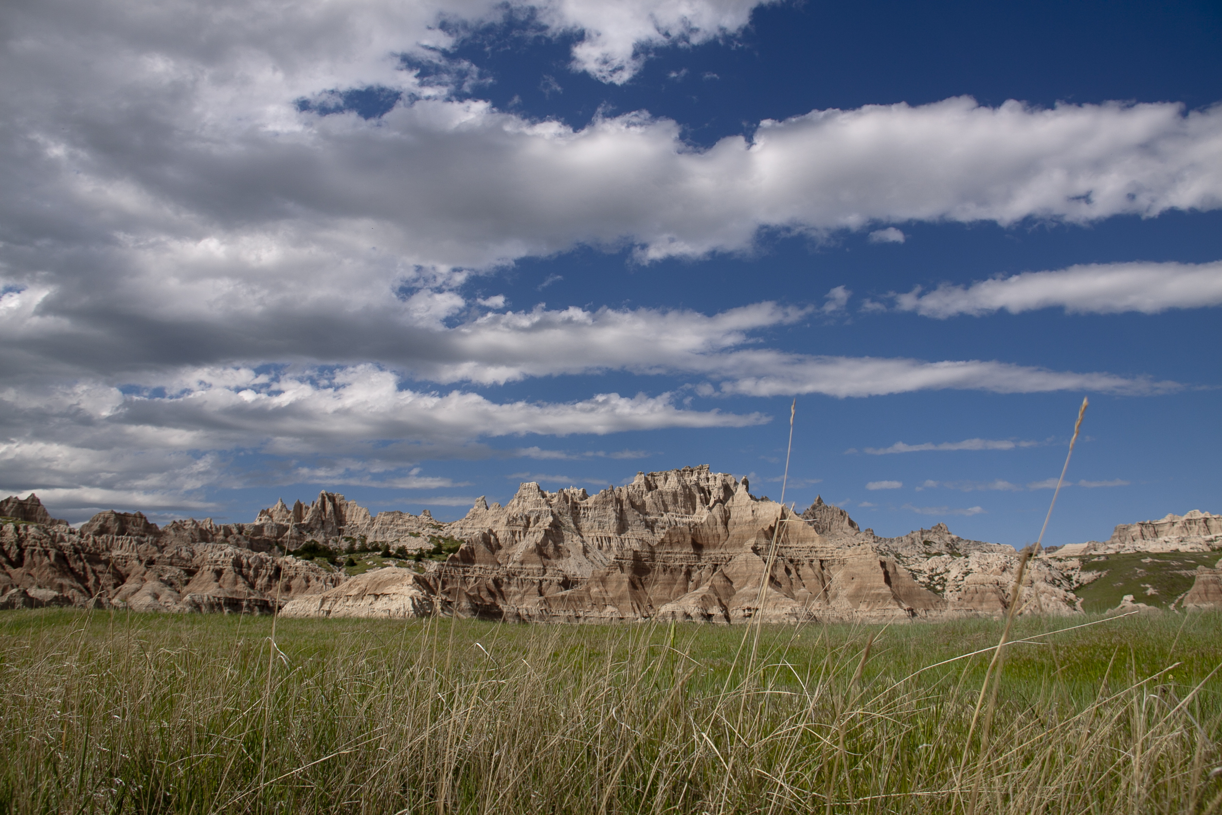
The rugged beauty of the Badlands draws visitors from around the world. These striking geologic deposits contain one of the world’s richest fossil beds. Ancient horses and rhinos once roamed here. The park’s 244,000 acres protect an expanse of mi...
We do not take reservations for this campground. Camping is on a first come, first serve, basis.
A two-lane gravel road travels in a circle with the outer and inner perimeter providing camping locations. A small tan building hosts a pit toilet. Badlands buttes are visible in the horizon, with prairie grasses, cottonwoods, and muddy draws between the campsite and the buttes.
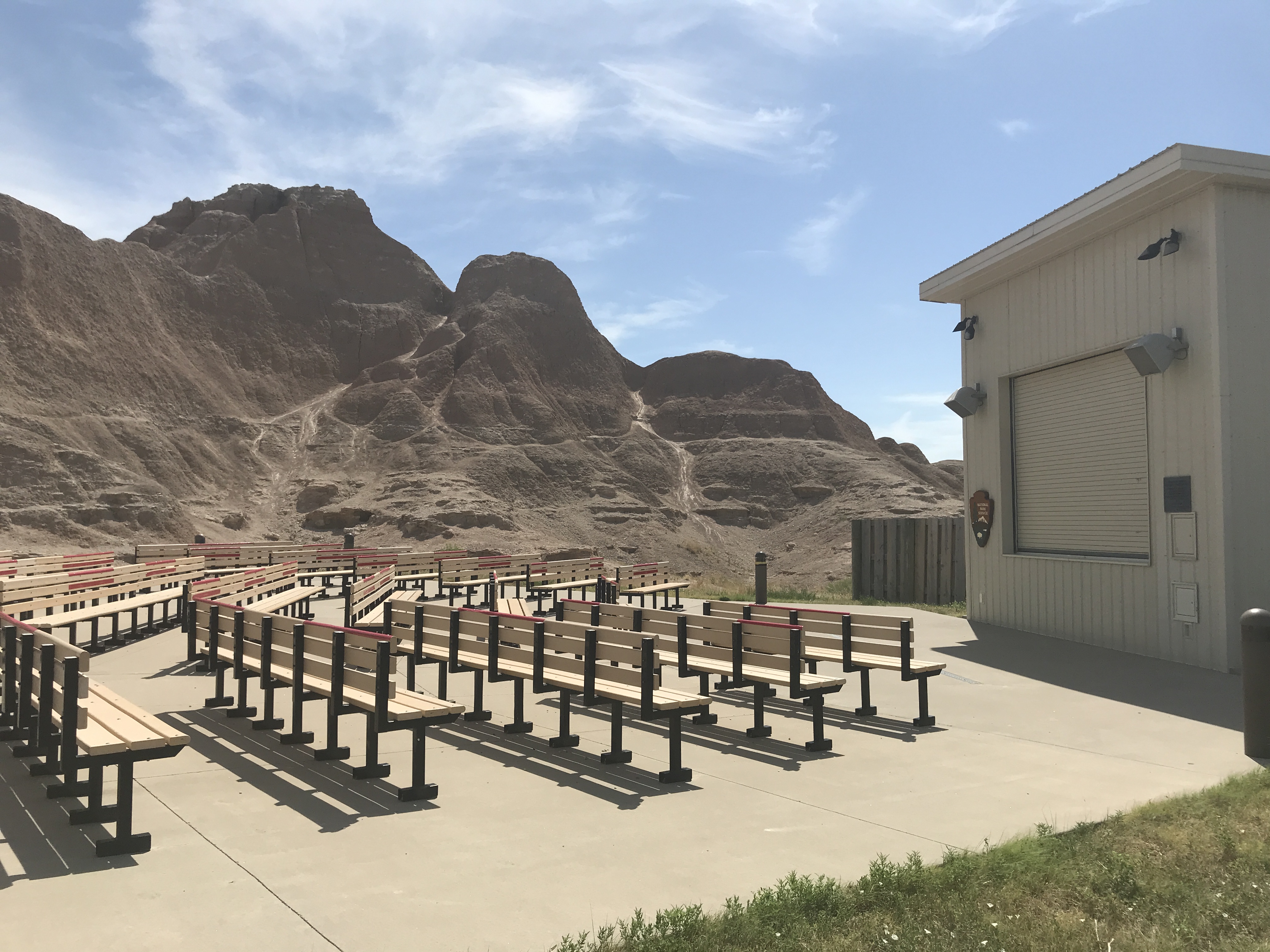
The amphitheater is used during periods of high visitation for evening programs, night sky viewing, and other special events.
A tan rectangular building, approximately 12 by 15 feet, is positioned in front of six rows of chairs accommodating over fifty people. The building has a screen build into the chair-facing section. The area is surrounded by layered and weathered badlands formations, with multiple small trails crisscrossing across the dirt and mud.
One of multiple overlooks in the park that provide expansive views of the Badlands. This overlook has a wayside exhibit sharing the history of paleo-Indians in the region.
A parking lot accommodating about a dozen vehicles overlooks an eastward expansive basin of mixed-grass prairie and badlands formations. The prairie extends into the horizon. On the west, a hill covered in grasses and sheering into layered badlands formations extends up 50'. The road continues northward and southward into winding and steep canyons and passes. A single wayside exhibit shares the story of paleo-Indian and other Indigenous peoples who have left behind arrowheads and other implements of their presence. The wayside has examples of bone awls, arrowheads, bone bead, pottery fragments, and stone blades. The text reads: Ancient Hunters: A thousand years ago, a hunter stood where you stand. He watched bison drift like a dark cloud shadow across prairie below. Could the herd be stampeded onto the high prairie behind the cliff on your left, and driven over the edge? If so, injured animals could be butchered on the spot, on the very edge of the camp. The hunter and his companions had pitched their shelters close by the cliff, protected from the cutting wind. Water seeped from the slop. A little digging with a sharp stick had released a spring. How do we know? Bits of pottery, arrowheads, razor-edged quartz flakes used for butchering -- a rabbit jaw and bird bone mixed among charcoal of long-quenched campfires -- and many bison bones have eroded out of the gullies that surround you. Collecting artifacts and fossils is illegal in the park.
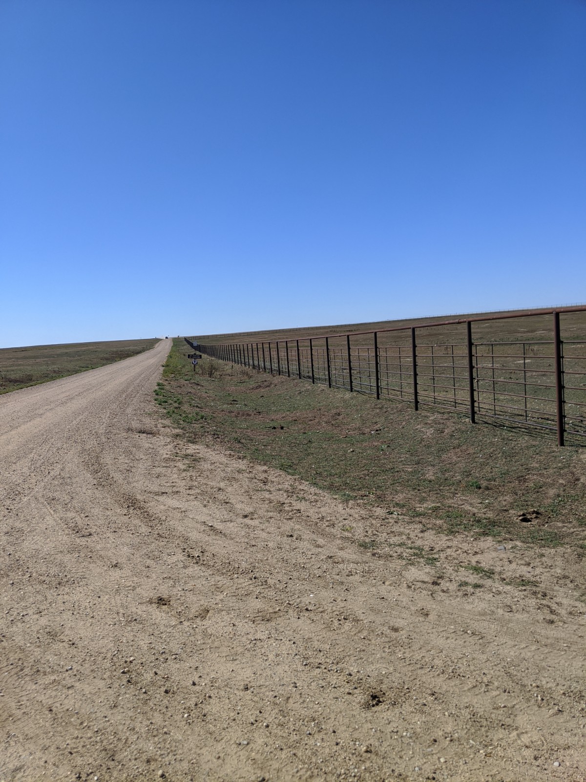
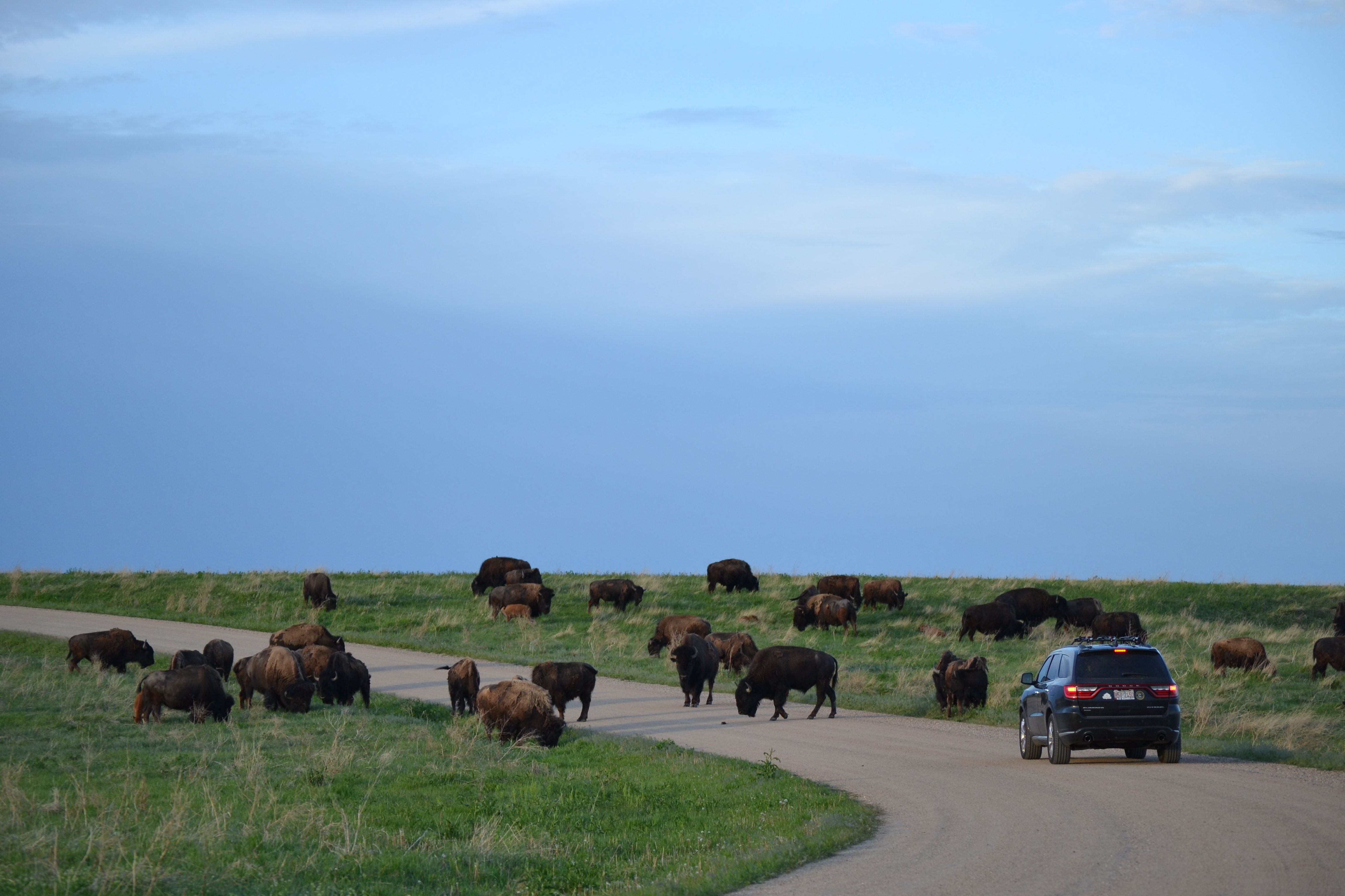
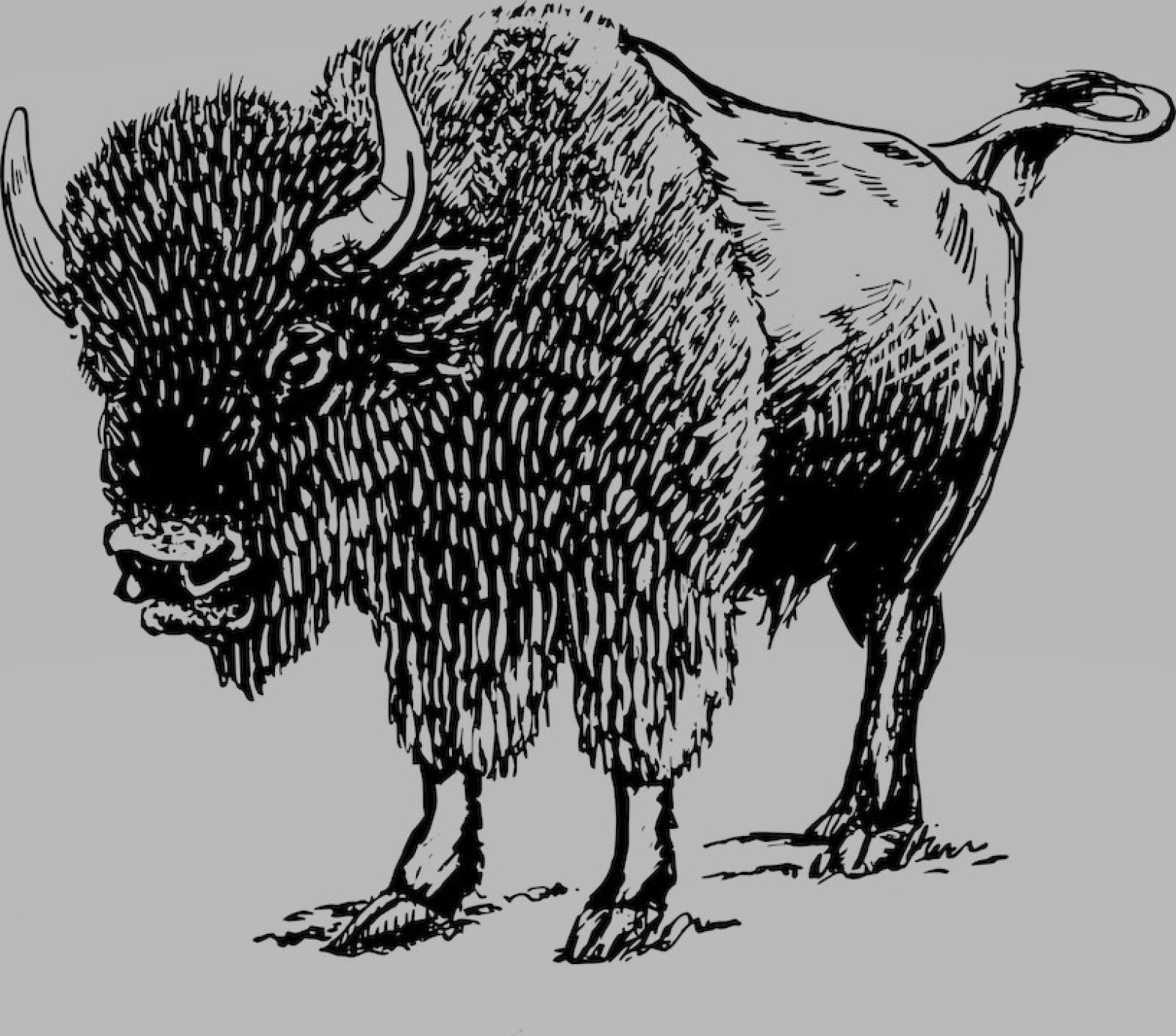
The Badlands bison corrals are off-limits to the public but can be seen along the road.
A long fence runs parallel to an unpaved, two-lane gravel highway. The fence encloses a several square mile patch of grasses and prairie dog holes. A badlands park sign alternatively greeting visitors and wishing them farewell rests beside the enclosure.
This location provides an expansive view of the historic gunnery range.
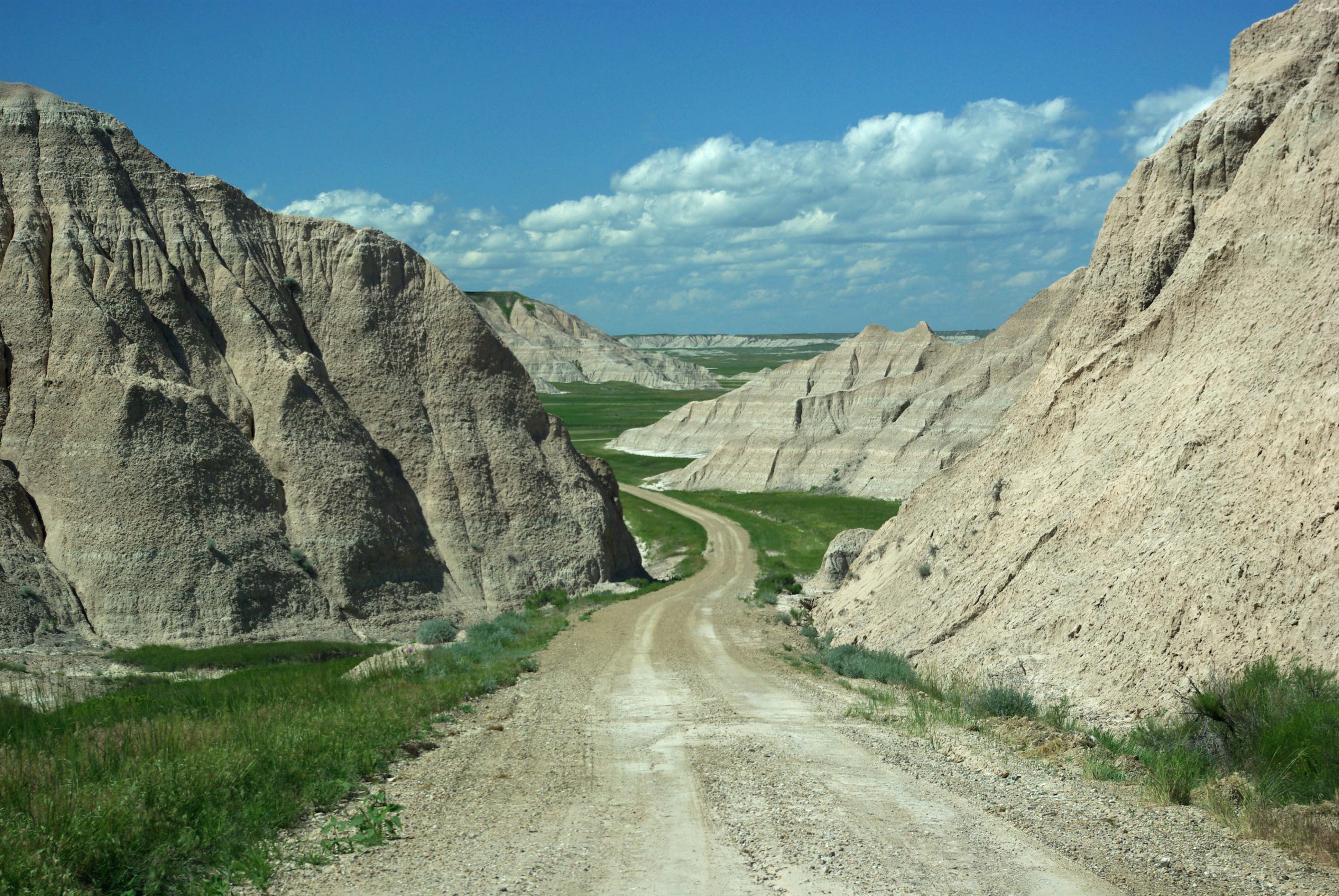
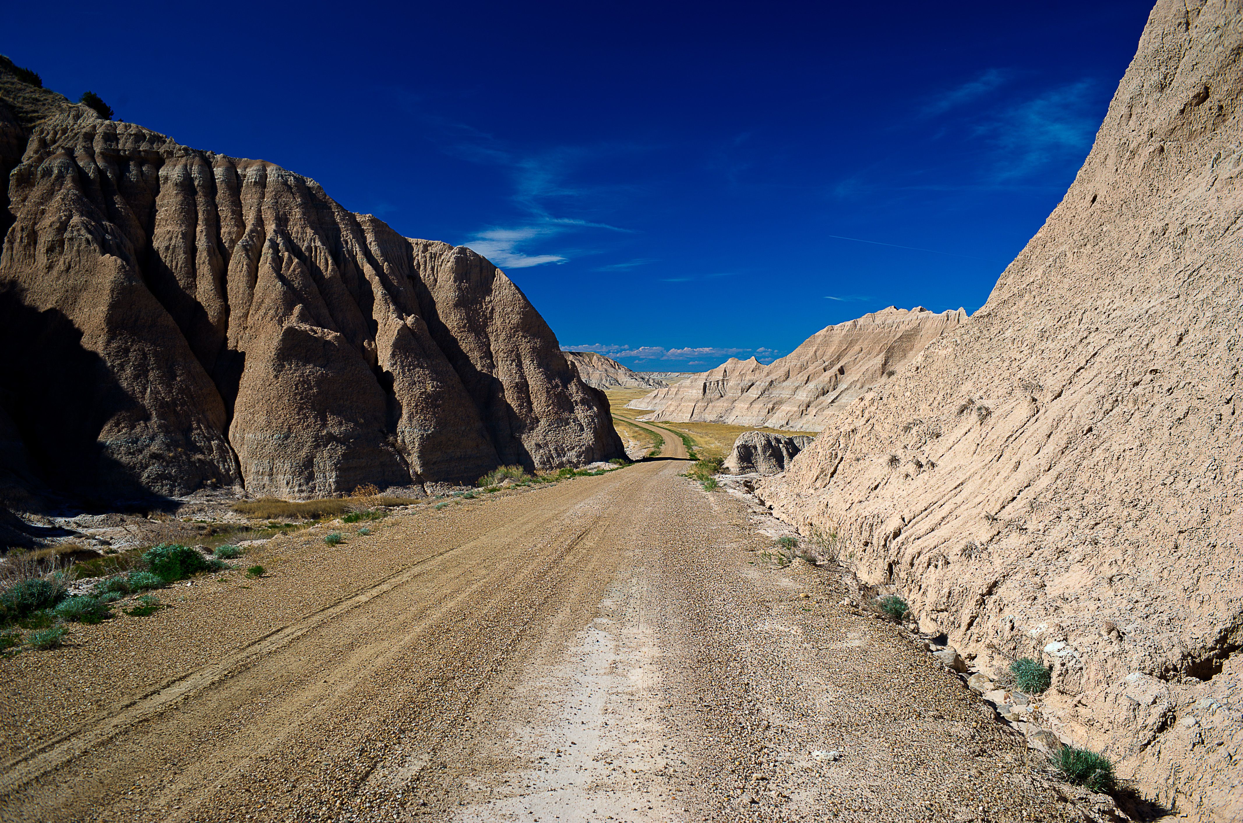
A single land dirt road heads north and south. A badlands wilderness contains numerous buttes and miles of flat terrain containing a mix of bare earth and prairie grasses. Strewn throughout are old metallic canisters and other implements. Many of these resemble bullets, but others are jagged and sharp pieces of twisted metal. There are no signs, parking lots, or trails marking the location -- only an expansive wilderness that extends for miles in all directions.
Badlands Tunnels is an area that used to have passageways through the badlands formations rather than the present-day passage around them.
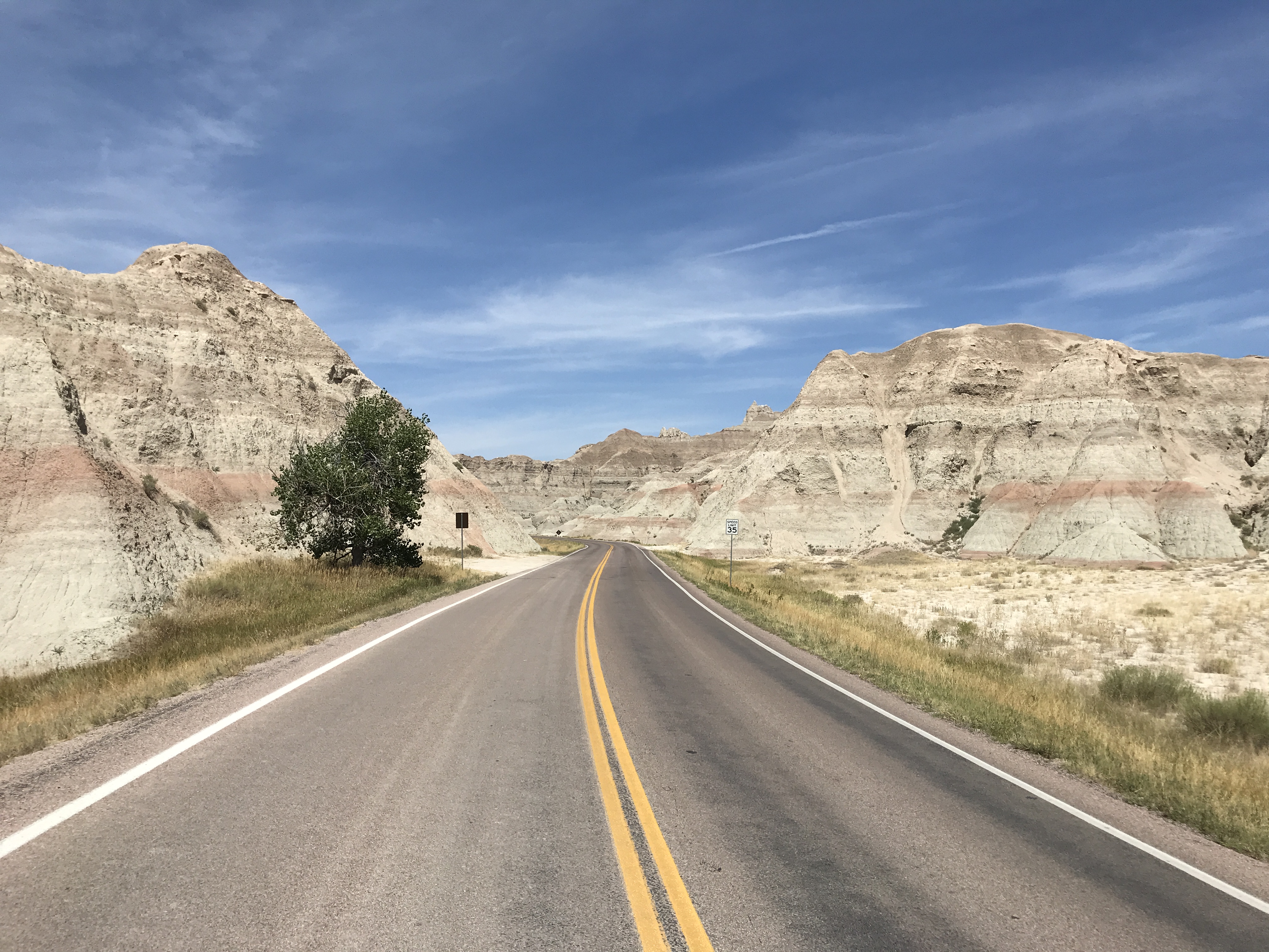
A paved two-lane highway traversed between two badlands buttes and several cottonwoods along the east and west sides of the road. There is one turn-out along the east side of the road that can accommodate approximately four compact vehicles.
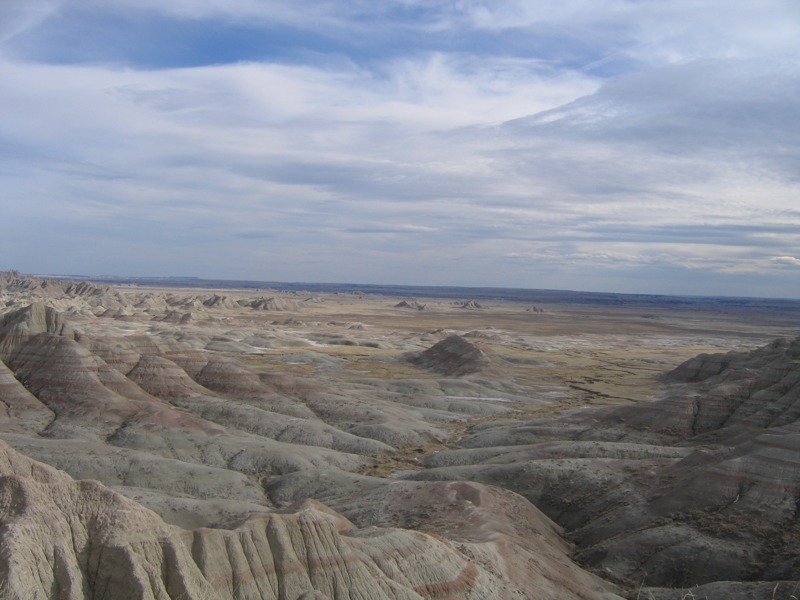
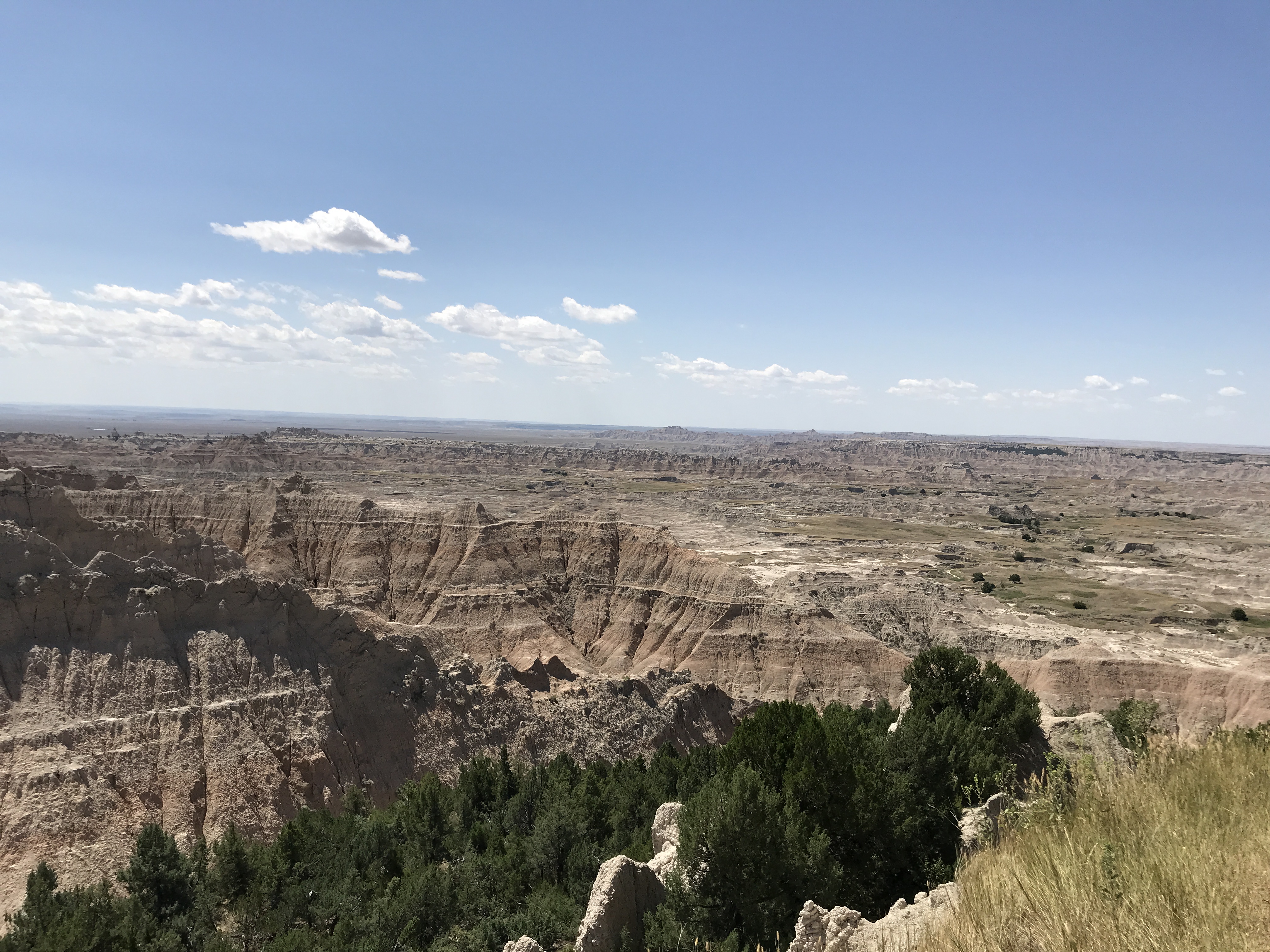
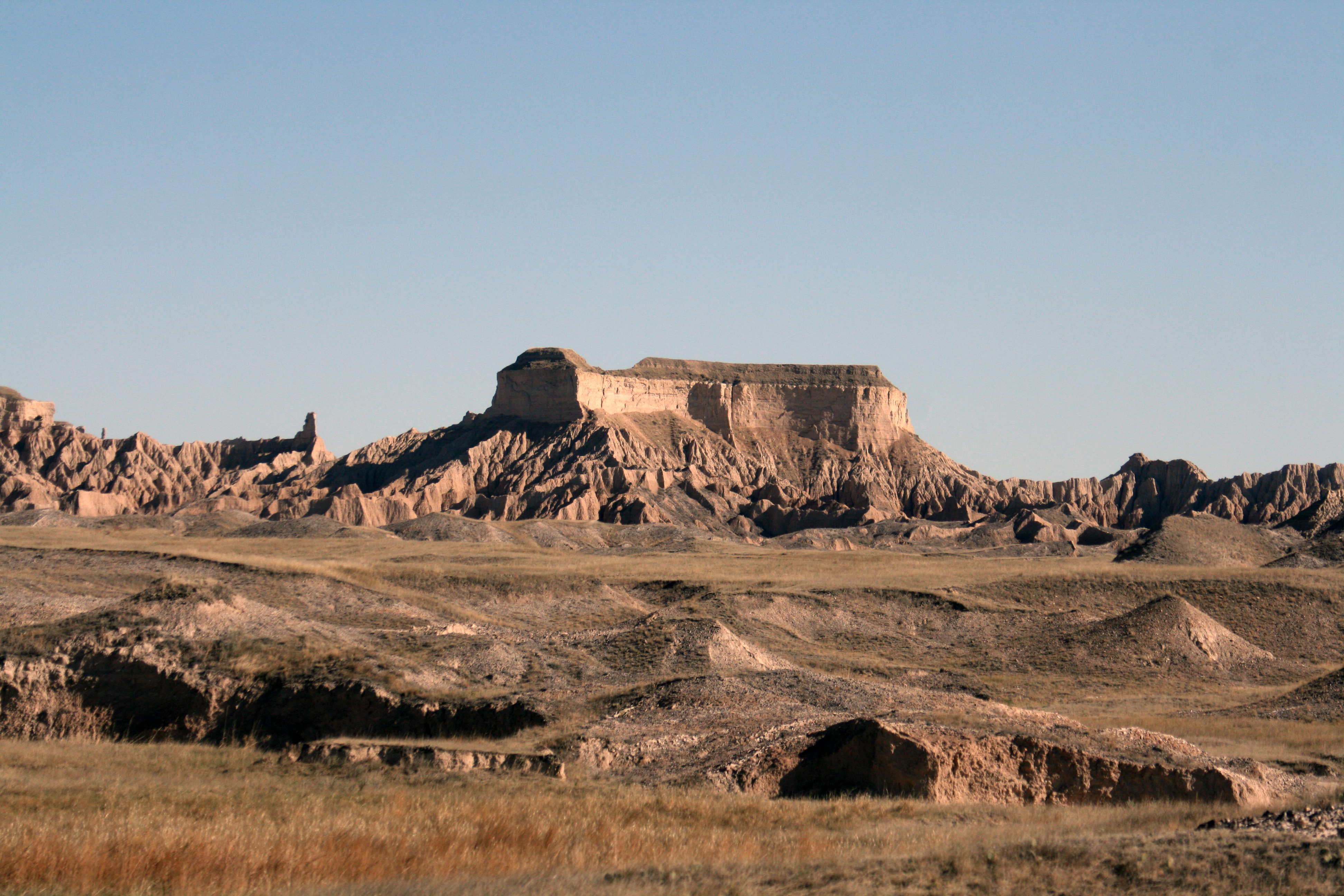
The Badlands Wall is a feature that extends a wide swath of the park.
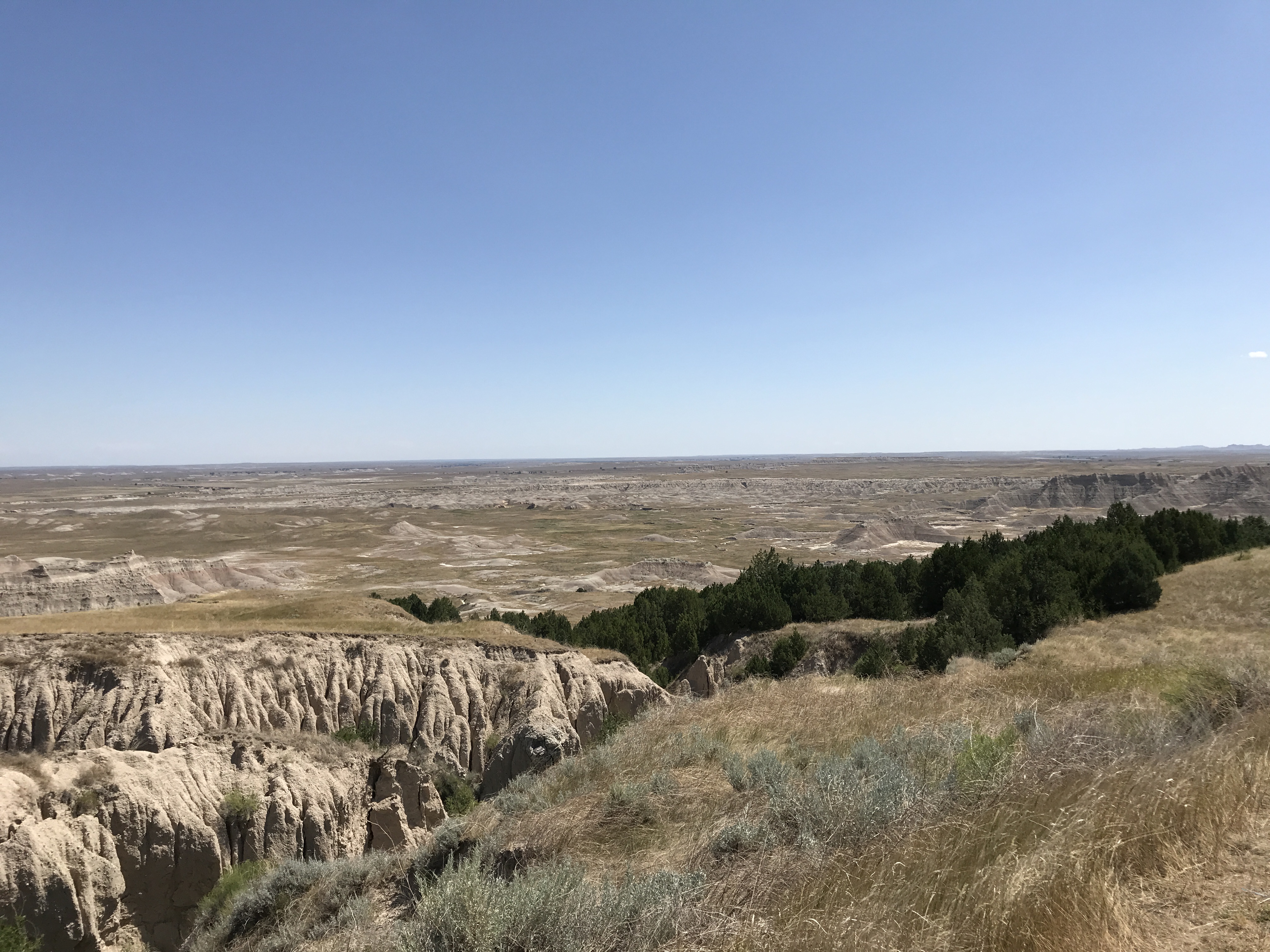
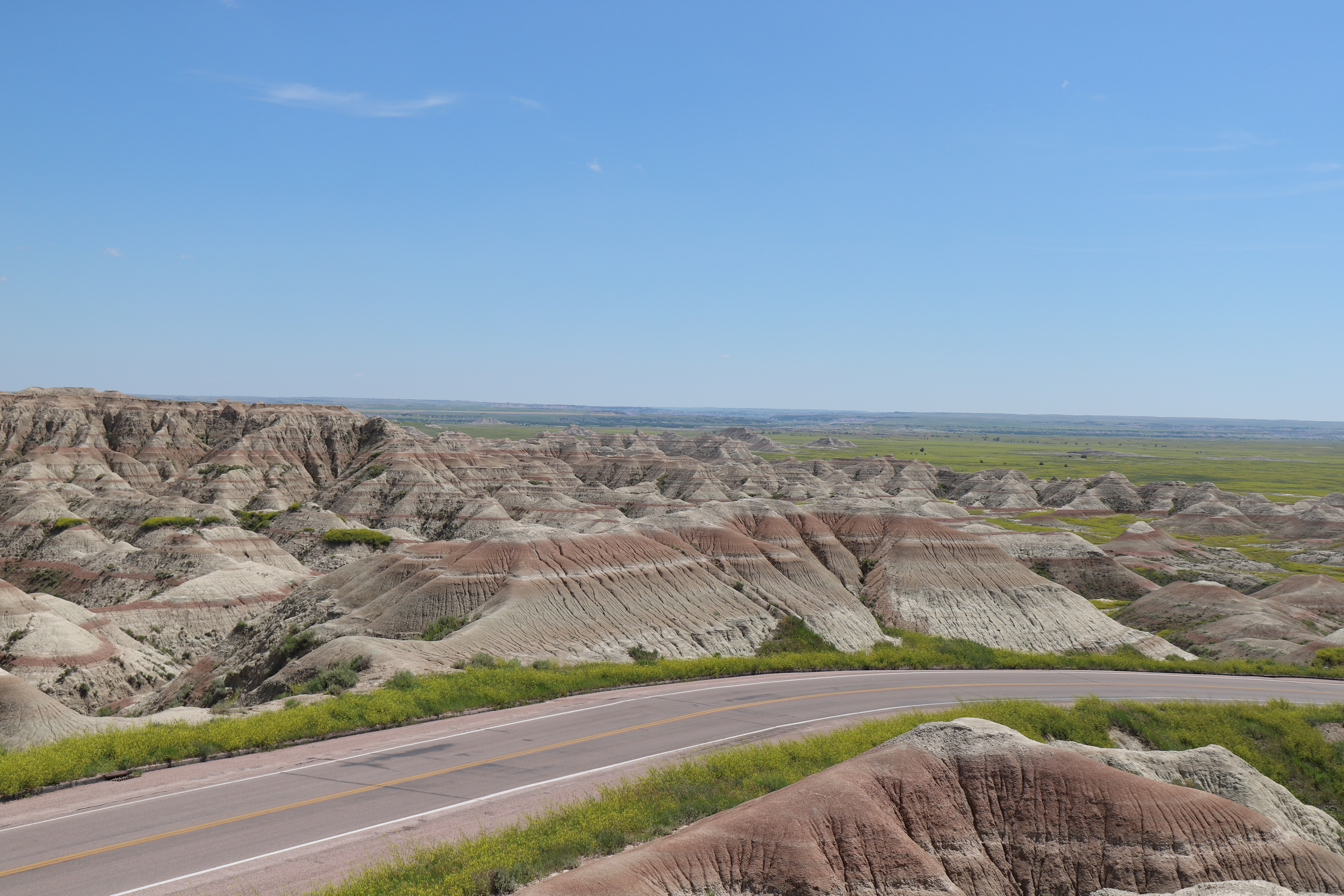
A vast expand of badlands formations abut against a wall of badlands that extends in western and eastern directions for miles. The buttes are a series of colorful horizonal stripes, ranging from red to brown to nearly white. Prairie grasslands extend from both the bottom and top of the buttes, separating the upper and lower prairie ecosystems.
One of multiple overlooks throughout the park that provide an opportunity to take in the expansive wilderness area of the park.
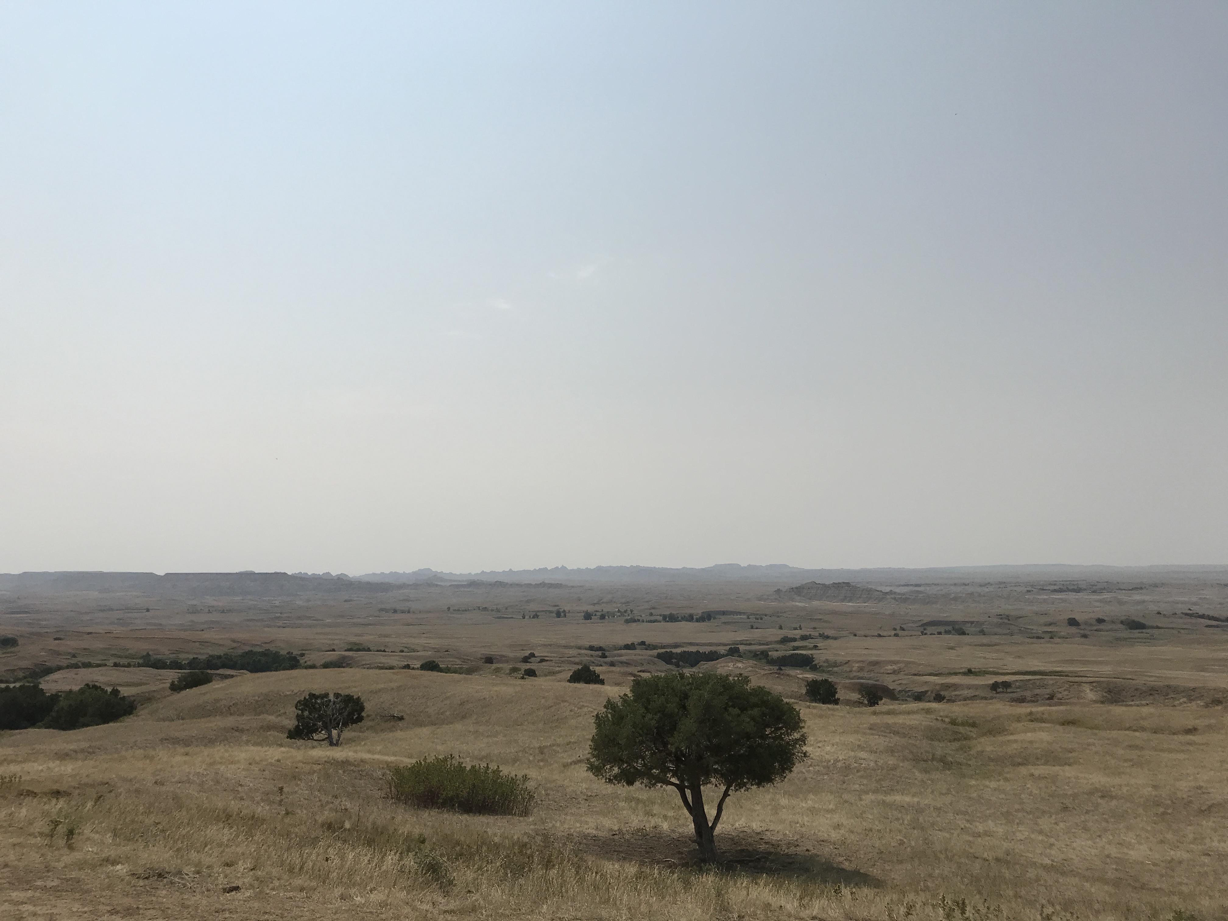
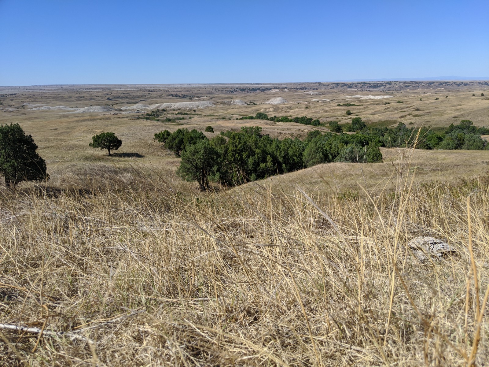
A small turnout alongside a two-way, dirt east-west highway sits on the edge of a vast expanse. Badlands buttes extend southward miles into the horizon, dotted by small islands of juniper and cottonwood trees. North of the road, mixed-grass prairie extends to the horizon.
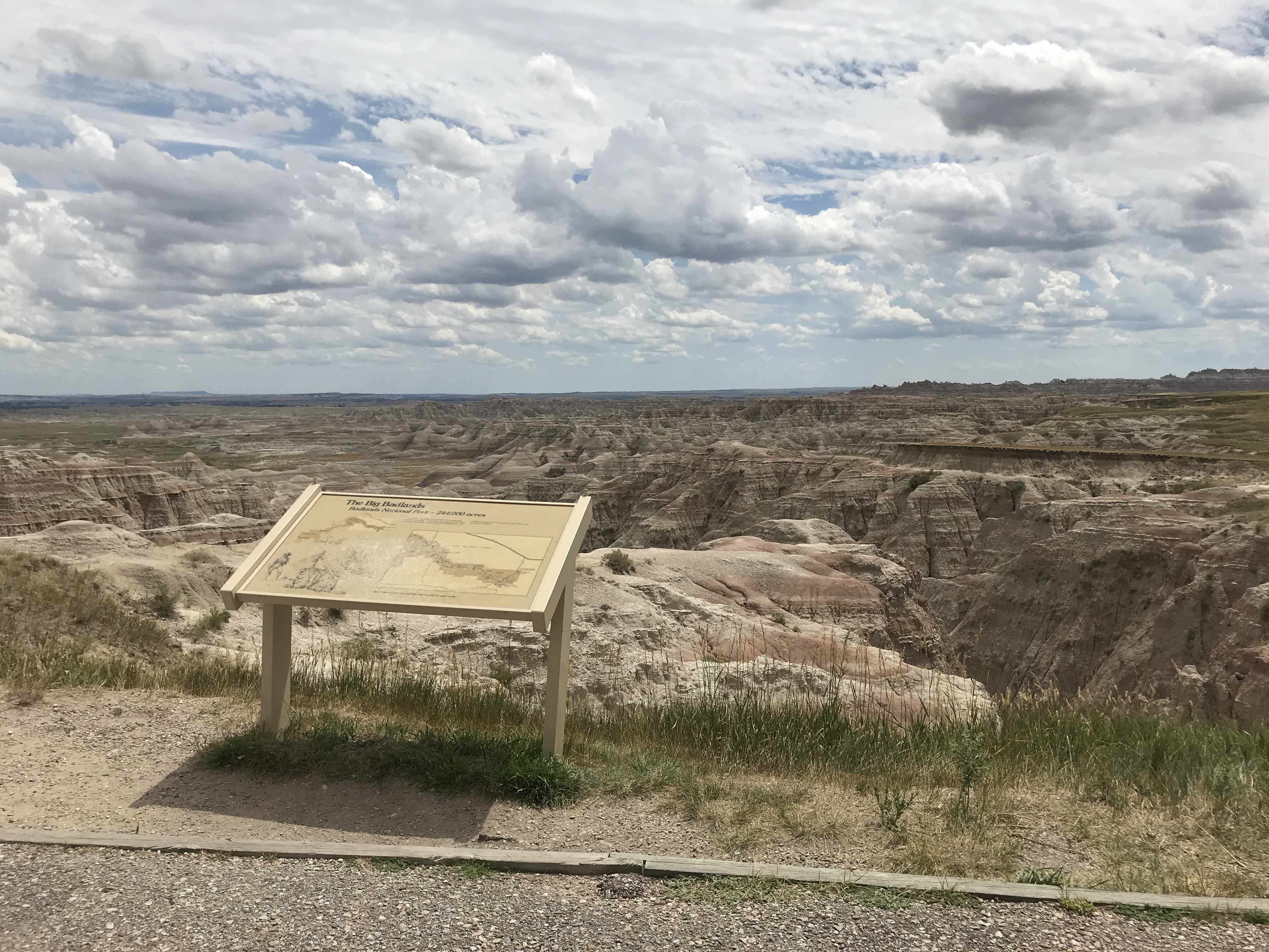
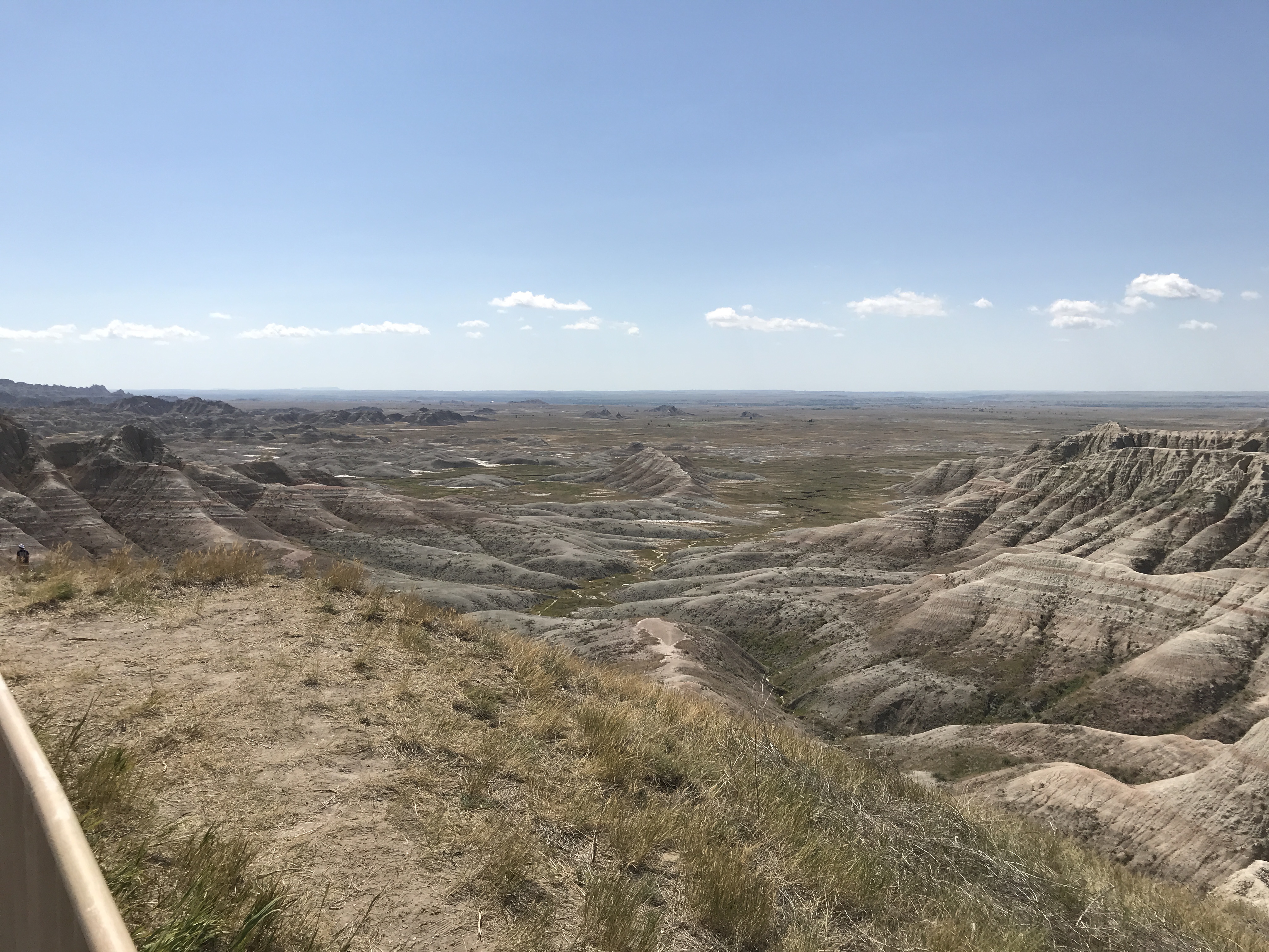
Big Badlands Overlook provides the opportunity to view the eastern portion of the Badlands wall.
An expanse of prairie grasses dramatically drops off into an expanse of layered badlands formations stretching off into the horizon. A horizonal rectangular wayside exhibit reads: "The Big Badlands. Badlands National Park -- 244,000 acres. The French trappers called them les mauvaises terres a traverser -- bad lands to travel across. Now, good roads make travel easy in the Badlands, one of the strangest and most spectacular landscapes in North America. Watch for wayside exhibits (like this one) beside park roads." The exhibit has a sketch of a mustachioed man holding a rifle, three prairie dogs, and badlands buttes. In addition, there are two park maps -- one showing where the park fits regionally, and the other showing the north unit roads and overlooks.
This overlook provides an opportunity to see stunning badlands vistas as well as a historically significant route.
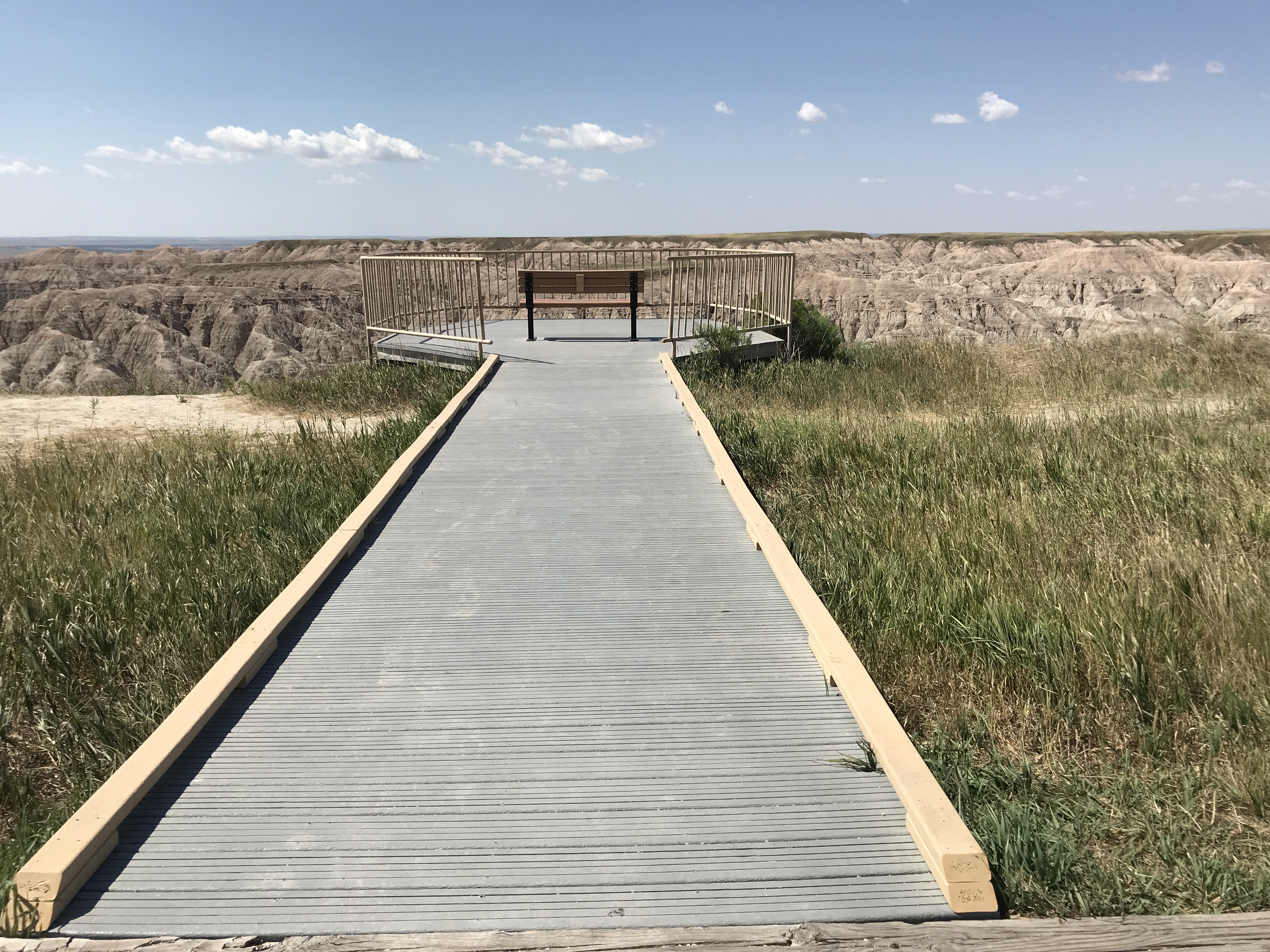
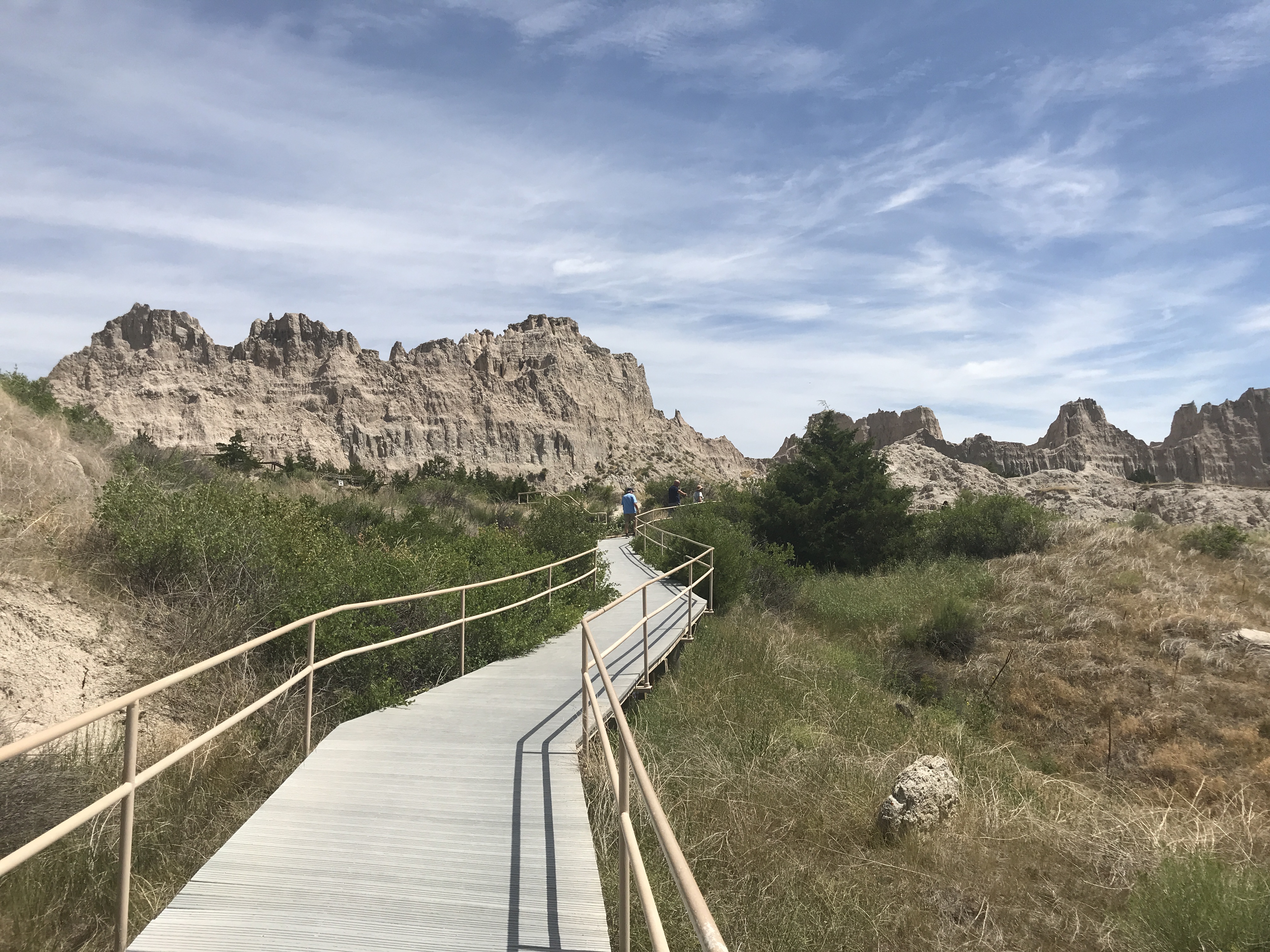
A parking lot accommodating approximately two dozen vehicles rests beside a paved, two-lane highway. Four picnic tables with shade structures are located in grassy areas approximately 30' from a drop-off that oversees miles of badlands buttes. A boardwalk extends 300' feet to several benches and a handrail that yields to a view of the badlands formations and the prairie grasslands.
One of multiple overlooks throughout the park that provides accessible experiences for all visitors to enjoy the park. This one features a boardwalk and a bench overlooking a vast badlands landscape.
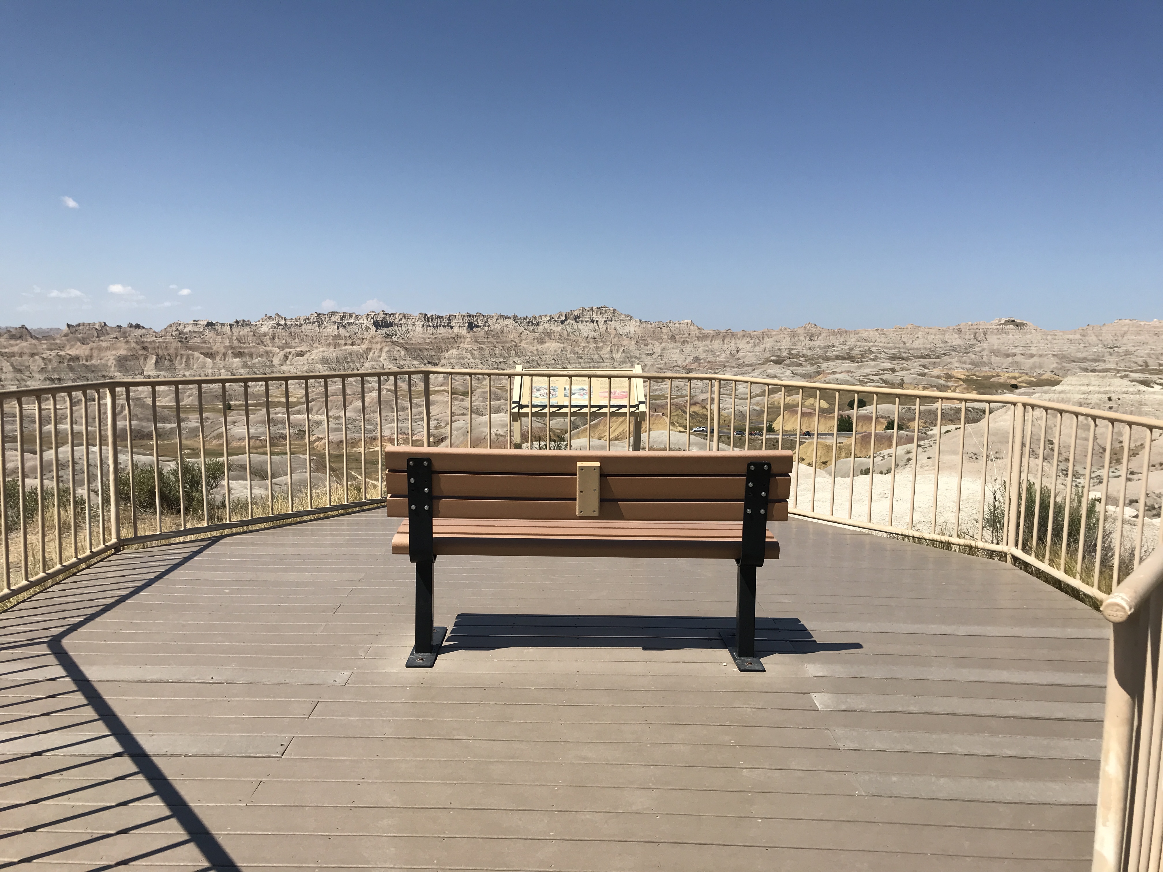
A single boardwalk extends approximately 20 feet and a bench sits against a vast landscape with miles of badlands buttes out into the horizon. Flat prairie and the black hills can be seen westward. The east side of the road is miles of prairie. A parking lot accommodating approximately twelve compact vehicles sits beside a two-lane, two-way, north-south paved highway.
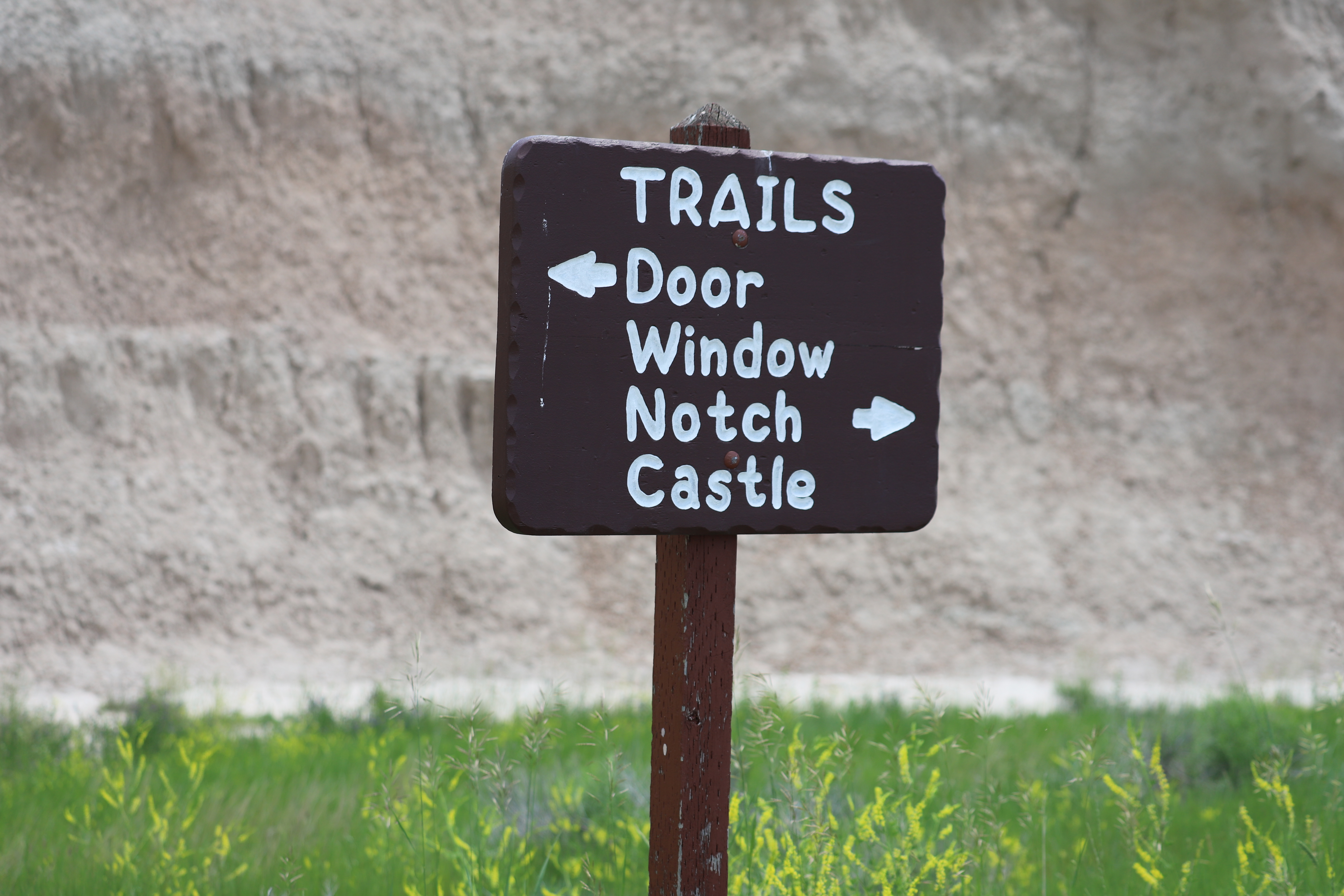
Moderate. The longest trail in the park begins at the Door and Window parking area and travels five miles one way to the Fossil Exhibit Trail. Relatively level, the path passes along some badlands formations. 10 miles/16 km (round trip)
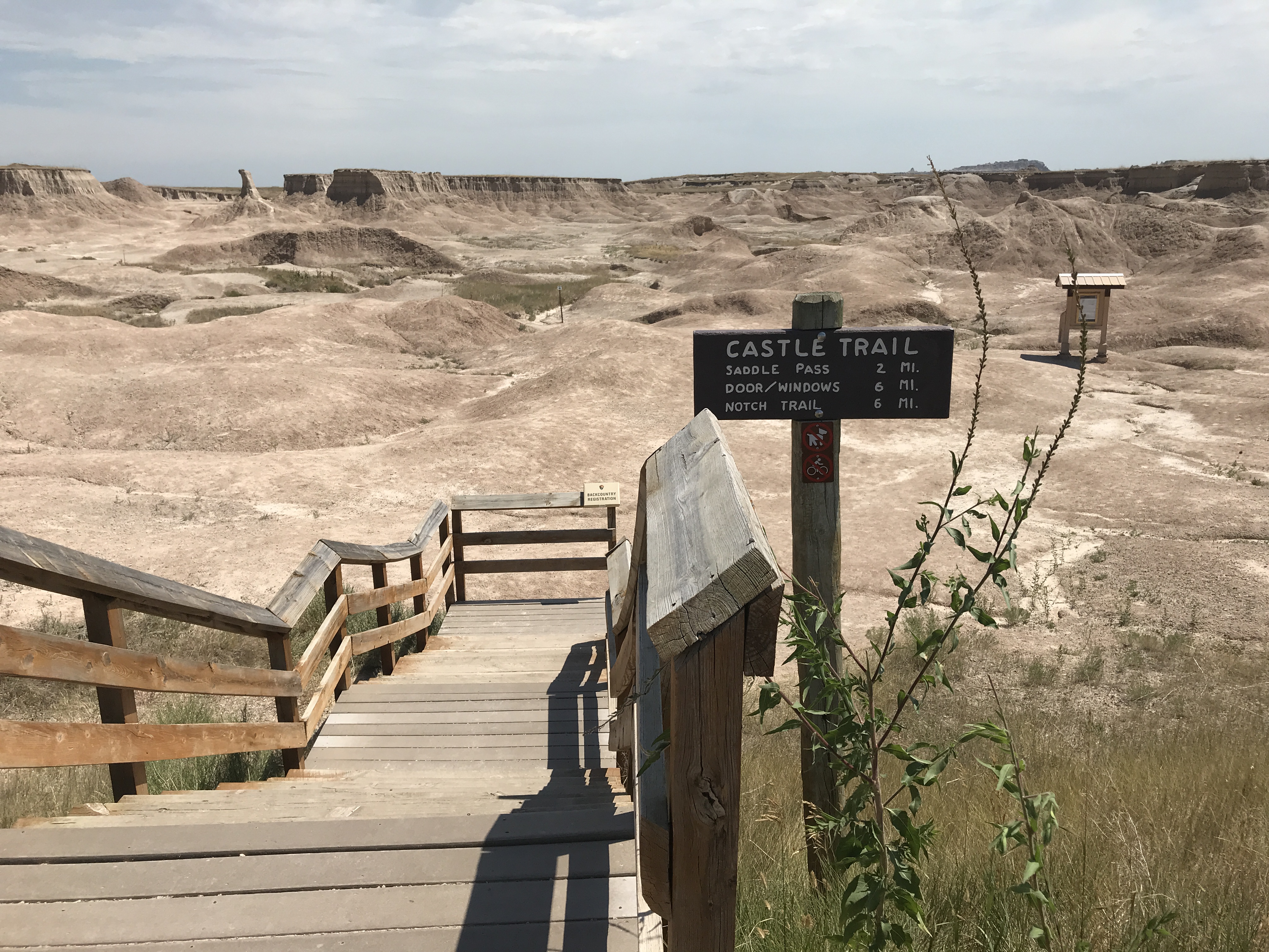
Beside a two-lane, two-way, north-south highway, an eastward wooden boardwalk and set of stairs, extending 20 feet, gives way to winding path through towering badlands formations and diverse prairie grasses. The path is worn down, and often indistinguishable from the layered, brown badlands formations that it traverses through. A small wooden kiosk with park information is just past the wooden pathway. A wooden sign reads: "Castle Trail / Saddle Pass 2 mi. / Door, Windows 6 mi. / Notch Trail 6 mi." On the west side of the road, there is a paved parking lot accommodating three dozen large vehicles. There is a concrete restroom and paved sideways outlining the parking lot.
Cedar Butte is a feature located in the South Unit of the park and is accessible by foot through a barbed wire fence.
Atop dramatic badlands butte, a plateau of grass and pine trees overlooks an expansive badlands wilderness. The butte is approximately 150 feet tall and the geologic layers of the badlands are vibrant in their reds, browns, and whites. The butte is north of a two-lane, two-way, east-west highway. On the south of the road are more rolling hills with pockets of layered brown and white badlands formations.
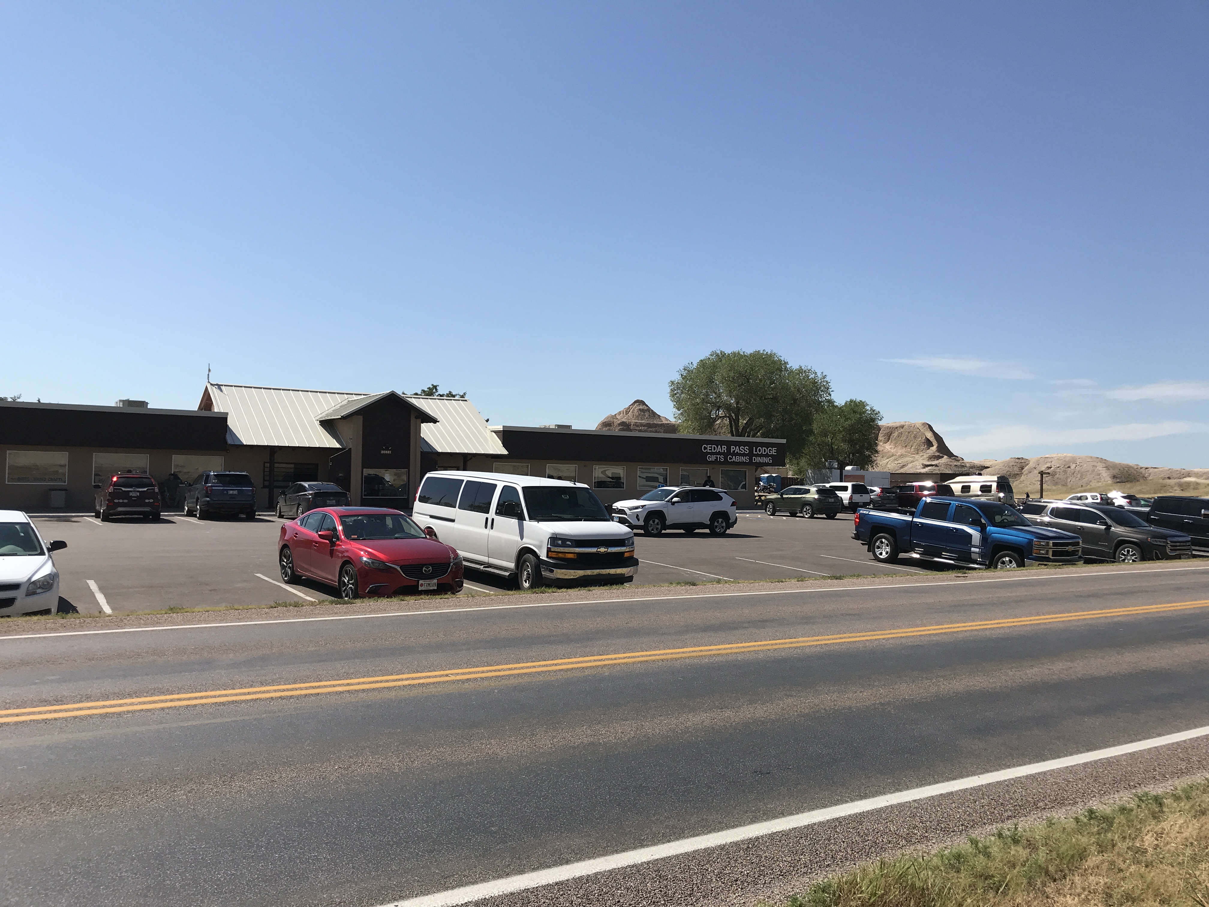
Cedar Pass Lodge is the only concessionaire operated facility in the park. Food, bathrooms, and water are available.
A large tan building approximately 150 by 150 square feet lies in a flat plain of prairie grasses and sporadic badlands buttes. A parking lot accommodating approximately 40 vehicles surrounds the building, with rental cabins nearby. A two-lane, two-way, north-south highway runs along the west side of the building. Two glass doors are the main entrance to the building, which lead into a large room broken into three sections. On the north side of the building, there are various souvenirs and gift items. The restrooms are also in this section. In the middle section of the building, there is apparel and jewelry being sold at various counters. A desk with a sign reading "Information" is built into the east wall. In the south section of the building, is a restaurant capable of serving approximately 100 people at a time. The dining area is illuminated through glass windows, and the seats are a combination of upholstered leather and metal chairs.
Cliff Shelf Nature Trail is one of several short, accessible hikes near the Ben Reifel Visitor Center of Badlands National Park.
A parking lot supporting approximately a dozen vehicles is located at the beginning of this feature. A gradually sloped boardwalk navigates through cedar trees and among badlands formations. There is an expansive view of a basin filled with badlands formations and extensive prairie grasses on the eastern and southern side. There is a two-lane, two-way, paved north-south highway on the east side of the parking lot.
One of multiple overlooks throughout the park that provides accessible experiences and interpretive exhibits. This overlook has a boardwalk with a bench, and a wayside exhibit discussing climate change and how it affects the landscape.
A vast badlands landscape, with miles of brown and white buttes extending into the horizon, rests alongside a two-lane, two-way, north-south paved highway. To the east, prairie grasses extend around a parking lot that could accommodate approximately a dozen vehicles. To the west, a boardwalk extends approximately 30 feet to a precipice with a bench facing the edge of a large cliff offering a view of layered sediments and a winding highway.
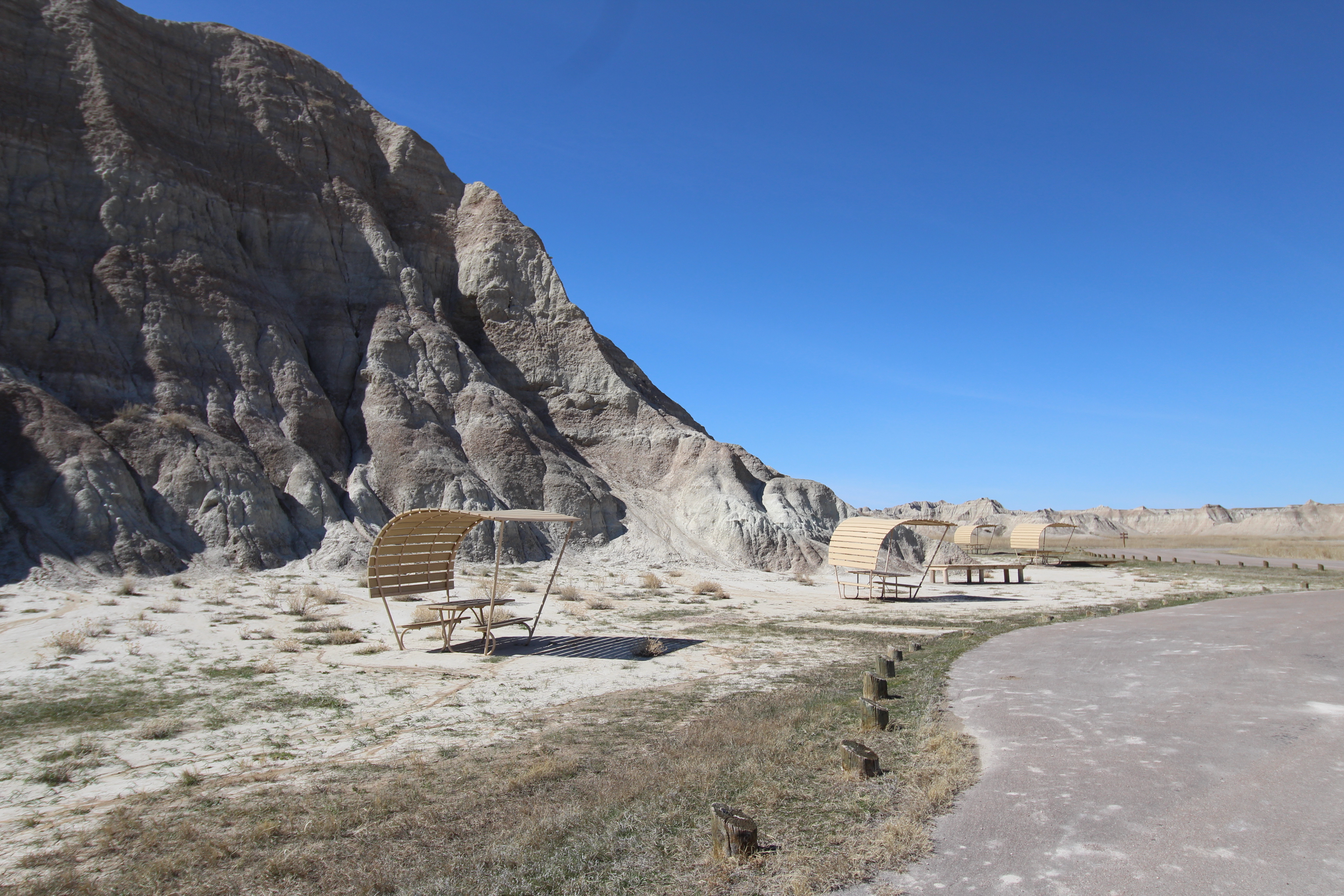
One of several picnic areas available for use in the park along the scenic loop road.
Along a two-lane, paved, north-south highway a prominent badlands butte 40' high is the center of a western offshoot of the main road. Around this butte are six picnic tables with attached shade structures. A tan, approximately 12' by 8' building is a bathroom, and several areas that are accessible by vehicle and foot. To the west of the butte is a several miles long and wide prairie with badlands formations along the horizon. The identical lies to the east, with the addition of vibrant yellow and reds characteristic of the yellow mounds area of the park.
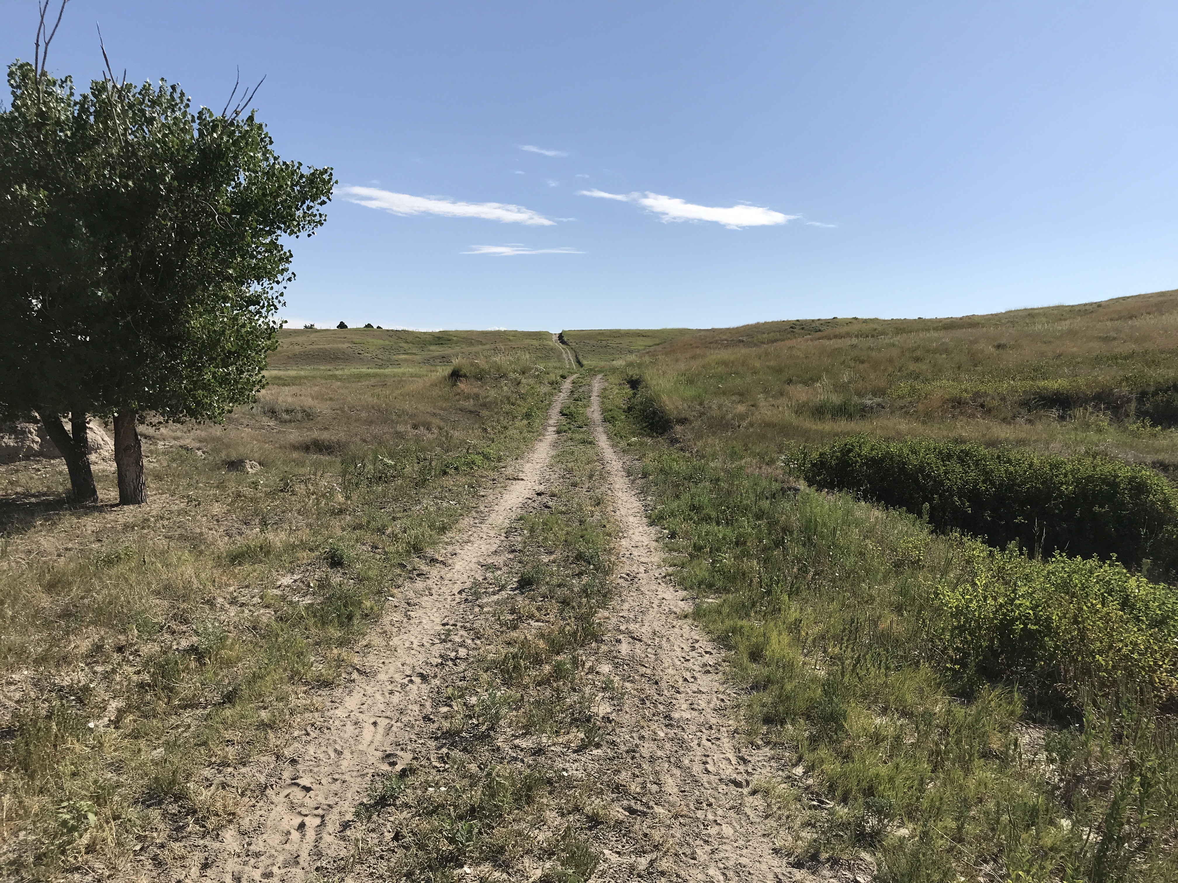
Badlands National Park has an Open Hike Policy, meaning that you are allowed to hike off-trail. As a visitor to the Badlands, you are free to explore social trails like Deer Haven, the Sage Creek Wilderness Area, or any other part of the park you can visit safely. Deer Haven is either a short round-trip (6 mile) hike or a more extensive 23 mile loop. The trail is not marked, so navigation will rely on map/compass or GPS routing.
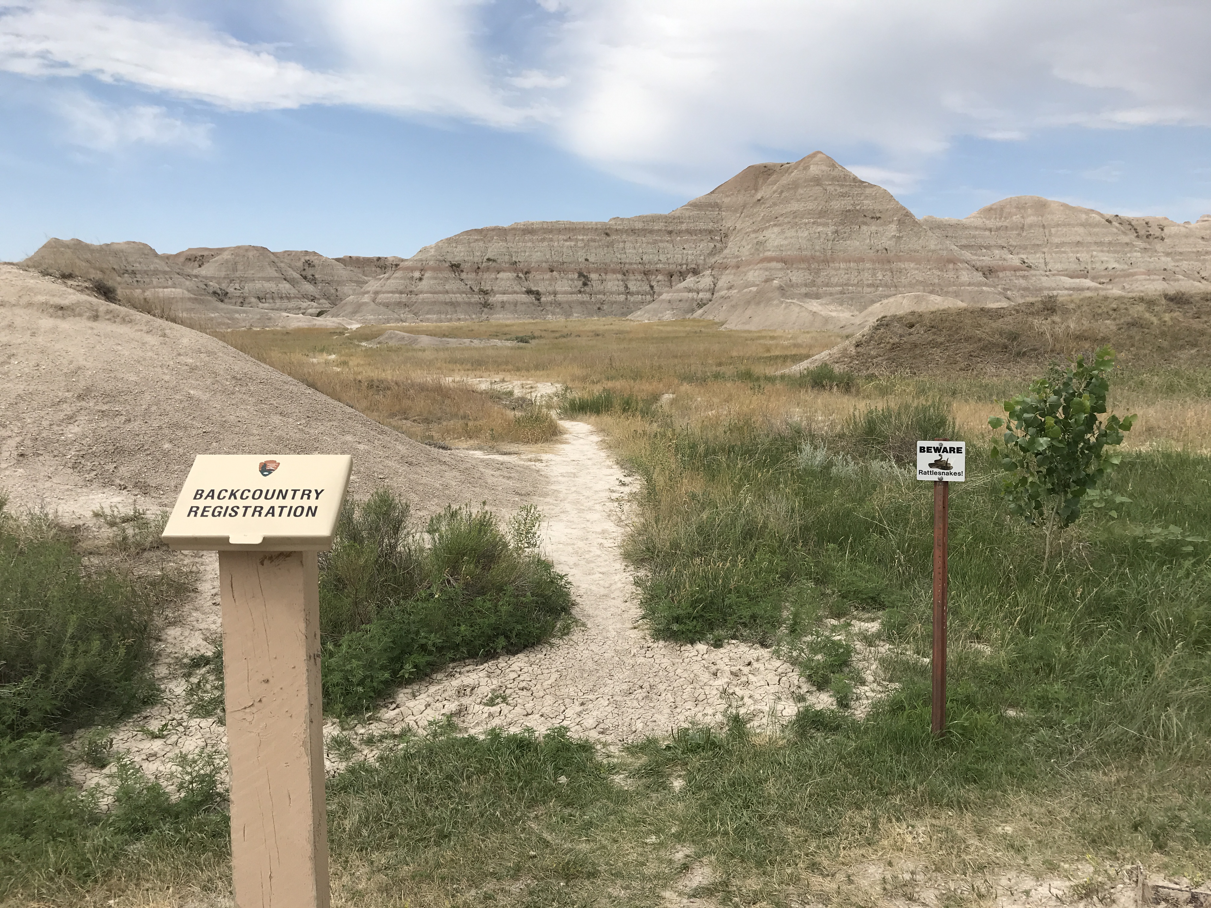
A dirt parking lot accommodating up to six compact vehicles lies between a vast landscape on the north, west, and south side and a single, prominent badlands butte extending 50' high towards the east. Between a tan, four feet high, metal box labelled "backcountry registration" and "beware rattlesnakes" sign, a westward game trail extends and is quickly lost amid towering badlands and prairie vegetation.
One of the park's most popular trails providing an accessible view of badlands buttes and formations.
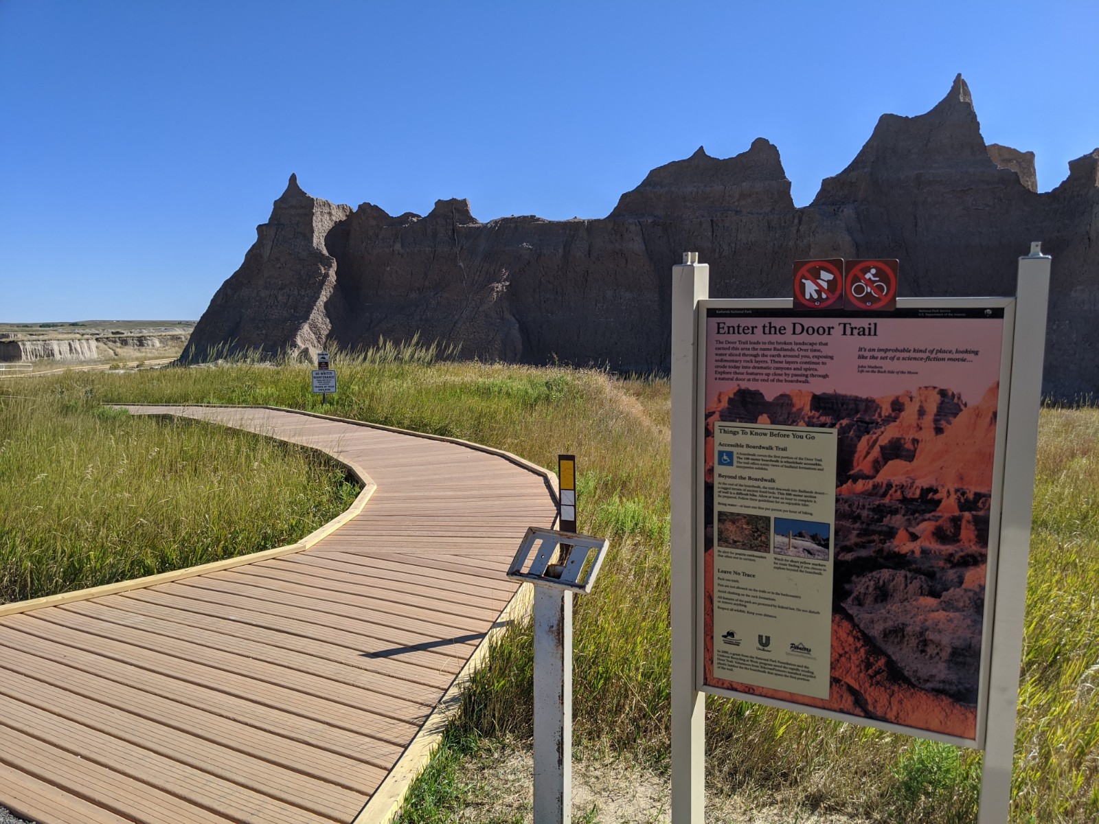
An extensive parking lot, accommodating approximately 50 vehicles, rests beside a busy two-lane, paved highway. It is surrounded on all sides by expansive and jagged buttes, extending miles in any direction. Multiple bathrooms are available in enclosed, tan buildings, and wayside exhibit signs mark the start of several trails. On the northeast corner, a trail marked Door has a boardwalk extending into the badlands formations. A wayside exhibit with an iconic image of a person on a bicycle and a dog, both with a red crossed out circle, affixed to the top. The exhibit has a backdrop of dramatic, layered badlands formations in the red haze of a sunset underneath a light pink sky. The text of the exhibit reads: The Door Trail leads to the broken landscape that earned this area the name Badlands. Over time, water sliced through the earth around you, exposing sedimentary rock layers. These layers continue to erode today into dramatic canyons and spires. Explore these features up close by passing through a natural door at the end of the boardwalk. "It's an improbable kind of place, looking like the set of a science-fiction movie," James Madsen, Life on the Back Side of the Moon.
This is slightly off the road but provides an opportunity to see how erosion has affected old geologic survey markers.
Rolling hills of badlands formations and heaps of dirt with small game trails along the ridges lines extend in each cardinal direction. To the south and east, a two-lane paved highway winds its way amid the badlands. In close proximity, several small metal polls ranging from inches to several feet stick out of the ground. At the top of each one, there is a concrete cluster with a metal cap indicating date and other data from a geologic survey.
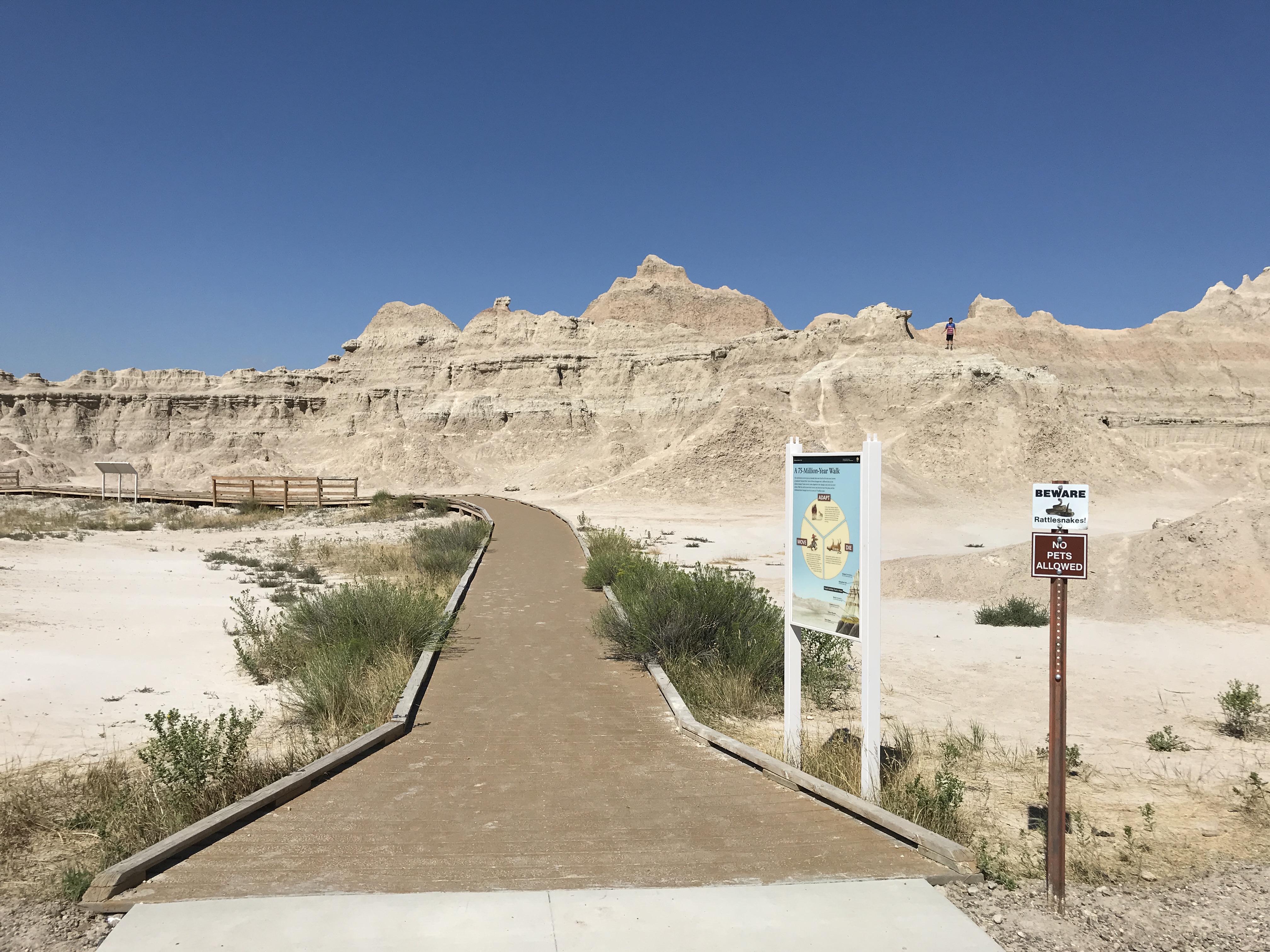
Fossil Exhibit Trail is one of several features in the park that provide accessible enjoyment of the park's resources.
Along a two-way paved highway, an extensive parking lot accommodating dozens of vehicles, a bathroom structure, and a small out building providing limited shade are also present. To the west, a worn unpaved trail extending into badlands formation and prairie grasslands. To the east, boardwalk trail approximately a quarter of a mile extends in a loop amid badlands formations and interspersed prairie grasses. A wayside exhibit beside the start of the trail is described as follows, A 75-Million-Year Walk: This trail features seven types of animals that once lived in the area now known as Badlands National Park. Each of these lineages met a different fate as the climate changed. Some moved, some adapted to the changes, and some are now extinct. Walk the trail to learn their stories and discover how this place and its inhabitants have changed over the course of 75 million years. A three piece pie chart is labelled and described as follows in a clockwise progression: Adapt – two horses, and adult and child, are standing next to one another with the text "As the climate changed, habitats changed. Many animals adapted to new environments. Early horses and dogs were flexible enough to survive in these new environments. These animals are each part of a lineage that evolved into modern horses and dogs. Die – A small creature that looks like a dog with white stipes on its back lays upside down with small flies floating above. The text reads "Some animals could not adapt to the changing climates and habitats. Four of the groups exhibited along this trail, including the oreodont, went extinct. Move – An alligator stylized as a cartoon is walking on two legs wearing a hat and holding a suitcase. The text reads "Some animals moved to habitats that were more favorable. Tens of millions of years ago, members of the alligator family used to live all over North Amiercan, including here at what is now Badlands National Park. As the climate cooled and dried, their range shrank. Now they live in places like Florida. The entire exhibit is backdropped by a stylized stack of a layered badlands formation with each layer marked, from bottom to top, as: Pierre Shale, 67 to 75 million years ago Yellow Mounds, 67 million years ago Chardron Formation, 34 to 37 million years ago Brule Formation, 30 – 34 million years ago Fossil Exhibit Trail is Here Rockyford Ash, 30 million years ago Sharps Formation, 28 – 30 million years ago.
This overlook provides the opportunity to see Badlands formations and the grassy ecosystems that cling to them.
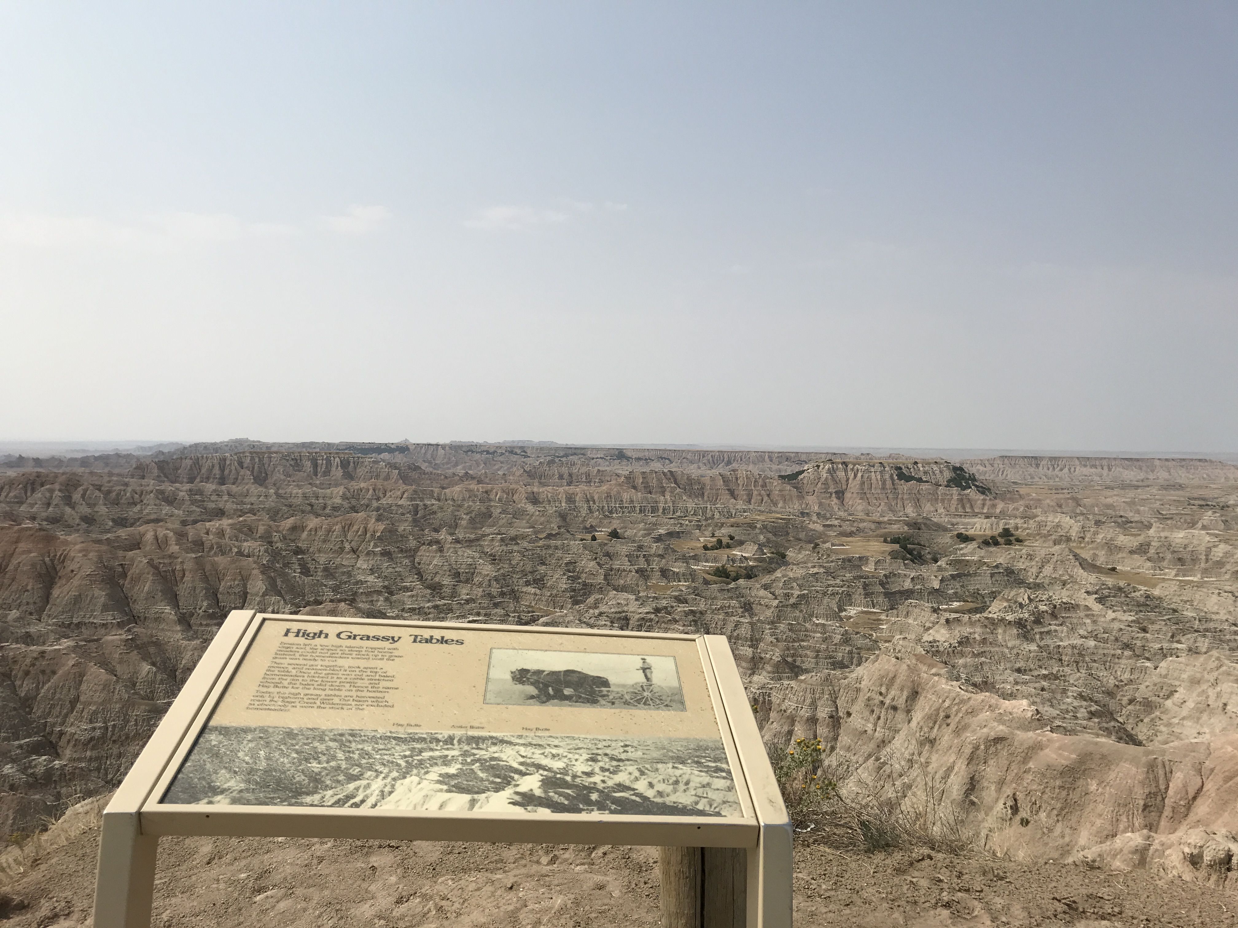
On the southwest side of a two-lane, two-way, north-south gravel highway rests a parking lot accommodating approximately a dozen vehicles. A small wooden sign identifies the location as Hay Butte Overlook. The overlook looks out into a badlands wilderness with buttes that stretch into the horizon for miles. There is a small wayside exhibit with information about the grasses on top of badlands buttes, which reads: High Grassy Tables: Erosion left a few high islands topped with virgin sod, the slopes so steep that homesteaders could not get their stock up to graze. Instead, the homesteaders waited until the grass was ready to cut. Then several got together, took apart a mower, and reassembled it on the top of the table. Once the grass was cut and baled, homesteaders hitched it to a cable stretched from the rim of the lower prairie – and whoosh, the bales slid down. Hence the name Hay Butte for the long table in the horizon. Today the high grassy tables are harvested only by bighorns and deer. The bison which roam the Sage Creek Wilderness are excluded as effectively as were the stock of the homesteaders. (Large black and white photograph of expansive, layered badlands landscape extending into the horizon with markers labeling several areas: "hay butte," "antler butte," and "hay butte." A second image is a smaller inset black and white photograph of a man standing on a way being hauled by two horses.)
This overlooks provides a combination of scenic viewpoints and exhibits discussing the homesteading history of the area.
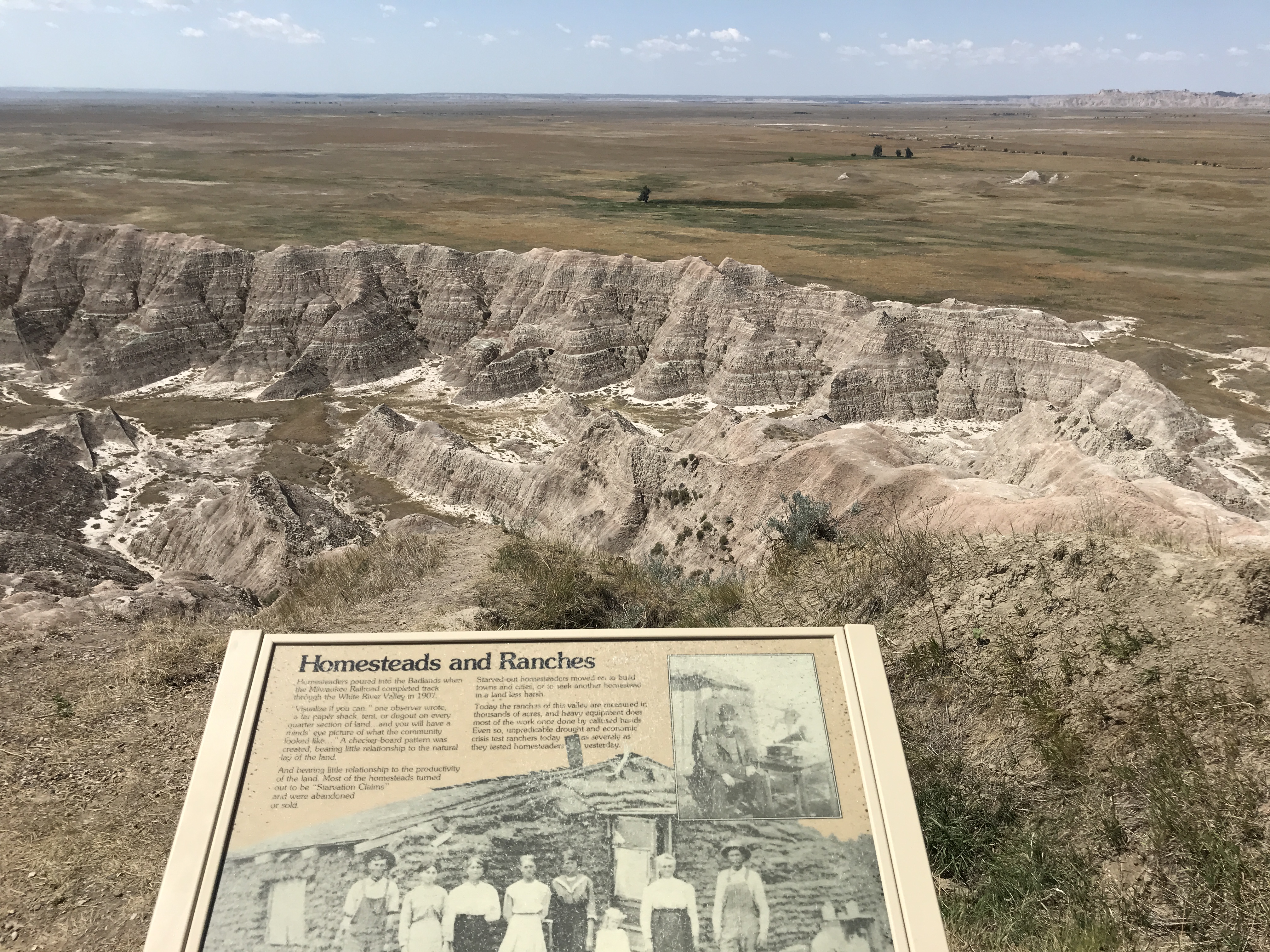
On the southwest side of a two-lane, two-way paved north-south highway, a parking lot accommodating approximately a dozen vehicles provides access to expansive views of Badlands geology and prairie ecosystems. A boardwalk extends to a drop-off into Badlands canyons and draws. There is a 6' wide bench at the edge of the boardwalk and metal handrails throughout. Wayside exhibits provide explanation of homestead and ranching history of the region, the text reads: Homesteads and Ranches: Homesteaders poured into the Badlands when the Milwaukee Railroad completed track through the White River Valley in 1907. "Visualize if you can," one observer wrote, "a tar paper shack tent, or dugout on every quarter section of land...and you will have a minds' eye picture of what the community looked like..." A checker-board pattern was created, bearing little relationship to the natural lay of the land. And bearing little relationship to the productivity of the land. Most of the homesteads turned out to be "Starvation Claims" and were abandoned or sold. Starved-out homesteaders moved on to build towns and cities, or to seek another homestead in a land less harsh. Today the ranches of this valley are measured in thousands of acres, and heavy equipment does most of the work once done by callused hands. Even so, unpredictable drought and economic crisis test ranchers today as severely as they tested homesteaders yesterday. (The background is a large black and white photo showing seven adults, and one child, standing in front of a slumped building made of sod. A smaller photo is inset showing a man sitting next to a gramophone.)
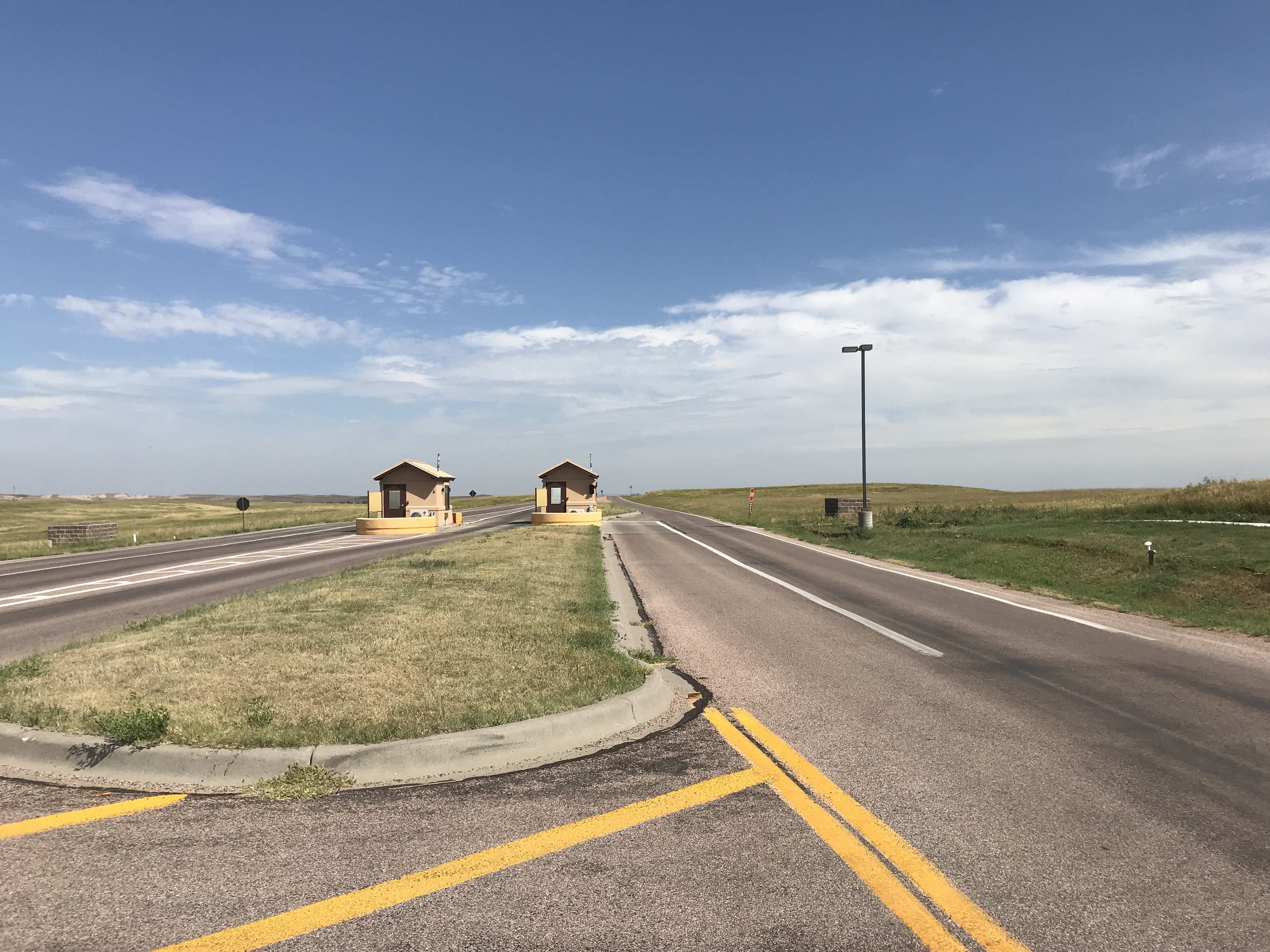
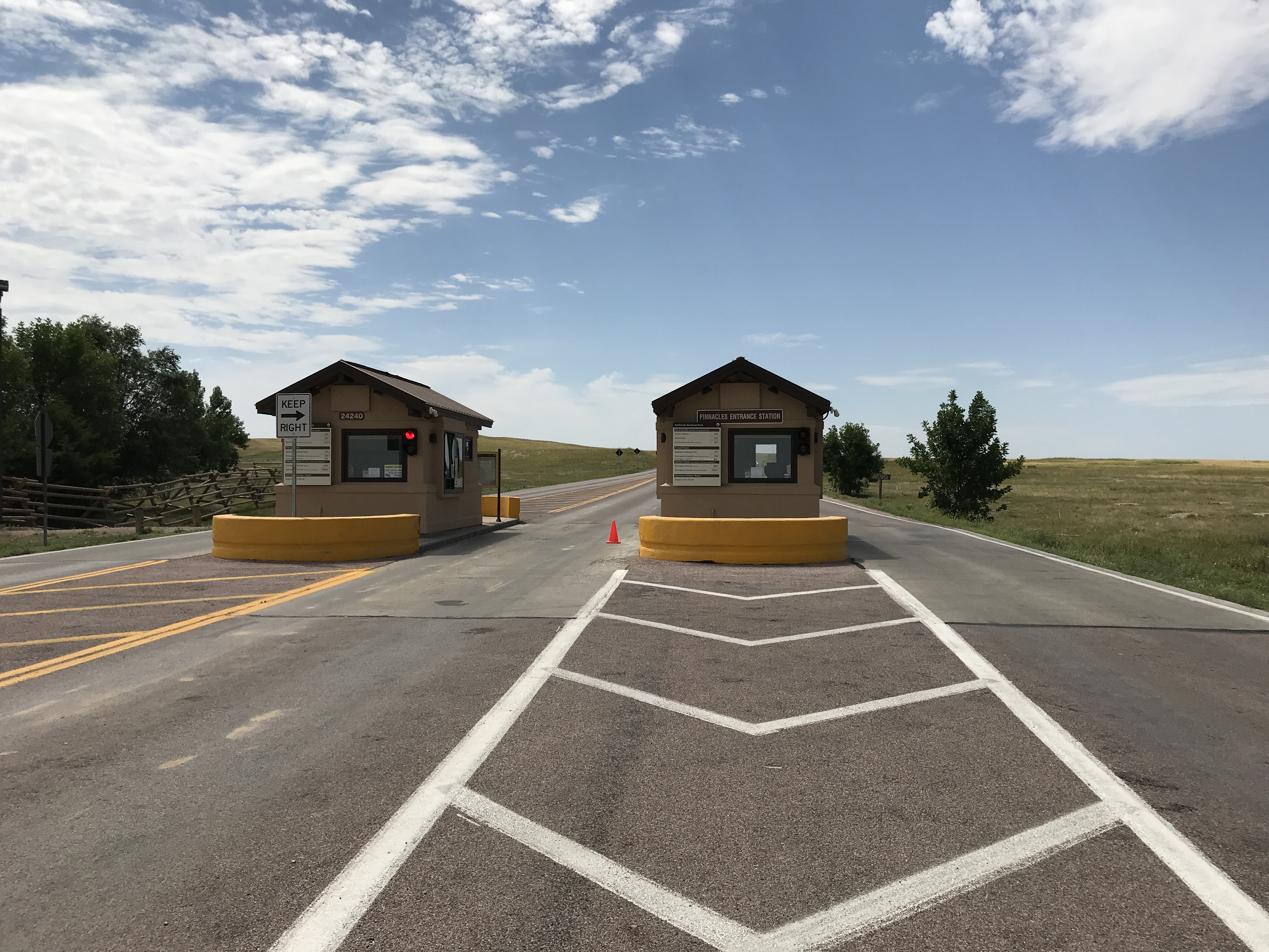
One of three entrances for Badlands National Park.
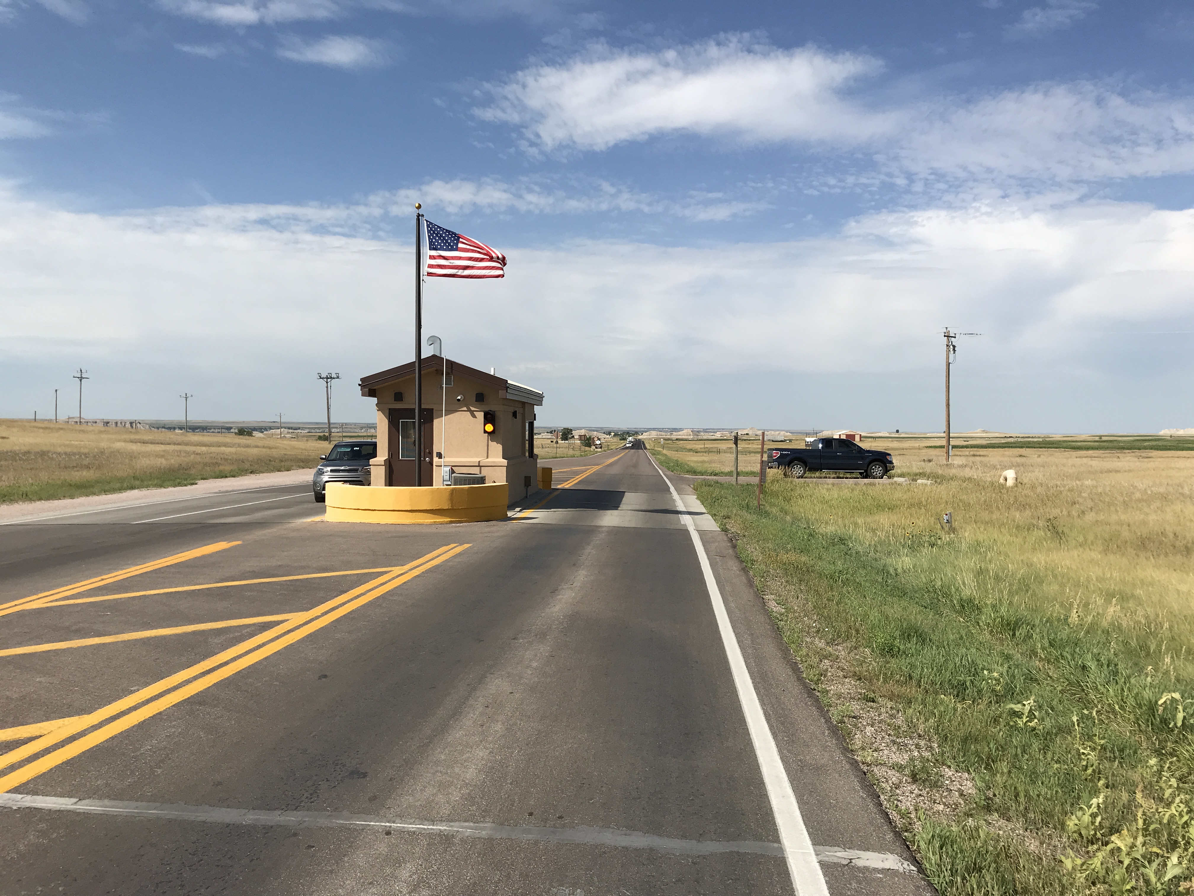
In the middle of a north-south, two-lane paved highway, a single tan building, approximately 15 square feet, is located in the middle of a two-way road. A blinking light indicates whether the station is in operation or not. A flag pole displays the USA flag during operating hours. On the east and west side of the road, prairie grasslands extend for miles with badlands buttes and features in the horizon.
On the Castle Trail portion of the Medicine Root loop, the trail is almost entirely within the upper part of the Brule Formation (Poleslide Member; Oligocene Epoch, 32.0-30.0 million years ago).
A dirt trail extends off a two-lane, gravel road. Badlands buttes extend into the horizon with prairie grasses interspersed. The grasses are mixed between tale and short grasses, with tall mullens and thorny thistles apparent throughout. The trail appears as a worn path meandering through the landscape and disappearing into the crags of badlands.
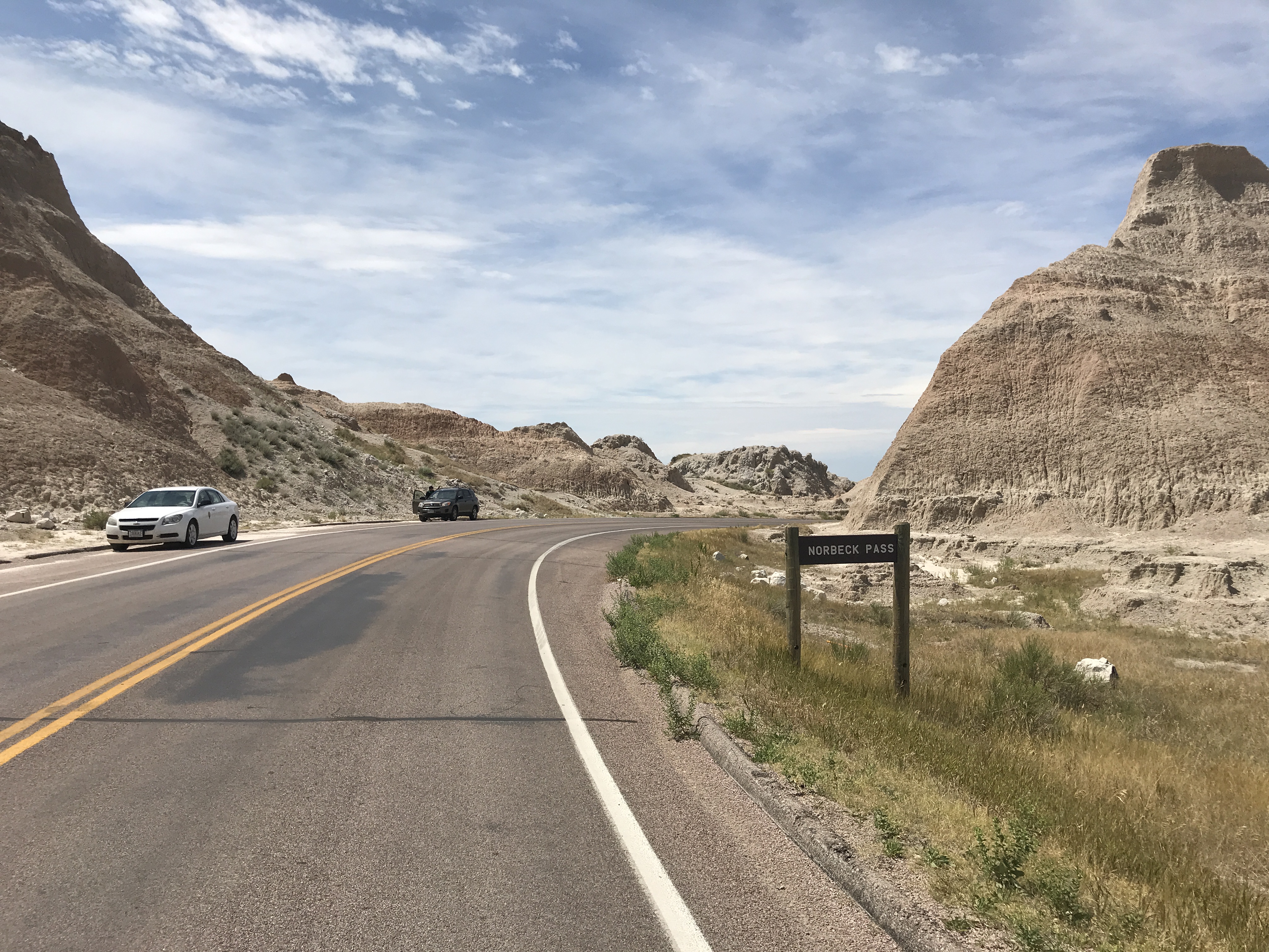
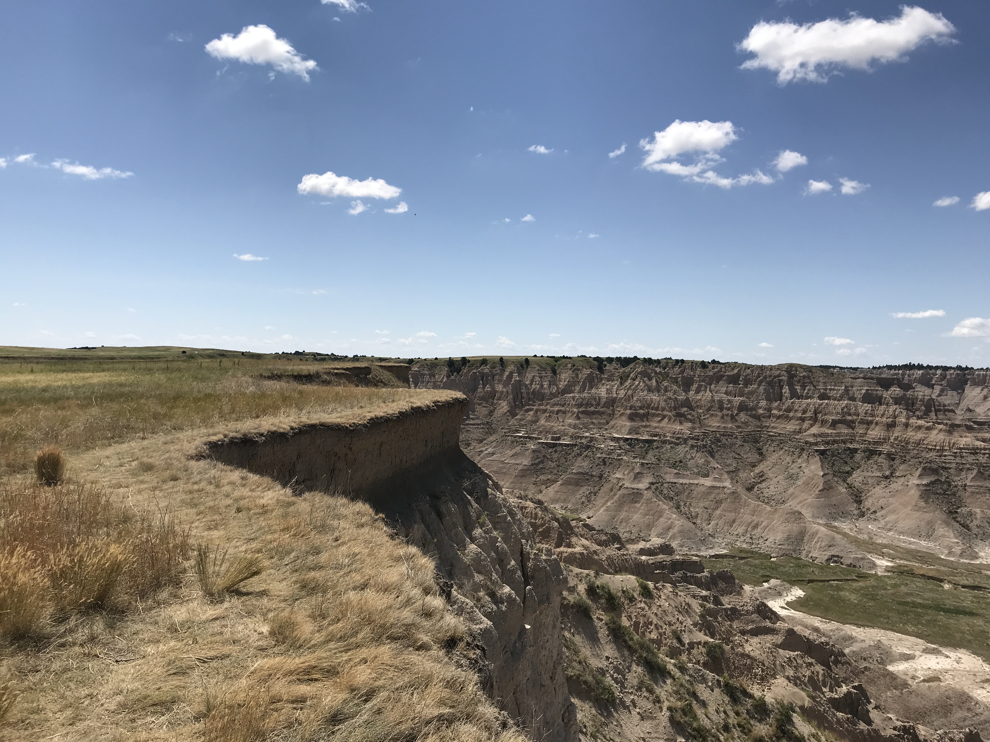
Norbeck Pass is a geologically and ecologically significant transition between upper and lower prairie environments.
A two-way, two-laned north-south paved road inclines between two dramatic badlands formations. A small wooden sign labeled "Norbeck Pass" rests alongside to mark the location. A small turnout accommodating four compact vehicles lies on the western side of the road. Both east and west sides for the road are lined with towering badlands formations at least 20' high.
One of three entrances for Badlands National Park.
Two tan buildings, approximately 15 square feet each, sit in the middle of a paved street with blinking lights indicating whether the station is operating or not. The road is two-way, running east-west. On all sides of the road, vast prairie landscapes extend as far as the horizon. Southward, badlands formations are visible.
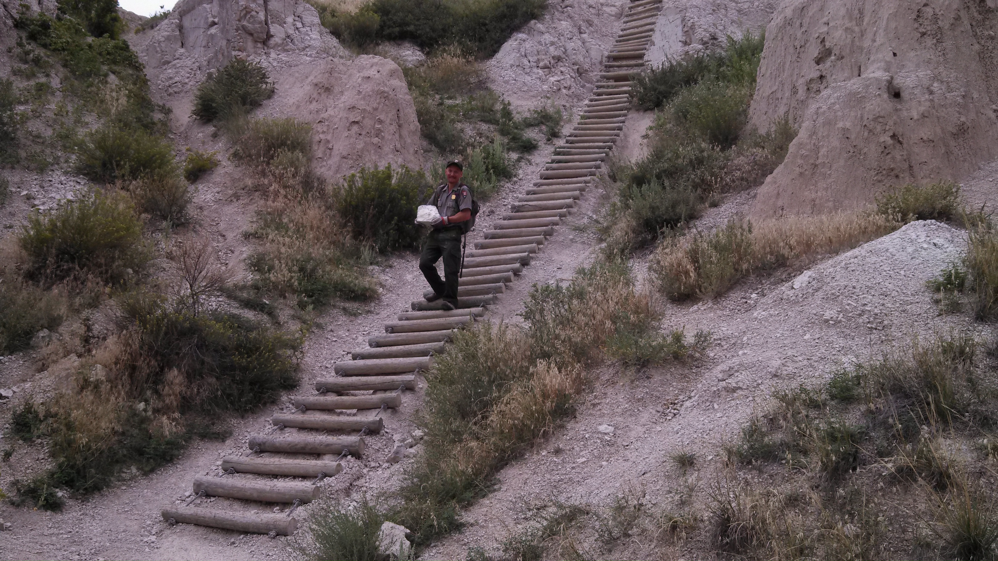
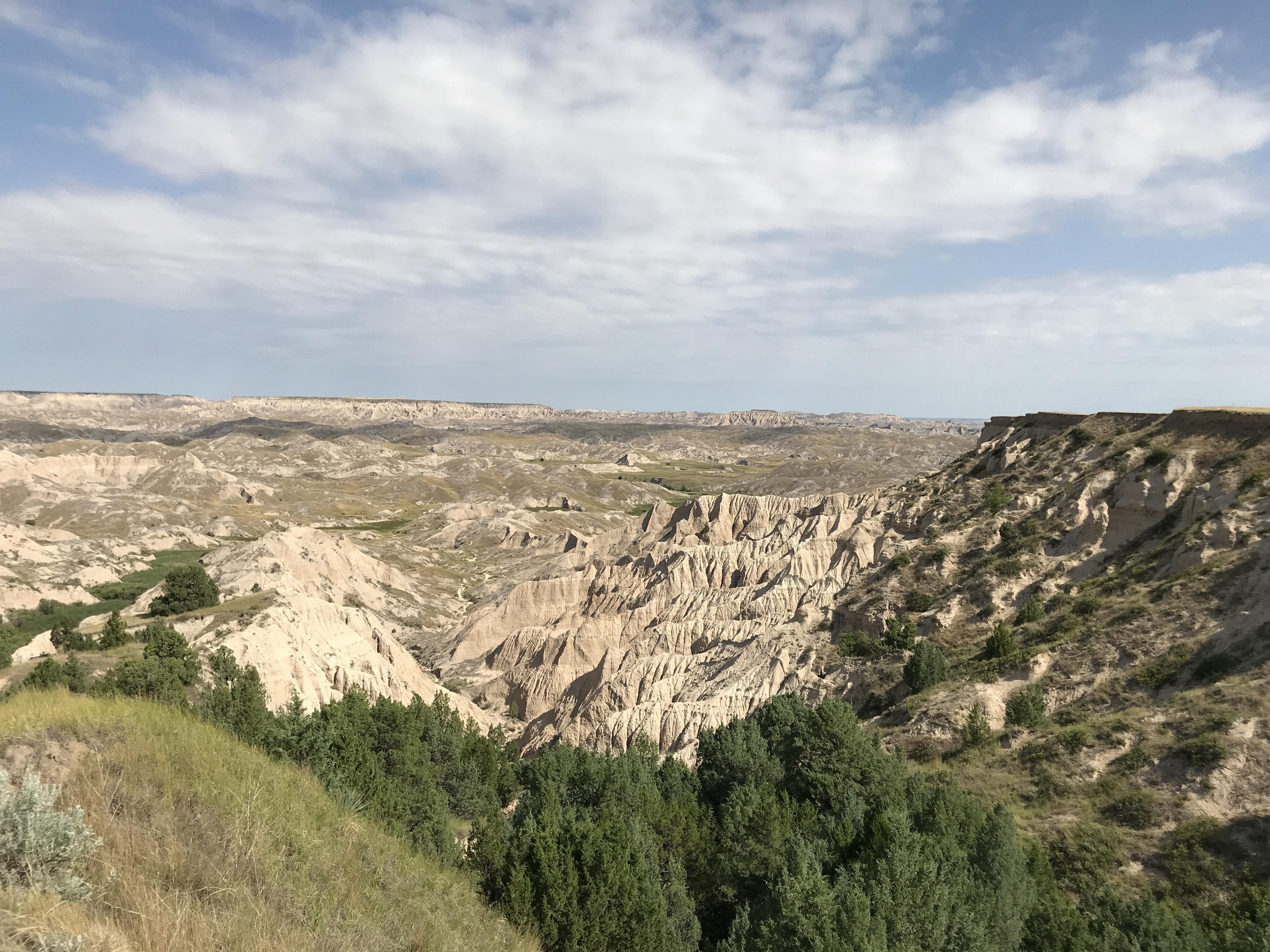
Jagged and clay-colored earth surrounds a trail that leads to a wooden ladder ascending a steep embankment of badlands mud. On either side of the ladder, a meandering and worn trail transits through badlands crags and canyons, with small patches of grasses and occasional juniper tree along the way.
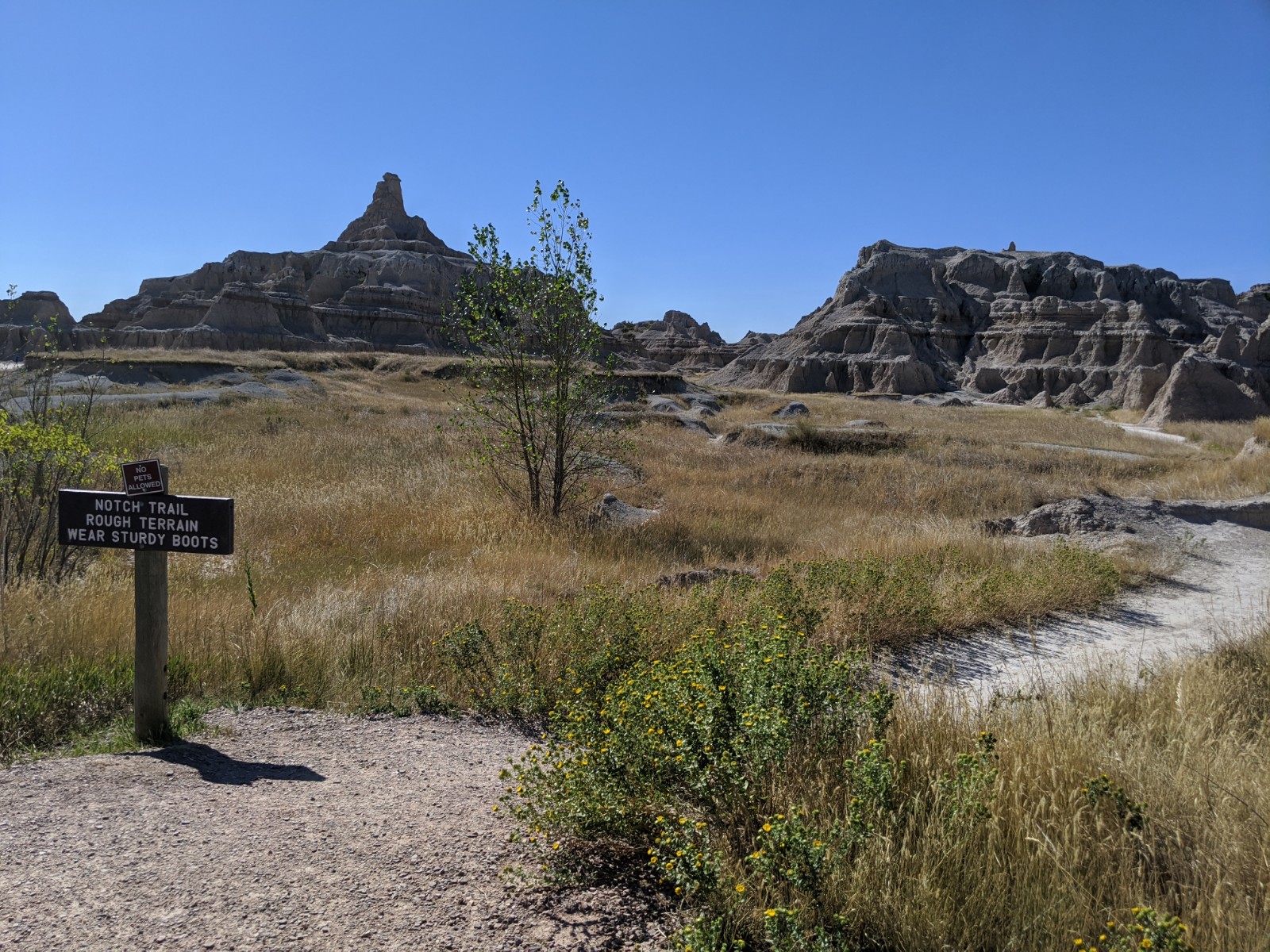
This is the park's most popular trail. It features badlands buttes, views, and a wooden ladder!
An extensive parking lot, accommodating approximately 50 vehicles, rests beside a busy two-lane, paved highway. It is surrounded by expansive and jagged buttes, extending miles in any direction. Multiple bathrooms are available in enclosed, tan buildings, and wayside exhibit signs mark the start of several trails. One trail, marked Notch Trail, has a wooden sign that reads "No Pets Allowed. Notch Trail, Rough Terrain, Wear Sturdy Boots."
Palmer Creek is one of two districts in the South Unit of the park. Contact park staff prior to attempting access.
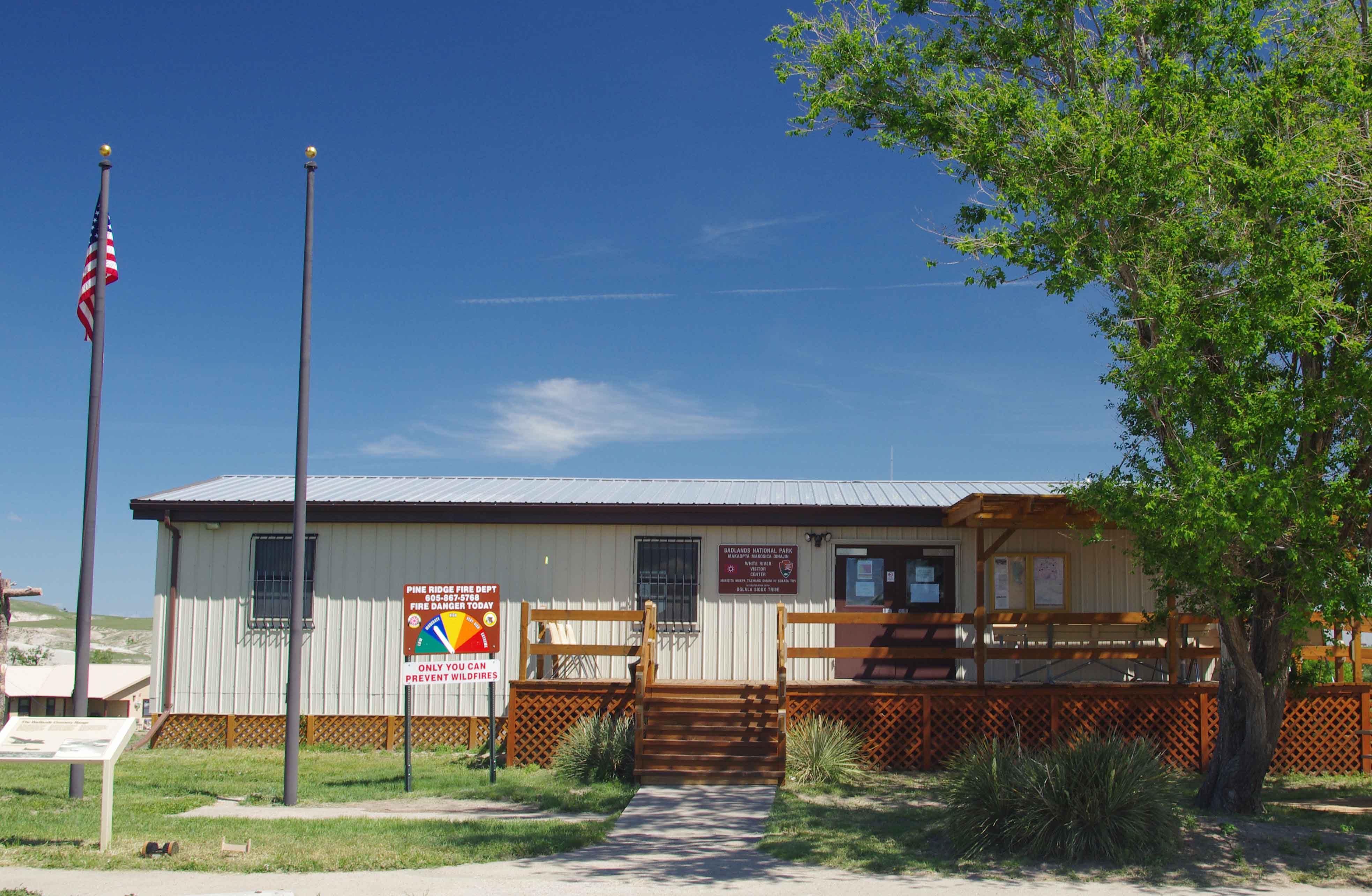
A small two-track extends into the horizon among prairie grasses. In the distance, Badlands formations can be see. The two-track starts at a closed cattle-gate and is perpendicular to a busy two-lane, two-way paved highway. Opposite the gate, across the road, is the White River Visitor Center -- a small, double-wide trailer with a parking lot accommodating a dozen compact vehicles. Two flagpoles are at the site, one with the USA and the other with the Oglala Sioux Tribe's flag.
Panorama Point offers a wide view of the Badlands landscape, downward towards the White River Valley. The view is similar to what is seen in the Big Foot Pass area.
A extensive parking lot accommodating approximately two dozen compact vehicles sits alongside a drop-off into a vast Badlands landscape extending miles into the horizon. The overlook lies on the southeast side of a two-lane, two-way, north-south paved road. To the west is vast prairie grasses extending into the horizon, while the badlands landscape is to the east and the overlook's boardwalk takes visitors to the edge of. Wayside exhibits provide information about air pollution and its effects on the delicate ecosystems of the park. The wayside is described as follows: Air Pollution: A threat to Badlands National Park. In the heart of a sparsely settled region, far from major sources of industrial pollution, Badlands National Park offers clean air and haze-free views – most of the time. On a clear day, you can see Eagle Nest Butte, thirty miles away. On a clear night, you can see a wealth of distant stars, trillions of miles out in space. But, all too often, polluted air flows in from urban and industrial areas as far as southern California and southern Arizona, as well as from industrial centers in the Midwest – and a mask of pollution veils the Badlands. Is the view as clear today as it should be? Will it be clear tomorrow? You can help to clear the air. Conserve electricity. Carpool. Recycle. And involve yourself in air quality issues. Three images are inset on the exhibit, from left to right: A badlands landscape extending into the horizon under blue skies, a starry night sky, a hazy badlands landscape with gray and unclear sky.
One of three entrance stations to Badlands National Park.
In the middle of a north-south, two-lane paved highway, two tan buildings, approximately 15 square feet each, are located in the middle of a two-way road. A blinking light indicates whether the station is in operation or not. A flag pole displays the USA flag during operating hours. On the east and west side of the road, prairie grasslands extend for miles with badlands buttes and features in the horizon.
One of the most popular overlooks in the park, it provides an opportunity to see unparalleled views of the park's unique geology and dramatic sunsets.
On the east side of a paved, two-way, two-lane north-south highway a large parking lot accommodating approximately three dozen vehicles contains a tan building for a restroom. A boardwalk extends approximately 50 feet down a small hill out to the edge of a drop-off. The view provides an opportunity to see a dramatic Badlands landscape consisting of layered, jagged rock and extending into the horizon dropping down into mixed-grass prairie. Three wayside exhibits provide information about badlands acreage, birds and junipers, and volcanic influences on the geology. The three exhibits are described as follows: The first exhibit reads, The Big Badlands: Badlands National Park – 244,000 acres A few hundred yards to the west, turn left on the Sage Creek Rim Road for Roberts Prairie Dog Town and the Sage Creek Primitive Campground. Wildlife, particularly bison, is often seen near this gravel road. The Sage Creek Rim Road overlooks the Badlands Wilderness Area – more than one hundred square miles of roadless mixed-grass prairie – set aside under the Wilderness Act of 1964 to preserve forever its primeval character. You may continue down this road to reach Sheep Mountain Table, the White River Visitor Center, and the Pine Ridge Indian Reservation via State 44 west and B.I.A. 27 south. (a stylized illustration of a bison heard has a combination of bison adults and calves, the rest of the wayside is a series of park maps showing locations throughout the park and highlights therein. There is a caption under one of the maps: "watch for wayside exhibits (like this one) beside park roads."). The second exhibit reads, Birds and Junipers: A cliff juniper grows in a natural garden featuring twisted trunks and sculpted rocks. Badlands birds seek out these pleasant places both in summer and in winter. Here they find nest sites and song perches, and hiding places from predators and mean weather. Bluebirds, solitaires, robins, waxwings, and many other eat juniper berries, sweet with the flavor of gin. It is the birds which plant the juniper gardens. Flying far after a good meal, they drop seeds at random. Some of those seeds grow up, and in time shelter other birds. (a series of stylized illustrations show several different birds, titled: Long-eared owl, Townsend's Solitaire, Field Sparrow, Mountain Bluebird, Brown Thrasher, Logger-headed Shrike, Rosy Finch, Tree Sparrow, Bohemian Waxwing, Northern Shrike.) Born of Volcanos: Thirty-seven million years ago, the ancient crystalline core of the Black Hills had already been exposed by erosion. The long blue profile of those mountains, visible to the west, looked much as it does now. About that time, streams flowing from the west began to deposit sediments in this area. Most of the sediment was wind-blown volcanic ash which had settled into the watershed which fed the streams. Occasionally the rivers brought gravel and stream-worn rocks from the Black Hills themselves. The ash weathered into clay, and turned into rock. Erosion did not begin to gully the Badlands layers and foretell the present landscape until quite recently, perhaps only half a million years ago. (A black and white photo of expansive badlands formations extending into the horizon, with several parenthetical markers showing the locations of Sage Creek Wilderness Area, Harney Peak, Mt. Rushmore, Rapid City, and the Black Hills).
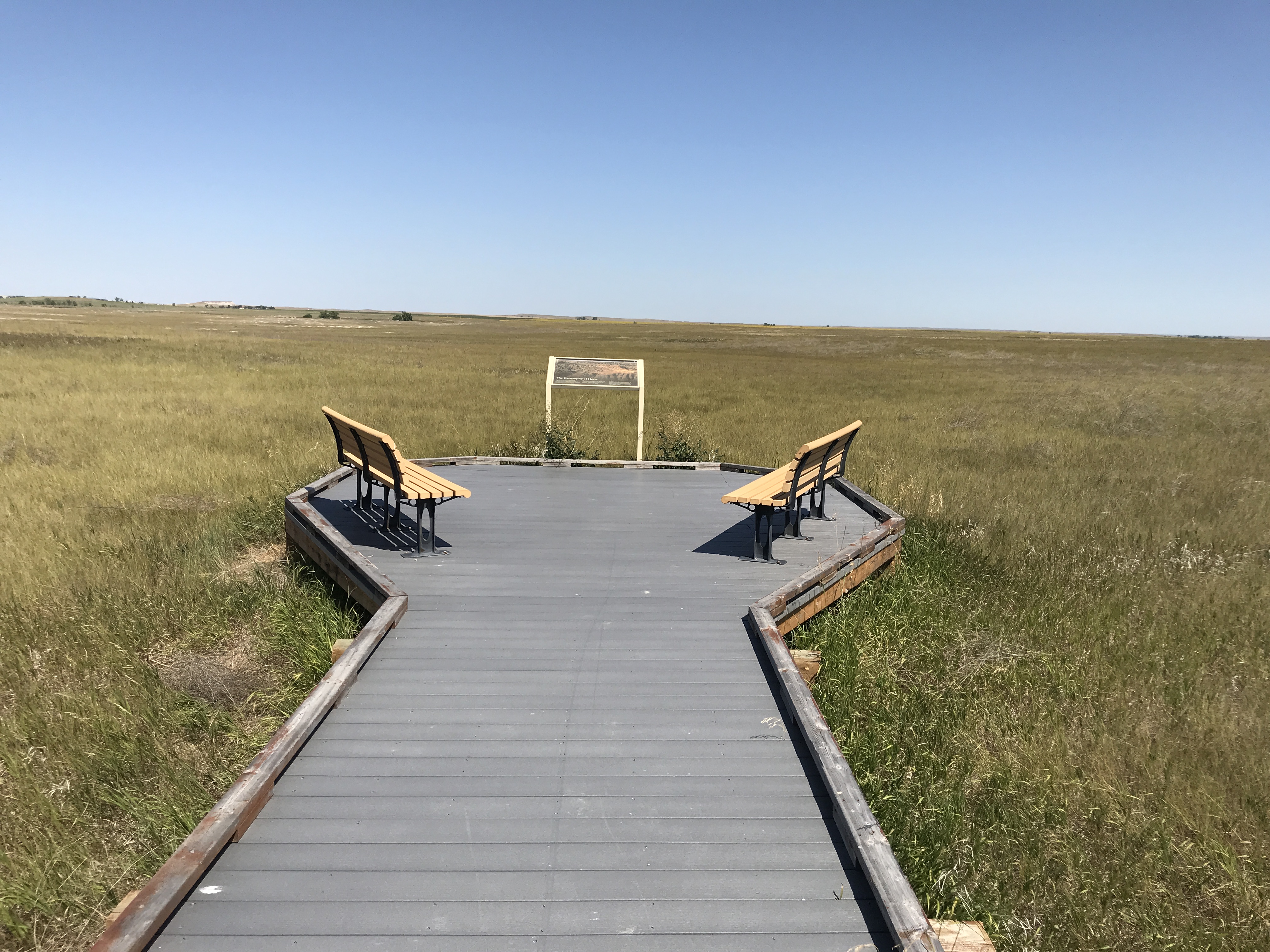
This overlook provides an opportunity to experience the vast prairie landscape.
On the northside of a two-lane, two-way, east-west paved highway, a small parking lot accommodating less than a dozen vehicles is nestled within a vast prairie landscape stretching into all directions. A meandering boardwalk extends into the prairie, ending in a hexagonal platform with a bench in the middle. Three wayside exhibits provide information about prairie ecology and the significance of fire to the health of an ecosystem. They are described in order: The first exhibit reads, The Geography of Hope: Here you stand between wilderness and civilization. In the distance before you lie Interstate 90 and a neighboring ranch. Behind you, beyond the Loop Road, Badlands Wilderness stretches out across 64,000 acres. The prairie around you was once part of a vast ocean of grass covering more than half of the continent. Today, less than two percent of North America's native prairie remains. The 1976 Congress designated 64,000 acres of Badlands as wilderness, making this wilderness a part of what author and environmentalist Wallace Stegner (1913 – 1993) characterized as the "geography of hope." (Miles of layered, jagged badlands formations extending into a horizon.) Second exhibit reads, Alien Attack: The field before you is under attack. Waging an aggressive campaign of propagation, such non-native plants as yellow sweet clover and Canada thistle squeeze out native plants. The resulting loss of plant diversity makes the prairie more susceptible to natural disasters and less hardy overall. To combat this invasion, park staff employ the triple threat of bio-control, chemical retardants, and native plant restoration. (Background image shows a field of purple flowers with the text "Planted by early settlers to beautify the prairie, yellow sweet clover and Canada thistle (below) threaten to overtake native prairie plants. Two other photos, a human hand holding a container with small white slivers and a black and white photo with a man and horse holding various large containers, are accompanied by the text: "Park staff release bio-control insects that target non-native plants for reproduction and food. Over time, these insects kill off their host plants. The insects then die off as their food source disappears. Motorized vehicles are not permitted on these delicate lands. Pack horses provide the muscle to carry heavy chemical retardant equipment needed for the fight against non-native plants.") The third exhibits reads, Cleansed by Fire: Fire routinely sweeps across the prairie. Though a terrifying spectacle, fire can help rejuvenate the prairie. Native grasses survive prairie fires, but non-native grass species such as smooth brome do not. Native grasses grow quickly, their roots holding the rich soil, keeping it from blowing away in steady prairie winds. Early settlers feared wildfires and sought to supress them. Today park staff plan prairie burnings to help eliminate non-native grasses and stimulate the growth of native species. In a few days after a prairie fire, green shoots of native grasses spring from the rich soil. Then wildlife quickly returns to feed on the tender plants. (Prairie fire with half grass and half ashen earth, and small inset image shows green grasses with the text: "non-native smooth brome grass is eliminated through the use of prescribed burning in the park."
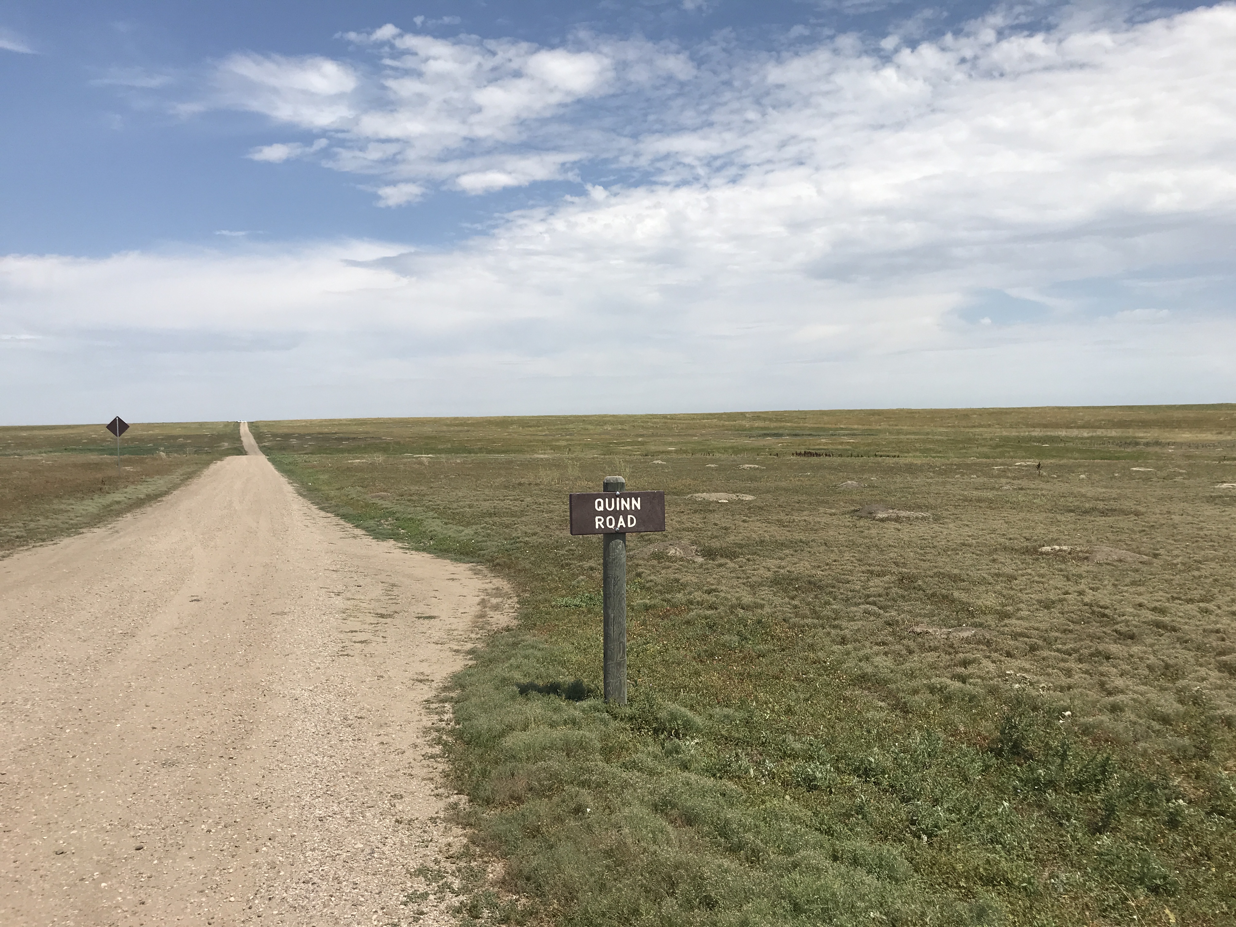
Quinn Road prairie dog town is one of several prairie dog towns in Badlands National Park.
An otherwise unassuming two-way, north-south dirt road and flat field yields an extensive series of prairie dog mounts and short grasses. The prairie dog town lies on both the east and west side of the road and extends at least a mile. The prairie landscape extends into the horizon. A small wooden sign reads "Quinn Road."
Red Shirt Table overlook is one of several significant geologic and scenic features in the South Unit of the park.
On the eastside of a busy highway, a small path traverses across a patch of grass to the edge of a drop-off. At the end of the path, a dramatic and expansive landscape of badlands formations extend into the horizon. Sheep Mountain Table is visible to the west, with Plenty Star Table and Cuny Table visible to the north and south, respectively. The westside of the highway also has badlands formations, but with greater amounts of prairie grasslands and homes.
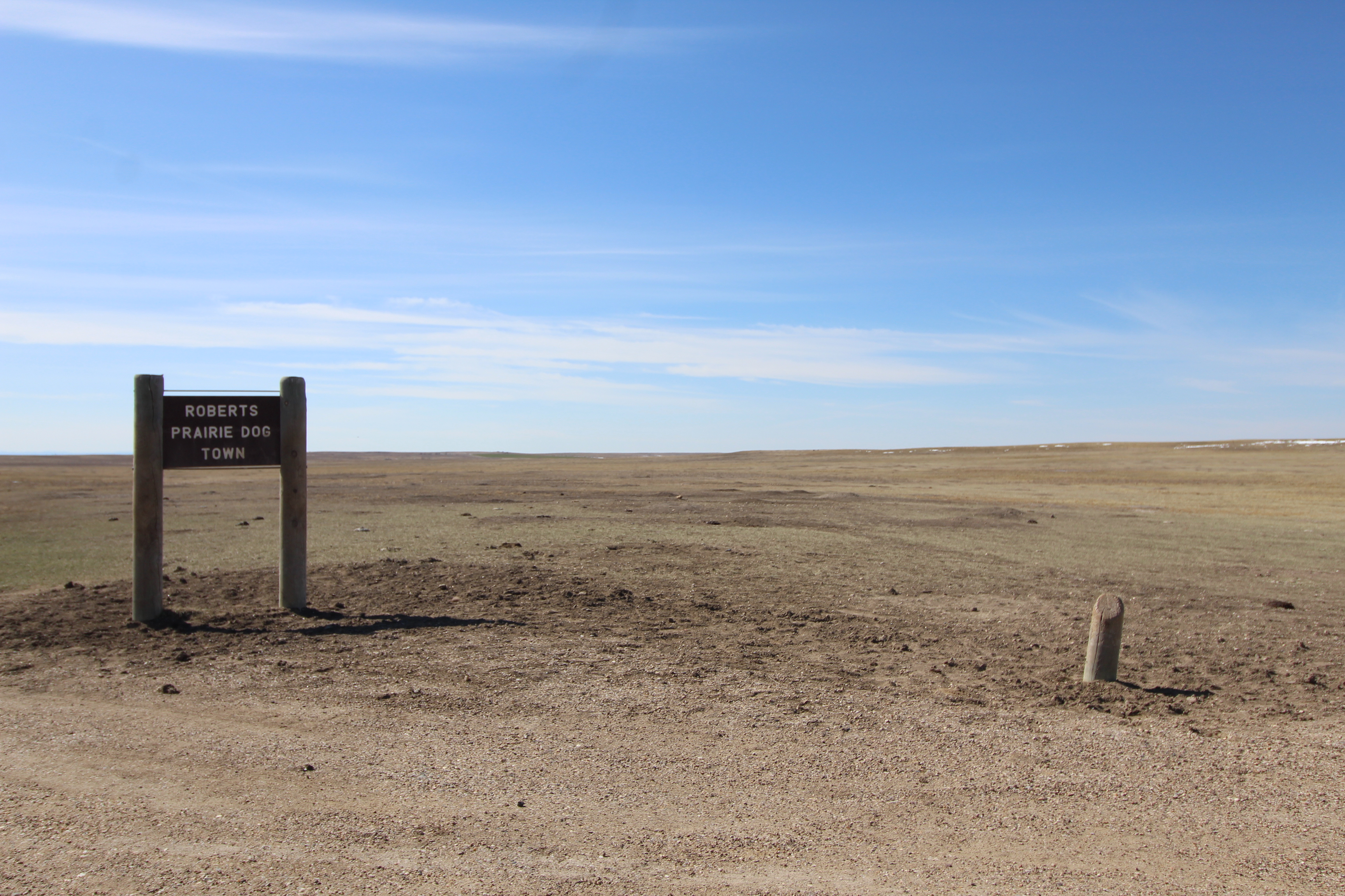
One of the largest prairie dog towns in the park, accessible via a main road.
An expansive prairie environment with short grasses rests on the northside of a two-lane, gravel highway with a small turnout accommodating approximately 3 vehicles. There are numerous mounds of various sizes with hundreds of prairie dogs scurrying about. The prairie dog town extends almost a mile north. South of the road is a drop-off into a dramatic badlands landscape with jagged layered formations and pockets of juniper.
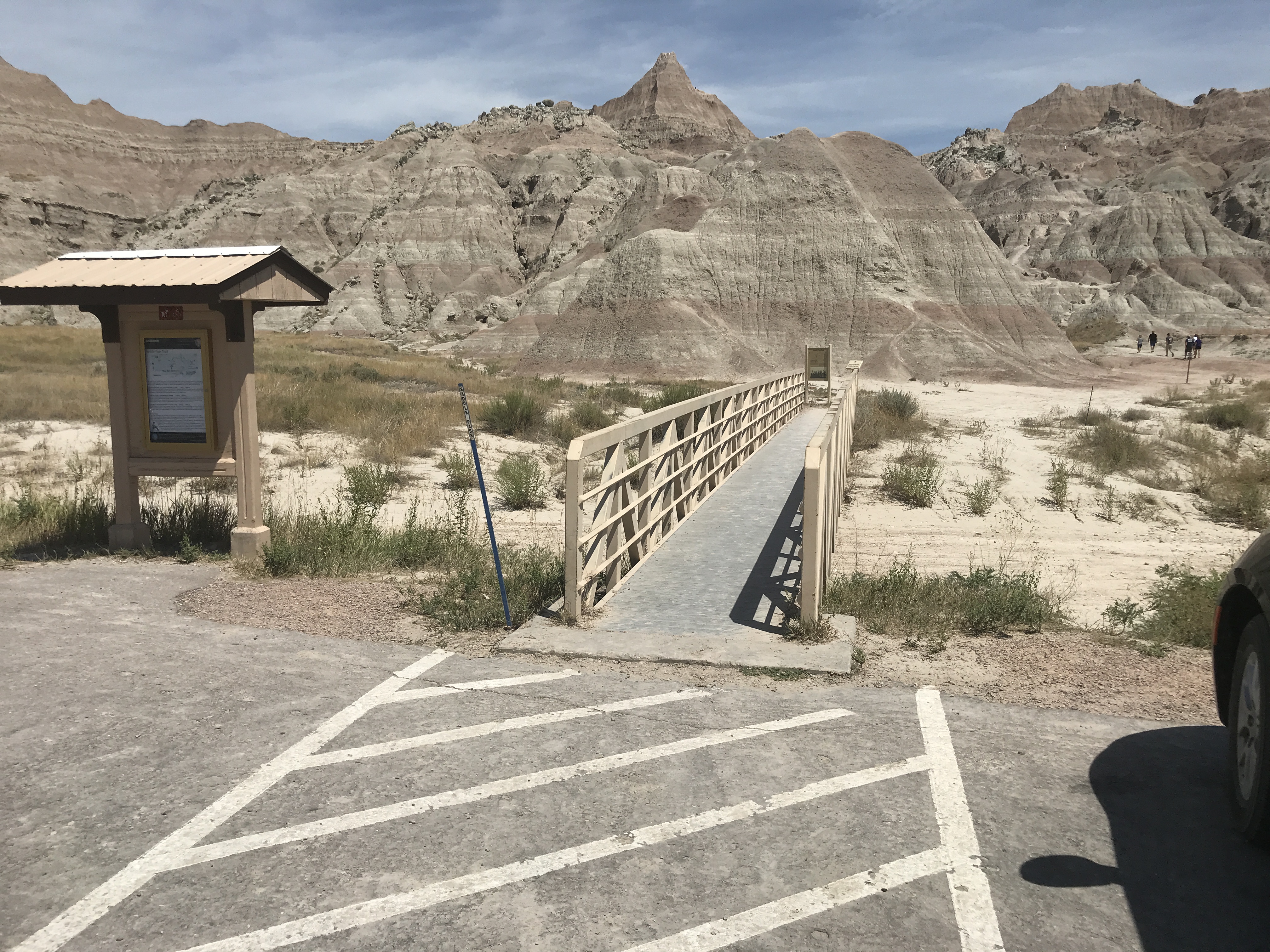
Saddle Pass is one of several short accessible hikes near by the Ben Reifel Visitor Center of Badlands National Park.
On the north side of a busy two-lane, two-way, east-west paved highway, a small wooden boardwalk 30 feet in length extends off a parking lot supporting approximately a dozen cars. At the end of the boardwalk, there are game trails and other informal paths traveling through badlands buttes and sporadic prairie grasses.
This overlook provides an expansive view of the mixed-grass prairie environment and the sage creek wilderness area.
A small gravel turnout accommodating no more than a few compact cars rests on the southside of a two-way gravel east-west highway. The turnout overlooks a vast and expansive prairie landscape, with mixed grasses, junipers, and cottonwoods extending for miles into the horizon. On the northside of the highway, prairie grasses extend far into the horizon.
The wilderness area has a primitive campground and no official trails. Any trip to the area needs to be planned ahead of time.
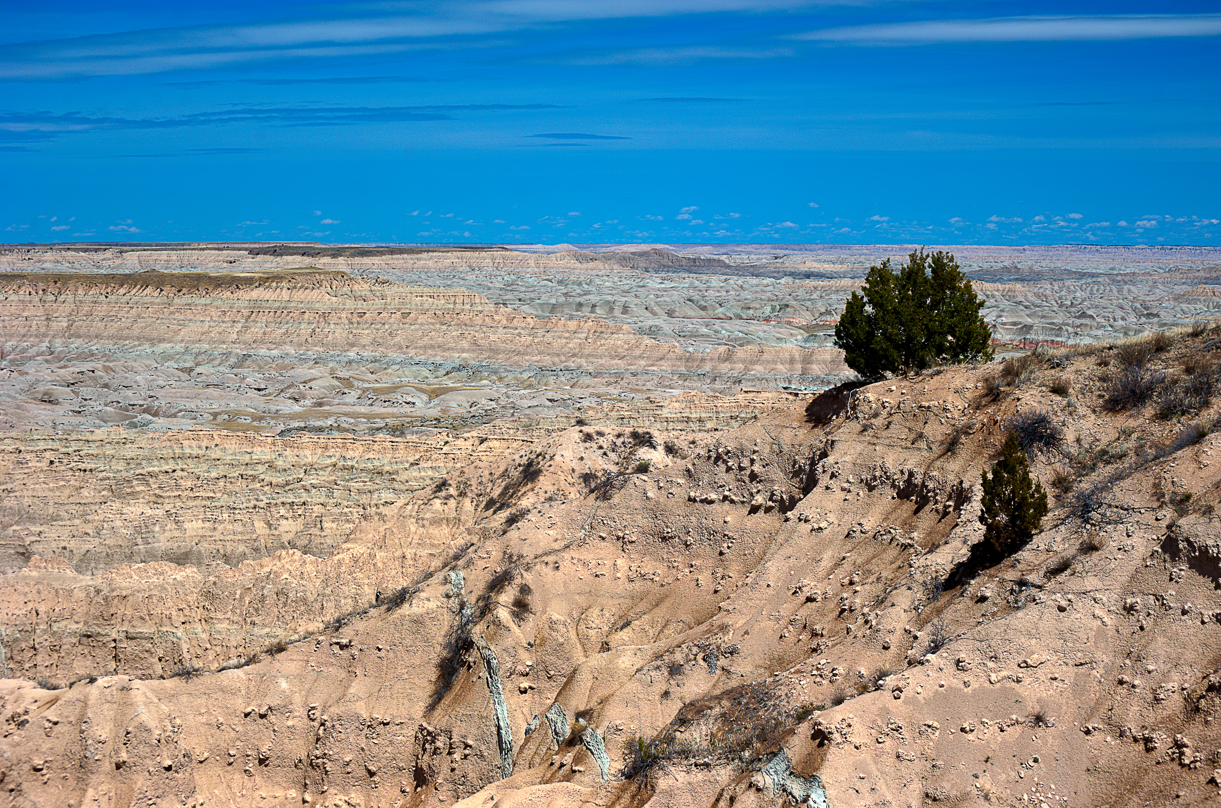
Mixed-grass prairie and rolling hills extend for miles in every direction. The occasional stripe of Badlands punctuates the landscape. Small paths formed by single-file bison, deer, coyotes and other animals spread throughout the grasses. On the north side of the wilderness area, a two-lane gravel highway travels along a ridgeline composed of badlands formations and thick sod layers. Within the wilderness area, there are dried creeks and sporadic mud. Small oases of junipers and cottonwoods throughout.
Sheep Mountain Table is one of the overlooks of Badlands National Park. It provides views of the park's South Unit and the Black Hills. The road to the overlook is not maintained in the winter, and beyond the overlook the road deteriorates and requires high clearance/4WD vehicles.
A narrow north-south dirt road leads to a small overlook that faces westward into the expansive badlands of the park's south unit. Multiple tables are visible in the horizon, with the black hills providing a backdrop. Below the overlook, there are prairie grasslands and occasional herds of cattle graze. To the east, several miles of mixed-grass prairie continues until it reaches the other end of the table.
Stronghold Table is one of five large tables located in the South Unit of the park.
A small north-south two-track weaves in between cattle herds and amid miles of mixed-grass prairie ends at the edge of a dramatic drop-off. The view to the north, east, and west is of vast, craggy, and miles of badlands formations with horizontal layered bands of reds, browns, and whites.
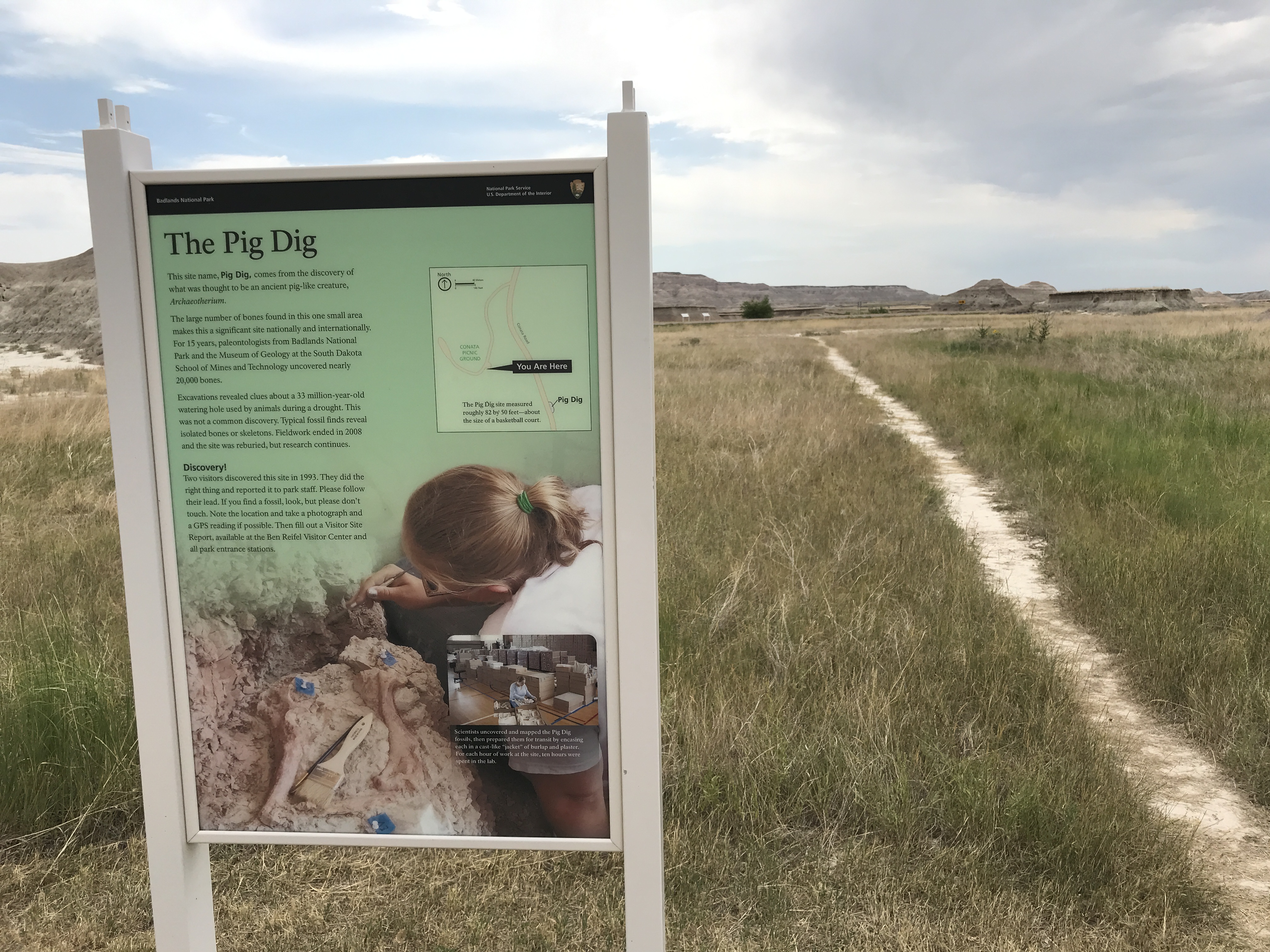
The Pig Dig is a site of a recent paleontological survey that yielded many significant fossil finds, including: Archaeotherium, Subhyracodon, Mesohippus, Leptomeryx.
Two wayside exhibits and a lone game trail meanders through badlands buttes and prairie grasses. It lies on the eastside of a busy paved, two-lane north-south highway, with the badlands wall to the north and expansive prairies to the south. The two wayside exhibits are described below: The first one reads, "Stuck in the Mud: Thirty-three million years ago, this area was an oasis during a drought. It attracted animals looking for water, food, and shelter. Some animals became stuck in the mud and died. Their carcasses were trampled, crushed, and buried. This cycle repeated until the watering hole dried out. After millions of years, erosion and the work of paleontologists exposed these buried remains. (a color, stylized illustration shows a variety of animals – rodents, felines, large mammals, birds – in a watering hole amid prairie grasses and forests in the distance. The animals are labeled by their names: "Mesohippus, three-toed horse," "Aves, bird," "archaeotherium, pig dig namesake," nimravid, cat-like predator," "subhyracodon, extinct rhinoceros," "ishyromys, squirrel-like rodent," "daphoenus, commonly known as a 'bear dog.'")." The second one reads, "The Pig Dig: This site name, Pig Dig, comes from the discovery of what was thought to be an ancient pig-like creature, Archaeotherium. The large number of bones found in this one small area makes this a significant site nationally and internationally. For 15 years, paleontologists from Badlands National Park and the Museum of Geology at the South Dakota School of Mines and Technology uncovered nearly 20,000 bones. Excavations revealed clues about a 33 million-year-old watering hole used by animals during a drought. This was not a common discovery. Typical fossil finds reveal isolated bones or skeletons. Fieldwork ended in 2008 and the site was reburied, but research continues. Discovery! Two visitors discovered this site in 1993. They did the right thing and reported it to park staff. Please follow their lead. If you find a fossil, look, but please don't touch. Note the location and take a photography and a GPS reading if possible. Then fill out a Visitor Site Report, available at the Ben Reifel Visitor Center and all park entrance stations. (A background image of a woman using a small brush on rocks. two smaller inset photos show, respectively, a map showing the location of the exhibit relative to the surrounding area, and a person in a room full of boxes. Additional text reads "Scientists uncovered and mapped the Pig Dig fossils, then prepared them for transit by encasing each in a cast-like 'jacket' of burlap and plaster. For each hour of work at the site, ten hours were spent in the lab.")."
The Saber Site is the location of a significant find: a rare nimravid skull, and it was found by a 7-year-old child.
Near multiple tan buildings, including the large Ben Reifel Visitor Center facility, a series of badlands buttes and flat areas of direct has three picnic tables with curved shade structures. The buttes extend approximately 50' into the sky, and prairie grasses extend miles into the horizon.
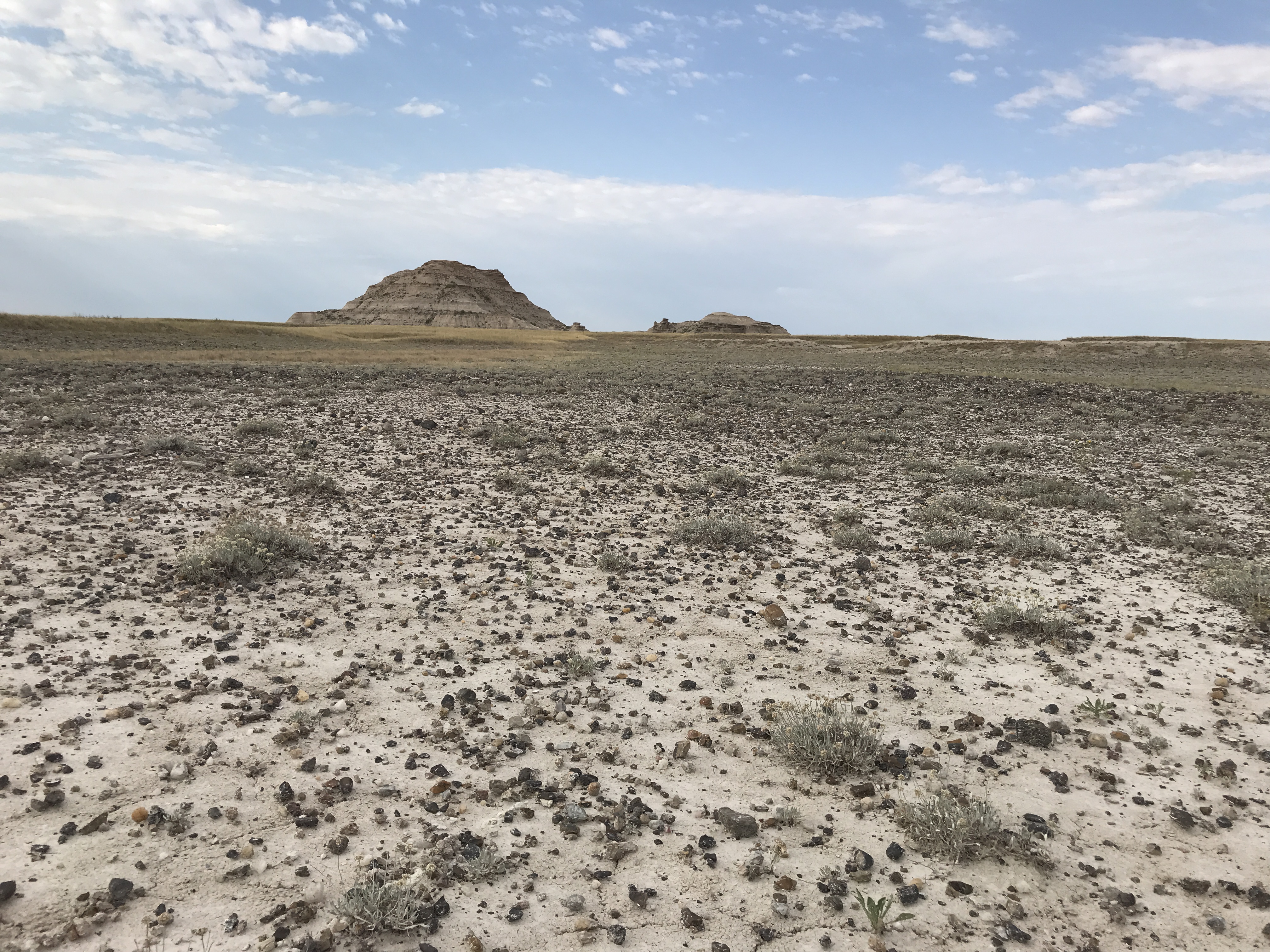
Toadstool Rock is one of the more visible examples of Badlands unique erosion processes.
Rolling badlands formations and prairie grasses stretch into the horizon. In between them all rests a series of rocks, one in particular stands out. Toadstool rock is a slanted rock that is perched atop a pillar of dirt and stone. The pillar is approximately 6' high and the rock perched atop is several feet across and wide.
This is a stop along the Fossil Exhibit Trail of Badlands National Park. This exhibit features a replica bronze alligator fossil and information about how alligators moved to survive a changing climate.
The exhibit is in two-panels, which are three feet high and slanted to allow the reader to peer down at the panels. On the right, A stylized illustration of a swampy environment shows two rhinoceros resembling creatures looking into a watering hole. A large alligator lays on the other side with the text: "Alligators lived in the badlands area 34-37 million years ago when the climate was like modern-day Florida." In the bottom right corner, there are silhouettes of an alligator and human being to show relative size difference and the text "How big was an ancient Alligator?" A cross-section of layered badlands formation is labeled from bottom to top as follows: Pierre Shale. Yellow Mounds, 34-37 million years ago, fossil found here. Chadron. Brule. Sharps.) On the left, a bronze replica of the upper jaw of an ancient alligator is represented in a gravel display. The caption reads: "Alligator. Alligators were common in this area and throughout North America. As the climate changed, alligators moved to the warm, wet environment of the southeast. A three piece pie chart is labelled Move, Adapt, Die. Move is highlighted.
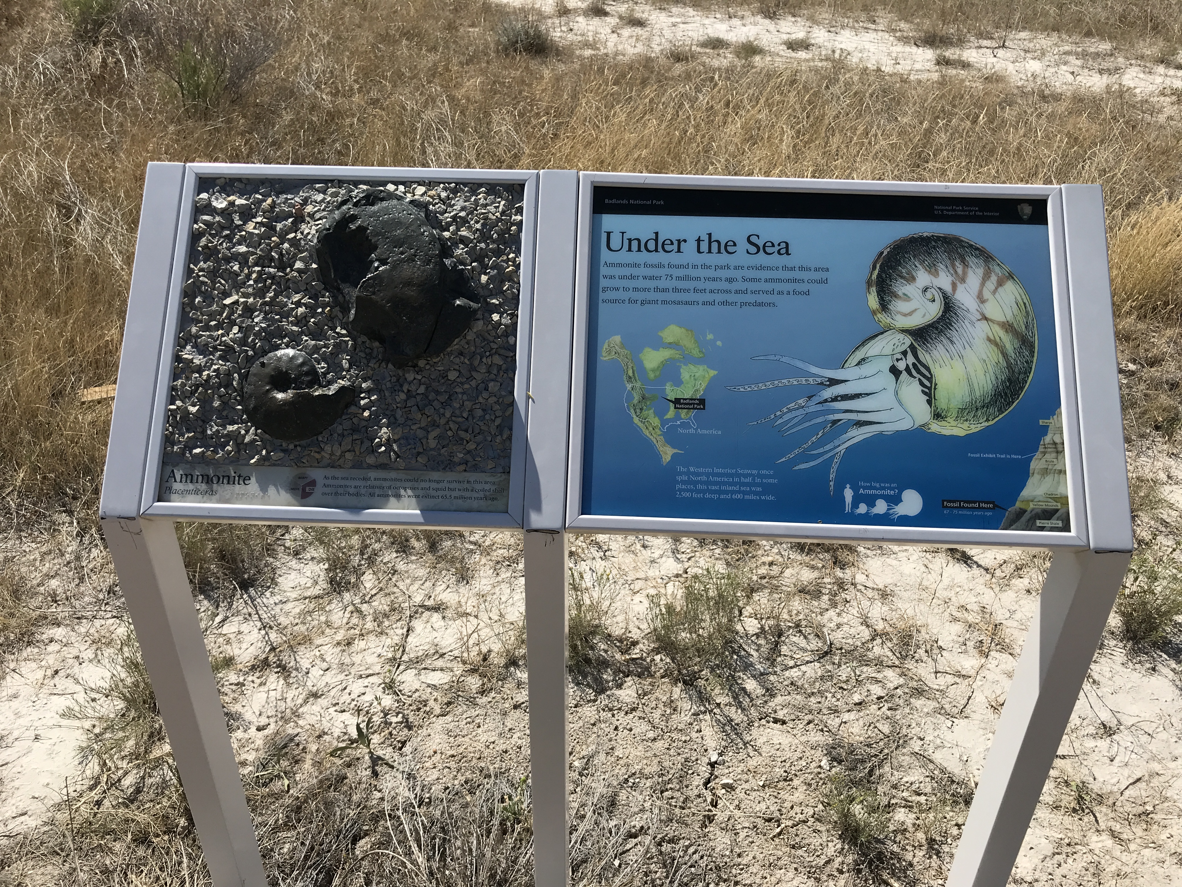
This is a stop along the Fossil Exhibit Trail of Badlands National Park. This exhibit features a replica bronze Ammonite fossil and information about how Ammonites died in response to a changing climate.
The exhibit is in two-panels, which are three feet high and slanted to allow the reader to peer down at the panels. On the right, (This panel has four images. First, a large stylized creature with a spiral shell and multiple tentacles. Second, an overhead map showing several landmasses with an outline of the United States superimposed. This shows that most of the interior United States used to be under water. A caption reads "The Western Interior Seaway once split North America in half. In some places, this vast inland sea was 2,500 feet deep and 600 miles wide." Third, an icon showing a human standing next to a version of the stylized sea creature image shows that it was almost as tall as a human being and many times wider. A caption reads, "How big was an Ammonite?" Fourth, a cross-section of layered badlands formation is labeled from bottom to top as follows: Pierre Shale, fossil found here, 67 – 75 million years ago. Yellow Mounds. Chadron. Brule. Fossil Exhibit Trail is here. Sharps.) On the left, A bronze replica of a two shells, one in the shape of a tight spiral while the other appears as a smoothed circular rock with part of it broken off, is represented in a gravel display. The replica is identified as "Ammonite, Placenticeras." The caption reads: "As the sea receded, ammonites could no longer survive in the area. Ammonites are relatives of octopuses and squid but with a coiled shell over their bodies. All ammonites went extinct 65.5 million years ago." A three piece pie chart is labelled Move, Adapt, Die with Die highlighted.
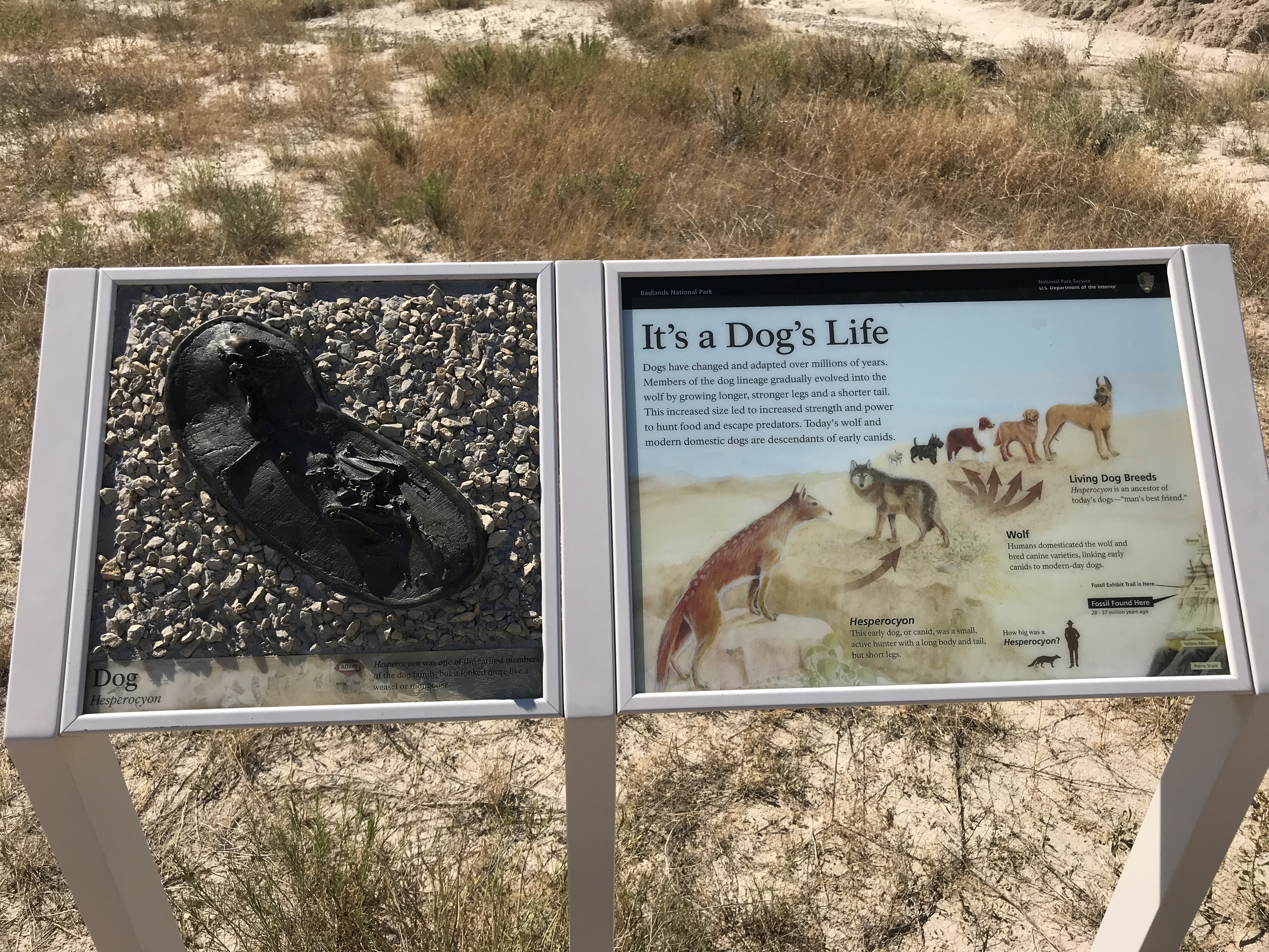
This is a stop along the Fossil Exhibit Trail of Badlands National Park. This exhibit features a replica bronze Dog fossil and information about how dogs evolved to survive a changing climate.
The exhibit is in two-panels, which are three feet high and slanted to allow the reader to peer down at the panels. On the right, This panel has three images. The first is a series of three sets of animals in a sequence going left to right. Each animal resembles the previous, and arrows indicate the direction of movement. Each set is labeled: 1) This animal is brown with four legs and white spots. Text reads, "Hesperocyon. This early dog, or canid, was a small, active hunter with a long body and tail, but short legs." 2) This animal is gray with a shaggy coat and four legs. Text reads, "Wolf. Humans domesticated the wolf and bred canine varieties, linking early canids to modern-day dogs." 3) There are five animals, small to large dogs of a variety of colors shapes. Text reads, "Living Dog Breeds. Hesperocyon is an ancestor of today's dogs -- 'man's best friend.'" The second image is an icon showing a human standing next to a version of the dog-like creature showing that it was almost much smaller than a human. A caption reads, "How big was Hesperocyon?" Third, a cross-section of layered badlands formation is labeled from bottom to top as follows: Pierre Shale. Yellow Mounds. Chadron, fossil found here, 34 – 37 million years ago. Brule. Fossil exhibit trail found here. Sharps. On the left, A bronze replica of a dog fossil cross-section l is represented in a gravel display. The replica is identified as "Dog, Hesperocyon." The caption reads: "Hesperocyon was one of the earliest members of the dog family, but it looked more like a weasel or mongoose." A three piece pie chart is labelled Move, Adapt, Die with Adapt highlighted.
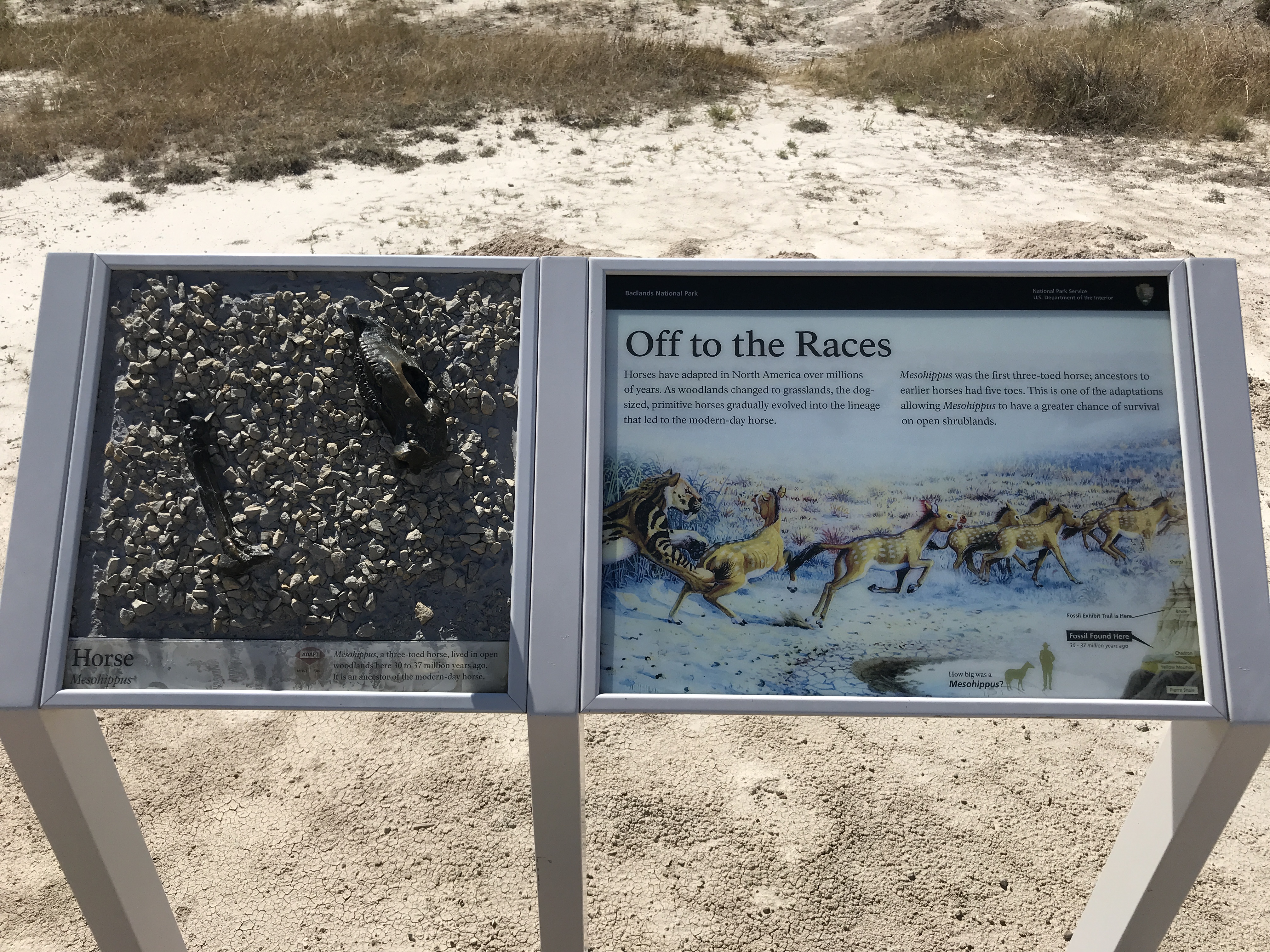
This is a stop along the Fossil Exhibit Trail of Badlands National Park. This exhibit features a replica bronze Mesohippus fossil and information about Mesohippus evolved to adapt to changing climates.
The exhibit is in two-panels, which are three feet high and slanted to allow the reader to peer down at the panels. On the right, (This panel has three images. First, the first is a stylized illustration of eight animals travelling from left to right. The first one on the right is a striped cat-like predator lunging at the first of the second smaller creatures. These smaller ones are tan with white spots and resemble horses. Second, an icon showing a human standing next to a version of the stylized creature image shows that it was almost half as tall and about the same width as a human. A caption reads, "How big was a Mesohippus?" Third, a cross-section of layered badlands formation is labeled from bottom to top as follows: Pierre Shale. Yellow Mounds. Chadron, fossil found here, 34 – 37 million years ago. Brule. Fossil exhibit trail found here. Sharps.) On the left, A bronze replica of a leg bone and skull is represented in a gravel display. The replica is identified as "Horse, Mesohippus." The caption reads: "Mesohhipus, a three-toed horse, lived in open woodlands here 30 to 37 million years ago. It is an ancestor of the modern-day horse." A three piece pie chart is labelled Move, Adapt, Die with Adapt highlighted.
This is a stop along the Fossil Exhibit Trail of Badlands National Park. This exhibit features a replica bronze nimravid fossil and information about how nimravid died in the face of a changing climate.
The exhibit is in two-panels, which are three feet high and slanted to allow the reader to peer down at the panels. On the right, (This panel has four images. A stylized illustration shows two cat-like creatures with large teeth and sharp, clawed four legs. One animal is biting the head of the other. The second image is an icon showing a human standing next to a version of the dog-like creature showing that it was almost much smaller than a human. A caption reads, "How big was Hesperocyon?" Third, a cross-section of layered badlands formation is labeled from bottom to top as follows: Pierre Shale. Yellow Mounds. Chadron, fossil found here, 34 – 37 million years ago. Brule. Fossil exhibit trail found here. Sharps. Fourth, a sideways image of nimravid skull with two holes circled labeled "Nimravid bites." This image accompanies the main exhibit text.) On the left, A bronze replica of a nimravid skull is represented in a gravel display. The replica is identified as "Nimravid, Nimravus." The caption reads: "Nimravids resembled large saber-tooth cats, but they are from a different family, now extinct." A three piece pie chart is labelled Move, Adapt, Die with Die highlighted.
This is a stop along the Fossil Exhibit Trail of Badlands National Park. This exhibit features a replica bronze oreodont fossil and information about how the fossilization process occurs.
The exhibit is in two-panels, which are three feet high and slanted to allow the reader to peer down at the panels. On the right, This panel has four images. A stylized illustration showing a left-to-right line of ten small, pig-like mammals standing amid a swampy environment. The second image a left-to-right illustration showing four steps in the fossil discovery process. The process begins with a decaying corpse, then is covered by dirt, an arrow traversing through the image represents mineral deposits, and the final image has human hands with a brush cleaning the fossil. The third image is an icon showing a human standing next to a version of the dog-like creature showing that it was almost much smaller than a human. A caption reads, "How big was Oreodont?" The fourth and final image is a cross-section of layered badlands formation is labeled from bottom to top as follows: Pierre Shale. Yellow Mounds. Chadron, fossil found here, 34 – 37 million years ago. Brule. Fossil exhibit trail found here. Sharps. On the left, A bronze replica of an oreodont fossil cross-section is represented in a gravel display. The replica is identified as "Oreodont, Leptauchenia." The caption reads: "Oreodont fossils are common in Badlands National Park, but it is rare to find a nearly complete specimen like this one. Oreodonts, now extinct, resembled sheep or pigs, but are unrelated." A three piece pie chart is labelled Move, Adapt, Die with Die highlighted.
The visitor center is located on the Pine Ridge Reservation and offers a staffed information desk, exhibits, restrooms, picnic tables, and water. Impromptu talks are available by request. This visitor center is only open during the summer season.
Many different programs are led by rangers at Badlands National Park. Learn more about wildlife, geology, paleontology, and more by stopping at a ranger program during your visit! Visit this page to find program descriptions, locations, and typical times.
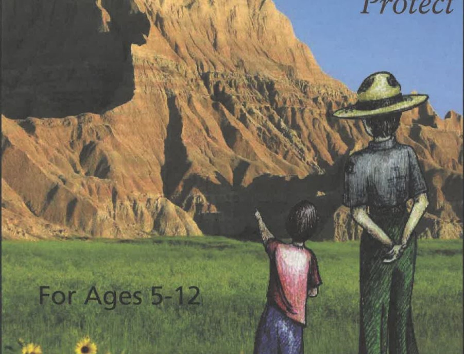
Become a Badlands Junior Ranger
Become a Junior Ranger at Badlands National Park! By completing a fun activity book, you can earn a Junior Ranger badge and pledge to explore, learn about, and protect the parks.
Campgrounds
Set up camp at one of Badlands National Park's two official campgrounds. Whether you're seeing views of the Sage Creek Wilderness Area or Cedar Pass, you're sure to enjoy an overnight stay in the park.
Badlands Astronomy Festival
Celebrate the spectacular sights and science of night skies at Badlands National Park's annual Astronomy Festival. Join astronomers, rangers, and visitors for activities, discussions, and programs about the night sky.
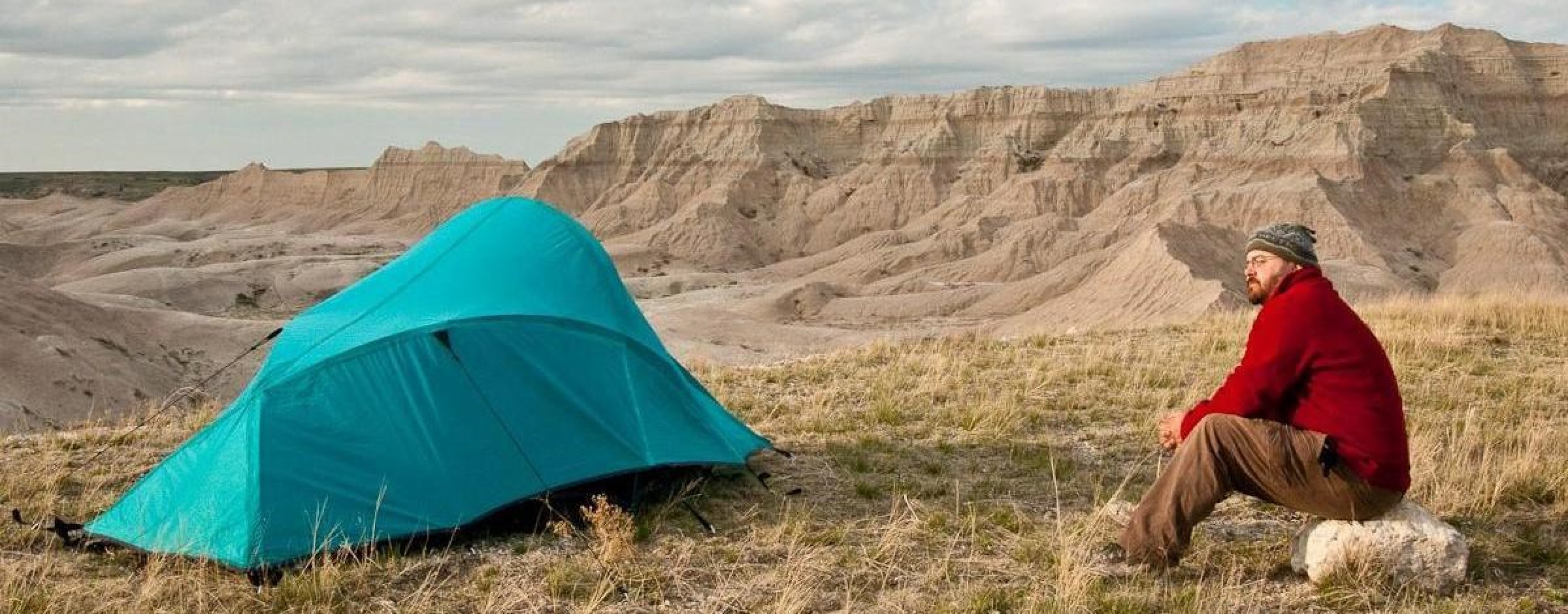
Backcountry Camping
Backcountry camping in the Badlands can be an exciting adventure for prepared and experienced hikers. Read more about rules, safety, and recommendations for backcountry campers here.
Pick Your Park Adventure in the Badlands
Pick your park adventure in the Badlands by deciding where to go next at the end of every chapter. Once your adventure is over, you can submit this activity to earn a Junior Ranger patch!
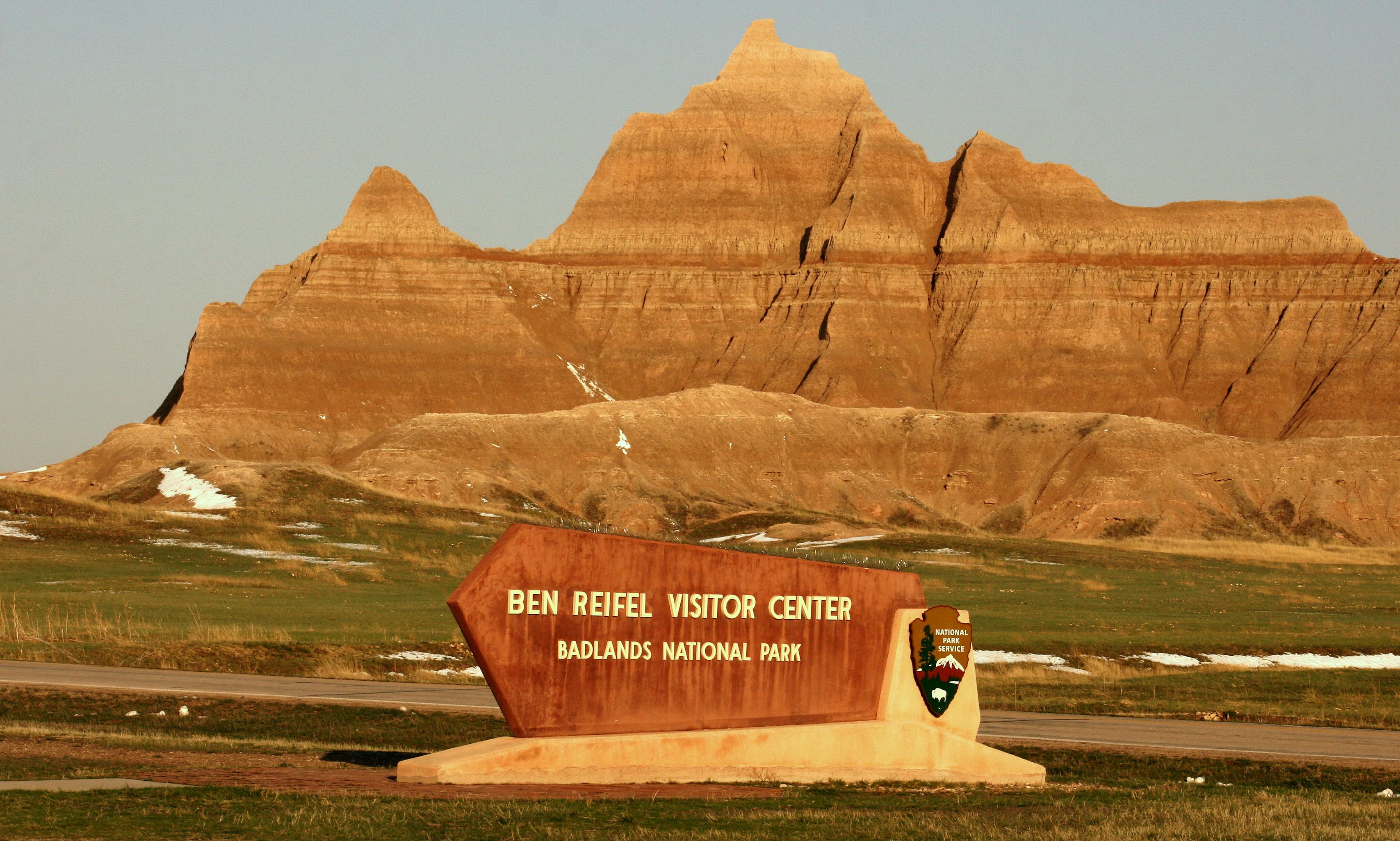
Visit the Ben Reifel Visitor Center
There's something for everyone at the Ben Reifel Visitor Center in the North Unit of Badlands National Park. Swing by the information desk, watch the park film, check out a working fossil preparation lab, enjoy museum exhibits, or stop by the park bookstore.
Visit the White River Visitor Center
The White River Visitor Center is the main facility in the South Unit of the park. Be sure to stop by to pick up maps, enjoy museum exhibits, and chat with rangers about the significance of the Badlands and treaties in Lakota heritage.
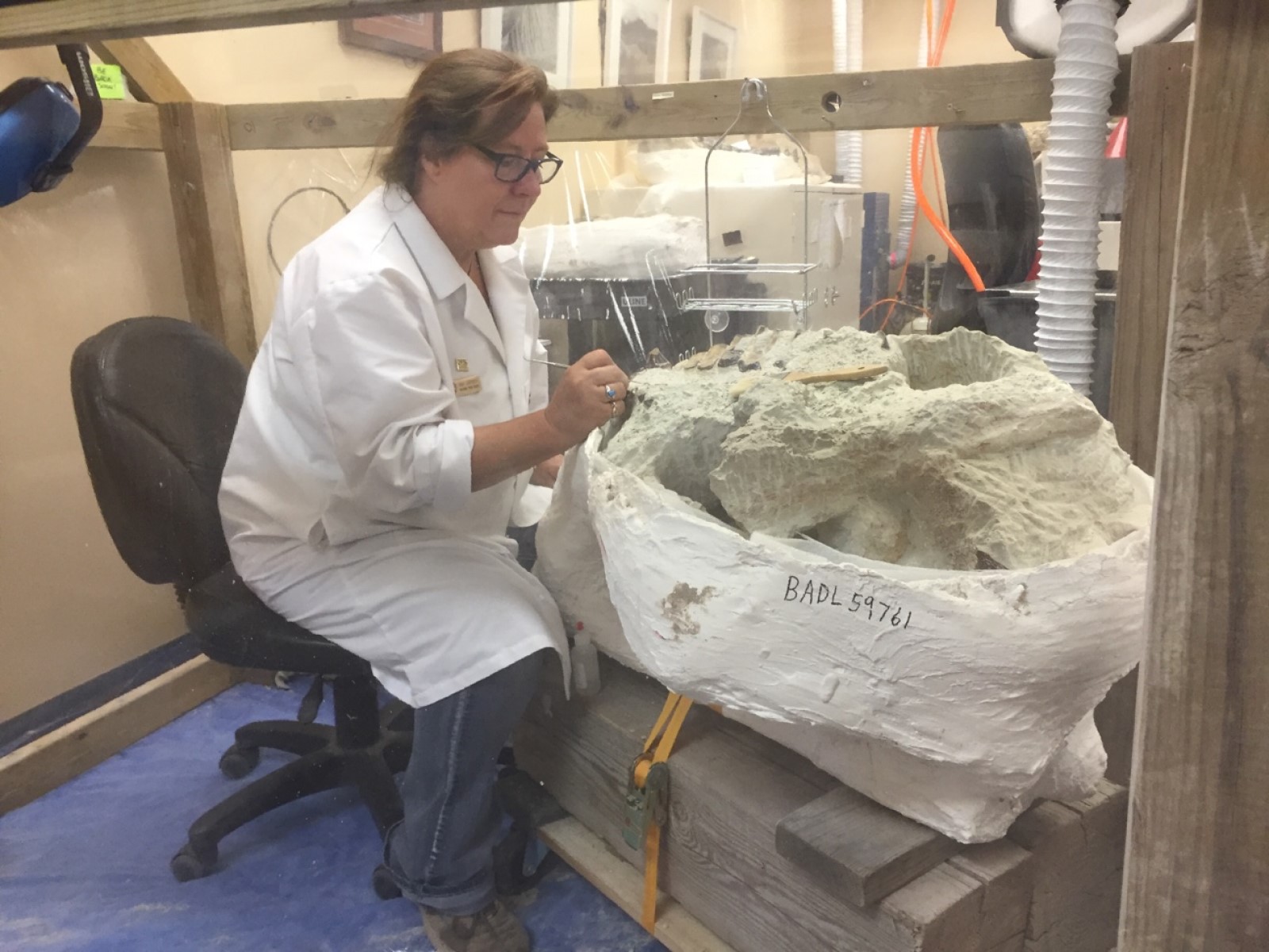
Visit the Fossil Preparation Lab
Visit the Fossil Preparation Lab in Badlands National Park, where visitors have the opportunity to engage with paleontologists and other park staff working on Badlands fossils!
Enjoy the Night Sky
Night Sky Viewings are a great way to see the dark skies of the Badlands. Park rangers and astronomy volunteers are available to point out objects in the night sky and help you look through telescopes.
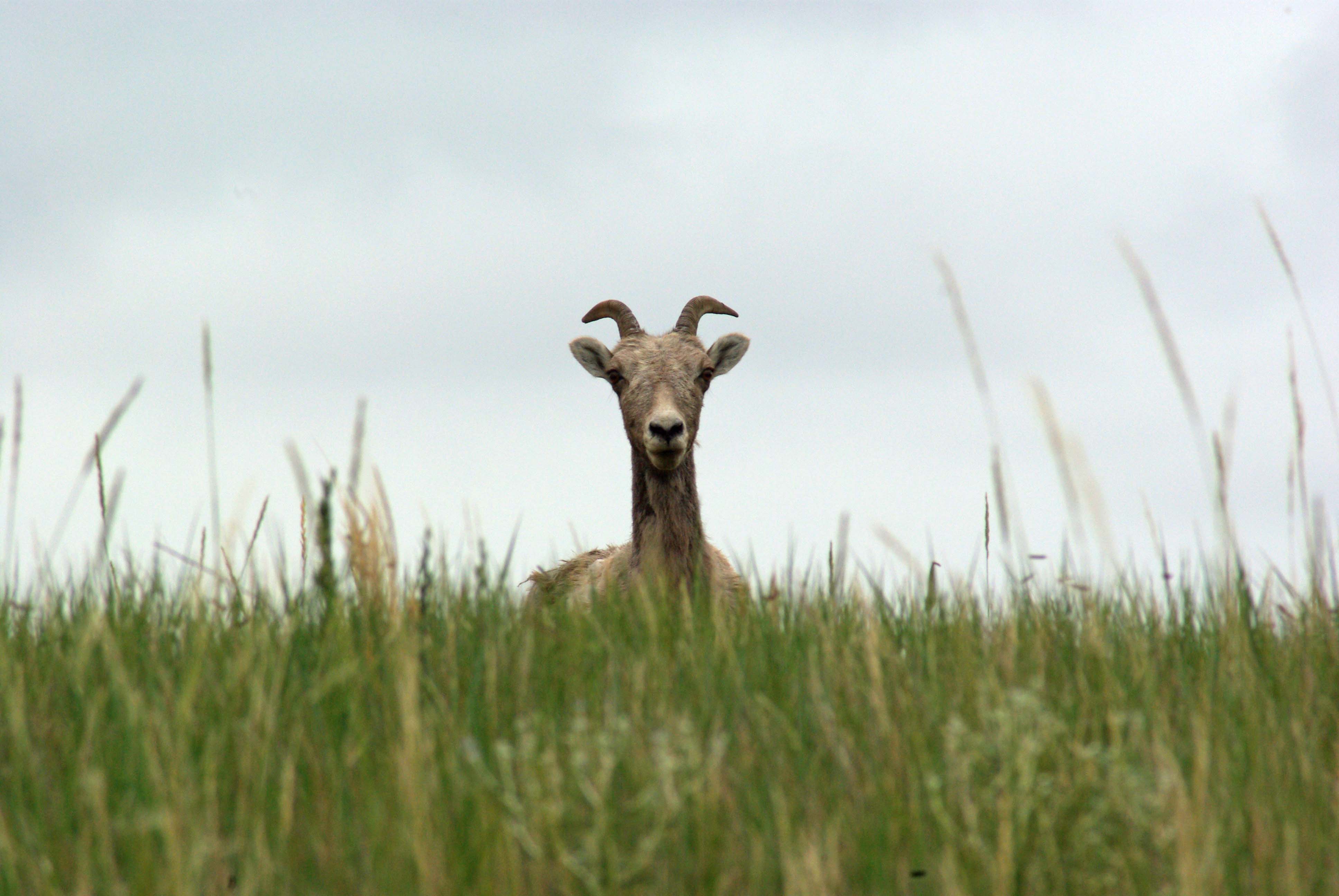
Spotting Wildlife in the Badlands
Many animals call Badlands National Park home. Learn more about these critters and where you can find them on this page.
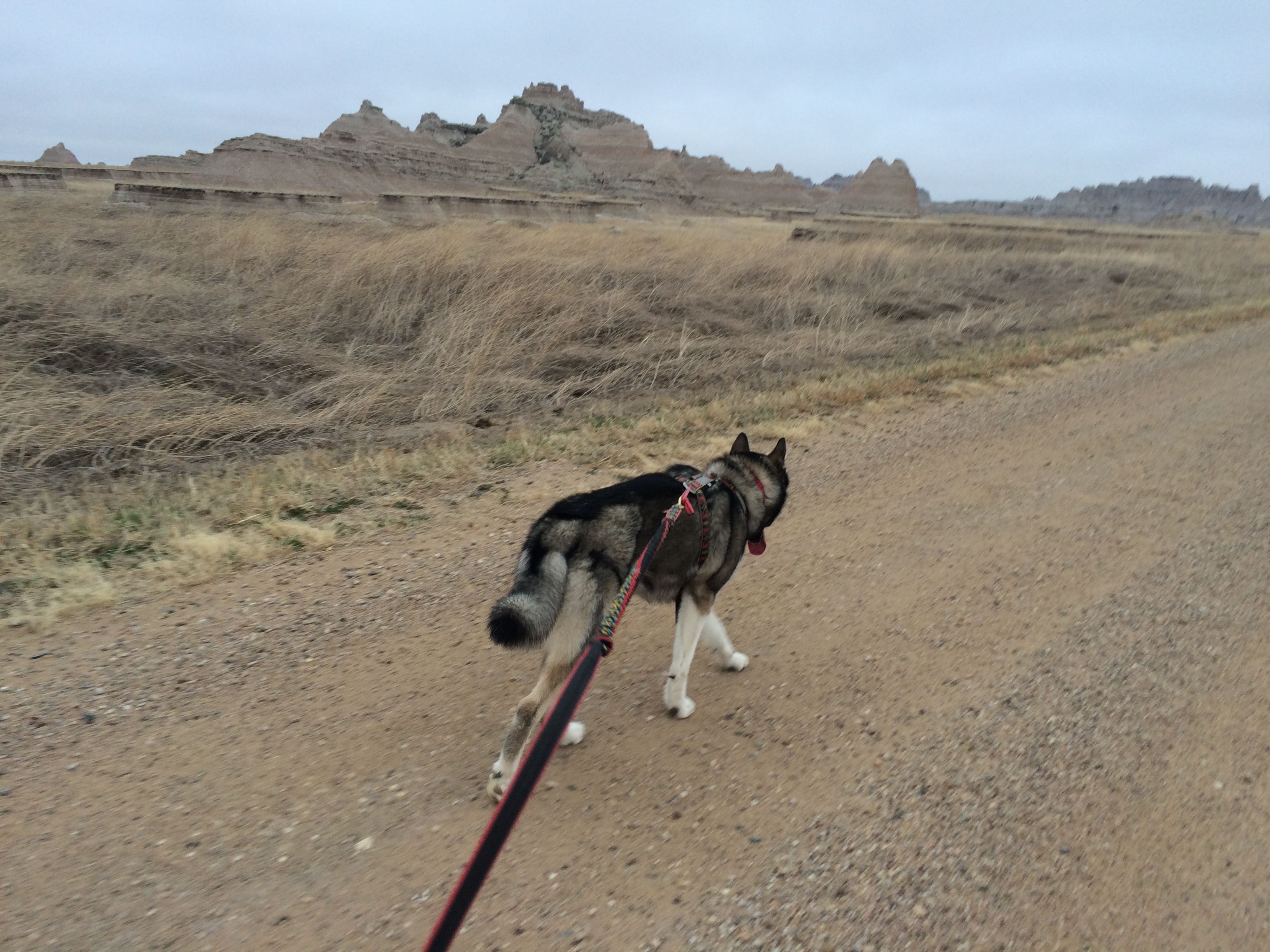
Hiking Badlands Back Roads With Your Dog
Back country roads are a great place to escape the everyday with your pet.
Drive Around the South Unit of the Badlands
Enjoy stunning views of Badlands National Park's South Unit by driving around its perimeter.
Horseback Riding in the Badlands
Enjoy views of the Badlands from the saddle! Although no commercial horse rental or day rides are available in the park, Badlands invites horse owners to explore the Badlands Wilderness Area, consisting of 64,000 acres of eroded spires and mixed-grass prairie, or other designated areas of the park via horseback.
Hiking the Badlands
Interested in hiking at Badlands National Park? Read about rules, official trails, and the park's open hike policy here.
Explore Sheep Mountain Table
Sheep Mountain Table is a great place to enjoy stunning views of the Badlands landscape. Whether you’re a hiker looking for a beautiful trail, a photographer scoping out a sunset spot, or simply a visitor seeking to explore the South Unit, Sheep Mountain Table offers incredible vist
Drive Sage Creek Rim Road
Enjoy views of badlands formations and glimpses of wildlife from Sage Creek Rim Road, one of the dirt roads located in the North Unit of Badlands National Park.
Drive Badlands Loop Road (Highway 240)
Enjoy the sights of Badlands National Park by driving its most popular road -- Badlands Loop Road, also known as Highway 240. Catch beautiful landscapes, informational exhibits, and glimpses of wildlife on this incredible drive.
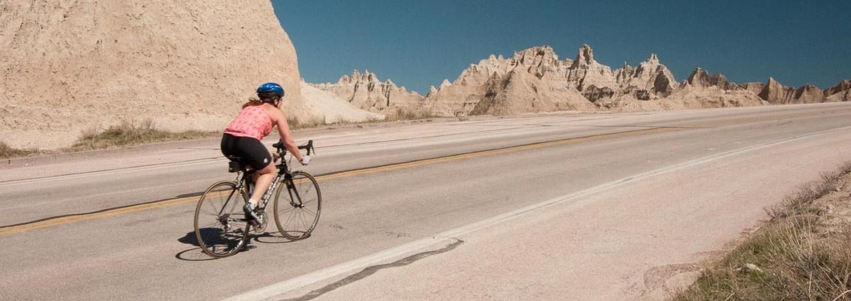
Bicycling in the Badlands
Enjoy beautiful views of the Badlands without a windshield! Biking in the park offers a chance to experience scenery firsthand -- from the back of a bike, it almost feels like you can reach out and touch the rugged buttes and twisted spires. Read here to learn more about rules, safety, and suggested routes.
Badlands BADLibs
Have you ever played a game of Madlibs? Now you can try out a Badlands version! Pick out your favorite words, then fill them in to create your own wacky Badlands story. After that, share your BADLibs with us on social media -- and don't forget to have fun!
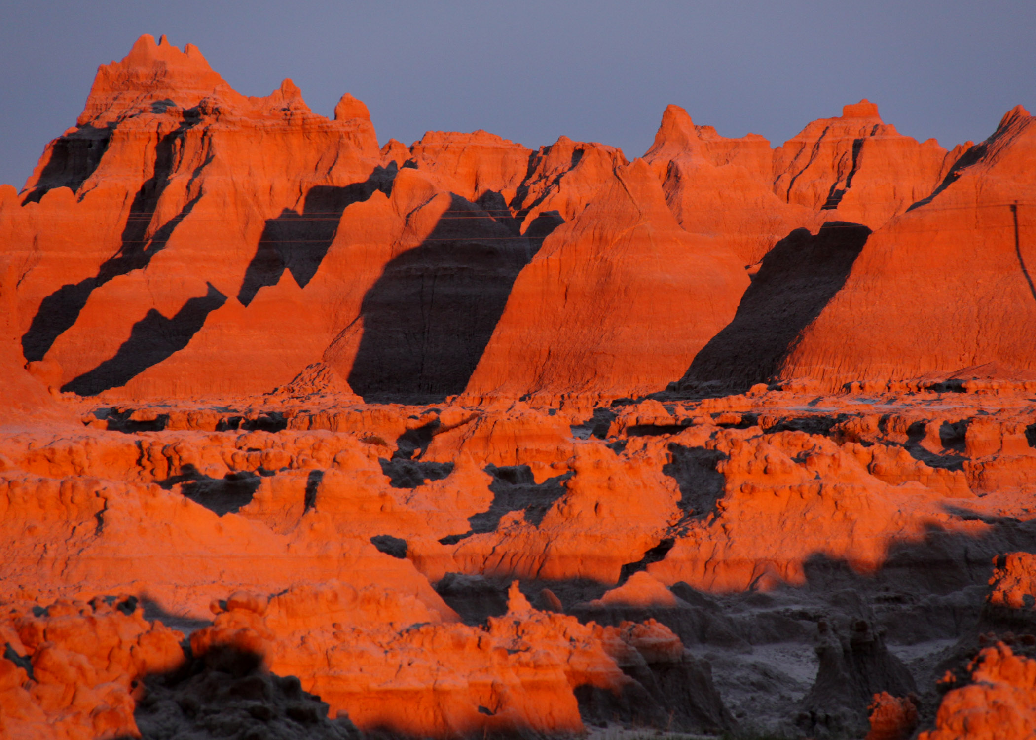
Badlands Sunrises & Sunsets
Enjoy incredible views of the Badlands by waking up early or staying out late. Sunrises and sunsets are photographer favorites for a good reason -- check out this page to learn all the best spots!
Tours
Count: 2
Driving tour and a short hike
Are you only passing through the Badlands? This tour takes you off the freeway and through the main highway of the park. You'll begin by stopping by one of our stunning overlooks and then taking a short 1.5 mile hike along Notch Trail. From there, you'll head to the visitor center and then drive the famous loop road with several overlooks marked along the way.
Fossil Exhibit Trail
The Fossil Exhibit Trail is a self-guided, fully accessible boardwalk featuring fossil replicas and exhibits of extinct creatures that once lived in the area. The exhibits are tactile, so please feel free to touch. Braille is incorporated into the exhibits.