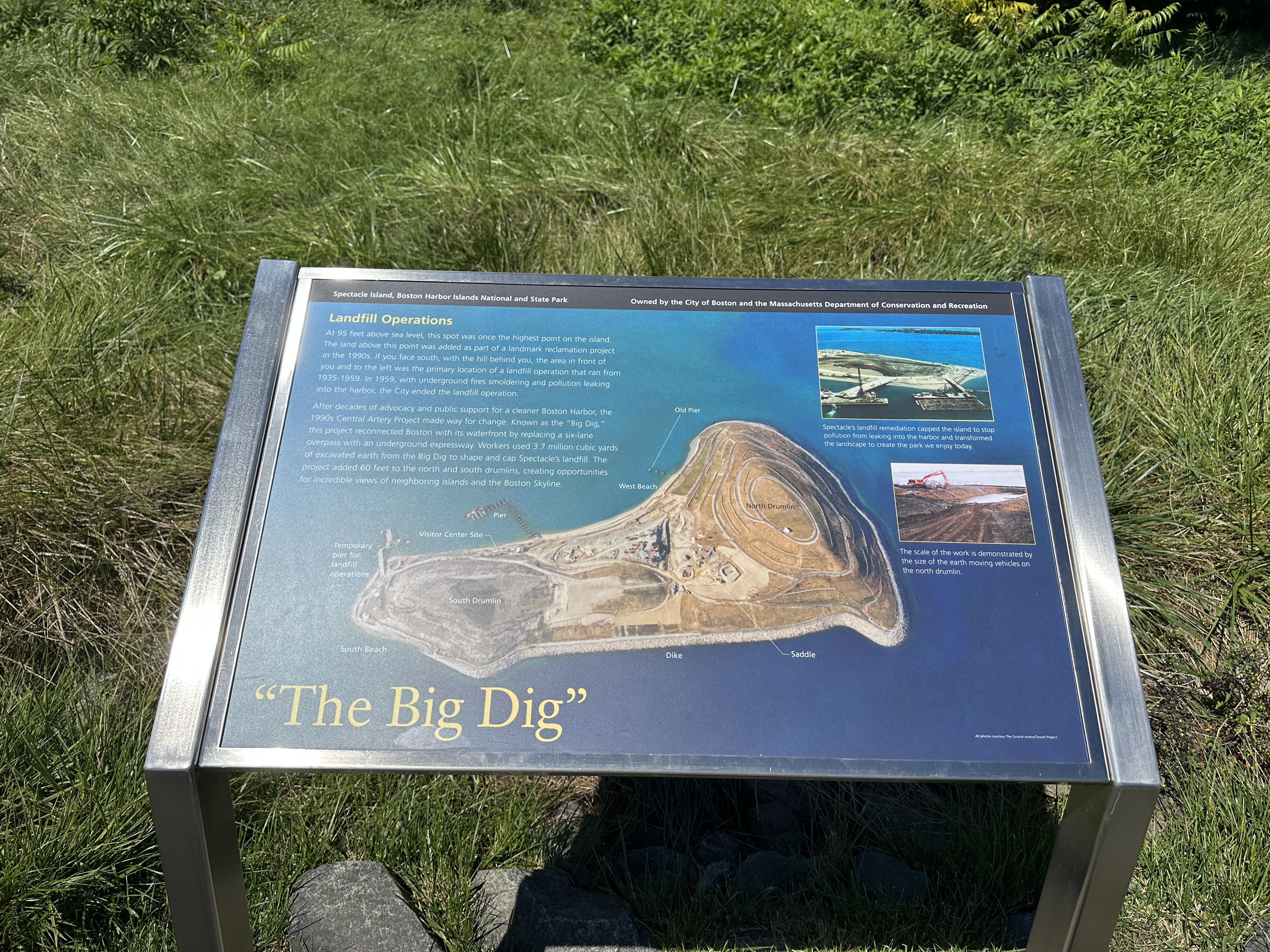
Low-profile wayside that is 40.5 x 24 3/8 inches, with interpretation panel spanning 36.5 inches wide. It has a grey square base with two rectangular pillars supporting the panel. The panel is framed in grey metal. The sign is located on the perimeter accessible trail by the South Drumlin.
Low-profile wayside that is 36 x 24 inches, with interpretation panel spanning 36.5 inches wide. It has a grey square base with two rectangular pillars supporting the panel. The panel is framed in grey metal. The sign is located on the interpretive trail on the North Drumlin.
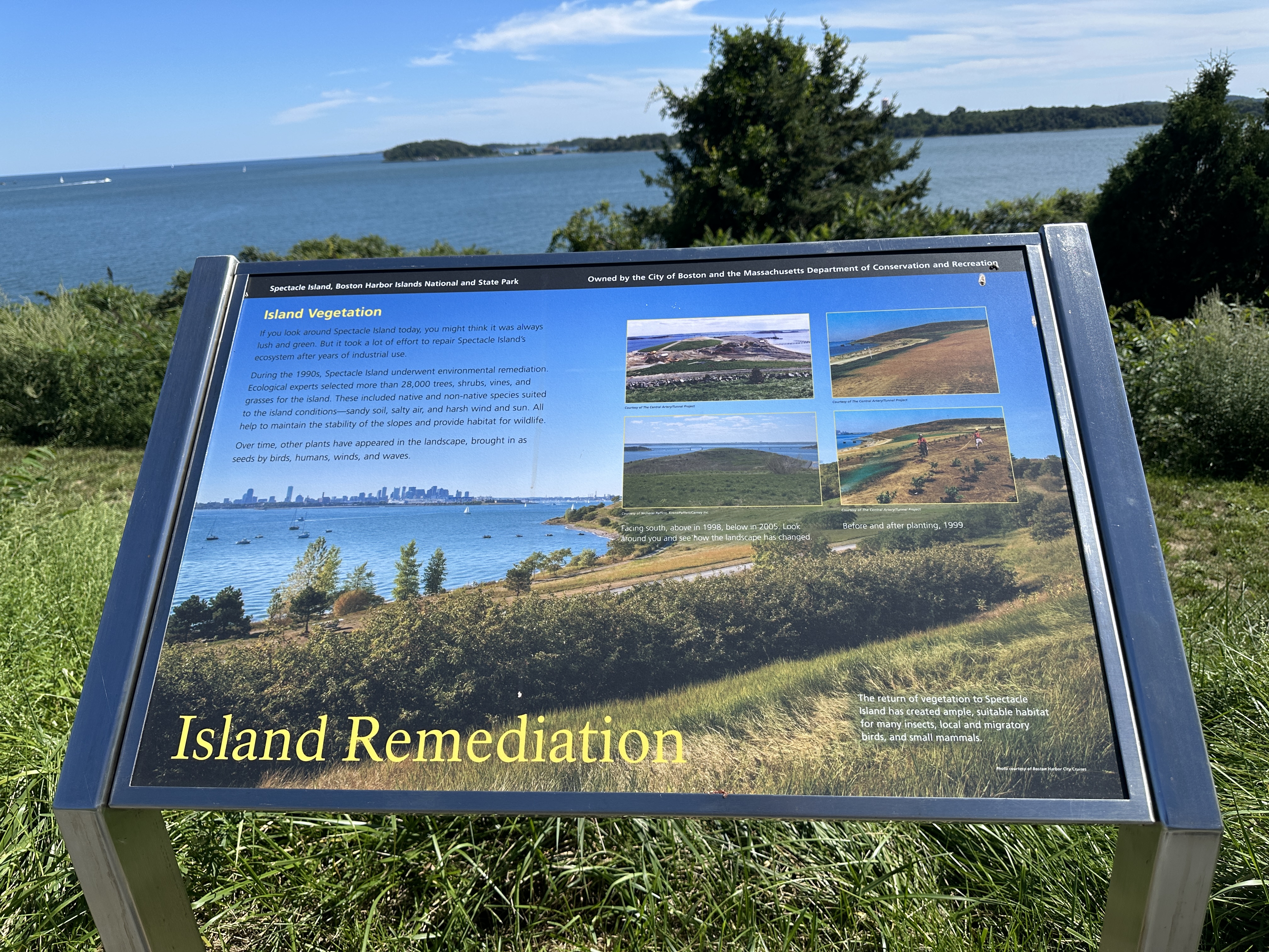
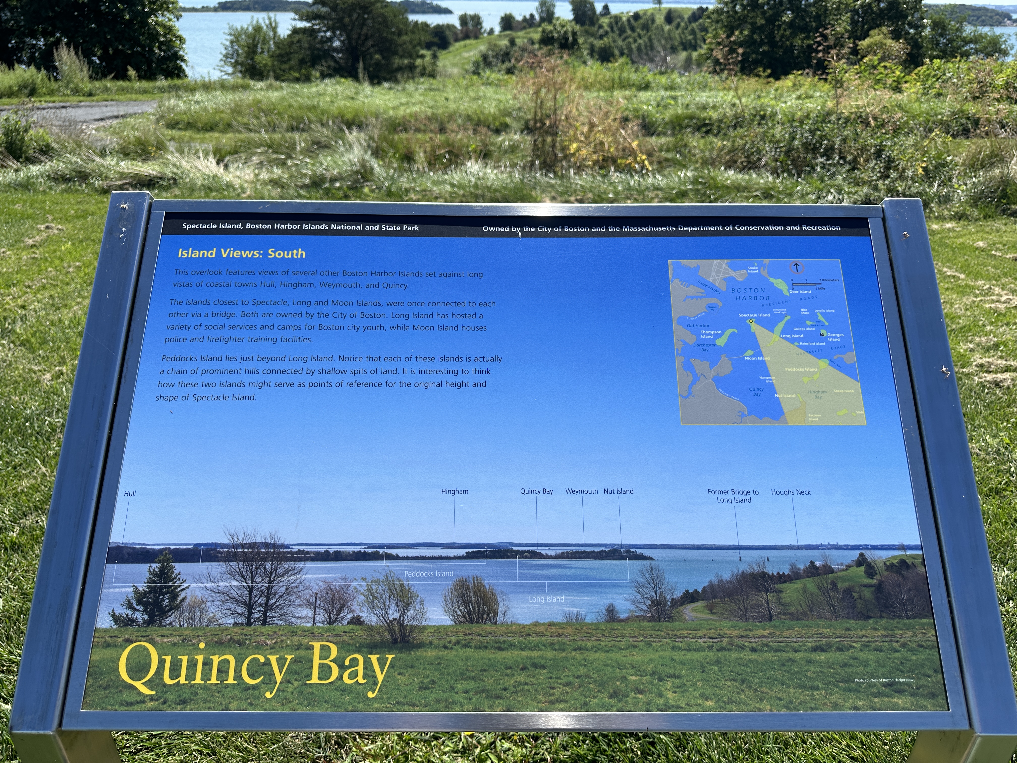
Low-profile wayside that is 40.5 x 24 3/8 inches, with interpretation panel spanning 36.5 inches wide. It has a grey square base with two rectangular pillars supporting the panel. The panel is framed in grey metal. The sign is located on the interpretive trail on the North Drumlin.
Low-profile wayside that is 36 x 24 inches, with interpretation panel spanning 36.5 inches wide. It has a grey square base with two rectangular pillars supporting the panel. The panel is framed in grey metal. The sign is located on the interpretive trail on the North Drumlin.
Low-profile wayside that is 40.5 x 24 3/8 inches, with interpretation panel spanning 36.5 inches wide. It has a grey square base with two rectangular pillars supporting the panel. The panel is framed in grey metal. The sign is located on the Interpretive trail on the South Drumlin.
Low-profile wayside that is 40.5 x 24 3/8 inches, with interpretation panel spanning 36.5 inches wide. It has a grey square base with two rectangular pillars supporting the panel. The panel is framed in grey metal. The sign is located on the interpretive trail on the North Drumlin.
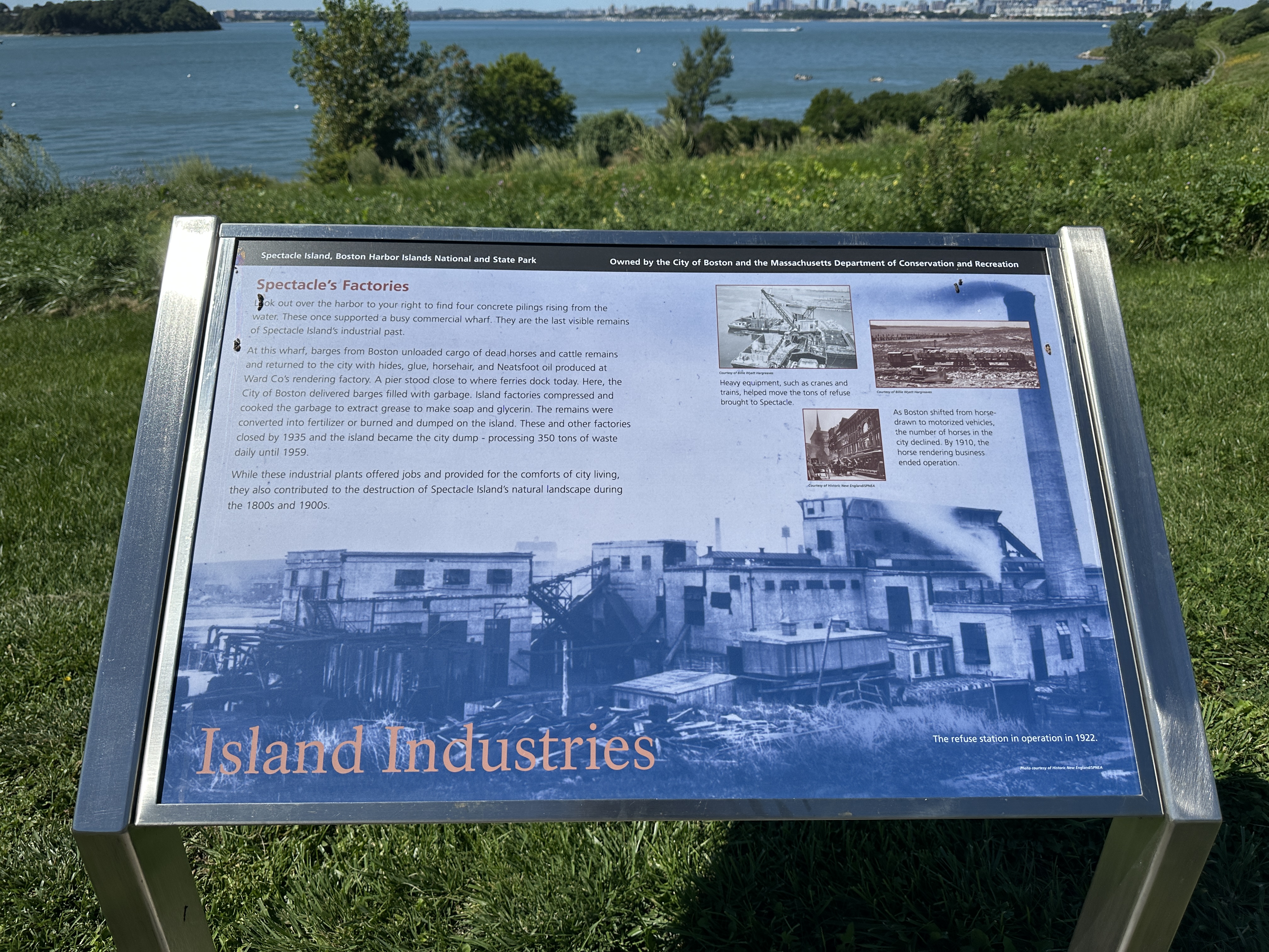
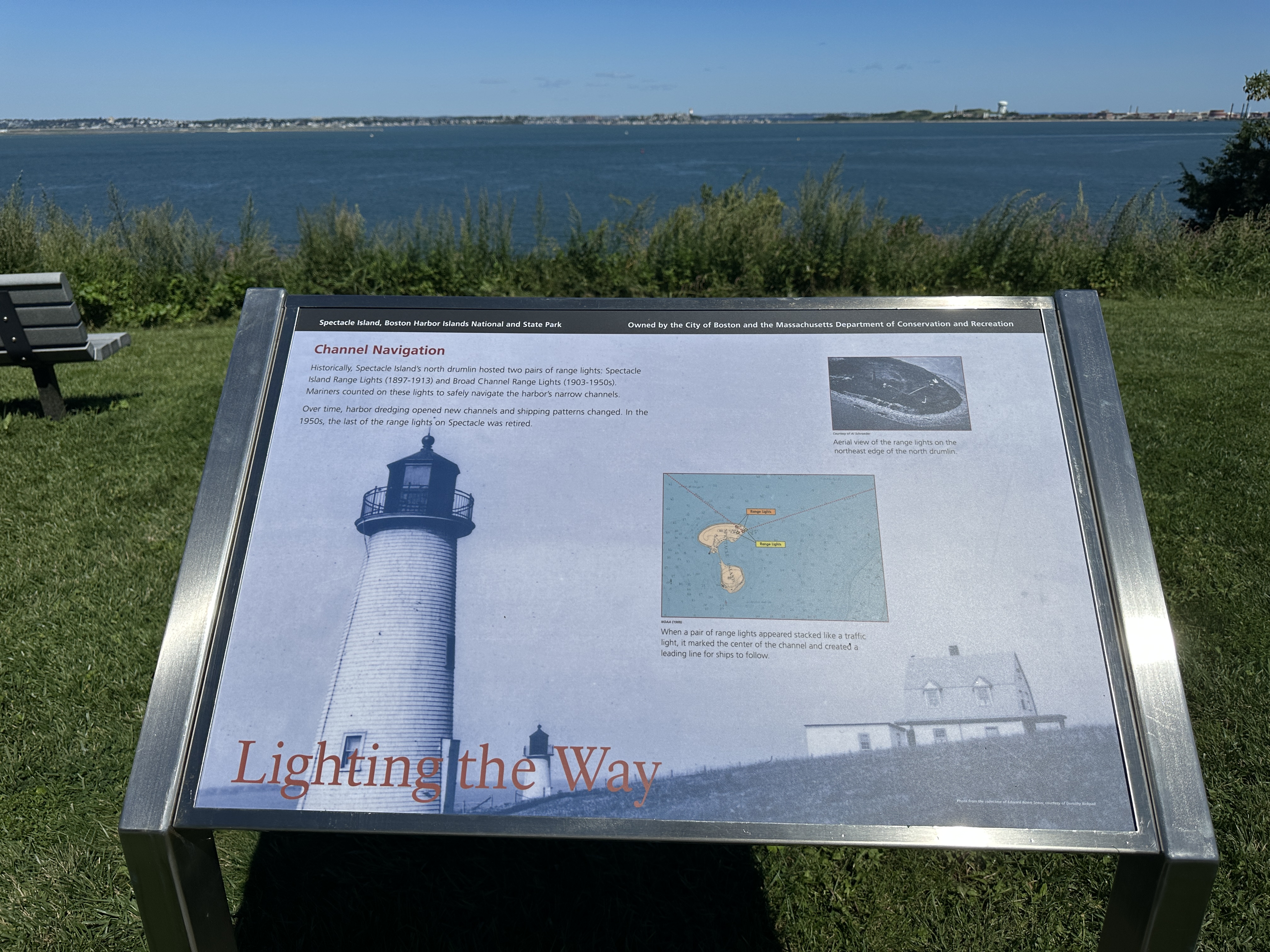
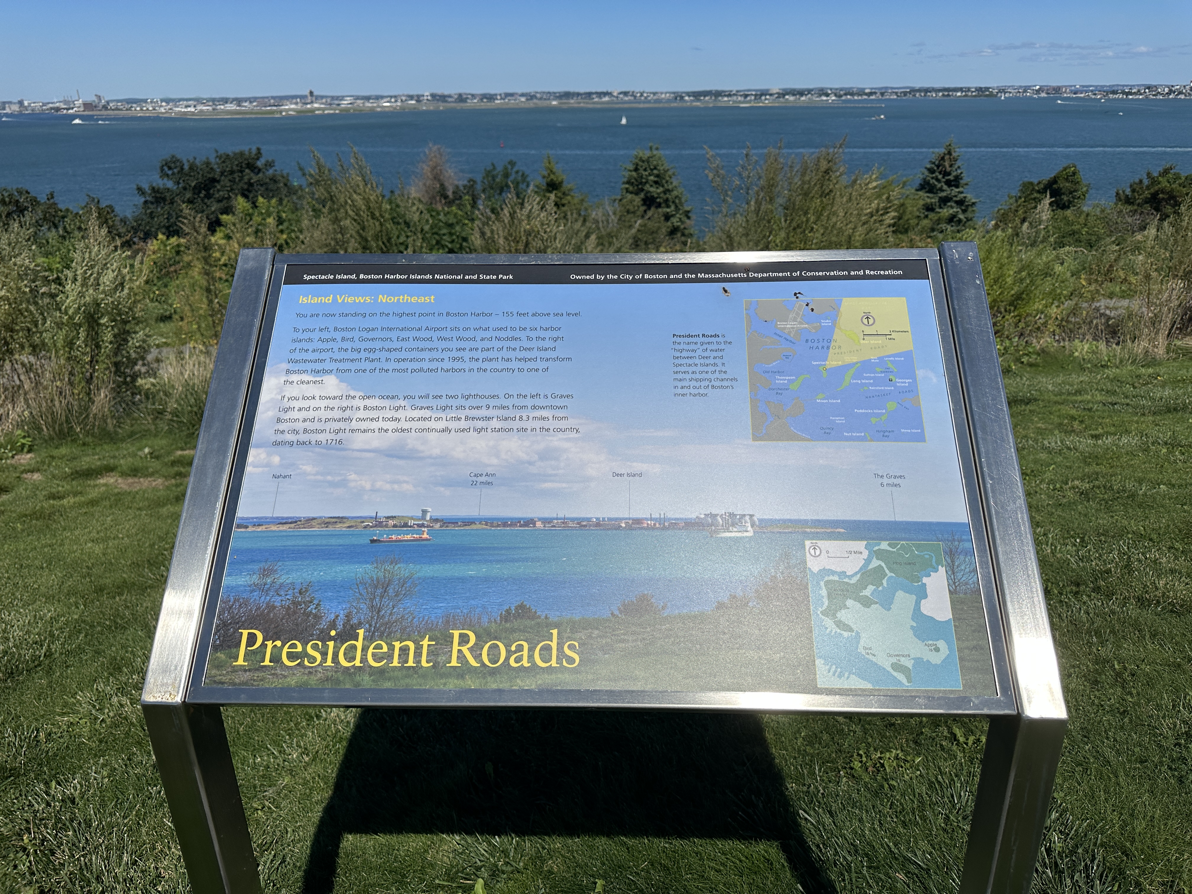
Low-profile wayside that is 40.5 x 24 3/8 inches, with interpretation panel spanning 36.5 inches wide. It has a grey square base with two rectangular pillars supporting the panel. The panel is framed in grey metal. The sign is located on the interpretive trail on the North Drumlin.
Low-profile wayside that is 40.5 x 24 3/8 inches, with interpretation panel spanning 36.5 inches wide. It has a grey square base with two rectangular pillars supporting the panel. The panel is framed in grey metal. The sign is located on the perimeter accessible trail on the South Drumlin.
Low-profile wayside that is 36 x 24 inches, with interpretation panel spanning 36.5 inches wide. It has a grey square base with two rectangular pillars supporting the panel. The panel is framed in grey metal. The sign is located on the interpretive trail on the North Drumlin.
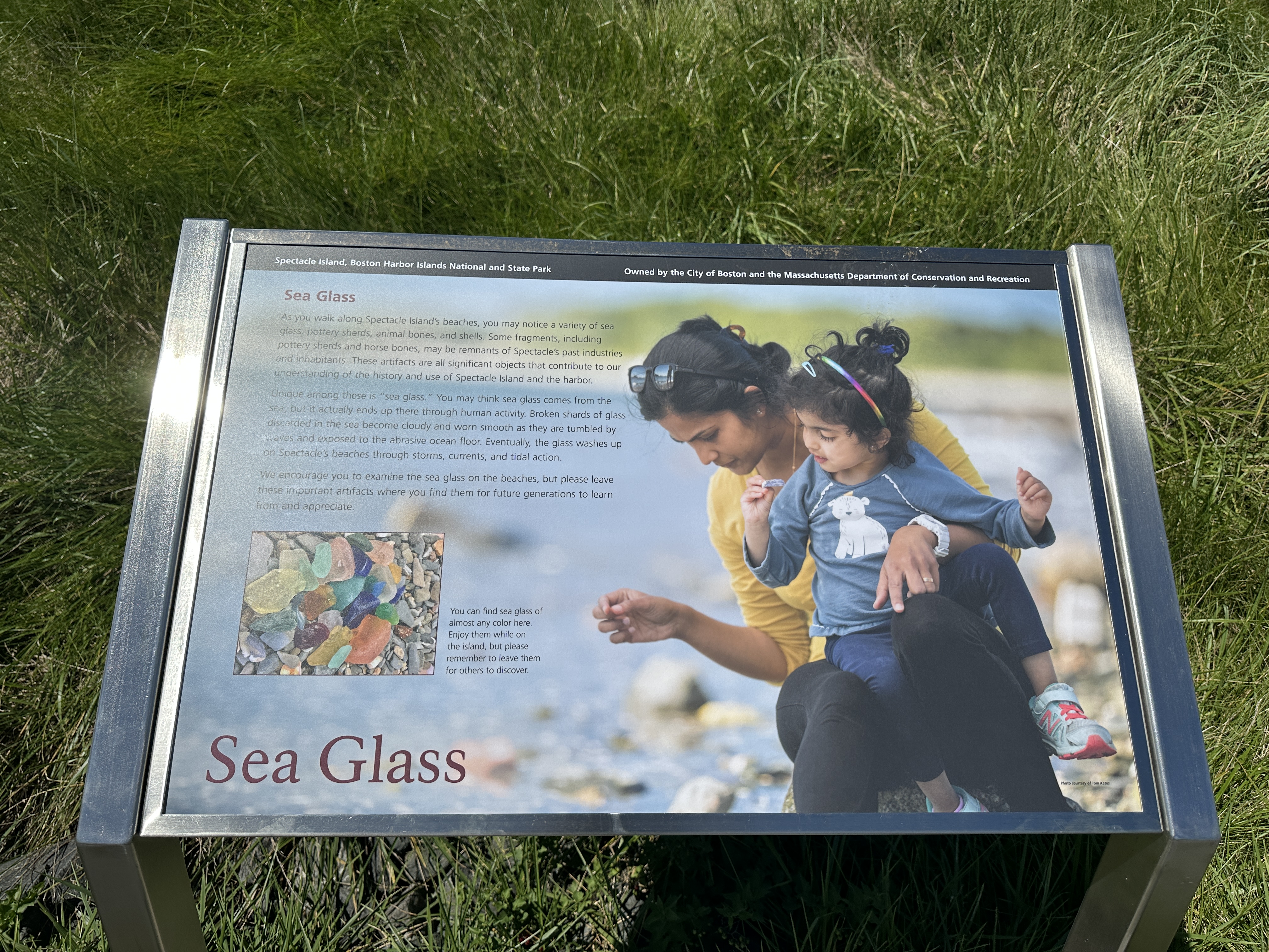
Low-profile wayside that is 36 x 24 inches, with interpretation panel spanning 36.5 inches wide. It has a grey square base with two rectangular pillars supporting the panel. The panel is framed in grey metal. The sign is located on the interpretive trail on the North Drumlin.
Low-profile wayside that is 36 x 24 inches, with interpretation panel spanning 36.5 inches wide. It has a grey square base with two rectangular pillars supporting the panel. The panel is framed in grey metal. The sign is located on the perimeter accessible trail on the South Drumlin.
Low-profile wayside that is 40.5 x 24 3/8 inches, with interpretation panel spanning 36.5 inches wide. It has a grey square base with two rectangular pillars supporting the panel. The panel is framed in grey metal. The sign is located on the interpretive trail on the North Drumlin.
Formerly a 10-acre island, Apple Island became absorbed by Boston Logan Airport as part of a runway expansion project in the 1950s, the island has since disappeared.1 Like other islands in the harbor, indigenous people in the area likely accessed the island seasonally for thousands of years. After European colonization, the town of Boston owned the island and used it for pasturage.
The last remaining salt marsh in the city of Boston, is located in East Boston. Known now as Belle Isle Marsh, this area boasts just over 130- acres of marshland, and is home to more than 250 species of birds. The area is designated as an Important Bird Area by the National Audubon Society, and an Area of Critical Environmental Concern by the Bureau of Land Management. While it might not seem like it, Belle Isle used to be an island.
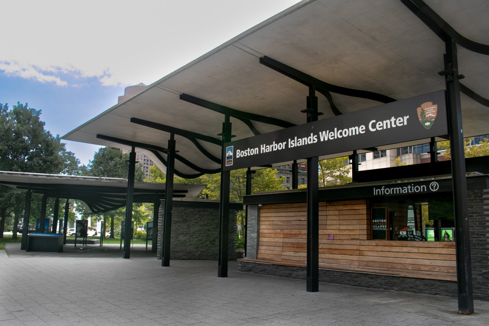
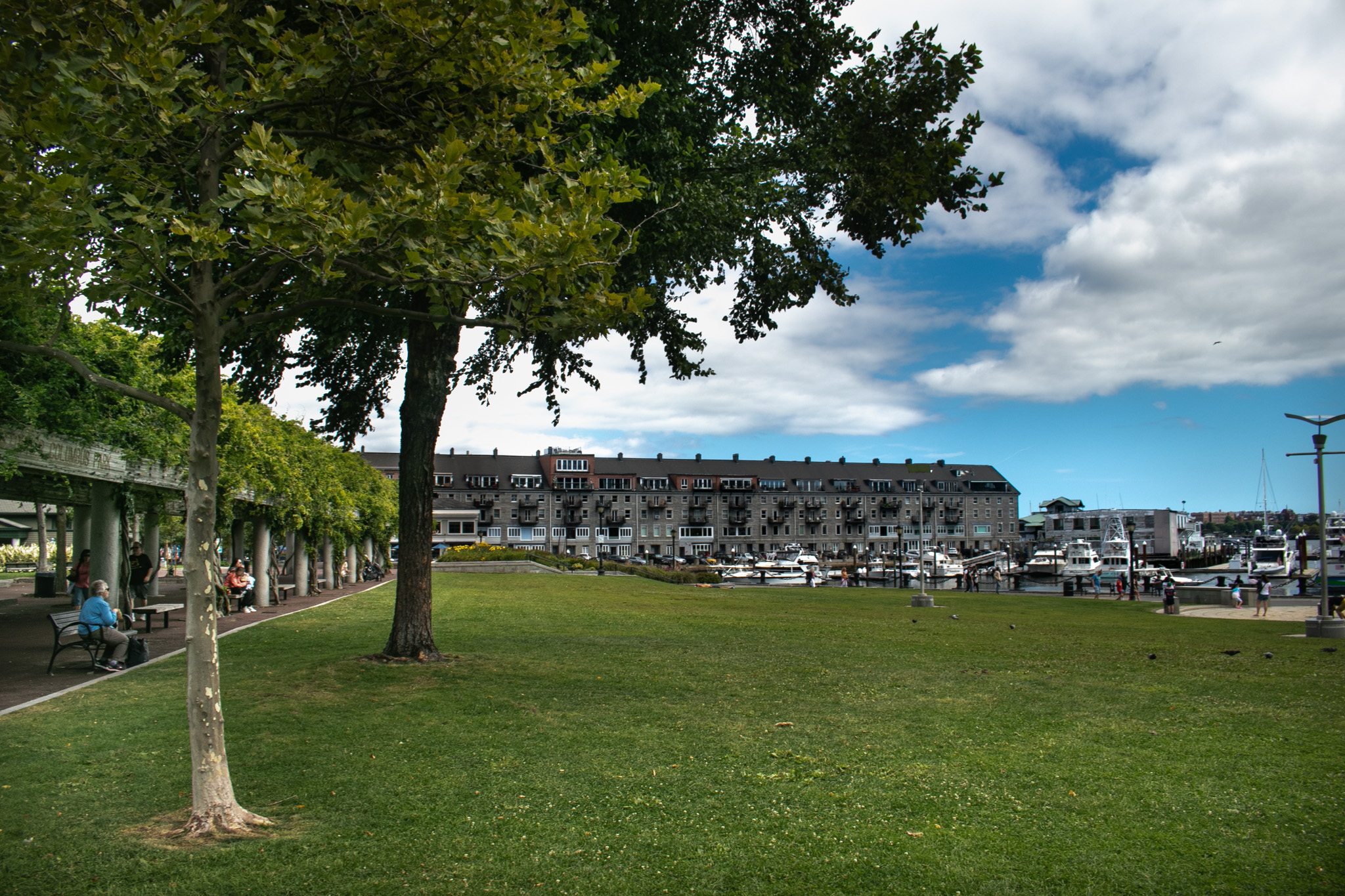
Located on the Rose Kennedy Greenway, the Boston Harbor Islands Welcome Center offers visitor information and serves as a waypoint before beginning any journey to the Boston Harbor Islands. The Welcome Center, opened in 2012, acts as a gateway to the Boston Harbor Islands National and State Park, as ferries to several islands, such as Georges and Spectacle, depart just east at Long Wharf North.
Located in the Hingham Bay, just 10 miles South of Long Wharf, sits a 65-acre island called Bumpkin Island. It has one central drumlin with an elevation of 70 feet, and excellent views of the surrounding Hingham islands.
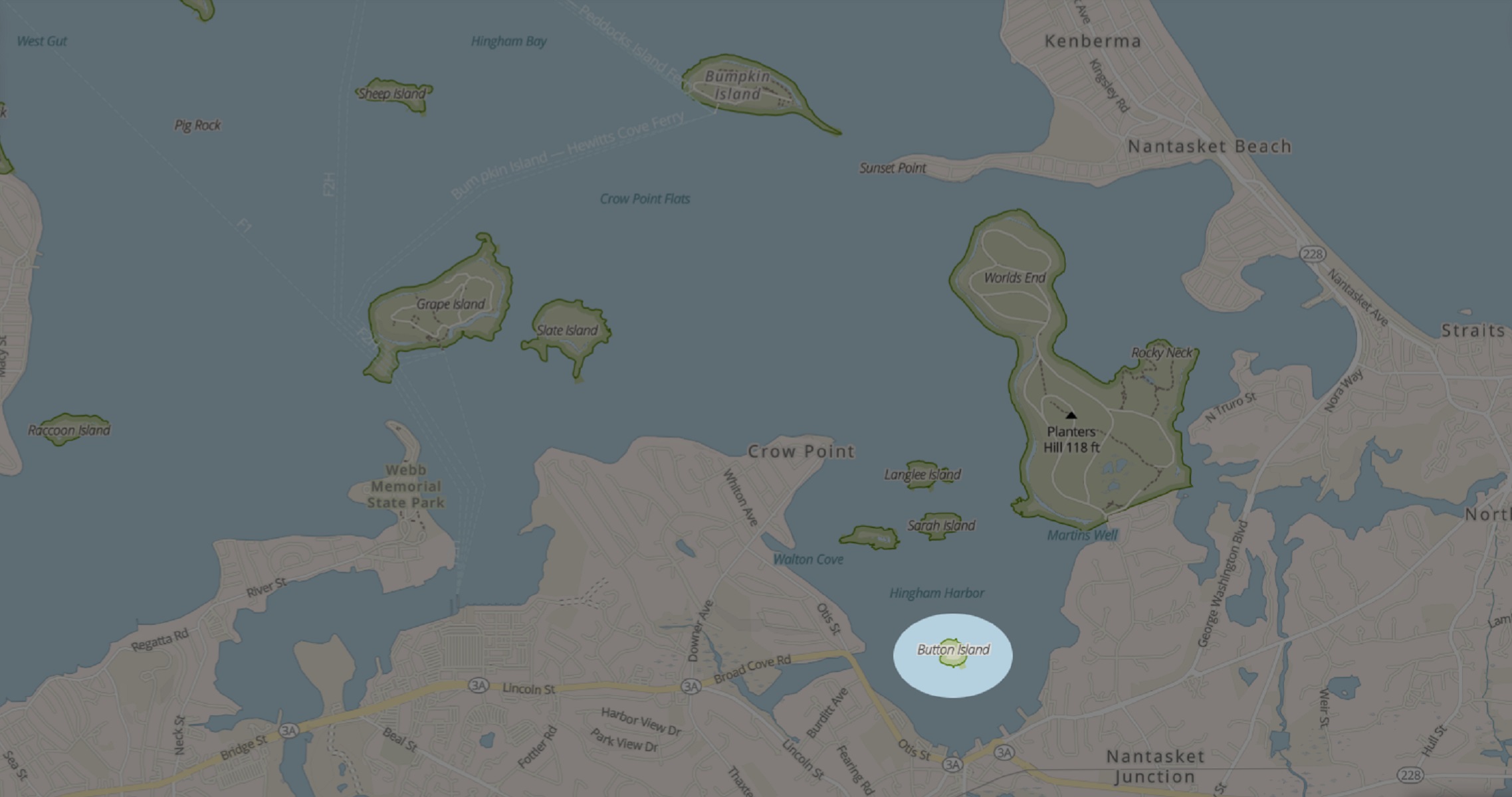
The smallest of the islands in the Hingham Harbor, Button Island is just one acre at high tide. Used seasonally by the indigenous population prior to European contact, the island likely once had trees that colonists cut down and used for firewood.
Calf Island sits nine miles out from Boston in the harbor. Somewhere in the middle of Boston Light and The Graves Light, this 35-acre island is one of the most secluded in the harbor.
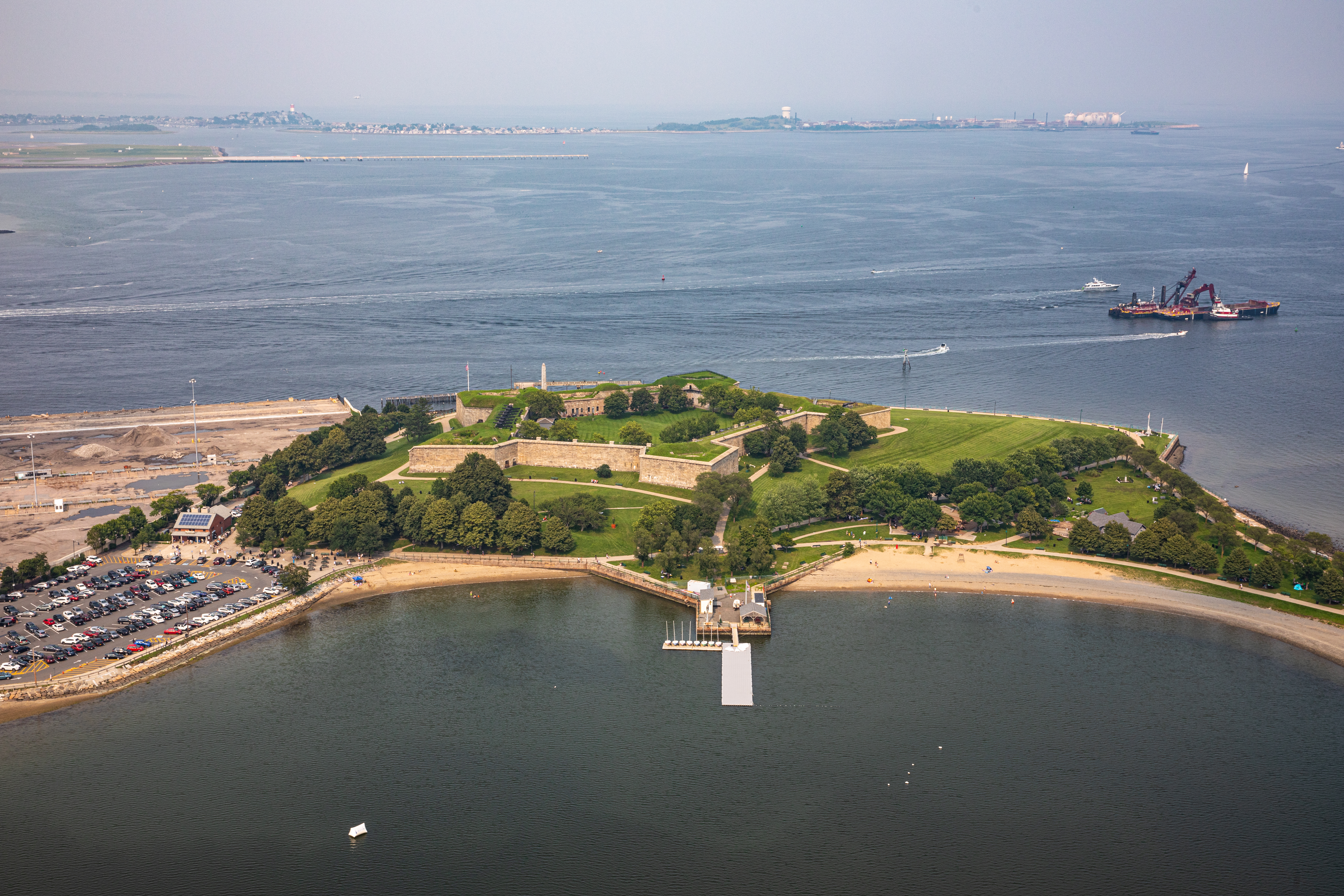
One of five peninsulas in Boston Harbor, Castle Island boasts 22- acres of land, a little more than two miles of walking trails, and the oldest fortified site in what was considered British North America. The former island has been connected to the mainland since 1928.
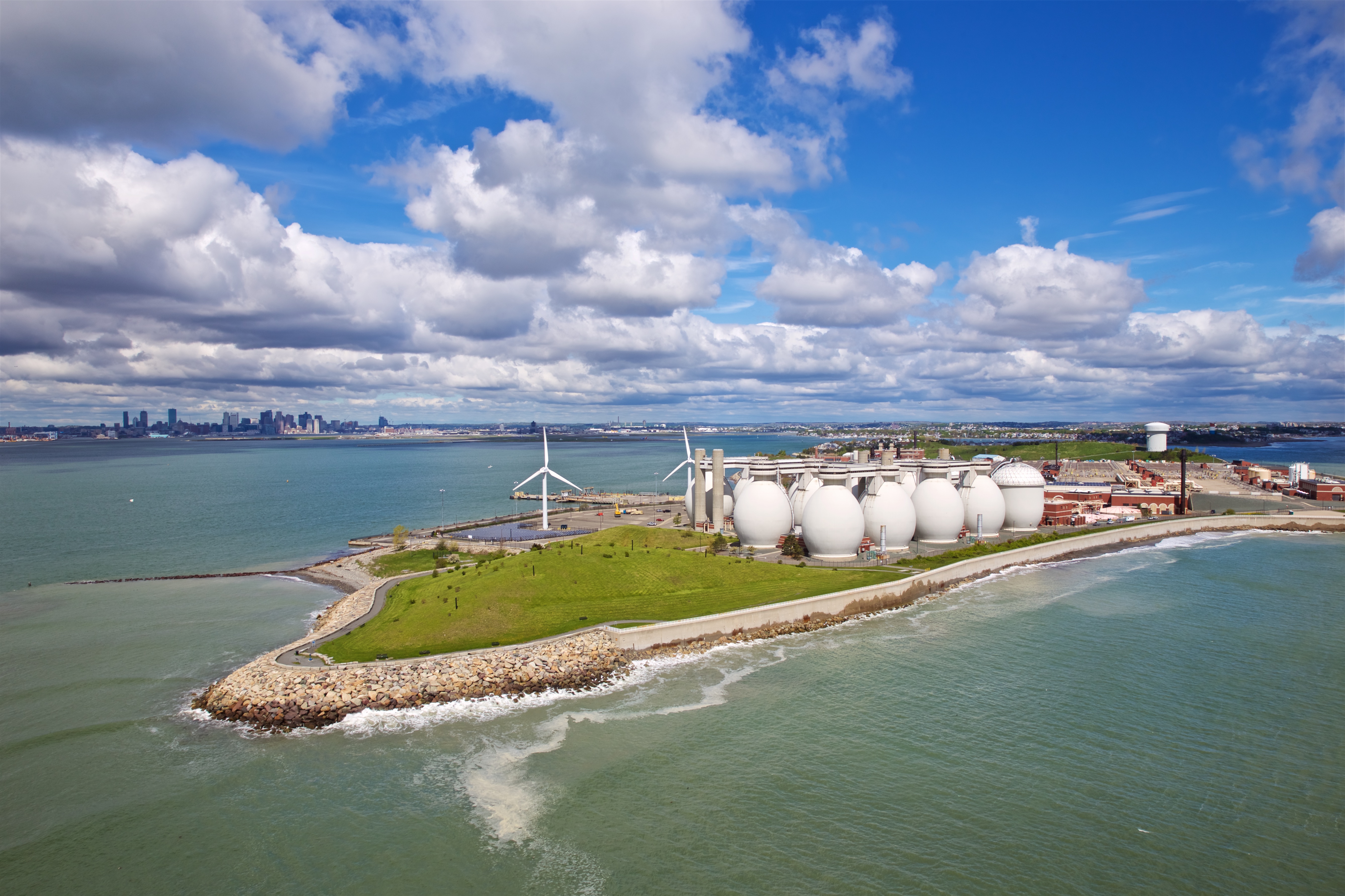
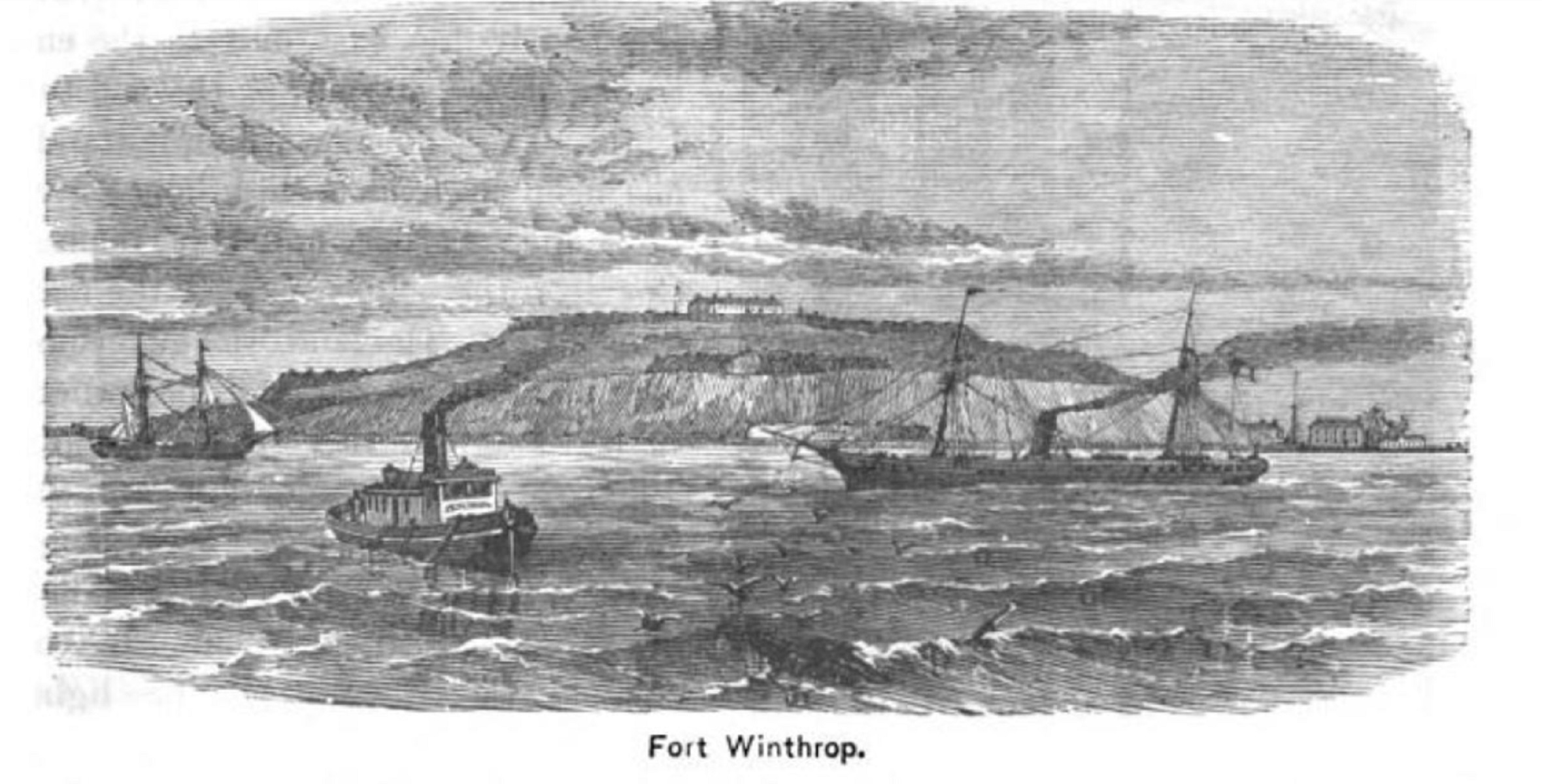
One of five peninsulas within the boundaries of the park, Deer Island once stood apart as an island before a hurricane in 1938. It is now home to The Deer Island Wastewater Treatment Plant.
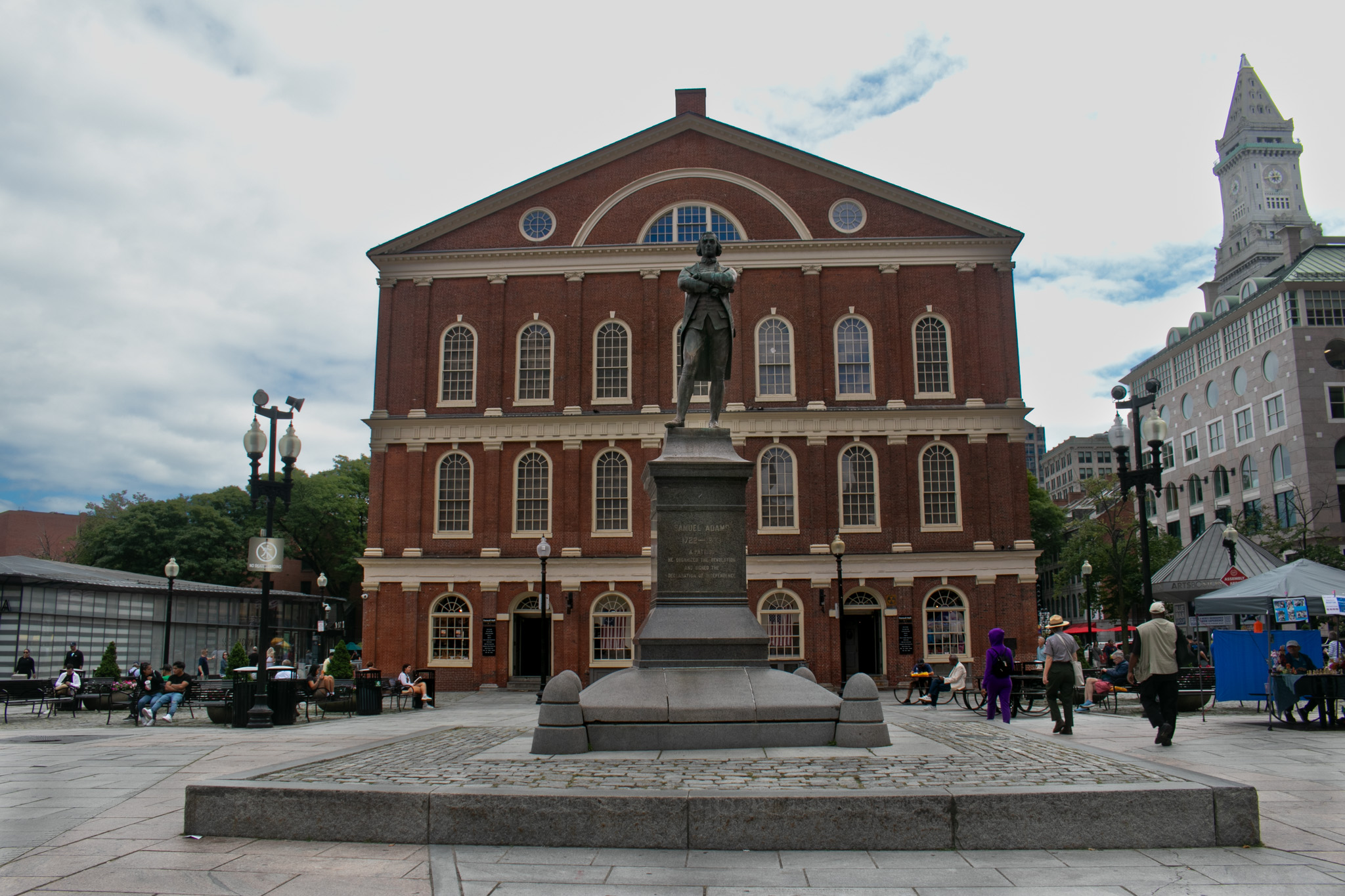
The Massachusett Tribe has lived with and stewarded the Shawmut Peninsula for thousands of years. When European colonists arrived, they claimed and transformed the landscape. Settlers cut down the three hills of downtown Boston, filled in salt marshes and beaches, and built permanent structures along the shore. This place first became known as Bendall’s Cove, then the Town Dock, and later, Dock Square. Today, parts of historic Dock Square make up Sam Adams Park.
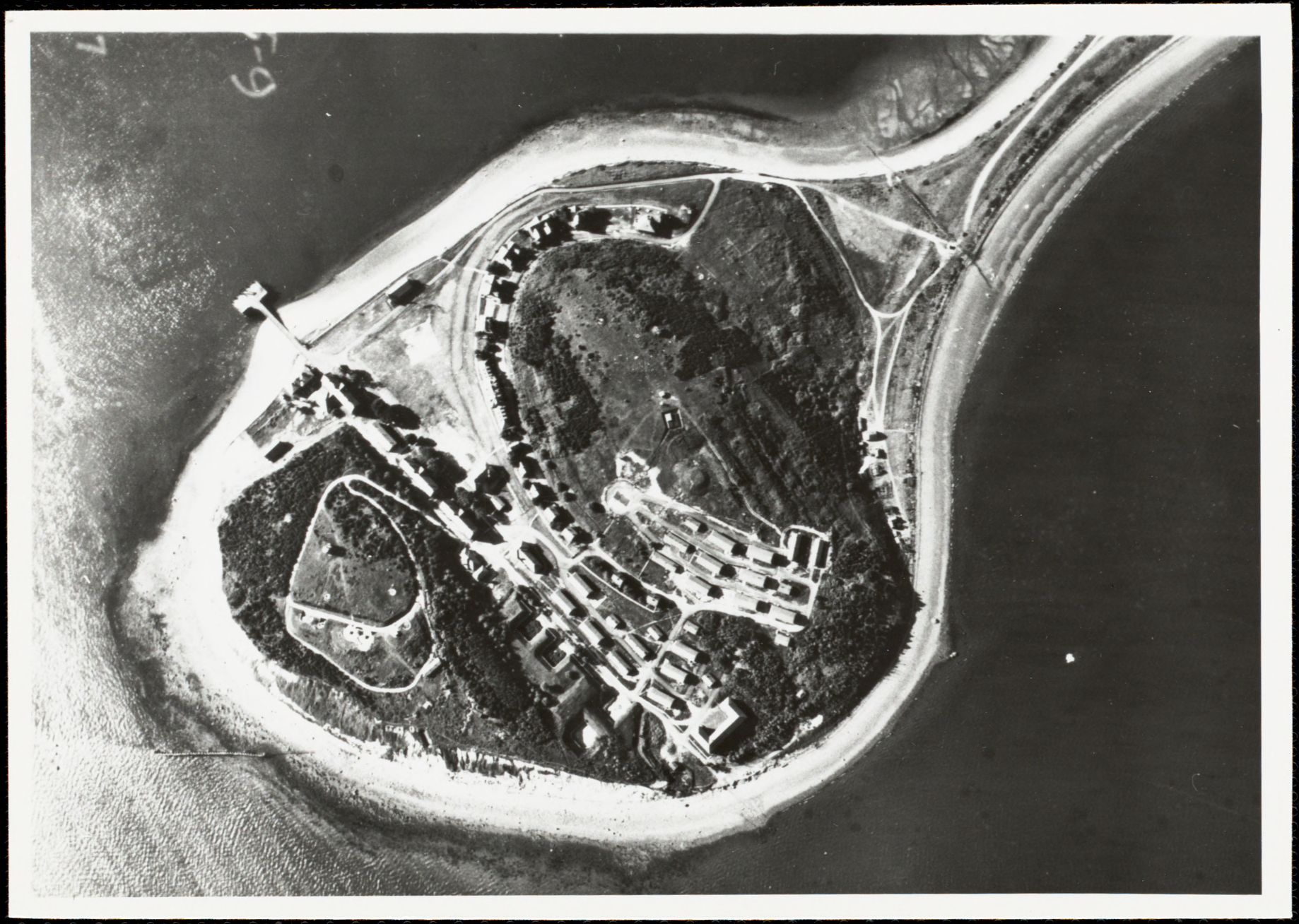
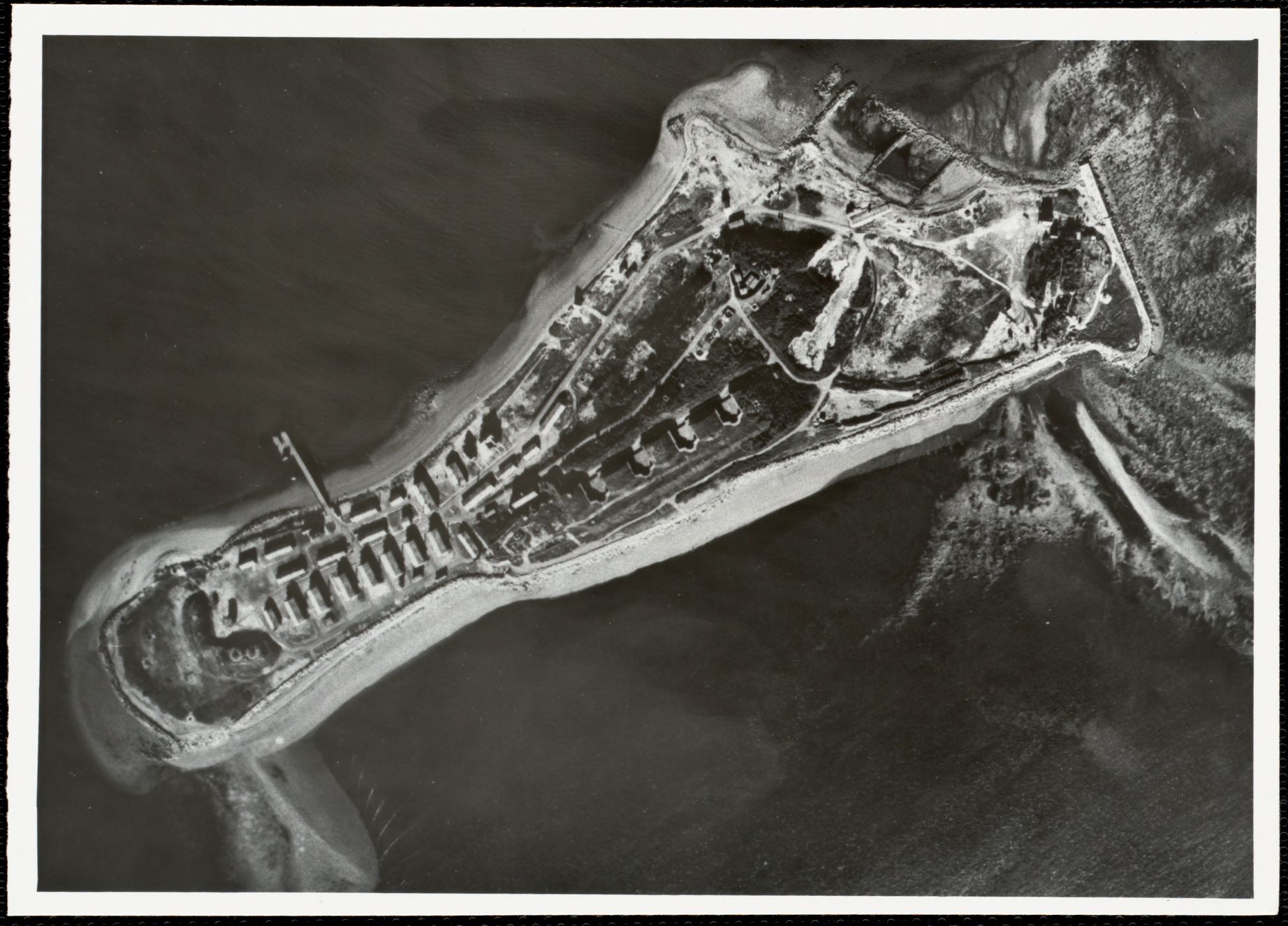
Constructed at the beginning of the 1900s and active throughout both World Wars, Fort Andrews on Peddocks Island served as a key component of Boston Harbor’s defense system.
Fort Dawes, formerly located on Deer Island, served as a crucial part of the defense of Boston Harbor during World War II. It primarily operated as a station for naval observation and monitoring.
Located on Spinnaker Island, Fort Duvall primarily saw action during World War II. Similar to other forts, it contained heavy artillery for defending Boston Harbor.
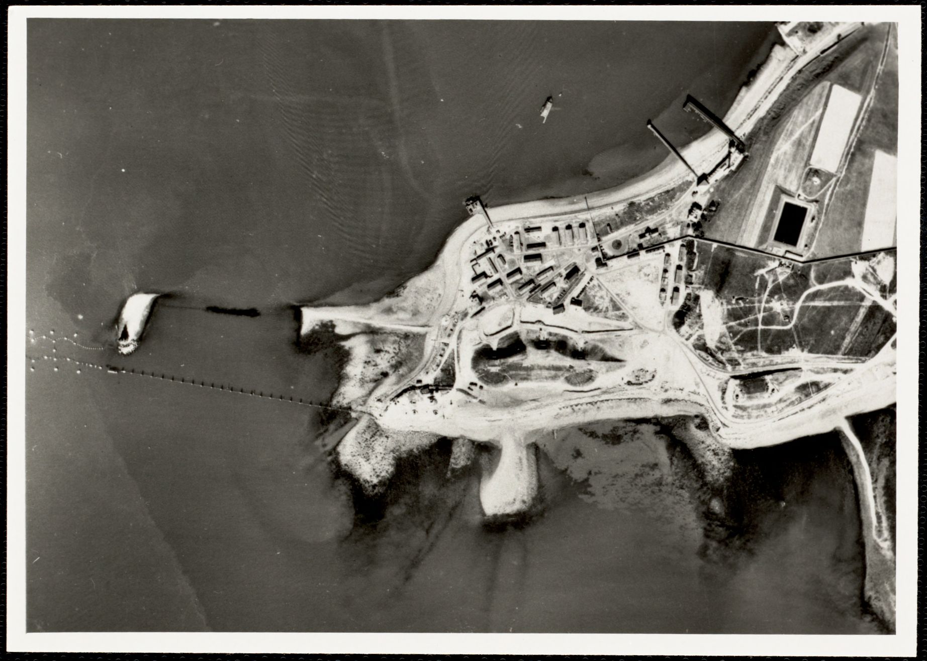
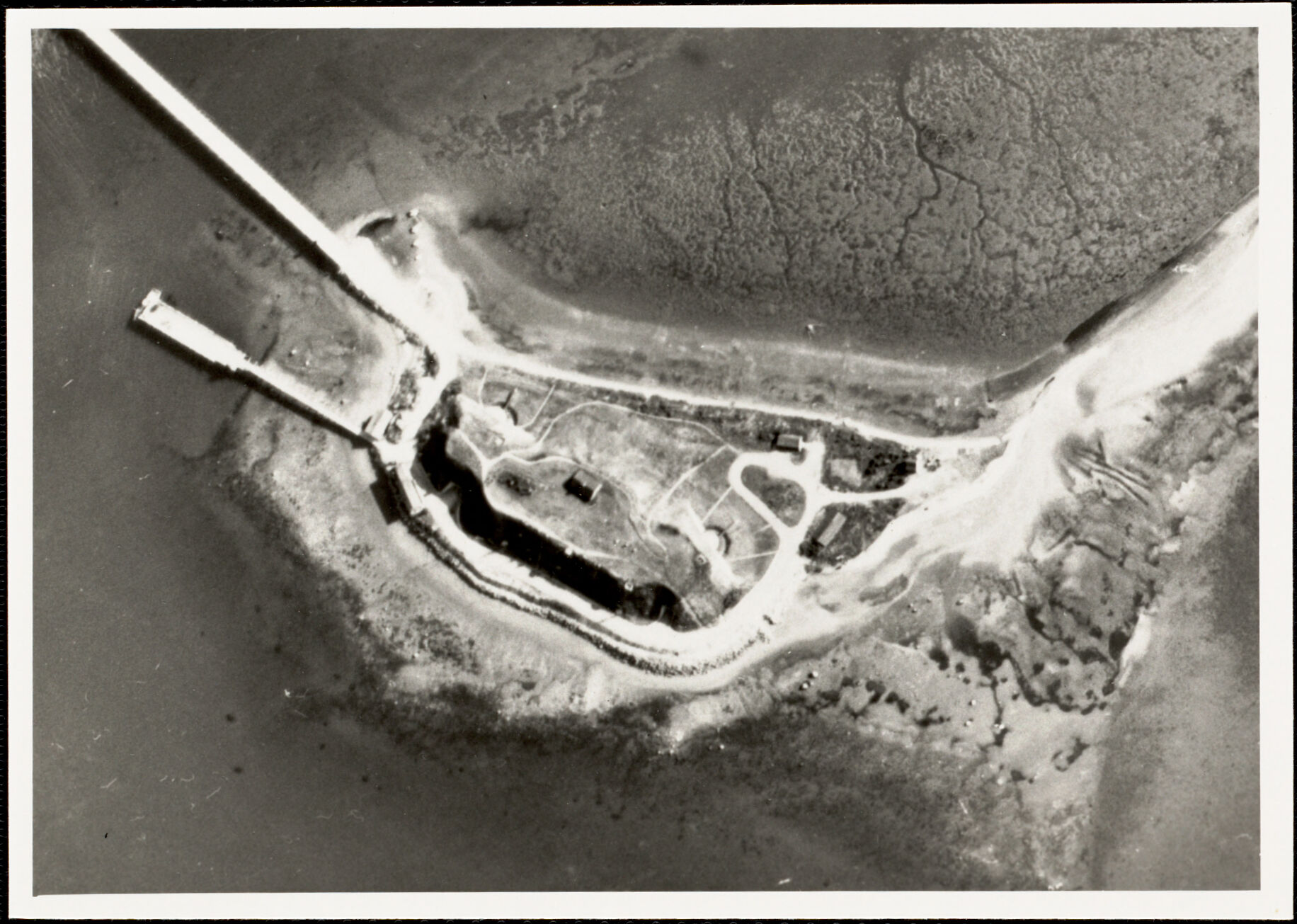
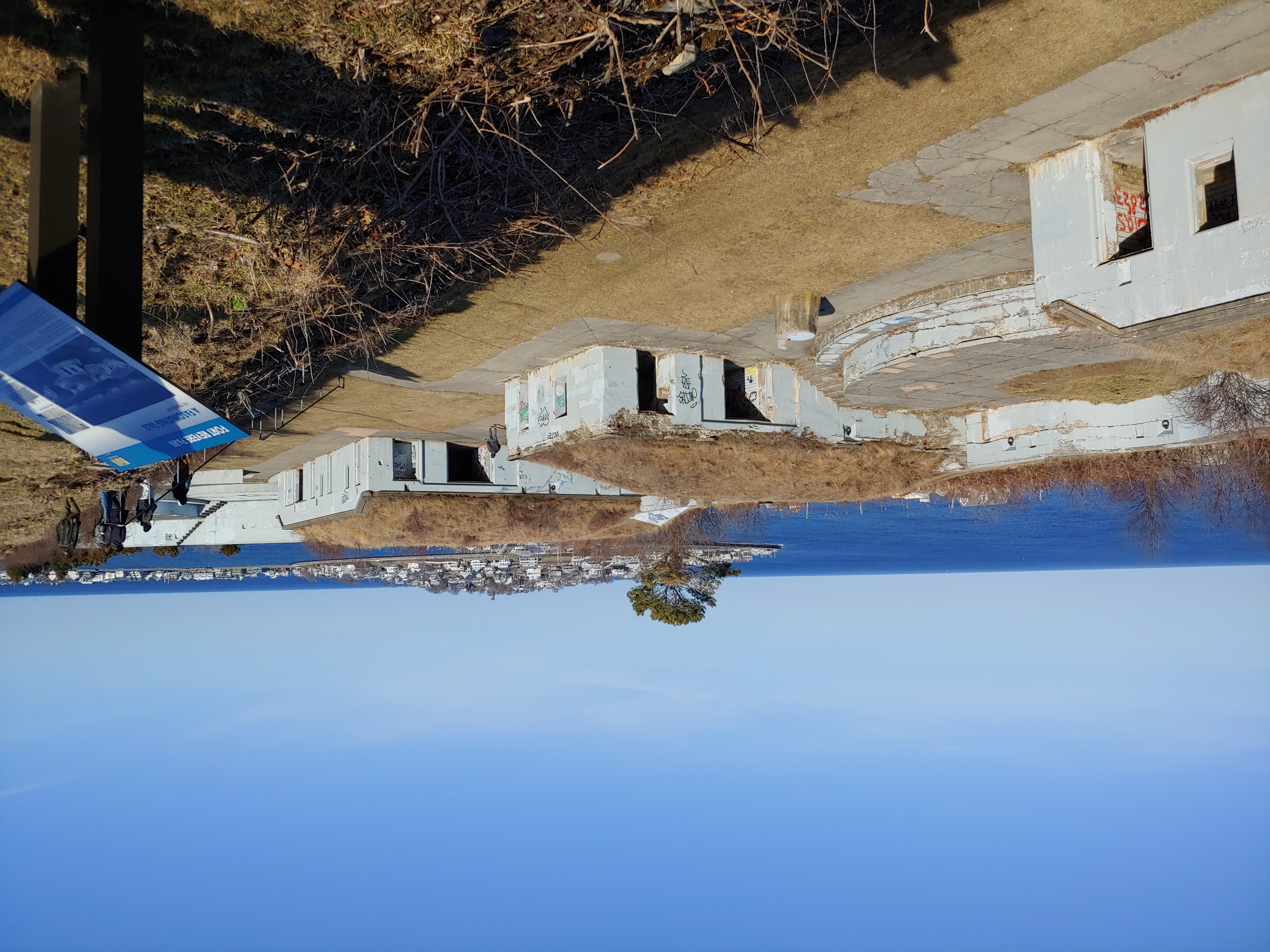
Fort Revere stands on Telegraph Hill in Hull. The fort played an important role in the defense of Boston Harbor throughout history, from the colonial era to World War II.
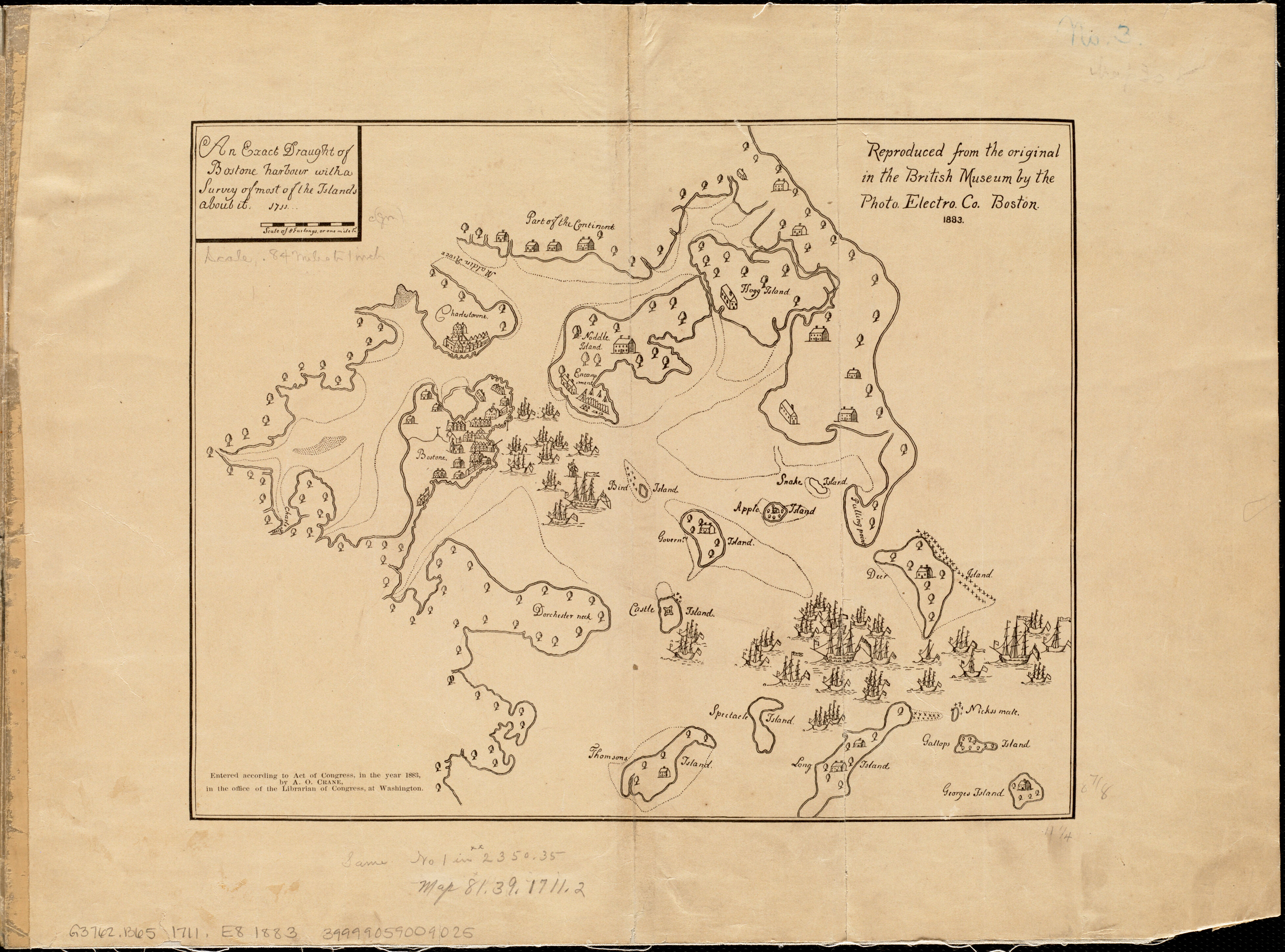
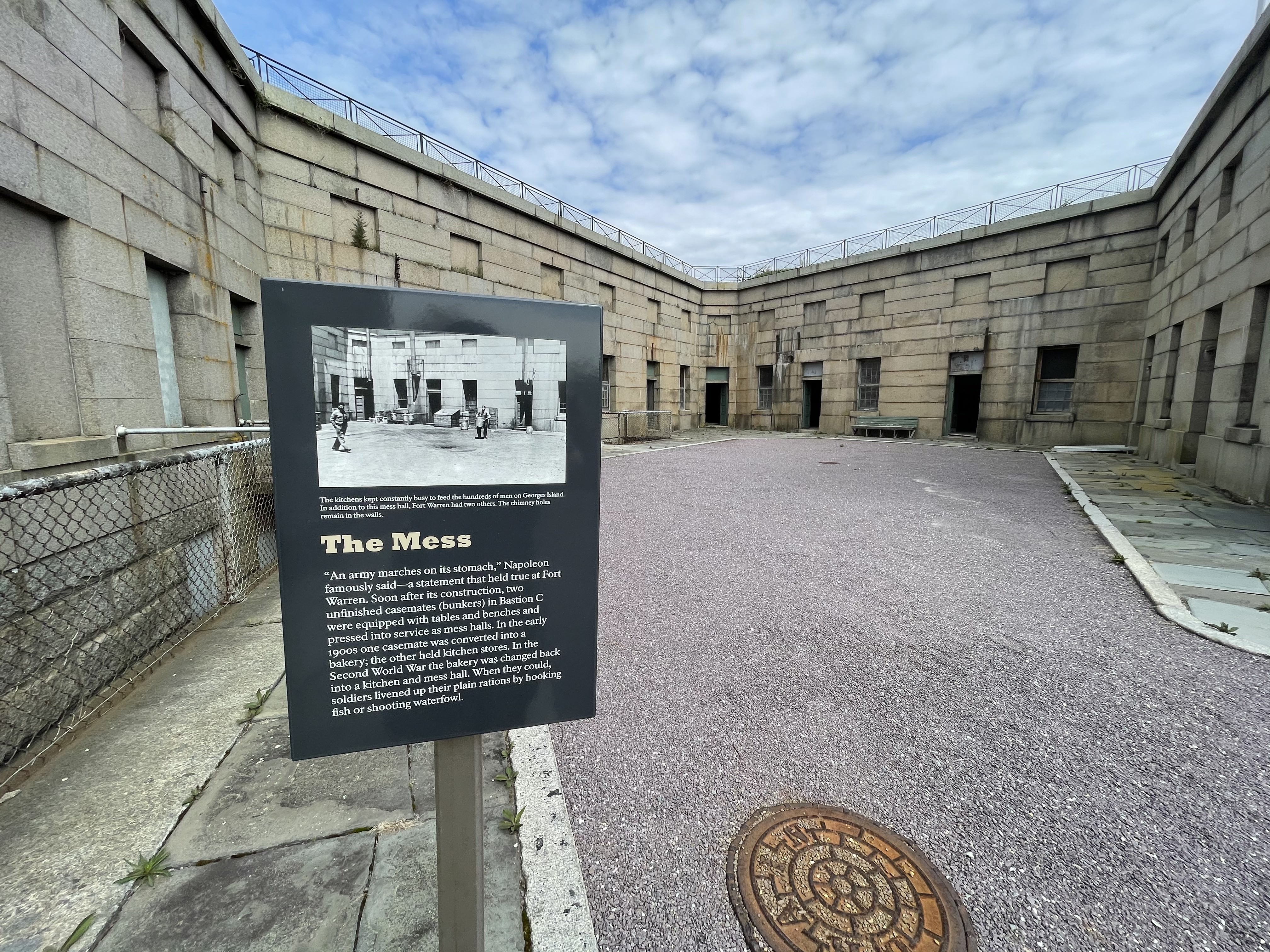
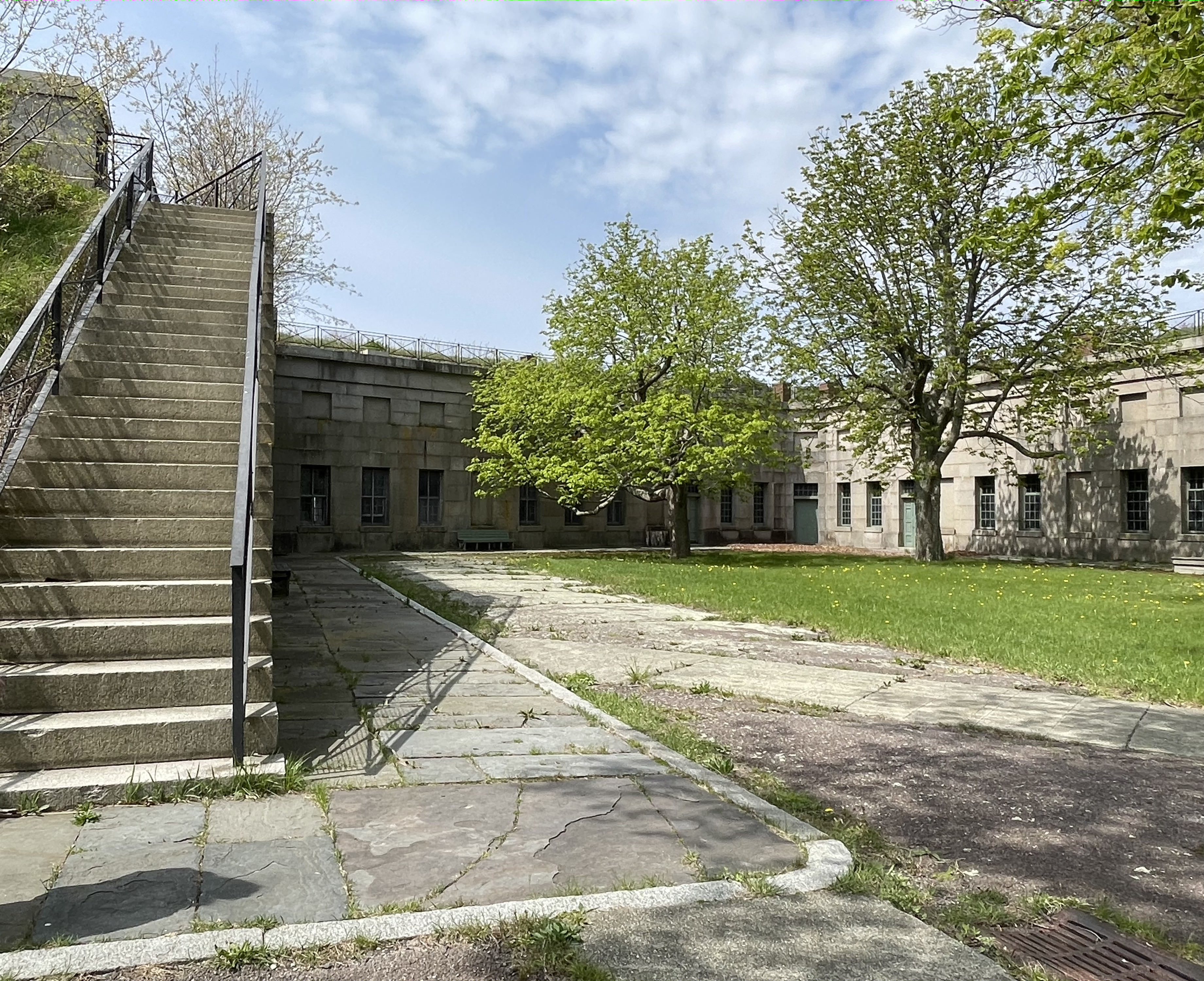
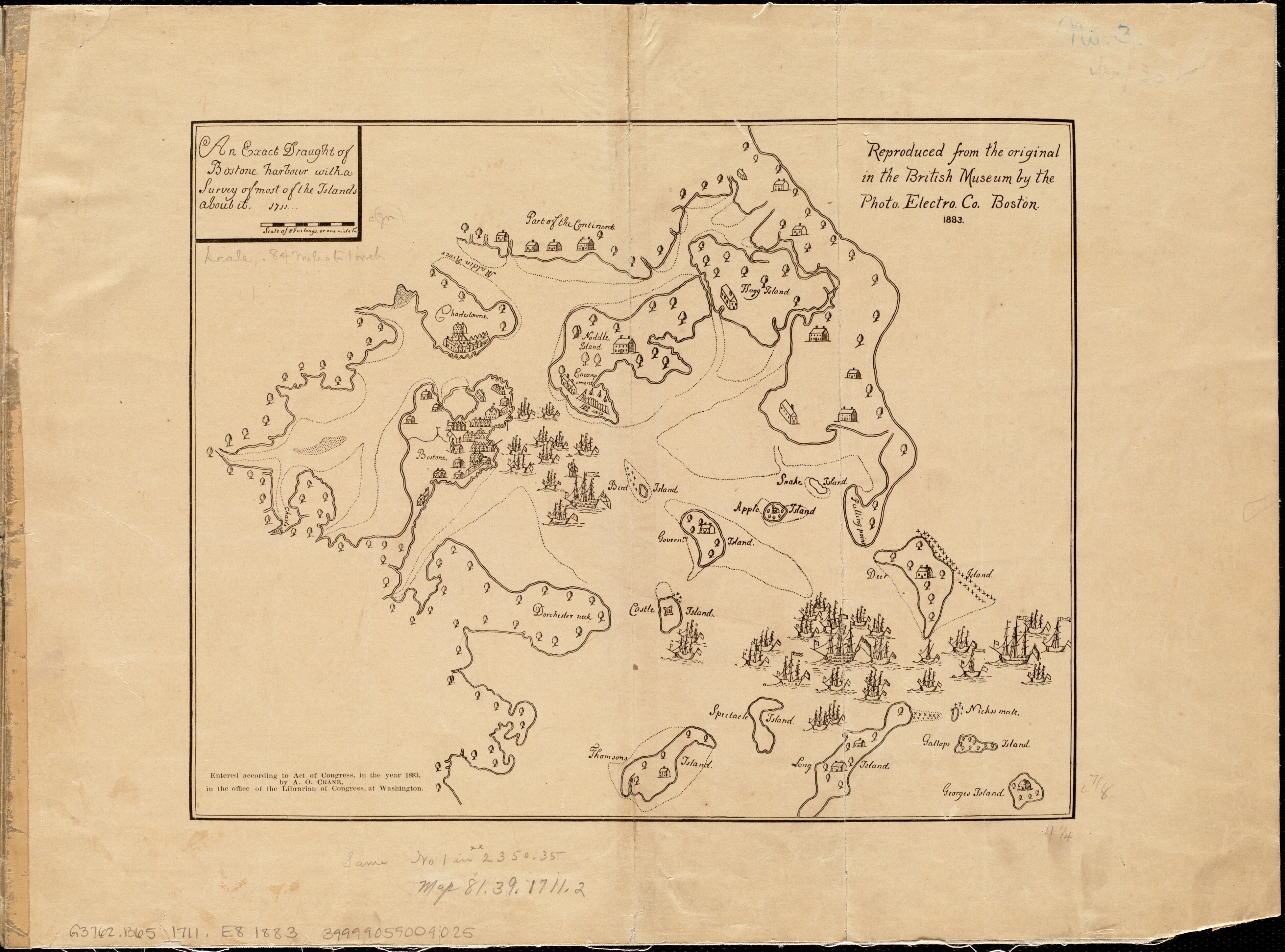
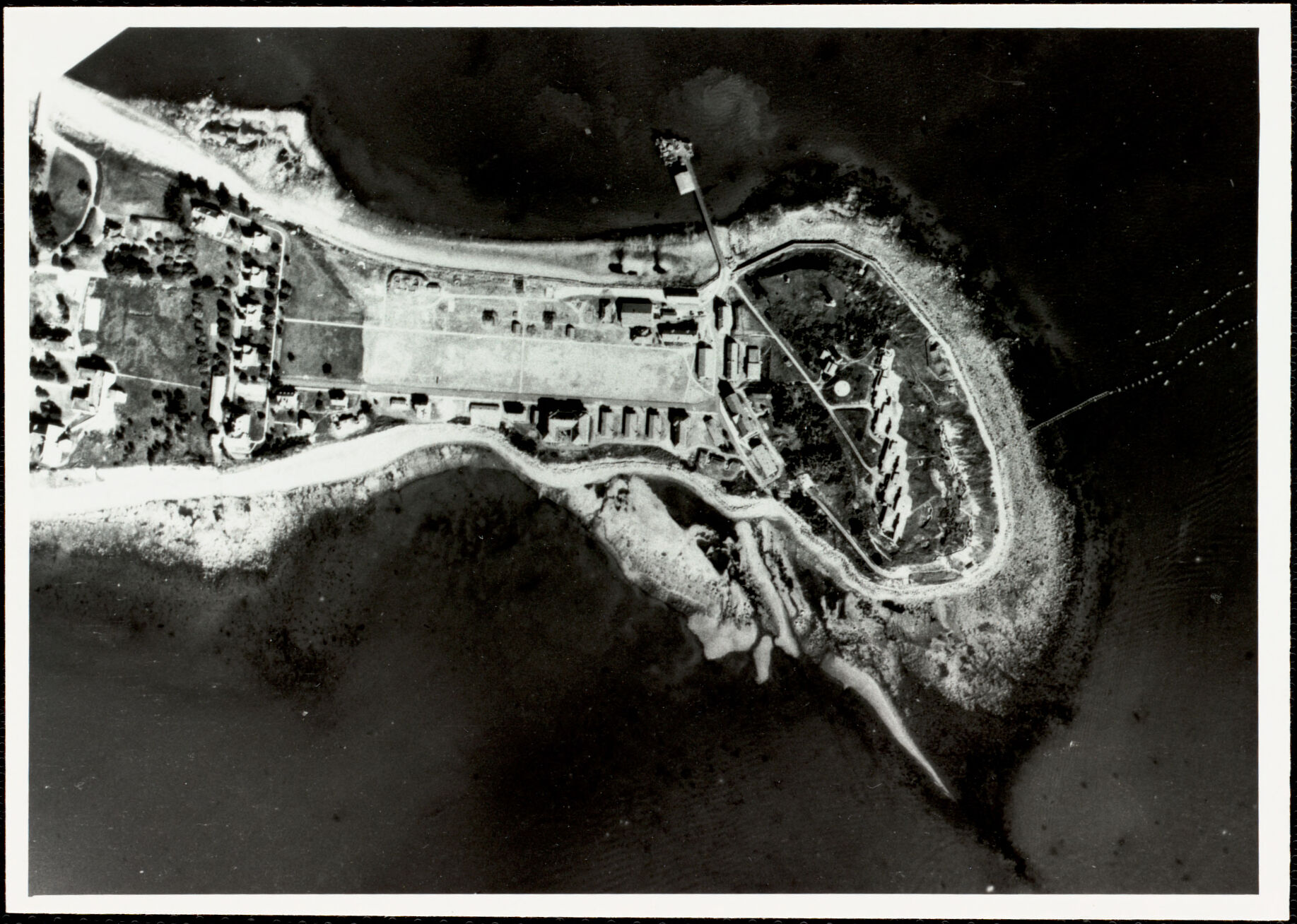
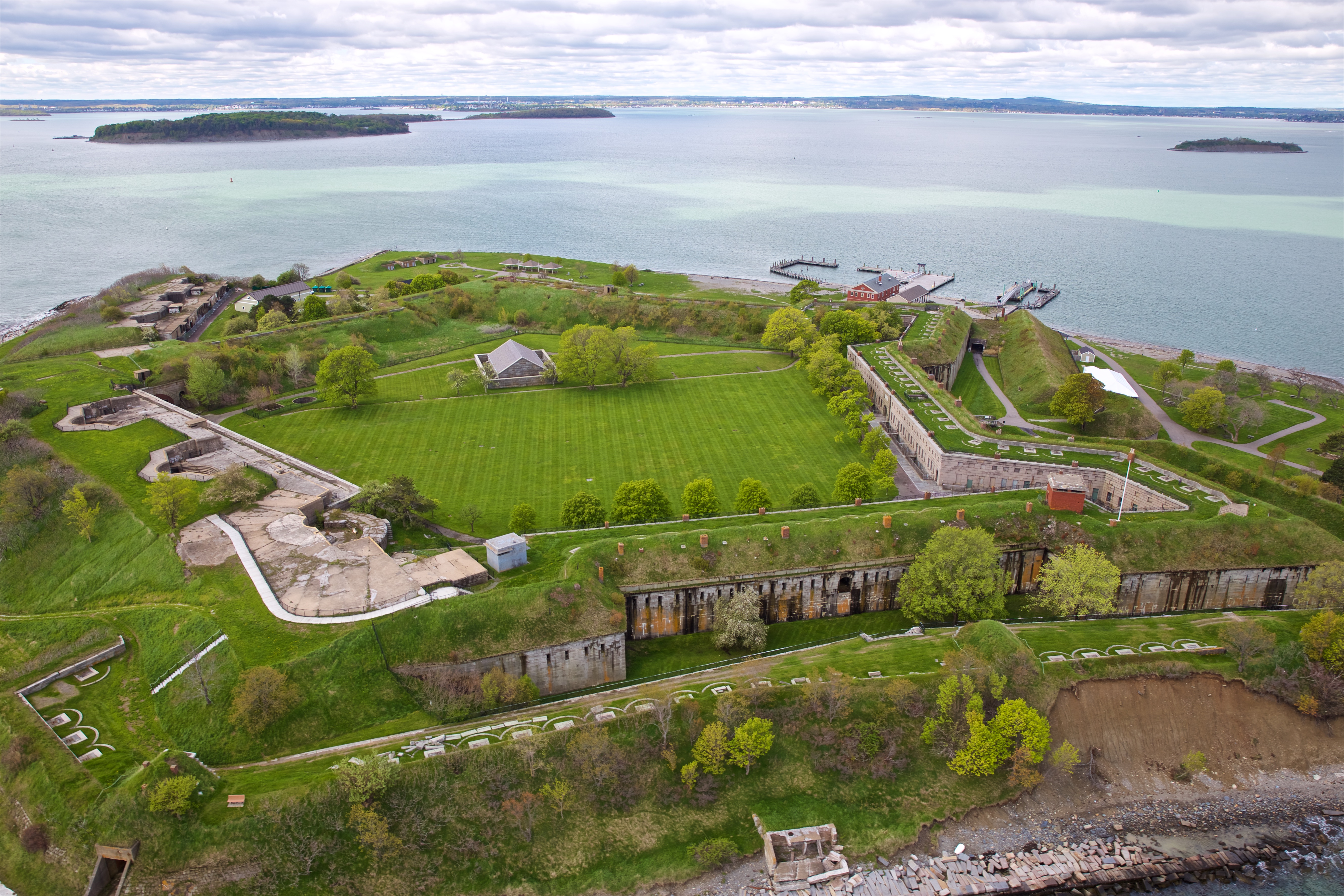
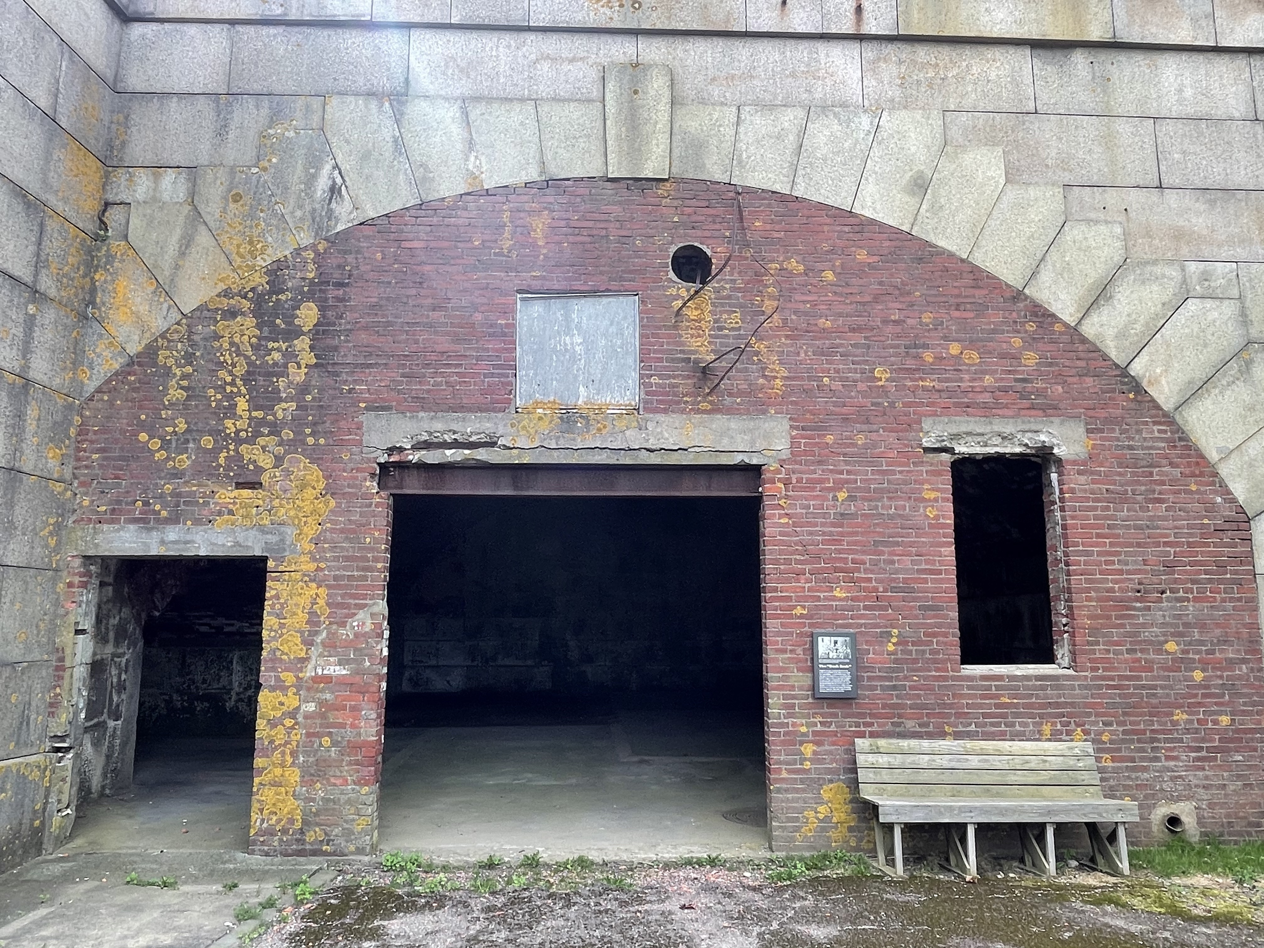
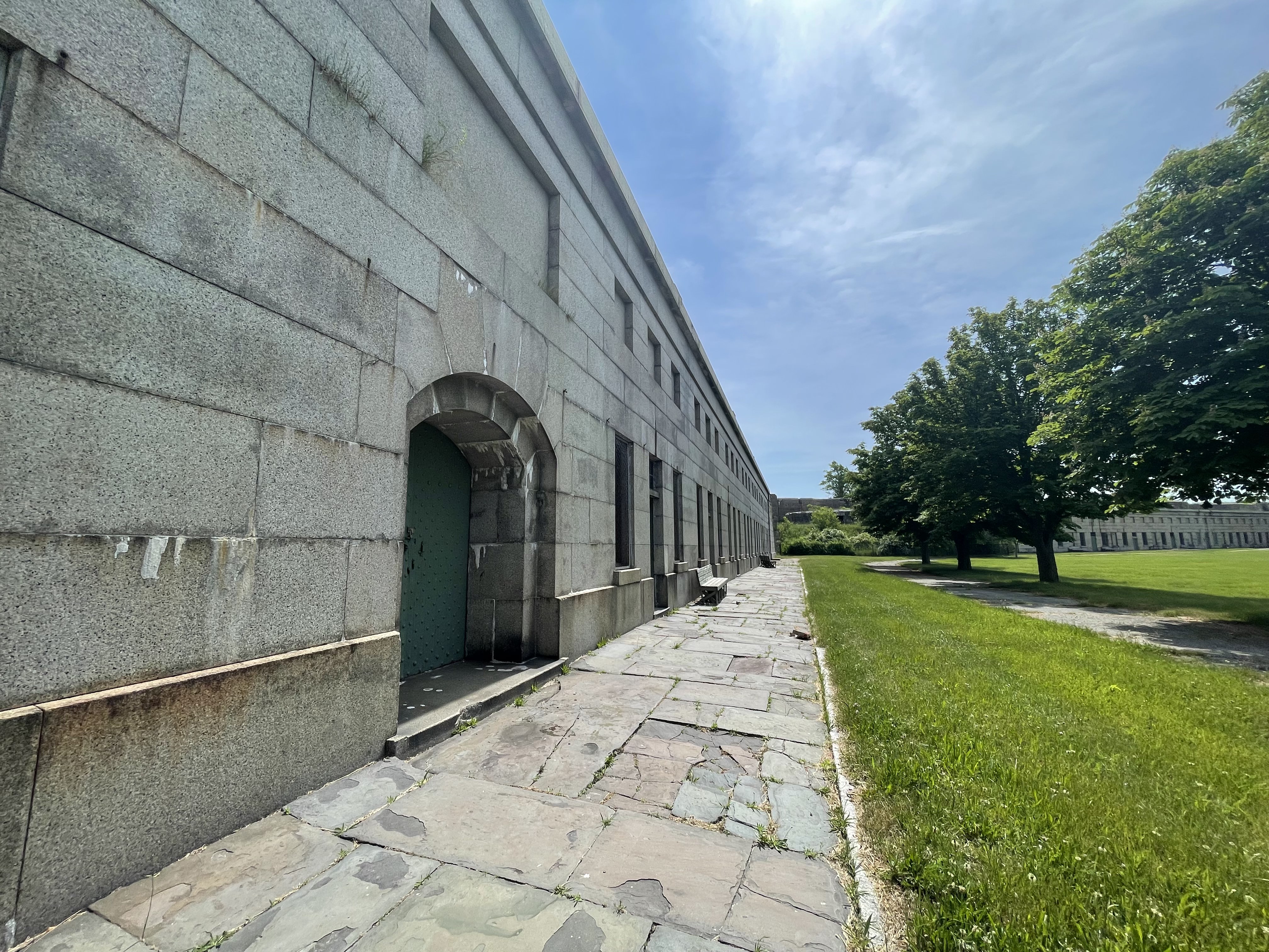
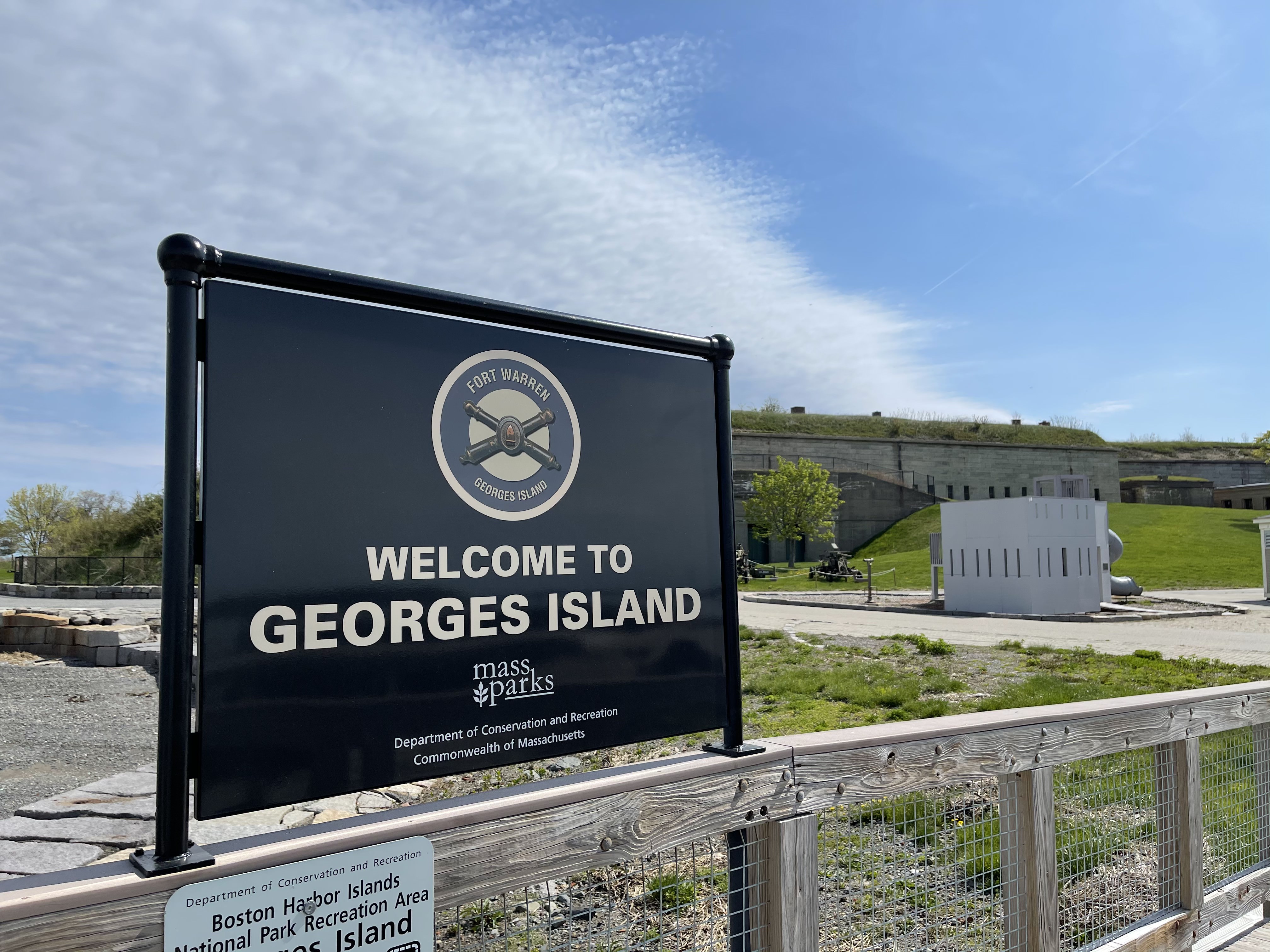
Designed and built from the 1830s to the 1860s, Fort Warren is an extant example of a Third System-era fortification. Over the years, Fort Warren played an important role in the Civil War, Spanish-American War, World War I, and World War II.
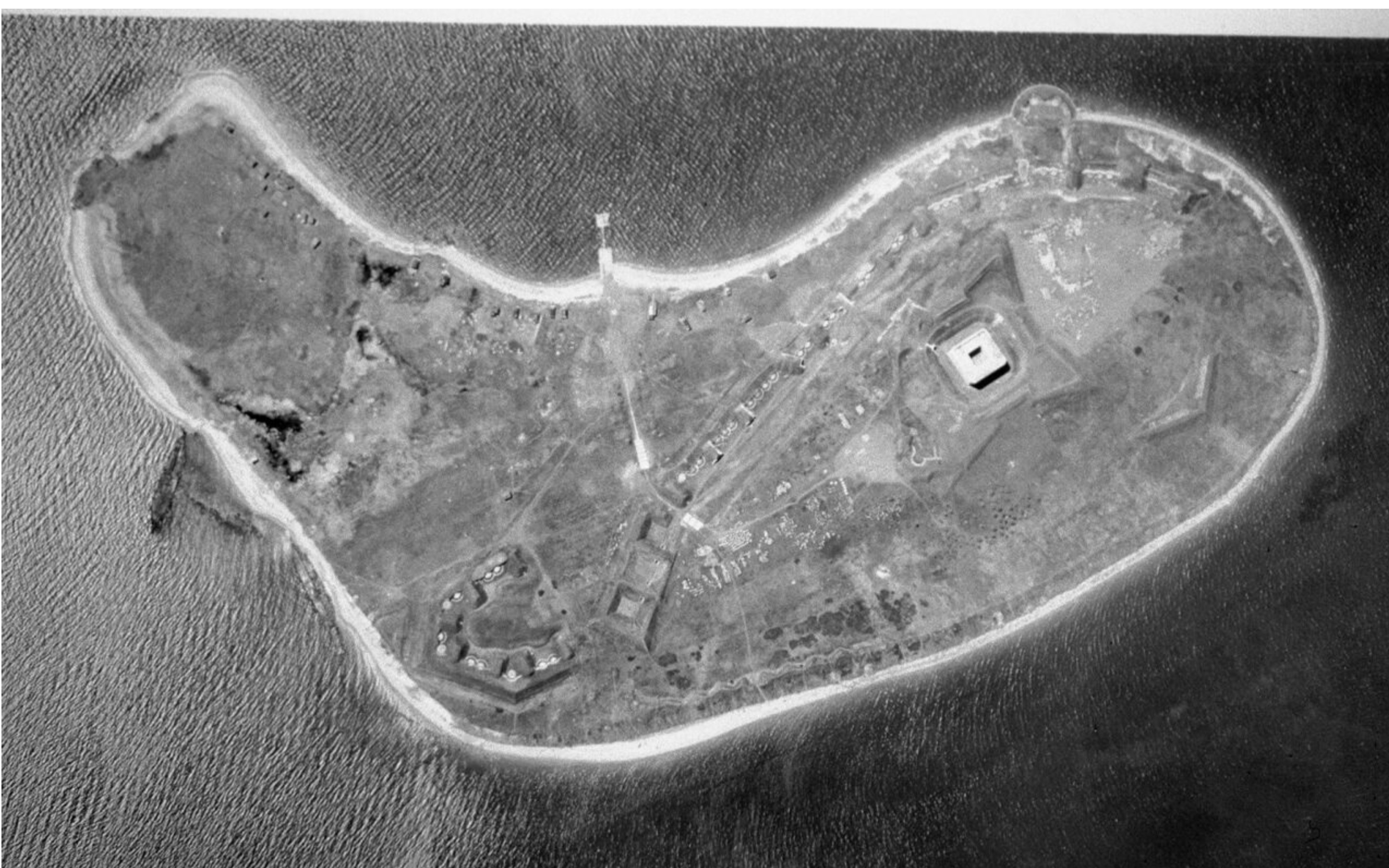
Six miles from Long Wharf, sits the 50- acre Gallops Island. The island is composed of one drumlin that is 79 feet. The island offers wonderful views of the harbor and surrounding islands.
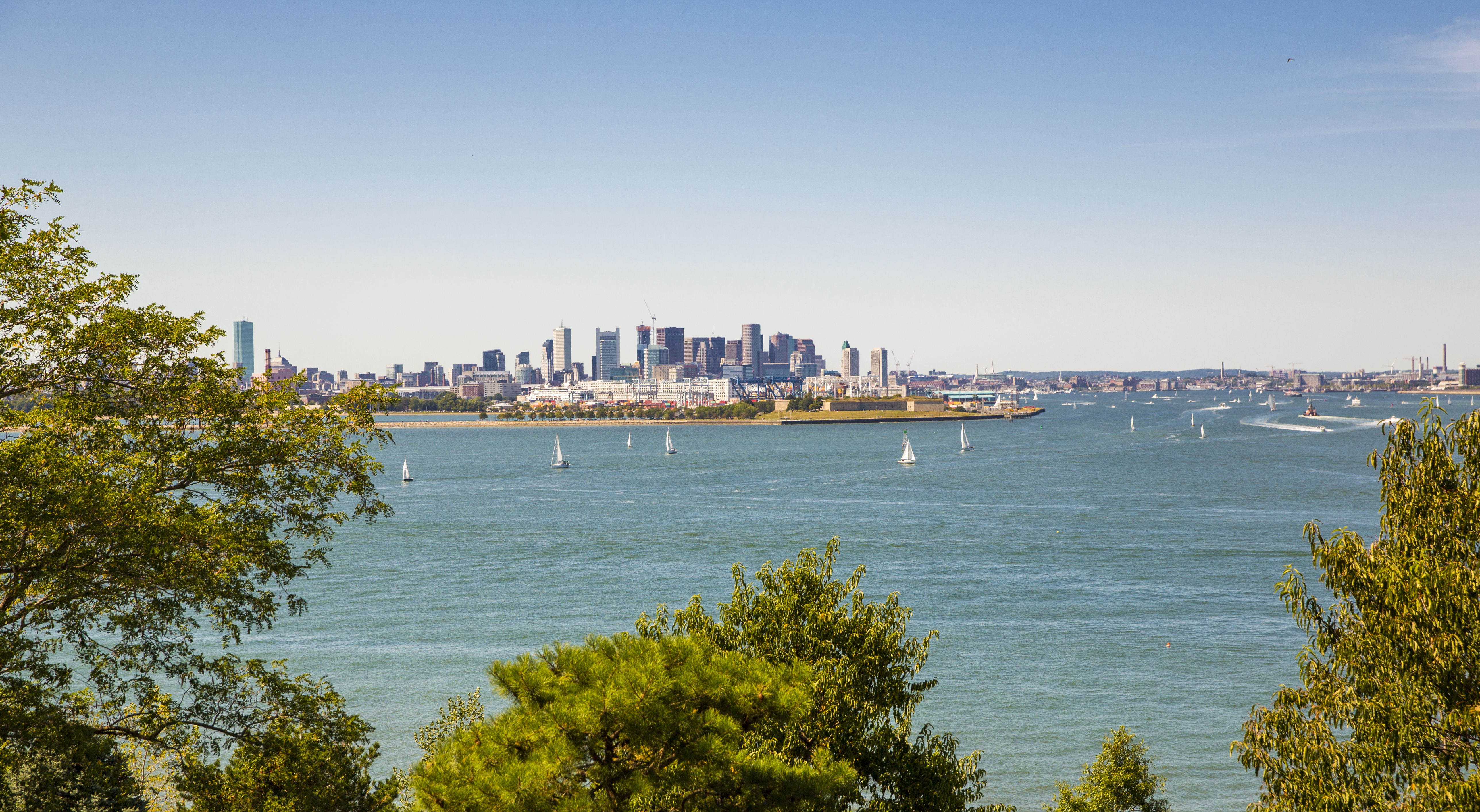
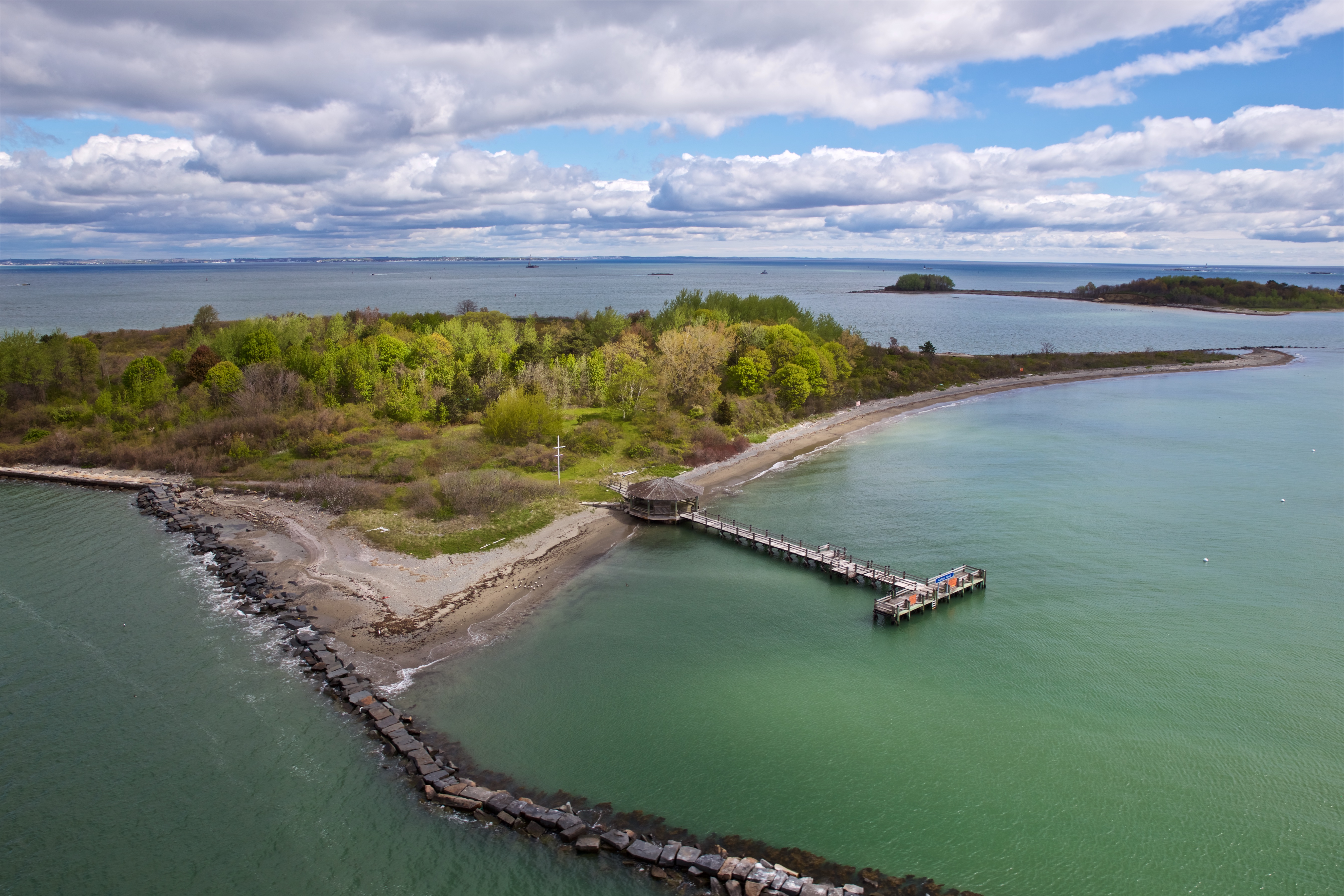
Located seven miles from downtown Boston, this 53-acre island is home to Fort Warren, a National Historic Landmark. Although now owned and operated by the Massachusetts Department of Conservation and Recreation, Georges Island once provided a strategic location for defending the port of Boston.
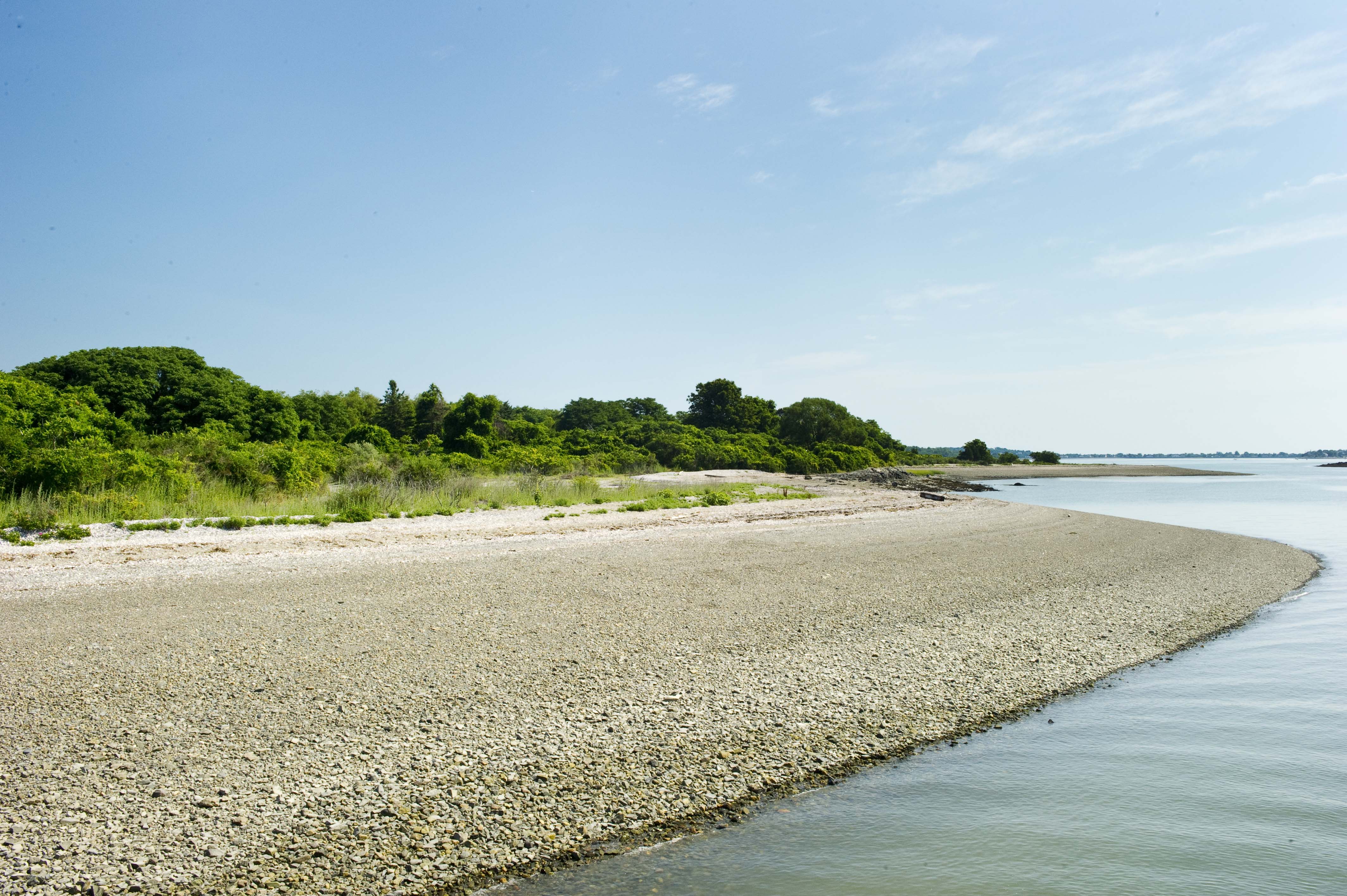
Grape Island sits right off the coast of Weymouth, south of Boston. Its size varies depending on the tides: 54 acres at high tide, 101 acres at low tide. Grape Island is recognized as a wildlife haven, offering an abundance of wild berries for birds and other animals to enjoy. An island for the outdoor enthusiast, Grape Island features trails, beaches, picnic areas, and camp sites.
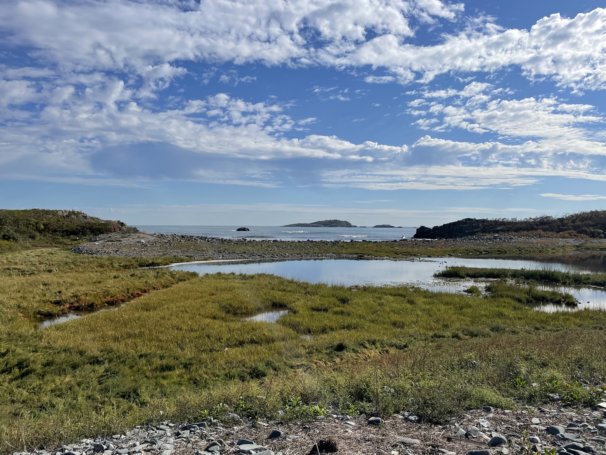
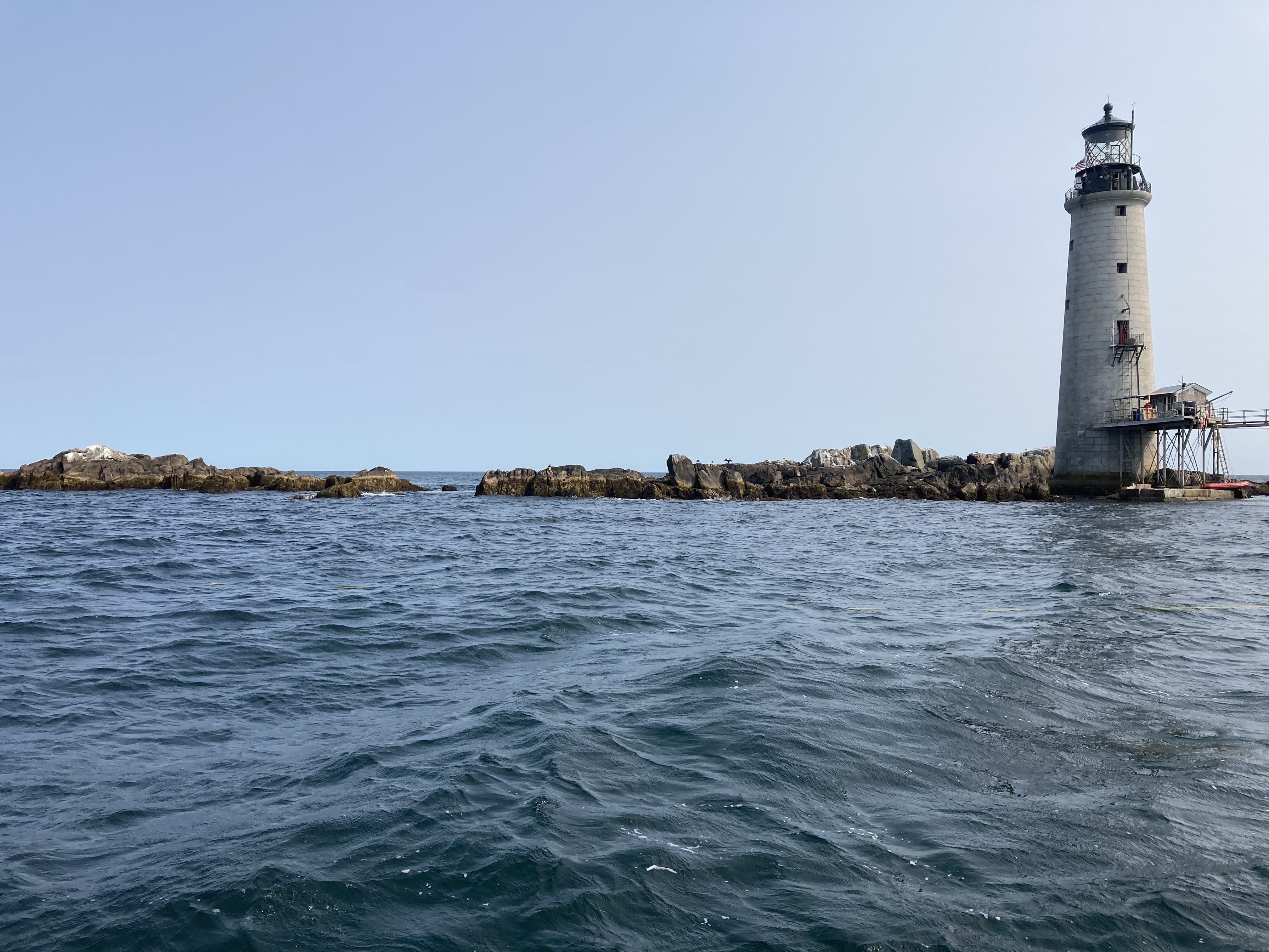
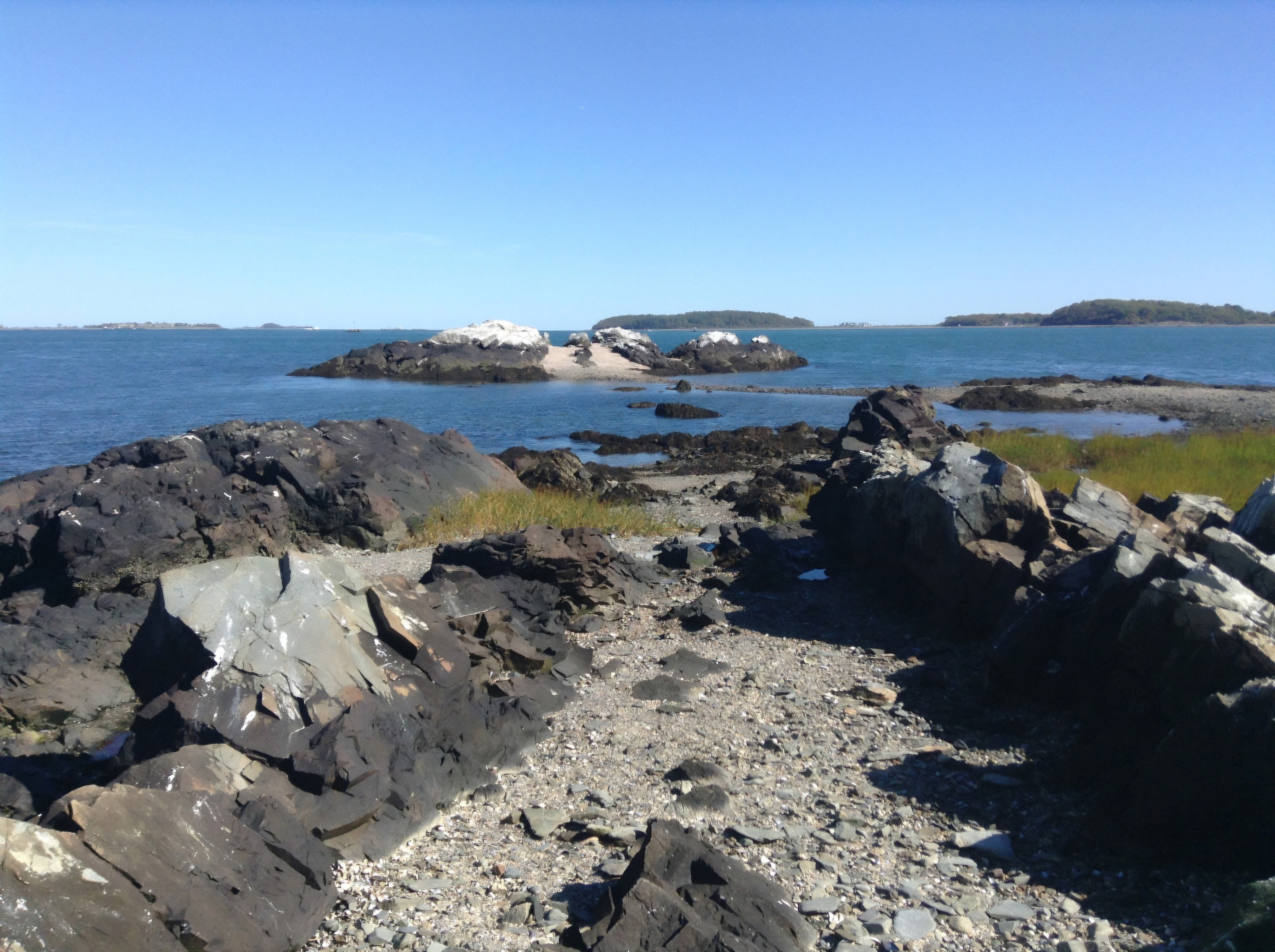
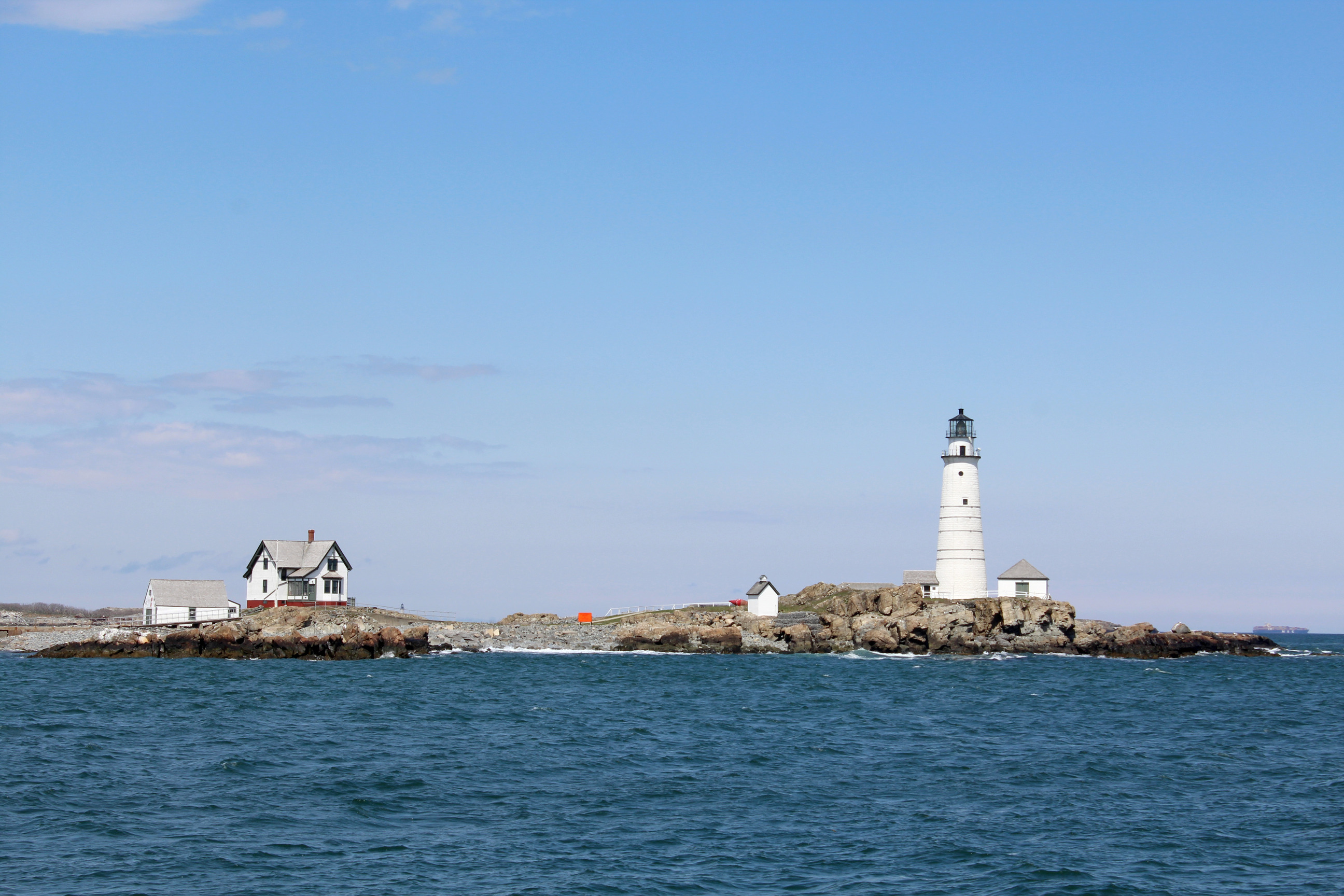
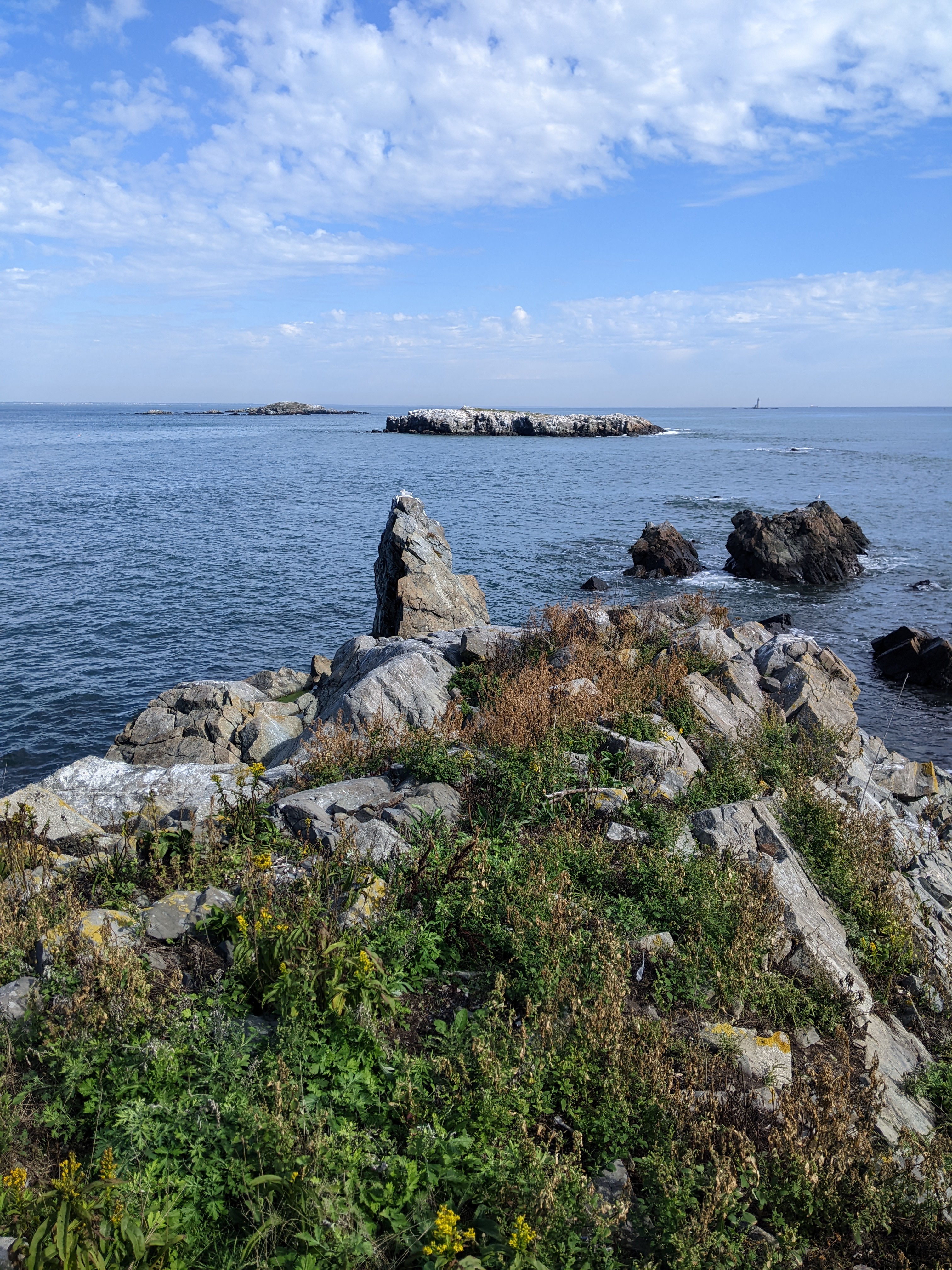
The Graves are located in the outer northeast corner of the Boston Harbor at approximately 11 miles away from Boston. Rocky outcroppings surround the island. They sit at 15 feet above sea level at high tide, making them a dangerous peril to passing ships.
Green Island sits 9.5 miles away from Long Wharf in the outer harbor. It is a barren island that is 1.8 acres with rocky outcrops and minimal vegetation. The island is currently owned by Massachusetts Department of Conservation and Recreation.
Eleven miles South of Boston, in the middle of Hingham Bay sits an eight-acre island called Langlee Island. Its closest in distance to Sarah, Ragged, and Button Islands. Similar to other islands in the harbor, local indigenous communities likely accessed the island seasonally before European settlers arrived.
About 9.5 miles away from Long Wharf sits Little Calf Island. This outer harbor island is less than 1 acre and is made up of rocky outcroppings that rise 20 feet in elevation.