Be advised that the NPS has issued alerts for this park.
Phone Service Disruption - Charlestown Navy Yard Visitor Center
We are working on resolving an issue with our phone lines at the Charlestown Navy Yard Visitor Center. To reach the NPS Visitor Center at Faneuil Hall, dial 617-429-6760.
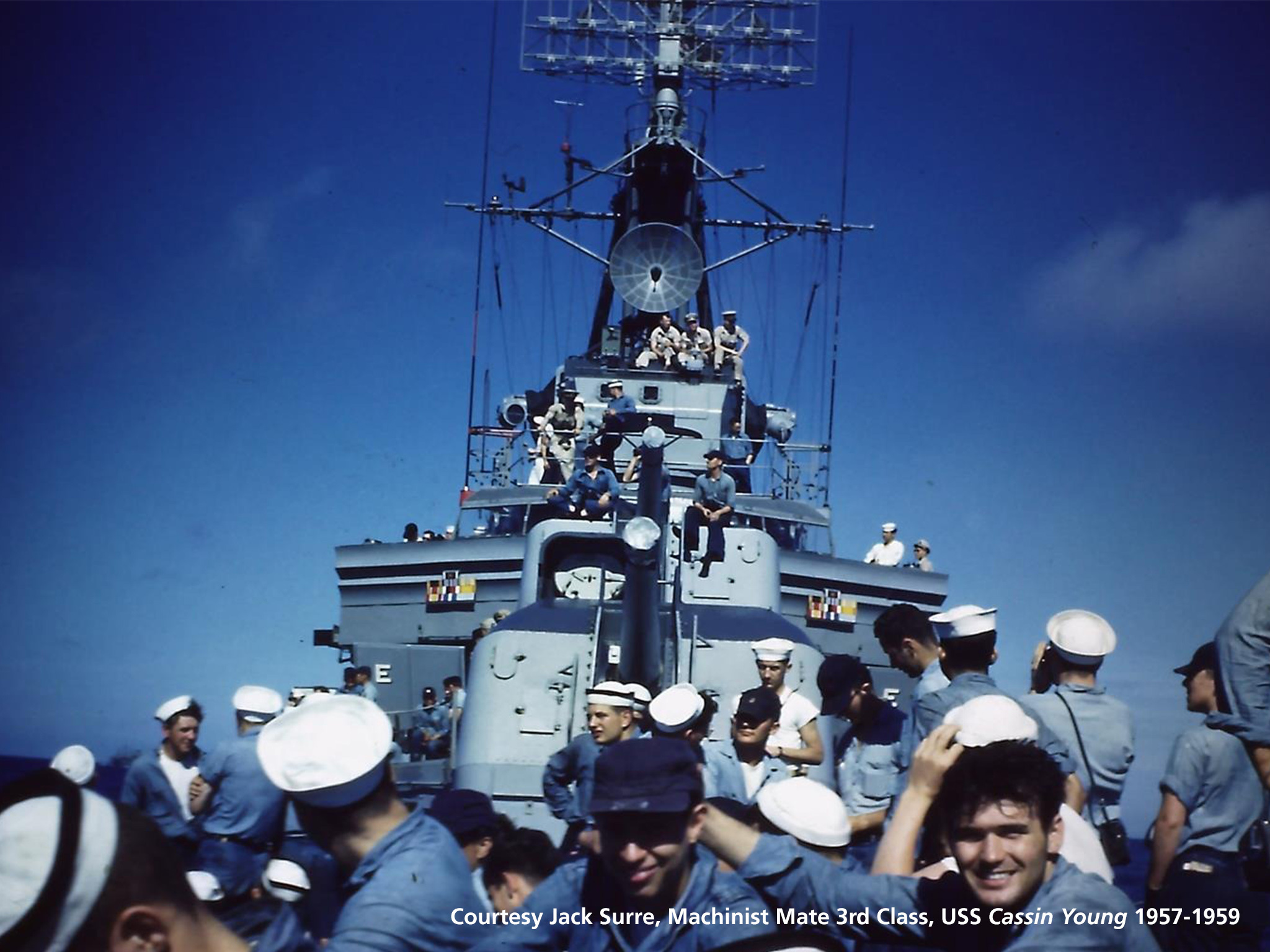
USS Cassin Young
Due to rain USS CASSIN YOUNG is CLOSED today, September 25, 2025.
Faneuil Hall Great Hall - Elevator Out of Service
The elevator in Faneuil Hall is temporarily out of service. We hope to have it fixed as soon as possible. If you have any questions, or if you need access to bathrooms, please inform one of the on-site Rangers or call 617-429-6760.
Discover how one city could be the Cradle of Liberty, site of the first major battle of American Revolution, and home to many who espoused that freedom can be extended to all.
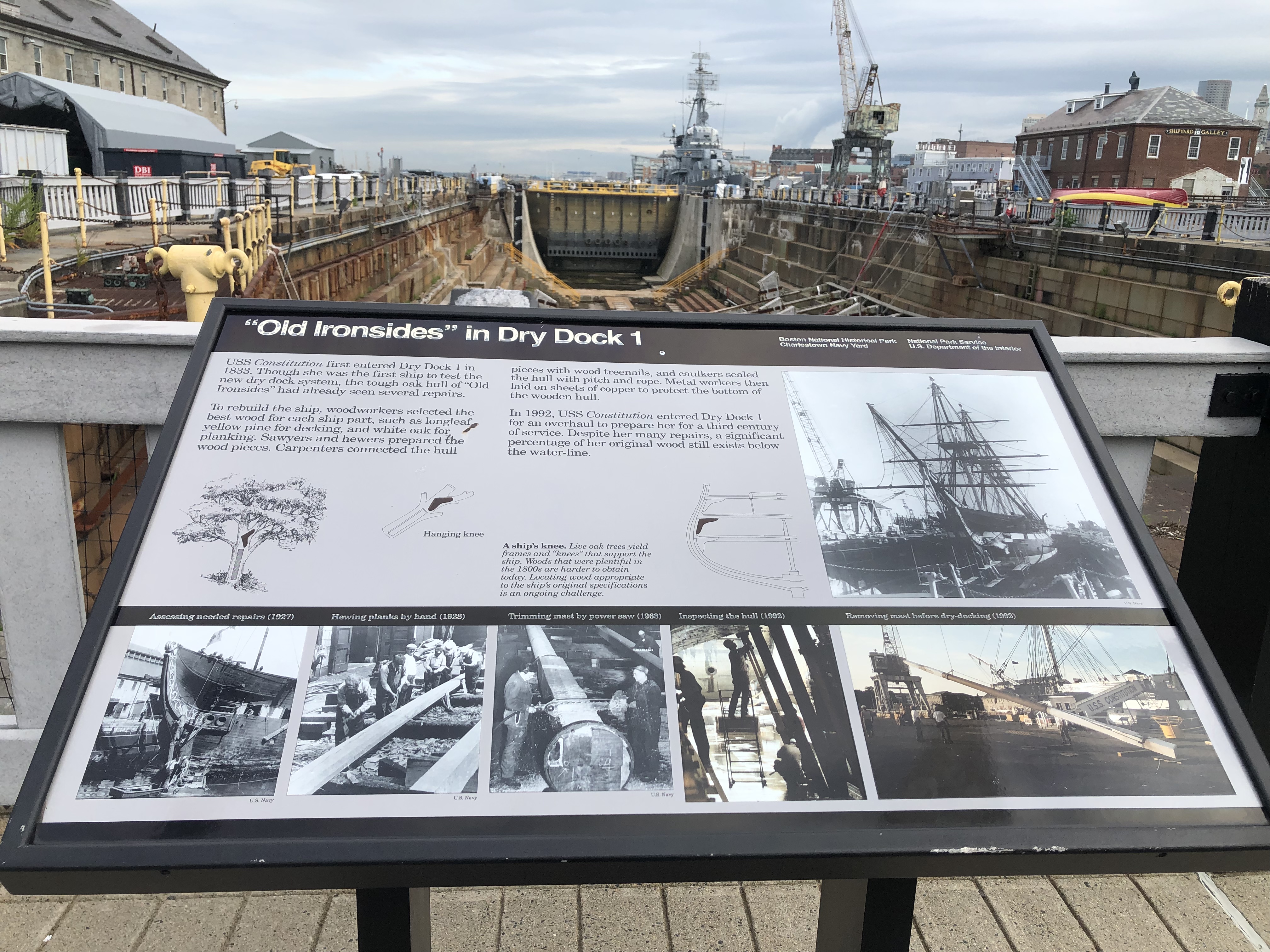
Sign titled "'Old Ironsides' in Dry Dock 1" in the Charlestown Navy Yard. This sign describes the USS Constitution's years at the navy yard.
Layout: At the top of the sign is a black banner with white text. The text includes the title, “'Old Ironsides’ in Dry Dock 1,” aligned to the left. Aligned to the right in the banner are two columns of two lines of text. The first column of text is “Boston National Historical Park,” followed by “Charlestown Navy Yard.” The second column states “National Park Service,” followed by “U.S. Department of the Interior.” The rest of the panel has a gray background with black text and mostly black and white images. The text and images are arranged in three rows and three columns. The top row features two columns of text, with spaces dividing the paragraphs. The third column features an image that spans two rows. The middle row includes three black-and-white diagrams with a bolded title and italicized caption. Two diagrams are under the first column of text. The image caption and third diagram are under the second column. The bottom row features five images. Two black-and-white images are in the first column side by side, a black-and-white image and a colored image are in the second column side by side, and a landscape, colored image fills the third column. A black banner divides the middle and bottom rows with image titles in white font above each image. Photo credits are in black font under the right corner of some images. Location: Dry Dock 1
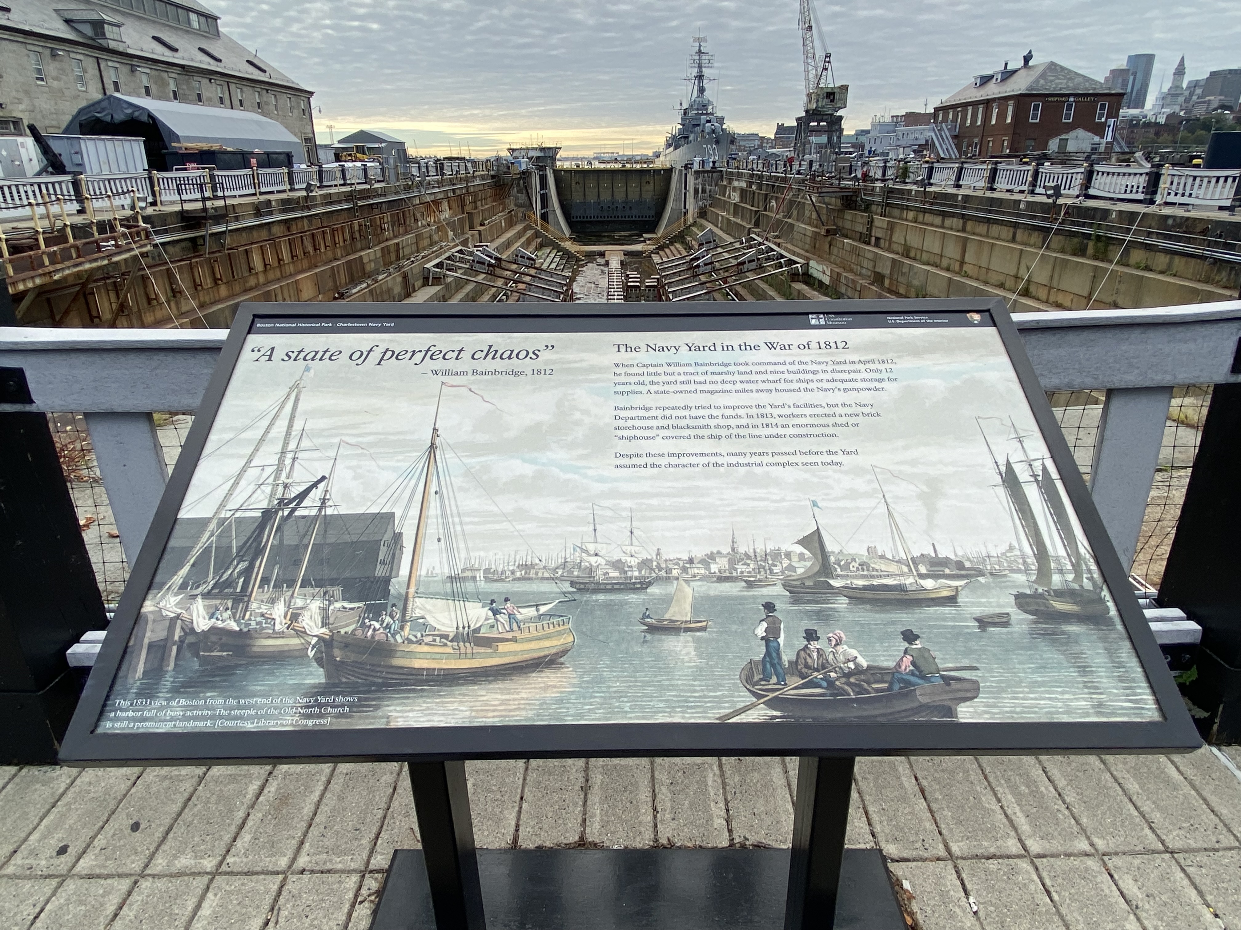
Sign titled "A State of Perfect Chaos" in the Charlestown Navy Yard. This sign describes Captain William Bainbridge taking command of the Navy Yard during the War of 1812.
Description: Low-profile wayside that is 42 x 24 inches. It has a black rectangular base with two rectangular pillars supporting the wayside panel. The panel is framed in black metal. The sign is located on cement directly in front of and facing Dry Dock 1. Layout: At the top of the sign is a thin black banner with white text. Aligned to the left is "Boston National Historical Park – Charlestown Navy Yard." Aligned to the right in order from left to right is the USS Constitution Museum logo, the text "National Park Service U.S. Department of the Interior," and finally the National Park Service arrowhead. The panel has a color landscape painting as the background. The title and main text are located on the painting’s sky. The title is in large italicized black font in the top left corner. The title is a quote, so the source is aligned right below it in small, upright black font. A slightly smaller subhead is to the right of the main title. Below it, in smaller black font, is the main text. The painting caption is in white font in the bottom left corner.
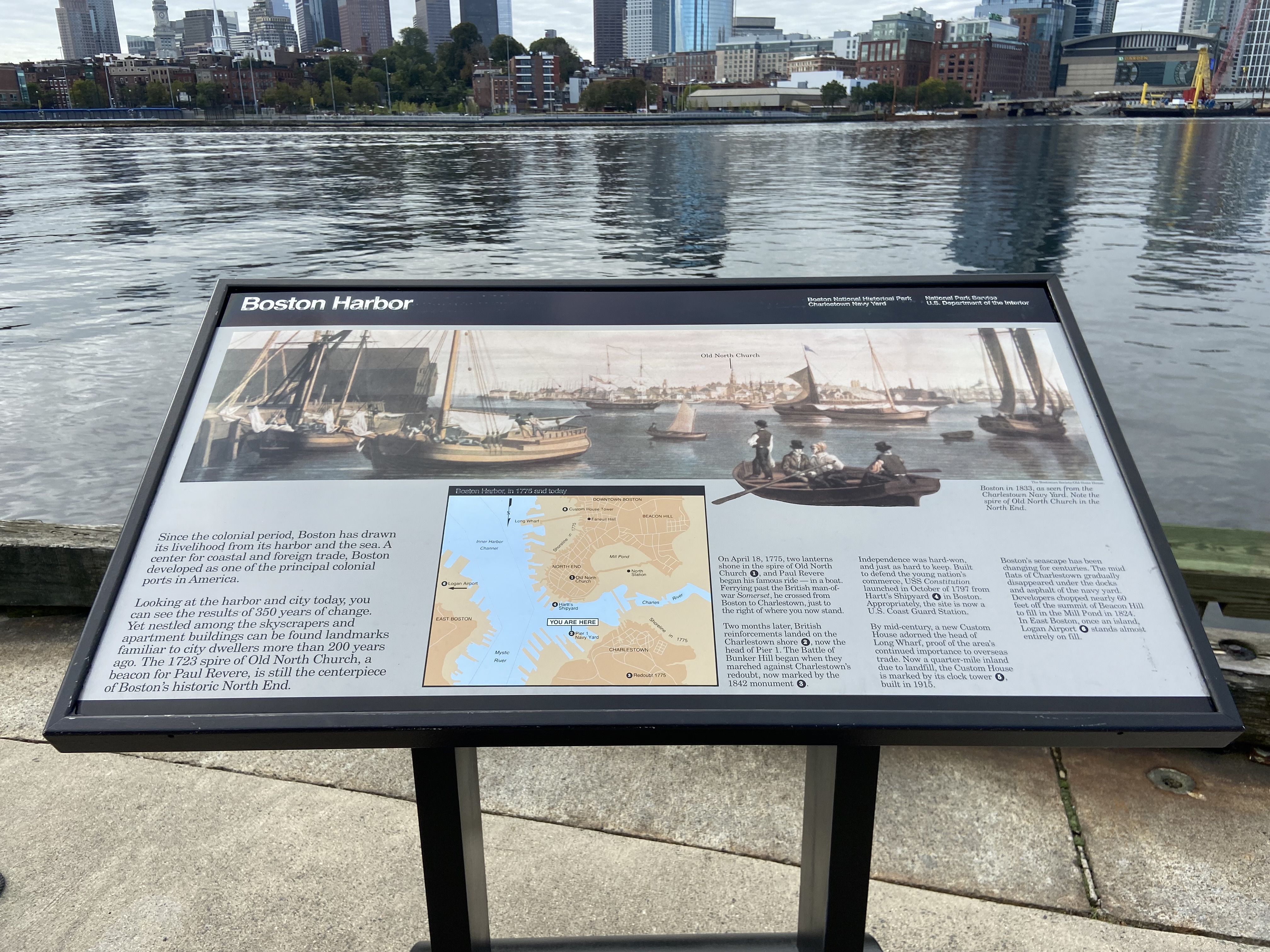
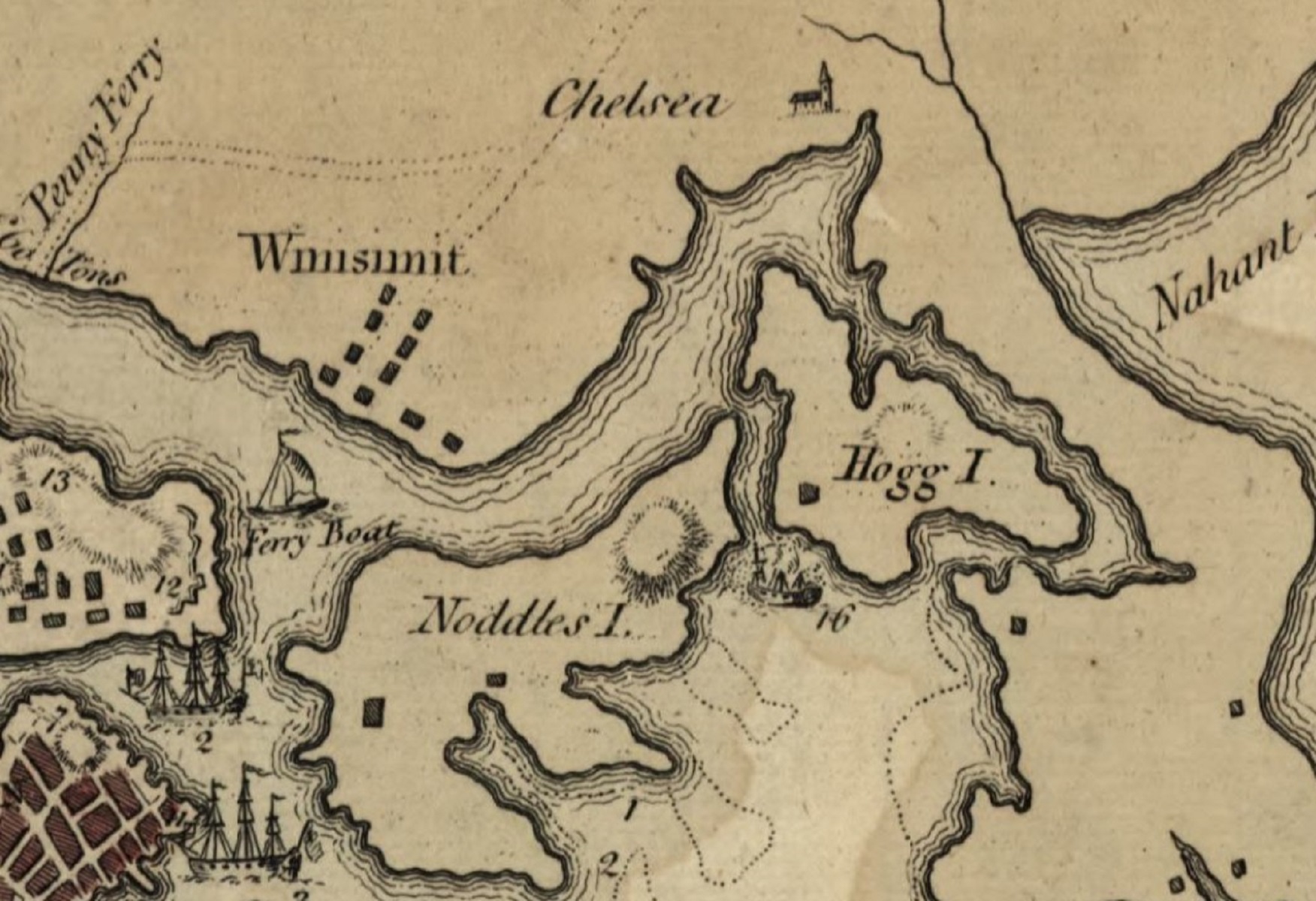
Sign titled "Boston Harbor " in the Charlestown Navy Yard. This sign describes the landscape and role of Boston Harbor.
Description: Low-profile wayside that is 42.5 x 24.5 inches. It has a black rectangular base with two rectangular pillars supporting the panel. The panel is framed in black metal. The sign is located at the end of Pier 1 facing the harbor. Layout: At the top of the sign is a black banner with white text. The text includes the title, “Boston Harbor,” aligned to the left. Aligned to the right in the banner are two columns of two lines of text. The first column of text is “Boston National Historical Park,” followed by “Charlestown Navy Yard.” The second column states “National Park Service,” followed by “U.S. Department of the Interior.” The rest of the panel has a gray background with black text and color images. The top half of the panel is a color painting. To the center right of the image is a cut out of a rowboat from the painting that extends beyond the bottom edge of the painting onto the gray background of the panel. Just underneath the bottom right corner of the painting is a caption. The bottom half of the panel is divided into three columns. The left column has the main text of the panel. A map encompasses the central column. The square map is thinly outlined in black. A thicker black strip goes across the top of the map and includes white text aligned left. Throughout the map are text and numbers. The numbers are printed in white within a black circle. The right column consists of three smaller columns of text that describe the numbered points in the map. Here the numbers are also white in black circles. Ship names are italicized.
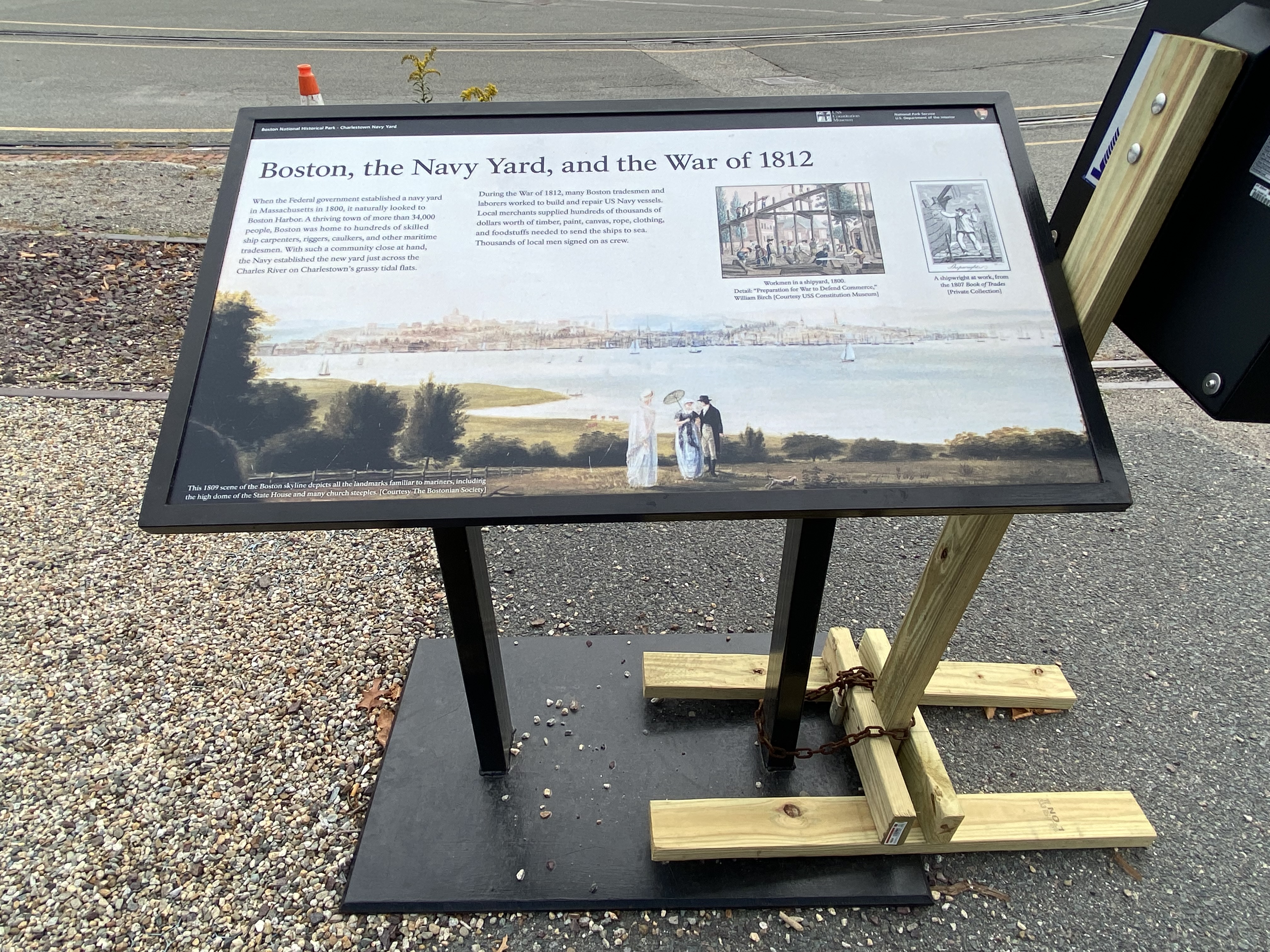
Sign titled "Boston, the Navy Yard, and the War of 1812 " in the Charlestown Navy Yard. This sign describes the role of the Navy Yard during the War of 1812.
Description: Low-profile wayside that is 42.5 x 24.5 inches. It has a black rectangular base with two rectangular pillars supporting the panel. The panel is framed in black metal. The sign is located off the railroad tracks on asphalt to the right of some gravel, facing Dry Dock 1. Layout: At the top of the sign is a thin black banner with white text. Aligned to the left is “Boston National Historical Park – Charlestown Navy Yard.” Aligned to the right in order from left to right is the USS Constitution Museum logo, the text “National Park Service U.S. Department of the Interior,” and finally the National Park Service arrowhead. The panel has a historic landscape painting as the background. Text and images are located in the top half of the painting where there is sky. The title of the sign is in large black font in the left top corner of the historic painting, below the black banner. Two columns of text are on the left half of the painting’s sky. Two side-by-side rectangular images are on the right half of the painting’s sky. Beneath each image are captions. A caption for the painting is in the bottom left-hand corner of the painting.
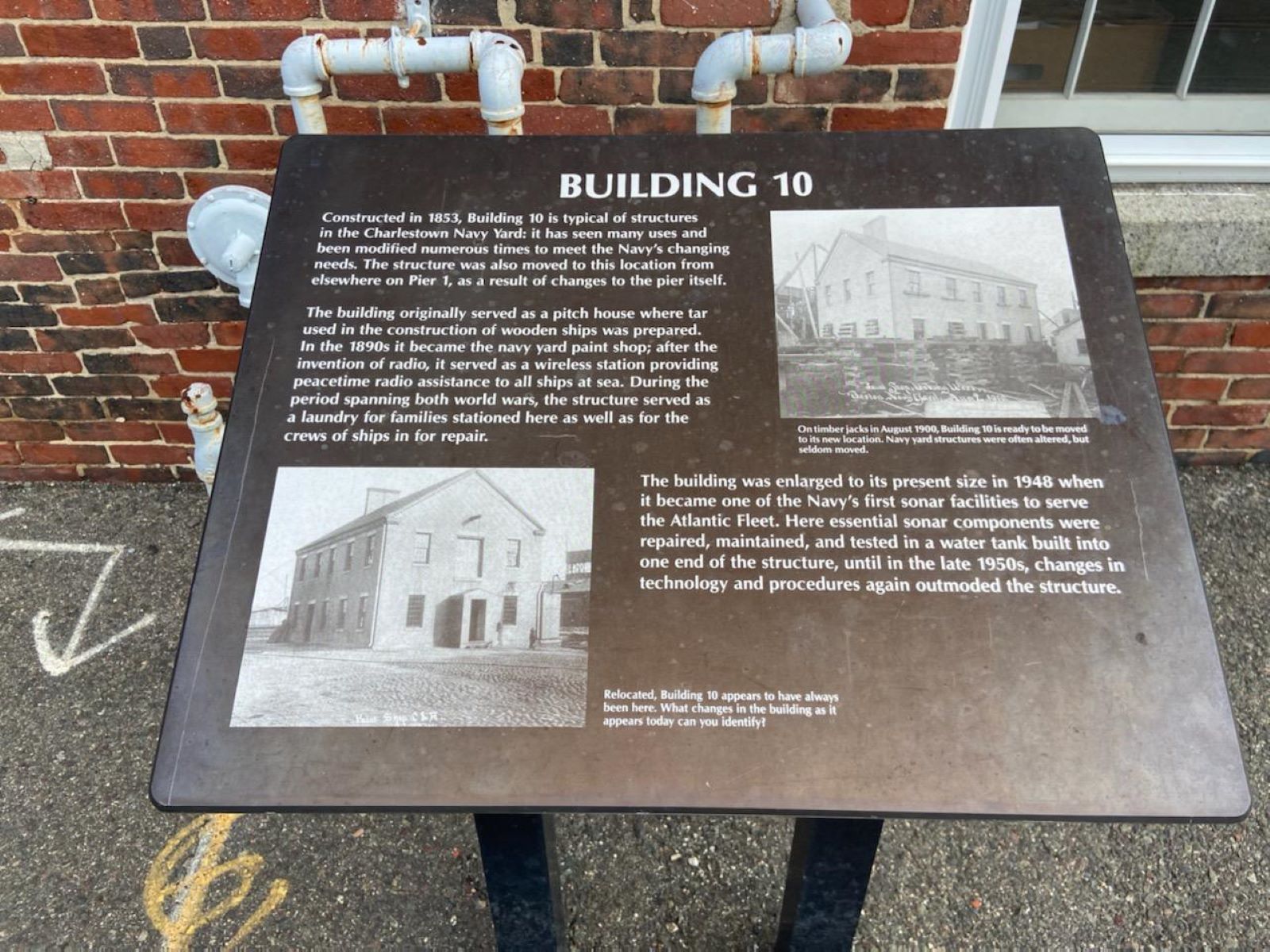
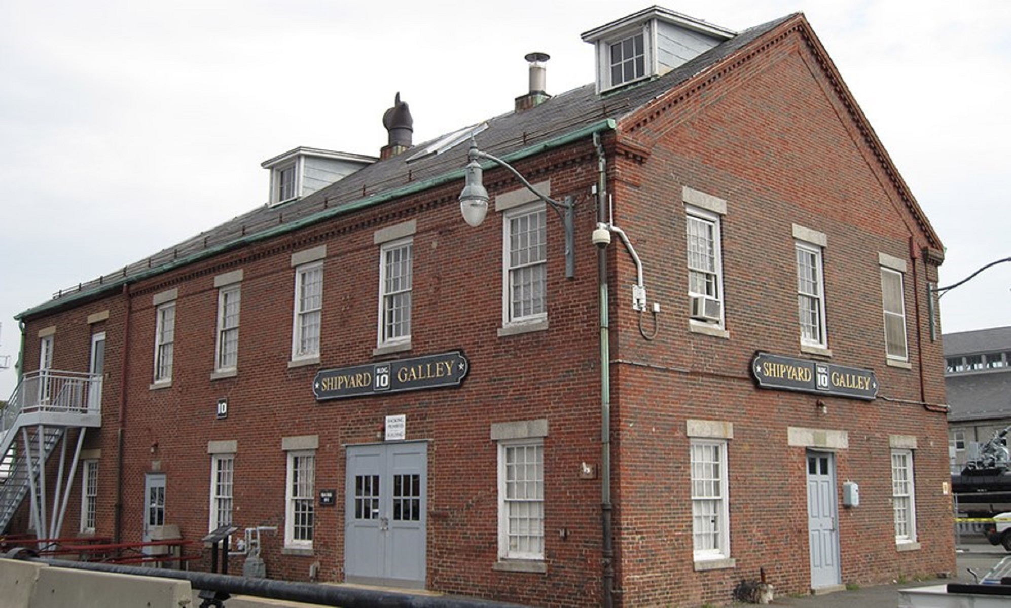
Sign titled "Building 10" in the Charlestown Navy Yard. This sign describes the history of Building 10 at the yard.
Description: Low-profile wayside that is 30 X 24 inches. It has a semi-cylindrical base with two rectangular pillars supporting the panel. The panel is made from black metal. The sign is located on cement in front of Building 10, the old Shipyard Galley. The building sits across the pavement from where the USS Constitution is docked and is next to the portal crane. Layout: The sign is black metal with white text and black and white images. Centered at the top is the sign’s title in uppercase letters. The text and images are arranged in two columns. The first column features the first two paragraphs of the main text separated by a space. A square photo is below the text. The image’s caption is to the right of the image’s bottom right corner. The second column features a square image with its caption centered below the image. Below the caption is the last paragraph of the main text.
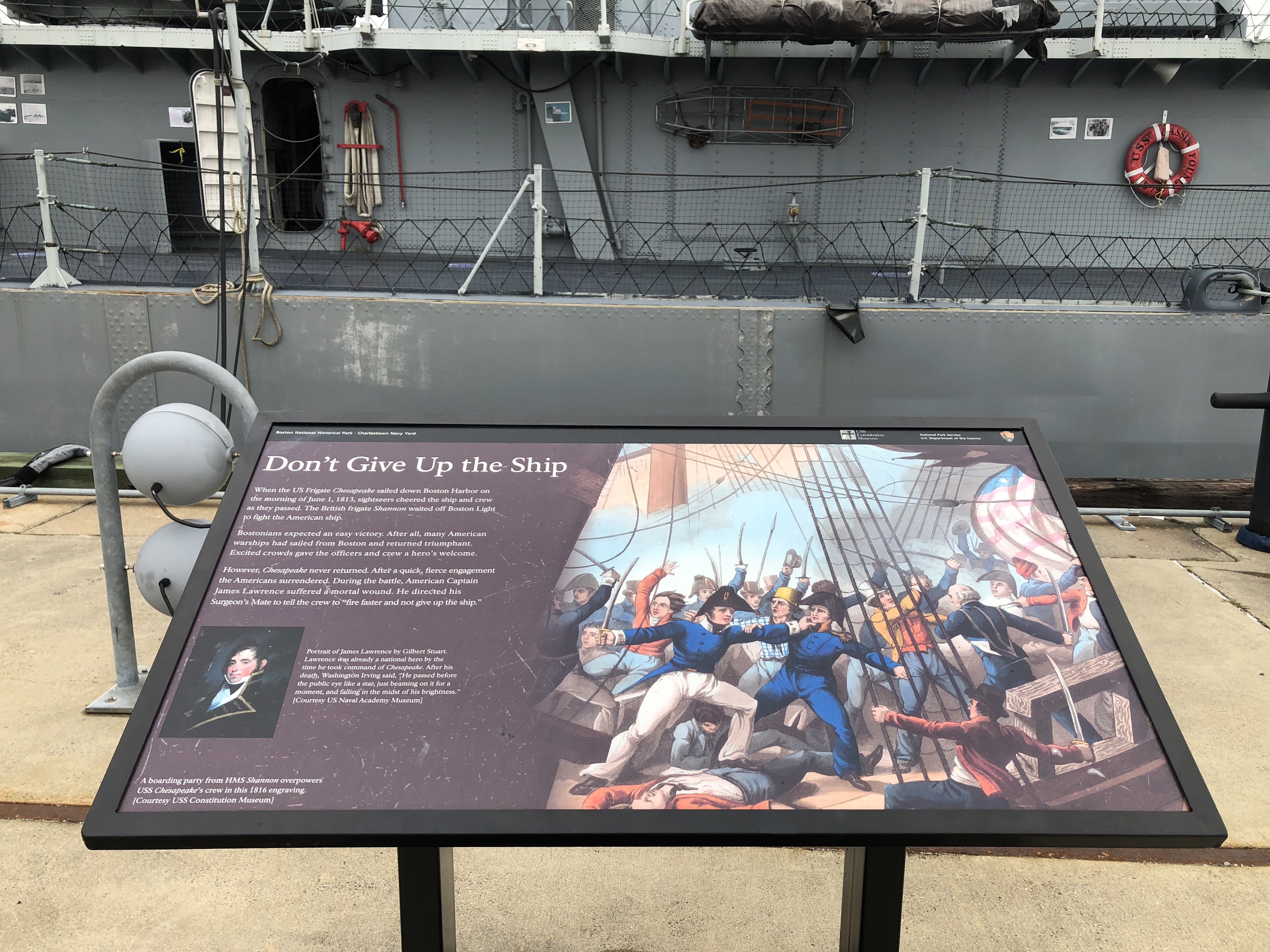
Sign titled "Don't Give Up the Ship" in the Charlestown Navy Yard. This sign describes a battle between the US Frigate CHESAPEAKE and HMS SHANNON.
Description: Low-profile wayside that is 42 x 24 inches. It has a black rectangular base with two rectangular pillars supporting the panel. The panel is framed in black metal. The sign is located on the sidewalk on a Pier facing the USS CASSIN YOUNG. At the top of the sign is a thin black banner with white text. Aligned to the left is “Boston National Historical Park – Charlestown Navy Yard.” Aligned to the right in order from left to right is the USS Constitution Museum logo, the text “National Park Service U.S. Department of the Interior,” and finally the National Park Service arrowhead. The title of the sign is below the black banner in large white font. The panel has a dark maroon background. White text is on the left third of the sign. Below the text in this same section is a portrait with the caption to the right. An image covers the entirety of the right two thirds of the sign. The caption for the image is the bottom left corner of the sign.
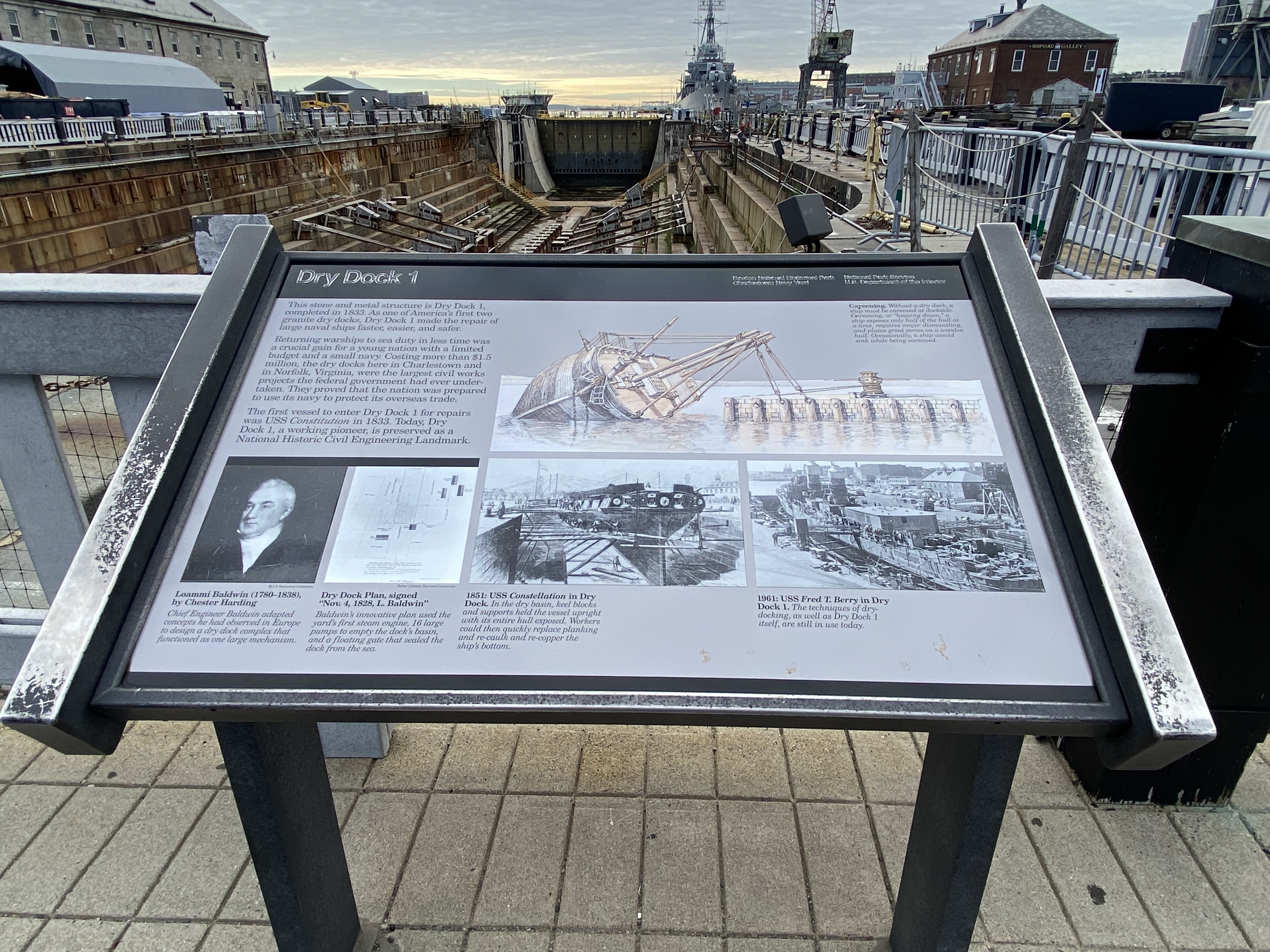
Sign titled "Dry Dock 1" in the Charlestown Navy Yard. This sign describes the construction and usage of Dry Dock 1 in the Naval Yard.
Description: Low-profile wayside that is 40.5 x 24 3/8 inches wide and sits between two raised metal sides. The interpretive panel itself is 36.25 inches wide. It has a rectangular base with two rectangular pillars supporting the panel. The panel is framed in black metal. The sign is located off of 1st Avenue, on cement directly in front of Dry Dock 1. Layout: At the top of the sign is a black banner with white text. The text includes the title, “Dry Dock 1,” aligned to the left. Aligned to the right in the banner are two columns of two lines of text. The first column of text is “Boston National Historical Park,” followed by “Charlestown Navy Yard.” The second column states “National Park Service,” followed by “U.S. Department of the Interior.” The rest of the panel has a gray background with black text, a color drawing, and black and white images. The text and images are arranged in three rows. The top row features a square of the main text in the left-hand corner. To the right is a colored drawing that fills three-quarters of the row. A caption for the drawing sits above it in the right corner. The middle row features four images. The two images on the left are squares that sit below the main text. A black bar above them connects the images but separates them from the main text. The right two landscape images are divided between the remaining three-quarters of the row. The bottom row are the photo captions. For the square images, the captions are directly below the image, but for the rectangular images, the captions are aligned left. All image captions are italicized with bold titles.
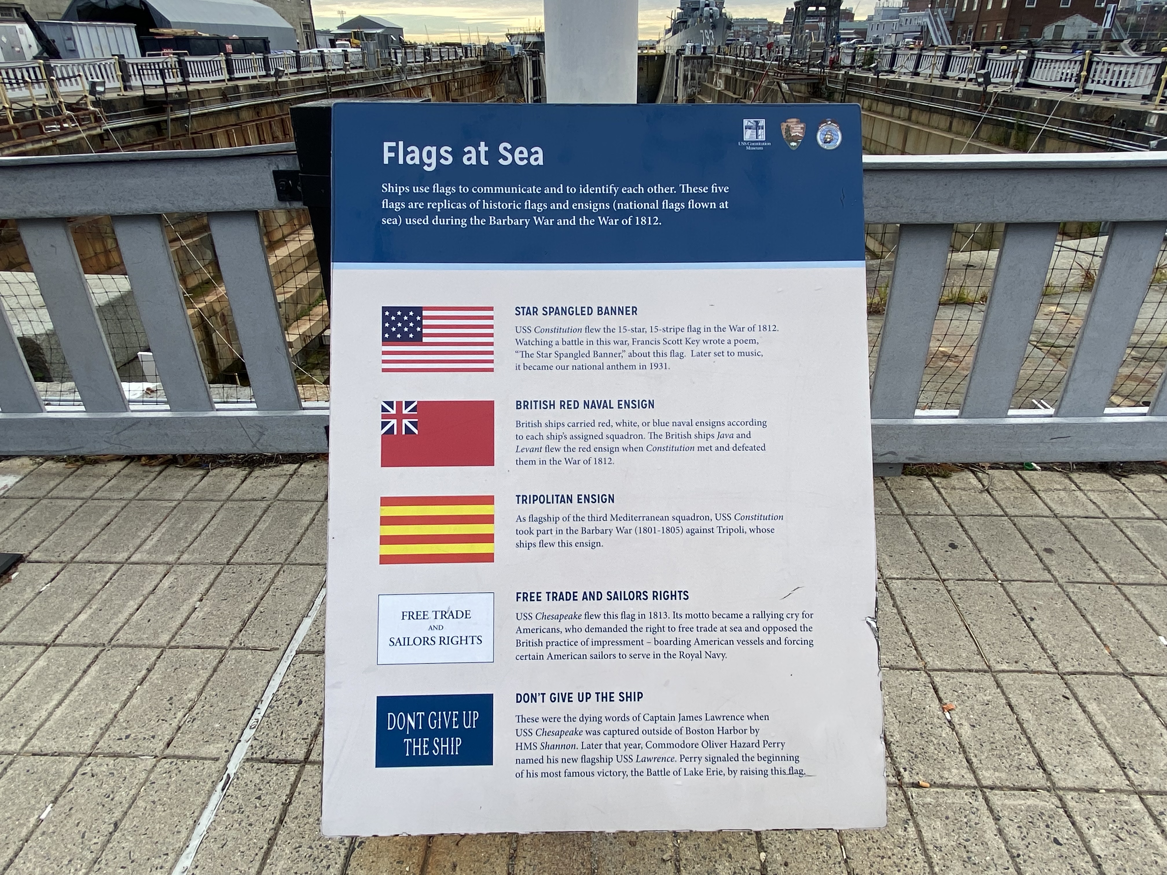
Sign titled "Flags at Sea" in the Charlestown Navy Yard. This sign describes five different sea flags.
Description: Low-profile wayside that is 28.5 x 38 inches. The sign is attached to the flagpole and suspended in the air. The sign is located on cement in front of a flagpole facing Dry Dock 1. Layout: At the top of the sign is a blue banner with white text. The text includes the title, “Flags at Sea,” aligned to the left. Before the title is a paragraph. Aligned in the top right corner of the banner are three small logos in a row. The first is the USS Constitution Museum logo with “USS Constitution Museum” written below. The second is the National Park Service arrowhead. The third is the USS Constitution logo. A light blue line separates the top banner from the rest of the panel. The rest of the panel has an off-white background with navy blue text. Text and images are arranged in two columns and five rows. The first column features images of various flags. The second column features text. Each row has the corresponding flag title in all caps and bolded. A paragraph describing the flag is below each title.
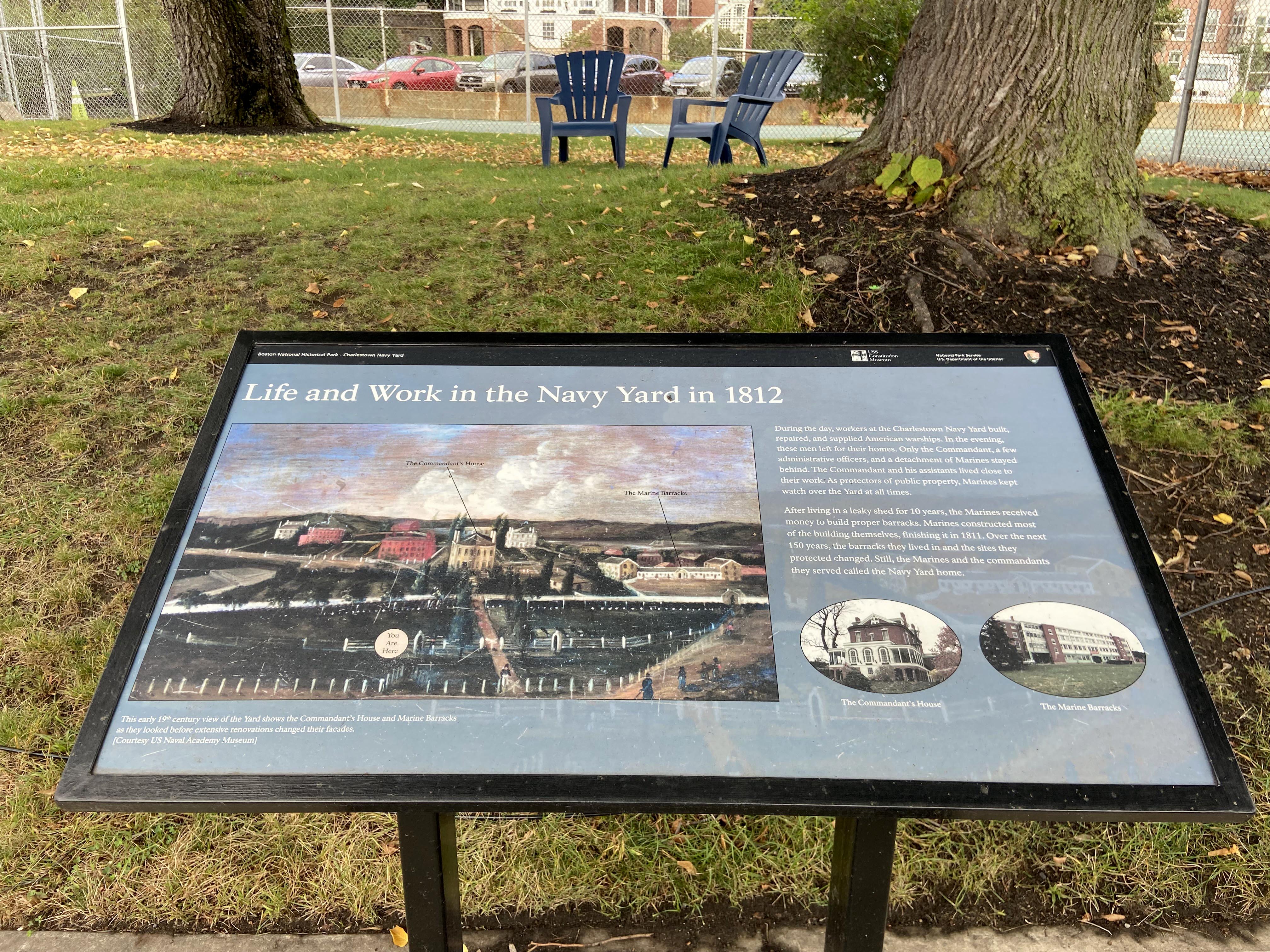
Sign titled "Life and Work in the Navy Yard in 1812" in the Charlestown Navy Yard. This sign shows a 19th century landscape view of the Navy Yard, highlighting places of residence at the Yard.
Description: Low-profile wayside that is 24x42 inches. It has a black rectangular base with two rectangular pillars supporting the panel. The panel is framed in black metal. The sign is located on the sidewalk at the bottom of a sloped grassy lawn southeast of the tennis courts. Beyond the tennis courts is the Commandant’s House. At the top of the sign is a thin black banner with white text. Aligned to the left is “Boston National Historical Park – Charlestown Navy Yard.” Aligned to the right in order from left to right is the USS Constitution Museum logo, the text “National Park Service U.S. Department of the Interior,” and finally the National Park Service arrowhead. The title of the sign is below the black banner in large white font. The panel has a transparent light blue background that covers a historic image. The same image is used as the main image of the sign. This image spans two thirds of the width of the sign. Beneath this image aligned to the left is the image caption. The right third of the sign includes text above two oval color photographs side by side. Captions are beneath each photograph.
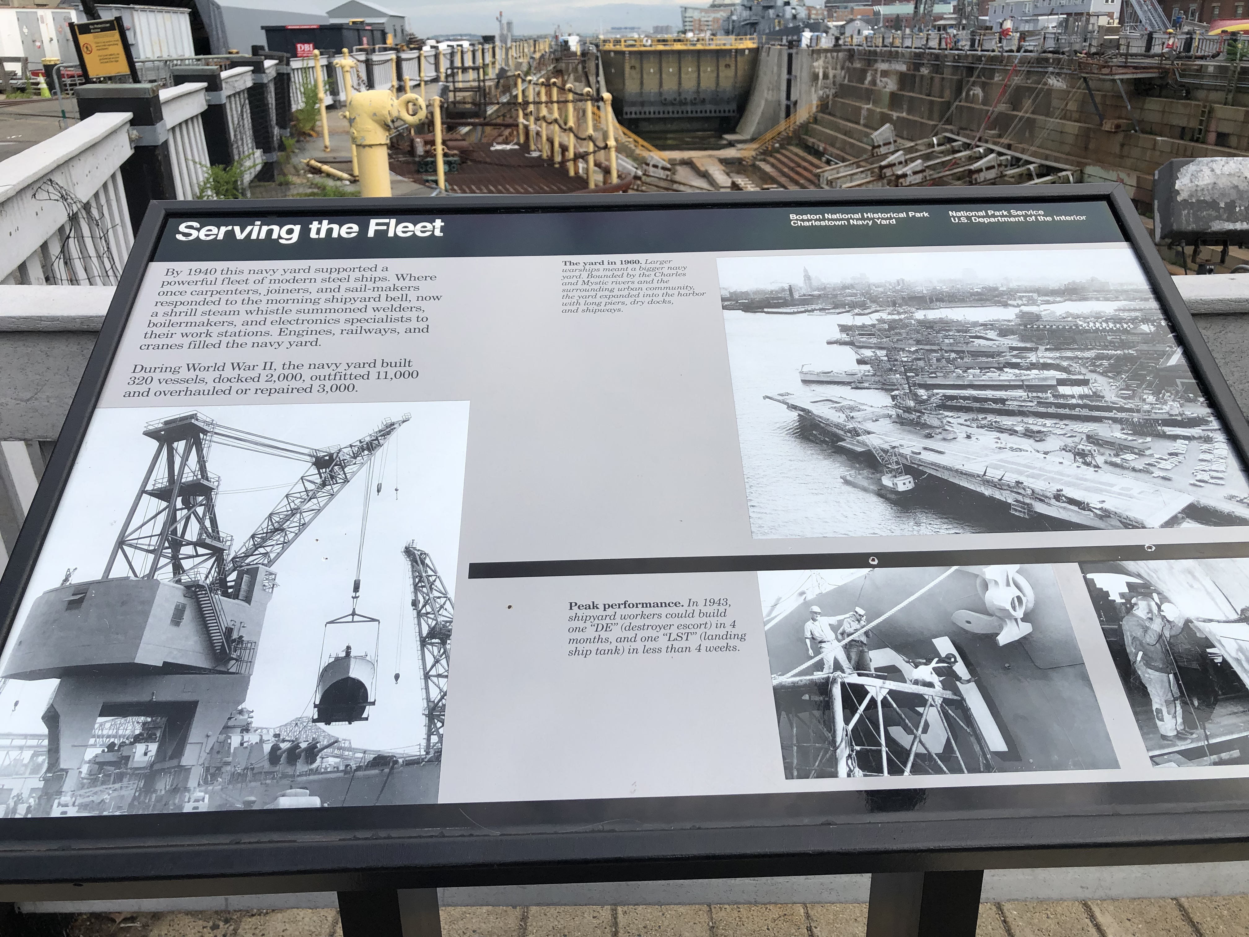
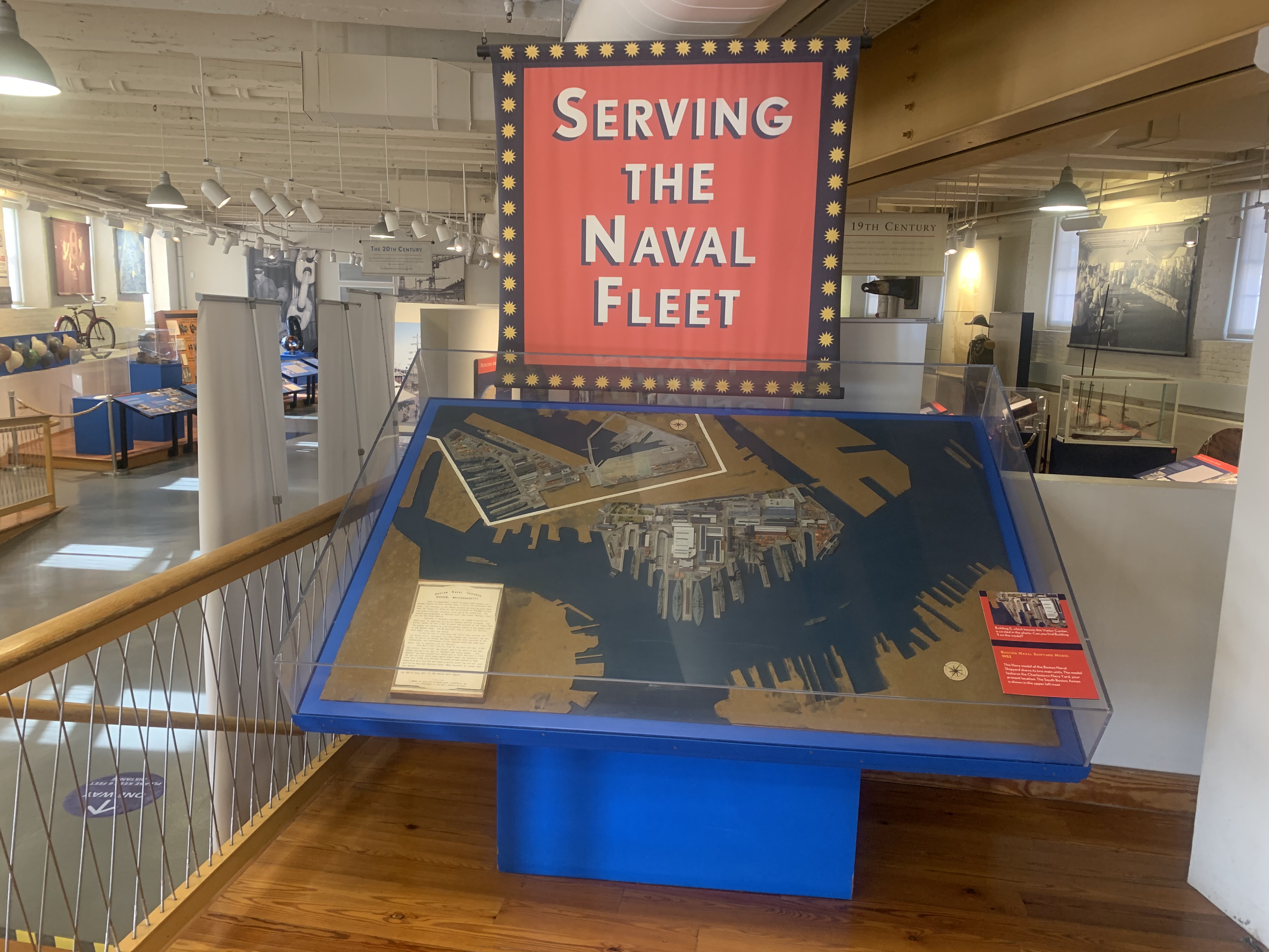
Sign titled "Serving the Fleet" in the Charlestown Navy Yard. This sign describes how by 1940, this navy yard supported a powerful fleet of modern steel ships during World War II.
Layout: At the top of the sign is a black banner with white text. The text includes the title, “Serving the Fleet,” aligned to the left. Aligned to the right in the banner are two columns of two lines of text. The first column of text is “Boston National Historical Park,” followed by “Charlestown Navy Yard.” The second column states “National Park Service,” followed by “U.S. Department of the Interior.” The rest of the panel has a gray background with black text and black and white images. The text and images are arranged in two rows and three columns. The top row takes up roughly two thirds of the sign’s height. A thick black line separates the two rows. The top row features a column of text with a space dividing the paragraphs. The second column features a bolded image title followed by an italicized image caption. The third column features a large square image that is slightly less than half the width of the sign. The bottom row’s first column features a large rectangular image that extends into the top row, right under the text, and covers where the thick black line would be. The second column features a bolded image title followed by an italicized image caption. The third column features two square images side-by-side. Location: Dry Dock 1
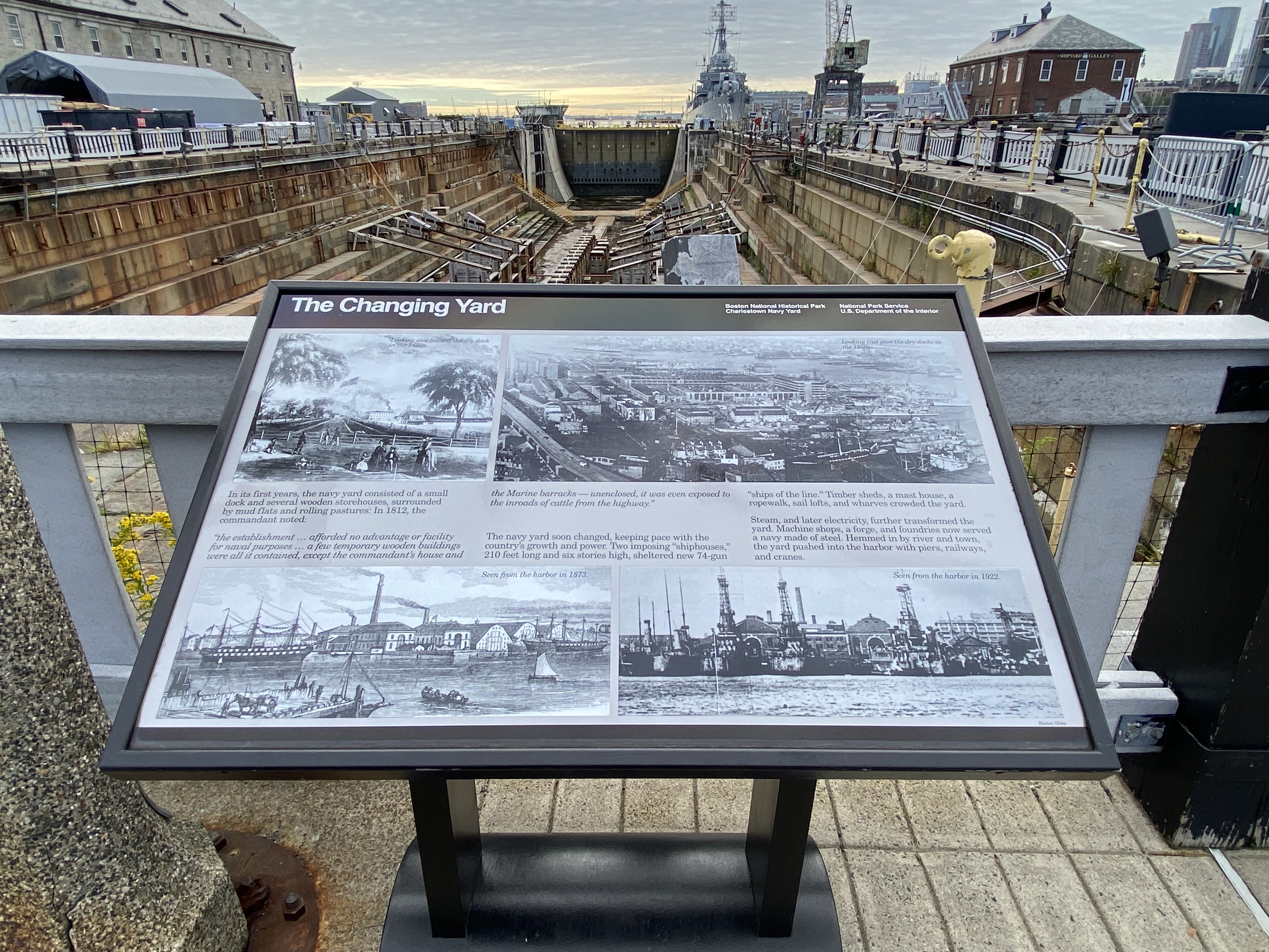
Sign titled "The Changing Yard" in the Charlestown Navy Yard. This sign describes changes and advancements the Charlestown Navy Yard has seen over the years.
Description: Low-profile wayside that is 36.5 x 24.5 inches. It has a semi-cylindrical base with two rectangular pillars supporting the panel. The panel is framed in black metal. The sign is located off of 1st Avenue, on cement directly in front of Dry Dock 1. Layout: At the top of the sign is a black banner with white text. The text includes the title, “The Changing Yard,” aligned to the left. Aligned to the right in the banner are two columns of two lines of text. The first column of text is “Boston National Historical Park,” followed by “Charlestown Navy Yard.” The second column states “National Park Service,” followed by “U.S. Department of the Interior.” The rest of the panel has a gray background with black text and black and white images. The text and images are arranged in three rows. The top row feature two columns of images. The image on the left is a square. The image on the right is a long rectangle that spans roughly two-thirds of the row. The middle row features the main text divided between three columns. A quote within this main text is italicized and begins at the bottom of the first column of text and ends at the top of the second column of text. The bottom row is similar to the top row because it has two images, but the bottom row features two rectangular images side-by-side with each spanning half of the width of the sign. Each image has a caption in the right-hand corner in italicized black font.
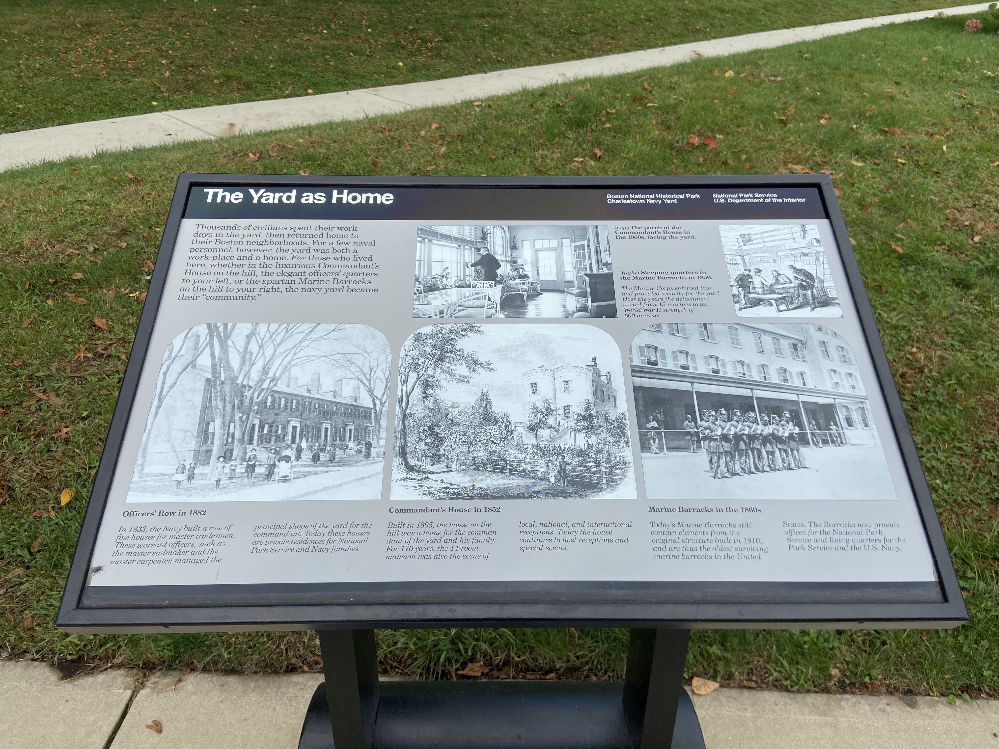
Sign titled "The Yard as Home" in the Charlestown Navy Yard. This sign describes the different residences located in the Navy Yard.
Description: Low-profile wayside that is 24x42inches. It has a black rectangular base with two rectangular pillars supporting the panel. The panel is framed in black metal. The sign is located on the sidewalk at the bottom of a sloped grassy lawn, directing the viewer to look up the hill towards the Commandant’s House. At the top of the sign is a black banner with white text. The text includes the title, “The Yard as Home,” aligned to the left. Aligned to the right in the banner are two columns of two lines of text. The first column of text is “Boston National Historical Park,” followed by “Charlestown Navy Yard.” The second column states “National Park Service,” followed by “U.S. Department of the Interior.” The rest of the panel has a gray background with black text and black and white images. The text and images are arranged in three columns and three rows. The first row contains text to the far left, with two images to the right. Captions are in between the two images. The captions are bold with additional information italicized. The next row has three large square images side by side. The square images have rounded top corners. The third and final row are italicized captions beneath each of the three images. The headers of the captions are bolded and the sub-text is italicized.
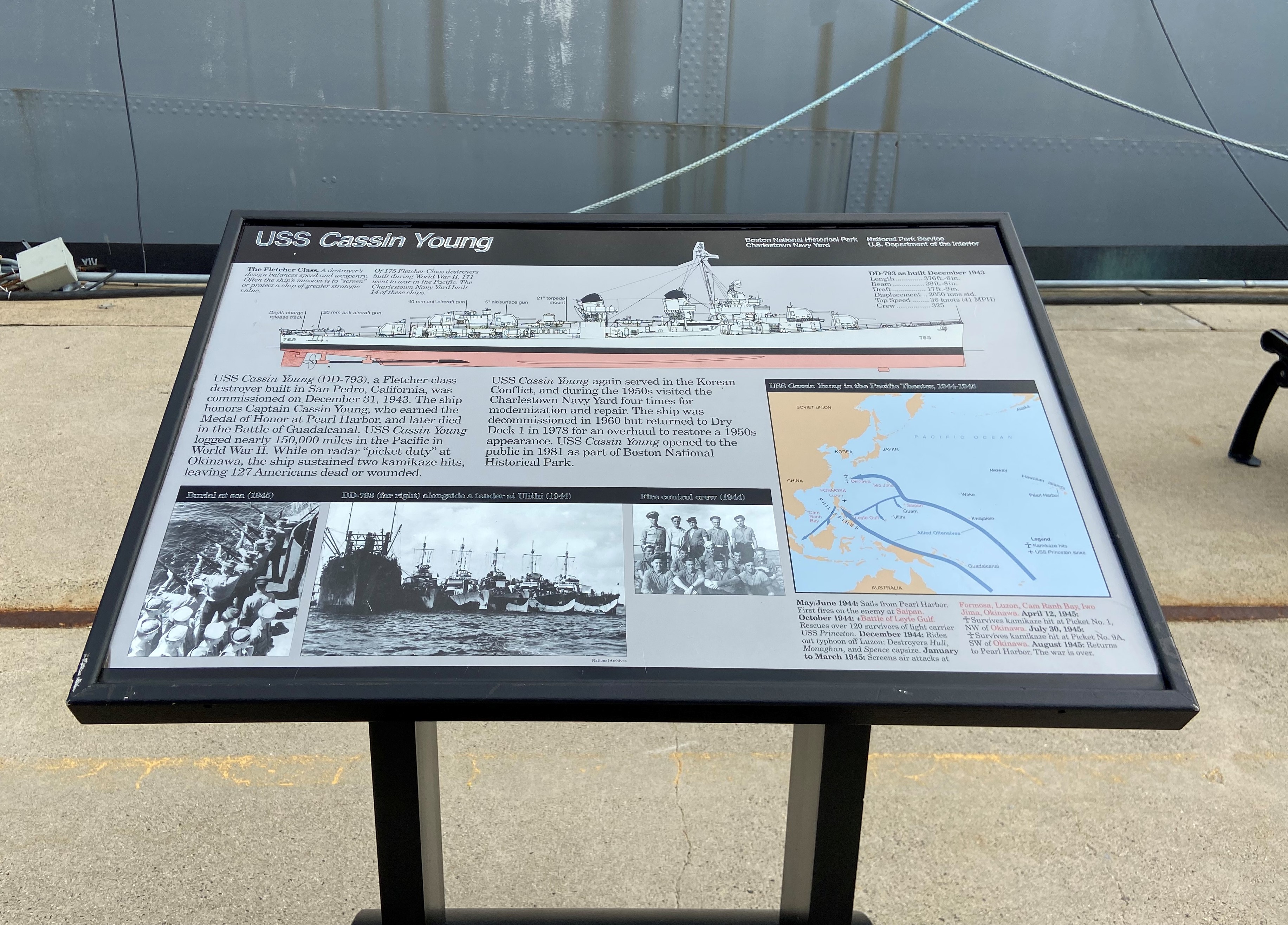
Sign titled "USS CASSIN YOUNG" in the Charlestown Navy Yard. This sign explores the Fletcher Class Destroyer USS CASSIN YOUNG and its history.
Description: Low-profile wayside that is 36.5 x 24.5 inches. It has a black semi-cylindrical base with two rectangular pillars supporting the panel. The panel is framed in black metal. The sign is located on Pier 1 facing the USS Cassin Young. Layout: At the top of the sign is a black banner with white text. The text includes the title, “USS Cassin Young,” aligned to the left. Aligned to the right in the banner are two columns of two lines of text. The first column of text is “Boston National Historical Park,” followed by “Charlestown Navy Yard.” The second column states “National Park Service,” followed by “U.S. Department of the Interior.” The rest of the panel has a gray background with black text, black and white images, and a color map. The top third of the panel has a diagram of a destroyer looking at the starboard side of the ship. The mast of the ship intersects the black banner at the top. Above the left end of the diagram are two columns of text serving as a diagram caption. The caption title is bolded, while the other text is italicized. Above the right end of the diagram is a short list of measurements about the ship. Directly below the diagram is two columns of text, taking up two-thirds of the panel’s width. Beneath these columns of text is a black bar with three images spaced beneath it. In the black bar are titles of the images. To the right of the text and images in the bottom right third of the panel is a map outlined in black. A thicker black strip above the map features white text aligned left. The map has mostly black labels with areas of importance labeled in red. Beneath the map are two short columns of text related to the map. Dates are bolded. Points that are labeled in red in the map are also printed in red within this text.
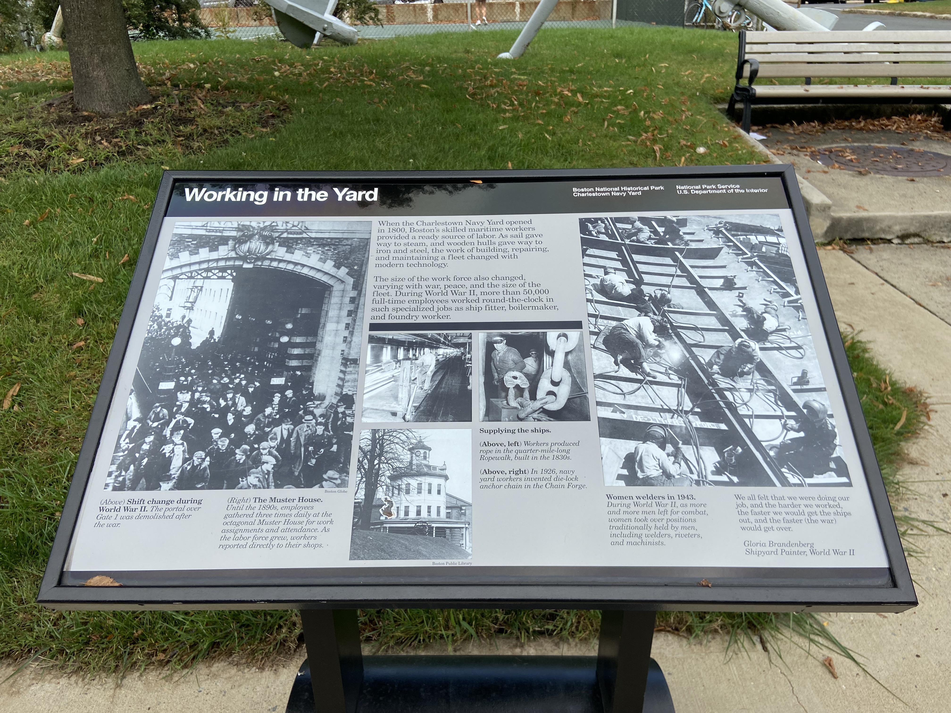
Sign titled "Working in the Yard" in the Charlestown Navy Yard. This sign explores the experiences of workers at the navy yard.
Description: Low-profile wayside that is 36.5 x 24.5 inches. It has a semi-cylindrical base with two rectangular pillars supporting the panel. The panel is framed in black metal. The sign is located on the sidewalk on the northwest side of 1st Avenue, facing the large anchors and tennis courts. The Marine Barracks are visible beyond the tennis courts. At the top of the sign is a black banner with white text. The text includes the title, "Working in the Yard," aligned to the left. Aligned to the right in the banner are two columns of two lines of text. The first column of text is "Boston National Historical Park," followed by "Charlestown Navy Yard." The second column states "National Park Service," followed by "U.S. Department of the Interior." The rest of the panel has a gray background with black text and black and white images. Titles of captions are bolded, while additional information is in italics. The panel is divided into three columns. The left column has a long portrait-oriented image that fills approximately the top 4/5 of the column. The image has a credit line beneath the bottom right corner. Below this image are two columns, each with a caption. The top third of the middle column is text. Below the text is a thick black bar separating it from the images below. A two x two grid is below this black bar, with the top two grid squares consisting of images, and the bottom left section also having an image with an image credit beneath it. The final grid section in the bottom right has captions. The right column has the same format as the left column. It has a long portrait-oriented image that fills approximately the top 4/5 of the column. Below this image are two columns, the left has a caption and the right has a quote. The quote is not-italicized while the name of the speaker is italicized.
The Abiel Smith School opened in 1835 and served as a focal point in the Black community’s struggle for equal school rights in 19th century Boston.
A modest two-story brick schoolhouse building situated on the corner of Joy Street and Smith Court, attached to a brick building on the left with Smith Court on the right. The building is on a downward slope and there is a granite base of the building. In the front there is a small half window in the granite level, with a set of granite stairs leading to a gray wooden door surrounding by white trim and a small window above the door. There are large 4 x 6 grid-paned glass windows on either side of the door with white trim. To the right of the windows are two dark plaques on the corner of the building facing Joy Street and facing Smith Court. In gold lettering both say “The Museum of Afro-American History, The Abiel Smith School and Museum Store, The African Meeting House, The Black Heritage Trail.” Above the door is a large white flagpole, and there are three windows, equally spaced, with white trim. The roof is angled to the center, with a brick chimney at the top. The side of the building facing Smith Court has a granite base. From left to right on the granite base there is a white vent, a half window, a small wooden door, and then two half windows. Above the granite level there are five windows with white trim equally spaced on the first floor, with five identical windows above them on the second floor.
Built in 1806, the African Meeting House served as a church, school and gathering place for the political activism and cultural life of Boston’s free Black community in the 19th century.
A three-story brick structure, the African Meeting House sits at the end of Smith Court, with the Abiel Smith School to the left, separated by a small walkway, and a brick building on the right also separated by a small walkway. On the ground level facing Smith Court, the African Meeting House has four archways. From left to right the first arch has been filled in with brick inset about three inches into the building, the next two are matching green doors and the last arch is also filled in with brick inset about three inches into the building. Between the two arches with green doors there is a black iron lamp that is on an iron bar connected to the brick wall. Hanging from that iron bar is a wooden sign with a depiction of the African Meeting House. Above the iron bar is a small concrete marker within the brickwork that honors Cato Gardner. Above this first level are four evenly spaced large arched glass-panned windows that are connected between the second and third floors of the building. These windows have green trim with a white frame. Moving into the walkway between the Abiel Smith School and the Meeting House, on the far-right corner there is a small plaque that identifies the building as a site on the National Register of Historic Places. To the left of that is a small window that is not transparent, with green trim and a white frame. There are three evenly spaced glass-paned windows with green trim and a white frame. On the second floor there are four glass-paned windows, evenly spaced out, with green trim and a white frame. On the third floor of the building there are four glass-paned windows, evenly spaced out, with green trim and a white frame. The room is at a center angle and has white trim above the brick.
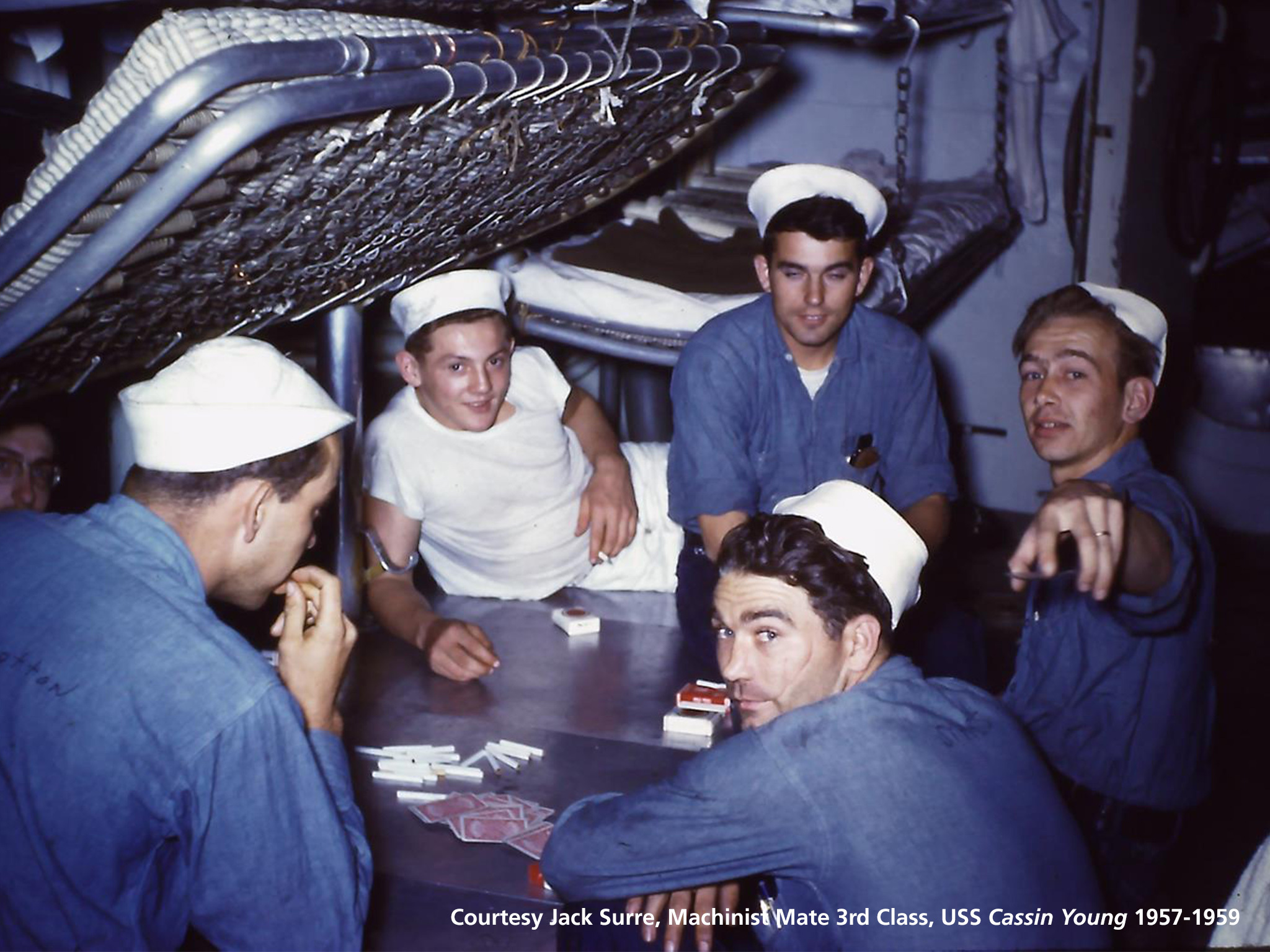
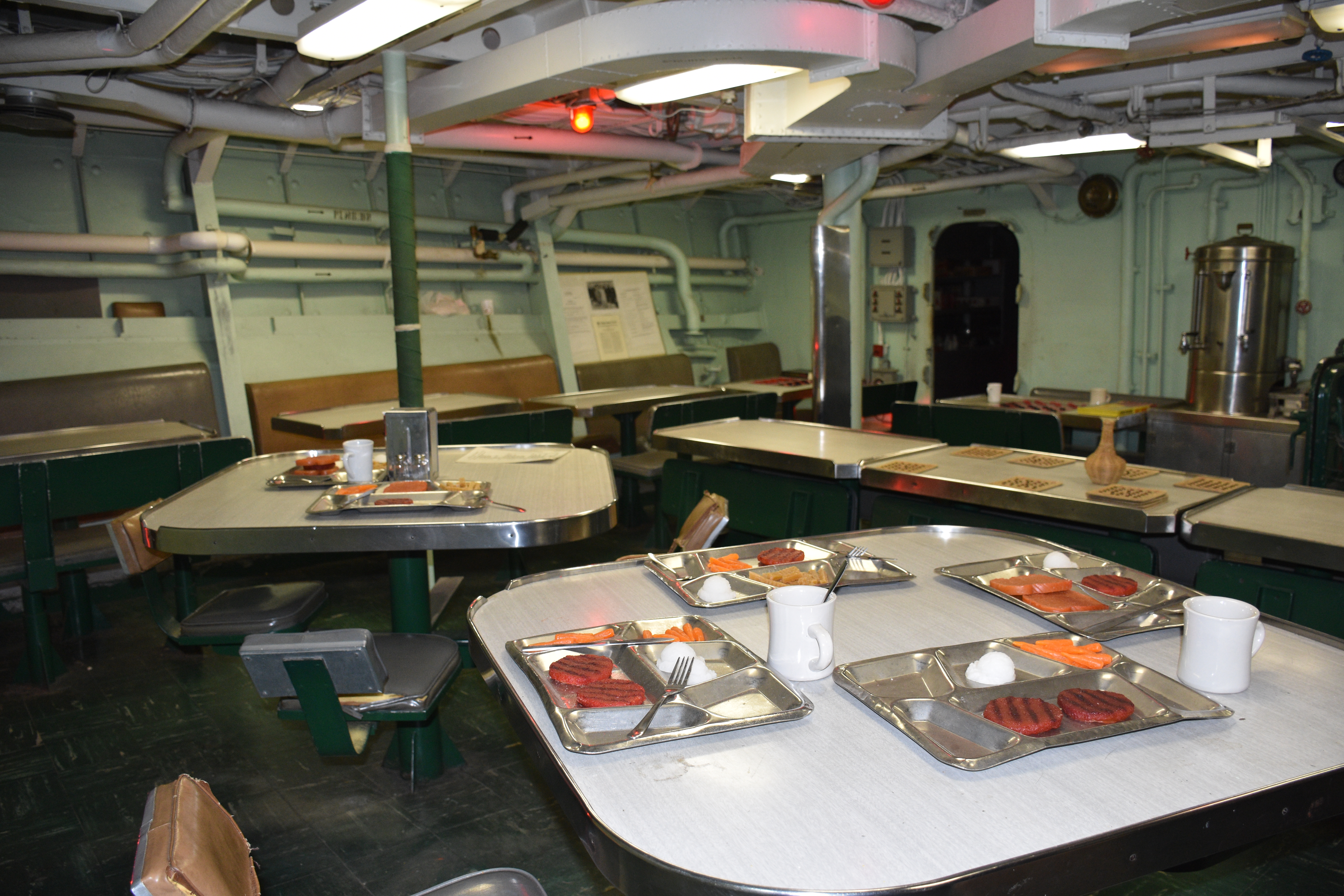
This is where two thirds of the enlisted crew called home. Each man had a bunk, one small locker, and many, many neighbors. Men found the conditions from acceptable, to tolerable, to absolutely unbearable.
Born into a biracial family in 1880, the poet and playwright Angelina Weld Grimke lived her earliest years at 61 Temple Street, in a neighborhood long known as a hotbed of Black activism.
Activist and singer Arianna Sparrow lived at 62 Phillips Street in Boston’s Beacon Hill neighborhood.
Five-story brick townhouse within a row of townhouses on a slight slant of a hill. Partial windows of basement line the walkway and have black trim. Arched door entry sits to the left and has four steps to the door. First floor has two windows to the right of the doorway, with the following stories having three evenly-spaced windows. A dark red door stands under an arched doorway.
Beacon Hill, the historic Boston neighborhood and the hill from which that neighborhood takes its name, has served the inhabitants of Boston for centuries. Its residents, their homes, and their gathering spaces played a transformational role in Boston's unique social, cultural, and political history.
Approximately 105 acre hill north of the Boston Common. Today's geography mark the area with Cambridge Street to the north, Somerset Street to the east, Beacon Street to the South, and Storrow Drive to the west, although with a little pop out on the southeast corner to include Park Street Church and Granary Burying Ground. Just a bit north of Park Street Church is the Massachusetts State House. Mount Vernon Street marks approximately the top of Beacon Hill, with the south slope falling towards Boston Common, the north slope declining towards Cambridge Street, and the west slope declining towards Charles Street. Beacon Hill has streets lined with brick townhouses and a couple small public alleyways and gardens.
City Hall serves as the center of government for the City of Boston. Built in 1968, the design firm Kallmann, McKinnell, and Knowles committed to a brutalist style for the new city administration building.
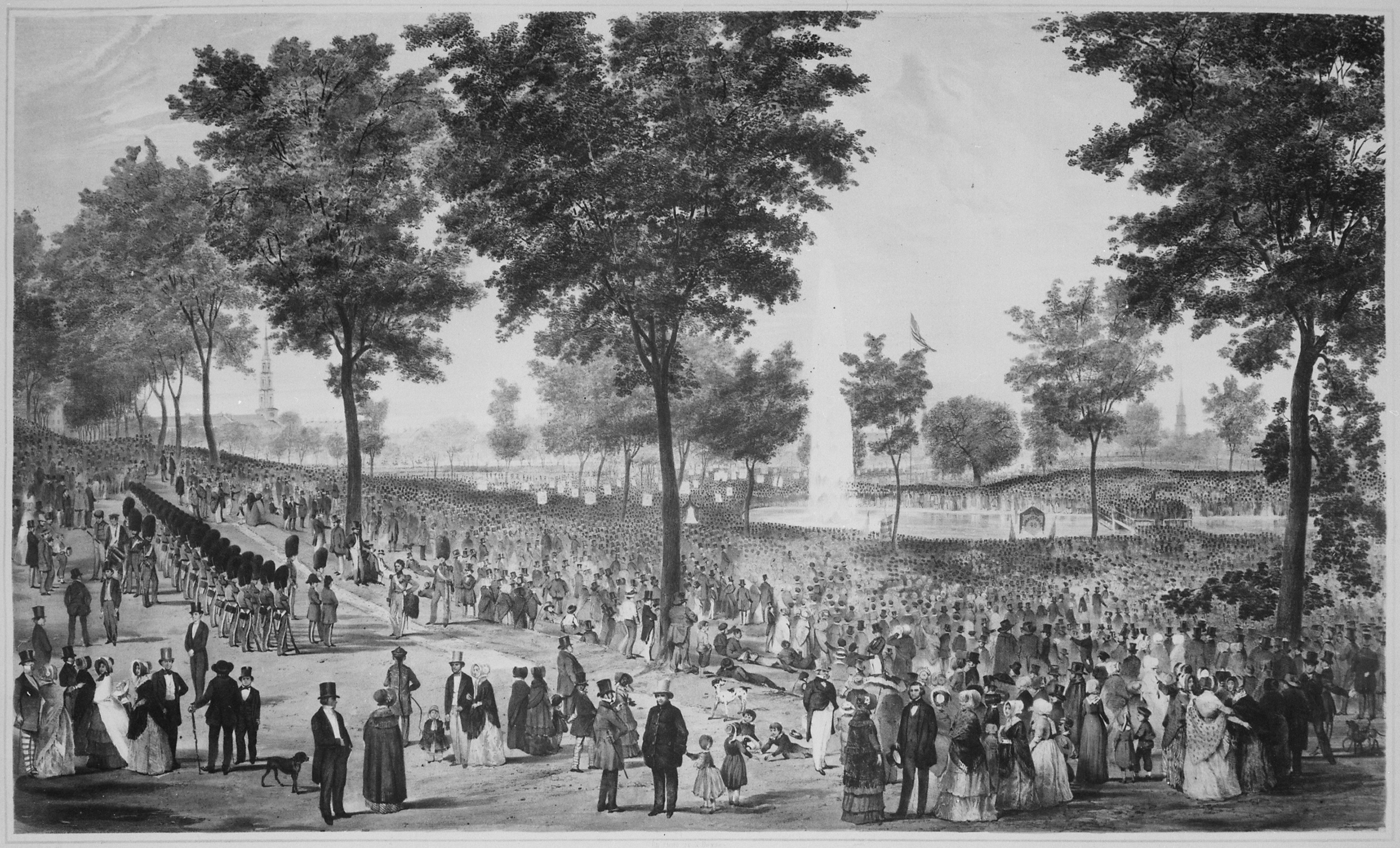
Considered the oldest public park in the United States, Boston Common played an important role in the history of conservation, landscape architecture, military and political history, and recreation in Massachusetts. The Common and the adjoining Public Garden are among the greatest amenities and most visited outdoor public spaces in Boston.
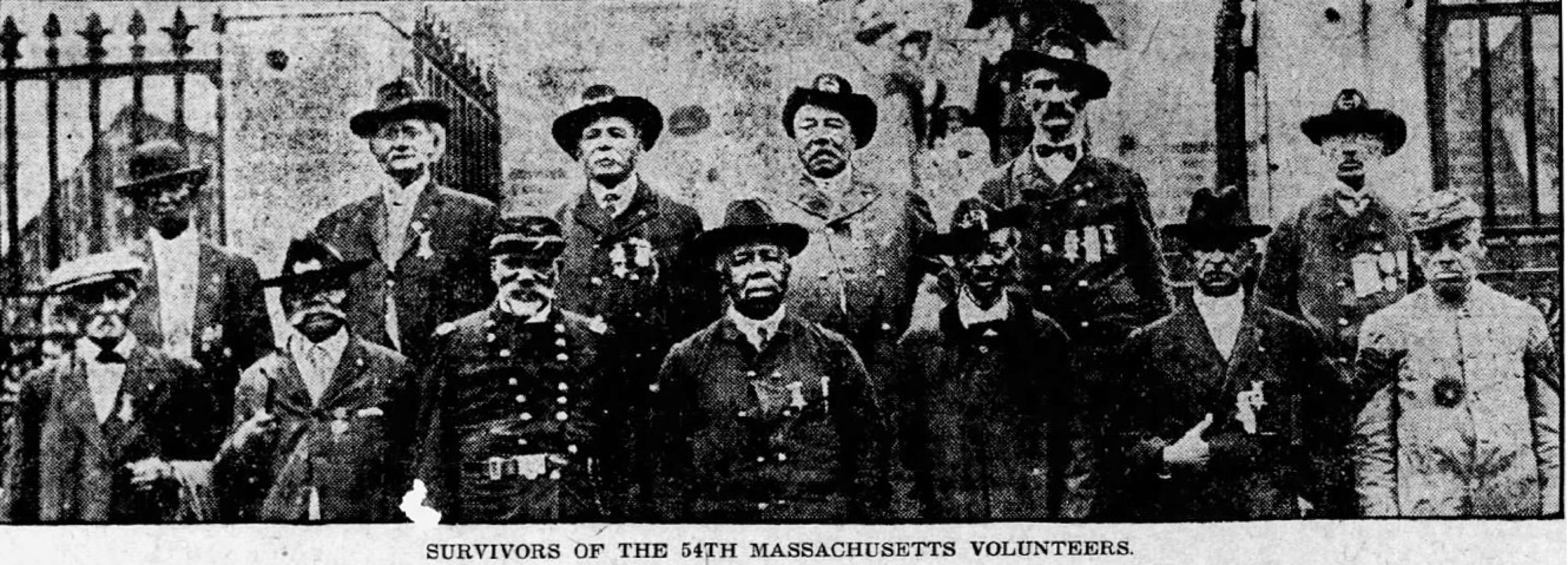
Sprawling 50-acre park that is bordered by Beacon Street to the north, Park Street to the northeast, Tremont Street to the southeast, Boylston Street to the south, and Charles Street to the west. There is a slight incline moving from west to east and south to north, so the highest point of the Common is the northeast corner. While mostly composed of lawns split up by sidewalks, there are several significant elements. At the northeast corner, across from the Massachusetts State House, stands the Robert Gould Shaw/Massachusetts 54th Memorial, which is a two-sided marble sculpture with a bronze relief of soldiers on the north side facing the State House. The southeast corner contains two main entrances to Park Street MBTA station next to a plaza with a large, circular fountain that is three levels. The first level has figures in the Greco-Roman style; the second level has cherubs, and the top level has some ornamentation. About 200-300 feet southwest is the Visitor Center, a small hut that has stables attached behind it. Continue walking south to reach the Parkman Bandstand, a white gazebo. Tucked away in the southeast corner is Central Burying Ground, which contains hundreds of old headstones. West of the Bandstand and northwest of the Burying Ground are two tennis courts, as well as a baseball field and softball field that are facing each other. North of the Bandstand is a hill on which the Soldiers and Sailors Monument stands. The monument is composed of a white marble obelisk with bronze figures at each corner representing different military groups. The square base of the monument has different bronze reliefs of soldiers. Northeast of that hill is Frog Pond, a shallow, man-made concrete pond. Next to it is a one-story concrete building that holds restrooms, lockers, and refreshments for purchase. Finally, east of the pond is the Tadpole Playground, an enclosed playground with structures.
This site served as the federal courtroom and jail cell for freedom seekers arrested under the Fugitive Slave Law. In response, the courthouse became a site of protest for abolitionists.
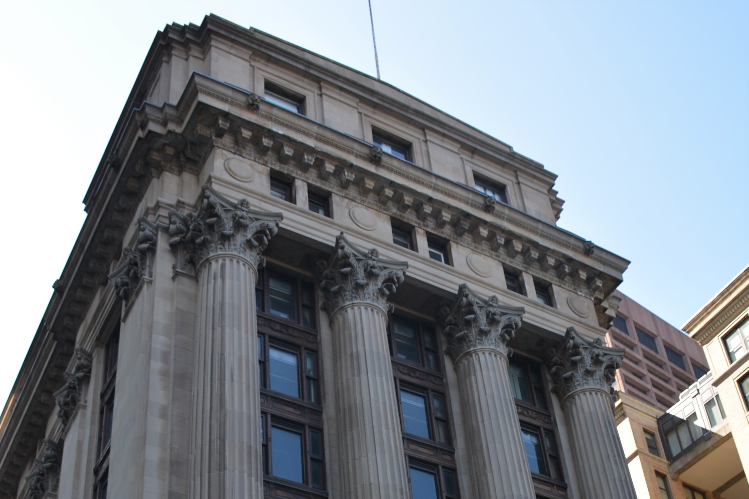
A narrow, rectangular building that has streets on three sides of it. It is neo-classical in style, with the first tall floor sided in rows of granite slabs. Center door has a tall entryway with a small pediment above. Two smaller doorways flank each side. Above the tall first floor, six floors with large glass windows are set back while four Corinthian columns sit on top of the first floor and divide each floor into three sets of windows. Each set of window is multi-paned, one large glass pane in the center with two narrow panes stacked on top of each other on either side. A large ornamental cornice sits on top of the columns.
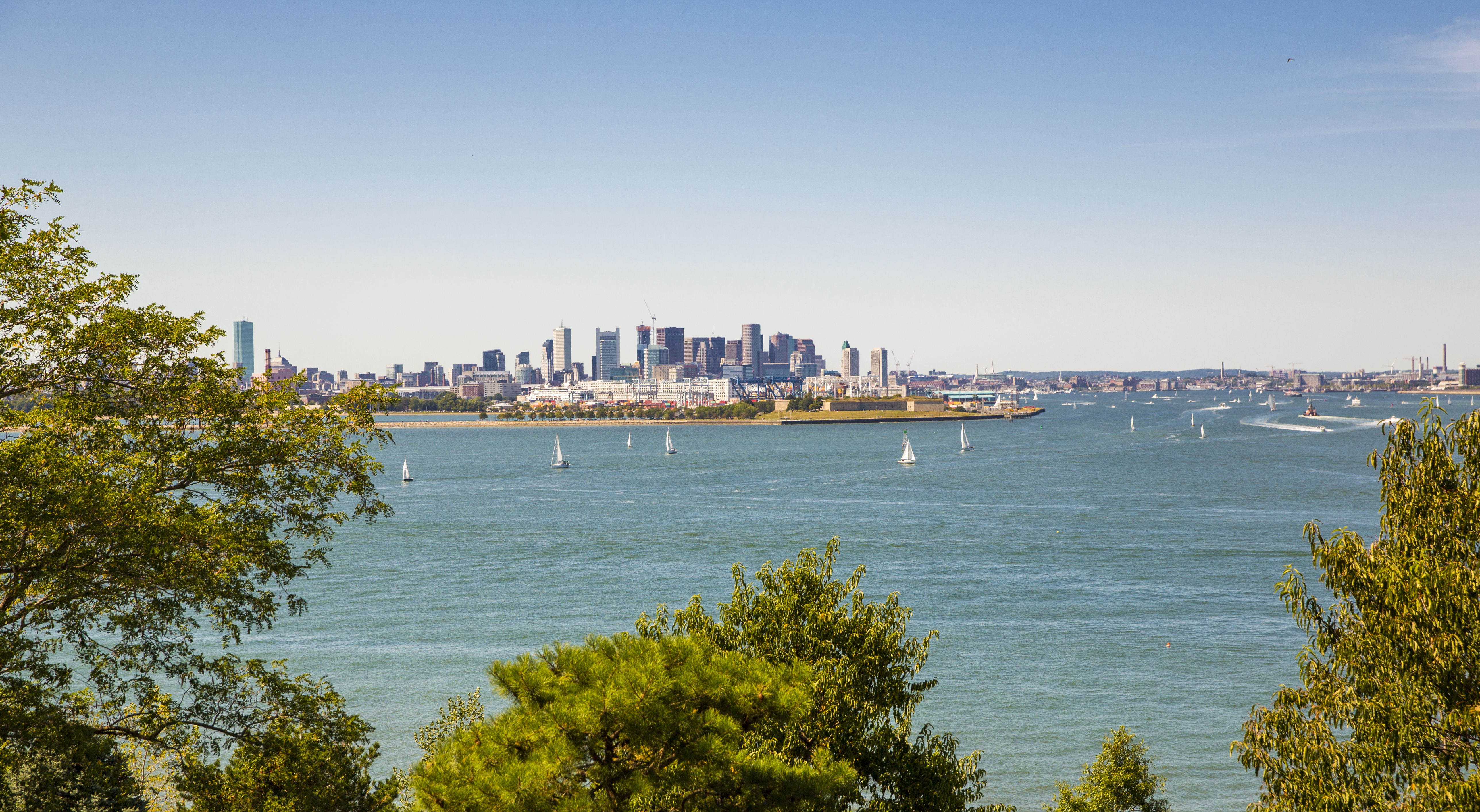
A major port and center for commerce, Boston Harbor played an integral role in many aspects of Boston's history, including the Underground Railroad.
A large harbor connecting numerous waterways and canals, including the Charles and Mystic Rivers. Most of the Boston Harbor Islands are situated within it.
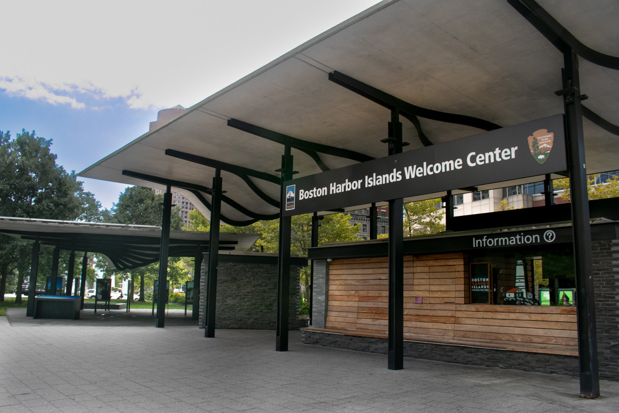
Located on the Rose Kennedy Greenway, the Boston Harbor Islands Welcome Center offers visitor information and serves as a waypoint before beginning any journey to the Boston Harbor Islands. The Welcome Center, opened in 2012, acts as a gateway to the Boston Harbor Islands National and State Park, as ferries to several islands, such as Georges and Spectacle, depart just east at Long Wharf North.
The Boston Harbor Islands Welcome Center is a covered pavilion with a building along the Greenway. The Welcome Center sits along the Rose Kennedy Greenway between two lane streets on opposite sides. The greenway has trees, bushes, and grassy areas running parallel to the roads. The Welcome Center building has screen panels alerting visitors to alerts and information about the Islands and departures. The main pavilion has wood paneling and is connected to another pavilion that hangs over exhibit signs and carvings in the pavement. The Welcome Center has large maps of the Harbor Islands, including carvings on the ground that show the layout and size of many of the islands. Display signs share more about the history of the islands, and in the summer months Park Rangers are on hand to answer questions and provide programming to visitors.
Beneath the Old State House balcony, a circle of granite pavers mark the site of the Boston Massacre. On March 5, 1770, an unruly group of colonists taunted British soldiers by throwing snowballs and rocks. Firing upon the crowd, the British killed five colonists including Crispus Attucks. Boston lawyer and future American President John Adams successfully defended the soldiers in court against murder charges.
Circular granite marker in the sidewalk directly in front of the east entrance of the Old State House. State Street located to the north and Devonshire Street to the south. Granite marker is about 8-10 feet in diameter. The outer ring of the circle is in brown stone bordered in gold. Gold stars are equally spaced throughout the ring. At the top of the ring (when facing the intersection and back to the Old State House) are the words "Site of the Boston Massacre." The words "March 5, 1776" are along the bottom of the circle. The inner rings are composed of gray cobblestones, intersected by 13 lines of gray cobblestones. At the very center of the circle is a gray circular stone with a star imprinted on it.
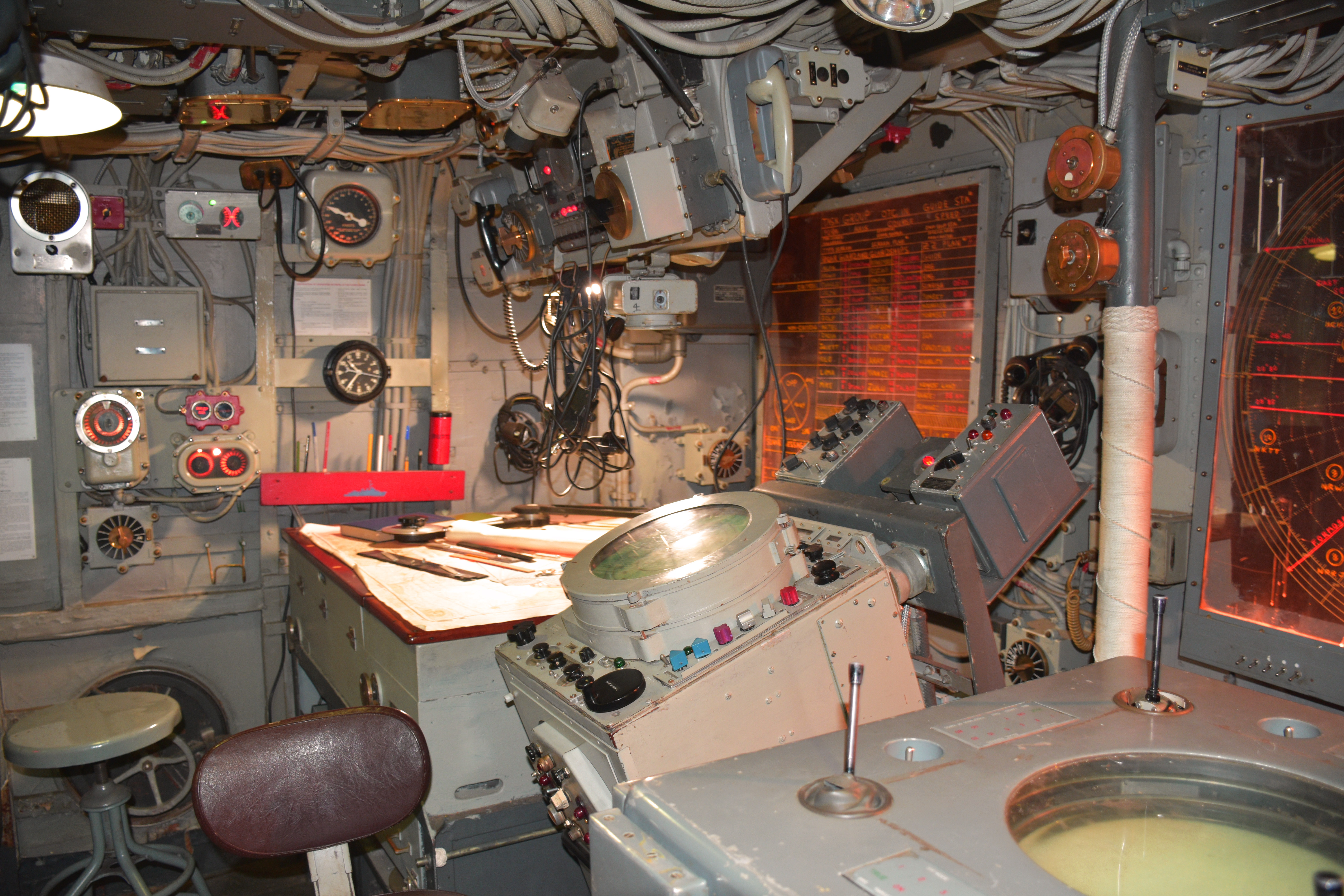
Because of the thin armor of their ships, the rugged conditions, and the reputation of a "can-do" attitude, destroyer men took pride in their nickname: "Tin can sailors."
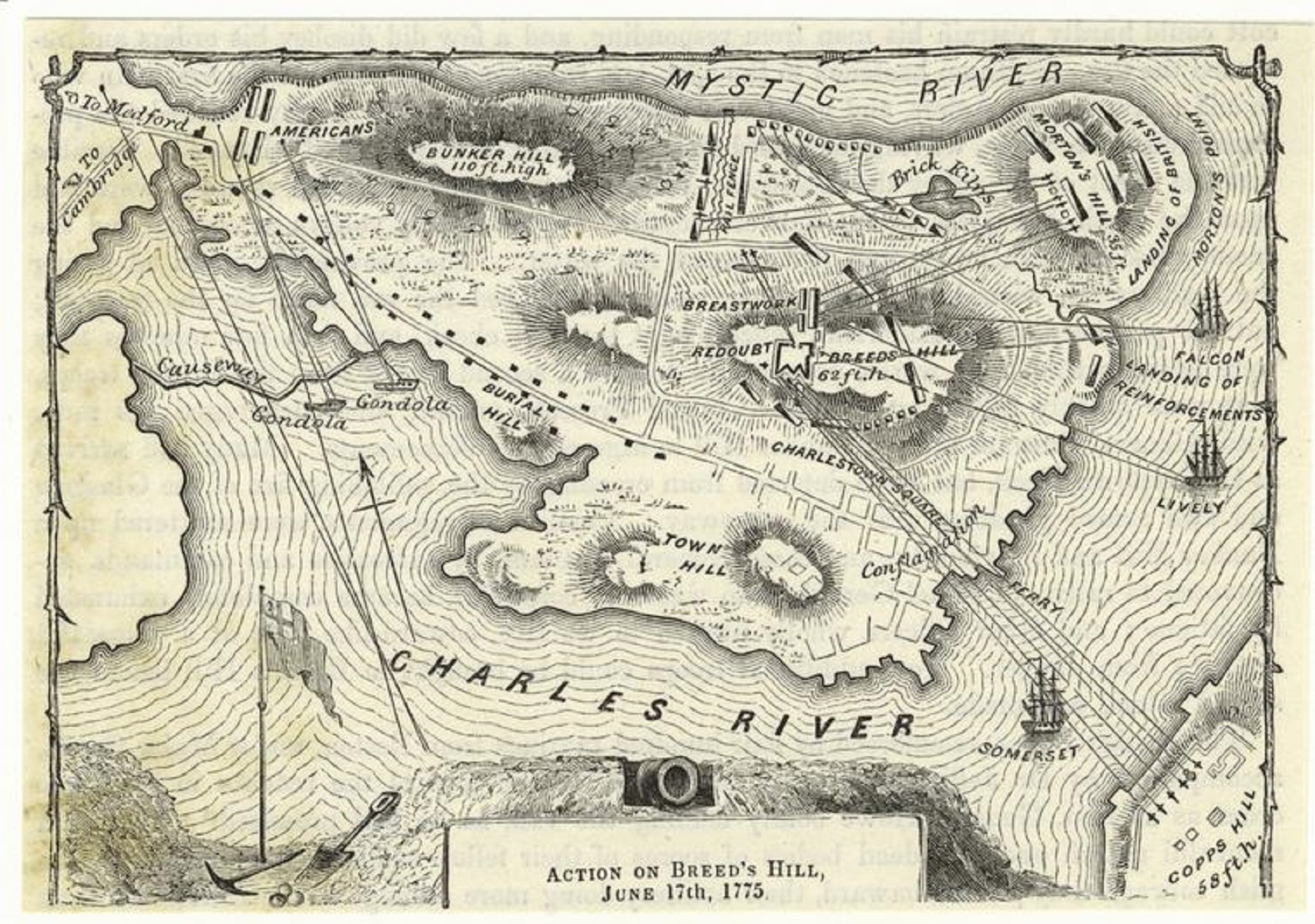
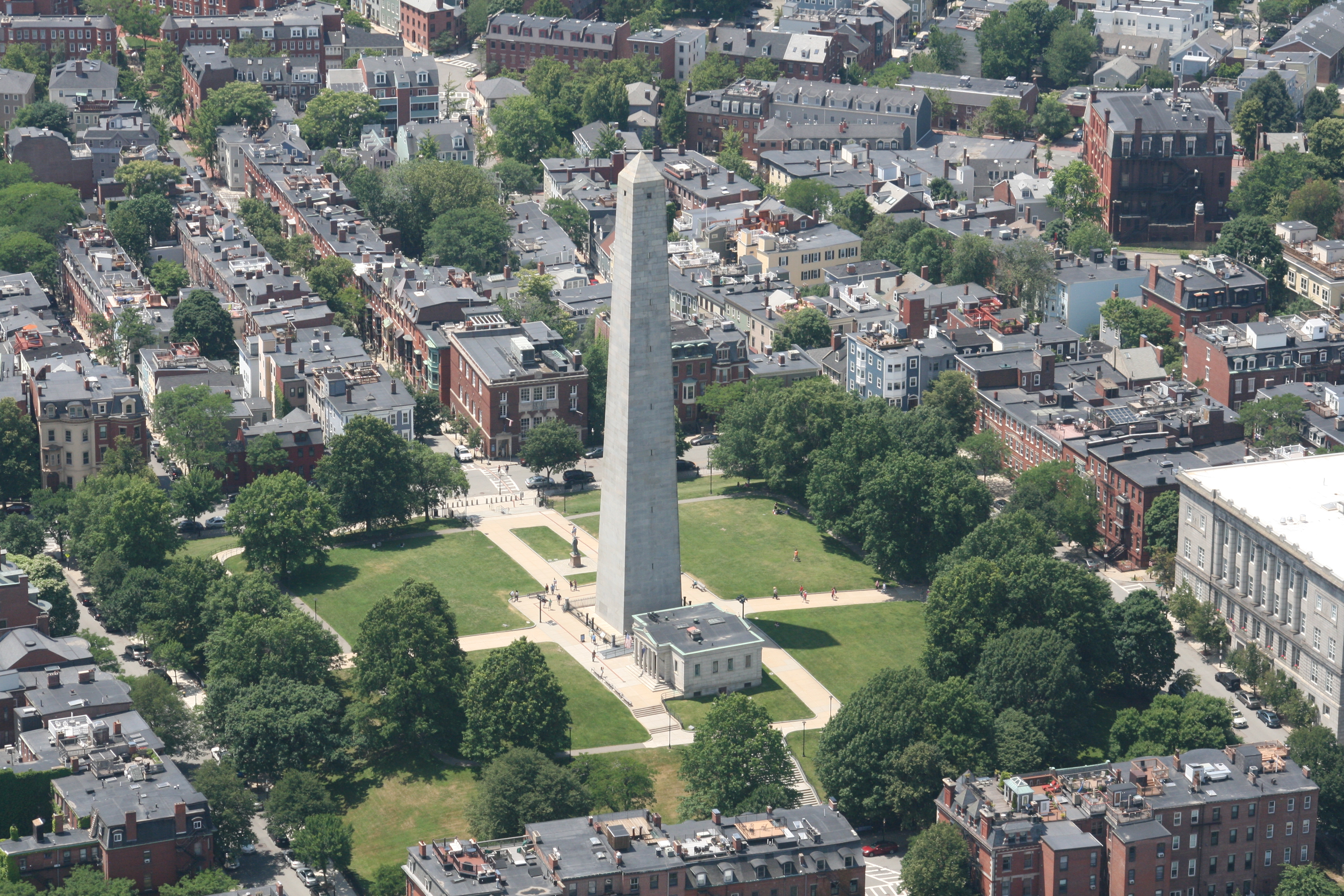
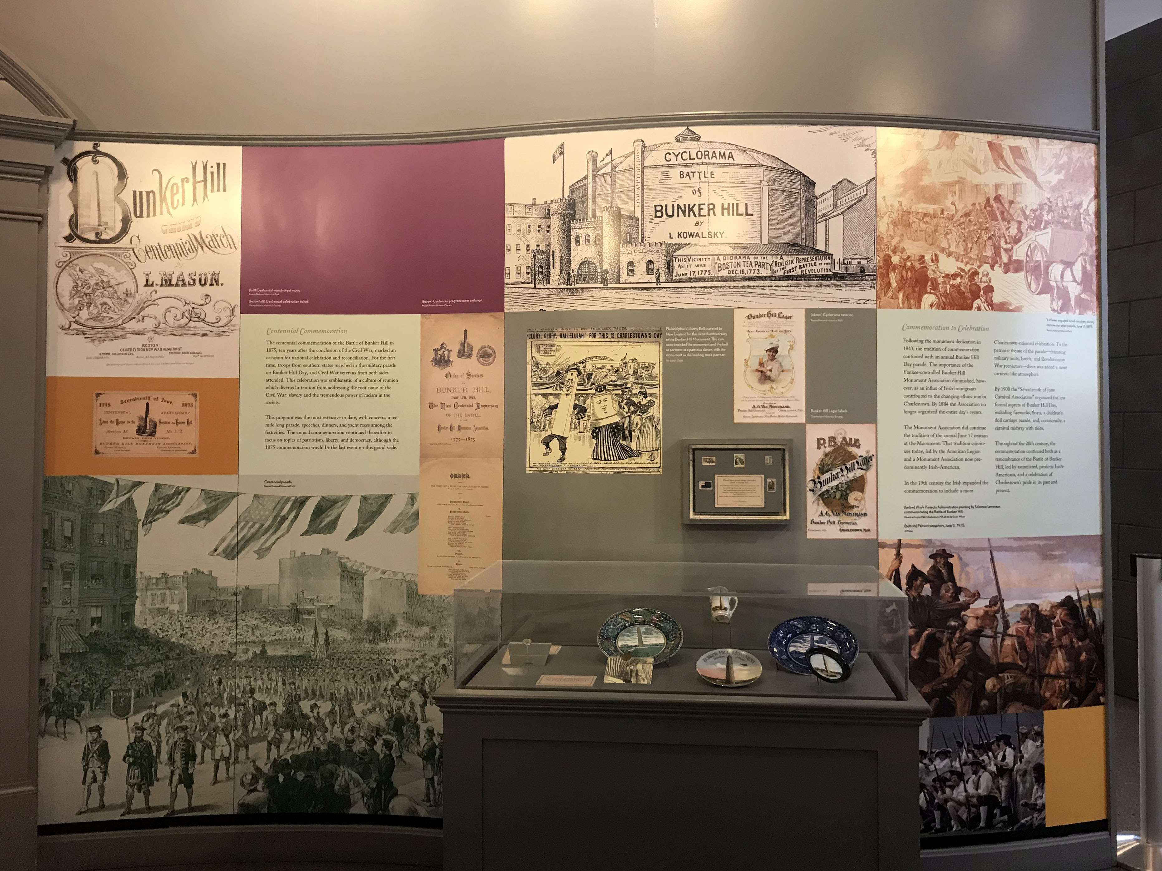
Due to its close proximity to Boston and its pivotal role during the Battle of Bunker Hill, Breed’s Hill in Charlestown is mostly remembered for its colonial and revolutionary ties. Today, it is home to the Bunker Hill Monument.
historical location of farmland that has converted into the Bunker Hill neighborhood. Bunker Hill Monument stands at the top of the hill, surrounded by green park space called Monument Square.
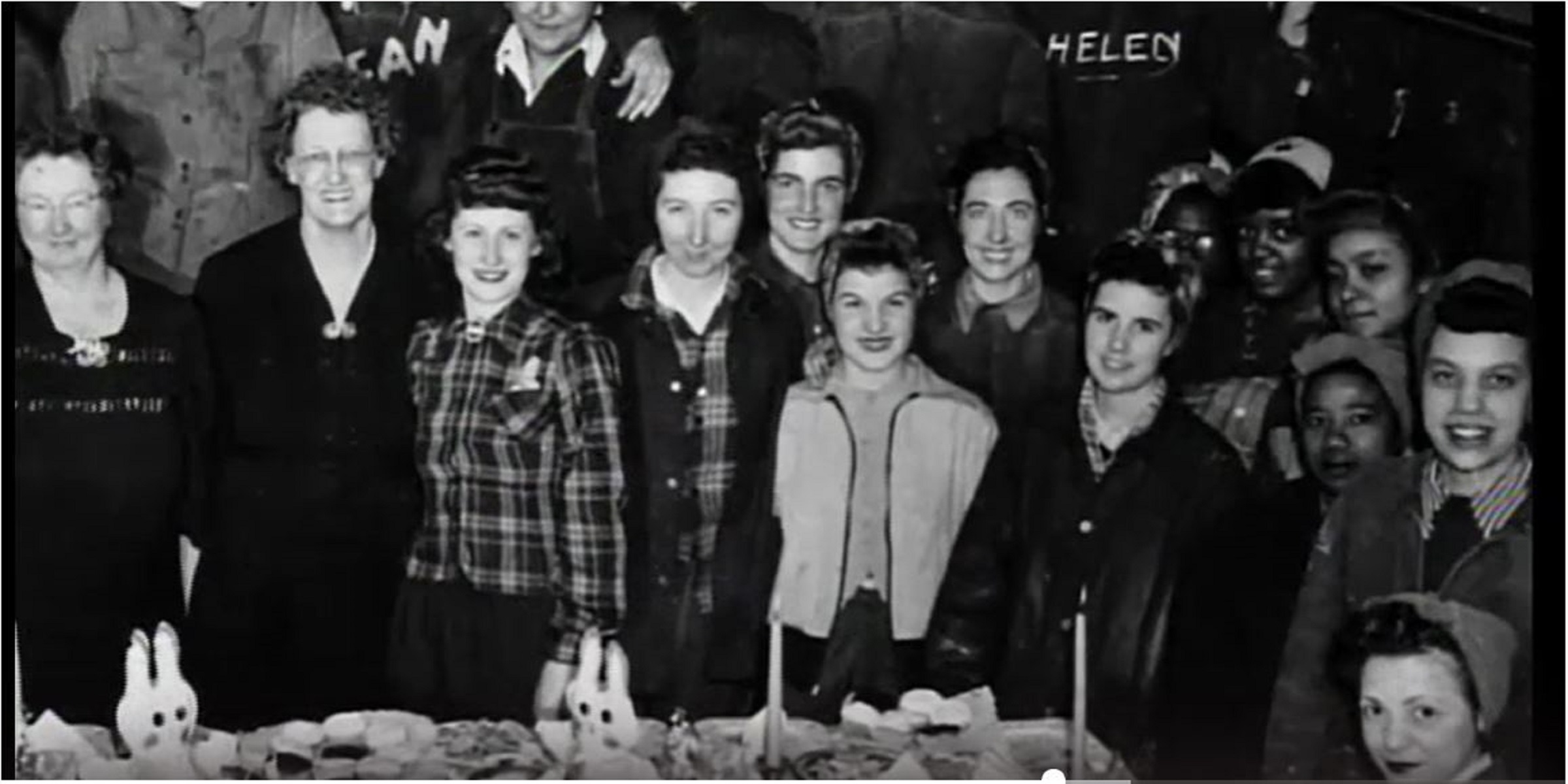
Since its construction in 1853, Building 10 has played several roles at the Yard. Initially, Building 10 was known as the Pitch House, where workers produced the tar that helped keep sailing ships watertight. Over the first half of the 20th century, it acted as a Paint Shop, a radio-transmitter station, and the Laundry. In 1958, the building served its last naval function as a charging station for ship batteries.
Building 10 is a two-story, three-bay-by-five-bay, rectangular brick building designed in the Greek Revival style. It has a slate shingle-clad, front-gable roof, two shed-roof dormers on the east and west slopes, and a denticulated brick cornice. The brick walls are laid in common bond. An addition extends the 5-bay side to 7-bays. The primary entrance is located in the center of the south (facade) elevation and consists of a wood panel door with a granite lintel. Secondary entrances with wood panel double doors are located in the south ends of the west and east elevations. The windows in the original building has granite lintels and sills while those in the addition have concrete lintels and sills. A white door is located next to the far left window on the second story of the facade. It opens to an exterior square platform with a staircase running parallel to the building, leading down to the ground. A large wood sign over the primary entrance reads "Shipyard Galley Bldg 10."
At the Charlestown Navy Yard, Building 107 served as the workspace for the Public Works Department of the Navy. This building also provides an example of American architecture and engineering for the "New Navy" period.
A two-story brick building with an attic space. The building is considered Classical Revival style and includes some decorative features in its brick façade. The building is about 340 feet long, 60 feet wide, and about 50 feet tall. Tall rectangular windows fill each side. The short side has three bays of three windows with the long side having 24 two-window bays. It 's roof is slanted and has green, likely copper, frame.
No other building in the Charlestown Navy Yard has had as many strikingly different uses as Building 5, reflecting the complexity of the 175-year history of the U.S. Navy in Boston.
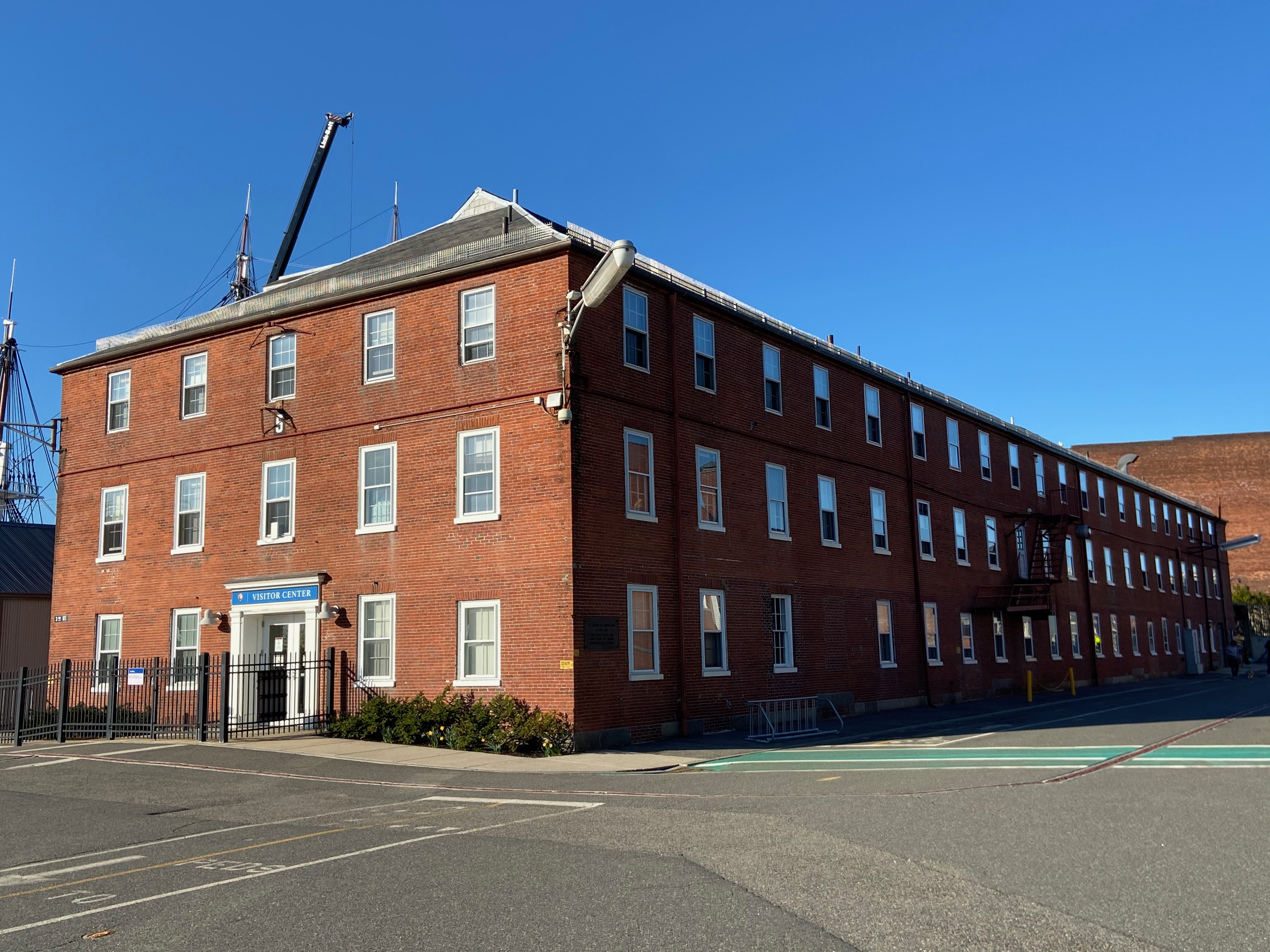
Building 5 is a three-story red brick building built in the Federalist-style. The entrance faces east and is the shorter side of the large rectangular structure. The entrance is framed with a white lintel on top and two white posts on either side. On the lintel is a blue sign with white text: "Visitor Center" in all caps. To the left of the text is a National Park Service arrowhead. On either side of the entrance are two windows. The second and third floors of this façade have 5 windows across. Between the center window of these two floors is a painted black rectangle with the number "5" painted white on top. The longer side of the is 200 feet long, with 21 windows. All windows are grid-paned 4x3. Halfway down the building on the second floor is an exterior metal fire-escape staircase, but it folded up, not extended to the ground. At the corner of the third floor on each end of this side is a large white rectangular light extending from the building like a rod. The building has a hipped roof that is gray.
The Battle of Bunker Hill, a significant event during the Siege of Boston, took place on one of the tallest hills near Boston.
The grassy hill has a large stone obelisk in the middle, with a smaller stone lodge sitting next to it. A statue of a man in a hat and coat, holding a sword is in front of the monument. Large trees are around the hill, and many buildings surround it.
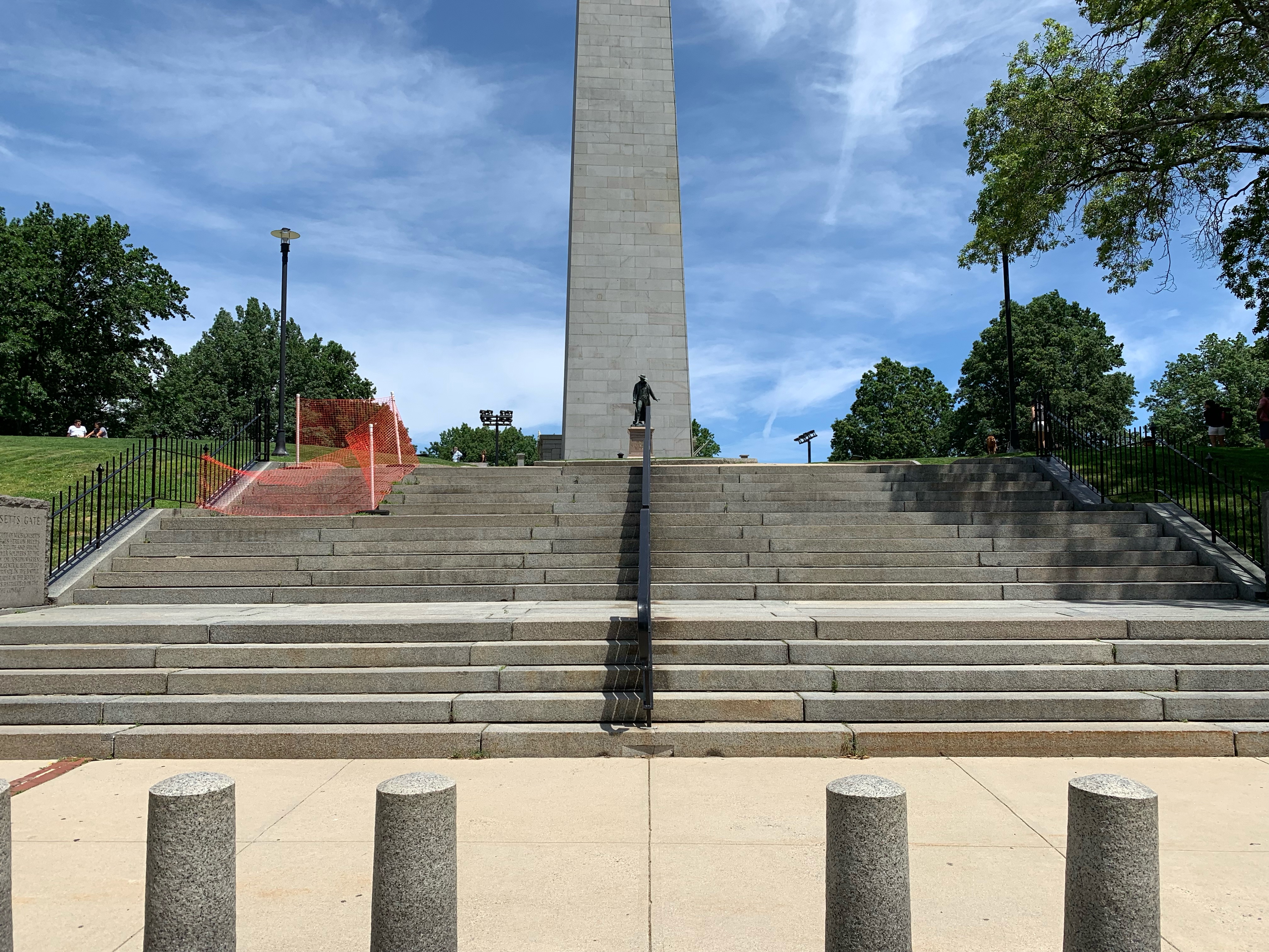
Explore the Bunker Hill Monument through the Massachusetts Gate, the primary entrance to Monument Square located on the Freedom Trail.
The Massachusetts Gate serves as the primary entrance for visitors who travel to Bunker Hill. The gate is located along Monument Square, at the intersection with Monument Avenue. The Bunker Hill Museum is located across the street. The Massachusetts Gate consists of a series of steps which lead to the Bunker Hill grounds. The steps are divided into two sections, left and right, by a iron railing which lays down the center of the gate’s staircase. There are three tiers of steps with a landing in between: the first tier has five steps, second tier has six steps, and the final tier has five steps. On the sidewalk before the stairs are a series of 16 waist-height granite pillars. There is a handicap accessible ramp on the southeastern part of the gate, which leads visitors to the top of the Connecticut Gate and the Monument grounds. On the first lasting, there are two stone markers on either side of the Massachusetts Gate. The marker on the southwest reads, “Colonel William Prescott of Massachusetts led the colonial forces on Breed’s Hill. His commanding figure and strong will inspired the farmer soldiers to the greatness of the day. Dr. Joseph Warren, commissioned a Major General, elected to serve Prescott as a private in the battle. Dr. Warren, an early leader in the Revolution, was killed on this battlefield in the waning moments of the conflict.” The marker on the southeast consists of an insignia and inscription. The Insignia is an adult male dressed in colonial clothing. A sword is in his right hand, while his left holds a document. The text wrapped around the figure in a circular pattern reads, “ Massachusettensis 1775 Sigillum Coloniae.” There is text to the right of the insignia. It reads, “June 17, 1775. This hand opposed to tyrants searches with a sword for peaceful conditions under liberty.” There is a final inscription on the bottom that reads, “Commonwealth of Massachusetts. Metropolitan District Commission.”
The Northwest Corner Lawn is located on the Northwestern portion of the Bunker Hill grounds. The New Hampshire Gate serves as the lawn's northern border, while the United States Gate serves as its western border. There is open green space, as well as trees which cover the walking path through the lawn. The ground slopes down gradually along the lawn and then drops off quickly towards the street below. The Rail Fence Marker is located on this corner lawn. It rests close to the intersection of Monument Square, Bartlett Street, and Concord Street.
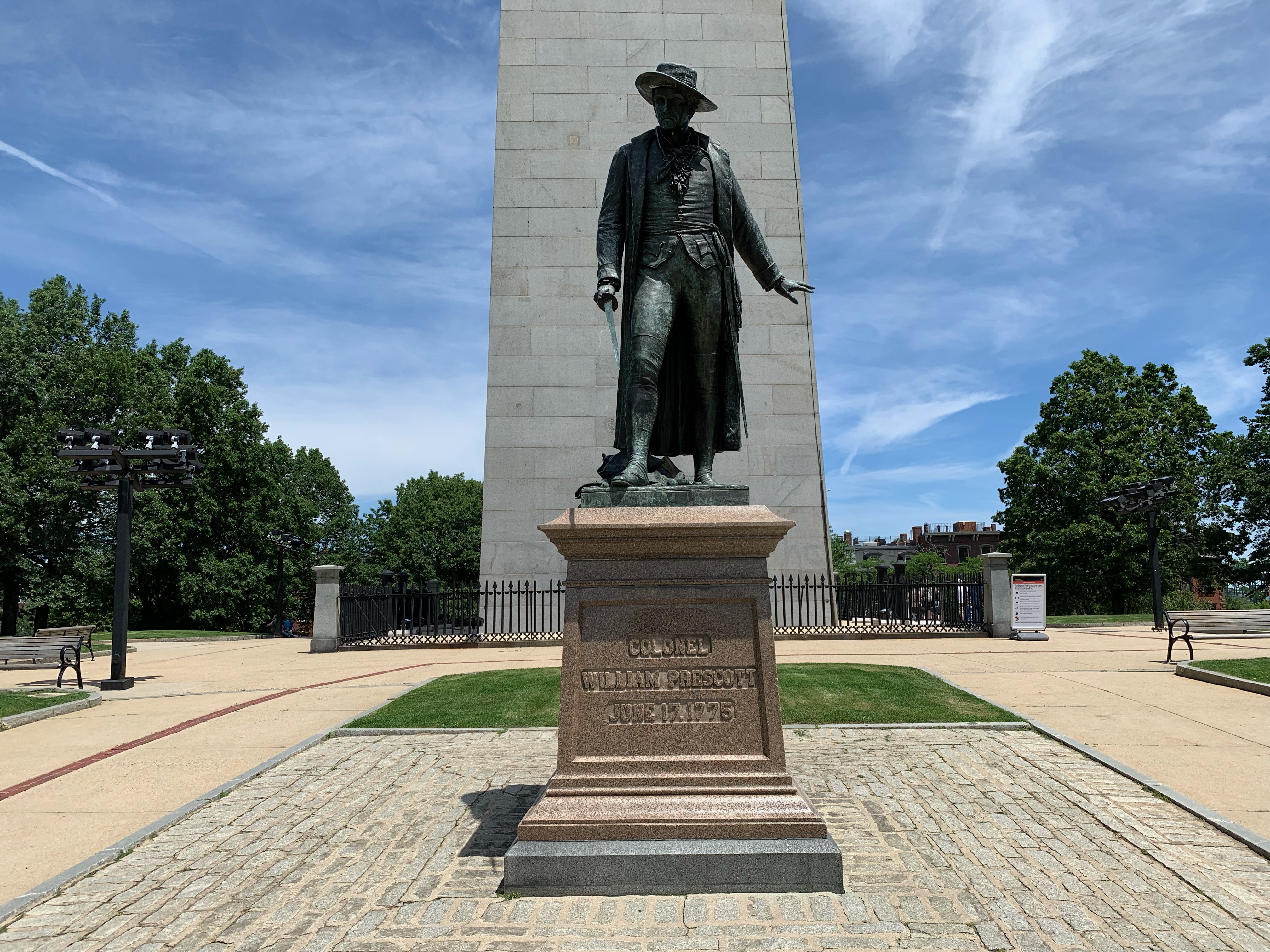
The statue of Colonel William Prescott is located on the path leading up to the Bunker Hill Monument from the Massachusetts Gate. It is centered between the southwest and southeast lawns, and is visible from the Bunker Hill Museum. Located in the center of a granite brick-paved square, two sidewalks from the Massachusetts Gate run on the left and the right side of the square, with grass patches in front and behind the square. The statue sits on a light-red granite pedestal. The front face of the pedestal reads, “Colonel William Prescott. June 17, 1775.” William Prescott is shown to be wearing colonial era clothing, which includes a long coat and hat. The hat is tilted slightly up and Prescott looks ahead with his neck angled slightly to the right. His right foot is a step in front of his left foot, causing the coat to hang by his right hip behind his right outstretched foot. He holds a sword in his right hand, with the sword pointed downward. His left arm is stretched down by his side, angled slightly behind him with his left hand is open.
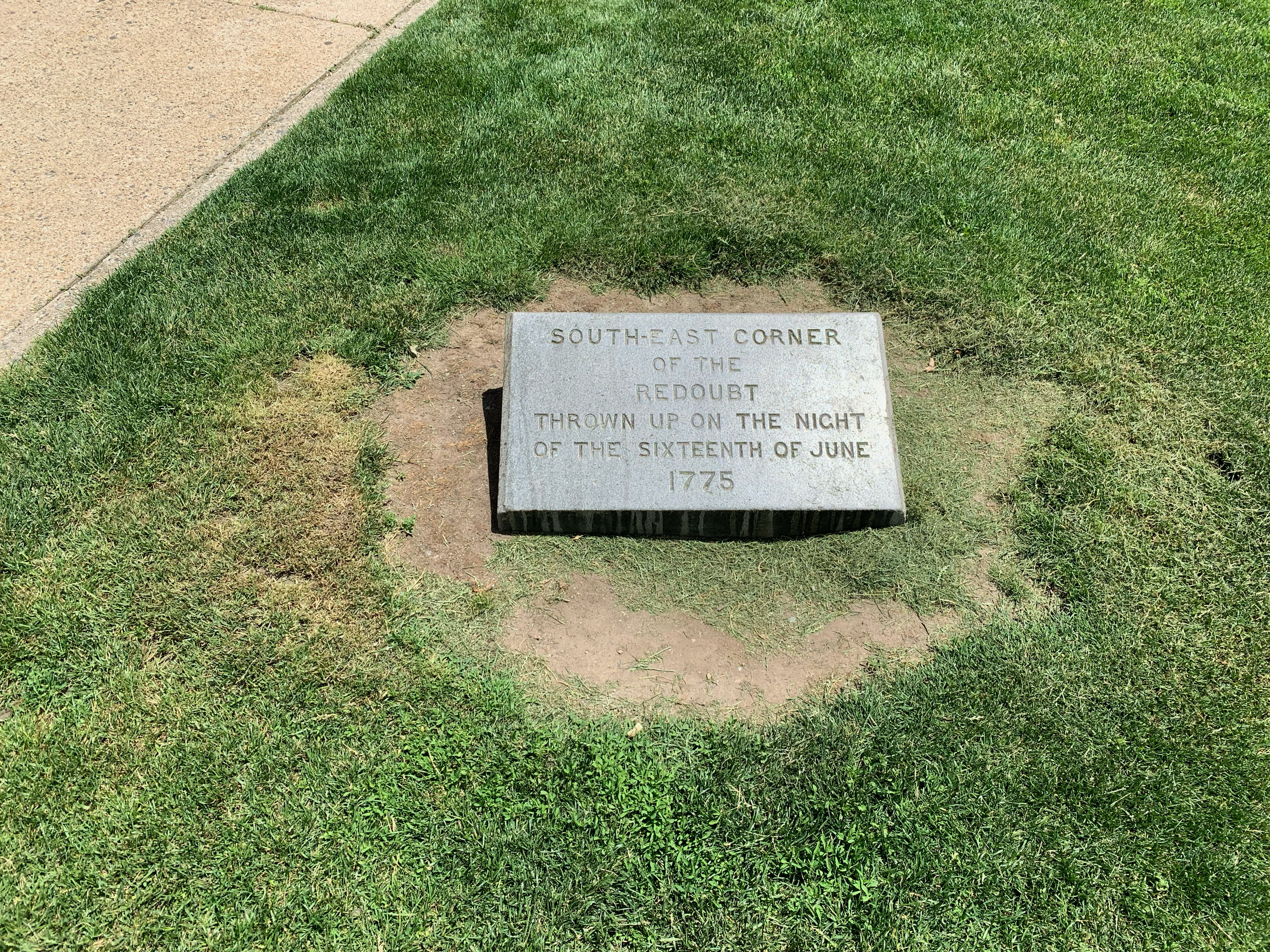
The Southeast corner marker rests on the southeast lawn. Next to the marker is the pathway from the Connecticut Gate to the Bunker Hill Lodge and Monument. The marker is made of granite, gray in color and rectangular in shape at the bottom. The marker rises about six inches from its base at the top edge and tapers down to about 1 inch above the ground at its bottom edge. There is an inscription on the front of the marker which reads, “South-East corner of the redoubt thrown up on the night of the sixteenth of June 1775.”
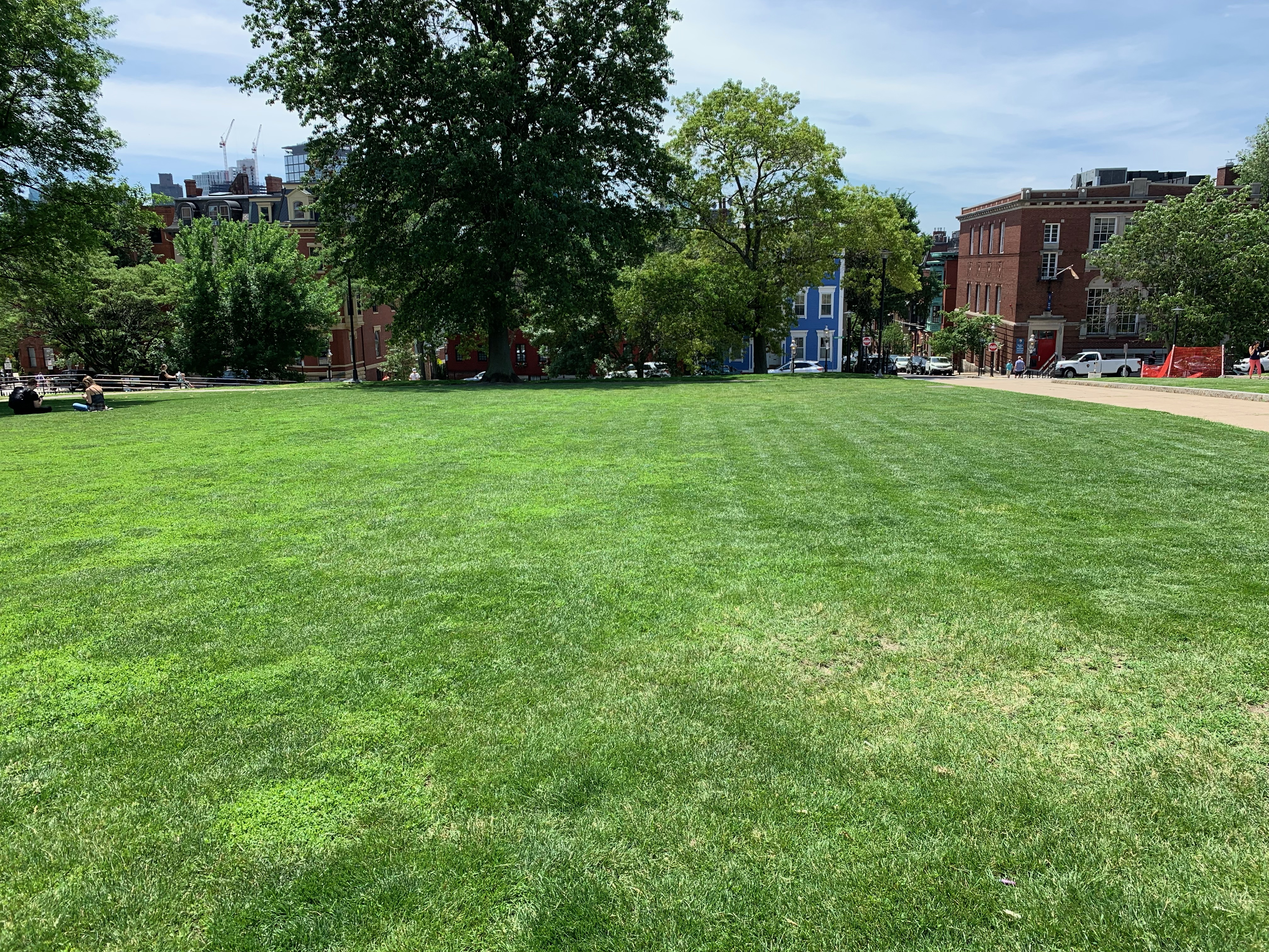
The Southeast lawn is located at the southeastern portion of the Bunker Hill grounds. The pathway from the Massachusetts Gate borders the lawn to the south, while the path to the Connecticut Gate is on the lawn’s eastern border. The lawn consists of a large green space with trees along the outer edge, shadowing the handicap accessible ramp between the Massachusetts and Connecticut Gate. The southeast corner marker is on the lawn near the end of the accessible ramp, just before the outer smaller pathway intersects the larger, concrete pathway to the Connecticut Gate in one direction and the Monument in the other direction.
The Southwest Corner Lawn rests upon the southwestern part of the Bunker Hill grounds. Monument Square, which wraps around the grounds, intersects High Street and Pleasant Street here. The marker which indicates the location of where Joseph Warren was killed, is found on western border of the lawn. There is a mix of green space and foliage upon this corner of the hill. The lawn slopes down towards High Street gradually at first and then dramatically. Exercise caution when walking in this area.
Dedicated in 1843, this 221-foot obelisk commemorates the Revolution's first major battle. Visitors may climb the monuments 294 steps. A museum across the street has exhibits about the community, monument, and battle.
Bunker Hill monument is a cream-colored granite obelisk. It is 221 feet tall. At the base, it is 30 feet square. At the top it is 15 feet square with a pyramid topper pointing 13 feet high. An enclosed spiral staircase built inside the monument provides access to a viewing deck at the top. Seven small rectangular windows are only on the north side of the monument in the stairwell, visible at each pass of the spiral staircase. Square windows are on all four sides of the monument at the viewing deck level. In the center of the monument is a circular newel that runs from the base up to the viewing deck. At the base of the newel, behind an iron gate, is a marble Tuscan column about 8 feet high as a memorial to Joseph Warren. The monument stands at the peak of a hill. The park is largely green space with symmetrical pathways leading from the streets up to the monument. The monument is surrounded by an iron picket fence. Immediately to the north of the monument is the Bunker Hill Lodge, a relatively small, one story granite structure with its primary outdoor feature being six fluted granite columns supporting a pediment that forms the entry point. Inside is a domed entry vestibule with yellow and cream Italian marble and a white marble mosaic floor. To the left is an information desk. Entryways to the left, right, and ahead are arched. To the right is a corridor with closed rooms and closets and a water fountain. Ahead is a room that comprises the full width of the building and half the depth of the building with a white marble statue of Joseph Warren in the center of the room against the back wall. Flags flank Warren. Portraits and seating line the walls.
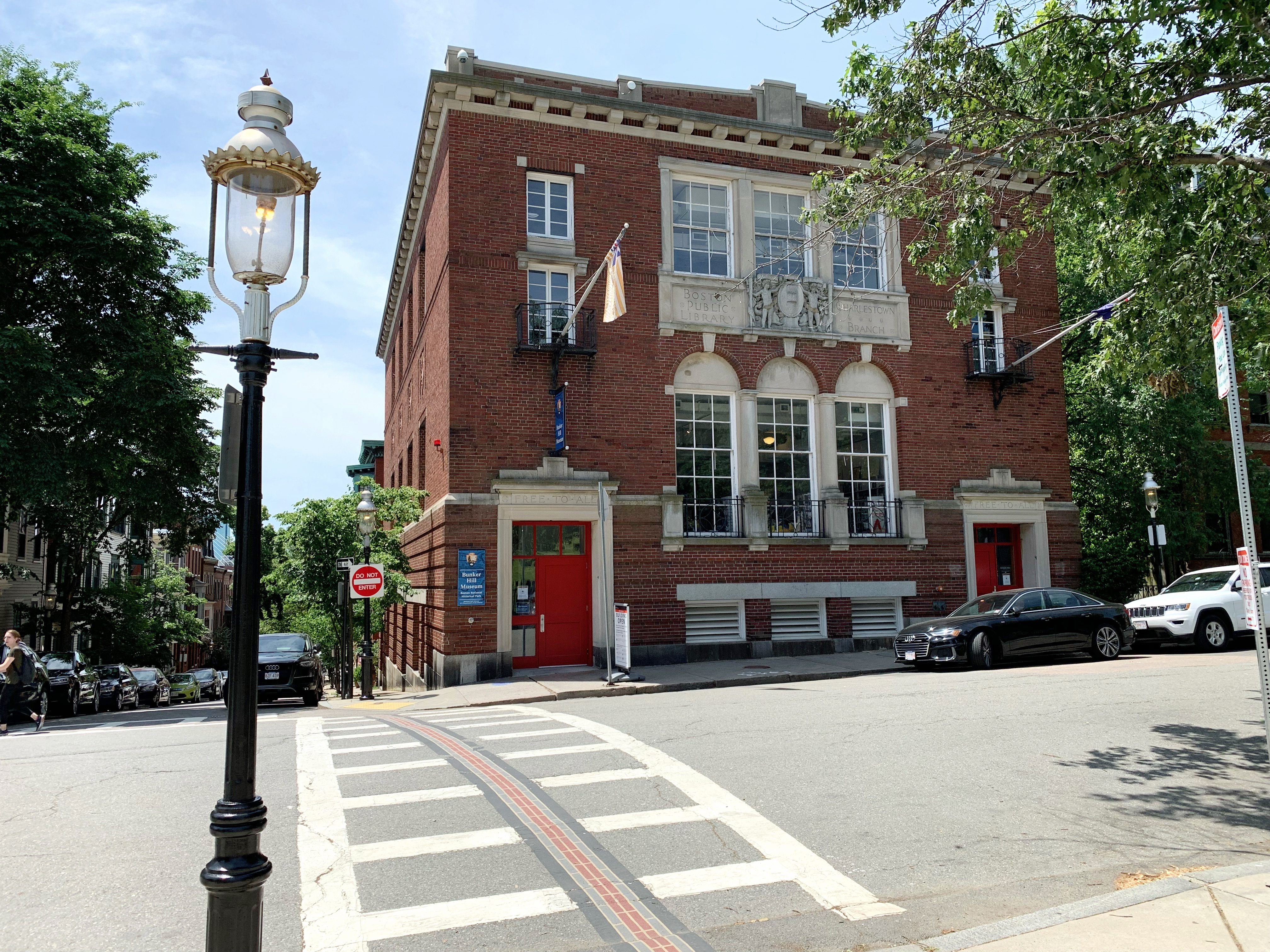
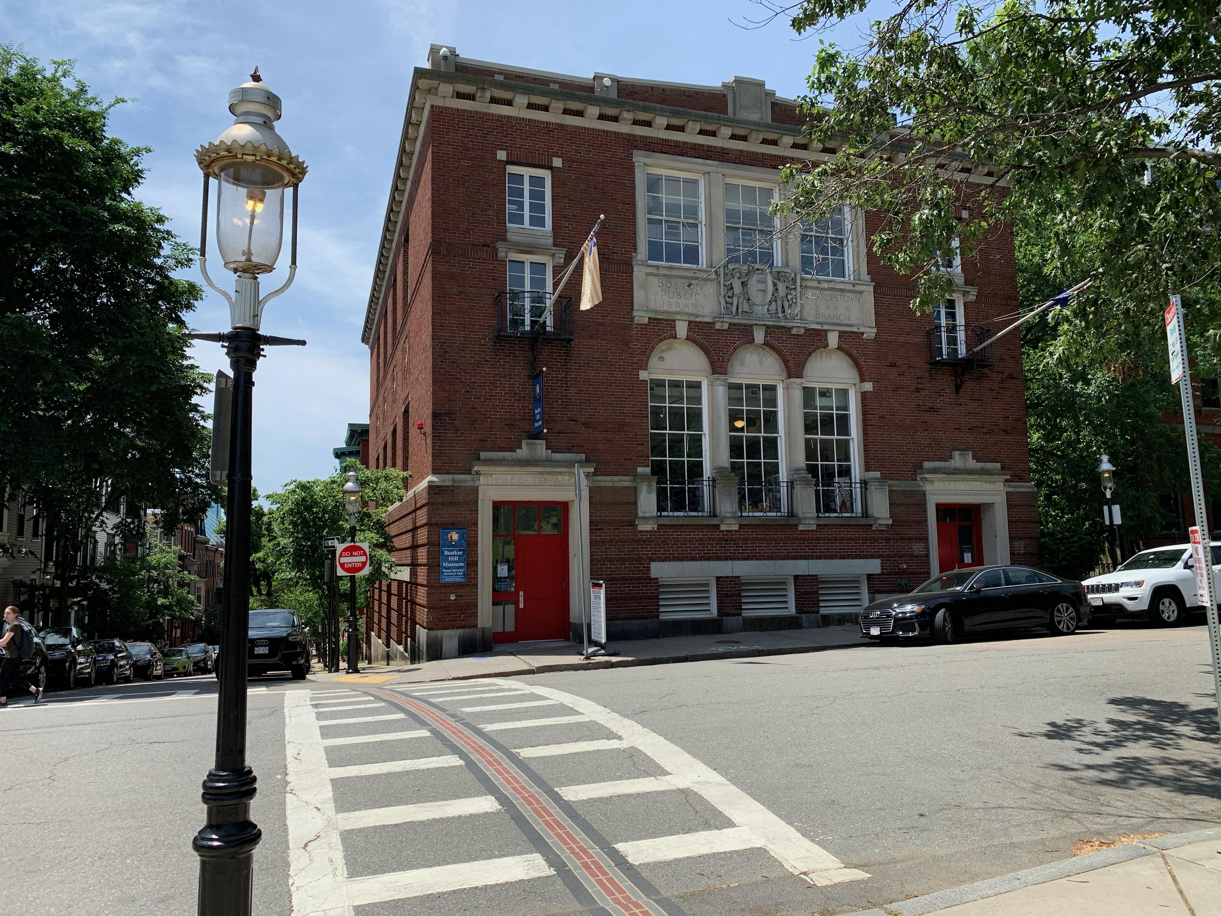
The Bunker Hill Museum’s exhibits and dioramas tell the stories of the Battle of Bunker Hill, the construction of the Monument, and the history of the Charlestown Neighborhood. The musem is housed in the old Charlestown branch of the Boston Public Library.
The Bunker Hill Museum is located at the intersection of Monument Avenue, and Monument Square. The museum is a three storied building constructed out of red brick. The two doors on the first level are painted red, and is across the street from the Massachusetts Gate. Above each door the words “Free to All” are carved into the stone that is located at the top of the door frame. There is a venting system in between the two doors. Above that on the second story are three windows, each with a small stone arch above them. There are two double stacked windows on the third floor located above the two front doors. Each of these windows has a small curved balcony outside of them. Hanging off of the balcony on the left side is the Grand Union Flag. It has a Union Jack in the top corner of the flag, a red plus sign outlined in white laid over a red x outlined in white over a background of blue. There are seven red stripes and six white stripes on the flag. Hanging off of the balcony on the right side is the Battle of Bunker Hill flag. The flag is almost entirely blue in color. In the upper left corner is a white field with a red cross on it. In the upper left quadrant of the white field is a green pine tree. It is depicted as a series of increasing green triangles one under the other, four in total. There is a small amount of grass under the brown trunk of the tree. In between the two double stacked windows are three square windows . Below that, and above the arches of the second floor windows, is a stone inlaid with three sections. The left section has “Boston Public Library” carved into it. The right side has “Charlestown Branch” carved into it. In the middle is a decorative medallion with two young boys standing on either side of a circular stone with a book on it and some Roman numerals which are very small. To enter into the building, visitors can go through the red door on the left side. There is a handicap door button to the left side of the door. Inside there are stairs leading to the first floor and an elevator which accesses each floor. The bottom floor consists of the public restrooms and an educational space. The second floor serves as the primary entrance into the museum. On this floor, the exhibits are about the town of Charlestown, the history of the monument, as well as the Gift Shop. The third floor contains exhibits specific to the Battle of Bunker Hill.
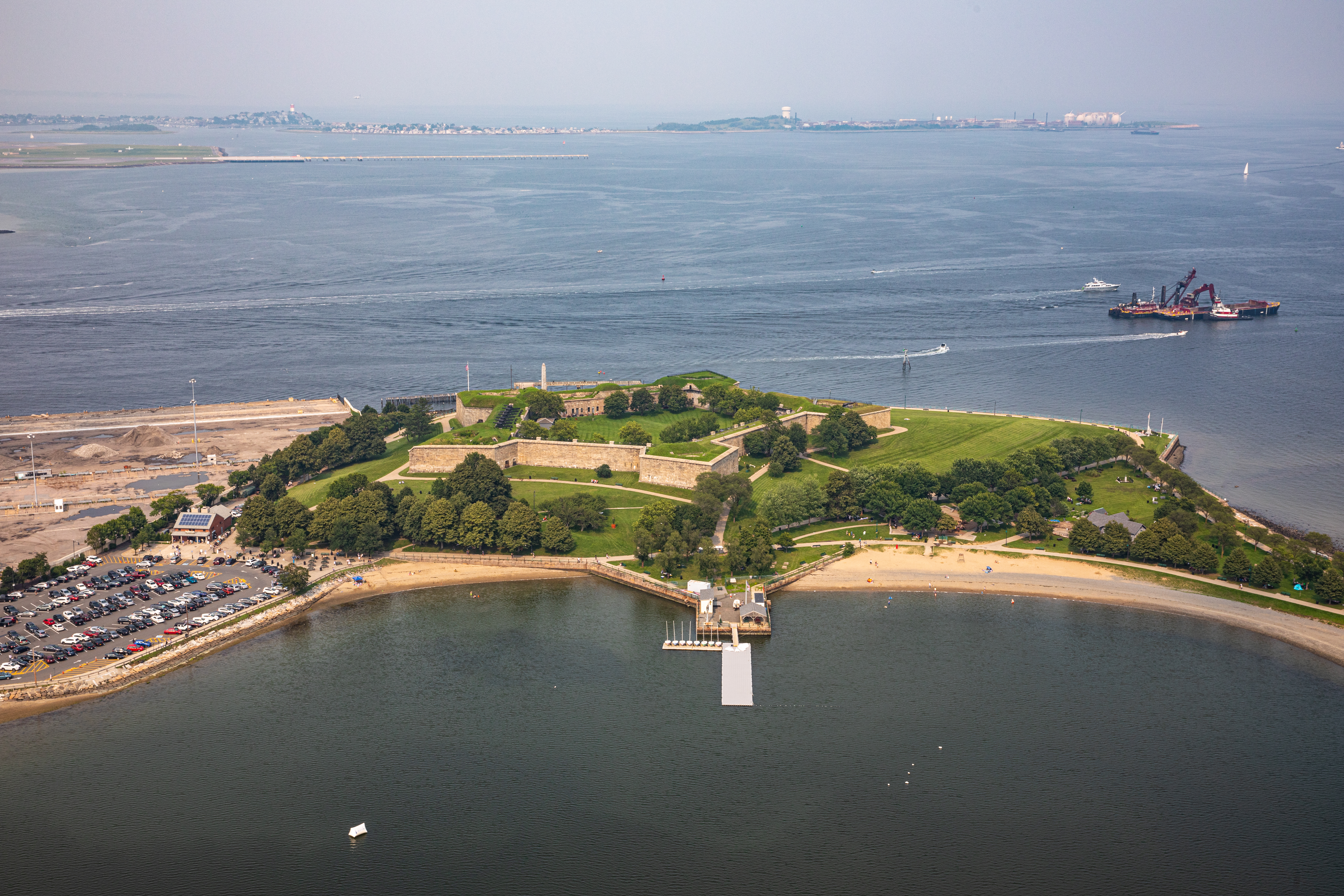
One of five peninsulas in Boston Harbor, Castle Island boasts 22- acres of land, a little more than two miles of walking trails, and the oldest fortified site in what was considered British North America. The former island has been connected to the mainland since 1928.
At the Chain Forge, Navy Yard workers produced anchor chain as well as developed the "die-lock" process to create new chain.
Building 105 has an innovative steel frame, covered with a brick veneer in a Classical Revival style. This "Cathedral of Industry" also has a central, gabled portico flanked by two wings with numerous arched windows.
After refusing to pay the $5 fine for protesting Woodrow Wilson's visit to Boston in February 1919, 16 members of the National Woman’s Party received a sentence of eight days at Charles Street Jail.
Built in 1807, the Charles Street Meeting House served generations of worshippers both as a Baptist church and later as an African Methodist Episcopal church. Throughout its history, the Charles Street Meeting House acted as a space for social activism.
The Charles Street Meeting House, on the corner of Charles Street and Mt. Vernon Street, is a red brick building approximately four stories tall. On the first floor facing Mt. Vernon Street there are concrete steps going up to three wooden doors. Above the inset on the second floor is a glass paned window with white trim. The window is within an inset about three inches into the building which goes down to the ground level. The center doors are larger than the doors on the left and the right side. All doors are within an arch, with white trim and a half-arched glass-pane window bother them. Above the doors are three equally spaced glass pane windows with white trim. The windows are within an inset about three inches into the building. Above the windows, separating the second and third floor, is a light-colored gutter. There are three additional equally spaced windows on the third floor with white trim. The middle window has an identical arched inset as the second floor, but the windows to the left and right both have a rectangular inset that spans the length of the third floor. Above these two windows is a white concrete inset surrounded by brick. There is a gutter separating the third and fourth floor. The fourth floor is much smaller in size and has a blue wooden clock with gold numbers. Above this level is a white, wooden steeple which is at the front of the roof and ends in a curved triangle at the top. The steeple has at least four large arch openings in it with Roman columns at each of the corners. Above the arches is a dome with gold trim and a weathervane. To the right of the first floor facing Mt. Vernon Street is an inset that contains a small courtyard with tables and chairs. There are windows, identical to the ones on the front of the building on the second and third floors. On the side of the building facing Charles Street, the building is two stories, with an angled roof connected halfway up the third floor of the steeple. On the first floor there are five equally spaced identical rectangular glass-pane windows with white trim. Above them on the second floor, there are five equally spaced large arched glass-pane windows with white trim. The Meeting House is surrounded by other red brick buildings on either side.
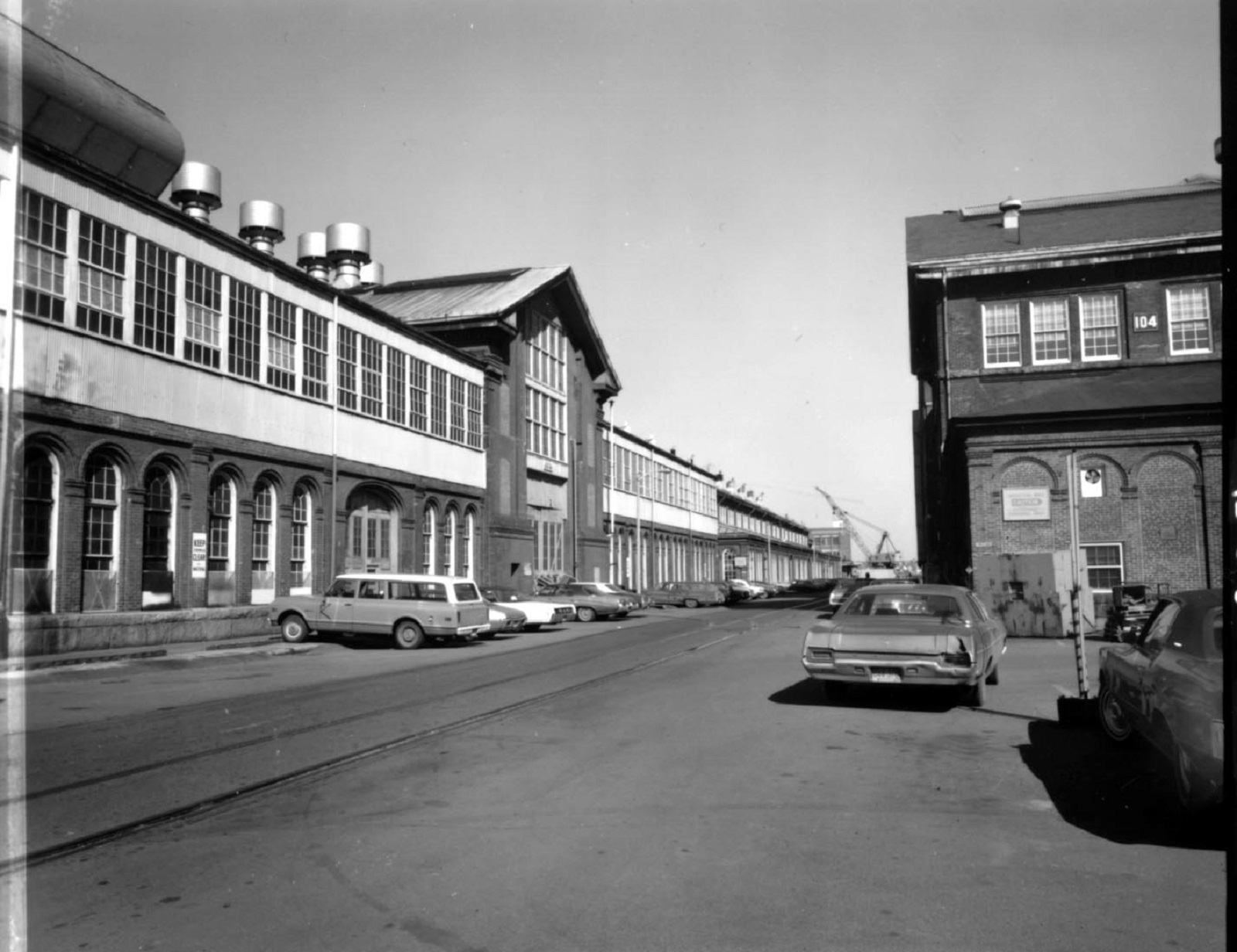
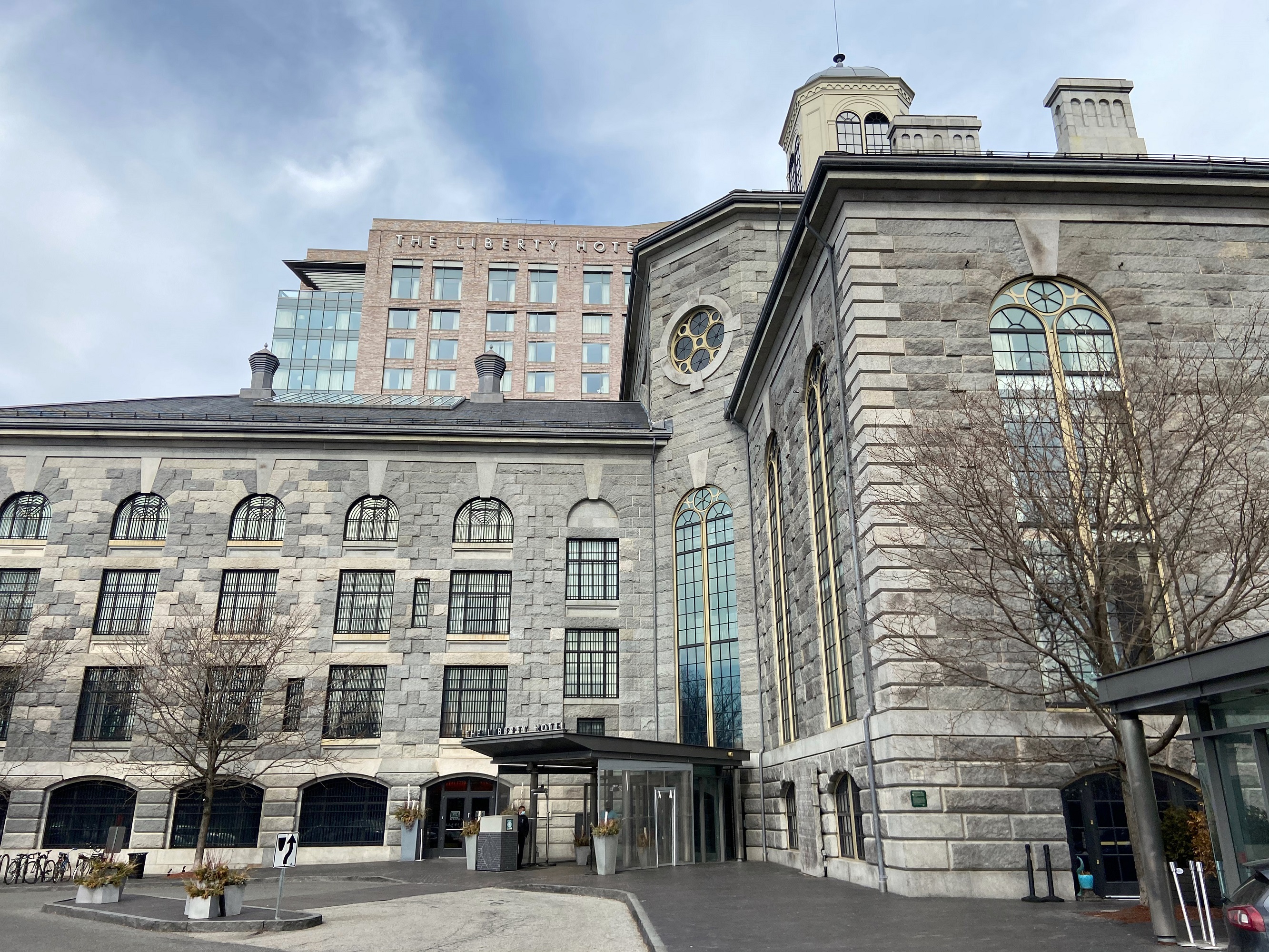
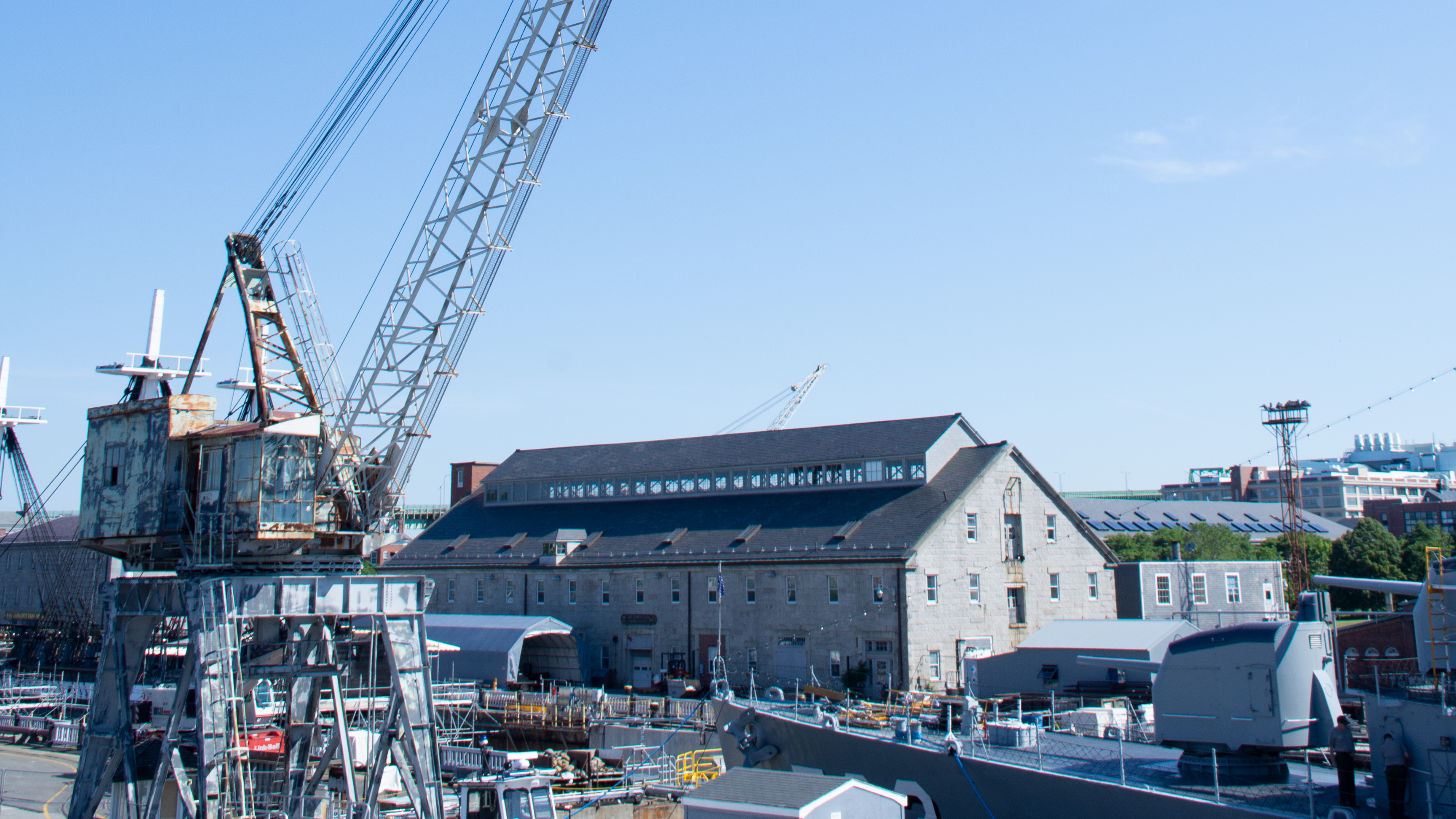
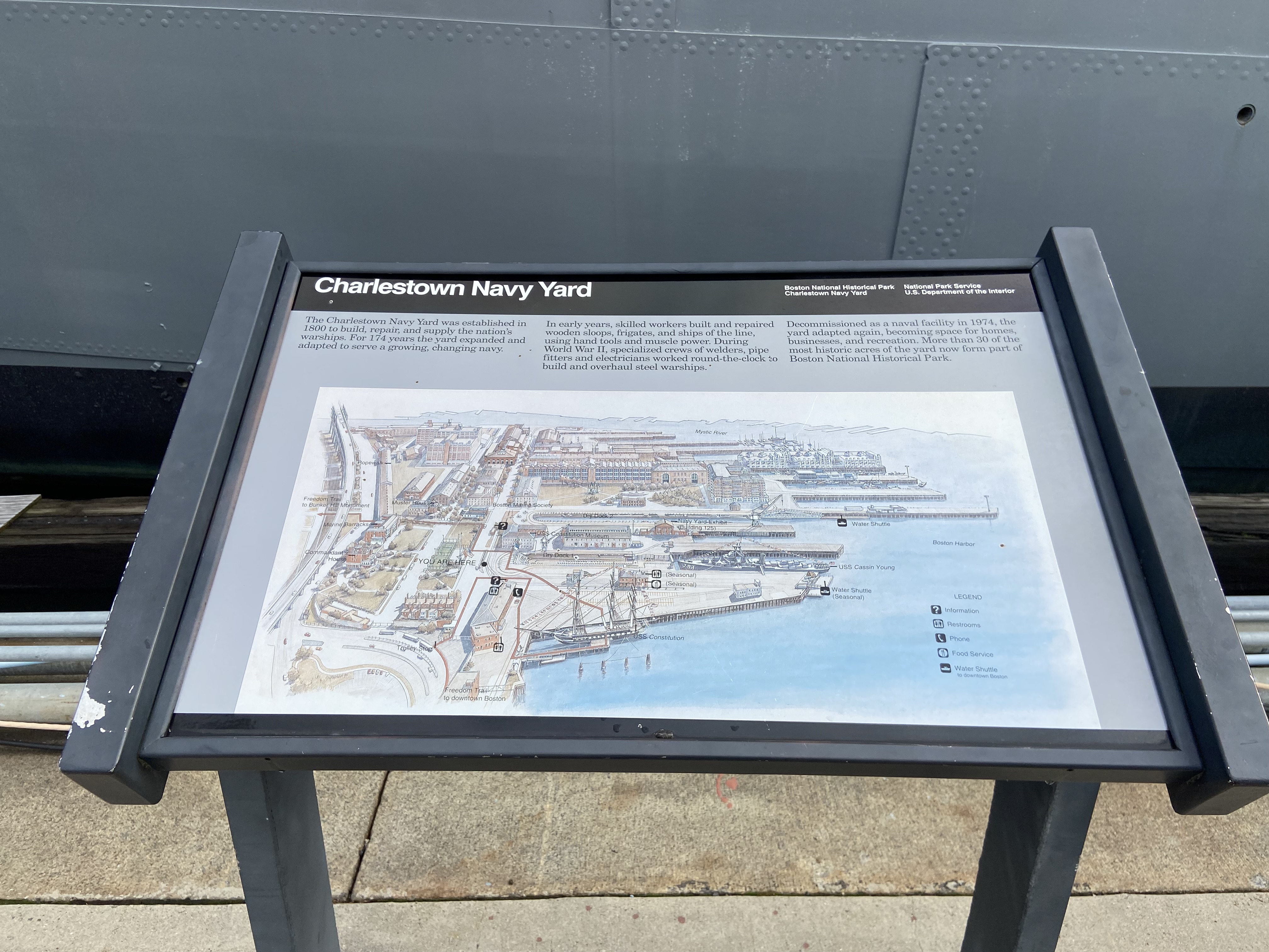
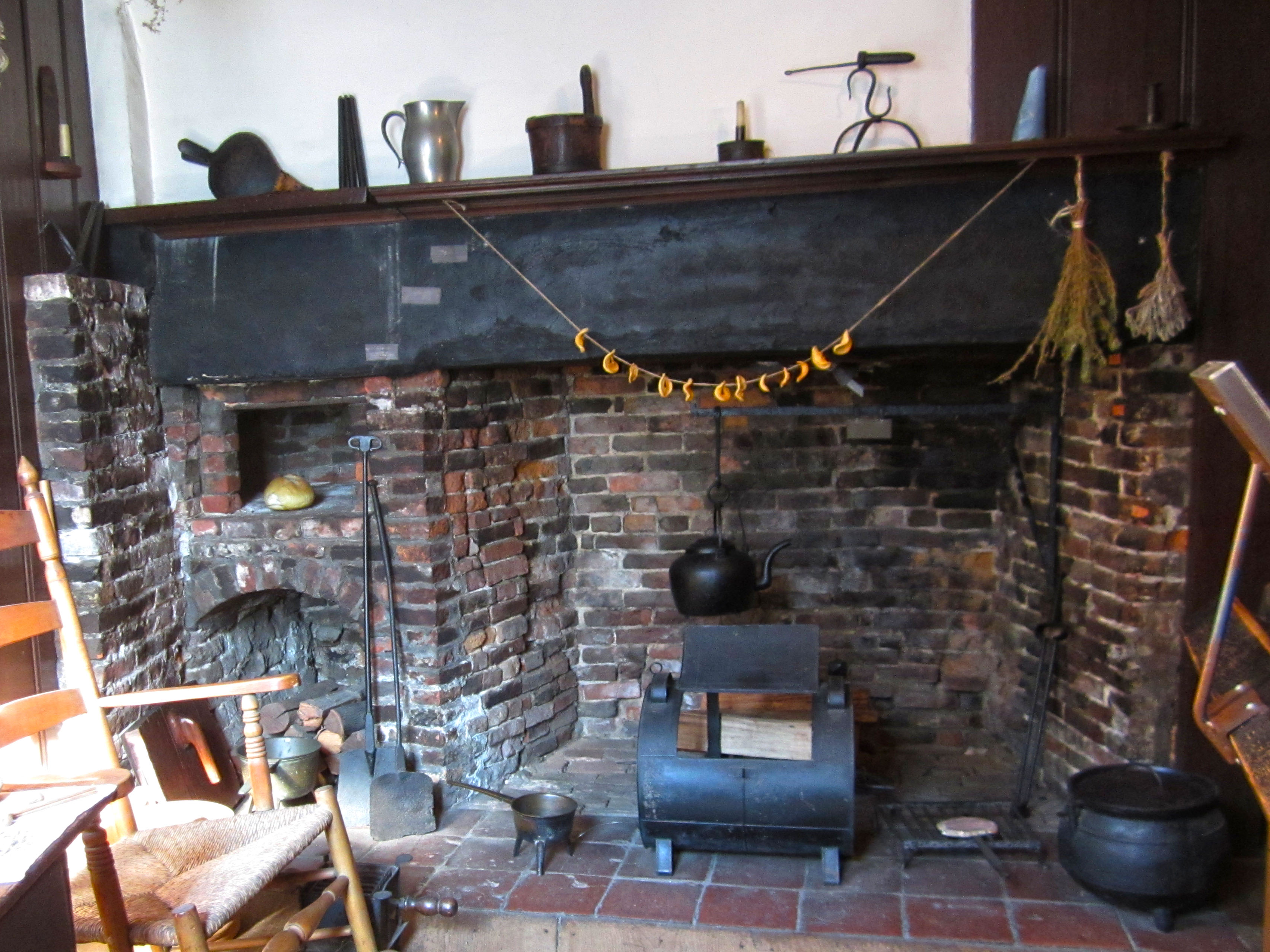
Home to USS Constitution and USS Cassin Young, the Charlestown Navy Yard consists of 30 acres of a once massive industrial area that supported the United States Navy from the 19th into the 20th centuries.
The Charlestown Navy Yard occupies about 130 acres of waterfront land on the Charlestown side of the Charles River as it opens up to Boston Harbor. Its borders extend to Chelsea Street. Most visitors enter from the southwest at Constitution Road, which leads them to the original main entrance of the Yard, Gate 1. Gate 1 has a one-story mid-century style unoccupied guardhouse. Continuing down the street brings visitors to the main campus of the Navy Yard, which is mostly asphalt with some green space to the north. To the immediate right is the entrance to the Visitor Center, which is a long brick building. Visitors must go through a security hut next to the Visitor Center to access the USS CONSTITUTION (behind it). The Visitor Center contains bathrooms, a small theater for films and events, a gift shop, and some exhibit space about the Navy Yard. Most of the rest of the campus is asphalt with numerous brick and stone buildings, most notably the USS Constitution Museum (stone building directly facing the Visitor's Center) and the Commandant's House (brick building on the north side of campus close to Chelsea Street). There are at least six piers as well as two dry docks. Continuing past the security entrance to the Visitor's Center is Pier 1, which has the USS CASSIN YOUNG, a fletcher-class destroyer, docked there. In between Pier 1 and Pier 2 is dry dock 1. Behind the USS Constitution Museum is Pier 3 and Pier 4, separated by dry dock 2, which is currently filled. The water shuttle runs from Pier 4. The red Freedom Trail enters and exits through First Avenue from Constitution Road and leads to the entrance to the Visitor's Center, the USS CONSTITUTION, and the USS Constitution Museum.
A map of the Charlestown Navy Yard with information on where to find visitor services, bathrooms, transportation, and other needs.
Low-profile wayside that is 40.5 x 24 3/8 inches, with interpretation panel spanning 36.25 inches wide. It has a black semi-cylindrical base with two rectangular pillars supporting the panel. The panel is framed in black metal. The sign is located near Dry Dock 1. At the top of the panel is a black banner with white text. The text includes the title, “Charlestown Navy Yard,” aligned to the left. Aligned to the right in the banner are two columns of two lines of text. The first column of text is “Boston National Historical Park,” followed by “Charlestown Navy Yard.” The second column states “National Park Service,” followed by “U.S. Department of the Interior.” The rest of the panel has a gray background. The top quarter of the wayside below the title banner is text divided over three columns. Below the text is a large color wayfinding map.
Now a 2.6 mile riverway, Chelsea Creek became the location of a two-day skirmish during the Siege of Boston in May 1775.
2.6 mile riverway that separates East Boston to the south from Chelsea and Revere to the north. It empties out into Boston Harbor and ends near the southern part of Revere, Massachusetts.
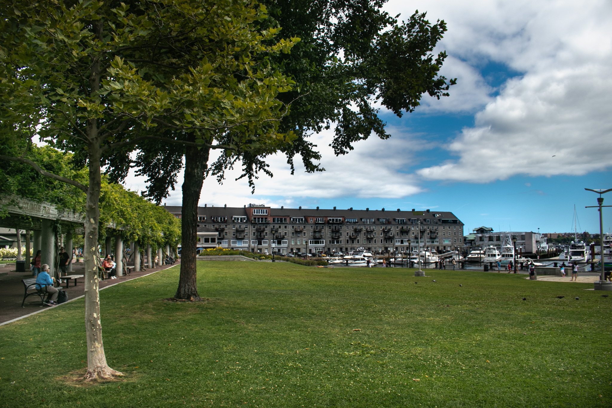
The Waterfront Park extends Boston’s downtown greenspace to the harbor, situated next to Long Wharf and near Faneuil Hall.
The Waterfront Park is a large greenspace alongside the Harborwalk (a path along Boston's harbor) and between several busy roads. The park has a large grassy lawn next to the Harbor for games and relaxation, and also a long trellis walkway with vines or lights throughout the year. The trellis walkway has benches for visitors to sit on. The park has several memorials, a playground, and water features where people can play year-round.
The park's main exhibits are at the Bunker Hill Museum. Located across the street from the Monument grounds, the exhibits are housed in the old Charlestown Branch building of the Boston Public Library.
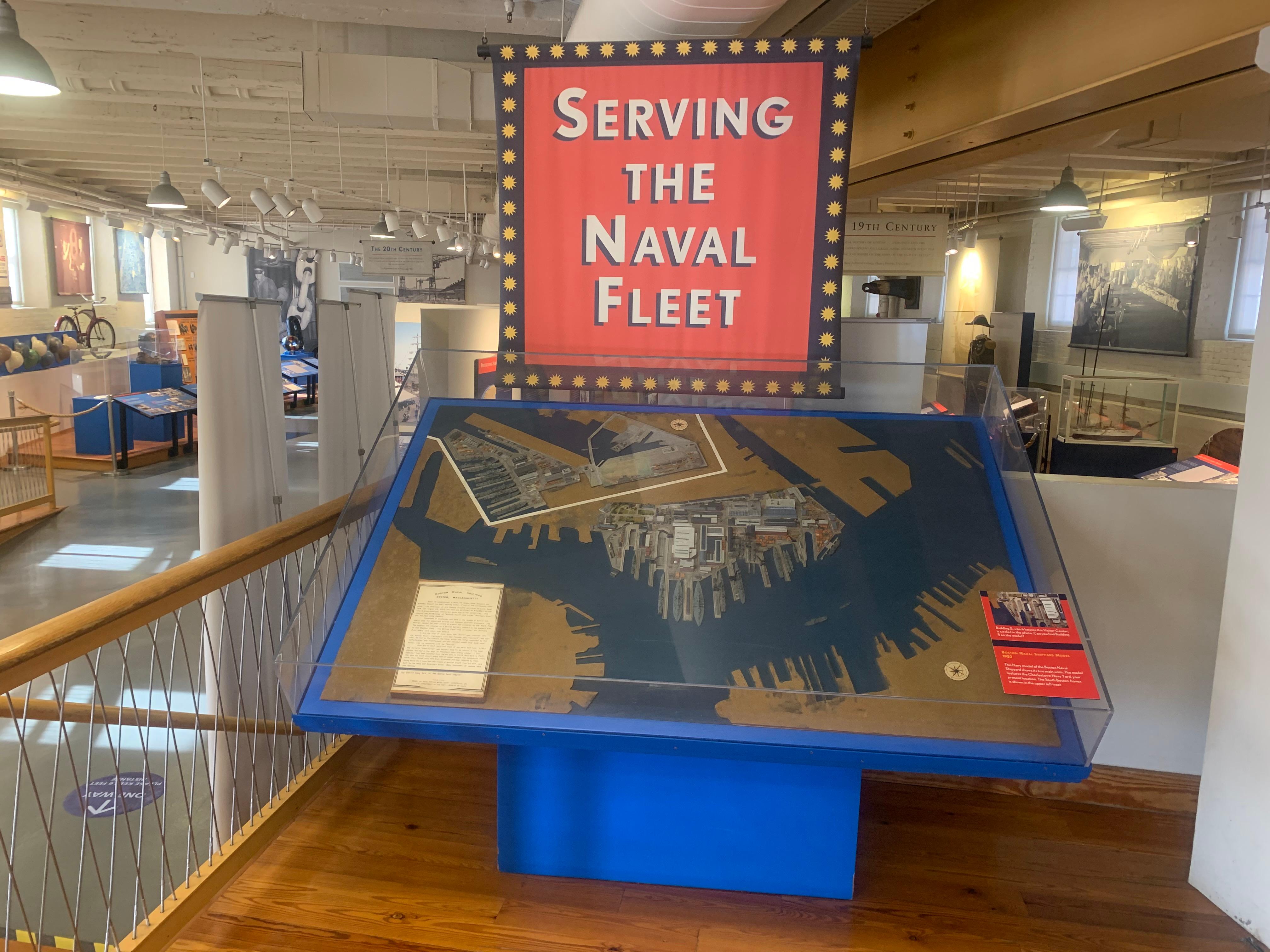
Located in Building 5 of the Charlestown Navy Yard, this Visitor Center features exhibits and a short film about the work and workers of the Navy Yard who supported the United States Navy from 1800 to 1974. Please note that access to this building is through a security checkpoint.
Located in the heart of downtown on the market floor of the historic 1742 building, the Faneuil Hall Visitor Center is the main visitor center for Boston National Historical Park and Boston African American National Historic Site. Maps and information for the Freedom Trail® and Black Heritage Trail® are available here. Tours begin here seasonally.
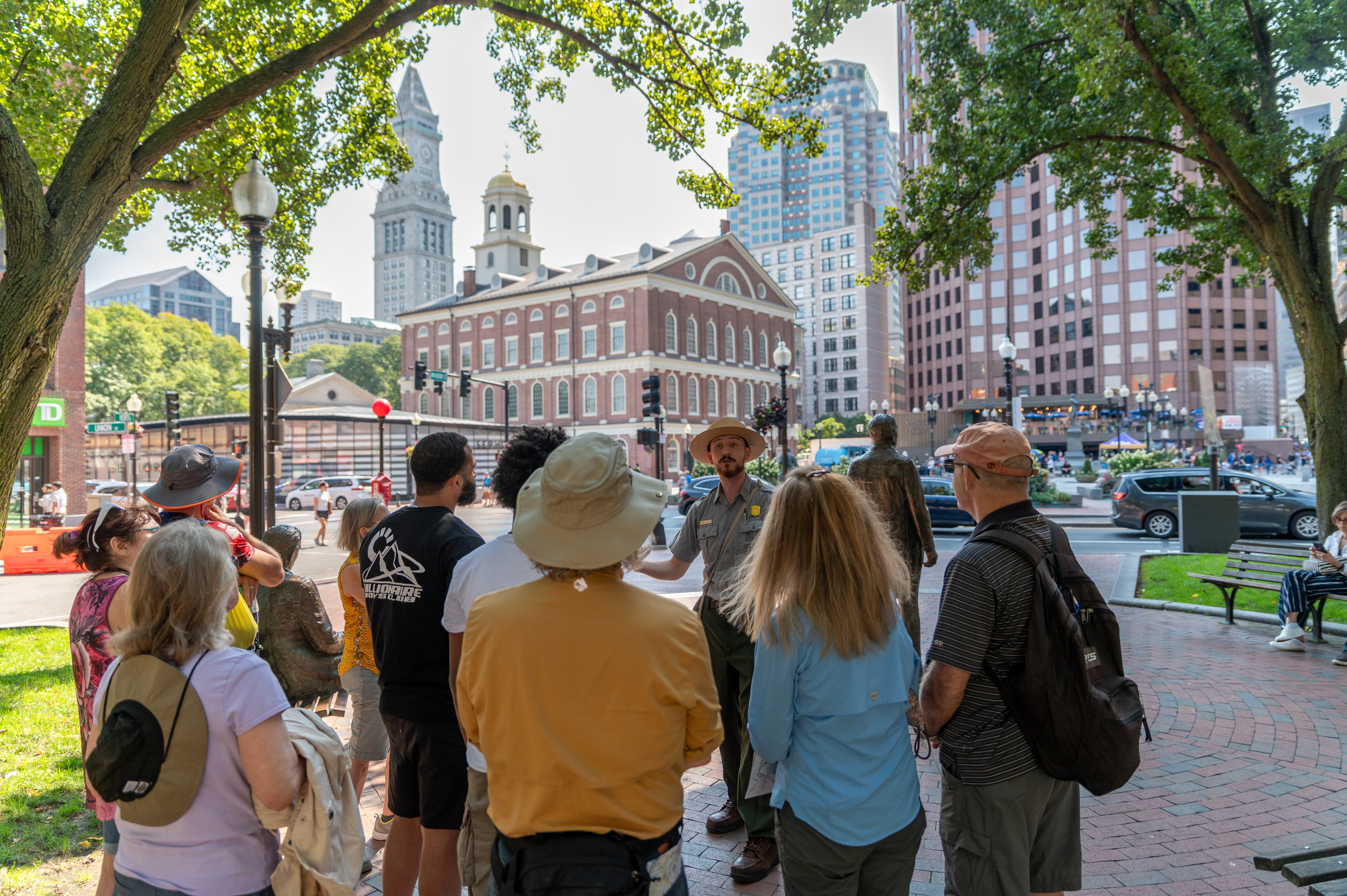
Join a Park Ranger for a special guided tour exploring Boston's rich history as a city of revolutions.
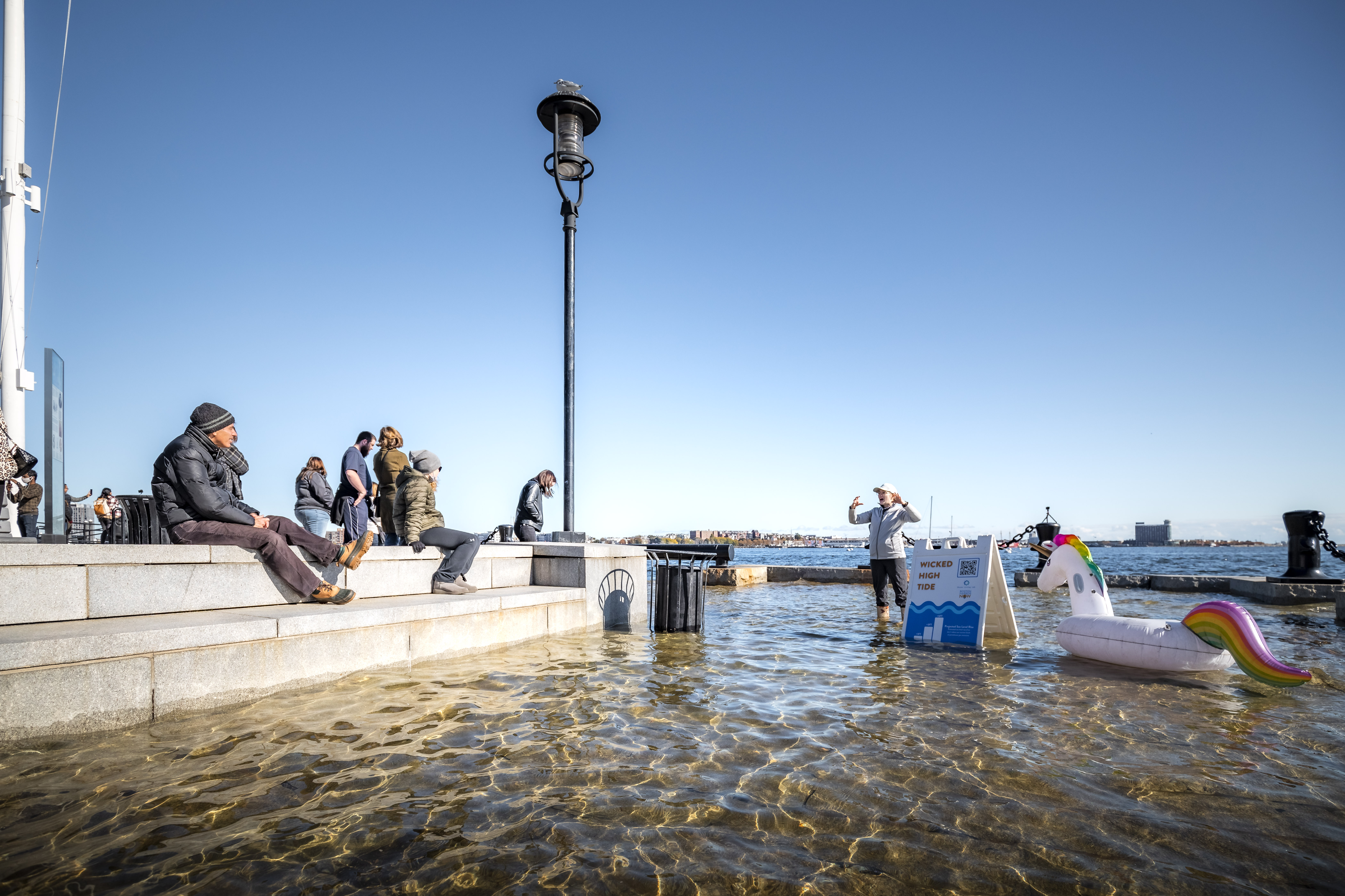
Learn about Boston's "Wicked" High Tides
Learn about Boston's coastlines and King tides by taking the High Tide Trail audio tour or joining a high tide program hosted by our partners, the Stone Living Lab.
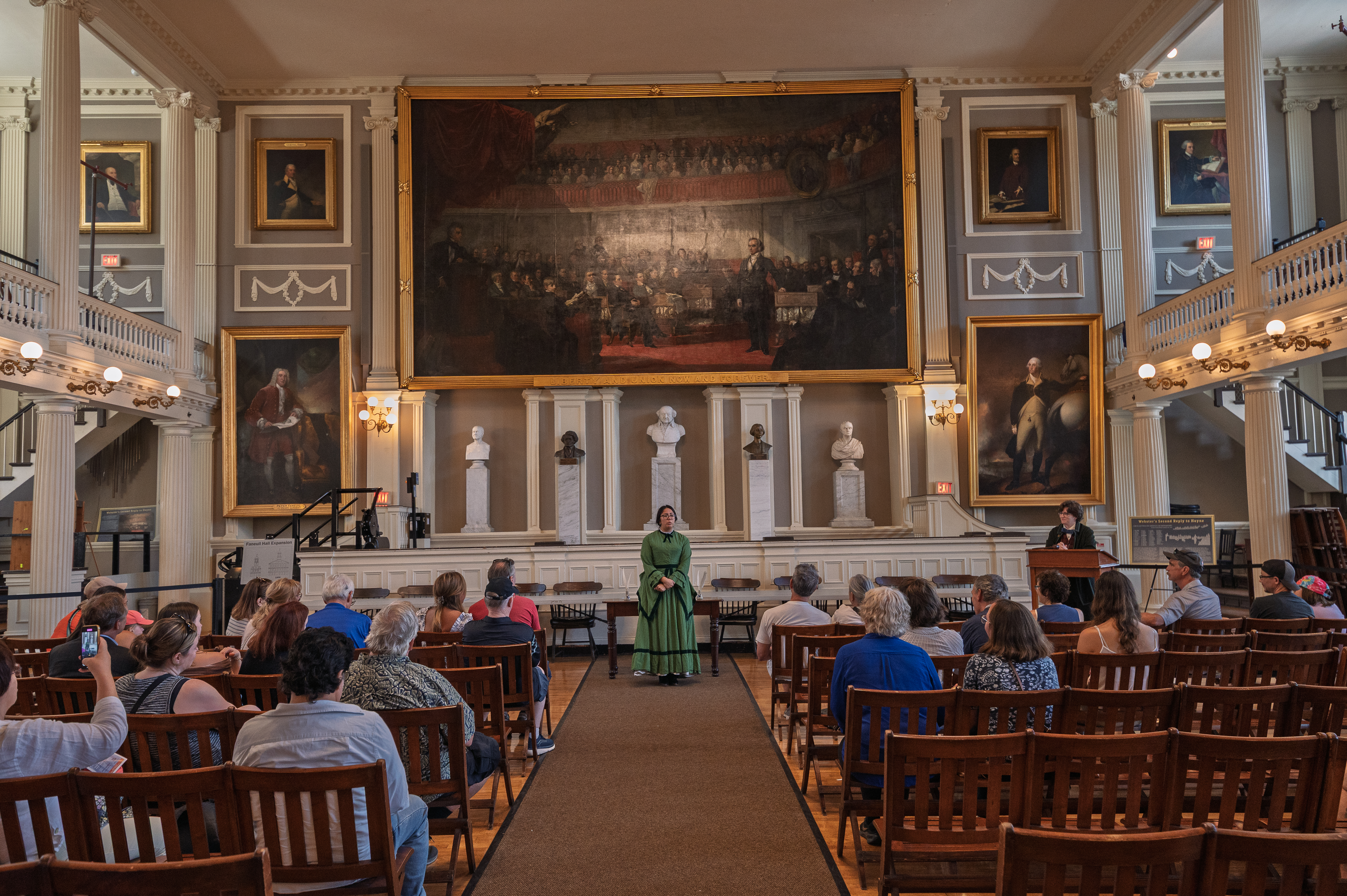
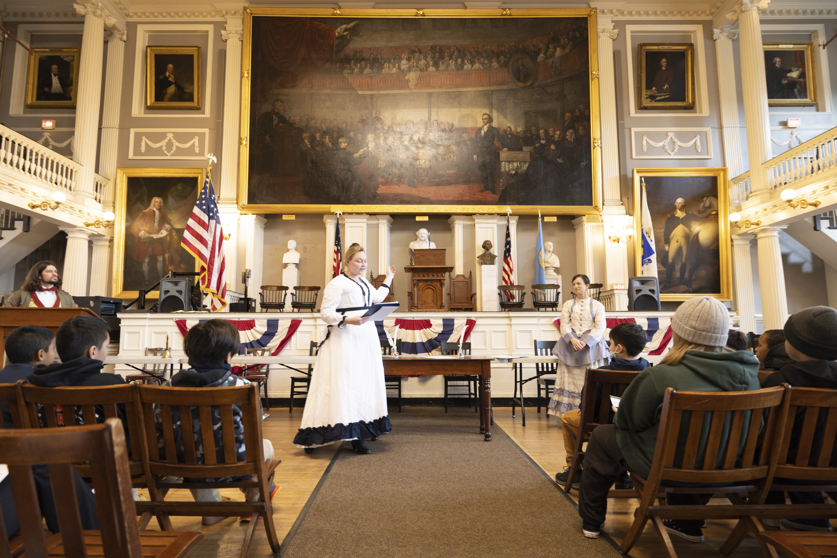
Join a Historic Town Meeting at Faneuil Hall
Join National Parks of Boston Rangers as we recreate historic town meetings.
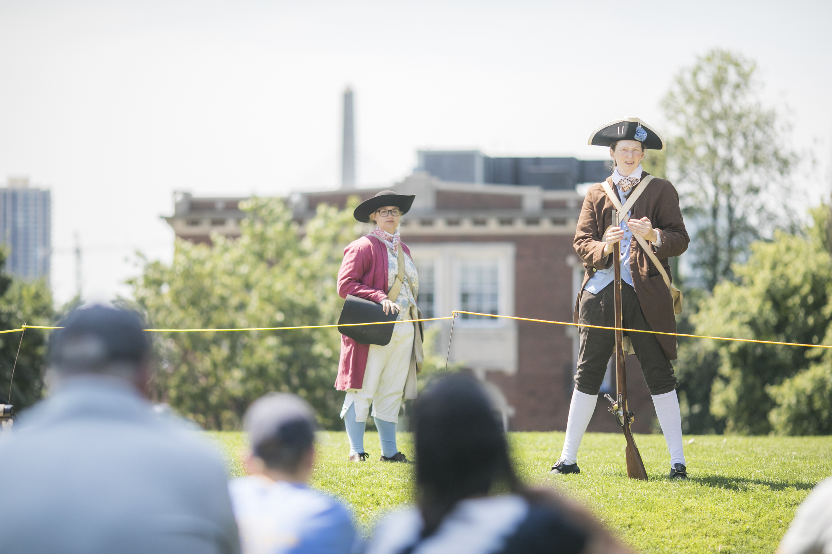
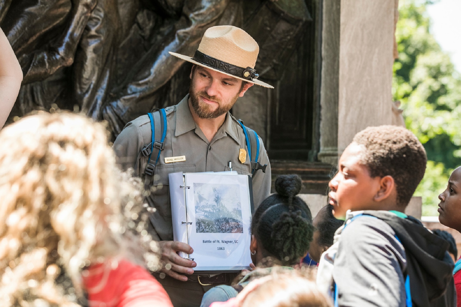
Bunker Hill: Muskets, Men, and Liberty
Listen to a ranger dressed in period clothing discuss why three men from different backgrounds fought in the battle. The program concludes with a musket firing demonstration!
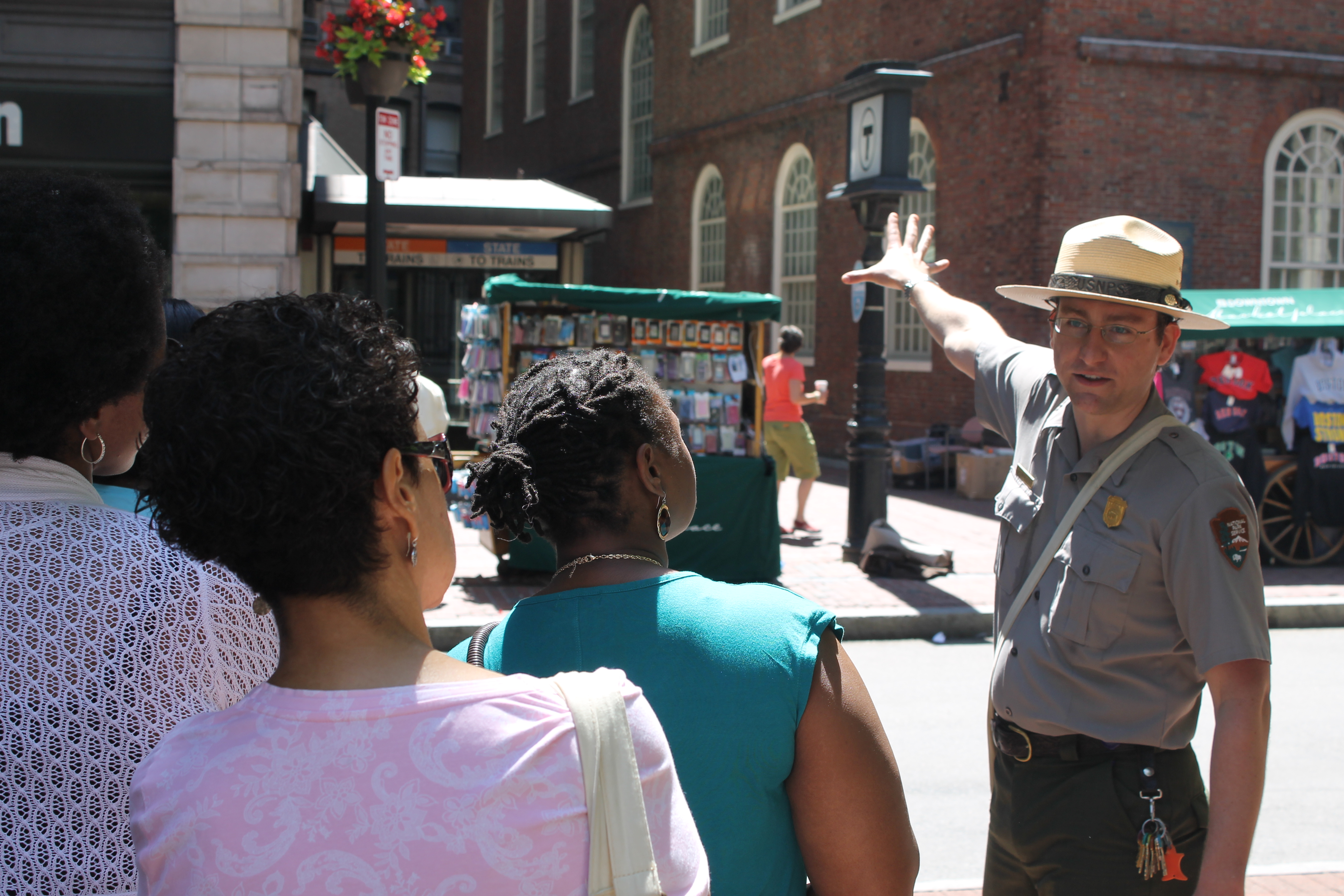
The Freedom Trail: Enemies to this Country Guided Tour
Join a park ranger for a free 75 minute walking tour and decide who the real "Enemies to This Country" were in the months before the breakout of the War for Independence.
Walk the Black Heritage Trail®
Join a Park Ranger from the National Parks of Boston on a Black Heritage Trail® Tour to learn about the Black community of Beacon Hill that thrived before, during, and after the American Civil War.
National Parks of Boston: Find Your Park Anywhere
Find your park anywhere, from your home to your backyard, with activities spanning the National Parks of Boston.
Charlestown Navy Yard: Tour USS CASSIN YOUNG (DD 793)
Explore above and below the main deck of USS CASSIN YOUNG (DD 793), a Fletcher-class Destroyer that served in the Second World War and throughout the 1950s.
The Clough House at Old North Church & Historic Site
Visit one of Boston's oldest surviving brick residences, the Clough House at Old North Church and Historic Site. The Clough House is home to the free exhibit "Unearthing Childhood: 300 Years of North End Kids," and Heritage Goods + Gift shop.
Walk the Freedom Trail
Originally conceptualized in the 1950s, the Freedom Trail® is an iconic symbol of Boston. Its red brick line snakes through some of the oldest parts of the City, navigating visitors to some of the most significant historic sites in the Downtown, North End, and Charlestown neighborhoods of Boston.
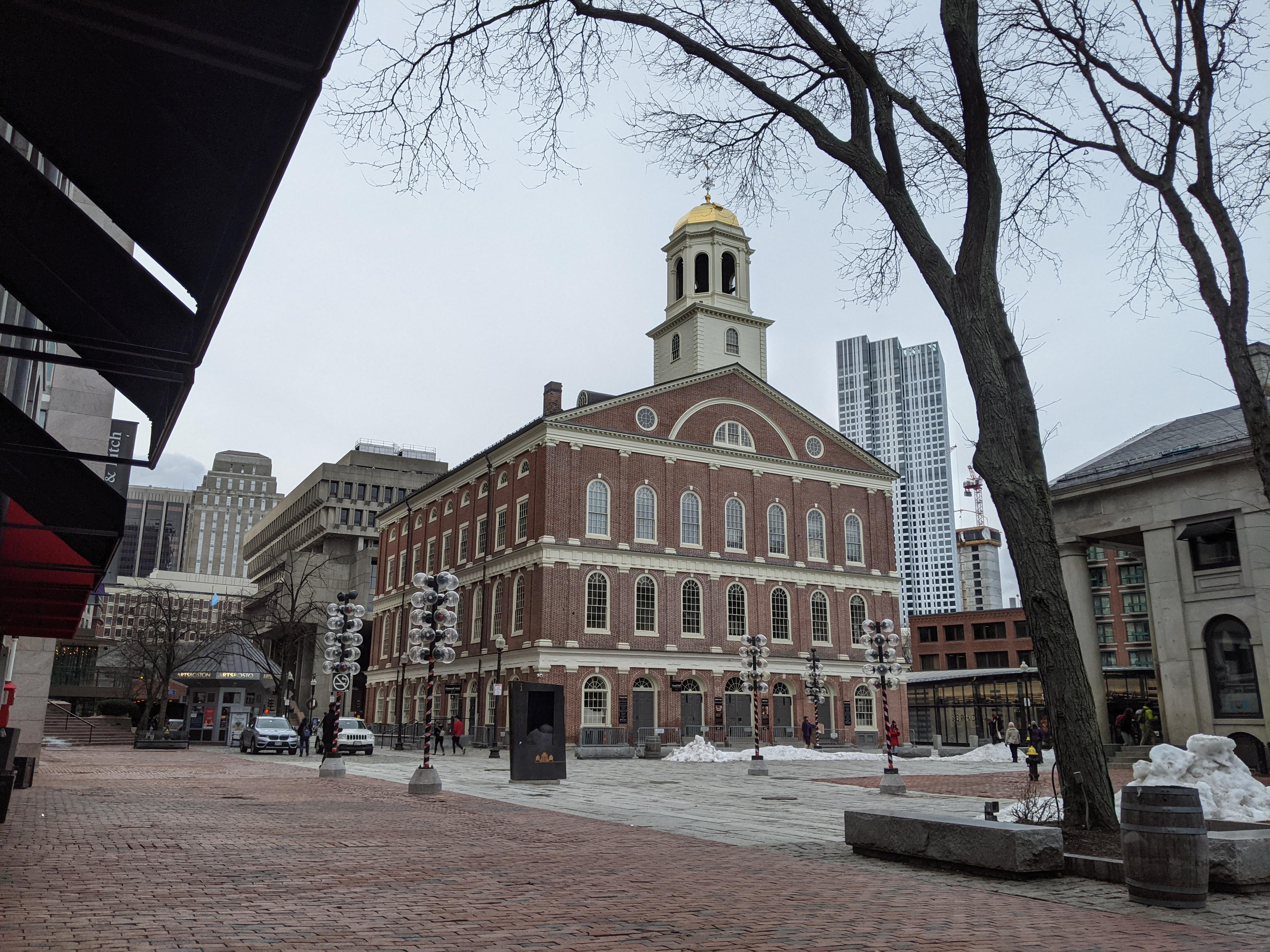
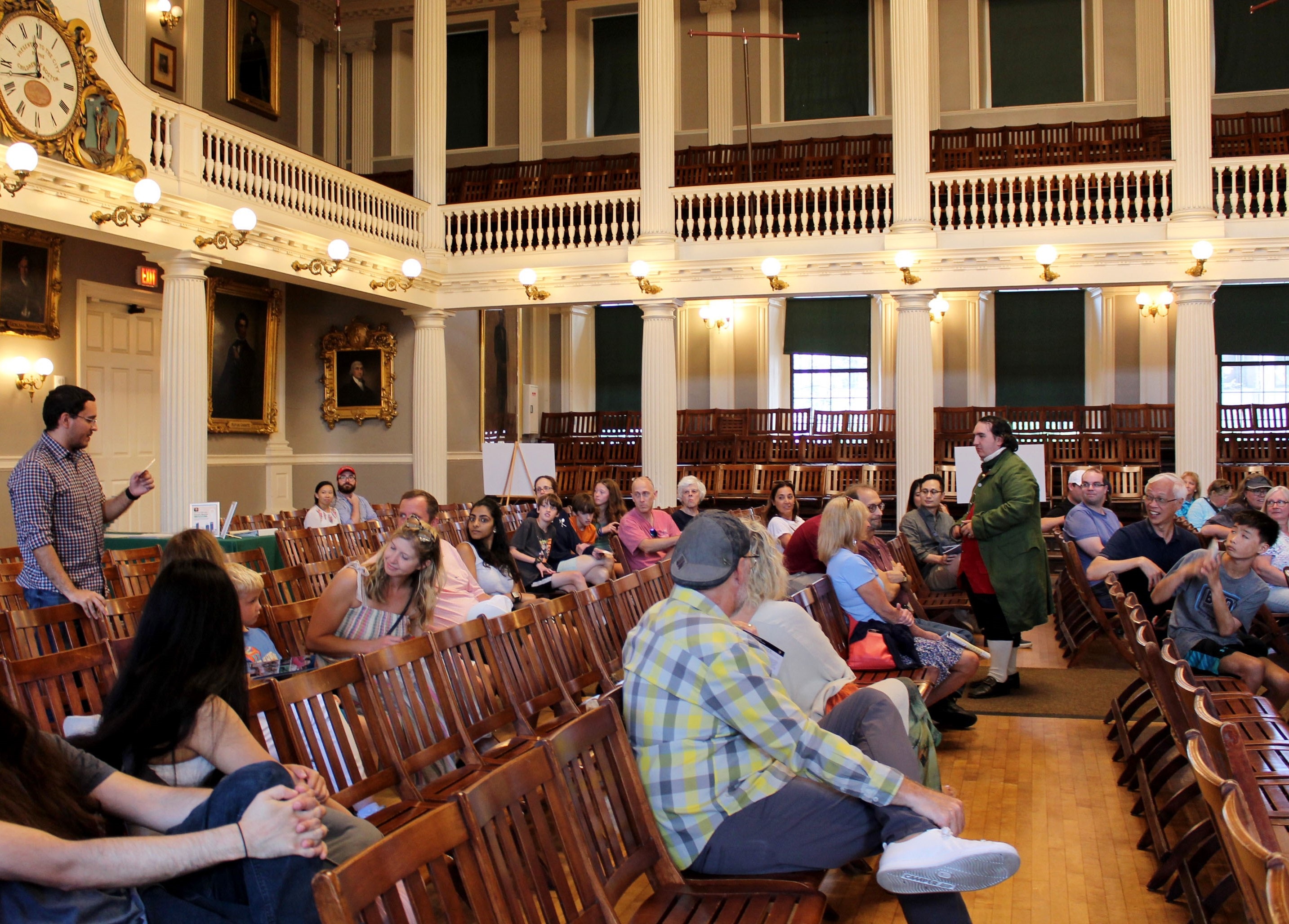
Visit Historic Faneuil Hall
Visit the Historic Cradle of Liberty's marketplace, Visitor Center, Great Hall, and Ancient and Honorable Artillery Company.
Explore Boston with a Free Audio Tour
Explore Downtown Boston, Beacon Hill, and Charlestown with a self-guided audio tour!
USS CONSTITUTION: Explore this Historic Ship
Step aboard USS Constitution, the oldest commissioned ship in the United States Navy. Naval officers and crew still serve aboard her as interpretative historians.
Old South Meeting House: Explore the Exhibits at this Space for Debate
Old South Meeting House's exhibits that explore the sites rich history of debate during the American Revolution.
Old North Church: Tour this Historic Church Known for the Two Lanterns
Walk through the pews and admire the stained glass windows of this Anglican Church originally built in 1723 and learn about the story behind the famed lanterns.
Old North Church: Crypt Tour
Take a self-guided tour of Old North’s historic crypt, where 1,100 people were laid to rest.
Old North Church: Balcony Tours
Visit Old North Church's gallery through a variety of special themed tours.
Raise Your Voice at the Woman's Tea Party
Join National Parks of Boston Rangers in an interactive program based on the 1873 Woman's Tea Party meeting.
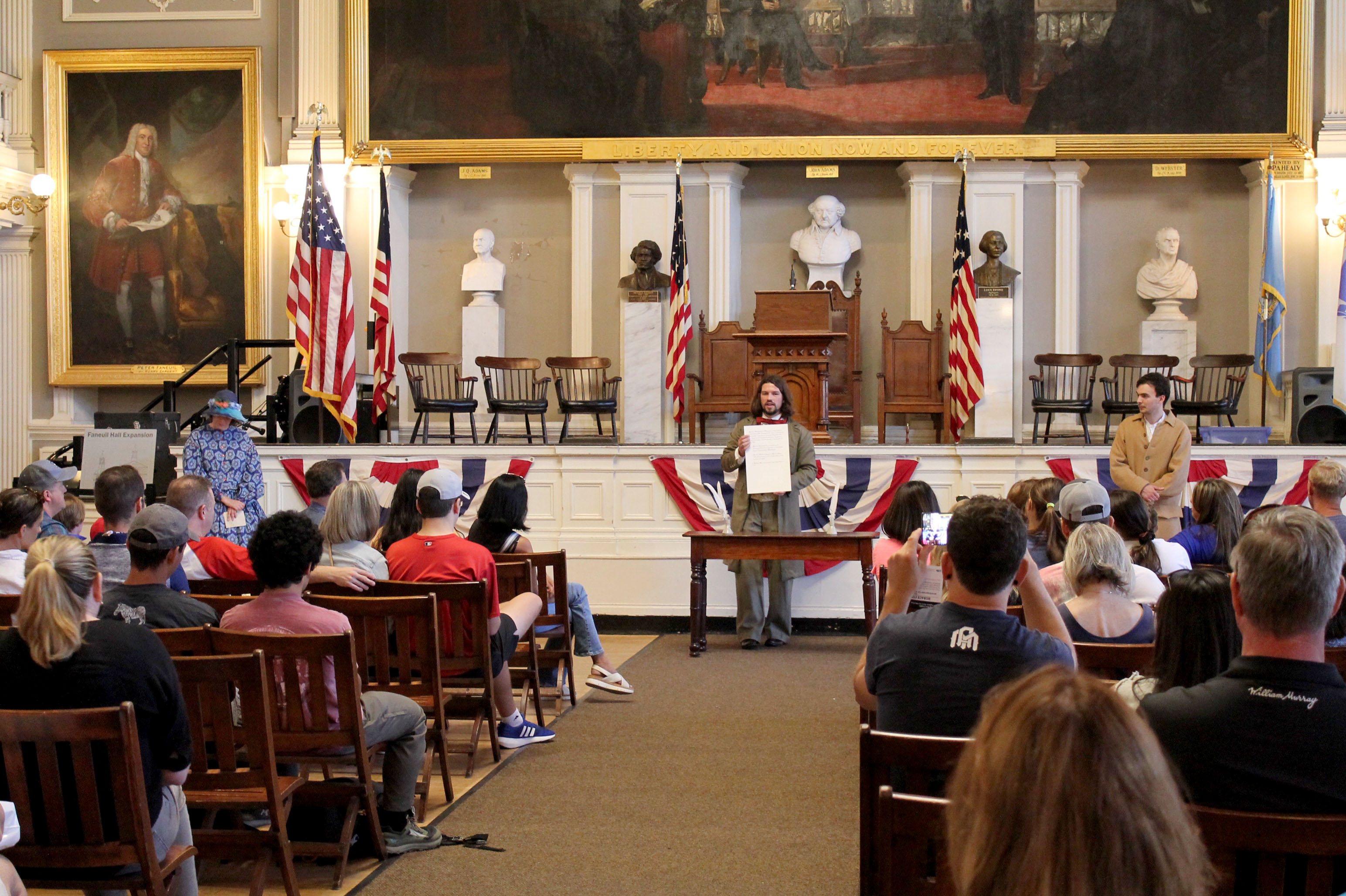
"The Destruction of the Tea" Town Meeting
Join Rangers in this town meeting on the Boston Tea Party to explore arguments about patriotism, destruction of private property, and the meaning of liberty.
Join the "Rocking the Cradle" Town Meeting
Join National Parks of Boston Rangers in an interactive program that recreates the historic meeting of abolitionists who protested freedom seeker Anthony Burns' arrest.
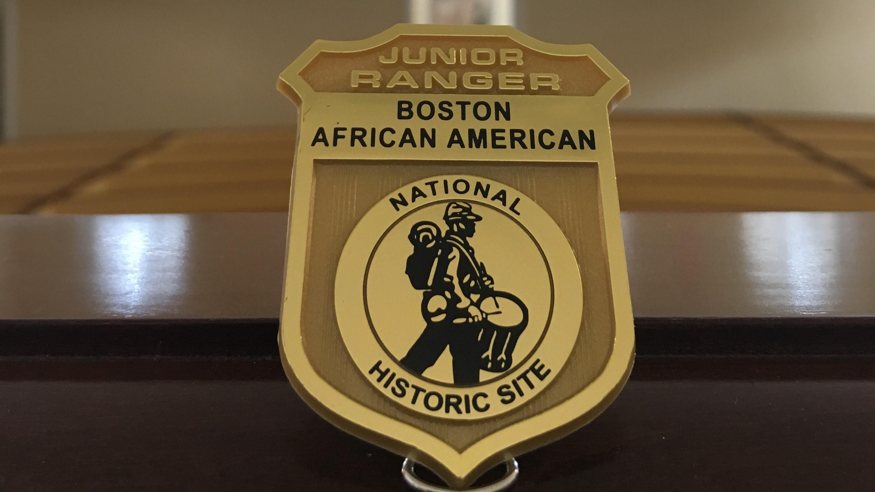
Become a Junior Ranger at Boston African American National Historic Site
Become a Junior Ranger at Boston African American National Historic Site by learning about the sites along the Black Heritage Trail Trail® here in Boston.
Paul Revere House: Step Back in Time at The Revere's Family Home
Take a self-guided tour through the well-preserved rooms where Paul Revere and his family lived for about twenty years.
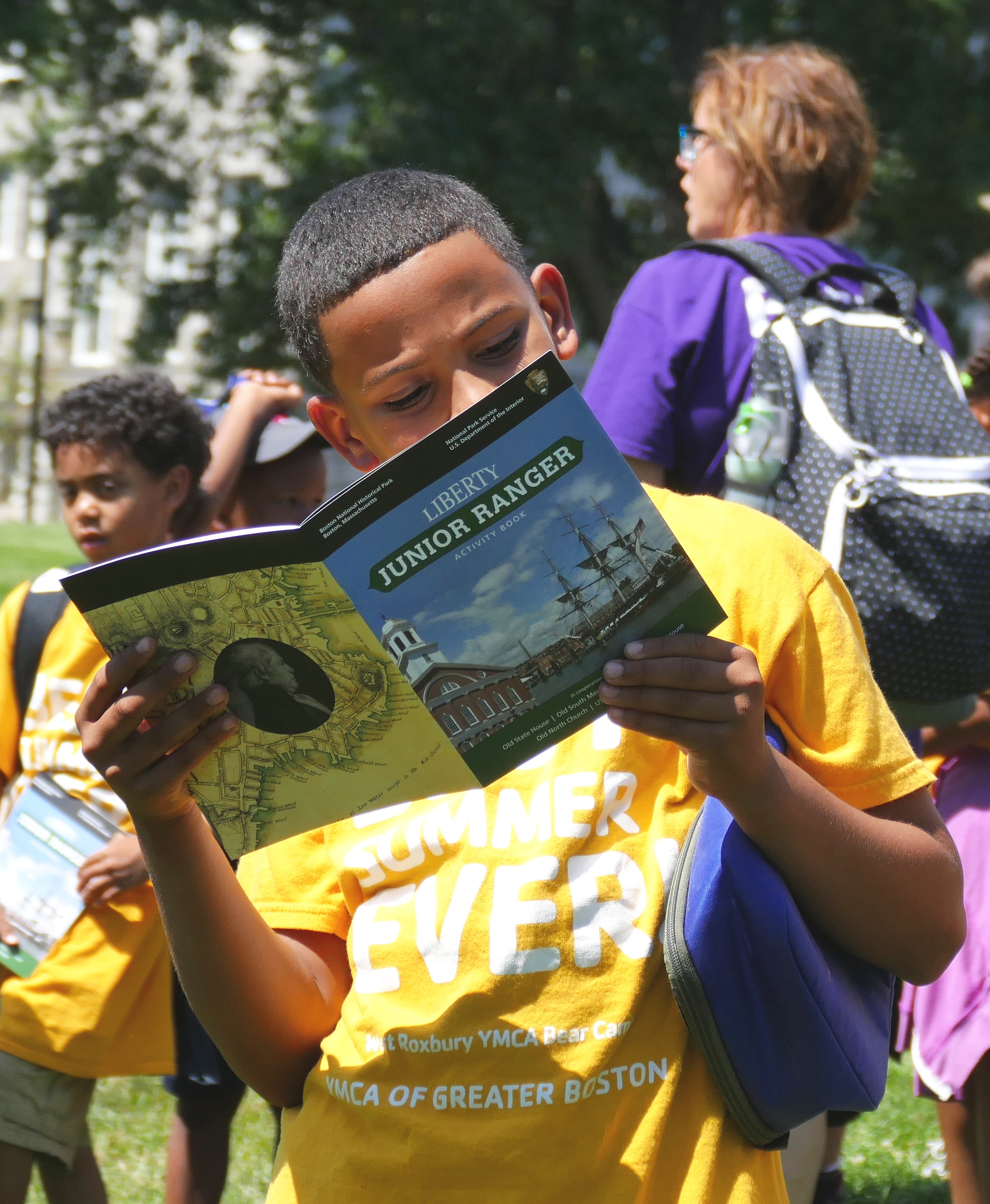
Become a Junior Ranger at Boston National Historical Park
Become a Junior Ranger at Boston National Historical Park by learning about the sites along the Freedom Trail® here in Boston.
Bunker Hill: Uncover the Stories Behind the Battle and Monument at the Museum
At the exhibits of the Bunker Hill Museum, visitors can explore more about the Battle of Bunker Hill, the construction of the Bunker Hill Monument, the memory of the battle, and the history of the Charlestown neighborhood.
Watch the Charlestown Navy Yard Orientation Film
Before exploring the Charlestown Navy Yard, take a few minutes to watch an introductory film on the Charlestown Navy Yard.
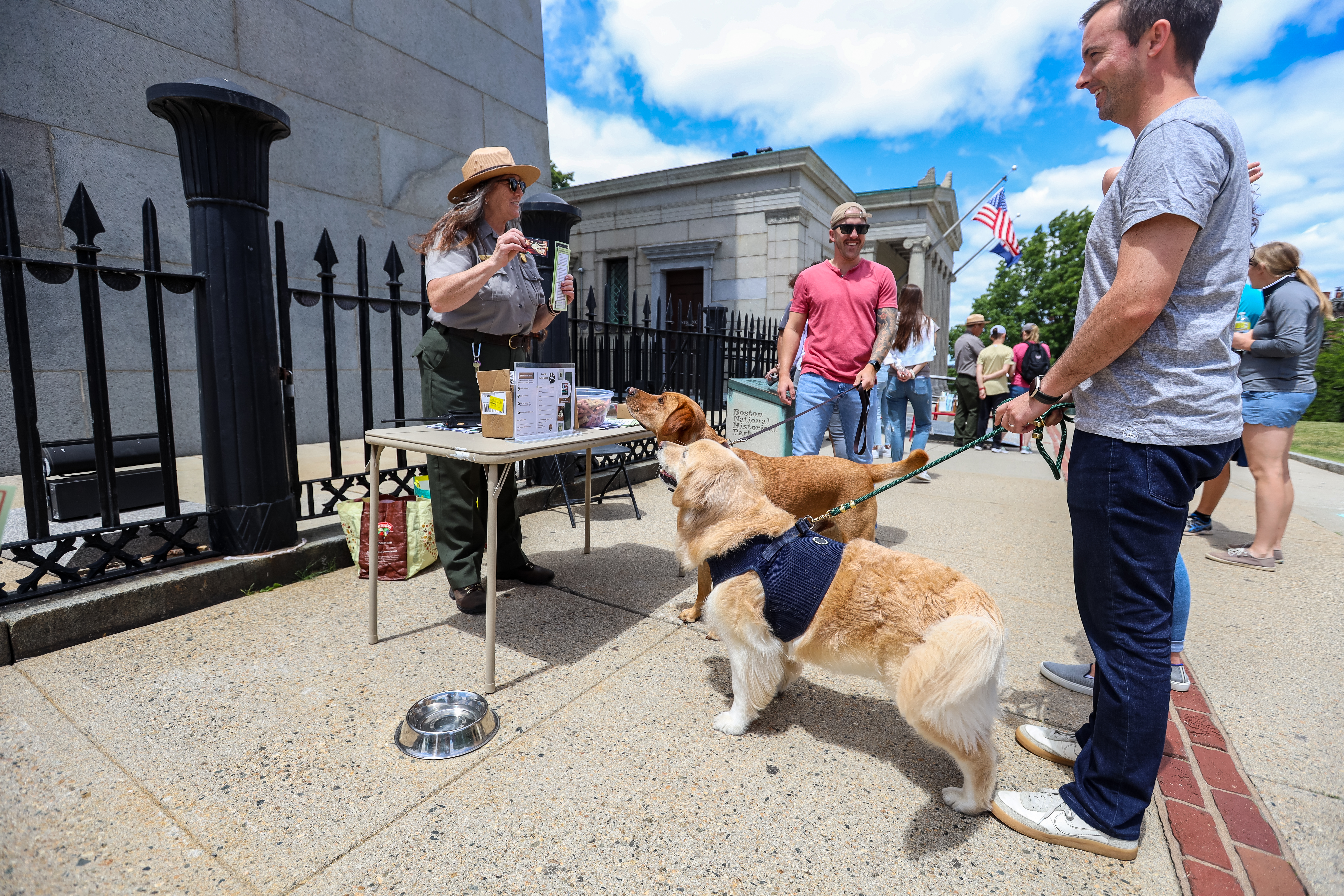
Become a Bark Ranger
Bring your furry friend to the National Parks of Boston and take the B.A.R.K. Ranger pledge to become a Bark Ranger!
Old North Church: Bell Ringing Chamber Tour
Take a tour of Old North's bell tower! Visitors will explore the archive room and the bell ringing chamber: two behind-the-scenes areas that aren’t typically open to guests.
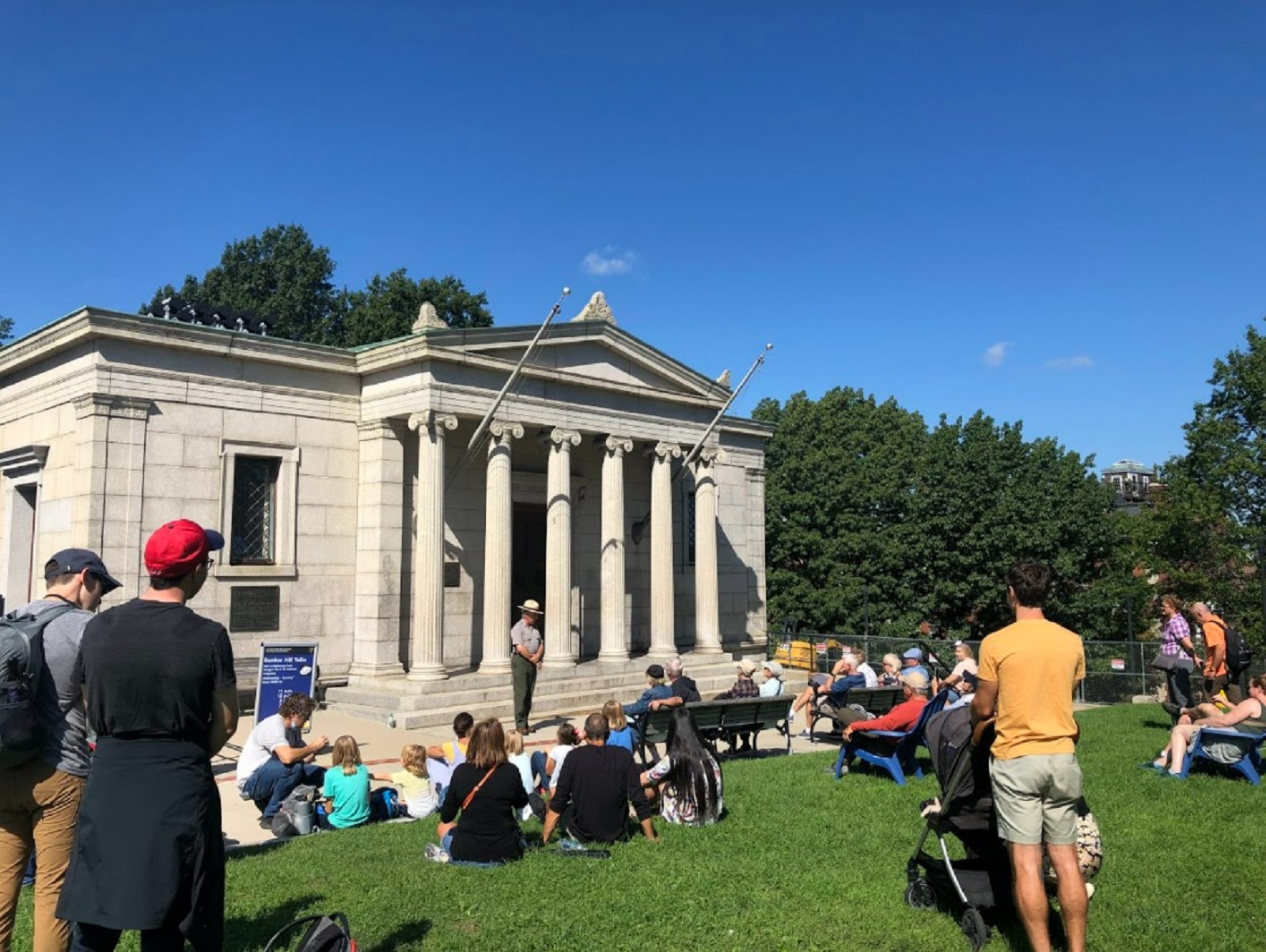
Bunker Hill: Decisive Day Talks
Join Park staff or a volunteer outside of the Bunker Hill Lodge to learn about the Battle of Bunker Hill and its memory.
The Freedom Trail: Meetings, Mobs, & Martyrs Guided Tour
Join a National Park Service Ranger for a free 60 minute walking tour of how Bostonians protested for liberty at Faneuil Hall, Old State House, & Old South Meeting House.
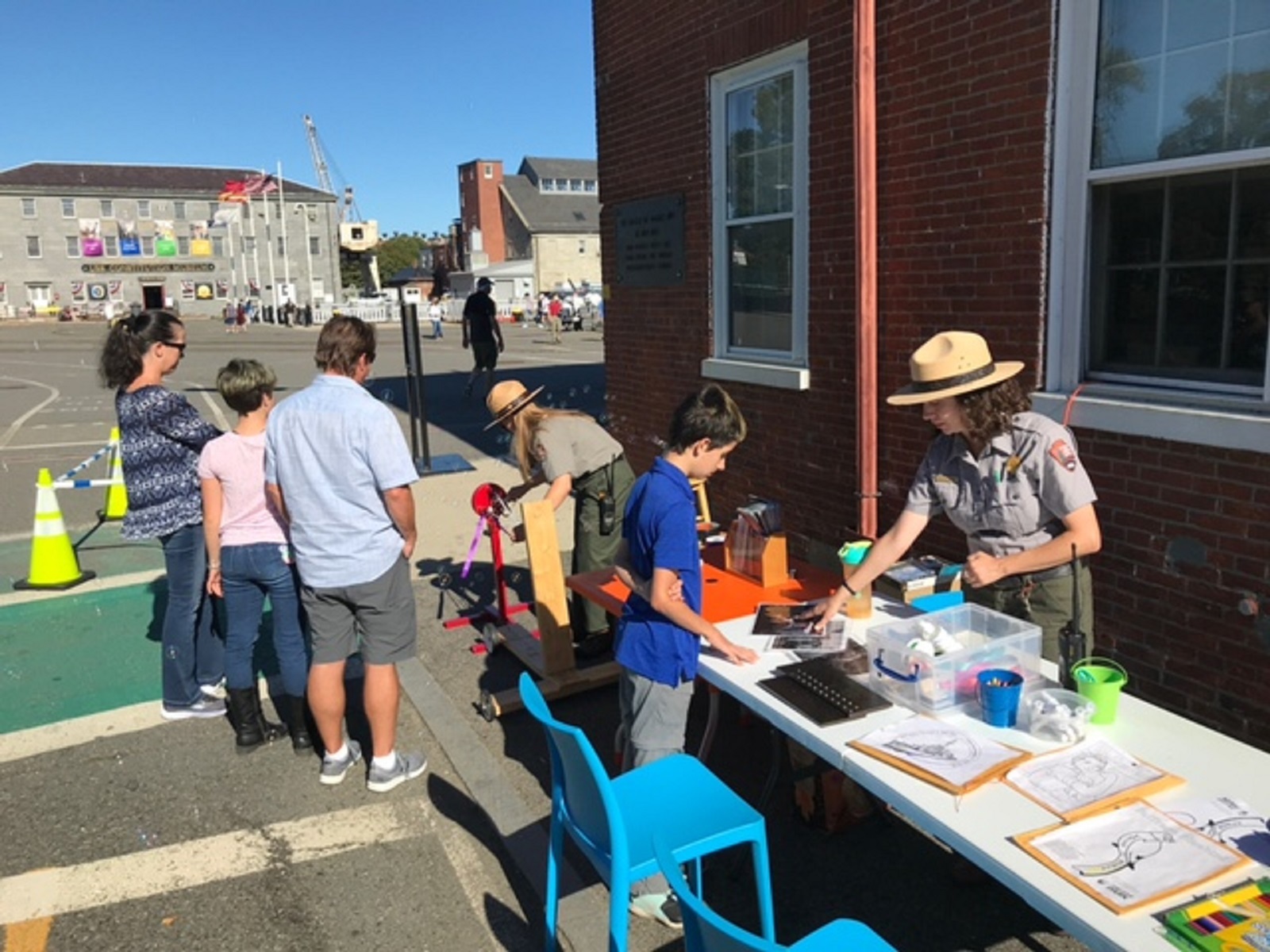
Sunday Funday at the National Parks of Boston
Join the National Parks of Boston for Sunday Funday! Rangers organize family friendly activities at the Charlestown Navy Yard on Sundays throughout the summer
Old North Church: Audio Tour
Discover Old North’s secrets and stories with a brand-new audio tour! Available in English or Spanish, the tour weaves together the story of Paul Revere’s famous lantern signal with recent research into the lives of Old North’s free and enslaved Indigenous and Black congregants.
Old State House: Soak in Boston's History at this Former Seat of Government
The Old State House's exhibits explore the founding of the United States as well as examine the legacies of the events surrounding the American Revolution.
USS Constitution Museum: Learn about the Role of "Old Ironsides" in U.S. Naval History
The USS Constitution Museum dives into the history of the oldest active vessel in the United States Navy. Serving as the memory and educational voice of USS Constitution, the Museum provides engaging hands-on experiences for all visitors.
Live Music at the Navy Yard
Enjoy lively concerts throughout the summer at the Charlestown Navy Yard.
Watch "Fighting for Freedom: Lewis Hayden and the Underground Railroad"
Watch a film that follows the story of Lewis Hayden and his family as they seek freedom on the Underground Railroad and become activists living in Boston, Massachusetts.
National Parks of Boston Virtual Programming
Virtual programs
Become a Junior Ranger at Boston Harbor Islands National and State Park
Become a Junior Ranger at Boston Harbor Islands National and State Park!
Old North Church: Prince's Pet Pursuit Family Activity
Explore Old North through a scavenger hunt narrated by Prince, the friendly North End cat who used to frequent the church.
Charlestown Navy Yard: Dive into The History of the Yard at the Visitor Center's Exhibits
Walk through the exhibits of the Navy Yard's Visitor Center to learn about the history of the Yard and the ingenuity of its workers.
Tours
Count: 9
Bunker Hill Monument: Remembering Revolution
Join us in an audio exploration of what over 100,000 people commemorated on June 17, 1843, the memory of some of the men who fought at Bunker Hill on June 17, 1775, and why the monument and men continue to have relevance today.
Charlestown Navy Yard Tour
At more than 200 years old, the Charlestown Navy Yard you see today is the product of constant change, both planned and unplanned. The central mission of the yard was always to support the US Navy—to build, repair, and modernize its warships. As the needs of the Navy changed and shifted, so did the landscape and the people at the Yard. The lasting legacy of those changes and shifts is what remains today. Join this tour to explore how the Navy Yard fulfilled its mission, and secured that legacy.
High Tide Trail
Join the National Parks of Boston and the Stone Living Lab on the High Tide Trail! Once known as the Shawmut Peninsula, Boston’s coastline was ringed by salt marshes and beaches. Since colonization, the coastline has been filled, moved, and transformed into the Boston we know today. Now, sea level rise due to human-caused climate change is changing the coastline once again. Follow the High Tide Trail to explore the history of Boston’s changing coastline and learn what future changes may be in store.
The Black Heritage Trail®
The Black Heritage Trail® showcases residences and community buildings associated with a Black community that thrived on, and near, the north slope of Beacon Hill before, during, and after the American Civil War. Throughout that time, this community struggled and organized for equal rights and access to equal education. Community members championed the movement to abolish slavery and even housed freedom seekers on their journey along the Underground Railroad.
The Freedom Trail®
The Freedom Trail is a collection of public and private sites linked together throughout Boston which work to preserve the history of sites relevant to Boston's role in America's struggle for freedom. Boston National Historical Park, established in 1974, works with these sites in order to preserve and tell these stories. The trail itself stretches from Boston Common to Charlestown Navy Yard - two and a half miles for visitors from all over the world to come explore their past.
The Freedom Trail® - Español
El sendero de la libertad es una colección de lugares vinculados en toda la Ciudad de Boston que trabajan para preservar la historia de los sitios relacionados con el rol de Boston en la lucha de los EE. UU. por la libertad. El Parque Nacional Histórico de Boston trabaja con estos sitios para preservar y contar estas historias. El sendero en sí se extiende desde el Boston Common hasta el Astillero Naval de Charlestown; 2.5 millas para que los visitantes alrededor del mundo vengan a explorar su pasado.
The Freedom Trail® - Français
Le Freedom Trail est un ensemble de sites publics et privés reliés entre eux à travers la ville de Boston, qui s'efforcent de préserver l'histoire des sites liés au rôle de Boston dans la lutte des Américains pour la liberté. Le parc historique national de Boston, créé en 1974, travaille avec ces sites afin de préserver et de raconter ces histoires. Le Freedom Trail lui-même s'étend de Boston Common au Charlestown Navy Yard, soit 4 kilomètres, permettant aux visiteurs du monde entier d’explorer leur passé.
The Underground Railroad in Boston
Over the next twelve stops we will hear powerful stories of people who seized their freedom on the Underground Railroad and came to Boston. We will also learn about the activists and allies in this city who helped these freedom seekers* along their way. This tour weaves through Beacon Hill followed by a few stops in Downtown Boston. The tour concludes at Long Wharf. *"Freedom seeker" refers to an enslaved person who took action to obtain their freedom from slavery (NPS Network to Freedom).
Women of Beacon Hill Tour
During the 1800s, Beacon Hill served as a center in the work to abolish slavery, the fight for equal education, & the struggle for women’s rights. Black & White women played a significant role in these & other efforts, having aspirational visions of a just & equitable world. Working from their homes & in community spaces, they used tools at their disposal to define their own sphere of action & influence. Join us as we explore stories of the inspiring women who lived & made a difference in this community.