| Title | Brices Cross Roads |
| Park Code | brcr |
| Description | The Confederate victory at Brices Cross Roads was a significant victory for Major General Nathan Bedford Forrest, but its long-term effect on the war proved costly for the Confederates. |
| Location | |
| Contact | |
| Activities |
|
| Entrance fees |
|
| Campgrounds | Count: 0
|
| Places | Count: 12
114th Illinois Monument at Brices Cross RoadsMonument to the men of the 114th Illinois Volunteer Infantry in honor of the men who fought at Brices Cross Roads. It is one of the newest monuments to the Brices Cross Roads Battlefield. This monument was dedicated in the Summer of 2019. It was funded by the 114th Regiment Illinois Volunteer Infantry (Reactivated). 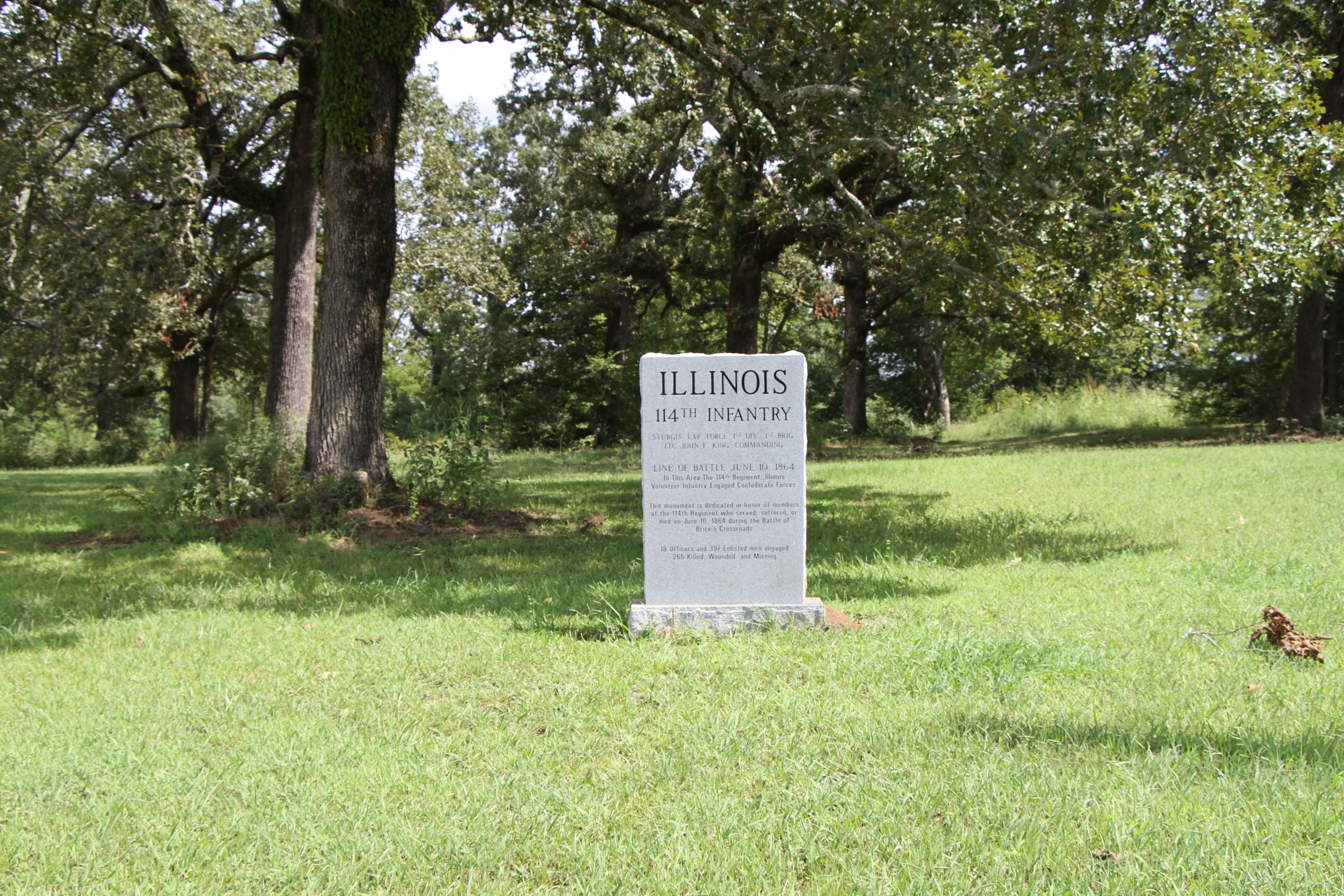
Mississippi Final Stands Interpretive CenterOur friends at the Mississippi Final Stands Interpretive Center have exhibits and films, which interpret the Battle of Brices Cross Roads fought June 10, 1864 and the Battle of Tupelo/Harrisburg fought July 14-15, 1864. 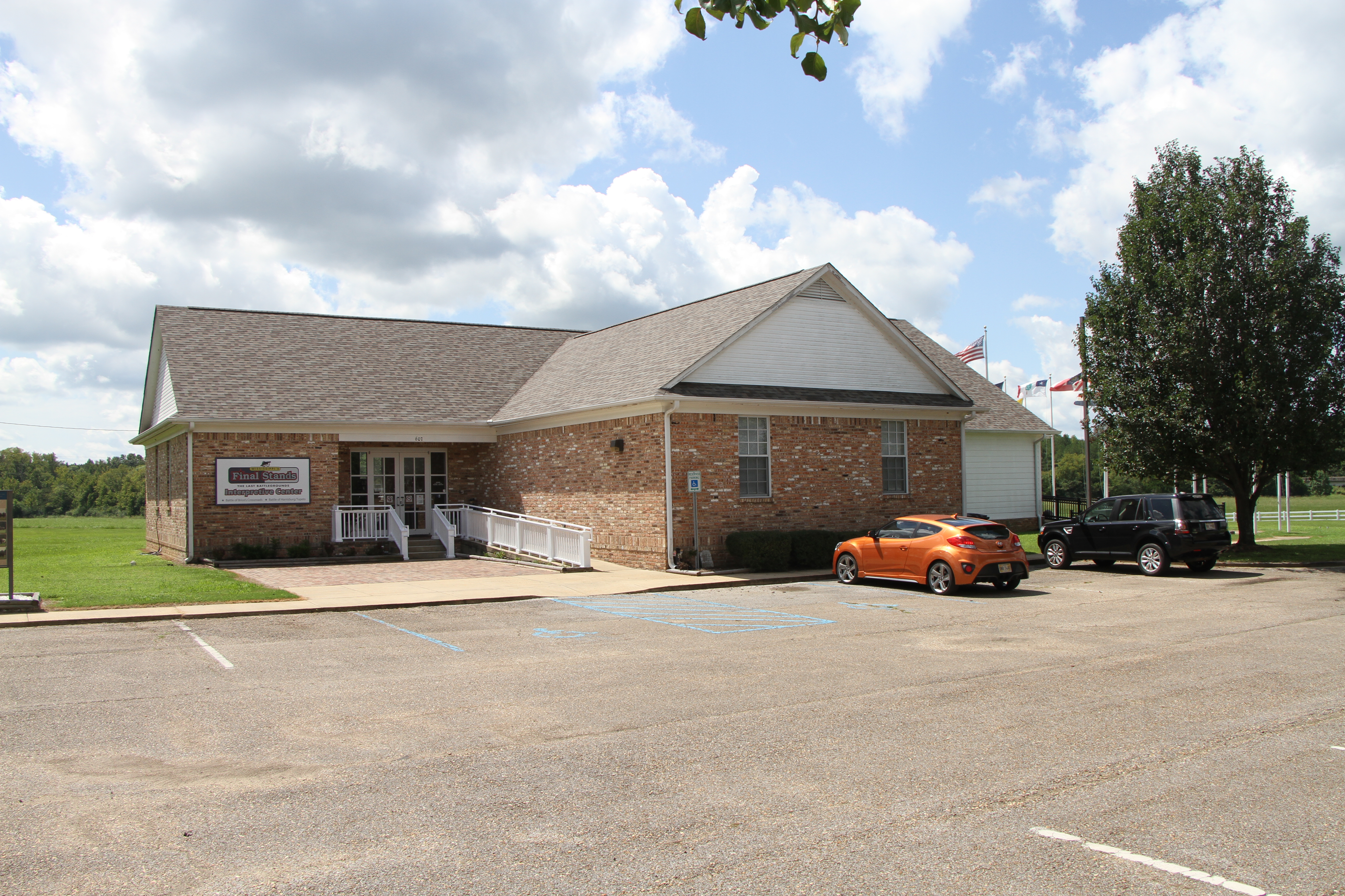
Tour Stop #1 - First Shots of the Battle of Brices Cross RoadsThis monument was erected by the State of Mississippi in 1957. It represents the beginning of the Battle of Brices Cross Roads. The first shots of the battle took place in this location between the Federal Cavalry represented by the 4th Missouri and the Confederate cavalry represented by the 7th Tennessee. This site is managed by the Mississippi Final Stands Interpretive Center. 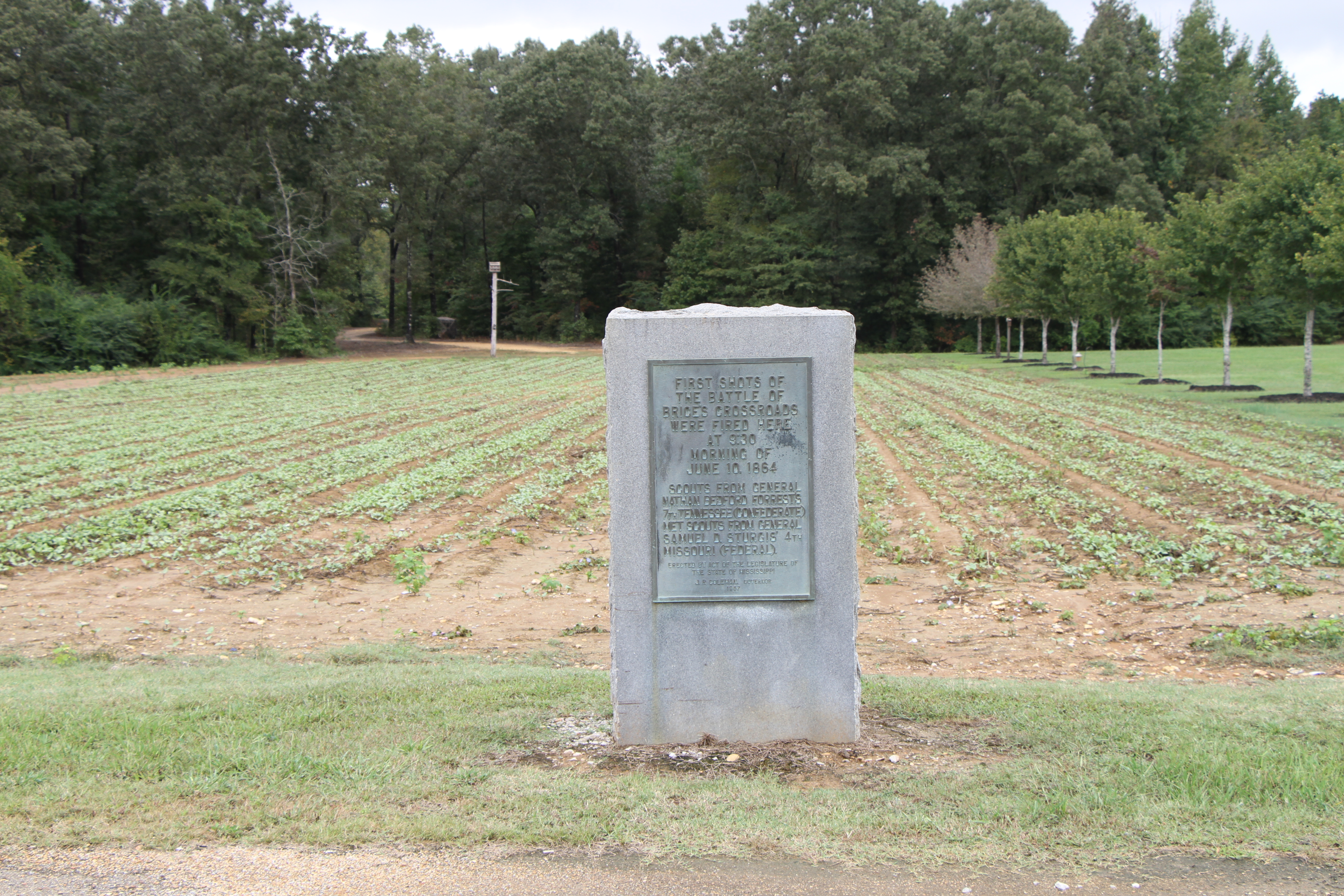
Tour Stop #10 - United States Colored Troops on White House Ridge at the Battle of Brices Cross RoadsThis is the site of the Union defensive stand on the "White House Ridge" by the United States Colored Troops (USCT). It was here that the Federals attempted to stop the Confederate pursuit or at least slow it down to give the other Union regiments time to get themselves and the wagon train to safety. This site is managed by the Mississippi Final Stands Interpretive Center. 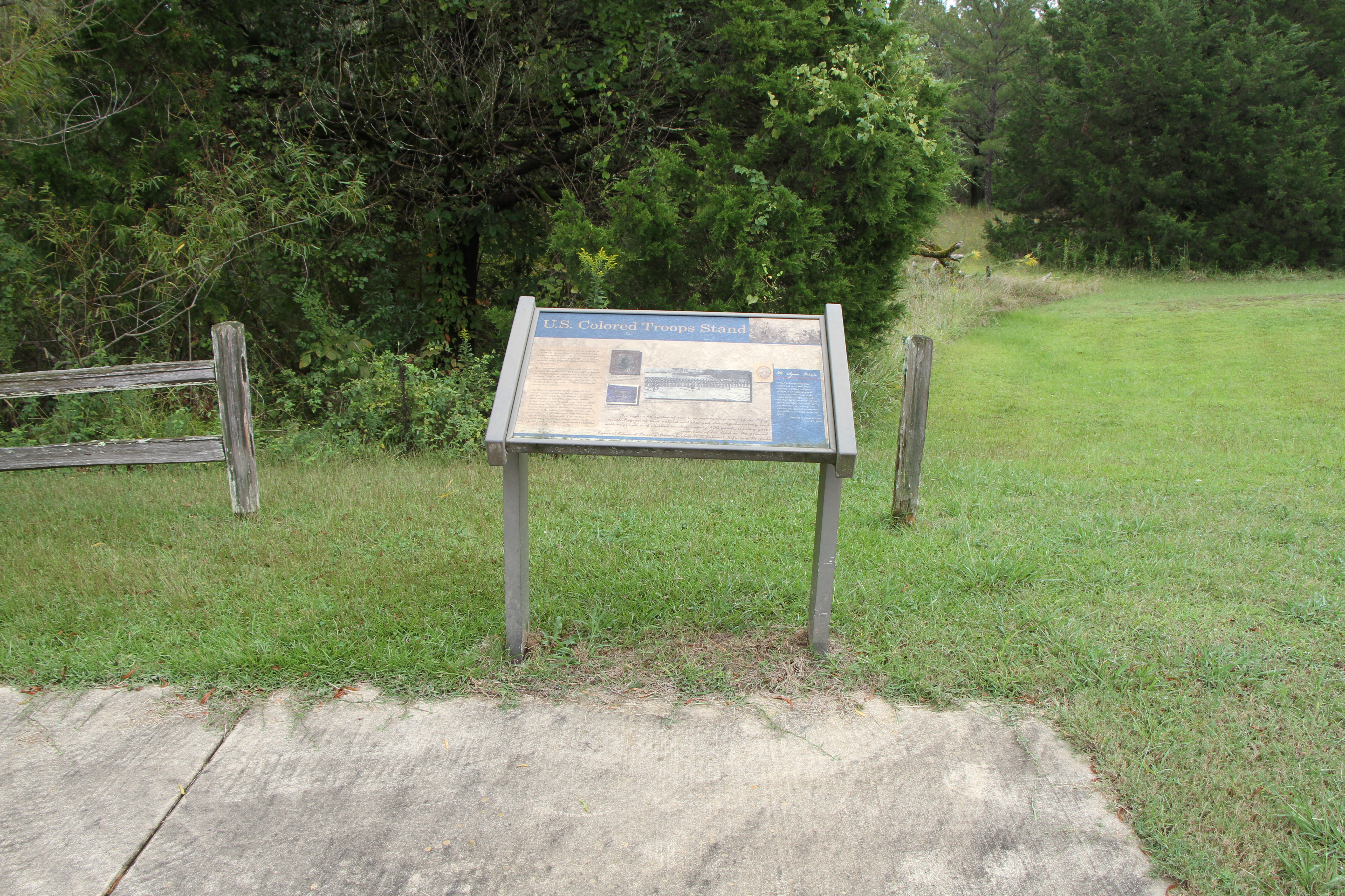
Tour Stop #2 - Cavalry Skirmish at the Battle of Brices Cross RoadsNear here the Federal and Confederate advance forces of cavalry met in their skirmish lines. The 2nd New Jersey Cavalry were equipped with Spencer repeating rifles and were able to inflict heavy casualties on the Confederate forces before falling back to the main Federal battle line. This site is managed by the Mississippi Final Stands Interpretative Center. 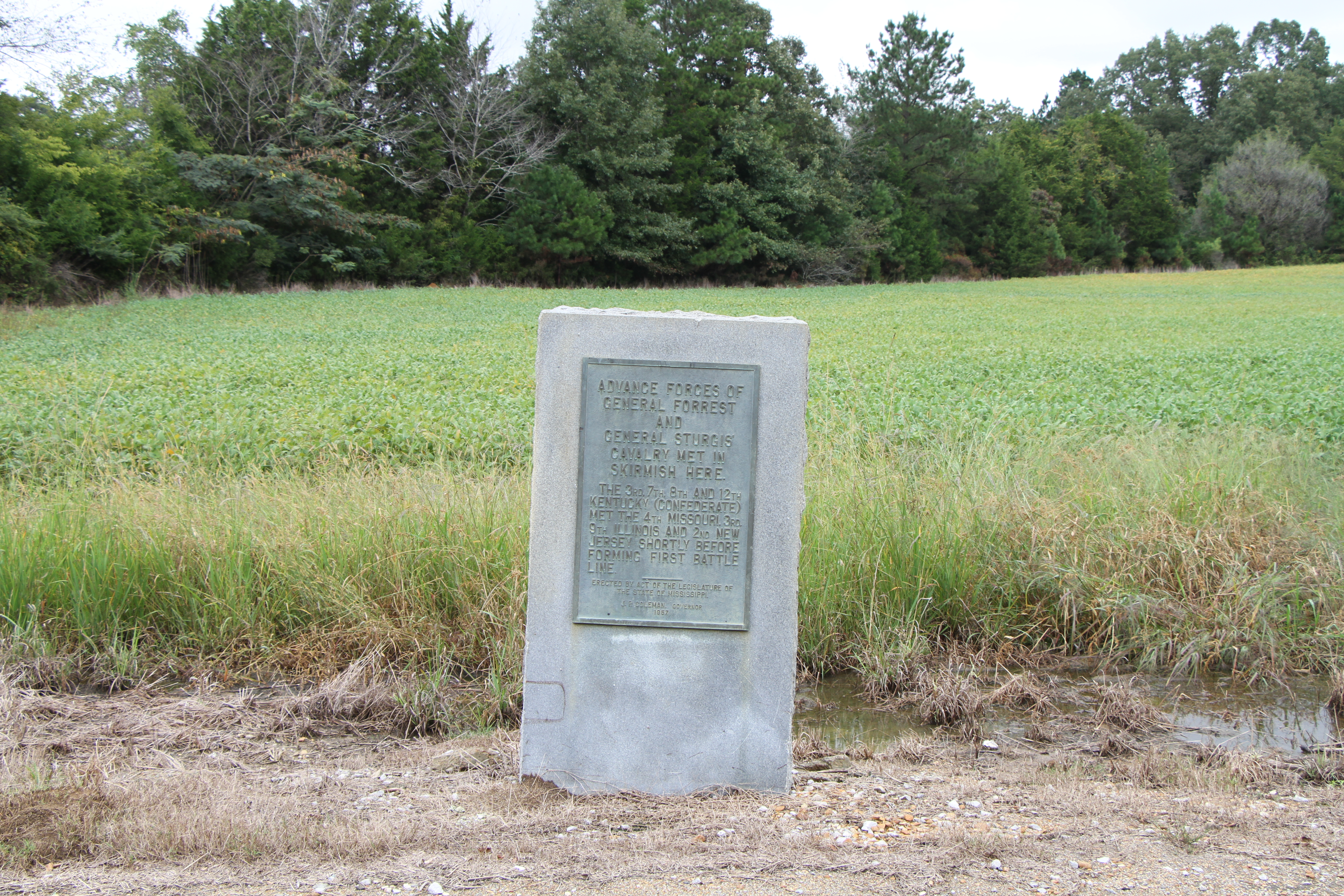
Tour Stop #3 - Federal Cavalry and Artillery Formed First Battle LineFederal cavalry and artillery formed their first battle line here. The Federal army battle line extended five hundred yards north and more than a mile south, across the Guntown Road. The soldiers who were behind rail fences and dense scrub-oak thickets fought stubbornly as the Confederates pushed on to the crossroads. Hand to hand fighting occurred along this line. This site is managed by the Mississippi Final Stands Interpretive Center. 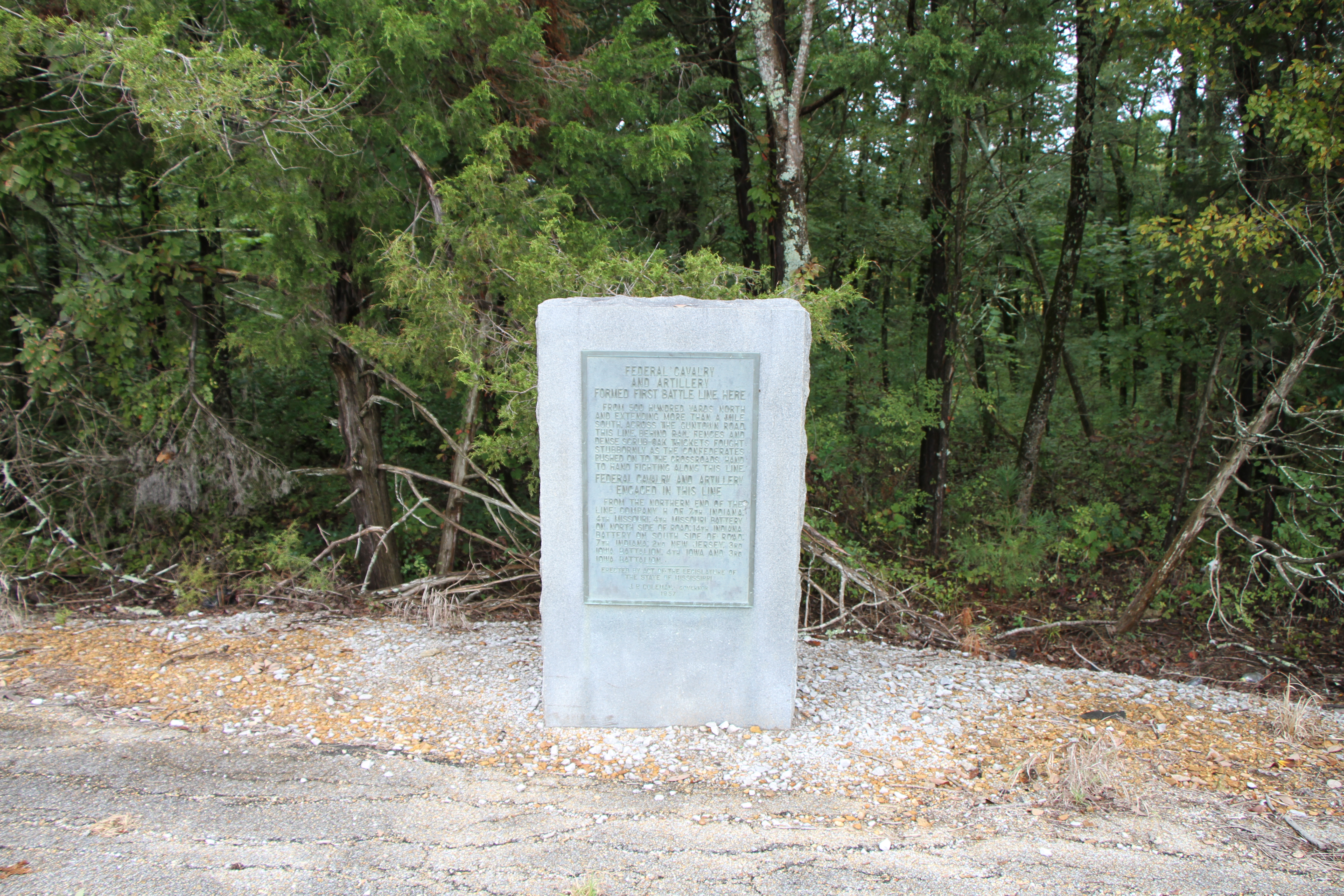
Tour Stop #4 - Confederates Second Battle Line at the Battle of Brices Cross RoadsConfederates Second Battle Line. Pushing the Union forces back, General Forrest slowly closed his pincers movement, forcing General Sturgis' soldiers back towards the crossroads. This Confederate battle line was anchored on the Blackland Road four hundred yards northwest. The southern end of the battle line ran across the Guntown Road. This site is managed by the Mississippi Final Stands Interpretive Center. 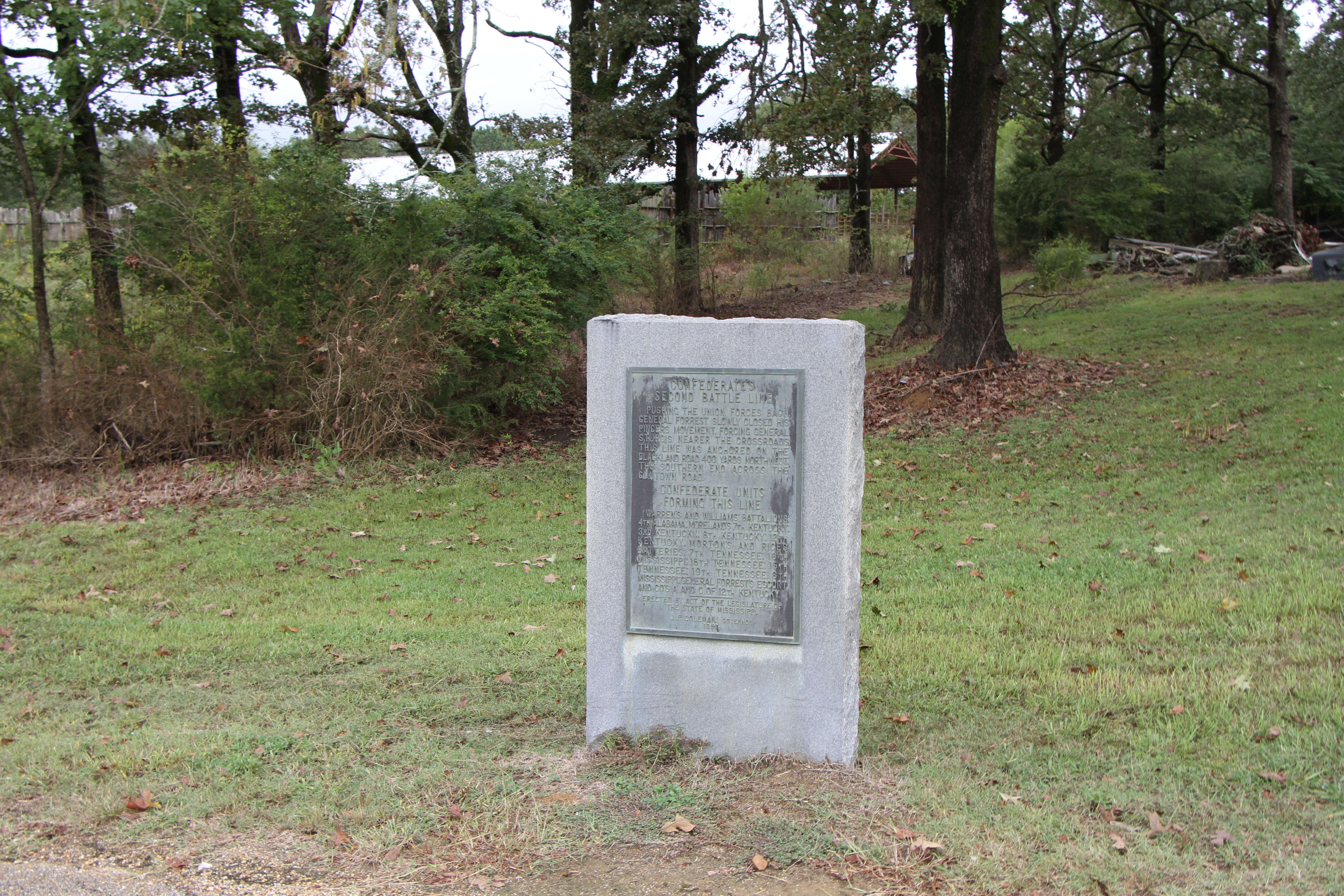
Tour Stop #5 - Federal's Second Battle Line at the Battle of Brices Cross RoadsFederal's Second Battle Line. General Sturgis was able to use his infantry here for the first time in the battle. General Forrest had beaten back the Federal cavalry before the Federal infantry reached the battlefield. Infantry and cavalry formed this second battle line. This site is managed by the Mississippi Final Stands Interpretive Center. 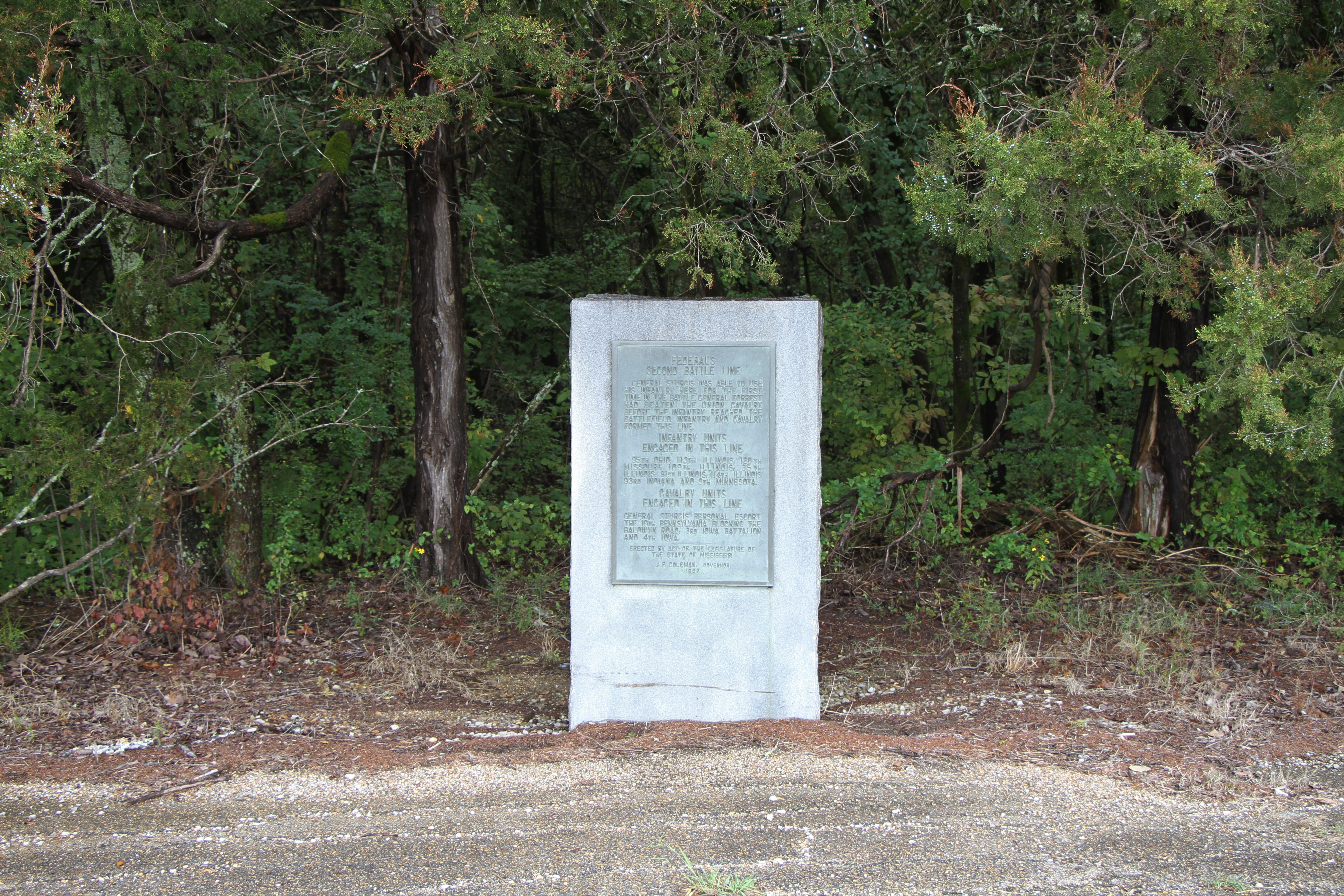
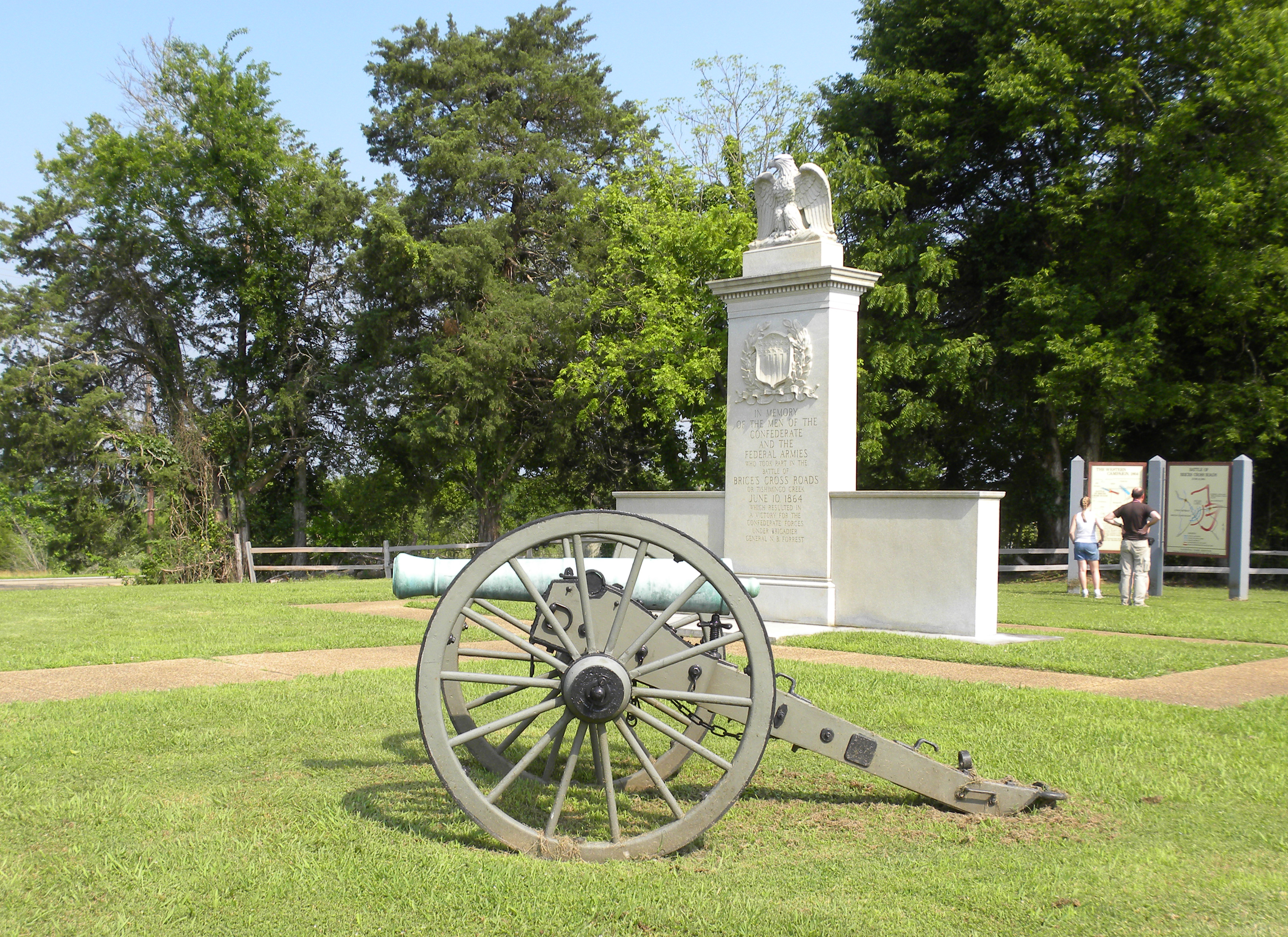
Tour Stop #6 - Brices Cross Roads National Battlefield MonumentThis granite monument was placed here in the 1930s. The National Battlefield was established and originally managed by the War Department starting in 1929. The monument commemorates the men who fought at the Battle of Brices Cross Roads. This is tour stop #6 on the Brices Cross Roads Driving Tour. 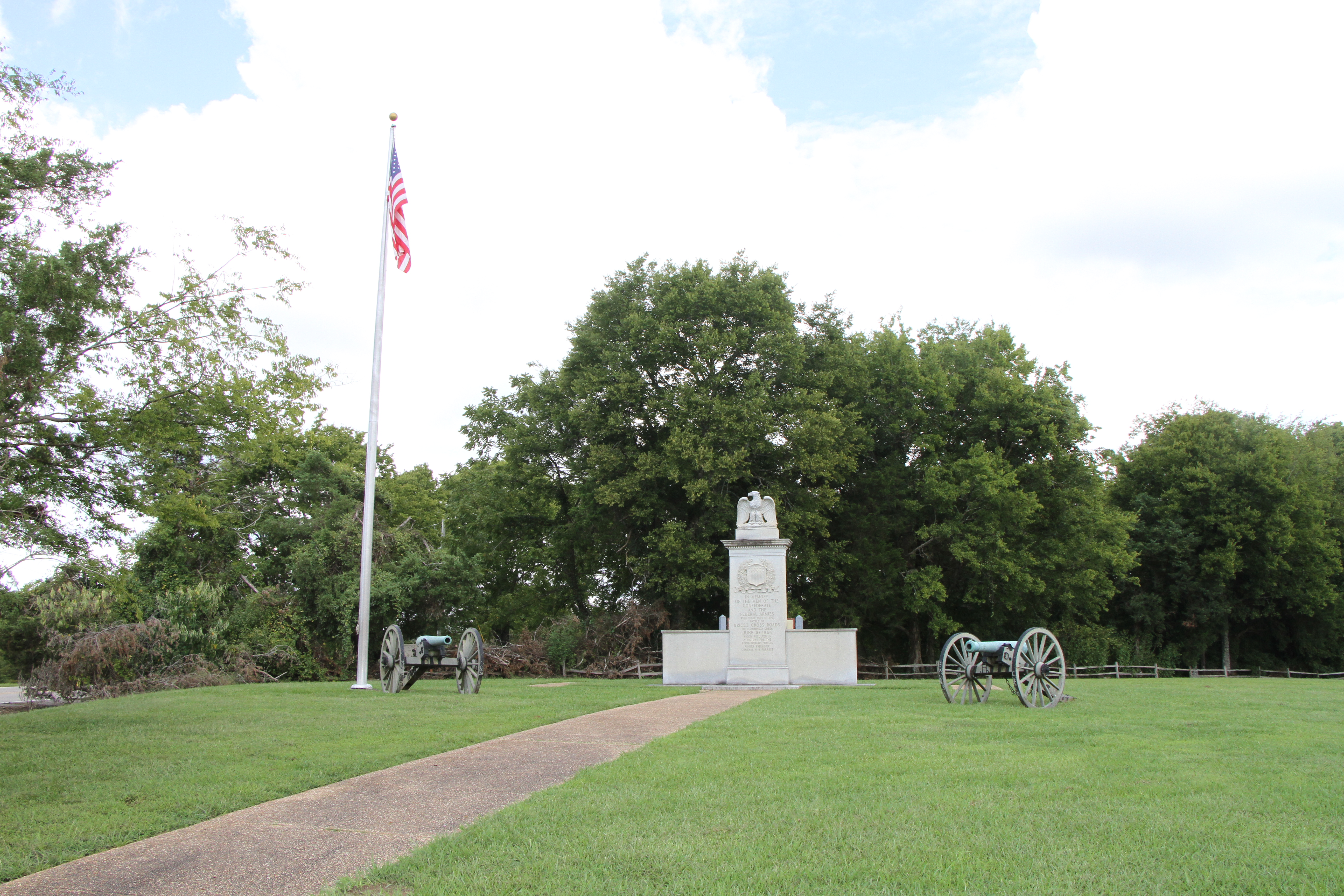
Tour Stop #7 - Log Cabin Knoll at the Battle of Brices Cross RoadsAs Union troops retreated past this location toward Tishomingo Creek, they faced not only a blocked bridge and rain-swollen creek, but also deadly cannon fire coming from this ridge. Confederate artillerymen rained fire upon the scrambling Federal soldiers with four field guns--two twelve-pounder howitzers and two three-inch ordnance rifles. This site is managed by the Mississippi Final Stands Interpretive Center. 
Tour Stop #8 - Tishomingo Creek Bridge at the Battle of Brices Cross RoadsThe end of the main part of the Battle at Brices Cross Roads centered on a small bridge across Tishomingo Creek. The rains of the previous several days had raised the water level of the creek, making it difficult to cross without using the bridge. The bridge soon became a bottleneck for General Sturgis expeditionary force as horses, wagons, cannon, and men attempted to cross the creek. This site is managed by the Mississippi Final Stands Interpretive Center. 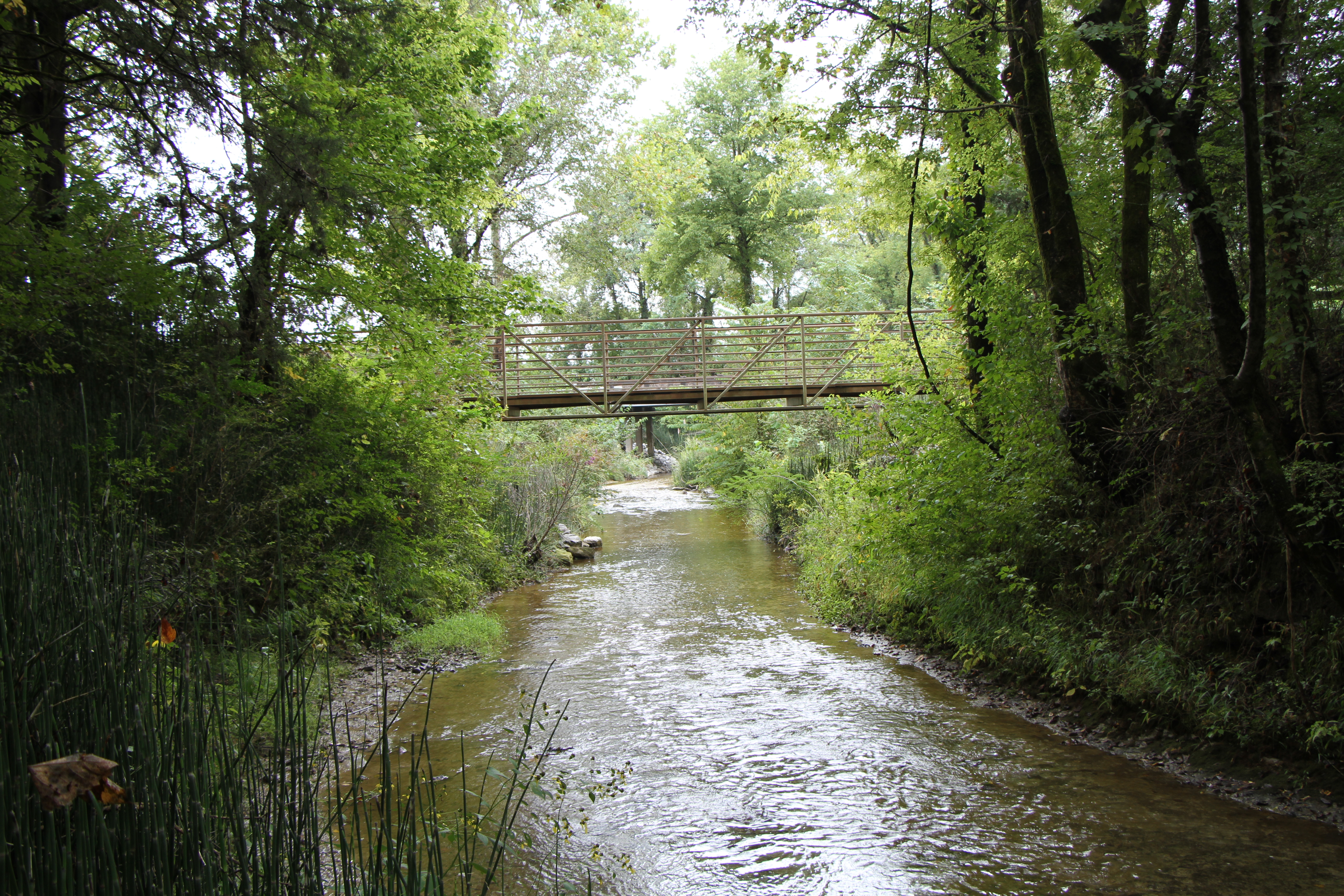
Tour Stop #9 - James Jourdan's Grave at the Battle of Brices Cross RoadsJames Jourdan was a confederate soldier from Alabama who was wounded at the Battle of Brices Cross Roads and died nearby at the Phillips family home. Sergeant Jourdan was buried on their property, and at some point two cedar trees were planted to mark his grave. This site is managed by the Mississippi Final Stands Interpretive Center. 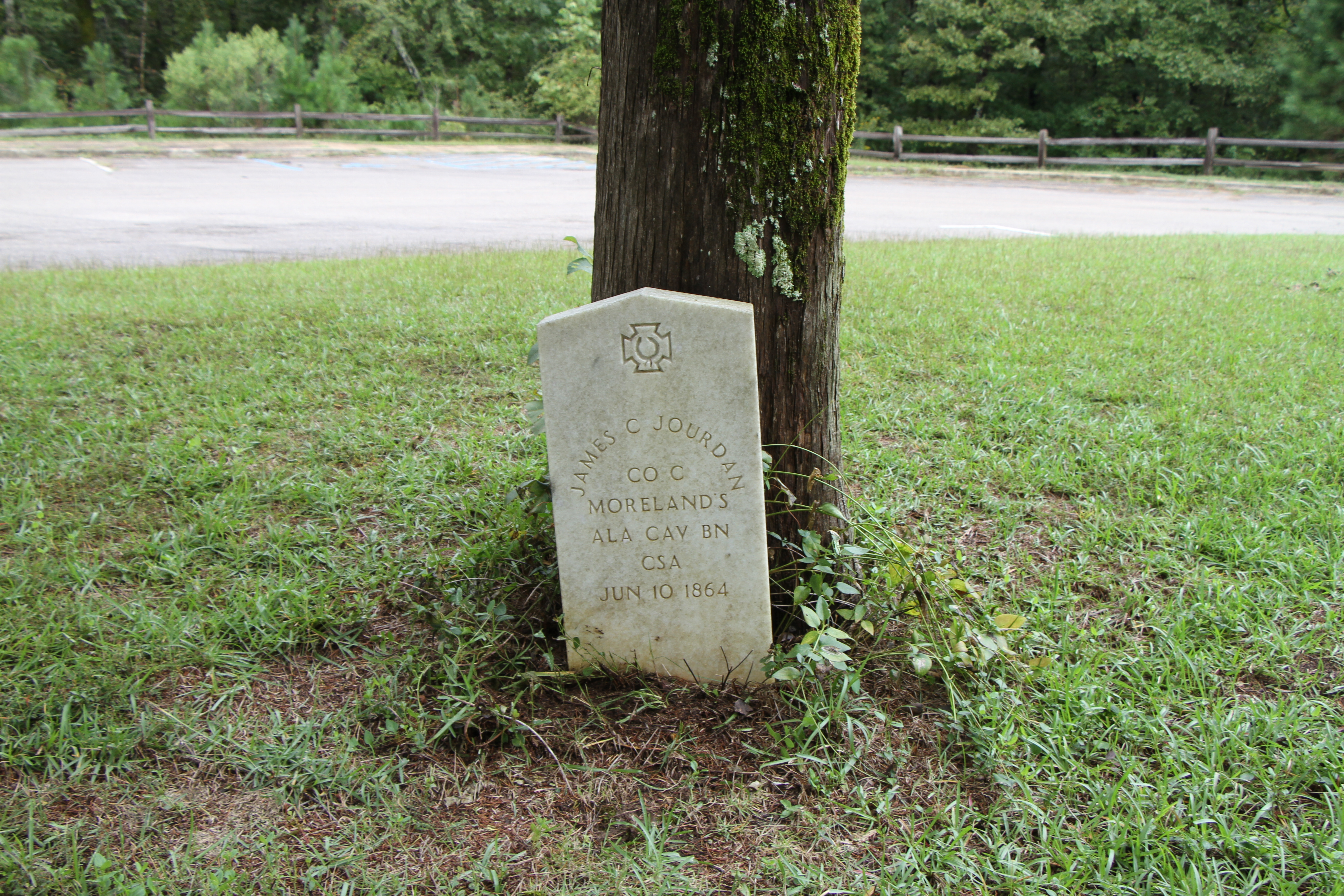
|
| Visitor Centers | Count: 1
Natchez Trace Parkway Visitor Center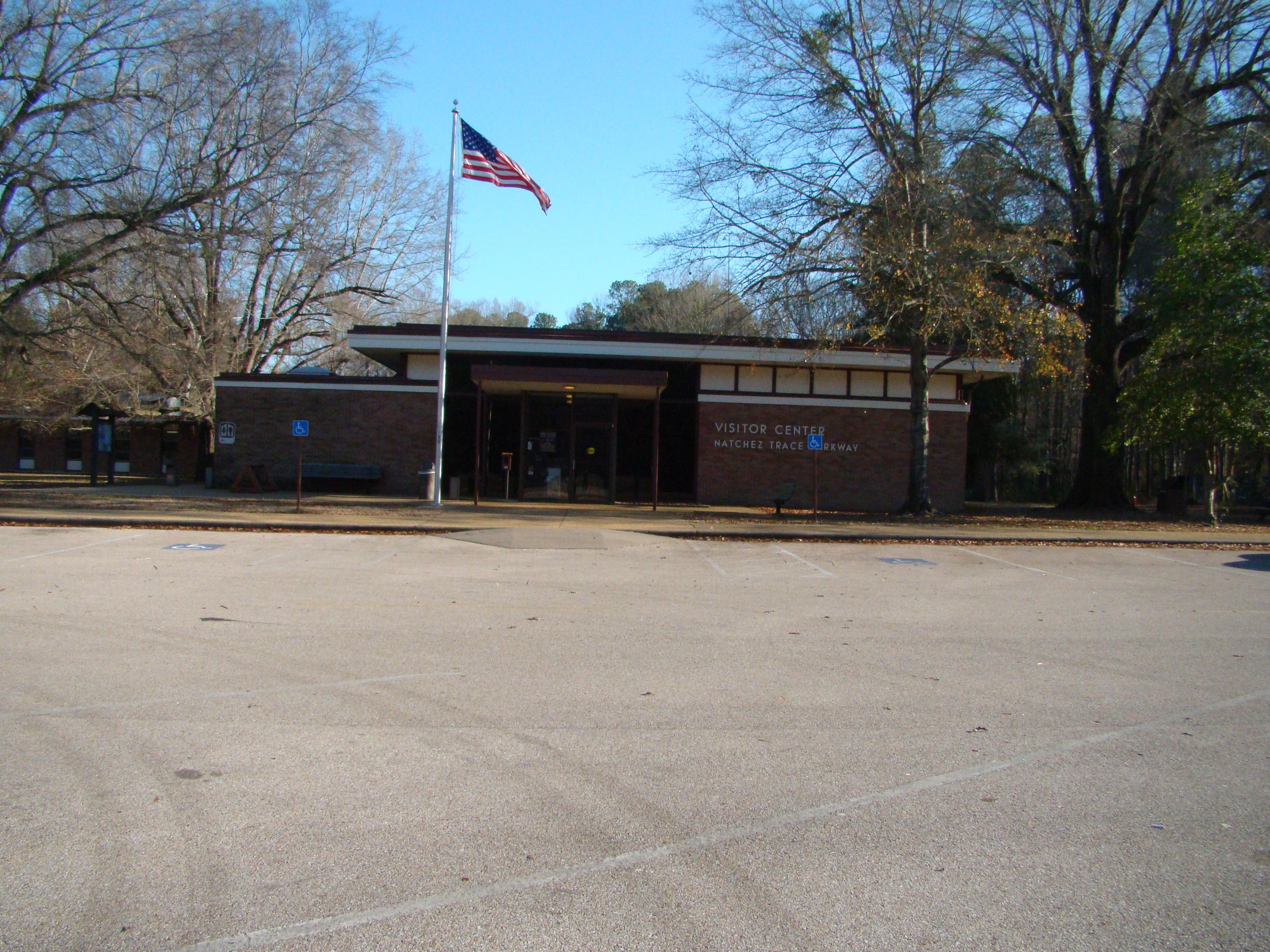
|
| Things to do | Count: 1
|
| Tours |
Count: 1
Driving Tour Of The Battle Of Brices Cross RoadsThis driving tour will take you through ten stops related to the Battle of Brices Cross Roads. Federal Army Major General William T. Sherman ordered Brig. Gen. Samuel D. Sturgis and a force of 8,100 to move out of Memphis and threaten north Mississippi in hopes of drawing Confederate General Nathan B. Forrest away from Sherman’s much needed railroad in Tennessee. The soldiers of Sturgis and Forrest met at Brices Cross Roads June 10, 1864. |
| Articles |