The Avon Fishing Pier is a Hatteras Island landmark, attracting fishers from all over the country who want to try their luck at reeling in a good catch, like the large red drum fish that make seasonal appearances.Avon Fishing Pier was the first pier constructed on Hatteras Island, opening its doors in 1963. It was instrumental in expanding the southern Outer Banks' reputation as a world-class fishing destination when a world-record breaking red drum, weighing in at a little o
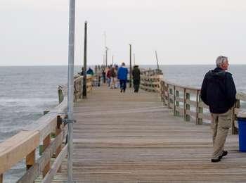
- Avon Fishing Pier<br />165 words (1-½ minute)<br />To get to the pier, move from the parking lot onto a 15-foot wide boardwalk ramp over the dunes and move 75 feet up a moderate incline to a 20-foot square landing area. Note a bench at the left and right on the landing. Move across the landing through a metal and glass door at the right into the snack, gift, bait and tackle shop. There is a ladies' room 10 feet to the left inside the door, followed by a short hallway to the left where a men's room is located at the end of the hall.<br /><br />To exit out onto the pier, move 25 feet across the store past the cash register at the right and through a metal and glass sliding door. The pier itself is 15 feet wide, 600 feet long, and made entirely of wood. Be mindful that there are many buckled planks causing the pier to look and feel uneven as the boardwalk bobs up and down.<br /><br />End of message.
Borrow Pit Road is a soundside off-road vehicle access road on Ocracoke Island. A small parking lot is available at the entrance of the road to allow pedestrian access to the sound, or to carpool down the ORV ramp. The ramp is located on the north side of Highway 12 approximately 2 miles from the northern ferry terminal.
- Borrow Pit Road is a soundside off-road vehicle access road on Ocracoke Island. A small parking lot is available at the entrance of the road to allow pedestrian access to the sound, or to carpool down the ORV ramp. The ramp is located on the north side of Highway 12 approximately 2 miles from the northern ferry terminal.
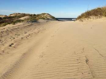
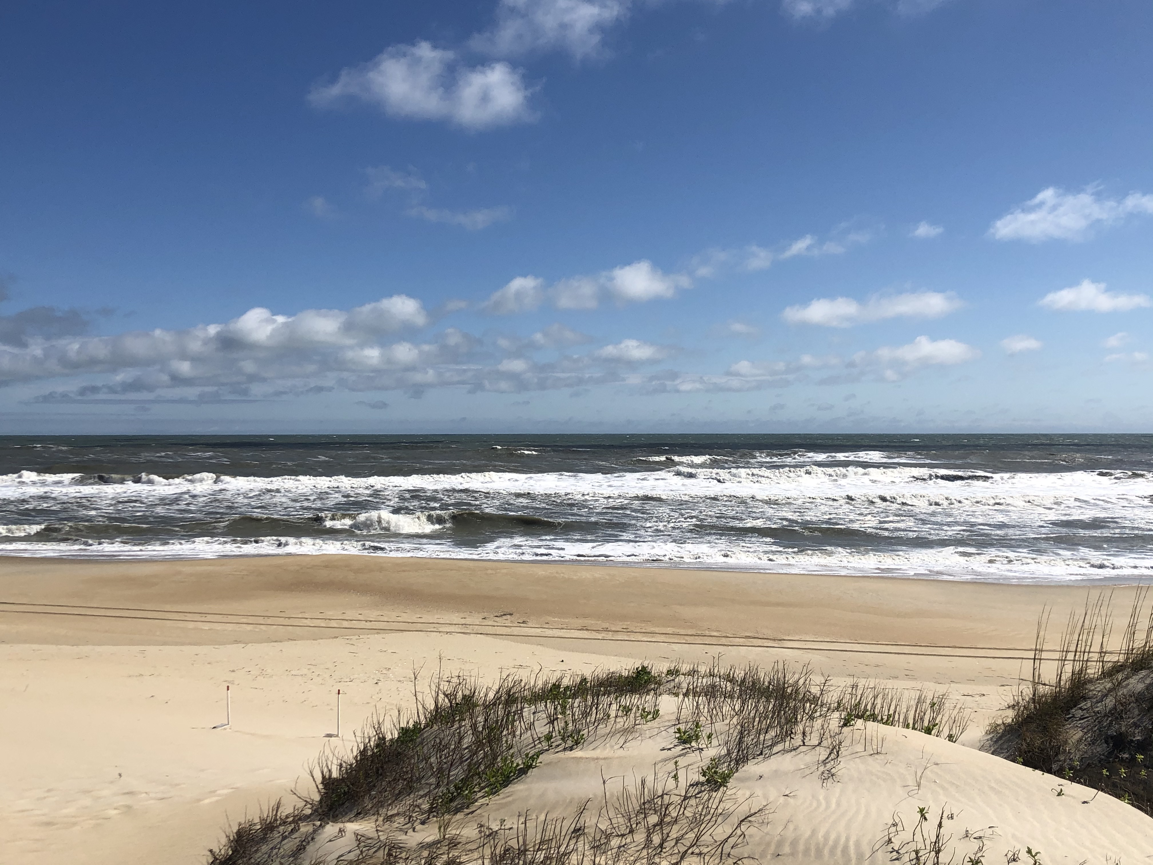
The northernmost stretch of ocean beach, about 1.5 miles long, within Cape Hatteras National Seashore is open to pedestrians, providing a serene place to stroll next to the Atlantic Ocean. At the start of the pedestrian access path are two outdoor exhibits on ocean swimming safety and sea turtles.<br /><br />There is parking available at this access point for about two dozen vehicles, as well as a recycling bin.
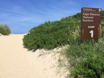
- Beach Access Ramp 1<br />71 words (¾ minute)<br />Beach Access Ramp 1 is the first beach access you come to once entering Cape Hatteras National Seashore from the north end at Bodie Island. It offers parking on a sandy road leading up to the ramp. It is a 75-yard walk up over the dunes to the beach from the parking area.<br /><br />To the right of the ramp is the outdoor exhibits "Know Before You Go" and "Uncommon Visitors."<br /><br />End of message.
Beach Access Ramp 2, located on the southern end of the Coquina Beach parking area, provides pedestrian access to the Atlantic Ocean beaches near the Coquina Beach Day Use Area. Two outdoor exhibits, "Know Before You Go" and "Islands on the Move," explore the topics of ocean swimming safety and barrier island migration.<br /><br />Parking is available to the north of the pedestrian access.
- Beach Access Ramp 2<br />86 words (¾ minute)<br />An asphalt road to the south of the Coquina Beach parking lot leads up to the sandy ramp with a slight incline onto and across the dunes to the beach. Parking is available to the north of the ramp. At the southeast corner of the parking lot are the outdoor exhibits "Know Before You Go" and "Islands on the Move." To the left of the exhibits is a sandy trail that leads about 30 feet up the dunes until it merges with the main sandy ramp.<br /><br />End of message.
Beach Access Ramp 23 provides year-round pedestrian access to the beaches in front of and south of the village of Salvo, North Carolina. From October 15 through April 14, off-road vehicle access to the village beaches is provided from this ramp, as long as no resource closures are in effect.<br /><br />There are fourteen normal-sized parking spaces available at this location.
- Beach Access Ramp 23<br />108 words (1 minute)<br />Beach Access Ramp 23 is located across the road from the Salvo Day Use Area on the ocean side of the highway. To the right of a wide, sand and gravel road, a sign reminds drivers that an off-road vehicle permit is required to drive onto the beach. Two additional signs post the driving and beach regulations to which all must adhere, after which the road curves around to the right towards the beach.<br /><br />To the right of the ramp is a small parking lot. About halfway along the parking lot are the outdoor exhibits "Know Before You Go" and "Island Life."<br /><br />End of message.
Beach Access Ramp 25 provides year-round off-road vehicle and pedestrian access to the beaches south of the village of Salvo, North Carolina.<br /><br />A dedicated off-road vehicle ramp and an ADA-compliant pedestrian boardwalk lead out to the beach. There are ten normal-sized parking spots, as well as one accessible spot in the lot with the boardwalk. At the entrance to the vehicle ramp is a parking lot for six normal-sized vehicles, for either carpooling or managing tire pressure.
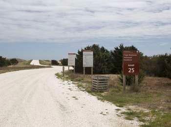
- Beach Access Ramp 25<br />172 words (1-½ minutes)<br />A 30-foot wide, sand and shell ramp leads from NC Highway 12 to the beach. At the right side of the ramp, a sign reminds drivers that an off-road vehicle permit is required to drive onto the beach. Two additional signs post the driving and beach regulations, after which the ramp curves to the left and up a gentle slope over the dunes to the beach.<br /><br />Fifty feet to the right of the ramp, an ADA (Americans with Disabilities Act)-compliant boardwalk runs parallel to the ramp, providing full pedestrian beach access. To reach the beach, move off the sand onto the five-foot-wide boardwalk with four-foot-high railings. Continue 10 feet forward, then move 30 feet up a slight incline with metal handrails at the sides. Continue about 500 feet forward up a series of slight inclines to the top of ramp. Move 150 feet down a slight decline to where the ramp starts to be covered with sand and another 20 feet forward onto the beach.<br /><br />End of message.
Beach Access Ramp 27 provides year-round off-road vehicle and pedestrian access to the beaches where a famous US Life-Saving Service rescue was conducted. A dedicated off-road vehicle ramp and a pedestrian boardwalk lead out to the beach.<br /><br />Off-road vehicle and pedestrian access to the beach is provided north of the ramp, while pedestrian-only access to the beach is provided south of the ramp. The parking lot has seventeen normal-sized and one accessible spaces.
- Beach Access Ramp 27<br />166 words (1-½ minute)<br />To the right of a 20-foot wide sand and gravel road, a sign reminds drivers that an off-road vehicle permit is required to drive onto the beach. Two additional signs post the driving and beach regulations. The vehicle ramp continues straight forward up and over the dunes.<br /><br />Twenty feet to the right of the vehicle ramp is a small parking lot. A brown, five foot tall trash and recycling station sits at the left. In the center of the lot, a pedestrian boardwalk ramp leads out over the dunes to the beach. To the left of the boardwalk stands a set of two outdoor exhibits, ""Know Before You Go"" and ""Rescue from the Priscilla.""<br /><br />To move to the beach, move onto the boardwalk and about 150 feet forward up a slight incline to the top of the ramp. Move down one step onto the sand and 40 feet forward along a sand path to the beach. The ocean is another 200 feet straight ahead.<br /><br />End of message.
Beach Access Ramp 30 provides year-round off-road vehicle and pedestrian access to the beaches roughly halfway between the villages of Rodanthe, Waves, and Salvo to the north and the village of Avon to the south. Off-road vehicle and pedestrian access is allowed south of the 30, while the stretch of beach north of the ramp is dedicated to pedestrian access.<br /><br />Parking is available for 17 normal-sized vehicles and there is an off-road vehicle ramp that leads out to the beach.
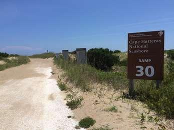
- Beach Access Ramp 30<br />101 words (1 minute)<br />To the right of a 20-foot wide, sandy road, a sign reminds drivers that an off-road vehicle permit is required to drive onto the beach. Two additional signs post the driving and beach regulations. The vehicle ramp continues straight about 100 feet forward, then turns left into the dunes.<br /><br />Twenty feet to the left of the vehicle ramp is a small parking lot. At the parking lot are the outdoor exhibits "Know Before You Go" and "Engage Your Senses," as well as a brown, five-foot tall trash and recycling station standing at the right side of the lot.<br /><br />End of message.
Beach Access Ramp 32 provides year-round off-road vehicle access to the beaches north of the historic Little Kinnakeet US Life-Saving Service station. There is a dedicated off-road vehicle ramp that lead out to the beach. A six-vehicle parking lot is located at the start of ramp, allowing for visitors to carpool out onto the beach, or change tire pressure without being on the ramp.
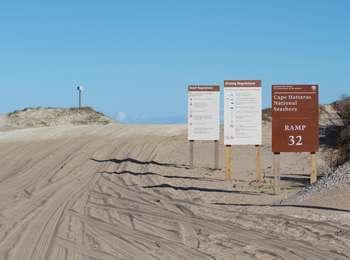
- Beach Access Ramp 32<br />67 words (¾ minutes)<br />A 30-foot wide, sand and shell ramp leads from NC-12 to the beach. At the right side of the ramp, a sign reminds drivers that an off-road vehicle permit is required to drive onto the beach. Two additional signs post the driving and beach regulations, after which the ramp curves to the left and up a gentle slope over the dunes to the beach.<br /><br />End of message.
Beach Access Ramp 34 provides year-round pedestrian access to the beaches north of the village of Avon, North Carolina, as well in front of the village. Seasonally (October 15-April 14), this ramp provides off-road vehicle access to the beaches in front of the village of Avon.<br /><br />There is an off-road vehicle ramp and a pedestrian boardwalk that lead out to the beach. The parking lot can accommodate nineteen vehicles.
- Beach Access Ramp 34<br />192 words (1-¾ minutes)<br />To the right of a 30-foot wide sand and gravel road, a sign reminds drivers that an off-road vehicle permit is required to drive onto the beach. Two additional signs post the driving and beach regulations to which all must adhere, after which the vehicle ramp curves around slightly to the left then continues up and over the dunes.<br /><br />Twenty feet to the right of the vehicle ramp is a small parking lot and a pedestrian boardwalk leading up and over the dunes to the beach. To the right of the start of the boardwalk are the outdoor exhibits "Know Before You Go" and "Journey of Sand."<br /><br />To get to the beach along the boardwalk, move onto the four foot wide wooden boardwalk without railings. Continue along the boardwalk about 400 feet forward through scrub thicket and up a series of slight to moderate inclines to the top of the ramp. Move down one step onto a sand path and continue 80 feet across the sand, then bear left up a slight rise 100 feet across the dunes and onto the beach. The ocean is about 150 feet straight ahead.<br /><br />End of message.
Beach Access Ramp 38 provides year-round off-road vehicle and pedestrian access to the beaches south of the village of Avon, North Carolina, as well as seasonal (October 15-April 14) off-road vehicle access to beaches in front of the village of Avon.A dedicated off-road vehicle ramp leads out to the beach, as do a couple of sandy pedestrian paths that start at the parking lot. Pedestrians, please use caution when using the off-road vehicle ramp to access the beach.
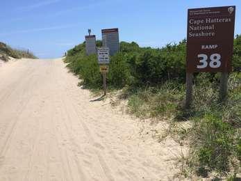
- Beach Access Ramp 38<br />100 words (1 minute)<br />To the left of a 20-foot wide sand road, a sign reminds drivers that an off-road vehicle permit is required to drive onto the beach. Two additional signs post the driving and beach regulations to which all must adhere, after which the vehicle ramp continues straight up a moderate incline, then over the dunes to the beach.<br /><br />Twenty feet to the right of the vehicle ramp is a long parking lot. On the eastern edge of the parking lot, about halfway along the parking spaces are the outdoor exhibits "Know Before You Go" and "The Place To Be."<br /><br />End of message.
Beach Access Ramp 4, located just south of the Oregon Inlet Campground and across from the Oregon Inlet Fishing Center, provides off-road vehicle access to the Atlantic Ocean beaches of Bodie Island.<br /><br />No parking is available at this access, though there is a portable restroom and trash/recycling station about a ¼-mile down the ramp.
- Beach Access Ramp 4<br />47 words (½ minute)<br />Beach Access Ramp 4 is located across from the Oregon Inlet Fishing Center just off of NC-12. Upon exiting NC-12, the first section of the ramp is a hardened surface upon which to deflate tires and prepare for the drive across sand to the beach.<br /><br />About ¼-mile down the ramp, there is a portable restroom and trash/recycling station on the south side of the ramp.<br /><br />End of message.
Beach Access Ramp 43 provides off-road vehicle and pedestrian access throughout the year to the beaches near Cape Hatteras, as well as access to the cape itself. There is some off-road vehicle access north of the ramp before it turns into a pedestrian-only area.<br /><br />There are a limited number of parking spaces available at the turnabout at the start of the ramp.
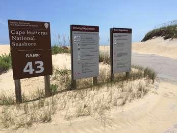
- Beach Access Ramp 43<br />119 words (1 minute)<br />Two signs at the center of a 20-foot wide sandy mound at the entrance to the parking lot at the start of Beach Access Ramp 43 highlight the name of the ramp, as well as the driving and beach regulations to which all must adhere.<br /><br />The 100-foot long lot backs against 20-foot tall dunes at the right. At the end of the lot, the vehicle ramp continues 30 feet directly onto the sand, then curves around to the right and out onto the beach. The ocean is 100 feet straight ahead.<br /><br />A sign at the right of the sandy ramp reminds drivers that an off-road vehicle permit is required to drive onto the beach.<br /><br />End of message.
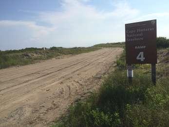
Beach Access Ramp 44 provides off-road vehicle and pedestrian access throughout the year to the beaches nearest Cape Hatteras, as well as access to the cape itself.
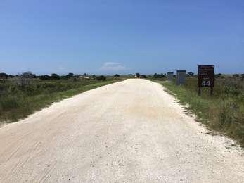
- Beach Access Ramp 44<br />149 words (1-¼ minutes)<br />Opposite the entrance to ramp 44 is a 100-foot long parking lot with a portable restroom at the far right side of the lot and a fish cleaning station at the far left side of the lot. Watch for egrets and other fauna in the grassy areas bordering the lot. Notice the bramble of "ghost trees" in the low surrounding brush. These are dead trees with bare branches, which have been bleached grey-white by the elements.<br /><br />Across Lighthouse Road, a sign to the right of a 20-foot wide gravel and sand road reminds drivers that an off-road vehicle permit is required to drive onto the beach. Two additional signs at the right post the driving and beach regulations to which all must adhere. The ramp continues 50 feet straight ahead, then turns left up a small rise to continue over the dunes to the beach.<br /><br />End of message.
Beach Access Ramp 48 provides off-road vehicle access to the heart of the southern, Gulf Stream-influenced beaches of Hatteras Island, known as South Beach, near the village of Frisco, North Carolina throughout the year.<br /><br />This location can be accessed by following Inside Road, which branches off of Beach Access Ramp 49 near the Frisco Campground.
- Beach Access Ramp 48<br />83 words (¾ minute)<br />Beach Access Ramp 48 is located approximately one mile down Inside Road from Beach Access Ramp 49 and the Frisco Campground.<br /><br />A sign along the ramp entrance at the left reminds drivers that an off-road vehicle permit is required to drive onto the beach. Fifty feet ahead along the shell and sand ramp, two additional signs at the right post the driving and beach regulations to which all must adhere. The vehicle ramp continues over the dunes and out to the ocean.<br /><br />End of message.
Beach Access Ramp 49 provides off-road vehicle and pedestrian access to the heart of the southern, Gulf Stream-influenced beaches of Hatteras Island, known as South Beach, near the village of Frisco, North Carolina throughout the year. Pedestrian access is best accomplished via the wooden boardwalk that starts in the Frisco Campground.
- Beach Access Ramp 49<br />117 words (1 minute)<br />Beach Access Ramp 49 is located just outside and to the west of the Frisco Campground entrance. For those who wish to park and walk along the ramp to the beach, there is a small parking lot to the right about 100 feet before you get to the ramp and campground.<br /><br />A sign along the ramp entrance at the left reminds drivers that an off-road vehicle permit is required to drive onto the beach. Fifty feet ahead along the gravel and sand ramp, two additional signs at the right post the driving and beach regulations to which all must adhere. The vehicle ramp continues around to the left onto the sand and out to the ocean.<br /><br />End of message.
Beach Access Ramp 55 provides off-road vehicle access to the southern stretch of beach on Hatteras Island throughout the year, as well as seasonal (October 15 through April 14) off-road vehicle access to the beach in front of the Village of Hatteras. Pedestrians have access throughout the year in both directions, and can reach the beach by walking across a dedicated boardwalk and sand path that starts at the parking lot to the east of the off-road vehicle ramp.
- Beach Access Ramp 55<br />240 words (2 minutes)<br /><br />Beach Access Ramp 55 is located at the end of a parking lot across the street from the Graveyard of the Atlantic Museum and the Hatteras Inlet North Ferry Terminal. From the lot, the off-road vehicle ramp continues 50 feet forward onto the sand. A sign at the right reminds drivers that an off-road vehicle permit is required to drive onto the beach. The ramp turns left where two signs at the right post the driving and beach regulations to which all must adhere. The vehicle ramp continues around to the left up a small rise over the dunes and out to the ocean.<br /><br />In the middle of the parking lot, a pedestrian boardwalk with railings leads out to the beach, though the boardwalk turns into a sandy path as it goes up the dune. Five feet to the right of the boardwalk stand the outdoor exhibits "Know Before You Go" and "Uncommon Visitors," while an additional 15 feet to the right stands a portable restroom.<br /><br />To get to the beach as a pedestrian, move off the asphalt lot onto the wooden boardwalk and continue 200 feet up a slight rise to where the railings end at a 15- by 20- foot rest area to your right with wooden benches all around its perimeter. Continue 50 feet up a sand path through the dune grass, then move 30 feet forward on a slight decline emerging past the dunes and onto the beach. Listen for birds, breathe in the salt air, hear the crashing waves.<br /><br />End of message.
The northern beaches of Ocracoke Island are accessible using this ramp. Year-round off-road vehicle and pedestrian access is provided to the west of the ramp, while pedestrian access is also provided to the east of the ramp that covers the northeastern end of Ocracoke Island. There is a parking lot just south of the ramp, for those who wish to use the pedestrian access, or ride in a vehicle with a permit.
- Beach Access Ramp 59<br />110 words (1 minute)<br />Located at the end of a small parking lot off the loop road leading to the Hatteras Inlet South Ferry Terminal, the ramp continues onto the sand and up a slight rise to the left. A sign at the right reminds drivers that an off-road vehicle permit is required to drive onto the beach. Two more signs at the right post the driving and beach regulations to which all must adhere. The vehicle ramp continues around to the left, then turns immediately right towards the dunes and out to the ocean.<br /><br />In the middle of the parking lot stand two outdoor exhibits, "Know Before You Go" and "Island Life."<br /><br />End of message.
This ramp provides year-round off-road vehicle access to the sandy beaches along the middle of Ocracoke Island. Pedestrians can also access the beach here, though no parking is available for vehicles.
- Beach Access Ramp 67<br />76 words (¾ minute)<br />This ramp starts directly off NC-12 and leads up a slight rise along a gravel and sand road. Two signs at the right post the driving and beach regulations to which all must adhere. A third sign at the right reminds drivers that an off-road vehicle permit is required to drive onto the beach. The ramp moves fully onto the sand, then turns to the left towards the dunes and out to the ocean.<br /><br />End of message.
This ramp is the closest to the Ocracoke Campground, providing year-round pedestrian access via a sandy path leading from the end of the parking lot to the vehicle ramp, as well as a vehicle access via a ramp that starts adjacent to the parking lot. The vehicle ramp provides seasonal (October 15 to April 14) off-road vehicle access to the beach in front of the Ocracoke Campground.
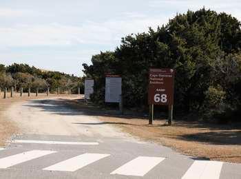
- Beach Access Ramp 68<br />174 words (1-½ minutes)<br />The off-road vehicle ramp is located to the west of the 100-foot long parking lot and open, mown grass playing field next to the Ocracoke Campground. A row of four-foot tall wooden posts placed at six foot intervals separate the field from the ramp. Following along a line of trees at the right, two signs at the right side of the ramp post the driving and beach regulations to which all must adhere. A third sign at the right reminds drivers that an off-road vehicle permit is required to drive onto the beach. The ramp turns right beyond the signs through the trees and continues out across the dunes to the ocean.<br /><br />Just east of the off-road vehicle ramp sits a large parking lot at the entrance to the Ocracoke Campground. At the southern end of the parking lot, a sandy trail leads through the scrub thicket to the ramp and out to the beach. At the start of the trail are the outdoor exhibits "Know Before You Go" and "Engage Your Senses."<br /><br />End of message.
Near the Ocracoke Airstrip, this ramp provides both year round off-road vehicle and pedestrian access to beaches on either side of the ramp. Any vehicles accessing the beach require an off-road vehicle permit.
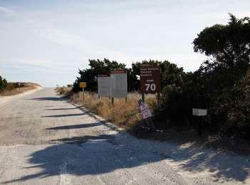
- Beach Access Ramp 70<br />102 words (1 minute)<br />The 20-foot wide gravel and sand ramp leads 200 feet straight ahead up a slight incline across the dunes and onto the beach. Two signs at the right post the driving and beach regulations to which all must adhere. A third sign at the right reminds drivers that an off-road vehicle permit is required to drive onto the beach. A small parking lot for the Ocracoke Airstrip sits to the right of the start of ramp 70, just off of NC-12. At the left of the parking lot stand the outdoor exhibits "Know Before You Go" and "Uncommon Visitors."<br /><br />End of message.
The farthest south ramp in the seashore, this ramp provides year round off-road vehicle access to the southern end of Ocracoke Island. Any vehicles accessing the beach require an off-road vehicle permit.<br /><br />Pedestrians may also access the beach and sound along this ramp, though it is roughly one mile to the sound access and almost two miles to the beach.
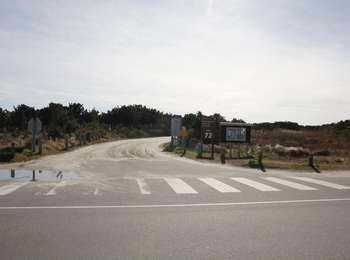
- Beach Access Ramp 72<br />61 words (¾ minute)<br />A 20-foot wide gravel and dirt ramp travels through roughly 1-¾ miles of scrub thicket and dunes to the beach. A sign at the right of the entrance reminds drivers that an off-road vehicle permit is required to drive onto the beach. Two more signs at the right post the driving and beach regulations to which all must adhere.<br /><br />End of message.
Located near the village of Frisco, North Carolina, Billy Mitchell Airstrip (HSE) is a 3,000-foot, unattended airstrip within Cape Hatteras National Seashore. The airstrip is operated by the North Carolina Department of Transportation Division of Aviation, through a special agreement with the National Park Service.<br /><br />There are minimal facilities at this airstrip consisting of two portable restrooms and a pilot operations room. No water or fuel is available.

- Billy Mitchell Airstrip<br />83 words (¾ minute)<br />From the west side of the parking lot, the entrance to the airstrip in located 30 feet to the left and through a chain-link fence gate. The door to the pilot facility is located about 10 feet to the behind and to the right of the airstrip entrance gate up three steps. There is an accessible ramp a further 30 feet beyond the steps. To reach the two portable restrooms, travel through the fence gate, turn left and walk about 40 feet.<br /><br />End of message.
Along the north side of Highway 12 on Ocracoke Island.
![]()
- Along the north side of Highway 12 on Ocracoke Island.
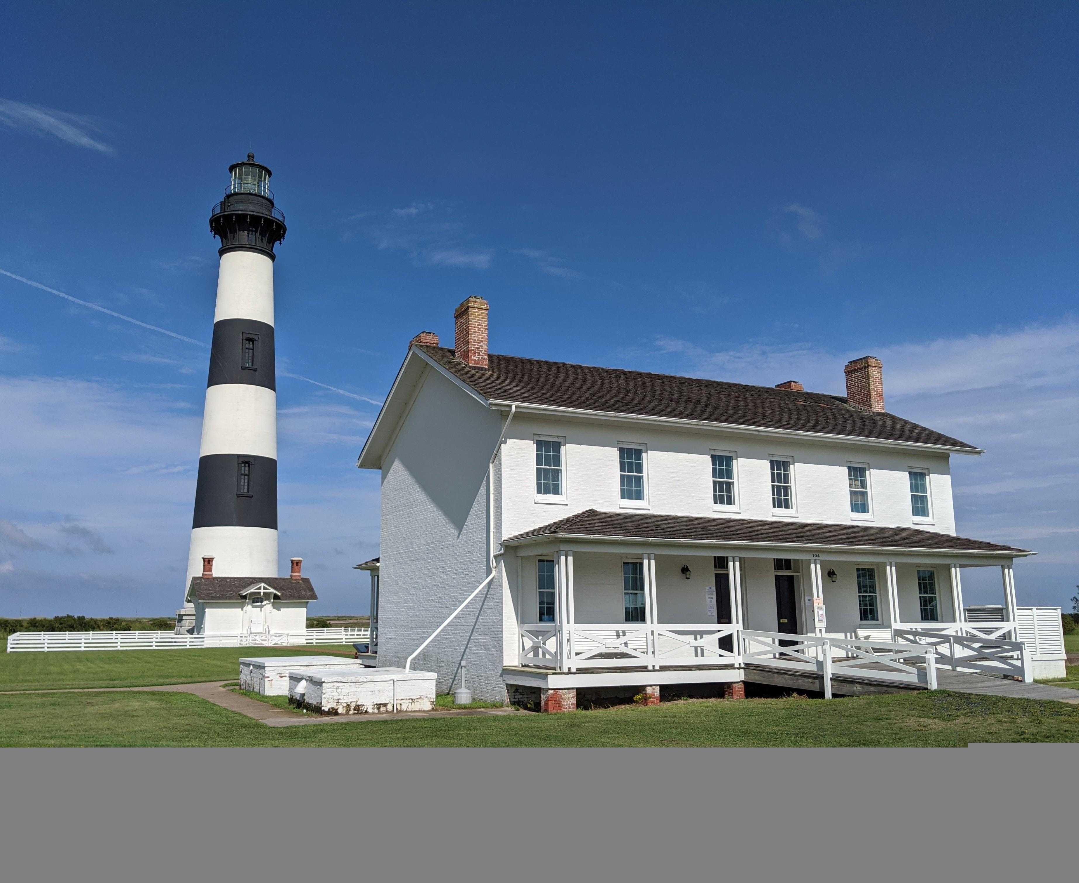
The relocated Bodie Island Life Saving Stations are located at the intersection of NC 12 and Bodie Island Lighthouse Road, and preserves three different eras of life saving stations. Buildings are closed to the public but viewable from the road.

- Buildings are located at the intersection of NC Highway 12 and the Bodie Island Lighthouse road, adjacent to the Coquina Beach Access.
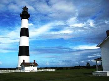
The Bodie Island Lighthouse is open to climbing in the summer season.
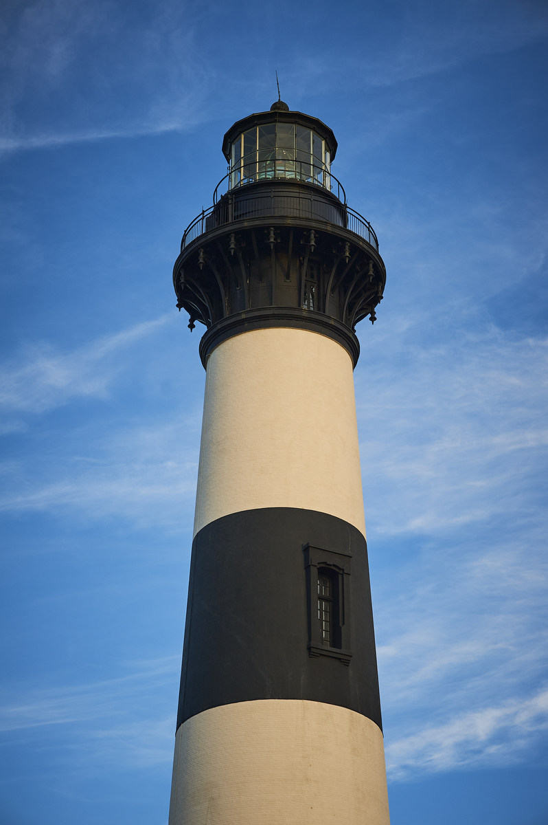
- The Bodie islands lighthouse with white and black painted horizontal bands stands in a field of green grass, overlooking the distant Atlantic Ocean.
Standing 156-feet tall, the current Bodie Island Lighthouse is actually the third lighthouse along this stretch of the Outer Banks to warn and guide ships.<br /><br />The Bodie Island Lighthouse has a distinctive daymark pattern of horizontal, alternating black and white stripes.
- Bodie Island Lighthouse<br />110 words (1 minute)<br />To get to the lighthouse from the parking lot, follow a concrete walkway around to the back of the visitor center building to a red brick path. Move 120 feet along the brick path away from the visitor center and through a double swinging gate in the white picket fence in front of the lighthouse.<br /><br />To get to the lighthouse from the visitor center, exit through the rear visitor center door. Note a wooden bench to the right. Move six feet across the wooden porch and down four steps onto the brick path leading to the lighthouse.<br /><br />End of message.
A wildlife-viewing platform (Bodie Island Marsh Blind) is available for all visitors. The Bodie Island Marsh Blind will remain open through the middle of November (with a few exceptions in October). The platforms is can be reserved by hunters with mobility issues during hunting season.
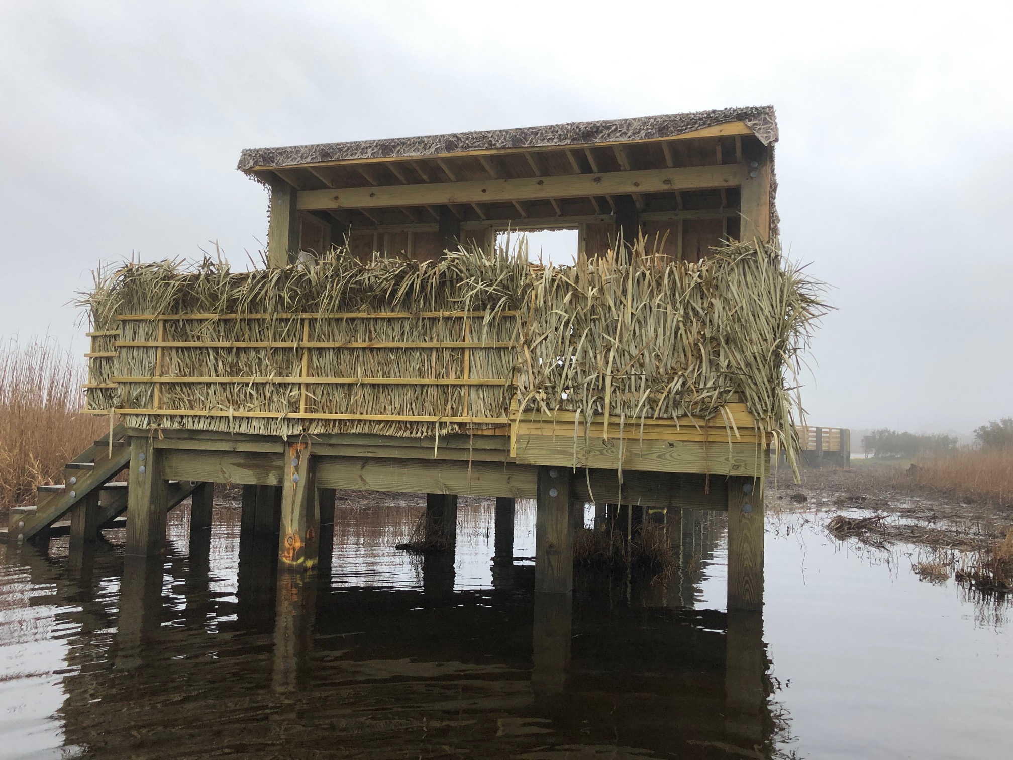
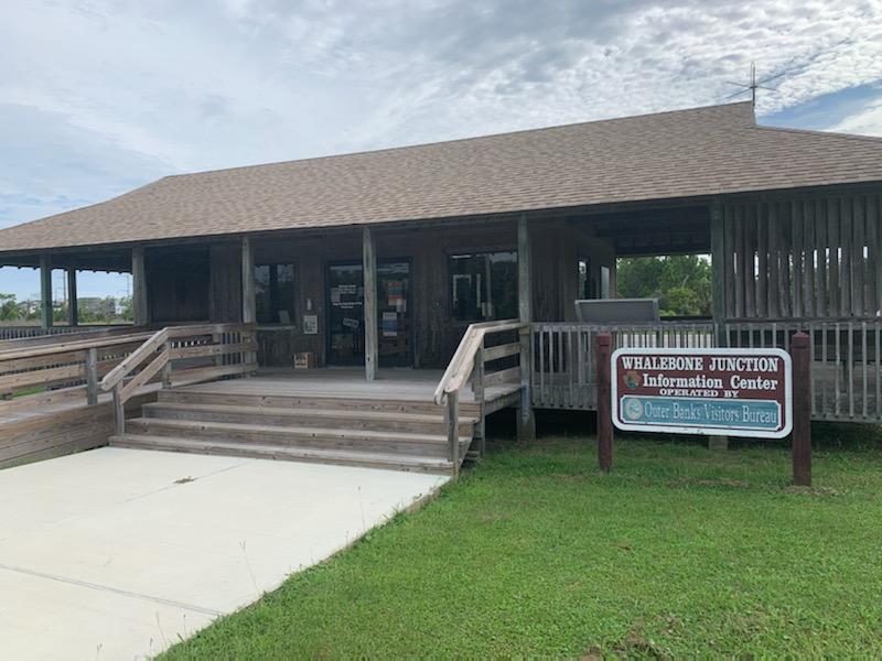
- Located along North Carolina Highway 12, the Bodie Island Marsh Blind is on the east side of the highway in-between Whalebone Junction and the Bodie Island Lighthouse.
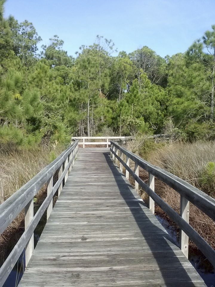
An eighth-mile long boardwalk leads out through a marsh to a freshwater pond. Along the way, and at the observation deck at the end of the boardwalk, smell the freshness of the marsh and listen to the wildlife around you. Birds migrating along the Atlantic Flyway make use of the freshwater ponds, providing a chance to spot different birds throughout the year. The pond and surrounding wetlands are also home to a diverse range of species, including blue crabs and snapping turtl
- Bodie Island Boardwalk<br />321 words (2-¾ minutes)<br />Two 150-foot wide parking lots flank a two-story white brick building situated 120 feet in front of the Bodie Island Lighthouse. At the far left of the left-hand lot, a boardwalk leads past the lighthouse to a wildlife observation deck on the edge of a large freshwater pond.<br /><br />To get to the boardwalk, from a position in the left-hand lot facing the lighthouse with the visitor center at your right, turn left and move along the concrete walkway away from the visitor center with the lot at your left. Note there is a combination water fountain, water bottle filling station, and pet water fountain to the right 25 feet before the boardwalk entrance.<br /><br />Turn right off the concrete path onto a six-foot wide wooden boardwalk with four-foot high railings and move 40 feet up a slight incline to a landing. Note that eight feet to your left is a comfort station with a men's room on the left and a women's room on the right. There is another single water fountain to the left of the women's room door.<br /><br />Continue across the landing and 20 feet down a slight decline where the boardwalk flattens out and the side railings end. The lighthouse is on your right. Follow the boardwalk 300 feet forward where it turns left into the tall grasses of the marshland. Move forward 60 feet, then turn left and move 100 feet forward and turn right. Continue 50 feet forward, then turn right and move ten feet along the boardwalk to the beginning of a slight incline where the railings resume. Move along the boardwalk ramps about 150 more feet as they wind upward left and right to a covered, 15-foot square observation platform overlooking a vast marshy wetland and freshwater pond. The lighthouse is far behind you. Note there are several wooden benches placed at various points on the observation platform.<br /><br />End of message.
Bonner Bridge Pier is a 1,047 recreational pier located on the south side of Oregon Inlet. The free pier provides great opportunities for sightseeing, wildlife viewing, walking, and recreational fishing.
During the first six months of 1942, the nearby beaches revealed crude oil, twisted metal, and corpses from the Atlantic Ocean. The grisly flotsam was evidence of World War II's toll imposed by German U-boats. Two foreign sailors who lost their lives during this time are buried in this cemetery. The Commonwealth War Graves Commission, established by Royal Charter in 1917, marks and maintains the war graves of Australia, Canada, India, New Zealand, South Africa and the United

- British Cemetery<br />96 words (1 minute)<br />Move across a gravel parking lot and turn right past a brown sign to a sandy and grassy road, noting several wooden posts at the sides of the road with a metal rope slung between them. Continue 100 feet down the road to a three-foot tall exhibit "Paukenschlag: Operation Drumbeat."<br /><br />Turn right and move 35 feet to a small graveyard with concrete gravestones encircled by a white picket fence. Several small trees grow around the graveyard. Several coins, pebbles, buttons, cigarettes, shells, and other mementos lie on top of the headstones. These should not be disturbed.<br /><br />End of message.
With a view of the Cape Hatteras Lighthouse and the shade of the maritime forest, the Buxton Woods Picnic Area can be an enjoyable place to picnic, rest, and relax.<br /><br />Picnic tables are spread around the area, and ample parking, the Buxton Woods Trailhead, and a pair of portable restrooms are all available.
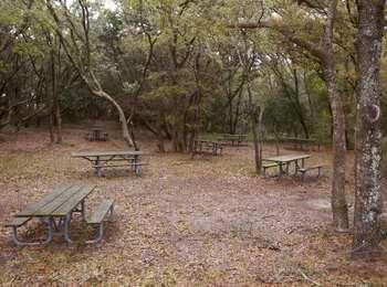
- Buxton Woods Picnic Area- a boardwalk runs along the top of a long, narrow parking lot next to the wooded picnic area. Placed throughout the grounds are several picnic tables with charcoal grilles. Note that there are two portable toilets to the right of the picnic area. Note also that the Cape Hatteras Lighthouse rises above the trees on the other side of the road behind you.
Here in Buxton Woods, a Hatteras Island maritime forest, look past the oceanfront sand dunes and discover the towering pine trees, thick sandy ridges, small ponds and marshes, and the menagerie of local island wildlife. A ¾-mile long, self-guided, loop trail leads from the picnic area through Buxton Woods, and back again. Along this relatively level path, you can see the diverse forest ecosystem up-close, practice your skill at identifying trees, listen to the call of birds,
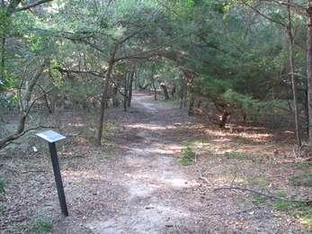
- Buxton Woods Trailhead<br />56 words (½ minute)<br />A boardwalk runs along the top of a long, narrow parking lot for the nearby picnic area and the trailhead. Note that there are two portable toilets to the right of the trailhead near the parking lot, and that the Cape Hatteras Lighthouse rises above the trees on the other side of the road behind you.<br /><br />End of message.
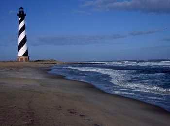
Visit and climb the tallest brick lighthouse in the United States, built in 1870.
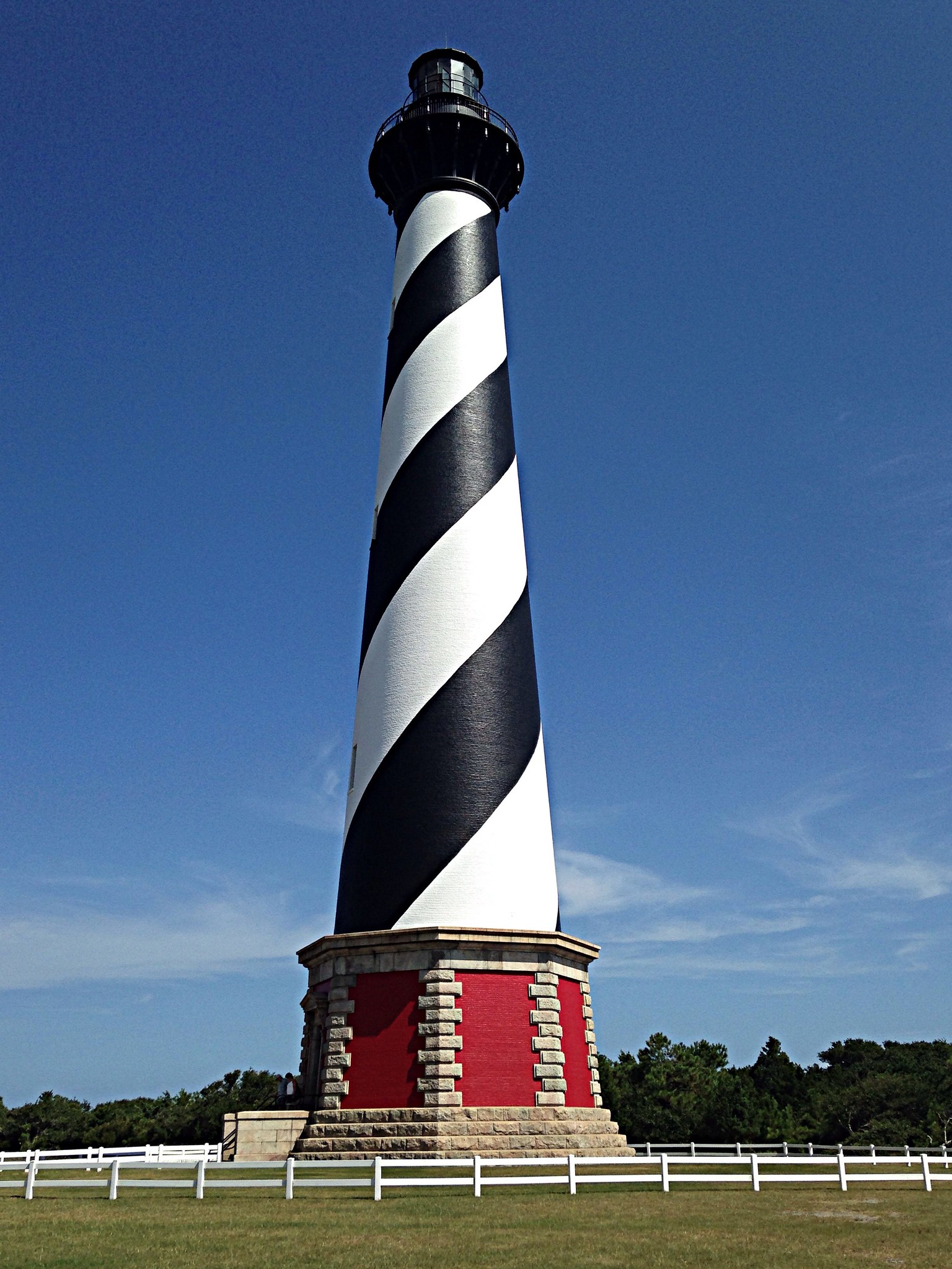
- The Cape Hatteras lighthouse, 197 feet tall is painted in a distinct black and white spiral pattern, sitting atop a vibrant red base. The lighthouse sits on flat, cleared ground, surrounded by the low shrubs and trees of the coastal forest.
A boat ride three miles off-shore brings you to the barrier islands of Cape Lookout National Seashore.<br /><br />There's something for everyone at Cape Lookout National Seashore, including horse-watching, shelling, fishing, birding, camping, lighthouse climbing, and touring historic villages!<br /><br />Learn more at <a href="http://www.nps.gov/calo">nps.gov/calo</a> .

- This National Park Service site preserves and protects the barrier islands of the Core Banks. Visiting this seashore can be done via park concessionaire ferries run out of Ocracoke (to Portsmouth Village), Beaufort, Harkers Island (both to Cape Lookout Light Station, and Shackleford Banks), Davis (to Great Island Cabin Camp), and Atlantic (to Long Point Cabin Camp).
Chicamacomico Lifesaving station is the only restored and open Life Saving Station in the Outer Banks. Located in Rodanthe, the Life Saving Station offers a museum, boathouse, and demonstrations in the summer months. Fee required, operated by park partner.
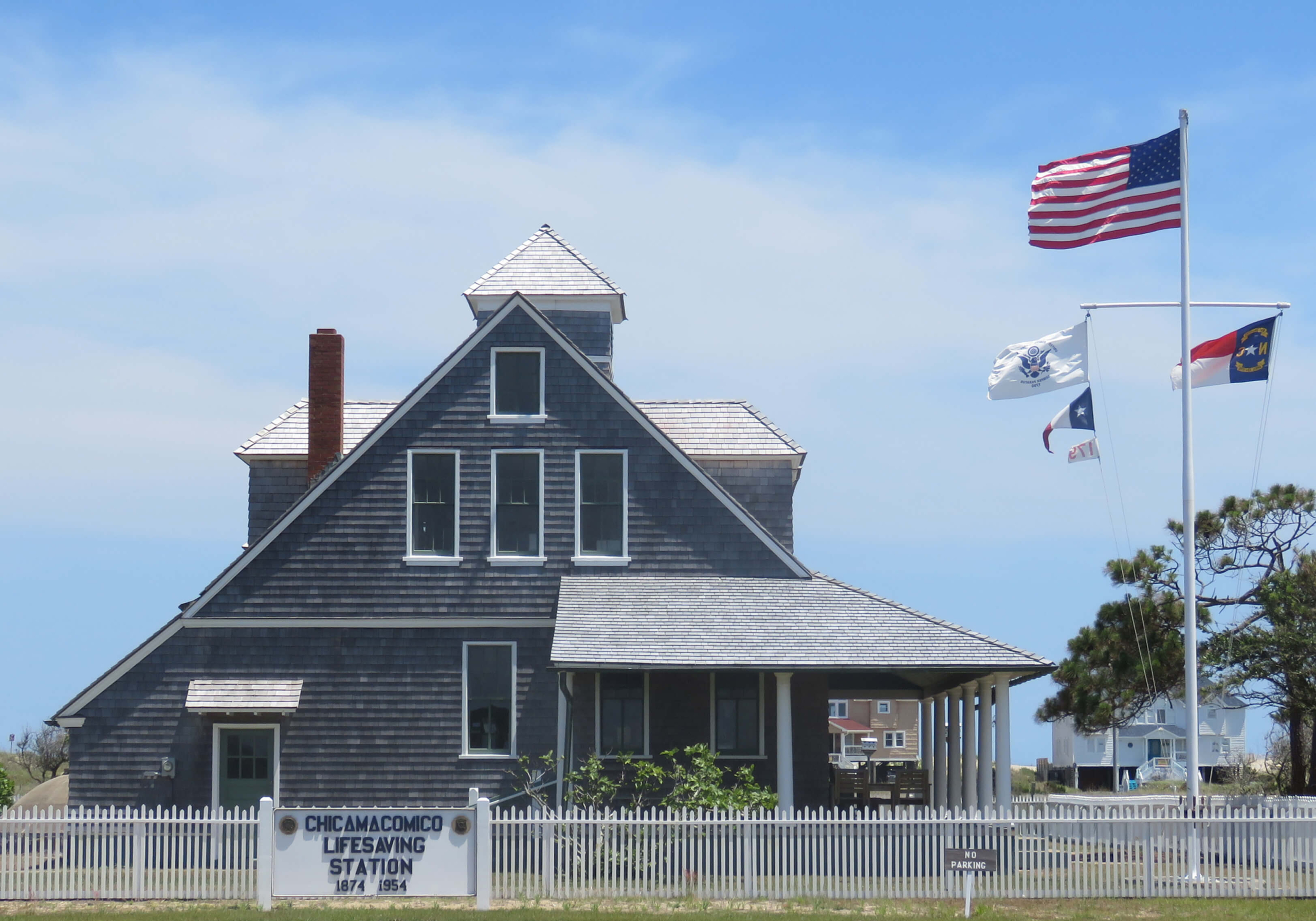
- Located in the village of Rodanthe off of Highway 12 A historic campus of seven buildings that interpret the history and evolution of the US Life Saving Service on the Outer Bankls.
Enjoy the refreshing waters of the Atlantic Ocean at this swim beach in the northern part of the seashore. During the summer season, there is a lifeguarded beach area and a bathhouse with 14 changing rooms (two that are accessible), four outdoor showers, and bathrooms. A boardwalk leads out to the beach from the bathhouse, as well as a primitive path at the northeastern end of the northern parking lot. There are parking lots to the north and to the south of the bathhouse.
- Coquina Beach Day Use Area<br />372 words (3-¼ minutes)<br />Two 150-foot long parking lots flank a raised, 50-foot wide wooden bathhouse structure. A boardwalk ramp leads up to the bathhouse from one end of each of the lots.<br /><br />To get to the bathhouse from the north parking lot, move along the concrete walkway with the dunes at your left to come to the base of a boardwalk with four-foot high railings. From the south lot, move along the concrete walkway toward the bathhouse with the dunes on your right. On this side, note a large garbage and recycling station 15 feet to the left of the boardwalk. Continue onto the boardwalk and move 50 feet up a slight incline to a 50-foot square wooden deck. <br /><br />Along one side of the deck is a restroom building with entrances in the middle and at both ends. Coming from the north lot, the women's restroom is located to the right on this end, with a second entrance 15 feet ahead on the right. Note there is a water fountain 10 feet along the wall at the right. The men's restroom is 25 feet down on the right, with another entrance about 40 feet along at the other end of the building. Coming from the south lot, the men's restroom is on this end, and the women's restroom is at the far end.<br /><br />Opposite the restroom building are two 20-foot square ceramic tile shower areas, one in each corner of the deck, surrounded by a half-dozen changing rooms with swinging wooden doors. A boardwalk with railings leads to the beach from the back of the deck between the shower areas.<br /><br />Two outdoor exhibits on the deck to the left of the boardwalk are entitled "Know Before You Go" and "Playing With Energy."<br /><br />To get to the beach, move 50 feet along the boardwalk up a slight incline, then turn slightly to the right and move another 80 feet to the top of the boardwalk. At the right is a 15-foot square rest area with a couple benches. Move five feet forward, then down five stairs onto the sand, and continue 50 feet forward to the edge of the dunes and another 100 feet across the beach to the ocean.<br /><br />End of message.
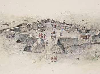
In an effort to prevent Union troops from taking Ocracoke Inlet, the Washington Grays, of Washington, North Carolina, were sent to Ocracoke to begin construction of Fort Ocracoke on May 20, 1861-the day North Carolina seceded from the Union.Brief skirmishes occurred on Ocracoke, but no war casualties were documented. Union troops destroyed the fort on September 17, 1861, and eventually took Ocracoke Inlet. What was left of the fort remained visible until it was completely sub
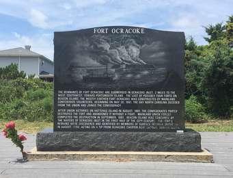
- Fort Ocracoke Marker<br />56 words (½ minute)<br />This Civil War marker is made out of a black granite, with an etching of the island fort ablaze with smoke and a steamship floating in the water in front of it. Text details the history of the fort. Picnic tables and parking are nearby, as is a view of the Pamlico Sound to the north.<br /><br />End of message.
Fort Raleigh National Historic Site protects and preserves known portions of England's first "New World" settlements from 1584 to 1590.<br /><br />This site also preserves the cultural heritage of the local Algonquian tribes, European Americans, and African Americans who have lived on Roanoke Island.<br /><br />For more information <a href="https://www.nps.gov/fora/index.htm">visit the website</a> .
- Fort Raleigh National Historic Site<br />32 words (½ minute)<br />The National Park Service site preserves and protects England's first colonial attempts in the "New World," a place where Carolina Algonquian called home, as would African Americans during the American Civil War.<br /><br />End of message.
The beaches around Frisco, North Carolina are a wonderful place to experience the Atlantic Ocean, where the waters are warmer than the northern beaches of Cape Hatteras National Seashore due to the influence of the nearby Gulf Stream. With showers, changing rooms, and restrooms, this is a great place to enjoy the beach while on the southern part of Hatteras Island. There are 48 regular parking spaces spread across three lots near the bathhouse.
- Frisco Beach Day Use Area<br />340 words (3 minutes)<br />A 30-foot wide by 20-foot deep, one-story, raised, wooden building sits in front of the dunes next to a long parking lot stretching off to the left and right. Here there are restrooms, two shower areas behind the bathhouse, and an accessible ramp up and over the dunes to the beach.<br /><br />Move off the asphalt lot onto an eight-foot wide boardwalk landing area. To the left are the outdoor exhibits "Know Before You Go" and "Islands on the Move." There is also a three-foot tall tube for recycling used fishing line located immediately behind the exhibits.<br /><br />To get to the bathhouse, move six feet forward and turn right up eight steps to a wooden landing and turn left. Or you may turn right to a ramp and move 30 feet up a slight incline, turn around six feet to the left and continue another 30 feet up the ramp to the wooden landing and turn right. There is a combination water fountain, water bottle filling station, and pet fountain six feet straight ahead. The men's room is six feet behind the fountain to the left, and the women's room is to the right.<br /><br />Move along the wooden porch area to the left or right around to the back center of the building, and move 15 feet away from the building toward the dunes along a boardwalk ramp. Note two 15-foot shower areas with non-potable water to the left and right. Continue 50 feet up a slight incline. Here, a second ramp to the beach splits off to the right.<br /><br />If you would like to continue to the beach using stairs, continue 40 feet forward to a 15-foot square observation deck at the top of the dunes. Move across the deck to a staircase and move 16 steps down onto the beach.<br /><br />If you would like to continue to the beach using the ramp, turn right and move eight feet then turn left and move 80 feet down the ramp onto the beach.<br /><br />End of message.
The Graveyard of the Atlantic Museum offers a great opportunity to explore the history of the Outer Banks and the maritime environment. The original lens from the Cape Hatteras Lighthouse is on display.
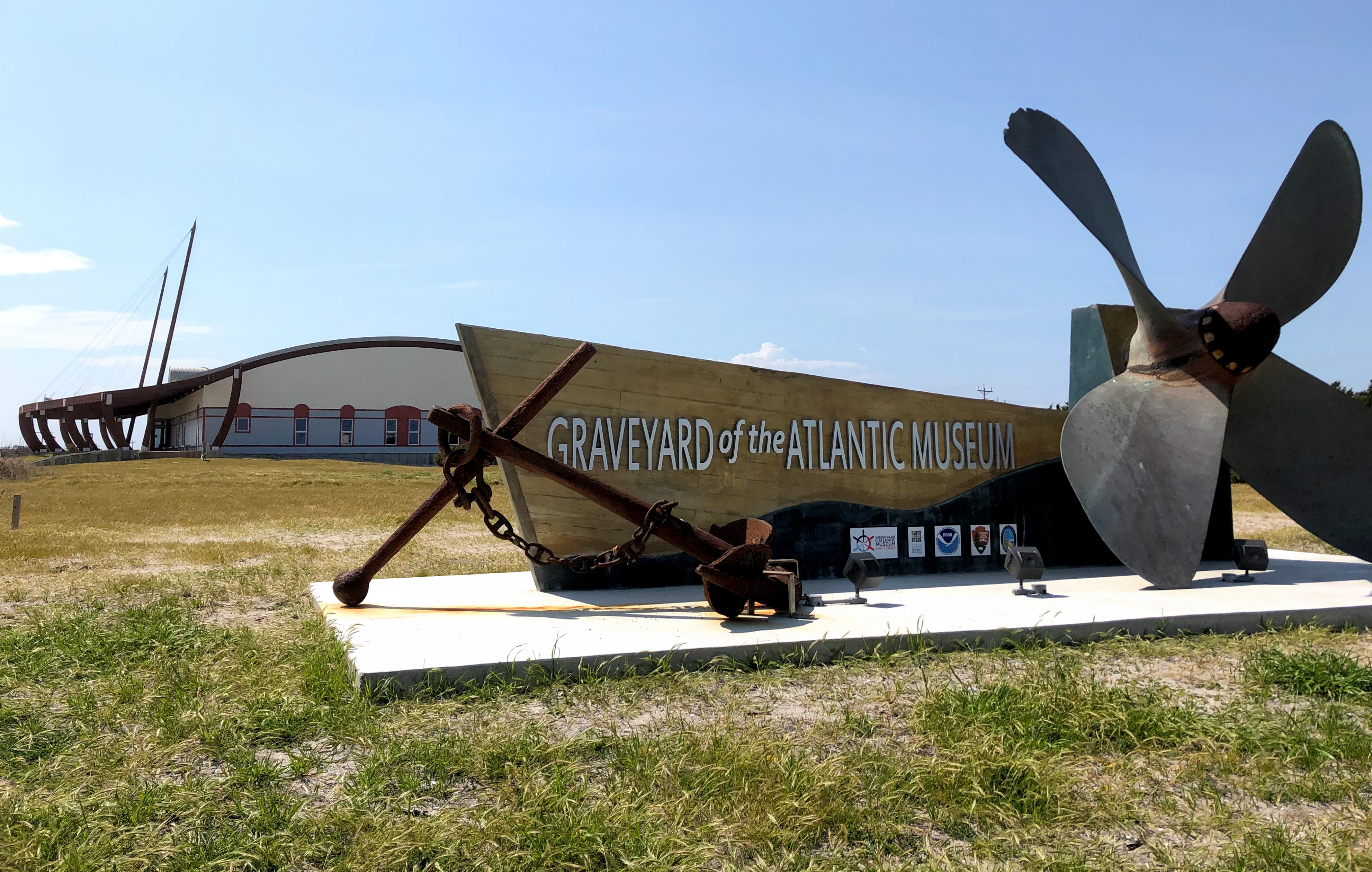
- Located at the end of Hatteras Island, next to the Ferry Terminal. Proceed past the ferry terminal, drive past the building to the large parking lot on the south side of the building.
The trail begins its journey to the marshy grass-lined edge of Pamlico Sound in a shrub thicket woodland. It crosses a boardwalk and splits into its loop just past a small, freshwater branch of Island Creek. Go right, and the trail passes an open dune scape where you'll notice low-growing prickly pear cactus. The path swings into a pine forest where distance from the ocean and an accumulating layer of soil invites less salt-tolerant species to take hold and mature.
- Hammock Hills Trailhead<br />55 words (½ minute)<br />Just across from the Ocracoke Campground, the Hammock Hills Nature Trail is a ¾-mile long loop trail through the island's maritime forest and salt marsh. There are informative signposts along the way, and the hike takes about 30 minutes. Be sure to bring along insect repellent as the trail is also popular with mosquitos at times!<br /><br />End of message.
Ferry services, provided by North Carolina's Department of Transportation (NCDOT), link Ocracoke Island to Hatteras Village and the mainland. There is a comfort station with restrooms available on the south side of the stacking lanes.The ferry crosses Hatteras Inlet in roughly one hour and reservations are not required. Check the NCDOT ferry website for current departure schedules.
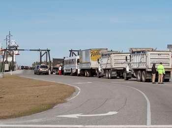
- Hatteras Inlet North Ferry Terminal<br />45 words (½ minutes)<br />A series of stacking lanes lead to large ferry-loading ramps. On the left side of the stacking lanes, next to a large, asphalt parking lot, is the terminal building. An accessible ramp at the front of the visitor center provides access to the building.<br /><br />End of message.
Ferry services, provided by North Carolina's Department of Transportation (NCDOT), link Ocracoke Island to Hatteras Village and the mainland. There is a comfort station with restrooms available on the south side of the stacking lanes.The ferry crosses Hatteras Inlet in roughly one hour and reservations are not required. Check the NCDOT ferry website for current departure schedules.Once in line to await ferry-boarding, visitors are free to hop out of their vehicles and explo
- Hatteras Inlet South Ferry Terminal<br />40 words (½ minutes)<br />A series of stacking lanes lead to large ferry-loading ramps. On the south side of the stacking lanes, next to a separate parking lot, is the comfort station. An accessible ramp at the front provides access to the building.<br /><br />End of message.
The Eastern National Park Store, at the Base of the Cape Hatteras Lighthouse at Cape Hatteras National Seashore provides visitors access to great souvenirs, books, and educational materials to support your visit to Cape Hatteras National Seashore.
- The Eastern National Park Store, at the Base of the Cape Hatteras Lighthouse at Cape Hatteras National Seashore provides visitors access to great souvenirs, books, and educational materials to support your visit to Cape Hatteras National Seashore.
The Hatteras Island Visitor Center is where you can replenish your water bottles, purchase or pick-up off-road vehicle permits, use the restroom facilities, or browse the items for sale in the gift shop.
- Hatteras Island Visitor Center<br />183 words (1-¾ minutes)<br />Mindfully cross the loop road from the parking lot to a 50-foot wide patio area with several benches at the left and right. Continue 40 feet forward onto a wooden boardwalk and 30 feet up a slight incline to a 30-foot square, open arbor plaza. Six wooden benches occupy the center section of the plaza.<br /><br />Turn right and move 15 feet and turn right to face the restrooms. The men's room is to the right down a short hallway, and there is a unisex restroom straight ahead. Ten feet to the left of the unisex room is a water fountain, and the women's room is located to the left of that down another short hallway. A second water fountain with a water bottle filling station and a pet fountain is located eight feet to the left of the ramp past a blue plastic recycling bin.<br /><br />On the plaza facing the ramp, turn left and move 15 feet past the water station on your right to a set of double metal and glass doors to the visitor center bookstore at your right.<br /><br />End of message.
Built in 1870 along with the lighthouse, this is where the Principal Lighthouse Keeper of the Cape Hatteras Lighthouse, and his family, lived.<br /><br />Now, the building is used by park staff and is not open to the public.
- Cape Hatteras Lighthouse Principal Keeper's Quarters<br />88 words (¾ minute)<br />From the Cape Hatteras Lighthouse Ticket Booth, face the booth, turn to the left, and move 40 feet forward, curving slightly around to the left out from under the trees, and move 100 feet forward to a red brick path. In an open grassy field, the lighthouse is to your left, and the keepers' quarters are to the right. Continue 30 feet to down the right path to the Principal Keeper's Quarters. This building is now used for park staff, so it is not open to the public.<br /><br />End of message.
Haulover Day Use Area has some of the world's best kiteboarding and windsurfing when the winds kick up in the spring and fall.<br /><br />This is also a great place for families with little ones who may be hesitant around the ocean waves. Here, they can splash and play in the Pamlico Sound, which for the most part has gentle water, a gradual slope, and an average depth of one to two feet near the shoreline.<br /><br />There is also a bathhouse with showers, changing rooms, and restrooms.
- Haulover Day Use Area<br />294 words (2-½ minutes)<br />The Pamlico Sound is accessible along the entire length of the northern parking lot, and there is an sandy path across NC-12 that provides access to the Atlantic Ocean. The ocean access path is opposite the entrance to the Ocracoke Day Use Area parking from the highway. If wanting to visit the ocean, please be mindful crossing NC-12.<br /><br />To get to the bathhouse, move onto a six-foot wide boardwalk with four-foot tall railings at the far northern end of the north parking lot. Move 60 feet up a slight incline, then continue 30 more feet bearing around to the right to the top of the ramp to a 40-foot, open deck area. Ten feet to the right is a men's restroom, and five feet further to the right is a women's restroom.<br /><br />Twenty feet straight ahead is a 25-foot square, open shower with a tile floor and a central shower station with multiple showerheads. Two wooden benches are arranged diagonally just to the right of the shower area. There are two changing rooms with swinging wooden doors on the far side of the shower area at the left and right, and there is a water fountain and water bottle filling station mounted on the far wall between the two changing rooms.<br /><br />Turning around with the water fountains at your back, note there is a second set of unisex restrooms opposite the open shower area at the far left of the deck 15 feet behind the wooden benches on the right.<br /><br />There is also a second, 150-foot long parking lot at the south end of the access road. Two sets of four stairs lead down onto the 30-foot wide beach at either end of the south lot.<br /><br />End of message.
This is the location where the Cape Hatteras Lighthouse stood from 1870 to 1999.In 1999, the Cape Hatteras Light Station, which consists of seven historic structures, was successfully relocated 2,900 feet to the west from this spot. Because of the threat of shoreline erosion, a natural process, the entire light station was safely moved to a new site where the historic buildings and cisterns were placed in spatial and elevational relationship to each other, exactly as they had
- Historic Cape Hatteras Lighthouse Site<br />65 words (¾ minute)<br />At the far end of the small loop road and parking lot north of the Cape Hatteras lighthouse, move from the asphalt across a concrete sidewalk onto the sand. An outdoor exhibit, "Retreat from the Sea," shows a 1993 photograph of the lighthouse. To reach the historic location of the Cape Hatteras Lighthouse, move across the sand about 100 feet to the north and east.<br /><br />End of message.
Howard Street is a step back in time. The unimproved road is the oldest street in the village, with old family cemeteries and homes lining the tree-covered street. Many of the homes here belong to descendants of the original settlers.

- Howard Street<br />31 words (½ minute)<br />Howard Street meanders under a canopy of old trees, with family cemeteries on one side of the dirt road and homes and shops predominantly on the other side of the street.<br /><br />End of message.