No Fruit Available in Orchards
Due to an abnormally early spring bloom, followed by a hard freeze, this year's crop was lost. There is no fruit available to pick this year.
Special Use Permits
Special Use Permits are typically needed for activities that benefit a specific group. Examples include: Groups of 40 or more, trips organized by scouting groups, churches, or academic institutions, photography, weddings, and first amendment activities
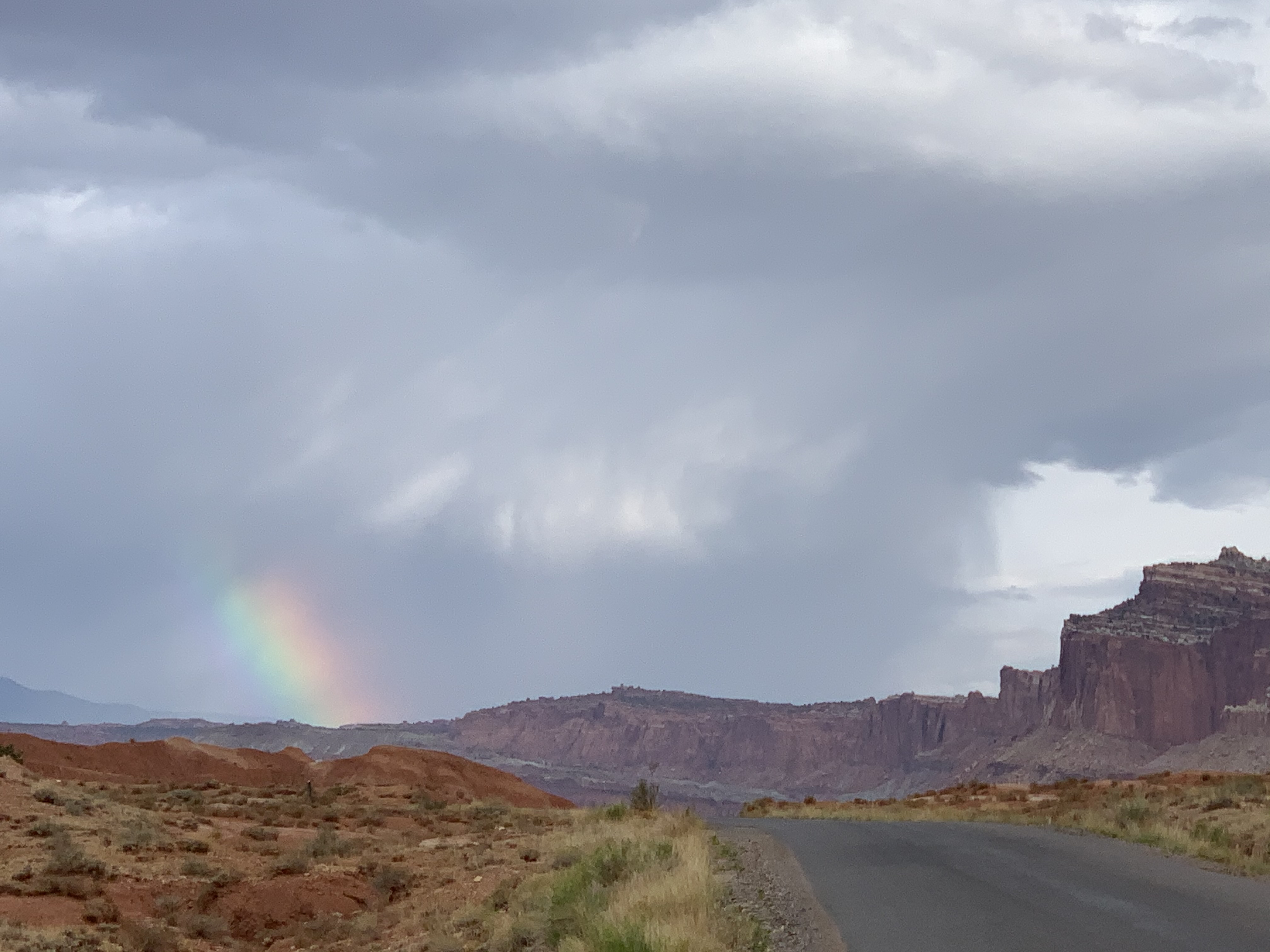
Monsoon Season & Flash Floods
Heavy rains can cause sudden flooding, especially in canyons and washes. Do not drive or hike through flood waters. Get to high ground and wait for floods to subside. Some roads may close temporarily; closures are posted at the visitor center.
| Title | Capitol Reef |
| Park Code | care |
| Description | Located in south-central Utah in the heart of red rock country, Capitol Reef National Park is a hidden treasure filled with cliffs, canyons, domes, and bridges in the Waterpocket Fold, a geologic monocline (a wrinkle on the earth) extending almos... |
| Location | |
| Contact | |
| Activities |
|
| Entrance fees |
Entrance - Private Vehicle
$20.00
An entrance fee is charged per vehicle.
Entrance - Motorcycle
$15.00
Admits one private, non-commercial motorcycle and its riders.
Entrance - Per Person
$10.00
Admits one individual with no car. Typically used for bicyclists and pedestrians.
Commercial Entrance - Sedan
$30.00
This fee is based on the seating capacity of the vehicle. A Commercial Use Authorization permit may be required.
Commercial Entrance - Van
$40.00
This fee is based on the seating capacity of the vehicle. A Commerical Use Authorization permit may be required.
Commercial Entrance - Mini-bus
$40.00
This fee is based on the seating capacity of the vehicle. A Commerical Use Authorization permit may be required.
Commercial Entrance - Motor Coach
$100.00
This fee is based on the seating capacity of the vehicle. A Commerical Use Authorization permit may be required.
|
| Campgrounds | Count: 5
Backcountry CampingFruita Campground
Group Campsite
Primitive campsites at Cathedral Campground
Primitive campsites at Cedar Mesa Campground
|
| Places | Count: 39
Behunin CabinImagine homesteading this area with your family. Would more children make it easier? Elijah Cutler Behunin, his wife Tabitha Jane, and their 13 children lived in this cabin and the alcove above for just one year. 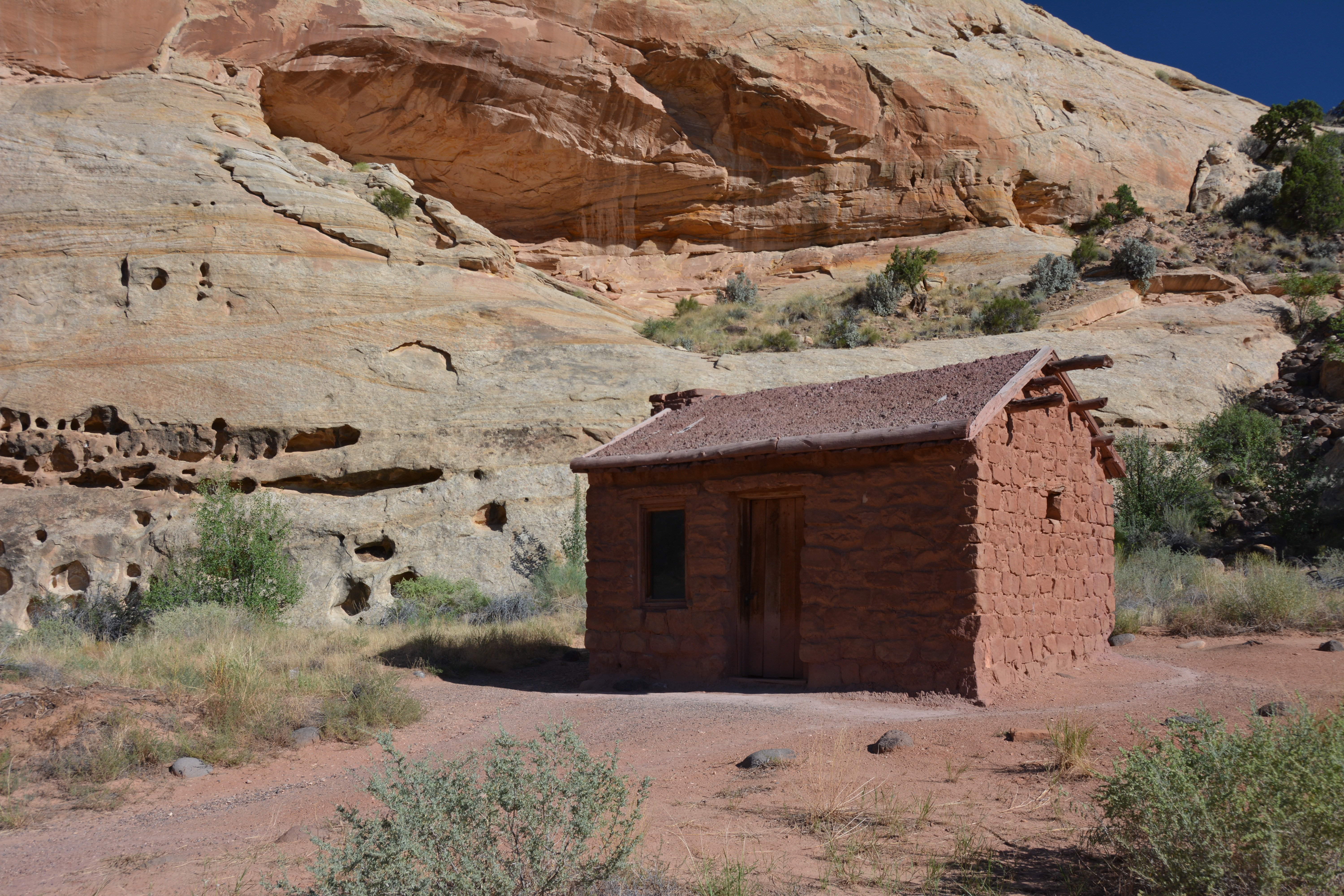
Bentonite HillsThe Bentonite Hills are softly rounded, large hills of various shades of gray, red, maroon, brown, and green. High clearance 4-wheel drive is usually necessary to access them, and sometimes the road is impassable. 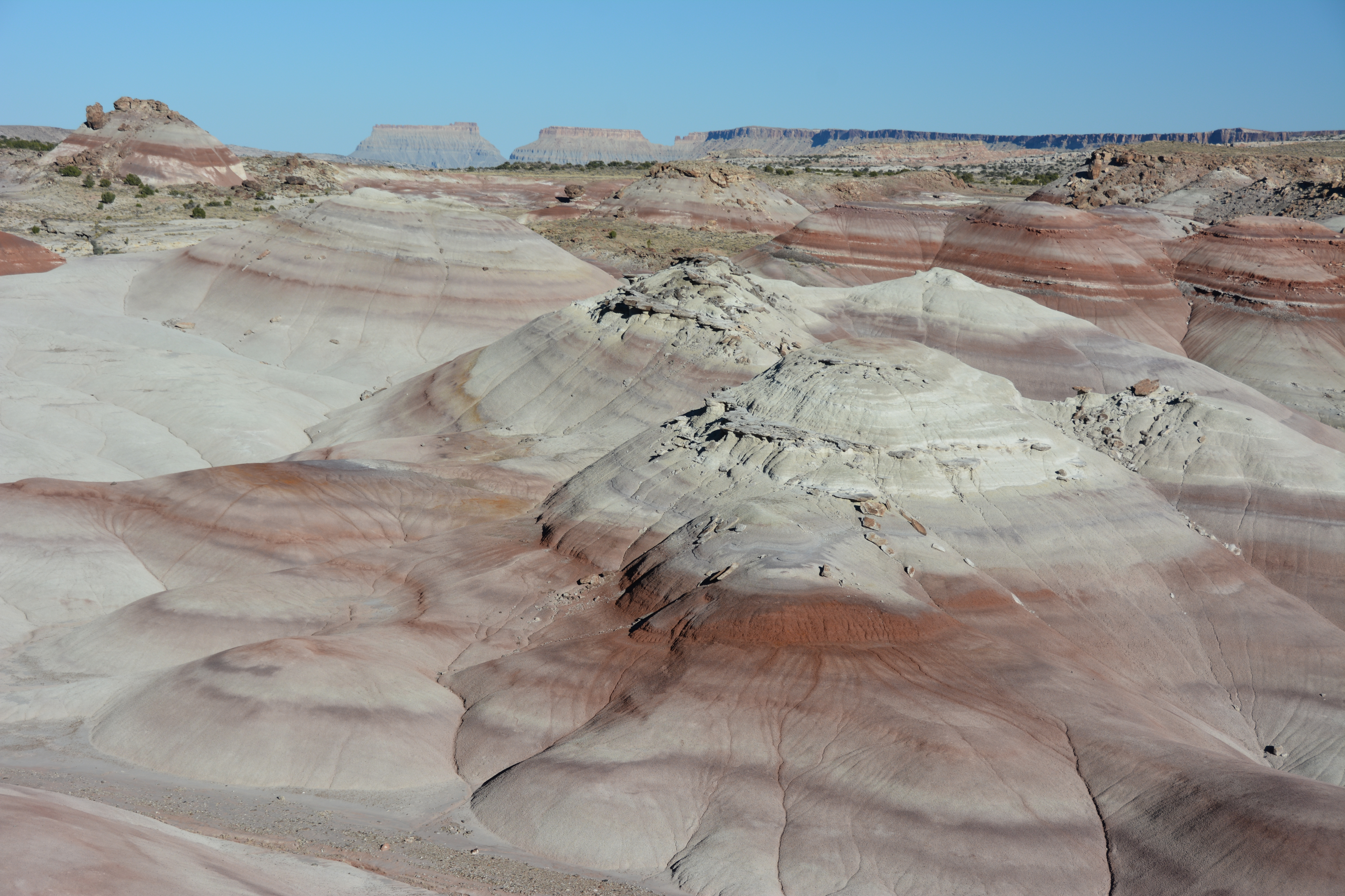
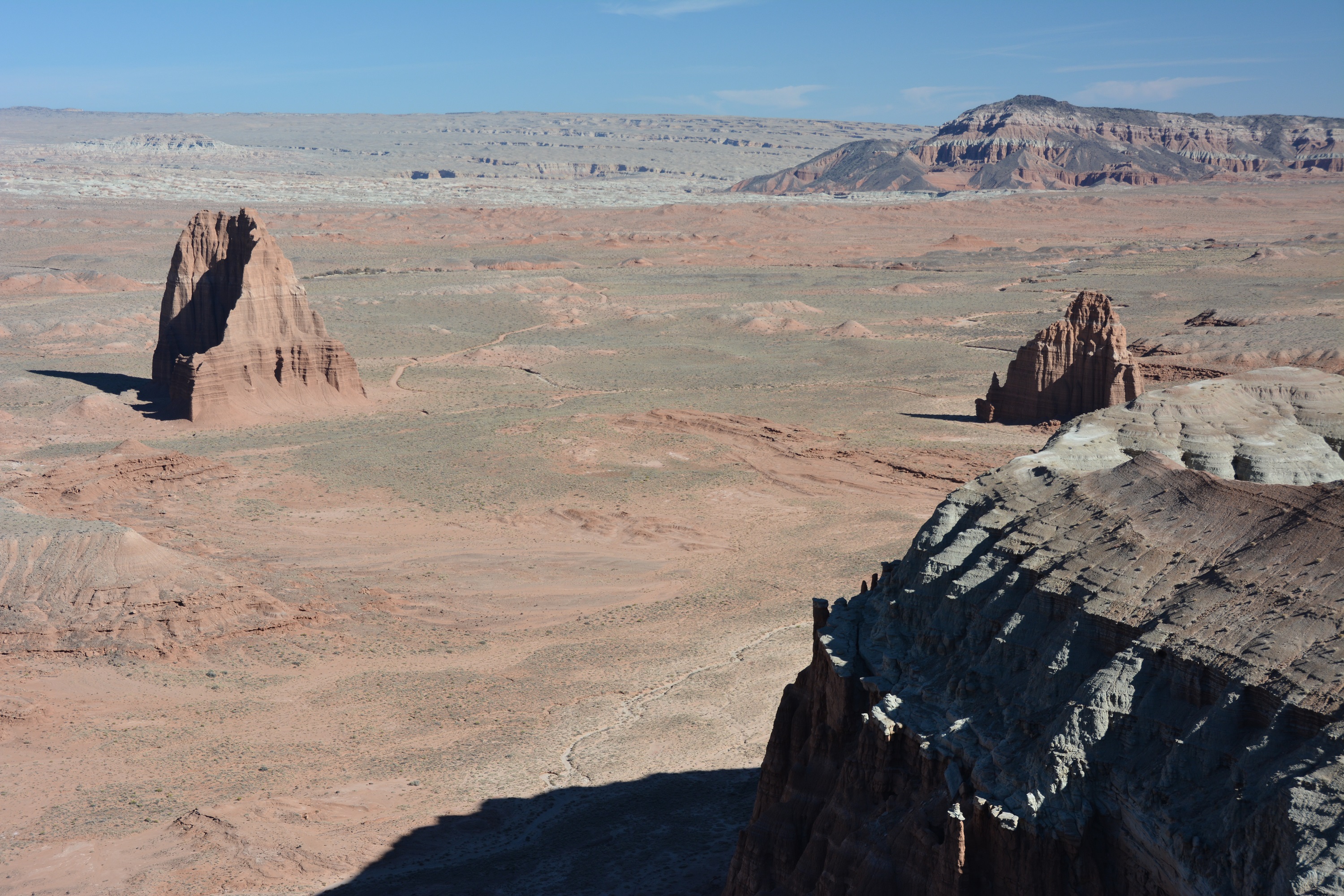
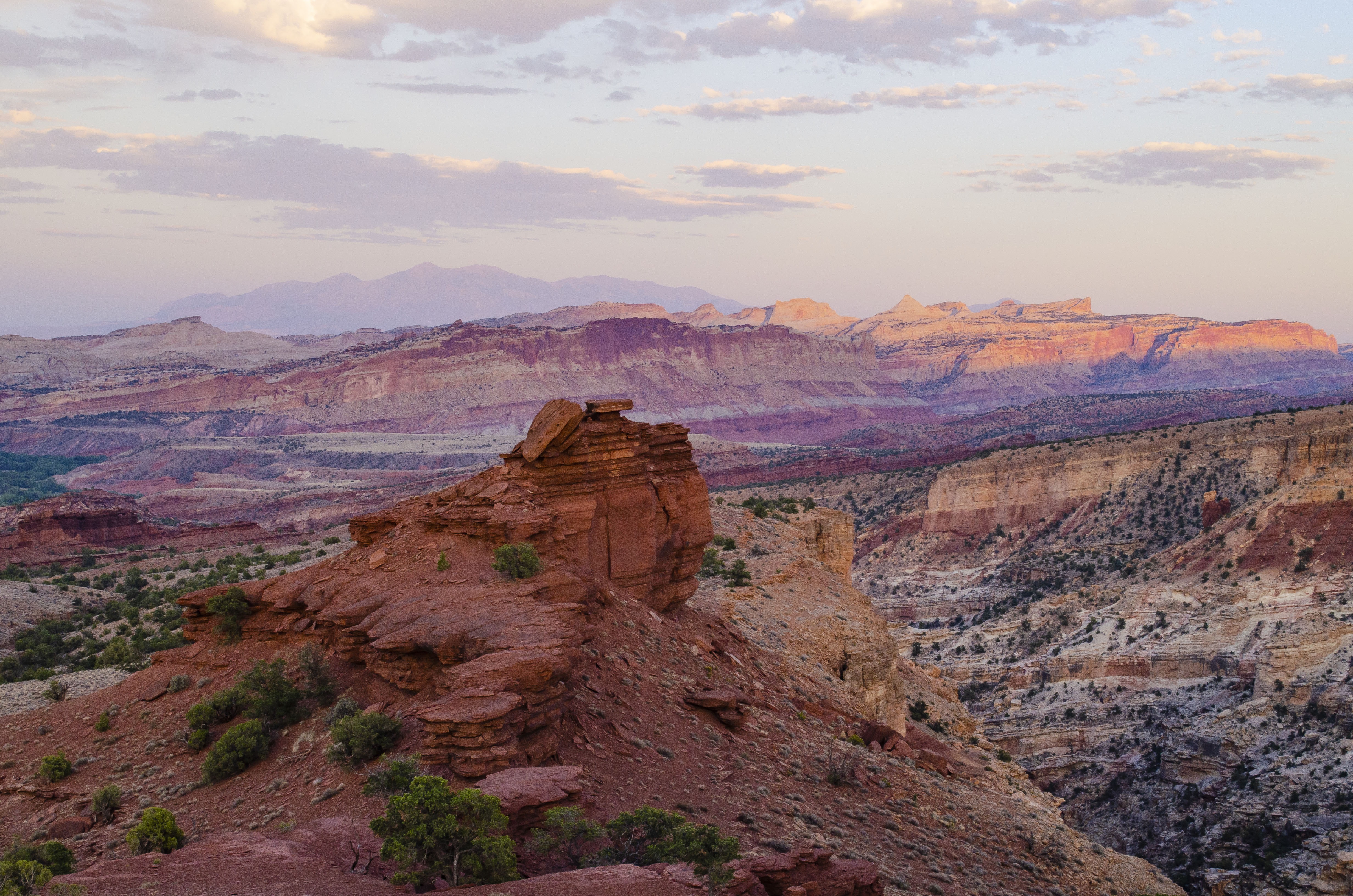
Capitol DomeCapitol Dome is part of why Capitol Reef has its name. The rounded dome resembled various capitol buildings, including the one in Washington D.C. It is easy to view from the Hickman Bridge Trailhead. 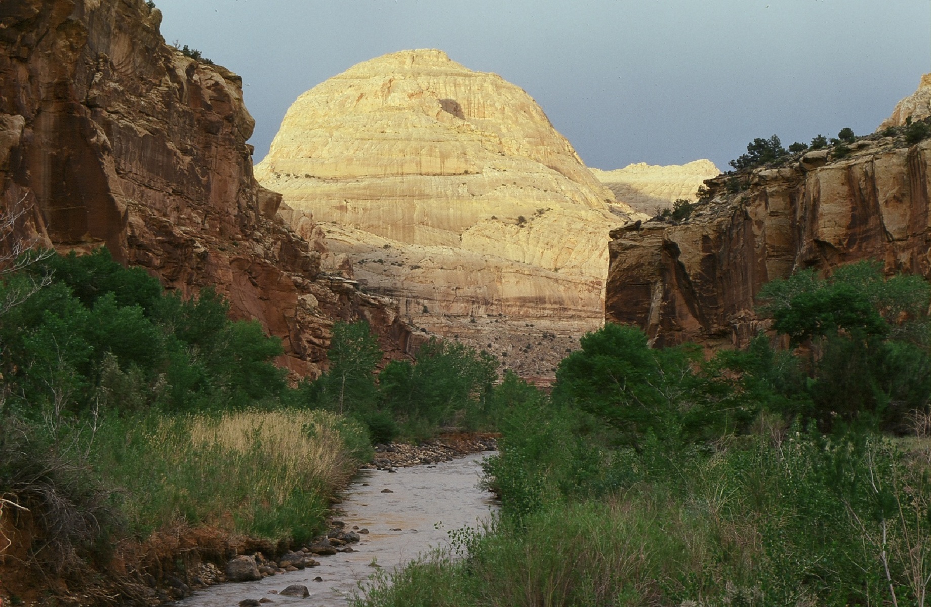
Capitol Reef East Entrance Wayside
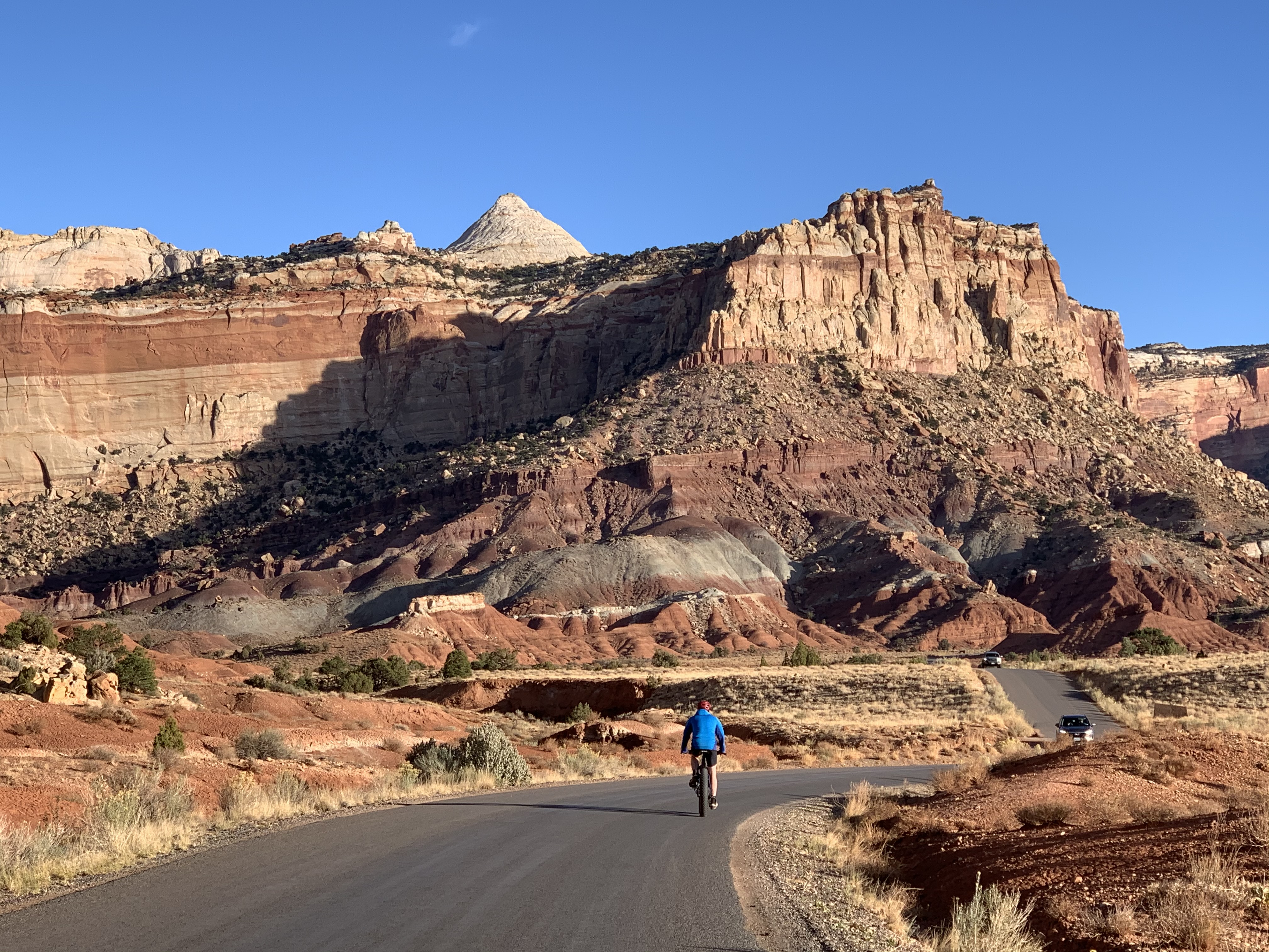
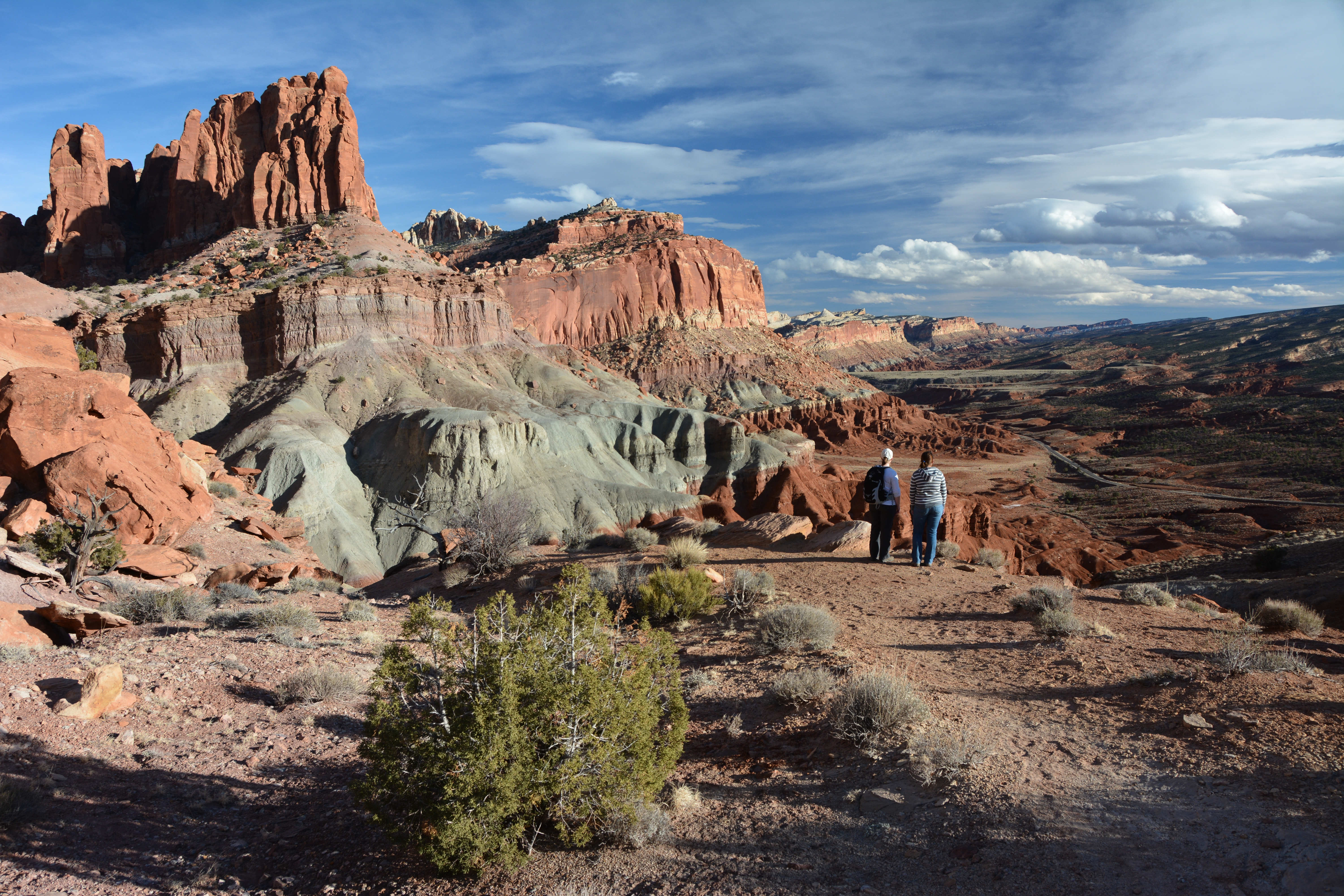
Capitol Reef National Park's Scenic DriveThe nearly 8 mile winding Scenic Drive is a great way to see and experience Capitol Reef National Park. 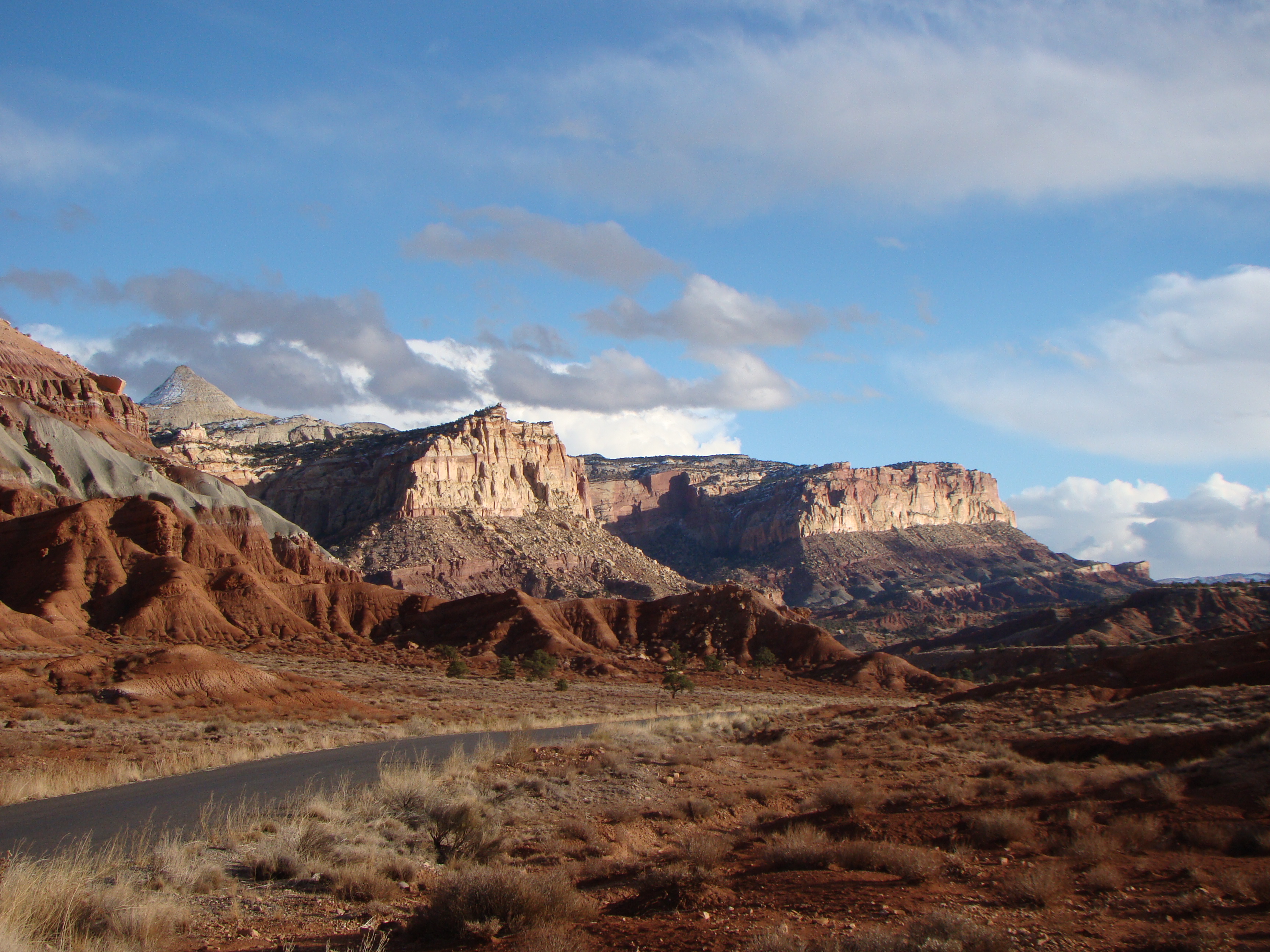
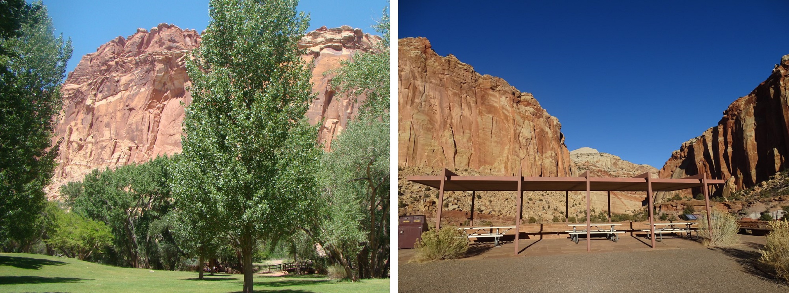
Capitol Reef OrchardsThe orchards that lie within a mile or two of the visitor center are evident remains of the pioneer community of Fruita, settled in 1880. Many varieties of heirloom fruit are available for harvest by visitors in season. 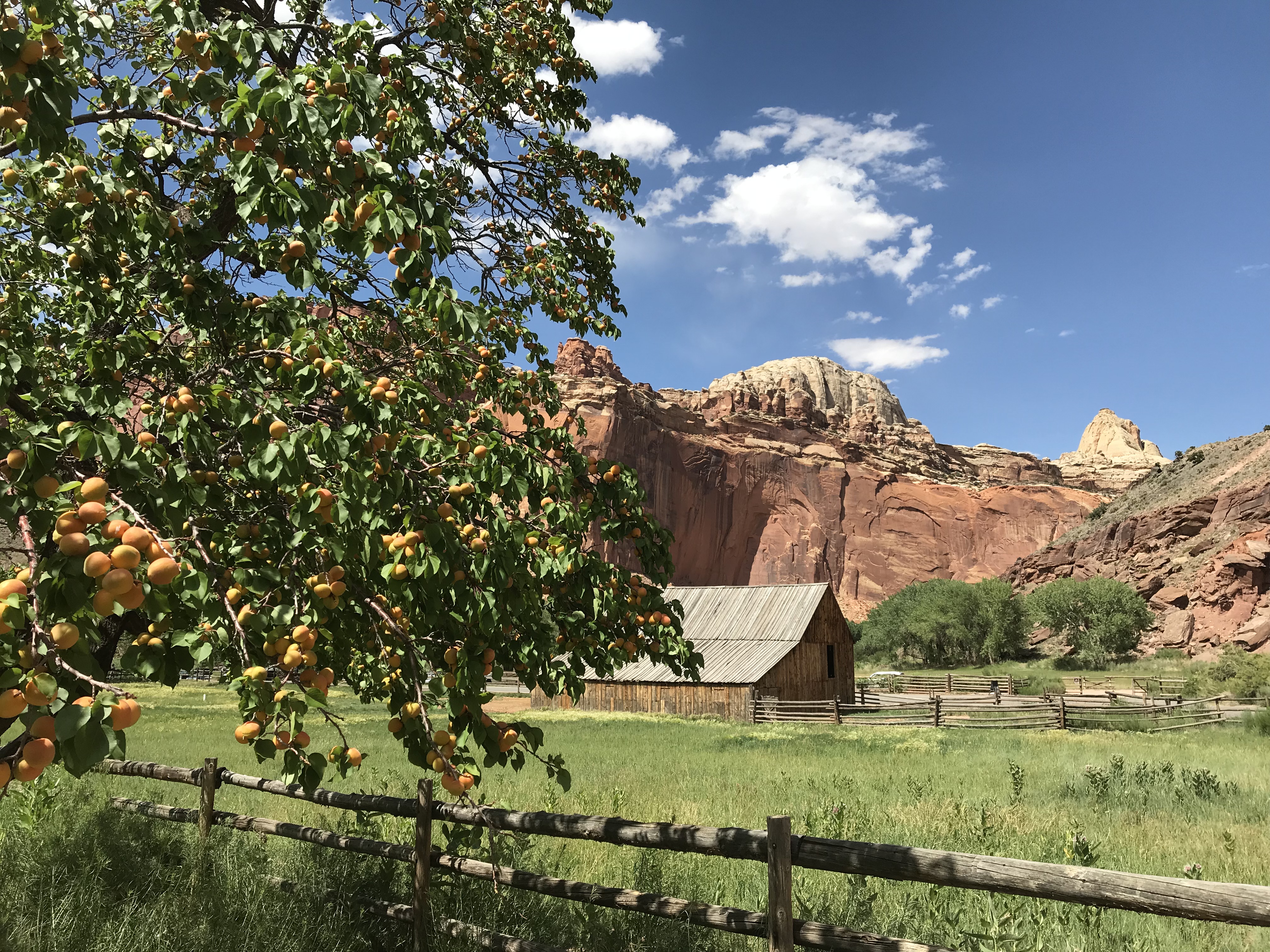
Capitol Reef West Entrance Pulloff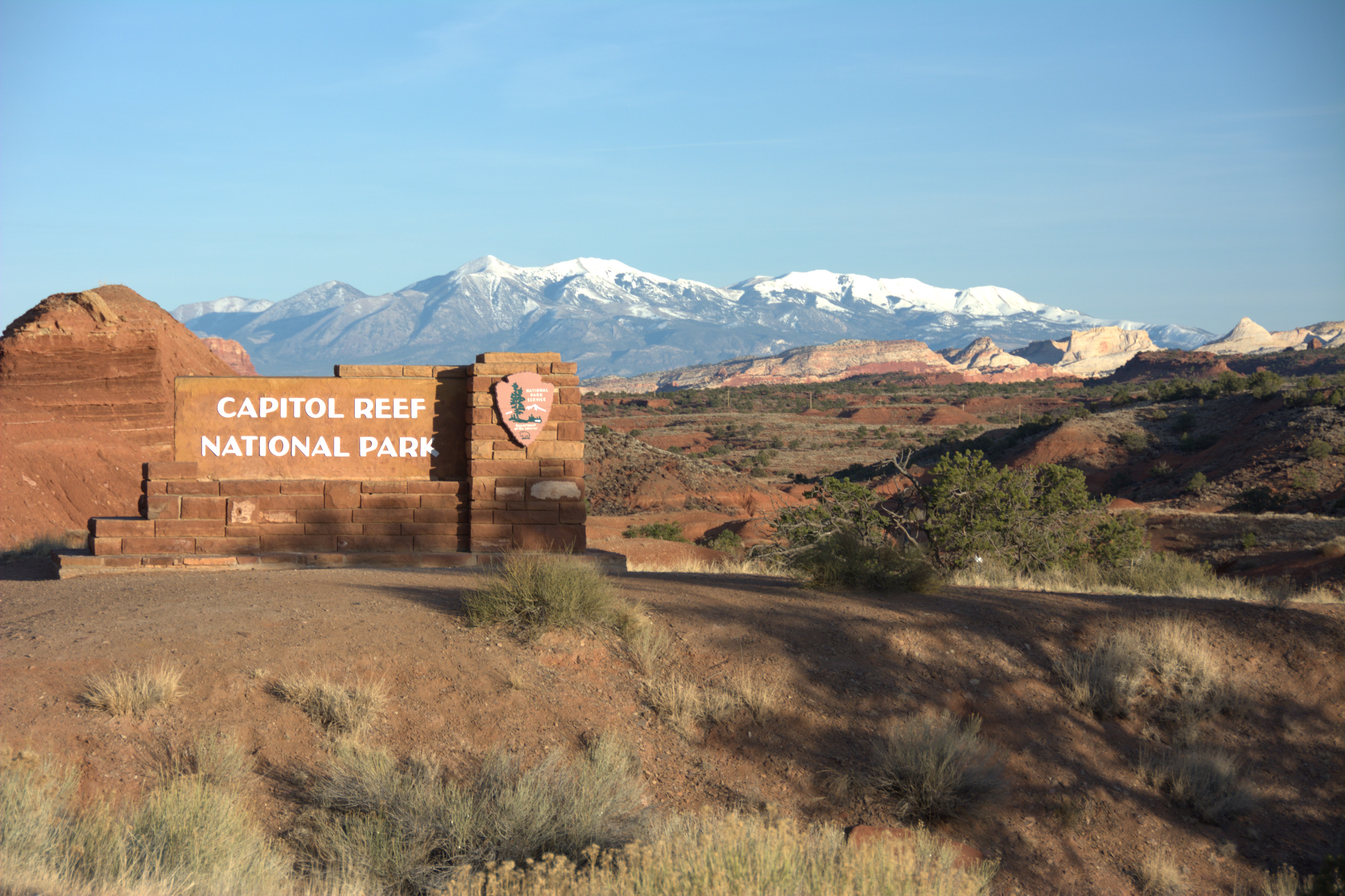
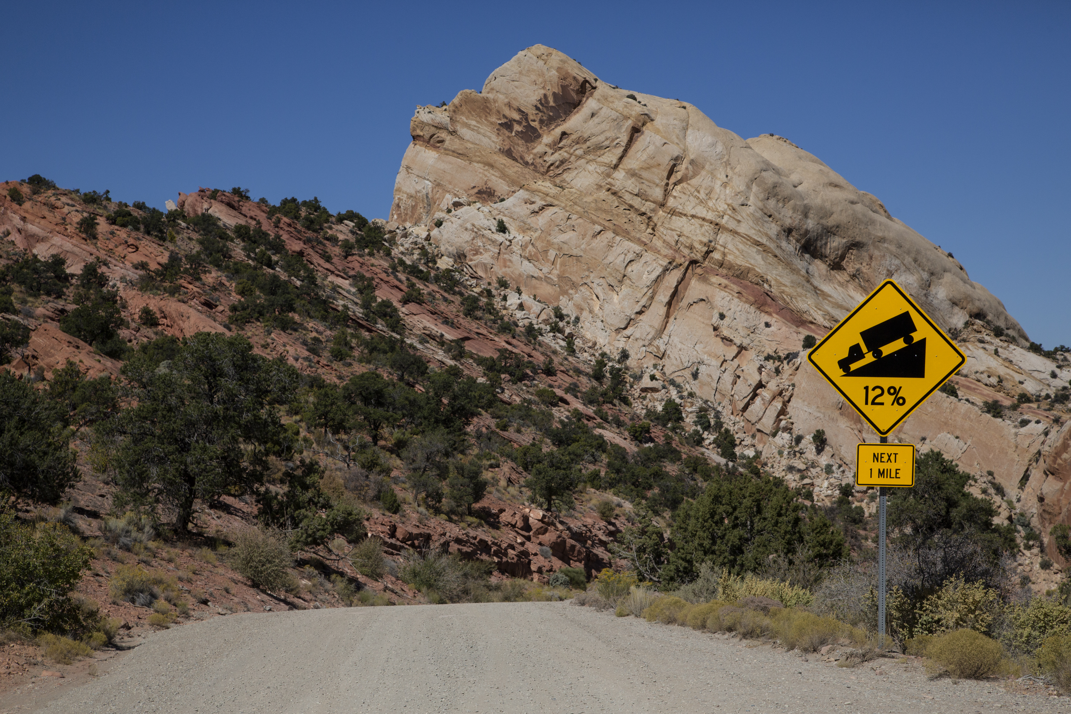
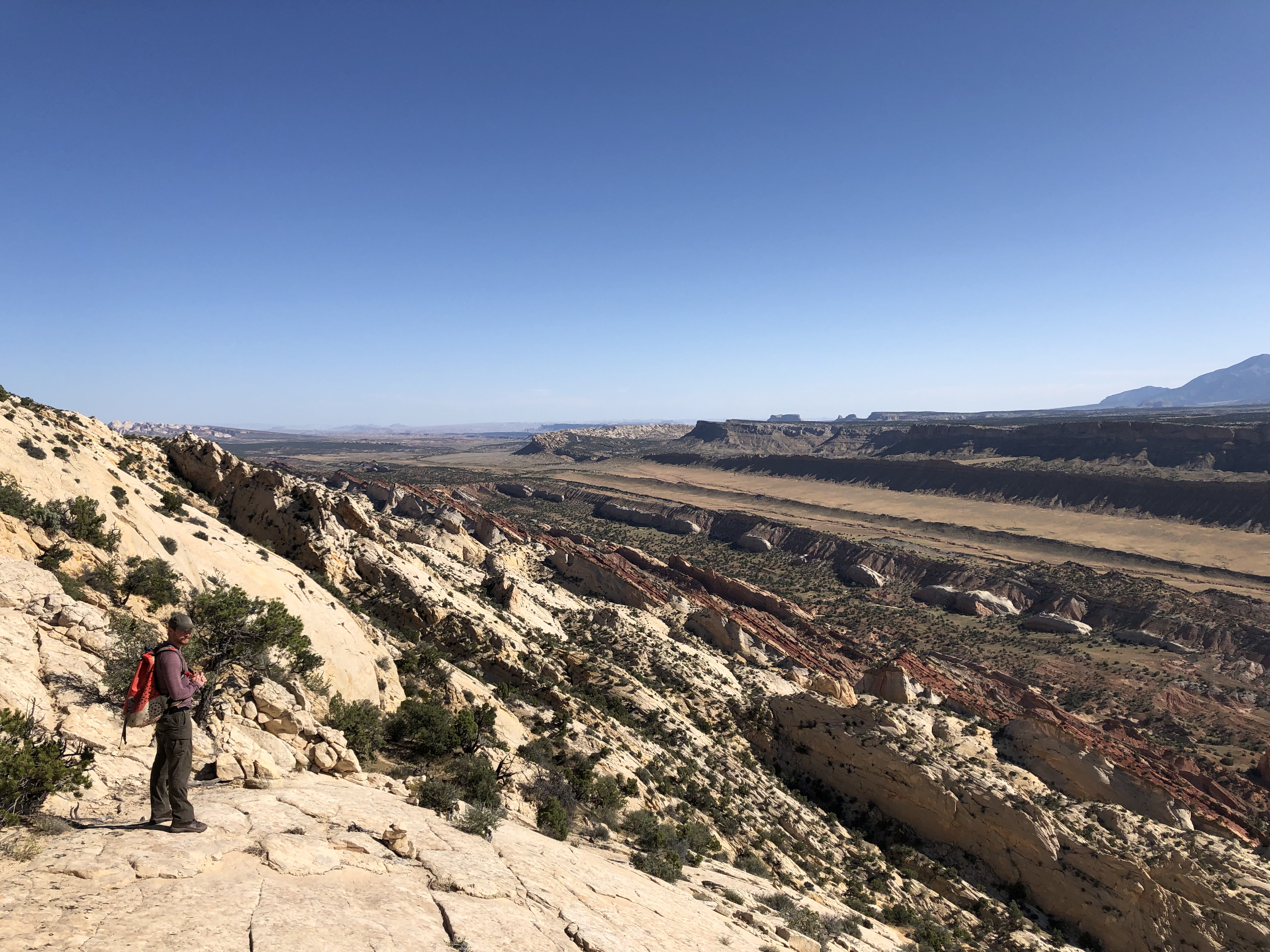
Cathedral ValleyThe Cathedral District of Capitol Reef is remote and rugged. A high clearance vehicle is required and occasionally 4 wheel drive as well. Check at the visitor center, or call 435-425-3791 for road conditions. 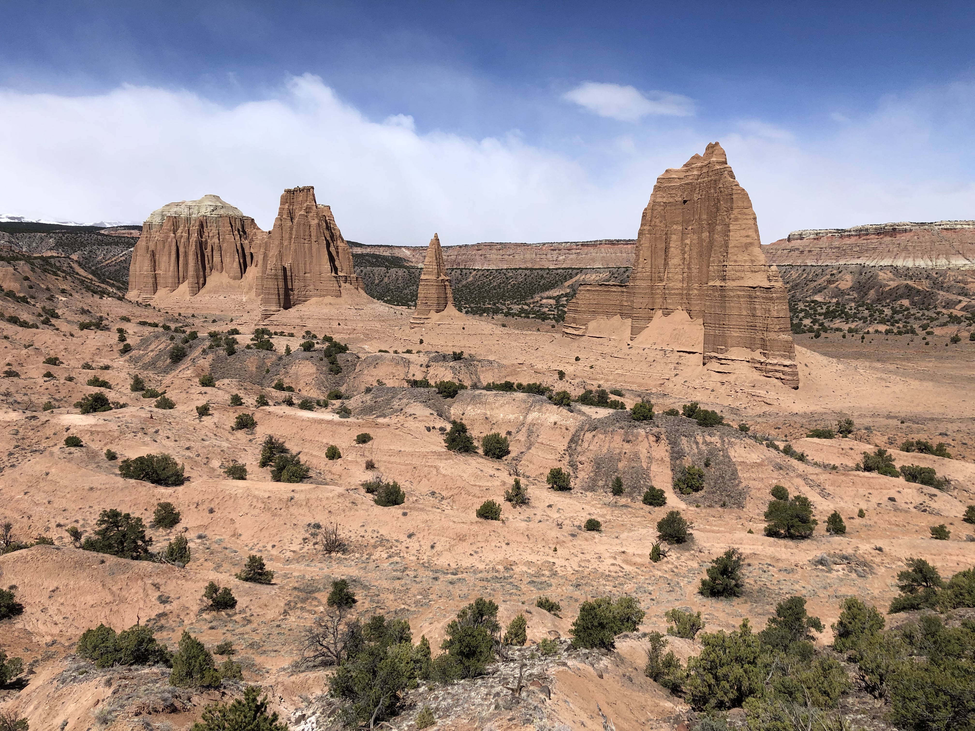
Fluted Wall Viewpoint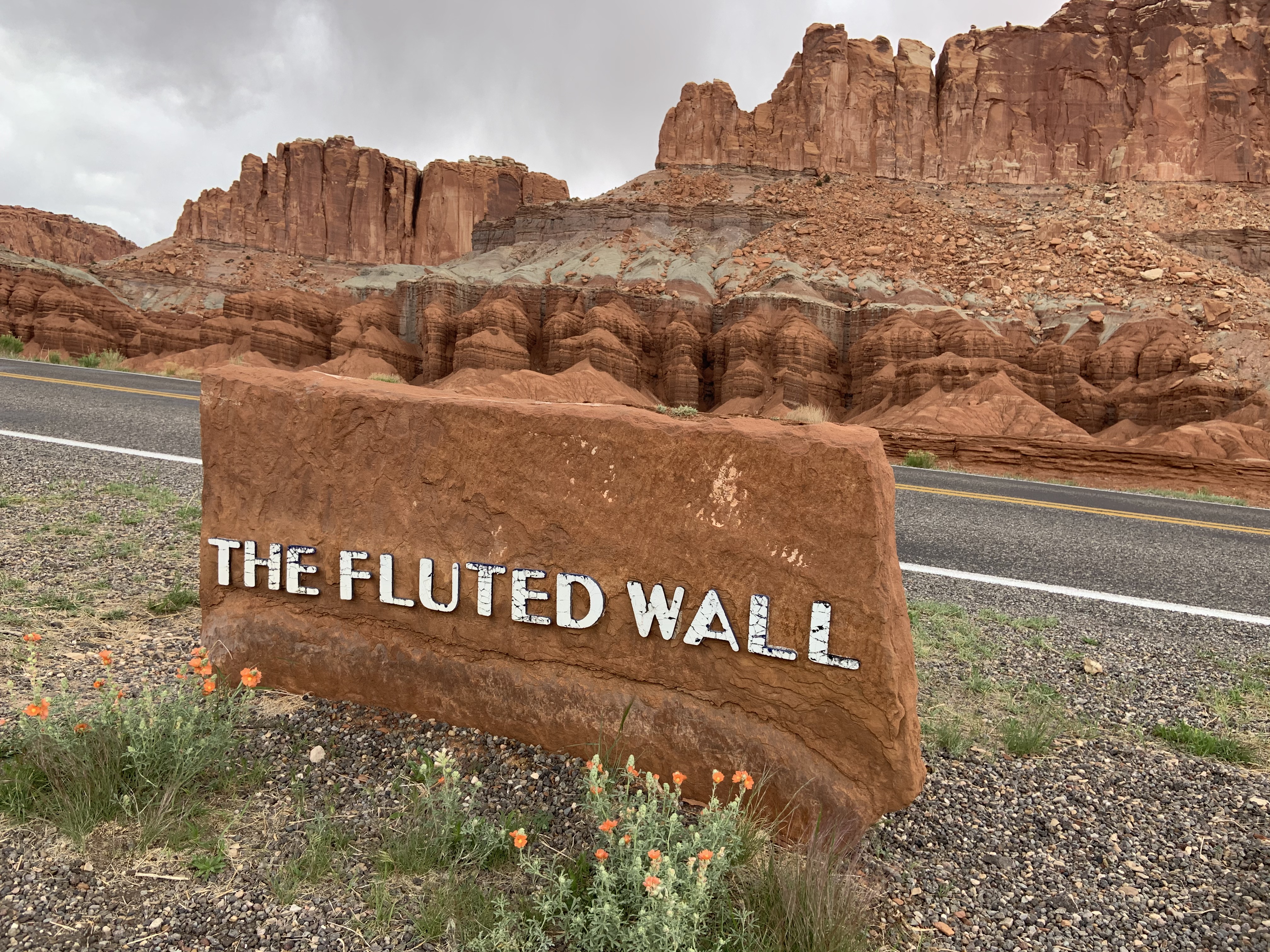
Fruita SchoolhouseVisit the Fruita Schoolhouse, and imagine what life was like for a pioneer child in this rural corner of Utah. 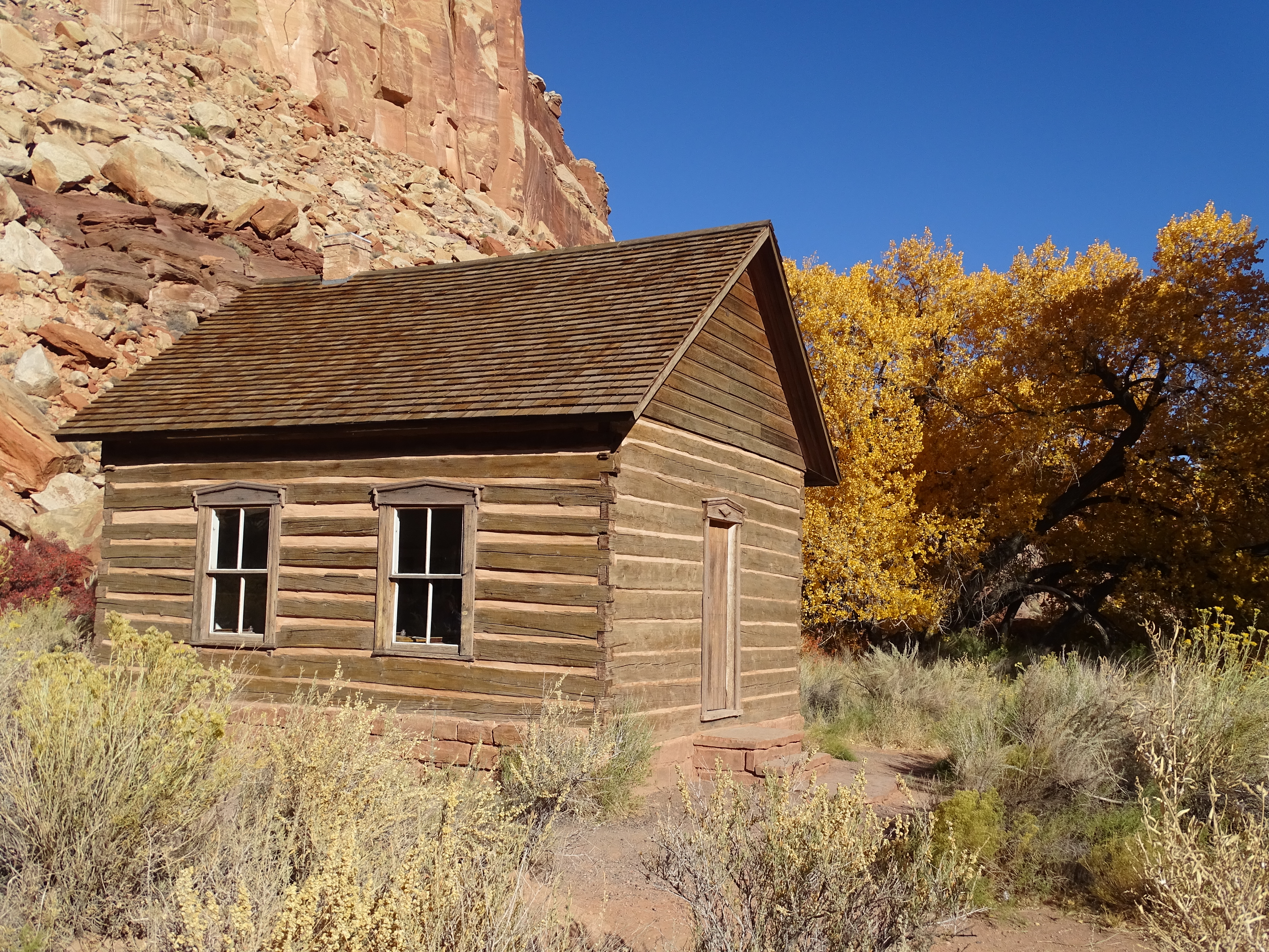
Gifford HouseThe Gifford House lies in the heart of the Fruita valley and depicts the typical spartan nature of rural Utah farm homes of the early 1900s. Today, the home is open seasonally, as a small sales outlet. 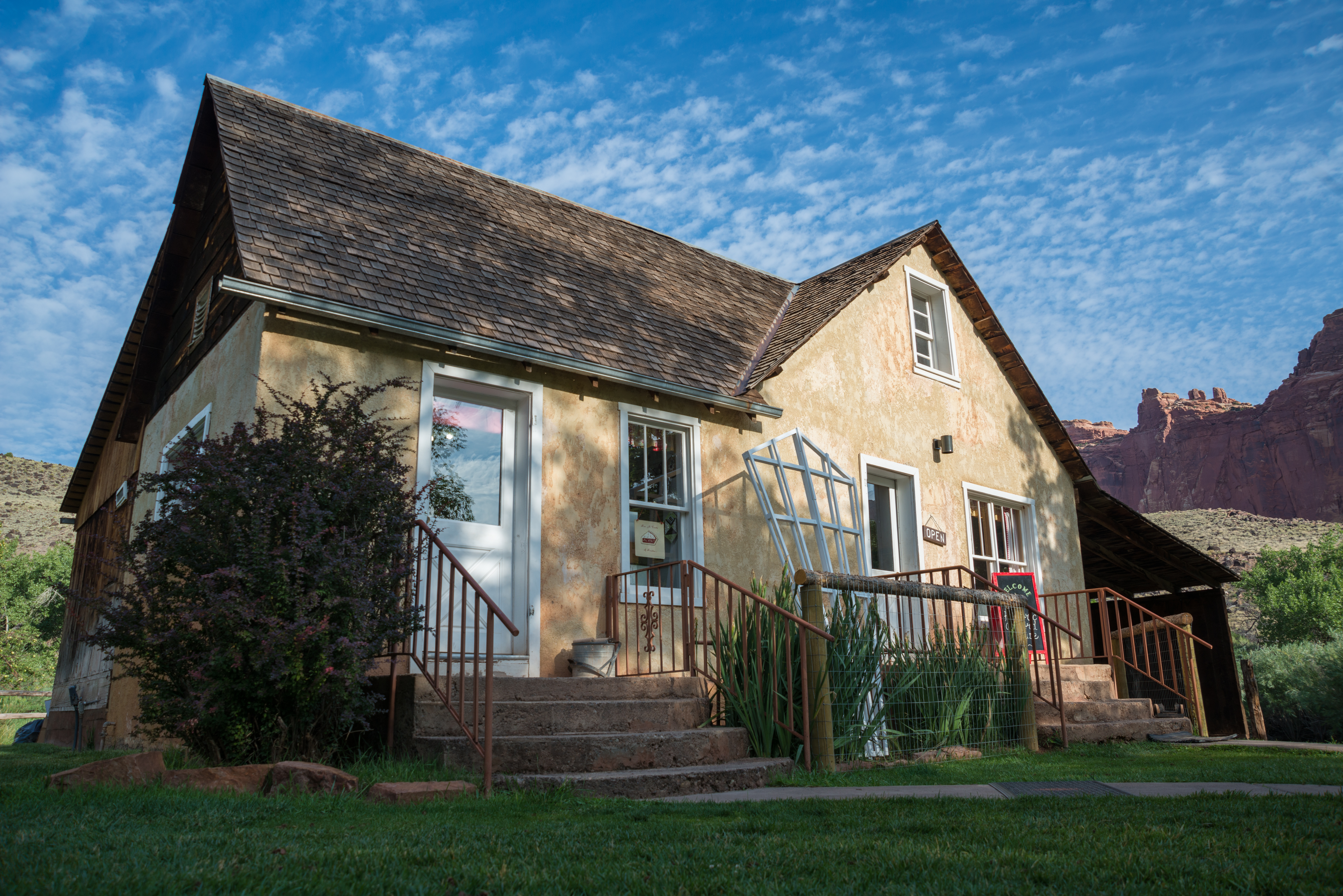
Gypsum SinkholeThe Gypsum Sinkhole is about 200 feet deep and was formed by water dissolving the gypsum, leaving a large cavity. The rock is very soft, stay back from the edge. 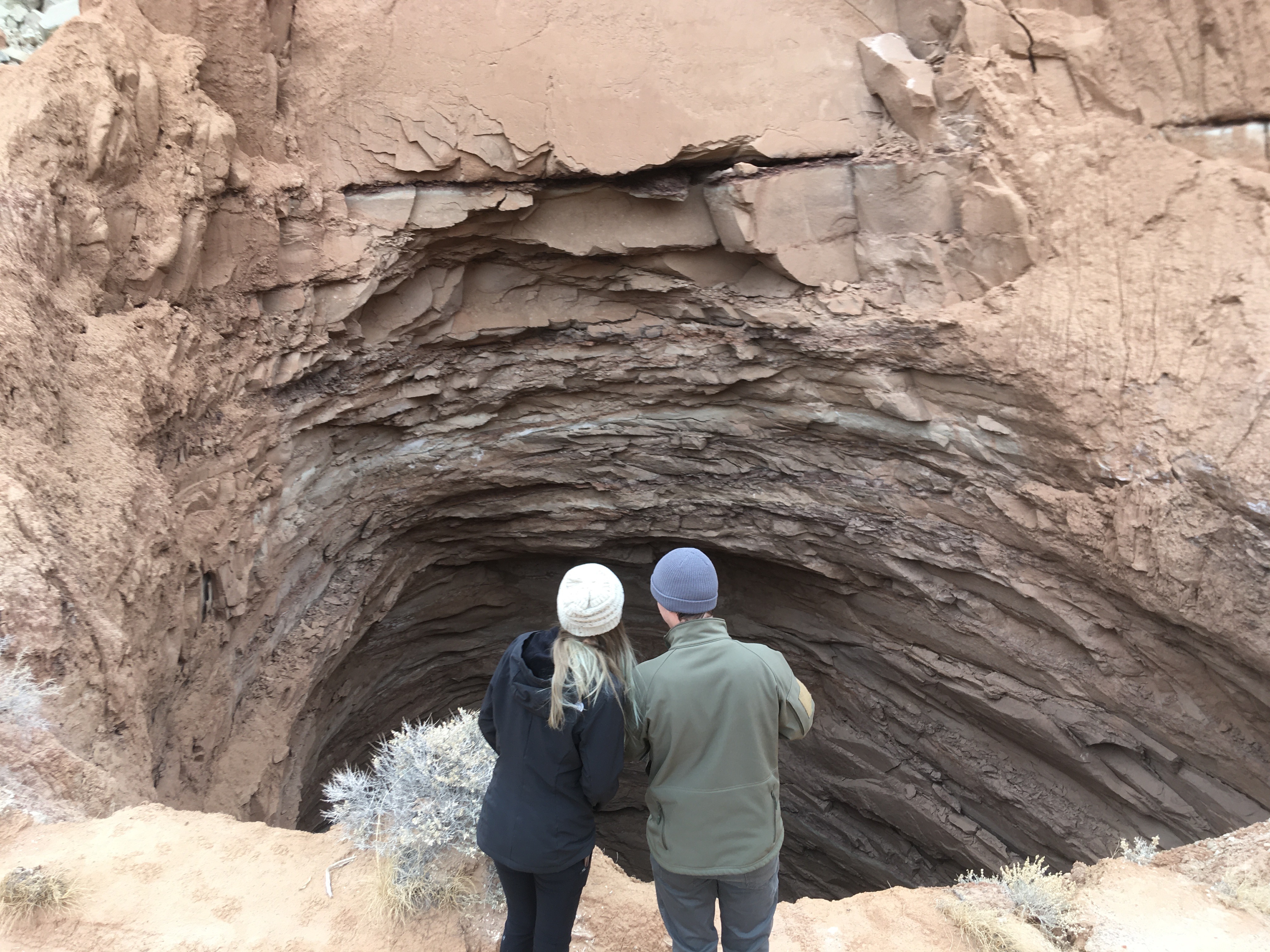
Jackson Orchard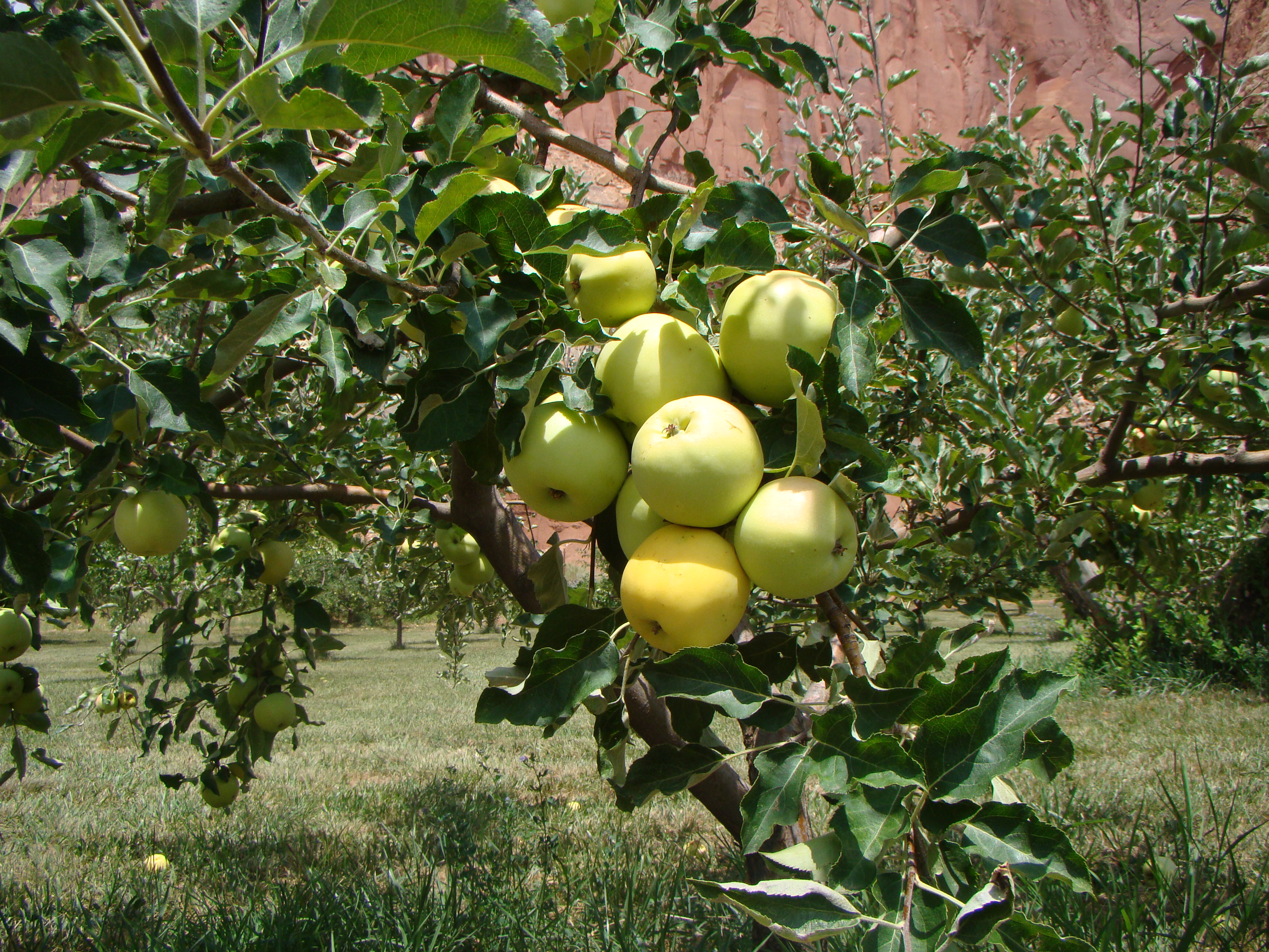
Lesley Morrell Line CabinThe Lesley Morrell Line Cabin provides a glimpse into the ranching past of Capitol Reef National Park. Access requires a high clearance vehicle. Check road conditions and weather before attempting. 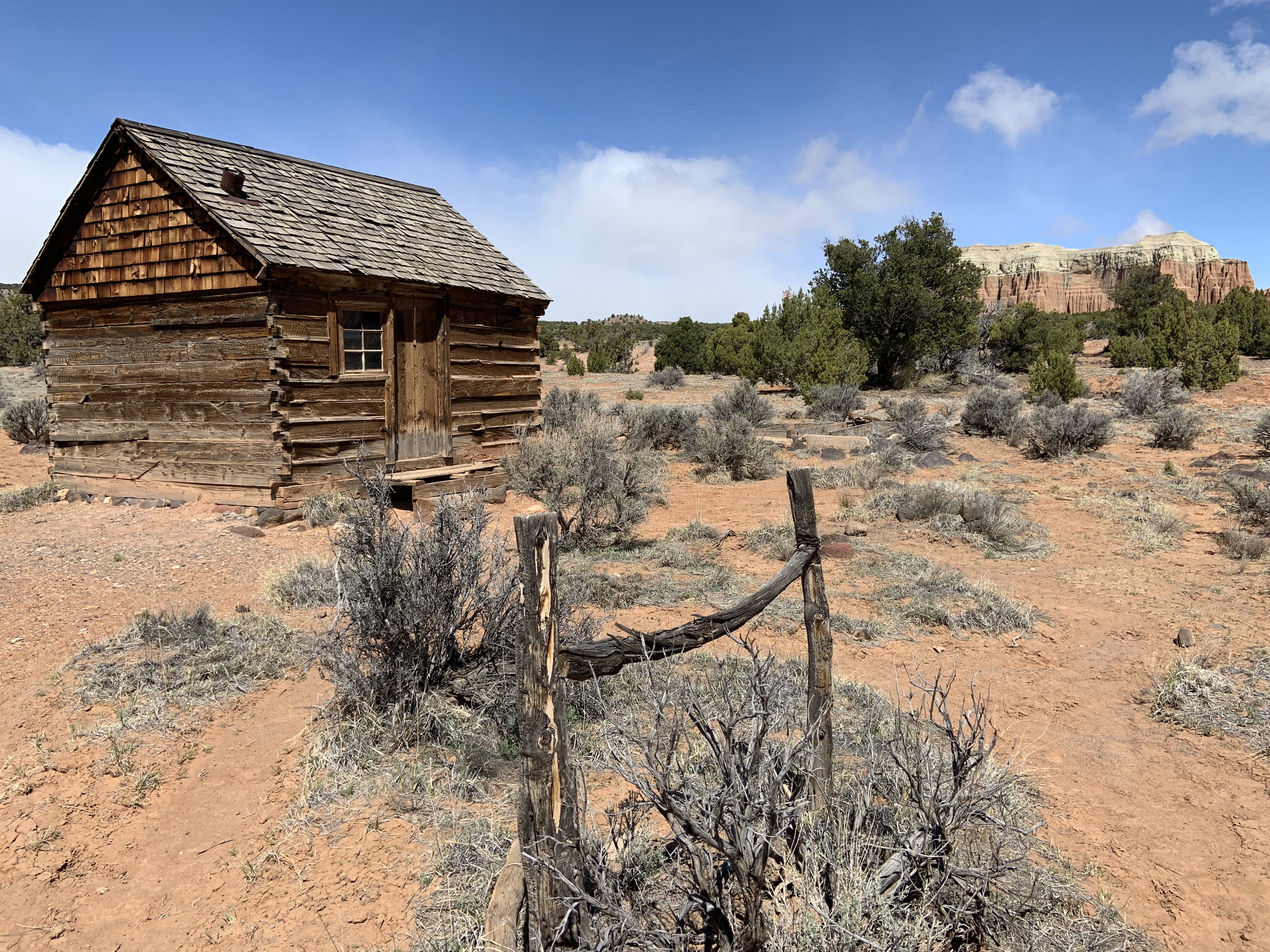
Lower Spring Canyon Trailhead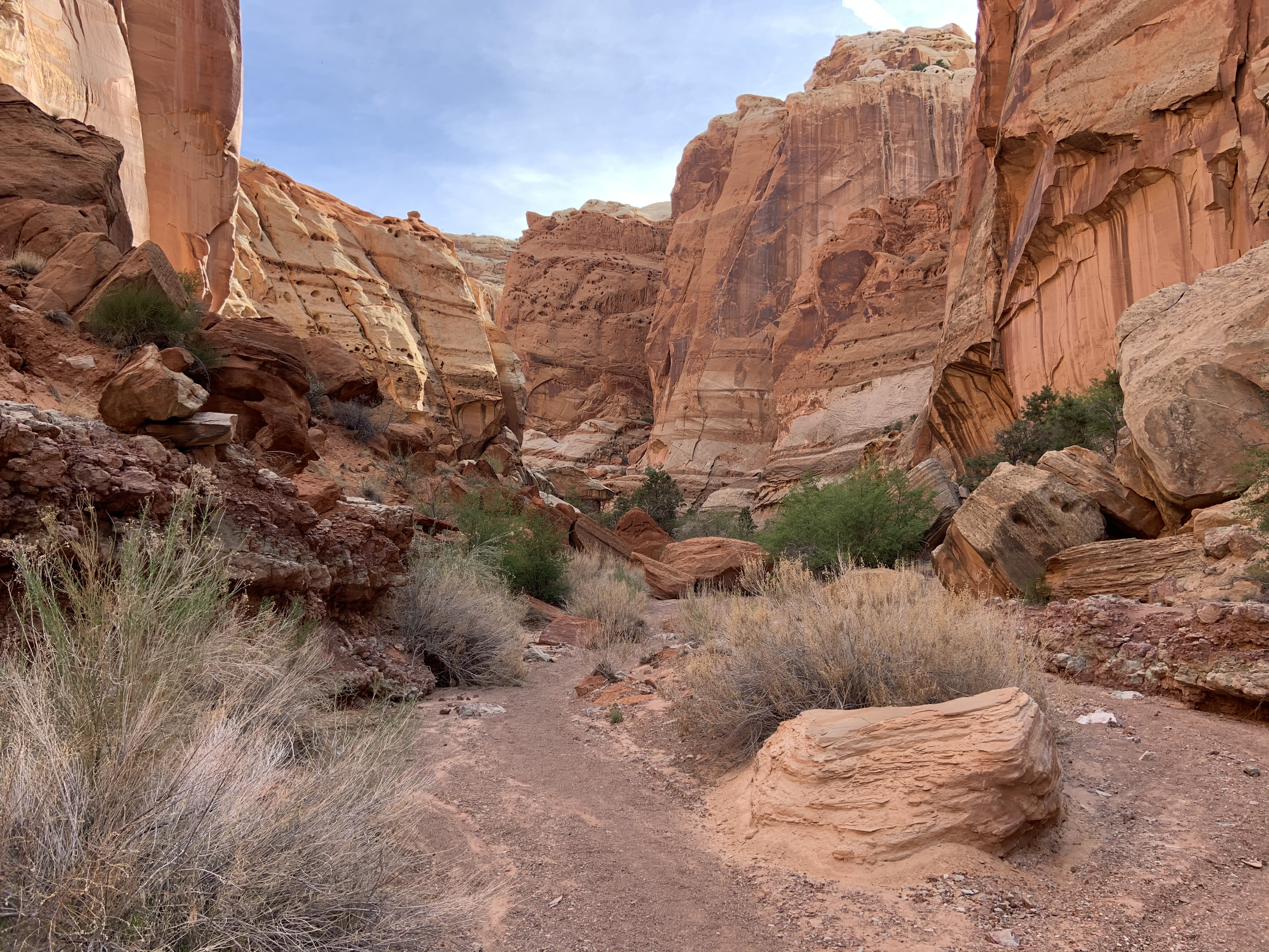
Max Krueger Orchard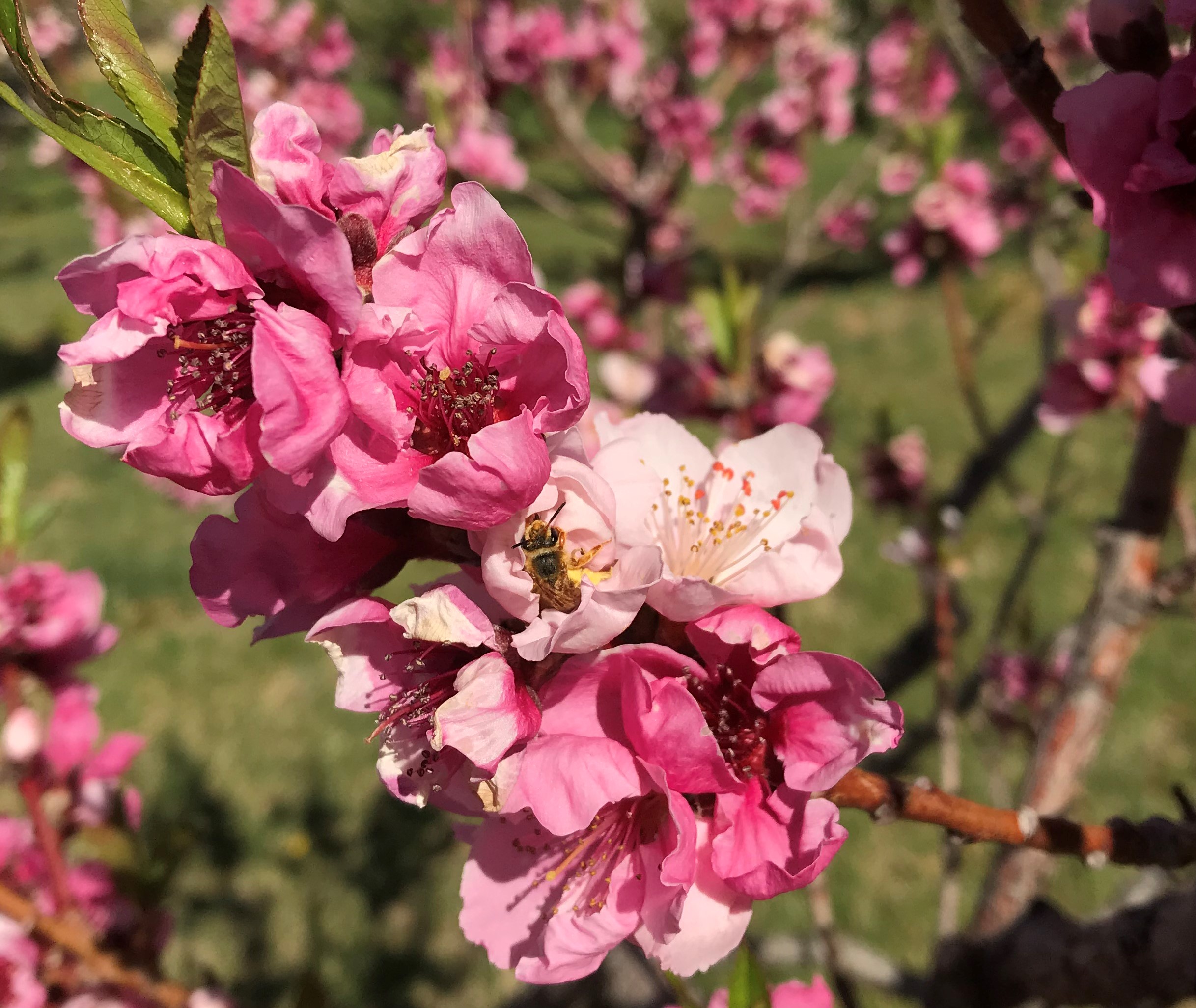
Merin Smith Implement ShedFruita resident Merin Smith built this shed in 1925 as a workshop, blacksmith shop, and garage. The objects in the shed illustrate what life would have been like in Fruita during that time period. 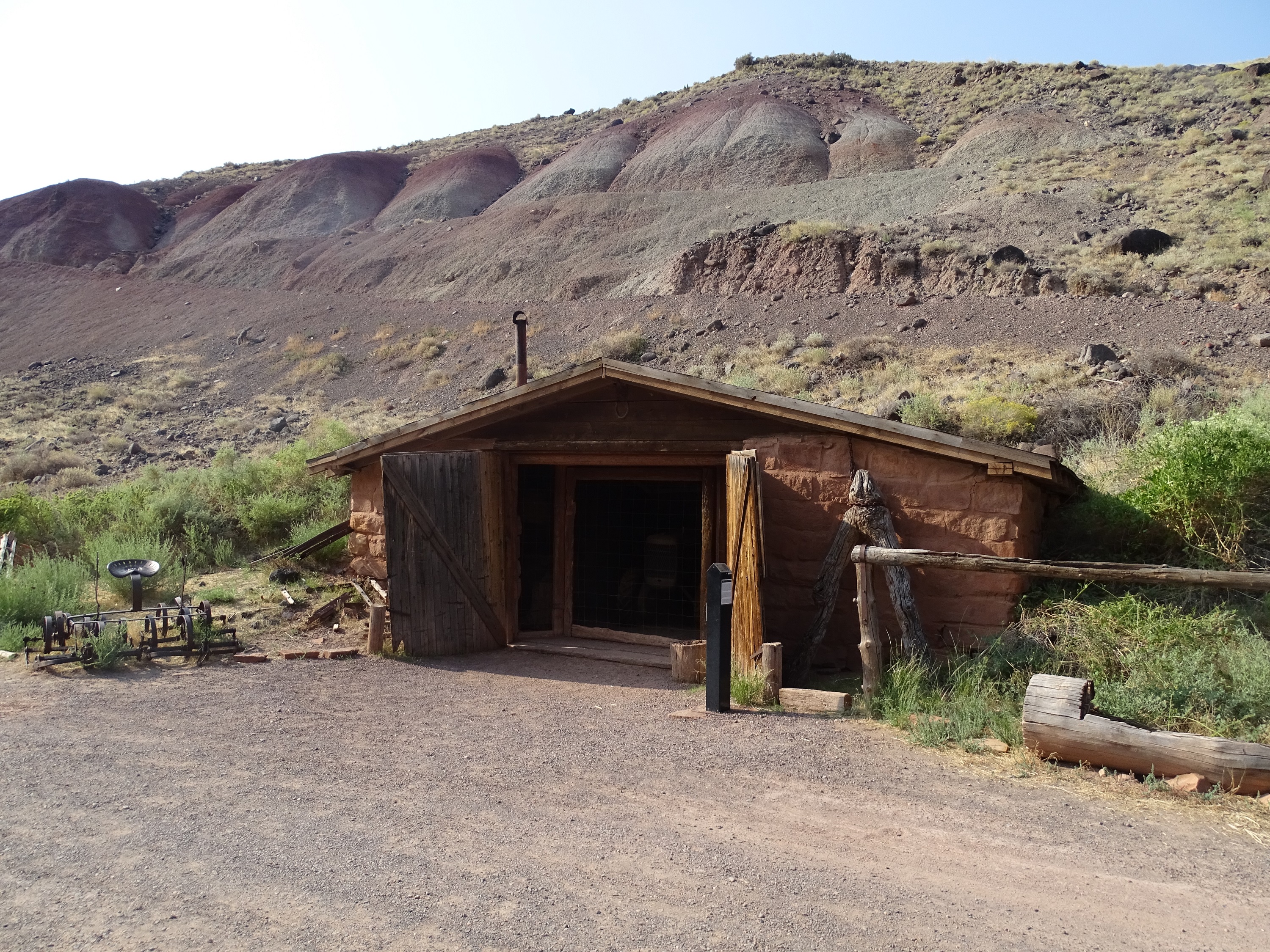
Mormon Pioneer National Heritage AreaThe Mormon Pioneer National Heritage Area preserves the natural, historical, and cultural heritage legacies and contributions of Mormon settlement in the West. The heritage area accomplishes this through community-led efforts to connect with the past by telling the Mormon pioneer story. 
Navajo Dome Viewpoint
Oxbow Waterfall
Panorama PointVisit Panorama Point to see sweeping vistas of red rock cliffs. 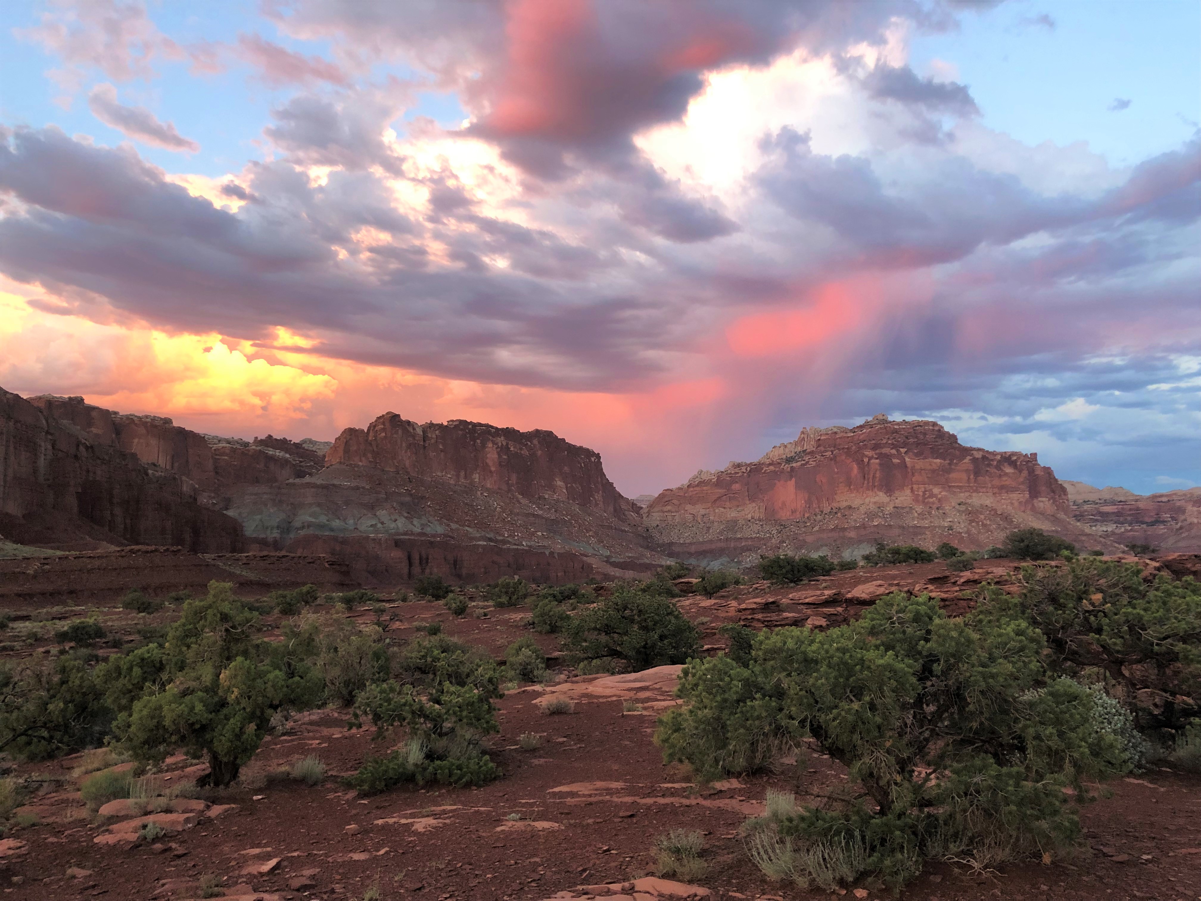
Petroglyph PanelView ancient rock markings carved by the Fremont Culture people who inhabited this area from 300-1300 Common Era (CE). 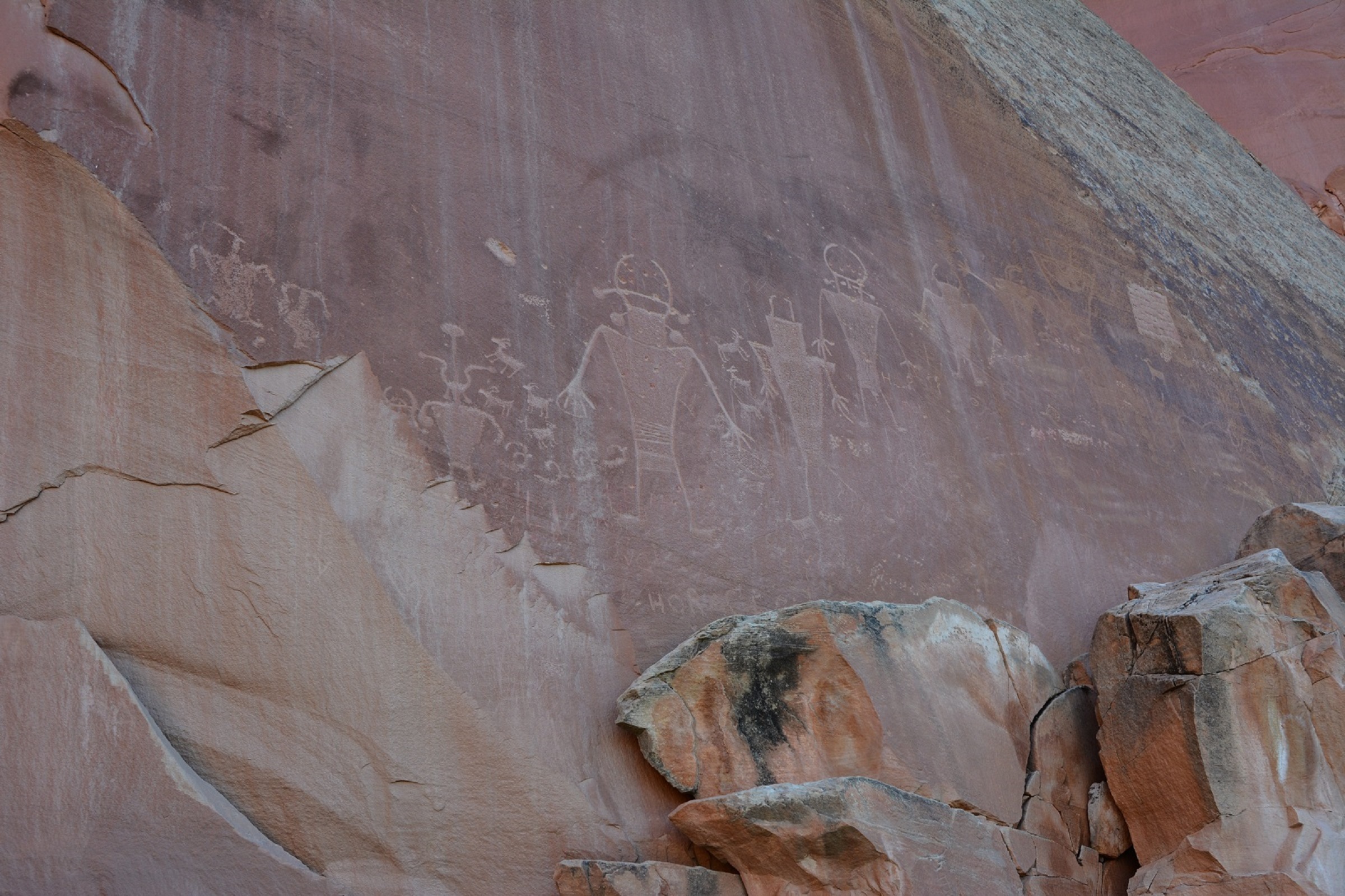
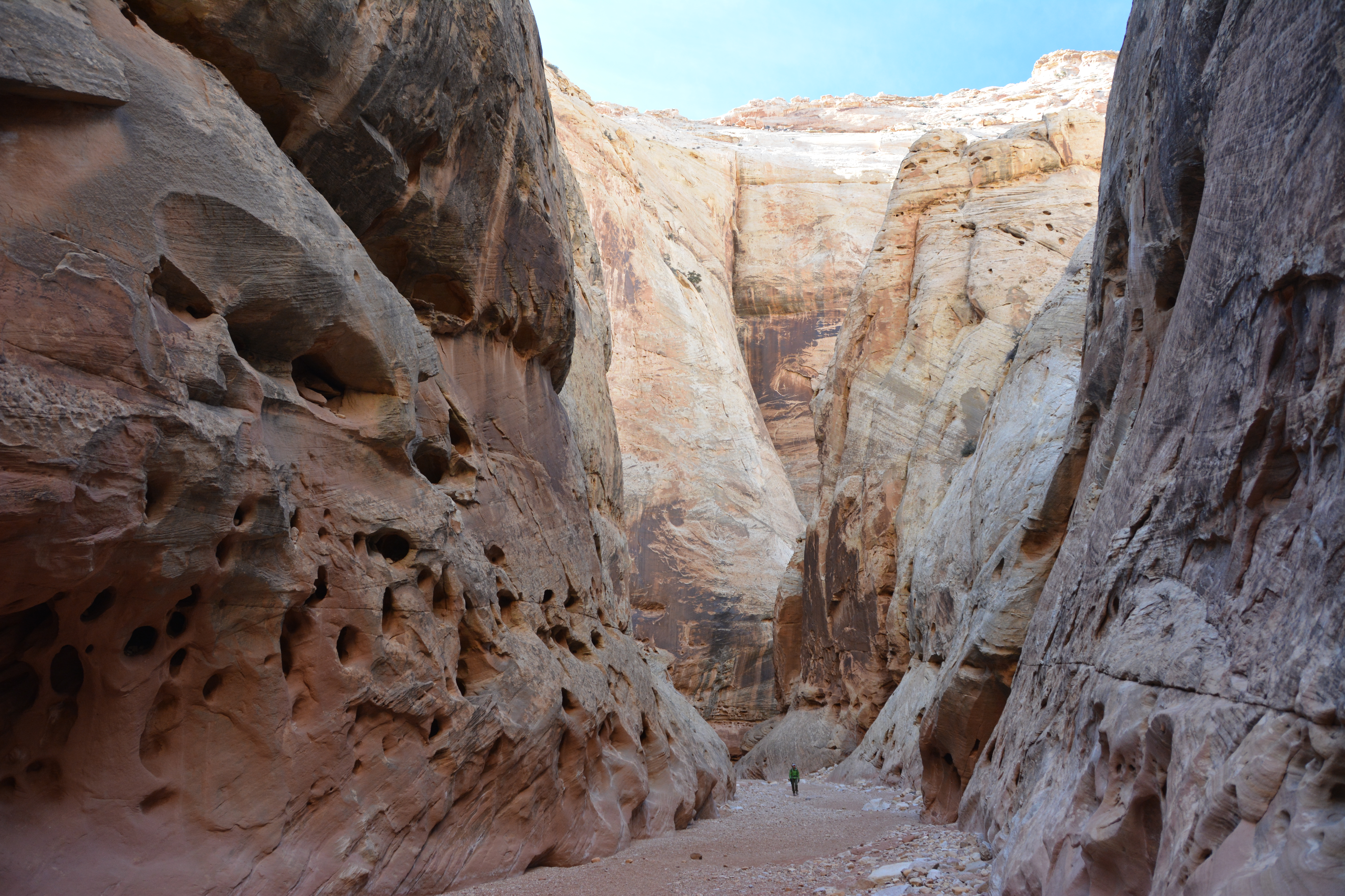
Pioneer RegisterTake a short hike in Capitol Gorge to see the historic Pioneer Register where early explorers and pioneers carved their names into the cliff wall. It is illegal to deface, vandalize, or add your own name to the Register. 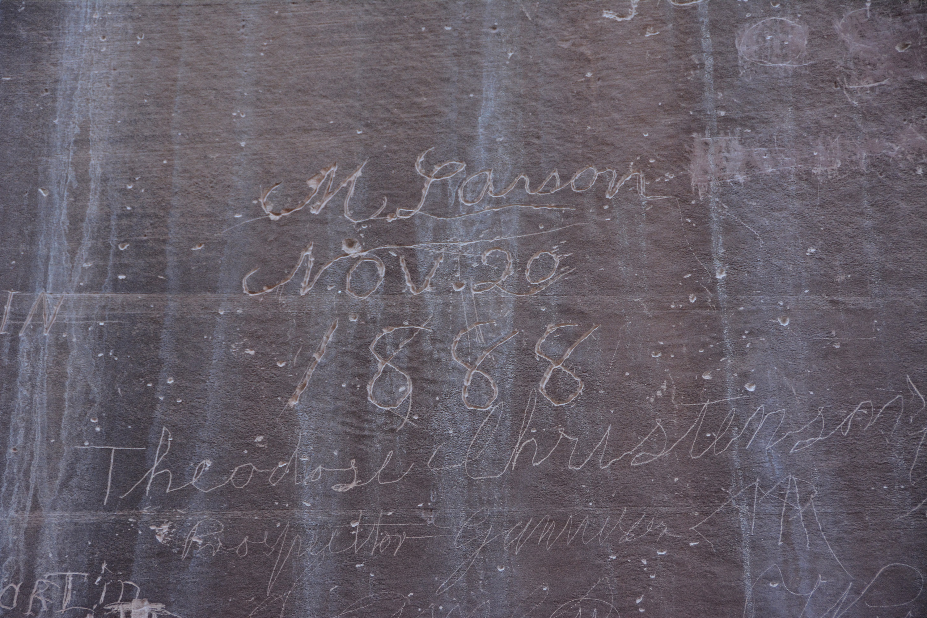
Scenic Drive Stop 1Capitol Reef’s sedimentary rock layers tell us stories from Earth’s ancient past. 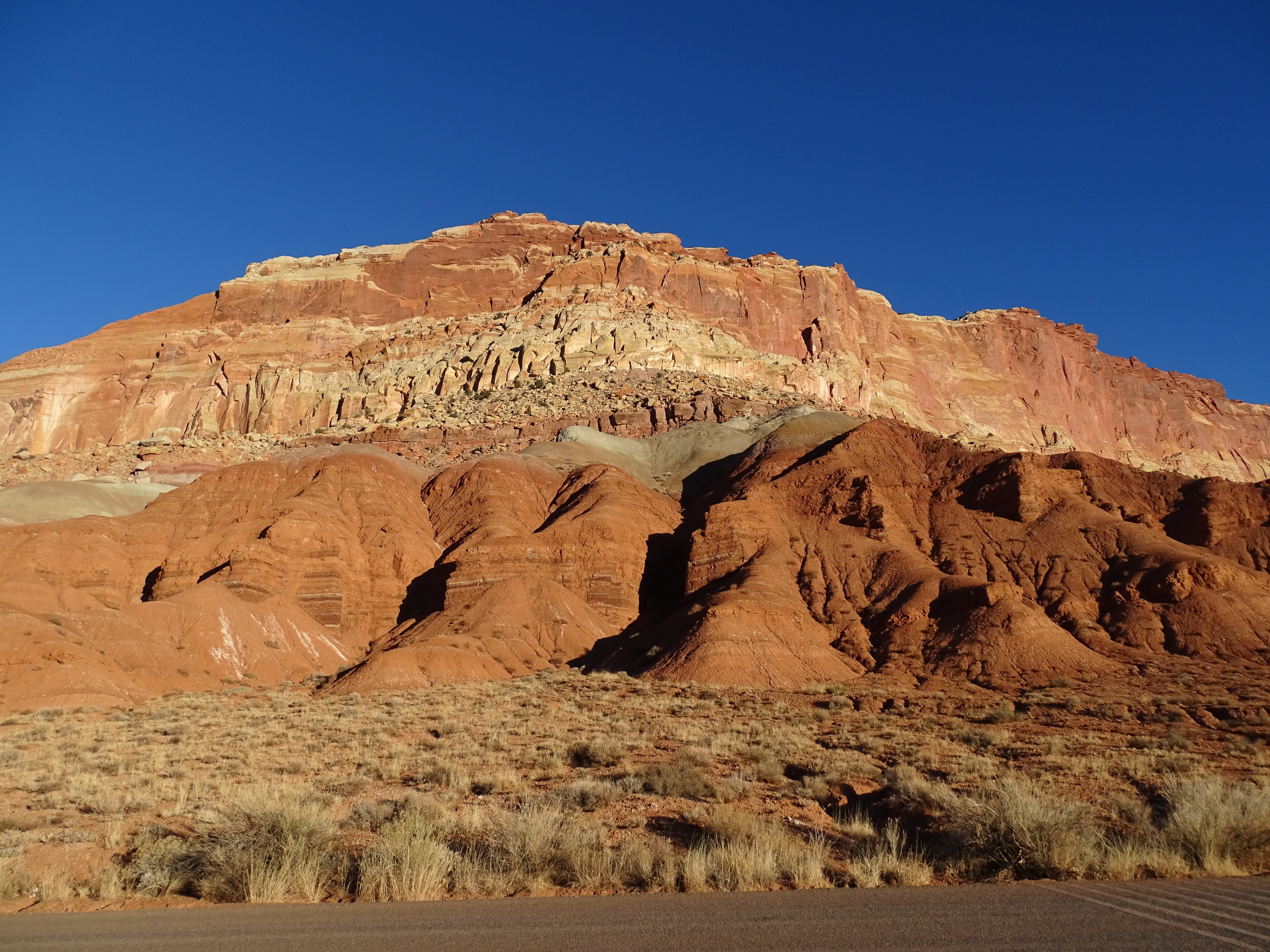
Scenic Drive Stop 10Why is it called “Capitol Reef?” 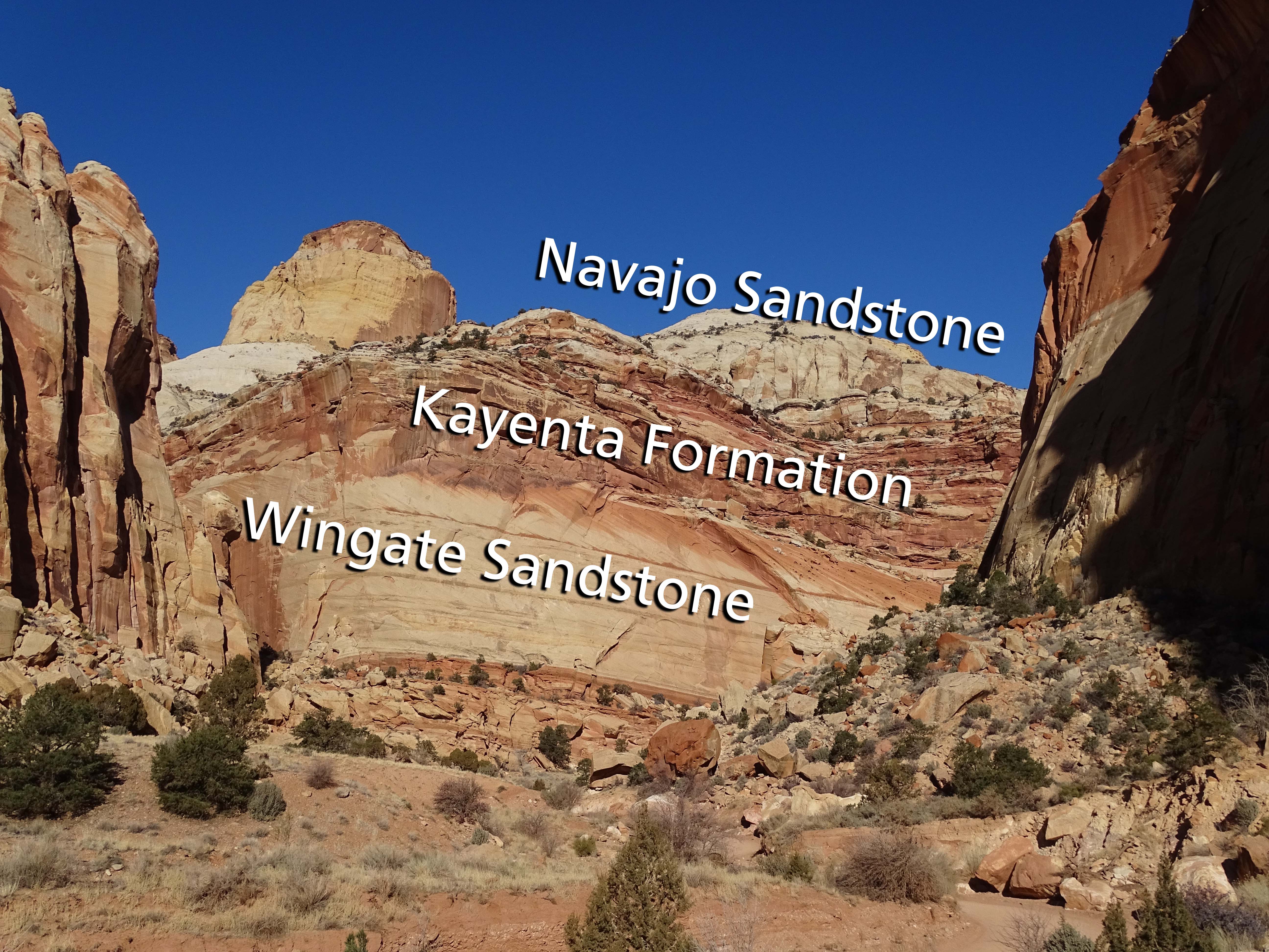
Scenic Drive Stop 11The Capitol Gorge trail features natural pools of water and markings from early pioneers and travelers. 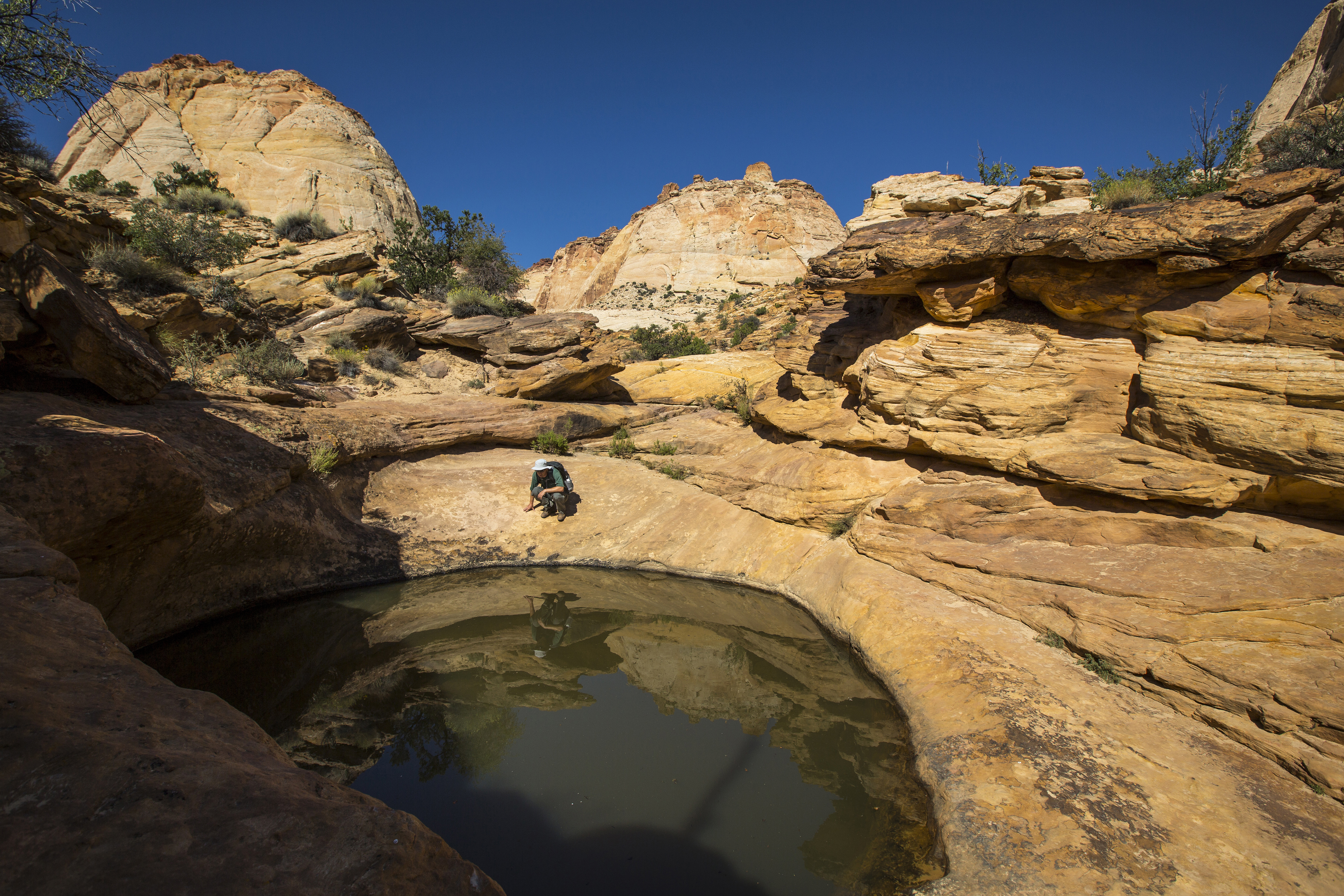
Scenic Drive Stop 2What is the Waterpocket Fold? The tilted cliffs along the Scenic Drive are part of this massive wrinkle in the Earth’s crust. 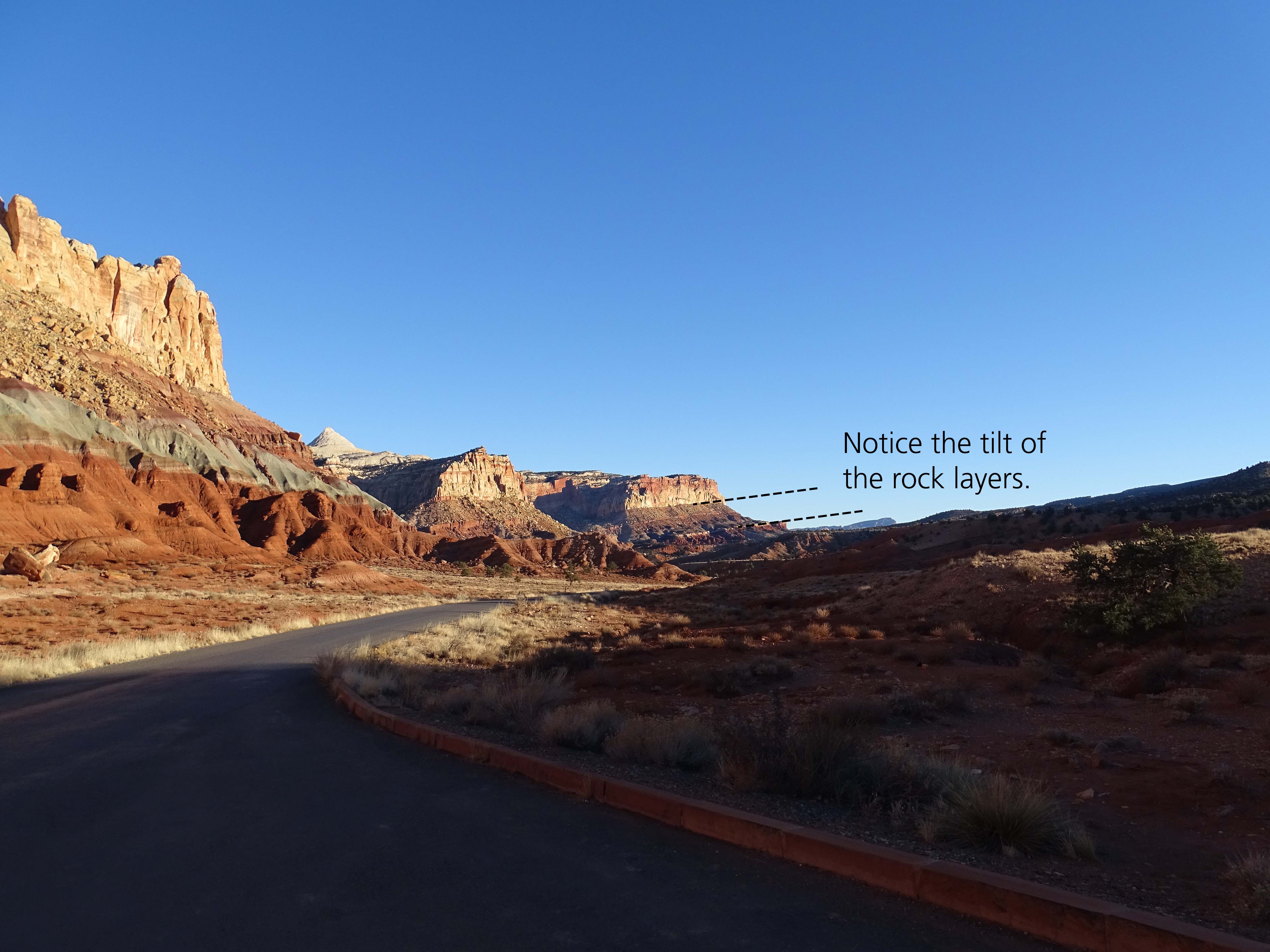
Scenic Drive Stop 3Ancient environments determine today’s rock types and colors. 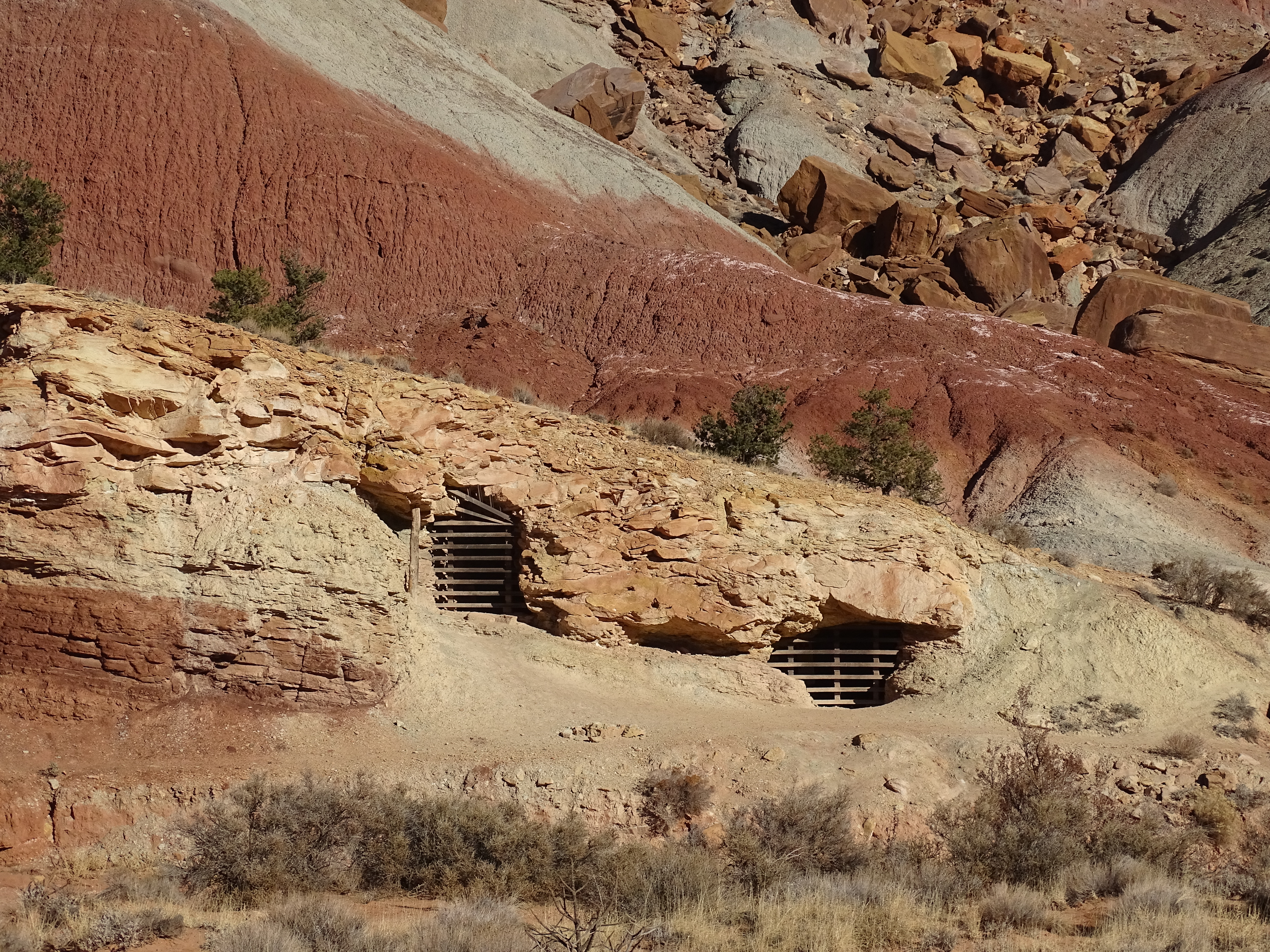
Scenic Drive Stop 4Erosion changes the landscape, from small holes in the cliff, to huge natural arches. 
Scenic Drive Stop 5What are those long black streaks striping the cliff walls? 
Scenic Drive Stop 6Juniper trees showcase dark, twisting bark and light blue berries. 
Scenic Drive Stop 7Summer monsoon season brings heavy rain and flash flooding to Capitol Reef. The torrents of water can be spectacularly beautiful, but also deadly. 
Scenic Drive Stop 8The incredible, edible pinyon pine helps many species survive in a harsh desert environment. 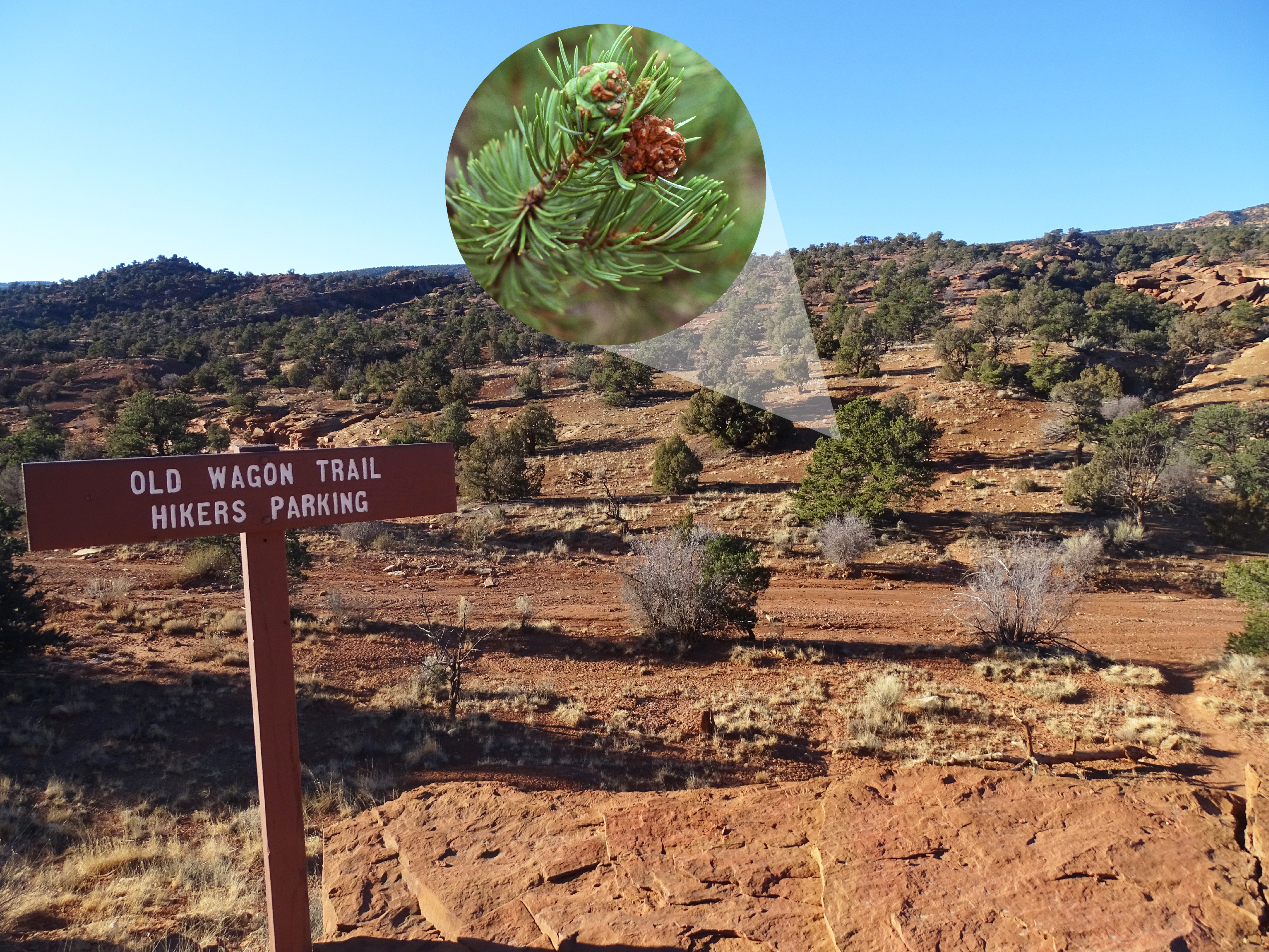
Scenic Drive Stop 9Desert bighorn sheep are often spotted in Capitol Gorge along narrow cliff ledges. 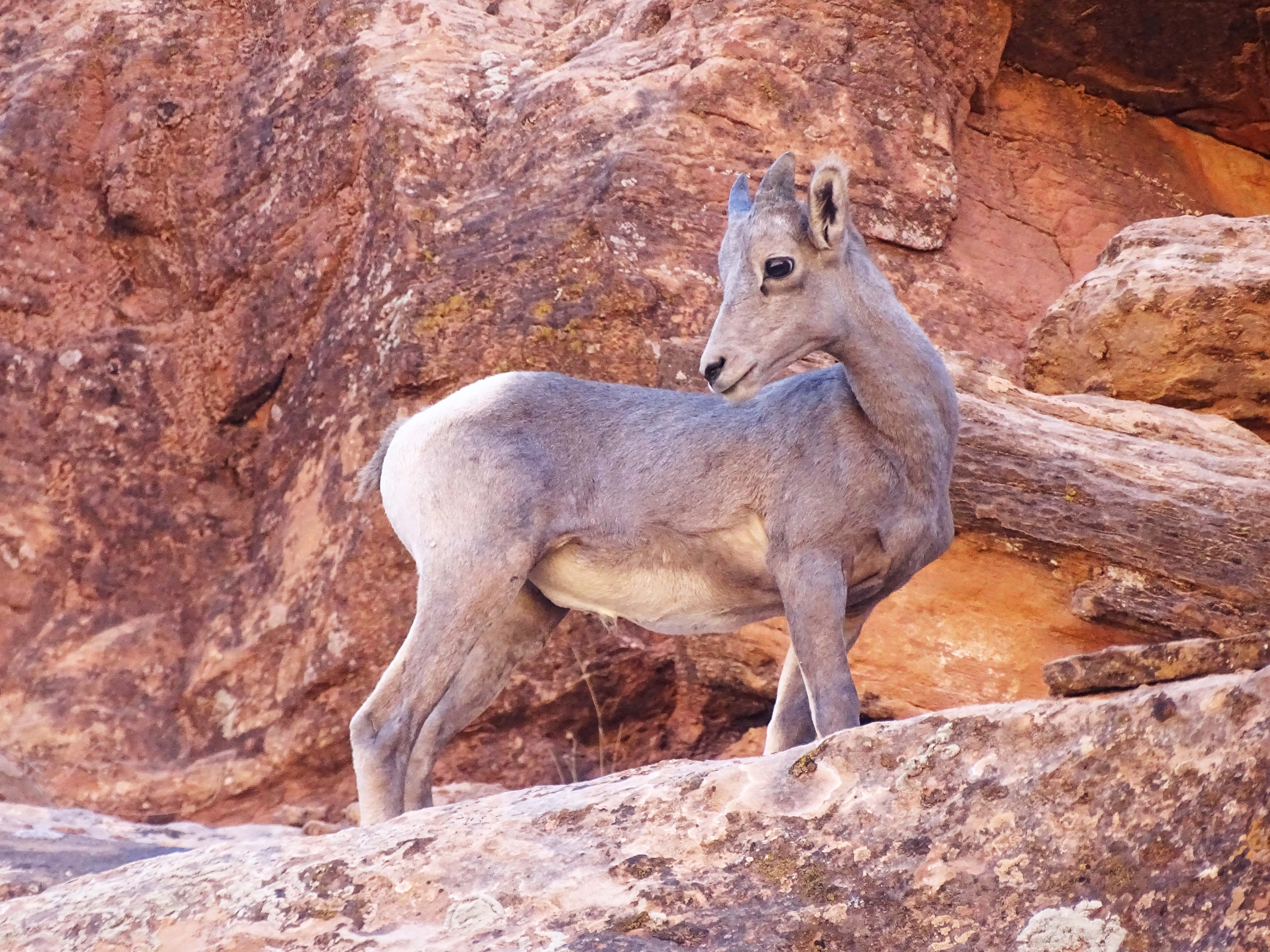
Sulphur Creek Trailhead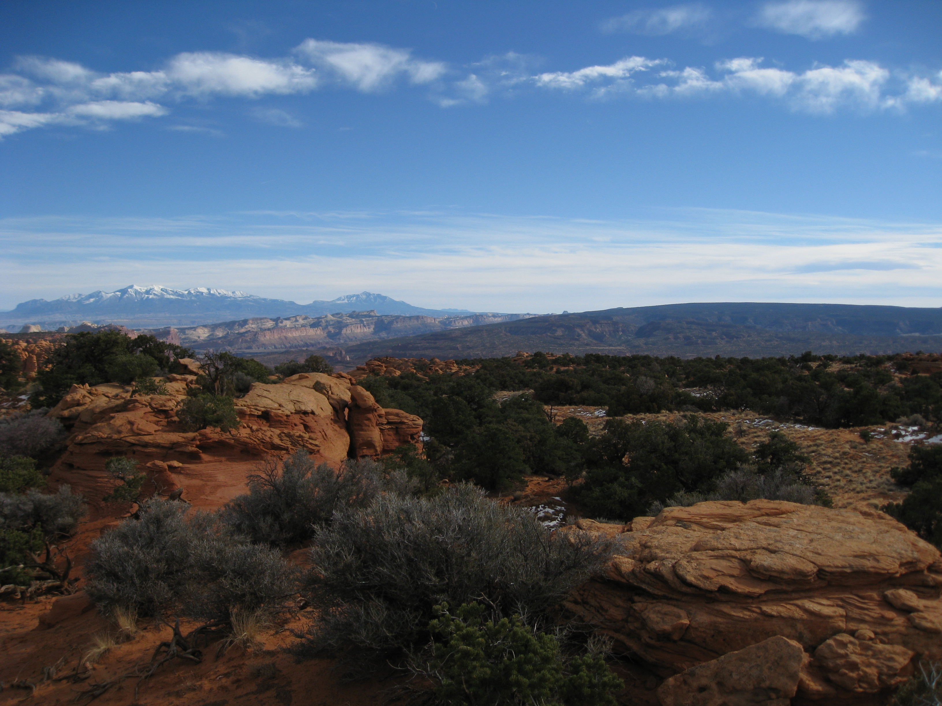
Temple of the Sun and Temple of the MoonThe Temples of the Sun and Moon in Cathedral Valley are large monoliths of Entrada Sandstone. High clearance 4-wheel drive is usually necessary to access them, and sometimes the roads in Cathedral Valley are impassable. 
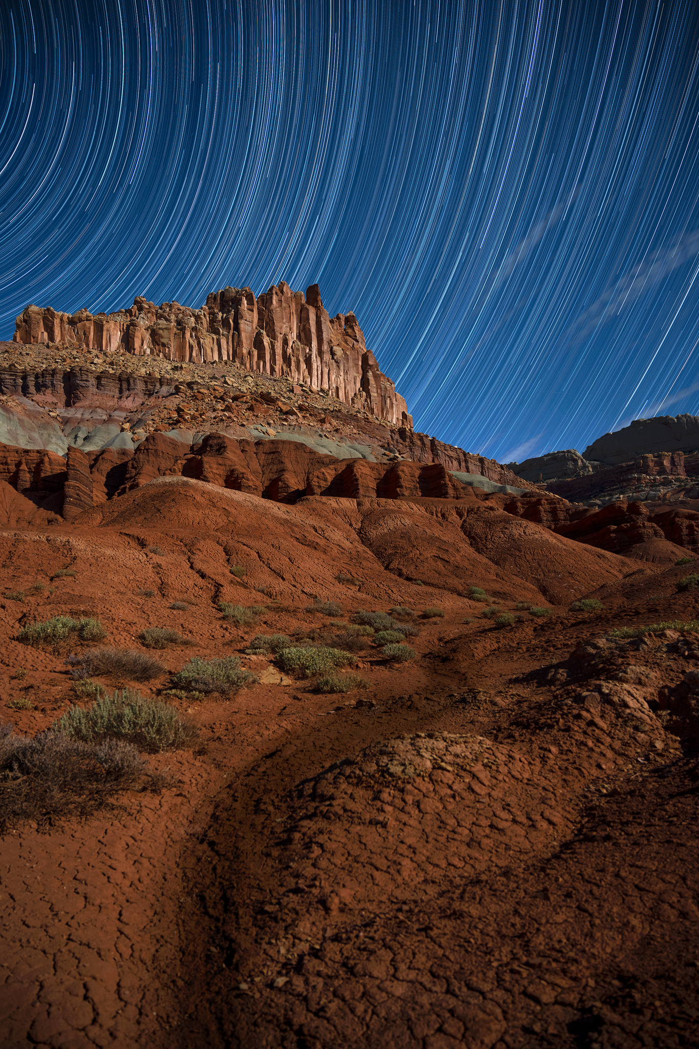
The Castle Viewpoint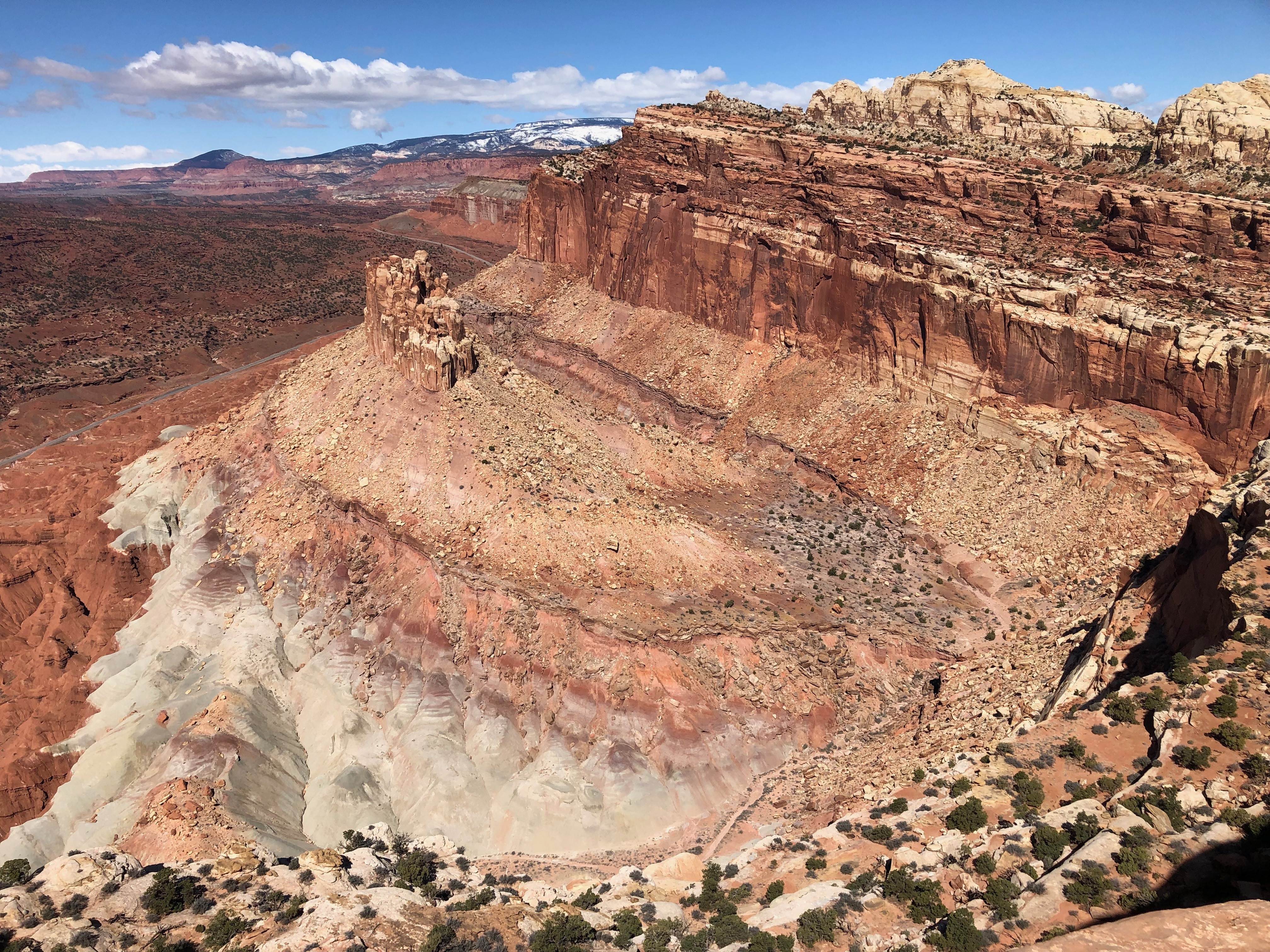
Twin Rocks Viewpoint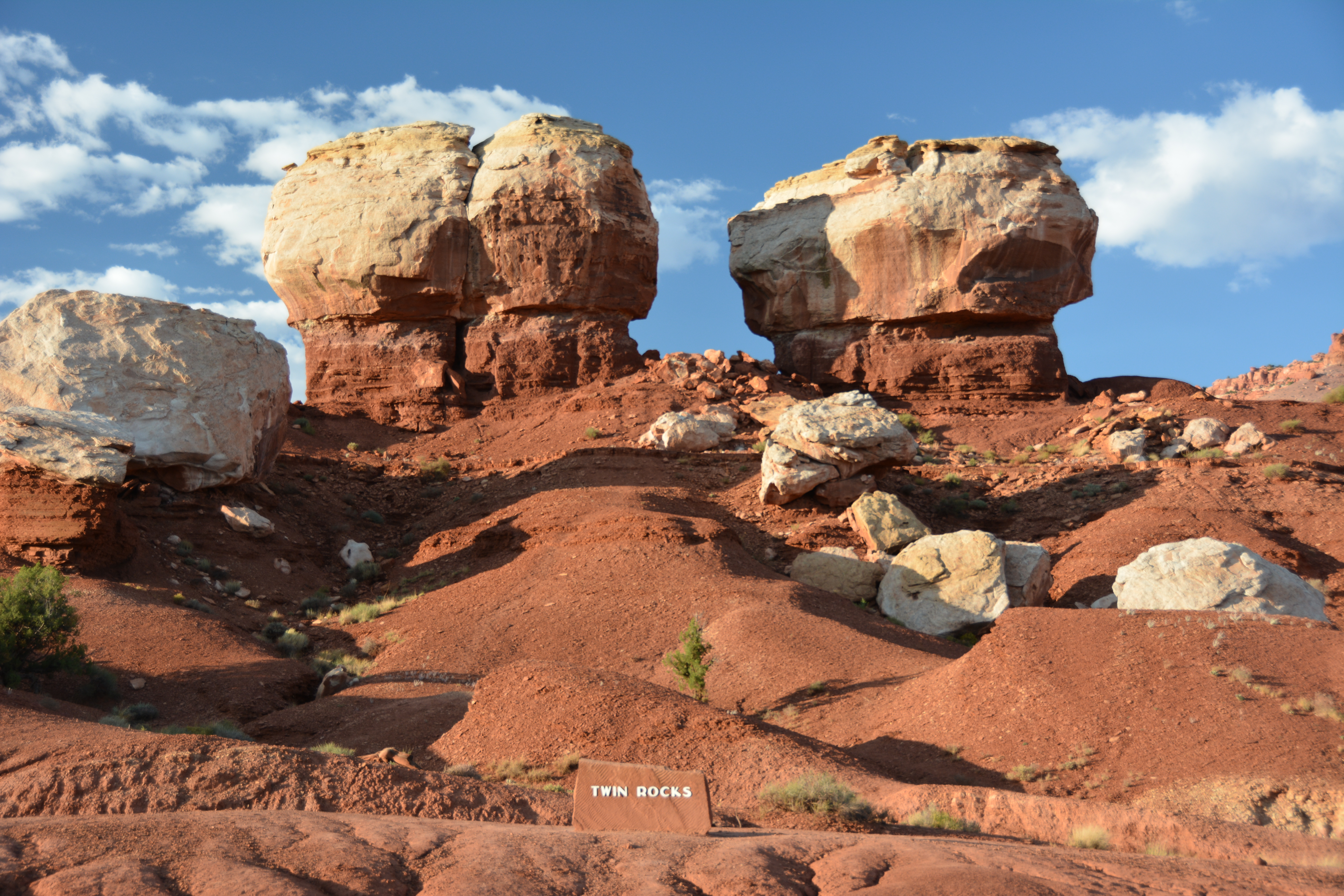
Waterpocket DistrictThe Waterpocket District of Capitol Reef is rugged and remote. Road conditions vary, a high clearance vehicle is usually needed. Check at the visitor center, or call 435-425-3791 for road conditions. 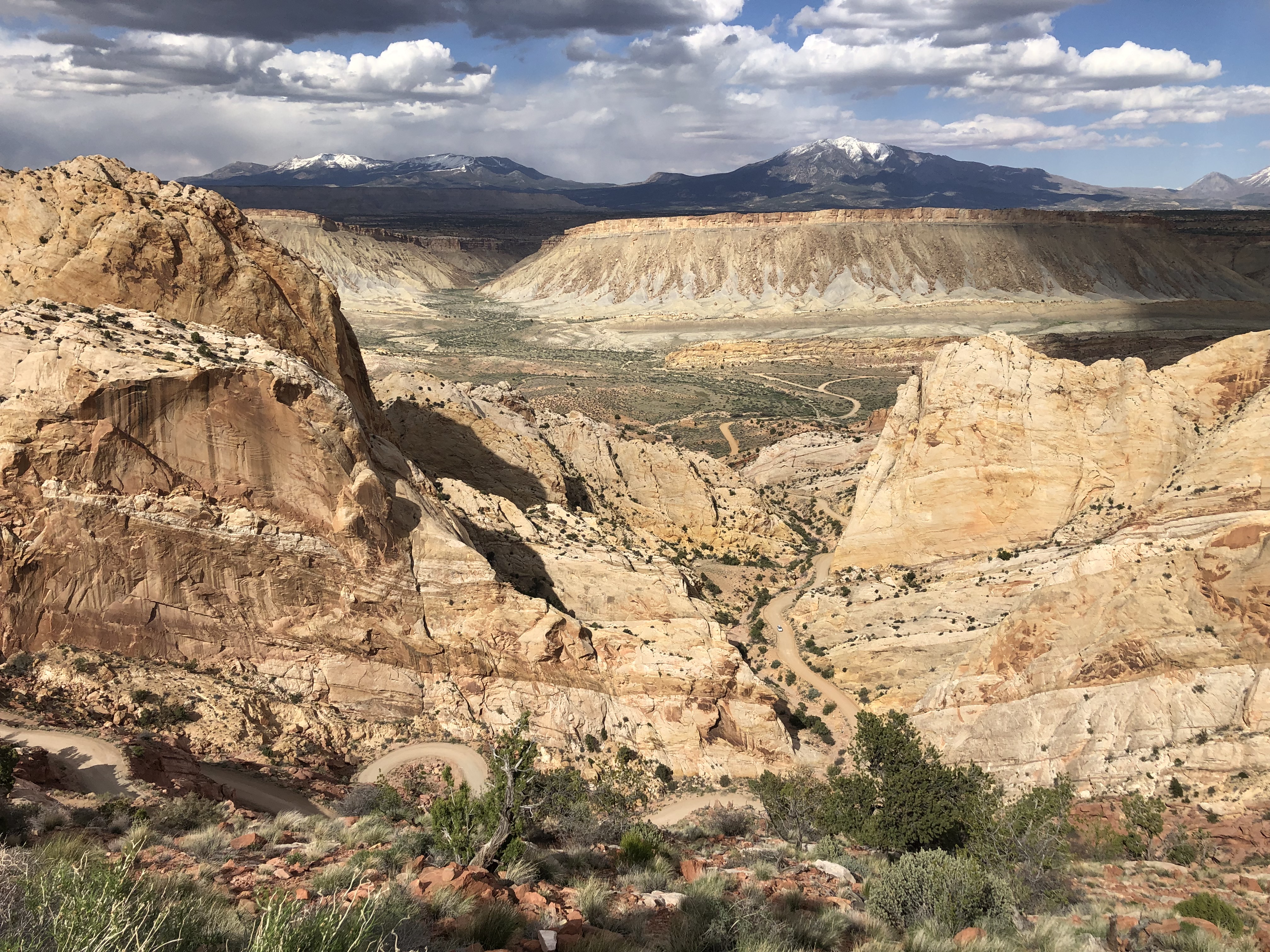
|
| Visitor Centers | Count: 1
Capitol Reef National Park Visitor Center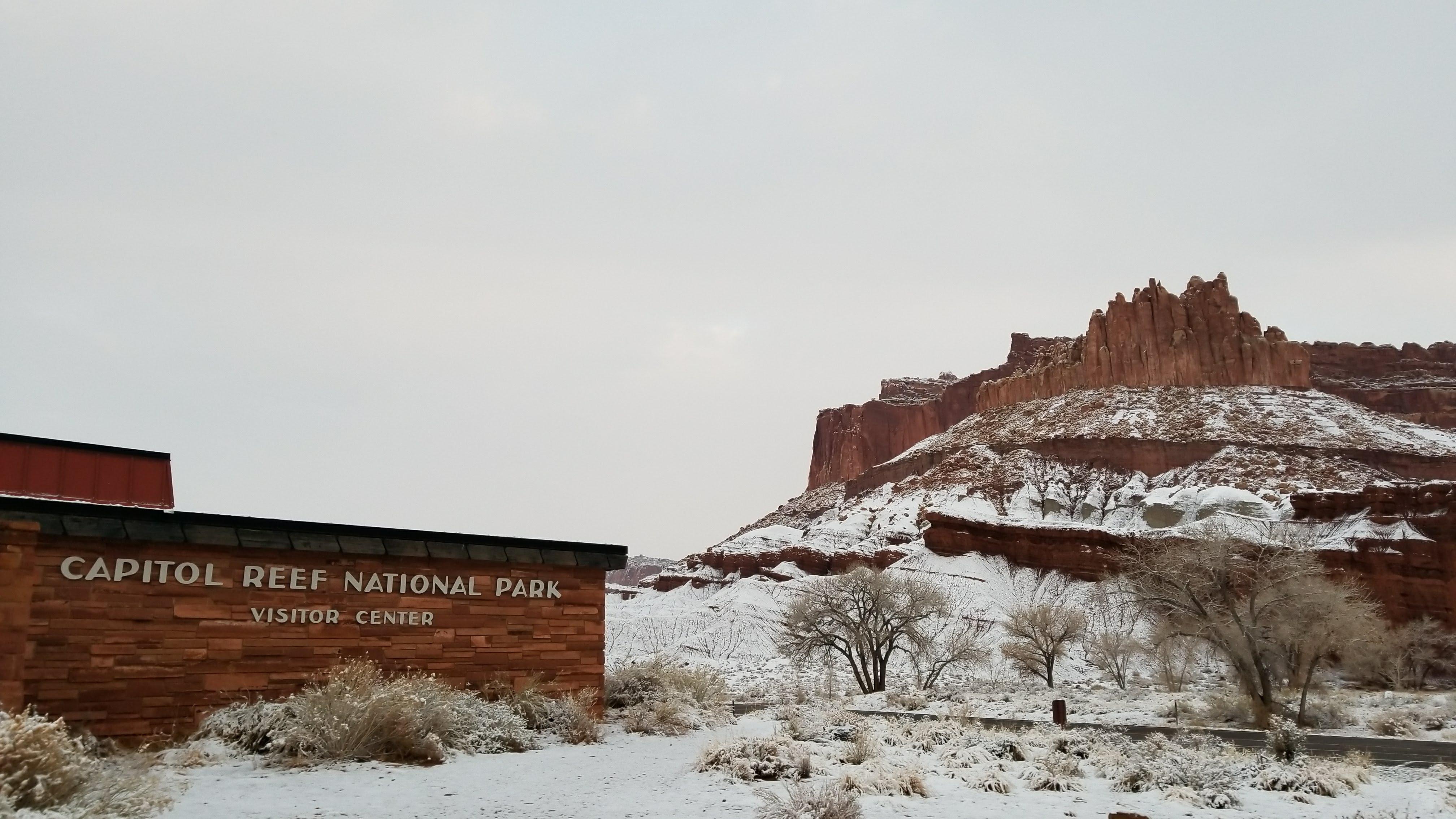
|
| Things to do | Count: 10
|
| Tours |
Count: 3
Scenic Drive TourThe Scenic Drive is an 8-mile (13 km) paved road. Allot 2 hours roundtrip to drive the Scenic Drive and the two dirt spur roads that lead into deep canyons, Grand Wash and Capitol Gorge. These dirt spur roads are usually suitable for passenger vehicles and small RVs up to 27 feet in length. Roads may close due to snow, ice, and flash flooding. An entrance fee is charged for the Scenic Drive. Pay at the self-pay station at Stop 1 or purchase a pass for all federal lands at the visitor center. Utah Highway 24 Tour – EastboundUtah State Route 24 is the main driving route in Capitol Reef National Park, crossing the park for 15 mi (24 km) from west boundary to east boundary. It passes through the Fruita Historic District, where Scenic Drive branches off to the south. You will experience 280 million years of Earth history written in the rocks as the road cuts through a cross section of the Waterpocket Fold. The wide range of landscapes supports diverse ecosystems and has served as a home to human cultures for millennia. Utah Highway 24 Tour – WestboundUtah State Route 24 is the main driving route in Capitol Reef National Park, crossing the park for 15 mi (24 km) from west boundary to east boundary. It passes through the Fruita Historic District, where Scenic Drive branches off to the south. You will experience 280 million years of Earth history written in the rocks as the road cuts through a cross section of the Waterpocket Fold. The wide range of landscapes supports diverse ecosystems and has served as a home to human cultures for millennia. |
| Articles |
|