Be advised that the NPS has issued alerts for this park.
Bonita Canyon Campground Restroom Construction
The restrooms at the campground will be closed for construction from 8/1/25 to 10/1/25. Portable toilets and a handwashing station will be available in the campground. Restrooms with running water are available at the Visitor Center and Faraway Ranch.
Vehicle Length & Trailer Restrictions
No large vehicle turnaround after Faraway Ranch Parking (1 mile after entrance). Vehicles over 29 feet park at Faraway. Disconnect trailers at Faraway. Trailers with campground reservations proceed to camp. Scenic drive = 24 ft limit and no trailers.
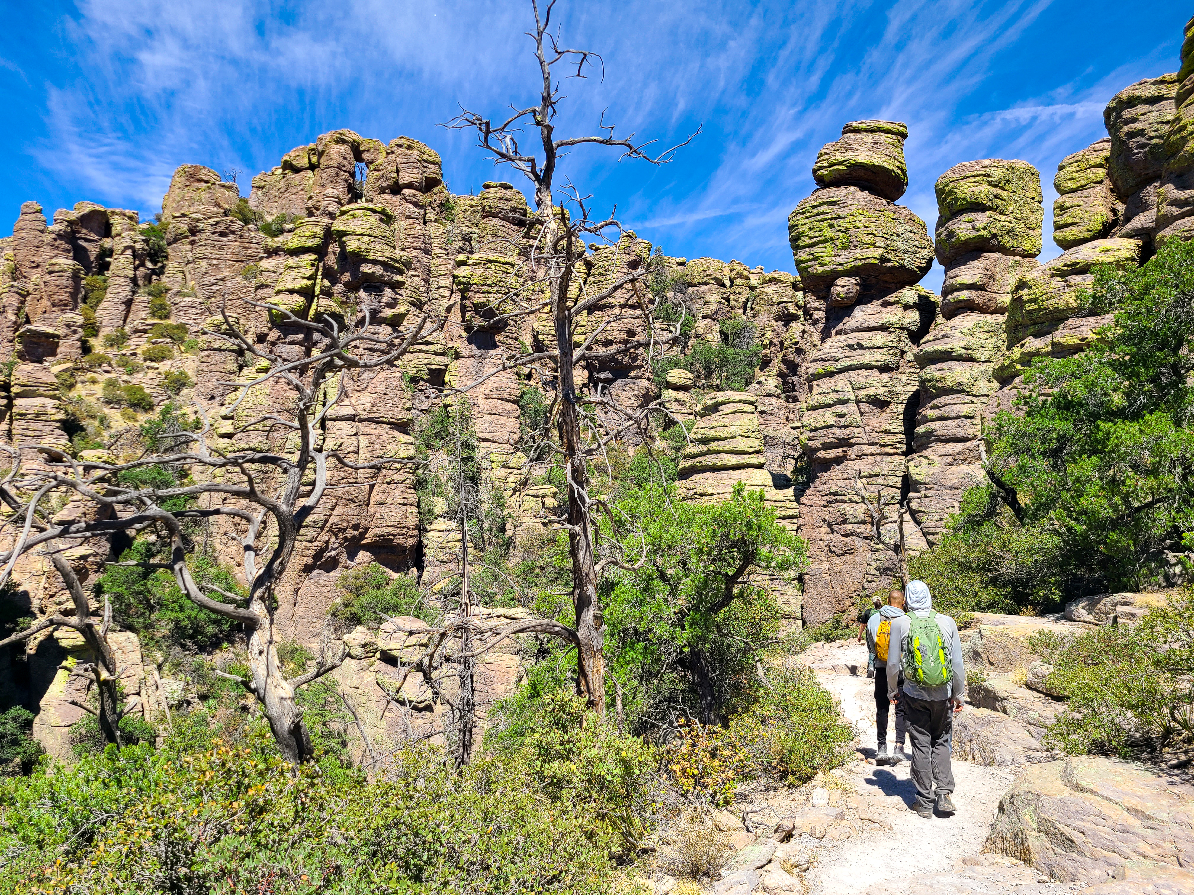
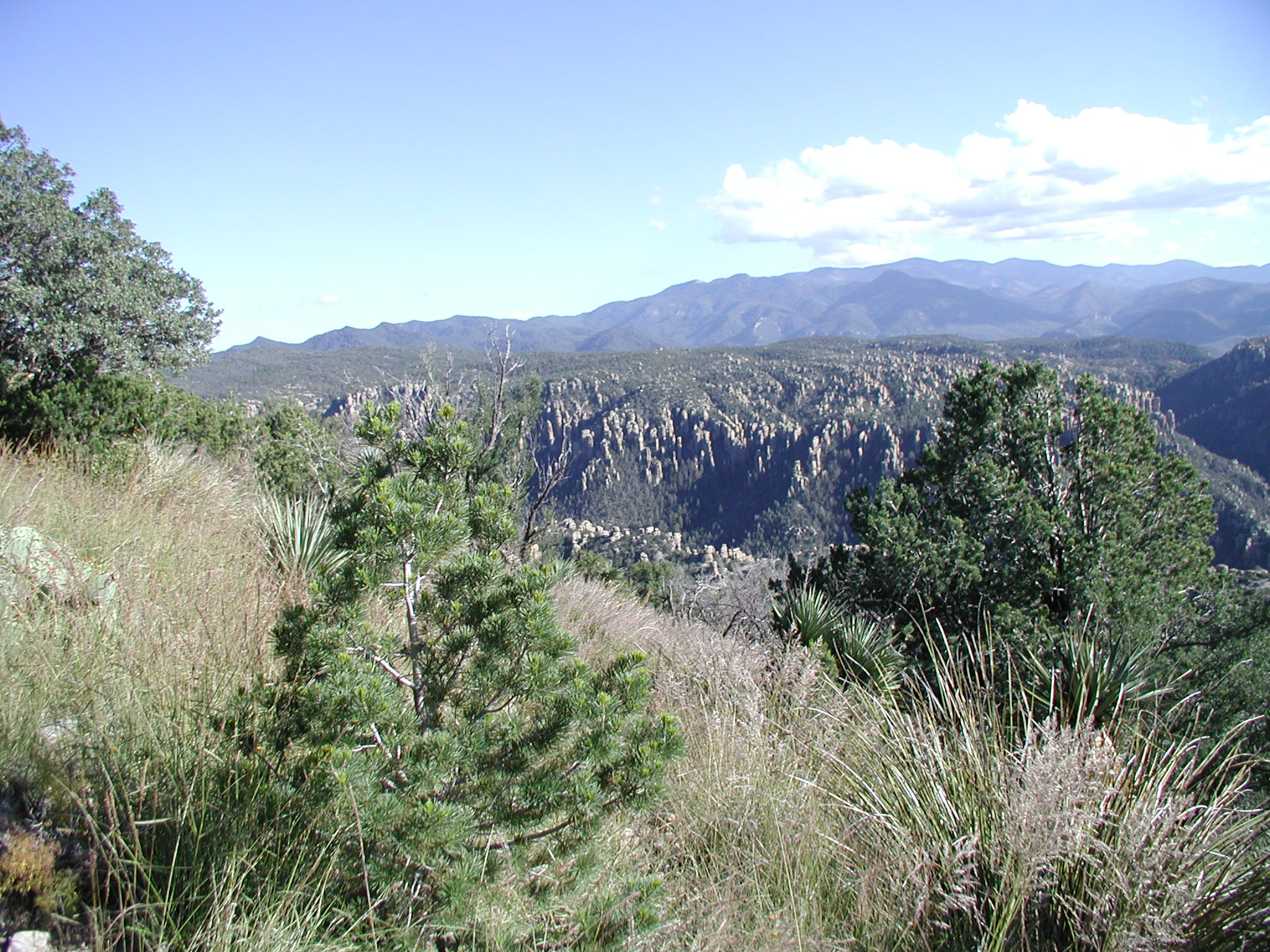
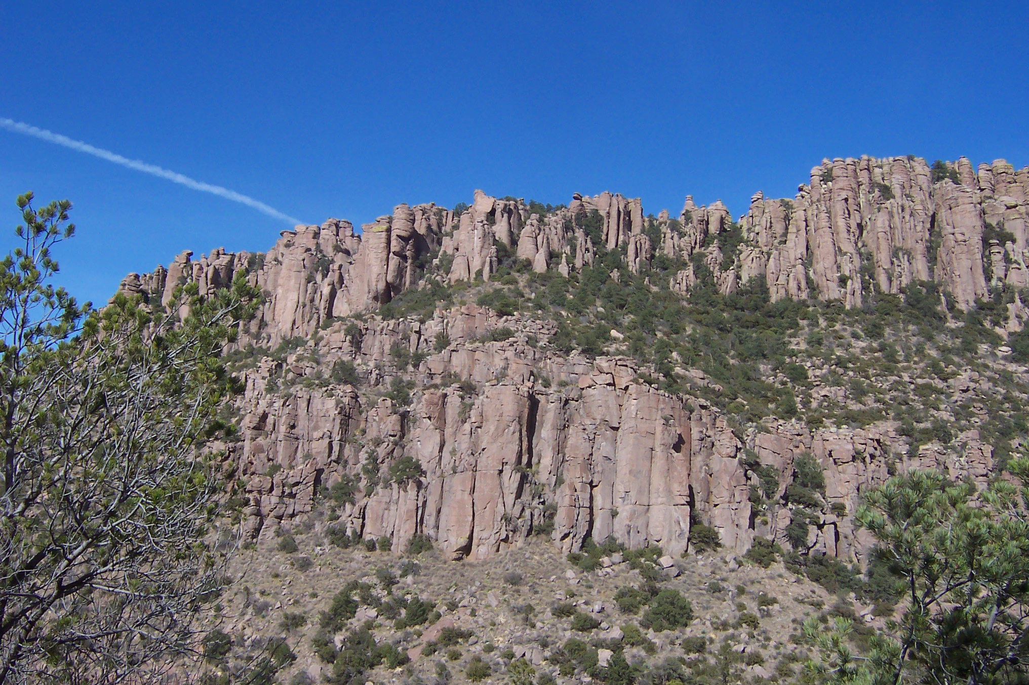
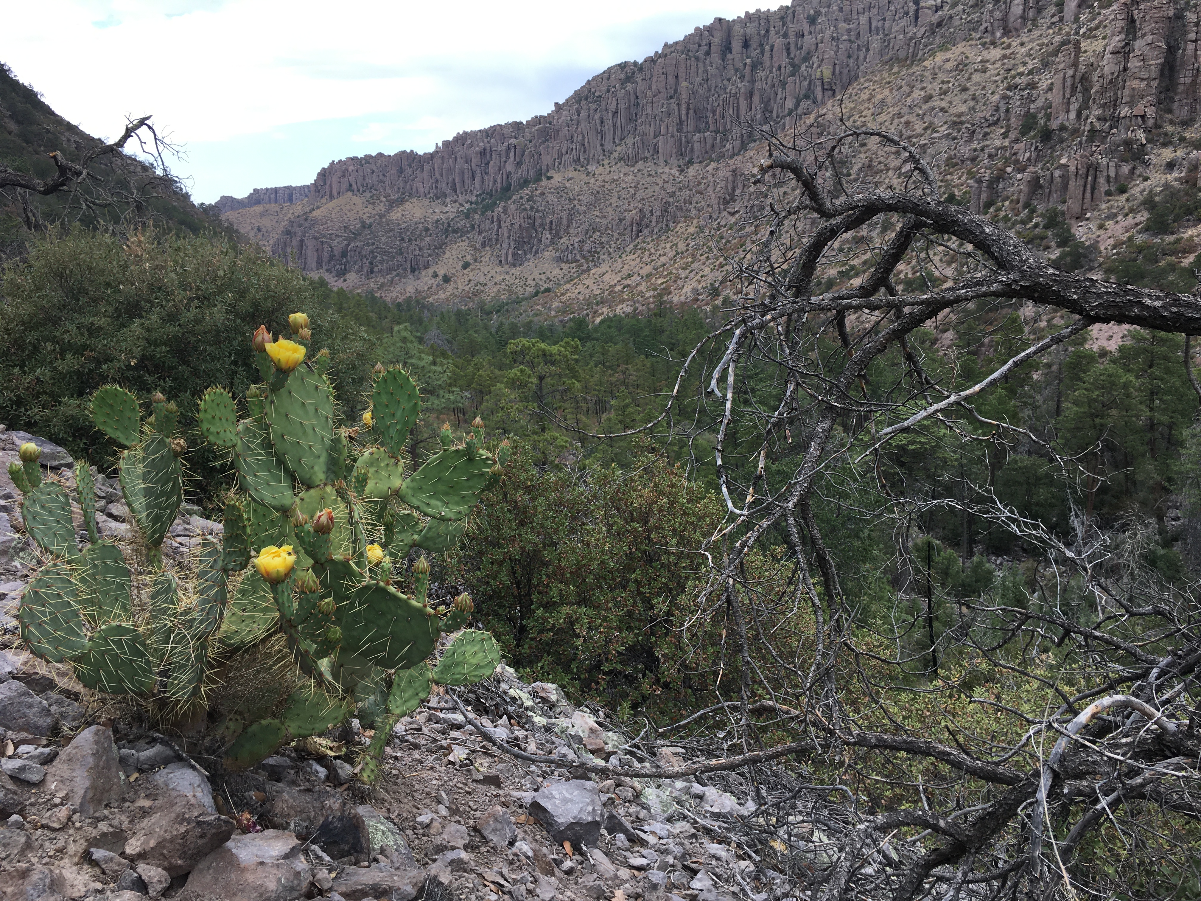
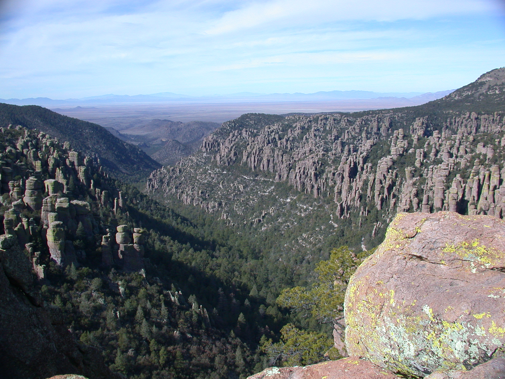
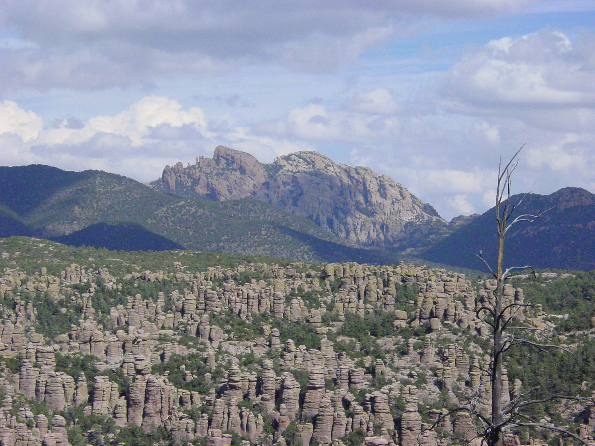
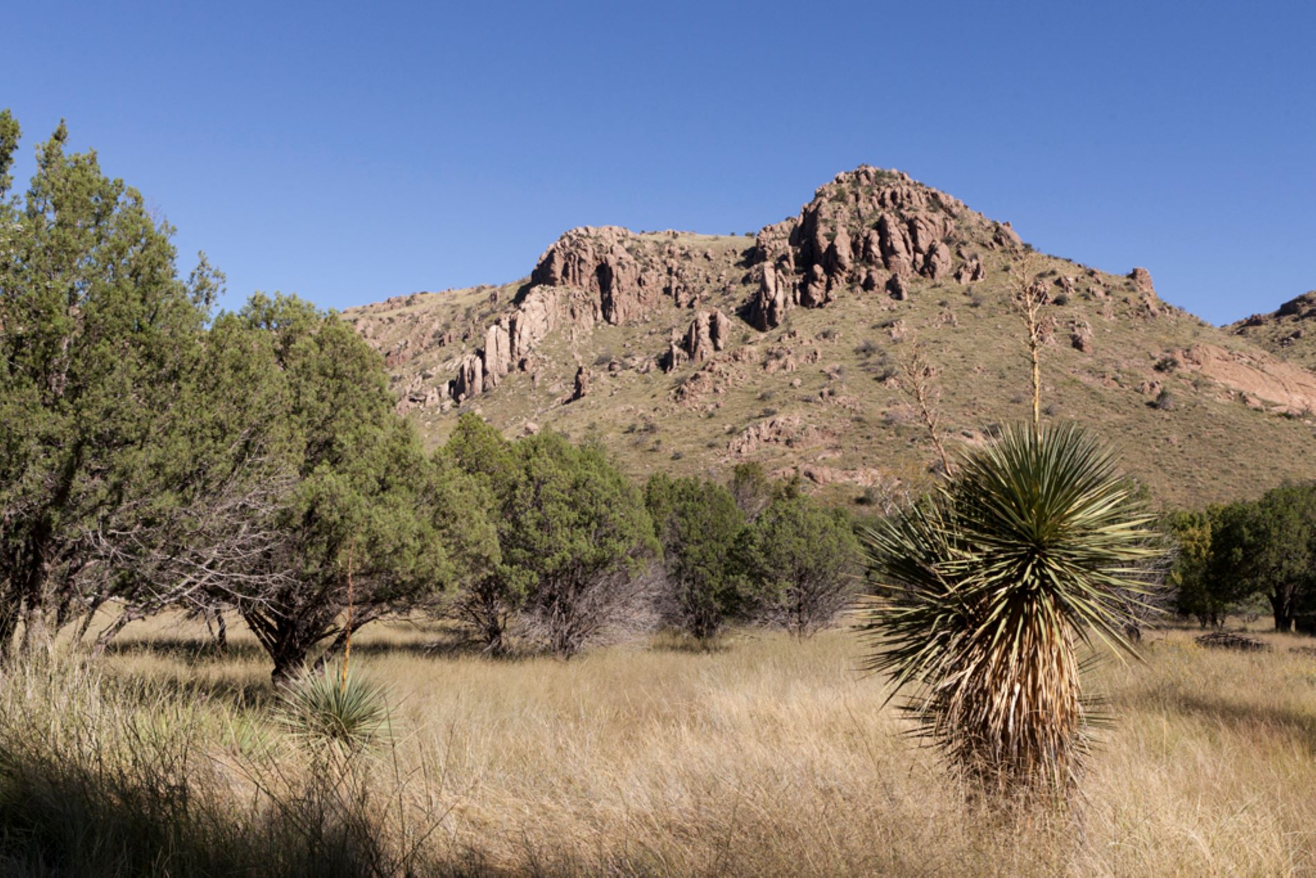
Explore rhyolite pinnacles and balanced rocks on foot or by car. Relax at the campground under star-filled, dark skies. See how a mountain range rising between two deserts creates a home for diverse wildlife. Imagine history here. Prehistoric peo...
All campsites are on the reservation system, recreation.gov. We recommend making reservations a few weeks in advance and as much as three months in advance during holidays and from January to April. Larger campsites often fill up early so tent campers may find last minute availability more frequently. The park does not offer any walk-in or first come first serve camping. If you arrive without a reservation you may be able to make a reservation using wi-fi at the visitor center. Dispersed camping without a reservation is available on Pinery Canyon Road (Forest Road 42) 6 miles outside the park.
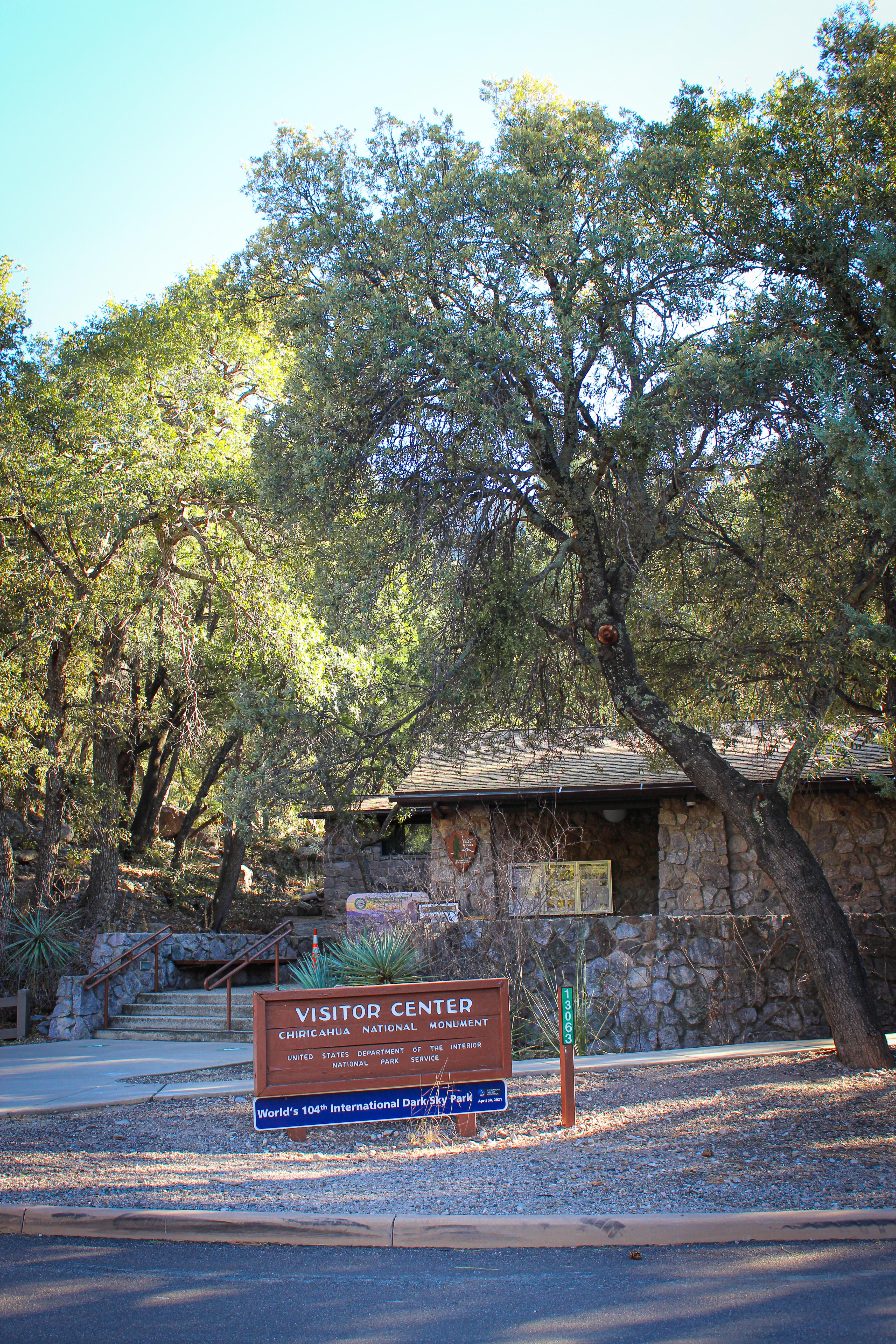
The visitor center, on the right 3.5 miles after the entrance, is open from 8:30 am to 4:30 pm. It has an information desk, museum, park film, and gift shop. It provides free maps, junior ranger booklets, and information. The museum includes geology, biodiversity, and human history exhibits. Its architecture showcases Civilian Conservation Corps rock work and Mission 66 architecture. The park store has shirts, books, stickers, and other collectibles. It is cashless! So, bring your card or mobile pay!
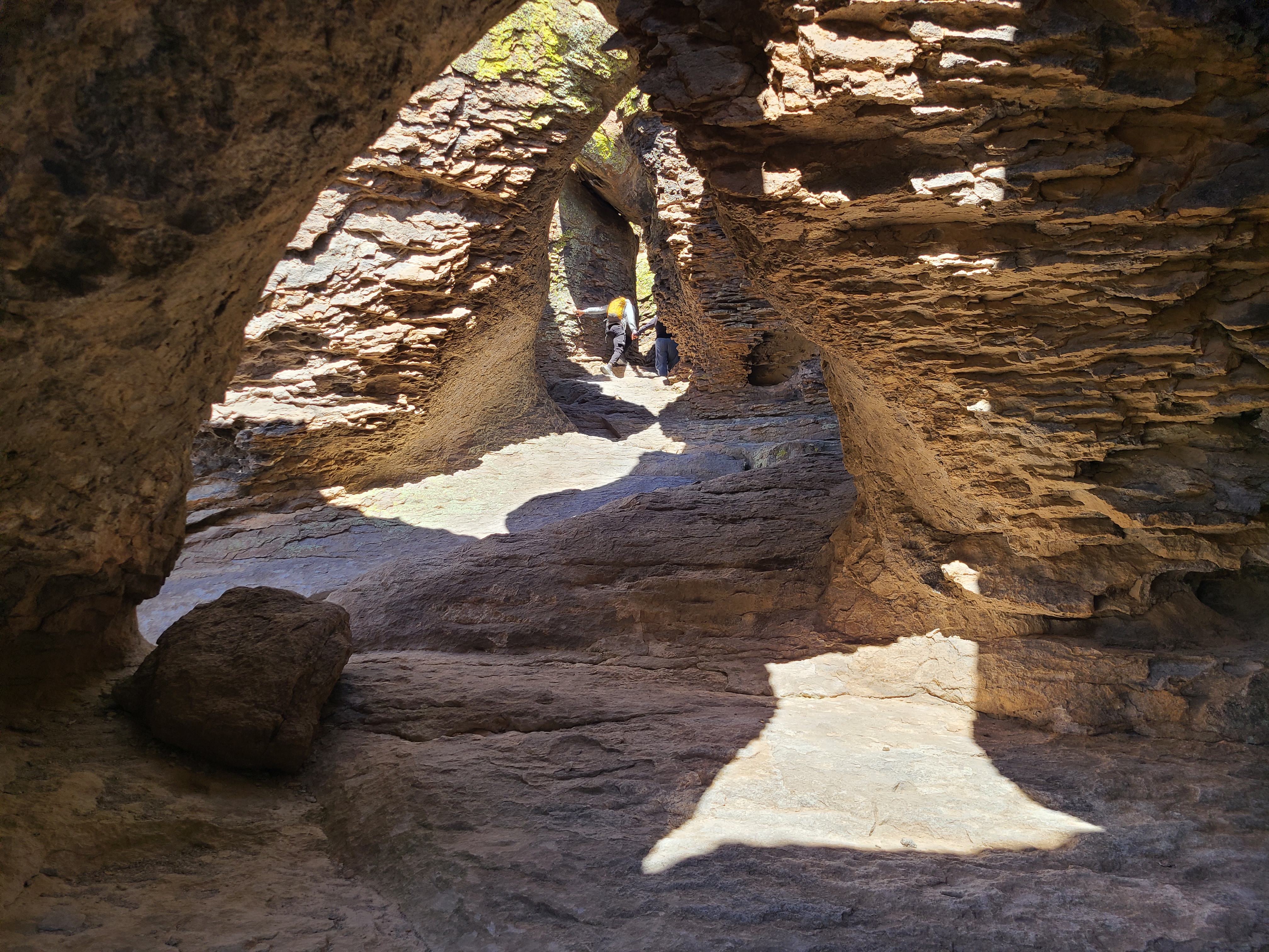
Just 1/2 mile from the parking area, on the Echo Canyon Trail, visitors can be amazed by the tunnel-like rock formations. The Echo Canyon Grottoes are a great option for those who want to experience the rocks but have limited time or mobility.
Echo Canyon Loop Trail
The most impressive moderate hike in the park. Hike 3.3 miles through balancing rocks, the unique tunnel-like grottoes, narrow slots, and below cliffs of towering pinnacles. No pets.
Massai Point Nature Trail
A short, half-mile trail at the end of Bonita Canyon Drive.
Hike the Trails at Chiricahua
17 miles of trails will take you into a wilderness of rocks. Chiricahua offers a range of day hiking options from easy to strenuous.
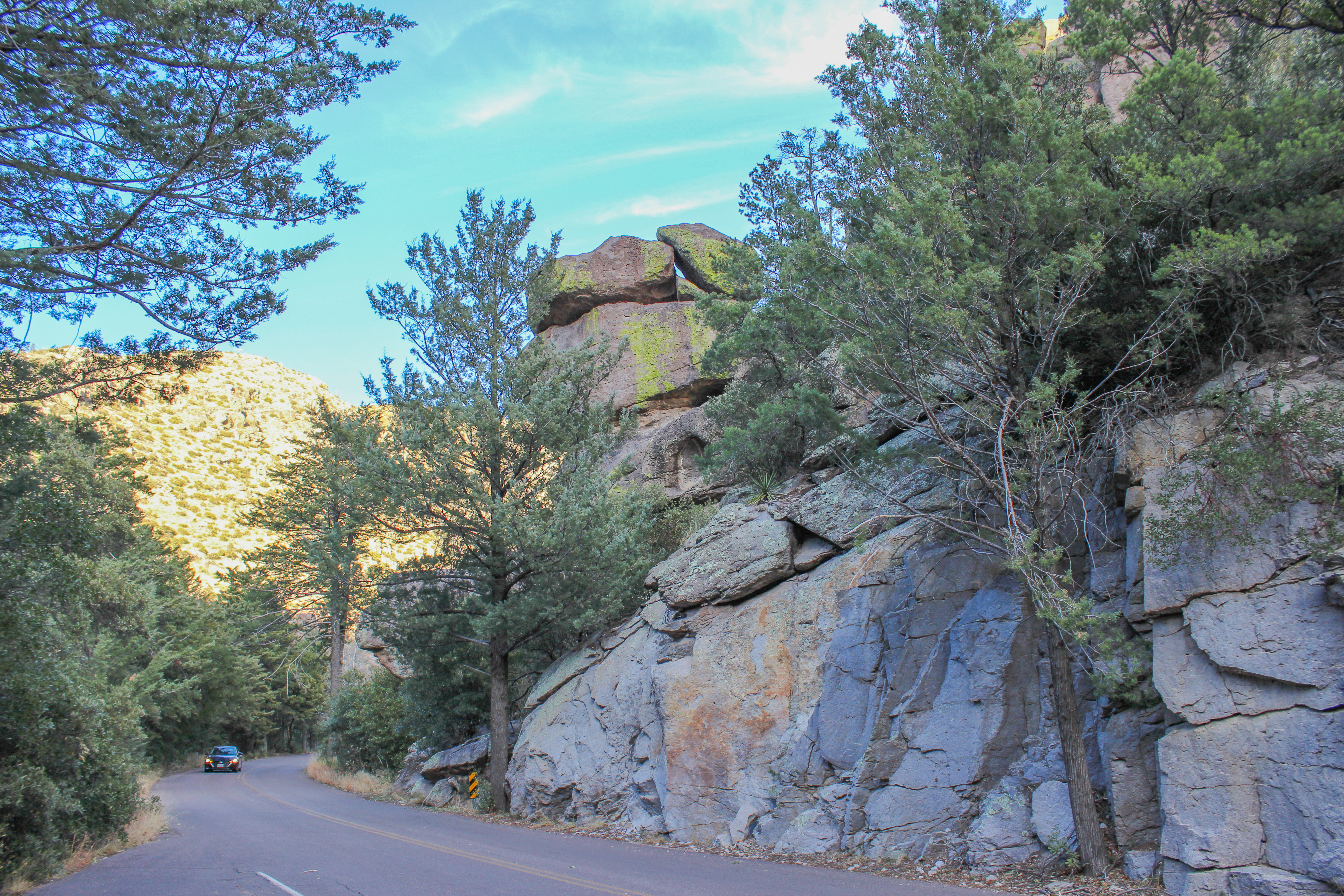
Bonita Canyon Drive
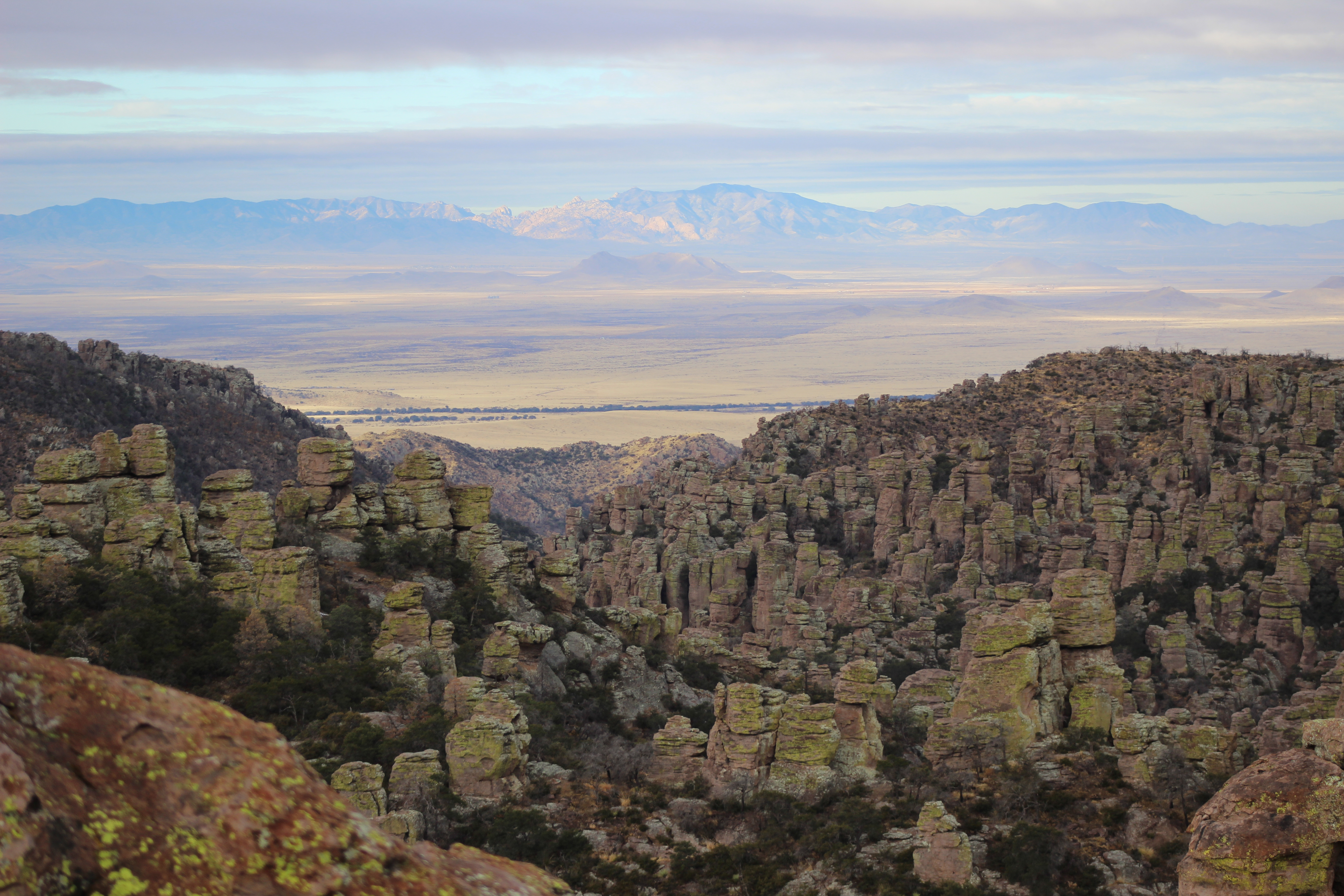
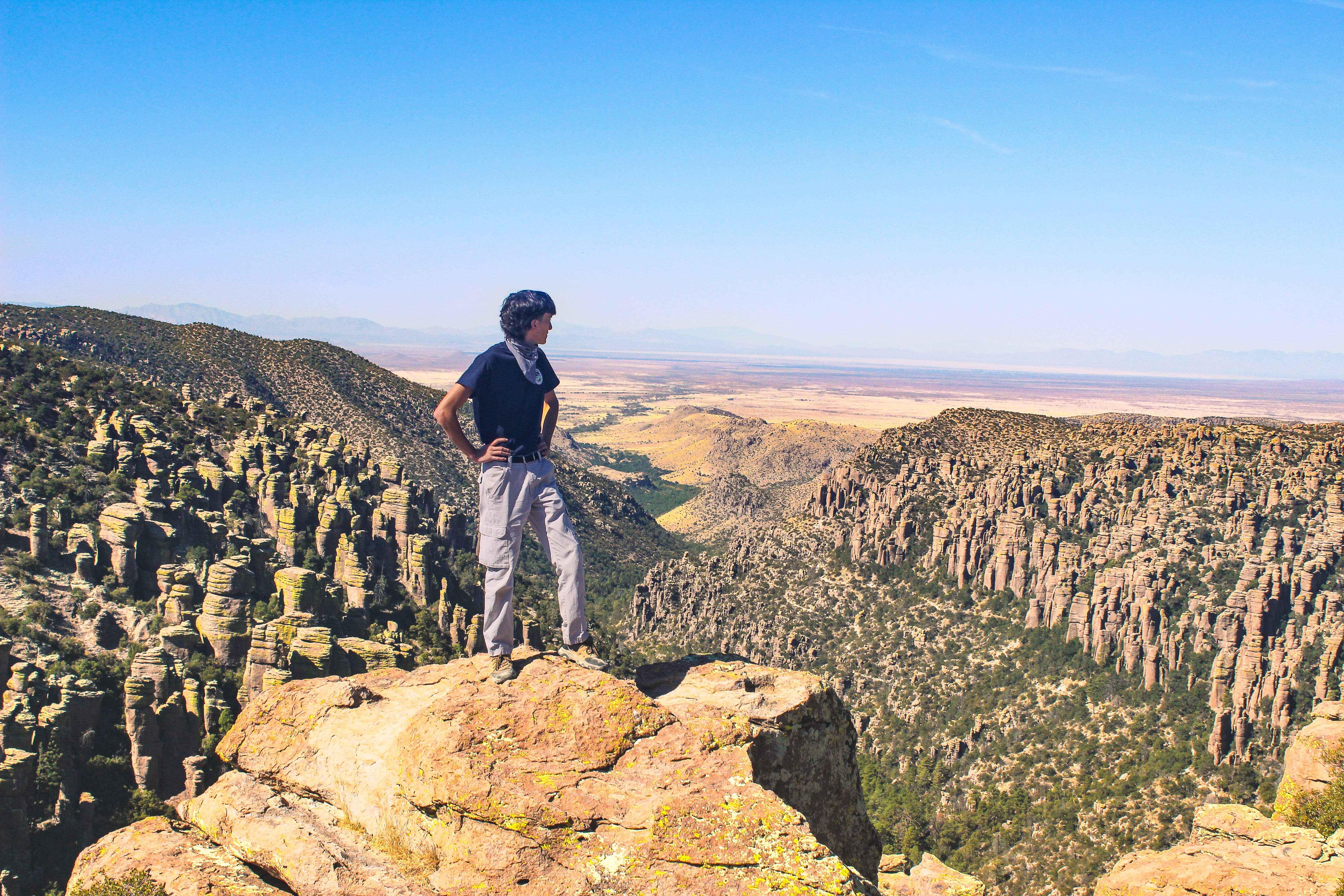
This 8-mile paved drive winds up the valley through rock formations, oak, cypress, and pine forests, to Massai Point. Massai Point overlook has a 360-degree view of the Wonderland of Rocks and the surrounding valleys and mountains.
Silver Spur Meadow Trail
Beginning from the Visitor Center, Campground, or Faraway Ranch picnic area, this 1.2 mile/1.9 kilometer leisurely walk goes by the Faraway Ranch Historic District, Stafford Cabin, and Silver Spur Meadow. This is a dog-friendly trail.
Bonita Creek Loop
This Bonita Creek loops around the picnic area and takes you along the intermittent Bonita Creek. Watch for Apache plume and prickly poppy flowers in spring and early summer. Arizona whitetail deer are frequently seen in the lower portion of Bonita Canyon. This is a good trail to view grassland birds.
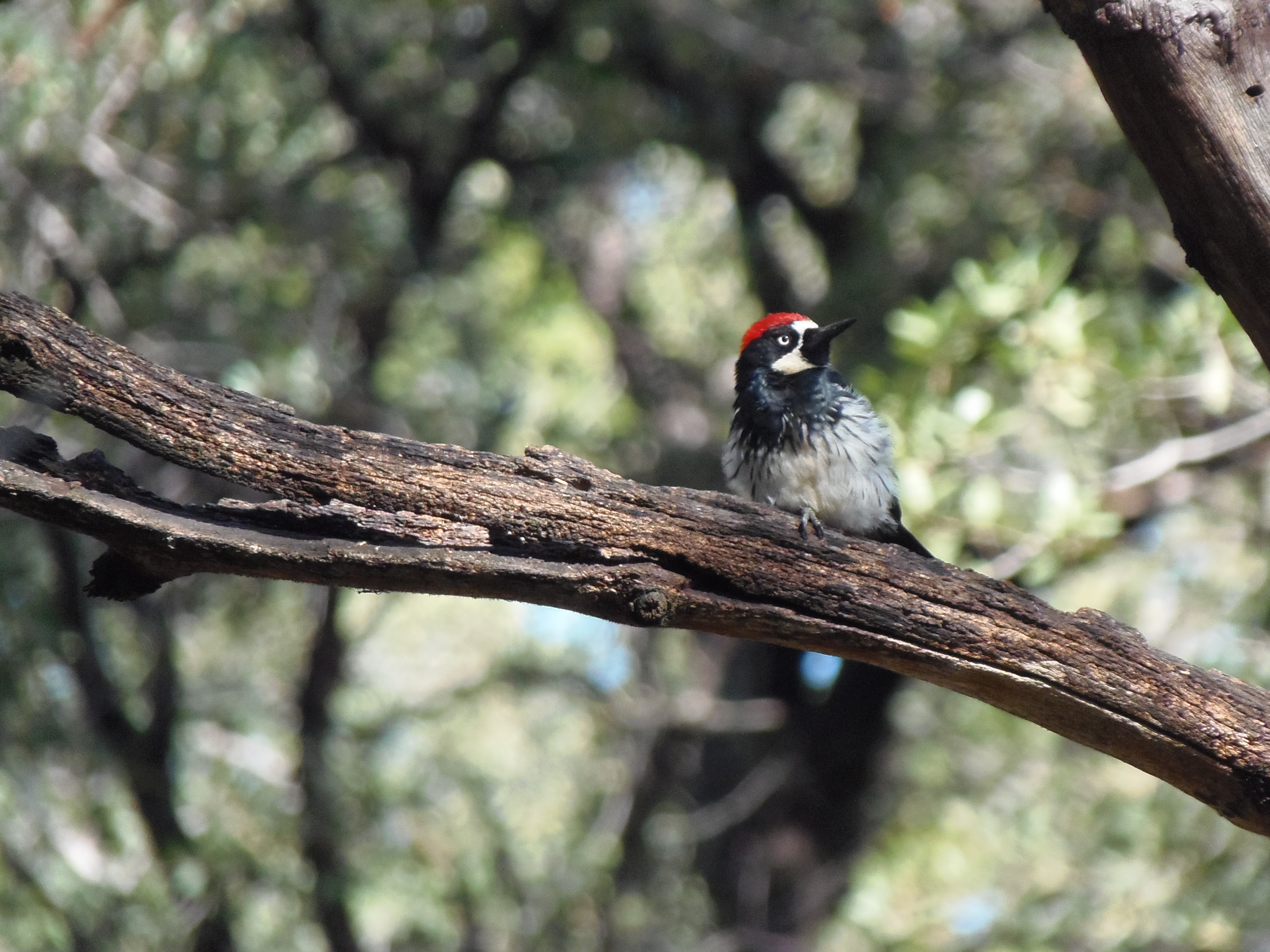
Birdwatching at Chiricahua
Chiricahua is a haven for birdwatchers, with over 200 different bird species documented in the area! The best places for birdwatching in the monument include Bonita Creek Trail, Silver Spur Meadow Trail, and Echo Park, although you'll see birds anywhere in the monument.
Sugarloaf Mountain Trail
This moderate trail to the top of Sugarloaf Mountain is 1.8 miles/2.8 kilometers roundtrip. Rising above the surrounding canyons, the summit of Sugarloaf Mountain at 7,310ft/2,228m is one of the highest points in the monument. The dark rock is dacite, evidence of a lava flow. Lightning activity is monitored from the Civilian Conservation Corps constructed fire lookout during the summer. Return the same way. Access is from the Sugarloaf parking lot.
Echo Canyon to Visitor Center
This moderate, 4.2 mile/6.8 kilometer trail begins at Echo Canyon trailhead and consists of Echo Canyon, Upper Rhyolite Canyon, and Lower Rhyolite Canyon trails ending at the Visitor Center. It goes downhill through spectacular rock formations in Echo Canyon. The last half of the hike is in shaded oak woodlands. Make sure you have transportation back to your vehicle or ride the seasonal hikers' shuttle at 9:00 am.
Lower Rhyolite Canyon Trail
A good way to view the rocks without driving up the road, this mostly-level trail takes you to Rhyolite Canyon, a canyon lined with rock pinnacles. Walk 1.5 miles / 2.4 km until you reach the junction between Upper Rhyolite Canyon and Sarah Deming trails. Return the same way.
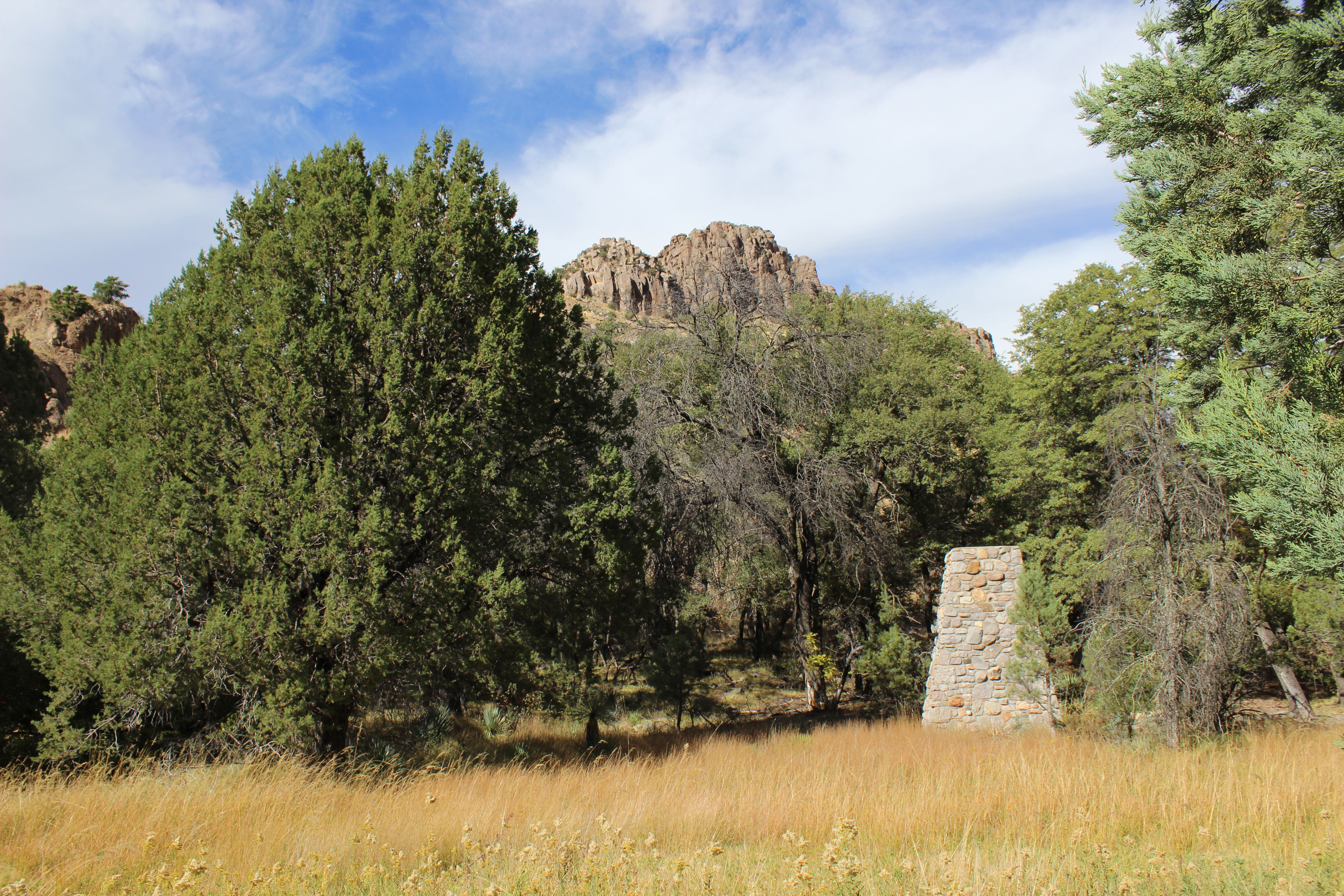
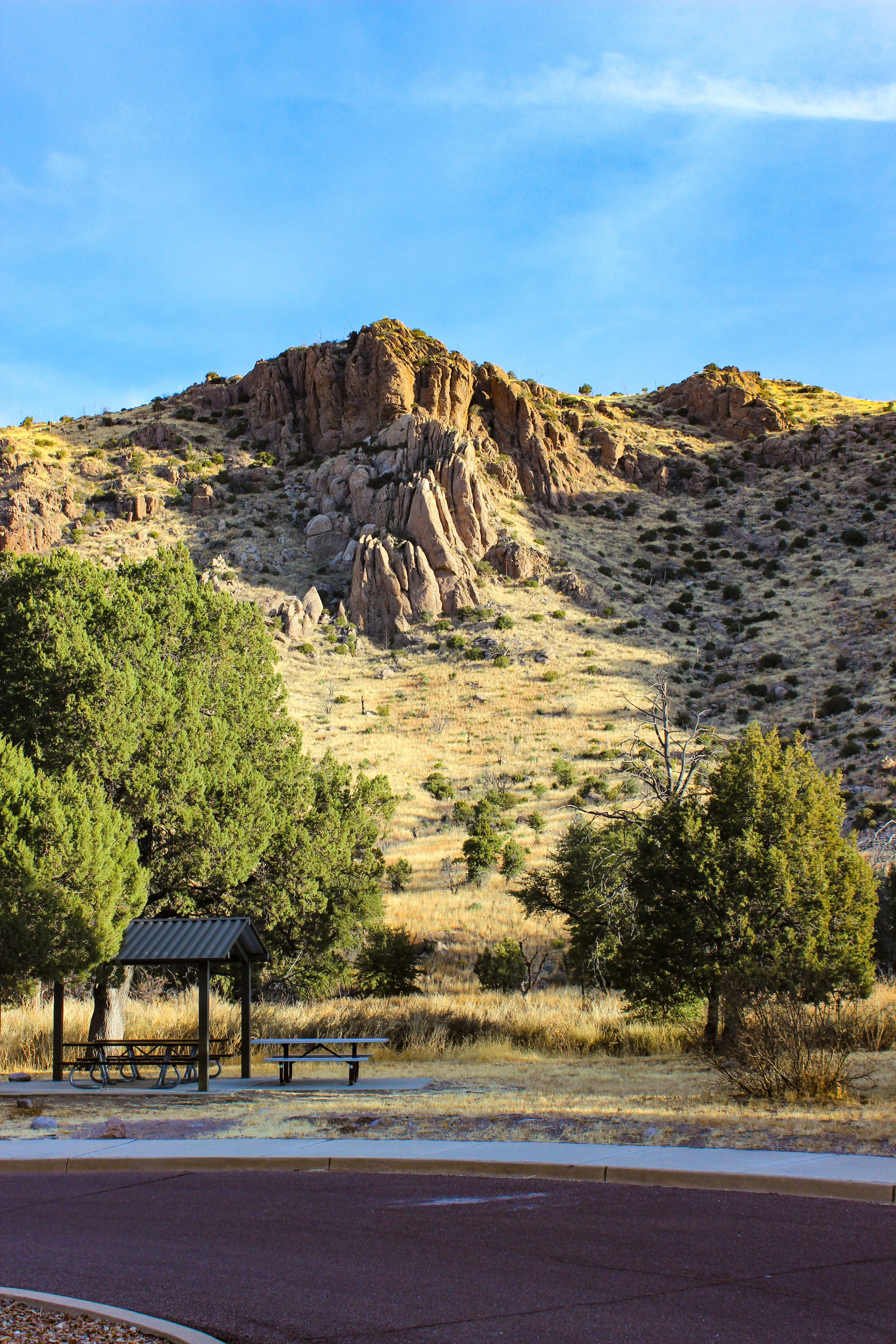
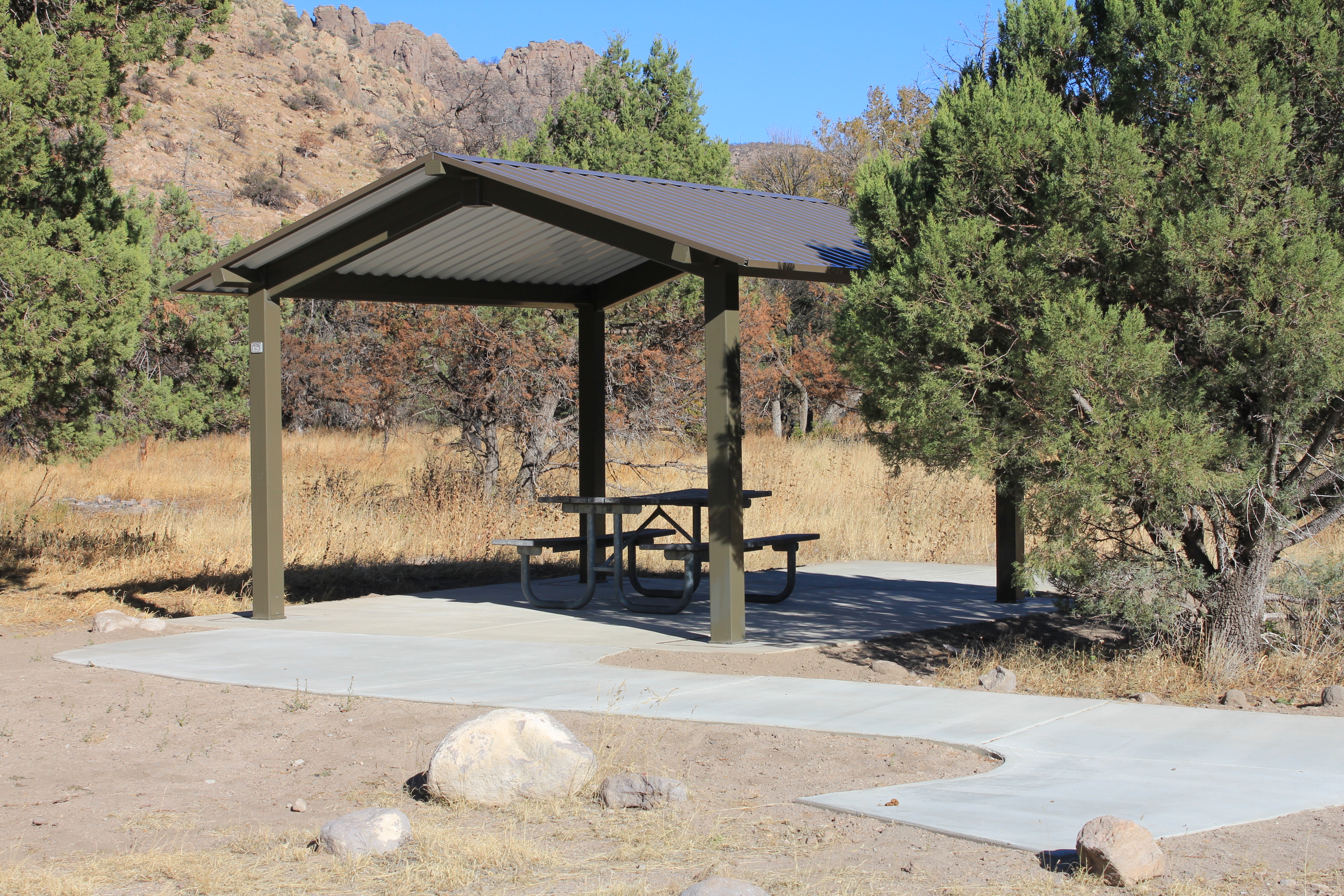
Picnicking
The Bonita Creek and Faraway Ranch picnic areas have tables, trashcans, and restrooms. Massai Point, Echo Canyon, and Sugarloaf areas have tables and restrooms. Water is available at Faraway Ranch and the Visitor Center. Picnicking in Bonita Canyon campground is prohibited.
Inspiration Point Trail
This 5.4 mile / 8.6 kilometer strenuous trail takes you to the Inspiration Point overlook. The route consists of Ed Riggs, Mushroom Rock, and Inspiration Point trails. Excellent views of Cochise Head and Rhyolite Canyon make this a great rest stop!
Heart of Rocks Loop
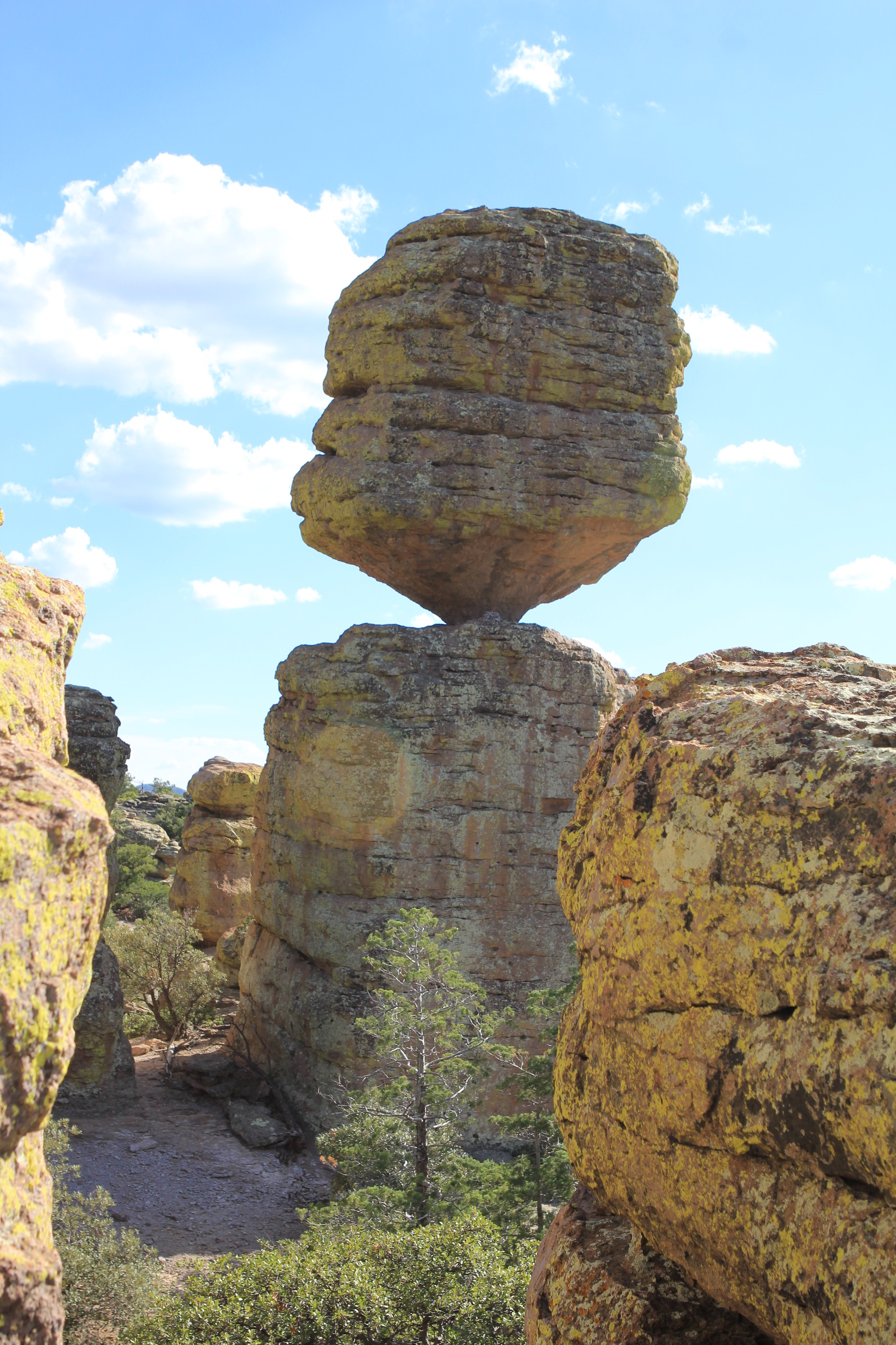
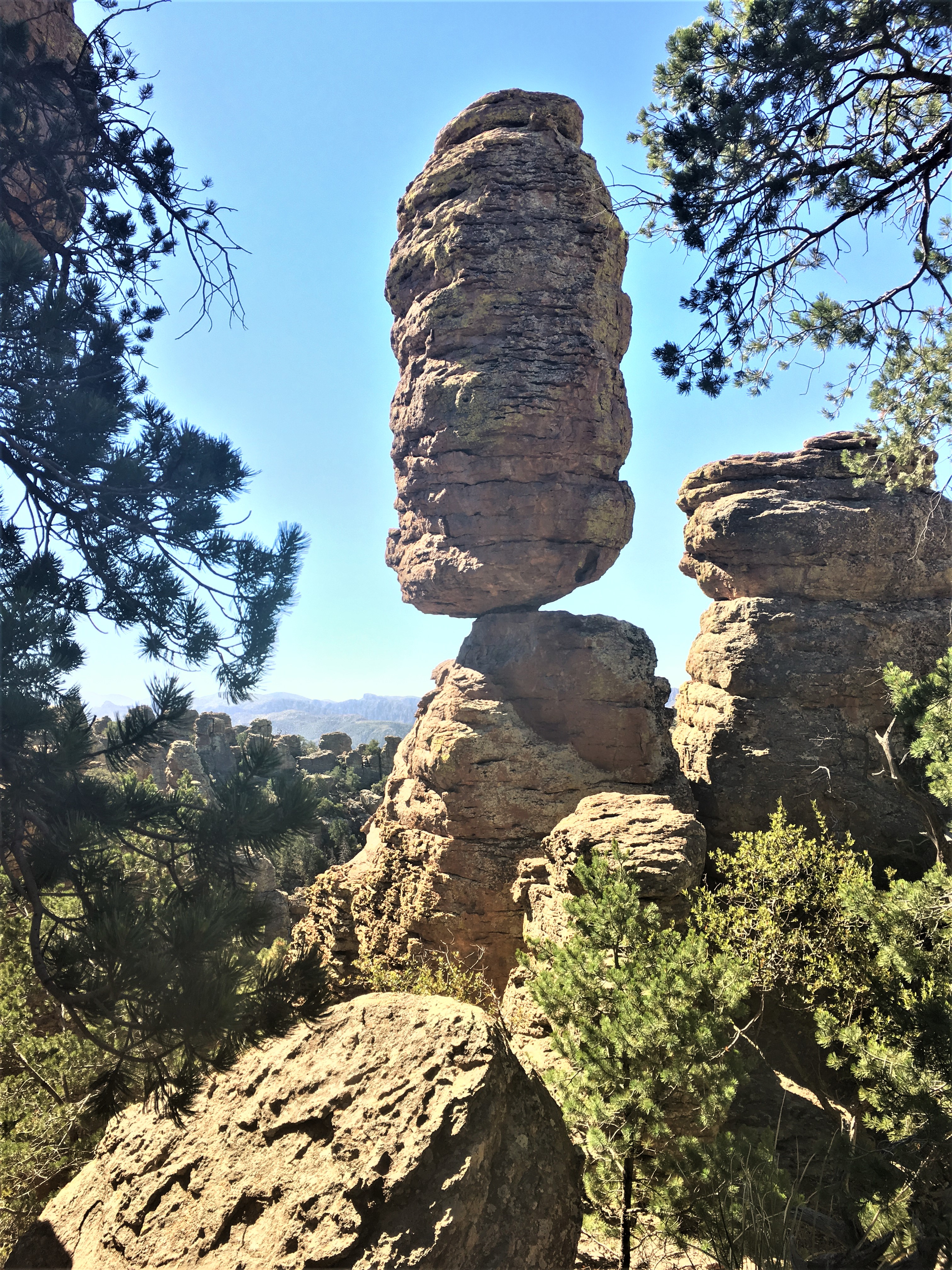
The Heart of Rocks Loop is a 7.3 mile/11.8 kilometer roundtrip hike to many of the most unusual rock formations in the monument, including Pinnacle Balanced Rock and Big Balanced Rock. Start the loop to the left and hike clockwise for the best views and easiest walking. Lots of rock steps make this a challenging loop, but it's worth the effort. There are three different ways to get to the loop, all of them being the same distance.
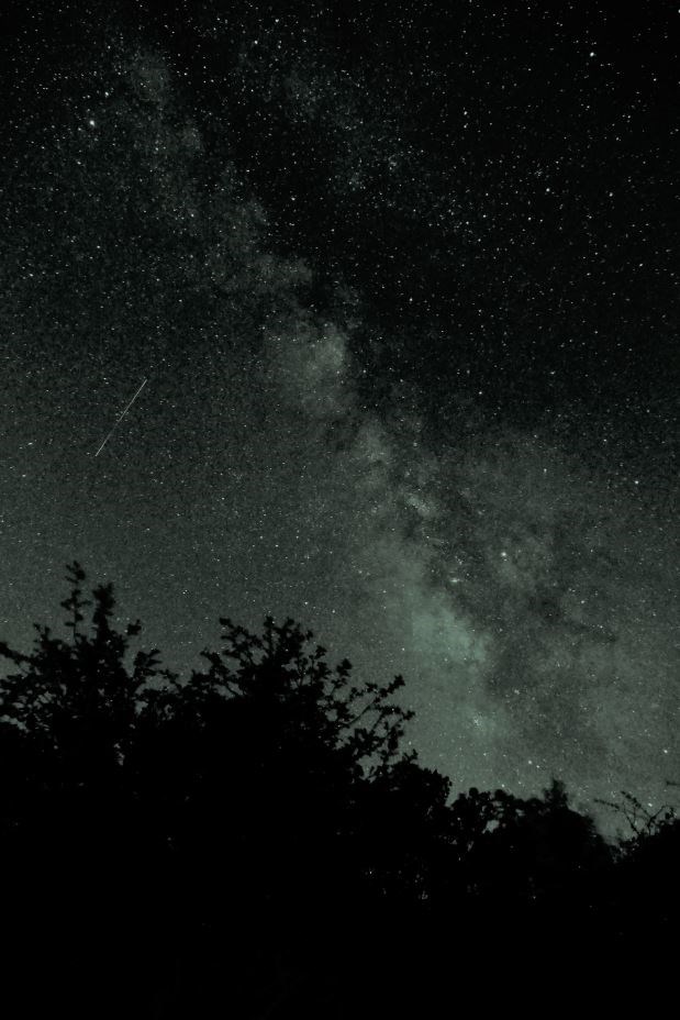
Stargazing at Chiricahua
Chiricahua National Monument is always open, so come experience our dark skies! The best places to view the night sky at Chiricahua are the Faraway Ranch and Echo Canyon parking lots, both offering wide, unobstructed views of the sky. For really spectacular views, plan a visit to avoid a full moon. Check our event calendar to see if any special night sky programs are scheduled!
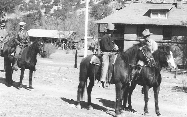
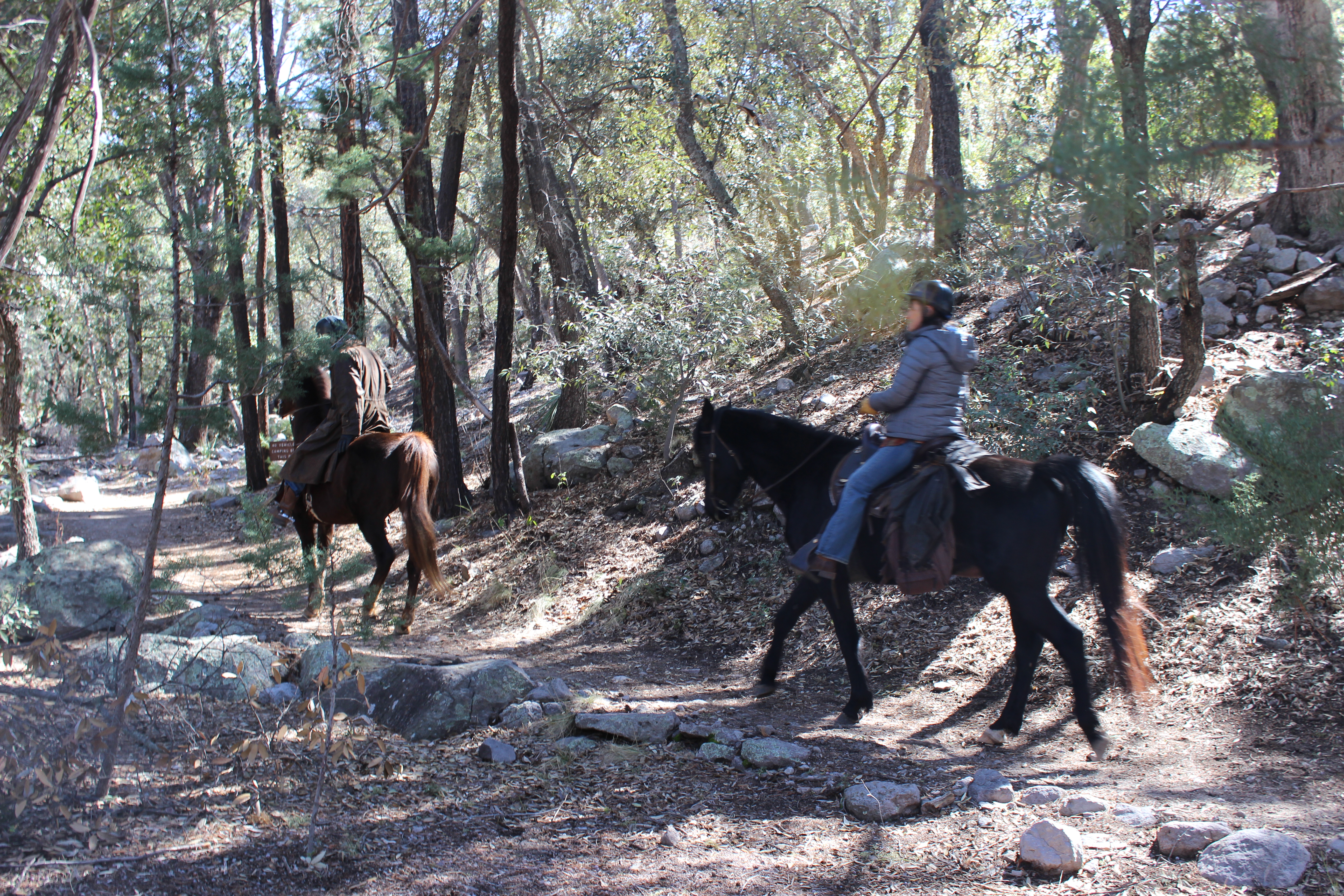
Horseback Riding at Chiricahua
Come explore the "Wonderland of Rocks" on horseback! Horses are allowed on many of the trails in the monument.
The Big Loop
For folks wanting to do everything, this 9.5 mile route consists of the Echo Canyon, Upper Rhyolite Canyon, Sarah Deming, Heart of Rocks, Big Balanced Rock, Inspiration Point, Mushroom Rock, and Ed Riggs trails. It features our balanced rocks. The trail begins from the Echo Canyon trailhead.
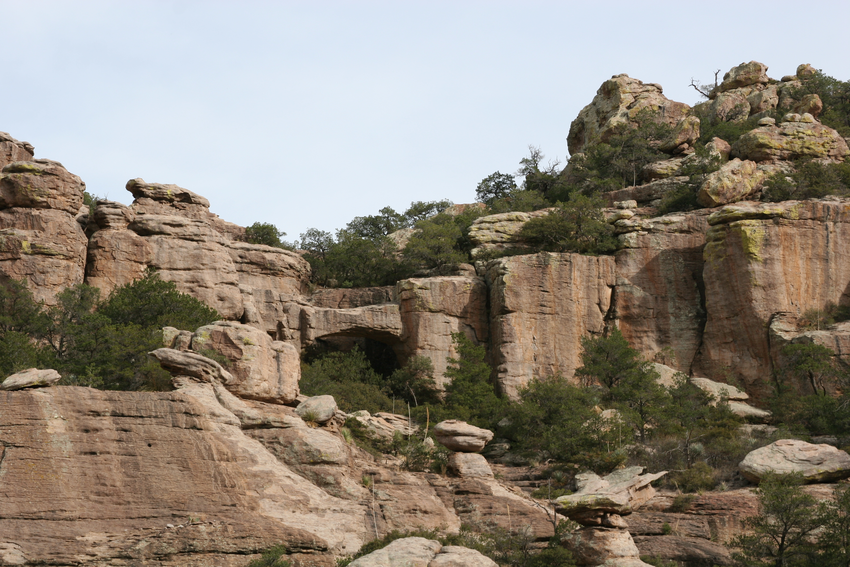
Trail to Natural Bridge
The least used trail in the monument climbs through oak and juniper woodlands to a ridge then drops into the Apache pine forest of Picket Park. It ends at an overlook for the small water-carved bridge located across the canyon. Return the same way.
Bonita Creek Trail
Winding along Bonita Creek, usually dry, this trail connects the Bonita Creek and Faraway Ranch Picnic Areas. Look for wild animals, including migrating birds, deer, coatimundi, and javelina. This is an easy 1/2 mile trail.