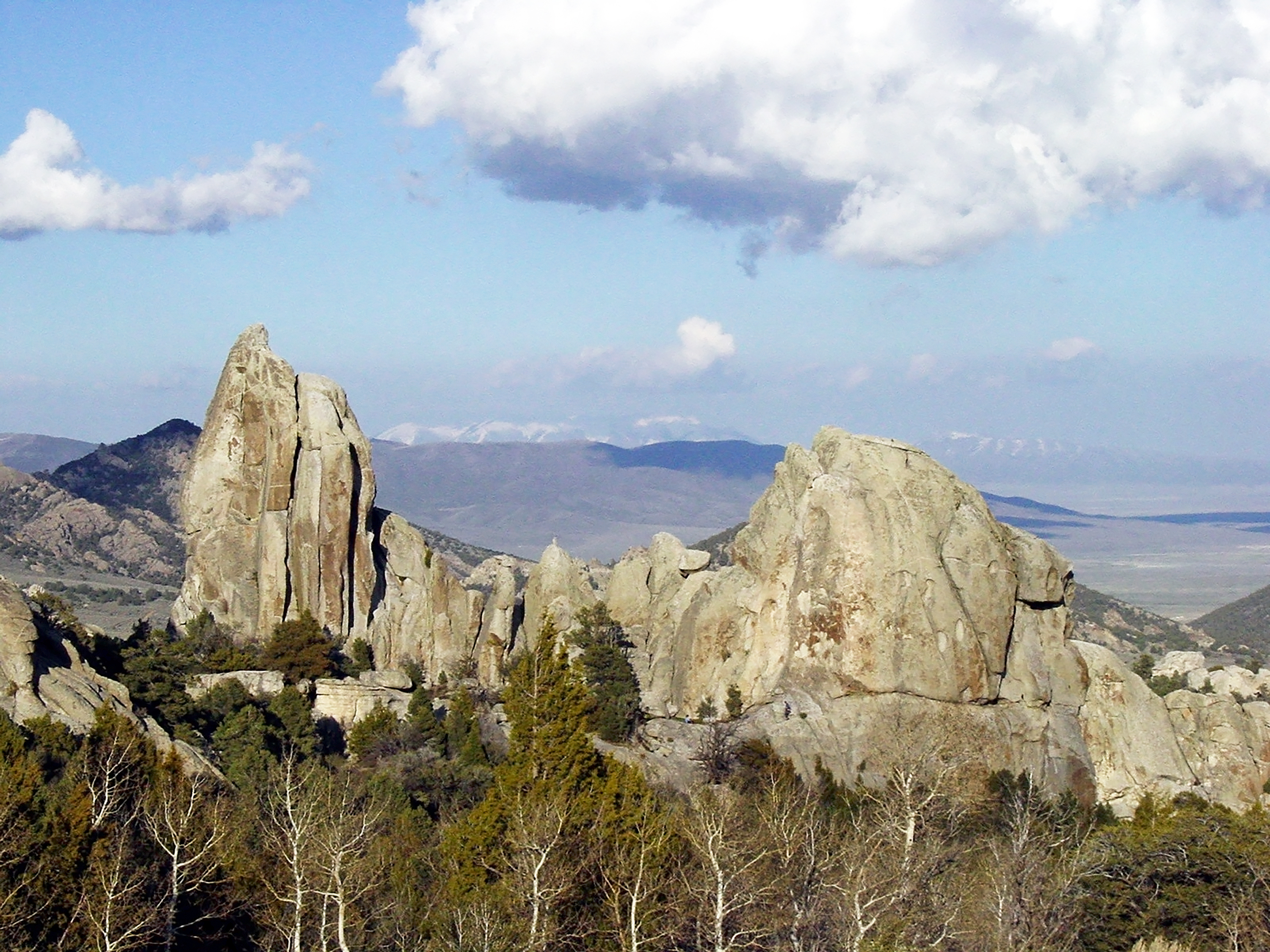
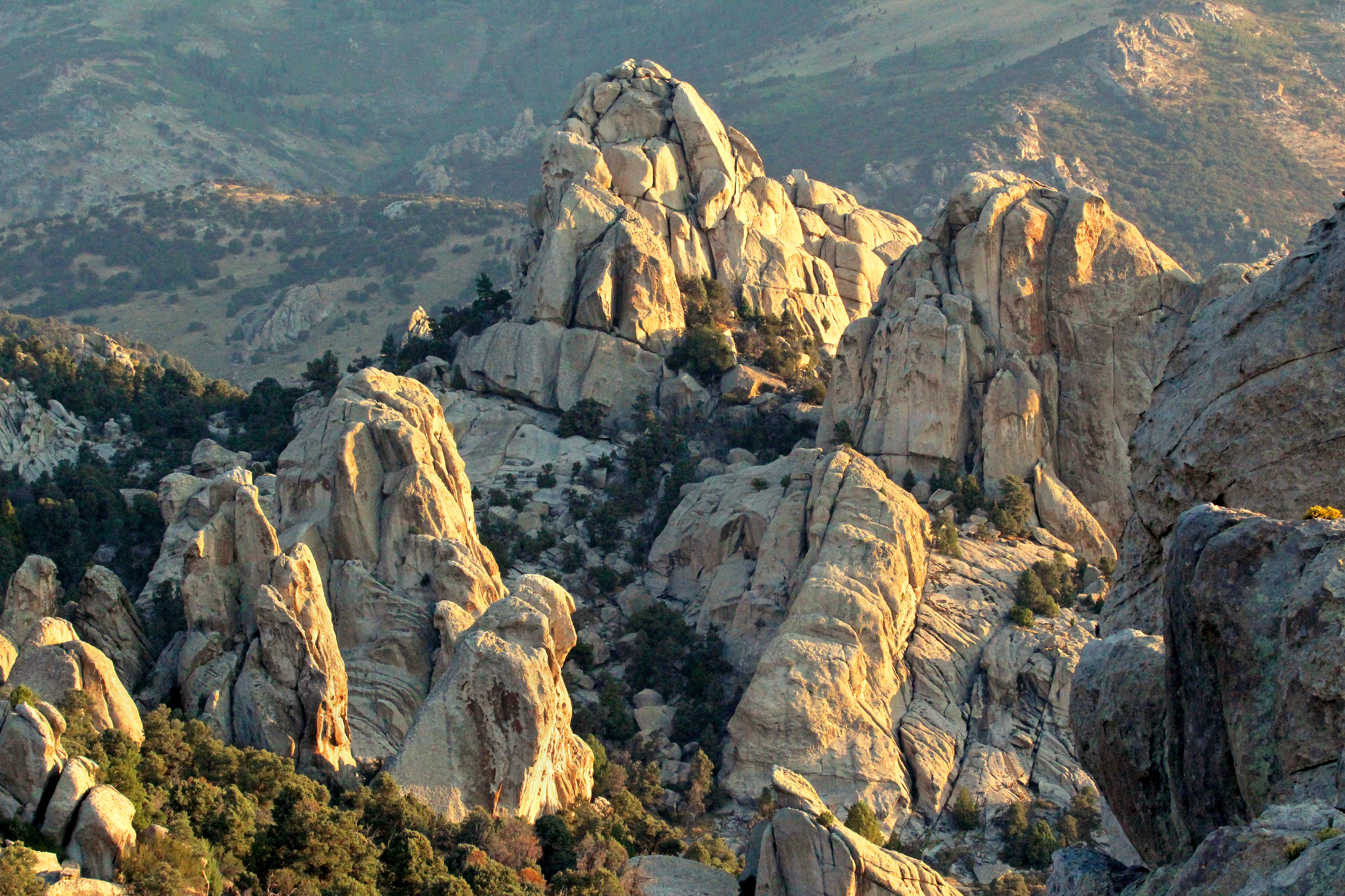
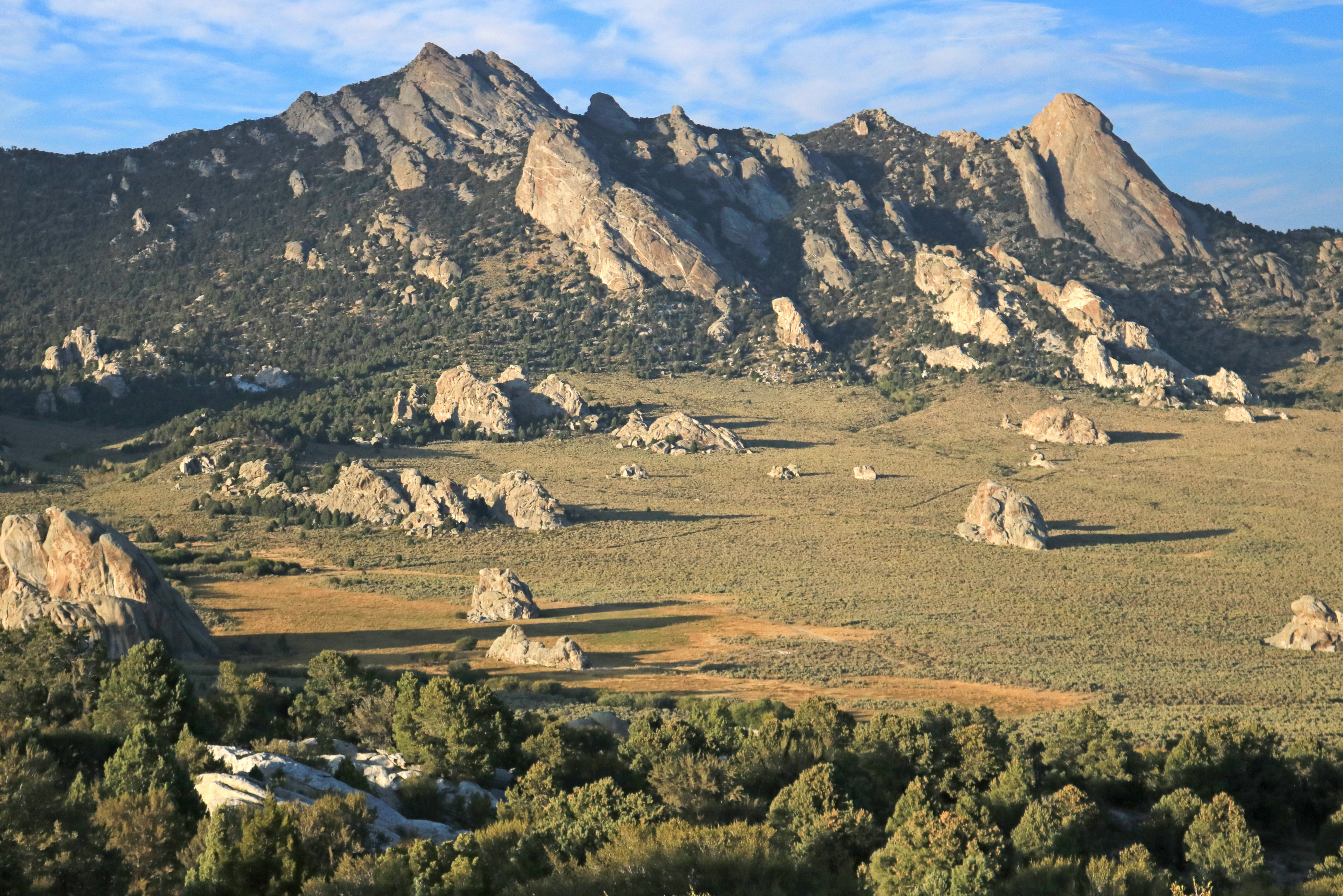
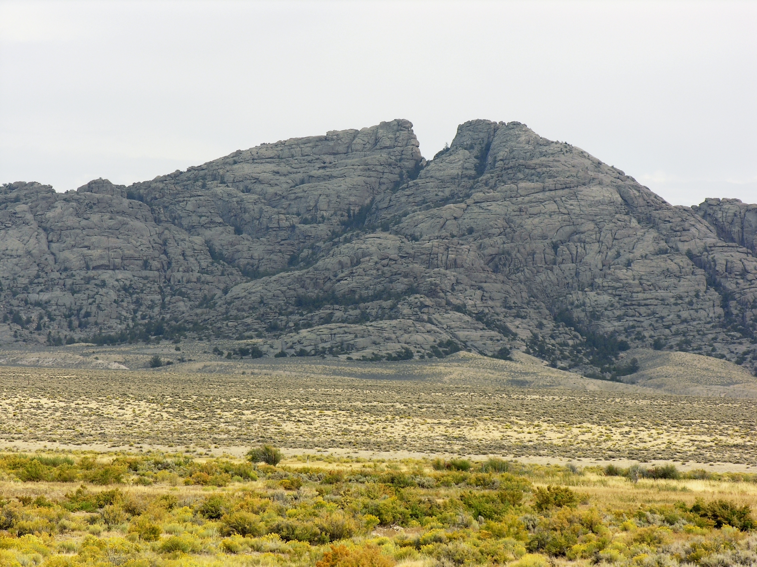
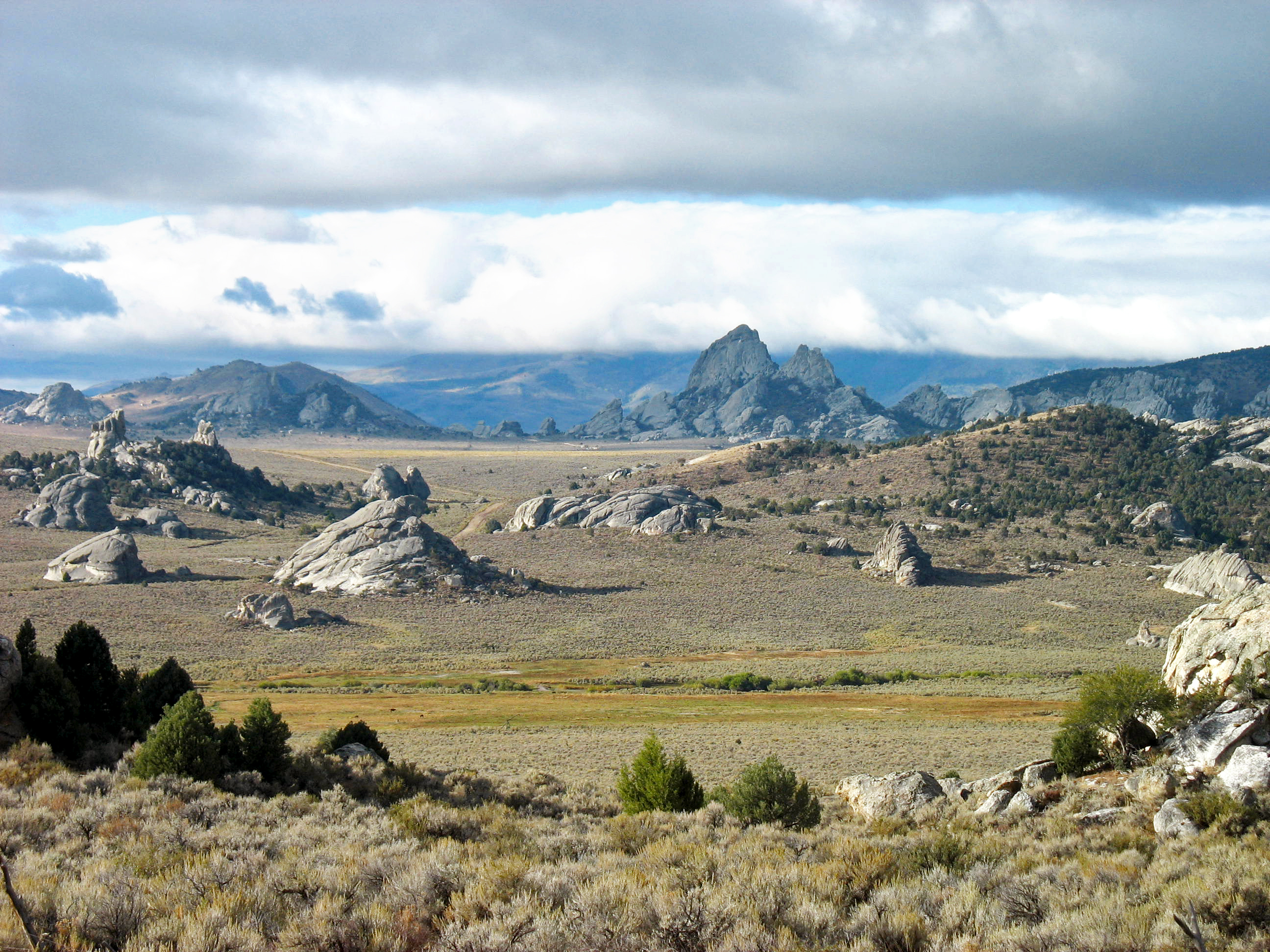
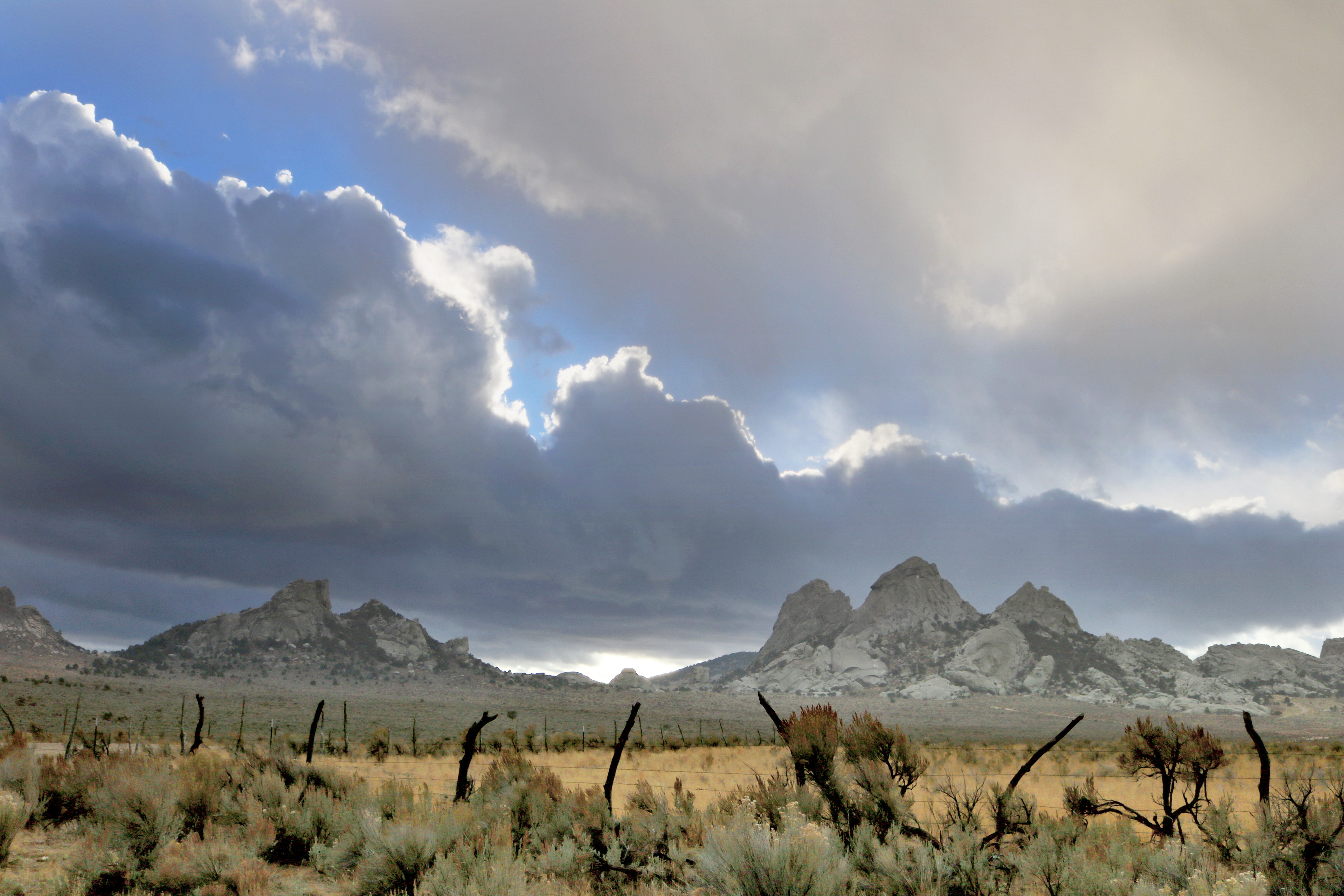
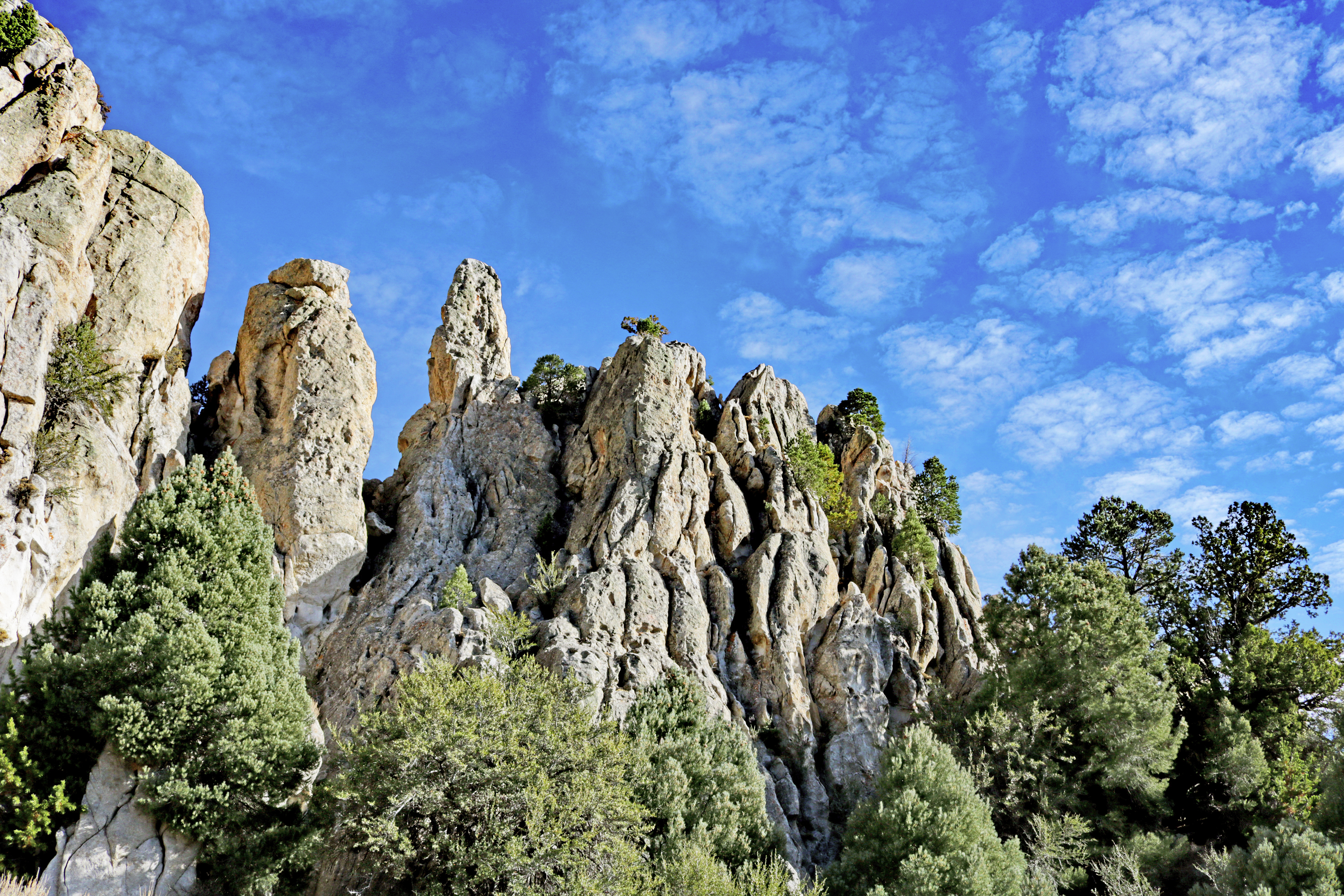
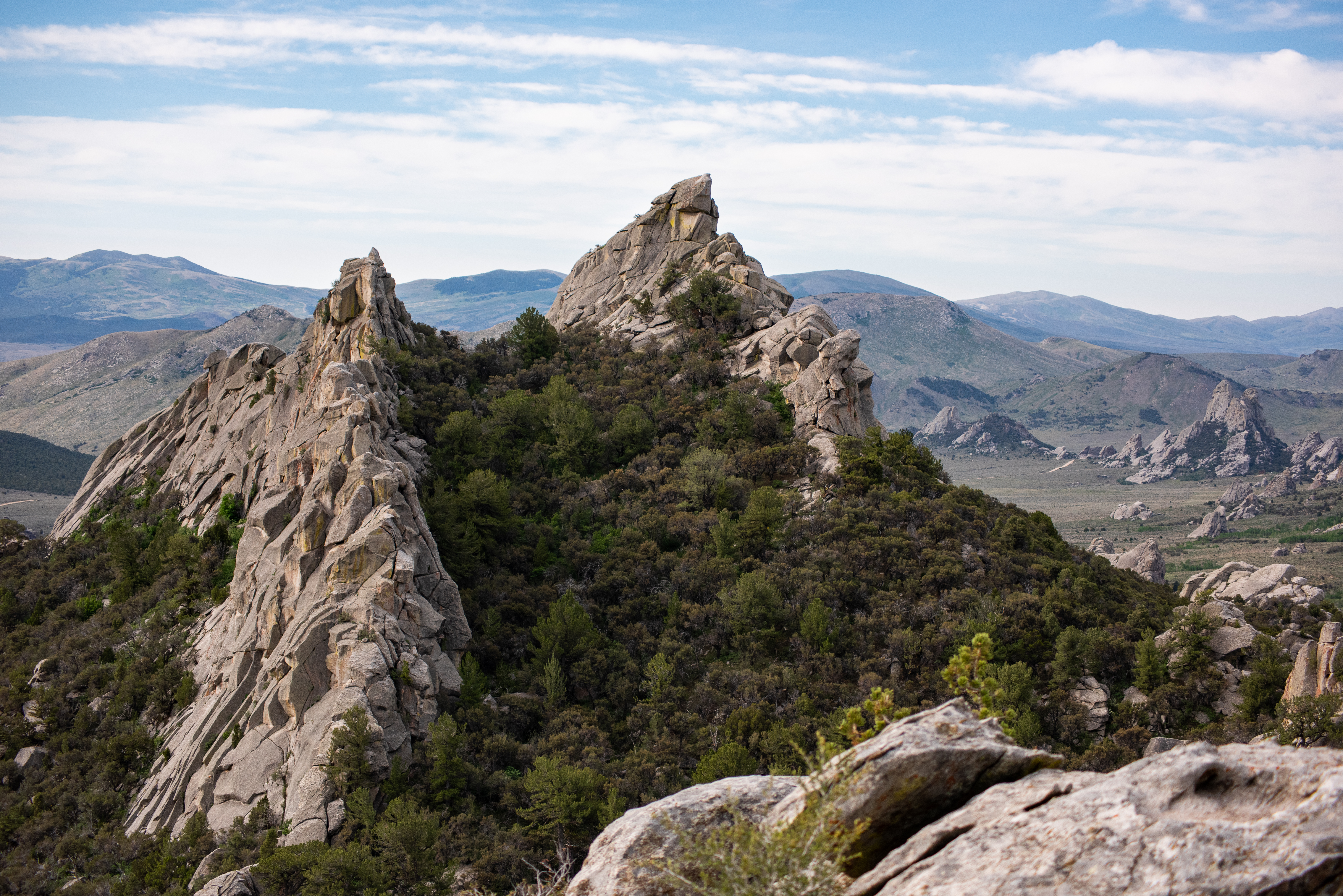
Described by California Trail emigrants as “a city of tall spires,” “steeple rocks,” and “the silent city,” this awe-inspiring landscape continues to captivate. Today, it beckons rock climbers, hikers, campers, hunters, and adventurers with its d...
Reservations can be made May 1st through September 30th by visiting https://www.reserveamerica.com or by calling 888-922-6743. October 1st through April 30th camping is first-come first-served.
Campsites can be reserved during the main season, but are first-come-first-served during the off season. Length of stay is limited to 15 days in any 30 day period.
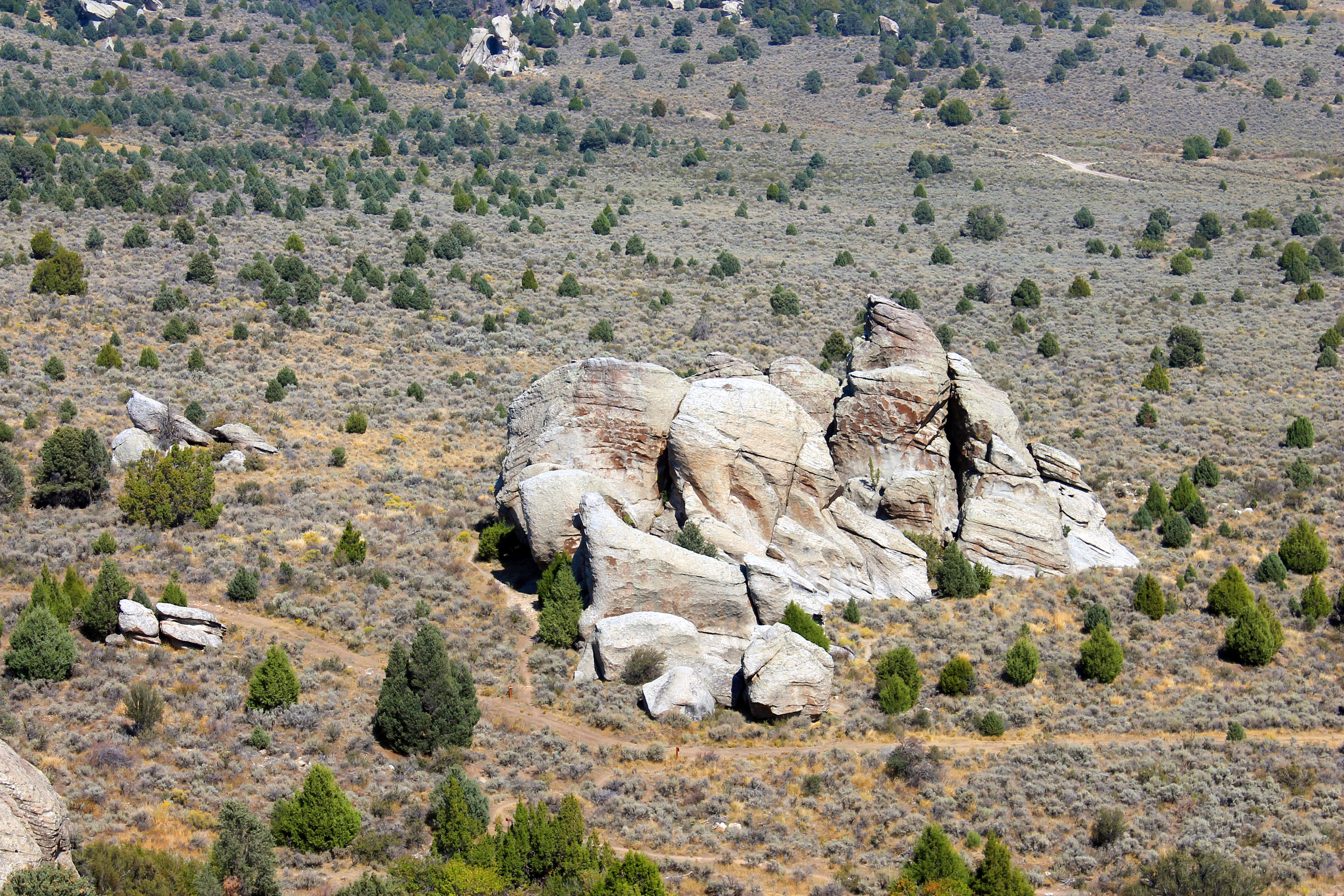
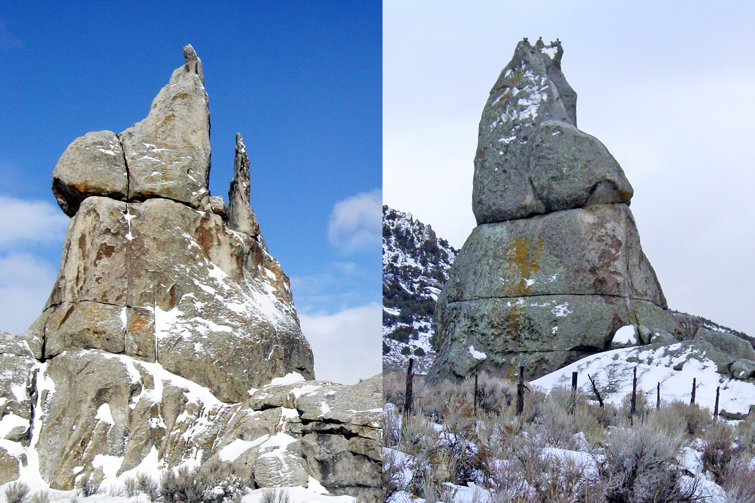
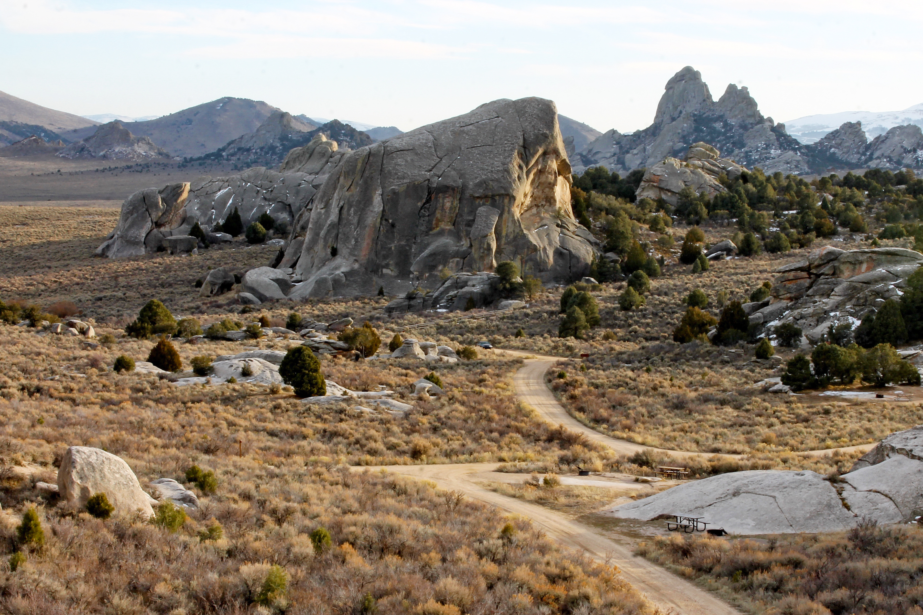
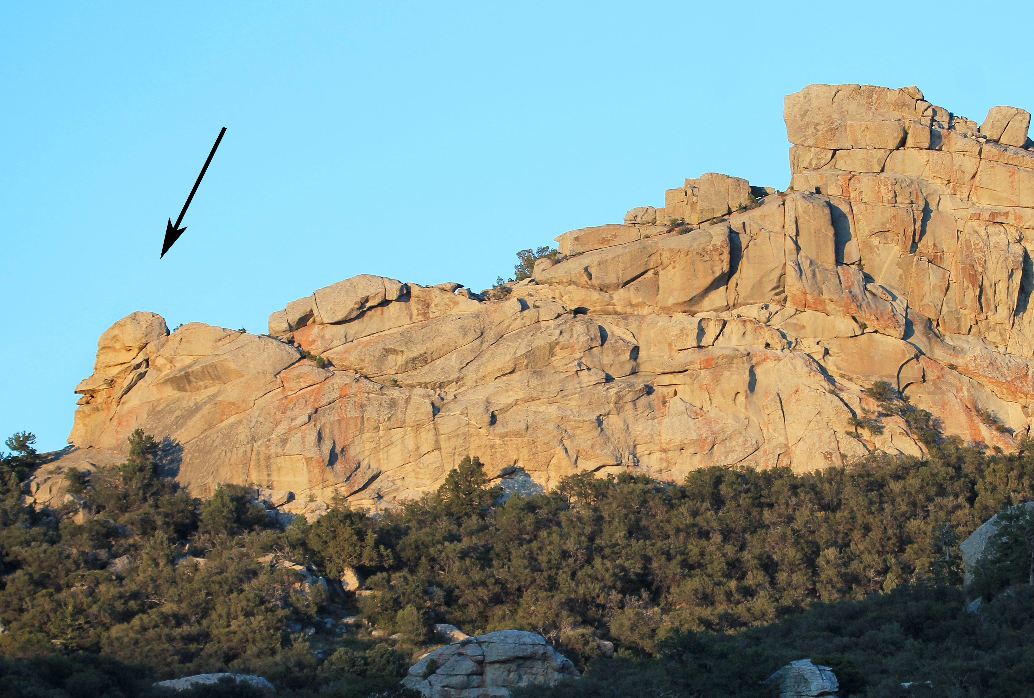
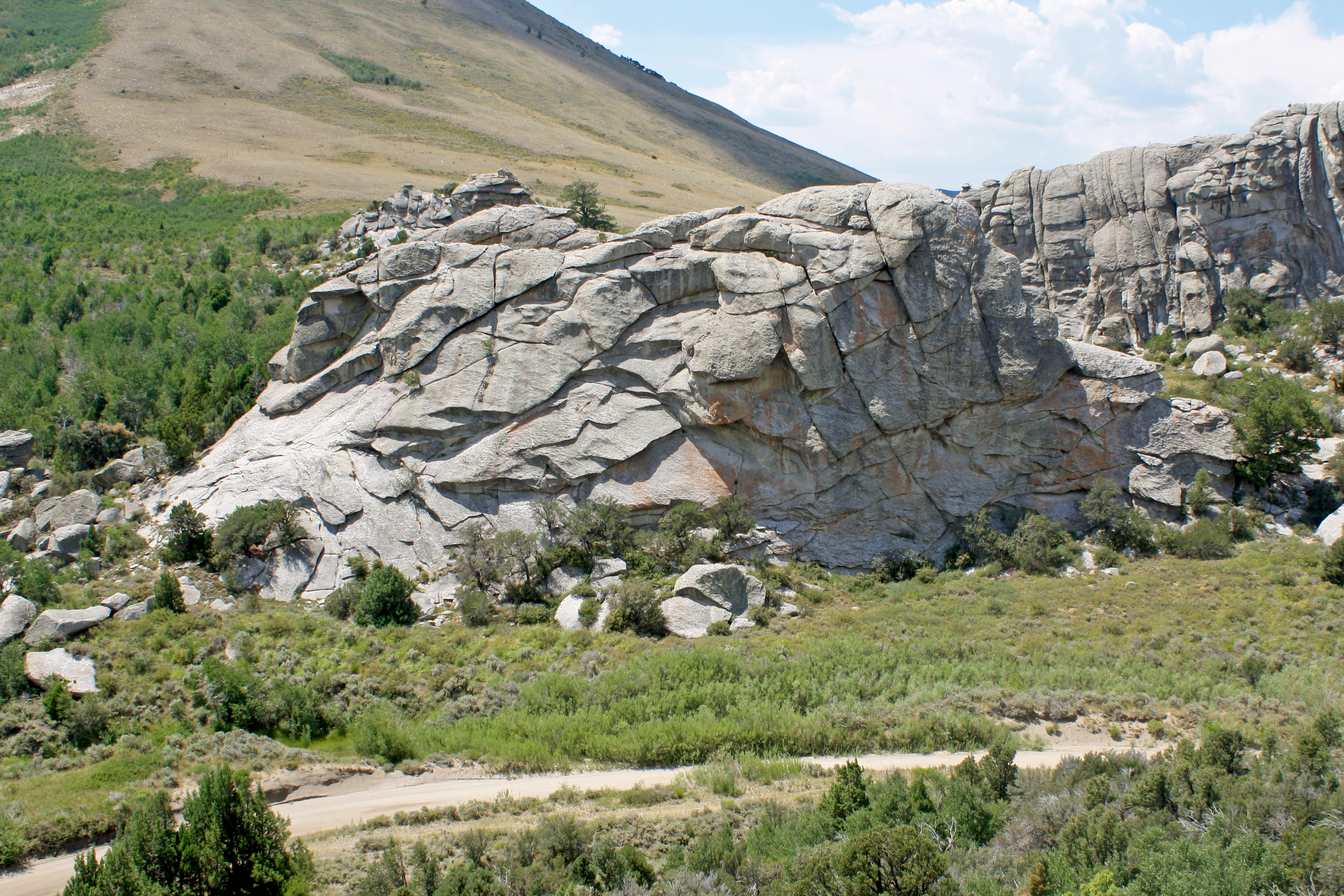
Large dome shaped granite formation next to the taller spire formation known as Morning Glory Spire. The area is mountainous with granite formations jutting up throughout the landscape. The area is surrounded primarily by juniper and pinyon pine trees.
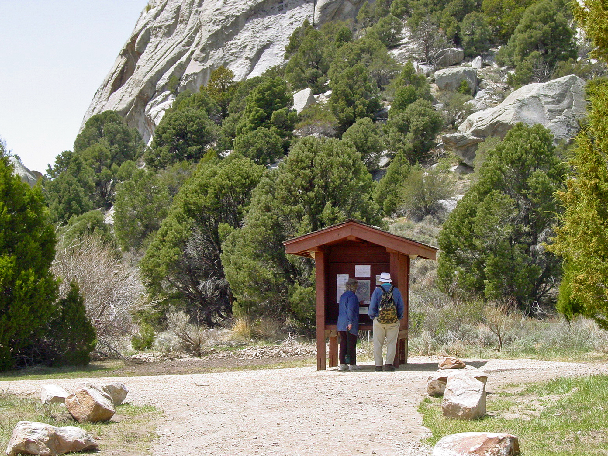
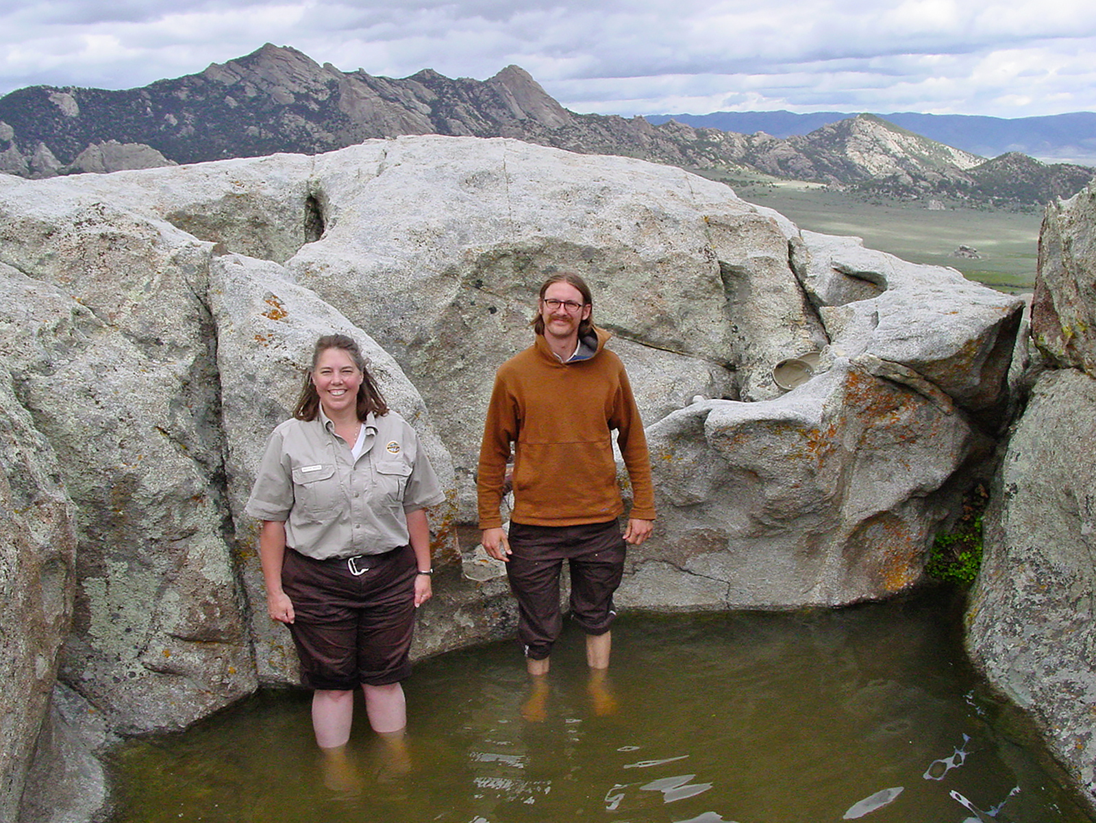
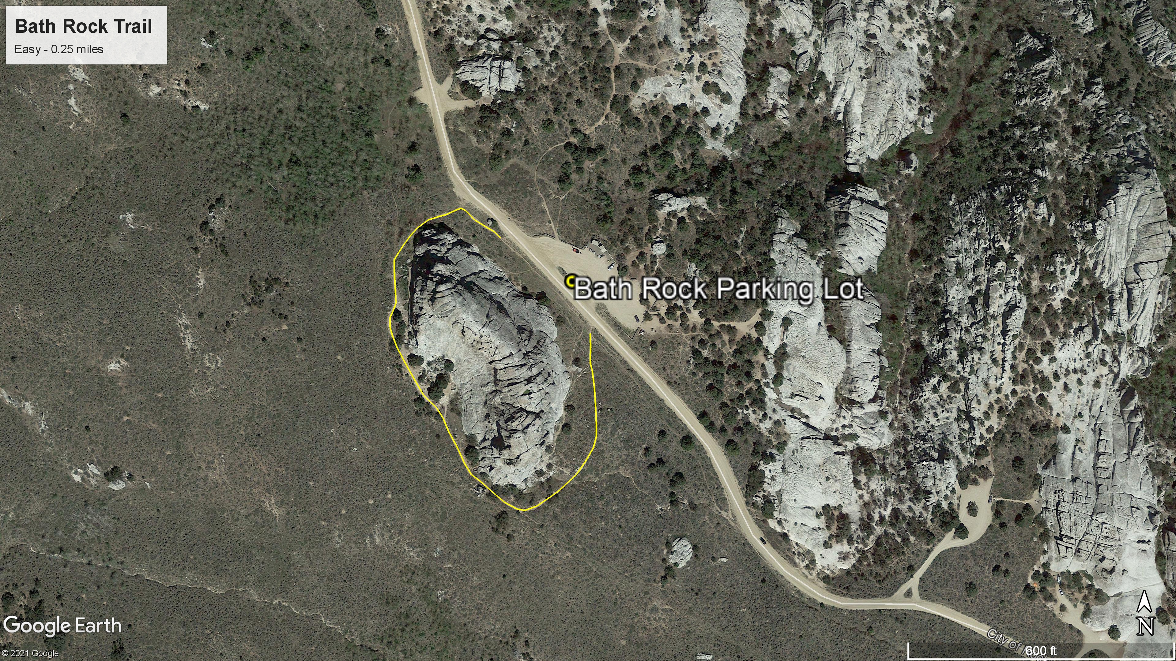
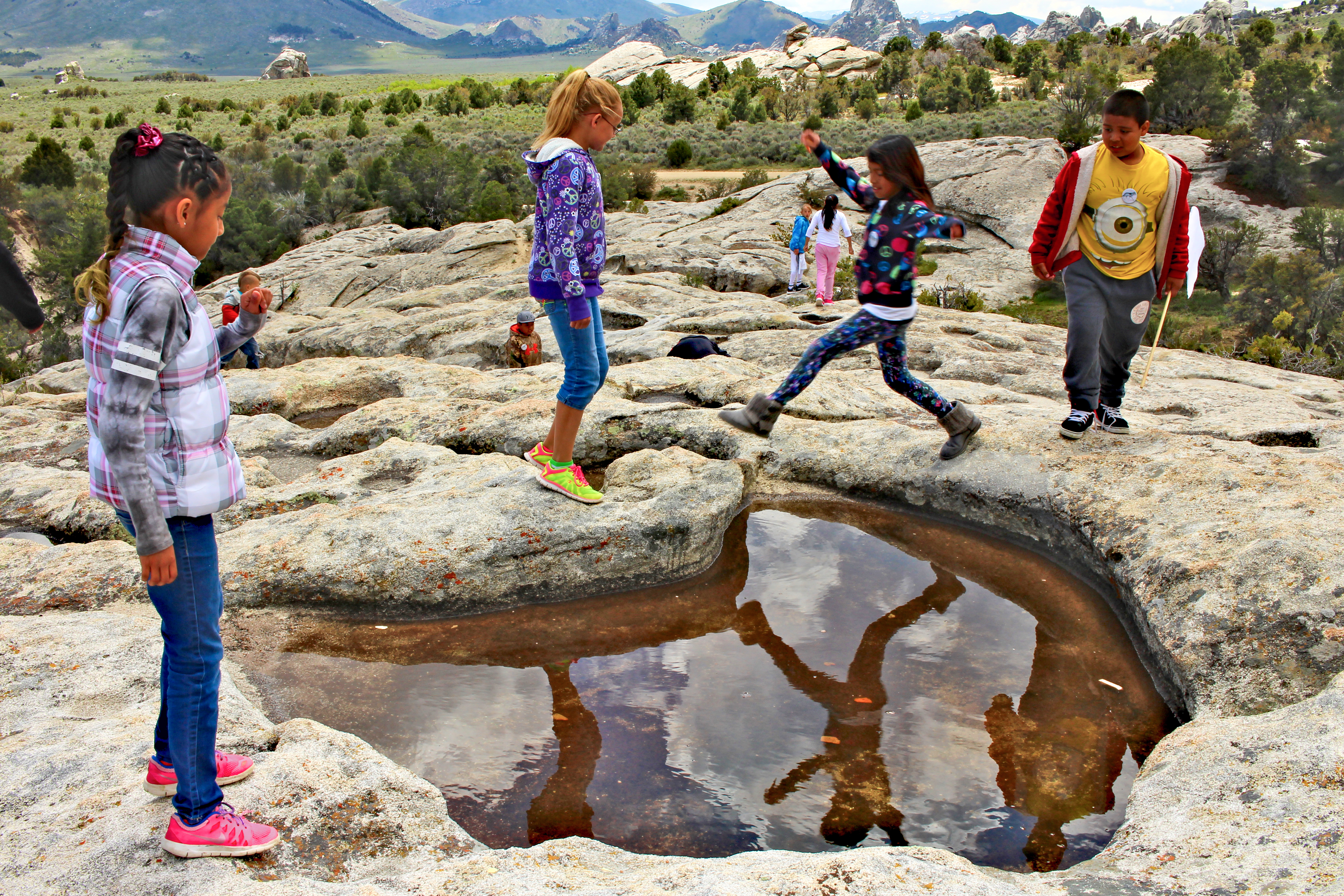
Starting from the parking lot, this short trail loops around the looming granite formation of Bath Rock. The rock is named for large natural pools of water atop this 240-foot tall monolith. Adventurous visitors can climb up the back side of Bath Rock where handles are affixed along the steepest section of the climb.
This short trail loops around Bath Rock beginning at the parking area. The rock is named for large natural pools of water atop this 240-foot formation.
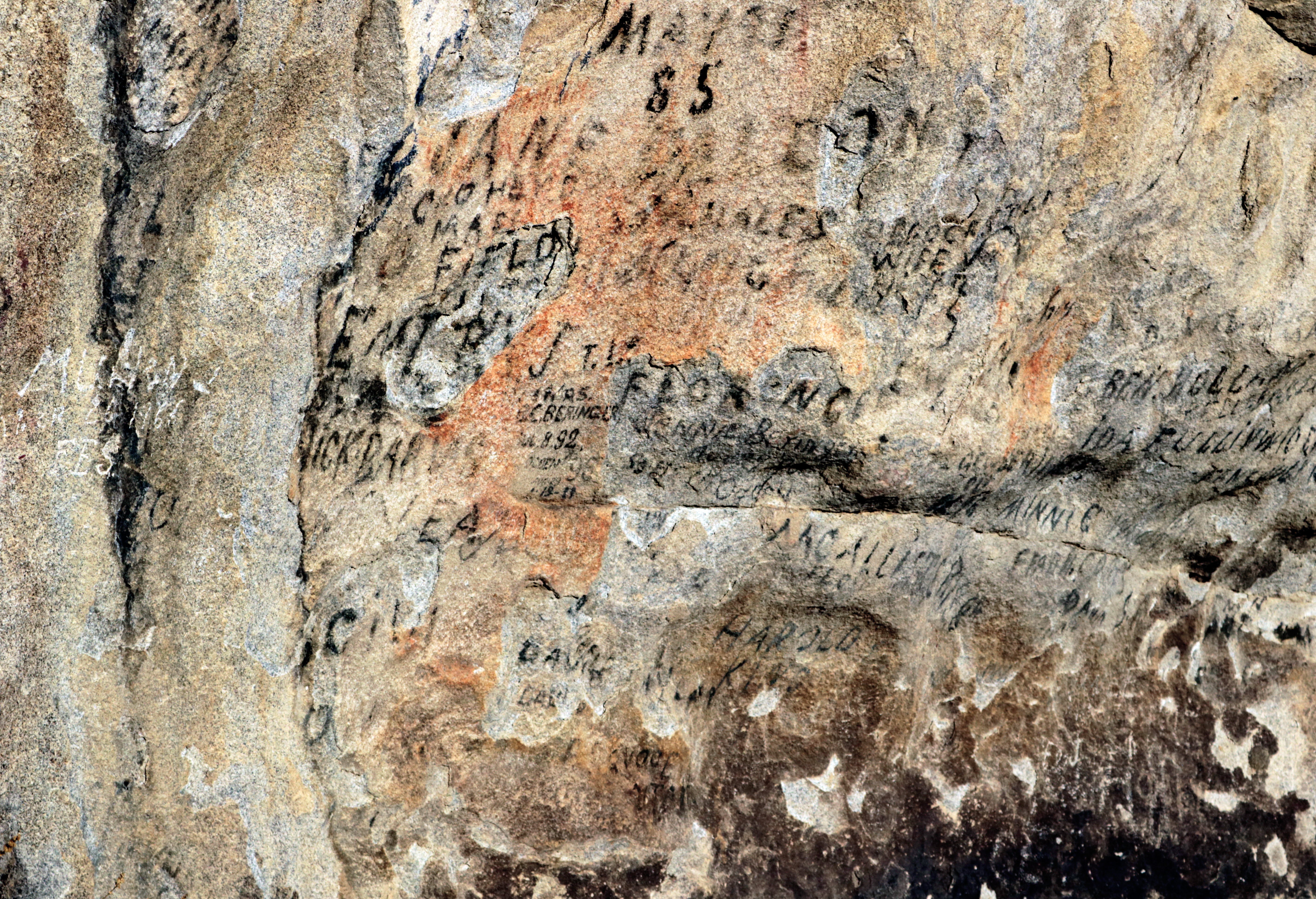
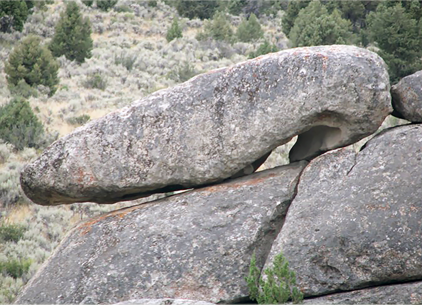
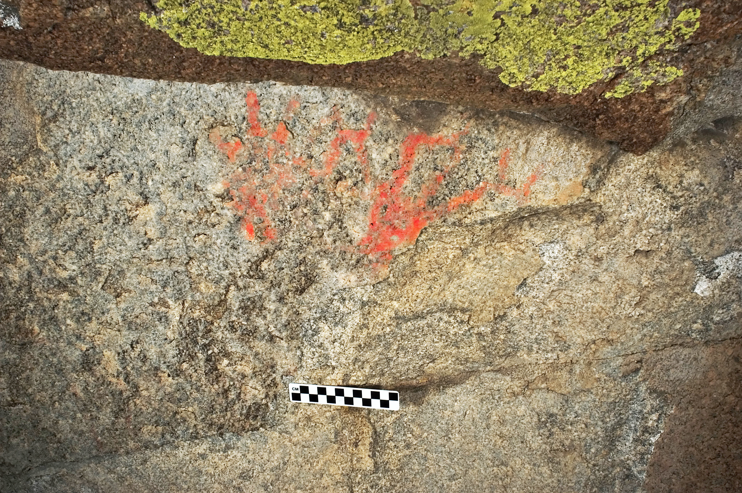
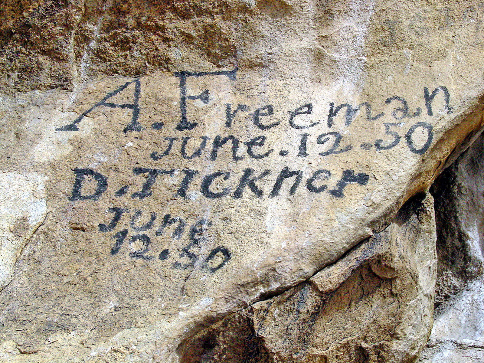
Camp Rock was a favorite resting place for emigrants traveling along the California Trail. Some wrote their names in axle grease on the rock faces. Now over 160 years later, we can see those names and wonder what it was like for them as they traveled throught the City of Rocks. Hundreds of inscriptions and dates can be seen ranging from 1843-1882.
Large dome-like granite formation with historical emigrant signatures graffitied all over the rock wall in axel grease on the back side of the formation.
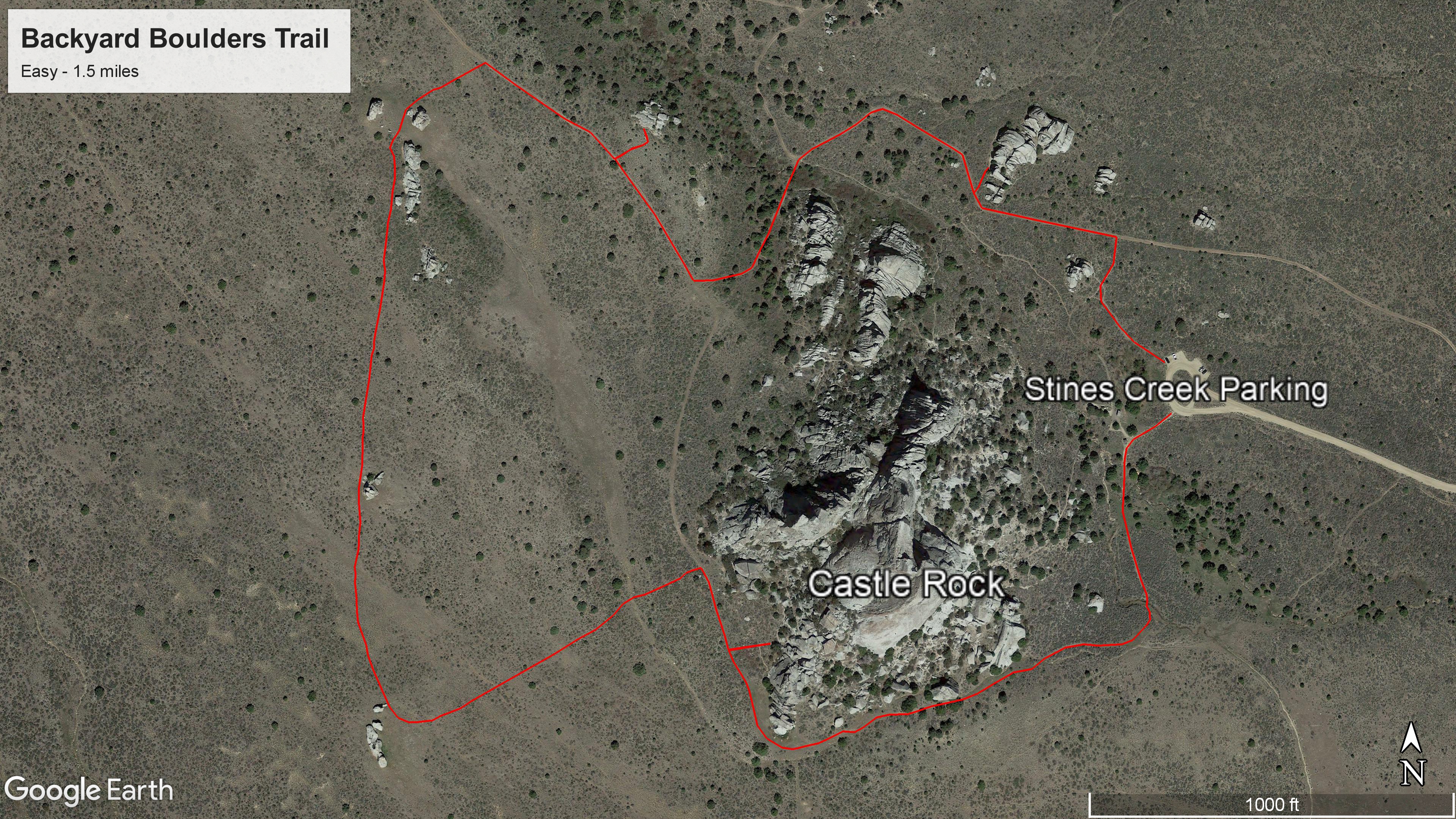
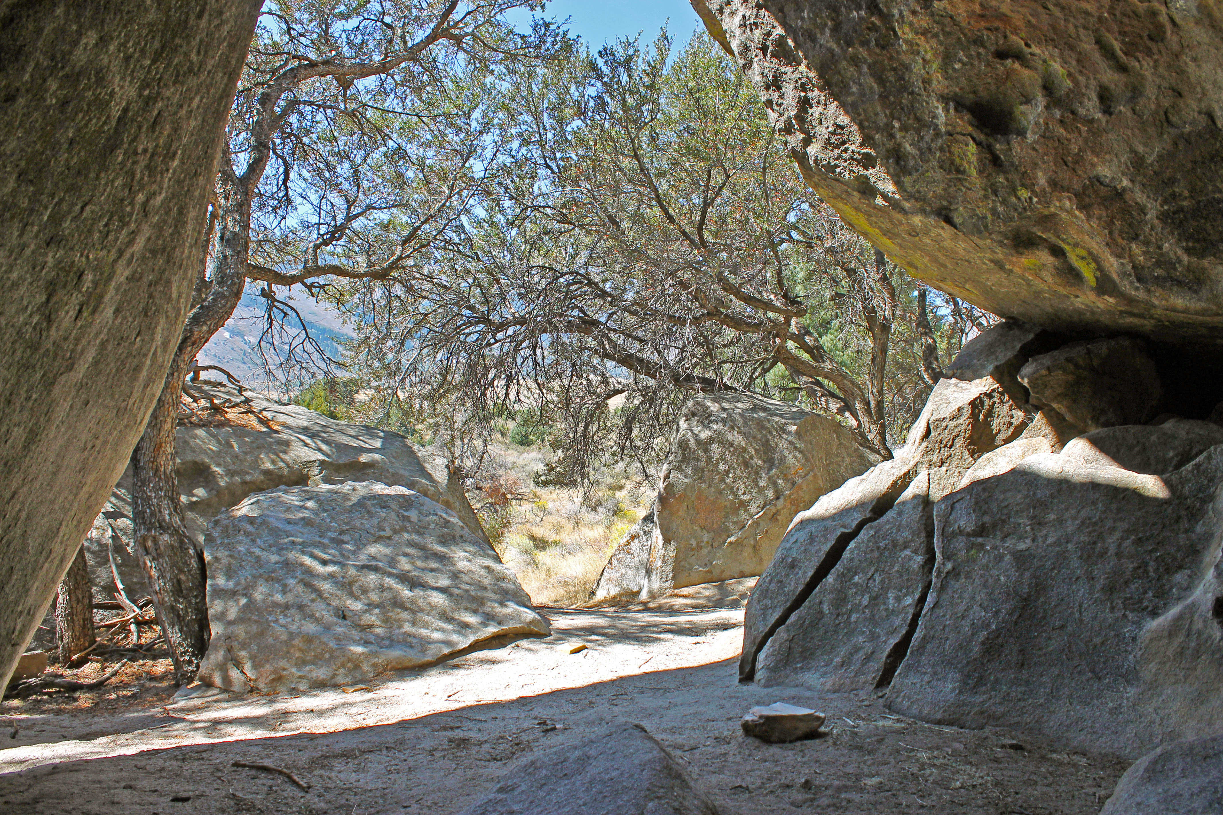
Castle Rock is the centerpiece of this 1.5 mile loop trail. It features impressive rocks as well as archaeological sites such as the Shock and Awe Shelter and pictographs.
Castle Rock is the centerpiece of this 1.5 mile loop trail. It features impressive rocks as well as archaeological sites such as the Shock and Awe Shelter and pictographs. In spring hikers may encounter many species of wildflowers and experience the arrival of migratory birds. In autumn, hikers are treated to the colorful foliage of aspen, chokecherry, and willow.
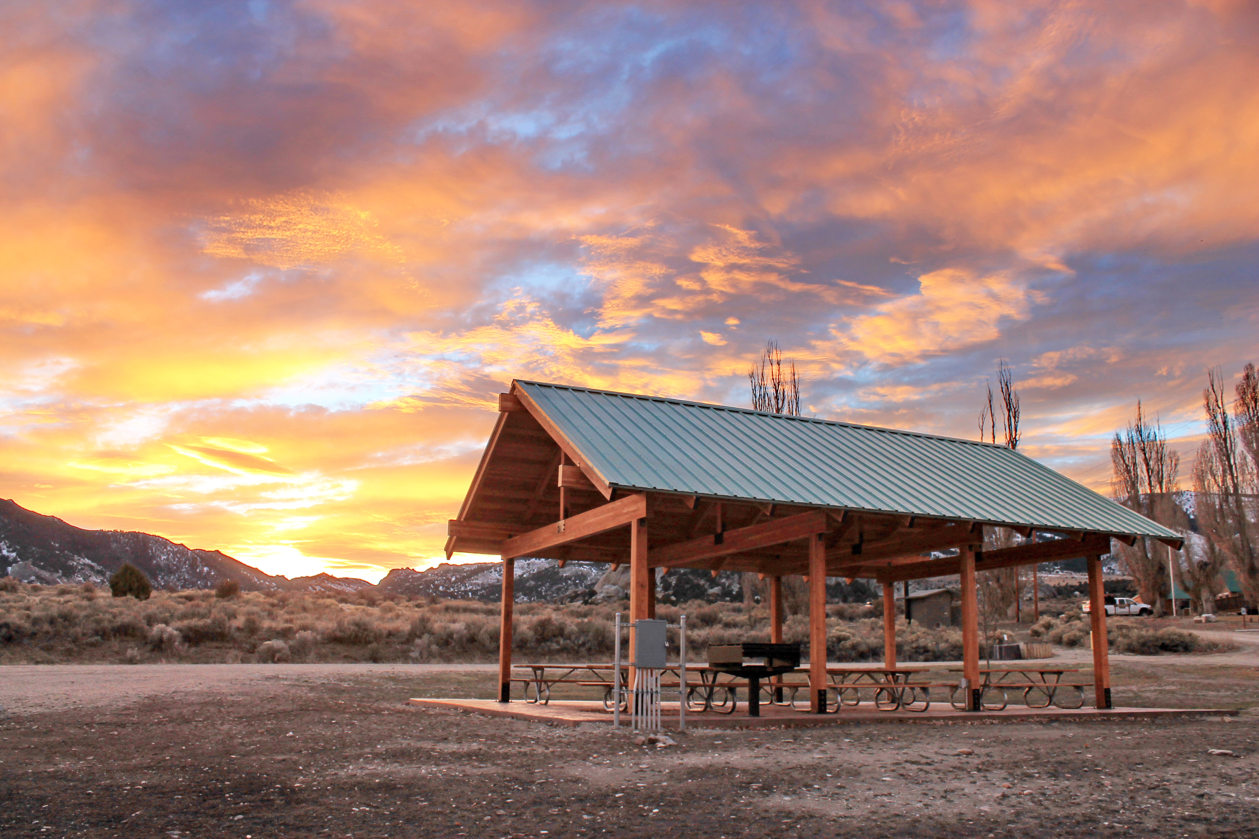
The Shelter is an attractive western style building with wooden beams, stained tile floor, and a roof that covers a 30 x14 foot area. The shelter comes with six picnic tables, electrical receptacles and a charcoal grill that has a cooking surface of 37 x 37 inches. A vault toilet and non-potable water spigot is located nearby. This is a day use facility only, no camping.
The Shelter is an attractive western style building with wooden beams, stained tile floor, and a roof that covers a 30 x14 foot area. The shelter comes with six picnic tables, electrical receptacles and a charcoal grill that has a cooking surface of 37 x 37 inches.
Just across the road from the Castle Ranch Lodge and Bunkhouse there is an accessible vault toilet. There is potable water in front of the lodge. There is also a picnic area, disk golf course, and large lush lawn area. There are large poplar trees and fruit trees that blossom in the spring on the lawn. The spectacular formations of Castle Rocks jut out from mountainous terrain in the backdrop.
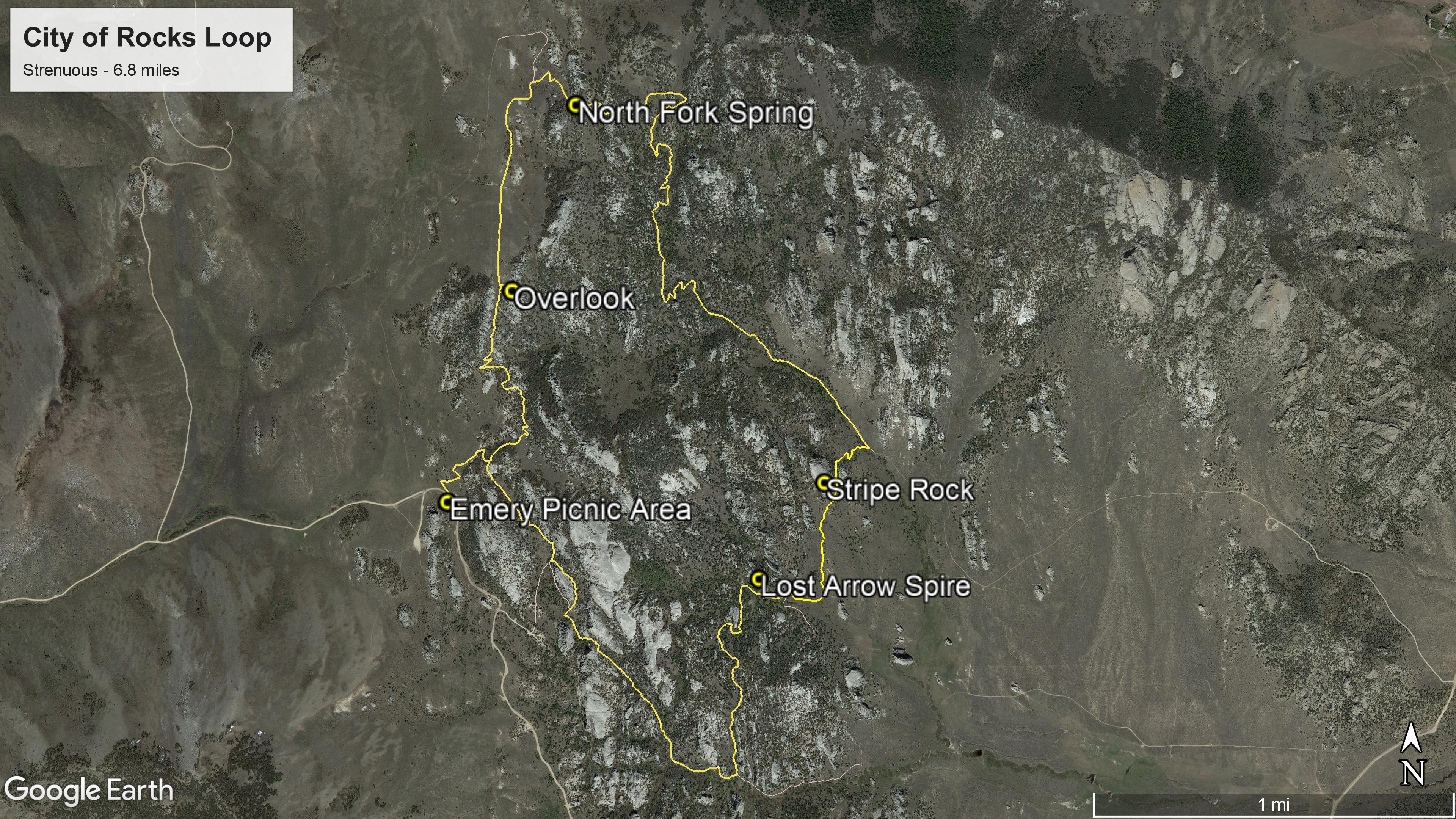
From sagebrush flats to high country groves, this trail takes you deep into the “City.” This remote loop hike is a ranger favorite. The combination of pine trees, rock formations, and epic views offer a surprise at every turn of the trail.
From sagebrush flats to high country groves, this trail takes you deep into the “City.” This remote loop hike is a ranger favorite. The combination of pine trees, rock formations, and epic views offer a surprise at every turn of the trail.
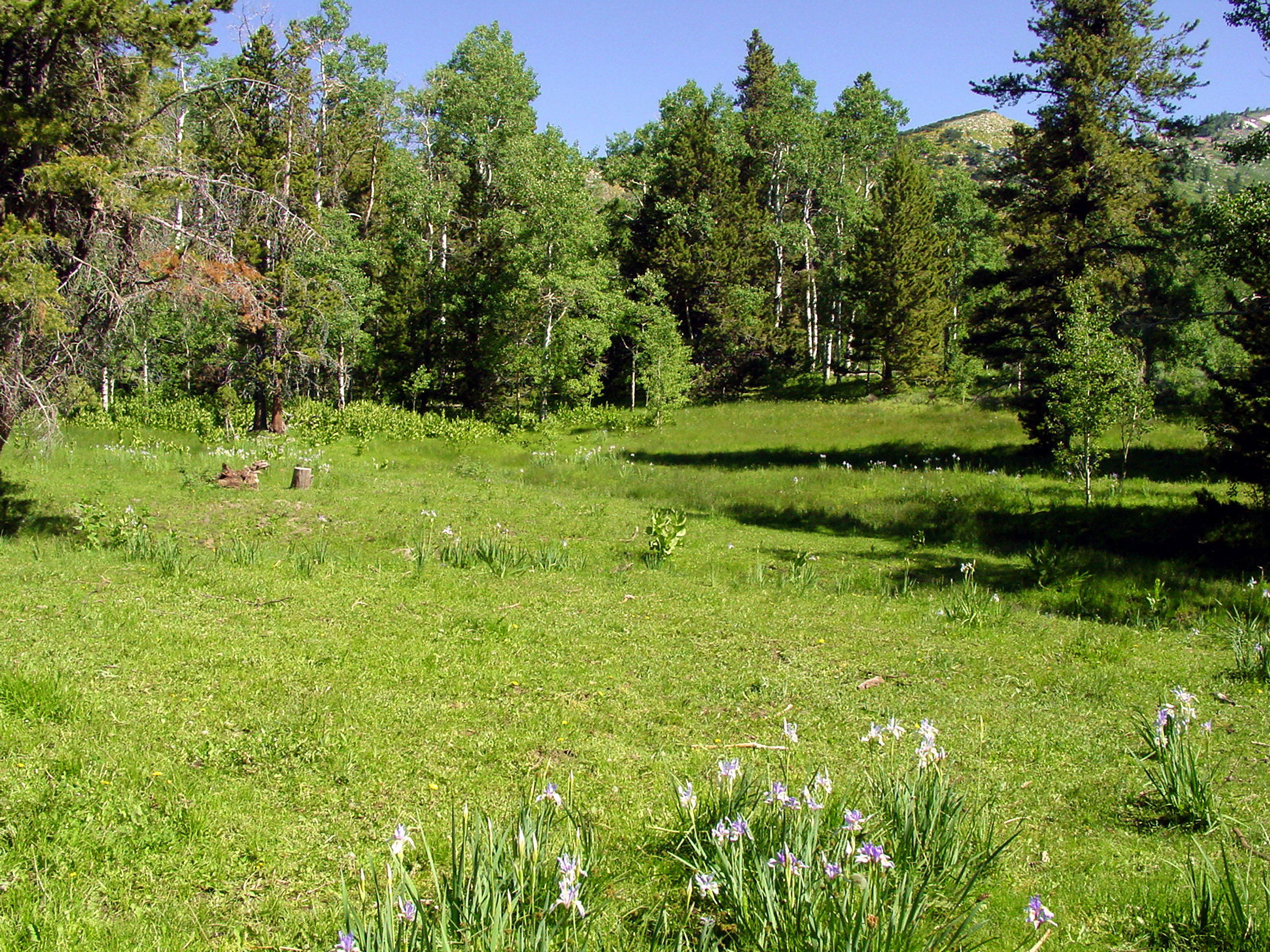
The City of Rocks National Reserve is a National Historic Landmark associated with the mass overland westward migration. Emigrants traveling the California Trail would reach Circle Creek in the City of Rocks and nooned or camped. Some of these emigrants left their names on the rocks along the trail within the Reserve. The reserve is a great place to view wildlife along the trail.
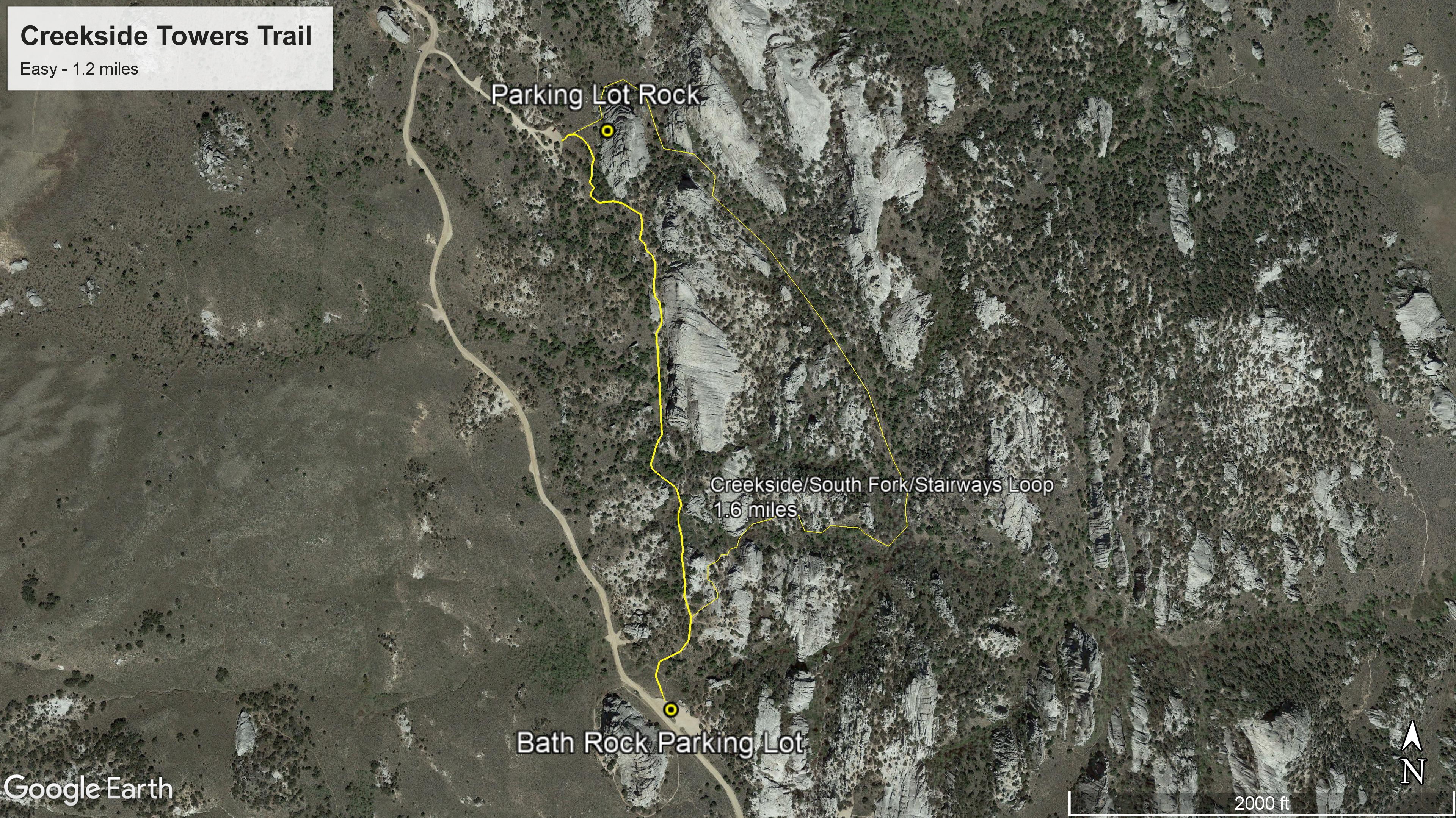
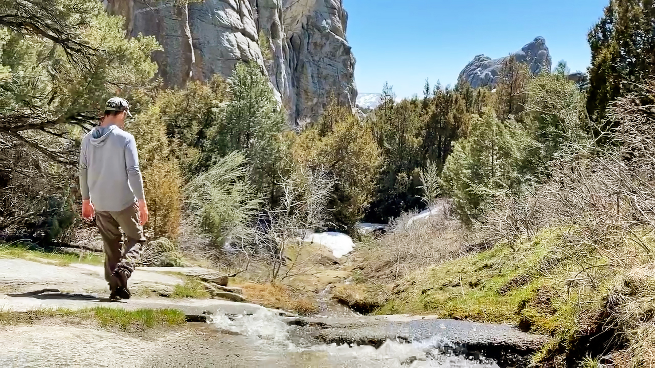
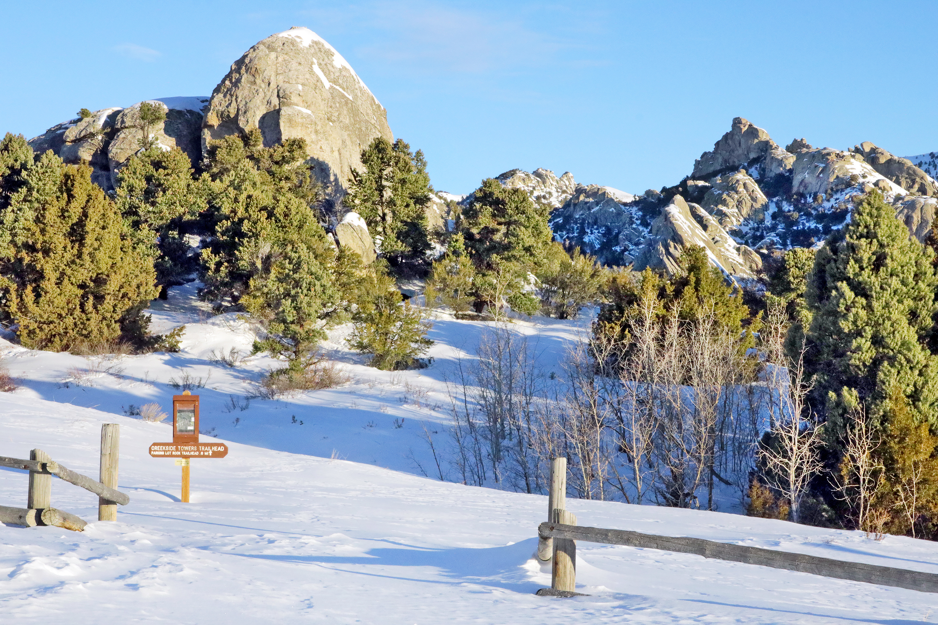
Creekside Towers is an out-and-back 1.2-mile trail. The trail’s gentle grade of 122 feet relative elevation is suitable for families with children or anyone looking for an easier hike in the Reserve. Interesting geologic sculptures line the trail. In spring and early summer enjoy the running creek and small cascading waterfall. Outstanding scenery, granite pinnacles, and a diversity of plants and animals await.
Creekside Towers is an out-and-back 1.2-mile trail. The trail’s gentle grade of 122 feet relative elevation is suitable for families with children or anyone looking for an easier hike in the Reserve. Interesting geologic sculptures line the trail. In spring and early summer enjoy the running creek and small cascading waterfall. Outstanding scenery, granite pinnacles, and a diversity of plants and animals await. Adjoining trails can make for a longer and more adventurous loop. Circle around Parking Lot Rock to South Fork Circle Creek Trail then Stairways to make a 1.6-mile loop.
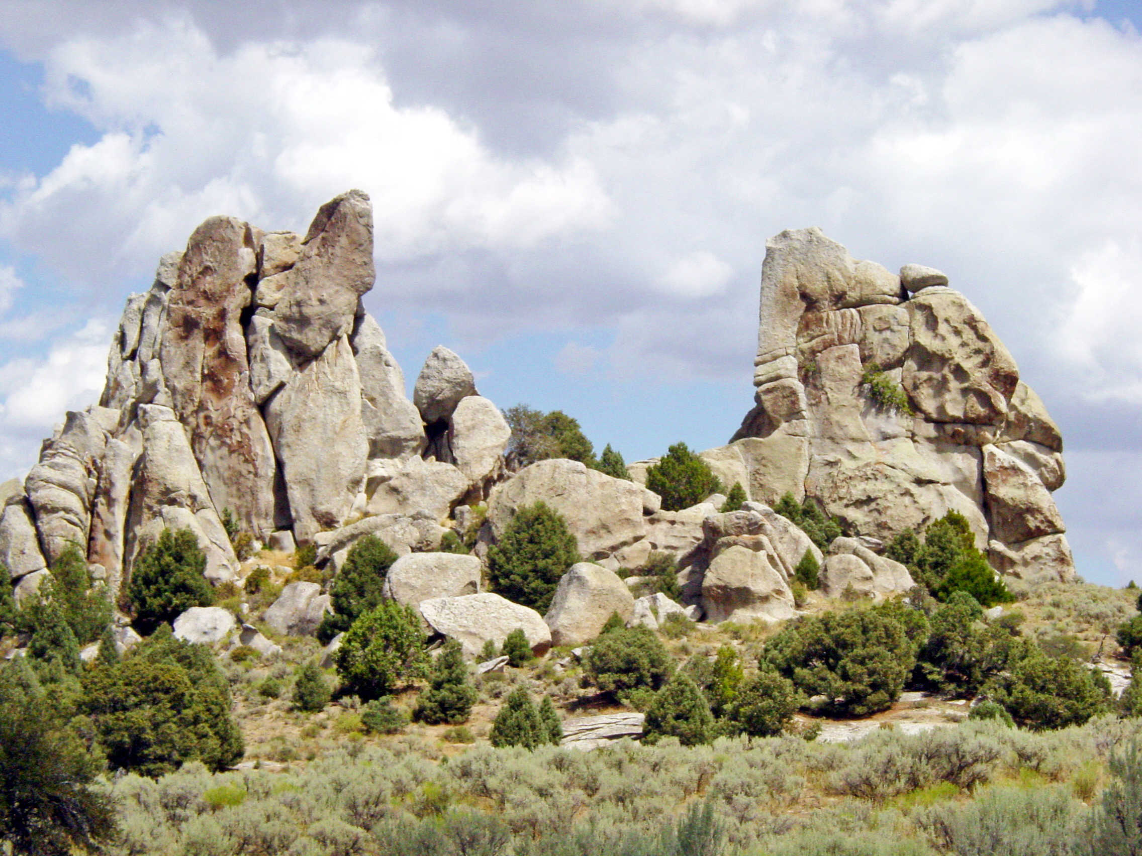
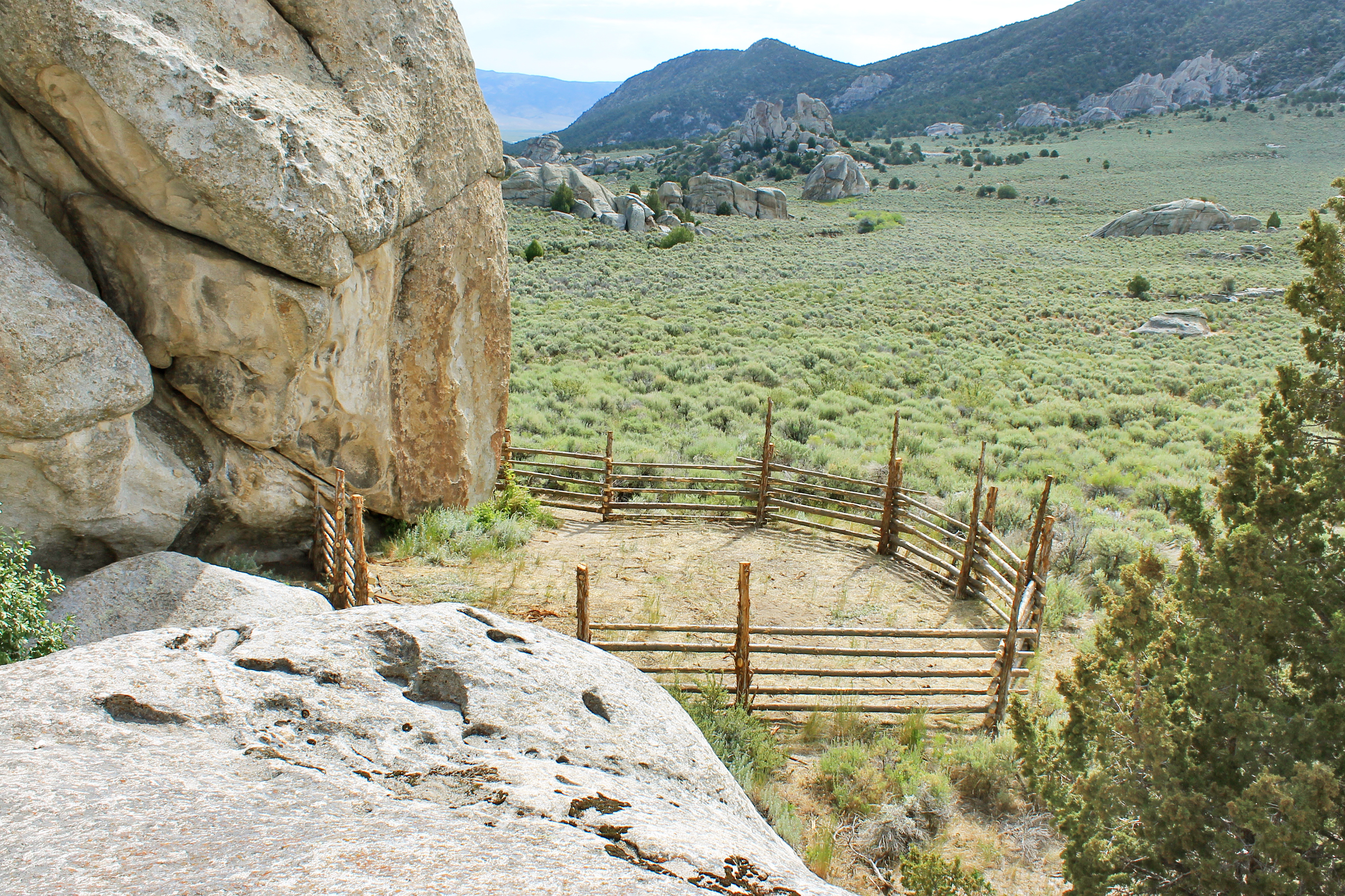
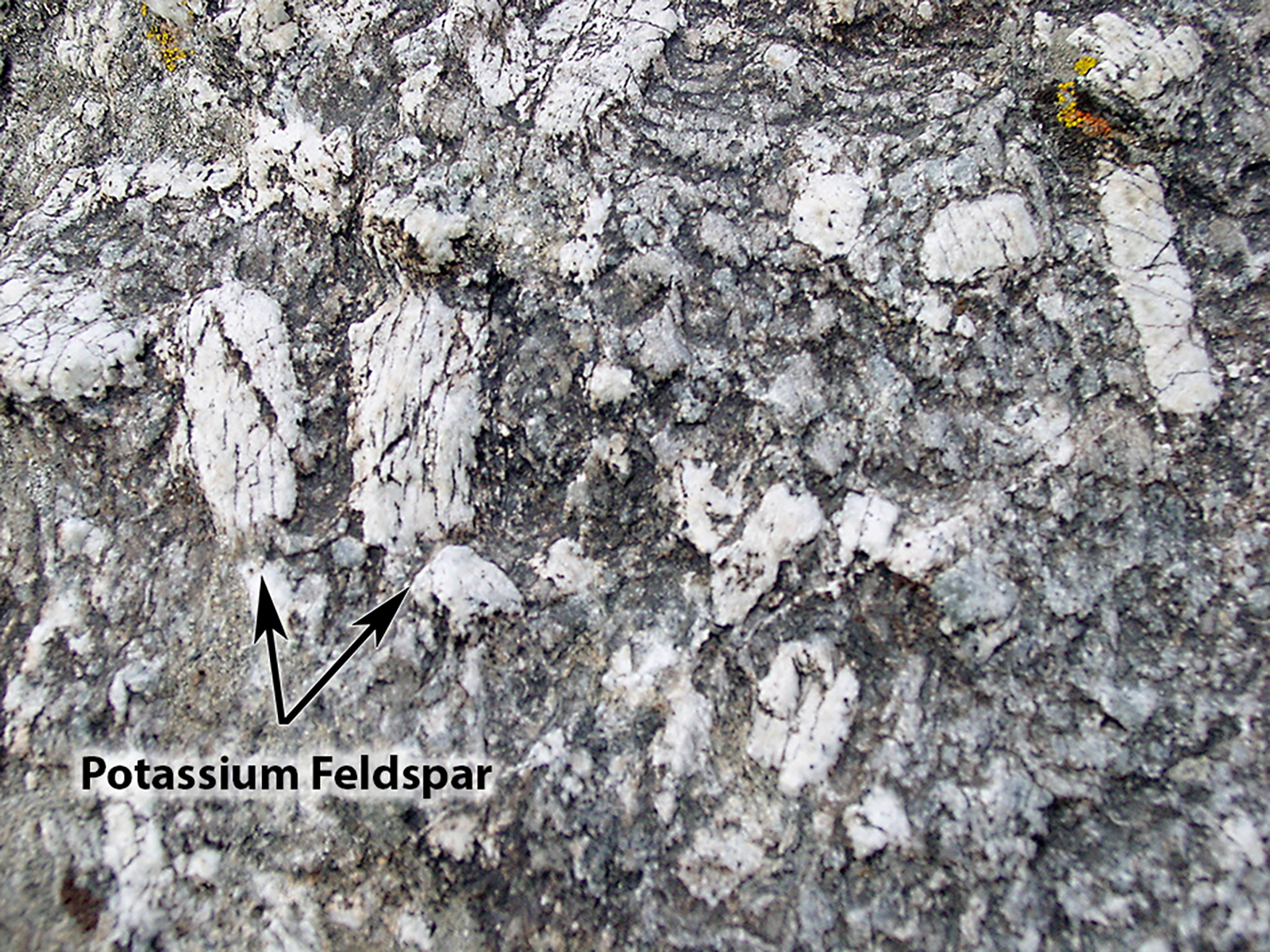
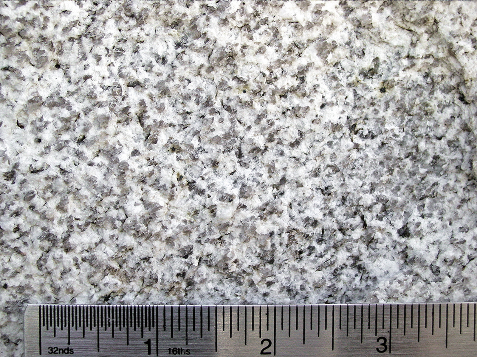
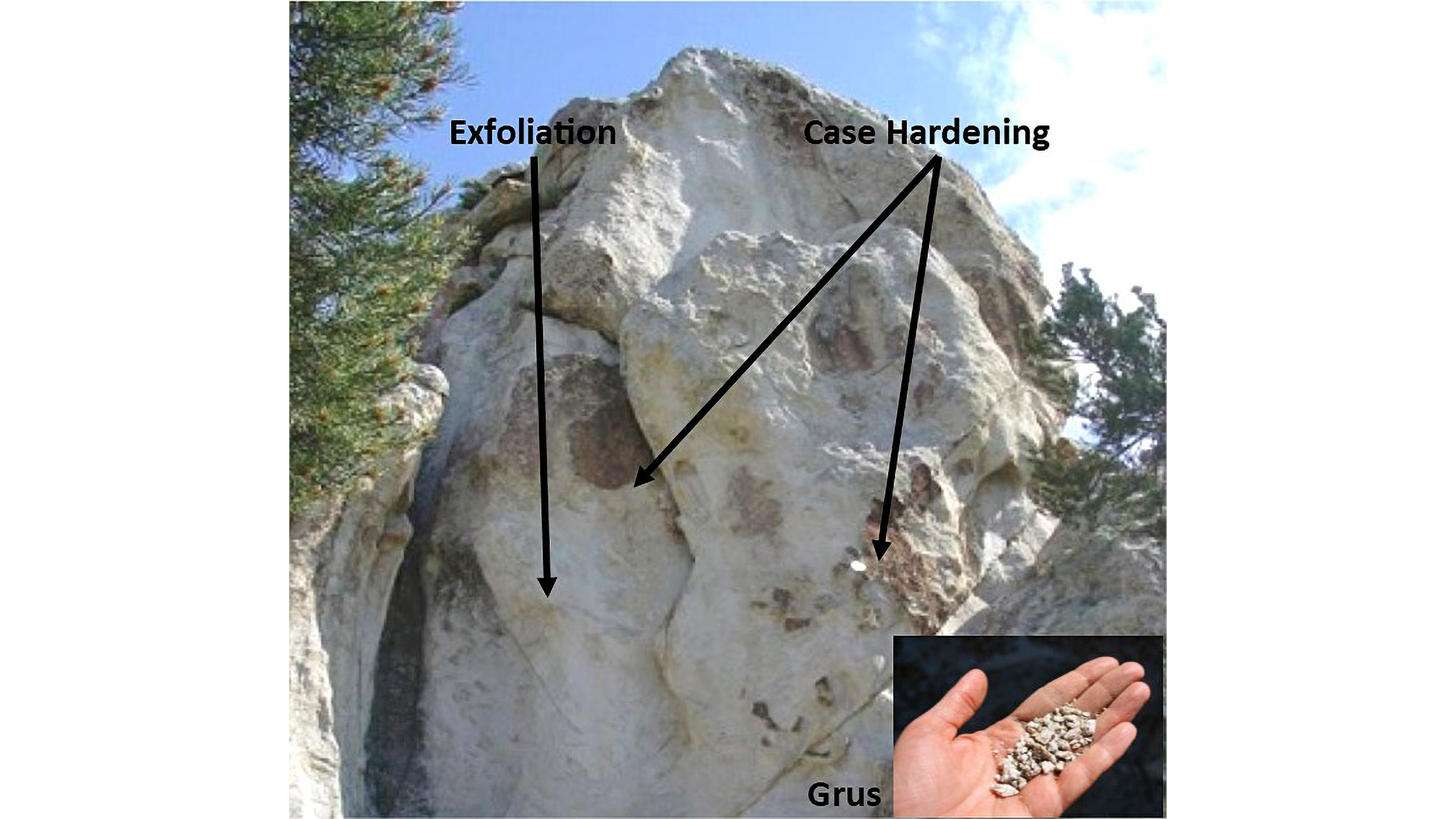
Have you ever visited City of Rocks and wondered, “How did this happen?” or “Why do the rocks look like this?” The Geological Interpretive Trail is the perfect short hike to: see fascinating geological formations up close examine the difference between the Green Creek Complex and Almo Pluton learn about the geologic history of this landscape
Have you ever visited City of Rocks and wondered, “How did this happen?” or “Why do the rocks look like this?” The Geological Interpretive Trail is the perfect short hike to: see fascinating geological formations up close examine the difference between the Green Creek Complex and Almo Pluton learn about the geologic history of this landscape
This is the end of the Creekside Towers Trail, or the beginning depending on which end you start from. If you need a rest stop there is a bathroom located about 500 ft up the road.
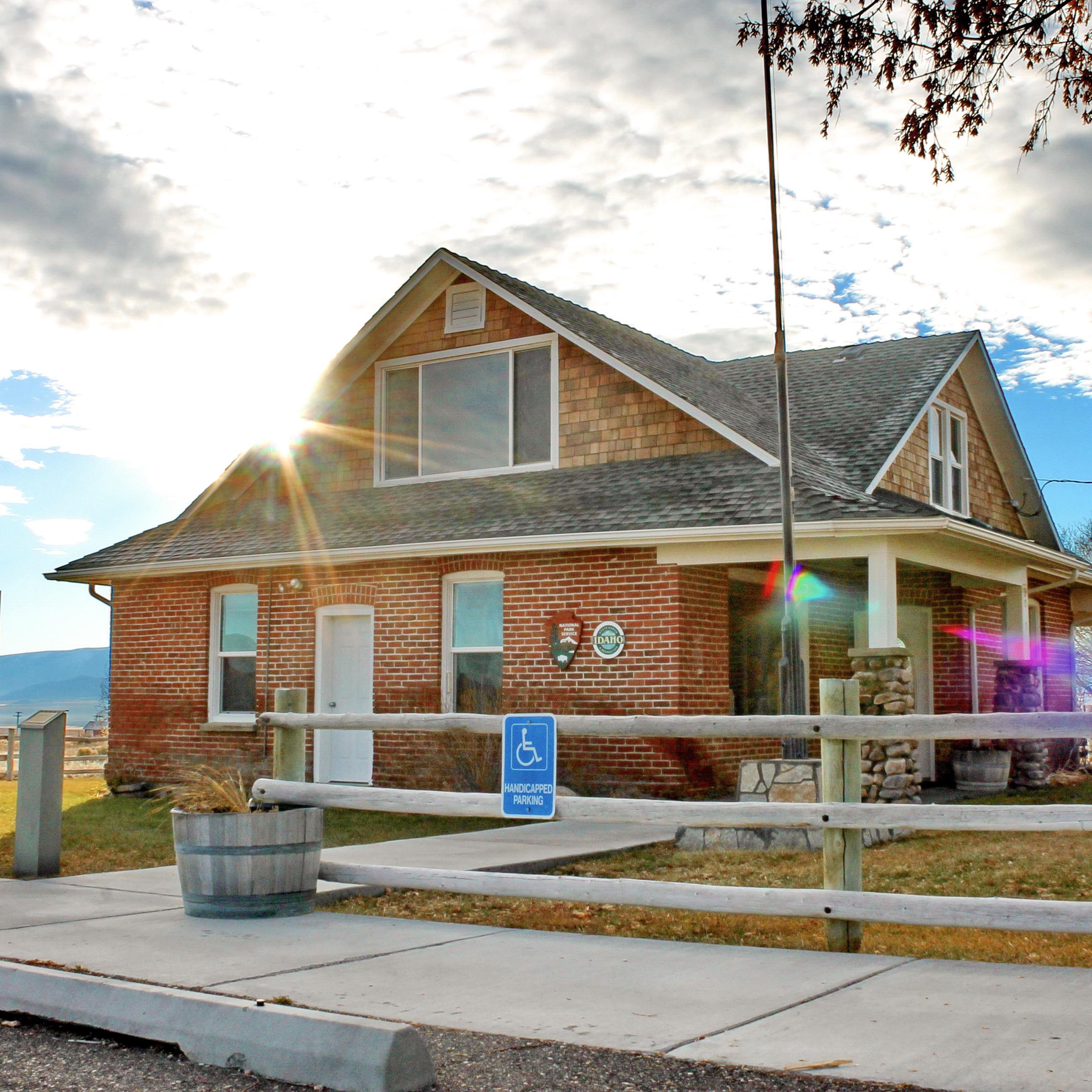
The Visitor Center for City of Rocks National Reserve and Castle Rocks State Park is located just outside the National Reserve in the community of Almo. Stop in to chat with a Ranger or pick up maps, guide booklets, and other informative resources. We also offer souvenirs such as books, mugs, apparel, postcards, and stickers.
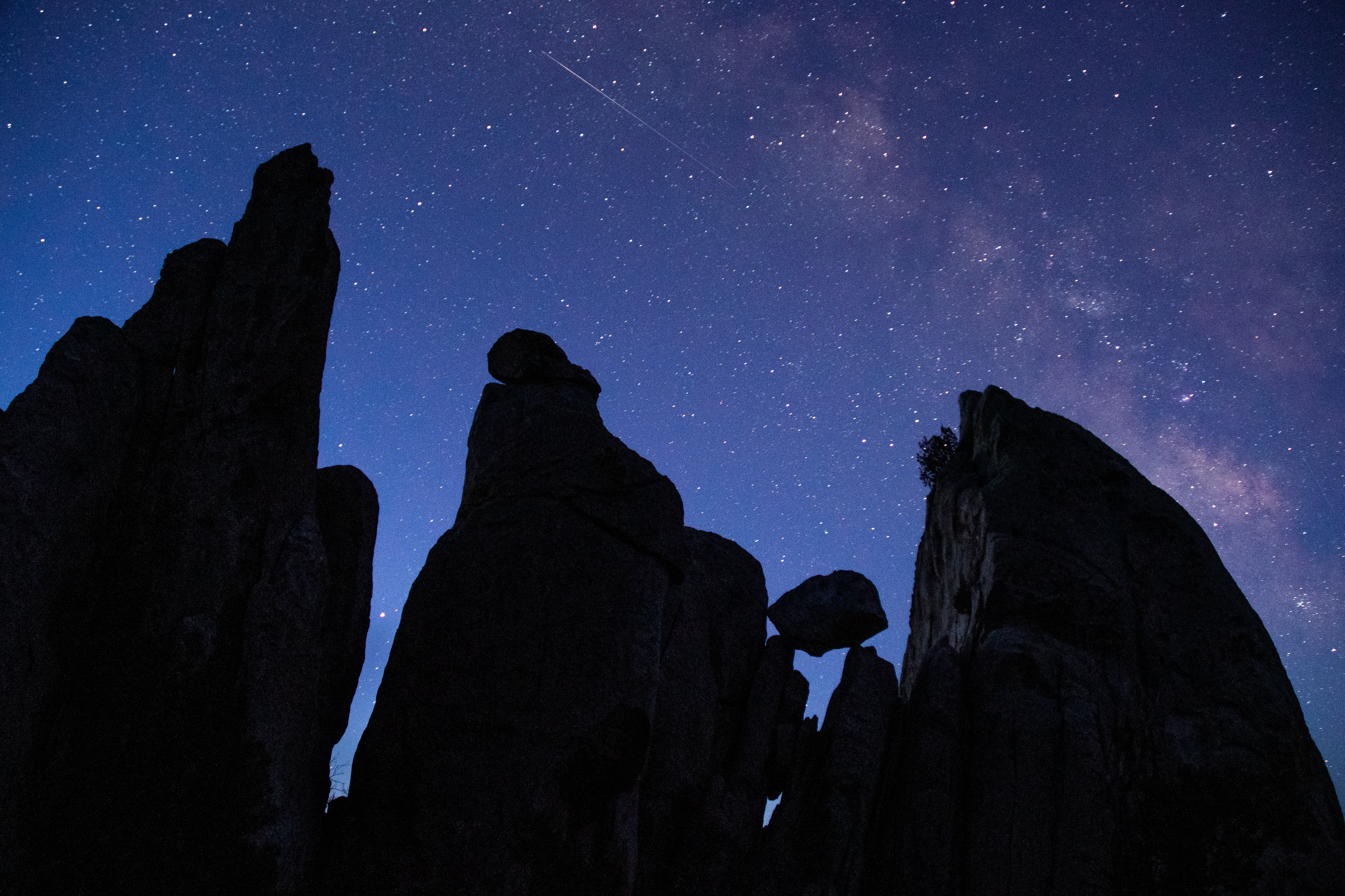
Immerse yourself in the solitude of the "Silent City".
Explore the Night Sky
A day in the park doesn't have to end when the sun goes down! A whole new world comes alive at night and is waiting to be explored. The dark sky over City of Rocks is an excellent place to experience the beauty of the night.
Become a City of Rocks Junior Ranger
Junior Rangers "Explore, Learn, and Protect" their national parks. Pick up a free booklet from the Visitor Center to learn about geology, nature, and history in City of Rocks National Reserve. Complete fun activities like scavenger hunts, fill-in-the-blanks, and word searches. Once you've finished the recommended number of activities, turn in the booklet, take the park oath, and earn your Junior Ranger Badge!
Geologic & Historic Sites Driving Tour
A self-guided journey to discovering geologic wonders and historical sites in City of Rocks National Reserve. As you drive through the Reserve you will be able to view the featured rock formations and historic sites from your vehicle. Use your imagination as you observe the rocks to see animals, faces, and buildings and experience what it might have been like in this area in the past as you explore remnants of history.
Disc Golf at Castle Rocks
With the dramatic Castle Rocks landscape in the backdrop, this small three-hole disc golf course is fun for all ages and abilities. The lush grassy area of Castle Rocks Ranch has large shady trees that provide a welcome reprieve from summer heat. There are bathrooms, and picnic facilities in this area with more a short distance up the road at Stines Creek.
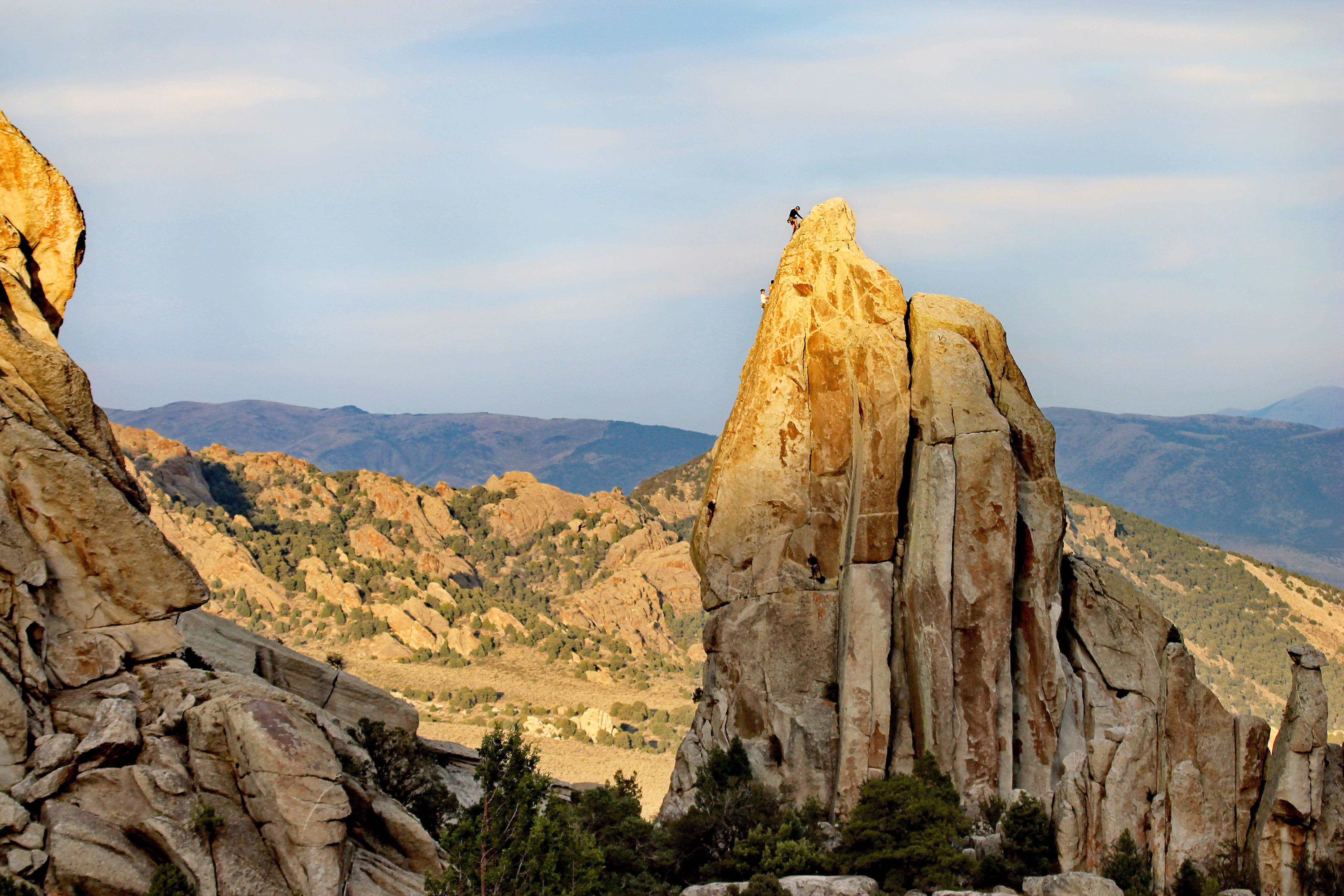
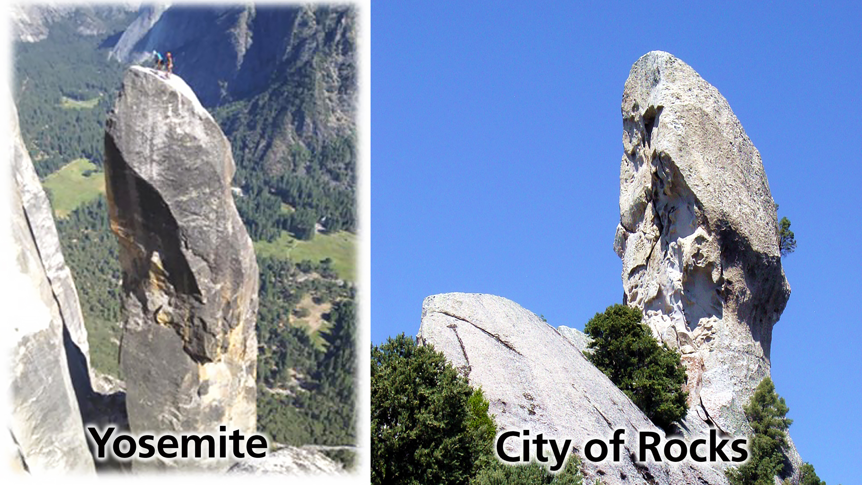
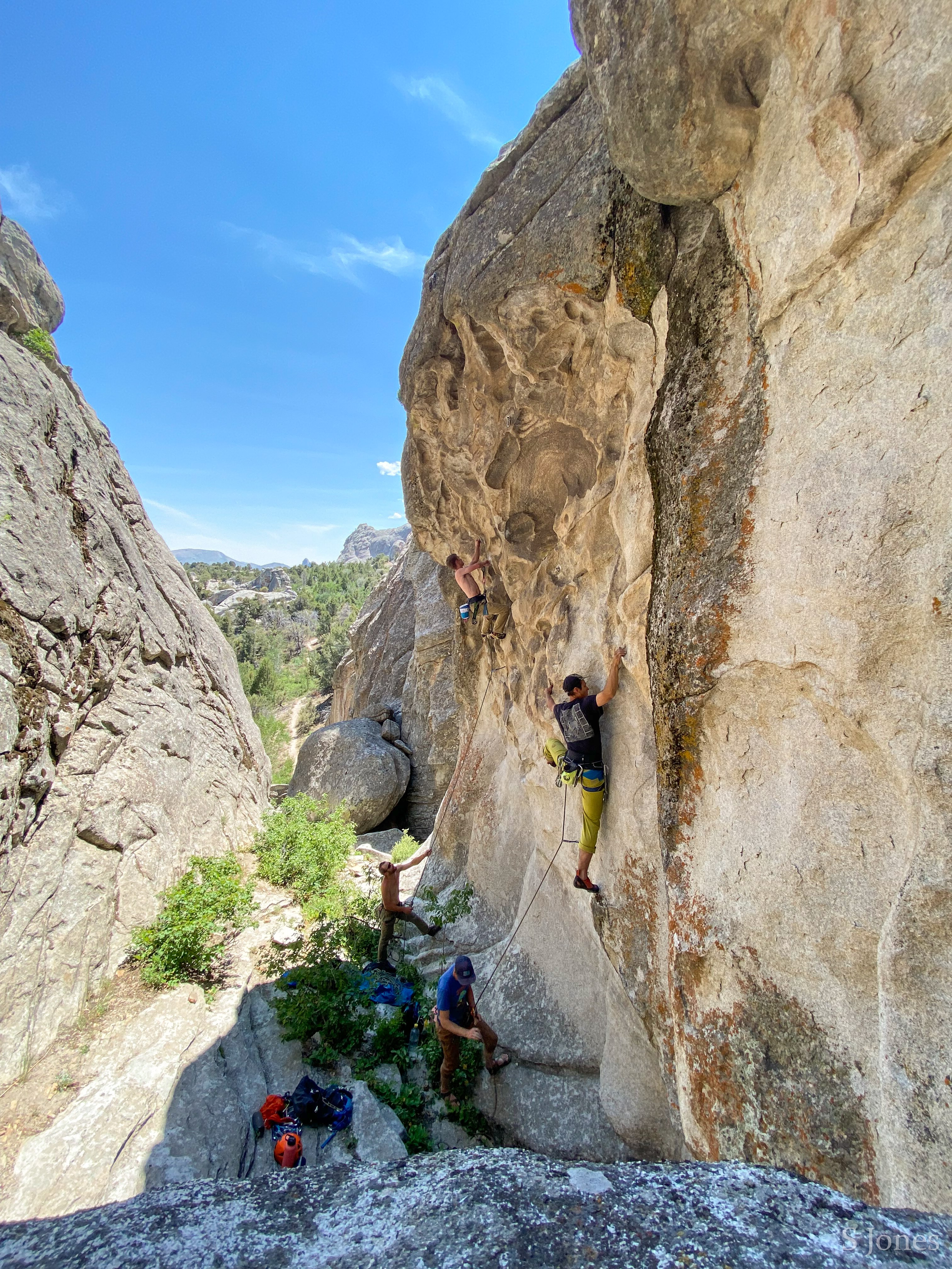
Rock Climbing in City of Rocks and Castle Rocks
Popular since the 1970's, City of Rocks granite is internationally renowned among climbers. There are over 600 routes here, both traditional and sport. Climbs vary from 30-600 feet, rating from the relatively easy 5.6 to the extremely difficult 5.14.
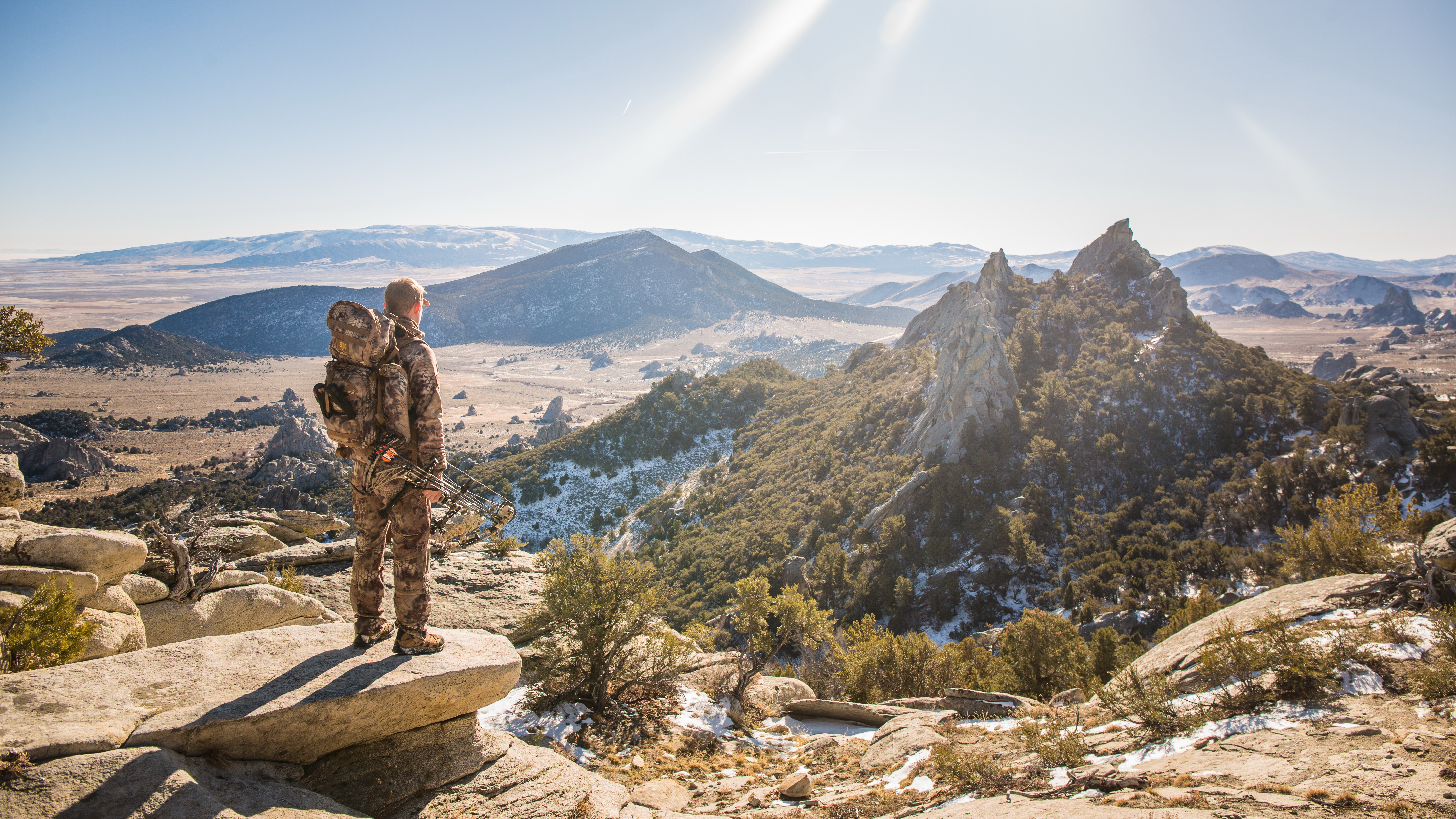
Hunting in City of Rocks and Castle Rocks
City of Rocks National Reserve was formed in part to preserve traditional uses of the land. It is one of few National Park System units that allows hunting. State and federal land around the Reserve, such as Castle Rocks State Park, Sawtooth National Forest, and BLM, are also open to hunting.
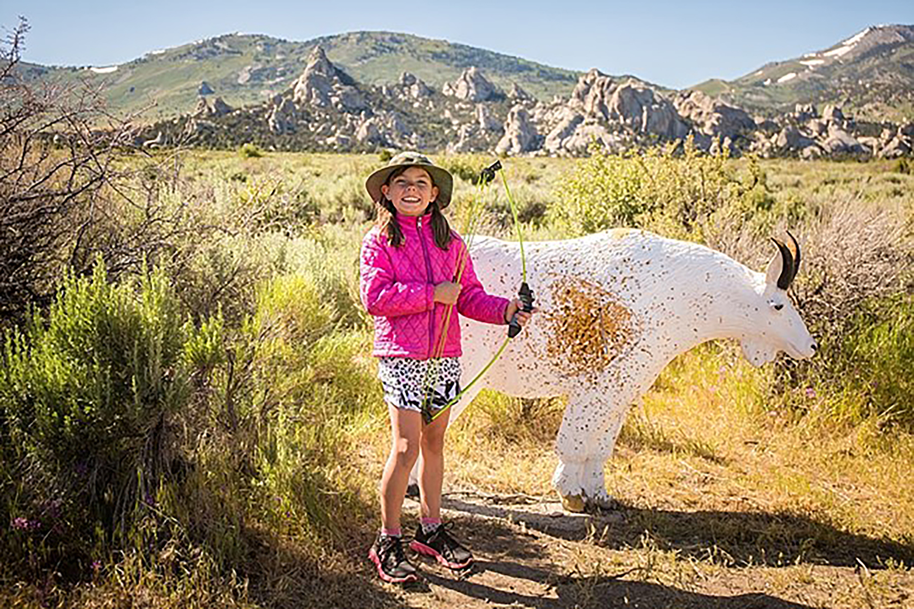
Archery Course at Castle Rocks
This course at Castle Rocks State Park has more than 20 stations. Shot distance ranges from 20 yards to 60 yards depending on target size.
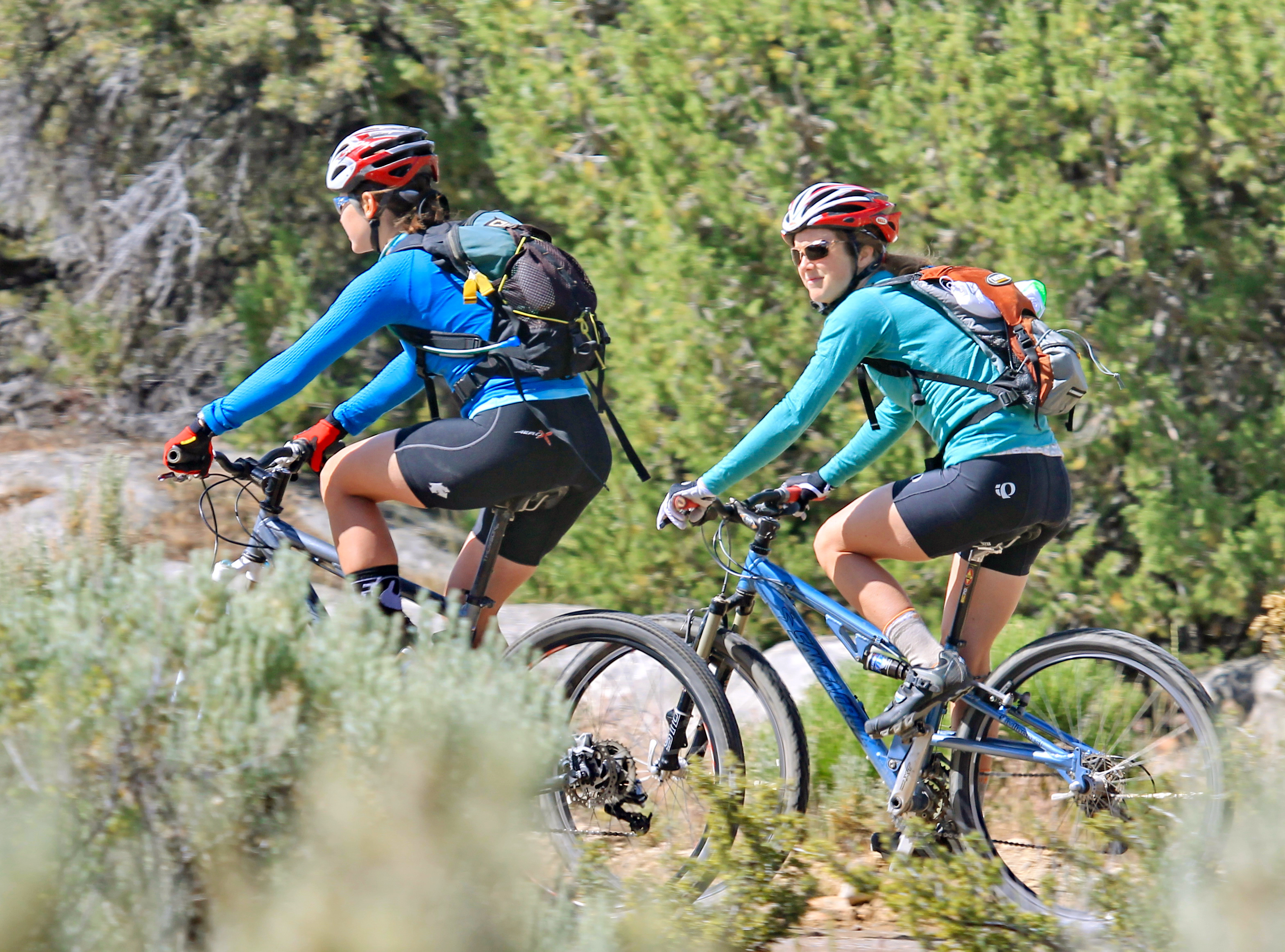
Bike the Tea Kettle Trail
Tea Kettle Trail is a great mountain biking trail that runs between Bread Loaves and Elephant Rock. The trailhead can be accessed from the Bread Loaves group camping parking lot or the parking area next to Elephant Rock. From one end to the other, the trail is 3 miles. Mountain bikers can connect with other trails or ride on the road to create loops and longer rides.
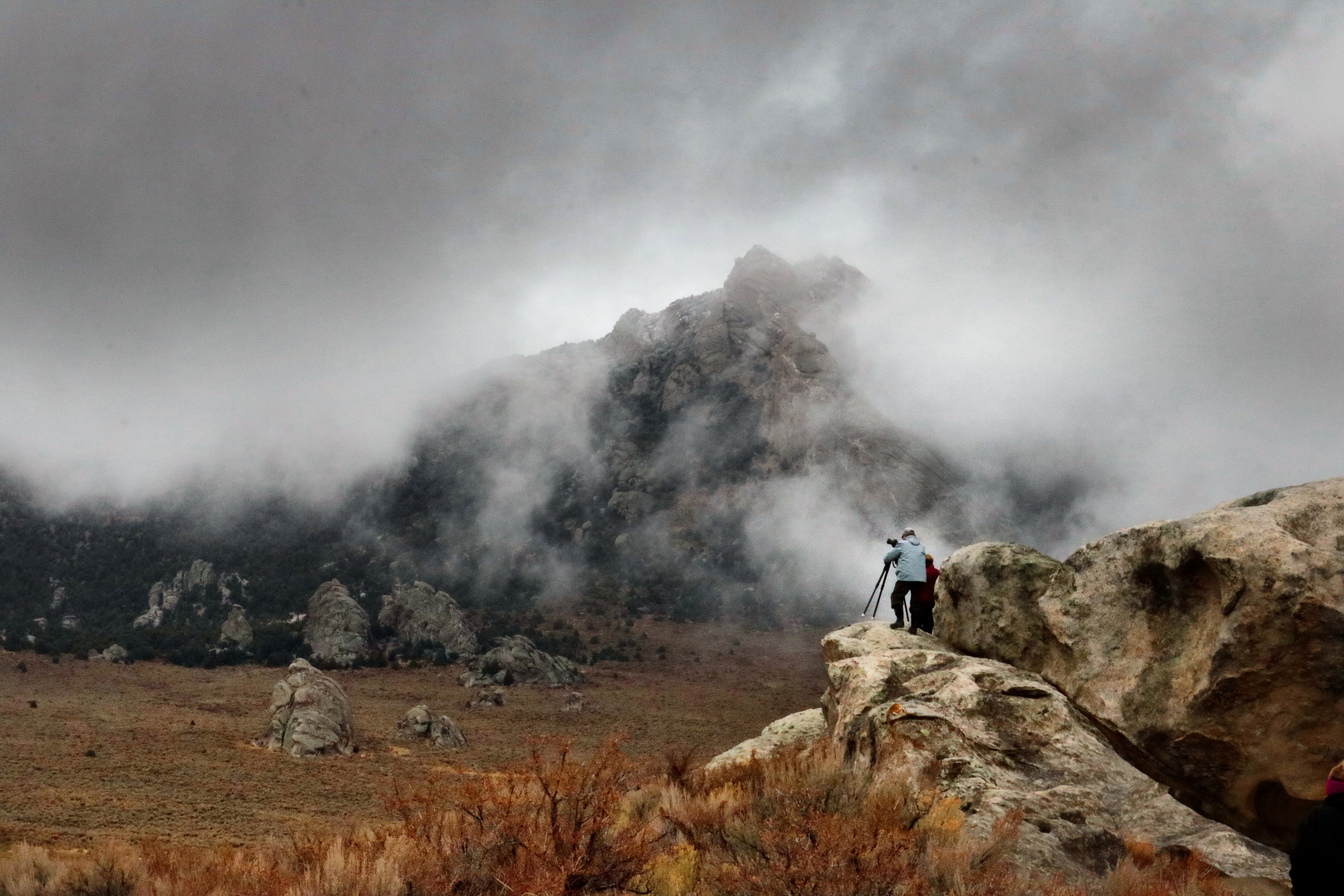
Winter Photography
Capture spectacular winter views.
Winter Birding
Spot over 40 species during winter months.
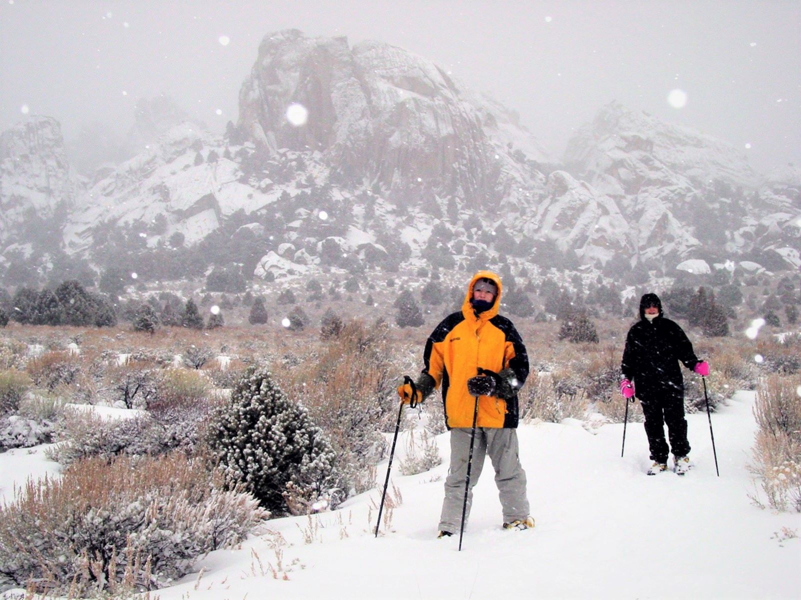
Snowshoeing
Get out and explore the winter trails.
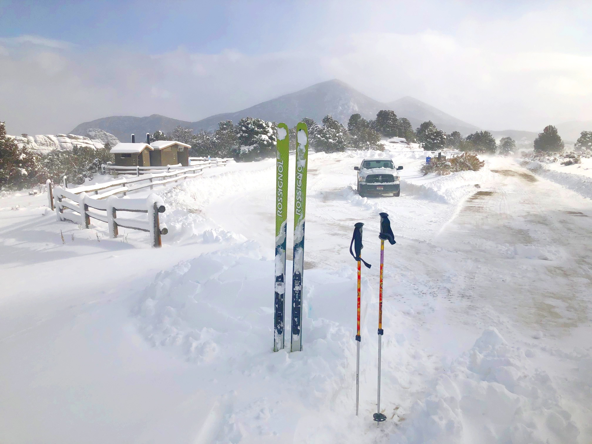
Skiing
Tour the frosty granite spires.
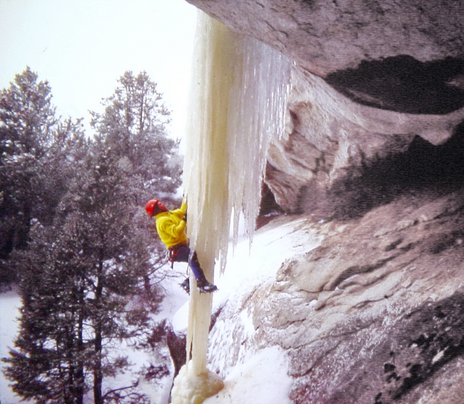
Ice Climbing
Explore epic rock and ice.
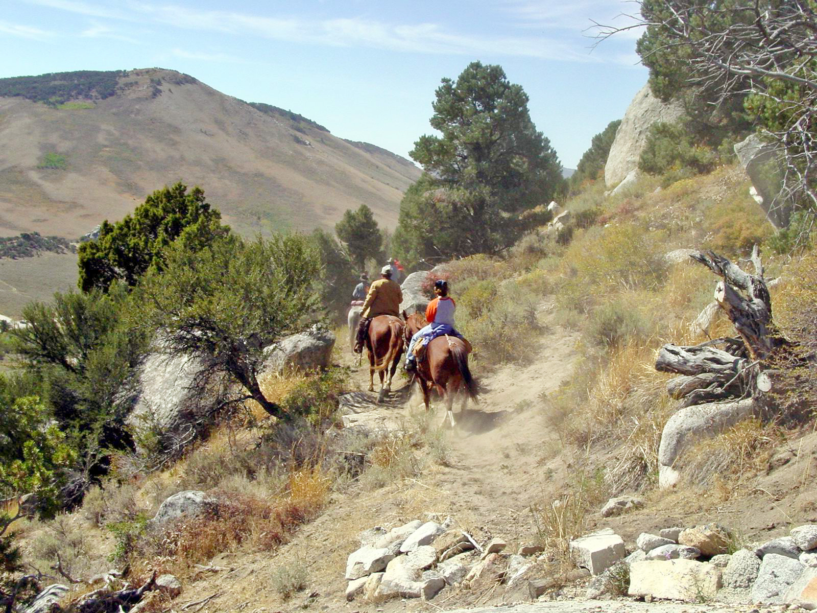
Horseback Riding in City of Rocks
Horseback riding can be one of the best ways to experience much of the Reserve's backcountry.
History of Pinnacle Pass Guided Hike
Join rangers on a short 1.10 mile guided hike to Pinnacle Pass. This feature of the California Trail is located on private land and only accessible to the public through this hike. The hike is easy to moderate, with a small hill leading up to the pass. Along the way you will see where the California Trail went south and met with the Salt Lake Alternate Trail, you will see emigrant signatures, and it is common to see snakes and fairy shrimp!
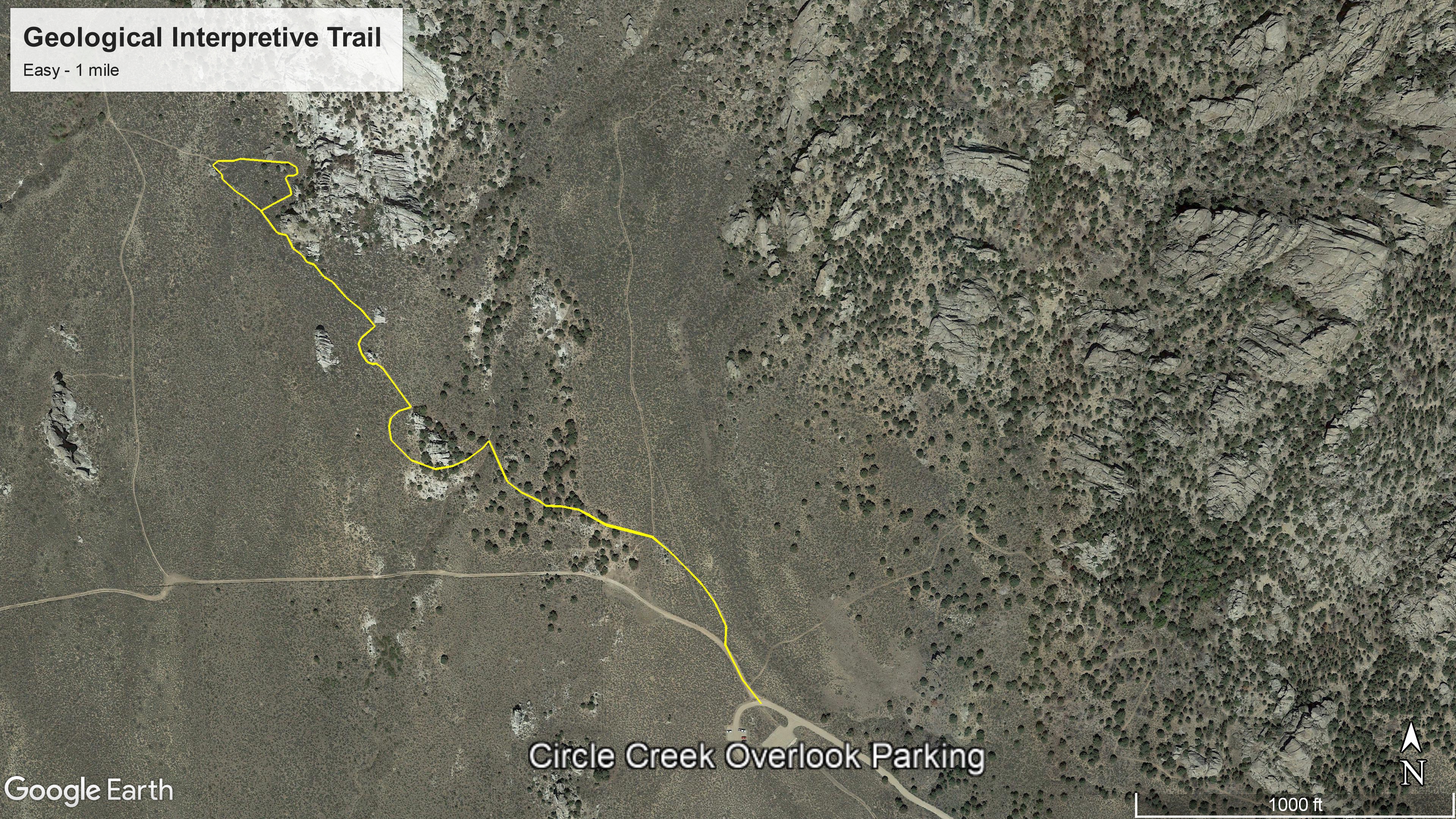
Hike the Geological Interpretive Trail
City of Rocks is well known for its geologic wonders. The Geological Interpretive Trail will guide you through many types of unique rock features and formations and explain the forces that created them. There are 12 interpretive stations along the 0.5 mile trail. The trail rises 160 feet in elevation, makes a loop, then retraces much of the same route back for a total of 1 mile.
Hike Creekside Towers Trail
Creekside Towers is an out-and-back 1.2-mile trail. Nearby trails (such as Stairways or South Fork Circle Creek) could make for a longer, more adventurous loop. The gentle grade of 122 feet relative elevation is suitable for families with children or anyone looking for an easier hike. In spring and early summer enjoy the running creek and small cascading waterfall. Outstanding scenery, sculpted granite pinnacles, and a diversity of plants and animals await you.
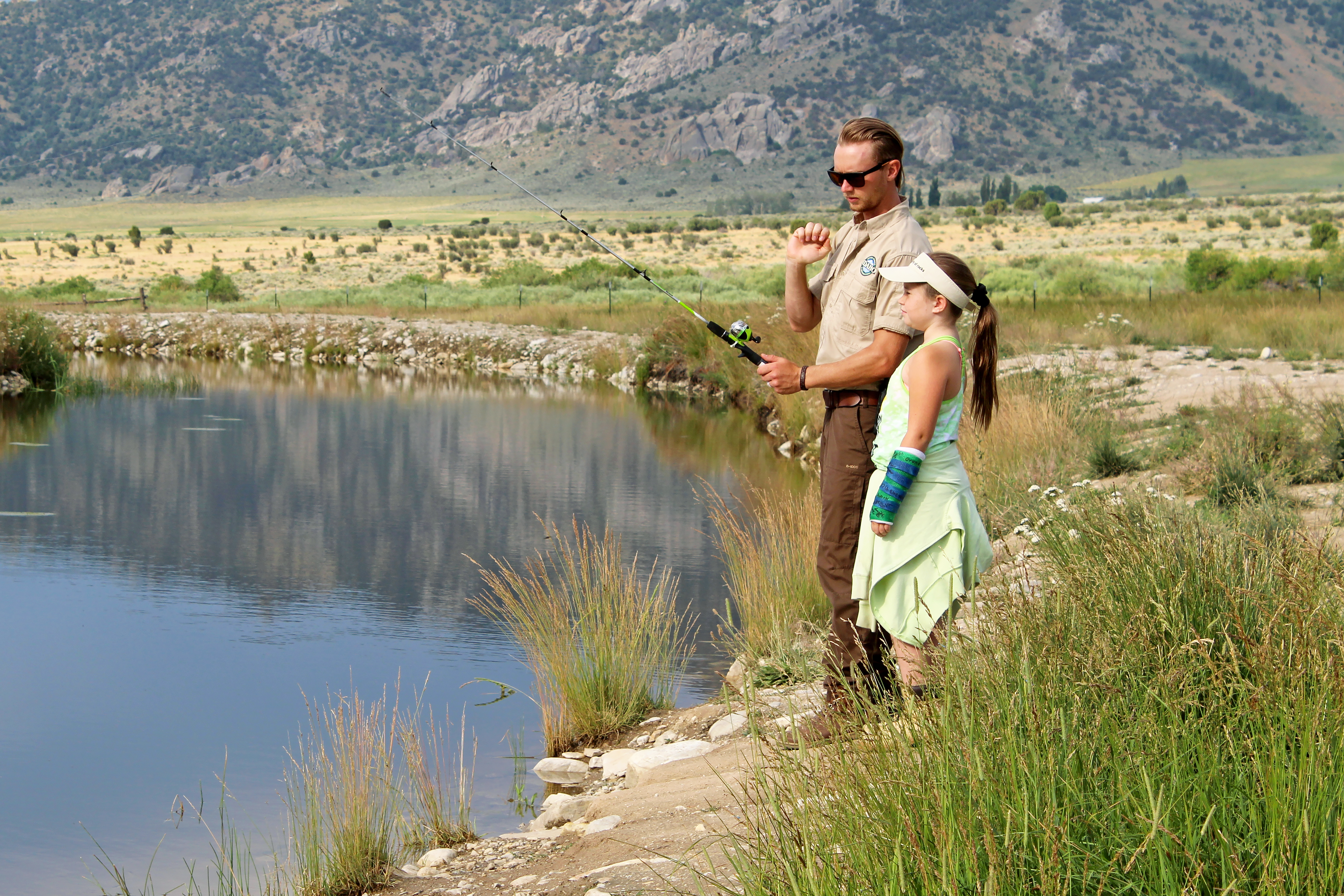
Fishing at the Castle Rocks Fish Pond
Besides fishing, the pond is also a great place to watch birds and wildlife. There is a walking path, benches to sit and enjoy the scenery, as well as a picnic table and fire ring.
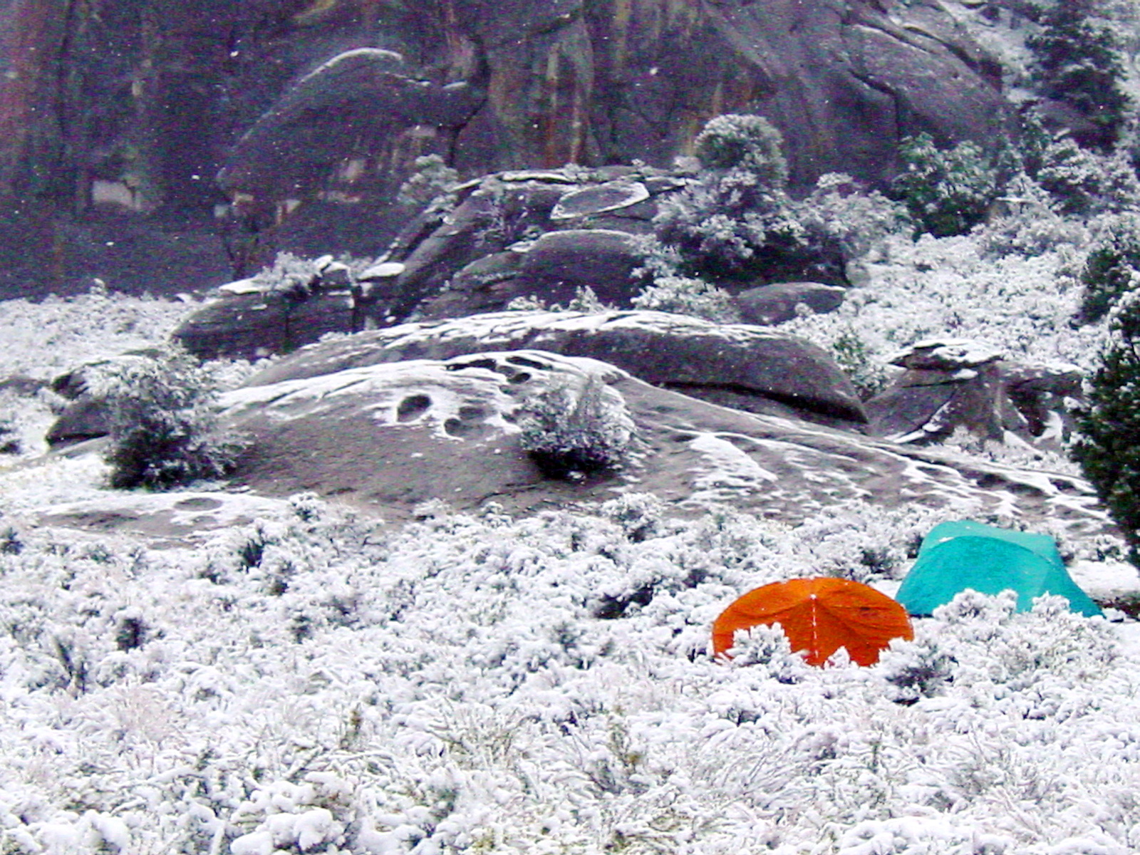
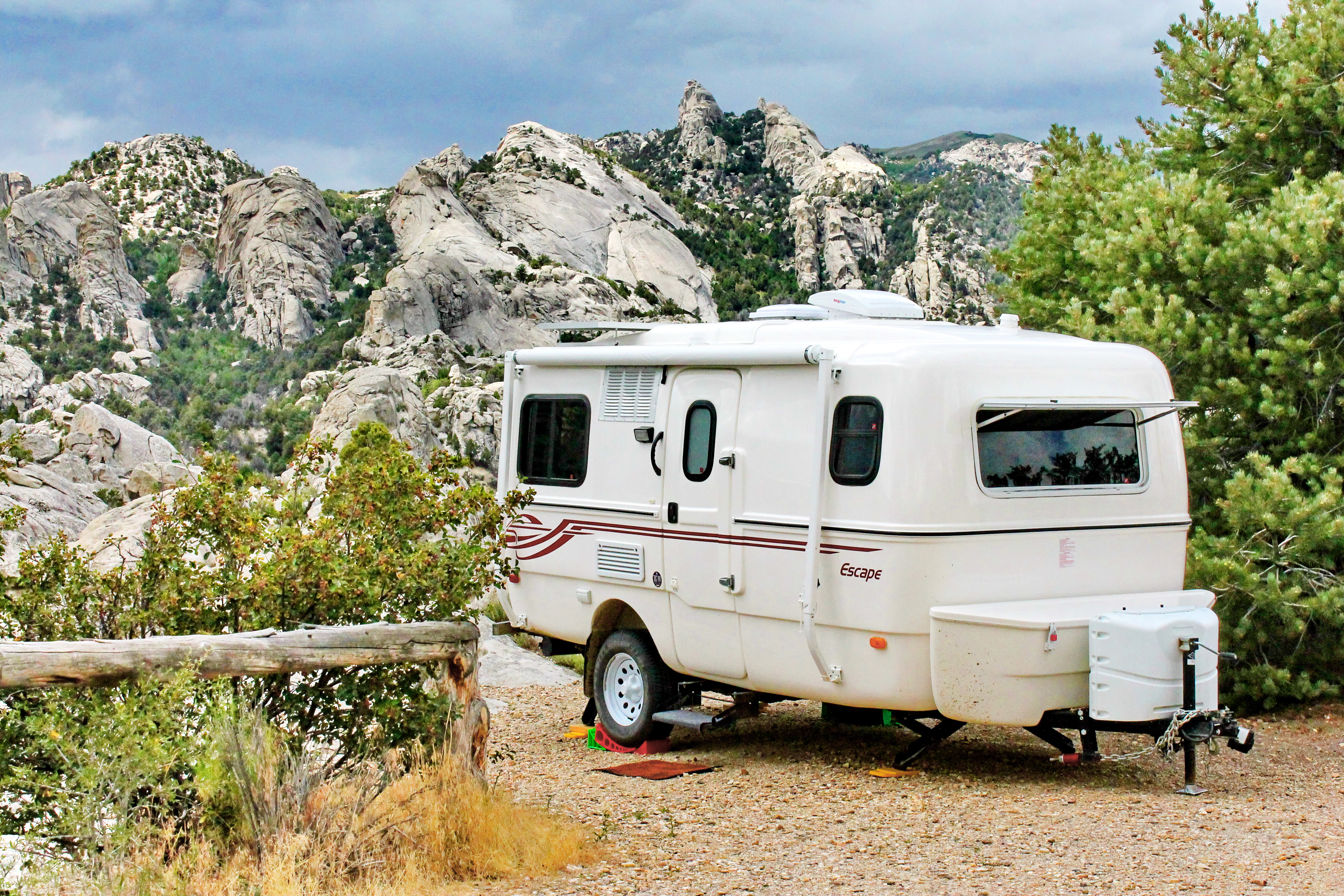
Camping
Camping in City of Rocks, or nearby Smoky Mountain Campground is a great way to enjoy being out in nature. Relax beneath the cool shade of aspen, juniper, mountain mahogany, or pine. Spend the night surrounded by impressive granite formations and starry skies.
Archeology of Castle Rocks Guided Hike
During this 1.10 mile ranger guided hike you will get to explore the archaeology of Castle Rocks State Park. The hike is easy to moderate with some elevation change. You will explore Native American pictographs, petroglyphs, and a rock shelter that was occupied for hundreds of years. Through this hike you will get a sense of what the landscape and everyday life was like thousands of years ago.
Backcountry Camping in Indian Grove
Backcountry camping is available in the designated Indian Grove area within City of Rocks National Reserve. Permits are required for backcountry camping and must be approved prior to your arrival.
Hike the City of Rocks Loop
This remote loop hike is a ranger favorite. The combination of pine trees, rock formations, and epic views offer a surprise at every turn of the trail.
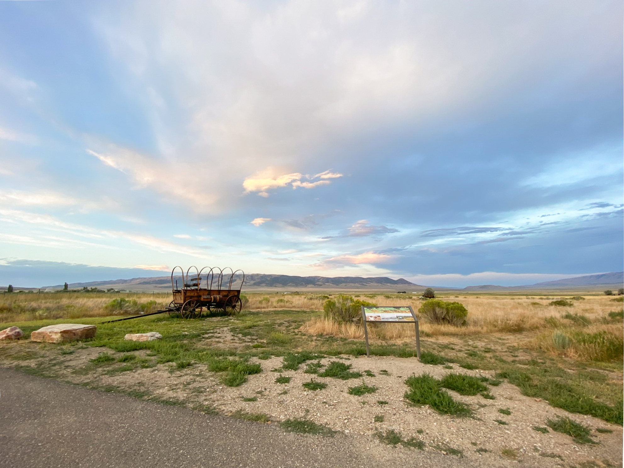
Wayside Exhibits Loop at the Visitor Center
This short 0.23 mile loop trail behind the Visitor Center will introduce you to some of the resources that make City of Rocks special. You can see up close examples of the wagons emigrants used as they traveled along the California Trail.
Shop for Souvenirs at the Visitor Center
Stop in to chat with a Ranger or pick up maps, guide booklets, and other informative resources. We offer souvenirs such as books, mugs, apparel, postcards, stickers and more.
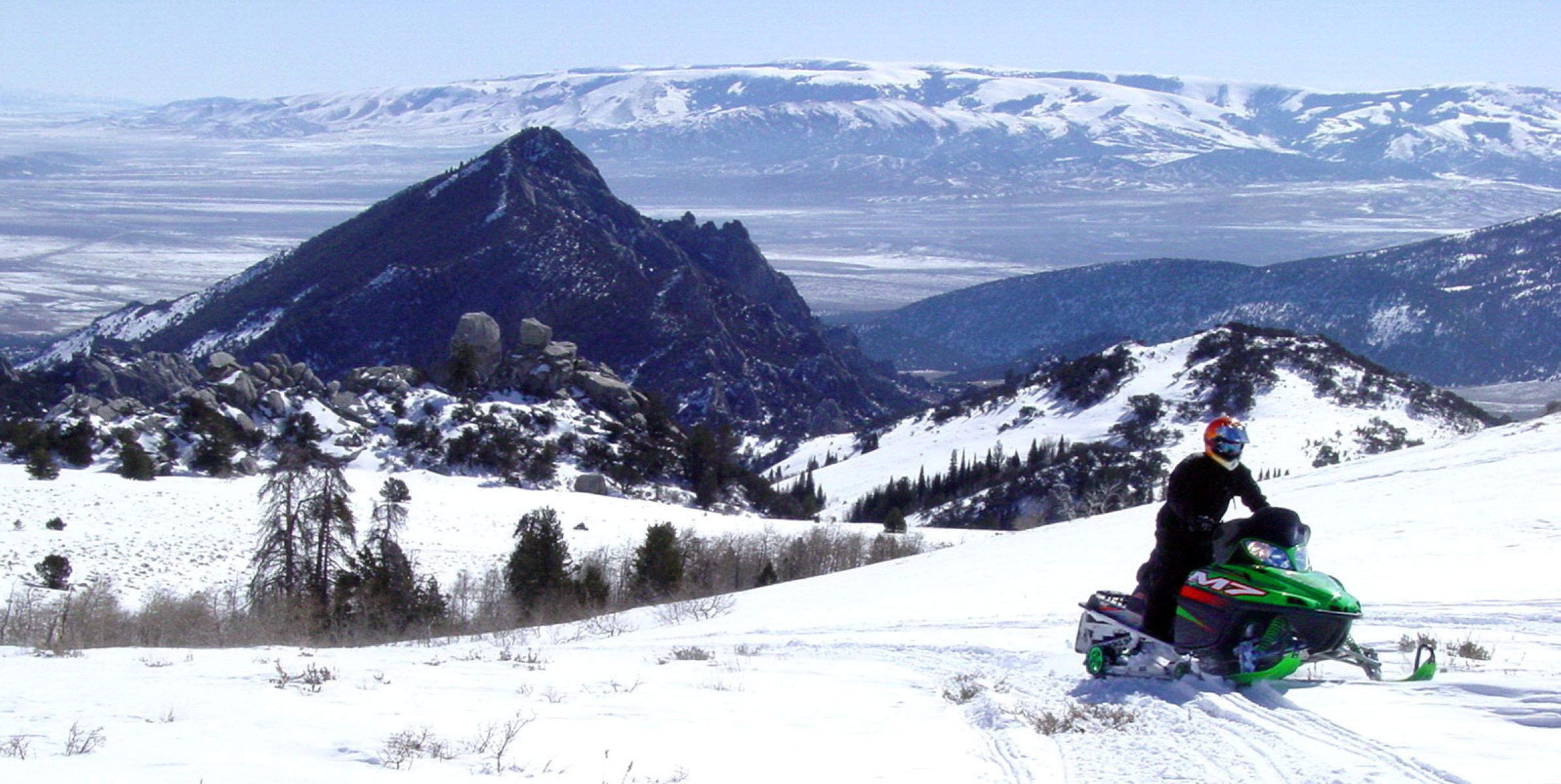
Snowmobiling
Take the road less traveled.
Birding in the City of Rocks Checklist Area
Few places in Idaho other than the City of Rocks Checklist Area offer such a high concentration of bird species, making this a top birding destination. The Checklist Area includes the National Reserve, Castle Rocks State Park, and the Almo and Upper Raft River valleys. These are some of the best locations in the Idaho for observing Pinyon Jay, Virginia's Warbler, Gray Flycatcher, Juniper Titmouse, Bushtit, Greater Sage-Grouse, Black-throated Gray Warbler, and Plumbeous Vireo.
Tours
Count: 3
Back Yard Boulders in Castle Rocks State Park
Castle Rock is the centerpiece of this 2-mile loop trail. It features impressive rocks as well as archaeological sites such as the Shock and Awe Shelter and pictographs. In spring hikers may encounter many species of wildflowers and experience the arrival of migratory birds. In autumn, hikers are treated to the colorful foliage of aspen, chokecherry, and willow. Signs and numbered markers are strategically located to help you find the route.
Creekside Towers Trail
Creekside Towers is an out-and-back 1.2-mile trail, nearby trails (such as Stairways and South Fork Circle Creek trails) could make for a longer and more adventurous loop. The trail’s gentle grade of 122 feet relative elevation is suitable for families with children or anyone looking for an easier hike in the Reserve. In spring and early summer enjoy the running creek and small cascading waterfall. Outstanding scenery, sculpted granite pinnacles, and a diversity of plants and animals await you.
Geological Interpretive Trail
A self-guided journey to discovering the geology at City of Rocks National Reserve. The 1 mile Geological Interpretive Trail is the perfect short hike to: - see fascinating geological formations up close - examine the difference between the Green Creek Complex and Almo Pluton - learn about the geologic history of this landscape Check out Intro 1, 2, and 3 on your way to the first station.