Be advised that the NPS has issued alerts for this park.
Dungeness and Little Greyfield Beach Crossings Closed to Vehicles Due to High Water
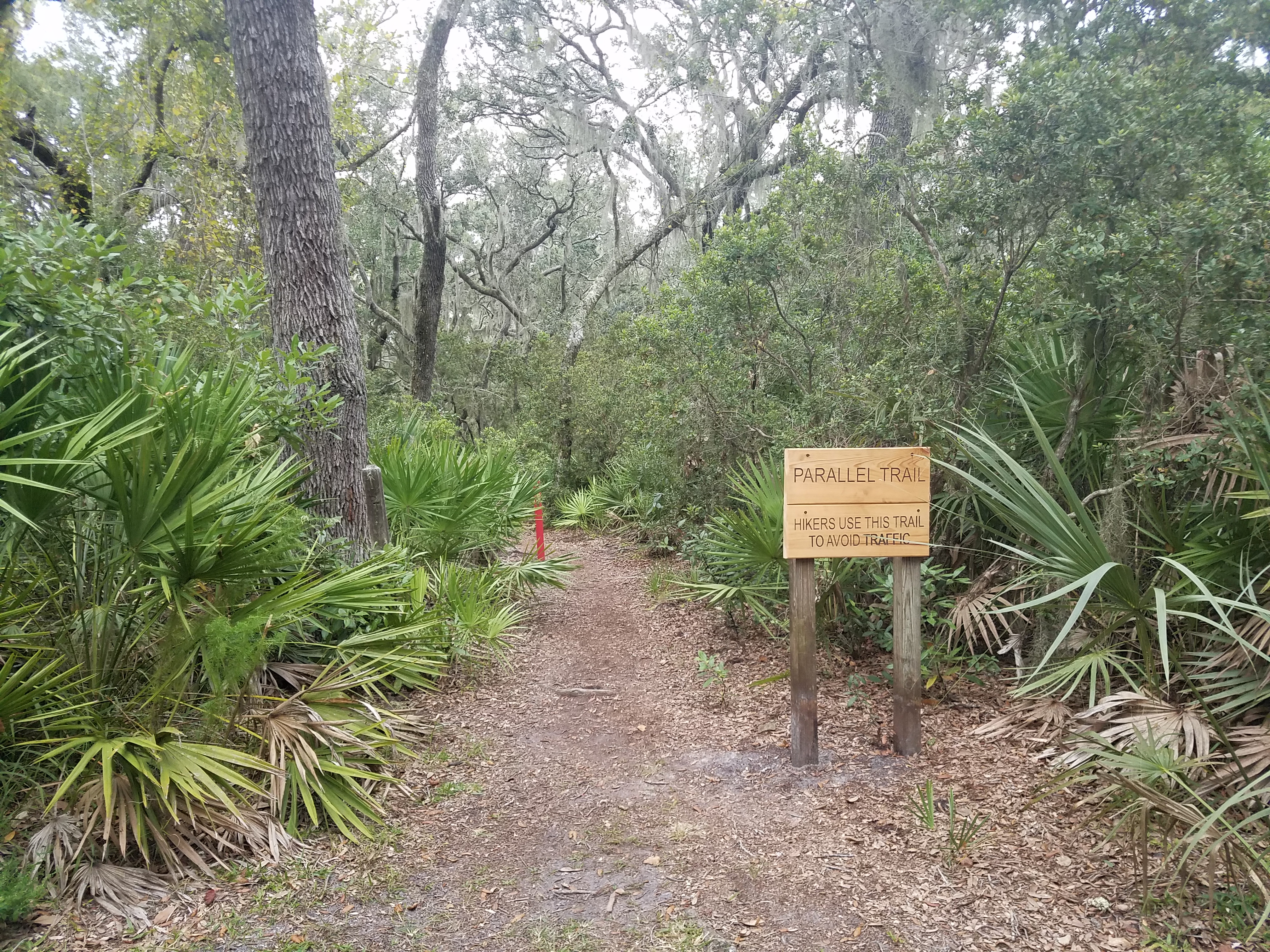
Pedestrian traffic is still allowed. Be aware of flooding after storms at all beach crossings and use caution when accessing. Please stay on designated trails and roads.
Scam Warning - Book ferry tickets through concessioner site only
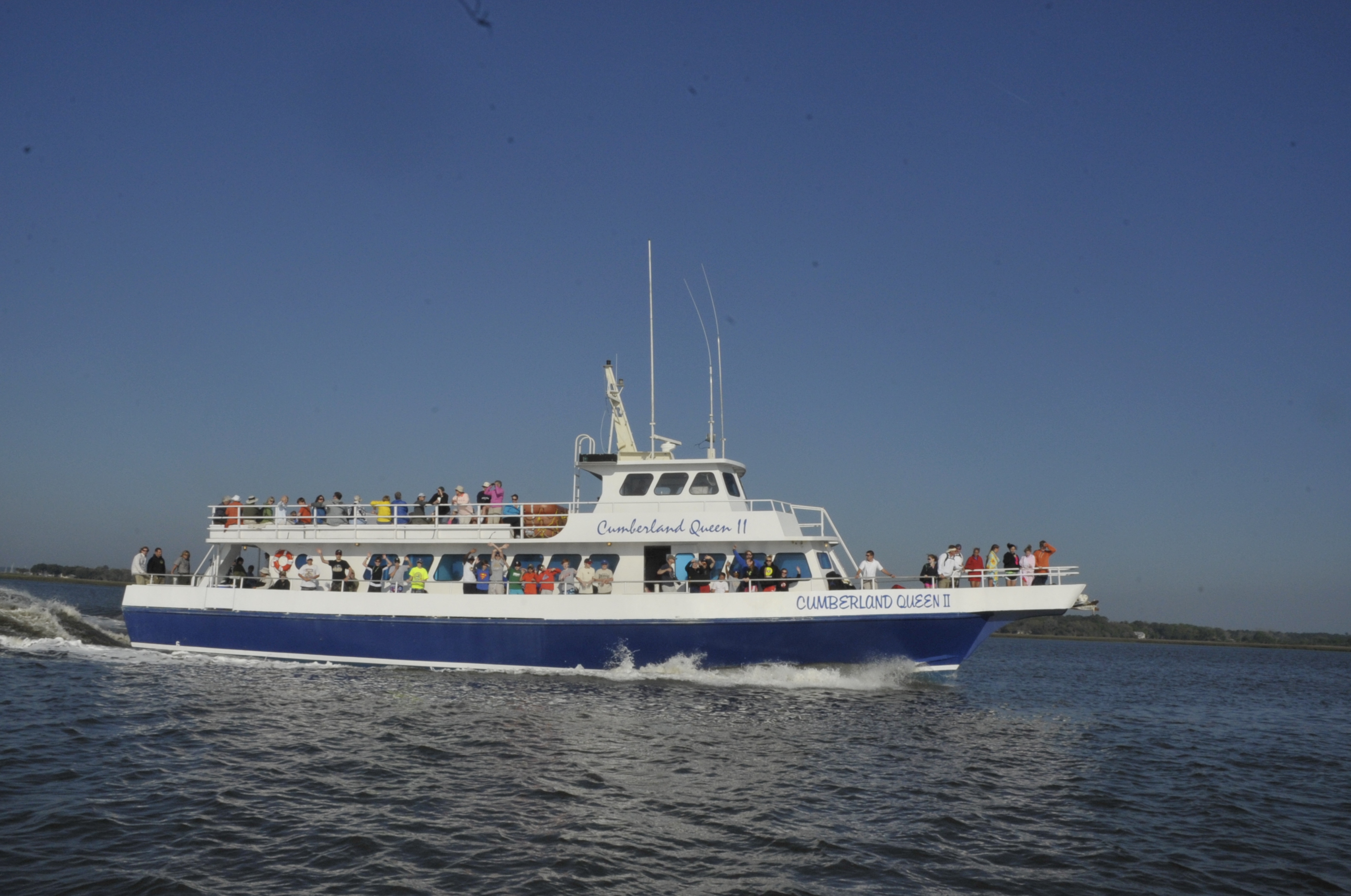
Valid ferry tickets can only be purchased through the website www.cumberlandislandferry.com. Check site carefully before purchasing. Only valid tickets will be honored.
Ongoing Road Repair on Main Road
Ongoing road work will be taking place throughout the Main Road on the island. Expect potentially heavier vehicle traffic and areas of uneven terrain. Please yield to construction traffic.
Mainland Parking Lot Closure June 2
The mainland parking lot will be closed as of June 2 for rehab and improvements. For more information please see the press release.
St Marys is the gateway to Cumberland Island, Georgia's largest and southernmost barrier island. Here pristine maritime forests, undeveloped beaches and wide marshes whisper the stories of both man and nature. Natives, missionaries, enslaved Afri...
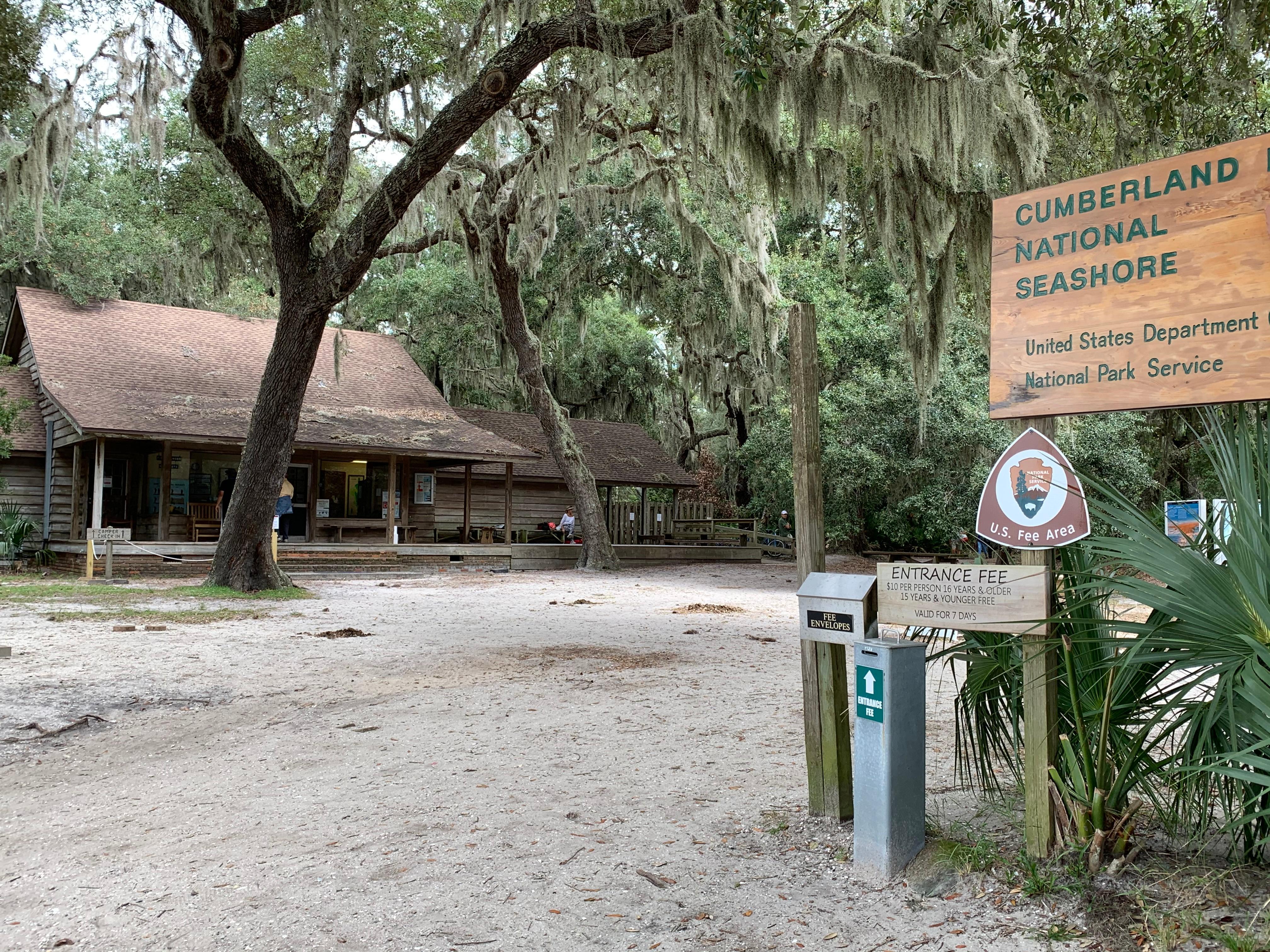
Cumberland Island National Seashore has a per-person entrance fee. This fee is waived for America the Beautiful pass holder plus three adults. Must present pass at time of check-in.
Reservations can be made up to 6 months in advance. All camping on Cumberland Island requires a reservation and printed permit, and must be done in a designated campsite. Dispersed camping and beach camping are not permitted. Check the ferry schedule prior to reserving your Cumberland Island National Seashore Camping Permit unless you are traveling by private boat. The ferry does not operate on Tuesdays and Wednesdays from December through February.
Reservations can be made up to 6 months in advance. All camping on Cumberland Island requires a reservation and printed permit, and must be done in a designated campsite. Dispersed camping and beach camping are not permitted. Check the ferry schedule prior to reserving your Cumberland Island National Seashore Camping Permit unless you are traveling by private boat.
Reservations can be made up to 6 months in advance. All camping on Cumberland Island requires a reservation and printed permit, and must be done in a designated campsite. Dispersed camping and beach camping are not permitted. Check the ferry schedule prior to reserving your Cumberland Island National Seashore Camping Permit unless you are traveling by private boat. The ferry does not operate on Tuesdays and Wednesdays from December through February.
Reservations can be made up to 6 months in advance. All camping on Cumberland Island requires a reservation and printed permit, and must be done in a designated campsite. Dispersed camping and beach camping are not permitted. Check the ferry schedule prior to reserving your Cumberland Island National Seashore Camping Permit unless you are traveling by private boat. The ferry does not operate on Tuesdays and Wednesdays from December through February.
Reservations can be made up to 6 months in advance. All camping on Cumberland Island requires a reservation and printed permit, and must be done in a designated campsite. Dispersed camping and beach camping are not permitted. Check the ferry schedule prior to reserving your Cumberland Island National Seashore Camping Permit unless you are traveling by private boat. The ferry does not operate on Tuesdays and Wednesdays from December through February.
The Carnegie family had multiple boats in their fleet at the Dungeness estate. Captain George W. Yates captained the Carnegie's yacht and led a crew of 17. He lived in the appropriately named Captain's House near his workplace: the Dungeness dock. The Captain's House still stands today near the Ice House Museum and Dungeness dock.
The Carnegie family's Dungeness estate featured multiple modes of transportation to and from the island and while on it. These included yachts, horses, carriages, and automobiles. The Carriage House in featured storage of carriages and elevator to hoist from one story to the next. Horse stalls housed the family's prized ponies.
Over the past millennia, many different people have visited and inhabited Cumberland Island. Timucuan Indians lived off the island’s abundance, eating shellfish, game, and edible plants. The arrival of the Spanish in the 1580s meant the downfall of a once flourishing society.
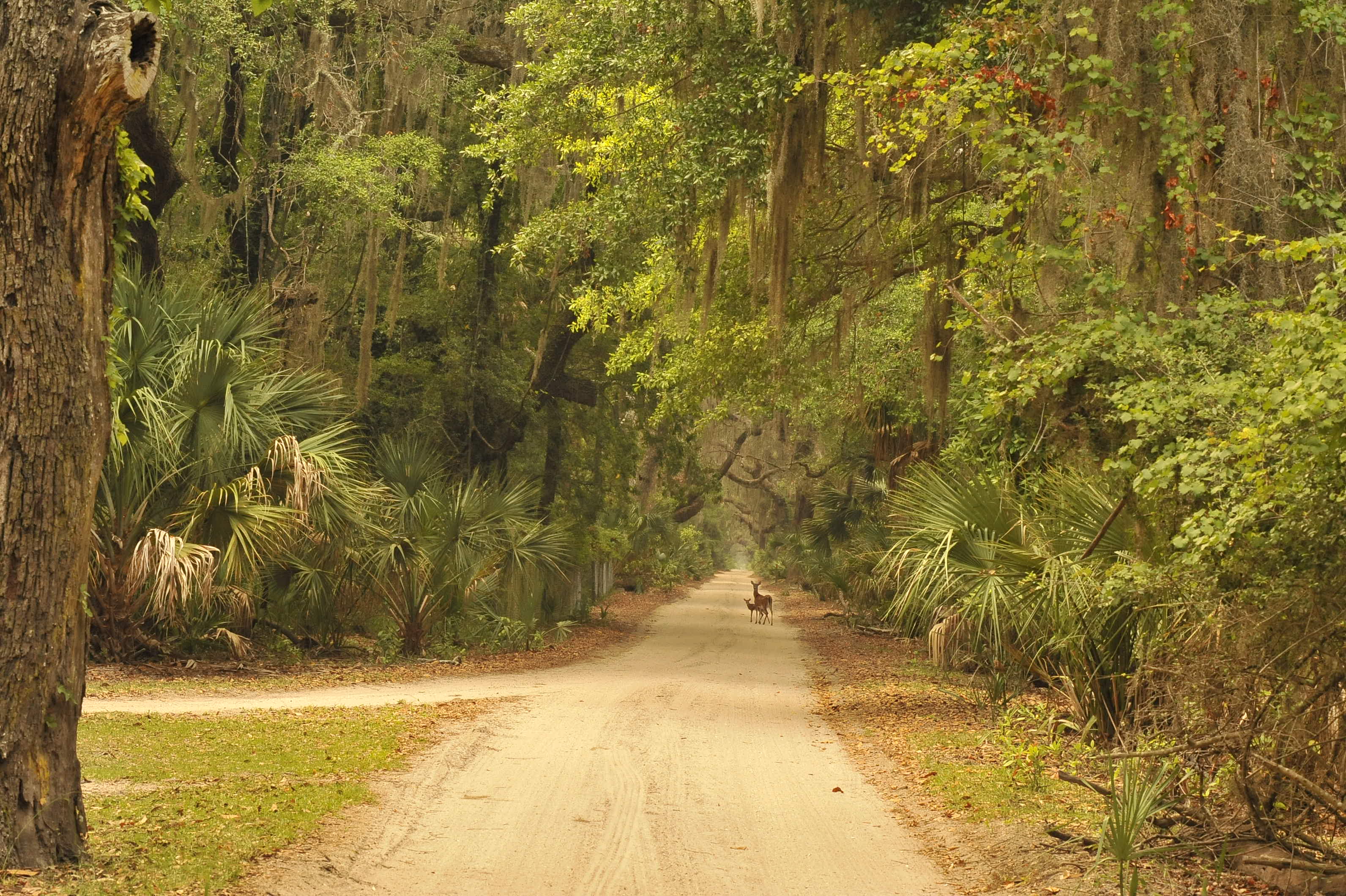
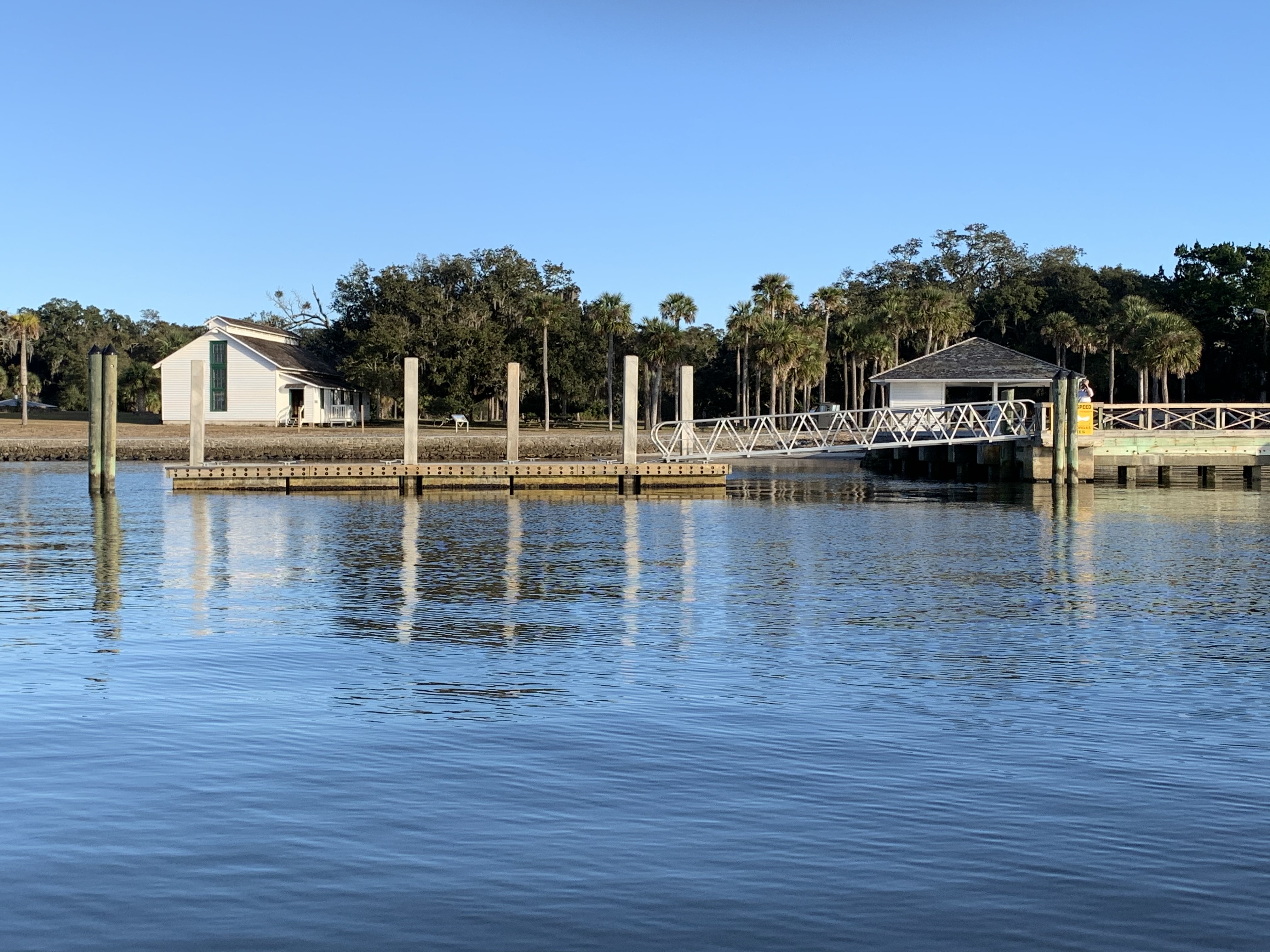
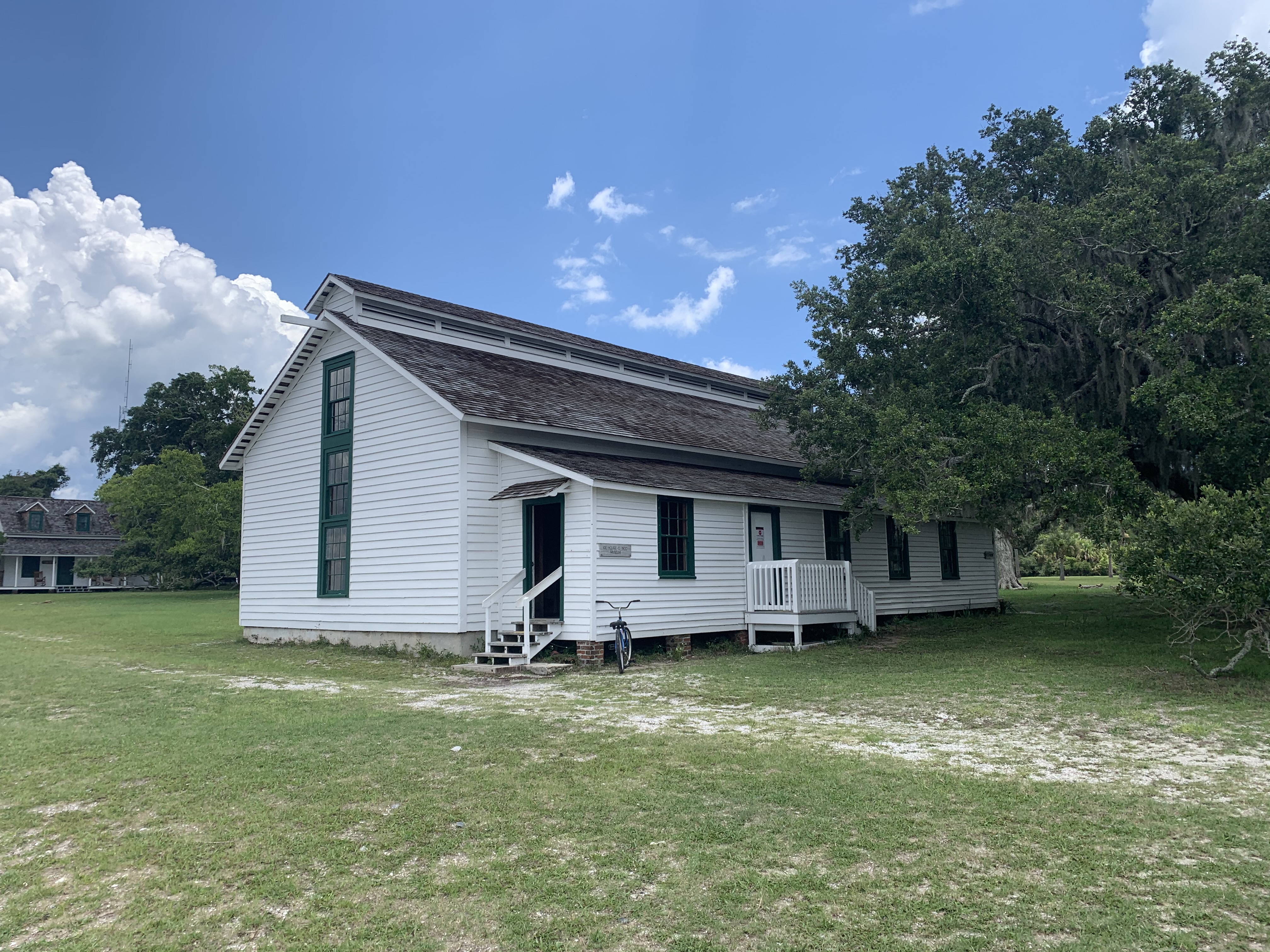
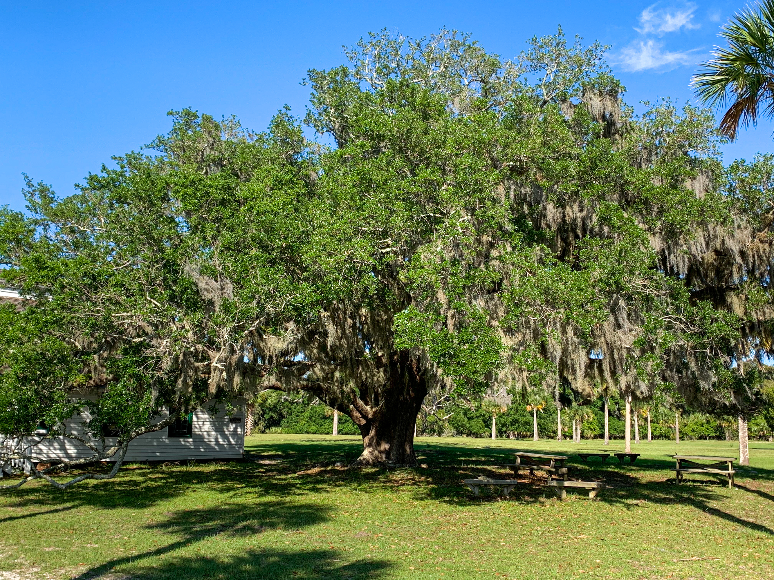
Accessible by a ferry dock with a small, white boathouse, the Cumberland River runs perpendicular to a sandy road called Coleman Avenue. This sandy road leads to the east and is bordered on each side by live oak trees which form a tunnel-like canopy over the road. A few feet from Coleman Avenue is a wooden sign that reads “Timucuan Indians” and marks the first stop on the self-guided tour. The wooden sign sits between the road and a dull silver, weathered concrete cistern. The cistern is approximately 10 feet off the road to the south, surrounded by scattered palmettos. Beyond the cistern are live oak trees that gain density, moving deeper into the island. Scattered palmettos and live oak trees stand to the need direction of the road, partially obscuring a one-story, white building about 200 feet away. The building is the Ice House Museum, facing west toward the Cumberland River. A few picnic tables lie just off the road under tree shade.
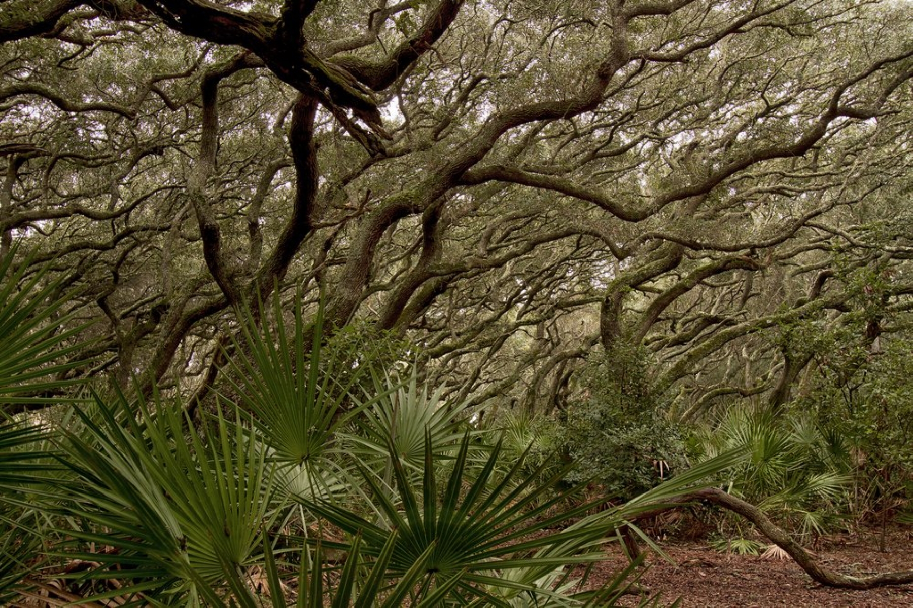
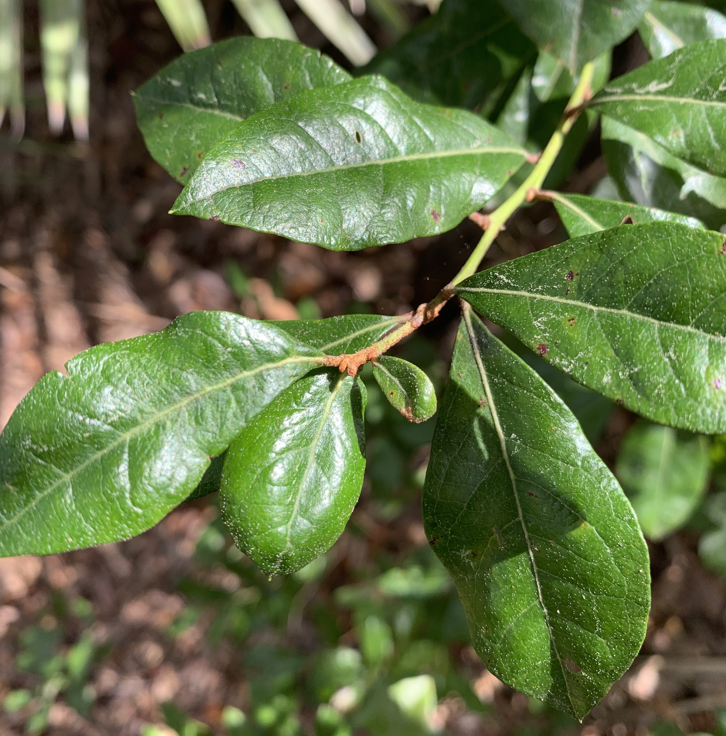
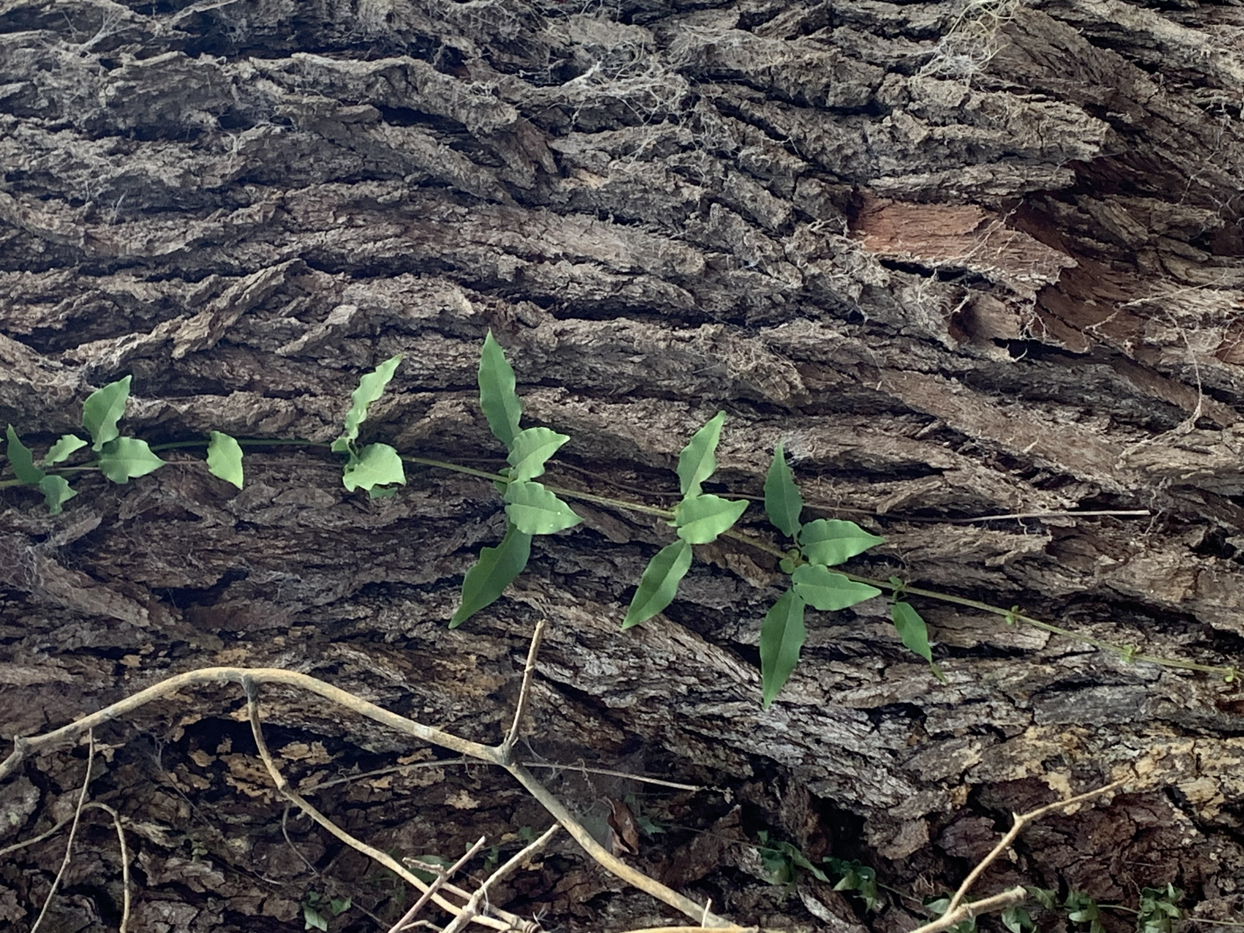
Cumberland Island is filled with an abundance of natural resources and has been utilized for a wide variety of human purposes throughout its history. The trees that surround you as you walk the road- live oaks- are an excellent example of human manipulation of a natural environment. This excellent hardwood species with curved branches, became extremely valuable by the mid to late eighteenth century for use in ship building.
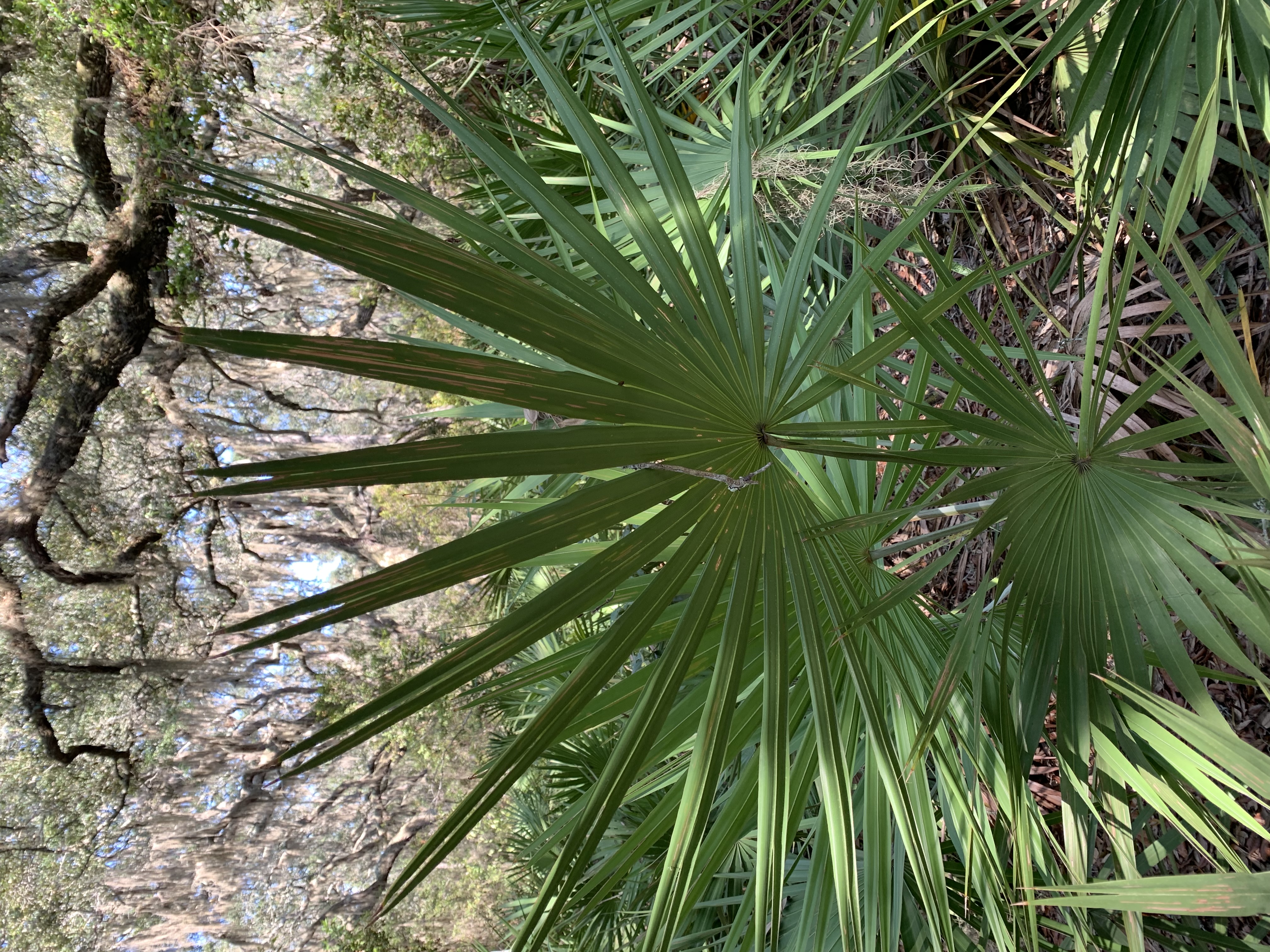
This stop is an area lush with saw palmettos and grape vines, draping down onto the brush from the dense trees. A sign lies a few feet to the left of an unpaved road, moving southeast. The wooden sign reads, “Maritime Forest 2,” indicating this point as the second stop along the self-guided tour, welcoming visitors to the Maritime Forest.
Many enslaved people lived on the island during the plantation era. Learn how they lived before and after the Civil War.
The third stop is at the intersection of Coleman Avenue, which runs east to west, and the Main Road, which runs north to south. This third stop guides visitors southbound on the Main Road, to the right of the sign. Beyond the sign in the southeast corner is a narrow thicket of trees. To the southwest, a dense group of trees stands next to a line of emerging, new growths of palmettos on the mowed shoulder of the road. The northwest corner of the intersection houses picnic tables and scattered live oak trees providing shade. Many palmettos and live oaks at the forest’s border are situated northeast of the intersection, hindering the view beyond.
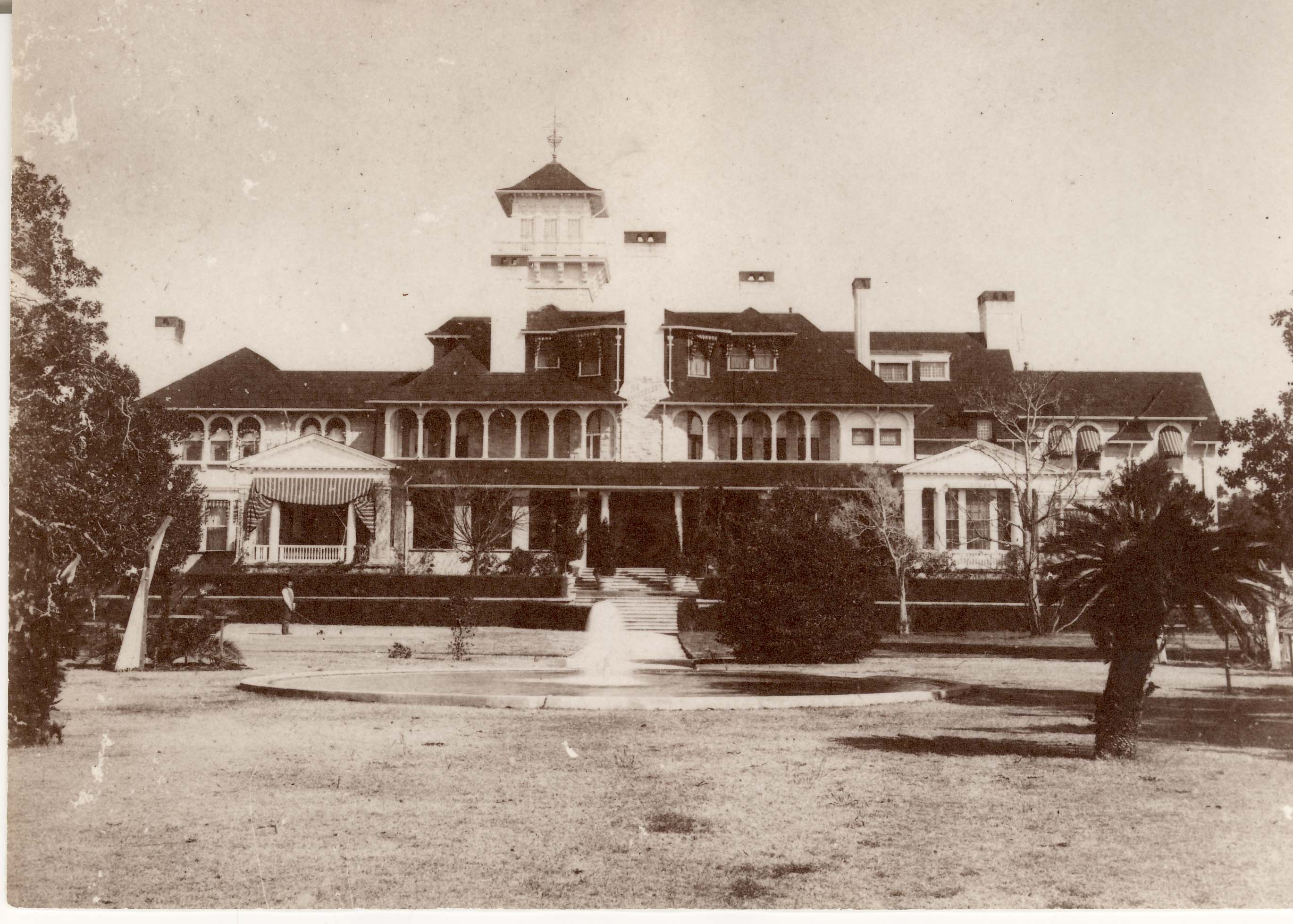
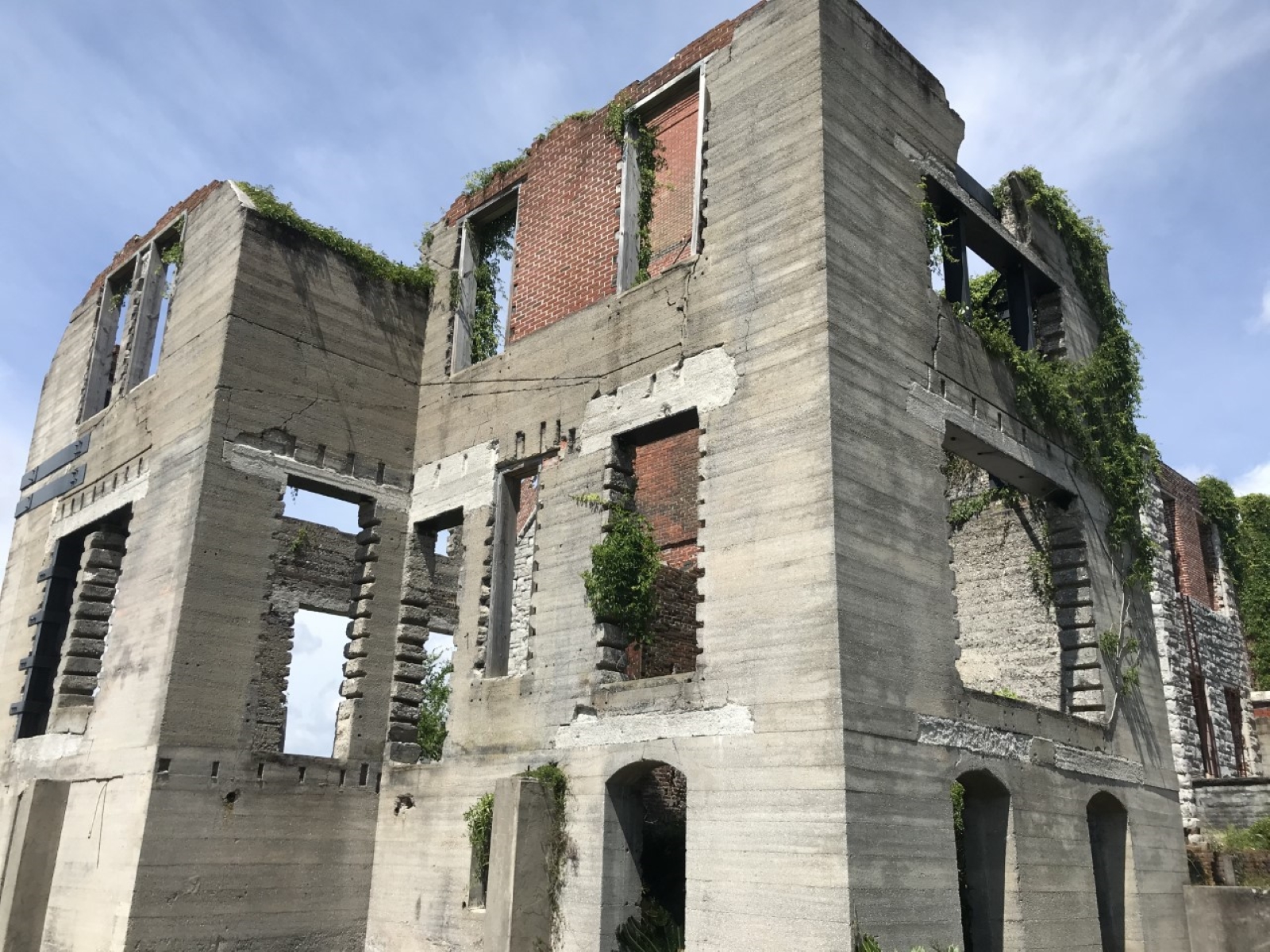
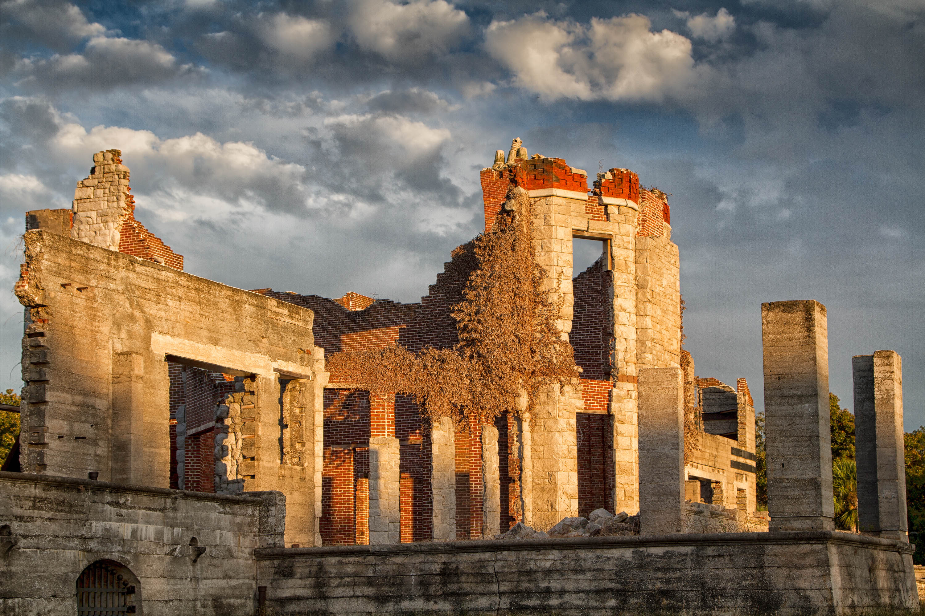
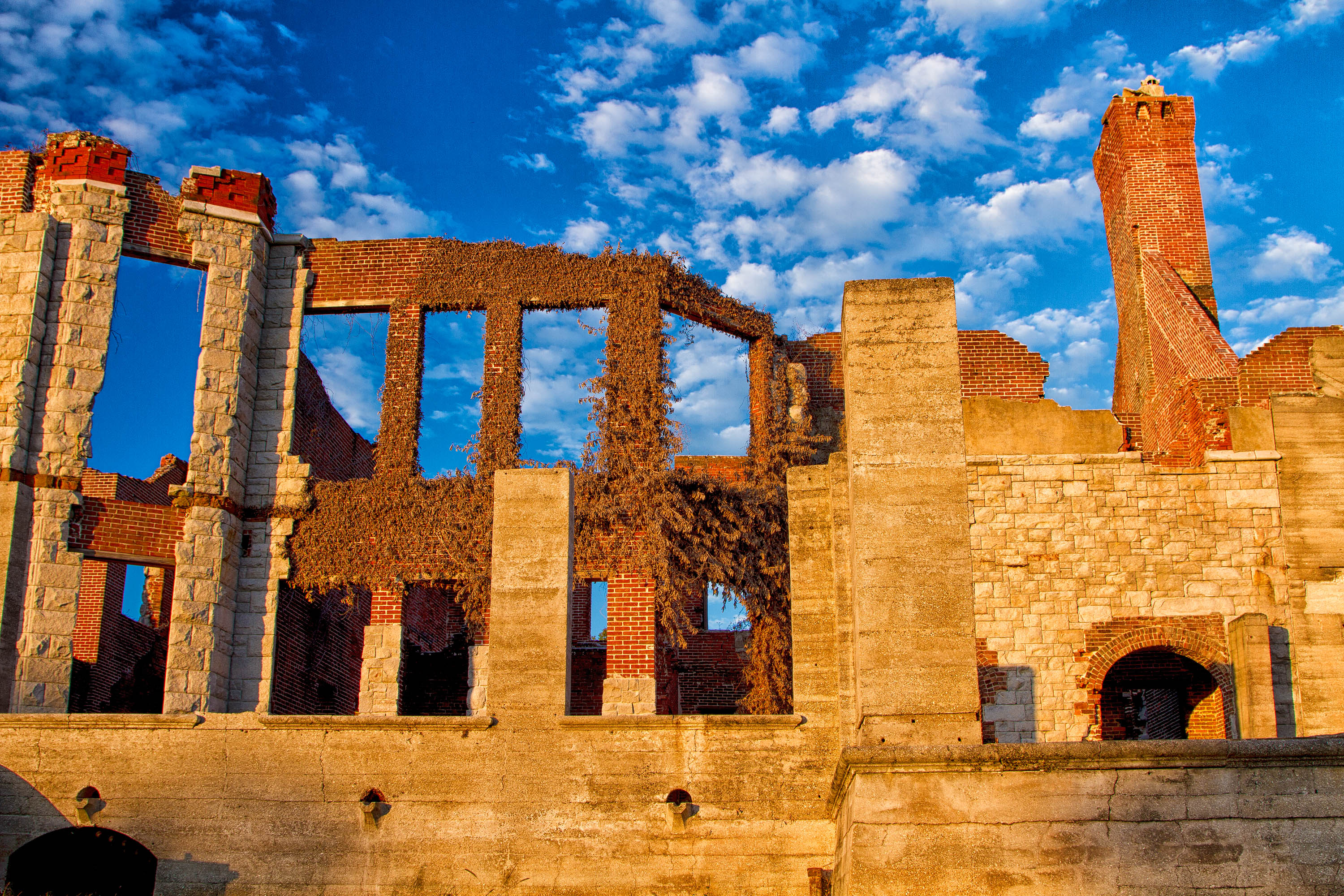
The Dungeness ruins are one of numerous visual reminders of the Carnegie era here on Cumberland Island, but the Carnegie Dungeness represents only one layer of this area’s rich history.
The Main Road continues through patchy grass, then a dark gray, tabby concrete gate. The gate is made up of square pillars, topped with thin, intricate ironwork. On each side of the pillars are three short steps that lead to slightly raised land. The Main Road continues through the gate with a small shoulder of grass and a one-foot cement curb border. Beyond the border, palmettos, hickory, and live oak trees are scattered, thin enough for visitors to view the light gray stone and red brick ruins in the distance at the end of the road. This entrance to the Dungeness Mansion grounds is the fourth stop of the self-guided tour.
The tabby house is the oldest standing structure on Cumberland Island, built around 1800 by the Greene-Millers for use as an overseer's cottage. Tabby is a combination of island resources: sand, water, oyster shell and lime. This was a common building material during the nineteenth century in coastal areas where oysters naturally occur.
A one-story, white building with narrow windows and a covered porch with small pillars securing the half wall stands past a large cedar tree. The building is the Tabby House and marks the 5th stop of the self-guided tour. Looking slightly to the Northwest, a stone and wood framed pergola is seated between the Tabby House and a large grass field. The dense Maritime Forest is to the north. Then a sandy road from the Maritime Forest travels north to south where a large, light gray stone and red brick ruins dwell. The ruins have wide, stone steps upward to open stone walls that reveal the empty interior of the structure, standing approximately 30 feet tall. These Dungeness Ruins overlook the second large grass field to the south.
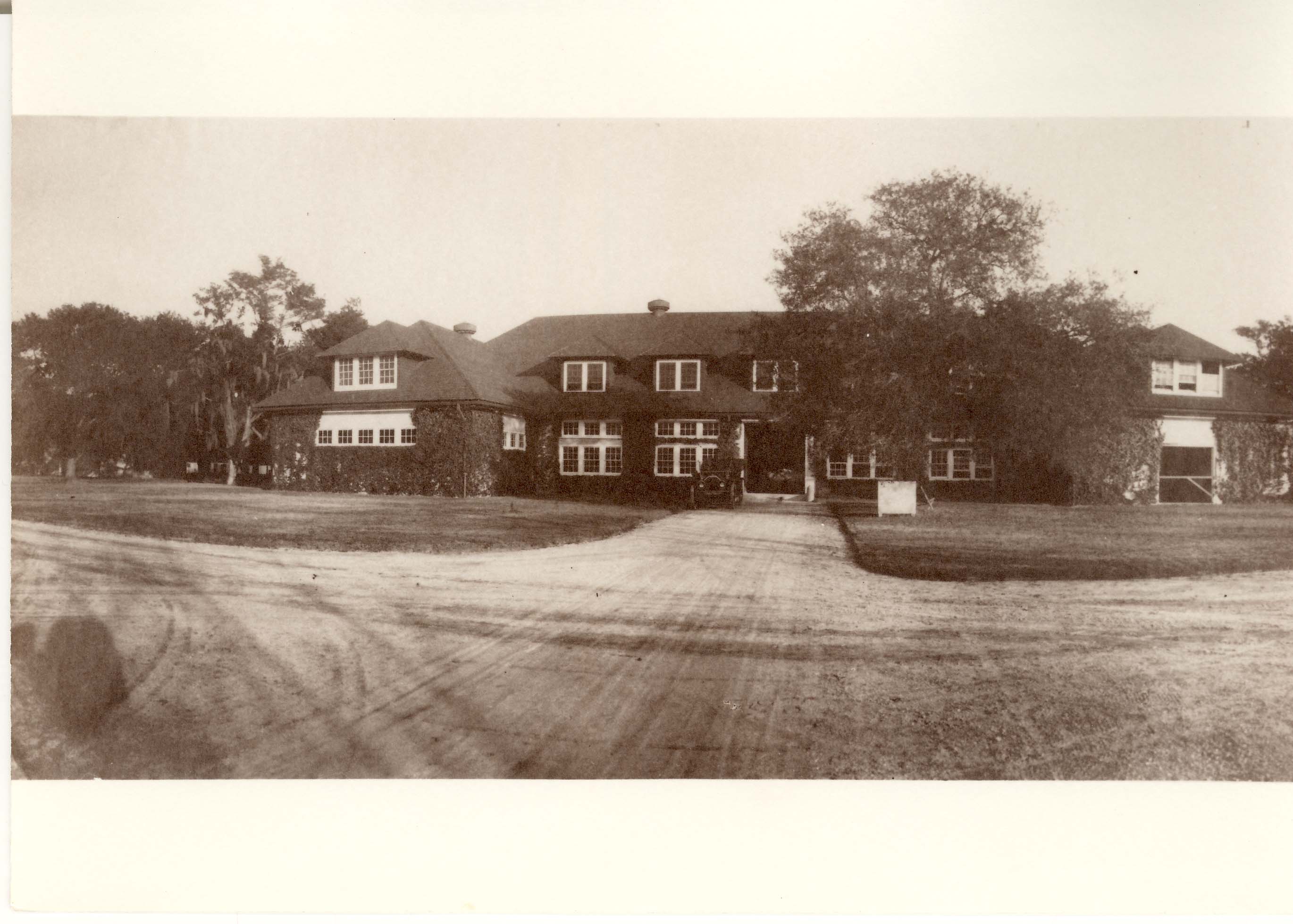
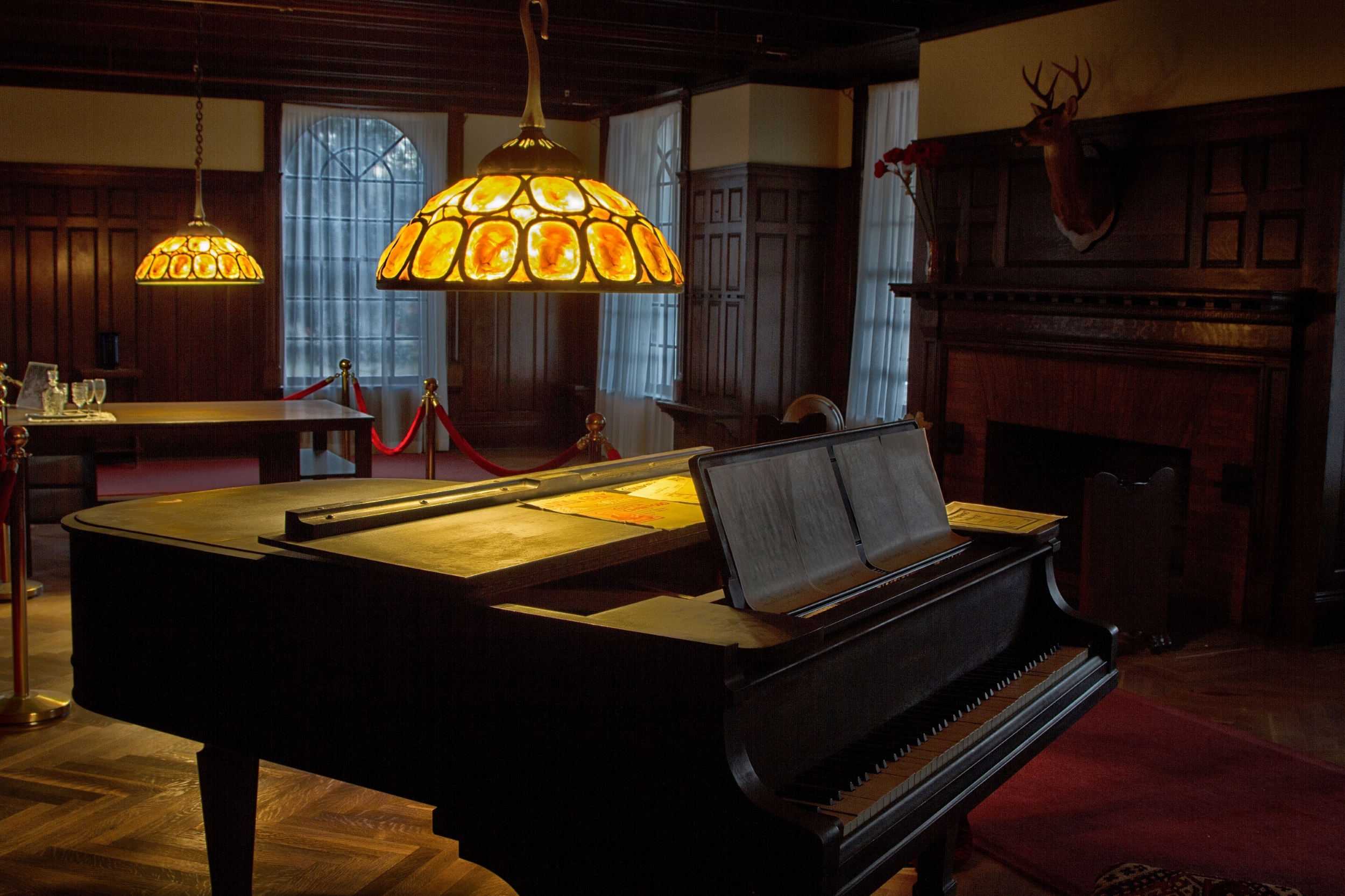
The Queen Anne structure- Recreation Building- held a doctor’s office, billiard room, gun room, dressing rooms, gymnasium, heated pool and, on the southeast side, an apartment for Lucy Carnegie’s bachelor son Frank.
A wooden sign beside a sandy road reads, “Recreation Building,” indicating the brick and stone deteriorated foundation beyond. These ruins to the south mark the 6th stop. A small tidal creek, called Beach Creek, appears in the far distance to the south of the road and disappears past dense tree gatherings. To the west of the road lies a grass field with scattered trees. Opposite to the sign to the north are live oak trees with approximately 20-foot outstretched branches reaching to the edge of the road. In the southeast distance, obscured by the trees, is a three-story white building called the Grange.
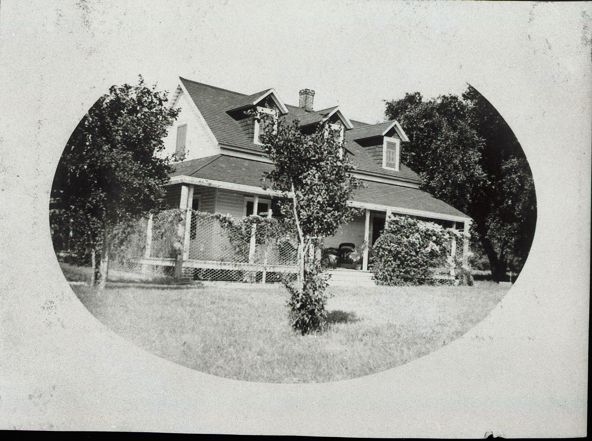
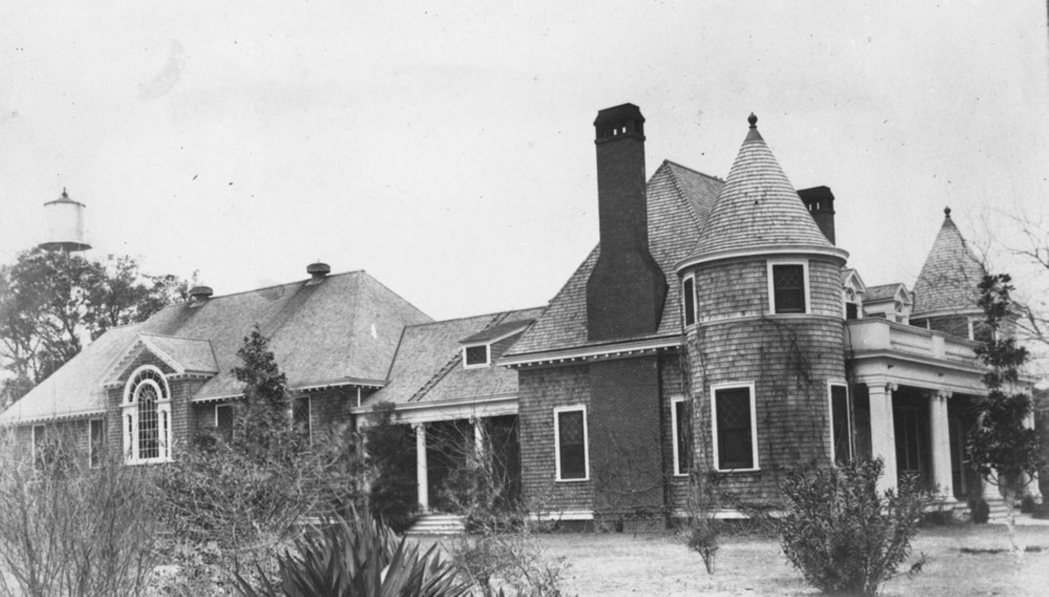
The Grange was built in 1901 as a residence for William Page, tutor for the Carnegie sons and later estate manager. As manager, Mr. Page oversaw the day-to-day running of operations for the entire island. Page died in 1922, after which Carnegie daughter Florence used it as her residence until her passing in 1962. Carnegie descendants retained the rights to the Grange until 2010 when it became public land.
A sandy road sits in patchy grass and brush in a field with a smattering of live oak and magnolia trees. A long, southbound driveway breaks off the Main Road. Approximately 100 feet from the sandy driveway dwells a three-story, white stucco building, mostly obscured by the hanging magnolia and live oak tree branches. This 40-foot square building is the Grange House. The Grange marks the 7th self-guided tour stop.
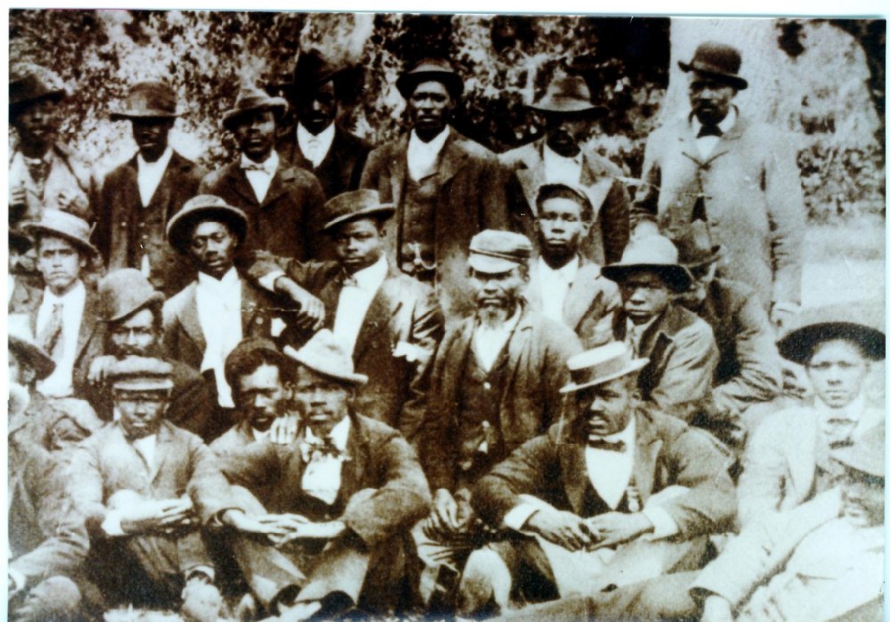
Many employees on the Carnegie Dungeness estate worked and lived on the island. Dormitory-style housing hosted some of the one hundred employees. Job descriptions ranged widely, including positions as household servants, stable hands, tending the cattle and poultry, working in the laundry, bakery, icehouse, or electrical plant, as well as landscaping and gardening.
Two sandy roads meet at a junction. The northbound road is Coleman Avenue and the eastbound road is Dungeness Beach Road. A two-story, white building, called the Carriage House, is perched to the south of Dungeness Beach Road, surrounded by a grass field with a few magnolia and live oak trees. The Carriage House marks the 8th stop of the Self-Guided Tour. To the west, live oak trees stand at Coleman Avenue with branches that reach over the junction to Dungeness Beach Road. Approximately 100 feet past the live oak trees is a single-story white building, called the Laundry House currently housing the restrooms. Two wooden benches sit a few feet to the north of the Dungeness Beach Road under the shade of the live oak trees. Beyond the benches, mostly obscured by trees, visitors can glimpse part of another two-story, white building, called the Dormitories. Northeast of the Dungeness Beach Road and opposite the Carriage House sits stone ruins of an electric power plant.
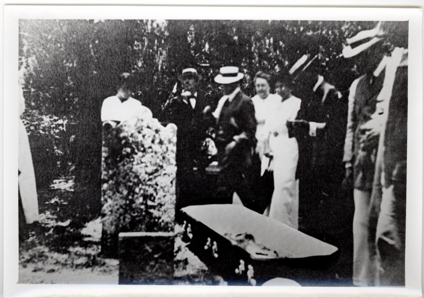
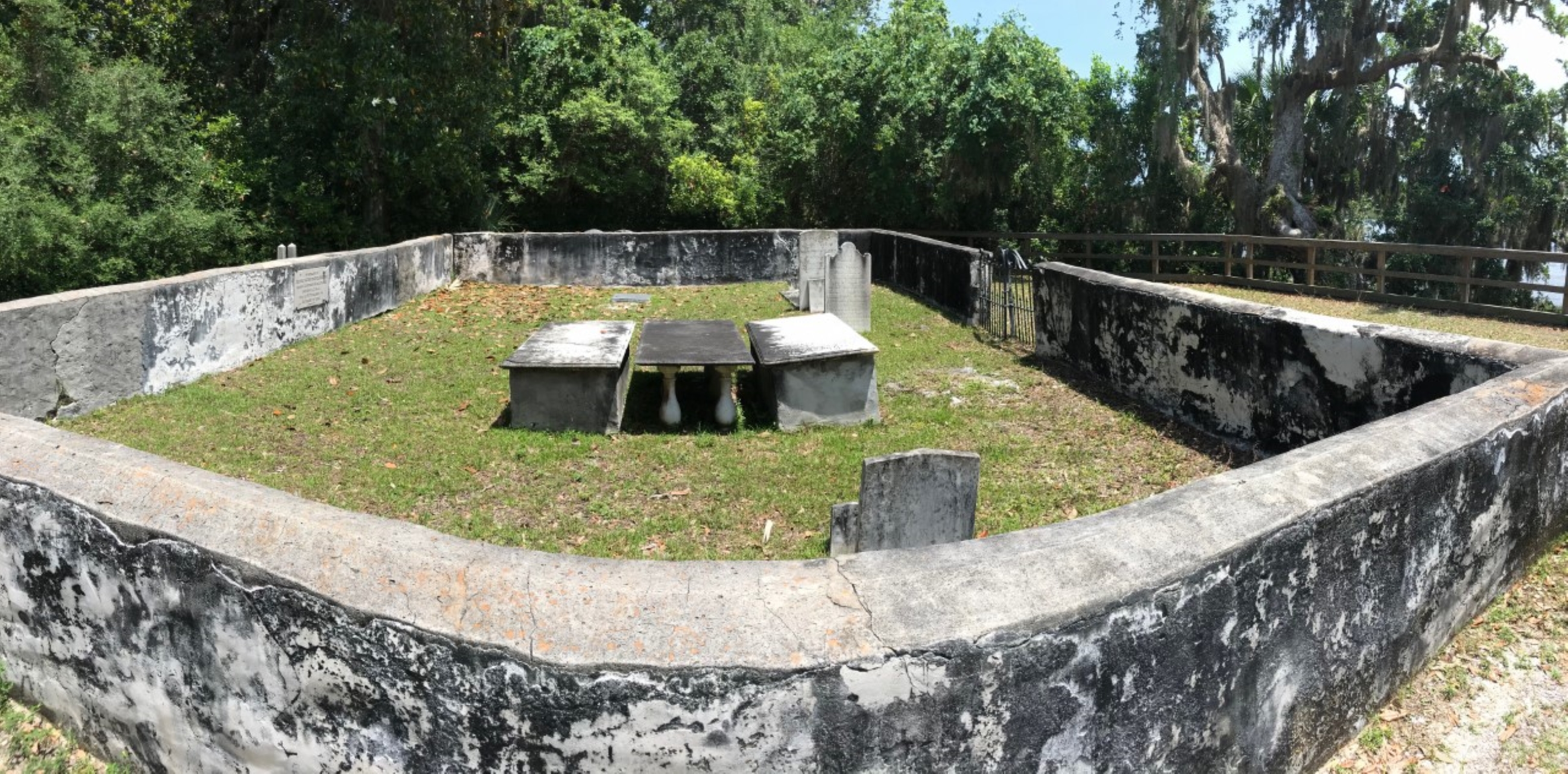
People from multiple eras of the islands history- plantation era and Carnegie period- are laid to rest at the Greene-Miller cemetery.
A wooden sign next to a yaupon holly bush reads, “Greene-Miller Cemetery.” Beside the sign, a stone barrier stands with an informational and photographic diagram in a 40-foot field. The stone barrier houses the Greene Miller Cemetery. The Greene Miller Cemetery is surrounded by yaupon holly bushes and palmetto trees. To the south, a simple wooden fence runs parallel to a small, tidal-creek, called Beach Creek, in the distance. To the west is the narrow, sandy path entrance. This is the final stop of the self-guided tour.
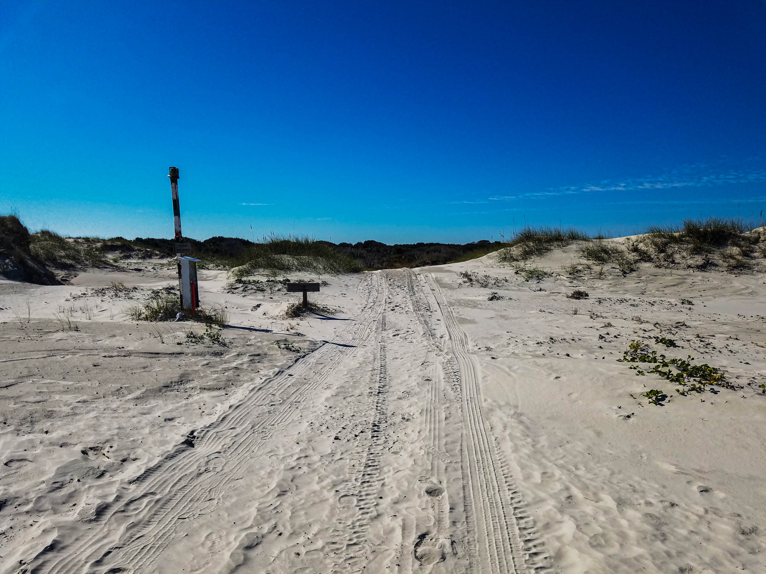
Dungeness Beach is a short walk from the Dungeness ruins area. This 0.5 mile path leaves the historic district and passes tidal marsh and dune field settings before reaching the beach. The dune crossing to Dungeness Beach can be completed as part of the 4.3 mile loop that takes visitors from the Sea Camp dock, to the Ice House Museum, Dungeness ruins, salt marsh, dune field, and beach, before returning to Sea Camp. However, the dune crossing to Dungeness Beach is not recommen
From the carriage house in the Dungeness Historic District, continue east along the path. A maintenance shed and bike rack will be located on the left side of the path. As the path leaves tree cover, the sand path continues until a wooden sign for “Marsh” points to the right. Turn right at this sign. There will be a slight rise as you leave the road bed and travel over a mixed grass/sand trail. After a few years, the trail will slope fairly steeply down a hill. Shortly after, continue on a boardwalk that extends over the marsh. Beach Creek is on your right in this boardwalk section. The boardwalk is 200 years long and has a railing on both sides. Roughly halfway along he board walk there are several benches and a few spotting scopes to view wildlife. At the end of the boardwalk, the surface turns to soft sand. The trail curves to the left and gains a slight elevation. After a few hundred yards, the path continues under tree cover. A couple hundred yards later, a sign reads “Boardwalk” pointing to the right. Turn right at this sign as this second boardwalk begins. This boardwalk winds through tree and shrub covered dunes. At the conclusion of the boardwalk, the grass/dirt surface continues a couple hundreds yards before terminating at the Dungeness Beach.
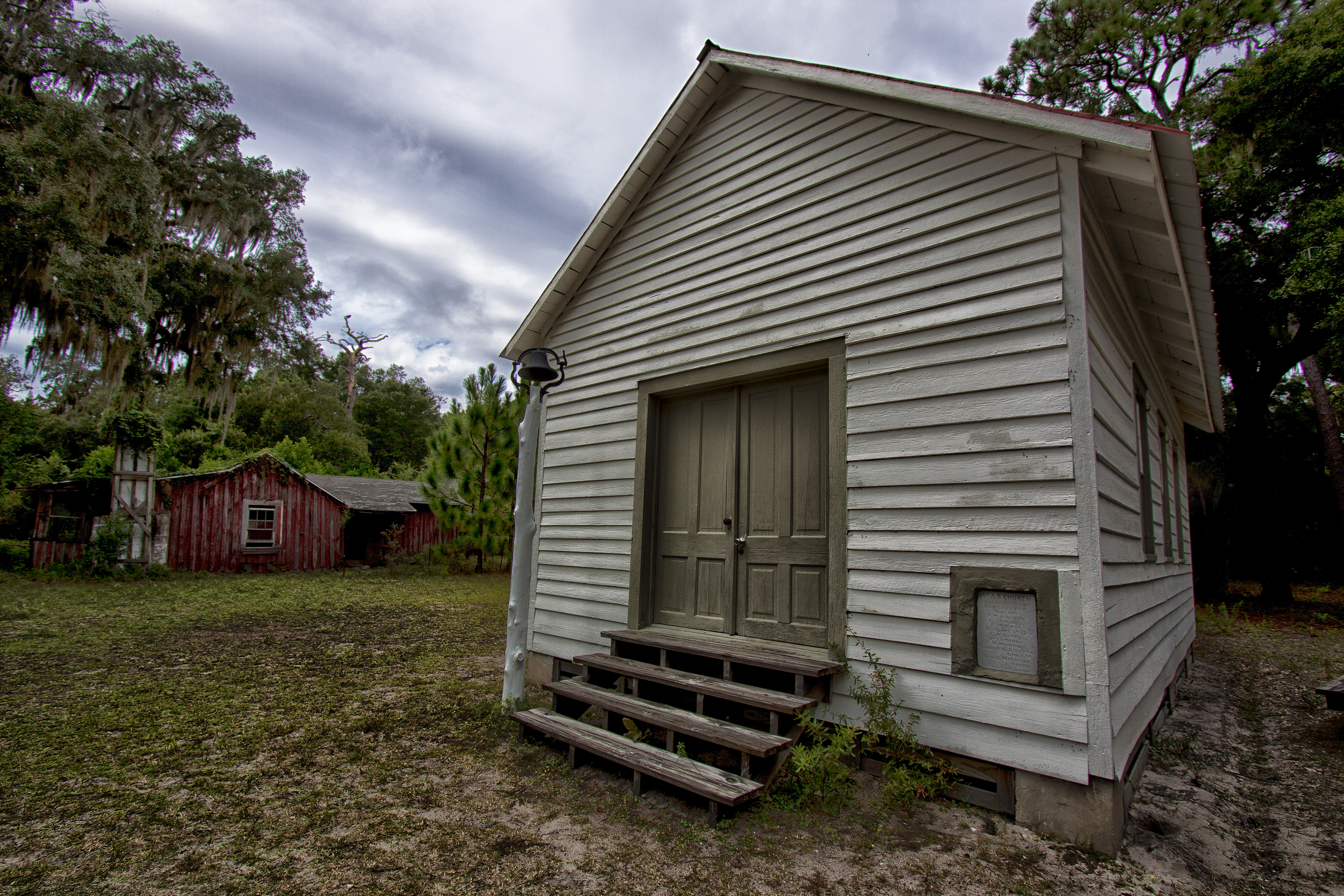
First established in 1893, the First African Baptist Church served a community of freedmen and women during the reconstruction era. This humble building served as the center of the community called The Settlement.
The First African Baptist Church is a small rectangular building with pitched roof. The building is raised on cinder blocks. The exterior features horizontal wood siding painted white. The entrance to the church has four steps leading to a two-panel door, painted brown. A granite plaque is cemented into the wall to the right of the door and reads “1st A. B. Church, Founded 1893 by Rev. T. Lockett, Deacons W. M. Alberty, C. Trimings, P. Mitchel; Officers 1937, C. Alberty, P. Trimings, N. Merrou, Beulah G. Alberty Chu. Clk.; Rev. L. Morrison Pastor; Carved by Geo. H. Leapheart.” The east and west exterior walls feature three windows each with brown trim, spaced equally. The north-facing exterior walls features a single window in the center of the wall. The roof is metal and colored red. When entering the building, an aisle divides two sets of four wooden bench pews. The pews face north. A pew sits against the west wall and faces east. Another pew sits against the east wall facing west. A raised stage area with red carpet lines the north wall. The first step of the stage features a small, wooden table with four legs, painted white, with a wooden cross sitting on top. The second step surface features a pulpit painted white.
The Greene-Miller Cemetery is a great place to delve into the island's storied history. Located in the Dungeness Historic District, take in the Greene-Miller Cemetery and the view of the salt marsh to the south.
A rectangular cement wall encloses several headstones and burial plots. The wall stands roughly four feet tall and one foot thick. An iron gate stands along the south cemetery wall. From west to east, burial plots include: Martha Greene Nightingale; buried beside one another are Catherine Greene-Miller, Louisa Catherine Greene Shaw, and James Shaw; Charles Jackson; former grave site of Henry Lee; Bernard M. Davis and George Dewson Davis. Outside the east wall of the cemetery, enclosed separately are plots for Catherine and John Rikart.
Stop by the Ice House Museum to learn about the island’s history. You will find photos and images from the island’s past and stories of the people that once lived, worked and recreated on the island. Located next to the Dungeness Dock, the Ice House also has restrooms and treated drinking water.
The Ice House museum is a historic structure from the Carnegie Era. It sits near the Dungeness dock on the south end of the island. Situated near the river, a large open field extends beyond the house to the tree line. A large live oak tree grows just to the south of the building. The Ice House is a wooden building with horizontal siding. The building is painted white with green trim. The roof is covered in cedar shingles00. There is a gabled cupola (raised ventilation) that runs the length of the roof and served to release hot air. The building faces the river, with a tall, vertical window centered on the front wall. This is the only window into the building. A small addition on the south side of the building provides access into the building. There is a set of four stairs that lead into the building on the southwestern corner. Once inside the entrance room, the door to the main exhibit room is to the left. There is a wide lip at the door and 6 inch step down into the exhibit hall. The exhibits begin to your left and starts with the early history of the American Indians on the island. Exhibits continue around the room and progress through the island’s history. On the far side of the room, a set of double doors leads out to the north side of the building. The exhibits continue around the room and focus on the Carnegie era on the island. In the center of the room is a small fenced off area with a glass covered, excavated pit that shows the tabby foundation of what is believed to be a general store active during the Greene-Miller time period. Hung on the east wall is a small carriage. Back outside and around the corner to the right of the entrance stairs, a small cooling room with air conditioning can be found. There is a set of 4 stairs that lead to the door. Once inside, the small room can be found to the right. There are several chairs in the room as well as an air conditioner. A large pair of double doors provides an accessible entrance on the north side of the building. A wooden entrance platform leads into the main exhibit gallery. On the back of the building facing east, A ramp leads to a covered platform and the bathrooms. At the top of the ramp, a water fountain and bottle filling station is located on the left. The women’s bathroom is on the left past the water fountain. Upon entering, the sinks are ahead along the far wall with two stalls located to the left of the entrance door. The men’s bathroom is located directly across from the women’s room. Upon entering there are two urinals to the right and two stalls to the left. The two sinks are located across from the entrance and to the right.
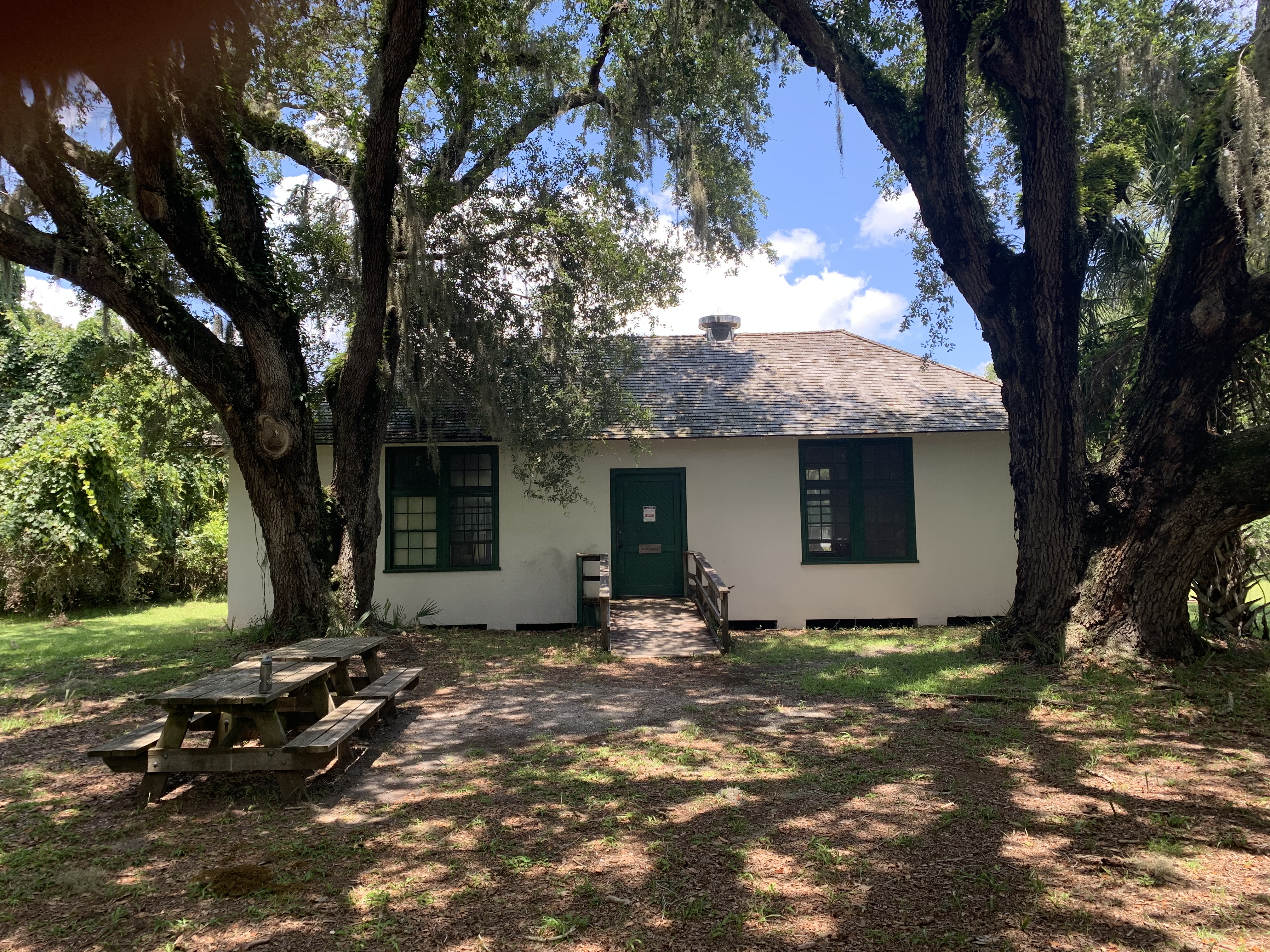
Originally housing the laundry facilities of the Carnegie’s Dungeness Estate, the Laundry house is now a restroom and water stop in the Dungeness Historical District. With shaded picnic tables in front and one indoor table, this is a great place to stop for a break.
The Laundry House is located in the center of the Dungeness support area. It is a small, white building tucked under large, spreading live oak trees. A small lawn area stretches out to the south and north of the building and a dense maritime forest lies to the west. To the east is the road through the Dungeness support area and the path to the beach. The only entrance to the Laundry house is on the south side of the building. There are several picnic tables near the main entrance the building in the shade. An ADA ramp leads up to the main door. The door opens outward with the handle on the left. Once inside, there is a large open area to the right. This area has an indoor picnic table and old sinks and equipment from when the building was used to clean laundry. Directly to the left upon entering is another doorway which leads to the restrooms. To the right of this doorway is a water fountain. Once through the door, the men’s room is straight ahead while the ladies room is to the right down the hall and then on the left. There is a push door to get into the men’s room. The sink is located directly to the right upon entering with a hand drier on the wall to the right. There are two stalls with flush toilets beyond the sink on the right. The furthest stall is ADA accessible and the door is perpendicular to the first stall. The layout of the ladies room is a mirror image of the Men’s. Upon entering the restroom through the push door, the sink is located to the left. A hand drier is located on the wall to the left of the sink. There are two stalls beyond the sink on the left. The furthest stall is ADA accessible and the door is perpendicular to the first stall.
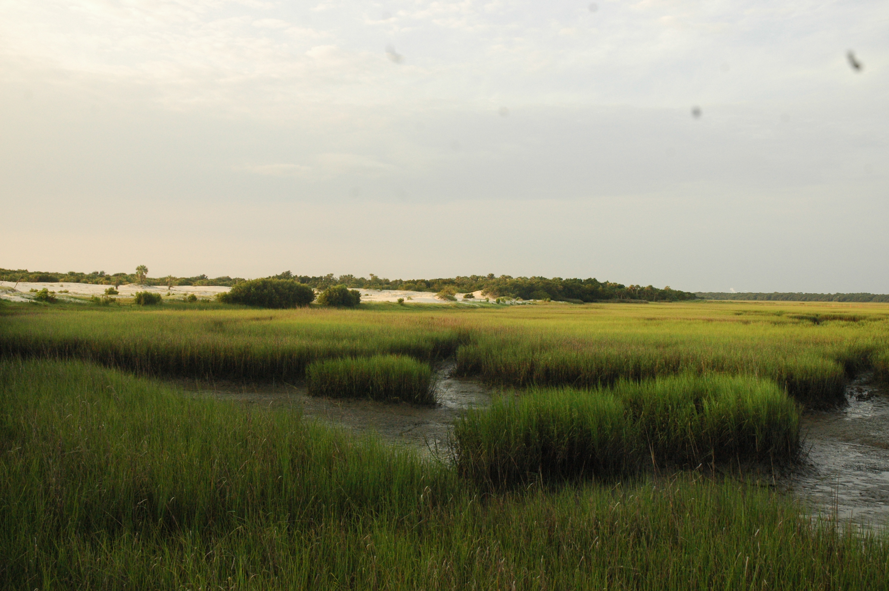
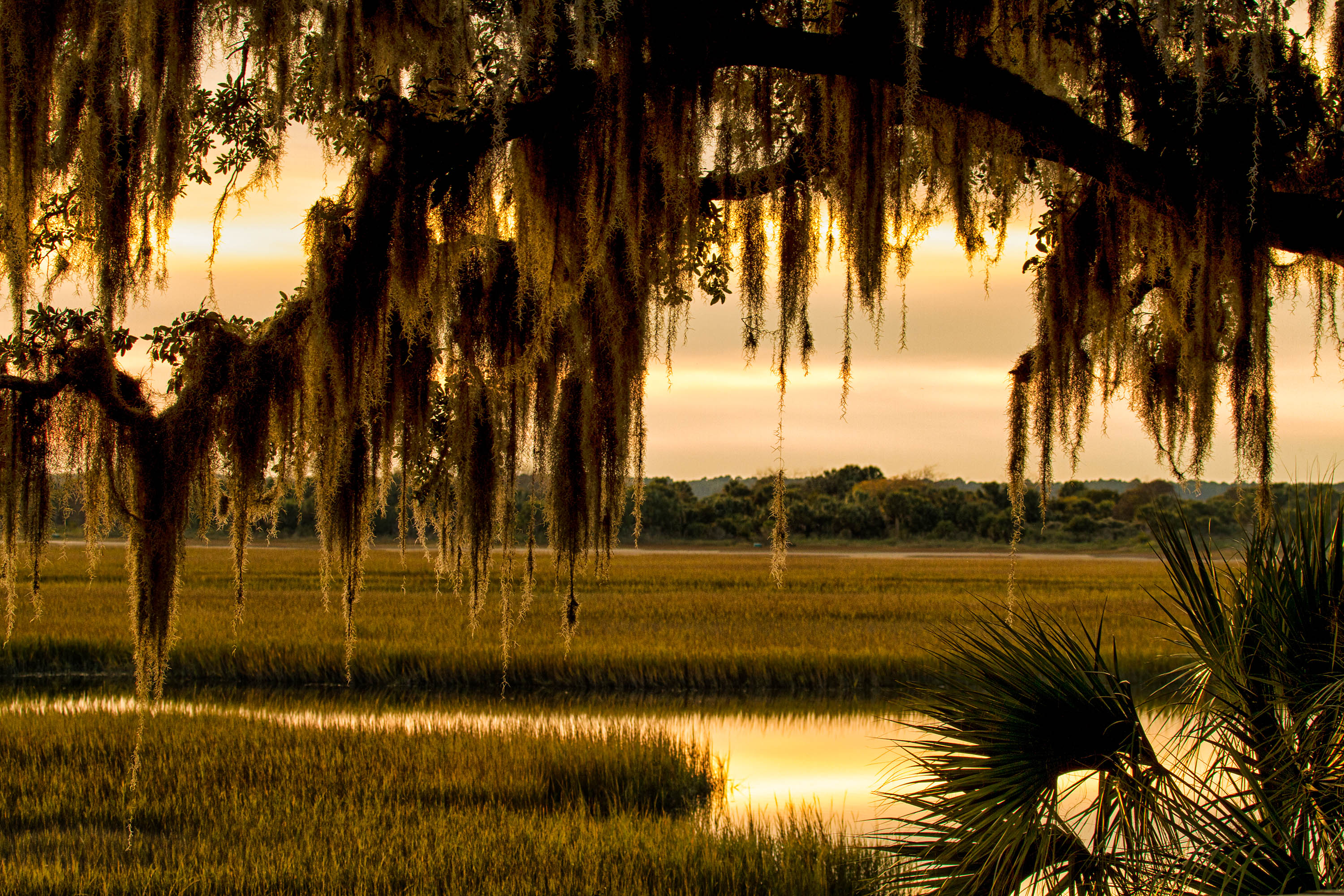
Leave the tree line near Dungeness and head onto the marsh boardwalk on your way to the beach. Just a short walk from the historic district, the marsh boardwalk provides great wildlife-viewing opportunities. Manatees can be seen feeding on the marsh grasses around high tide during the summer. Wading shorebirds probe the mud flats in search of crabs and small fish. An American alligator sighting isn't out of the question either.
A wooden boardwalk one tenth of a mile long traverses the salt marsh area with tidal creek and marsh grasses on either side. The boardwalk is lined with railings on each side. Halfway along the boardwalk, a platform extends further and features a magnifying scope and benches. The boardwalk terminates at the edge of a sand dune where the surface changes from wooded decking boards to soft sand.
The trailhead has a cleared area with a low wooden sign. A red plastic post sits in the middle of the opening with the symbols for no ATV's or bikes. Palm trees and other shrubs surround the clearing. Interspersed are medium sized live oaks to the east and west of the trail. The trail is flat and open with grassy sides. A road lies to the south of the clearing.
Brown marker in front with number 10. To the west the shrubs are very dense in the understory blocking any extensive view. The live oak canopy is sparse so light penetrates to the ground. A large live oak has fallen and large chunks of the cut trunk litter both sides of the trail. To the east the sand dunes are clearly visible with palmettos scattered in the understory. The trail continues north winding through the vegetation.
A brown post with the number 11 is directly in front. The trail goes east toward the dunes and beach. To the south is the forest with an open understory. Medium size trees with grape vines hanging amidst palmettos fill the canopy. The trail goes west toward marker 12.
Brown marker with the number 12 stands in front. A medium size shrub overhangs the marker. To the east is the trail leading to marker 11. The forest has medium size trees in the canopy with dense palmetto and shrubs in the understory. The palmetto create a distinct line of plants with an open area between it and the canopy. To the west the trail leads in an almost straight line to the next marker.
Brown sign with number 13 in front surrounded by palmetto. The trail goes straight east to marker 12. To the south are larger live oak trees scattered throughout the forest. The canopy is separated from the mainly palmetto understory with open space. Spanish moss hangs from the trees. The trail is due west to the next marker. Grassy patches line either side of the dirt trail.
Brown marker with the number 14 is in front. Behind the marker is a pile of dead limbs. The trail goes directly east to the next marker. The forest on either side of the trail has large live oak trees in the canopy with a dense understory of palmetto and shrubs. To the west the trail goes straight to marker 15.
Brown sign with the number 15 in front. A tangle of vines hangs behind the sign. The trail goes east straight through to marker 14. A dense line of live oak and shrubs line the trail on each side. The north trailhead can be seen to the west
Brown post in front with number 2. Thin shrub leans to the right of the sign with a large live oak bending overhead. The trail leading south goes to the trailhead. The north trail leads to the next marker. The forest on either side of the trail has a mixed understory of shrubs and palmettos. There is an open space between the understory and the canopy. The canopy has lots of open spaces letting light in.
Brown marker sits in front with the number 3. The trail goes south to marker 2. The forest to the east and west sides of the trail is covered sporadically with saw palmetto and live oaks are scattered throughout with open spaces in between them. Due to the open area between understory and canopy the view opens for a good distance. The trail to the north starts to wind toward marker 4.
Brown marker in front with number 4. Palmettos are scattered sporadically in the open understory surrounding the trail. A large live oak stands just beyond the marker. A medium size holly stretches overhead. The Spanish moss is prevalent on the scattered trees in the area. To the south the trail goes toward marker 3. To the north the trail starts to veer toward the east.
Brown marker in front with number 5. The forest on either side of the trail has an open canopy so sunlight shines through. The understory is filled with palmetto and smaller shrubs scattered throughout leaving open space between. To the south the trail continues to marker 4. The trail to the north passes between two large live oaks lining the path.
Brown marker in front with number 6. the understory is made up of mostly palmetto but large open areas are revealed. To the west are 3 large live oaks clustered together. To the east side of the trail the canopy is thinning revealing more sky. The trail meanders to the south toward marker 5. To the north, the trail goes straight forward.
Brown marker in front with number 7. Live oak tree hangs over the marker. Smaller shrubs sit among palmetto on east side of trail. The live oaks seem to be in groups that thin out and more sky revealed. To the west side of trail, live oaks grow scattered throughout but with a thin canopy. The trail goes south to marker 6. to the north the trail veers toward the east.
Brown marker in front with number 8. Three large live oaks group behind marker. The middle oak is dead. Vines grow up both of the side trees. On the east side of the trail, the canopy is thinning and dunes can be seen in the distance. The understory has thinned into an open area. The trail goes south toward marker 7. The west side of the trail has scattered palmetto in the understory and live oaks making up the canopy. The trail goes north winding through the forest.
Brown marker in front with number 9. A very large live oak trunk with no bark exposes the wavy growth of the tree near the marker. To the east a line of live oak edges the dunes in the distance. The canopy is open so forest is very light in this area. Palmetto are more dense with other shrubs scattered throughout on both sides of the trail. To the north the trail continues into more dense shrubs.
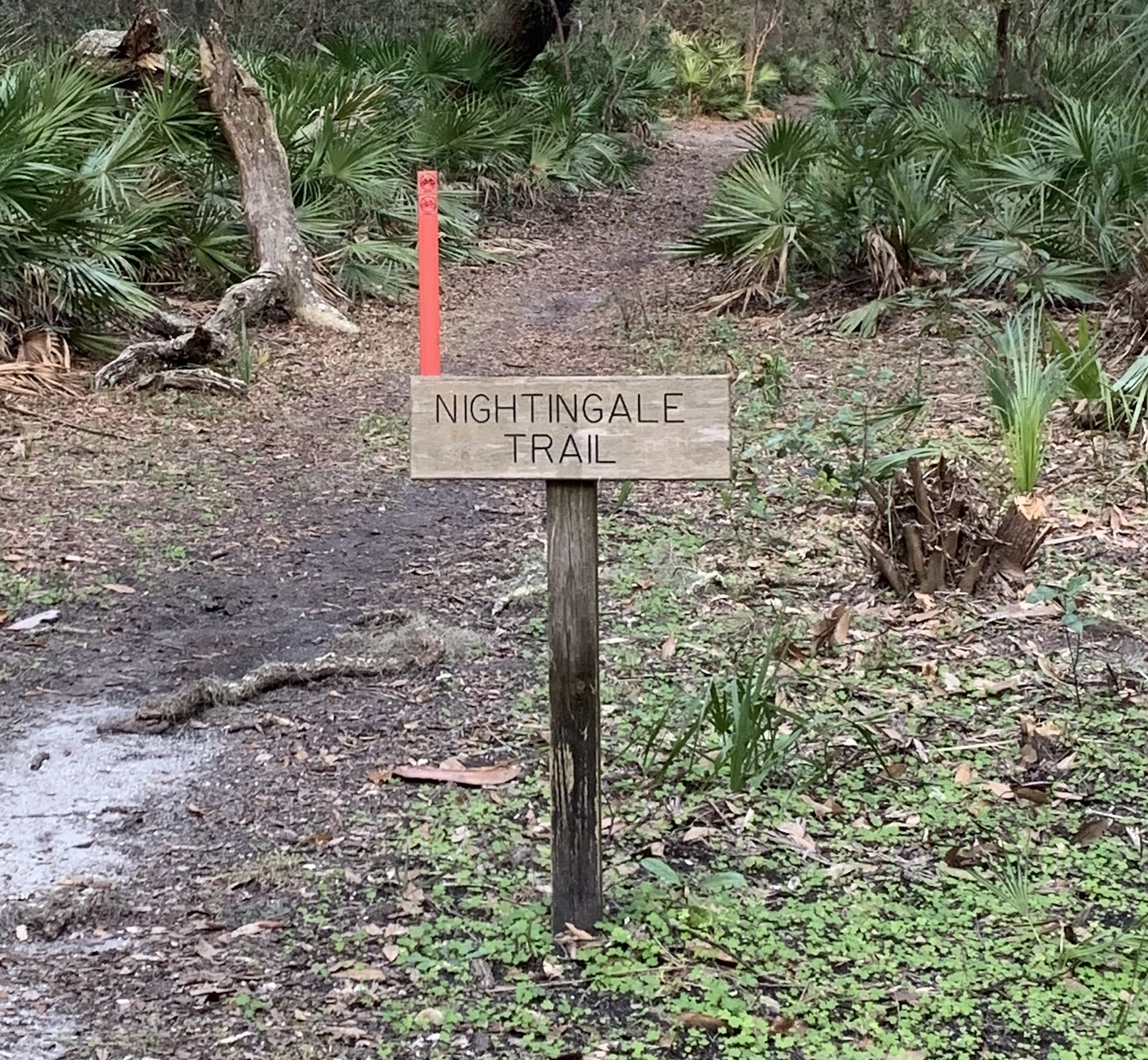
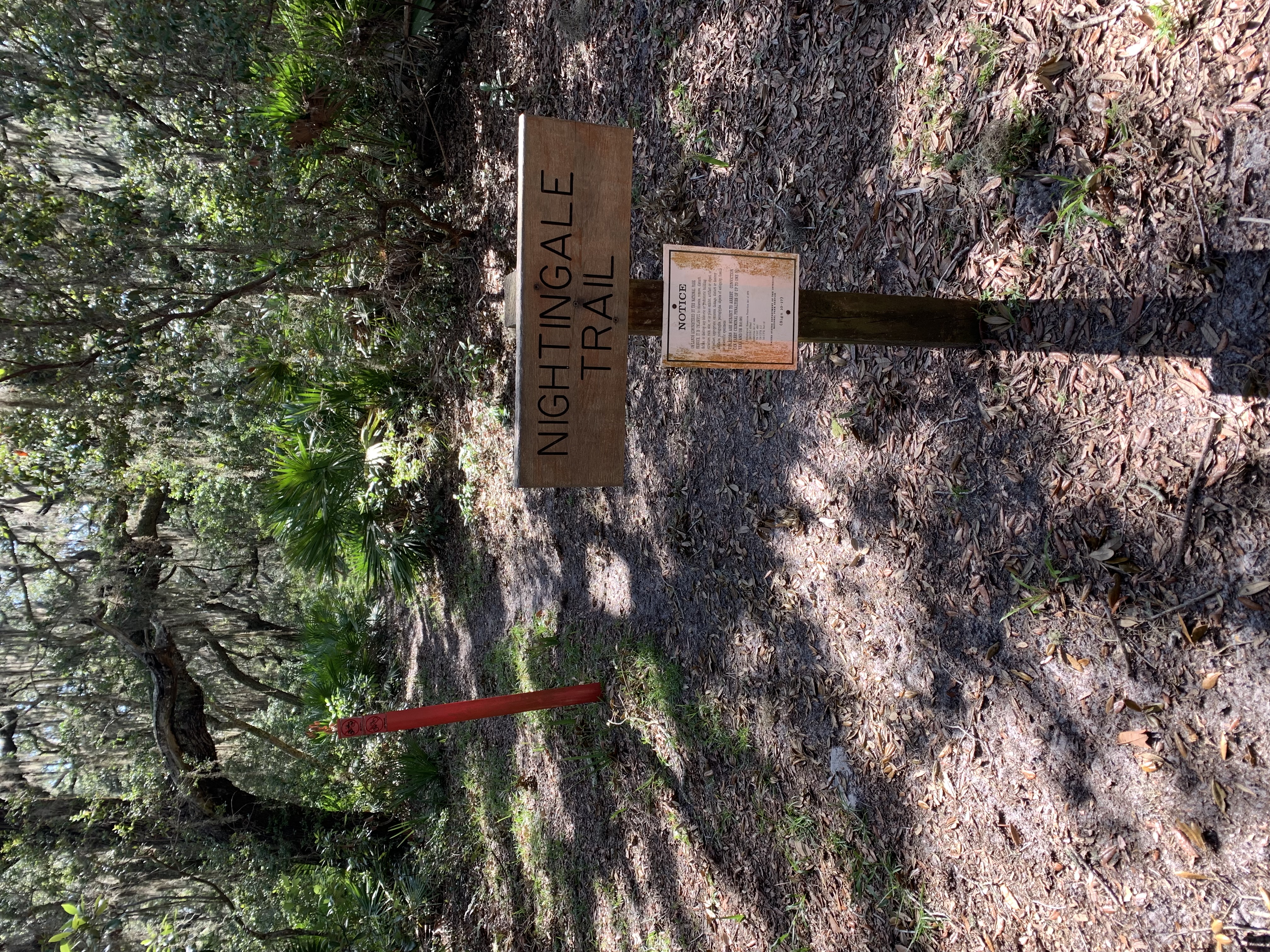
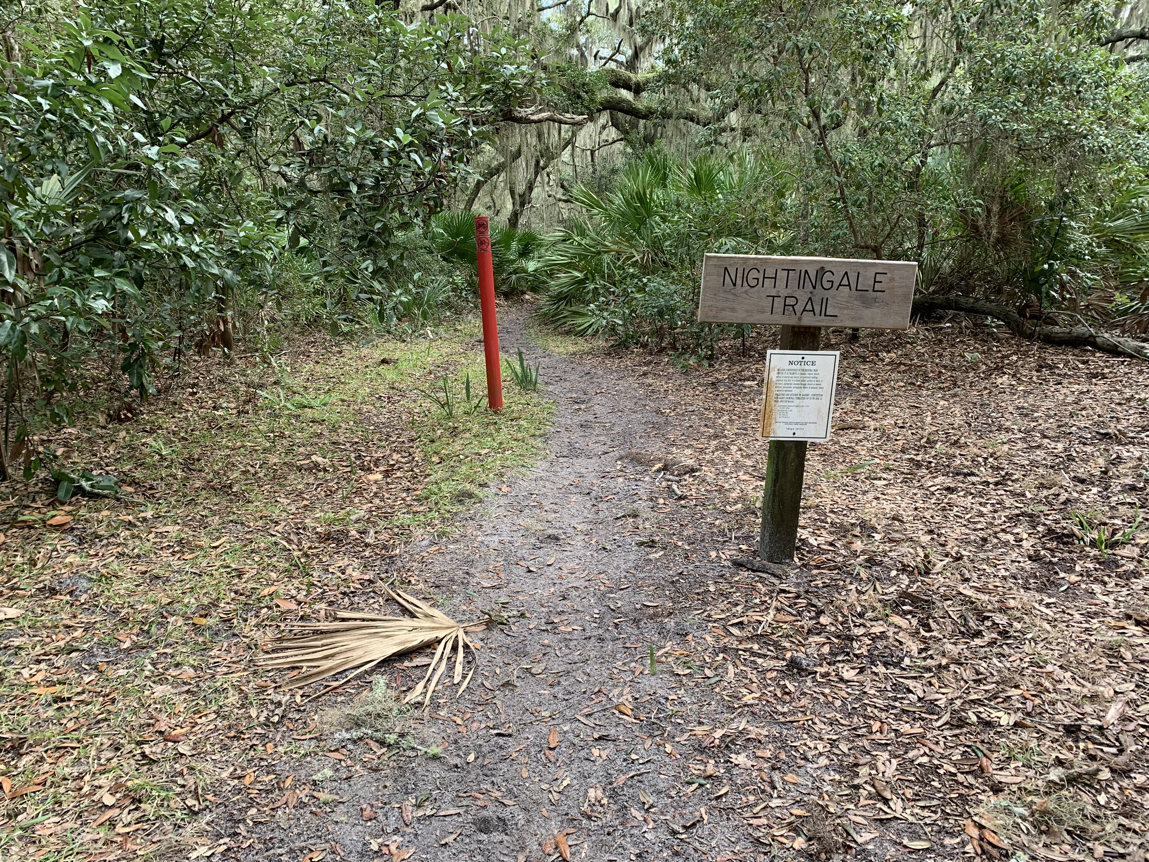
The area is a clearing with grass and live oaks scattered throughout. A wooden picnic table sits on the north side of the clearing. The trail begins to the east marked by a wooden sign with the words Nightingale Trail. A brown metal sign below it has a QR code with the label "Nightingale Trail". A red plastic flat post beside the trail sign has a symbol of no bikes. To the south side of the clearing is another wooden picnic table. The main road which runs north and south is on the west side of the clearing. Next to the road are two ground level circular pipes. Across the main road is a road that is labeled "Employees Only". A metal gate can be seen in the distance on this road. The forest surrounding the clearing has dense palmetto and shrubs with live oak being the main tree in the sparse canopy.
Brown post with number 1 sits in front. Large live oaks overhang the trail creating a semi-open canopy. The understory on each side of trail is a scramble of shrubs and palmetto plants. The trailhead is close to the south. The trail continues north.
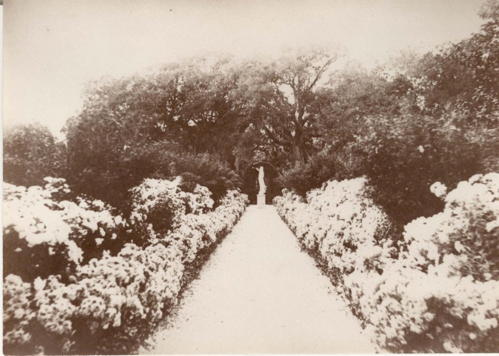
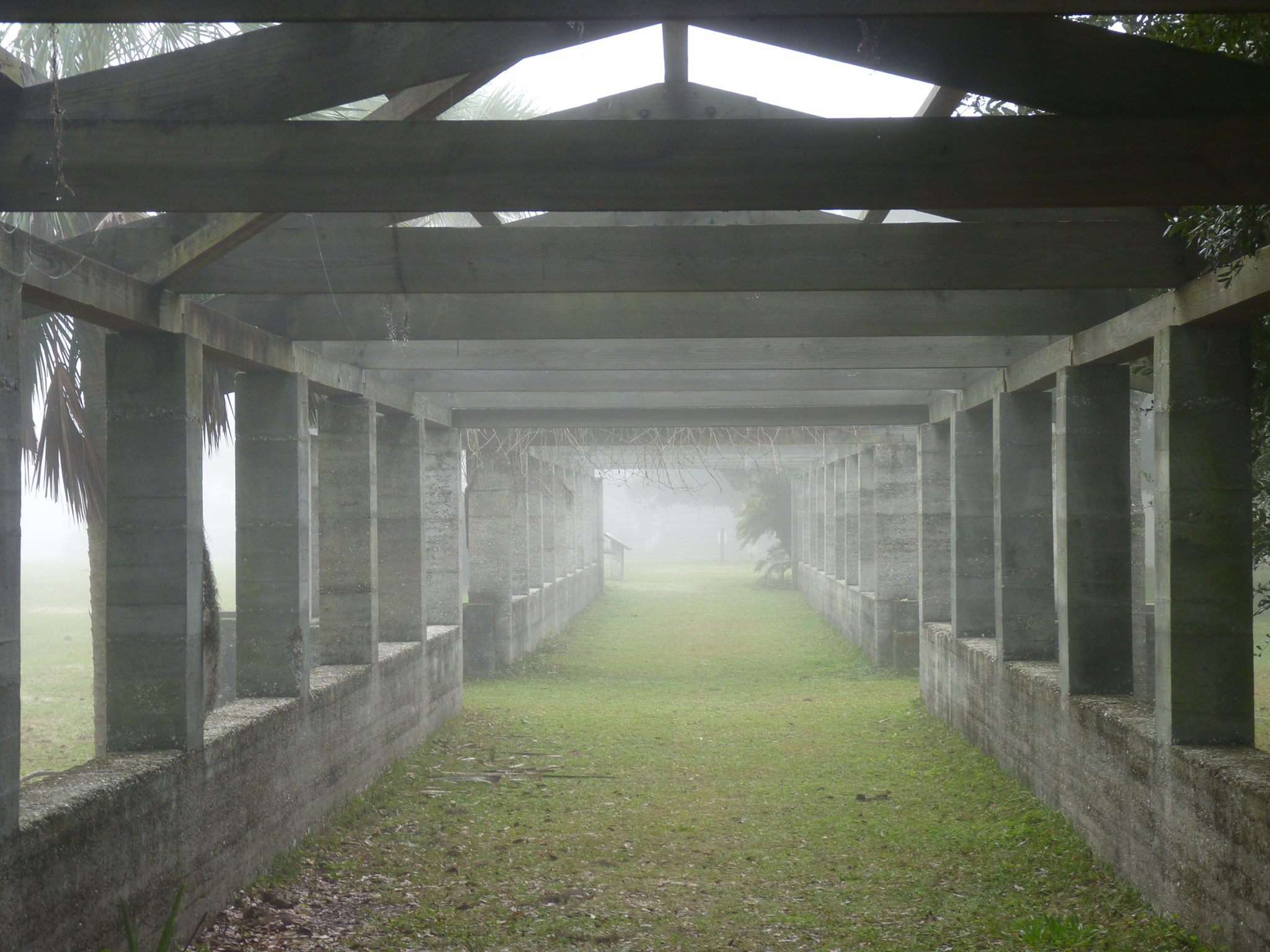
Step back in time and imagine yourself as a Carnegie guest spectating a game of polo or taking a shaded stroll. See how this wealthy industrialist family enjoyed recreation and leisure with a visit to the Dungeness pergola.
A long, covered walkway made of tabby extends east-west fifty yards. Tabby is a oyster shell lime, sand, water, and raw oyster shell concrete mixture. Nine tabby columns on each side, equally spaced, lead to central archways. Two archways on the north and south entrances to the pergola. Adjacent to the archways, a sitting area with four L-shaped bench seats made of tabby lay, two on each side of the two archways. Nine more tabby columns on each side, equally spaced, lead to the terminus of the pergola. Overhead, an open, slightly pitched A-frame made of wooden boards extends the whole walkway. Vining plants covered the pergola when the Carnegie family lived here, providing shady place to stroll. Today, a small section near the central archway and sitting is covered in vining plants.
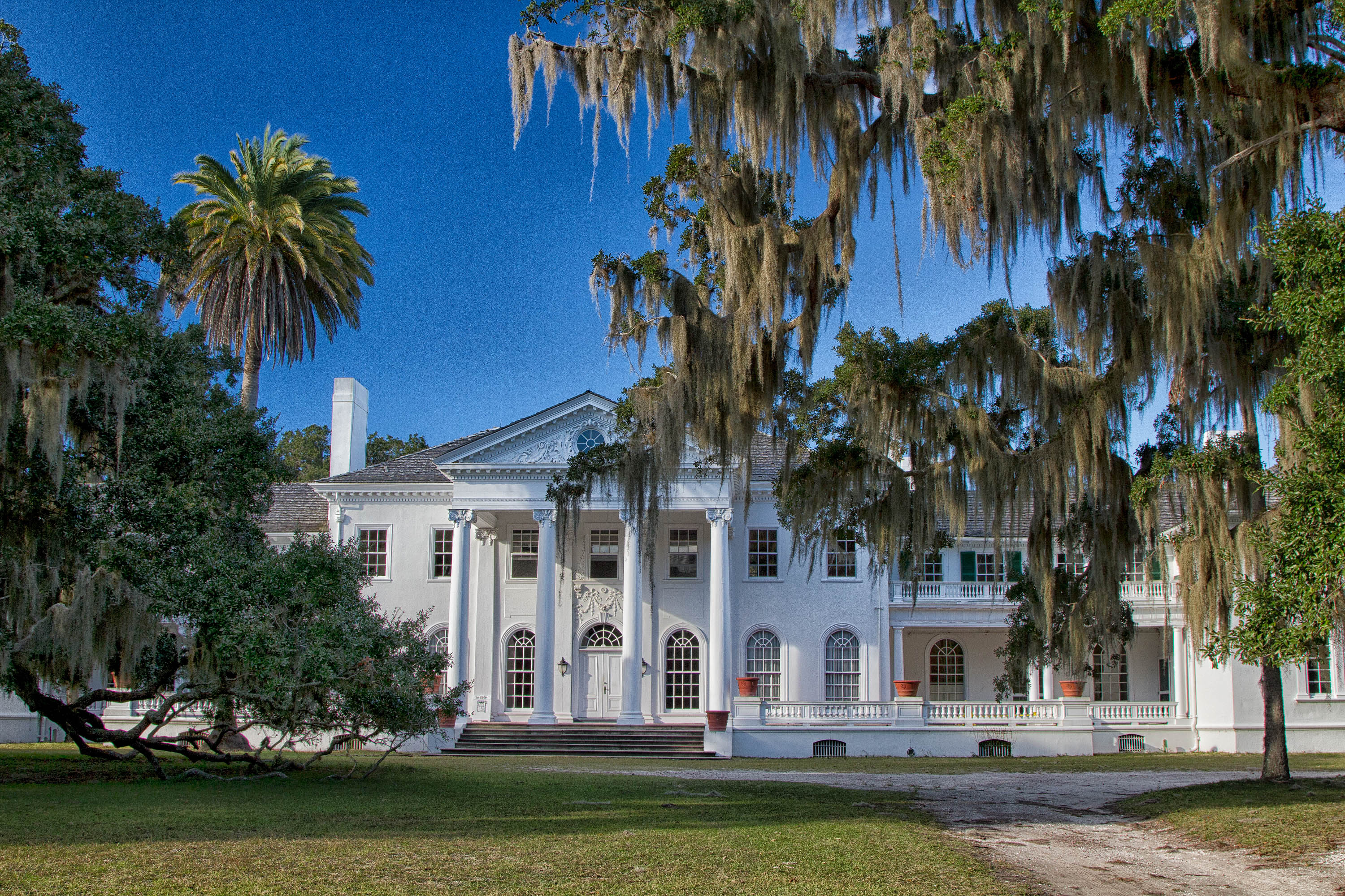
Located 7 miles from the Sea Camp dock, Plum Orchard mansion is a sight to see. Constructed in 1898, the 22,000 square foot mansion was gifted by Lucy Carnegie to her son, George Lauder Carnegie, upon marrying Margaret Thaw. Visitors can take a free tour of the mansion for a glimpse into Edwardian High Society at the turn of the 20th century. But further exploration tells the story of a family who valued the island, and their time spent with friends and family there.
Plum Orchard is a large 22,000 square foot mansion with exterior painted white. Palm and large live oak trees with Spanish moss hanging down are found on the grounds surrounding the mansion. The house is wood siding, with some stucco. It is painted white and is built in a Georgian Revival style. The front of the house faces south, with a wide porch extending to the east and west wings. The porch is bounded by balustrades. There are second story balconies with balustrades on the east and wings of the house. There are arch-topped windows on the first floor of the home. Second story windows are rectangular. Several tall brick chimneys rise from the shingled roof. The front entrance is covered, with four tall, two story columns supporting the decorative roof. A wide set of stairs leads to the front porch. There are separate entrances to the east and west wings and pool house on the porch. The main doors are double, solid wood that open into the house. The doors are kept locked and are only opened by park staff and volunteers during public tours. Around the side of the house to the left, or west, there is a covered porch facing west with a wide set of stairs leading to the porch. The porch is bounded by balustrades with tall white columns supporting the roof. The porch is open on three sides. There is a swinging seat on this porch. Continuing around the back of the house, there are a few narrow sets of stairs that lead to locked doors. The wide set of stairs on the back of the house leads to a small porch. This is where the public restrooms can be found. There is no ramp to the porch and no railing on the stairs. The restrooms are multi use and located to the left of the stairs at the top of the porch. There is a screen door that pull outward and a glass and wood door that pushed inward into the bathroom. The toilet is straight ahead and the sink is located to the right upon entering. On the east side of the house there is another covered porch with a wide set of stairs leading to the porch. The porch is bounded by balustrades with tall white columns supporting the roof. The porch is open on two sides. There is a swinging bench on this porch. The door on the porch leads to the pool, though it is locked.
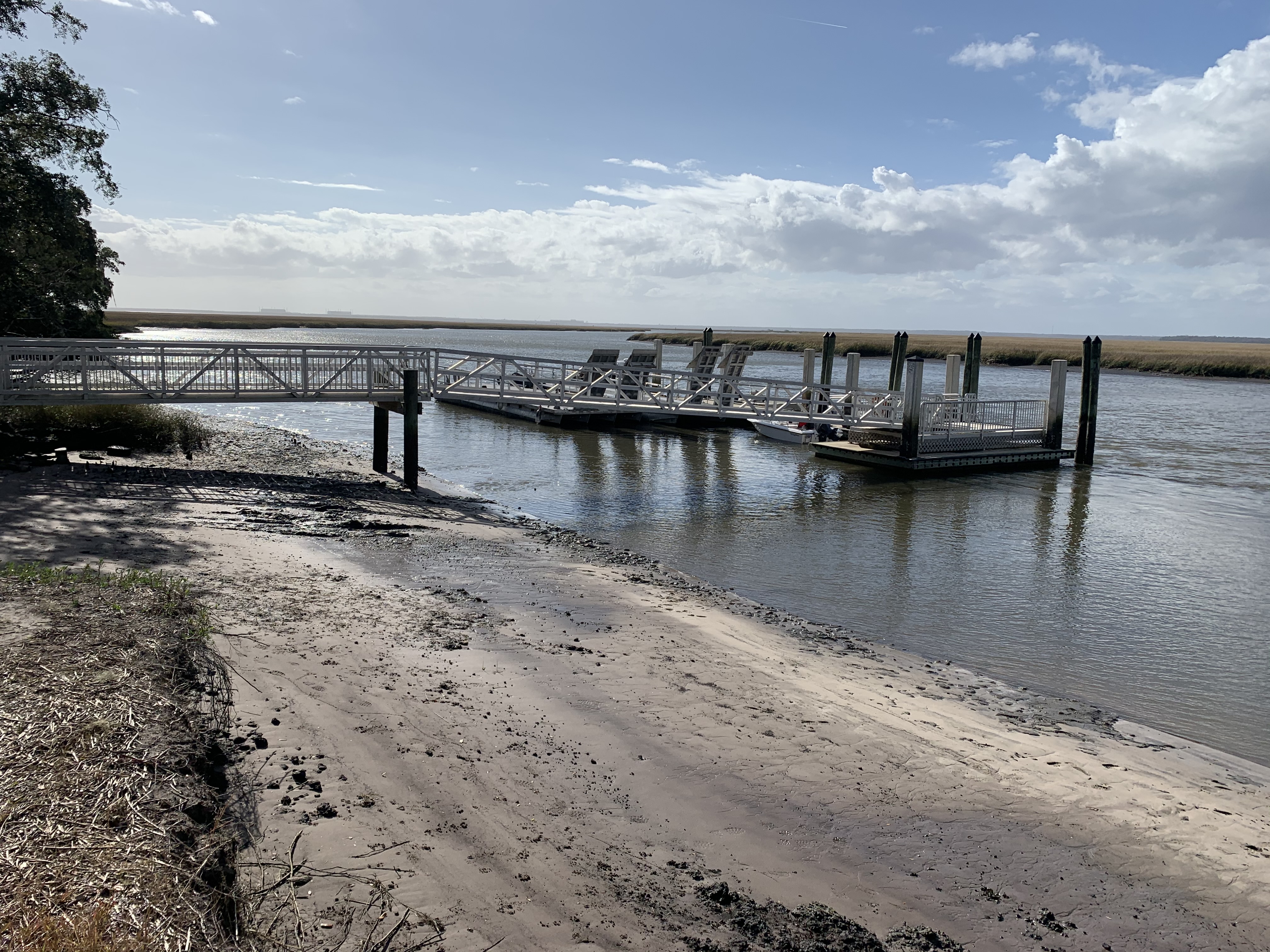
The Plum Orchard dock is the northern-most public dock on the island. It provides access to the Plum Orchard mansion and many wilderness trails.
From the island on left, a park display board includes rotating information. An entrance fee payment box sits with envelops and writing utensil inside. A drop box with slot is adjacent for park entrance fee envelops to be deposited. A sign reads, “U.S. Fee Area, Entrance Fee $10 per person 16 & older, 15 & younger free, valid for 7 days”. The surface approaching the dock is sandy and uneven. Ruts have developed due to runoff. On right, a metal walkway lined with metal railing extends approximately 30 yards from the island. Caution, the slope of the dock walkway will depend on the tide. This walkway ends at a landing before a second, short, metal walkway on left continues to the floating dock. The concrete floating dock extends about 15 yards from the end of the second metal walkway. On right are concrete pilings that secure the dock and metal cleats for boat docking. The far end of the dock features a metal ladder for entering the water. There is no railing on the floating dock.
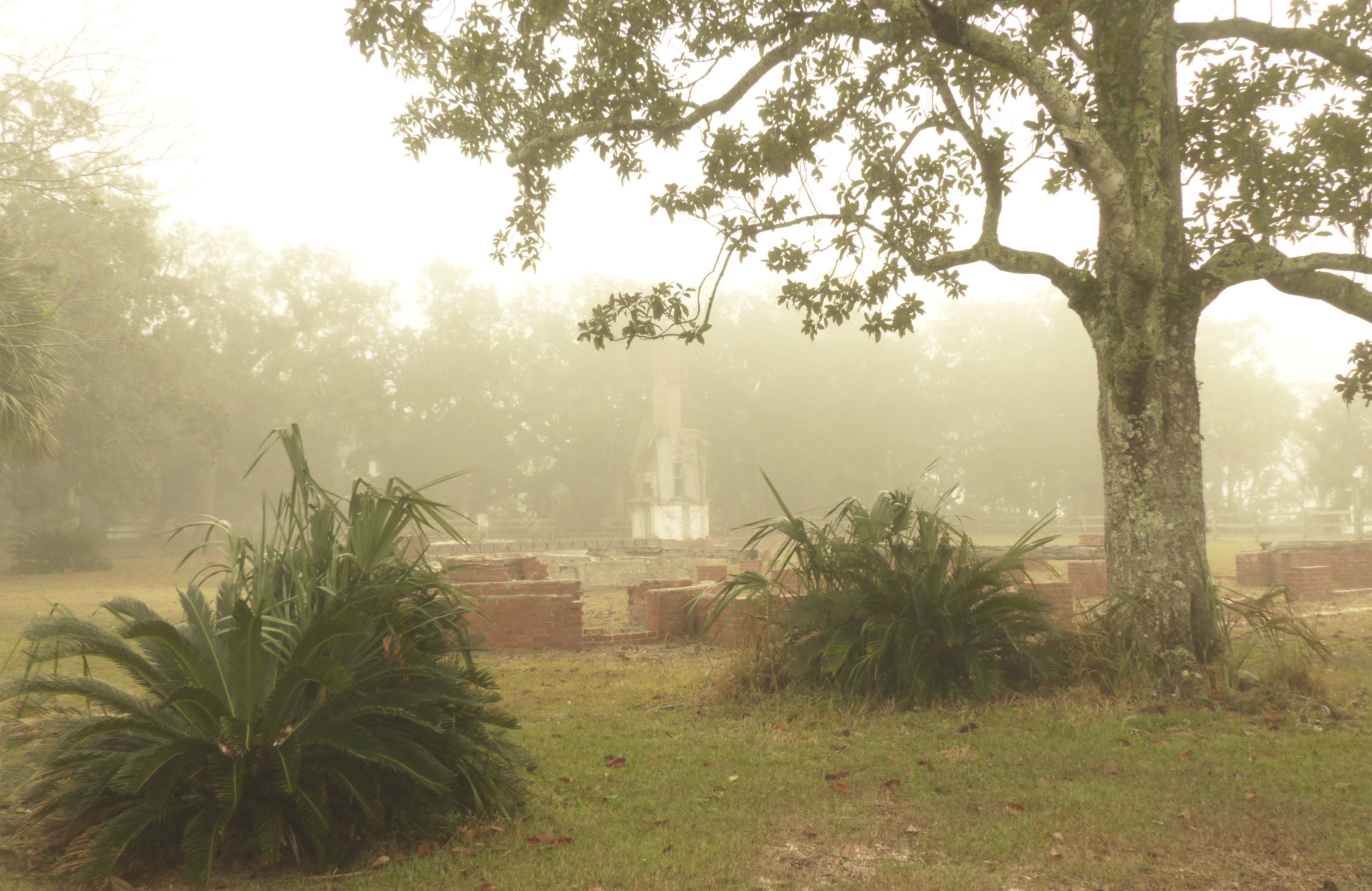
Recreation complexes were common among the wealthy Gilded Age industrialists. The Carnegies' at Dungeness featured a heated swimming pool, steam room, squash court, apartment, billiard room, gun room, and doctor's office. Stop by during your visit to the Dungeness area to view where recreation once abounded for the Carnegie family.
The ruins of the Carnegie Recreation Building at Dungeness are surrounded by a wooden split-rail fence with no access inside.
This is stop number 1 along the River Trail interpretive tour featuring the native uses of yellow pine on the island.
Brown trail sign marked with the number 1. To the north, the trail continues to meander through the understory of cabbage and saw palmettos. Live Oaks arch over the trail but the canopy is mostly open, with sky visible. To the east, behind the trail sign marked with the number 1, numerous young cabbage palmettos grow. They have large palm fronds and grow from a central node. The ground is coated in oak leaves year-round. To the south, the southern trailhead is visible. Beyond the trail to the south are the Dungeness Dock and Icehouse museum. To the west, the canopy thins out towards the Cumberland River.
Stop number 10 on the River Trail features Spanish moss.
Brown trail sign marked with the number 10. To the east and behind the sign, a young Red Bay grows towards the mid-story. The understory is comprised of saw palmetto and red bay. The canopy of tall, old Live Oak trees draped with long, stringy grey Spanish moss reaches over the trail. To the south, the dirt trail continues beneath the canopy of live oaks and Spanish moss. To the west, the canopy and understory thin out towards the river. The understory is primarily Saw Palmetto. To the north, the end of the trail is visible and marked with a red post. Beyond that, the Sea Camp Ranger station comes into view. The live oak trees are tall, gnarled, and coated in Spanish moss.
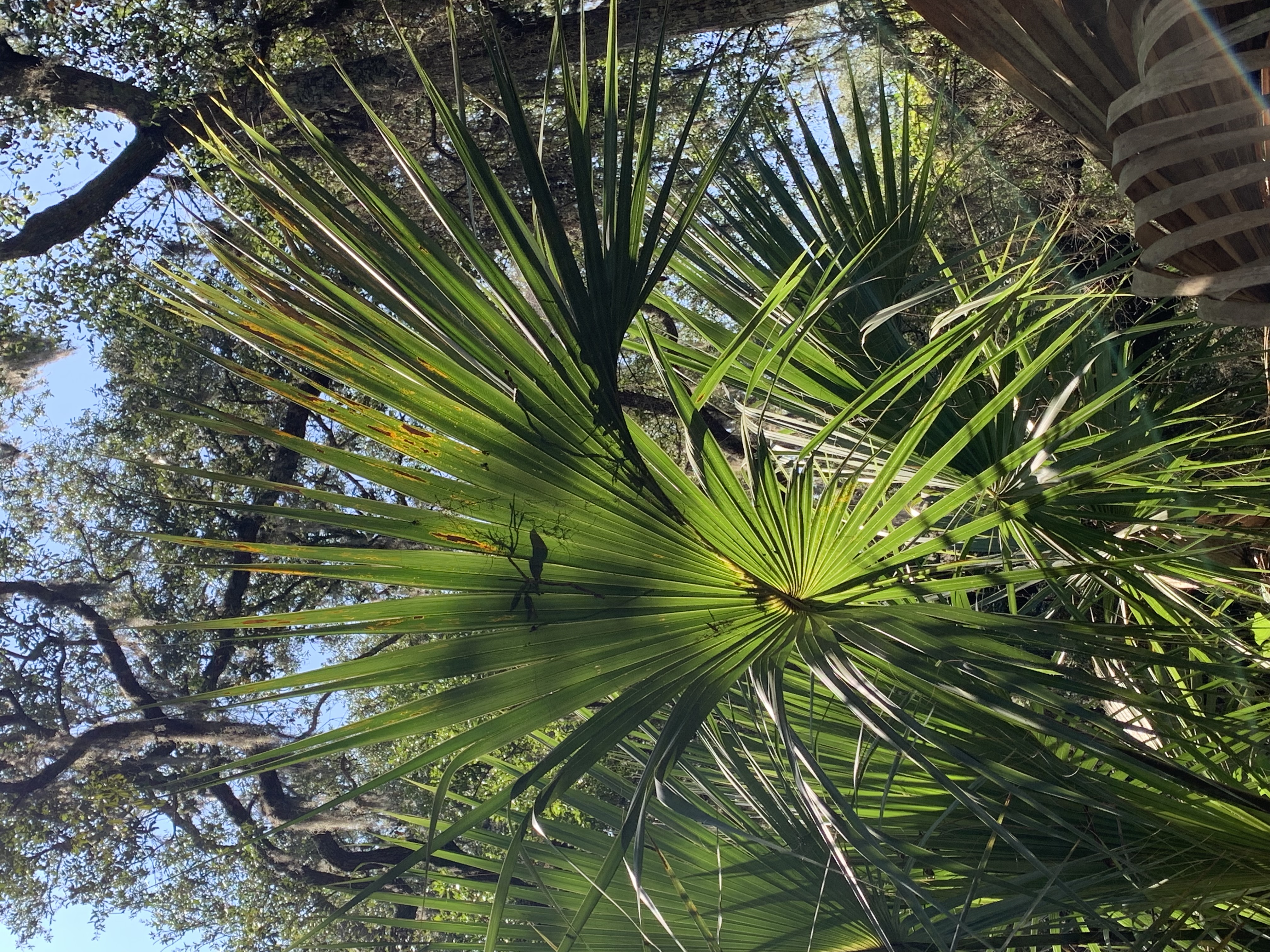
Stop number 2 along the River Trail interpretive tour featuring cabbage palm.
Brown trail sign marked with a number 2. Behind the sign, young cabbage palmettos compete with red bay and shrubby plants to dominate the understory. Many fully grown cabbage palmettos stretch into the sky. They look like typical palm trees. A few fully grown cabbage palmettos are dead, yet still stand. To the north, the dirt/sand trail continues through the understory of red bay, wax myrtle, and cabbage palmetto. The canopy is nearly fully open, with mostly open sky visible. Few tall trees in the canopy. To the west, shrubs and one tree looms over the trail. To the south, live oak branches extend over the trail, which continues southward through the understory.
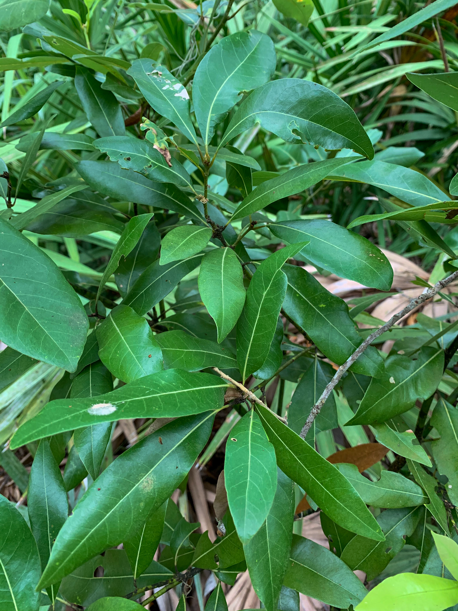
Stop number 3 on the River Trail interpretive tour features red bay trees.
Brown trail sign marked with a number 3. To the southeast / right of the sign, a young Red Bay with dead, brown leaves shows signs of being afflicted with Laurel Wilt Disease. Another young Red Bay nearby appears healthy and shows minimal signs of disease. The understory is comprised of cabbage palmettos. Looking south, the dirt trail continues through the cabbage palmettos. To the west, two tall, Laurel oak trees stretch into the canopy. Their limbs are coated in Spanish Moss. To the north, the dirt trail continues under the shade of oaks through the understory. The canopy is mostly closed, but leaf coverage is sparse, and blue sky is visible.
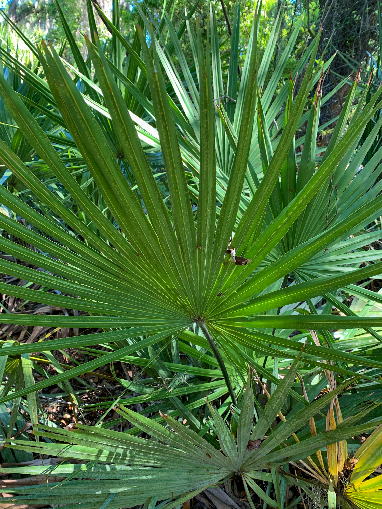
The fourth stop along the River Trail features saw palmetto.
Brown trail sign marked with a number 4. To the east, behind the sign, a thick stand of saw palmettos are present. Vines trail down from the canopy of oaks. The vines are coated with Spanish Moss. To the south, the trail continues around a bend. Muscadine grapevines hang into the trail, coated in Spanish Moss. To the west, oaks dominate the canopy, and a few cabbage palmettos reach into the upper understory. The understory is comprised of saw palmetto, cabbage palmetto, and a few Red Bay sapling. To the north, the dirt trail continues through the understory and winds beneath a large, gnarled live oak coated in Spanish moss.
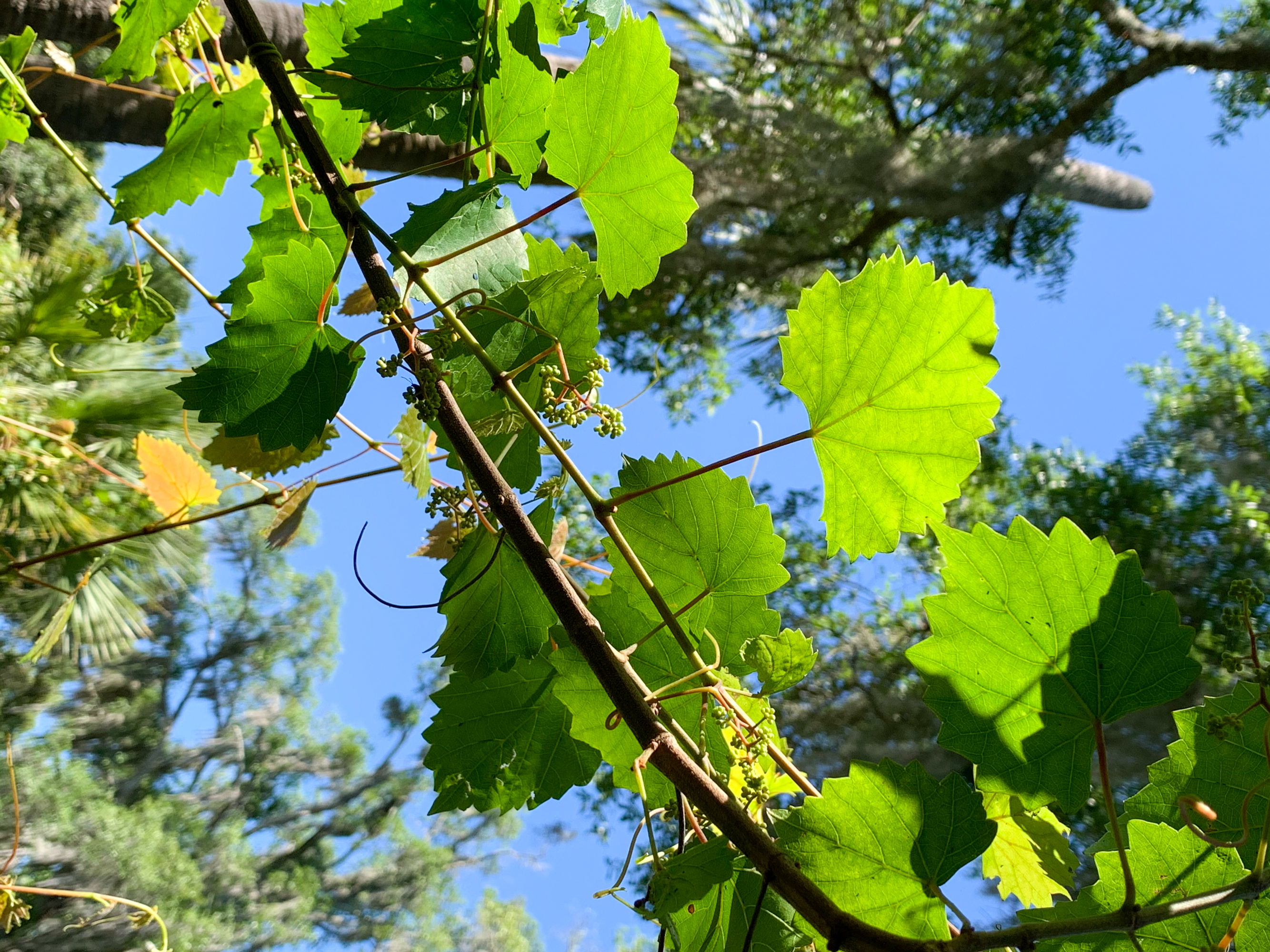
Stop number 5 on the River Trail tour features muscadine grapes.
Brown trail sign marked with a number 5. To the east, the understory is dense, and comprised of wax myrtle, Red Bay, young oak trees, and palmettos. To the south, the trail continues into the shade of a large oak tree. To the west, a tall saw palmetto arcs into the trail. To the north, the dirt trail continues through the thick understory, with few trees reaching into the canopy. The sky is mostly visible.
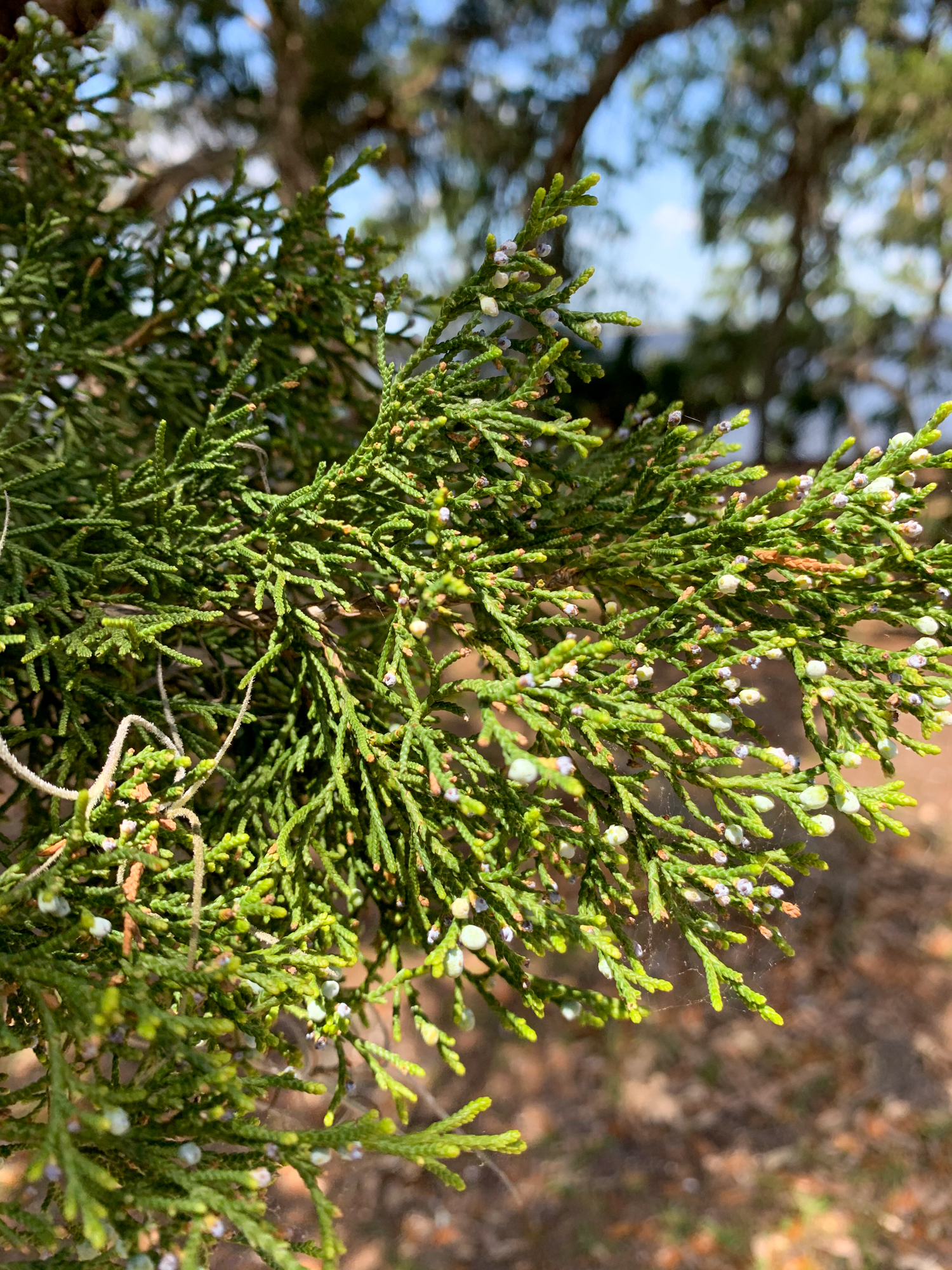
Stop number 6 along the River Trail features eastern red cedar.
Brown trail sign marked with a number 6. To the east and behind the sign, a tall Red Cedar reaches into the canopy. The tree is twisted and has reddish bark that flakes off in strips. Many trees reach into the canopy, including a laurel oak covered in poison ivy and muscadine vines. The understory is mostly saw palmetto and young Red Bay. To the south, the dirt trail continues through the thick understory. To the west, vines drape down to border the trail. To the north, the dirt trail continues through the forest, below a canopy a live oak coated in Spanish Moss. The canopy is mostly closed, but large patches of sky are visible.
Stop number 7 on the River Trail features live oak trees
Brown trail sign marked with a number 7. To the west and behind the sign, numerous tall oak trees stand tall above the trail. The oaks have blocky bark, twisted branches, and waxy leaves. The canopy thins out towards the river. The trees are coated in Spanish moss. To the north, the dirt trail continues through the understory of wax myrtle beneath the oak and moss canopy. To the east, the dense understory is comprised of shrubs such as wax myrtle. To the south, the dirt trail continues through the forest. A bench is located southeast of stop 7.
Stop number 8 along the River Trail features smilax.
Brown trail sign marked with a number 8. To the east and behind the sign, the understory is dense with Red Bay and Saw palmetto. The canopy is extensive and dominated by Live Oak trees draped with Spanish Moss. To the south, the dirt trail continues through the understory beneath the live oak canopy. Spanish moss is plentiful and drapes off the oak limbs. To the west, the understory is dense with saw palmettos with a few Red Bay reaching out. The canopy thins out towards the river but is still dominated by Live oak. To the north, a tall Laurel oak stands to the west of the trail, coated in Spanish moss. To the north west, a tall dead tree stands along the trail. The dirt trail continues northwards between them.
Stop number 9 along the River Trail features wax myrtle.
Brown trail sign marked with a number 9. To the west and behind the sign, Wax Myrtle dominates the understory, a shrubby plant with long, notched leaves. Saw Palmetto and Red bay reach into the understory. Oaks dominate the canopy, limbs coated in Spanish moss. To the north, the dirt trail continues through the understory. The canopy is open towards the northwest. To the east, stands a tall Laurel oak with dense Spanish moss. The understory is comprised of saw palmetto, red bay, and wax myrtle. To the south, the dirt trail continues through a triangle of oaks beneath a canopy of oaks and Spanish moss.
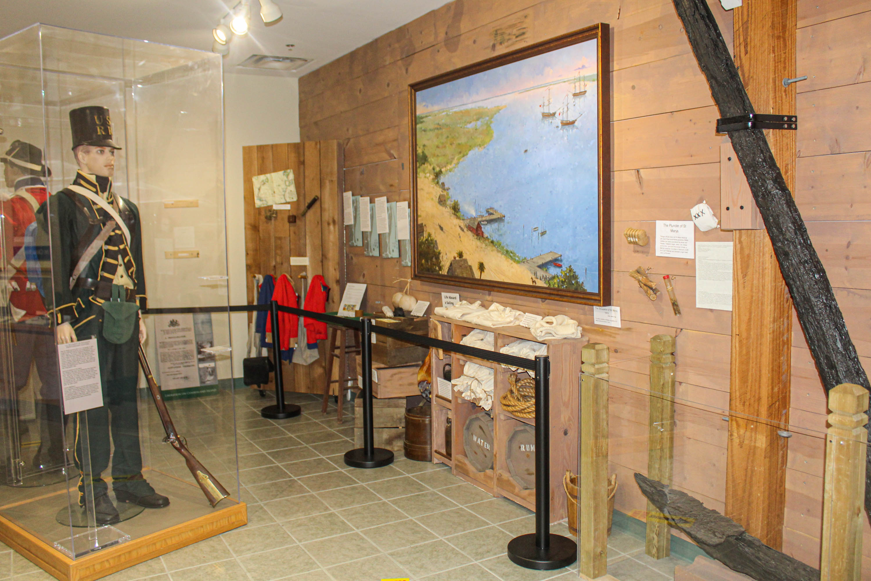
Exhibits explore the cultural and natural history of the island from prehistoric American Indian lives, through British occupation during the war of 1812, the Plantation Era, the Gilded Age, and the island today.
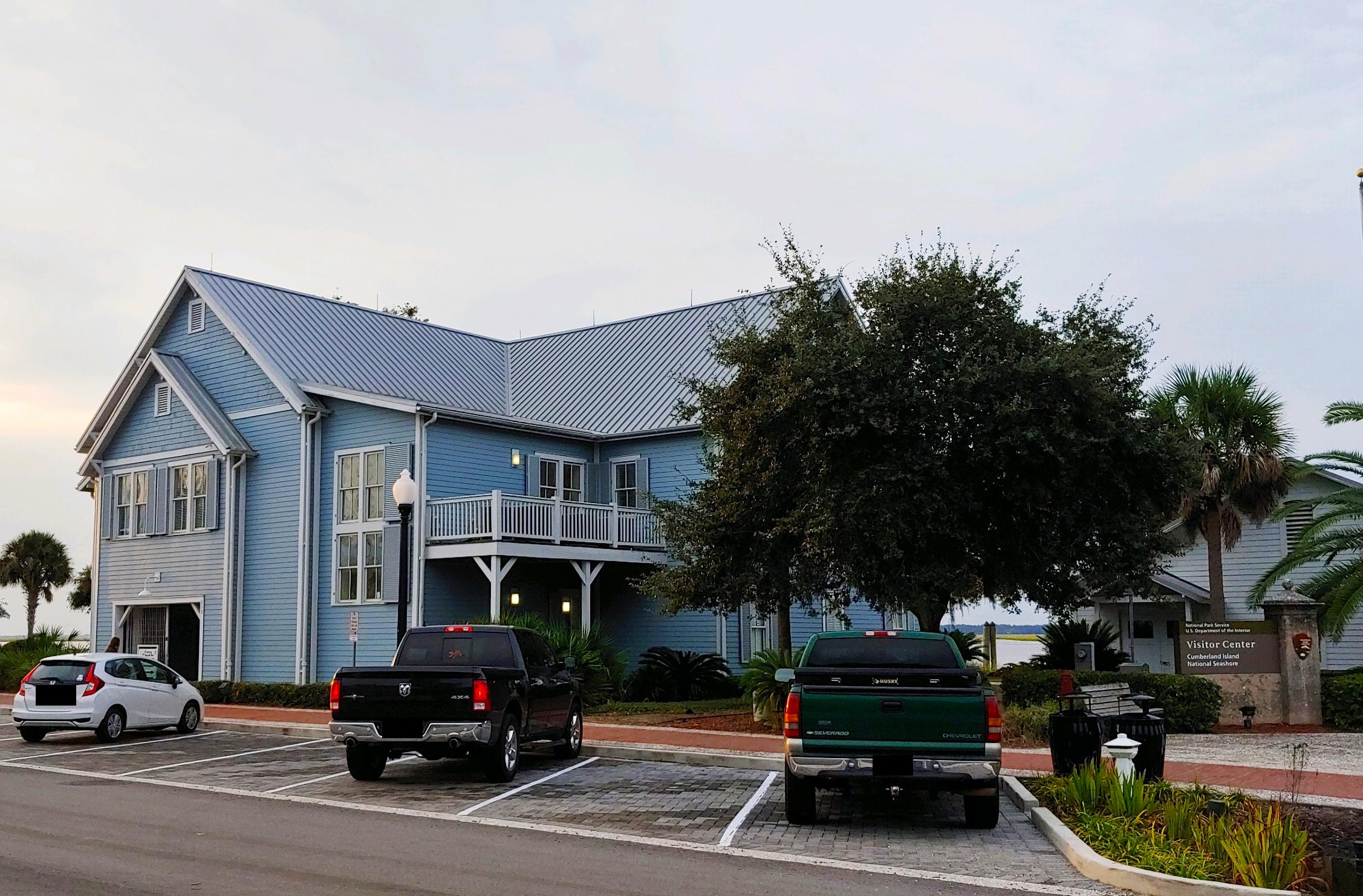
The Mainland Visitor Center is located at the waterfront in downtown St. Marys, GA. Visitors taking a ferry to the island should check in at this location 1 hour prior to departure. The visitor center offers exhibits, a bookstore with memorabilia, and information to help you plan your visit to the island. Rangers are available to answer questions, sell park passes, and issue camping permits for private boaters. Long term parking is located one block west on the north side of the street.
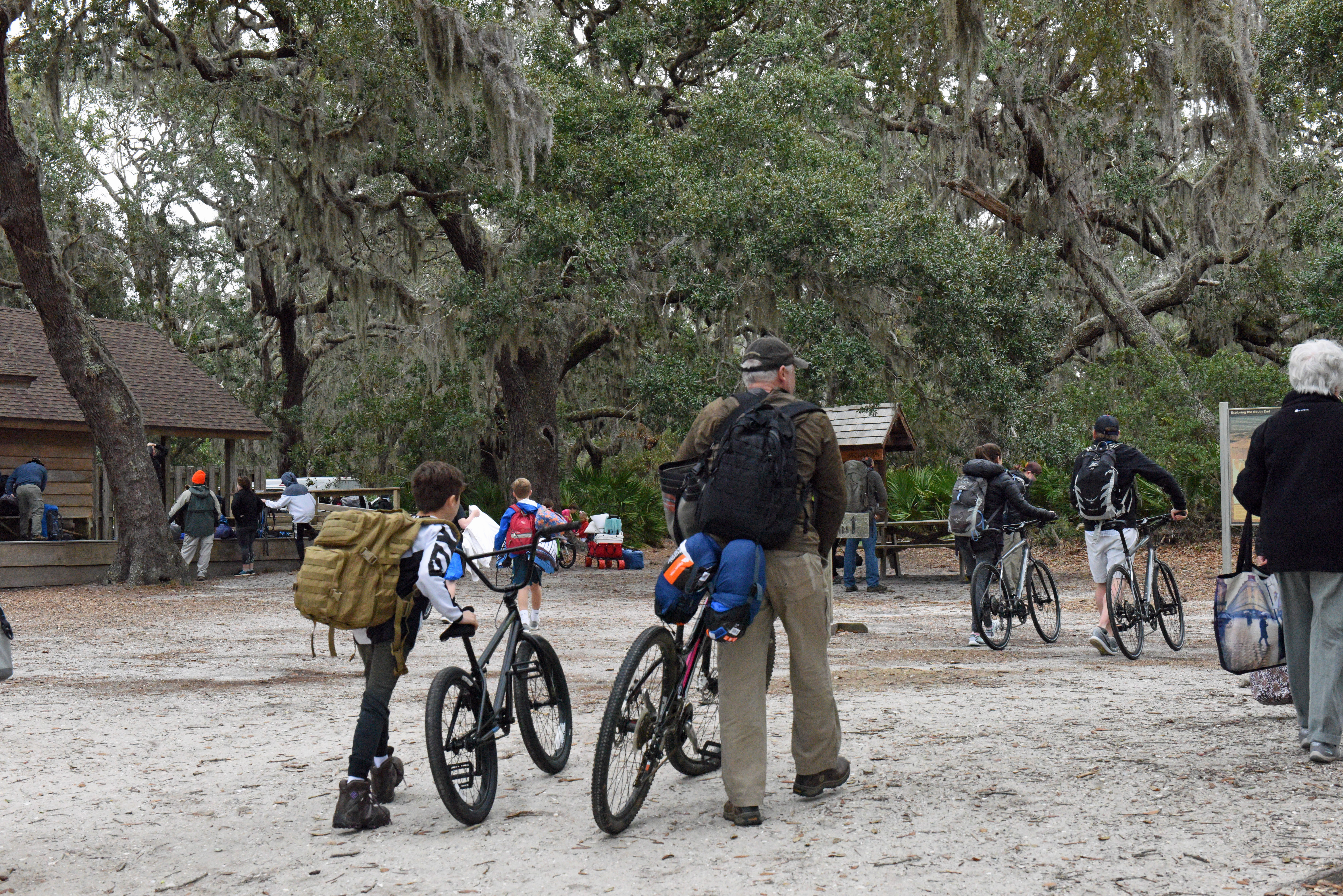
Located at the Sea Camp dock on Cumberland Island. Visitors camping on the island must visit Sea Camp for a quick orientation and to receive their camping permits. Volunteers and rangers staff the station when available throughout the day. Here visitors can get information, see exhibits, attend interpretive programs, and rent bicycles when the ferry arrives.
Take a 4.5 miles hike through the forest, over the marsh and along the beach. Take some time to explore the Dungeness historic district, wildlife and history is everywhere! This Is a great 3-4 hour day hike for first time visitors that provides a taste of the island’s diversity.
Plum Orchard Tour
Plum Orchard Mansion was built in 1898 by Lucy Carnegie for her son, George Lauder Carnegie, as a wedding present. This home reflects an opulent era in the island's history; one of recreation, relaxation, and time spent with family. This Visitors today can join a ranger for a 45-minutes tour of this 22,000 square foot home for a glimpse of such times.
Plan a Backpacking Trip
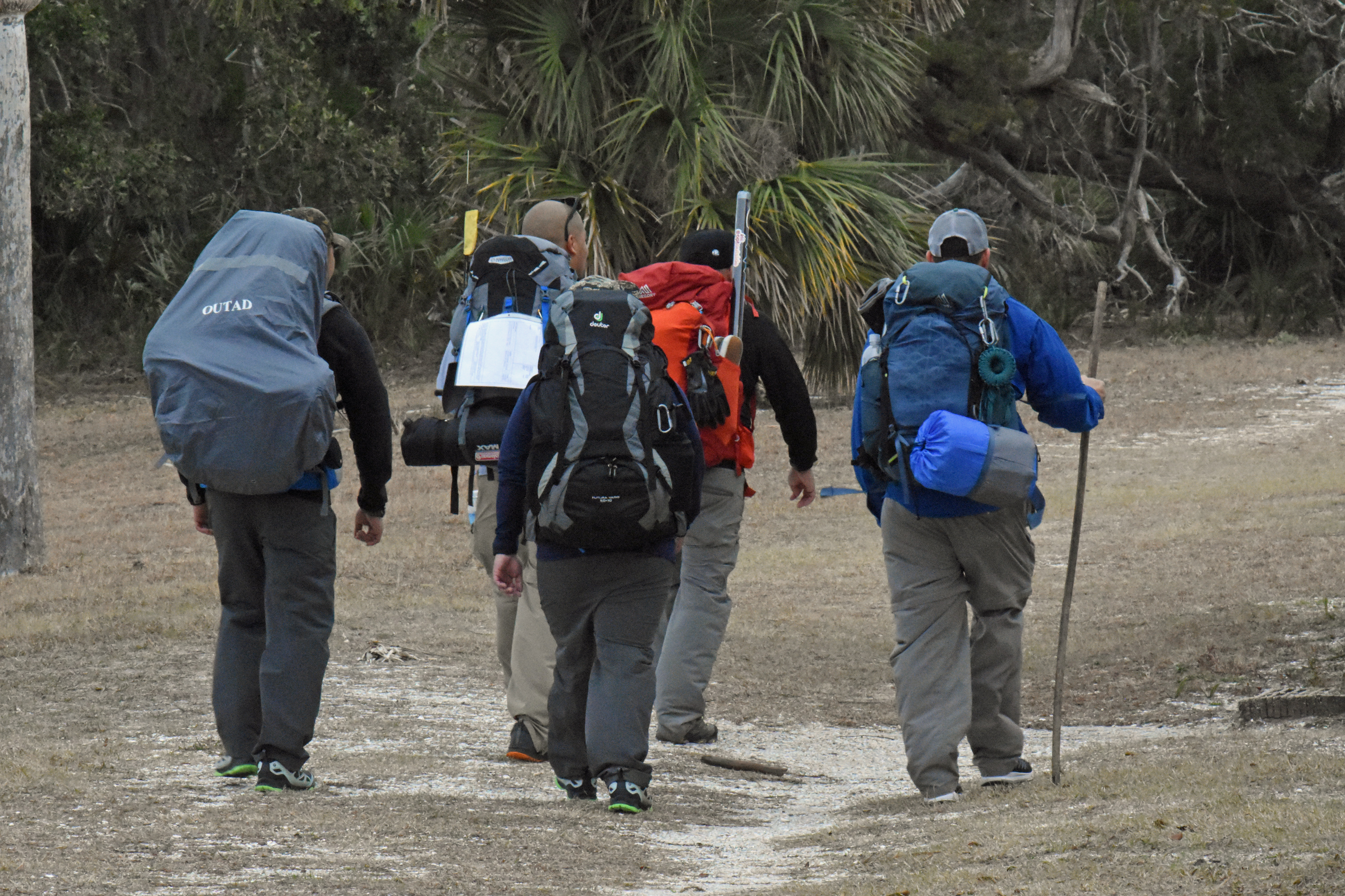
Backpacking on Cumberland Island can be a great experience when proper preparations are made. Failure to prepare can lead to a less than desirable and potentially dangerous experience.
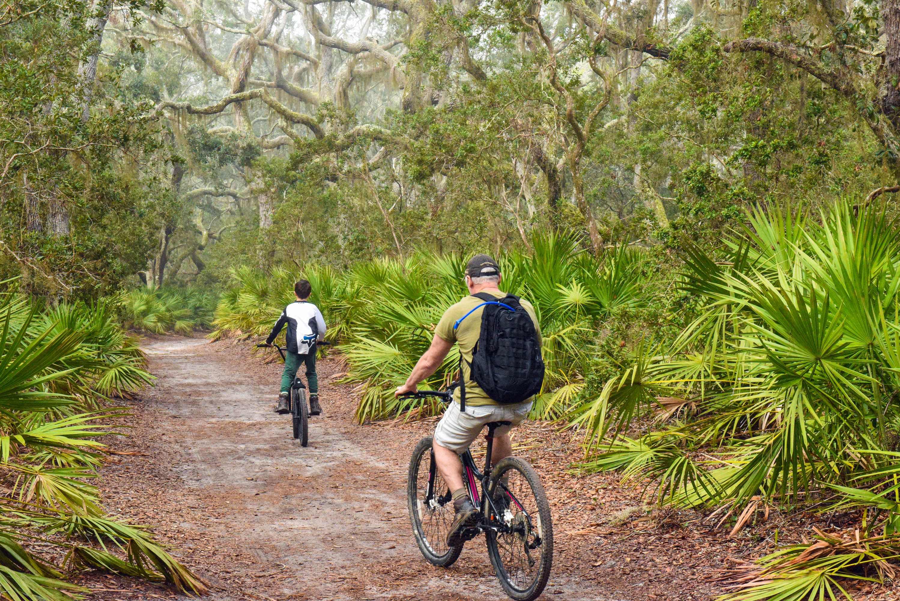
General Biking
Riding a bike can be a great way to get around the island. However, with no paved roads on the island it is important to understand the conditions on the island. Read on to find out if biking is right for your visit.
Bike to Plum Orchard
Take a 15-mile round trip bike ride up to the Plum Orchard mansion and take a tour of the Georgian-revival house. This is a strenuous 3-5 hour bike ride. Check with a ranger before starting out for current conditions.
Bring Your Own Bike
Bringing your own bike can provide more access to the island. Not all bikes are suited to be ridden on Cumberland Island. Read on to see if biking is a good choice for your visit.
Ranger-Led "Footsteps" Tour
Walk with a ranger as you explore the Dungeness historic district and dive into the pivotal stories of its location. Tours are offered when the ferry arrives at the Dungeness dock (around 10:00 AM and 12:45 PM) on Friday, Saturday, and Sunday, when staff is available. Ask if tours will be offered on the day of your visit. Tours last about an hour and cover roughly a mile in distance.
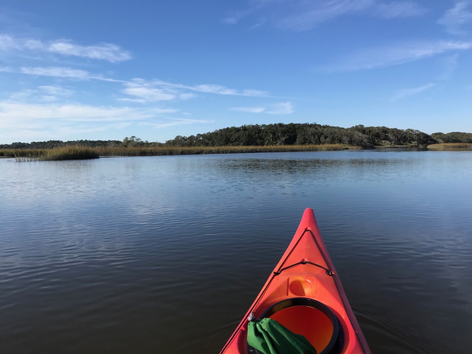
Kayak to the Island
Kayaking to Cumberland Island offers a different perspective and can be a rewarding experience. Advanced preparation is essential, however. This is only recommended for those with previous coastal kayaking experience.
Lands and Legacies Tour
Take a van ride to the north end of the island. A guide will present the island's history.
Become a Jr. Ranger
Join the National Park Service “family” by becoming a Junior Ranger. Complete the activity book, have a park ranger review it, and receive an official Junior Ranger badge for Cumberland Island. Pick up your booklet and badge from the Mainland Visitor Center and Sea Camp Ranger Station today.
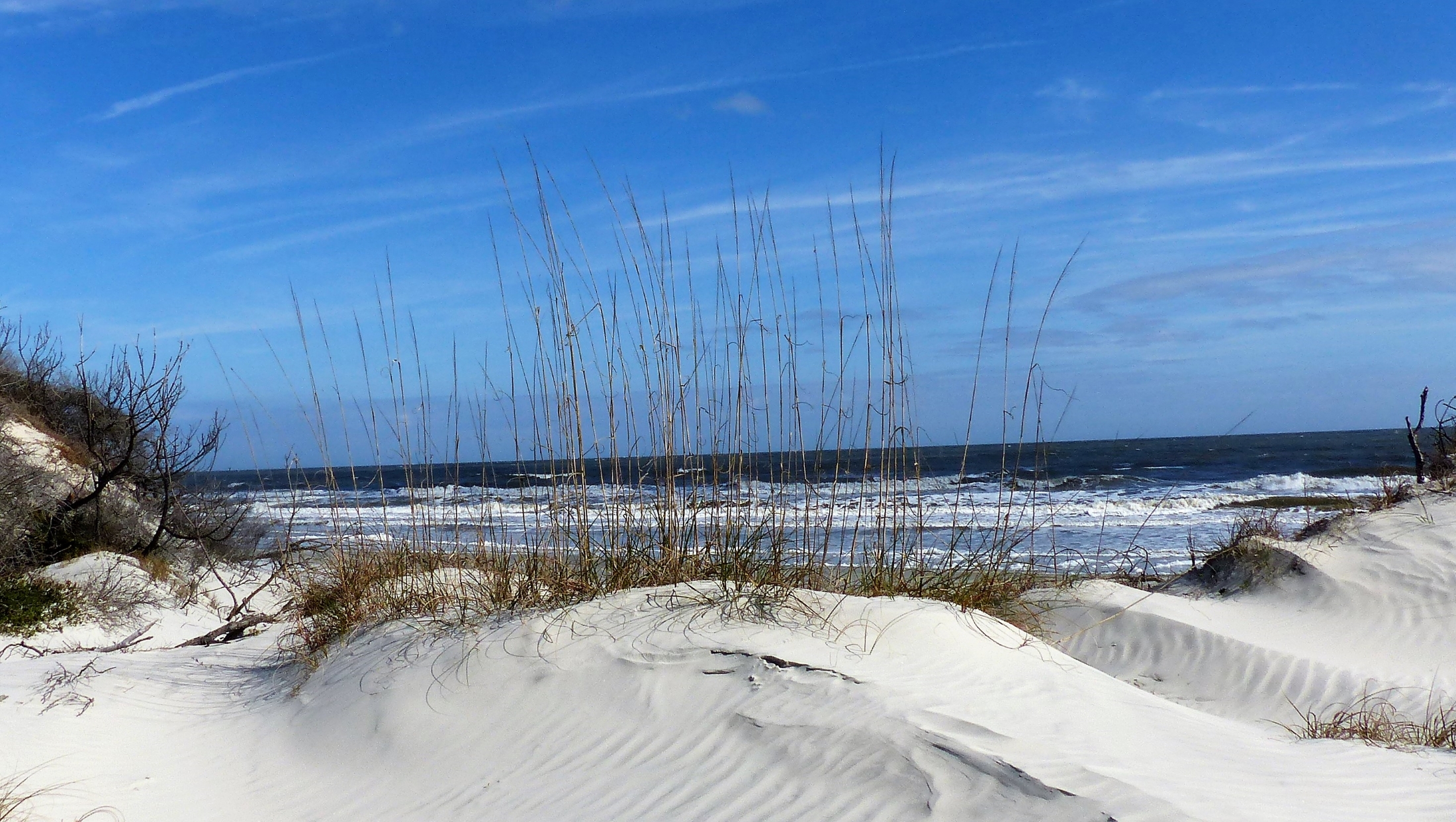
Swim at the Beach
With over 17 miles of undeveloped beach, no matter where you are on Cumberland Island you’re never too far from the beach. Swimming in the ocean can a great way to beat the heat on a hot coastal Georgia day.
Hike to Little Greyfield
Take a secluded hike through the maritime forest and along the beach. This hike will take you through saw palmetto, wax myrtle and under the canopy of sprawling live oak trees. The trail will intersect with the Little Greyfield beach crossing about two miles in. Take this crossing through the dunes to a particularly isolated portion of the beach. Turn right and keep the ocean to your left to return to Sea Camp. You can also take this loop the opposite way.
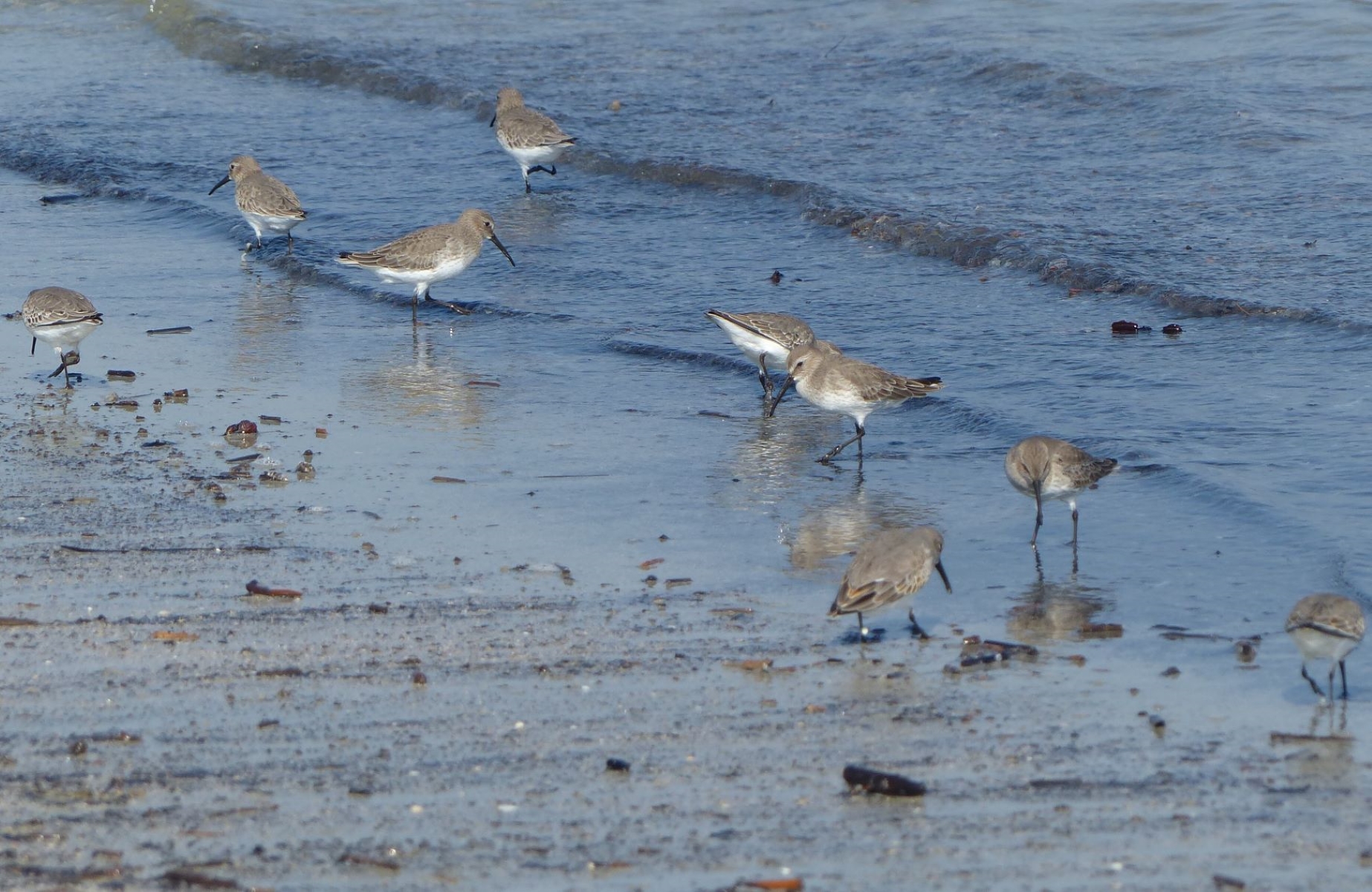
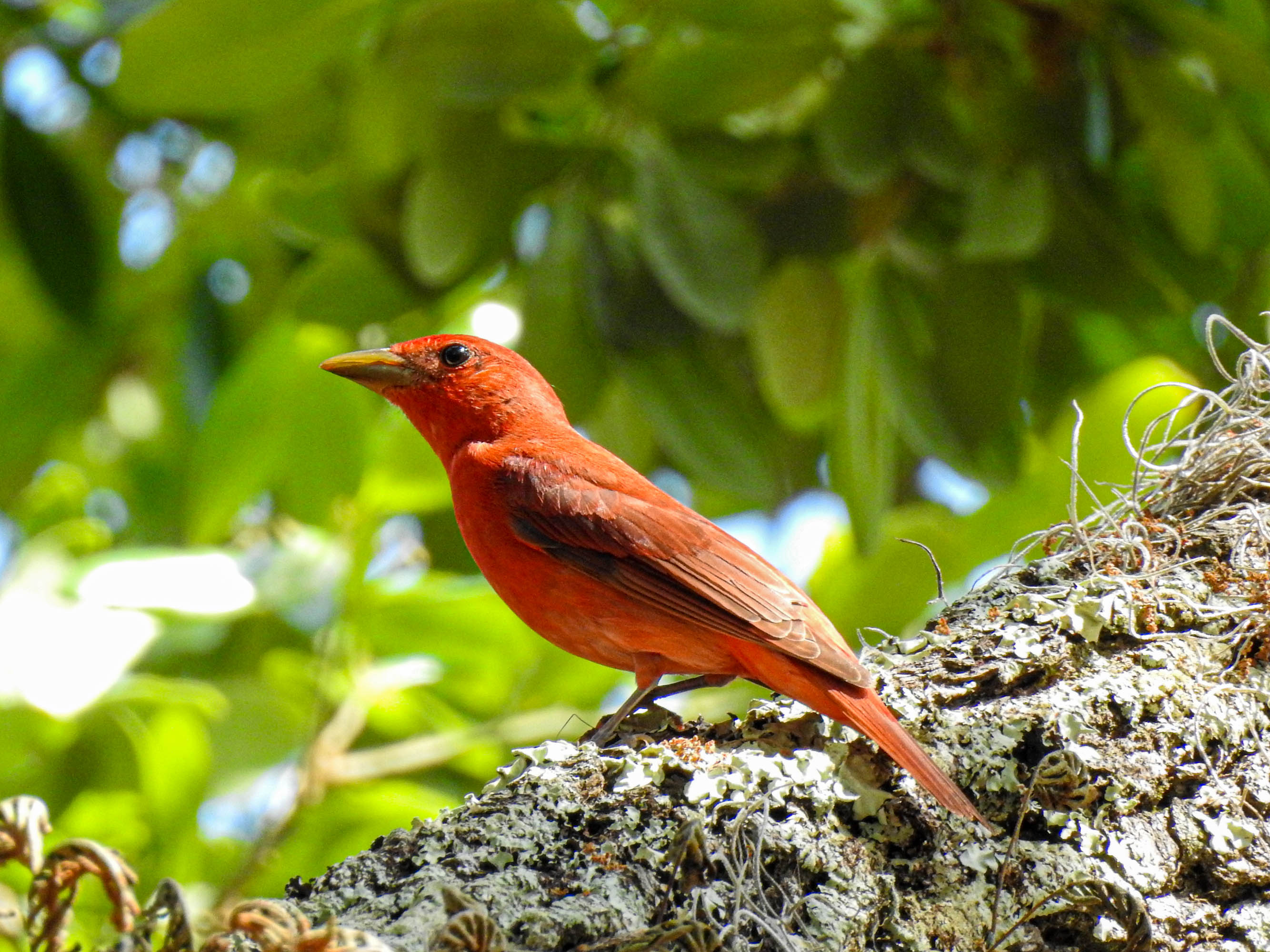
Birding on the Beach
Birding on the beach can be successful in any season on Cumberland Island. There are many rear-round residents, and those around during breeding season, migrations, and winter alike. Be sure to pack your binoculars and head to the beach on your next visit to the island.
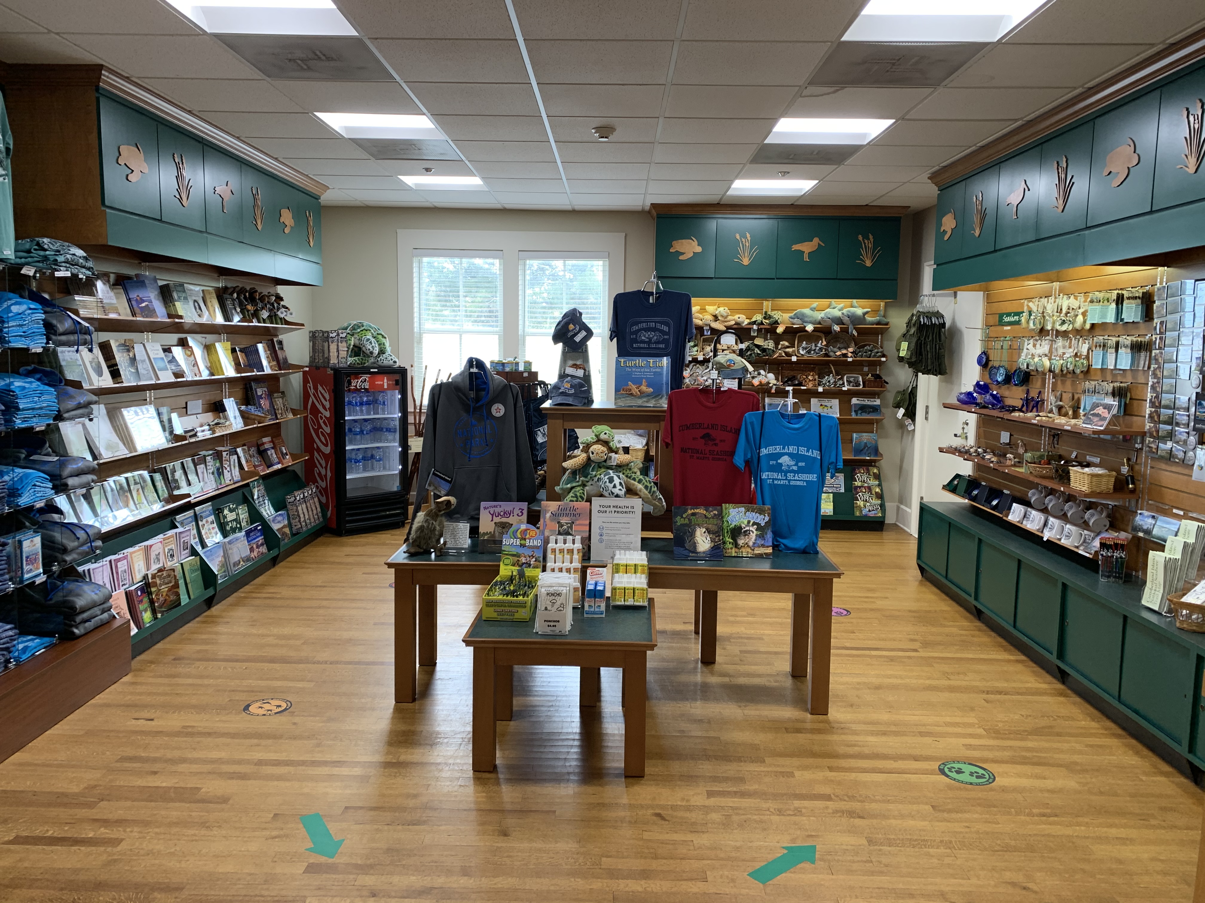
Shop at the Bookstore
Stop by the bookstore at Cumberland Island’s Visitor Center in Saint Marys, GA, open daily from 8:00 AM – 4:00 PM (closed Christmas Day). You will find books related to the island’s natural and cultural history, apparel, postcards, pins, patches, magnets, and more.
Hike to Sea Camp Beach
With 17 miles of undeveloped beach, it is easy to find your own personal space on Cumberland’s beach. The wide-open space of the beach provides a striking contrast to the dense, tangled maritime forest. When you step out of the forest in the dunes, you feel like you are entering a whole new world. Whether you are looking for seashells, shorebirds or a tan, the beach on Cumberland will not disappoint.
Photography
Cumberland is a magical place for photographers. Abundant wildlife, picturesque ruins, and lack of crowds make this a great place for taking photos.
Explore the Ice House Museum
Make a pitstop at the Ice House Museum to learn about the island’s history. Fill up your water bottle at the water bottle filling station and use the restrooms before heading on to Dungeness.
Hike the Nightingale Trail
The Nightingale Trail on the south end of the island is a great place to experience the interior of the maritime forest.
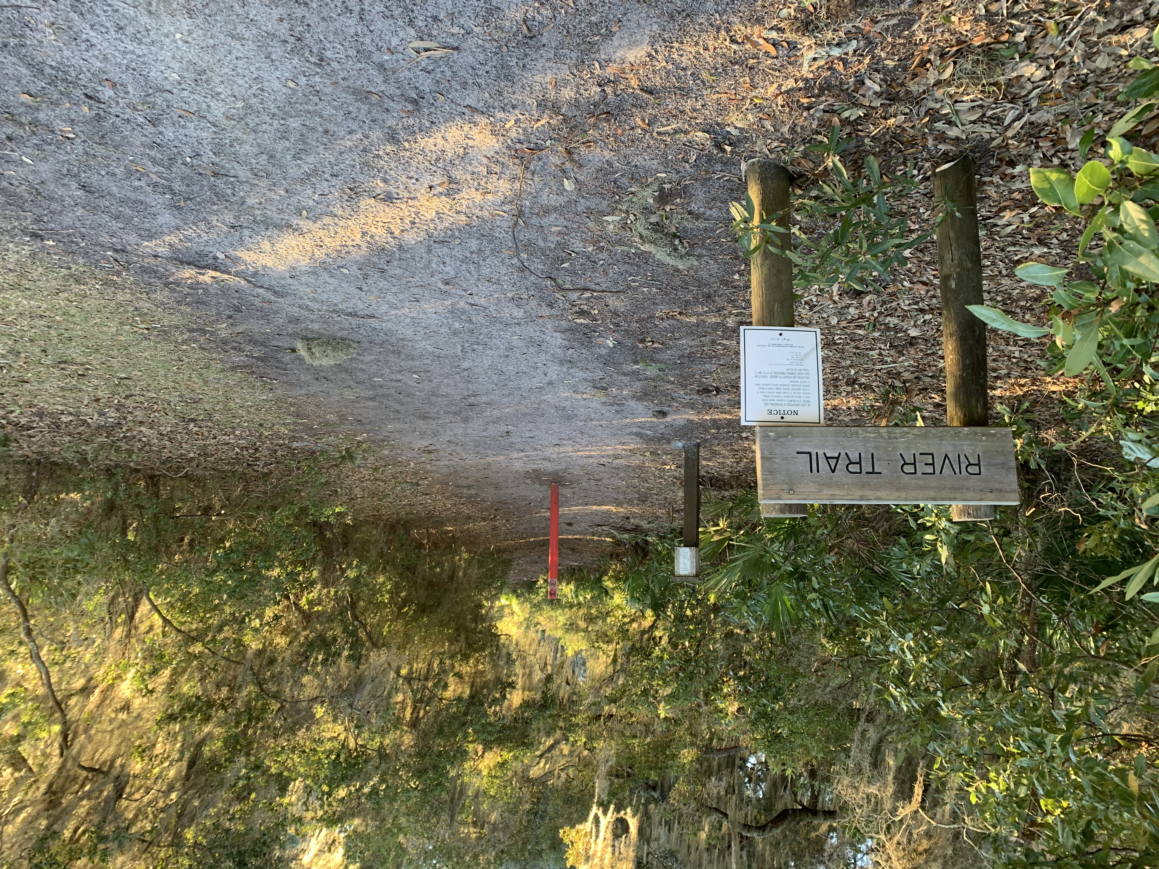
Hike the River Trail
The River Trail is 0.8 miles long and connects the Sea Camp and Dungeness docks. It takes you through the maritime forest and provides a few views of the intracoastal waterway.
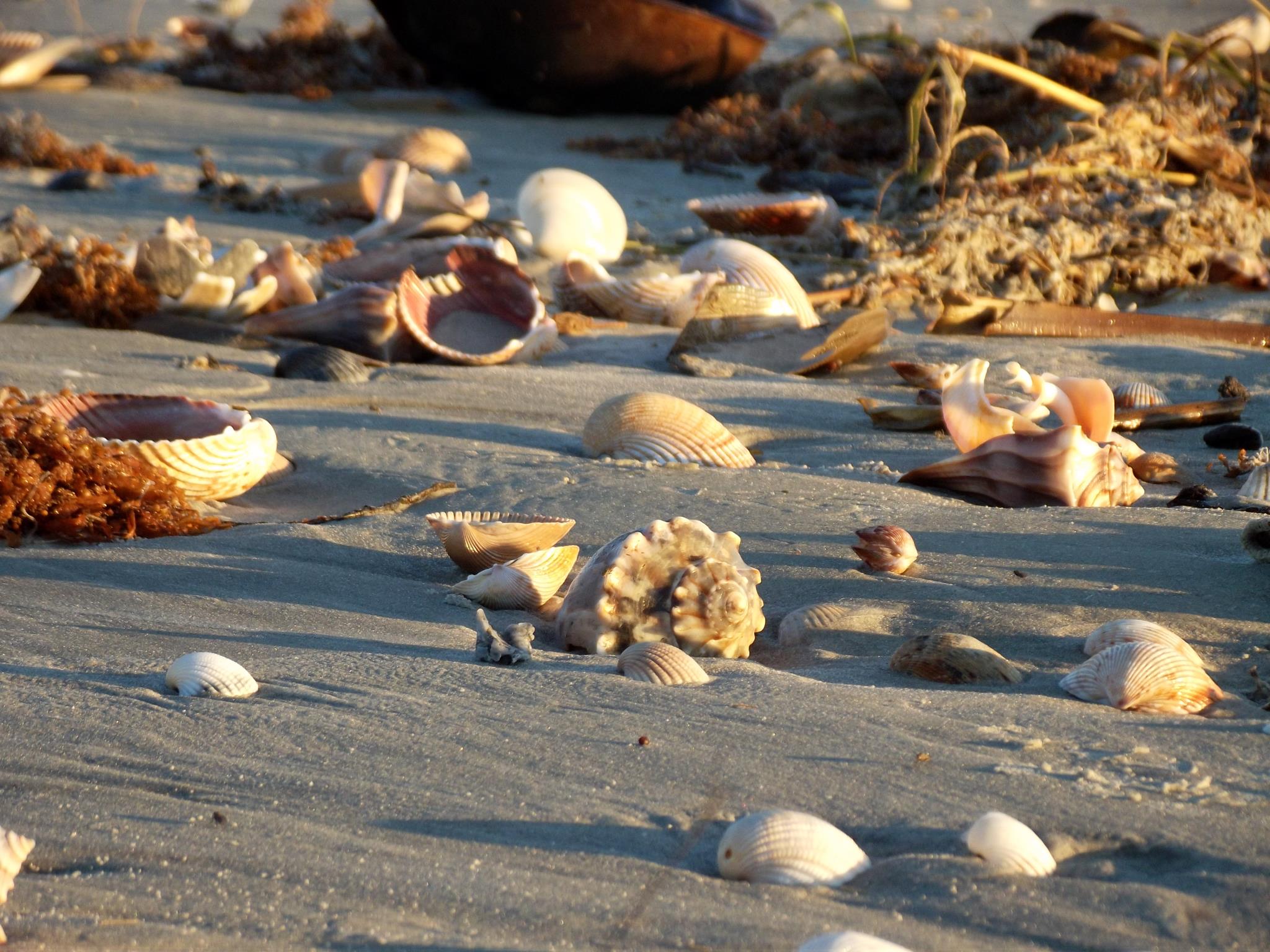
Beachcombing
The ocean can bring many interesting things onto our beaches. Beachcombing is a popular activity on Cumberland Island. Shells are not found on the beach all the time, however. Read on to learn when is the best time to scour the beach for shells.
Wildlife Viewing at Dungeness
Cumberland Island is a great place to view wildlife. Dungeness is a great place to look for the many common animals on the island and is an easy walk from the dock.
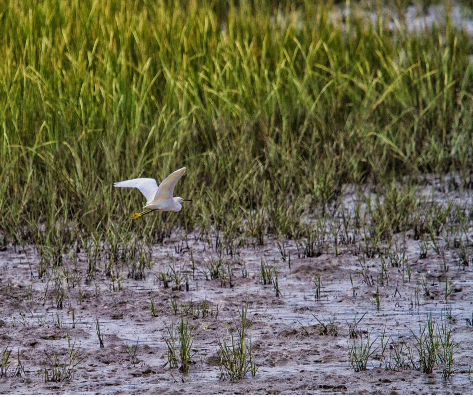
Birding at the Marsh Boardwalk
The extensive marshes around Cumberland Island provide great birding opportunities. One of the best places to get a view of the marsh is at the marsh boardwalk, just east of the Greene-Miller Cemetery. After you’ve gotten your history fix at the Dungeness ruins area, take the short walk to the marsh boardwalk, a birding hotspot.
Hike to Dungeness
Take a hike to the southern most historical district to see the ruins of a Carnegie mansion, learn about what it took to upkeep the estate, check out wildlife and enjoy the view of the salt marsh. This short hike can be enjoyed in just 2 hours.
Birdwatching at Dungeness
Over 300 species of birds have been recorded on Cumberland Island. About 200 of these species are migratory, with the rest being year-round residents of the island. What birds you will find on the island will depend on what time of year you visit. The best birding is typically in the spring, when many birds stop over on Cumberland Island on their way north. Dungeness is a great area to view many different species.
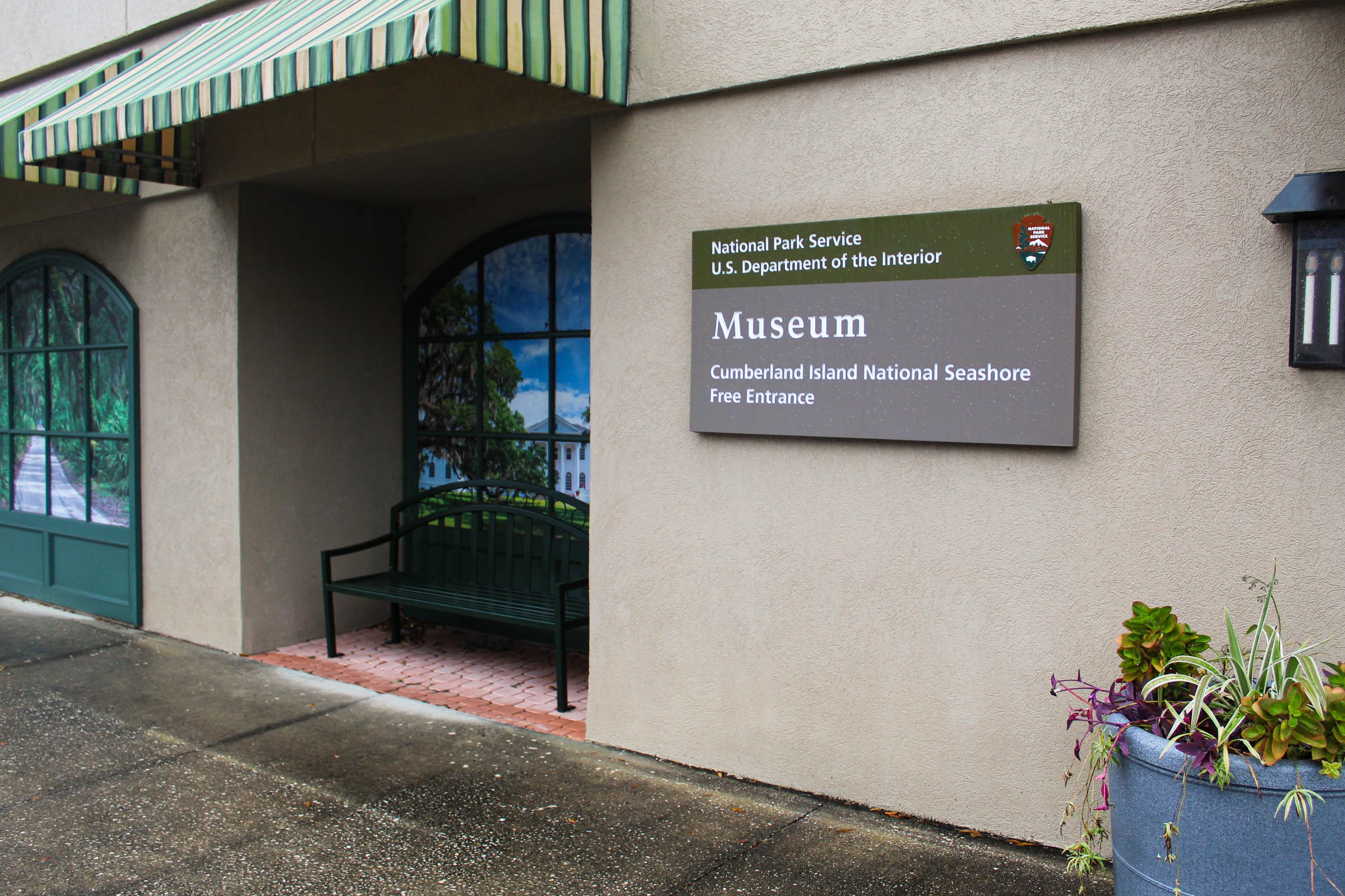
Explore the Mainland Museum
Open from 1:00 PM to 4:00 PM daily , the Mainland Museum for Cumberland Island National Seashore is a great starting place to learn more about the island’s diverse history. Exhibits explore the cultural and natural history of the island from prehistoric American Indians lives, through British occupation during the War of 1812, the Plantation Era, Gilded Age, and the island today.
Tours
Count: 3
Dungeness Audio Tour
An audio tour through the Dungeness Historic District has nine stops and describes the island's rich human history spanning thousands of years.
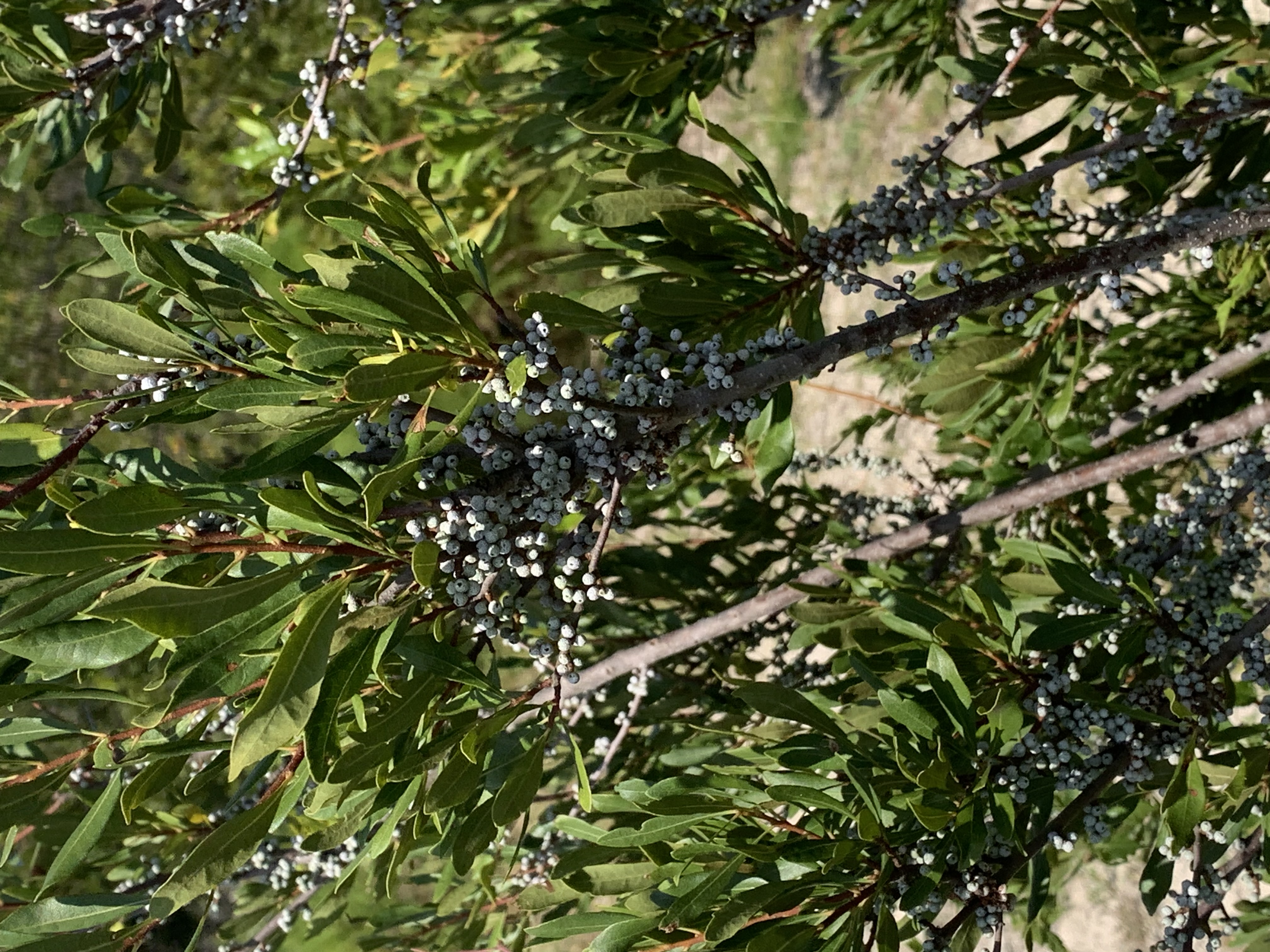
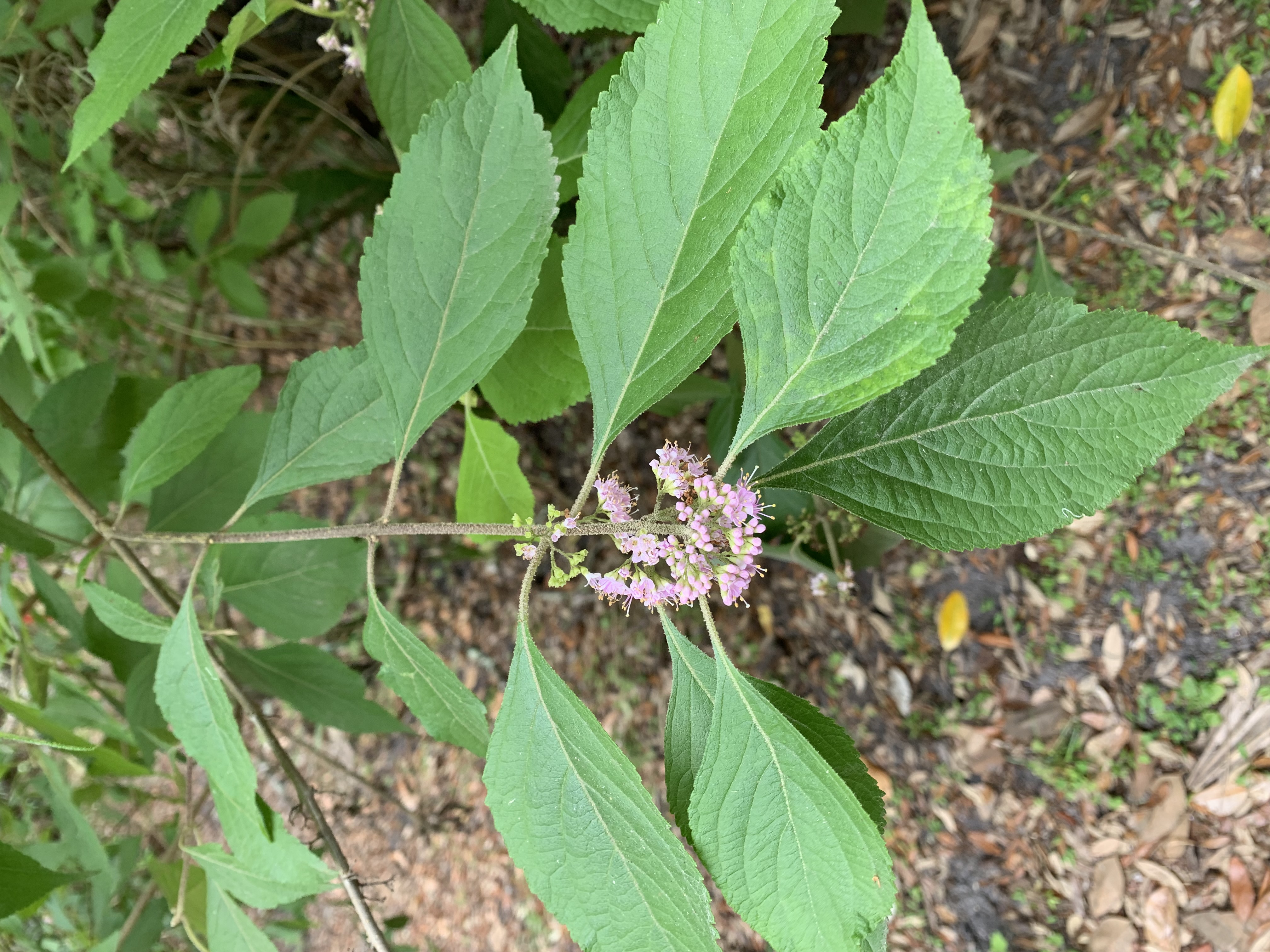
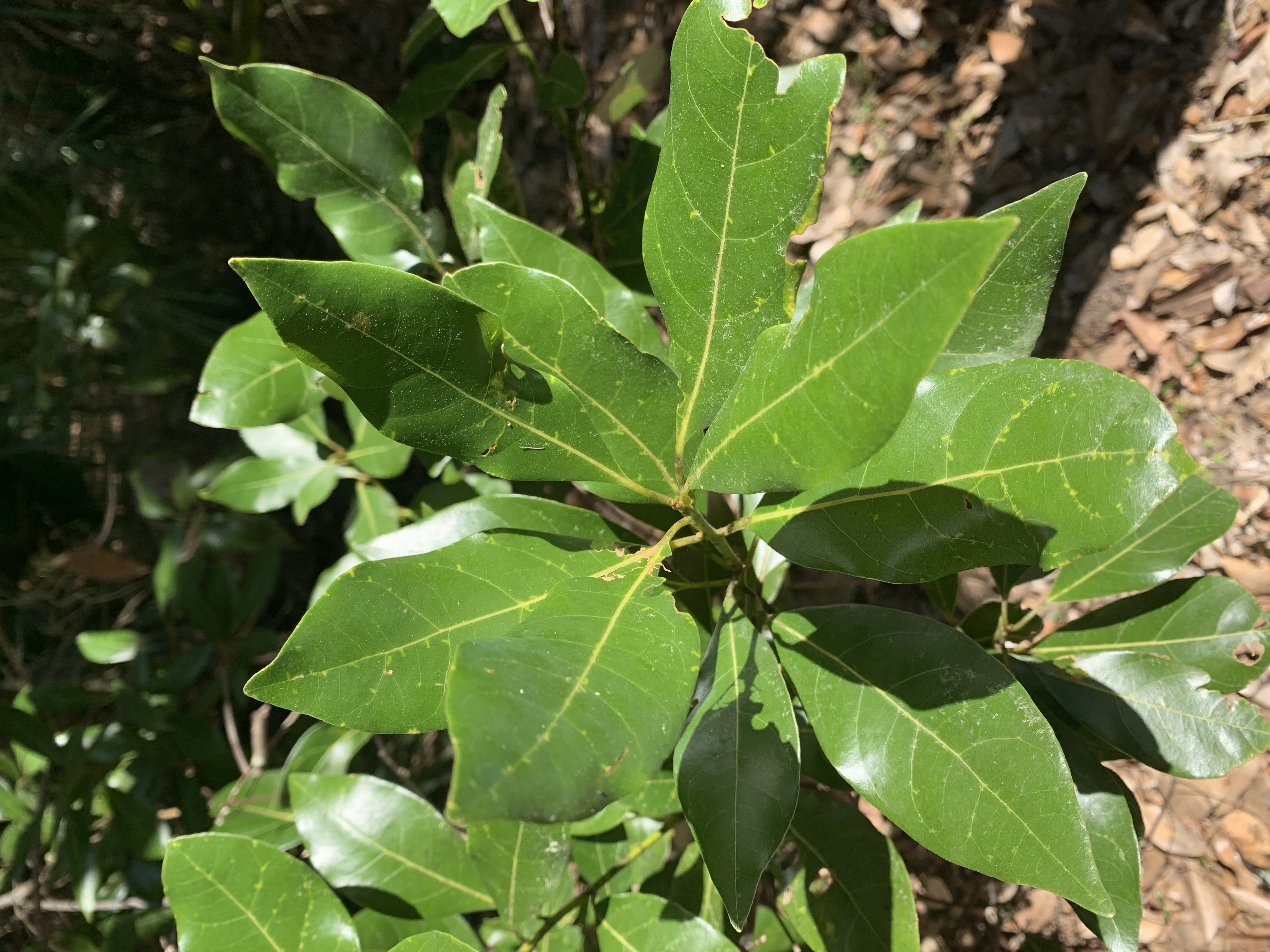
Nightingale Trail - A Walk through a Maritime Forest
Stroll through the maritime forest and experience the peacefulness as you learn about some of the plants that have adapted to live in this ecosystem.
River Trail: Native Plant Uses
Take a hike along the River Trail and learn about the many plants American Indians used on the island.