Be advised that the NPS has issued alerts for this park.
Part of Fort Totten Park remains closed for public safety
Out of an abundance of caution, Fort Totten Park will remain closed east of Fort Totten Drive, south of Gallatin Street/Metropolitan Branch Trail and north of Brookland Ave NE/Farragut St. due to the investigation involving two WWI-era munitions found.
On forested hills surrounding the nation's capital are the remnants of a complex system of Civil War fortifications. These strategic buttresses transformed the young capital into one of the world's most fortified cities. By 1865, 68 forts and 93 ...
Monument erected by the 122nd New York Cavalry who served with the Union Army during the Battle of Fort Stevens.
122nd New York Volunteer Cavalry Monument<br />(498 words)<br />Battleground National Cemetery is located in the Brightwood neighborhood of Washington, DC. The one-acre park is on the east side of Georgia avenue, NW between Whittier place to the north and Van Buren street to the south.<br />The Cemetery sits on a terrace approximately five feet above street level. A bluestone wall along the front edge is separated by two sets of three steps that lead up to a wrought-iron black gate at the Cemetery entrance. Set atop stone pillars on either side of the entrance are two six-foot long black cannons, one pointing north and one pointing south. On the face of the columns are black signs in the shape of a shield that both read in white: U.S. National Cemetery.<br />To the right from the front entrance is a two-story red stone building with brown shutters and a gabled roof. A porch extends out on the west side of the building.<br />Directly back and to the east seventy feet from the entrance is a central flagpole, surrounded by forty-one marble headstones. Behind them and the east end of the Cemetery stands a white marble pavilion with four granite pillars.<br />To the left from the entrance and set in a row across the lawn about six feet from the front edge of the cemetery are four granite monuments, each between six and eleven-feet tall. Facing the four monuments, second from the left is a ten-foot-tall white granite obelisk with pointed top and set on a rock-faced one-foot tall base. A leafed border rings the top of the monument. Just below at the top of the front face, a cross is inscribed and below is written:<br />To the gallant sons of Onondaga County, N.Y. who fought on this field July 12, 1864 in defense of Washington and the presence of Abraham Lincoln.<br />Below is a one-foot wide circular bronze plaque depicting two women in flowing robes. The woman on the left is resting her left hand on the side of a shield between them and holds a staff with her right hand with a hood cap set atop its point. The right woman is blindfolded. She raises a scale with her left hand and holds up a sword with her right. Atop the shield is an eagle with wings spread as it stands on a globe. The shield shows an image of the sun shining behind mountains. A sail ship floats by in water below. A smaller ship sits to the right. Below on a banner is inscribed: Excelsior.<br />Below on the front base is inscribed: 122 N.Y.Y.<br />The right side of the monument is inscribed to read:<br />Killed and Died of Wounds<br />Seven names are listed below.<br />The backside is inscribed along the top to read:<br />Served Three Years in the Sixth Army Corps<br />Below a three by two-foot bronze plaque is entitled, "Battles," listing 18 Civil War battles.<br />The left side of the monument is inscribed to read at the top: Wounded<br />Names are inscribed below.<br />END OF DESCRIPTION<br />
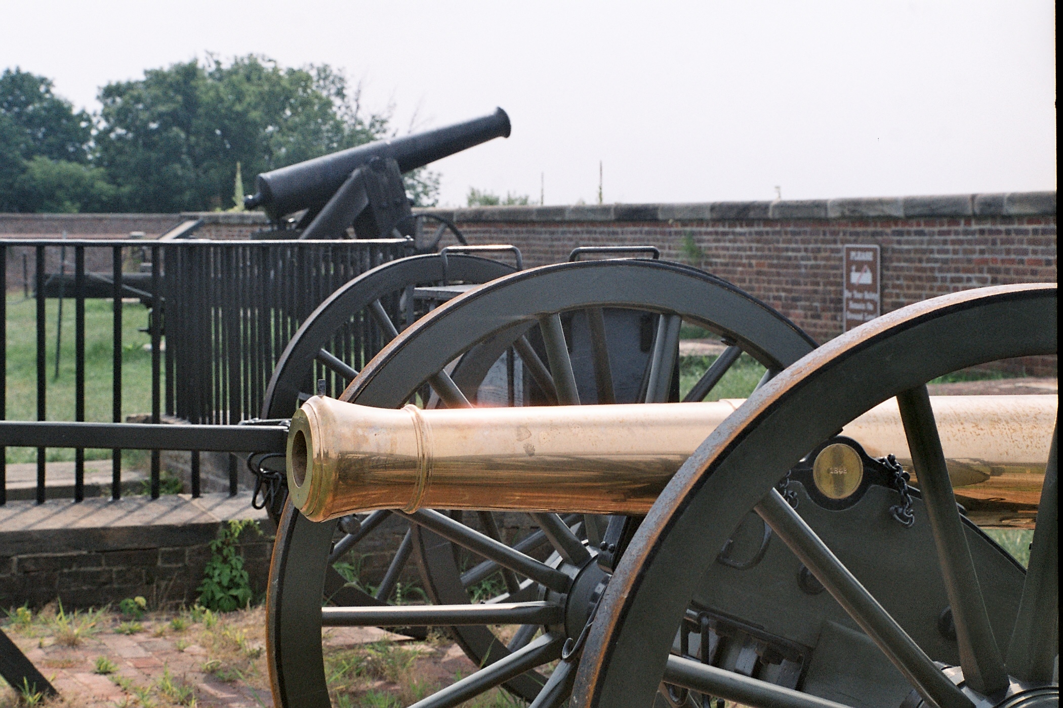
Spaced about 70 yards apart two massive cannons point out over the water. Each cannon is roughly 12 ft long and is mounted on a large metal base which raises it to about 15 ft high. The barrel of the cannon is 15 in in diameter. Both Canon and base are painted black. This rests on a half circle mounts made of stone and metal.
This monument erected by Co. K 150th Ohio National Guard who served in the Defenses of Washington during the Battle of Fort Stevens. The monument was dedicated in 1907.
(330 words) Battleground National Cemetery is located in the Brightwood neighborhood of Washington, DC. The one-acre park sits on the east side of Georgia avenue, NW between Whittier place to the north and Van Buren street to the south. The Cemetery sits on a terrace approximately five feet above street level. A bluestone wall along the front edge is separated by two sets of three steps that lead up to a wrought-iron black gate at the Cemetery entrance. Set atop stone pillars on either side of the entrance are two six-foot long black cannons, one pointing north and one pointing south. On the face of the columns are black signs in the shape of a shield that both read in white: U.S. National Cemetery. To the right from the front entrance is a two-story red stone building with brown shutters and a gabled roof. A porch extends out on the west side of the building. Directly back and to the east seventy feet from the entrance is a central flagpole, surrounded by forty-one marble headstones. Behind them and the east end of the Cemetery stands a white marble pavilion with four granite pillars. To the left from the entrance and set in a row across the lawn about six feet from the front edge of the cemetery are four granite monuments, each between six and eleven-feet tall. Facing the four monuments, furthest left is a six-foot tall gray granite grave marker with a rounded top. The front face is polished smooth. The back and sides have a rocky stone design, as does the one-foot tall base. A faded, circular design at the top of the face shows the sun shining through mountains. A round structure sits below, and three sets of bundled reeds line the left bottom of the circle. At the bottom is inscribed: Ohio Inscribed beneath on the front face reads: Memorial to Co. K, 150th O.N.G.I. Which Took Part in the Defense of Fort Stevens, D.C. July 12, 1864 END OF DESCRIPTION
Monument erected by the 25th New York Cavalry who served in the Defenses of Washington during the Battle of Fort Stevens. The monument was dedicated in 1914.<br />Inscriptions<br />Sacred to the Memory of our Comrades Who Gave Their Lives in Defense of the National Capitol<br />July 11, 1864<br />Erected by the State of New York in Honor of the 25th N.Y. Vol. Cav.<br />
(344 words)<br />Battleground National Cemetery is located in the Brightwood neighborhood of Washington, DC. The one-acre park is on the east side of Georgia avenue, NW between Whittier place to the north and Van Buren street to the south.<br />The Cemetery sits on a terrace approximately five feet above street level. A bluestone wall along the front edge is separated by two sets of three steps that lead up to a wrought-iron black gate at the Cemetery entrance. Set atop stone pillars on either side of the entrance are two six-foot long black cannons, one pointing north and one pointing south. On the face of the columns are black signs in the shape of a shield that both read in white: U.S. National Cemetery.<br />To the right from the front entrance is a two-story red stone building with brown shutters and a gabled roof. A porch extends out on the west side of the building.<br />Directly back and to the east seventy feet from the entrance is a central flagpole, surrounded by forty-one marble headstones. Behind them and the east end of the Cemetery stands a white marble pavilion with four granite pillars.<br />To the left from the entrance and set in a row across the lawn about six feet from the front edge of the cemetery are four granite monuments, each between six and eleven-feet tall. The closest of the four monuments is a nine-foot-tall white granite memorial. Atop a five-foot tall pedestal is a four-foot tall statue of a man with a mustache wearing a hat and double-breasted military jacket. A rifle and canteen hang on his back, and he holds sword at the ground with his right hand. His left hand holds the sheath of his sword.<br />An inscription on the front face of the pedestal reads:<br />Sacred to the Memory of our Comrades Who Gave Their Lives in Defense of the National Capitol<br />July 11, 1864<br />A one by two-foot bronze plaque at the pedestal base reads:<br />Erected by the State of New York in Honor of the 25th N.Y. Vol. Cav.<br />END OF DESCRIPTION<br />
Monument erected by the 98th Pennsylvania Volunteer Infantry who served with the Union Army during the Battle of Fort Stevens. The monument was dedicated in 1891. InscriptionsfrontIn Memory of Our Comrades Killed and Wounded in Battle on This FieldJuly 11th & 12th 186498th Reg't. P.V.1st Brig. 2nd Div. 6th CorpssideKilled in BattleJuly 11th & 12th 1864Frederick Walter Co.Bernhard HoerleSergt. George MarquetCorpl. Henry PoelserMichael BrunerCharles SehausGeorge MerkleJoseph Sc
(401 words)<br />Battleground National Cemetery is located in the Brightwood neighborhood of Washington, DC. The one-acre park is on the east side of Georgia Avenue, NW between Whittier place to the north and Van Buren street to the south.<br />The Cemetery sits on a terrace approximately five feet above street level. A bluestone wall along the front edge is separated by two sets of three steps that lead up to a wrought-iron black gate at the Cemetery entrance. Set atop stone pillars on either side of the entrance are two six-foot long black cannons, one pointing north and one pointing south. On the face of the columns are black signs in the shape of a shield that both read in white: U.S. National Cemetery.<br />To the right from the front entrance is a two-story red stone building with brown shutters and a gabled roof. A porch extends out on the west side of the building.<br />Directly back and to the east seventy feet from the entrance is a central flagpole, surrounded by forty-one marble headstones. Behind them and the east end of the Cemetery stands a white marble pavilion with four granite pillars.<br />To the left from the entrance and set in a row across the lawn about six feet from the front edge of the cemetery are four granite monuments, each between six and eleven-feet tall. Facing the four monuments, second from the right is a nine-foot tall gray granite obelisk, about two feet wide on each side, with a rounded top that meets at a point. A cross is sculpted at the top of each of the four sides. Below on the front is inscribed:<br />In Memory of Our Comrades Killed and Wounded in Battle on This Field<br />July 11th & 12th 1864<br />Below is a one by two-foot bronze plaque of the Pennsylvania State Seal, showing two horses with their front hooves raised up along the sides of a crest featuring a ship in the middle and an eagle standing on top. A banner across the bottom of the plaque reads:<br />Virtue, Liberty and Independence<br />Inscribed along the monument base is written:<br />98th Reg't. P.V.<br />1st Brig. 2nd Div. 6th Corps<br />The three other sides of the monument all feature a cross at the top. One bears the inscription, "KILLED IN BATTLE" and the other two state, "WOUNDED IN BATTLE."<br />Names are inscribed below on each of the three sides.<br />END OF DESCRIPTION<br />
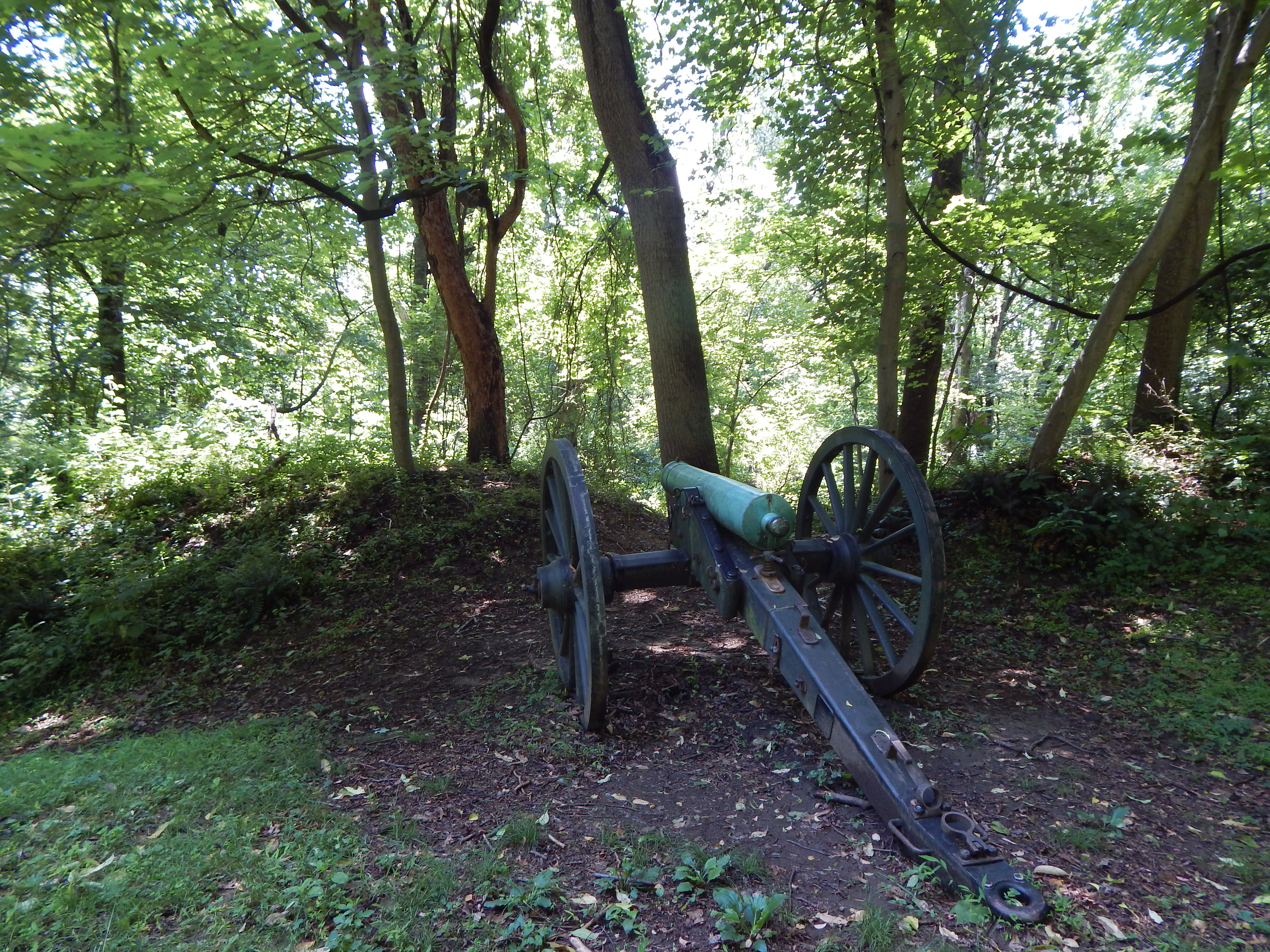
Battery Ricketts was constructed to protect the Maryland or eastern end of the two bridges crossing the Anacostia (at the Navy Yard and two and a half miles upstream at Benning's Bridge) and to occupy the heights above the Navy Yard and Washington Arsenal.
A sign in front of a forest. The sign reads "Battery Ricketts 1861-1865" and has a old black and white photography of people in a park
Battery Kemble held two 100-pounder Parrott rifles, placed in such a way as to sweep Chain Bridge and Virginia beyond. Battery Kemble was named after Gouveneur Kemble of Cold Springs, New York, former superintendent of West Point Foundry.
A large boulder sits near tree-covered earthen mounds. A plaque on the rock reads "Battery Kemble. One of the Civil War defenses of Washington constructed in 1862, Battery Kemble's two 100-pounder Parrott rifles guarded Chain Bridge along the Potomac River. United States Department of the Interior. National Park Service."
Fort Ricketts was constructed during the Civil War to protect the Maryland or eastern end of the two bridges crossing the Anacostia (at the Navy Yard and two and a half miles upstream at Benning's Bridge) and to occupy the heights above the Navy Yard and Washington Arsenal.
(344 words)<br />Battery Ricketts is located in southeast Washington, D.C. at the intersection of Bruce place SE and Erie street SE.<br />Travel north along the west side of Bruce place about one hundred fifty feet from the intersection with Erie street. There is no sidewalk on this side of the street. <br />Set about twenty feet back from the road on a strip of grass along the edge of thick forest and overgrowth is a four by three-foot yellow sign.<br />The sign is titled across the top in brown letters to read:<br />Battery Ricketts<br />Earthworks of Battery Ricketts are visible inside the wooded area in front of you.<br />Across a blue border is written in white letters:<br />Civil War Defenses of Washington<br />1861-1865<br />Below on the left is a diagram of a fort, showing an arching top border and straight back end. Above the diagram is labeled: "Rickett Battery." Below, a diagram of the circular boundaries of a fort is titled: "Fort Wagner." Text below reads:<br />Battery Ricketts from the U.S. Army Corps of Engineers drawing.<br />Battery Ricketts, built to defend an area in front of Fort Stanton, was named for Maj. Gen. James B. Ricketts.<br />To the right is a map of Washington and the edge of Virginia at the bottom. The map indicates Civil War fort locations along this section of Washington. They are, from left to right Fort Marcy, Battery Kemble, Fort Bayard, Fort Reno, Fort De Russy, Fort Stevenson, Fort Slocum, Fort Totten, Fort Bunker Hill, Fort Mahan, Fort Chaplin, Fort Dupont, Fort Davis, Fort Stanton, Battery Rickets, Fort Carrol, and Fort Greble.<br />Text below reads: "Other Civil War fort locations administered by the National Park Service.<br />The bottom third of the sign shows a black and white photograph of Civil War soldiers standing in a fort around an eight-foot long cannon on a rotating platform, aimed to the left. The fort sits atop a tall hill with a vast view in the background of open spaces and rolling hills.<br />The caption below reads: <br />During the Civil War, Washington's forts overlooked the land.<br />END OF DESCRIPTION <br />
Battleground National Cemetery was established shortly after the Battle of Fort Stevens in the summer of 1864. The battle, which lasted two days (July 11 through July 12, 1864) marked the defeat of General Jubal A. Early's Confederate campaign to launch an offensive action against the poorly defended nation's capital.
(337 words) Battleground National Cemetery is located in the Brightwood neighborhood of Washington, DC. The one-acre park is on the east side of Georgia avenue, NW between Whittier place to the north and Van Buren street to the south.<br />The Cemetery sits on a terrace approximately five feet above street level. A bluestone wall along the front edge is separated by two sets of three steps that lead up to a wrought-iron black gate at the Cemetery entrance. Set atop stone pillars on either side of the entrance are two six-foot long black cannons, one pointing north and one pointing south. On the face of the columns are black signs in the shape of a shield that both read in white: U.S. National Cemetery. To the left about six feet from the front edge of the cemetery and set in a row across the lawn are four granite monuments, each between six and eleven-feet tall. To the right is a two-story red stone building with brown shutters and a gabled roof. A porch extends out on the west side of the building. The northwest corner of the building features a three by one-foot bronze plaque engraved with the Gettysburg Address. The entrance walkway is lined with two black signs on stakes on the left side and on the right two waysides about two by three feet each. Directly back seventy feet from the entrance is a central flagpole, surrounded by forty-one marble headstones. Forty-foot tall shade trees are set on the east and west sides of the flagpole area. Further to the east behind the flagpole is a marble rostrum. Raised at a three-step elevation, the structure spans thirty feet across, twelve feet deep, and features eight white columns, four in the front, and four in the back that have a marble block wall running between them. In the northeast corner of the cemetery sits a one-story, red brick building with a flat roof. It features a green door and two windows, along with a wooden sliding barn door. END OF DESCRIPTION
Plaque includes the full text of President Lincoln's Gettysburg Address.
(270 words) Battleground National Cemetery is located in the Brightwood neighborhood of Washington, DC. The one-acre park sits on the east side of Georgia avenue, NW between Whittier place to the north and Van Buren street to the south. The Cemetery sits on a terrace approximately five feet above street level. A bluestone wall along the front edge is separated by two sets of three steps that lead up to a wrought-iron black gate at the Cemetery entrance. Set atop stone pillars on either side of the entrance are two six-foot long black cannons, one pointing north and one pointing south. On the face of the columns are black signs in the shape of a shield that both read in white: U.S. National Cemetery. To the left about six feet from the front edge of the cemetery and set in a row across the lawn are four granite monuments, each between six and eleven-feet tall. To the right is a two-story red stone building with brown shutters and a gabled roof. A porch extends out on the west side of the building. On the west-facing side of the building at its left corner and to the left of the window, sits a one by three-foot bronze plaque. Engraved at the top it reads: ADDRESS BY PRESIDENT LINCOLN AT THE DEDICATION OF THE GETTYSBURG NATIONAL CEMETERY NOVEMBER 19, 1863. Text of the Gettysburg address is in the main content. Directly back seventy feet to the east from the Cemetery entrance is a central flagpole, surrounded by forty-one one-foot tall marble headstones. Set behind is a thirty-foot wide white marble rostrum with eight columns. END OF DESCRIPTION
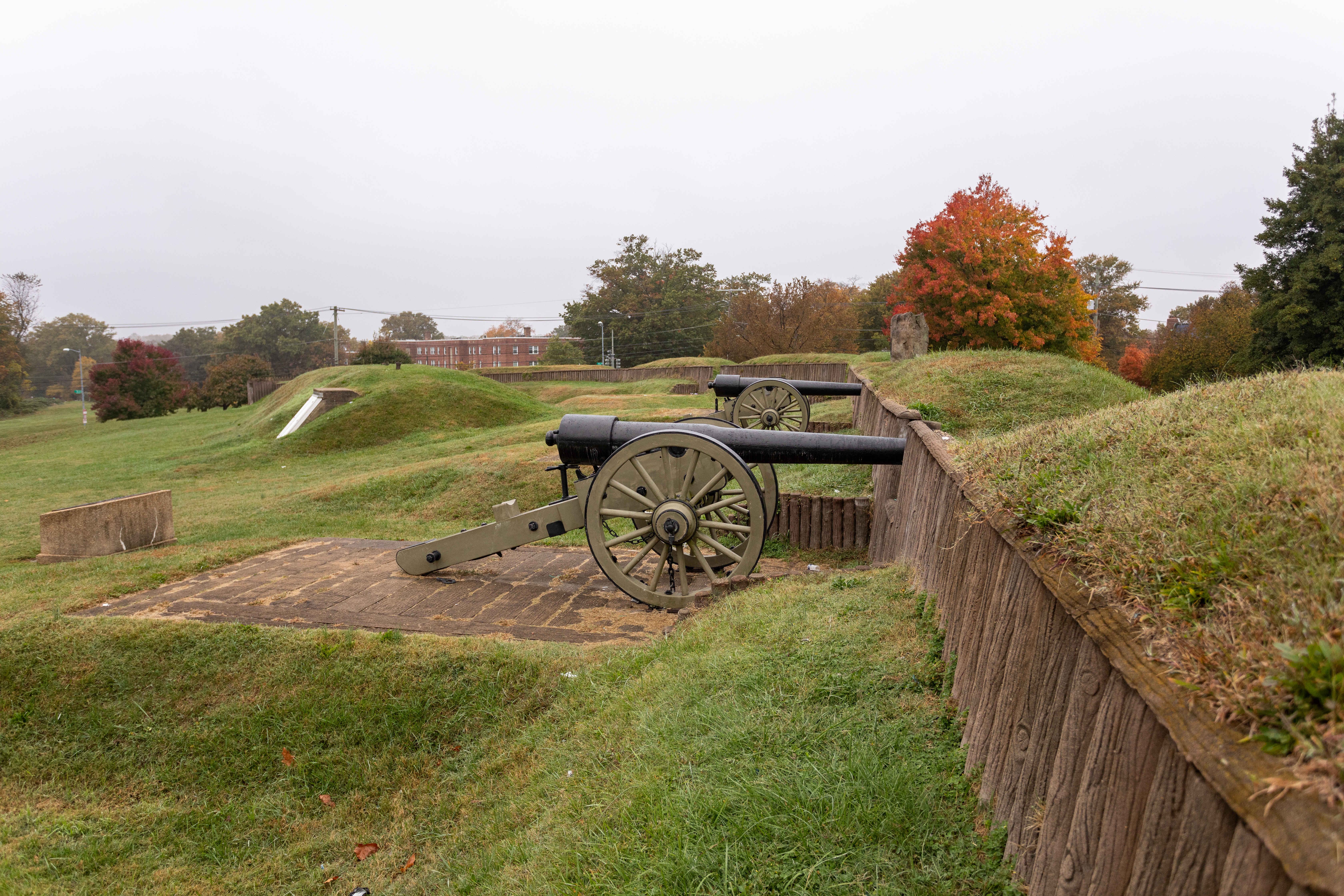
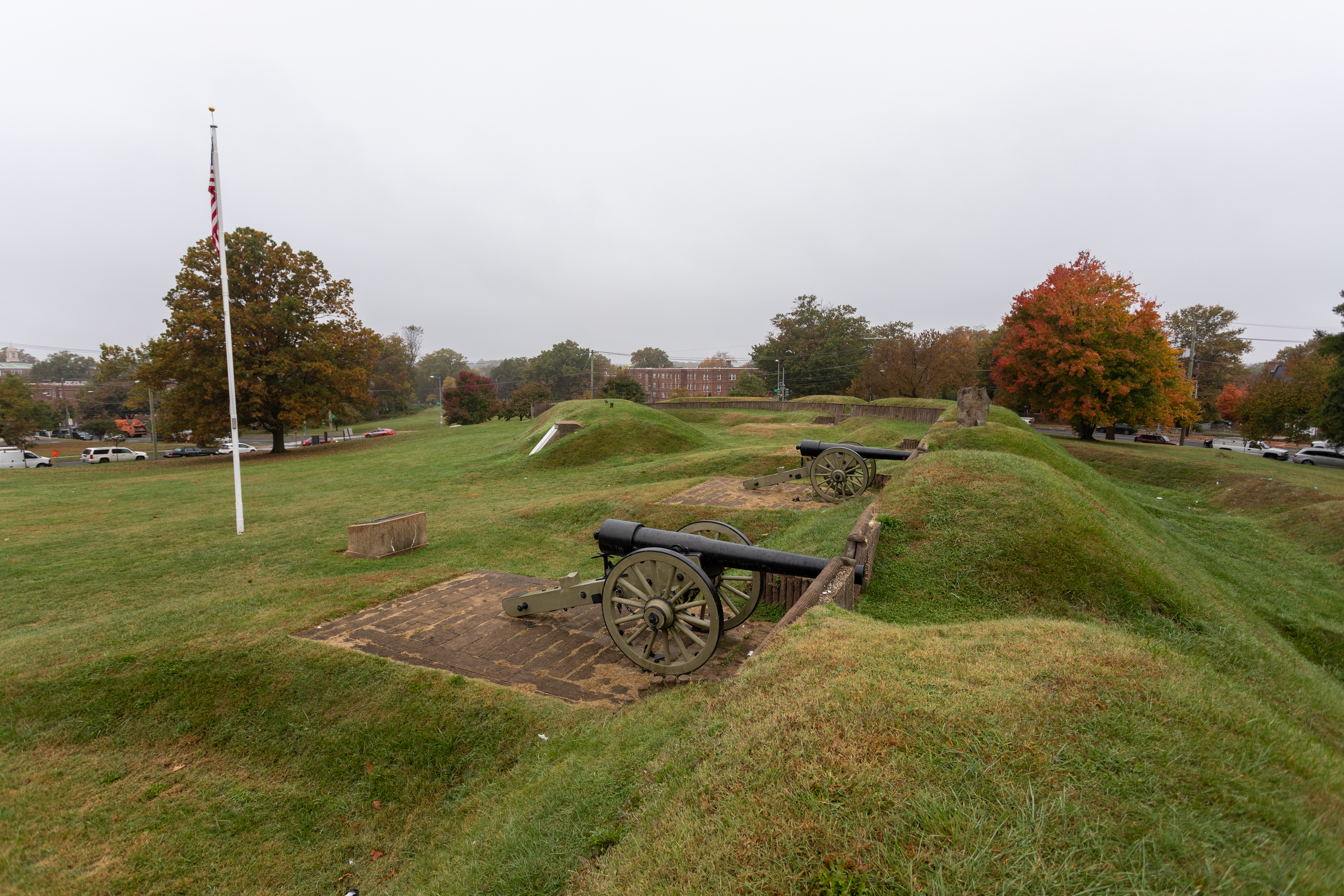
(295 words)<br />Fort Stevens is located in the northern corner of Washington, DC, within the center of a block bordered by 13th Street, NW to the west, Georgia Avenue to the east, Rittenhouse Street to the north, and Quakenbos Street to the south.<br />The park area rises about thirty feet from street level at the northwest corner of 13th and Rittenhouse Streets to the eastern end where the fort is situated. A flagpole in the center of the hilly field marks the fort location. Lined in front to the north are a wall of grassy bunkers, about four feet tall. One six-foot tall hill to the left has a white wooden double-sided door on its face.<br />A cement bunker wall with wood-log designed vertical ridges spans about one hundred yards across the top of the hill. The wall stands about five feet tall with seven three-foot wide, three-foot tall openings. Pointed out of two of those openings are sixteen-foot long cannons set on cement platforms and directed out to the north.<br />Set in the grassy hill, equidistant between the two cannons and back to the south about thirty feet, is a bronze plaque atop a cement block. The cement base is about five-feet wide, four-feet deep, and three-feet tall. The bronze plaque measures three by three feet. It features a bas-relief of the fort design as viewed from above, detailing its walls, borders, bunkers and cannon platforms. In the upper right corner is a compass rose.<br />The lower left corner is inscribed to read:<br />Dedicated September 1936<br />In the Memory of<br />The Grand Army of the Republic<br />by the<br />Daughters of Union Veterans<br />of the<br />Civil War<br />1861-1865<br />An inscription in the lower right corner reads:<br />Scale Model of Fort Stevens<br />A measurement ruler is etched below.<br />END OF DESCRIPTION<br />
Fort Bunker Hill was built in the fall of 1861 by the 11th Massachusetts Infantry and was named after the Revolutionary fortification at Bunker Hill, Massachusetts.
A sign on the edge of the woods with National Park Service logo and text "Fort Bunker Hill, Fort Circle Parks, National Park Service, U.S. Department of the Interior."
<br />Inscriptions<br />FORT BUNKER HILL<br />ONE OF THE CIVIL WAR DEFENSES OF WASHINGTON<br />ERECTED IN THE FALL OF 1861, FORT BUNKER HILL OCCUPIED AN IMPORTANT POSITION BETWEEN FORT TOTTEN AND FORT LINCOLN IN THE DEFENSE OF THE NATIONAL CAPITAL. THIRTEEN GUNS AND MORTARS WERE MOUNTED IN THE FORT.<br />UNITED STATES DEPARTMENT OF THE INTERIOR<br />NATIONAL PARK SERVICE<br />
(234 words)<br />Fort Bunker Hill is located in the northeast quadrant of Washington, DC, bordered by Perry Street, NE to the north, Otis Street NE to the south, 13th street NE to the west and 14th street NE to the east. The block consists of wooded forest with trails that rise to a point in the middle.<br />From the intersection of 14th and Otis streets, proceed north on 14th street about two hundred twenty-five feet (68 meters). A brown sign with white letters is set at a trail head on the west side of the street. Text on the sign reads:<br />Rock Creek Park<br />Park Watch<br />Below in English and Spanish is written:<br />Information 202-895-6000<br />US Park Police 202-610-7500<br />A white sign below reads in English and Spanish:<br />Park Closed at Dark<br />Turn left and travel west slightly uphill on a dirt path into the park. About three hundred eighty feet west (115 meters), on the right side of the path, is an approximately two-foot tall rock set with a one by two-foot bronze plaque. An inscription on the plaque reads:<br />FORT BUNKER HILL<br />ONE OF THE CIVIL WAR DEFENSES OF WASHINGTON<br />ERECTED IN THE FALL OF 1861, FORT BUNKER HILL OCCUPIED AN IMPORTANT POSITION BETWEEN FORT TOTTEN AND FORT LINCOLN IN THE DEFENSE OF THE NATIONAL CAPITAL. THIRTEEN GUNS AND MORTARS WERE MOUNTED IN THE FORT.<br />UNITED STATES DEPARTMENT OF THE INTERIOR<br />NATIONAL PARK SERVICE<br />END OF DESCRIPTION<br />
Battery Carroll and Fort Greble were two defense sites north of the Potomac that guarded the gateway to Washington during the Civil War. Battery Carroll was named after Samuel Sprigg Carroll, a native Washingtonian and West Point graduate.
(346 words)<br />Battery Carroll is located in southeast Washington, D.C. at the intersection of South Capitol street SE and Martin Luther King, Jr avenue SE.<br />Travel north along the west side of Martin Luther King, Jr avenue from the intersection with South Capitol street about four hundred feet. On your left about ten feet off the sidewalk will be two signs, sitting on a strip of grass that runs about fifteen feet back to thick forest and overgrowth.<br />The sign on the left is a two by five-foot brown sign titled in white letters: <br />Fort Carroll<br />Civil War Defenses of Washington<br />National Park Service<br />U.S. Department of the Interior<br />About six feet to the right is a four by three-foot yellow sign titled at the top in brown letters to read:<br />Fort Carroll<br />Earthworks of Fort Carroll are visible 100 yards to the right at the top of the hill<br />Below along a blue border is written in white letters:<br />Civil War Defenses of Washington<br />1861-1865<br />Beneath on the left is a diagram of a rectangular fort, showing its boundaries and in the top left corner a closeup look at one of the corners of the fort.<br />To the right is a map of Washington and the edge of Virginia at the bottom. The map indicates Civil War fort locations along this section of Washington. They are, from left to right Fort Marcy, Battery Kemble, Fort Bayard, Fort Reno, Fort De Russy, Fort Stevenson, Fort Slocum, Fort Totten, Fort Bunker Hill, Fort Mahan, Fort Chaplin, Fort Dupont, Fort Davis, Fort Stanton, Battery Rickets, Fort Carrol, and Fort Greble.<br />Text below reads: "Other Civil War fort locations administered by the National Park Service.<br />The bottom third of the sign shows a black and white photograph of Civil War soldiers standing in a fort around an eight-foot long cannon on a rotating platform, aimed to the left. The fort sits atop a tall hill with a vast view in the background of open spaces and rolling hills.<br />The caption below reads: <br />During the Civil War, Washington's forts overlooked the land.<br />END OF DESCRIPTION <br />
Fort Chaplin was constructed in 1864. Its function was to cover the flank of Fort Mahan and force an enemy to detour around Fort Meigs by prolonging the obstructed line to that fortification.
(352 words)<br />Fort Chaplin is located in the southeast quadrant of Washington, D.C., bordered by Texas Avenue SE to the east, C street SE to the south, and East Capitol street SE to the north.<br />From the intersection of Texas avenue and B street, travel south on Texas avenue about one hundred sixty feet. Set on the west side of the road, along the edge of an open grass field, is a four by three-foot wayside, titled across the top to read:<br />Fort Chaplin<br />Earthworks of Fort Chaplin are visible through the wooded area at the top of the hill.<br />Below across a blue border is written in white letters:<br />Civil War Defenses of Washington<br />1861-1865<br />Below on the left side is a diagram of the boundaries and walls of an asymmetrical ten-sided structure. Text below reads:<br />Fort Chaplin from U.S. Army Corps of Engineers drawing.<br />Fort Chaplin was named in honor of Col. Daniel Chaplin, who was mortally wounded on August 17, 1864, at Deep Bottom, Virginia.<br />To the right is a map of Washington and the edge of Virginia at the bottom. The map indicates Civil War fort locations along this section of Washington. They are, from left to right Fort Marcy, Battery Kemble, Fort Bayard, Fort Reno, Fort De Russy, Fort Stevenson, Fort Slocum, Fort Totten, Fort Bunker Hill, Fort Mahan, Fort Chaplin, Fort Dupont, Fort Davis, Fort Stanton, Battery Rickets, Fort Carrol, and Fort Greble.<br />Text below reads: "Other Civil War fort locations administered by the National Park Service<br />The bottom third of the sign shows a black and white photograph of Civil War soldiers standing in a fort around an eight-foot long cannon on a rotating platform, aimed to the left. The fort sits atop a tall hill with a vast view in the background of open spaces and rolling hills.<br />The caption below reads: <br />During the Civil War, Washington's forts overlooked the land.<br />To the west behind the sign is an open field that stretches about four hundred yards north to south along the sidewalk and about one hundred yards west to a heavily forested and overgrown area. <br />END OF DESCRIPTION<br />
Fort Davis was named in honor of Colonel Benjamin F. Davis. Constructed as part of the Eastern Branch Defenses (Anacostia River), the fort had a perimeter of 220 yards and was armed with 12 artillery pieces, including 11 cannons and 1 mortar.
(372 words)<br />Fort Davis is located at the northern intersection of Pennsylvania avenue SE and Alabama avenue NE in Southeast Washington, D.C.<br />Travel about three hundred fifty feet north on Alabama avenue from the intersection with Pennsylvania avenue. On the west side of the street, an iron gate will be set about six feet west of the sidewalk on a patch of asphalt. About ten feet to the right, on a raised grass mound of the park is a four by three-foot wayside.<br />The park is an open grass field, about two hundred fifty feet wide, that stretches about five hundred feet to the northeast. The southern end of the park features thick woods and overgrowth. <br />The yellow wayside sign is written in brown letters across the top:<br />Fort Davis<br />Earthworks of Fort Davis are visible behind the wooded area in front of you.<br />Written across a blue border below reads in white lettering:<br />Civil War Defenses of Washington<br />1861-1865<br />Below on the right is a diagram titled Fort Davis. The image shows a series of walls surrounding two rectangular buildings in the center. Text below reads:<br />Fort Davis from the U.S. Army Corps of Engineers drawing.<br />Fort Davis was named after Col. Benjamin F. "Grimes" Davis, hero at Harpers Ferry in 1862, killed at the Battle of Brandy Station, June 9, 1863.<br />To the right is a map of Washington and the edge of Virginia at the bottom. The map indicates Civil War fort locations along this section of Washington. They are, from left to right Fort Marcy, Battery Kemble, Fort Bayard, Fort Reno, Fort De Russy, Fort Stevenson, Fort Slocum, Fort Totten, Fort Bunker Hill, Fort Mahan, Fort Chaplin, Fort Dupont, Fort Davis, Fort Stanton, Battery Rickets, Fort Carrol, and Fort Greble.<br />Text below reads: "Other Civil War fort locations administered by the National Park Service.<br />The bottom third of the sign shows a black and white photograph of Civil War soldiers standing in a fort around an eight-foot long cannon on a rotating platform, aimed to the left. The fort sits atop a tall hill with a vast view in the background of open spaces and rolling hills.<br />The caption below reads: <br />During the Civil War, Washington's forts overlooked the land.<br />END OF DESCRIPTION <br />
InscriptionsThe Civil War Defenses of WashingtonFort DavisOne of several earthworks commenced late in 1861 to guard the nations capital from the ridge east of the Anacostia River, the fort was named in honour of Colonel Benjamin F. Davis of the 8th New York Cavalry, killed at Beverly Ford, Virginia, June 9th, 1863. Its armament consisted of eleven guns and one mortar.United States Department of the InteriorNational Park Service, National Capital ParkPresented by theNational S
(255 words)<br />Fort Davis is located at the northern intersection of Pennsylvania avenue SE and Alabama avenue NE in Southeast Washington, D.C.<br />Travel about three hundred fifty feet north on Alabama avenue from the intersection with Pennsylvania avenue. On the west side of the street, an iron gate will be set about six feet west of the sidewalk on a patch of asphalt. About ten feet to the right, on a raised grass mound of the park is a four by three-foot wayside.<br />The park is an open grass field, about two hundred fifty feet wide, that stretches about five hundred feet to the northeast. The southern end of the park features thick woods and overgrowth. <br />From the iron gate, proceed west into the park. About one hundred feet into the park, underneath vegetation and overgrowth, is a bronze plaque sitting on the face of a three foot-tall, four foot-wide, and two-foot-deep rock. <br />The plaque is about one by two feet and engraved to read:<br />The Civil War Defenses of Washington<br />Fort Davis<br />One of several earthworks commenced late in 1861 to guard the nations capital from the ridge east of the Anacostia River, the fort was named in honour of Colonel Benjamin F. Davis of the 8th New York Cavalry, killed at Beverly Ford, Virginia, June 9th, 1863. Its armament consisted of eleven guns and one mortar.<br />United States Department of the Interior<br />National Park Service, National Capital Park<br />Presented by the<br />National Society of the Colonial Dames of America<br />In the District of Columbia<br />1956<br />END OF DESCRIPTION<br />
Fort DeRussy was built on a high hill with the purpose of providing cross fire upon the approaches to Fort Stevens on the 7th Street Pike (now Georgia Avenue NW ) and, together with Fort Kearney and Fort Reno to the west, controlling the country roads between Rockville Pike and Rock Creek Valley.
A large boulder on the edge of mounds of tree-covered earth displays a bronze plaque, "Fort DeRussy. One of the Civil War Defenses of Washington. Constructed on the site in 1861, Fort DeRussy commanded the deep valley of Rock Creek. Its armament consisted of 11 guns and mortars including a 100-pounder Parrott rifle. United States Department of the Interior. National Park Service."
Fort Dupont was commenced between Ocotober and December of 1861 and "completed" in the spring on 1862. It was named for Flag Officer Samuel F. Dupont, who commanded the naval victory at Port Royal, South Carolina, in November 1861.
(513 words)<br />Fort Dupont is located along the north side of Alabama avenue, SE in Southeast Washington, D.C. The park is bordered by Massachusetts avenue to the west and Burns street to the east. <br />From the intersection of Alabama avenue and Massachusetts avenue, travel about eight hundred thirty feet. Turn left into the park entrance. A brown sign will be on the right with white letters that read:<br />Fort Circle Park<br />Picnic Area<br />Park Closed at Dark<br />Proceed to the left along an asphalt-paved path that loops around in a circle in the park, passing through a parking lot. At the north end of the parking lot, the path continues. Proceed about one hundred fifty yards along the path. On your right about ten feet off the path in a grassy knoll at the edge of the forest line is a four by three-foot yellow wayside. Titled across the top in brown letters it reads:<br />Fort DuPont<br />Earthworks of Fort Dupont are visible, follow path to the entrance of fort.<br />Below across a blue border is written in white letters:<br />Civil War Defenses of Washington<br />1861-1865<br />Below to the left is a diagram titled "Fort Dupont." It features a rectangular building surrounded by three hexagonal walls. Text below reads:<br />Fort DuPont from U.S. Army Corps of Engineers drawing.<br />Fort DuPont was named after Rear Admiral Samuel Francis DuPont, a Union naval hero of the early years of the Civil War.<br />To the right is a map of Washington and the edge of Virginia at the bottom. The map indicates Civil War fort locations along this section of Washington. They are, from left to right Fort Marcy, Battery Kemble, Fort Bayard, Fort Reno, Fort De Russy, Fort Stevenson, Fort Slocum, Fort Totten, Fort Bunker Hill, Fort Mahan, Fort Chaplin, Fort Dupont, Fort Davis, Fort Stanton, Battery Rickets, Fort Carrol, and Fort Greble.<br />Text below reads: "Other Civil War fort locations administered by the National Park Service.<br />The bottom third of the sign shows a black and white photograph of Civil War soldiers standing in a fort around an eight-foot long cannon on a rotating platform, aimed to the left. The fort sits atop a tall hill with a vast view in the background of open spaces and rolling hills.<br />The caption below reads: <br />During the Civil War, Washington's forts overlooked the land.<br />About forty feet to the left of the wayside, also set along the tree line, is a four-foot-tall, four-foot-wide, and two-foot-tall rock with a bronze plaque set on its face. The plaque is about one by two feet, and engraved to read:<br />The Civil War Defenses of Washington<br />Fort DuPont<br />This small work was one of the defenses begun in Fall of 1861 on the ridge east of the Anacostia River. It was named after Admiral Samuel F. DuPont, a commander of the South Atlantic Blockage Squadron. Eight guns and one mortar comprised its armament.<br />United States Department of the Interior<br />National Park Service, National Capital Parks<br />Presented by the National Society of the Colonial Dames of America<br />In the District of Columbia<br />1955<br />END OF DESCRIPTION<br />
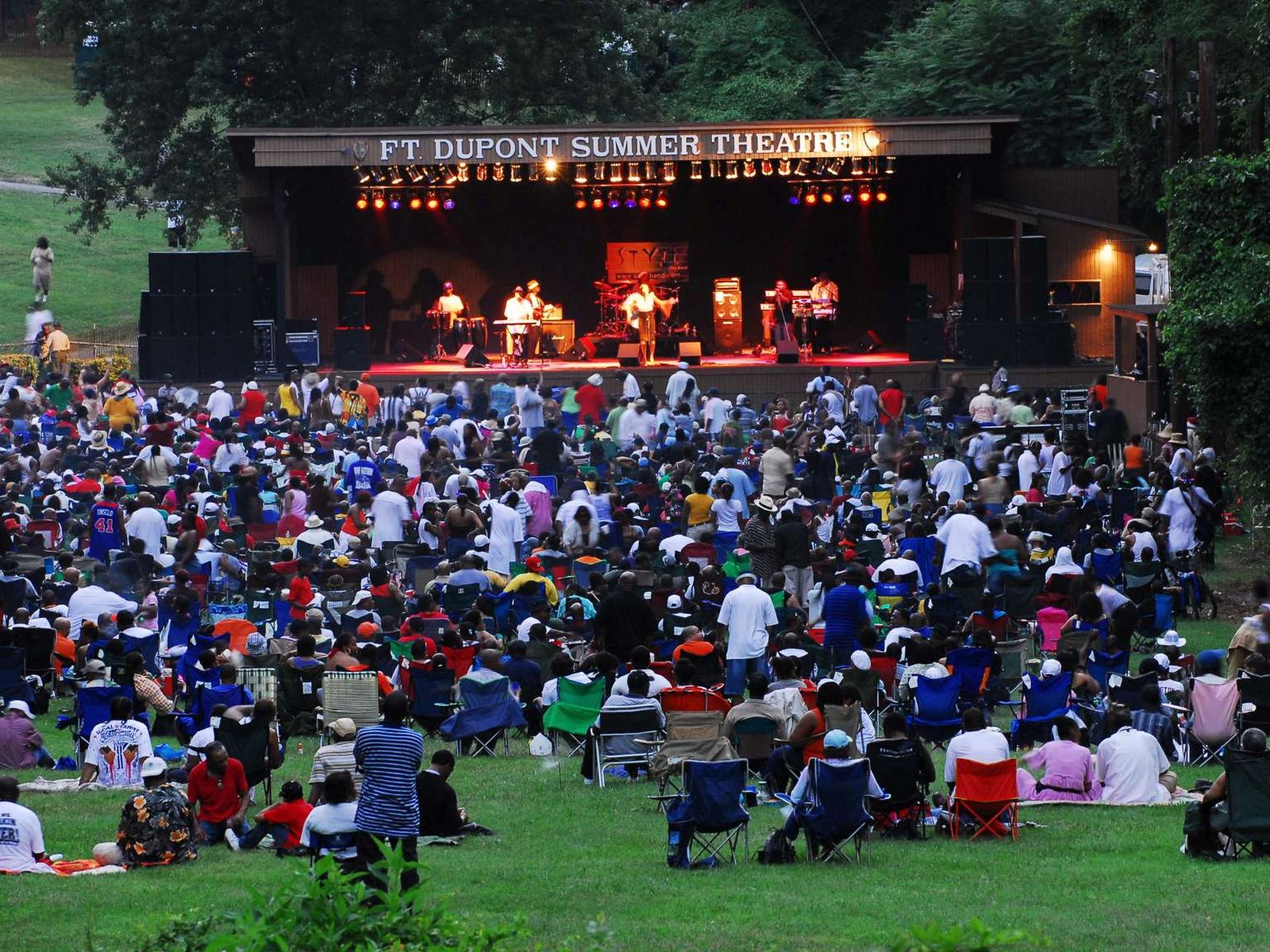
One of the largest community gardens in Washington, DC, the Fort Dupont Community Gardens increases the accessibility and exposure of fruits and vegetables as well as providing education on nutrition and sustainable agriculture for urban residents. The Community Gardens of Fort DuPont provide education through shared knowledge and agricultural practices by empowering the community to grow its own healthy food.
A large community garden filled with different plants and vegetables.
Picnic amid history at the site of Fort Dupont's historic earthworks.<br /><br />Picnickers may <a href="https://www.recreation.gov/camping/campgrounds/250017">reserve sites through Recreation.gov</a> .
Two picnic tables in front of a small brick building.
The picnic grove at Fort Dupont offers a number of recreational opportunities. In addition to picnicking, visitors can hike the nearby trails that link the various Civil War-era forts that protected the capital.<br /><br />Picnickers may reserve sites through <a href="https://www.recreation.gov/camping/campgrounds/250017">Recreation.gov</a> .
Seven picnic tables sit in a wooded area in front of a playground.
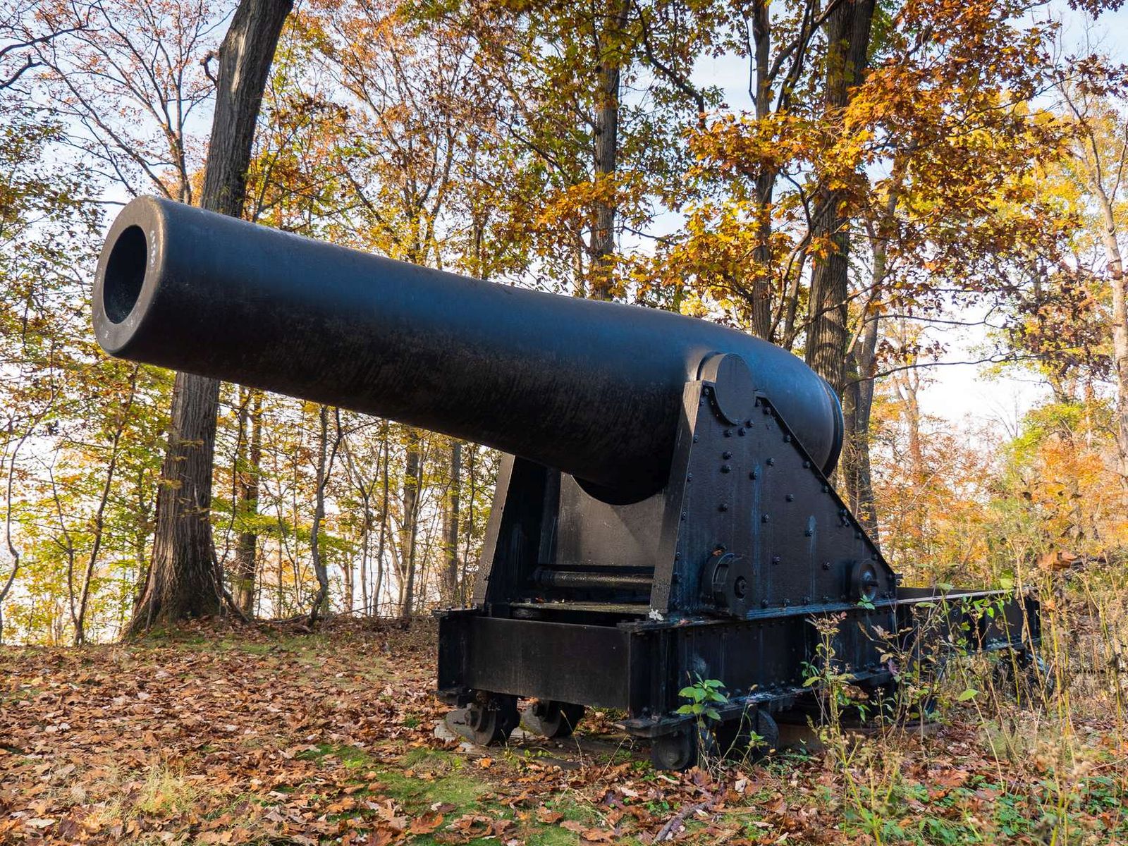
Fort Foote was named after Rear Admiral Andrew H. Foote. He distinguished himself in the actions against the Confederate forts on the Mississippi River and died of wounds on June 26, 1863.
A small overgrown fort. The fort is constructed of earth and some stone and is now covered in a forest ecosystem. On the Western side of the fort sit two 7 ft tall cannons.
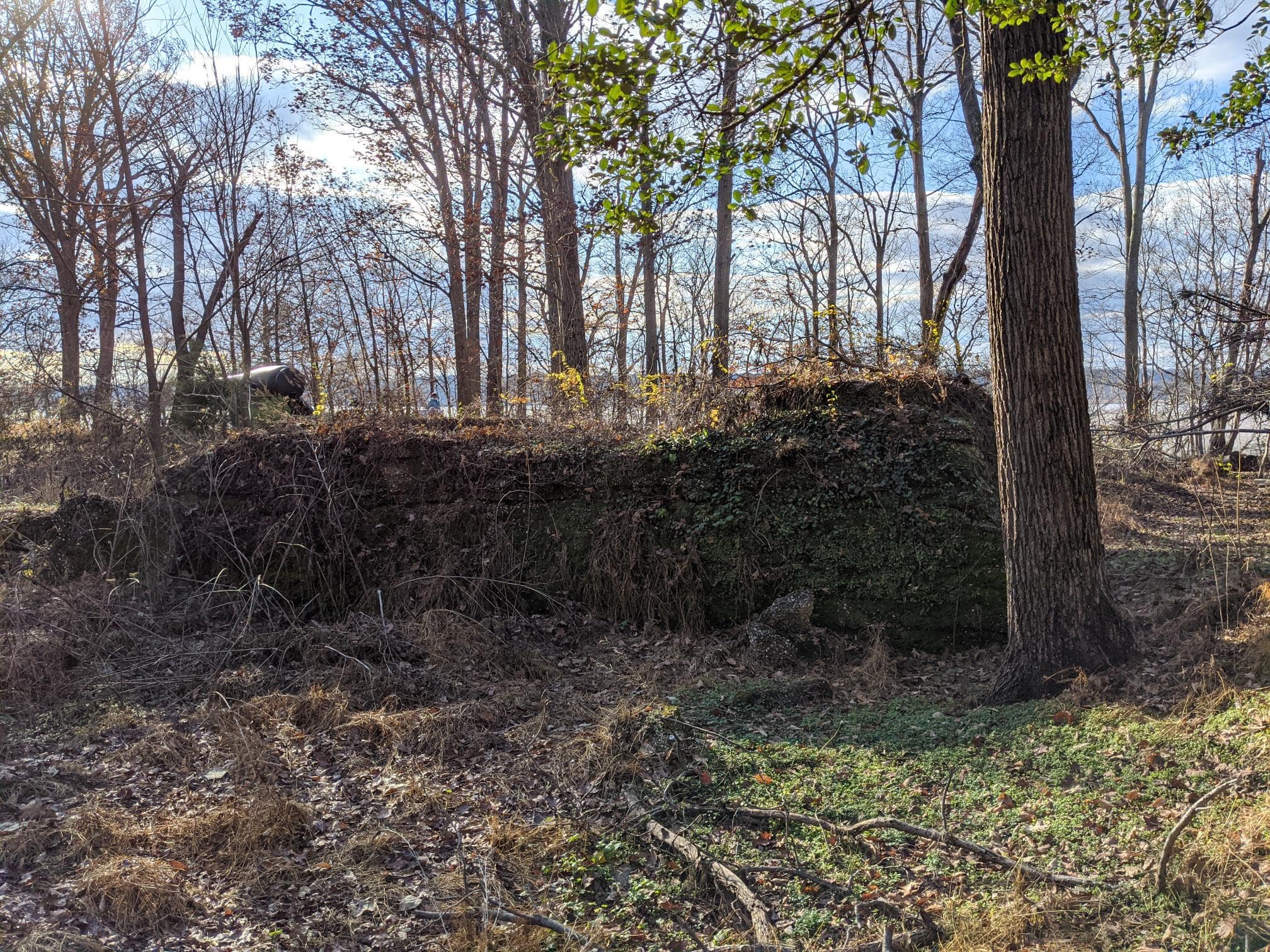
Located in the center earthwork of Fort Foote the bomb proof magazine is a short t-shape structure measuring about 50 by 50 ft. It is made of a cement-like material filled with small pebbles. It has many tunnels overgrown with moss vines and shrubs. The structure has seen much where over the past century and is in disrepair.
Fort Foote was constructed in 1863 atop Rozier's Bluff to strengthen the ring of fortifications that encircled Washington, DC. Two of the Guns that protected Washington are still there along with the remains of the fort's earthworks.
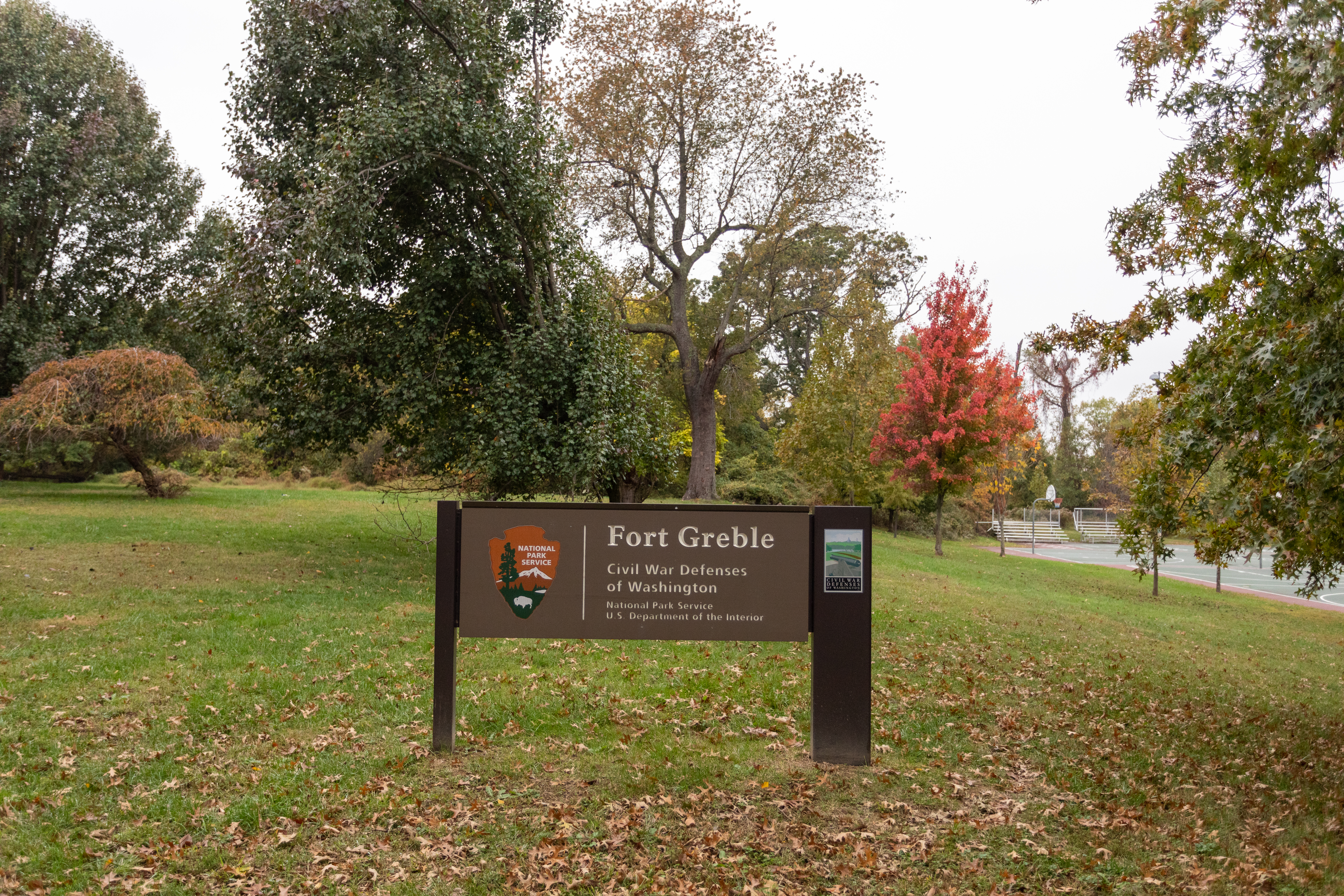
Battery Carroll and Fort Greble were two defense sites north of the Potomac that guarded the gateway to Washington during the Civil War. Fort Greble was named in honor of Lt. J.T. Greble who was killed at Big Bethel, Va., July 10, 1861.
A sign with text that reads "Fort Greble, Civil War Defenses of Washington, National Park Service, U.S. Department of the Interior". The sign is in front of a large field next to a basketball court.
Fort Greble and Fort Carroll were two defense sites north of the Potomac that guarded the gateway to Washington during the Civil War. Fort Greble was named in honor of Lt. J.T. Greble who was killed at Big Bethel, Va., July 10, 1861. Fort Carroll was named after Samuel Sprigg Carroll, a native Washingtonian and West Point graduate.
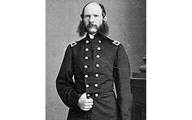
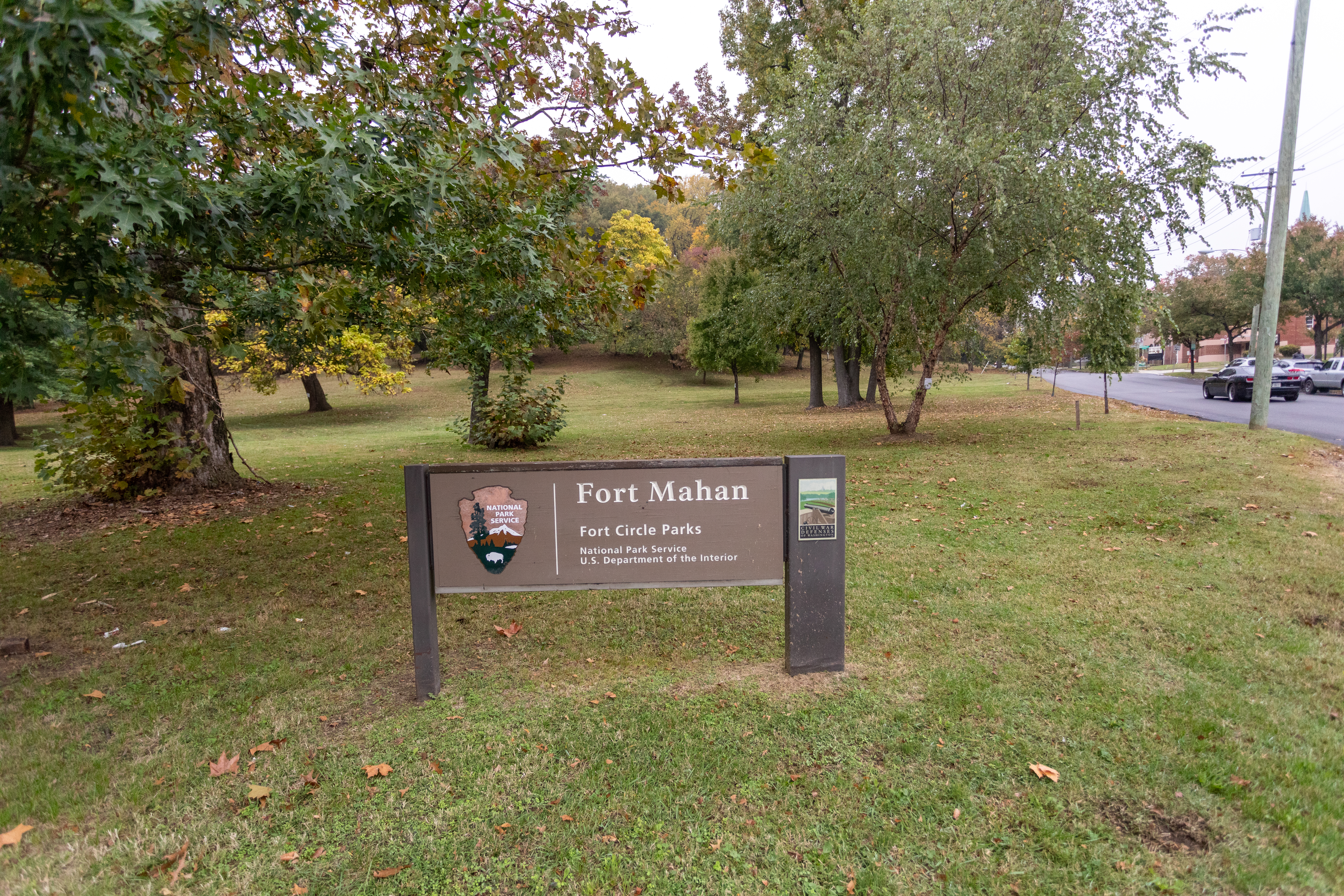
Fort Mahan, situated on an isolated hill belonging to Dr. William Manning, was built to guard the approaches to Benning's Bridge which crosses the Anacostia River.
(425 words)<br />Fort Mahan is located in the northeast quadrant of Washington, D.C., bordered by Grant street NE to the north, Benning road, NE to the south, 42nd street to the east and Minnesota avenue NE to the west.<br />From the intersection of Benning road and 41st street, travel about twenty feet east on the north side of Benning road. Follow the pedestrian walkway north into the park. At one hundred twenty feet, turn left and continue one hundred forty feet, at a slight incline.<br />Set of the right side of the path is a brown sign with white letters, partially obscured by the forest and overgrowth. The sign reads:<br />Fort Circle Park<br />Hiker - Biker - Trail<br />Motorized Vehicles Prohibited<br />Ten feet west is a four by three-foot wayside, titled across the top to read:<br />Fort Mahan<br />Earthworks of Fort Mahan are visible; follow path to the top of the hill.<br />Below across a blue border is written in white letters:<br />Civil War Defenses of Washington<br />1861-1865<br />Below on the left side is a diagram of the walls of an eight-sided structure, titled: "Fort Mahan."<br />Text below reads:<br />Fort Mahan from U.S. Army Corps of Engineers drawing.<br />For Mahan was named after West Point professor Dennis Hart Mahan, whose book on fortifications guided construction of the forts around Washington, D.C.<br />To the right is a map of Washington and the edge of Virginia at the bottom. The map indicates Civil War fort locations along this section of Washington. They are, from left to right Fort Marcy, Battery Kemble, Fort Bayard, Fort Reno, Fort De Russy, Fort Stevenson, Fort Slocum, Fort Totten, Fort Bunker Hill, Fort Mahan, Fort Chaplin, Fort Dupont, Fort Davis, Fort Stanton, Battery Rickets, Fort Carrol, and Fort Greble.<br />Text below reads: "Other Civil War fort locations administered by the National Park Service<br />The bottom third of the sign shows a black and white photograph of Civil War soldiers standing in a fort around an eight-foot long cannon on a rotating platform, aimed to the left. The fort sits atop a tall hill with a vast view in the background of open spaces and rolling hills.<br />The caption below reads: <br />During the Civil War, Washington's forts overlooked the land.<br />The pedestrian path continues west and winds around the block in a loop. A path from 42nd and Eads street leads west into the park about five hundred feet to an open field at the top of a hill. The field spans about two hundred yards in each direction and is surrounded by thick forest and overgrowth.<br />END OF DESCRIPTION<br />
Fort Marcy and nearby Fort Ethan Allen and other batteries on the northern bank of the Potomac River were built to protect Leesburg Pike and Chain Bridge.
(579 words)<br />Fort Marcy sits on the east side of the George Washington Memorial Parkway, north of the Chain Bridge in Northern Virginia.<br />Travel north on the George Washington Memorial Parkway about three and one-quarter of a mile from the intersection with Spout Run. Turn right at the sign for Fort Marcy and follow the turnoff about six hundred feet. Set at the south end of an approximately two-hundred-foot-long parking lot is a three by four-foot wayside. Access to Potomac Heritage Trail is at the east end of the parking lot.<br />The yellow wayside sign is written across the top in brown letters to read:<br />Fort Marcy<br />Earthworks and other visible remnants of Fort Marcy and related batteries still remain.<br />Below across a blue border is written in white letters:<br />Civil War Defenses of Washington<br />1861-1865<br />Beneath on the left is a diagram showing the boundaries of a fort. A border from the lower left to top right is labeled "Batteries." A circular loop around the center of the diagram identifies "Battery Trail." A parking lot is identified at the south end and Route 123 runs along the west side of the area.<br />Below is written:<br />Fort Marcy trail map.<br />Fort Marcy was built in 1861 to protect the Chain Bridge approach to Washington, D.C.<br />To the right is a map of Washington and the edge of Virginia at the bottom. The map indicates Civil War fort locations along this section of Washington. They are, from left to right Fort Marcy, Battery Kemble, Fort Bayard, Fort Reno, Fort De Russy, Fort Stevenson, Fort Slocum, Fort Totten, Fort Bunker Hill, Fort Mahan, Fort Chaplin, Fort Dupont, Fort Davis, Fort Stanton, Battery Rickets, Fort Carrol, and Fort Greble.<br />Text below reads: "Other Civil War fort locations administered by the National Park Service."<br />The bottom third of the sign shows a black and white photograph of Civil War soldiers standing in a fort around an eight-foot long cannon on a rotating platform, aimed to the left. The fort sits atop a tall hill with a vast view in the background of open spaces and rolling hills.<br />The caption below reads: <br />During the Civil War, Washington's forts overlooked the land.<br />Behind the wayside is a dirt trail that leads north through an overgrown forest. A brown sign stands on the left of the trail about one hundred yards north. Yellow text provides details on Fort Marcy:<br />Fort Marcy, Virginia<br />A Civil War Defense of Washington<br />The Virginia approaches to the Chain Bridge were guarded by Fort Marcy on the old Leesburg Turnpike and Fort Ethan Allen on the Military Road. The sites were occupied by Union troops on September 24, 1861, and the earthworks completed in short order. Fort Marcy was named for Brig. General Randolph B. Marcy, Chief of Staff for Major General George B. McClellan. The armament consisted of 17 guns with one platform vacant and 3 mortars.<br />The trail continues uphill through an open but overgrown space in the woods. A picnic table sits at the north end and at the south an iron cannon with a wheeled carriage. A second picnic table and small brown sign describes the Auxiliary Battery:<br />Auxiliary Battery<br />Fort Marcy, Virginia<br />An extensive line of rifle trenches connected the advance works of Fort Ethan Allen and Fort Marcy and extended on to the west bank of the Potomac River. Auxiliary batteries for field guns, strategically placed, provided additional strength to afford a full view of the front.<br />END OF DESCRIPTION<br />
Fort Reno was originally named Fort Pennsylvania, and was built during the winter of 1861 shortly after the disastrous defeat of the Union Army at the First Battle of Manassas. In charge of construction of the defenses around Washington was Brig. Gen. John G. Barnard, Col. of Engineers, U.S. Army. Barnard chose the location of Fort Reno for its strategic importance in guarding the Rockville Pike (present-day Wisconsin Avenue NW).
A broad grassy field dotted with trees. A slight rise of earthworks is detectable at the perimeter.
<br />Inscriptions<br />The Civil War Defenses of Washington<br />Fort Reno<br />The site of this fort was selected in August, 1861. First called Fort Pennsylvania, the fort was located at an elevation of 430 feet, commanding three important roads which entered the city from the northwest in the vicinity of what is now Wisconsin and Nebraska Avenues, N.W.<br />National Capital Sesquicentennial Commission<br />1970<br />
(274 words)<br />The Fort Reno: Stone and Plaque is located on Chesapeake Street, NW in Tenleytown, Washington, DC. The stone marker is set on the north side of Chesapeake Street, five hundred feet west of Nebraska Avenue and three hundred twenty feet east of 40th Street, NW.<br />The marker sits about six feet beyond the sidewalk from the street, at a slight incline. It is five feet long, three feet wide, and two feet tall and features a three by one-foot bronze plaque set on its top surface.<br />Raised text on the plaque reads:<br />The Civil War Defenses of Washington<br />Fort Reno<br />The site of this fort was selected in August, 1861. First called Fort Pennsylvania, the fort was located at an elevation of 430 feet, commanding three important roads which entered the city from the northwest in the vicinity of what is now Wisconsin and Nebraska Avenues, N.W.<br />National Capital Sesquicentennial Commission<br />1970<br />Beyond the stone marker is a soccer field, elevated about eight feet from street level. The park also features a baseball field, tennis courts, and large grassy field areas.<br />As you face the marker, three water towers stand about two hundred yards in the distance. The tower furthest to the right is about three hundred feet tall and resembles a castle, with its rounded stone face, pointed top, and a smaller stairwell tower connected to its left side. The two towers to the left are made of red brick and have flat rooftops.<br />To the right of the stone marker, a gravel and dirt road leads into a grass field area and through the middle of the park.<br />
Fort Slocum was built by the 2nd Rhode Island Infantry and named after Colonel John Slocum of the 2nd Rhode Island Infantry.
A sign stands in front of a field with scattered trees, reading "Fort Slocum, Fort Circle Parks, National Park Service, U.S. Department of the Interior."
Fort Slocum was built by the 2nd Rhode Island Infantry. The fort had 25 guns and mortars, and commanded the intersection of the left and right forks of Rock Creek Church Road (near today's New Hampshire Avenue and McDonald Place). The fort also provided support for Fort Stevens to the west.
Fort Stevens is one of many fortifications that surrounded Washington, DC, during the Civil War and the place where President Abraham Lincoln came under fire from Confederate forces.
(632 words)<br />Fort Stevens is located in the northern corner of Washington, DC, within the center of a block bordered by 13th Street, NW to the west, Georgia Avenue to the east, Rittenhouse Street to the north, and Quakenbos Street to the south.<br />The park area rises about thirty feet from street level at the northwest corner of 13th and Rittenhouse streets to the eastern end where the fort is situated. A flagpole in the center of the hilly field marks the fort location. Lined in front to the north are a wall of grassy bunkers, about four feet tall. One six-foot tall hill to the west of the flagpole has a white wooden double-sided door on its face.<br />A cement bunker wall with vertical ridges spans about one hundred yards across the top of the hill. The wall stands about five feet tall with seven three-foot wide, three-foot tall openings. Pointed out of two of those openings are sixteen-foot long cannons set on cement platforms and directed out to the north.<br />About thirty feet behind and six feet to the right of the right cannon sits a two by three-foot wayside. The sign is titled in black letters in the upper left corner: Fort Stevens.<br />The left two thirds of the sign feature a color painting of a battle scene. Men in blue military uniforms stand in a fort on a hilltop around a cannon set on a wheeled turret. A man standing above in the top left corner wears a long black suit coat and black top hat. Below him a man holds an American flag. Two men carry a wounded soldier below, a man runs with a raised right arm and hand, and a man to the right stands while holding a white flag with a red and blue cross. A quote above the image reads: "We haven't taken Washington, but we scared Abe Lincoln like hell!" The quote is attributed to General Jubal Early.<br />Text in the bottom right reads:<br />Illustration of President Lincoln on the parapet of Fort Stevens<br />Text below describes the battle that took place at Fort Stevens:<br />Built between 1861-1863 this structure was originally called Fort Massachusetts and guarded the northern defenses of the nation's capital during the Civil War. On July 11-12, 1864 Fort Stevens defended the city from a Confederate attack under the command of General Jubal Anderson Early. During the battle, President Abraham Lincoln came under direct fire from Confederate sharpshooters while he witnessed the battle from the parapet of the fort. The Battle of Fort Stevens marks the only time in American history that a seated President came under fire from an enemy combatant during a time of war.<br />Fort Stevens was named after General Isaac Ingalls Stevens. General Stevens was killed on September 2, 1862 during the Battle of Chantilly, Virginia.<br />You can download a podcast of Fort Stevens at www.nps.com/rocr<br />The right third of the sign is a white panel. In the top left is a sketch of an older African American woman, sitting with a slight smile and hands clasped. Text to her right reads:<br />In order to construct Fort Stevens, the home of the original property owner, Elizabeth Thomas, was destroyed.<br />To the right is a QR code to scan for additional information about the Battle of Fort Stevens.<br />Below is a black and white image of about forty military soldiers posing in a fort for the camera To the right men stand among two cannons, and another four cannons line the fort behind them from a raised platform, pointed out over the tops of the forts walls. About twenty more soldiers stand and kneel on the left by a flagpole and amongst piles of cannonballs. Text beneath them reads:<br />3rd Massachusetts Heavy Artillery at Fort Stevens 1865<br />END OF DESCRIPTION<br />
(436 words)<br />Fort Stevens is located in the northern corner of Washington, DC, within the center of a block bordered by 13th Street, NW to the west, Georgia Avenue to the east, Rittenhouse Street to the north and Quakenbos Street to the south.<br />Two fifty-foot tall oak trees stand along the lower south end of the park at street level by 13th Street. The park area rises about thirty feet from street level at 13th and Rittenhouse Streets about two hundred yards to the eastern end where the fort is situated. A flagpole in the center of the hilly field marks the fort location.<br />Lined in front, to the north of the flagpole are a wall of grassy bunkers, about four feet tall. One eight-foot tall hill to the left has a white wooden double-sided door on its face. The bunker measures sixty feet across and twenty feet deep. The white door is about seven feet tall and six feet wide and has three metal brackets on the outer sides of each door. The doors overlap in the center. It is set on a cement base that appears to run back into the hill.<br />A cement bunker wall with three-inch-wide log-like vertical ridges spans about one hundred yards across the top of the hill. The wall stands about five feet tall with seven three-foot wide, three-foot tall openings. Pointed out of two of those openings are sixteen-foot long cannons on wheels, set on cement platforms and directed out to the north. Five additional cement platforms are set on about three-foot tall grass mounds that lead up to the cement wall.<br />About six feet left of the left cannon, sitting on grass just beyond the cement bunker wall is a stone marker with a bronze plaque displayed on its face. The stone is about five feet tall, four feet wide, and two feet deep. The plaque measures about one and a half feet high by two feet wide. It features a bas-relief and is engraved across the top to read:<br />LINCOLN UNDER FIRE AT FORT STEVENS<br />July 12, 1864<br />The image below is a bas-relief of a man in the center with top hat and long suit coat tending to a wounded man on the right falling with his head thrown back. Another man tries to pull the man in top hat away from the left. A man in the lower left corner watches on while holding a staff.<br />Back towards the flagpole is another bas-relief, atop a cement block base. It features the Fort Stevens design as viewed from above, detailing its walls, borders, bunkers and cannon platforms.<br />END OF DESCRIPTION<br />
(232 words)<br />Fort Stevens is located in the northern corner of Washington, DC, within the center of a block bordered by 13th Street, NW to the west, Georgia Avenue to the east, Rittenhouse Street to the north and Quakenbos Street to the south.<br />The park area rises about thirty feet from street level at the northwest corner of 13th and Rittenhouse streets about two-hundred yards to the eastern end where the fort is situated. A flagpole in the center of the hilly field marks the fort location.<br />Lined in front to the east of the flagpole are a wall of grassy bunkers, about four feet tall. One eight-foot tall hill to the left has a white wooden double-sided door on its face. The bunker measures sixty feet across and twenty feet deep. The white door is about seven feet tall and six feet wide and has three metal brackets on the outer sides of each door. The doors overlap in the center. It is set on a cement base that appears to run back into the hill.<br />A cement bunker wall with wood-log designed vertical ridges spans about one hundred yards (90 meters) across the top of the hill. The wall stands about five feet tall with six three-foot wide, three-foot tall openings. Pointed out of two of those openings are sixteen-foot long cannons set on cement platforms and directed out to the north.<br />END OF DESCRIPTION<br />
Construction of Fort Totten began in August 1861 and was finished by 1863. It occupied a high point in advance of the Soldiers' Home, President Lincoln's summer home.
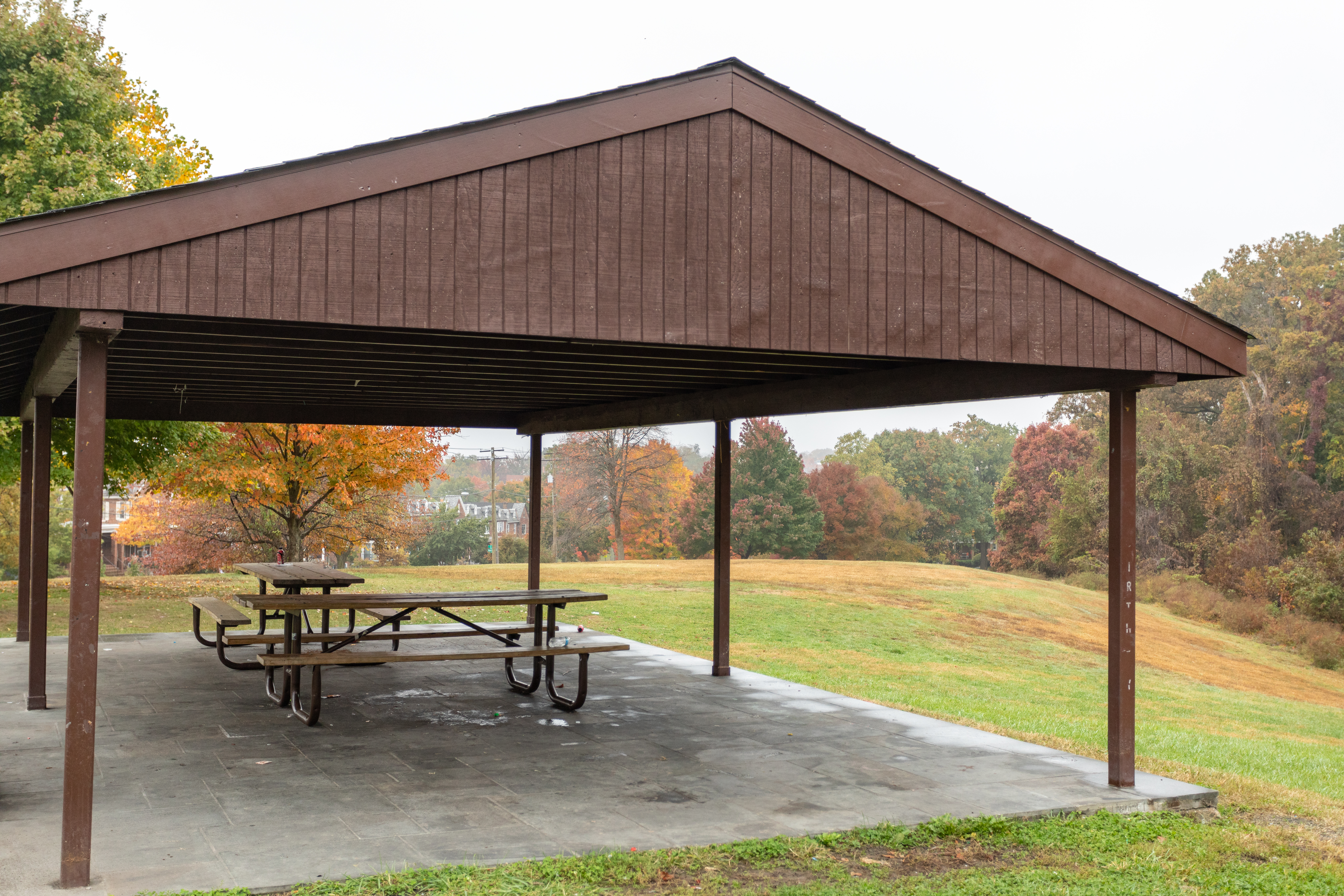
A picnic table sits alongside a path under the shade of tall trees.
Junior Ranger Programs at National Capital Parks - East
Become a Junior Ranger at parks across National Capital Parks – East! Explore, complete a booklet, and earn badges and certificates along the way!
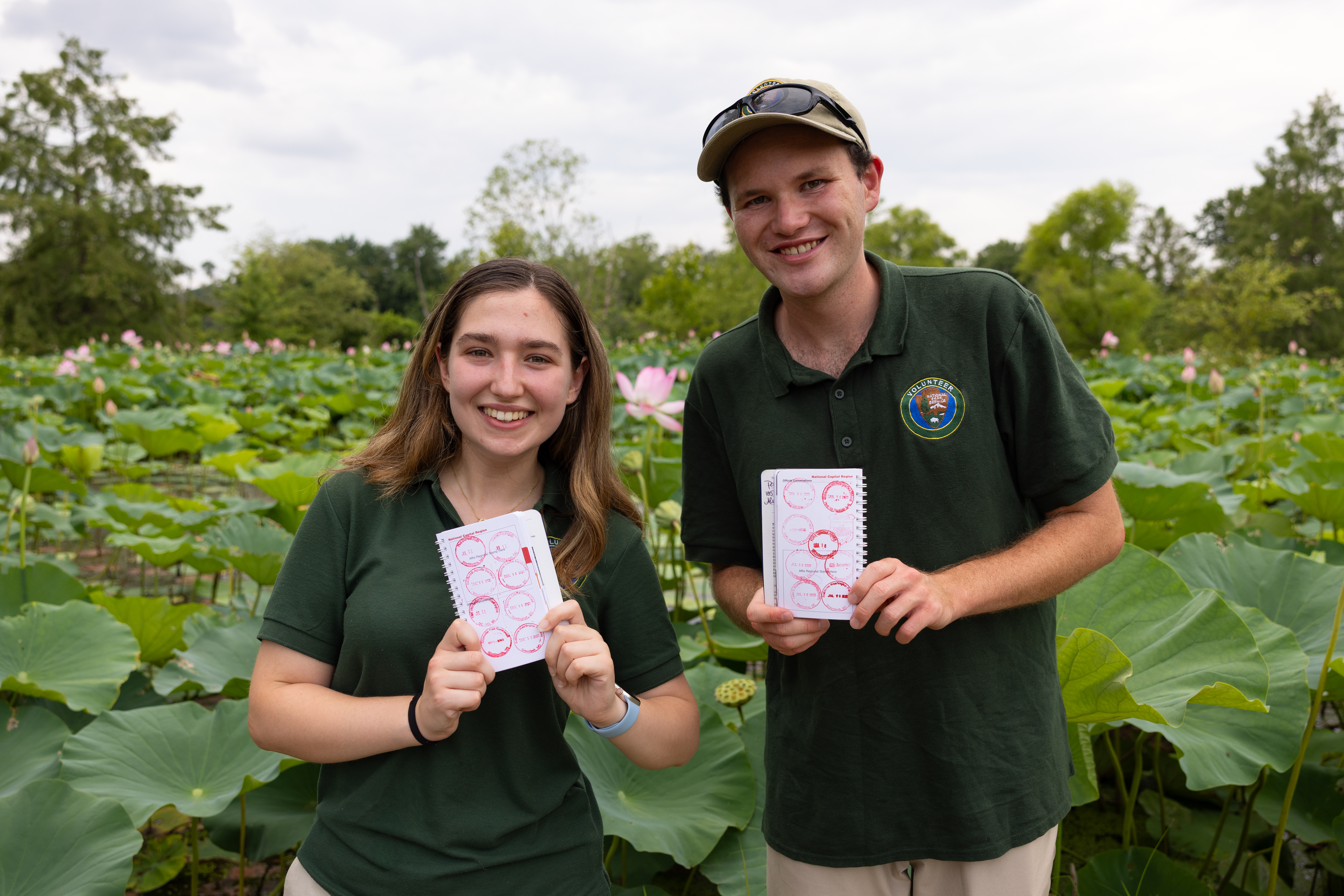
Collect all the National Capital Parks - East Passport Stamps
Start your stamp collection and celebrate every park you visit! Explore historic sites and scenic parks managed by National Capital Parks - East and collect a unique stamp at each one.
Watch an Artillery Demonstration at Fort Washington Park
Ever wonder how Civil War cannons were fired? Visit the park the first Sunday of every month from May to November to watch the Fort Washington Guard demonstrate and explain the procedures used during the muzzle-loading era of American Artillery.
Hike the Northern Loop in Rock Creek Park
Enjoy an easy 5-mile round trip hike around the northern section of Rock Creek Park.