Be advised that the NPS has issued alerts for this park.
Many Roads Closed due to Flooding
Badwater Road, North Highway, and some other roads are still closed due to damage by flash floods on 9/19/2025. Click "More" for a full list of closures.
Emigrant Campground and Restroom Closed
Emigrant Restrooms and Campground are closed due to storm damage to the water supply system. Access to the day use area is still open.
Gas Pumps at Panamint Springs Resort are Closed at Night
Gasoline is available at Panamint Springs Resort from 7am-9:30pm, daily. Gas is available at Furnace Creek and Stovepipe Wells 24hrs.
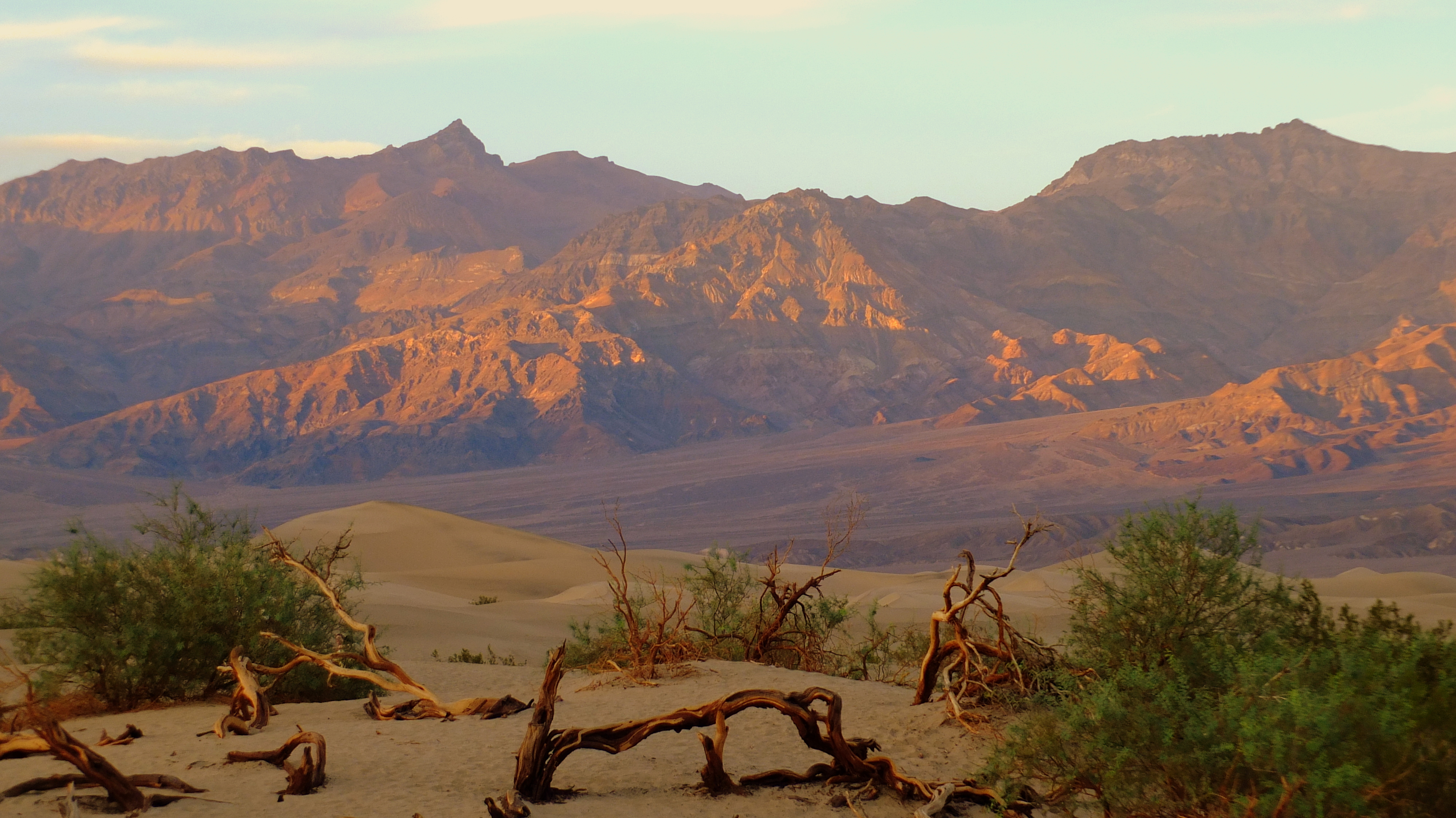
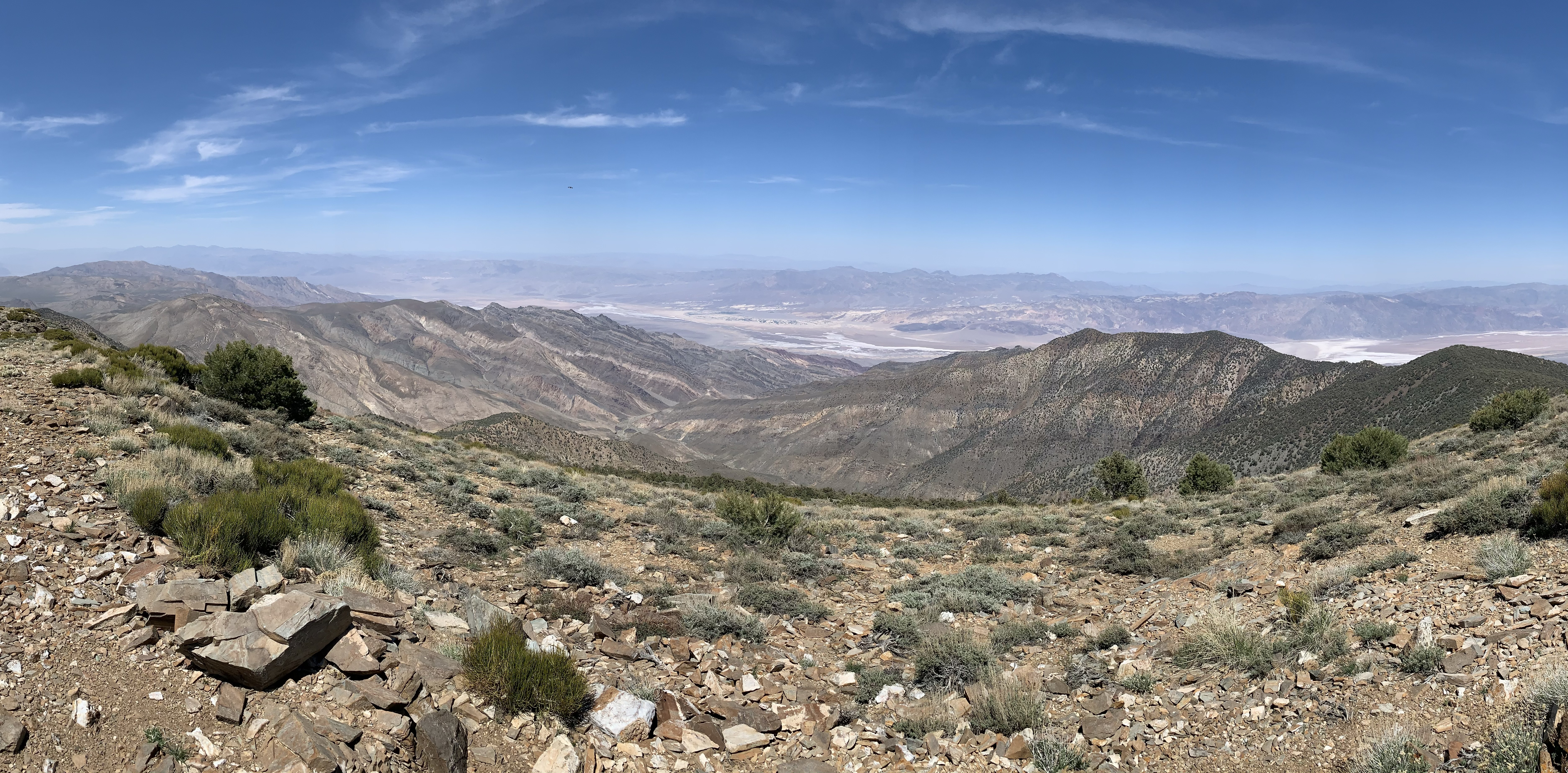
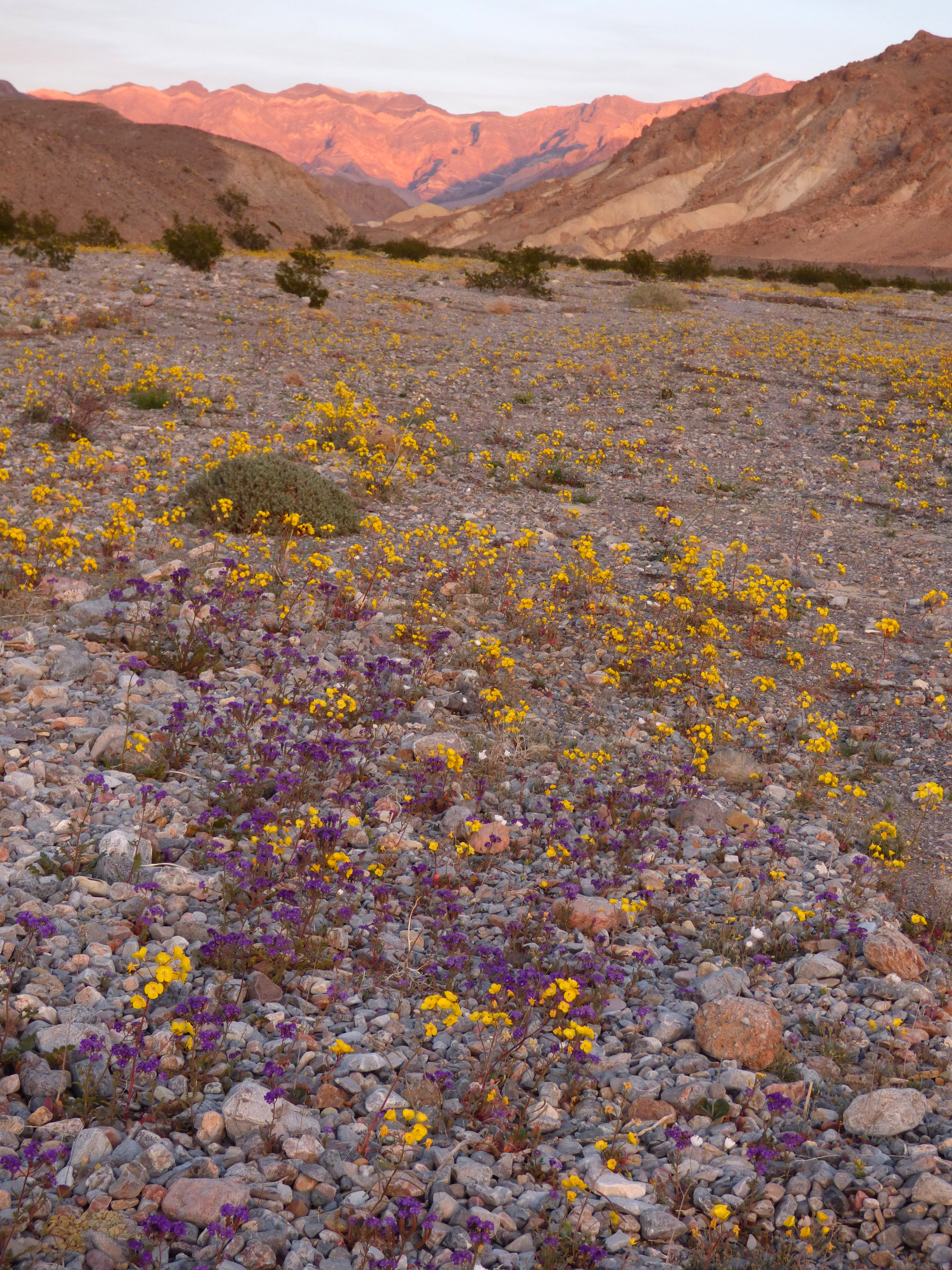
In this below-sea-level basin, steady drought and record summer heat make Death Valley a land of extremes. Yet, each extreme has a striking contrast. Towering peaks are frosted with winter snow. Rare rainstorms bring vast fields of wildflowers. L...
This permit allows all persons traveling with the permit holder in one single private, non-commercial vehicle (car/truck/van/RV/aircraft) to leave and re-enter the park as many times as they wish during the 7-day period from the date of purchase.
Entrance - Motorcycle
$25.00
This permit allows persons traveling on one motorcycle to leave and re-enter the park as many times as they wish during the 7-day period from the date of purchase.
Entrance - Per Person
$15.00
This permit allows a single individual traveling on foot or individuals traveling on one bicycle to leave and re-enter the park as many times as they wish during the 7-day period from the date of purchase.
Commercial Entrance - Per Person
$10.00
1 - 6 Passenger Vehicle: $25 + $10 per person.
In addition to the entrance fees listed below, additional permits are required for commercial groups, special park uses (weddings, memorialization, group events, etc.), commercial film and photography, research, and more.
Commercial Entrance - Sedan
$25.00
1 - 6 Passenger Vehicle: $25 + $10 per person
In addition to the entrance fees listed below, additional permits are required for commercial groups, special park uses (weddings, memorialization, group events, etc.), commercial film and photography, research, and more.
Commercial Entrance - Van
$75.00
7 - 15 Passenger Vehicle: $75
In addition to the entrance fees listed below, additional permits are required for commercial groups, special park uses (weddings, memorialization, group events, etc.), commercial film and photography, research, and more.
Commercial Entrance - Mini-bus
$100.00
16 - 25 Passenger Vehicle: $100
In addition to the entrance fees listed below, additional permits are required for commercial groups, special park uses (weddings, memorialization, group events, etc.), commercial film and photography, research, and more.
Commercial Entrance - Motor Coach
$200.00
26 + Passenger Vehicle: $200
In addition to the entrance fees listed below, additional permits are required for commercial groups, special park uses (weddings, memorialization, group events, etc.), commercial film and photography, research, and more.
Entrance - Non-commercial Groups
$15.00
Non-commercial Groups (e.g., Scout groups, church groups, etc.) entering in a vehicle with a capacity of 16 persons or more are charged per-person for each person on board, not to exceed $200.
Entrance - Education/Academic Groups
$0.00
National Park Service regulations allow school groups and other approved national and international academic institutions to obtain a waiver of Park entrance fees, provided that visit is for educational or scientific purposes, and the resources or facilities that the group intends to use, support those purposes. Submit your waiver through the link below at least one month prior to your visit.
Campground is a flat, square-shaped, open, rocky, gravel space. 6 to 12 inch rocks are laid out in a line to mark the outside perimeter of the square campground. Lines of loose rocks extend into the open area to mark the boundaries of each of 10 tent spaces. Each space is approximately 30 feet wide by 40 feet deep. A metal picnic table is just inside the outer boundary of each space. The restroom is just outside the campground. A narrow, uneven gravel and rock social trail extends from the north-east corner of the campground 270 feet to a stone building. This building is the Emigrant wash room which sits along an asphalt road to the parking area beyond. Doorways to the bathrooms are behind privacy walls which open toward the parking area, women on the right side and men on the left side of the building. Gender signs are high above the privacy wall entrances. View to the far south is rounded hills with sharply eroded canyons. View to the east is the open end of a valley which opens to the pale brown floor of the rest of Death Valley. Low shrubs and rocky desert terrain surrounds the campground.
During the cooler winter season, the campground is fully open. Reservations are accepted from October 15 to April 15. Make reservations from 5 days to 6 months in advance by calling 877-444-6777 or visiting www.recreation.gov. The remainder of the year, the campground reduces to 41 sites and is first-come, first-served. Note: The NPS reserves the right to hold reserved sites at any time due to management needs.
This campground is first-come, first-served. No reservations are available.
A single lane road 12 feet wide made of dirt and gravel with 1 foot wide embedded and loose rocks, enters the campground to the left of a sign that reads Mahogany Flat Campground, Elevation 8133 Feet. Starting 120 feet out the road, turn into each of three campsites on the right. Each has a metal non-ADA table and a fire ring. A single-room vault toilet is between the second and third site on the right. Starting 80 feet further downslope along the road, turn into four tent sites on right with metal non-ADA tables and fire rings. Overlook views of Death Valley between trees on far side of each site. 400 feet further downslope is a loop at the end of the road with two trees in the center of the road loop. Two campsites are to the right with metal non-ADA tables and fire rings. One site is at the far end of the road loop and has a stone fire pit. Thick, downed tree trunk logs scatter throughout the sites of this campground. The whole campground area sits on top of a mountain with scattered trees and sloping edges.
The campground is first-come, first-served. NPS reserves the right to reserve sites for management needs. Occupy your site first, then pay using the automated fee machine.
Campground pay station and informational bulletin board is at the end of the dirt entrance road at a Y-shaped intersection. Wood sign reads “generator hours 7am to 7pm.” Glass-enclosed bulletin board to left has several signs, including no-drone zone, campsites $14 per night or $7 with access pass, and a park map. Directly across dirt road from pay station is a RV dump site and potable water fill. Continue right at this Y-intersection to a crescent-shaped asphalt main loop. Five roads bisect the main loop by turning left. The first road has a restroom building, the next four have additional camp sites. Campground host, in season, is at site 1 on left of main road after the first bisecting road. Each campsite includes a metal picnic bench and low-set metal fire ring. Some sites also include a pole-mounted bbq. The campground has two flush restroom buildings. An ADA accessible restroom is on the fourth bisecting road, to the left of site 35. Two asphalt paths extend from the campground road, one each to the gendered restrooms on both end of a brick and wood building. A center door opens to a dish washing sink. The restroom on the first bisecting road has an identical building but with loose gravel approaches to the doors. Sites on outside of loop on south side of campground end with a sharp drop off of about 10 feet into Death Valley Wash.
All sites are first come, first served, however NPS reserves the right to hold sites for administrative needs at any time.
The campground is rectangular shaped, approximately 500 feet wide and 600 feet deep. At the entrance, there is a campground fee collection area to the right at a stop sign. An automated fee machine is labeled “pay fee here.” A dark brown informational bulletin board with a glass window is to the left of the fee station. Signs behind the glass include campground rules, do not feed wild animals, and rules for pets in the campground. 170 feet straight beyond the entrance is the campground’s restroom. Restroom is a beige metal building with privacy walls extending from the sides. Men’s room is to the left, women’s room to the right. A square concrete area extends from the center of the building about 15 feet. There is an approximately three inch step up to the concrete surface from the surrounding gravel. An overhang roof structure to the west of the restroom is over a dishwashing sink. The entire campground surface is gravel. To the right of the entrance is a public picnic area with three metal tables. To the left of the entrance are eight group tent sites. Four long rows of RV spaces are perpendicular to the entrance road. These spaces are designated by curbs and posts at the back, center of each site. About 20 tent-only spaces with metal picnic tables line the north border of the campground. No other spaces have tables, and there are no fire rings in the campground. The campground is surrounded by a wide expanse of rocky desert valley floor with short mesquite bushes. Tall mountains with sharply eroded canyons border the valley floor on all sides.
The campground is first-come, first-served, however the NPS reserves the right to reserve sites for management needs. Occupy your site first and then pay using the automated fee machines or head across to the Furnace Creek Visitor Center to pay your fee.
This campground is first-come, first-served. No reservations are available.
Tall trees surround campsites and line both sides of a U-shaped road that intersect the main road on the east side. A post with a light brown tent symbol and wooden sign reading Thorndike Campground marks the upper entrance. The road is 12 foot wide hardpacked dirt and gravel with 6 inch wide rocks. It runs parallel to and about 20 feet higher than the main road. The first campsite is 60 feet out the road and a tight right turn. 100 feet further, two sites are laid out across the road from each other. The site on the right has six stone stairs that lead to a flat camping space. The site on the left is a multi-level space with a tent site up and to the left. Fire rings and metal benches are in each site. A one-room vault toilet is 230 feet down slope on right side of the loop. To the right of the vault toilet and 15 feet beyond the fire pit is a steeply sloped campsite. The road curves left and meets the main road in a T-shaped intersection. The whole campground area is a mountain valley with pine trees.
An asphalt entrance road leads up to an open dirt and gravel area about 100 ft wide followed by a figure 8 of 2-interconnected loops. Within the first open space there are three campsites on the dirt to the left and four to the right. Metal non-ADA picnic tables are located at each site. A single-room vault toilet is on the left beyond the third tent space. A brown bulletin board sign with glass is on the right side halfway through the loop immediately after the second site. A wooden sign is bolted to the bottom of the bulletin board, reading “Generators 7 am – 7 pm.” Signs behind the glass include “do not feed wild animals,” “high wind advisory,” “the use of metal detectors is not allowed in national parks” and “no drones.” Space #3, 20 feet past the sign has a wheelchair accessible picnic table. From the vault toilet to the left, an 8 foot wide dirt path with two S-shaped curves continues uphill, leading to two tent sites. From the vault toilet 25 ft to the right, a potable water spigot is on the far side of bushes. Beyond the toilet is the figure 8 of two loops of campsites with several campsites each. Potable water is available at a spigot in the center, half way into the first loop. The whole campground area sits in a valley surrounded by rolling hills. Low bushes are scattered throughout the campground and surrounding area.
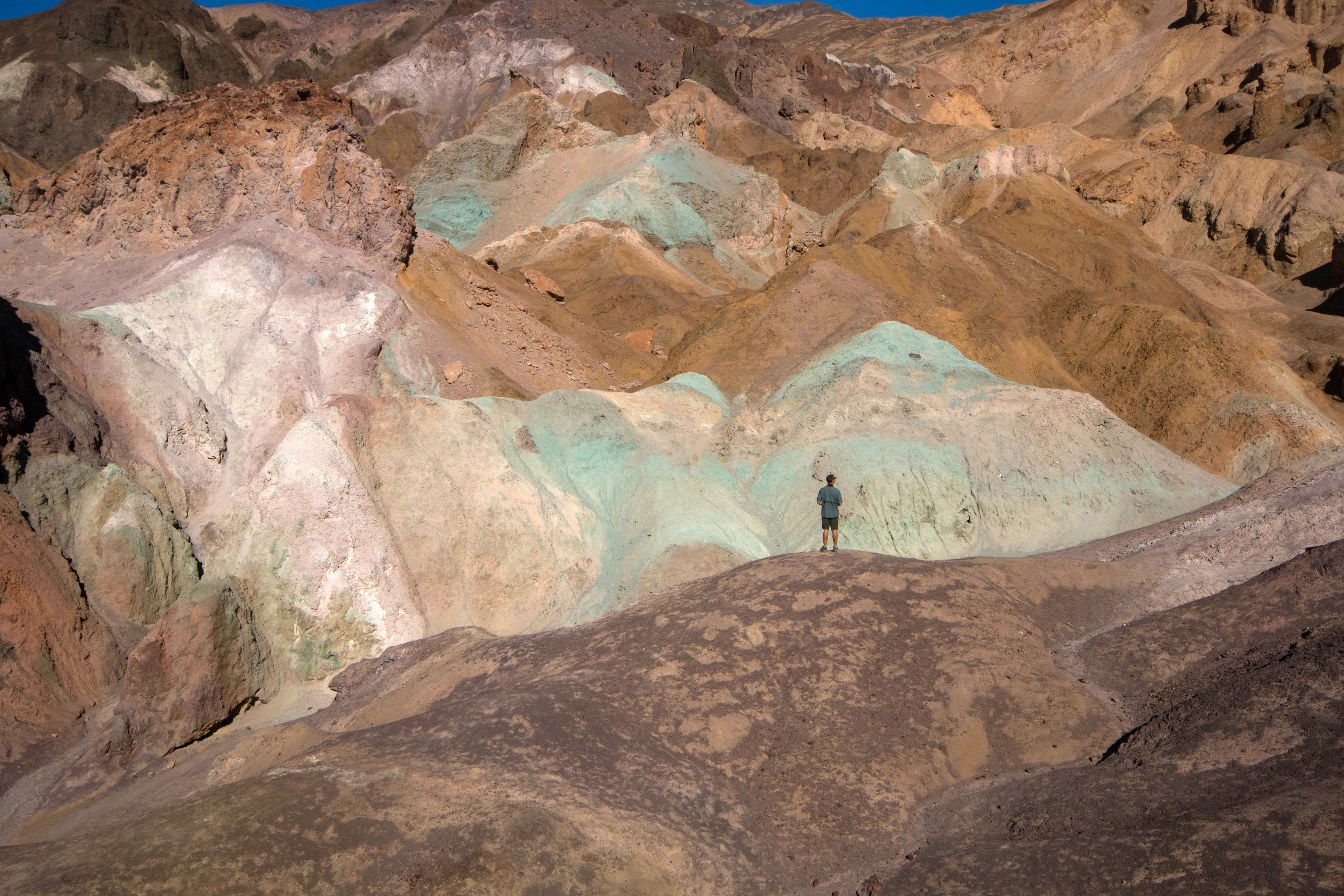
This scenic vista offers a stunning glimpse into Death Valley’s colorful volcanic past.
Partially eroded yellow hills free of vegetation, with layers of different colors including blue, red, pink, orange, brown, and green. There is a large wash between the viewpoint and the hills.
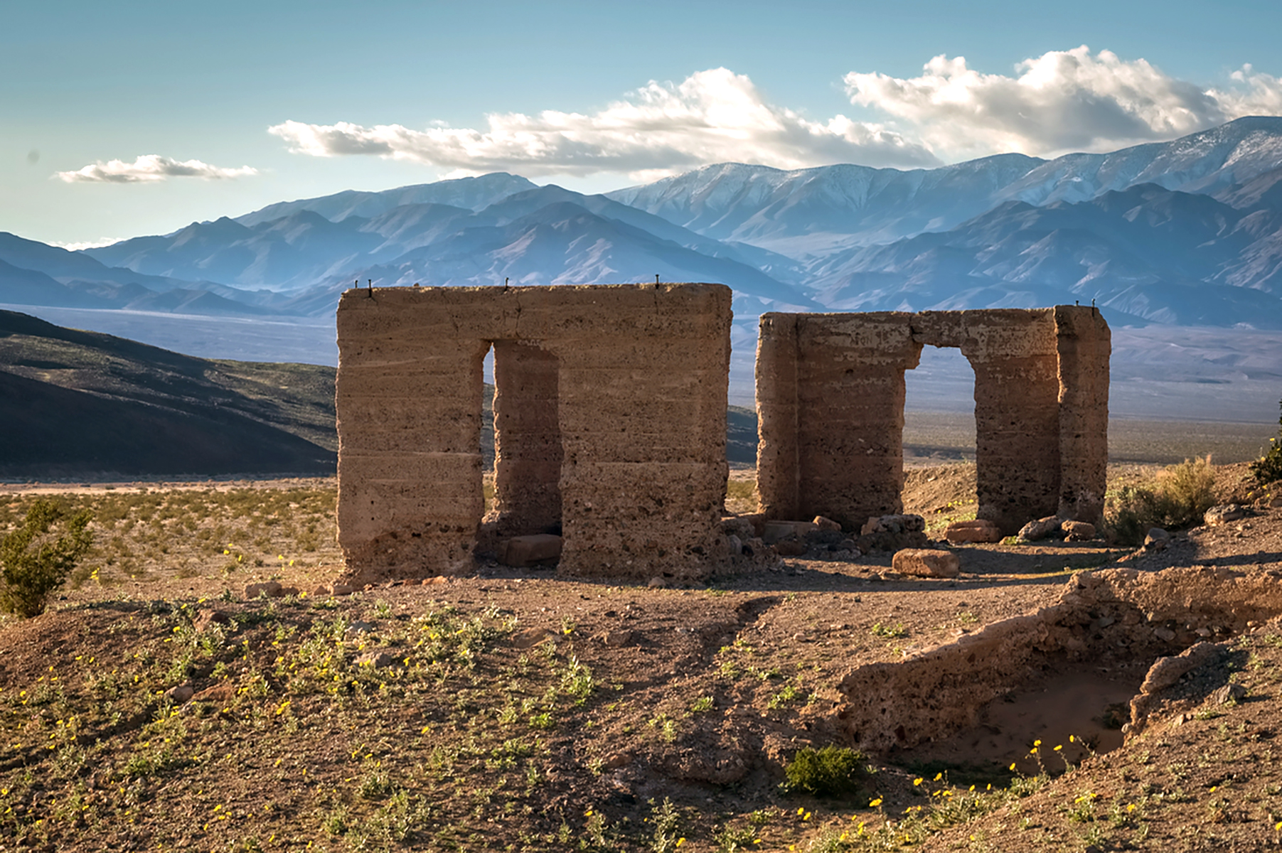
Explore the ruins of the historic Ashford Mill and office building.
Open desert floor with scattered small woody shrubs and mountains to the east and west. There is a crumbling brown concrete ruin, which was once an office building. The ruin has partial remains of three side walls with tall holes for windows/doors. There is no wall on the fourth side, and no roof. Chunks of concrete debris of various sizes are scattered in and around the ruin. There is also minimal ruins of a historic mining mill which include a concrete slab and several upright concrete pillars on the downhill side of a small hill. A butte covered in small shrubs, grasses and volcanic rock rises in the distance to the west. The butte has horizontal lines (terraces) in the earth which were naturally formed by different levels of a long-gone lake.
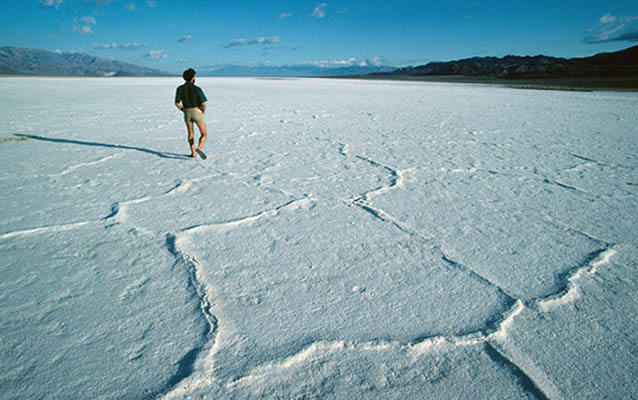
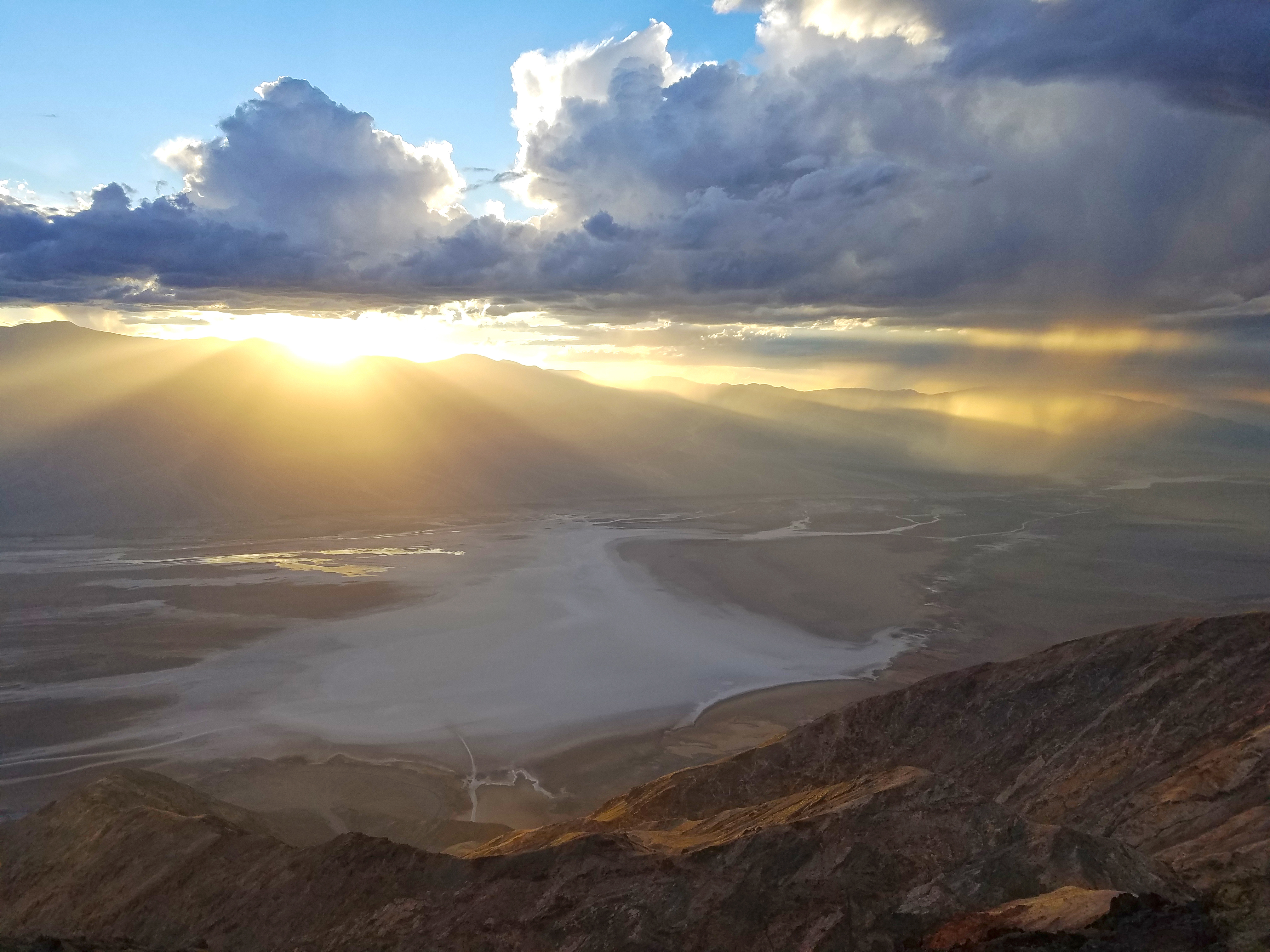
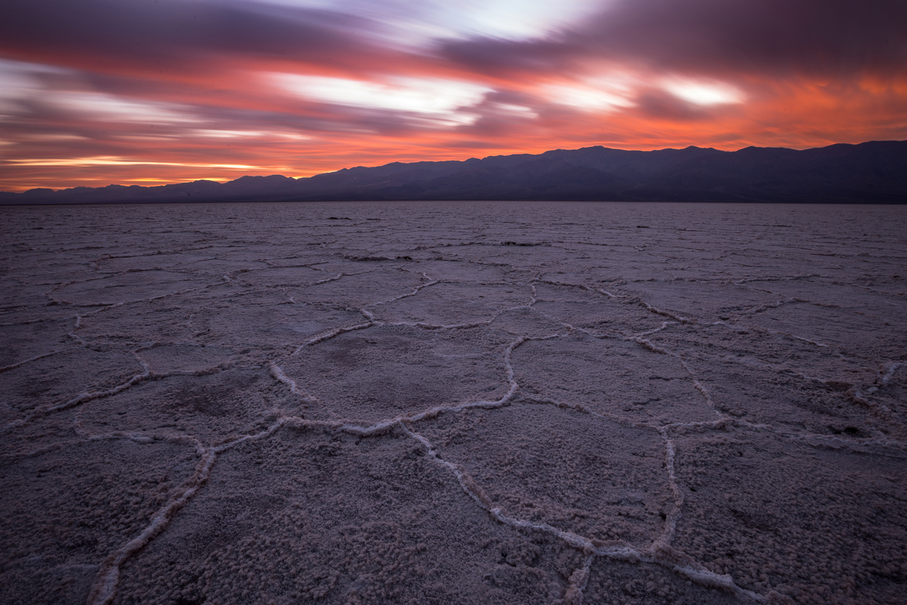
The lowest point in North America is a surreal landscape of vast salt flats. The basin sits 282 feet (86 m) below sea level where a temporary lake may form after heavy rainstorms.
A broad, flat valley surrounded by a tall ridge line of mountains to both the west and east. The valley is covered in white salt, which in some areas forms large raised polygon shapes roughly 2-3 feet (0.6-1 meters) in diameter. The outlines of these shapes are approximately 6 inches (15 centimeters) tall. Areas of brown clay dirt ring the edge of the salt-lined valley. A white railed pathway leads to a wooden boardwalk with a sign that reads "Badwater Basin, 282 feet/85.5 meters below sea level," and a ramp down to the salt flats. There is a shallow pool approximately 20 feet (6 meters) in diameter near the boardwalk, with short bushes scattered near its edge.
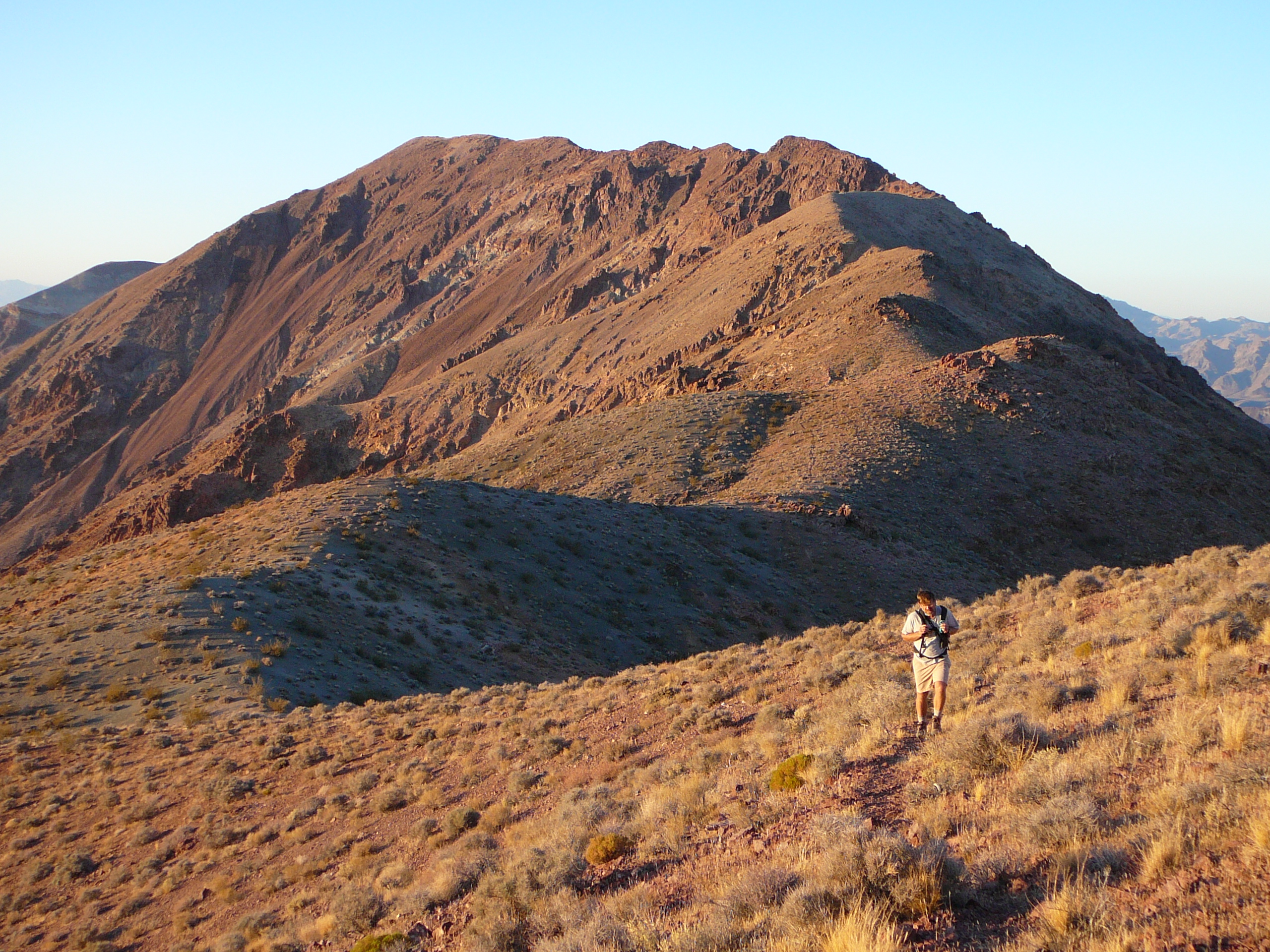
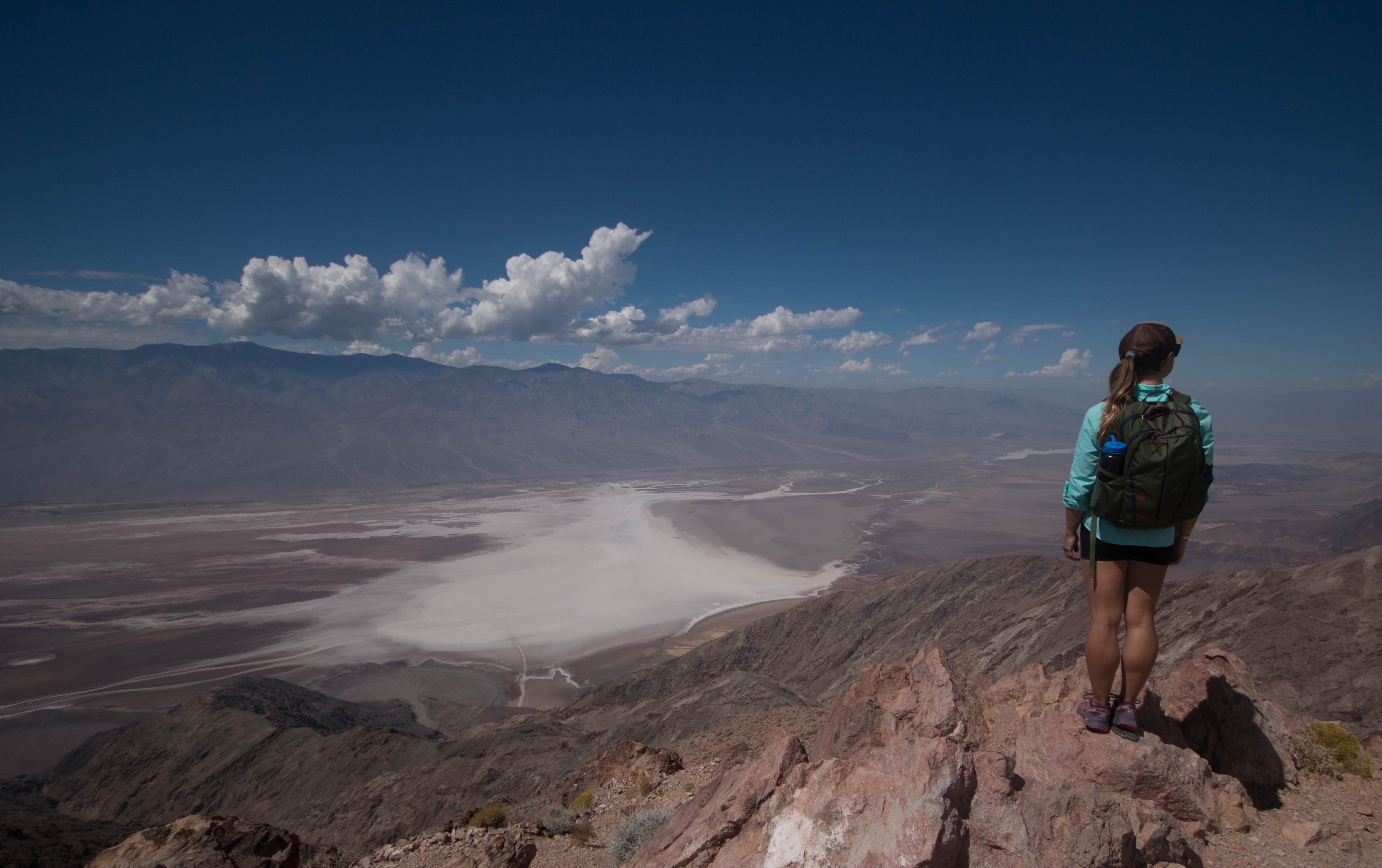
A strenuous hiking route along a ridge to a high point, with stunning views of the floor of Death Valley and the Panamint Mountain Range.
trail overlook a desert valley approximately 5,000 ft (1,500 m) below, covered with white salt and minerals. A rocky brown and gray mountain range runs north-south, on the opposite side of the valley, parallel to Dantes Ridge. The dirt route roughly follows the top of the ridge and leads north from the parking area. There are some clumps of grasses and small woody shrubs along the route, but no trees. Some areas next to the route have clusters of brown jagged rocks. During warmer months there are often lizards of various species which run across or near the route. The route ends at the relatively flat top of Mount Perry, the high point along the ridge. There are open views of desert valley floors and distant mountains to the east the entire way. The route does not go near the edge of the ridge or have any exposed drop-offs. There are several steep sections of the route with slippery, loose dirt as well as uneven areas and areas with large boulders.
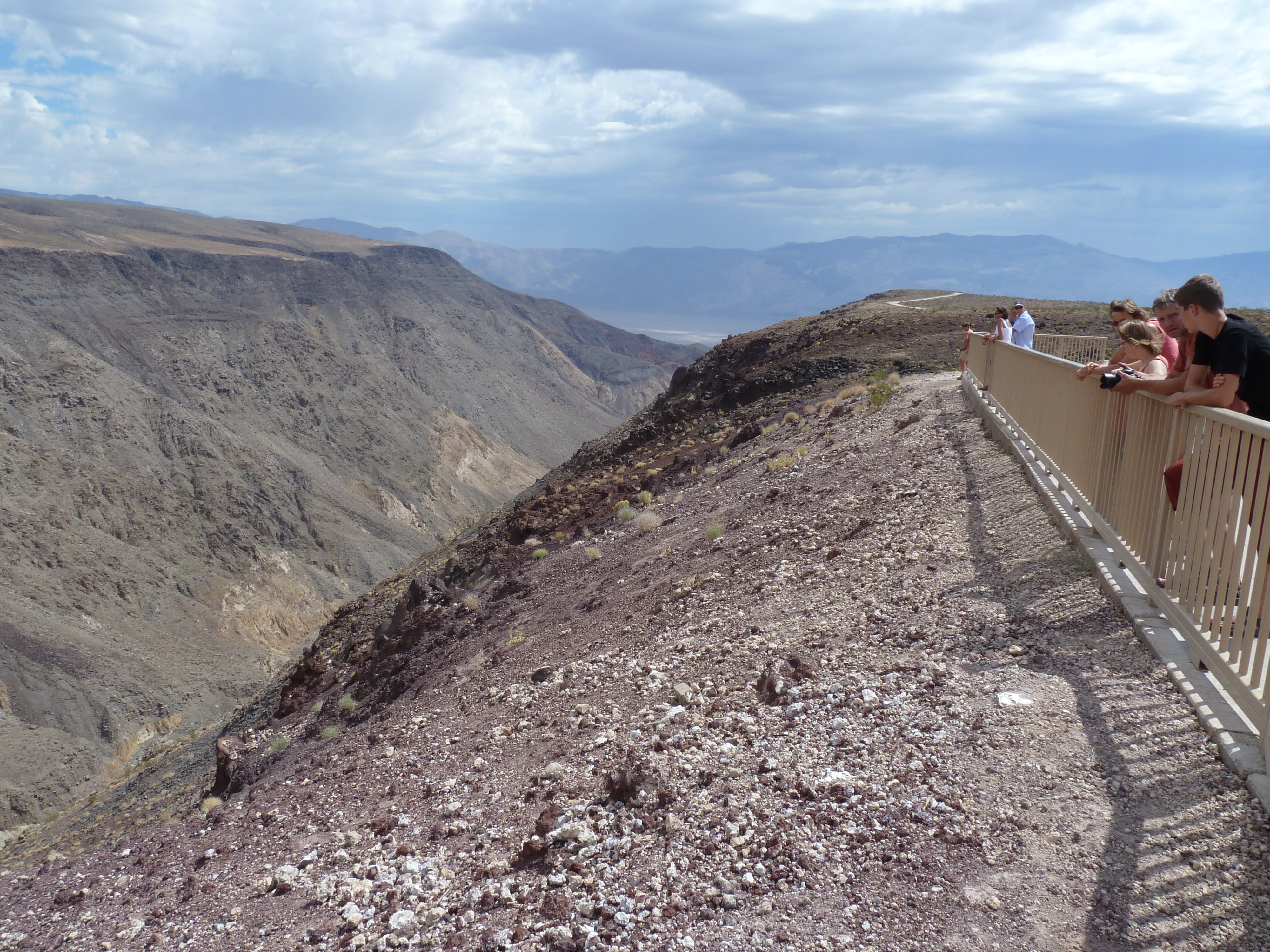
Considered one of the best scenic vistas in the park, Dantes View provides a birds-eye view of Death Valley.
A raised curb separates the viewing area from the parking lot. A 4 foot (1.2 meter) metal fence separates the viewing area from a near-vertical drop of over 5,000 feet (1,525 meters) to the valley floor. The valley floor below is swirling white salt flats. A mountain range rises on the west side of the valley, parallel to the view point. The tallest peak in this range is Telescope Peak, with an elevation of 11,049 feet (3,368 meters).
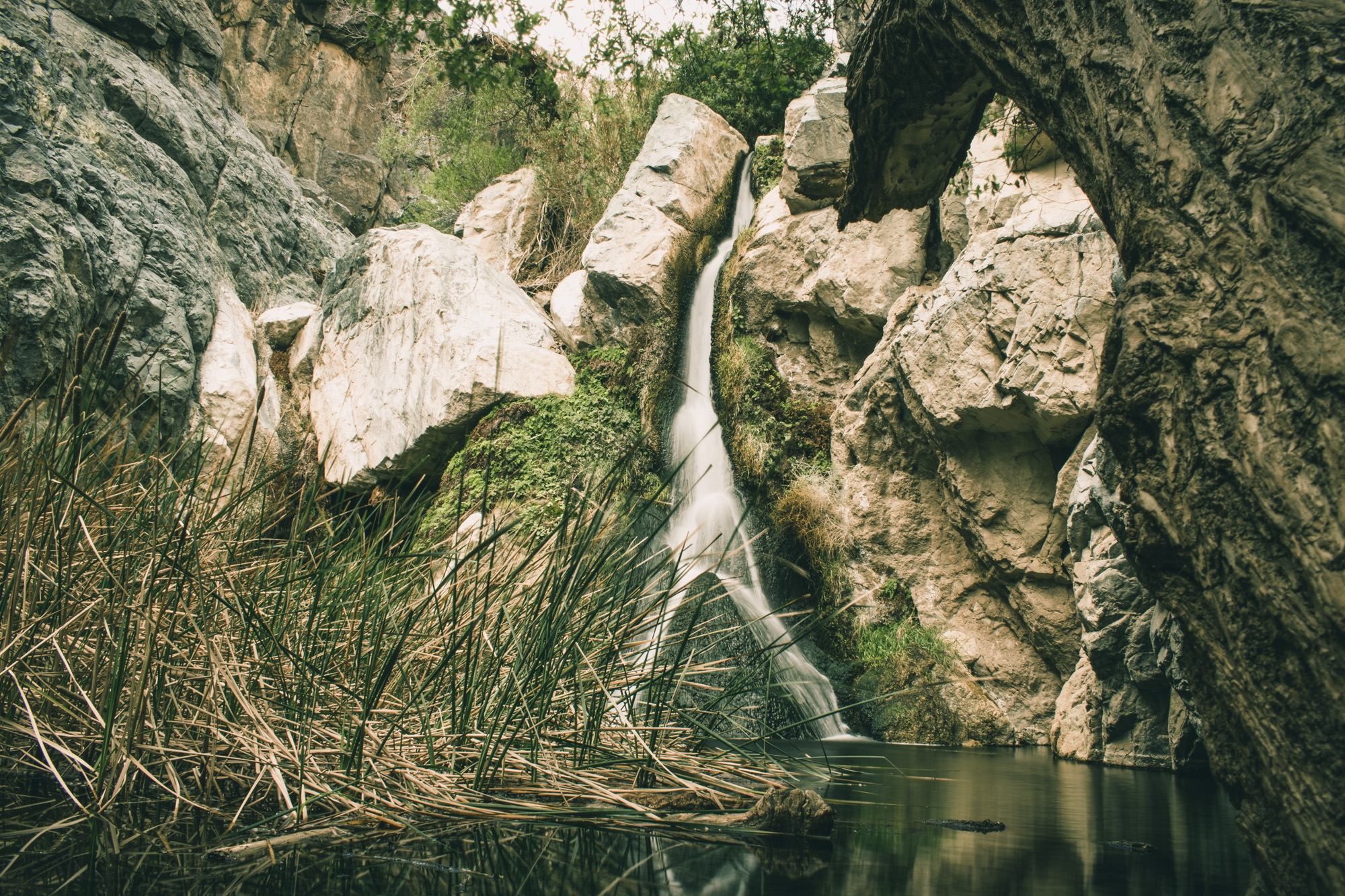
A lush oasis and year-round waterfall in the desert.
The parking area is an uneven dirt lot at the end of a rough gravel road. There is no official trail but the route leads down into a dry desert wash dotted with small plants including creosote and desert holly. Hikers proceed up the wide gravely wash, making several turns as the wash bends between high rocky walls. The canyon walls gradually narrow the farther up you go, and water and willows begin to appear. As hikers proceed farther into the canyon, there is an increasing amount of vegetation including willows and cattails. There are several locations where the unofficial route branches, and hikers must climb over rocks or cross the stream (in some places, hikers have placed logs at crossings to avoid getting wet shoes). There are also areas with low-hanging branches. The route eventually dead ends at a small shallow pool about 20 feet (6 m) across. A rock cliff covered in wet moss rises from the opposite side of the pool and a narrow cascade of water flows over it into the pool, branching over a rock outcropping into and upside down V shape about 1/3 of the total waterfall height above the pool. Cattails grow in the pool to the left of the fall, and ferns cling to the cliff wall to the right of the fall.
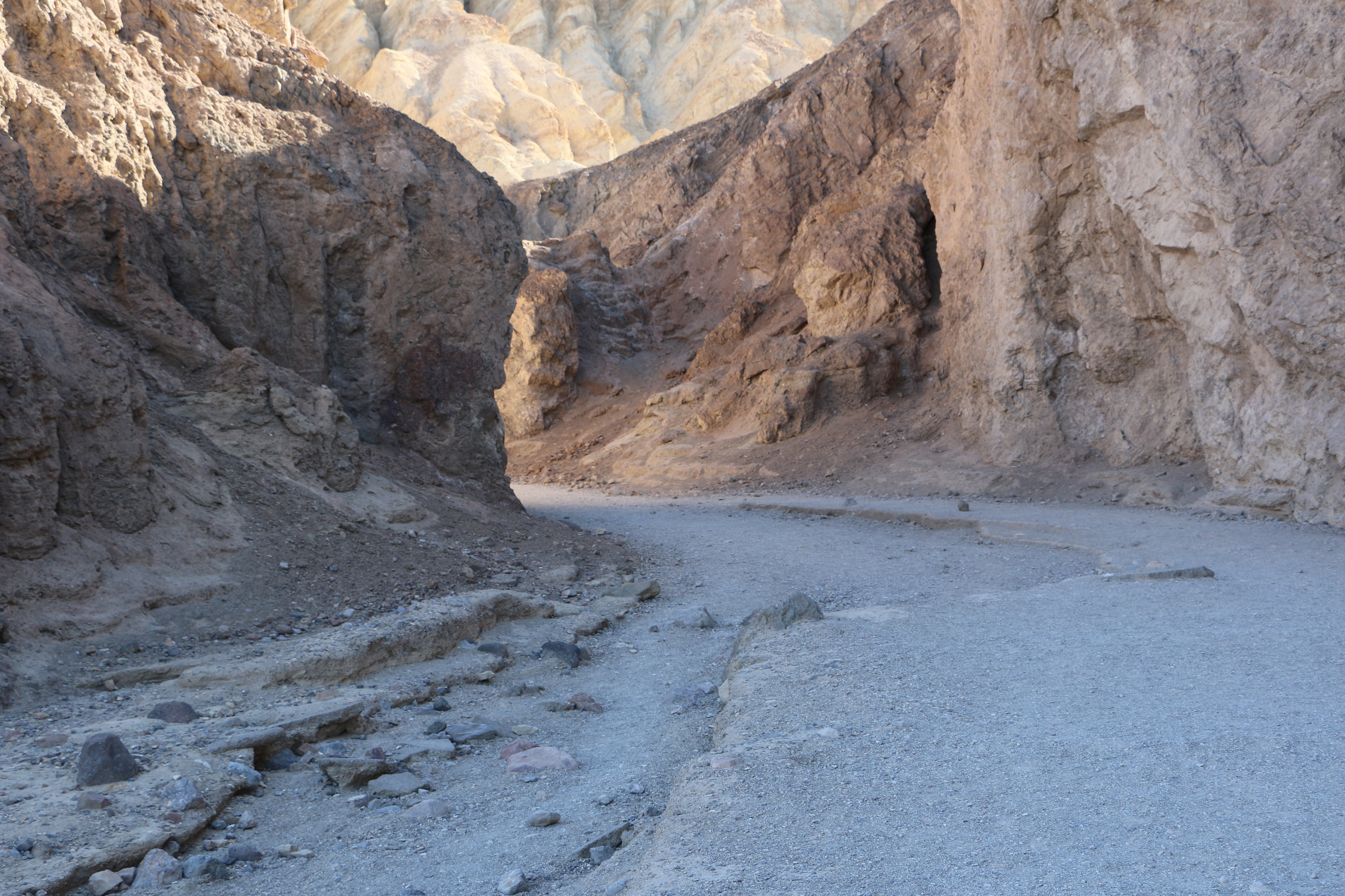
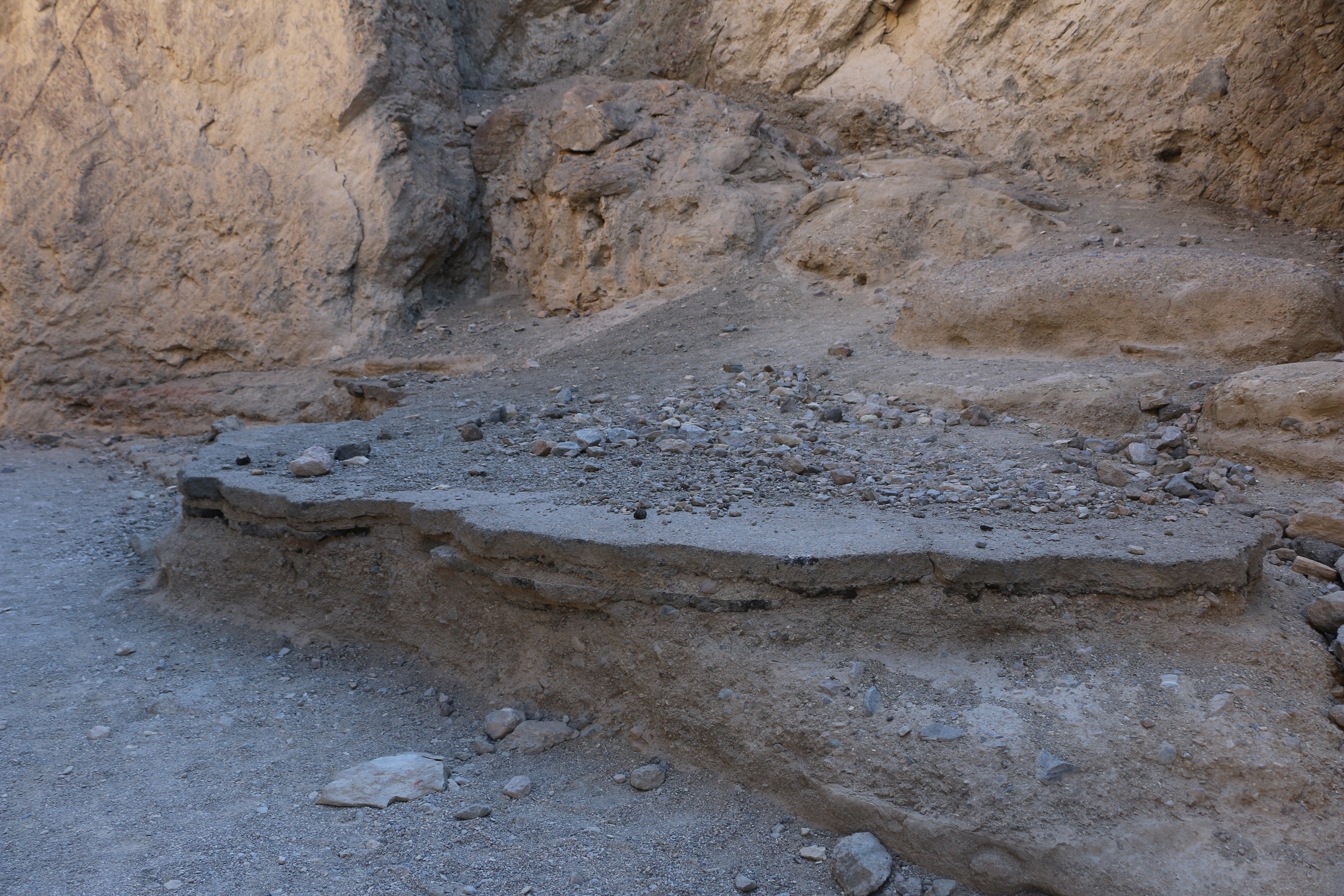
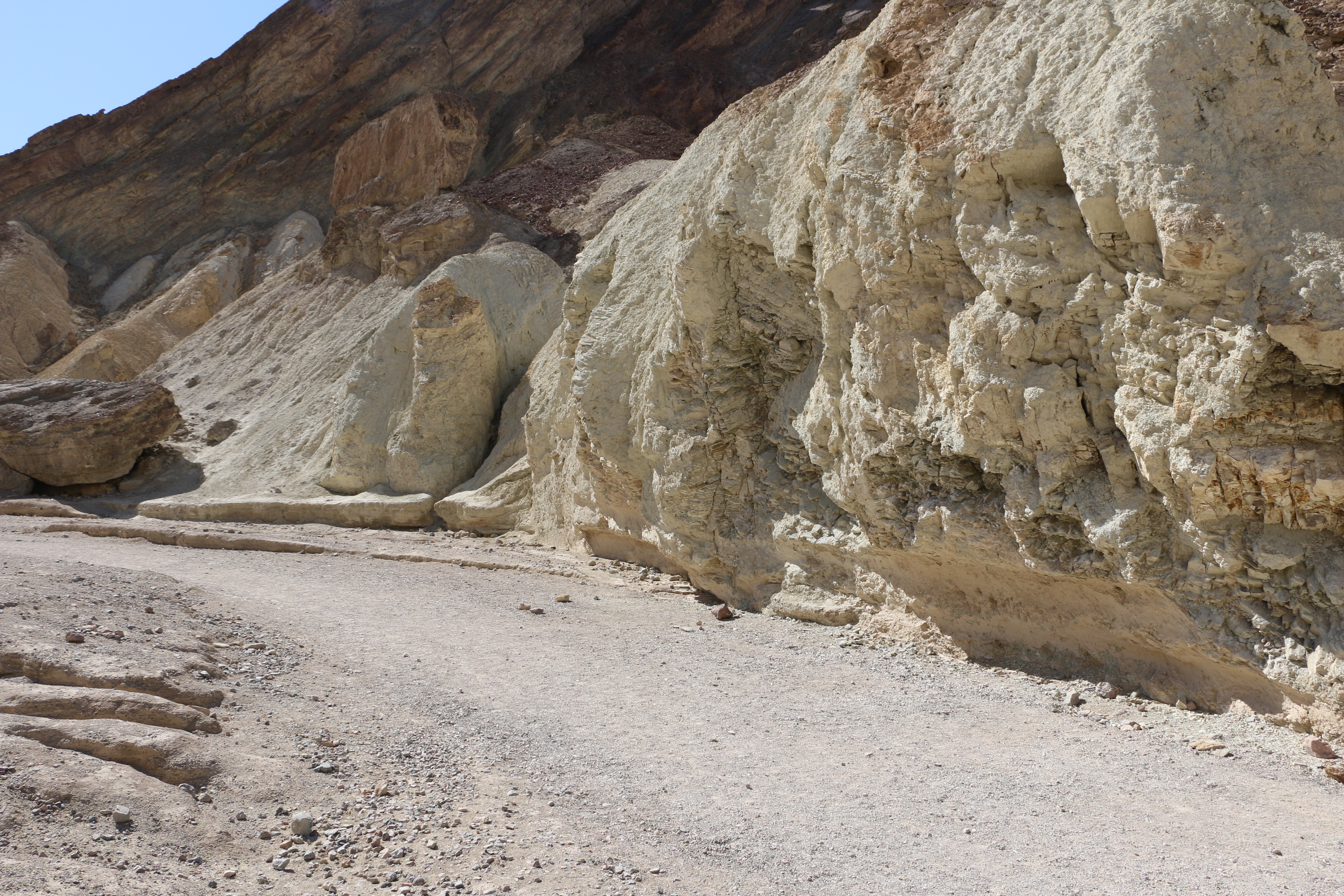
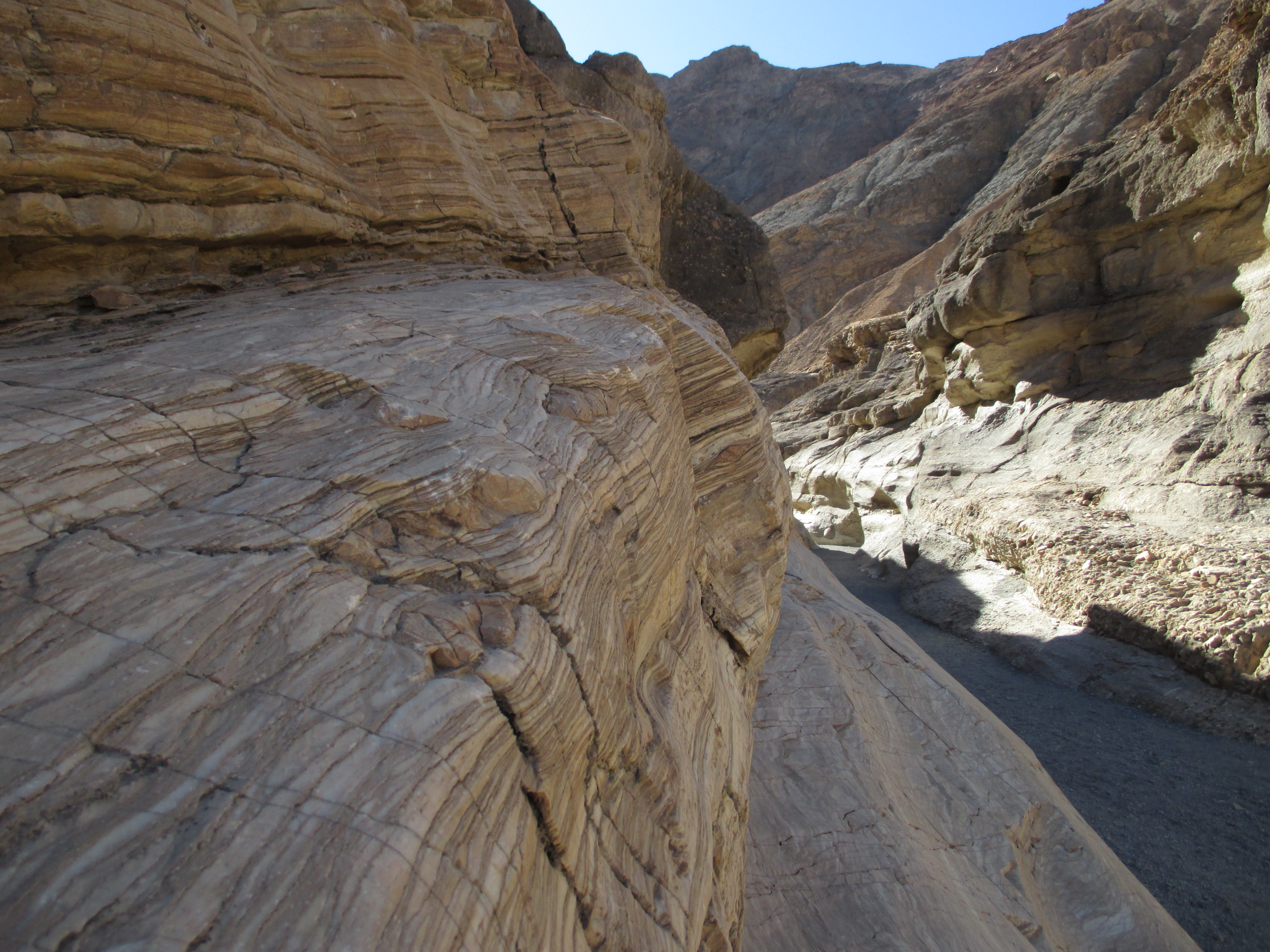
A favorite trail-less canyon for hiking and geology enthusiasts.
Open desert with small washes and brown mountains to the east. Very little vegetation except small plants with few leaves. Walking beyond the dirt parking area brings hikers to a canyon with towering yellow hills/walls on both sides. Some areas of the canyon have mud cracks on the canyon floor and colorful deposits in the otherwise yellow/brown walls.
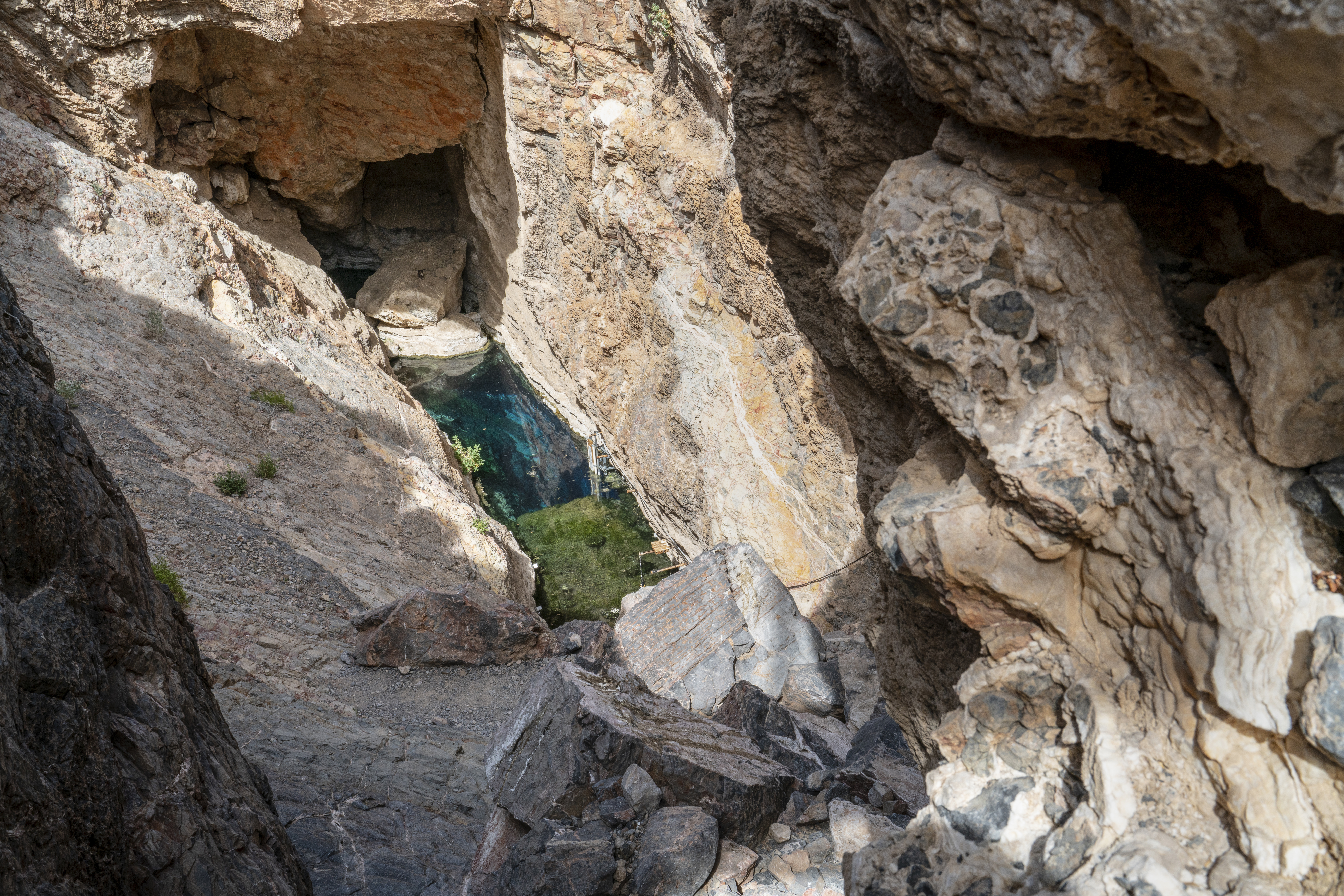
Peer into a vast aquifer in the Mojave Desert to observe one of the most endangered fishes on the planet.
A platform completely encaged with metal fencing provides views of a teal blue pool below. The pool is approximately 70 feet long by 12 feet wide (22 meters by 3.5 meters). Steep rocky cliffs rise nearly vertically from three sides of the pool, and the fourth side is a sloped rocky descent from under the viewing platform.
The Eureka Dunes lie in the remote Eureka Valley, an enclosed basin at 3000 foot elevation located northwest of Death Valley. The dunes cover an area only 3 miles long and 1 mile wide, yet they are the tallest sand dunes in California, possibly the tallest in all of North America. They rise suddenly more than 680 feet above the dry lakebed at their western base. As tall as these dunes are, they are dwarfed by the impressive limestone wall of the Last Chance Mountains.
The route up Fall Canyon is a moderately strenuous hike with towering narrows.
A faint footpath begins at the parking area behind the restrooms and crosses rocky alluvial deposits. The rocks are mostly small, jagged, and various shades of brown. The trail descends steeply into a wash (about an 8 ft/ 2.4 m), and continues up the gravel into the canyon. The canyon walls are striped brown and gray and some sections are close together (approximately 20 ft/ 6 m). Passage is eventually blocked by a vertical smooth gray rock dryfall.
A favorite stopping spot of Death Valley’s beloved priest, Father Crowley Vista Point affords incredible views of Rainbow Canyon and Panamint Valley.
A raised sidewalk and metal fence separate the parking area from the canyon. The canyon drops several hundred feet below the rim where the parking lot is located, and the rim on the far side of the canyon is higher than that on the near side. The exposed canyon walls are striped with different shades of brown, black, yellow and orange rock. To the east, a portion of the floor of Panamint Valley is visible. The valley floor is covered with brown rocks and white sand. Several interpretive signs, and a metal plaque honoring Father Crowley are located along the sidewalk near the rim of the canyon.
The paved parking lot leads to an uneven, undulating gravel area, which gives way to dirt, where the canyon begins. The canyon mouth is approximately 30 feet wide and has walls rising approximately 40 feet overhead. The walls of the canyon are yellow and brown and are composed of large rocks in addition to many small rocks which have been naturally cemented together. There is no actual trail, but hikers follow the dirt and gravel wash of the canyon floor, east into the canyon.
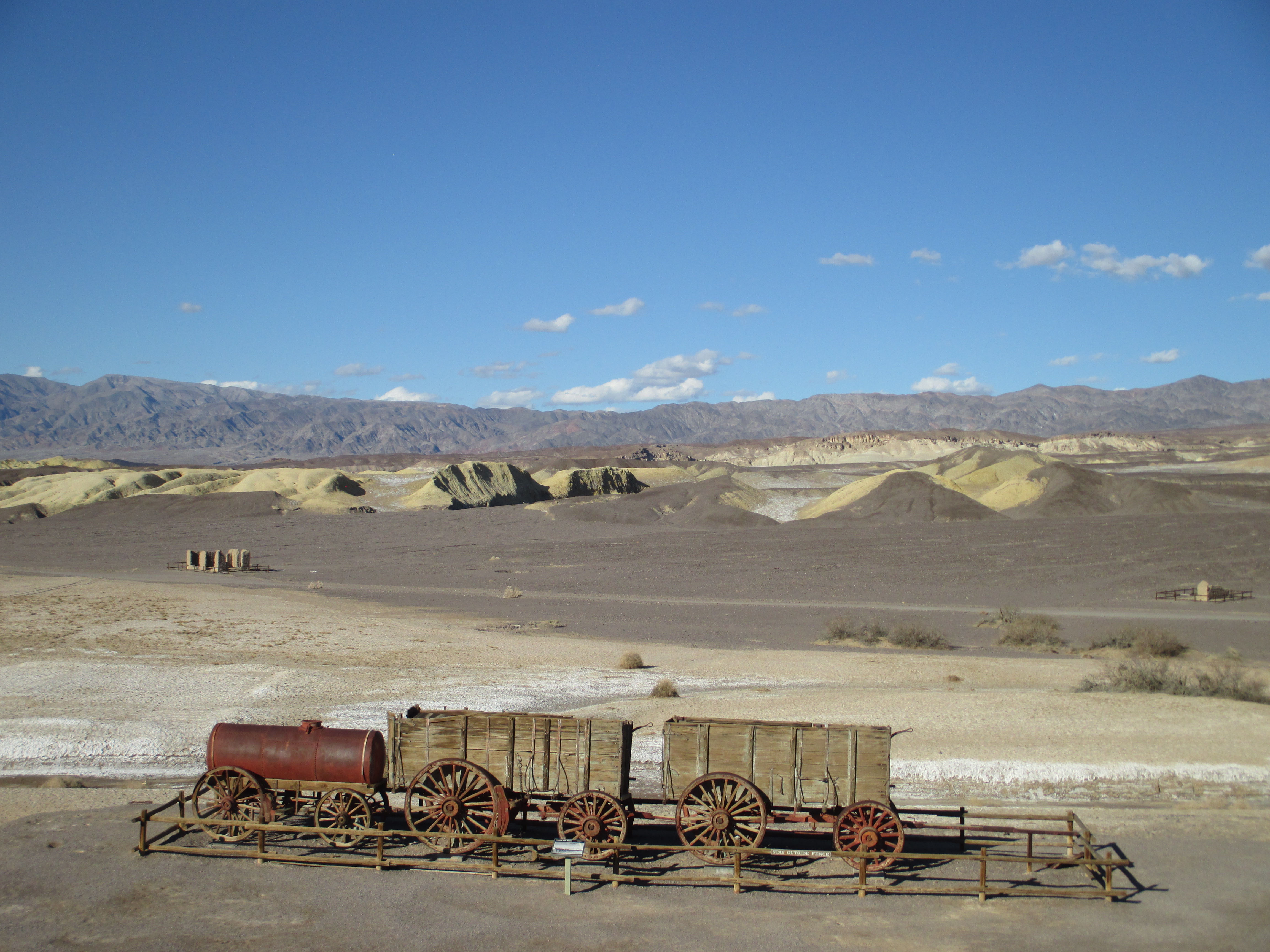
The stories of borax (white gold) and the famous 20-mule teams come to life at this historic borax processing site. Walk: 0.4 mi (0.6km)
Yellow and beige adobe walls and rusty red metal vat ruins of a late 1800s borax processing plant. The ruins are built on a hill, and are two stories tall. There is no roof, and no glass in the windows. A 20 Mule Team wagon is parked below the ruins. This wagon consists of two large wooded wagons hitched together, with a rusty red water tender on wheels, hitched to the back.
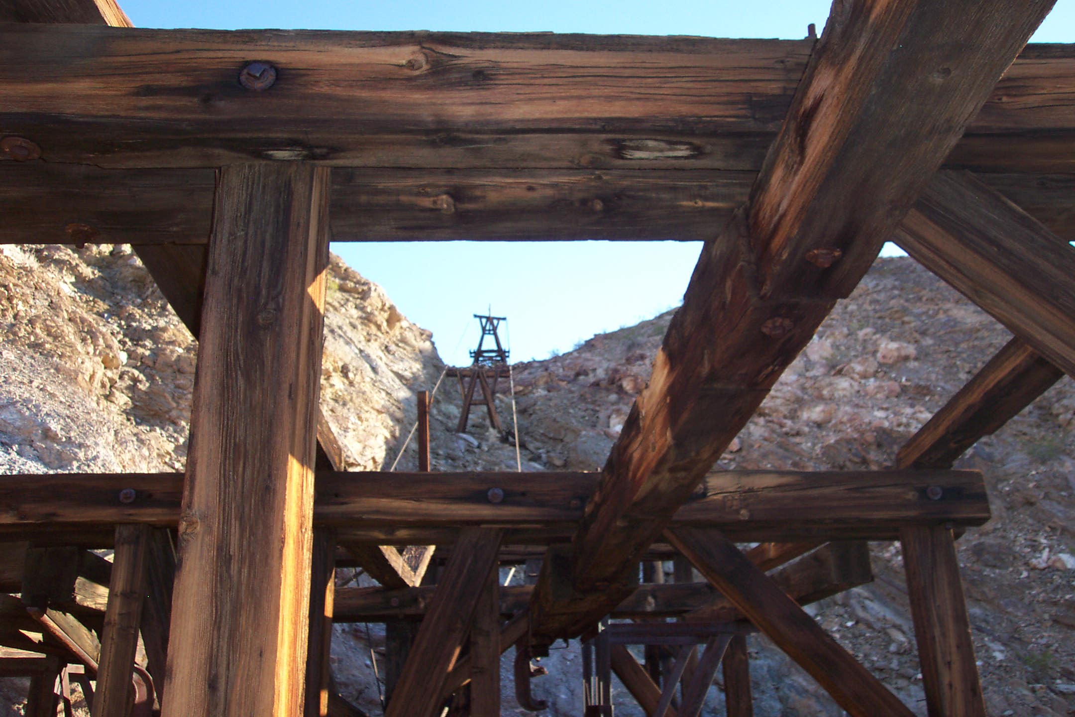
Explore the remains of one of the most productive gold mines in Death Valley history.
A short walk from the parking area up a dirt road brings visitors to the historic mill and lower tramway terminal. These structures sit at the base of a gray rocky cliff, with taller Funeral Mountains beyond. The buildings are open air, several stories tall, and are constructed of large wooden timbers. A ravine runs behind and around the mill, with grated vertical mine openings on the opposite bank.
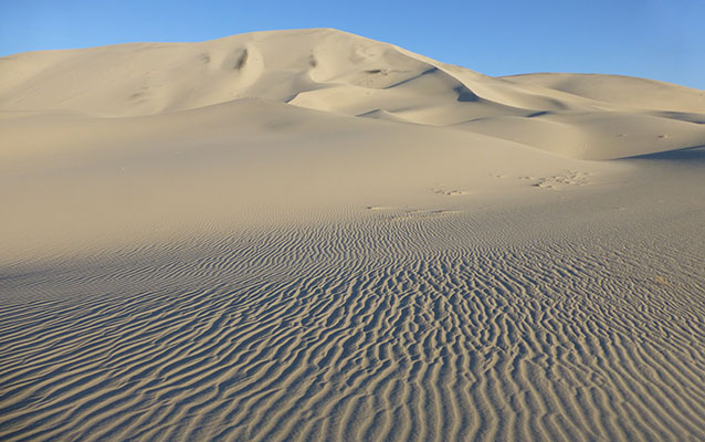
White sand dunes sprawl across a desert valley floor, the tallest just under 100 ft (30 m). The dunes are punctuated by plants- mostly Creosote bushes and Mesquite trees, and separated by areas of cracked gray mud. Mountains rise on all sides of the valley.
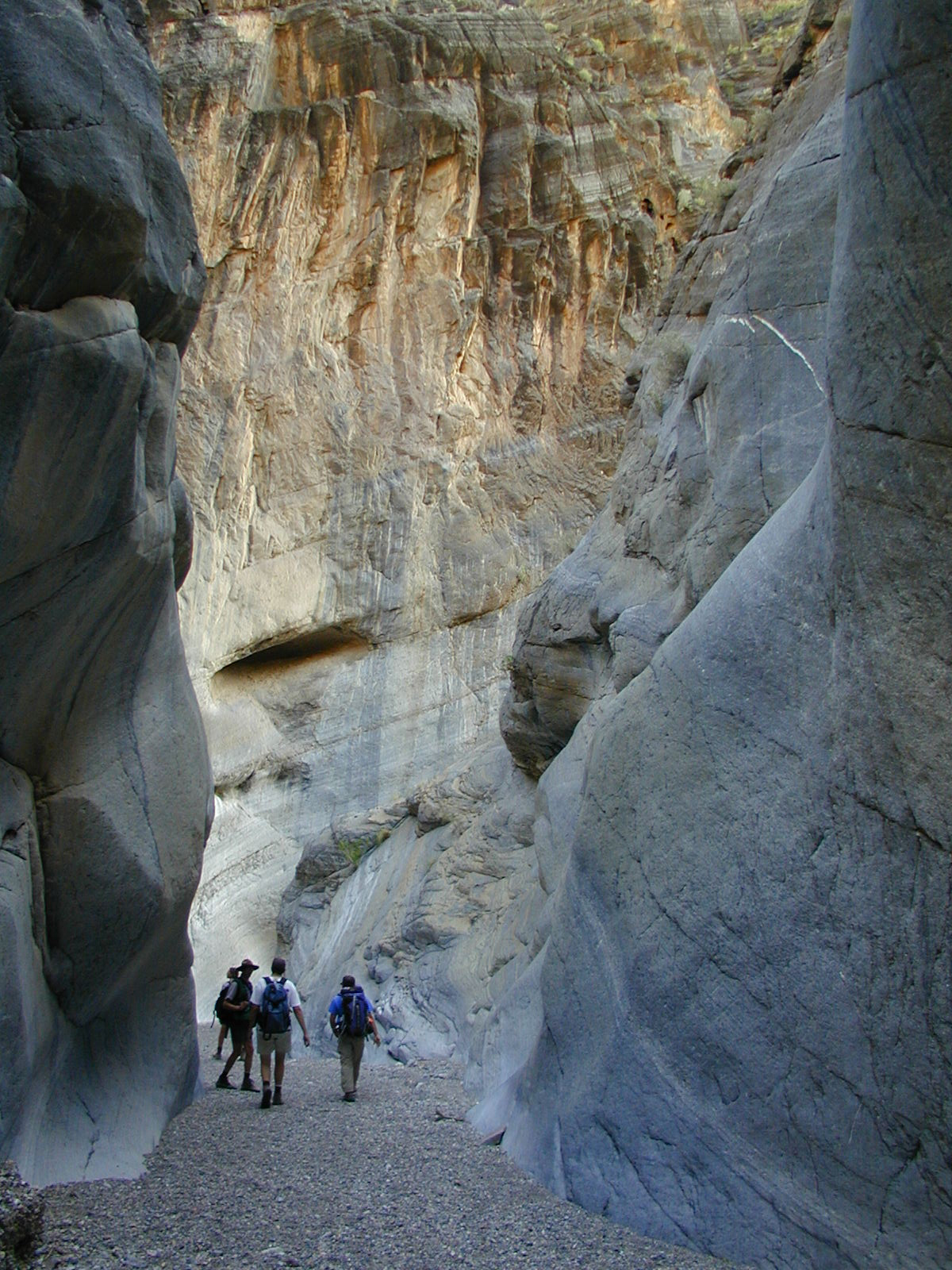
Natural mosaics and sculpted narrows beckon hikers along this quintessential Death Valley Canyon.
The hike begins at a gravel parking area near a wash leading to the mouth of a desert canyon. Very little vegetation is present. The canyon quickly narrows to several feet wide and hikers wind through polished striated and mosaiced brown and white rock walls. The canyon widens and narrows along the hike, with towering rock walls reaching high overhead the entirety of the route. The canyon route is blocked in several places by jumbles of large boulders and rock walls.
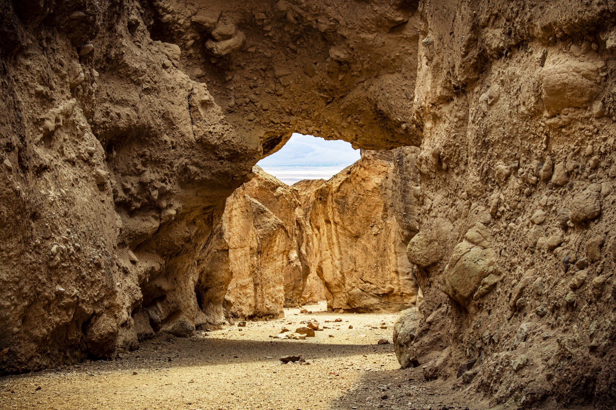
A short walk up a canyon brings hikers to a natural rock bridge formation spanning the canyon.
The parking lot is a large, roughly circular gravel and dirt area with a vault toilet located near the west side. Rocky mountains rise near the north east side of the parking area and additional colorful mountains with natural erosion drainages on their face stand to the east. A wide dirt path leads from the parking area up a gradual hill, around the corner of a cliff of the near mountain and into a canyon. At the edge of the parking area/beginning of the path, there is a triangular informational kiosk with a small wooden roof and a vertical interpretive panel on each side. One panel is a general overview of the trail route, another has diagrams and a description about how the bridge was formed, and the third is about desert hiking safety. Once hikers round the corner in the path they hike up the gradual incline of the canyon floor (wash) to the bridge. The wash is comprised of loose pebbles and gravel as well as several larger rocks approximately the size of basketballs. Brown and yellow vertical canyon walls tower above on both sides and gradually narrow as hikers continue further into the canyon. After about 0.25 miles (0.4 km) the bridge becomes visible farther up the canyon. The bridge spans the canyon and is approximately 35 ft (11 m) above the canyon floor and 35 ft (11 m) thick. The bridge is made of many small jagged rocks, pebbles, and sediment naturally cemented together and is a brownish yellow color. There is a rocky passageway carved by water on the north side of the bridge approximately 8 ft (2.4 m) above the ground.
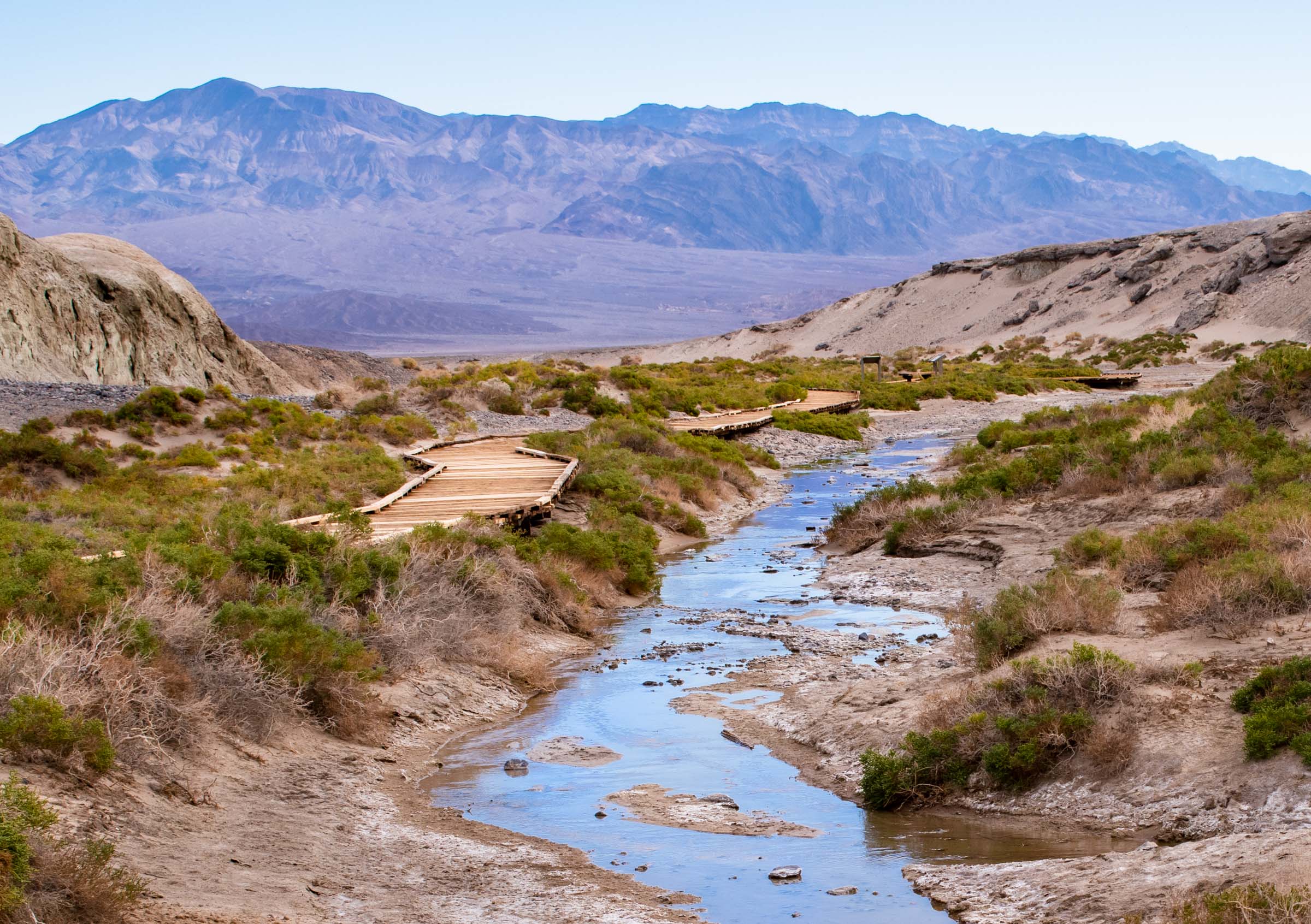
Take a stroll along the boardwalk to discover the unique organisms which depend on the saline waters of Salt Creek.
A wooden boardwalk approximately 4 feet (1.2 m) wide elevated up to approximately 3 feet (1 m) above the ground crisscrosses and parallels a shallow creek several inches to several feet deep and several feet wide. The surrounding landscape is white soil and salt with low bare hills rising to the north and south. Small green and gray woody plants dot the desert floor near the boardwalk and creek. Some plants may be visible under the water as well as macroinvertebrates (often insect larvae) and small (approximately 1 inch/2.5 cm in length) blue and green pupfish.
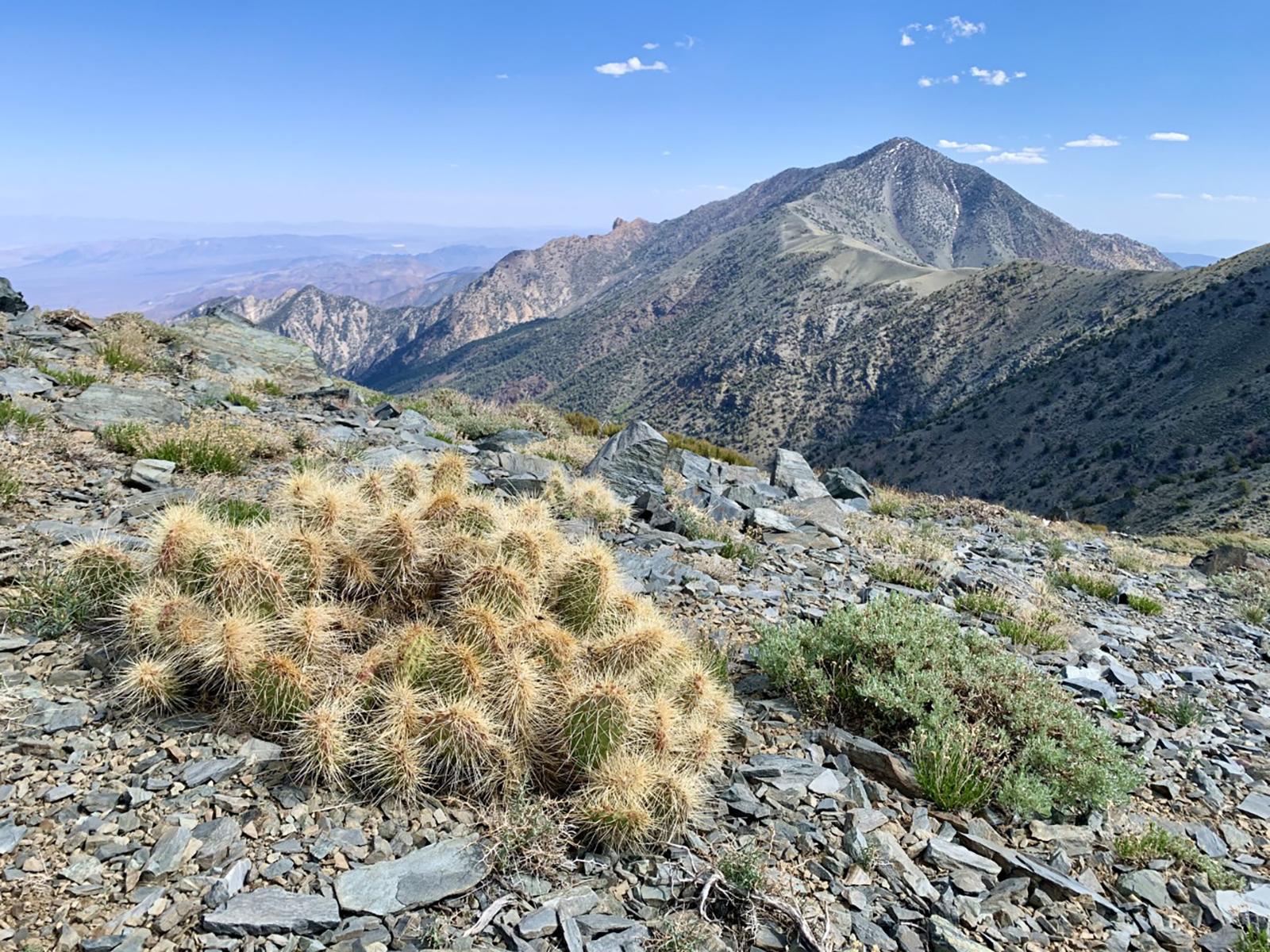
Hike to the tallest peak in Death Valley (elevation: 11,049 ft/ 3368 m).
Dirt hiking trail which hugs the side and ridgeline of a mountain. The trail begins in a pinyon pine and mountain mahogany forest, climbs to a meadow with open views to the east and west, then continues to the summit with 360 views of desert canyons and valleys below and mountains in the distance.
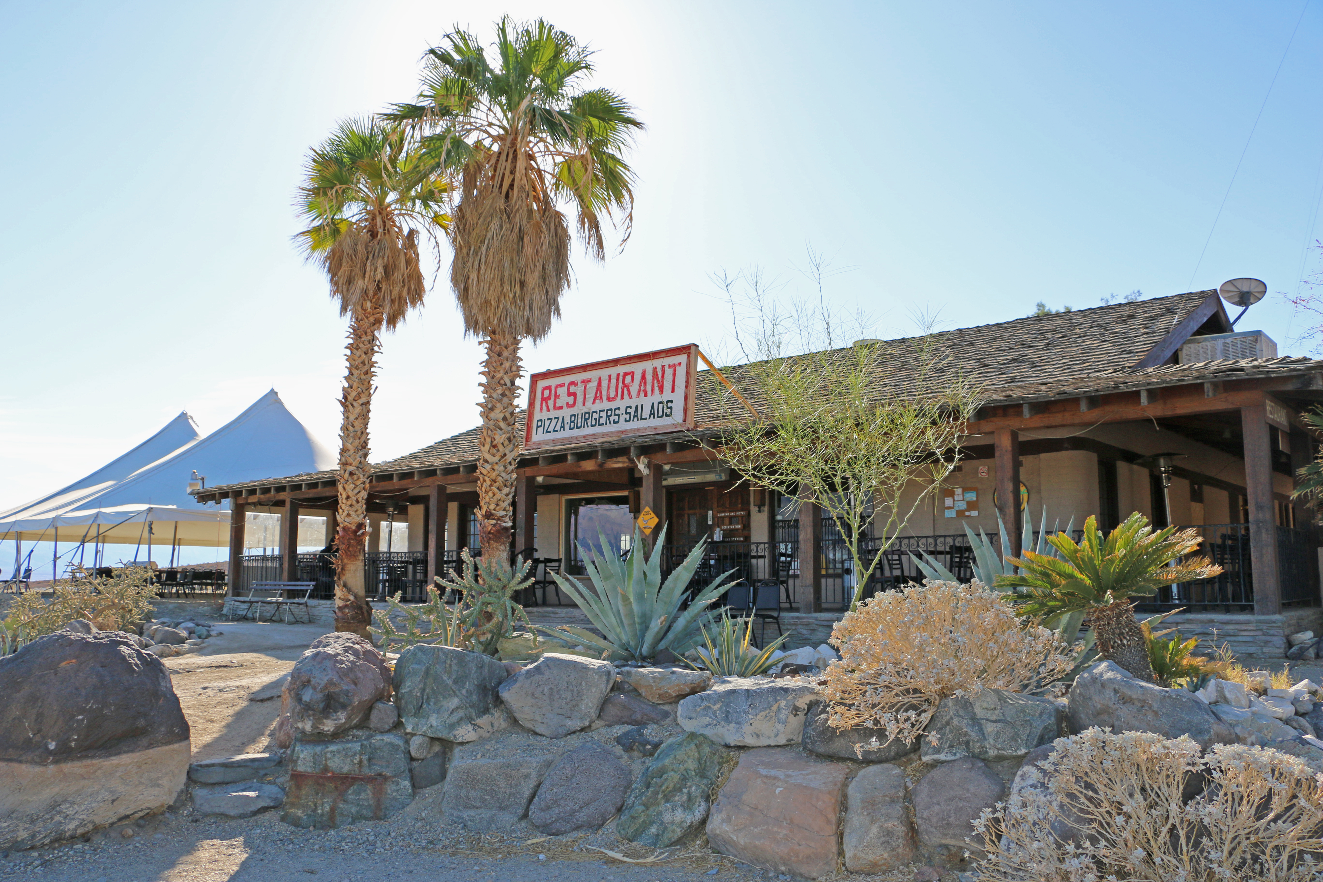
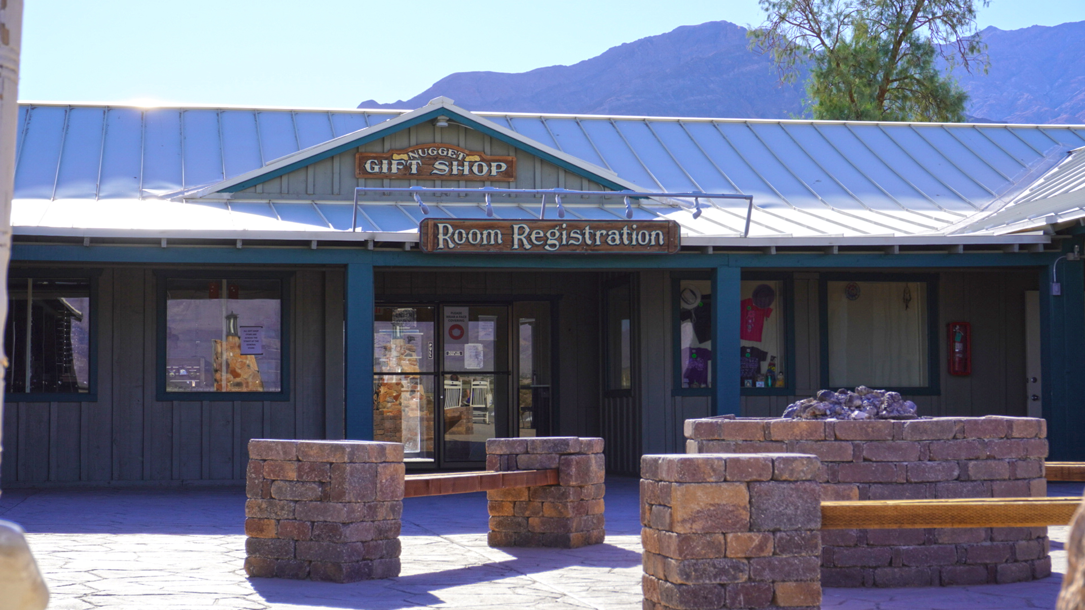
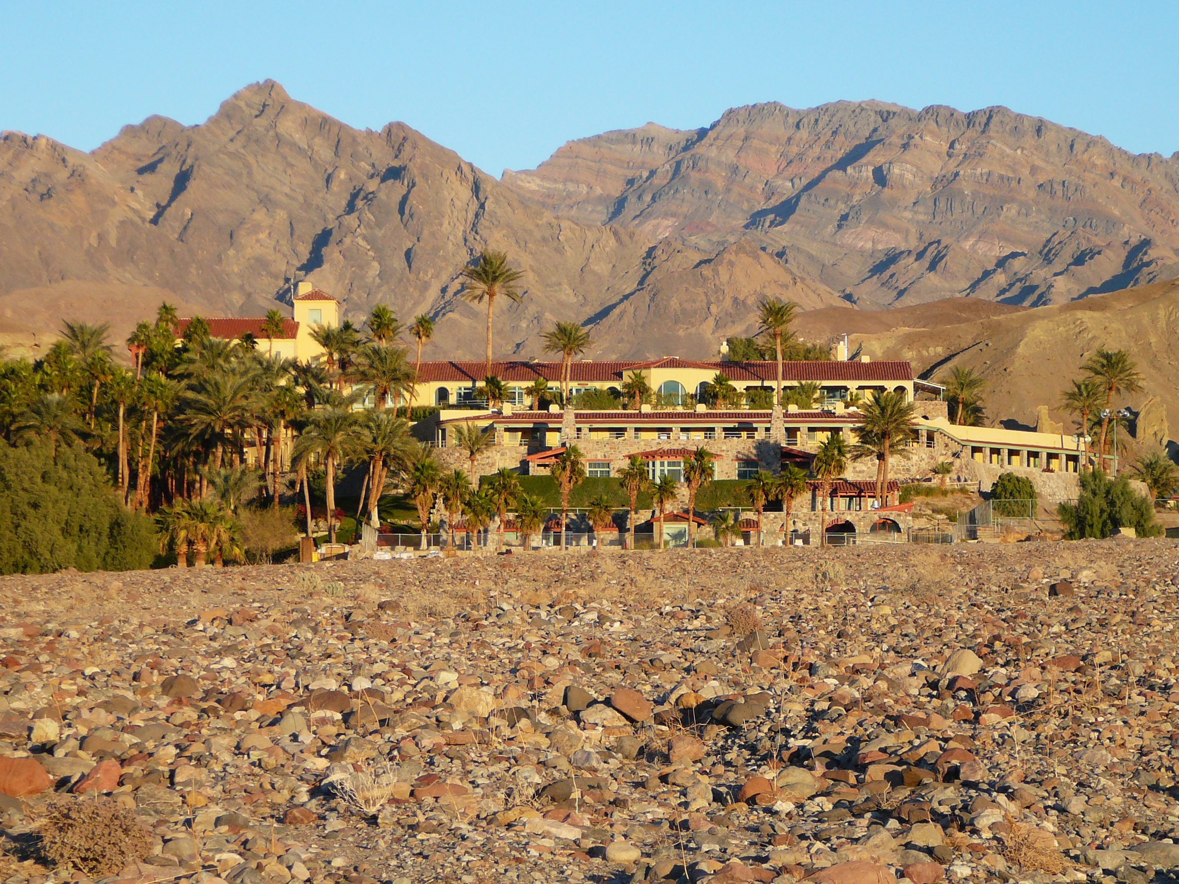
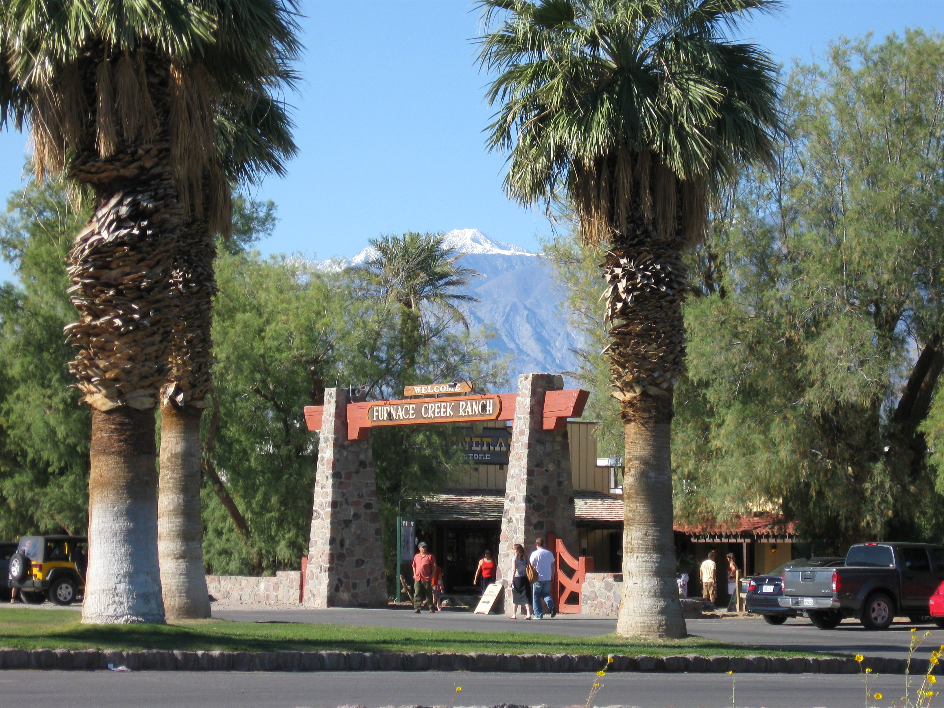
A private resort within Death Valley National Park, featuring oasis-like landscaping and a historic ornate lodging and restaurant.
a very large castle like structure built of local rock with a red tile roof. It is surrounded by lush vegetation such as palm trees, oleander, and flowering shrubs, fountains, and paths leading between the hotel rooms, main lobby and restaurant, and pool.
A private resort within the park boundary, featuring oasis-like landscaping, lodging, restaurants, golf, pool, stables, stores, museum, post office, gas, and other amenities.
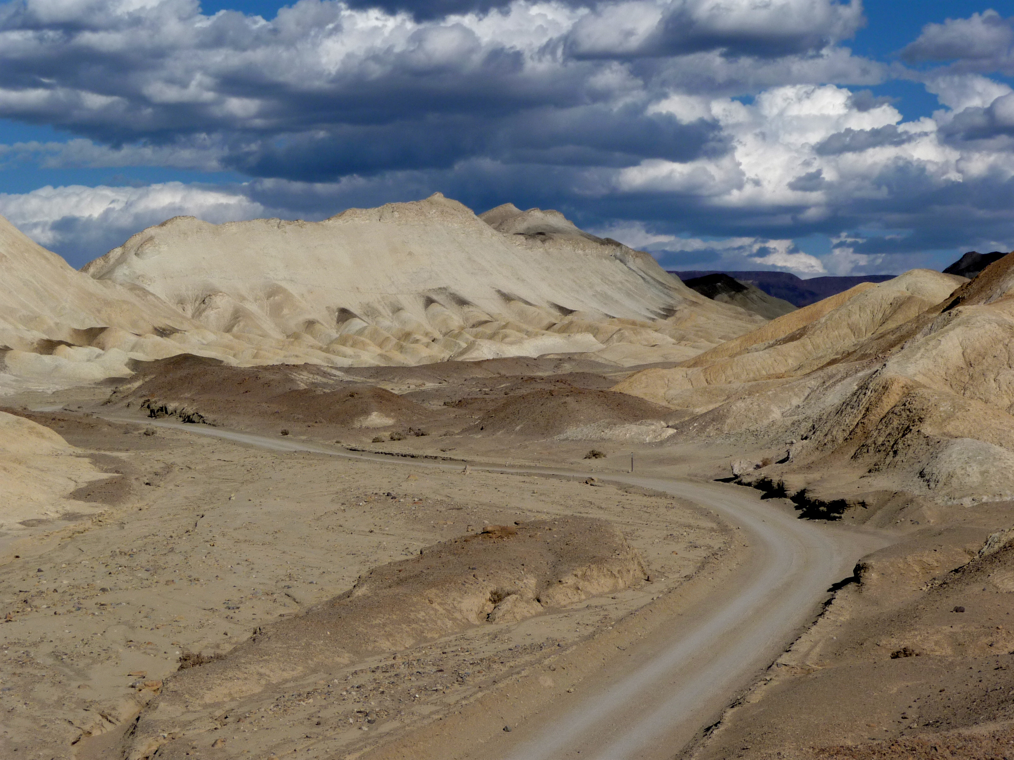
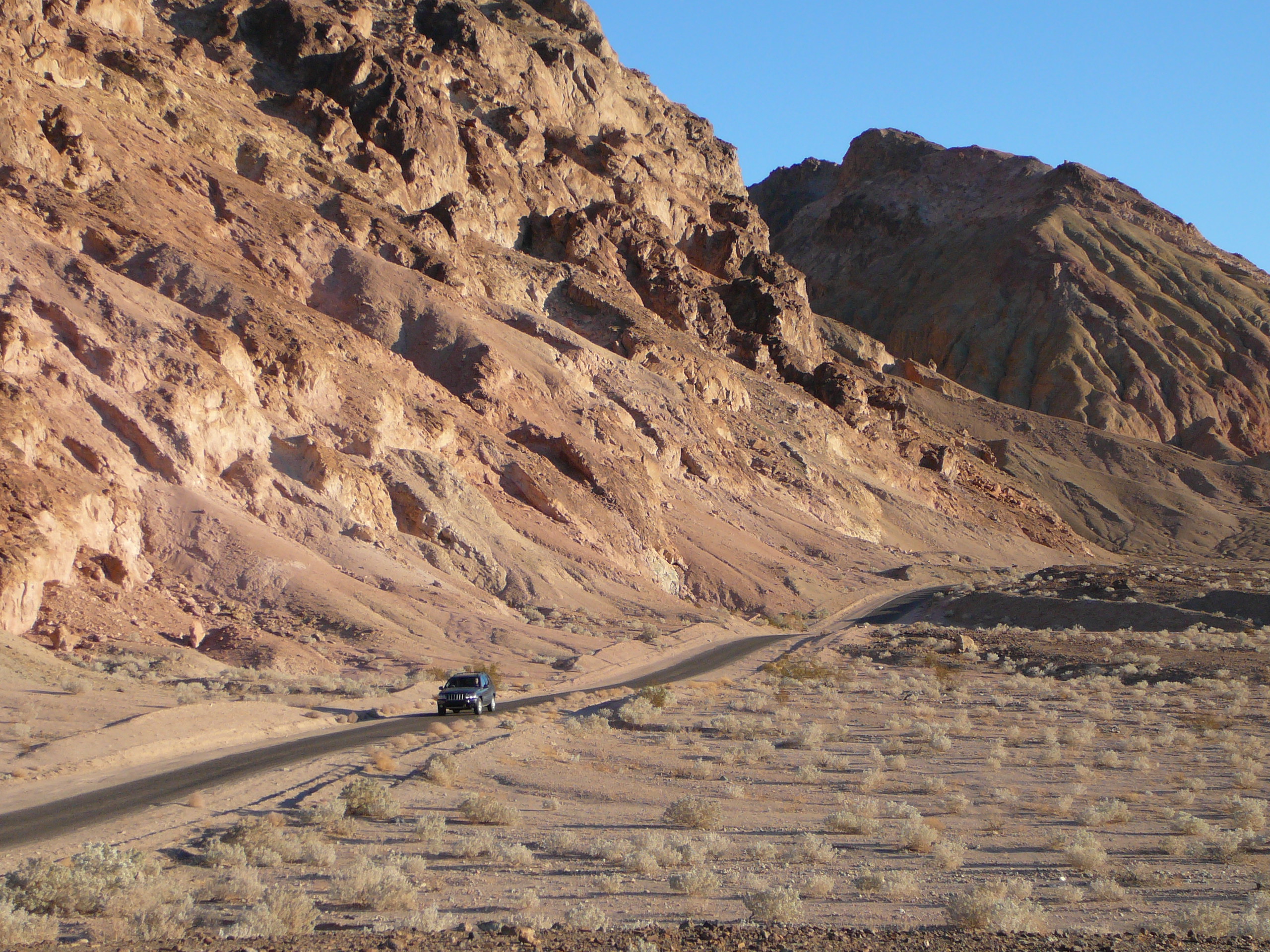
A dirt road winds between bare yellow and brown hills. The soil of the hills is compacted, but some larger gray rocks exist, mostly in the washes which run between the hills.
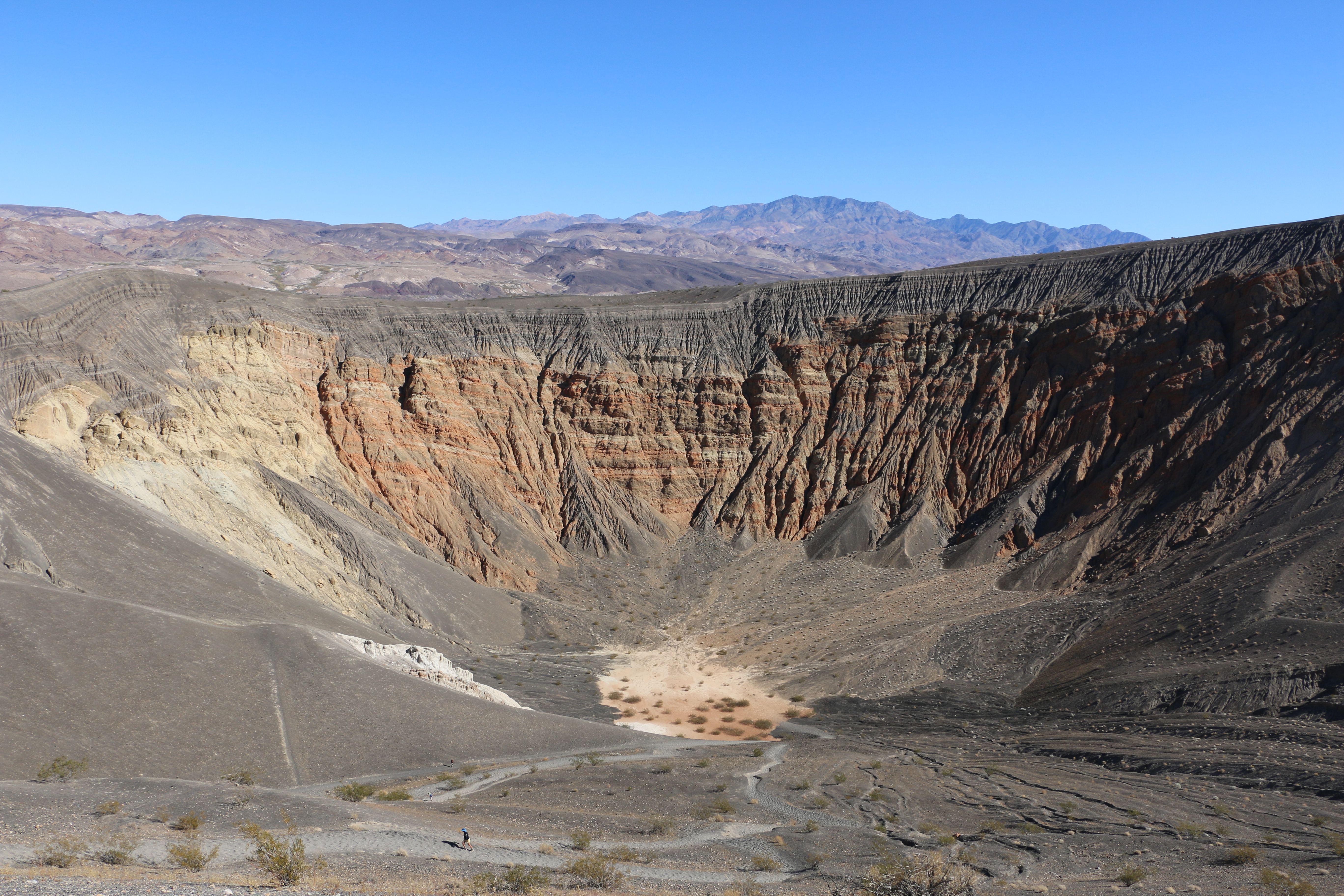
Discover Death Valley’s explosive past at this volcanic crater.
A large roughly circular volcanic crater approximately 0.5 miles (0.8 km) in diameter and 500-777 feet (152-237 m) deep, with mountains in the distance. Dark volcanic material mantels the ground to a depth of about 80 feet (24 m), covering older sedimentary rock now exposed and forming the crater walls. This sedimentary rock has colorful red, brown, and pink layering, and has vertical erosion in many places. The walls are fairly steep/vertical, but a more gentle slope leads from the parking area overlook to the bottom of the crater. Some small plants (mostly green creosote and silver-colored desert holly) dot the more gentle slope and crater floor. The crater floor is covered in silt in some areas and sometimes collects water after rain. A trail leads around the rim of the crater and down the gentler slope to the crater bottom.
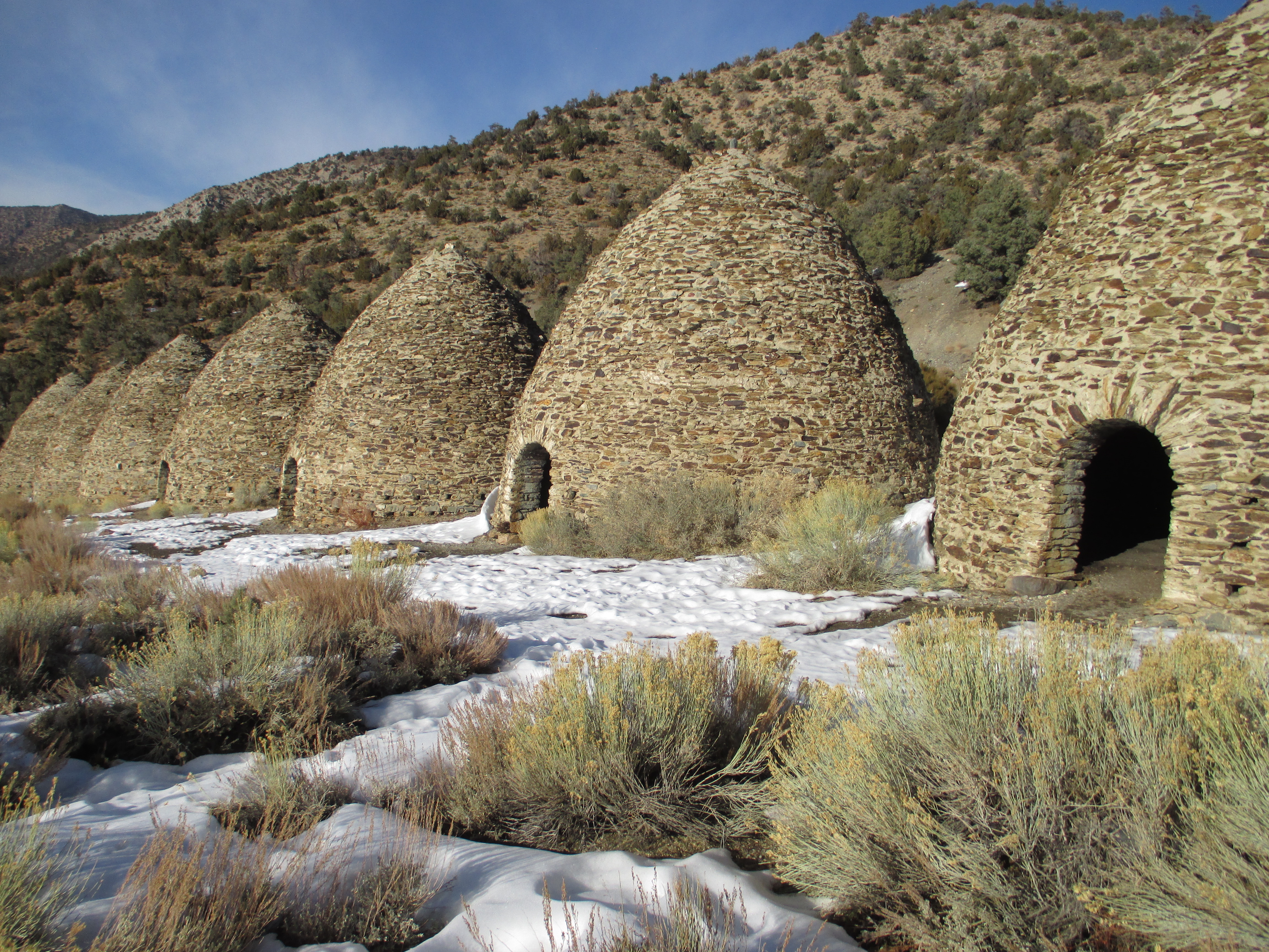
Ten beehive shaped structures used to produce charcoal needed for Death Valley mining operations in the late 1800s.
Ten gray/brown stone and mortar bee-hive shaped structures stand in a row, at the base of hills dotted with pinion pine and juniper trees. The structures are approximately 25 feet tall, with a 30 foot (9 meter) interior diameter. Each structure has an open arched doorway in the front, approximately 4.7 feet (1.4 meters) wide by 6 feet (1.8 meters) tall, and a second open arched doorway in the rear, opposite the front doorway. The rear doorway is approximately 12 feet (3.7 meters) off the ground and is approximately 3 feet (1 meter) wide by 3.7 feet (1.1 meters) tall. Neither opening has a door. The kilns have three rows of open vent holes between the stones, which measure approximately 4 inches (10 centimeters)by 4 inches (10 centimeters) and are spaced 1.5 feet (0.46 meters) apart vertically. The floor is dirt.
A strenuous trail leads to this spectacular peak in the Panamint Mountains.
Rocky uneven dirt trail which begins near the first of the Wildrose Charcoal Kilns. Pinon pine and Juniper trees grow to either side of the trail, as well as some small shrubs, grasses, and seasonal wildflowers. The trail ascends steeply initially then flattens out for about a mile following the side of a ridge and passing rock outcroppings. The trail then ascends even more steeply through a Pinon Pine forest, with a few shar switchbacks and exposed tree roots. Hikers eventually reach a saddle with a view through the trees of the swirling sands of the floor of Death Valley below. The climb to the peak continues through more forest and the trees open up as the trail reaches the summit. The summit is relatively flat with some rocks and small trees, shrubs and grasses. The summit affords panoramic views of the Sierra Nevada mountains to the west, and the floor and foothills of Death Valley to the east.
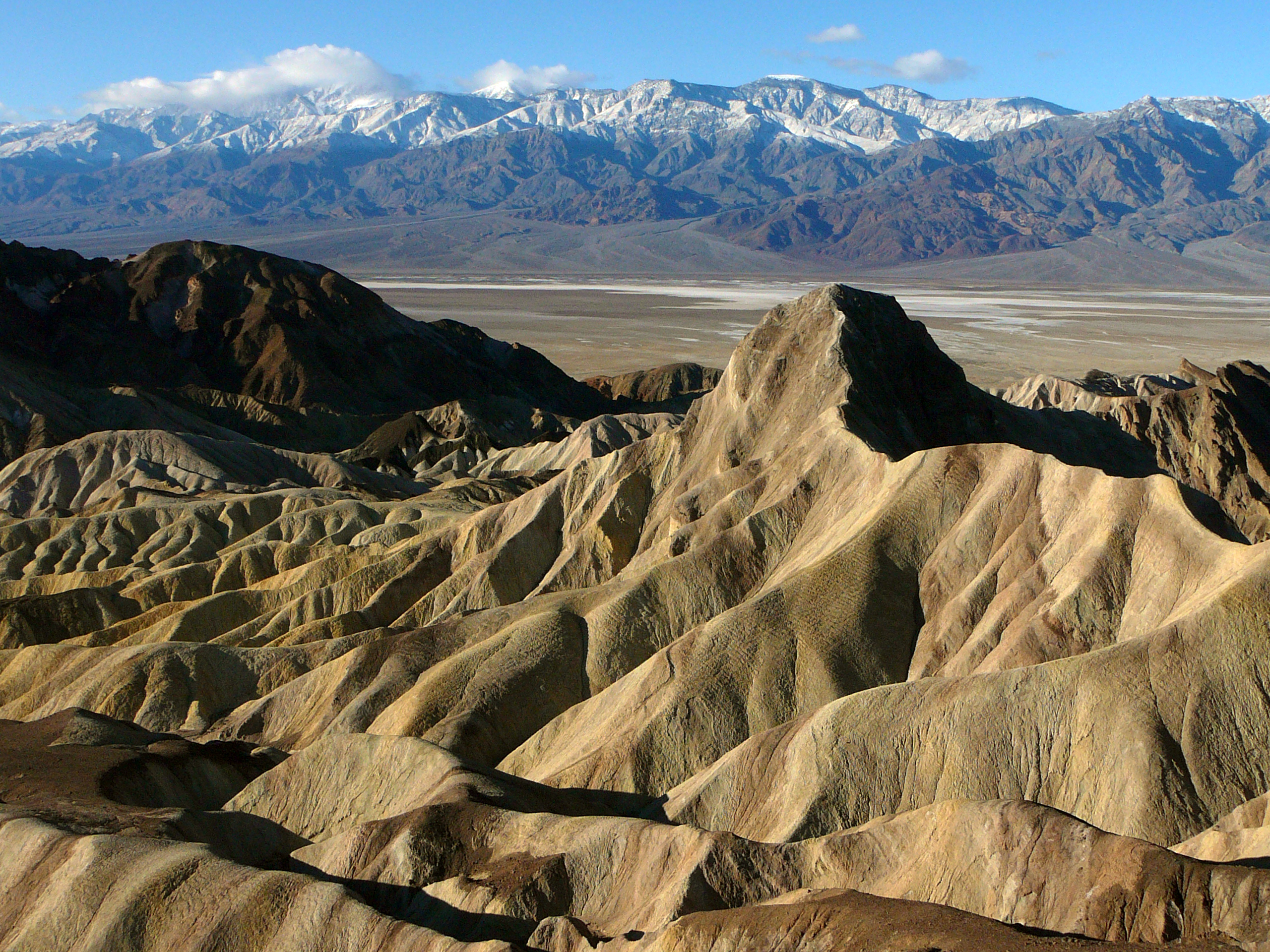
Experience the stark beauty of Death Valley at this iconic vista overlooking badlands and salt flats.
Bollards separate the parking lot from a paved trail which leads 1/4 mile (400 m) up a hill to the viewpoint. From the viewpoint, brown and yellow striped hills and several large washes are visible in the foreground. One hill, Manly Beacon, rises above the rest in a shape roughly that of an acute triangle. Beyond the hills, white salt flats spread across a brown, rocky valley floor, and large mountains rise in the distance.
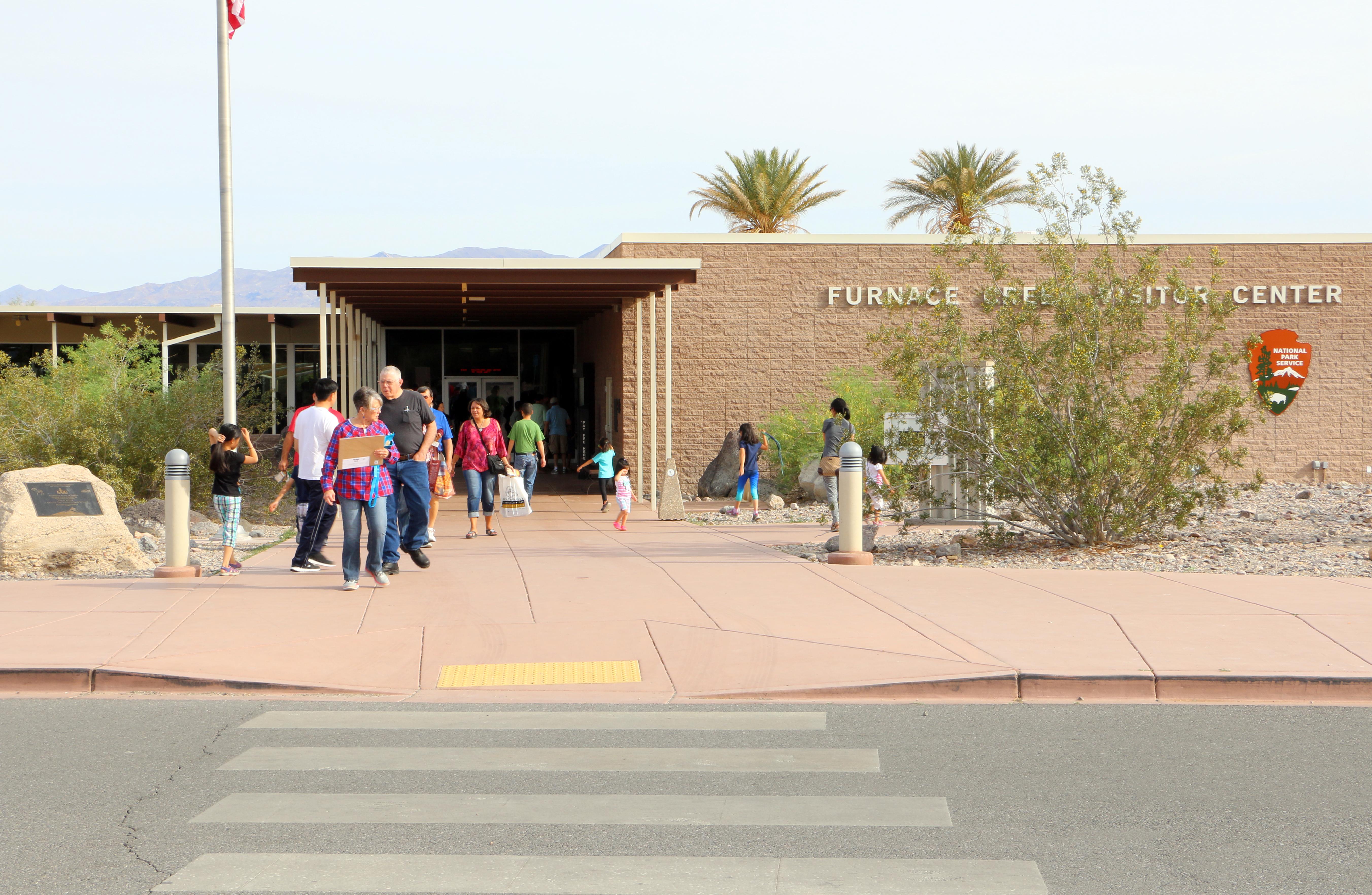
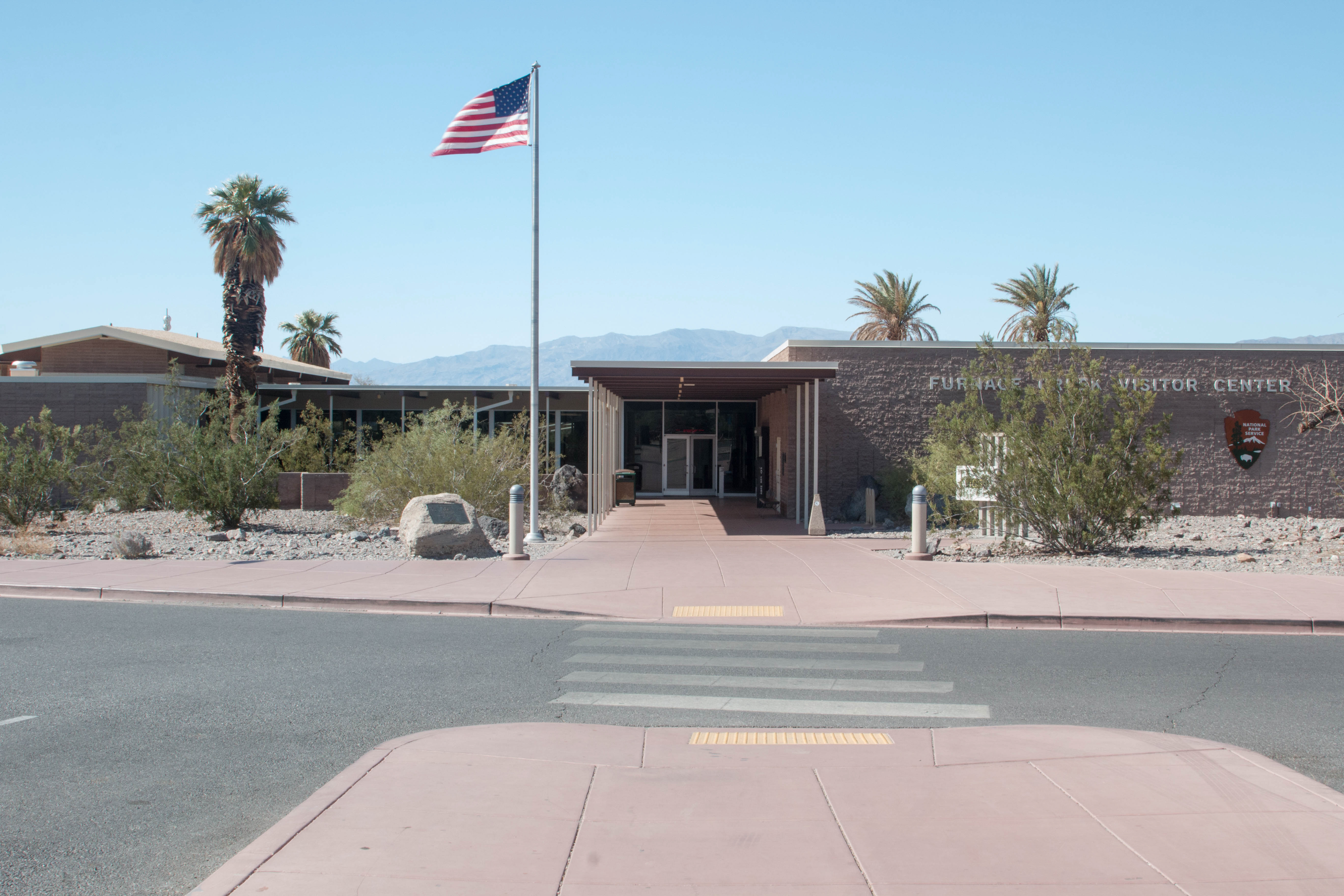
Furnace Creek Visitor Center is the central hub for all things Death Valley. Here you can pay the park entrance fee, speak with a ranger about trip plans or questions, participate in the Junior Ranger program, watch the 20-minute park film, explore museum displays, and browse the park bookstore.
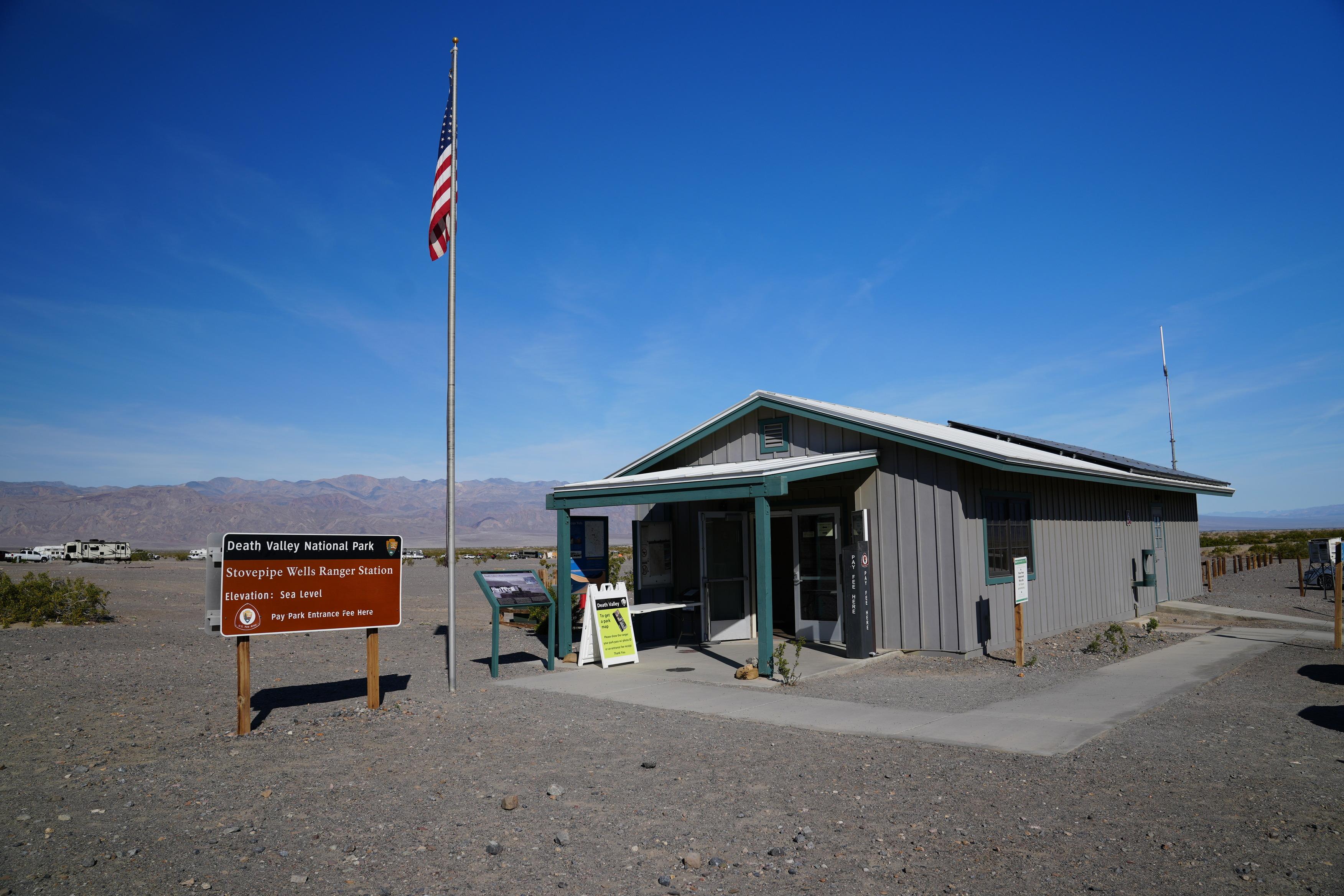
Stovepipe Wells Ranger Station offers a location to talk to a ranger and pay the park's entrance fee. Note: This is a contact station, not a full visitor center. The hours listed below can change and are dependent on staffing level. Please call: (760) 786-3200 for today's hours.
Learn about the different flowers you might be able to see in Death Valley during spring months.
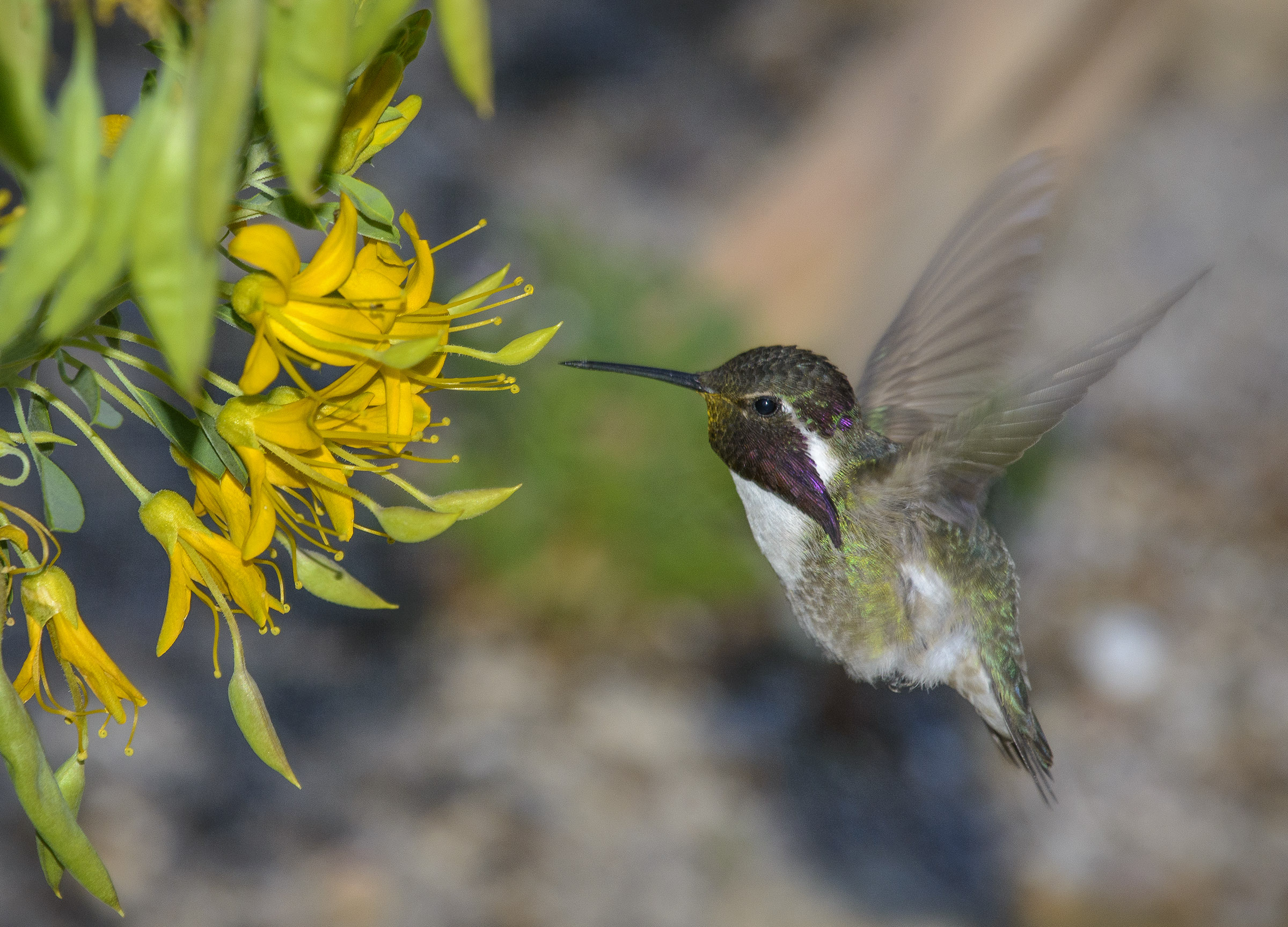
Bird Watching
Roadrunners and ravens and hummingbirds- oh my! With many resident and migratory species, bird watching opportunities abound in Death Valley.
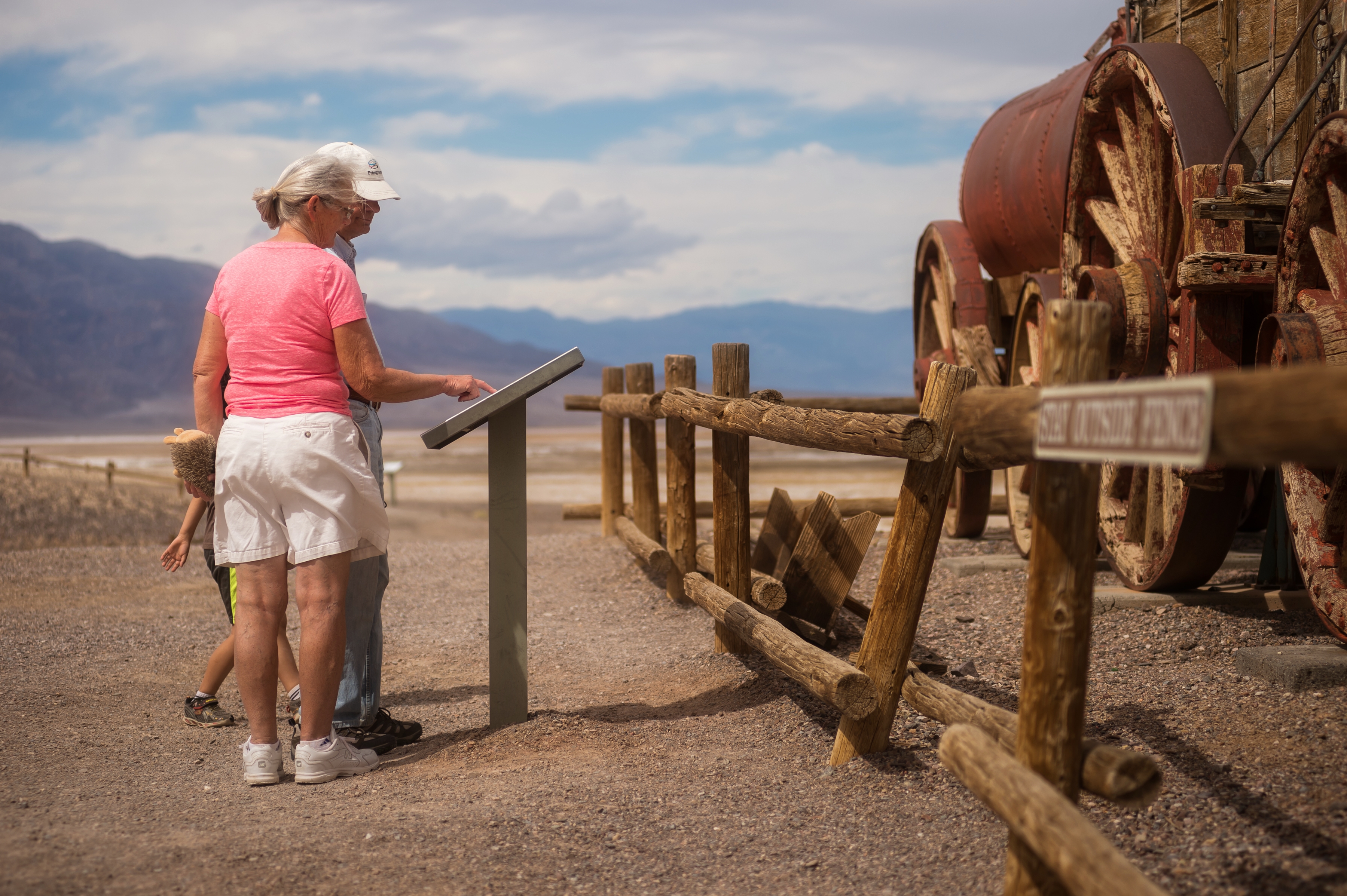
Harmony Borax Works Self Guided Walk
Harmony Borax Works was instrumental in drawing people to Death Valley in the late 1800s and in the subsequent popularity of the Furnace Creek area. The 1/4 mi (0.4 km) paved walking path at this site takes visitors back in time by exploring the ruins of the plant and associated townsite and an original twenty mule team wagon.
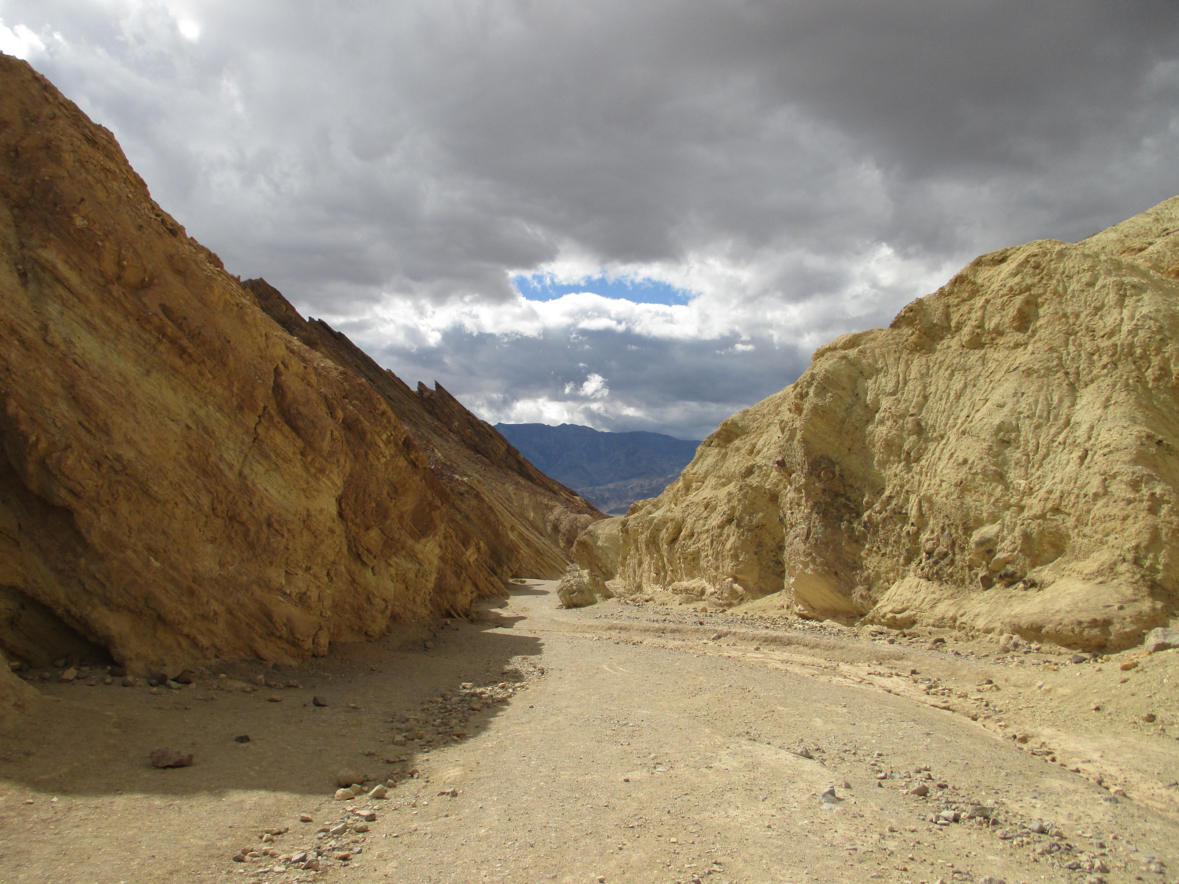
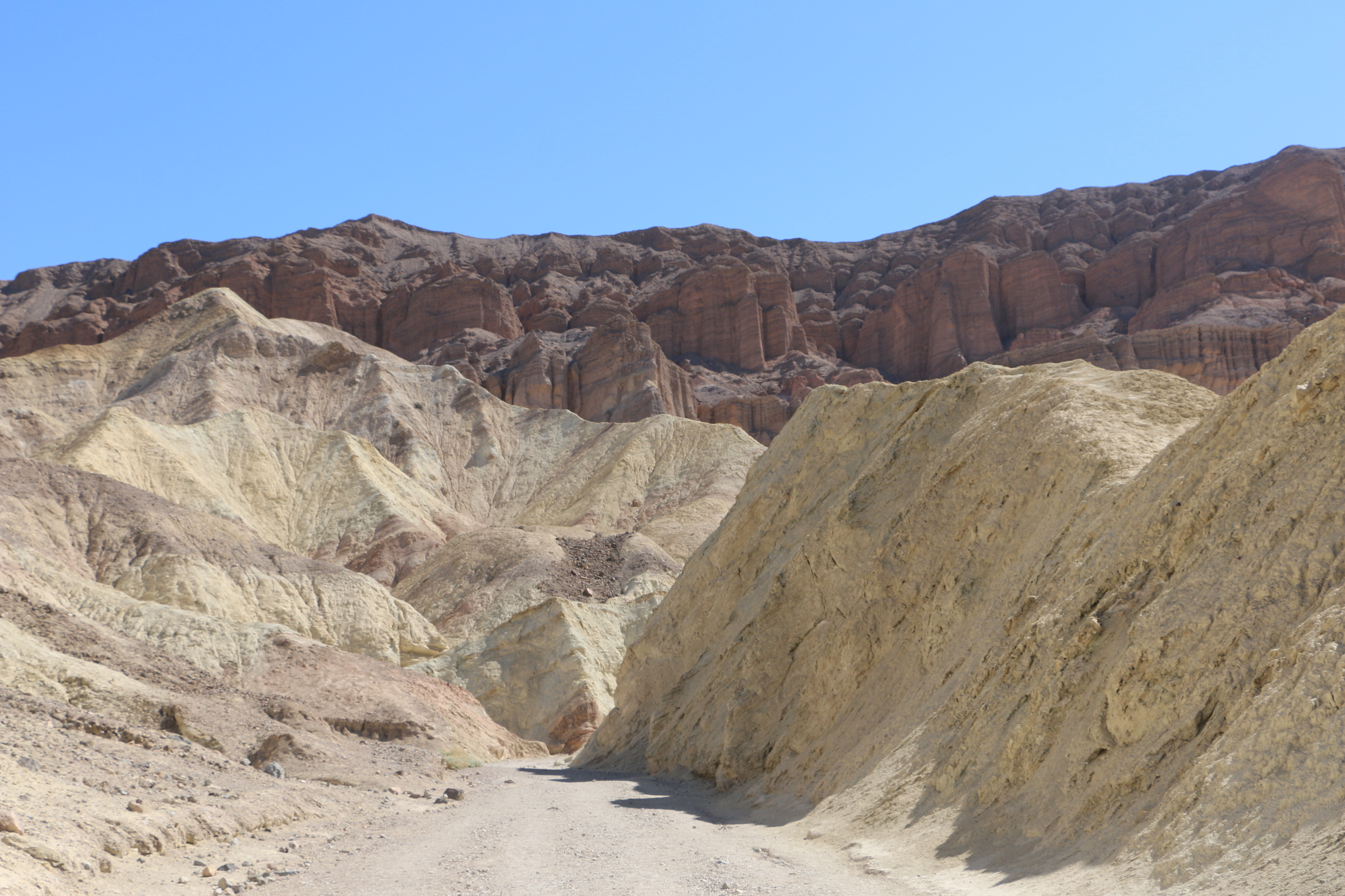
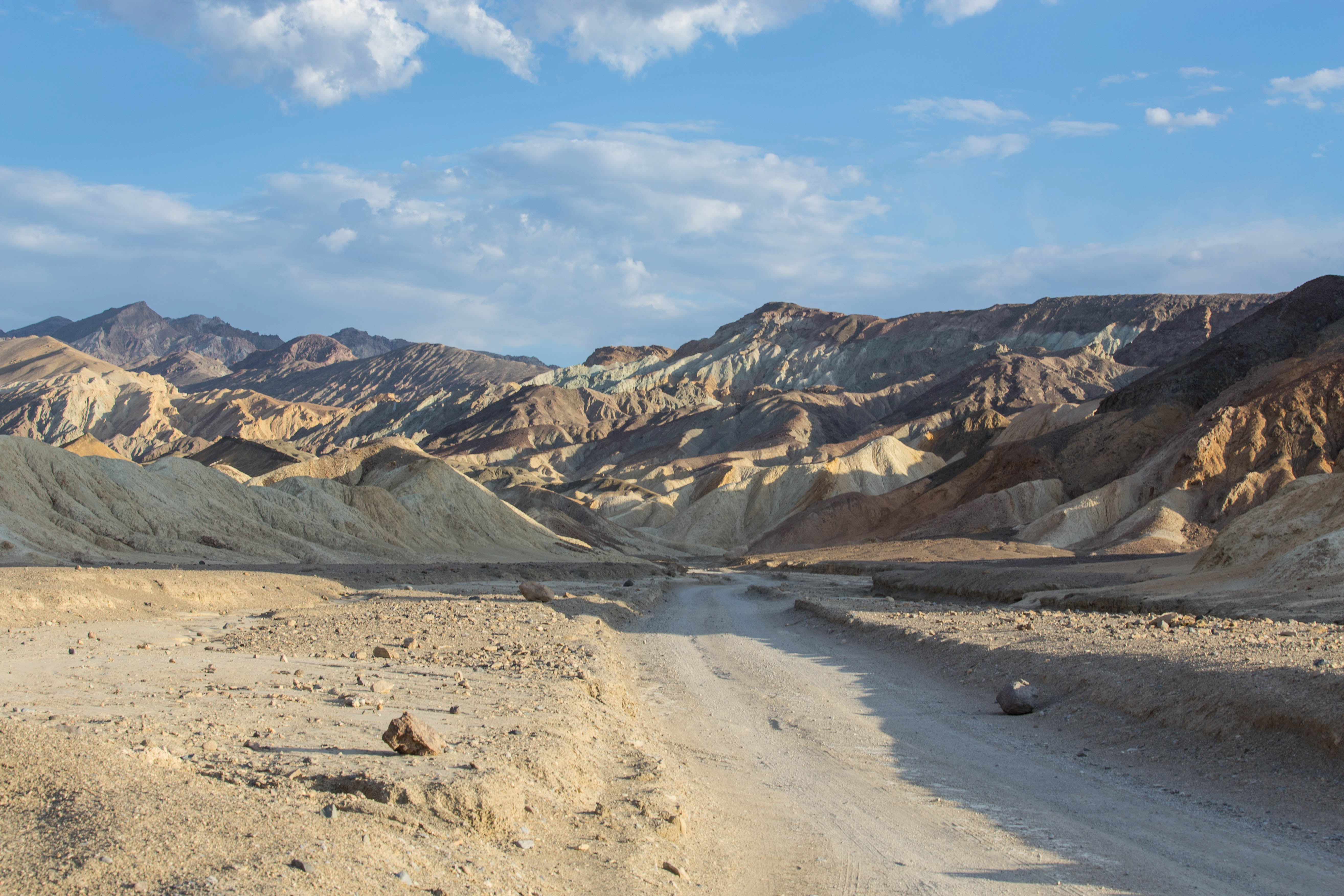
Drive Twenty Mule Team Canyon
A short scenic drive along an unpaved road through colorful badlands.
Tour Artists Drive
Enjoy a scenic drive through a geologic rainbow! Artists Drive is a one-way, nine mile (14.5 km) drive which passes through eroded, colorful desert hills. Artists Palette (a viewpoint) has the most colorful scenery along the road.
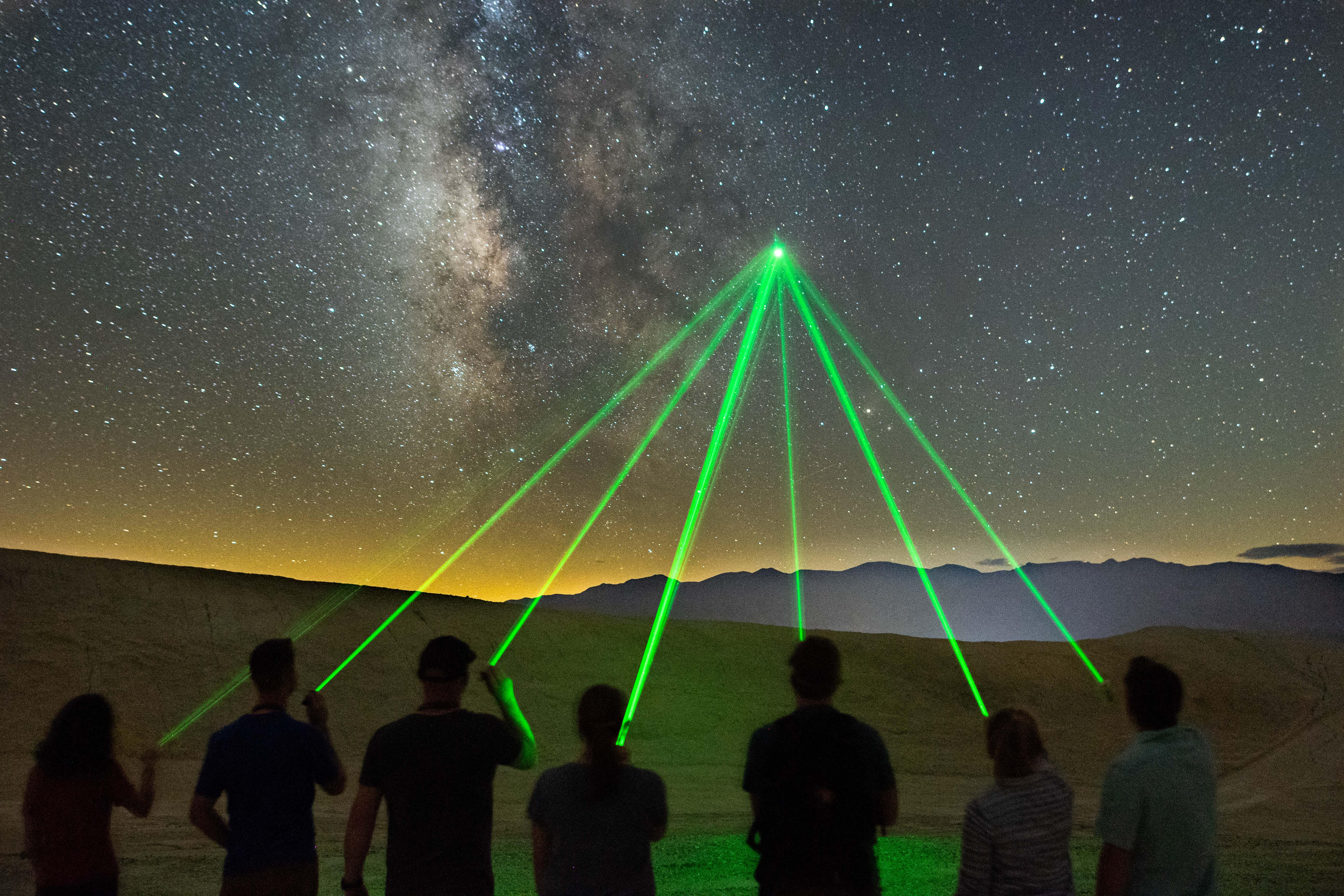
Experience Death Valley at Night
Death Valley is just as spectacular at night as it is during the day- learn about a few ways you can explore the park after dark.
Running in Death Valley
Go for a run in Death Valley! The park can be a very interesting and challenging place to test your road running or trail running abilities. Over 1,000 miles of paved and dirt roads, plus almost endless cross country opportunities await you. To enjoy the park safely, please run in the cooler months.
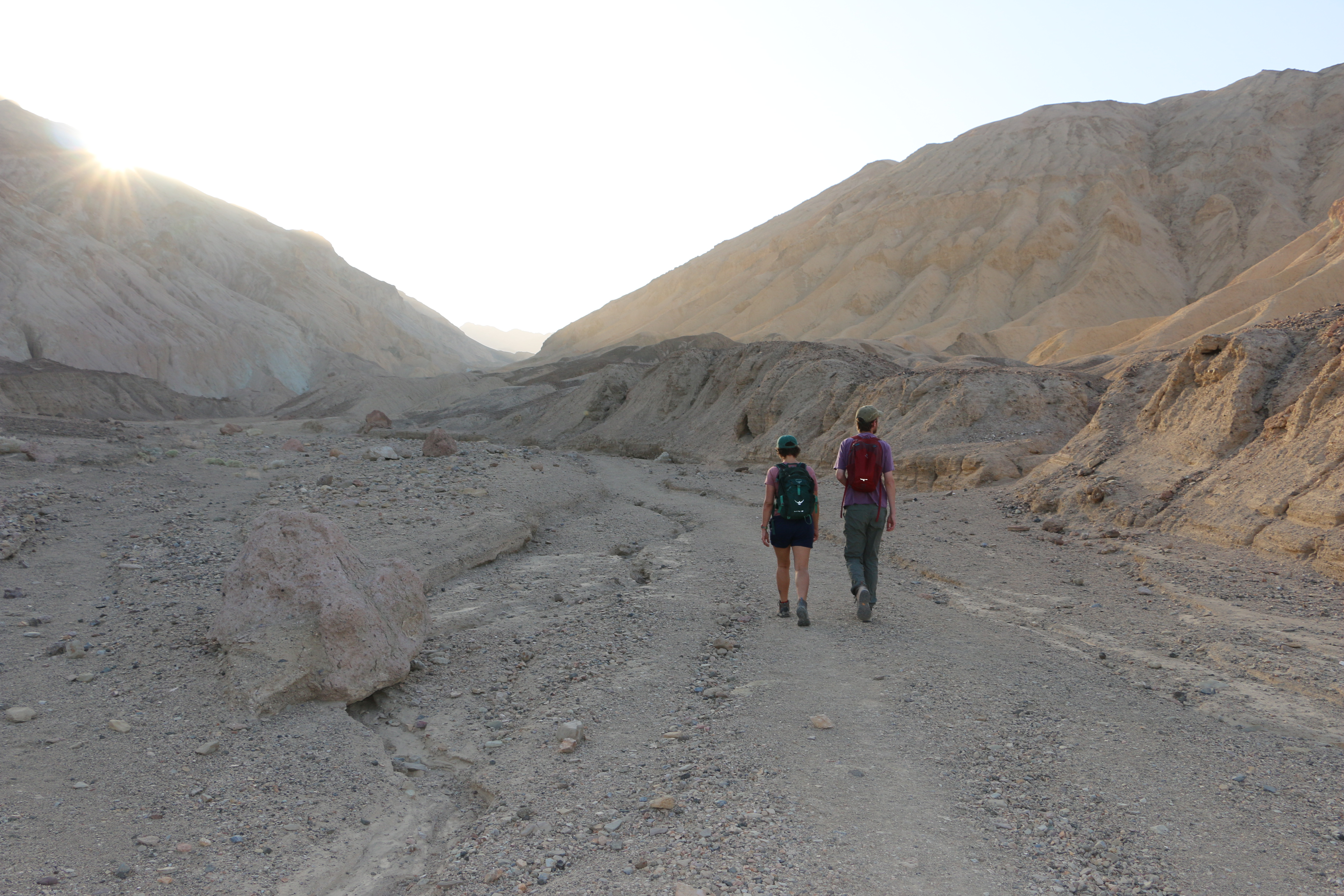
Day Hiking
Looking for somewhere to hike in Death Valley? The park has interpretive trails, hiking trails, and unofficial hiking routes, and is open to cross-country travel by foot in most places.
Visit Badwater Basin
Badwater Basin is the lowest elevation in North America at - 282 feet (- 86 m) below sea level. A visit to this otherworldly salt flat will provide you with a unique experience and a landscape that appears to stretch on forever. A short 1/4 mile (400 m) hike will you bring you to the polygon salt formations that Death Valley is famous for, or in the summer months, the view can be enjoyed from the parking area.
Hiking/Visiting with Pets
Due to the extreme weather, it is not usually a good idea to bring a pet to Death Valley if you want to do any exploring out of your vehicle. If you are traveling through the park with a pet, and want to know where they are allowed to go, this is where to find that info! Stick to the roads, developed areas, and campgrounds. Pets are not permitted in the Wilderness or out of the areas listed above.
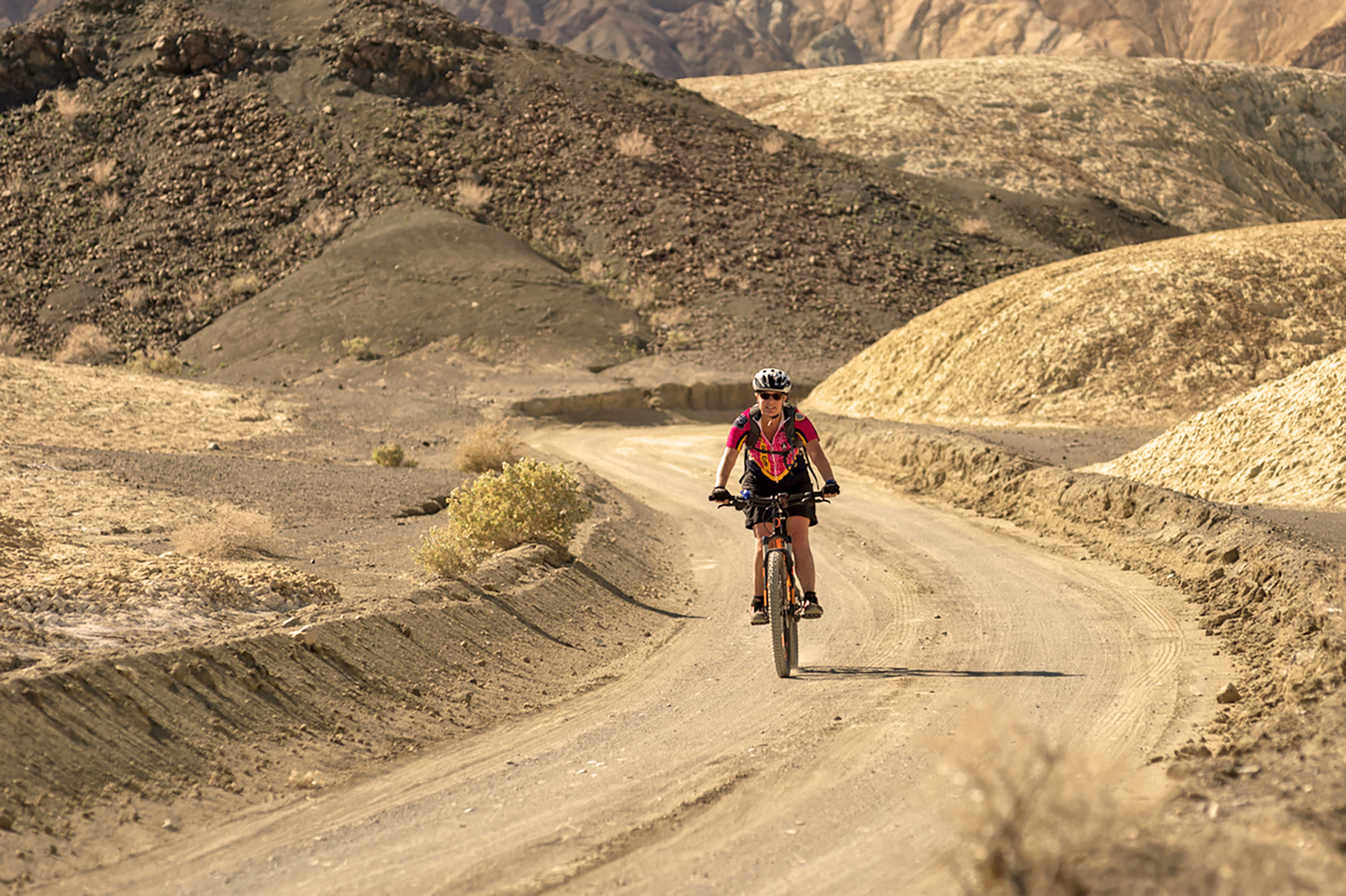
Mountain Biking
Hundreds of miles of dirt roads are available for mountain biking exploration.
Visit the Furnace Creek Visitor Center
Stop by the visitor center to speak with park rangers and pay park fees and purchase national park passes. View the exhibits about Death Valley's history and natural wonders. Watch the park film, which is 20 minutes in length and plays throughout the day. Shop at the bookstore - light snacks/sandwiches/water are available for purchase. Become a Junior Ranger! Complete the activities in the booklet and earn a badge.
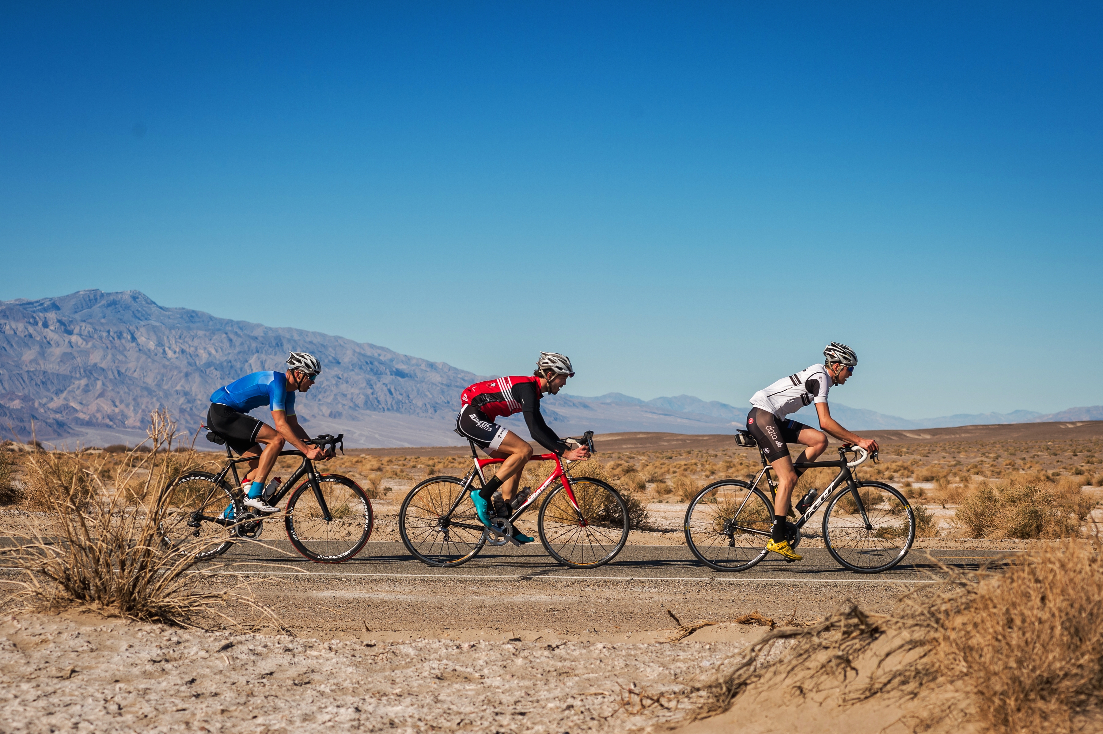
Cycling
Whether you prefer flat and straight or mountainous and curvy, Death Valley has paved roads suitable for all levels of cycling enthusiasts.
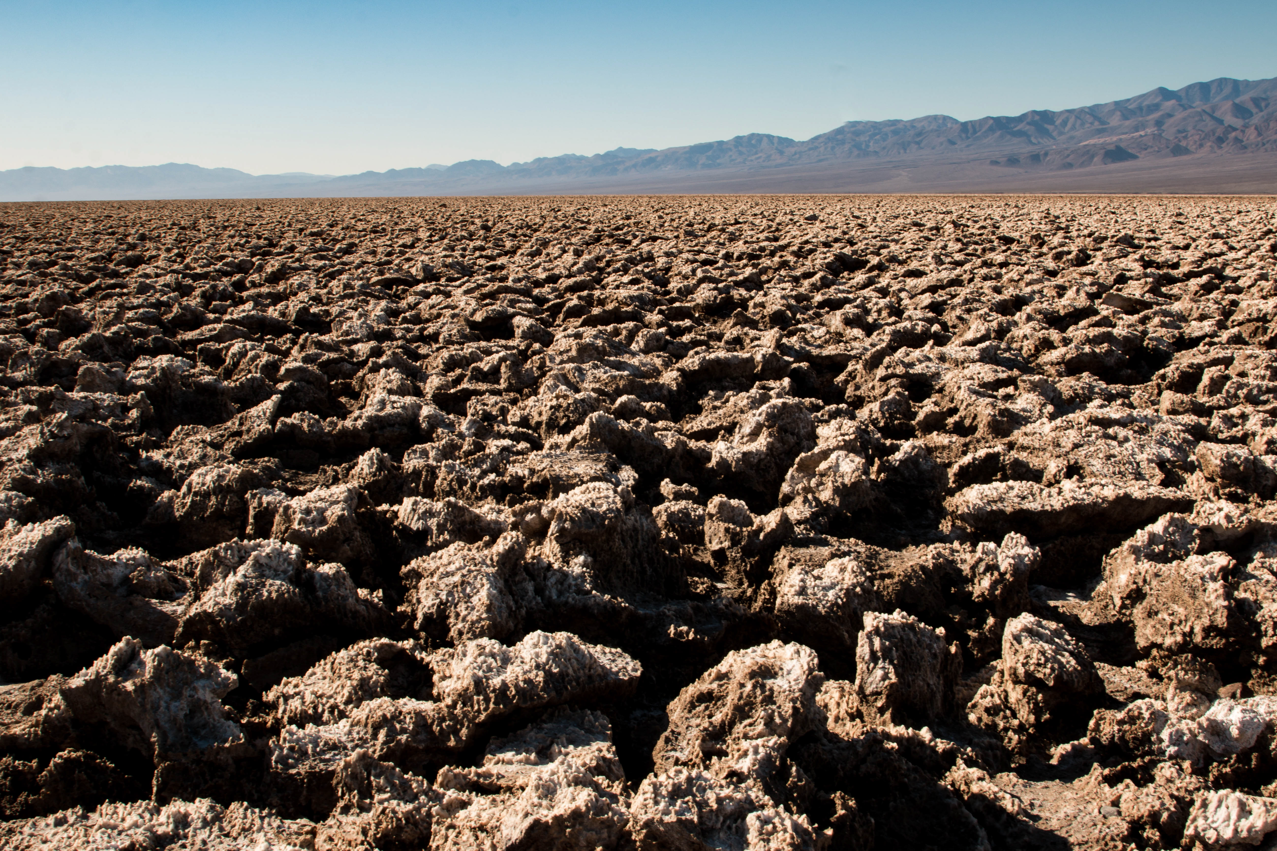
Check Out Devils Golf Course
An immense area of rock salt eroded by wind and rain into jagged spires. So incredibly serrated that "only the devil could play golf on such rough links." Listen carefully and you'll hear sounds like tiny pops and pings. The sound is literally billions of tiny salt crystals bursting apart as they expand and contract in the heat.
Tours
Count: 3
Golden Canyon Hike
Golden Canyon is one of the most popular hikes in Death Valley, and for a good reason- it is incredible! Walk between towering golden walls and learn about some of the many changes which have occurred over time in the area we now call Golden Canyon. This hike is an out and back, is slightly uphill on the way out, and is considered easy/medium difficulty. Make sure to take plenty of water and do not attempt during the heat of summer.
Highlights: 3 Hour Driving Tour
Learn about the powerful forces which have shaped Death Valley and some of the incredible plants and animals which call this extreme place home. This is a self-guided driving tour starting from Furnace Creek Visitor Center. Stops include: Badwater Basin, Artists Palette, Zabriskie Point, and Mesquite Flat Sand Dunes. Internet and cell service in Death Valley National Park are limited. To ensure the best visit possible, please download this tour prior to your arrival.
Star Wars Film Locations Tour of Death Valley
Have you ever dreamed of visiting Tatooine? Then you've come to the right place! Two movies from the famous Star Wars series, Episode 4 - A New Hope, and Episode 6 - Return of the Jedi, were filmed here! Check out the film locations on this tour and see if you can spot familiar vistas where droids, jawas, and jedis once walked. Internet and cell service in Death Valley National Park are limited; downloading the app prior to your arrival is recommended.