Be advised that the NPS has issued alerts for this park.
Fort Donelson NB Park Fall Hours
Visitor Access to Fort Donelson NB Park Lands: Pedestrian Access is from sunrise to sunset. Automobile Access to Fort Donelson NB Park Roads 8:00 am – 6:00 p.m. daily.
Brigadier General Ulysses S. Grant was becoming quite famous as he wrote these words following the surrender of Confederate Fort Donelson on Sunday, February 16, 1862. The Union victory at Fort Donelson elated the North, and stunned the South. Wi...
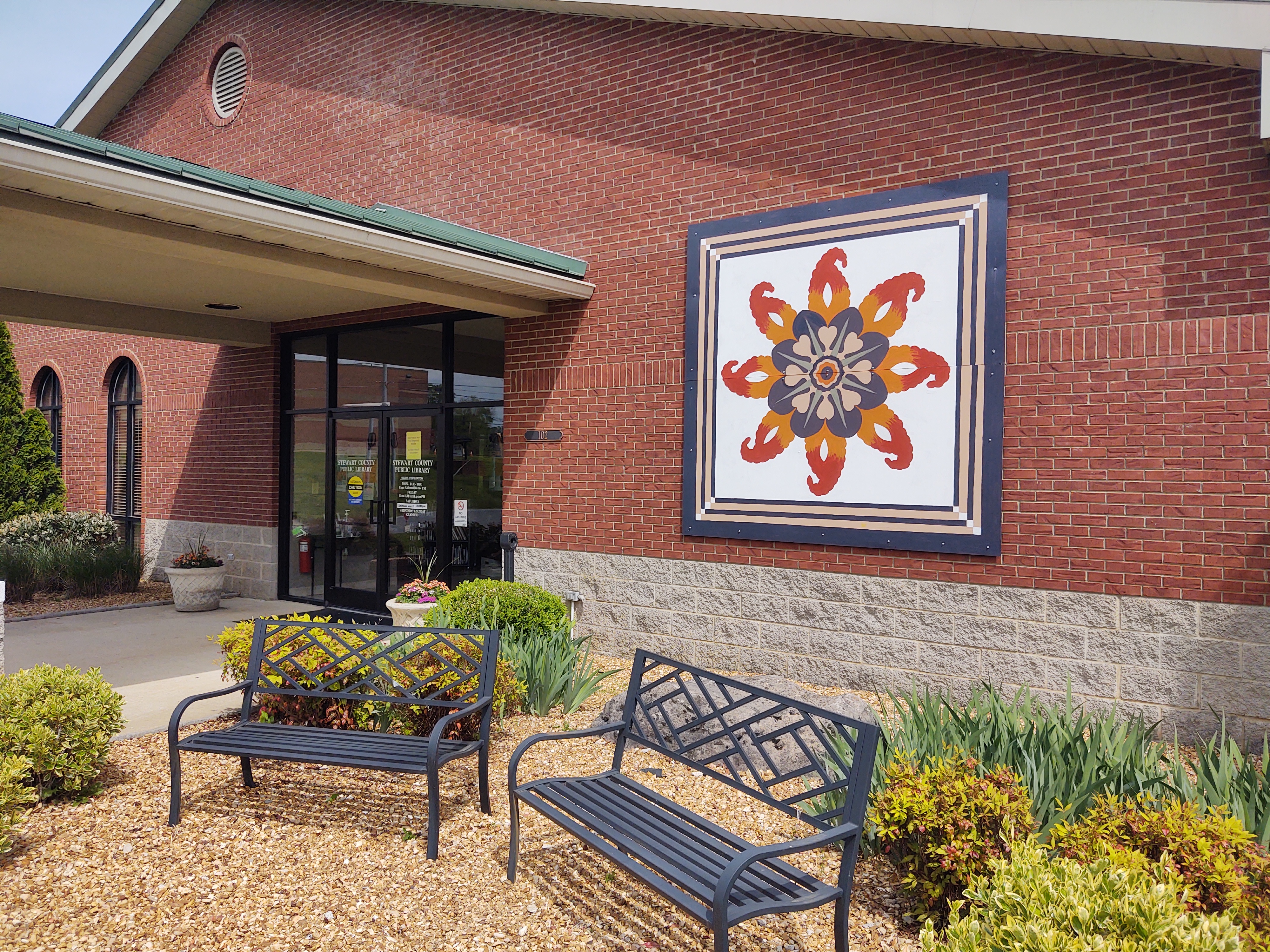
The parking lot for the public library is located off Natcor Drive. Accessible walkways and parking are near the front of the building. The block may be seen on the north side of the building near the pavilion.
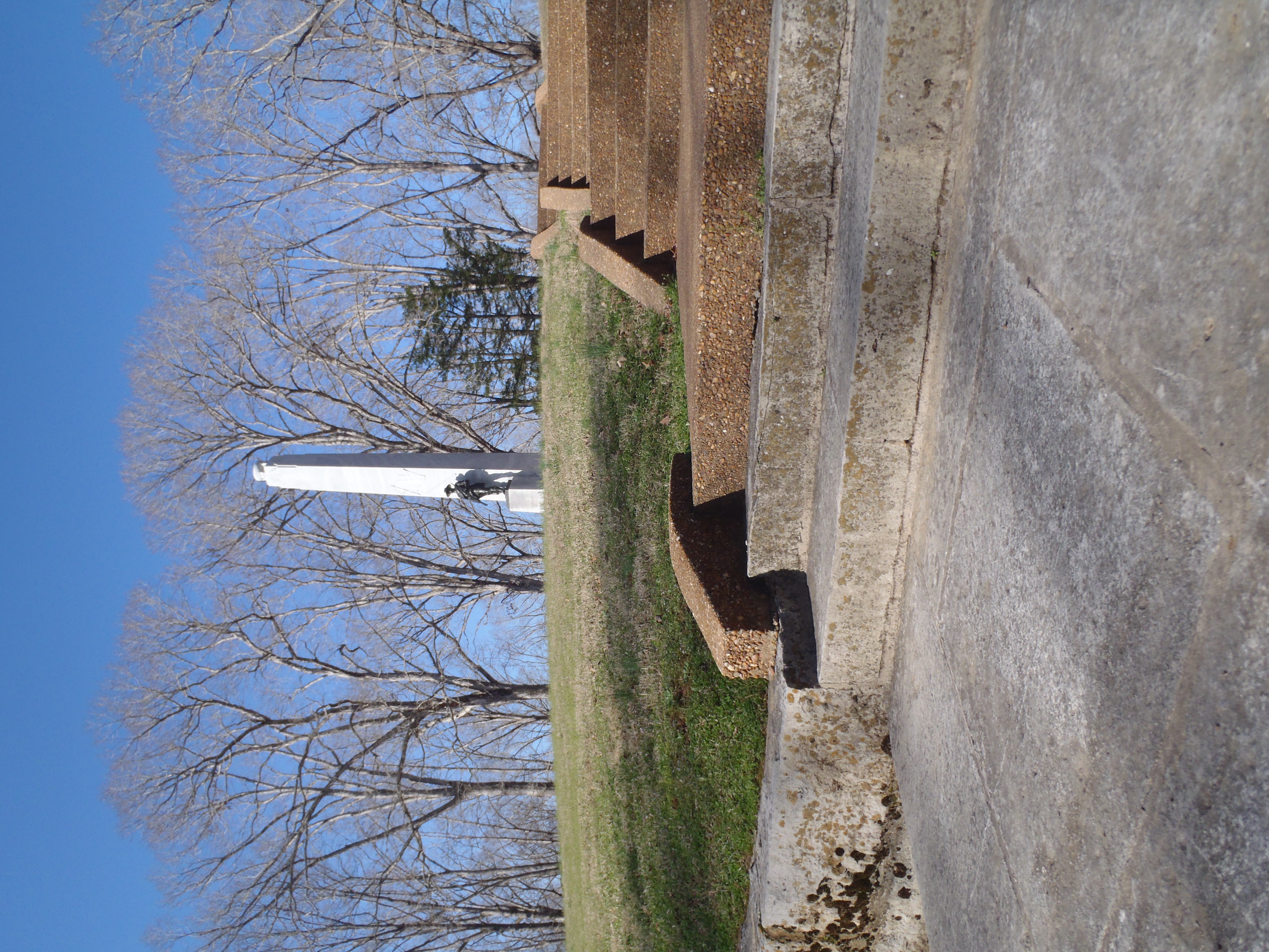
The monument is placed nearby the earthworks, up a slight hill. Parking is available across the park road from the monument. Concrete steps will lead you to the base of the monument, approximately 120 feet from the parking area.
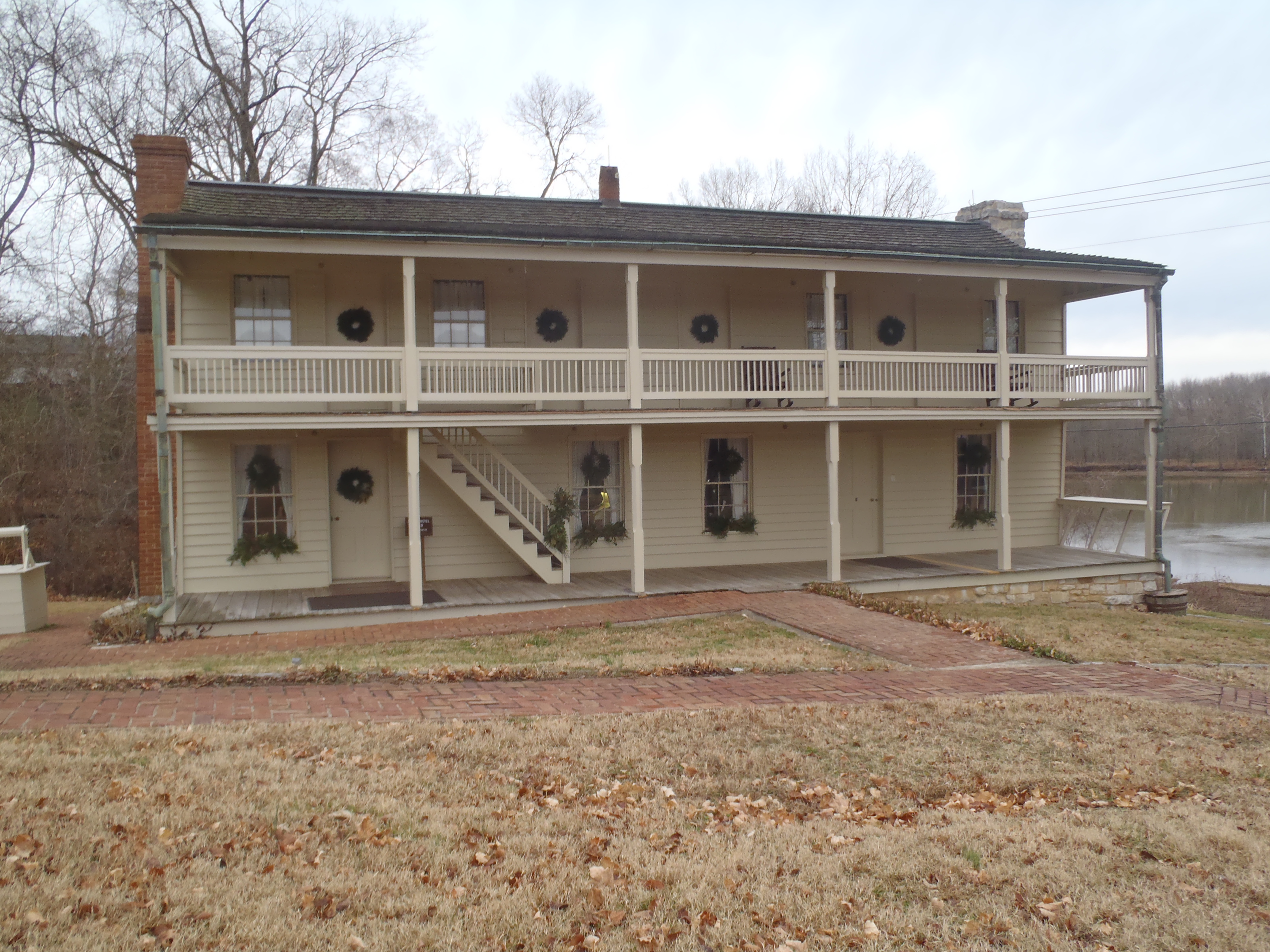
The Dover Hotel or Surrender House (Fort Donelson NB)
Driving into the parking area, handicapped parking is available near the building. Concrete sidewalks and brick walkways lead to a two-story white frame, double-porched hotel. The walkways and porch are lined with native flowers and plants, some indicative of 19th century gardens. The structure has three chimneys. One chimney on the north end is the original limestone rock. The limestone foundation is original as well. The hotel sits within feet of the Cumberland River. One picnic table sits under an American elm just adjacent to the first-floor porch. The hotel was built sometime between 1851-1853, and has three levels: an upstairs (now used by the National Park Service), the first floor (an interpretive area with exhibits and 19th-century reproduction furnishings), and a basement (which is largely used by the Park Service as storage). Exhibits describe the personalities and commanders of the 1862 Campaign, as well as the events of the surrender. A short film may be viewed and limited seating is available for visitors. There is ample space for wheelchairs to navigate the exhibit area. The audiovisual film is also available online.
This site sits along a busy city street. One wayside exhibit, two War Department plaques, and one granite monument tell the story of this site. One field cannon sits under an oak tree. Earthworks line the park road, ending at Main Street (to your right near the parking area). The area has a manicured lawn. A small, wood-framed church sits across the street from this location. In the distance from this tour stop, you can see another brick church, private homes, and a city municipal water tower.
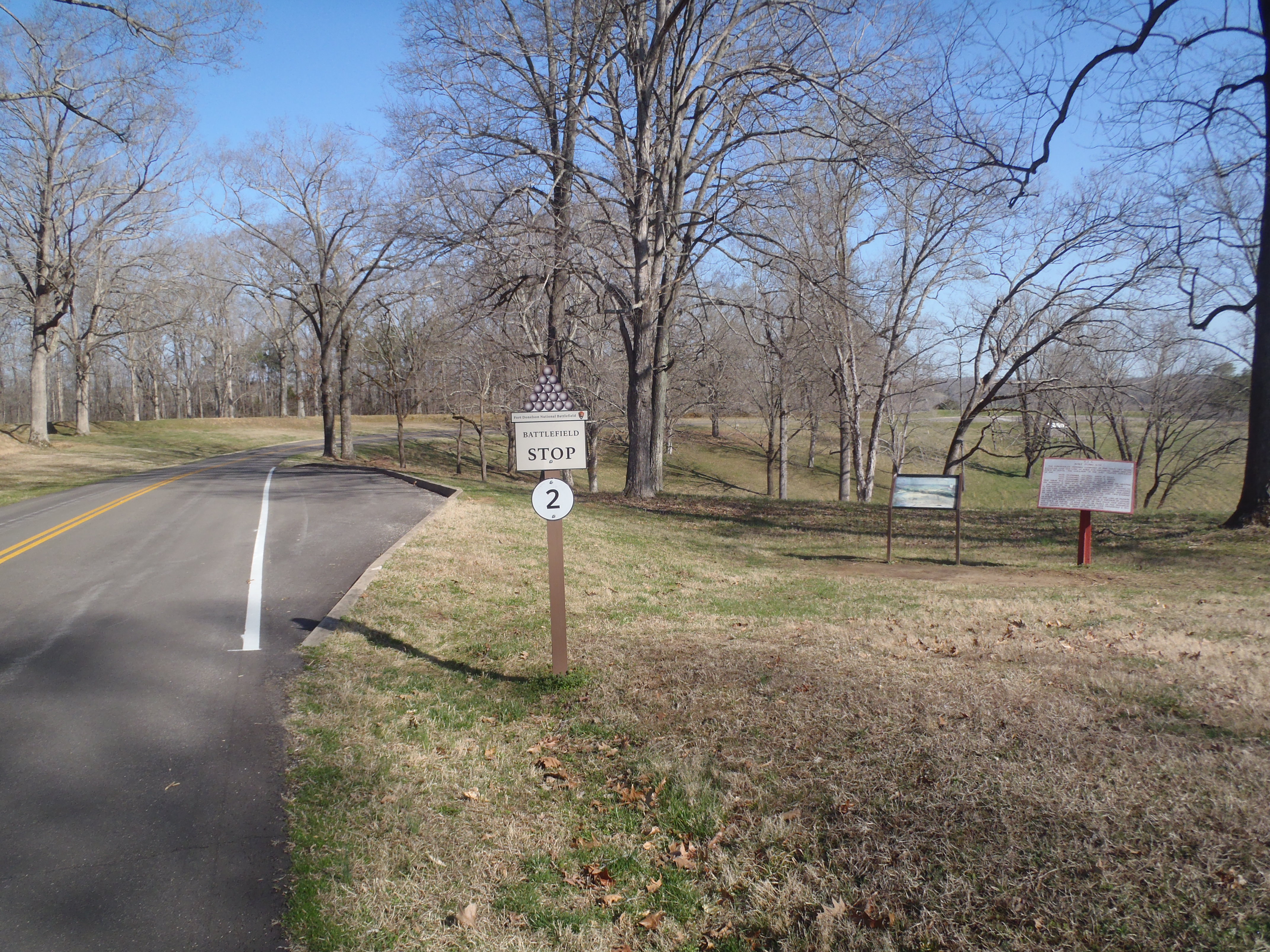
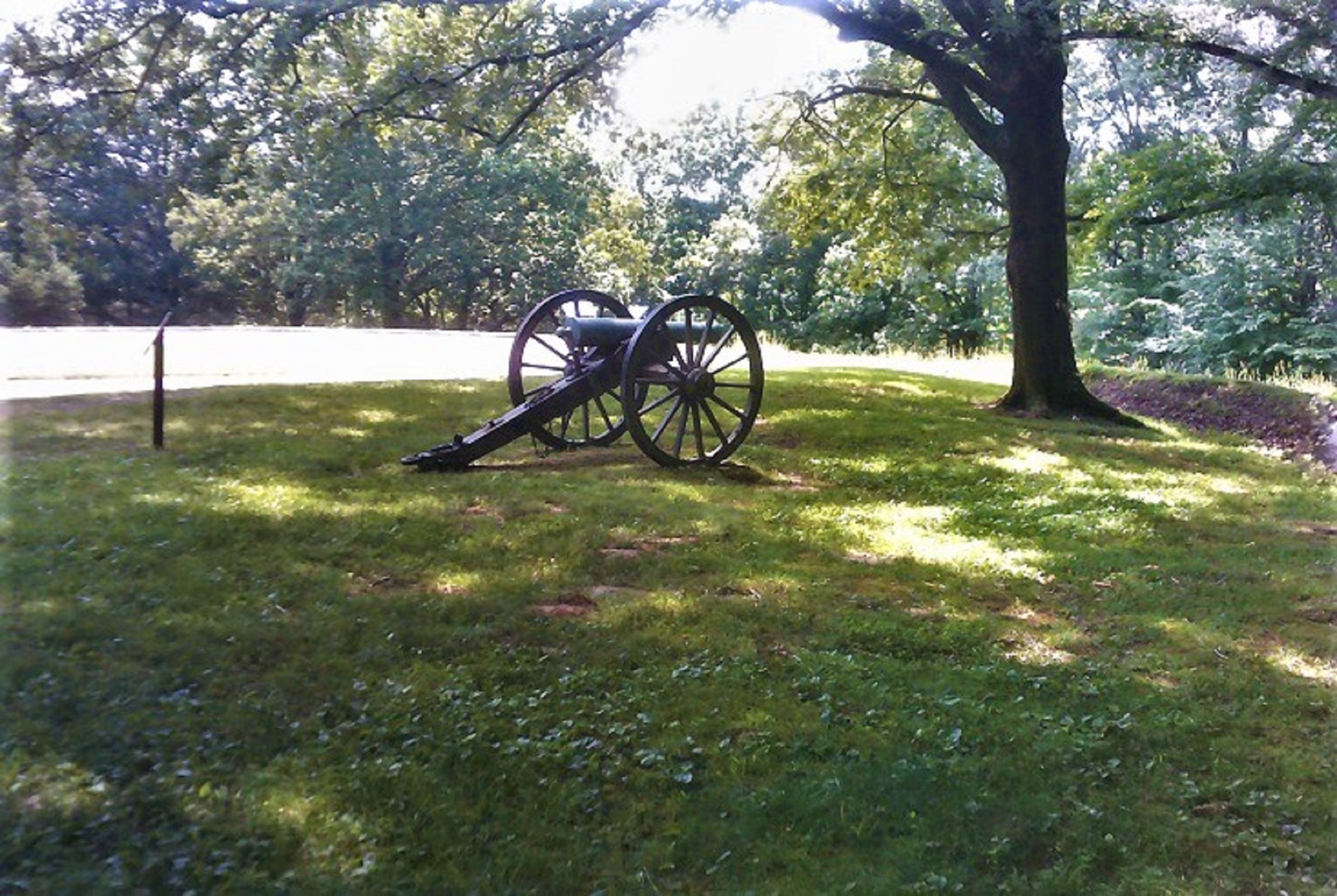
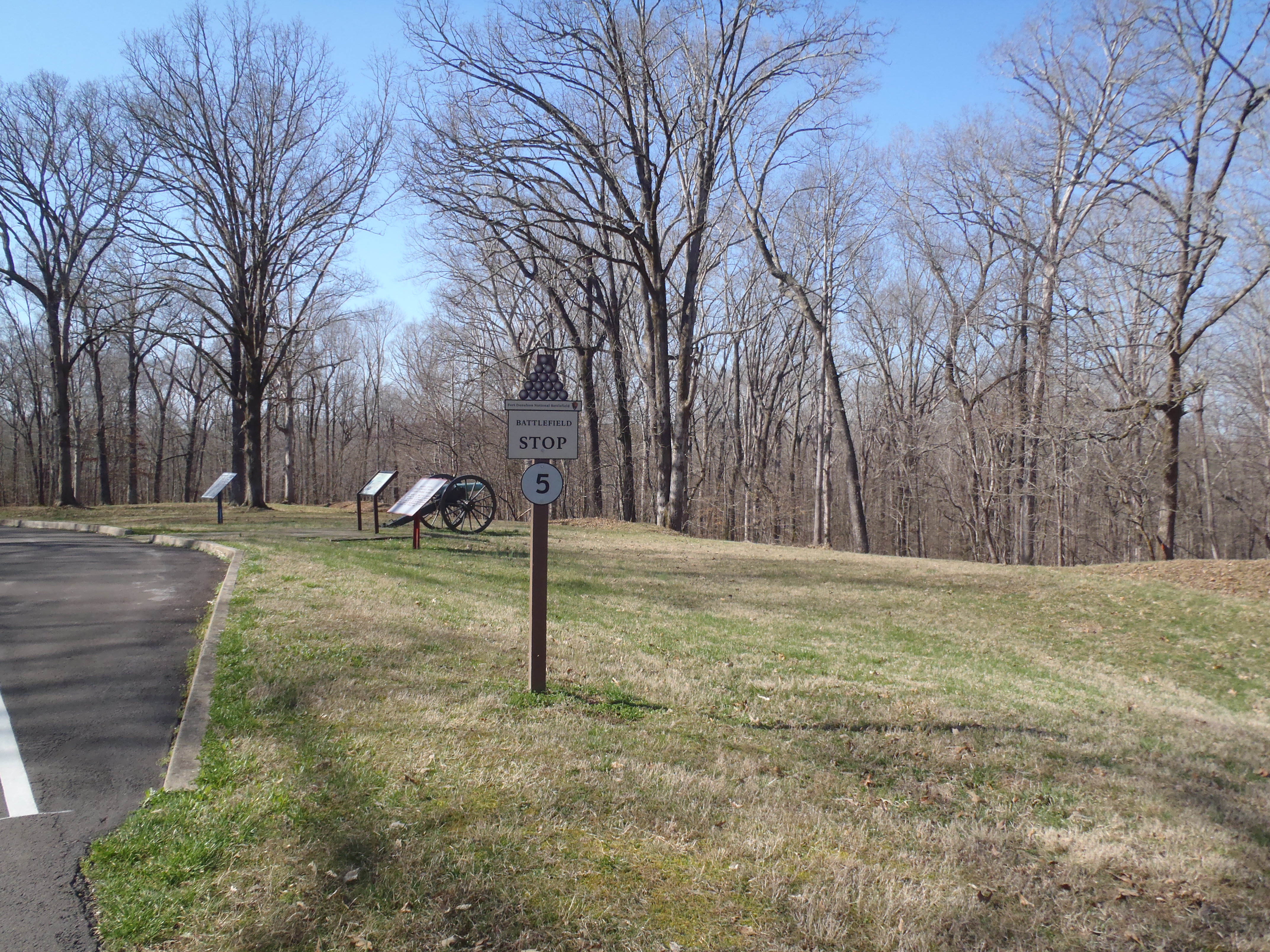
The parking area for this tour stop is located to the right of the park road, just inside the rock columns. From here, you can see the earthen fort as it appears as a grass-covered mound. A few trees grow from the fort wall. As you drive further into the fort, field cannons are placed inside the wall at three locations as you continue the drive to tour stop #3. The entire area and park road sits along a ridge, which encircles a large hollow or "bowl." Turkey, coyotes, deer and bald eagles and other wildlife may be seen seasonally within this area.
An open-air pavilion with rough floor surfaces to prevent slippage. Brick walkways lead from the main parking area into the pavilion and also from the northside. The structure is approximately 30 ft x 40 ft, roof with wood shakes, with stacked limestone columns. Seating is available around the interior of the structure. electric panel available on the rear of the structure.
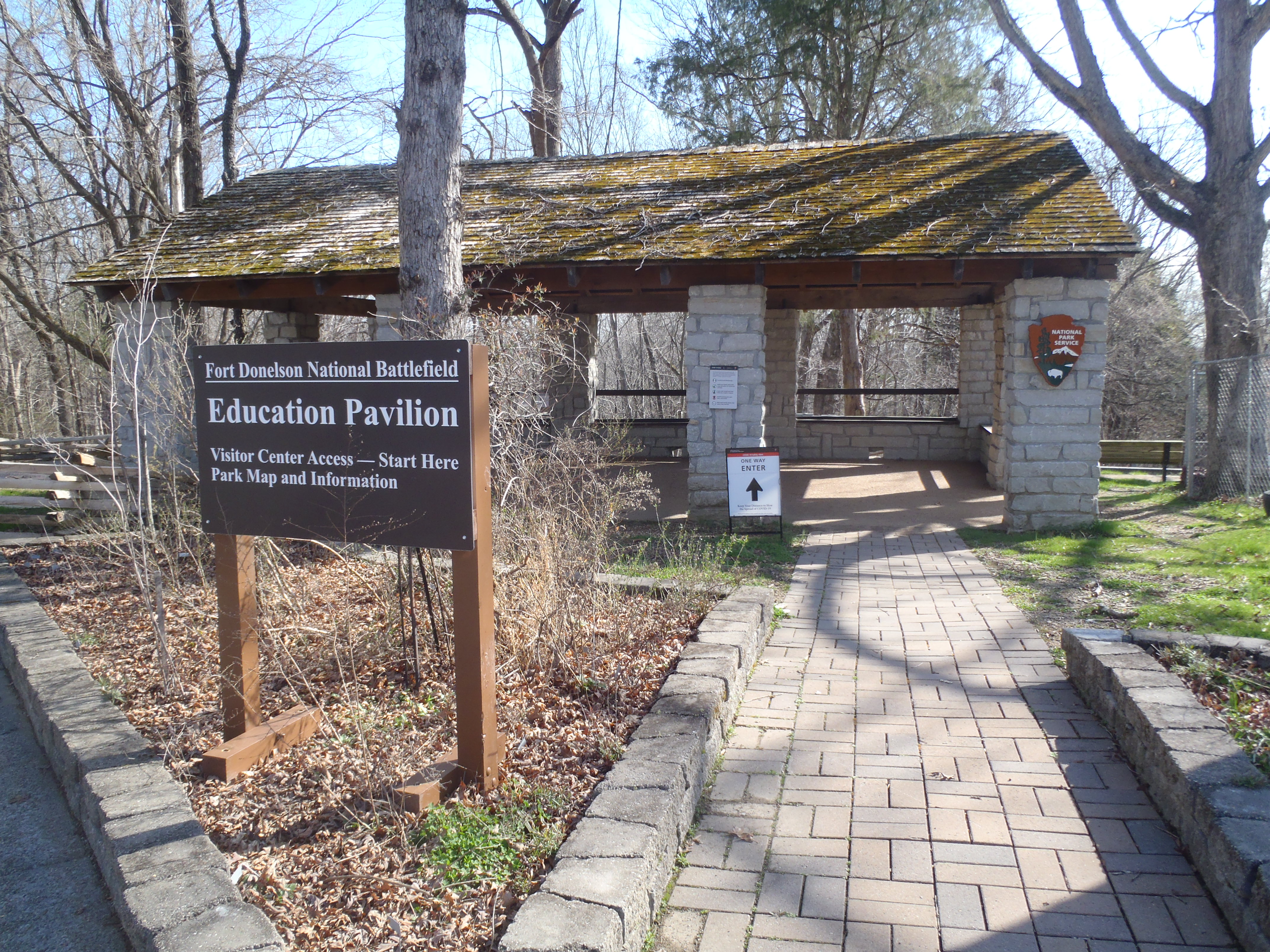
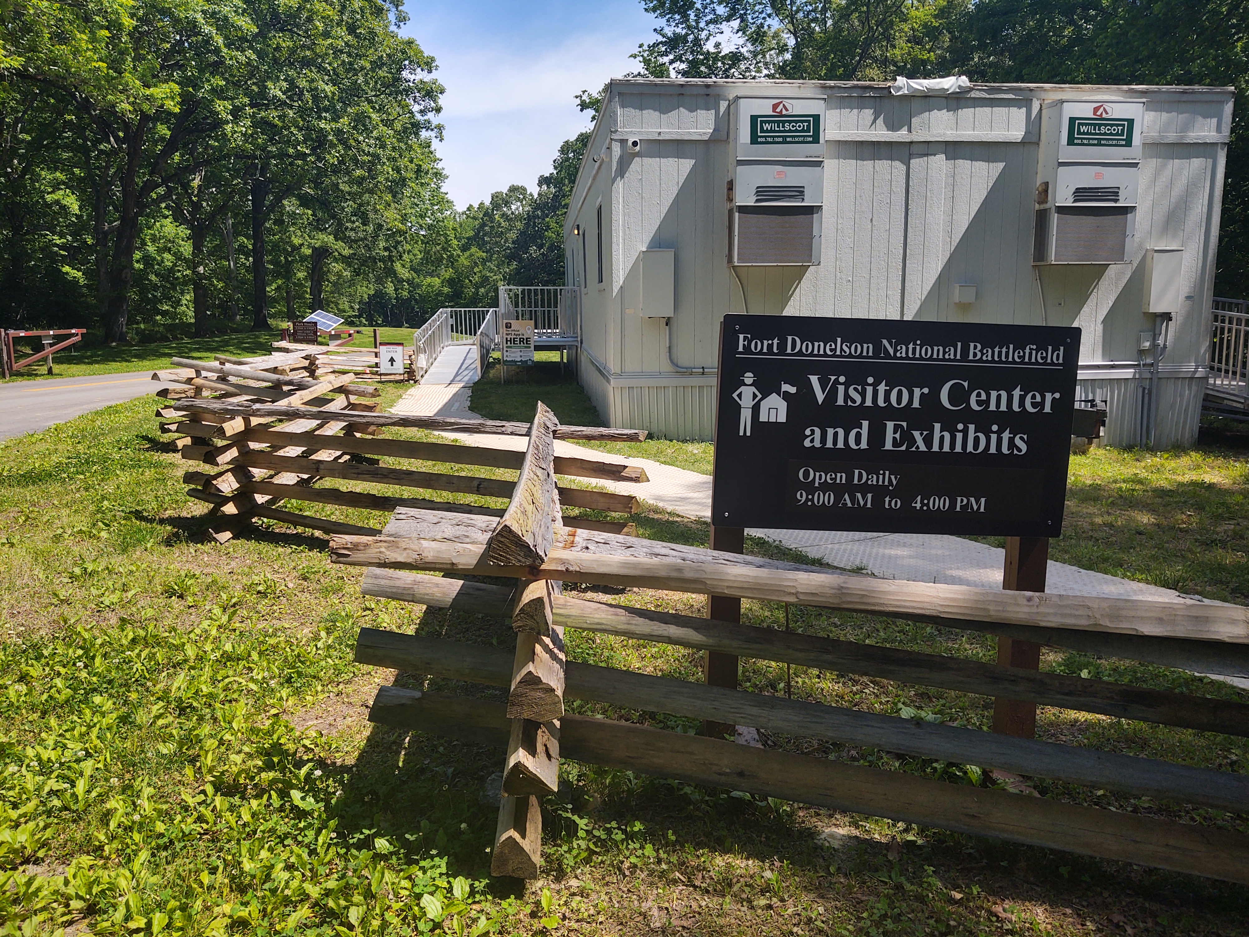
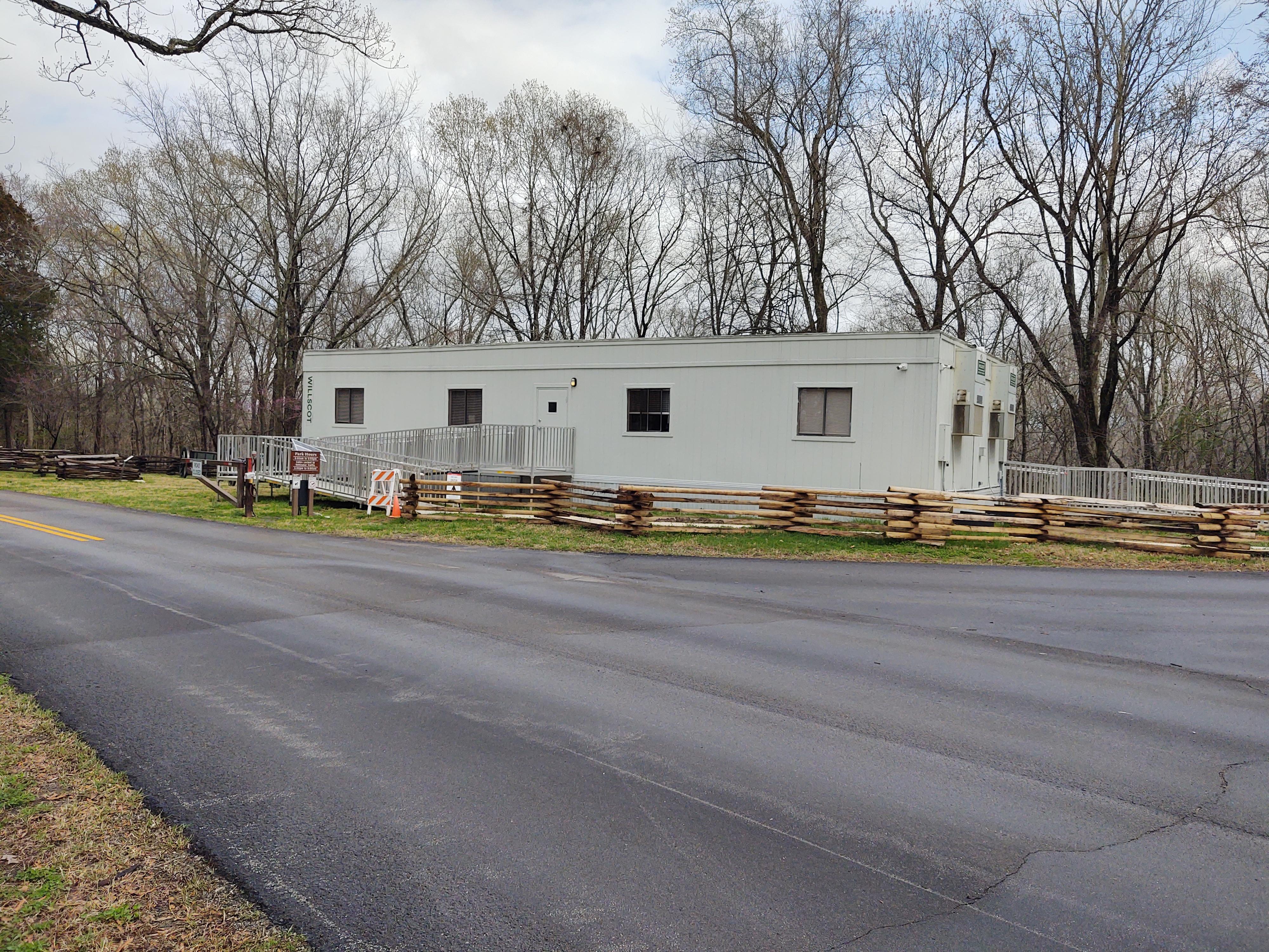
One of the surviving Mission-66 visitor centers is undergoing a renovation, so you will find orientation in our current Visitor Center. Friendly staff, Civil War exhibits, the Passport to Your Parks stamps, Junior Ranger Handbooks, and a gift shop are available. One handicapped accessible restroom is located here. The Education Pavilion nearby is also stocked with information and Junior Ranger Handbooks.
The Visitor Center, pavilion, information, gift shop, exhibits, and a restroom are located at the main park entrance. Handicapped parking is adjacent to this area, with side walks leading to the pavilion. The area is also the location of the trail head and exit. An amphitheater is located behind the pavilion. Construction and rehabiliation on the Mission-66 Visitor Center occur behind a chain-link fence. Gravel walkways lead visitors to the temporary Visitor Center. Ramps are located at the front and rear entrance of the modular structure.
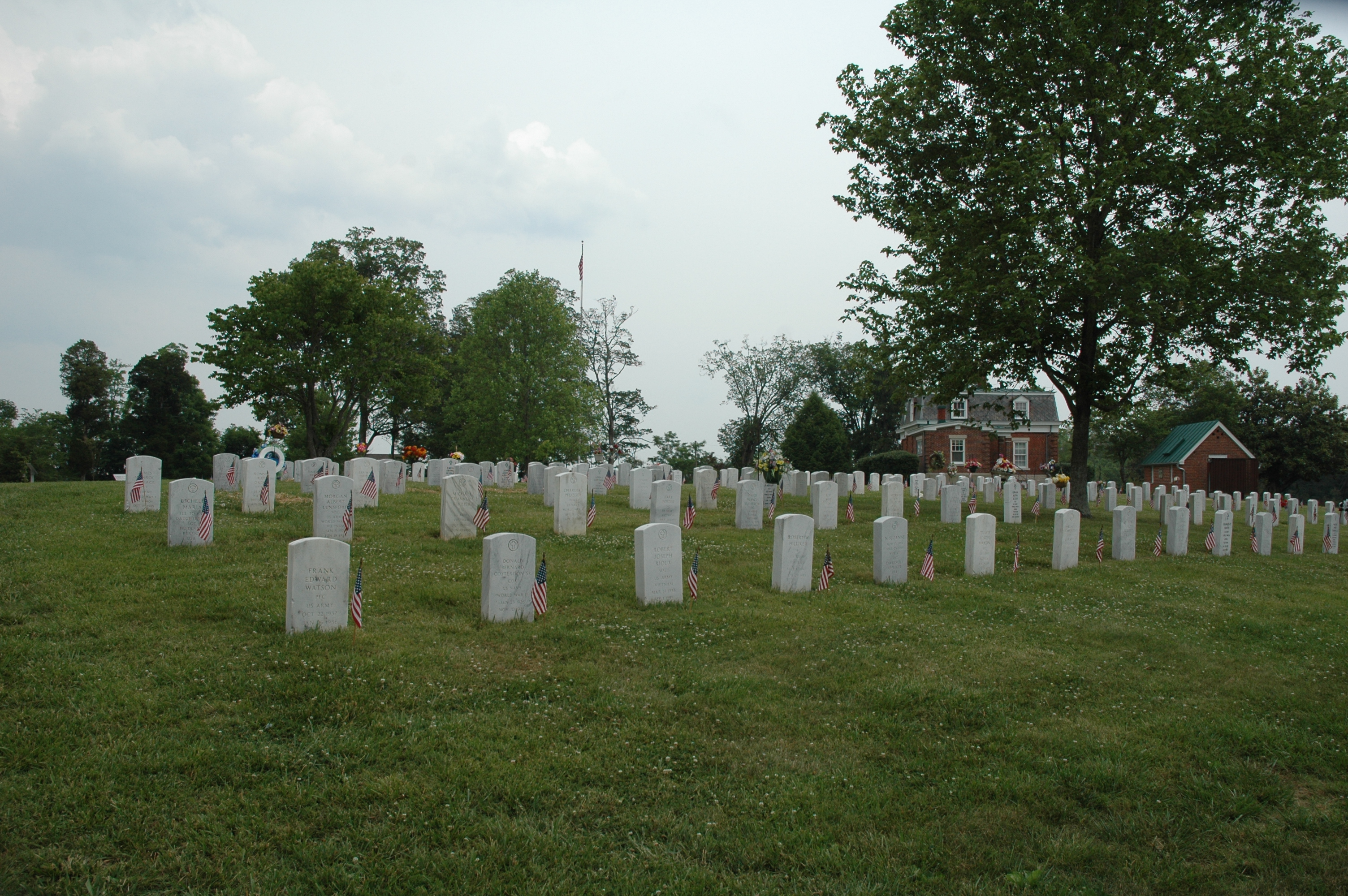
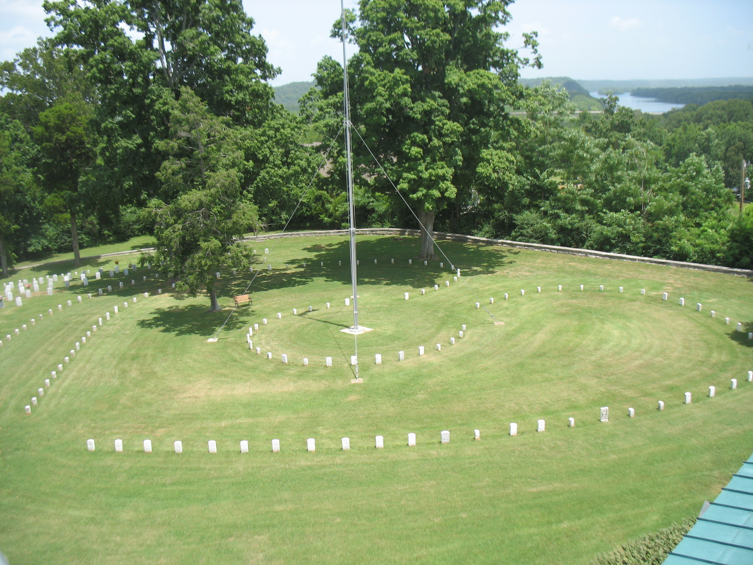
Exiting Highway 79, turn right on Church Street. The entrance is just a short drive. At the first parking area, you will see a limestone rock wall, double-cast iron gates, and a large two-story brick lodge with a front porch. The smaller brick building to the left of the parking area is the cemetery carriage house or shelter. It houses exhibits. Handicapped parking is available in the two parking spaces near the double-gate entrance. Leaving the parking lot, and driving left towards the back of the national cemetery, you will see Union headstones, a brick restroom, a flagpole, and Civil War cannon monument. Parking is available at the back of the cemetery. Another double, cast-iron gate is located in this section. A smaller gate provides entrances for visitors and families.
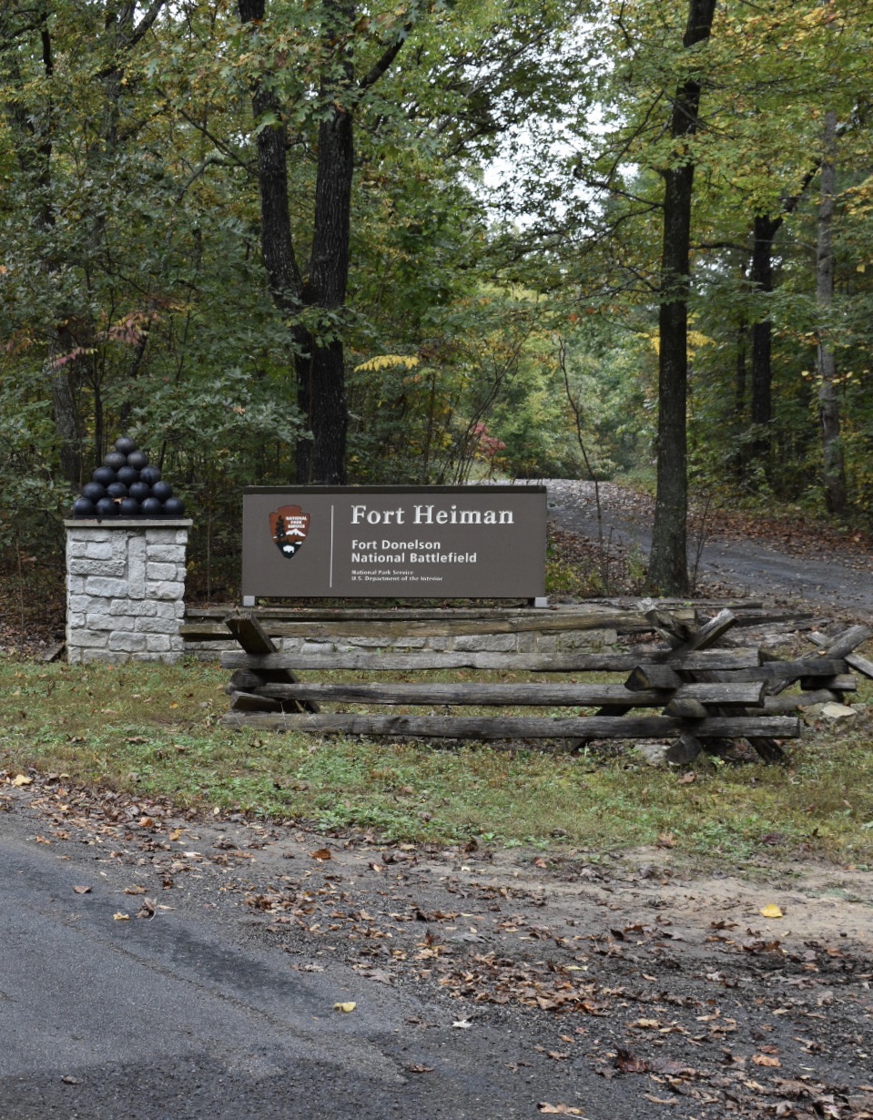
The Fort Heiman Unit is located in Calloway County, Kentucky. The site is still under development, but you will find an impressive view of Kentucky Lake and the historic earthworks, wayside interpretive exhibits, and a pavilion with exhibits. Cell phone service is limited.
The site is still under development. No Visitor Center or Contact Station is located here, but you will find wayside interpretive exhibits, one open-air pavilion with exhibits, and historic earthworks. There's one pit toliet. Handicapped parking is avilable. There's limited cell-phone service. The county road is closed past the pavilion; visitors should be prepared to walk to a higher point overlooking the river. The road is rough in places and the terrain is hilly.
A manicured lawn with wayside exhibits and War Department plaques. The exhibits require some walking from the parking area. There are no paved paths or brick walkways. A field gun sits near the line of continuous earthworks.
The manicured lawn has an extensive line of continuous earthworks and one field cannon. Mature trees provide shade. A trail entrance begins here. A brick walkway leads you to a wayside exhibit and War Department plaque.
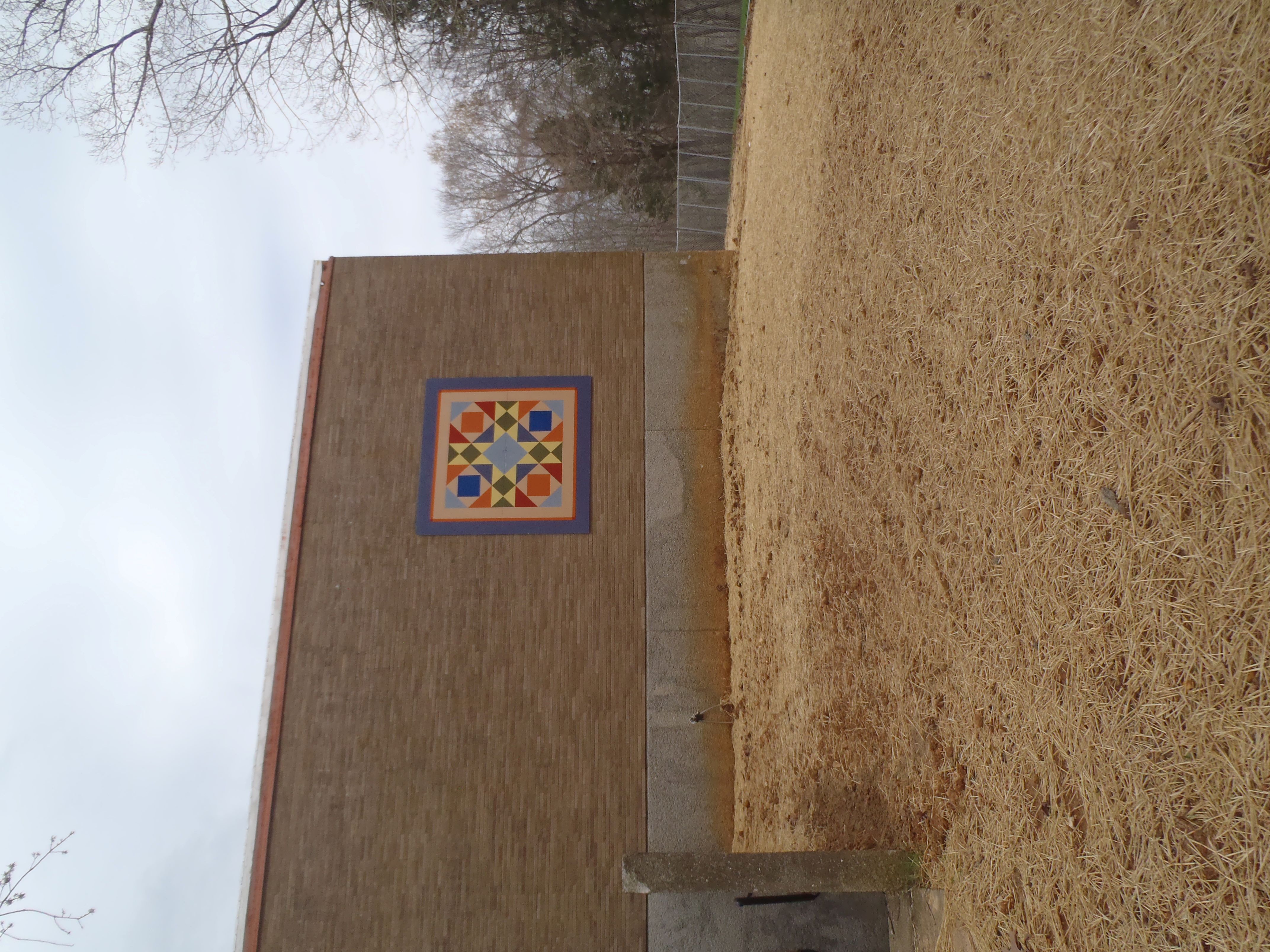
The quilt block for this location is located on the south side of the building. Currently, you will have to walk around the chain link fence to see this block.
The Log Cabin quilt block is featured on the Dover Family Pharmacy, on the west side. Parking is available in the front or back of the pharmacy. Be careful, the pharmacy pick-up line is near the block. It may be safer to sit in the adjacent parking area and view the block.
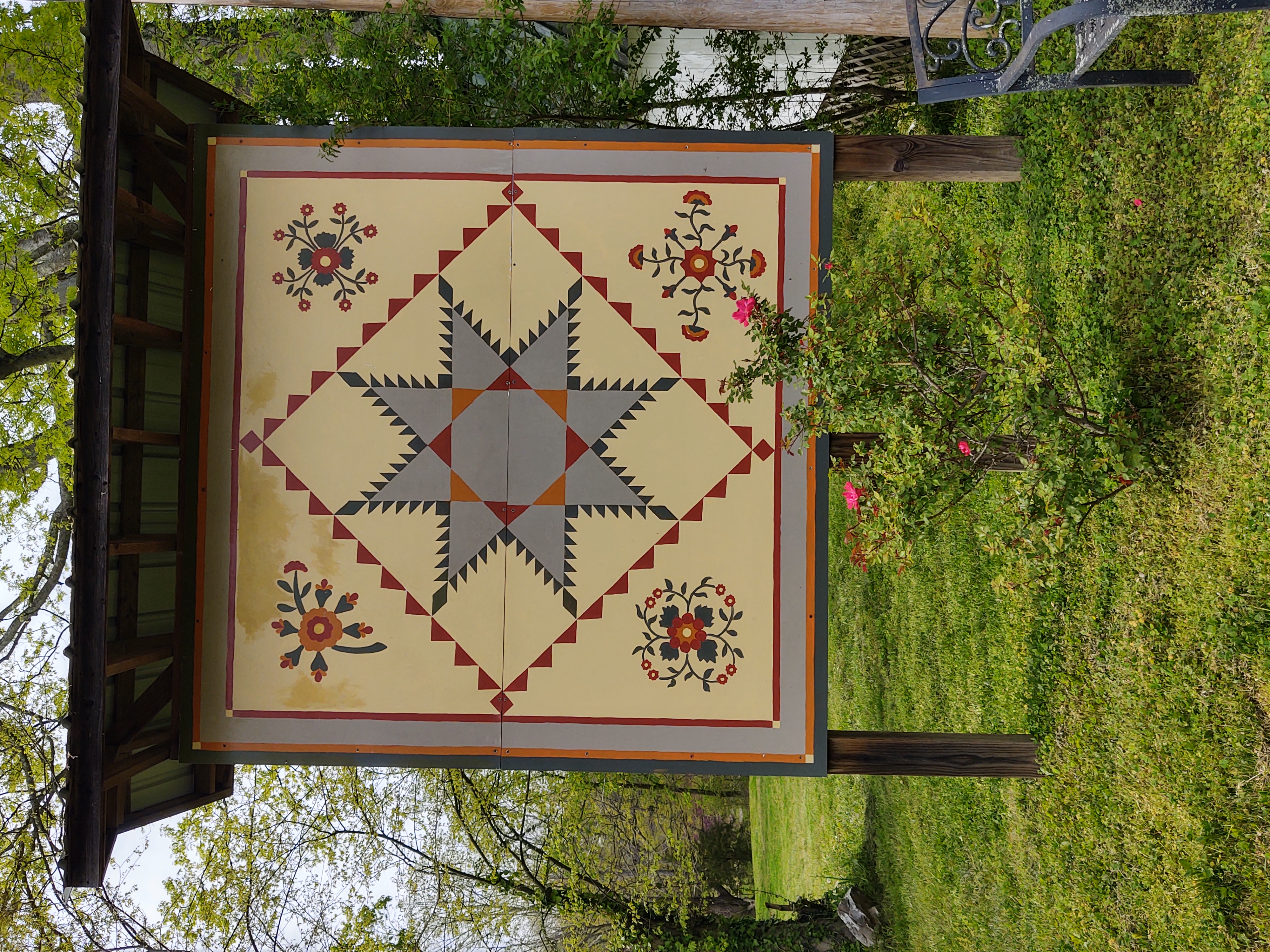
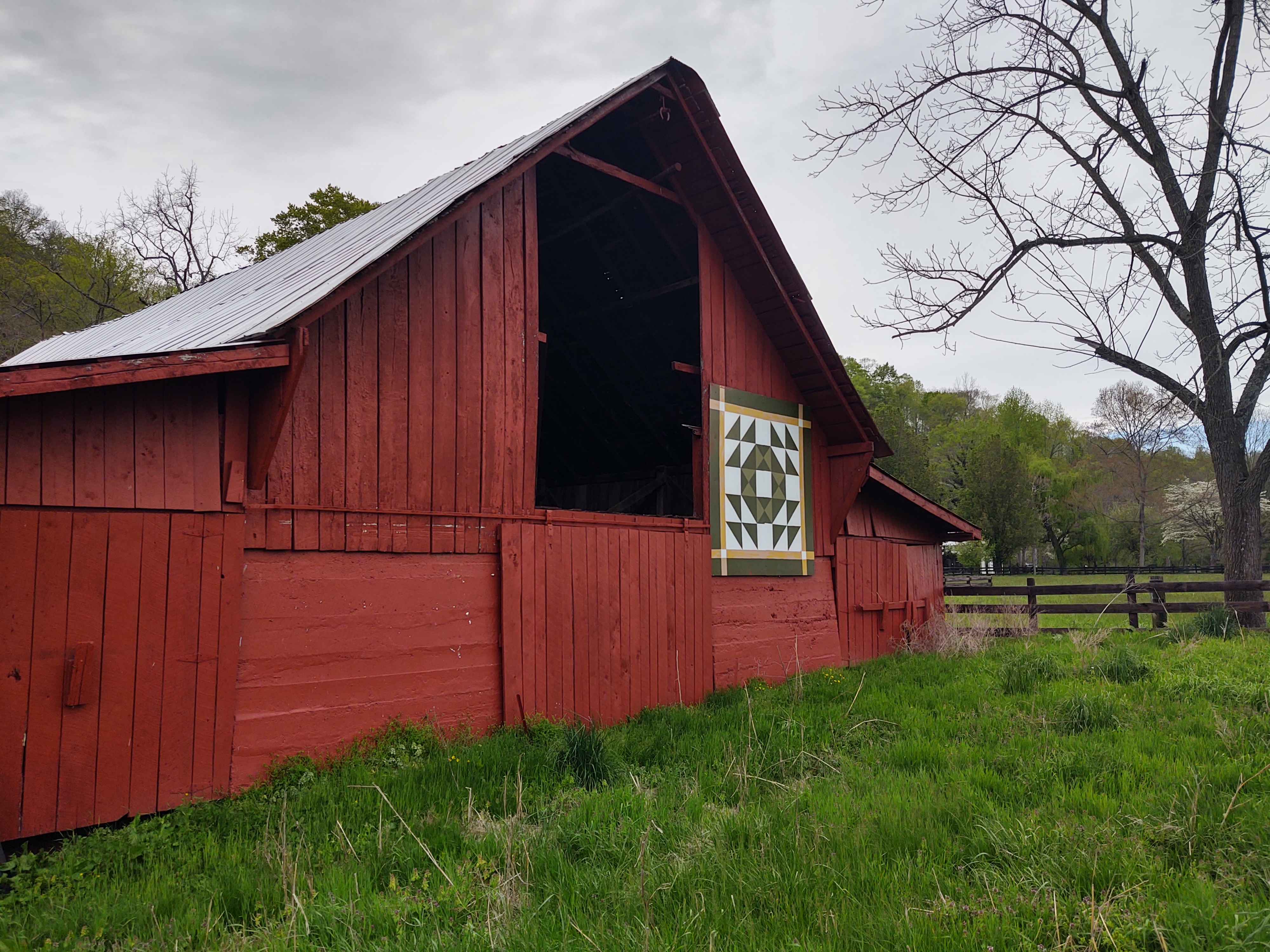
The quilt block is located on a large early 20th century barn. It's location is in a farm setting, with farm buildings, fences, and a two-story house. The block is located on the east side of the barn, facing Long Creek Road.
The Mission-66 visitor center is under renovation, with a chain-link fence surrounding the premises. The Underground Railroad Quilt block is located on the south-facing side of the building. It is visible from Highway 79 and also by parking in the large parking area and walking along the earthworks to the side of the building. Restrooms, a gift shop, and information are available here inside the temporary park Visitor Center.
The Stewart County Visitor Center sits across Highway 79 from Fort Donelson NB. A large parking area is located in front of the one-story building. Sidewalks surround three sides. A wheelchair ramp may be found to the left of the main entrance. Picnic tables are located to the right of the building. The double-glass doors lead into the lobby. The doors are not handicapped accessible. A large reception desk sits in the room to the left, just off the lobby. The Roper Star may be found near the back of the Visitor Center. For an additional view of this lovely quilt, visit Black Family Farms, 175 Lorena Bagwell Drive, Dover, TN 37058.
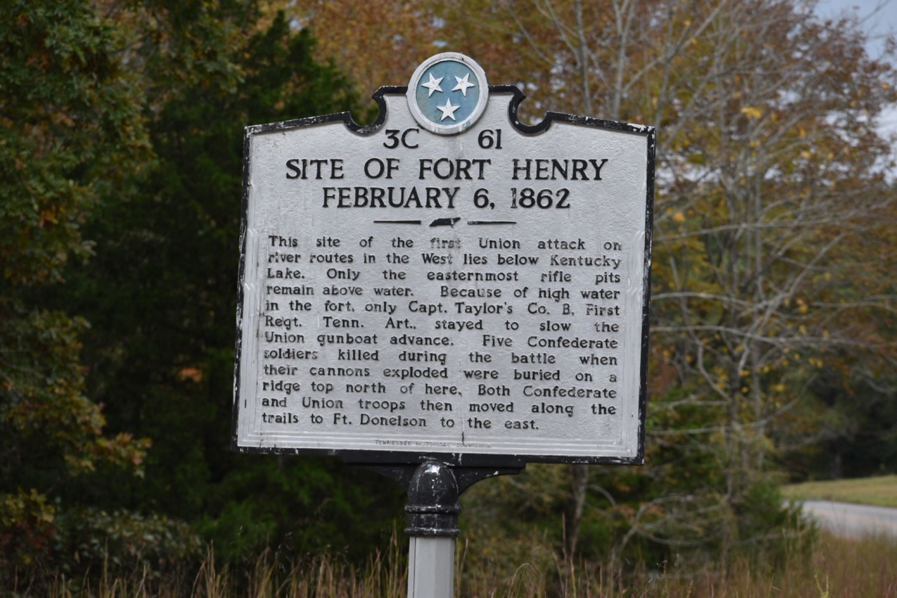
Fort Henry, USDA Land Between the Lakes-US Forest Service www.landbetweenthelakes.us
From the South Welcome Station within Land Betweent the Lakes NRA, drive west on Fort Henry Road to the Boswell Landing/Fort Henry Site. You will see the Fort Henry Interpretive Marker. Turn right into the site, and you will notice a gravel road. The trail head for the Fort Henry hiking trails begins, and parking is available, at the end of the gravel road. Follow the informational kiosk and your hiking trip guide for your walk. If you drive Highway 79 South to Fort Heiman, you will pass the second Fort Henry marker. It's located right off the highway.
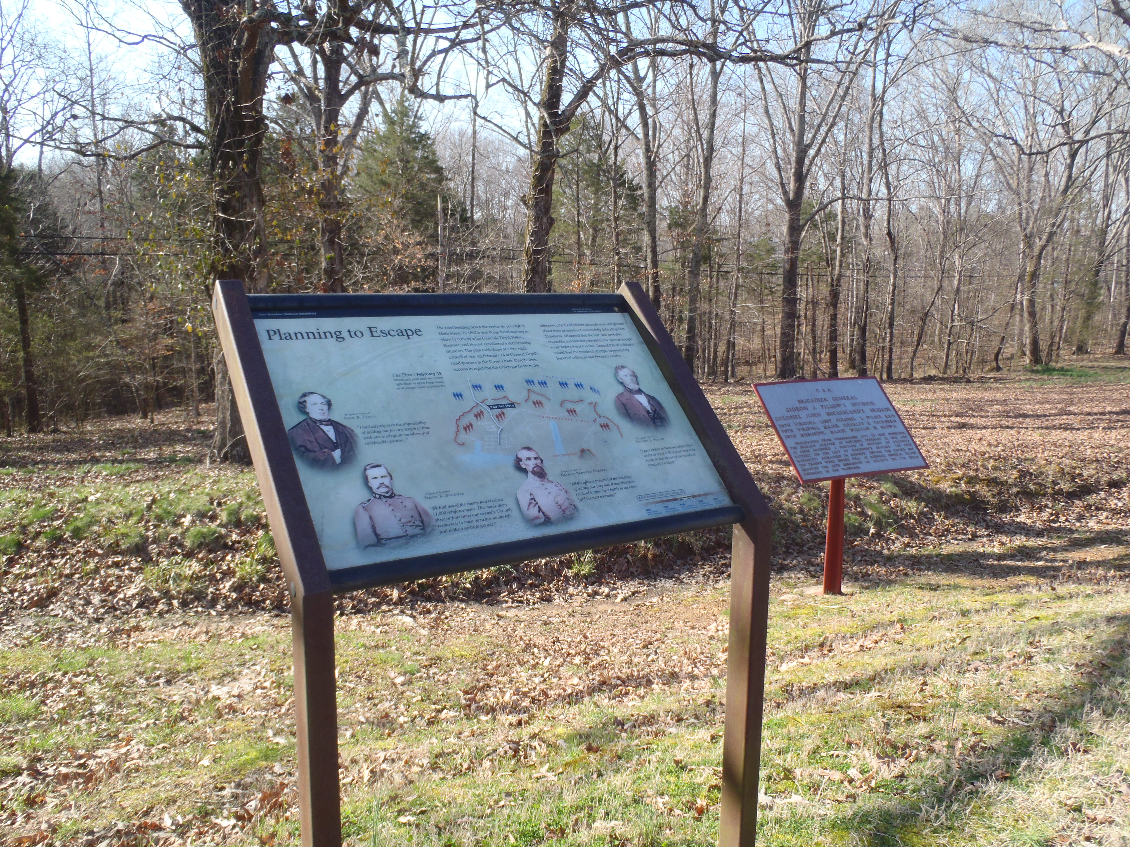
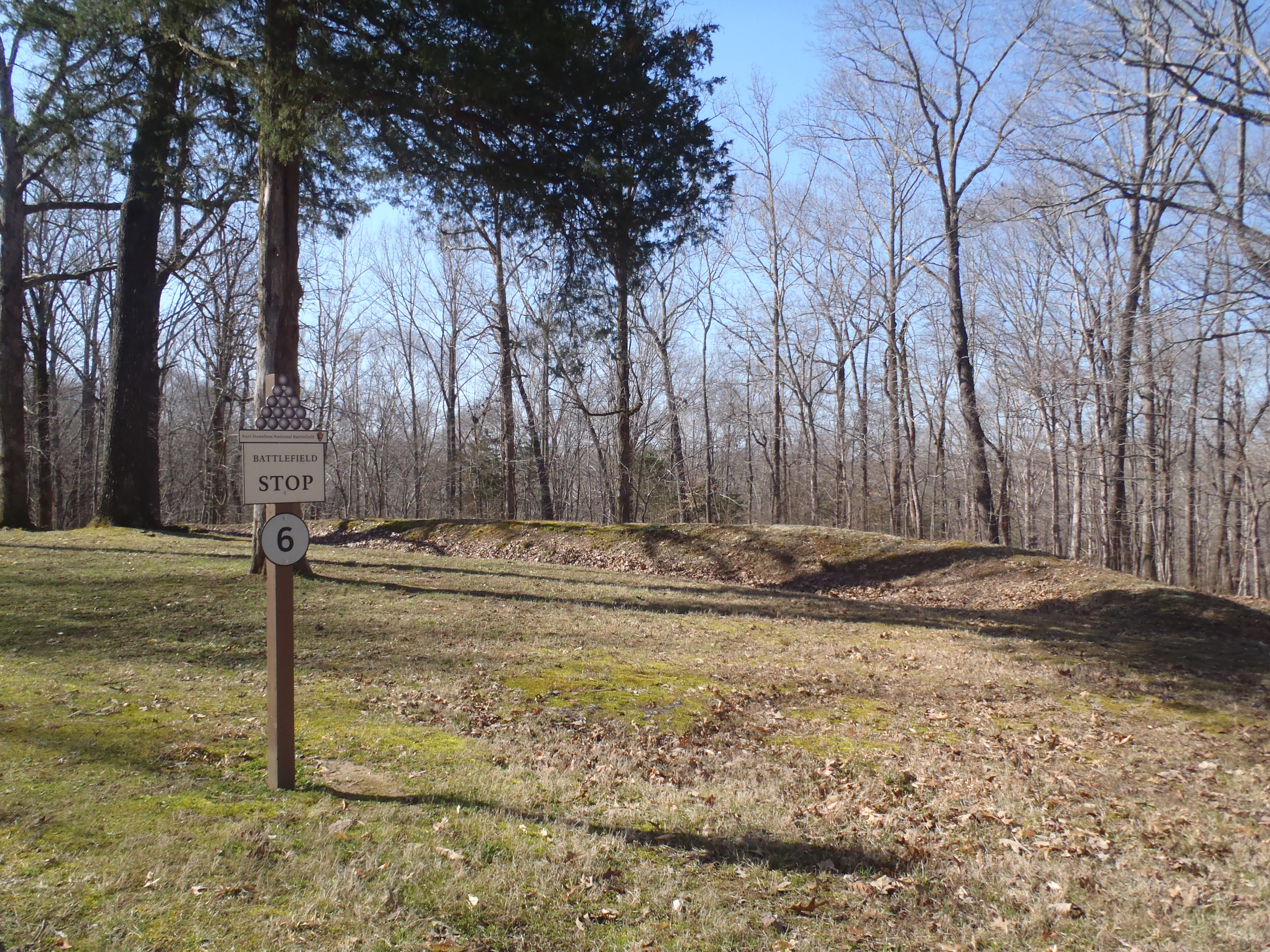
The area is both a mixture of manicured lawn and a wooded area with a mixed forest of oaks and hickories. The area contains segemented rifle pits, or fighting positions, unlike other areas of the battlefield, which have a continous line of earthworks. One War Department exhibit and one wayside exhibit explain the circumstances of the engagement. One brass field piece sits nearby the exhibits.
The remains of the fort (Tour Stop #3) illustrate how the agricultural landscape of the 19th century was transformed into a military fortification. You can help us continue to preserve this historic resource by not walking or climbing on the fort walls or earthworks within the national battlefield.
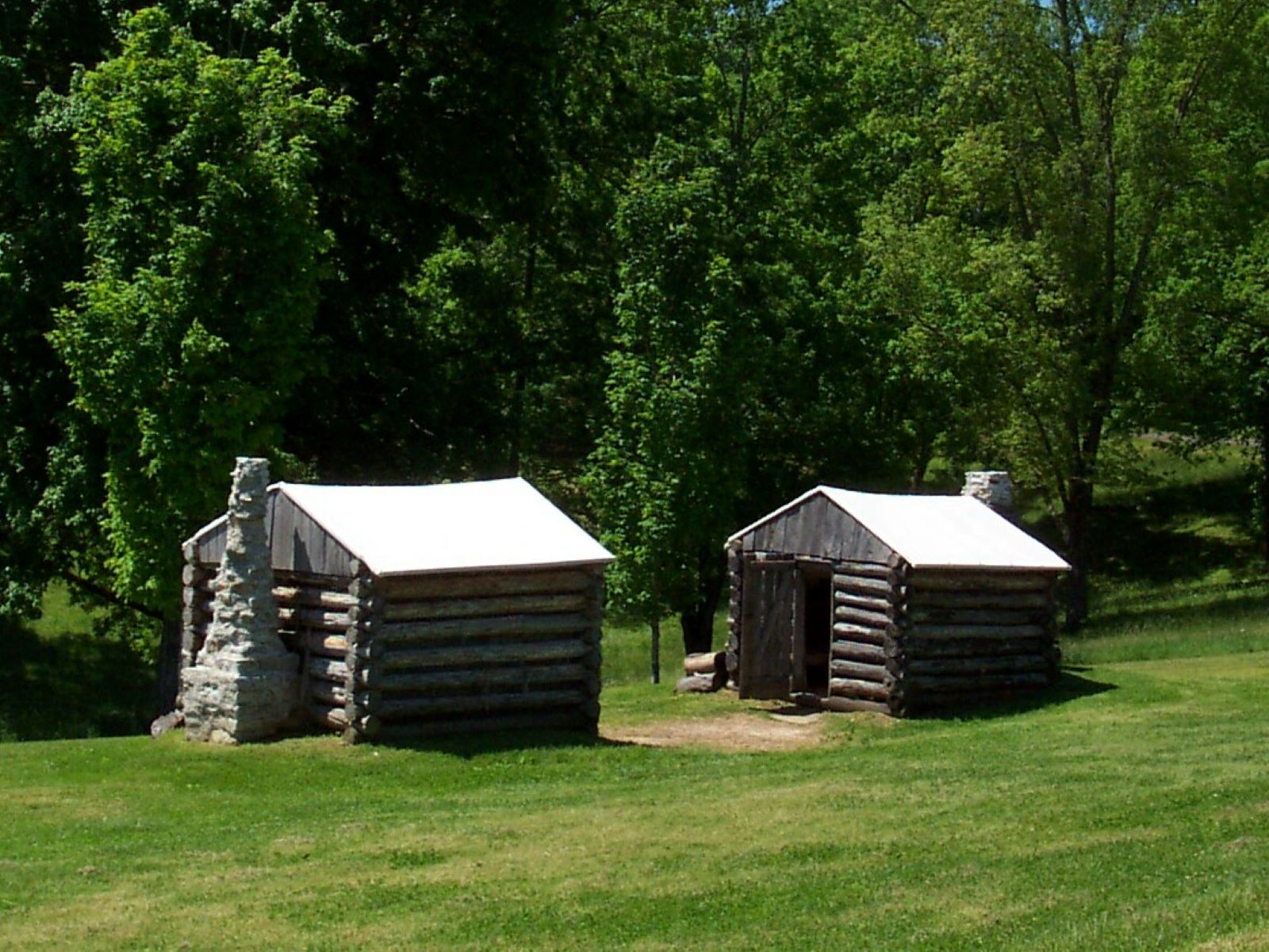
The 15-acre fort sits upon a high point along the Cumberland River. The remains of the fort encircle a large "bowl" or hollow. The fort walls were built on top of the ridges surrounding this hollow. One reproduction log hut can be seen (and you may go inside) just adjacent to the parking area. It is believed that Confederates built winter huts similar to this during the winter of 1861-1862. Two wayside exhibits are accessed from this location: one in front of the log hut, and the other near a field gun across the park road. The walls of the fortification have eroded in the years after the 1862 battle. Signage directs visitors to stay off the fort walls to preserve the cultural resource. The walls have been sodded with grass and a few trees grow from the wall too.
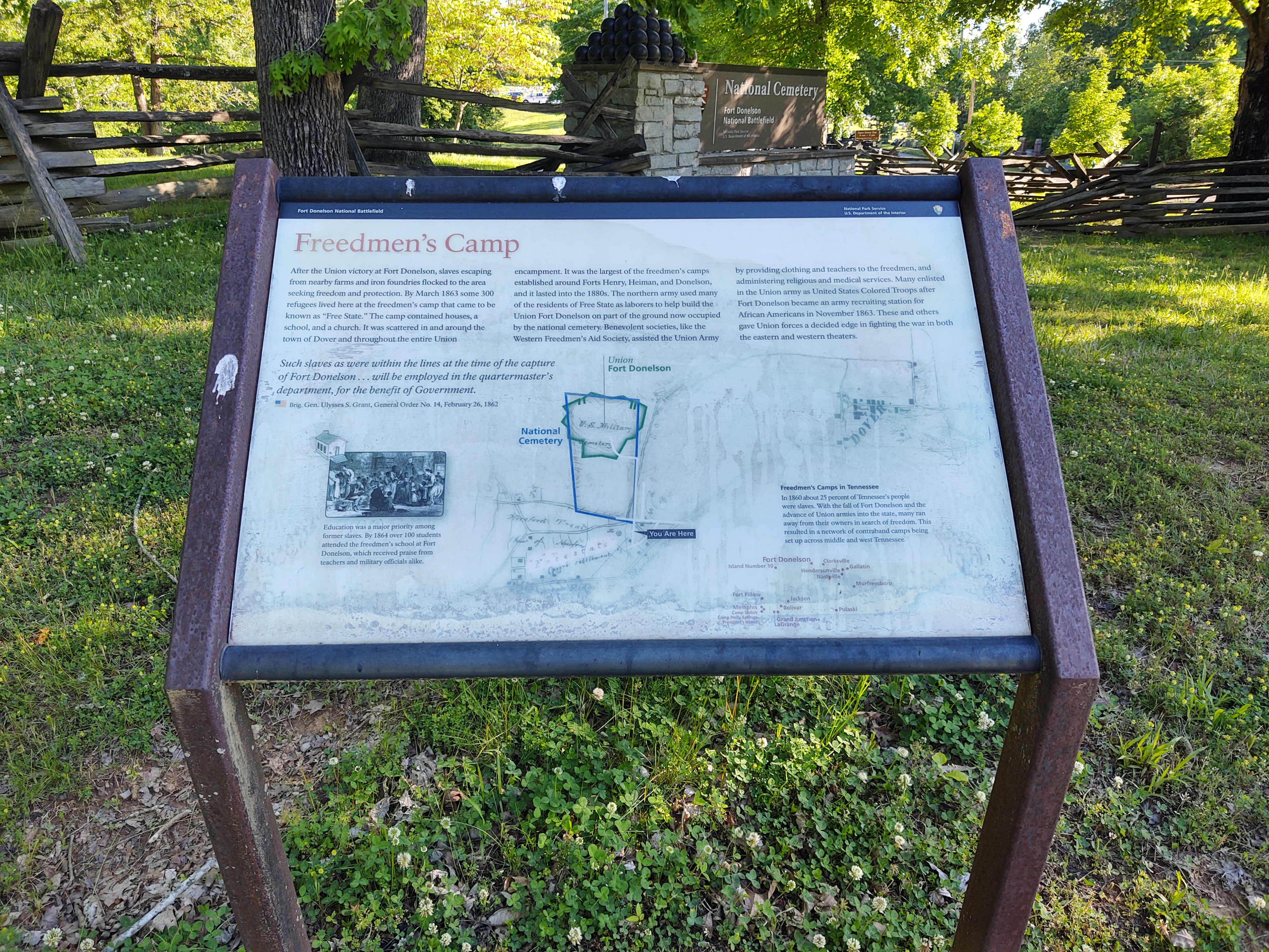
Exiting from Church Street, just off Highway 79, enter the entrance to the National Cemetery. Before you enter the gate, look to the left. You will see a gravel road and the wayside exhibit for the Free State is located here. Visitors may park here to read the exhibit.
The mowed grass areas contain rifle pits, one wayside exhibit, and parking. The area is heavily wooded along the ravines and areas beyond the earthworks or rifle pits.
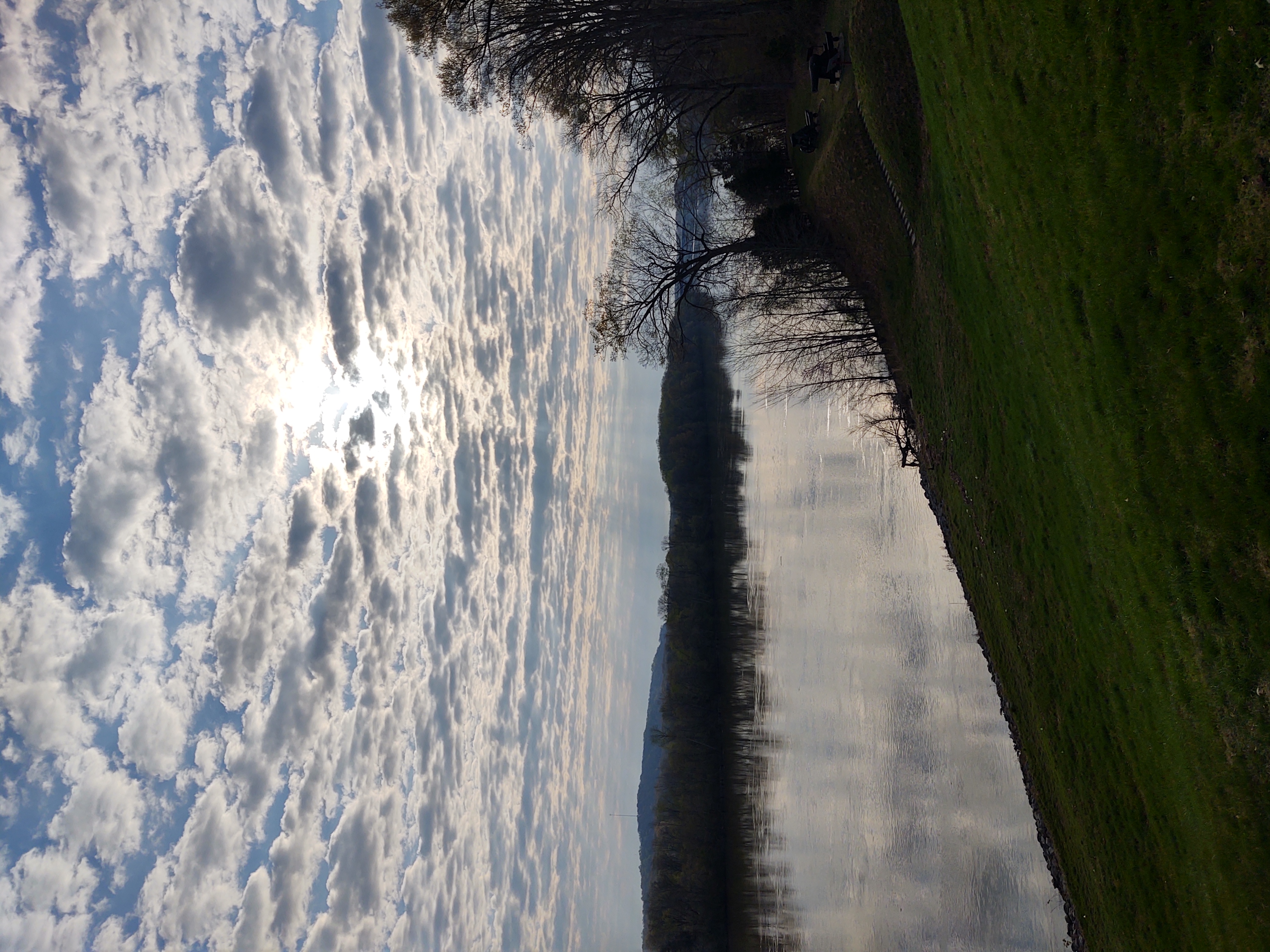
Two artillery positions were constructed on the banks of the river to provide formidable defenses against attack by the U.S. Navy. This site marks the location of the Valentine's Day battle between the ironclad gunboats and the Confederate artillerists. Today's views from the Cumberland River (Lake Barkley) offer outstanding views of the historic resources, and glimpses of wildlife and migratory birds.
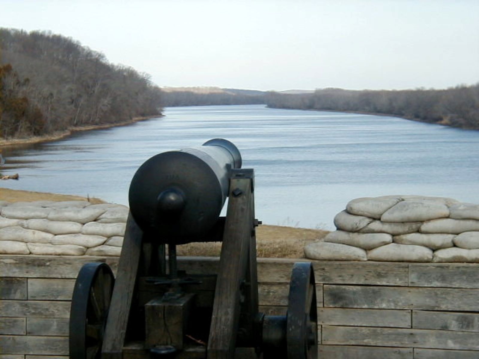
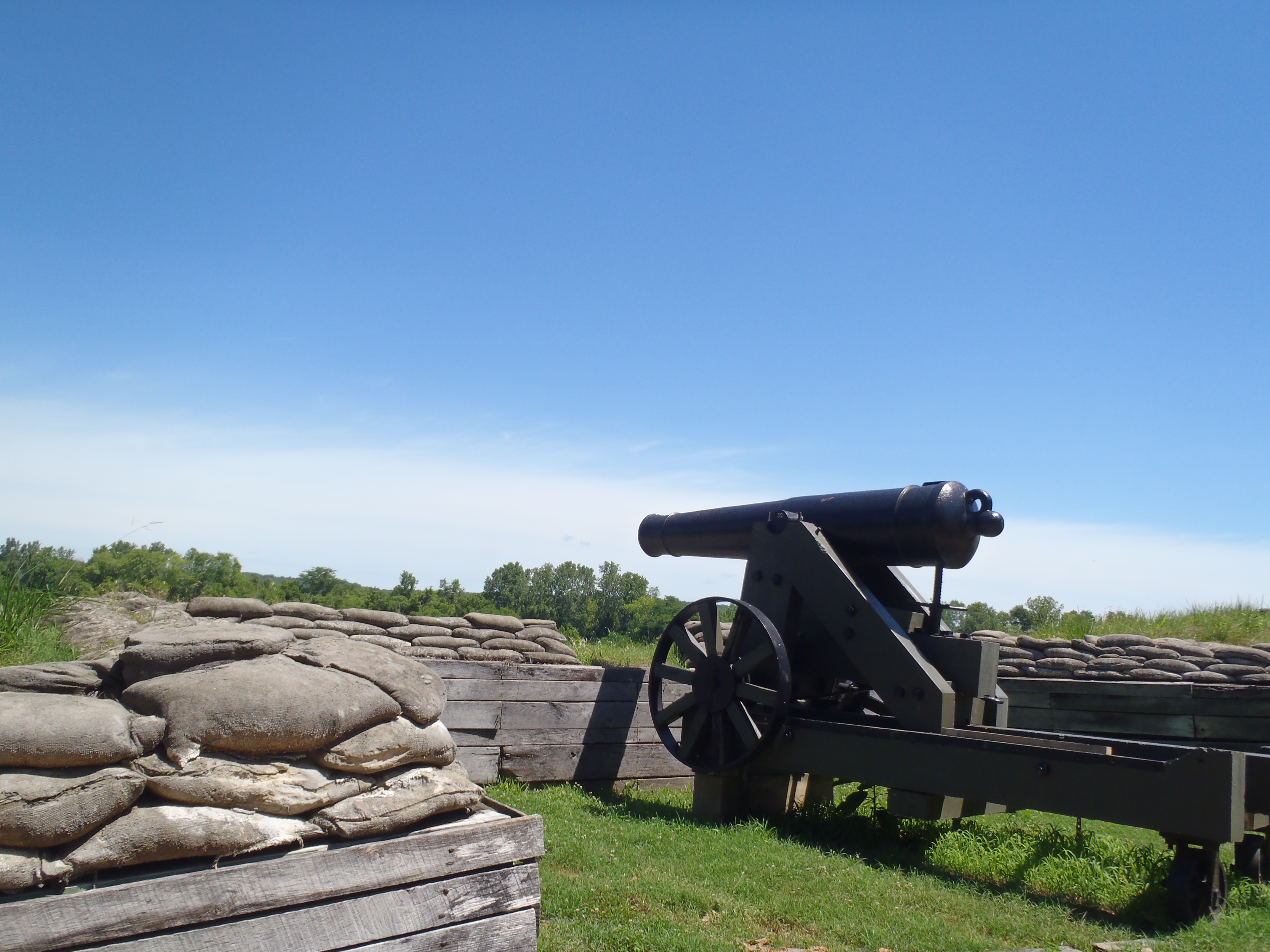
This historic area has both gun emplacements and cannons at two locations: the lower gun battery and the upper gun battery. The lower battery consists of seven 32-lb cannons and one columbiad. Two 32-lb cannons are resting on the grass near the park roadway. The upper gun battery has three guns, two 32-lb carronades and one rifled columbiad. Today, these features are separated by a parking area and limestone rock wall. The Cumberland River has been impounded by dams, thus it appears differently than it would have in 1862. The area across from this artillery battery is managed by the US Corps of Engineers. Depending on the season, you may see migratory waterfowl, duck blinds, flooded waters, or you may see crops such as soybeans or corn. The description of this area reflects the flow of the Cumberland River. The river flows north at this point; therefore, you pass by the Upper Gun battery first, and drive a little further, and you arrive at the Lower Gun battery. The Upper Gun battery can only be reached by trail. The trail is steep. The Lower Gun battery has an observation deck and one sidewalk. Exhibits may be found at both locations. Exhibits are also located on the observation deck. Walking around the gun emplacements at the Lower Gun battery, you will find interpretive exhibits and a War Department plaque which tell the story of the ironclad gunboats and 1862 battle.
The Visitor Center is at the main park entrance, just off Highway 79. Museum exhibits, a gift shop, handicapped accessible restroom, and information are available for visitors. The park audiovisual films are available at our website under the link: https://www.nps.gov/fodo/planyourvisit/things2do.htm We encourage you to begin your visit at this location. GPS: 120 Fort Donelson Park Road, Dover, TN 37058
Immerse yourself in the beauty of the historic site by hiking the park trails. You may see migratory birds, bald eagles, and lovely native wildflowers. Lovely views of the Cumberland River/Barkley Lake may be seen as well.
Want to Become a Junior Ranger?
Junior Rangers
Fort Donelson NB Autotour Route
An excellent way to understand the historic site include the self-guided auto tour.
Pets
Pets in the Park
Fort Donelson: Then and Now
Fort Donelson: Then and Now
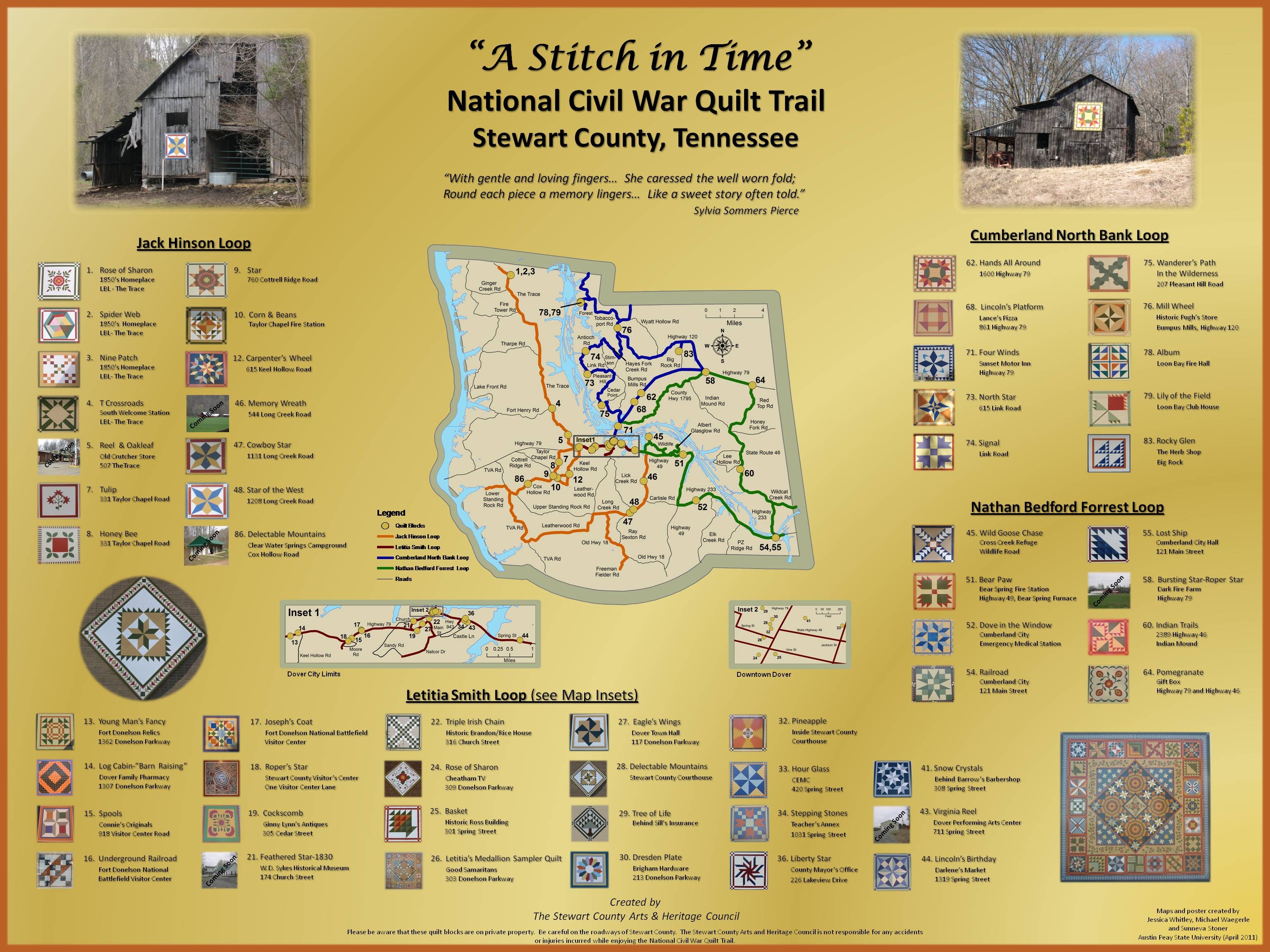
Quilt Trail
Quilt Block: Joseph's Coat
Tours
Count: 2
Fort Donelson NB Auto Tour
The self-guided auto tour consists of 11 stops along six miles of park roads, including the city of Dover, Tennessee. https://www.facebook.com/fortdonelsonnps
Quilt Tour
This self-guided auto tour features hand-painted quilt blocks, created by a group of volunteers from Stewart County, Tennessee. There are four different auto tours and one walking tour, the Mourner's Walk. Pick up your maps at the park Visitor Center.