Originally established as a private fur trading fort in 1834, Fort Laramie evolved into the largest and best-known military post on the Northern Plains before its abandonment in 1890. Nicknamed the “Grand Old Post,” Fort Laramie witnessed the ent...
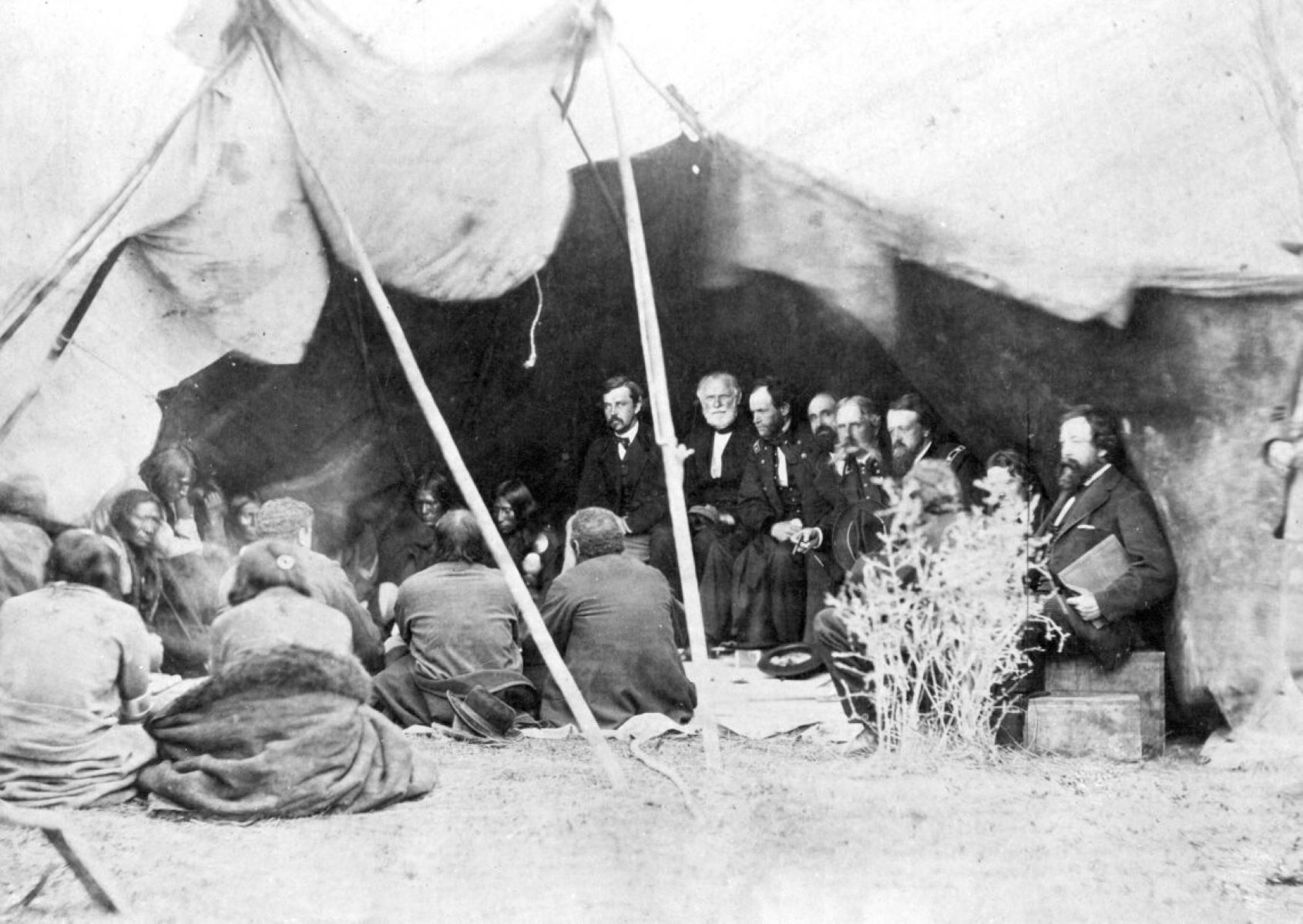
Across the Laramie River, beyond the trees, is a sweeping field. In 1868, this field was the setting for a solemn ceremony, at an unprecedented moment in Fort Laramie’s history.
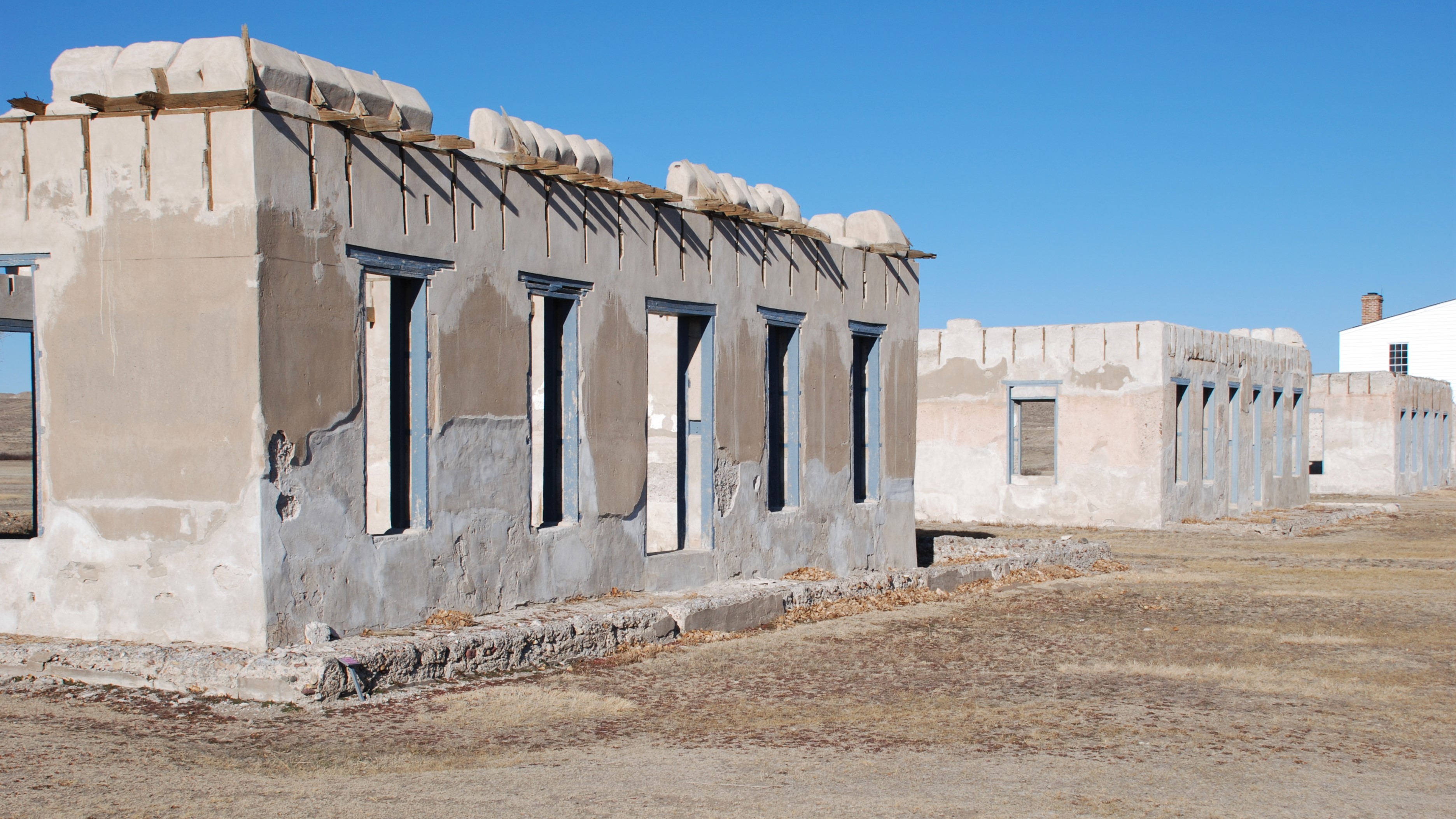
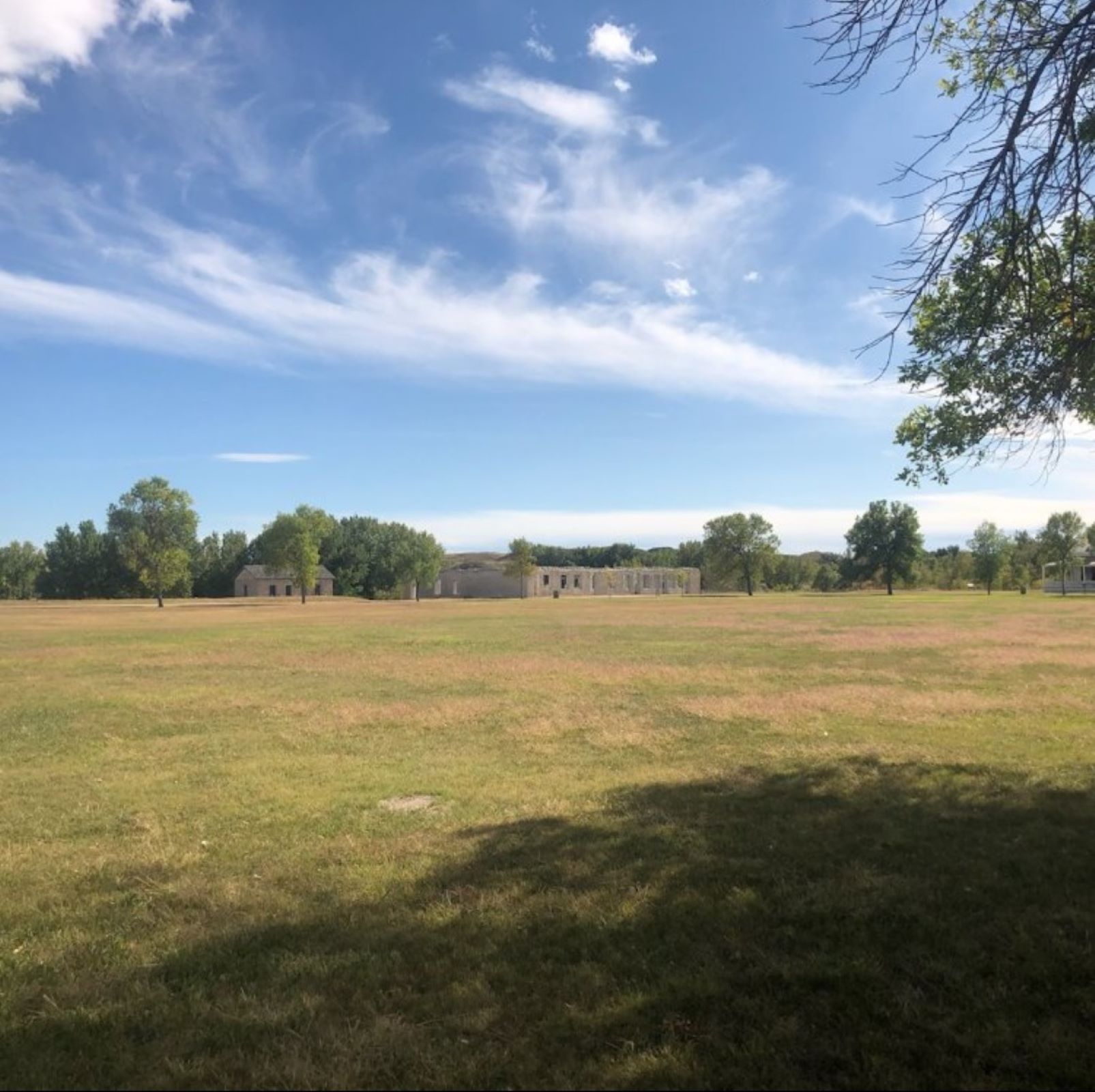
A single story ruin of an originally two-story lime-grout cement building. The building is on the southeast side of the parade ground and laid out in two wings, each approximately 20' by 50' in length.
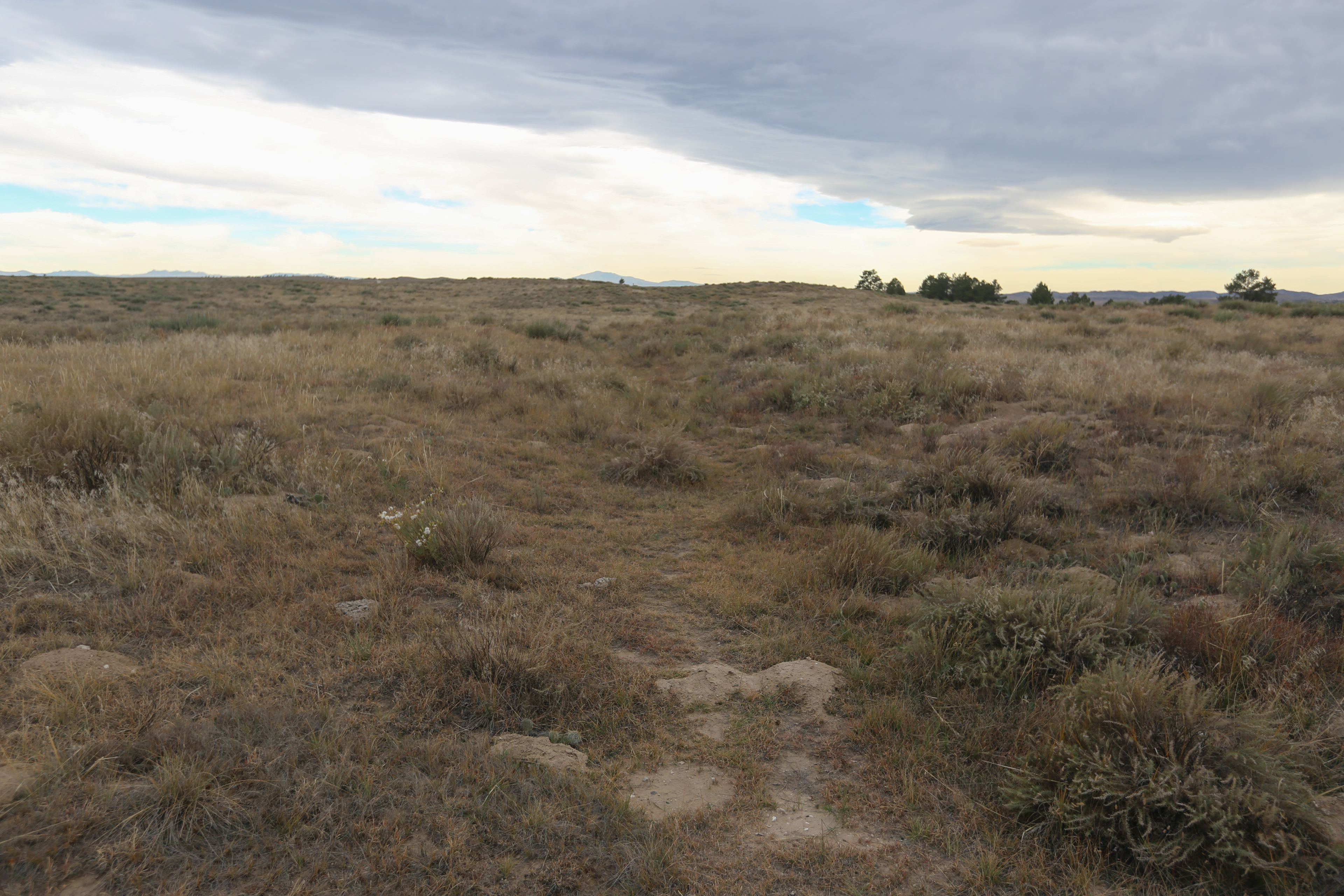
The Bedlam Ruts are a fine stretch of Oregon Trail ruts and swales that visitors can walk. This Trail segment is on 40 acres of undeveloped public lands jointly managed by the Bureau of Land Management and the National Park Service (Ft. Laramie National Historic Site).
Bedlam Ruts. 363 words<br /><br />From the parking lot, a path leads up a slight slope through scrubby pastureland. The path is fairly smooth, although it is dirt with fine gravel mixed in. Along with mixed grasses and yucca plants, there are tiny prickly pear cacti with flat, rounded pads covered with spines. The path ends at the top of the rise where a small fenced enclosure protects a small sign. Large logs on either side of the path here serve as benches. On the far side of the fenced enclosure, a swale crosses from right to left, about 10 feet wide and perhaps 3 feet deep. Feel free to move past the fence on the left side and into the swale.<br /><br />The sign is titled, "The Journey West Continues." Text reads, "'We proceeded westward from Fort Laramie and encamped outside the boundaries of Uncle Sam.' So wrote Dr. J.S. Shepard in 1851 as he began the second leg of his journey west. ‘To leave Fort Laramie was to cast off all ties with civilization. It was an alien land,' he noted.<br /><br />"The emigrants' elation at reaching the civilization of the fort after 650 miles of monotonous, difficult overland travel was soon tempered by the realization that even more troublesome trail conditions lay ahead over the final two-thirds of the journey. ‘Here comes the ascent to the Rocky Mountains,' wrote an apprehensive Cornelius Conway at mid-century.<br /><br />"To lighten their loads many travelers cast off thousands of dollars worth of food and equipment. This was especially true of the ‘49ers' who, in their haste to reach the gold fields often invested little effort in planning their trip. Joseph Berrien reached Fort Laramie early, May 30, 1849, yet still referred to it as ‘Camp Sacrifice' because of the large quantities of abandoned gear and foodstuffs he saw nearby.<br /><br />"Between 1849 and 1854 an annual average of some 31,000 overlanders passed through or near the fort on their journey to Oregon, California, or Utah. Most passed on a trail marked by the ruts before you. Wagon travel near the Platte River, just to the north, was difficult due to seasonal high water and progressively more difficult terrain."
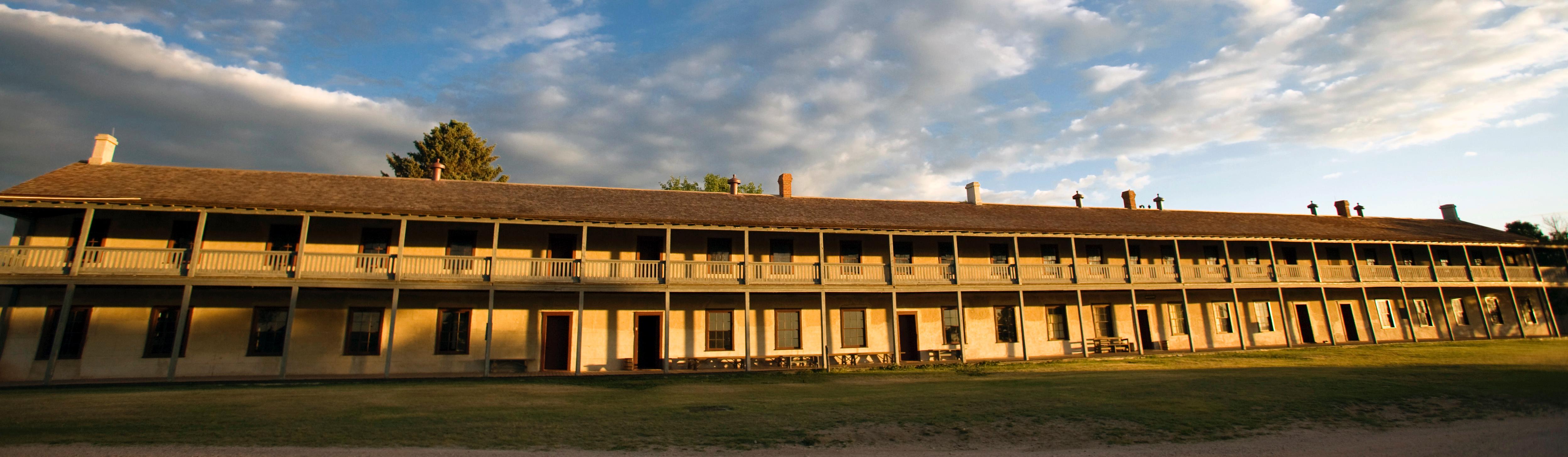
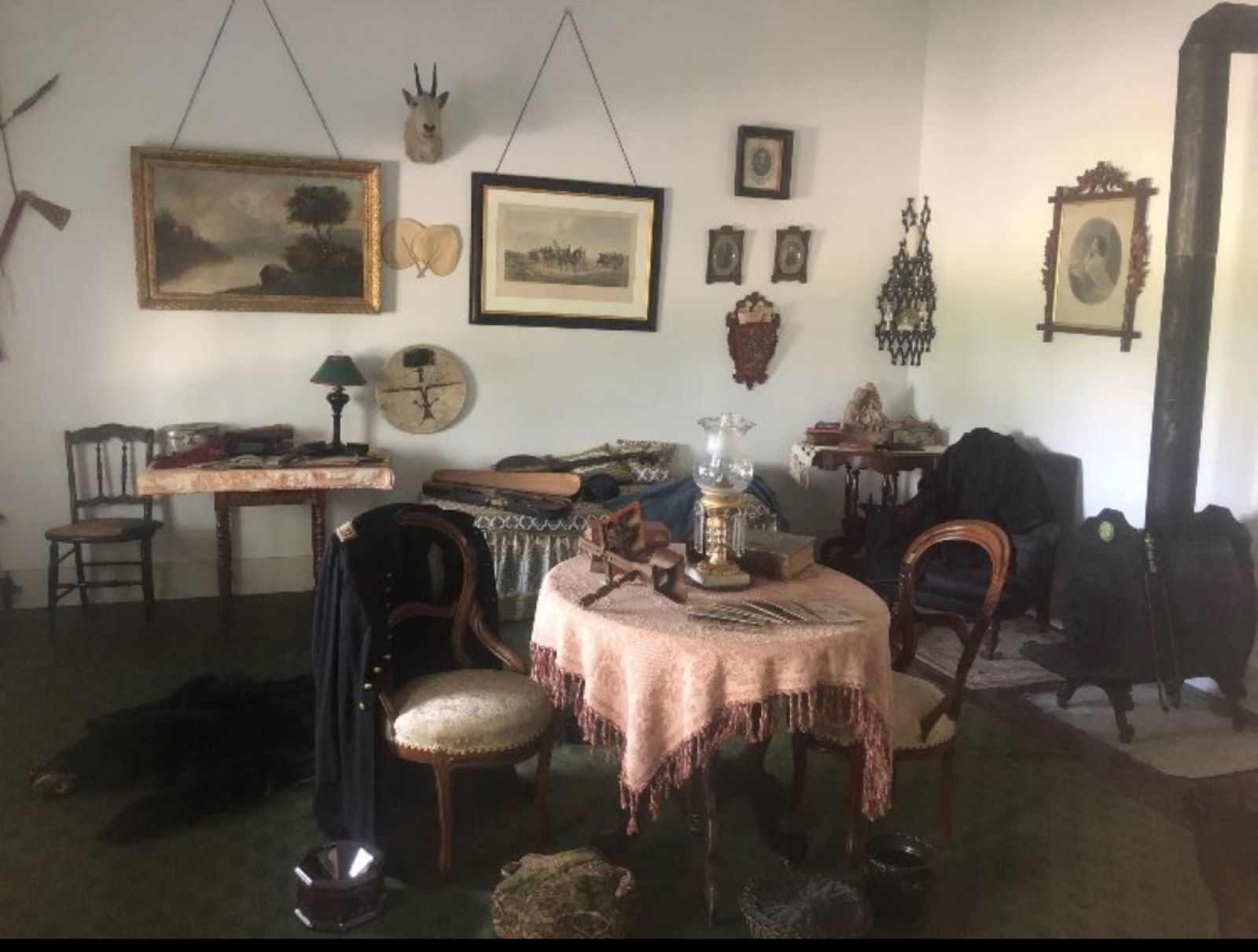
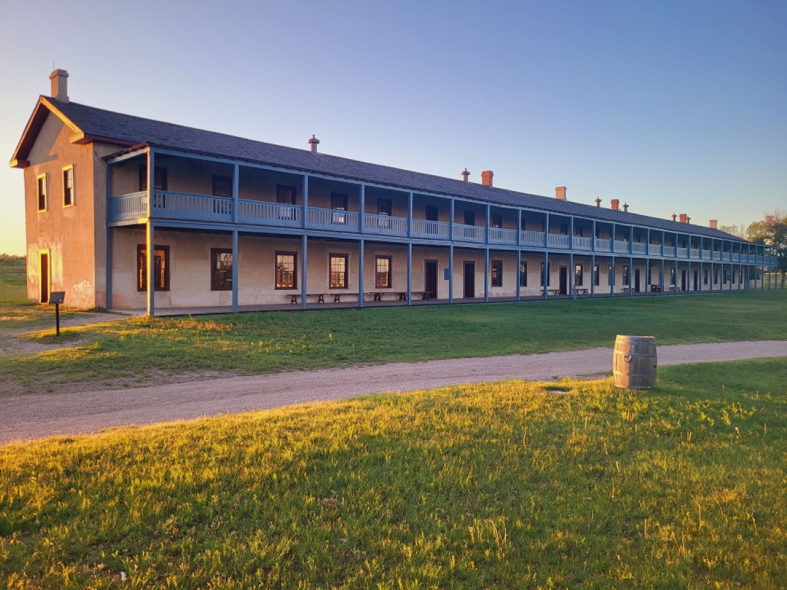
The Cavalry Barracks (1874) is a long lime-grout structure approximately 150' in length and 20' wide. It is two stories and has a porch on both levels. The interior is furnished to resemble a cavalry company barracks of the 1870s.
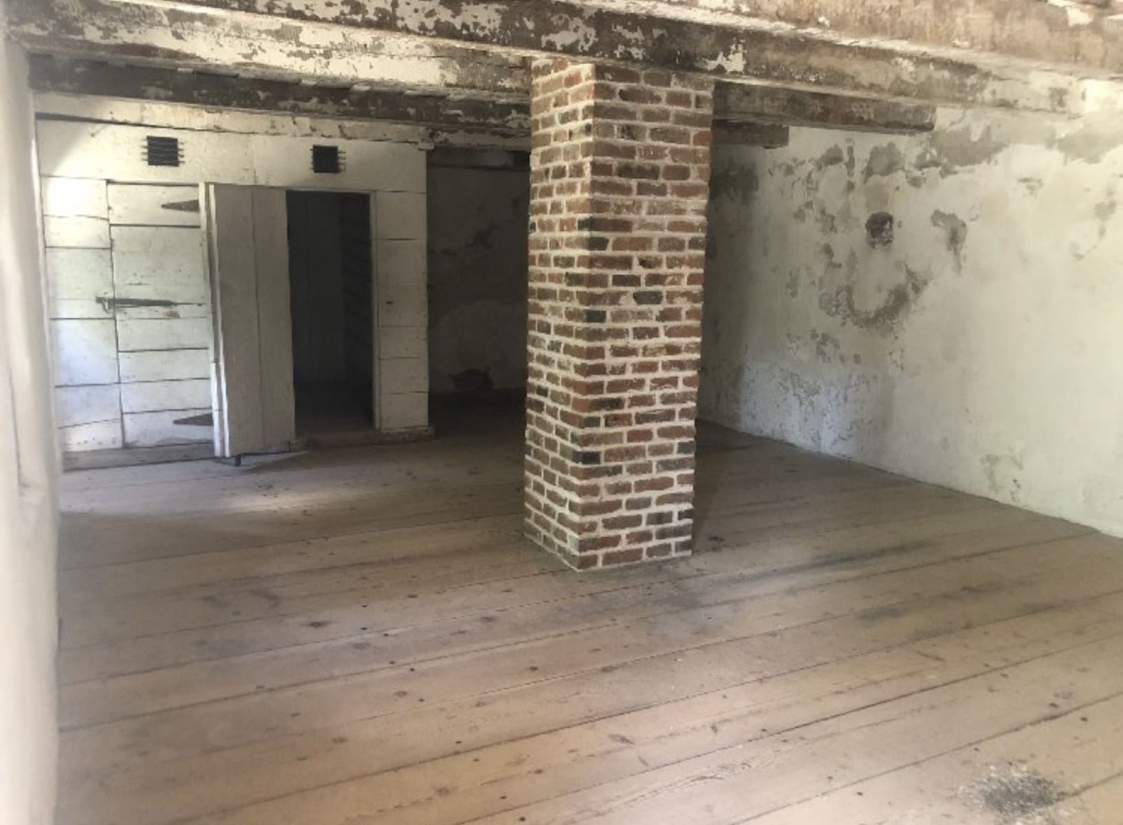
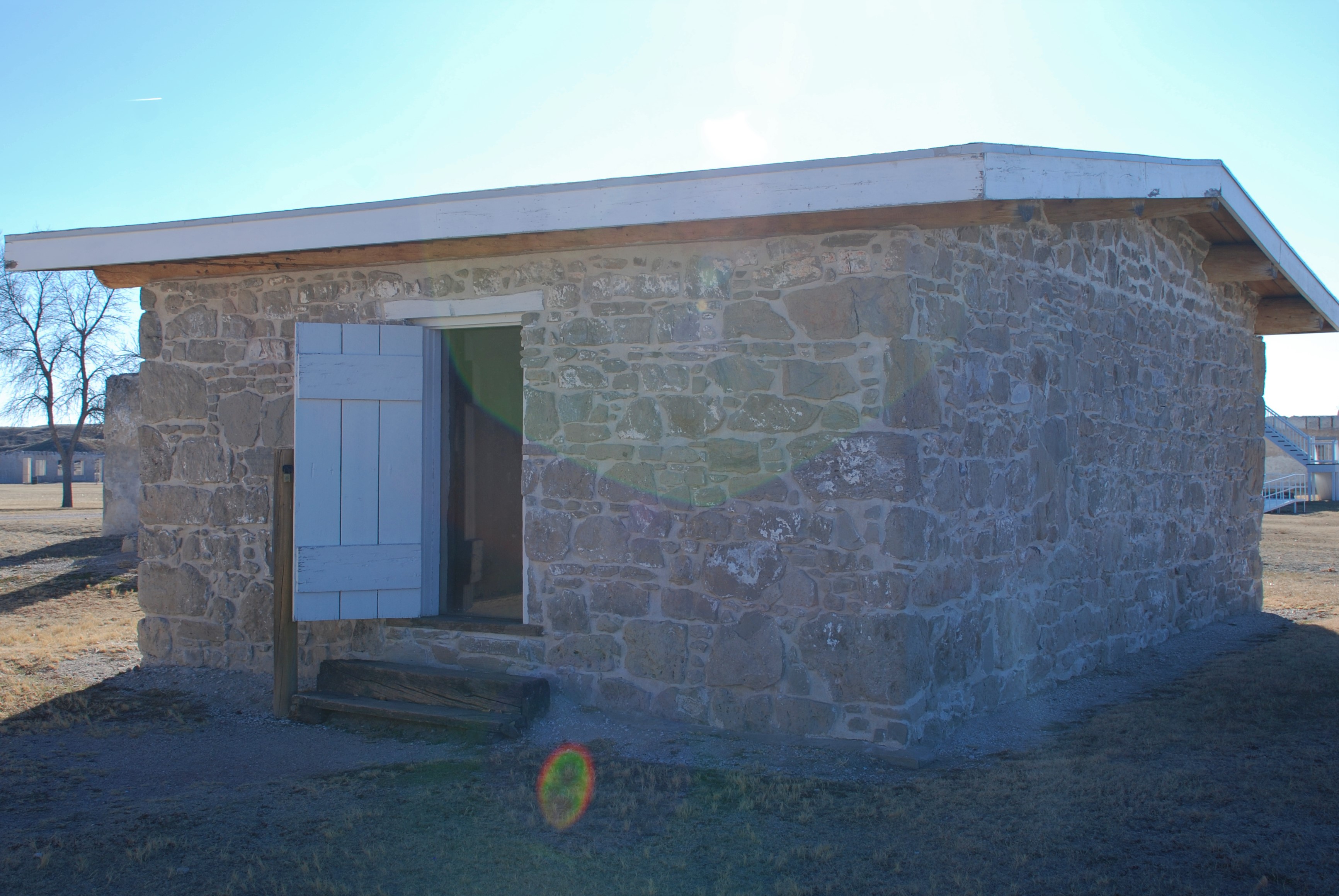
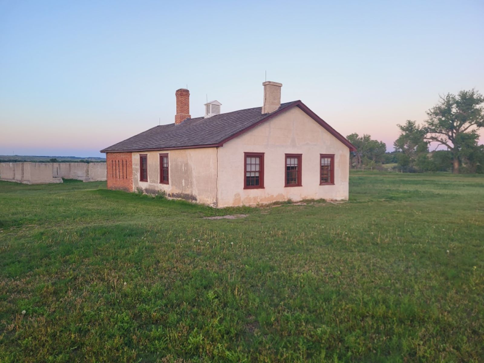
A rectangular lime-grout cement structure that sits to the northeast of the parade grounds. It is approximately 50 feet by 25 feet with a main floor and a cellar.
Fort Laramie once stood sentinel over the Oregon, California, and Mormon emigration trails; was a stop on the Pony Express route; and served as a staging ground for both peaceful and hostile dealings with Plains Indians. Its association with important figures, including Sitting Bull and Crazy Horse, and historic events makes Fort Laramie an icon of the American West.
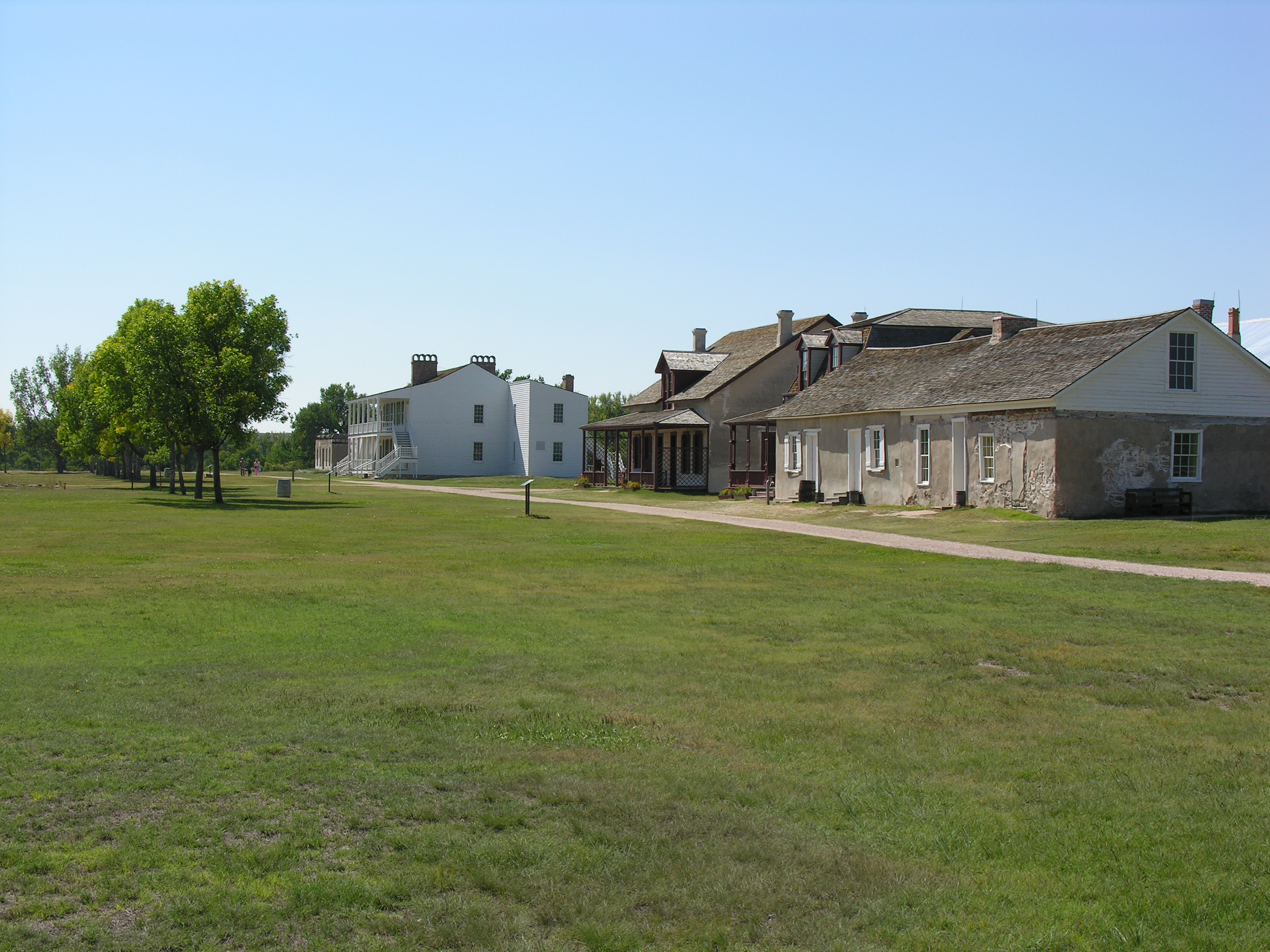
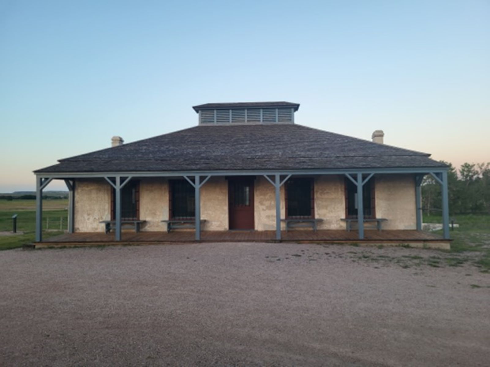
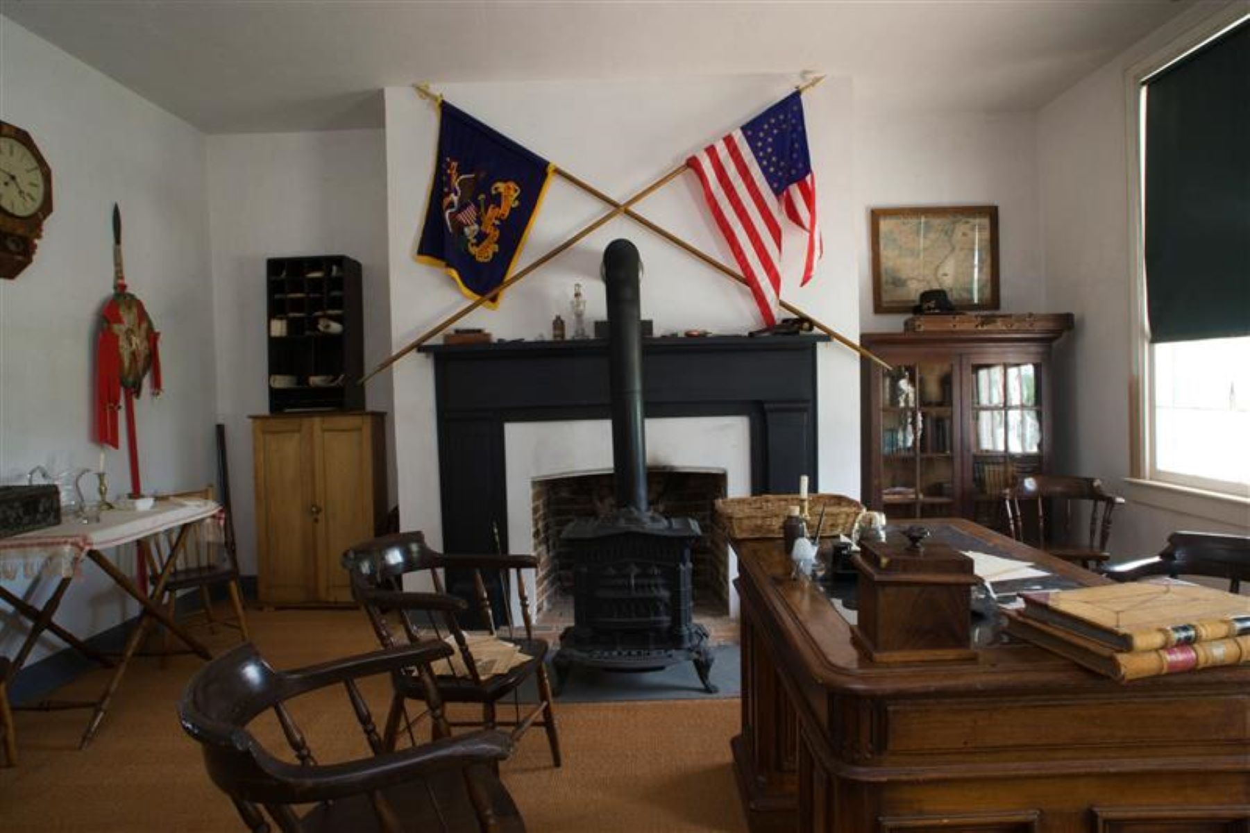
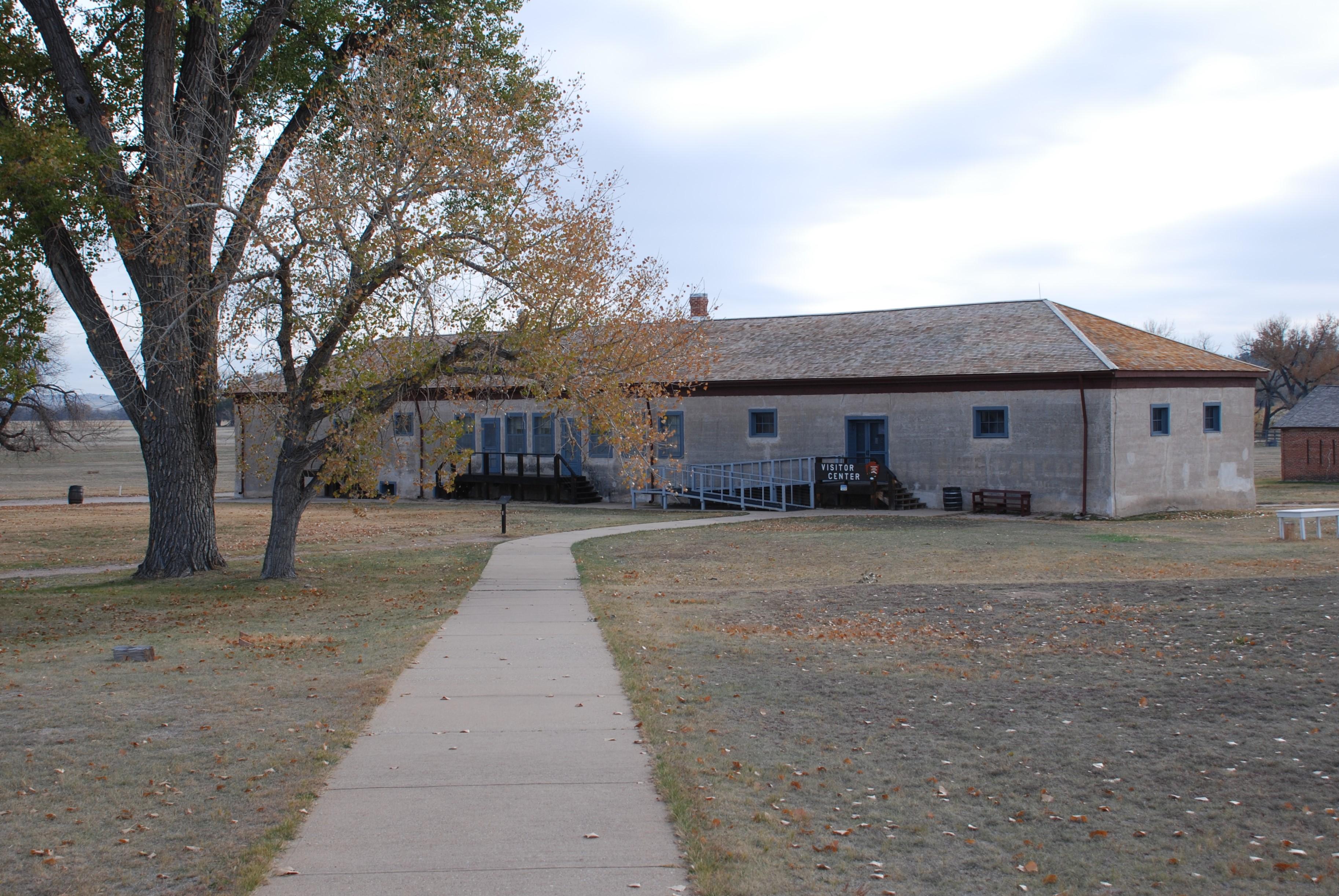
Fort Laramie National Historic Site. 394 words<br /><br />From the parking lot, a long sidewalk winds north towards the middle of the fort area to the visitor. On either side are some buildings that have been restored and others that exist only as foundations or ruins. Most of the structures are of concrete or adobe and tan in color with gray shingle roofs. Other buildings are wood frame and painted white.<br /><br />Along the sidewalk are a couple of wayside signs with information about the park and the surrounding area. About halfway to the visitor center is a tall stone monument with multiple plaques on its sides commemorating the Pony Express and Transcontinental Telegraph and identifying Fort Laramie as being on the National Register of Historic Places. On front a stone marker reads, "Fort Laramie, a military post on the Oregon Trail, June 16, 1849 to March 2, 1890. This monument is erected by the state of Wyoming and a few interested residents, 1913."<br /><br />The walkway then crosses a dirt road and continues on over the lawn, crossing a shallow ditch over a short wooded bridge. A small sign in front of the visitor center building reads, "Commissary Storehouse. This building was completed in 1884. It was built as a commissary storage facility. As such, it would have been primarily divided into two large storerooms: one for meat and one for flour, rice and beans. Three or four smaller rooms would have been used as offices, an ‘issue room' and a storage room for canned goods. This building also had a partial cellar with a trap door for use with a hand-operated elevator. Rations and other official army food items were issued from this building. A commissary officer and sergeant ran the operation."<br /><br />The entrance is located about 30 feet from the right end of the building. The small wooden porch in front of the door may be reached by a set of 5 stairs on the right side or by a ramp that zig-zags up on the left side. At the right end of the building a small sign indicates that restrooms are located in the rear of the building.<br /><br />As you enter the building, the information desk is straight ahead of you against the opposite wall. Bookcases and shelving to your left form the gift shop. On the right side is an exhibit area.
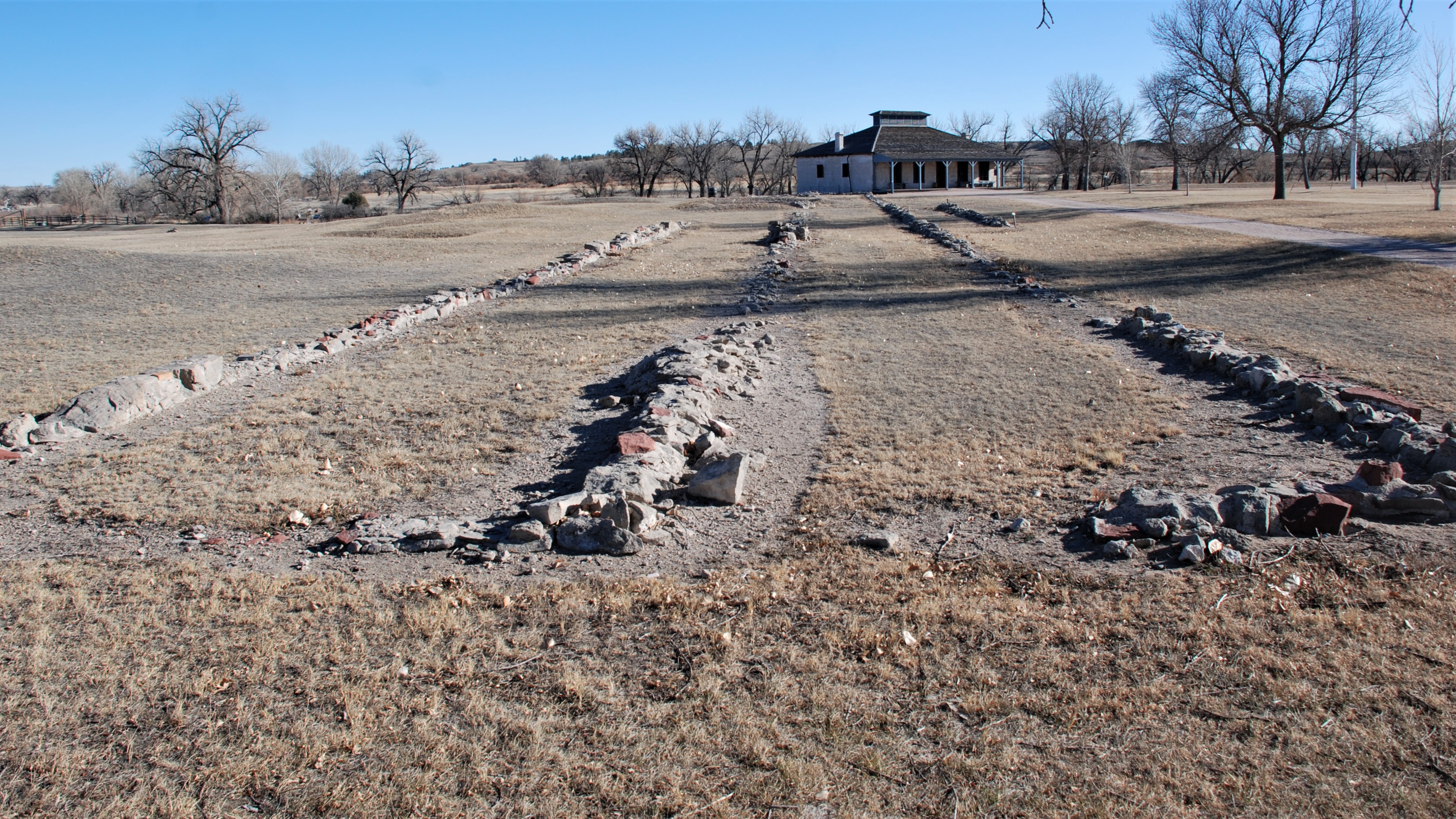
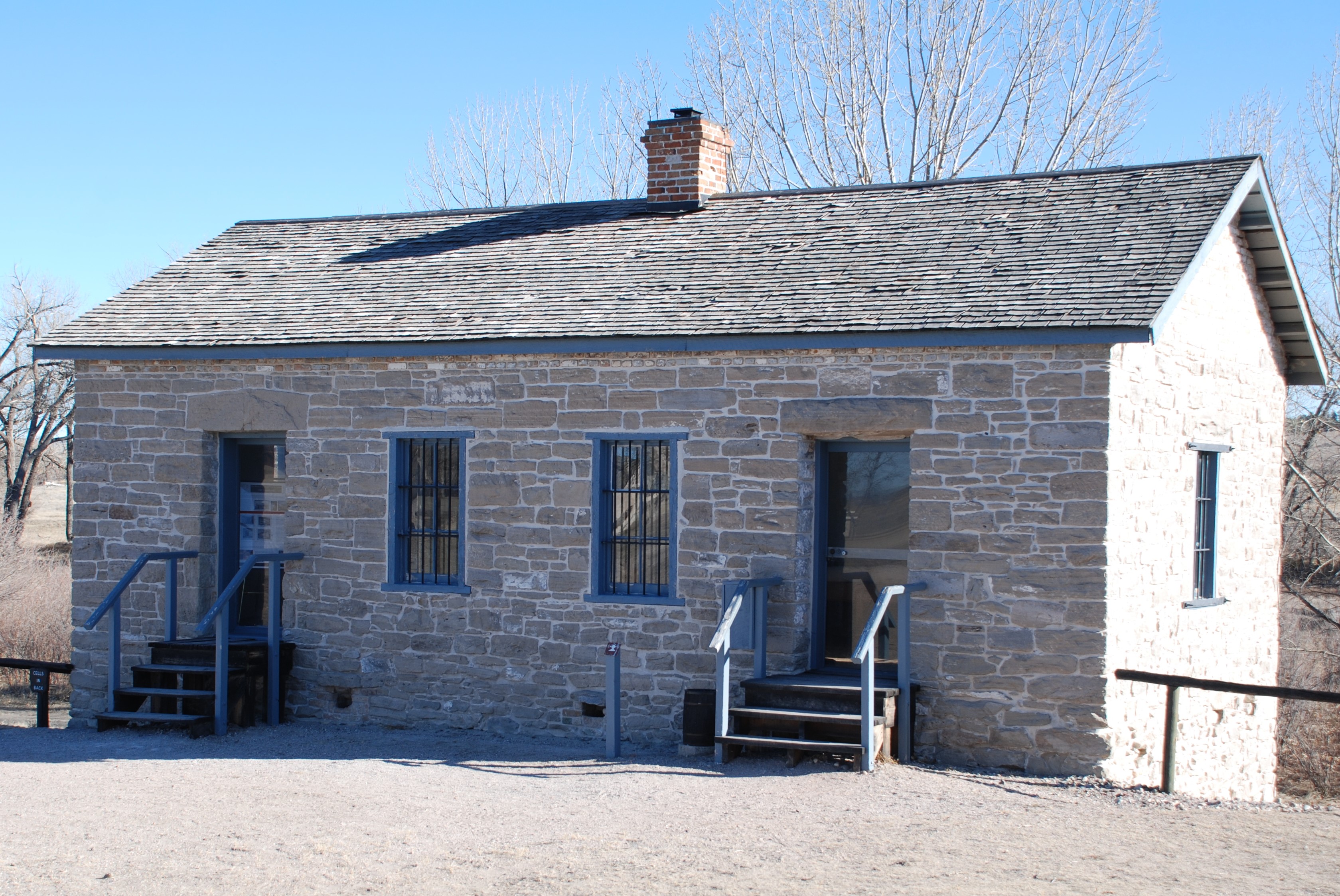
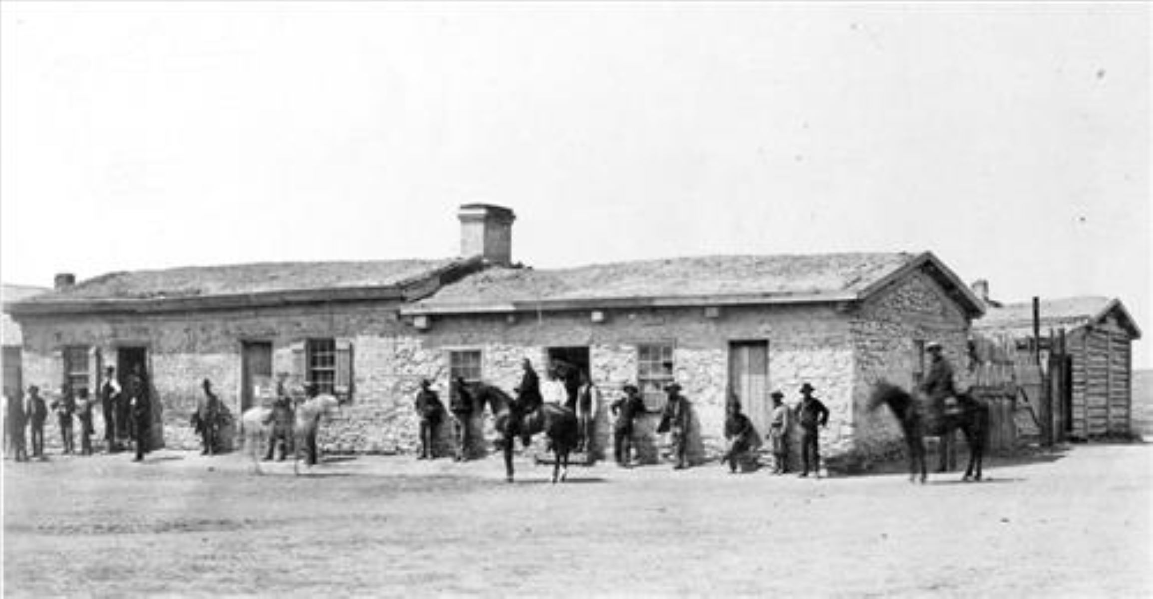
This set of foundations runs approximately 150' long and 20' wide along the northeast edge of the parade grounds. The remaining foundations two rectangles of stone and brick approximately one foot high and is absent in some places.
A narrow two-story lime grout cement building between the post trader store and surgeon's quarters. The building has a front porch and smaller kitchen porch.
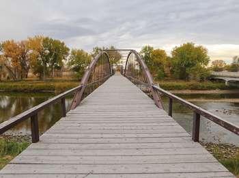
North Platte River Crossing was one of numerous crossings used by trappers, traders, American Indians, and emigrants to reach Fort Laramie. In order to enter the fort, two rivers had to be crossed- the Laramie River and the North Platte River. Over the years, at least nine different sites were used to cross the Laramie and at least four different sites were used to cross the North Platte.
North Platte River Crossing. 431 words<br /><br />This historic bridge lies just east of the modern highway bridge. This one-lane bridge has three spans, each a low arch about 15 feet high, made of iron, now rusty-brown in color. There are "I" beam piers at the beginning and end of each arch. The flooring is formed by broad planking, now a weathered gray. The bridge is much longer than the current width of the river. Only the northern span still has water underneath.<br /><br />At the southern end of the bridge, at the edge of the dirt parking lot, is a wayside sign titled, "Spanning a Century: End of an Era." A historic photograph on the sign shows the bridge in 1877 when the water stretched from end to end of the bridge. Text reads in part, "Once broad and turbulent, the North Platte River posed a formidable obstacle to 19th century travelers. High water made it nearly impossible to cross the river for several month each year. The crossing became less dangerous by 1850 when ferry service was established to meet the growing volume of military and emigrant traffic." It goes on to tell us that after the Great Sioux Reservation was established in 1868, huge amount of supplies were needed to be transported to supply the Indian agencies, leading Congress to fund construction of a bridge. Text at the bottom of the sign reads, "The King Iron Bridge Company built bridges with speed and efficiency by standardizing the manufacturing process and maintaining stockpiles of prefabricated parts. The triple-span Fort Laramie Bridge was constructed between August 1875 and February 1876 for $15,000. Rubble-filled log ice breakers protect the unique I-beam piers supporting the bridge. Spanning 400 feet, this bridge is the best-preserved King paten tubular bowstring iron bridge still in existence."<br /><br />To the right of the bridge, a trail leads down to the water's edge, then proceeds eastward along the bank. Another wayside sign by the river tells of initial skirmishes between the military and the Lakota Sioux, the beginnings of the Northern Plains Indian wars, which finally ended in 1890 at Wounded Knee, South Dakota.<br /><br />At the northern end of the bridge are 2 markers. One identifies the bridge as a Wyoming Historic Civil Engineering Landmark. The other marker, protected by a metal rail fence, reads, "Old Army Bridge over the Platte River, erected in 1875. This bridge was a vital link between Cheyenne, Fort Laramie and the military outposts, Indian agencies and gold fields of the Black Hills Dakota Regions. Placed by the Historical Landmark Commission of Wyoming, July 1951."
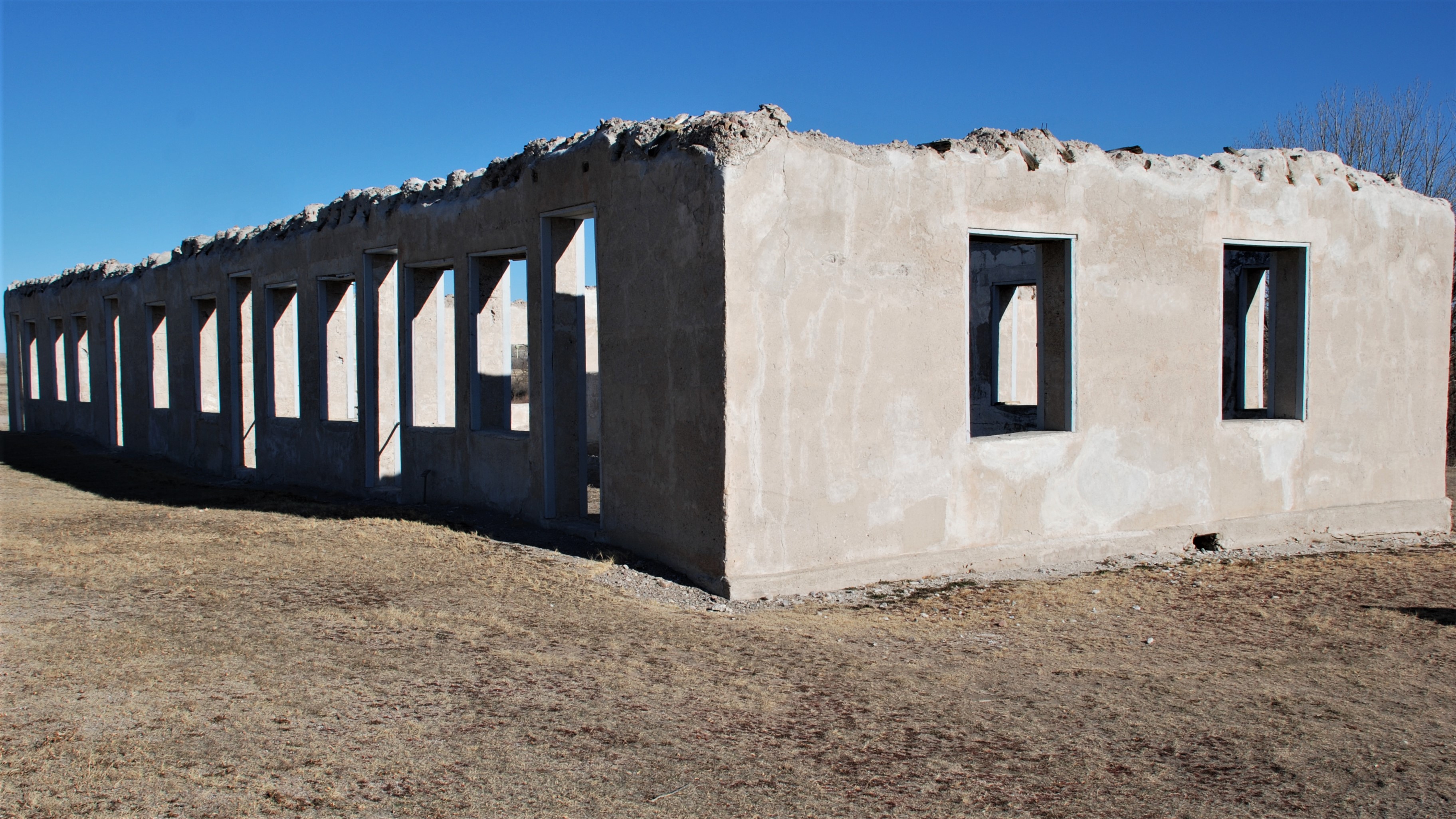
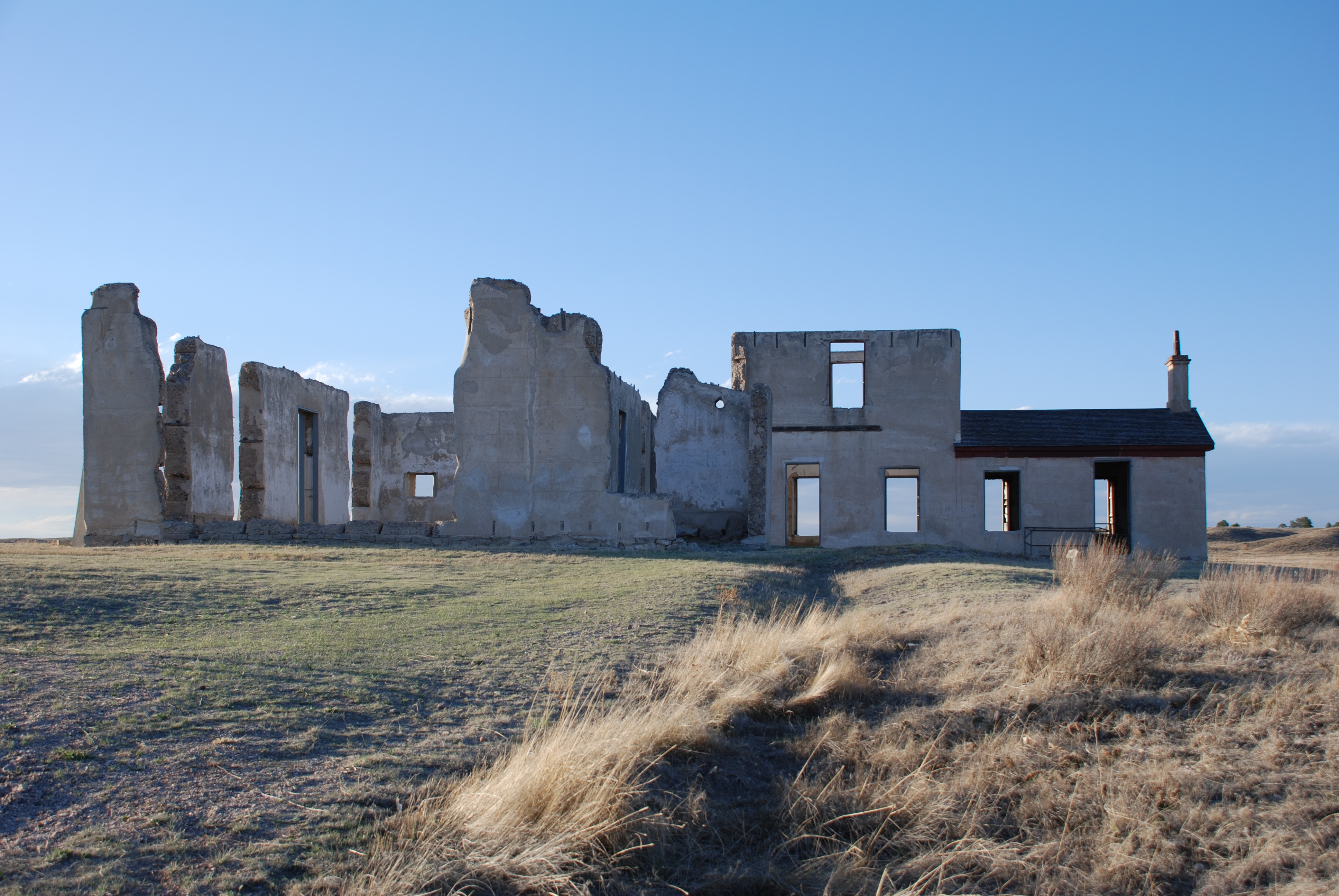
Three large concrete buildings approximately 30'x40' lined up on the southwest side of officers' row. These buildings are in ruins and are missing their upper story..
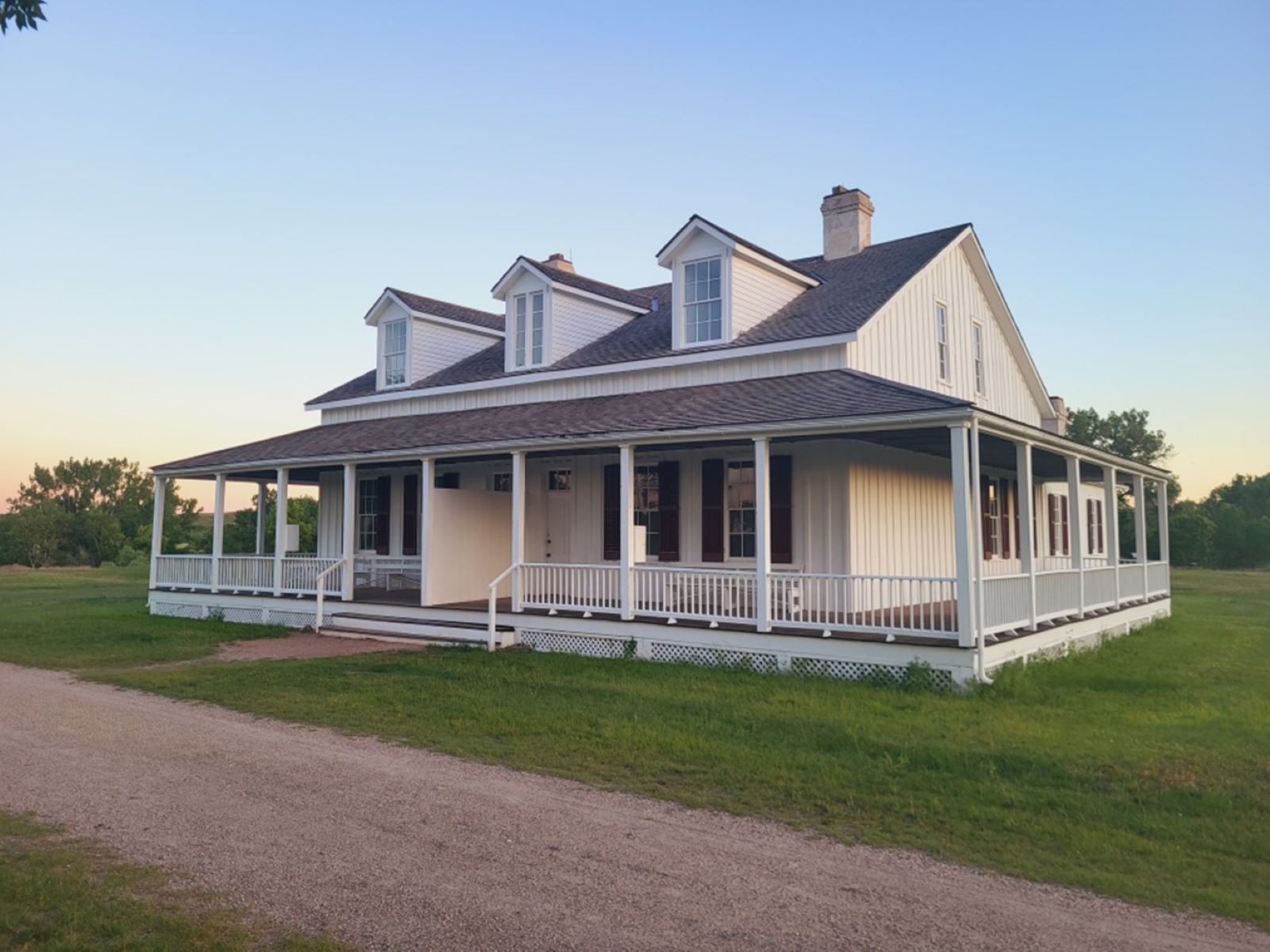
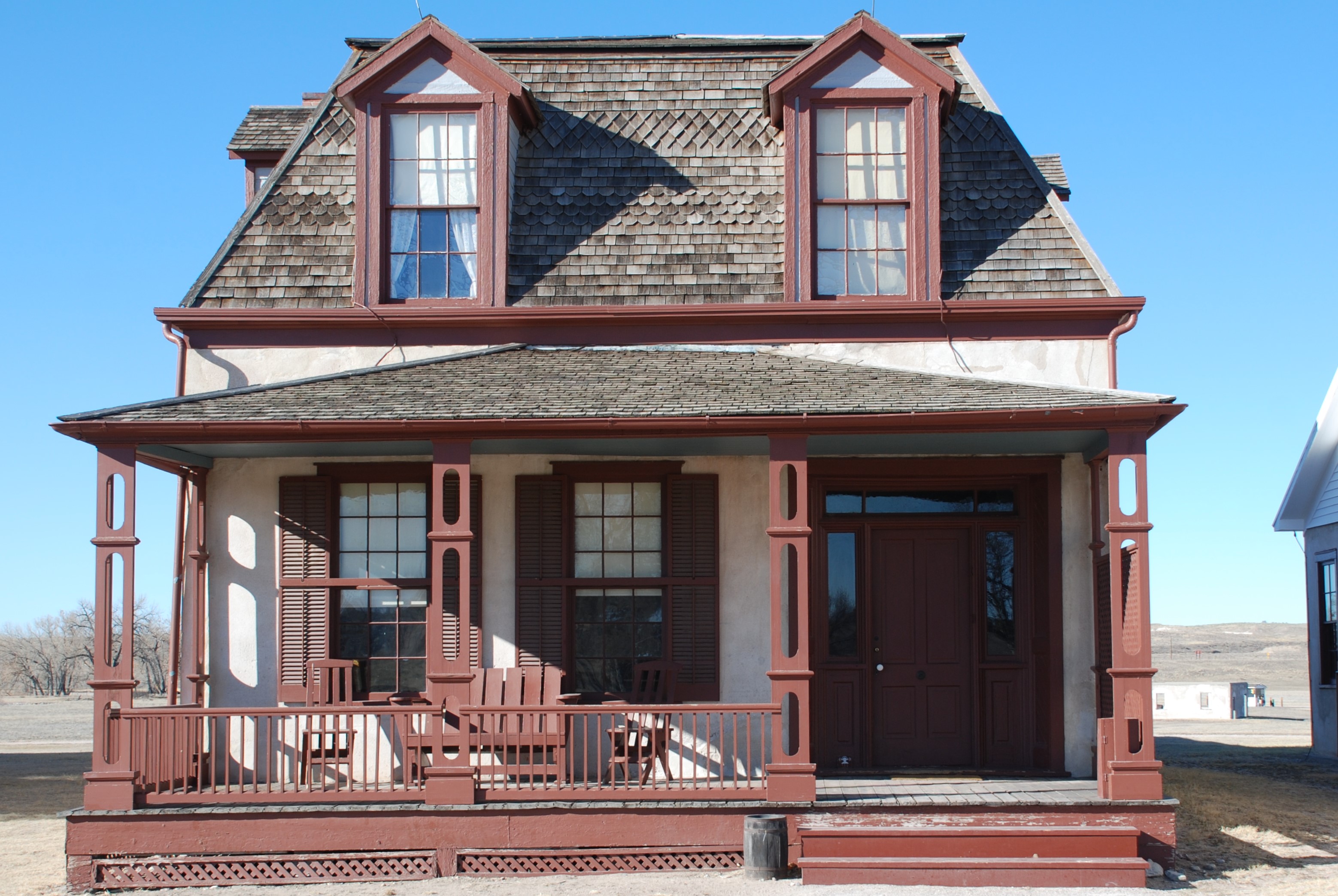
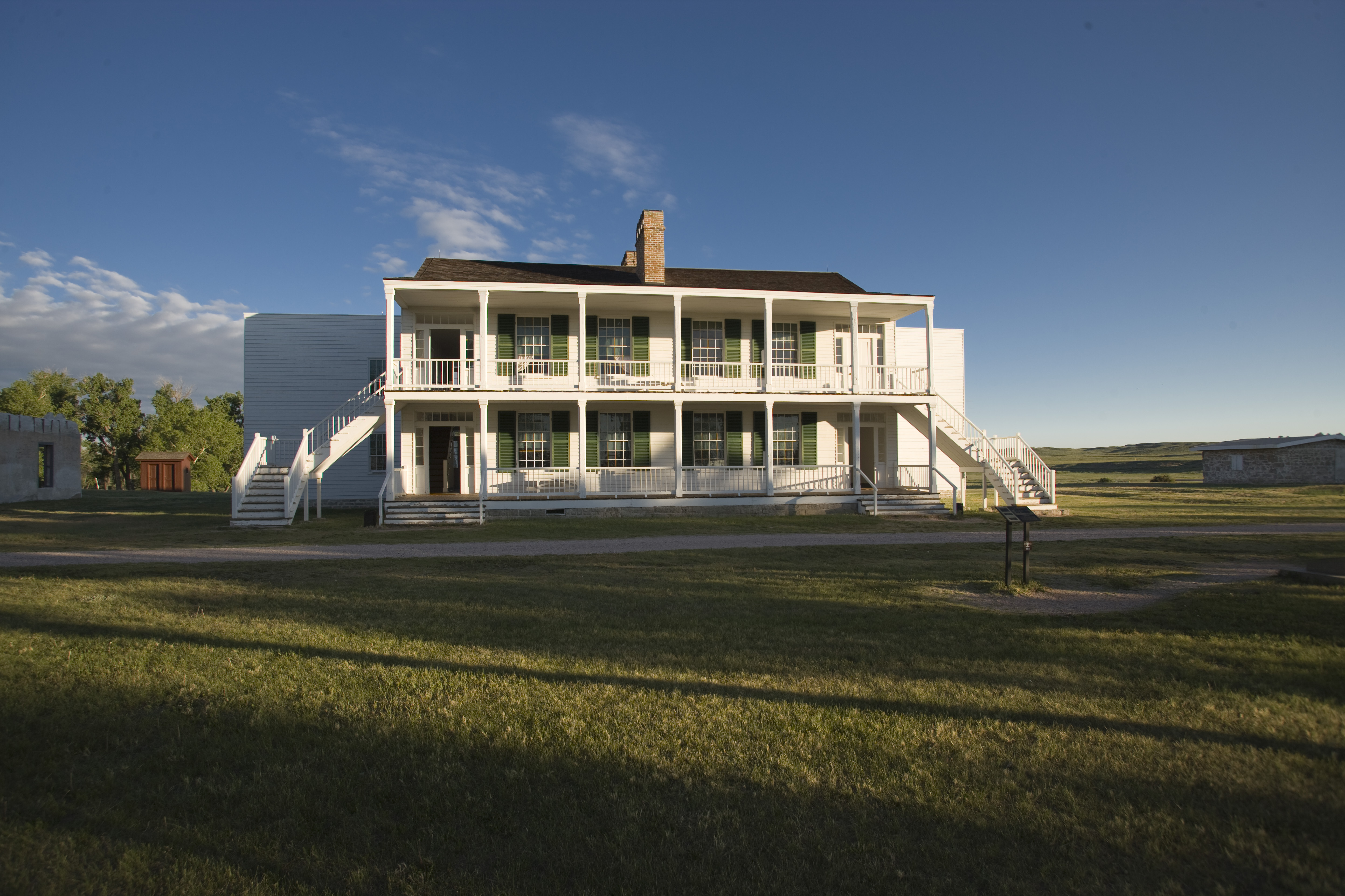
Old Bedlam is a two-story wood-frame structure from the middle of the 19th century. Internal and external stairs attach to the front and back porches and two kitchen wings project from either side of the building which stands prominently on the southwest side of the historic parade grounds.
A stone two-story building standing on a bluff above the Laramie River. The building is split-level with access to the first floor from the rear entrance only.
A two-story lime-grout concrete duplex just northeast of the parade grounds and near the parking area. It is between the magazine and another lime-grout concrete building.
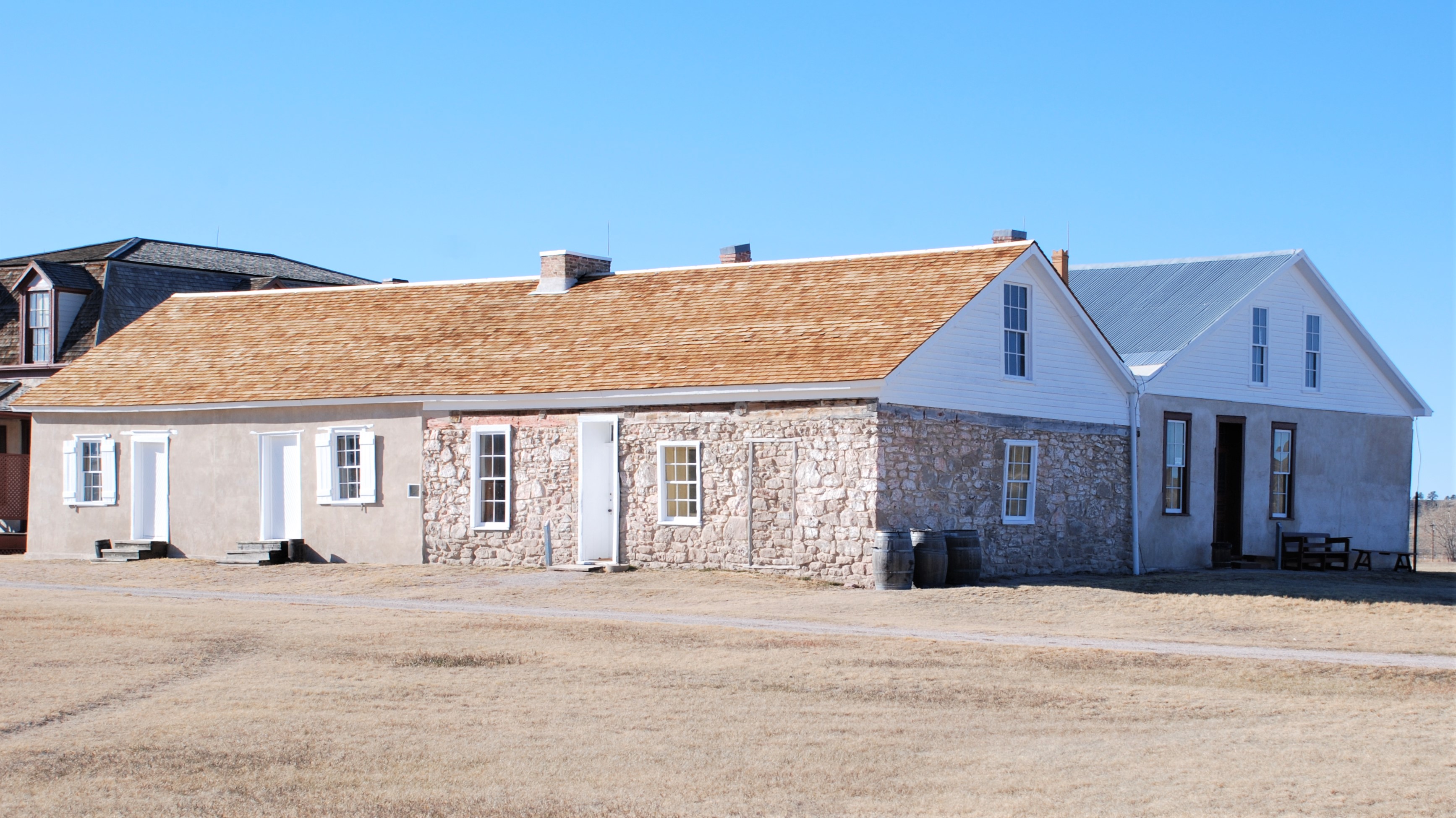
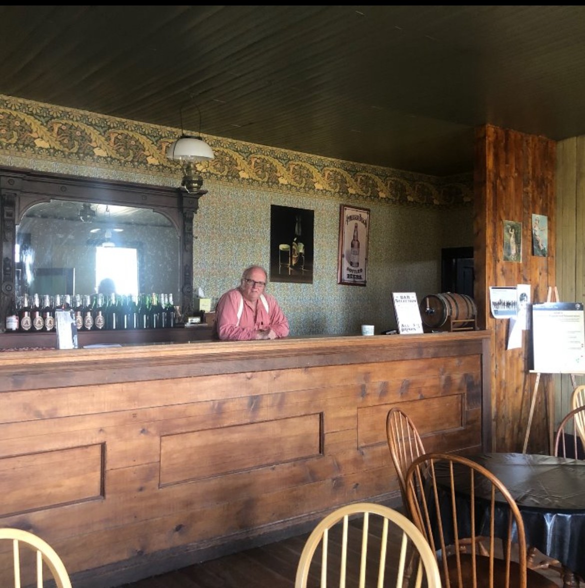
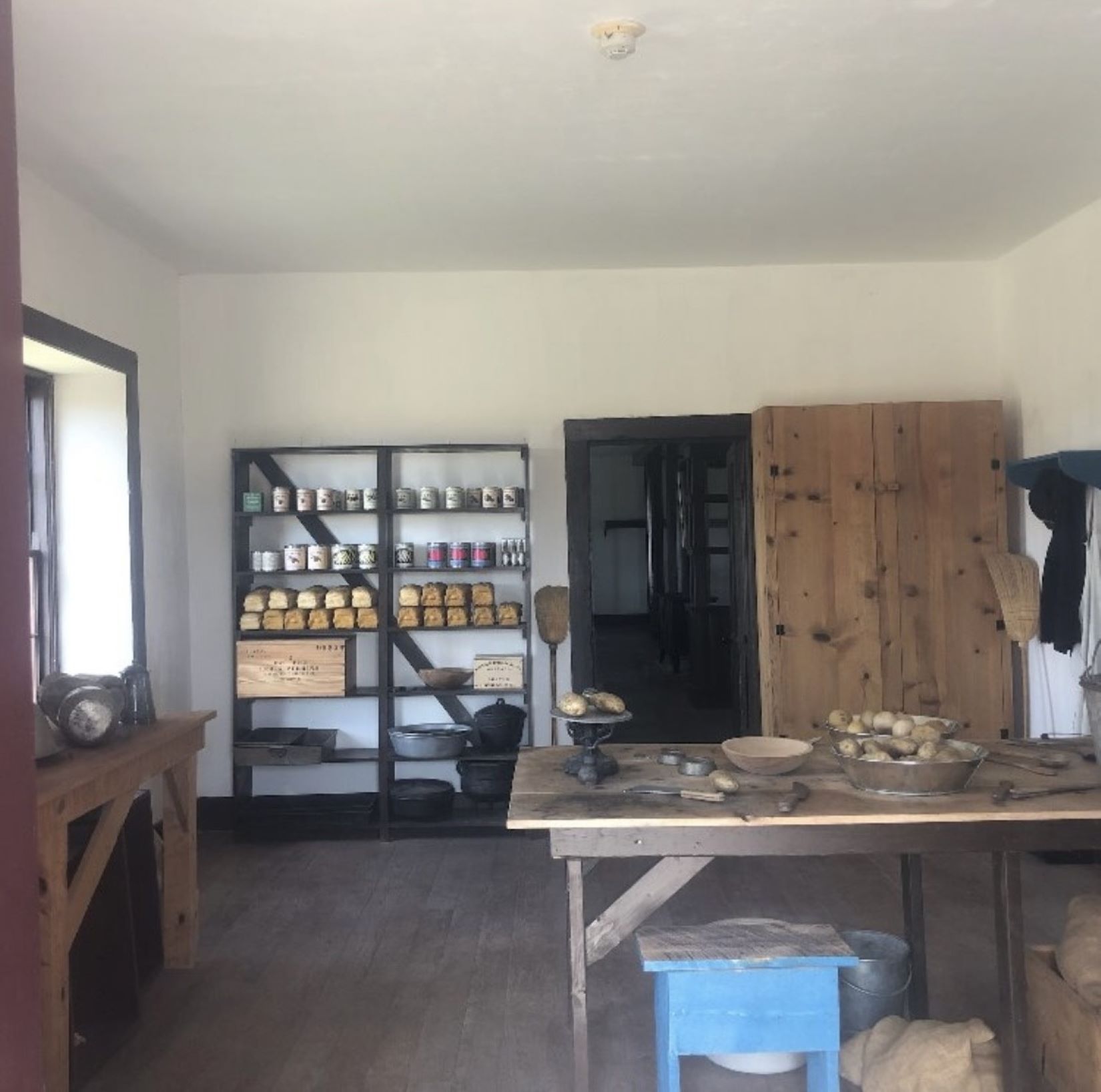
The post trader store is a double-gabled building that has three major sections. The oldest, closest to Burt House, is an adobe shop and showroom for wares. The original adobe is mostly encased in lime-grout cement. North of this is a stone addition which houses the post office and telegraph station. The western addition is completely made of lime-grout cement and has multiple doors to access the warehouse and bar rooms.
Fort Laramie National Historic Site Visitor Center
Start your tour at the Visitor Center. Located in the restored 1884 Commissary Storehouse, you can view an 18-minute orientation film, tour our museum, and browse our award-winning bookstore.