Be advised that the NPS has issued alerts for this park.
Updates to Superintendent's Compendium
The Fort Matanzas Superintendent's Compendium has been updated on 9/19/2025 to include restrictions on lighting and maintaining fires within the park boundaries. The document can be found under the following tabs: Learn about the park/Management/Laws & Policies. and click on "Fort Matanzas NM Compendium".
Fort Matanzas Only Accessible by Ferry Service
Fort Matanzas may only be accessed by our free ferry service. The boats operate Thursday through Monday; we do not operate the ferry on Tuesdays or Wednesdays. For more information about tickets and times, please visit the "Plan Your Visit" tab.
Fort Matanzas National Monument preserves the fortified coquina watchtower, completed in 1742, which defended the southern approach to the Spanish military settlement of St. Augustine. It also protects approximately 300 acres of Florida coastal e...
All areas of the park are free of charge including the ferry to the fort. However, you must stop in the Fort Matanzas Visitor Center (NOT the St. Augustine city Visitor Center) to get your free boarding pass for the ferry. Family members of all ages must have a pass to board the ferry. Passes are Free
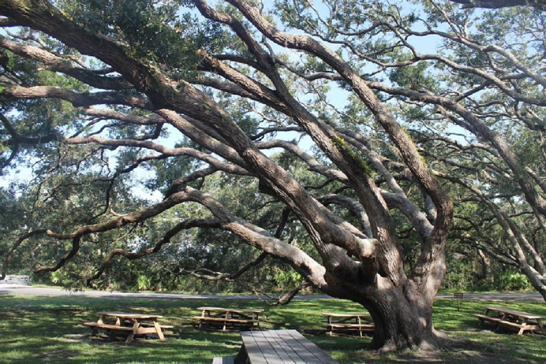
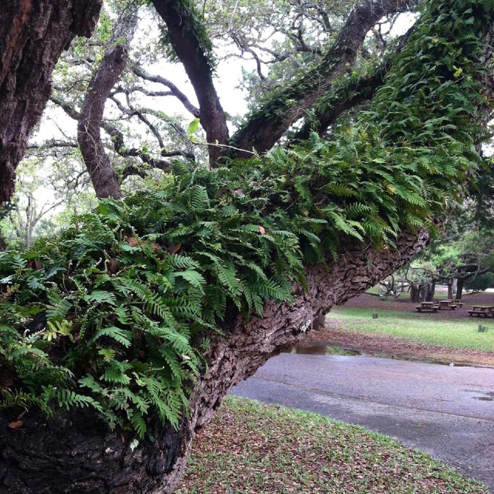
The unique southern live oak species twists and sculpts itself in response to its environment. Notice how most of the branches are leaning west-away from the salty air blowing in from the Atlantic Ocean. Live oak wood is incredibly strong and was once the preferred material for ship building. Scan the long, twisting limbs for lichens, ferns, air plants, lizards, squirrels, and birds.
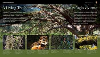
The panel background is a color photo of a live oak tree's branches spreading out under a light green canopy of leaves. <br /><br />In the top left and right corners of the panel, white text in English and Spanish reads: <br /><br />A Living Treehouse. The unique southern live oak species twists and sculpts itself in response to its environment. Notice how most of the branches are leaning west-away from the salty air blowing in from the Atlantic Ocean. Live oak wood is incredibly strong and was once the preferred material for ship building. Scan the long, twisting limbs for lichens, ferns, air plants, lizards, squirrels, and birds.<br /><br />End of Text<br /><br />Below the tree branches, inset against a green background are 4 inset color photos. On the far left is a dry grey bunch of tiny tendrils twisted together. Below, white text in English and Spanish reads:<br /><br />Spanish moss isn't a parasite-it's an air plant that absorbs moisture and nutrients from the air.<br /><br />End of Text<br /><br />To the right, a photo of a brown and white owl with large gold eyes. Below, white text in English and Spanish reads:<br /><br />Great horned owls have long, earlike tufts, a yellow-eyed stare, and a deep hooting voice.<br /><br />End of Text<br /><br />To the right, a photo of a brown oval spider with striped black and yellow legs in a circular web,. Below, white text in English and Spanish reads:<br /><br />Golden silk spiders weave elaborate webs to catch flying insects.<br /><br />End of Text<br /><br />To the right, a photo of light green ferns growing on top of and below a live oak tree branch. <br /><br />Below, white text in English and Spanish reads:<br /><br />Resurrection ferns appear brown and dead when dry, but turn green after a rain.<br /><br />End of Text<br /><br />The panel is set on a concrete pad, which depending on the season, may be covered with leaves. Beyond the panel is a shady area with picnic tables scattered amongst live oak trees; behind and to the right of the panel is a concrete sidewalk and parking lot. . <br /><br />[End of message]<br />
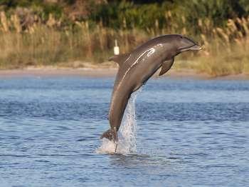
Bottlenose dolphins are a relatively common sight in the Matanzas River and in the ocean. They are very social animals and usually congregate together in groups of up to ten members. As with human beings, communication and cooperation are hallmarks of the species. There is a dolphin "language" that consists of noises resembling whistles, whines, groans, and jaw claps. They use their vocalizations to coordinate feeding behavior; sometimes by corralling fish close to shore,
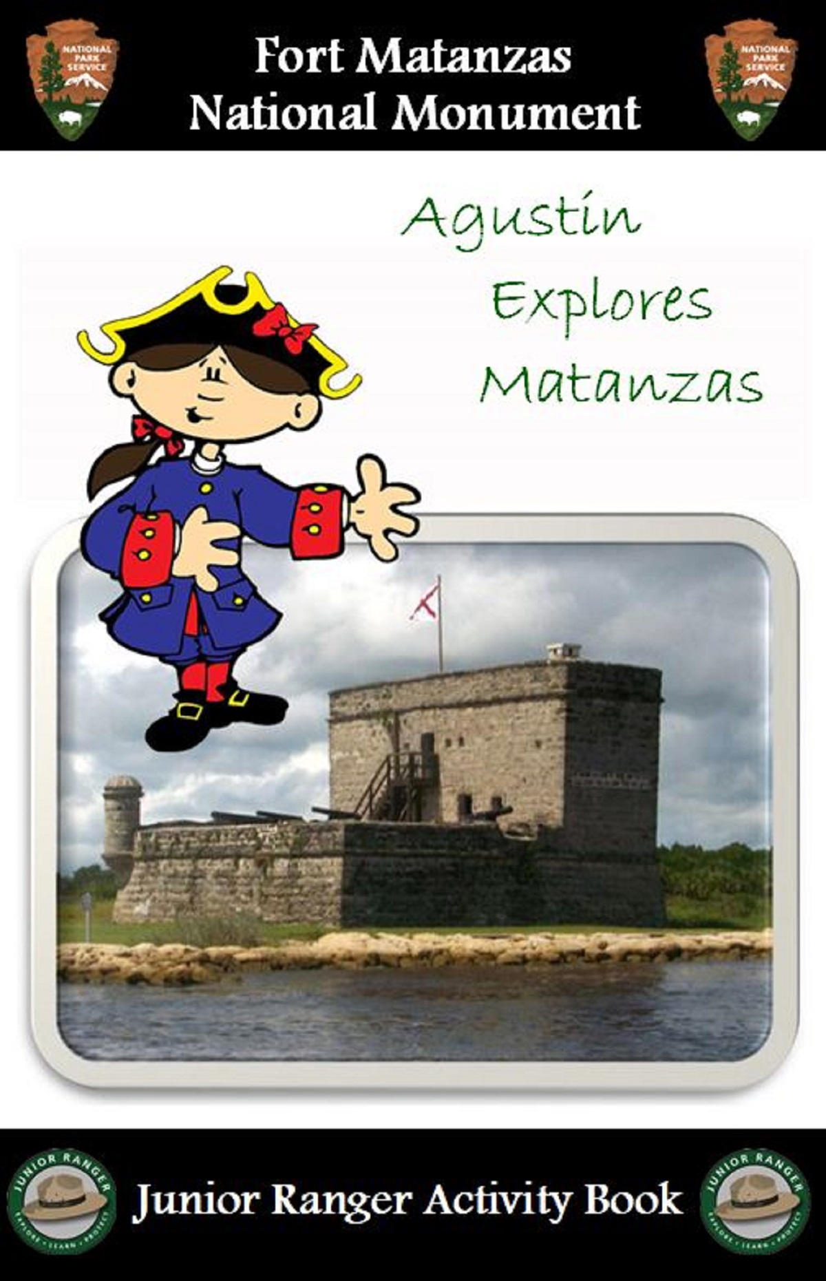
The Junior Ranger Program encourages children ages 4 and above and their parents to explore both the history and nature of Fort Matanzas as a family and is a fun way for young visitors and their families to get the most out of their visit. As Junior Rangers, children will be a part of our team helping to protect our parks.<br /><br />Free booklets are available in the Visitor Center or digitally <a href="https://www.nps.gov/foma/learn/kidsyouth/upload/Fort-Matanzas-JR-Ranger-Book-2016.pdf">here</a> .<br />
The Beach Ramp Parking area is located across the A1A from the Fort Matanzas Visitor Center. This audio description is written as if facing east at the top of the beach ramp, at the east end of the parking area.<br /><br />The beach ramp is adjacent to the asphalt parking area. It is not accessible at this time. From the top of the ramp, the beach and the Atlantic Ocean can be seen.<br /><br />On the left, or north, side of the ramp is an information panel that explains the rules for use and conduct at the beach and for beach driving. The ramp to the beach is flanked by large sand dunes covered with tuffs of grasses, vines, low shrubs and a few palm trees. The palms have a single trunk topped with a cluster of flat, fan-shaped leaves that end in a point. <br /><br />On the right, or south, side of the ramp is an area with an interpretive welcome sign, a bulletin board, and two trash cans. <br /><br />At the start of the ramp is a bright yellow metal gate. Two triangular shaped bars swing from posts on either side of the ramp and are chained together in the center of the ramp, when the gate is locked. Two signs are posted on the gate.<br /><br />a white square sign with a red circle with a white horizontal rectangle that reads,<br /><br />Do Not Enter<br /><br />And a white sign with a blue wave motif on the bottom that reads,<br /><br />Reach the Beach <br />Beach Access Information<br /> www.sjcfl.us/beaches <br /><br />At this time the ramp is closed with warnings posted due to erosion and exposed metal around the east end of the ramp.<br /><br />The size of the beach area varies with the tides, so the distance to the water varies as well.
The beaches of our National Monument are some of the most beautiful and popular in St. Augustine. One visit and you will see why! <br /><br />The park-protected beach stretches from the beach ramp all the way to the ferry docks. If you are at the park entrance, you will see a parking area directly across A1A. The beach ramp is open during the summer months and is operated by the county as an exit only ramp. If you wish to drive on the beach, head north on A1A to access the beach from another ramp; you will drive south and exit at our ramp. The beach south of the ramp is NPS property and is closed to motorized vehicles.<br /><br />If you drive south on A1A, you will find two parking areas before the bridge over the Matanzas Inlet. On the northbound side is a boardwalk over the dunes to the beach, an area that is favored by surfers and fishermen. The lot on the southbound side provides access to the river with a short, accessible boardwalk. The river side often has shallow areas ideal for swimming. Remember that the currents near the inlet are extremely strong as the tides go in and out. Use caution when swimming and supervise children closely. <br /><br />A popular fishing area is on the southern end of Rattlesnake Island. There is a small parking area accessible by a dirt road in the Summer Island neighborhood. Access to the fort itself is only permitted by the NPS ferry boat. Visitors on foot or in personal watercraft may not access the fort. <br /><br />Wherever you choose to enjoy our beaches, be safe and help us to preserve and protect our resources.<br />
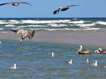
What would Florida be without the pelican?? One of the joys of a visit to the shore is sighting a flotilla of these large, distinctive birds, silently gliding up or down the coastline with an occasional beat of their strong wings. Or watching them perched on dock pilings, looking like ambassadors for a sub-tropical lifestyle that winter-weary human snowbirds look forward to on each and every visit. Indeed, pelicans are so associated with the Florida coastal environment tha
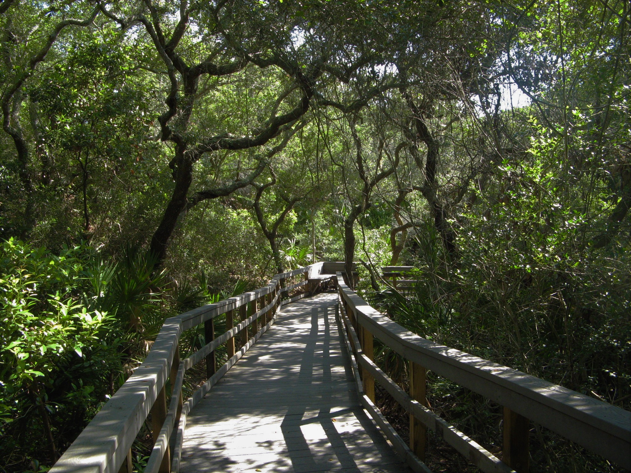
Pick up a free trail guide to learn about the oldest and highest part of the barrier island is covered with a forest called a hammock ("shady place") -- an ancient dune on which larger plant species have taken root in the thin layer of decayed remains from pioneer species.Cabbage palm, red bay, magnolia, and live oak provide a canopy under which diverse animal species can thrive. These plants provide food for animals as well as for migrating birds who stop for a rest in the m
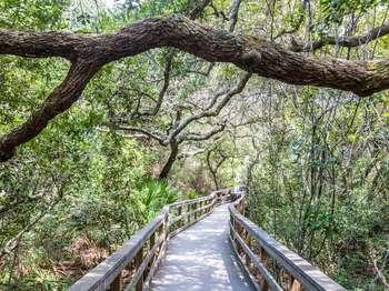
A half-mile raised boardwalk loop, with railings, and some seating. Most of the trail is surrounded by a lush forest canopy.
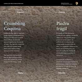
Fort Matanzas was built using coquina, a local limestone. This porous limestone is made from millions of seashells pressed together for thousands of years. The Spanish coated the fort walls with plaster made from oyster shells to help waterproof the structure.<br /><br />You can help us preserve the fort for generations to come: touch this sample of coquina instead of the historic walls.<br />
Against a beige background of the tiny shells that make up the coquina stone are 2 columns of white text: on the left, English; on the right, Spanish.<br /><br />Crumbing Coquina. Fort Matanzas was built using coquina, a local limestone. This porous limestone is made from millions of seashells pressed together for thousands of years. The Spanish coated the fort walls with plaster made from oyster shells to help waterproof the structure.<br /><br />You can help us preserve the fort for generations to come: touch this sample of coquina instead of the historic walls.<br /><br />End of Text<br /><br />In the center of the panel, between the 2 columns of text, a long rectangular inset container with touchable material. On the top half, light tan, coquina; on the lower half, greyish-white plaster.<br /><br />Beyond the panel is a shrub and tree covered ancient sand dune. To the left, a sidewalk leading to the ferry dock, beyond that another sidewalk leading back to the visitor center. To the left and behind is the visitor center.<br /><br />[End of Message]<br />
A solid foundation is vital for a fortification, especially underneath the heavy cannons. With the exception of the water cistern at the center, the base of the fort is filled in with dirt and construction debris. There was no need for extra storage space or to spend the time and resources to construct it of solid stone. The outer walls provided adequate protection against enemy attacks. The dirt filling provided enough support for the living space and observation tower as w
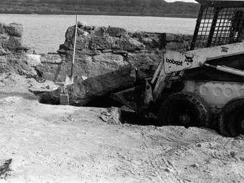
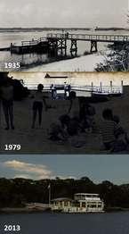
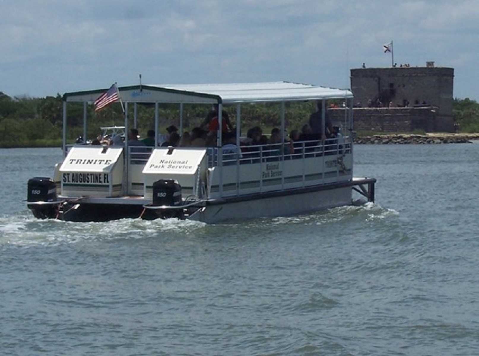
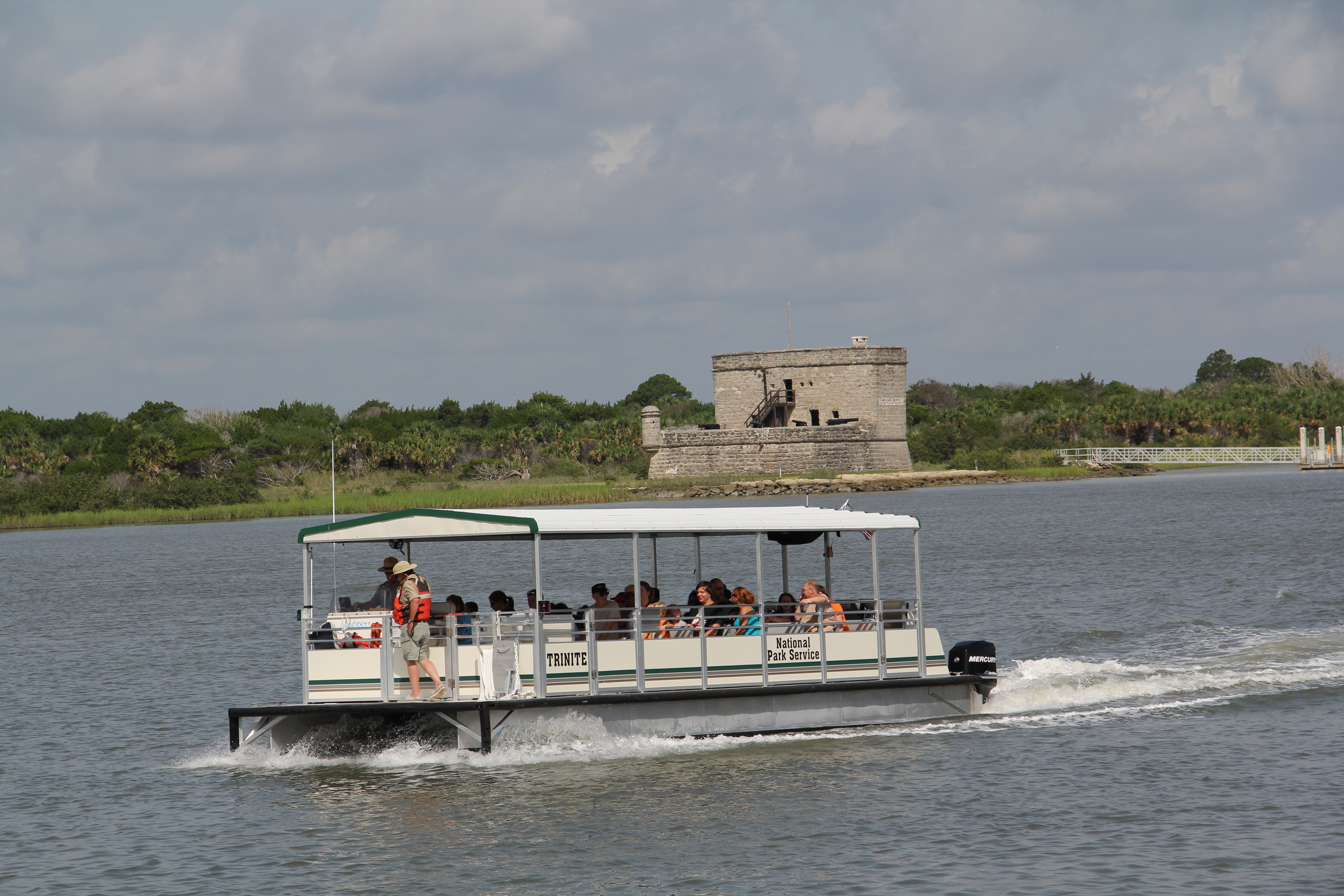
Since the 1930s, visitation to the park has greatly increased and the docks have gone through many changes. The first Visitor Center Dock was built in 1935 and was a simple wooden structure. It was replaced in 1978-1979 by an aluminum floating dock that moved with the tides. That dock was later replaced in 2001 with a concrete floating dock which is in use today. This dock has since been modified to work with the two current boats which began their ferry service in October 2011.
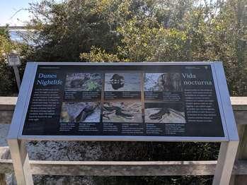
Look for wildlife tracks in the sand. You might see the paw prints of a raccoon, opossum, or even a bobcat. Look carefully for the faint trace of a lizard or a black racer snake. You may see a racerunner lizard itself, but because of daytime heat and the threat of being caught by predators, many wild animals search for food in the dark of the night.
In the background of the panel is a color photo of the Fort Matanzas National Monument's darkening dunes landscape at sunset: the sky a dark orange; the land in dark shadows.<br /><br />At the far left and right sides of the panel, against the darkened background, white text in English and Spanish reads:<br /><br />Dunes Nightlight. Look for wildlife tracks in the sand. You might see the paw prints of a raccoon, opossum, or even a bobcat. Look carefully for the faint trace of a lizard or a black racer snake. You may see a racerunner lizard itself, but because of daytime heat and the threat of being caught by predators, many wild animals search for food in the dark of the night.<br /><br />End of Text<br /><br />In the center of the panel, between the 2 text columns, are 6 rectangular color photos: 3 on top and 3 on the bottom. Below each photo, white text in English and Spanish identifies the nocturnal animals.<br /><br />On the top row, from left to right: a grey marsh rabbit with black eyes sits in the underbrush, its small ears up. In the text below:<br /><br />These strong swimmers live only near water.<br />End of Text<br /><br />Next, a brown raccoon with black fur around its eyes, dips its paws into a pool of water. In the text below:<br /><br />These masked mammals are most active at night. <br /><br />To the right, a light tan opossum with a pointed snout, hangs upside down on the side of a tree trunk. In the text below:<br /><br />North America's only marsupials eat bugs, mice, and rats.<br /><br />End of Text<br /><br />On the bottom row from left to right: a grey and brown gopher tortoise climbs up a dune. In the text below:<br /><br />Their burrows shelter hundreds of other animal species.<br /><br />End of Text<br /><br />To the right, a "Black Racer" snake with a cream-colored belly, slithers over a light brown rock. In the text below:<br /><br />When resting, these nonvenomous snakes mimic a fallen branch.<br /><br />End of Text<br /><br />To the right, a 6-lined brown Racerunner lizard with black and yellow stripes, poses on a brown rock. In the text below: <br /><br />6 yellow or yellow-green stripes give these lizards their name.<br /><br />End of Text<br /><br />Dark green foliage surrounds the panel, overlook deck, and walkway. Below, dunes stretch toward blue water. Beyond, on a corresponding sandy shore, are trees and bushes. <br /><br />Mounted on the railing adjacent to the panel are 6 touchable bronze models of animal footprints found in this area: marsh rabbit, raccoon opossum, gopher tortoise, black racer, and 6-lined racerunner. Each model is identified in raised English, Spanish, and Braille letters. <br /><br />[End of message]<br /><br /><br />
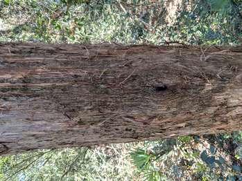
The evergreen foliage attracts wildlife for food, protection, and nesting. Its fruit, young branches, and leaves have aromatic oils used in a variety of medicines. A tea made from its leaves can relieve a cough or calm restlessness.
Mounted on top of the wooden rail along the Nature Trail boardwalk is a horizontal panel with a touchable bronze model. <br /><br />On the left and right sides of the panel, black text in English Spanish reads:<br /><br />Eastern Red Cedar. The evergreen foliage attracts wildlife for food, protection, and nesting. Its fruit, young branches, and leaves have aromatic oils used in a variety of medicines. A tea made from its leaves can relieve a cough or calm restlessness.<br /><br />End of Text<br /><br />In the center between the 2 columns of text is a bronze, 4-inch square with a touchable model of the Eastern Red Cedar foliage, and raised letters in English, Spanish, and Braille. This tree has tiny green, branchlike tendrils and round white berries.<br /><br />Directly in front of the panel, is a red cedar within a dense maritime forest.<br /><br />[End of message]<br /><br />
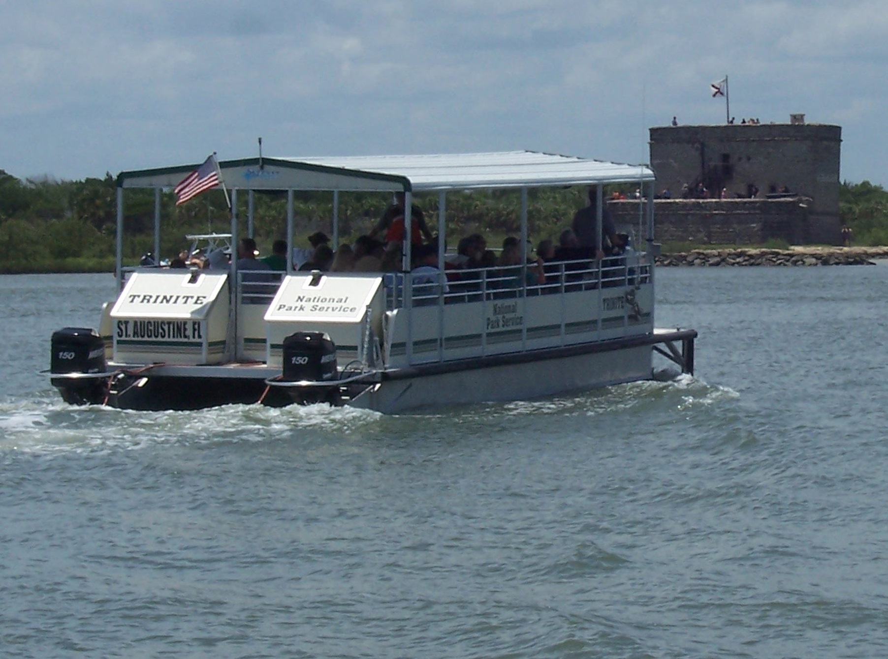
While there are many things to do at Fort Matanzas National Monument, there is only one way to get to the fort. As long as weather, equipment, and staffing allows, we run our modern USCG inspected ferries 7 days a week except for Christmas and Thanksgiving. Grab your ticket for the 9:30, 10:30, 11:30, 12:30, 1:30, 2:30, 3:30, or 4:30 cruise at the visitor center and get ready for an adventure. <br /><br />
On the west side of the visitor center is the Fort Matanzas Ferry Dock.<br /><br />There is a metal gate at the top of a metal ramp that leads to the dock area, where there are two docks. Midway down the ramp is a tall flagpole flying the American Flag, described in detail later. Two signs are attached to the gate, that read,<br /><br />Do Not Enter<br /><br />And<br /><br />Please Note-<br />No food or drink (except water) allowed on the boat or at the fort.<br />Children must be accompanied by an adult.<br />Shoes must be worn at the fort.<br />There are no restroom facilities at the fort.<br />The tour lasts about 50 minutes.<br /><br />Once the gate is opened by Park personnel, you can walk down the railed ramp to the first platform. The ramp is 4 feet across and about 50 feet long. The ramp surface alternates between a coarse textured solid surface and thin metal slats. The ramp bridges over the beach and part of the Matanzas River to reach the platform. This platform has a metal railing around it.<br /><br />From the first platform you can cross over to the second larger docking platform to embark on the ferry boat. The ferry is a 12 foot wide by 36 foot long pontoon boat. It has rows of seats and a shade roof overhead. The boat has low sides and railings, above the railings is "open air".<br /><br />To the left of the platforms is an identical pontoon boat out of the water resting on a boat lift.<br /><br />The American flag has red and white stripes white a blue square with 50 white stars in the upper left corner.<br />
Fort Matanzas is located on a barrier island, which is volatile and ever-changing by nature. Today's landscape is totally different from what the Spanish soldiers would have seen. The landscape around Fort Matanzas has changed much over the years. Logs written by the fort's officers describe the island as less than two acres in size. Officers also made log entries describing the condition of the fort. Officer Estevan LaCal, who was stationed at the fort in July of 1796, wrot
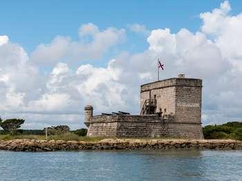
From the Rattlesnake Island ferry landing dock, continue on a flat path of packed sand and crushed seashells through a grassy field. The path curves slightly to the left for 145 feet, ending at the west side of Fort Matanzas.<br /><br />Fort Matanzas is located on the east side of Rattlesnake Island, about 20 feet inland from the water's edge. The fort foundation is about 50 feet square, surrounding an inner battlement. The fort's thick walls are made of blocks of coquina, a local shellstone. Shells are visible within the stone. The foundation is wider at the base, angling slightly inward up to about 12 feet, then continuing straight up from there.<br /><br />The north wall, which you see from the path, is a 30-foot tower about 20 feet deep. It is twice as high as the rest of the fort. There are two rectangular windows near the center of the wall. The upper one is about 1-foot-wide by 3-feet-high. The lower one is about 2 feet square. Along the top of the wall is an observation deck. A pole on the deck if flying the Spanish colonial flag, which is white with a ragged red "x" shape. A chimney, made of blocks with a capped vent, is seen towards the east end.<br /><br />The path passes the northern tower portion of the building and ends at stairs that climb up the center of the west wall. 15 wooden risers lead to the first floor, called the "gundeck". This is about 25 feet square and about 12 feet above ground. A three-foot-high foundation wall extends up along the west, south, and east sides. On the southwest corner is an 8 foot cylindrically-shaped structure with domes on the top and bottom. It juts out from the corner about 3 feet. The outer wall of the structure has three openings at eye level, each about 6 inches wide by 8 inches tall.<br /><br />Along the south wall, three iron cannon barrels protrude over the top of the fort foundation wall. A terra cotta pipe sticks out from the wall about 10 feet above the ground, close to the south-eastern corner.<br /><br />The east wall is about 30 feet from the edge of the rock lined shore. One cannon sticks out from an opening that has been cut into the upper wall of the fort.<br />
Coastal Florida was a major field of conflict as European nations fought for control in the New World. As part of this struggle, Fort Matanzas guarded St. Augustine's southern river approach.
The coquina stone watchtower is a square base approximately 50 feet by 50 feet on each side. It sits right on the Matanzas River to overlook the Matanzas Inlet, just a mile to the South. The gun platform has a round sentry tower and four cannons. The backside of the gundeck is a two story structure, including two rooms. The top of the tower serves as a lookout point accessible only by ladder. A chimney and flagpole is at the top.
Fishing is one of the best kept secrets of Fort Matanzas National Monument. With our close proximity to the Matanzas Inlet, we have an abundance of salt water fish species and a wide area to fish, both on the river side and ocean side. Recreational fishing provides a fun way to enjoy the outdoors with your family and maybe even catch your own dinner if you're lucky.
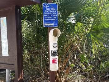
From the Marsh Trail, the Fishing Access path is on the left, or west, side just beyond the unimproved kayak launch. <br /><br />To the left of the access path entrance is a kiosk with an information bulletin board with local information. Attached to a front post, at a five foot height, is a 15 inch long white plastic tube container, with a curved opening at the top and a sealed bottom. The signage above it reads,<br /><br />Keep our waterways tangle free; recycle your fishing line responsibly.<br /> <br />The ten foot wide access path has a packed sand surface. There are six wooden planks about four feet apart in the ground that create shallow steps down to the beach. The path is about 50 feet long. Flanking the path are grasses, low brush, scrubby oak trees, and palm trees. The palms have a single trunk topped with a cluster of flat, fan-shaped leaves that end in a point. <br /><br />As you walk down the access path, Rattlesnake Island can be seen, straight ahead, across the river, about a quarter of a mile away. Fort Matanzas is on the island at 2 o'clock. <br /><br />At the end of the path is a sandy beach at the edge of the Matanzas River. The pale sand is fine-grained. It feels like white sugar. The distance to the river varies with the tides. <br /><br />A passenger ferry loading dock is down the shore to the left, about 200 feet away. In front of you is a pile of rocks, partially covered with sand, grasses, and low brush. Around this shallow jetty is a flat, sandy beach. More piles of rocks are near the shore, about 100 feet away, to the left and right. As water levels change, erosion may change the beach, and rocks may be slippery, use extreme caution in this area.<br /><br />A posted sign on the beach to the right reads,<br /><br />Notice <br />No fishing after 5 p.m. <br />No digging for shellfish<br />No digging for bait<br />
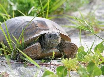
Who's been digging all those holes in the scrub habitat at Fort Matanzas National Monument? The shape of the holes gives an important clue as to who is responsible. The holes are typically hemispherical, as if something with a flat bottom and a convex top did the digging. There's basically only one creature which possesses such distinguishing characteristics- a tortoise! In this case, it's the gopher tortoise (Gopherus polyphemus), an inhabitant of the coastal scrub that
Along the top third of the panel, against a light blue background, black text in English and Spanish reads:<br /><br />Gopher Tortoise Burrow. In the height of summer, you would not stand in this spot long. The simmering heat would drive you away. The animals that live here must be able to escape too.<br /><br />But where? The gopher hole. A gopher tortoise digs a burrow deep into cool moist sand below. There, it rests away from the heat of summer and the cold of winter. Rabbits, armadillos, opossums, skunks, mice, snakes, lizards, and many invertebrates share the tortoise's burrow. In fact, researchers say that hundreds of animals may benefit from the gopher tortoise's burrowing habitat.<br /><br />End of Text<br /><br />Below, a color cutaway illustration of a gopher tortoise's burrow shows some of its inhabitants. To the left of the burrow, standing on the sand, is an opossum. It has a white, heart-shaped face, pink nose, small black eyes, and small round ears. Its short, shaggy fur is black with white tips, and has a long, light pink, curling tail.<br /><br />To the right of the opossum, a light brown snake with black rings on its body, slithers out of the burrow. <br /><br /><br />Under the ground, in a lower passage, at the left is a round brown mouse; below the mouse, at the bottom of the burrow, a slim green lizard. Opposite the lizard, at the lower right end of the burrow, a brown tortoise with black markings on its shell. Behind the tortoise, a dung beetle is at work.<br /><br />To the left of the burrow, black text in English and Spanish reads:<br /><br />Gopher tortoises are considered "Species of Special Concern" in Florida and "Endangered" in other states. Scientists fear the decline in tortoise numbers will mean trouble for other animals too.<br /><br />End of Text<br /><br />The panel sits at a bump-out deck area along a long wooden boardwalk. Beyond the panel, views of scraggly, low bushes, and a single palm tree atop a small rise. In the distance to the left of the palm tree, peaks of the water; to the right, power lines. <br /><br />[End of message]<br />
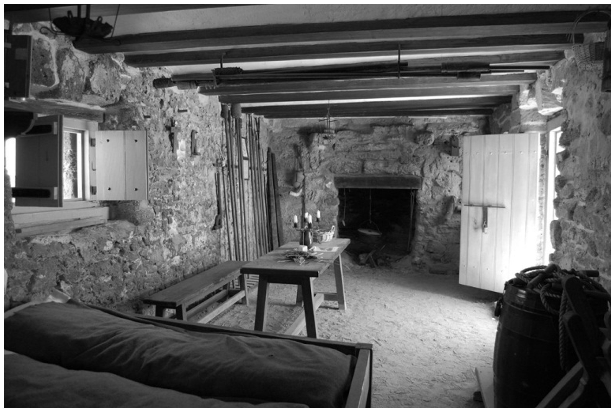
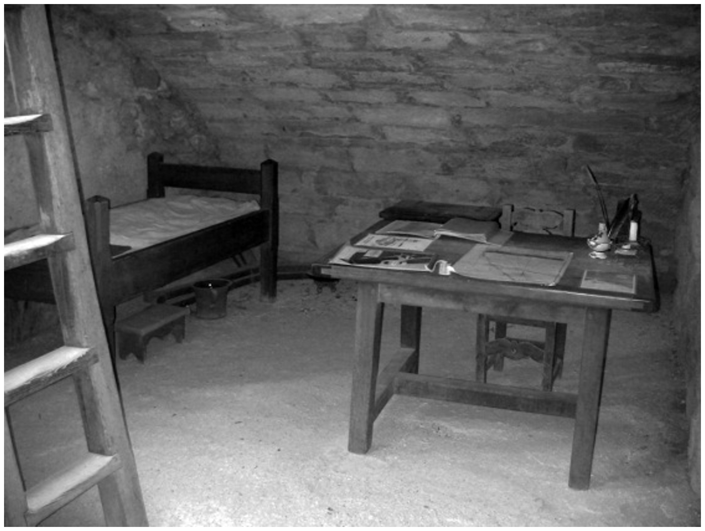
Spanish soldiers left their houses in St. Augustine to man Fort Matanzas for 30 days at a time. This room became their shared home away from home.The first floor room served as the enlisted men's quarters. The soldiers cooked, ate, and slept in this room. Opposite the fireplace was a long, wooden sleeping platform. Benches and a table completed the furnishings. On average, six people shared this room. More men could be assigned as needed. The small openings on the south wal
The gundeck is the most fearsome part of the fort. At one time, this watchtower boasted 5 cannons, one of which could shoot up to three miles down range. Fort Matanzas is a very simple structure, its main strengths being the artillery and its strategic location. Five cannons once guarded the fort. Each cannon could easily reach the inlet, then only a half-mile away. Two original cannon still stand guard at the fort today. These guns were placed at the fort in 1793 and left b
At the top of the wooden stairs is the gundeck. This audio description includes the interior areas of the fort that can be accessed from this location.<br /><br />Standing at the top of the stairs, at the gun deck level, facing east, the description, moving from left to right, includes:<br /><br />To the immediate left is a wooden bench.<br /><br />Beyond that wooden stairs lead to a platform and the entry to the second level.<br /><br />At 10 o'clock is the entry to the Soldier's quarters. It has a fireplace, wooden table, and long platform bed with artifacts such as muskets and wooden barrels. <br /><br />To the left of the entry to the soldier's quarters is a water cistern.<br /><br />Straight ahead and to the right, platforms extend out from the east wall and south wall with four cannons, facing outward.<br /><br />At 3 o'clock, at the southwest corner, is a cylindrically shaped structure, with a domed top. A 5 inch high step is at the entry to this structure, which is the sentry box. There is a low doorway, approximately 5 ½ feet (Check NPS) tall. You may need to duck down. The interior is 8 feet high with three small square windows. <br /><br />To access the third level to the Officer's quarters you climb the wooden risers previously noted, at 10 o'clock, and enter through the wooden door at the landing. The Officer's quarters has various features that are roped off on the left, or west, wall, including the entryway into the powder magazine, where gun powder was stored. Ahead, to the north, there is a window, to the northeast a wooden chest, a desk, and to the east a wooden bed. In the center of the room is a wooden ladder to the observation deck. At the top of the ladder you will be facing north.<br /><br />Once on the observation deck, a pole behind you, to the south, is flying the Spanish colonial flag, which is white with a ragged red "x" shape. To you right, or east, is a chimney, made of coquina stone with a capped vent. <br /><br />The View from the observation deck: To the north is the intersection of the Matanzas River and the intracoastal Waterway. To the southeast is the Matanzas inlet and the distant Atlantic Ocean. To the west is a grassy area extending to scrubby native grasses and bushes, and, further away, to the intracoastal Waterway. The ferry dock, Matanzas river, and visitor center are to the east. <br />
Also known as the toothache tree, its bitter bark is a home remedy for toothache. In fact, all of its plant parts-seed, fruit, bark, and root-are useful. Seeds can be used like pepper and a tonic from the fruit can ease a stomach ache.
Mounted on top of the wooden rail along the Nature Trail boardwalk is a horizontal panel with a touchable bronze model.<br /><br />On the left and right sides of the panel, black text in English and Spanish reads:<br /><br />Hercules Club. Also known as the toothache tree, its bitter bark is a home remedy for toothache. In fact, all of its plant parts-seed, fruit, bark, and root-are useful. Seeds can be used like pepper and a tonic from the fruit can ease a stomach ache.<br /><br />End of Text<br /><br />In the center between the 2 columns of text, a bronze 4-inch square. On it is a touchable model of the Hercules Club and raised letters in English, Spanish, and Braille. The tree has a spiky trunk, while its smooth dark green leaves extend from a central stem.<br /><br />Directly in front of the panel, the maritime forest includes the Hercules Club tree. Beyond the tree is a boardwalk switchback.<br /><br />[End of message]<br />
These evergreens have oval-shaped leaves, but differ in the details. The yaupon holly leaf is a near perfect oval with only a slight serration. The wax myrtle leaf is wavy and has a more pointed base with noticeable notches along its edge.
Mounted on top of the wooden rail along the Nature Trail boardwalk is a horizontal panel with a touchable bronze model. <br /><br />On the left and right sides of the panel, black text in English and Spanish reads:<br /><br />Holly & Myrtle. These evergreens have oval-shaped leaves, but differ in the details. The yaupon holly leaf is a near perfect oval with only a slight serration. The wax myrtle leaf is wavy and has a more pointed base with noticeable notches along its edge.<br /><br />End of Text<br />In the center between the 2 columns of text, is a bronze 4-inch square with a touchable model of holly and myrtle leaves and raised letters in English, Spanish, and Braille. <br /><br />Directly in front of the panel is a canopy of trees and below, holly and myrtle plants.<br /><br /> [End of message]<br /><br /><br />
"Don't move! I'll be right back with lunch!" If you could translate Tern-speak, this is what you might hear in May or June at the least tern nesting colony at the southern tip of Anastasia Island at Fort Matanzas National Monument.Each spring this smallest member of the tern family leaves its wintering grounds along the coast of Central and South America. Some fly through Mexico to California; others follow the Mississippi River, and others fly to the eastern coast of the
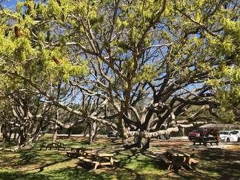
When people think of a symbol of the American south, they often think of the graceful and majestic live oak festooned with Spanish moss or resurrection fern, like the gnarled old trees in the picnic area at Fort Matanzas.While many species of oak trees are found throughout the world's temperate zones, live oaks are native only from Virginia south to Florida and west to central Texas, especially thriving in the heat and humidity near the coast where they often form dense stran
Gunpowder storage was vital, even at this small watchtower. Cannons were the soldiers' only defense against an invading enemy. Located within the west wall of the fort and accessed only through the officer's quarters, the powder magazine kept the dangerous black powder from open flames used for heat and light. The magazine shaft extends down through the wall to the level of the gundeck. Although thick walls protected the black powder from enemy fire, humidity was often a pro
What connects Matanzas Bay to the Matanzas Inlet and flows right past Fort Matanzas? The Matanzas River of course! (You may notice a bit of a theme here.) Unlike most rivers, the Matanzas doesn't flow in just one direction. It is a tidally influenced waterbody that connects two ocean inlets- one at the port city of St. Augustine, and the other fourteen miles south (as the crow flies) at Fort Matanzas National Monument. Depending on if the tide is outgoing or incoming, th
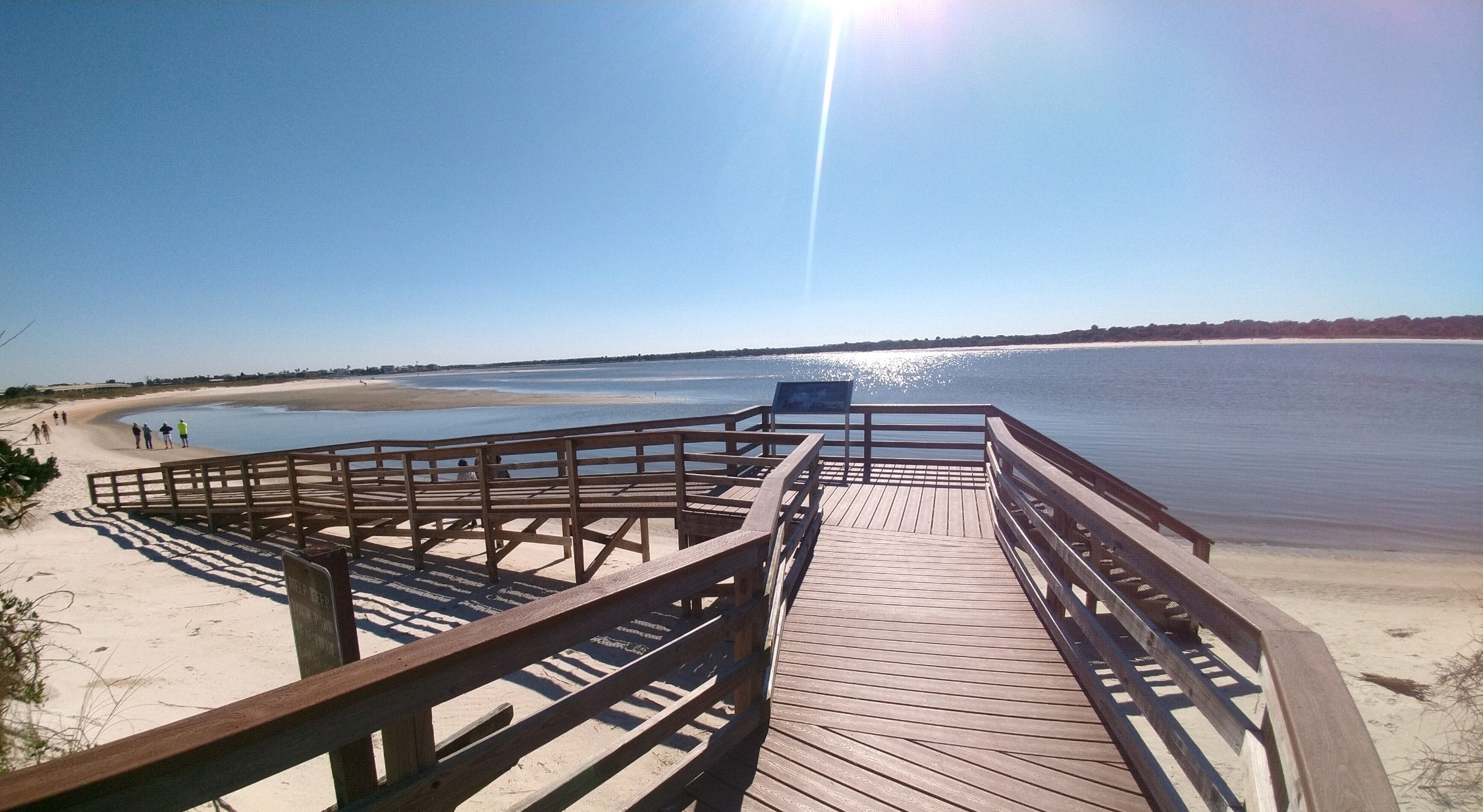
The Matanzas Inlet connects the Matanzas River to the Atlantic Ocean, going underneath the A1A bridge. Water is always flowing through the inlet.<br /><br />If you are facing the beach, the view to the south, at 7 o'clock, is of homes built along the shore of Summer Haven. At 9 o'clock on the west side of the bridge out in the river, are concrete utility poles that are no longer in use. At 10 o'clock is Rattlesnake Island. The view to the north at 12 o'clock, is the concrete A1A bridge that crosses over Matanzas Inlet to Summer Haven. The Atlantic Ocean is at 3 o'clock.
The observation deck was one of the most vital parts of the Matanzas watchtower, as it enabled the soldiers to see for miles. Enemy ships would be spotted long before they posed a threat. Then, as now, a narrow ladder was the only access to the top of the tower. This opening probably had a cover to keep the rain out of the officer's quarters. The deck provided an excellent view of the inlet to the south. In 1742, the inlet was about a half-mile closer than it is now, within e
Fort Matanzas National Monument is located on the edge of one the world's most stupendous natural features- the Atlantic Ocean. The Atlantic is the second largest of the Earth's four oceans, covering about 21% of the globe and containing approximately 22 billion billion gallons of water. Its depth ranges from sea level to 27,841 feet at the Puerto Rico Trench (located north of the eponymously named island). Probably the most distinguishing feature of ocean water is its salinity. Due to the presence of salts and minerals washed into the seas over the eons from terrestrial sources, ocean water has a salinity of 3.5%. This is mostly due to the presence of sodium chloride, but also to minerals like magnesium, sulfate, calcium, potassium, etc. that were once part of rocks which were slowly eroded and carried downstream in rivers to their ultimate<br />destination.<br /><br />All the world's oceans are physically connected and together cover about 71% of the Earth's surface and collectively contain perhaps 352 quintillion gallons of water. The world ocean is the predominant natural feature on the planet.
Adjacent to the parking lot is a kiosk with concrete ramps of either side. Both ramps lead onto the Oceanside Boardwalk. The boardwalk has a wooden plank floor with four-foot-high wooden railings. The boardwalk is elevated above the dune meadow environment of seasonal flowers, sea oats, grasses, vines, low shrubs, and palm trees. The palms have a single trunk topped with a cluster of flat, fan-shaped leaves that end in a point.<br /><br />Once you are on the boardwalk, the two ramp routes converge, and then there is a right turn at about 50 feet from where you started. After another 150 feet, halfway to the beach, there is a viewing platform that is about 10 feet by 10 feet. A wayside panel, titled "Gopher Tortoise," is located on the right side, to the north.<br /><br />Another 150 feet, from the halfway viewing platform, is a platform that is about 10 feet by 10 feet.<br /><br />From this platform, on the right, to the south, a ramp leads to the beach, heading down about 50 feet, with a short switchback at the end.<br /><br />From this platform, on the left, to the north, stairs with railings descend to the beach.<br /><br />The size of the beach varies during the year as well as daily with the tides.<br />
The commanding officer at Fort Matanzas could survey all activities at the watchtower from his second-floor quarters. The commander of Matanzas had this room to himself. The entrance to his room was a staircase from the gundeck. On the left is a wall separating the officer's bedroom from a food storage area and the entrance to the powder magazine. Thick walls protected the gunpowder from enemy fire. The officer had one window looking north and three small musket loopholes
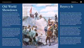
One of the first colonial conflicts between European nations happened near here in 1565. Spain had already claimed Florida when France established Fort Caroline near present-day Jacksonville. This French outpost threatened the security of Spanish treasure fleets that sailed along the Florida coast. To defend its claim, protect its fleet, and defend the Catholic religion, Spain sent 800 sailors, soldiers, and civilians to remove the French Protestants (Huguenots) from Florida
On the far left and right sides of the panel, white text in English and Spanish reads:<br /><br />Old World Showdown. One of the first colonial conflicts between European nations happened near here in 1565. Spain had already claimed Florida when France established Fort Caroline near present-day Jacksonville. This French outpost threatened the security of Spanish treasure fleets that sailed along the Florida coast. To defend its claim, protect its fleet, and defend the Catholic religion, Spain sent 800 sailors, soldiers, and civilians to remove the French Protestants (Huguenots) from Florida and start a Spanish colony.<br /><br />The French had barely survived a year when the Spanish founded St. Augustine in 1565. To secure their place in the New World, the French sailed south to attack the settlement. A storm scattered the French ships, stranding soldiers and leaving Fort Caroline weakly guarded. The Spanish attacked, capturing Fort Caroline.<br /><br />Later, the Spanish found the shipwrecked Frenchmen just south of where you now stand. They spared only a few professed Catholics and artisans needed in St. Augustine. In the end, about 250 people lay dead. Since then, the inlet has been called Matanzas, meaning, "slaughter" in Spanish.<br /><br />The Spanish found the Frenchmen helpless and unable to cross the inlet.<br /><br />End of Text<br /><br />In the center of the panel, a color illustration. On a white sandy dune overlooking blue water, a man in a red uniform with gold stripes looks down on a group of men in loose white shirts and brown pants; many of them barefoot. Their heads hang down and their hands are tied behind their back. Behind the man in red, other men, their hands also tied, are pushed forward by soldiers wearing breastplates and silver helmets. On a dune behind these men stands a man in a long black robe with a cross around his neck; his face turned up toward the sky, his hands folded across his chest. To his left, are more soldiers. One in a black, thigh-length jacket and sword looks down on the shackled men. Behind him stand more soldiers looking out over the water; one holds a large red flag. <br /><br />The panel is set in the elbow of the wooden walkway. Directly beyond the panel is a large oak tree, its branches stretch outward to the left and right. Beyond the tree, on the ground below, thick palm fronds and other vegetation. <br /><br /> [End of message]<br /><br /><br />
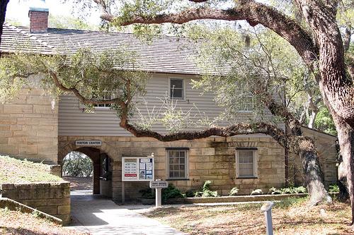
Dedicated volunteers handle Fort Matanzas Visitor Center. They will usually be the first people to welcome you to our park, unless you explore our nature trails and encounter one of our rangers. Volunteers are essential to our park operations and are a wealth of information. Upon arrival to the Visitor Center they will provide you with a boarding pass for the next available ferry
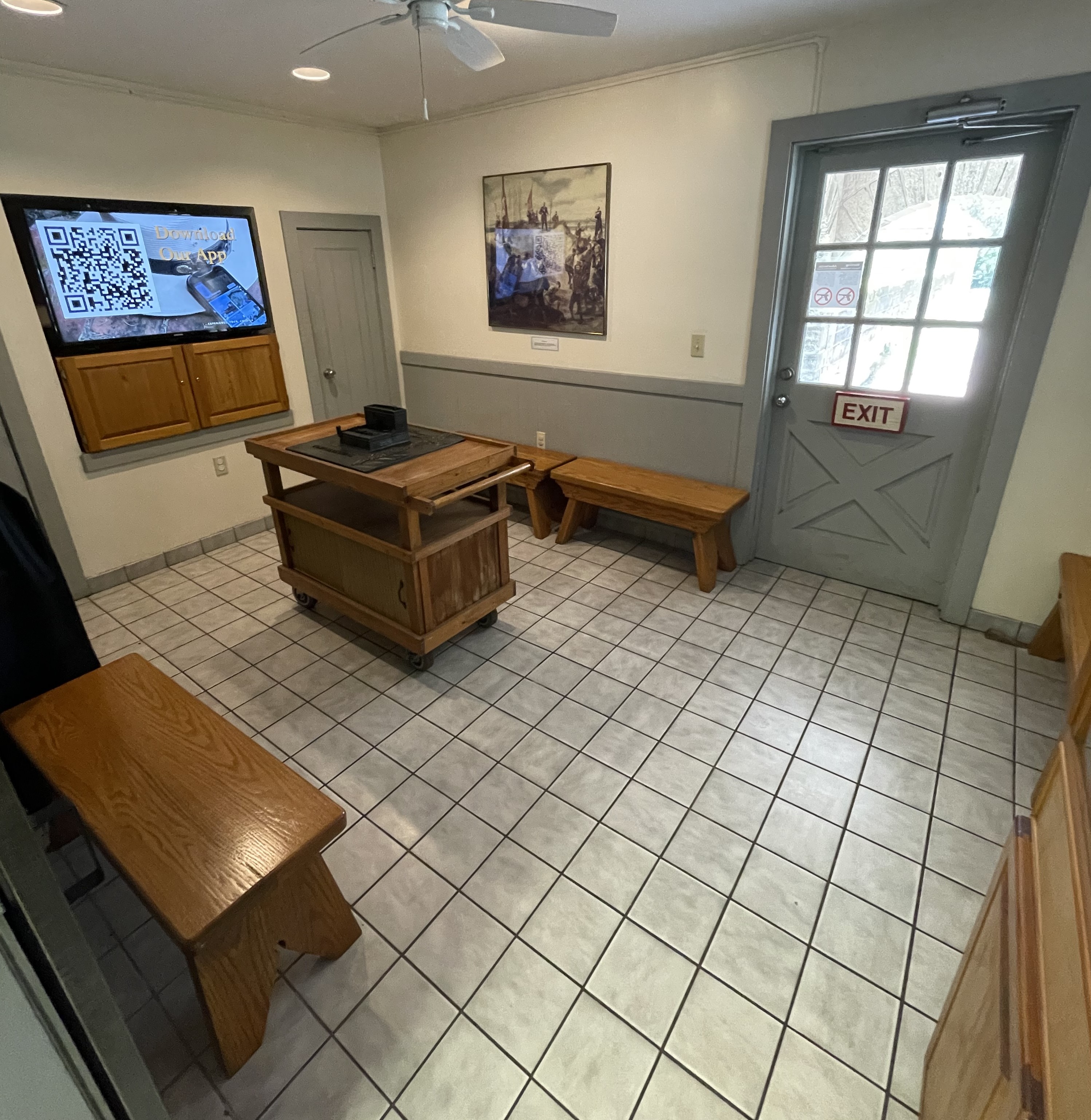
The visitor center door opens outward, toward you. Once inside, the information desk is ahead and slightly to the left. A monitor behind the desk displays historic pictures of the fort, ferry tour times, and special event information. Staff can assist you with information. Gift shop merchandise is in tall bookcases along the wall to your left. The exhibit room is straight ahead, through the next door. To the left is a cart centered in the room with a bronze model of the fort. The TV is recessed into the wall on the left. There are two models of the fort in Plexiglas cases: a during-construction model directly to the right of the second door, and a completed fort model on the left-hand side of the desk.
Picnic Area located under large oak trees, adjacent to the main parking area and restrooms.
a teardrop shaped roadway that leads to a paved parking area. Picnic tables are located in a shaded grassy center. Live oak trees dominate the landscape.
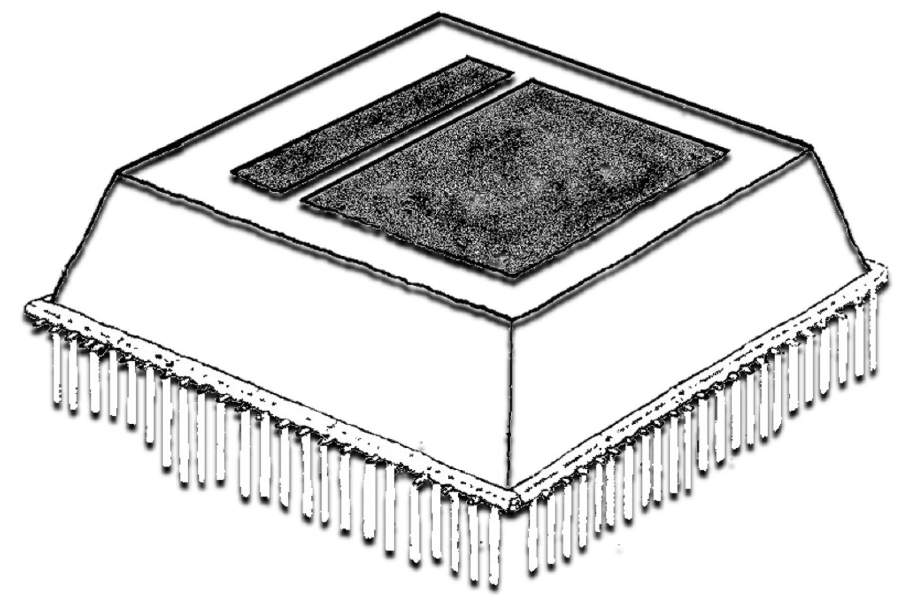
The marshy ground of Rattlesnake Island was less than ideal for a heavy stone fort, but brilliant construction techniques made it possible. Techniques for building stable foundations in unstable environments have evolved and improved over time. In the 18th century, wooden foundations were often the best option in in places such as the marshy shores of Rattlesnake Island. Friction pile construction consists of sturdy pine poles sunk vertically deep into the marsh. The poles w
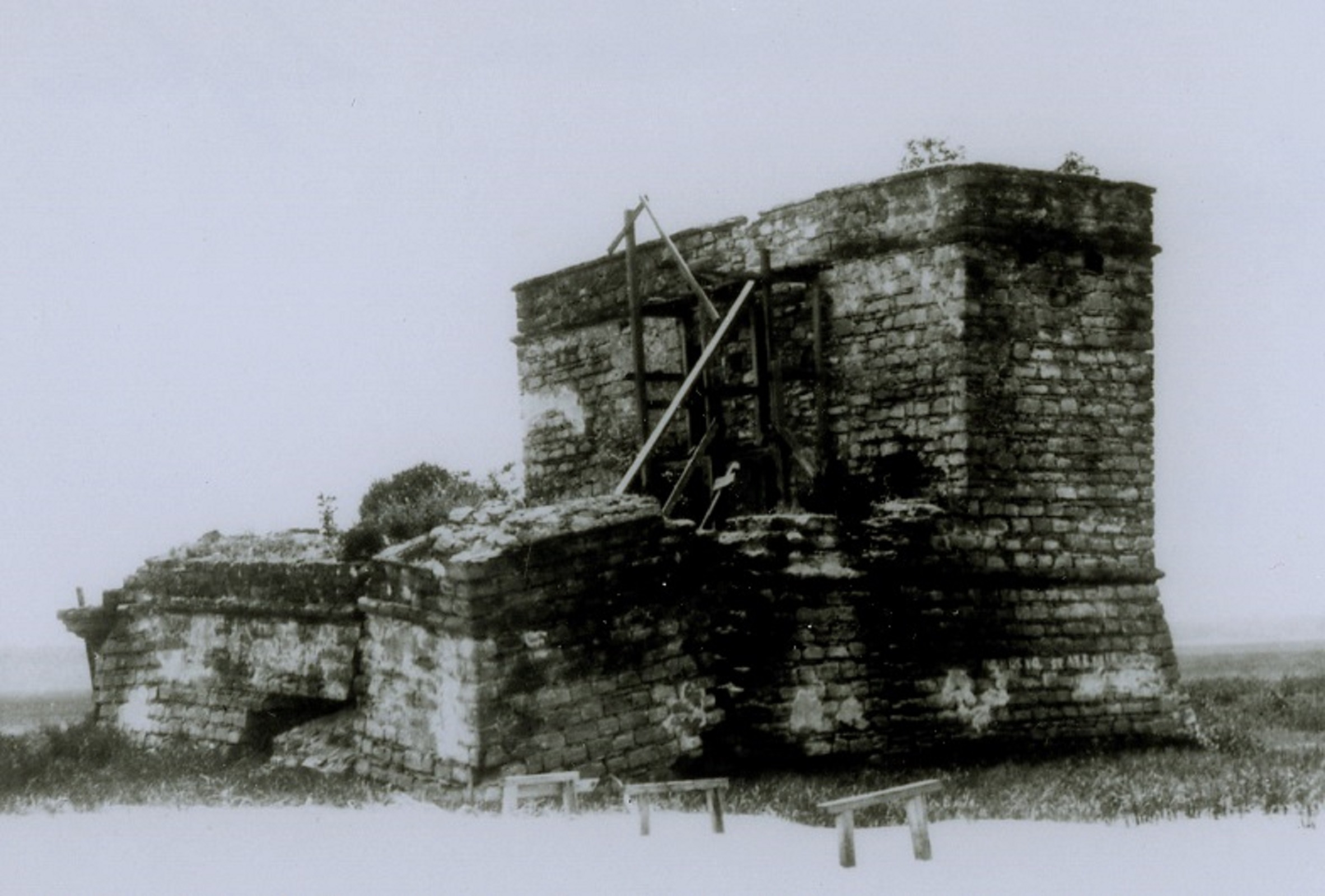
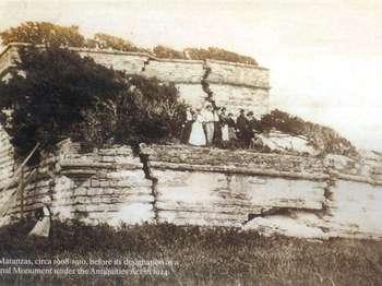
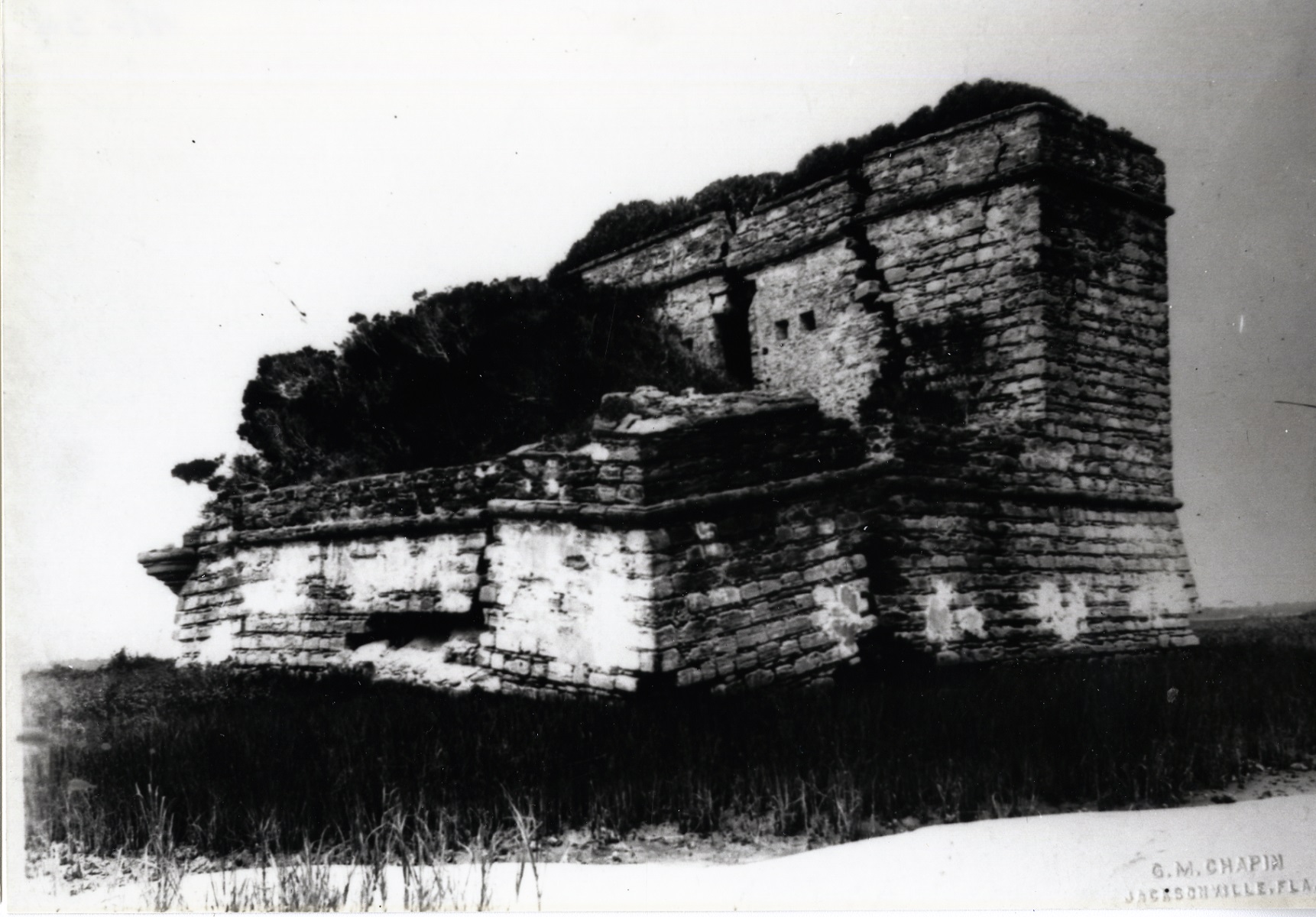
When Florida was ceded to the United States in 1821 the tower was abandoned and almost forgotten for nearly one hundred years. It was not until 1916 that efforts were first made to preserve this unique part of America's history. The National Park Service continues to preserve this structure for future generations.
Step back in time to when Spain ruled Florida. Take a short boat trip to Fort Matanzas and visit the outpost guarding the back-door approach to St. Augustine. Hike the trails through a coastal forest and dunes to see a unique mix of plants and animals in this ecological transition zone. Watch the timeless interplay of waves and sand along the Atlantic coastline.
Under a small canopy are 2 side by side, 3-foot wide by 4-foot tall panels. On the left, the "Discover Fort Matanzas" panel; on the right, a bulletin board for posting park information.<br /><br />On the left "Discover Fort Matanzas" panel, against a light blue background, black text in English and Spanish reads:<br /><br />Discover Fort Matanzas. Step back in time to when Spain ruled Florida. Take a short boat trip to Fort Matanzas and visit the outpost guarding the back-door approach to St. Augustine. Hike the trails through a coastal forest and dunes to see a unique mix of plants and animals in this ecological transition zone. Watch the timeless interplay of waves and sand along the Atlantic coastline.<br /><br />End of Text<br /><br />Below on the left is a map of Fort Matanzas National Monument. On the right is Rattlesnake Island; on the left, Anastasia Island. Running between the islands is the Matanzas River.<br /><br />To the right of Rattlesnake Island is the intracoastal waterway; to the left of Anastasia Island is the Atlantic Ocean. Above Anastasia Island, running from the Atlantic Ocean into the Matanzas River, is the Matanzas Inlet.<br /><br />Several other points on the islands are indicated with black text and arrows.<br /><br />Near the bottom left of Rattlesnake Island, facing the Matanzas River is Fort Matanzas. Across the river,on the right side of Anastasia Island is the Visitor Center. Below the visitor center, a picnic area, with a connecting black line that runs further left across SR A1A to a beach access ramp. Above the Visitor Center is a nature trail marked with a thin red line. Running through Anastasia Island from top to bottom, a red line indicates route "A1A." Above the nature trail to the right of route "A1A" is a gray rectangle indicating a parking lot with an arrow indicating that "You Are Here." <br /><br />Below, black text in English and Spanish reads:<br /><br />Weather permitting, a passenger ferry runs from the park visitor center dock to Fort Matanzas.<br /><br />End of Text<br /><br />To the right of the map, 4 small square color photos: 2 on top and 2 below.<br /><br />In the top left photo, water runs between 2 banks of of tall yellow and green grasses and a thick grove of trees. <br /><br />Below, black text in English and Spanish reads:<br /><br />Cordgrass dominates the landscape in the salt marsh ecosystem.<br /><br />End of text<br /><br />Next, to the right, a brown tree branch hangs over a boardwalk that runs through a dense growth of trees and plants. <br /><br />Below, black text in English and Spanish reads:<br /><br />The maritime forest's live oak canopy shades many animals from the hot Florida sun.<br /><br />End of Text<br /><br />In the bottom left photo, a line of tall grass with feathery tops borders a white sandy beach and the Atlantic Ocean beyond.<br /><br />Below, black text in English and Spanish reads:<br /><br />Sea oats flourish in salt-rich coastal dune sand; their expansive root system helps keep dunes in place.<br /><br />End of Text<br /><br />To the right, a wide blue green river with green plants on its banks. <br /><br />Below, black text in English and Spanish reads:<br /><br />The Matanzas River is a saltwater estuary. Many plants and animals thrive here.<br /><br />End of Text<br /><br />Along the bottom of the panel is a color photo of Fort Matanzas overlooking the Matanzas River. The fort is a 2-story, light brown L-shaped stone structure; a lower section at the left connects to a taller rectangular section at the right. At the far left corner of the fort's lower section is a cylindrical tower. 4 horizontal black cannons poke out over the fort's lower left and front facing walls. Behind the cannons, to the right, a staircase rises half-way up the side of the taller rectangular section. On top, a flag from the first Spanish military era flies; a red "x" against a white background. <br /><br />The 2 adjacent panels stand between 2, v-shaped railings; the entrance to the boardwalk on either side. The boardwalk has ramped curb-cuts to the right and left. Directly behind you is a marked pedestrian crosswalk. To the far left, beyond the boardwalk, is a road; to the right, beyond the boardwalk is vegetation.<br /><br />[End of message]<br /><br /><br />
These palms both have long, narrow, blade-like fronds that radiate from a center point, but differ in their stem connection. Sabal palms have a defined center midrib and the saw palms have sharp, saw-toothed leaf stems.
Mounted on top of the wooden rail along the Nature Trail boardwalk, is a horizontal<br />panel with a touchable bronze model.<br /><br />On the left and right sides of the panel, black text in English and Spanish reads:<br /><br />Sabal & Saw. These palms both have long, narrow, blade-like fronds that radiate from a<br />center point, but differ in their stem connection. Sabal palms have a defined center<br />midrib and the saw palms have sharp, saw-toothed leaf stems.<br /><br />End of Text<br /><br />In the center between the 2 columns of text, is a bronze 4-inch square with a touchable<br />model of 2 palm leaves and raised letters in English, Spanish, and Braille. Along the<br />top, Saw palm leaves; along the bottom, Sabal palm leaves.<br />Directly in front of the panel is a maritime forest with a tree canopy overhead.<br />[End of message]
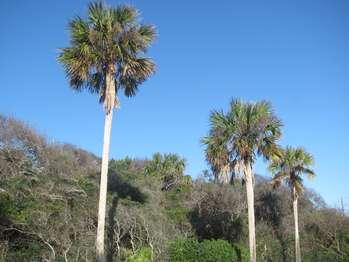
One of the most prominent tree species growing at both Fort Matanzas and Castillo de San Marcos is the sabal palm (Sabal palmetto). This palm is widely distributed throughout the state, and is considered so indicative of Florida that it was chosen as the official state tree by the Florida Legislature in 1953.<br /><br />Another name for the sabal palm (its so-called "common" name) is cabbage palm. What is so apparently "cabbage-like" about the sabal palm that earned it this moniker? New palm fronds (the palm's green leaves) emerge from the top of the tree from a terminal bud that is shaped like a cabbage. Since this was the location where new green life emanated from the plant, some people considered it the "heart" of the palm. The fleshy, cabbage-shaped terminal bud is edible by humans, and was in fact a common food for Florida's Native American population. Even today people still use the tree as a food source (think heart-of-palm salad). Unfortunately, cutting out the terminal bud from a sabal palm will eventually kill the tree, since the bud is the only point where this species can produce new growth. (Luckily, other species of palms are available that don't die as a result of harvesting.) <br /><br />One of the many interesting facts about the sabal palm is that it and all other palm species are monocotyledons, or monocots. Monocots are a type of flowering plant that first evolved about 100 to 120 million years ago. (Sabal palms, in particular, evolved around 85 million years ago, making them one of the oldest palm species in existence.) What distinguishes monocots from other flowering plant species are anatomical features such as the way in which a monocot's vascular tissue is arranged. (Like animals, plants have a vascular system that transports water and nutrients throughout the organism.) In monocots the vascular bundles are arranged haphazardly, whereas in dicots they are segregated- water-carrying bundles towards the center of the plant, nutrient-carrying bundles towards the outer perimeter. The most important distinguishing feature is the number of cotyledons (or seed leaves) possessed by each type of plant. As the nomenclature implies, dicot seeds produce two leaves upon germination, and monocots only one. By virtue of their being monocots, palms are more closely related to other monocots such as grasses, corn, irises, and orchids than other types of flowering plants. <br /><br />Sabal palms are somewhat easy to identify based on their morphology, or growth form. They have tan-gray, unbranched trunks. All of the leaves, or fronds, sprout from the top of the plant and are fan-like (palmate) in shape. As the plant grows, the older fronds die off, leaving their bases still attached to the trunk. Over time the bases self-prune due to age and weather, leaving the trunk with a relatively smooth appearance. In developed areas, people often hasten this process by pruning off the old growth themselves for aesthetic reasons. Also in the name of aesthetics, people sometimes prune off live fronds from the crown of the tree to achieve a desired look. This can affect the tree's health, though, if done to excess. The green fronds are where the plant photosynthesizes. Photosynthesis is the chemical reaction whereby carbon dioxide and water are converted into carbohydrates and oxygen using the energy of the sun. Sugar and cellulose are carbohydrates that the palm requires for overall health and structural integrity. If too many fronds are removed too often, the tree can become weak and sickly. <br /><br />A healthy sabal palm can grow to a height of over eighty feet and achieve a stem diameter of nearly twenty-five inches. The fronds can get to almost ten feet in length. When in reproductive mode the palm produces clusters of cream-colored flowers that droop from the crown. Fertilized flowers become round, black fruits that each contain a single seed. The seeds are resistant to salt and are also buoyant. They germinate easily in moist sand, which is why the sabal palm is often found growing along water bodies. Its seeds are highly coveted as a food source by many animals, including: black bears, raccoons, bats, wild turkeys, white-tailed deer, sea gulls, cardinals, grackles, blue jays, and scrub jays. <br /><br />By virtue of its natural resistance to insects and pathogens, this attractive, native tree is a ubiquitous member of Florida landscapes and fully deserves the recognition it's been given. <br />
On the far left and right sides of the panel, white text in English and Spanish reads:<br /><br />Old World Showdown. One of the first colonial conflicts between European nations happened near here in 1565. Spain had already claimed Florida when France established Fort Caroline near present-day Jacksonville. This French outpost threatened the security of Spanish treasure fleets that sailed along the Florida coast. To defend its claim, protect its fleet, and defend the Catholic religion, Spain sent 800 sailors, soldiers, and civilians to remove the French Protestants (Huguenots) from Florida and start a Spanish colony.<br /><br />The French had barely survived a year when the Spanish founded St. Augustine in 1565. To secure their place in the New World, the French sailed south to attack the settlement. A storm scattered the French ships, stranding soldiers and leaving Fort Caroline weakly guarded. The Spanish attacked, capturing Fort Caroline.<br /><br />Later, the Spanish found the shipwrecked Frenchmen just south of where you now stand. They spared only a few professed Catholics and artisans needed in St. Augustine. In the end, about 250 people lay dead. Since then, the inlet has been called Matanzas, meaning, "slaughter" in Spanish.<br /><br />The Spanish found the Frenchmen helpless and unable to cross the inlet.<br /><br />End of Text<br /><br />In the center of the panel, a color illustration. On a white sandy dune overlooking blue water, a man in a red uniform with gold stripes looks down on a group of men in loose white shirts and brown pants; many of them barefoot. Their heads hang down and their hands are tied behind their back. Behind the man in red, other men, their hands also tied, are pushed forward by soldiers wearing breastplates and silver helmets. On a dune behind these men stands a man in a long black robe with a cross around his neck; his face turned up toward the sky, his hands folded across his chest. To his left, are more soldiers. One in a black, thigh-length jacket and sword looks down on the shackled men. Behind him stand more soldiers looking out over the water; one holds a large red flag. <br /><br />The panel is set in the elbow of the wooden walkway. Directly beyond the panel is a large oak tree, its branches stretch outward to the left and right. Beyond the tree, on the ground below, thick palm fronds and other vegetation. <br /><br /> [End of message]<br /><br /><br />
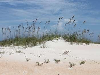
One of the most common plants growing within the sand dune system at Fort Matanzas is sea oats (Uniola paniculata). It can be argued that sea oats is one of the most important species comprising the dune ecosystem, particularly the foredune. It is a hardy and salt tolerant plant that can survive in the harsh seashore environment. (It can even survive being inundated by sea water for short periods.) It and other pioneer plants help trap wind-blown sand, which is the first
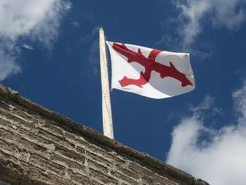
Spanish naval ships began to fly this flag in the early 1500s in honor of their king. In those days, the flag of a country was actually the flag of the ruling house. Eventually, the army also began to fly this flag, and it came to represent Spain. As Spain's power spread to the New World and across the Pacific to the Philippines, this was the flag carried by ships and flown over the fortresses which guarded Spain's possessions. Thus, it is sometimes referred to as the Spanish
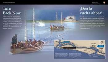
In 1742, cannon fire thundered from Fort Matanzas turning back longboats from British warships beyond the inlet. The fort's gunfire warned the British that the fort was now defensible.<br /><br />The Spanish could challenge any attempt by enemies to sneak up this southern waterway to attack St. Augustine.<br />
A color illustration fills the entire panel. Dozens of men row 2 boats up the Matanzas River, from the lower left corner of the panel, diagonally toward the upper right corner. The boats white sails are lashed to double masts. A British flag flies at the back of the forward boat. Set on the far shore is a whitewashed 2-story fort flying a white flag with a red "x" in the center. On the front, lower portion of the fort's wall, 5 cannons point toward the river and boats. One cannon shows a plume of smoke from being fired and a corresponding white splash is to the left of the forward boat. <br /><br /> On the right and left sides of the panel, white text in English and Spanish reads: <br /><br />Turn Back Now! In 1742, cannon fire thundered from Fort Matanzas turning back longboats from British warships beyond the inlet. The fort's gunfire warned the British that the fort was now defensible.<br /><br />The Spanish could challenge any attempt by enemies to sneak up this southern waterway to attack St. Augustine.<br /><br />End of Text<br /><br />Along the panel's bottom right edge, a horizontal map of the Atlantic Ocean, the coastline, and the Matanzas River which runs from left to right. Near the top left side of the map, a blue arrow marks the location of Fort Matanzas. Below, across the river from the fort, a black arrow with white text reads: "You are Here." Continuing to the right, the Matanzas River meanders between the mainland and Anastasia Island. The mouth of the Matanzas River is at the far right, with a blue arrow marking the town of St. Augustine and the Castillo de San Marcos on the mainland. <br /><br />Below the map, against a blue background, white text in English and Spanish reads:<br /><br />Fort Matanzas protected this vital supply route when St. Augustine was besieged. Today the inlet is farther south than it was in the 1740s.<br /><br />Beyond the wayside are views of the Matanzas River and its sandy beaches. To the right, are views of Fort Matanzas. <br /><br />[End of message]<br />
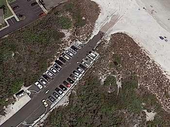
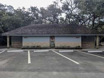
Additional parking and restrooms are located along the entrance road loop, on the out-bound side. The single story restroom building is tan stone block with gray, planked wood siding on the upper half of the walls. As you face the building from the parking lot, signage shows that accessible restrooms for men are on the left side of the building and, for women, on the right.<br /><br />The side of the building facing the parking lot has one foot high plant beds that stick out by about one foot. In the center of that wall is a water fountain, with a water bottle re-filling station. Mounted above the fountain is a National Park Service logo, described later.<br /><br />On the right, or west, side of the building is a large bulletin board, flanked by vending machines. To the right of the building is the entrance to a nature trail.<br /><br />The National Park Service logo is a brown arrowhead, pointed downward. Inside the arrowhead are the words in white lettering, "National Park Service" with a green sequoia tree shape to its left. Near the bottom of the arrowhead is a white buffalo silhouette set against a green meadow, with a white lake and snowcapped mountain behind it. <br />
Though not as large or formidable as the Castillo de San Marcos, the coquina walls of Fort Matanzas were more than enough to protect its soldiers from enemy fire. Matanzas measures 50 feet on each side and 30 feet high. It was built of local shell stone called coquina. This stone was quarried south of the inlet and transported by boat to the construction site. The stones were held together with mortar made from sand, fresh water, and lime, which was produced by burning oyste
While the Matanzas River could provide the soldiers with food if their rations ran out, access to fresh water was vital for their survival. The fort's cistern is located under the gundeck with its opening under the stairs. It measures 13 feet deep and about 8 feet in diameter. The roof of the fort collected rain water which was directed into the cistern by a wooden pipe. There was no other source of fresh water on the island. However, if needed, the soldiers could bring water
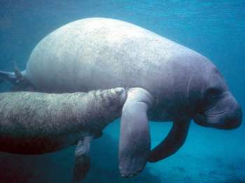
The West Indian Manatee, the type of manatee found in Florida, is a member of the Dugong family which includes only five species--the West Indian, the Amazonian, and the West African Manatees, the Dugong of east Africa and the East Indies, and the extinct Steller's Sea Cow. In fact, most members of this family are slowing edging towards extinction.Several reasons for their decline include a high mortality rate, especially human-influenced (by motor boats, hunting, and discar
Welcome to Fort Matanzas National Monument. Our site is located at 8635 A1A South, St. Augustine, FL 32080. Upon arrival at the park, you will circle the picnic area and see our visitor center. The parking spaces will lead you to the public restrooms and a sidewalk that directs you to our visitor center. There is limited parking and the parking lot often fills up fast. Ferry Boarding Passes are available at this location. Behind the Visitor Center is the dock where the ferry departs.
Here's what you need to know, to take the Ferry ride to historic Fort Matanzas.
Fishing
Fishing options at Fort Matanzas National Monument
Junior Ranger Programs
This page describes how kids can download and participate in activities while at the park, or at home
Beach Access
This page helps direct visitors to the various beach access locations throughout the park
Virtual Tour
This page links you to a virtual tour of the historic watchtower.
Coastal Hammock nature trail
Take a few minutes to walk this half-mile boardwalk trail and discover some of the plants and animals who do find homes here at Fort Matanzas National Monument and find out how, in spite of seemingly harsh living conditions, they manage to survive on the barrier island.
Tours
Count: 3
Archive Photos Tour of Fort Matanzas
This virtual tour uses historic archive photos of Fort Matanzas as it takes you through various features of the historic watchtower.
Free Boat Tour to Fort Matanzas
The National Park Service operates a Free Ferry Service to Fort Matanzas. Check the ferry status before your visit by calling us at (904) 471-0116. Coastal Florida was a major field of conflict as European nations fought for control in the New World. As part of this struggle, Fort Matanzas guarded St. Augustine’s southern river approach. Fort Matanzas is the only example of a Spanish fortified watchtower in the continental United States.
Virtual Tour
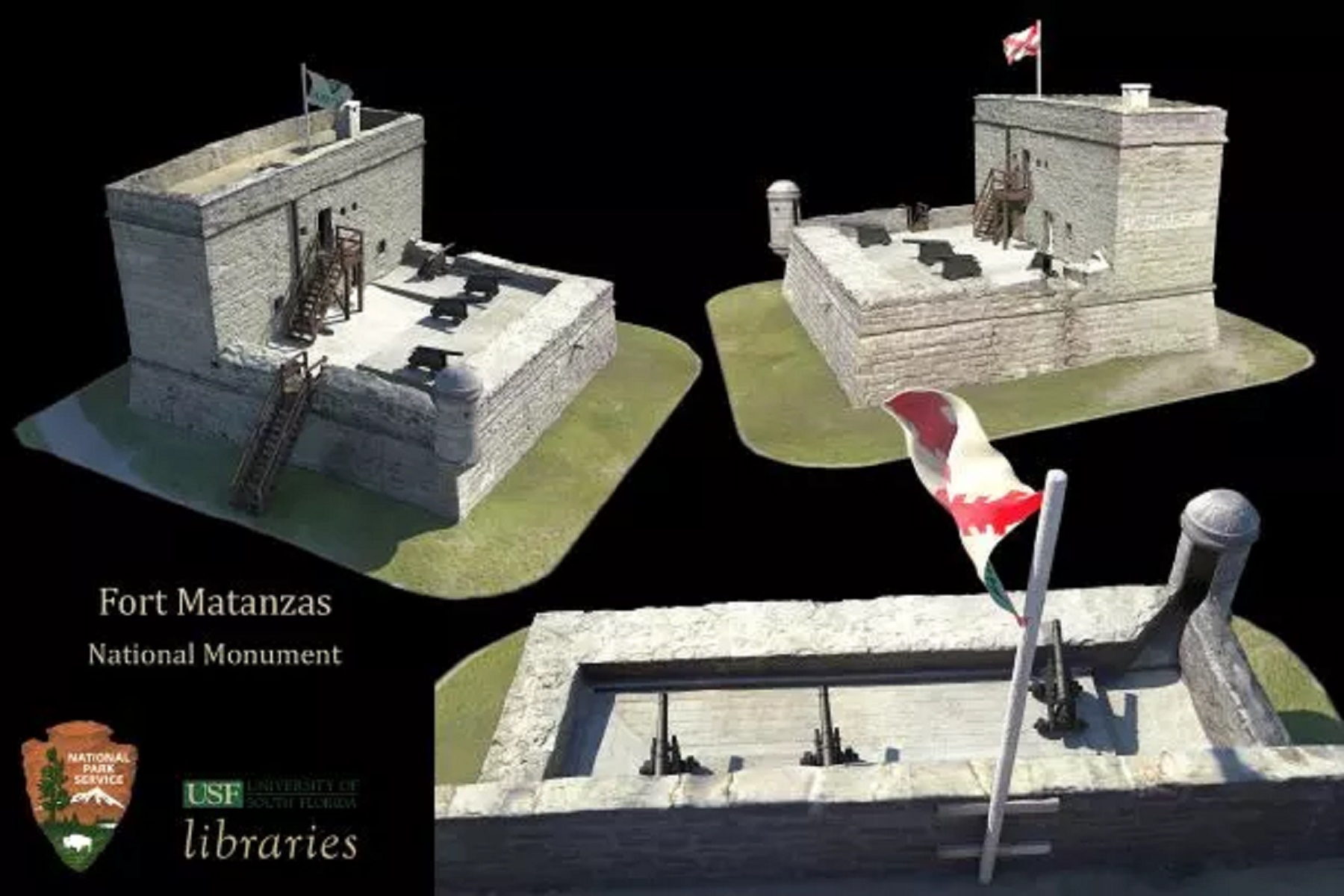
Click on the tour stop below and it will take you to our various virtual tour options. Including a 3D interactive model of Fort Matanzas created by the University of South Florida.