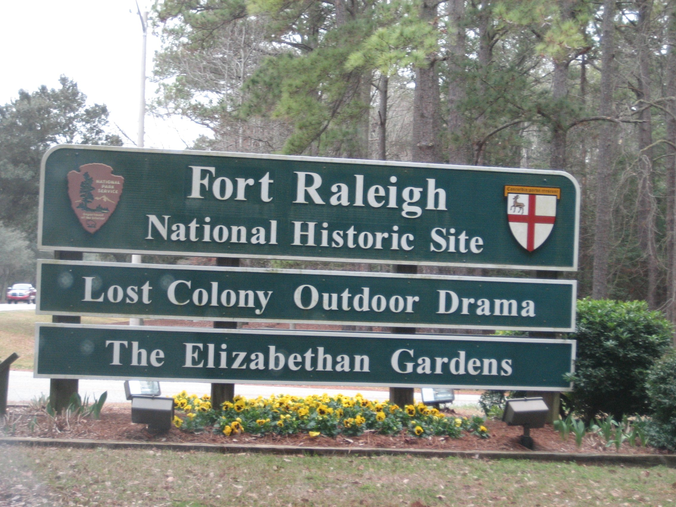
Amongst the shallow blue waters of the Outer Banks lies Fort Raleigh on Roanoke Island. Shaped by constant winds of change, Fort Raleigh has become a focal point of American history. From the first Algonquian-speaking people to the first English ...
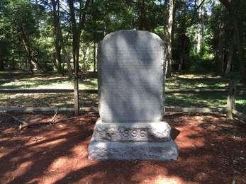
The monument to Virginia Dare and the Roanoke colony was dedicated by the Roanoke Island Memorial Association on November 24, 1896. This stone monument is the first official commemoration on-site. It is not the gravesite of Virginia Dare; the location of her remains are unknown.
1896 Monument<br />235 words (2 minutes)<br /><br />The 1896 monument commemorating Virginia Dare is a gray granite marker, just off the trail as you enter the maritime forest to the north. Engraved on both sides, the south-facing side is smooth granite with an iron cross engraving at top, while the north-facing side is rough.<br /><br />The text on the south-facing side reads: ON THIS SITE, IN JULY - AUGUST, 1585 (O.S.), COLONISTS, SENT OUT FROM ENGLAND BY SIR WALTER RALEIGH, BUILT A FORT, CALLED BY THEM "THE NEW FORT IN VIRGINIA" THESE COLONISTS WERE THE FIRST SETTLERS OF THE ENGLISH RACE IN AMERICA. THEY RETURNED TO ENGLAND IN JULY, 1586, WITH SIR FRANCIS DRAKE. NEAR THIS PLACE WAS BORN, ON THE 18TH OF AUGUST, 1587. VIRGINIA DARE. THE FIRST CHILD OF ENGLISH PARENTS BORN IN AMERICA - DAUGHTER OF ANANIAS DARE AND ELEANOR WHITE, HIS WIFE, MEMBERS OF ANOTHER BAND OF COLONISTS SENT OUT BY SIR WALTER RALEIGH IN 1587. ON SUNDAY, AUGUST 20, 1587, VIRGINIA DARE WAS BAPTIZED. MANTEO, THE FRIENDLY CHIEF OF THE HATTERAS INDIANS HAD BEEN BAPTIZED ON THE SUNDAY PRECEDING. THESE BAPTISMS ARE THE FIRST KNOWN CELEBRATIONS OF A CHRISTIAN SACRAMENT IN THE TERRITORY OF THE THIRTEEN ORIGINAL UNITED STATES. <br /><br />The text on the north face reads: IN MEMORY, TOO, OF OUR FOUNDER AND FIRST PRESIDENT, EDWARD GRAHAM DAVES. ERECTED BY THE ROANOKE COLONY MEMORIAL ASSOC'N, NOV. 24, 1896. GRAHAM DAVES, PRESIDENT JOHN S. BASSETT, SEC'TY & TREAS.<br /><br />End of message.
Cape Hatteras National Seashore preserves and protects over 70 miles of coastline on the Outer Banks, offering an array of recreational opportunities as well as preserving habitat for many coastal animal species. For more information, please visit the <a href="https://www.nps.gov/caha">official website</a> or <a href="https://itunes.apple.com/us/app/nps-cape-hatteras-national/id980803877?mt=8">download the official mobile app</a> !
Cape Hatteras National Seashore<br />67 words (¾-minute)<br /><br />The sound of ocean waves, the starry night sky, or the calm of the salt marshes, you can experience it all. Shaped by the forces of water, wind, and storms these islands are ever changing. The plants, wildlife, and people who live here adapt continually. Whether you are enjoying the beach, kayaking the sound, or climbing the Cape Hatteras Lighthouse there is something for everyone to explore!<br /><br />End of message.<br />
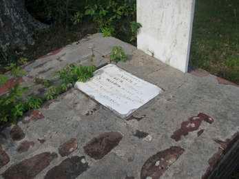
The Dough family arrived on Roanoke Island at the turn of the nineteenth century. By 1849, Thomas A. Dough obtained a land grant from the State of North Carolina legitimizing ownership of the Dough homestead on the north end of the island. Originally including a house, outbuildings, farmland, and a family cemetery, the cemetery is the only remaining element of the homestead, now part of Fort Raleigh National Historic Site.
Dough Cemetery<br />72 words (¾-minute)<br /><br />Nestled in a small clearing of pine trees and live oaks, the Dough family cemetery is located on the right-hand side of the cul-de-sac at the end of Pear Pad Road. There are seven graves at the cemetery, all of which are within a few yards of Albemarle Sound. The towns of Kill Devil Hills and Kitty Hawk are visible in the distance across the sound to the east.<br /><br />End of message.
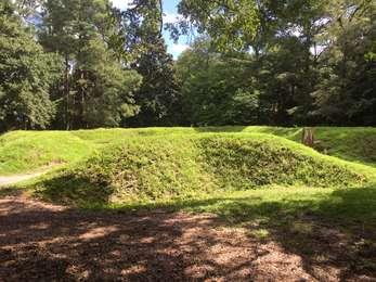
This earthwork was built by the English during the expeditions to Roanoke Island in the late 1500s. However, why the earthwork was built and when it was built remains a bit of a mystery. What is known is that Ralph Lane, the expedition leader of the 1585 expedition, was familiar with and had built similar earthworks to this one. Also, that artifacts pertaining to metallurgical work were found just to the west of the earthwork, further reinforcing the leading idea that this ea
Earthwork<br />71 words (¾-minute)<br /><br />In a clearing in the maritime forest rests an English earthwork, reconstructed in 1950 on its original location. The earthwork is in a star-shaped pattern, with a shallow trench dug along the outer perimeter and the earth piled up just inside the trench to create the walls. The walls are approximately 5 feet high. You are welcome to walk inside the earthwork, but please do not climb the fragile walls.<br /><br />End of message.
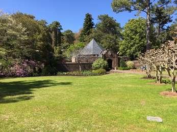
The Elizabethan Gardens are a reproduction of a 16th-century English garden run by a non-profit group. Operating hours vary and an admission fee is charged. For more information, <a href="http://elizabethangardens.org/">visit their website</a> .
Elizabethan Gardens<br />32 words (½-minute)<br /><br />The entrance to the Elizabethan Gardens consists of a brick path surrounded by crepe myrtle trees leading to a round, brick entrance building. There is a loop parking lot south of the entrance.<br /><br />End of message.
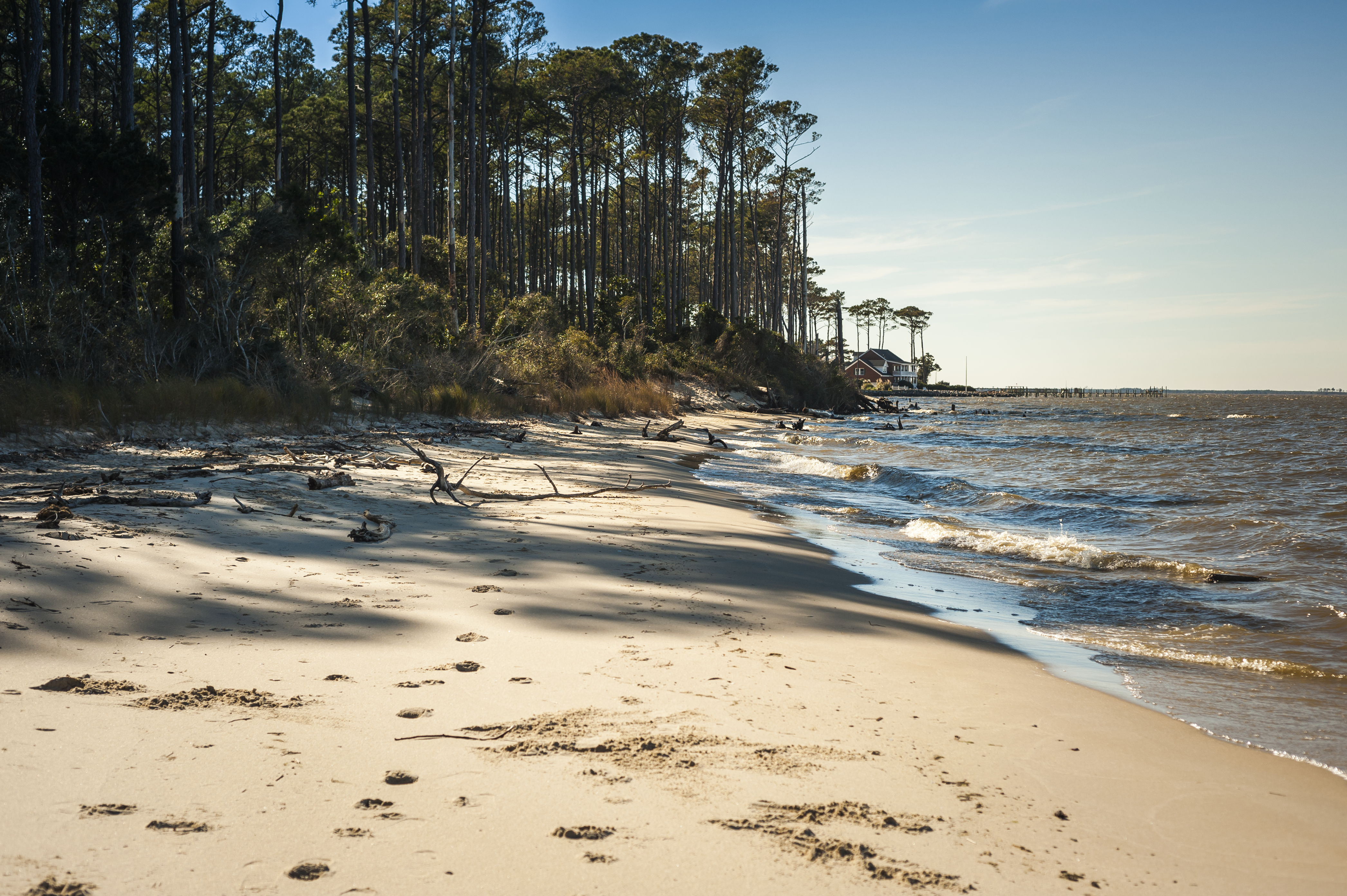
Etheridge Point provides a nice, sheltered soundside beach for recreation. Etheridge Point also has some of the most expansive views of the Outer Banks.
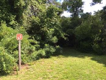
Drive down Pear Pad Road to the roundabout. From the parking lot, take a short walk down the grass path and take the shaded path through the woods to the sandy beach.
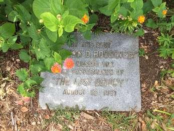
US President Franklin Delano Roosevelt attended a performance of <strong>The Lost Colony</strong> during the drama's inaugural year on August 18, 1937 as part of a speaking engagement commemorating the 350th anniversary of the birth of Virginia Dare.
FDR Marker<br />45 words (½-minute)<br /><br />Located at the top of the Waterside Theatre seating area on the southwest side, a small gray granite marker in the ground marks the spot where President Franklin Delano Roosevelt attended a performance of The Lost Colony. The marker is located in a garden setting.<br /><br />End of message.
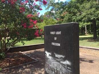
This memorial commemorates the freedom that formerly enslaved people found on Roanoke Island during the American Civil War, and the experimental freedmen's colony that existed on the island. The memorial is also part of the National Underground Railroad Network to Freedom. The Freedmen's Colony Of Roanoke Island 1862-1867A year after the Civil War began, Roanoke Island fell to Union forces. find "safe haven" on the Island.
First Light of Freedom Memorial<br />383 words (3-¾ minutes)<br /><br />The First Light of Freedom Memorial, located at the west end of the concrete courtyard, is a shiny, black, rectangular marble marker. <br /><br />The east side of the marker has engraved at the top the words: First Light of Freedom. Directly below is an illustration depicting an African-American woman, child, and dog. The woman's arms are outstretched in the direction of sunlight breaking through the clouds over an American flag and a Civil War-era fortification. At the bottom are the words National Underground Railroad Network to Freedom. <br /><br />The opposite side of the marker is engraved with the following text: The Freedmen's Colony Of Roanoke Island 1862-1867- A year after the Civil War began, Roanoke Island fell to Union forces. Word spread throughout North Carolina that slaves could find "safe haven" on the Island. By the end of 1862, over a thousand runaway slaves, freed men, women and children found sanctuary here. This colony, precursor to the Freedmen's Bureau, was to serve as a model for other colonies throughout the South. Once again this small island, site of the first English attempt at permanent settlement in the New World, became a land of historic beginnings. The Freedmen's Colony encompassed unoccupied, unimproved lands from Manteo to the north and west shores, including some of the land today known as Fort Raleigh National Historic Site. A sawmill, hospital, a school with black female teachers and homes were established. Able-bodied men were offered rations and employment to build a new fort. They also enlisted to form the First and Second North Carolina Colored Regiments. The colony could not remain self-supporting without men and became a refuge for three thousand women, children, aged and infirmed. Upon the war's end, the federal government discontinued rations and supplies to colonists and returned land to original owners. Reminiscent of early English efforts, the Roanoke Island Freedmen's Colony was abandoned by 1867. Many freed people remained, and their descendants would become respected local residents. Others settled in communities throughout the region and would become an integral part of eastern North Carolina culture.<br /><br />Administrative buildings are located to the south, the trailhead is located to the north, and the visitor center is located to the northeast. The courtyard is poured concrete with a low brick wall along its perimeter.<br /><br />End of message.
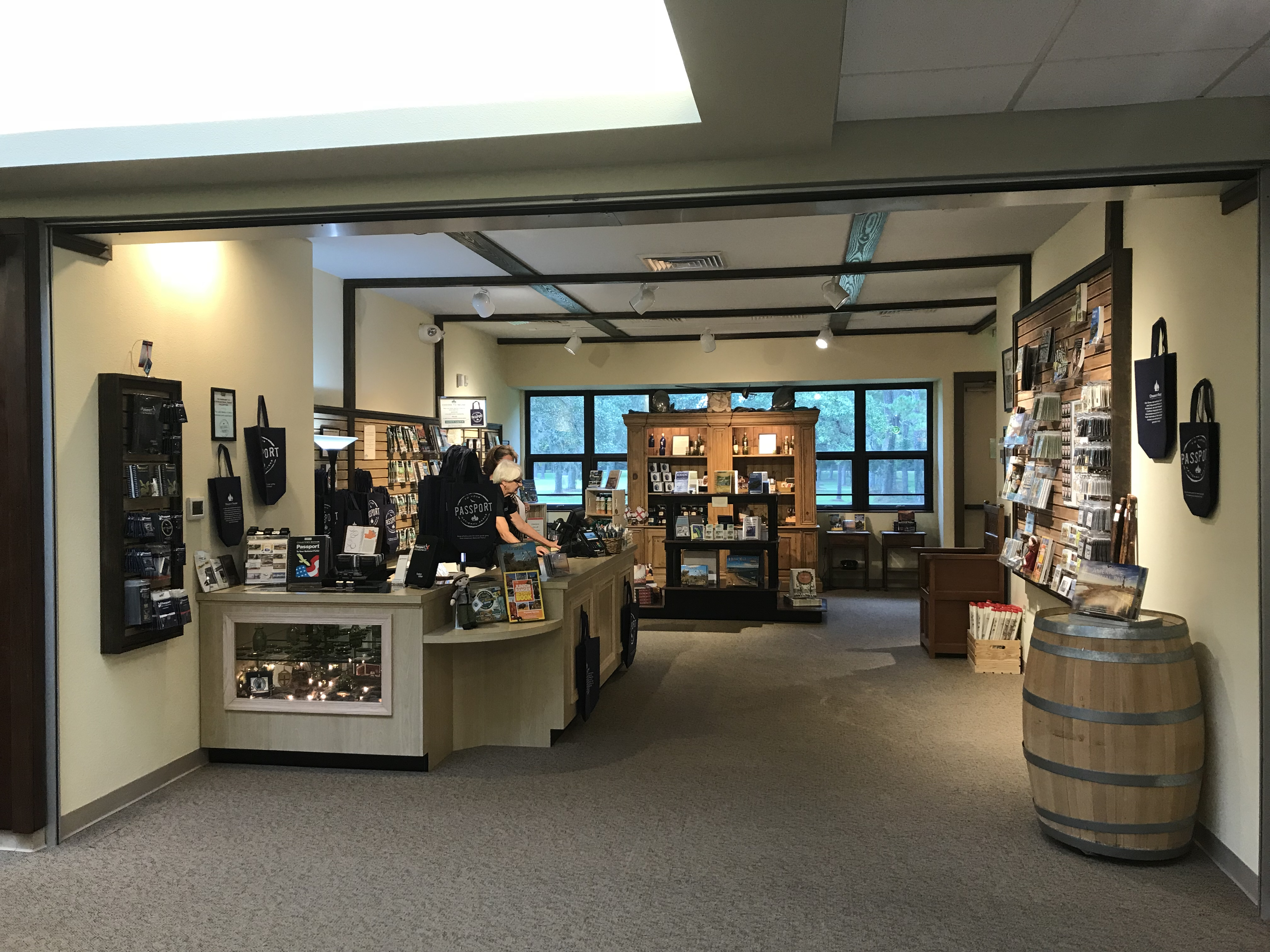
The Eastern National Park Store in the Lindsay Warren Visitor Center at Fort Raleigh National Historic Site, is a great place to find merchandise that helps tell the story of the Lost Colony and Fort Raleigh National Historic Site.
The Eastern National Park Store in the Lindsay Warren Visitor Center at Fort Raleigh National Historic Site, is a great place to find merchandise that helps tell the story of the Lost Colony and Fort Raleigh National Historic Site.
At the west end of the Freedom Trail and the multi-use path along US-264/64 is a small picnic area and access to the Croatan Sound. A parking lot is available for cars coming from US-264/64.
West End Picnic Area<br />66 words (¾-minute)<br /><br />Located on the right side of US-264/64, just before the William B. Umstead Memorial Bridge on the northwest portion of Roanoke Island, the West End Picnic Area has one picnic table in a grassy clearing just north of the gravel parking lot. A low, wooden fence extends southeast to northwest to the edge of Croatan Sound. North of the picnic area lies the maritime forest.<br /><br />End of message.
The Freedom Trail begins at the southwest end of the Elizabethan Gardens parking lot and ends 1-¼ miles later at the West End Picnic Area on Croatan Sound.
Freedom Trail<br />44 words (½-minute)<br /><br />Located at the southwest side of the Elizabethan Gardens parking loop, the eastern end of the Freedom Trail leads directly into dense maritime forest. The trailhead is denoted by a trail sign and pet on leash sign immediately to the left of the trailhead.<br /><br />End of message.
The Freedom Trail begins at the West End Picnic Area on the northwest end of Roanoke Island and ends 1-¼ miles later at the southwest end of the Elizabethan Gardens parking lot.
Freedom Trail (West End)<br />34 words (½-minute)<br /><br />Located at the West End Picnic Area, the Freedom Trail's western trailhead is located 20 yards to the right of the picnic table, denoted by a pet on leash sign, entering the maritime forest.<br /><br />End of message.
Due to the discovery of copper nuggets, charcoal, antimony ore, furnace bricks, and related items, archeologists believe the metallurgy workshop of Joachim Gans and Thomas Hariot was located immediately west of the English earthwork. One theory is that the earthwork was constructed as a means of defending the metallurgy workshop.
Gans Workshop<br />63 words (¾-minute)<br /><br />In a clearing in the maritime forest, a few yards west of the earthwork across the trail is a small grassy area that archeologists have determined was the site of the 1585 Thomas Hariot and Joachim Gans metallurgy workshop. The site was discovered and excavated in 1991 and 1992, yielding various artifacts. Some of these artifacts can be viewed in the visitor center.<br /><br />End of message.
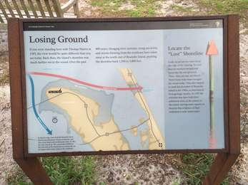
If you were standing here with Thomas Hariot in 1585, the view would be quite different than you see today. Back then, the island's shoreline was much farther out in the sound. Over the past 400 years, changing river currents, rising sea levels, and storms blowing from the northeast have eaten away at the north end of Roanoke Island, pushing the shoreline back 1,500 to 3,000 feet.
Losing Ground<br />215 words (2 minutes)<br /><br />This low-profile outdoor exhibit stands in a clearing surrounded by live oak trees. Describing the effects of erosion and sea level rise on Roanoke Island, this exhibit is in an area with a clear view of the confluence of Albemarle and Roanoke Sounds just beyond. There is a bench located just beyond the exhibit. <br /><br />The text of the exhibit reads: If you were standing here with Thomas Hariot in 1585, the view would be quite different than you see today. Back then, the island's shoreline was much farther out in the sound. Over the past 400 years, changing river currents, rising sea levels, and storms blowing from the northeast have eaten away at the north end of Roanoke Island, pushing the shoreline back 1,500 to 3,000 feet.<br /><br />Locate the "Lost" Shoreline.<br />Look out across the water from the edge of the clearing. Try and find the modern navigational buoys like the one pictured. (Hint- they are way out there!) These buoys help boats navigate the sound today. They also happen to mark the shoreline of Roanoke Island in the 1580s, as determined from geologic studies.<br /><br />In 1587 the colonists may have built their settlement close to the waters of the sound, leaving some experts to theorize that evidence of their settlement is now underwater.<br /><br />End of message.
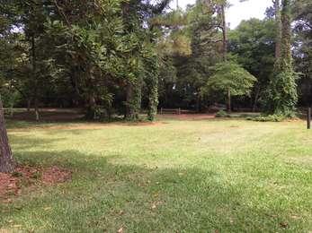
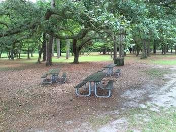
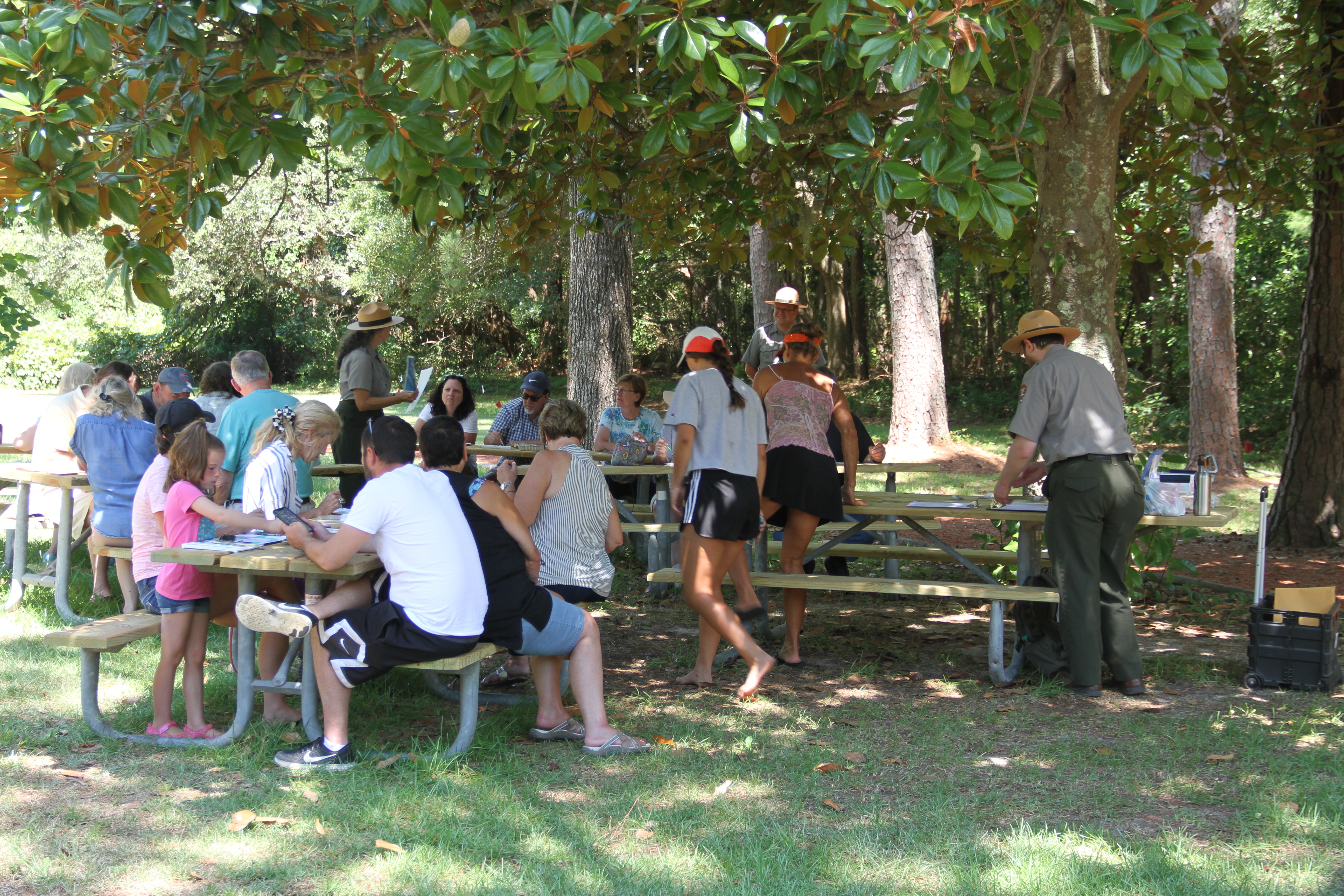
Located under majestic trees-such as live oaks and loblolly pines-are several picnic tables where you can enjoy a meal, relax for a moment, or take in the forest atmosphere.
Picnic Area<br />53 words (½-minute)<br /><br />Located in the middle of the entrance loop road, the picnic area rests underneath a canopy of native shade trees. There are five picnic tables and three trash bins. The visitor center is located to the west across the loop road; the Lost Colony drama parking lot is located to the north.<br /><br />End of message.
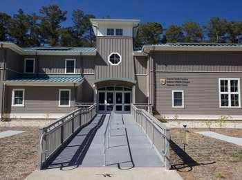
Operated by the US Fish and Wildlife Service, the National Wildlife Refuges Visitor Center houses exhibits on eleven national wildlife refuges and one national fish hatchery. Admission is free. For more information, <a href="https://www.fws.gov/ncgatewayvc/">visit their website</a> .
National Wildlife Refuges Visitor Center<br />52 words (½-minute)<br /><br />The visitor center is located at the end of Conservation Way, nestled within the maritime forest that covers the northern end of Roanoke Island. The visitor center is a large, wooden, grey building with a green tin roof with solar panels. The entrance to the visitor center is up a wide ramp.<br /><br />End of message.
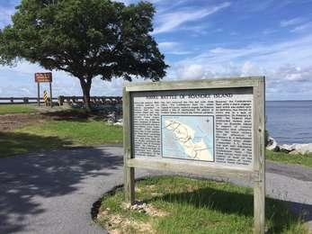
During late January, 1862, a Federal land-sea expedition assembled at Hatteras Inlet to take Roanoke Island and capture control of the North Carolina Sound region. This force was under the joint command of General Ambrose Burnside and navy Flag-Officer Louis Goldsborough.After several delays due to bad weather, the Union fleet, consisting of numerous troop transports and more than 20 war vessels, arrived at the southern end of Roanoke Island. On February 7, 1862, Federal wars
Naval Battle of Roanoke<br />260 words (2-¼ minutes)<br /><br />Immediately right of the entrance to the William B. Umstead Memorial Bridge, within the West End Picnic Area, stands this tall wooden outdoor exhibit. Albemarle Sound is located 10 yards beyond the wayside; the picnic area is 100 yards to the rear.<br /><br />The wayside text reads:<br /><br />During late January, 1862, a Federal land-sea expedition assembled at Hatteras Inlet to take Roanoke Island and capture control of the North Carolina Sound region. This force was under the joint command of General Ambrose Burnside and navy Flag-Officer Louis Goldsborough.<br /><br />After several delays due to bad weather, the Union fleet, consisting of numerous troop transports and more than 20 war vessels, arrived at the southern end of Roanoke Island. On February 7, 1862, Federal warships bombarded Fort Bartow, southernmost of the Confederate defenses. The fort returned the fire but with little effect. The Confederate fleet, under Captain W.F. Lynch, waited to engage the Federals behind a line of obstructions placed in Croatan Sound to retard the Federal advance. However, the Confederate fleet, after a sharp engagement which was ended only by darkness, was forced to retire due to a lack of ammunition.<br /><br />On February 8, 1862, the Federal fleet bombarded various positions on Roanoke Island in support of General Burnside's land offensive. After the Union victory on the afternoon of February 8, a detachment of Federal ships under Commander S.C. Rowan was sent into Albemarle Sound in pursuit of the Confederate fleet. The Union forces were now in control of most of the inland waters of northeastern North Carolina.<br /><br />End of message.
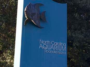
The North Carolina Aquarium on Roanoke Island, operated by the North Carolina Department of Natural and Cultural Resources, displays an array of aquatic life. There is an admission fee. For more information, <a href="http://www.ncaquariums.com/roanoke-island">visit their website</a> .
North Carolina Aquarium on Roanoke Island<br />36 words (½-minute)<br /><br />The aquarium is located near the near of Airport Road on the northwestern side of Roanoke Island. South of the parking lots, the entrance ticket station stands next to an old family gravesite under a tree.<br /><br />End of message.
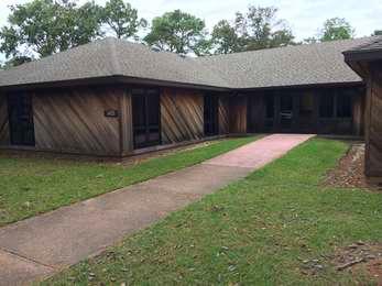
This is the administrative office for three National Park Service sites on the Outer Banks: Cape Hatteras National Seashore, Wright Brothers National Memorial, and Fort Raleigh National Historic Site.
Park Headquarters<br />42 words (½-minute)<br /><br />Located across the courtyard south of the visitor center is the administrative offices for Cape Hatteras National Seashore, Wright Brothers National Memorial, and Fort Raleigh National Historic Site. The building is a one-story wooden structure with 6 alcove-type office wings.<br /><br />End of message.
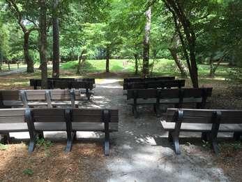
The ranger program amphitheater is located ten yards southwest of the reconstructed English earthwork. Ranger programs are offered during the spring, summer, and early fall. Please check the events section to determine if a ranger program is available for your visit.
Program Amphitheater<br />46 words (½-minute)<br /><br />The ranger program amphitheater is located in the maritime forest surrounded by trees. There are eight benches located just off the trail to the north. A view of the earthwork is available from the benches. The visitor center is visible through the woods to the south.<br /><br />End of message.
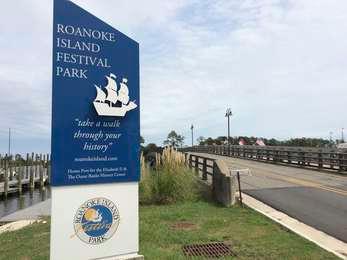
Located on the waterfront in downtown Manteo and operated by the North Carolina Department of Natural and Cultural Resources, Roanoke Island Festival Park houses a living history museum. Included are reproductions of Algonquian dwellings and a reproduction of the Elizabeth II, a ship that was part of the English expeditions to the New World. Operating hours vary and admission is charged for certain sites and events.
Roanoke Island Festival Park<br />61 words (¾-minute)<br /><br />This state-run facility is located on a small island just east of downtown Manteo, North Carolina. The grounds are accessible across a short automobile and pedestrian bridge. The island is wooded, with a boardwalk trail running along the northern and eastern edge of the island, and the cedar-shingled buildings of Festival Park are located south of the parking lots.<br /><br />End of message.
The Roanoke Island Multi-Use trail is a 7 mile paved trail that connects the northern end of the island with downtown Manteo. Visitors can access this trail from Fort Raleigh National Historic Site by parking at the Lindsay Warren Visitor Center and walking down the entrance road to the park sign.
Park at the Lindsay Warren Visitor Center and walk down the entrance road to the park entrance sign. The trail crosses the road at the crosswalk.
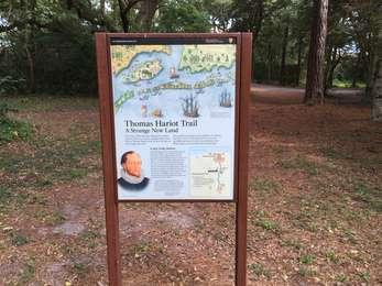
A Strange New LandIn the late 1500s, Roanoke Island and London had very little in common. Imagine what it was like for Thomas Hariot when he first set foot on this strange new land. New people, new plants, new animals- everything was truly "new." Is this land new to you? Look carefully and listen closely as you walk this trail. What strikes you most about this foreign land? A Very Costly VentureAlthough supported by Queen Elizabeth, the Roanoke Voyages were privately funded.
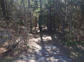
Thomas Hariot Trail<br />286 words (2-½ minutes)<br /><br />Located at the Thomas Hariot Trail entrance, this tall, vertical outdoor exhibit is located on a mulch path within the maritime forest, a few yards northwest of the earthwork. The trail continues west up a slight incline. <br /><br />Showing a map of the trail and exhibits, a portrait of Thomas Hariot, and a 1590 illustration of English ships landing at the Outer Banks, the exhibit text reads:<br /><br />A Strange New Land.<br />In the late 1500s, Roanoke Island and London had very little in common. Imagine what it was like for Thomas Hariot when he first set foot on this strange new land. New people, new plants, new animals- everything was truly "new." Is this land new to you? Look carefully and listen closely as you walk this trail. What strikes you most about this foreign land?<br /><br />A Very Costly Venture.<br />Although supported by Queen Elizabeth, the Roanoke Voyages were privately funded. Surely there was wealth and power to be gained in the New World, but how much, and where? Sir Walter Raleigh assigned Thomas Hariot, one of the most preeminent scientists of the time, to answer these questions. While here in 1585, Hariot documented the value of the plants, animals, and minerals he found. Returning to England in 1586, Hariot brought good news to Raleigh and his investors, enthusiastically praising both the people and the land of the New World...commodities alreadie found or to be raised...as by way of trafficke and exchange with our owne nation of England, will enrich your selves the providers; those that shal deal with you; the enterprisers in general; and greatly profit our owne countrey men...<br /><br />A briefe and true report of the new found land of Virginia.<br />Thomas Hariot.<br /><br />End of message.
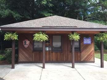
This is where you can purchase tickets for <strong>The Lost Colony</strong> drama, which runs from late May to late August every year. <a href="http://thelostcolony.org/">Visit the Roanoke Island Historical Association website</a> for details.
Ticket Office<br />178 words (1-½ minutes)<br /><br />On the west side of The Lost Colony drama parking lot-at the edge of the maritime forest-stands The Lost Colony ticket office. It is a one-story, wooden building with three ticket windows. A walking trail leads past the west side of the ticket office toward the entrance to the Waterside Theatre. Three outdoor exhibits are located directly across the trail from the ticket office. <br /> <br />Immediately left of the three outdoor exhibits stands a small green kiosk with Roanoke Island written at top and The Lost Colony written at bottom. The kiosk posts events occurring on Roanoke Island.<br /><br />Another outdoor exhibit is located immediately left of the ticket office.<br /><br />Across the trail from this exhibit is a display case highlighting portraits of Lost Colony actors (during the summer). The display case is located directly next to a bike rack.<br /><br />The Lost Colony parking lot consists of four rows of parking spaces, with handicapped spaces located closest to the ticket office. Between each row of parking spaces is a grassy area with picnic tables and trash cans.<br /><br />End of message.
From the Lindsay Warren Visitor Center, walk down the path towards the Waterside Theater and bear left once you leave the plaza. The picnic tables will be beneath the trees on the left.
From the parking lot, walk past the Lindsay Warren Visitor Center and leave the paved patio in the direction of the Waterside Theater. To the left is a grove of trees with picnic tables beneath.
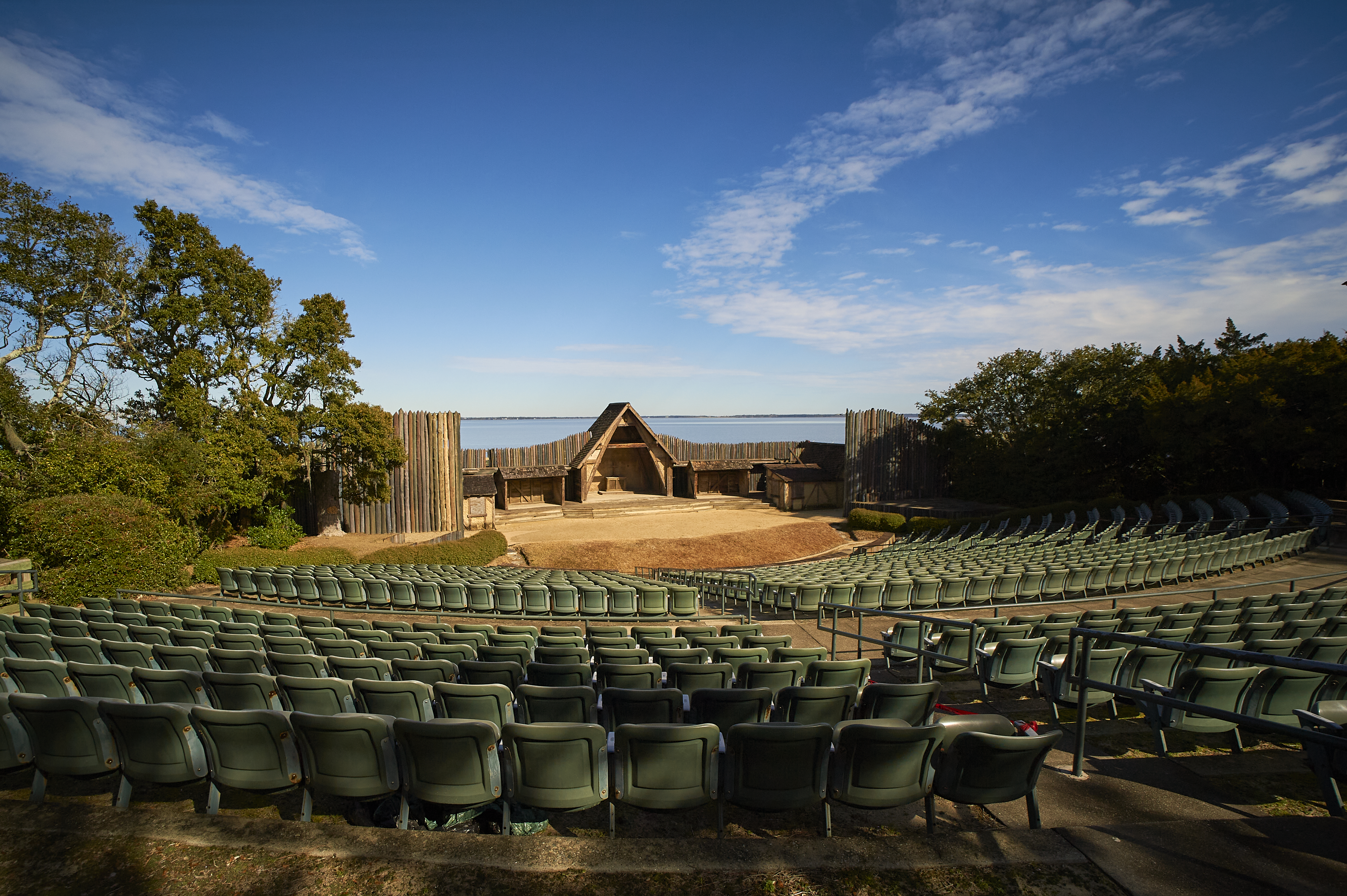
Originally constructed in 1937 to house the inaugural performance of Paul Green's symphonic drama <strong>The Lost Colony</strong> , the Waterside Theatre has been rebuilt three times. It was damaged by a fire in 1947 and two hurricanes in 1944 and 1960. The drama was not shown from 1942 to 1945 on account of World War II, and was cancelled in 1947 due to the fire.<br /><br />Since 1947, it has been performed every summer.
Waterside Theatre<br />115 words (1 minute)<br /><br />The entrance to the Waterside Theatre is through a large wooden gate on the south side of the theater. There is a three-story building with a 16th-century English appearance immediately inside the entrance. To either side are two covered concession areas. Prior to the concession areas are two concrete ramps leading up into the theatre itself.<br /><br />An outdoor theatre at the edge of the maritime forest with a view of Roanoke Sound to the northeast, the Waterside Theatre has 1,600 seats divided into 6 sections or 25 rows. The stage consists of wooden walls and buildings reminiscent of the 1580s. There are two wooden light towers on each side of the seating area.<br /><br />End of message.
Roanoke Island has been the scene of historical dramas for more than four centuries. Algonquians, Europeans, and African Americans have all played their parts here.First here were the Carolina Algonquian, who farmed the land and fished the sounds. In 1584, English explorers sponsored by Sir Walter Raleigh arrived here. It was the first of three voyages in England's attempt to colonize North America.
Welcome to Fort Raleigh<br />69 words (¾-minute)<br /><br />This orientation-style exhibit is located just southwest of the visitor center, on the northern side of the courtyard and to the right of the path leading to the English earthwork. The courtyard is surrounded by a low wall with recessed lights. To the south of the exhibit are two wooden buildings. The smaller building is the restroom building, while the larger structure is the headquarters of the park.<br /><br />End of message.
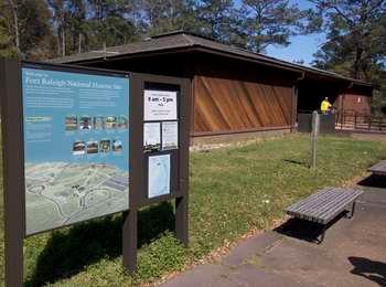
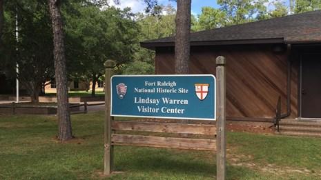
The visitor center of Fort Raleigh National Historic Site, housing immersive exhibits on the Algonquian, the English, the Roanoke Island Freedmen's Colony, the Civil War Battle of Roanoke Island, and Reginald Fessenden. A 17-minute dramatic video on the interaction between the Algonquian and the English is displayed in the visitor center's theater.