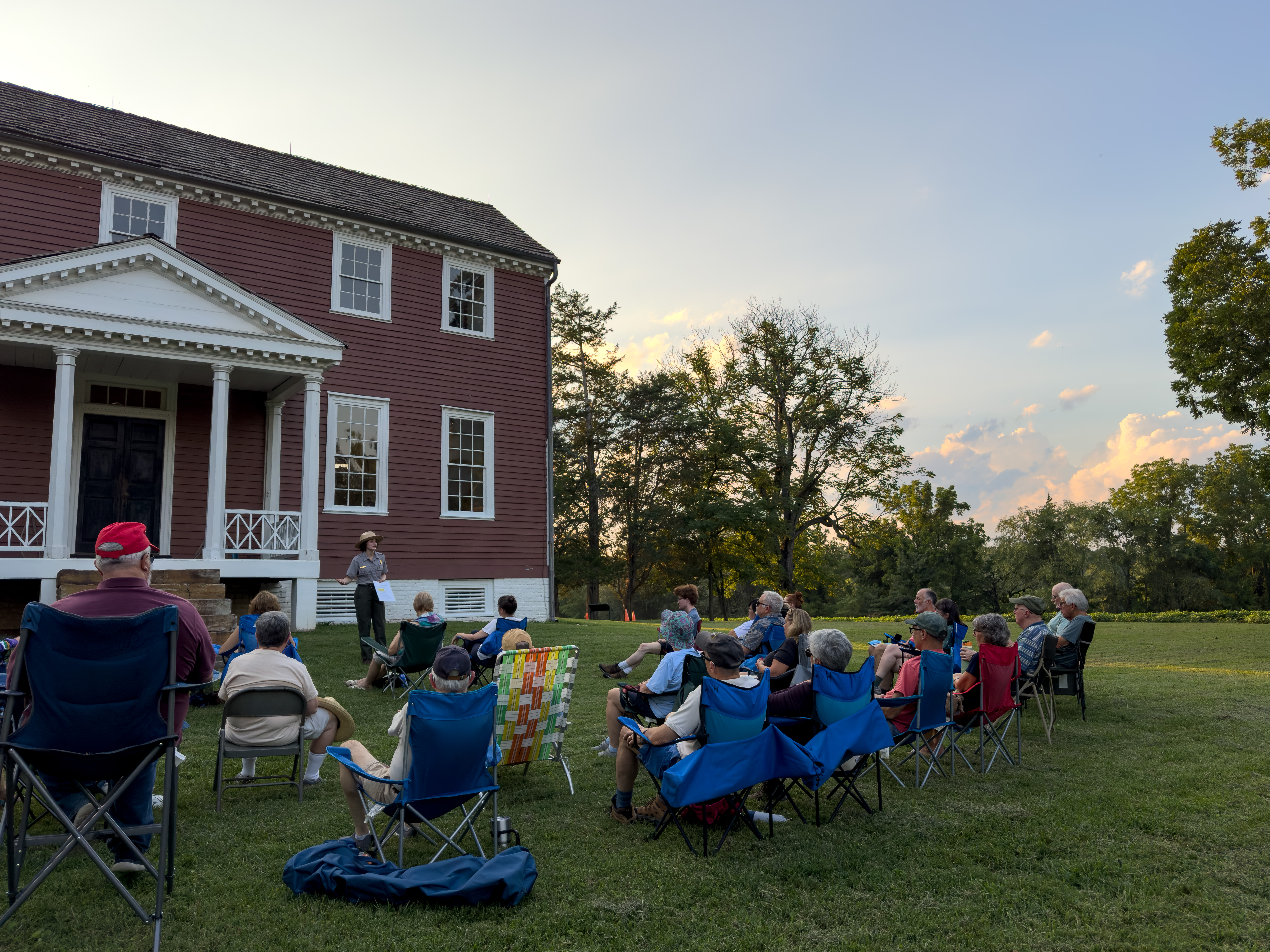
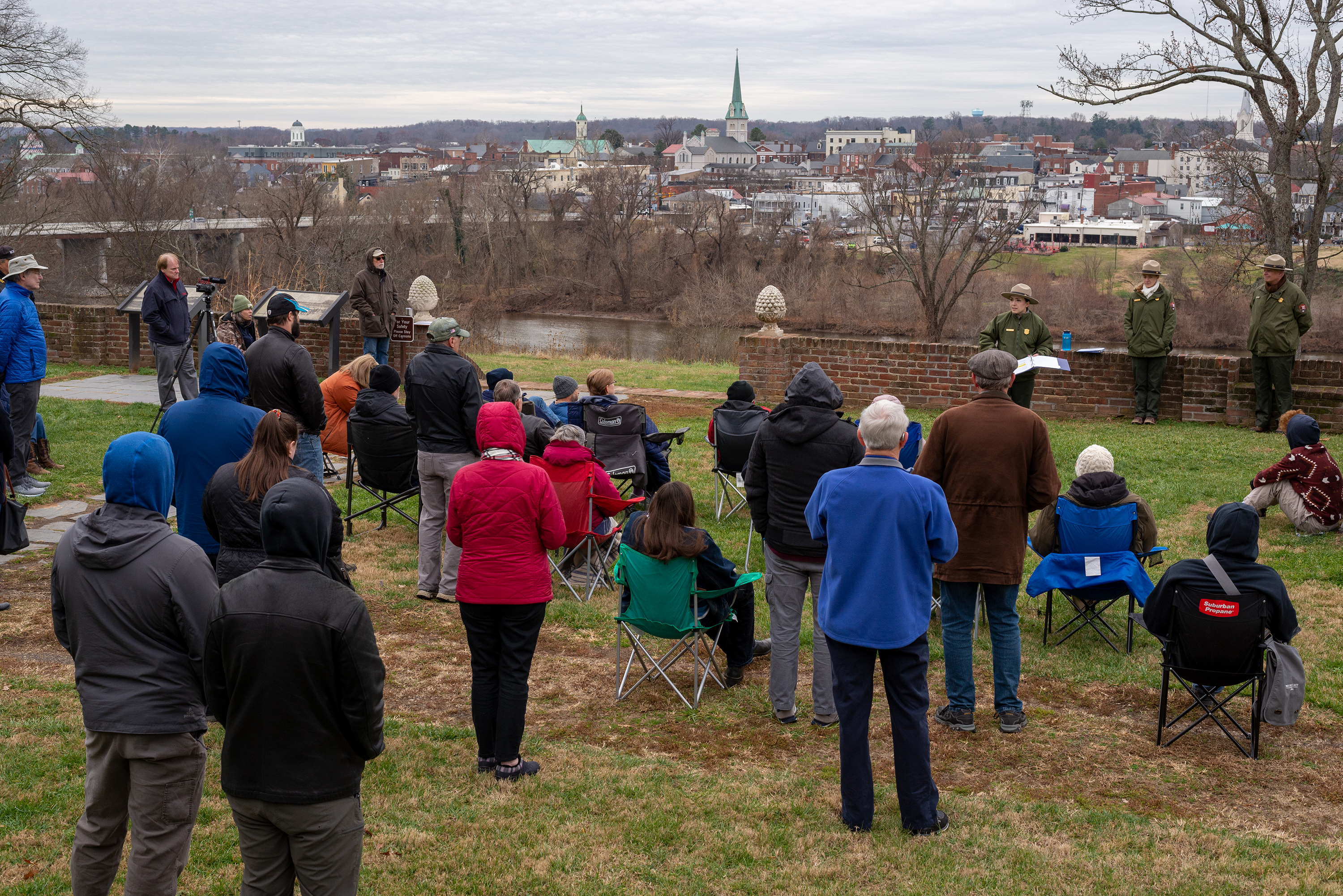
Chatham Closed for Rehabilitation Project
Chatham's interior will be closed until at least summer 2026 for a major rehabilitation project. The grounds remain open sunrise to sunset, and the gated parking area will be open from 9-5 daily.
| Title | Fredericksburg & Spotsylvania |
| Park Code | frsp |
| Description | Fredericksburg, Chancellorsville, Wilderness, and Spotsylvania, this is America's battleground, where the Civil War roared to its bloody climax. No place more vividly reflects the War's tragic cost in all its forms. A town bombarded and looted. F... |
| Location | |
| Contact | |
| Activities |
|
| Entrance fees |
|
| Campgrounds | Count: 0
|
| Places | Count: 50
23rd New Jersey MonumentVeterans of the 23rd New Jersey Regiment placed this monument here in 1906 to commemorate their actions at the Battle of Salem Church. This act of memorialization was one of many that occurred here after the war. How do the ways the war was memorialized in the past impact the way we remember the war today? 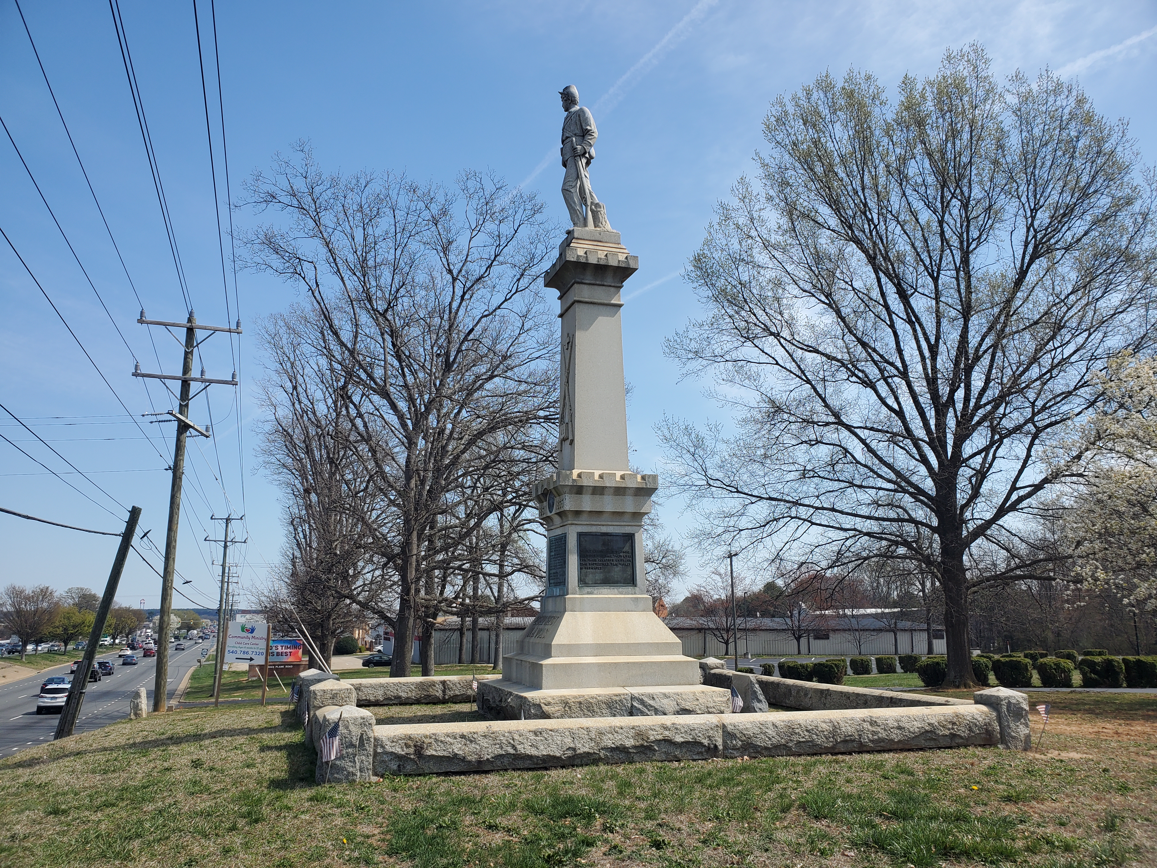
Bloody AngleOn May 12 Union General Grant captured the tip of the Mule Shoe Salient. For the following 22 hours, hand-to-hand and close range fighting ensued. The fighting concentrated around a slight bend in the trenches that became known as the Bloody Angle. 
Brock Road-Plank Road IntersectionThis crossroad was the key to the Battle of the Wilderness. Here, United States soldiers repulsed repeated assaults on May 5 and May 6, 1864. With the crossroad secure, the United States Army had a position from which to continue south, marking the end of the first engagement of the Overland Campaign, which would ultimately bring the Army of Northern Virginia to its knees. 
Bullock House SiteUnion troops marched past this location on April 30, 1863 on their way to the Chancellor House, and again on May 3, pulling back after 5 hours of brutal fighting. Earthworks and artillery pits nearby mark the Unions last line of the Battle of Chancellorsville. 
Catharine Furnace RuinsThe base of the furnace stack is all that remains of this ironworks which dates to the mid-1800s. Confederate General Stonewall Jackson's troops passed here during their march around the Union Army on May 2, 1863. 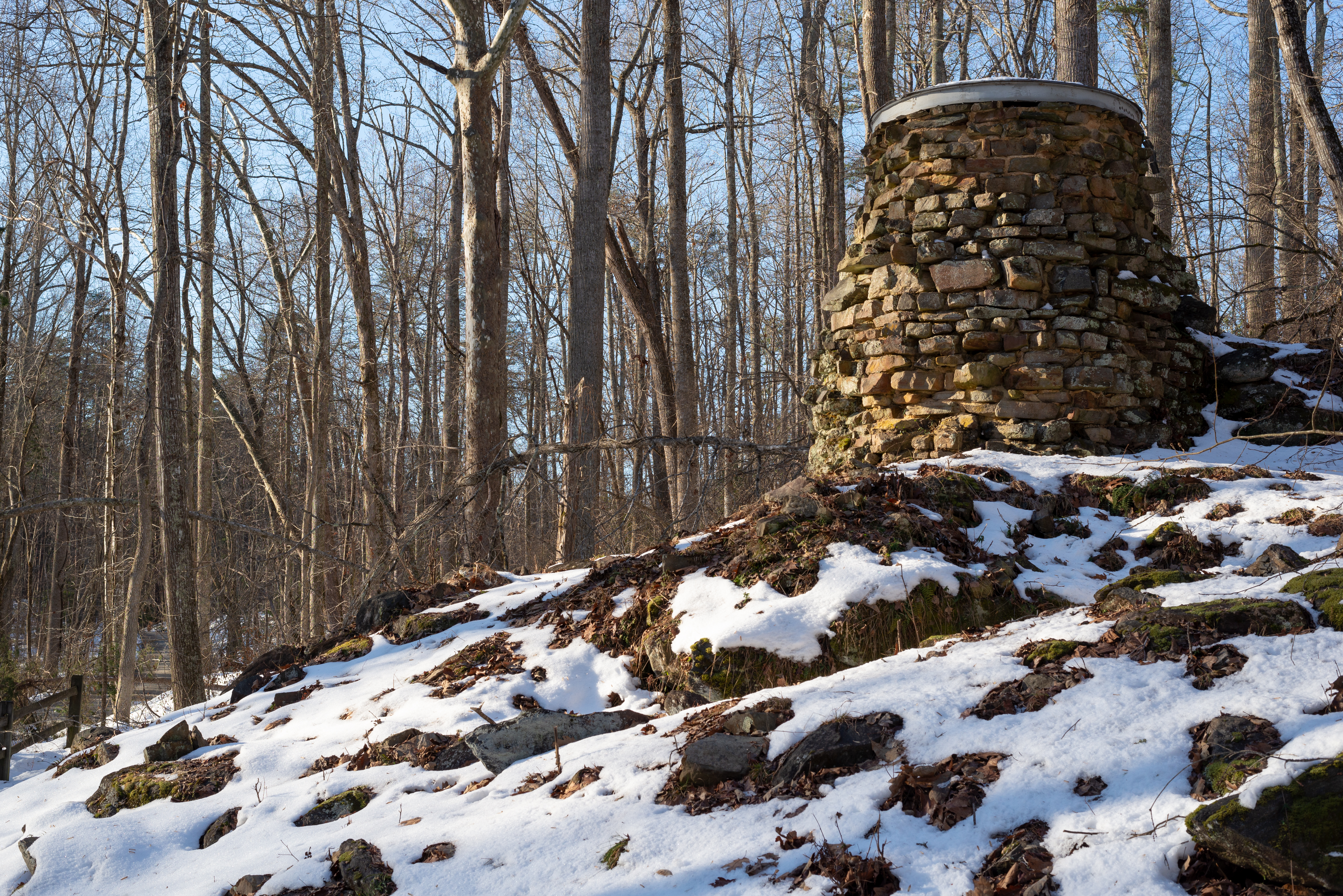
Chancellor House SiteThe building that stood here was the home of the Chancellor family. It served as an inn before the Civil War and as Hooker's headquarters during the battle. The house burned during the fighting on May 3, 1863. 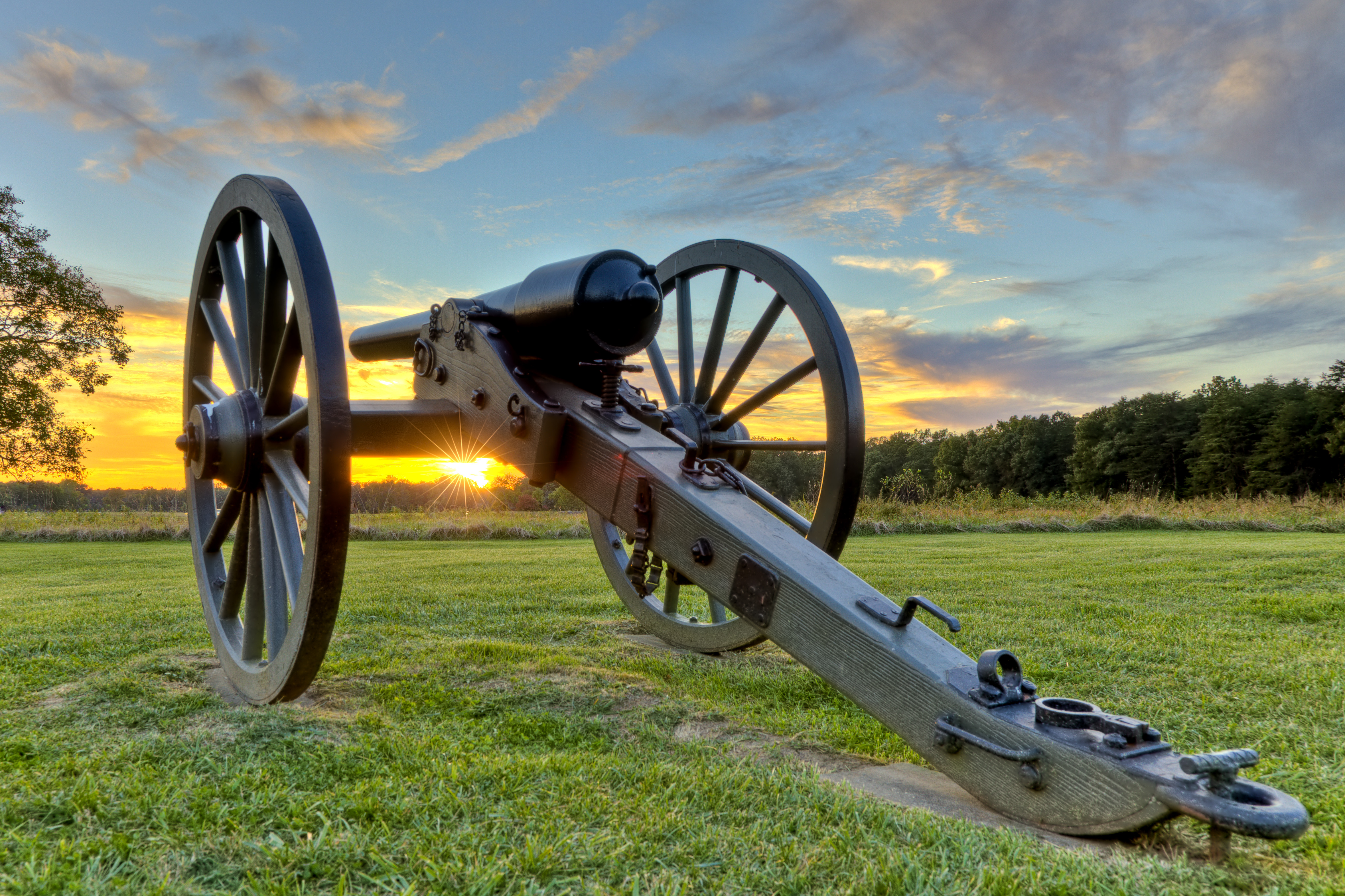
Chandler House SiteThe Chandler House Site was the location of the home around which stood the Fairfield Plantation. A large slave plantation complex located near Guinea Station, Fairfield was located in the path of moving armies during the Civil War and became most associated with the death of Confederate General Thomas "Stonewall" Jackson, who died in the nearby office on May 10, 1863. 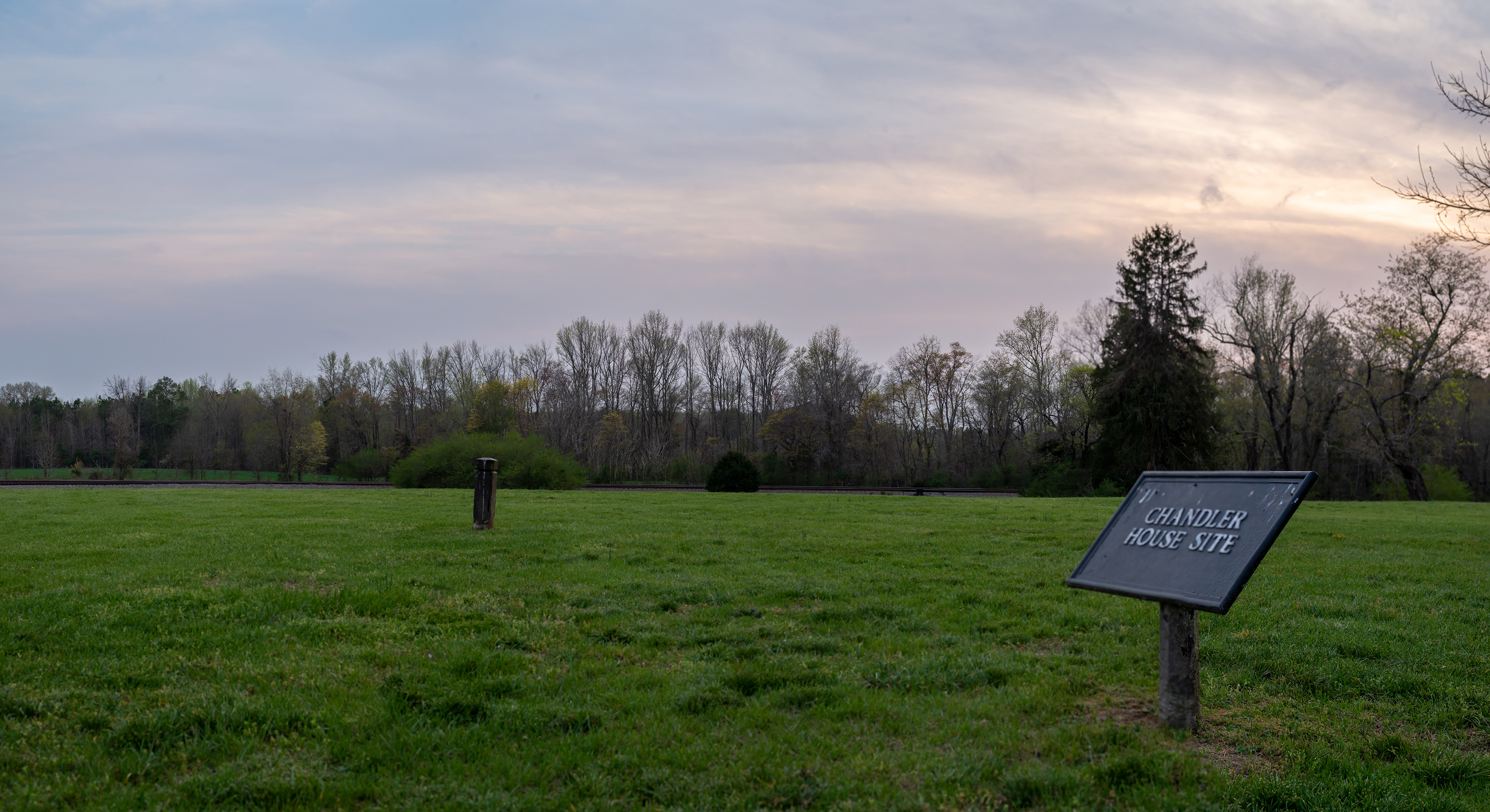
Chatham EntranceAt Chatham, explore the grounds of this Southern plantation and learn about the history of slavery, freedom, ruin, and reconstruction. 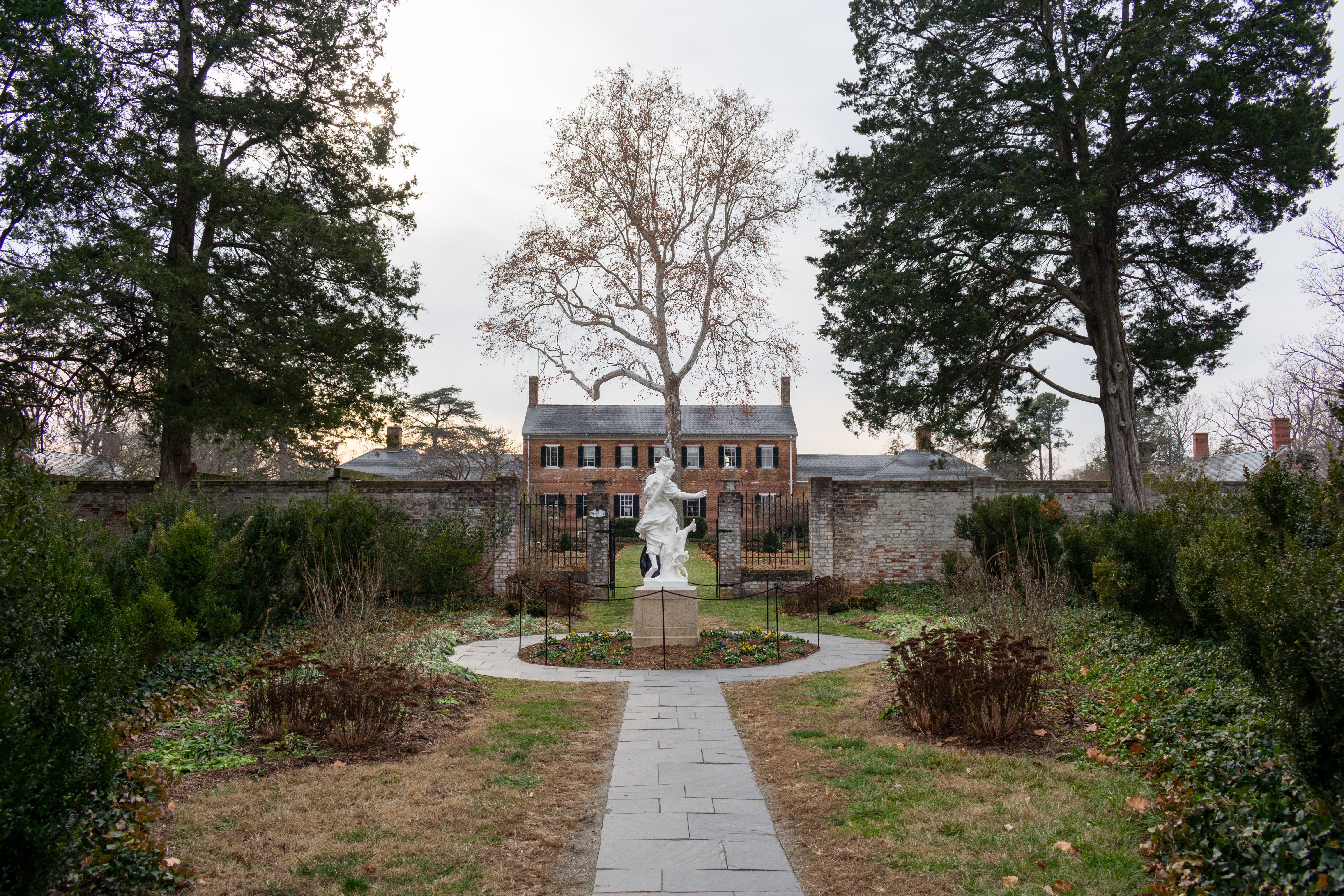
Chatham GardensThe Chatham gardens are one of the most popular features of the Chatham landscape. These gardens were designed by landscape architect Ellen Biddle Shipman in the 1920s. The flower beds, paths, and sculptural features that bring a sense of peace and beauty to those who visit today were once a place of enslavement of the people whose forced labor generated wealth for Chatham's owners. 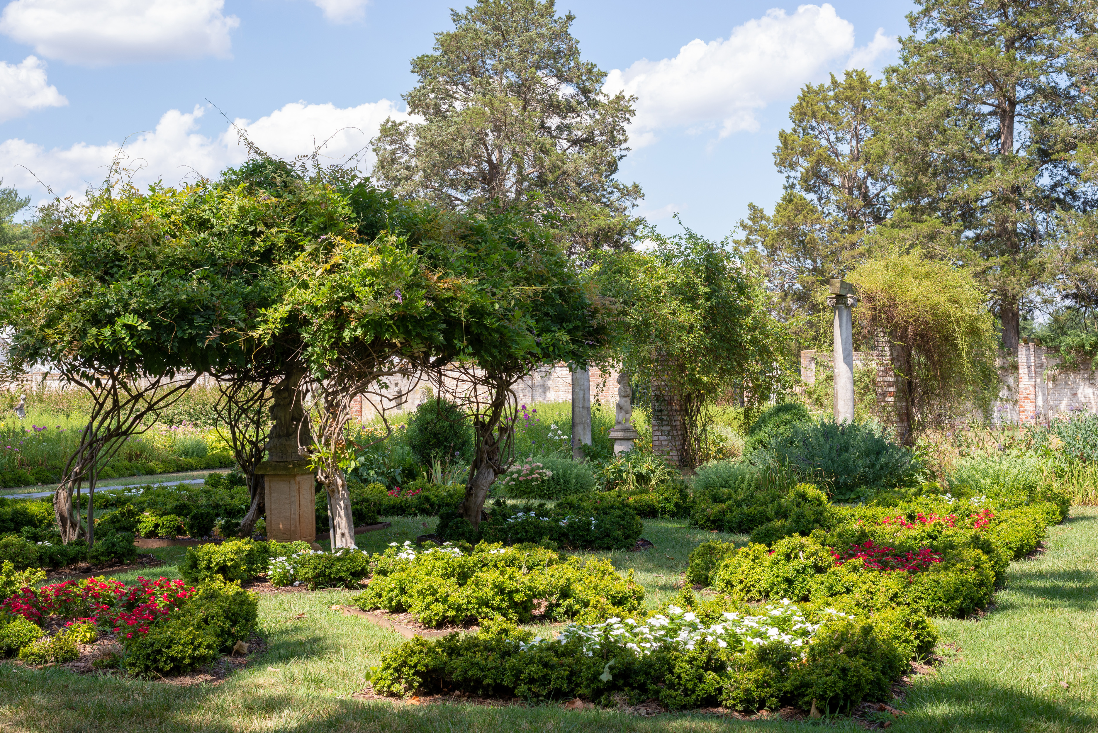
Chatham KitchenThe Chatham kitchen is one of three buildings at Chatham, the others being the main house and the laundry, that dates to the 1770s. Note: The Chatham kitchen building is a park office and is not open to the public. 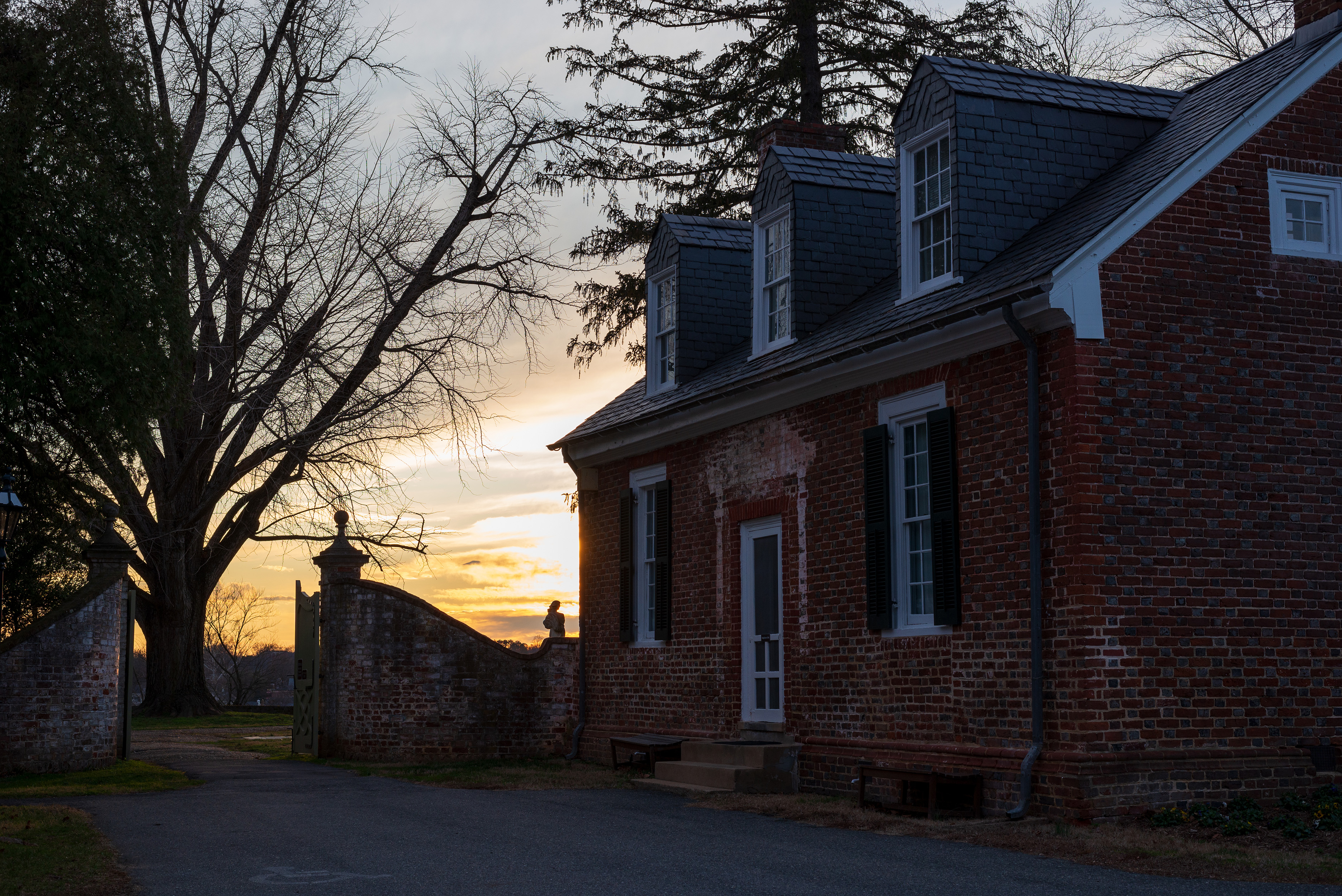
Chatham LaundryThe Chatham laundry is one of the original structures at Chatham, dating to the 1770s. Enslaved women labored and likely lived in this building. In the 1900s the laundry was converted to a guest house, then an office. Today, it is an office for park staff. 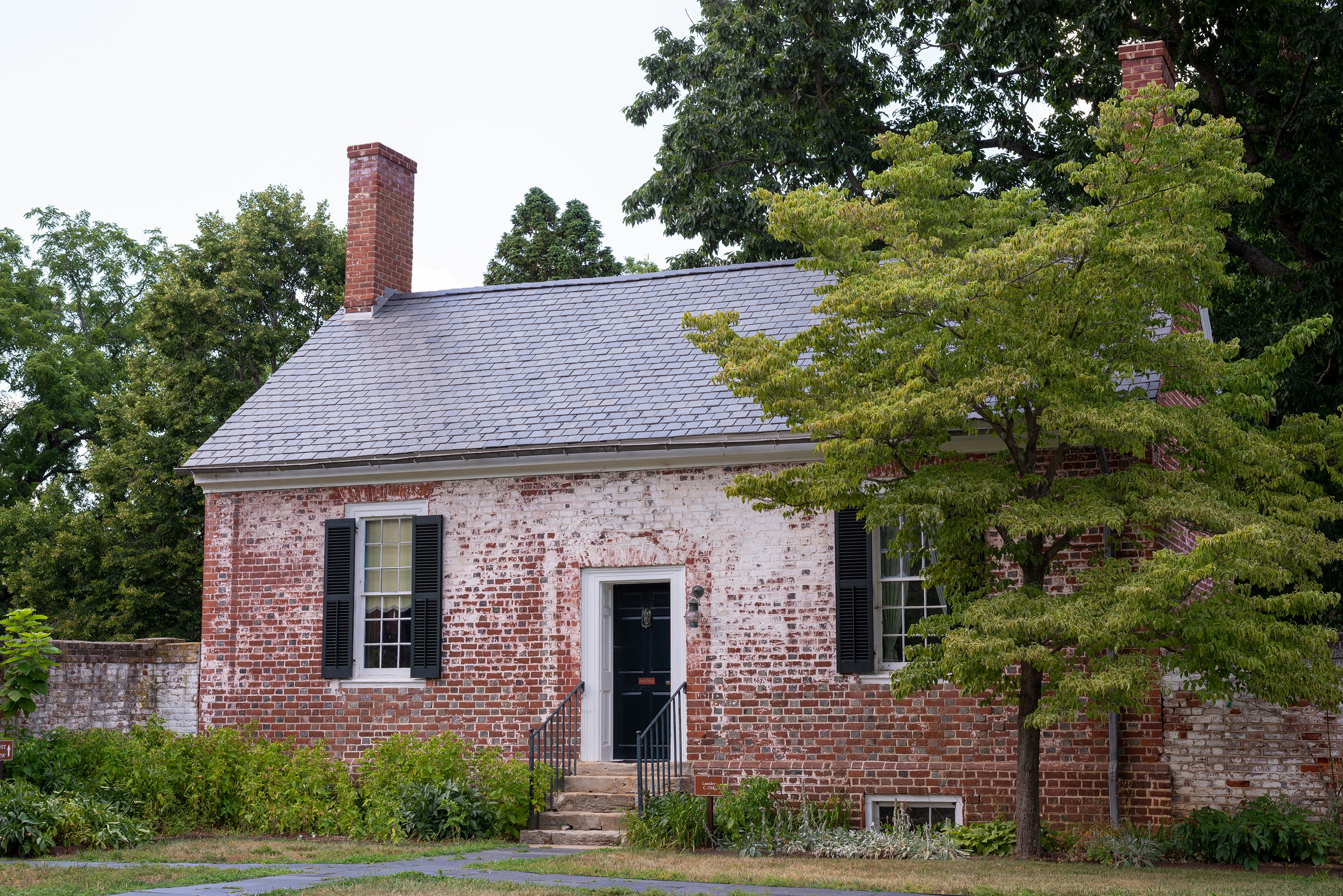
Chatham's Diana StatueThe Diana statue marks the entrance to the Chatham gardens. This terracotta artwork was placed in the garden in the 1920s. After being donated to the Virginia Musuem of Fine Arts many years ago, it was restored to its place in the garden in 2019. 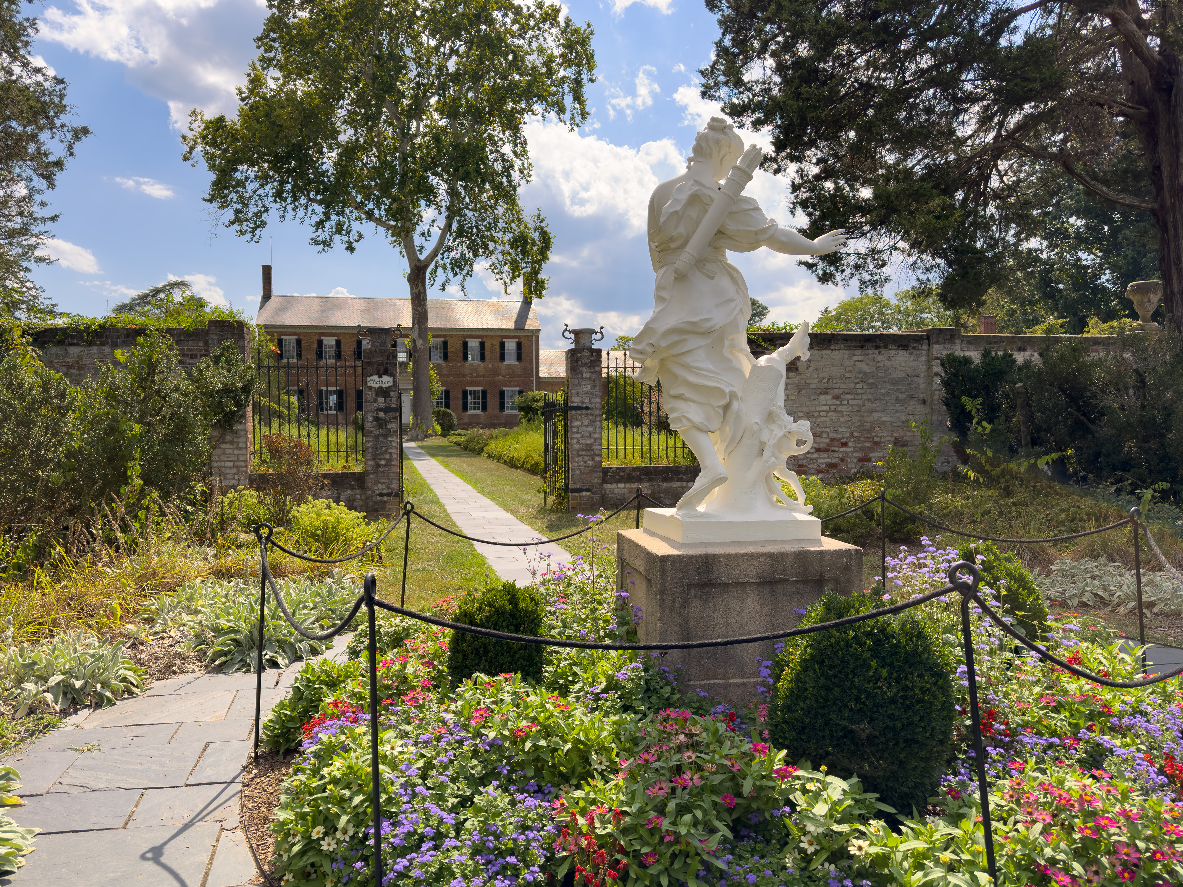
Chewning FarmThe farm road here leads to the place where Chewning Farm once stood, a location that was occupied and tactically important to both Confederate and United States forces. 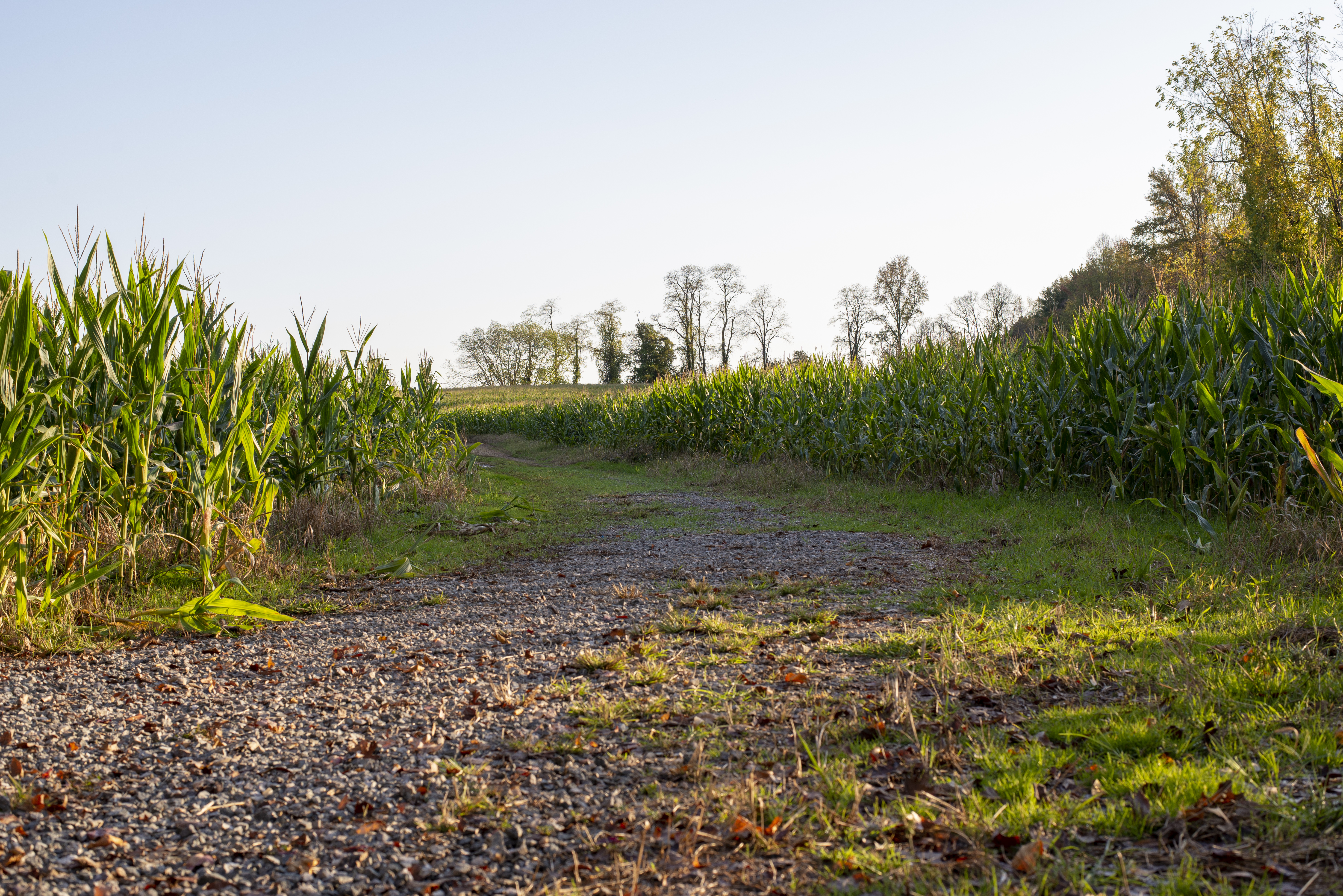
Civil War Soldier's GraveThis grave marks the final resting place of one of over 100 United States soldiers who died at Chatham in the aftermath of the Battle of Fredericksburg. The majority of the soldiers buried on the property were reinterred at the Fredericksburg National Cemetery. Today, three graves remain at Chatham. 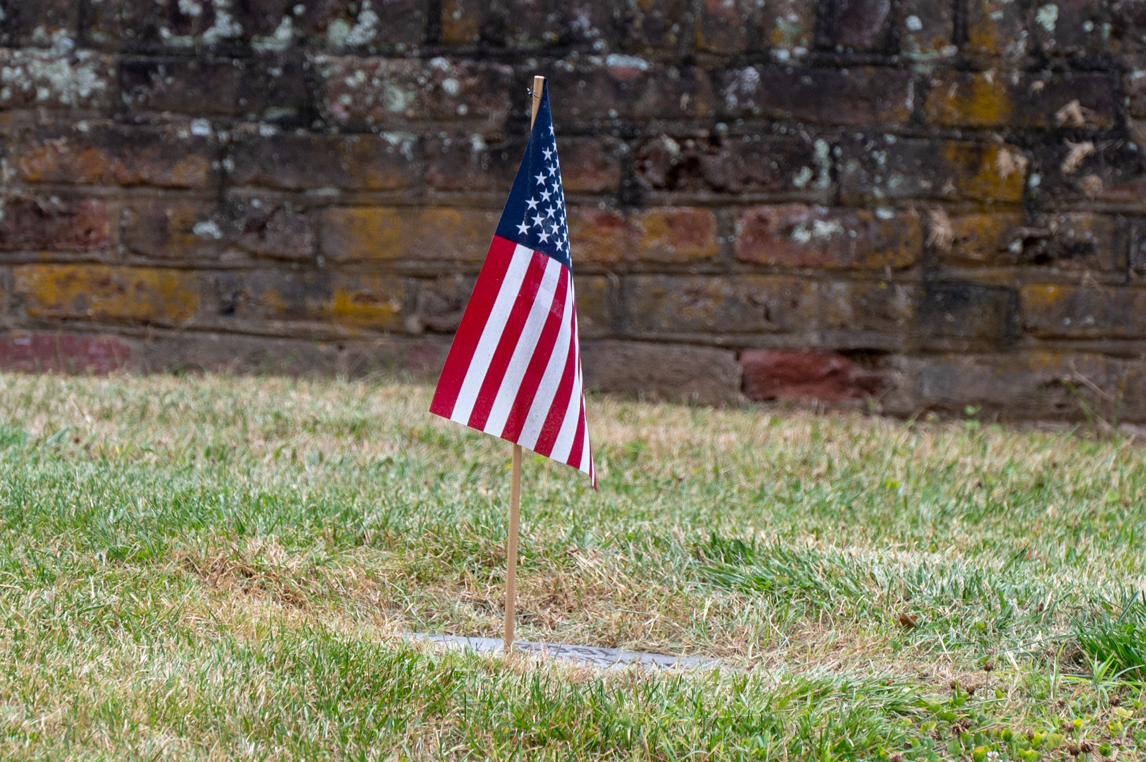
Cobb MemorialPrior to the Civil War, Cobb was a prominent lawyer, most well known for his legal treatise defending slavery. He became an leading secessionist in Georgia and formed his own military unit in 1862. The Battle of Fredericksburg was Cobb's first battle as a general, but it would be his last battle of the war. Confederate General Thomas Cobb died near this spot on December 13, 1862. 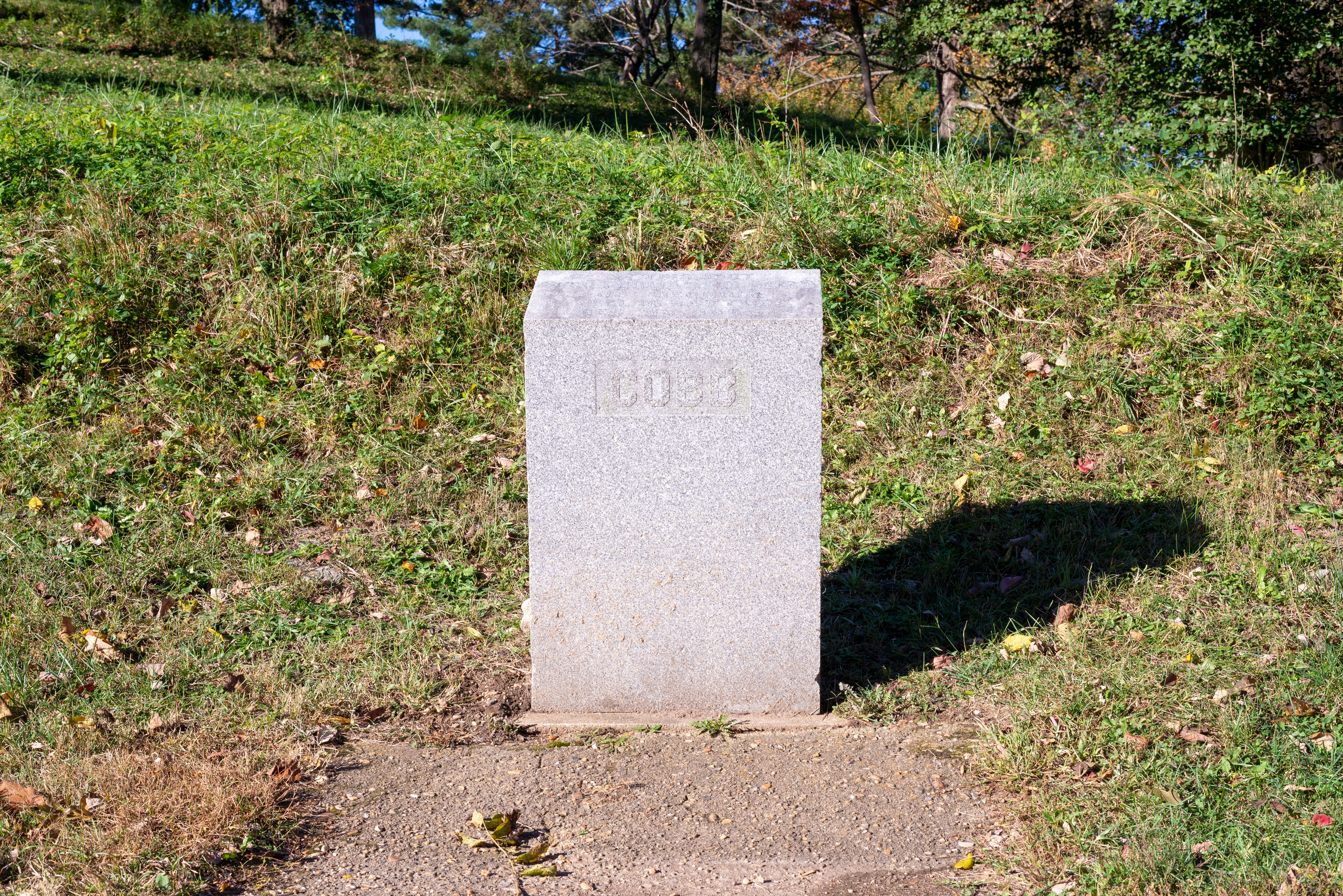
East Face of SalientFederal and Confederate forces battled in this area on May 12 at the same time the Bloody Angle fighting occurred. The earthworks that remain from the battle here are some of the best preserved in the park. 
Ellwood Brooder BarnThe Ellwood Brooder Barn was built around 1950 for raising chickens. The owner of Ellwood at the time, Leo Jones, had turned Ellwood into a productive livestock farm. Today the main part of the building is used for storage. Public restrooms are located at the side of the building. 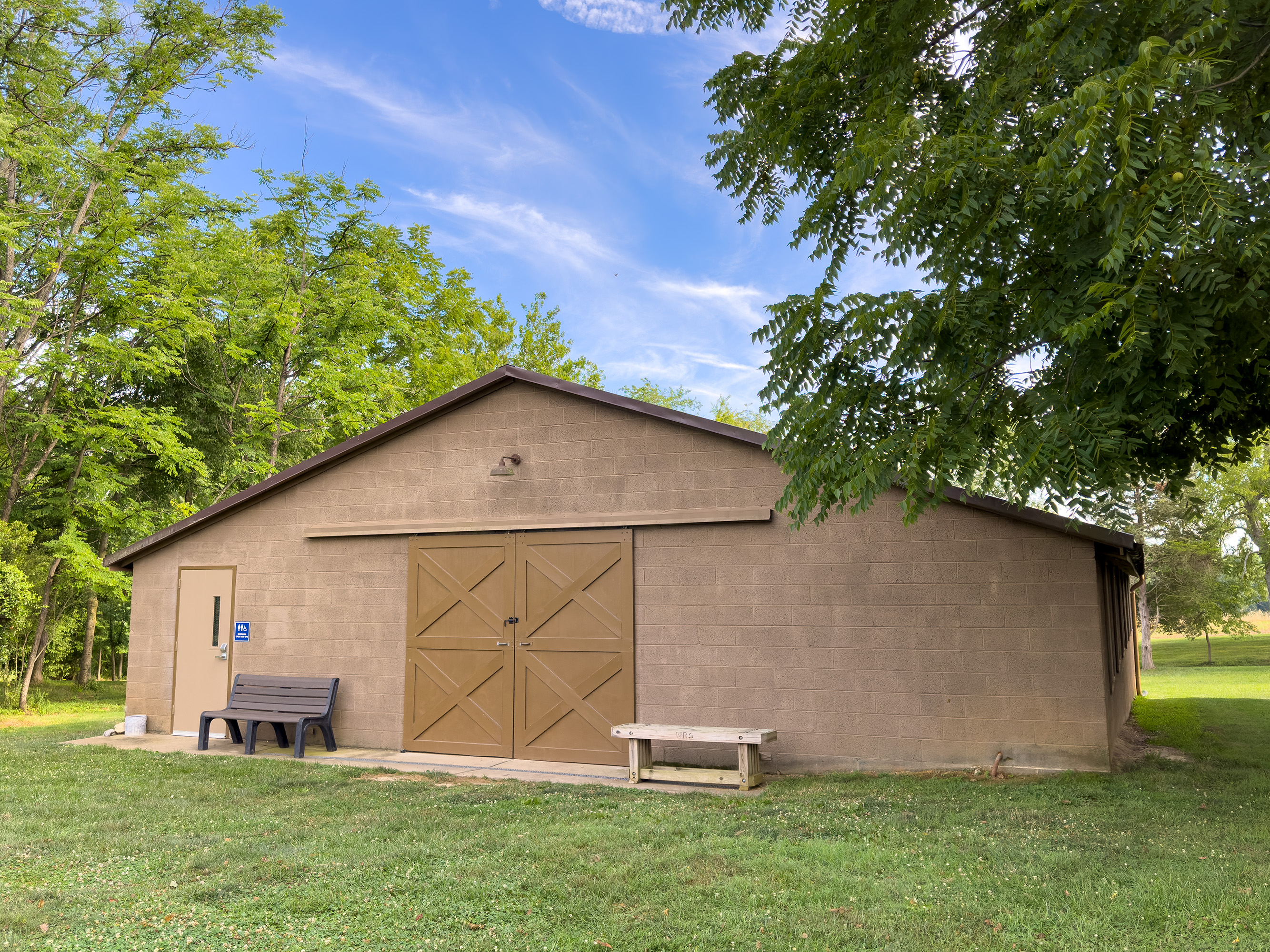
Ellwood CemeteryEstablished in 1807, the Ellwood cemetery contains the remains of fifteen members of the Jones family who owned Ellwood in the 1800s. Today, the cemetery contains one marker, for the amputated arm of Confederate General "Stonewall" Jackson. How did this small family cemetery become intertwined with the history of Jackson and the Lost Cause? 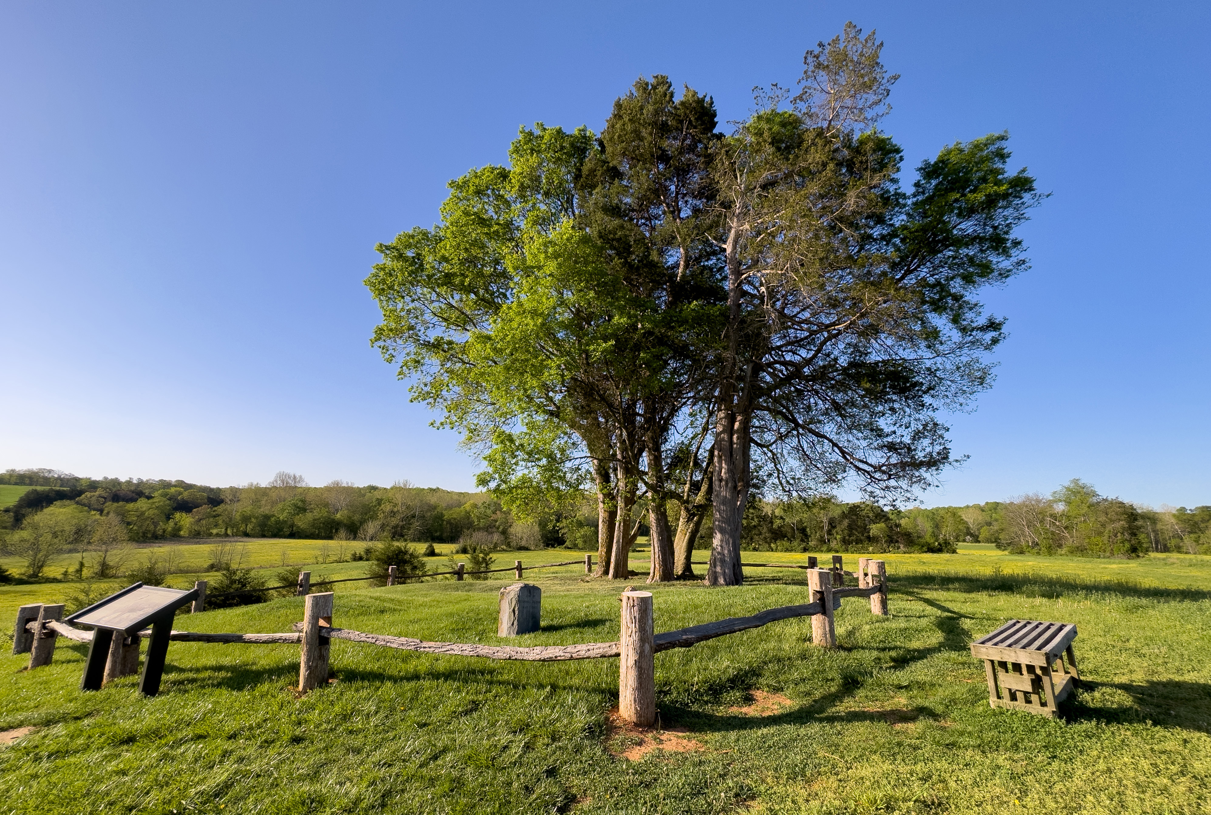
Ellwood GroundsFirst constructed in the 1700s, Ellwood is best known for its association with the Battles of Chancellorsville and the Wilderness during the Civil War. However, this place has a much wider and more expansive history. Learn about the people who first inhabited this land and the ways that colonial settlement altered the physical landscape. 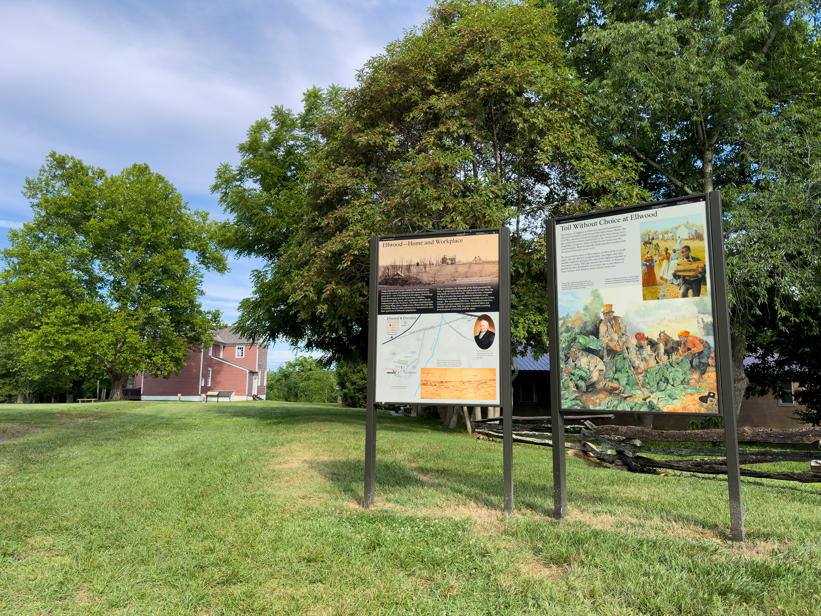
Ellwood HouseEllwood was a slave plantation dating to the 1790s. During the Battle of Chancellorsville, this building was a Confederate field hospital. During the Battle of the Wilderness it was the headquarters for US Generals Warren and Burnside. Though most famous because Confederate General "Stonewall" Jackson's amputated left arm is buried in the family cemetery, the house has many more stories to tell. The house is open seasonally. 
Ellwood Service YardThe open, grassy field besides the main house was the location of the Ellwood service yard. Many buildings where enslaved people once lived and worked once stood here. 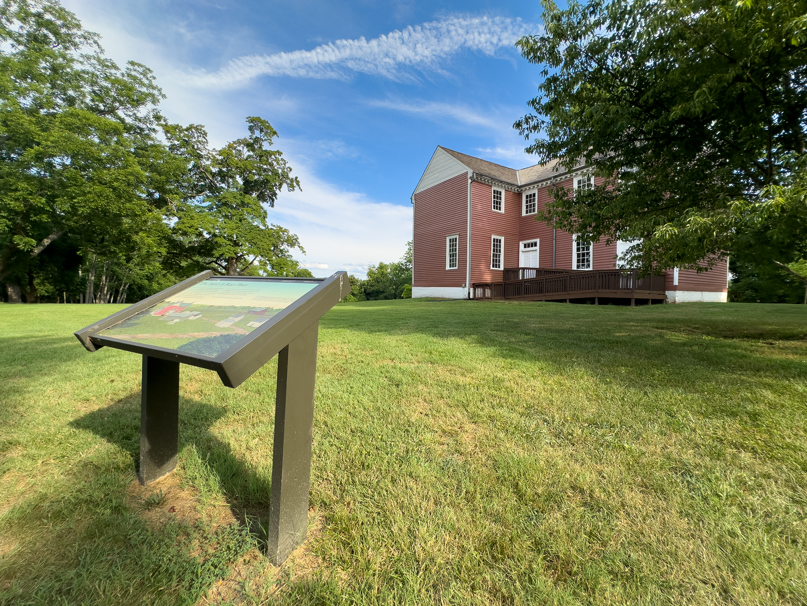
Fairfield OfficeThe Stonewall Jackson Death Site is the plantation office building near Guinea Station where Confederate General Thomas J. "Stonewall" Jackson died on May 10, 1863. 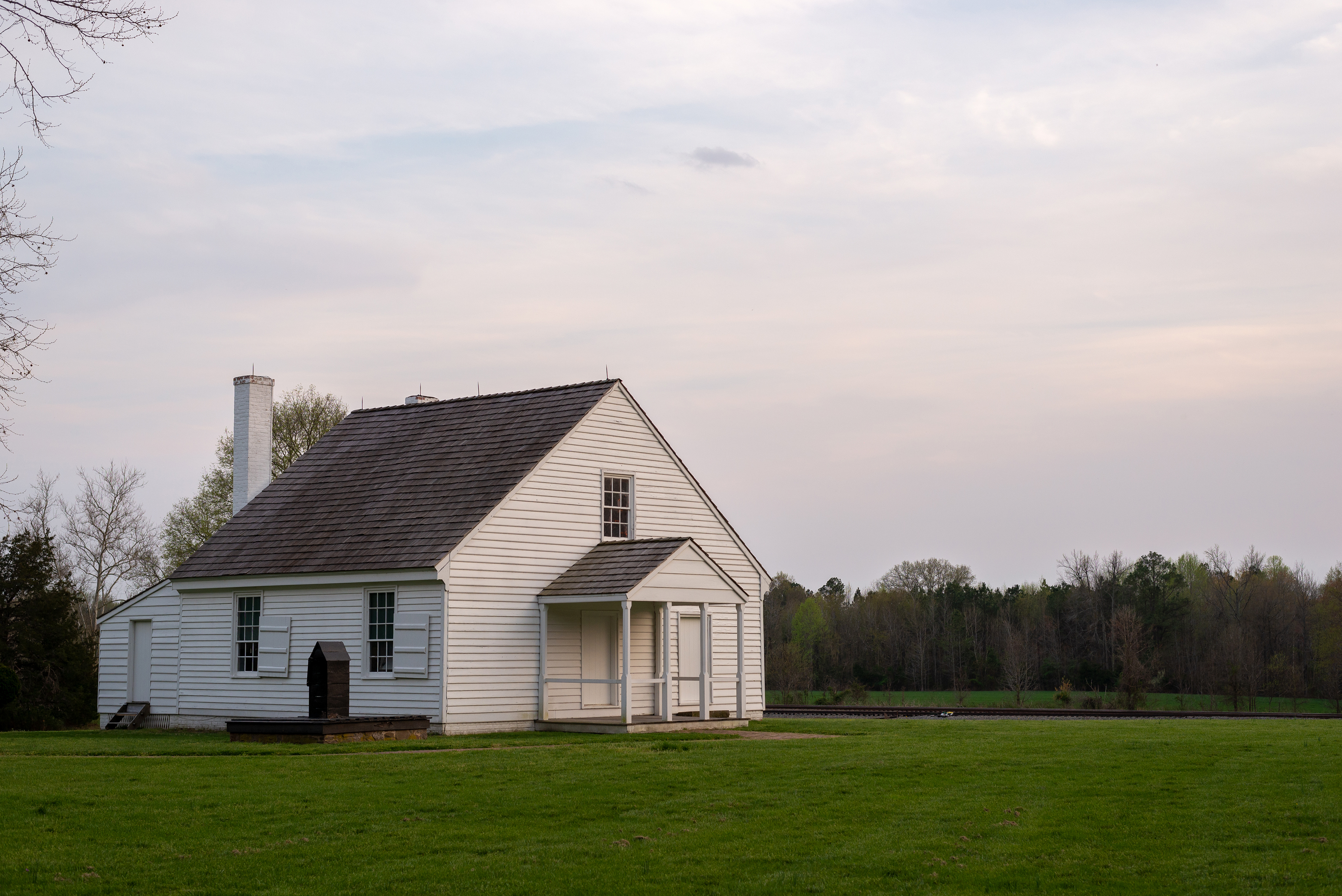
FairviewFor about five hours Union artillery here dueled with Confederate artillery on Hazel Grove, while opposing infantry clashed in some of the bloodiest fighting of the war. 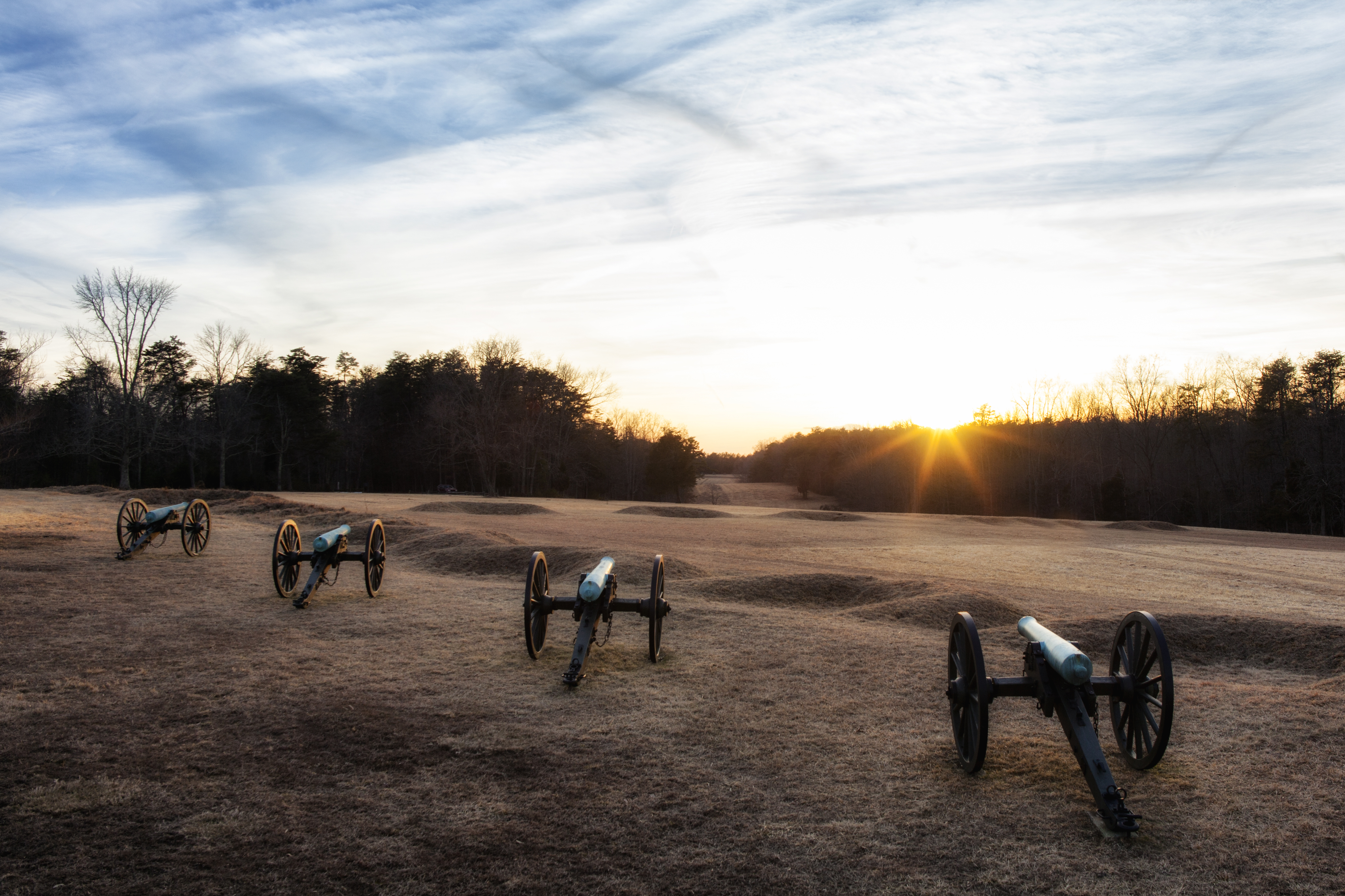
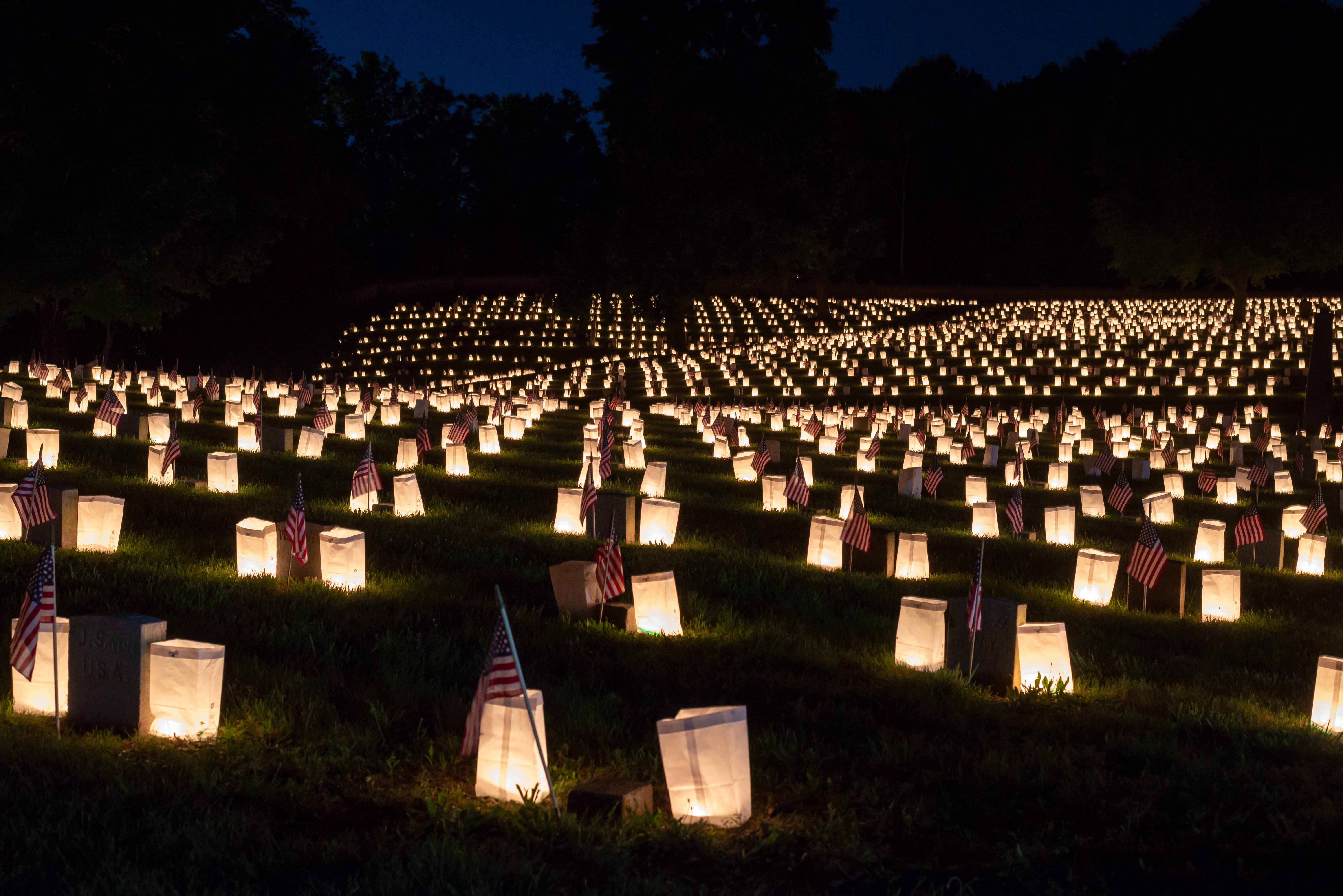
Fredericksburg National CemeteryThe Fredericksburg National Cemetery is the final resting place for over 15,000 United States soldiers, the majority of whom died during the Civil War, plus about 100 soldiers from the 1900s and a handful of spouses. Over 80% of the soldiers here are unidentified. 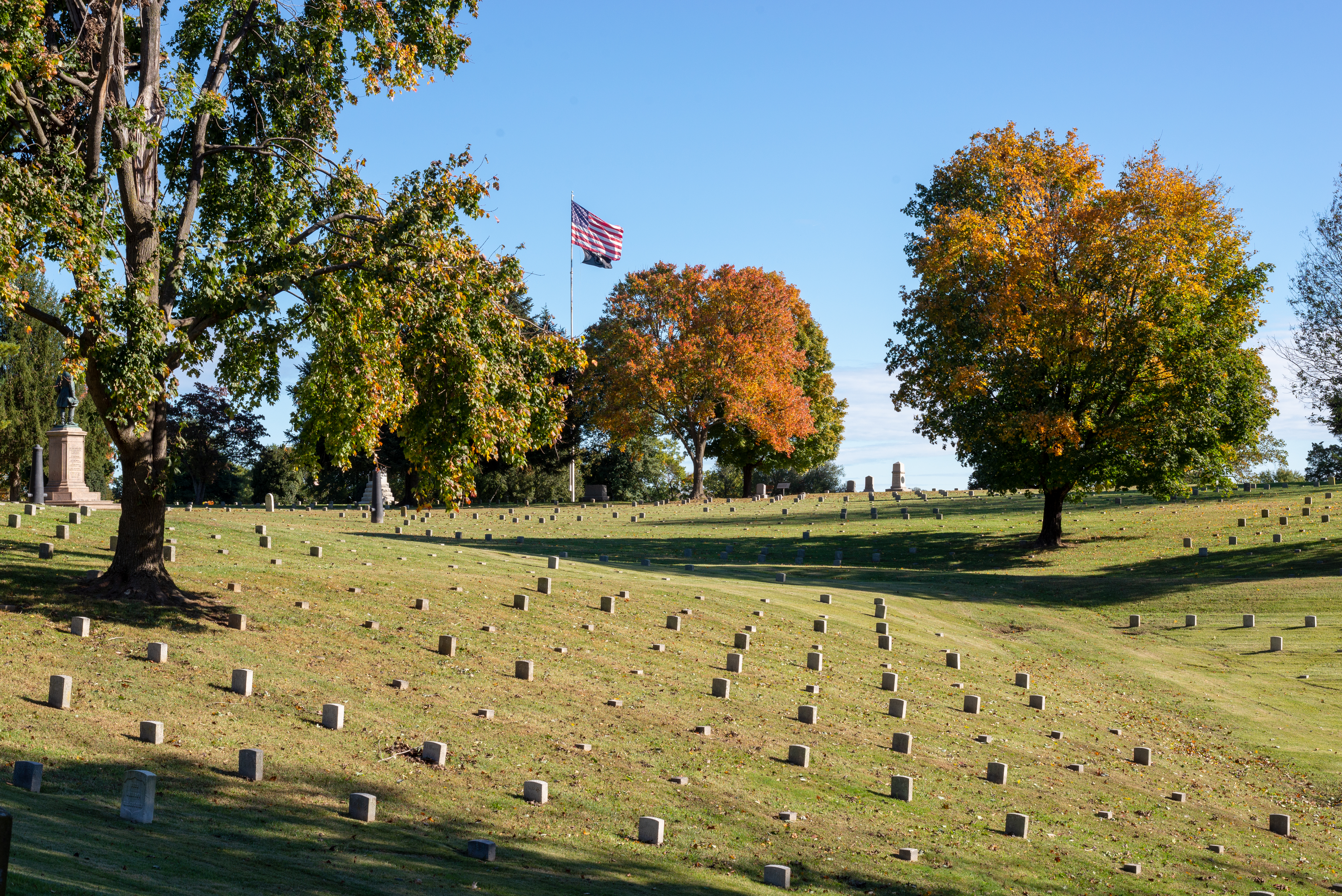
Fredericksburg Park StoreVisit the Fredericksburg Park Store, managed by America's National Parks, for books, gifts, souvenirs, and information about the Battle of Fredericksburg. 
Fredericksburg RoadThe Fredericksburg Road became the lifeline for the United States Army, allowing Grant to bring up supplies and reinforcements. Robert E. Lee tried to cut the Army of the Potomac's access to this road on May 19 with attacks here and at the Harris Farm. Lee was ultimately unsuccessful and the US maintained control of the road and continued to move south. 
Grant's HeadquartersAs his army marched into the Wilderness, Union General Ulysses S. Grant made his headquarters on a slight knoll above the Orange Turnpike. 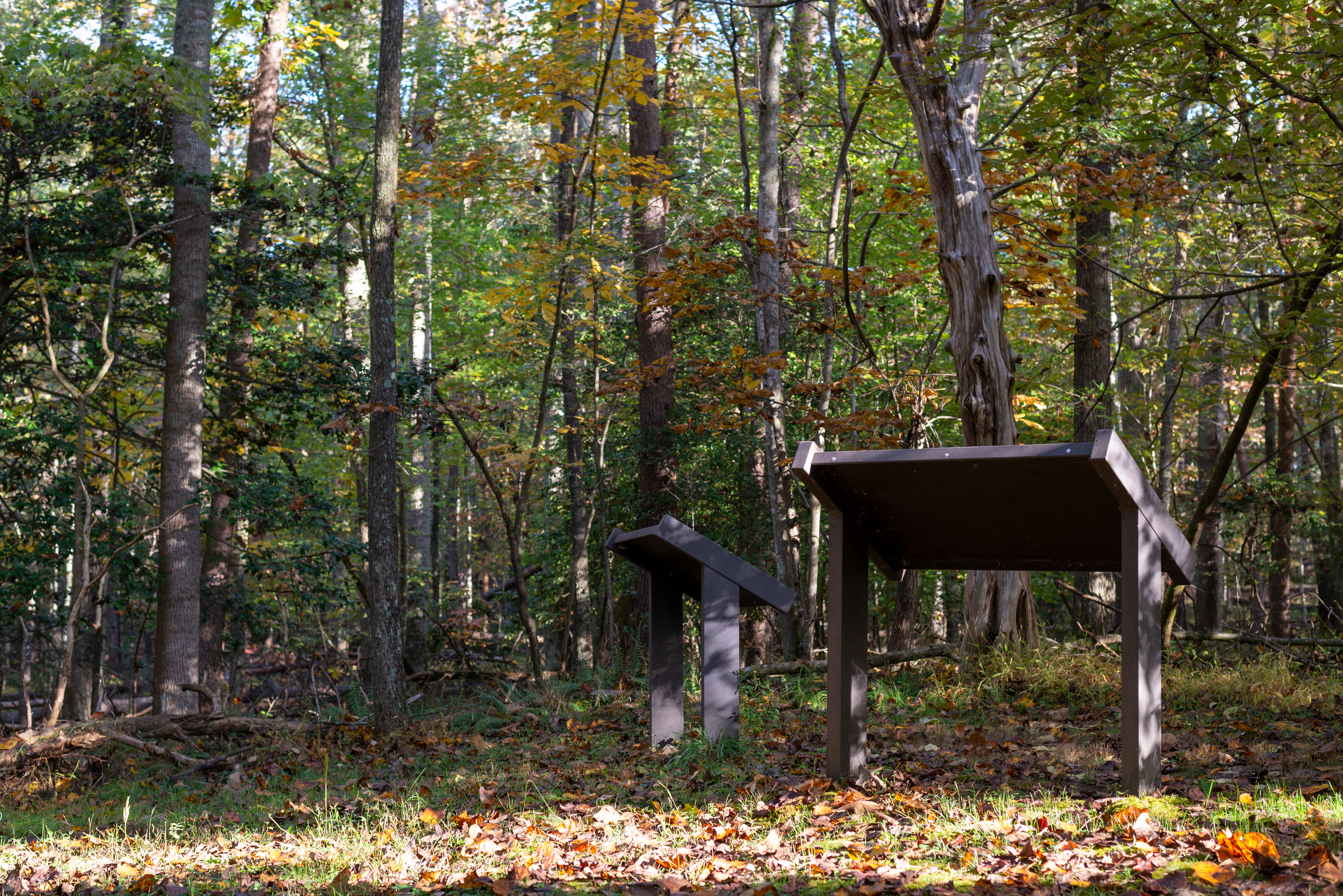
Guinea StationStation was a small community in Caroline County thrust into the spotlight because of its role as a Confederate supply depot during the Civil War and, subsequently, the location of Confederate General Jackson's death within the community in 1863. 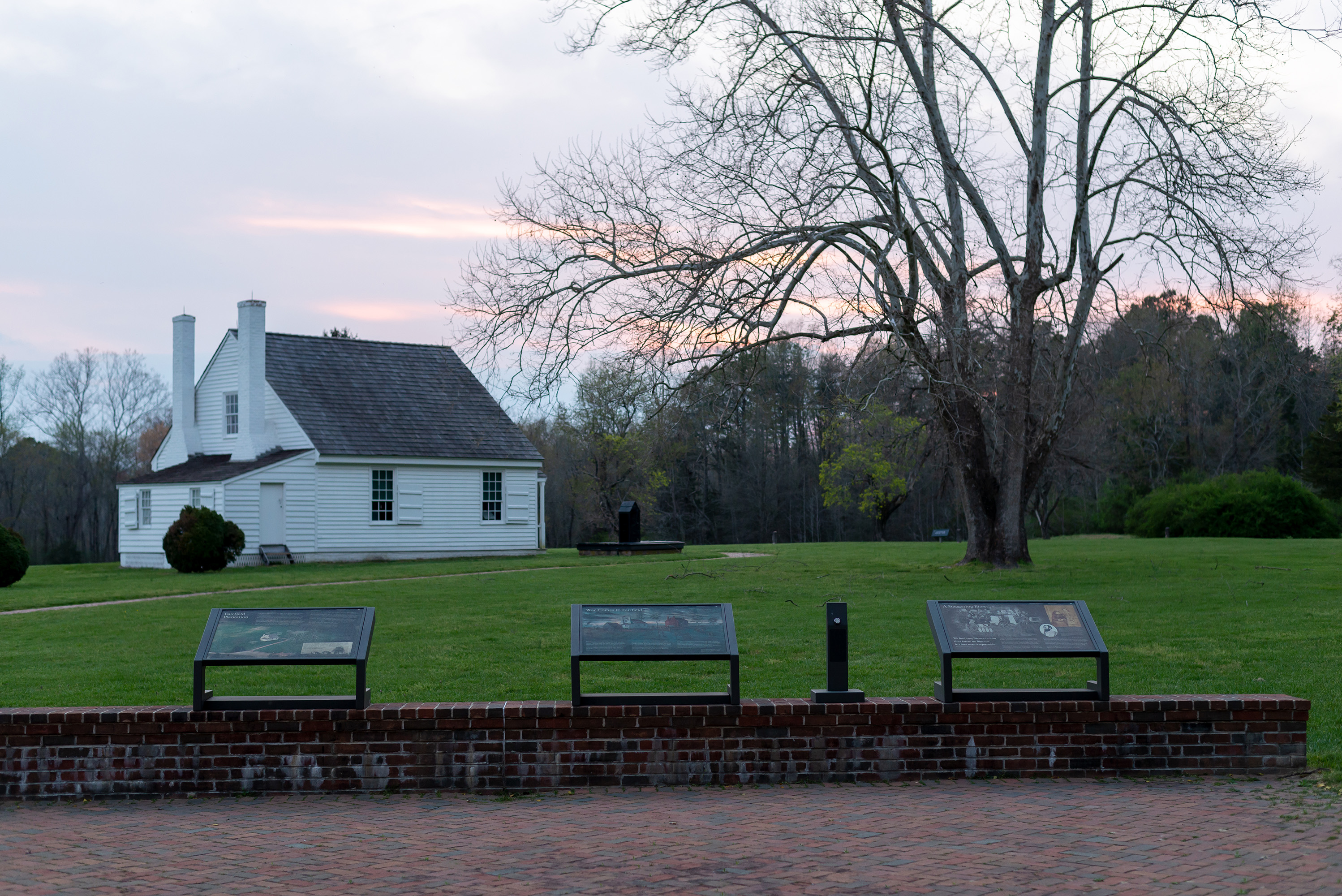
Hamilton's CrossingThis stop along the Richmond, Fredericksburg, and Potomac Railroad served as a critical supply hub for the Confederate Army of Northern Virginia and was the right flank of Jackson's line during the Battle of Fredericksburg. 
Harrison House SiteThe Harrison House was one homesite on the Spotsylvania Battlefield. From here on May 12, Confederate General John B. Gordon stopped General Robert E. Lee from leading a counterattack against the Union Army inside the Mule Shoe Salient. Gordon launched the attack himself. Only portions of the house foundation remains. 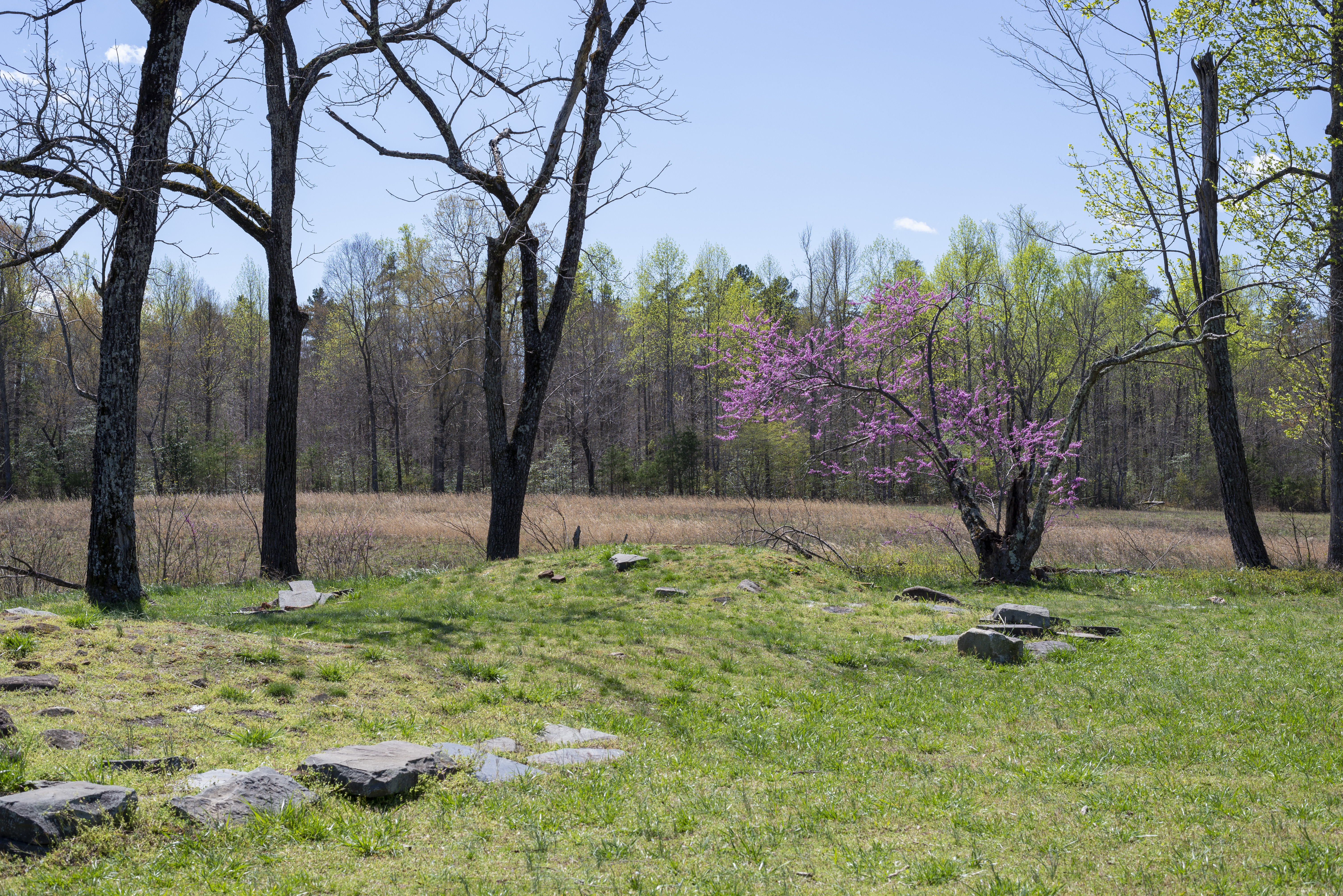
Hazel GroveOn the morning of May 3 Confederates concentrated 30 cannon here and opened an intense, concentrated bombardment of Union artillery at Fairview. 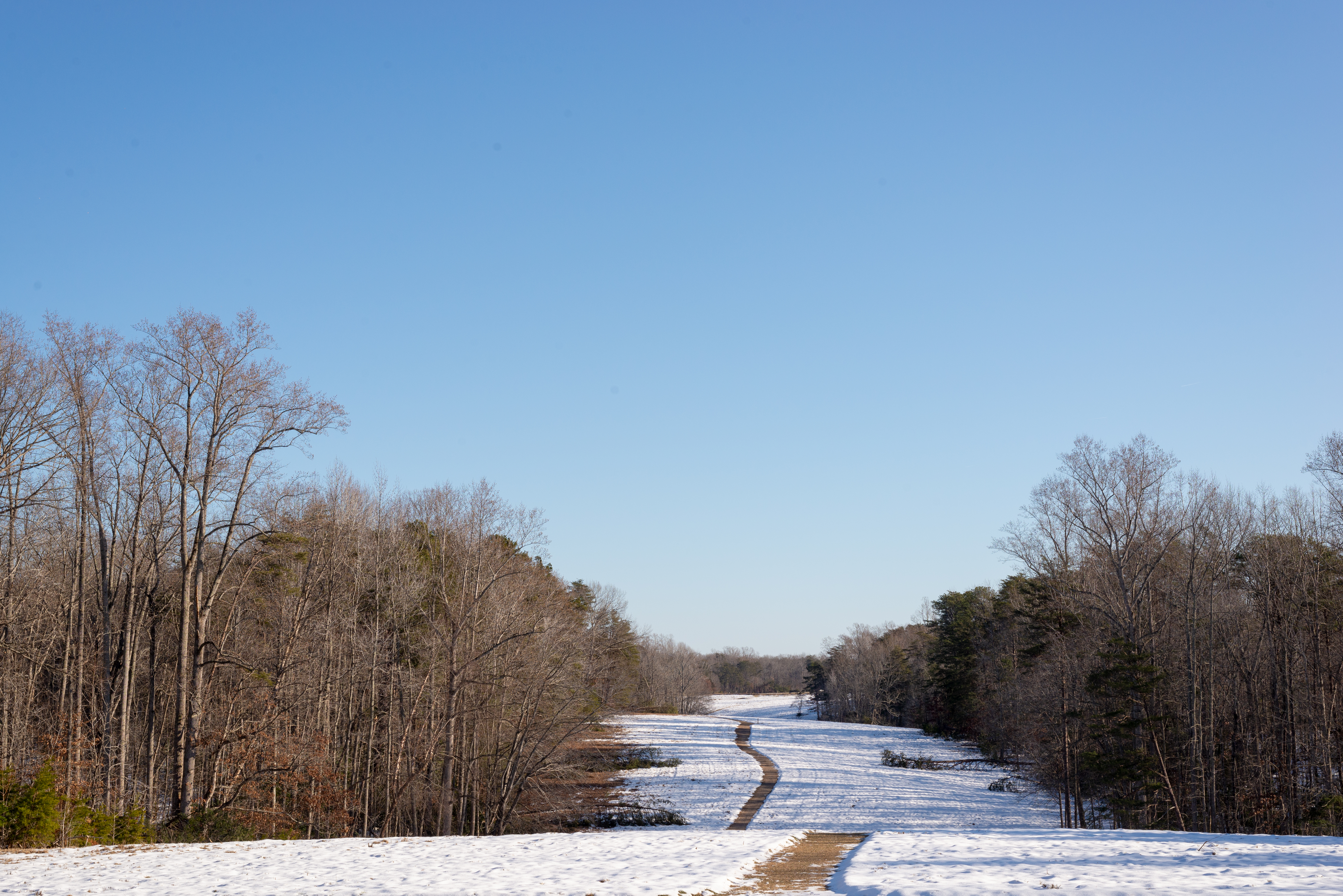
Heth's SalientUS General Ambrose Burnside's 9th Corps assaulted Heth's Salient on the east side of the Mule Shoe. Confederate General Henry Heth's soldiers repulsed Burnside's attack. Today, the remains of the earthworks are tucked away in the woods nearby. 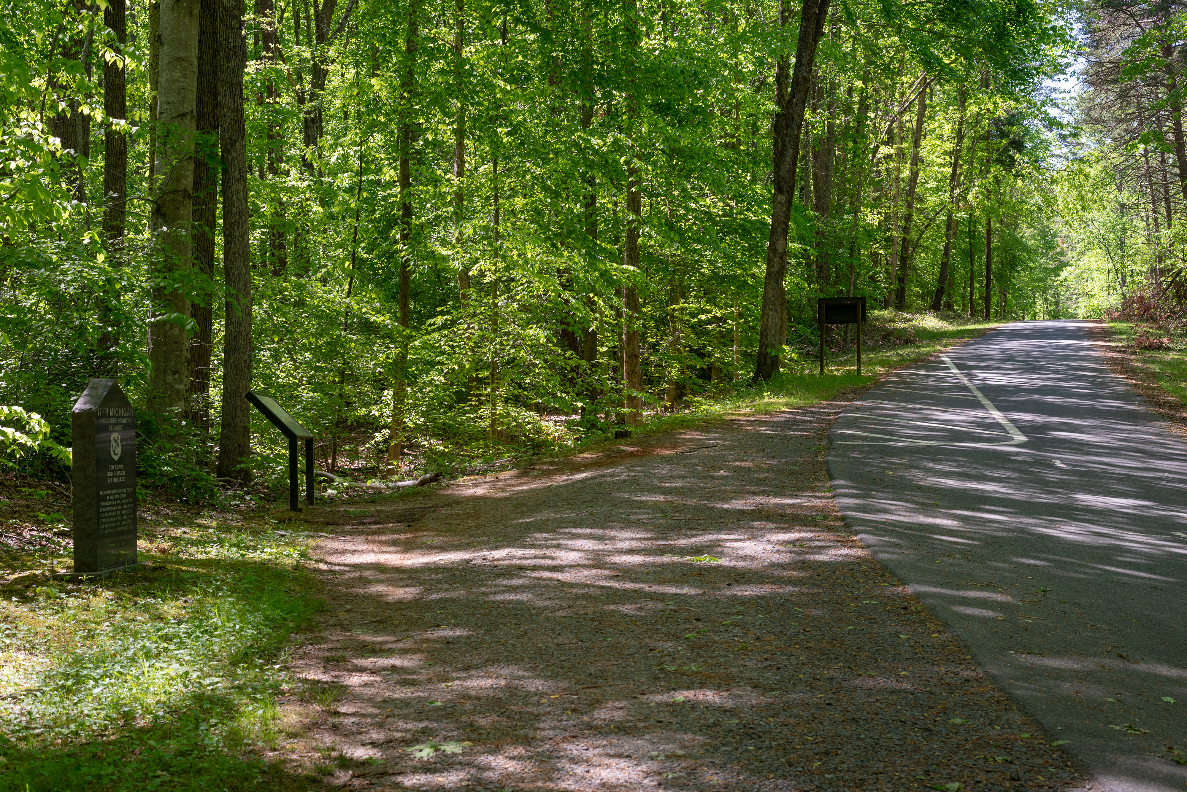
Higgerson FarmSome of the heaviest and most chaotic fighting occurred here. From the pullout, a short trail leads to the location of the Higgerson House. 
Howison HillHowison Hill was crowned with Confederate artillery that blasted the Union attackers in front of Marye's Heights. A large 30 pounder Parrot was among the guns at this location. This type of gun is classified as siege artillery and not usually found on a battlefield. 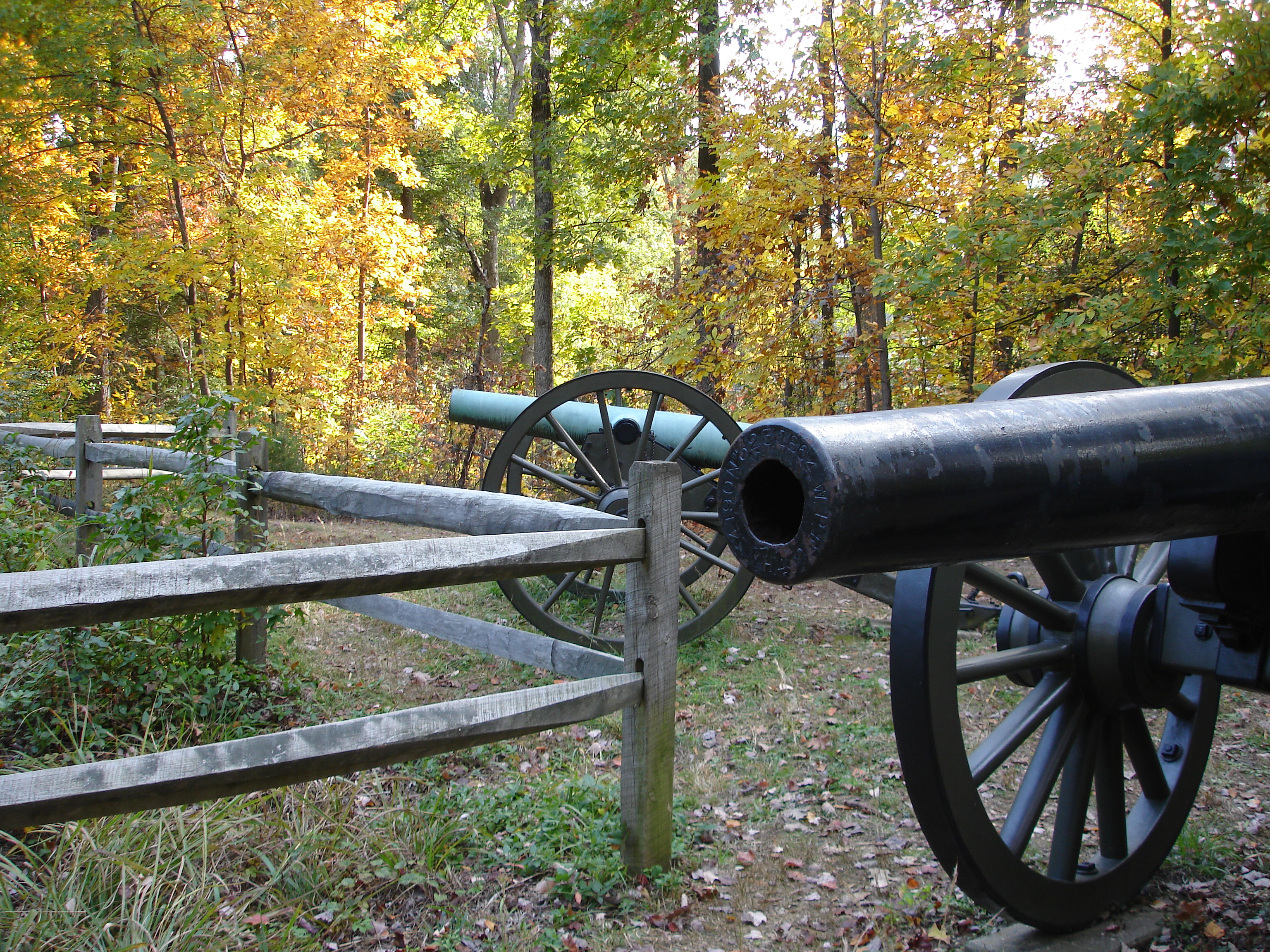
Humphreys MonumentThe charge of Andrew Atkinson Humphreys’ Division of the US Army of the Potomac was the last major assault against the stone wall at the Battle of Fredericksburg in December 1862. While Humphreys survived the war and is not buried here, his soldiers felt that Fredericksburg was the proper place to honor their service and that of their fallen comrades. They dedicated this monument in the Fredericksburg National Cemetery in 1908. 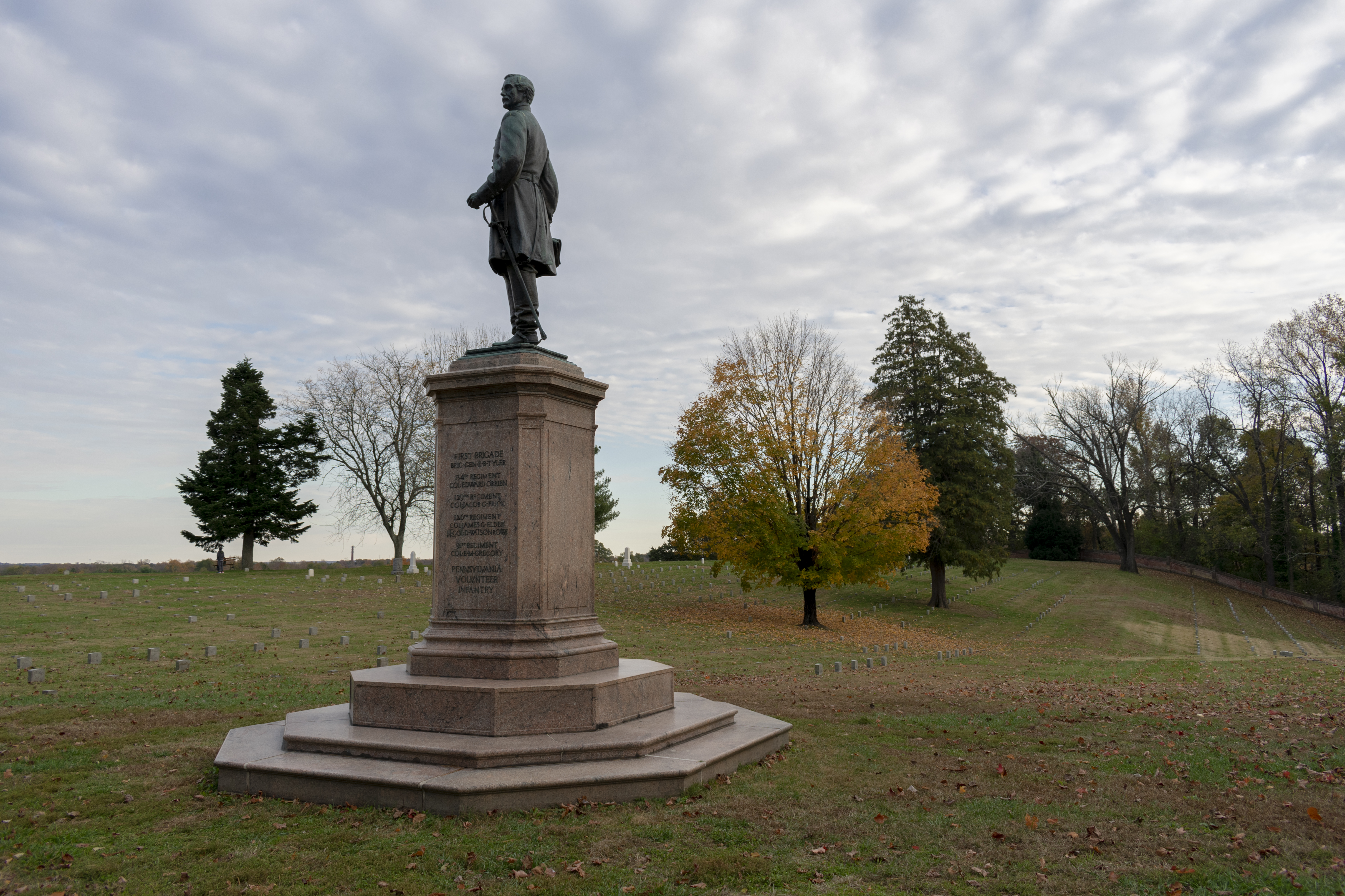
Innis HouseThe Innis House is one of the few standing structures along the Sunken Road that was standing during the battle in December 1862. The house is still riddled with bullet holes from the battle, a stark testament to the brutality of war. 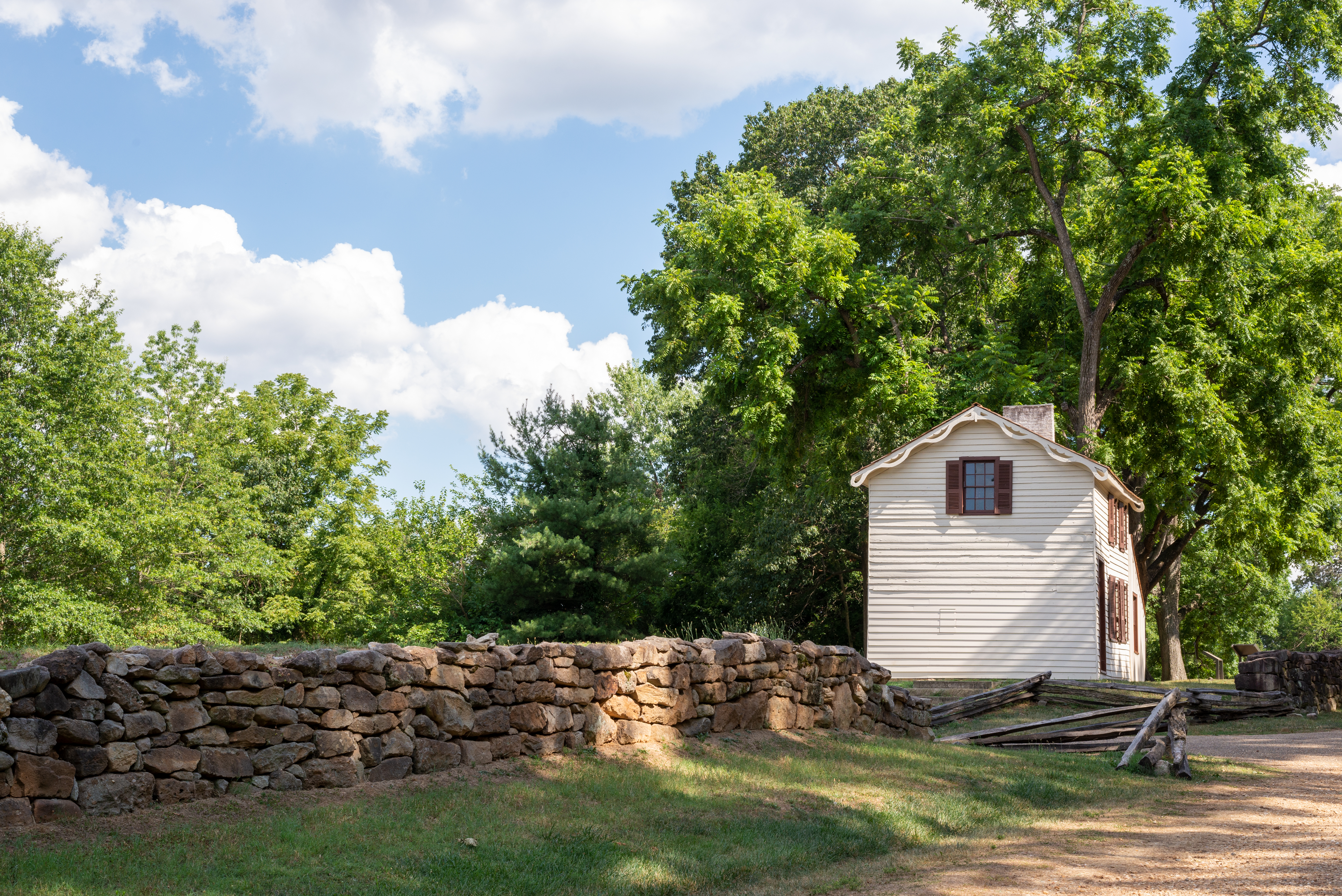
Jackson's Flank AttackHere at 5:15pm on May 2, Jackson's veterans crushed the Union Army's right flank held by General Oliver O. Howard's 11th Corps. 
Journey Through Hallowed Ground National Heritage AreaThe Journey is a unique historic, natural and scenic region, with farms and orchards; woodlands and forests; rivers and streams; rolling hills and mountain views; and unspoiled landscapes that can be explored by car, bike, canoe, foot or on horseback The region is alive with vibrant historic downtowns, rich agriculture and an abundant bounty of wineries, inns and unique cultural events. 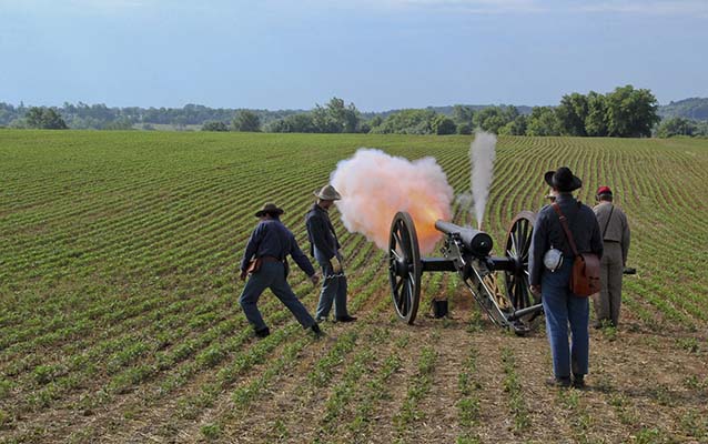
Kirkland MemorialThe Kirkland Memorial pays homage to the deeds of Richard Kirkland, a Confederate sergeant, who crossed over the stone wall to give water to wounded US soldiers after the fighting of December 13, 1864 at the Battle of Fredericksburg. 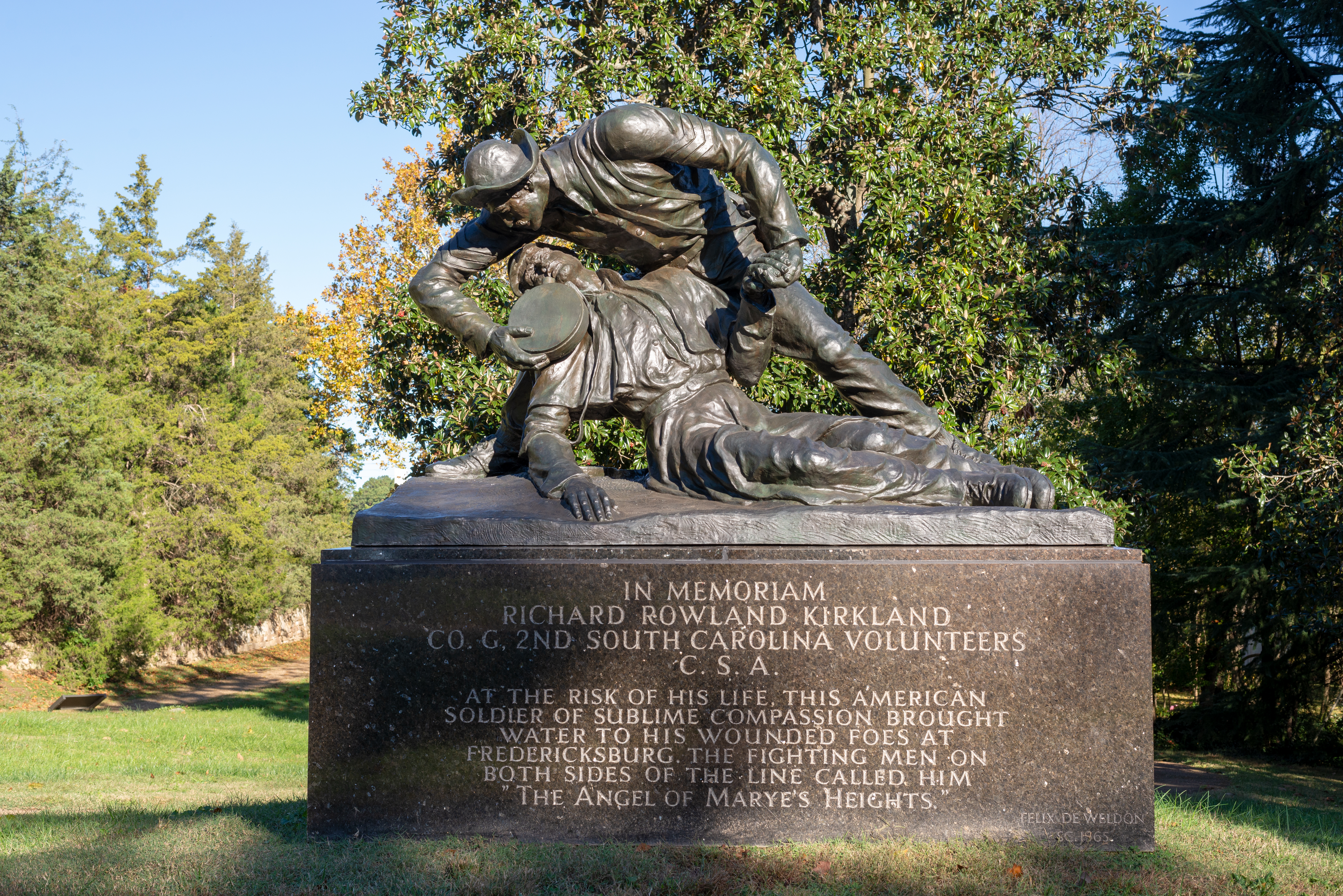
Lee's Hill (Telegraph Hill)Originally called Telegraph Hill, this hill became known as Lee's Hill because it was the headquarters for Confederate General Robert E. Lee during the Battle of Fredericksburg. From this vantage, he could observe much of the battle. Cannons were also placed on this hill. 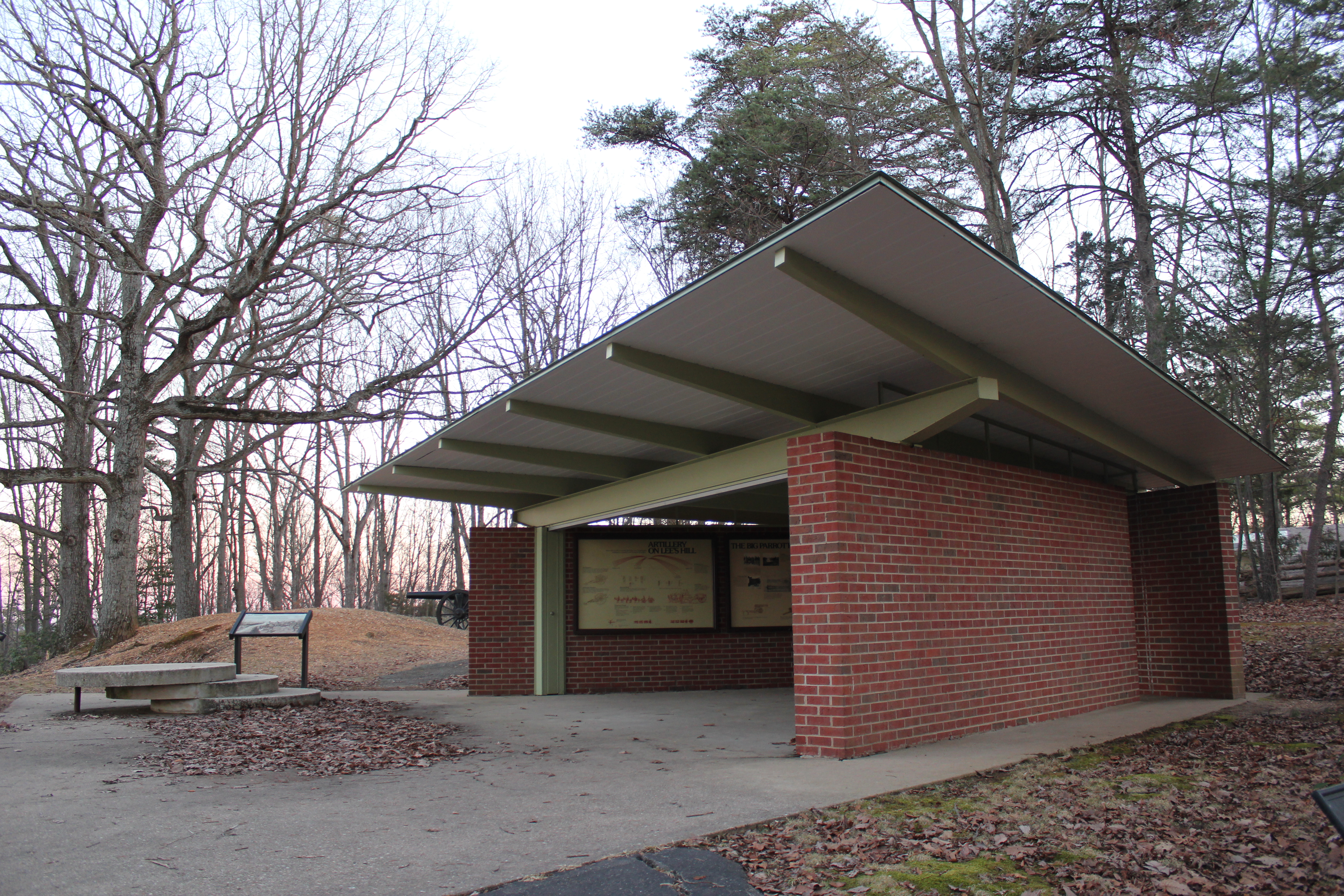
Lee-Jackson BivouacHere on the night of May 1, 1863, Robert E. Lee and Stonewall Jackson met to plan Jackson's flank attack that would begin the next morning. 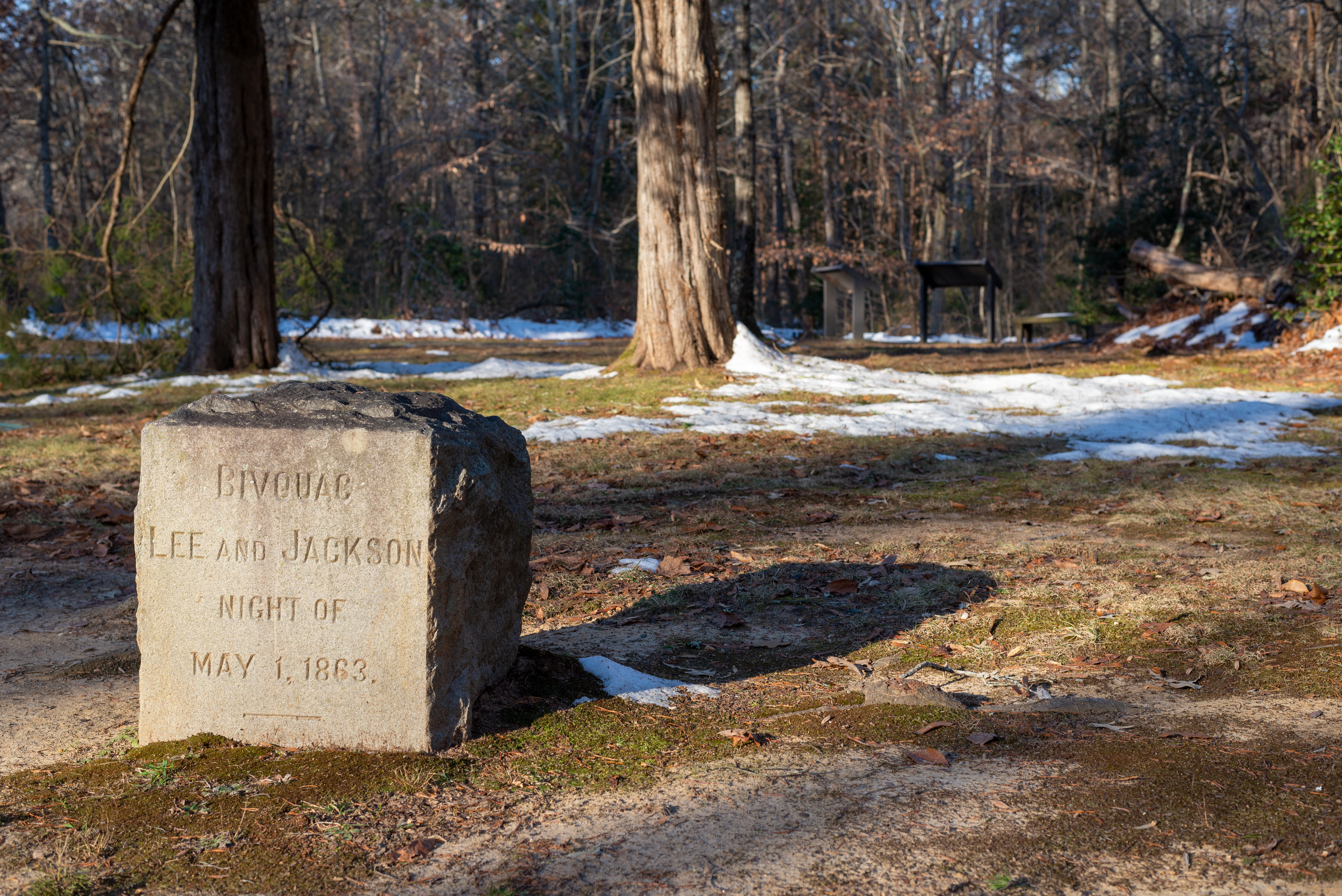
Longstreet's WoundingWhile making a flank attack against the Union Army, Confederate General James was wounded by his own men. 
Lower TerraceToday, visitors enjoy this picturesque view of the Rappahannock River and Fredericksburg from the Chatham terraces. While the view is peaceful now, it was once a scene of labor and war. 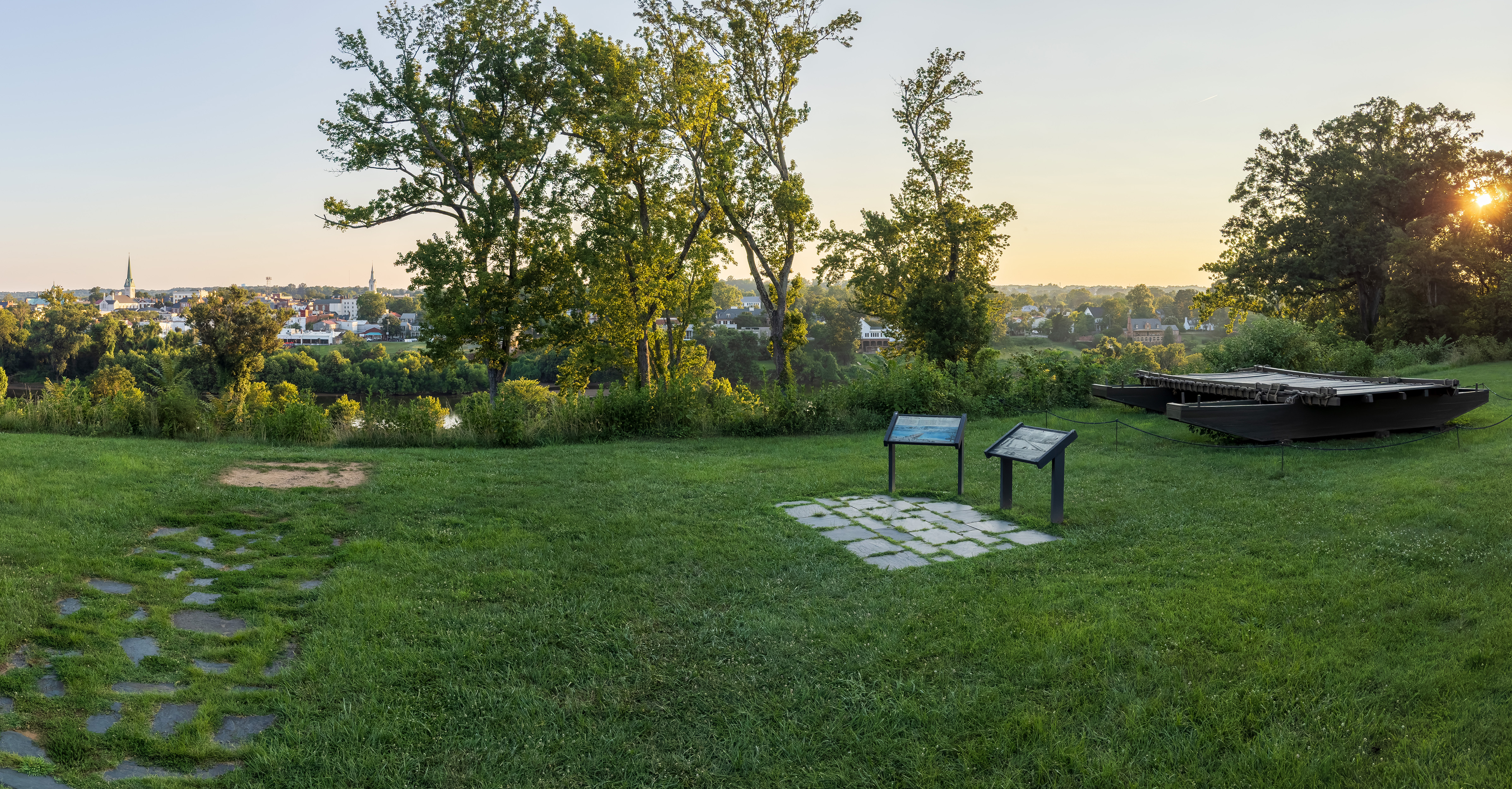
Marye's HeightsFrom Marye's Heights, the high ground hovering over the Sunken Road, Confederate troops held an imposing defensive line during the Battle of Fredericksburg. 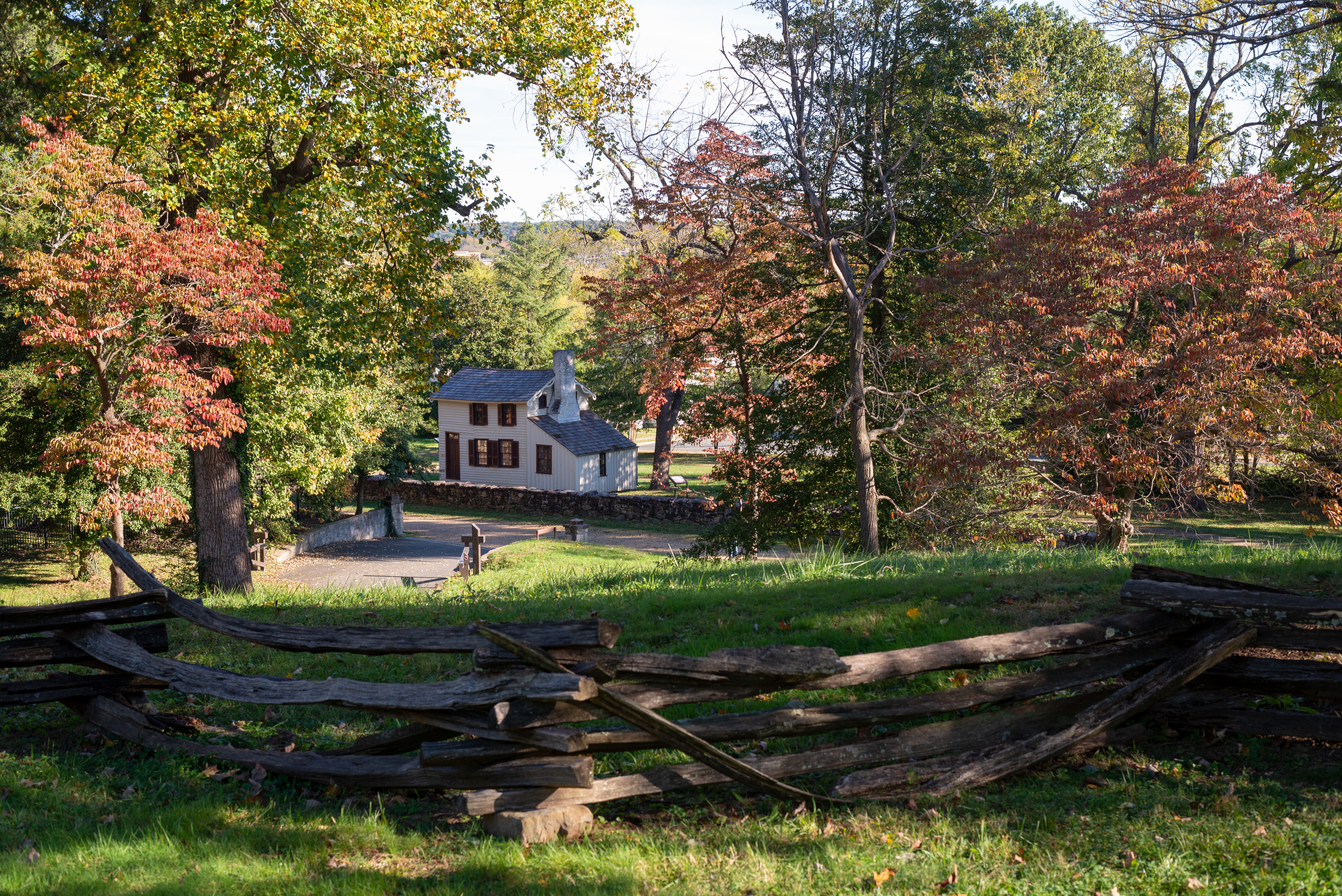
Marye's Heights: Artillery PositionThis was the position for the nine cannons of the Washington Artillery of New Orleans during the Battle of Fredericksburg. Fire from these heights rained down on the US soldiers tasked with assaulting this position. The futile assaults against these heights led many soldiers to despair and led the American public to question just what could be gained from such a horrible war. 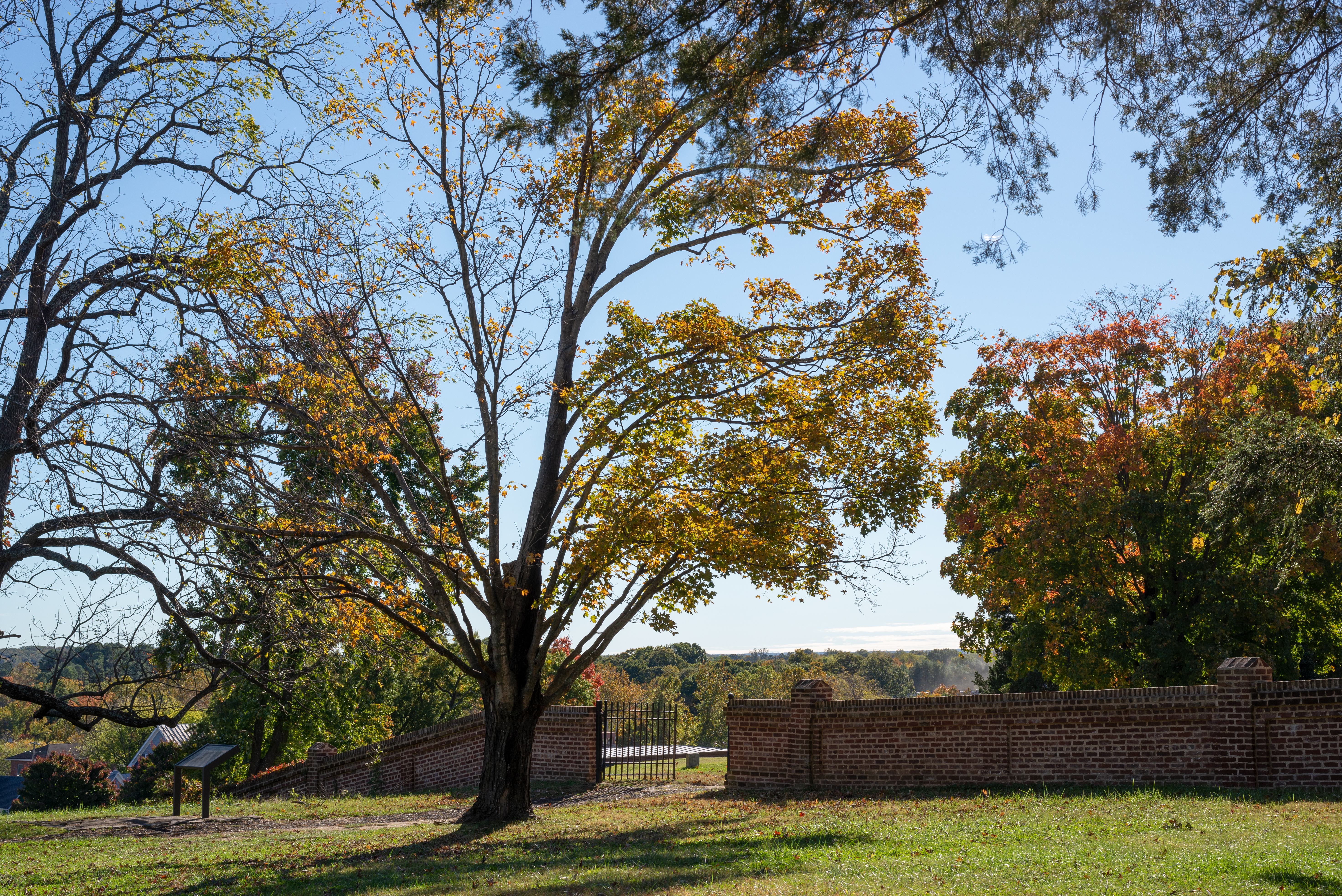
McCoull House SiteThe McCoull House Site was located in the middle of the Confederate line known as the Mule Shoe Salient. Heavy fighting swept around this area on May 10, 12, and 18. Even before the battle, the lives of the residents here changed due to the war as the people enslaved here fled to Federal lines. Only the house's outline remains today. 
McLaws' LineFrom here on May 1-3 Confederate General Lafayette McLaws division kept Union forces occupied while Stonewall Jackson's troops marched around Hooker's army to attack his flank. 
Musical StaircaseThe Chatham staircase is a decorative feature added to the landscape in the 1920s. The staircase's flowing design conveys the musical notes to the song "Home, Sweet, Home", popular in the Civil War era. 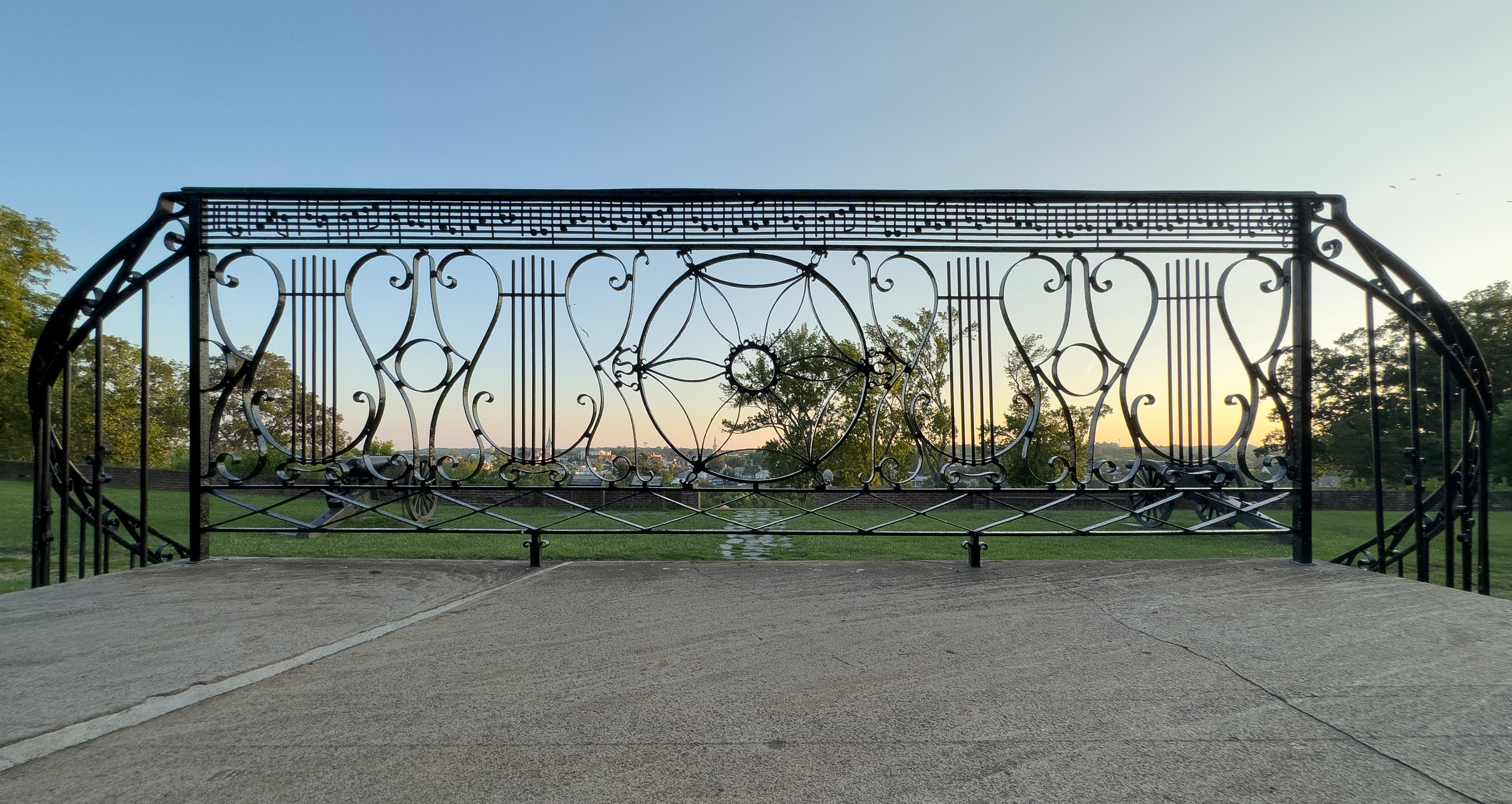
Old Salem ChurchAlthough the Biblical word "Salem" originally derived from a Hebrew verb meaning, amongst other things "peace," Salem Church west of Fredericksburg, Virginia lives on in history because of its connections with war. Its main moment of fame was during the second Battle of Fredericksburg in May of 1863, when it became a field hospital. 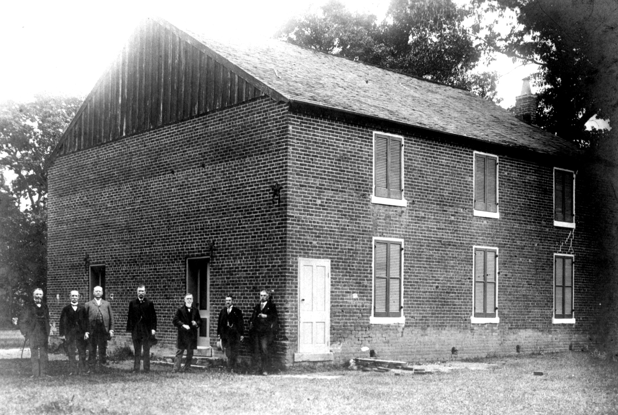
Prospect HillThe Army of Northern Virginia's 2nd Corps, commanded by General Stonewall Jackson defended Lee's right at Prospect Hill. On December 13, this would become the location of an intense artillery standoff between the two armies. Ultimately, Jackson's troops would use the terrain to their advantage and hold off the United States forces, bringing fighting on the southern portion of the battlefield to a close. 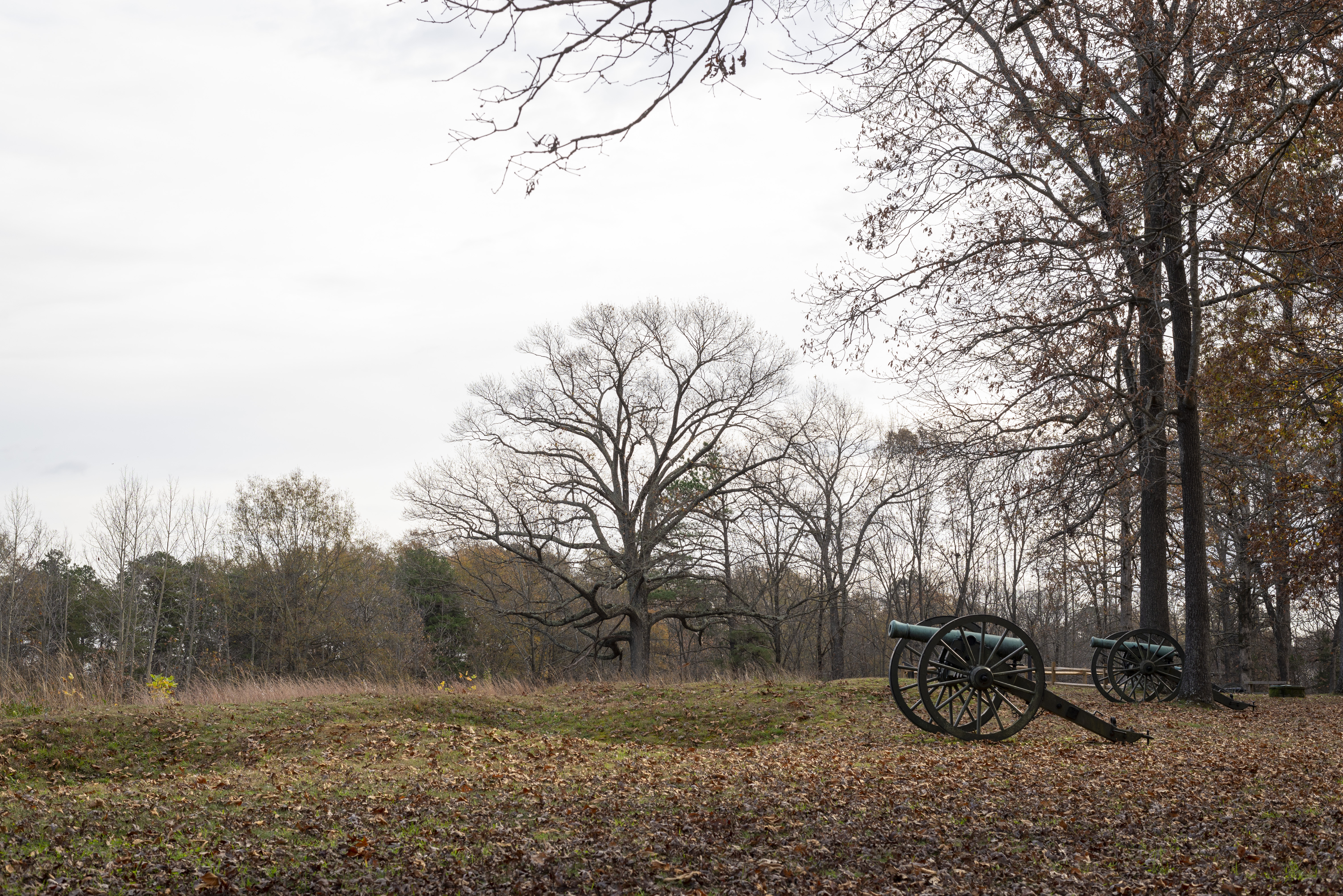
|
| Visitor Centers | Count: 5
Chancellorsville Battlefield Visitor Center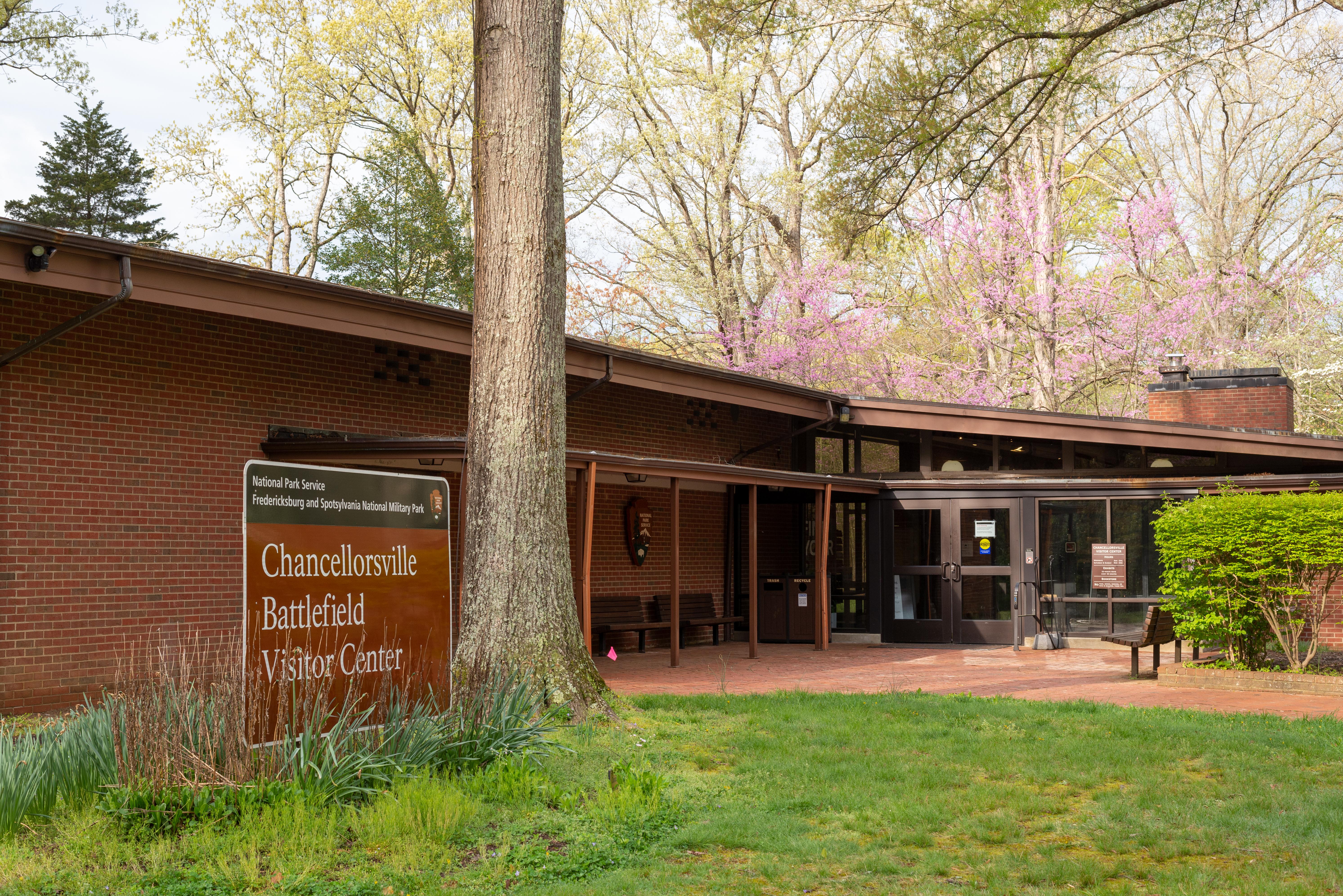
Chatham
Ellwood
Fredericksburg Battlefield Visitor Center
Jackson Death Site
|
| Things to do | Count: 8
|
| Tours |
Count: 9
Chancellorsville: Driving TourFrom April 30-May 6, 1863, the Battle of Chancellorsville raged in the area called the Wilderness. For Confederates, this victory provided a distraction from a crumbling home front and hope that Northern support for the war would falter. What were the consequences of the Battle of Chancellorsville? This tour follows the route indicted by the numbered stops on the circular battlefield tour signs on the park map and out in the landscape, including shared public roads that move at high speeds. Drive carefully. Chatham Walking TourWelcome to the Chatham Walking Tour! This tour explores the history of Chatham from its initial development as a slave plantation through its preservation by the National Park Service. The distance covered by this tour will be less than half a mile over the Chatham grounds. Ellwood Walking TourWelcome to Ellwood! Explore the history of these grounds from the land's inhabitation by the Manahoac people to its transformation into a slave plantation. Discover how Ellwood went from being a place over which Civil War soldiers fought and died to a site that preserves the memory of past conflicts. What does this landscape teach us today? What stories are hidden from view? Fredericksburg: Driving TourIn December of 1862, the US Army of the Potomac crossed the Rappahannock and faced the Confederate Army of Northern Virginia. With a defensive line encircling Fredericksburg, the Confederates pushed the Federals back across the river in a devastating defeat for the US Army. This tour follows the route indicted by the numbered stops on the circular battlefield tour signs on the park map and out in the landscape. The battlefield includes shared public roads that may move at high speeds. Drive carefully. Fredericksburg: Sunken Road Walking TourWhy did this place matter in 1862?...and why does it matter today? Explore the Sunken Road through this guided walking tour that follows along the Sunken Road, where US soldiers made futile assaults against Confederate soldiers behind a stone wall, up Marye's Heights, where Confederate artillery ensured the Army of Northern Virginia's success, and through the Fredericksburg National Cemetery, the final resting place for over 15,000 US soldiers. *Pets are not allowed in the National Cemetery* Jackson Death Site Walking TourOn May 10, 1863 Confederate General Thomas "Stonewall" Jackson died in the office building of the Fairfield Plantation. Today, this location is most associated with the death of Jackson, but the history here spans a much wider period before and after the Civil War. Follow along and discover the history of this complex place. If following this tour onsite, the distance covered will be less than a quarter of a mile and the tour will take about 30 minutes to complete. Old Salem Church Walking TourWelcome to the Salem Church Audio Walking Tour. Explore the history of these grounds from the establishment of the church through the site's role during the Civil War as a civilian refuge, battle site, and hospital, to its preservation in the 1900s. This tour of Salem Church can be viewed at home or can be used as a guide onsite. If following this tour onsite, the distance covered will be less than half a mile and the tour will take about 30 minutes to complete. Spotsylvania: Driving TourJust a day after the Battle of the Wilderness, the US and Confederate armies clashed again in the small community of Spotsylvania Court House. Drive the battlefield to the places where these armies experienced relentless fighting and where the nature of the Civil War was shifting in the summer of 1864. This tour follows the route indicted by the numbered stops on the circular battlefield tour signs on the park map and out in the landscape. Wilderness: Driving TourIn the spring of 1864 the US Army of the Potomac and Confederate Army of Northern Virginia found themselves in the same position they had been a year earlier, with one major difference. Lincoln had appointed General Ulysses S. Grant commander of all US armies. Drive the Wilderness Battlefield, the first clash between Lee and Grant in the Overland Campaign. This tour follows the route indicted by the numbered stops on the circular battlefield tour signs on the park map and out in the landscape. |
| Articles |
|