Be advised that the NPS has issued alerts for this park.
Jacob Riis Park Access Restrictions
Due to extremely hazardous conditions Gateway National Recreation Area has restricted access to sections of Jacob Riis Park. Erosion has created unsafe conditions from Bays 1-5, and portions of the eastern beach are closed.
Spring Creek (Queens) Closed to the Public
Spring Creek is closed to the public at this time. The NPS is conducting field investigations as part of a Remedial Investigation at the site. Spring Creek is located in Queens, NYC.
Dead Horse Bay (Brooklyn) Remains Closed to the Public
The entire southern area of Dead Horse Bay, including Glass Bottle Beach, is closed to the public. Crews are working in these areas using heavy brush clearing equipment and performing radiation surveys. Dead Horse Bay is located in Brooklyn, NYC.
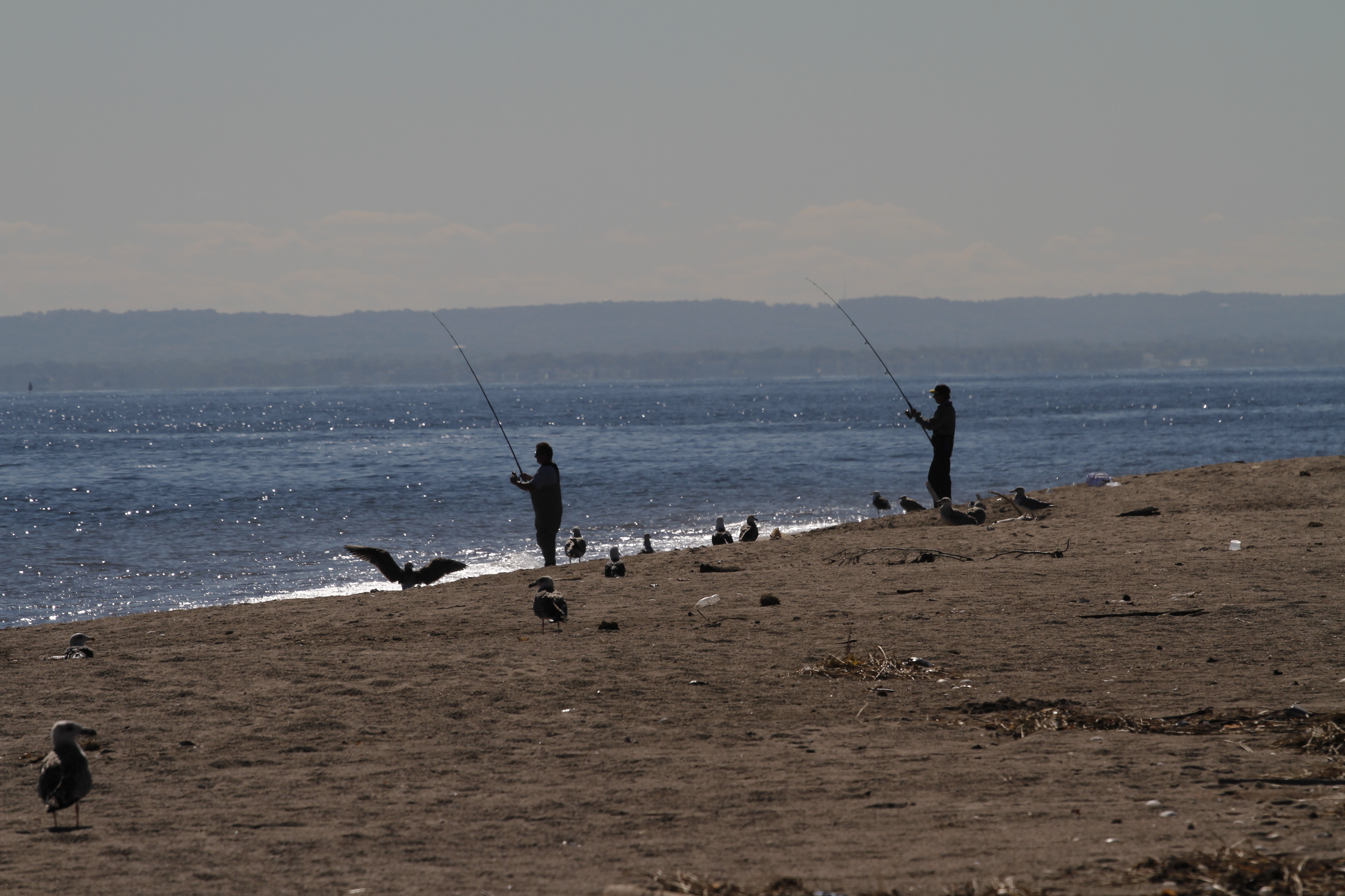
Dogs Not allowed on ocean beaches in Jamaica Bay and Sandy Hook March 15- Sept. 15
Dogs are not allowed on ocean beaches at Sandy Hook between March 15 through September 15. Dogs are not allowed on the ocean beaches at Jacob Riis Park, Fort Tilden, Breezy Point Tip and at the bayside of Breezy Point between March 15 through September 15
Spanning 27,000 acres from Sandy Hook in New Jersey to Breezy Point in New York City, the park is both the gateway from the ocean into New York Harbor, and the gateway to the National Park Service for millions of visitors every year. Gateway offe...
The BOQs hosted unmarried officers. Captains and majors lived on the second floor in their own suites with private baths and sitting rooms. Lieutenants occupied single bedrooms and shared a bathroom on the top floor. The first floor was the original Fort Hancock Officers Club with a dining room, billiards room and bar. Officers paid a staff to clean and cook meals.
The BOQs hosted unmarried officers. Captains and majors lived on the second floor in their own suites with private baths and sitting rooms. Lieutenants occupied single bedrooms and shared a bathroom on the top floor. The first floor was the original Fort Hancock Officers Club with a dining room, billiards room and bar. Officers paid a staff to clean and cook meals.
Historically, these barracks housed enlisted soldiers. Building 74 could house 220 men or two batteries. These photos are from the 1950s and 1960s. Today, these buildings are home to two organizations: the New Jersey Sea Grant Consortium and the National Oceanic Atmospheric Administration, or NOAA. The New Jersey Sea Grant Consortium carefully restored Barracks 22 to its historic appearance. Here they conduct innovative hands-on environmental education and outreach programs and manage research that benefits New Jersey's marine and coastal environments. NOAA uses Building 74 as part of the J. J. Howard National Science Laboratory. The staff of this fisheries research facility conducts investigations on climate change, habitat condition, ocean acidification and contaminants. Other organizations have headquarters on the parade ground as well, including the American Littoral Society and Clean Ocean Action.
Historically, these barracks housed enlisted soldiers. Building 74 could house 220 men or two batteries. These photos are from the 1950s and 1960s. Today, these buildings are home to two organizations: the New Jersey Sea Grant Consortium and the National Oceanic Atmospheric Administration, or NOAA. The New Jersey Sea Grant Consortium carefully restored Barracks 22 to its historic appearance. Here they conduct innovative hands-on environmental education and outreach programs and manage research that benefits New Jersey's marine and coastal environments. NOAA uses Building 74 as part of the J. J. Howard National Science Laboratory. The staff of this fisheries research facility conducts investigations on climate change, habitat condition, ocean acidification and contaminants. Other organizations have headquarters on the parade ground as well, including the American Littoral Society and Clean Ocean Action.
Although built in 1898 for enlisted men, curtains were added during World War II for the new residents: soldiers from the Women's Army Auxiliary Corps (WAAC). Originally they were not part of the Army itself. This barrack was the first for women soldiers stationed at Fort Hancock, who arrived here in 1943. They distinguished themselves both nationally and here at Fort Hancock in providing essential logistical support. That is why the Corps officially became part of the Army in 1943, and the woman received the same pay and benefits as men and dropped "auxiliary" from their name. Soldiers in the Women's Army Corps were called "WACs."
Although built in 1898 for enlisted men, curtains were added during World War II for the new residents: soldiers from the Women's Army Auxiliary Corps (WAAC). Originally they were not part of the Army itself. This barrack was the first for women soldiers stationed at Fort Hancock, who arrived here in 1943. They distinguished themselves both nationally and here at Fort Hancock in providing essential logistical support. That is why the Corps officially became part of the Army in 1943, and the woman received the same pay and benefits as men and dropped "auxiliary" from their name. Soldiers in the Women's Army Corps were called "WACs."
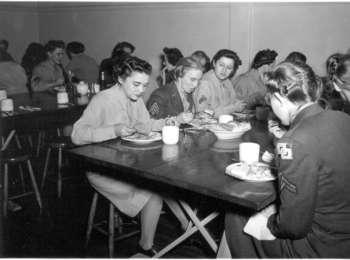
Enlisted men lived on Barracks Row in one of the four buildings that held about 120 men each. Behind each of the barracks were mess halls that included barber and tailor shops and a kitchen. The mess halls hosted many occasions, including holiday dinners. Once female soldiers arrived, men and women ate separately. The soldier sitting at the left corner of the table is Private Romona Washer.
Enlisted men lived on Barracks Row in one of the four buildings that held about 120 men each. Behind each of the barracks were mess halls that included barber and tailor shops and a kitchen. The mess halls hosted many occasions, including holiday dinners. Once female soldiers arrived, men and women ate separately. The soldier sitting at the left corner of the table is Private Romona Washer.
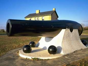
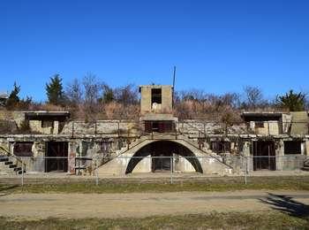
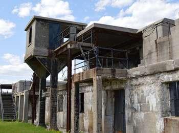
Battery Granger, located between Battery Potter and the Mortar Battery, was built by the US Army in 1898. Battery Granger mounted two 10-inch caliber counterweight disappearing guns that were in use from the Spanish-American War to World War II.
Sandy Hook Battery Granger<br />268 words; Length: 1:05<br /><br />Battery Granger is a 19th century concrete, disappearing gun battery. It is about one hundred feet long. Part of the structure has two stories and other sections are one story with an open flat roof protected at the rear by six-foot high concrete walls. In the front, a black handrail runs most of the length of the second floor. The first floor has eighteen square concrete pillars across the front, that support the upper level walkways. The pillars are two feet by two feet and are about twelve feet tall. An informational wayside sign giving the history of Battery Granger stands near the road.<br /><br />A four-foot-high chain link fence stretches the length of the battery about ten feet from the road. A brown metal sign with a white border is attached to the fence at the center of the fence. It reads: "Extremely Hazardous Conditions/Area Closed". <br /><br />In the center of the second floor, there is a square cement lookout extending beyond the face of the building. It is approximately ten feet wide by ten feet deep by ten feet tall. There is a four-foot by six-foot opening in the lookout.<br /><br />There are gated doors across the first floor, which lead to internal stairs. There are also concrete stairs at the far right end and a set of concrete stairs twenty feet to the left of the square cement lookout. <br /><br />In addition to the gated doors, there are two painted wooden doors on the left side of the battery. They are green but the paint is peeling away to reveal red paint below. <br /><br />End of Message
Battery Gunnison, later called Battery New Peck, is a six-inch coast artillery battery located on Sandy Hook in New Jersey. Gunnison was built in 1903 as a twin six-inch disappearing gun battery.
Sandy Hook Battery GunnisonFirst of two descriptions at this area476 words; Length: 1:45Battery Gunnison is a one-story, concrete structure about twelve feet tall and 120 feet across the face. It is composed of three distinct sections. There are two round gun platforms at either end. Concrete steps lead up to each of the guns. In between the gun platforms, there is a flat-fronted, one story storage area. An 8-foot wide curving path leads to the battery with a wide grassy area on either side. Two descriptive audio described signs giving the history of the battery are located along the path. On the left side of the path, set three feet in, there is a wood and rope barrier. The wooden uprights are painted grey and cut at a 45-degree angle at the top. Rope is strung between the uprights through a hole 8 inches below the top of the upright. There are 15 steps up to the gun platform on the right. It has black painted hand railings which extend around the front perimeter of the gun platform. About twenty feet from the stairs, the barbette gun is mounted on a metal track inside a circular, raised concrete area about twelve feet in diameter. It is painted grey green and points upwards at a 45-degree angle. The track allows the gun to be rotated in any direction.There is a three-foot high concrete wall on the far side of the gun platform. Standing at the edge of the platform behind the low wall, you can see the ocean and the dunes. To your left is the earth covered roof of the storage area, with an earth embankment leading down to the dunes. Beyond the storage area, the barrel of the second barbette gun is visible.As you face the front of the storage area, there is a twelve-foot wide entrance in the center, now covered with a black pull down metal door. A concrete abutment on the roof above the doors has a window with black shutters. There is a smaller black door to the left of the wide entrance. The gun platform on the left also has 15 steps up. The gun is mounted in the same way as the gun on the right end of the battery. Standing at low wall on the far side of the gun, you can see the dunes covered in sea grass and the wide ocean beach.On the right of this gun platform, there is a second set of stairs. There are twelve steps down with a black handrail leading to a concrete wall with a black-painted door directly in front of you. You take a sharp right to head back towards the parking lot. As you walk back towards the parking lot, between the wall of the gun parapet and the wall of the storage structure, there are two more steps down. There is no handrail. End of messageSandy Hook Battery Gunnison WaysideSecond of two descriptions at this area732 words; Length: 2:50Sign: Battery GunnisonThis wayside sign stands about fifty feet in front of Battery Gunnison to the left of an eight-foot wide concrete path leading to the battery. It is housed in a pale green wooden frame mounted about three feet off the ground at the front, and measures three feet by four feet. It sits at a 45 degree angle front to back.The sign is entitled "Battery Gunnison" at the top. On the left hand side of the sign, there is text on a cream colored background that reads: "The concrete structure beyond the trees is Battery Gunnison, built in 1904 as part of Fort Hancock's Endicott period defenses. The battery's two guns were originally mounted on counterweight carriages. These so-called "disappearing" guns recoiled back to their loading position behind the protective concrete wall each time they fired their 6-inch caliber shells.During World War II, the army raised Battery Gunnison's gun platforms and mounted two barbette guns here. These guns were also 6-inch diameter, but could rapid fire 108-lb. armor-piercing projectiles more than 10 miles in any direction. This short path leads to Battery Gunnison's barbettes and the only guns at Fort Hancock not scrapped after World War II."End of TextBelow the text is a diagrammatic drawing of the battery showing the circular gun platforms on either end. The circle on the left is labeled Platform 2. The one on the right is labeled Platform 1. The square structure in the center shows the Powder Room and Shell Rooms on the top of the battery with a large area below labeled Plotting Rooms. The Plotting Rooms are flanked on either side by Store Rooms.The caption above the diagram reads: "Plan of Battery Gunnison as originally built (below) shows two large platforms designed for its original 6-inch-diamater "disappearing" guns (right).End of TextThe right two thirds of the sign is taken up by a black and white photograph of one of the barbette guns. The gun is manned by four soldiers in work style clothes, not regulation army uniforms. Two men are at the loading end of the gun, one is on top of the gun, and one mans the movable carriage. There is a uniformed soldier wearing a wide brimmed hat looking on.Imposed on the photograph is a small, oval shaped, color portrait of
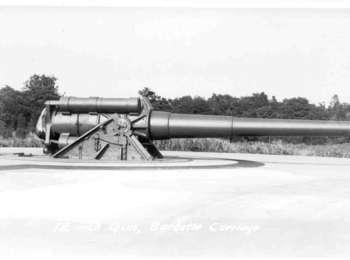
To out range enemy battleships, the U.S. Army Ordnance Department developed a new barbette gun carriage that allowed 12-inch caliber guns to fire at a high angle, just like battleship guns. Mounted on large, round concrete platforms located out in the open, the battery's 12-inch guns could fire their half ton, armor piercing projectiles over 20 miles in any direction. Battery Kingman is a good example of a World War One designed barbette gun battery. The battery was construct
This battery is identical in design and construction as Battery Kingman, just north of Battery Mills. Like Battery Kingman, Battery Mills' two 12-inch barbette carriage mounted guns stood on large round concrete platforms so that the guns could fire 20 miles in any direction in a circle that included the Atlantic Ocean, Lower and Upper New York Harbor, Sandy Hook and Raritan Bays, as well as south towards the New Jersey Seashore. Wooden sheds were used to shelter the guns fro
Construction on Battery Peck was started during 1901, but the work was not completed until late 1903, when the battery was finally armed with two 6-inch guns mounted on barbette pedestal carriages. Battery Peck served many years in Fort Hancock's Underwater Mine Defense Command.
Sandy Hook Battery Peck<br />282 words; Length: 1:05<br /><br />Battery Peck is a fifty-foot long, two story gun battery that stands behind a chain link fence. On either end, thirteen concrete stairs with metal handrails rise up to the second floor walkway. There is also a double set of stairs over an arched entryway in the center of the battery. A single twelve-foot by twelve-foot lookout rises above the flat roof of the second story.*<br /><br />The first floor of the battery is about 10 feet tall. It has 3 gated, double doors, one on the left, one on the right, and one in the center under a twelve-foot wide arch. The doors on the right and left of the battery are each flanked by rectangular window openings. To the extreme right, there is a concrete wall with the word "Battery" in protruding letters. <br /><br />The second floor has a walkway that extends across the whole battery. Behind the walkway, a wall of steps six feet high stretches across most of the front, interspersed on the far left, the far right, and in the center by three low concrete rooms with black metal doors. A set of steps at either end of the battery leads up to the earth covered roof, covered with low shrubs, grasses, and several trees. <br /><br />The unmarked head of the Warbler Nature Trail can be found just to the right of the chain link fence. The rough trail winds through native foliage and low, wind-carved trees. An informational wayside sign entitled "Wandering Warblers" gives an overview of the migratory patterns of these colorful birds, with photographs of eleven different species of warblers found in New Jersey in the spring and fall. <br /><br />End of Message
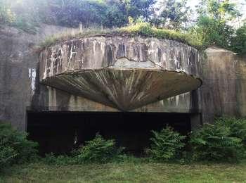
Originally called Lift-gun Battery #1, it was the first and only disappearing gun battery powered by a steam hydraulic lift system. The first gun, a 12-inch, breech loading rifle, was mounted in 1892. The second gun was mounted in 1895." In operation from 1893-1906, it was obsolete by the time it was built because the fastest firing of the gun took over two minutes to load and fire. In the meantime, The Army had developed a new gun carriage that used a counterweight to rais
Sandy Hook Battery Potter<br />306 words; Length: 1:10<br /><br />Battery Potter is a 19th century stone and concrete gun battery. The approximately ten-foot wide, arched entrance, set into a grass covered hill, is flanked by two stone turrets, each two stories high, giving it the appearance of a medieval castle. Above the grassy hill, and stretching approximately 100 feet in either direction, there is a wall of concrete fortifications which look out towards the water. An informational wayside sign giving the history of Battery Potter stands about 30 feet to the left of the entrance.<br /><br />The entrance is approximately twelve-feet high at the peak of the arch. It is closed off with heavy black metal doors and further sealed with black iron gates that are constructed of both upright bars and a large metal X stretching from corner to corner. Each of the black doors have two small rectangular gun slits about six feet from ground level. The gates are locked with a heavy metal chain and a new padlock. The name "Battery Potter" is spelled out in large white letters just below the arch.<br /><br />Flanking the turrets, there are granite walls angling off from the height of the arched doors to approximately three feet high at the end of each wall. These angled walls, capped in concrete, extend approximately twenty feet to either side of the turrets. <br /><br />The turrets have three rectangular gun slits about ten feet above ground level. There are three more gun slits in each turret about thirty feet above ground level. <br /><br />At the upper level of the concrete fortifications, there is a series of eight-foot tall concrete rooms with entrances on both the front and backside.<br /><br />Black painted cannon shells lay on the ground on either side of the door. There is a bike rack about ten feet to the right of the door. <br /><br />End of Message
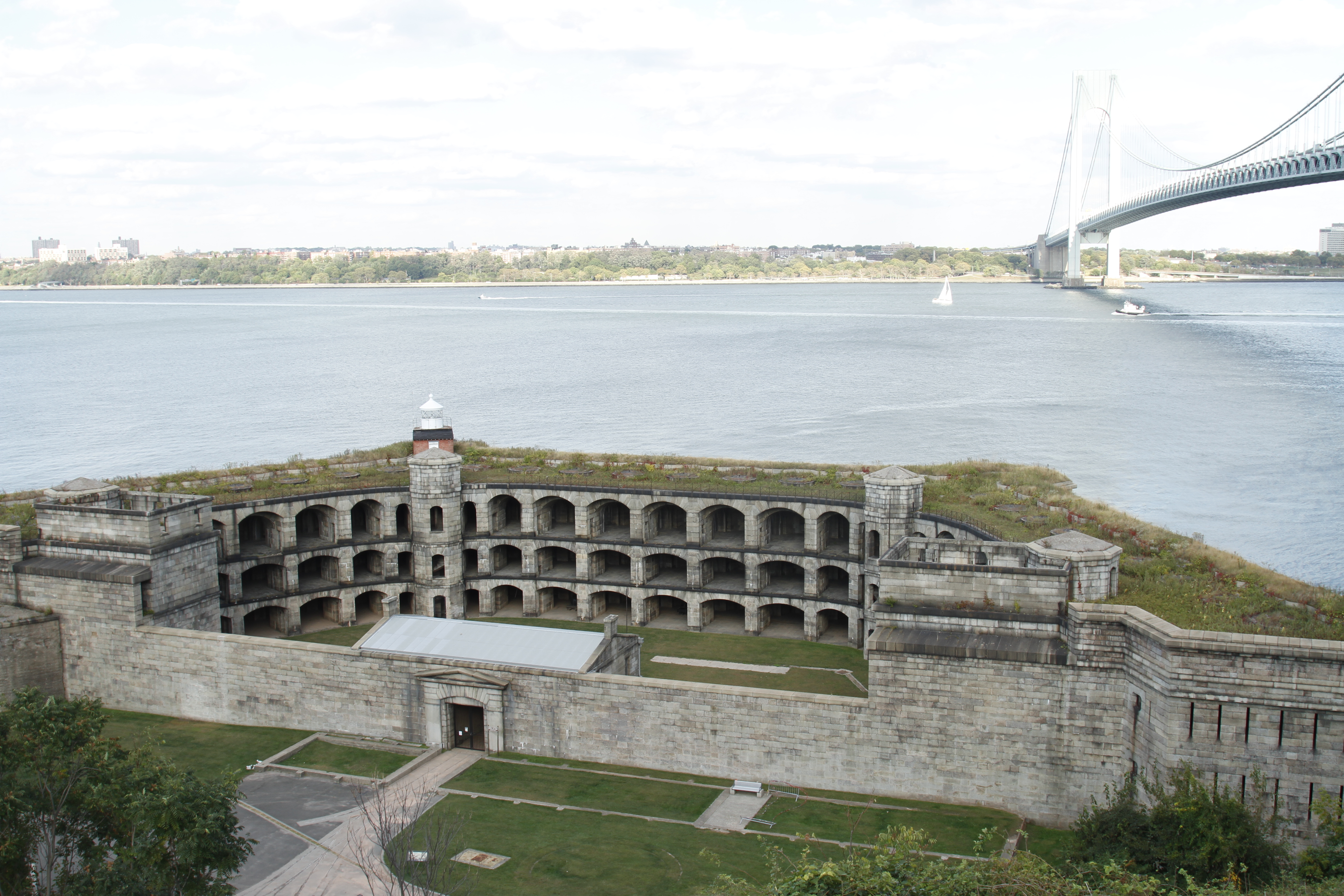
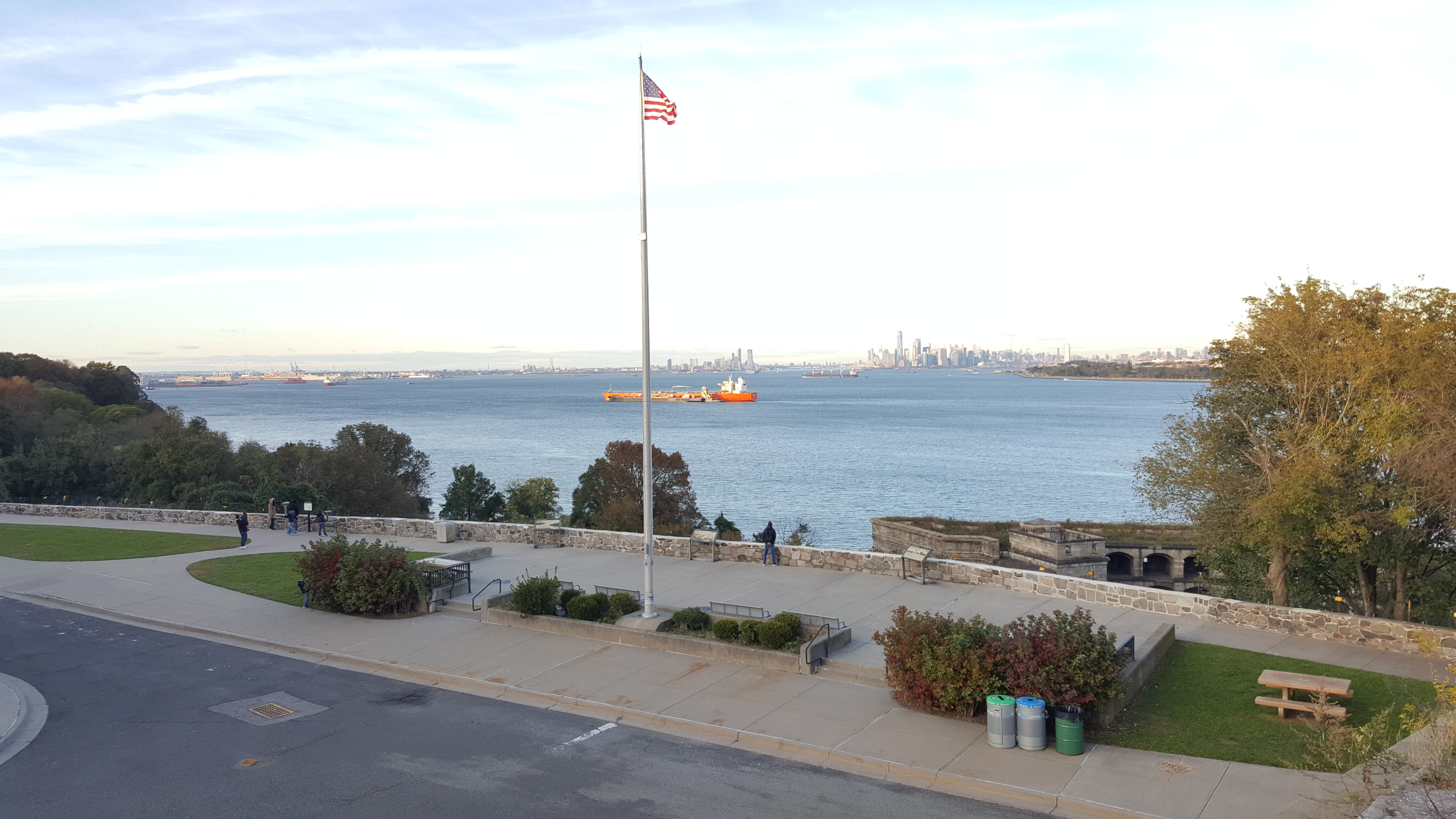
Battery Weed is a substantial, three-tiered, 19th century fortification on Staten Island guarding the Verrazano Narrows, the main approach from the Atlantic Ocean to New York City.
Battery Weed exterior, Torpedo Building and Wayside<br />1003 words; Length: 3:55<br /><br />Battery Weed is a three-tiered trapezoidal shaped fortification facing west across the Verrazano Narrows. The battery is constructed of rectangular granite blocks of irregular lengths. The western wall is about 20 feet tall, with an observation tower on the northern end. The central entrance is twelve feet wide and twelve feet tall, with a black metal gate. Tracks run from the torpedo building to the north through the gate into the central parade ground. As you stand in front of the massive gate on the eastern side, the Verrazano Bridge rises above you on the right. There is an informational wayside sign here.<br /><br />The road leading to the gate has grass on the right side, with a six-inch concrete curb. This area is about thirty feet deep. A bench sits against the wall at the back of the grassy area. There is also a curbed, grassy rectangular area, about twelve feet deep by twenty feet long, just to the left of the entrance.<br /><br />The informational wayside sign entitled "Battery Weed" stands in the grass three feet behind the curb. It gives a brief history of the battery and the other defense systems found around the New York Harbor area. <br /><br />Through the closed gate and past the center parade ground, arched gun enclosures are visible on the three-story eastern wall of the battery.<br /><br />About sixty feet to the right of the entrance, the wall rises to forty feet in height, with an open roofed lookout area, twenty feet deep by thirty feet high. As the wall continues to the right past the lookout area, there are narrow, six-foot tall gun slits evenly spaced about four feet apart. The gun slits are on all three levels of the battery, starting just a few inches off the ground.<br /><br />About sixty feet to the left of the entrance, there is another square lookout area. Past the lookout area, the wall continues another forty feet to the left with the same configuration of gun slits as on the right. <br /><br />A small, round lighthouse sits atop a square, red brick house in the northwest corner of the barbette roof of the fortress. The lighthouse has a white, domed lens house.<br /><br />Across the road is the Fort Wadsworth Torpedo Building. It is a twelve-foot high structure made of very large granite blocks that vary in size. It is forty-two feet across the face with three six-foot-wide doors. The roof is missing, although the remains of the steel girders that once supported the roof are partially in place. Vines grow up the girders and across much of the roof, hanging down from the second story level on the left hand side of the building. An informational wayside sign is to the right of the building.<br /><br />A remnant of a second story brick wall is still standing on the east side of the building, shored up with steel girders. <br /><br />Rail tracks in a concrete bed run from each of the doors to Battery Weed. The doors on the left and right are rusted metal double doors. The door in the center has a partially rusted pull down metal gate. A rusted three-inch in diameter pipe runs from the second floor to ground level and disappears into the asphalt below. <br /><br />A steep incline with trees, vines, low shrubs and grass rises up on the western side of the building. Two benches sit to the left of the building and one to right, facing each other on either side of the asphalt road that leads to the building. A black chain link fence runs along the eastern side of the building.<br /><br />A small granite house with a sharply peaked roof and a twelve-foot wide open entrance stands to the left of the Torpedo Building. Wooden beach fencing has been erected in front of the granite house and along the road at the bottom of the incline.<br /><br />The wayside sign, entitled "Torpedo Building" is positioned three feet off the ground at a 45 degree angle. It is three feet by four feet and stands on two grey two inch by four inch legs. A black and white photograph dated 1921 shows Battery Weed and the many buildings that once made up the torpedo area complex. The copy reads: "This structure, built from 1892-94, once held the key to New York Harbor's defense. In the late 1800s, military engineers developed "torpedoes" - actually "mines" in current military terms - that could be exploded electrically from shore positions like Battery Weed behind you. New York's torpedoes and their miles of cable were not permanently wired in place, but stored here until needed. <br /><br />These tracks connected the 323-foot by 42-foot Torpedo Building and the nearby cable storage tanks to the wharf. If New York was threatened, small rail cars could quickly transport the torpedoes and cables to specialized vessels ready to stretch them across the Narrows. The Army tested this system in the late 1890s, but removed the torpedoes and cables in 1899."<br /><br /><br />End of Text<br /><br />The photograph below, which dominates the sign, shows each structure outlined and labeled in red. The Torpedo Building is on the left. The Torpedo Wharf is in the background on the left. The Torpedo Loading Room and the Cable Storage tanks are positioned in front of the east wall of Battery Weed. A tall, enclosed section of Battery Weed in the northwestern part of the battery is labeled Mine Control Center. The railroad tracks connect all of the buildings. <br /><br />An arrow that is labeled "You Are Here" points to the site of the informational sign.<br /> <br />There is a blue architectural diagram of the area imposed on the lower part of the photograph. The Torpedo Building is outlined in red. <br /><br />The bottom of the sign depicts four eras of defense systems employed at the fort. It is entitled "Fort Wadsworth's Defense Systems".<br /><br />The four systems shown are: 1794-1807 First System Defenses/Example: Block House. <br />1807-1817 Second System Defenses/Example: First Fort Tompkins. 1817-1876 Third System Defenses/Example: Battery Weed. 1890-1910 Endicott System Defenses/Example: Battery Duane<br /><br />End of Message
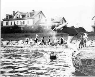
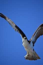
Although many people come to Sandy Hook with the intention of visiting the beach, the bayside is also a great destination point if you're interested in enjoying the sun and water. There are ranger-led canoe tours, places to soak up the sun, coves to explore, and areas where you can bring pets. You may see birds overhead, including the osprey or sea hawk, which likes to perch on high places. As you can see from this historic photo, soldiers and their families enjoyed the beach and the bay for recreation as well. The Hospital is in the background.
Although many people come to Sandy Hook with the intention of visiting the beach, the bayside is also a great destination point if you're interested in enjoying the sun and water. There are ranger-led canoe tours, places to soak up the sun, coves to explore, and areas where you can bring pets. You may see birds overhead, including the osprey or sea hawk, which likes to perch on high places. As you can see from this historic photo, soldiers and their families enjoyed the beach and the bay for recreation as well. The Hospital is in the background.
Before you start on the trail, look around you. Across from the parking lot is an osprey nest on a platform, which was built by park staff. Ospreys, also called seahawks, like to nest in high places, including electric or telephone poles. You may see a diamondback terrapin crossing the road from May to July, when females lay their eggs. Watch out for them when you drive!<br />Also notice the northern bayberry. These tall shrubs have sweet scented leaves, which are used to make candles. In the spring, flowers bloom on the female bushes. During the colonial era the waxy grayish berries were used for making candles and for medicinal purposes. Many birds eat the berries, including cedar waxwings.<br />
Before you start on the trail, look around you. Across from the parking lot is an osprey nest on a platform, which was built by park staff. Ospreys, also called seahawks, like to nest in high places, including electric or telephone poles. You may see a diamondback terrapin crossing the road from May to July, when females lay their eggs. Watch out for them when you drive!<br />Also notice the northern bayberry. These tall shrubs have sweet scented leaves, which are used to make candles. In the spring, flowers bloom on the female bushes. During the colonial era the waxy grayish berries were used for making candles and for medicinal purposes. Many birds eat the berries, including cedar waxwings.<br />
The Native American Canarsie tribe launched canoes into Jamaica Bay from this site. Later a pier with an amusement park was a popular destination for locals. Today, the historic pier is used for fishing, picnicking and community events. The adjacent natural area provides access to the bay for kayaking and boating, and visitors fish and relax in the shade. The eastern beach provides a superb sheltered kayak launch.
Jamaica Bay Canarsie Pier<br />592 words Length: 2:16<br /><br />Canarsie Pier on Jamaica Bay offers breezes, benches, a playground for small children, as well as tables for checkers and backgammon, picnic tables, grills, and a kayak launch area. There are portable toilets here, as well as water fountains. Garbage and recycling cans are available throughout the area. <br /><br />As you enter from the Belt Parkway, there are two brick pillars topped with a pyramid shaped concrete cap. A pale green metal arch stretches between the pillars with Canarsie Pier spelled out in cutout letters. A small anchor sits at the apex of the arch On the left of the car entrance is a red brick pedestrian walkway that passes under a metal arch with a stylized sea gull in the center. On the right is another red brick pedestrian walkway with a metal arch that has a stylized fish in the middle. <br /><br />The wheelchair accessible toilets are just to the right as you enter. There is a one story brick pavilion to the right with a pale green metal roof. The L-shaped pavilion has stairs on the far side as well as a wheelchair accessible ramp to the right of the stairs. There is a picnic table on the covered concrete platform to the left of the stairs.<br /><br />The pier is the size of two side-by-side football fields. A fifty-foot wide plaza and walkway surround three sides of the pier. At water's edge, there is a four-foot high green metal railing with three-foot square concrete uprights. The uprights are spaced every eight feet and are topped with a pyramid-shaped cap. Twenty-foot tall black metal lamp posts with nautical style lamp shades surround the inner and outer area of the pier. An asphalt parking lot is in the center. <br /><br />Two rows of trees* line a twenty-foot wide inner walkway. Tan slatted benches with green upright supports and arm rests flank the walkway. There are occasional groupings of benches and matching chairs. There is also a row of benches facing the water about twenty feet in from the edge of the pier, as well as low, backless cement benches near the edge of the pier. Large iron ship's bollards shaped like a blacksmith's anvil are positioned about every sixty feet at the pier's edge. The walkway at the edge of the pier is laid with grey, rectangular paving stones.<br /><br />The inner walkway is made of red brick bordered by tan brick. Raised-relief plaques are embedded In the center of the inner walkway. The plaques are two feet by two feet and depict local flora and fauna, giving both their English and scientific names along the border of the square plaques. Among the birds and sea life pictured are the piping plover, the American lobster, the window pane flounder, the laughing gull, the searobin (a fish, not a bird) and bladder rockweed. The plaques are surrounded by square paving stones. <br /><br />Looking across Jamaica Bay, the North Channel bridge is at ten o'clock . Straight ahead is Canarsie Pol, one of the larger islands in Jamaica Bay. <br /><br />The eastern side of the pier has a small enclosed children's playground, currently closed to the public and surrounded by a chain link fence. There are also cement tables for checkers and backgammon. The tables have six-foot long benches for seating.<br /><br />To the north and east of the pier, there is a grassy picnic area with over a dozen picnic tables and several grills. Four large trees provide shade in the spring and summer months.<br /><br />A kayak launch can be found east of the picnic area.<br /><br />End of Message
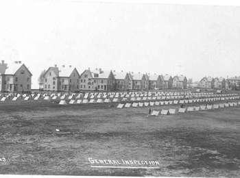
The parade ground is one of the most important fixtures of any military post. Here troops drilled, formed for inspection, held morning physical training, and paraded and reviewed for superior military officers and visiting dignitaries. A soldier might receive a medal here in a special ceremony. The photo of tents on the Parade Ground is not a "camp out" but an inspection of soldiers' equipment, from rifles to toiletries. Inspections ensured that a soldier's equipment is in top shape as well as sharpening a soldier's ability to quickly notice when things out of place - a key military skill in wartime. Today, ROTC students from the Marine Academy of Science and Technology (MAST) drill on the parade grounds, just up the hill from their campus.
The parade ground is one of the most important fixtures of any military post. Here troops drilled, formed for inspection, held morning physical training, and paraded and reviewed for superior military officers and visiting dignitaries. A soldier might receive a medal here in a special ceremony. The photo of tents on the Parade Ground is not a "camp out" but an inspection of soldiers' equipment, from rifles to toiletries. Inspections ensured that a soldier's equipment is in top shape as well as sharpening a soldier's ability to quickly notice when things out of place - a key military skill in wartime. Today, ROTC students from the Marine Academy of Science and Technology (MAST) drill on the parade grounds, just up the hill from their campus.
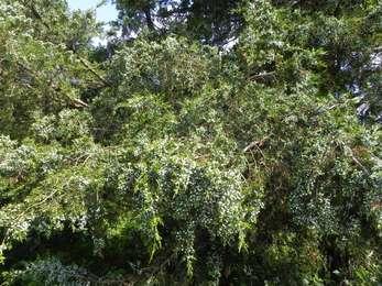
As you make your way back up to the West Pond Trail, take a closer look at the evergreen trees on either side of the trail. Although it is called a cedar, the eastern red cedar is truly a juniper. Eastern red cedar is known for its reddish, fragrant, and durable wood. The dense evergreen foliage of this native tree offers good nesting cover for robins, house finches, and mockingbirds. Cedar waxwing birds love to eat its blue berries in the fall. In winter, birds such as saw-whet owls roost in its branches. Eastern red cedar like these were among the first trees planted by Herbert Johnson. Does the scent of this tree smell familiar? These berries were historically used to flavor stews and marinades.
As you make your way back up to the West Pond Trail, take a closer look at the evergreen trees on either side of the trail. Although it is called a cedar, the eastern red cedar is truly a juniper. Eastern red cedar is known for its reddish, fragrant, and durable wood. The dense evergreen foliage of this native tree offers good nesting cover for robins, house finches, and mockingbirds. Cedar waxwing birds love to eat its blue berries in the fall. In winter, birds such as saw-whet owls roost in its branches. Eastern red cedar like these were among the first trees planted by Herbert Johnson. Does the scent of this tree smell familiar? These berries were historically used to flavor stews and marinades.
Sand is terrible for growing plants. It does not hold water, has few nutrients, and can get hotter than 100 degrees Fahrenheit in the summer. The Eastern red cedar or red juniper gets around this by producing evergreen leaves that take less energy to grow. Despite this, the red cedar still struggles in the environment here because it cannot tolerate salt. When Hurricane Sandy flooded this area, it killed many cedar trees that you will see on the trail. Even then, dead trees are useful because they provide food and habitat for wildlife.
Sand is terrible for growing plants. It does not hold water, has few nutrients, and can get hotter than 100 degrees Fahrenheit in the summer. The Eastern red cedar or red juniper gets around this by producing evergreen leaves that take less energy to grow. Despite this, the red cedar still struggles in the environment here because it cannot tolerate salt. When Hurricane Sandy flooded this area, it killed many cedar trees that you will see on the trail. Even then, dead trees are useful because they provide food and habitat for wildlife.
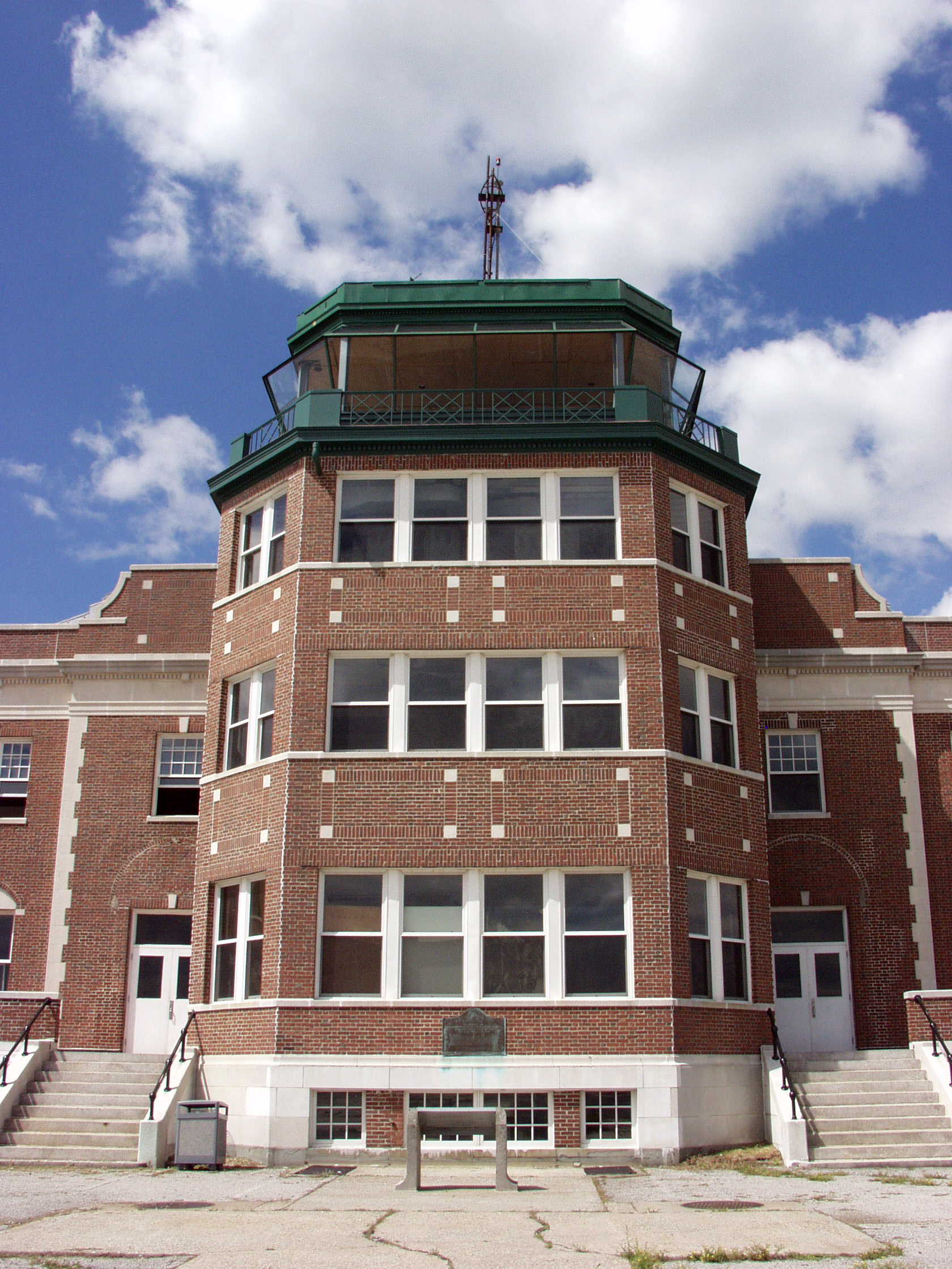
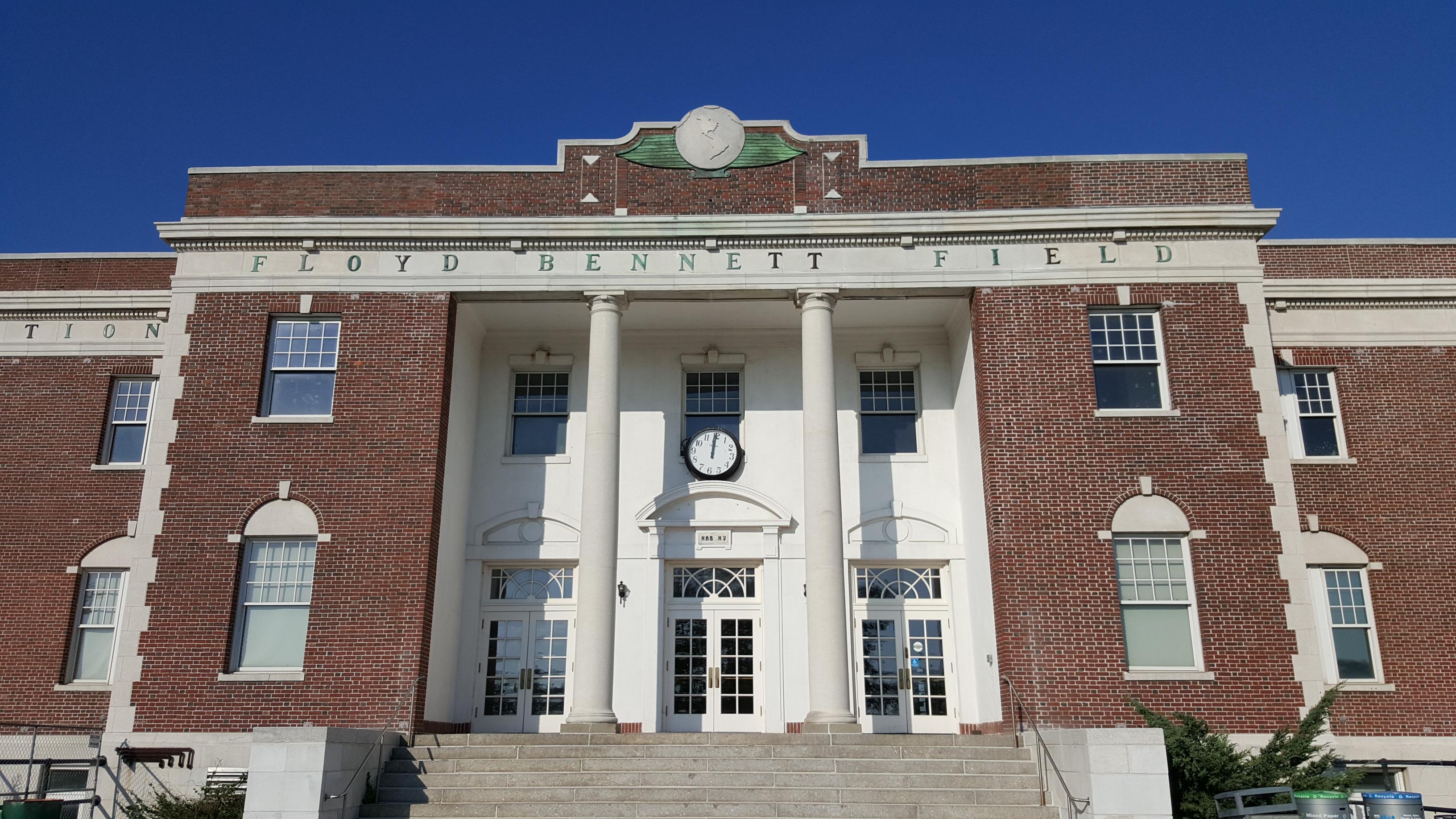
Floyd Bennett Field was New York City’s first municipal airport; later it became a World War II naval air station. Today this area includes over 1,300 acres of grassland, saltmarshes, tidal mudflats, a marina, and the former airfield, including a control tower and terminal that is now the Ryan Visitor Center (Ryan Visitor Center). Many recreational opportunities are available, including camping, biking, archery, gardening, ice skating, hockey, and gymnastics and more.
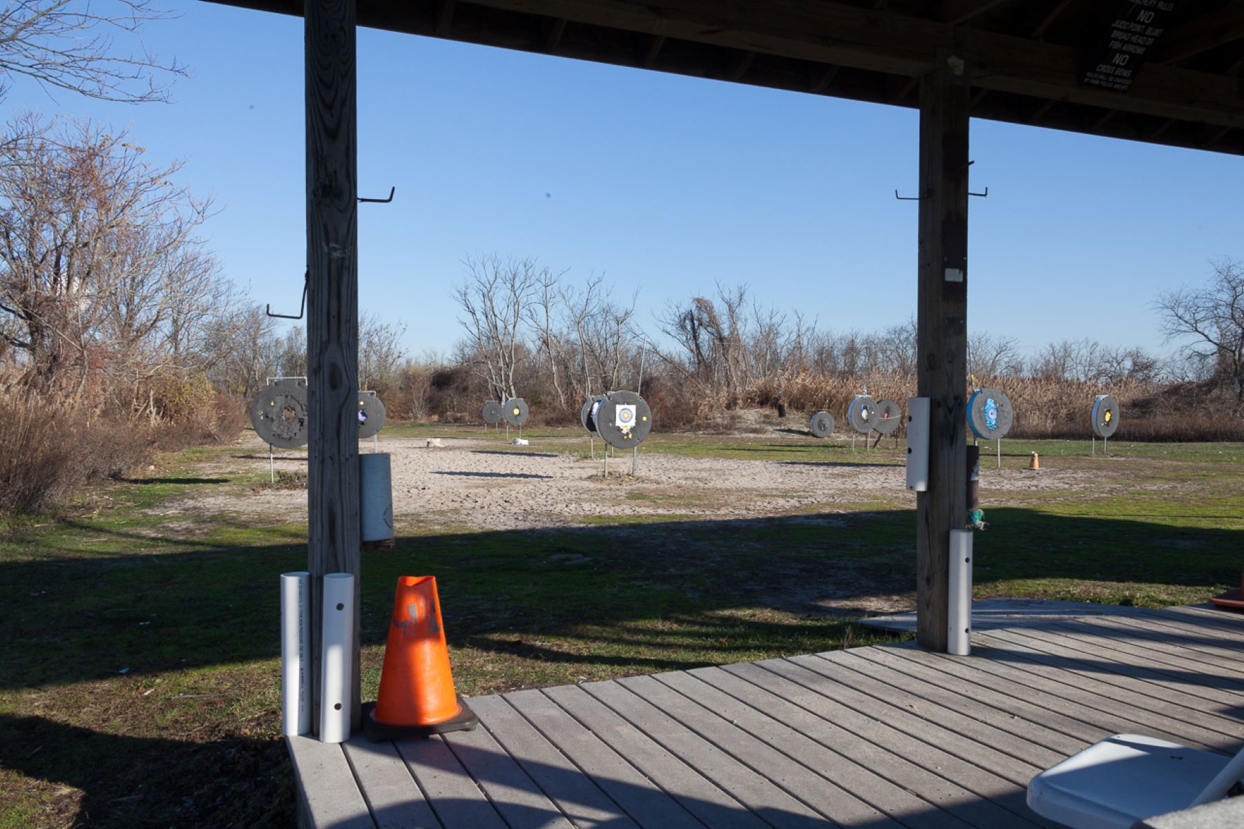
The Floyd Bennett Field Archery Range is an outdoor range with 8-10 targets set at various distances and a covered platform from which to shoot. Use of this range is permitted with your camping reservation. Crossbows and hunting tips are prohibited. The range is accessible to persons with disabilities. Call 718-338-3799 for more information.
Fort Tilden is a former military site that overlooks the approach to New York Harbor and today includes athletic fields, hiking trails, an arts center, a theater, and an observatory deck on a historic battery offering spectacular views of Jamaica Bay, New York Harbor, and the Manhattan skyline. Dunes, a maritime forest, freshwater ponds, and coastal defense resources including Battery Harris and the Nike Missile Launch Site are also found here.
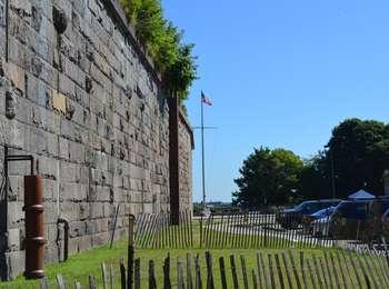
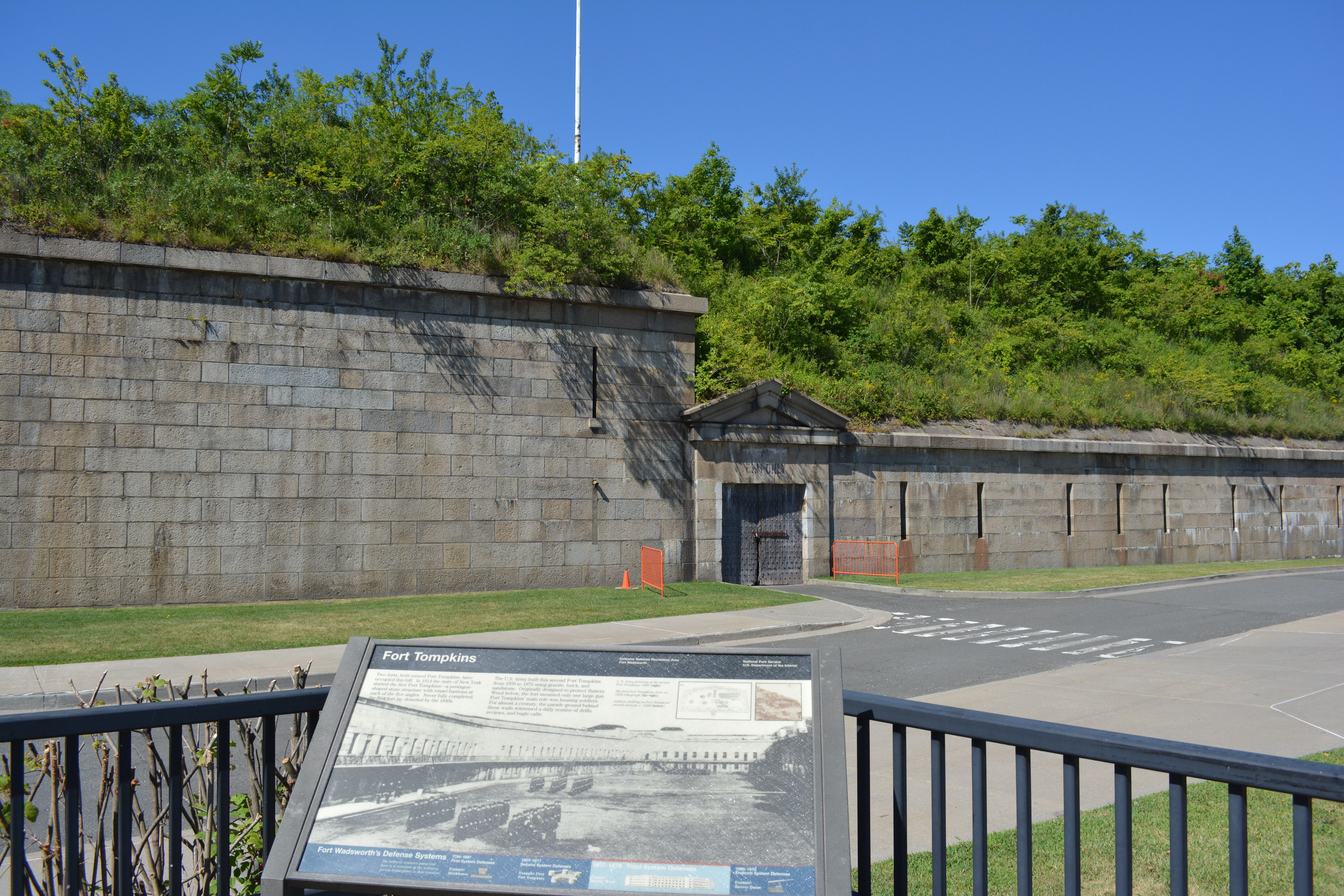
Fort Tompkins was established on Staten Island to protect the Narrows leading into New York Harbor. Completed by 1876, it provided quarters for the post's garrison and protected the waterside and channel batteries from land attack. In the development of a comprehensive harbor defense plan for the Third American System, the fortification of the west bank of the Narrows was identified as vital to the security of the nation, and designated as a top priority.A redoubt built by Co
Fort Tompkins was named for New York Governor and Vice President of the United States Daniel Tompkins. This imposing granite structure, constructed between 1859 and 1876, was designed to work in tandem with Battery Weed. Battery Weed was positioned to fire on enemy ships attempting to pass through the narrows, and Fort Tompkins was situated above to protect Battery Weed from a landward attack.
This gate serves as the front door to one of the oldest military installations in the nation. The site occupies 226-acres on the northeastern shore of Staten Island along the Verrazano Narrows of New York Harbor. Rich in history and natural beauty, Fort Wadsworth affords you the opportunity to observe an important part of our nation's history, while offering magnificent views of New York Harbor.This is the main entrance to Fort Wadsworth from Bay Avenue leading to New York Av
The panoramic view from the overlook and the narrow passage into the harbor has made the fort a strategic defense location since Colonial times. It also makes it the perfect place for visitors to survey the harbor. Located on a bluff overlooking the Verrazano Narrows, the overlook provides a sweeping vista that takes in Bayonne, N.J., Manhattan, and Red Hook, Brooklyn, where many sea-going cruises originate. Less than a mile separates Brooklyn and Staten Island. This natur
Ft. Wadsworth OverlookFirst Wayside Sign 511 Words; Length: 2:12First of five descriptions at this locationWayside Panel: Defending New York Harbor - Panel DescriptionThis wayside sign is set at the far left hand side of the Ft. Wadsworth Overlook in front of a three foot high, granite protective wall, with a view of the New York harbor directly ahead. Battery Weed is below, the Verrazano Bridge to the right, and in the distance off to the left, the New York and Brooklyn skylines. The wayside is angled at 45 degrees and is approximately three feet from the ground. It is four feet wide by three feet tall. The sign is entitled "Defending New York Harbor."Below this, the text reads: "How do you protect one of the world's busiest ports? This question has challenged military leaders for centuries. In 1776, the British landed unopposed on Staten Island, captured New York City, fortified this point, and occupied the area until the Revolutionary War Ended. Starting in 1794, the state of New York began building forts here. The War of 1812 hastened those efforts, and, by 1817, ten forts built by the state and the U.S. War Department ringed this harbor. As weapons improved over time, this circle of forts expanded to defend New York Harbor - which has not been attacked since the British left in 1783."End of TextIn the upper right, there is a quote from Prussian General Frederich Von Steuben, Aide to General George Washington during the Revolutionary War, which reads: "...[The Narrows} are the place pointed out by nature for the defense of the harbor."The background of the sign is an 1853 lithograph of New York Harbor, depicting various sailing vessels plying the waters of The Narrows and the Harbor. The lithograph shows the busy harbor and harbor shoreline, still not densely populated, with church spires and low buildings at the tip of Staten Island and, across the Narrows on the Brooklyn shore line, two-story buildings on tree lined streets.The many fortifications ringing the harbor are identified in red type. The Text Reads:First Fort Tompkins, 1814(site of second Fort Tomkins, 1876)Fort Richmond under construction(renamed Fort Wadsworth in 1865, then Battery Weed in 1902)Fort Lafayette(fort's rubble now forms the base for the east tower of the Verrazano-Narrows Bridge)Fort HamiltonFort Columbus(on Governor's Island)Castle Williams(On Governor's Island)Castle Clinton(On Manhattan)Fort Gibson(on Ellis Island)Fort Wood(on Bedloe's Island; now called Liberty Island)There are four small maps in the lower part of the sign, showing the ever-expanding fortifications around the harbor with red dots marking each fortification. The first map is labeled "First System Defenses 1794-1807." The second map is labeled "Second System Defenses 1807-1817." The third map is labeled "Third System Defenses 1817-1876." The fourth map is labeled "Endicott Period Defenses 1890-1910." The purpose of the illustrations is to show how the city is being defended at each period in time and the strategic locations of the batteries providing coverage of the harbor entry to the young city.End of MessageFort Wadsworth OverlookSecond Wayside Sign Battery Weed511 Words; Length: 2:08Second of five descriptions at this locationThis wayside sign describes the history of Battery Weed, located below the Fort Wadsworth Overlook on the edge of the Verrazano Narrows. The sign is predominated by a sepia toned drawing of the fort from Harpers Weekly Illustrated, circa 1860, and shows the outer moat of the fort still filled with water. There are about a dozen soldiers on the roof at the center of the fort's front wall and another dozen men on the roof in the far right corner of the fort. There are sailing ships in the waters of the Verrazano Narrows as well as steam-powered paddle wheelers. The sign is elevated approximately three feet from the ground and is four feet wide by three feet tall.Wayside Panel: Battery Weed - Panel DescriptionThe sign is predominated by a sepia toned drawing of the fort from Harpers Weekly Illustrated, circa 1860, and shows the outer moat of the fort still filled with water. There are about a dozen soldiers on the roof at the center of the fort's front wall and another dozen men on the roof in the far right corner of the fort. There are sailing ships in the waters of the Verrazano Narrows as well as steam-powered paddle wheelers. The sign is elevated approximately three feet from the ground and is four feet wide by three feet tall. Text reads:"Begun in 1847, this granite structure was finally completed during the Civil War. Its four-tier design allowed up to 116 guns to skip cannonballs across the Narrows. However, by the mid-1860s, bigger, more-accurate guns could destroy a stone fort like this. Compromised, it became obsolete almost before its last stones were laid. First named Fort Richmond - after an earlier New York state-built fort on the same site - it was renamed in 1865 for Brt. Maj. Gen. James Wadsworth, who was mortally wounded at the Battle of the Wilderness. In 1902, the army post was named Fort Wadsworth and this fortification renamed Battery Weed for Brig. Gen. Stephen Weed, killed at the Battle of Gettysburg."End of text.There are three smaller illustrations across the lower part of the sign, the first one a drawing from the 1850s of Fort Richmond under construction, as shown in Frank Leslie's Illustrated Magazine. The second is a photograph of cannonballs stacked in triangular shaped rows in the interior grounds of Fort Wadsworth, circa 1893. The third is a photograph from the 1890s of a man in business attire standing on the roof of Fort Wadsworth with guns pointed towards the narrows. Text reads: Fort Wadsworth mounted almost every type of gun available in its day, including Rodmans and Parrots in the 1890s.End of text.The bottom of the sign depicts four eras of defense systems employed at the fort. It is entitled "Fort Wadsworth's Defense Systems".The four systems depicted are: 1794-1807 First System Defenses/Example: Block House. 1807-1817 Second System Defenses/Example: First Fort Tompkins. 1817-1876 Third System Defenses/Example: Battery Weed. 1890-1910 Endicott System Defenses/Example: Battery DuaneEnd of MessageFort Wadsworth OverlookThird Wayside Sign Verrazano Bridge415 words; Length: 1:53Third of five descriptions at this site.This wayside sign describes the construction of the Verrazano-Narrows Bridge through text and photographs. The sign is elevated three feet from the ground and is four feet wide by three feet tall. It is set at the south end of the Fort Wadsworth Overlook, behind the bridge itself. The sign is entitled "Verrazano-Narrows Bridge." To the right of the title, Giovanni da Verrazano, from 1554. Text reads: The quote reads: "We found a pleasant place below steep little hills. And from among those hills, a mighty deep mouthed river ran into the sea." End of text.Text reads:Wayside Panel:The main body of text reads: "Until the 1960s, the only way from Brooklyn to Staten Island was by water - first by Indian canoes, then boats and ferries. A railroad tunnel was started from Brooklyn in 1923, but never completed. Plans for a vehicular tunnel were studied in 1929 and 1942, but dropped. Finally, in 1946, the state of New York authorized a bridge to be built across these Narrows. Designed by Othmar Amman, the bridge was started on August 13th, 1959, by over 1,000 workers. The " world's largest suspension bridge" when dedicated November 21, 1964, it was named for Italian Explorer Giovanni da Verrazano, who discovered these Narrows 440 years earlier. For Staten Island, this bridge marked the beginning of a change from a rural landscape to today's urban environment.End of text.Below this text is a series of four photographs, showing the bridge in various stages of construction. The first is labeled "Foundations laid, 1959" and shows towering cranes on a concrete platform. The second is labeled "Tower pedestals built, 1960", showing cranes on the Staten Island shore of the Narrows. The third photograph is labeled "Towers erected", and shows one of the towers upon completion with an ocean bound ship in the background. The fourth is labeled "Cables strung to Anchorages, 1962", and shows the massive cables attached to one of the towers being drawn towards the foot of the bridge.Below these photographs is a diagrammatic drawing of the bridge with statistics on aspects of the bridge's construction. Some of these statistics include: The Length (including approach ramps): 13,700 feet. The Height of the Towers: 690 feet. The height above water in the summer and winter : 228 in the summer, 240 in the winter.End of MessageFort Wadsworth OverlookFourth Wayside Sign Fort Tompkins338 words; Length: 1:37Fourth of five descriptions at this site. This sign describes the history of the 19th century Fort Tompkins. The sign is located at the back of the Ft. Wadsworth Overlook, facing the ruins of Fort Tompkins is set in the hill east of the overlook. There is a separate audio description for the Fort itself. The sign is elevated three feet from the ground and is four feet wide by three feet tall.Wayside Panel: Fort Tompkins - Panel Description:The sign is entitled "Fort Tompkins". The background is a black and white photograph from 1920, showing soldiers drilling on the parade ground, surrounded by the fort walls. There are six rows of soldiers, all with arms and hands at their sides. Each row contains nine to thirteen men, all wearing long winter coats and military style caps. Two officers stand facing the front row of soldiers in the foreground. Text reads:"Two forts, both named Fort Tompkins, have occupied this hill. In 1814 the state of New York started the first Fort Tompkins - a pentagon-shaped stone structure with round bastions at each of the five angles. Never fully completed, the first fort lay deserted by the 1840s.The U.S. Army built this second Fo
From the overlook you can see the New York Harbor and Brooklyn. This spectacular view was recognized for its strategic value centuries ago by no one less than George Washington himself.
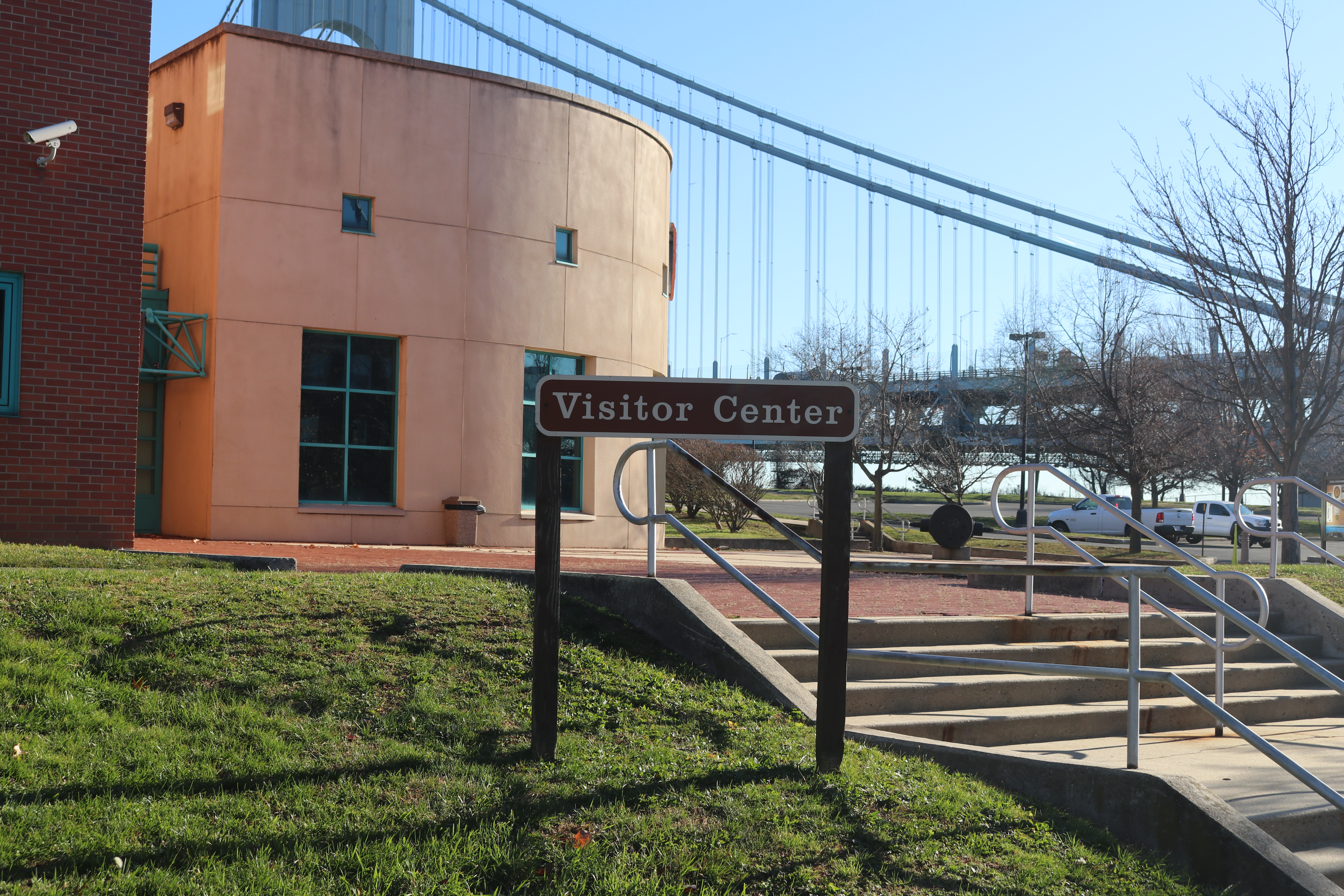
The Fort Wadsworth Visitor Center is open Friday-Monday from 10 am to 4 pm.
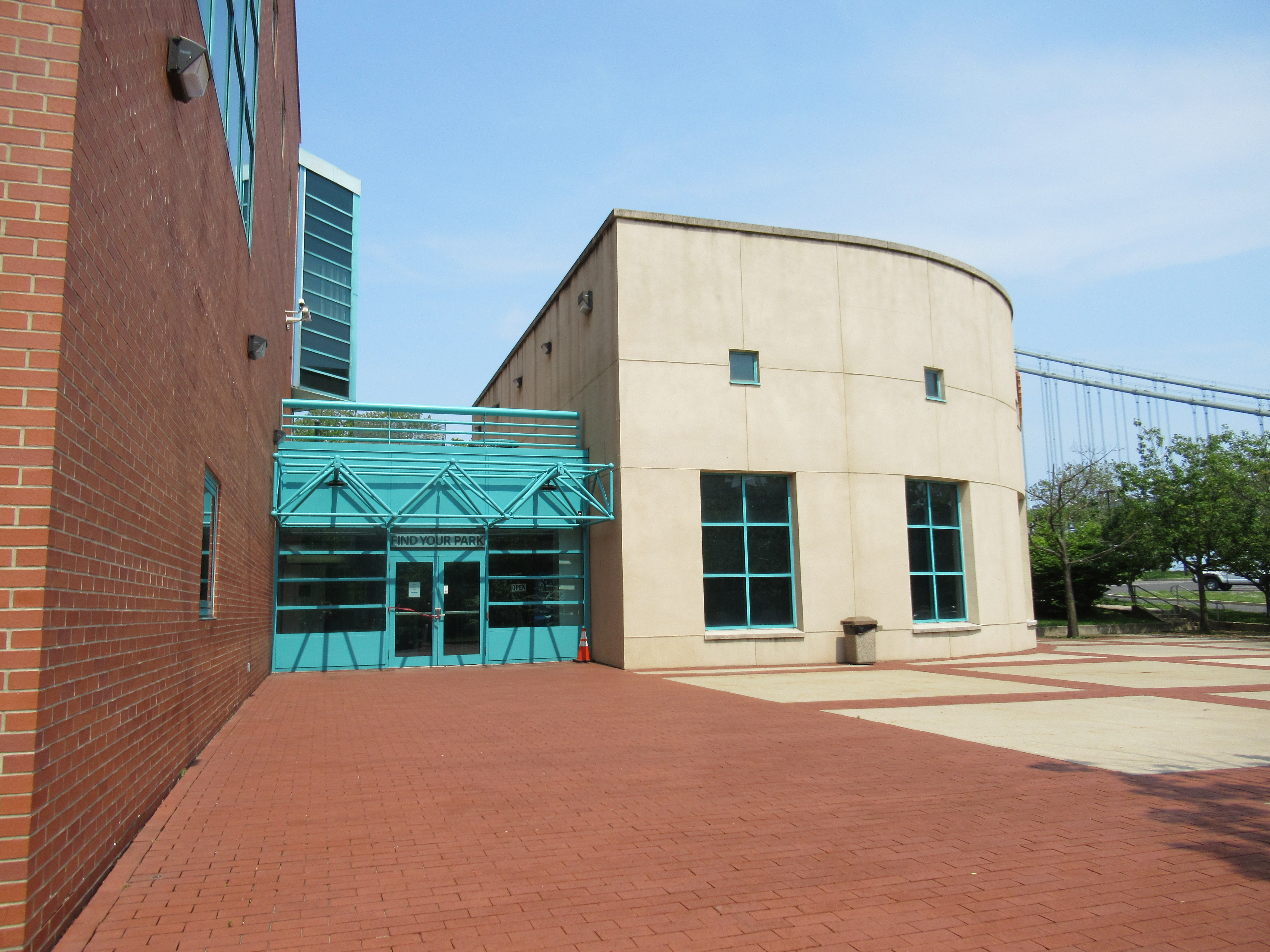
Plaza in front of a round building that houses Fort Wadsworth's visitor center and museum. Plaza also includes a small cannon and information signs. Cherry trees line the plaza.
Fort Wadsworth remained active throughout the Cold War. Although the threat of a major city in the United States being attacked from the sea had been miniscule for decades, the looming threat of nuclear war brought about major changes in defense preparation. Nike missiles designed to intercept high-altitude bombers were located near large urban centers. Fort Wadsworth served as the Nike control center for the NYC area.
Plaza flanked by round building holding Fort Wadsworth visitor center and museum.
Frank Charles Memorial Park, originally part of New York City's Department of Parks and Recreation, includes playgrounds, ball fields, shoreline access for fishing, as well as fragile, protected marshlands.
Jamaica Bay Frank Charles Memorial Park<br />499 words; Length: 2:01<br /><br />Frank Charles Memorial Park is a twenty-acre recreational area serving the Howard Beach Community. It faces south on Jamaica Bay, and has basketball, handball, bocce and tennis courts, a baseball diamond, as well as checkers tables and a children's playground. Oak trees and benches line fifteen-foot wide asphalt walkways, frequented by both runners and walkers. Picnic benches dot the grassy area between the recreation facilities and the narrow beach. A thirty-foot high flag pole stands in the lawn just south of the tennis courts. From the beach, you can see planes landing and taking off from JFK International Airport. <br /><br />The five tennis courts are located on the bay side of the park, along with a horseshoe pit. <br />Just east of the tennis courts, there is a glass encased upright sign attached about two feet off the ground to two black metal poles capped with a round finial. The sign is four feet by four feet and reads: "Pvt. Frank M. Charles/Frank M. Charles was born on September 27, 1894 within Manhattan. His mother passed away during childbirth and his father soon placed Frank and his two sisters, Anne and Catherine, in a Staten Island orphanage where they lived for seven years. Eventually, his uncle and aunt, Agnes and Bill Charles, adopted the three children. <br /><br />When Bill bought land at nearby Hawtree Beach, he and Frank built bungalows and rented them out for additional income. During his high school years, Frank played football.<br /><br />Later Frank went on to attend Columbia University, but on December 8, 1917, Frank was drafted into the U.S. Army. World War I had hit home. After training at Yaphank, Long Island, he was assigned to Company B, 307th Infantry, 77th Division. In May 1918, Private Charles landed in France. He survived two months of trench warfare, but on July 21, while on a mission to liberate prisoners of war from behind the German line, he was killed in battle. He was 23 years old.<br /><br />In 1922 Private Charles' remains were returned to the United States and he was buried with full military honors at the Calvary Cemetery in Queens. His surviving family moved to West Hamilton Beach and then settled into their permanent home in Howard Beach.<br /><br />In 1912 a recreational building was constructed inside what was then know as Casino Park. The building became known as "The Casino" and was a popular place for residents to gather. Facing south, the structure stood just east of the tennis courts in today's park. Eventually the building housed the headquarters of the Pvt. Frank M. Charles Post #480 of the American legion.<br /><br />Although the structure is no longer standing today, the Pvt. Frank M. Charles Memorial Park commemorates this soldier to keep the memory of thousands alive. To recognize their sacrifices honors their service."<br /><br />End of Text<br /><br />To the left of the sign, there is a large stone, three feet by three feet, with two memorial plaques honoring local men who died serving their country.<br /><br />End of Message
Some plants dominate certain beach areas, such as the golden heather. This plant releases a toxin into the ground that slows the growth of other plants, giving it plenty of room to grow. Its complex root system helps anchor the sand, but trampling by humans can easily damage the roots. This plant is commonly found around beach plums, a shrub whose fruit ripens in late summer to fall. The Lenape people used these fruits in their diet. A neighbor to these plants is the seaside goldenrod. This blooms into large, bright yellow flowerheads in the fall.
Some plants dominate certain beach areas, such as the golden heather. This plant releases a toxin into the ground that slows the growth of other plants, giving it plenty of room to grow. Its complex root system helps anchor the sand, but trampling by humans can easily damage the roots. This plant is commonly found around beach plums, a shrub whose fruit ripens in late summer to fall. The Lenape people used these fruits in their diet. A neighbor to these plants is the seaside goldenrod. This blooms into large, bright yellow flowerheads in the fall.
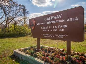
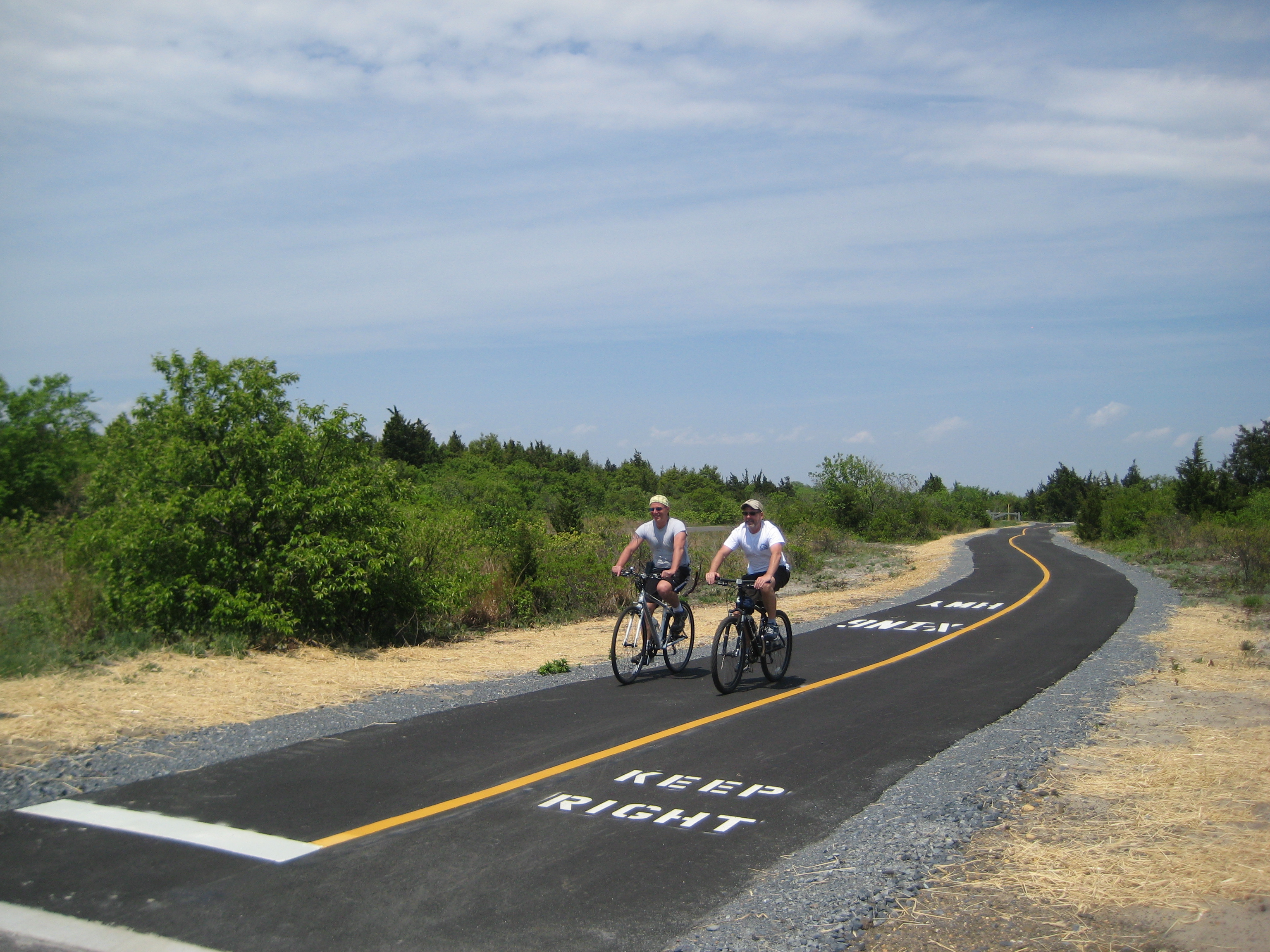
A sandy barrier peninsula perched on Staten Island's South Shore. Great Kills is known for its abundant opportunities for outdoor recreation. Enjoy the fishing at Crooke's Point, go bird-watching, or simply relax under the sun at the beach. A marina provides access to the harbor for boaters. There is also a 1.5-mile multi-use path that is perfect for running, walking, or biking.
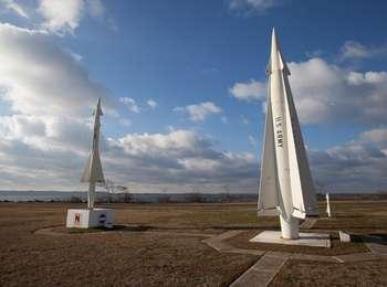
Guardian Park Memorial was established by the U.S. Army as they prepared to deactivate Fort Hancock. It is named for the Nike Air Defense Missiles, which were the last "guardians" of the New York Metropolitan Area. The granite monument was originally located at the Missile Launch Area in Middletown, New Jersey, where eight Nike Ajax Missiles exploded in 1958. The Middletown missile site closed in 1963, and the monument was then moved to the Army Highlands Air Defense Site
Sandy Hook Guardian Park Missiles<br />772 words Length: 4:08<br /><br />Guardian Park is a memorial to the men who worked with the Nike Ajax and Hercules Missiles here at Sandy Hook. It is a large, open, grassy triangular space dominated by two large missiles in the center. As you walk south towards the missiles from the parking lot, there is step down from a four-inch-high curb before crossing the Multi-Use Path. (Be on the alert for bicycles.) If you approach this site from the road to the south, there is a large, grey wooden sign about four-feet high that reads in large white letters, "Fort Hancock Historic District."<br /><br />The Hercules missile at the center of the site stands about twenty-four feet high. It is a round, white missile with four large triangular fins extending most of the length of the missile, coming to the narrowest point about six-feet from the nose of the missile. At the largest point of the fins, the Hercules missile is about six-feet across. There are four smaller fins above these larger fins, only about three-feet in length. These smaller fins are attached about three feet from the nose of the missile. "US Army is stenciled in black on all sides. <br /><br />There is an eighteen-inch-high, square cement block installed in front of the missile, with a brass plaque attached that reads: <br /><br />"Nike Hercules<br />History<br />The Nike Hercules surface-to-air guided missile was the second generation air defense missile developed by in the mid-1950s and initially deployed in 1958. It possessed a nuclear warhead capability and was vastly superior to its predecessor, the Nike-Ajax. Capable of destroying high-flying, supersonic formations of enemy aircraft, the Nike-Hercules was deployed throughout the continental United States and in overseas areas. <br /><br />Description<br />Length - 41 Feet<br />Weight - 10,000 pounds<br />Warhead - Nuclear or Conventional<br />Range - More than 75 Nautical Miles<br />Altitude - In Excess of 150,00 Feet<br />Speed - Supersonic<br />Propulsion System - Two Stage<br />Four Solid-Propellant Booster Motors<br />Solid-Propellant On-Board Rocket Motors"<br /><br /><br />A thirty-foot tall flag pole stands twenty feet north of the Hercules missile, at the end of a narrow walk way. <br /><br />To the west of the Hercules missile, there is another narrow concrete pathway about twelve feet long that leads to a memorial of light grey granite, about two and half-feet wide by five-feet high. The memorial is polished granite in the center with a rough granite border. On either side of the stone, there are two white wooden models of missiles, each about four-feet tall. The stone memorial sits on a square concrete platform elevated about 5 inches tall. The platform has a brass plaque that reads: <br /><br />"Nike Ajax Explosion Battery B 526th Missile Battalion, Leonardo, NJ." <br /><br />The granite memorial itself is engraved with the following:<br /><br />"IN MEMORIAM<br />22 May 1955<br />Sgt. Daniel J. Lavengood<br />Sgt. Jerome W. Mould<br />SP3 Walter E. Berry<br />SP3 William I. Cochran<br />PFC Donald L. Marsh<br />Pvt. Nicklos J. Composino<br /><br />ORD. CORPS CIVILIANS<br />Joseph Arciere<br />Joseph F. Brokos<br />Lee A. Parker<br />Charles Romanitow"<br /><br />End of Text<br /><br /><br />A third path narrow concrete path, twelve feet long, on the south side of the Hercules missile leads to the smaller Ajax Nike missile. The twenty-foot tall missile sits in the center of a square, white, five foot by five foot concrete planter about three-feet high. The one-foot in diameter missile is white with the words "U.S Army" stenciled in black on all four sides. There are four fins at the bottom with a span of four feet. Four small, one foot triangular fins sit two feet below the pointed nose of the missile. You can circle the missile on an eight-sided, narrow concrete path. On the north side of the missile, there is a brass plaque seated on a twelve-inch white concrete platform. The plaque is angled forty-five-degrees front to back. It reads: <br /><br />"Nike-Ajax <br />History<br />Nike-Ajax Surface to Air Guided Missile developed in the late 1940s and early 1950s as a defense weapon against enemy banned bomber attack. After extensive research and development, this first generation missile was deployed throughout the continental United States and in overseas areas. The final Nike Ajax succumbed to advanced technology in 1964 when it was replaced by the second generation Nike missile system, the Nike-Hercules. <br />DESCRIPTION:<br />Length - 31.5 feet <br />Weight - 2,325 pounds <br />Warhead - Conventional <br />Range - 25 Miles <br />Altitude - 50,000 Feet <br />Speed - 1,700 mph <br />Propulsion System - Two Stages<br />Single Solid Propellant Booster Motor <br />Liquid Propellant On-Board Rocket Motor"<br /><br /><br />The planter which contains the missile has a logo on three sides representing army battalions who worked with the Ajax missiles: The First Army Area, The U.S. Army Air Defense Command, (Radcom), and Air Defense Artillery Branch. On the south side, the logo is missing.<br /><br />End of Message
Originally created as a municipal park, Hamilton Beach Park includes playgrounds and ball fields along with shoreline access for fishing. Nearby sensitive marshlands are visible from the grassy shoreline.
Hamilton Beach Park<br />185 words; Length: :38<br /><br />Hamilton Beach Park is a football field sized recreational area serving the Queens Community of Hamilton Beach, facing south and west towards Jamaica Bay. It has twelve parking spaces. The parking lot is surrounded by three-foot high silver metal posts spaced four feet apart. There is a children's playground, a handball court, a basketball court and a baseball field with a backstop. A twenty-five-foot tall flag pole stands five feet from the southwest corner of the parking lot. The open area is bordered by tall shrubs and trees on the bay side. The North Channel Joseph A. Addabbo Memorial Bridge is across the channel at two o'clock.<br /><br />Just to the right of the flagpole, there is a brown metal sign, two feet tall by six feet wide, that is positioned six feet off the ground on two metal poles. The sign has a National Park Service arrowhead log in the upper right and reads: "Gateway National Recreation Area/Hamilton Beach Park/Jamaica Bay Unit"<br /><br />End of Text<br /><br />The primary colored playground is at the western end of the park. It has two slides and a climbing structure.<br /><br />End of Message
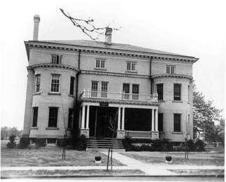
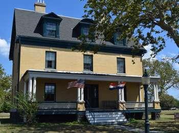
In 1898, History House (building #1) was designated as a lieutenant's quarters on Officers Row in Fort Hancock. History House is open on the weekends from 1p.m. to 5p.m.
Sandy Hook History House<br />520 words Length:2:05<br /><br />The Sandy Hook History House is a typical example of the officer's housing at Fort Hancock. It is furnished with period furniture typical of the World War II era. There is an informational sign out front. The three-story house is approximately 36 feet across the face with a wide front lawn. It has a three-foot high elevated porch extending the width of the front at the first floor level. The porch has a white balustrade trimmed in green. There are double white-round columns at each end of the porch and flanking the ten-foot wide steps at the center. The front entrance is green with two 12-paned first floor windows on either side. There are three windows across the front of the second floor above the roof of the porch, and three dormer windows on the attic floor. The roof is dark grey and there are two yellow brick chimneys visible at the peak of the roof.<br /><br />The informational sign is on the far right side of the yard, just off the sidewalk that borders the street. The sign, entitled "History House", is anchored on a three-foot tall wooden post and is framed in brown wood. It is two feet by three feet and is angled 45 degrees front to back. A black and white photograph of the house, rendered in blue tones, dominates the sign. The caption below the photograph reads: "This was one of the first buildings completed at Fort Hancock in 1898, shown here in 1938."<br /><br />End of Text<br /><br />The text below the title reads: "This officer's home, designed for a lieutenant and his family, was a testament to the rank and privilege of officers in a small peacetime army of the late 19th century."<br /><br />End of Text<br /><br />Below this text, there is a small black and white photograph of a desk containing a typewriter in the center, a black rotary dial phone on the left, a small radio with a coffee cup placed in front of it, several books in an upright row behind the typewriter, and an open newspaper lies on the right. The caption below the photograph reads: "This building is now called History House and is furnished as it would have appeared during World War II when Fort Hancock was busiest. Fort Hancock was in operation from 1895 to 1974."<br /><br />End of Text<br /><br />The twenty-foot long concrete path from the sidewalk leads to twelve-foot wide wooden steps with green-painted metal handrails on either side. There are six steps up to the ten-foot deep wooden porch. There is one six-inch step up to the green wooden door. The door has a brass knob and an oval-shaped glass window that begins about four feet high from the deck of the porch. It is framed by oval-shaped glass highlights positioned above green wooden paneling that flanks the door. There is an electric door bell to the right of the door and a wooden bench three feet to the right of the door.<br /><br />Inside there is a fully furnished parlor, dining room and kitchen on the first floor and furnished bedrooms above.<br /><br />End of Message
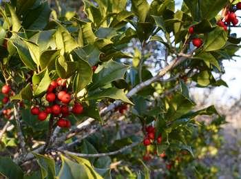
This forest of American Holly is the largest stand or group of American holly trees on the East Coast. Along with Eastern red cedar and wild black cherry trees, the American hollies create a unique maritime forest on Sandy Hook. One tree in this forest dates from the 1830s. Female trees produce flowers which produce red berries. <br /><br />Stop for a moment and be silent. What do you hear? Morning is the best time to hear birdcalls. Try to differentiate between the different calls.<br />
This forest of American Holly is the largest stand or group of American holly trees on the East Coast. Along with Eastern red cedar and wild black cherry trees, the American hollies create a unique maritime forest on Sandy Hook. One tree in this forest dates from the 1830s. Female trees produce flowers which produce red berries. <br /><br />Stop for a moment and be silent. What do you hear? Morning is the best time to hear birdcalls. Try to differentiate between the different calls.<br />
Throughout spring, the beaches around Jamaica Bay are host to a curious, ancient creature. Horseshoe crabs have wandered the earth for more than 450 million years, 200 million years longer than the dinosaurs. These living fossils play an incredibly important role in the ecological food web, their eggs and larvae a vital food source for migrating shorebirds. The Red Knot, a robin-sized shorebird that travels 9,000 miles each way on its annual migration from the tip of South America to the Canadian Arctic, is one shorebird that fuels up each year on the tiny green horseshoe crab eggs found along these shores. Although horseshoe crabs have survived many mass extinction events in their long history, they face their most serious threat today in the forms of overharvesting and habitat loss.
Throughout spring, the beaches around Jamaica Bay are host to a curious, ancient creature. Horseshoe crabs have wandered the earth for more than 450 million years, 200 million years longer than the dinosaurs. These living fossils play an incredibly important role in the ecological food web, their eggs and larvae a vital food source for migrating shorebirds. The Red Knot, a robin-sized shorebird that travels 9,000 miles each way on its annual migration from the tip of South America to the Canadian Arctic, is one shorebird that fuels up each year on the tiny green horseshoe crab eggs found along these shores. Although horseshoe crabs have survived many mass extinction events in their long history, they face their most serious threat today in the forms of overharvesting and habitat loss.
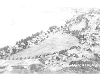
Some buildings which served important post functions are now gone. The hospital, completed in 1899, treated soldiers and their dependent family members during sickness and injury. Soldiers might be injured from heavy equipment at the fort and the Sandy Hook Proving Ground. One of the hospital's largest emergencies was in January 1944, when a Navy destroyer blew up on the ocean side of Sandy Hook. Fifty sailors were rushed to the hospital on boats and ambulances. The hospital needed blood plasma, and Battery Park in Manhattan had some to spare. Entertainment could make a hospital visit more cheerful, as seen in photos from the last years of the fort. The hospital was destroyed by fire in 1985.
Some buildings which served important post functions are now gone. The hospital, completed in 1899, treated soldiers and their dependent family members during sickness and injury. Soldiers might be injured from heavy equipment at the fort and the Sandy Hook Proving Ground. One of the hospital's largest emergencies was in January 1944, when a Navy destroyer blew up on the ocean side of Sandy Hook. Fifty sailors were rushed to the hospital on boats and ambulances. The hospital needed blood plasma, and Battery Park in Manhattan had some to spare. Entertainment could make a hospital visit more cheerful, as seen in photos from the last years of the fort. The hospital was destroyed by fire in 1985.
Jacob Riis Park was designed by the politically powerful NYC Parks Commissioner Robert Moses, who in 1929 had created Jones Beach as a state park further east on Long Island. The Atlantic Ocean beach, boardwalks, courtyards, and walkways gave the city's poor a respite from cramped tenements and crowded city streets. The park was largely built on the site of the former Rockaway Naval Air Station, one of the first US naval air stations.
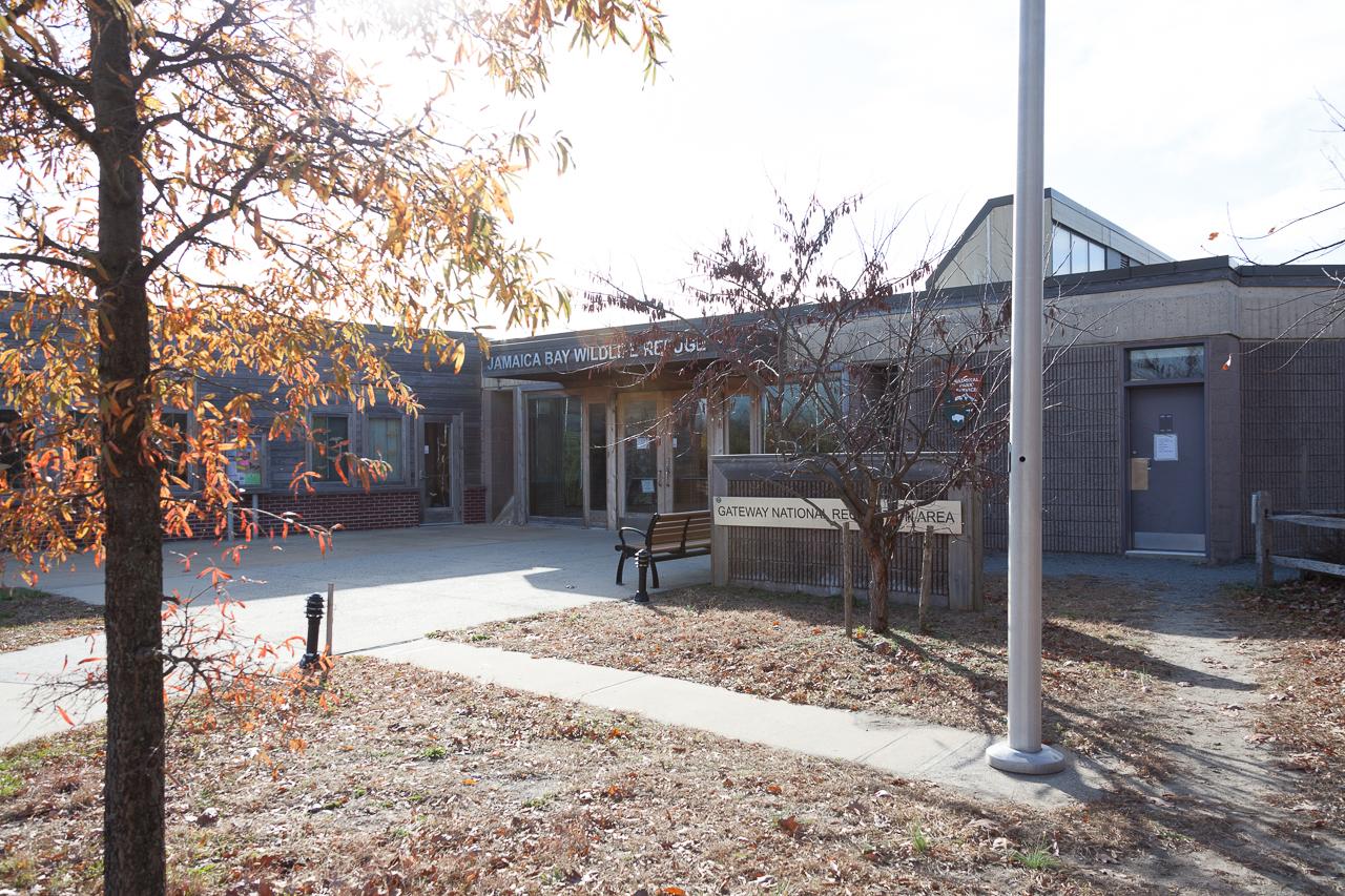
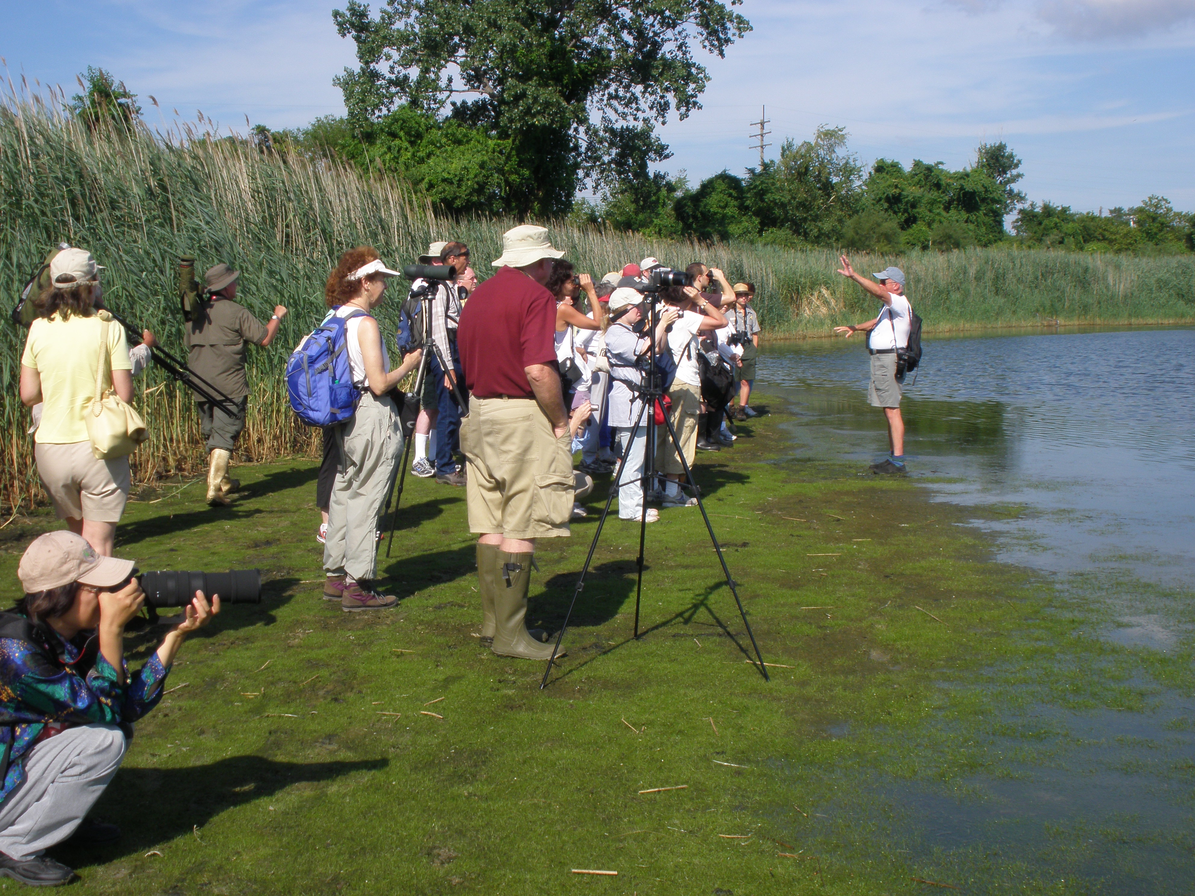
Jamaica Bay Wildlife Refuge is one of the most important urban wildlife refuges in the United States. Encompassing more than 9,000 acres, it is comprised of diverse habitats including salt marsh, upland field and woods, several fresh and brackish water ponds and an open expanse of bay and islands - all located within the limits of New York City.
Jamaica Bay Wildlife Refuge Center940 words; Length: 3:26The Jamaica Bay Wildlife Refuge Visitor Center is the gateway to this 900-acre preserve, home to salt marshes, uplands, open bay and beach areas, and two man-made ponds, all supporting hundreds of species of plant and wildlife. The one story, flat-roofed building contains a ranger desk, colorful exhibits on the eco-system of the surrounding area, a classroom, a book store, wheelchair accessible bathrooms, water fountains, and tactile, hands-on nature exhibits. The building is L-shaped, with one wing extending twenty-four feet towards the parking lot on the south side of the building. At the back of the building there is a garden of native plants found in the preserve, as well as the trailhead for the West Pond trail.You approach the building from the west side of the parking lot using one of two eight-foot wide concrete walks. The walkways have two-foot high solar lights on the side. The building sits back on a square concrete apron, twenty-four feet wide by twenty-four feet deep. There is a slatted bench on the right side of the platform and a garbage can just beyond. On the opposite side of the platform, a glass encased, weathered wood housing holds a bulletin board with information on the area. Over the entry doors there is a weathered wood overhang at roof level with "Jamaica Bay Wildlife Refuge" in raised gold metal letters. Solar panels sit at a 45-degree angle on a raised roof extension on the north side of the building. There is a women's room just to the right of the main entrance. A gravel path on the right leads around the building with a split rail fence on the right protecting the natural vegetation area. A sign issuing a warning about deer ticks hangs from the fence. The men's room is on the left of the path at the rear of the building, as well as a raised wooden apron leading to the rear entrance to the main room of the building.The trail head for the West Pond Trail is found at the rear of the building on the right hand side of the gravel walkway. There is a long trail and a short trail. You reach the trail head for the long trail first. The trailhead for the short trail is just to the left. If you continue along the rear path, you come to a phenology garden on the left. This garden has samples of different types of plants that can be found in the wildlife refuge. All of the plants are identified with markers. You enter the Visitor Center through the glass double doors into a trapezoidal-shaped foyer, about twelve feet deep and twenty feet wide at the widest point. The foyer has brown brick walls on the north and south sides. The bricks are set vertically and the walls are hung with floor-to-ceiling photographs of flora and fauna in the preserve. On the left, there is a photograph of a salt marsh with green marsh grass and mud flats. Hanging beside it is a photograph of a tree in early autumn, with leaves just beginning to turn bright red. On the right hand wall, there is a photograph of a small duck* sitting on a narrow rock in the water. Beside it hangs a close up shot of leaves just beginning to turn from green to orange and brown tones.Another set of wide, glass double doors framed in light brown wood open into the main room of the Visitor Center. The flat-screened television behind the desk displays information about events at the Wildlife Refuge as well as still photographs of the wildlife and plants in the area. Displays hang on the wall giving the history of the Jamaica Bay area, ecological information, and information on the National Park Service and parks throughout the United States. The room is approximately forty feet deep by twenty-four feet wide with twelve-foot high ceilings. The ranger station, a semi-circular, light wood desk about fifteen feet in diameter, is on the left. The light yellow walls and polished light wood floors combined with the floor-to-ceiling windows at the back wall give an open feeling to the space. Towards the back of the main room, there is a three-foot high, square, glass-topped display case with a map of the area entitled "Jamaica Bay, Above, Below, and All Around". On the four sides of the six-foot by six-foot display case, there are informational displays of various aspects of Jamaica Bay: the ongoing dredging, a short historical perspective of the area, the watershed ecosystem, and the wildlife. At each corner of the case, there is a tactile exhibit of different fish, shell fish, and amphibians in the area. There are boxes below the window sills at the rear of the room containing shells of horseshoe crabs, turtles, and mollusks. There are also boxes with mushrooms, pinecones, and other botanical samples. You can pick these samples up and feel them.The bookstore is on the left at the rear of the room. It sells games, books, plush toys, and souvenirs. There are windows on three sides of the store, filling the it with light. A birdhouse sitting on a colorful
Military life could be strict. A soldier could be punished for an offense as minor as being outside his barracks after lights-out. Military penalties could include loss of rank, heavy fines, assignment to a work detail, or imprisonment for a few days in one of the cells in the Post Guardhouse or jail. For serious crimes, prisoners were transported to Fort Jay on Governors Island in upper New York Harbor to wait for their trial date.
Military life could be strict. A soldier could be punished for an offense as minor as being outside his barracks after lights-out. Military penalties could include loss of rank, heavy fines, assignment to a work detail, or imprisonment for a few days in one of the cells in the Post Guardhouse or jail. For serious crimes, prisoners were transported to Fort Jay on Governors Island in upper New York Harbor to wait for their trial date.
While Fort Hancock encompasses the entire Sandy Hook peninsula, Fort Hancock Historic Post was the center of social and daily life outside of the fortifications and field training locations.<br /><br />The Parade Ground Walking Tour takes you through the main areas in Fort Hancock Historic Post for junior enlisted soldiers, sergeants, and officers. Despite numerous distinctions between these soldiers, they all came together at the Parade Ground to carry out the traditions and routines of the U.S. Army.
While Fort Hancock encompasses the entire Sandy Hook peninsula, Fort Hancock Historic Post was the center of social and daily life outside of the fortifications and field training locations.<br /><br />The Parade Ground Walking Tour takes you through the main areas in Fort Hancock Historic Post for junior enlisted soldiers, sergeants, and officers. Despite numerous distinctions between these soldiers, they all came together at the Parade Ground to carry out the traditions and routines of the U.S. Army.
Miller Field was once home to one of the most prominent American families of the 19th Century. In 1836, Cornelius Vanderbilt began purchasing farmland in New Dorp and owned most of what became Miller Field by 1843. Vanderbilt's heirs sold the property to the federal government in 1919. This site is now one of the three sites of Gateway National Recreation Area's Staten Island Unit.
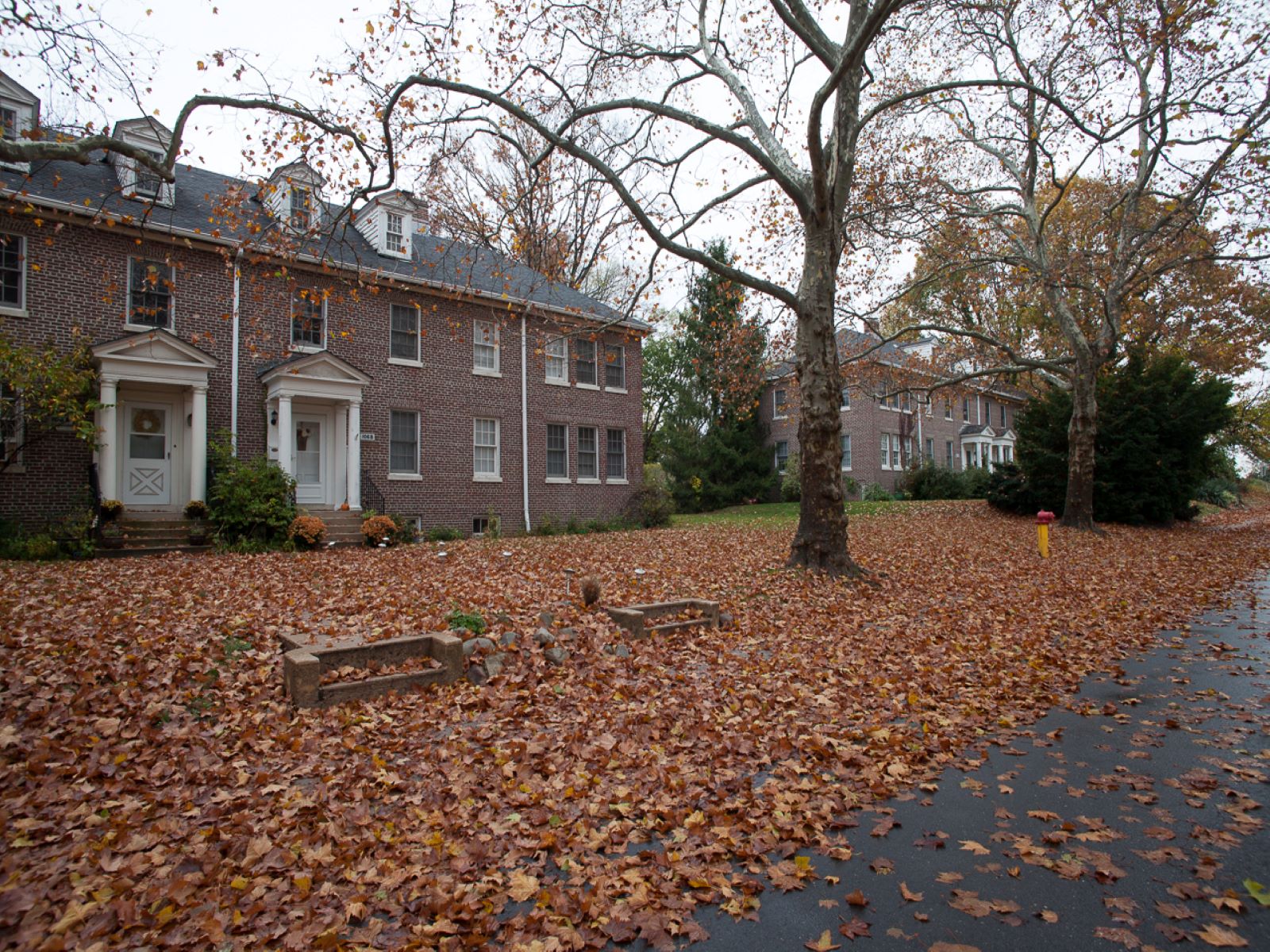
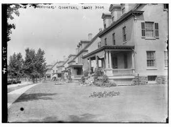
Officers and their families lived in these houses lining Mont Sec Avenue. The oldest houses in neighborhood date to the 1870s; later houses were built during the 1930s as part of the Works Progress Administration.
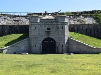
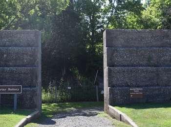
Sandy Hook was the site of America's first mortar battery. Completed in 1894, it mounted sixteen 12-inch caliber, breech-loading rifled mortars, which were divided equally in four massive concrete and earth covered "firing pits." The mortars were designed to fire armor-piercing projectiles, weighing up to 1,000 pounds, in high arcs to bombard an approaching enemy battleship or cruiser from above.
Sandy Hook Mortar Battery<br />386 words; Length: 1:29<br /><br />The Mortar Battery is a concrete gun battery with four mortar pits. It is protected by dunes and earth embankments. It is faced with a wall about eight feet tall and four feet wide at the base. The wall is about two hundred yards in length. Outside the wall, there is a brown, upright metal sign posted on two grey wooden posts about three feet high that reads "Mortar Battery". The Multi-Use Path passes directly in front of the battery, so be alert for bikes. <br /> <br />You enter the area through a ten foot-wide opening in the wall. As you enter, you face an earth embankment with trees and low shrubs to the right and left. A path runs between the wall and the embankment. An electric, chain link fence stretches across the embankment on either side. A twenty-four inch by twelve inch white sign is attached to the fence. It reads: "Electric Fence. Do Not Touch. Shock Hazard".<br /><br />An informational sign entitled "Mortar Battery" stands just to right of the hazard warning. It has a black and white photograph of four manned mortars in one of the mortar pits and explains why batteries became more predominant than forts as battleships became more powerful.<br /><br />An interior path leads straight ahead between two eight-foot thick concrete walls. The massive wall slopes up at a forty-five degree angle until it levels off at ten feet in height. The path has two parallel metal tracks running down the center that were for transporting heavy armory. <br /><br />About fifty feet ahead, there is an arched concrete bridge across the walls with a ten foot by ten foot enclosed structure on the top. Just before reaching the concrete bridge, there is a black metal grate on the right, screening off crumbling concrete steps that once provided access to the structure.<br /><br />The archway is about fifteen feet high and fifteen feet long with rough concrete walls. You exit the archway into a center courtyard area with fifteen-foot high walls. The walls then angle upwards another fifteen feet in height to the earth embankment. The tracks lead to a metal gate directly ahead. <br /><br />Ranger tours are available that provide access to the closed off areas of the battery. There is a scale model of the Mortar Battery in the Lighthouse Visitor's Center.<br /><br />End of Message
The Multi-Use Pathway (MUP) starts at the park entrance and loops around Fort Hancock. It provides a great way to see Sandy Hook. The seven-mile long pathway is shared by walkers, bicyclists and in-line skaters. Bring your own bicycle, or you can rent a bike during your visit.The MUP is for everyone, so please use it with courtesy. Whether you walk, bike or rollerblade, stay on your side of the yellow line. Keep an ear out for people who wish to pass. Have your pets on a s
Both the Nike Ajax and Nike Hercules missiles on display are not part of the original Sandy Hook arsenal. All the original missiles from Sandy Hook were removed despite the request from the National Park Service to save one to interpret the history of the Nike Missile program at Sandy Hook. <br /><br />The U.S. Army was unable to fulfill the request from the National Park Service as they were following orders which were handed down as a result of the Strategic Arms Limitation Talks (S.A.L.T.). The agreements between the United States of America and the Soviet Union were intended to restrain the nuclear arms race. As a result of S.A.L.T., the Treaty on Anti-Ballistic Missile (ABM) Systems was supposed to permit each side to have one limited ABM system to protect its capital and another to protect another missile launch area. The two sites must be at least 1,300 kilometers apart with no more than 100 missiles and 100 launchers. It was agreed that the treaty was to be reviewed in 5 years. <br />
Sandy Hook Nike Missile Site<br />343 words; Length: 1:28<br /><br />The Sandy Hook Nike Missile Site has several Nike Ajax and Hercules missiles on display in a restricted area. It also has two informational wayside signs and a parking lot. There are two yellow wooden maintenance sheds with green roofs, each about forty feet long and 15 feet wide. They have six windows on the long side and a large barn-style door at the narrow end.<br /><br />At the southern end of the parking lot, surrounded by a four-foot high chain link fence. there is a Nike Ajax missile seated on a grey-green elevated missile launch. The one-foot in diameter missile is white with the words "U.S Army" stenciled in black on four sides. The body of the missile is twenty-one feet long with four fins at the base, each with a four-foot span. There are four smaller fins near the nose of the missile. Four even smaller fins are positioned below the nose fins. The missile is pointed northwest at a forty-degree angle. The booster is grey-green and fourteen feet long.<br /><br />Looking across the north bound lane of Hartshorne Drive, there is a restricted area cordoned off with four-foot high chain link fencing. This area contains a twenty-four foot long Nike Hercules missile. It is aimed north at a forty-five degree angle and sits on a grey-green carrier. This round, white missile has four large triangular fins extending most of its length. The fin span at their base is seven feet, and they reach their narrowest point about six feet from the nose of the missile. There are four smaller fins above these larger fins, each only about 3 feet in length. The missile is stenciled on all sides with the words "U.S. Army". <br /><br />There are two informational wayside signs at the site that give the history of the Nike Missile program at Sandy Hook and the Nike guidance systems.<br /><br />The parking lot, located between the north and south bound lanes of Hartshorne Drive, is small, about fifty feet long and twenty feet deep with only one row of parking. <br /><br />End of Message
Nine Gun Battery was built in four stages over a period of 8 years, from 1897 to 1904. When completed, the battery mounted three 10-inch guns and six 12-inch guns. Sandy Hook became the only place in the US and its possessions having a nine gun battery mounting large caliber, disappearing guns. However, the Army found that having only one gun commander for the whole battery made it difficult to coordinate the loading, aiming, and firing of nine big cannons. To solve this pro
Sandy Hook Nine Gun Battery<br />426 words; Length: 1:39<br /><br />The Sandy Hook Nine Gun Battery is a massive concrete and brick two story structure about 200 yards long. The battery has three architecturally different sections, left, middle and right. It is fenced off with chain link fencing and no visitors are allowed on the structure. The Multi-Use Path passes directly in front of the fence. A paving stone plaza with benches, bulletin boards, bike racks and a portable toilet is positioned just off the parking area. There is an informational wayside sign at this site.<br /><br />The left side of the battery's lower level has a solid concrete face with four black metal doors, each about 10 feet tall, spaced about 6 feet apart. There are two wooden doors painted green to the left of the black doors. A set of stairs leading up to the upper level is at the far end of the structure.<br /><br />A brown metal upright sign with a white border, elevated about four feet high, reads: "Extremely Hazardous Conditions/Area Closed". The sign is positioned in front of the chain link fence at the left end of the structure.<br /><br />At the center of the lower level, there is a series of concrete steps up to the first floor gallery. The gallery is elevated three feet off the ground. The stairs are spaced about every 100 feet in a sloped concrete abutment. Two-foot wide, square concrete pillars support the upper deck. The pillars are approximately twelve feet tall. Above the lower gallery, there is a walkway protected by black handrails that run the length of the upper level.<br /><br />The right end of the structure has a lower level gallery raised four feet from the ground. There are four concrete pillars supporting the upper level. There is a storage area on the second story with doors and windows. Two of the windows are blocked off with cement. A black metal catwalk runs the width of the right end of the structure.<br /><br />The three foot by four-foot informational wayside sign is at the left of the battery positioned in the grassy area in front of the chain link fence. It gives an overview of the concrete gun batteries constructed here, as well as Sandy Hook's importance in the defense of New York Harbor. There are three black and white photographs depicting the batteries and guns, plus a color aerial photograph of the area. It is framed in black metal and stands three feet high at a slight ten-degree angle, front to back. It is entitled "Fort Hancock/Coastal Defenses of Sandy Hook". <br /><br />End of Message
This launch site is the most northerly point on Rulers Bar Hassock, the largest of the islands in Jamaica Bay. This sand and pebble beach and parking lot are a popular destination for birdwatchers, anglers and paddlers.
Jamaica Bay North Bridge Beach Parking and Kayak Launch<br />604 words; Length: 2:18<br /><br />The Parking Lot at the end of the North Channel Joseph P. Addabbo Memorial Bridge provides access to the kayak launch and a narrow strip of beach about fifty yards long. The beach has a clear view of the hangars and control tower of JFK International Airport across the water. It has picnic tables and portable toilets. The parking lot runs north and south along side the north-bound lane of Cross Bay Boulevard and has a grass meridian strip planted with three London plane trees. A three-inch curb runs around the whole of the meridian. There are two rows of diagonal parking spaces on the east side of the lot and one row of parallel parking on the west side. The portable toilet is at the north end of the meridian strip. A pedestrian cross walk at the north end of the lot gives access to a second parking lot and narrow beach along the southbound lane of Cross Bay Boulevard. This second parking lot looks west across the North Channel and Pumpkin Patch Channel, with views of the hammocks and islands of Jamaica Bay.<br /><br />An upright sign at the north end of the lot, just before the sandy area and the water, is entitled "Paddling Jamaica Bay". It stands about three feet off the ground, attached to two black metal posts, and measures four feet by three feet. It features a photograph of a kayaker paddling in quiet waters, silhouetted against the sunset. The text reads: "Gateway National Recreation Area is the primary steward of Jamaica Bay, home to a complex of wetlands and uplands that support a large diversity of both native and migratory fish, birds and other wildlife. In addition to providing critical habitat for wildlife, the wetlands of Jamaica Bay also provide important services for humans: marshes act as a protective barrier against storm surges and shore erosion, while improving water quality by absorbing pollutants."<br /><br />End of Text<br /><br />Below the text, there is a map of Jamaica Bay with all available kayak launches named in red. There are iconic symbols for the services offered at each one. To the left of the map, there is a column of text on a yellow background that reads: "Jamaica Bay is the largest expanse of sheltered open space in the region, and one of the finest opportunities for paddle sports in the northeast United States. From short introductory trips lasting less than an hour; detailed excursions into the channels among the delicate marsh highlands; or more experienced paddlers navigating around the tip of the Rockaway Peninsula for some ocean kayaking. Jamaica Bay has something for every level."<br /><br />End of Text<br /><br />Below the map there are three extensive sets of kayaking tips entitled "Know Before You Go", "Good to Go", and "Protect the Bay". The tips are printed over a photograph of a snowy egret wading in the water.<br /><br />Four feet to the left of the kayaking sign, there is a white sign with the rules and regulations of the parking area.<br /><br />At the south end of the lot, there is a red brick picnic pavilion, no longer in use. Wooden posts, the last remnants of an old pier, emerge from the water in front of the former picnic pavilion.<br /><br />The beach is composed of tan sand but has quite a few large rocks, so watch your step. The edge of the beach and the shallow waters just beyond are often host to many seagulls. The grassy mounds of the Landfill Restoration Project lie straight ahead across the bay. There are newly rebuilt salt marshes in the middle of the bay.<br /><br />End of Message
On most Army posts from the early 20th Century, officers' houses face the parade ground, but the view of the bay at sunset was too good to resist. These homes were built for officers in 1898 and 1899. Families could plant flowers and shrubs close to their houses, but plants had to remain below the railings of the front porch. In later years, porches were screened in to keep out insects. White poplar trees lined the street, but they were no match for the constant salt spray and heavy winds. See if you can spot some of the few that remain.
On most Army posts from the early 20th Century, officers' houses face the parade ground, but the view of the bay at sunset was too good to resist. These homes were built for officers in 1898 and 1899. Families could plant flowers and shrubs close to their houses, but plants had to remain below the railings of the front porch. In later years, porches were screened in to keep out insects. White poplar trees lined the street, but they were no match for the constant salt spray and heavy winds. See if you can spot some of the few that remain.
The Jamaica Bay Wildlife Refuge Visitor Center is the gateway to this 900-acre preserve, home to salt marshes, uplands, open bay and beach areas, and two man-made ponds, all supporting hundreds of species of plant and wildlife. The one story, flat-roofed building contains a ranger desk, colorful exhibits on the eco-system of the surrounding area, a classroom, a bookstore, wheelchair accessible bathrooms, water fountains, and tactile, hands-on nature exhibits. Restrooms are open when the visitor center is
The Visitors Center, once New York City's first airport terminal, now houses a ranger desk, a bookstore, bathrooms, and many exhibits on the history of aviation, particularly here at Floyd Bennett Field, as well as exhibits about the ecosystems and flora and fauna of the New York Harbor area.
Visitors are able to fish at many sites throughout Gateway. A fishing/parking permit is required after hours throughout the park. There are also some sites that require permits at all time. Visit our fishing page to learn where you need a parking permit and how to purchase the permit.
Sandy Hook Multi Use Path
See the breathtaking natural scenery and historic military buildings of Sandy Hook's peninsula by bike. Sandy Hook's multi use path is open year-round. The park is open from 5 am to 9 pm from April 1 to October 31 and from 5 am to 8 pm from November 1 to March 31.
Cross Country Skiing at Floyd Bennett Field
After a snow fall visitors can cross country ski in Floyd Bennett Field's North Forty Natural Area. Park rangers will cut a trail through the snow for visitors to follow.
Birdwatching at the Jamaica Bay Wildlife Refuge
The Jamaica Bay Wildlife Refuge is well known as a great place to bird watch, for both the beginner and experienced birdwatchers.
Tours
Count: 3
Fort Hancock Parade Ground Tour
Walking tour of the main areas in Fort Hancock Historic Post
Jamaica Bay Wildlife Refuge Tour
Experience the flora and fauna of this rich and surprising habitat in the heart of New York City.
Old Dune Walking Tour
This tour takes you through the dunes of Sandy Hook. You'll also learn a bit about the historic life saving station. The tour is .7 miles.