Be advised that the NPS has issued alerts for this park.
What's Closed and What's Open on South Rim —Friday, September 26, 2025
Visit this link for a list of the available visitor services in Grand Canyon Village and at Desert View. —South Rim High 68°F (20°C) Low 46°F (8°C). Rain showers likely.
Friday, September 26, 2025 — Critical Backcountry Updates/Closures
Visit the link for the inner canyon weather forecast, today's heat risk and drinking water availability. Inner Canyon High 85°F (29°C) Hot.
North Rim Status and Inner Canyon Closures — Friday, September 26, 2025
Follow the link for North Rim status and current closures. ADDITIONAL CLOSURES: South Kaibab Trail below the Tipoff, Phantom Ranch and North Kaibab Trail.
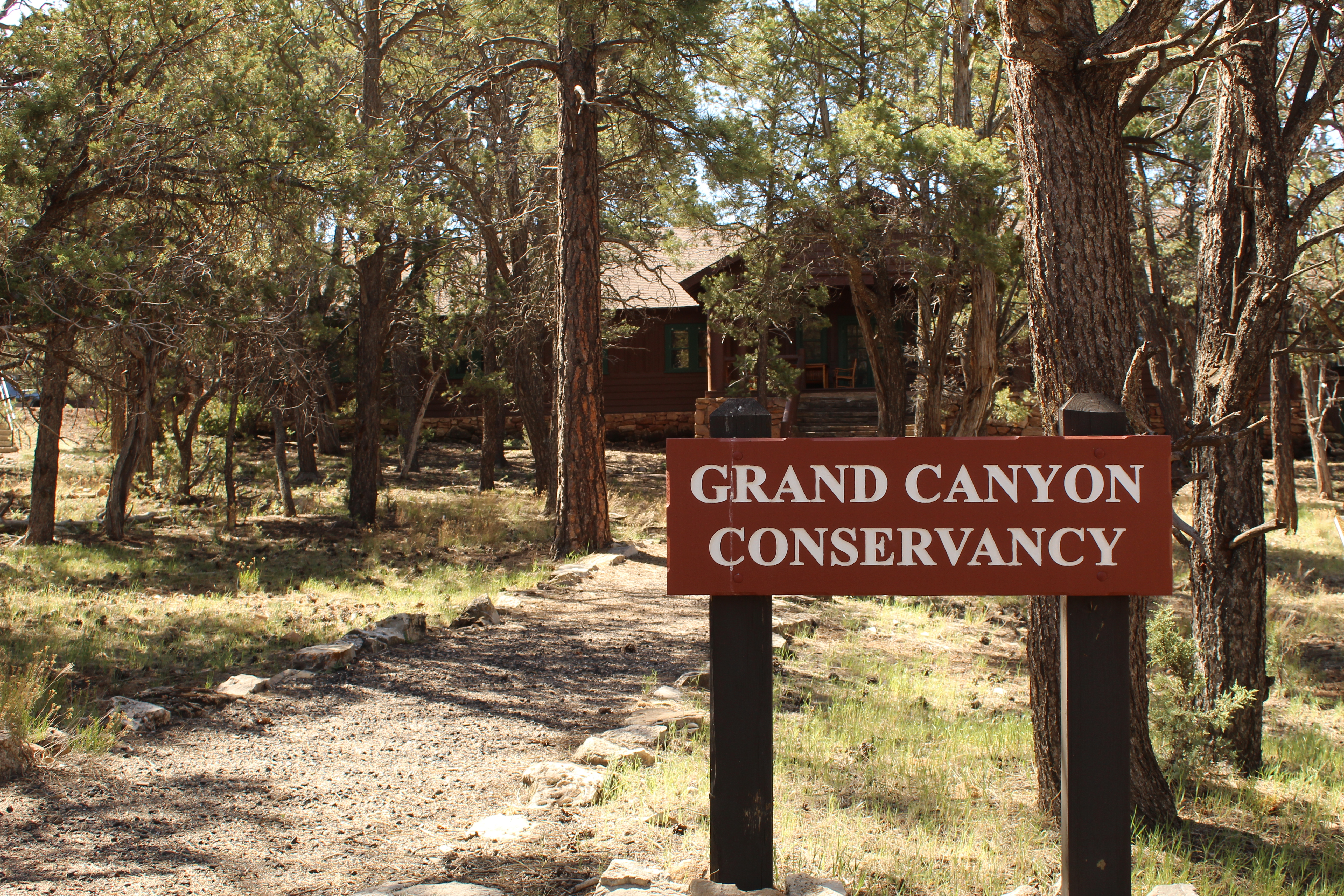
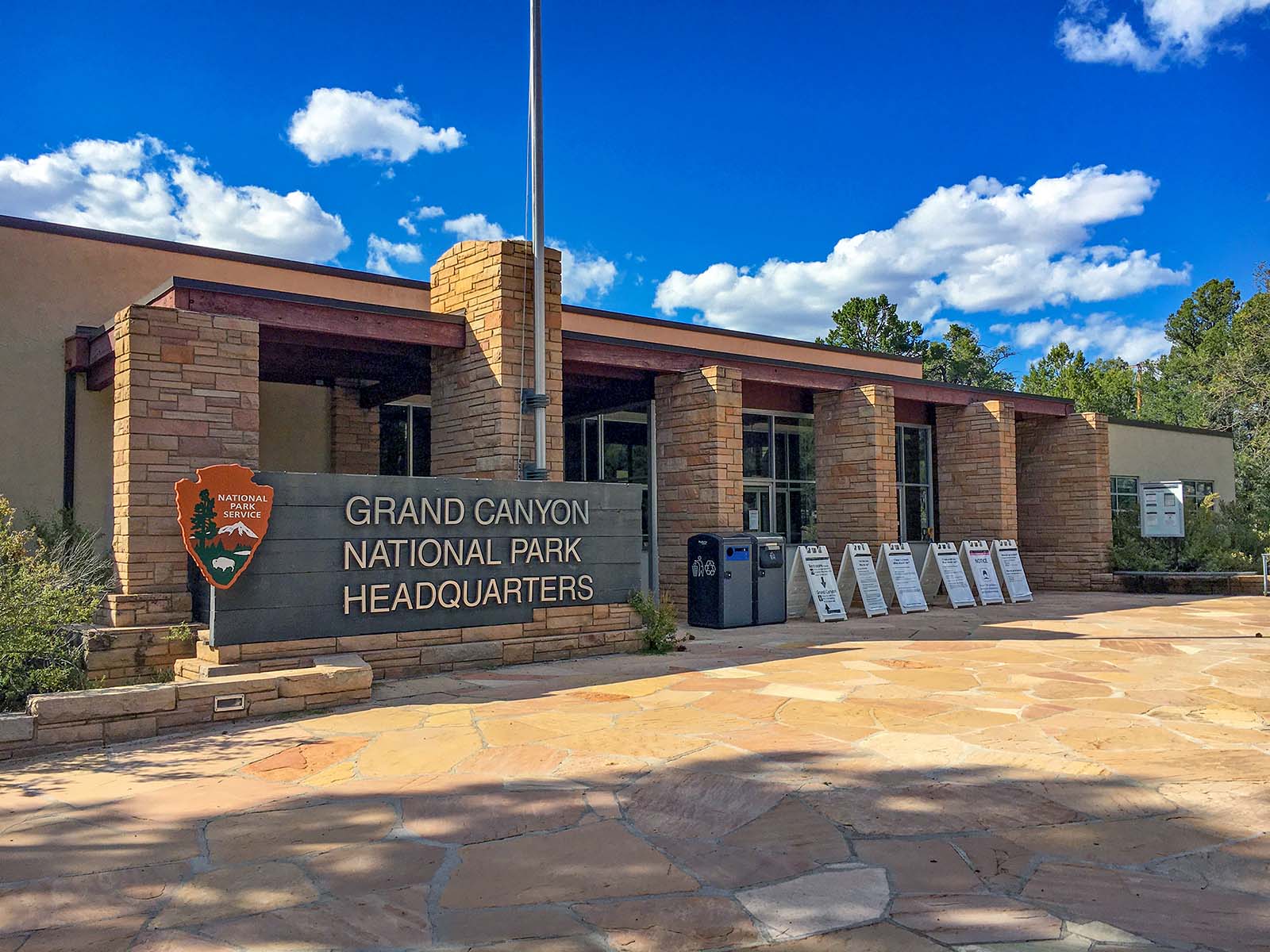
Entirely within the state of Arizona, the park encompasses 278 miles (447 km) of the Colorado River and adjacent uplands. Located on the ancestral homelands of 11 present day Tribal Communities, Grand Canyon is one of the most spectacular example...
Admits one single, private, non-commercial vehicle and all its passengers, up to a 15 person passenger van. Organized non-commercial groups over 16 passengers require different charges. Commercial groups are not eligible for the vehicle permit.
Entrance - Motorcycle
$30.00
Admits one single, private, non-commercial motorcycle and its passenger(s).
Entrance - Per Person
$20.00
Individual ($20 valid for 7 days): for bicyclists, hikers, and pedestrians.
Campsites for the 2025 season are by reservation only, through www.recreation.gov. Reservations can be made with them online, by clicking the reservation button below, or by phone (877-444-6777). Reservations can be made 6 months in advance for the 2025 season that runs from Saturday, April 12 through Sunday, October 12, 2025, with the campground closing for the season on Monday, October 13, 2025. Due to high demand, Desert View Campground now requires advanced reservations. You may book reservations up to 6 months in advance. Desert View Campground does not hold back any campsites for first-come, first-served camping during peak season and does not have a wait list or call back system. Same Day Reservations can be made online (www.recreation.gov) or by phone (877-444-6777).
From March 1, through November 30 (Peak Season) most campsites are by reservation only through recreation.gov. Mather campground offers 15 first-come, first-served sites that go on sale at 8 am. None of Mather Campground's sites have hook-ups or electricity. Full hook-ups are available at adjacent Trailer Village RV Campground, operated by Delaware North.
Reservations can be made up to 13 months in advance. If visiting during the busy season (May through October) making reservations 1 year in advance is recommended.
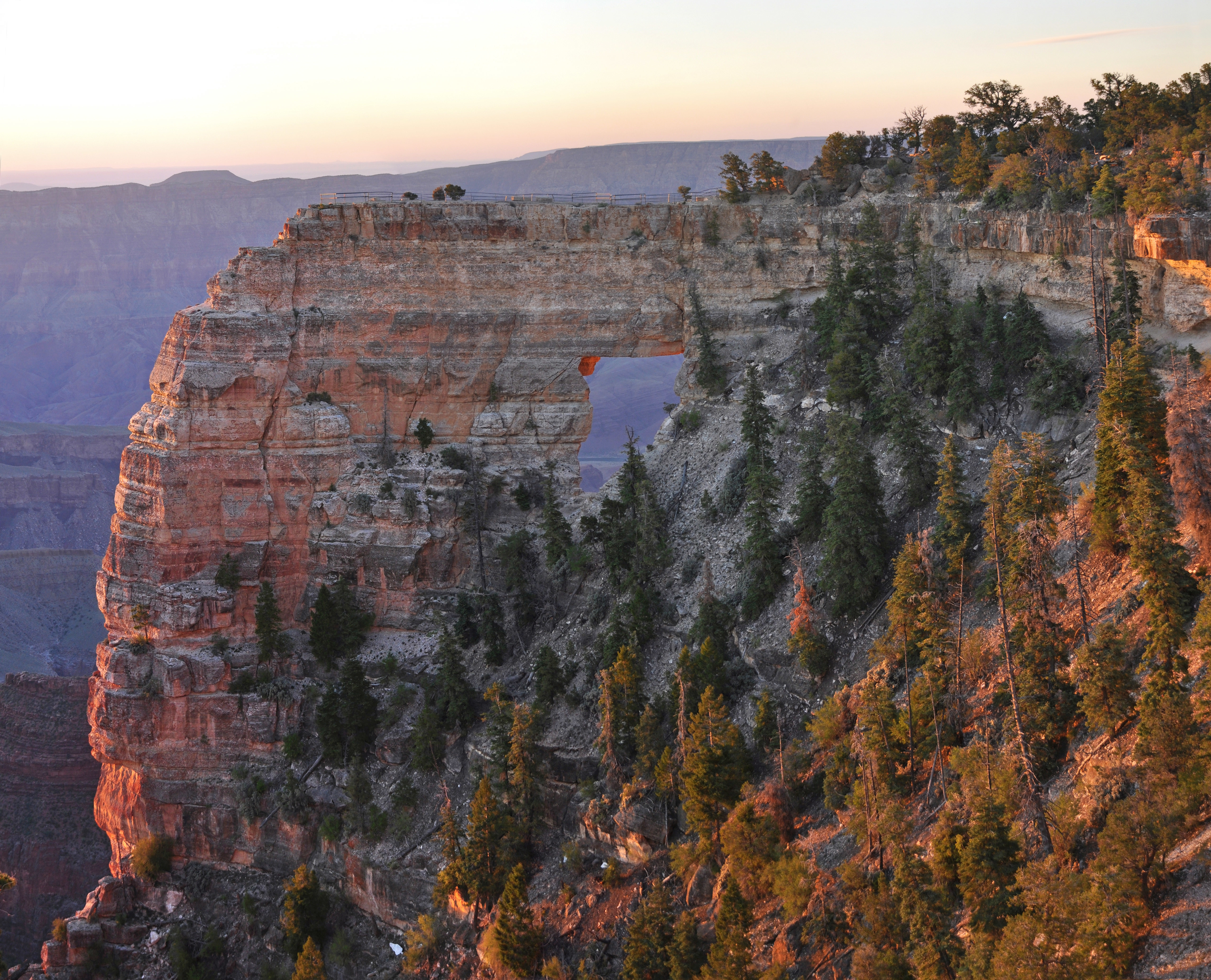
The North Rim is CLOSED for the remainder of the 2025 season because of damage and losses caused by the Dragon Bravo Wildfire. A short, easy side trail from the Cape Royal trail leads to an area above Angels Window, which offers visitors the chance to stand over a natural arch and enjoy a magnificent viewpoint. Railings and fencing secure the area. However, walking above Angels Window may not be a good idea if you are afraid of heights!
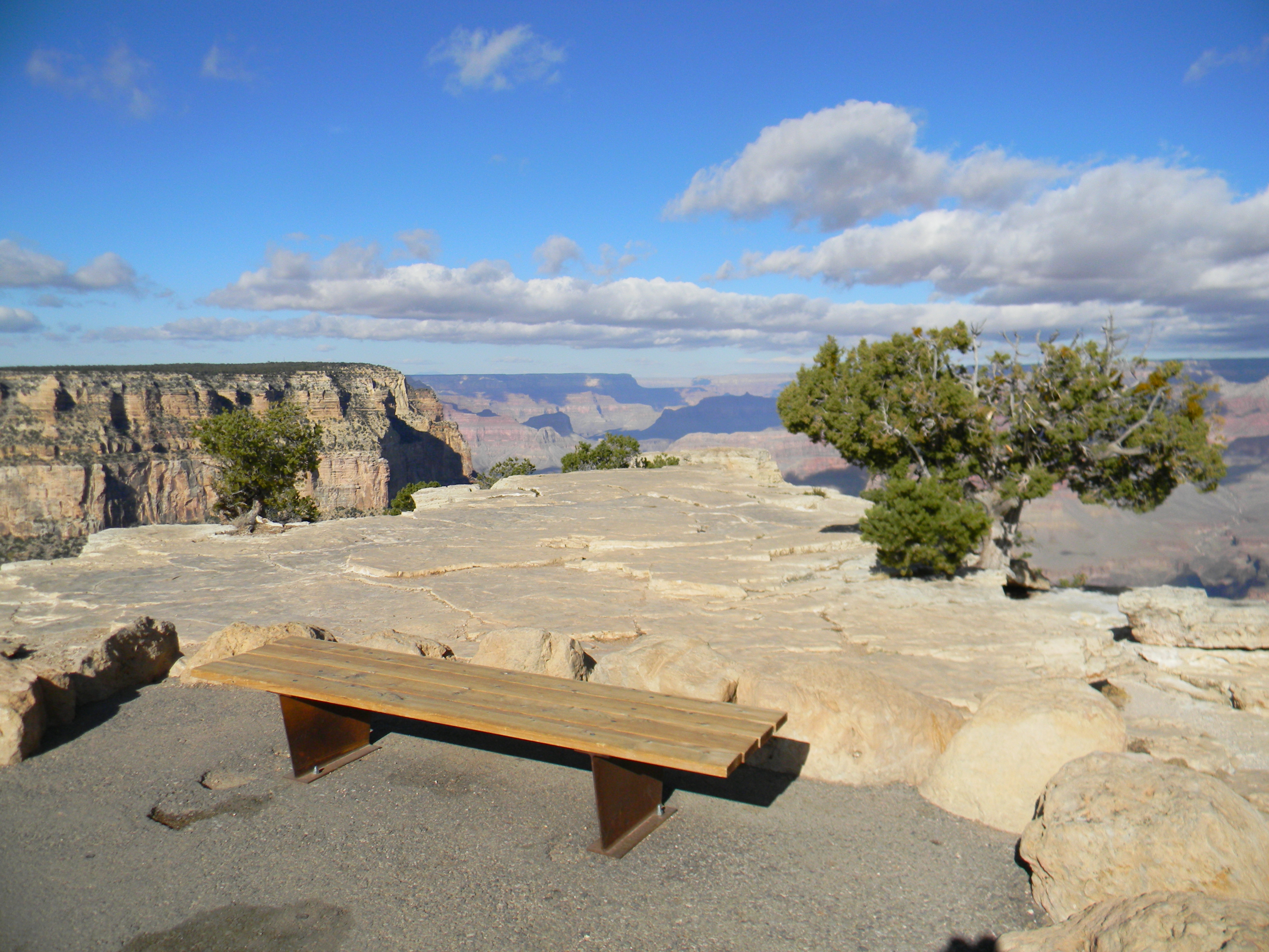
A D Stop 2, Angels Window. 2 minutes. About halfway along the paved Cape Royal Trail from the parking area, a second paved trail leads left (east) to an observation platform, and an unpaved trail along the top of Angel’s Window. The Angels Window trail leads down a slight slope to a fork. Take the left fork to continue along a slightly narrower path that curves around to the right to a paved, stone-lined observation platform, 15 feet (five meters) wide by 10 feet (three meters) deep. To the left is the towering Vishnu Temple. To the right, the massive, curved walls and flat top of Wotans Throne. Two, three-foot tall wayside panels mounted on angled, metal reading rails stand side by side along the canyon side of the platform. The left-hand panel describes the changing colors of the Colorado River. The right-hand panel encourages you to listen to the sounds of the canyon. Descriptions of these two panels are included in the sub-script below. Note a wooden park bench in a small grove of trees at the far, right-hand side of the platform. Be mindful of the rocky platform border when moving to the bench. Moving back up the trail from the observation platform to the fork, a second asphalt trail to the left slopes down about 20 feet (six meters) to set of uneven stone steps and a dirt and gravel trail. The uneven dirt trail winds further down among a series of large boulders, then moves down three more stone steps to a path along the edge of the canyon. Four-foot tall metal guardrails flank the trail on either side. Note the path narrows as it crosses onto the top of Angel’s Window itself. The path continues east to a large, rocky expanse on top of the rock formation, 50 feet (15 meters) long by 25 feet (eight meters) wide, with metal guardrails all around. The River Red Wayside Panel A panoramic color photograph of the canyon with a view of the winding, reddish brown Colorado River at the bottom fills the face of the first wayside panel at the left. Entitled “The River Red,” words at the top of the panel read: Is the Colorado River clear, rusty brown, or emerald green today? Before the 1963 construction of Glen Canyon Dam just upstream of Grand Canyon, the river flowed a sediment-filled red and was called “the river colored red”, or Rio Colorado. It was described as “too thick to drink, and too thin to plow.” Sediments act as liquid sandpaper, carving the canyon, but that effect is now drastically curtailed. The clear green water that flows through Grand Canyon today is sediment-starved. The sediment is choked back by the dam and deposited in Lake Powell. It is only after spring snowmelt or when the summer monsoons arrive that the river flows red (like photo below), as side streams flush sediment into the Colorado. The first of two inset color photographs at the left shows a large dam on the river, nestled between high rock walls at the left and right. A caption reads: Glen Canyon Dam stifles the cutting and scouring power of the Colorado River. The cold, clear water discharged from the dam has drastically altered the ecology of the river, forever changing the web of life. The second, circular color photograph shows an emerald green segment of the Colorado River, with a diagonal line pointing from the river in the inset photograph to the river in the main panel photograph. A caption reads: Today’s sediment-starved river erodes rather than replaces beaches. Listen Wayside Panel At top of the second wayside panel at the right, text reads: Listen Stand still, be quiet, close your eyes. . .what do you hear? Is it a natural or human-caused sound? Can you hear a distant Colorado River rapid roar? Is something else masking its sound? Is one sound more desirable or more soothing? What value do you place on the sound of falling rain or the wing beat of a passing raven? National parks allow us to enjoy landscapes and soundscapes. But natural sounds are slowly and incrementally being covered up by noises that did not exist in parks until recently. Park managers must limit the array of mechanized disturbances that encroach upon the acoustic values of the park. Hearing is the only option for experiencing certain aspects of Grand Canyon—whistling canyon winds, howling coyotes, its immense quiet. Without limits on human noises, would your Grand Canyon visit be diminished? A series of three color photographs fills the left side of the panel. At the top, the first photograph shows a bright white lightning strike above a cloudy, blue-tinged view of the canyon. Questions read: “What value do you place on the sound of thunder? On quiet?” At the middle left, a waterfall cascades between some rocks, splashing into a green pool below. Text reads, “Natural sounds have powerful effects on our emotions, attitudes, and memories.” At the bottom left, a lone hiker stands in silhouette against a sun-drenched rock wall. Words read, “The quieter a place is, the more sensitive we become to human-caused noises. What can you do to lessen your noise?” A panoramic view of the canyon fills the right side of the panel, with a black bird soaring high overhead. Words read, “Listen for the wing beat of a passing raven.”
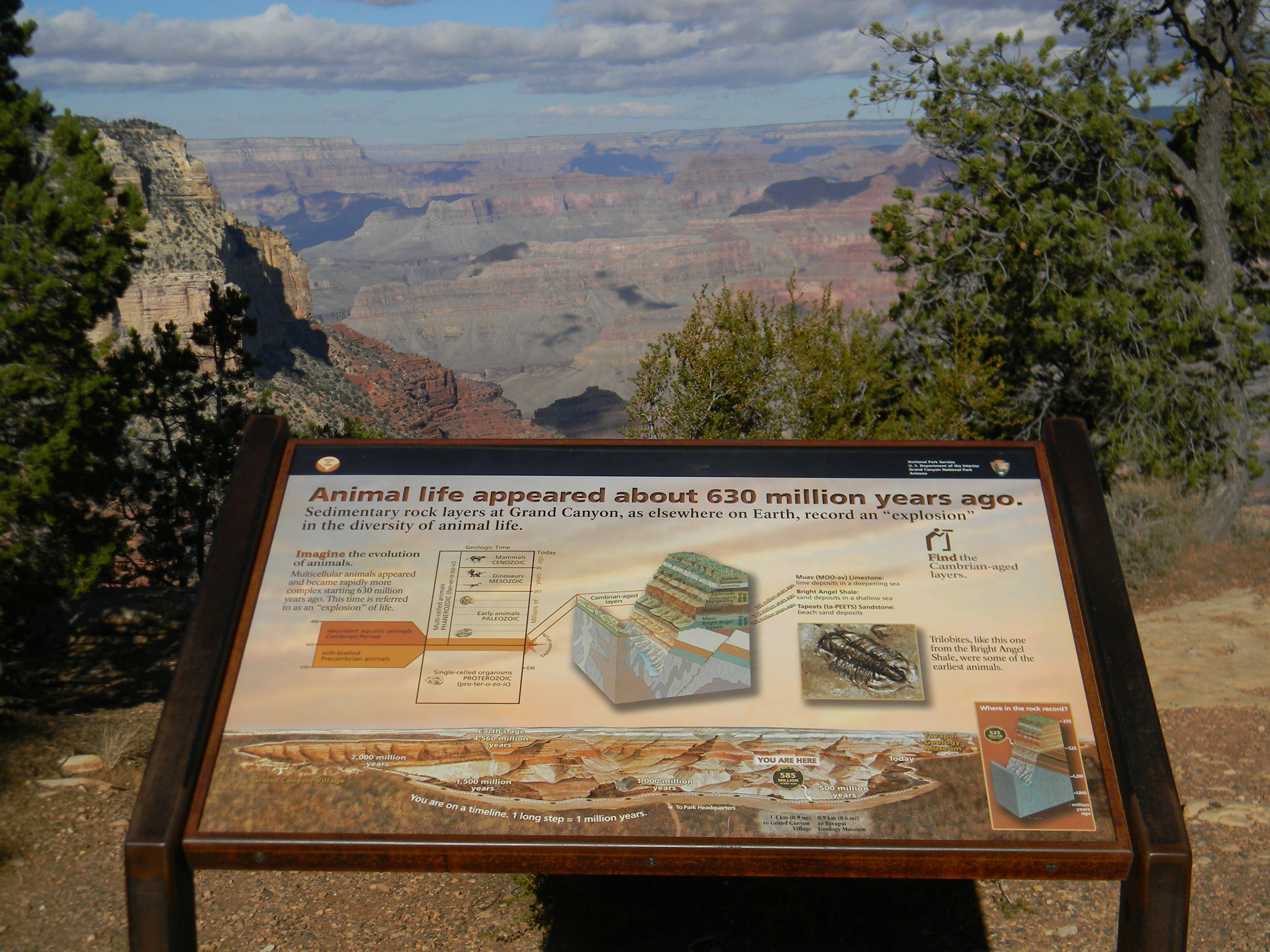
The record of life and the stories of the diverse creatures that once lived here are captured in the rocks that make up the walls and cliffs of Grand Canyon today in the form of fossils, tracks, and various clues deciphered by paleontologists.
A colorful wayside next to the paved rim trail offers an explanation on the fossil record of Grand Canyon rocks. To the right of the angled wayside is a tall post with a brass tube attached to the top. In the distance the canyon's colorful landscape of cliffs, slopes, layered rock, carved formations, and wide views is visible behind a few small green trees.
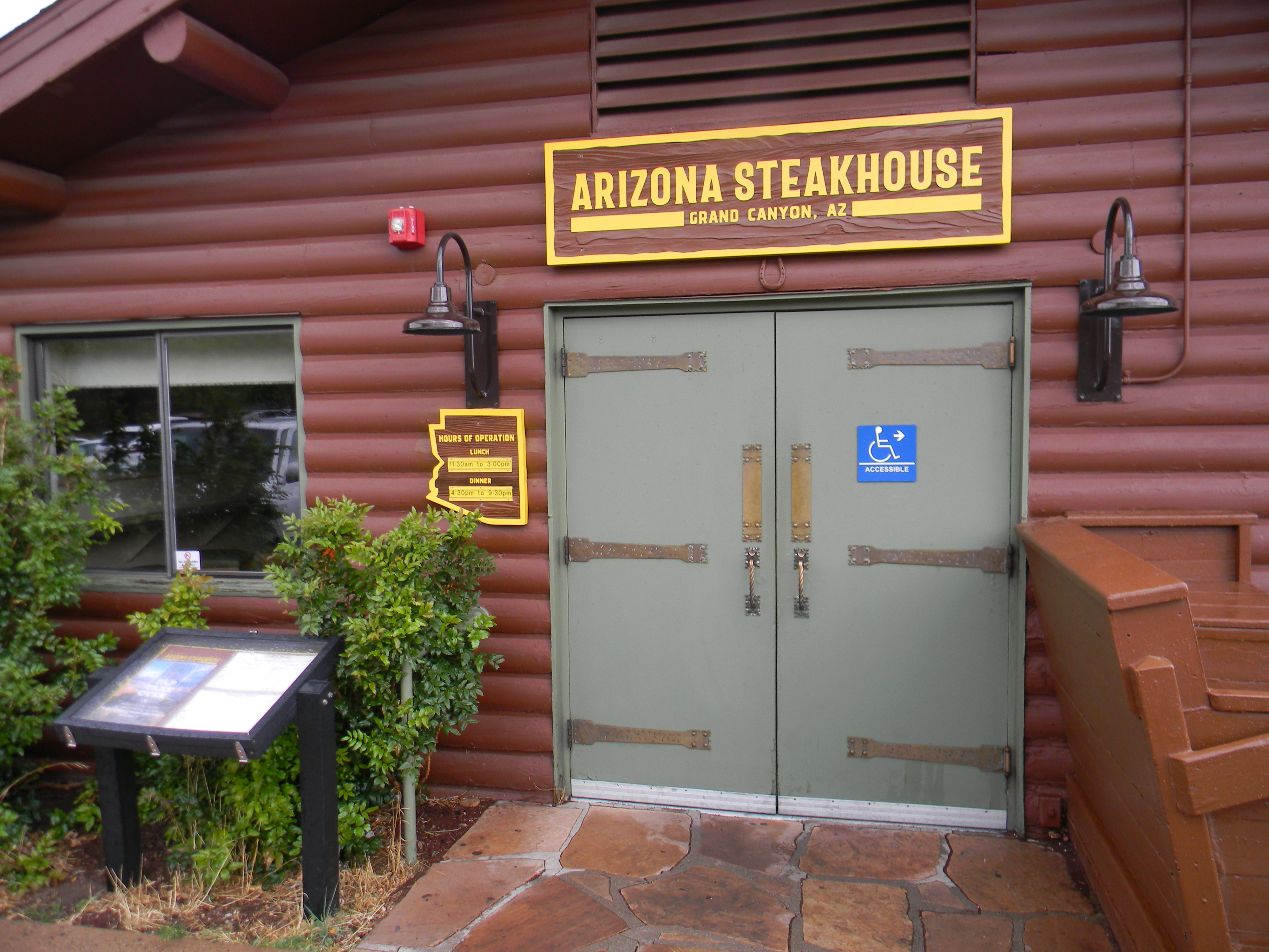
The Arizona Steak House (at Bright Angel Lodge) Lunch 11:30 am – 3:30 pm, Dinner 4:30 pm – 9:00 pm. Located on the east side of Bright Angel Lodge in the South Rim Village Historic District, the Arizona Steakhouse is one of the few restaurants in the park offering canyon views from the dining area. Southwestern flavors and ingredients inspire the cuisine.
Outside on the canyon side of the lodge, a flagstone bench with a stone slab back rings a planter at the center of a 100-foot (30 m) long by 80-foot (24 m) wide flagstone terrace. Several other stone benches sit across the terrace, and there is a soda fountain and ice cream shop toward the east side of the building. At the far eastern end of the lodge is the Arizona Steakhouse restaurant, with its own separate entrance.
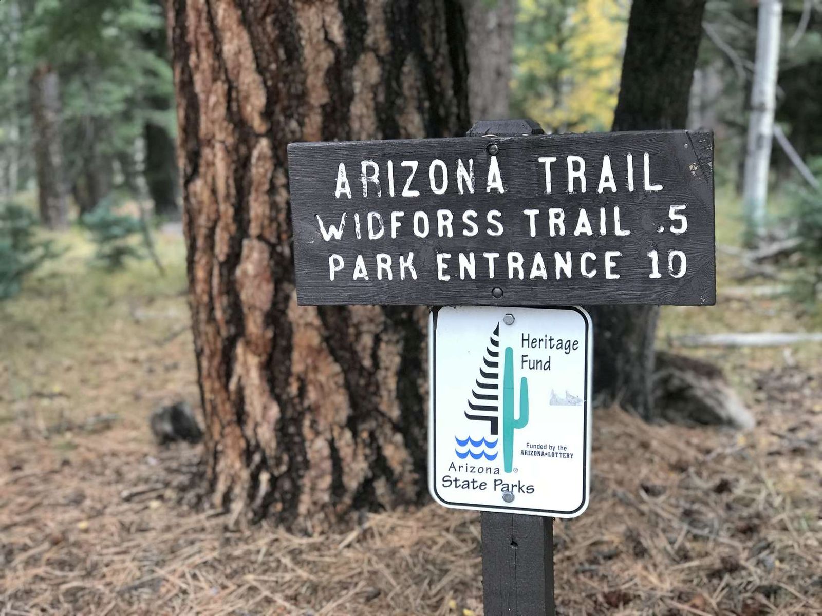
The North Rim is CLOSED for the remainder of the 2025 season because of damage and losses caused by the Dragon Bravo Wildfire. The Arizona Trail is an ambitious project that traverses the length of Arizona from the Utah border to Mexico. A section of this trail enters the park near the North Entrance and roughly parallels the highway until it connects with the North Kaibab Trail, a distance of approximately 10 miles (16 km).
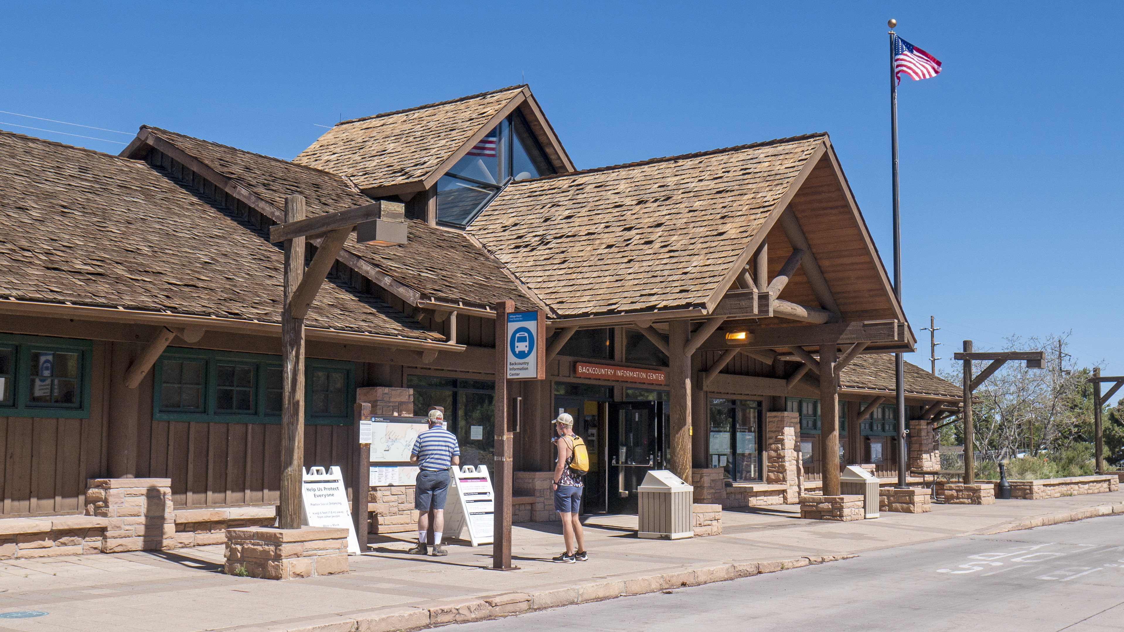
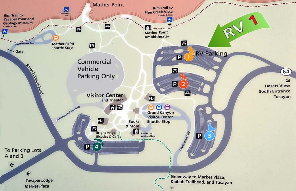
The Backcountry Info Center is open daily from 8 am–noon; and 1 pm–5 pm, and provides information, permits, and trip planning assistance about day and overnight hikes into the canyon. The building is located in the village by Parking Lot D, and across the railroad tracks from Maswik Lodge. Park in Lot D, then take the free, early morning Hikers' Express bus from Backcountry Info Center to South Kaibab Trailhead.
Located near Maswik Lodge and Parking Lot D, the Backcountry Information Center is where one obtains a permit to camp anywhere in the park, other than in developed campgrounds. A triangular wood and shingle awning supported by thick log pillars and exposed timbers rises 20 feet (6 m) above the double metal and glass entry doors in the center of the long, one-story building. A couple of shaded picnic areas with tables sit at either end of the building. Several garden areas bounded by low limestone walls are interspersed across surrounding stone patio, and a set of railroad tracks runs directly behind the building on the other side of a four-foot (1.2 m) tall metal fence. Park staff are stationed inside the building to issue permits and answer questions. Restrooms and a water fountain with a bottle filling attachment are also available inside. The Village Route shuttle bus has a designated stop in front of the building, as does the early morning Hikers' Express shuttle.
Parking Lot D has 150 standard parking spaces, and 30 sized for RVs or buses. The Backcountry Information Center provides restrooms, water, trail information, and helpful park rangers ready to answer your questions and help plan your trip. (Permits are required for all overnight trips into the canyon.) The early morning Hikers' Express shuttle bus also stops here daily on its way to the South Kaibab Trailhead. Visit the link for current schedules.
A metal sign outside of a large peaked roof wood and stone building displays a white and blue symbol of a shuttle bus. Text under the image reads "Backcountry Information Center".
The North Rim is CLOSED for the remainder of the 2025 season because of damage and losses caused by the Dragon Bravo Wildfire. This trail follows the road (AZ 67) and connects Grand Canyon Lodge with the North Rim Campground, the Backcountry Information Center, and North Kaibab Trailhead. It is 1.9 miles through the forest, with minimal elevation gain. Bicycles and leashed pets are permitted on this hard-packed trail.
A D Stop 10, Bridle Path. 1 minute. The Bridle Path begins above the parking lot for the North Kaibab Trailhead, located along the east side Route 67, a little over two miles (three and a half kilometers) north of Grand Canyon Lodge. Two wildlife-proof metal garbage cans and bicycle rack stand at the foot of a one-way road that loops right uphill around a long, slender lot with diagonal parking spaces. Note at the top of the lot, there is a wheelchair accessible vault toilet, and another wildlife-proof metal garbage can. From a horse pen above the lot, a long, wood-post lined path leads downhill from the pen, alongside and parallel to the long south side of the lot. It emerges at the North Kaibab trailhead beside the water filling station, at the base of a stone staircase. The Bridle Path continues alongside the roadway to the west, connecting the North Kaibab Trailhead with the Backcountry Information Center, North Rim Campground, and Grand Canyon Lodge. Bicycles and leashed pets are permitted on this hard-packed trail.
The North Rim is CLOSED for the remainder of the 2025 season because of damage and losses caused by the Dragon Bravo Wildfire. This trail follows the road (67) and connects Grand Canyon Lodge with the North Rim Campground, the Backcountry Information Center, and North Kaibab Trailhead. It is 1.9 miles through the forest, with minimal elevation gain. Bicycles and leashed pets are permitted on this hard-packed trail.
Thousands of feet of exposed rock layers at Grand Canyon provide a veritable playground for scientists to explore and this site tells the tale of a world far different than the one we see here today. With careful eyes the exposed fossilized remains of creatures from an ancient marine environment can be seen.
This site is located at the western end of Grand Canyon Village, 300 feet (90 m) west of Hermits Rest Route Transfer along the paved Rim Trail. Twenty feet (6 m) to the canyon side of the trail, a three-foot (1 m) tall by six-foot (2 m) wide square stone altar stands roughly six feet (2 m) from the rim of Grand Canyon, near the end of a flat, 30-foot (9 m) wide by 60-foot (18 m) long open, pebble-strewn landing. Be mindful stepping over a line of rocks bordering the edge of the asphalt trail onto the loose footing of the landing. Touch the stones that form the altar. Facing north down into the canyon, numerous switchbacks of the Bright Angel Trail run up to and past 3-Mile Resthouse, and continue into the distance toward a stand of trees at Indian Garden far below. To the right across the chasm, perched on the edge of the canyon cliffs, is the multi-level dark brown Kolb Studio surrounded by evergreen trees below and behind the building. To the right of the studio, hikers enter and leave the canyon at the Bright Angel Trailhead. Above the trailhead, a few parking lots in the Village sit behind Bright Angel Lodge. The turreted top of El Tovar Hotel rises in the background, high above the rim. Located opposite the Rim Trail Worship Site on the other side of the asphalt path, away from the canyon, is a several-hundred-square-foot (90 meters square) gently-sloping rocky area filled with fossils. Note that once off the Rim Trail, the terrain quickly becomes rough, uneven and rocky, interspersed throughout with prickly pear cactus, juniper, and fir trees. Rocky escarpments stand exposed across the field, some three- to four-feet (1 to 1.2 m) high and tens of feet (10 m) long. On this west side of the Bright Angel Fault line, sedimentary rock layers have been uplifted, exposing an amazing diversity of rock formations with an abundance of fossils and trace fossils hidden within the youngest layer of Grand Canyon, the Kaibab Limestone. Common marine fossils include crinoids, animals that had a column-shaped body, created by a series of discs stacked together, topped by a cup-like head feeding structure radiating out like feathery arms. Shelled marine animals known as brachiopods had two asymmetrical shells, or valves. Several different species of brachiopods can easily be found here.Colonial animals called bryozoans produced lacy structures on hard surfaces or stick structures that stood up in ancient seas. Some solitary coral embedded the pointed end of its horn in the soft sediment for stability with a wider upright cup-like end. Sponge fossils are abundant as well. When they hardened into rock, they are more resistant to erosion and often stick out as large knobs or nodules from the surrounding limestone. Animals burrowed through the soft sediment at the bottom of ancient seas. Look for all manner of preserved burrows that were filled in with sediment. These could be long, short, wide, or thin tubular-looking structures. Many plant fossils also remain, such as small pines and ginkgoes. Most of the plant fossils are impressions called trace fossils, left behind in the mud of an ancient river system. Note that it is illegal to dig up, relocate, and/or remove fossils from Grand Canyon National Park. If you find a fossil, please leave it for others to discover and scientists to study. You are welcome to take a picture or make a drawing of the fossil, then go to one of the visitor centers to see if a park ranger can help you identify it.
Opened in 1935, Bright Angel Lodge offers several dining options: Bright Angel Fountain/Coffee and Grab and Go: 5:30 am to 6 pm daily. Fred Harvey Burger: Breakfast: 6:30 am to 10 am, Lunch: 11 am to 4 pm, Dinner: 4 pm to 9 pm daily. Fred Harvey Tavern: 11 am to 10 pm (food until 9 pm) daily. Arizona Steakhouse: . Lunch 11:30 am to 3:30 pm, Dinner 4:30 pm to 9 pm. Bright Angel lodge is located right along the canyon's edge in the Village Historic District.
Just inside the front doors of Bright Angel Lodge at the left is a counter to book bus tours, mule rides, and Phantom Ranch reservations. Continue 10 feet (3 m) forward across the stone floor of the lobby to the 25-foot (8 m) long main registration desk at the left. Three massive log pillars spaced evenly across the width of the desk rise 15 feet (4.5 m) high to an exposed timber ceiling. Interior finishes included hand-sawn logs, adobe, and local limestone. Directly opposite the desk, a 10-foot (3 m) wide stone floor corridor leads to a gift shop at the left, a restaurant straight ahead, and a bar at the right. Note that about 8 feet (2.4 m) beyond the far end of the desk is a large, 10-foot (3 m) wide by 8-foot (2.4 m) tall, limestone fireplace with a couple wooden benches at the left and right up a small 6-inch (150 cm) step. Another hallway to the left at the far end of the desk leads to a water fountain and an ATM machine. The Bright Angel History Room is on the right. A set of restrooms is available straight ahead down this hallway and down a small flight of six stairs. Outside, on the canyon side of the lodge, a flagstone bench with a stone slab back rings a planter at the center of a 100-foot (30 m) long by 80-foot (24 m) wide flagstone terrace. Several other stone benches sit across the terrace, and there is a soda fountain and ice cream shop toward the east side of the building. At the far eastern end of the lodge is the Arizona Room restaurant, with its own separate entrance. From a position facing the Bright Angel Lodge reception desk, move to the far right-hand side of the desk and turn left. Move about 15 feet (4.5 m) forward, and turn right to move across the stone floor, then over a wooden threshold and through a set of eight-foot wide wooden sliding pocket doors onto a carpeted floor. You are in a 25-foot (8 m) wide by 20-foot (6 m) deep room with exposed timbers. The Bright Angel History Room highlights the legacy of Fred Harvey, Mary Jane Colter, and the Santa Fe Railway at Grand Canyon National Park and throughout the Southwest. On the wall to your left and along the left-hand wall are a series of exhibits about Fred Harvey in Arizona. On the wall to your right are a series of exhibits on Harvey at the Canyon, including an open, three-seat carriage with a roof. Four six-foot (2 m) tall floor-standing glass-enclosed display cases in the center left and right of the room display artifacts used and sold in Harvey's company restaurants and gift shops along the Santa Fe main line from Chicago to Los Angeles. A small gift shop and check-out counter sit in the back-right corner. On the opposite side of the room from the door, two five-foot (1.5 m) square picture windows frame a 10-foot (3 m) tall by 10-foot (3 m) wide stone fireplace. Designed by Mary Colter, its construction mirrors a typical cross-section of the canyon's geology. The roughly triangular outline represents the alternating slopes and cliffs seen in the profile of the canyon's walls. Be mindful of the two-inch (5 cm) high dark-stone Vishnu Schist that forms the hearth at the bottom and the metal andirons at the front left and right. Feel how the rock layers of the fireplace mimic the canyon. Touch the diagonal layers of the Grand Canyon Supergroup next to the fireplace opening, topped by the narrow horizontal layers of the Paleozoic era. The top layer is the Kaibab Formation, the youngest and uppermost layer of rock in Grand Canyon. Five steps at the front left of the one-story limestone brick Bright Angel Lodge lead up under a simple shallow-pitched gable roof, forming a 10-foot (3 m) deep by 50-foot (15 m) wide covered gabled porch supported by peeled log posts. Six large exposed timbers support a triangular sloping shingled roof, 20-feet (6 m) tall at the center over the main entrance. Designed by architect Mary Jane Colter, Bright Angel Lodge is a complex of cabins around a central lodge building, directly on the edge of the canyon. Four windows penetrate the stone façade of the lodge. Two glass and metal hurricane lamps hang eight-feet (2.4 m) high to the left and right of the main entrance. A brightly painted eight-foot (2.4 m) wide wood and glass vestibule stands in front of the doors with blue and yellow vertical stripes, inlaid with red and white triangles outlined in black. Shed-roofed appendages create a layered effect for the mass of the main lodge. Outside on the canyon side of the lodge, a 100-foot (30 m) long by 80-foot (24 m) wide flagstone terrace leads right up to a 3-foot (1 m) tall limestone wall on the edge of the rim.
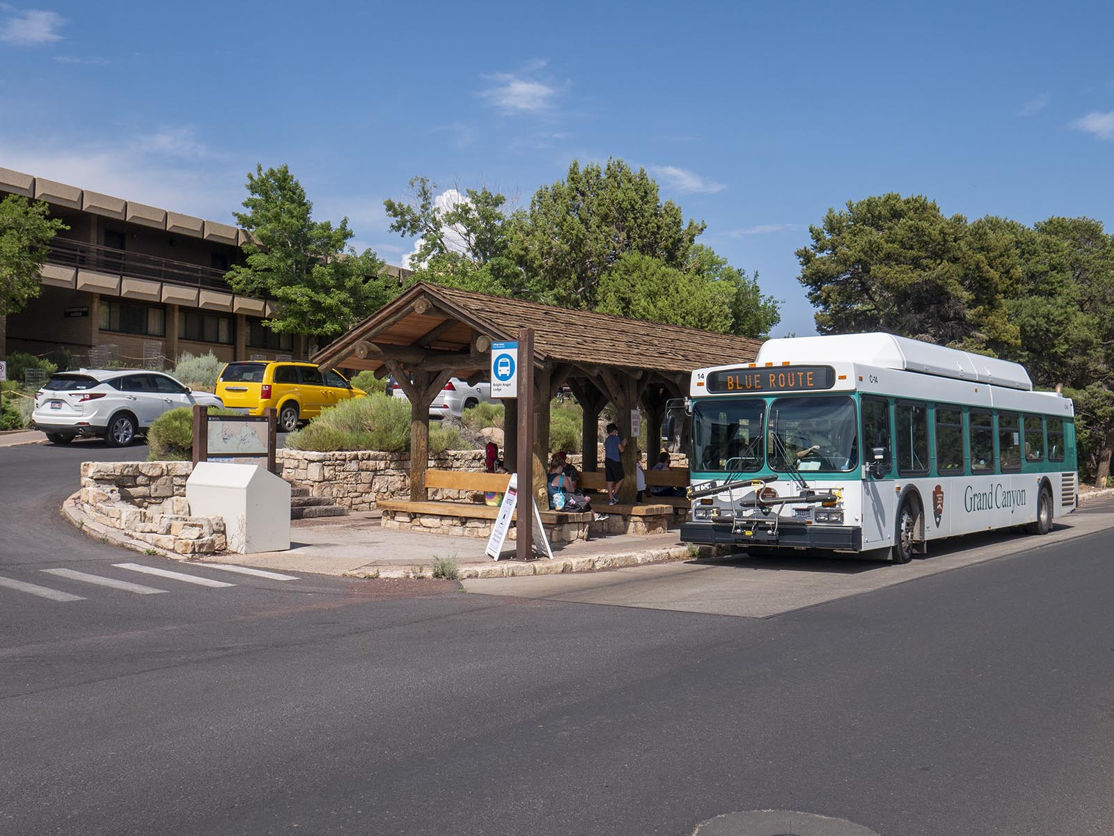
Located on Village Loop Road and just east of Bright Angel Lodge, this shuttle stop offers quick access to the canyon rim. Thunderbird and Kachina lodges (guest rooms) and Bright Angel Lodge (including Fred Harvey Burger, Bright Angel Coffee Bar and Fountain). The early morning Hikers' Express Shuttle, with service to South Kaibab Trailhead, also departs daily from this stop. Visit the link for the current schedules.
The North Rim is CLOSED for the remainder of the 2025 season because of damage and losses caused by the Dragon Bravo Wildfire. The viewpoint can be accessed from a steep, paved trail below Grand Canyon Lodge.
A D Stop 24, Bright Angel Point. 1 minute. From A D Stop 23, the asphalt path to Bright Angel Point continues about a quarter mile (400 meters) east. Note the paved path becomes increasingly steep, and there are no guardrails along the path to Bright Angel Point. The paved Bright Angel Point Trail leads out the spine of the ridge to Bright Angel Point. This trail is steep in places, with drop-offs and stairs, and provides dramatic views into Roaring Springs and Bright Angel Canyons. At the end of the trail is a narrow overlook, surrounded by four-foot (one meter) tall metal railings. A three-foot tall wayside panel mounted on an angled, metal reading rail stands at the edge of the rim at the far end of the overlook. Entitled “Breaking Ground,” the panel discusses the fracturing that created Bright Angel fault. A description of this panel is included in the sub-script below. Sub-Script Breaking Ground Wayside Panel A color photograph of the canyon view from this location at Bright Angel Point fills the panel. At the top left, words read: Breaking Ground Look down Bright Angel Canyon where North Kaibab Trail winds. The Earth’s crust fractured in this area, lifting one side of the rock layers and lowering the other, creating a fault. The trail follows this fault into the canyon. Water also follows the fault. Springs, like Roaring Springs, are able to flow because the groundwater has reached impermeable rock, where it spreads out sideways and leaks out of the canyon walls as springs. At the left, a white label and line indicate the location of Walhalla Plateau. At the bottom center, a second white label points out Bright Angel Fault. The deep fault continues to the right, all the way to a third label at the right of the panel, Phantom Ranch. At the right, an inset color illustration shows a cross-section of the canyon, with the fault in the middle. A caption reads: Sixty million years ago the west side of Bright Angel Fault was lifted higher than the east side.
The North Rim is CLOSED for the remainder of the 2025 season because of damage and losses caused by the Dragon Bravo Wildfire. This narrow, paved path provides spectacular views, though it drops off dramatically on both sides in some places, and certain sections are surprisingly steep.
A D Stop 21, Bright Angel Point Amphitheater + Wayside. 1 minute. The Ranger talk area is located to the southeast of Grand Canyon Lodge along the Bright Angel Point trail. From a position along the access ramp at the back of the lodge complex, move about 250 feet (75 meters) east away from the lodge complex along a concrete sidewalk. Continue past several cabins at the left and right, and through a small grove of ponderosa pine, to where the pavement changes from concrete to asphalt. Continue about 75 feet (23 meters) to a number of wooden benches arranged in a semi-circle at the left. A wooden sign at the left tells us that during the season, ranger programs are held here daily. At the far side of the Bright Angel Point Amphitheater, a three-foot tall wayside panel mounted on an angled, metal reading rail at the right, a mere 10 feet (three meters) from the rim, talks about how the different horizontal layers of the canyon were formed. A description of this panel, entitled “Layered Environments,” is included in the sub-script below. Sub-Script Layered Environments Wayside Panel A color photograph of the canyon from this vantage point fills the left side of the panel. Words at the top left read: Layered Environments Tropical seas, coastal beaches, sand dunes, swamps, lagoons, and Sahara-like deserts are encapsulated within the horizontal layers that fill the view. The upper five layers of prominently stacked rocks record 70 million years of rising and falling sea levels. The limestone layers equate to shallow sea environments, sandstone layers mean sandy beaches or dunes, while shale layers translate to mud flats, swamps, or coastal plains. How do we know all this? The rocks tell us, through their fossils, mineral grains, and structures. Beneath the text, white lettering and lines point to the different formations. Top to bottom on the image, there is Kaibab limestone, the Toroweap Formation, Coconino Sandstone, the Hermit Formation, and the Supai Group. At the right, several color illustrations depict the environments that gave rise to these formations, in that same order. At the top, a shark and other ancient sea creatures swim in an ocean, above many plants and shelled creatures on the seabed. Text reads: The Kaibab sea advanced as far as modern-day eastern Arizona, depositing marine fossils including crinoids, shells, and shark’s teeth. A mix of beach (sandstone) and sea (limestone) environments were embedded in the Toroweap, indicating a short advance and retreat of the sea. In the second image, a reptilian creature slithers across wide sand dunes. Text reads: Crossbed sands in the Coconino Sandstone depict scenes of shifting sand dunes, where reptiles left their tracks. In a third image, large animals, insects, and plants thrive by a marshy lake. Words read: The Hermit Formation was once a broad coastal plain evidenced by deposits of silt, mud, and fine-grain sand with an abundance of fern and animal track fossils. The last image at the bottom right depicts a wide expanse of shallow pools and plants across a sandy landscape. Words read: The Supai Group’s mix of shale, siltstone, sandstone, and limestone represents a period of rapidly changing coastlines and rising and falling sea levels. A quote from John Strong Newberry at the bottom left reads: Nowhere on the earth’s surface . . . are the secrets of its structure so revealed as here. A D Stop 22, Wayside 1 – On path to Bright Angel Point. ½ minute. About 75 feet (23 meters) east along the asphalt path from the Bright Angel Point Amphitheater, the path turns right down an increasing decline. About 40 feet (12 meters) further along, a three-foot tall wayside panel mounted on an angled, metal reading rail at the left discusses where the drinking water in the canyon comes from. A description of this panel, entitled “Drink in the View,” is included in the sub-script below. Sub-Script Drink in the View Wayside Panel A color photograph of a tall, rocky cliff with a gushing stream of water falling from its base fills the right side of the panel. Text at the top left reads: Drink in the View You have reached a special view, overlooking Roaring Springs Canyon. Drink in the canyon view here—literally. Roaring Springs provides drinking water for both the North and South rims. If you fill your bottle at the lodge or campground, you are drinking Roaring Springs water. At the left, the first of three, circular, inset color photographs shows the rim of the canyon covered in snow. Text reads: Because the North Rim is higher than the South Rim, it receives more precipitation, particularly snowfall. As the snow melts water seeps into the ground. The second inset color photograph shows a stream of water rushing down a rocky, green slope. A caption reads: Some of the water moves quickly through cracks in the rock to the Roaring Springs aquifer, a natural holding tank. In the third inset photograph at the bottom left, water drips into a rocky pool. A caption reads: Some water moves through tight fractures or pores in the rock layers, taking longer paths to reach the spring’s aquifer. At the top right, a final, color inset photographs shows a view of Grand Canyon Lodge from below, next to an image of a gushing water spigot. A caption reads: Water is tapped at Roaring Springs and pumped to the North and South rims. A D Stop 23, Wayside 2 – On path to Bright Angel Point. ½ minute. Continuing along the asphalt path toward Bright Angel Point, about 60 feet (18 meters) beyond A D stop 22, a three-foot tall wayside panel mounted on an angled, metal reading rail at the edge of the rim at the right discusses where the air quality in the canyon. A description of this panel, entitled “How’s the View,” is included in the sub-script below. Sub-Script How’s the View Wayside Panel Two horizontal, color photographs of the same canyon view split the panel into top and bottom halves. In the top photograph, distant mountain ridges at the left, labeled ‘San Francisco Peaks,’ are visible above the canyon rim. Haze obscures the peaks in the bottom photograph. Words at the top left read: How’s the View? If you are standing here in summer, your view of the San Francisco Peaks is probably hazy. The air pollutants that cause haze can be from local forest fires, but usually they are from distant urban and industrial areas hundreds of miles to the south and west. Because views are so essential to enjoying Grand Canyon, the park has been monitoring visibility since the 1970s. The good news is that the park’s clearest days have gotten clearer in recent years. The bad news is that the haziest days have stayed about the same. An inset map at the top right shows Grand Canyon National Park in the center, with two large, brown arrows pointing up to the canyon from the south. A caption reads: Since most of Grand Canyon’s air pollution comes from distant sources, the National Park Service works with states and tribes to help clear the air there and here. A caption at the bottom right of the top photograph reads: Air pollution affects your canyon experience; the more haze in the air the less vivid Grand Canyon’s colors and forms. A caption at the bottom right of the bottom photograph reads: Pollution-caused haze can get so bad that on some days you can barely see the San Francisco Peaks, 66 miles (106 km) away.
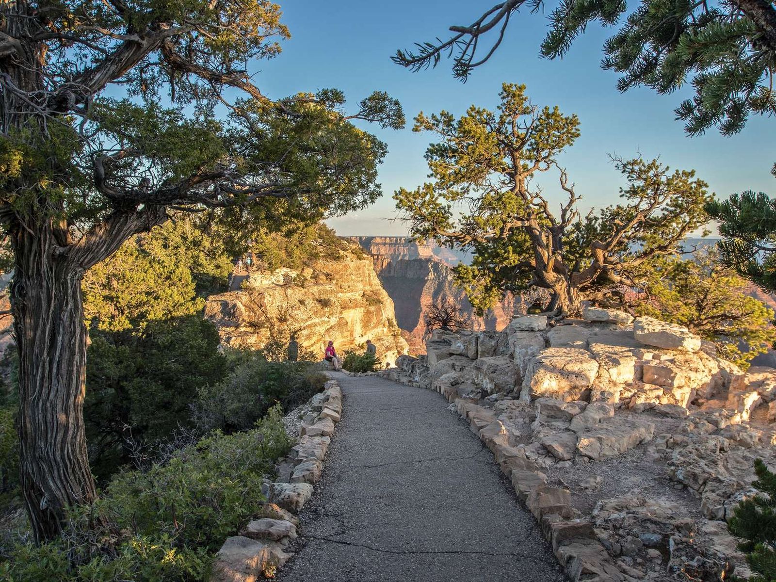
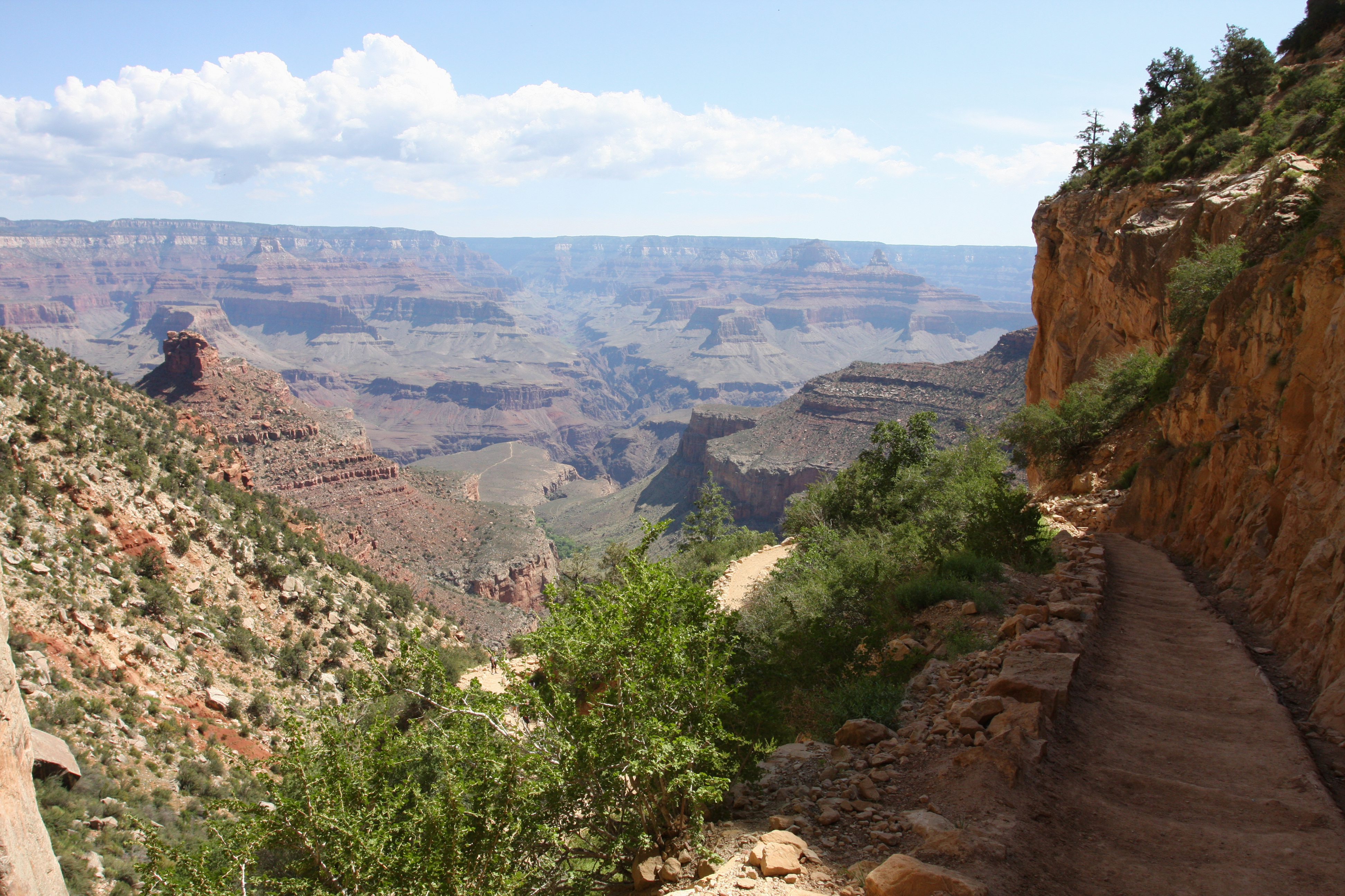
Bright Angel Trail lets hikers walk in the footsteps of the canyon's Indigenous peoples, miners, and early tourists, as they descend into the canyon's depths. Offering outstanding views, morning and afternoon shade, resthouses, vault toilets, and water stations during the summer. Visit the link for the current list of trail reopenings and closures.
At the top left of a vertical wayside panel at the Bright Angel trailhead, a black and red circle surrounds a black-and-white image of Grand Canyon with large white letters urging you to, "Hike Smart." Text reads: "Welcome to Bright Angel Trail. This magnificent Grand Canyon is a vast and harsh wilderness demanding respect." Continuing down the left-hand side of the panel, text reads: "Do You Have a Realistic Plan? Grand Canyon National Park assists more than 600 hikers during the hot summer months and helicopter rescues an additional 150 people...You are responsible for your safety and the safety of your friends and family. Rescue is not a guarantee. Have You Checked the Weather? Summer temperatures in the shade reach 105 degrees Fahrenheit (40 degrees Celsius) at Indian Garden and 115 degrees Fahrenheit (46 degrees Celsius) at Phantom Ranch. Avoid hiking in the heat of the day, between 10 am and 4pm. In winter, temperatures drop below 32 degrees Fahrenheit (0 degrees Celsius) with steep, icy trails requiring shoe traction devices. From July to September, monsoons can build large, violent lightning storms. Seek shelter immediately. The Rim Trail, where you are reading this sign, is the most dangerous to be." Under a topographical map of Bright Angel Trail in the top center of the panel, text continues: "How Much Food and Water Should You Bring? Your body needs energy - balancing: proper nutrition and hydration are critical to your hiking success...Eat and drink while resting - sip fluids while hiking. Too little water leads to dehydration and heat stroke. Over hydration and lack of salty foods causes hyponatremia - a seizure-producing electrolyte disorder. If you do not feel well: seek shade, get wet, cool off, and rest. Turning around may be your best decision today." At the right, a list of standard trail courtesy items appear. Along the bottom of the panel, text reads: "Pets are not allowed on the trails. If you wish to take a service animal with you, please check in at the Backcountry Information Center. Never approach, touch, or feed any animal. It is dangerous and illegal to do so."
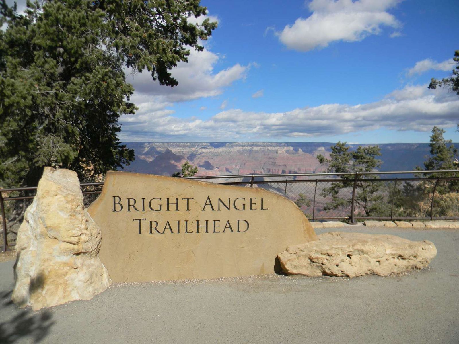
Bright Angel Trailhead is located just west of Bright Angel Lodge, Lookout Studio, and Kolb Studio. At 6,840 feet (2,085 m), it provides access for hikers and mules to many inner canyon destinations. From the Hermit Road Interchange shuttle bus stops, it is a short walk to the east, and up a hill, on a paved footpath to the trailhead. As of Aug. 20, Bright Angel Trail is open from the Trailhead to Pipe Creek Resthouse. Visit the link for trail reopenings and current closures.
A large, 200-foot (60 m) wide by 100-foot (30 m) deep courtyard surrounds the Bright Angel Trailhead along the rim. Two sets of accessible bathrooms at the back of the courtyard face north toward a wide-open concrete plaza, with a water bottle filling station at the right. Limestone boulders ring a couple garden areas in the center of the plaza, each with a stone bench under tall shade awnings. 30 feet (9 m) west down a slight incline from the water station, 18 stone pylons, each 3 feet (1m) square by four feet (1.2 m) tall with metal pipe suspended between them, ring a low stone wall surrounding a 100-foot (30 m) diameter oval-shaped mule corral. 50 feet (15 m) east of the corral up a slight incline along the rim, an 18-inch (46 cm) circular bronze plaque embedded in a roughly 4 foot (1.2 m) tall triangular-shaped limestone boulder commemorates the 2013 dedication of the Bright Angel Trailhead renovation. Text reads: "The Bright Angel Trailhead was renovated with gifts from Grand Canyon Association donors in partnership with the National Park Service." A list of major supporters follows. Text at the bottom of the plaque reads: "Additional support was provided through your park entrance fees." A water filling station is located just to the west of the public restroom building in the Bright Angel Trail courtyard area. Mounted on a 6foot (2 m) wide by 4 foot (1.2 m) deep limestone brick base, 3 metal spigots stick out from the center of a 4 foot (1.2 m) square panel, housed in a metal frame topped with a short, sloped metal roof. Across a full-panel color photograph of the canyon, text at the top of the panel reads: "Grand Canyon Spring Water. Fill Your Bottles Here for Free. The Grand Canyon is a place of pristine, almost unimaginable beauty. The park is dedicated to protecting the canyon and its resources for all to enjoy. Today and into the future, there is a way you can help. Before purchasing a disposable plastic bottle of water, consider this: these bottles clog landfills and litter the park. Wind carries them over the rim and into the canyon. Water filling stations, providing free, pure Grand Canyon spring water straight from Roaring Springs below the North Rim are located throughout the park. Fill up, drink up and enjoy!" Note the spigot at the lower left of the panel is for winter use only. It is operated with a push button, located just to the right of the spigot on the face of the panel. A picture at the top right shows a small stream cascading over limestone rocks into a swirling pool of water. Text continues: "Refill your bottles here and enjoy pure, clean Grand Canyon spring water." At the bottom right, the words, "Junior Ranger" appear in a green circle surrounding a park ranger hat. Text continues: "Kids, did you know... The average American uses 167 water bottles a year; A bottle of water costs about $2 (that's $334 per year); Refillable water bottles look cool and are great souvenirs. Take them home and use them again and again!" Note these filling stations are located throughout the park at hotels, visitor centers, markets, and major trailheads, and provide free Grand Canyon spring water for all visitors.
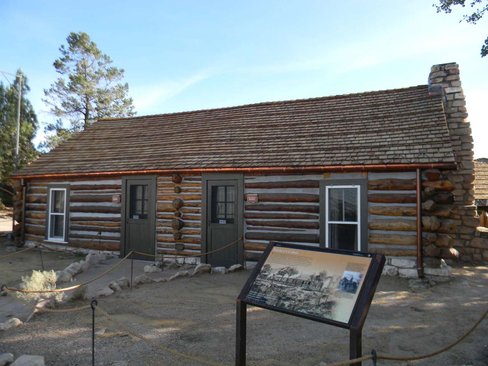
This cabin is the only remaining building from the early pioneer settlement era of the Village. Built on this site in 1895 by William Owen "Buckey" O'Neill, the 2-room office and bunkhouse—complete with v-notched logs, rough mortar chinking, and a native stone chimney—was the rustic home of Buckey and his wife while they operated a small hotel on the South Rim.
Facing the edge of Grand Canyon, this 1-story cabin built of v-notched wood logs sits on a low stone foundation. The shallow-pitched roof is covered with wood shingles, and there is a native stone chimney at the right. The 2-room cabin features 2 lime-sherbet-green painted wood screen doors on either side of a central vertical row of interleaved logs, with a matching 5-foot (1.5 m) tall double sash window at the far left and right. Touch the sides of the cabin to feel the smooth brown logs. Touch the interweaved logs at the center of the structure and at the corners of the building to feel how the cabin was constructed. A black-and-white photograph of Buckey O'Neill's cabin fills the center of a 3-foot (1 m) tall angled-metal wayside panel. In front of the cabin, a 4-foot (1.2 m) tall 3-rail wooden fence sits perched at edge of the canyon rim. Text at the top left of the panel reads: "Buckey's Cabin This cabin is the only remaining building from the early pioneer settlement era of Grand Canyon Village. Built on this site in 1895 by William Owen "Buckey" O'Neill, the two-room office and bunkhouse - complete with v-notched logs, rough mortar chinking, and a native stone chimney - was the rustic home of Buckey and his wife while they operated a small hotel here on the South Rim. The consummate entrepreneur, Buckey improved the Bright Angel Trail and camp at Indian Garden and promoted the Grand Canyon railroad to benefit both his tourism and mining interests." At the lower left, a quote by Theodore Roosevelt, praising fellow "Rough Rider" Buckey O'Neill reads: "A born soldier, a born leader of men. He was a wild, reckless fellow, soft-spoken, and of dauntless courage and boundless ambition...” A black-and-white photograph inset at the right shows a man in a military uniform with a wide-brimmed hat sitting astride a black horse. Text above and below the picture reads: "At age 19, Buckey O'Neill's restless spirit drove him from Washington, DC, to the western territories in 1879. There he worked as a lawyer, newspaperman, sheriff, mayor, superintendent of public schools, gambler, miner, congressional candidate, adventurer, and soldier. At the outbreak of the Spanish-American War, Buckey signed up and served as one of Theodore Roosevelt's "Rough Riders." He was killed in action on July 1, 1898."
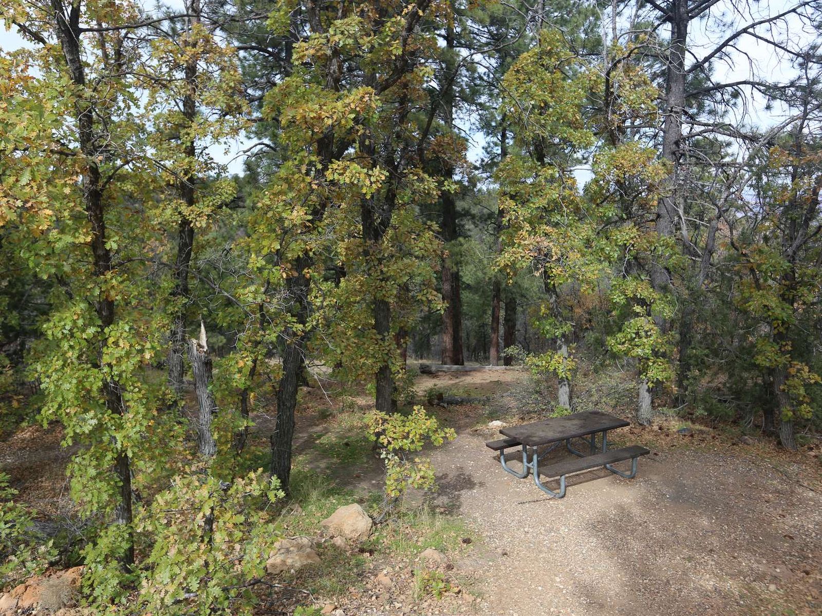
The Buggeln picnic area features vault toilets, multiple picnic tables, shade, and exhibit panels describing the local forest habitat; no water. There is no direct view of the canyon from this site, but a few small glimpses can be seen through the gaps in the trees. The small, teardrop-shaped parking area is fine for cars and small RVs, but larger vehicles and those towing trailers will find turning around a bit tight.
A 4-foot (1.2 m) wide asphalt sidewalk rings the parking lot at Buggeln picnic area. Facing away from the lot, a number of picnic tables are available down a short, steep embankment, nestled among several ponderosa pine and Gambel oak trees. Note there is a unisex vault toilet at the far left-hand side of the lot. Along the path in the middle of the parking lot, a color photograph of a stand of Gambel oak trees fills the left-hand side of a three-foot (1 m) tall angled metal wayside panel. Text at the top right reads: "Welcomed Mix Each ponderosa pine forest is unique. Here at Buggeln picnic area ponderosa pine shares the forest with Gambel oak, resulting in a diverse and rich community of plants and animals. Gambel oak shelters wildlife and attracts higher insect populations. Its acorns and foliage feed golden-mantled ground squirrels, wild turkeys, and common porcupines. Decomposing oak leaves improve soil conditions for grasses, wildflowers, and woody shrubs. Experienced birdwatchers consider these forests hot spots for birds. You man spy uncommon birds here, like Grace's and Virginia's warblers. Pine-oak forests are valuable to native people. For centuries, area tribes have gathered a wide array of foods, medicines, and natural dyes in these productive woods." Several inset color photographs across the center of the panel show a dark slate gray Northern goshawk with pale-gray barred underparts, a checkered black-and-white downy woodpecker with a small red patch on the back of its head, a small gray and white Virginia's warbler, and a black wild turkey with a red wattle. Other photographs show the small red and yellow flowers of the wax currant, and the small greenish-white to pink flower clusters of the snowberry. Text at the bottom left of the panel reads: "Gambel oak often associates with ponderosa pine at elevations of 6,000-8,000 feet (1,800-2,400 m). Fires visit this forest every 5 to 7 years. Low-intensity ground fires cycle nutrients into the soil to help this forest combination thrive." Next to a picture of a mountain lion at the bottom right, a caption reads: "Feeding wildlife upsets the balance of this natural forest community. Please don't share your picnic!"
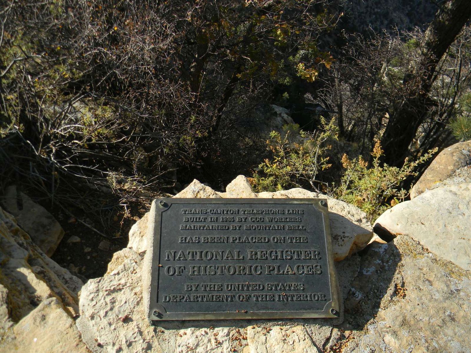
Many of our national parks have benefited from the hard work of the Civilian Conservation Corp (CCC) and Grand Canyon is no different. This site marks where CCC workers built the transcanyon telephone line in 1935.
Along the Rim Trail near the El Tovar Hotel, a 12- by 14-inch (30- by 35-cm) bronze plaque set in a stone masonry pedestal sits attached to the limestone wall along the edge of the canyon. An inscription reads: "Trans Canyon Telephone Line built in 1935 by CCC workers, maintained by Mountain Bell, has been placed on the National Register of Historic Places, by the United States Department of the Interior." Peering over the edge of the wall, a two-foot (60 cm) tall galvanized pole can be seen sticking out of the ground with a metal crossbar. A copper wire runs across the top of the crossbar. An old black-and-white picture in the center of a nearby three-foot (1 m) tall angled metal wayside panel shows a man perched atop a similar, taller steel pole steadied by a second man on the ground. Text at the left reads: "CCC Legacy. The nearby plaque commemorates an amazing feat achieved by members of the Civilian Conservation Corp (CCC) in the 1930s - construction of a telephone line spanning the entire width of Grand Canyon. One of the poles still stands behind this wall. Beginning in 1934, CCC enrollees worked through winter snow and summer heat to survey and clear a right-of-way roughly following the Bright Angel and North Kaibab trails. Supplied by pack mules, they set 592 galvanized pipe telephone poles and completed stringing the 18 miles (29 km) of copper-weld wire in 1935." A quote from Robert L. Robeson, a CCC Enrollee, at the top right of the panel reads: "Maybe those mountains are hard to climb. Those trees so hard to cut. But the air is pure, the water fine. And we're climbing right out of the rut...For besides helping ourselves, you see. We are helping Mother and Dad." Two additional black-and-white pictures inset at the right of the panel show workers building the stone wall before you, and a line of flat-bed trucks filled with young men. A caption reads: "At Grand Canyon, today's visitors still benefit from the labor and skills of seven CCC companies. During the Great Depression, these young men constructed trails, roads, walls, fences, reservoirs, fire towers, buildings, power lines, telephone lines, and more."
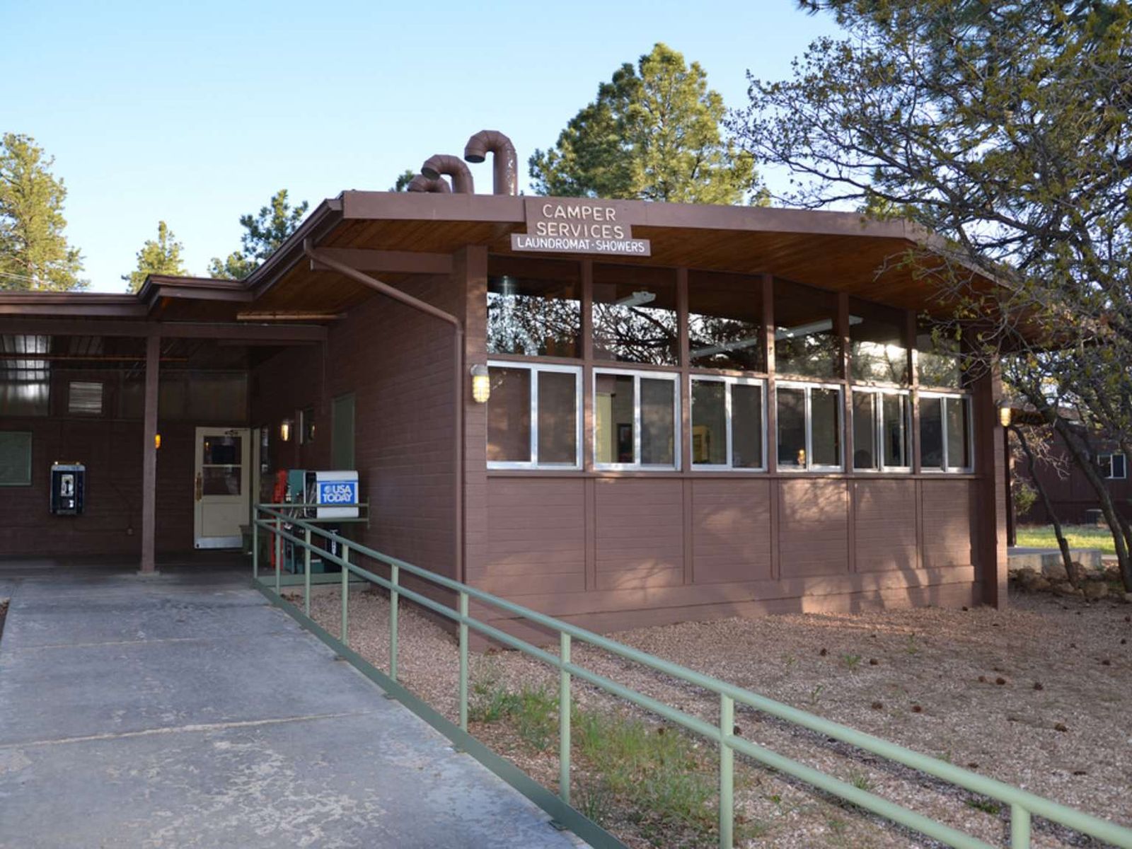
Camper Services (Laundry and Showers) is located near the entrance to Mather Campground. Hours of Operation: 7:00 am to 8:00 pm daily. Last laundry load: 7:00 pm — Last shower: 7:45 pm. The Camper Store is open from 7:00 am to 8:00 pm daily. Adjacent to Camper Services is a free dump station and potable water filling station for RVs. Several picnic tables are located outside the building. This facility also serves nearby Trailer Village RV Campground.
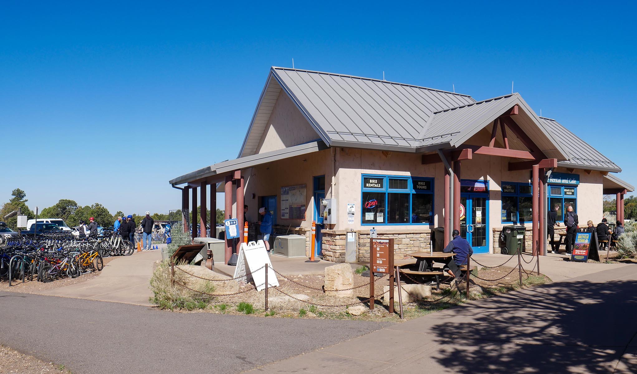
Canyon Adventures Bike Tours & Café offers bicycle, eBike, stroller, and wheelchair rentals, as well as a full espresso bar and grab-and-go sandwiches, salads, pastries, drinks, and more. Hours: 8 am to 5 pm daily. Located in the South Rim Visitor Center's Plaza, adjacent to Parking Lot 4. During spring, summer and fall, guided bicycle tours are available. Some outdoor accessories are also on sale, like hats, sunglasses, water bottles and trekking poles.
At the edge of a large open plaza sits a small, light tan colored, single story building, with a sign that reads: "Canyon Adventures Bike Tours & Café". A clearing behind the building is filled with rows and racks of bicycles of all sizes. A large parking lot, Visitor Center Lot 4, lies just beyond the bicycle racks..
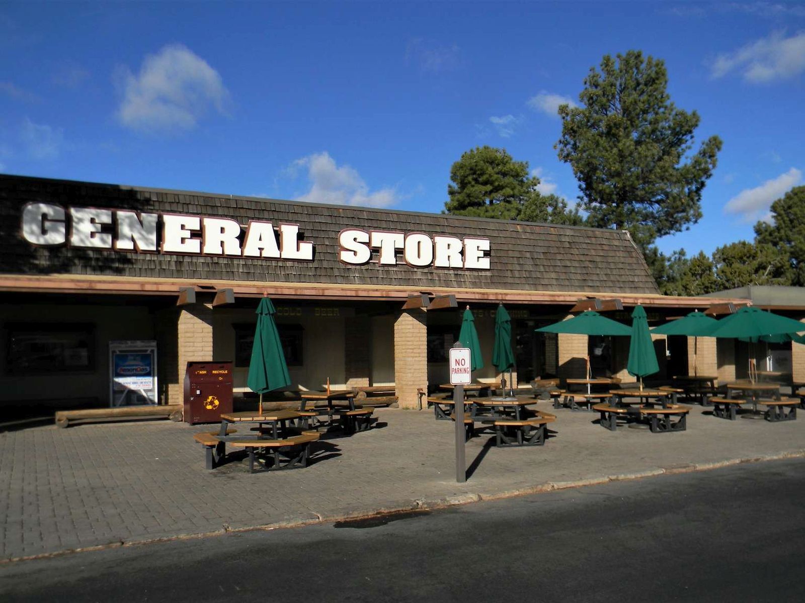
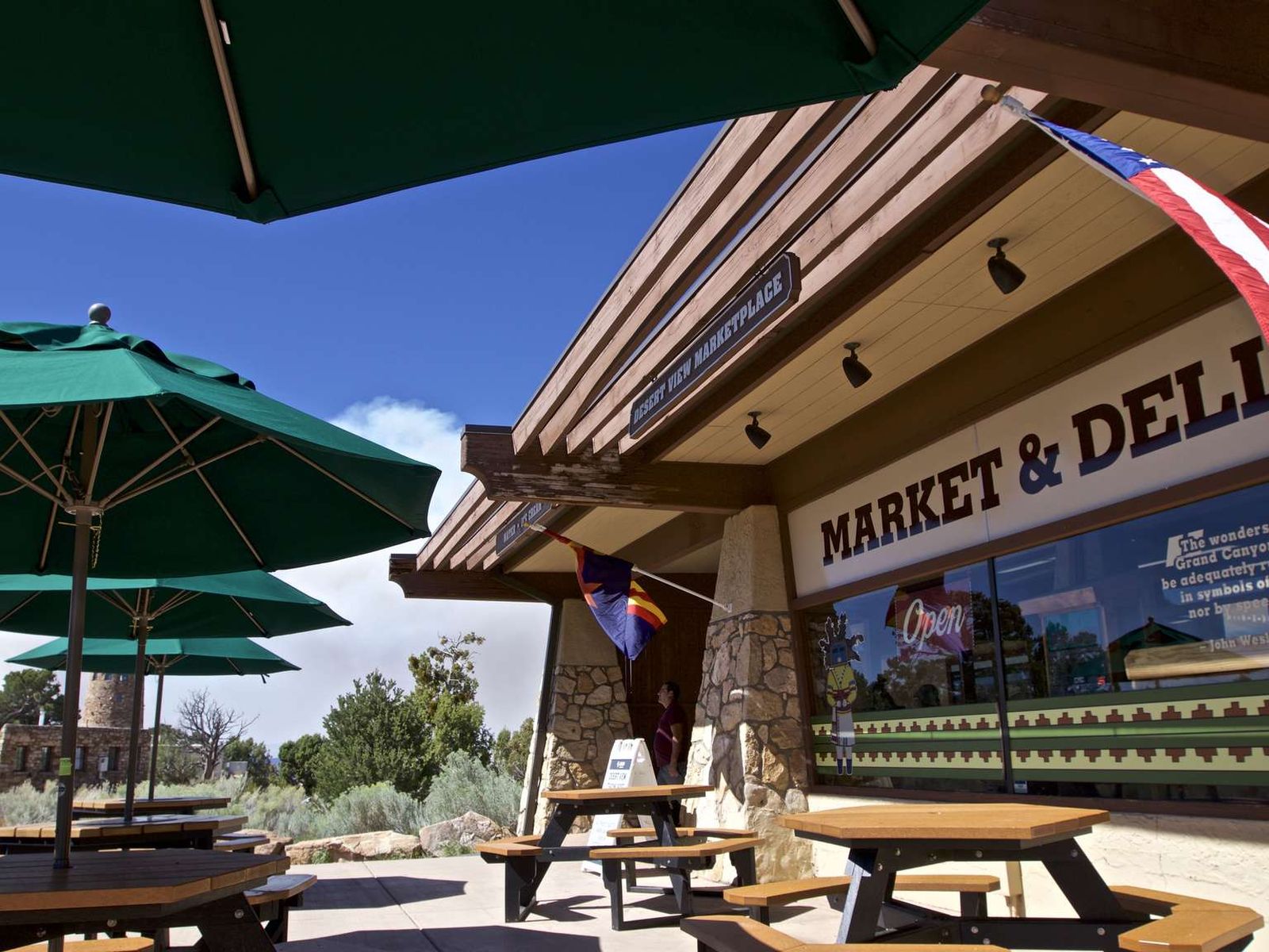
Canyon Village Market & Deli is located in Market Plaza, across the parking lot from Yavapai Lodge and next to the US Post Office. The Market/General Store is open daily from 6:30 am to 9:30 pm. The Deli is open daily from 6:30 am to 5:30 pm. A large selection of groceries and souvenirs are available, along with outdoor gear for campers and backpackers.
The general store offers a grocery area with a wide selection of fresh produce and vegetables, hand cut meats, cheeses, cooking staples to make a variety of dishes, beer, wine and non-alcoholic beverages. There is also a wide selection of grab and go items, and a deli for quick, freshly made sandwiches or salads. There is a large retail section with clothing, hiking gear, camping equipment and camping rental items, and a water filling station. There are also areas filled with arts, crafts, souvenirs, native art collectibles, Christmas ornaments, jewelry, logo merchandise, and more. Several benches sit outside on a large, open brick-paved patio, along with several picnic tables with umbrellas. Free WiFi is offered daily.
The North Rim is CLOSED for the remainder of the 2025 season because of damage and losses caused by the Dragon Bravo Wildfire. Named by geologist Clarence Dutton in 1880, this scenic viewpoint rewards hikers for their 4.2 miles (6.8 km) round-trip hike. According to Dutton, "Point Final is doubtless the most interesting spot on the Kaibab." Backcountry camping is available, but you must first obtain a permit in advance from the North Rim Backcountry Information Center.
The North Rim is CLOSED for the remainder of the 2025 season because of damage and losses caused by the Dragon Bravo Wildfire. This relatively flat, forested trail leads hikers to the end of Cape Final, for a 4.2 miles (6.8 k) round trip hike. The first half of this rocky trail is entirely within the forest, but views of Grand Canyon begin peaking through the trees around halfway. The trail comes to an end at Cape Final, one of the most spectacular viewpoints on the North Rim
The North Rim is CLOSED for the remainder of the 2025 season because of damage and losses caused by the Dragon Bravo Wildfire. Cape Royal and Angel's Window are some of the only spots with views of the Colorado River from the North Rim. From the southeast side of the parking lot, a short wheelchair-accessible path leads to several spectacular viewpoints. The west side of the parking lot is where you can find a picnic area.
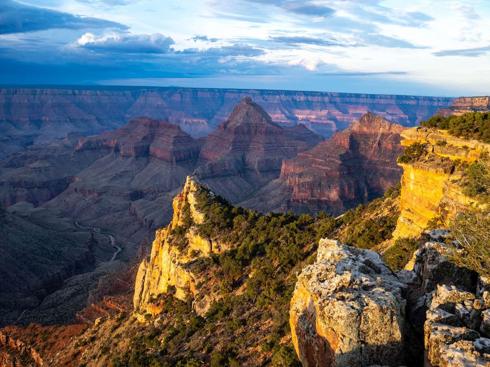
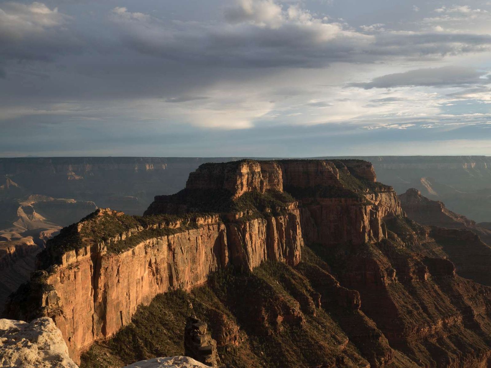
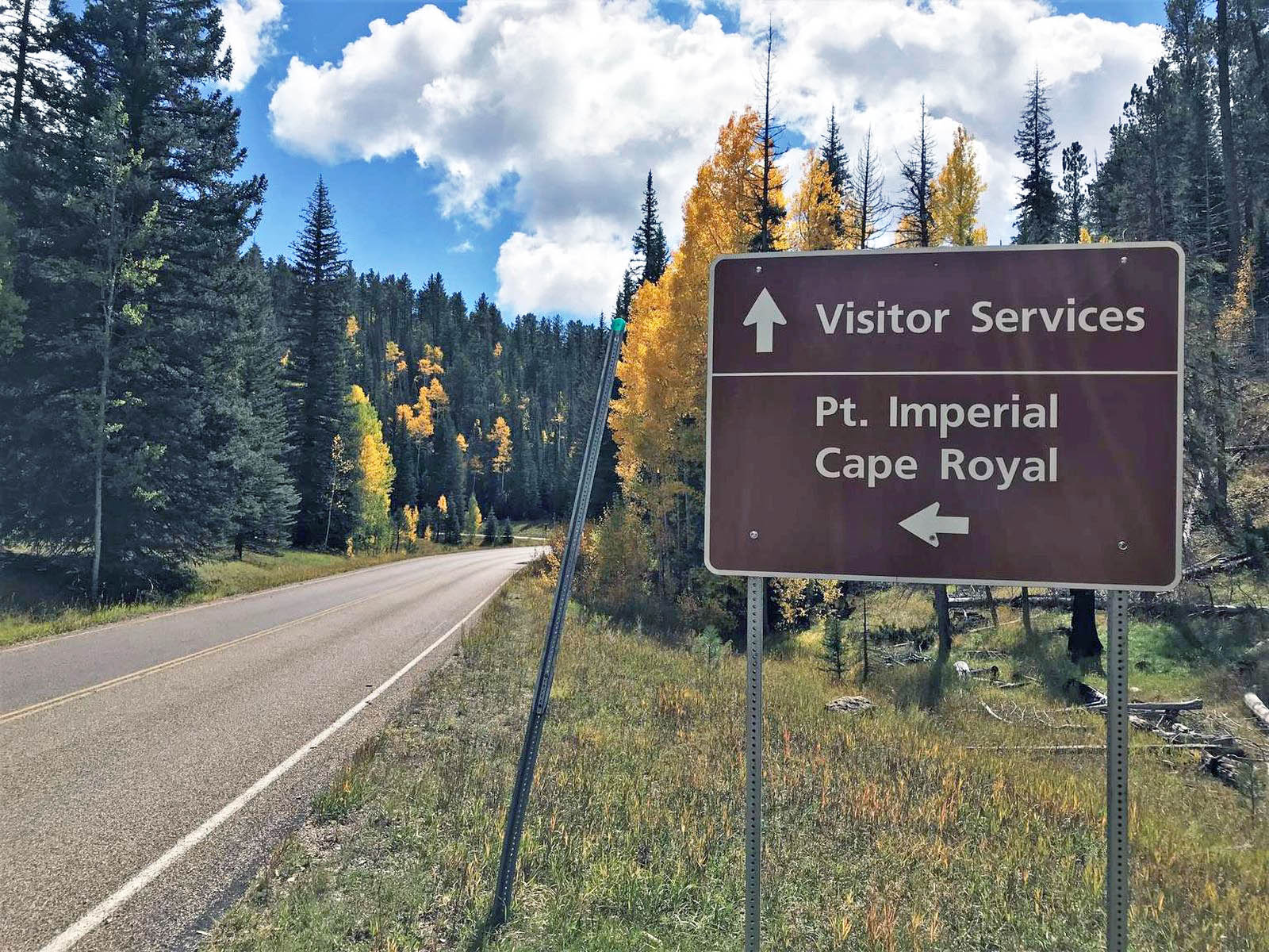
A D Stop 1, Cape Royal. 4 minutes. The parking lot for Cape Royal is located about one and a half miles (two point four kilometers) south of Walhalla Overlook, at the end of Cape Royal Road. Note an accessible parking area along the left (east) side of the multi-lane lot. Also note a wheelchair accessible vault toilet along the north side of the lot. Beside the accessible parking spaces, the paved, six-foot wide Cape Royal Trail leads east towards the rim, flanked by two wildlife-proof, metal garbage containers. The flat, paved trail, lined with stones on either side, leads about four-tenths of a mile (650 meters) to the point at Cape Royal. Note a wide variety of plants and trees growing along the sides of the trail. Pinyon pine is recognized by its short needles which typically grow in bundles of twos; cliffrose by its cream-colored blossoms and sweet fragrance throughout the summer; Utah Juniper trees by their scraggly bare trunks and bluish berries; and sagebrush with small blue-gray leaves with a strong sage aroma. Moving along the trail, the natural arch of Angel's Window to your left (east) frames the sweeping turn of the Colorado River at the Unkar Delta. About halfway along the path, a smaller paved path to the left leads to a trail along the top of Angel’s Window. About 150 feet (45 meters) before reaching the point at Cape Royal, a three-foot wide paved trail leads left (east) down a slight slope to a rocky overlook. Note at the end of this short trail, two uneven stone steps lead down onto a wide, open area with loose dirt and rocks. Moving east, a series of uneven, rocky ledges step down to an overlook at the rim. Note there are no guardrails or railings here. Continuing south along the main path, at the top of the point overlook area, the pavement forks in two around some boulders in the middle of the path. About 35 feet (10 meters) forward, the paths converge, sloping gently downward. The path forks again around more boulders in the middle, leading about 60 feet (18 meters) south to a roughly 15 foot (five meter) wide curved, paved overlook area at the point. Metal railings line the rim along the second path and the whole overlook area. Stunning bands of color, deep gorges, and towering buttes are revealed. Situated one mile immediately to the southwest, the wooded top of Wotans Throne, composed of thick limestone over top a layer of cream-colored, cliff-forming sandstone, rises 5,200 feet (1,585 meters) above the Colorado River, over 7,700 feet (2,300 meters) above sea level. About two miles (three point two kilometers) east-southeast of Wotans Throne is Vishnu Temple. Also composed of cream-colored, cliff-forming sandstone with a limestone cupola caprock, it rises over just over 7,500 feet (nearly 2,300 meters) high. Three wayside panels along the rails at the rim discuss the differences in water erosion on the north versus the south rim, how the impressive Vishnu Temple and Wotan’s Throne rock temples located here were formed, and how cold air can trap haze layers in the canyon. Descriptions of these three wayside panels are included in the sub-script below. Back in the parking area, note at the west side of the lot, a second path leads south to a picnic area, and a separate wedding site on the edge of the rim. Also flanked by two wildlife-proof, metal garbage containers, a gravel and dirt path leads to a small grove of trees with a number of picnic tables overlooking the canyon. From the grove, the path continues to the right to an open area surrounded by pinyon pine trees. Two rows of half-log wooden benches face a rock altar at the rim’s edge. Note a permit is required to use the wedding site. North versus South Wayside Panel An aerial photograph of the canyon fills the face of a three-foot tall wayside panel mounted on an angled, metal reading rail. Entitled “North versus South,” a yellow inset illustration at the top right shows the changing depth of the canyon in profile, with the Colorado River identified at its lowest point towards the left. Text reads: The slicing power of the Colorado River has given Grand Canyon its depth (1 mile, 1.6 km), while side stream erosion has given the canyon its width. Water is the single most powerful force acting on the canyon today. This is especially apparent on the North Rim, where the landscape is a maze of jutting side canyons, rock islands, and horseshoe-shaped alcoves. The North Rim has eroded more than 7 miles (11 km) from the river’s edge, while the South Rim has only retreated 3 miles (5 km). Why? Because the North Rim is higher than the South Rim by 1,200 feet (366 m) and captures twice the amount of rain and snow. Since the plateaus are higher to the north, water from the North Rim runs south into the canyon, causing greater side canyon incisions. Water on the South Rim runs south too, away from the canyon, resulting in less erosion and a steeper profile. At the lower left, a black label with the words, “You Are Here,” points to your location here at Cape Royal on the North Rim, directly opposite Grandview on the South Rim, with the Colorado River snaking between them in the center. Text at the lower right states: The North Rim receives up to 12 feet (4 m) of snow each winter, while the South Rim gets about 5 feet (1.5 m) of annual snowfall. Building Temples Wayside Panel A color photograph of two of the most stunning formations visible from Cape Royal fills the bottom of a three-foot tall wayside panel mounted on an angled, metal reading rail: the Vishnu Temple formation beside Wotan’s Throne. Text at the top left of the panel reads: Building Temples At first glance the canyon resembles ancient temples towering above the river. Geologist Clarence Dutton named many of the canyon’s formations temples, after Eastern religious and spiritual deities like Shiva and Vishnu. Cliffs, slopes, alcoves, plateaus, mesas, buttes, terraces, and platforms all make up what we call temples in Grand Canyon. Temples form when side canyon erosion produces peninsula-like projections off the main rims, like here on Cape Royal. Further erosion transforms the peninsulas into islands, like Wotan’s Throne, and separates them from the rim, like Vishnu Temple. Erosion continues, as softer rock erodes and undercuts harder rock, until the temple is gone. At the top right, a series of three, inset illustrations show how temples are constructed. In the first illustration, a peninsula-like projection of rock juts out from the canyon rim due to side canyon erosion. The second illustration shows that peninsula beginning to detach from the rim. A caption reads, “With continued erosion, the peninsulas become islands, separated from the rims.” In the third illustration, the ‘island’ becomes narrower and more distinct. A third caption reads, “Temple erosion continues as softer rock, which erodes easier and faster, undercuts harder rock, leaving the hard rock without support and causing it to break and fall. The sequence continues until the temple has vanished.” At the lower right, a green, circular Junior Ranger icon appears over an inset color photograph of a roughly square stone temple topped with crumbling, triangular rocks. Text reads: Ancient Temples Looking at this Vishnu Temple built 1,500 years ago in India, can you see why geologist Clarence Dutton thought fitting to name canyon formations temples? Can you find Grand Canyon’s Vishnu Temple in the view? Which Vishnu Temple is older? Trapped in the Canyon Wayside Panel A crisp panoramic color photograph of the canyon fills the face of a three-foot tall wayside panel mounted on an angled, metal reading rail. Text at the top left reads: Trapped in the Canyon Grand Canyon National Park Service U.S. Department of the Interior Your view from Cape Royal extends across the canyon and may reach 100 miles (160 km) on a clear day. Sometimes, however, the view within the canyon is hidden or murky. Why? When the winds are calm, cold air can drain into the canyon and become trapped. If moisture in the cold air is high enough, clouds may form in the canyon, with only the rims and highest temples poking through. Less appealing are the times when the cold air carries air pollution into the canyon from nearby industries or forest fires. Fire managers try to avoid such smoke impacts, but sometimes it happens. Human industry tries to lessen their impacts too. One nearby coal-fired power plant invested hundreds of millions of dollars to reduce its contribution to these haze layers that get trapped in the canyon. A caption above the canyon photograph reads: “Trends show the best visibility days at Grand Canyon are getting clearer, while the haziest days remain the same.” At the top right, an inset color photograph shows a white cloud hanging over the canyon. A caption reads: “Cold air can trap forest fire smoke in the canyon, masking the view.”
The North Rim is CLOSED for the remainder of the 2025 season because of damage and losses caused by the Dragon Bravo Wildfire. Cape Royal Road is a fantastic scenic drive leading to points of interest, including Point Imperial and Cape Royal. Diverse viewpoints and several trailheads can be reached via this winding scenic drive. NOTE: RVs over 22 feet long, and vehicle + trailers with a total length over 22 feet, are not permitted because of the narrow roadway.
After you turn off Highway 89A onto the Lees Ferry access road, drive 1.3 miles. The trailhead is at the pull out on your left. You can access both upper and lower Cathedral Wash from this parking area.
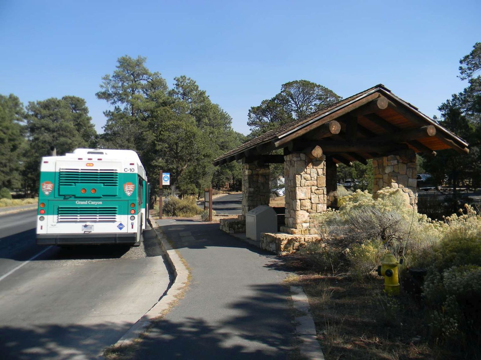
This bus stop along the Village (Blue) Route provides direct access to Parking Lot C, a small public lot with 38 spaces, but often one of the last parking areas to fill during busy days. This stop is centrally located within the historic district of Grand Canyon Village with historic buildings located to the east, north and west of this point. Visit the link for the current schedule.
A small shade structure of large rough-hewn rocks and logs, with a peaked, cedar shake roof, is between a small, paved parking lot and a paved road. On the sidewalk next to the shade structure there is a 7-foot-tall dark metal post with a blue and white sign that marks the shuttle stop with text reading: "Center Road".
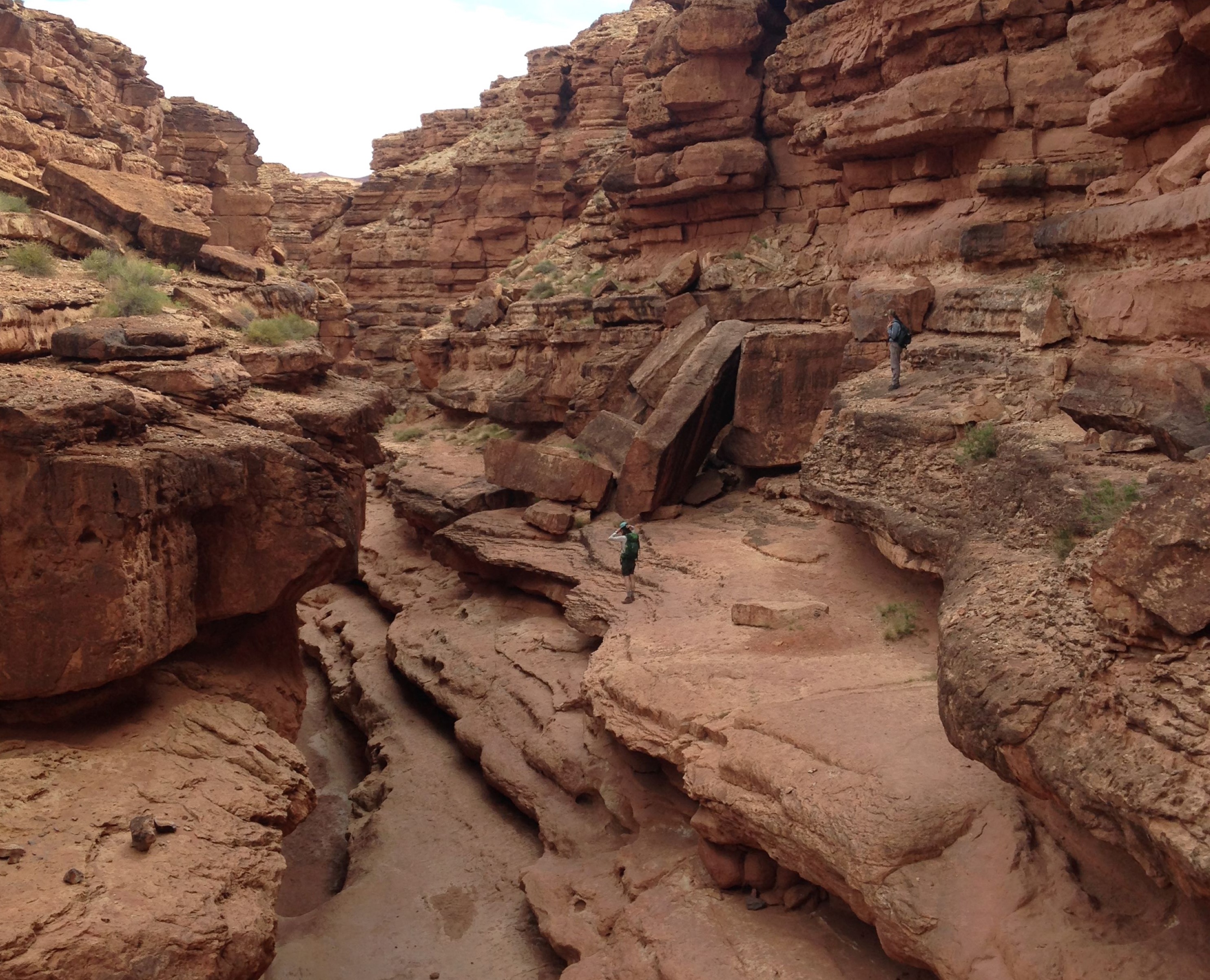
The North Rim is CLOSED for the remainder of the 2025 season because of damage and losses caused by the Dragon Bravo Wildfire. This short, unique trail is accessed from a pullout on the left side of a curve in the road, 0.3 miles (0.5 km) from Cape Royal. The trail heads down along a wash down into a forested ravine.
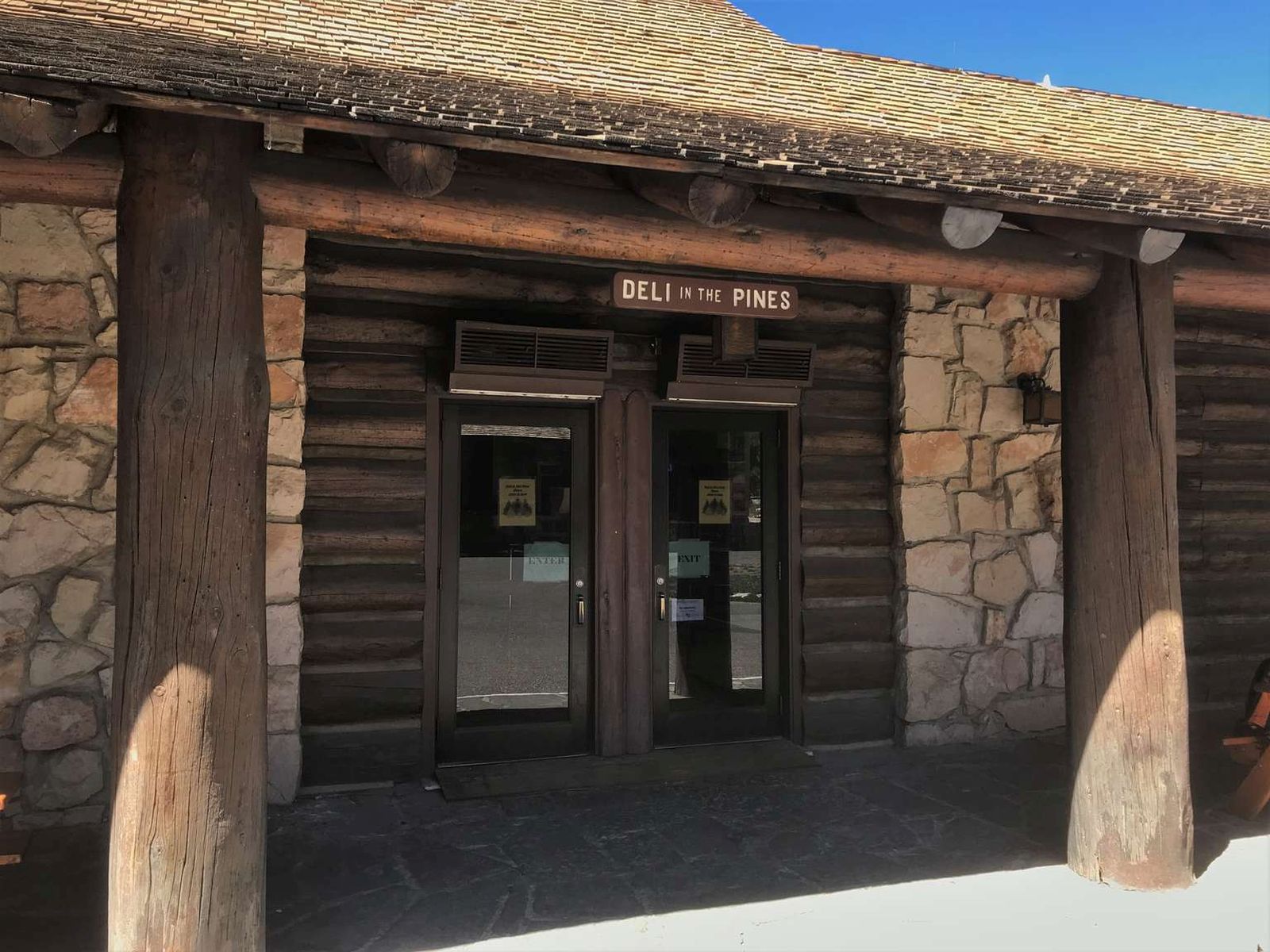
The North Rim is CLOSED for the remainder of the 2025 season because of damage and losses caused by the Dragon Bravo Wildfire. Deli in the Pines was severely damaged by the fire. The deli was located in the main lodge building. Coffee drinks were available daily in addition to grab-and-go sandwiches, pizza, soup/chili and snacks. For convenience, all items were available for takeout dining —perfect for a picnic or during a hike.
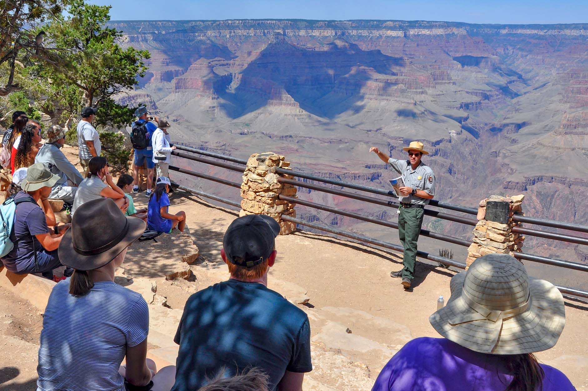
During the Summer of 2026, Sunset Talks by park rangers take place at the amphitheater on Monday, Tuesday, Wednesday and Thursday. Enjoy a program with a beautiful sunset backdrop. Talks start an hour before sunset, and end with enough time to take pictures and enjoy the view. On Tuesday and Thursday Sunset Talks are "Grand Canyon Speaks" presentations, in which members of Grand Canyon's Native American Communities share their rich history and culture.
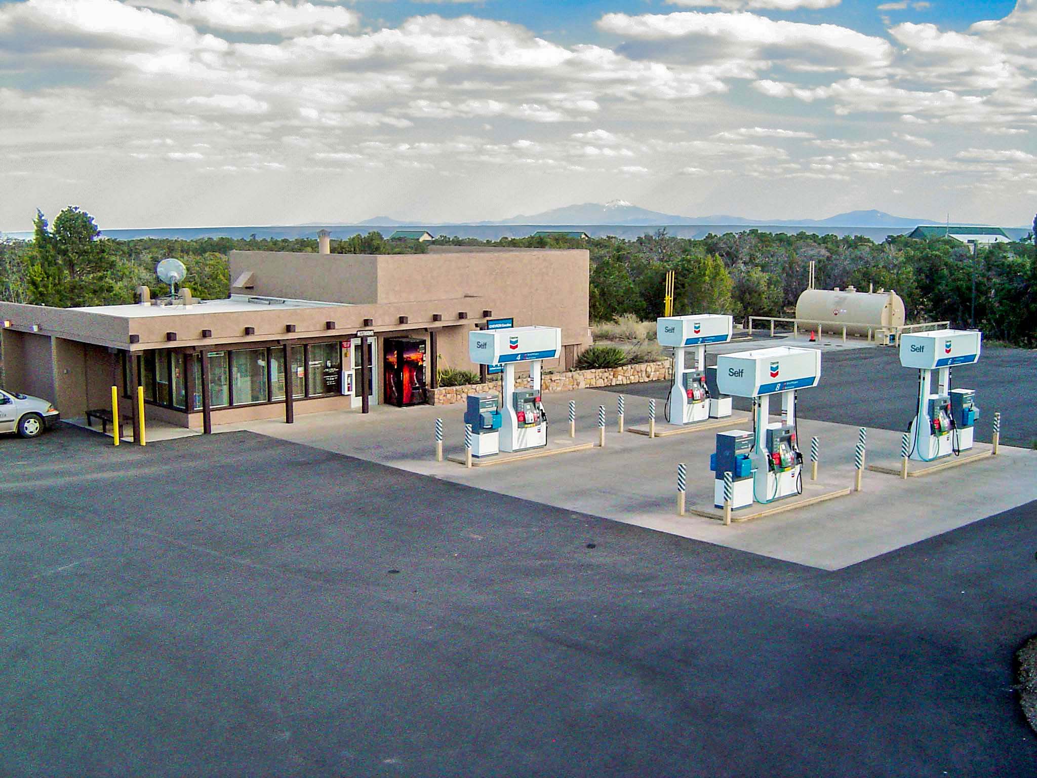
Approximately 30 miles (48 km) west of Cameron, AZ, and 23 miles (37 km) east of Grand Canyon Village, the Desert View Entrance Station serves as a secondary gateway to the South Rim and the primary portal to the Desert View area. It is open 24 hours/day, 7 days/week. This entrance is ideal for motorists traveling to/from Southwestern Colorado, Southern Utah, New Mexico and Phoenix, Arizona.
Self-service gasoline and diesel fuel (pay at the pump with credit/debit card) is available year-round, 24 hours a day. The convenience store is open 9:00 am to 5:00 pm daily. The park's only gas station on the South Rim offers visitors one last chance to fill-up before heading to the next closest gas stations 30 miles (48 km) east in the town of Cameron, Arizona —or 30 miles (48 km) west in the town of Tusayan, Arizona (just outside of the park's south entrance) .
Located on the eastern side of the Desert View settlement, near the restrooms, the market sells groceries and souvenirs, including t-shirts, keychains and coffee mugs. Current hours of operation are from 8 am to 8 pm daily. The deli, inside the market, is open from 9:30 am to 5 pm daily. There is both indoor and outdoor seating. Stock up on groceries for camping, or road trip snacks and drinks.
About 100 feet (30 m) south up a gently sloping paved path from the Desert View Trading Post stands a one-story building with four 15-foot (4.5 m) tall trapezoidal stone roof supports in front. In warmer weather, several wooden picnic tables with umbrellas sit out on the 25-square foot (8 meters square) concrete patio in front of the Desert View Market, along with a few metal benches. There is an automatic teller machine inside the door to the right. The store also sells food and other snacks, water, ice cream, beer and wine. A large gift shop fills the center and left of the store. Note there is a water filling station at the back center of the store.
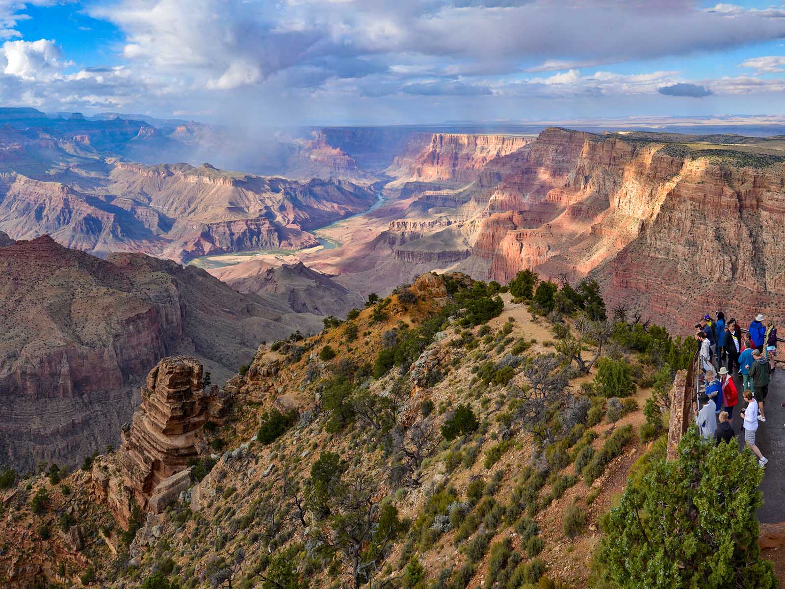
Below Desert View Point, the Colorado River makes a sharp 90-degree turn to the west, cutting directly into a major uplift. Looking to the west, one can glimpse in the distance where the river plunges into the black, narrow, confined depths of the Granite Gorge. Also at Desert View Point, a plaque and stone memorial commemorate the 1956 Grand Canyon TWA-United Airlines Aviation Accident Site, a horrific airline collision over Grand Canyon that took place on June 30, 1956.
At an overlook area at the very northern tip of Desert View Point at Desert View Watchtower, an 18-inch (46 cm) square, metal plaque, embedded in a four-foot (1.2 m) tall by roughly two-foot (60 cm) wide limestone pillar reads: “1956 Grand Canyon TWA-United Airlines Aviation Accident Site has been designated a National Historic Landmark. This tragic accident site represents a watershed moment in the modernization of America's airways leading to the establishment of the Federal Aviation Administration and national standards for aviation safety. This site possesses national significance in commemorating the history of the United States of America. 2014, National Park Service, United States Department of the Interior." Nearby, a panoramic photograph of the canyon at this location fills a three-foot (1 m) tall angled metal wayside panel. Text at the right reads: "Tragedy Remembered—Catastrophe can happen even in spectacular beauty. When technological achievements and human actions fail, disasters may happen. On June 30, 1956, a United Airlines DC-7 and TWA Super Constellation maneuvered around towering cumulus clouds on a partly clear day. All 128 passengers and crew perished when the planes collided at an altitude of 21,000 feet (6,400 m) above Temple and Chuar buttes. Passengers included prominent businesspeople and families. Every passenger had loved ones waiting for them, though their journey ended unexpectedly. The Grand Canyon disaster "rocked the aviation world." It was the deadliest crash in American commercial aviation history at the time. Within a few years, the United States Congress created the Federal Aviation Administration to increase air safety. Due to its importance in aviation history, this hallowed ground is a National Historic Landmark. This designates and protects artifacts remaining in this remote area of the canyon and provides learning opportunities from that day and beyond." Two inset pictures at the bottom show additional monuments commemorating the crash with the text: "Grand Canyon's Pioneer Cemetery (L) is the final resting place for 29 unidentified passengers from United Airlines. Recovery personnel removed the remains of the 70 accident victims from the TWA flight, and all but three were interred in a mass grave at Flagstaff Citizens Cemetery (R). Twenty-nine identified passengers were returned home for burial. Two smaller photographs show a corroded key and a rusty lighter, reminders of that day."
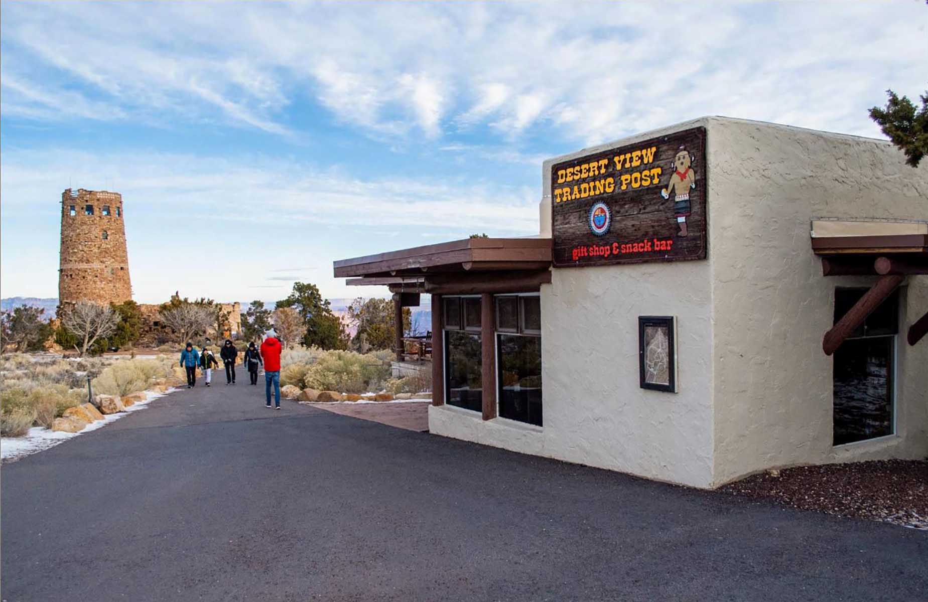
Within sight of Desert View Point and the Watchtower, the Trading Post is just up the walkway from the rim of the canyon. Hours are 7:30 am to 8 pm daily. A snack bar is located inside the Trading Post. The snack bar is temporarily closed. When it reopens, it offers ice cream, sweet treats and coffee drinks. There is an outdoor patio. When it comes to authentic Native American crafts, the trading post gallery/shop features handicrafts from Grand Canyon's associated tribes.
About 200 feet (60 m) north down a gently sloping paved path from the main shade shelter is a one-story stucco building with a large outdoor patio at the left. Inside, the Desert View Trading Post has a gift shop at the left and a snack bar at the right.
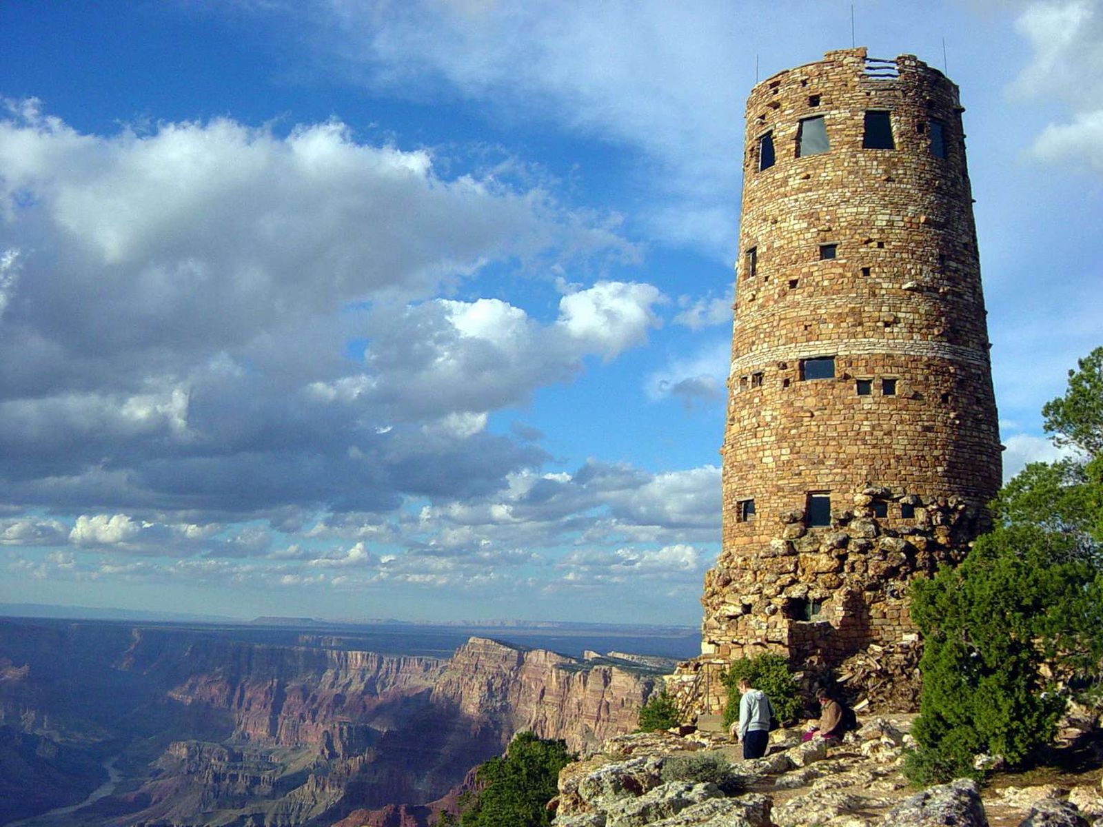
Desert View Watchtower Retail Store (View Room) is open daily: 8 am to 6 pm. The upper floors of the tower are open, when staffing allows, from 8:00 am to 5:00 pm. The last tower access is at 5:00 pm, with the stairs closed for the day at 5:30 pm. A ticket system admits 25 people with a 20-minute time limit. A National Historic Landmark, the Watchtower was constructed in 1932.The design by Mary Colter is based on Ancestral Puebloan architecture found in the southwest.
As you move north down a gently sloping eight-foot-wide asphalt path, a five-story, 70-foot-tall (21 m) circular stone tower sits perched on the South Rim at the left. Massive, irregularly shaped limestone foundation stones ring the bottom of its 30-foot (9 m) diameter base. Concentric rows of rough rectangular-shaped limestone bricks with weathered faces fill its tapered sides. Log posts stick out through the wall here and there. Trapezoidal-shaped picture windows appear near the top of the tower. Cracks in the walls seem to run through many smaller window openings irregularly disposed along its surface, some of which are themselves irregular in shape, all conveying a partly ruinous appearance. Inlaid in one side is a three-foot (1 m) square limestone plaque of a native snake spirit, and there is open observation area on the roof. Immediately west of the Watchtower, but separated from it by several feet, stands a stone ruin which serves as a storage facility and firewood bin. To the right is an attached one-story, 40-foot (12 m) diameter circular stone kiva, with an observation platform on its roof and large picture windows overlooking the canyon. Magnificent vistas of earth and sky are visible from the many overlooks in, on, and around the tower. Colors blend and change as the sun rises and passes toward the west. The dark night sky allows stars to slowly emerge. Feel the extreme texture in the masonry, and the careful massing of forms that add visual depth and architectural emphasis to the structure. Listen to the winds and canyon creatures all around you. Move from the asphalt sidewalk through a wood-framed doorway and into the stone kiva building onto a flat stone floor. Opposite the door on the far side of the 40-foot (12 m) diameter circular room is a six-foot (2 m) wide stone fireplace. In the center is a smaller four-foot (1.2 m) wide symbolic fire ring, two-feet (60 cm) tall, topped with a ladder to the world above. Visitors are not permitted to climb the ladder. Six eight-foot (2.4 m) wide by six-foot (2 m) tall windows ring the perimeter of the room looking out onto the canyon. Note that the 18-inch (46 cm) deep stone windowsills also serve as seating areas and benches. Notice also that along the side of some of the large windows hang three-foot (1 m) wide by four-foot (1.5 m) tall black reflector scopes in wood log frames. Originally made of highly polished black onyx, they were invented by Claude Lorrain in the 1600s to intensify the color of the image reflected in the scope that gets wiped out by very strong light. Reflecting Grand Canyon's image in the black glass makes the color seem stronger. Above the windows, logs salvaged from the old Grandview Hotel are overlaid horizontally six-feet high in a crisscrossing, cribbed formation around the circular room. Additional horizontal logs form the flat ceiling of the room. Fifteen feet (4.5 m) to the left of the door is a small Grand Canyon Conservancy Park Store. Facing the store, 10 feet (3 m) to the right, a stone staircase with a leather-wrapped wooden handrail on the right curves counterclockwise up 22 steps to the first floor of the Watchtower. Note a four-foot (1.2 m) long by four-foot (1.2 m) tall metal handrail mounted to the floor at the base of the stairs that serves to separate foot traffic flowing simultaneously up and down the stairs. Note also a doorway to the left at the top of the stairs that leads out onto the flat roof and observation deck of the circular kiva building.
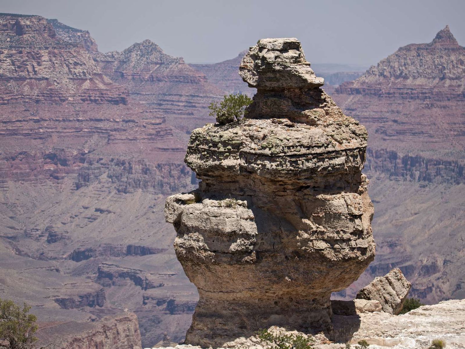
This unsigned pull off on Desert View Drive offers plenty of parking for cars, larger vehicles, and RVs to stop and view Grand Canyon and a well-known rock formation.
It can be hard to put into context how vast Grand Canyon is. Nestled between the Kolb Studio and the Bright Angel Trail, this wayside attempts to put it into perspective, while offering sweeping overlooks of the canyon itself.
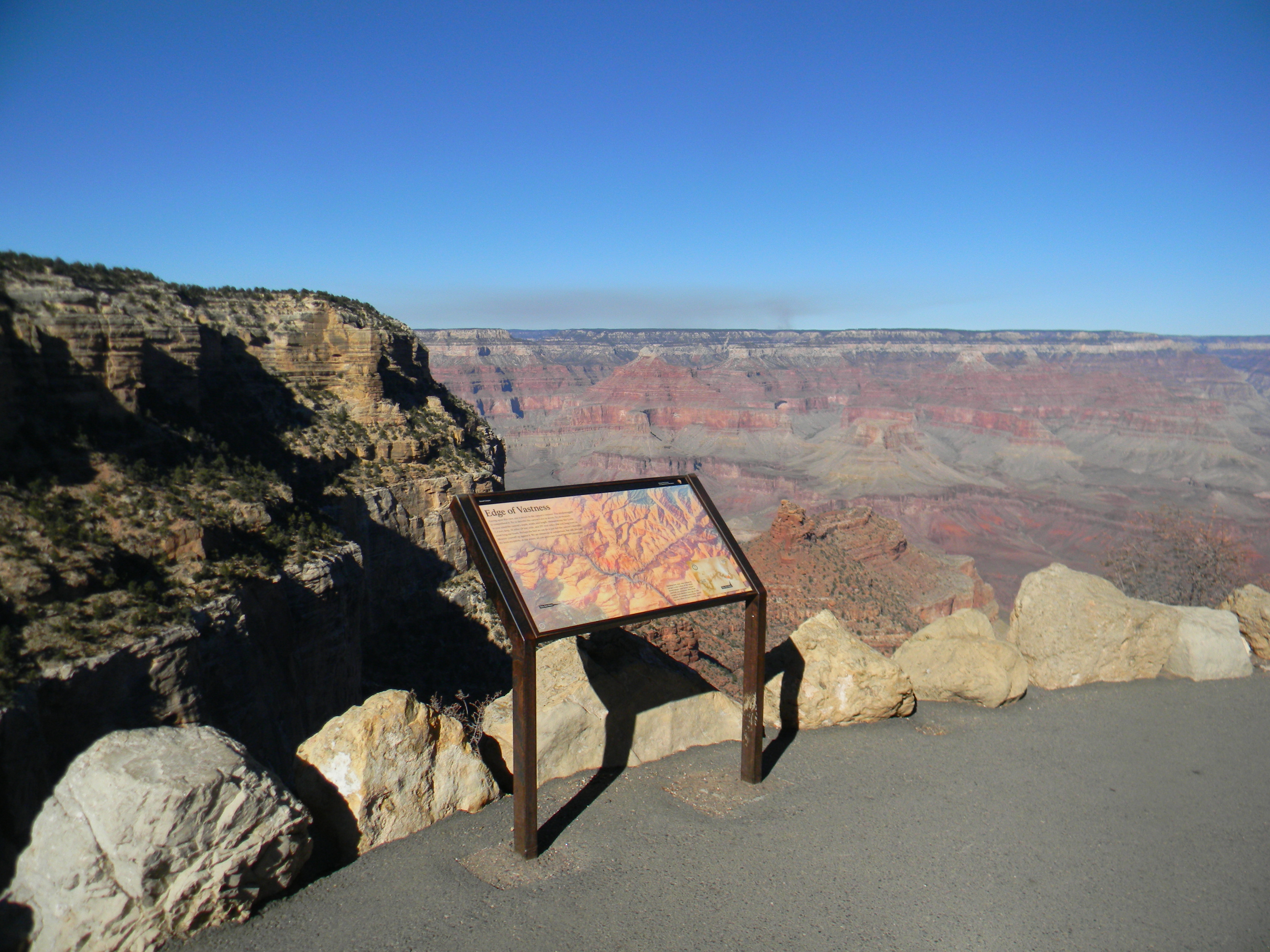
One-hundred feet (30 m) east of the Bright Angel trailhead, a color aerial photograph of Grand Canyon fills a four-foot (1.2 m) wide by three-foot (1 m) tall angled metal wayside panel. At the lower left corner of the panel, a small black rectangle with the words, “You Are Here,” points to your location on the South Rim near the Village. The canyon extends north across the entirety of the rest of the panel, with the Colorado River winding top to bottom across the face of the panel. The rugged topography of the canyon walls, peaks, creeks and inner canyons continue all the way across to a small white dot in the upper right-hand corner, Grand Canyon Lodge on the North Rim. Text at the top left of the panel reads: Edge of Vastness Gazing upon this view, one is struck by the canyon's vastness. The mind struggles to comprehend it. Try to describe the canyon's size in words. Try to measure in your mind the canyon's depth, width, and length. Measurements like 1 mile (1.6 km) deep, 18 miles (29 km) wide, and 277 river miles (446 km) long leave us scratching our heads. Perhaps the best we can do is just feel the canyon's enormity. Measure yourself up against it. We are minuscule in comparison, but still, through the keen receptivity of our sense, we can appreciate Grand Canyon's immensity. A second aerial photograph inset at the bottom right shows an even wider view of Grand Canyon. The branch-like arms of the inner smaller canyons extend from the snaky path of the Colorado River. A small section of the map along the river has been highlighted in orange. A caption reads: Standing here, your view (shown in orange) is only a sliver of the whole Grand Canyon. Each Grand Canyon overlook you encounter offers fresh insight, from detailed close-ups of side canyons to sweeping panoramas. Search out and reflect on your favorite view.
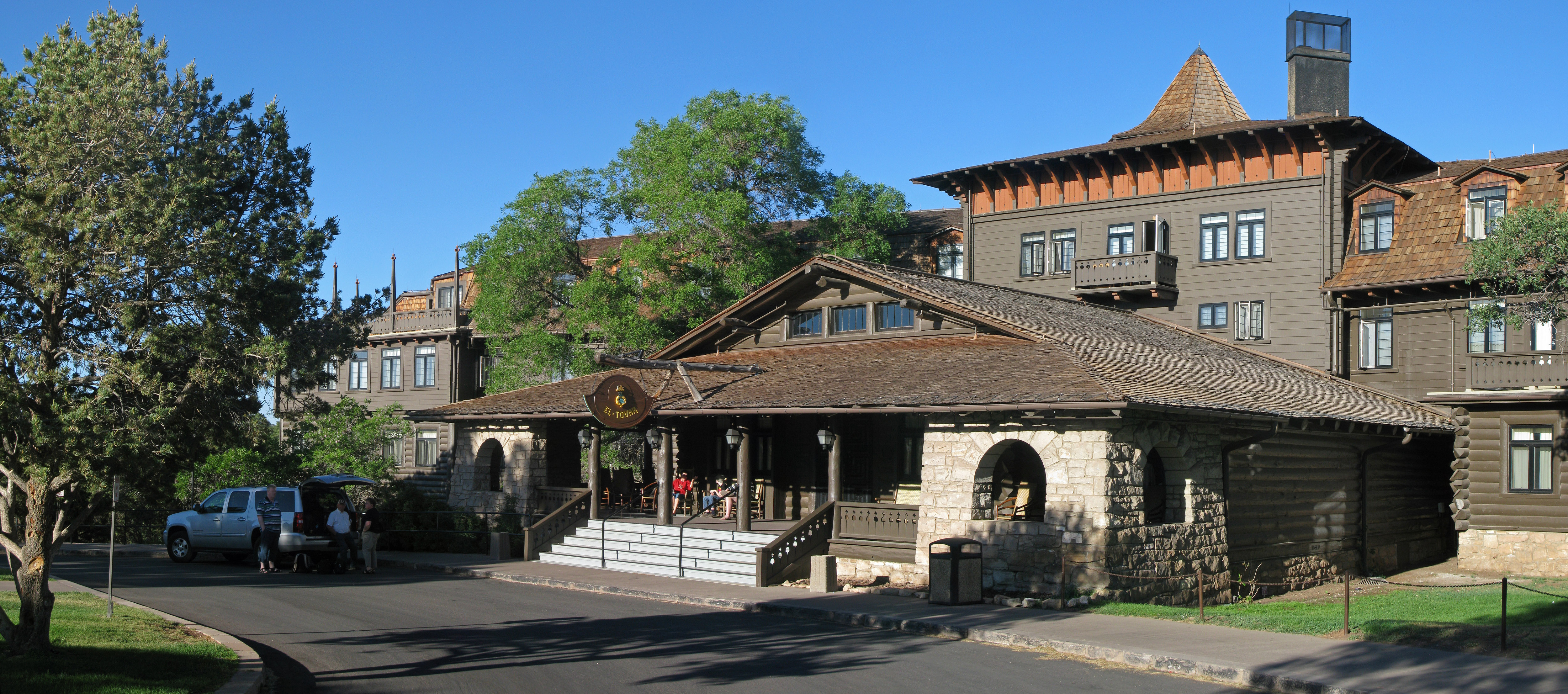
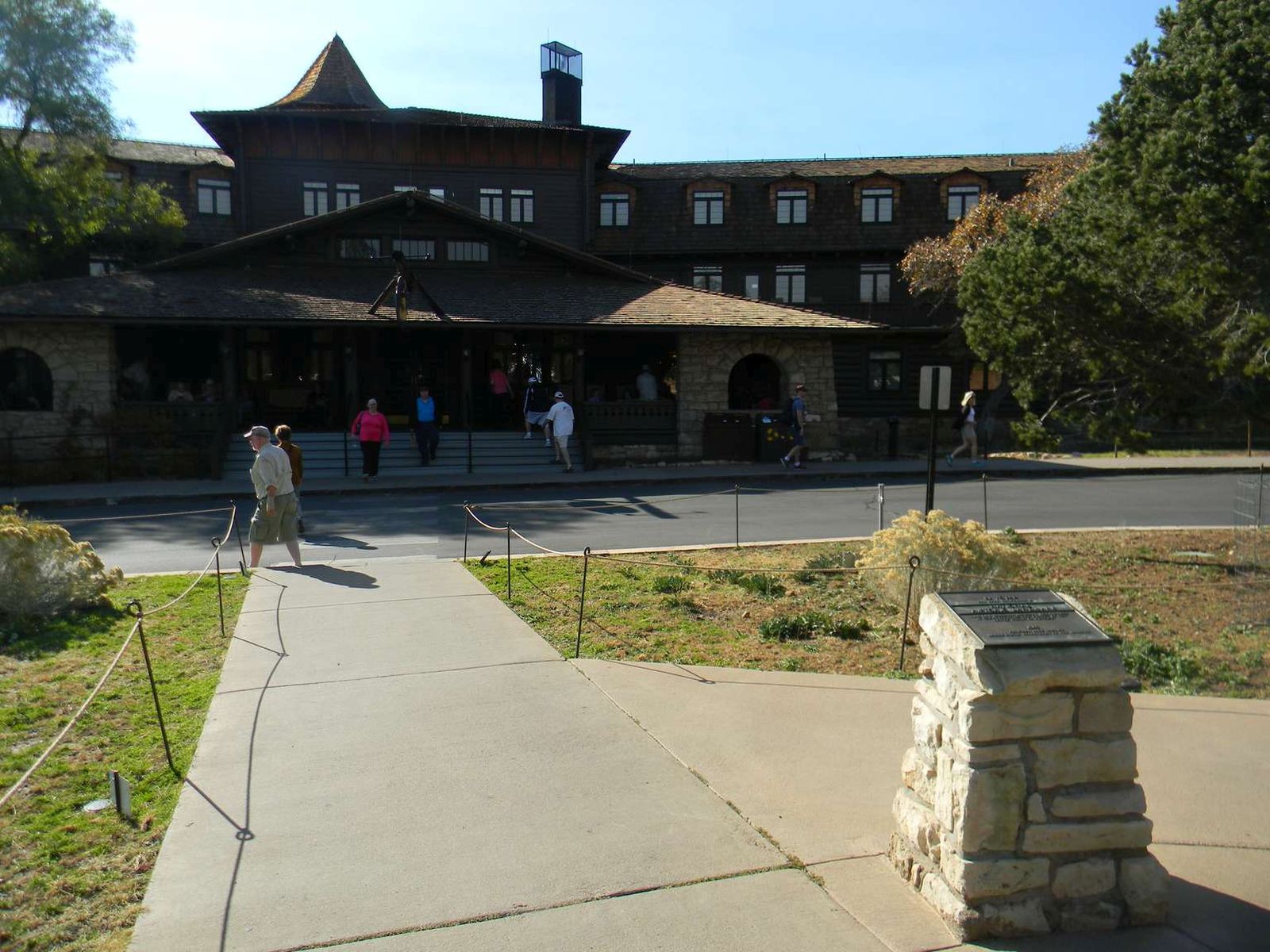
Located directly on the rim of Grand Canyon, El Tovar Hotel features a fine dining room, lounge, gift shop, and newsstand. Dining Room: Breakfast: 6:30 am to 10 am, Lunch: 11 am to 2:30 pm, Dinner: 4:30 pm to 9:30 pm. *Advanced reservations are required for lunch and dinner at El Tovar Dining Room. (928) 638-2631, ext. 6432 - El Tovar Lounge 11 am to 10 pm. (food until 9:30 pm).
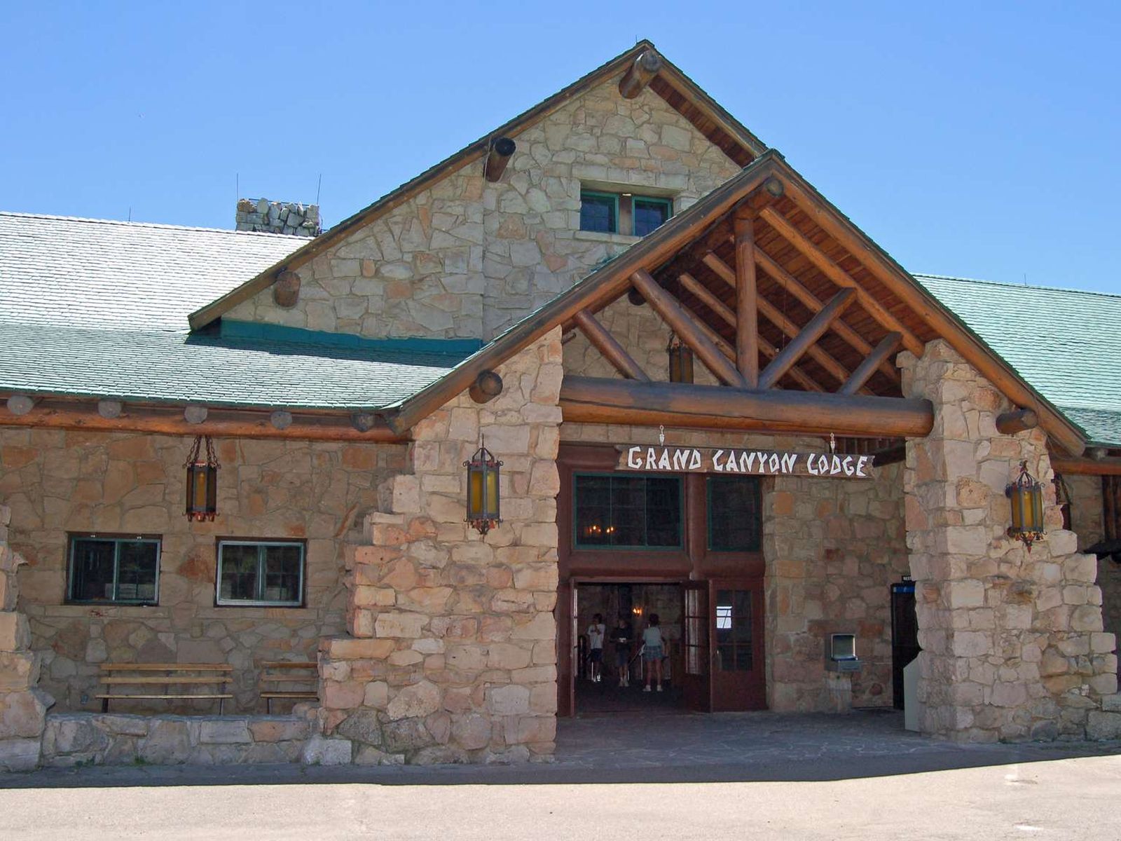
Located on Village Loop Drive about 100 feet (30 m) from the South Rim, the El Tovar Hotel blends a Swiss chalet and a Norwegian hunting lodge with a rustic Mission style. Five steps lead up to a broad limestone and pine entry veranda on its east side, extending 40 feet (12 m) across the front of the building. Numerous rocking chairs and benches are set out on its 10-foot (3 m) deep wooden porch. Behind the veranda, the lobby rises three stories tall, topped with an octagonal turret with a pyramid roof. A smaller wooden porch on the north side of the building faces the canyon, and is equipped with a wheelchair ramp. The hotel has many levels. The 200-foot (60 m) long two-story central portion runs roughly parallel with the canyon rim and connects to three-story north and south wings. The top floors of the guest room wings extend only partway from the central section, creating roof decks. The third floor exterior is treated as a mansard, with projecting dormers with shallow gables. The lower portions of the building are mainly of log construction, yielding to a lighter, smoother framed construction sheathed with dark wood planking on the upper levels. The roof is covered in wood shingles. Inside, the central rotunda of the lobby features Swiss-inspired cutout wood railings framed by peeled log posts, all varnished a dark brown. Southwestern pattern carpets are accented with Arts and Crafts Movement furnishings and native southwestern motifs. There are two gift stores at the left and right, and numerous mounted moose, deer, and elk heads ring the room high on the walls under exposed log timbers. Accessible restrooms are located down a hallway to the right of the check-in desk in the center of the rotunda. Keys to these facilities may be requested at the desk.To the rear of the lobby is a dining room with large windows through which one can view the canyon.
The first modern hotel constructed in the Village, El Tovar Hotel eventually became the eventual heart of Grand Canyon National Park, and a National Historical Landmark. Constructed to the highest standards of the time, El Tovar Hotel helped lure visitors to a remote and rough canyon region.
In front of the east entrance to the El Tovar Hotel, near the center of a 50-foot (15 m) wide circle ringed by the loop road, stands a three-foot (1 m) tall rectangular limestone-block pedestal with a roughly 16-inch (40 cm) square metal plaque mounted at a slight angle on the top. Move carefully across the road using the crosswalk in front of the hotel veranda. Text on the plaque reads: "El Tovar has been designated a National Historic Landmark. This site possesses national significance in commemorating the history of the United States of America, 1987, National Park Service, United States Department of the Interior."
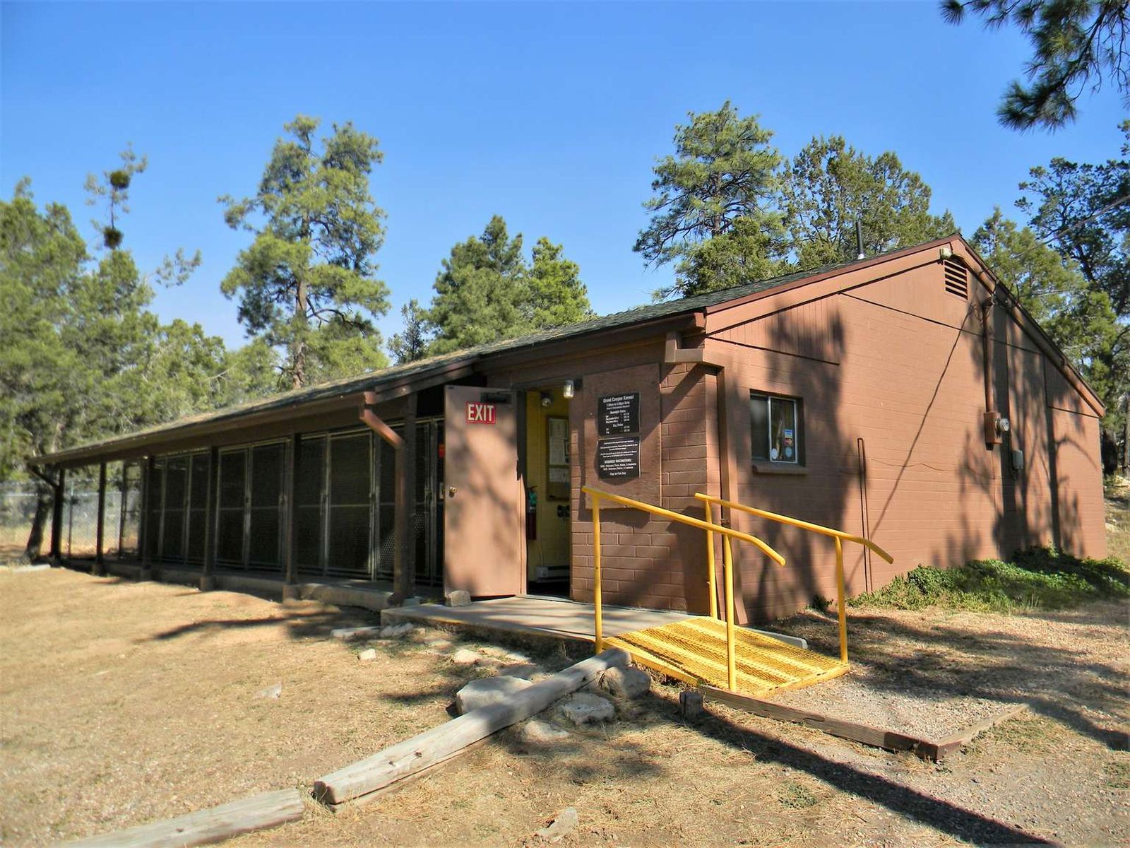
Located on the South Rim near Maswik Lodge, Grand Canyon Kennel is operated by Xanterra, and accepts dogs and cats only. Reservations are highly recommended, especially during spring break and summer. The kennel is open 7:30 am – 5 pm, 7 Days/Week. Overnight boarding is available. The kennel can provide a safe place for your furry friend to stay while you explore all that Grand Canyon has to offer.
A one-story brown brick building with a gently peaked, shingled roof fills the field of view. A door stands open at the right end of the building, with a sign on the wall next to the door and a yellow metal ramp with handrails leading up to the doorway to the right of the sign. To the left of the door, along the length of the building, is a series of large, metal, wire enclosures with latched doors. A small section of roof supported by pillars extends over a concrete walkway which runs next to these enclosures.
The North Rim is CLOSED for the remainder of the 2025 season because of damage and losses caused by the Dragon Bravo Wildfire (7/12/2025). Grand Canyon Lodge was severely damaged by the fire. The lodge featured private cabins, both along and near the rim of Grand Canyon in the forest. Accommodations were very popular and typically book up a year in advance.
A D Stop 20, Grand Canyon Lodge Circle. 7 minutes. About 400 feet (120 meters) south of the Visitor Center, Route 67 reaches its southernmost end in a loop road that runs in front of a U-shaped, multiple log and stone building complex. Note a ‘Do Not Enter’ sign at the head of the loop road, as access is restricted to authorized commercial service providers, and folks entering to use the accessible parking spaces along the east near Rough Rider Saloon. Here we find Deli in the Pines to the west, Grand Canyon Lodge to the south, and Rough Rider Saloon, the Post Office, and the gift shop along the east. A stone sidewalk porch at ground level runs in front of Deli in the Pines and Grand Canyon Lodge. Note also a raised stone sidewalk porch in front the gift shop, Post Office, and Rough Rider Saloon. This porch can be accessed from a set of stone stairs at the north and south ends of the porch, or via an access ramp that begins just north of the gift shop at ground level. From here, the ramp leads about 60 feet (18 meters) east up a slight incline, then turns right to continue 100 feet (30 meters) south along the back of the building. Turning right again, the ramp continues up a slight incline with metal handrails at the left and center, then through a covered, stone hallway to arrive at the south end of the raised sidewalk porch, with Rough Rider Saloon at the right. The loop road surrounds an oval landscaped area in its center. Towards the southern end of the oval, a metal flagpole stands before a three-foot tall wayside panel mounted on an angled, metal reading rail. A rough, stone sidewalk spans the 40 foot (12 meter) width of the oval in front of the wayside. Should you move to the wayside, be mindful of any vehicular traffic when crossing the loop road. Entitled, “Grand Canyon Lodge,” the panel tells of the need for and construction of the lodge. A description of this panel is included in the sub-script below. A wide, covered, flat stone sidewalk porch runs around the front of all the buildings, supported by large stone columns and wide wooden posts, spaced about every eight to ten feet (two-and-a-half to three meters) along the roofline at the edge of the sidewalk. Beginning at the far, northwest side of the complex, a set of restrooms is located up a couple wide, stone steps from the loop road, through a single wooden door. The men’s restroom is to the left; the women’s restroom is to the right. From the restrooms, move about 50 feet (15 meters) south along the porch to the two side-by-side glass and metal doors of Deli in the Pines at the right. Coffee drinks are available daily, in addition to grab-and-go sandwiches, pizza, soup or chili, and snacks. Grab-and-go food menu items and beverages are available daily. Note there may be a two-tier wooden bench outside the deli doors at the edge of the sidewalk. From Deli in the Pines, continue south along the porch another 40 feet (12 meters), then turn left about 50 feet (15 meters) to the main entrance to Grand Canyon Lodge at the right. To the right of the doors, note a water fountain with a bottle filling spigot mounted on the outside wall of the lodge. Also note a wildlife-proof, metal garbage on the other side of the porch, immediately opposite the water fountain. The lodge features private cabins, both along and near the rim of Grand Canyon in the forest. Interior wheelchair lifts allow access to the auditorium and dining room. The dining room serves breakfast, lunch, and dinner daily. Note reservations are required for dinner. At the back of the lodge, two large, stone patios with wooden deck chairs afford unobstructed views of the canyon. A third interior wheelchair lift allows access to the patio level. Note also several narrow, uneven stone staircases and paths that lead down from the patio to the Bright Angel Point Trail along the base of the lodge. From the front doors of the lodge, the porch continues about 50 feet (15 meters) east past a long line of large, rough-hewn, wooden deck chairs placed along the outside stone wall at the right. A 15-foot (three meter) wide stone staircase, with a metal handrail at each side and another in the middle, leads up nine steps to the stone porch area in front of Rough Rider Saloon. Whether you arrive at this location via the stairs or the access ramp, here at the southern end of the stone porch, white, arched lettering across the top of a six-foot (two meter) square plate glass window spells, “Saloon.” Guests are invited to stop in for a quick cappuccino, espresso, or coffee in the morning. Baked goods and breakfast burritos are also available from 5:30 to 10:30 am. In the afternoon, from 11 am to 11 pm, cold beverages and pizza slices are available while the saloon transitions to evening dinner options and a bar. About six feet (two meters) north along the porch from the saloon is the Post Office. Vertical metal bars cover the face of a double-hung window in the log wall, with a small open slot at the bottom center. At the top left side of the window, white letters carved into the first of two, small wooden signs sticking out from the building read, “Post Office.” The second reads, “N Rim A Z, 8 6 0 5 2.” Beneath the window, a word above a horizontal slot at the top of a plain, painted, brown wooden panel reads, “Letters.” About six feet (two meters) to the left (north) of the window, note a sturdy, three foot (one meter) tall wooden writing desk juts out from the wall about two feet (60 centimeters). A second, narrow wooden shelf is mounted to the wall slightly above it. Note also a garbage can on the porch, placed just to the left of the desk. The Post Office is an active operation that handles post cards and letters for residents and visitors to Grand Canyon's North Rim. It is open Monday through Friday during the season between the hours of 8 am and 12 pm, and from 1 pm to 5 pm At the far northern end of the raised, stone porch is the door to the gift shop. The shop offers visitors to the North Rim gifts, postcards, and souvenirs of their trip, from clothing and accessories to Native Americans handicrafts. Sub-Script Grand Canyon Lodge Wayside Panel A sepia-tone photograph fills the left side of the panel. In front a line of buses arrayed in front of Grand Canyon Lodge, a line of men and women stand a couple rows deep, all dressed in light-colored, one-piece dresses or white shirts with dark pants. Two of the men hold a banjo and guitar. A caption reads: Lodge employees, in 1930, “sing away” departing guests in front of the first Grand Canyon Lodge. Entitled, “Grand Canyon Lodge,” text at the top of the panel reads: When Grand Canyon became a national park in 1919, the North Rim was scarcely developed. While the South Rim had grand hotels and many visitor programs and services, the hard-to-reach North Rim had only rustic tent cabins for 40 guests. The National Park Service’s first Director, Stephen T. Mather, urged the Union Pacific Railroad to improve access to the North Rim and build a rustic lodge with cabins. During 1927–1928, architect Gilbert Stanley Underwood designed and built a lodge using local Kaibab Limestone and ponderosa pine logs taken from the site. Just four years after completion, the new lodge and four cabins burned to the ground. At the top right, a caption above a color inset drawing of the lodge reads: Architect Underwood’s rendering of the original lodge shows its second story level and a three-story observation tower, both eliminated in the lodge’s reconstruction in 1937. A quote above the rendering reads: So cunningly have the architects planned this remarkable building that it seems to have sprung full-grown from the canyon wall itself. —Union Pacific Railroad, 1929 At the bottom right, a black-and-white picture shows a roofless, burned-out lodge, with blackened stone walls. A caption reads: On September 1, 1932, fire left only the foundations and walls of the first lodge. The present-day lodge, rebuilt on the old foundation, features more stone and less timber to make it more fire resistant. The steeper roof sheds snow more efficiently.
The North Rim is CLOSED for the remainder of the 2025 season because of damage and losses caused by the Dragon Bravo Wildfire. Grand Canyon Lodge Gift Shop was severely damaged by the fire. The shop offered visitors to the North Rim postcards, along with gifts and souvenirs of their trip. From clothing and accessories to Native Americans handicrafts, the shop has something for everyone.
With wood floors, the exposed wooden beams that make up the walls, roof, and supports, and lantern style lights the room feels like stepping back in time, but modern gifts and souvenirs of all kinds line shelves, stands, and counters throughout the space.
Park Headquarters is currently closed to the public. Between 1957 and 2001, this building was the South Rim Visitor Center. Basic trip planning and hiking information, along with ranger program schedules are posted on signs in front of the building. A paved footpath, just beyond the left side (southwest side) of the building reaches the canyon rim in 0.5 mile/ 0.8 km.
Grand Canyon Park Headquarters is located about six miles (9.5 km) from the south entrance of the park off the park entrance road, with parking lot A to the west of the building. A 10-foot (3 m) wide by six-foot (2 m) tall redwood sign with the National Park Service arrowhead logo sits at the left of a large, 20-foot (6 m) deep by 50-foot (15 m) wide flagstone patio area in front the headquarters.<br />Four limestone brick pillars frame a series of aluminum awning-type windows with a flat-roofed canopy over the entrance to a long, one-story building with a glass curtain wall, pulled back from the line of pillars. One larger pillar at the left supports a flagpole.<br />The interior of the building is closed to the public. Inside the lobby, a 20-foot (6 m) long blond wood information desk fills the right-hand side of a spacious lobby with flagstone paving, 40 feet (12 m) wide by 20 feet (6 m) deep. A central limestone fireplace sits in the back center of the room with a low stone bench in front. A quote from Theodore Roosevelt hangs above the fireplace and reads:<br />The Grand Canyon. Do Nothing to mar its grandeur...Keep it for your children, your children's children, and all who come after you as the one great sight which every American should see.<br />Several chairs and a sofa surround a large native rug in the center of the room in front of the fireplace. <br />A set of glass doors to the left of the fireplace lead to a large open-air stone courtyard area. Several more wooden benches placed around the courtyard, distinguished by low, stone, free-form planters filled with native trees, flowers, shrubs and cactus and tapered wood columns.<br />Outside Grand Canyon Park Headquarters, the Rim Trail leads along the west side of the building to the canyon edge.<br /><br />A 20-foot (6 m) long blond wood information desk and park ranger contact station fills the right-hand side of the spacious, one-story lobby of the building. Restrooms are located down a small corridor to the left of the desk.<br />In the center of the room, several wooden chairs and a sofa with stuffed cushions surround an eight- by ten-foot (2.4- to 3.5 m) native rug in front of a central glass-enclosed fireplace embedded in the stone wall at the back of the room. A low stone bench sits in front of the fireplace. <br />A 15- by 20-foot (4.5 by 6 m) map of Grand Canyon fills the floor of the lobby to the left of the fireplace, and there is a water fountain with a water bottle spigot at the far-left front of the lobby next to the front glass curtain wall.<br />A set of glass doors to the left of the fireplace leads to a large outdoor stone courtyard area at the left. Signs posted around the perimeter of the courtyard lead to the park reference library, complete with WiFi and computer access.
Located next to Shrine of the Ages the Grand Canyon Pioneer Cemetery is the final resting place of many historical figures involved in the development and protection of Grand Canyon as a National Park. Captain John Hance, Ralph Cameron, Pete Berry, Ellsworth Kolb, Gunnar Widforss, and Eddie McKee are just a few of the folks you might visit here.
A 20-foot (6 m) long, 30-inch (76 cm) diameter ponderosa log supported by two 12-foot (3.6 m) tall by four-foot (1.2 m) square limestone pylons form the gateway to Grand Canyon Pioneer Cemetery. Directly below the primary log, also encased within both pylons, are two secondary logs running perpendicular to the main log. There are three steps at the base of each pylon, and the north pylon has an American Legion plaque mounted on it. Limestone gravestones and headstone markers of all shapes and sizes lay scattered across several well-tended acres among peaceful ponderosa pines.People interred at the cemetery include Grand Canyon pioneers, war veterans, tribal members, and employees of the concessionaires, US Forest Service, and National Park Service. Graves of the Verkamp family fill a corner of the cemetery. Early Canyon photographer Emery Kolb and his wife, Blanche, are buried here, as are the remains of the unidentified victims aboard the United Airlines DC-7 that crashed here in 1956. Grand Canyon Pioneer Cemetery is still active. To qualify for burial an individual must have lived at Grand Canyon for no less than three years or must have made a significant and substantial contribution to the development of, public knowledge about, understanding of or appreciation for Grand Canyon National Park.
The South Entrance Station is the entry point for most visitors to Grand Canyon National Park. It is the closest entrance to Grand Canyon Village on the South Rim. The entrance is open 24 hours/day and 7 days/week, unless closed by snow. Located in Arizona, it is 5 miles (8 km) north of the gateway town of Tusayan; 55 miles (89 km) north of Williams, Arizona via SR 64 from I-40; and 80 miles (129 km) north of Flagstaff via US 180,
This terminal is the main hub for the park's free shuttle buses. From here, the Village (Blue) Route shuttle connects the Visitor Center with lodges, campgrounds, the Backcountry Information Center, and Market Plaza (general store, deli, and U.S. Post Office). The Kaibab Rim (Orange) Route travels eastbound to South Kaibab Trailhead, or westbound to Yavapai Geology Museum. During summer only, the Tusayan (Purple) Route transports visitors to the gateway town of Tusayan.
The Grand Canyon Visitor Center shuttle bus terminal is located on the southeast side of Grand Canyon Visitor Center Plaza in a large, open-air gazebo filled with many benches. A large analog clock with no hands hangs in the middle of the gazebo, with overhead signs pointing to the Bookstore, Canyon Rim, and the shuttle bus stops themselves. The bus stops and bus turnarounds are located to the east outside the gazebo across a one-lane asphalt road. Be mindful of bus traffic as you move to this area. Free shuttle buses operate on four routes at Grand Canyon National Park: Hermits Rest Route (indicated in red on the map), Village Route (blue), Kaibab/Rim Route (orange), and Tusayan [TWO-see-ahn] Route (purple). The shuttles are free, no tickets are required, and bus stops are clearly marked here at the terminal and throughout the park by signs along with their matching color. Buses are white with a green stripe. The route name is indicated on the front of the bus. Note that the Hermits Rest Route is not in service between December 1 and February 28. During those three months only, Hermit Road is open to private vehicles. Note also that the Tusayan Route operates during summer only. Exact dates are announced each winter prior to the shuttle's operation. A scenic drive accessibility permit is available at all entrance stations, visitor centers, hotels, and the Backcountry Information Center. The permit allows access to some areas closed to the general-public traffic. Shuttle buses are equipped with ramps to accommodate wheelchairs smaller than 30 inches wide by 48 inches long (76 by 122 cm). Most motorized scooters will not fit on shuttle buses. Note that food, drinks, and pets are not permitted on shuttle buses, but service animals for visitors with disabilities are allowed.
Geologically speaking, the canyon is considered to be a "young" feature, having largely been eroded in just the last few million years. But the rocks of Grand Canyon are a different matter entirely. The age range of Grand Canyon's rocks encompasses over 1.5 billion years of Earth's past, from the oldest known rock, at an ancient 1.8 billion years old, to the youngest, a mere 270 million years old.
Moving east along the Trail of Time from the Village, a three-foot (1 m) tall angled metal wayside panel sits to the left of a roughly one-foot square chunk of black and gray striated igneous rock mounted on a 15-inch (38 cm) square concrete pedestal on the ground. Text at the top of the panel reads: "Grand Canyon's rocks are incredibly old. Grand Canyon's oldest known rock is called the Elves Chasm Gneiss (pronounced "NICE") and it is 1,840 million years old." On the left of the panel, a caption under a color photograph looking out towards Maricopa Point from your present location reads: "Imagine how old? The 1,840 million-year-old Elves Chasm Gneiss is almost unimaginably old, yet it is only two-fifths the age of the Earth. To reach the 4,560 million-year age of the Earth along the Trail of Time, walk west 2.7 kilometers (1.7 miles), to Maricopa Point." A graphic in the center of the panel shows a central cluster of blue and red circles being orbited by five black circles along separate elliptical lines. A caption reads: "How do we know? Geologists can tell how old a rock is by counting the atoms produced by natural radioactive decay." Referring to the rock sample at your right, text on the right side of the panel continues: "Touch a rock that is 1,840 million years old. This rock sample came from the bottom of the canyon 32 kilometers (20 miles) west of here." Next to a color photograph showing a layer of similar rock beside the Colorado riverbed, a caption reads: "This rock was first formed as granite when magma cooled 1,840 million years ago. Pressure and heat then changed it into gneiss (pronounced NICE) about 1,700 million years ago." A map of the Trail of Time runs along the bottom of the panel. Text below the map reads: "You are on a timeline. 1 long step = 1 million years." A graphic of the V-shaped Trail of Time portal rock column at the bottom right asks, "Where in the rock record?" An arrow points just above the bottom of the column with the label, "1,840 million years ago."
This location offers one of the better views of the layers and depths of the canyon in the area of Grand Canyon Village. It also provides especially fantastic aerial views of the switchbacks on the upper and middle portions of Bright Angel Trail.
A flat wooden bench sits in a paved pull-out just off a paved trail following edge of Grand Canyon. Beyond the bench a wall of large rough white rocks about 3 feet highlines the edge of the path. Past the rocks a relatively flat extension of smooth white limestone juts into a wide 3 sided vista of canyon cliffs, slopes, and colorful rock layers.
Open daily from 8 am through 4 pm. Trip planning and hiking information is available through exhibit kiosks and sidewalk signs outside of the building. Park in one of four large parking lots and get your first look at Grand Canyon by walking to nearby Mather Point. With your vehicle parked at the Visitor Center, you can also board free shuttle buses and be transported around the village and out to scenic overlooks.
In the Village Historic District, near Hopi House and El Tovar Hotel, Verkamp's Visitor Center features exhibits that focus on the Grand Canyon Community; what it was like to live and work here on the brink of one of the seven natural wonders. A staffed information desk and a Grand Canyon Conservancy Museum Store are also located here. Public restrooms are available in a separate building behind the Visitor Center.
Geology Talk (30 minutes) South Rim Village: 2:30 pm
Geology Talk Ranger Program - 2:30 pm daily (during summer 2025). Gain insight into Grand Canyon’s unique geologic story. Meet in front of Yavapai Geology Museum. Program duration: 30 minutes. Learn how this immense canyon formed and the science behind the landscape. Knowing some of the stories encoded in the rock layers will enrich your understanding and enhance your experience at Grand Canyon.
History Exhibit - The Amazing Kolb Brothers
See the Amazing Kolb Brothers; A Grand Life at Grand Canyon Exhibit - at Kolb Studio, house-turned-museum perched perilously on the precipice in Historic Grand Canyon Village. Examine their antique cameras, study paintings by plein-air artists through the decades, and watch the motion picture of their 1912 trip down the Colorado River.
Tours
Count: 3
Full Steam Ahead: A Historic Village Tour
Journey through Grand Canyon's Historic Village. Explore buildings constructed over 100 years old, stories of the past, and consider Grand Canyon's future as tourism continues into the 21st century. Total walking distance is about half a mile throughout the village.
Grand Canyon Geology - The Trail of Time
The 1.3 mile (2.1 km) section of paved rim trail between Yavapai Geology Museum and Verkamp's Visitor Center features rock samples, fossils, interpretive waysides, and viewing aids to help you discover the geologic processes and the vast amounts of time involved in forming the Grand Canyon that we know and love today. While the trail can be walked in either direction this tour runs East to West, or from the most recent events to the most ancient. Adjust this tour to fit your needs.
South Rim; The 1–2 hour visit.
While one can get lost for days on end at a place like Grand Canyon, we don't always have the time. Thankfully even a short trip to Grand Canyon can still yield some amazing views and life long memories. The following is our Ranger Recommended 1–2 visit for the South Rim that includes a short walk, and our free shuttle bus service, but remember that there is no wrong way to visit the canyon. Relax, enjoy the views, and thanks for visiting.