This canal, skirting the 76-foot drop of the Great Falls on the Potomac, was the most demanding and complex of the five canals built by the Patowmack Company.
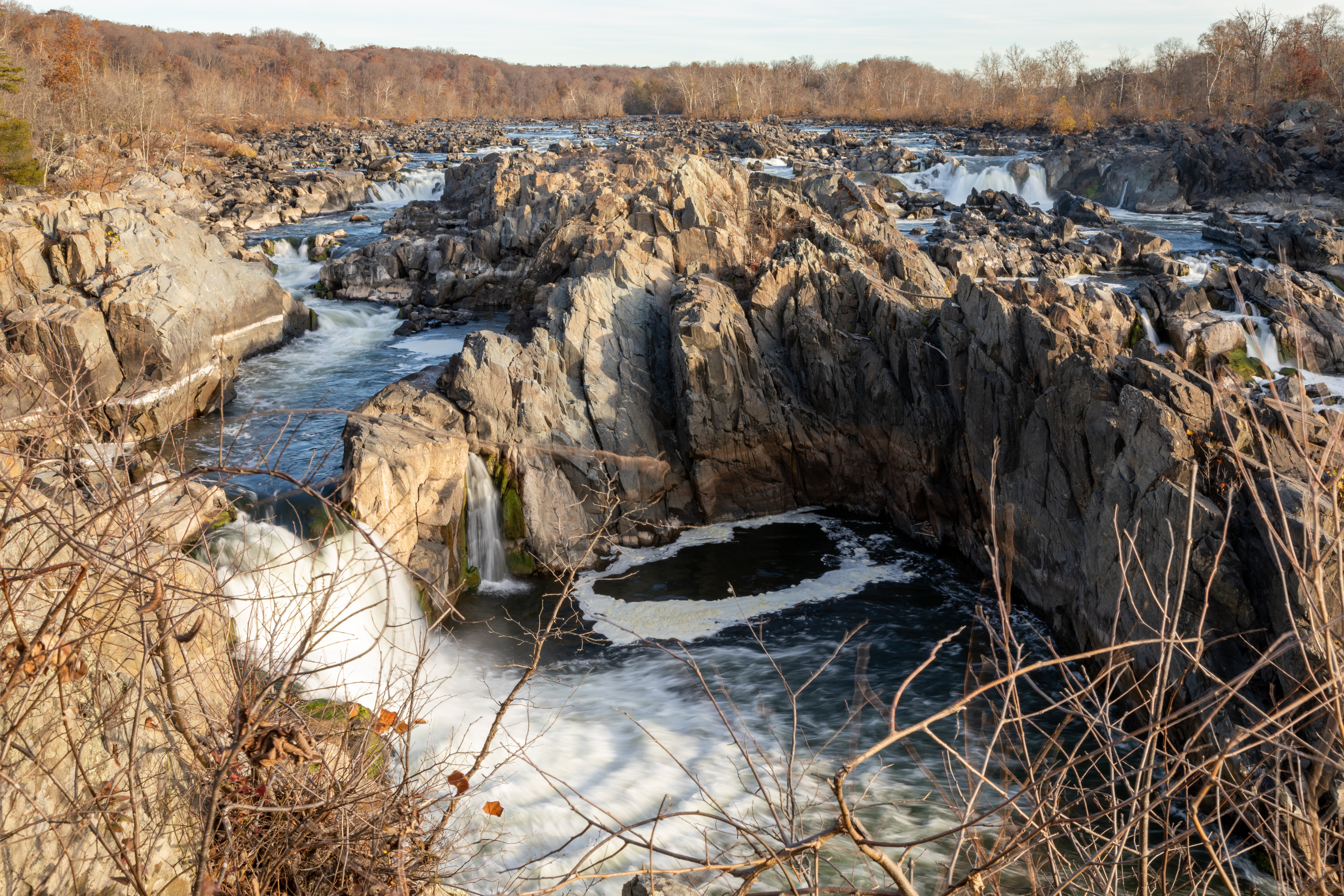
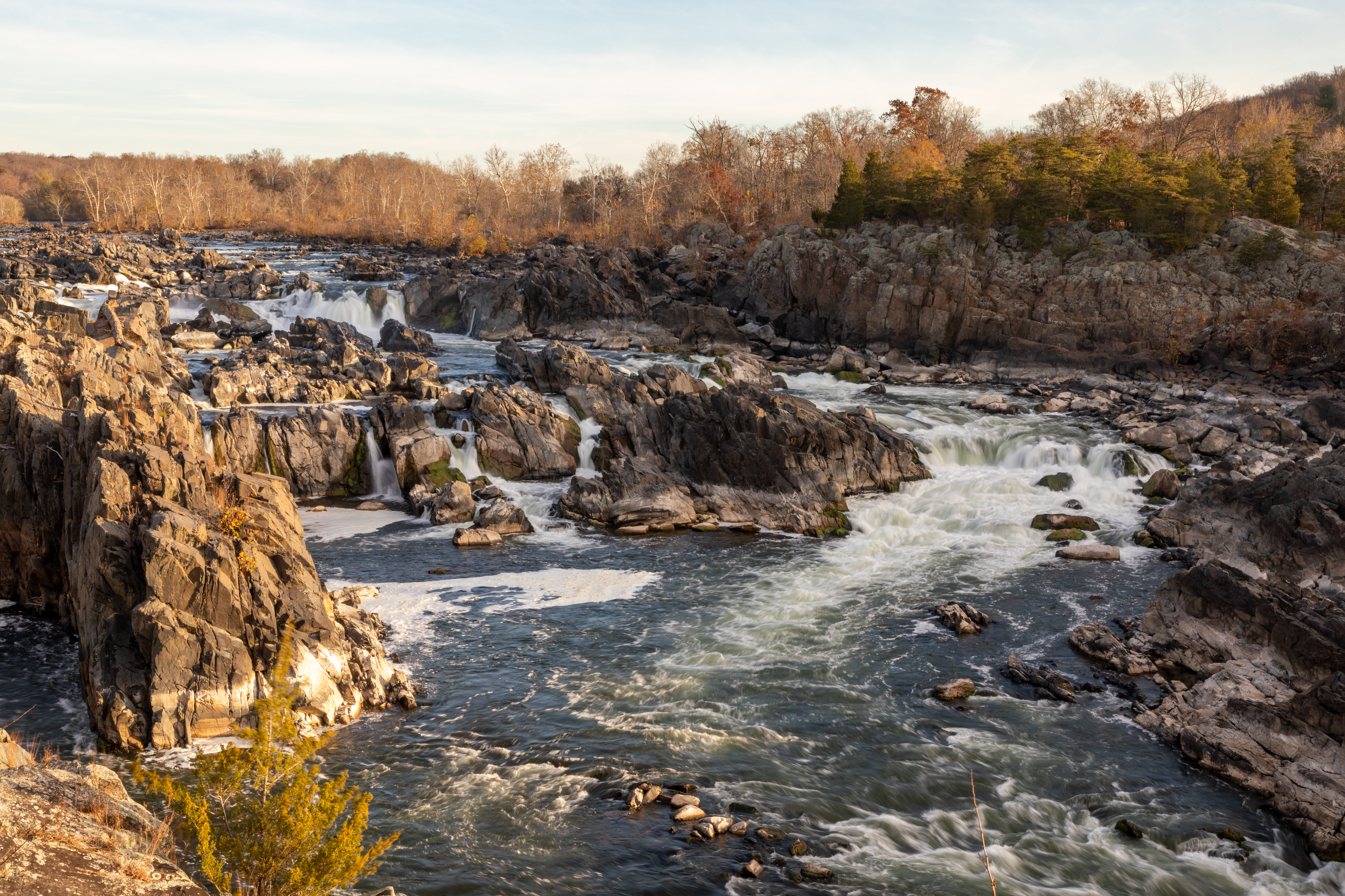
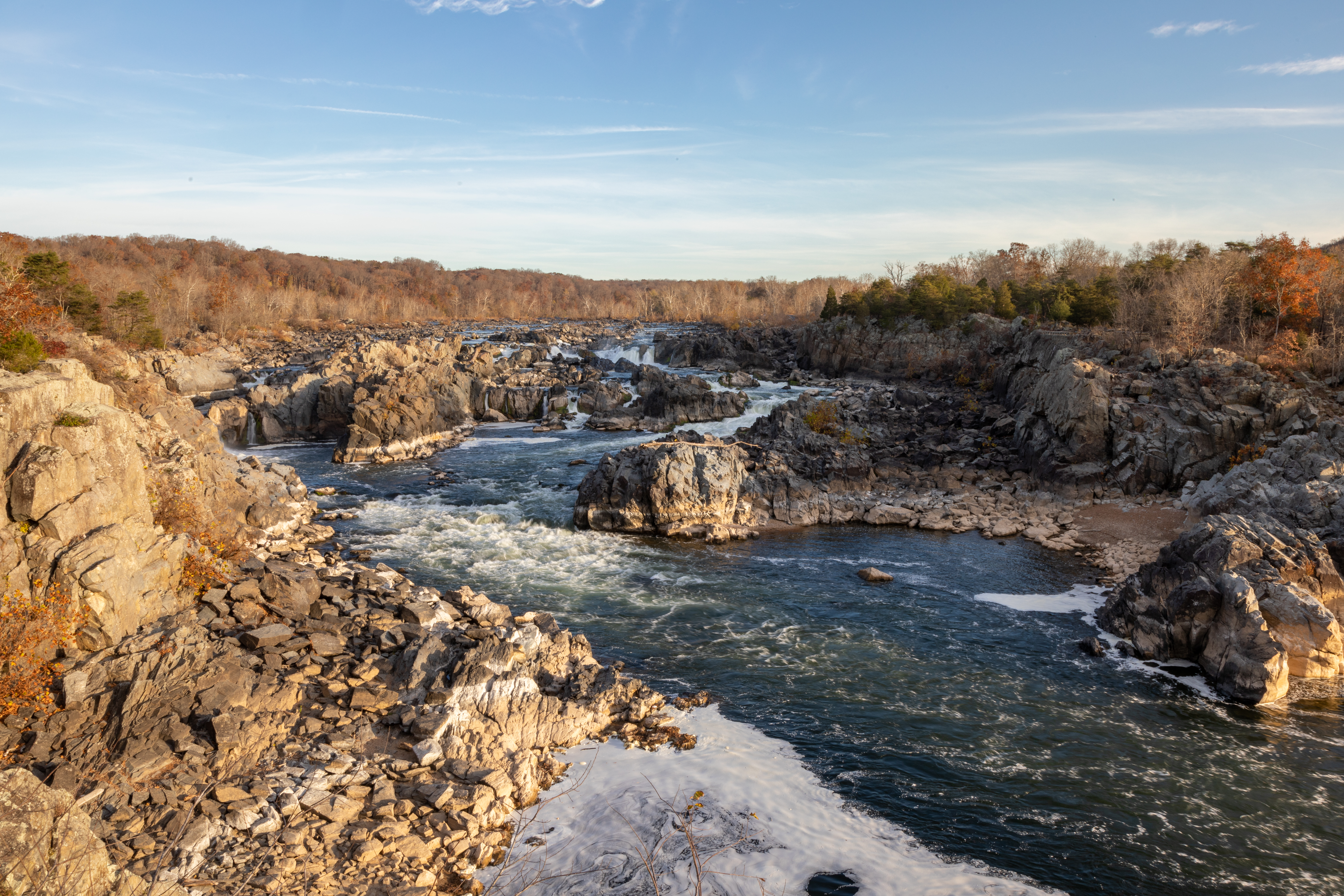
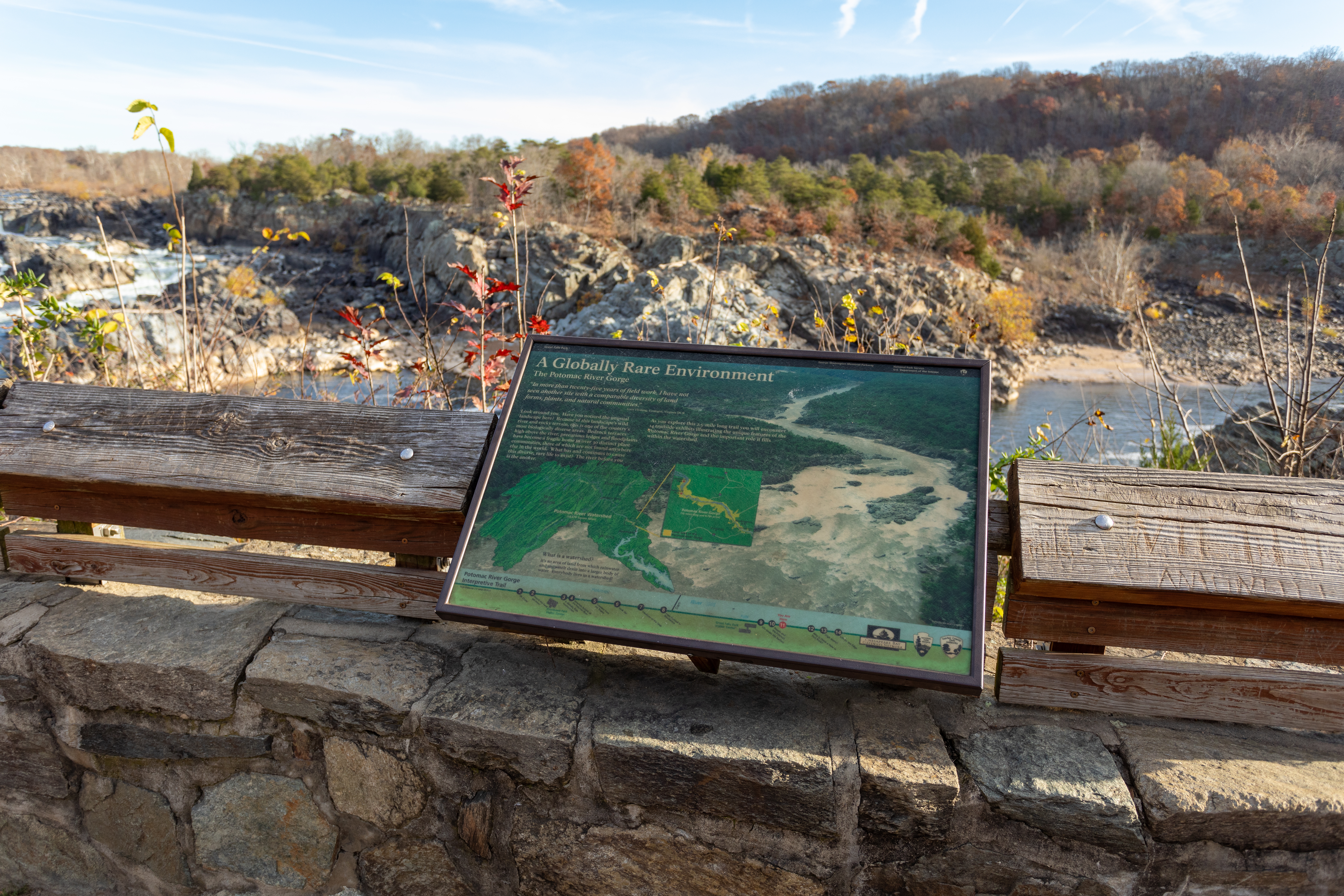
Look around you. Have you noticed the unusual landscape here? Because of this landscape's wild river and rocky terrain, this is one of the country's most biologically diverse areas. Bedrock terraces high above the river, precarious ledges and floodplains have become a fragile home to over 30 distinct plant communities, three of which are not found anywhere else in the world. What has and continues to cause this diverse, rare life to exist? The river before you is the answer.
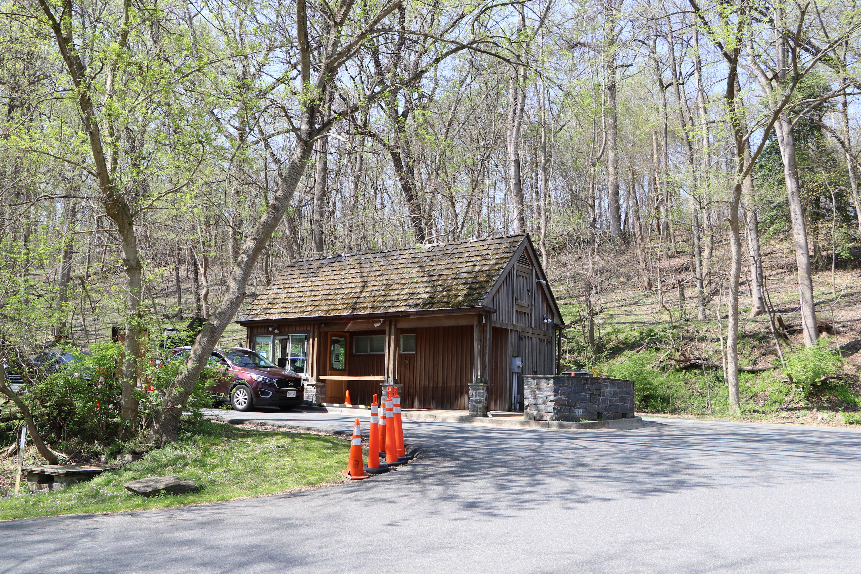
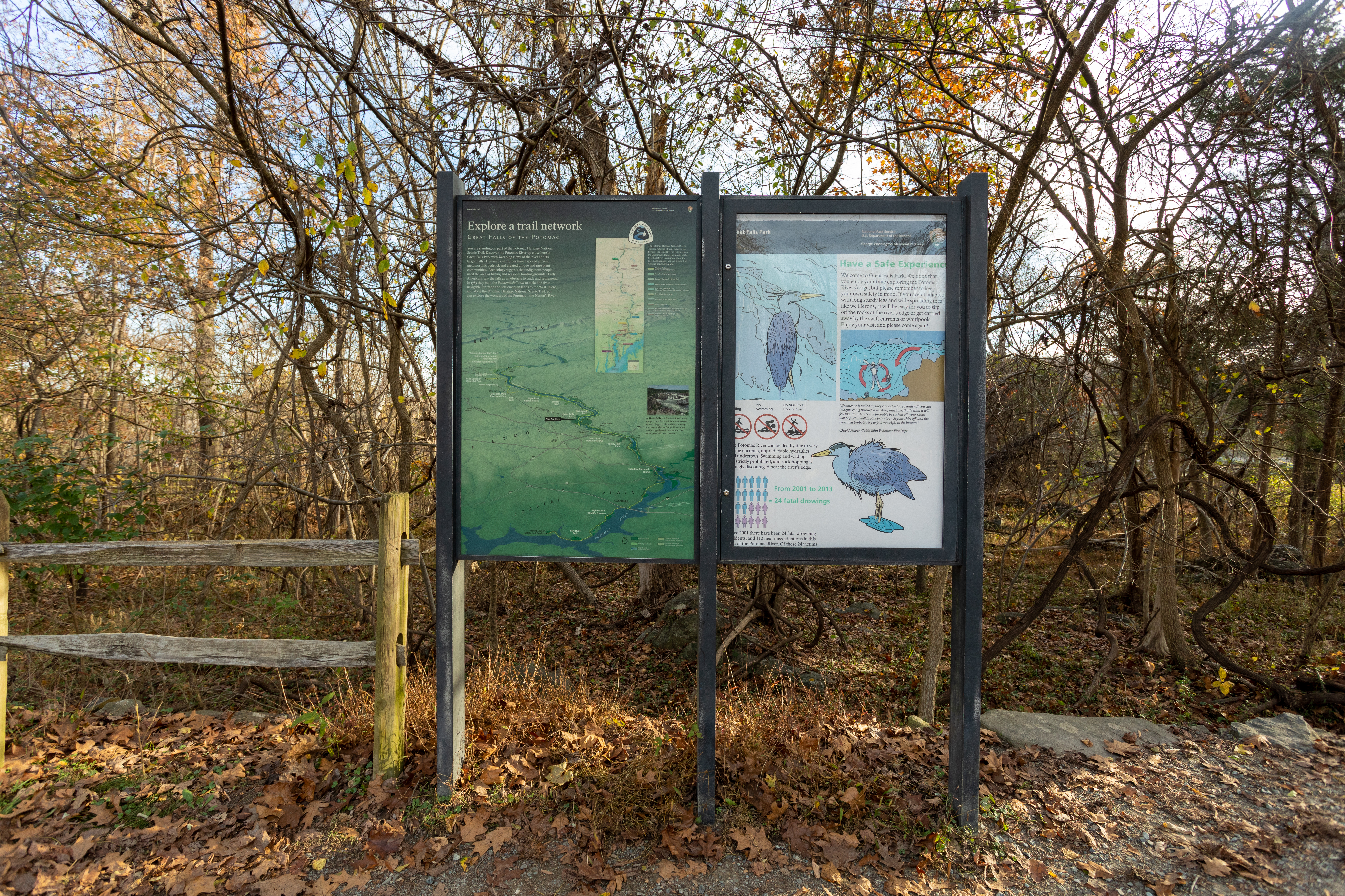
Welcome to Great Falls Park. We hope that you enjoy your time exploring the Potomac River Gorge, but please remember to keep your own safety in mind. If you aren't adapted with long sturdy legs and wide spreading toes like we Herons, it will be easy for you to slip off the rocks at the river's edge of get carried away by the swift currents or whirlpools. Enjoy your visit and please come again!
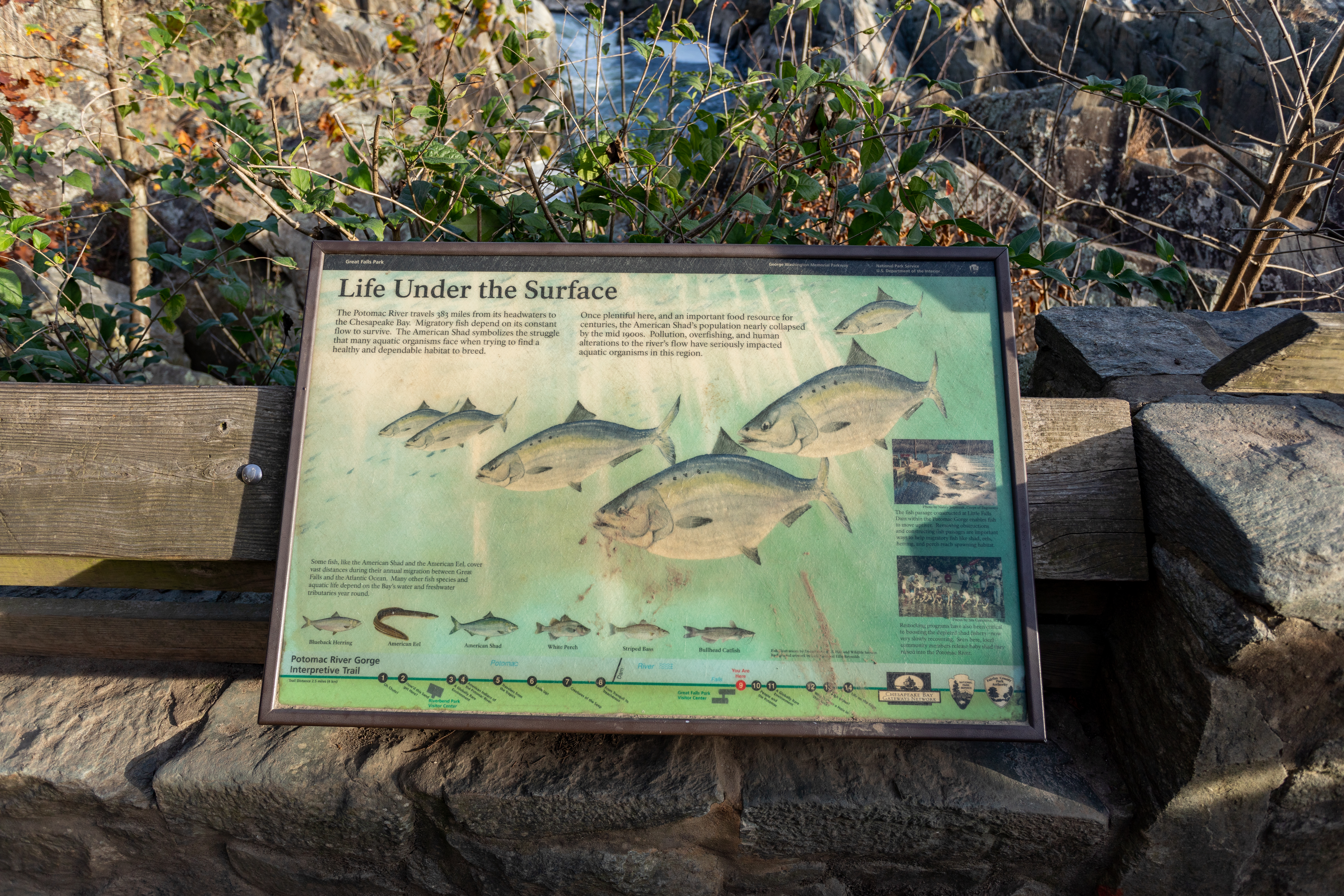
The Potomac River travels 383 miles from its headwaters to the Chesapeake Bay. Migratory fish depend on its constant flow to survive. The American Shad symbolizes the struggle that many aquatic organisms face when trying to find a healthy and dependable habitat to breed.
The Potomac River is the second largest watershed feeding the Chesapeake Bay. Early peoples depended on the river for food and made their homes along its banks. European settlers saw the river as a source for transportation, expansion, and settlement.
The Potomac River begins as a small spring near Fairfax Stone, West Virginia. Like a giant funnel it gathers water from Pennsylvania, West Virginia, Maryland, Virginia, and the District of Columbia as it travels 383 miles to the Chesapeake Bay.
Before World War II, there were no national memorials honoring American veterans. This was the first. Felix de Weldon was working for the Navy when he first saw the flag-raising photo. Powerfully inspired, he started work. He created his first small statue in only 48 hours. He then secured approval from the Corps and Congress to make something grander.
These rocks mark the site of a building of the now-vanished town of Matildaville. Founded in 1790, the town was planned as an industrial community which would profit from its location on the canal. It once boasted a forge, gristmill, store, storage buildings, some homes and an inn, but it could not survive the closing of the canal in 1830.
These rock walls mark the site of a house built in the late 1790's by the Patowmac Company. Intended for the Canal Superintendent and his family, the house took so long to build that only one of the superintendents ever lived in it. Later it was occupied by the canal lock-tenders.
Since entering the woods, you have been walking through what was the holding basin of the Patowmac Canal. Water held here by the wooden gates was used to fill the locks for boats locking through.
The Potowmack Canal Historic District consists of the largest, longest and most intact remains of the Potowmack Canal, built between 1786 and 1802, and the ruins of the small associated town of Matildaville. The development of the Potowmack Canal required interstate cooperation and the canal planners saw that the new republic would require similar collaboration thus inspiring the unification of the colonies to become the United States of America.