| Title | Grand Portage |
| Park Code | grpo |
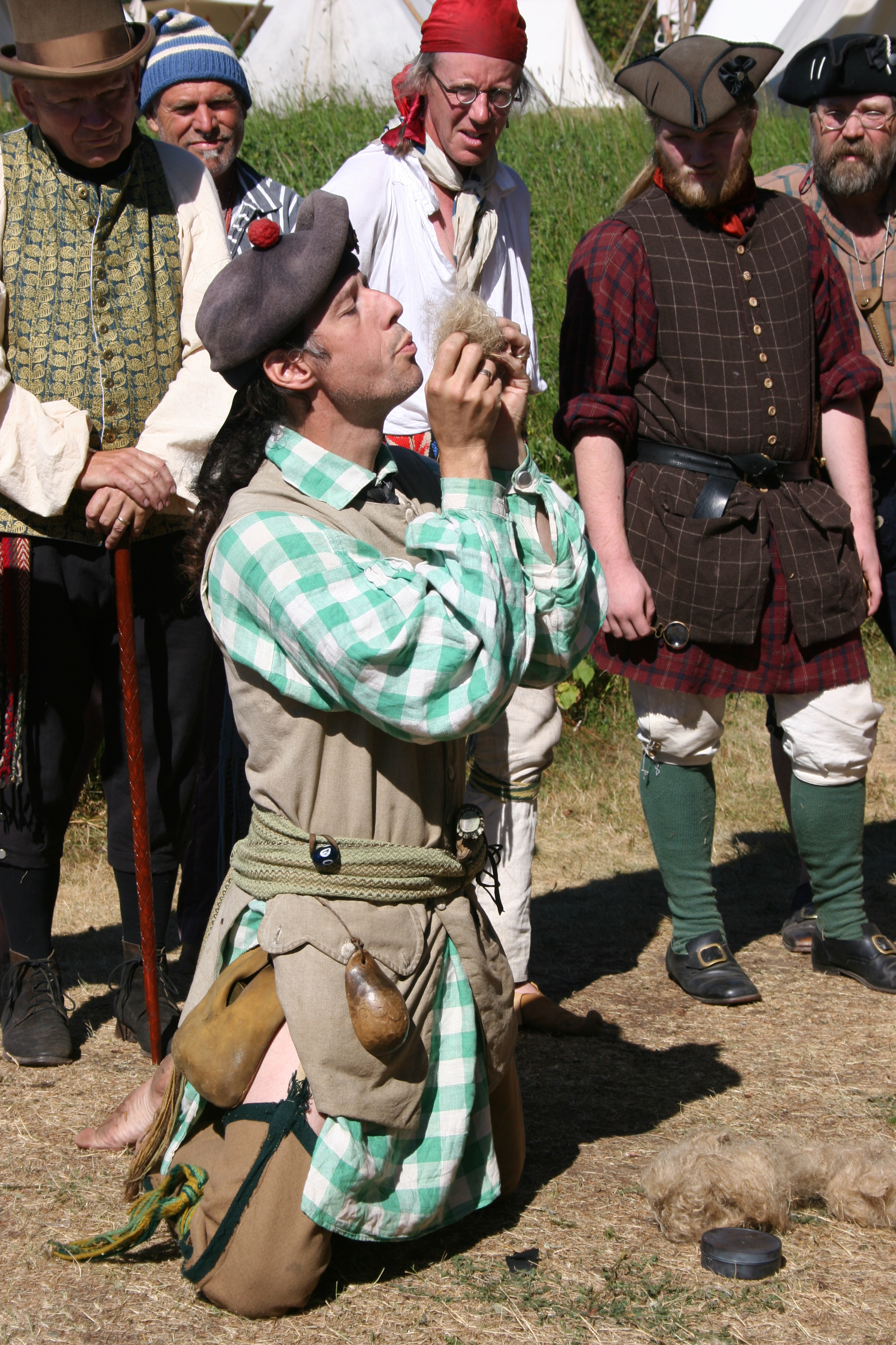
| Description | Travel into the past to discover the present. Explore the partnership between the Grand Portage Anishinaabe and the North West Company during the North American fur trade. Experience the sights and smells of a bustling depot reconstructed in its ... |
| Location | |
| Contact | |
| Activities |
|
| Entrance fees |
|
| Campgrounds | Count: 1
Fort Charlotte Backcountry Campgrounds
|
| Places | Count: 25
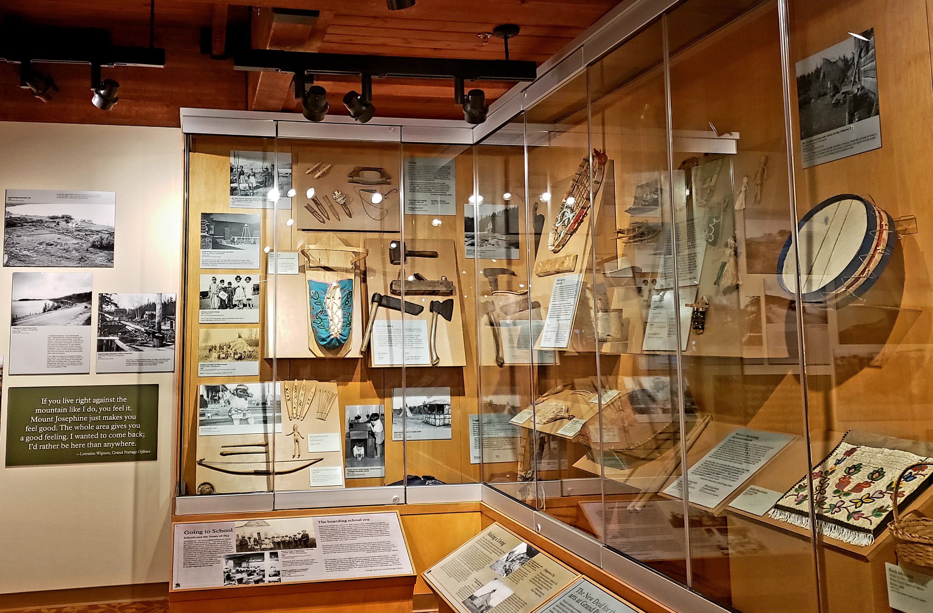
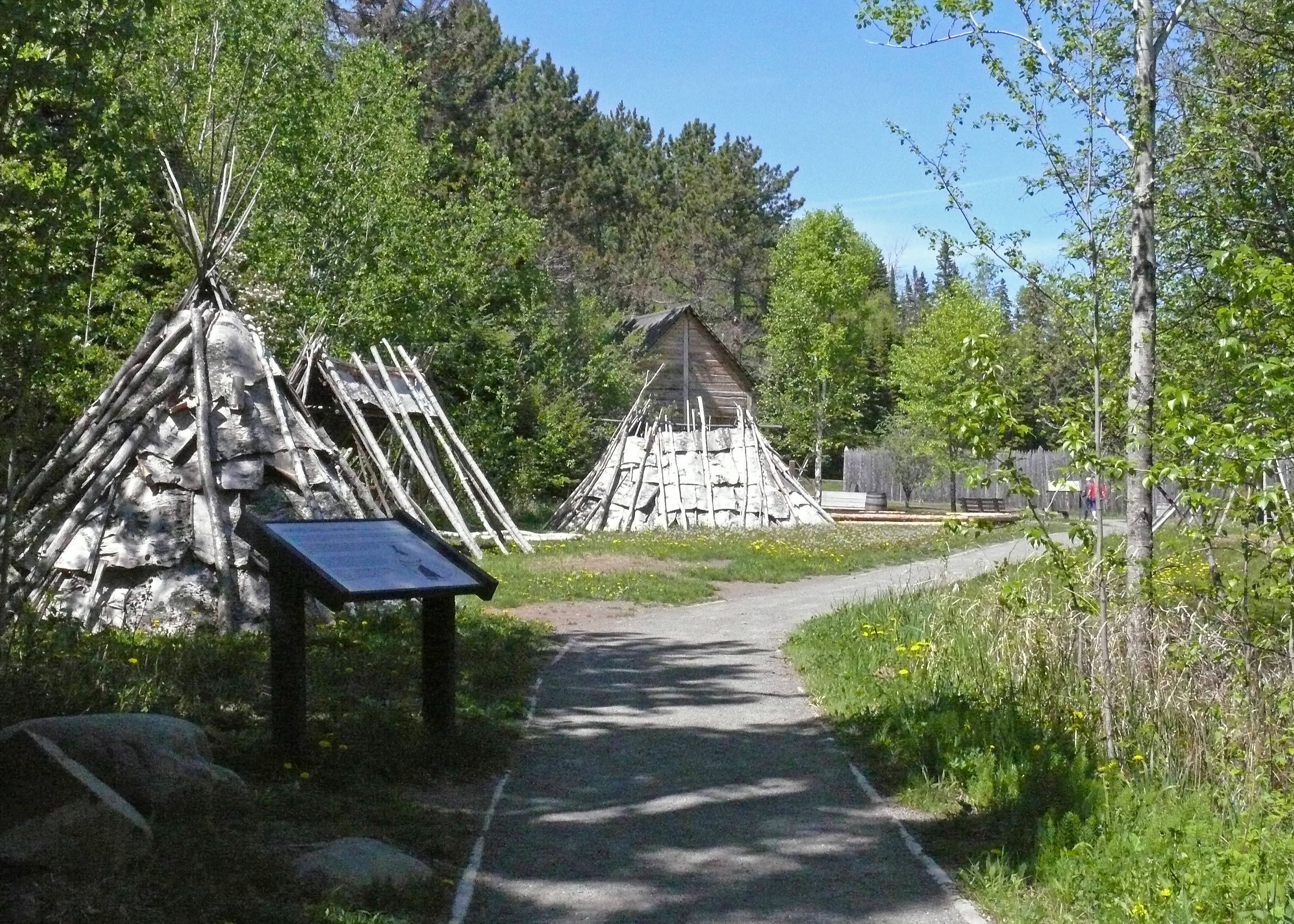
Anishinaabe Oodena (Ojibwe Village) Re-creationFur traders constructed their posts near Native villages for survival and convenience. This re-creation of a small village at the NWCo Depot exemplifies the economic partnership between the Anishinaabe (Ojibwe) and the Northwest Company. 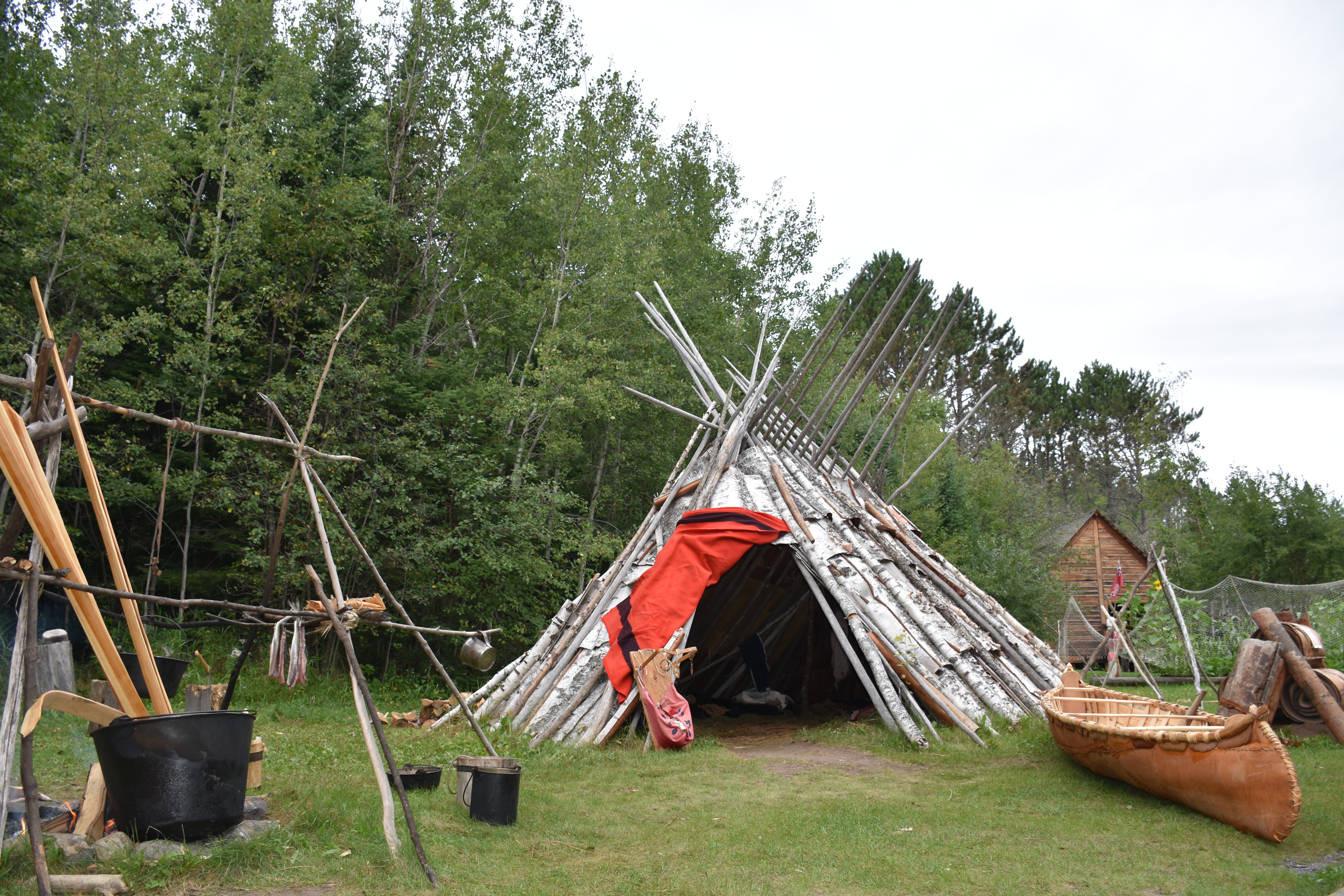
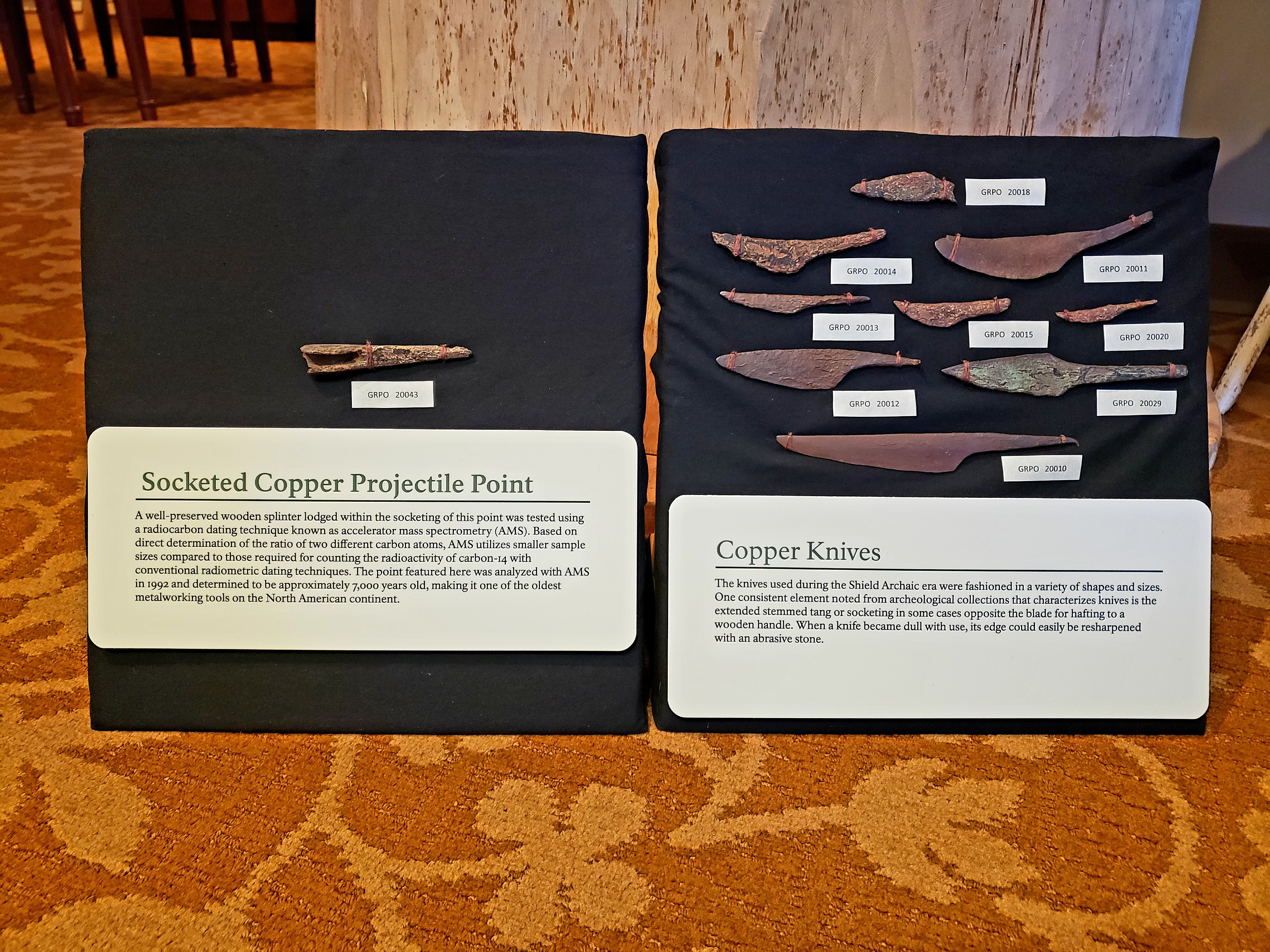
Canoe Warehouse at the Grand Portage DepotArcheological and historical data indicate that a large building stood here, probably a warehouse. It may have housed trade goods and supplies destined for Athabasca country in the far Northwest. 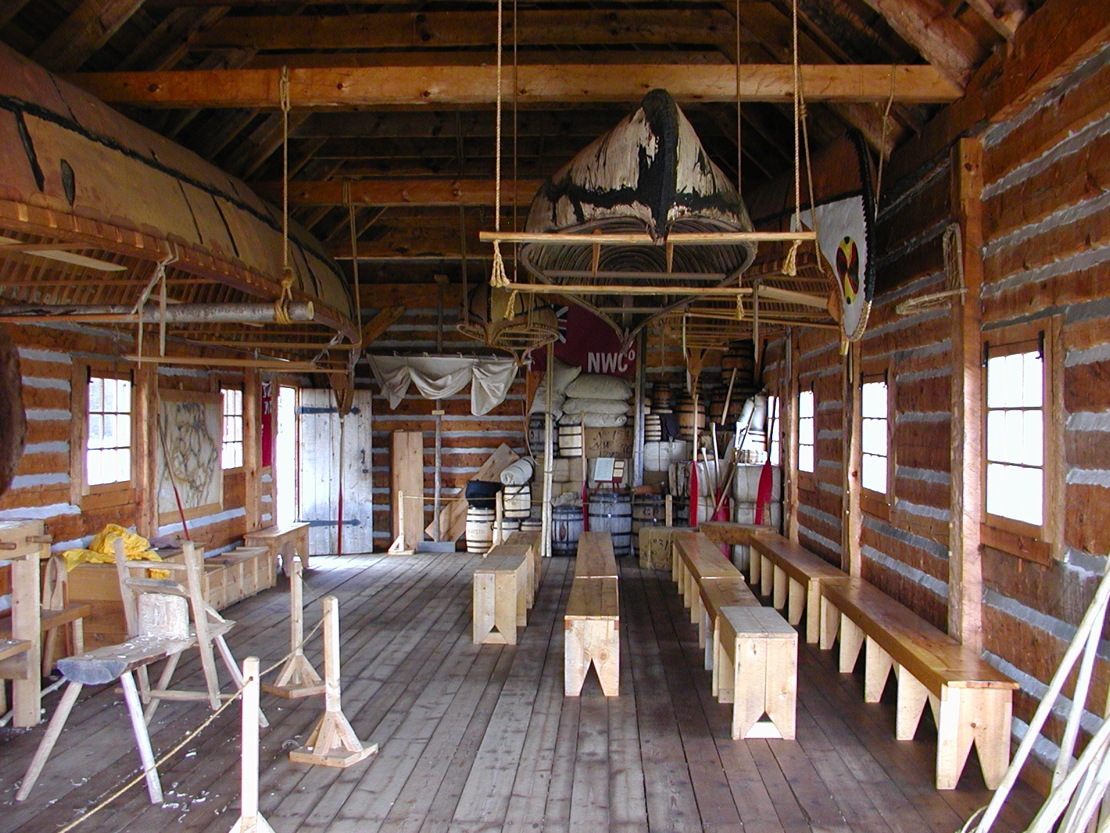
Giizhikag (The Cedars)Old-growth white cedar trees persist despite fire, drought, and logging along this section of trail. Known simply at giizhikag (The Cedars), the oldest of this group of trees were saplings when North West Company men and others trudged this portage in the late 1700s. 
Grand Portage Highest PointAt 1,340 feet (408.4 m), this sign marks the highest elevation on the portage trail, 7 miles (11.27 km) from Lake Superior. 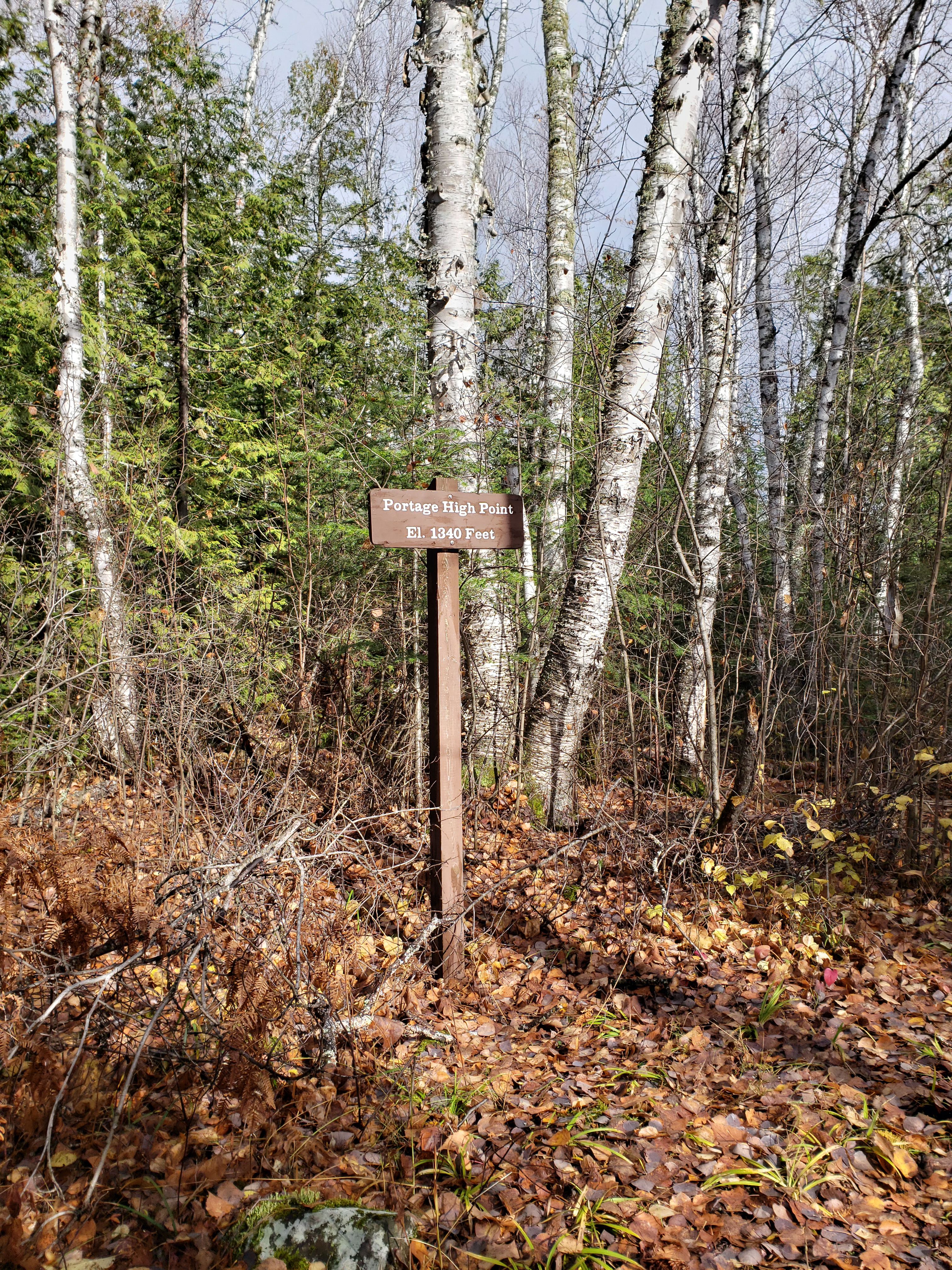
Grand Portage National MonumentGrand Portage National Monument is a national park unit on in Minnesota. It is one of five Lake Superior national parks. 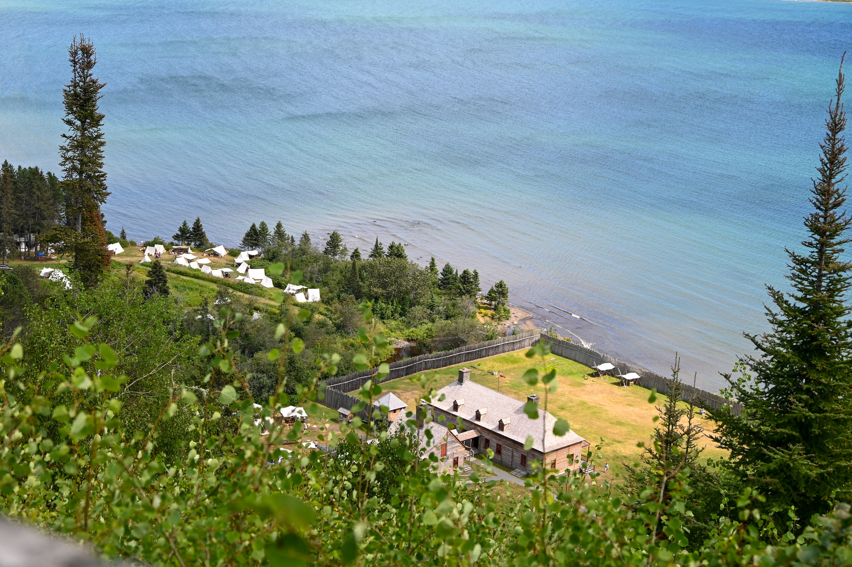
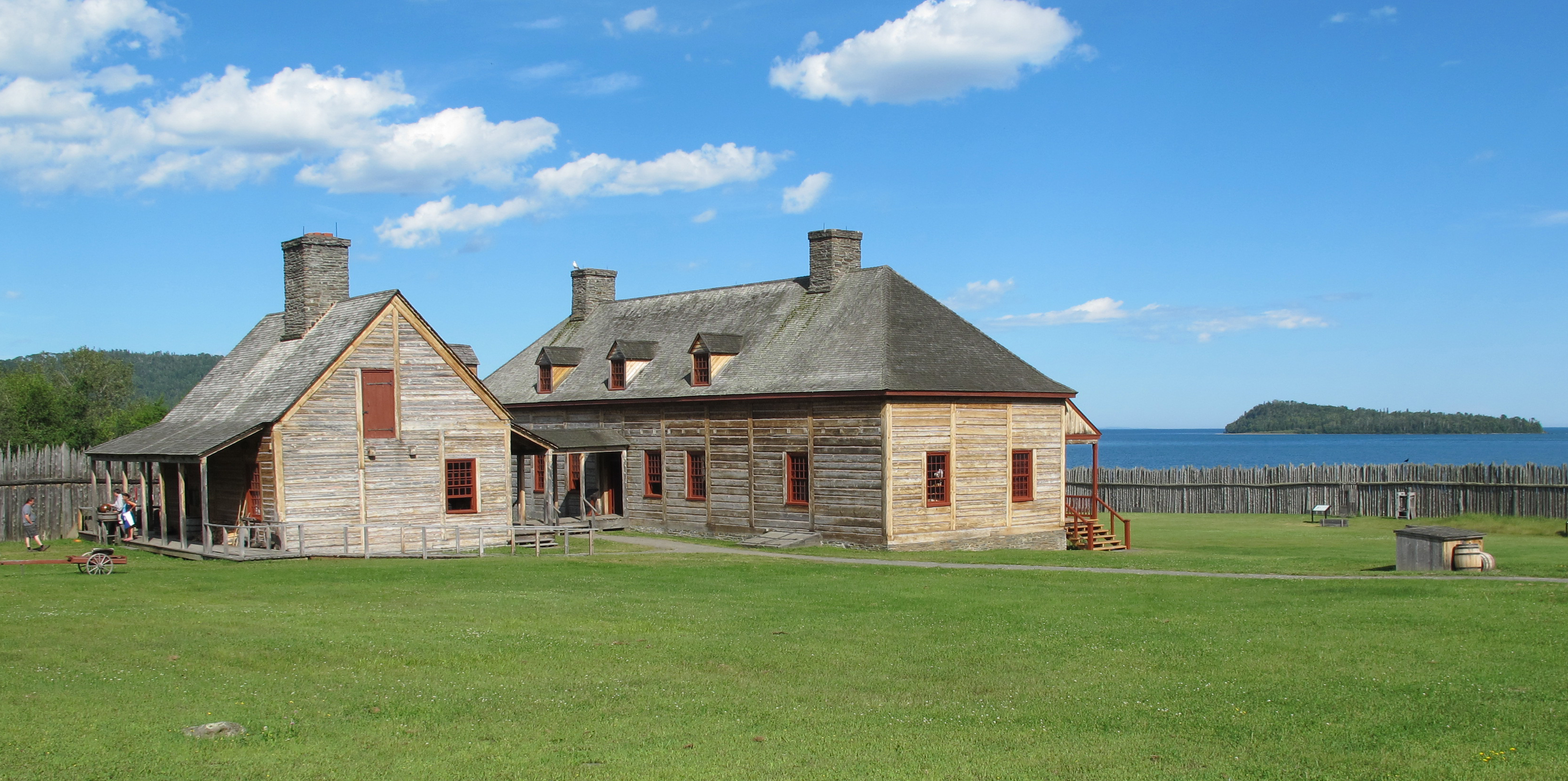
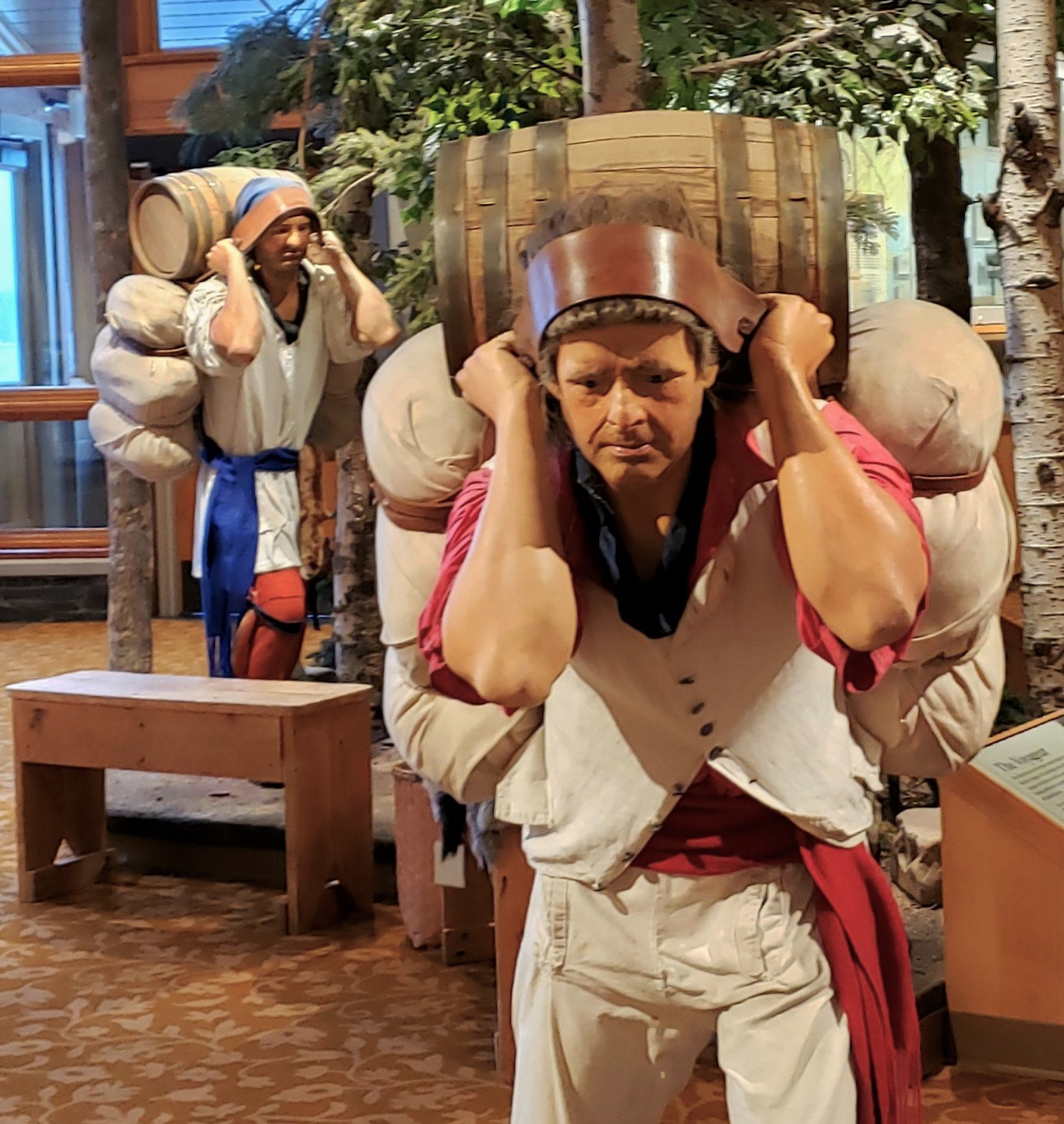
Great Hall at Grand PortageThe Depot at Grand Portage is the summer headquarters for the North West Company and the Great Hall is the meeting room. Here the owners of the company held their all important business meetings with their clerks in the far reaches of the continent. 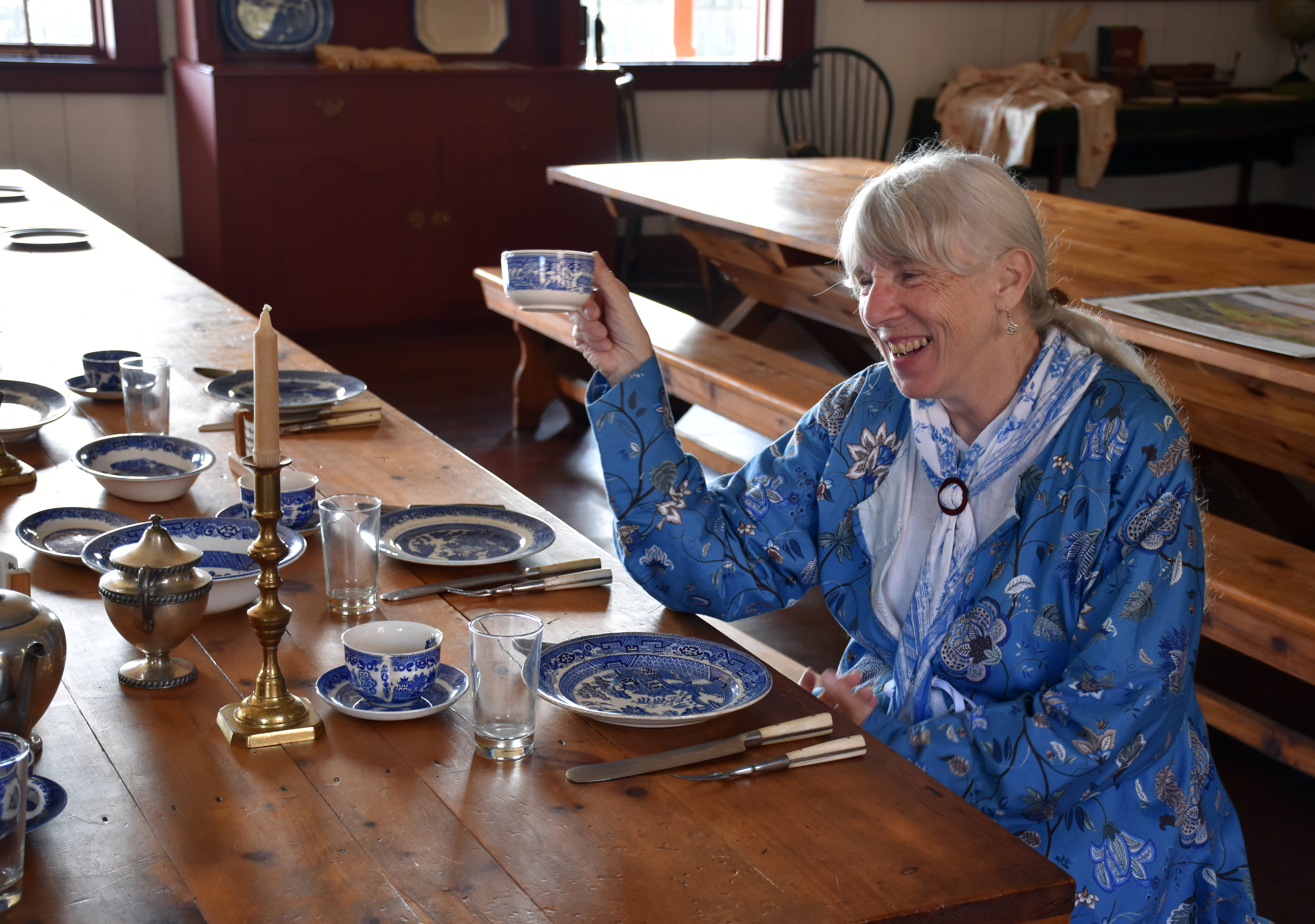
Historic Garden at Grand PortageThe Grand Portage historic kitchen garden is located inside the palisade behind the kitchen. The North West Company operated its post here from 1778 to 1803. Many vegetable varieties grown in the garden now date back to the 1700s and early 1800s. Vegetable varieties from 200 years ago and earlier are still available today because Native American and early settler families saved seeds from their harvests to plant in the following year. The seeds saved were handed down. 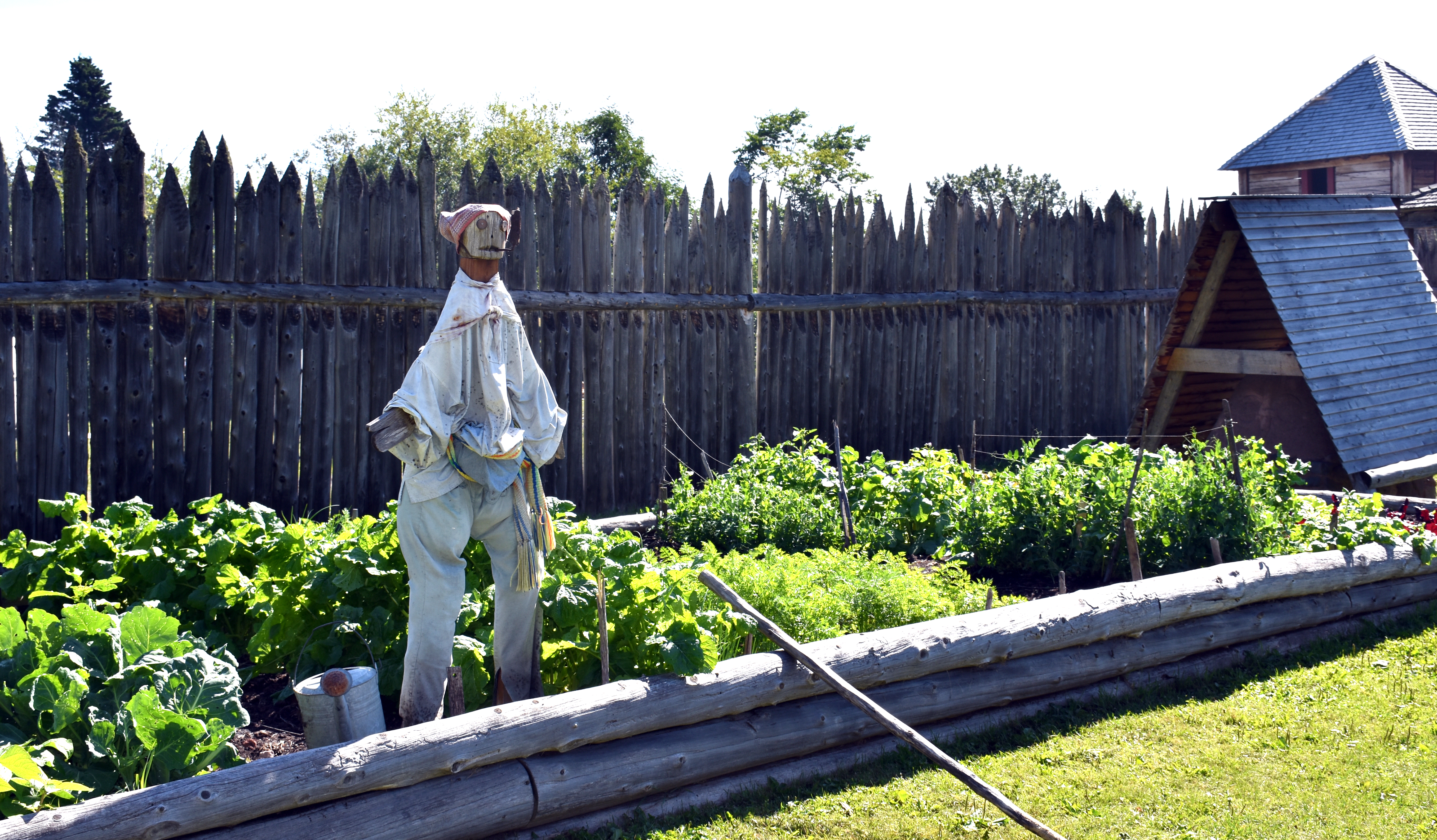
Kitchen at Grand PortageLook around this historic state-of-the-art kitchen to see kitchenware of the time, and watch staff prepare food on the hearth or bake bread in an outdoor bread oven. While you’re there, learn what the voyageurs ate on their journey and see what Native goods made it on the menu. 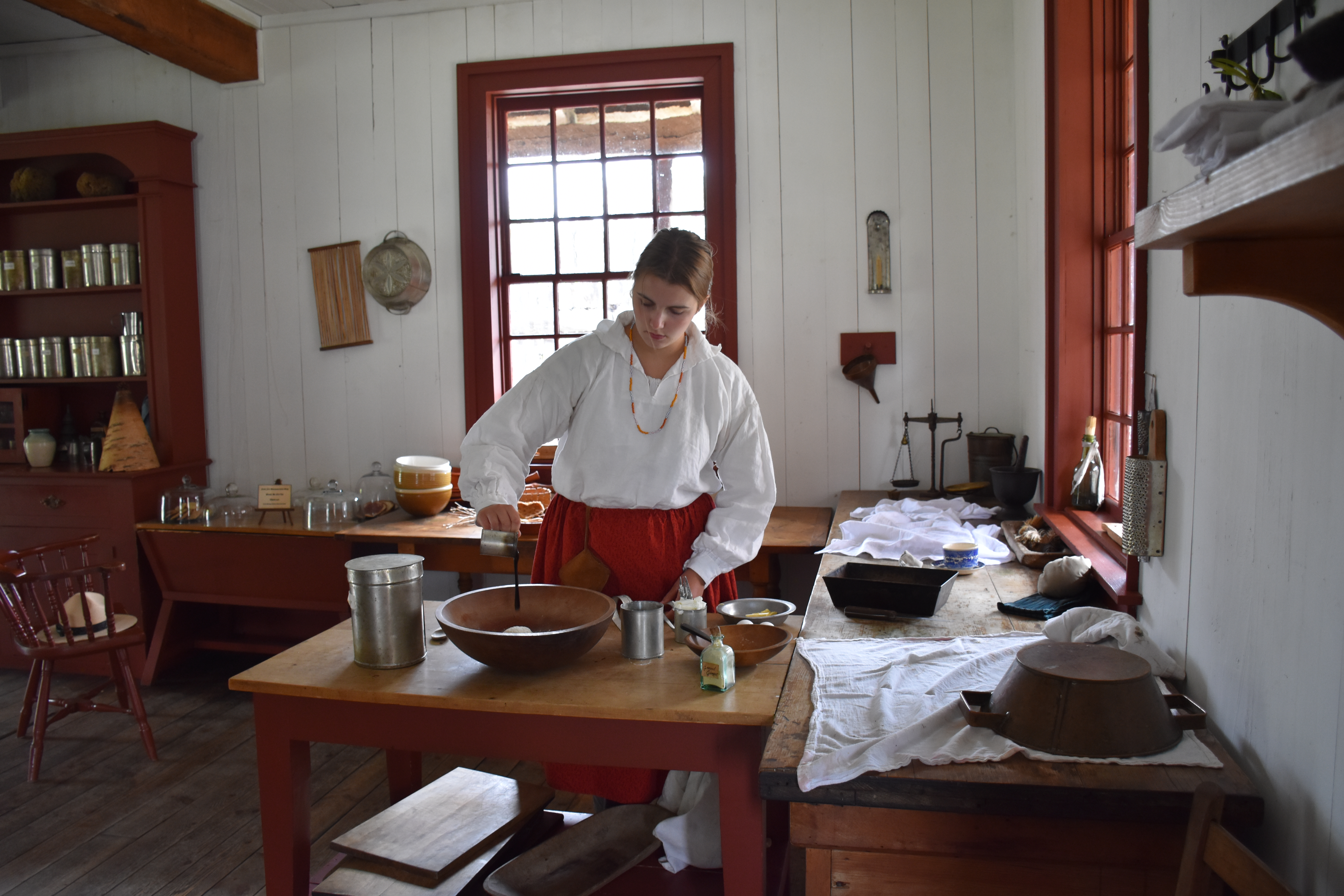
Meadow on the Grand PortageDuring the 18th century fur trade, this was a grassy wetland. Today it is known as The Meadow. Many walked the trail in knee-deep mud, with only moccasins to protect their feet. Beaver activity in the area creates ponds and wet conditions, necessitating a boardwalk for contemporary portagers. 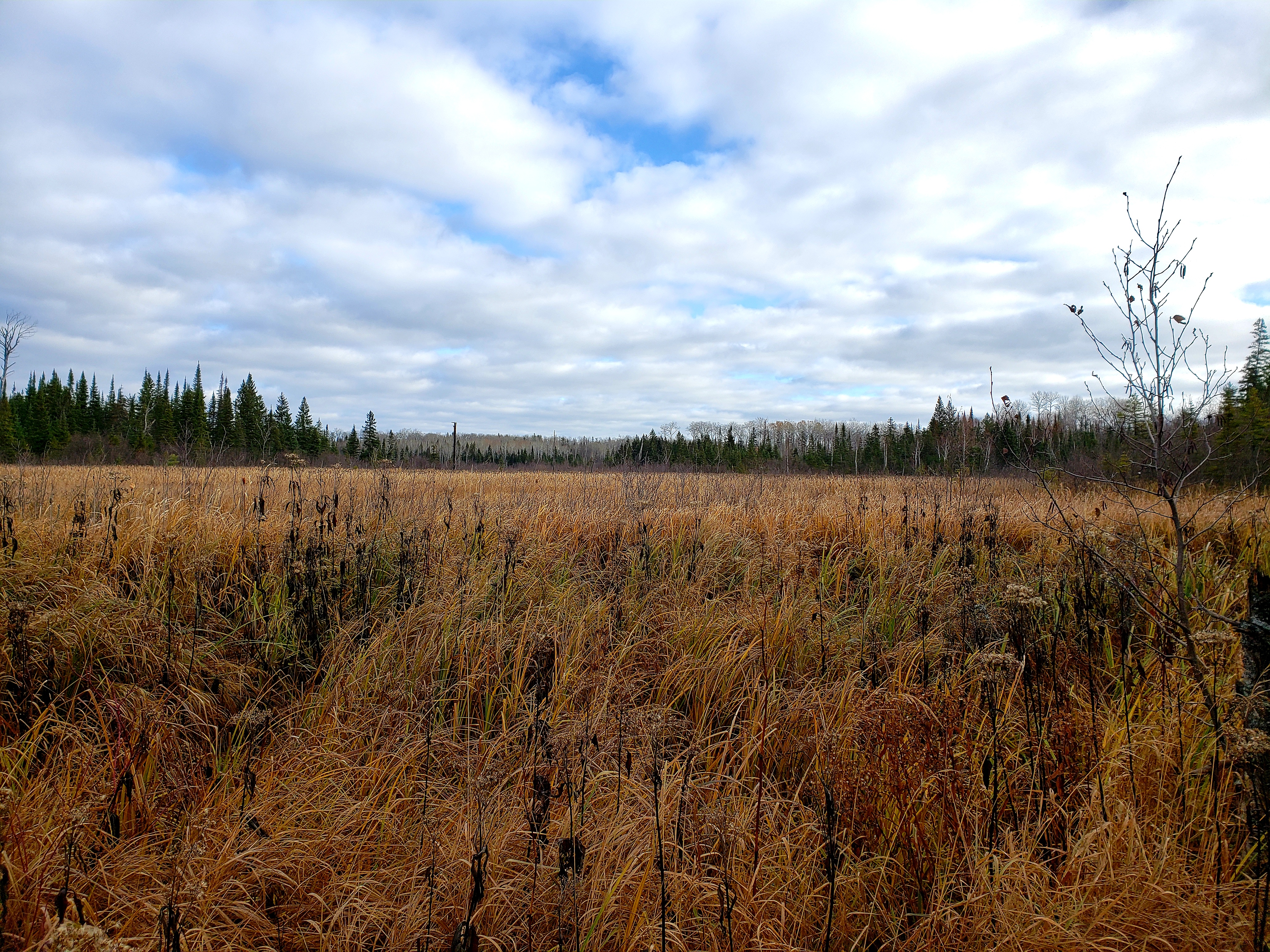
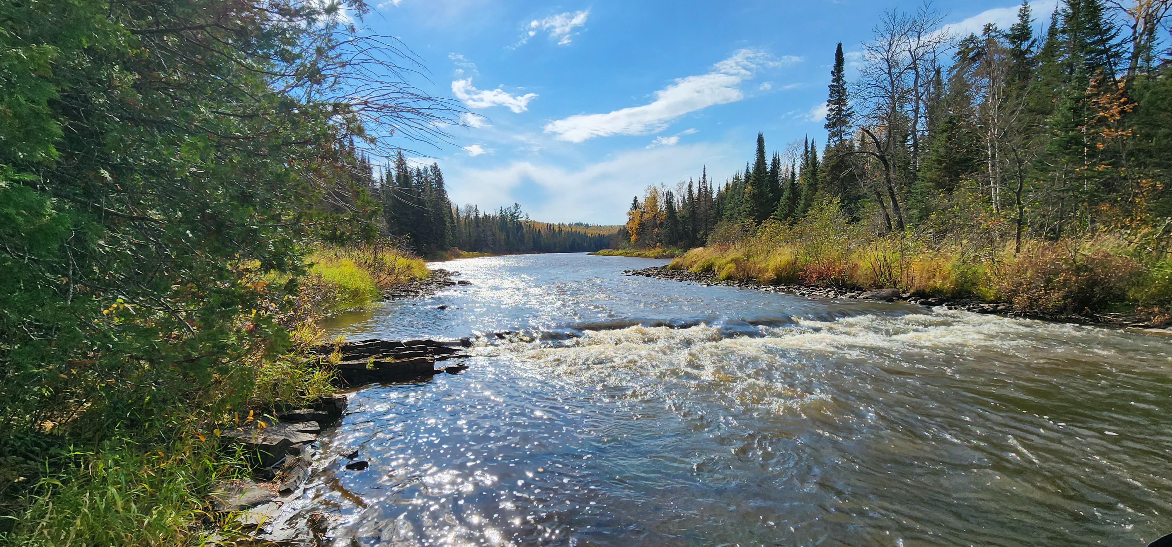
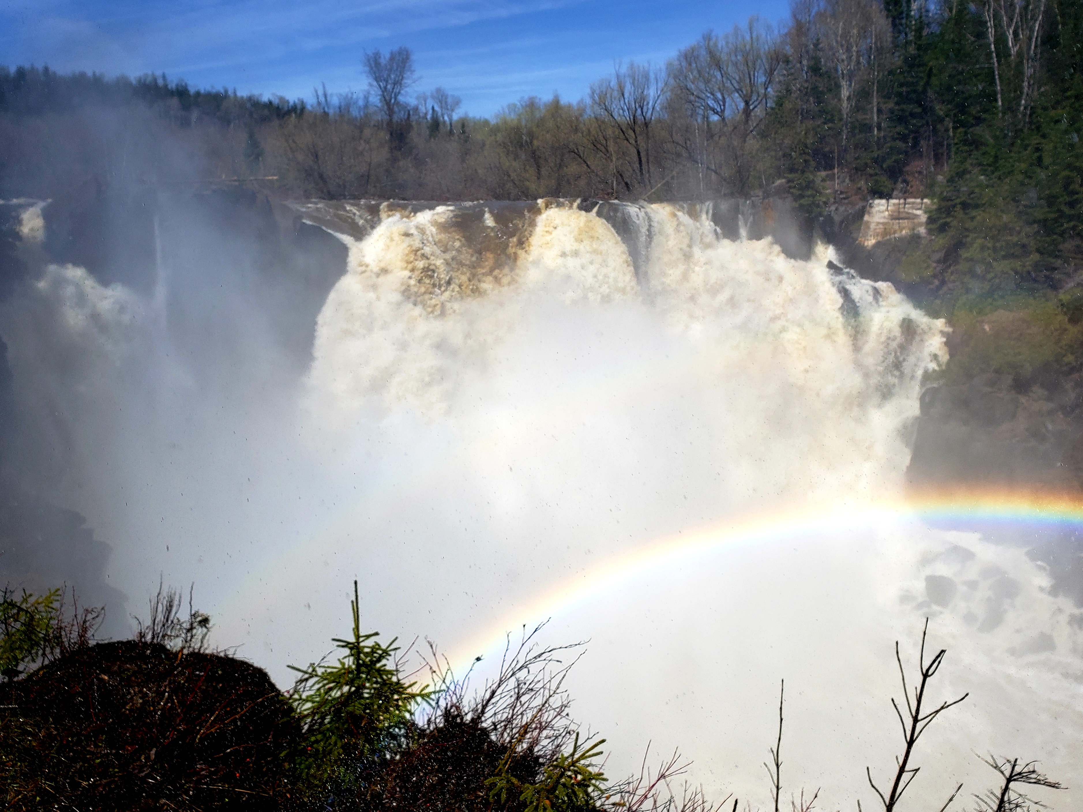
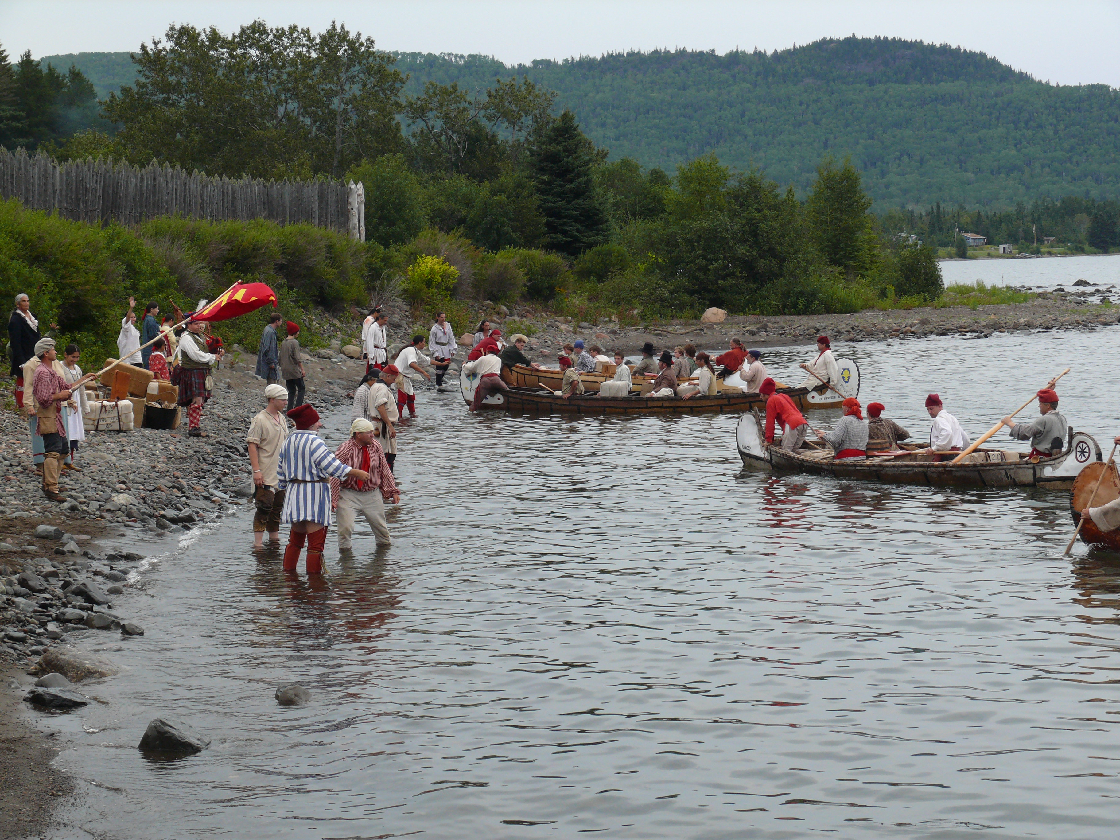
Midway Parking for the Grand PortageMidway parking for the Grand Portage. This 8.5-mile portage became a vital link in the 18th century water trade route from Montreal and the Great Lakes to the northwestern wilderness. First traveled by Indians, the Grand Portage bypassed a series of falls and rapids extending along the last 21 miles of the Pigeon River. 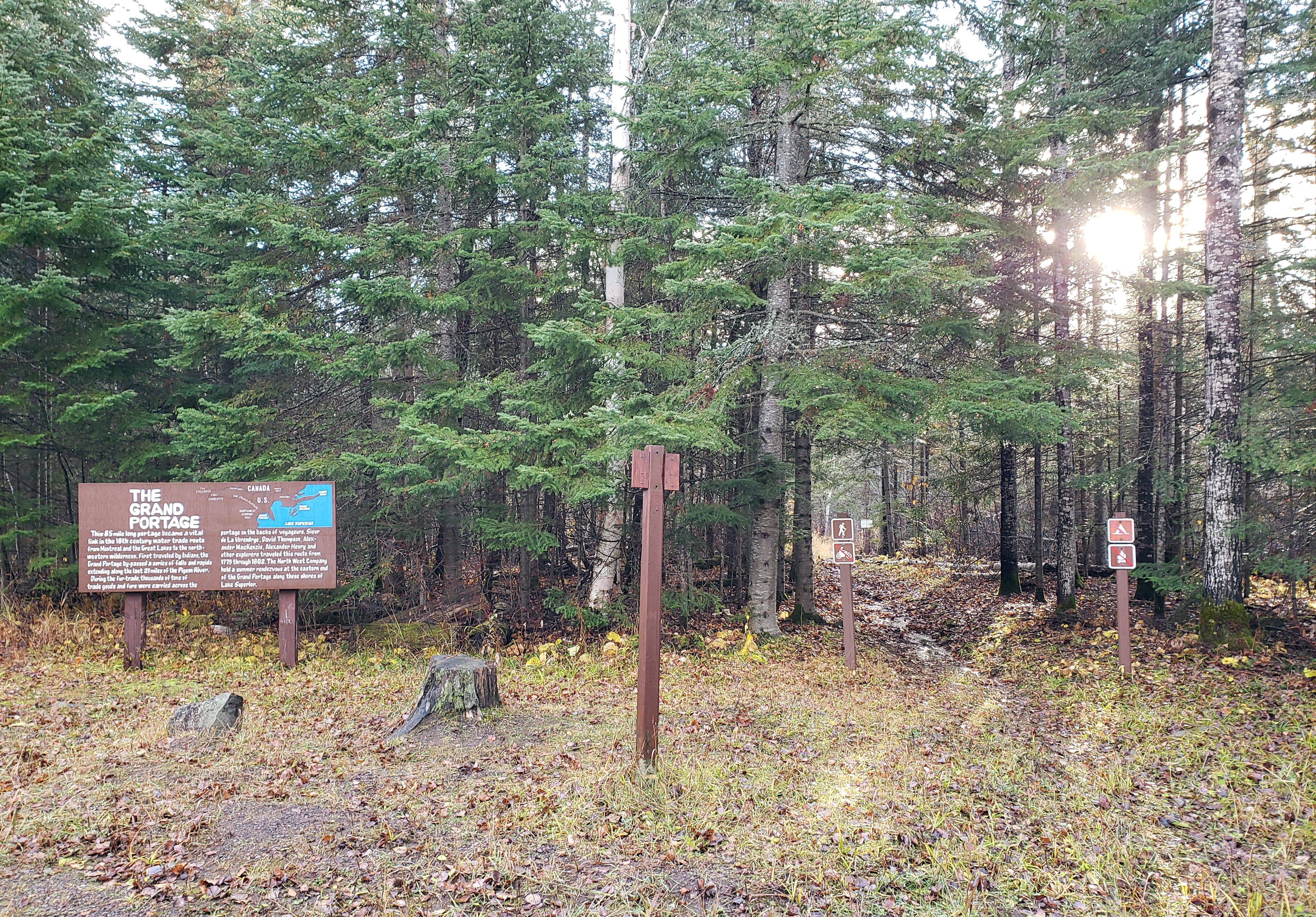
Mount Rose - Once an Island!About 12,000 years ago, melting glaciers formed temporary lakes. The biggest, Glacial Lake Duluth, submerged most of the Grand Portage. Its shoreline was 738 feet (225 m) above today’s Lake Superior. The shoreline of Glacial Lake Beaver Bay was where you are standing, 243 feet (74 m) above Lake Superior. 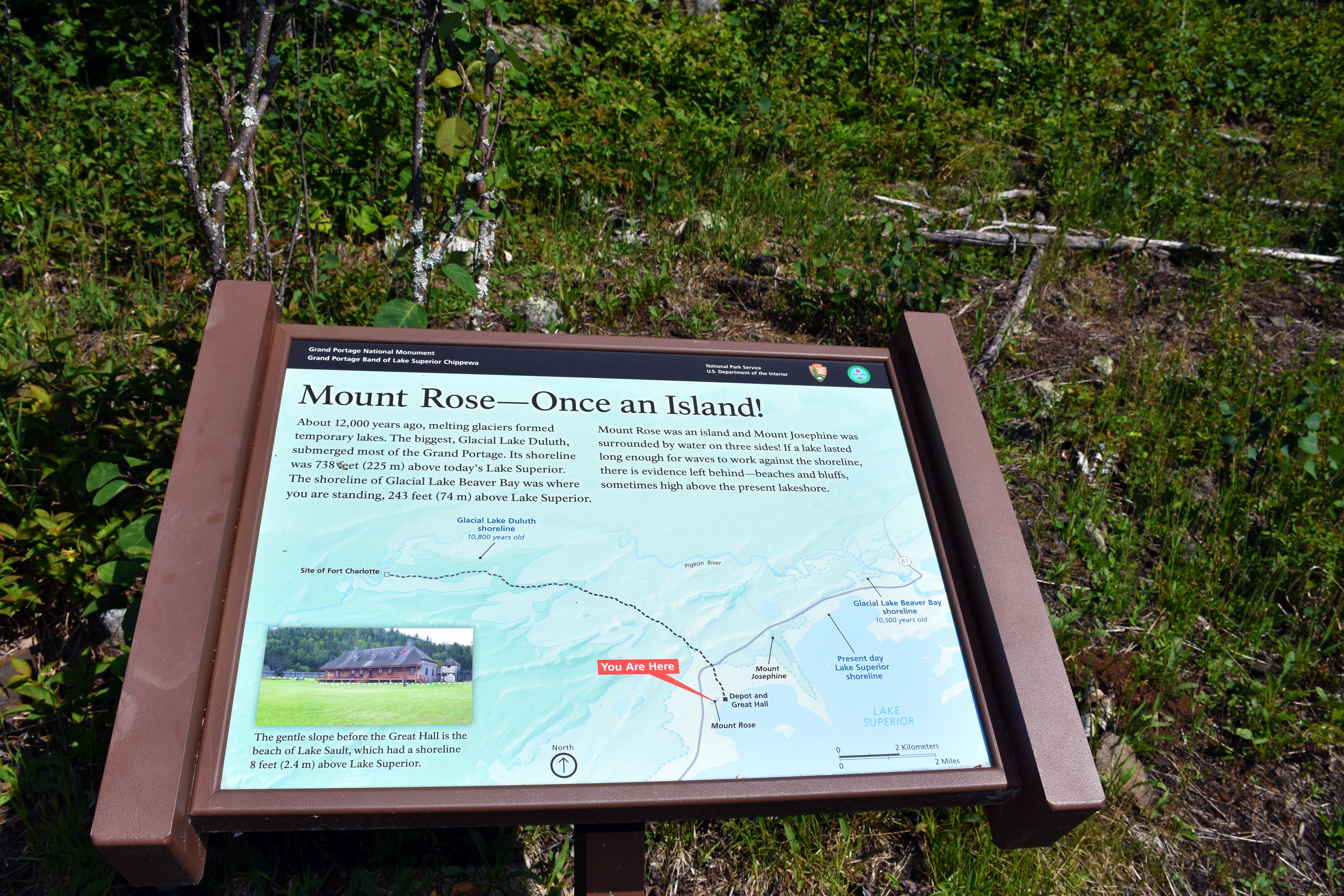
Mount Rose A Story in RockThe weathered outcrop above you is made of sedimentary rock, known as the Rove Formation, formed by layers of sands and clay deposited on an ancient sea floor nearly two billion years ago. There are at least two sedimentary rock types visible in the stratigraphy, or layering, you see before you: a dark sandstone known to geologists as graywacke; a fine-grained siltstone known as shale. Rivers carried these sediments to the sea, where they were deposited on the 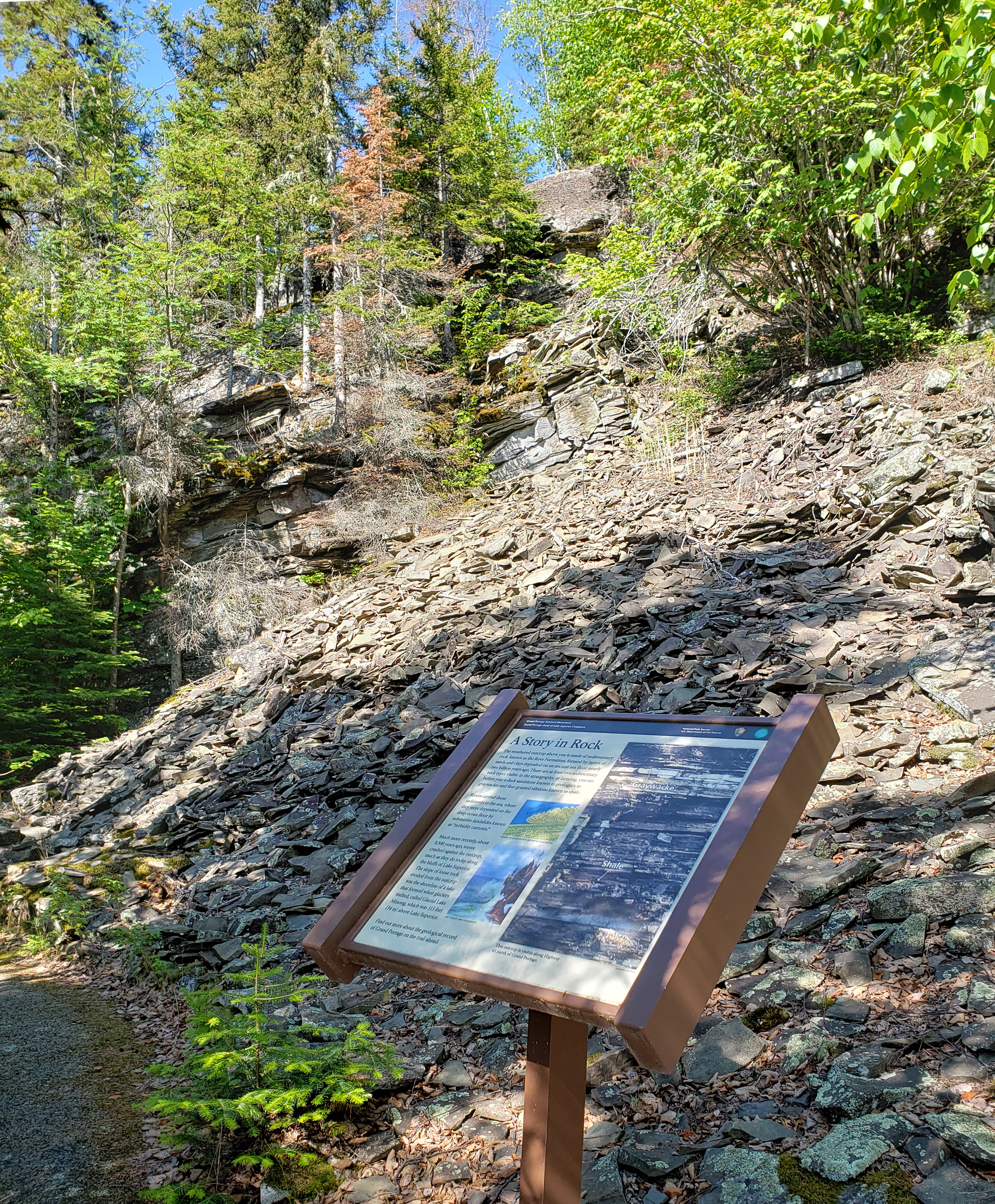
Mount Rose Geologic RidgesHard Rock Ridges You are standing on a ridge of hard, igneous rock with a 10-foot (3-m) crust of "baked" rock on top. How was this formed? Roughly 1.1 billion years ago, hot volcanic magma pushed up into cracks and faults in the existing rock bed, know as the Rove Formation, made of silt and a coarse rock called graywacke. The heat radiating from the magma baked the nearby rocks. 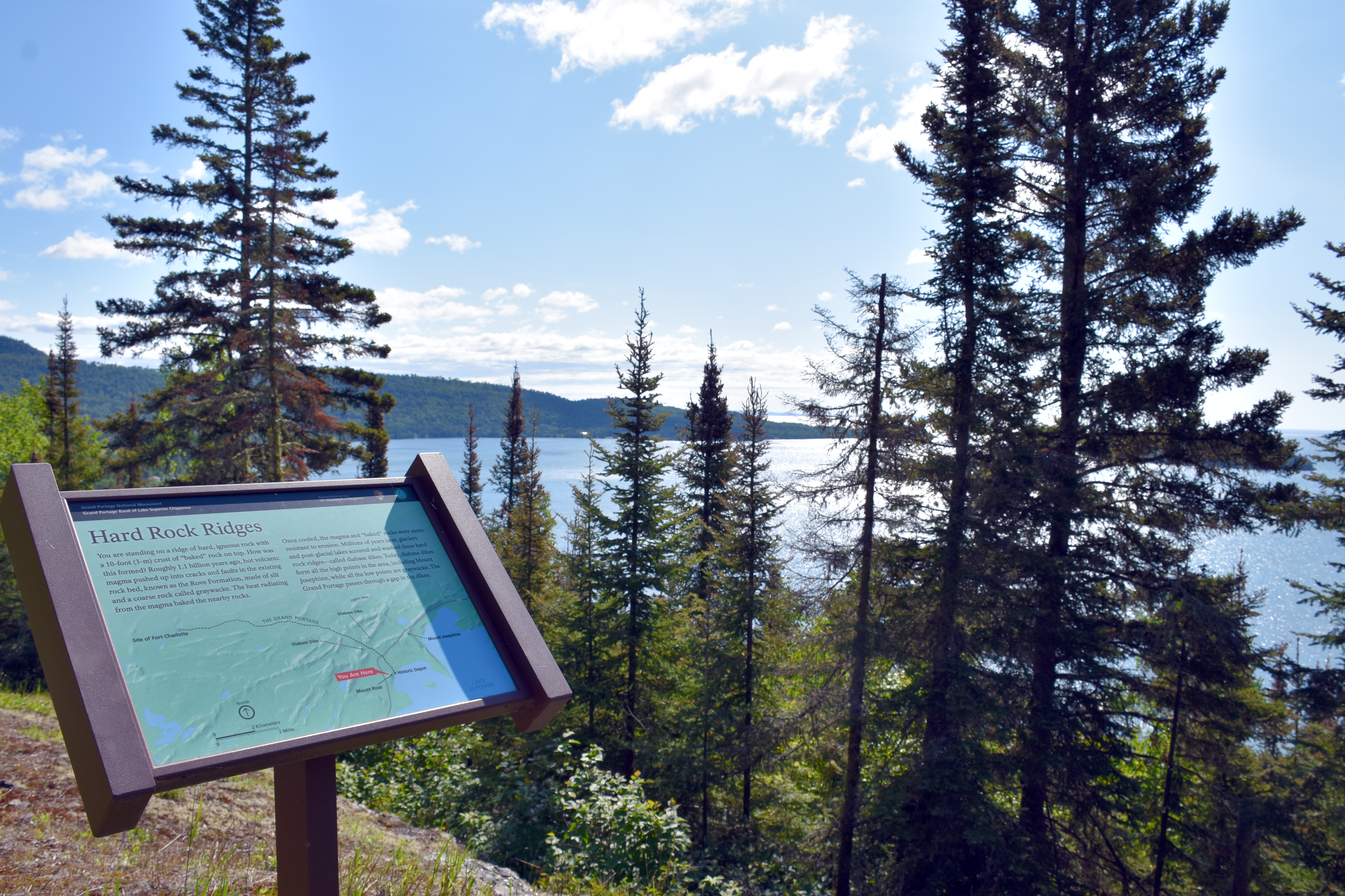
Mount Rose LandingThis Mount Rose Trail landing is along the uphill hike from the parking lot to the summit of Mount Rose and offers a spectacular view of Grand Portage Bay. 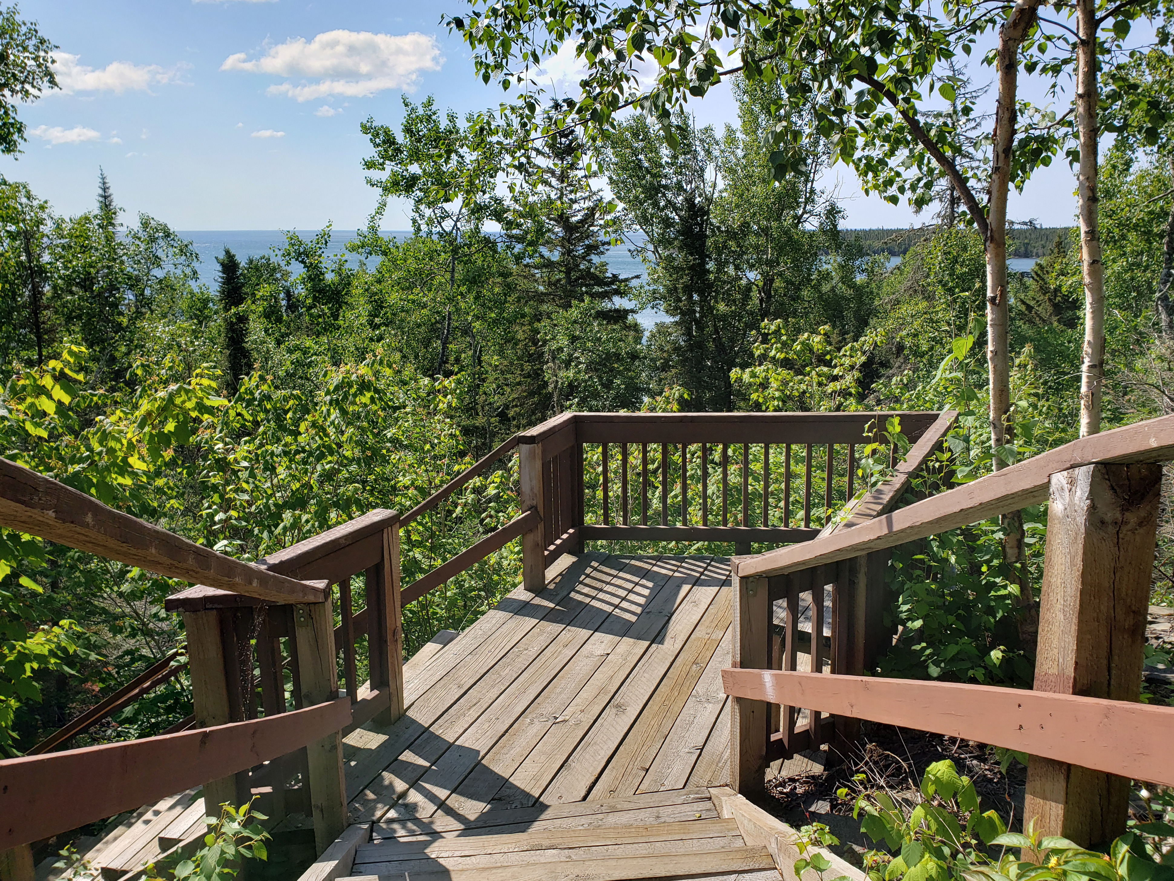
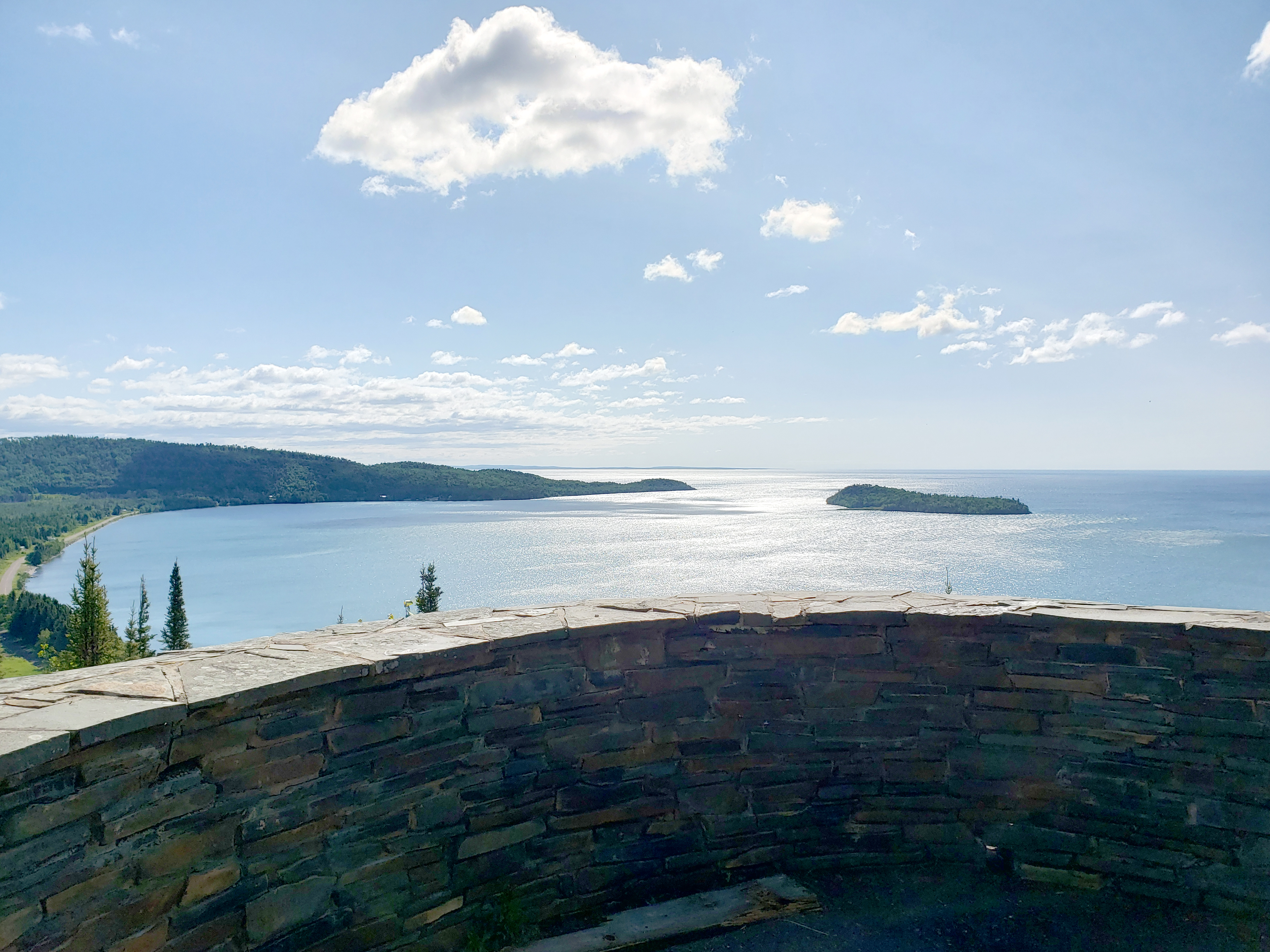
Mount Rose SummitThe Mount Rose Summit offers a view to the east overlooking the historic depot and Grand Portage Bay. To the west, a gap in the landscape indicates where the Grand Portage Trail passes through the landscape. 
Mount Rose Trail BenchThis bench, about halfway up the hill from the Depot trailhead, is a perfect spot to catch your breath in sun dappled shade with a view of Lake Superior through the trees. 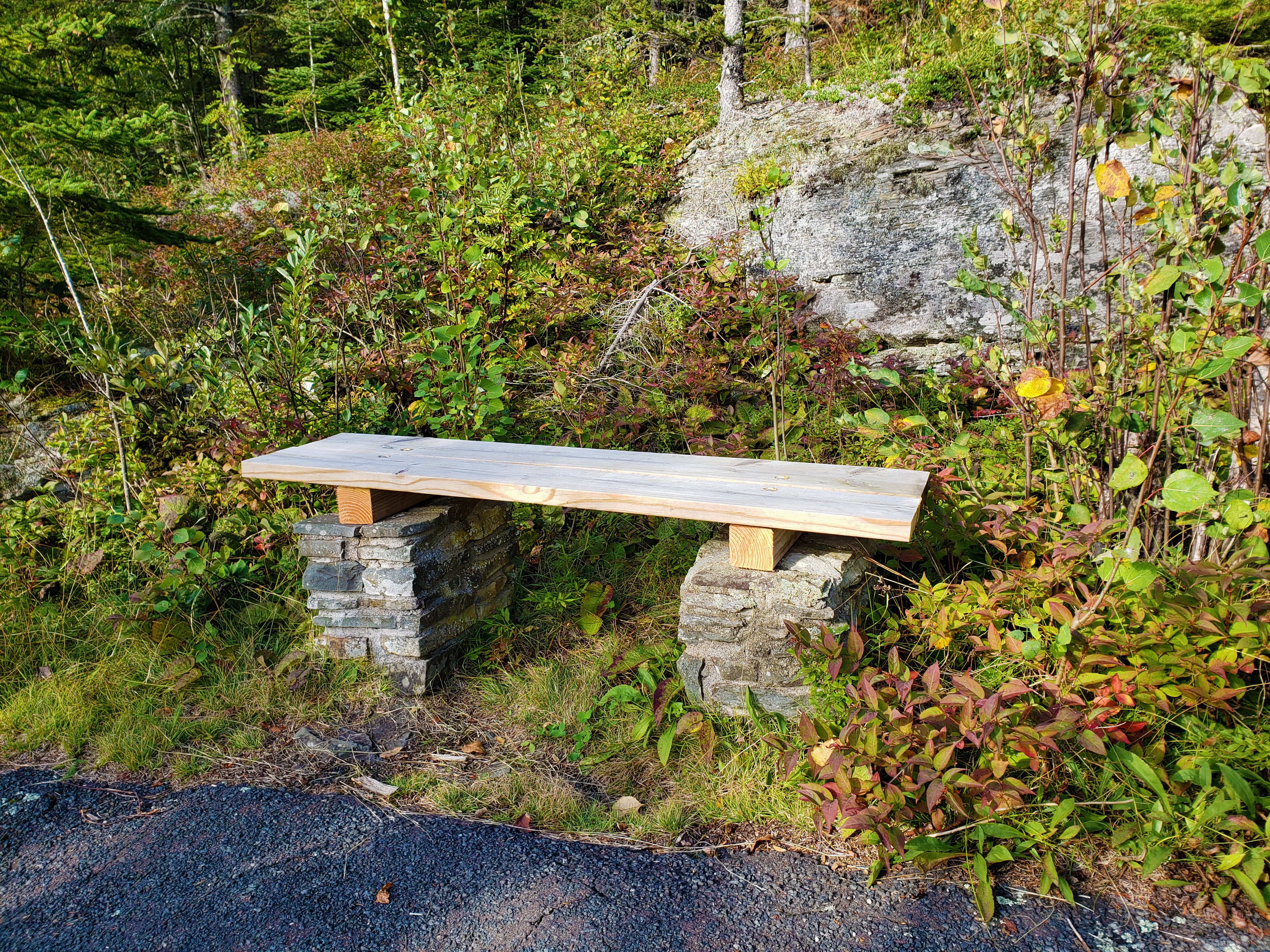
Mount Rose Trail Depot OverlookThis Mount Rose overlook is at a low rock wall along the trail. From this viewpoint you can see the historic depot and beyond to the dock in Grand Portage Bay. 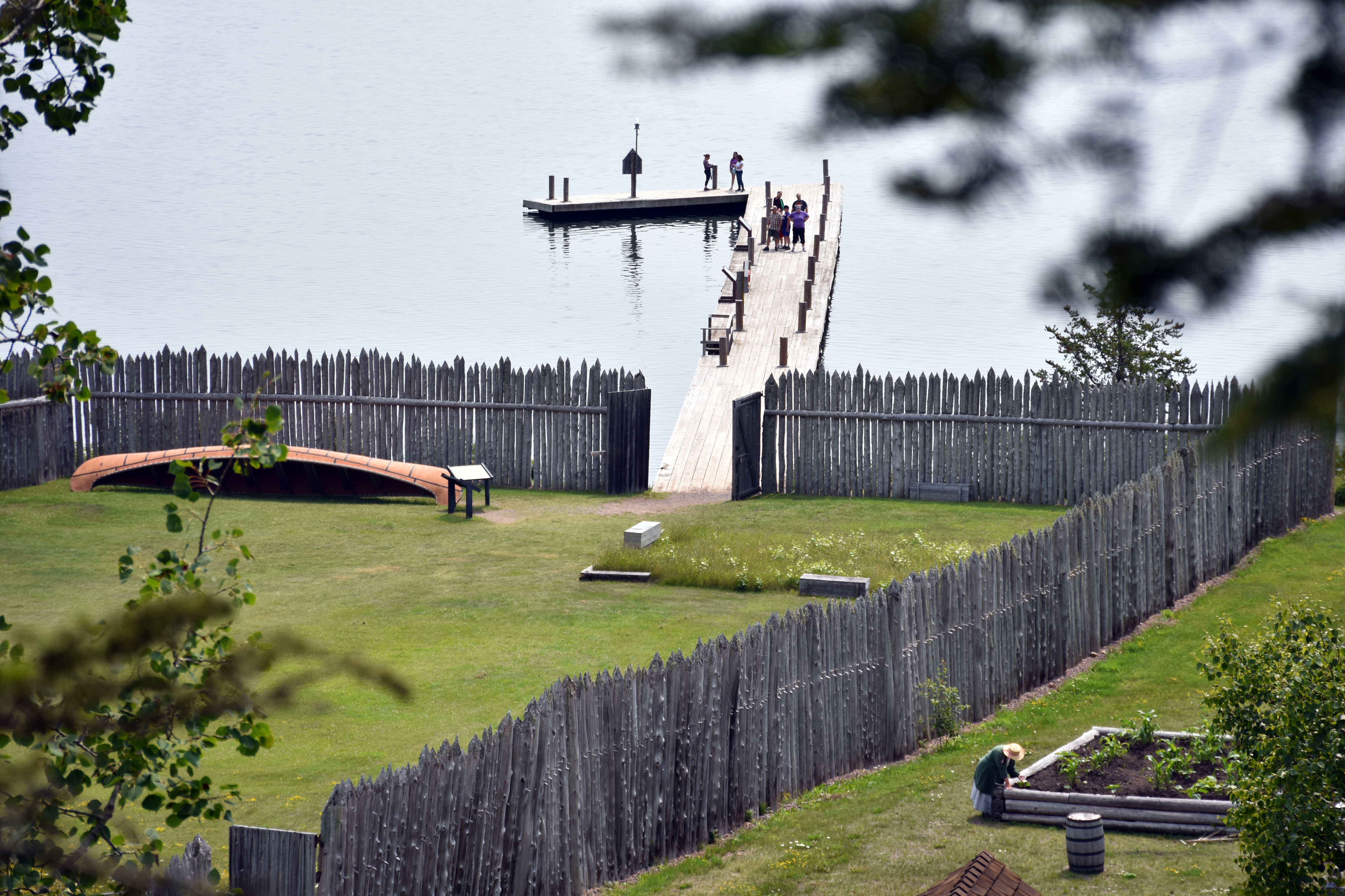
Mount Rose Trail Interpretive OverlookWayside with fur trade era quotations and an aerial view of the historic depot and Grand Portage Bay. A low stone wall keeps visitors back from the edge. 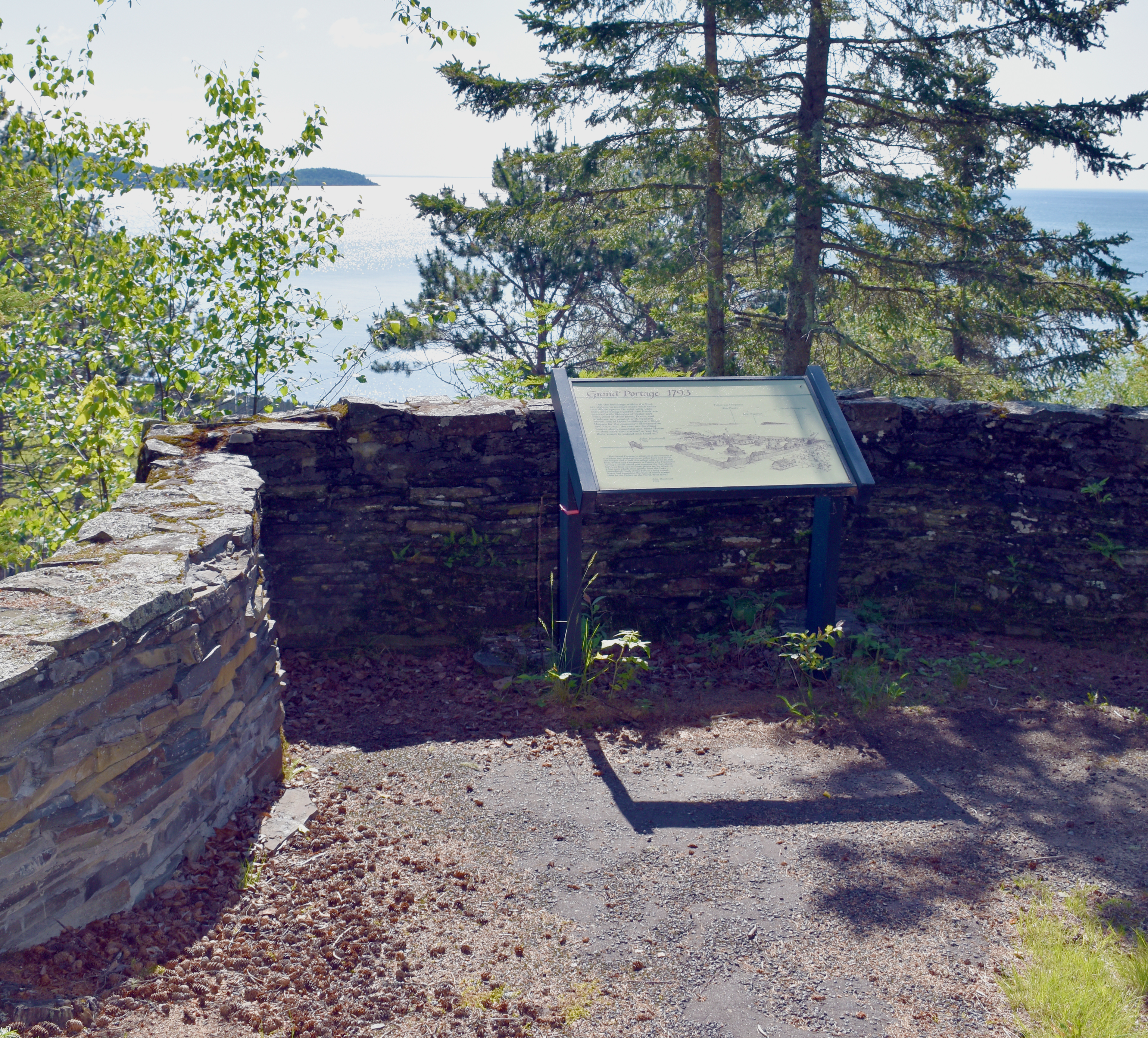
Mount Rose Trail JunctionThis bench marks the turnoff trail to the Heritage Center parking lot. 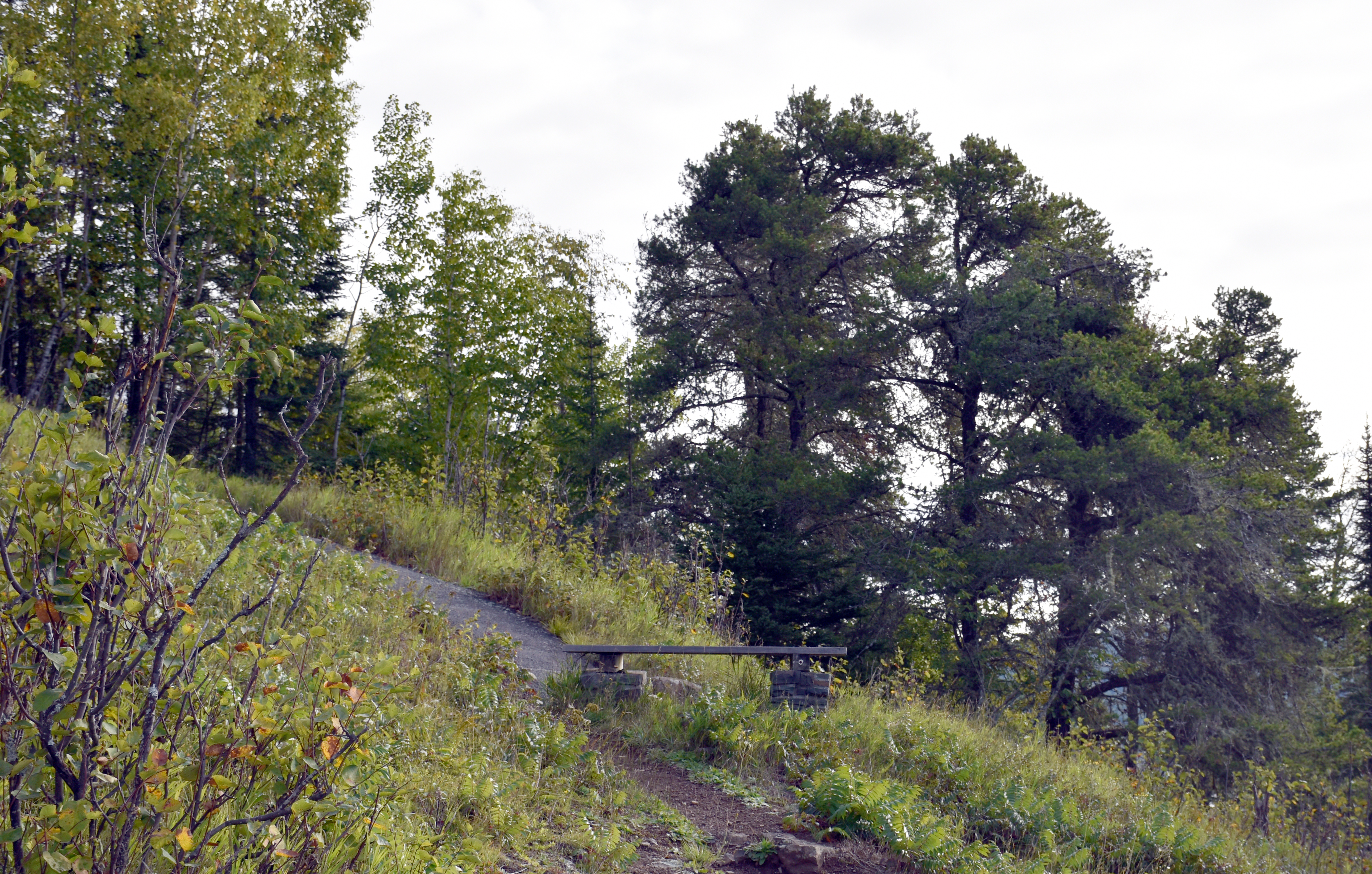
Mount Rose Trailhead (Depot)The Mount Rose Trailhead is the beginning of a half-mile, uphill hike to the summit of Mount Rose. From there is a spectacular view of Grand Portage Bay and distant Isle Royale to the east, and the gap in the land where the Grand Portage trail passes to the west. 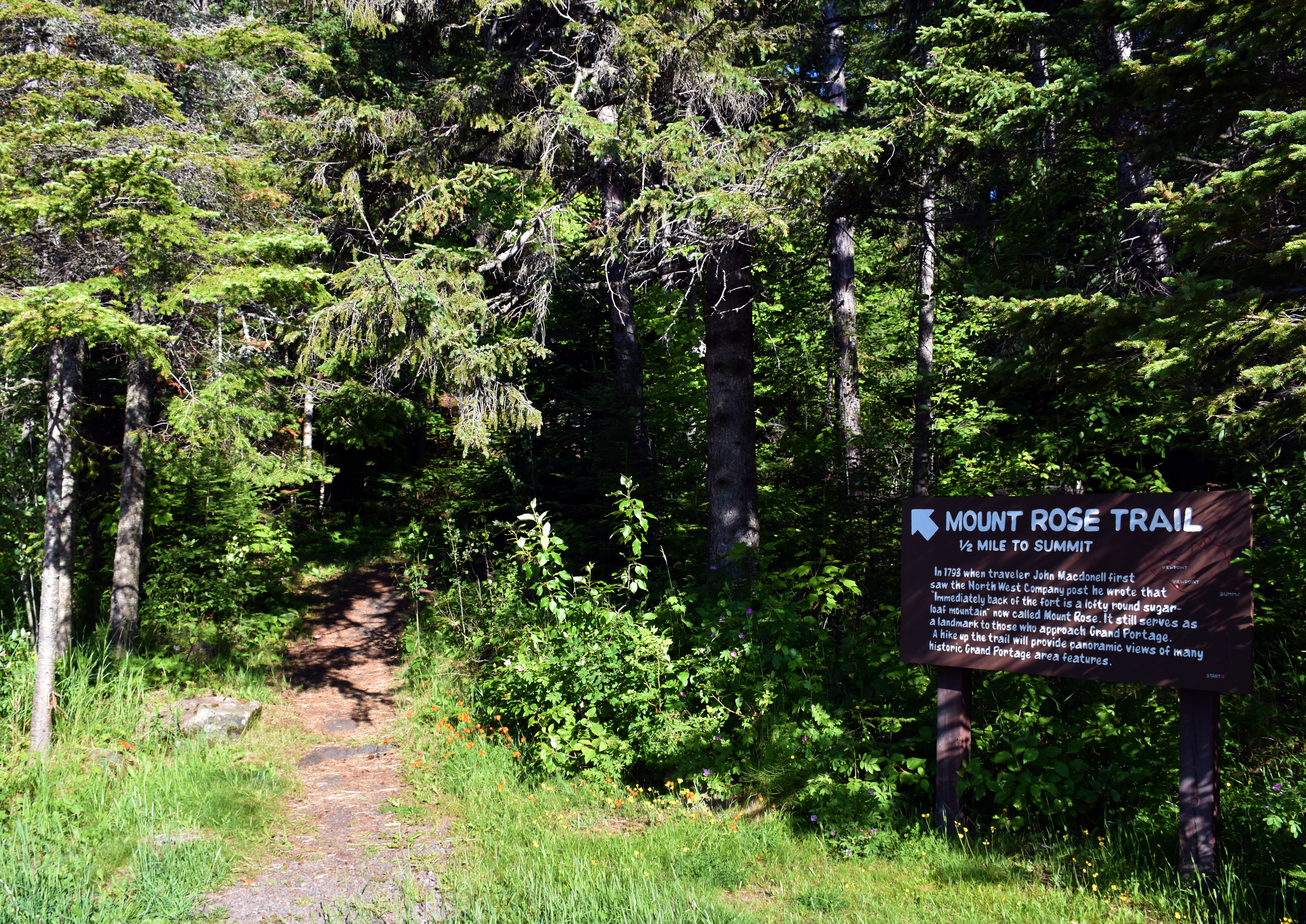
Mount Rose Trailhead (parking lot)The Mount Rose Trailhead is the beginning of a half-mile, uphill hike to the summit of Mount Rose. From there is a spectacular view of Grand Portage Bay and distant Isle Royale to the east, and the gap in the land where the Grand Portage trail passes to the west. This is also the best aerial view of the Historic Depot. 
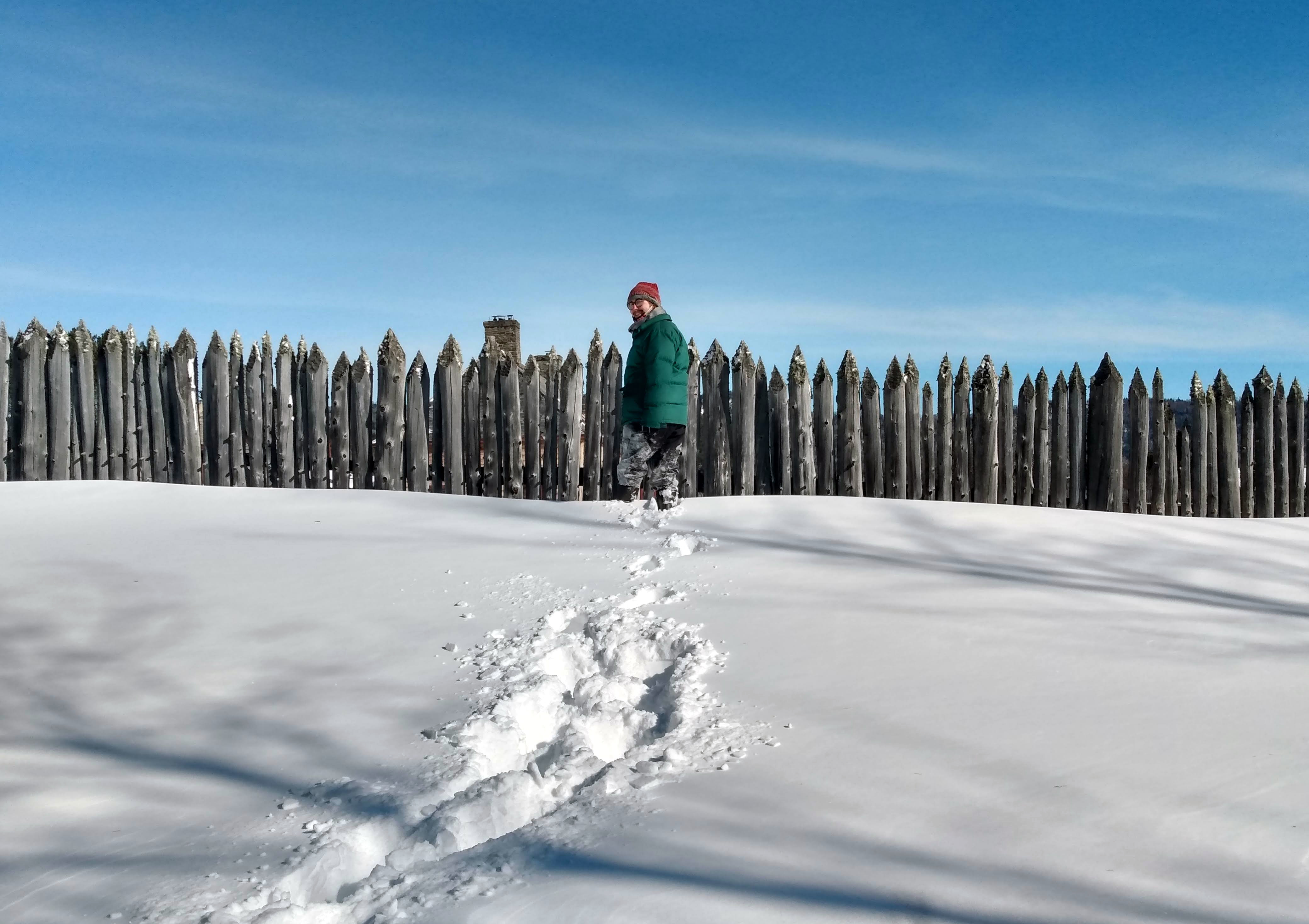
North West Company Depot GatehouseIn the days of the fur trade, a great variety of people passed through the Depot's gates to do business with the North West Company. 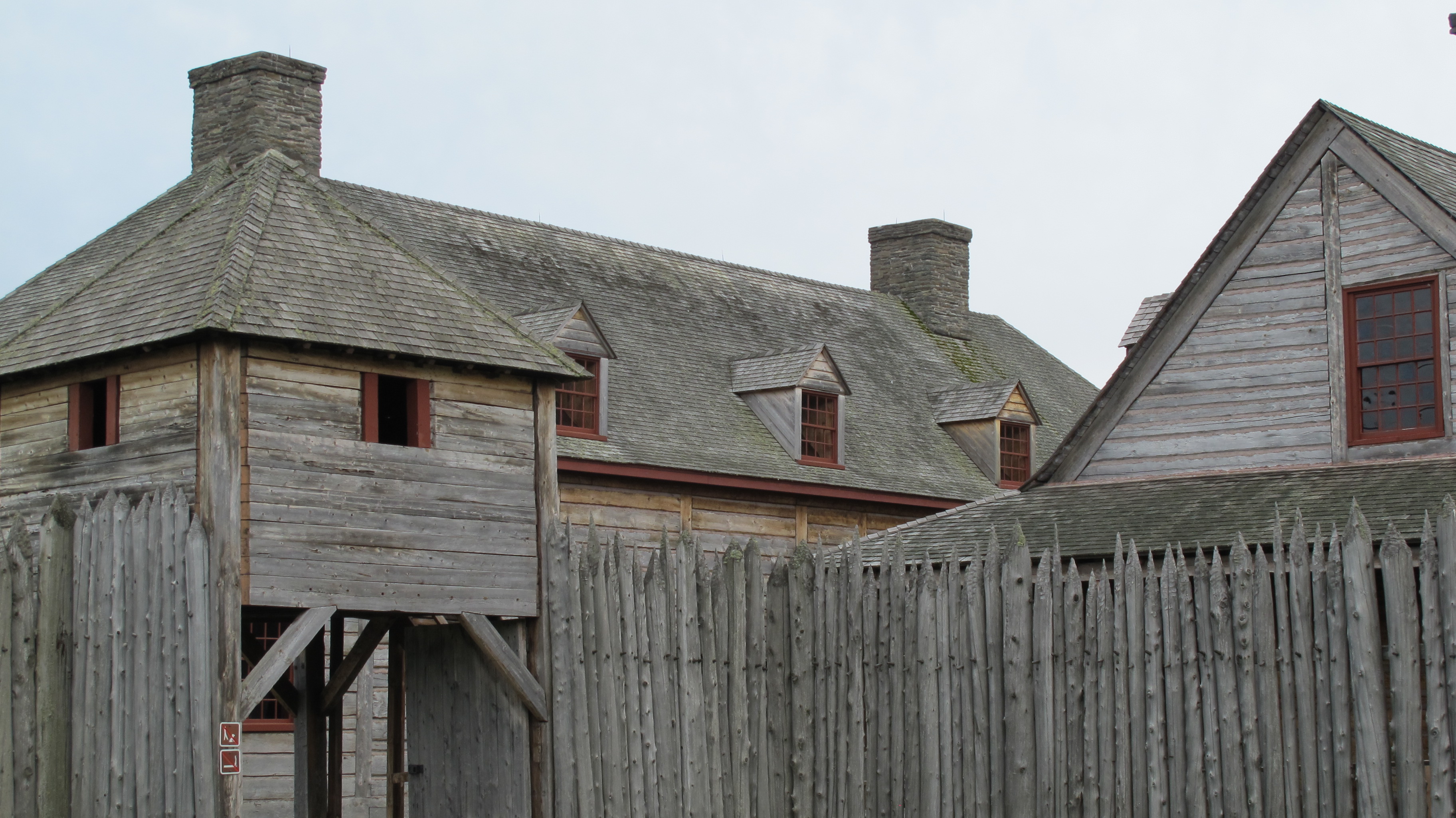
Pigeon River at Fort CharlottePicture in this location Fort Charlotte – once a North West Depot for North canoes laden with furs and now a backcountry campground. The fort no longer exists. In its place are two tent platforms. Many paddlers recreate the historic journey from what are now Voyageurs National Park or the Boundary Waters Canoe Area Wilderness, stopping overnight at Fort Charlotte, then portaging to Lake Superior. 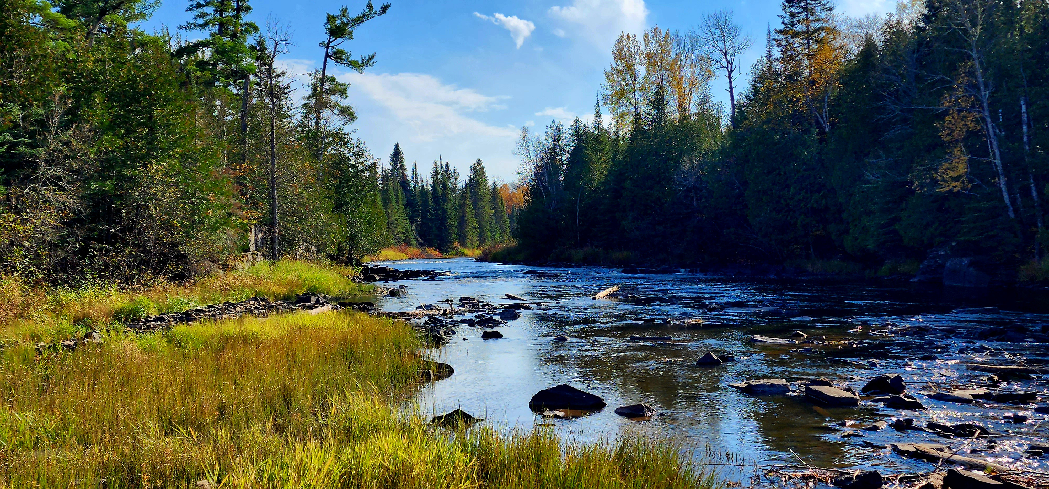
Three Sisters Garden at Grand Portage National MonumentBecause Grand Portage was a major hub of the fur trade, seeds and other items passed through en route to other posts. This planting style is thought to originate with the Haudenosaunee (Iroquois Confederacy) and traveled west with the Anishinaabe (Ojibwe). The Anishinaabe Oodena at Grand Portage grows an example as a teaching tool. 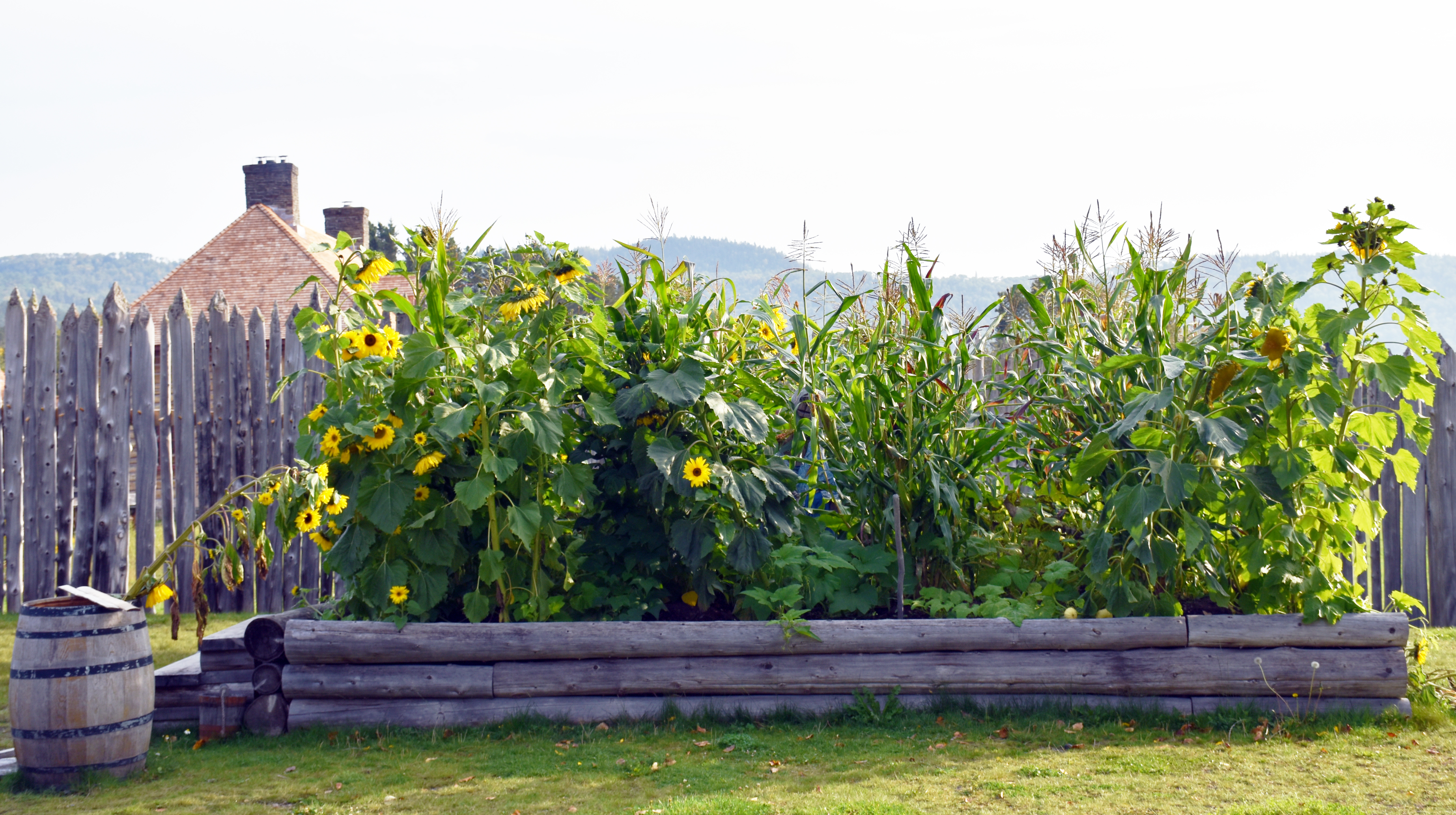
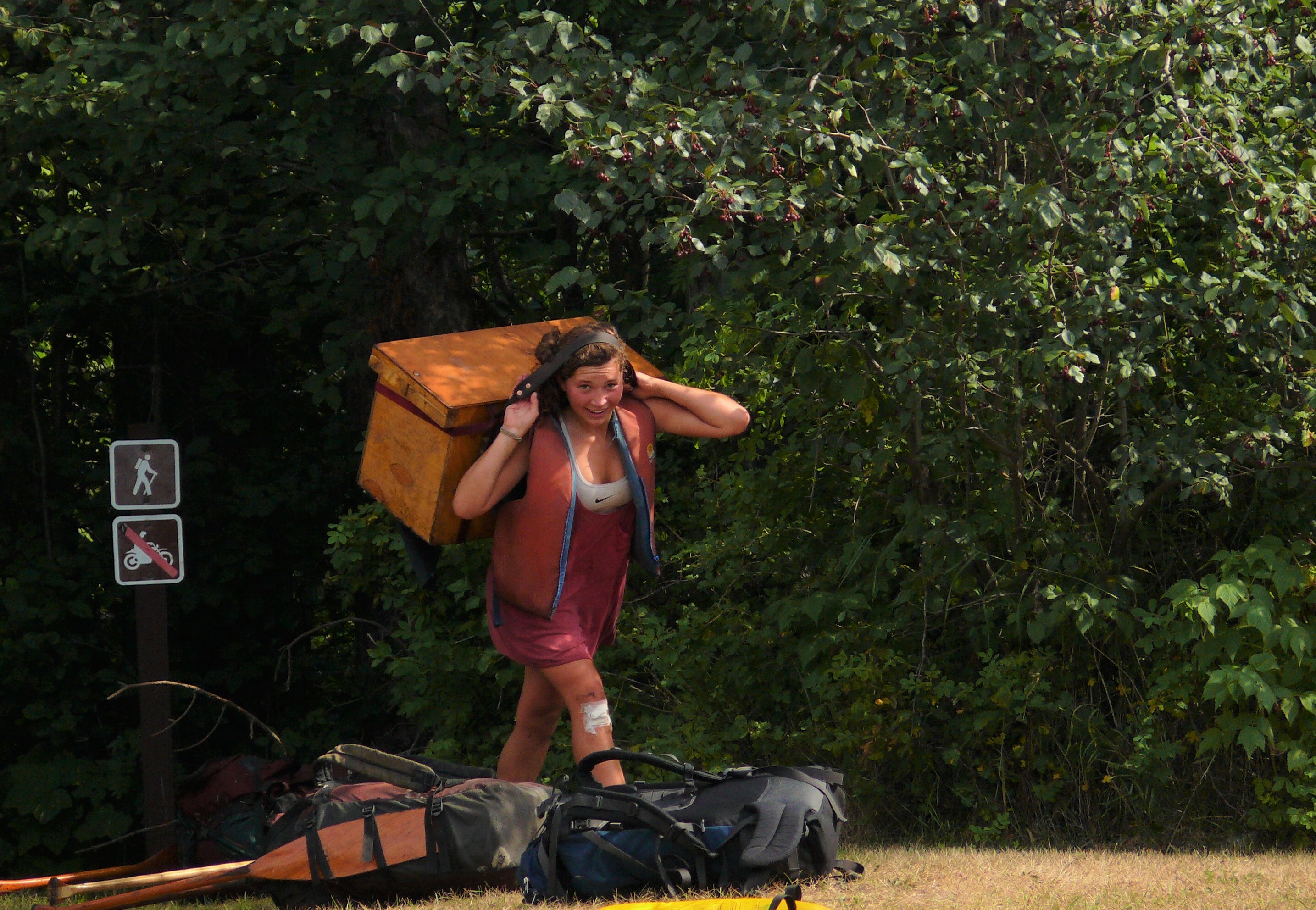
Trailhead for Gichi Onigaming, the Grand PortageToday's 8.5 mile (13.7km) portage trail corridor can be thought of in two parts: the eastern "half" that passes through gaps and valleys to avoid the high rocky ridges and the western "half" that passes over elevated terrain to avoid steep slopes and swamps. The parking area at Old Highway 61 approximately divides the halves so hikers can choose the "exploration into history" of their choice. 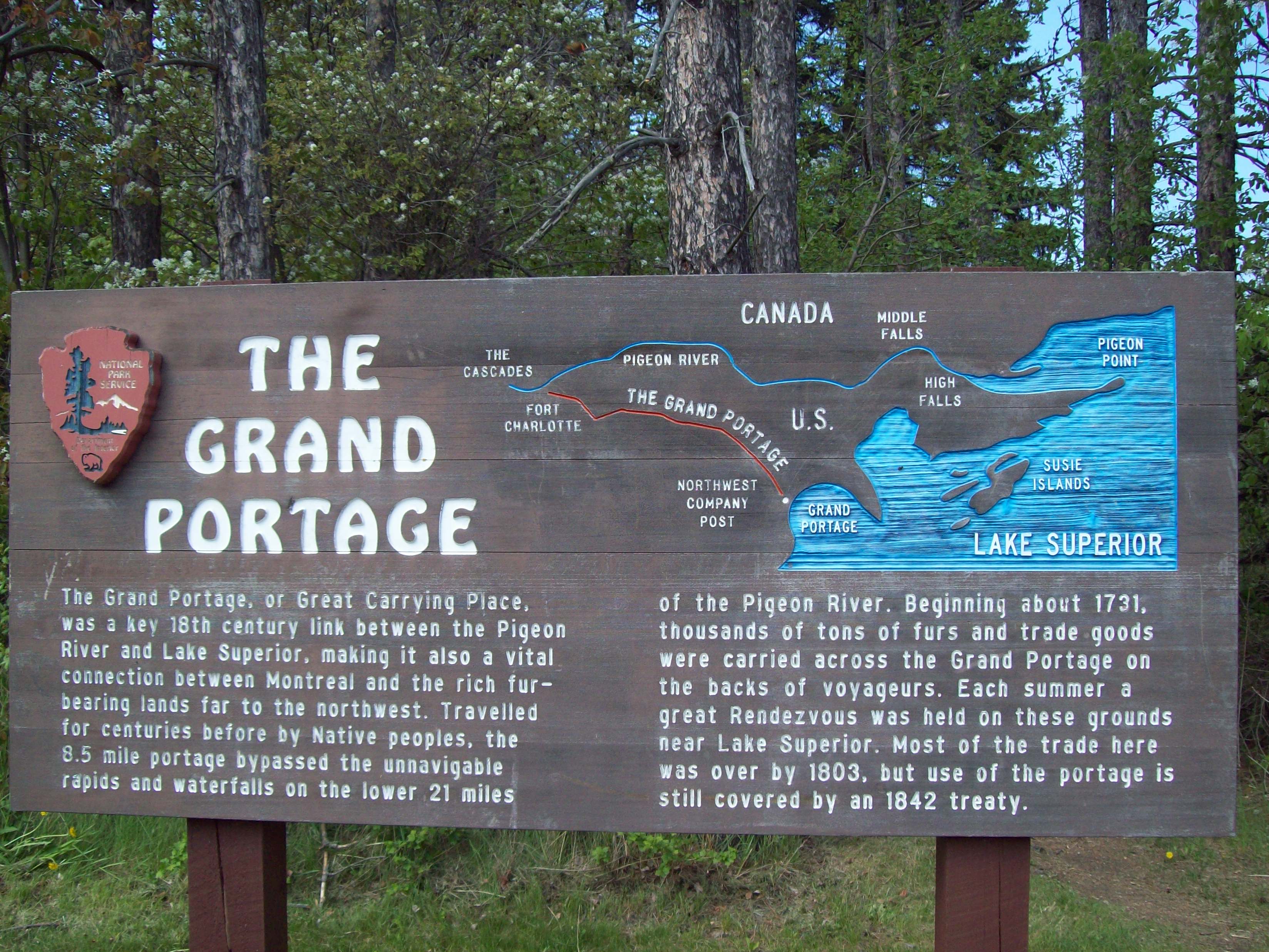
|
| Visitor Centers | Count: 1
Heritage Center
|
| Things to do | Count: 18

|
| Tours |
Count: 4
Grand Portage Site TourStart at the Monument parking lot,170 Mile Creek Road in Grand Portage. See the Heritage Center and work your way through the historic site structures. Add a hike to the top of Mount Rose for a stunning view of the bay, which will take you back to the parking area. Hike the Grand Portage TrailThe Grand Portage Trail (Gichi Onigaming) is an eight-and-a-half mile long trail between Lake Superior and the Pigeon River used to transport goods during the Fur Trade Era and for thousands of years as part of a larger trading network. It is natural pathway formed by glacial runoff and a popular destination for through-canoers coming from lakes along the border country. Hikers begin at the Fire Hall on Store Road or midway at old Highway 61 (County Rd 89). Reservations required to camp at Fort Charlotte. Mount Rose Hiking Trail from the Heritage Center Parking LotThis trail can begin at either trailhead. This tour is the steeper, more direct route to the summit. Hike to the top of Mount Rose for a spectacular view of Grand Portage Bay and beyond – on a clear day, Isle Royale is visible! Get a bird's eye view of the Depot or look west to the gap in the land where the voyageurs transported goods along the Grand Portage Trail. Learn about the ancient geology that brings beauty to the North Shore landscape. Mount Rose Hiking Trail from the Historic DepotThe Mount Rose Trail has two trailheads. This tour begins across from the Historic Depot at the corner of Mile Creek and Store roads and can follow the Grand Portage Site Tour. This hike is available year-round – see which animals left their tracks in the snow! In spring, watch the leaves unfurl and the many wildflowers emerge. In early summer, bring your binoculars or listen for returning birds. The surrounding forest in fall is loaded with fiery color. |
| Articles |
|