Be advised that the NPS has issued alerts for this park.
LSR Preserve Construction
The Laurance S. Rockefeller Preserve parking lot and areas around the Preserve Center will be closed for construction beginning September 23. Use Death Canyon Trailhead to access Phelps Lake.
Construction work in the Taggart area
Construction work is underway near Taggart Lake Trailhead to bury power lines. Pathway users should expect short delays, detours, and construction equipment in the area. The Taggart Trail bridge is under repair. Through mid-October, use the bypass along the corral road. Sept. 22–29, all hikers will be rerouted to the south segment of the Taggart Lake Loop Trail while crews remove boulders.
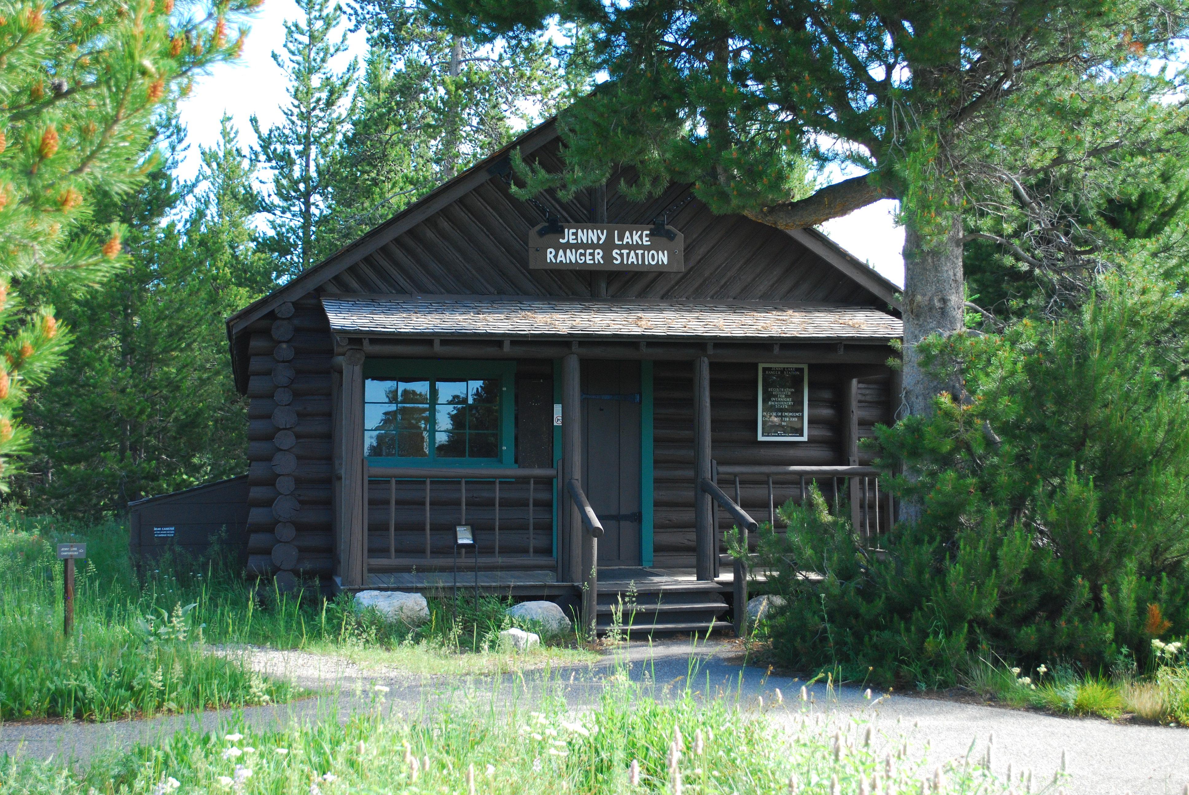
Jenny Lake Lakeshore Trail Reroute
The Jenny Lake Boat Dock Bridge is under construction, and the trail has been temporarily rerouted. Temporary reroutes will be in place September 22nd-25th and September 29th - October 23rd. Maps and directional signage will be posted in the area of the reroute to guide you along the trail during construction. Jenny Lake Boating is closed with the exception of September 26th - September 28th: 10am-4pm
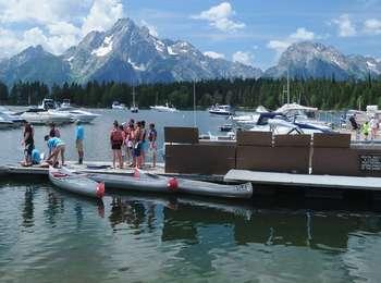
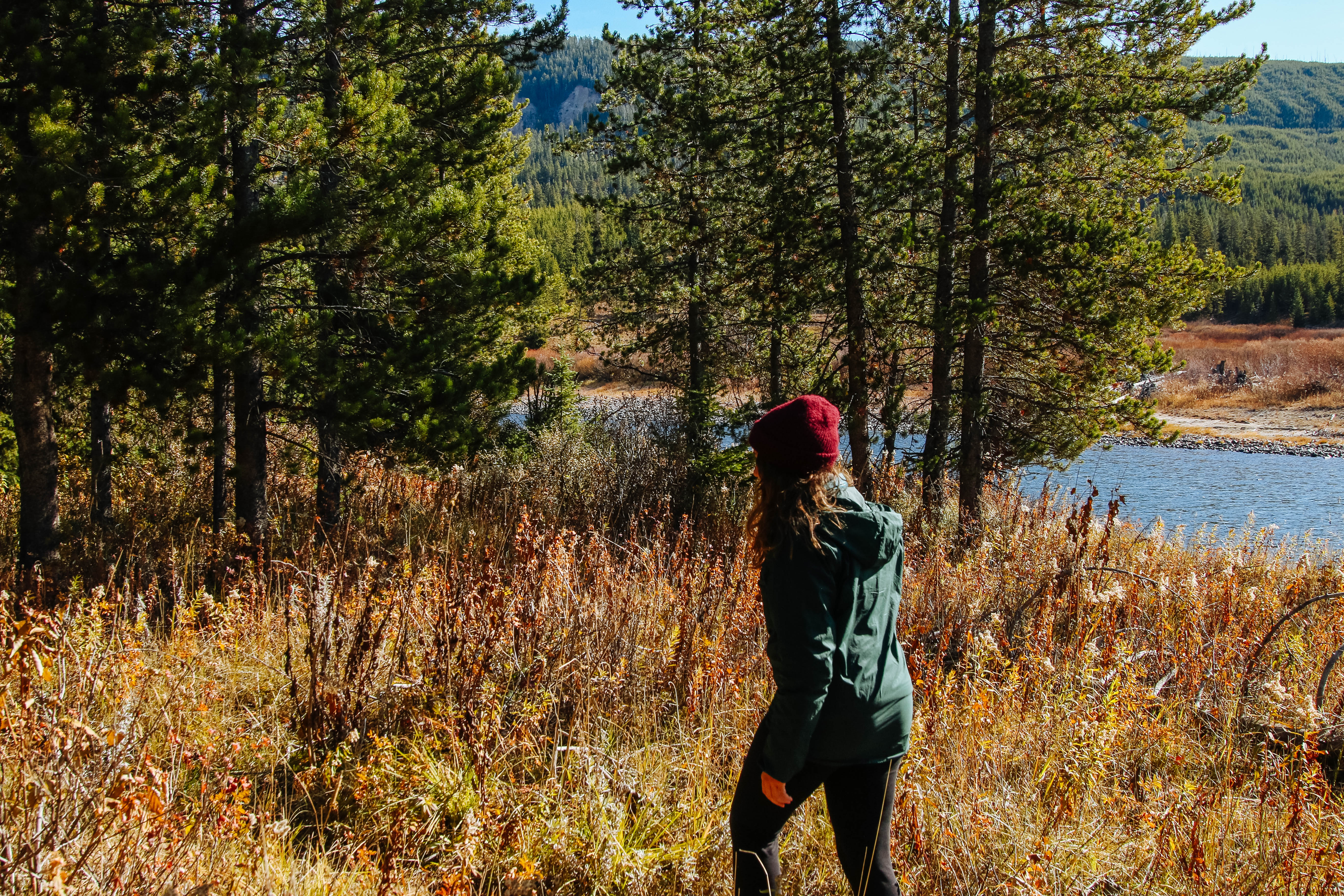
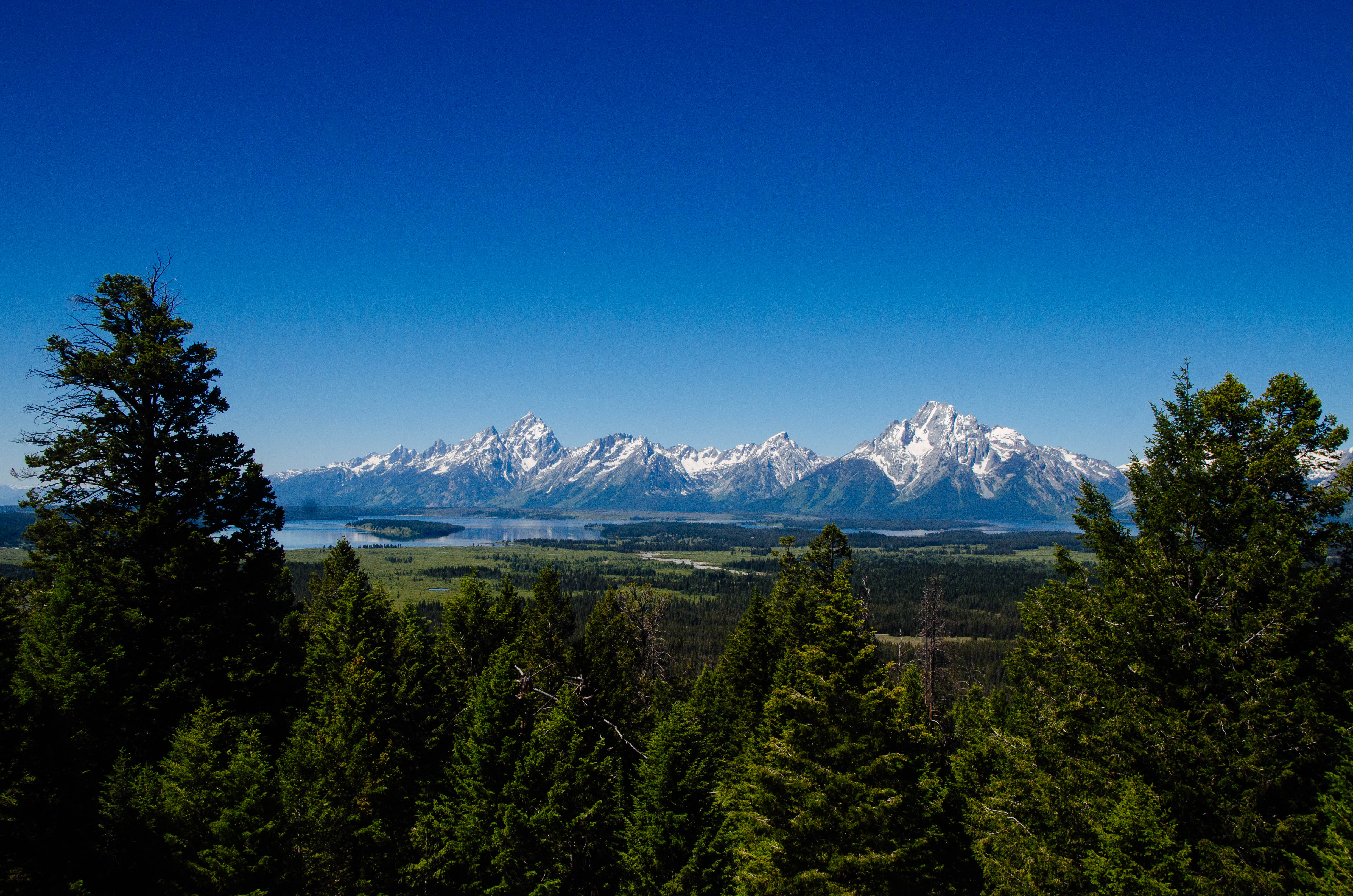
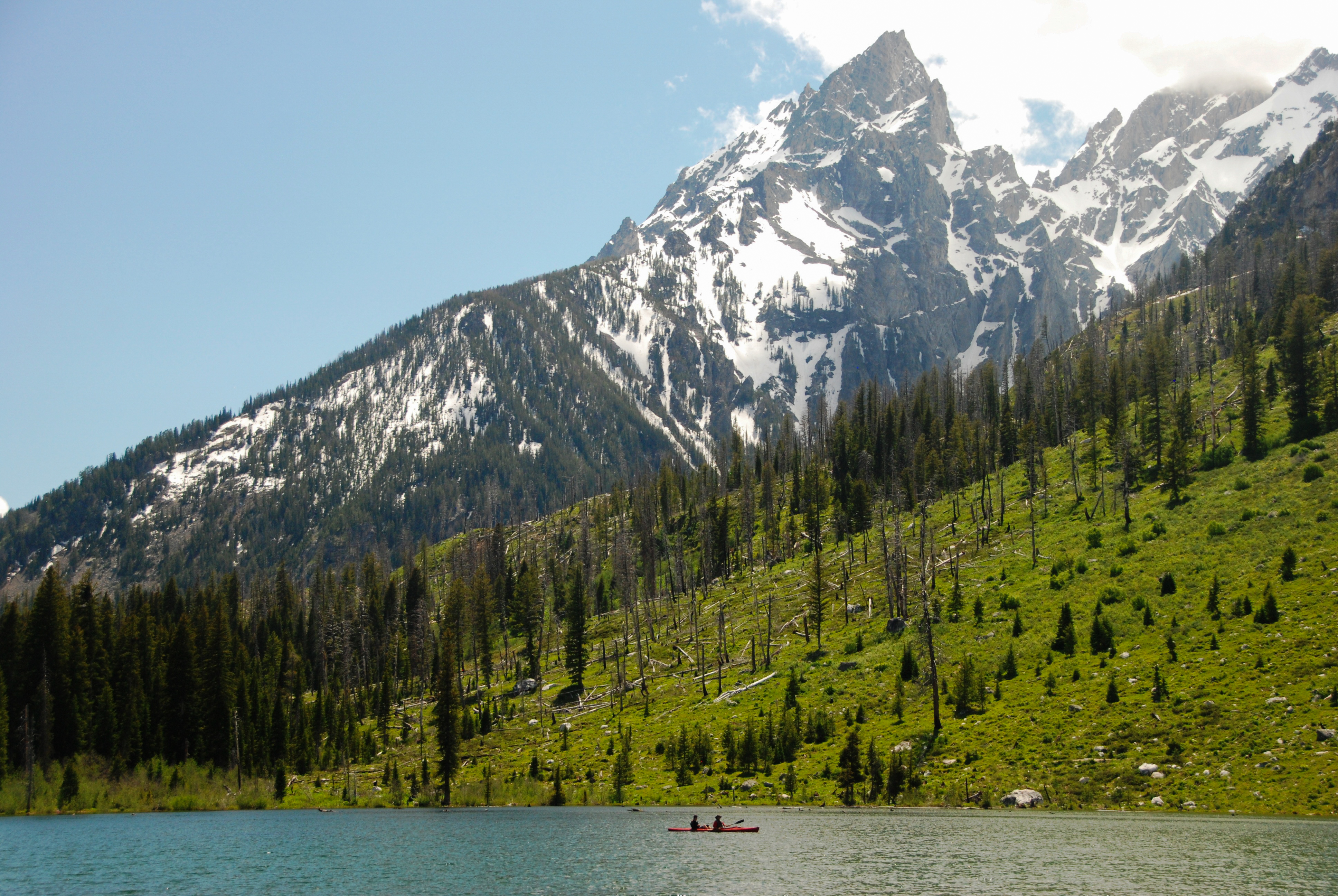
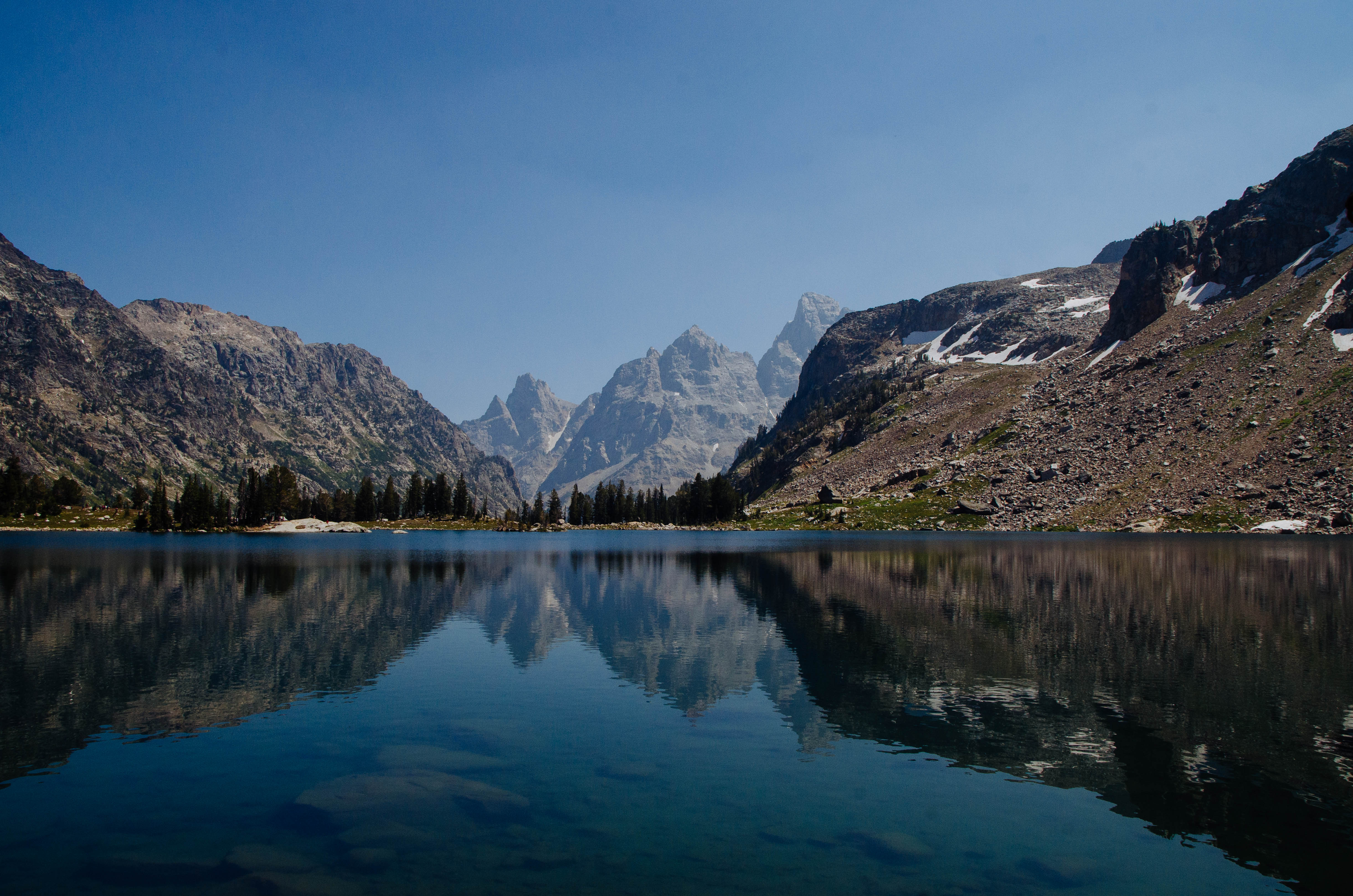
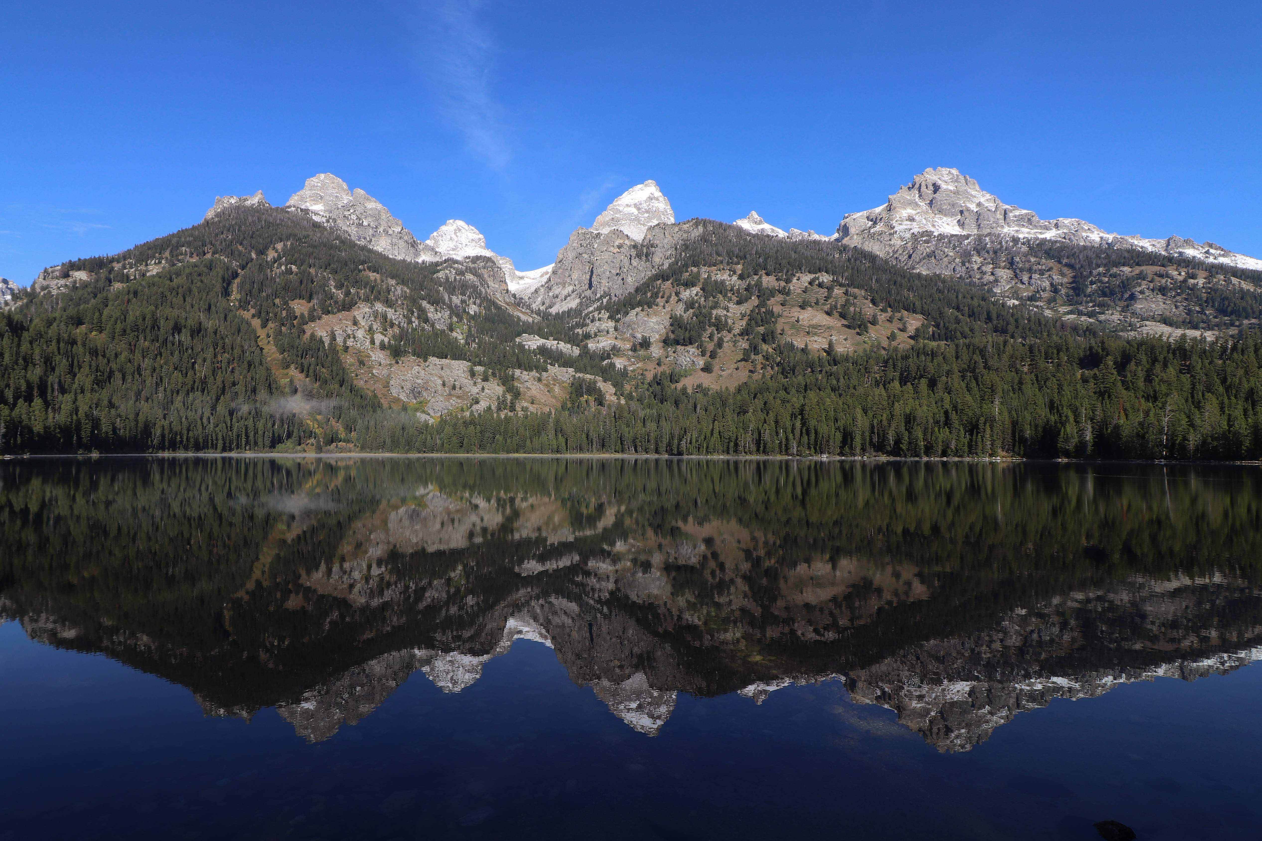
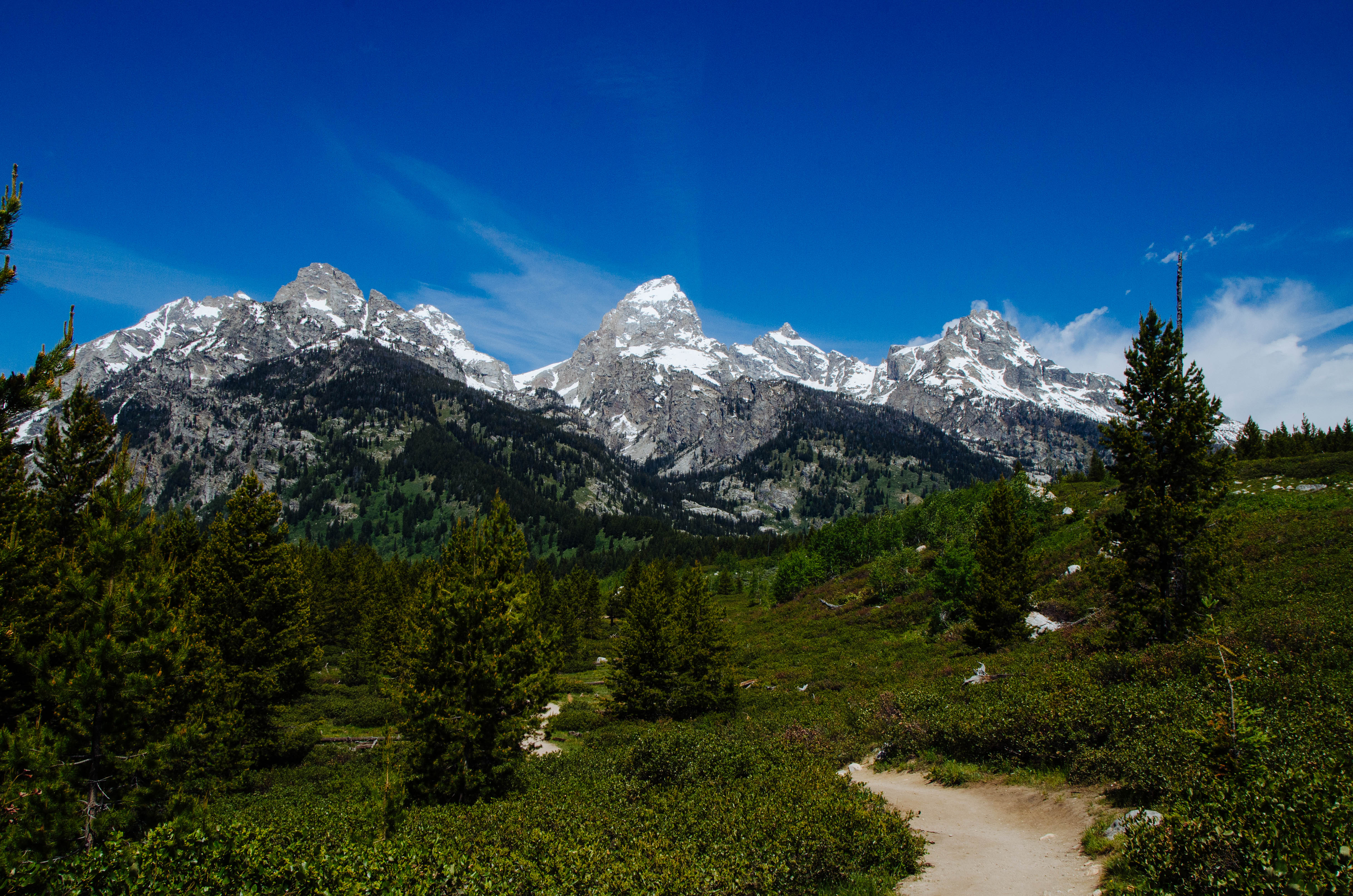
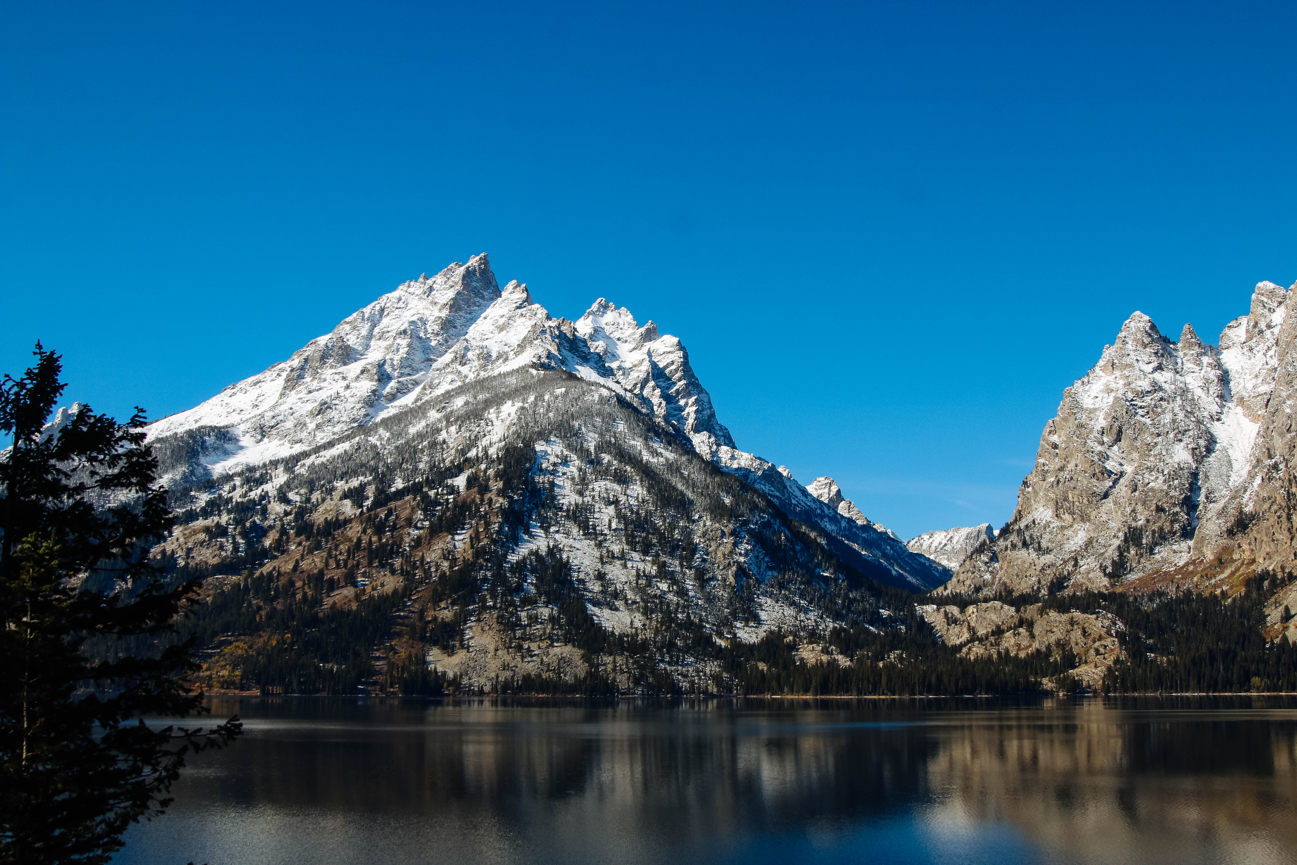
Soaring over a landscape rich with wildlife, pristine lakes, and majestic alpine vistas, the Teton Range stands as a testament to generations of stewards. For over 11,000 years, communities have thrived in the valley known as Jackson Hole, turnin...
Park entrance fee for 7 days for a private, non-commercial vehicle.
Entrance - Motorcycle
$30.00
Park entrance for 7 days per private motorcycle.
Entrance - Per Person
$20.00
Park entrance fee for 7 days for each visitor 16 years and older entering by foot, bicycle, ski, etc.
Commercial Entrance - Sedan
$25.00
A commercial tour is defined as consisting of one or more persons traveling on an itinerary that has been packaged, priced, or sold for leisure or recreational purposes by an organization that realizes financial gain through the provision of the service.
The cost is $25 + $20 per person. Pass is good for seven days as long as it's the same passenger group.
Commercial Entrance - Van
$125.00
Based upon the total capacity of a vehicle that can carry 7-15 passengers, regardless of the actual number of passengers.
A commercial tour is defined as consisting of one or more persons traveling on an itinerary that has been packaged, priced, or sold for leisure or recreational purposes by an organization that realizes financial gain through the provision of the service.
Pass is good for seven days as long as it's the same passenger group.
Commercial Entrance - Mini-bus
$200.00
Based upon the total capacity of a vehicle that can carry 16-25 passengers, regardless of the actual number of passengers.
A commercial tour is defined as consisting of one or more persons traveling on an itinerary that has been packaged, priced, or sold for leisure or recreational purposes by an organization that realizes financial gain through the provision of the service.
Pass is good for seven days as long as it's the same passenger group.
Commercial Entrance - Motor Coach
$300.00
Based upon the total capacity of a vehicle that can carry 26 or more passengers, regardless of the actual number of passengers.
A commercial tour is defined as consisting of one or more persons traveling on an itinerary that has been packaged, priced, or sold for leisure or recreational purposes by an organization that realizes financial gain through the provision of the service.
Pass is good for seven days as long as it's the same passenger group.
Entrance - Education/Academic Groups
$0.00
Schools or other bona fide educational institutions (accredited, officially recognized, or tax exempt for educational purposes) may request an educational fee waiver. The fee waiver will allow qualifying groups free entry into the park for educational or scientific purposes. Prior approval required before entry to park. See additional <a href="https://www.nps.gov/grte/planyourvisit/eduwaiver.htm">Education Fee Waiver</a> page.
Campsites are reservable on Recreation.gov. Plan ahead and reserve your site up to six months in advance. The maximum stay permitted at Colter Bay campground is 14 nights, and the maximum cumulative stay between all Grand Teton National Park campgrounds is 30 nights.
All campsites in the Colter Bay RV Park can be reserved. The maximum stay permitted at Colter Bay RV Park is 14 nights, and the maximum cumulative stay between all Grand Teton National Park campgrounds is 30 nights.
Campsites are reservable on Recreation.gov. Plan ahead and reserve your site up to six months in advance. The maximum stay permitted at Gros Ventre Campground is 14 nights, and the maximum cumulative stay between all Grand Teton National Park campgrounds is 30 nights.
All campsites in the Headwaters Campground can be reserved. The maximum stay permitted at Headwaters Campground is 14 nights, and the maximum cumulative stay between all Grand Teton National Park campgrounds is 30 nights.
Campsites are reservable on Recreation.gov. Plan ahead and reserve your site up to six months in advance. The maximum stay permitted at Jenny Lake Campground is seven nights, and the maximum cumulative stay between all Grand Teton National Park campgrounds is 30 nights.
Stop 4 (Jackson Lake Overlook): What effects do repeated fires have on a landscape, and why is that important for forests and wildlife? Explore our Fire History page to see a map of fires in the park over the last several decades, including the ones Diane and Ron discuss.
Host: As you look across to the west shore of Jackson Lake, you can see evidence of several fires that have burned over there-if you look carefully. Far to the south, you can see where the Waterfalls Canyon Fire burned almost 50 years ago, in 1974. Much of that area is now dense lodgepole pine forest or shrubs. The dark forested area that you see across the lake and extending south, which is left if you're facing the lake, is all regrowth from that fire. If you look directly across, you'll see that forest grow patchy and disappear, where a fire burned in 2000. Farther to the north, which is to the right, you can see burned trees on the ridgeline from the 2016 Berry Fire. Explore the fire history page on Grand Teton's website to see a map of how these fires overlap one another. Here's Diane Abendroth, the park's fire ecologist, and Ron Steffens, a fire analyst in the park, to discuss what we're seeing on the other side of the lake. Diane mentions the Moran fire in 2000, which burned even farther south than the Waterfalls Canyon Fire-you can see it from Colter Bay.<br /><br />Diane: You can see across the lake now that there are a lot of little trees out there, and some areas where shrubs still dominate, and some areas where the trees are actually getting bigger. And then if you look to the north of that fire and to the south, you'll see some fires that burned in the year 2000. That's the Moran Fire, the Wilcox Fire, and the Glade Fire. Those were lightning caused fires, but those weren't fires that the Park Service was attempting to allow to just burn. But they suppressed them in a way that included letting them go up into the rocks of the Tetons, while protecting some cabins and some values in the lower elevations. But Jackson Lake is a pretty good fuel break. And if you look at the whole area on the backside of the lake, people really haven't played a very big role in fire there. And it looks like maybe it looked before settlers came and started to interfere with the landscape.<br /><br />Ron: The other thing we learned with the waterfalls canyon fire and the fires afterwards is the value of. Diversity of a fire landscape. So the fire in 1974. 26 years later in 2000 there are fires burning from the south and from the north. And as those fires burned into the Waterfalls Canyon area, there was a younger forest. It is much more shaded because of the density of the regeneration of the forest, and both of those fires slowed and went out. So we're able to demonstrate and learn from the value of a diverse landscape with a diverse pattern of burns.<br /><br />Host: This type of area, where several different fires overlap like a patches on a quilt, creates excellent wildlife habitat. Many species appreciate recently-burned areas for the lush plant regrowth and the high populations of wood-boring insects and small mammals. Perhaps even more important is the juxtaposition of different habitats, where old growth forest opens out to a grassy clearing, or dense young lodgepoles border a shrubby meadow. Wildlife love these so-called "edge habitats", from elk and deer that want to graze in meadows but shelter in the forest, or raptors that want to nest in the trees and hunt rodents in the open. The series of fires we've seen on the west shore of the lake is ideal for creating this mix of habitats where wildlife can thrive. Here are Ron and Diane to explain more about what we can learn from this type of landscape:<br /><br />Ron: The landscape where you get a diversity of forest ages and a diversity of regeneration that supports the wildlife that people have come to cherish here. All landscapes have a cycle. Fire is such a dramatic way of resetting that cycle that I think it lets us humbly look around and learn that we need to learn from this place.<br /><br />Diane: When you have towns or people's homes or other kinds of developments in the mix, with the public lands and forests, it makes it kind of dangerous to have fire on the landscape too. But here in the Greater Yellowstone we have just enormous vast areas with nobody's house in the way. And so that makes it possible to see what nature can do on its own. And we don't have to try to interfere.
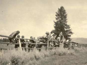
Many Bar BC guests of the 1920s and 30s came on vacation to Jackson Hole seeking some of the same things that visitors hope to find today-the peace of being in nature, the splendor of the mountain scenery, and the appreciation of a slower pace of life. Struthers Burt and Horace Carncross selected this site for its beautiful views, its gentle breezes that ruffle the aspen trees, and its solitude, provided by the river valley.
Many Bar BC guests of the 1920s and 30s came on vacation to Jackson Hole seeking some of the same things that visitors hope to find today-the peace of being in nature, the splendor of the mountain scenery, and the appreciation of a slower pace of life. Struthers Burt and Horace Carncross selected this site for its beautiful views, its gentle breezes that ruffle the aspen trees, and its solitude, provided by the river valley. Though much about the Bar BC has changed, the setting itself is much the same. What are you hoping to find on your visit here? Excerpt from "Diary of a Dude Wrangler": "Some of the happiest hours I have ever spent and some of the most profitable, philosophically speaking, have been spent on the top rail of a corral fence, the favorite sitting-place of all Westerners if they have nothing else to do-and, sometimes, even when they have something else to do. I don't know which makes you the more homesick for the West when you are away from it: the thought of shadowy forests and cool water, or the recollection of warm dust and the top rail of a corral fence and, on Sunday afternoons, the shady side of a cabin or saddle-shed, where you sit with some chosen companions and converse at intervals."
The AMK Ranch represents the initial phase of vacation homes in Jackson Hole. Homesteaded by John Sargent in 1890, little remains of his lodge and store that served travelers on the road to Yellowstone. All current buildings date to the W. Lewis Johnson era (1926-1936) and the Alfred Berol era (1936-1976). Both Johnson and Berol built large log vacation homes representing two distinct periods of rustic architecture as well as various other cabins and outbuildings.Berol, presi
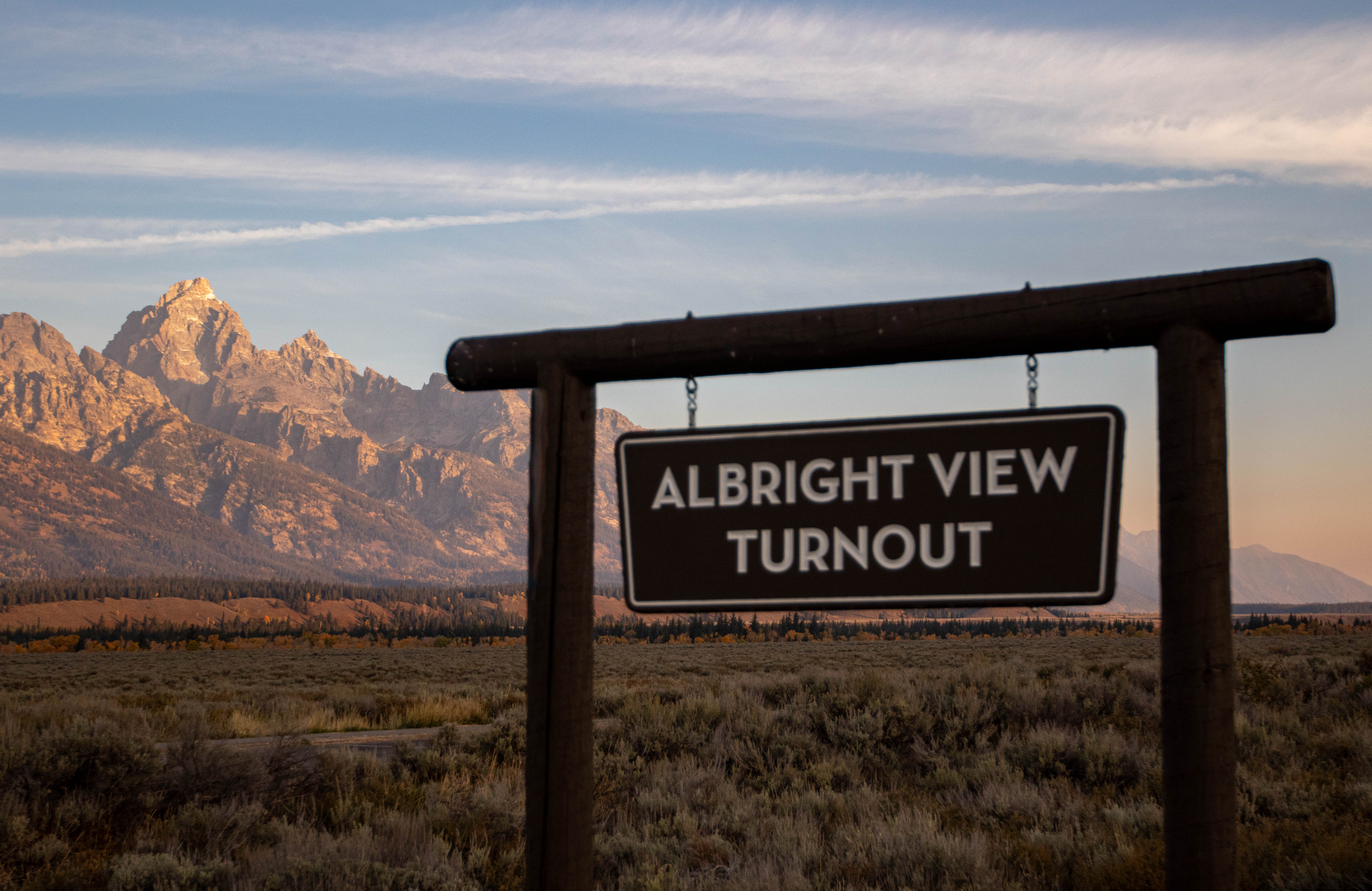
Facing west, the southern Teton Range-dominated by Buck Mountain, Static Peak and Albright Peak-towers over the valley of Jackson Hole. Death Canyon slices deep into the range to the south of these peaks. To the east, Blacktail Butte seems a minor hill but it still over 1,000 feet above the highway. The lack of trees on the south facing slopes of Blacktail Butte suggest past logging by settlers. The lack of trees, however, reflects the well-drained soils and exposure to the s
This paved turnout overlooks a sage-dotted plain with the Teton range beyond. The view of the mountains matches the photograph at the bottom of the wayside, which labels the various peaks. Text on the panel reads, "What's in a Name? Many natural features in this region went without names until the 1800s. The Shoshone called the mountain range "Teewinot," meaning "many pinnacles." French Canadian trappers referred to the Grand, Middle, and South Teton as "Les Trois Tetons," or "The Three Breasts." Early explorers called them "Pilot Knobs." Jackson Hole and Jackson Lake honor trapper David Jackson. The 1872 Hayden Expedition named Leigh and Jenny lakes after its guide, Richard Leigh, and his Shoshone wife. The expedition even named the Grand Teton "Mount Hayden" briefly." To the right of the text is a historic photograph of a group of six men in front of a white canvas tent. The men stand or sit on packing cases. Other cases and bedrolls are scattered around. The caption reads, "Hayden Expedition, 1872." Across the middle of the panel are five historic photographic portraits of men. The first one on the left shows a man in park service uniform with a broad brimmed hat and knee-length top boots. The caption reads, "Horace M. Albright served as the National Park Service director, 1929-33." The next shows a man in suit and waistcoat, his dark hair parted in the middle. He wears a dark mustache. The caption reads, "Novelist Owen Wister was an early Jackson Hole visitor." The middle portrait shows an older American Indian man wearing a full-feathered headdress and many strings of beads. The caption reads, "Chief Joseph. The Nez Perce Indians hunted in the surrounding area." <br /><br />The next photo shows a man with sleeked-down fair hair and wearing wire-rimmed glasses. The caption reads, "William O. Owen led the first documented ascent of the Grand Teton in 1898." The last photo shows a man with full beard wearing an overcoat and black hat. The caption reads, "Thomas Moran sketched and painted scenes for the Hayden Expedition." Along the photo of the mountain range at the bottom labels identify major peaks. From left to right they are Albright Peak, 10,552 ft.; Static Peak 11,303 ft.; Buck Mountain 11,938 ft. (George A. Buck was a geological recorder in a 1898 mapping expedition.) Next in line are Mount Wister 11,490 ft.; South Teton 12,514 ft.; and Middle Teton 12,804 ft. Then are Nez Perce 11,901 ft.; Grand Teton 13,770 ft.; Mount Owen 12,928 ft. and Teewinot Mountain 12,325 ft. The final peaks at the right are St. John 11,430 ft., named for Orestes St. John who served as a geologist with the Hayden Expedition and Mount Moran 12,605 ft.
Andy Chambers homesteaded on Mormon Row in 1912. By 1916, the homestead consisted of a log house and stable. In addition to homesteading, early settlers trapped to help earn a living. Andy Chambers trapped along the Snake River from 1918 to 1928. The hardships of ranching caused farmers to switch from livestock to farming and back. Chambers homestead lacked water so he dry farmed raising oats and wheat until 1927.
This traditional barn structure is set back from the road and at right angles to it, facing a small dirt farm road. It has a grey metal roof and grey, weathered, vertical plank siding on the flanks and smooth rounded logs at the center of the main structure. The peak of the roof extends over the front of the building to form a triangular projection. There is an addition to the barn extending out on the side facing the road, a one story structure with a lower sloped roofline.
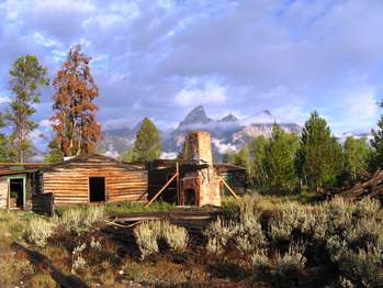
The Bar BC was one of the first dude ranches in Jackson Hole, and perhaps the most iconic. Today, it's the oldest one still standing. It was founded in 1912 by Struthers Burt and Harold Carncross, Easterners who emigrated to Wyoming. Burt and his wife, Katharine Newlin Burt, were prolific writers, so their ranch attracted a more artistic and literary set. The clientele tended to be wealthy Easterners who wanted a rustic vacation experience, away from the constraints of high s
Host: The Bar BC was one of the first dude ranches in Jackson Hole, and perhaps the most iconic. Today, it's the oldest one still standing. It was founded in 1912 by Struthers Burt and Horace Carncross, Easterners who emigrated to Wyoming. Burt and his wife, Katharine Newlin Burt, were prolific writers, so their ranch attracted a more artistic and literary set. The clientele tended to be wealthy Easterners who wanted a rustic vacation experience, away from the constraints of high society. Many former guests bought ranches in the area, and some of their families are still in the valley today. During the heyday of dude ranching in the 1910s and 20s, many other ranches operated in Jackson Hole and throughout the West. At its height in the 1920s, the Bar BC was actually one of the valley's largest employers, hiring over fifty people to help run the ranch each summer. The industry declined as tourism dropped during the Great Depression and World War II, though there are still some dude ranches in Jackson Hole today.<br /><br />Excerpt from "Jackson Hole Journal": "You couldn't see the ranch as you started toward the Gros Ventres, with the Tetons and evening at your back. It looked as though you would have to travel straight across the valley for hot miles of sagebrush to those further mountains. Then suddenly came the second bench, a prehistoric riverbank, running neat as a dam north and south, then the steep road down a gully in the jolting wagon between larkspur and mules-ears, with perhaps a last decadent little snowbank still lingering in the draw-the whole panorama of river valley opening out below. Then finally you come down the first bench right into the ranch itself-the sod of tarpaper-roofed cabins, the corrals and saddle shed and barns and ditches and willows and big pines and aspen groves and the shining square of the swimming pool dug out of the flat between cabins and river. It was coming home with a vengeance."
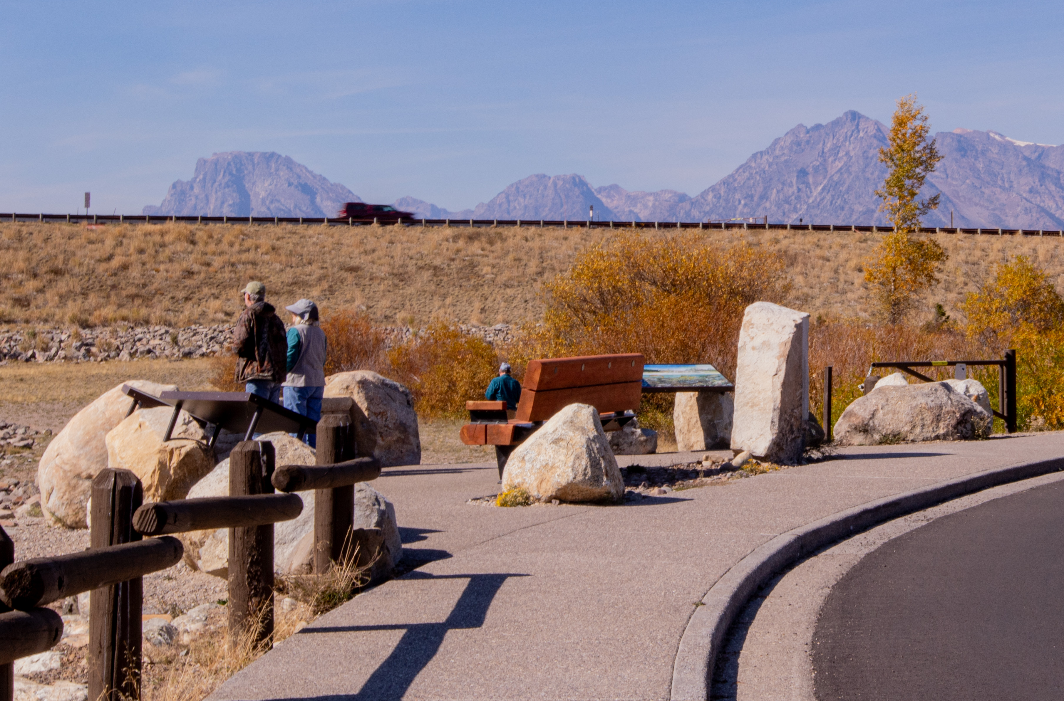
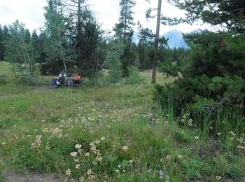
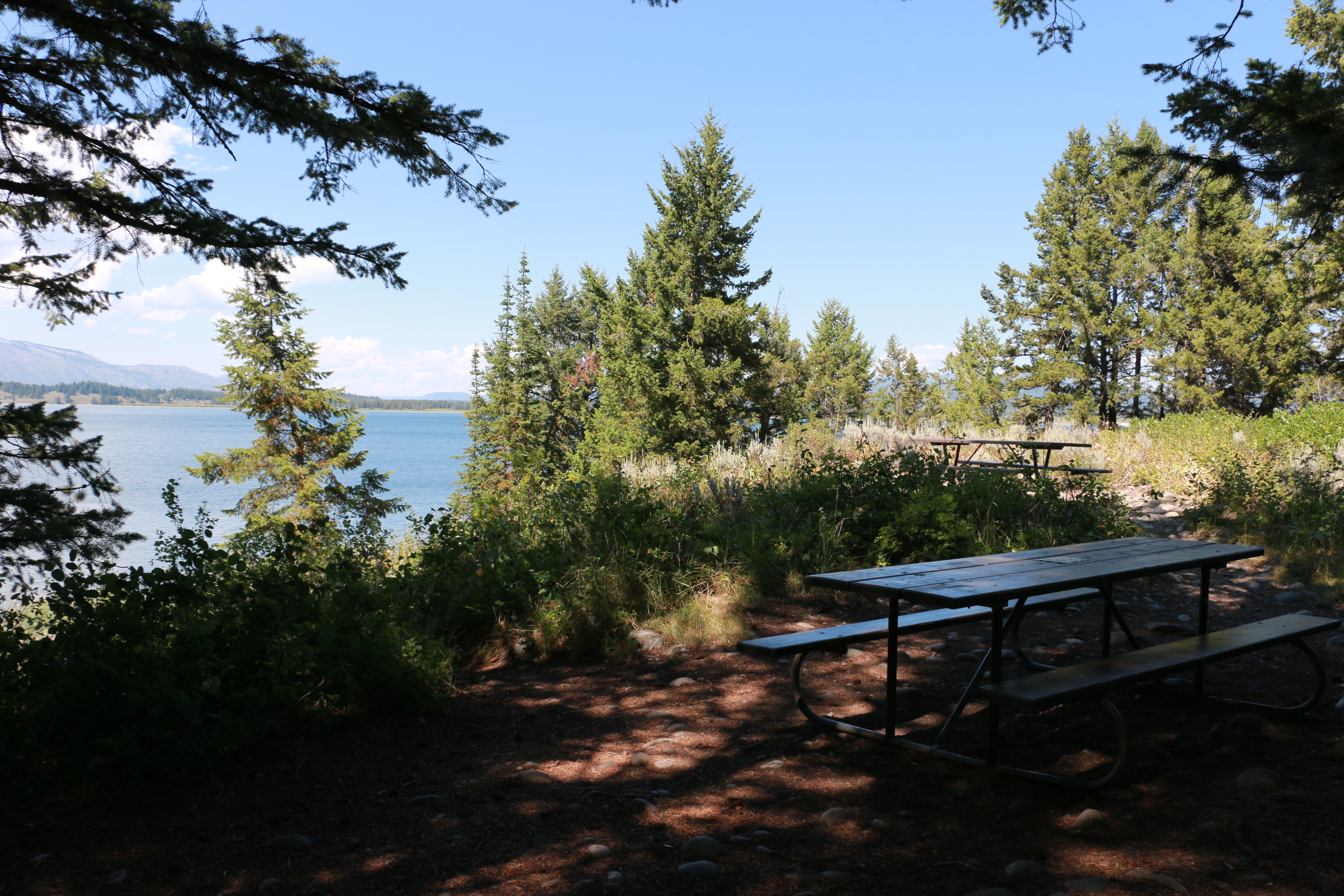
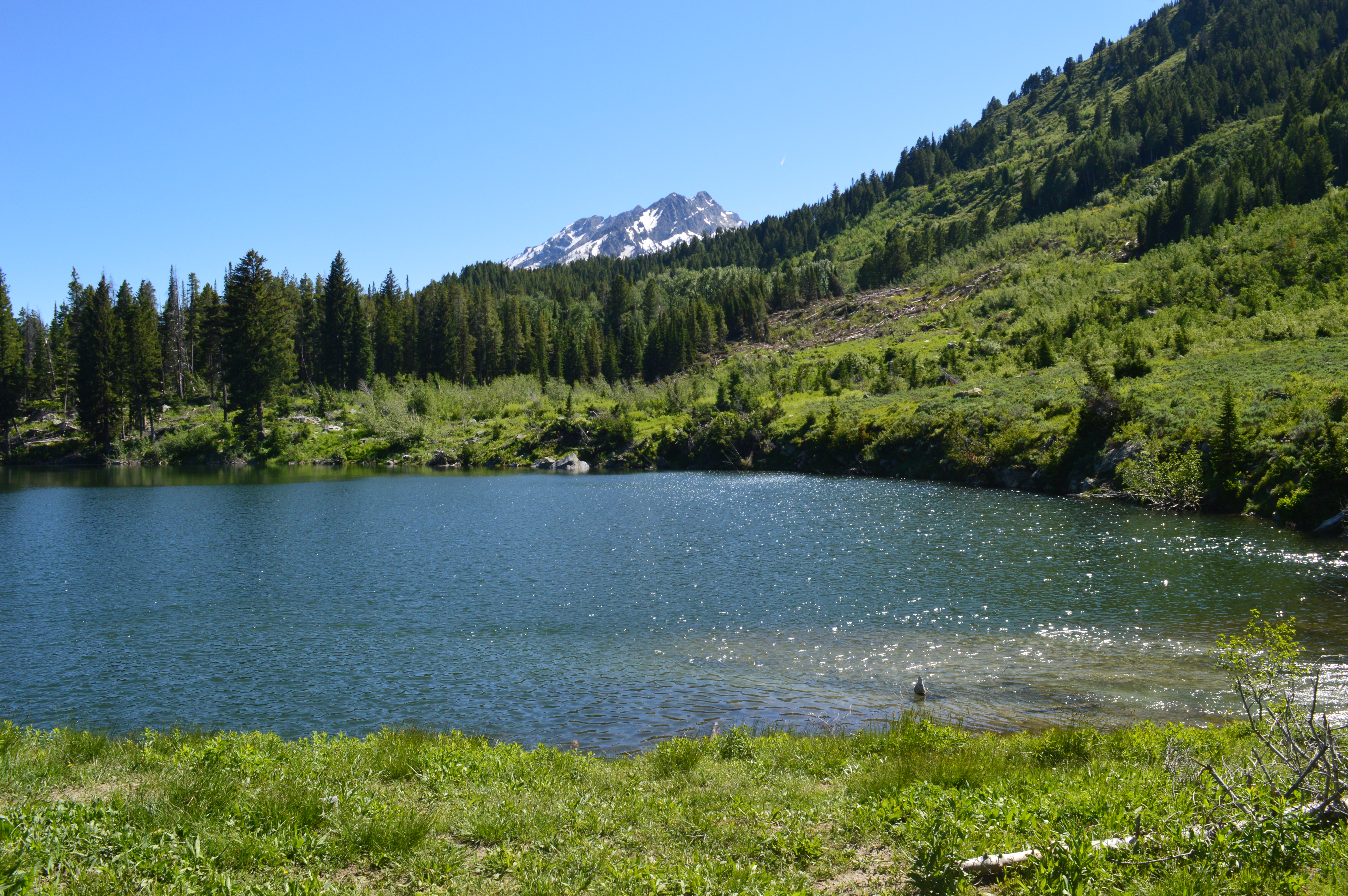
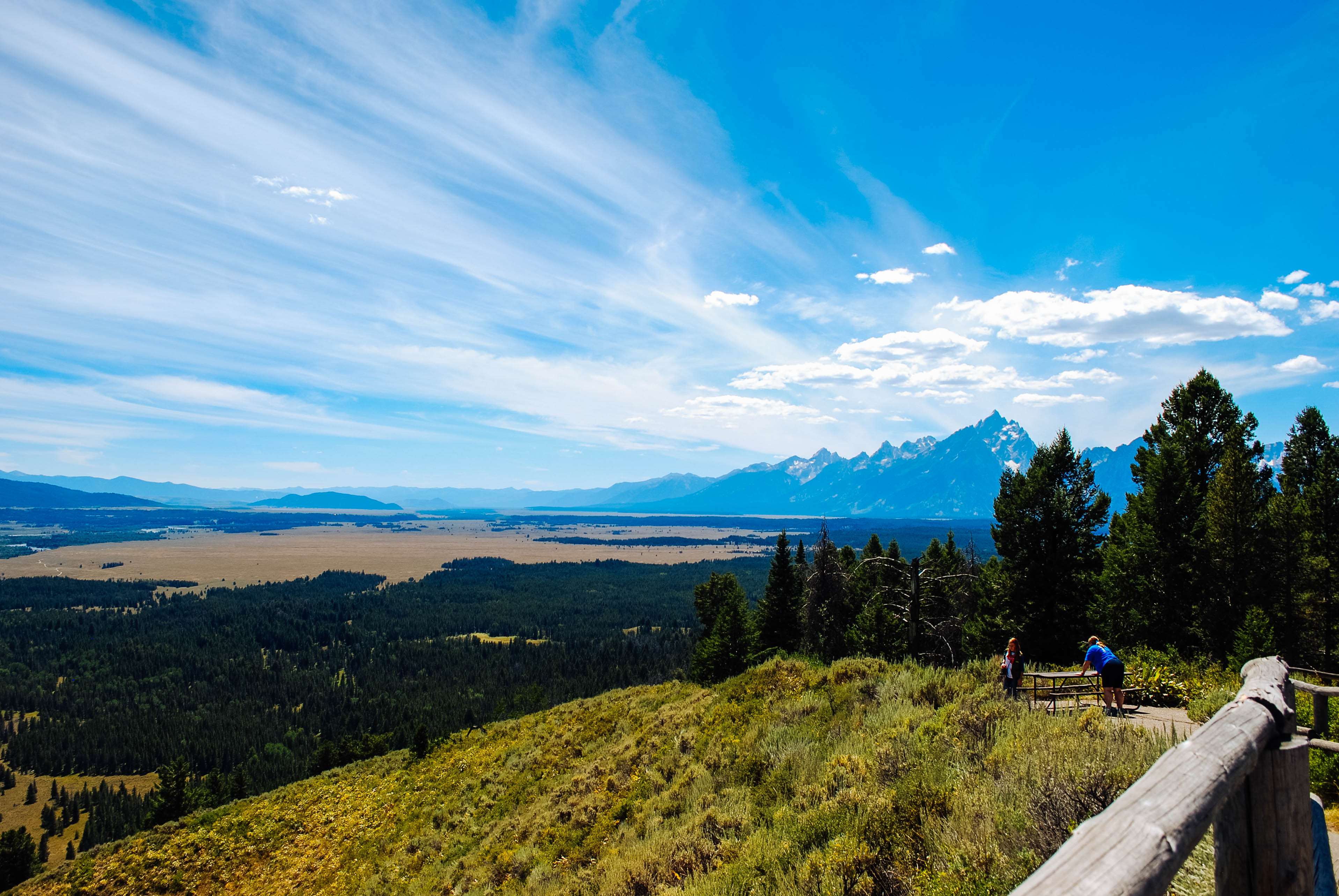
Arizona Island picnic area consists of just a few tables in a meadow with mature forests surrounding. Have a snack and enjoy the view when traveling to or from Yellowstone National Park.
Arizona Island picnic area consists of just a few tables in a meadow with mature forests surrounding. Have a snack and enjoy the view when traveling to or from Yellowstone National Park.
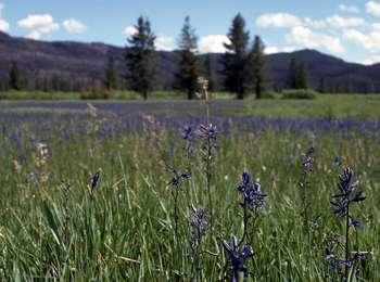
This wet meadow turns blue violet in the early summer when blue camas blooms. Shoshone Indians harvested the bulbs once the flowers bloomed so that they did not confuse the plant with death camas that could be a very deadly mistake! The roasted bulbs formed an important part of their diet. Today, the meadow is an oasis surrounded by lodgepole pine forest.
This wayside in a turnout on the east side of the road looks out over a large, flat meadow, surrounded by conifer forest. Low mountains are in the distance. The sign shows a photo of the meadow filled with bright blue flowers on tall stalks surrounded by grass-like vegetation. The text reads, "From Bulbs to Flour. Blooms of blue camas blanket this moist meadow during summer. Shoshone Indians and other tribes gathered the "quamash" plant's bulbs and dried or roasted them. They waited for the plants to bloom, because the bulbs of a similar plant, death camas, are fatally poisonous. Indians ate the bulbs or ground them into flour to make cakes or biscuits-important additions to their diet of elk, trout, and berries."This meadow may once have been a pond. You may not see water today, but the ground is too wet for trees to grow. In the future, this meadow may become drier and a forest may flourish." In the lower left corner is an historic photo of an American Indian woman sitting beside a large pile of bulbs. She wears a kerchief on her head and has a stone pestle in her right hand. The caption reads, "Annie Yellow Bear grinds camas bulbs into meal about 1890."
Aspen Knoll offers minimally obstructed views of Jenny Lake and the Teton Range.
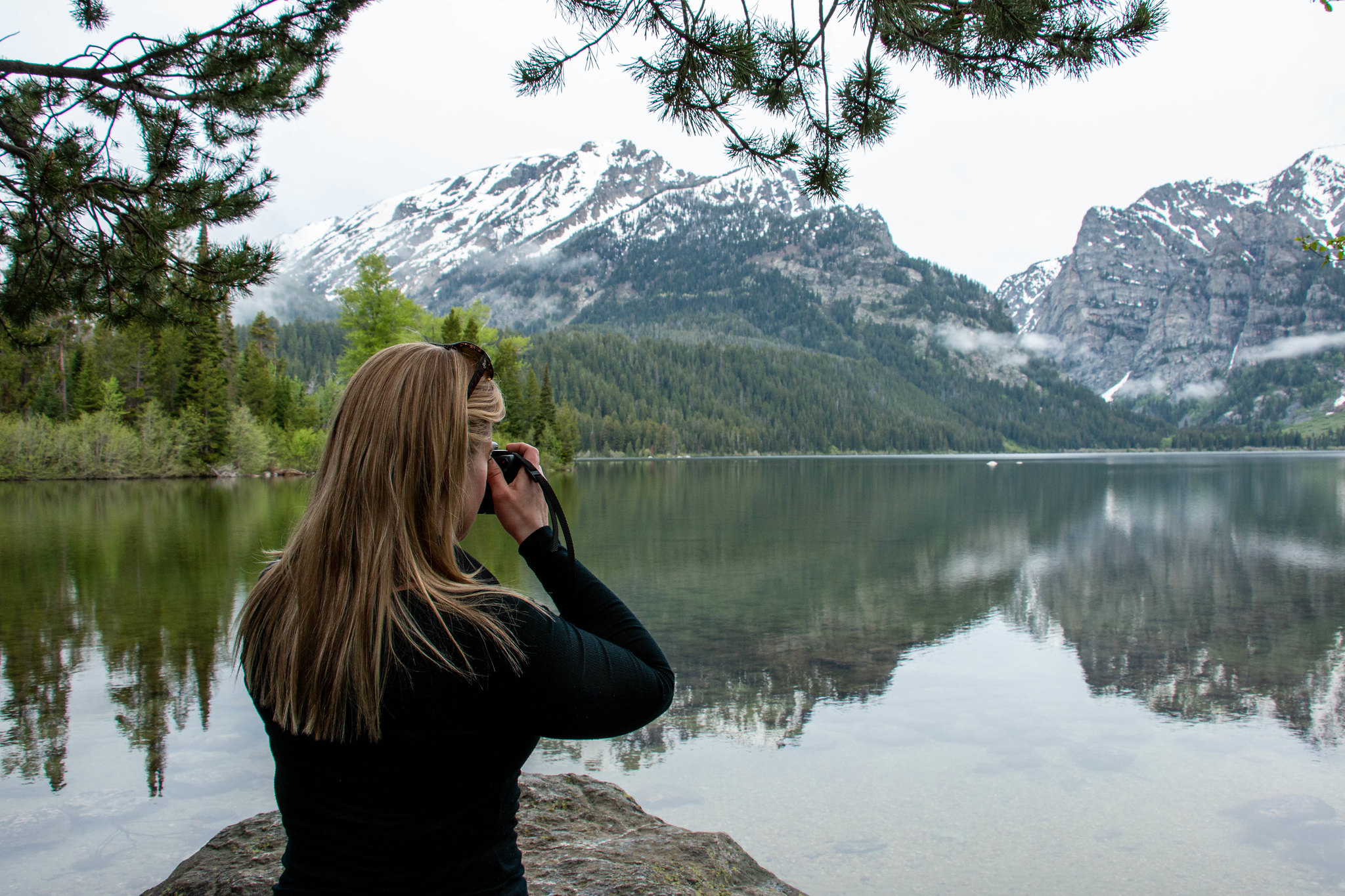
Aspen Knoll is located north along the path from Teewinot Overlook, at the top of a flight of 32 stairs from Rock Beach. Rising approximately 50 feet above the shoreline in a stand of Aspen trees, the knoll offers minimally obstructed views of Jenny Lake and the wooded hillsides and craggy, snow-capped peaks of the mountains on the opposite shoreline, over a mile away. Depending on the season, listen for the sound of bird calls, and the hum of the shuttle boat engines. Breathe in the air, and feel the breeze as it blows through the rustling leaves and branches of the forest around you.
The Bar BC Ranch was the second dude ranch in the valley. Started by Struthers Burt and Horace Carncross in 1912, their ranch attracted Eastern Dudes who wanted to experience life in the Old West. Situated on the west bank of the Snake River, the ranch had a swimming hole from water diverted from the river. Today, the park has stabilized many of the cabins. Visitors may wander through the ranch and enjoy a glimpse of early tourist life, but for your safety please do not enter
The Bar BC Ranch was the second dude ranch in the valley. Started by Struthers Burt and Horace Carncross in 1912, their ranch attracted Eastern Dudes who wanted to experience life in the Old West. Situated on the west bank of the Snake River, the ranch had a swimming hole from water diverted from the river. Today, the park has stabilized many of the cabins. Visitors may wander through the ranch and enjoy a glimpse of early tourist life, but for your safety please do not enter the cabins. Access to the Bar BC Overlook requires a four-wheel drive vehicle.
Access the Blacktail Butte Trailhead from US 26/89/191. The parking lot is one mile north of Moose Junction on the east side of the highway. There are no facilities at this trailhead-remember to bring water and use a restroom before you arrive. Bears may be active any place and at any time-travel in groups, make noise and carry bear spray. Hikers cannot access backcountry camping from this trailhead.
This sign is located at the edge of a parking lot at the western end of Blacktail Butte. Immediately past the sign, trails climb up the end of the butte to a rock face used for climbing practice. Other trails branch off to the right, or south, to skirt the butte and climb the southern side. The panel shows a photograph of a woman scaling a rock face with a view of the Teton peaks in the background. Text reads, "Blacktail Butte rises 1,100 feet above the valley floor and is the seasonal home to many animals. Follow the trail south to reach a summit elevation of 7,688 feet. Madison limestone outcrops provide a variety of challenges for the experienced climber. Glaciers sculpted this butte that is comprised of sedimentary rock." At the bottom of the panel is a side view of the butte with the western end, your current location, on the left. Dotted lines indicate the trails that climb the western end, go east about a mile to the Upper Blacktail climbing area and that on up to the summit. Down the right side of the panel are additional notices and trail tips. Text reads, "No Pets On Trails. Pets are not allowed on hiking trails or away from developed areas. These measures help protect you, your pet and sensitive park resources. A good rule of thumb is that a pet may go anywhere a car may go. Pets, where permitted, must be restrained on a leash no longer than six feet. "Wildlife Safety. Follow food storage regulations. Do not leave food, coolers, trash, backpacks, water bottles or any potential attractant unattended-not even for a second-including in an open truck bed or the exterior of any vehicle. Carry and know how to use bear spray. Keep it immediately available, not inside your pack. Hikers must be prepared for wildlife encounters. Do not approach or harass animals. Stay at least 300 feet from large mammals such as moose, elk or bison for your safety and theirs. Wildlife often bite the hand that feeds them-do not feed any animal, including squirrels, chipmunks and birds. "Firearms & Hunting. Inquire at a visitor center for firearm and hunting regulations. Please note that firearms are not allowed inside visitor centers and most park buildings. "Prevent Crime. Lock your car! Parked vehicles may attract thieves and vandals. To avoid theft or damage to your vehicle: Secure all valuables such as cameras, electronics, wallets or purses. Leave glove box and other storage areas open and empty. Lock your car with the windows closed. Do not leave notes or permits that announce your plans. We need your help. Report any crime, accident, fire or safety hazard to a park employee as soon as possible. In case of emergency, call 911! "Trail Tips. Climbing is a technical sport that requires training, skill and proper equipment. Scrambling up steep slopes and on loose rock can quickly lead to tragedy. "Follow low impact climbing ethics. Leave the rock in its natural condition. Avoid placing permanent protection. Motorized drills are prohibited. "Beware of loose rock. When hiking use caution to avoid knocking rocks over cliffs onto climbers. "Stay on established trails. Shortcutting switchbacks damages plants and causes erosion. "Pack out all trash. Keep the park litter-free. Leave the park as you found it for others to enjoy. Picking wildflowers or collecting any object is prohibited. "Vehicles, including bicycles and strollers, are prohibited on trails or off established roads. Wheelchairs and any type of assistive technology are allowed. "Saddle and pack animals must stay on authorized trails and may not graze in the park. Find out more at a visitor center or ranger station."
From this vantage point, the park's natural communities stretch out before you. The ponds and wet meadows along the Snake River are home to the wetland community. Terraces step up from the Snake River to the sagebrush community covering much of the valley floor. Islands of lodgepole pines take root on glacial moraines that ring glacial lakes. The lower slopes of the mountains support aspen and conifer forest communities.
This wayside sign is located a short walk down a dirt path going west from the parking area. There is a split rail fence at the end of the path. The sign is to the left of the fence, just past a trail that leads down a slope to the meadows and ponds below. West of the flat marshy area are woods with the mountain range in the distance. The background of the panel is a photograph of the view from the overlook with the various habitats identified. Text reads, "See One, See Them All. Here, in one place, you can see examples of every biological community in the national park. The geologic landscape determines the types of plants and animals that exist in each community. Sunlight, water, soil, and wind all influence where different species find food and shelter to sustain their lives." Sets of three photographs illustrate each of these communities. In the upper left, near the mountain slopes are photos of a pika, a small mouse-like rodent, a marmot and tiny, bright blue alpine forget-me-nots. The caption reads, "Alpine life above treeline adapts to minimal soil, intense sun, heavy snow, and fierce wind. Wildflowers cling to the ground. Pikas and marmots struggle to gather food." The next trio is just below, near the open meadow next to the treeline. The photos show a tortoiseshell butterfly, fireweed blossoms and a bison. The caption reads, "Meadows contain grasses and wildflowers that provide food and shelter for elk and songbirds. Look for meadows interspersed in other communities." Bottom center on the panel are photos of a pronghorn, a uinta ground squirrel and a sage grouse. The caption reads, "Sagebrush flats include shrubs, grasses, and wildflowers that can survive in dry, rocky soil and intense sunlight. Look for sage grouse and pronghorn." In the middle of the panel are three photos of a mule deer, quaking aspen and a black bear. The caption reads, "Forests take root at all elevations from cottonwoods along rivers to dwarf trees at treeline. See any red squirrels, elk, or black bears?" At the lower right of the panel are photos of a beaver, a moose and a yellow warbler. The caption reads, "Wetlands consist of aquatic plants and shrubs and serve as buffers against floods. Look for waterfowl, beavers, and moose."
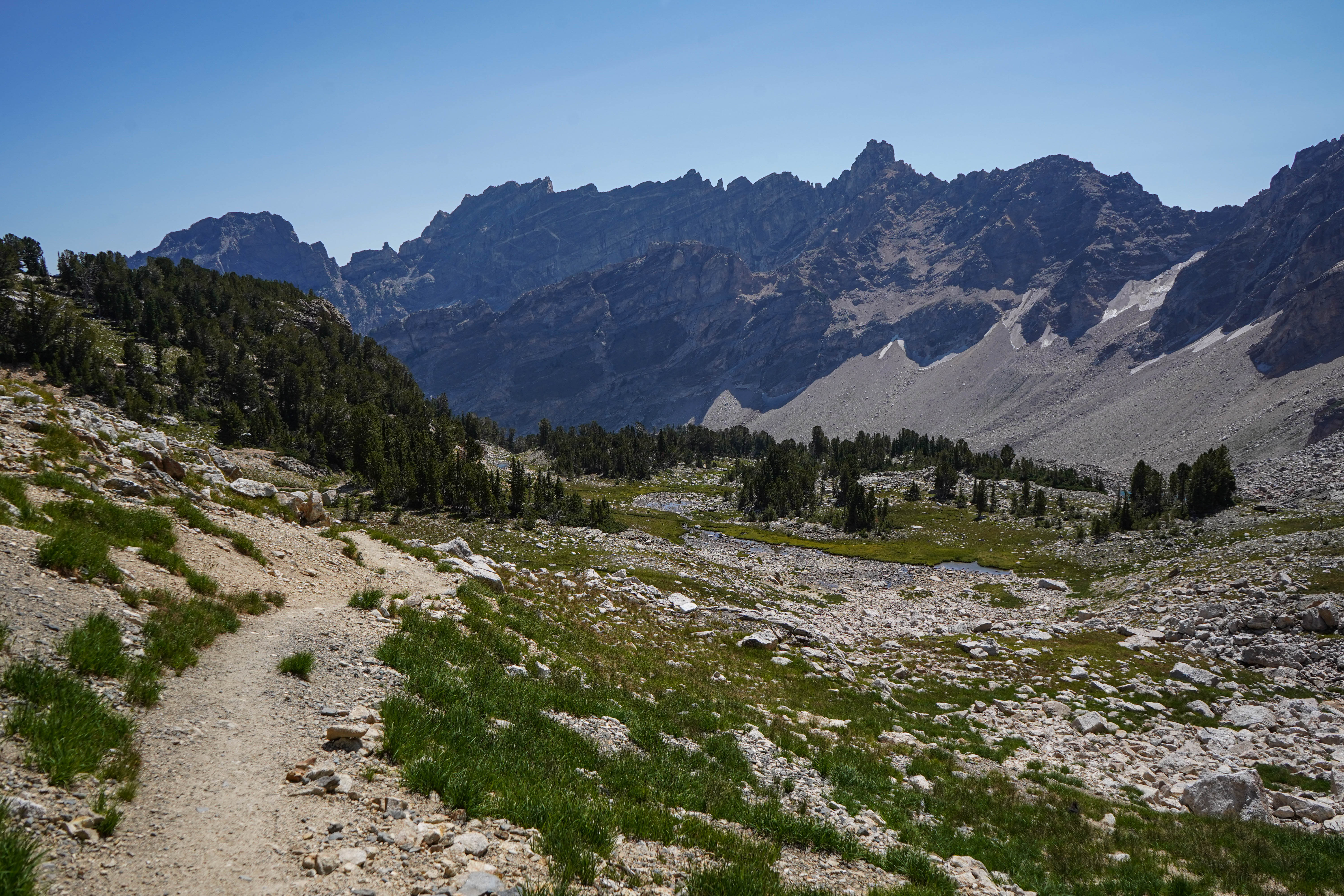
Most visitors find it challenging to reach the alpine community in the park, but the view from Cascade Canyon turnout provides a glimpse. The canyon climbs through the forest community where many conifers thrive-lodgepole pine, Engelmann spruce, Douglas fir and subalpine fir. Cascade Creek flows near the trail providing islands of wetland community. In the upper part of the canyon, the alpine community thrives-a harsh environment buried in snow most of the year.
This wayside sign stands at the edge of a semicircular paved area with an accessible curb leading up from the parking area. Beyond the sign is a sagebrush meadow with dark green conifer woods behind. Beyond the trees a deep canyon extends back between Teewinot Mountain on the left and Mount St. John on the right. Further to the right is the jagged ridge of Rockchuck Peak and still further, the flat-topped peak of Mount Moran with two visible glaciers on its face. To the left of Teewinot the jagged central Teton peaks fade off in the distance. The background of the wayside shows a photograph of a close-up view of the mouth of Cascade Canyon between snow-dusted mountains, with a golden glow from a rising sun. Text down the left side reads, "Cascade Canyon. Jagged peaks tower above Cascade Canyon reminding us that powerful Pleistocene glaciers carved this canyon and sculpted this range. From the shores of Jenny Lake, venture through forest communities, wetlands along Cascade Creek, high meadows filled with wildflowers, and up to the rocky windswept slopes of the alpine community. Both forks of Cascade Canyon once held glaciers. Schoolroom Glacier clings to a cliff at the head of the south fork, while Lake Solitude fills a glacial cirque at the head of the north fork. "Alpine conditions are harsh. During the brief summer, splashes of colorful wildflowers accent bare rock. Winter brings deep snow, sub-zero temperatures and winds gusting to more than 100 miles per hour." Below the text is a photograph of a small, brown furry animal sitting on a boulder. The caption reads, "American Pika. Many animals migrate or hibernate during winter, but pikas gather grass during summer to store as haystacks under rocks for winter forage. Yellow-bellied marmots, however, hibernate up to nine months of the year." Another photograph in the lower right shows thick green vegetation hugging the ground covered with small dark blue flowers. The five-petaled blossoms have a yellow center surrounded by a white band. The caption reads, "Alpine Forget-me-not. Small, dense mounds of cushion plants grow slowly between rocky outcrops storing nutrients for years before blooming."
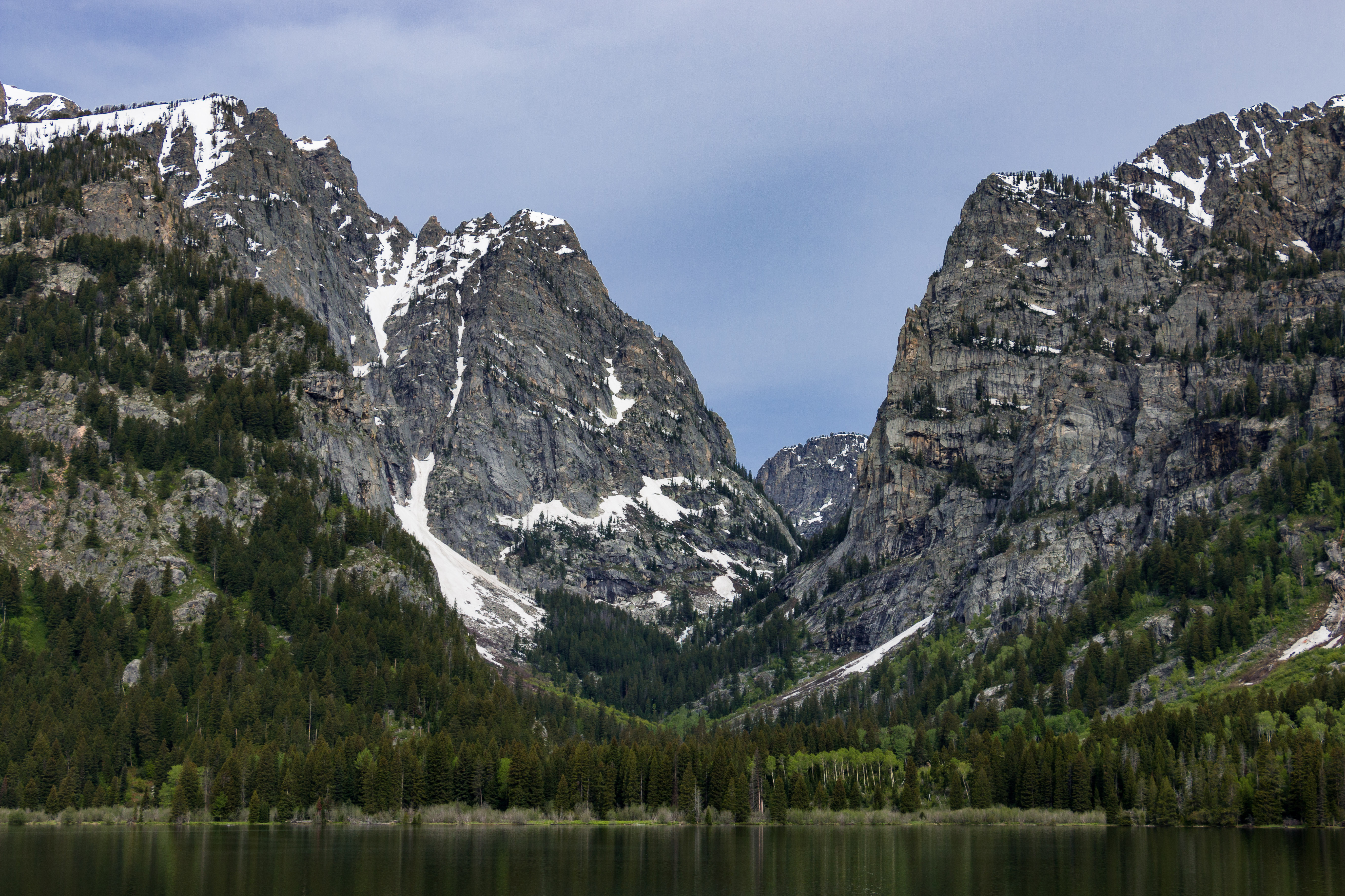
The Cathedral Group refers to three peaks: Teewinot Mountain, the Grand Teton and Mount Owen. These spires tower above Cascade Canyon casting long shadows during a summer sunset. Looking west, the Teton fault breaks the lower slope on Rockchuck Peak recording the last several large earthquakes on the fault. This turnout captures both the beauty of the Teton Range and the power of earthquakes to change the landscape.
There are two wayside signs at the edge of the semicircular paved area with an accessible curb. Both overlook a sage meadow flanked by conifer woods with the Teton peaks towering in the background. The sign on the right is titled "The Cathedral Group." The background is a black and white photograph of the sharply jagged central peaks in the Teton Range - Grand Teton in the middle flanked by Teewinot Mountain to the left and Mount Owen to the right. At the bottom of the panel is an inset photo of a man sitting on a pile of rocks, wearing a plaid shirt. He has a coil of rope across his chest and holds an ice axe in his left hand. The caption reads, "Fritiof Fryxell served as Grand Teton National Park's first park naturalist. As geologist, teacher, and mountaineer, he developed public education programs, trail maps, and safety rules for climbers. Fryxell's publications stand as classics of explanation and eloquence." At the bottom left of the panel is a quote, "These peaks have been called the Cathedral Group . . . more evident here than in many of the great cathedrals of men is the gothic note. It is seen in the profiles of the countless firs and spruces congregated like worshippers on the lower slopes; it reappears higher in the converging lines of spire rising beyond spire; it attains supreme expression in the figures of the peaks themselves that, towering above all else, with pointed summits direct one's vision and thoughts yet higher." - Fritiof Fryxell. The sign on the left is titled "Teton Fault." Its background is a color photograph of the base of the mountains visible beyond the sign. Running along the base a steep bank labeled "Teton Fault Scarp" is clearly visible. Text down the right side of the panel reads, " Looking west toward Mount St. John, notice the steep slope or fault scarp near the base of the peak. This steep slope formed as several massive earthquakes broke the ground by more than 75 feet since the ice-aged glaciers last retreated 14,000 years ago. The Teton fault began moving roughly nine million years ago generating earthquakes that shook the landscape.Each earthquake, up to a magnitude 7.5, lifted the mountain block one part for every three to four parts that the valley block dropped building the range one step at a time. Future earthquakes will continue to shape this landscape but the geoscientists cannot predict when this will happen." Below the text is an illustration showing the Teton Range with an orange line along its eastern base indicating the line of the Teton Fault. A vertical cutaway shows the land underneath the range rising and the land to the east subsiding.
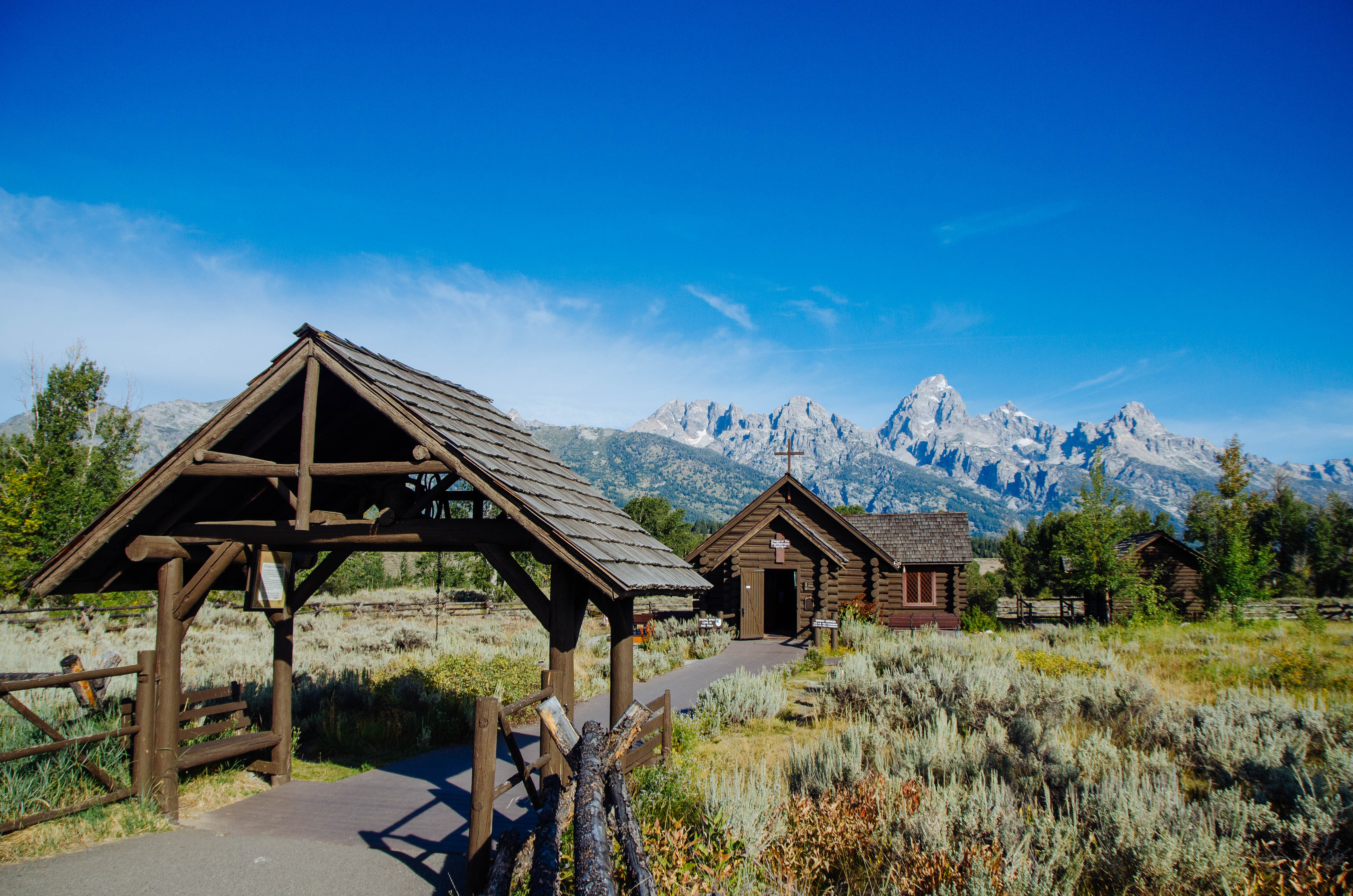
The Chapel of the Sacred Heart is on Catholic Bay of Jackson Lake. The beautiful chapel was built in 1937 and is recognized by the Teton County Historic Preservation Board as being more than 50 years old. The Catholic Church owns the chapel and usually offers Sunday services during the summer. A picnic area is next to the chapel and offers views of Jackson Lake. "http://olmcatholic.org/about-the-parish/location/" Visit the Chapel of the Sacred Heart website to learn more.
The rear of this log-construction church faces the parking area. To reach the front follow the gravel path around the left side of the building or there is a handicapped access at the right side of the rear of the building. From the rear you can see a round, stained glass window at the back of the apse. There are low log benches along the edge of the parking area. The entrance at the front of the church is covered by a double peaked roof. Each of the double doors has a simple wooden cross on it. Five flagstone steps lead up to the church porch. The steps form three sides of a hexagon, with simple wood-pole handrails at the sides.
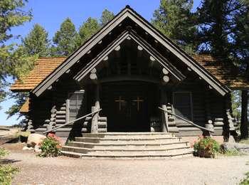
The Chapel of the Transfiguration is next to the Menors Ferry Historic District. Maud Noble donated the land to St. John's Episcopal Church in 1925. The chapel served employees and guests from the nearby dude ranches. Today, one of the park's classic views is through the altar window framing the Grand Teton beyond. The chapel usually offers Sunday services during the summer. Visit "http://stjohnsjackson.diowy.org/Worship/chapel-of-the-transfiguration.html" to learn more.
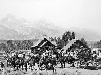
This small log chapel sits near a paved parking lot at Menors Ferry Historic District. At the edge of the asphalt a sign hangs, covered by a peaked roof. The sign has a black and white photograph of the chapel with almost 30 horses tethered to a rail fence alongside. The text reads, "A Spiritual Heart in the Park. This rustic Episcopal chapel, constructed in 1925, held the first services on July 26 of that year. Prior to its construction, worshipers traveled 12 miles over rough roads to the town of Jackson. Today, that is just a short car ride away, but in the 1920's roads were rough and automobiles rare. Once fully constructed, the Chapel of the Transfiguration served to provide spiritual refreshment to dude ranchers and tourists that flocked to the Chapel every Sunday to worship and gather as a community. Today the Chapel continues to draw people, and services are held every Sunday during the summer." Past the sign a broad asphalt path leads to an open roofed entrance arch which houses a large bell. Here the path turns to wood and leads on through an open area to the chapel itself, a small log building with a simple cross on the peaked roof. Just in front, a fork in the path leads to the right side of the chapel, where rows of benches sit outside. The front door of the chapel leads into a vestibule, with the small sanctuary beyond. Rustic log pews line the aisle leading up to the altar at the far end. Behind the altar is a large picture window, which provides a dramatic view of Grand Teton in fair weather.
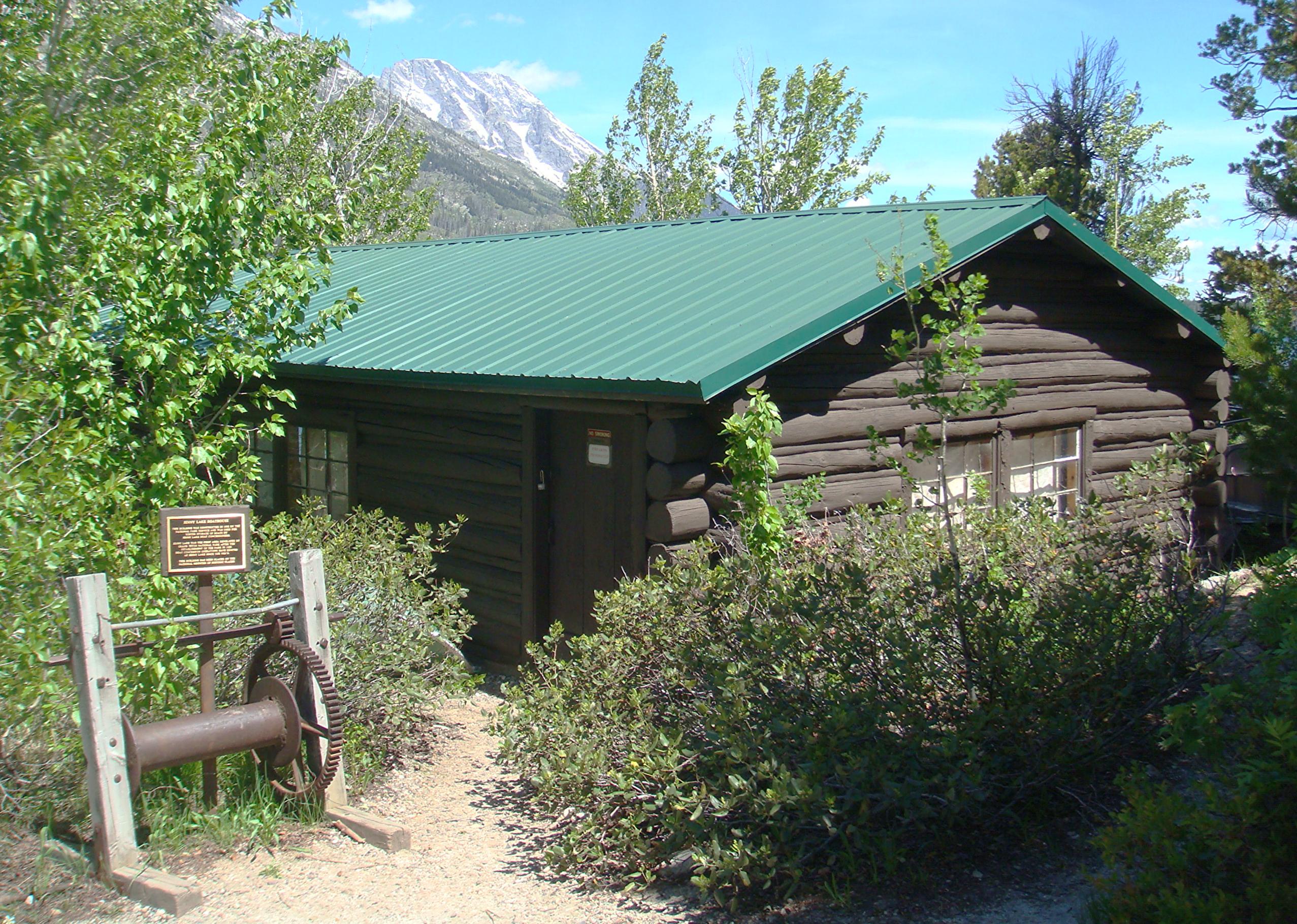
Constructed in 1932 by the National Park Service, the Charles Wort Boathouse was used for winter storage of boats by Jenny Lake boat concessioners. Boat concession operations have existed at Jenny Lake since the 1920’s. This building is now on the National Register of Historic Places.
Moving south up the hill from the Jenny Lake boat launch, a small gravel path leads down a relatively steep incline to a one-story, log cabin structure with sloped, green metal roof. At the head of the path, a black-and-white photograph of this same building fills the top of a small, angled metal reading rail. The structure is perched right on the shoreline with wide, flat-panel doors in front. Text on a blue field reads: Historic Jenny Lake – Charles Wort’s Boathouse A seasonal boat rental business began operating on Jenny Lake in the 1920s, several years before the establishment of Grand Teton National Park. Local outfitter Charles Wort built this cabin to provide winter storage for his boats, protecting them from the heavy snow and ice. The boathouse is listed on the National Register of Historic Places. At the bottom of the incline at the left, a three-foot long, horizontal metal spindle with a large toothed sprocket wheel at the right is mounted between two four-foot tall wooden posts. The teeth of a small sprocket wheel are attached to the end of a second, smaller horizontal bar mounted above the spindle mesh with the teeth of the lower wheel. A metal plaque mounted to a wooden post behind the spindle reads: Jenny Lake Boathouse This building was constructed in 1932 by the national park service and was used for winter storage of boats by Jenny Lake boat concessioners. Jenny Lake was the first area developed by Grand Teton National Park after the establishment of the park in 1929. Boat concession operations have existed at Jenny Lake since the 1920’s. This building has been placed on the National Register of Historic Places.
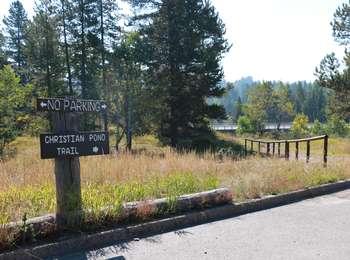
<b>Location</b> : Access the Christian Pond trail from the east edge of the parking lot next to the corrals at the Jackson Lake Lodge. <br /><br /> <b>Notes</b> : There are minimal facilities and limited parking at this trailhead-remember to bring water and use a restroom before you arrive. Bears may be active any place and at any time-travel in groups, make noise and carry bear spray. Hikers cannot access backcountry camping from this trailhead.
In the early 1900s, Mormon settlers established the community of Grovont along today's Mormon Row. These settlers built homesteads close together to assist with communal efforts. Clark Moulton was TA Moulton's son. He dry-land farmed on Mormon Row until the 1970s when he sold his property. Dry-land farming was unusually by this time. Most farmers used irrigation to support their crops.
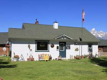
This is a small, one-story white-frame house with a grey shingled roof. A chimney painted white extends up over the middle of the roof. The left half of the house is off-set slightly to the front. The top half of the dark blue, front door is a multi-paned widow. To the left of this is a large picture widow. Two double-sash windows are on the right side of the front. The house sits behind a small front yard edged with a plain grey, post and rail fence. On either side of the house are small log cabins, stained dark with white chinking.
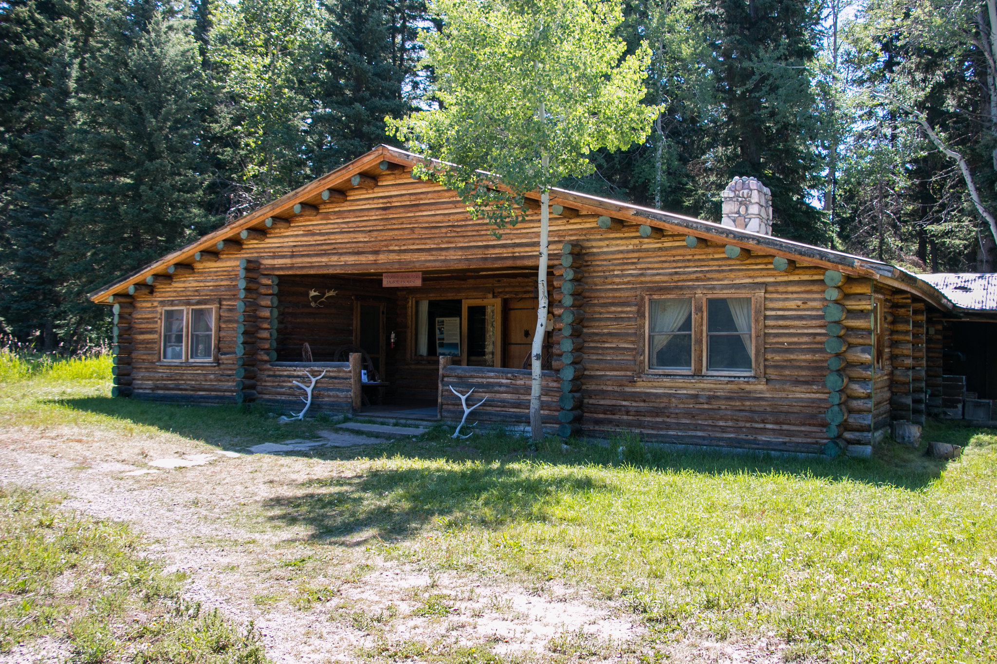
The Climbers Ranch offers affordable and accessible lodging for climbers visiting the Grand Teton National Park. The accommodations are primitive co-ed dormitory-style lodging in a communal setting. Guests are housed in open, one-room cabins with other guests, sleeping on wooden bunks. Minimal facilities include bunkhouses, restrooms with showers and a covered cook shelter. The ranch opened in 1970 re-occupying the Double Diamond Dude Ranch that opened in 1924.
The buildings here at the ranch are a collection of log cabins of various sizes. Several smaller cabins are scattered about around a larger central lodge and an open sided picnic-style dining area. The buildings are stained dark brown with reddish brown metal roofing. One rectangular building near the dining pavilion has a climbing wall on one end. To the west of the buildings are the jagged central peaks of the Teton Range.
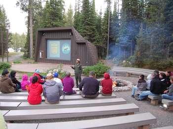
Enjoy a variety of ranger programs offered at the Colter Bay Amphitheater. This open-air facility provides a fantastic setting for ranger-led evening programs during the summer. Special programs also occur throughout the season. Check at a visitor center for a current schedule of events.
The amphitheater is down a shallow slope at the edge of the parking lot, surrounded by woods. Its low benches are arranged in three sections. Four rough asphalt paths form the four-foot wide aisles, two on the outside of the benched seating and two dividing the sections. Each section has around 30 rows facing the cement stage at the bottom. A small brown building forms the backdrop. To the right of the stage is a large fire pit surrounded by a stone circle and more benches. Various paths lead off to the parking lot, the lakeside and the visitor center.
The Colter Bay Cabins and Tent Cabins provide rustic accommodations in Colter Bay Village. Enjoy Jackson Lake, the marina, restaurants, corrals, grocery store and the visitor center all within a short distance. Many of the cabins were part of the Sheffield lodging operation once located below the Jackson Lake Dam. The park service and the Teton Lodge Company moved these cabins to Colter Bay in 1955.
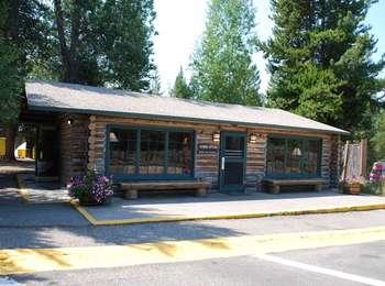
This building is of log construction with a light-colored chinking. The dark green door is in the middle of the building with large picture windows on either side. There is a 10-foot wide cement area in front of the building, which slopes very gently to the left for wheelchair access. Directly in front there is a shallow step up to the cement with another small step up at the doorway itself.
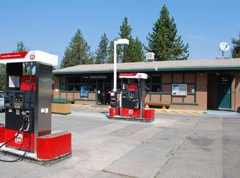
At the corner of US 89/191/287 and the road into Colter Bay Village, is a large convenience store and gasoline station. Whether you visit the Village or continue on your way, the store and gas station offer a break along the way.
The Convenience store is a plain, rectangular building painted light brown with dark green trim. There are five gas pumps in front. The double entrance doors are slight to the left of center. Inside the counter is to the right. To the right of the entrance is an ice freezer with a log bench just beyond. About 4 feet to the left of the door is a water filling station with a faucet for refilling water bottles. The graphic sign behind it shows a view of a moose's head drinking from a body of water. Further to the left is another log bench. Restrooms are located at the right end of the building, women's towards the front and men's at the rear.
Enjoy a one or two hour horseback ride along the trails south of Colter Bay. The corrals also offer breakfast and dinner horseback or wagon rides. See and feel the park from a different perspective in truly western style! "http://www.gtlc.com/activities/horseback-riding" Visit the Grand Teton Lodge Co. website for more information.
Enjoy a one or two hour horseback ride along the trails south of Colter Bay. The corrals also offer breakfast and dinner horseback or wagon rides.
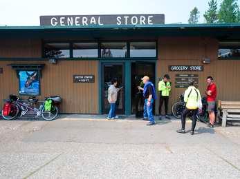
The one stop place for many of your traveling needs! Buy groceries, gifts or sporting goods in the main store. Schedule an activity such as rafting, horseback riding or taking a cruise through the Grand Teton Lodge Company's activities desk. Clean your clothes for the remainder of your trip or take a hot shower if you have been camping for days. "http://www.gtlc.com/dining/the-general-store-colter-bay-village" Visit the Grand Teton Lodge Co. website for more information
The General Store is housed in a long building facing the main entrance road to Colter Bay Village. Its walls are vertical planking painted a light brown and the window and door trim is dark green. Restrooms are located around on the right end of the building. Near the right end of the building is an alcove with ticket widows for the Grand Teton Lodge Company activities desk. The main entrance to the grocery store is through double doors to the right of the center of the building. To the left of the doors is a water filling station with a faucet for refilling water bottles. The graphic sign behind it shows a view of a moose's head drinking from a body of water. There is also a small log bench and a large bay window extending out from the building. The laundry and showers are housed in a smaller, roughly square, building just to the left of the general store. It has windows all around the building just under the roofline. A short flight of steps with metal handrails leads down a short bank to the double door entrance, which may also be reached by a ramp to the left. Inside showers are to the right and the laundry to the left.
Access the paved Colter Bay Lakeshore trail northwest of the visitor center. Visitor services include a visitor center, restrooms, water, stores, restaurants, laundromat, showers, cabins, corrals, campground and an RV park. Bears may be active any place and at any time-travel in groups, make noise and carry bear spray. Backcountry camping requires a permit-pick one up at a backcountry permits office.
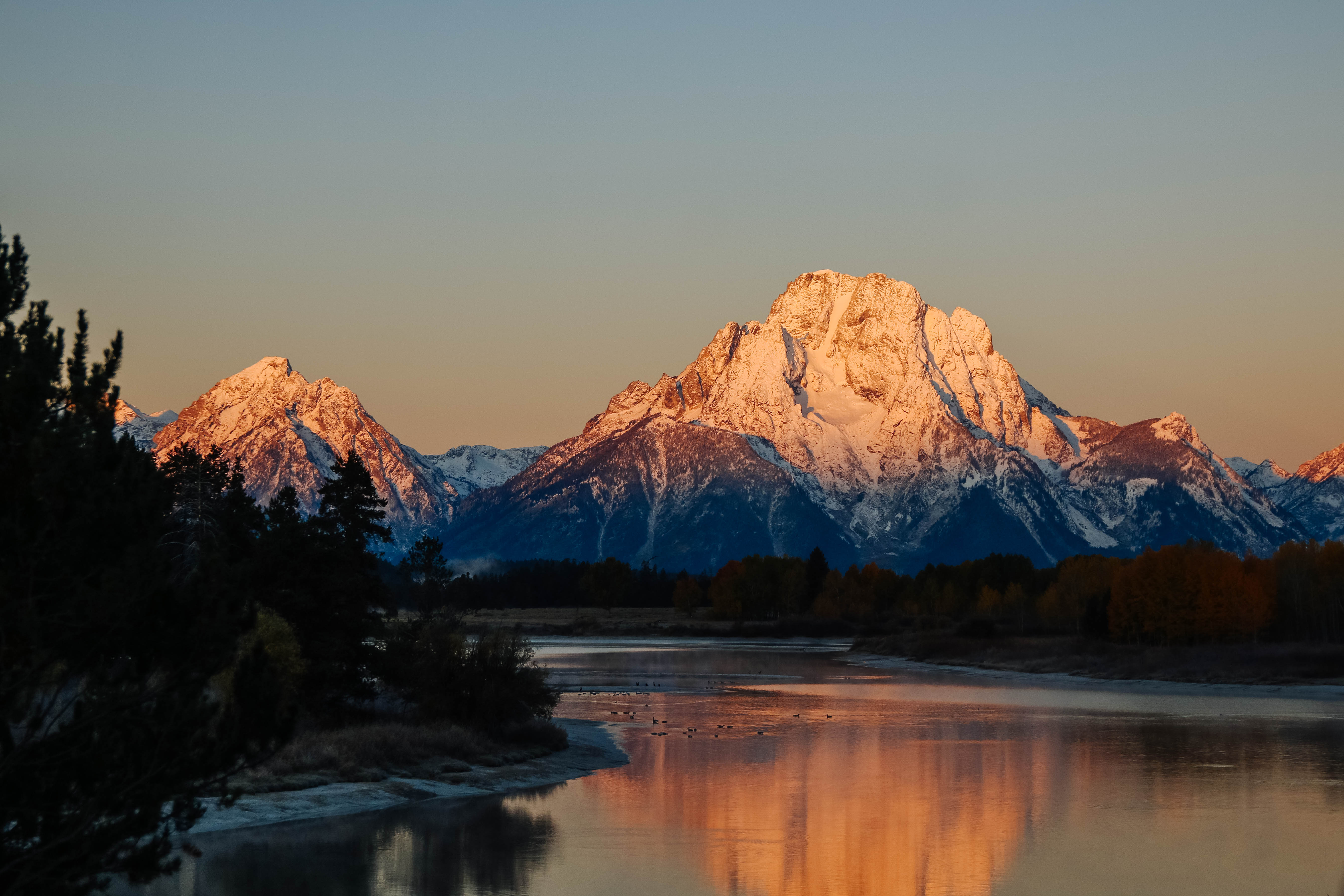
This broad, paved path runs along the edge of the bay, passing below the visitor center, alongside the boat slips and past the marina building to the lake access at the south end of the bay. In clear weather Mount Moran is visible across the bay with beautiful reflections in the water on still days. On the side of the path away from the water's edge between the visitor Center and the Marina is a large boulder with a brass plaque which reads, "This bay is named for John Colter, discoverer of the Teton Mountains and scenic wonders of the upper Yellowstone. Experienced as a hunter for the 1804-1806 Lewis and Clark expedition, he explored this region in winter of 1807-1808 in the employ of fur trader Manuel Lisa. Dedicated on the 150th anniversary of Colter's historic passage, 1957." The top of the boulder above the plaque mimics the outline of the peak of Mount Moran visible directly behind it.
<b>Location: </b> Colter Bay Village is located west of US 89/191/287 about 10 miles north of Moran Junction. The Village offers a complete complement of visitor services including a visitor center, lodging, restaurants, camping, RV park, groceries, laundry, showers, and more. The marina is full service with boat launch, store, fuel and boat rentals.<br /><br /> <b>Notes: </b> The ramp is paved and accesses a sheltered bay. During low water summers, the boat ramp may become inoperable since Colter Bay is an artificial body of water.<br /> <a href="http://www.gtlc.com/activities"><br />Visit the Grand Teton Lodge Co. website for more information.</a> <br />
The Marina is a long building near the edge of the lake. Along the shore in front are long docks extending out into the water of the bay with multiple boat slips lining each one. Further out in the water are lines of buoys marking anchorages. During the summer months many boats fill the slips and anchorage points. The marina building has vertical siding painted a light brown with dark green trim, with huge wooden post supporting the roof in front. A covered porch, reached by three steps up from the asphalt path, runs along the entire front of the building, with the double door entrance in the middle. There are log benches on either side of the door. To the left of the door is a water filling station with a faucet for refilling water bottles. The graphic sign behind it shows a view of a moose's head drinking from a body of water.<br /><br />Inside there are counters to either side of the door. The one on the right is for booking cruises and rentals. The one on the left provides licenses.<br /><br />Restrooms are located in a small building at the far right of the marina.
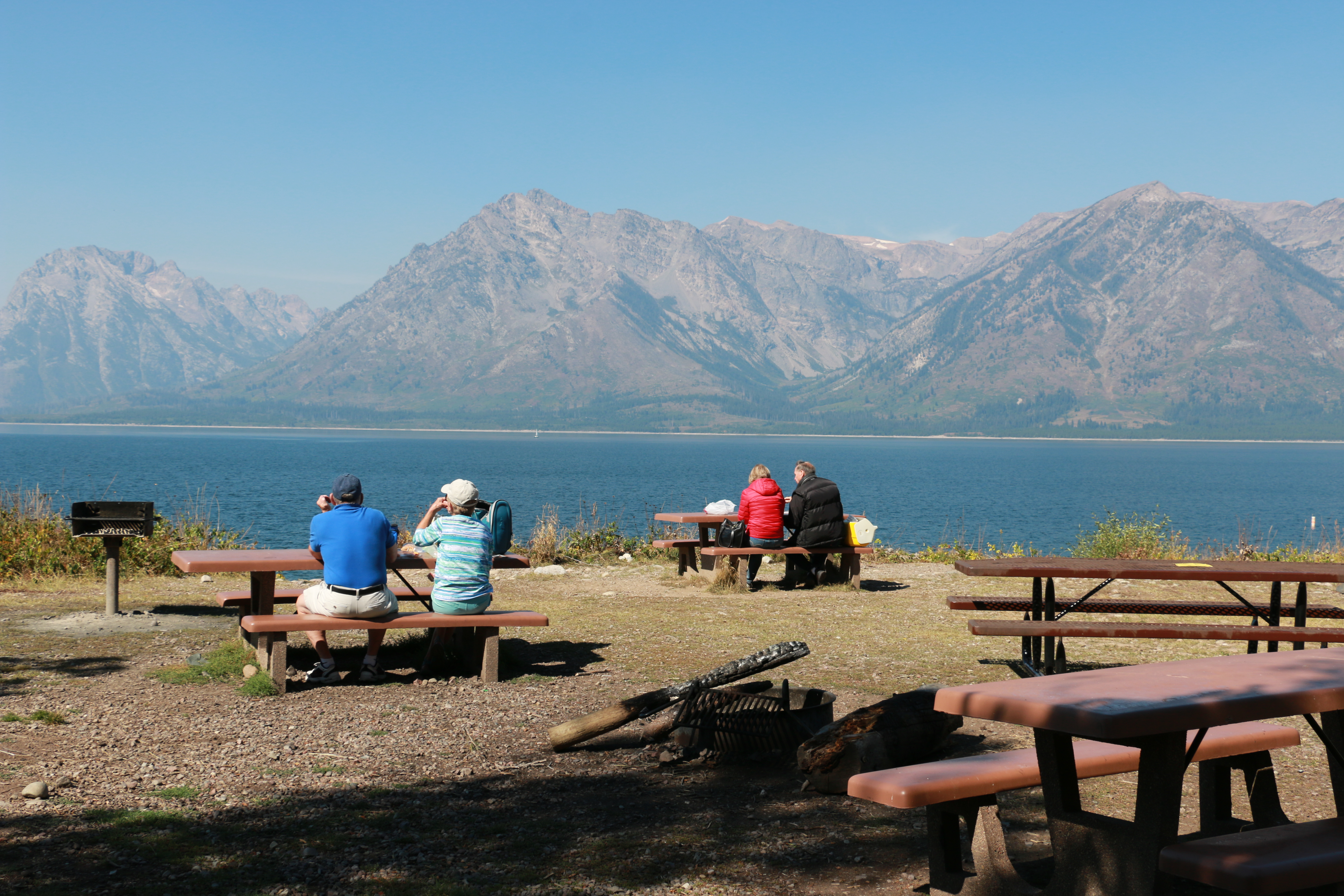
Colter Bay picnic area and swim beach is a wonderful place to relax along the shores of Jackson Lake. The largest picnic area in the park has facilities for nearly everyone. There are even tables on the lakeshore hidden back in the trees! Buoys mark off the swimming area to remind boats to remain out of the area. Lodgepole pines shade many of the tables, but some enjoy the sunshine and lake breeze.
Colter Bay picnic area and swim beach is a wonderful place to relax along the shores of Jackson Lake. The largest picnic area in the park has facilities for nearly everyone. There are even tables on the lakeshore hidden back in the trees! Buoys mark off the swimming area to remind boats to remain out of the area. Lodgepole pines shade many of the tables, but some enjoy the sunshine and lake breeze.
One of the surviving Mission 66 visitor centers, the Colter Bay Visitor Center sits above the shores of Jackson Lake. Enjoy a view of the lake and Teton Range from the back deck. Wander down to the lakeshore for a swim or picnic lunch, or hike to Swan Lake or Heron Pond from the Hermitage Point Trailhead.The visitor center exhibits 35 artifacts from the David T. Vernon Indian Arts Collection never before displayed .
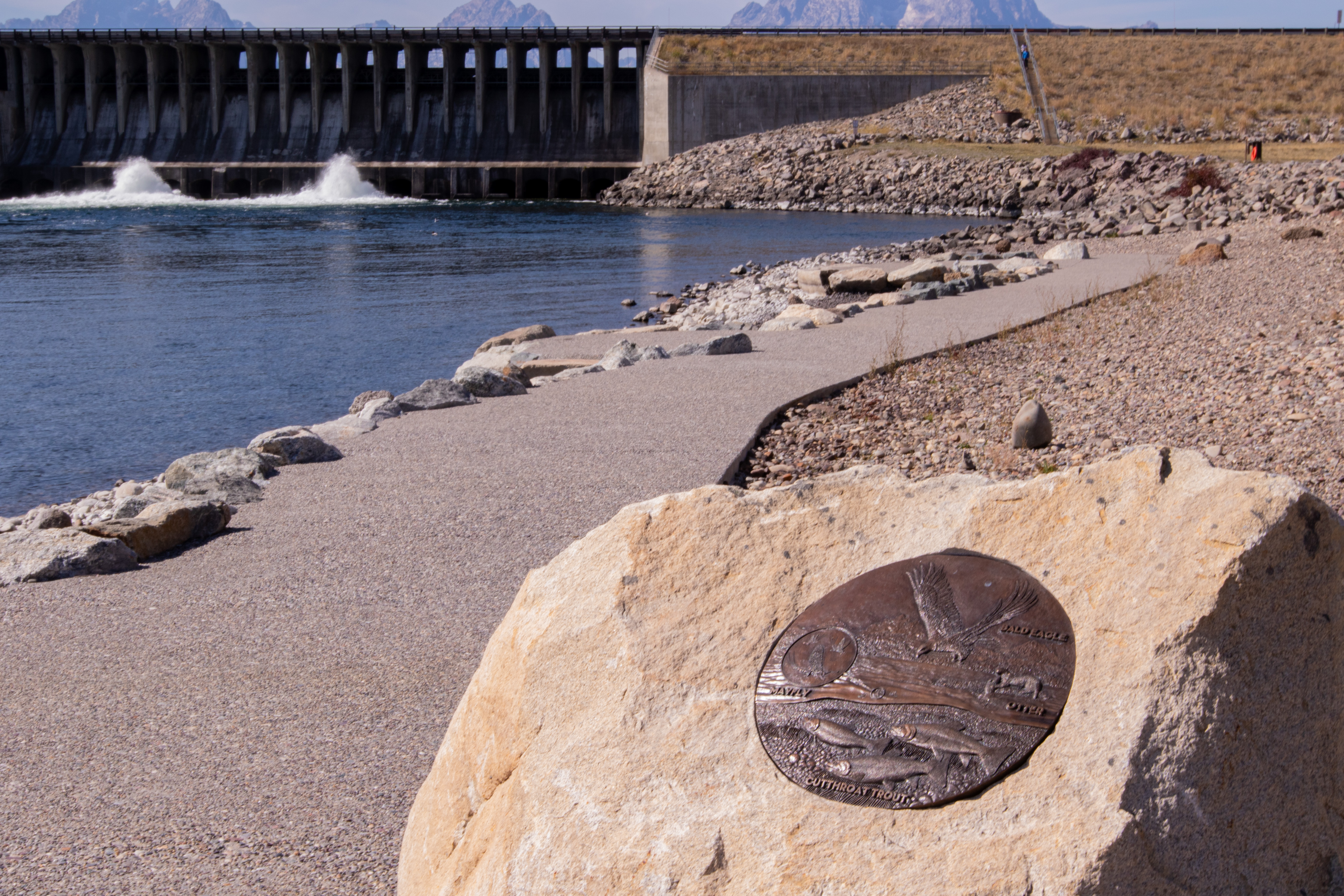
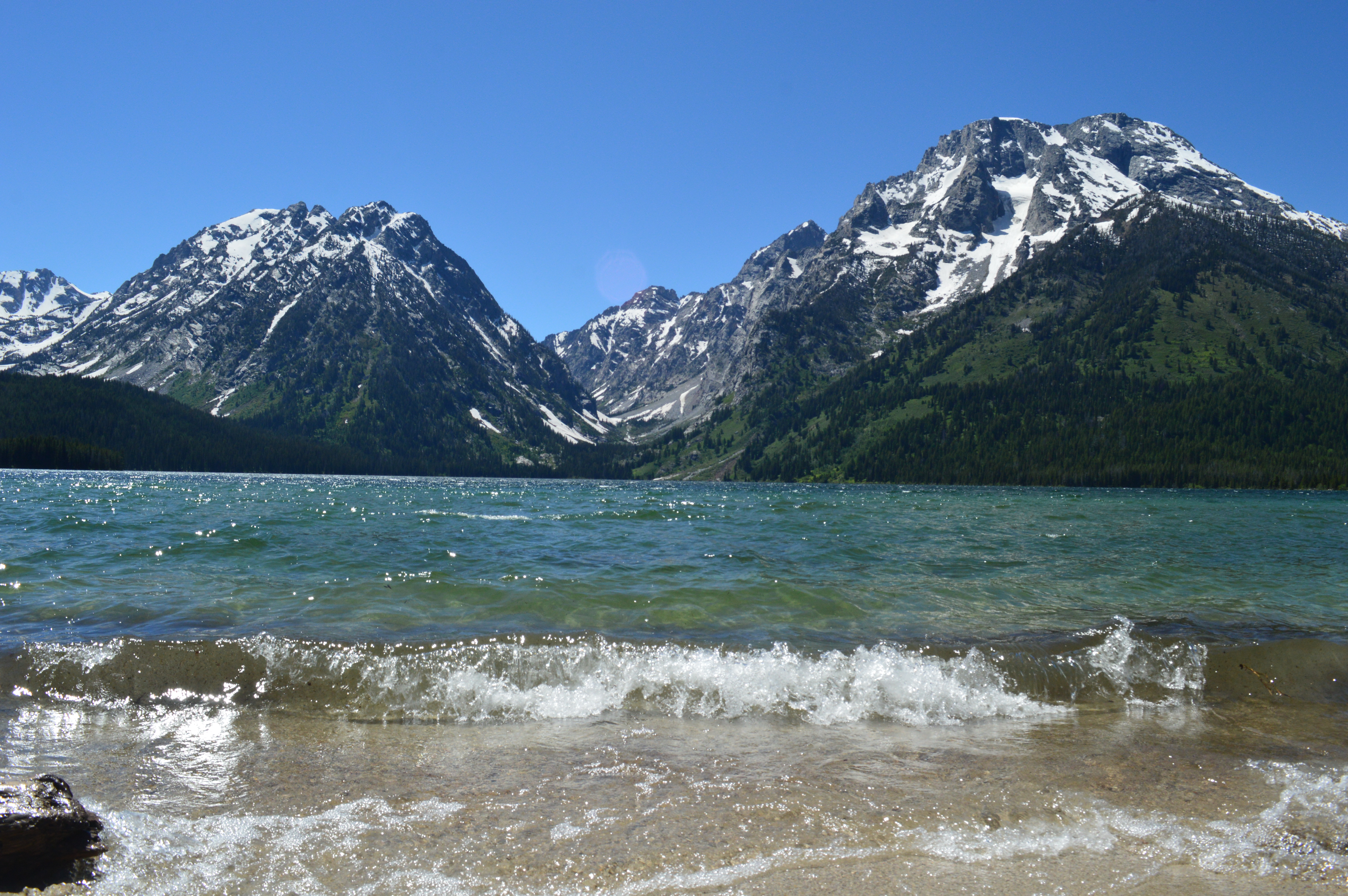
The Visitor Center is a low, long building. Its vertical board-and-batten siding is painted a dark brown. The entrance is located close to the center of the building and may be accessed by a ramp or up a set of three steps just to the left of the ramp. There are benches to the left of the steps. Restrooms are located in a breezeway at the far left end of the building. A ramp leads up to the breezeway.The entrance leads into a large, airy lobby with walls and ceiling of natural-finished pine. An information counter is on the right wall and the entrance to an auditorium is on the left. To your immediate right as you enter is a wide doorway leading to the bookstore and gift shop and a small exhibit area which features American Indian objects from the David T. Vernon Collection including touchable exhibits. At the far right, past the counter is an area which hosts American Indian guest artists during the summer months.The far wall of the entrance lobby is glass and has an exit onto a large deck in the rear of the building. From here the land slopes down to the bay with views of Mount Moran beyond. The deck is surfaced with rough planking with wide, one-inch spacing between the planks and is edged with a wooden railing. Several benches are located long the railing. At the far left end stairs provide access to the waterfront.There are two wayside signs along the railing. The one on the right is titled, "A Changing Landscape." Text reads, "Alterations to a Natural Lake. Jackson Lake is the largest of the park's many lakes formed by glaciers. The lake expanded when the Bureau of Reclamation built a dam in 1907, creating a reservoir on top of the natural lake. The water behind the dam provides irrigation water to the communities in Idaho through the Minidoka Project.Jackson Lake Dam allows the Bureau of Reclamation to manage the lake's water level. Sometimes they keep the level low to capture meltwater. Other times, the level is low due to lack of precipitation."Lake Levels and Climate. The water level of Jackson Lake varies from year to year due to seasonal precipitation amounts, winter snowpack, and irrigation demands. In some years the reservoir may start completely full of meltwater from winter's deep snow but end the summer nearly empty, drained to meet water needs downstream. The National Park Service is committed to reducing its contributions to climate change through conserving energy and water, promoting alternative transportation, constructing green building, and minimizing waste."At the bottom center of the panel is a satellite view of Jackson Lake showing the extent of the pre-dam lake in a light blue color. The dam is located at the bottom left of the image and Colter Bay is located near the middle of the bottom ledge of the lake. The caption reads, "Enhancing the Natural Resource. Jackson Lake Dam increased the lake's capacity by 30 percent and raised the water level nearly 40 feet. Reservoir levels vary, however the natural lake is always full."Two photos above the image show the difference in water level in the bay between high water and low water. The one on the left shows the marina's boat slips full of large power boats riding high on the water. The right one shows empty slips, many resting on mud flats.An image at the far right of the panel shows Teton Glacier. Red dotted lines below the glacier show how far it extended at various times I the past, with the outline for 1929 covering almost twice the current area. The caption reads, "Climate change affects glaciers, too. Research indicates that the park's glaciers have receded significantly in the last 100 years."The wayside on the left reads, "The Art of Making Mountains. A Landscape built up by Earthquakes. The spectacular Teton Range began to rise around ten million years ago when movement on the Teton fault generated a series of massive earthquakes. The block of bedrock west of the fault rotated skyward to form the mountains and the block east of the fault hinged downward to form the valley of Jackson Hole. One day, another earthquake will continue this process."Today the mountains tower more than 7,000 feet above the valley floor. Across Jackson Lake, the 40-mile-long Teton fault marks the abrupt transition between the steep mountain face and the flat valley floor."Worn Down by Glaciers and Erosion. Beginning some two million years ago, a series of glaciers flowed down from the high peaks and south from Yellowstone. These glaciers, their bases studded with rocky debris, ground and polished bedrock, carved U-shaped canyons, and dug out basins. The receding glaciers left behind moraines, ridges of boulders, gravel, and rock flour that form natural dams around the valley's lakes. Jackson Lake is more than 400 feet deep, evidence of the power of glaciers to change the landscape."Water, wind, and ice continue eroding the mountains, although with less power than during the ice age.
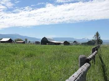
A popular fall photograph captures the Jimmy Manges cabin, the park stock used by the summer trial crew, the aspens turning golden and the Grand Teton towering above. A corral is a classic buck and rail fence used by the early homesteaders. Enjoy the view of the horses and mules, but please do not feed them or touch them. Manges' cabin is thought to be the first two story cabin in the valley. The turnout also includes the Cottonwood Creek Picnic area and a vault toilet.
This wayside stands at the edge of a paved sidewalk area between the parking area and the road. Across the road from the sign can be seen a pasture with a buck-and-rail style fence with a long, low ranch building at the far side. Horses often graze in the pasture, which is backed by low hill wooded with conifers. Beyond the hills the mountains rise steeply with sharp-pointed Grand Teton in front of you and Mount Owen slightly to the right. Behind you, on the other side of the parking lot are picnic tables to the left and a unisex vault toilet to the right. In between is a dirt path that leads down a bank to the rocky creek bed below. The background of the sign has a photograph of the view of Grand Teton and Mount Owen. Text down the left side reads, "Community Crossroads. You are at the crossroads of several natural communities. Cottonwood and Taggart creeks converge just south of here supporting a diversity of plants and animals in a wetland habitat. Somewhere nearby, wildlife finds shade in the cool of the creek, birds nest in the shelter of the cottonwood trees, and cutthroat trout thrive in the cold, snow-fed stream. A mosaic forest community covers the hillside across the road. This hillside is a glacial moraine: a pile of glacial sediments. A wildfire burned this area in 1985, a force of natural change that renewed the landscape. Since then, a patchwork of lodgepole pine forest, aspen stands, and brushy clearings has reemerged. At the bottom of the panel just to the right of the text is a photograph of a bright yellow bird. The caption reads, "Yellow warblers flit through the willows along the stream." To the right of that is a photograph of a pair of elk standing together in a frost-covered meadow. The caption reads, "Many species depend on several communities. Elk spend their day in the cool of the hillside forest and then graze in the sagebrush flats during morning and evening. Their daily movement illustrates one of many ties between the natural communities of the Teton landscape. Next to the wayside a smaller sign on a post reads, "Manges Cabin - Two Stories. In 1911, homesteader James Manges built the distinctive cabin you see across the pasture - likely the first two-story structure in this area. A skilled craftsman, he designed the steep, overhanging roof to shed snow. The park now uses this cabin for storage and the pasture to graze horses and mules used for trail work and ranger patrols."
Cottonwood Creek picnic area is the first picnic area north of the Moose Entrance Gate. Five tables cluster near cottonwood trees above the creek. Across the Teton Park Road is a fenced meadow where the park houses its pack animals during the summer when they are not in the backcountry. Behind the meadow is the James "Jimmy" Manges cabin thought to be the first two-story cabin in the valley. During fall the aspens that grow on the moraine above the cabin.
This wayside stands at the edge of a paved sidewalk area between the parking area and the road. Across the road from the sign can be seen a pasture with a buck-and-rail style fence with a long, low ranch building at the far side. Horses often graze in the pasture, which is backed by low hill wooded with conifers. Beyond the hills the mountains rise steeply with sharp-pointed Grand Teton in front of you and Mount Owen slightly to the right. Behind you, on the other side of the parking lot are picnic tables to the left and a unisex vault toilet to the right. In between is a dirt path that leads down a bank to the rocky creek bed below.
J. Pierce Cunningham established the Bar Flying U Ranch in the 1880s. Today, his "dogtrot" style cabin is one of the few remaining homestead cabins in Jackson Hole. This style cabin was common in eastern states, consisting of two small cabins joined with an open, covered breezeway. Cunningham chose this land because silt sediments deposited from an ancient glacial formed soil that retained moisture and provided better nutrients for raising lush grasses and forbs.
At the edge of the small gravel parking area is a wayside sign. The background image shows a color photograph of the historic cabin located here. A "dogtrot" style cabin, it has two small log rooms facing each other across a covered breezeway. Text on the panel reads, "From Rancher to Conservationist. J. Pierce Cunningham settled here in Jackson Hole in the 1880s despite the hardships of winter. He initially opposed the expansion of Grand Teton National Park but later became an advocate. He teamed up with neighbor Josiah "Si" Ferrin to write a petition signed by 97 valley ranchers who agreed to sell their land to form a "national recreation area." John D. Rockefeller, Jr.'s Snake River Land Company bought Cunningham's land and other ranches. Rockefeller later donated over 33,000 acres to expand the national park. Cunningham called this cabin home from 1888 to 1895. After he and his wife, Margaret, completed their ranch house, they used this building as a smithy and barn." At the bottom of the panel is a quote from Cunningham: "The destiny of Jackson's Hole is as a playground, typical of the West, for the education and enjoyment of the Nation, as a whole." In the upper right of the panel a sketch shows the various scattered ranch buildings as they might have looked in the late 1800s. To the right of the sign a path leads underneath a post arch with a sign that reads, "Bar Flying U. J. Pierce Cunningham." The dirt path curves gently to the right, down through willow thickets, past wildlife-dug holes to the historic cabin 0.3 mile away. The cabin is long and low, the entrance to the breezeway being only a little over 5 feet high. The roof is formed of sapling poles laid side by side and covered with dirt. Low open doorways with large log sills lead off the breezeway into each of the two small rooms. Each room has two small open windows - one front, one back - and has a dirt floor. On the wall to the right of the breezeway is a plaque marking the cabin as being on the National Register of Historic Places.
Deadmans Bar is one of the major put-in and take-out locations for the Snake River within the park.
The path to the river's edge here is gently sloped and covered with small, smooth river rocks. There is a large level area on this side of the river as the river flows right to left in a gentle curve around you. The far side of the river is faced with a tall bluff. This is an easy location to approach the river, feel the cold water and the river rocks. Like all river launch access points there is a large, three-panel sign located close to the river providing information on safety, river regulations, and details on this section of the river. The left hand panel reads, "Snake River Safety. The Snake River, wild and dynamic, provides challenges that rapidly test the skill of boaters. Braided channels and shifting log jams present difficulties found on few whitewater rivers. "Boaters floating the Snake River must watch for areas of swift current, blocked channels, and hazards such as submerged rocks or logs, sweepers and strainers. River water remains cold throughout most of the year, increasing the risk of hypothermia. "Review river updates posted below, but be aware that river channels change course frequently and boaters must take responsibility for safety." Below this text there may be additional flyers posted with seasonally changing information. The right hand panel reads, "Snake River Regulations. A National Park is a special place, created to protect resources while providing for visitor use and enjoyment; however, as more people explore the Snake River, increasing impacts harm fragile plant and animal communities. You can help prevent damage caused by human use by observing the following regulations. "Boating. A park boating permits is required for all vessels floating the Snake River. Permits can be obtained at visitor centers. All vessels must carry a U.S. Coast Guard approved personal flotation device (PFD) properly fitted for each person on board. Motorboats and inner tubes are prohibited. "Pets. Dogs and all other pets are not permitted on the river (or away from roads and parking areas) to avoid wildlife disturbance. Where permitted, pets must be leashed. "Camping. Camping and fires are prohibited along the river. "Resource Protection. Do not feed of disturb wildlife. You are disturbing an animal if you cause it to interrupt its natural activities or to move away from you. Stopping and bank use is prohibited in posted nesting areas. Collecting any natural or historic object(s) is prohibited. "Fishing. A Wyoming state fishing license is required. Complete regulations can be obtained from visitor centers. Help preserve high quality angling for native wild fish." An inset reads, " Stop Aquatic Hitchhikers! Prevent the transport of nuisance species. Clean all recreational equipment. Remove any visible mud, plants, fish or animals before transporting equipment."<br /><br />The middle panel shows a map of the Snake River within Grand Teton National Park with the section from Deadman's Bar to Moose Landing highlighted. Text reads, "Advanced. This section is one of the most challenging river stretches in the park. Advanced boating skills are necessary to navigate fast moving water, braiding and logjams; careful route-finding and channel selection are critical. Moose Landing is the last take out inside Grand Teton National Park, the next take out after Moose is at the Wilson bridge, 14 miles downstream from Moose. In Case of Emergency Call 911! Nearest telephone is at Moose Headquarters Building 8 miles south on Highway 89."
Location: Access the Death Canyon trailhead from the Moose-Wilson Road. Travel three miles south from Moose and turn north on a spur road. The last mile leading to the trailhead is a narrow, rough dirt road recommended for high-clearance vehicles. Notes: Facilities include a small dirt parking lot, a vault toilet and a seasonally-occupied patrol cabin. Remember to bring water with you. Bears may be active any place and at any time-travel in groups, make noise and carry bear
This is a three-panel sign covered by a small roof. To your right, the somewhat rocky trail heads up a slight slope through conifer trees.The center panel on the sign shows a map of the area around Phelps Lake and Death Canyon to the west of it, running between Prospectors Mountain to the south and Static Peak to the north. The map is oriented so that north is to the right. You are currently located towards the right side of the map, north of Phelps Lake. Dotted lines show the trails that can be accessed from this location. The panel reads, "Explore Your Park. Glacial ice carved Death Canyon ending 15,000 years ago. Ice formed Phelps Lake leaving a prominent moraine-or rocky ridge of glacial debris-as it melted back. Look for evidence of glaciation-such as large boulders called "erratics" left behind by melting ice-as you hike in this area."DID YOU REMEMBER?-Sunscreen: The sun burns quickly at this elevation.-Clothing Layers: Weather can change suddenly.-Plenty of Food & Water: Avoid the dangers of dehydration and fatigue.-Bug Spray: Don't let mosquitoes ruin your trip.-Map & Watch: Avoid spending an unplanned night in the backcountry with careful planning and routefinding.-Bear Spray: Both grizzly and black bears thrive in Grand Teton National Park."RECOMMENDED ROUTES-Phelps Lake Overlook - Trail climbs a glacial moraine to view Phelps Lake. MILEAGE ROUNDTRIP: 2 miles; DURATION: 1.5 hours; TOTAL ELEVATION CHANGE: 420 feet; DIFFICULTY: easy to moderate.-Phelps Lake - Trail climbs to overlook then descends to Phelps Lake. Return involves steep hike back to the overlook. MILEAGE ROUNDTRIP: 4.2 miles; DURATION: 3 hours; TOTAL ELEVATION CHANGE: 1,050 feet; DIFFICULTY: moderate.-Death Canyon to Historic Patrol Cabin - Trail follows overlook trail down moraine then into Death Canyon. MILEAGE ROUNDTRIP: 7.9 miles; DURATION: 5 hours; TOTAL ELEVATION CHANGE: 2,150 feet; DIFFICULTY: strenuous.-Phelps Lake Loop - Trail climbs to overlook then descends to Phelps Lake, circling the lake and returning via the overlook. MILEAGE ROUNDTRIP: 8 miles; DURATION: 5 hours; ELEVATION CHANGE: 1,750 feet; DIFFICULTY: moderate.-Static Peak Divide - Follow trail into Death Canyon, then climb switchbacks through whitebark pine forest to impressive views. An ice axe may be necessary for safe travel through July. MILEAGE ROUNDTRIP: 16.3 miles; DURATION: 10 hours; TOTAL ELEVATION CHANGE: 5,250 feet; DIFFICULTY: very strenuous."* Duration and degree of difficulty will vary individually. For more trip suggestions ask at a visitor center."Stock Users - Inquire at a visitor center, ranger station or entrance station for regulations and trails open to stock."Emergencies - The nearest telephone is located at the Laurance S. Rockefeller Preserve, about 2.5 miles southwest of here."Did You Know? No one knows why this area is called Death Canyon. The canyon may be named for the disappearance of a member of Thomas M. Bannon's U. S. Geological Survey party. In 1899 a survey member wandered into this canyon and was never heard from again. Bannon's topographic party surveyed the Teton Range and Jackson Hole for the USGS, while also climbing many of the easy peaks."The left hand panel has a photograph of a climber on the side of a rock face with a jagged peak visible in the background. Text reads, "Protect the Backcountry. "HIKING, CAMPING & STOCK USE-All overnight stays require a backcountry camping permit. Permits are available during the summer at Craig Thomas Discovery and Visitor Center in Moose, Jenny Lake Ranger Station and Colter Bay Visitor Center.-Pack out all trash. Keep the park litter-free for all to enjoy.-Stay on established trails. Shortcutting switchbacks damages plants and causes erosion.-Backcountry campfires are allowed ONLY at designated lakeshore sites and must be confined to metal grates or with a permit below the Jackson Lake high water line.-Backpackers must use park-approved bear-resistant canisters or food storage lockers when camping below 10,000 feet.-Saddle and pack animals must stay on authorized trails and may not graze in the park. Find out more at a visitor center."CLIMBING & MOUNTAINEERING-Registration is not required for technical climbing or mountaineering; however, a permit is required for all overnight stays in the backcountry.-Tell a friend or family member your plans and when you expect to return.-During summer visit the Jenny Lake Ranger Station for details on climbing routes and current conditions.-Follow low impact climbing ethics. Leave the rock in its natural condition. Avoid placing permanent protection. Motorized drills are prohibited.-"RESOURCE PROTECTION & FIREARMS-Leave the park as you found it for others to enjoy. Picking wildflowers or collecting any object is prohibited.-Hikers must be prepared for wildlife encounters. Do not approach or harass animals. Stay at least 300 feet from large mammals such as moose, bison, elk or bears for your safety and theirs.-Wildlife often bi
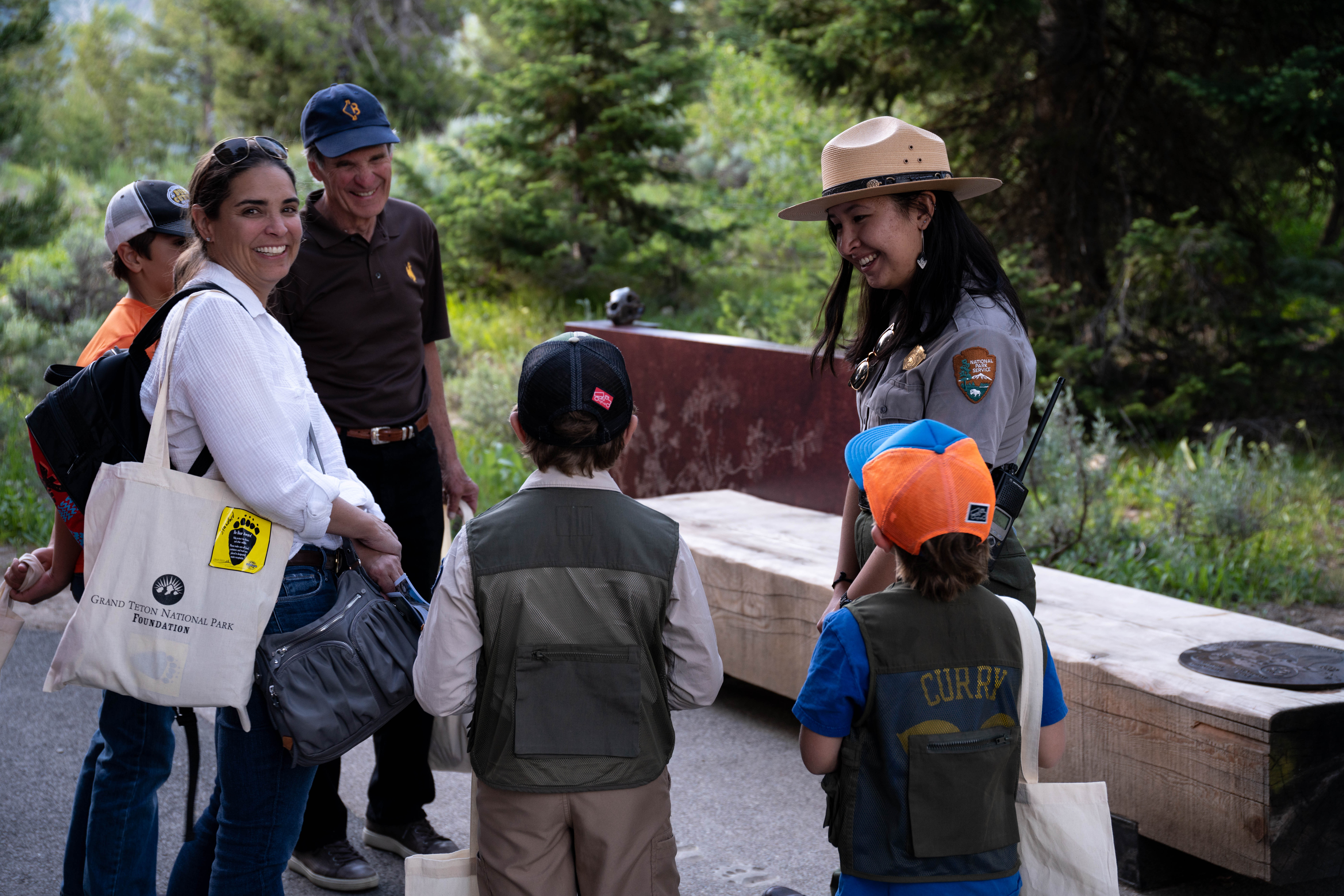
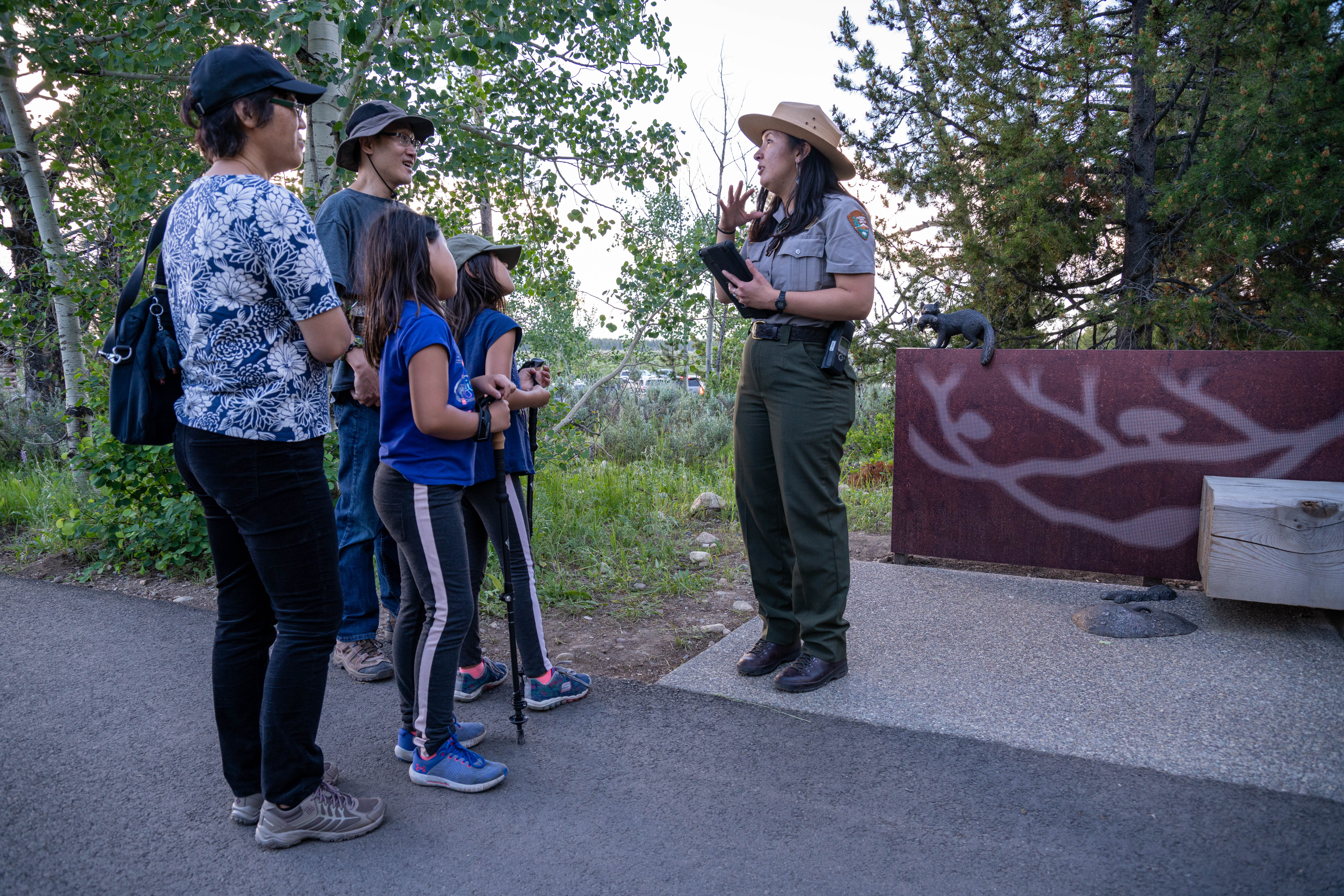
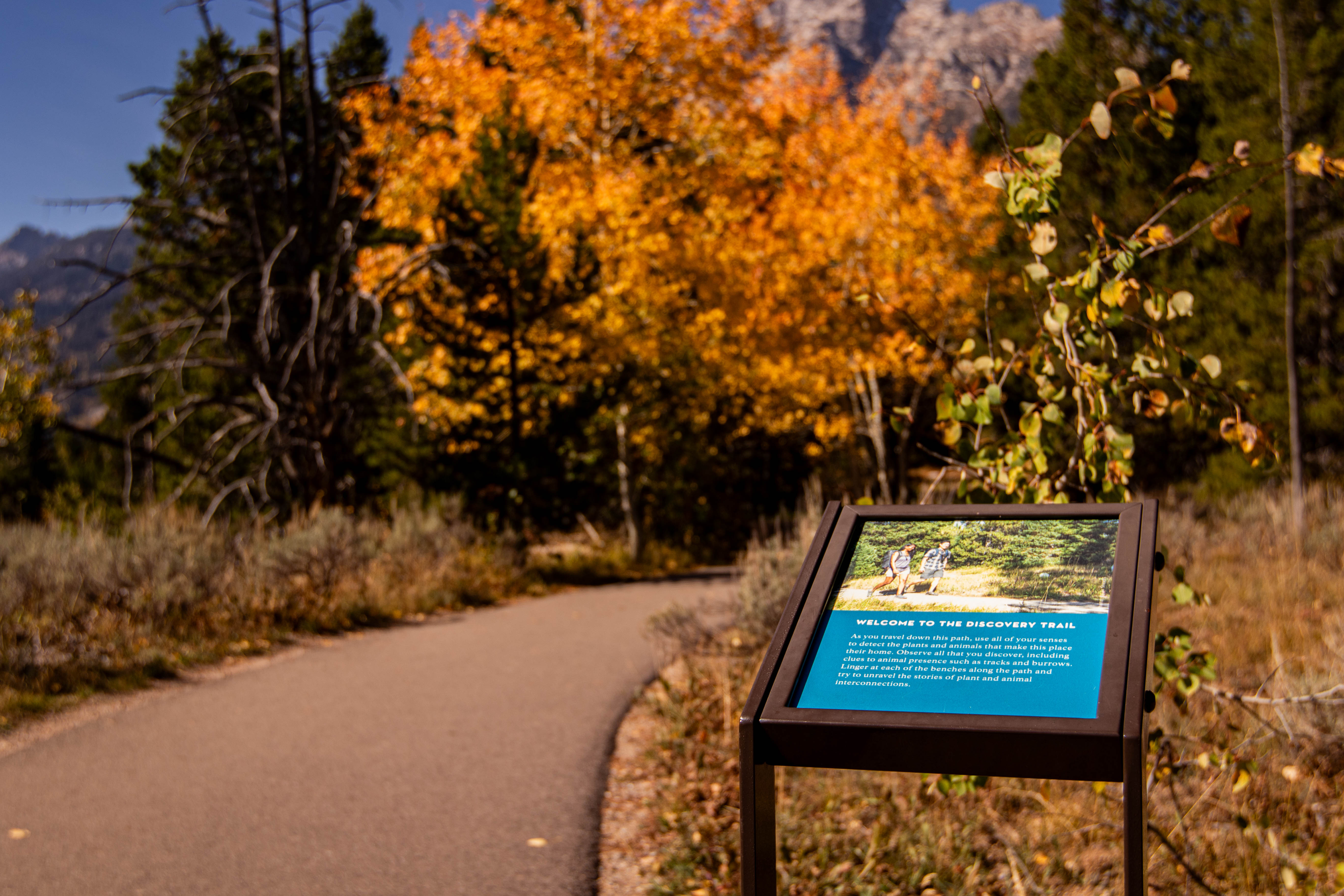
Welcome to the Discovery Trail. As you travel down this path, use all of your senses to detect the plants and animals that make this place their home. Observe all that you discover, inducing clues to animal presence such as tracks and burrows. Linger at each of the benches along the path and try to unravel the stories of plant and animal interconnections.
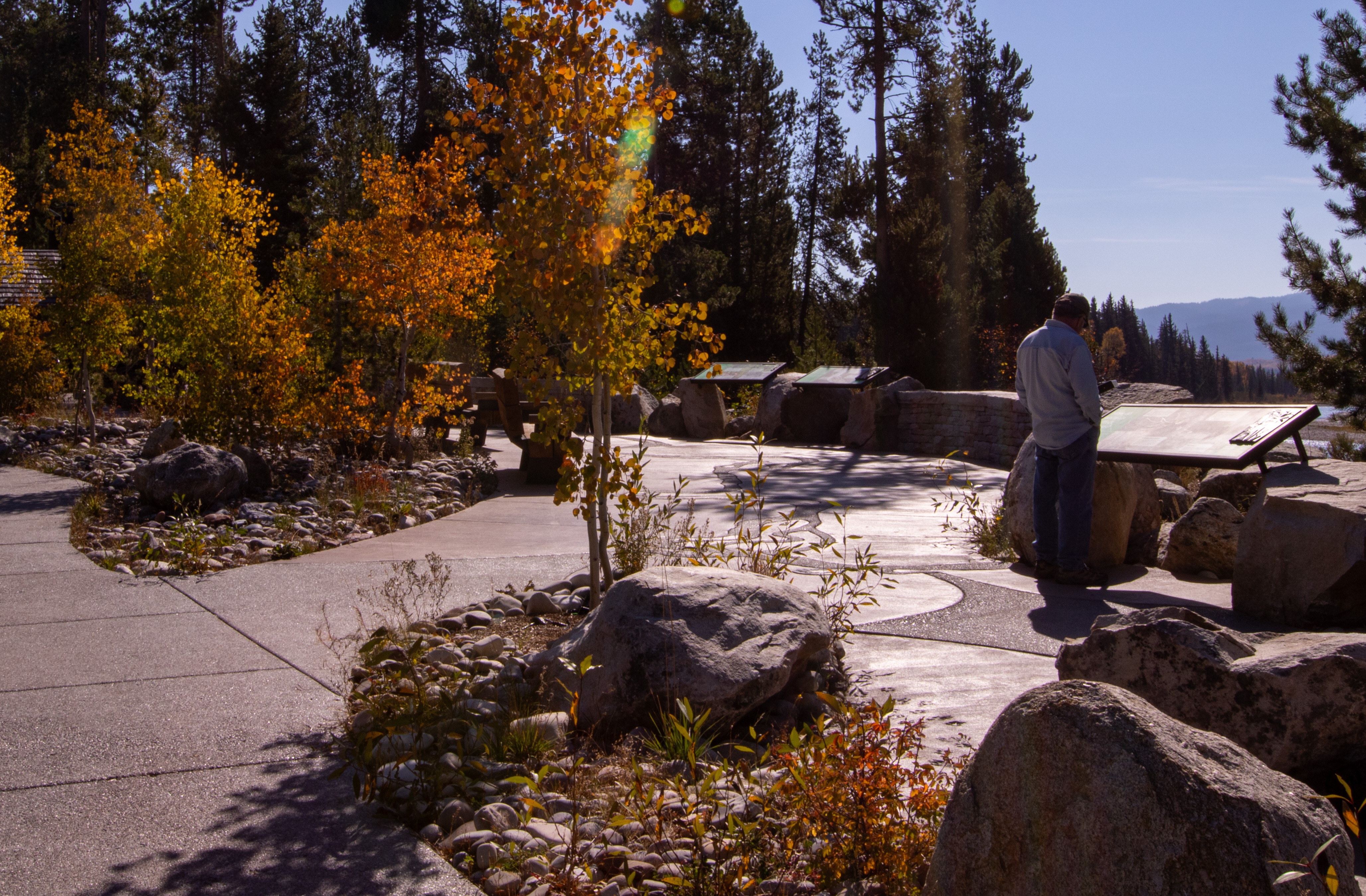
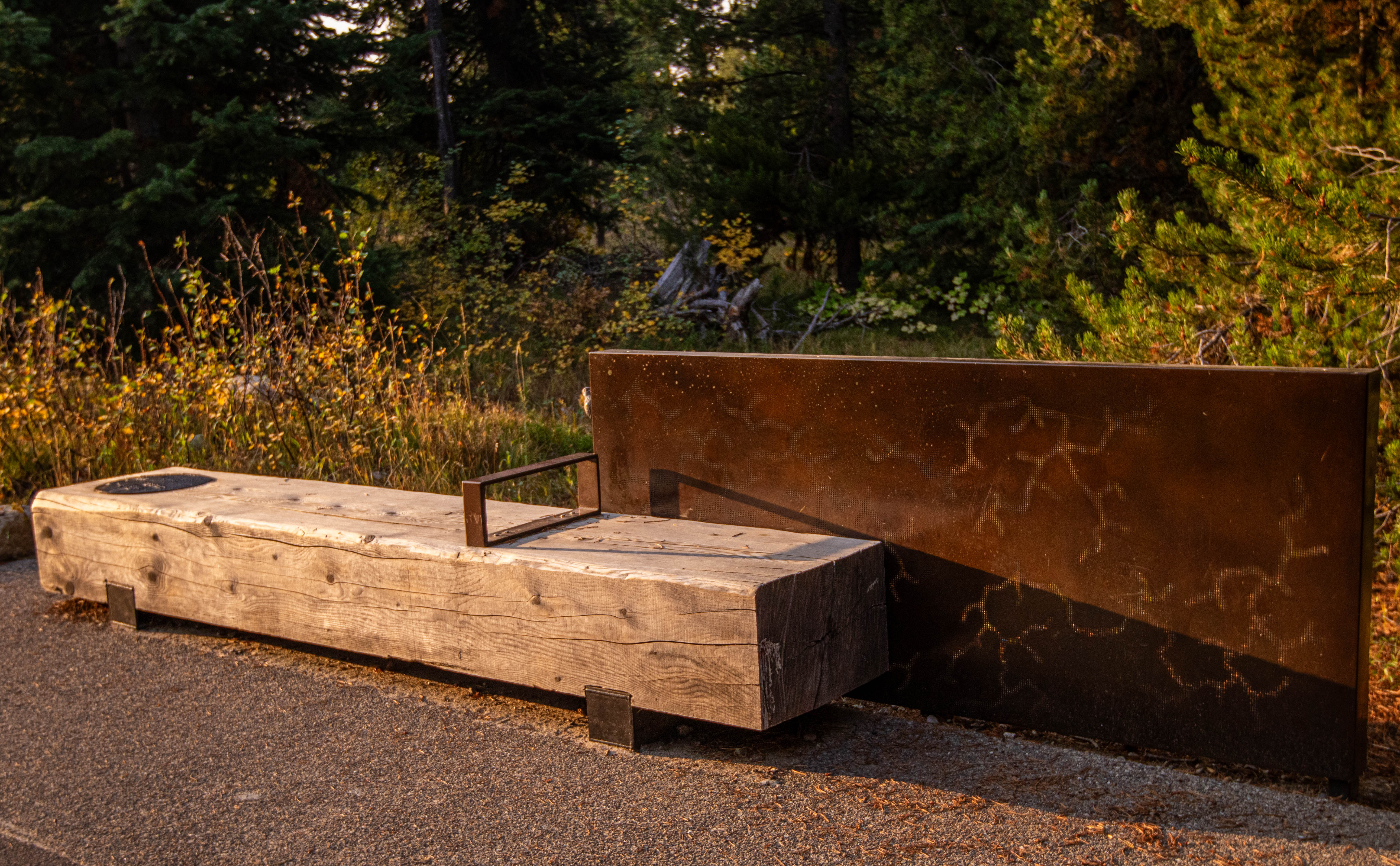
Moving north along the Discovery Trail from the Jenny Lake Plaza, about 30 feet beyond the Permits Office, a color photograph at the top of a small, angled metal reading rail at the right shows two young people walking along this trail with Jenny Lake in the background. Text in the blue portion of the panel underneath the photograph reads: Welcome to the Discovery Trail As you travel down this path, use all of your senses to detect the plants and animals that make this place their home. Observe all that you discover, inducing clues to animal presence such as tracks and burrows. Linger at each of the benches along the path and try to unravel the stories of plant and animal interconnections. Follow along the sagebrush-lined path to a concrete pad along the asphalt walkway with a low, eight-foot wide wood block bench. A four-foot tall, narrow, bronze wall panel stands behind the bench, slightly offset to the left. Across the face of the panel, hundreds of small holes drilled through the panel create an image of the Western Serviceberry plant. Touch the holes to feel this favorite food of black bears, as well as the bronze black bear skull mounted on top of the panel at the left. At the far right of the low bench, touch a 12-inch wide, circular bronze medallion embedded in the top with images cast in low relief of a black bear, bear scat, western serviceberry, and its seeds. In front of the bench, note a line of bear cub paw prints travelling across the concrete pad under your feet, and a pile of bronze bear scat on the ground to the immediate left of the bench, which you may touch.
Welcome to the Discovery Trail. As you travel down this path, use all of your senses to detect the plants and animals that make this place their home. Observe all that you discover, inducing clues to animal presence such as tracks and burrows. Linger at each of the benches along the path and try to unravel the stories of plant and animal interconnections.
Moving north along the Discovery Trail, away from the Jenny Lake plaza, a second fork in the asphalt walkway leads right to the campground. Continue along the walkway to a concrete pad at the left with a low, eight-foot wide wood block bench. A four-foot tall, narrow, bronze wall panel stands behind the bench, offset to the left. Across the face of the panel, hundreds of tiny holes have been drilled through the panel to create an image of the underground home of the pocket gopher. Touch the holes to feel the interconnected tunnels and burrows, as well as the Pine Marten sculpture mounted on top of the panel at the left. On the ground in front of the panel, to the immediate left of the bench, note a roughly tubular pocket gopher esker, as well as a circular pocket gopher mound in front with a pocket gopher in the center, which you may touch.
Welcome to the Discovery Trail. As you travel down this path, use all of your senses to detect the plants and animals that make this place their home. Observe all that you discover, inducing clues to animal presence such as tracks and burrows. Linger at each of the benches along the path and try to unravel the stories of plant and animal interconnections.
Follow along the sagebrush-lined path to a concrete pad along the asphalt walkway with a low, eight-foot wide wood block bench. A four-foot tall, narrow, bronze wall panel stands behind the bench, offset to the left. Across the face of the panel, hundreds of small holes drilled through the panel create an image of American Mountain Ash. Touch the holes to feel the stems and branches of this favorite moose food, as well as the bronze moose antler mounted on top of the panel at the left. At the far right of the low bench, touch a 12-inch wide, circular bronze medallion embedded in the top with images cast in low relief of a moose, moose scat, American Mountain Ash, and a moose-browsed twig. Feel the line of moose hoofprints travelling across the concrete pad under your feet in front of the bench, and a pile of bronze moose scat on the ground to the immediate left of the bench, which you may also touch.
Discover the interconnectedness of plants and animals. How do plants affect wildlife and how does wildlife affect plants? And what does that have to do with a river?
Welcome to the Discovery Trail. As you travel down this path, use all of your senses to detect the plants and animals that make this place their home. Observe all that you discover, inducing clues to animal presence such as tracks and burrows. Linger at each of the benches along the path and try to unravel the stories of plant and animal interconnections.
Moving north along the Discovery Trail, heading away from the Jenny Lake plaza, just beyond the black bear bench, a fork in the asphalt walkway leads right to the campground. Continue about 30 feet forward along the walkway to a concrete pad at the left with a low, eight-foot wide wood block bench. A four-foot tall, narrow, bronze wall panel stands behind the bench, offset to the right. Across the face of the panel, hundreds of tiny holes have been drilled through the panel to create an image of the paths bored by mountain pine beetles beneath the bark of pine trees. Touch the holes to feel the branching tunnels. At the far left, note a 12-inch wide, circular bronze medallion embedded in the top of the low bench. Images cast in low relief, which you may touch, show the American Three-Toed Woodpecker, and the Mountain Pine Beetle, including its eggs, larvae, and pupae.
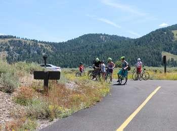
The pathway section from Moose Junction to the Antelope Flats Road is the most recent addition to the multi-use pathway system. This section allows bicyclists to complete a loop on the secondary roads from Antelope Flats to Kelly and return to Gros Ventre Junction without riding on the main highway. There is parking available at the small lot on the north end Blacktail Butte just south of Antelope Flats Road. ADA compliant.
There is a large, three-panel sign located near the pathway providing information on safety, park regulations and a map. The center panel shows a map of the pathway between Moose Junction in the south and the southern end of Jenny Lake in the north. The pathway runs alongside the Teton Park Road for most of this stretch, only diverging slightly to the west as it approaches Jenny Lake Visitor Center. The title on the right hand panel reads, "No Pets on Pathway" and shows a picture of a dog with the universal not-allowed symbol of a red circle with a line across it. The text reads, "PETS ARE NOT PERMITTED on the park pathway. Guide dogs-used for the sole purpose of aiding a person with physical disability-may travel on the pathway. The pathway travels through sensitive wildlife areas. "Why Are Pets Not Allowed? For the wildlife and for your safety. Wildlife such as bears, wolves or coyotes may be drawn to pets and their owners. A surprise encounter with wildlife may result in death or injury to pets, wildlife or visitors. Pets may escape and quickly become prey. Dogs cause the same stress responses in prey species (such as elk and pronghorn) as predators do. Transmittable diseases, such as parvovirus, from infected feces may live in the soil for months, passing on to wildlife. "WHERE CAN PETS GO? "OUTSIDE THE PARK Jackson Hole Community Pathways except on the National Elk Refuge. Bridger-Teton National Forest trails-Shadow Mountain, Gros Ventre River, Snow King, Cache Creek, Phillips Canyon and Teton Pass. Snake River dike, at the intersection of highways WY 22 & 390 in Wilson. "INSIDE THE PARK In general, leashed pets may go anywhere a car may go-roads and road shoulders, campgrounds, picnic areas, and parking lots. Pets must be in control and restrained on a leash no longer than six feet in length." At the bottom of the panel are photographs of a bull moose and a male sage grouse, its large white chest puffed up. The text reads, "SAGEBRUSH COMMUNITY. The drought-tolerant plants of the sagebrush community thrive despite porous, cobbly soils and intense sunlight. These flowering plants form one of the most colorful and diverse communities in the park. Sagebrush provides a mosaic of food and shelter for a variety of animals." The panel on the left is titled "Protect Your Park." In a light green color block at the top left there is a photograph of two people on bicycles on the path with Grand Teton in the background. Text reads, "How to Ride. Only NON-MOTORIZED METHODS of transportation are permitted on the multi-use pathway. Persons with physical disabilities may use electric and battery-operated transportation. Horses are not permitted on the pathway, except on the Snake River bridge in Moose.Travel single file in the right-side lane; share the pathway. Notify other recreators before you pass. Be aware of others passing you. The use of portable audio devices is strongly discouraged. Obey all traffic signs. Yield to all vehicles. Yield to slower recreators. Wear a helmet. Stay on paved pathway; no shortcutting through vegetation. Absolutely no pets allowed. Respect the rights of all users." In the center of the panel is a photograph of a small herd of pronghorn . The caption reads, "Help wildlife thrive. NEVER FEED, APPROACH OR HARASS WILDLIFE-especially large mammals. Stay at least 100 yards away from bears and wolves, and 25 yards from other animals. Be prepared for wildlife interactions; be prepared to stop." At the bottom of the panel is a photograph of two bears standing in snow at the edge of a pond, drinking. The caption reads, "Be Bear Aware. Grizzly and black bears may become aggressive when surprised or in defense of young. Stay alert and make bears aware of your presence. Follow food storage regulations: never leave your backpack, pannier or any item with food unattended. Carry and know how to use bear spray." There are two smaller photograph in a border down the right side of the panel. The first one shows an elk with a full set of antlers. The caption reads, "When to Ride. The multi-use pathway is CLOSED from dusk to dawn for wildlife and public safety." The bottom photo shows a single tree backlit by a sun low in the sky. The caption reads, "Leave No Trace. The park PROHIBITS PICKING, COLLECTING OR DESTROYING park resources. Leave all plants, animals and artifacts as you found them for other visitors to enjoy. Stay on the designated pathway to help preserve the park."
The Dornans complex has a long history of providing services to park visitors. This family owned business is actually a park inholding dating back to the 1920s. During summer, visitors may enjoy two restaurants, a wine shoppe, grocery and deli, gasoline, ATM, coffee stand, ice cream cart, gifts, lodging, and adventure sports equipment rental and sales.
Leave from Dornans in Moose to access the multi-use pathway. A short spur connects to the main pathway allowing non-motorized users access to the paved trail system that extends from Jackson to Moose and on to Jenny Lake. Hop on your bike or pull on your shoes to enjoy the park at a slower pace. ADA compliant.
There is a large, three-panel sign located near the pathway providing information on safety, park regulations and a map. The center panel shows a map of the pathway between Moose Junction in the south and the southern end of Jenny Lake in the north. The pathway runs alongside the Teton Park Road for most of this stretch, only diverging slightly to the west as it approaches Jenny Lake Visitor Center. The title on the right hand panel reads, "No Pets on Pathway" and shows a picture of a dog with the universal not-allowed symbol of a red circle with a line across it. The text reads, "PETS ARE NOT PERMITTED on the park pathway. Guide dogs-used for the sole purpose of aiding a person with physical disability-may travel on the pathway. The pathway travels through sensitive wildlife areas. "Why Are Pets Not Allowed? For the wildlife and for your safety. Wildlife such as bears, wolves or coyotes may be drawn to pets and their owners. A surprise encounter with wildlife may result in death or injury to pets, wildlife or visitors. Pets may escape and quickly become prey. Dogs cause the same stress responses in prey species (such as elk and pronghorn) as predators do. Transmittable diseases, such as parvovirus, from infected feces may live in the soil for months, passing on to wildlife. "WHERE CAN PETS GO? "OUTSIDE THE PARK Jackson Hole Community Pathways except on the National Elk Refuge. Bridger-Teton National Forest trails-Shadow Mountain, Gros Ventre River, Snow King, Cache Creek, Phillips Canyon and Teton Pass. Snake River dike, at the intersection of highways WY 22 & 390 in Wilson. "INSIDE THE PARK "In general, leashed pets may go anywhere a car may go-roads and road shoulders, campgrounds, picnic areas, and parking lots. Pets must be in control and restrained on a leash no longer than six feet in length." At the bottom of the panel are photographs of a bull moose and a male sage grouse, its large white chest puffed up. The text reads, "SAGEBRUSH COMMUNITY. The drought-tolerant plants of the sagebrush community thrive despite porous, cobbly soils and intense sunlight. These flowering plants form one of the most colorful and diverse communities in the park. Sagebrush provides a mosaic of food and shelter for a variety of animals." The panel on the left is titled "Protect Your Park." In a light green color block at the top left there is a photograph of two people on bicycles on the path with Grand Teton in the background. Text reads, "How to Ride. Only NON-MOTORIZED METHODS of transportation are permitted on the multi-use pathway. Persons with physical disabilities may use electric and battery-operated transportation. Horses are not permitted on the pathway, except on the Snake River bridge in Moose. Travel single file in the right-side lane; share the pathway. Notify other recreators before you pass. Be aware of others passing you. The use of portable audio devices is strongly discouraged. Obey all traffic signs. Yield to all vehicles. Yield to slower recreators. Wear a helmet. Stay on paved pathway; no shortcutting through vegetation. Absolutely no pets allowed. Respect the rights of all users." In the center of the panel is a photograph of a small herd of pronghorn . The caption reads, "Help wildlife thrive. NEVER FEED, APPROACH OR HARASS WILDLIFE-especially large mammals. Stay at least 100 yards away from bears and wolves, and 25 yards from other animals. Be prepared for wildlife interactions; be prepared to stop." At the bottom of the panel is a photograph of two bears standing in snow at the edge of a pond, drinking. The caption reads, "Be Bear Aware. Grizzly and black bears may become aggressive when surprised or in defense of young. Stay alert and make bears aware of your presence. Follow food storage regulations: never leave your backpack, pannier or any item with food unattended. Carry and know how to use bear spray." There are two smaller photograph in a border down the right side of the panel. The first one shows an elk with a full set of antlers. The caption reads, "When to Ride. The multi-use pathway is CLOSED from dusk to dawn for wildlife and public safety." The bottom photo shows a single tree backlit by a sun low in the sky. The caption reads, "Leave No Trace. The park PROHIBITS PICKING, COLLECTING OR DESTROYING park resources. Leave all plants, animals and artifacts as you found them for other visitors to enjoy. Stay on the designated pathway to help preserve the park."
A surviving Mission 66 visitor center, the Colter Bay Visitor Center provides great views of Jackson Lake. Home of the Indigenous Arts and Cultural Demonstration Program. Inside, meet artists and view exhibits of Indigenous art. Watch the park film in the auditorium throughout the day. Visit this facility for trip planning information, backcountry, or boating permits. Shop at the Grand Teton Association bookstore, attend a ranger-led program, or visit nearby shops and restaurants.
The grand expanse of the Teton Range rises above the visitor center. Inside, interwoven themes of place, people, preservation, mountaineering, and Indigenous tribes encourage visitors to contemplate the past, present, and future of this place. Visit this facility for trip planning information, backcountry or boating permits. Shop at the Grand Teton Association Park Store, enjoy the variety of exhibits and artwork, attend a ranger program or watch a movie about the park.
The Flagg Ranch Information Station is located in the John D. Rockefeller, Jr. Memorial Parkway—the heart of the Greater Yellowstone Ecosystem. For visitors traveling south from Yellowstone National Park, Flagg Ranch is the first stop for trip planning information. This small wooden cabin is staffed daily during the peak summer season and includes a visitor information area, exhibits, and restrooms.
In the 1930s, the Jenny Lake Ranger Station and Museum opened as the park’s first visitor facility. Today, climbing rangers provide safety information, issue backcountry and boat permits, share climbing route conditions, and perform mountain rescues. Climbing and day hiking do not require a backcountry camping permit unless camping overnight in the backcountry. Backcountry permits involving climbing or mountaineering, and camping in Garnet Canyon must be obtained at the Jenny Lake Ranger Station.
Harrison Crandall built this cabin in 1921 near the Cathedral Group Turnout as his studio. Today, the visitor center highlights the relationship between art, inspiration, and action in Grand Teton. Rangers are available at the front desk, in the plaza, and on trails for trip planning, park information, and education. Attend one of the many ranger programs offered here or shop at the Grand Teton Association bookstore. The nearby Jenny Lake Ranger Station offers backcountry and boat permits.
The Laurance S. Rockefeller Preserve Center allows visitors to learn about Mr. Rockefeller's vision and his legacy of conservation stewardship. Exhibits engage visual, tactile, and auditory senses through a poem by Terry Tempest Williams, audio recordings of Mr. Rockefeller, videos, photography, and a soundscape room. Visitors may relax in the resource room, attend a ranger program, or strike out on a hike to Phelps Lake. The center does not have a sales area or offer permits.
National Elk Refuge & Greater Yellowstone Visitor Center
The National Elk Refuge & Greater Yellowstone Visitor Center is an visitor center located in Jackson, WY. The visitor center is owned and operated by the U.S. Fish and Wildlife Service on the National Elk Refuge. The six agencies that operate from the visitor center are the Bridger-Teton National Forest, Grand Teton Association, Grand Teton National Park, National Elk Refuge, Jackson Hole Chamber of Commerce, and Wyoming Game & Fish.
The Moose-Wilson Road is a corridor road connecting the towns of Moose and Wilson.
Chapel of the Transfiguration
Visit the historic Chapel of the Transfiguration.
Valley Trail - Phelps Lake Overlook
Travel from Teton Village to the Phelps Lake Overlook on this strenuous hike.
Open Canyon
Take in spectacular views from Mount Hunt Divide on this very strenuous hike.
Granite Canyon
Hike through forests and meadows in Granite Canyon on this moderately strenuous to strenuous hike.
Marion Lake
Head up Granite Canyon to an alpine lake on this very strenuous day or overnight hike.
Static Peak Divide Trail
Get spectacular views of Alaska Basin and Jackson Hole on this very strenuous hike to the Static Peak Divide.
Death Canyon - Static Peak Divide Junction
Travel into the Teton Range on this strenuous day or overnight hike to Death Canyon.
Phelps Lake Overlook
Gain a vantage point above Phelps Lake on this easy hike.
Phelps Lake
Travel to the Phelps Lake Overlook and down to the shore of Phelps Lake on this moderate hike.
Polecat Creek Loop
Keep an eye out for birds and wildlife on the Polecat Creek Loop hike.
Flagg Canyon
Explore the northern stretch of the Snake River on this hike through Flagg Canyon.
Hermitage Point
Take a moderately strenuous day or overnight hike to Hermitage Point for views of Jackson Lake and the Teton Range.
Heron Pond - Swan Lake Loop Trail
Take an easy loop hike for access to Heron Pond and Swan Lake.
Lakeshore Trail
Take an easy hike on the Lakeshore Trail for views of Jackson Lake and the Teton Range.
Grand View Point
Hike to Grand View Point for panoramic views of the Teton Range and Jackson Hole.
Christian Pond Loop
Christian Pond Loop is an easy hike through a marsh habitat.
Lunch Tree Hill
Lunch Tree Hill is an easy walk with spectacular views of the Teton Range.
Two Ocean Lake - Emma Matilda Lake Loop
Circle Two Ocean and Emma Matilda Lakes on this strenuous loop trail.
Emma Matilda Lake
Hike around Emma Matilda Lake for wildflowers and views of the Teton Range.
Two Ocean Lake
Hike around Two Ocean Lake for a secluded trail with mountain views.
Signal Mountain Trail
Hike up Signal Mountain for panoramic views of Jackson Hole and the Teton Range.
Holly Lake
Hike to an alpine lake on this strenuous day or overnight hike up Paintbrush Canyon.
Bearpaw and Trapper Lakes
Hike along the shore of Leigh Lake for panoramic views of Mount Moran.
Leigh Lake
Take an easy day or overnight hike to Leigh Lake for less crowds and mountain views.
Paintbrush Canyon - Cascade Canyon Loop
Loop through Paintbrush and Cascade canyons on this very strenuous day or overnight loop hike.
Aspen Ridge - Boulder Ridge
Travel through aspens and boulders as you hike to Phelps Lake on this loop trail.
String Lake
Travel around String Lake on this easy loop trail.
Garnet Canyon
Travel to the heart of the Teton Range on a strenuous hike into Garnet Canyon.
Surprise and Amphitheater Lakes
Travel to Surprise and Amphitheater Lakes on this strenuous hike.
Lake Creek - Woodland Trail Loop
Take an easy hike to the shore of Phelps Lake.
Phelps Lake Loop
Circle Phelps Lake and get views of Death Canyon and the Teton Range on this moderate hike.
Forks of Cascade Canyon
Travel deep into the Teton Range on this hike through Cascade Canyon.
Jenny Lake Loop
Hike around Jenny Lake for spectacular views of Cascade Canyon and the Teton Range.
Hurricane Pass
Visit a glacier and get panoramic views of the Three Tetons on this strenuous day or overnight hike to Hurricane Pass.
Lake Solitude
Travel to an alpine lake on this day or overnight hike to Lake Solitude.
Inspiration Point
One of the most visited trails in the park, Inspiration Point offers stunning views of Jackson Hole, Cascade Canyon, and the Teton Range.
Hidden Falls
Visit the only accessible waterfall in Grand Teton on this easy-moderate hike to Hidden Falls.
Moose Ponds
Be on the lookout for moose on this hike to Moose Ponds.
Taggart Lake - Beaver Creek Loop
Take a easy loop hike to Taggart Lake for some of the most stunning views of the Teton Range.
Taggart Lake - Bradley Lake Loop
Hike to Taggart Lake and Bradley Lake on this moderate loop trail.
Taggart Lake
Get spectacular views of the Teton Range on this easy hike to Taggart Lake.
Murie Ranch Hike
Hike to the Murie Ranch on this easy out and back trail.
Jenny Lake Scenic Drive
The Jenny Lake Scenic Drive skirts the east shore of Jenny Lake and provides spectacular views of the peaks
Signal Mountain Summit Road
Drive the Signal Mountain Summit Road for panoramic views of the Teton Range and Jackson Hole.
Teton Park Road
The Teton Park Road follows the base of the Teton Range from Moose to Jackson Lake Junction.
Oxbow Bend
Visit Oxbow Bend for iconic views of the Teton Range.
Mormon Row
Visit Mormon Row to see the historic Moulton Barns and Teton views.
Grassy Lake Road
Grassy Lake Road is a dirt road connecting Flagg Ranch to Ashton, Idaho.
Teton Park Road in Winter
The Teton Park Road is open to skiing, snowshoeing and walking during winter from Taggart Lake Trailhead to the Signal Mountain Lodge. Located along the base of the Teton Range it offering stellar views. The road is closed to vehicles November 1 to April 30.
Tours
Count: 4
Behind the Lens: Photo Spots
Grand Teton is one of the most photographed national parks. From barns, mountains, wildlife, and rivers the enormity of places to capture that perfect photo exist throughout the park.
Fire in the Tetons
Fire has touched every part of the park. Explore the effects the of fire historically and today.
Menors Ferry, Step Back to a Different Time
Discover the story of Menors Ferry Historic District and learn how early settlers crossed the Snake River.
Wrangling Dudes at the Bar BC Ranch
This audio tour provides a glimpse into the Bar BC's past, focusing on the ranch's early days in the 1910s and 20s. Learn about this iconic dude ranch, and listen to excerpts from the writings of Struthers Burt, who co-founded the ranch with Horace Carncross, and Burt's son Nathaniel. If you do plan to visit the Bar BC site, be aware that the road is rough and high clearance is advised. Please park at the gate above the sit