The 4th Division, commonly called the "Ivy Division" after its Roman numeral designation, was organized in December of 1917 to serve in the American Expeditionary Force in World War I. It was involved in the Battle of Mame, during which it fought for 28 consecutive days and sustaining almost 13,000 casualties.The Division was reactivated to serve in World War II. The 4th Infantry Division participated in the Normandy Invasion and campaigns in the Rhineland, Ardennes, and cent
- (167 words)<br />The 4th Infantry Division Memorial is located on Memorial Avenue west of the Arlington Memorial Bridge at the entrance to Arlington National Cemetery in Arlington, Virginia.<br />From the west side of Memorial Circle travel west on Memorial Avenue about three hundred seventy yards. Set back about ten feet beyond the sidewalk on the south side of Memorial Avenue is the 4th Infantry Division Memorial.<br />The memorial consists of a six and one-half foot tall square bronze sculpture of a diamond with four ivy leave-shaped windows arranged in a cross pattern. The bronze sculpture rests on an oblong twenty-foot long marble base. The base is filled with ivy that hangs over its edge.<br />An inscription of the front of the base reads in gold:<br />4TH INFANTRY (IVY) DIVISION<br />STEADFAST AND LOYAL<br />A line of trees stand about ten feet behind the memorial. Ten-foot tall hedges about ten feet west and to the right of the memorial run the length of Memorial Avenue to the Arlington National Cemetery entrance.<br />END OF DESCRIPTION<br />
During his long career as a Naval officer, Rear Admiral Richard Evelyn Byrd, Jr. expanded the fields of navigation, aviation, and Arctic exploration. Byrd claimed to lead the first expedition to the North Pole and South Pole by air. Over his lifetime, he received numerous awards, including the Medal of Honor.InscriptionsBelow statueFelix W. de WeldonSc. 1961Base, frontRICHARD EVELYN BYRDREAR ADMIRAL UNITED STATES NAVYOCTOBER 25, 1888 - MARCH 11, 1957UPON THE BRIGHT GLOBE HE C
- (300 words)<br />The Admiral Richard Evelyn Byrd statue is located on Memorial Avenue west of the Arlington Memorial Bridge, at the entrance to Arlington National Cemetery in Arlington, Virginia.<br />From the west side of Memorial Circle travel west on Memorial Avenue about five hundred yards. Set back about ten feet from the sidewalk on the north side of Memorial Avenue is the Admiral Richard Evelyn Byrd statue.<br />The eight-foot tall bronze statue is set back along a ten-foot-tall line of hedges that runs the length of Memorial Avenue towards the cemetery. Byrd stands on top of a four-foot tall white marble plinth. Byrd is dressed in fur with a high collar, long gloves and boots. His left foot stands forward, his fists are at his waist and his head is slightly cocked back.<br />An inscription on the right top side of the base reads:<br />Felix W. de Weldon<br />Sc. 1961<br />An inscription on the front of the base reads:<br />RICHARD EVELYN BYRD<br />REAR ADMIRAL UNITED STATES NAVY<br />OCTOBER 25, 1888 - MARCH 11, 1957<br />UPON THE BRIGHT GLOBE HE CARVED<br />HIS SIGNATURE OF COURAGE<br />ERECTED BY NATIONAL GEOGRAPHIC SOCIETY<br />An image of a shield with wings is inscribed in the center.<br />Inscribed on the left side of the base is a circular image labeled "South Pole" in the center. Around the circle is written:<br />ANTARTIC REGION<br />ARCTIC CIRCLE<br />Below is inscribed:<br />VALIANT LEADER OF<br />FIVE ANTARCTIC EXPEDITIONS 1928-1957<br />WHICH REVEALED THE SECRETS OF<br />HALF THE GREAT WHITE CONTINENT<br />The right side of the base features a circular image of the Earth. The "North Pole" is identified in the center, and an inscription along the top reads:<br />ARCTIC REGION<br />Below is inscribed:<br />FIRST TO FLY OVER THE NORTH POLE 1926<br />AND THE SOUTH POLE 1929<br />A PIONEER CONQUEROR OF THE ATLANTIC BY AIR 1927<br />END OF DESCRIPTION<br />
The U.S. has used tanks in conflicts since World War I. Armored forces included tanks, but also armored infantry, field artillery, engineers, tank destroyer units, and support units. The memorial was dedicated in 1991.<br /><br />Inscriptions<br />ARMORED FORCES<br />FORGING THE THUNDERBOLT<br />"A BALANCED TEAM OF COMBAT ARMS AND SERVICES<br />OF EQUAL IMPORTANCE AND EQUAL PRESTIGE."<br />Maj. Gen. Adna R. Chaffee<br />Father of the American<br />Armored Force<br />
- (238 words)<br />American Armored Forces Memorial is located on Memorial Avenue west of the Arlington Memorial Bridge, at the entrance to Arlington National Cemetery in Arlington, Virginia.<br />From the west side of Memorial Circle travel west on Memorial Avenue about five hundred eighty yards. Set back about ten feet from the sidewalk and set among ten-foot tall hedges along the south side of Memorial Avenue is the Armored Forces Memorial.<br />The memorial consists of an open oval of white granite about thirty feet wide and three-feet tall on each side, inscribed with the insignia of various armored units. On the top of the wall are etchings of maps and descriptions of the campaigns from WWI, WWII, Mediterranean theater, European theater, Pacific theater, Korean War, Vietnam, and Desert Storm and regiments commissioned in the history of the Armored Service. <br />In the center is a seven-foot four-inch tall, five-foot-wide vertical slab of black granite. The highly polished black granite panel is etched with three military scenes of tanks moving across a mountainous landscape. In the clouds in the upper left is a man on horseback and in the upper right is a lightning bolt with the words: "FORGING THE THUNDERBOLT." An inscription below reads:<br />"A BALANCED TEAM OF COMBAT ARMS AND SERVICES<br />OF EQUAL IMPORTANCE AND EQUAL PRESTIGE."<br />Maj. Gen. Adna R. Chaffee<br />Father of the American<br />Armored Force<br />The front edges of the granite wall are both inscribed to read:<br />ARMORED FORCES<br />END OF DESCRIPTION<br />
- (93 words)<br />The Arlington House Museum is located in a white brick structure the size of a small two-story house at the far end of the kitchen garden.<br />Facing the rear of the mansion, follow the path to the left through the middle of the kitchen garden. The restrooms and gift shop are roughly 30 yards from the garden entrance. The museum is at the end of a short paved path to the right.<br />The exhibit spans about six hundred square feet and features various artifacts, exhibit pieces, a video, and information panels.<br />END OF DESCRIPTION<br />
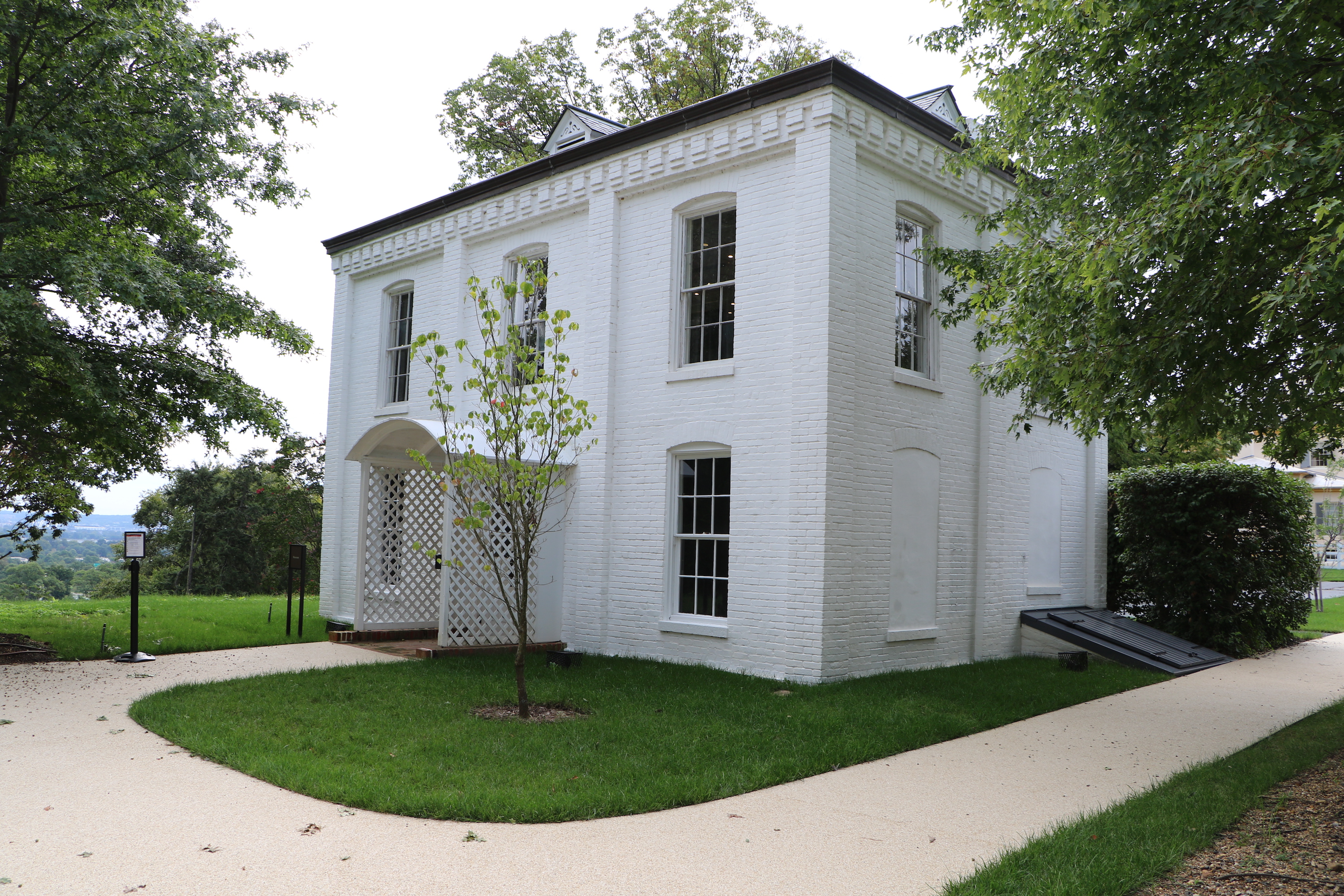
- (182 words)<br />The Arlington House North Slave Quarters are located northwest of Arlington House, The Robert E. Lee Memorial in Arlington National Cemetery in Arlington, Virginia.<br />From the intersection of Schley Drive and Roosevelt Drive, follow Roosevelt Drive up the hill to the west about six hundred thirty feet. Turn right at Weeks Avenue and proceed north about four hundred-fifty feet. Turn right at Sheridan Drive and travel north one hundred ninety yards. Turn left and follow the path up Custis Walk two hundred forty-five yards to the Arlington House.<br />The Arlington House North Slave Quarters are set behind and to the right of the Arlington House. The yellow two-story building has a stucco surface, and angled roof line and a large arch set at its front end. Chimneys sit at the front and back center. Four windows are set on the first floor and five along the second on the right side of the building. An archway on the right side is set above four columns on the first floor. A stone foundation about three feet tall is visible along the front side.<br />END OF DESCRIPTION<br />
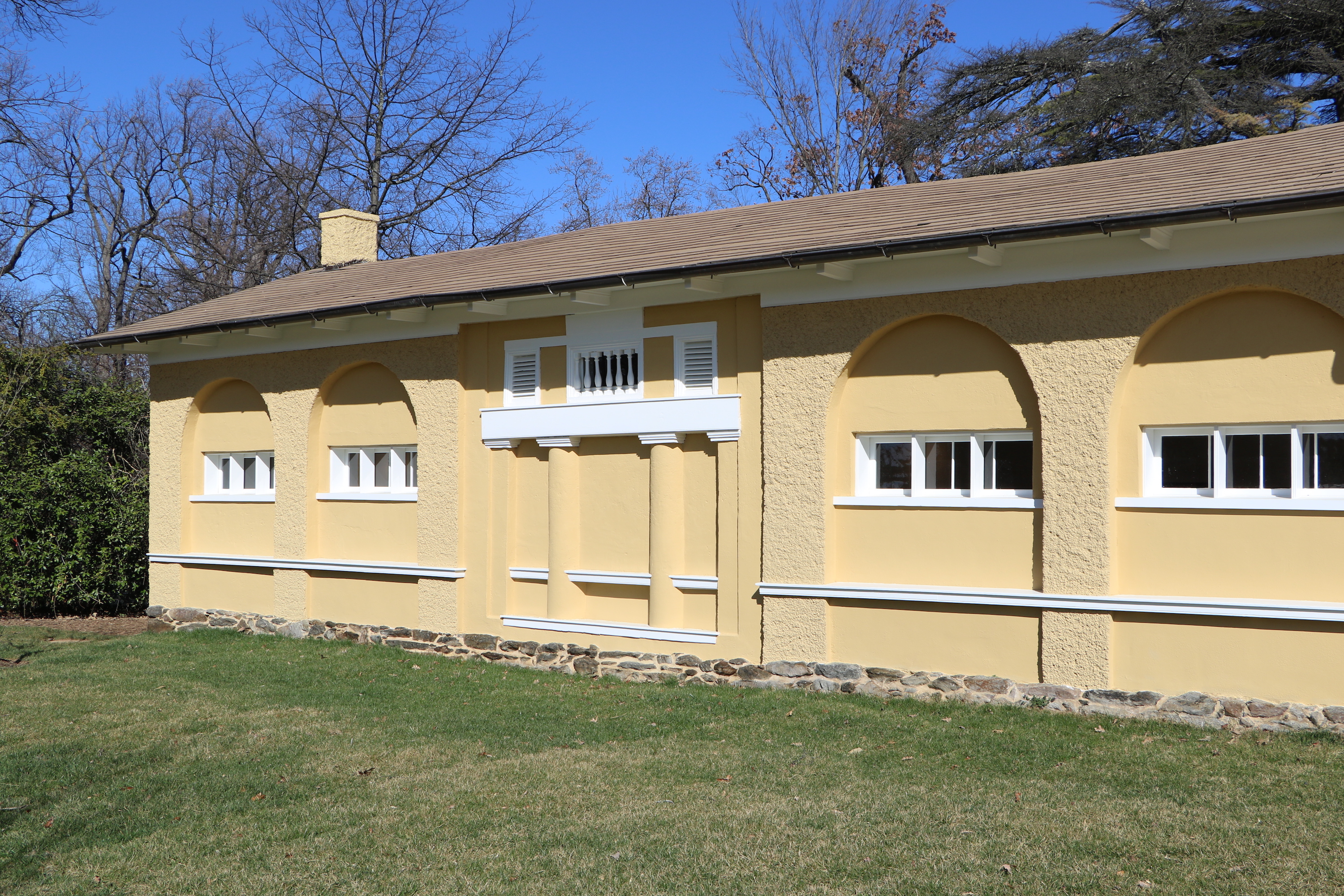
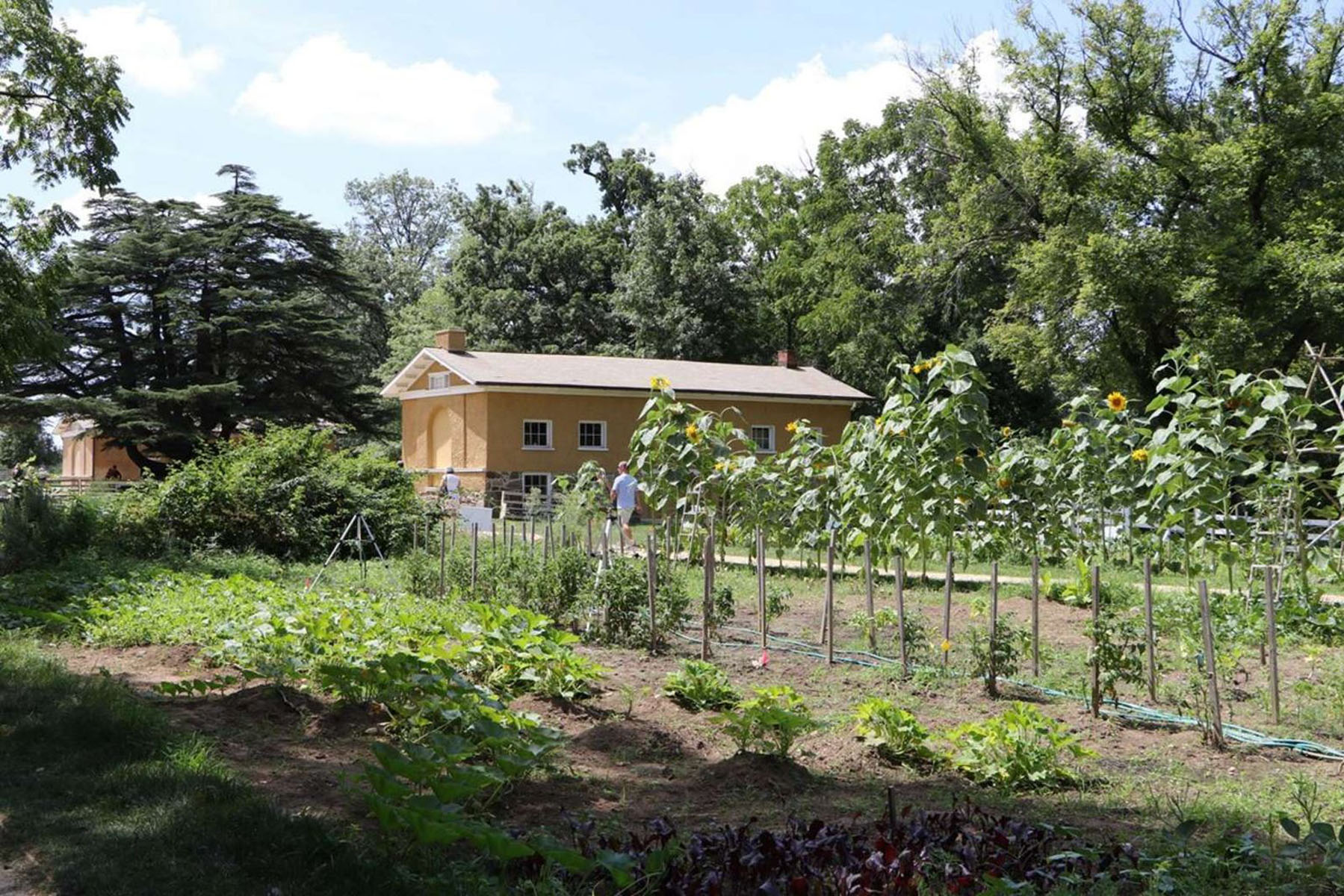
- (190 words)<br />The Arlington House South Slave Quarters are located southwest of Arlington House, The Robert E. Lee Memorial in Arlington National Cemetery in Arlington, Virginia.<br />From the intersection of Schley Drive and Roosevelt Drive, follow Roosevelt Drive up the hill to the west about six hundred thirty feet. Turn right at Weeks Avenue and proceed north about four hundred-fifty feet. Turn right at Sheridan Drive and travel north one hundred ninety yards. Turn left and follow the path up Custis Walk two hundred forty-five yards to the Arlington House.<br />The Arlington House South Slave Quarters are set behind and to the left of the Arlington House. The yellow one-story building has a stucco surface, an angled roof line and a large arch set at its front end. Chimneys sit at the front and back center. Four windows are set on the left side of the building with an arch above them. A square alcove with four columns sits between the two sets of windows. A stone foundation about three feet tall is visible along the front side of the building. Faded frescos adorn each of the three doors above their lintels.<br />END OF DESCRIPTION<br />
Your purchase at the book and souvenir shop supports this and other national parks.
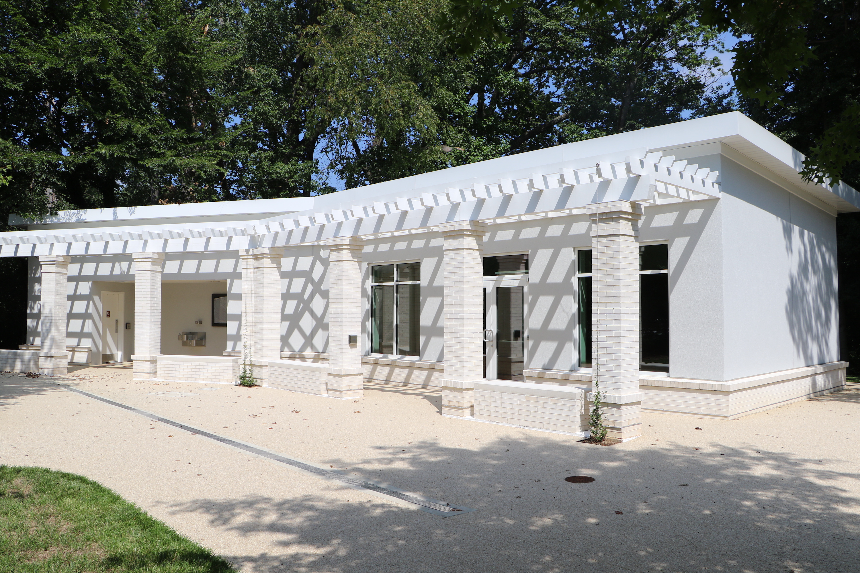
- A white building with columns and stone benches supporting a pergola. Double doors on the right side of the building lead to the bookstore. To the left, separate doors lead to restrooms. Drinking fountains are between the doors on the exterior of the building.
Arlington House is the nation's memorial to Robert E. Lee. It honors him for specific reasons, including his role in promoting peace and reunion after the Civil War. In a larger sense it exists as a place of study and contemplation of the meaning of some of the most difficult aspects of American History: military service; sacrifice; citizenship; duty; loyalty; slavery and freedom.<br /><br />Architect: George Hadfield
- (198 words)<br />Arlington House, The Robert E. Lee Memorial is located at the northwest corner of Arlington National Cemetery, in Arlington, Virginia.<br />From the intersection of Schley Drive and Roosevelt Drive, follow Roosevelt Drive up the hill to the west about six hundred thirty feet. Turn right at Weeks Avenue and proceed north about four hundred-fifty feet. Turn right at Sheridan Drive and travel north one hundred ninety yards. Turn left and follow the path up Custis Walk two hundred forty-five yards to Arlington House.<br />The Arlington House is a two-story Greek revival building with six tall columns supporting a triangular roof. One-story wings on either side are each fronted with three arched windows.<br />A grass hillside slopes downward about one hundred yards from the front of the house. Several grave markers, large and small, surround the mansion at the edges of walkways..<br />Facing east from Arlington House provides a sweeping view of the Washington Monument, U.S. Capitol, the Potomac River and downtown Washington.<br />Arlington House Slave Quarters are set behind to the left and right of the Arlington House. The yellow one-story buildings have a stucco surface, an angled roof line and large arches set at their front ends.<br />END OF DESCRIPTION<br />
Designed as a memorial symbolizing reunification of the North and South after the Civil War, Arlington Memorial Bridge links the Lincoln Memorial in Washington, DC, and Arlington House, the Robert E. Lee Memorial, as well as Arlington National Cemetery, in Arlington, VA. The bridge was dedicated in 1932.<br /><br />Architects: McKim, Meade & White

- (226 words)<br />Arlington Memorial Bridge links the Lincoln Memorial in Washington, D.C. on the east side of the Potomac River with Arlington House, the Robert E. Lee Memorial and Arlington National Cemetery to the west in Arlington, Virginia.<br /> <br />The steel and stone arch bridge spans two thousand feet. On the pylons of each pier of the bridge are large circular discs with eagles and fasces. Stone railings with balusters and sidewalks line both sides of the bridge.<br />At the northeastern end, the bridge runs into Lincoln Memorial Circle before connecting with Constitution Avenue, Independence Avenue, and Rock Creek Parkway. <br />At its southwestern terminus on Columbia Island, the bridge leads into Memorial Circle and its roadways connect with the George Washington Memorial Parkway, Route 27 and Route 110. Memorial Avenue continues southeast off the circle into Arlington National Cemetery. <br />Two nineteen-foot tall bronze equestrian statues flank the entrance to Arlington Memorial Bridge from Washington, D.C. at its east end. One is inscribed at the base of its pedestal to read "Sacrifice" and the other "Valor." Each statue faces east toward the Lincoln Memorial and is set atop an approximately twenty-foot tall granite base.<br />At the west end of the bridge two sculpted bald eagles stand atop forty-foot tall granite piers on either side. Carved oak leaf wreaths are engraved on the top face of each side of the piers.<br />END OF DESCRIPTION<br />
The golden "The Arts of War" statues standing at the end of Memorial Bridge were sculpted by Leo Friedlander. "Sacrifice" is depicted by a standing female representing the earth looking to the equestrian figure of Mars.<br />Inscriptions<br />SACRIFICE<br />LEO FRIEDLANDER SCULPTOR<br />CAST IN BRONZE FLORENCE 1950<br />A GIFT FROM THE PEOPLE OF ITALY<br />TO THE PEOPLE OF THE UNITED STATES<br />LEO FRIEDLANDR, Sc.<br />

- (251 words)<br />Arts of War: Sacrifice is one of two equestrian statues that flank the entrance to Arlington Memorial Bridge from Washington, D.C. at its east end.<br />The Sacrifice statue sits on the north side of Arlington Memorial Bridge and faces east toward the Lincoln Memorial. It stands nineteen feet tall, sixteen feet long, eight feet wide and is set atop an approximately twenty-foot tall granite base. <br />A nude male figure sits atop the horse and a nude female figure stands on the right side of the rider. Her back is against the side of the horse and she looks back and up toward the rider. A small child is sandwiched between the back of the female figure's shoulders and the proper right leg of the rider. The rider reaches out to the child. The female figure reaches up with her right hand to hold the right arm of the child. A bit of drapery is wrapped around the back of the child and down over the left leg of the female figure.<br />The granite base is adorned with a row of 36 stars around its top edge, including five stars along the front side. An engraving of a wreath sits below the five stars.<br />An inscription at the front bottom of the base reads:<br />SACRIFICE<br />LEO FRIEDLANDER SCULPTOR<br />CAST IN BRONZE FLORENCE 1950<br />A GIFT FROM THE PEOPLE OF ITALY<br />TO THE PEOPLE OF THE UNITED STATES<br />An inscription at the right back edge of the sculpture base reads:<br />LEO FRIEDLANDR, Sc.<br />END OF DESCRIPTION<br />
The golden "The Arts of War" statues standing at the end of Memorial Bridge were sculpted by Leo Friedlander. "Valor" is represented by a male equestrian figure accompanied by a female holding a shield.<br />Inscriptions<br />VALOR<br />LEO FRIEDLANDER SCULPTOR<br />CAST IN BRONZE MILAN 1950<br />A GIFT FROM THE PEOPLE OF ITALY<br />TO THE PEOPLE OF THE UNITED STATES<br />LEO FRIEDLANDR, Sc.<br />

- (194 words)<br />Arts of War: Valor is one of two equestrian statues that flank the entrance to Arlington Memorial Bridge from Washington, D.C. at its east end.<br />The Valor statue is set on the south side of Arlington Memorial Bridge and faces east toward the Lincoln Memorial. It stands nineteen feet tall, sixteen feet long, eight feet wide and is set atop an approximately twenty-foot tall granite base. <br />A nude male figure sits atop the horse and a nude female figure stands to the left of the rider. A shield is attached to her left arm which swings back behind her. Her right arm is raised up toward the rider. A cape is draped behind her. <br />The granite base is adorned with a row of 36 stars around its top edge, including five stars along the front side. A carving of a wreath sits below the five stars.<br />An inscription at the front bottom of the base reads:<br />VALOR<br />LEO FRIEDLANDER SCULPTOR<br />CAST IN BRONZE MILAN 1950<br />A GIFT FROM THE PEOPLE OF ITALY<br />TO THE PEOPLE OF THE UNITED STATES<br />An inscription at the right back edge of the sculpture base reads:<br />LEO FRIEDLANDR, Sc.<br />END OF DESCRIPTION<br />
Battery Mount Vernon
- A concrete structure is positioned between two hills, making it the same height as the hill. Stairs lead to multiple doors and openings. Railing surrounds the structure on the top level. The lower level has cove areas leading to locked doors.
Battery Porter
- A concrete wall is constructed low to the ground. Concrete steps lead to the building. An information panel is positioned to the right of the structure. Leaves cover the ground's surface.
Battery Sater
- A non-functioning building, low to the ground, is positioned in a field. Stairs lead up to the concrete building. An information panel is positioned in front of the building.
Belle Haven Marina
- 14 canoe boats, colors of yellow, red, and green, are flipped upside down and stacked atop each other in front of a boat dock. The boat dock has 4 sailboats parked near the boardwalk and off to the left. he dock has a railing on the left side for visitors to use as they walk to and fro.
Bell Haven Park and Picnic Area
- Two picnic tables are in front of a marina with rocks near the water's edge. There is a slight decline in slope as one approaches the water. Other picnic tables align the water and can be seen in the background. A large tree sits behind the picnic tables.
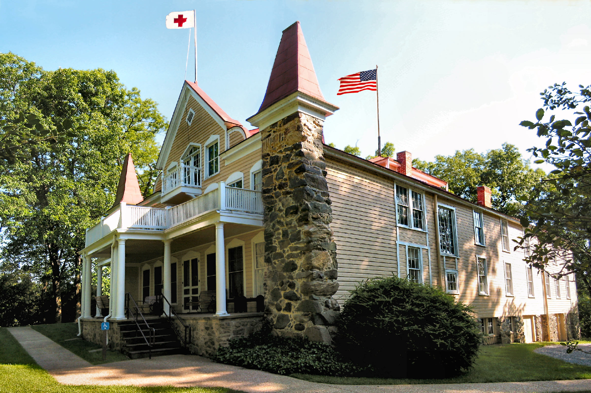
Clara Barton dedicated her life and energies to help others in times of need - both home and abroad, in peacetime as well as during military emergencies. Glen Echo was her home the last 15 years of her life and the structure illustrates her dedication and concern for those less fortunate than herself.
- A three-story house with stone facades on either side and a peaked facade in the center. The ramp to access the front porch is to the left of the entrance via a front porch with white columns.
Collingwood Picnic Area
- One picnic table is positioned in front of a body of water. There is no barrier separating the table from the drop to the water. A tree is seen to the right.
- A large marina with dozens of boats in a large river surrounded by trees
No longer an island, this area is accessible from the Mount Vernon Trail.
- A boat dock with 3 boats on a large river.
District of Columbia Boundary Stone
- A short, skinny stone is positioned under a concrete box-like structure. A patch of sunlight hits the stone. Vegetation and small rocks surround the stone on all sides.
Dyke Marsh Wildlife Habitat
- A wide, concrete path leads to information panels, a bench, and a trail. Trees surround the trail on either side. 3 information panels are positioned on the right of the trail, 1 is positioned on the left of the trail. The trail's surface is dirt and gravel.
Located on the Potomac River just south of Washington, D.C. Fort Hunt was originally a part of George Washington's Mount Vernon estate. The War Department purchased the land in 1892 as part of an ambitious, but short-lived, plan to modernize coastal defenses. In 1930, Congress authorized the land to be transferred into the new George Washington Memorial Parkway.<br /><br />Picnickers may reserve sites through <a href="https://www.recreation.gov/camping/campgrounds/232494">Recreation.gov</a> .
- A sign with the words "Fort Hunt Park" in front of a road surrounded by fields with a building in the distance.
Fort Marcy and nearby Fort Ethan Allen and other batteries on the northern bank of the Potomac River were built to protect Leesburg Pike and Chain Bridge.
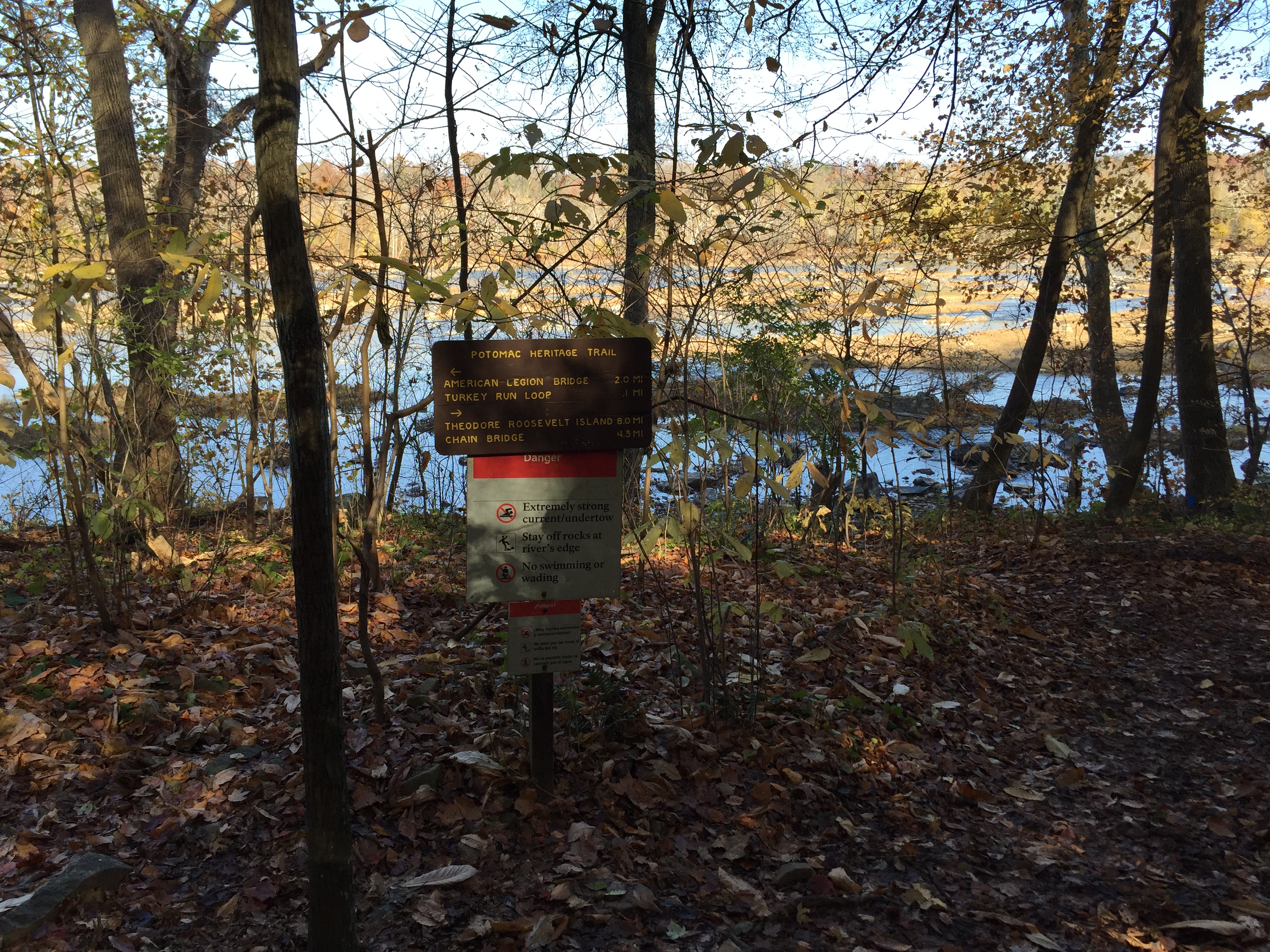
- (579 words)<br />Fort Marcy sits on the east side of the George Washington Memorial Parkway, north of the Chain Bridge in Northern Virginia.<br />Travel north on the George Washington Memorial Parkway about three and one-quarter of a mile from the intersection with Spout Run. Turn right at the sign for Fort Marcy and follow the turnoff about six hundred feet. Set at the south end of an approximately two-hundred-foot-long parking lot is a three by four-foot wayside. Access to Potomac Heritage Trail is at the east end of the parking lot.<br />The yellow wayside sign is written across the top in brown letters to read:<br />Fort Marcy<br />Earthworks and other visible remnants of Fort Marcy and related batteries still remain.<br />Below across a blue border is written in white letters:<br />Civil War Defenses of Washington<br />1861-1865<br />Beneath on the left is a diagram showing the boundaries of a fort. A border from the lower left to top right is labeled "Batteries." A circular loop around the center of the diagram identifies "Battery Trail." A parking lot is identified at the south end and Route 123 runs along the west side of the area.<br />Below is written:<br />Fort Marcy trail map.<br />Fort Marcy was built in 1861 to protect the Chain Bridge approach to Washington, D.C.<br />To the right is a map of Washington and the edge of Virginia at the bottom. The map indicates Civil War fort locations along this section of Washington. They are, from left to right Fort Marcy, Battery Kemble, Fort Bayard, Fort Reno, Fort De Russy, Fort Stevenson, Fort Slocum, Fort Totten, Fort Bunker Hill, Fort Mahan, Fort Chaplin, Fort Dupont, Fort Davis, Fort Stanton, Battery Rickets, Fort Carrol, and Fort Greble.<br />Text below reads: "Other Civil War fort locations administered by the National Park Service."<br />The bottom third of the sign shows a black and white photograph of Civil War soldiers standing in a fort around an eight-foot long cannon on a rotating platform, aimed to the left. The fort sits atop a tall hill with a vast view in the background of open spaces and rolling hills.<br />The caption below reads: <br />During the Civil War, Washington's forts overlooked the land.<br />Behind the wayside is a dirt trail that leads north through an overgrown forest. A brown sign stands on the left of the trail about one hundred yards north. Yellow text provides details on Fort Marcy:<br />Fort Marcy, Virginia<br />A Civil War Defense of Washington<br />The Virginia approaches to the Chain Bridge were guarded by Fort Marcy on the old Leesburg Turnpike and Fort Ethan Allen on the Military Road. The sites were occupied by Union troops on September 24, 1861, and the earthworks completed in short order. Fort Marcy was named for Brig. General Randolph B. Marcy, Chief of Staff for Major General George B. McClellan. The armament consisted of 17 guns with one platform vacant and 3 mortars.<br />The trail continues uphill through an open but overgrown space in the woods. A picnic table sits at the north end and at the south an iron cannon with a wheeled carriage. A second picnic table and small brown sign describes the Auxiliary Battery:<br />Auxiliary Battery<br />Fort Marcy, Virginia<br />An extensive line of rifle trenches connected the advance works of Fort Ethan Allen and Fort Marcy and extended on to the west bank of the Potomac River. Auxiliary batteries for field guns, strategically placed, provided additional strength to afford a full view of the front.<br />END OF DESCRIPTION<br />
During the 19th century, the greatest threat to Washington, DC was by water. This narrow section on the Potomac River was an ideal location for a coastal defense. Fort Warburton was built on the Maryland side in 1808 as tensions escalated between the United States and England. During the War of 1812, as British troops marched overland into Washington, the fort was destroyed by its own garrison to prevent capture. This embarrassing incident led to the court martial of the fort
- An information panel is positioned directly behind a wood barrier. A large body of water is seen in the background. Vegetation surrounds the information panel on the ground.
A small parking area with scenic views of the Potomac Gorge. From this location you can see the river more than 150 feet below.
- An overlook of a wide river surrounded by hills filled with trees and other foliage.
- An overlook of a wide river surrounded by hills filled with trees and other foliage.
Glen Echo Park began in 1891 as a National Chautauqua Assembly "to promote liberal and practical education." By 1911, it transformed into DC's premier amusement park until it closed in 1968. Since 1971, the National Park Service has owned and operated the site and today, with the help of the Glen Echo Park Partnership for Arts and Culture, offers year-round cultural and recreational activities.

- Two tall pillars resembling airplane wings rise above the viewer supporting a massive neon sign in block letters "GLEN ECHO PARK."
Gravelly Point is popular among plane-spotters who watch the arriving and departing aircraft from the adjacent Ronald Reagan Washington National Airport.
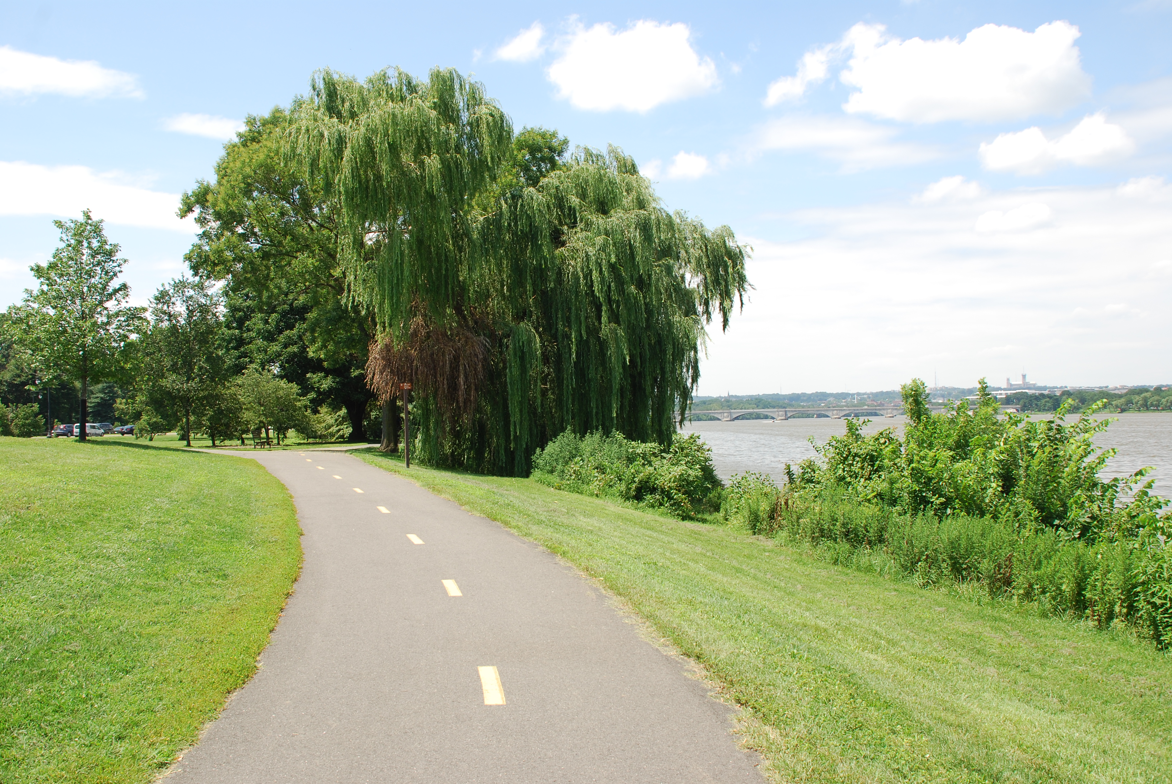
- (288 words)<br />Gravelly Point is an open field and park area in Arlington, Virginia north of Ronald Reagan National Airport.<br />Travelling north about one mile on George Washington Memorial Parkway from Ronald Reagan National Airport, turn right after the brown sign with white letters that read "Gravelly Point." Follow the road as it turns south into the parking lot. <br />Gravelly Point sits to the northwest from the parking lot. It spans about six hundred fifty feet wide and runs five hundred fifty yards west along the Potomac River. A channel separates Gravelly Point from the end of a National Airport runway to the east. Airplanes land and takeoff throughout the day, flying only a few hundred feet above the field.<br />Soccer and other athletic fields line the area and trees and picnic tables are scattered around the edge of the field. Mount Vernon Trail runs along the northern side as it passes through from east to west. A boat ramp feeds into the Potomac River from the southeastern end of the point.<br />Portable restrooms and bicycle racks sit north of the bicycle trail at the west end of the park.<br />North of the parking lot, on the north side of the Mount Vernon Trail is a six-square-inch bronze plaque set in cement on the ground. An inscription on the plaque reads:<br />GOVERNOR'S GROVE<br />THIS GROVE OF DOGWOOD TREES WAS PLANTED BY THE WIVES OF OUR STATE GOVERNORS<br />MARCH 18, 1967<br />Across Mount Vernon Trail to the west is a four by three-foot wayside titled at the top:<br />Gravelly Point<br />The sign features a map of the Potomac River and Mount Vernon Trail along the left side and provides trail and bicycling rules and etiquette, and park information on upcoming events.<br />END OF DESCRIPTION<br />
This overlook is located to the left of the south end of the Visitor Center. It is the closest you can get to the Falls themselves.
- A wide photo of a large rocky waterfall surrounded by rocky cliffs and trees.
This overlook is located further down the trail. Most of the waterfall can be seen from this overlook.
- A wide photo of a large rocky waterfall surrounded by rocky cliffs and trees.
Two viewing platforms at Overlook 3 provide the best view of Great Falls.
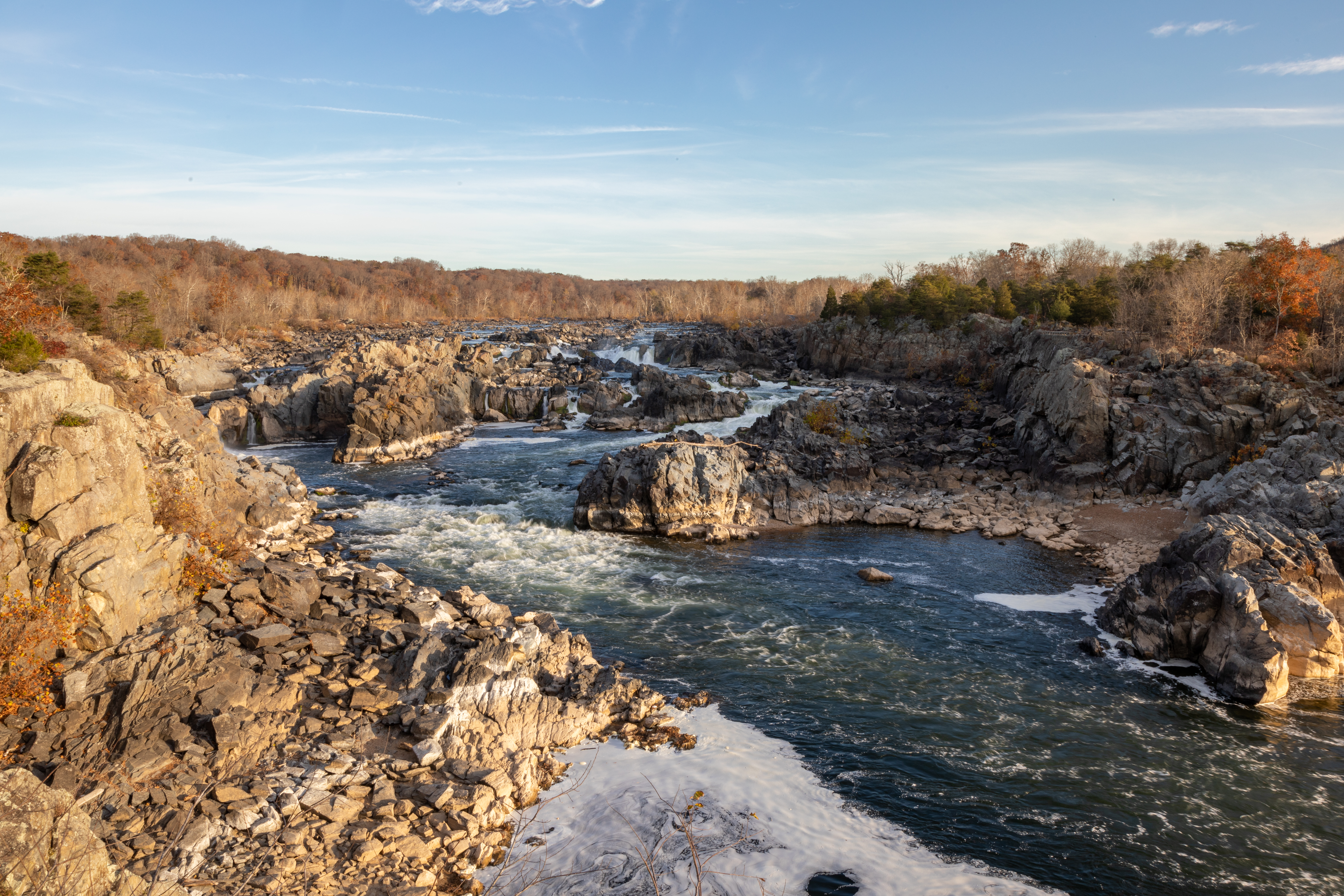
- A large and wide rocky waterfall surrounded by rocky cliffs and trees.
Great Falls Fee Booth.
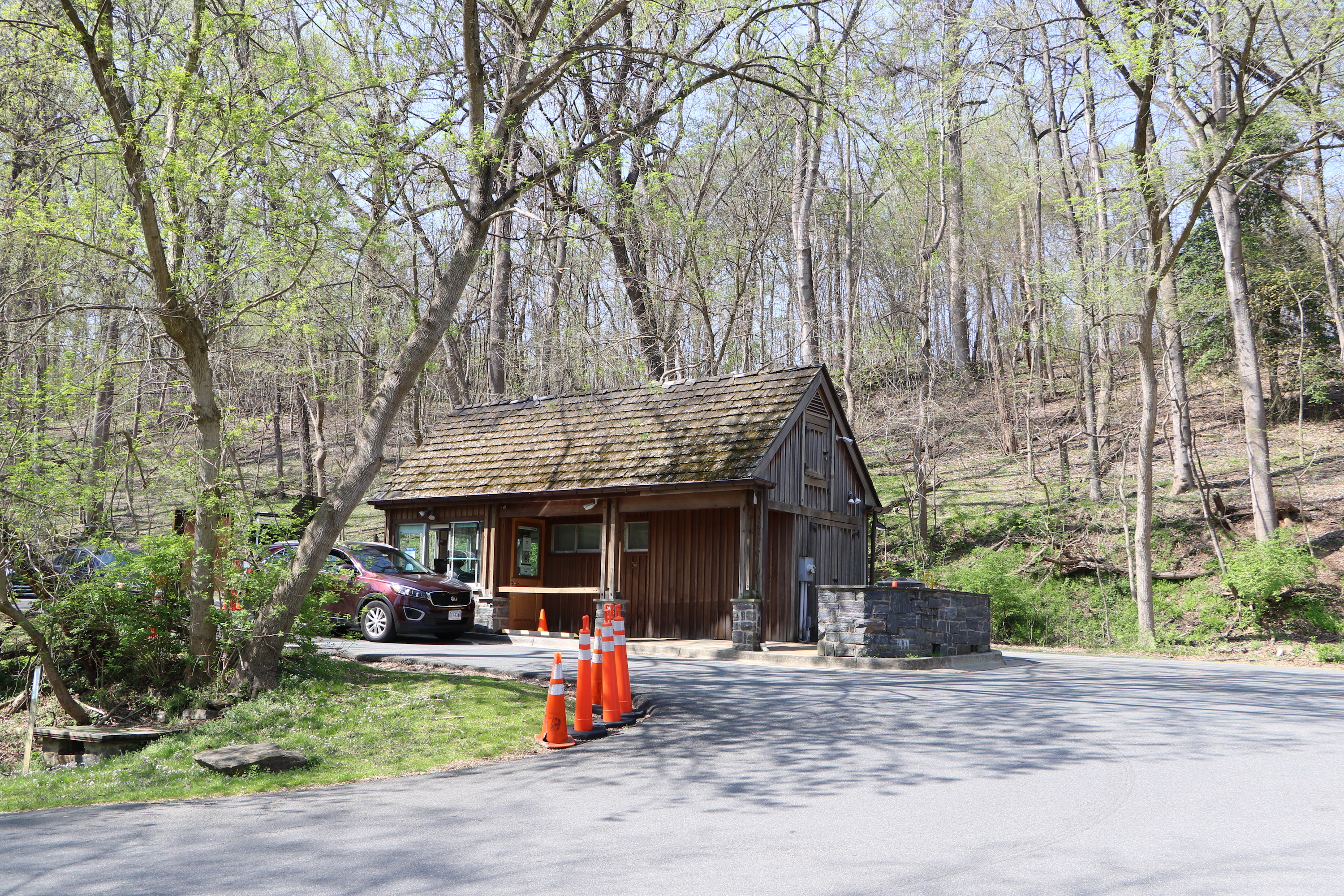
- A small fee booth surrounded by trees. Next to the booth is a line of cars checking into the booth/
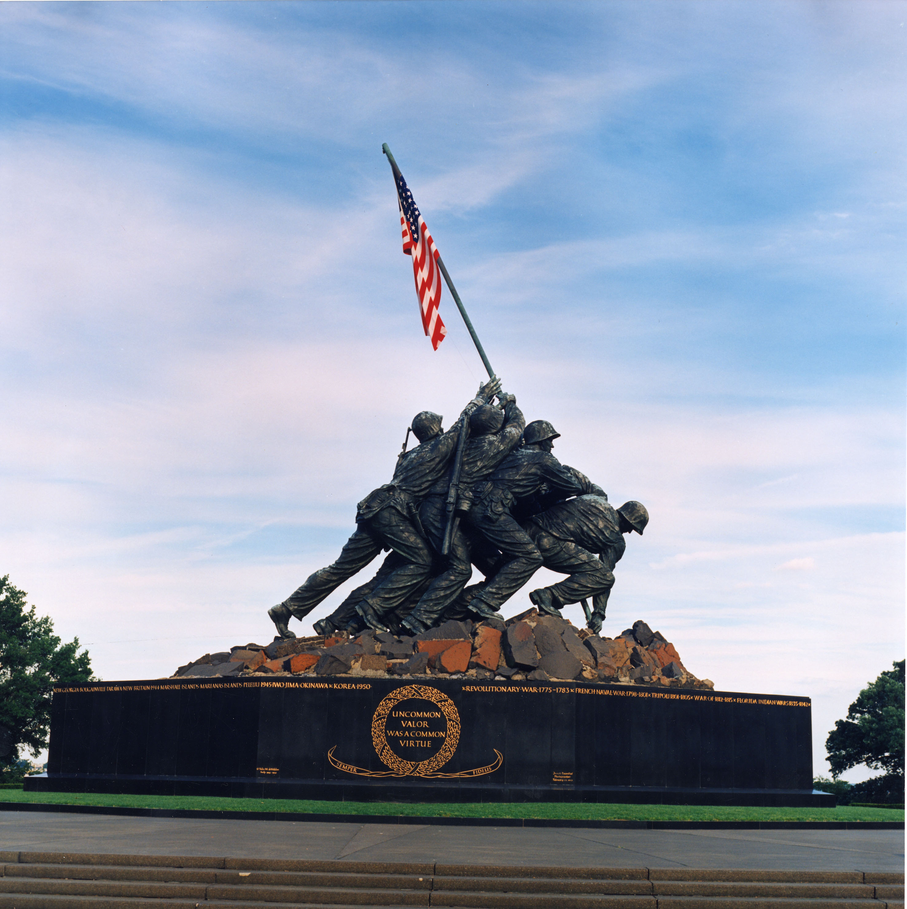
Here you can see a part of the actual Marine combat patrol that took the Stars and Stripes up Mount Suribachi, past snipers concealed in the sides of that volcano. Some of these faces are here in the war memorial statue.
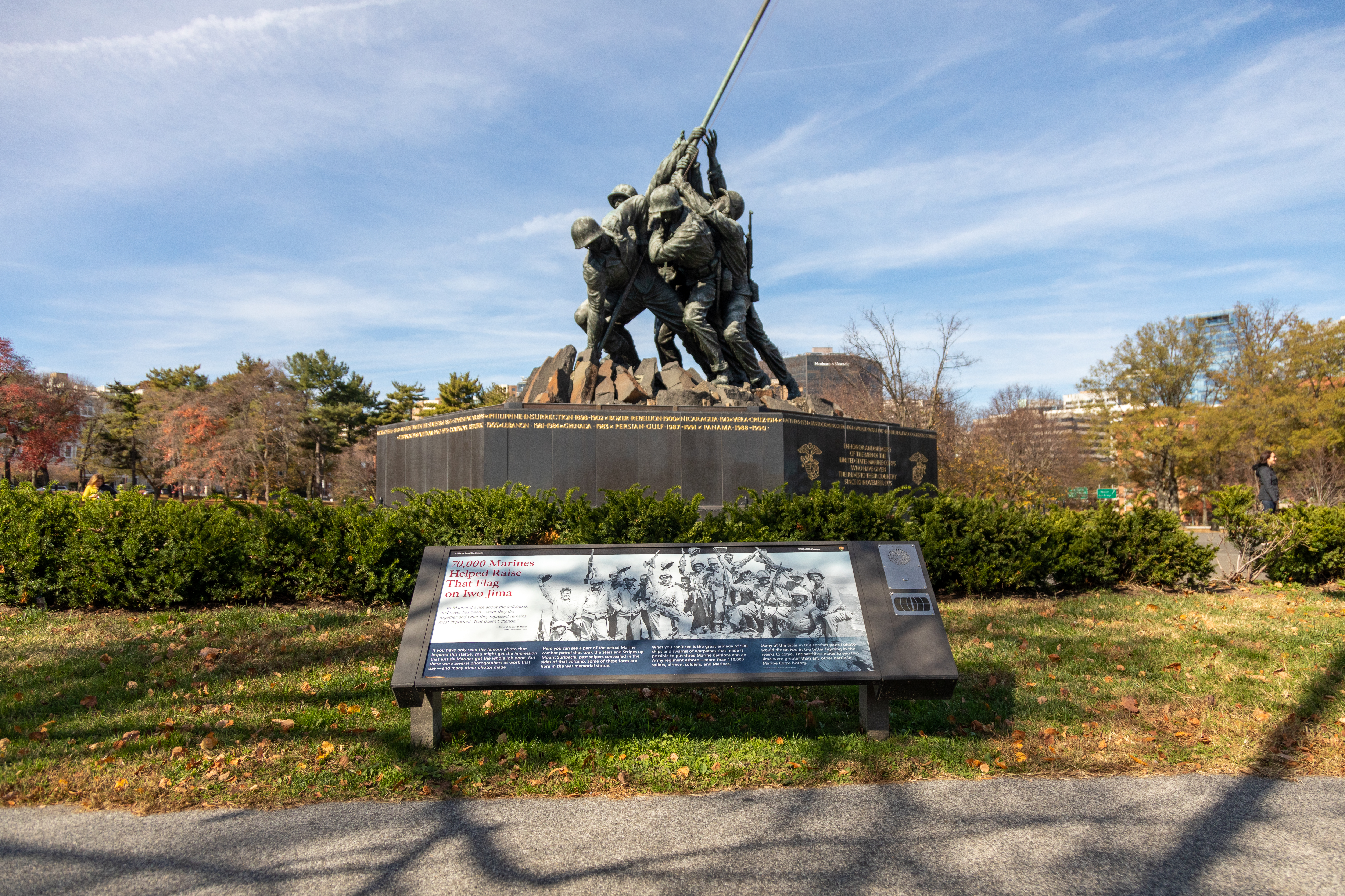
- An information panel is positioned just off a paved sidewalk path. It is positioned low to the ground and in front of the Marine Corps Memorial. Bushes encircle the memorial.
The kinds of birds you see in this forest depend on where you look and when. You might hear the rapping of a woodpecker year-round, while abundant summertime insects support a variety of neotropical migrants that breed here during the warmer months. Still other migrants stop only for a brief respite before continuing their annual journey.
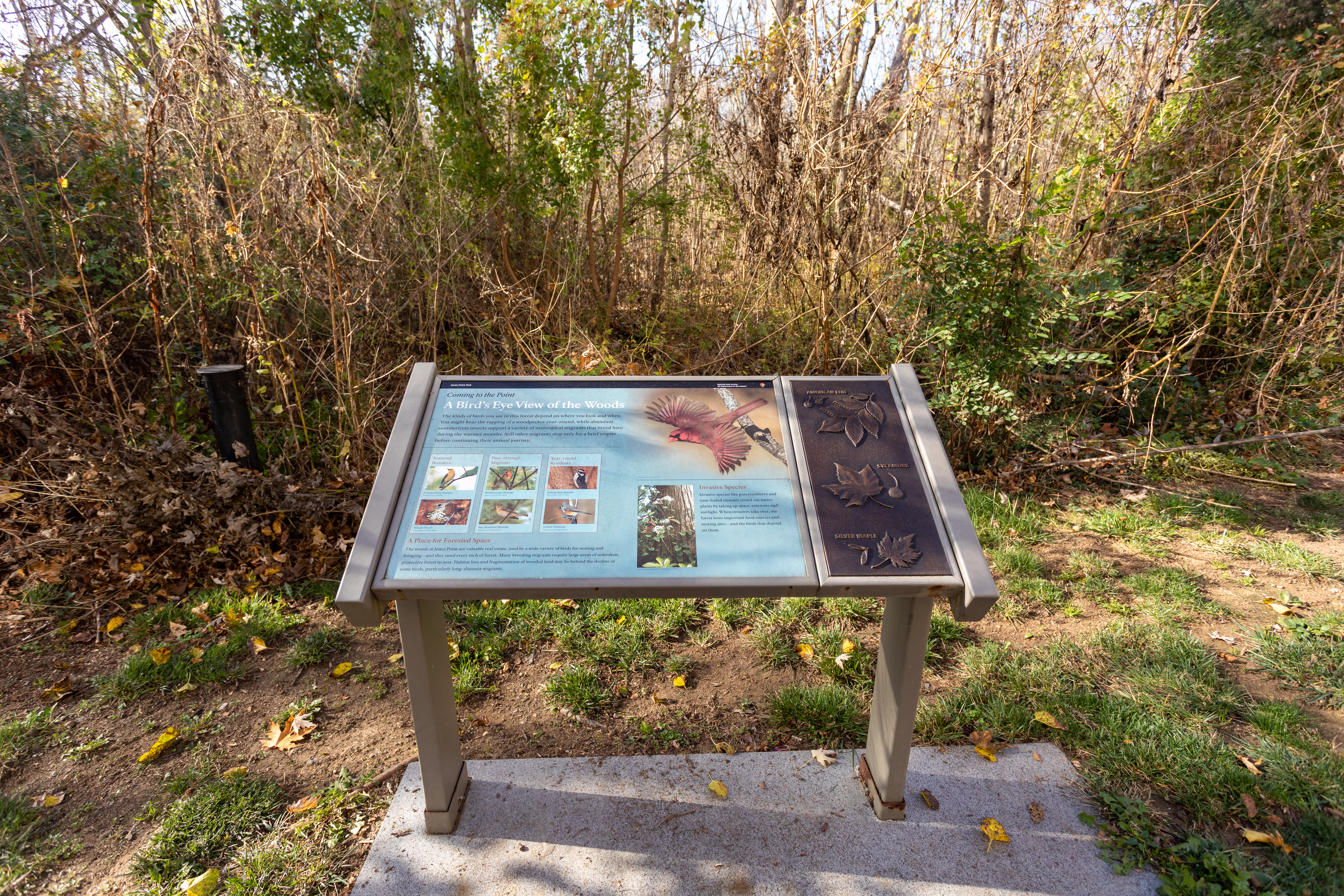
- An information panel is positioned on a concrete platform in the shape of a rectangle. The platform is embedded in the ground and dirt and grass surround the platform. Tall bushes and vegetation stand in the background. Tactile elements of leaves are available for visitors to touch on the right side of the information panel.
When George Washington surveyed the future site of Alexandria in 1749, he described this area as a "fine improvable marsh." Do you think that ideas about improving marshlands have changed since Washington's time? How can we improve Dyke Marsh today?
- An information panel is positioned in front of a marsh, on a boardwalk. There are railings on either side of the boardwalk. A large body of water is seen in the background. Cattails and other plants are seen below the boardwalk and on the ground.
This dock, constructed of reinforced concrete on concrete and wood pilings, was once the last stop for cargo ships under construction at Jones Point's World War I shipyard. Here, ships received final fittings before heading out for service. The dock featured a derrick- a crane-like device- to move construction materials, equipment, instruments, and fittings on and off ships.
- An information panel is positioned to the left of a concrete drop off toward water. The panel seems to be about 10 feet from the drop off point. In the background is a fence separating bushes and trees from the grassy area.
- An exhibit panel includes a timeline with images of the people it describes. A background image depicts a black and white photo showing the columns and peaked roof of Arlington House with a number of people standing or sitting on the steps.
Nearly 300 different kinds of birds find food, shelter, or a rest stop in Dyke Marsh. Birds that migrate thousands of miles along the Atlantic Flyway rest here on their way to winter homes in the Caribbean, Central America, and South America.
- An information panel sits just in front of the water's edge, almost as if it were going to get dragged into the water. Leaves, dirt, and grass surround the information panel on the ground. Multiple boats are seen in the water in the distance.
During WWII, the US helped liberate the Netherlands from Nazi occupation. After the war, the US helped rebuild European economies. The people of the Netherlands gave Americans this carillon to thank them.
- Two information panels are connected. They are positioned just off a paved sidewalk. They are positioned in front of a large, tall, rectangular-like structure. Two animals that appear lion-like are positioned in front of the structure.
America's Stars and Stripes remains a potent symbol of Marine Corps spirit and what it took to gain victory in World War II. Marines raised the flag twice over Iwo Jima. Each action was over in a matter of seconds. Photographers present recorded many pictures of both events.
- An information panel is positioned in front of a large memorial of soldiers raising a flag. The information panel sits just off the paved pathway. It is positioned low to the ground. An audio description option is available on the right side of the panel.
- An information panel depicts a large shipyard with scaffolding and cranes. A series of images shows delivery of parts from fabricating shop to shipways, erecting the keel and hull, framing the vessel, and ship launch to fitting-out dock. Another image shows overgrown ruins with a caption, "Look on-site for remnants of the shipway." A panoramic image shows the shipyard's structures, with three large scaffolding structures in the center with cranes jutting out.
Your body has a heart and blood vessels to carry nutrients to your tissues, lungs to breathe, kidneys to filter out pollutants, and skin to protect you. When you look closely at Dyke Marsh, you can find natural systems that do all the same things.
- An information panel is positioned in front of a marsh. Dirt, leaves, and gravel surround the surface around the panel. A few feet behind the panel is where the ground drops down to the marsh. Skinny trees surround the area.
The Lyndon Baines Johnson Memorial Grove on the Potomac is a living memorial, surrounded by a grove of white pines and dogwoods bordered by azaleas and wildflowers. The focal point of the memorial is a 19-foot monolith made of sunset red granite quarried 35 miles from President Johnson's Texas ranch home.

- Two information panel are positioned off to the right of a boardwalk path. The panels are positioned in front of the boardwalk railing. Brown sand and water is seen under the boardwalk. Tall trees stand in the distance.
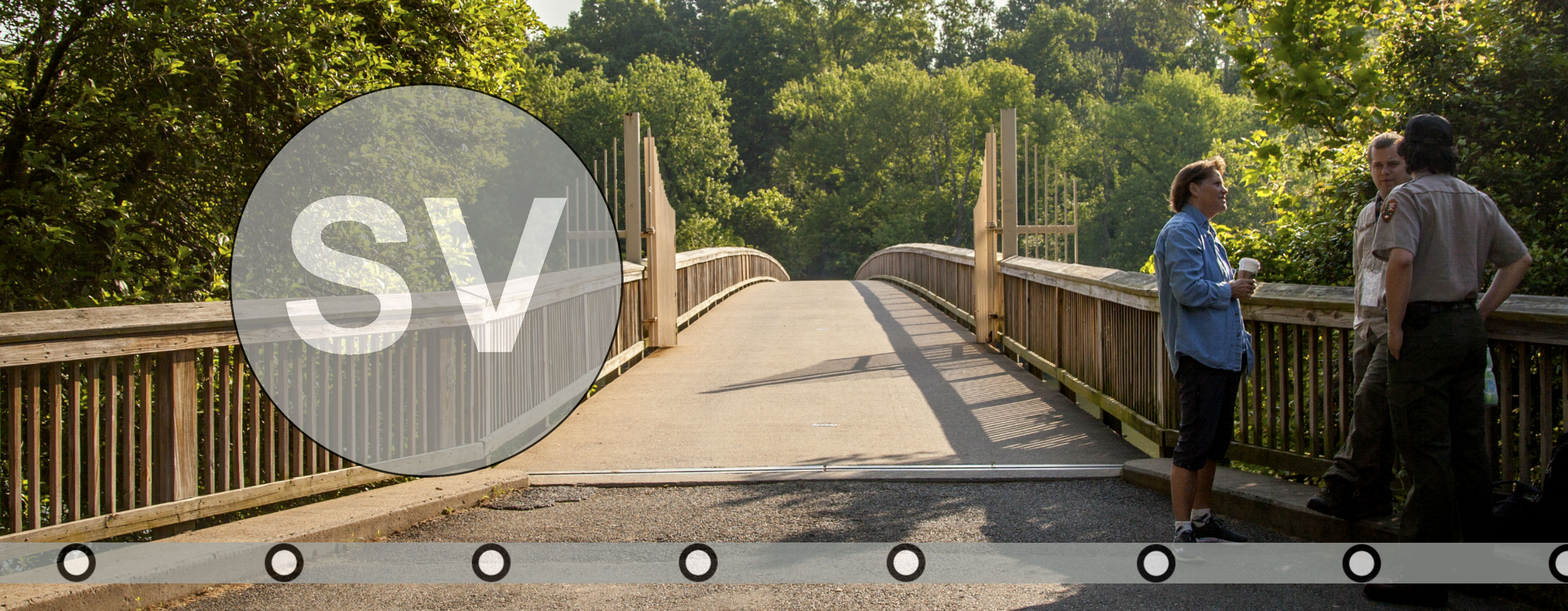
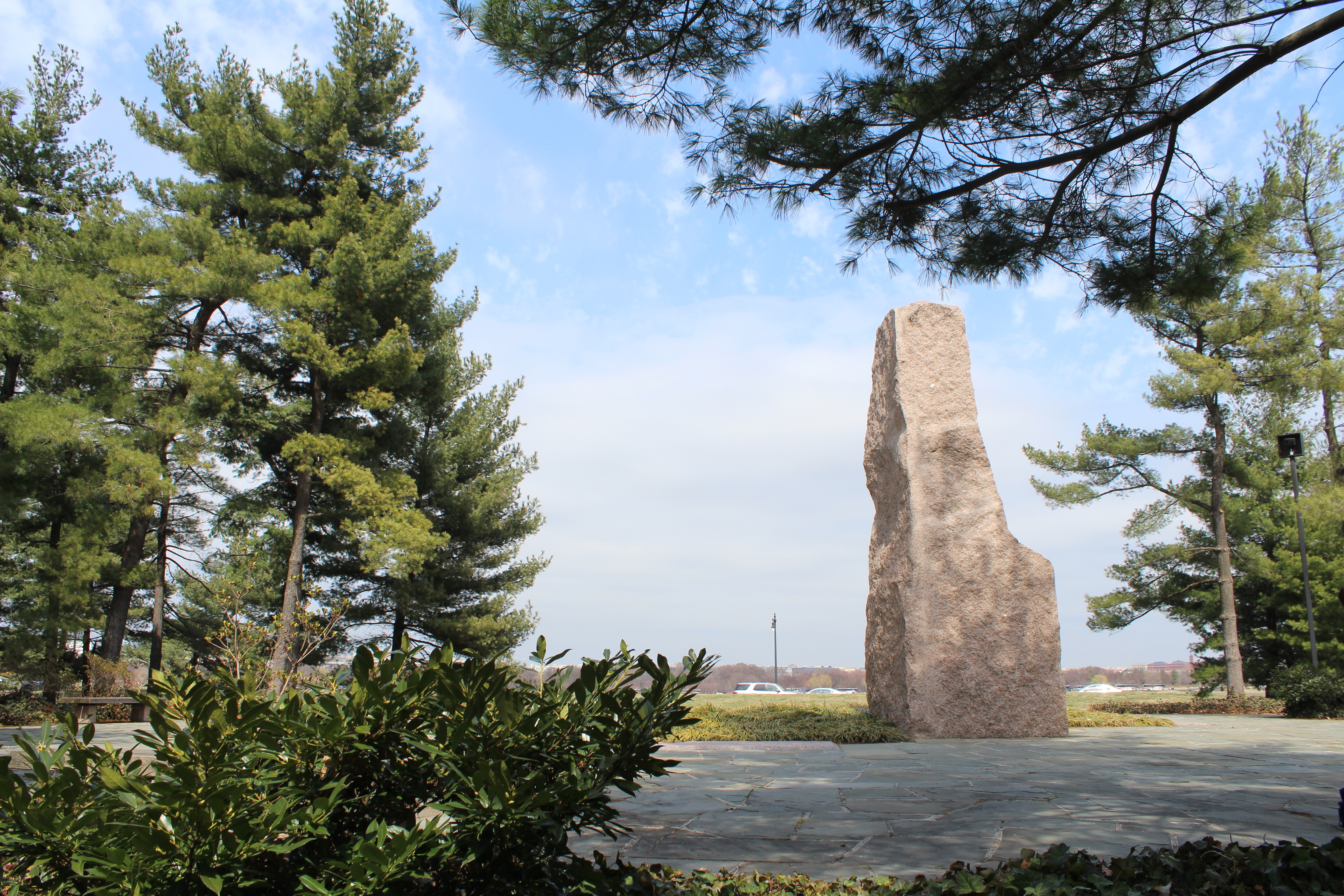
Memorial Avenue was created at the same time as Arlington Memorial Bridge to serve as a ceremonial entrance to Arlington National Cemetery. The avenue was orginally planned to be flanked by numerous statues of American heroes. Seven memorials have been placed along it since 1960.
- An information panel stands along a sidewalk, enshrouded by holly trees.
The area around Jones Point, which lies just south of the nation's capital, was an obvious location for early defensive fortifications. During the Civil War (1861-1865), Battery Rodgers was built overlooking the cove to guard the river approach to Washington. The battery also commanded the southern approaches to Alexandria by covering the Accotink Road (modern Fort Hunt Road).
- An information panel is positioned on top of a concrete platform on the ground. The platform has various engravings that form a map of Alexandria, Battery Rodgers, Ft. Farnsworth, and more. Paved concrete leads up to the information panel. A tactile element of a canon and a quote is positioned on the right side of the panel. Dirt surrounds the panel. Trees stand in the background.
As you walk around this statue, you can see a long list of battlefields where Marines have put their lives on the line for the sake of the United States. Some of these places you may know well. Others may reveal unknown chapters of American history to you. By tradition, the Corps determines when to add battle honors to this memorial.
- An information panel is positioned in front of a large memorial of Marines standing up an American flag. The memorial is encircled by green bushes. A tall building is seen in the background. The information panel is positioned just off a paved sidewalk path. It is positioned low to the ground.
Only 12 original acres of mature forest, known as Arlington Woods, survive today.
- An information panel along a sidewalk next to a stump on a wooden platform.
In 1791, surveyors on Jones Point began to lay out the ten-mile square that would become Washington, D.C. The first marker for the survey- the south cornerstone- was set in place on this spot. Although the stone within this protective enclosure may be a replacement dating from 1794, it is nonetheless among the oldest existing physical monuments associated with the federal city of Washington, D.C.
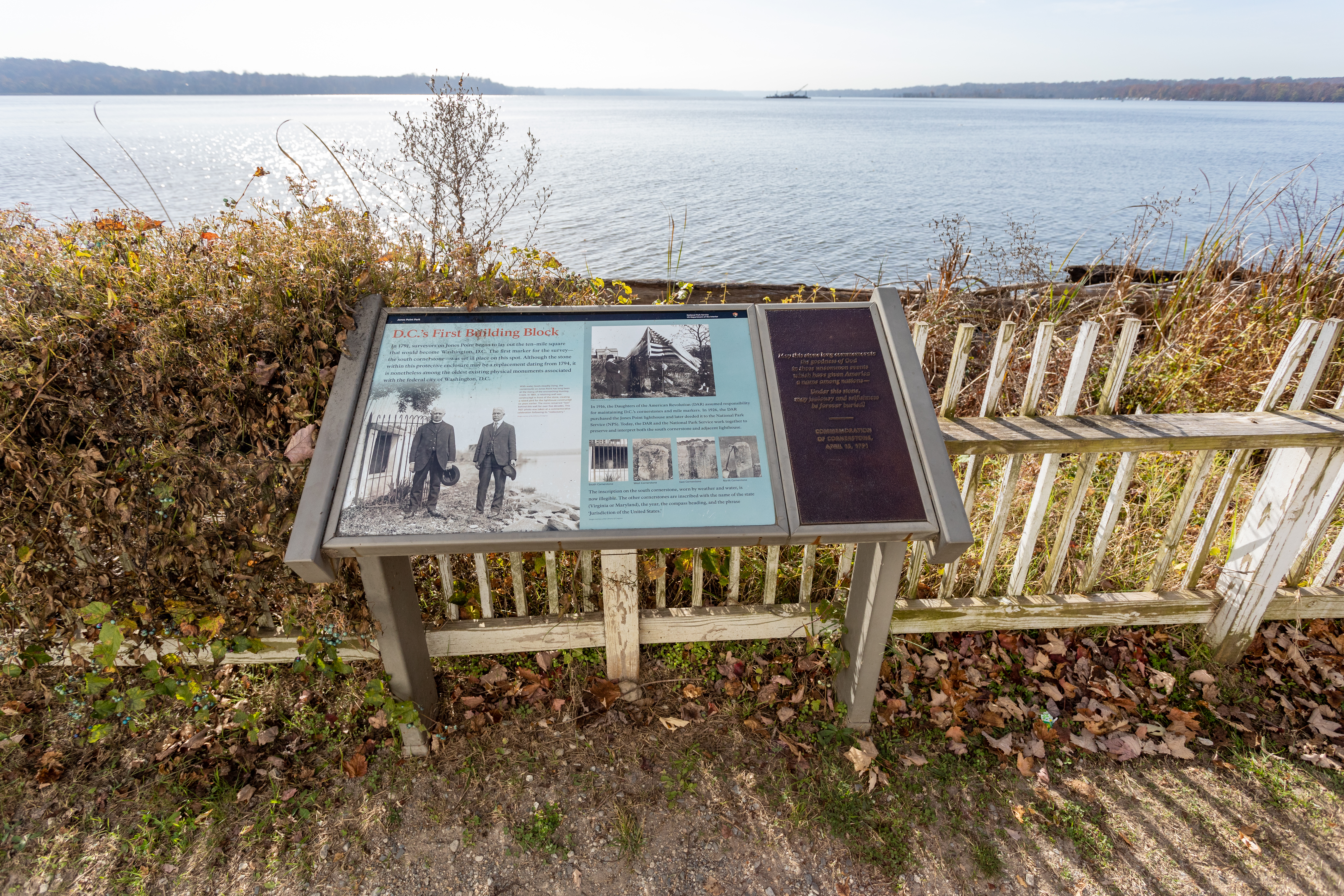
- An information panel is positioned in front of a large body of water. Directly behind the panel, almost attached, is a white, wood fence acting as a barrier. The surface of the ground is dirt and grass. A raised, tactile quote is placed on the right side of the information panel.
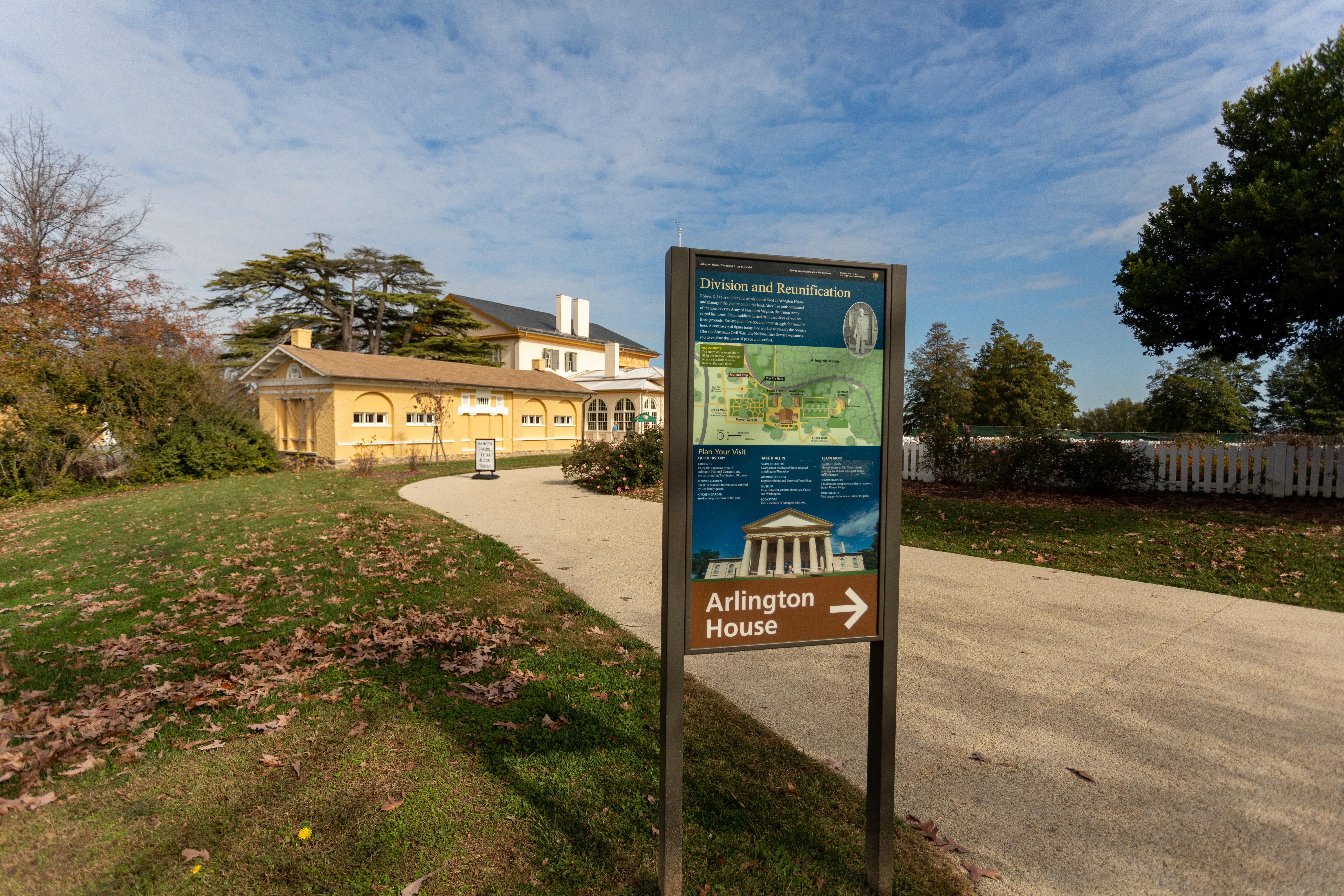
- A sign indicates to follow the sidewalk on the right ahead to Arlington House.