| Title | Hot Springs |
| Park Code | hosp |
| Description | Hot Springs National Park has a rich cultural past. The grand architecture of our historic bathhouses is equally matched by the natural curiosities that have been drawing people here for hundreds of years. Ancient thermal springs, mountain views,... |
| Location | |
| Contact | |
| Activities |
|
| Entrance fees |
|
| Campgrounds | Count: 1
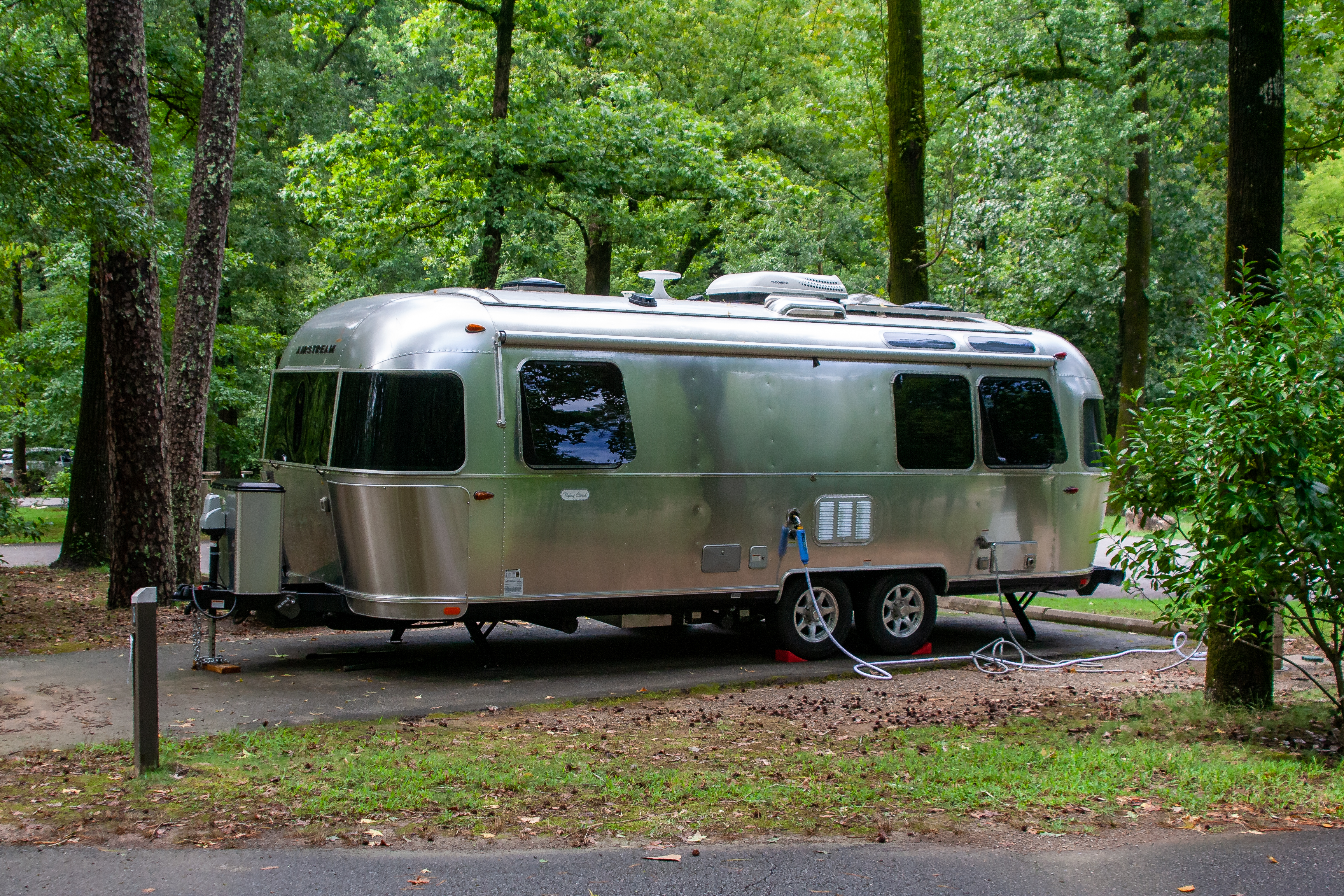
Gulpha Gorge Campground
|
| Places | Count: 39
Administration BuildingThe administration building was built in 1936 and became a National Historic Landmark in 1987. It's the newest building to be added onto bathhouse row, and started out as the park's visitor center and museum in addition to being the administration building. It wasn't until 1989 when the visitor center and museum operations moved into the newly refurbished Fordyce Bathhouse. 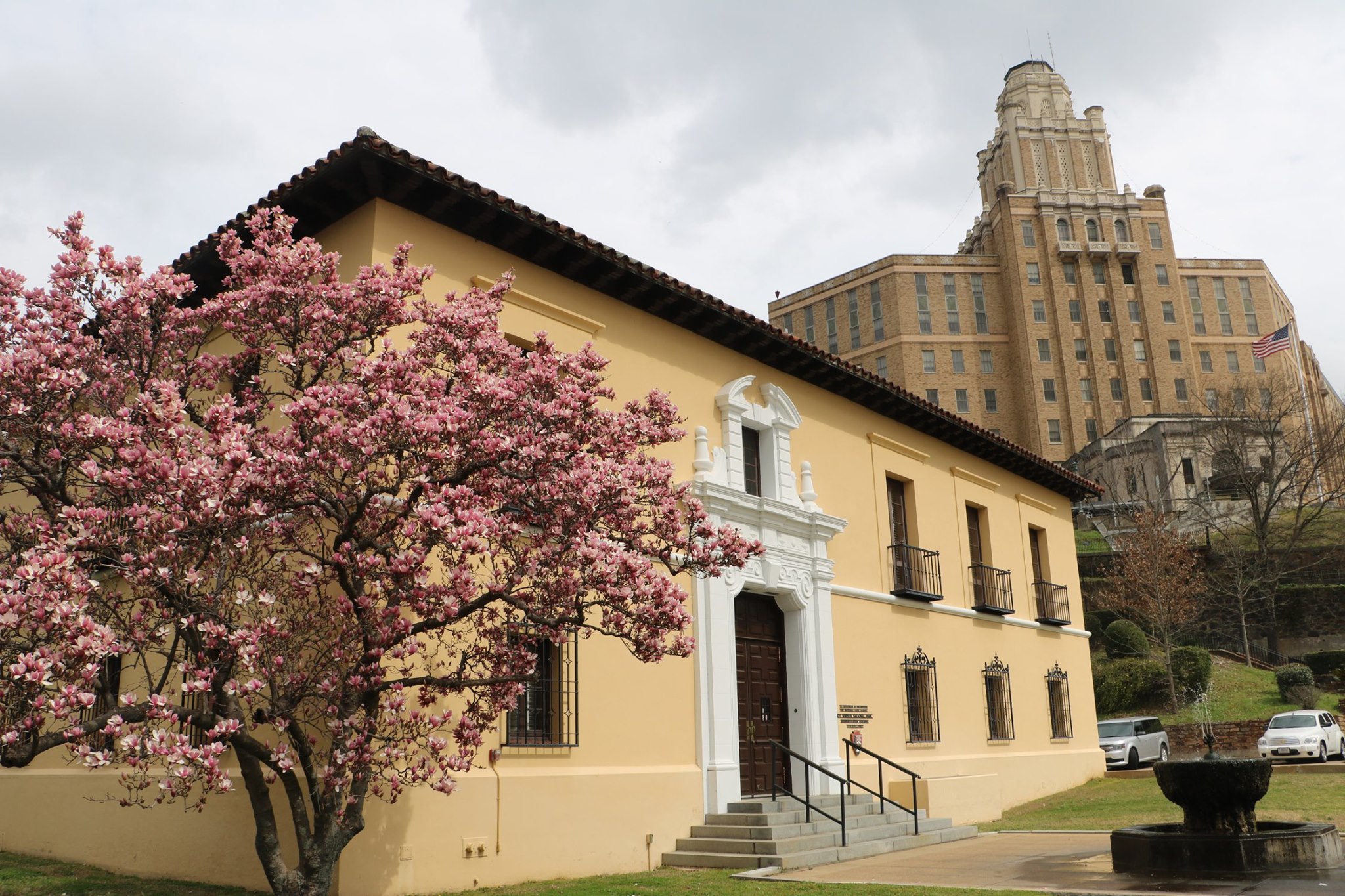
Arlington LawnArlington Lawn in a nice little area to enjoy nature and the town. It's right across the street from the shops and right next to the hot water cascade and hot spring mountain trials. It offers many benches and a pavilion to cool off in the shade. 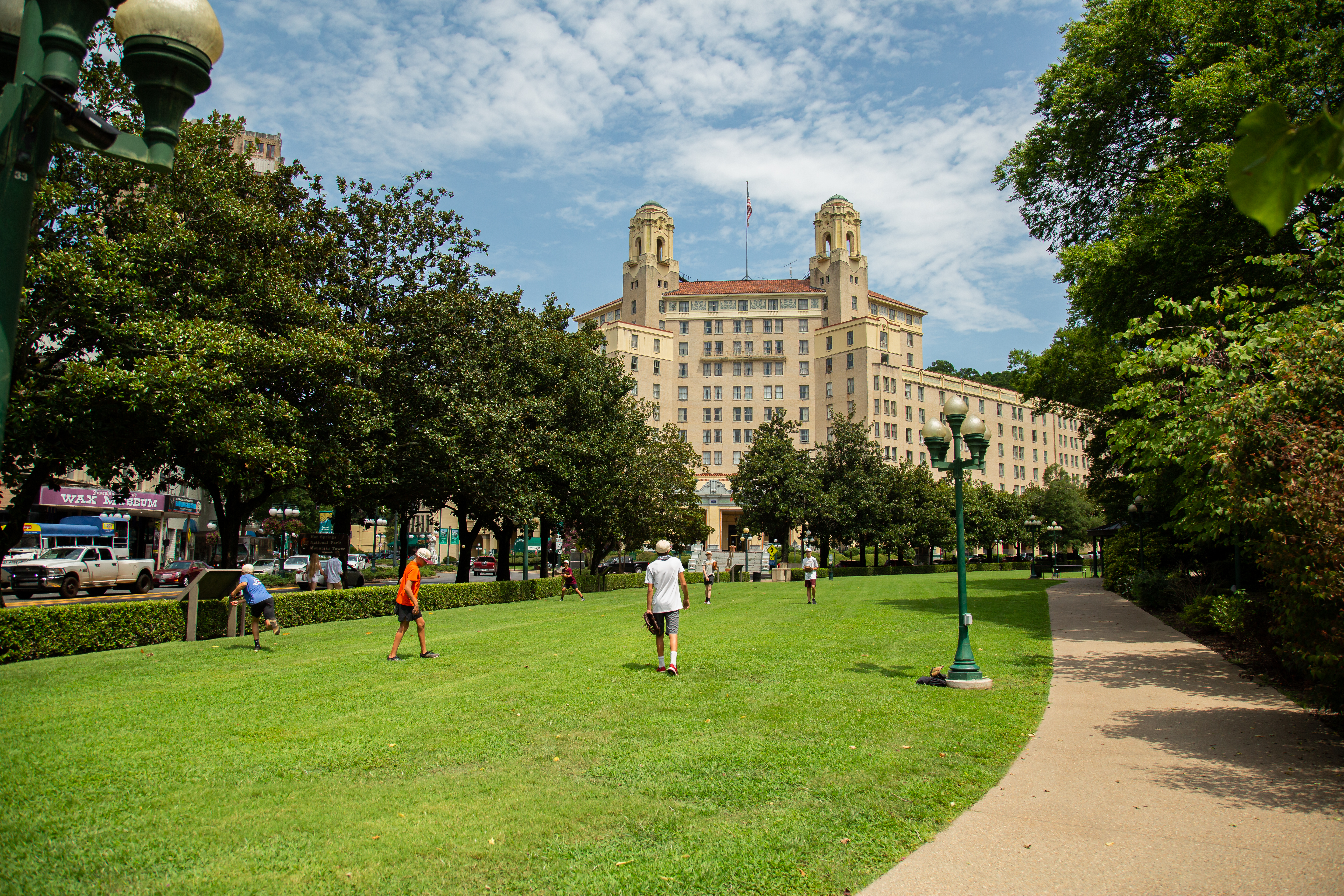
Army and Navy HospitalHot Springs is home to the former Army-Navy Hospital, the first general hospital in the nation that provided treatment to both Army and Navy patients. 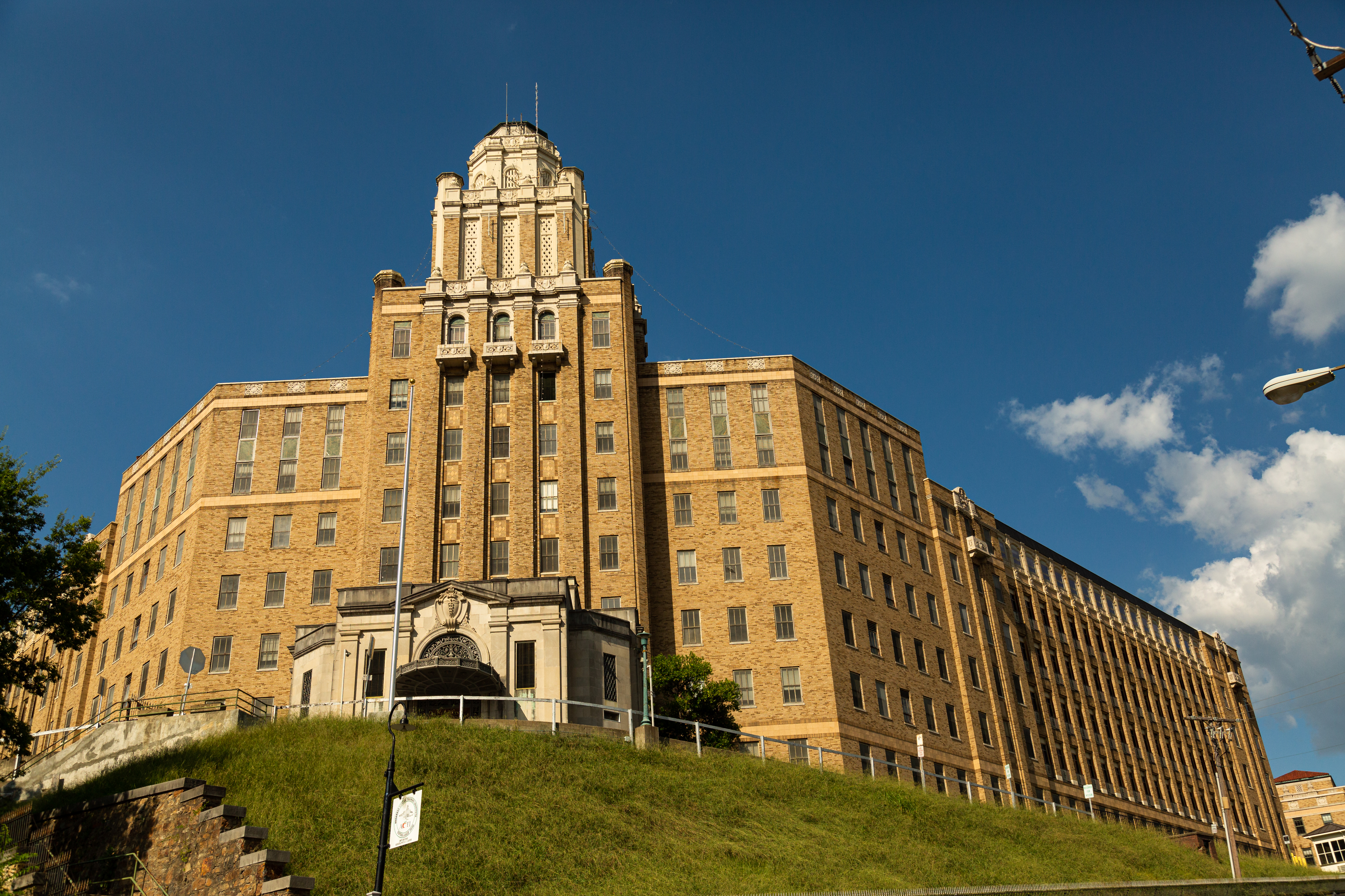
Arsenic SpringArsenic Spring is the northernmost of the springs located along Hot Springs Creek. By the late 1800s, a Victorian-era wooden structure was built over the spring. Despite its name, Arsenic Spring became a favorite drinking spring for nineteenth century visitors. A national publication in the 1870s wrote that Arsenic Spring was “in great repute among the fair sex, who fancy that it improves their complexion." 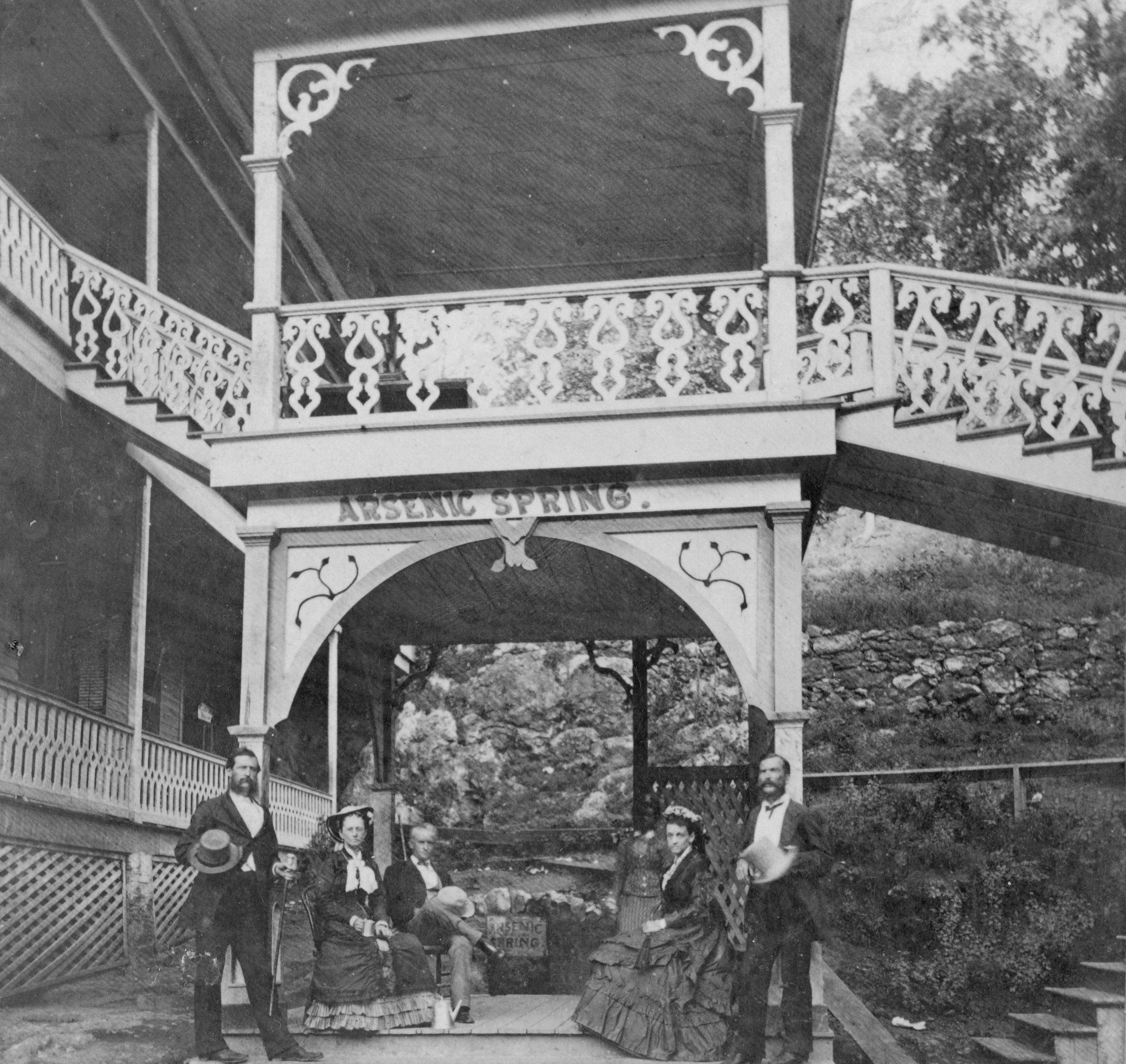
Balanced RockBalanced Rock is located on Sugarloaf Mountain along Sunset Trail between Blacksnake and Cedarglades Road. It's a huge novaculite outcrop with a great view. 
Big Iron SpringBig Iron Spring is the largest and one of the hottest springs in Hot Springs. It was a centerpiece of 19th century Hot Springs both as a functioning spring and a marketable name. 
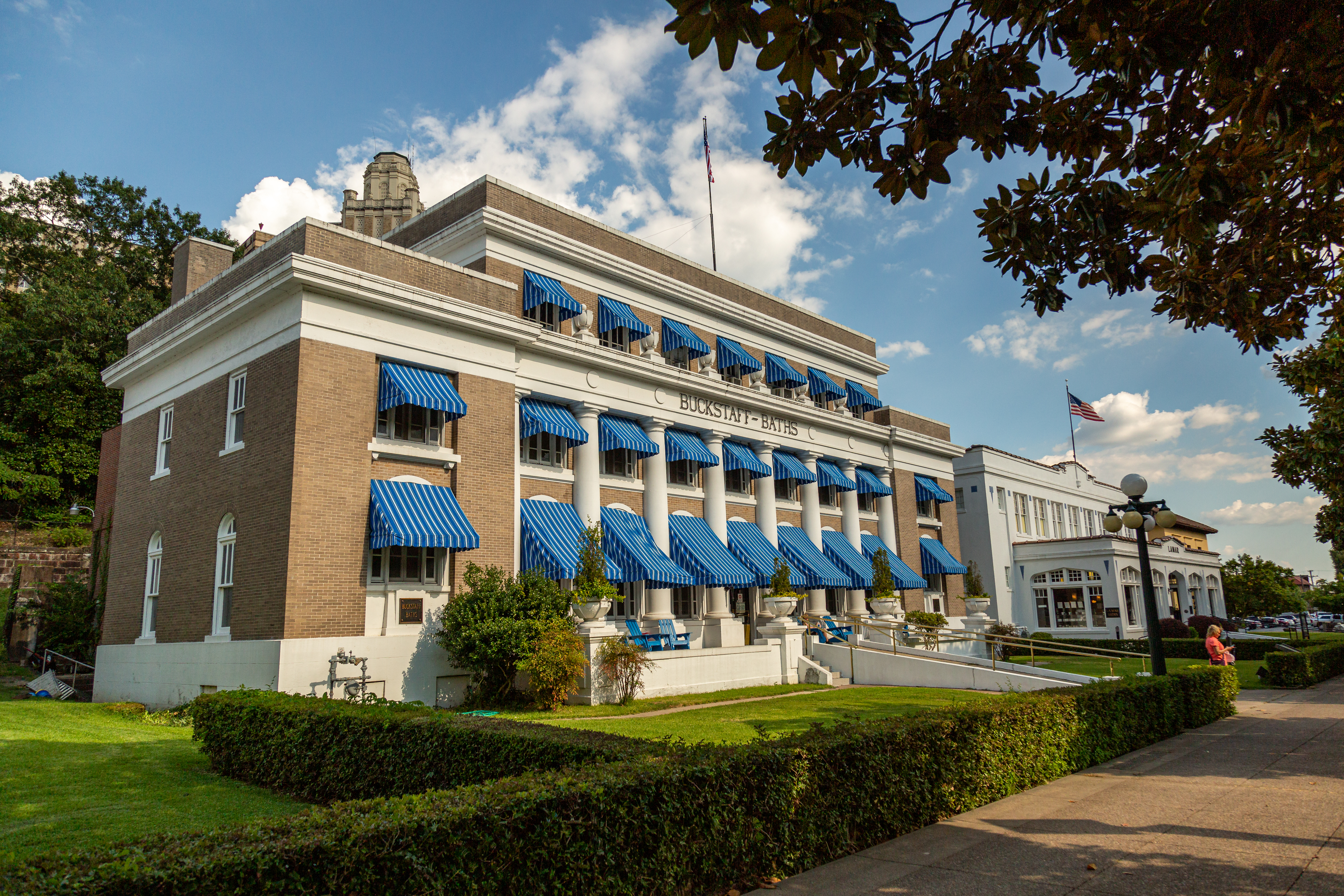
Buckstaff BathhouseOrginally opened in 1912, the Buckstaff is the only facility on the Row that has never fully closed since it first started offering baths. For information about services, rates, and reservations, please visit their website (www.buckstaffbaths.com) or call them directly at (501) 623-2308. 
Corn HoleCorn Hole Springs attracted a broad range of bathers in the nineteenth century because of its ability to treat specific foot ailments. Observers frequently reported that Corn Hole was the most sociable location in Hot Springs, as strangers chatted about topics like the destruction of Ral Hole and their experiences during the Civil War, while healing their feet. 
Display SpringThis display spring is one of the few thermal springs that can be seen along Bathhouse Row. It is located behind the Maurice Bathhouse, alongside Steven's Balustrade. 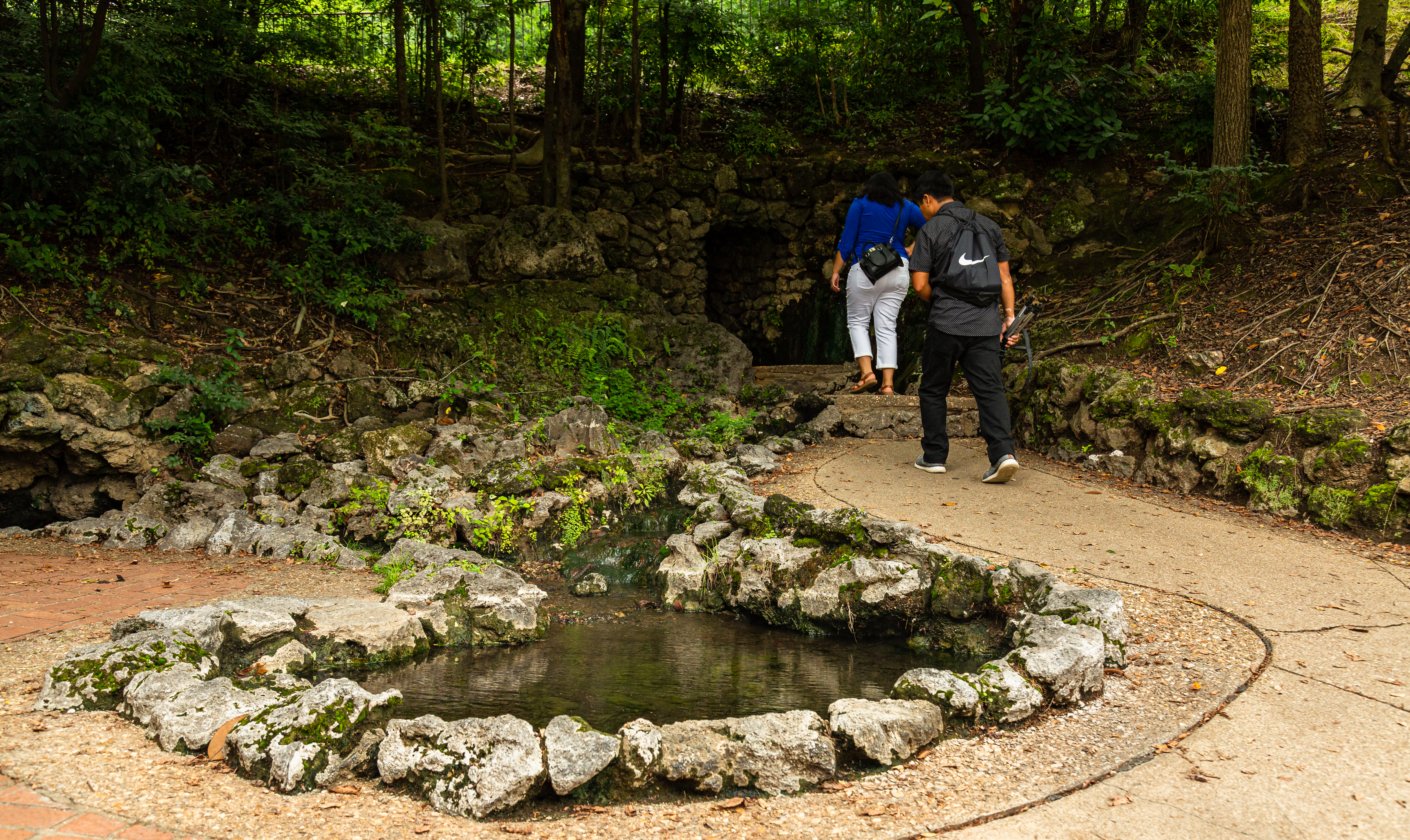
Egg SpringEgg Spring is the northern-most spring located in the uppermost group of hot springs. Egg Spring was historically one of the hottest springs in the park. One observer even reported a water temperature over 150 degrees. Its 1901 temperature was 143 degrees. Egg Spring earned its name because it could supposedly boil an egg the quickest, about 15 minutes. 
Goat Rock View PointThe Goat Rock viewpoint on the Goat Rock trail offers great views overlooking Indian Mountain. 
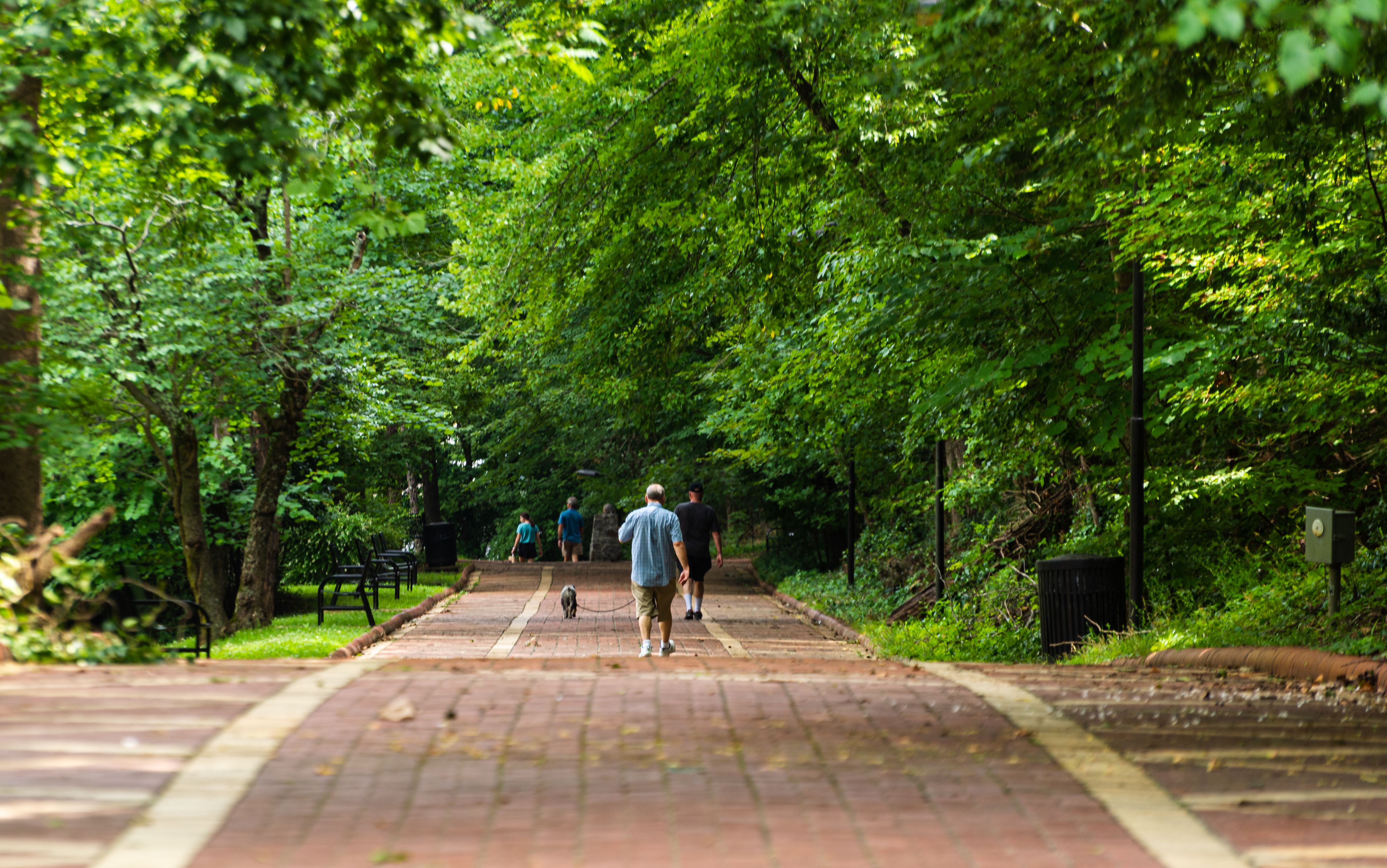
Grand PromenadeThe Grand Promenade is a National Recreation Trail that runs parrallell to bathhouse row, behind the bathhouses. It's about a half mile long and made entierly out of brick. The inspiration for its design came from the Prado, a pedestrain walkway in Havana, Cuba. Along with it being a great place to walk, it also ofers many benches, tables, and even a table for playing chess. 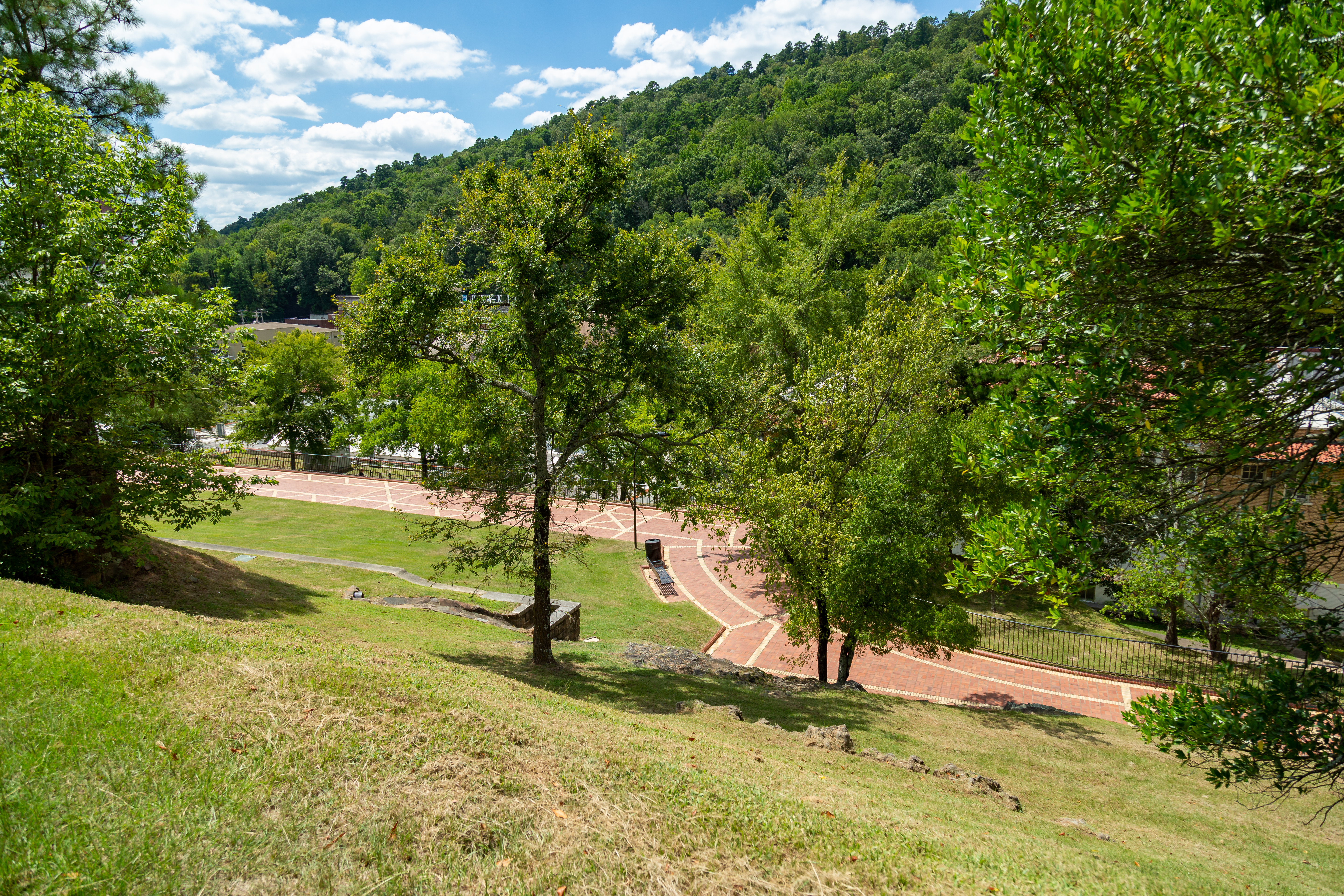
Hale BathhouseThe present Hale Bathhouse is the oldest visible structure on Bathhouse Row, built in 1892. The Mission Revival-style bathhouse is a textbook case of the changes in use and design of bathhouses buildings in Hot Springs National Park. Today, the Hale operates as a historic boutique hotel. 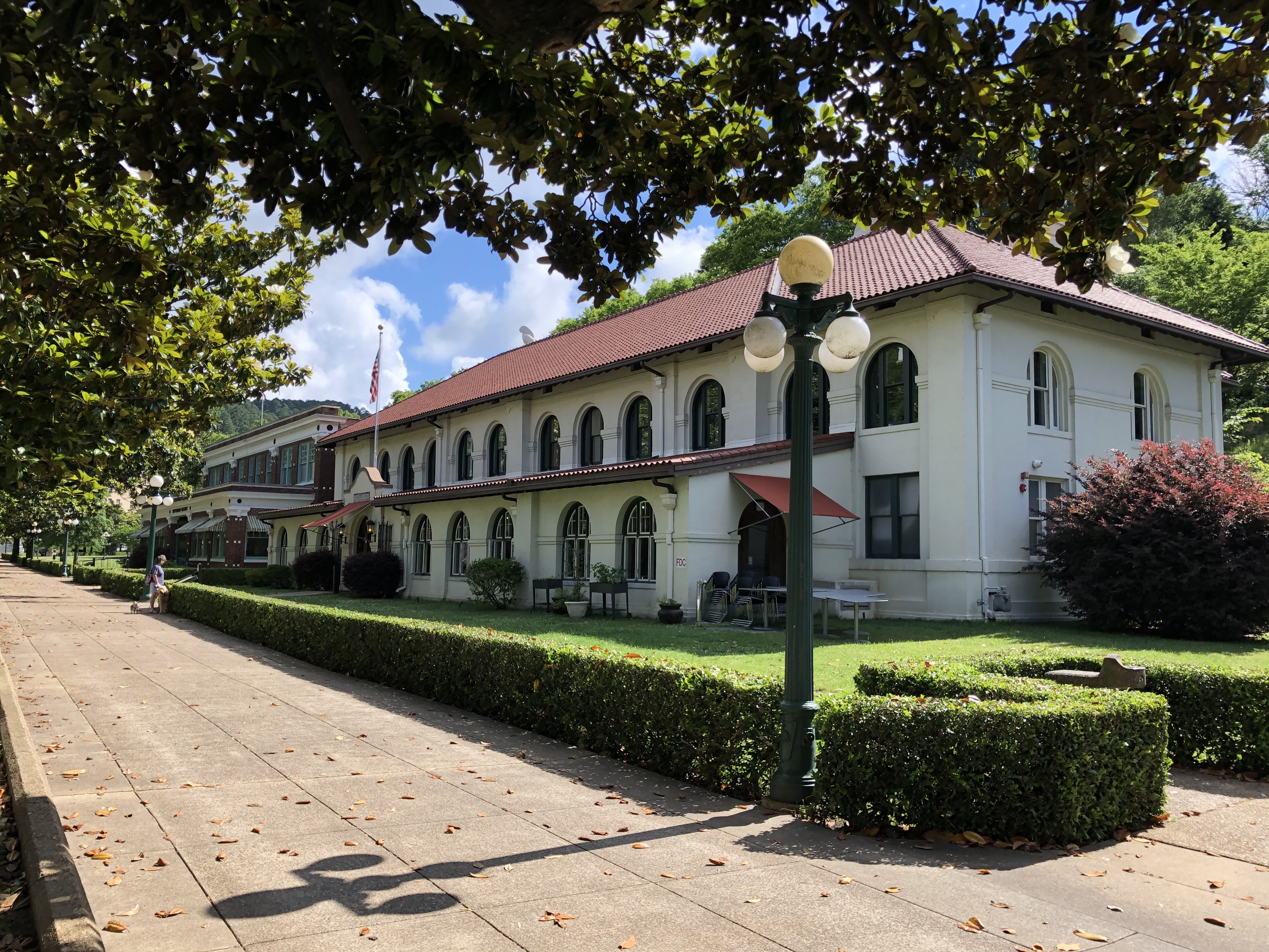
Happy Hollow Jug Fountain (Cold)The source of this cool water is a spring above Fountain Street on the southeast slope of North Mountain. Happy Hollow Spring probably issues from Arkansas Novaculite. The water appears to be of recent vintage-perhaps less than a century in age. Prior to 1960 when it was privately owned, it was called the Magnesia Spring and a pitcher-full cost 5 cents. 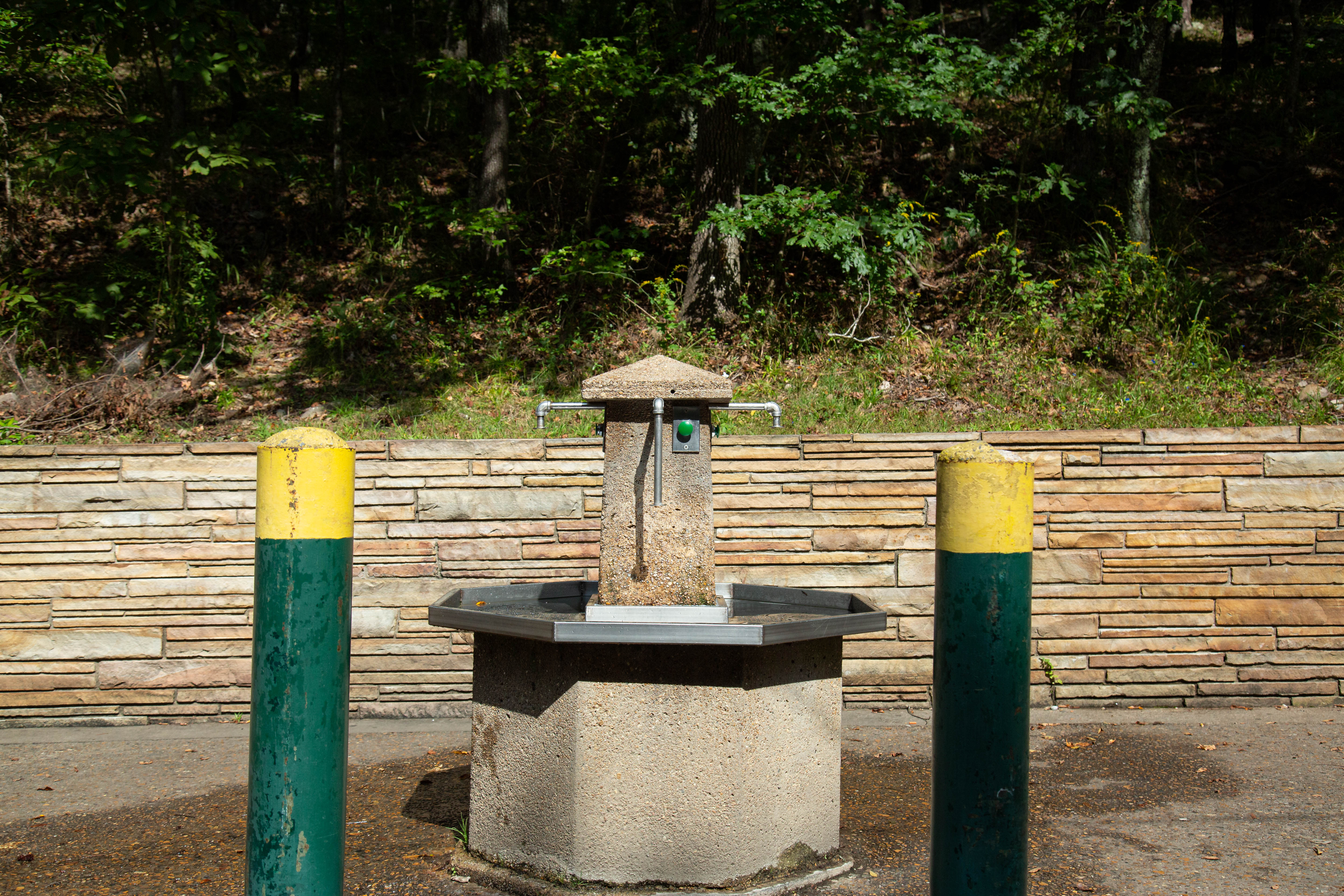
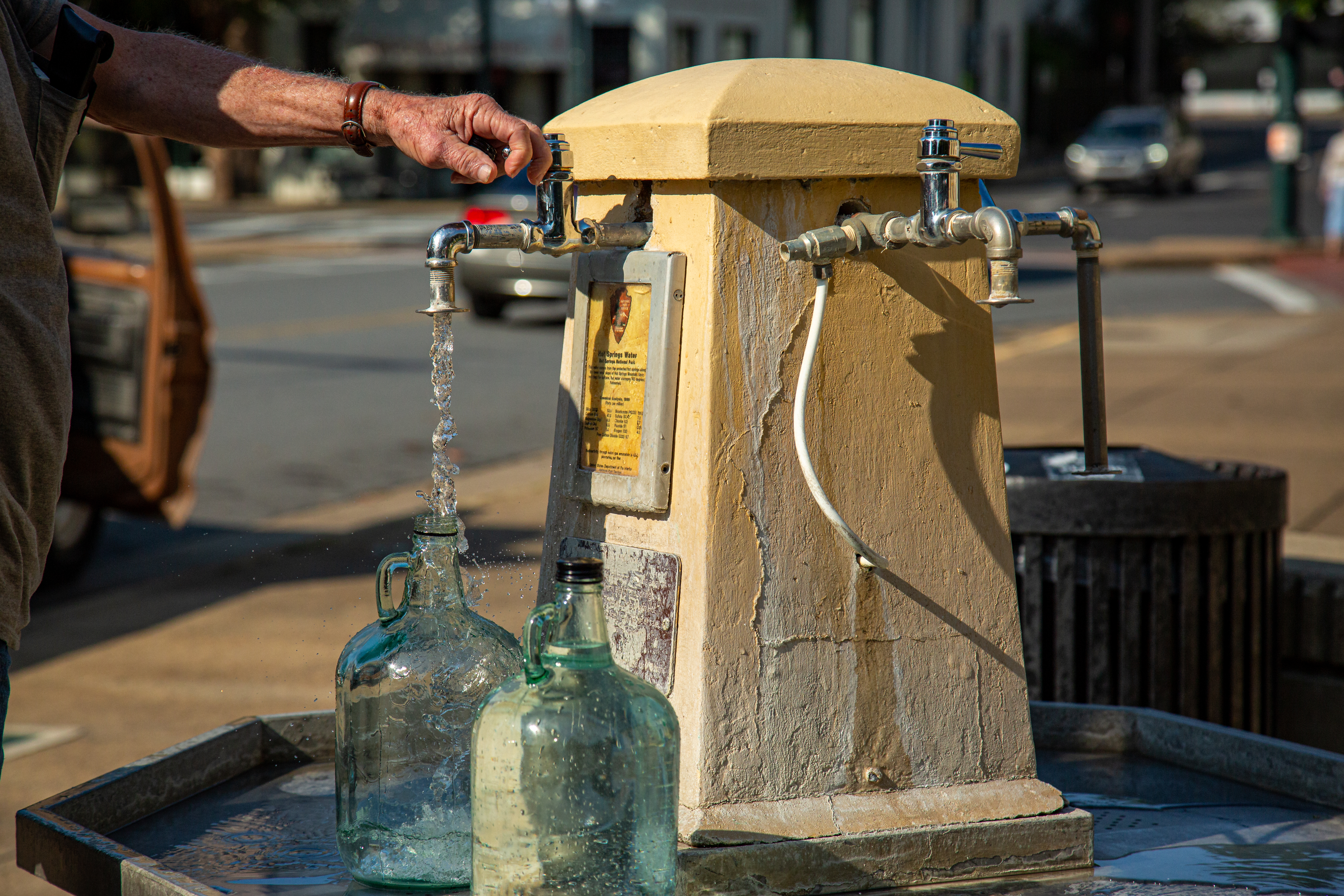
Hill Wheatley Plaza Jug Fountain (Hot)Located at 629 Central Ave., just across the street from Hot Springs National Park. Water averages 143º Fahrenheit/62º Celsius 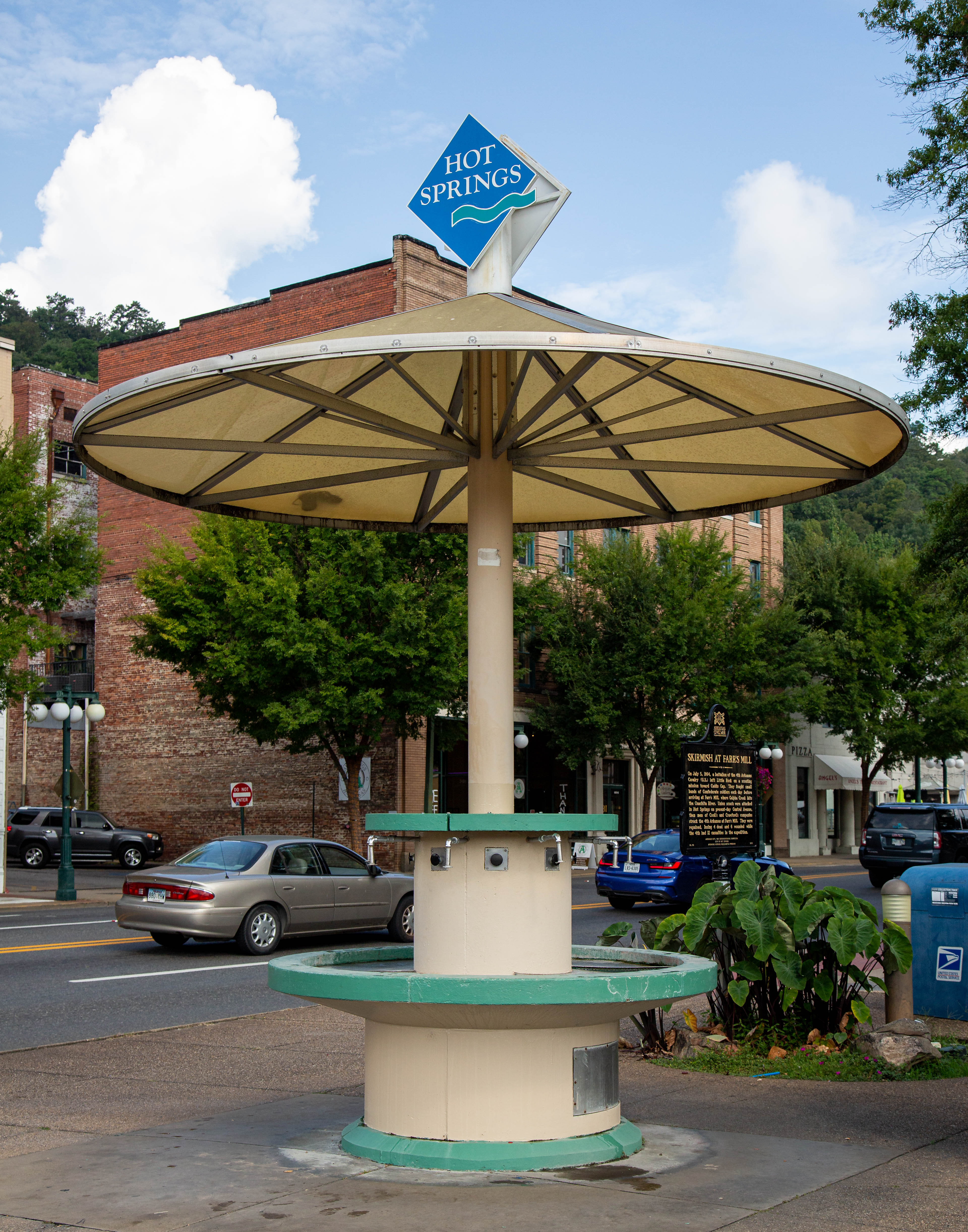
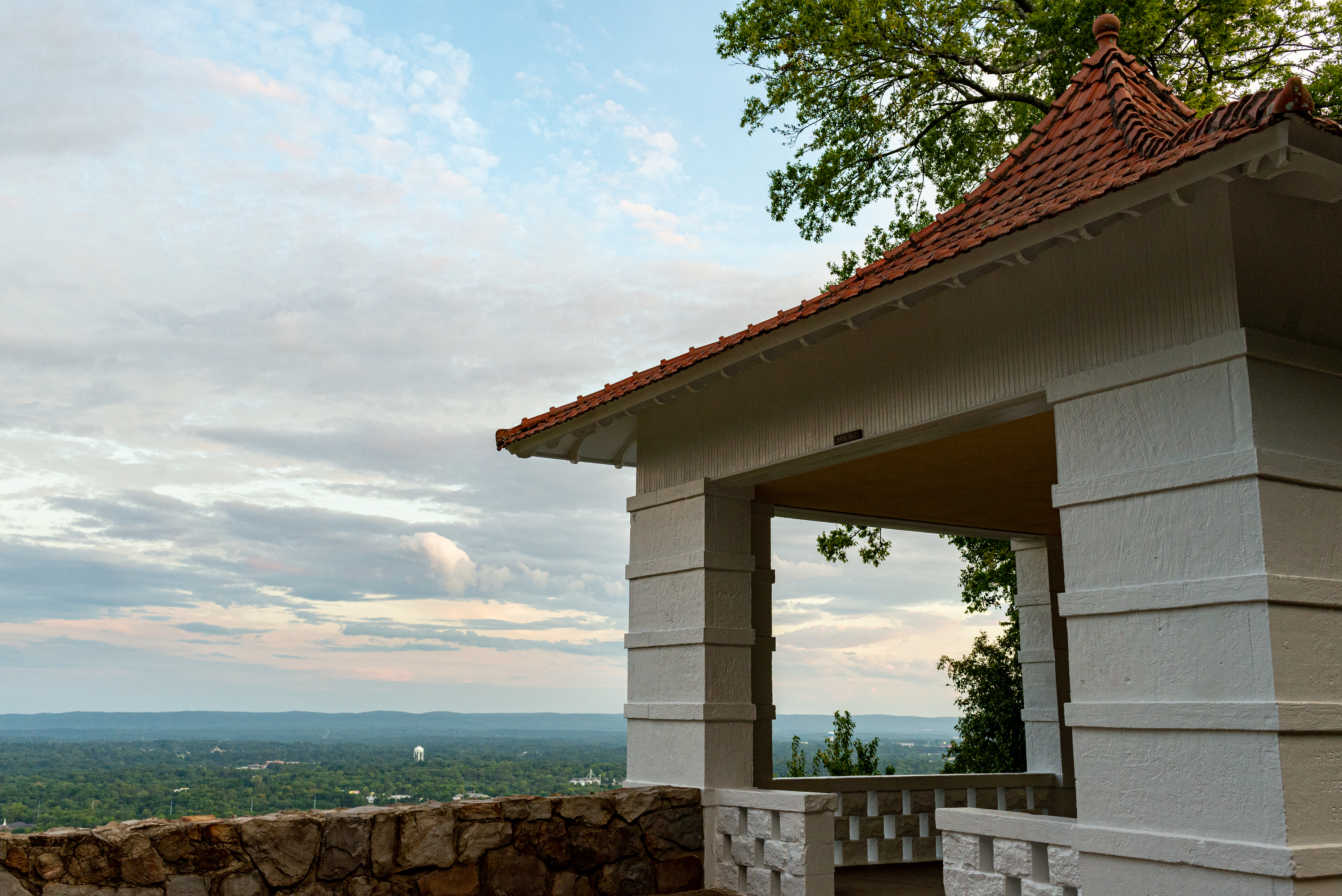
Honeysuckle Trail Shelter HouseA stone shelter house on the side of a hiking trail. Built high on the edge of Hot Springs Mountain, The shelter faces a great view of the surrounding mountain area. 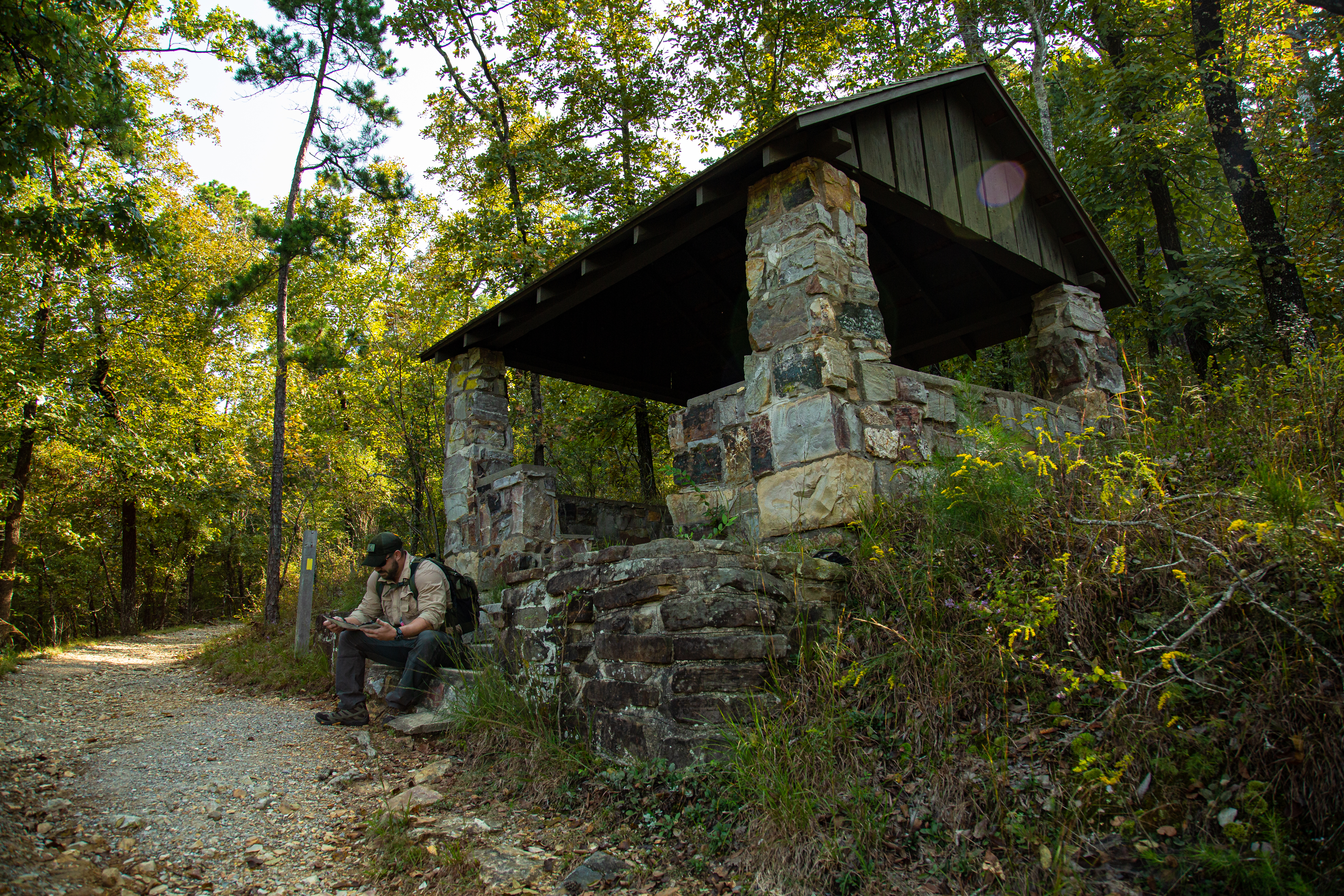
Hot Springs CreekHot Springs Creek drains the hot waters of Hot Springs National Park. Today the creek is covered by a tunnel as it passes along Bathhouse Row and is not visible to the public. 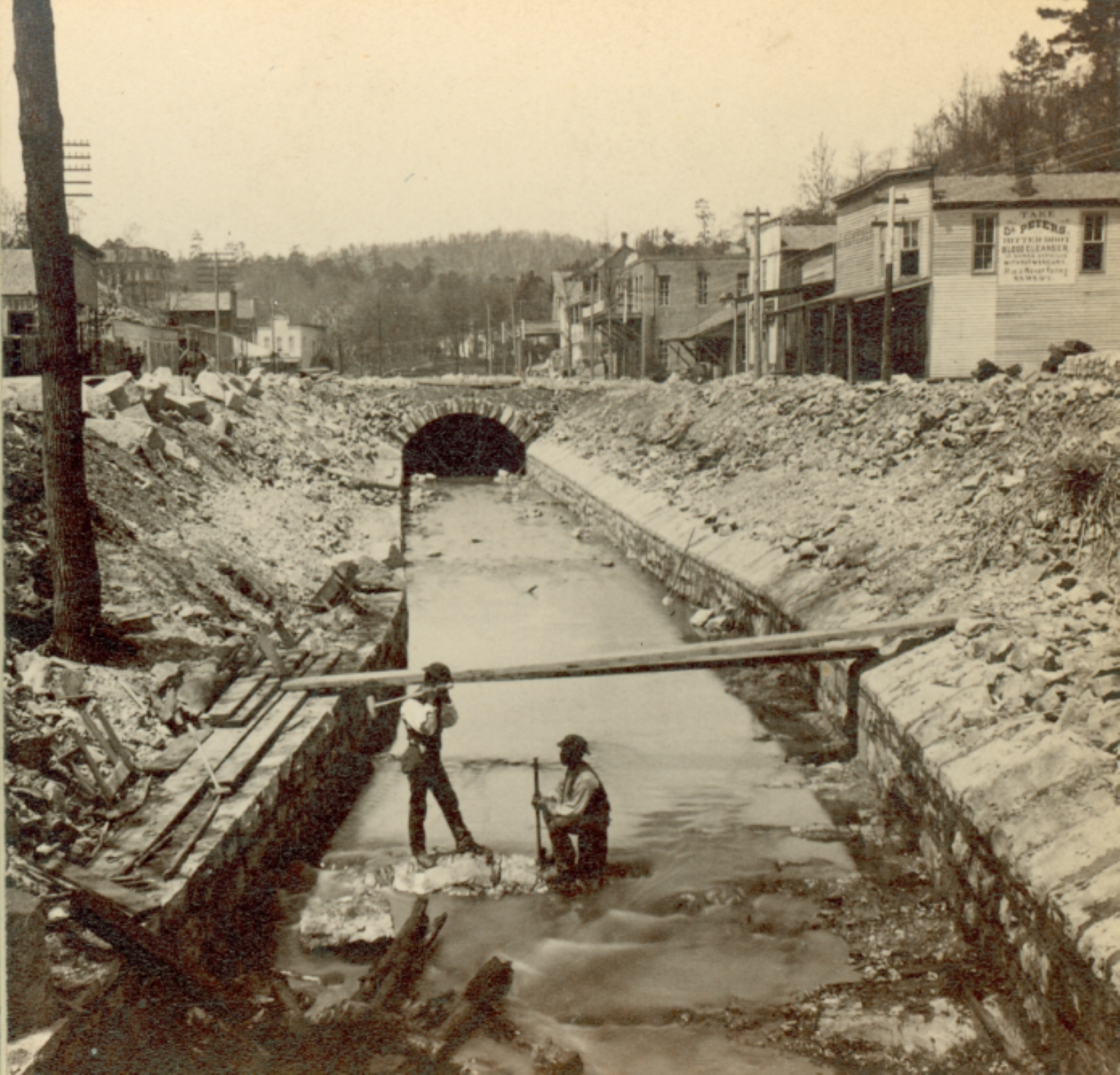
Hot Springs Mountain ShelterMountain shelters like the one on Hot Spring Mountain were made to provide visitors with a place to rest in the shade while out on a hike. 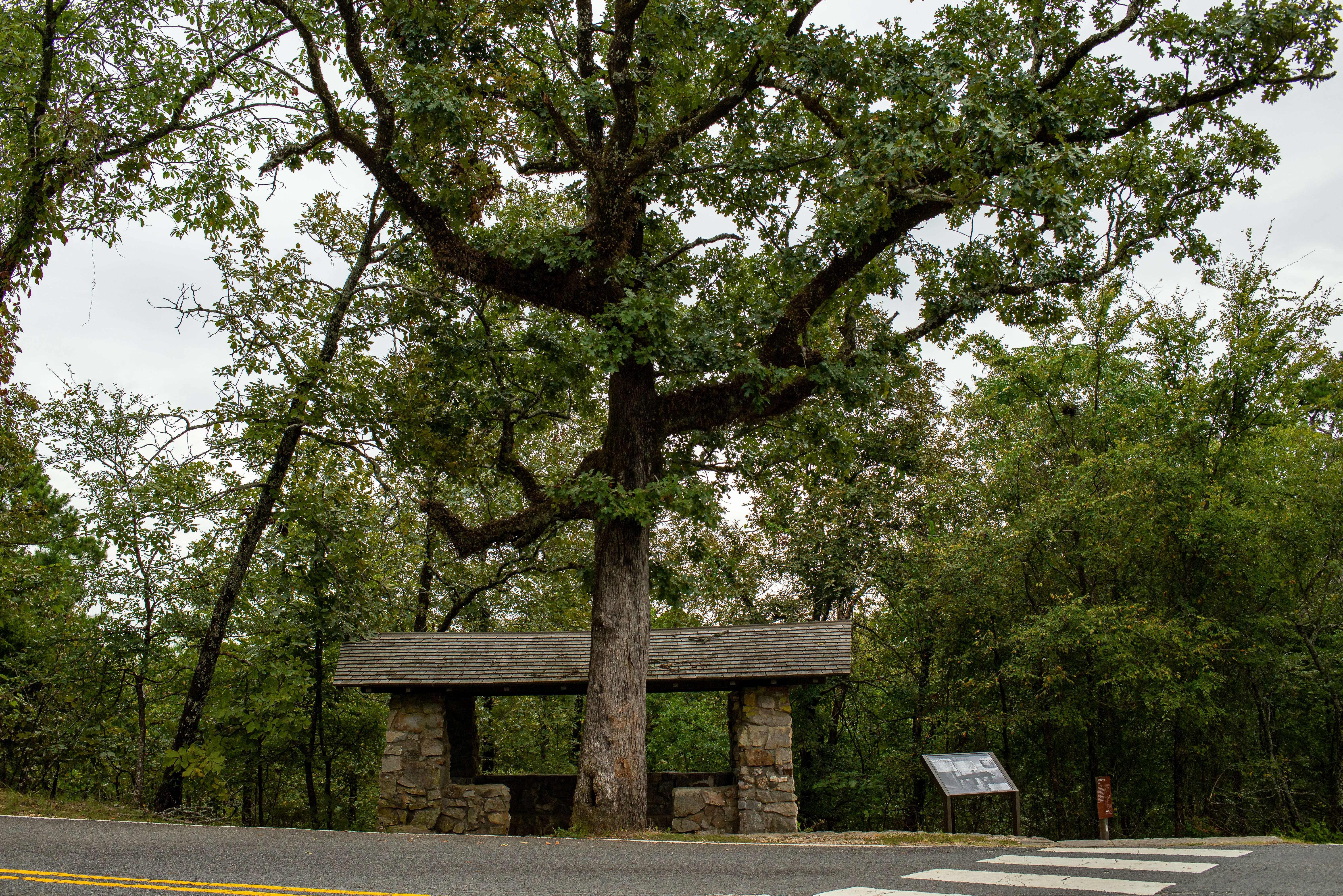
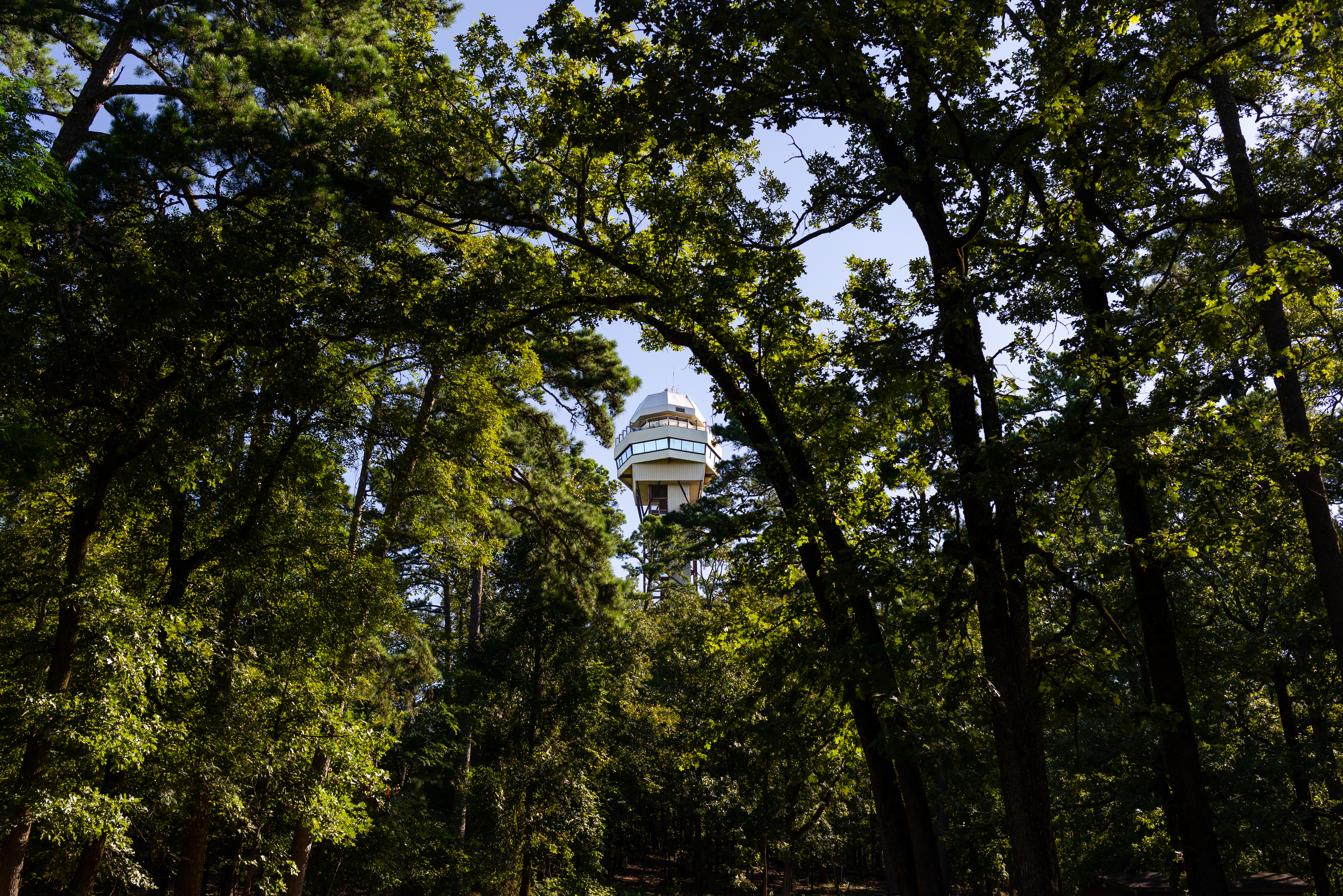
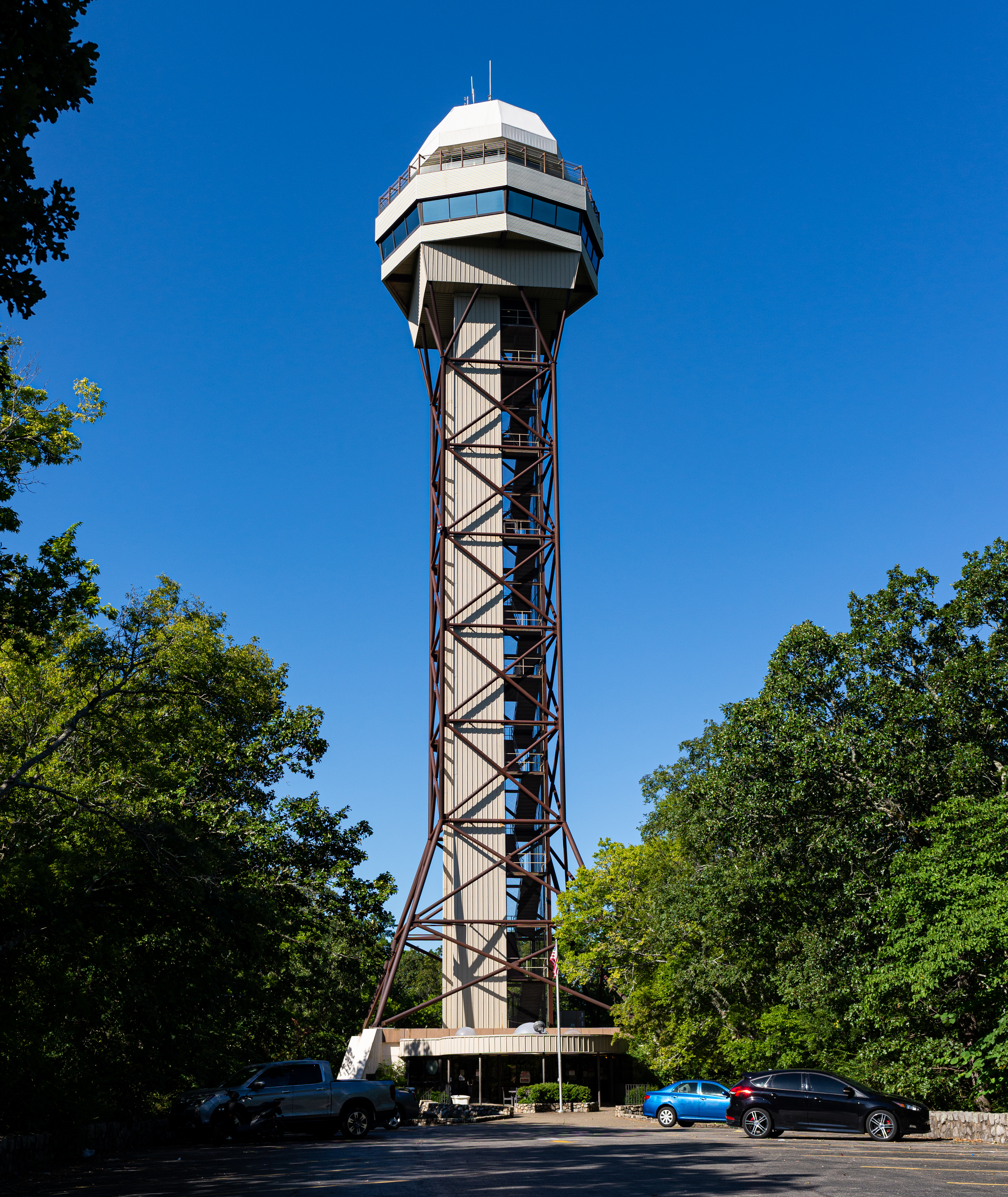
Hot Springs Mountain TowerThe Hot Springs Mountain Tower is operated as a concession for the park. The tower's upper observation deck is open-air and at an elevation of 1,256 feet above sea level. From there, visitors may overlook 140 square miles of surrounding countryside, including the entire park and a portion of the Ouachita Mountains. 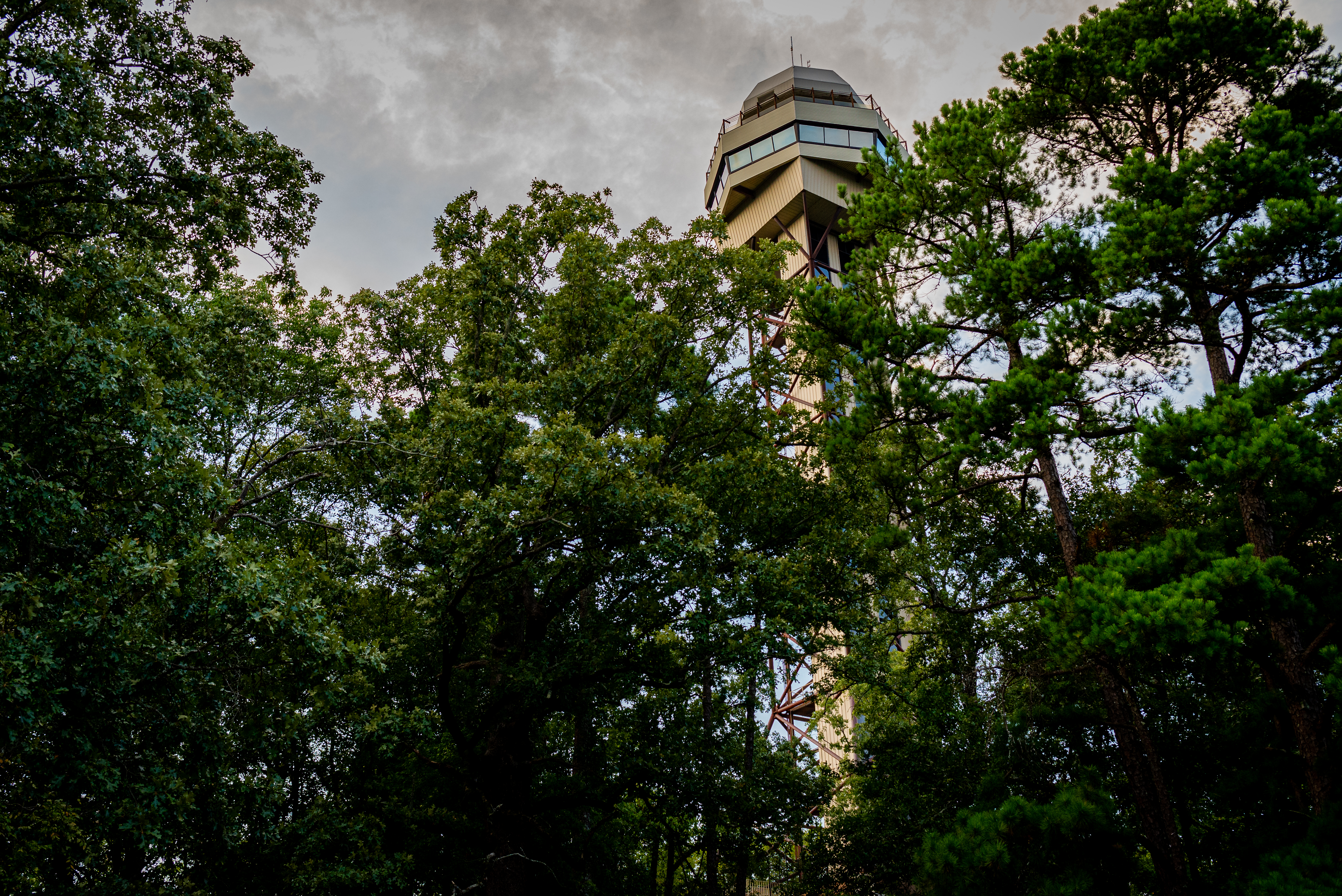
Hot Water CascadeLocated at Arlington Lawn, this is the largest visible spring in the Park. Hot water emanates from the hill side near the Grand Promenade and flows under the path, down a steep cliff into two pools. 
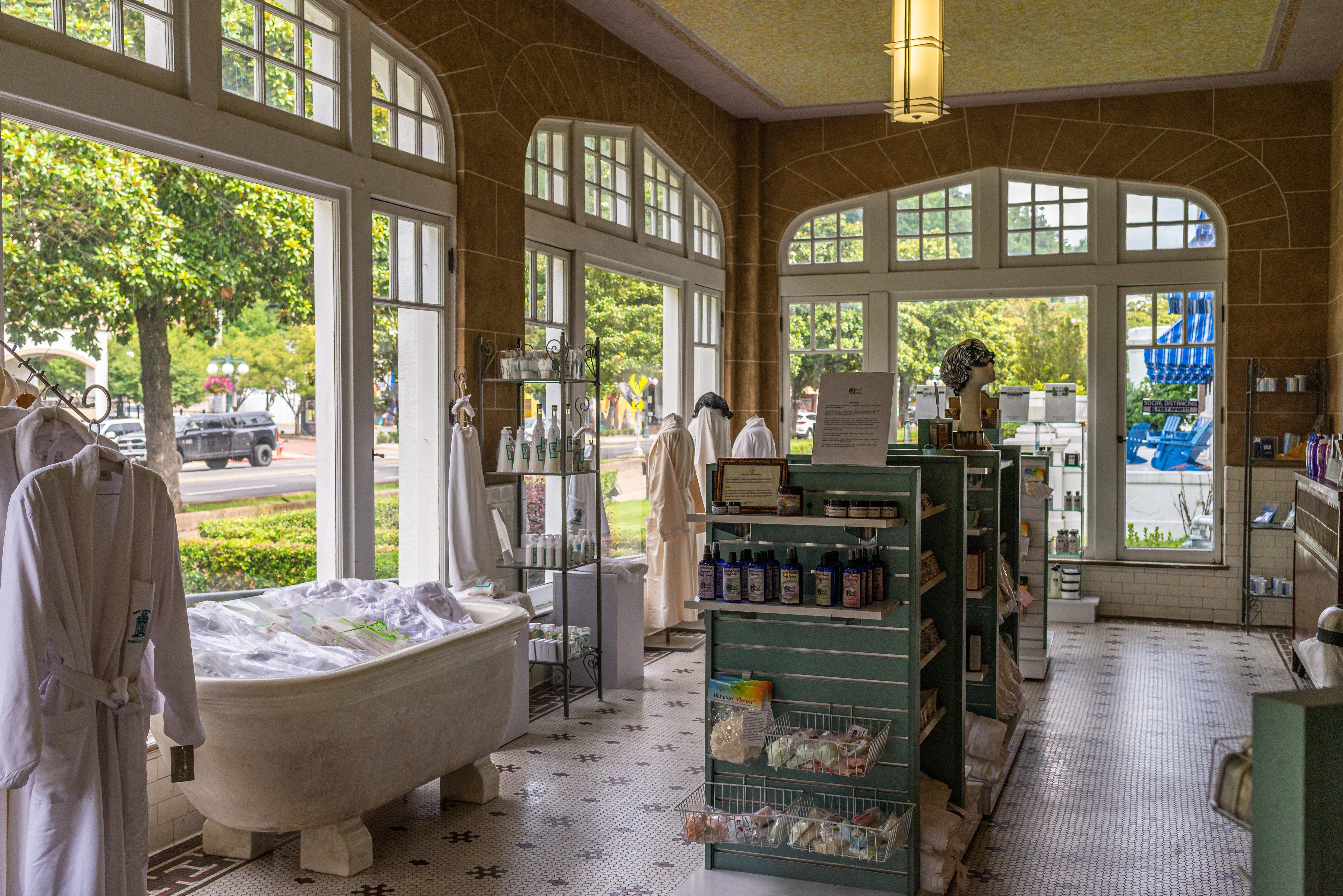
Lamar Bathhouse Emporium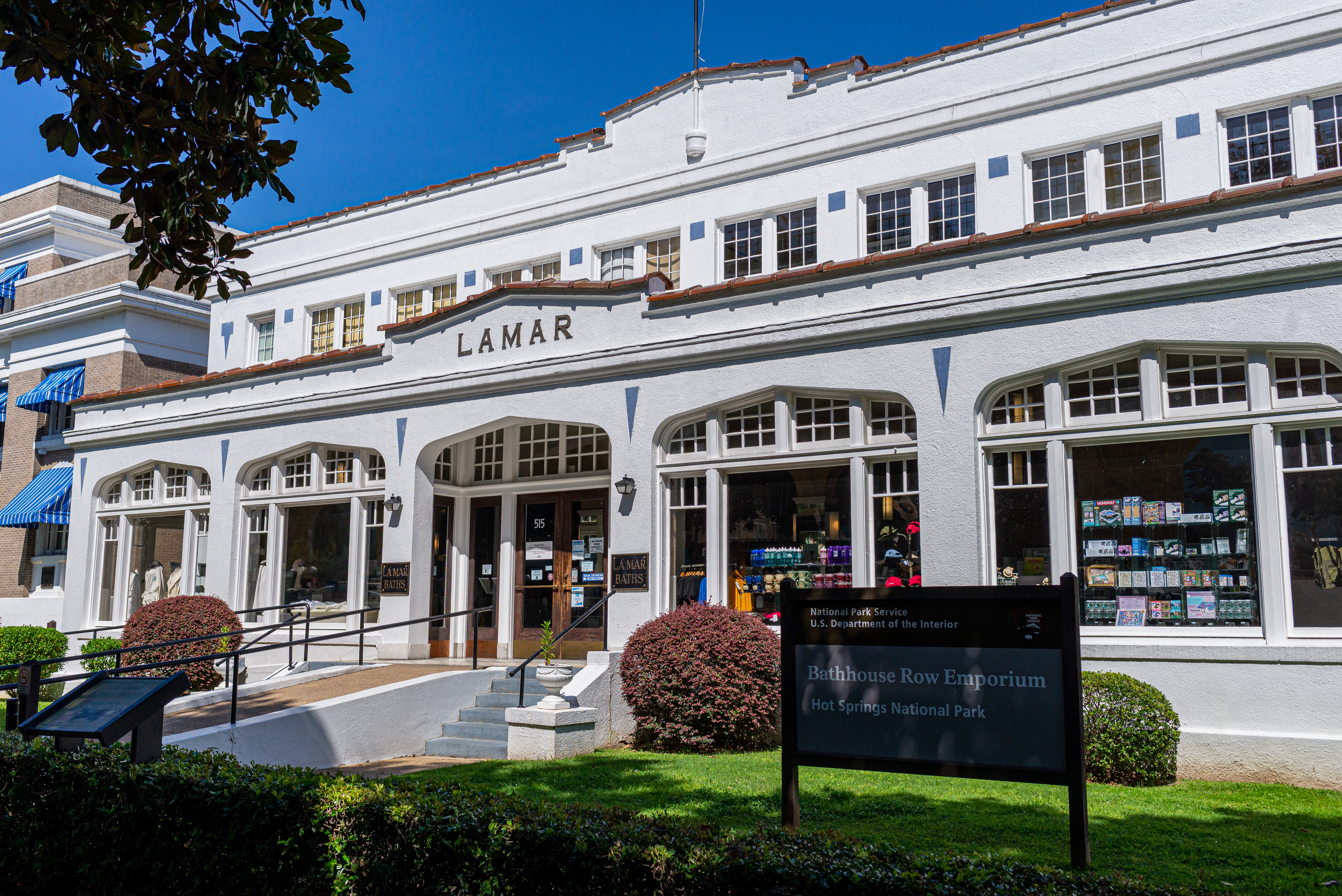
Libbey BathhouseThe Libbey Bathhouse once operated as the government free bathhouse. It is now vacant but holds a thermal water jug fountain. 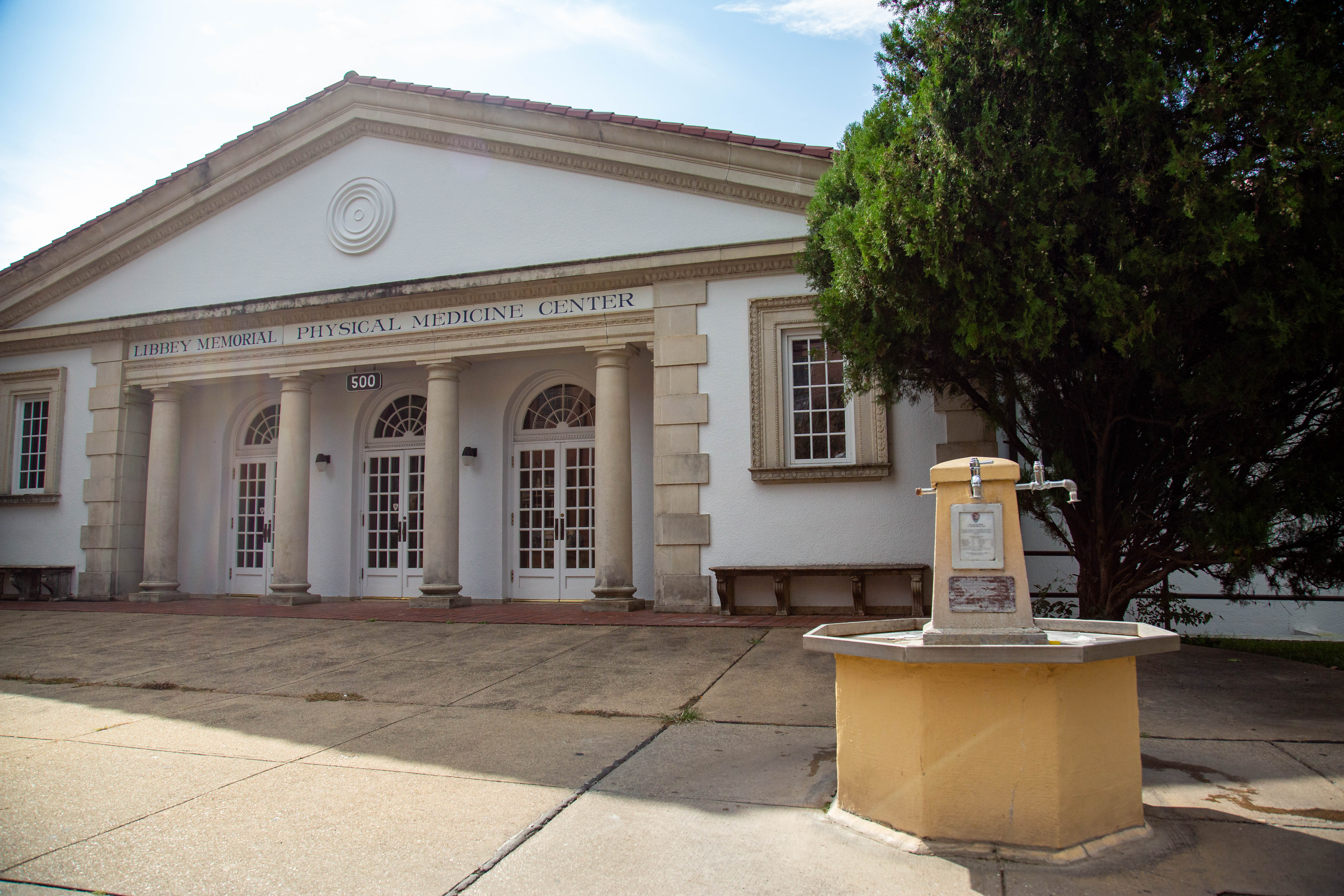
Libbey Jug Fountain (Hot)Located in front of the Libbey Memorial Physical Medicine Center, this thermal jug fountain is available to fill up water jugs with the mineral-rich thermal water. 
Magnesia SpringMagnesia Spring historically flowed from the east bank of Hot Springs Creek, at the base of a 20-foot-high tufa cliff. Numerous 19th century photographs show visitors drinking from and posing by the springs. In 1901, the water measured 137 degrees, and flowed at 35 gallons a minute. The Quapaw Bathhouse, built in 1922, now sits over the location of Magnesia Spring. 
Mud HoleIn the late nineteenth century, the open waters of the Mud Hole were very popular across the class spectrum. Initially, paying customers at the Mud Hole subsidized poorer patients. Eventually, the federal government took over the bathhouse, using revenue from the pay bathhouses to provide free bathing. 
Noble Fountain (Hot)The Noble Fountain is located at the southern end of the Grand Promenade, just off Reserve Street. 
North MountainHot Springs Mountain Drive begins at the end of Fountain Street off Central Avenue downtown. Built as a carriage road in the 1880s, it has switchbacks that will take you to the top to a picnic area, the Pagoda overlook, and the Hot Springs Mountain Tower. 
Ozark Bathhouse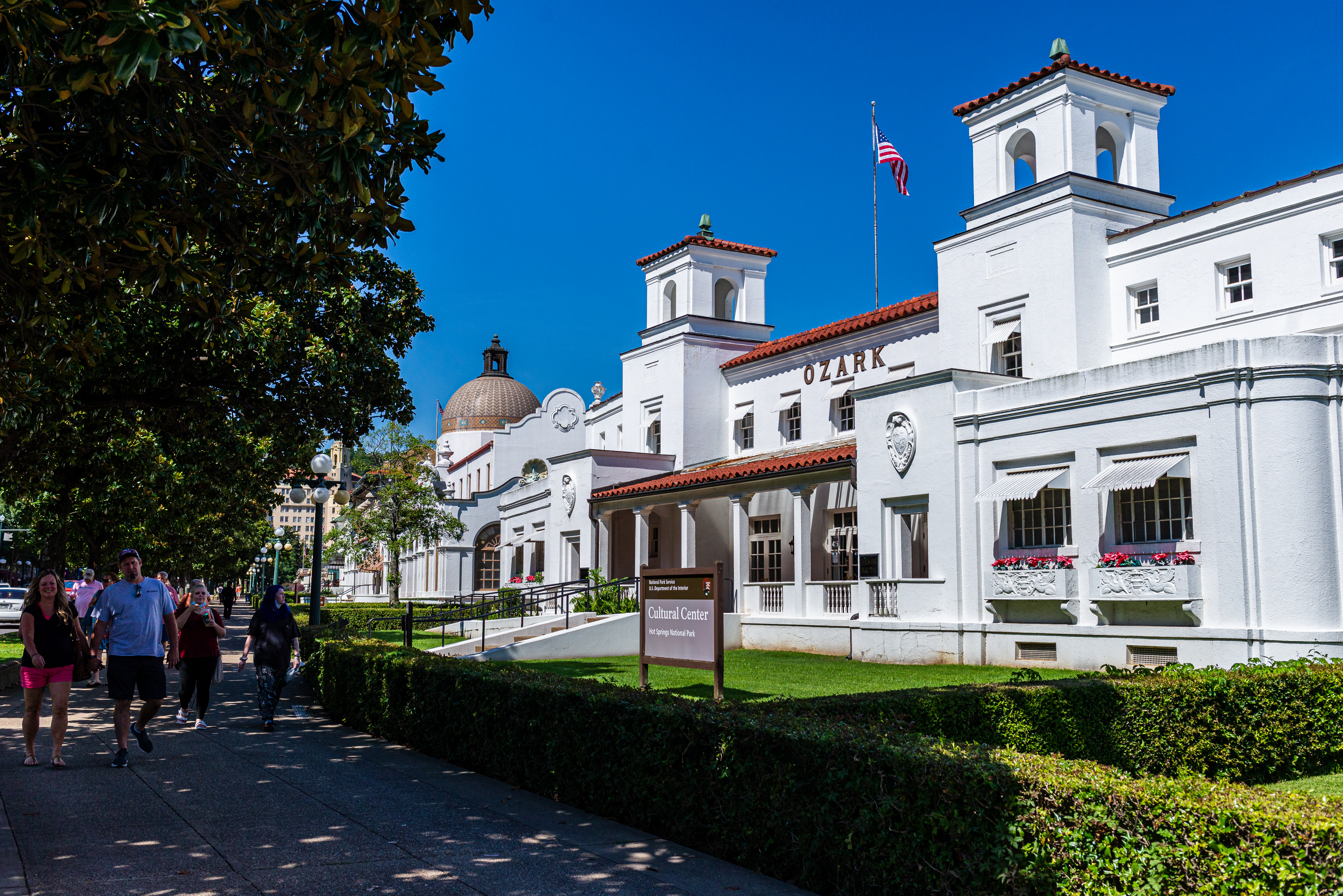
Quapaw BathhouseThe Quapaw Bathhouse offers modern day spa services with amenities like thermal pools, private baths, and a steam cave. For information about services, rates, and reservations, please visit their website (www.quapawbaths.com) or call them directly at (501) 609-9822. 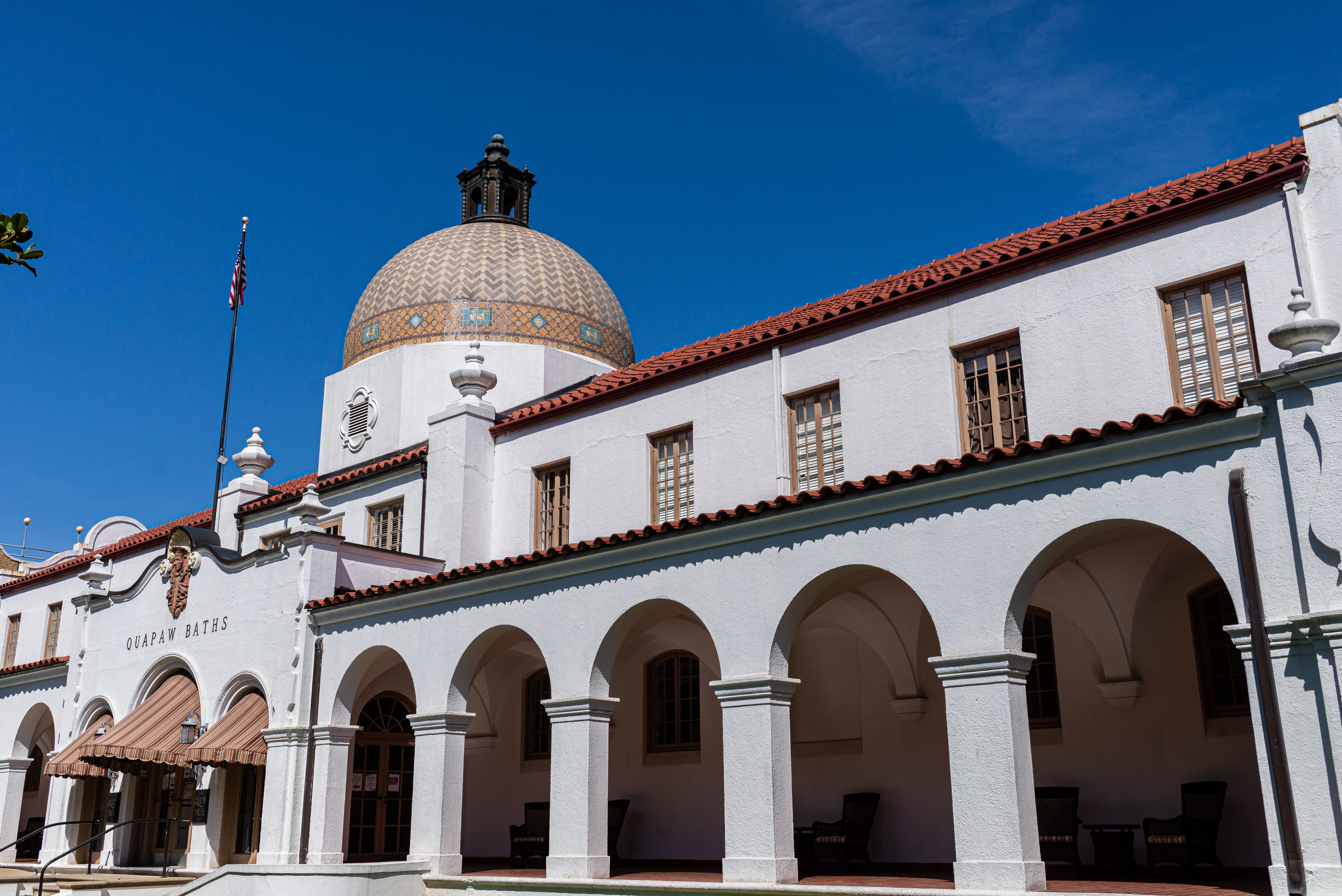
Ral SpringRal Spring was perhaps the most famous Hot Springs water in the nineteenth century. Ral Springs was associated with the most remarkable outcomes in Hot Springs. The stories of healing, along with free access, made Ral Springs the destination for hundreds of health seekers who could not afford the costs of the bathhouses. 
Reserve Street Jug Fountain (Hot)Located on the southern end of Bathhouse Row, this thermal jug fountain is available to fill up water bottles and jugs all year-long. 
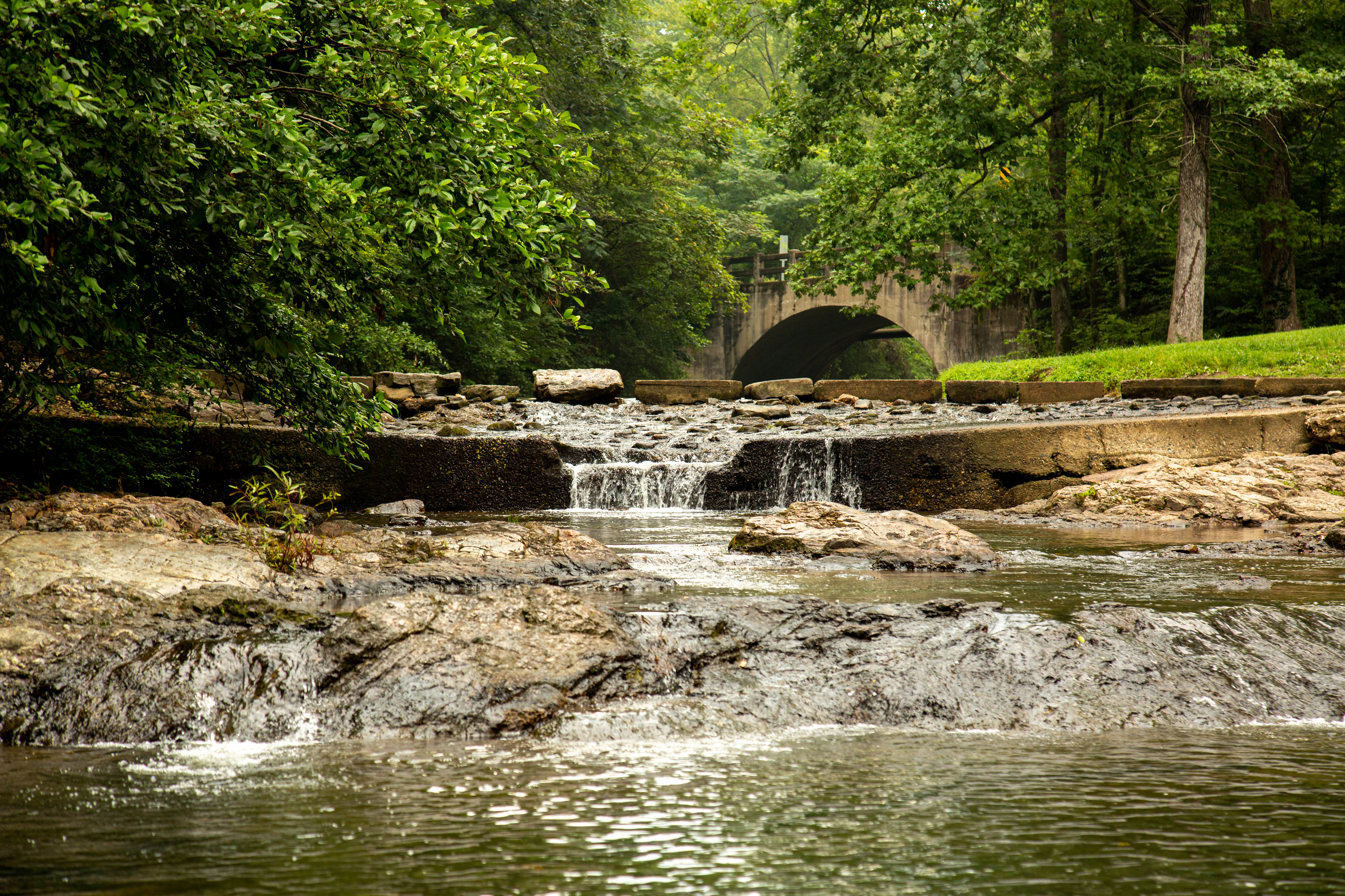
Rick's PondRick's Pond is both historical and very peaceful. Located near Gulpha Gorge Campground, off Stonebridge Road, it is one of the less visited locations in the park. From Rick's Pond, you can catch the Sunset Trail to the campground or up towards Fordyce Peak. 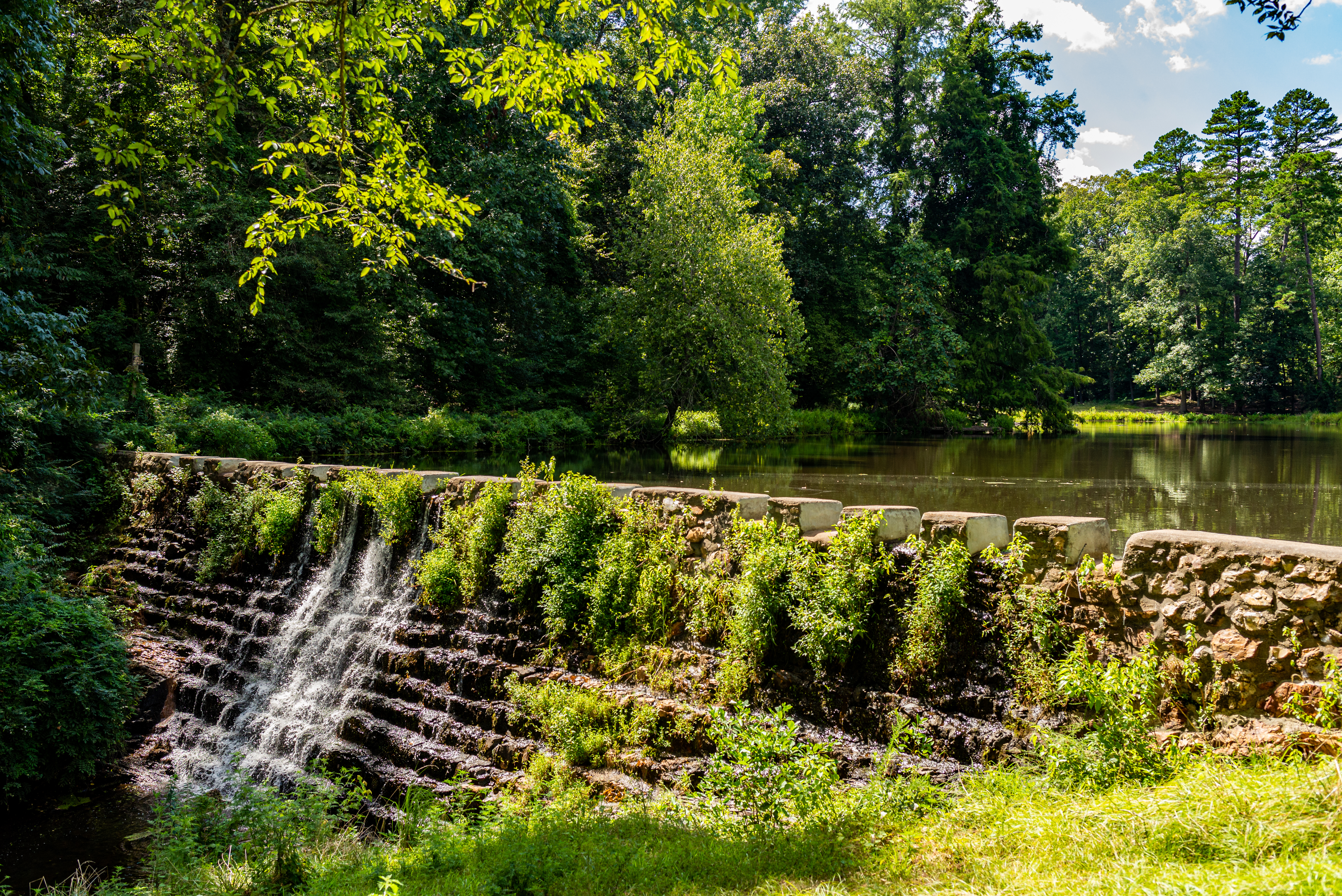
Stevens Balustrade Shell Fountain (Hot)The Shell Fountain is located between the Fordyce and Maurice Bathhouses. Built in the late 1800s, it still offers visitors the opportunity to drink the thermal springs water. 
Superior BathhouseThe Superior Bathhouse is now home to the only brewery in a United States National Park, and the only brewery in the world to utilize thermal spring water to make their beer. Be sure to visit their website to learn more about the Superior Bathhouse Brewery. 
West MountainWest Mountain Drive has entrances on Prospect Avenue and Whittington Avenue. It is a two way road that leads to the Summit Loop where you will find three overlooks. The first overlook affords a good view of Bathhouse Row and the former Army-Navy Hospital. The second overlook has a historic trail shelter and picnic tables and the summit has a view south to the Trap Mountains and Lake Hamilton. The Sunset Trail can be accessed from the top of West Mountain. 
West Mountain Novaculite OutcropNovaculite was mined by early native people because of its ability to be easily formed into a variety of shaped for tools while retaining their sharp edge. This outcrop is located on the summit of West Mountain. 
West Mountain Shelter HouseLocated in the middle of West Mountain, this shelter is a great place to rest in the shade after a long hike. This shelter was built in 1924 making it the oldest one still standing in the park today. 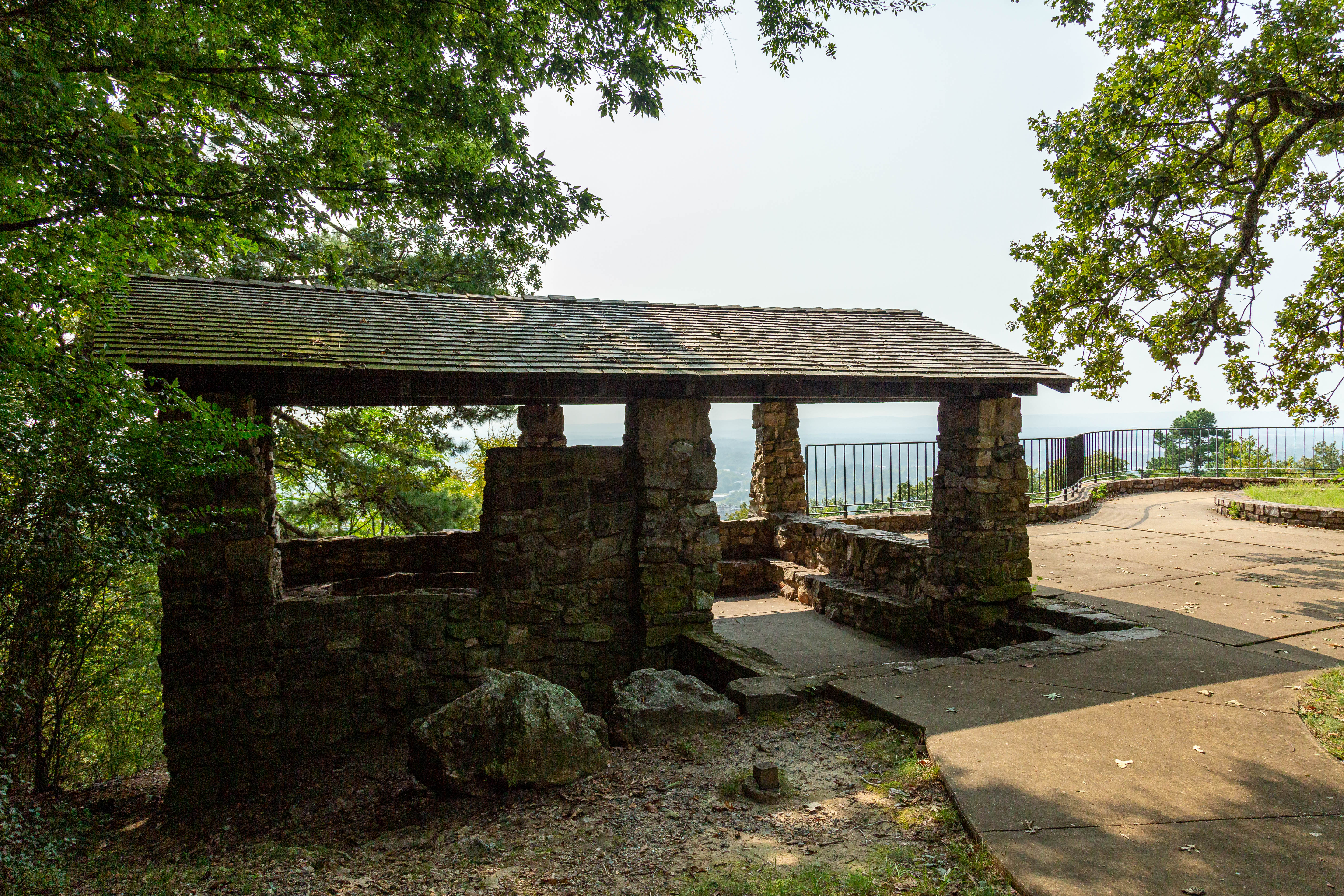
Whittington Jug Fountain (Cold)The source of this cool water is just off Whittington Avenue near the base of West Mountain. In 1911, park employees built a trough for this spring flow to gather in, and in 1954 a jug fountain was built at the present location. Emerging from Big Fork Chert, the water is over 6000 years old. 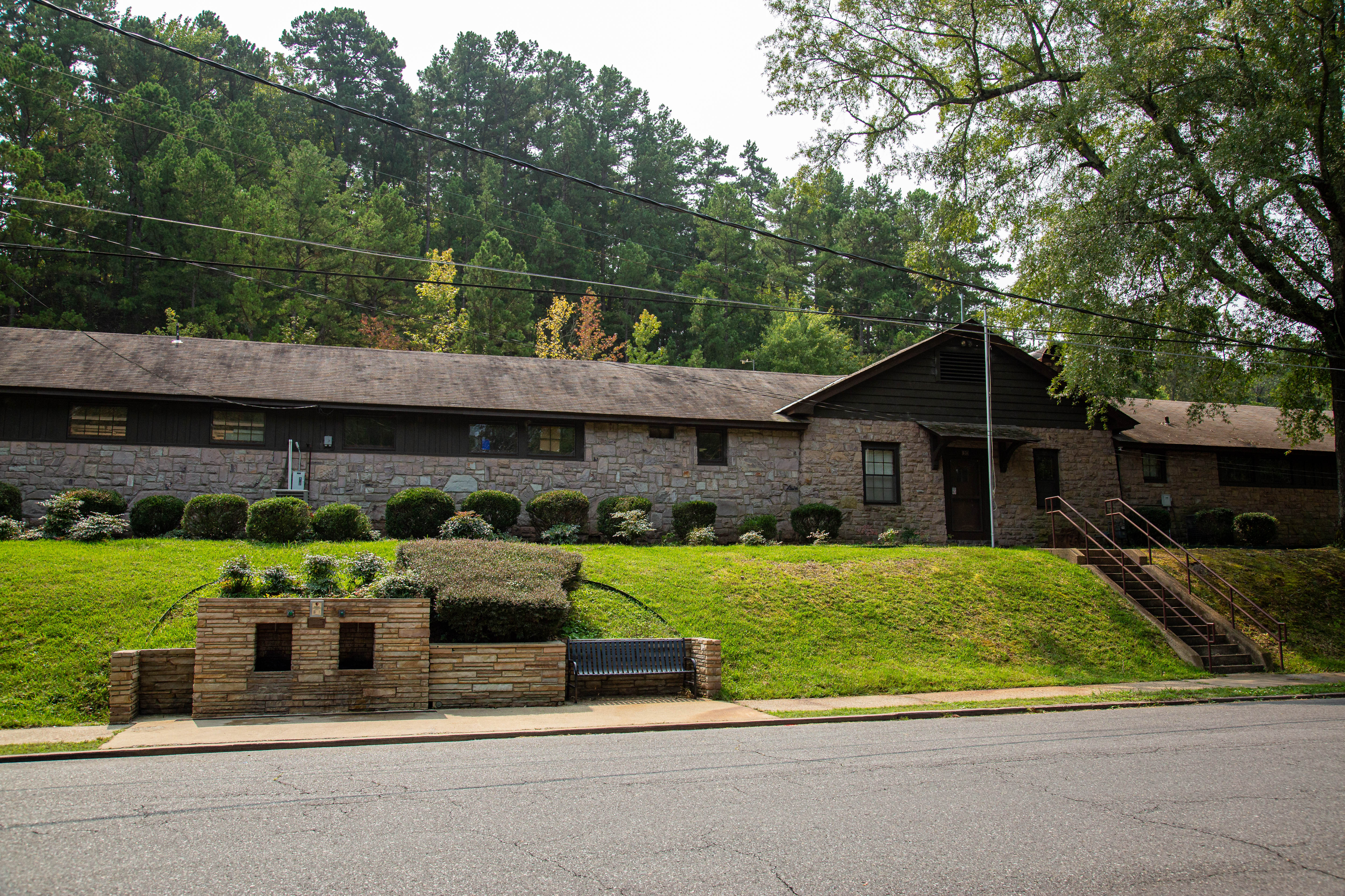
Whittington Park and CreekWhittington Park once featured two shallow rowing lakes, several pavilions, tennis courts, carriage drives, and a caretaker's house. Today, it simply offers shaded walking trails for visitors to enjoy. 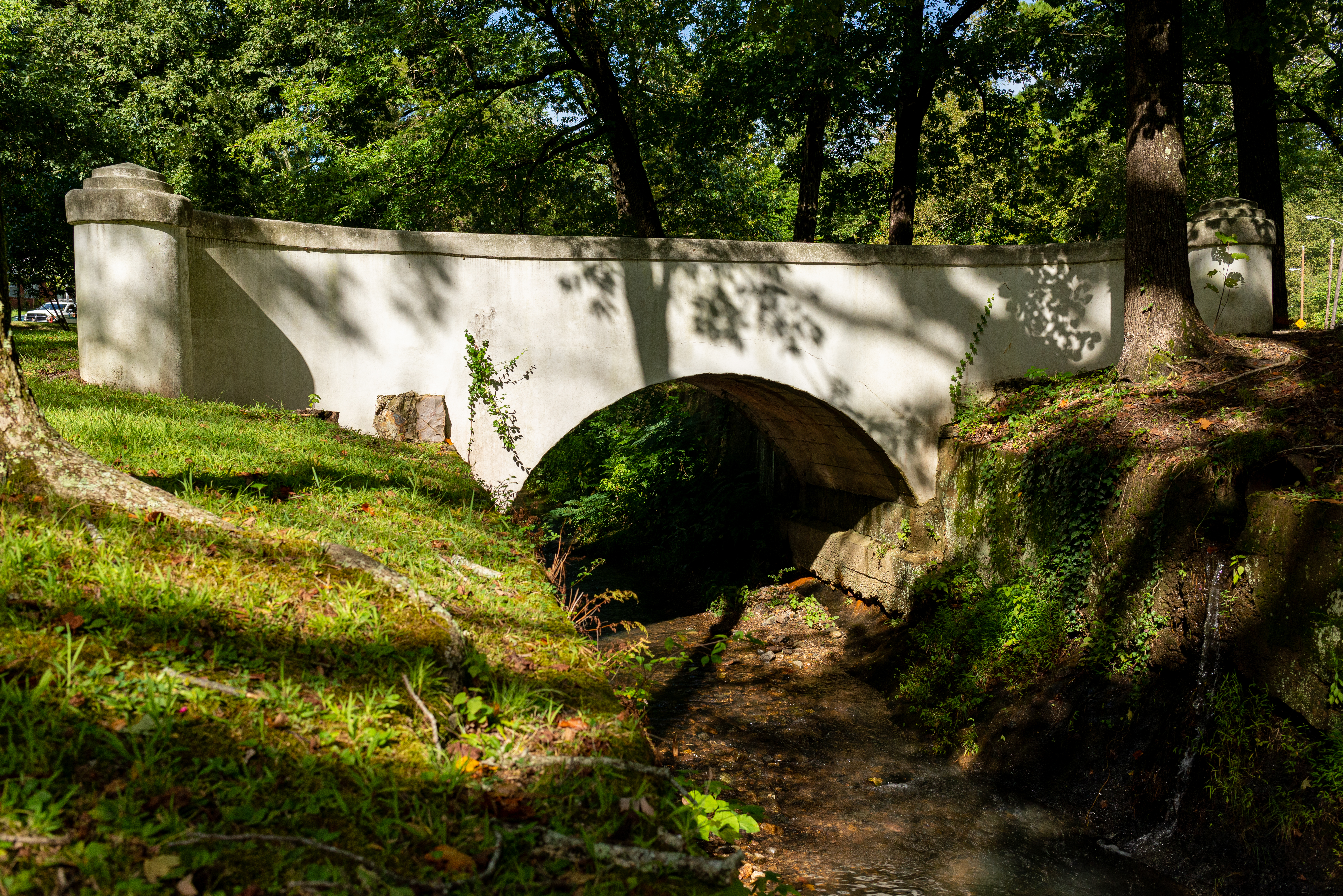
|
| Visitor Centers | Count: 1
Fordyce Bathhouse Visitor Center and Museum
|
| Things to do | Count: 36

|
| Tours |
Count: 2
Explore Hot Springs National ParkWalk along Bathhouse Row and then take a scenic drive to take in the sights and learn more about Hot Springs National Park. Hidden Hot Springs: A Walking Tour of the Park as Told Through the SpringsDozens of springs cover the lower slopes of Hot Springs Mountain. However, most are hidden after two centuries of development and efforts to keep the water clean for consumption. This 1-mile loop along Bathhouse Row, to Happy Hollow Spring, and back along the Grand Promenade reveals the stories and images of some of the hottest, most famed springs from the 19th century. Along the way, you’ll learn about the hydrology and the cultural significance of the springs that help explain the park you see today. |
| Articles |
|