| Title | Ice Age Floods |
| Park Code | iafl |
| Description | At the end of the last Ice Age, 18,000 to 15,000 years ago, an ice dam in northern Idaho created Glacial Lake Missoula stretching 3,000 square miles around Missoula, Montana. The dam burst and released flood waters across Washington, down the Col... |
| Location | |
| Contact | |
| Activities |
|
| Entrance fees |
|
| Campgrounds | Count: 0
|
| Places | Count: 50
Back to Trailhead Park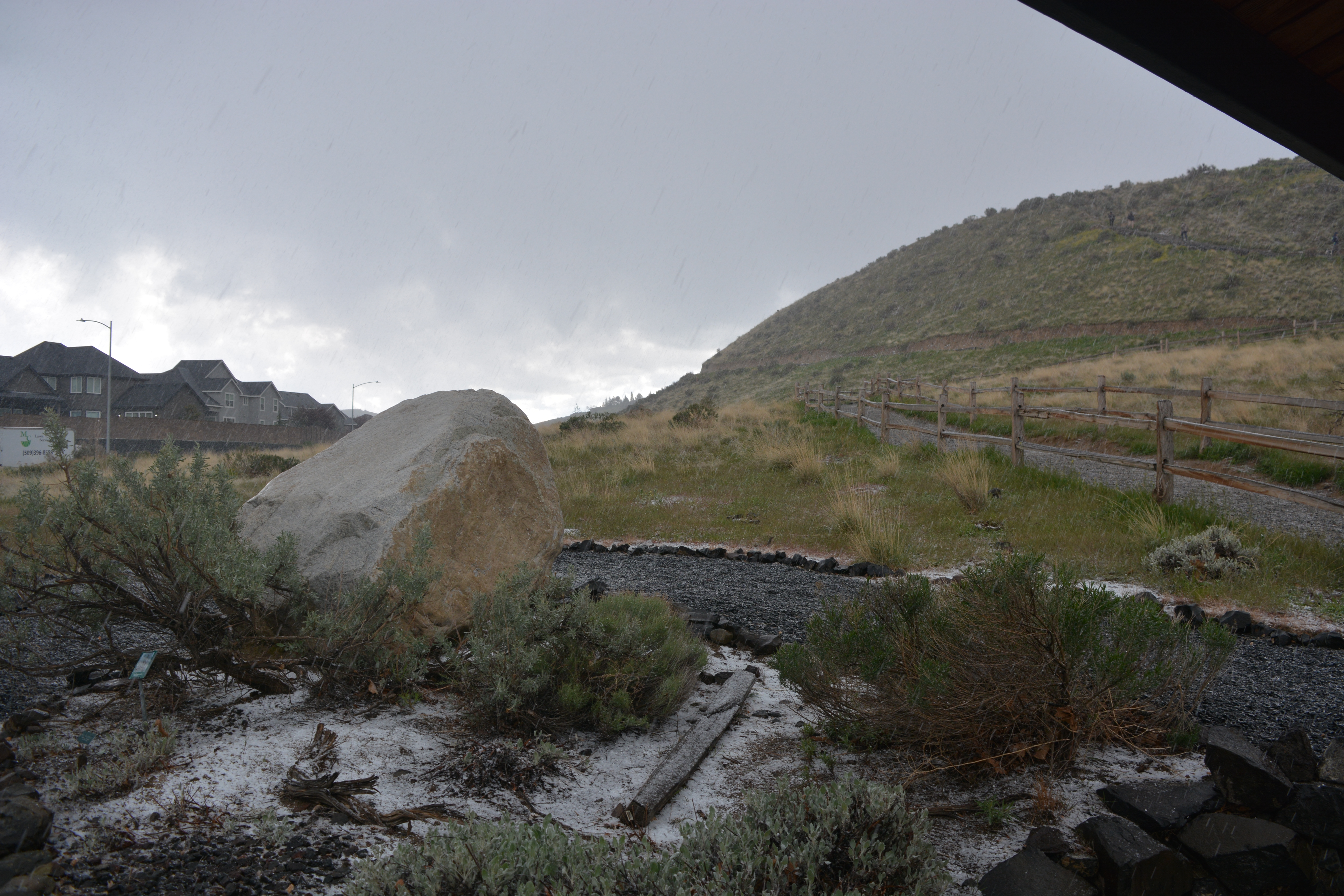
Badger Mountain Trail Head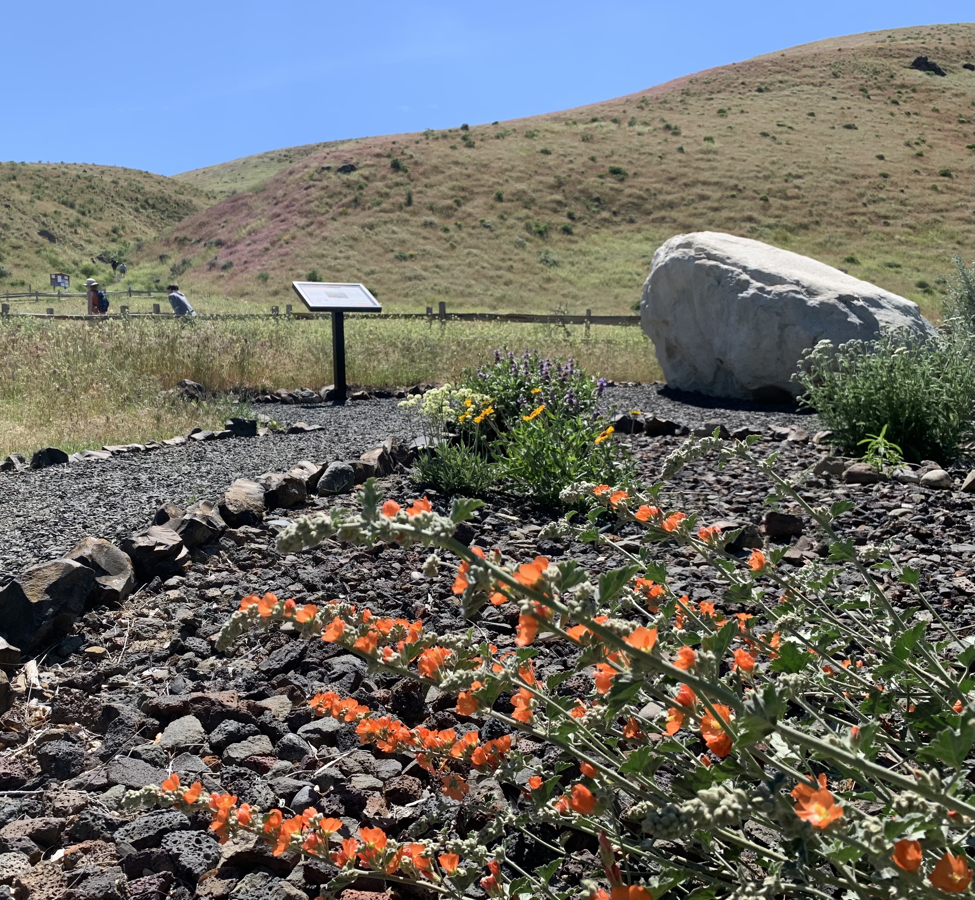
Beacon RockOutside Skamania, Washington is the 848-foot-tall Beacon Rock that overlooks a breathtaking section of the mighty Columbia River. Beacon Rock State Park is a 4,464-acre, year-round camping park sitting in the midst of the Columbia Gorge National Scenic Area. The core of an ancient volcano, Beacon Rock is essentially a basalt plug; the Missoula Flood waters eroded away the softer outer material. Captain Clark wrote in his journals, “…a remarkable high rock on Stard." 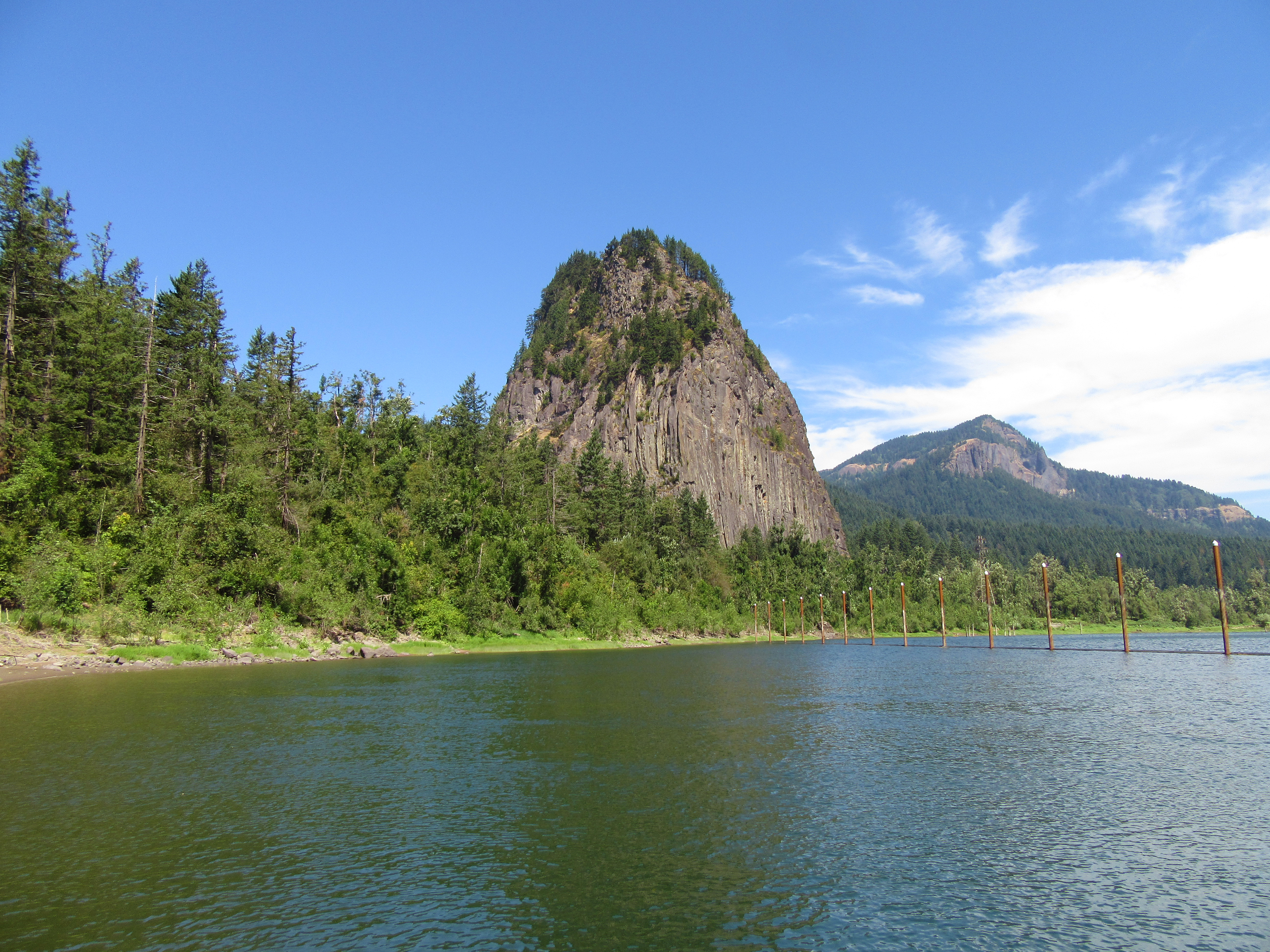
Bowl and Pitcher (Riverside State Park)Carved away from the adjoining hillside by Ice Age Floods, the Bowl and Pitcher formation can be found within Riverside State Park in Spokane, Washington. 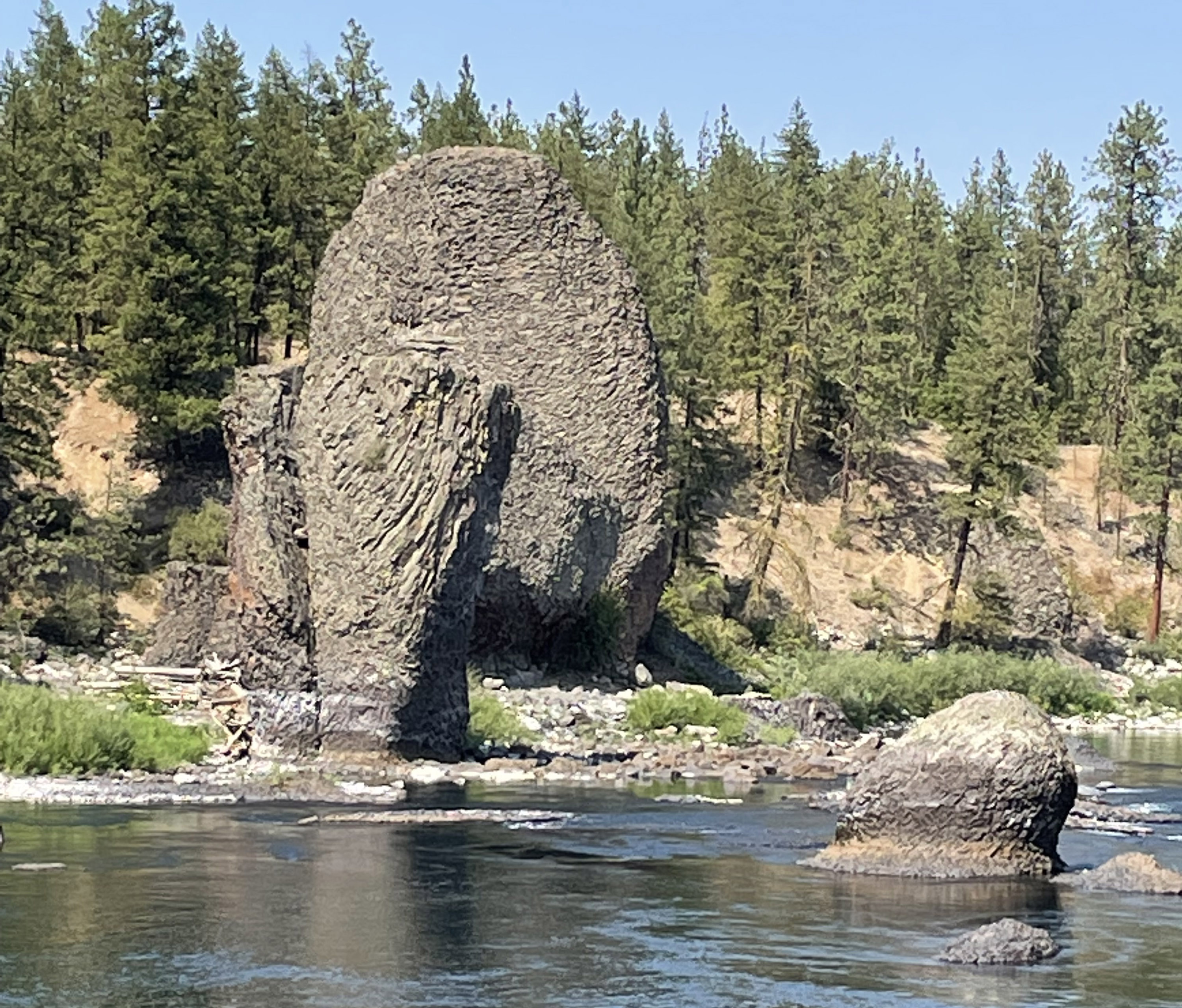
Bull LakeBull Lake 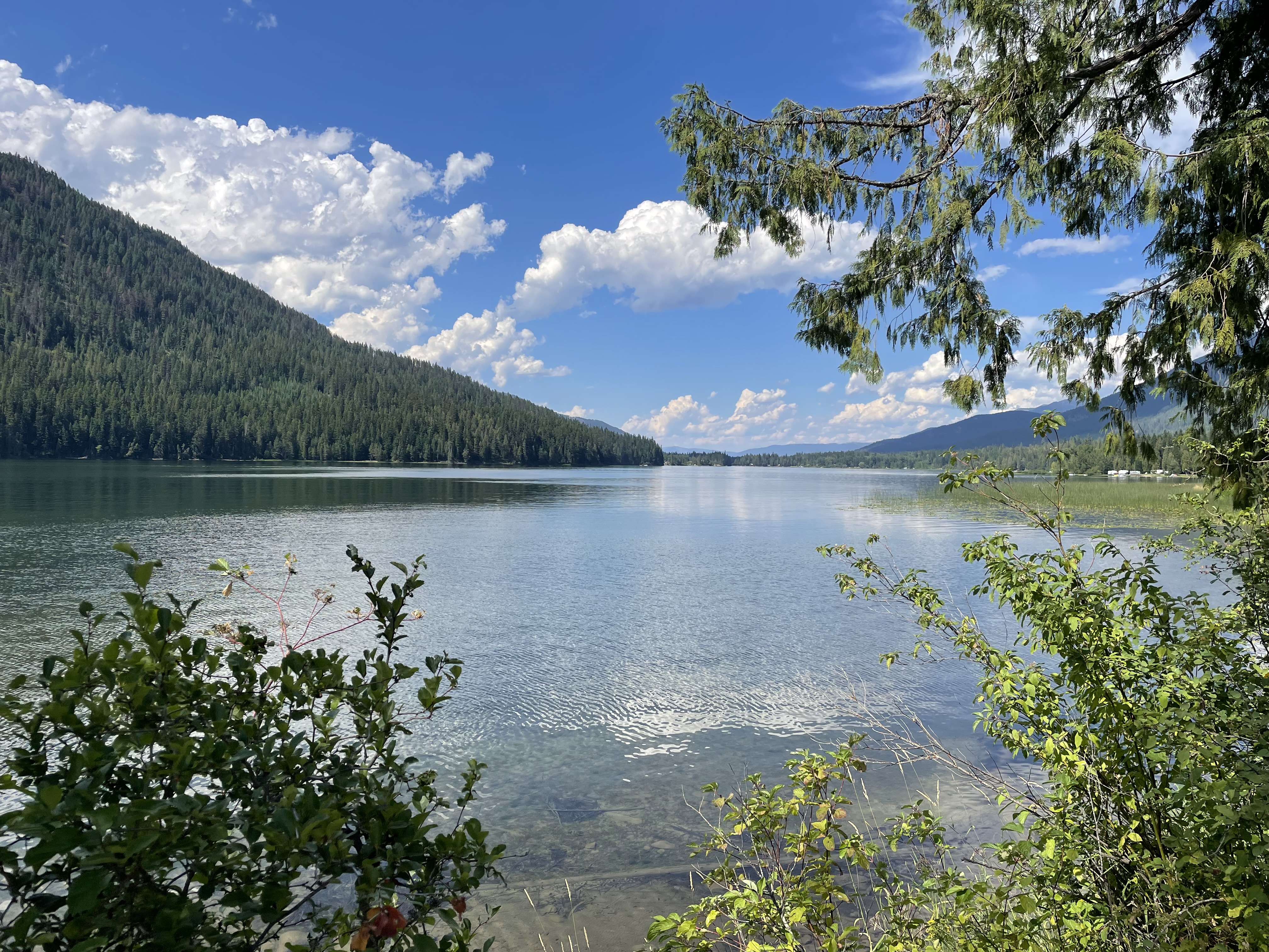
Cabinet Gorge DamCabinet Gorge dam is a great place to see how far the ice came up the Clark Fork River. 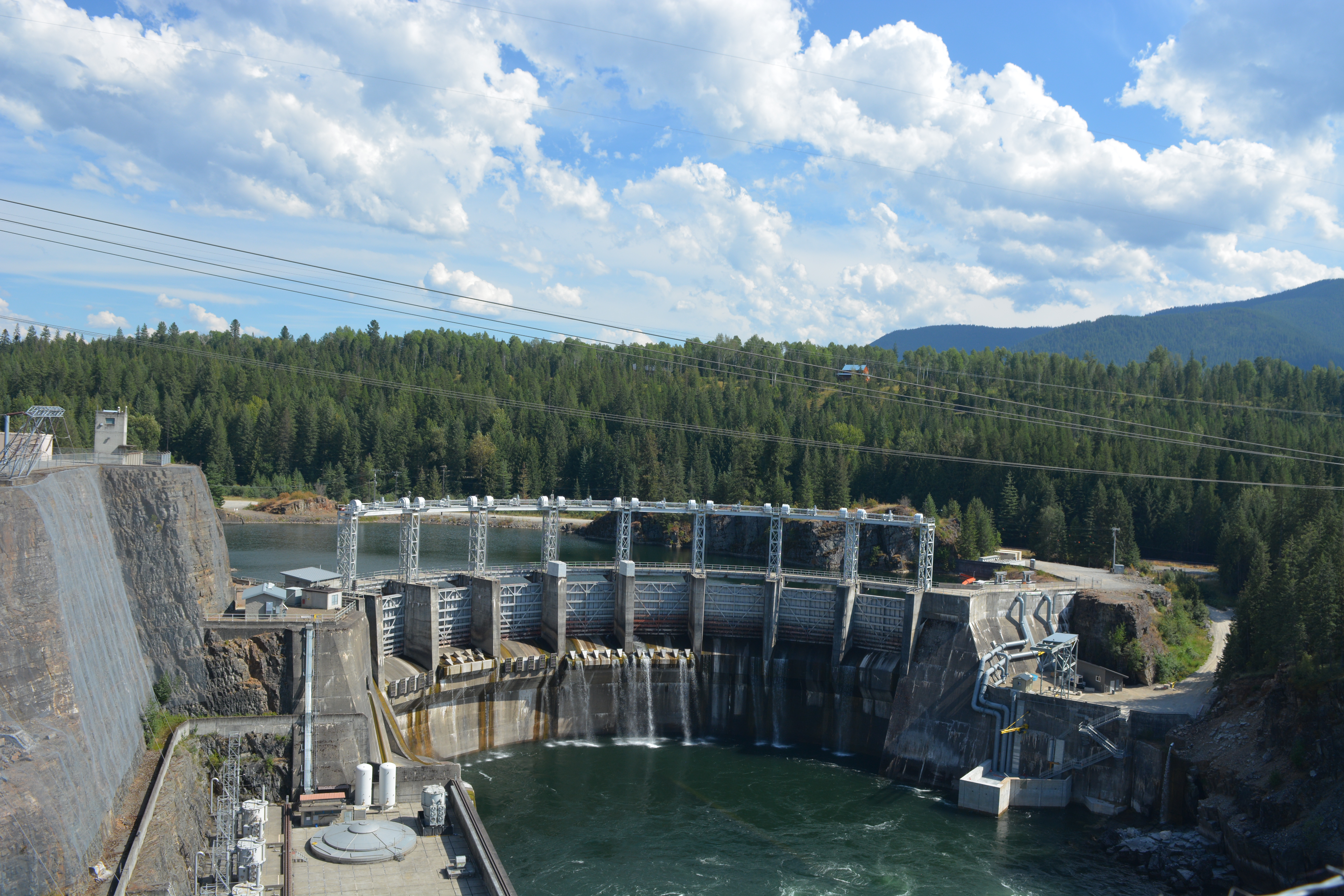
Candy MountainThe trail up Candy Mountain is a moderate 3.6 mile (5.8 km) roundtrip hike that offers sweeping views of the Tri-Cities region and a walk through time. Signs along the trail explain the impact of the ice age floods on area geography. Hikers capture sweeping views from the summit, with Mount Adams, Rainier, and Stuart visible on clear days. This perch offers a bird’s-eye view of the Hanford Site. A nearby sign points out the various areas of the Hanford Site. 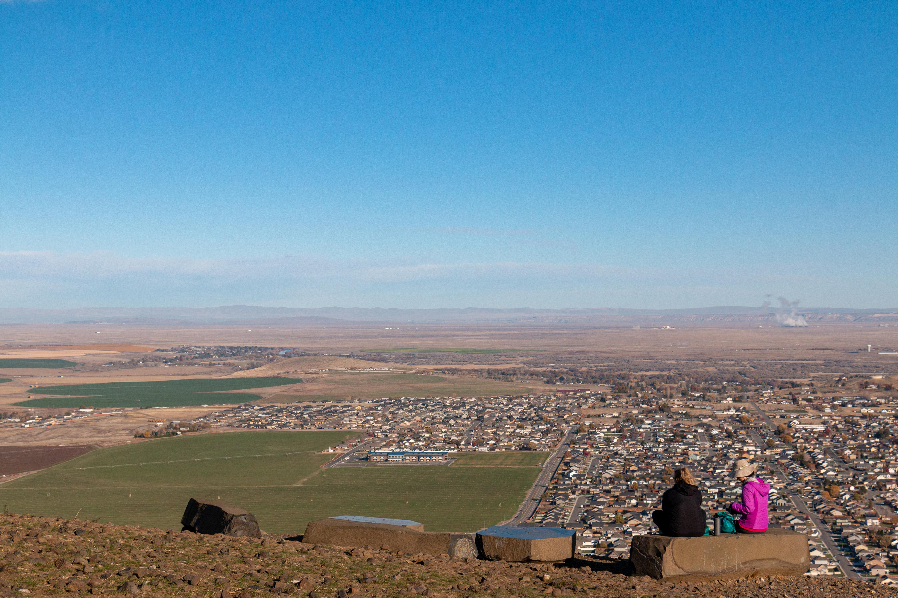
Candy Mountain Trailhead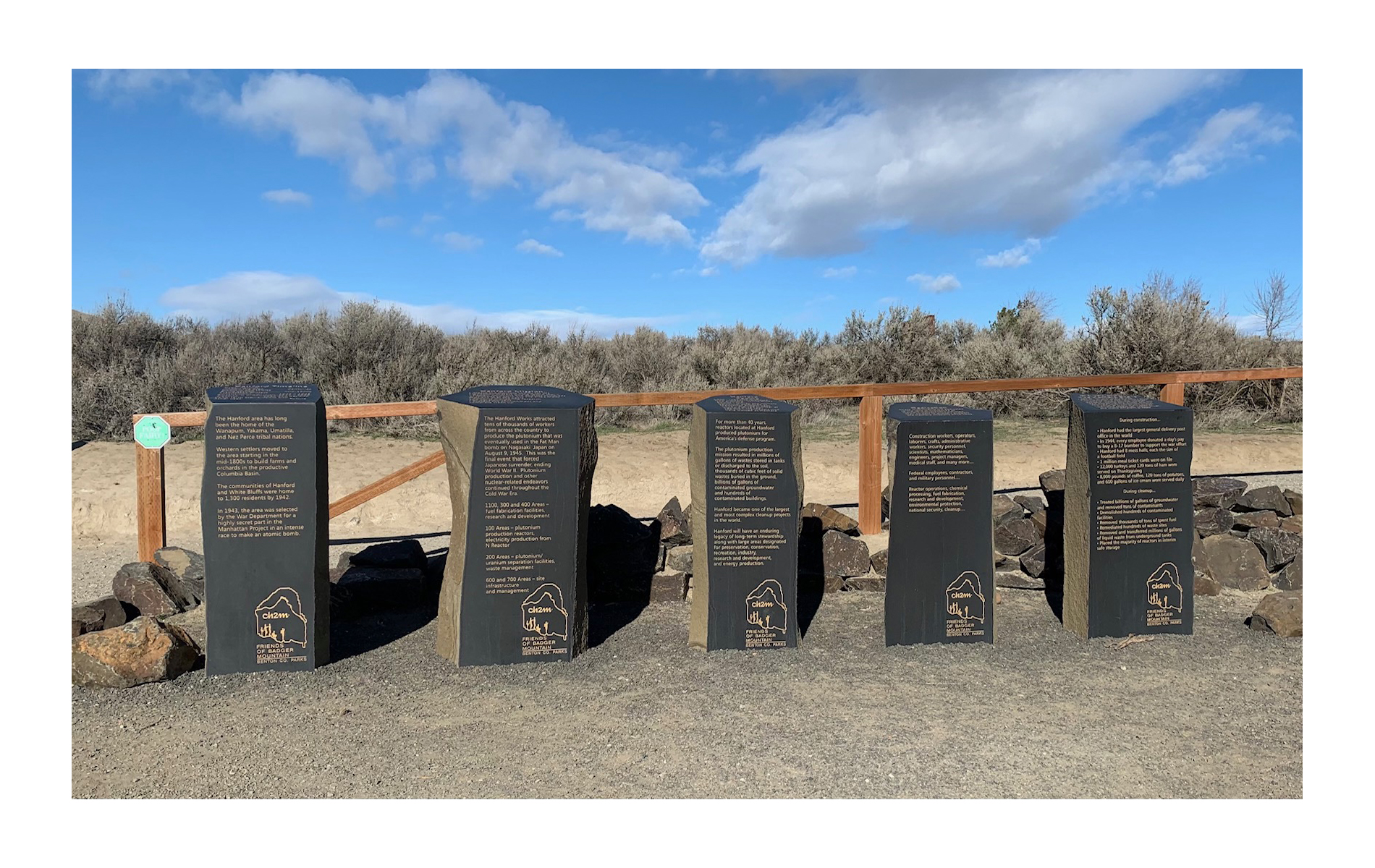
Cape Disappointment State ParkLocated in Ilwaco, Washington, Cape Disappointment State Park was named for Captain John Meares’ first failed attempt to find the Columbia River in 1788. Meriwether Lewis and William Clark would later conduct reconnaissance of this area during their stay at Station Camp from November 15 to November 24, 1805. 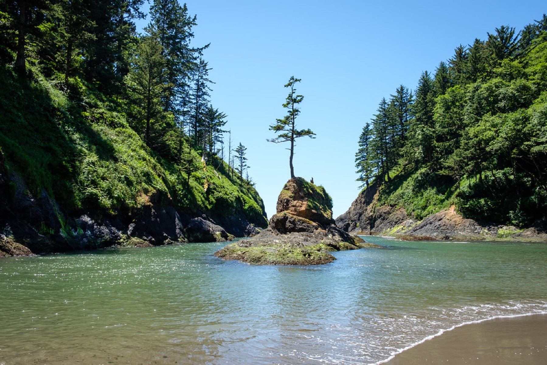
Cape Disappointment State Park-Lewis and Clark Interpretive CenterWhen you visit Cape Disappointment State Park today, you certainly won’t be disappointed in what you find. It’s an amazing park that’s home to the Lewis and Clark Interpretive Center. Perched on a cliff 200 feet above the pounding Pacific surf, the Lewis and Clark Interpretive Center shares the story of the Corps of Discovery’s journey, focusing particularly on their Pacific Coast stay during the winter of 1805-1806. 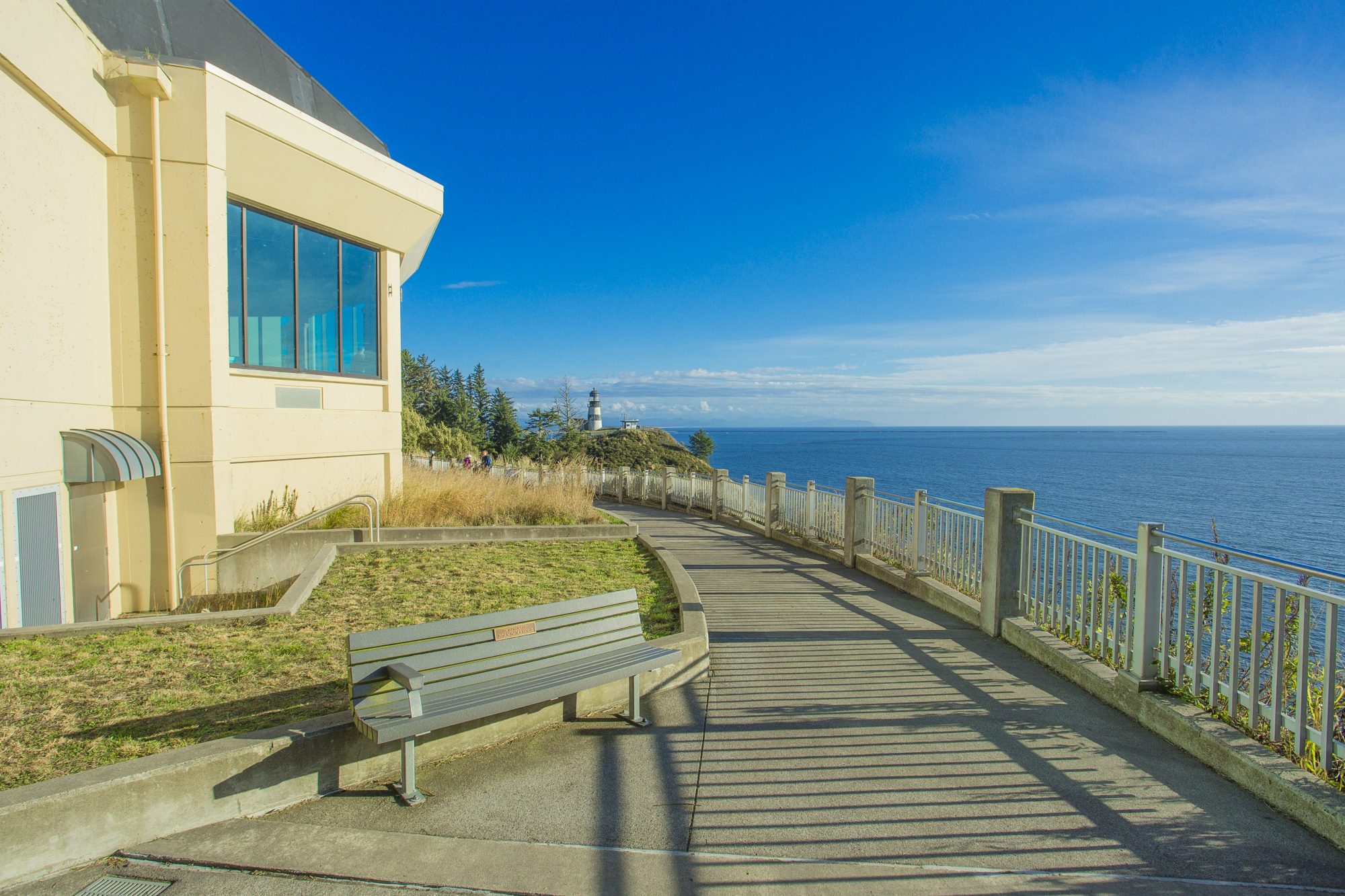
Clark Fork Ice Dam12,000 to 17,000 years ago a 4000' tall ice dam blocked the path of the Clark Fork River creating glacial Lake Missoula. During the Ice Age Floods this ice dam failed, releaseing more water then is held in modern day Lake Ontario and Lake Erie combined. 600 cubic miles of water rushed through this area and down Lake Pend Oreille destin for the Pacific Ocrean. 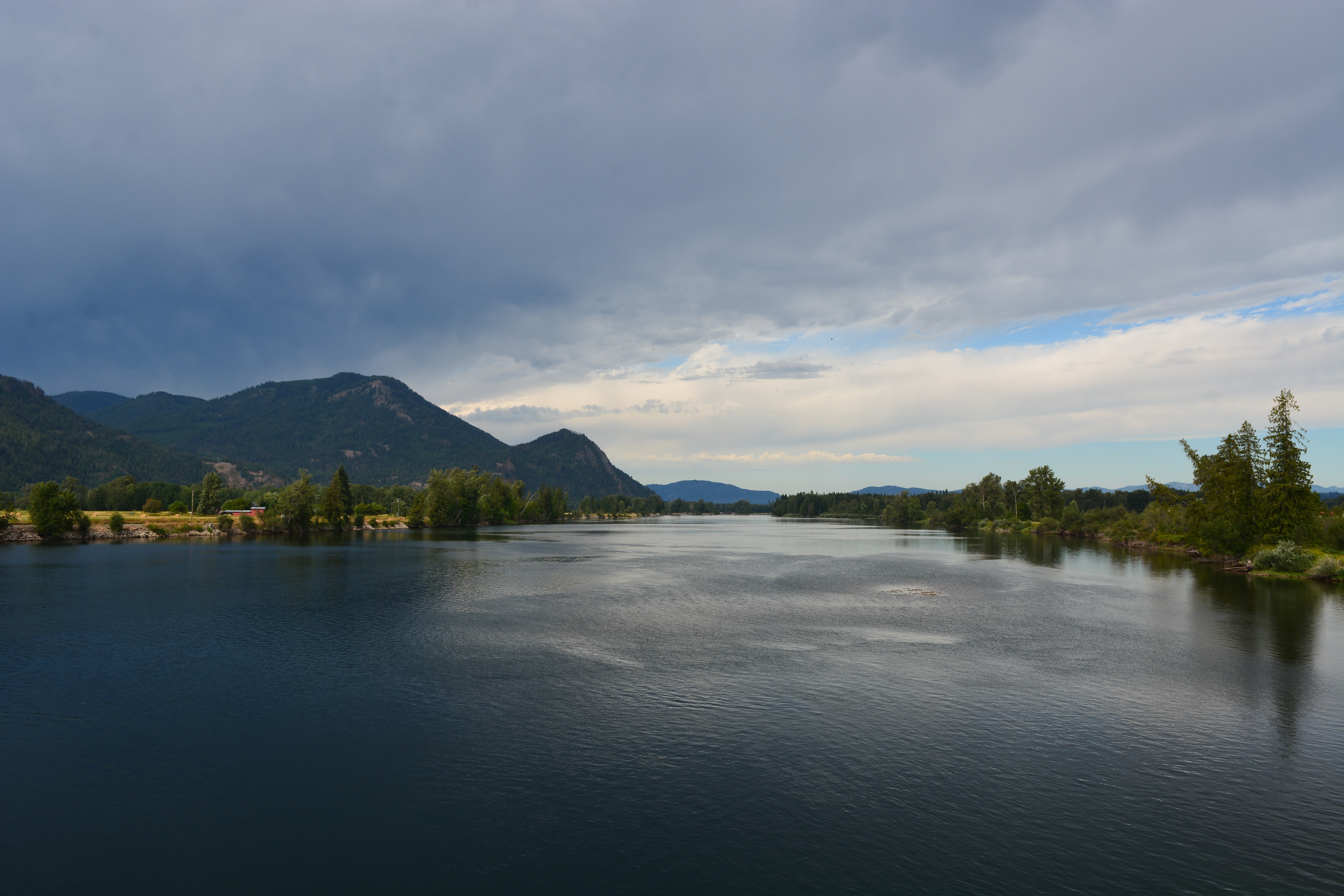
Coffeepot Lake Recreation AreaCoffeepot Lake is deep blue and three-miles-long in the upper part of the Lake Creek Coulee. Look for giant current ripples leading to the lake. 
Columbia Gorge Discovery Center & MuseumColumbia Gorge Discovery Center & Museum is located on a 54-acre point of land adjacent to the Columbia River and is the interpretive center for the Columbia River Gorge National Scenic Area. This area includes one of the oldest continuously occupied places in North America (over 11,000 years) and parts of the Lewis and Clark and Oregon Trails. 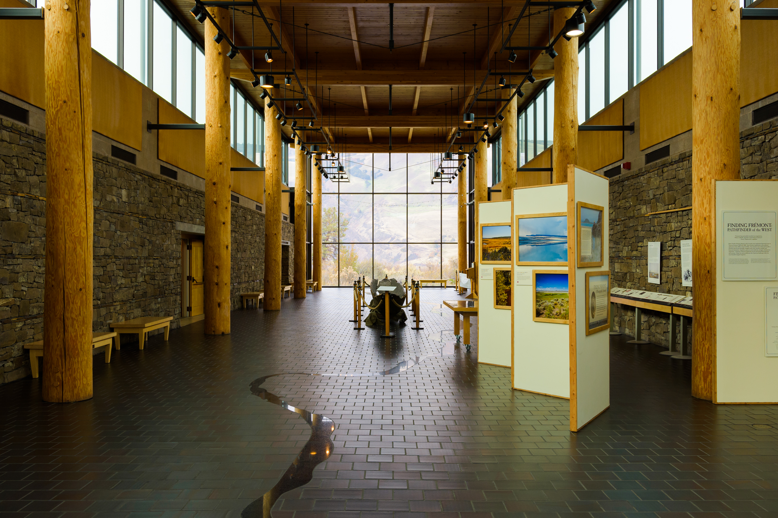
Columbia Hills Historical State ParkColumbia Hills Historical State Park puts the Columbia River Gorge National Scenic Area at your fingertips. This 3,637-acre park is composed of four different sites which offer a range of experiences. Rock climbing, swimming and spring hikes through vast fields of balsamroot flowers make for an action-packed stay, not to mention the nearby attractions of Goldendale Observatory and Maryhill Museum.
Crab Creek - Rocky Ford AreaCrab Creek is and ancient steam bed that was quickly overcome by floods waters. Look for streamlined and scarped Palouse Hills along with a crescent flood bar to the south and rock benches to the north. 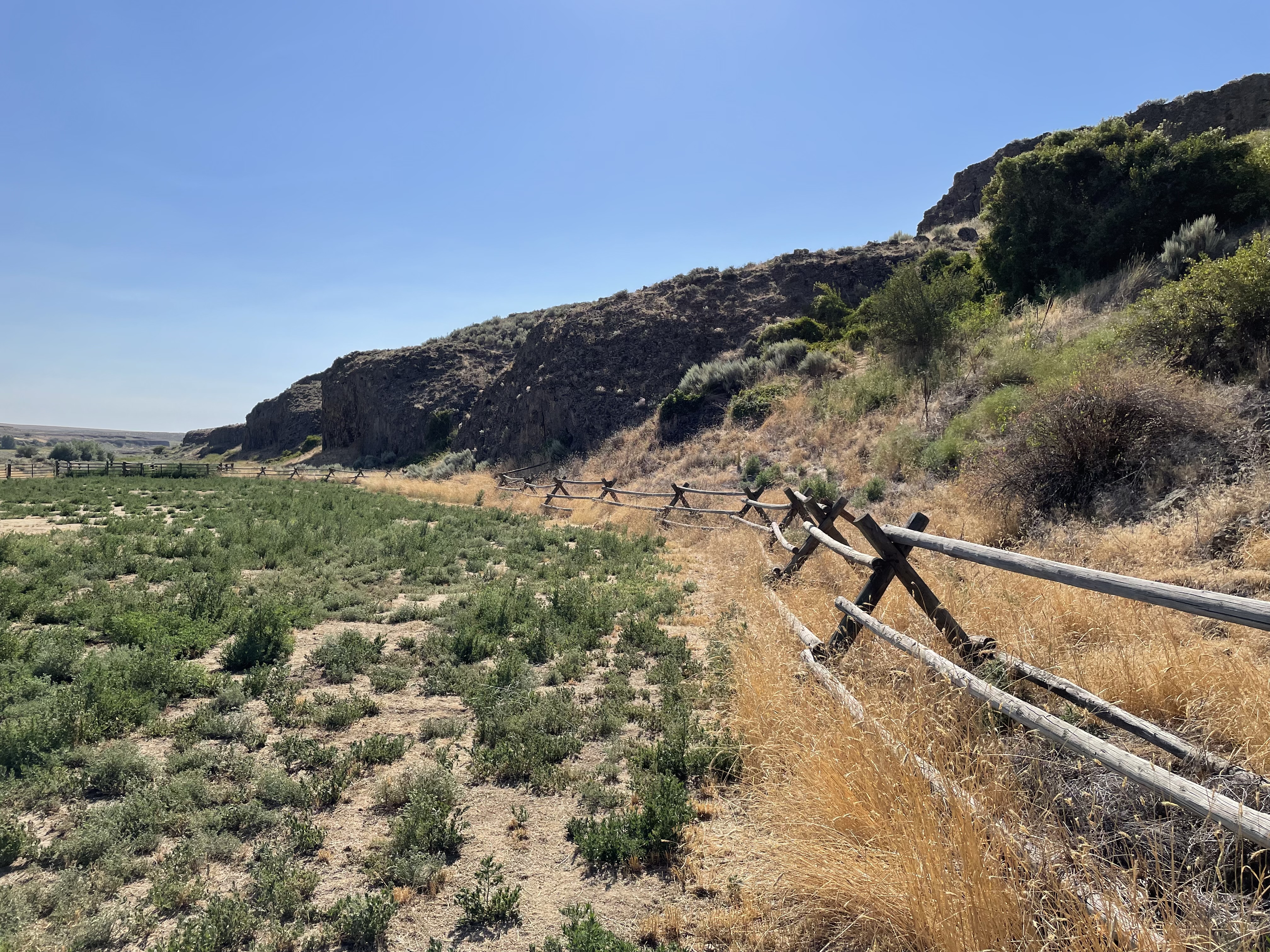
Crown Point National Natural LandmarkThe Crown Point section of the Columbia Gorge illustrates a gradual stream valley formation as downcutting kept pace with the rise of the Cascade Range. Ice Age Floods scoured the valley walls some 12 to 17 thousand years ago. 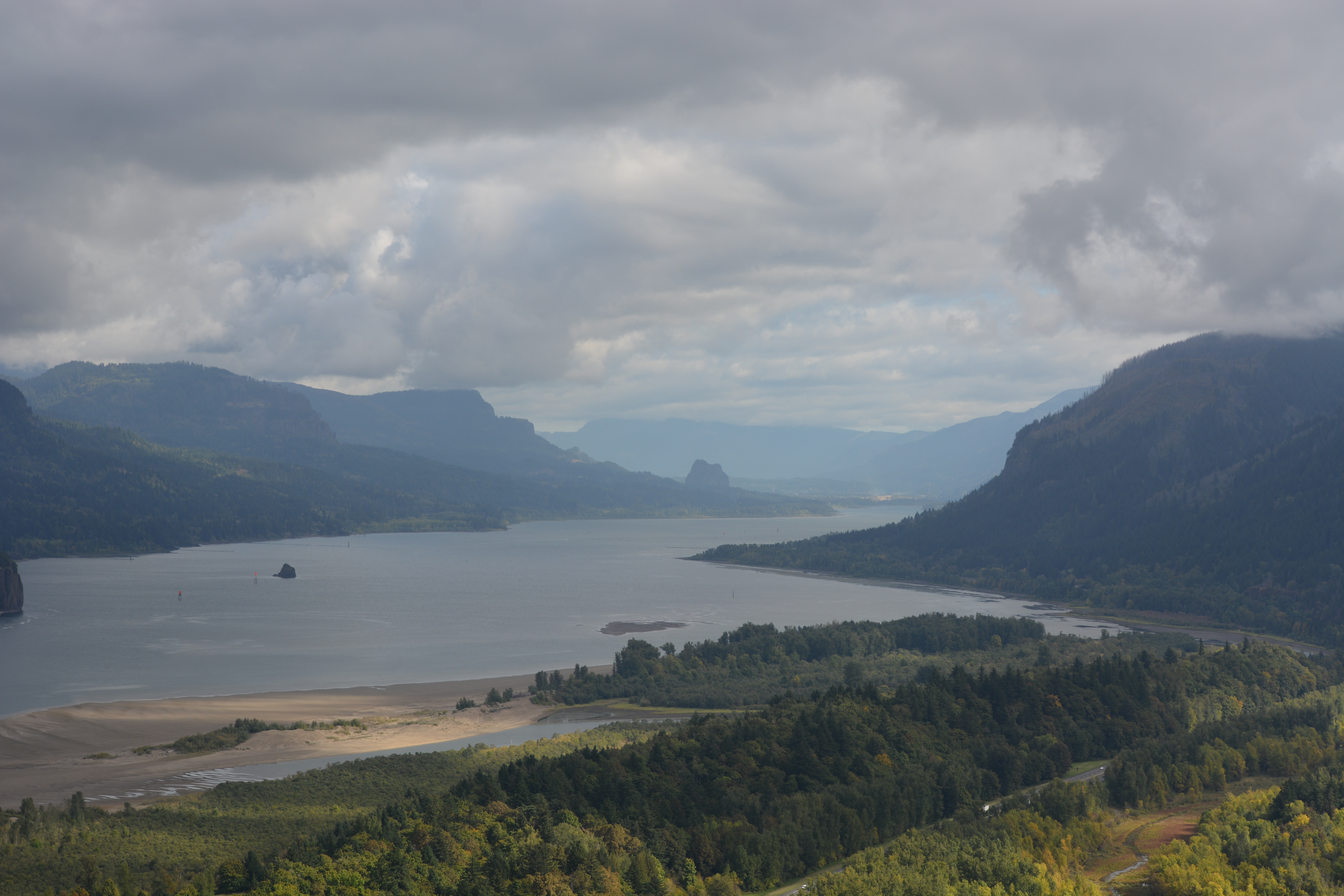
Drumheller Channels National Natural LandmarkThere is a unique character to the Drumheller Channels; unlike most other Channeled Scabland zones, no single centralized channel or major cataracts were formed. In the Drumheller Channels the floodwaters passing through in a broad cascade of 8 to 12 miles in width. There are 150 distinct channels and over 180 rock basins in this region. Drumheller Channels is the most spectacular tract of butte-and-basin scabland on the Columbia Plateau. 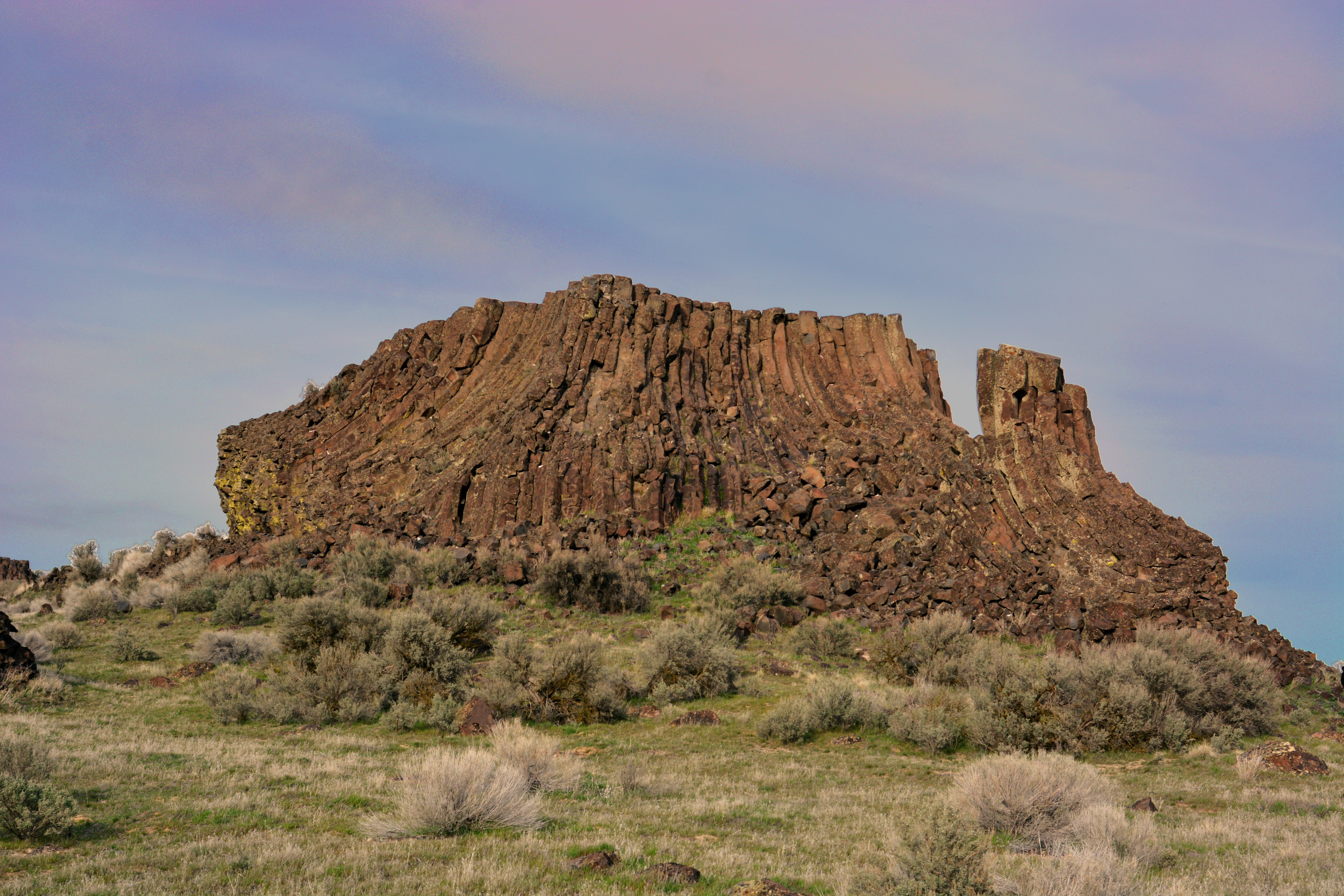
Eddy NarrowsThe flume shaped section of this canyon is the throttle that controlled the flow rates of the giant Ice Age Floods after the ice dam holding back Glacial Lake Missoula failed catastrophically. The valley walls in Eddy Narrows were scoured by the Ice Age Floods to nearly bare bedrock up to 1000’ above the valley floor. 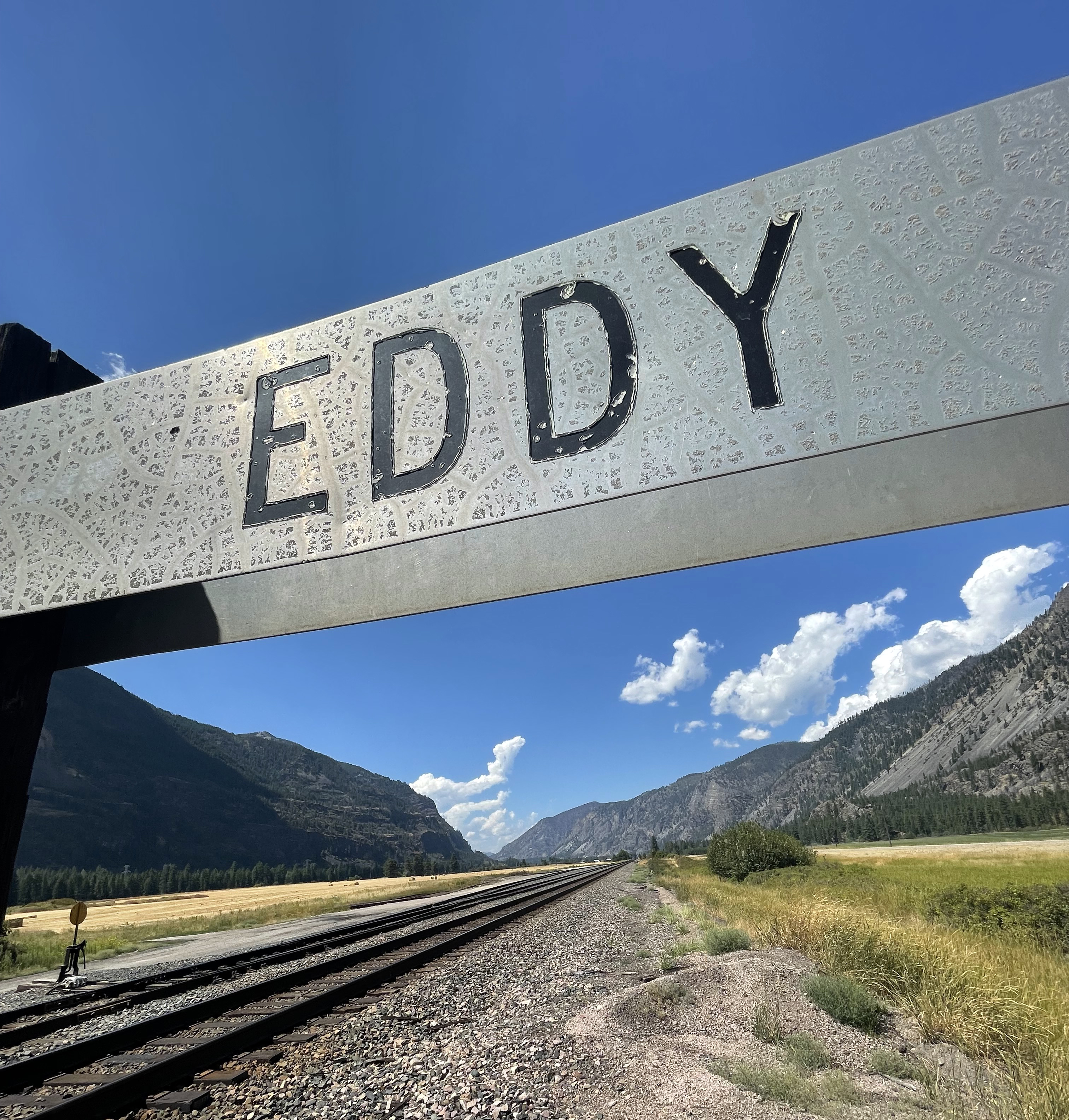
Ephrata Erratic FanThe basalt and granite boulders now littering the Ephrata Fan were carried there by torrents of water that gushed out of a canyon called the Grand Coulee. Water and debris exploded from the mouth of the Lower Grand Coulee complex sending debris in a wide swath like pellets from the mouth of a shotgun. Velocity reduction at the coulee mouth and debris momentum carried large boulders a mile or more before they began to settle out of the slowing water stream. 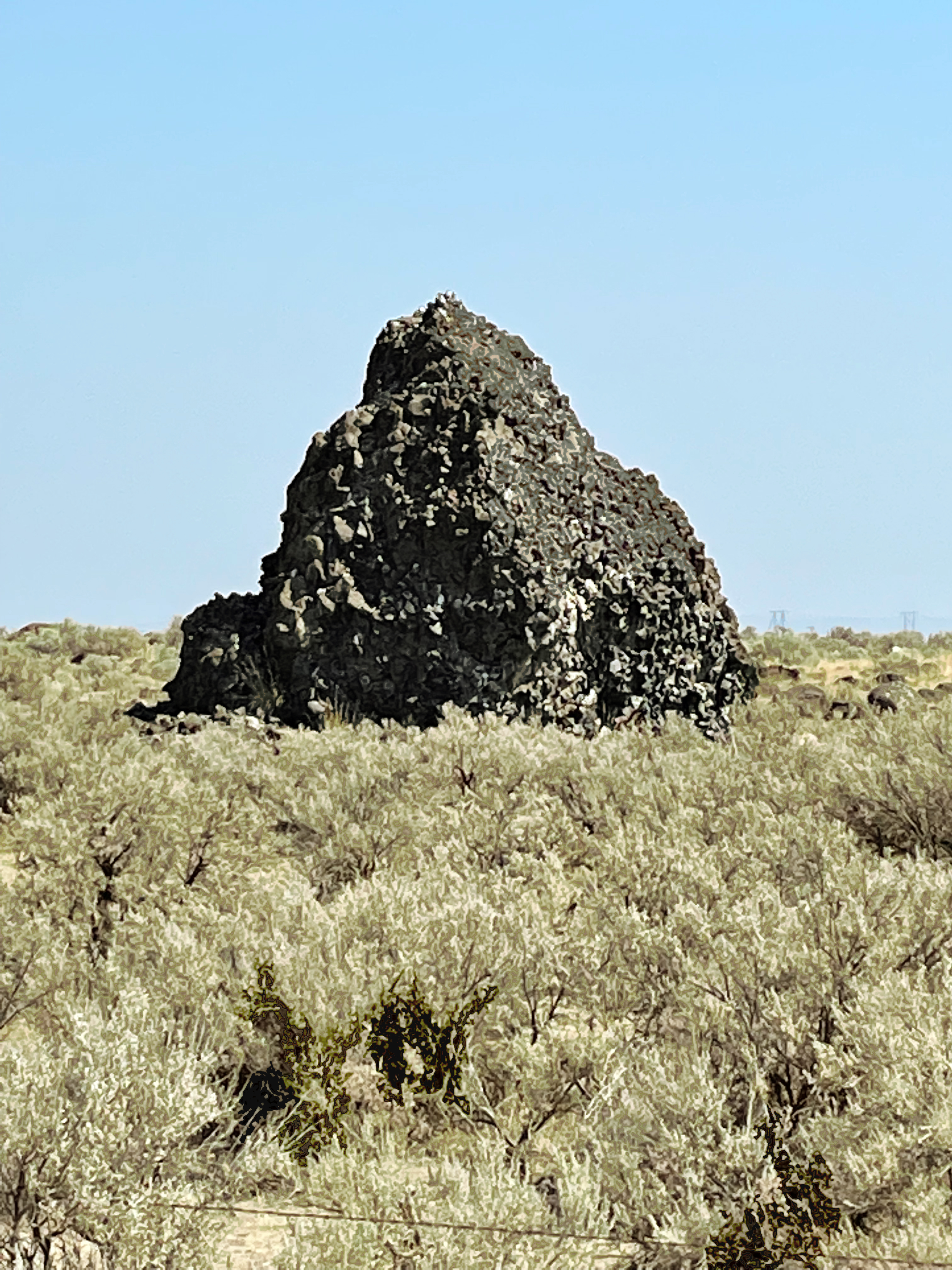
Erratic Rock State Natural Site (Bellevue Erratic)This 90-ton rock was deposited during an Ice Age flood. It floated over 500 miles in an iceberg 12,000 to 17,000 years ago, by way of the Columbia River. When the ice melted, the rock was left behind. This is the largest glacial erratic found in the Willamette Valley. It is a type of rock not normally found in Oregon because it came from the Northern Rocky Mountains. Visitors at Erratic Rock can look out across the vast landscape and imagine the huge amount of water that fil 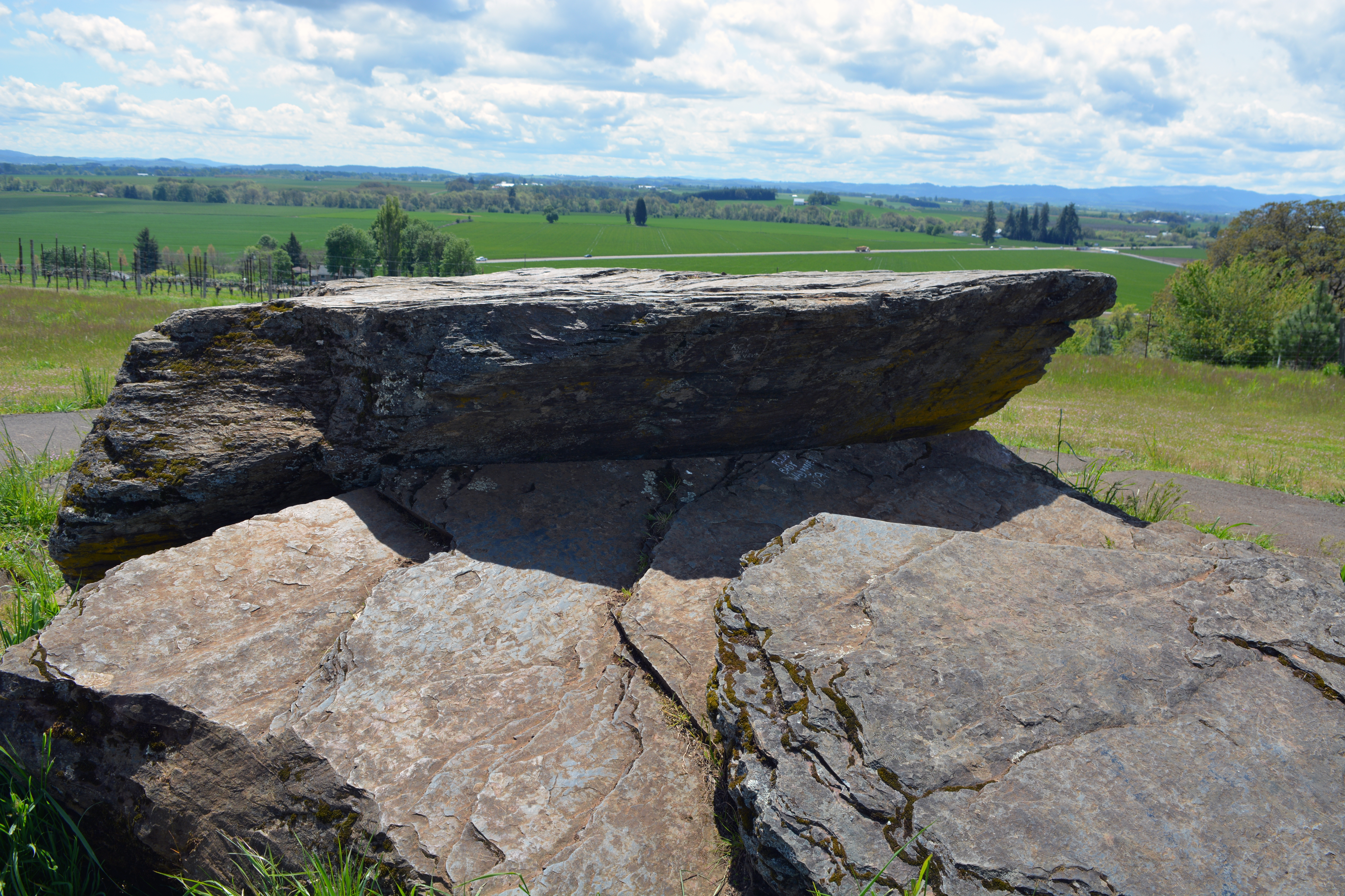
Farragut State ParkFarragut State Park is located at the “breakout” of Glacial Lake Missoula floods, where the ice dam in the Clark Fork valley and the 20-mile-long tongue of ice occupying the Lake Pend Oreille basin failed. From there, a torrent of water and ice burst from the south end of the lake. Located on the southern tip of Lake Pend Oreille in the Coeur d’Alene Mountains of northern Idaho, Farragut State Park offers unique scenery, history and an abundance of recreational opportunities. 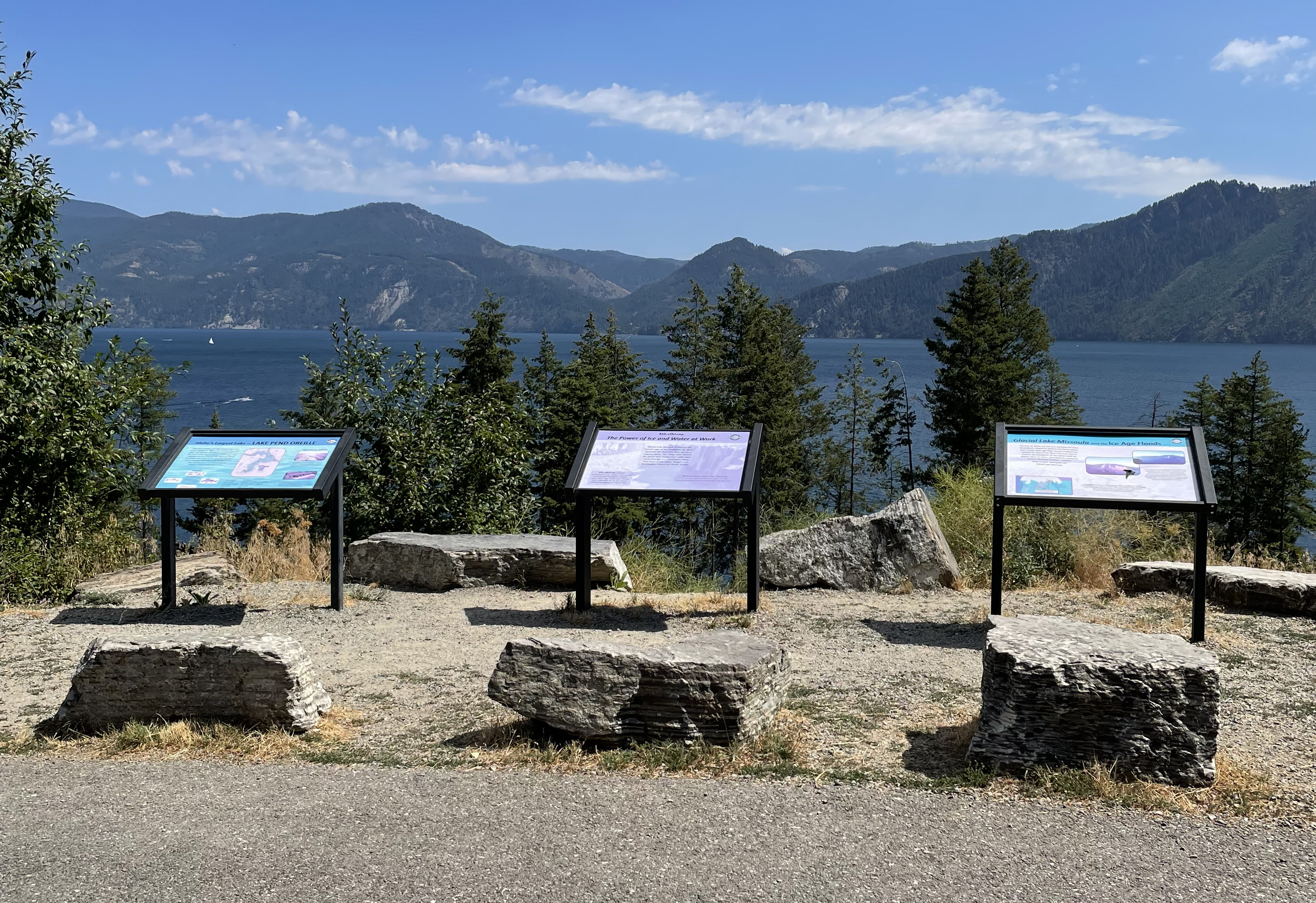
Fishtrap Recreation AreaFishtrap and Hog Lakes are part of Fishtrap Recreation Area managed by the Bureau of Land Management. In the area you will find hiking trails and signs of the Missoula Floods. Potholes and rock benches alongside scraped Palouse hills. 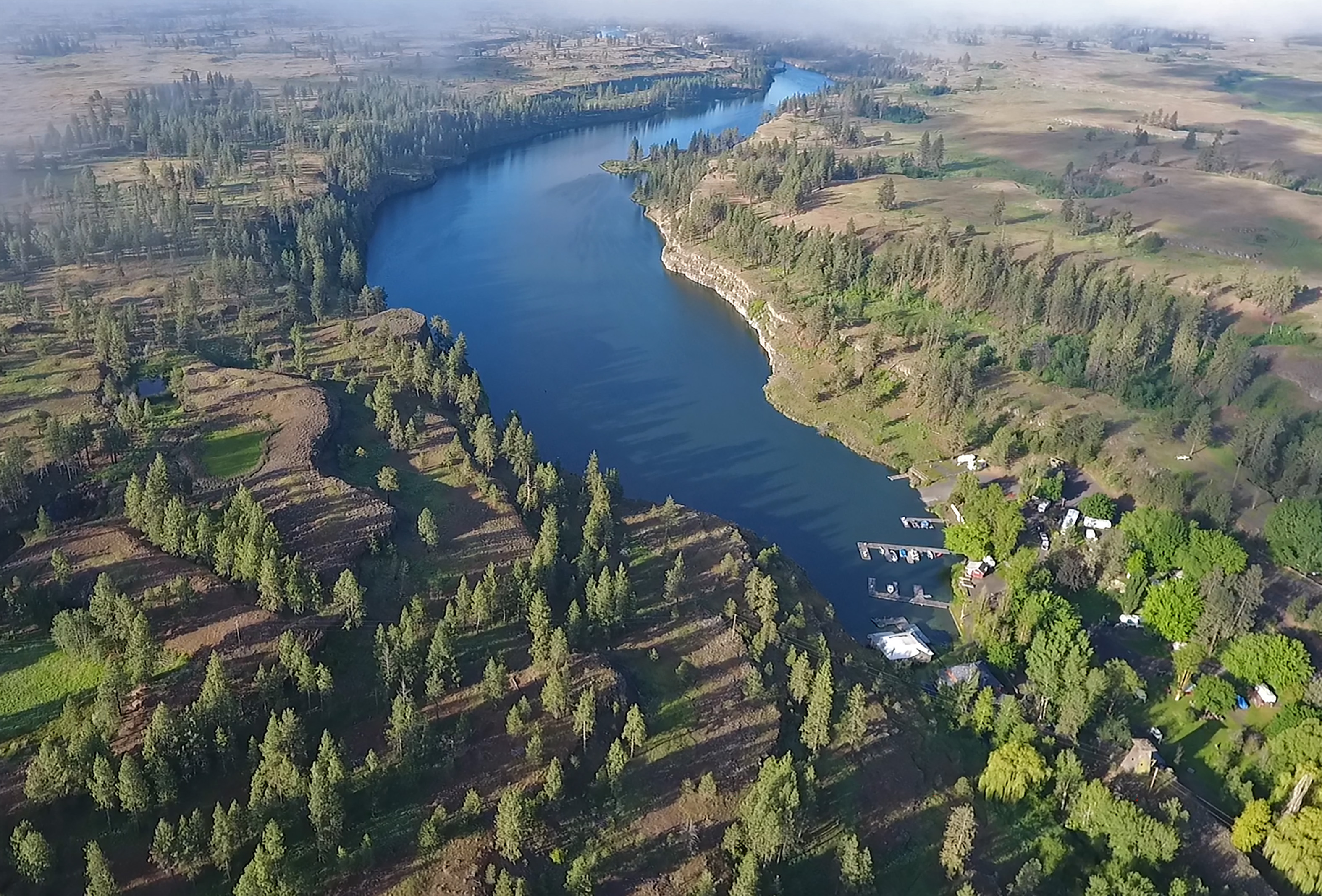
Fort Owen State ParkFirst European settlement in Montana, structure dates back to 1850. During the time of the Ice Age floods this area was completely submerged under ancient Glacial Lake Missoula. Standing here one can image being under a 1000 feet of water created by an Ice Dam blocking the Clark Fork River nearly 200 miles to the north. 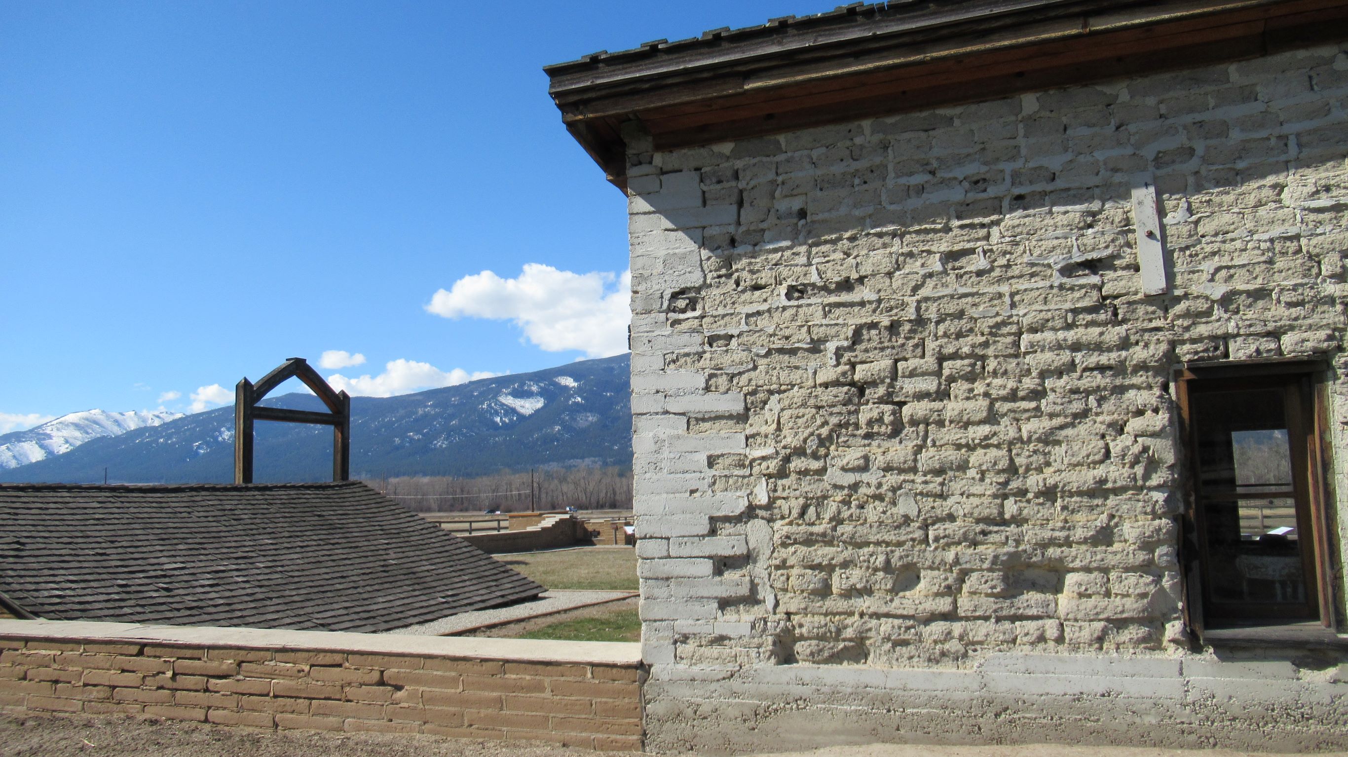
Fort Spokane Visitor Center and MuseumPrimary visitor center for Lake Roosevelt National Recreation Area which also contains exhibits and information regarding Ice Age Floods National Geologic Trail. 
Frenchman Coulee Recreation AreaFrenchman Coulee is an erosional feature left behind by the great Ice Age Floods, a spectacular dual coulee and recessional-cataract complex in the western Quincy Basin. 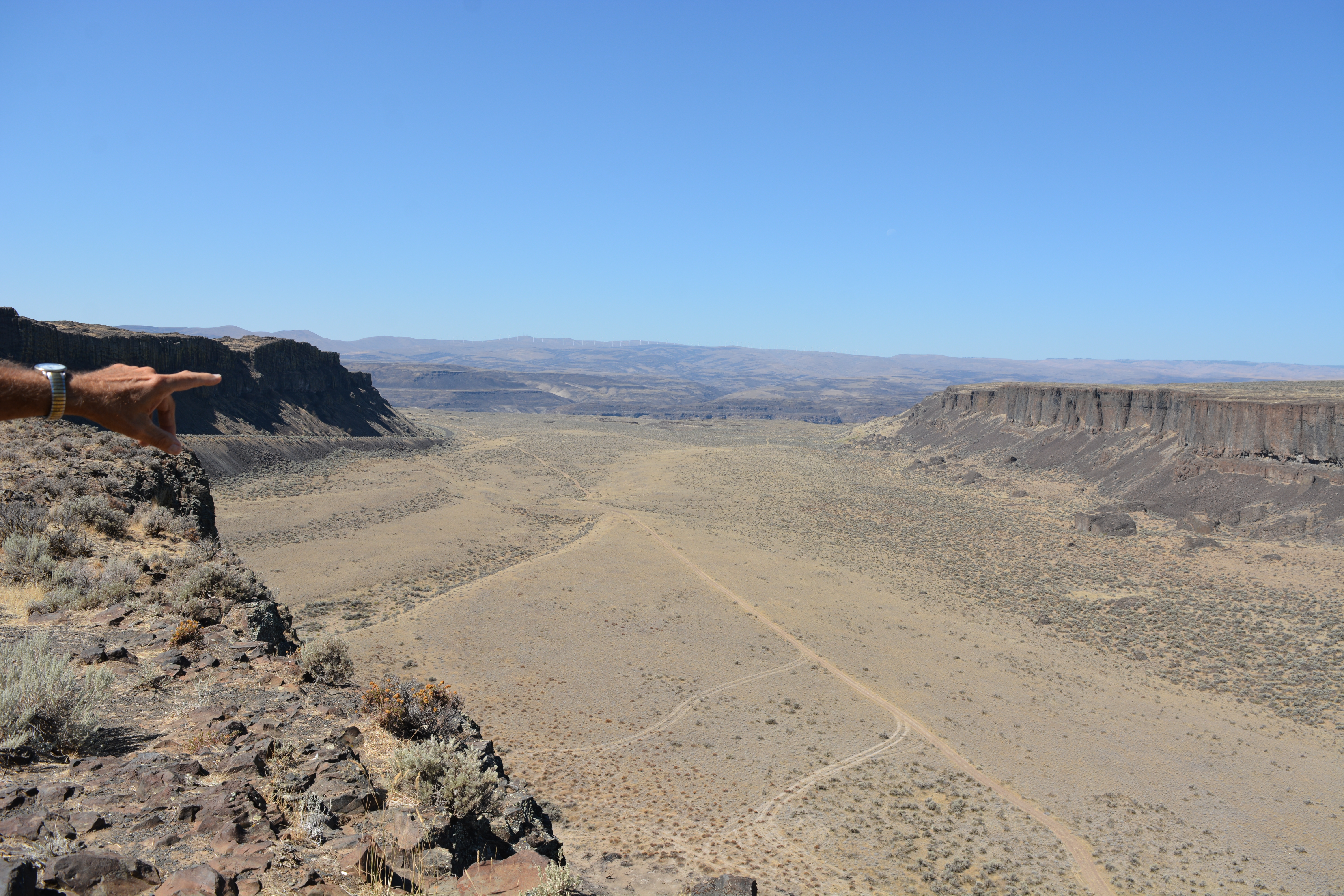
Ginkgo Petrified Forest National Natural LandmarkCurious? Drive to the park interpretive center and take in the big skies, Columbia River views and outdoor exhibits of petrified wood. Look for evidence of Ice Age floods carved into the walls of the Columbia River Gorge. Then step inside the Ginkgo Petrified Forest Interpretive Center. Not only is it air-conditioned, the museum features more than 30 varieties of petrified wood, including a display of rare ginkgo petrified wood. 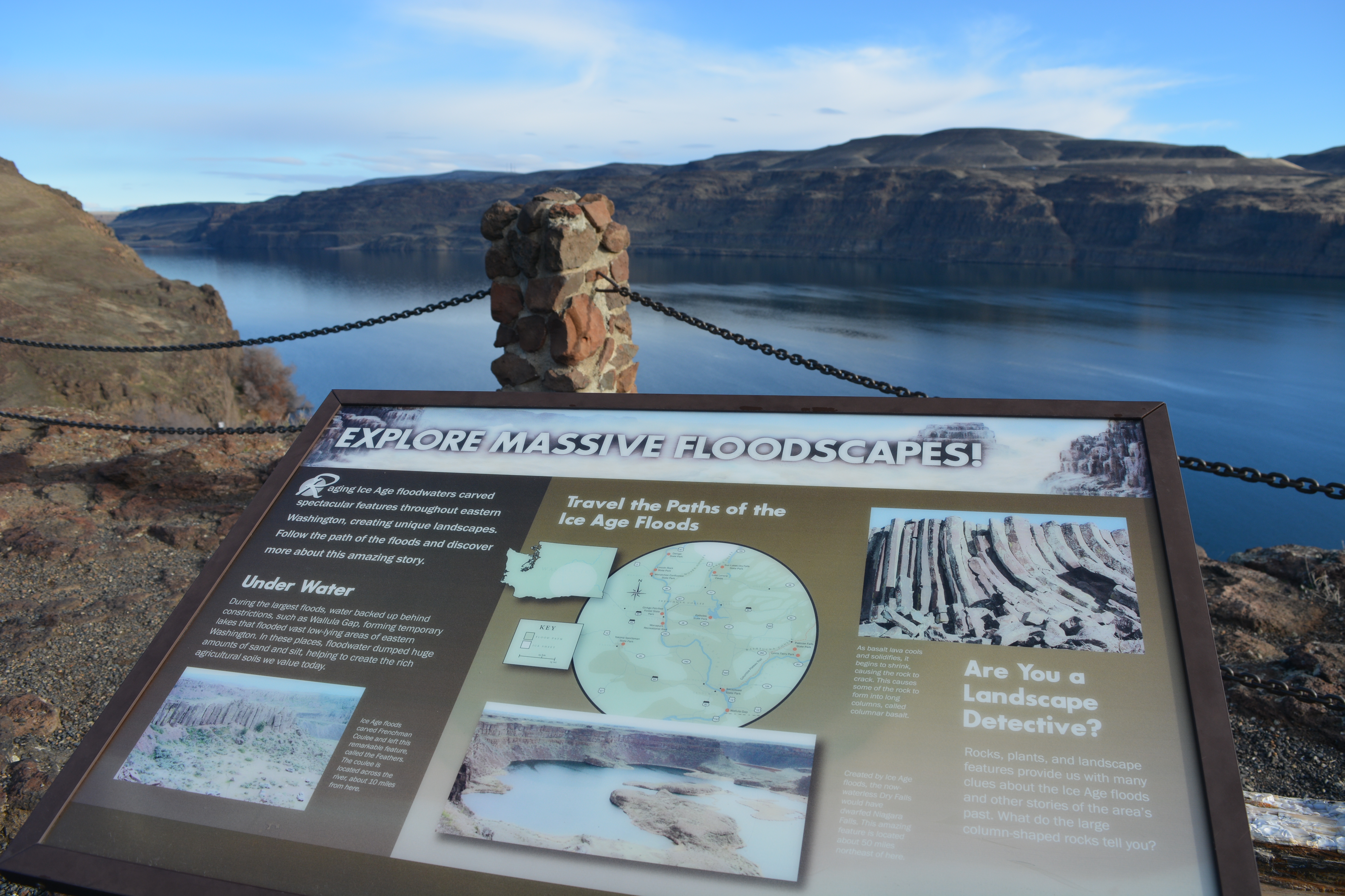
Glacial Dam at Green Monarch Ridge View PointView the Green Monarch Ridge and the Purcell Trench from a large pullout on Idaho State Route 200, about one mile (1.6 km) west of Hope, Idaho and 15 miles (24 km) east of Sandpoint, Idaho. 
Glacial Lake Missoula National Natural Landmark (Camas Prairie Ripples)This site contains the largest and best examples of giant flood ripples known in the North American continent and provides evidence of the largest floods known on earth. Best viewed from Hwy 382 north of Camas Prairie at the Camas Creek Rd. 
Glacial Lake Missoula StrandlinesAncient shorelines or strandlines of Glacial Lake Missoula are visible as perfectly parallel horizontal benches ground into hillside slopes around Missoula. They are most visible with light snow cover, or in low evening light on the mountains marked with an"M" and an "L" on either side of Hellgate Canyon looking east from the downtown. 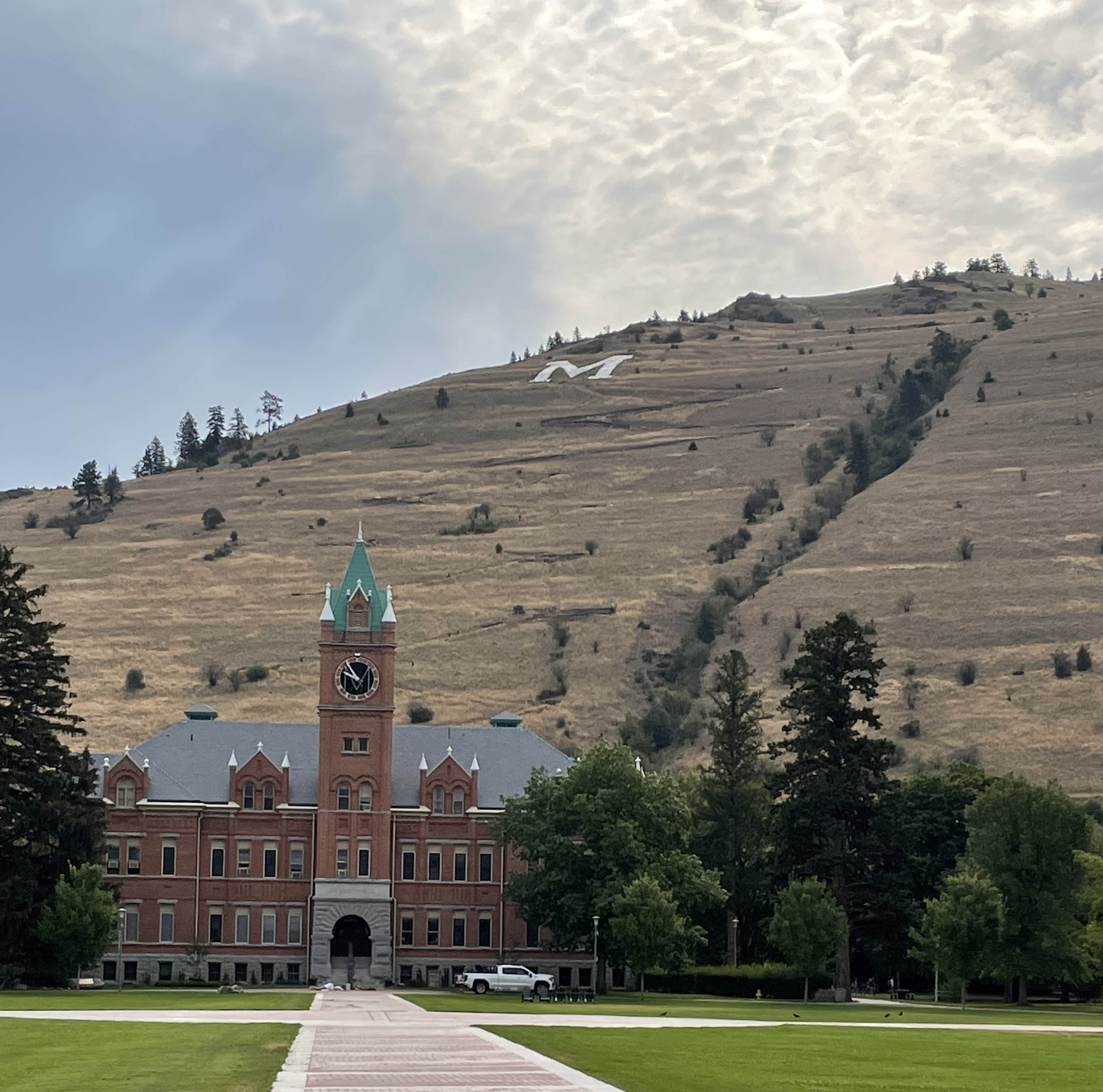
Gold CreekEastern high water mark for glacial Lake Missoula 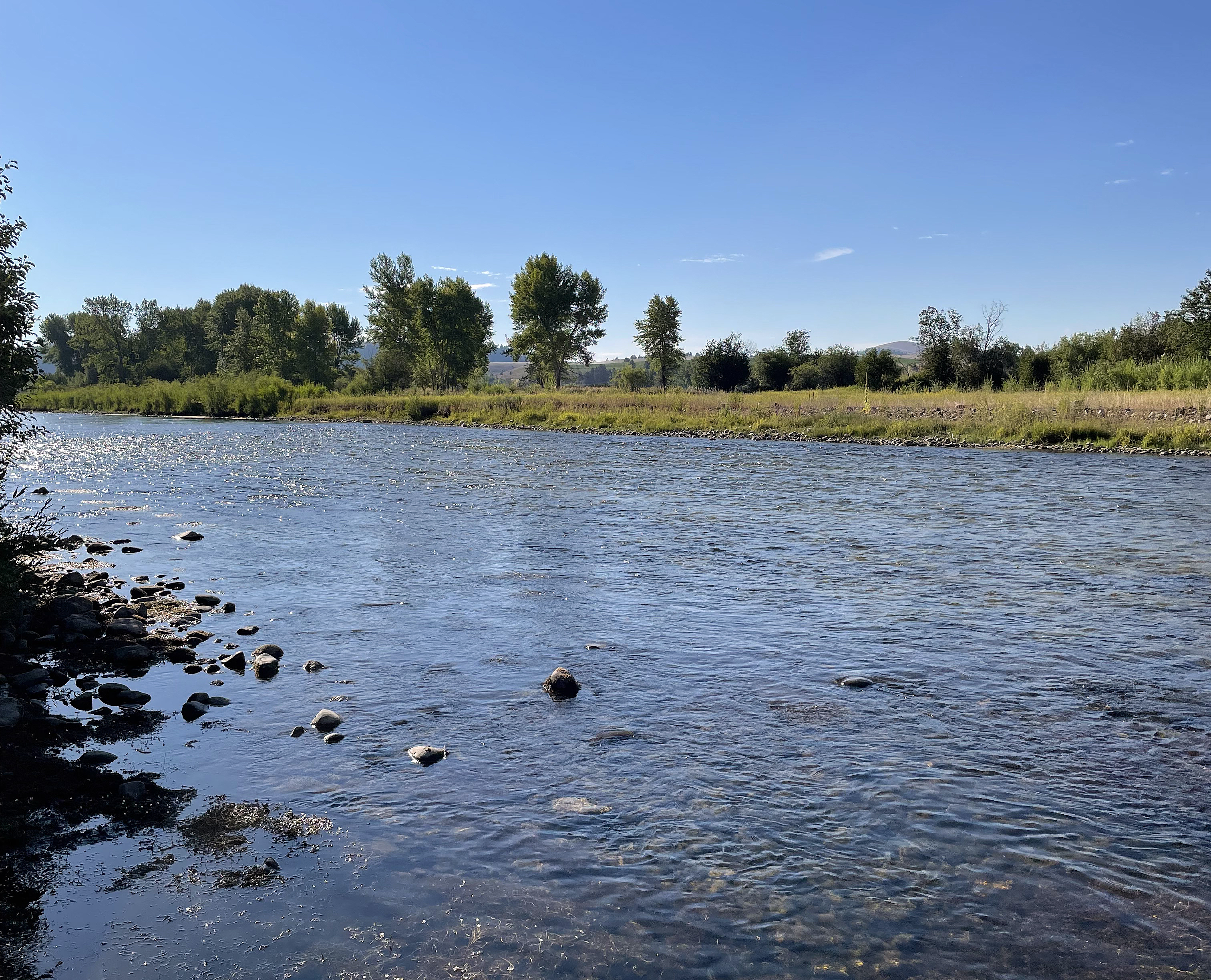
Govan Recreation Site
Grand Coulee Dam Visitor CenterBuilt at the location of Glacial Lake Columbia and at the head of the Grand Coulee signs of the Missoula Floods can be found throughout the region. 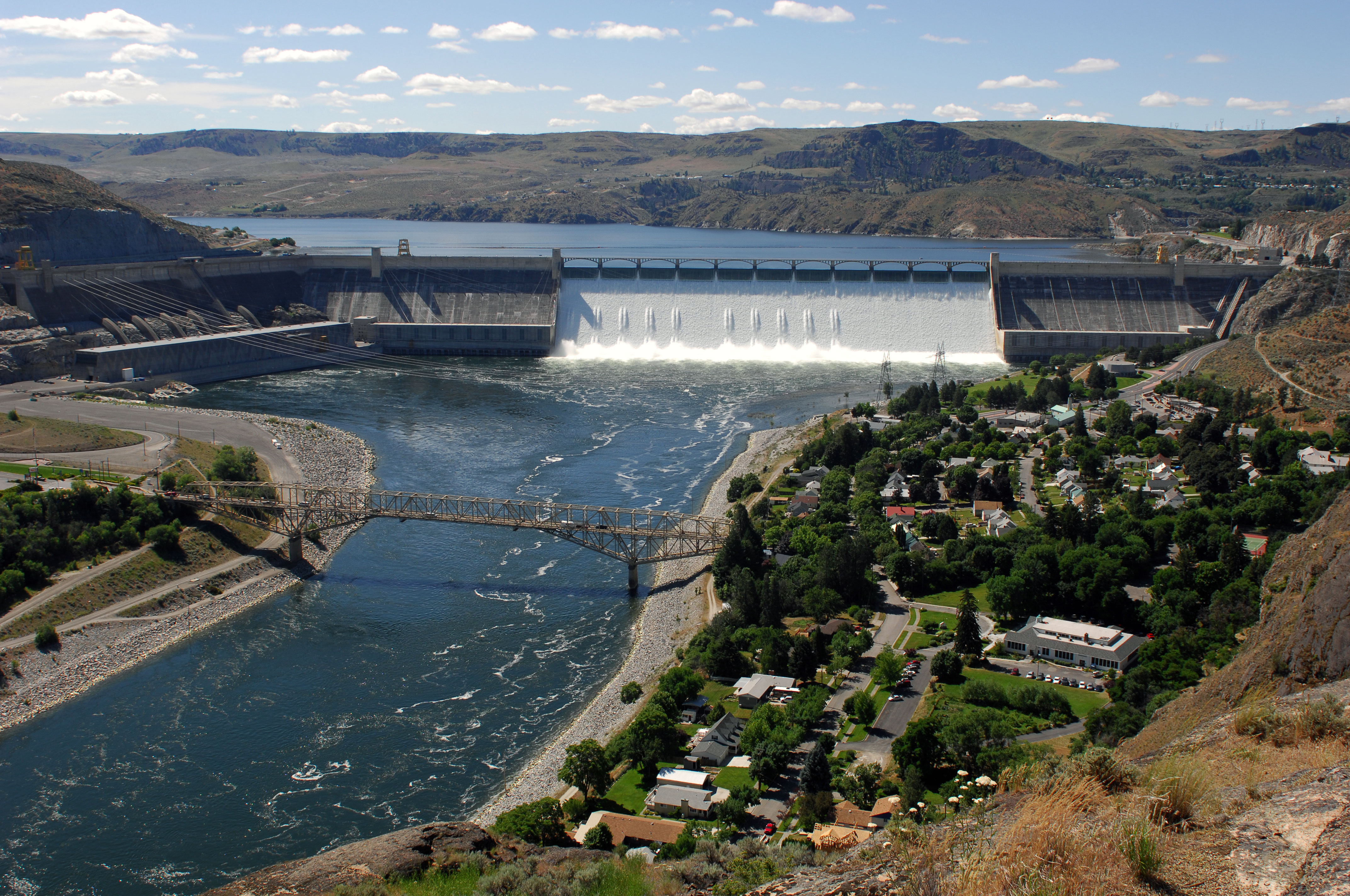
Grand Coulee National Natural LandmarkGrand Coulee is the largest coulee in the Columbia Plateau and is probably the world’s finest example of a recessional cataract gorge. 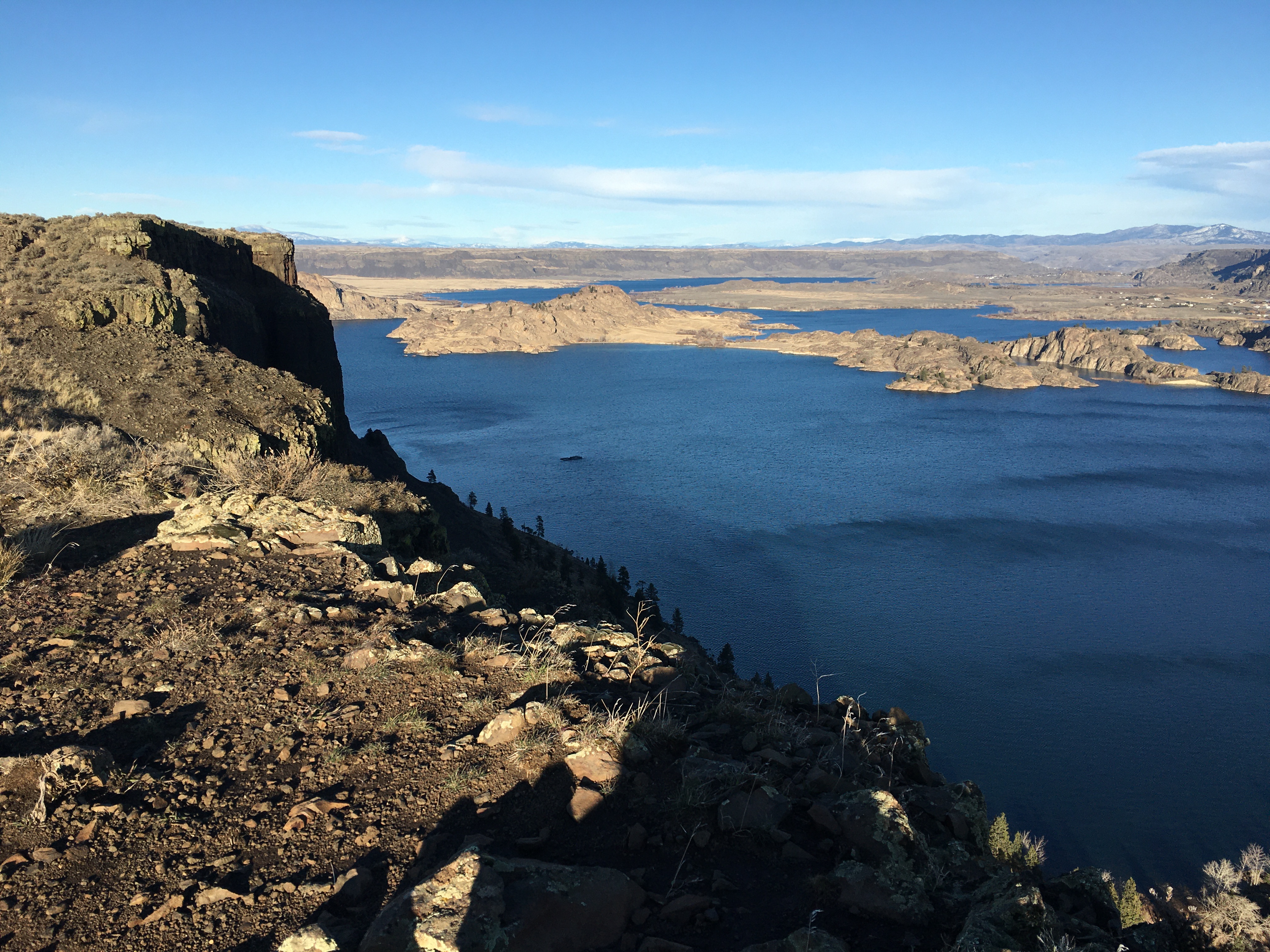
Green Monarch RidgeThe Purcell Trench Ice Lobe originated in Canada and flowed south into Idaho, guided by the structural control of the Purcell Trench. Following the path of least resistance into the basin now occupied by Lake Pend Oreille, it was impeded by the Green Monarch Ridge forming an ice dam of the Clark Fork River and creating glacial Lake Missoula. 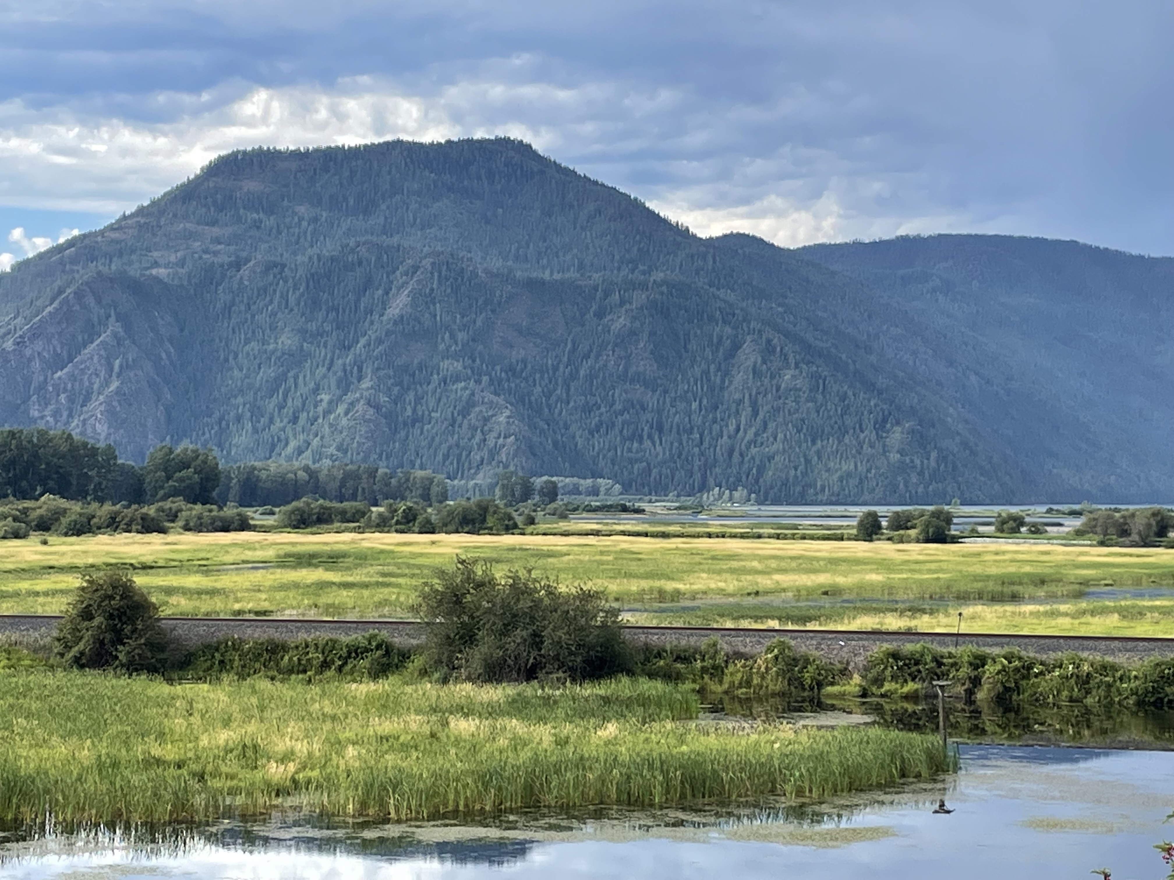
Hanford Reach National Monument
Hat Rock State ParkHat Rock is a natural monolith of basalt carved by floods from glaciers melting over ten thousand years ago. Lewis and Clark saw this monument on their expedition, and noted that it had a strong resemblance to a man’s hat. Imagine seeing this otherworldly boulder in the middle of a field of rolling hills in a vast, unexplored territory — the members of the expedition must have felt like they were on a different planet! 
Ice Rafted Erratics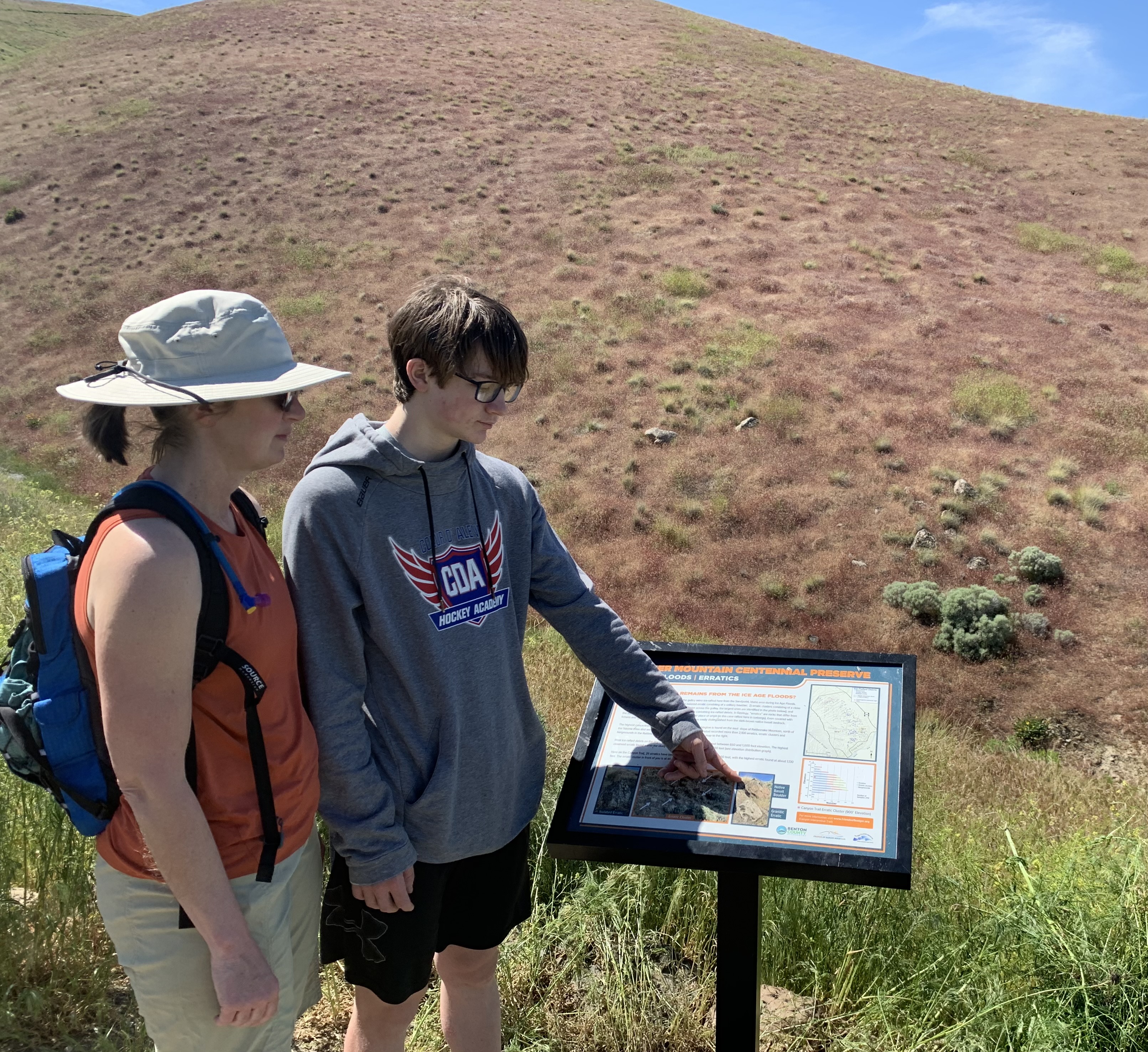
Lake ComoThe furthest extent of Glacial Lake Missoula in the Bitterroot Valley arm southeast of Missoula is marked by a stone in the Bitterroot National Forest several miles north of Darby MT. The marker was placed at a parking area for the swimming beach near the dam which regulates Lake Como. 
Lake Lewis High Water Marker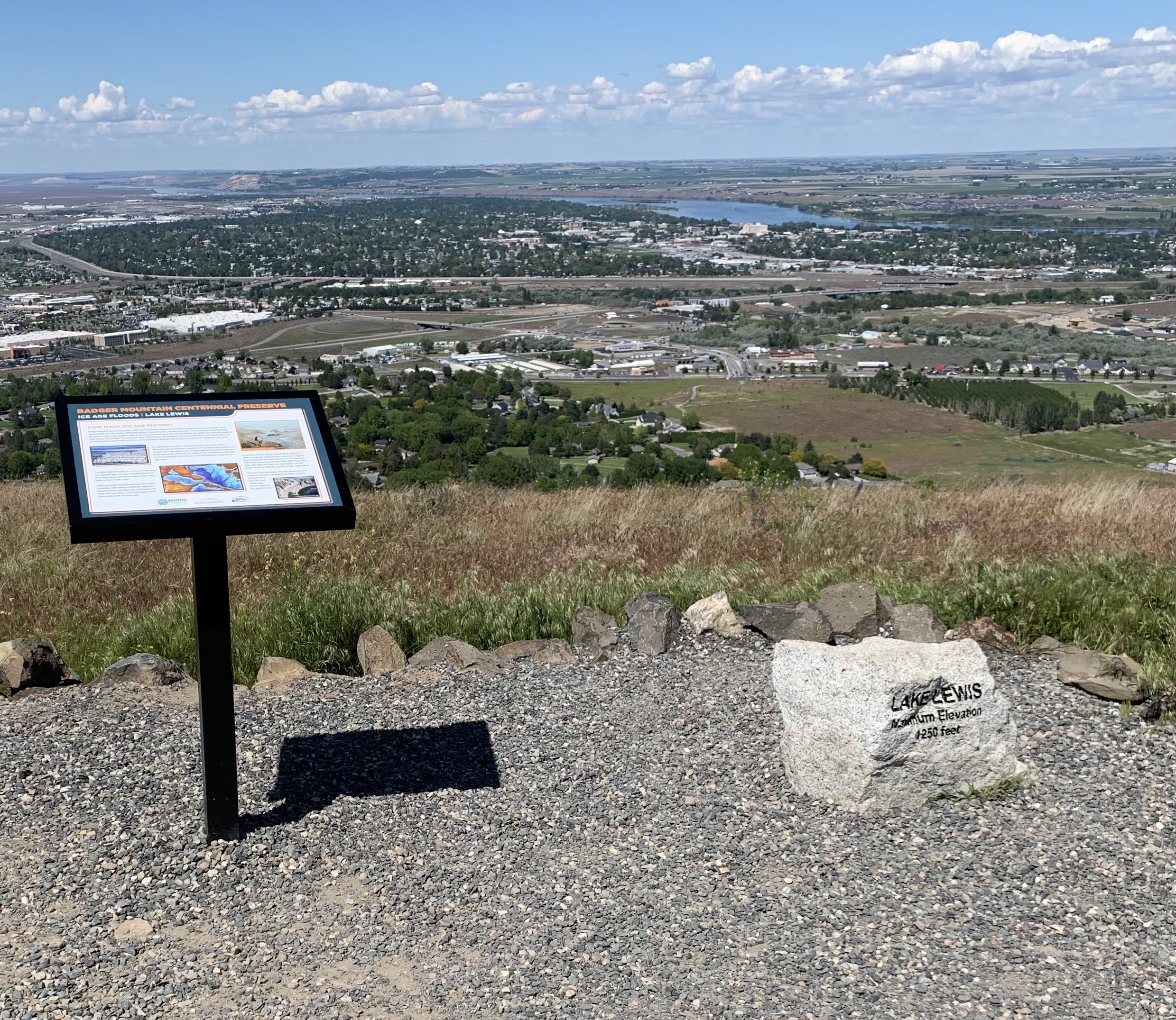
Lake Pend OreilleThe Lake Pend Oreille basin was carved by the repeated advances of Pleistocene ice and scoured by ice age floods. With the waning of ice age flood waters, the basin was, and continues to be, filled with glacial outwash and flood deposits. The lake is dammed at the south end by thick glacial and flood deposits the mark the beginning of the “Outburst Deposits”. 
Lyons Ferry State ParkIf eastern Washington calls to you, Lyons Ferry State Park is sure to enthrall. Tree-shaded green lawns gracefully slope to the cooling waters of the Snake and Palouse rivers. The hills of the Palouse, on a landscape carved by powerful Ice Age floods, lie beyond the water. 
Montana Natural History CenterThe Montana Natural History Center maintains an interpretive exhibit in cooperation with the Glacial Lake Missoula Chapter of the Ice Age Floods Institute, where you can watch interactive video shorts on floods features in this area, view artifacts from the life of J.T. Pardee, who lived and did his research near here, and find books and brochures about the Ice Age Floods. 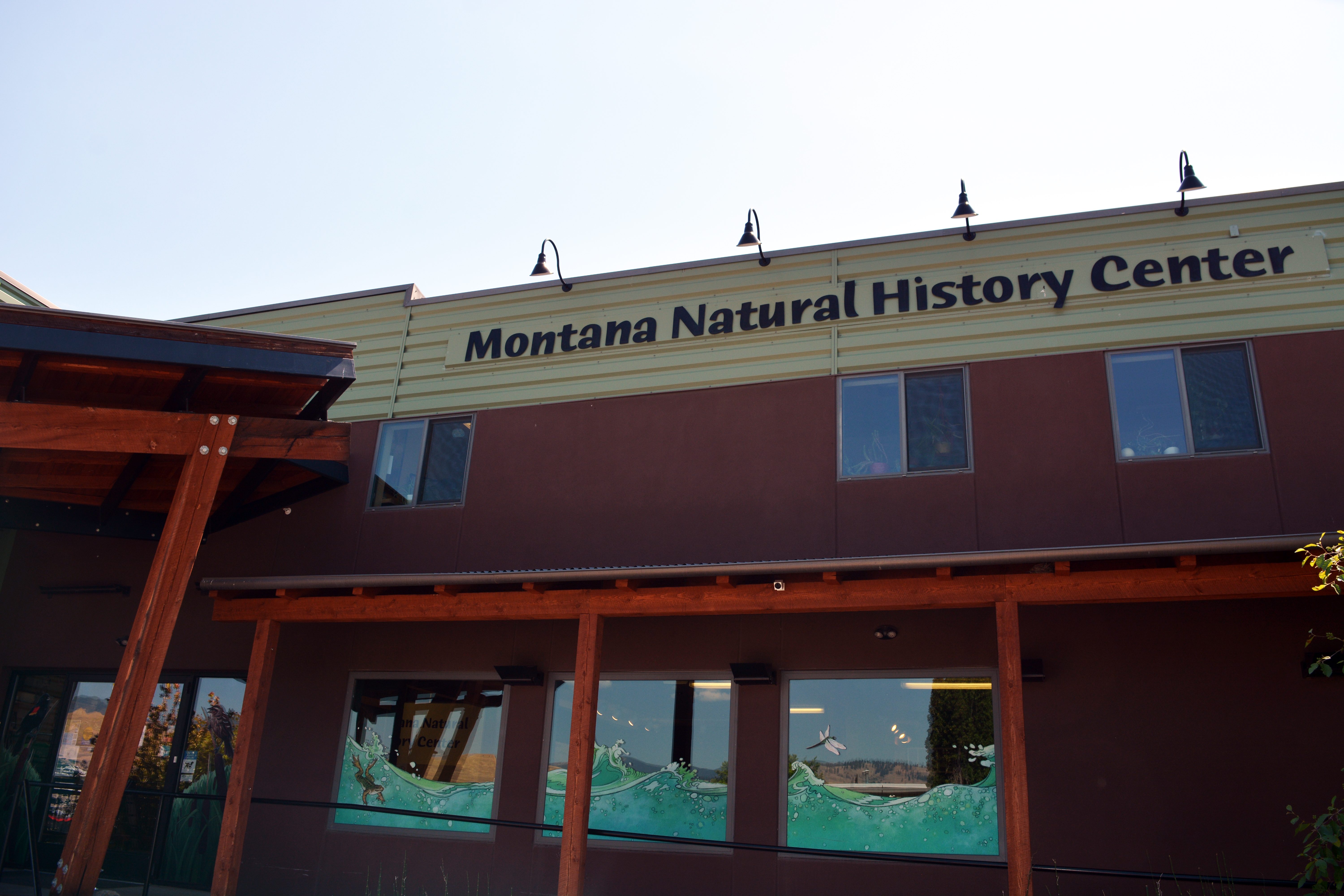
Multnomah Falls and LodgeOregon’s tallest waterfall (620 ft.) is just 30 minutes east of Portland and 30 minutes west of Hood River. Offering scenic splendor and a gateway to the Gorge’s Waterfall Corridor, the waterfall is the most visited outdoor attraction in the Pacific Northwest due to its constant flow and proximity to the Historic Columbia River Highway. The falls are fed by rainwater and snowmelt, and its steady stream runs year-round, making it a four-seasons attraction. 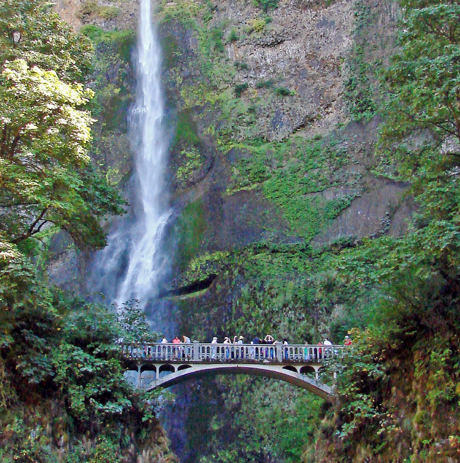
Museum of Natural History, University of OregonThe Museum of Natural and Cultural History is a place for making connections—to each other, to our past, and to our future. It's a place for digging into science, celebrating culture, and joining together to create a just and sustainable world. Exhibits include content about the Missoula Floods. 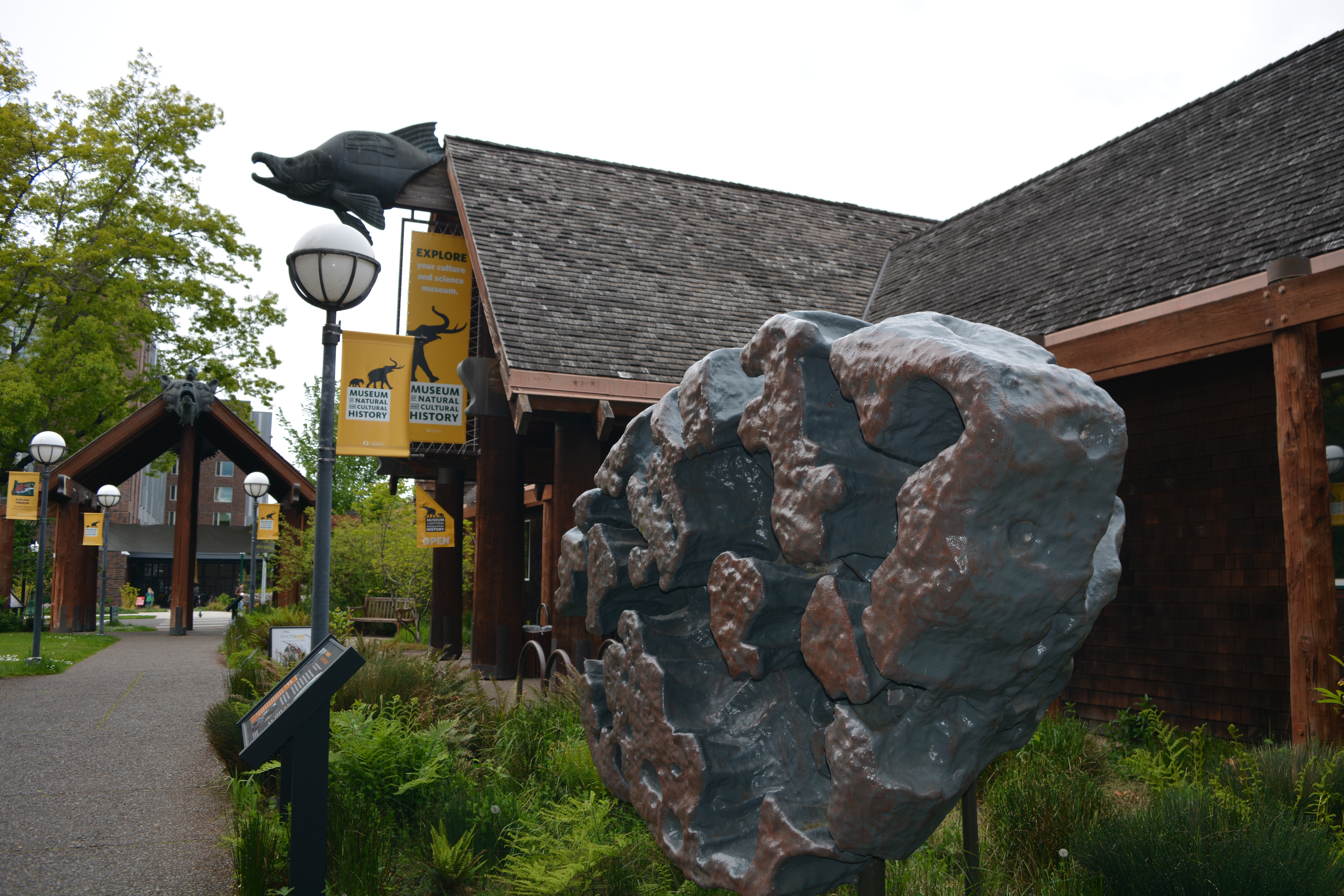
National Bison RangeThe National Bison Range is in the center of the 1,250,000-acre Flathead Indian Reservation and consists of 18,766 acres. The Bison Range is a pay-to-enter, fee-use area only. Visitors are to report to Visitors’ Center to pay for access. Tribal members were directly involved in saving the bison as a viable wildlife species and continue to care for them today. Many signs of Glacial Lake Missoula and massive water movement can been seen in the surrounding landscapes. 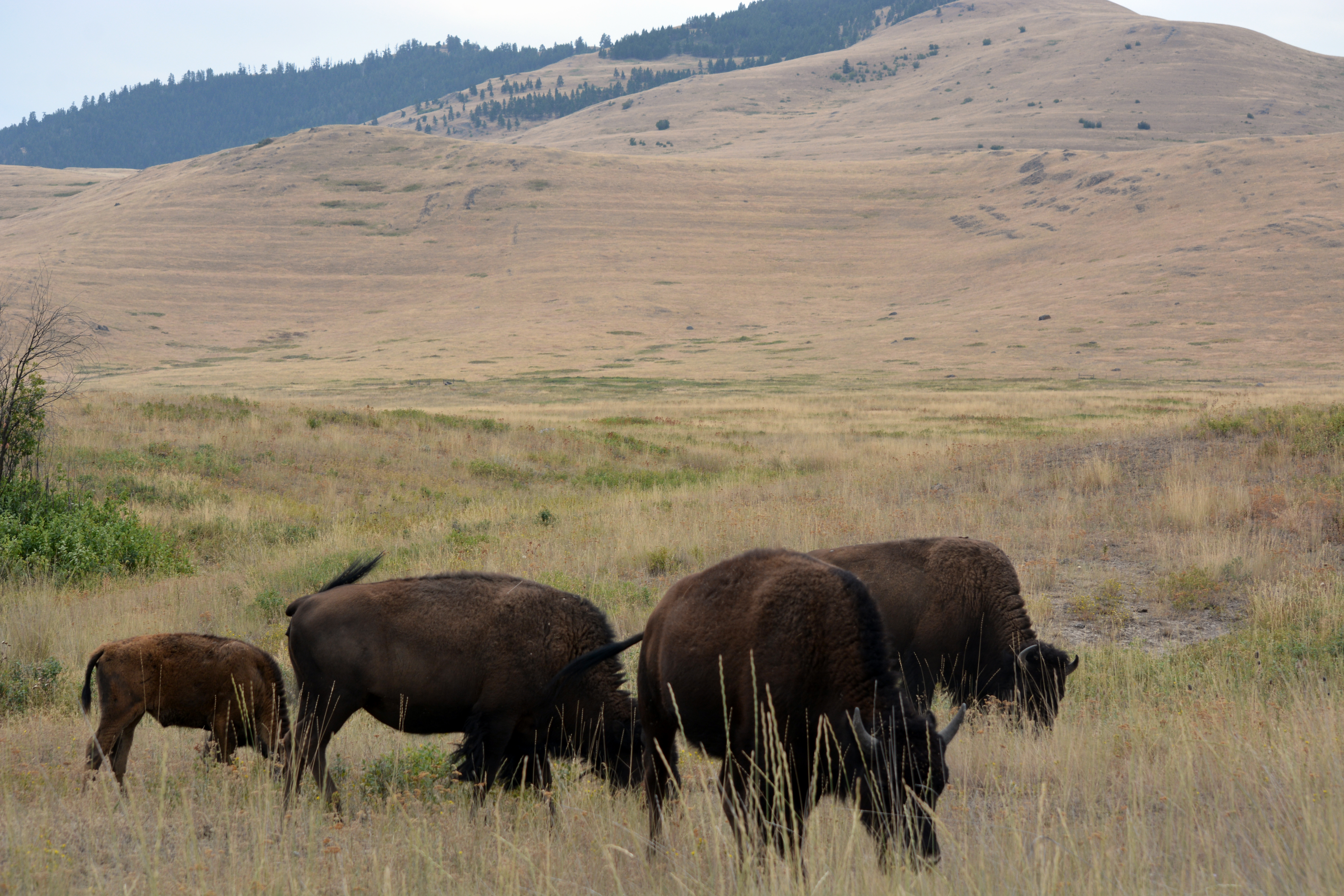
Pacific Lake Recreation SiteThis area includes dozens of unique Ice Age floods features where you can see the impact of multiple floods through this tract of channeled scabland. 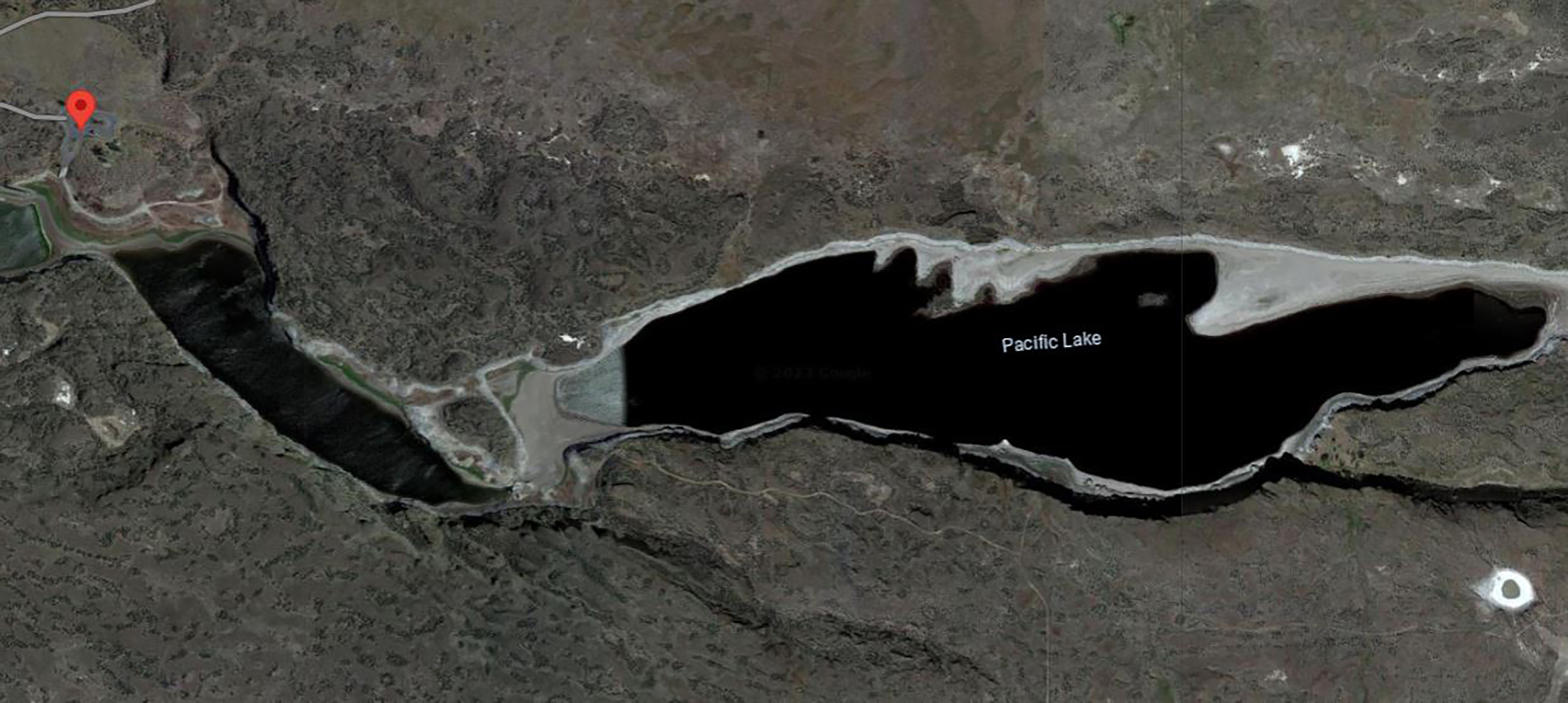
Palouse Falls State ParkAll Washingtonians, visitors to the region and Ice Age floods fans should see Palouse Falls State Park at least once in their lifetime. Carved more than 13,000 years ago, Palouse Falls is among the last active waterfalls on the Ice Age floods path. This natural wonder was named Washington’s state waterfall in 2014, when the state Legislature passed a bill written by local schoolchildren, who advocated for the designation. 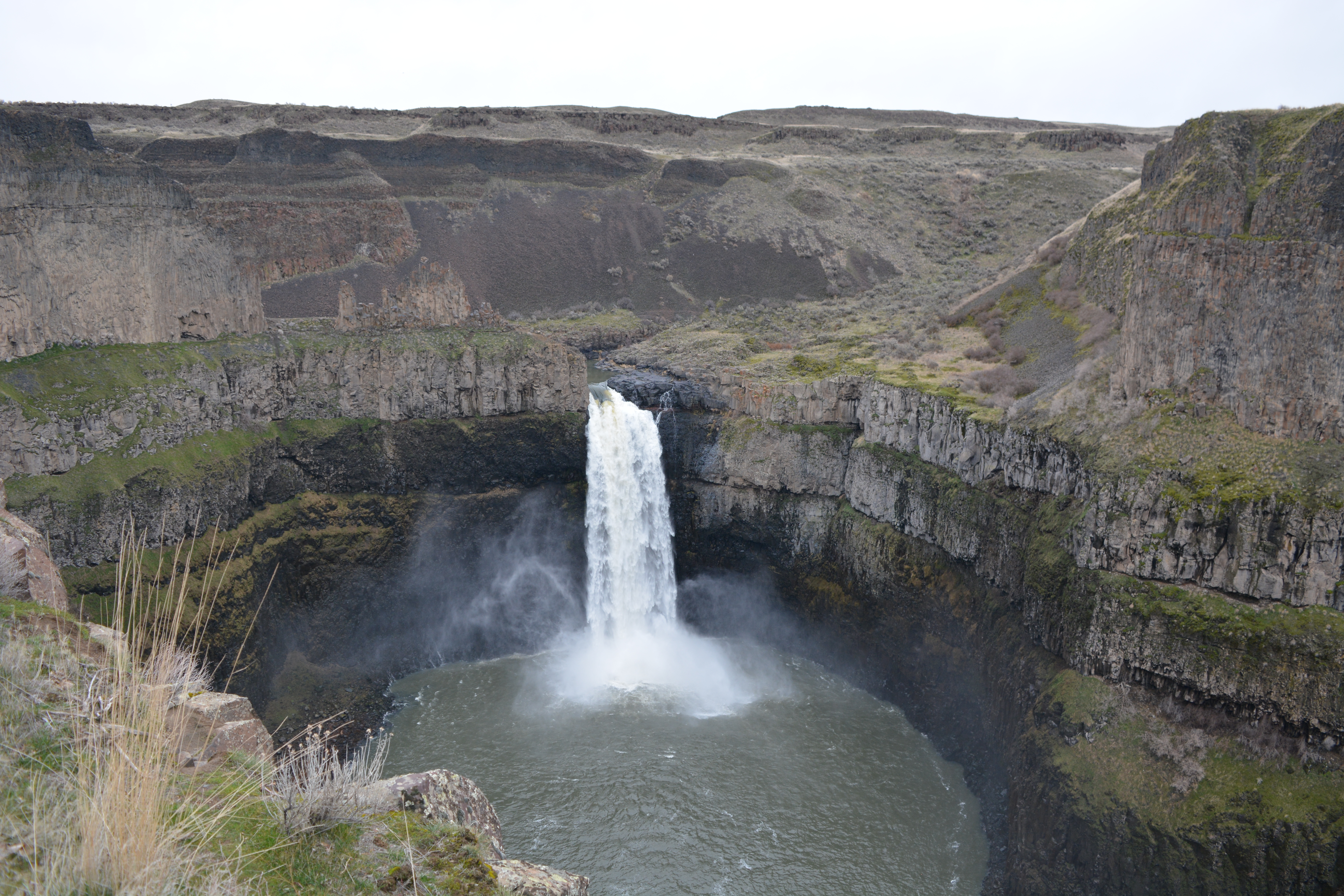
Panoramic Views to the north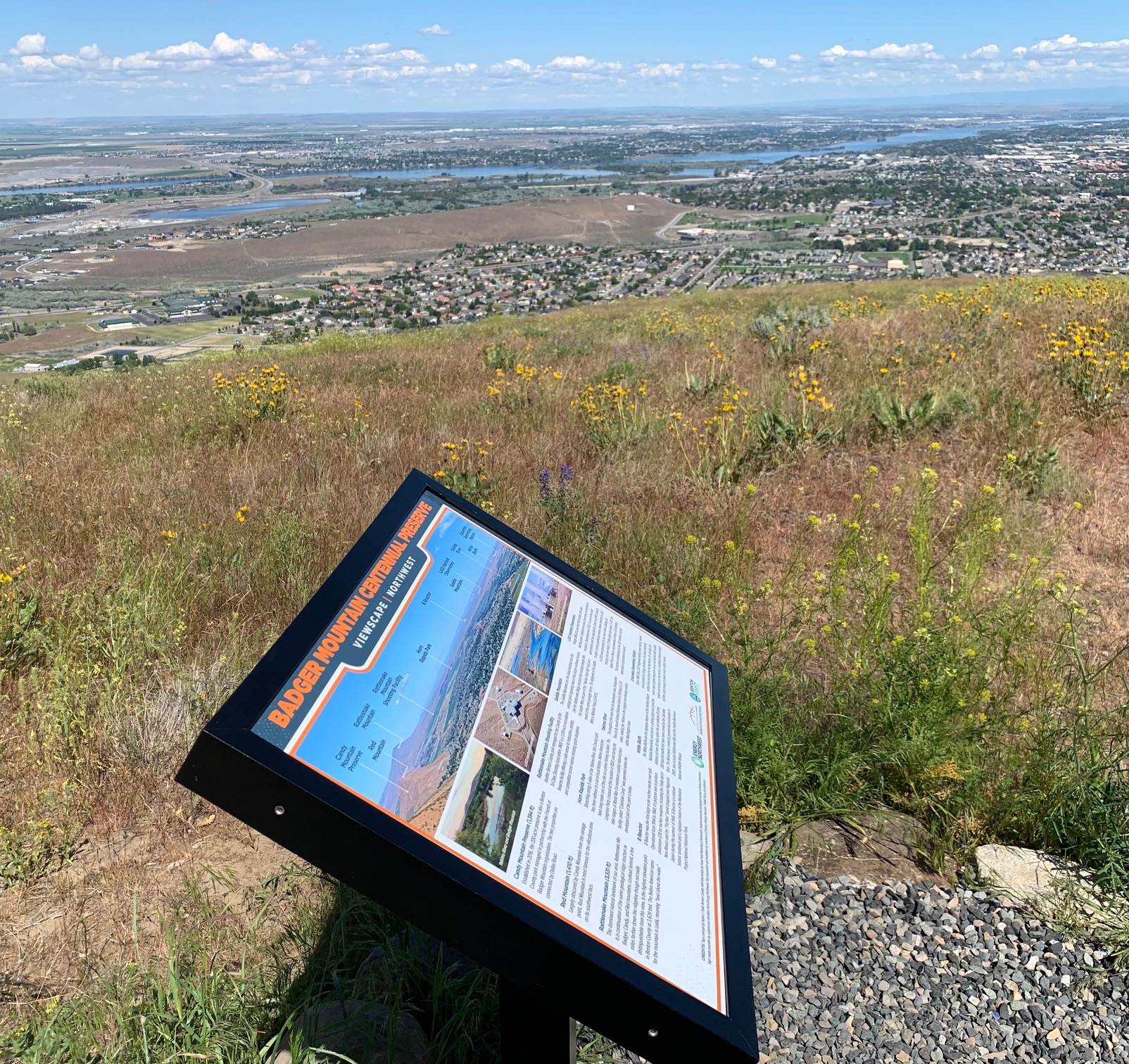
Pipistrelle Cliffs Trail at Drumheller ChannelsThis "trail" is not really a trail; it's a hike along a service road that takes you on a hike to Black Lake, which is located off the refuge. However, this is one of the best places to view the exemplary geology of the refuge, including columnar basalt, and the results of the Ice Age floods. The "trail" is about 3/4-miles in length one-way; you must backtrack to return to your vehicle. Take note that Black Lake and its shoreline are in private ownership, so please respect. 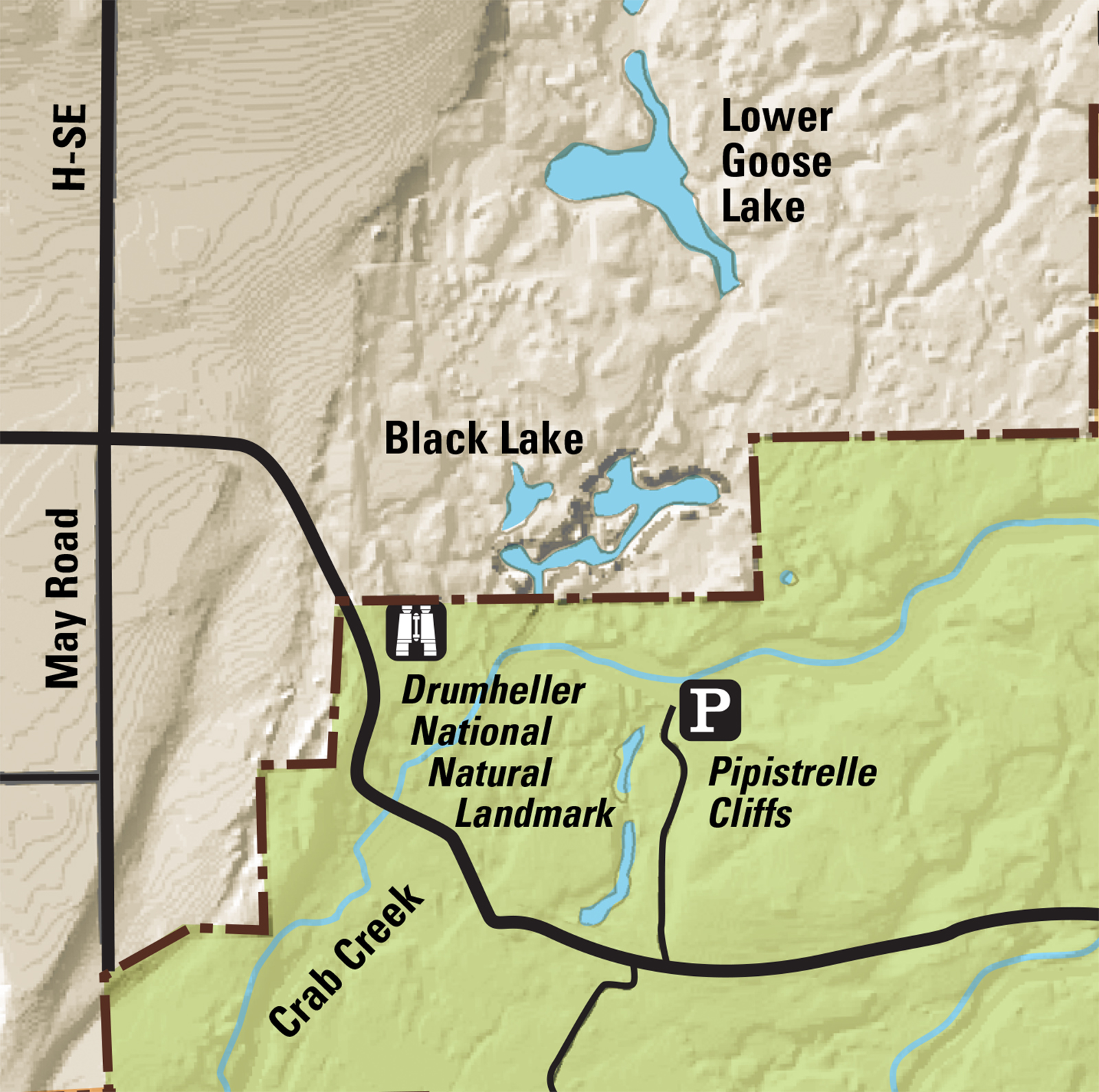
Potholes CouleePotholes Coulee is very similar to Dry Falls cataract located in Lower Grand Coulee; in that it consists of two arcuate alcoves separated by a relatively thin “rock blade”. Similar plunge pools (now filled with lakes) are also located at the base of the two alcoves in Potholes Coulee. Ancient Lakes are located in the northern alcove, while Dusty Lake occupies the southern alcove portion below the cataract. 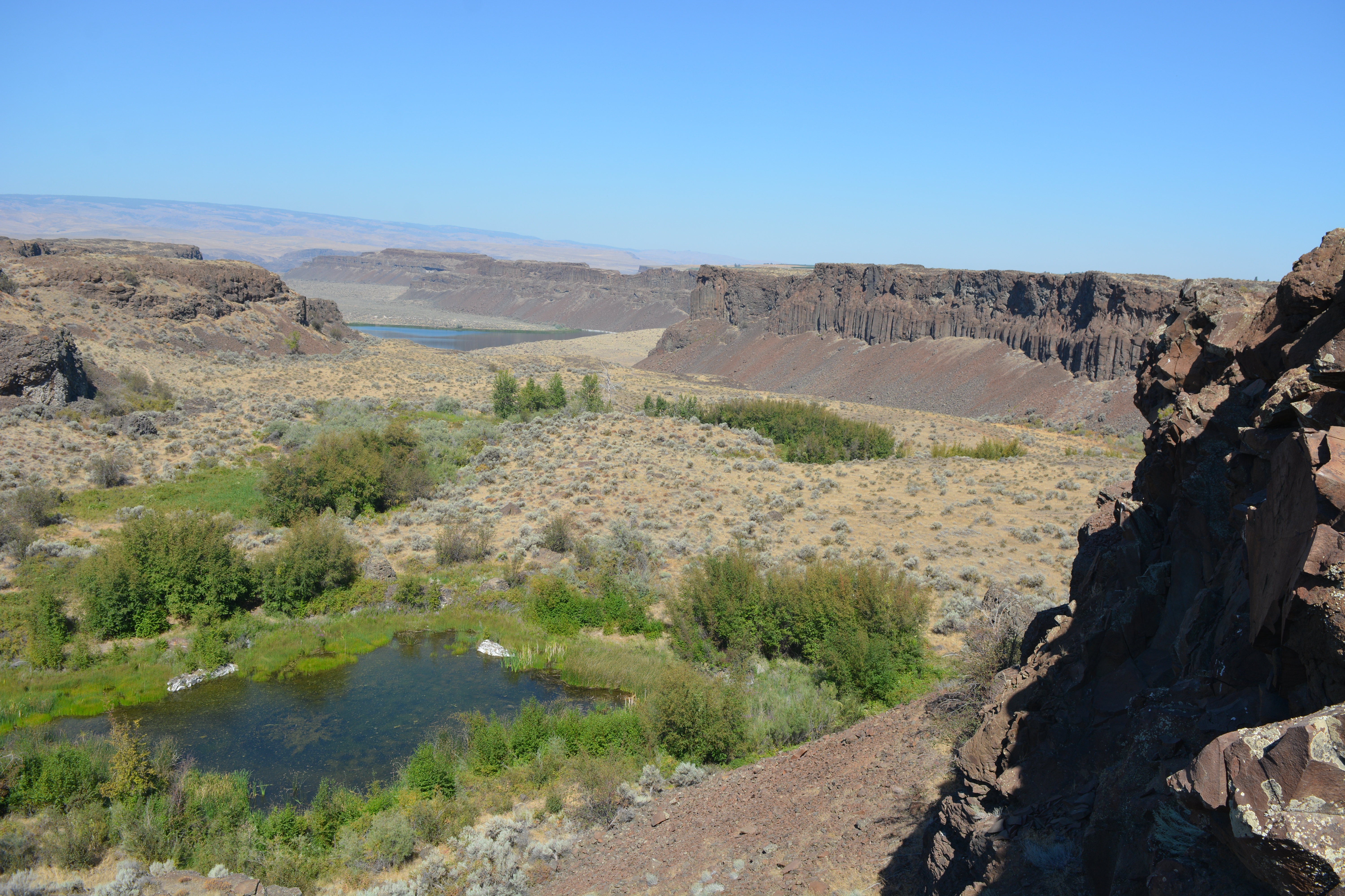
|
| Visitor Centers | Count: 0
|
| Things to do | Count: 0
|
| Tours |
Count: 1
Badger MountainWhen Columbian Mammoths roamed our area, Badger Mountain experienced some of the largest freshwater floods known to have happened anywhere on the planet. Learn about the awesome power of the Ice Age Floods. Hike up the Canyon Trail to the summit of Badger Mountain and learn fun facts about the Ice Age Floods. This self-guided tour is a loop hike which begins and ends at Trailhead Park. The loop is 3.3 miles in length and has an elevation change of about 800 feet. Please be prepared and leave no trace. |
| Articles |