Be advised that the NPS has issued alerts for this park.
2025 RANGER III Parking Area Construction Notice: Carpool When Possible
Houghton city will be doing construction work that affects the upper, non-gated lot for most of the 2025 summer season. Parking may become limited in the NPS available lots. To help with available parking, when possible, please carpool.
New Food Storage Guidelines to Reduce Human - Wildlife Interactions
In response to wolves accessing human food and garbage in and around Rock Harbor and campgrounds located on the east end of the island, new food storage guidelines to ensure the safety of visitors and wildlife are in effect.
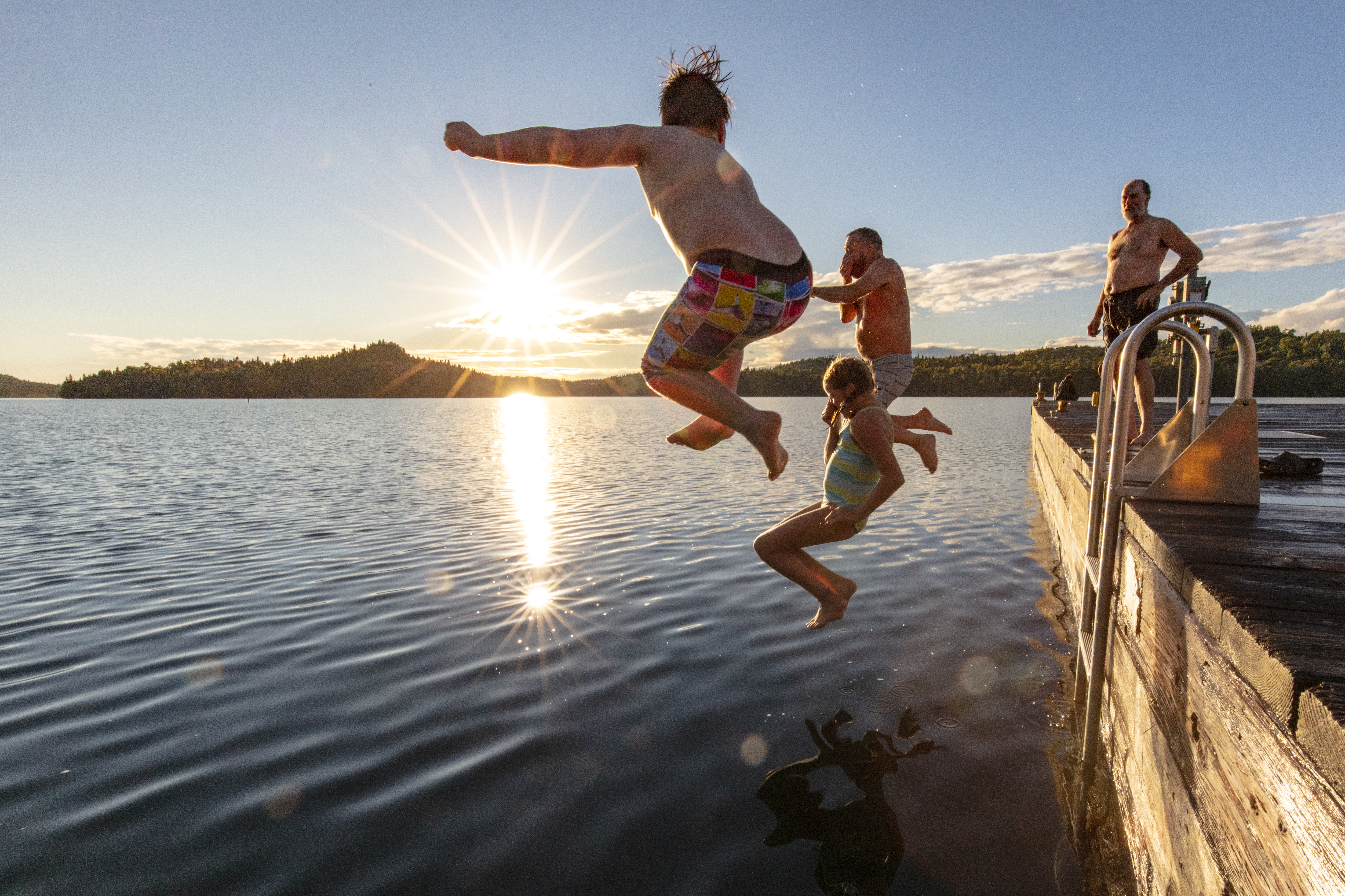
Explore a rugged, isolated island far from our connected communities. Isle Royale offers adventures for backpackers, hikers, boaters, paddlers, and divers. Cross Lake Superior and make a commitment: Become a part of this island, and let it become...
$7 per person per day to enter or remain in Isle Royale National Park. Children 15 and younger are exempt.
Visiting Park Headquarters in Houghton, MI does not require a fee.
Beaver Island Campground is located in Washington Harbor on the southwest end of Isle Royale National Park. The forested campground is about a mile by water from the Windigo Dock. The Beaver Island Dock is located on the southeastern side of Beaver Island. Three water front shelters comprise the campground along with a vault toilet. There are no tent sites. This campground is accessible by private boat, canoe, or kayak. Campsites have boat slip accessibility for kayaks and canoes.
First come, first serve. Consecutive night stay limit is 5 nights, effective 6/1 - Labor Day. Normal conditions of depth at dock is 13'.
Belle Isle is located in Belle Harbor, on the northeast end of Isle Royale National Park. This campground consists of one individual tent site and six shelters. Under normal conditions, the depth at the dock is 13'. Overnight stay is permitted at the dock. Canoe/kayak accessible.
Birch Island Campground is located on Birch Island near the mouth of McCargoe Cove, along the north shore of Isle Royale National Park. There is one individual tent site and one shelter site. Under normal conditions the depth at the dock is 5'. Boats are permitted overnight at the dock. Canoe/kayak accessible.
Caribou Island Campground is located on the western end of West Caribou Island, in Rock Harbor Channel, on the northeast end of Isle Royale National Park. Boats are permitted to stay overnight at the dock. Consecutive night stay limit is 3 nights form June 1 – Labor Day annually. This campground includes one individual tent site, two shelter sites, and a vault toilet.
Individual tent sites and shelters are first come, first serve. Group site needs to be reserved in advance.
Chippewa Harbor Campground is located in Chippewa Harbor, on the south shore of Isle Royale National Park. Trail access is via the Indian Portage Trail. Consecutive night stay limit is three nights from June 1- Labor Day annually. This campground offers two individual tent sites, four shelter sites, one group site, and vault toilets. Boats are permitted to stay overnight at dock. Canoe/Kayak/private boat access available.
Individual tent sites and shelters are first come, first serve. Group tent sites need to be reserved in advance.
Daisy Farm is located in the Rock Harbor Channel, off of the Rock Harbor Trail, Daisy Farm Trail, and Mount Ojibway Trail. Daisy Farm is Isle Royale’s largest campground with sixteen shelters, six individual tent sites, and three group sites. The stay limit is three nights from June 1 – Labor Day annually. Boats are permitted to stay overnight at the dock. Under normal conditions the depth at the dock is 9’. Canoe/kayak/private boat access. Ranger Station staffed seasonally.
Individual tent sites and shelters are first come, first serve.
Duncan Bay Campground is located on the west end of Duncan Bay, on the northeast end of Isle Royale National Park. Consecutive night stay limit is three nights from June 1 – Labor Day annually. One individual tent site, two shelter sites, and vault toilet are available. Boats are permitted to stay overnight at the dock. Campground is accessible by canoe/kayak/private boat.
Individual tent sites and shelters first come, first serve.
Duncan Narrows Campground is located in the narrows of Duncan Bay on the northeast end of Isle Royale National Park. There is one individual tent site and two shelters. Normal conditions at the dock are 6’. Boats are permitted to stay overnight at the dock. Access available to canoe/kayak/private boat.
Individual tent site first come, first serve. Group site needs to be reserved in advance.
East Chickenbone Campground located on the east end of Chickenbone Lake, off of the East Chickenbone Trail. This backcountry campground includes three individual tent sties and one group site. There is no boater access. Canoe/kayak access using 1.2 mile portage from McCargoe Cove or .2 mile portage from Lake Livermore. This campground is not on the shoreline but offers a forest experience.
Individual tent sites are first come, first serve. Group tent sites must be reserved in advance.
Feldtmann Lake Campground is located on the southwest end of Feldtmann Lake on the southwest end of Isle Royale. A relatively flat and brushy trail leads to the campground. This backcountry campground includes a vault toilet. Ground covering is thick with mostly thimbleberries and large leaf aster. A beaver dam is located on the south side of the lake. Wildlife viewing is common. The Rainbow Cove trail extends from the campground southwesterly to Lake Superior. Rainbow Cove is a rocky inlet upon the shores of Lake Superior. The Rock of Ages Lighthouse can be viewed on a clear day from Rainbow Cove.
Grace Island Campground is located on Grace Island, in Grace Harbor, just outside of Washington Harbor on the southwest end of Isle Royale National Park. Shelters view Grace Harbor while Lake Superior is southwest of the island. The stay limit is three nights from June 1 – Labor Day annually. There are two shelter sites available. The depth at the dock is 2’-4’ under normal conditions. Boats are permitted to stay at the dock overnight.
Individual tent sites are first come, first serve. Group tent sites must be reserved in advance.
Hatchet Lake Campground is located on the south end of Hatchet Lake. The backcountry campground connects to the Hatchet Lake Trail and the Greenstone Ridge Trail. A strenuous and steep hike connects the campground to the Greenstone Ridge Trail. There are five individual tent tents, three group tent sites, and vault toilets. The campground is nested in a white paper birch stand. Use caution for dead tree snags near campsites. A beaver dam sits on the east end of the lake. A steep rocky stairway leads to water access near the campground.
Hay Bay Campground is located in Hay Bay on the south shore of Isle Royale National Park. Say limit is three nights from June 1 – Labor Day annually. The depth at the dock under normal conditions is 3’-7’. Canoe/kayak/private boat access available. Boats are permitted to overnight at the dock. One individual tent site is available.
Individual tent sites are first come, first serve.
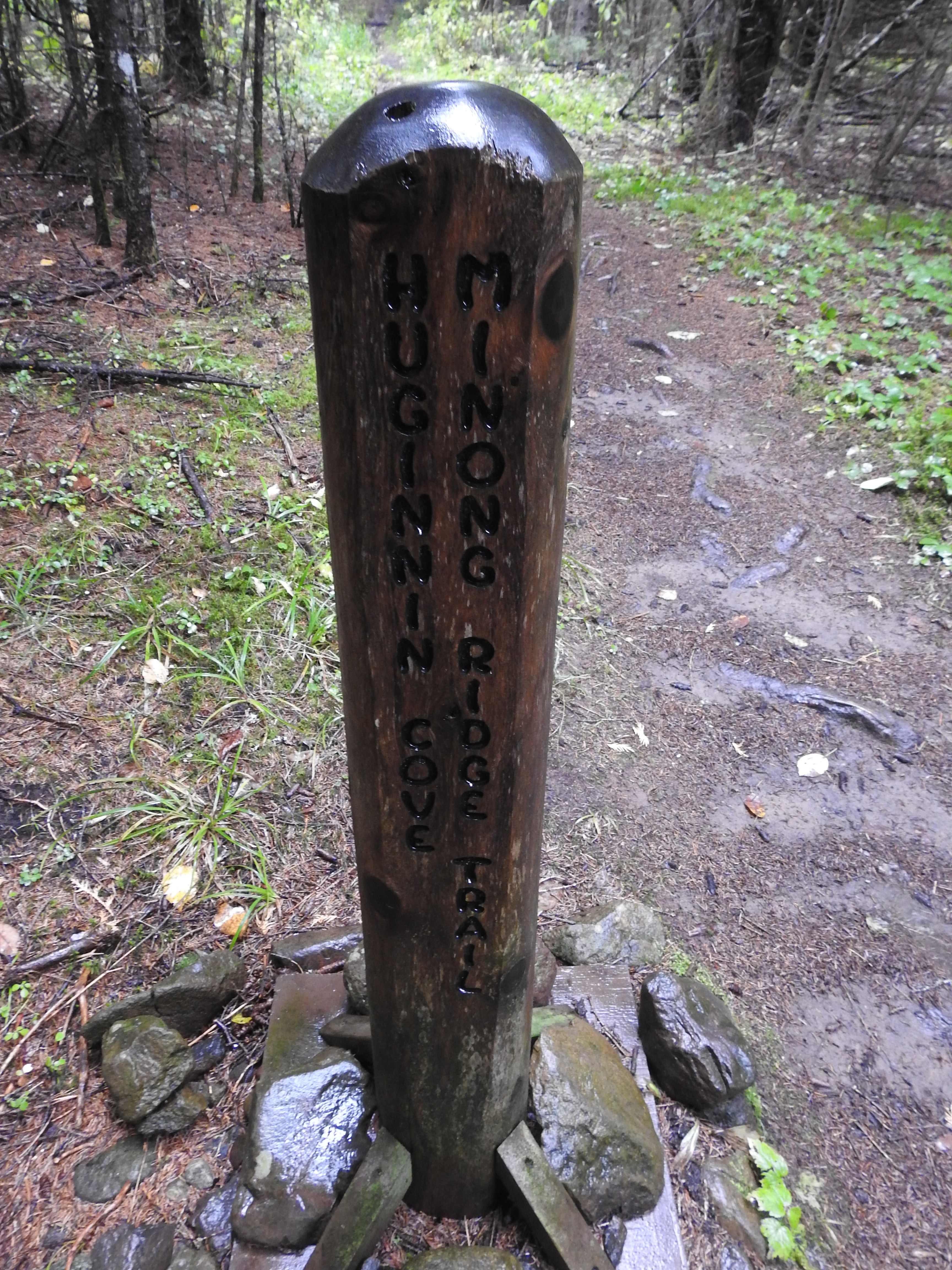
The Huginnin Cove campground is located on Huginnin Cove, on the north west shore of Isle Royale National Park. The campground sits right on the rocky shore of Lake Superior. The Canadian shoreline can be viewed to the north. A rushing creek separates site one from the rest of the campground. Site one can be accessed via a foot bridge. Rocky coast is found on either side of the Huginnin Cove inlet. This backcountry campground includes five individual tent sites and vault toilets.
Individual tent sites are first come, first serve.
Intermediate Lake Campground is located on the shoreline of Intermediate Lake. Consecutive night stay limit is two nights. Three individual tent sites are available. Intermediate Lake can be accessed via a .6 mile portage from Lake Richie or a .4 mile portage from Siskiwit Lake. No boat access. Canoe/kayak access.
Individual tent sites are first come, first serve. Group tent sites must be reserved in advance.
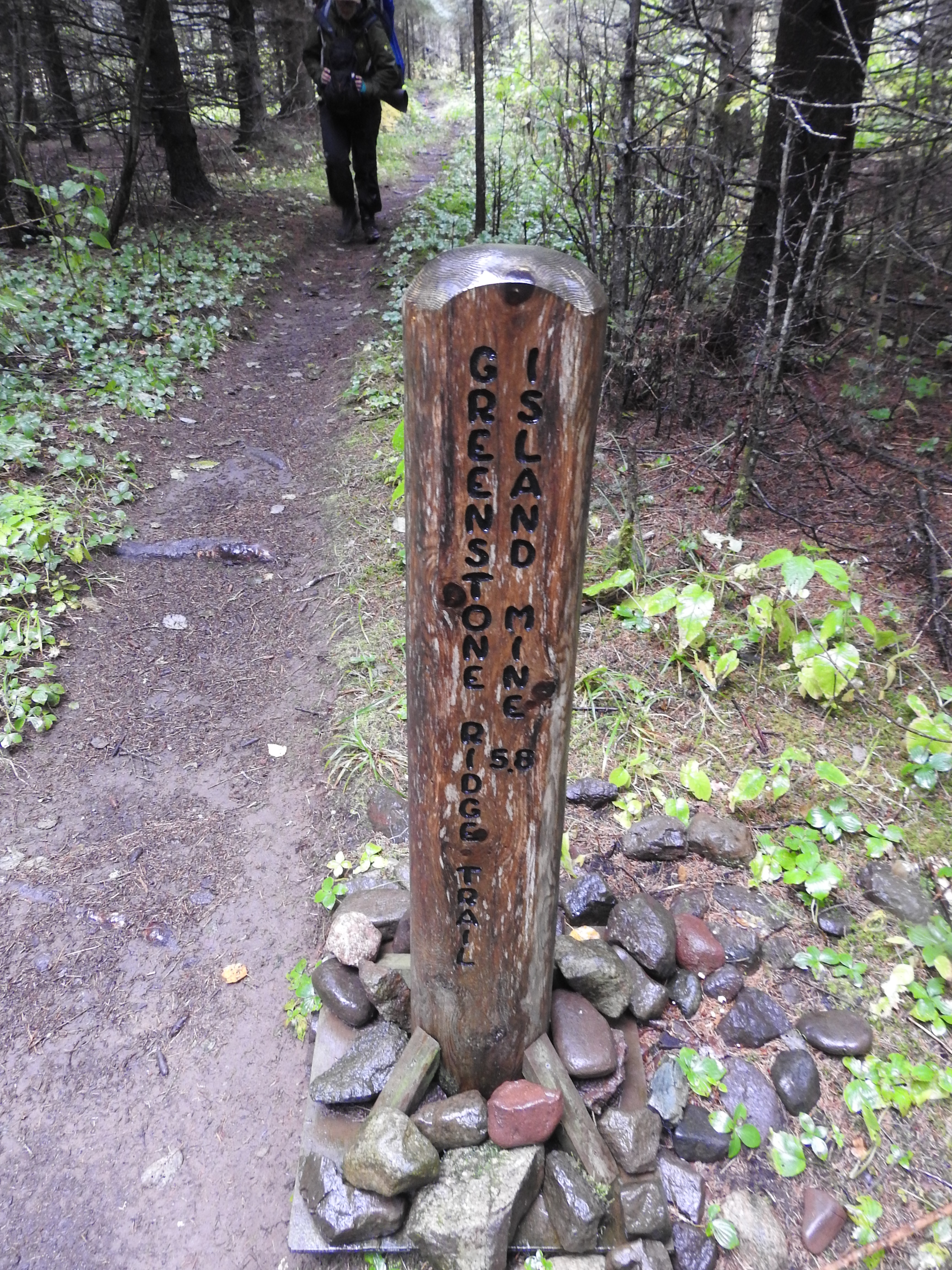
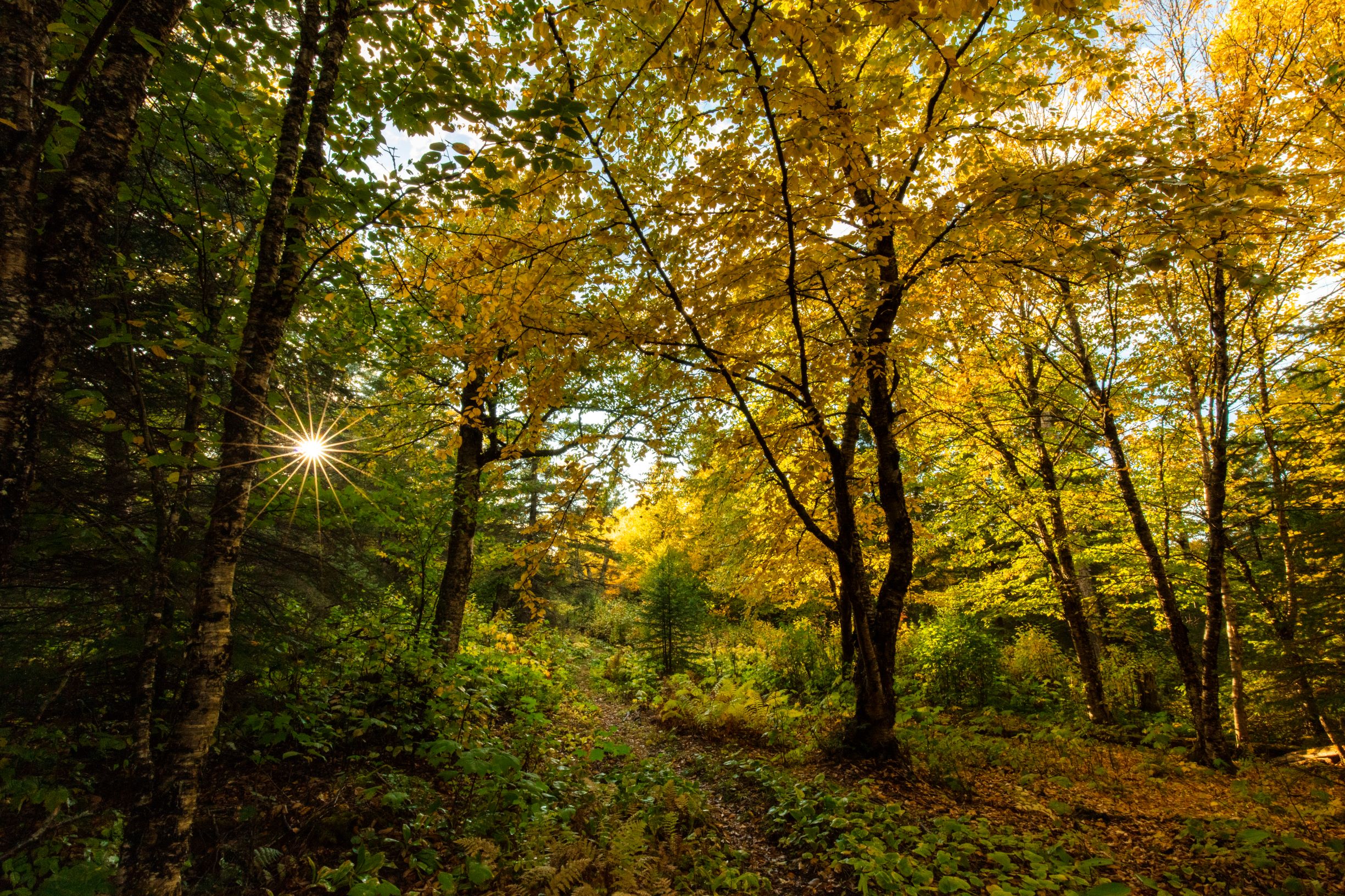
Island Mine Campground is located on the western side of Isle Royale National Park. It is located on the Island Mine Trail that connects the Greenstone Ridge Trail to Siskiwit Bay Campground. This backcountry campground includes four individual tent sites, two group tent sites, and vault toilets. Island Mine Campground sits in a sugar maple forest and is colorful during the fall. The campground sits upon a small ridge with gently flowing creeks on either side. The main water source is a creek on the south end of the campground. Southeast of Island Mine Campground is the historic Island Mine that was last active in 1870. Remnants of humans exploring copper resources are a steam engine, mining rubble, a dried out well and a cemetery off in the woods.
Individual tent sites are first come, first serve. Group tent sites must be reserved in advance.
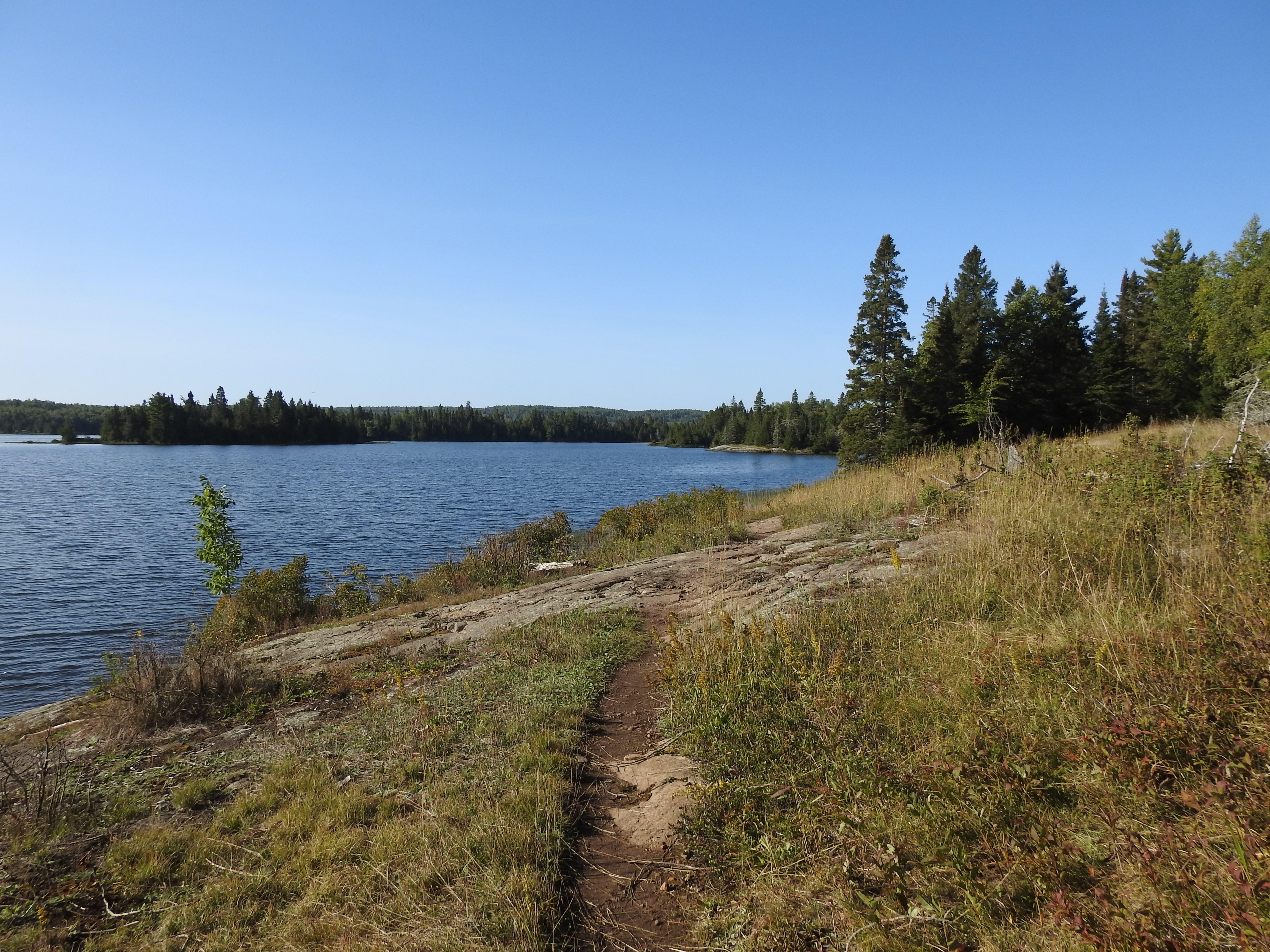
Lake Richie Campground is located on the north shore of Lake Richie, off of the Indian Portage Trail. Consecutive night stay limit is two nights from June 1 - Labor Day annually. There are four individual tent sites and two group tent sites. No boat access. Canoe/kayak access from .6 mile portage from Intermediate Lake, 2.0 mile portage from Moskey Basin, 1.2 miles portage from Chippewa Harbor, and .6 mile portage from Lake LeSage. Paddlers may want to consider staying at Lake Richie Canoe Campground.
Individual tent sites are first come, first serve.
Lake Richie Canoe Campground is located on the north shore of Lake Richie. Consecutive night stay limit is two nights. There are three individual tent sites available. No boat access. Canoe/kayak access via the .6 mile portage from Intermediate Lake, the 1.2 mile portage from Chippewa Harbor, the 2.0 mile portage from Moskey Basin, and the .6 mile portage from Lake LeSage.
Individual tent sites are first come, first serve.
Lake Whittlesey Campground is located on the north shore of Lake Whittlesey. Consecutive night stay limit is two nights. Three individual tent sites are available. No boat access. Canoe/kayak access via .6 mile portage from Wood Lake and .6 mile portage from Chippewa Harbor.
Individual tent sites are first come, first serve only.
Lane cove Campground is located in Lane Cove, on the north shore of Isle Royale National Park, off of the Lane Cove Trail. The Lane Cove Trail can be accessed via the Greenstone Ridge Trail. The Lane Cove Trail contains one of the few switchbacks on the island. A beaver pond is located near the campground and a side trail is provided. This lakeshore campground offers excellent sunsets, wildlife viewing, and shoreline scenery.
Individual tent sites are first come, first serve.
Little Todd campground is located on the north shore of Isle Royale off of the Minong Ridge Trail. The trail leading to the campground is challenging and involves a river crossing with a good chance of getting wet. This backcountry campground includes four individual tent sites and vault toilets. The campground is located on the Little Todd inlet and includes a rocky beach. Each campsite has an individual fire ring. Views of the Canadian Shoreline can be viewed from each site.
Shelters are first come, first serve. Group tent sites must be reserved in advance.
Malone Bay Campground is located on the south shore of Isle Royale within Malone Bay. The campground can be accessed by the Ishpeming Trail, by private boat, or by ferry. The Ishpeming Trail, north of Malone Bay Campground, is brushy, wild, and involves a beaver dam crossing. This campground includes five shelters and two group tent sites. The campground sits on the rocky shore of Malone Bay. The outer islands and the Isle Royale Lighthouse on Menagerie Island can be viewed in the distance. Siskiwit Lake is located just north of the campground. A creek connects Siskiwit Lake to Lake Superior. This creek is just east of the campground. A ranger station, information station, and dock can be found just further east of the campground. The ranger station is not always staffed.
Individual tent sites and shelters are first come, first serve. Group tent sites must be reserved in advance.
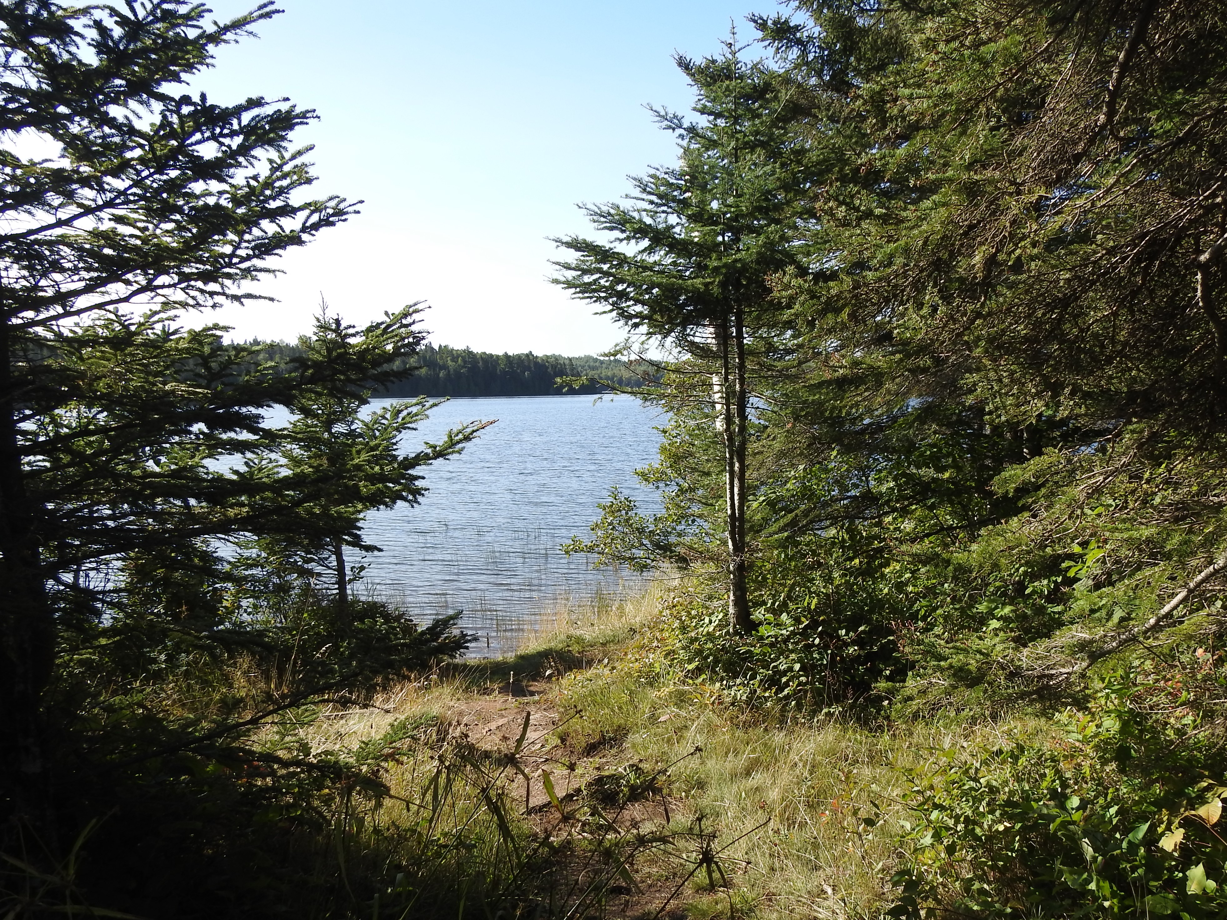
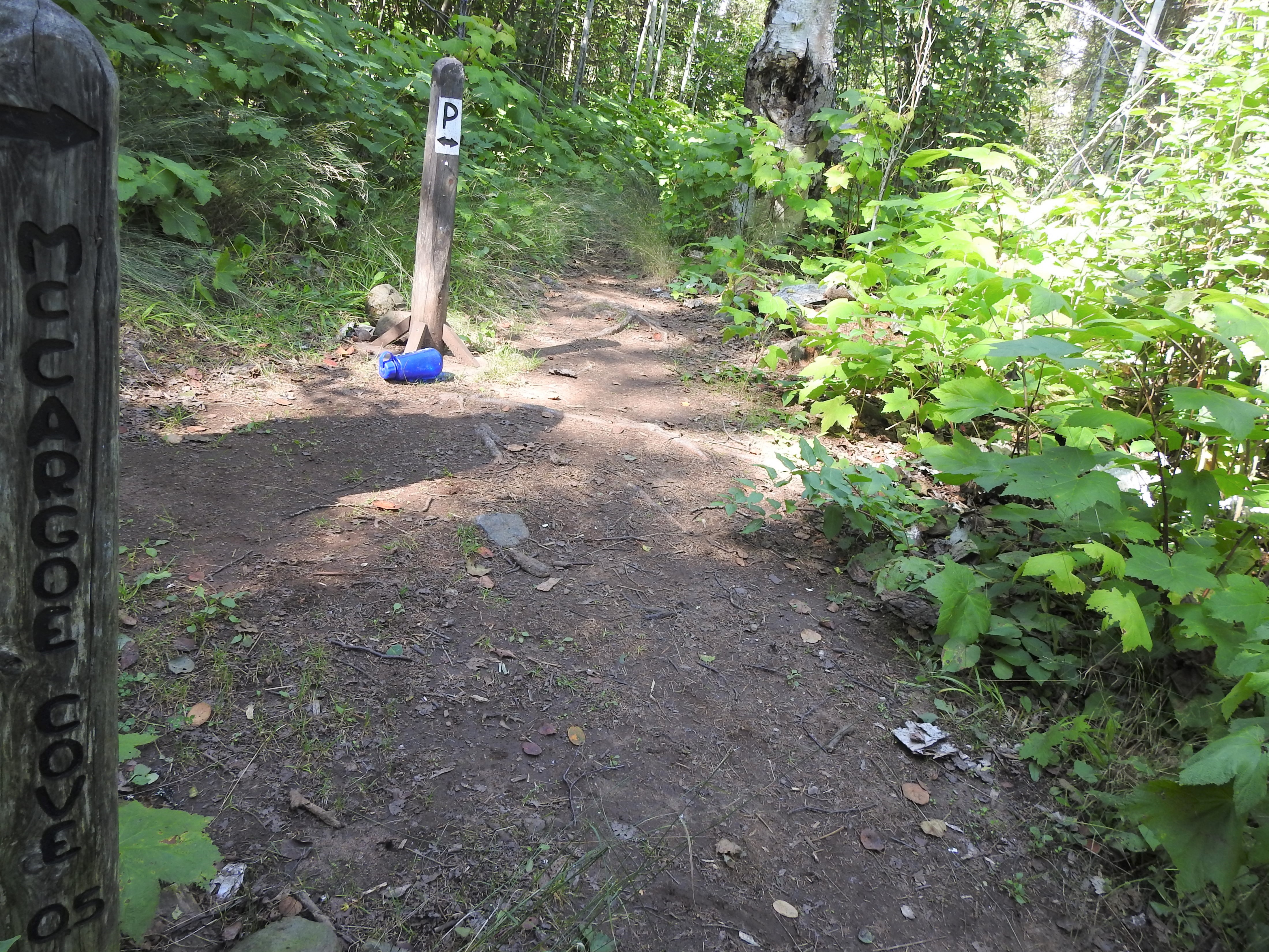
McCargoe Cove Campground is located in McCargoe Cove, on the north shore of Isle Royale National Park, off of the Indian Portage and East Chickenbone Trails. Three individual tent sites, six shelters, and three group tent sites are available. Normal conditions for depth at dock is 7'. Boats can overnight at dock. Canoe/kayak access from Lake Superior or 1.2 mile portage from Chickenbone Lake. The campground is on a rocky hillside. The Minong mile is accessible via the Minong Ridge Trail .8 miles from the campground.
Shelter and individual tent site are first come, first serve.
Merritt Lane Campground is located in Merritt Lane on the northeast end of Isle Royale National Park. Consecutive night stay limit is three nights from June 1 - Labor Day annually. One individual tent site and one shelter are available. Normal conditions for depth at dock is 8'. Boats can overnight at dock. Canoe/kayak access.
Individual tent sites and shelters are first come, first serve. Group tent sites must be reserved in advance.
Moskey Basin Campground is located in Moskey Basin at the west end of Rock Harbor Channel, off of the Indian Portage and Rock Harbor Trails. Consecutive night stay limit is three nights from June 1 – Labor Day annually. Two individual tent sites, six shelters, and two group tent sites are available. Normal conditions at the dock are 8’. Boats are permitted to overnight at dock. Canoe/kayak access from Rock Harbor Channel via 2.0 mile portage from Lake Richie. Scenic sunrises viewing available.
Individual tent sites are first come, first serve.
North Desor Campground located on the north side of Lake Desor, off the Minong Ridge Trail. A gentle descend from the challenging Minong Ridge Trail leads to the backcountry campground. The campground is surrounded by sugar maple saplings. This backcountry campground includes three individual tent sides and a vault toilet. The campground sits on the rocky north shore of Lake Desor, the second largest inland lake at Isle Royale National Park. Lake Desor is a relatively shallow lake that encompasses three islands. North Desor Campground is about a 13 mile hike from Windigo.
Pickerel Cove Campground is located in Pickerel Cove on the north shore of Isle Royale National Park. Consecutive night stay limit is two nights from June 1 – Labor Day annually. One individual tent site is available, no shelter sites are available. No dock available for boats. Canoe/kayak access from Pickerel Cove or via .1 mile portage from Lake Superior. No trail access to Pickerel Cove.
Individual tent sites and shelters are first come, first serve. Group tent sites must be reserved in advance.
Rock Harbor Campground is located in Rock Harbor on the northeast end of Isle Royale, off of the Rock Harbor and Tobin Harbor Trails. Additional fees for boats to stay overnight at marina. The consecutive stay limit is one night effective June 1 – September 15 annually. This harborside campground offers eleven individual tent sites, nine shelters, and three group tent sites. The Rock Harbor Visitor Center, Rock Harbor Comfort Station, and the Rock Harbor Lodge are all easily accessible from the campground.
Individual tent sites and shelters are first come, first serve. Group tent sites must be reserved in advance.
Siskiwit Bay Campground is located in Sisikiwit Bay on the southwest end of Isle Royale National Park. The backcountry campground is located at the junction betweent he Island Mine and Feldtmann Ridge Trails. This campground includes four individual tent sites, two shelters, three group tent sites, and vault toilets. Normal conditions for depth at dock are 2'-6'. Boats can overnight at the dock. Canoe/kayak access is available. Carnelian beach is north of the campground.
Individual tent sites are first come, first serve. Group tent sites must be reserved in advance.
South Lake Desor Campground is located on the south side of Lake Desor off of the Greenstone Ridge Trail. It is about a 12 mile hike from Windigo to South Lake Desor Campground through a maple sugar forest. A steep trail leads from the Greenstone Ridge Trail to the campground. There are seven backcountry individual tent sites, three group sites and vault toilets. No boat access. No canoe/kayak access. Looking north from the campground lies North Desor Campground and the Minong Ridge Trail. Lake Desor has three islands. Lake Desor is the second largest inland lake in the park. Lake Desor is a relatively shallow lake with a sandy bottom. Loons can often be heard from late spring to late summer.
Individual tent sites and shelters are first come, first serve. Group tent sites must be reserved in advance.
Threemile Campground is located on Rock Harbor Channel off of the Rock Harbor and Mount Franklin Trails. Boats are permitted to overnight at the dock. The consecutive night stay limit is one-night effective June 1 – Labor Day annually. There are eight shelters, four individual tent sites, and three group tent sites available.
Individual tent sites and shelters are first come, first serve. Group tent sites are reserved in advance only.
Todd Harbor Campground is located in Todd Harbor on the north shore of Isle Royale National Park, off of the Minong Ridge Trail. The consecutive night stay limit is three nights from June 1 – Labor Day annually. This lakefront campground includes five individual tent sites, one shelter, and three group tent sites. Normal conditions for depth at the dock is 2’. Boats are permitted to overnight at dock. This north shore campground offers scenic views of the Canadian shoreline.
Tookers Island Campground is located on Tookers Island in the Rock Harbor Channel. Consecutive night stay limit is three nights from June 1 – Labor Day annually. Two shelters are available on this outer island campground. Normal conditions for depth at the dock is 7’. Boats are permitted to stay overnight at the dock.
Individual tent sites and shelters are first come, first serve. Group tent sites must be reserved in advance only.
Washington Creek Campground is located along Washington Creek near Windigo on the southwest end of Isle Royale. The Feldtmann Lake, Minong, Greenstone Ridge, and Huginnin Trails create a junction near Windigo. This large campground offers creek front sites. Boat access is at the Windigo Dock with a short .3 mile walk to the Washington Creek Campground. Many shelter sites have canoe/kayak access. The trail from Windigo to Washington Creek Campground is wide and accessible. Potable water is found at the second entrance to the Washington Creek Campground and by the flagpole in Windigo. Moose viewing is common in Washington Creek during summer months. This campground includes five individual tent sites, ten shelters, and four group tent sites.
Individual tent sites are first come, first serve. Group tent sites must be reserved in advance.
West Chickenbone Campground is located on the west end of Chickenbone Lake, off the Indian Portage Trail. This backcountry campground includes six individual tent sites, three group sites, and vault toilets. No boater access. There is canoe/kayak access from a 1.2 mile portage from McCargoe Cove or the .2 mile portage from Lake Livermore. This inland campground offers a forest experience.
Individual tent sites are first come, first serve.
Wood Lake Campground is located on the north shore of Wood Lake. Consecutive night stay limit is two nights from June 1 – Labor Day annually. Three individual tent sites are available. Wood Lake can be accessed via a .6 mile portage from Lake Whittlesey or from Siskiwit Lake. No boat access, canoe/kayak access only.
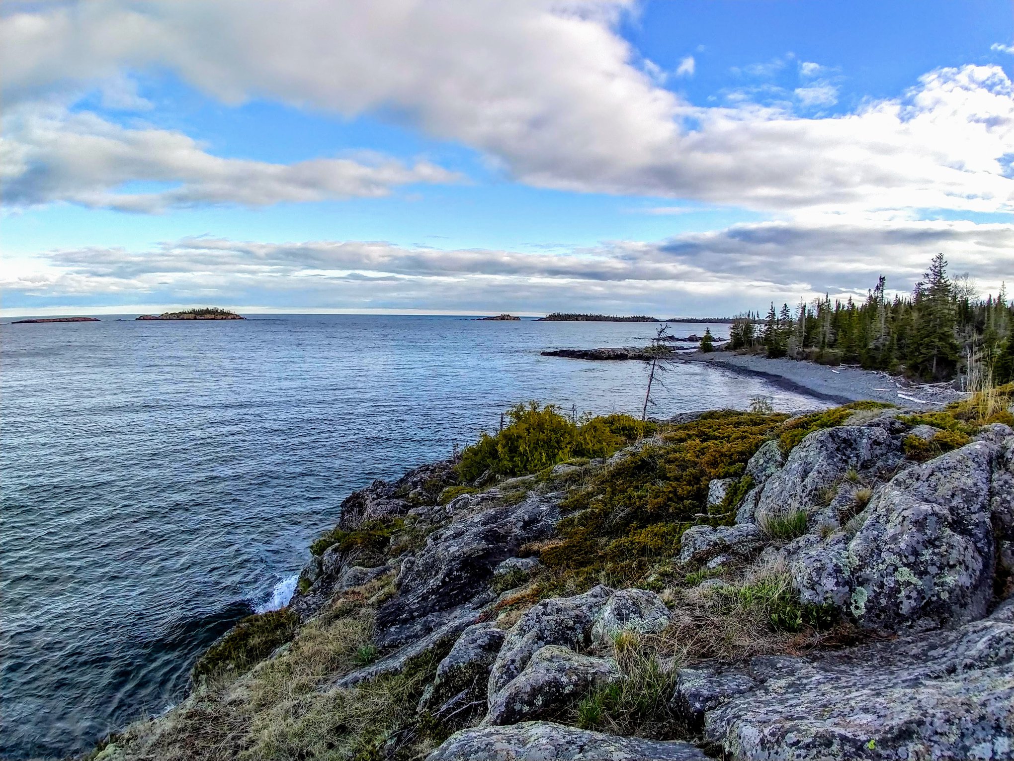
Amygdaloid Island, found on Isle Royale National Park’s northern shore, offers a unique geological experience.
Amygdaloid Island is found on the north shore of Isle Royale National Park, near the mouth of McCargoe Cove. Known for its fascinating geology and presence of a sea arch. A ranger station and historic cabins can be found near the dock on the southern side of the island.
Permit, fees, itinerary- know all things boating before you venture to Isle Royale.
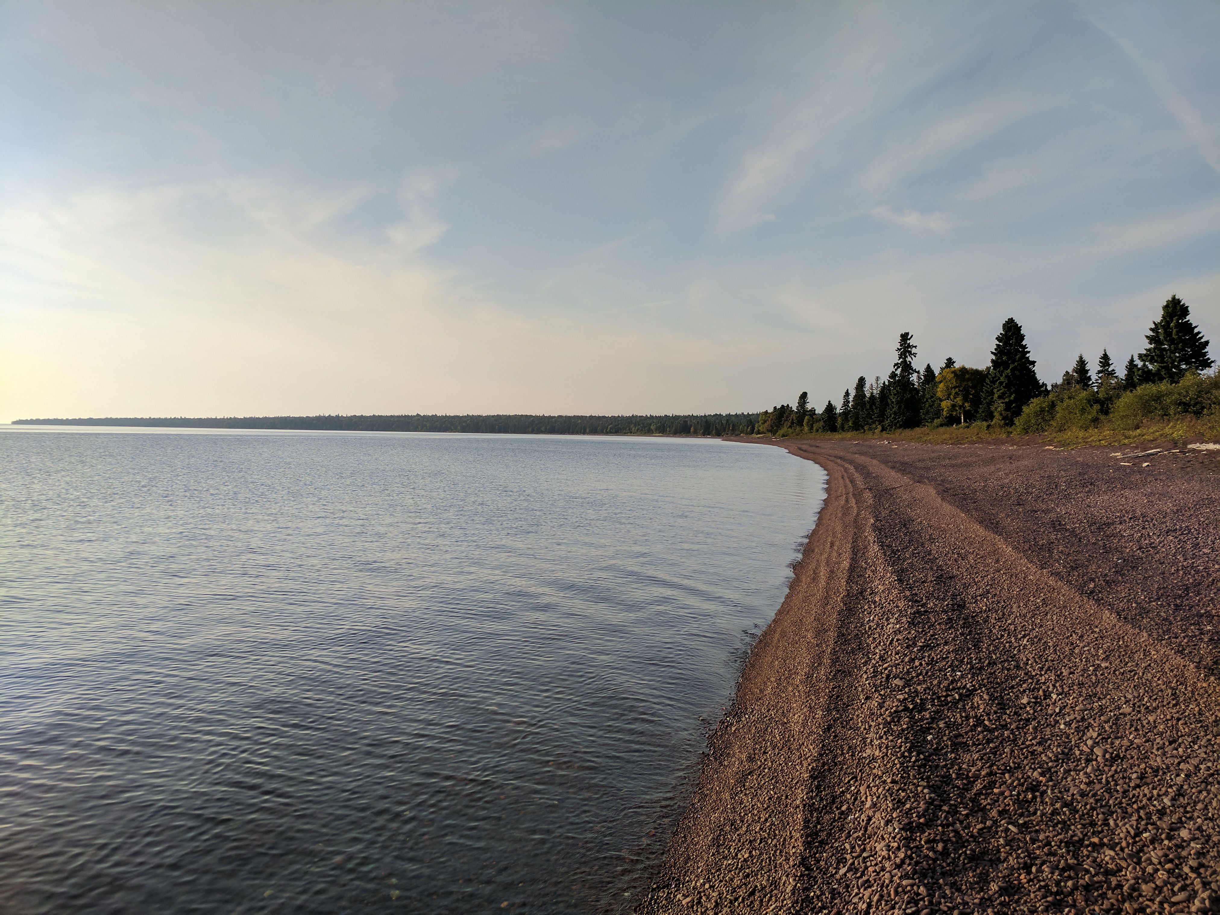
Isle Royale National Park is located in the northwest corner of Lake Superior. Boating is one of the main ways to explore around the island. The water is clear, cold, and can be moody.
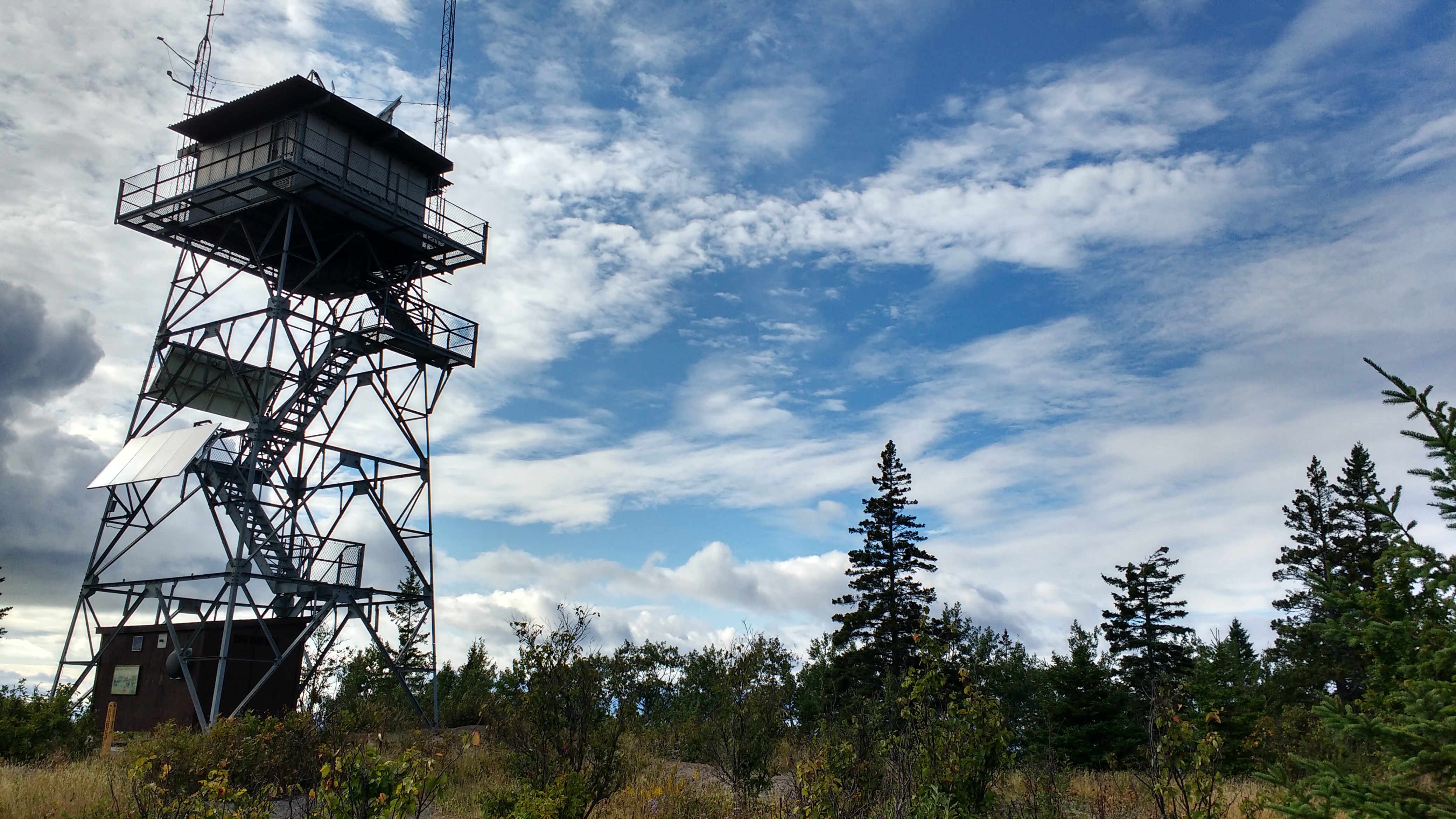
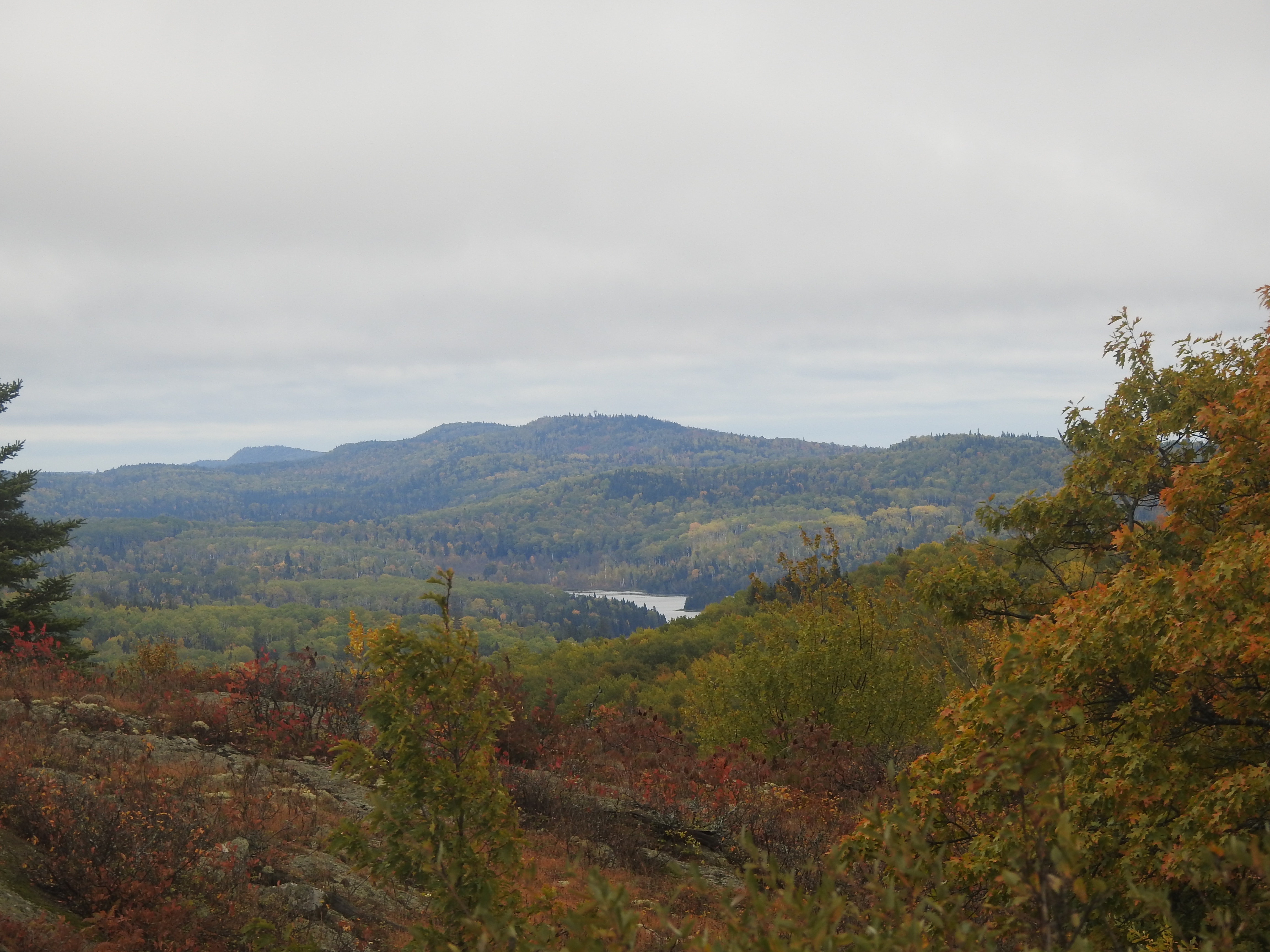
The Feldtmann Fire Tower offers a unique 360 degree view of the west end of Isle Royale National Park.
The Feldtmann Fire Tower is located on Isle Royale’s southwest end. The Feldtmann Fire Tower is found along the Feldtmann Ridge between Feldtmann Lake Campground and Siskiwit Campground. Those that climb the tower can enjoy a 360 view from the tower. Sisikiwit Bay, Houghton Ridge, Feldtmann Ridge, and the Red Oak Ridge can all be viewed from the tower.
Planning a trip to Isle Royale? Make sure to review this guide before your journey.
A guide for people visiting Isle Royale National Park for the first time. There are a variety of ways to recreate at Isle Royale including hiking, backpacking, paddling, and boating. The park's isolation and wilderness characteristic create challenges for those who dare to venture to this island in the northwest corner of Lake Superior.
Grace Creek Overlook is a popular scenic day hike destination on the west end of Isle Royale National Park.
Grace Creek Overlook, a popular day hike on Isle Royale, is located on the West End. A spur trail off of the Feldtmann Lake Trail leads to the overlook. After a 1.8-mile hike from Windigo on the Feldtmann Lake Trail, a spur trail and sign lead the way to the overlook. Grace Creek, Grace Beach, Grace Harbor, and Lake Superior can all be viewed from the overlook. This is a great area to see wildlife.
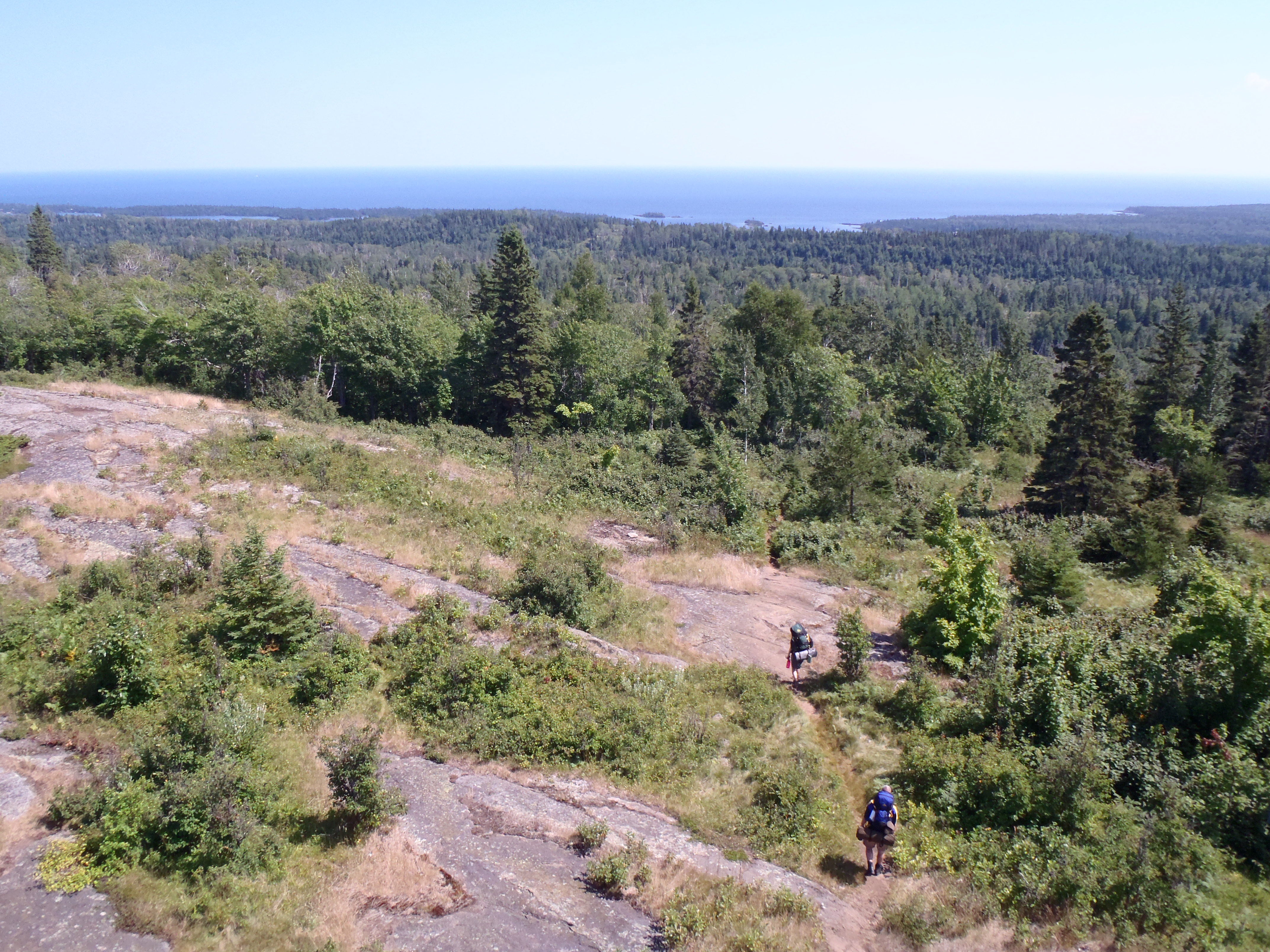
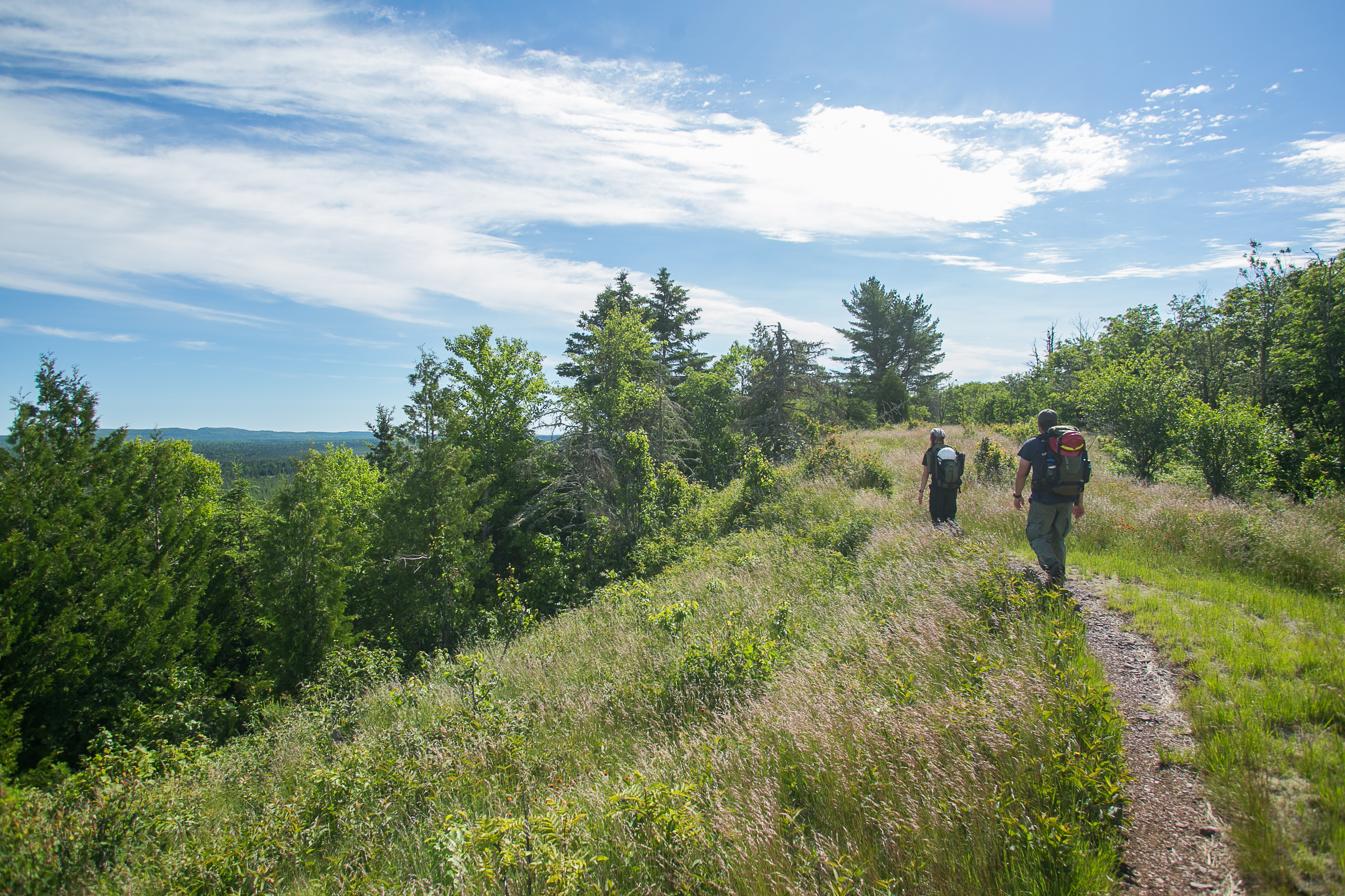
Backpack the entire island of Isle Royale National Park by hiking the Greenstone Ridge Trail starting at the Hidden Lake.
The Greenstone Ridge Trail connects the southwest end of Isle Royale to the northeast end. The trail includes forests, rocky ridges, swamps, inland lakes, wildlife, and wilderness. All campgrounds are backcountry campgrounds.
Backpack the entire island of Isle Royale National Park by hiking the Greenstone Ridge Trail starting at Windigo.
The Greenstone Ridge Trail connects the southwest end of Isle Royale to the northeast end. The trail includes forests, rocky ridges, swamps, inland lakes, wildlife, and wilderness. All campgrounds are backcountry campgrounds.
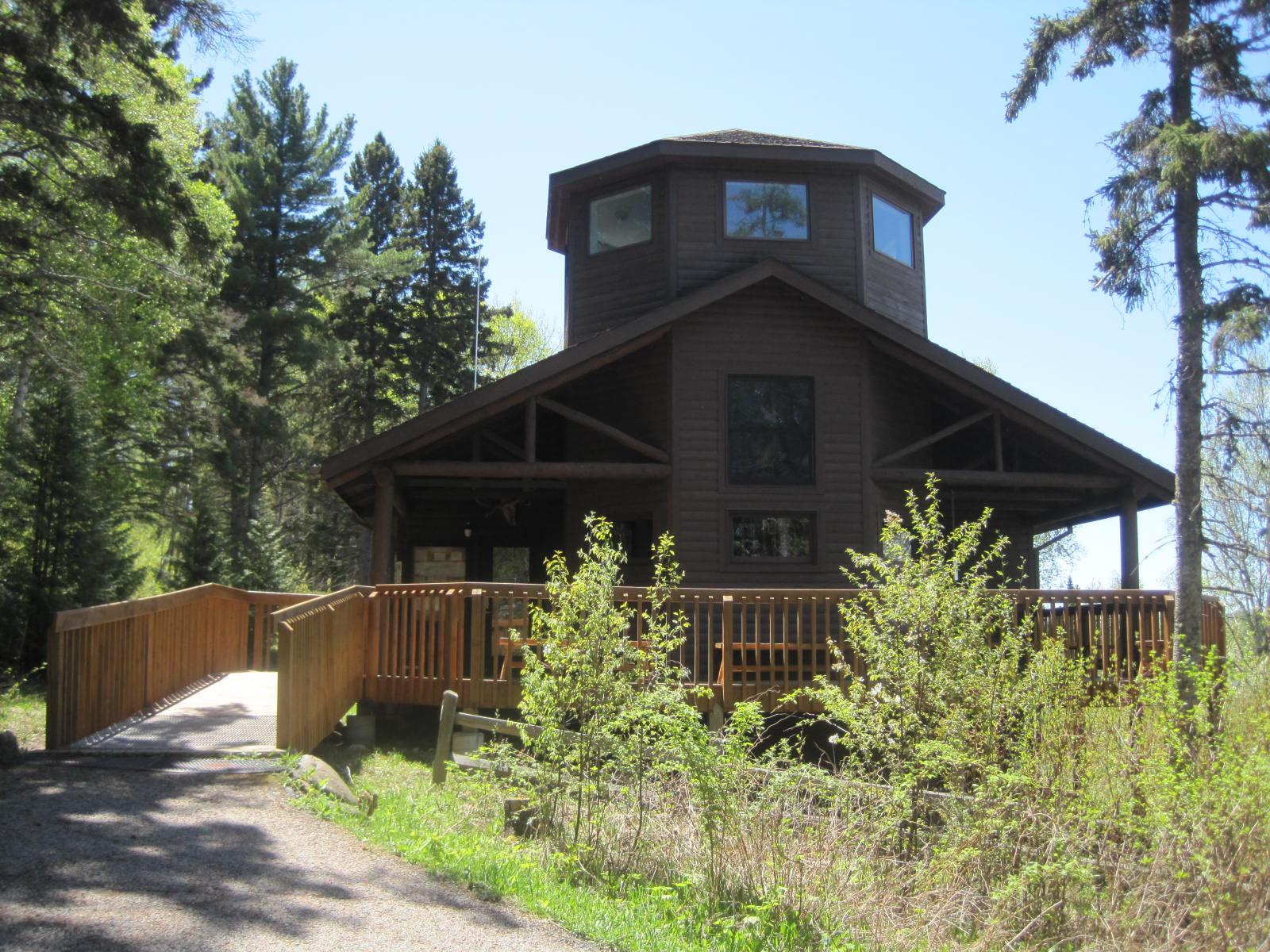
Ishpeming Fire Tower, located on Isle Royale National Park, offers a glimspe of conservation’s past.
Ishpeming Fire Tower is located on Isle Royale National Park. The tower is located at the junction of the Greenstone Ridge Trail and the Ishpeming Trail. Ishpeming Fire Tower offers forest views and shelter from rain.
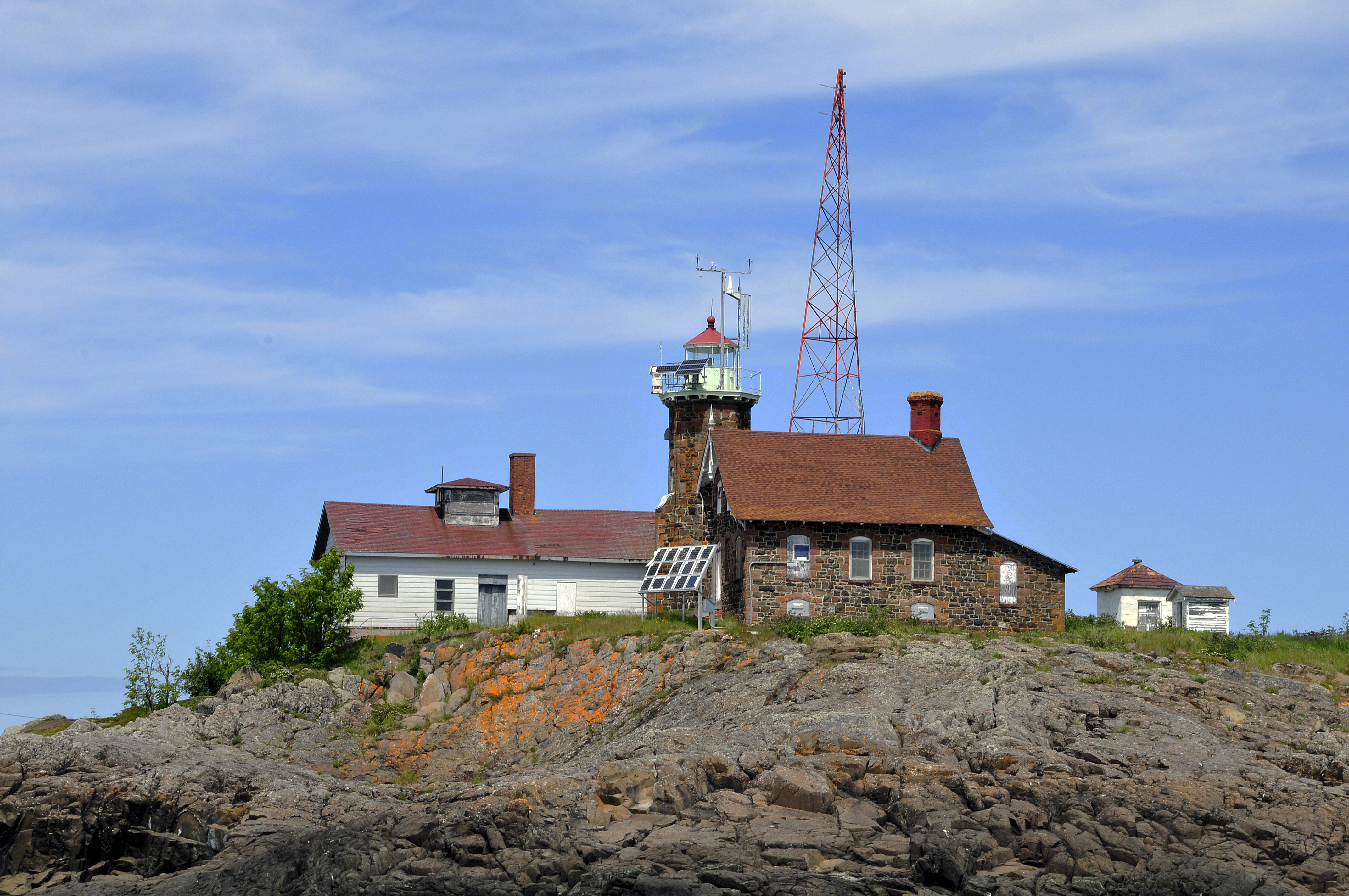
The Isle Royale Light stands on long, rocky Menagerie Island via Isle Royale's south shore at the entry to Siskiwit Bay.
Isle Royale Lighthouse is located on the south shore of Isle Royale National Park near Malone Bay Dock and Campground. The lighthouse is located on Menagerie Island. Reachable only by private boat, it features a 61-foot double-walled octagonal sandstone tower, with a black lantern and gallery.
Isle Royale National Park is an island national park unit on Lake Superior in Michigan's Upper Peninsula. It is one of five Lake Superior national parks.
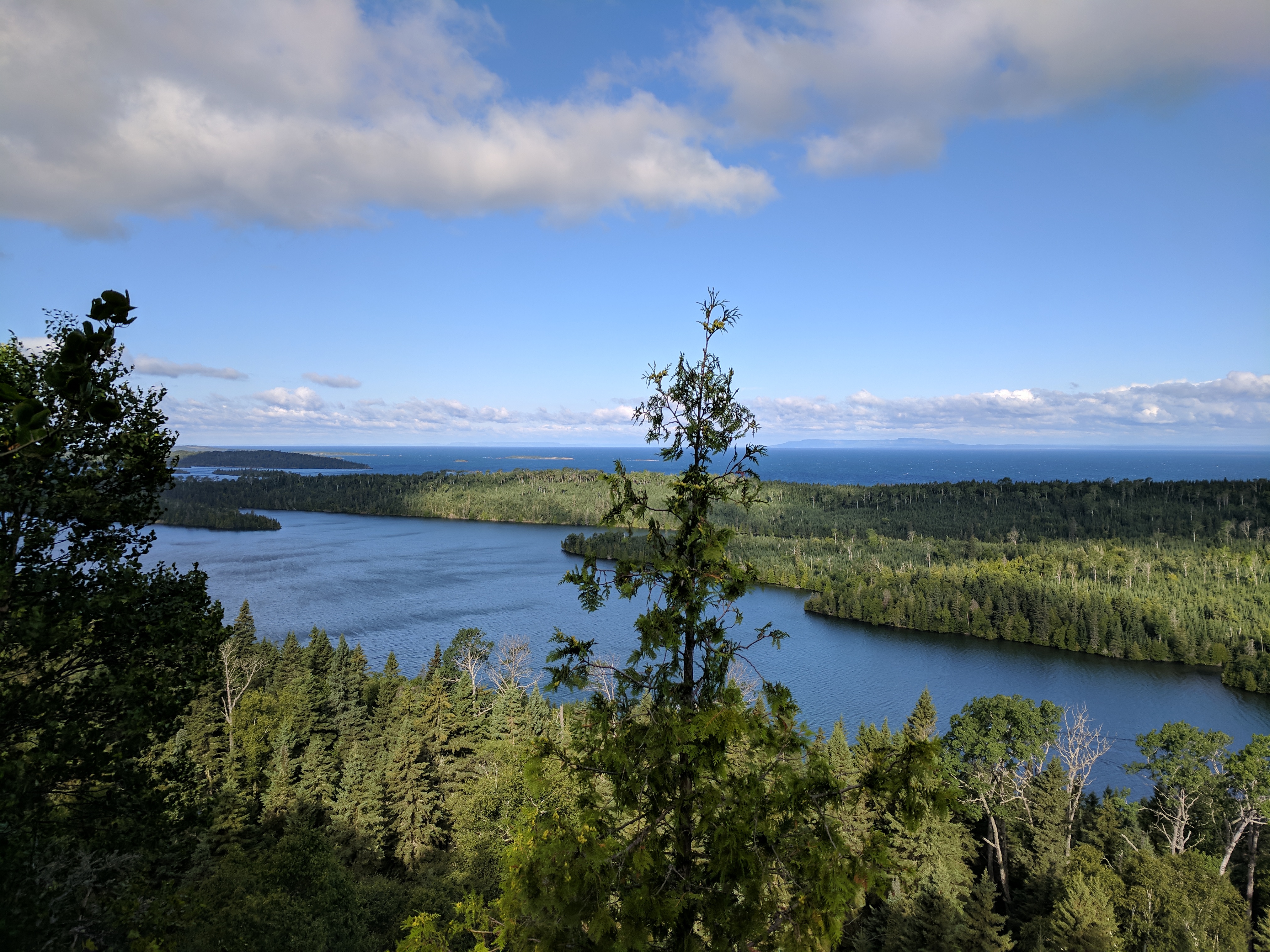
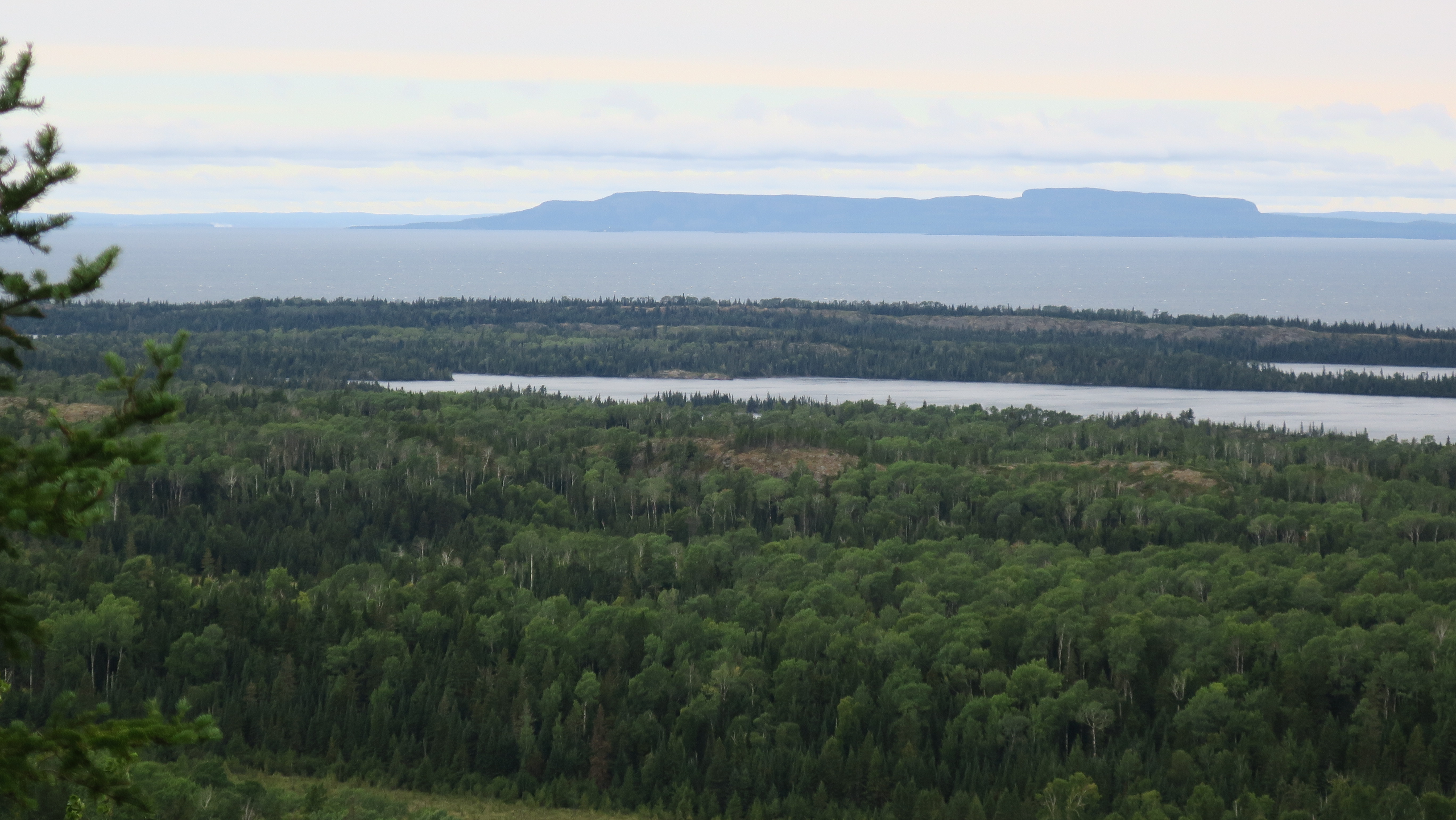
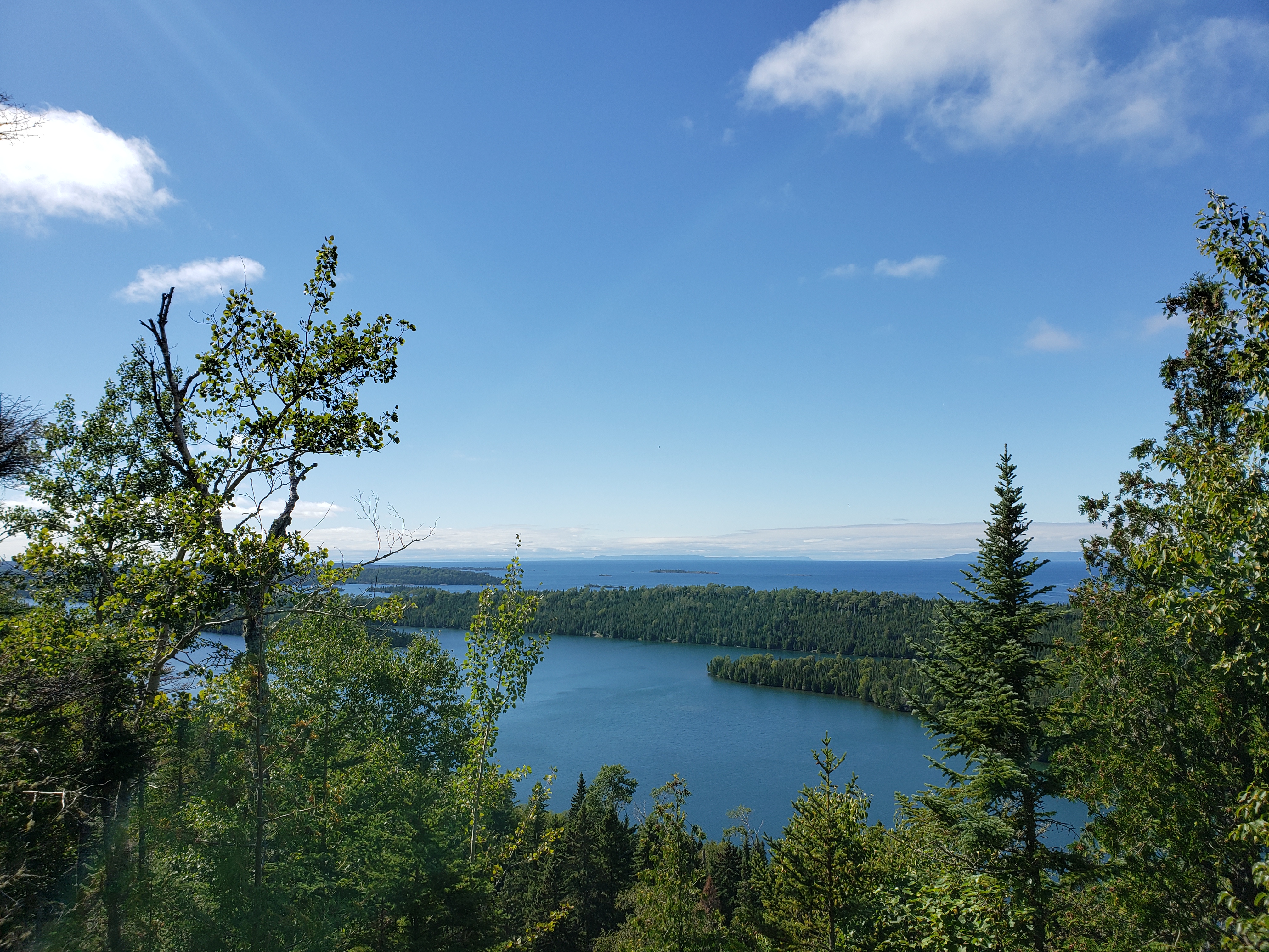
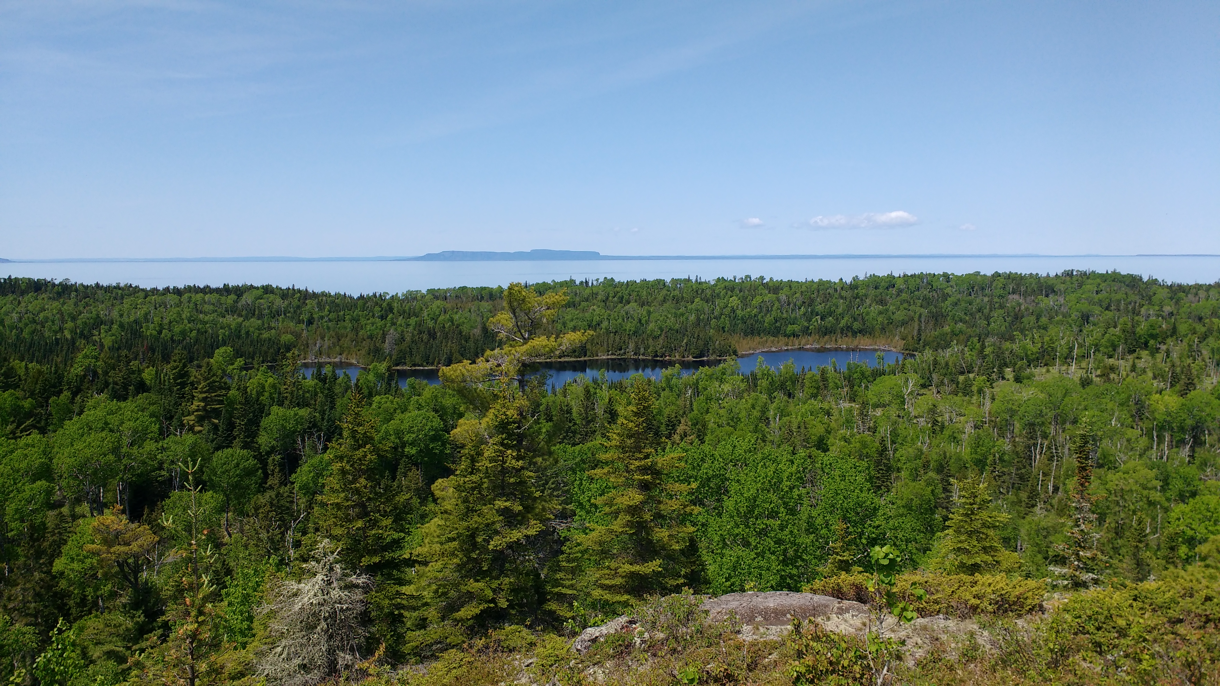
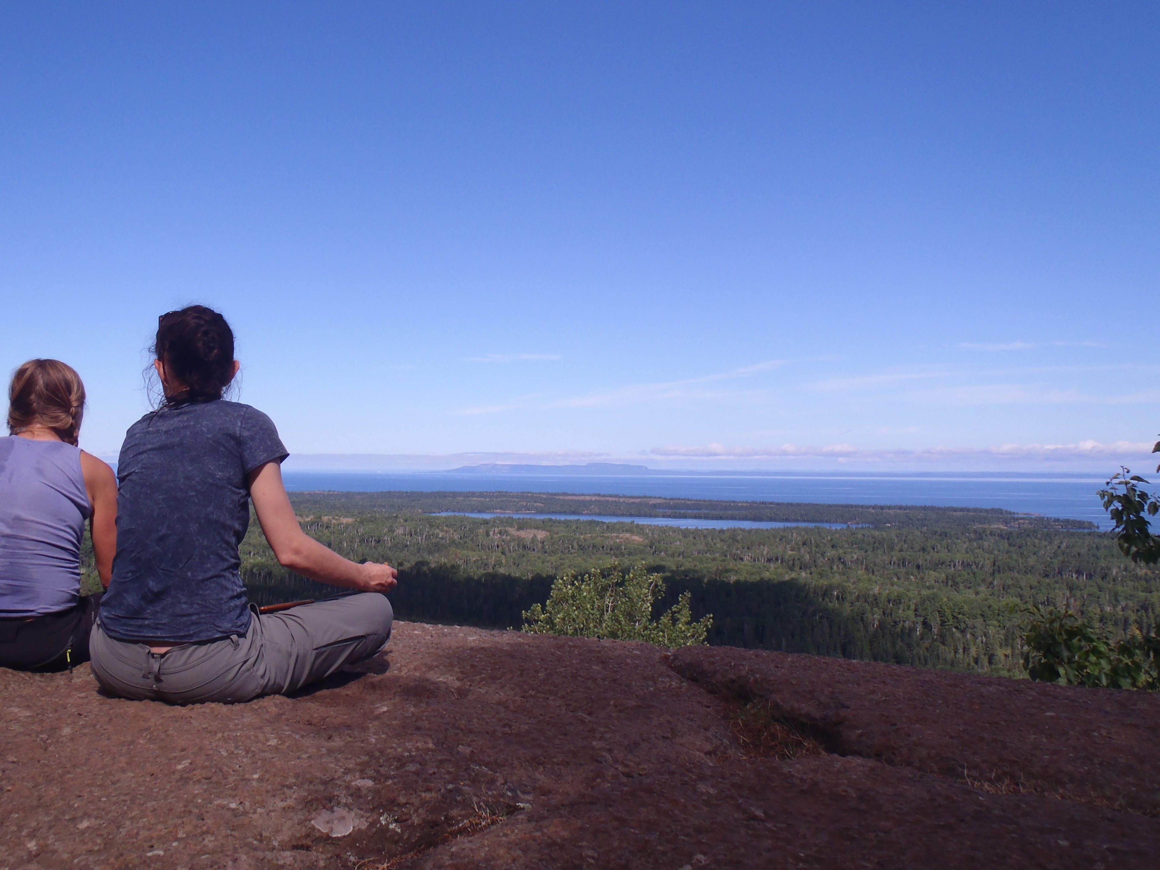
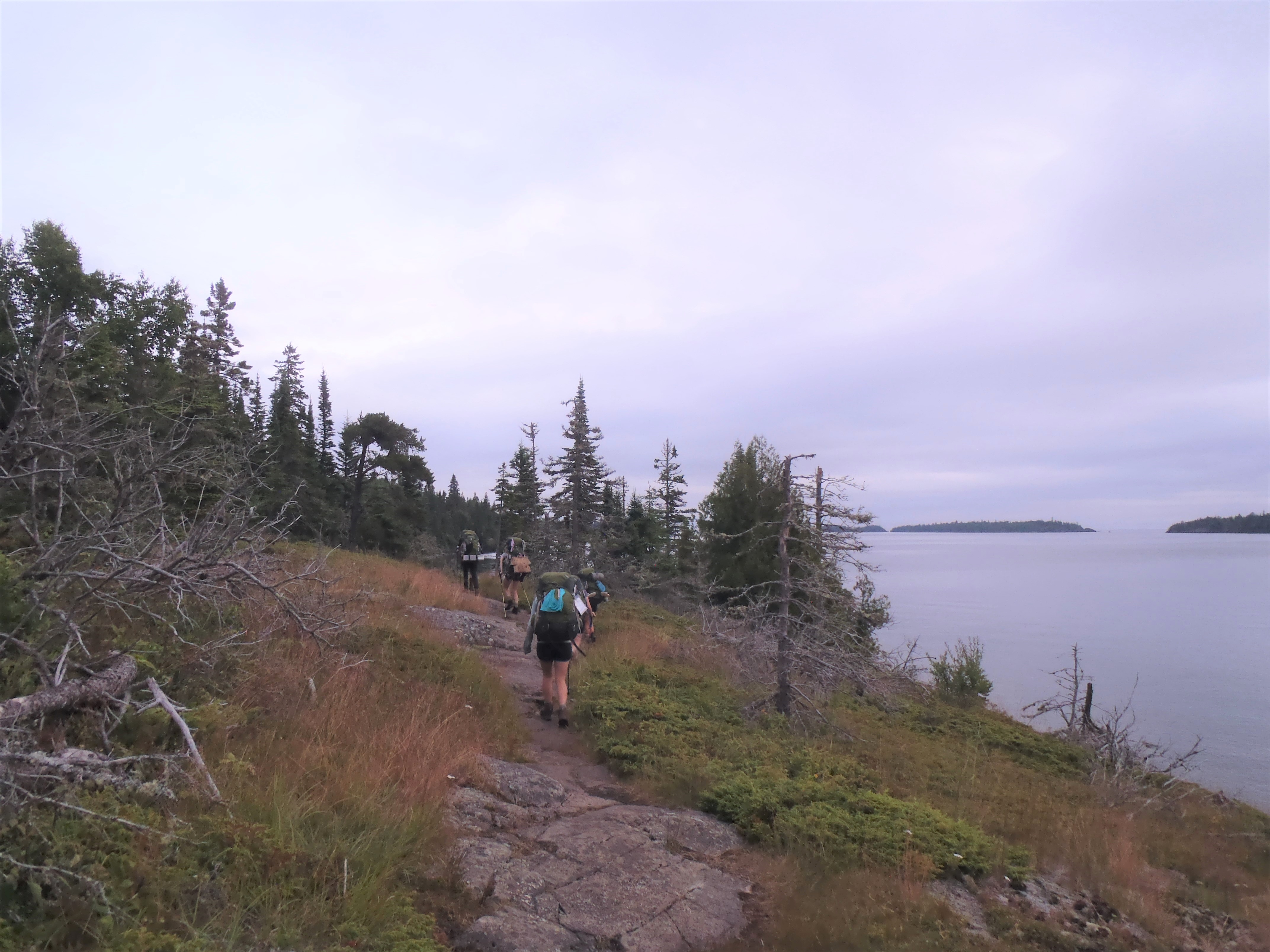
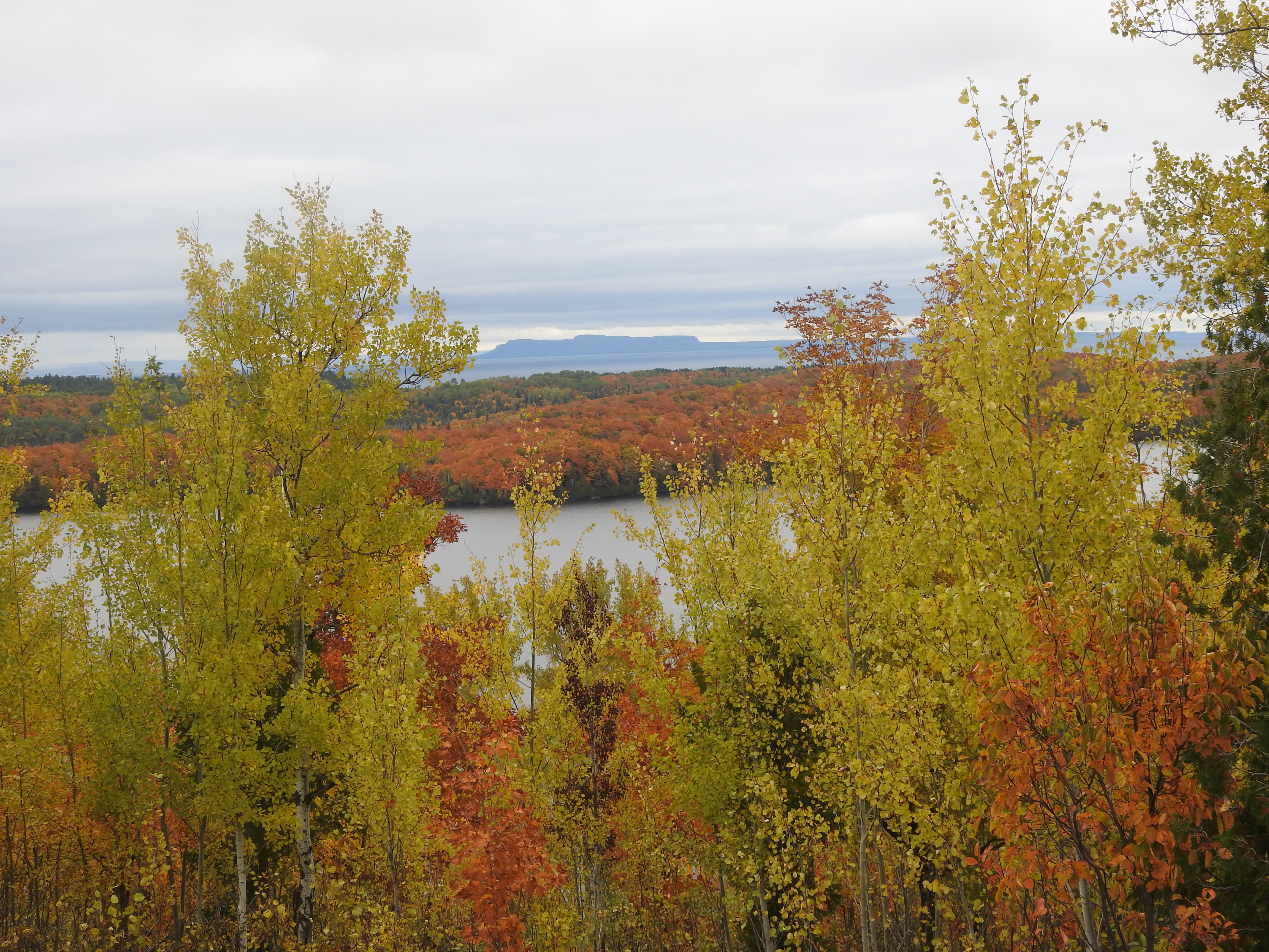
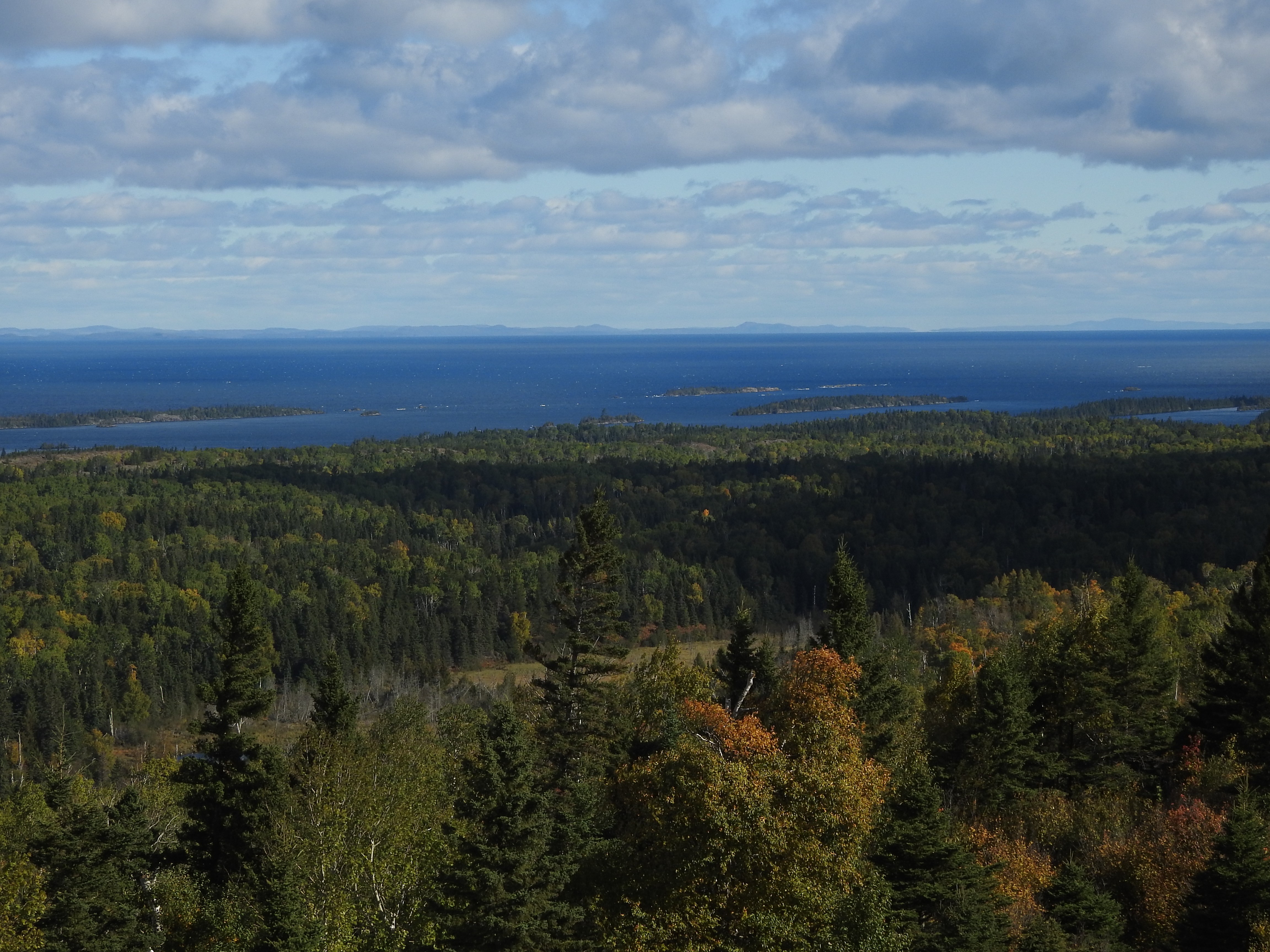
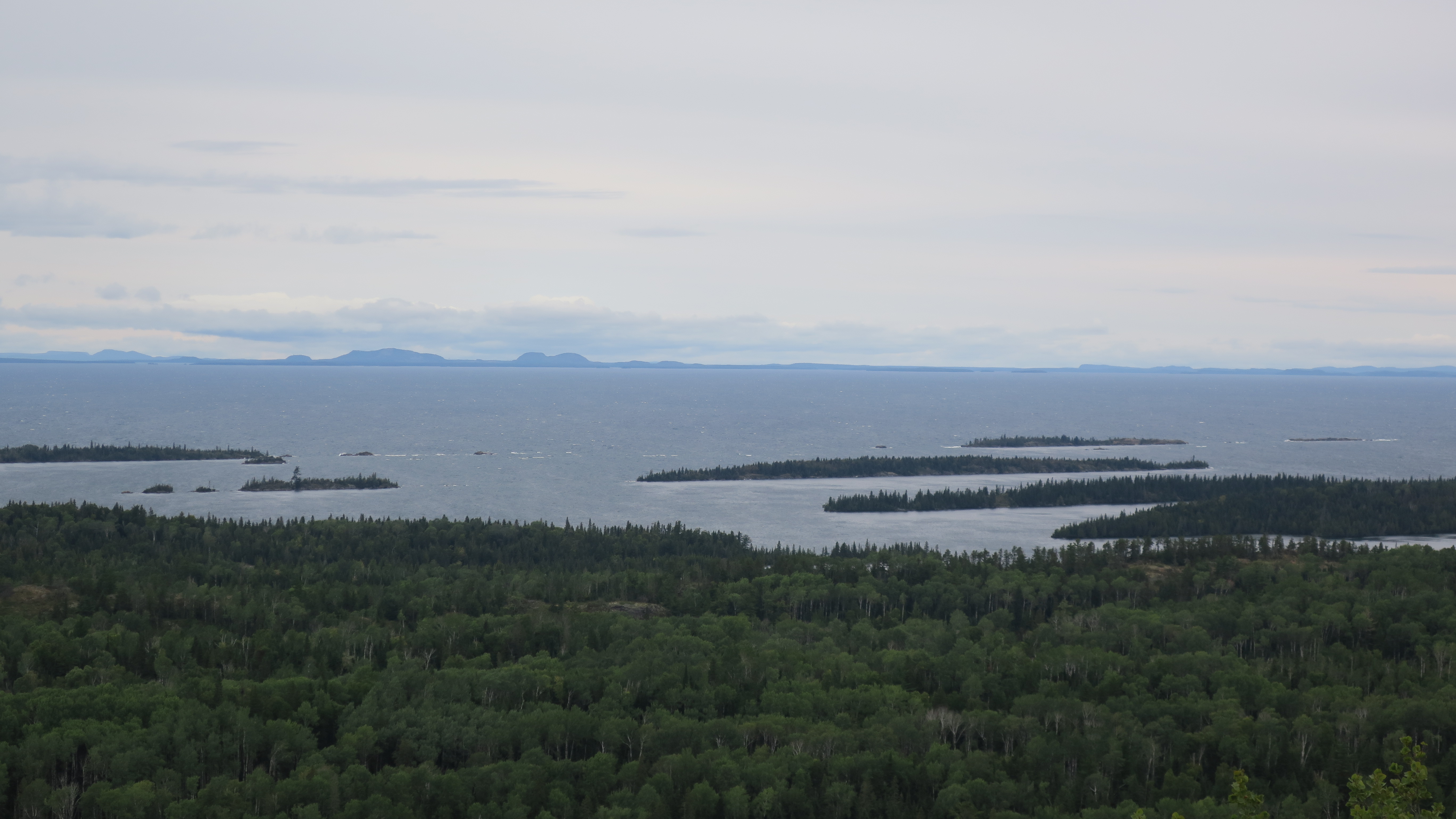
Lookout Louise is a popular scenic overlook at the east end of Isle Royale National Park, capturing a view of Thunder Bay across roughly 15 miles of Lake Superior.
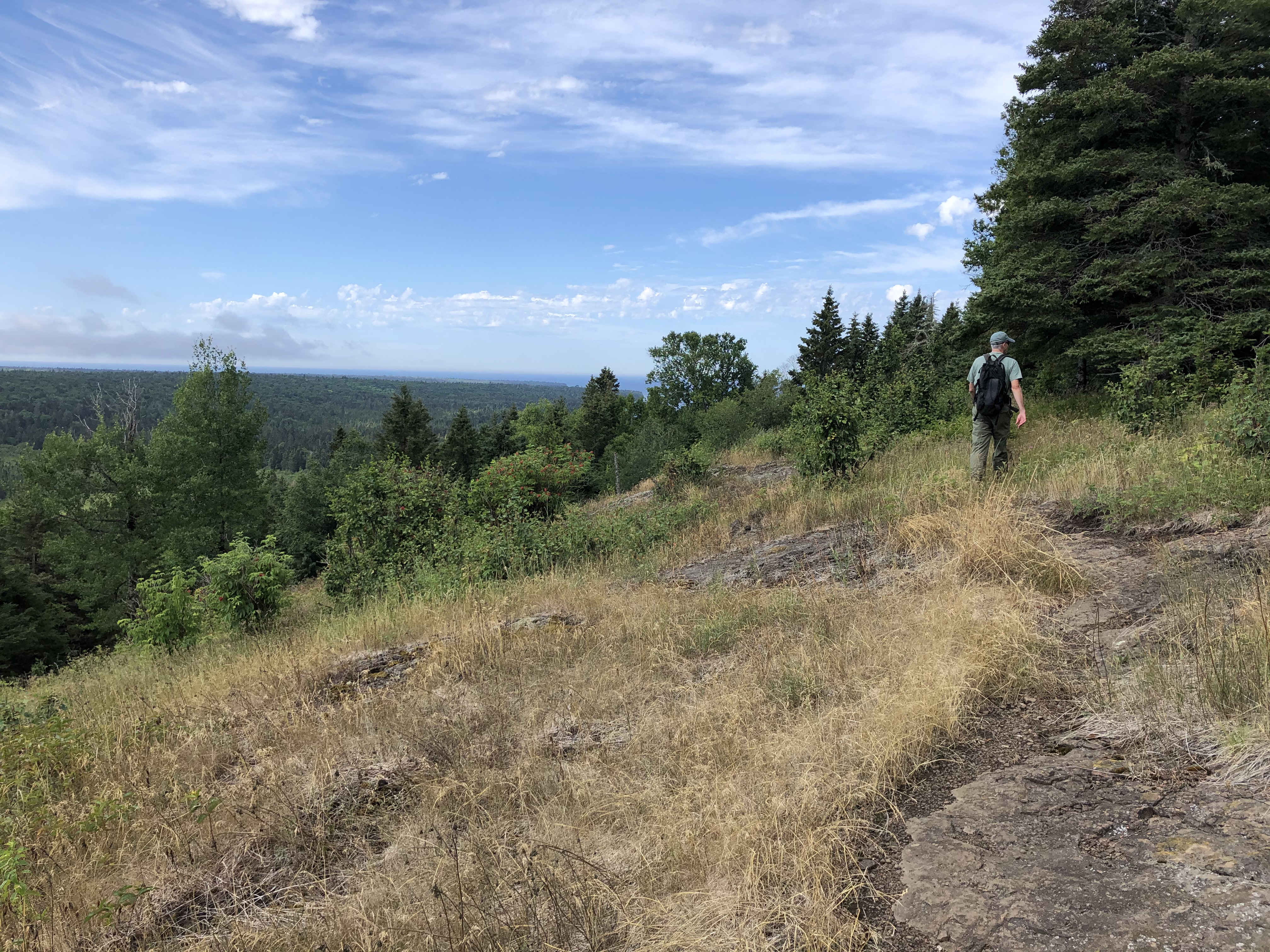
Elevated roughly 300 feet above Duncan Bay, this overlook provides an unobstructed view of the rocky north shore of the island, and on a clear day the roughly 15 to 20 miles that separate Isle Royale from the Ontario mainland. It is not uncommon to be visited by eagles on this platform and spy large maritime vessels carrying freight to and from Thunder Bay. Evident is the island's ridge and valley topography from this view, with layers of lakes and trees interwoven in the foreground below. There is almost no evidence of human construction from this view unless binoculars are used to gain a clearer view of the Ontario shoreline.
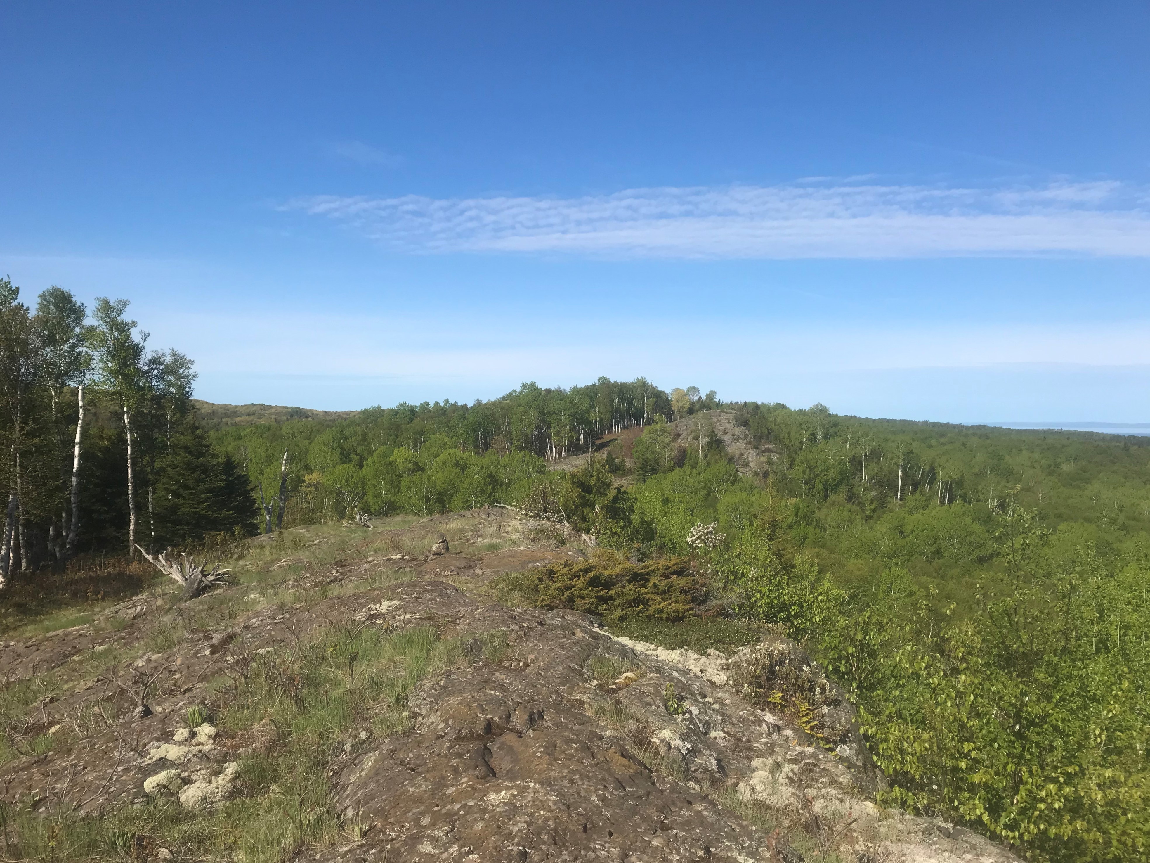
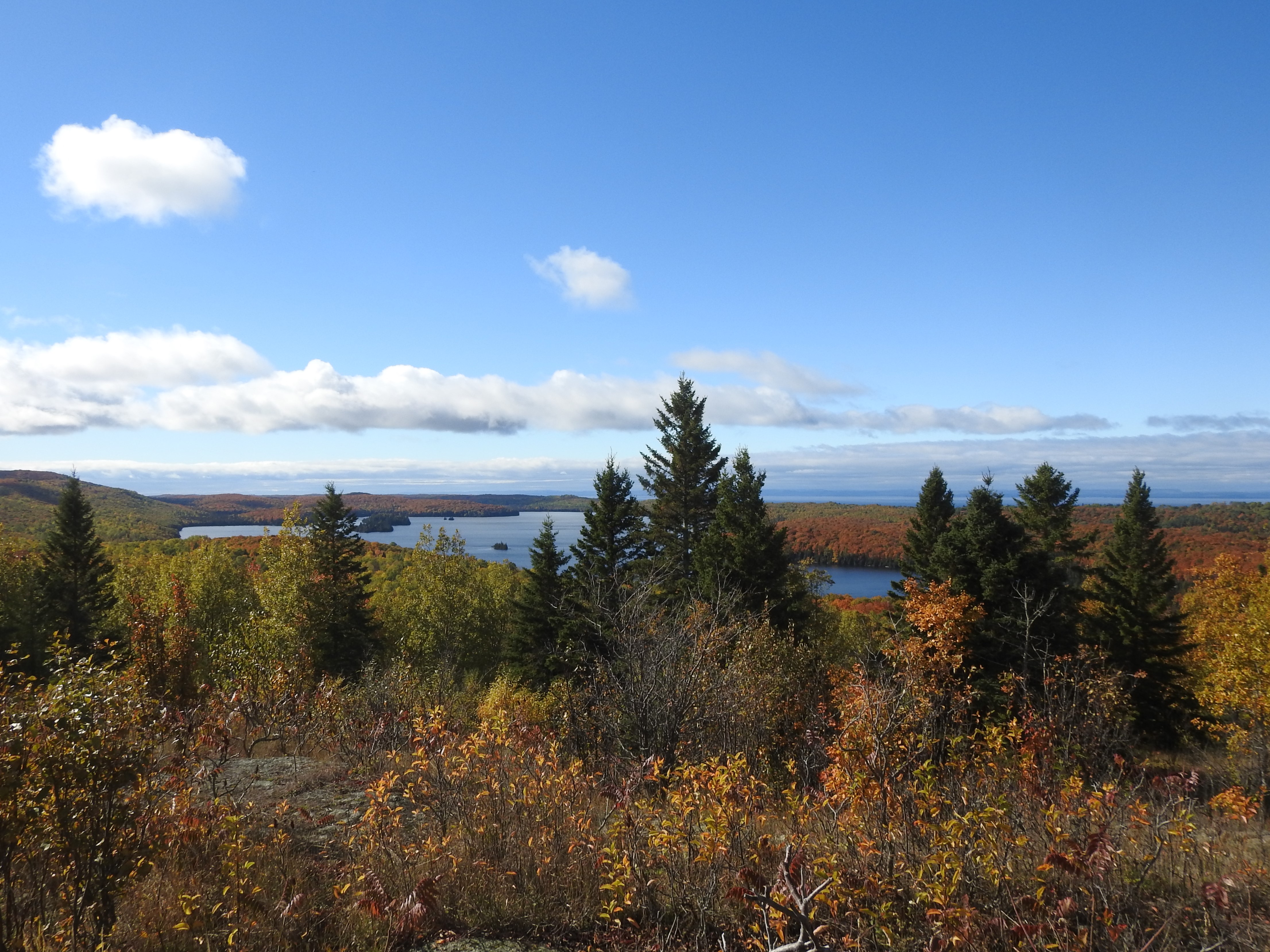
The Minong Ridge Overlook on the west end of Isle Royale National Park is a scenic stop for day hikers and backpackers alike.
The Minong Ridge Overlook is located along the Minong Ridge Trail on the west end of Isle Royale National Park. The overlook sits upon an exposed rocky ridge. Views of the island’s west end, Minong Ridge, and the Candian shoreline to the north can be enjoyed from the overlook.
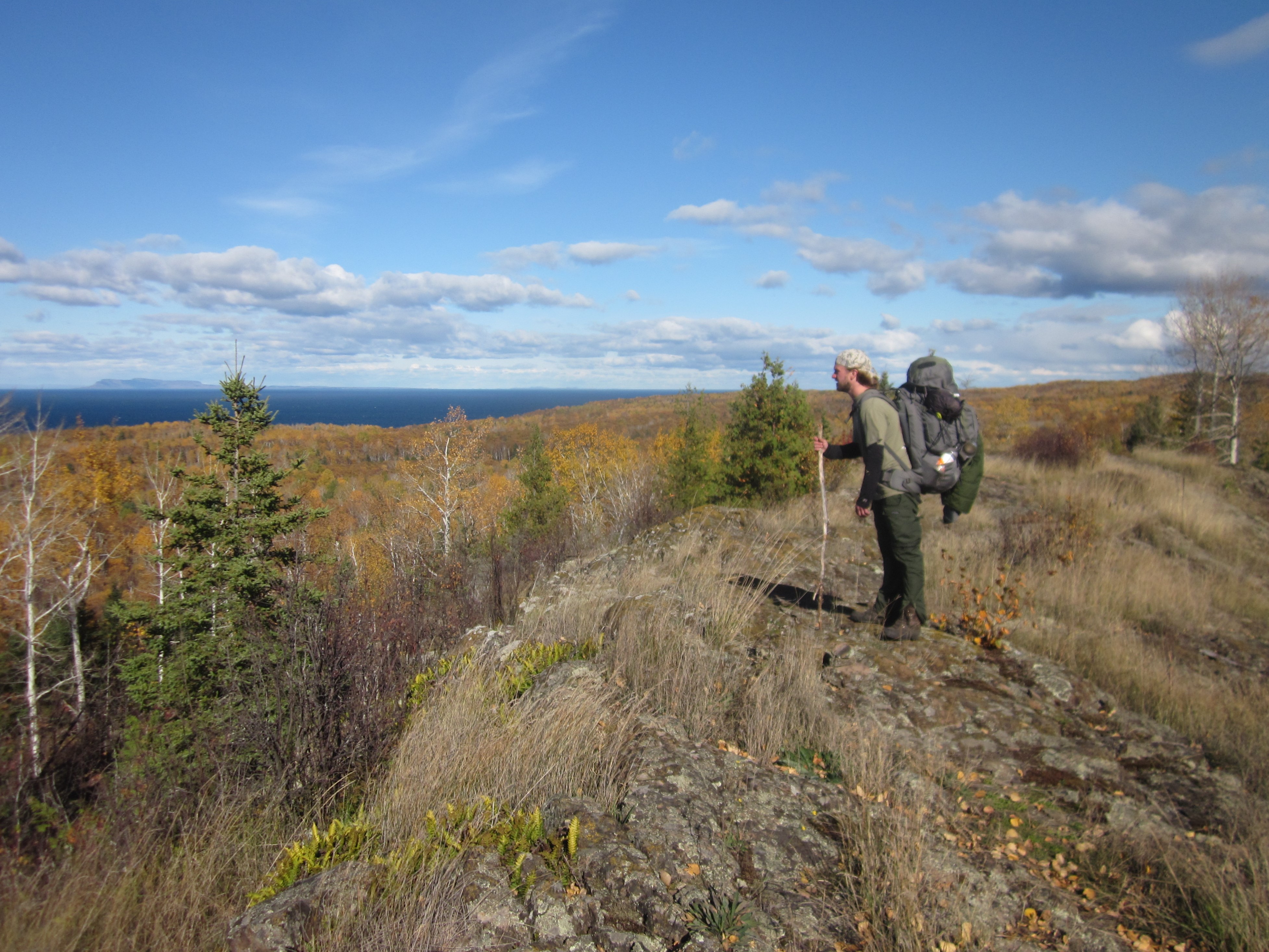
Embark on a challenging adventure and backpack the Minong Ridge Trail on Isle Royale starting at McCargoe Cove.
The Minong Ridge Trail is the most challenging trail on Isle Royale. The trail is composed of rocky ridges, elevation change, beaver dams, interior lakes, Lake Superior and Canadian shoreline views.
Embark on a challenging adventure and backpack the Minong Ridge Trail on Isle Royale starting at Windigo.
The Minong Ridge Trail is the most challenging trail on Isle Royale. The trail is composed of rocky ridges, elevation change, beaver dams, interior lakes, Lake Superior and Canadian shoreline views.
Mount Franklin is a a scenic hike destination for day hikers and backpackers on Isle Royale National Park.
Mount Franklin is located along the Greenstone Ridge Trail on the east end of Isle Royale National Park. This scenic hike destination offers views of the Canadian shoreline to the north. Mount Franklin is a popular day hike destination from the Rock Harbor Area.
Ojibway Tower is an old fire tower, converted to a telecommunications tower, located on the East End of Isle Royale National Park.
Ojibway Tower, located on the east end of Isle Royale National Park, offers a unique Isle Royale 360 degree view. The tower sits on a rocky ridge top. Visitors may climb part way up the tower and enjoy views of the Island’s interior lakes and bays. The tower can be accessed from the Greenstone Ridge Trail and Daisy Farm Campground.
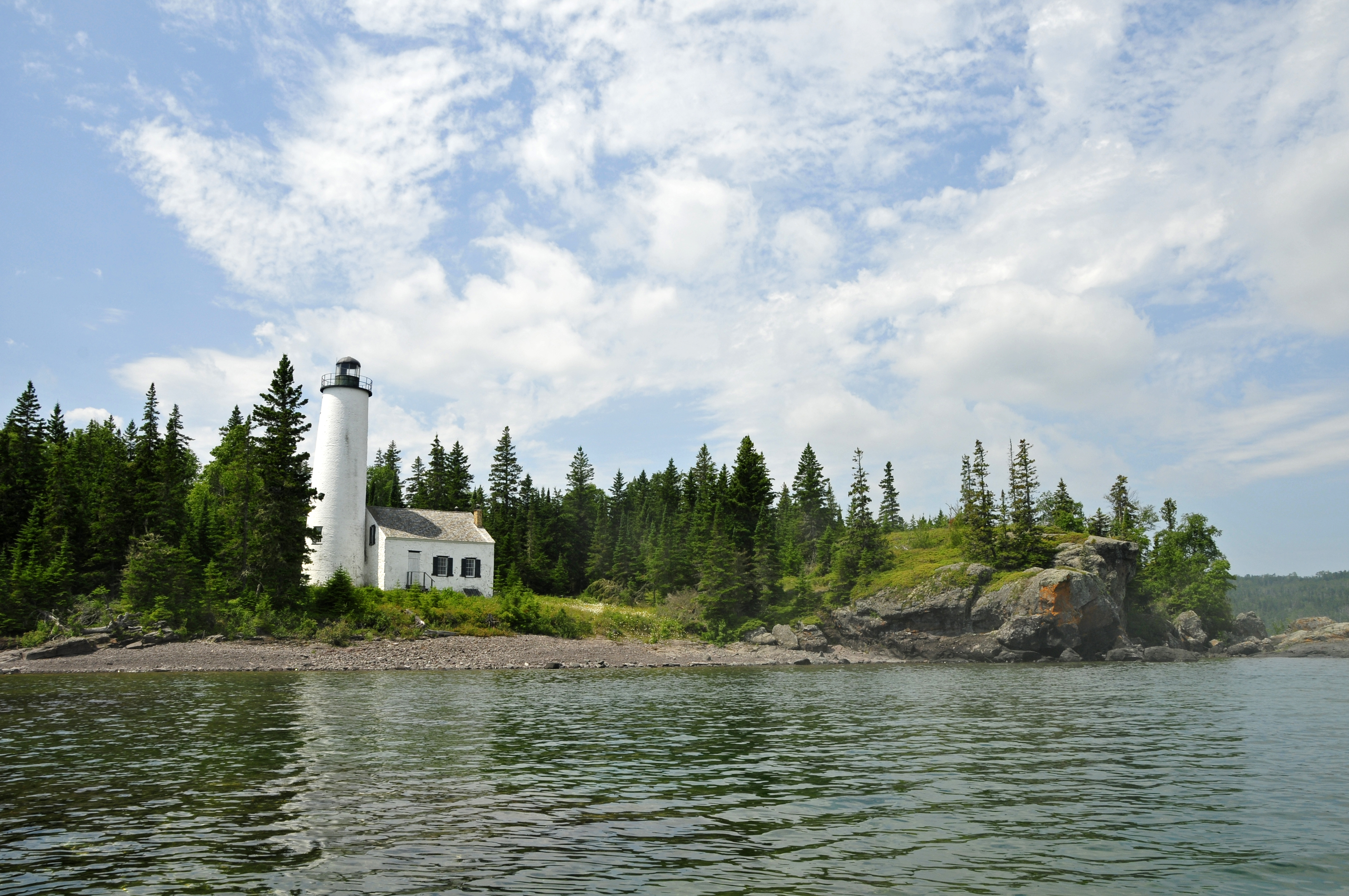
On the northeast side of Isle Royale National Park, the Passage Island Light guides ship traffic between the channel of Isle Royale's main island and Passage Island.
Passage Island Lighthouse is located on Passage Island, northeast of the main island of Isle Royale National Park.
A scenic spot located on Isle Royale’s southwestern shore, Rainbow Cove is a rocky beach with excellent opportunities to view sunsets, the historic Rock of Ages Lighthouse, and the Minnesota shoreline
Rainbow Cove is located on Lake Superior, on the Southwest shore of Isle Royale National Park. The cove includes a rocky beach and scenic views of Lake Superior. The historic Rock of Ages Lighthouse and Minnesota shoreline can be seen in the distance on a clear day. Visitors may catch beautiful sunsets.
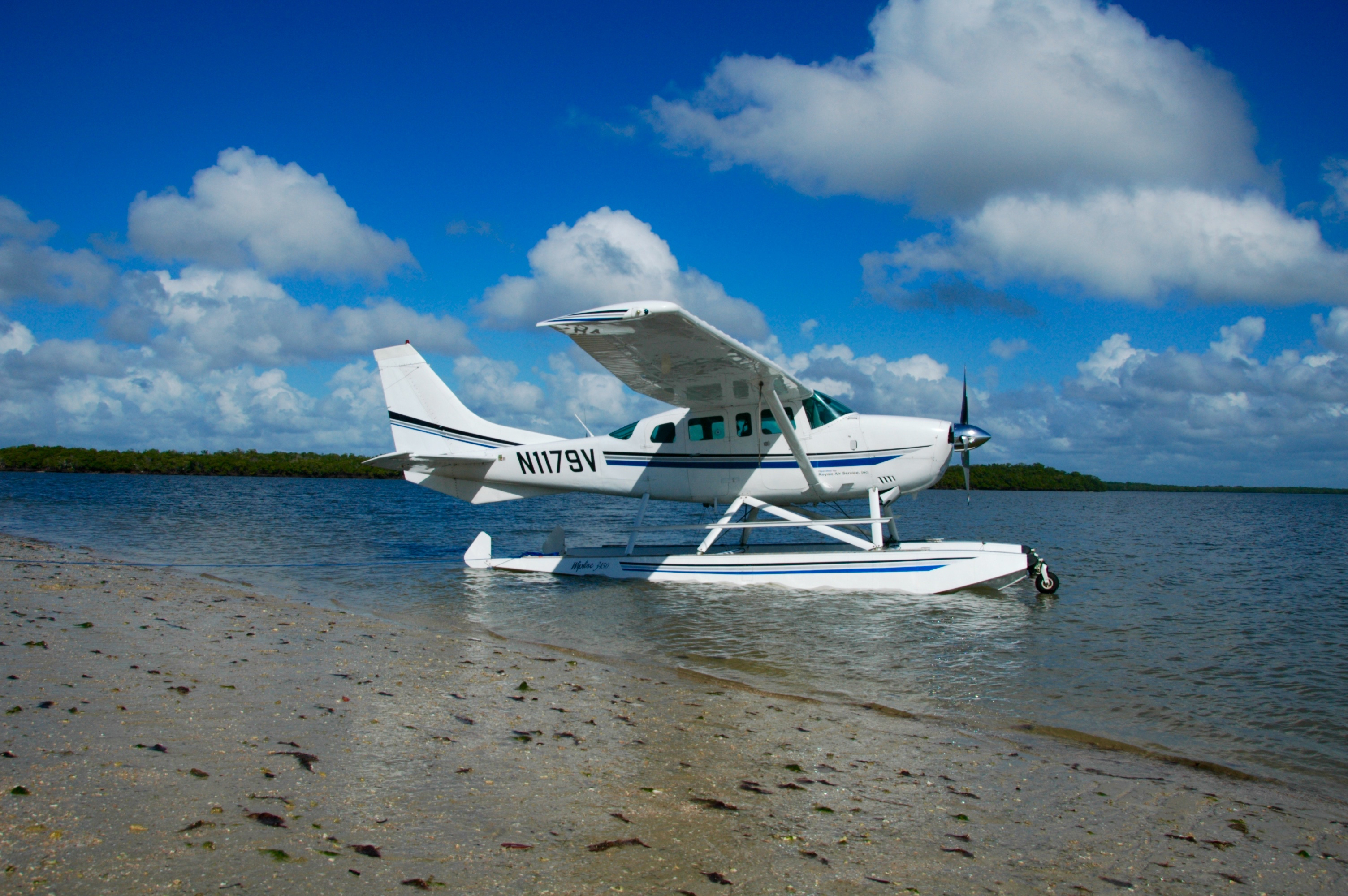
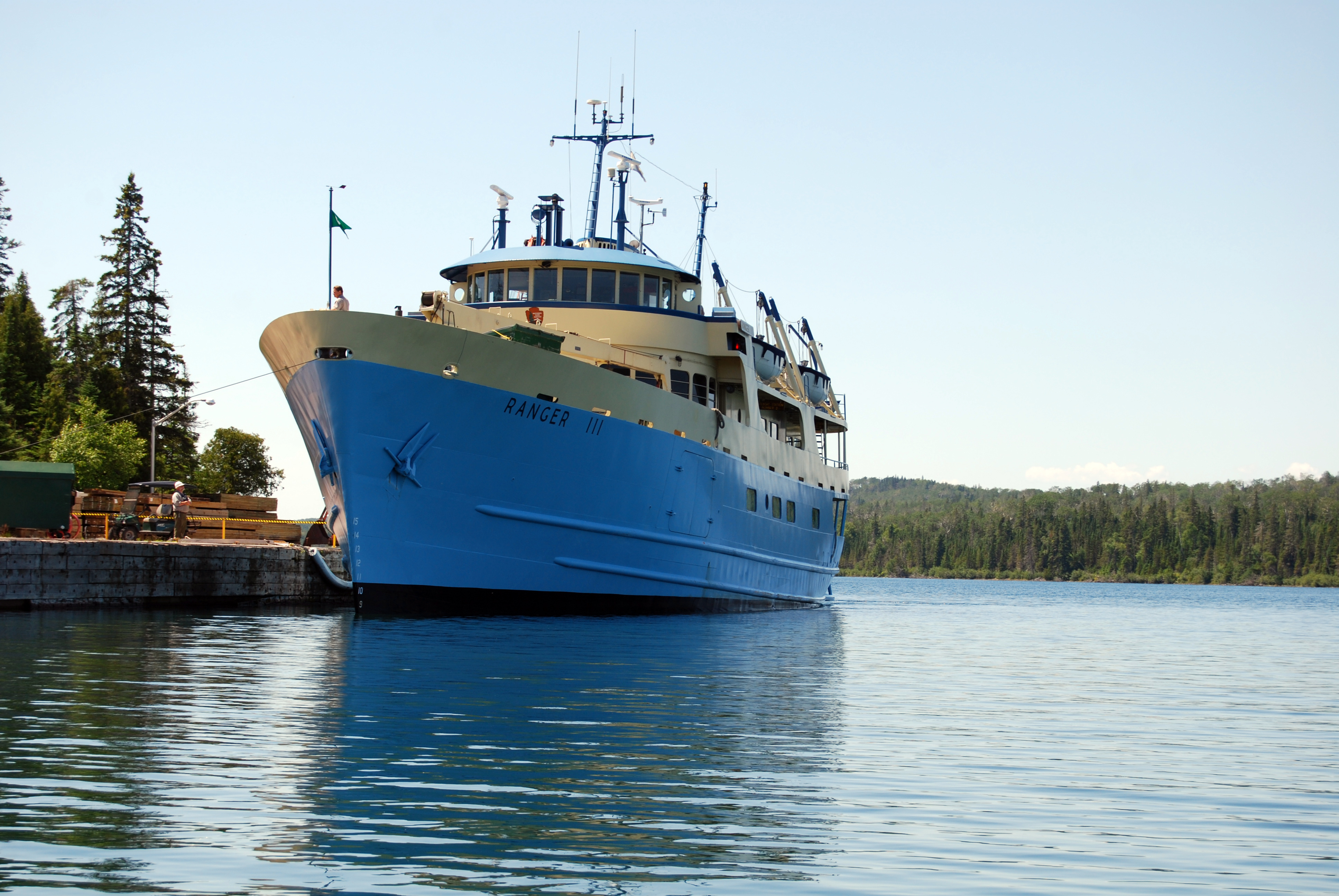
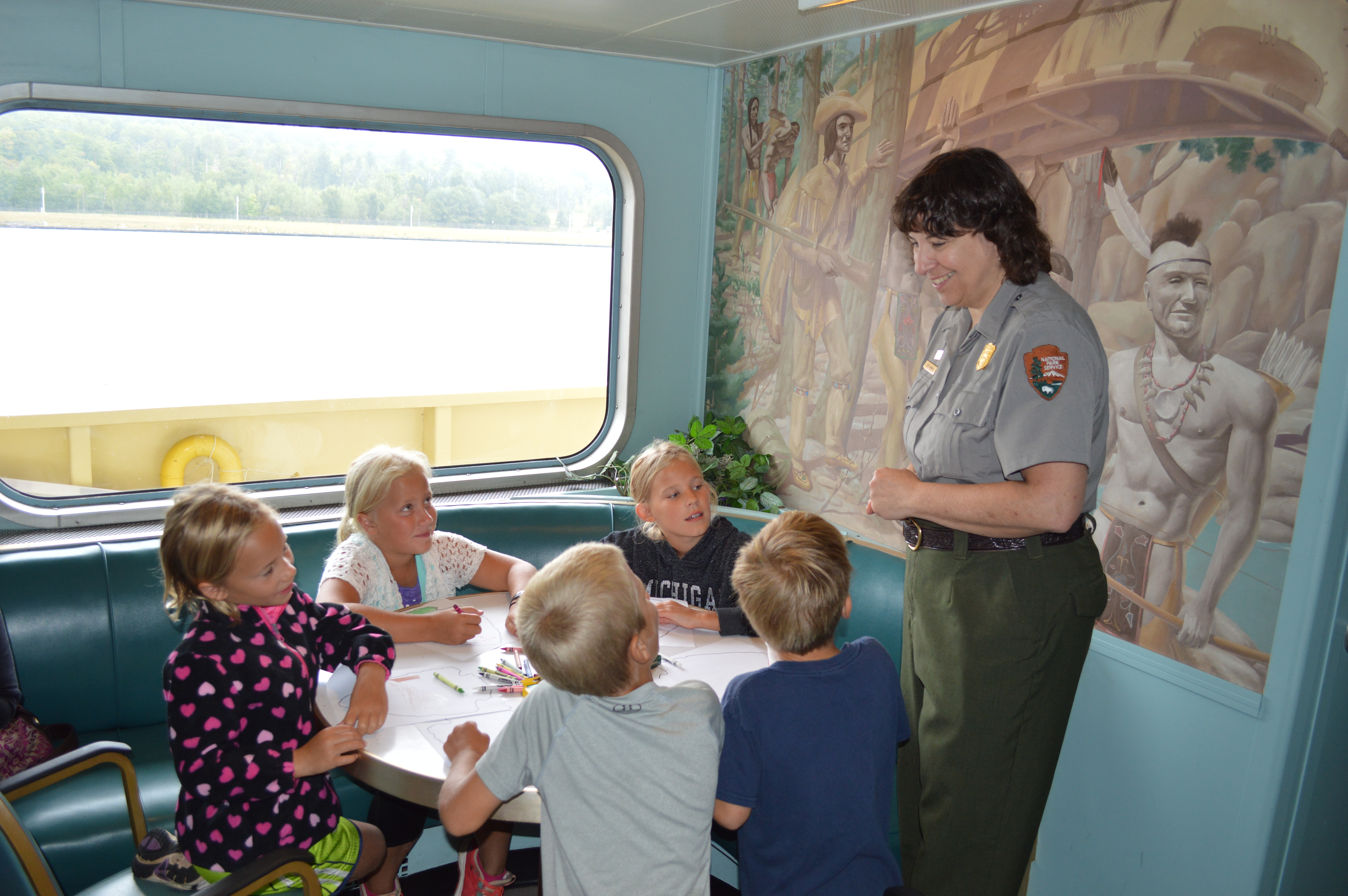
The Ranger III, the largest vessel operated by the NPS, serves as the logistical backbone of Isle Royale National Park, operating as the main cargo vessel to the island and the flagship passenger transporter. The USNPS Ranger III has been serving Isle Royale since September 8, 1958.
The Ranger III is a 165 foot long, 34 feet wide, 648 ton vessel that carries 128 passengers.
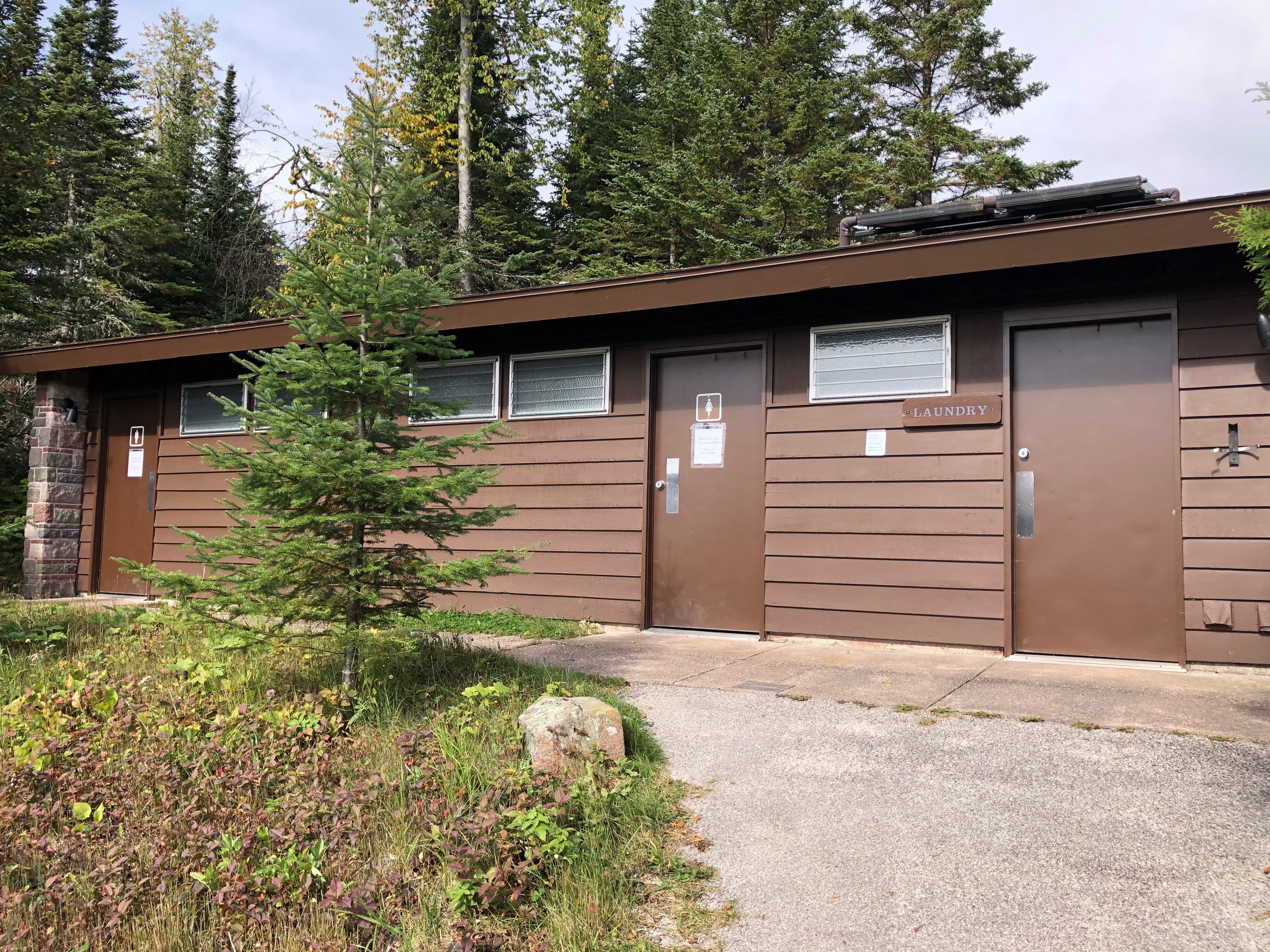
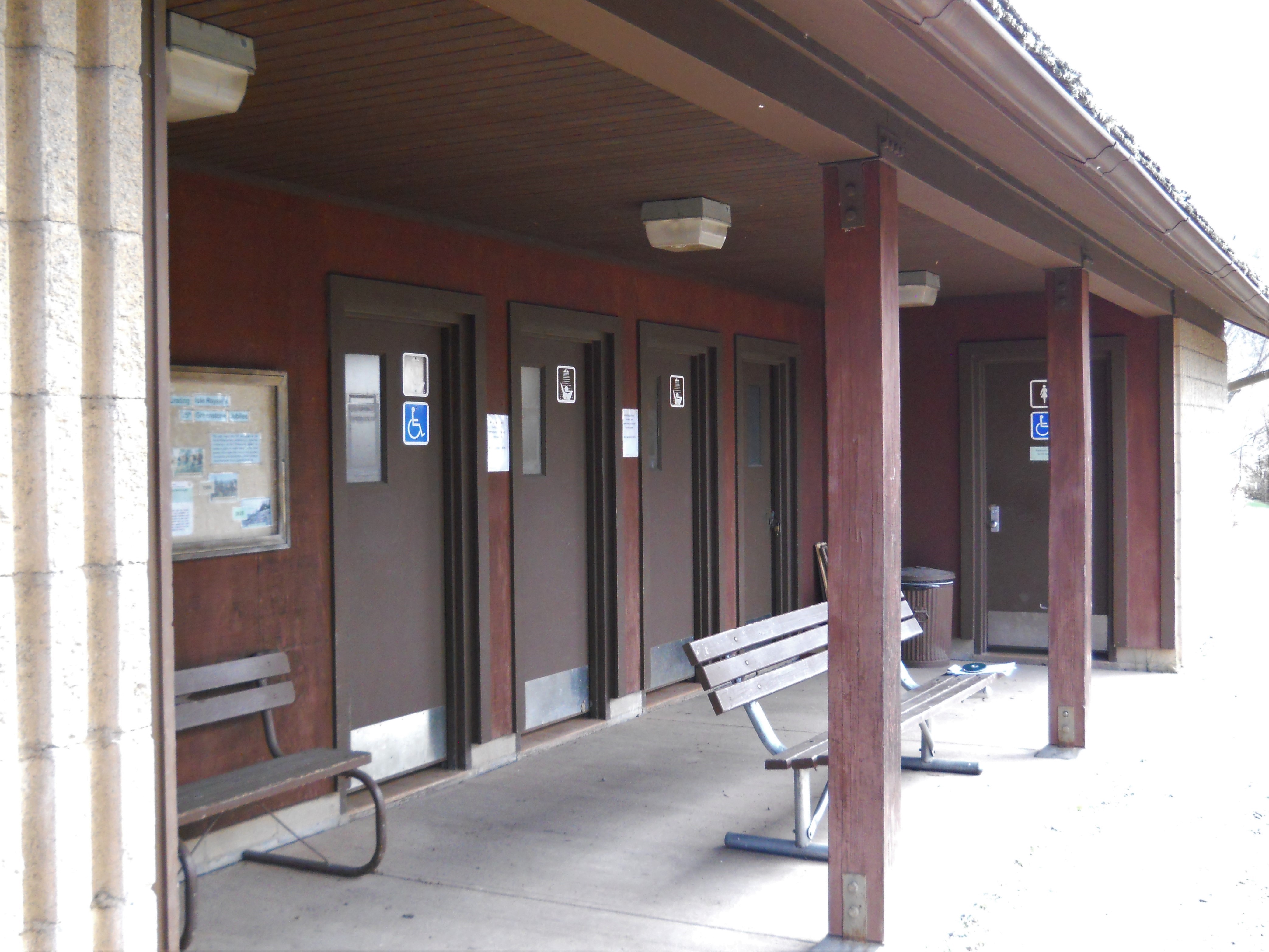
Bathroom services are found at the Rock Harbor Comfort Station on the east end of Isle Royale National Park.
A building including bathrooms, showers, and laundry services is located in Rock Harbor on the east end of Isle Royale National Park. It is found directly north of the Rock Harbor Visitor Center and Rock Harbor Camp Store.
The Rock Harbor Lighthouse at the southwest entrance to Rock Harbor is the most viewed and visited lighthouse at Isle Royale National Park.
Rock Harbor Lighthouse marks the entrance to Rock Harbor at the Middle Islands Passage. The white brick makes the lighthouse stick out on the shoreline.
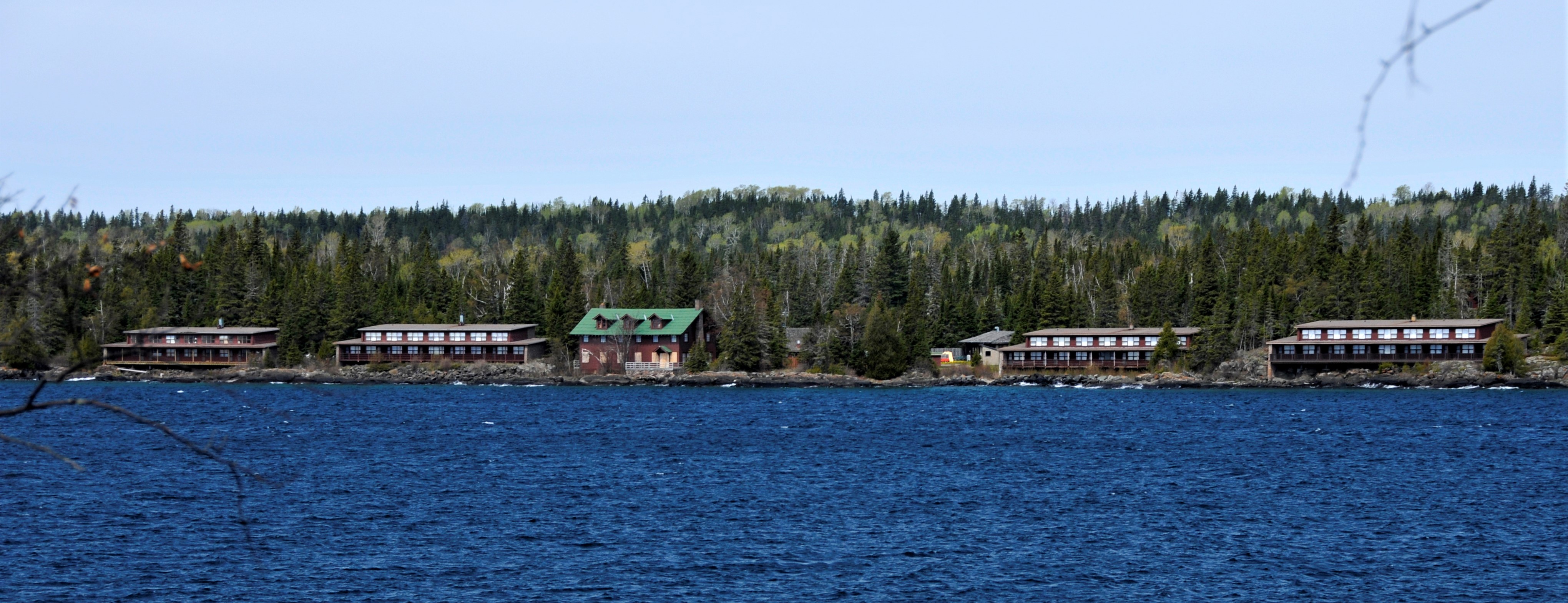
The shore front Rock Harbor Lodge found on Isle Royale National Park’s east end provides many visitor services.
The Rock Harbor Lodge, on the shores of Lake Superior, is located on Isle Royale’s east end. In the heart of Rock Harbor, the Lodge is accessible via ferry, private boat, or seaplane. The wide and accessible paths near the Lodge connect to the Rock Harbor Visitor Center, Rock Harbor Store, and the Rock Harbor Campground.
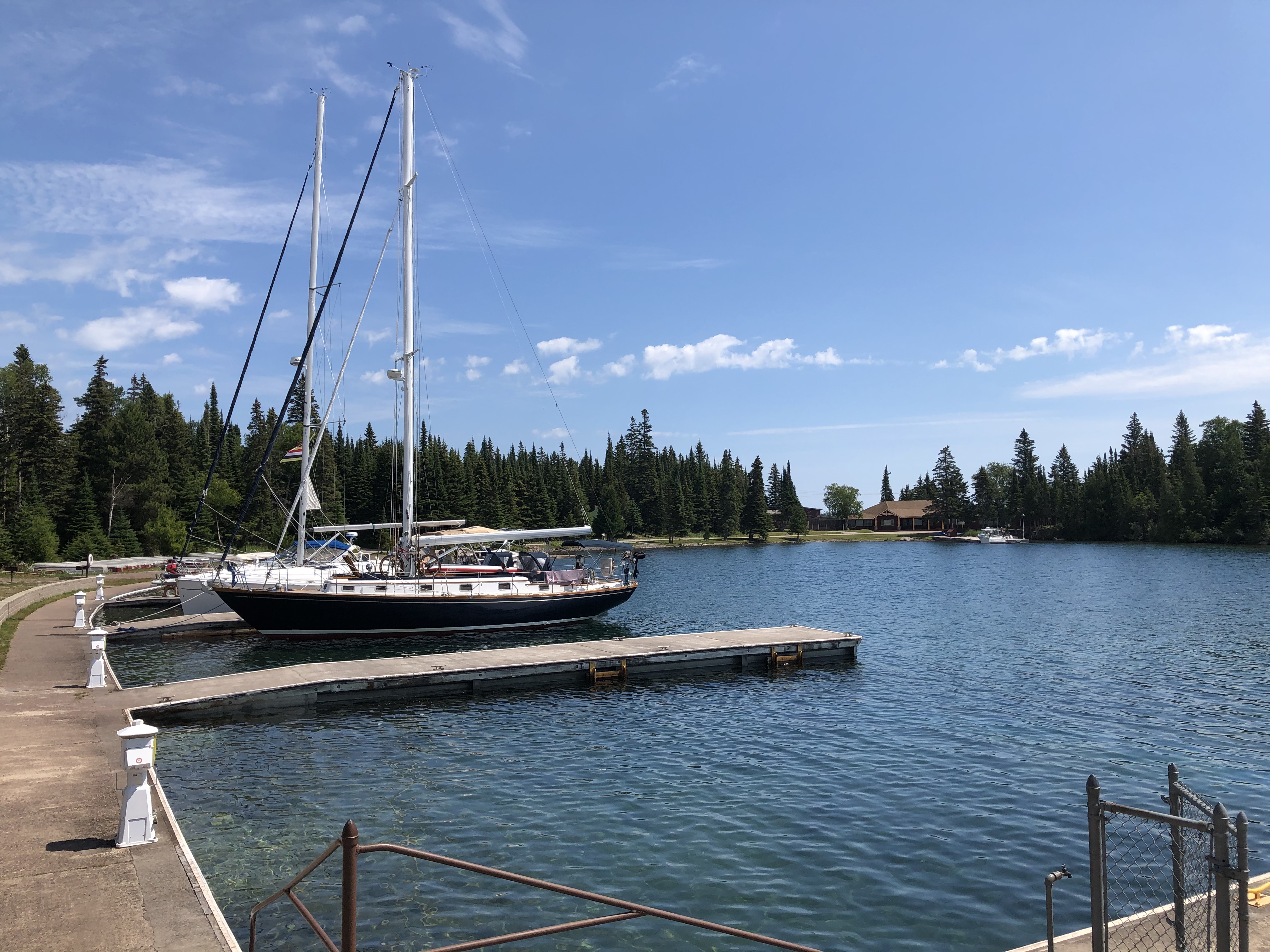
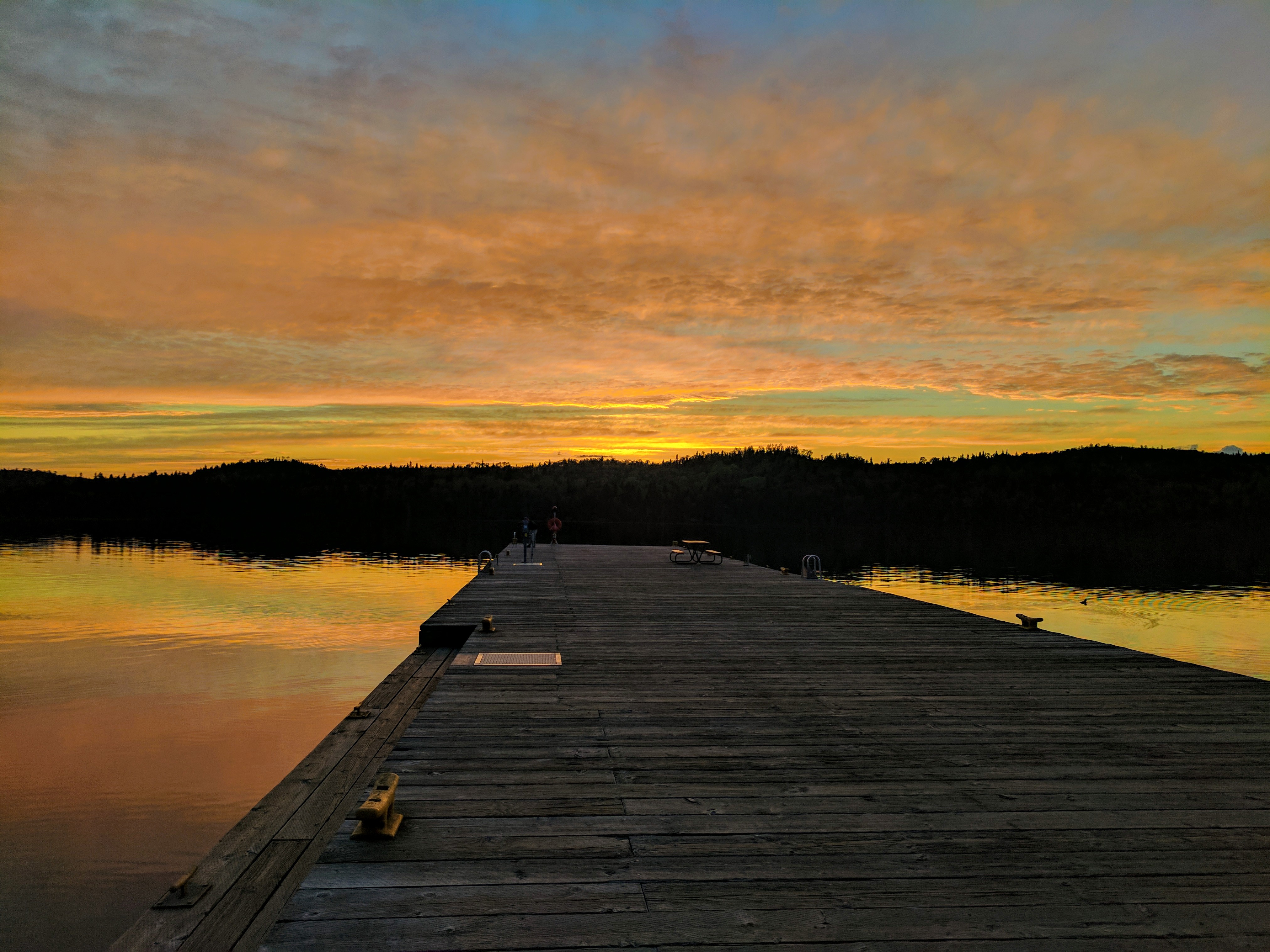
The Rock Harbor Marina on Isle Royale National Park’s northeastern end is a portal to wilderness for private vessels.
The Rock Harbor Marina is located on the northeastern end of Isle Royale National Park. It is located near downtown Rock Harbor. Overnight stays by private vessels are permitted for an extra fee. This portal to wilderness offers access to a variety of visitor services.
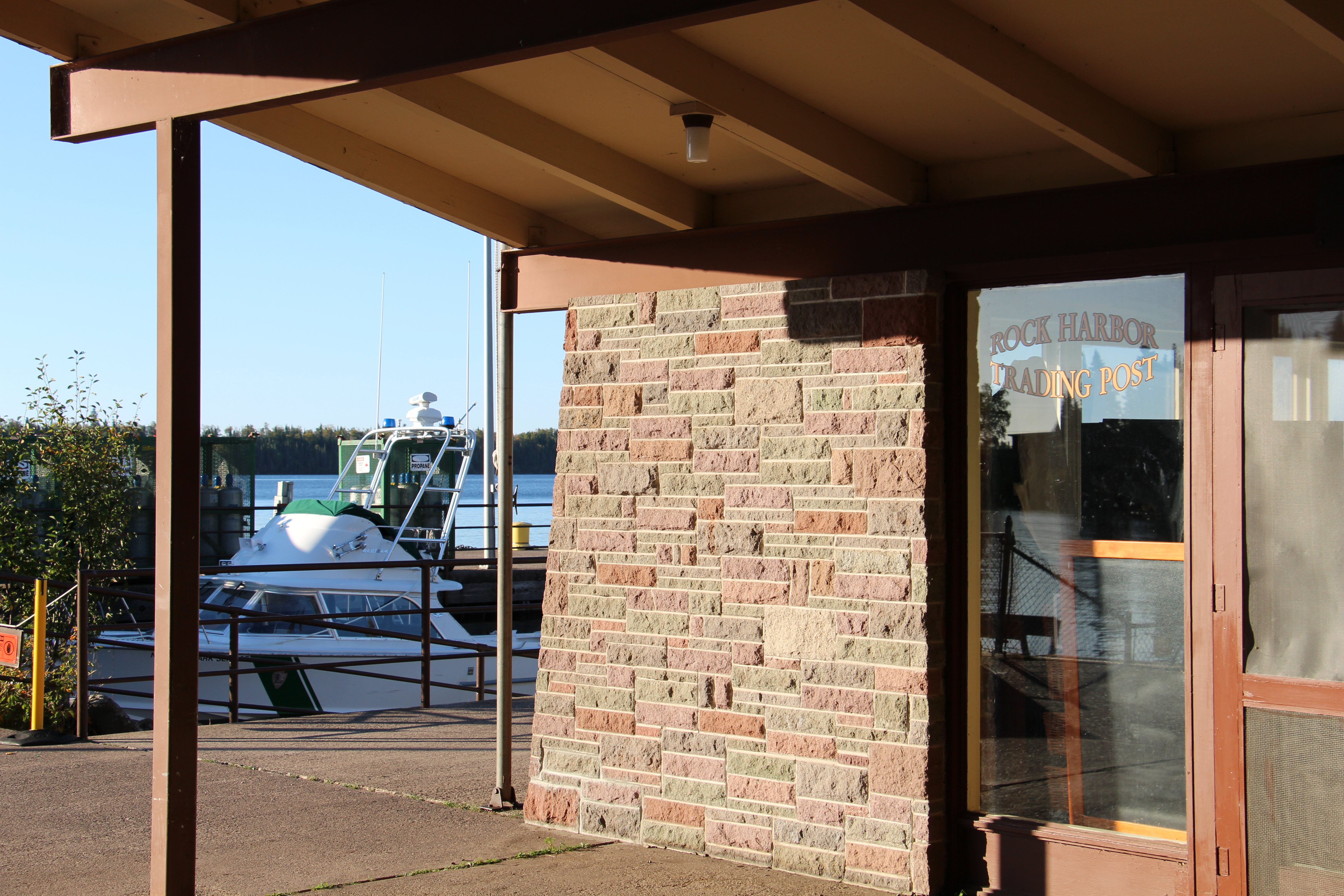
The Rock Harbor Store offers a standard selection of groceries and more on the east end of Isle Royale National Park.
The Rock Harbor Store is located in Rock Harbor on Isle Royale’s east end. Found right in downtown Rock Harbor across from the Rock Harbor Visitor Center. The Rock Harbor Dock and Marina are just a few steps from the store. Rock Harbor is a developed area that acts as a portal to the vast wilderness of Isle Royale National Park.
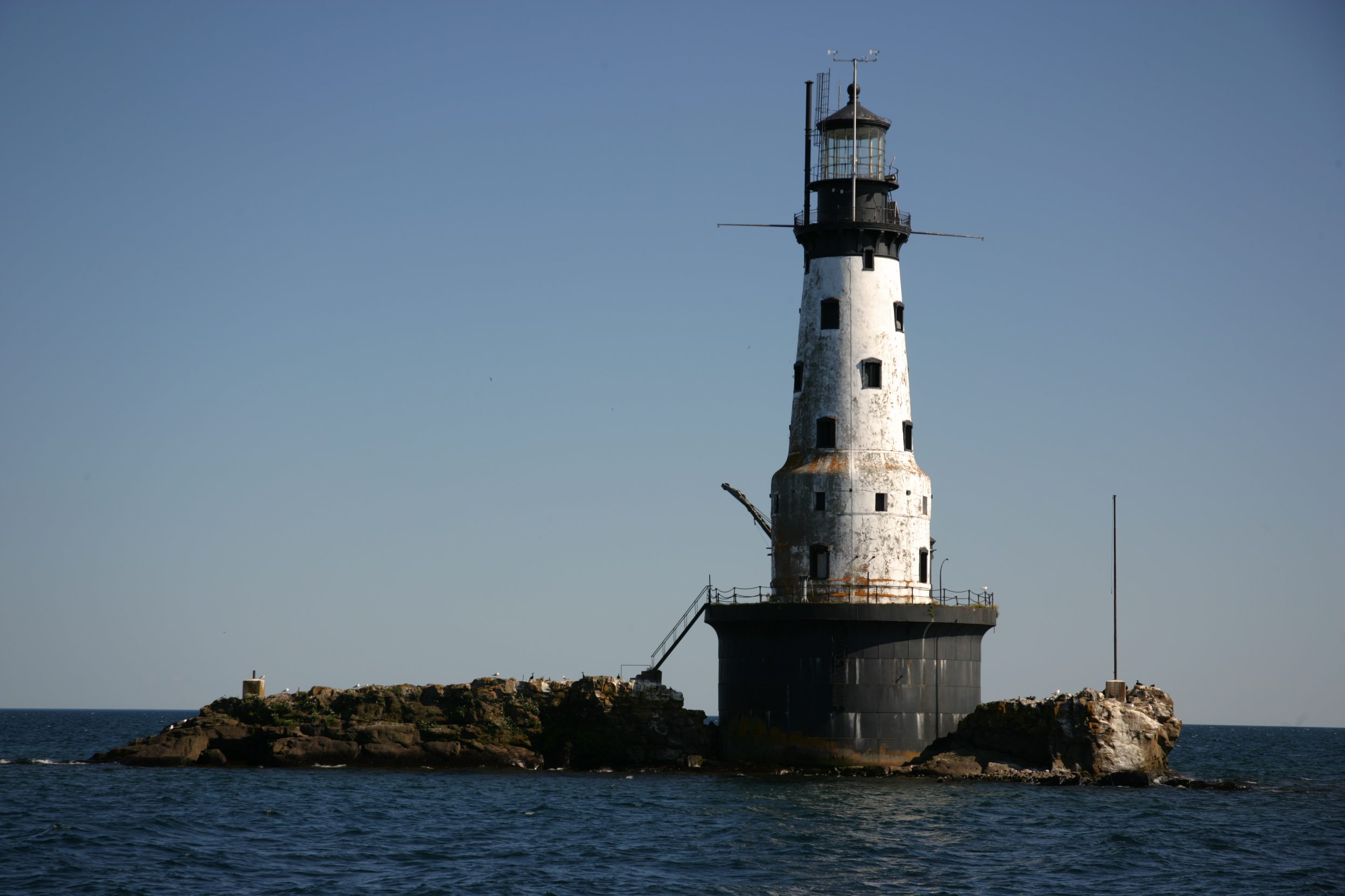
Just outside Washington Harbor stands the Rock of Ages Light, which began operation in 1908. The 117-foot white cylinder-shaped lighthouse is composed of steel, concrete, and brick, with a black base and lantern.
The Rock of Ages Lighthouse is located 8 miles from Windigo and 4 miles from the mouth of Washington Harbor, on the western end of Isle Royale National Park. The lighthouse sits on a rock surrounded by Lake Superior.
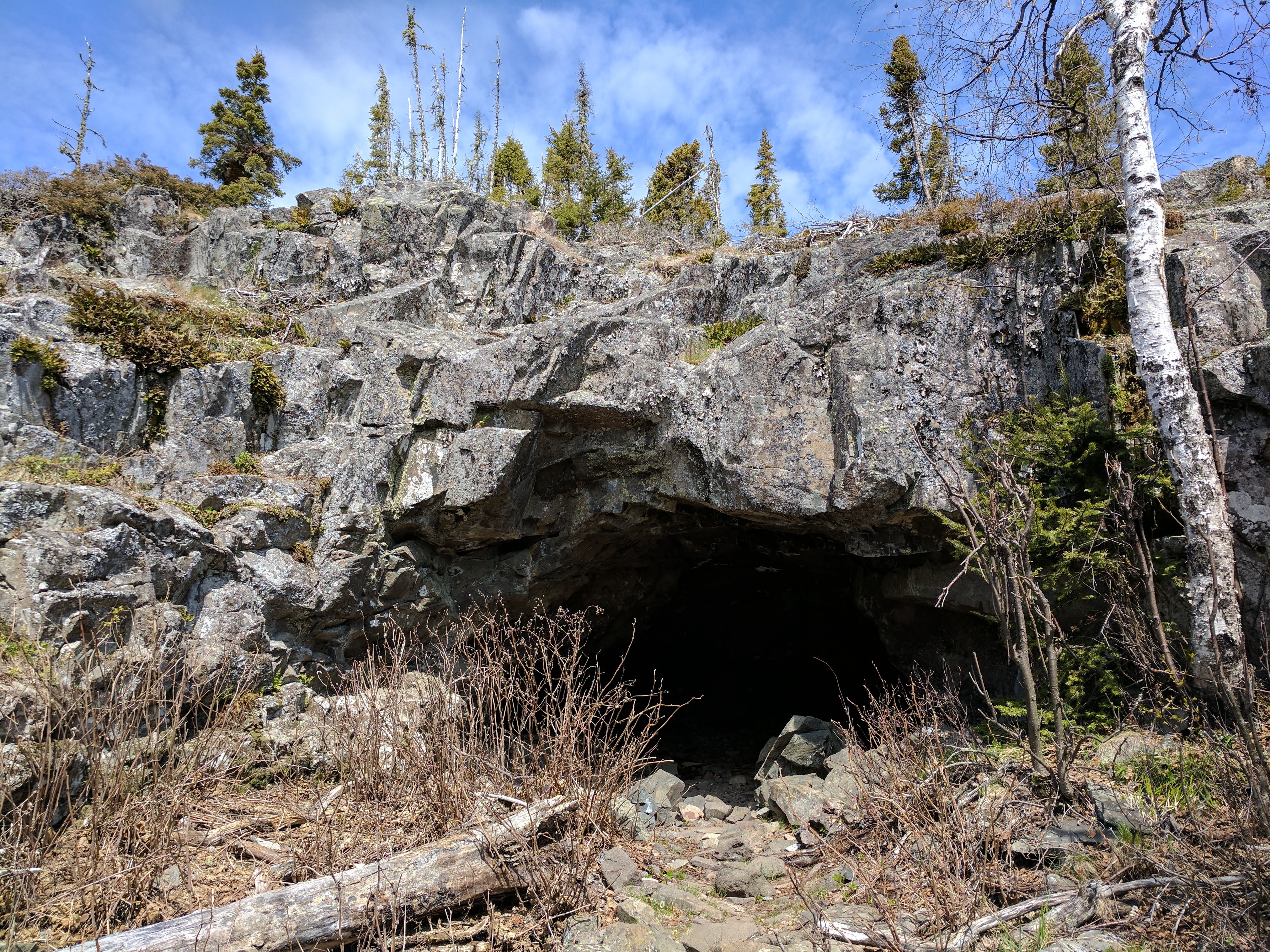
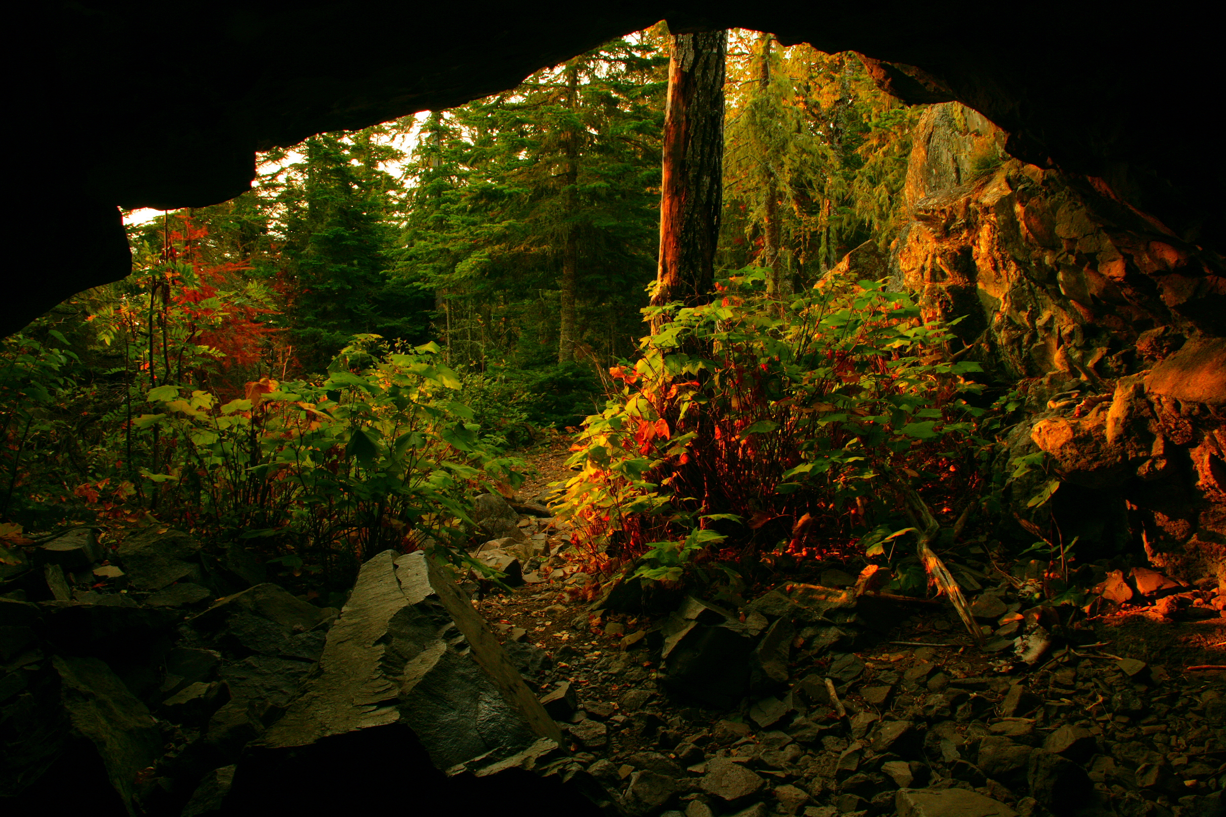
Observe the lasting impact of wave action at Suzy’s Cave- an inland sea arch on Isle Royale National Park, formed over 4,000 years ago.
Suzy’s Cave includes a wave-washed cliff and an inland sea arch, both were formed by wave action about 4000 years ago when water levels were higher. The cave is located on the southeast end of Isle Royale between Three Mile Campground and Rock Harbor. The Tobin Harbor and Rock Harbor Trails lead to Rock Harbor. Both trails are 1.8 miles, but the Tobin Harbor Trail is significantly smoother. A .2 mile spur trail connects the two trails to Suzy’s Cave. Listen carefully for wildlife through a thick canopy of spruce, fir, and birch.
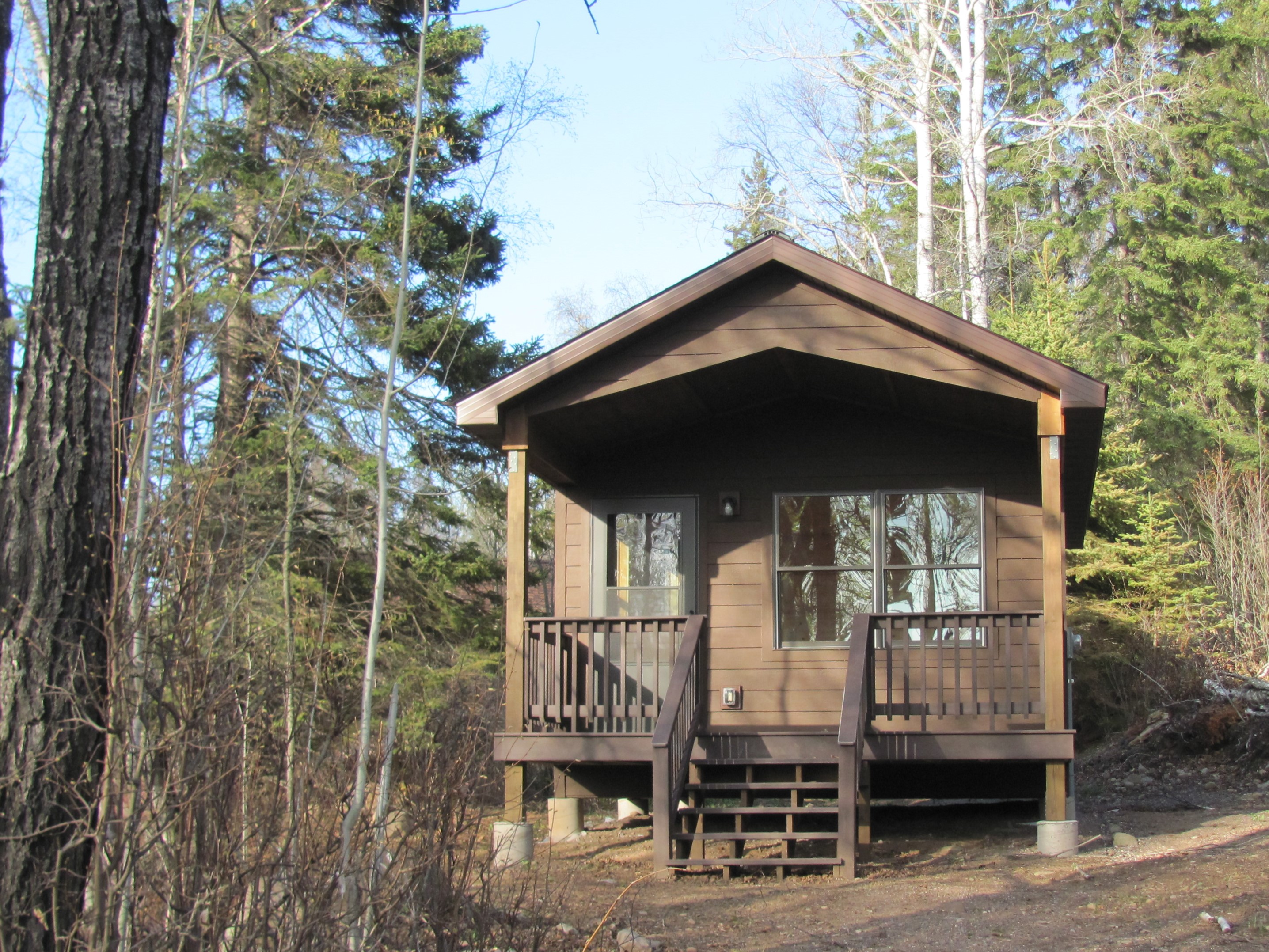
Stay at the rustic Windigo Camper Cabins on the west end of Isle Royale National Park.
The Windigo Camper Cabins are located in Windigo on the west end of Isle Royale National Park. Two rustic cabins and a privy are found on the hill behind the Windigo Visitor Center. A gravel trail passes by the cabins and gives access to the Windigo area and nearby trailheads. Reservations for the cabins need to be made in advance through Isle Royale Resorts.
Bathrooms, showers, and laundry services can be found at the Windigo Comfort Station at Isle Royale National Park.
The Windigo Camp Store is located in Windigo on the west end of Isle Royale National Park. It is found along Washington Harbor near the Windigo Marina, Windigo Camp Store, and the Windigo Visitor Center. Restrooms are open to the public seasonally. Showers and laundry services are offered seasonally for an extra fee paid through the Windigo Camp Store.
A portal to wilderness, the Windigo Marina is located on Isle Royale National Park’s southwest end and is easily accessible by private boat, ferry, or seaplane.
The Windigo Marina located in Washington Harbor, which opens to Lake Superior, the largest amongst the Great Lakes. Historic fisheries and resorts are a welcoming site along the outer islands of Washington Harbor. The Windigo Marina welcomes visitors as they round Beaver Island. Find port on the large wooden dock located between the Windigo Comfort Station and the Pavilion. Wildlife sightings are common here possibly including moose, fox, loons, osprey, grebes, mergansers, and more.
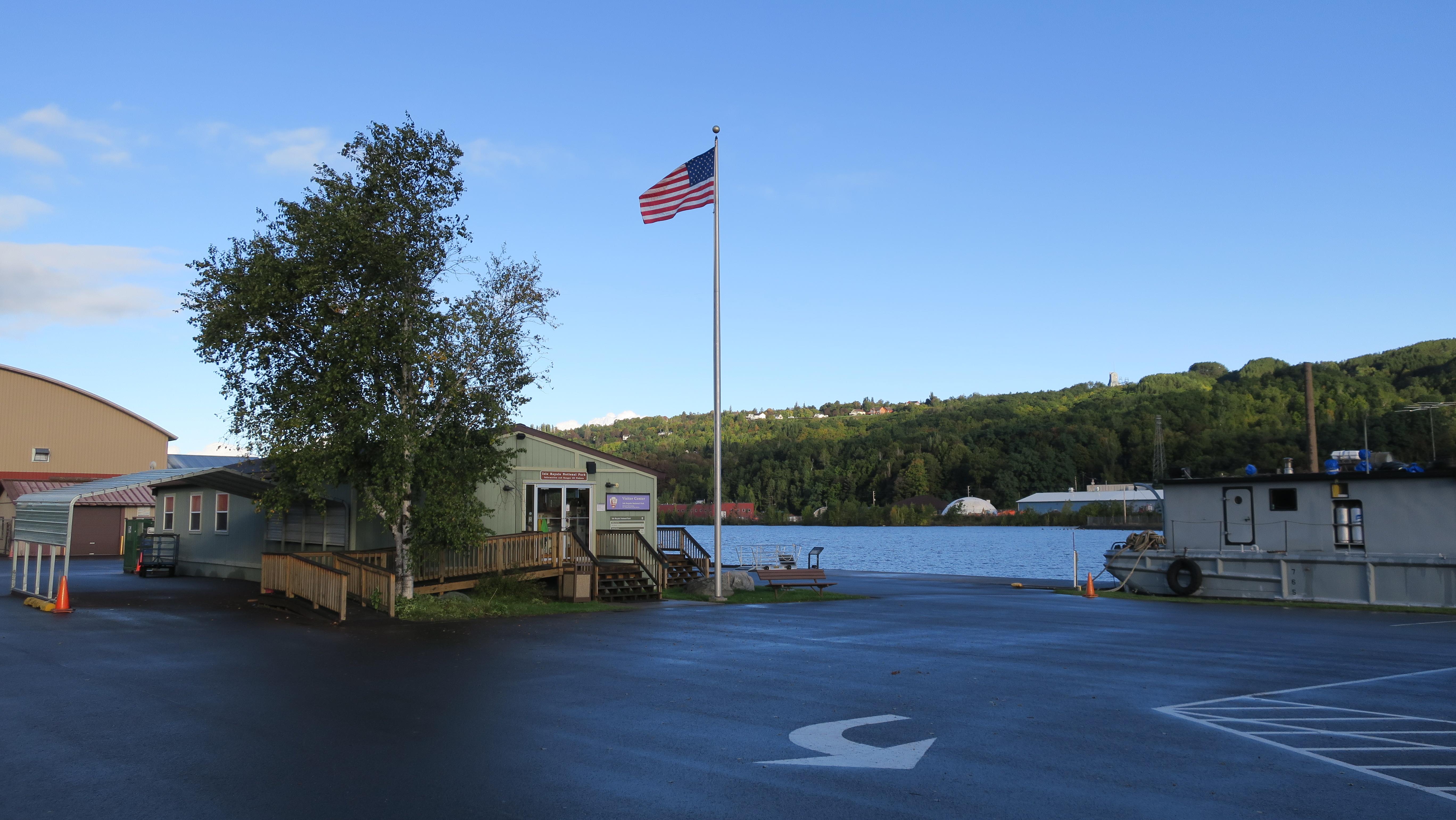
The Houghton Visitor Center is located in Houghton, Michigan. It is the mainland headquarters for Isle Royale National Park. Trip planning assistance, Ranger III tickets and information, a park store, and viewing the park film are available.
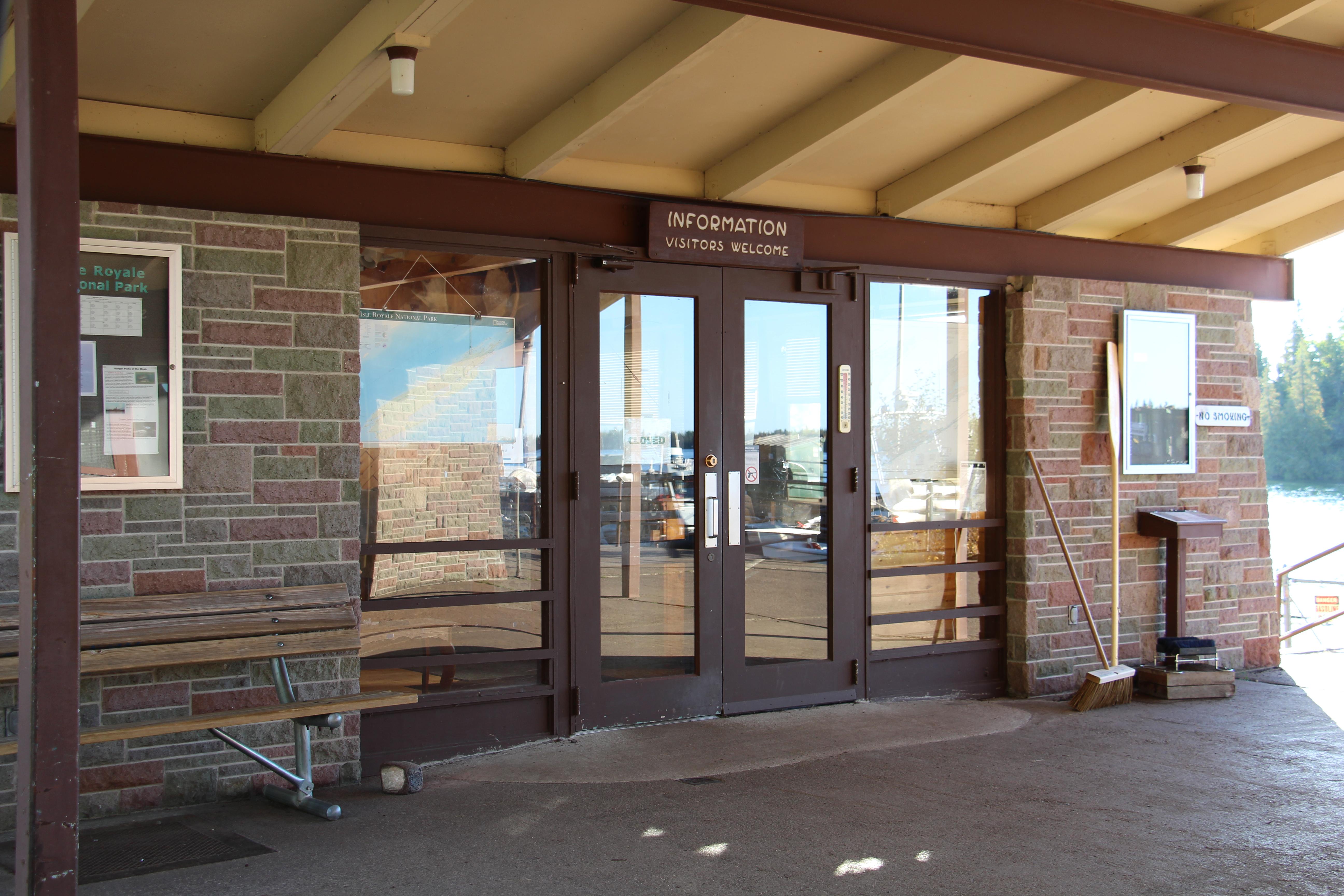
The Rock Harbor Visitor Center is located in Rock Harbor on the northeast end of Isle Royale National Park. It is only accessible by boat or seaplane. Permitting and fee payment, trip planning assistance, and a park store area available.
The Windigo Visitor Center is located in Windigo on the southwest end of Isle Royale National Park. It is only accessible by boat or seaplane. Permitting and fee payment, trip planning assistance, a park store, and exhibits are available.
Greenstone Section 1: Hike from Lookout Louise to Mount Franklin
This secluded section of the Greenstone Ridge Trail reaches to the northeastern tip of Isle Royale. Mileage: About 5 miles
Minong Section 1: Hike from McCargoe Cove to Todd Harbor
Try out Isle Royale's most challenging trail by trekking this more traveled section of this primitive trail. Mileage: About 6.7 miles
Minong Section 2: Hike from Todd Harbor to Little Todd
Enjoy scenic views of interior lakes, Lake Superior, and Canada on this strenuous, primitive trail. Mileage: About 6.8 miles
Minong Section 3: Hike from Little Todd to North Desor
Trek the most challenging section of the primitive Minong Ridge Trail with strenuous hill climbs, unsure footing, and picturesque ridgetop views. Mileage: About 5.7 miles
Minong Section 4: Hike from North Desor to Windigo
Discover remnants of a wildfire, carefully trek over beaver dams, and roll with the ridges of the longest section of the primitive Minong Ridge Trail. Mileage: About 13 miles
Hike the Mount Franklin Trail
Looking for a hike with a scenic view? The Mount Franklin Trail connects Three Mile Campground to Mount Franklin, an overlook with picturesque northern views. Mileage: About 2.5 miles
Hike the Mount Ojibway Trail
Hike from Mount Ojibway to Daisy Farm on the Mount Ojibway Trail. Explore an old fire tower on the Greenstone Ridge, hike through wetlands, and finish near Daisy Farm Campground along Rock Harbor Channel. Mileage: About 1.7 miles
Hike the Daisy Farm Trail
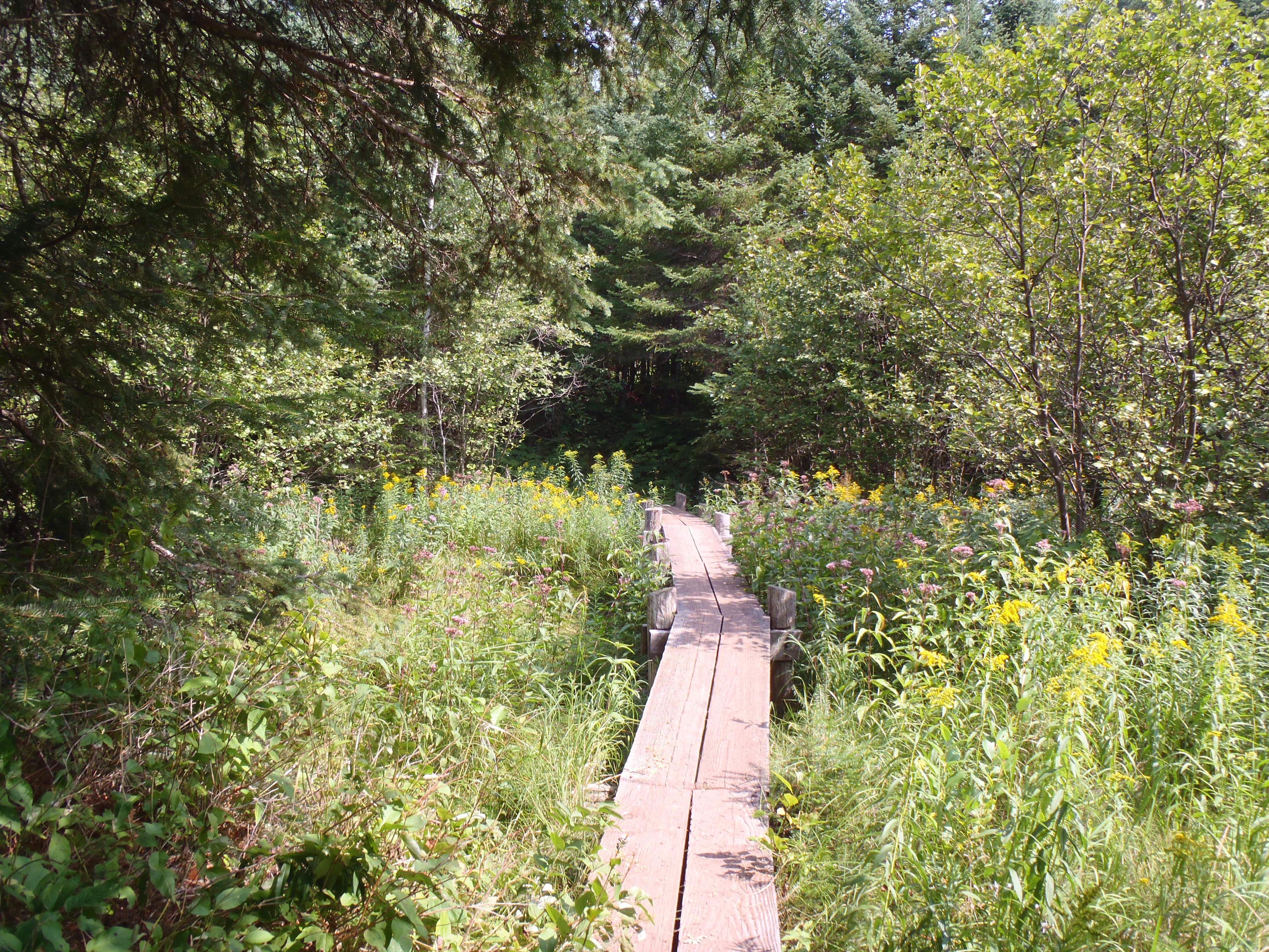
Explore a bog, trek along a lengthy boardwalk through wetlands, and view wildlife along the Daisy Farm Trail that connects the Greenstone Ridge to Daisy Farm Campground. Mileage: About 1.7 miles
Harbor to Hills Section 5: Hike from Lake Richie to West Chickenbone
Hike from one interior lake to the next on the Indian Portage Trail. Mileage: About 3.6 miles
Harbor to Hills Section 4: Hike from Moskey Basin to Lake Richie
Hike by streams, through wetlands, and atop rocky outcroppings on the Lake Richie Trail. Mileage: About 1.9 miles
Harbor to Hills Section 3: Hike from Daisy Farm to Moskey Basin
This section of the Rock Harbor Trail strays away from Rock Harbor Channel and meanders through forests speckled with rocky outcroppings. Mileage: About 3.9 miles
Harbor to Hills Section 2: Hike from Three Mile to Daisy Farm
Hike along the Rock Harbor Trail from Three Mile to Daisy Farm and enjoy views of Rock Harbor Channel, Rock Harbor Lighthouse, and Edisen Fishery. Mileage: About 4.2 miles
Harbor to Hills Section 1: Hike from Rock Harbor to Three Mile
The Rock Harbor Trail hugs the Rock Harbor Channel offering scenic views of the outer islands. Mileage: About 3.6 miles
Greenstone Section 7: Hike from South Desor to Island Mine
Unknowingly trek over the highest peak on the island—Mount Desor—on this section through hardwood forest. Mileage: About 5.2 miles
Greenstone Section 6: Hike from Ishpeming Tower to South Desor
This rolling trail through hardwood forest offers an opportunity for self reflection. Mileage: About 3.5 miles
Greenstone Section 5: Hike from Hatchet Lake to Ishpeming Tower
Discover scenic views, an old fire tower, and the hardwood forest on Isle Royale's west end. Mileage: About 3.8 miles
Greenstone Section 4: Hike from Chickenbone Lake to Hatchet Lake
Begin this trek with scenic views near Chickenbone Lake then travel through a variety of forest types to Hatchet Lake. Mileage: About 7.2 miles
Greenstone Section 3: Hike from Mount Ojibway to Chickenbone Lake
Take in the stunning vistas from the eastern Greenstone Ridge, including views from Ojibway Tower. Mileage: About 5.7 miles
Greenstone Section 2: Hike from Mount Franklin to Mount Ojibway
Travel from one scenic viewpoint to another starting at Mount Franklin, a picturesque overlook along the Greenstone Ridge. Mileage: About 2.8 miles
Walk the Windigo Nature Trail
Walk the Windigo Nature Trail and immerse yourself in the deciduous forest on the western end of Isle Royale.
Hike the Huginnin Loop
Day hike or backpack the Huginnin Loop on the west end of Isle Royale. Discover over 8 miles of trail that includes remnants from past humans, the rocky northern shore, and the western wilderness of the island.
Feldtmann Loop Section 4 / Greenstone Ridge: Hike from Island Mine to Windigo
Walk along an old mining road on the western end of the Greenstone Ridge then descend to Windigo. Mileage: About 6.5 miles
Feldtmann Loop Section 3: Hike from Siskiwit Bay to Island Mine
Comb Carnelian Beach and relish in the remnants of the historic Island Mine on this section of the Feldtmann Loop. Mileage: About 4.3 miles
Feldtmann Loop Section 1: Hike from Windigo to Feldtmann Lake
Hike on the Feldtmann Lake Trail and experience remnants of an old Lake Superior shoreline. Mileage: About 8.5 miles
Hike the Tobin Harbor Trail
The Tobin Harbor Trail connects the Mount Franklin Trail to Rock Harbor. This easygoing route is preferred amongst backpackers compared to the Rock Harbor Trail. Mileage: About 3 miles
Portage from Lake Richie to Chippewa Harbor
The portage between Lake Richie and Chippewa Harbor is 1.2 miles and connects to the island's exterior.
Portage from Lake LeSage to Lake Richie
Portage 0.6 miles from Lake LeSage to Lake Richie over a rolling trail.
Portage from McCargoe Cove to Chickenbone Lake
Enter the island's interior by portaging from McCargoe Cove to Chickenbone Lake.
Portage from Lake Livermore to Lake LeSage
Portage from Lake Livermore to Lake LeSage and travel over the Greenstone Ridge along the Indian Portage Trail.
Portage from Chickenbone Lake to Lake Livermore
The portage between Chickenbone Lake and Lake Livermore is a short and steep 0.2 miles.
Feldtmann Loop Section 2: Hike from Feldtmann Lake to Siskiwit Bay
Climb the steep path to the Feldtmann Ridge and enjoy scenic views of Feldtmann Lake and the western wilderness of Isle Royale. Mileage: About 10.3 miles
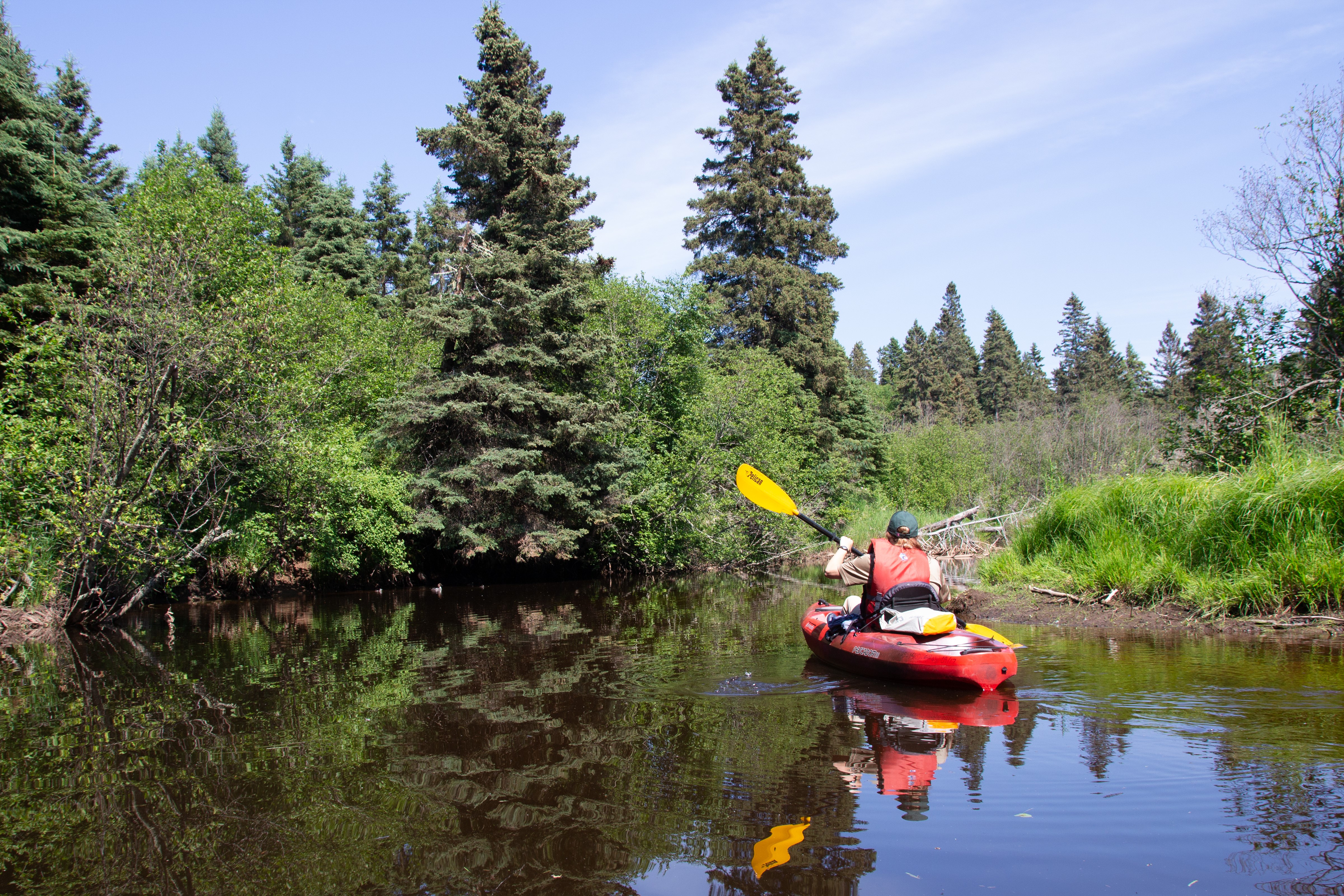
Paddle Washington Creek
Paddle Washington Creek, located on the west end of Isle Royale National Park. Washington Creek is an excellent spot for wildlife viewing.
Become an Isle Royale Junior Ranger
Become an Isle Royale Junior Ranger and learn about the isolated island, the unique plants and animals found in the park, the island’s cultural history, and Leave No Trace principles.
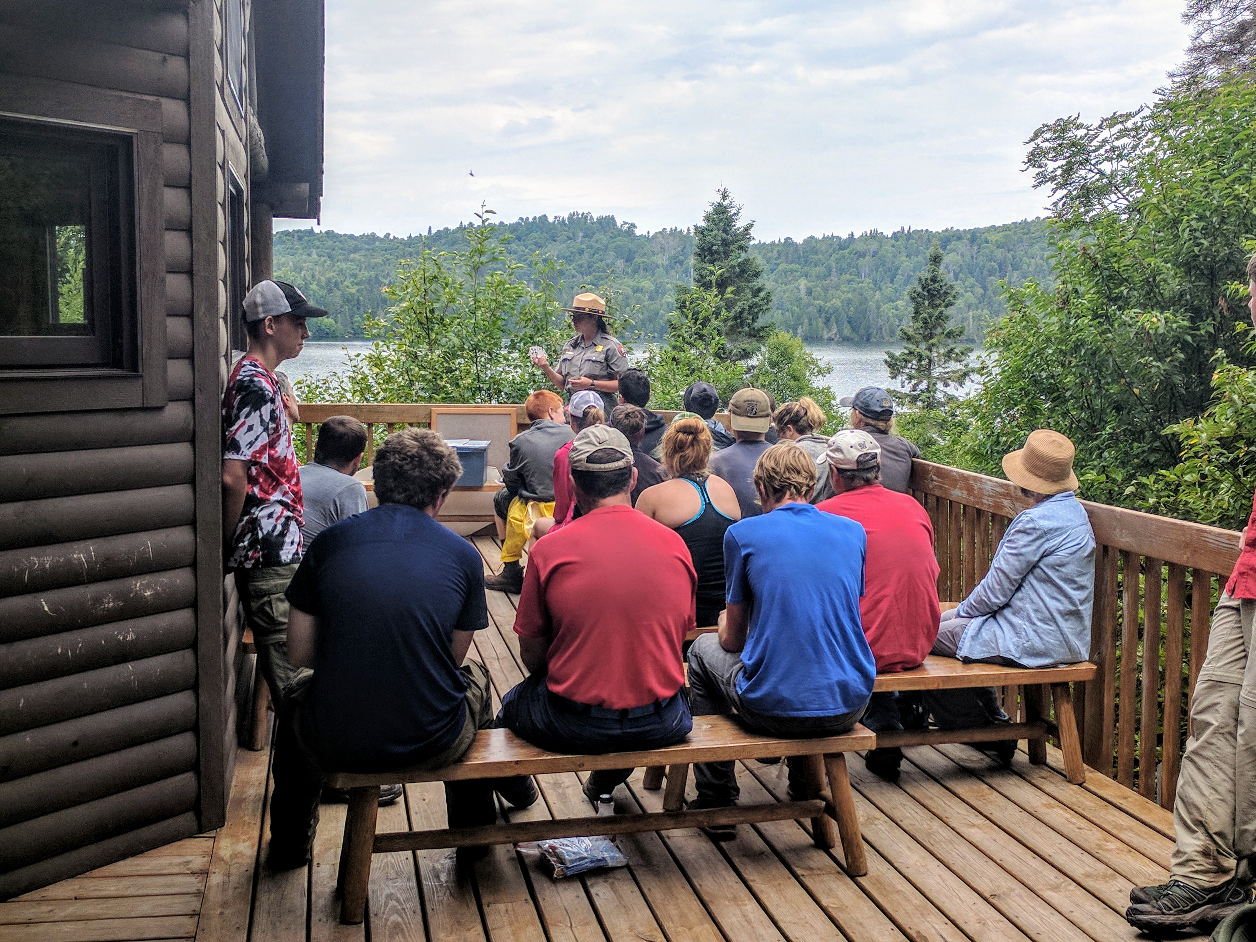
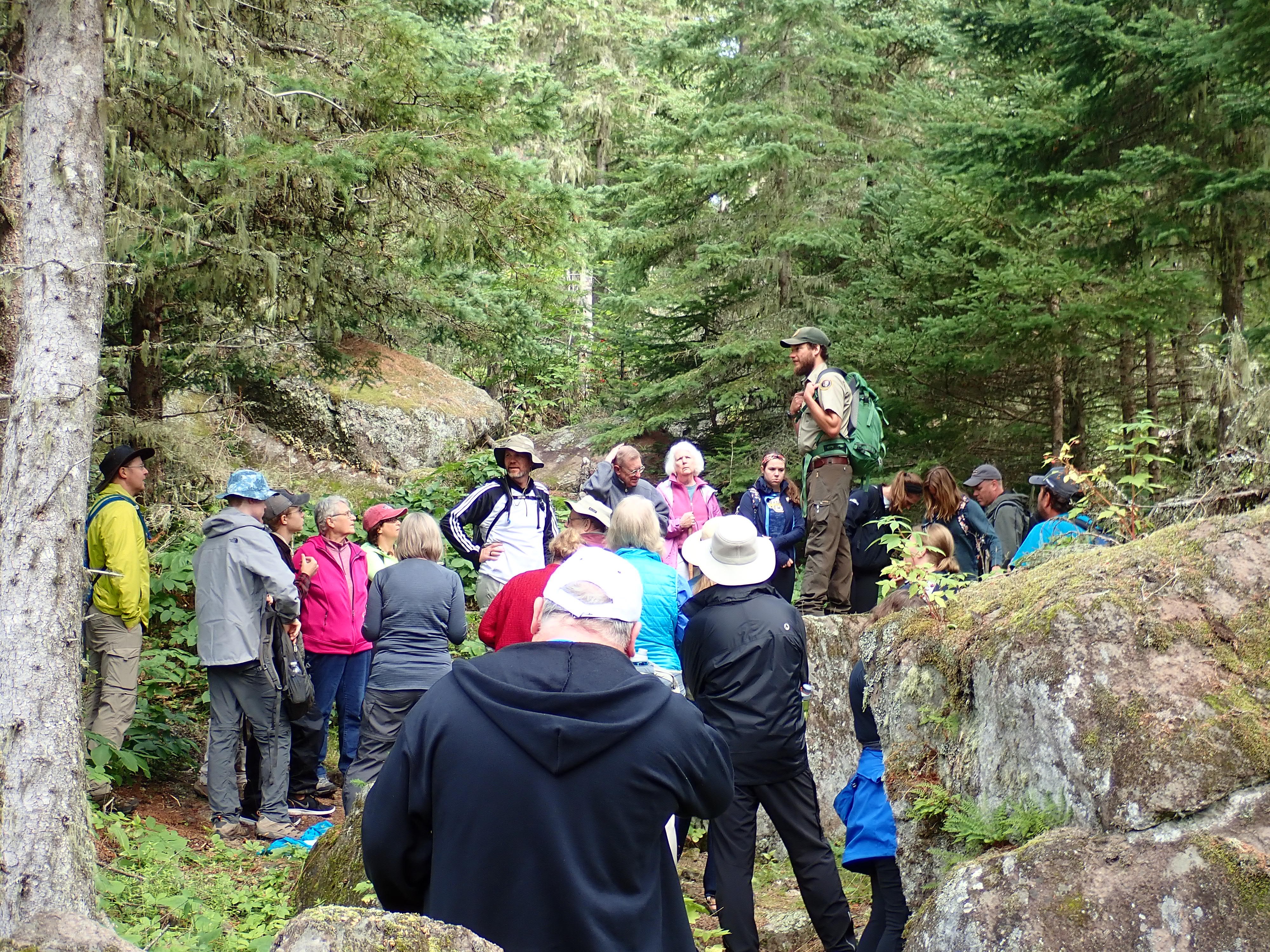
Attend a Windigo Ranger Program
Attend a Windigo ranger program at Isle Royale National Park. Learn about the isolated island, it's cultural history, and the critters who call the island home. Topics include moose, wolves, geology, shipwrecks, island biogeography, wilderness, and more.
Stoll Memorial Trail (Scoville Point)
The Albert Stoll Jr. Memorial Trail is a relatively easy hiking trail that captures the majesty of Lake Superior and engages with the wilderness character of Isle Royale National Park.
Hike to Minong Ridge Overlook
Hike to the Minong Ridge Overlook and enjoy views of Isle Royale's west end, Lake Superior, and the Canadian shoreline to the north.
Hike to Grace Creek Overlook
Grace Creek Overlook offers scenic views of Grace Creek, Grace Harbor, and Lake Superior.
Explore Raspberry Island
Take a leisurely walk along a boardwalk through the spruce bog on Raspberry Island accessible by private boat, vessel rental, or a tour on the MV SANDY from Rock Harbor on Isle Royale’s east end.
Hike to Suzy's Cave
Discover Suzy’s Cave, a wave-washed cliff and an inland sea arch, found on Isle Royale’s eastern end.
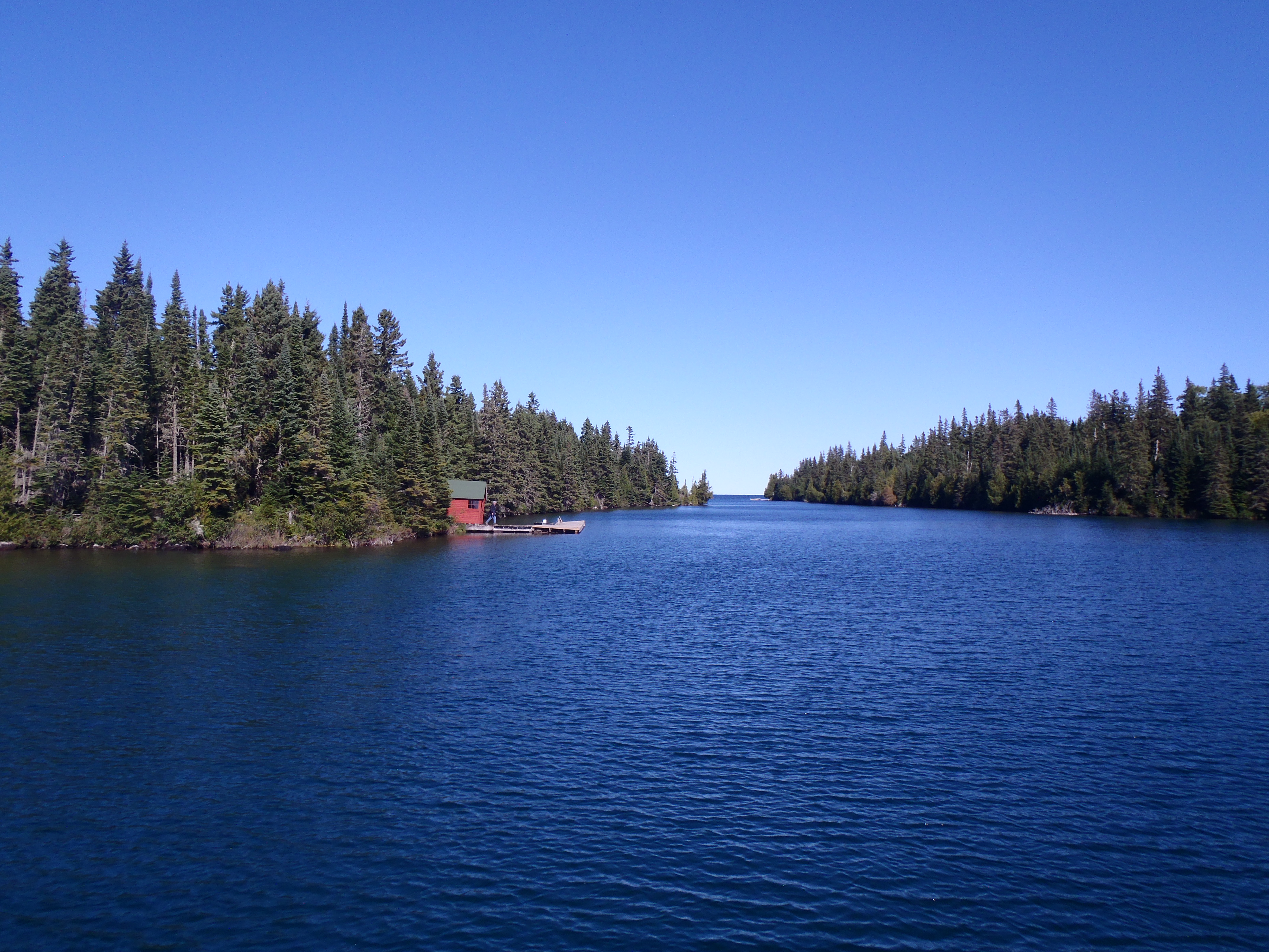
Paddle Tobin Harbor
Embark on a serene paddle in Tobin Harbor, on the east end of Isle Royale National Park. Wildlife sightings, especially aquatic birds, are abound in this scenic harbor.
Attend a Rock Harbor Ranger Program
Attend a Rock Harbor ranger program at Isle Royale National Park. Learn about the isolated island, it's cultural history, and the critters who call the island home. Topics include moose, wolves, geology, shipwrecks, island biogeography, wilderness, and more. Ranger programs also include guided hikes and tours.