Elevated Fire Risks - Full Closure (Vehicle and Foot Traffic) in Prone Areas
Drought conditions pose risk of fire. The following areas are closed to vehicle and foot traffic until further notice: Coastal Road between lighthouse and Boom Site/Kalawao cattleguards; settlement perimeter road along fence, roads through fuel farm.
Kalawao County Restrictions
Access to the park, including Kalawao County, the Kalaupapa Trail, the settlement, and Waikolu Valley, is restricted to residents and visitors with approved permits issued by Hawaii State Department of Health. Violations will result in arrest/fine.
Phones Are Not Operational
We continue to experience intermittent outages with our phone lines. If your call does not go through, please try again later, or try to leave us a message and we will get back to you. Thank you for your understanding.
Arrival by Boat
It is prohibited to come within 1/4 mile of the Kalaupapa shoreline. Access by boat within the quarter mile offshore park boundary requires a special use permit.
Unmanned Aircraft
Launching, landing, or operating an unmanned aircraft from or on lands and waters administered by the National Park Service within the boundaries of Kalaupapa National Historical Park is prohibited. This includes model airplanes, quadcopters, and drones.
| Title | Kalaupapa |
| Park Code | kala |
| Description | When Hansen's disease (leprosy) was introduced to the Hawaiian Islands, King Kamehameha V banished all afflicted to the isolated Kalaupapa Peninsula on the north shore of Molokai. Since 1866, more than 8,000 people, mostly Hawaiians, have died at... |
| Location | |
| Contact | |
| Activities |
|
| Entrance fees |
|
| Campgrounds | Count: 0
|
| Places | Count: 36
Auditorium at Paschoal HallBuilt around 1915, patients and administration used the hall to host community events such as movies, dances, concerts, and political rallies. 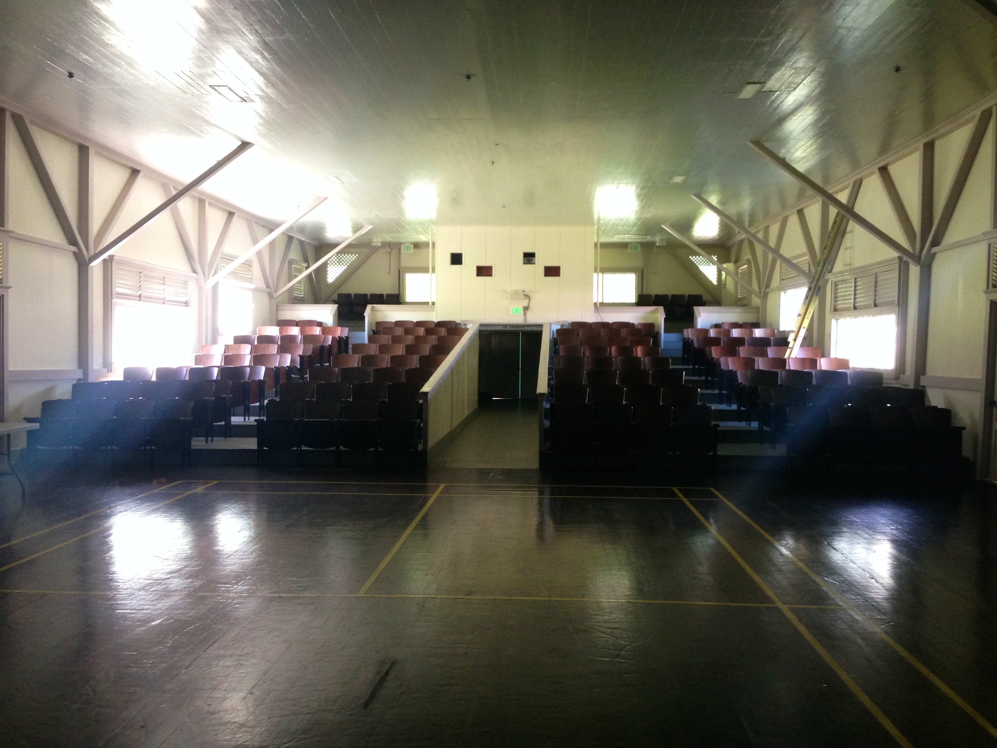
Bay View HomeBay View Home, first established in 1901, served as a group home for the elderly, blind, and disabled. Patients at Bay View shared meals in a central dining room and received round-the-clock nursing care. 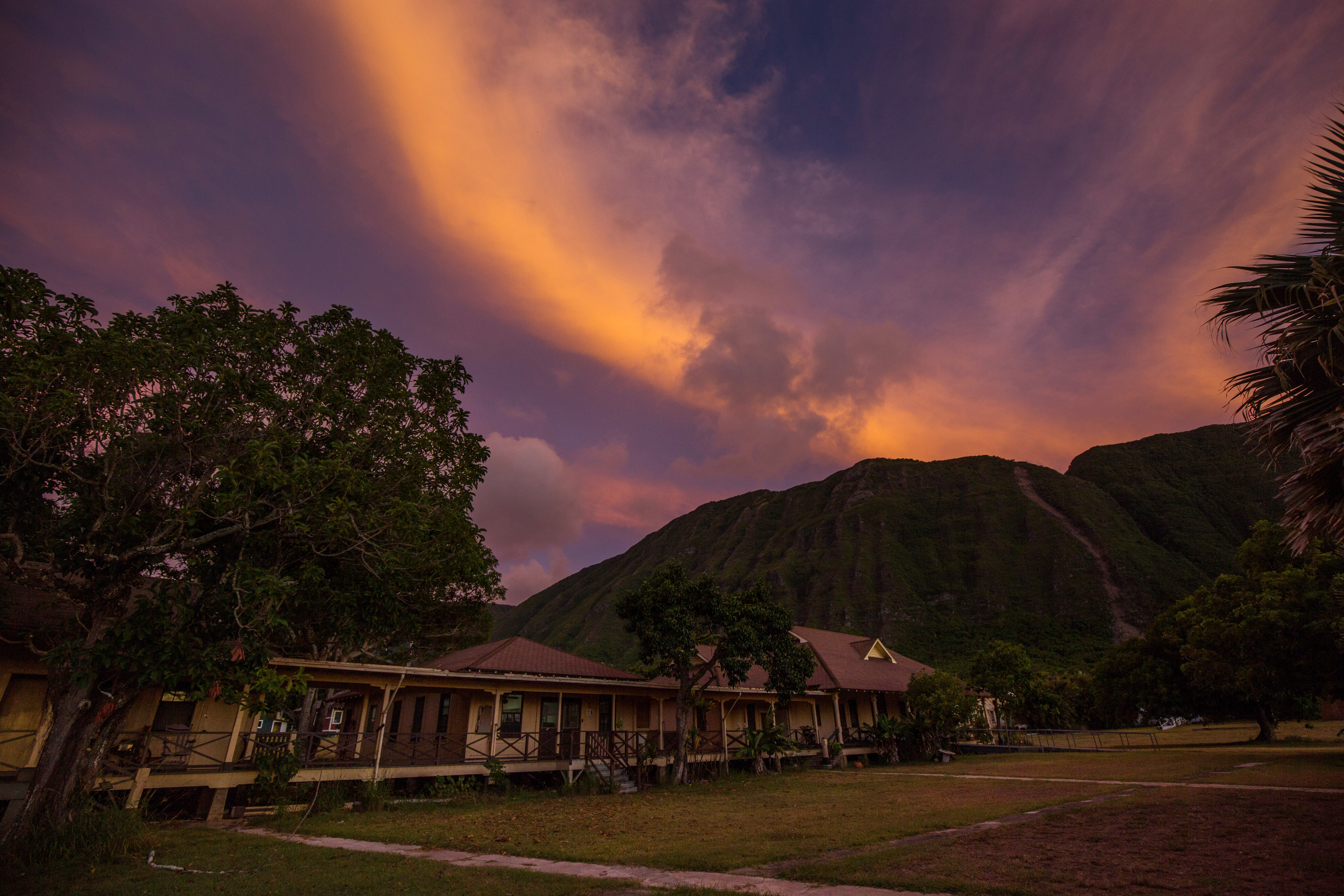
Bishop HomeCentrally located in the settlement, the home historically contained as many as 19 structures. It's been managed by the Sister's of St. Francis for over a century. 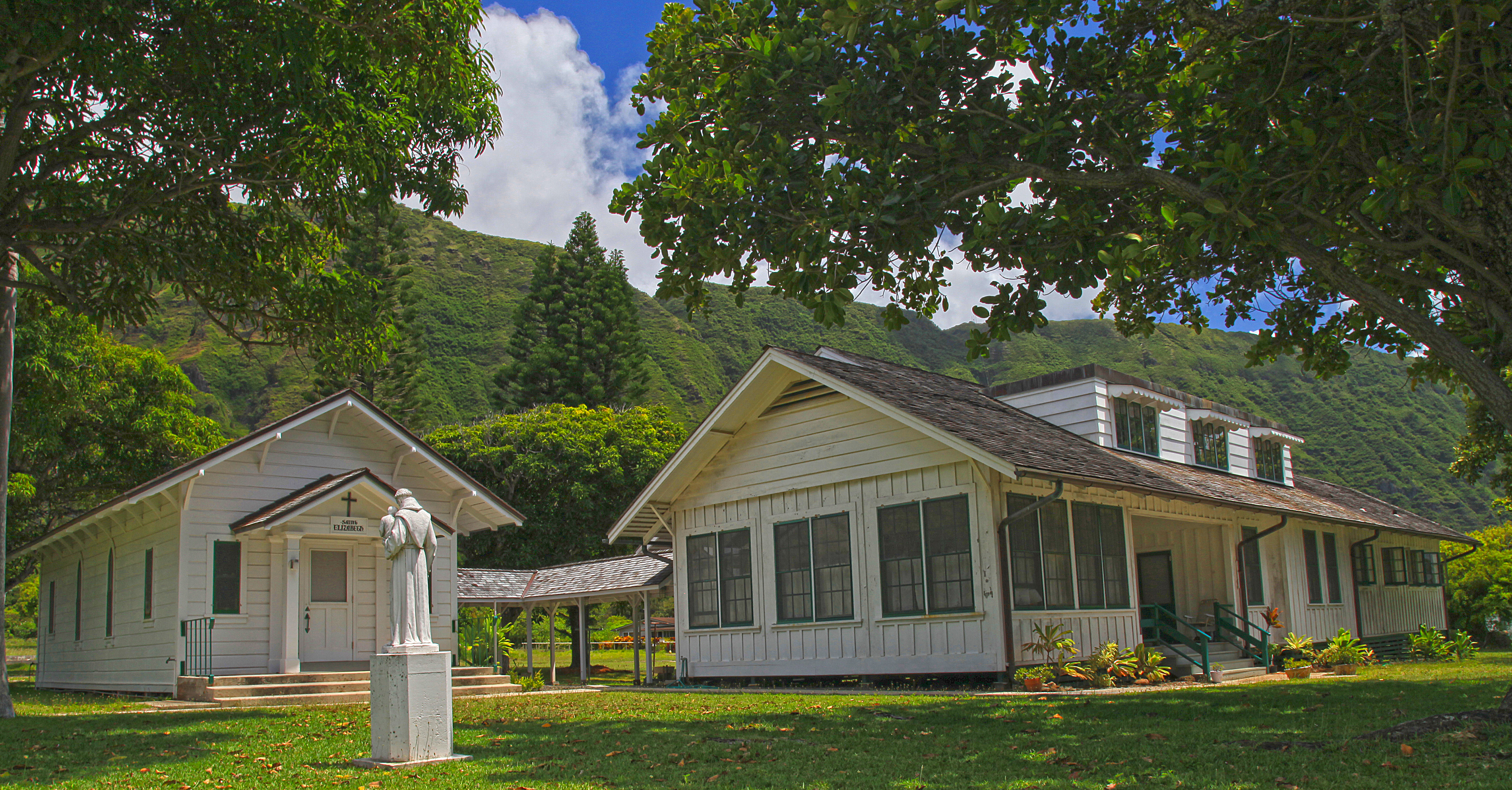
Bookstore and AJA HallThe building was constructed in 1910 and was well used for many years as the Social Hall for the Americans of Japanese Ancestry. It is currently used as the park bookstore. 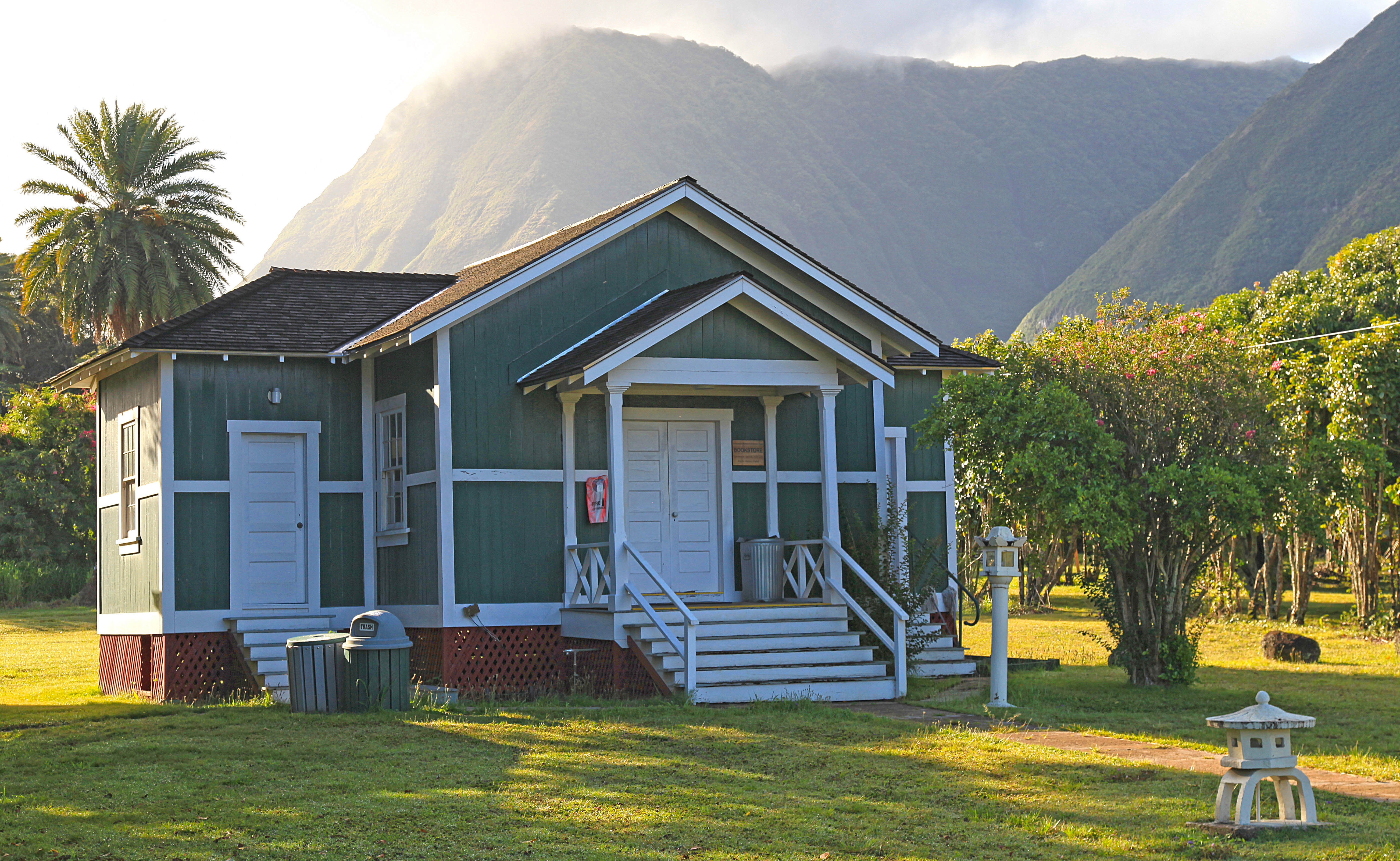
Church of Latter-Day SaintsThe Mormon congregation at Kalaupapa was established in 1901. The church today dates to 1965 and is one of the newest church buildings in the settlement. 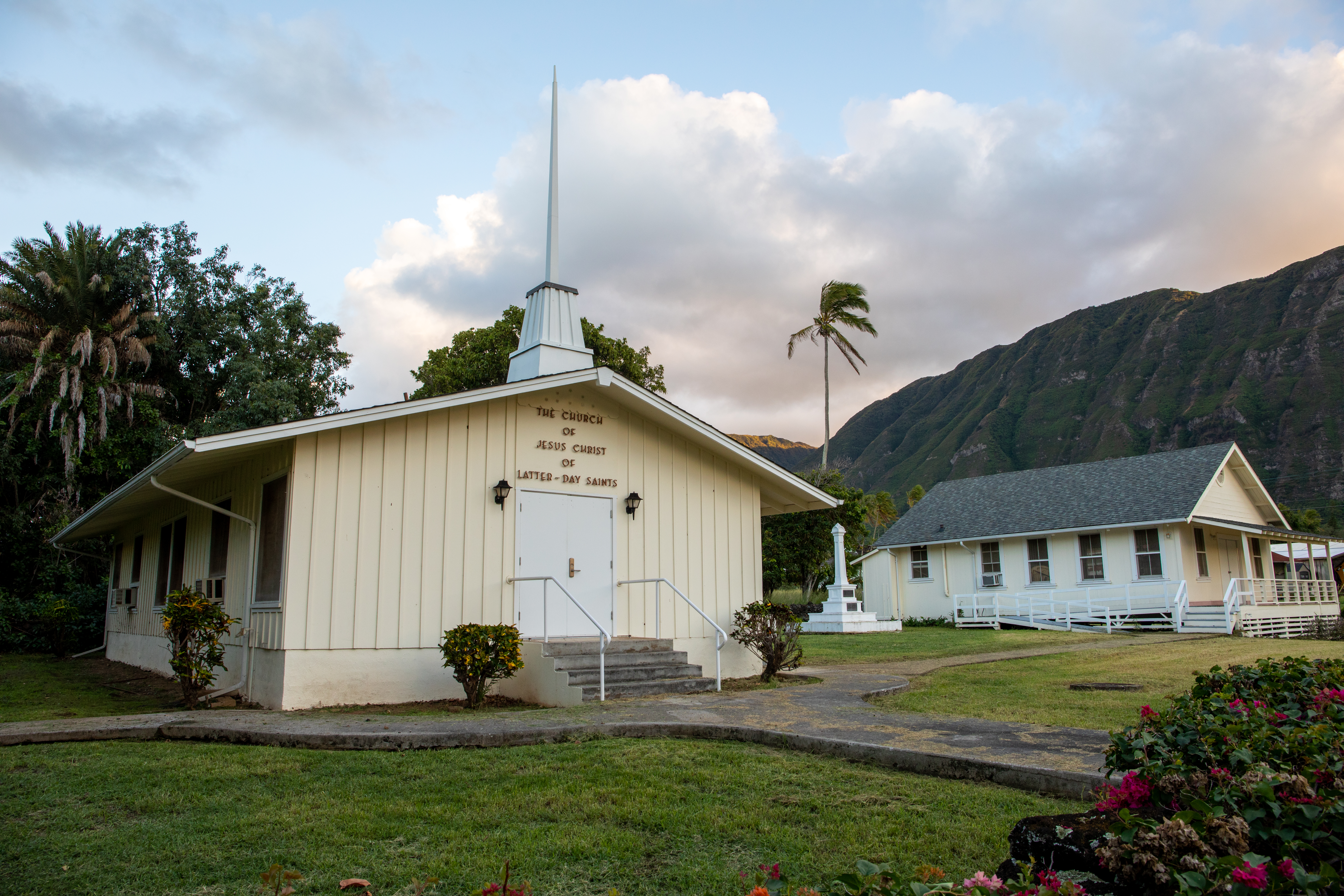
Father Damien's GraveFather Damien came to Kalaupapa to help the patients and uplift spirits. He eventually contracted Hansen's disease and passed away on August 15, 1889. Father Damien was canonized a saint in the Catholic Church on October 11, 2009 and is now St. Damien. 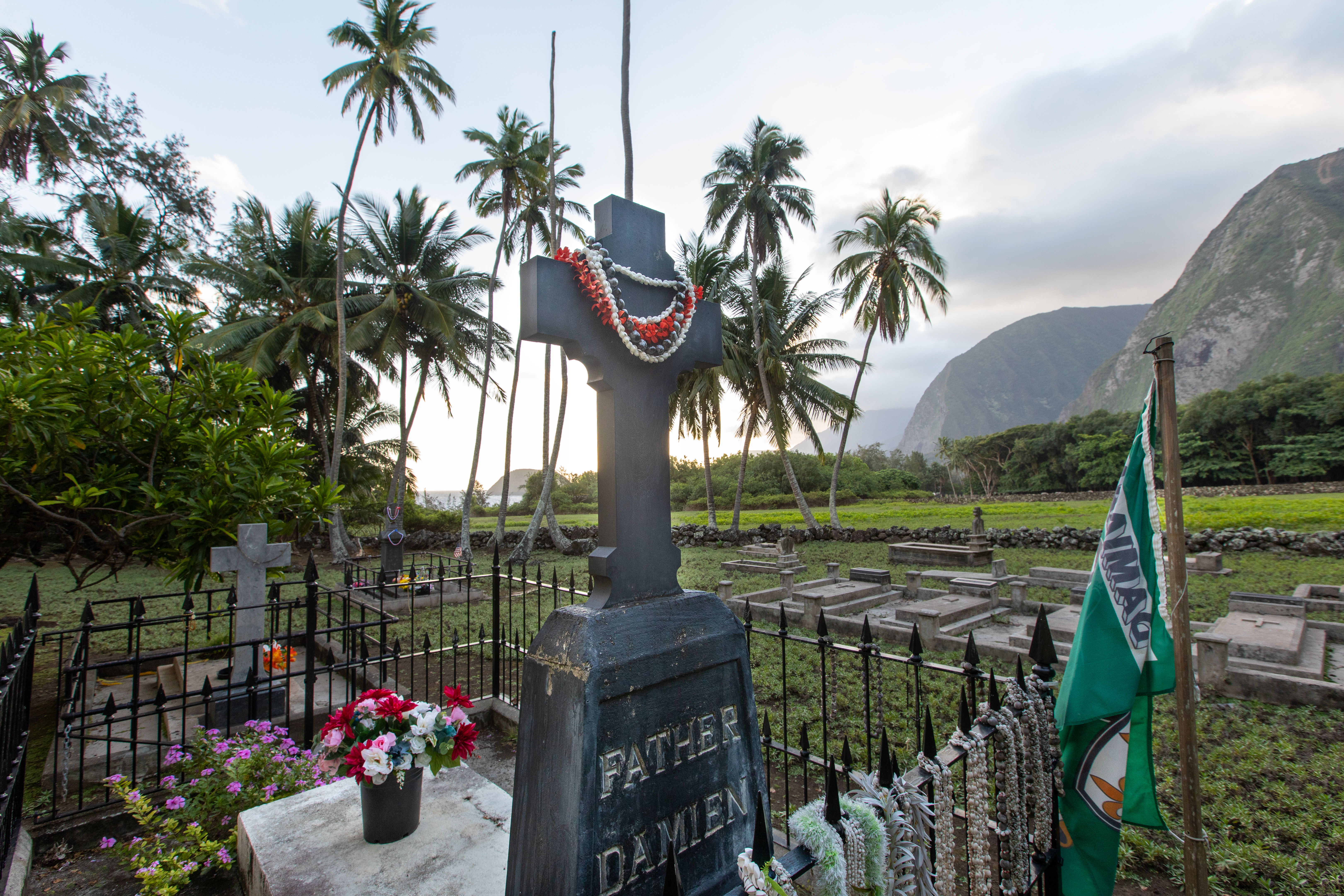
Father Damien's MonumentFather Damien's work exemplifies the triumph of the human spirit over great adversity. 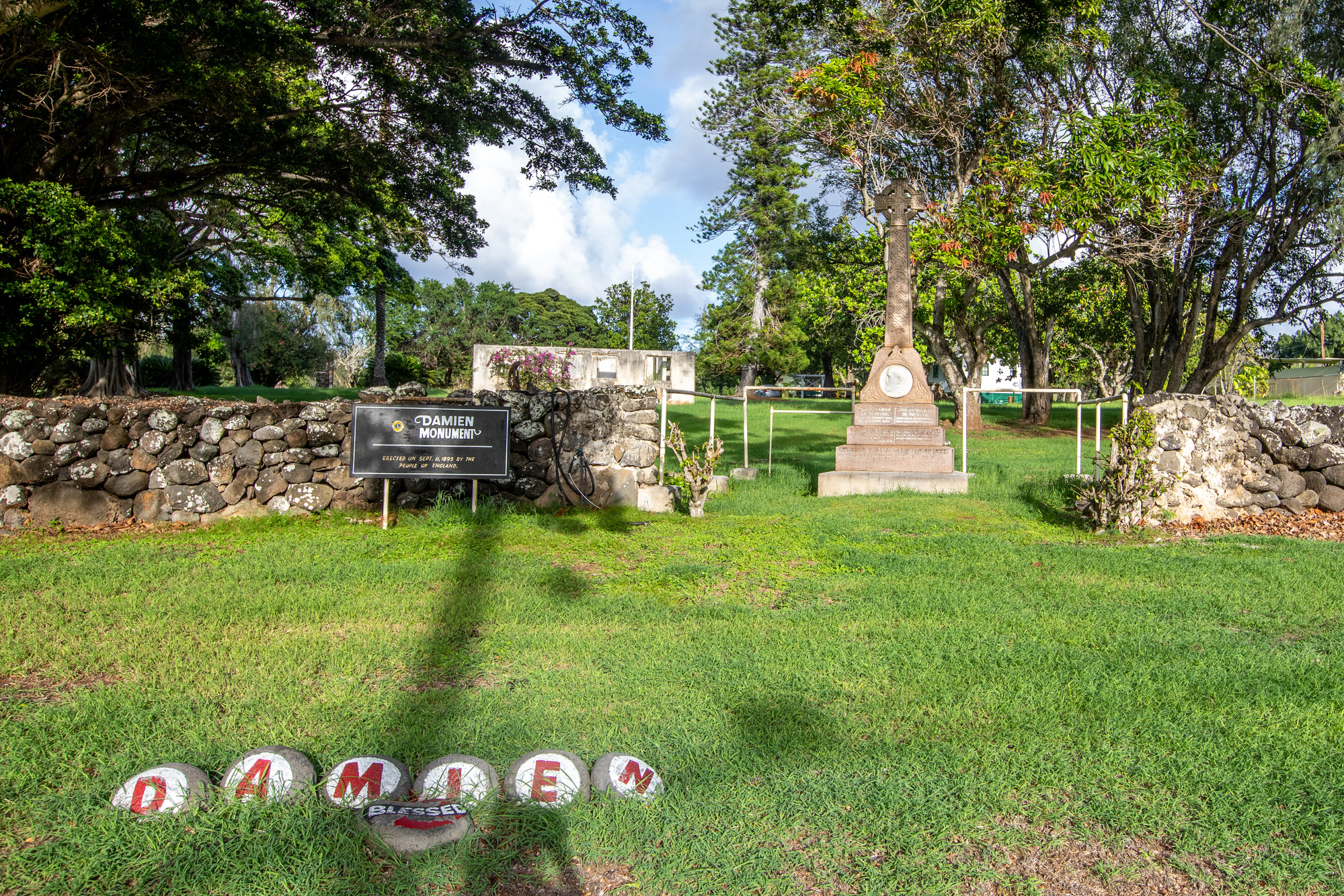
Fuesaina’s BarA favorite community gathering place was Fuesaina's Bar. 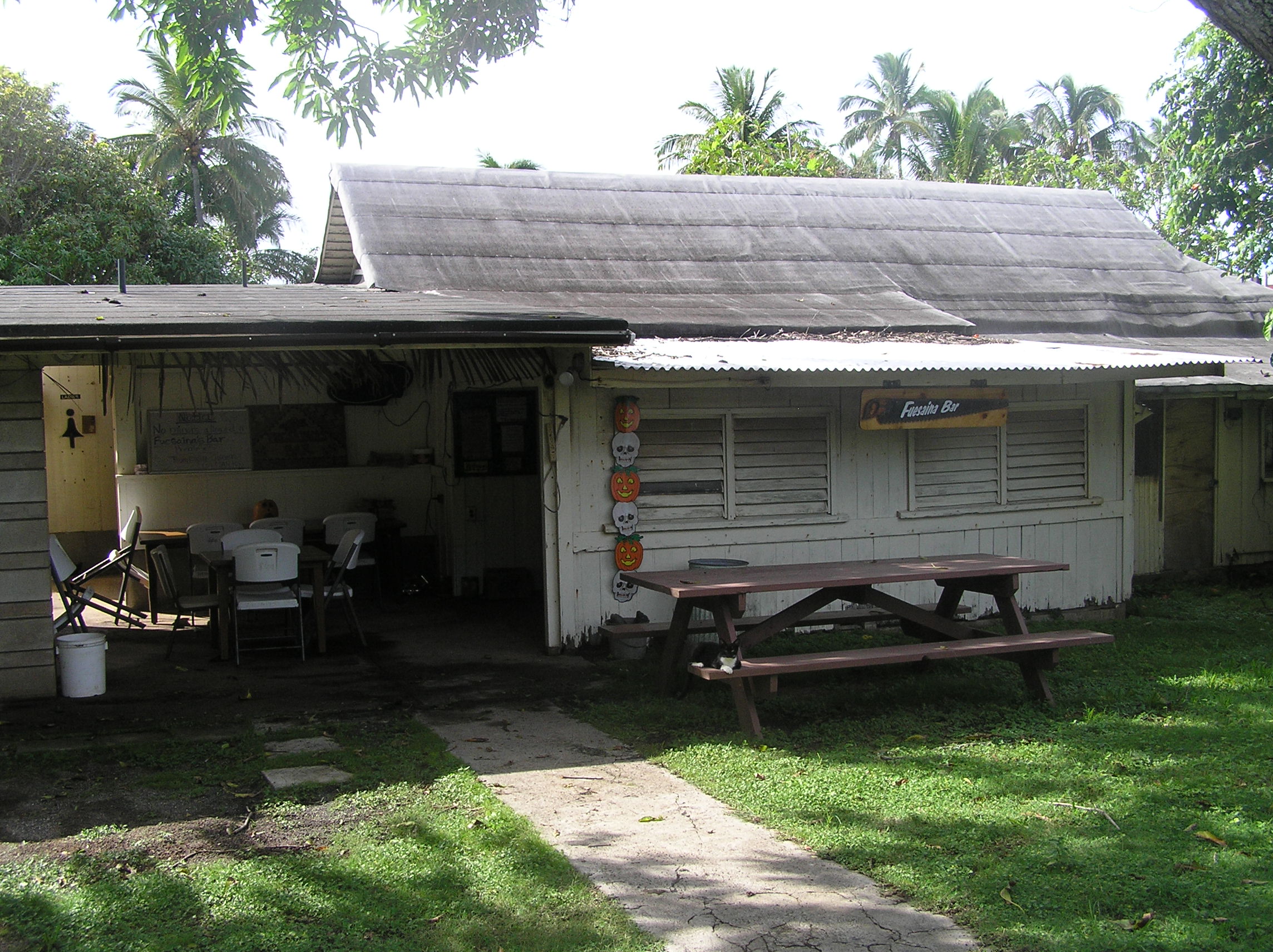
HeiauThe heiau and ahupuaʻa remind us of the peninsula's rich past. Archeological evidence shows that Hawaiians lived here 1,000 years ago, 900 years before the first patients arrived. 
Judd ParkJudd Park on the eastern, Kalawao side of the peninsula is very scenic. It overlooks rugged sea cliffs, ephemeral waterfalls, dramatic ocean rock formations and crashing surf of Molokai's north shore. 
Kahaloko CemeteryThis site is one of the older cemeteries associated with the Hansen’s Disease settlement. Based on the dates of marked headstones within the cemetery boundaries, Kahaloko was likely used from 1887-1921. 
Kanaʻana Hou Protestant ChurchThe church was erected in 1915 and named Kana'ana Hou (New Canaan), meaning "The Church of the Promised Land." 
Kauhakō CraterOnce a shield volcano that created the Kalaupapa Peninsula, the crater is now a beautiful viewpoint. 
Kenso Seki's HomeBuilt in 1931, this building was the home to Kenso Seki, an infamous resident of Kalaupapa. 
Lower Pali TrailheadThe Pali Trail has 26 switchbacks which descend nearly 2,000 feet of elevation over about 3.5 miles. The lower trailhead is located on the Kalaupapa Peninsula and should not be confused with the upper trailhead. 
McVeighThe McVeigh Home and neighborhood were originally built for “white foreigners” in the late 1920s-1930s. 
Molokai LightFor over one hundred years, the Molokai Light has shone over the people of Kalaupapa Peninsula. More than just a guide for ships, the lighthouse inspires the art, music, and daily lives of the people in Kalaupapa. Today, the Molokai Light is as iconic to the Kalaupapa Settlement as the towering sea cliffs. 
Mother Marianne Cope's GraveIn November of 1888, Mother Marianne and a few other sisters went to serve in Kalaupapa. An outstanding administrator as well as an excellent nurse and pharmacist, Mother Marianne felt it was essential to preserve the personal dignity of patients and encourage a "quality of life spirit." After serving the people of Kalaupapa for over 30 years, Mother Marianne passed away on August 9, 1918 and was later canonized on October 21, 2012 and is now Saint Marianne. 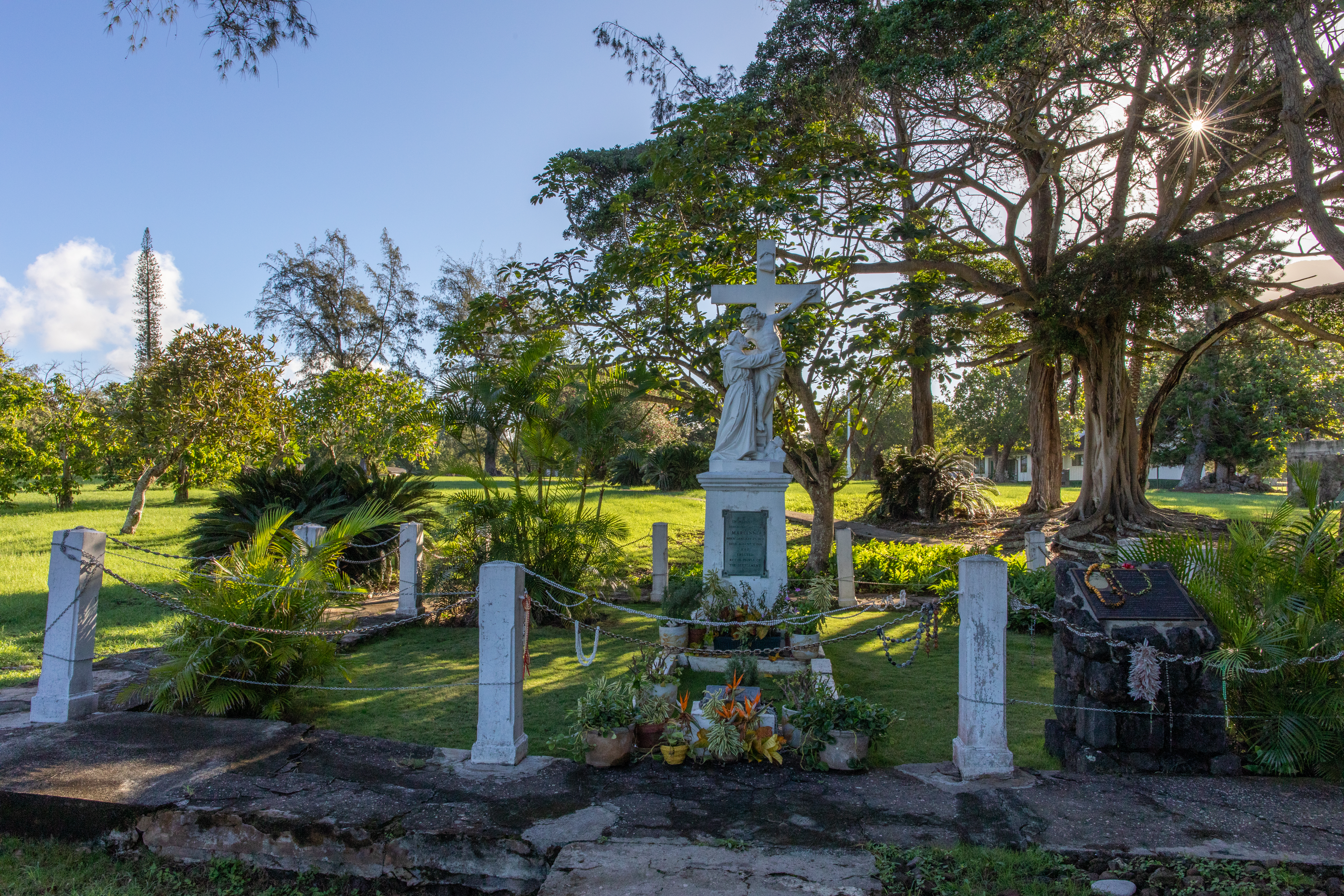
Old Stone ChurchThe oldest church structure at Kalaupapa dates to the pre-Hansen's disease period. It was built in 1853 as a church but its use changed significantly over time. 
Papaloa CemeteryPapaloa is the main cemetery at Kalaupapa with approximately 1,000 people buried here. 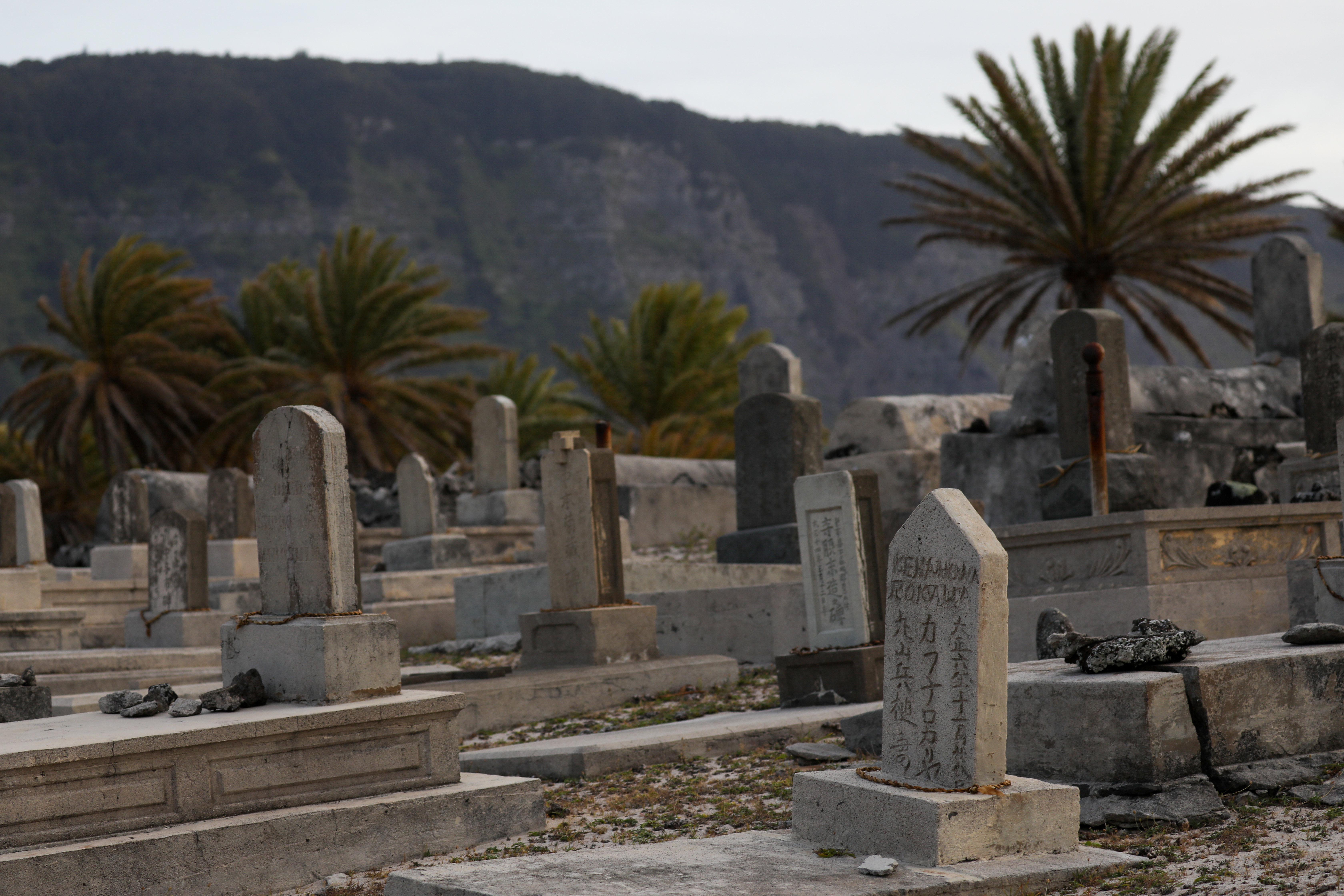
Paschoal HallKalaupapa's Paschoal Hall was the heart and soul of the community. Built around 1915, patients and the administration used the hall to host community events such as movies, dances, concerts, and political rallies. 
Paschoal Hall EntrywayPaschoal Hall was the primary community center with movie nights, dances, and more. 
Peninsula OverlookThis overlook at Pala'au State Park sits at an elevation approximately 1600 feet above the Kalaupapa Peninsula at the edge of the steep north-shore pali cliffs of Molokai. 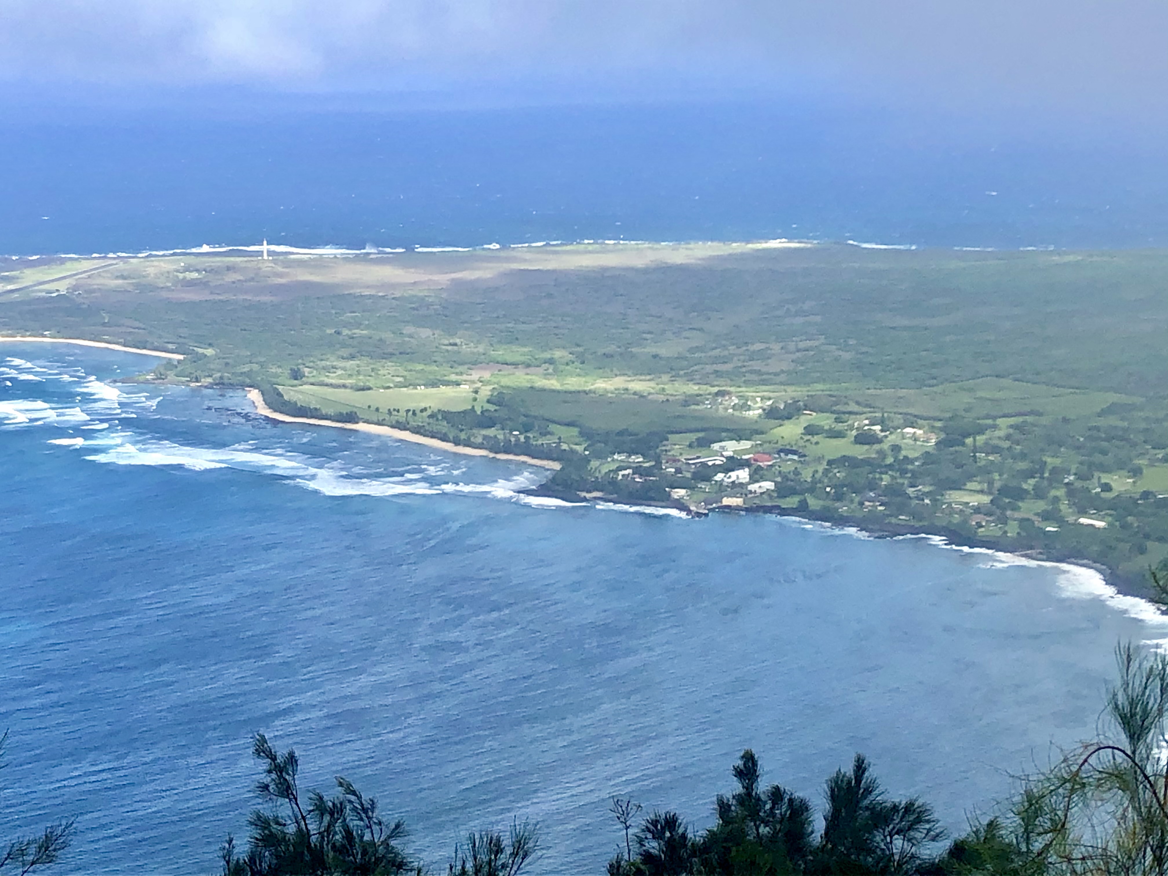
Post OfficeThe Kalaupapa Post Office was built in May 1934 and is still in operation today! 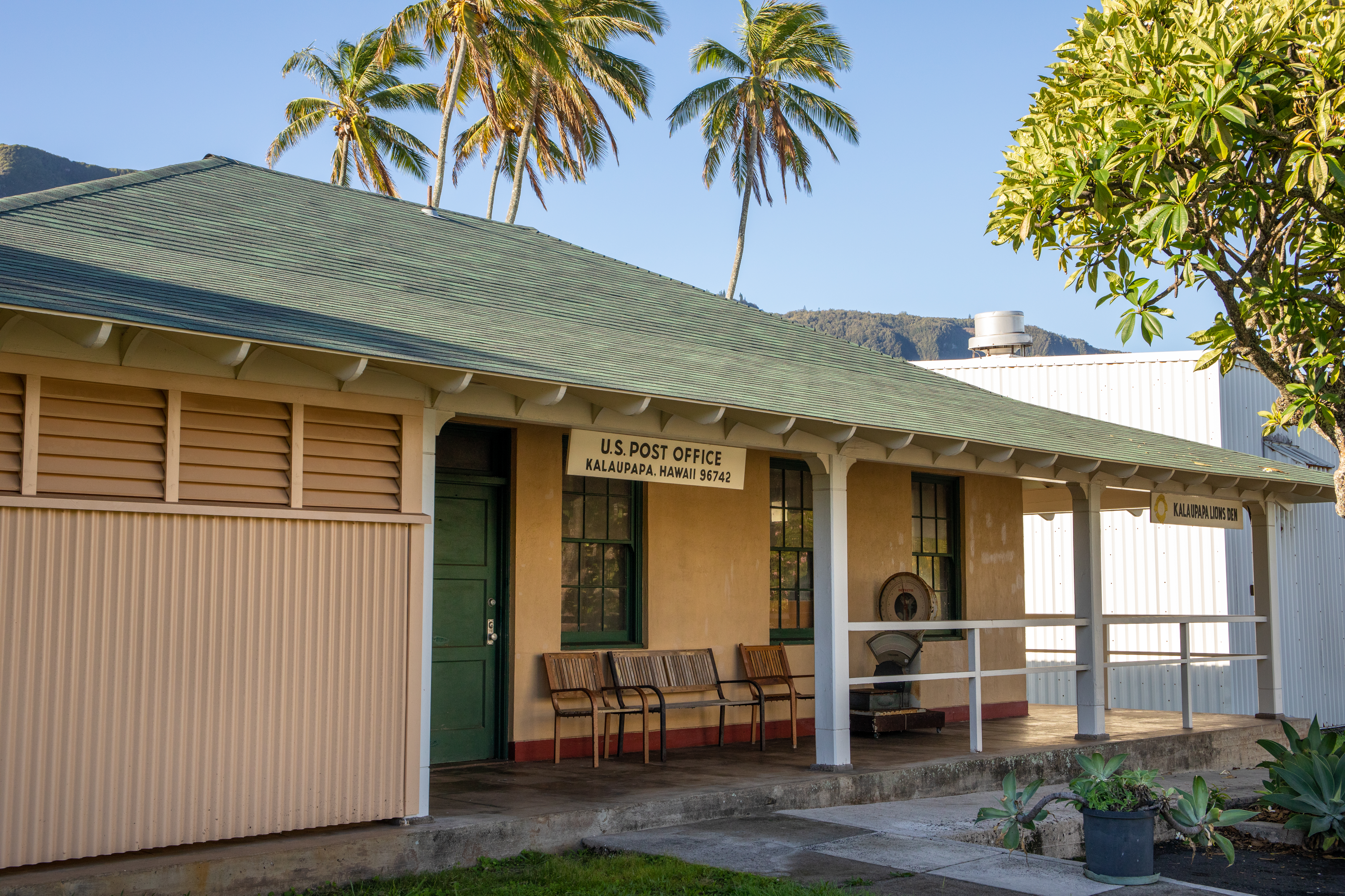
Projection BoothThe first film projector was installed at the Kalaupapa Social Hall (later renamed to Paschoal Hall) in 1931. 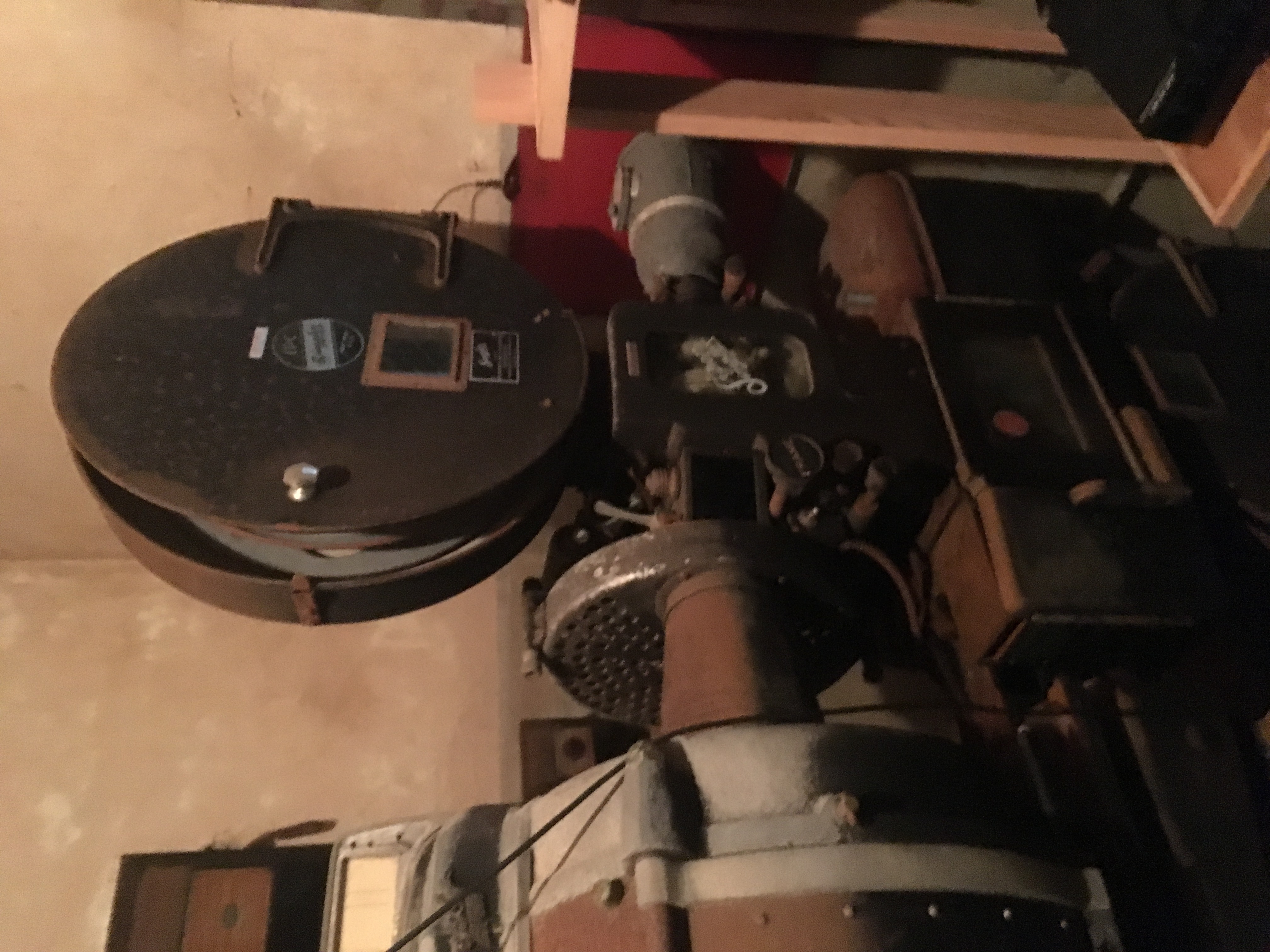
Siloama ChurchSiloama Church was erected in Kalawao County in 1871 and named "Siloama" for the healing spring of Siloam where Jesus healed a blind man. 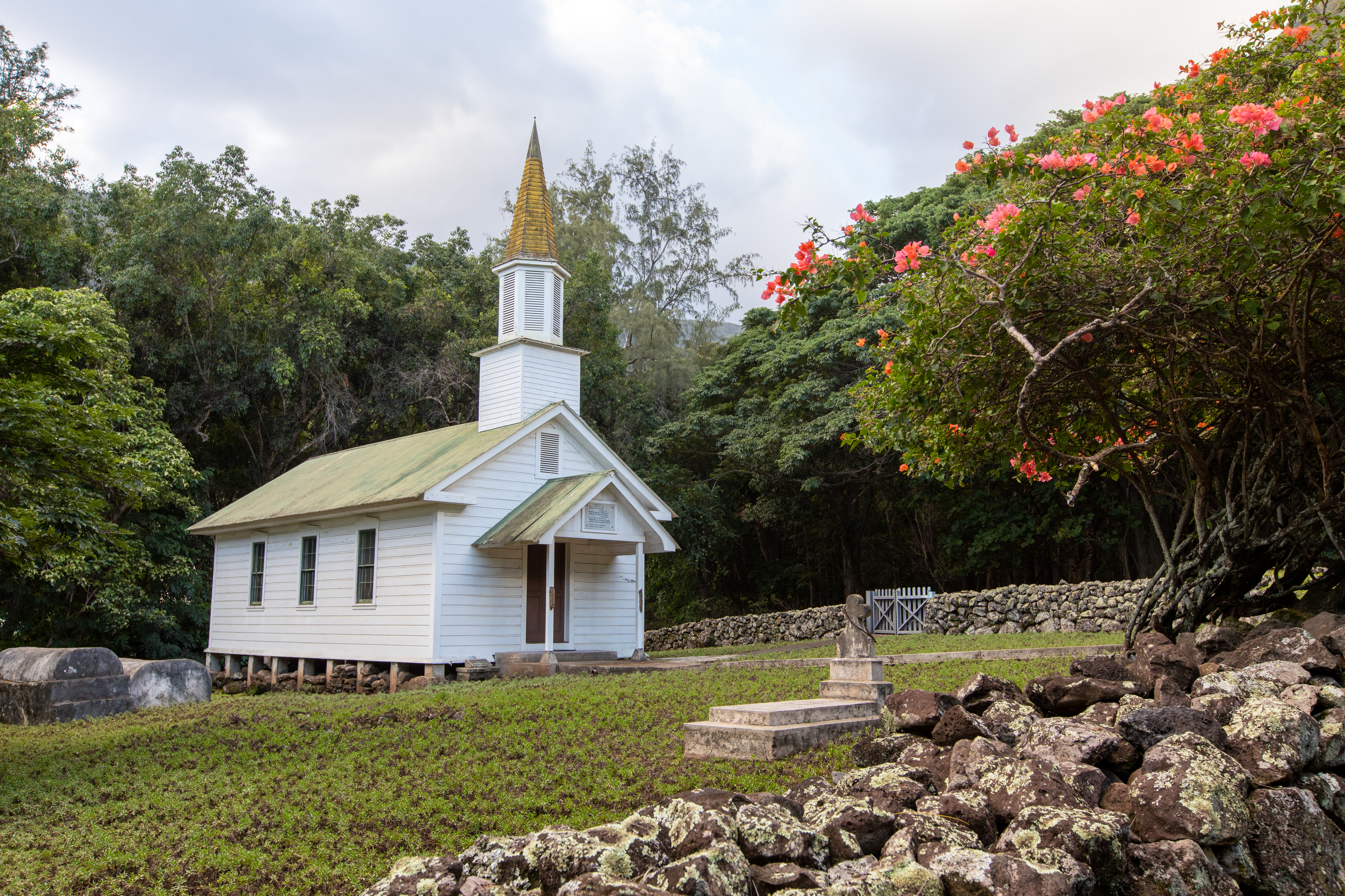
St. Frances ChurchSt. Francis Church is an active catholic church in the Kalaupapa Settlement. The building that stands today was erected in 1908. 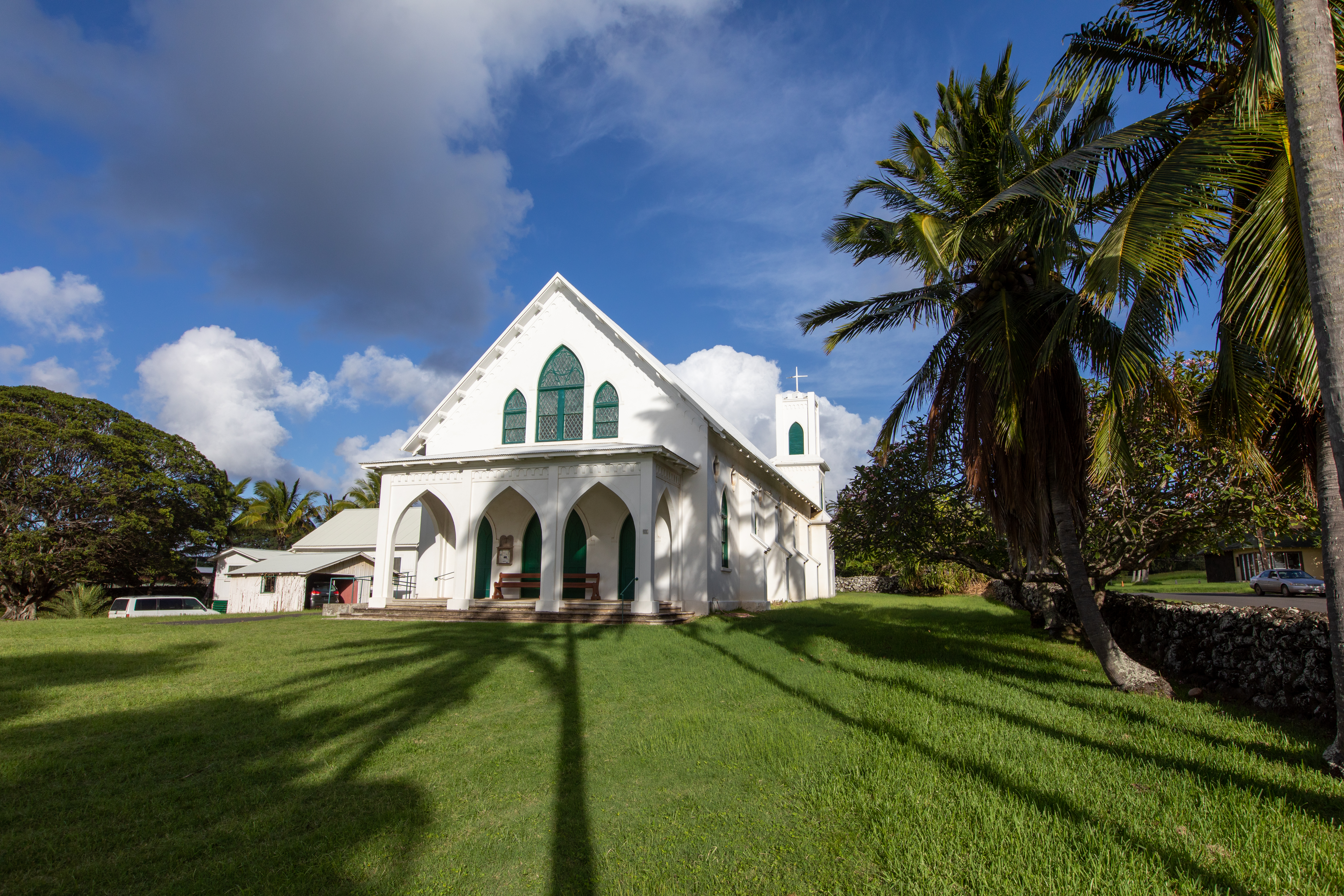
St. Philomena ChurchToday, St. Philomena Church is one of only a few remaining structures on the Kalawao side of the Kalaupapa peninsula. The National Park Service restored the church in 2009 in anticipation of Father Damien's canonization. 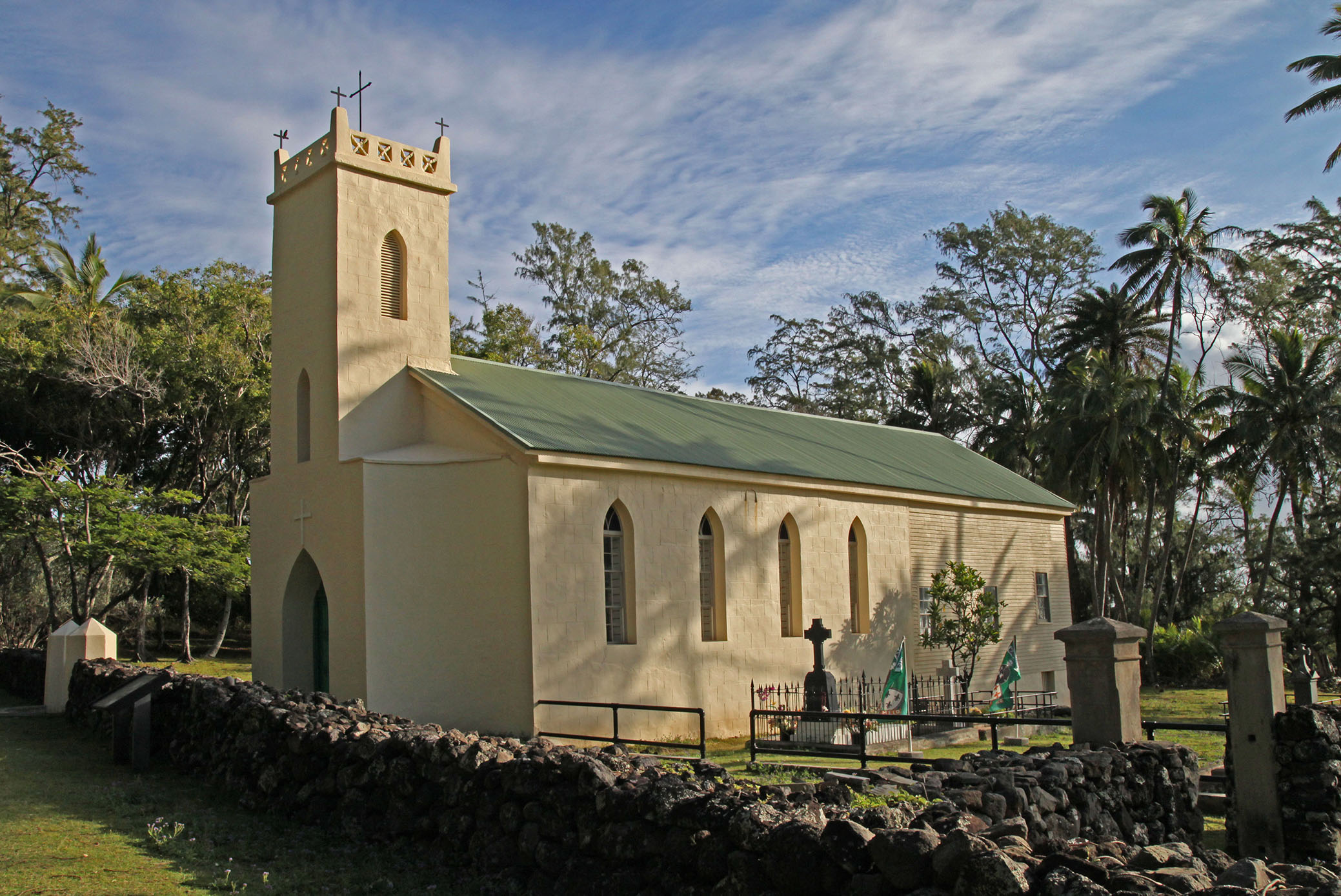
Staff RowThe fences at Staff Row dramatically illustrate the rules of physical separation between patients and non-patients once enforced at Kalaupapa. 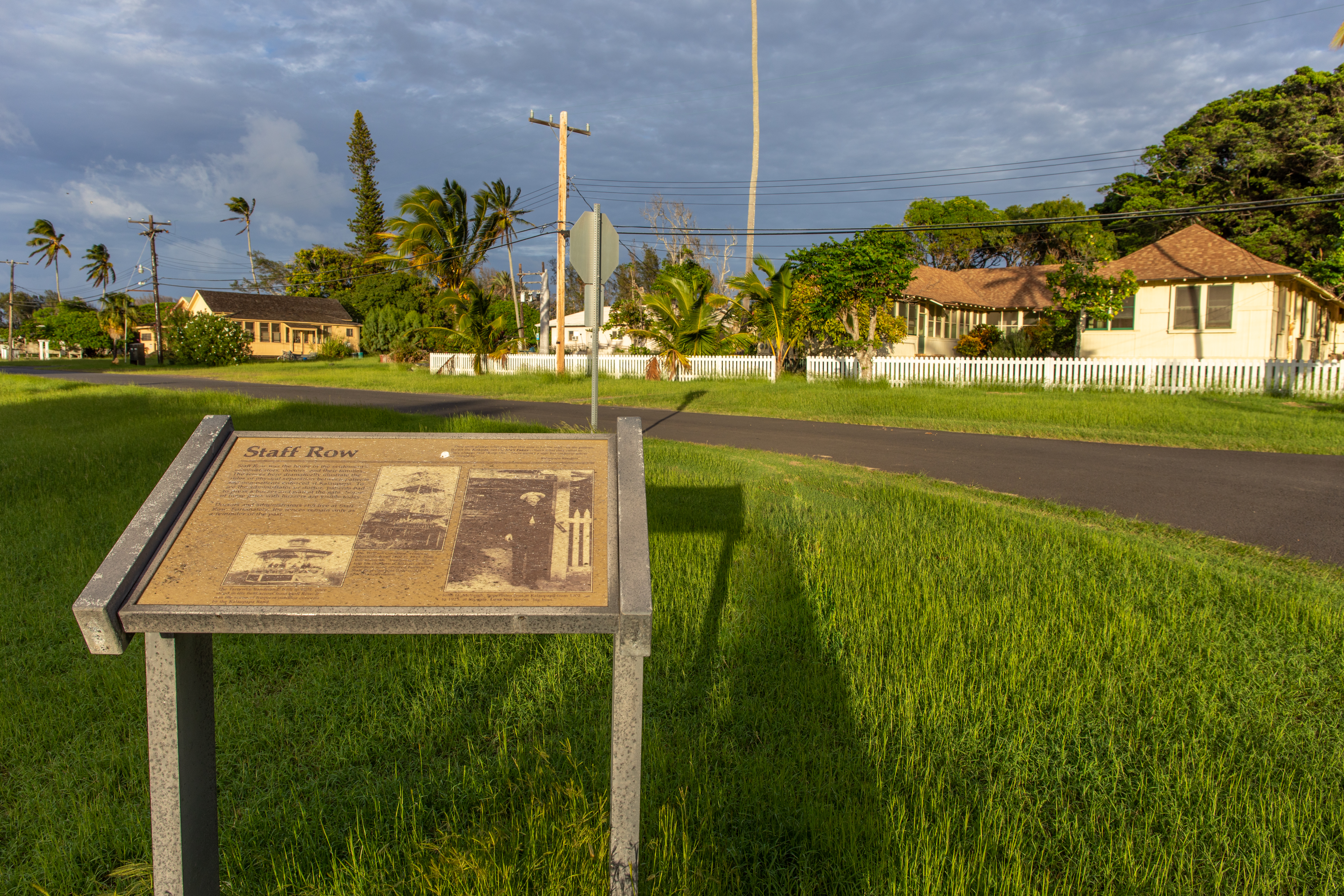
The Airport (LUP)The airport formally opened in 1933 with a 2,000-foot grass runway. The airport is still used today and only one airline offers scheduled flights in and out of Kalaupapa. 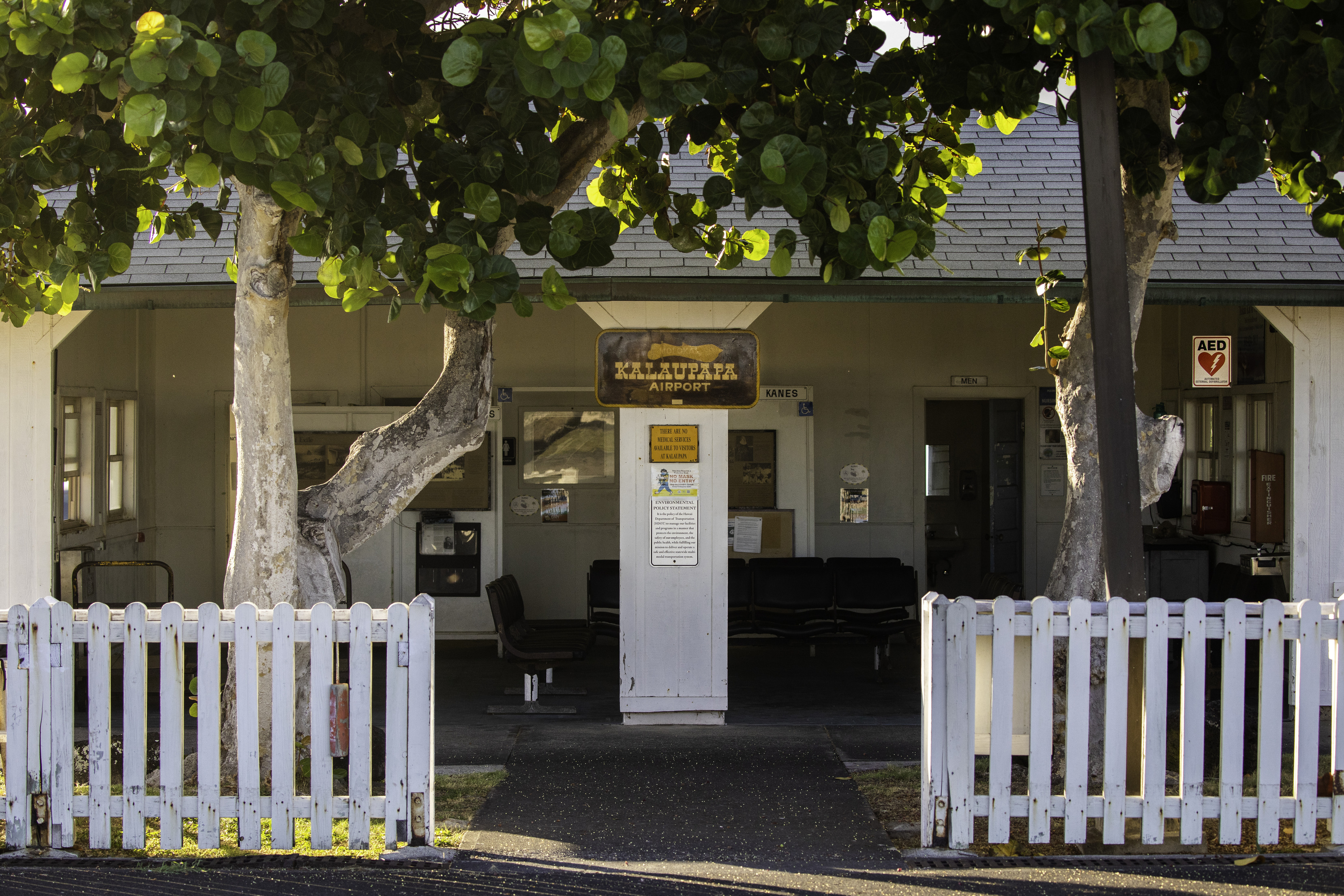
The Gas StationThe Kalaupapa gas station was built in 1934 and during the first year of operation, gas was 13 cents a gallon. The gas station still operates today. Gasoline arrives on the annual barge in tankers. The price of gas is fixed throughout the year and is based on the purchase price of gas in O'ahu. 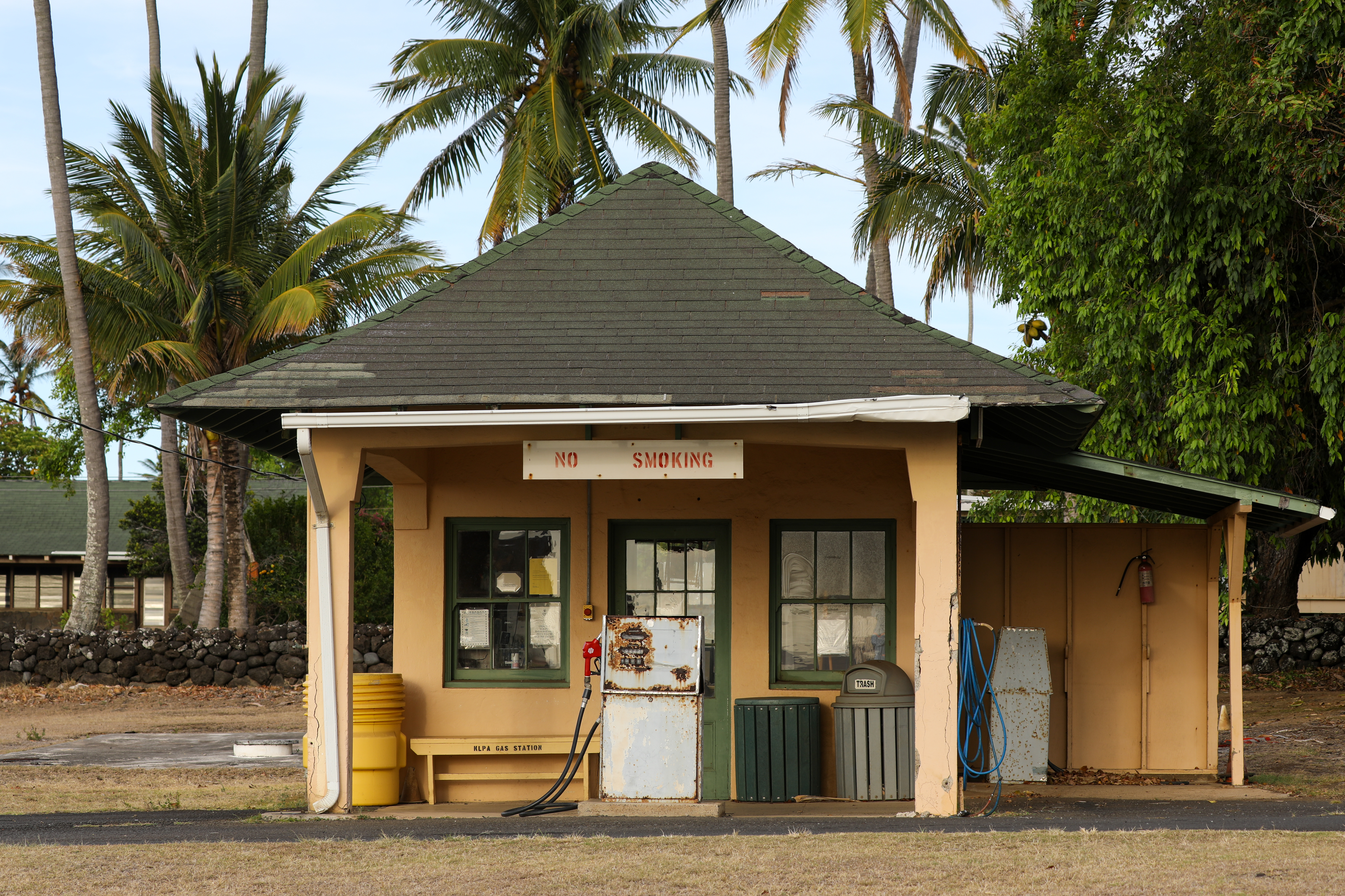
The HospitalDoctors treated the patients of Kalaupapa even before a cure for Hansen's disease, more commonly known as leprosy, had been discovered. 
The Kalaupapa PierThe pier was historically the lifeline of Kalaupapa, bringing patients, visitors, staff, and supplies into the settlement. 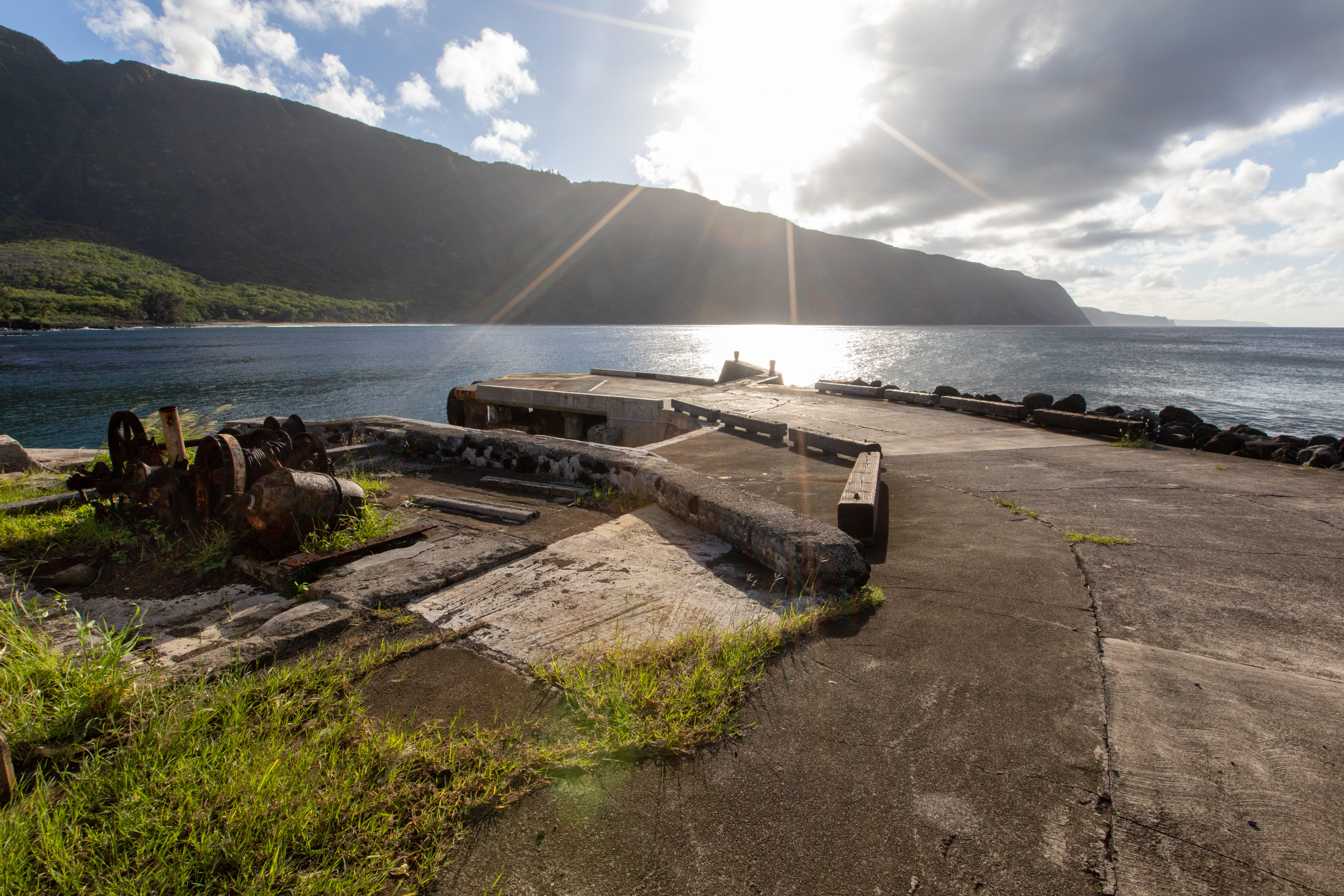
The Kalaupapa StoreBuilt in the 1930s, the existing Kalaupapa store is the last remaining store that continues to provide groceries and supplies to residents within the settlement. 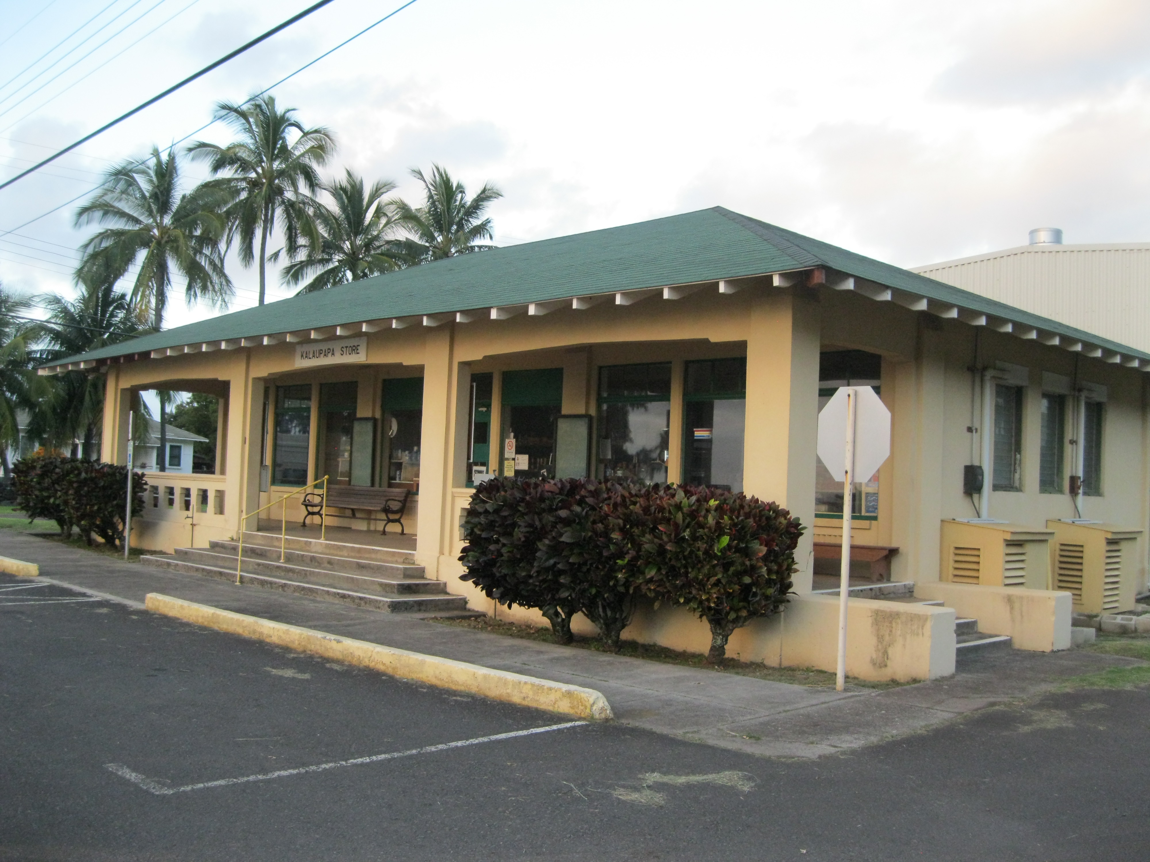
Unmarked CemeteryThe open fields adjacent to the St. Philomena Churchyard are the burial site for 2,000 - 3,000 Hansen's disease patients. 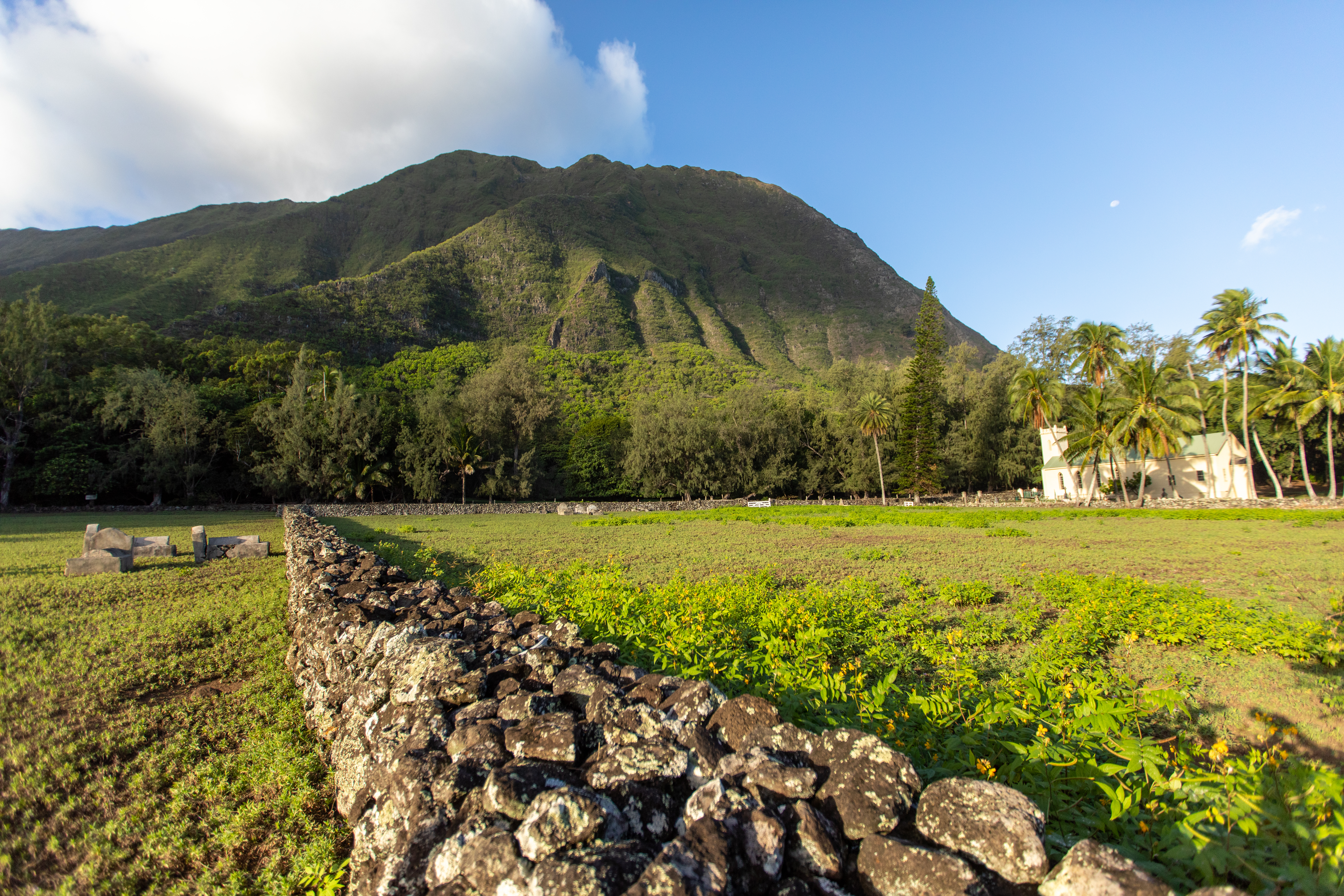
Visitor QuartersA heavy wire fence surrounded the Visitor Quarters Complex and ran down the center of the Longhouse, separating the patients from their loved ones. 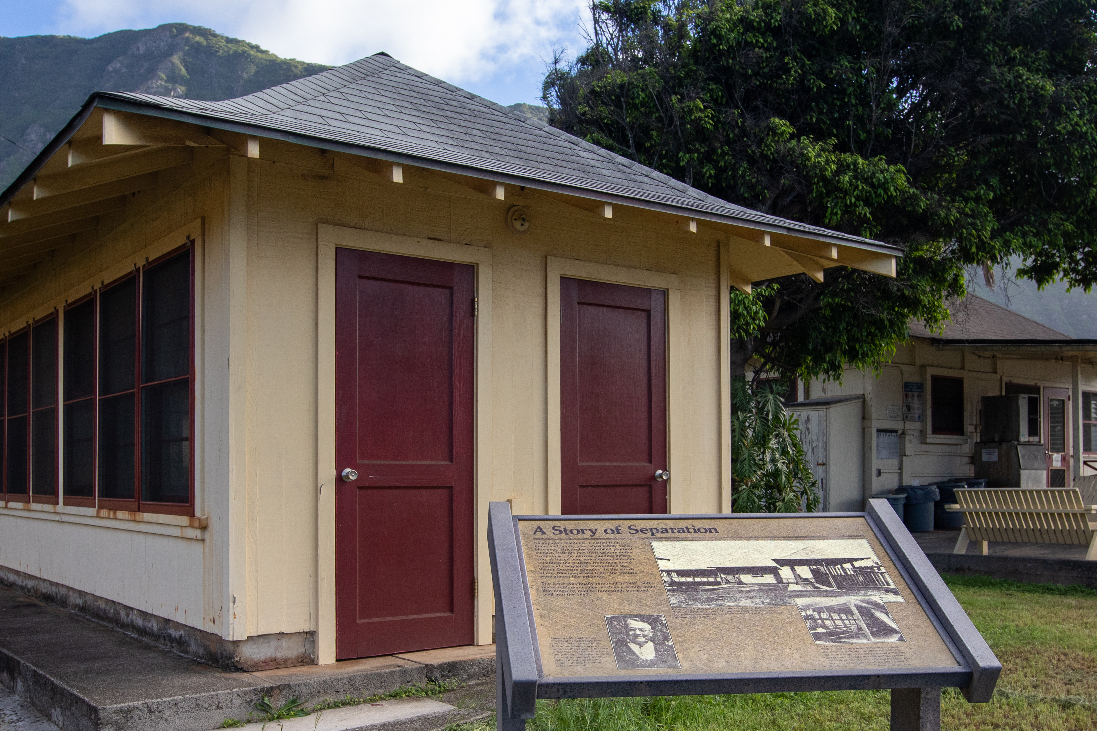
|
| Visitor Centers | Count: 0
|
| Things to do | Count: 0
|
| Tours |
Count: 2
Kalaupapa Settlement TourThis self-paced and self-guided tour consists of a series of stops along a 2.5-mile route. It starts at the Kalaupapa Pier and ends at Papaloa Cemetery. Bring water, a hat, sunscreen, and sturdy walking shoes. Sidewalks at Kalaupapa are limited, so please be cautious if walking on the side of the street. Be wary of vehicular traffic and yield to oncoming traffic. In Kalaupapa, cars have the right of way. Always be respectful of the privacy and homes of residents and heed Kalawao County rules. Saints Tour of Kalawao and KalaupapaThis self-paced tour consists of a series of stops related to Saint Damien and Saint Marianne along a 3+ mile route. The tour includes locations in Kalawao, outside of the Kalaupapa Settlement. Please only go to those tour stops if you are allowed outside the settlement. Be cautious if walking on the side of the street and yield to oncoming traffic. Always be respectful of residents' privacy and heed Kalawao County rules. To help with navigation, download a map app for offline use before starting the tour. |
| Articles |
|