High Fire Danger
The monument is currently under a high fire danger warning issued by the Maine Forest Service. Please exercise caution when lighting a fire, and make sure the fire is completely out before leaving. Fires are allowed in designated areas only.
Increased Logging Activity on Swift Brook Road
Logging trucks and other large machinery will be active on Swift Brook Road for an undetermined amount of time. Please use caution when driving. Always pull over for logging trucks, and wait until dust has cleared to continue moving.
Hunting Season Begins August 23rd
Hunting season is upon us! Please stay alert and be mindful of the rights of lawful hunters. Hunting is permitted only East of the East Branch of the Penobscot River, but it is advised to wear high visibility clothing on all monument land.
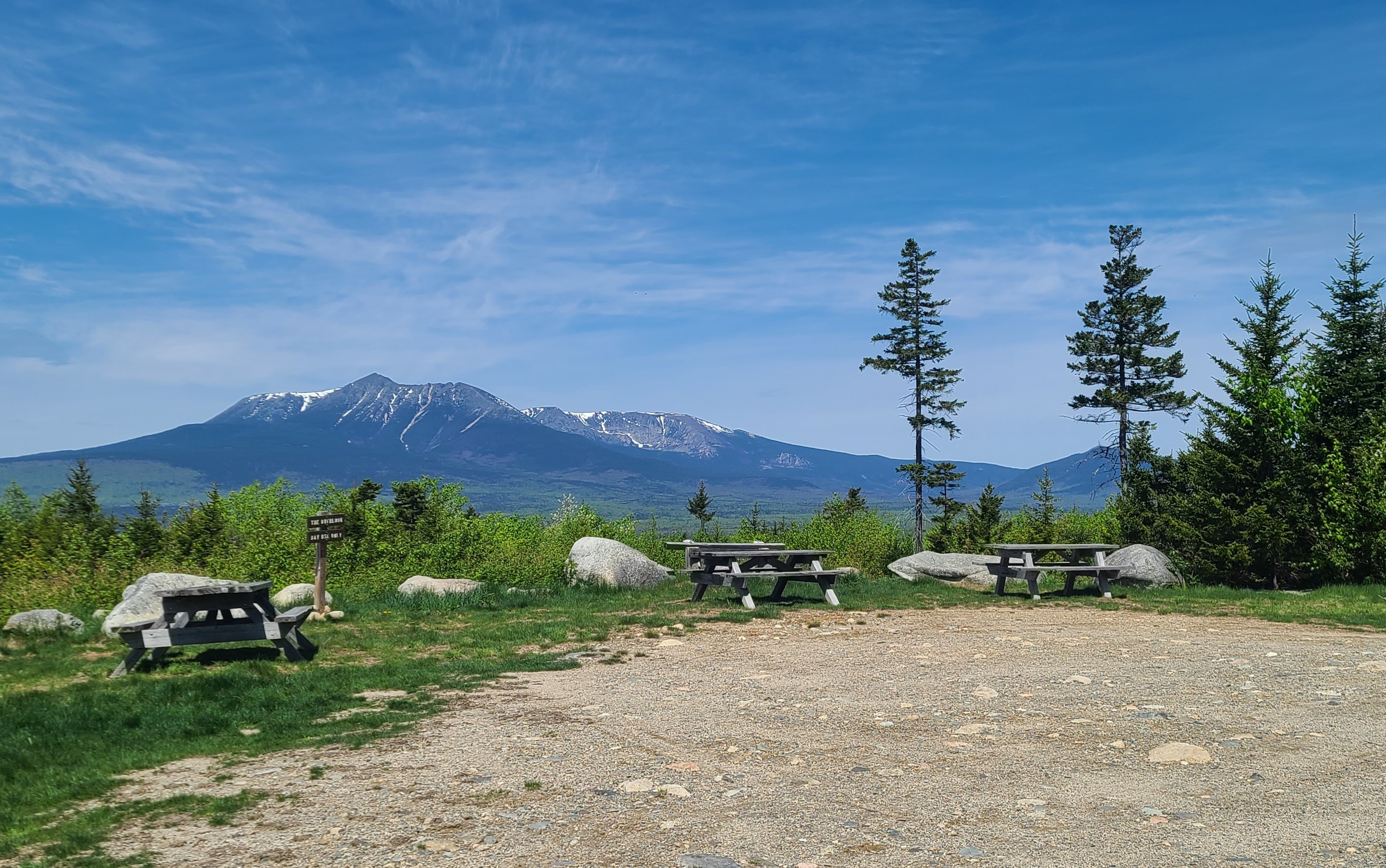
Katahdin Overlook Construction Closure
The Katahdin Overlook is currently closed for construction. Visitors are not permitted in the overlook area due to construction hazards. All other locations on the Loop Road are accessible.
| Title | Katahdin Woods and Waters |
| Park Code | kaww |
| Description | Spread across a wild landscape offering spectacular views of Katahdin, Katahdin Woods and Waters invites discovery of its rivers, streams, woods, flora, fauna, geology, and the night skies that have attracted humans for millennia. |
| Location | |
| Contact | |
| Activities |
|
| Entrance fees |
|
| Campgrounds | Count: 16
Big Seboeis Campsite
Big Spring Brook Campsite
Big Spring Brook Hut
Esker Campsite
Grand Pitch Lean-to
Haskell Deadwater Campsite
Haskell Hut
Katahdin Brook Lean-to
Lunksoos Campsites
Lunksoos Mountain Lean-To
Pond Pitch Campsite
Sandbank Stream Campground
Stair Falls Campsite
Upper East Branch Campsite
Wassataquoik Campsite
Wassataquoik Lean-to
|
| Places | Count: 45
Barnard MountainDiscover the spectacular views of Mount Katahdin and Katahdin Lake from Barnard Mountain. 
Barnard Mountain TrailheadWhether you're starting a grand adventure on the International Appalachian Trail or you're going for a day hike up Barnard Mountain, this is where your journey will begin. 
Bowlin FallsThe majestic views of Bowlin Falls awaits when paddling the East Branch of the Penobscot River. 
Deasey MountainThe summit of Deasey Mountain offers incredible views of Mount Katahdin and the forested region around it. 
Deasey Mountain Fire LookoutExplore the history of wildfire prevention and get spectacular views from this lookout on a mountain peak. 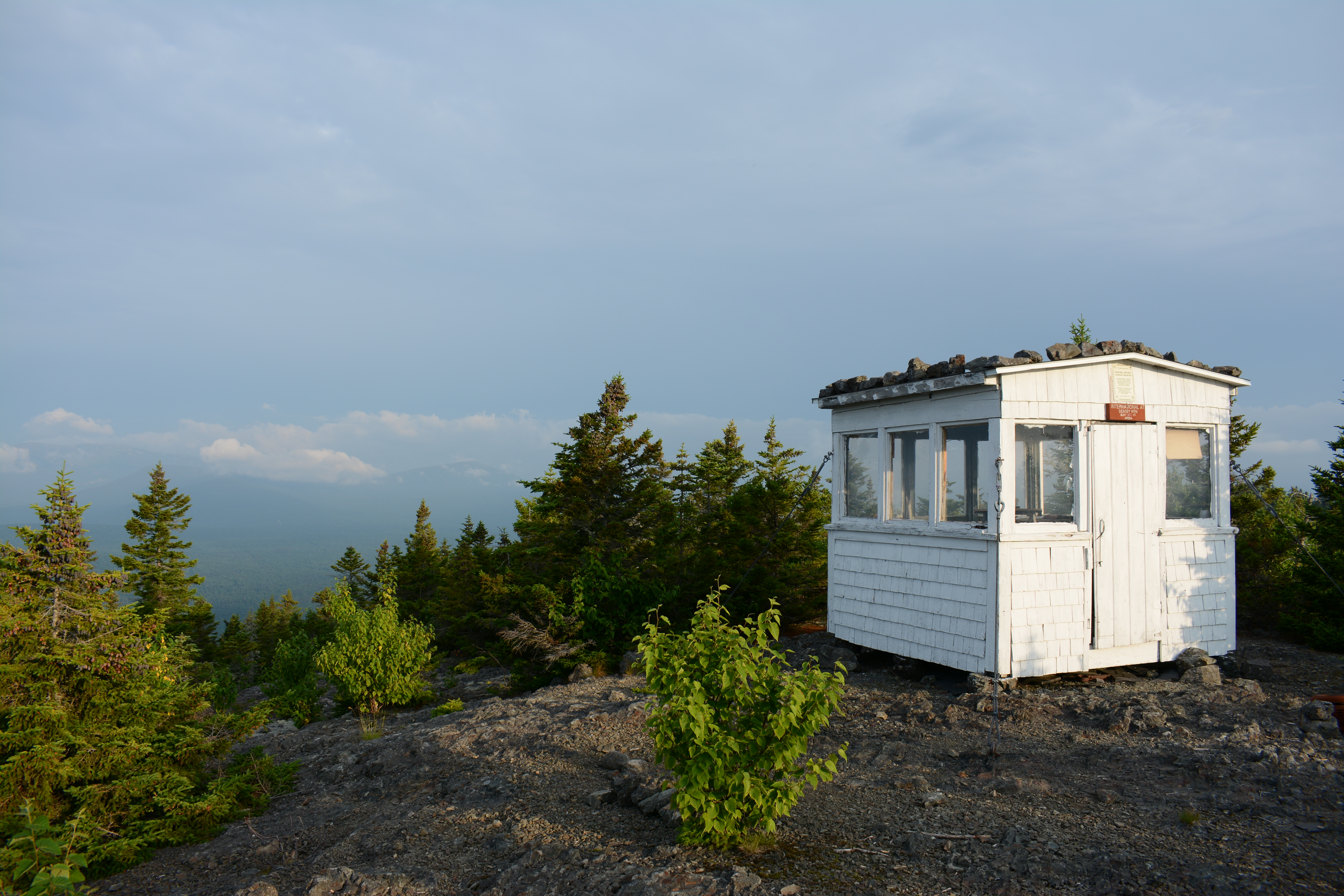
Deasey PondsEnjoy the view and sounds of the forest at a quiet scenic pond. Deasey Ponds offers opportunities to observe the flora and fauna of a wetland habitat. 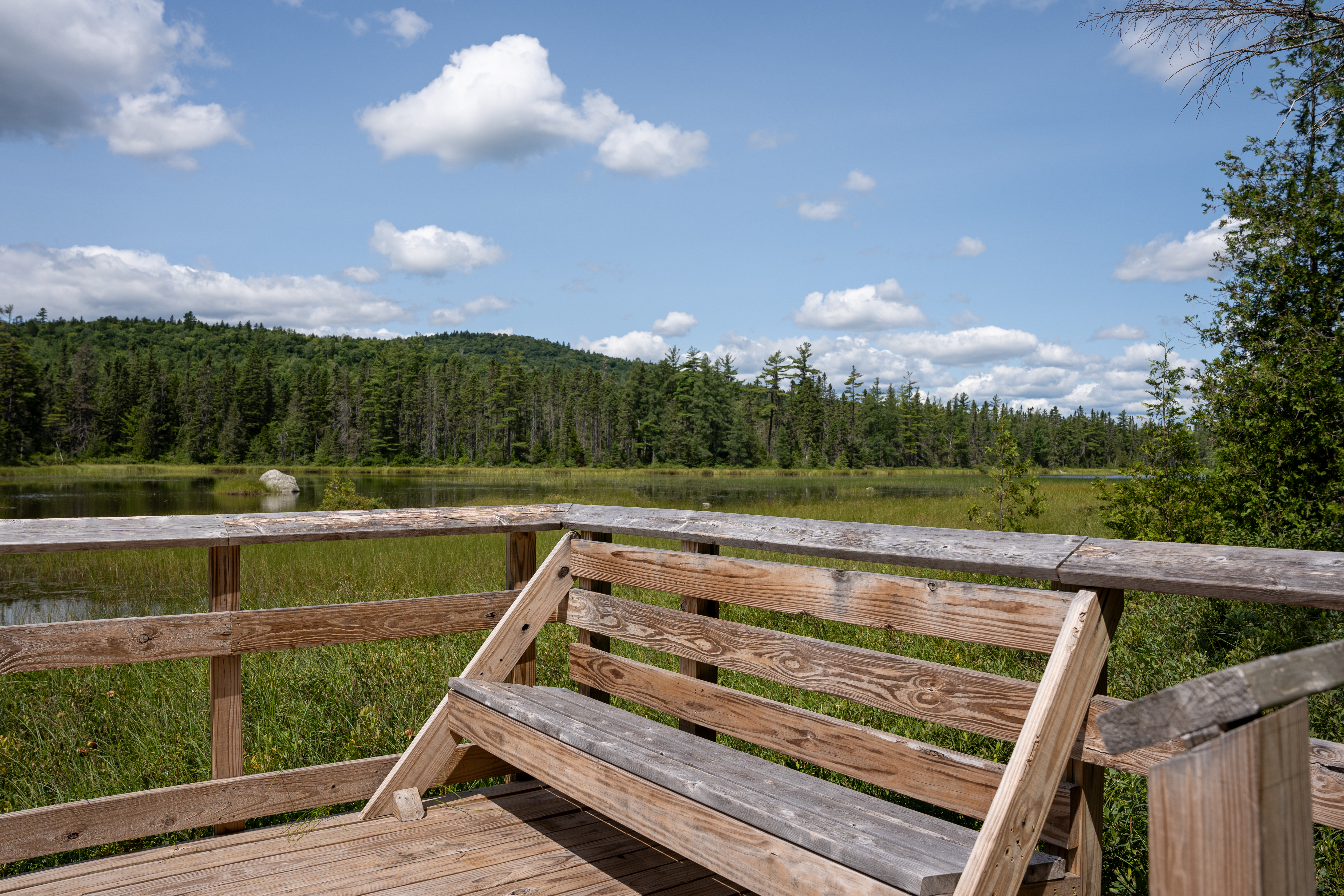
Deasey Ponds Trail Parking LotPark here to access the Deasey Ponds Trail. 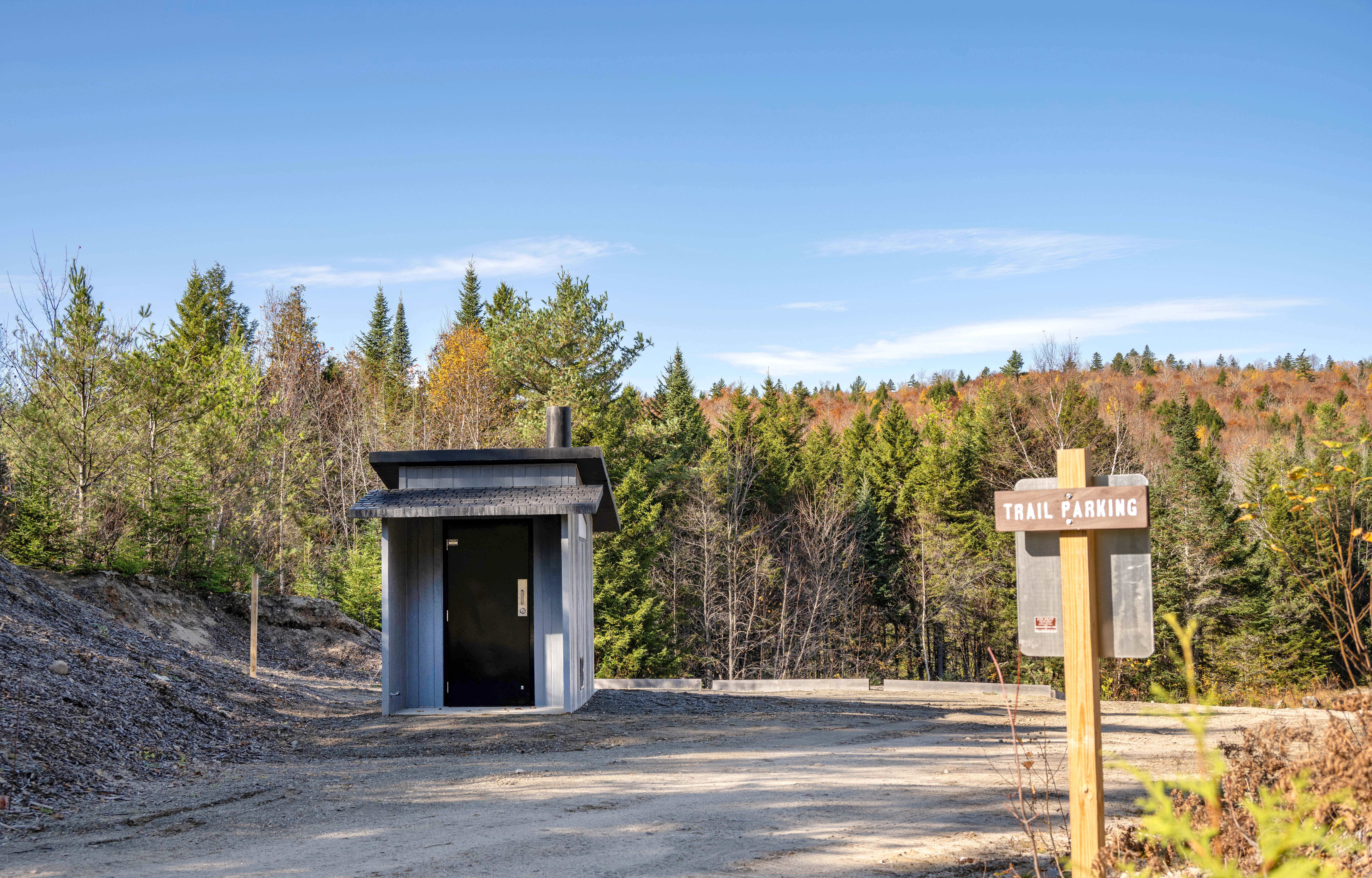
Esker WetlandA beautiful short hike to a scenic river landscape area. 
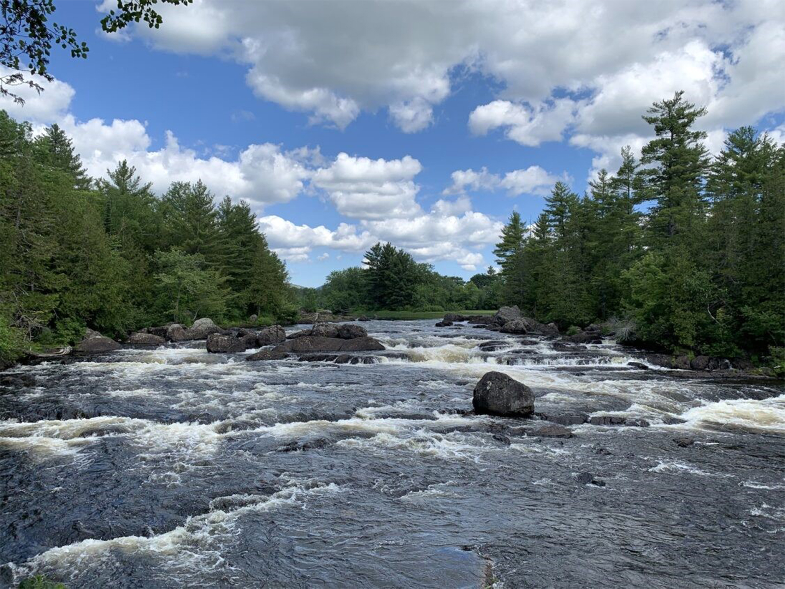
Grand PitchCome see the crown jewel of the East Branch of the Penobscot River. 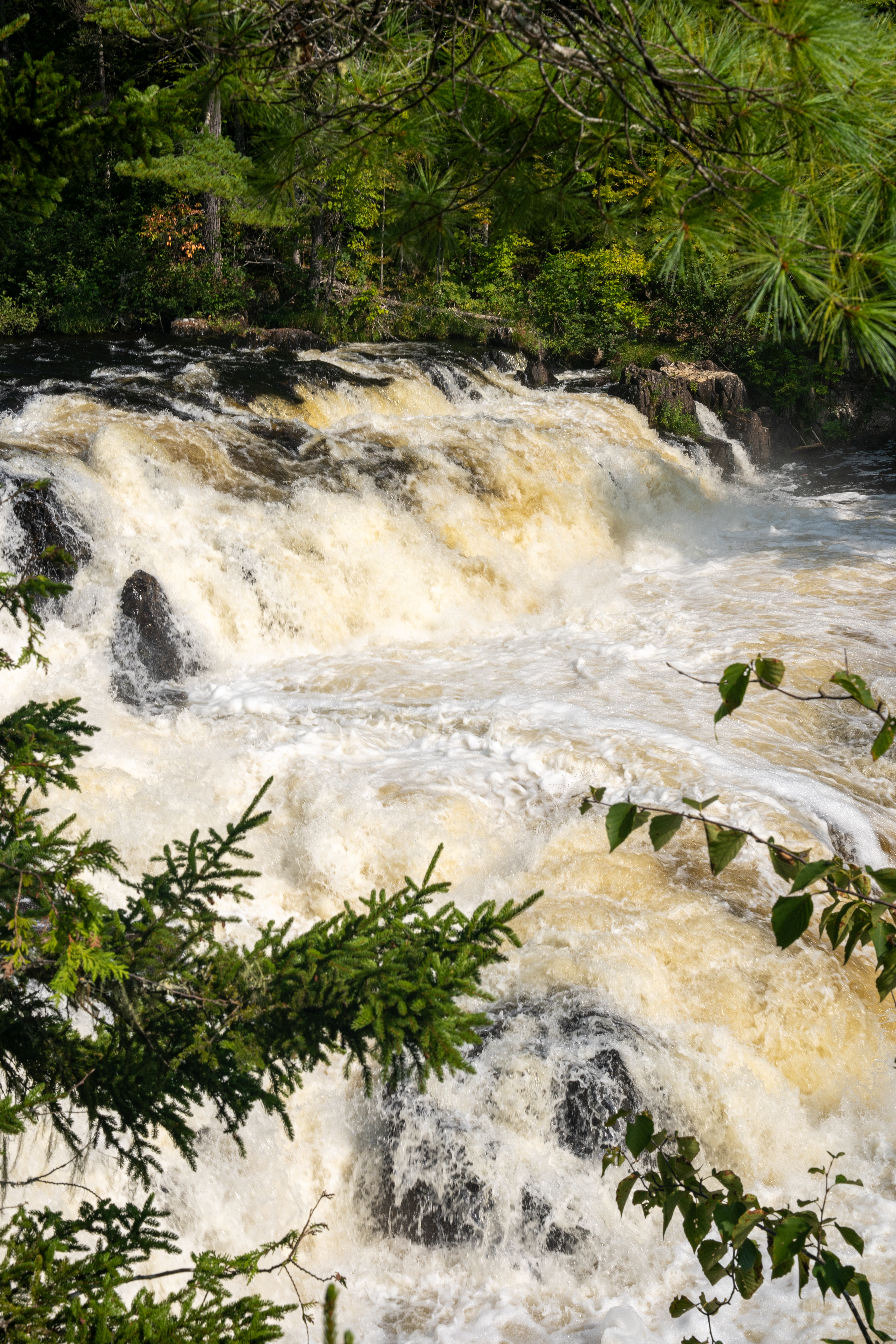
Haskell GateVehicle access on New River Road ends here. Visitors wishing to access points of interest or hike-in campsites in the northern section of the monument can park their vehicles here. Note: During winter months, vehicles must park at the North Gate parking area and travel by foot to Haskell Gate. 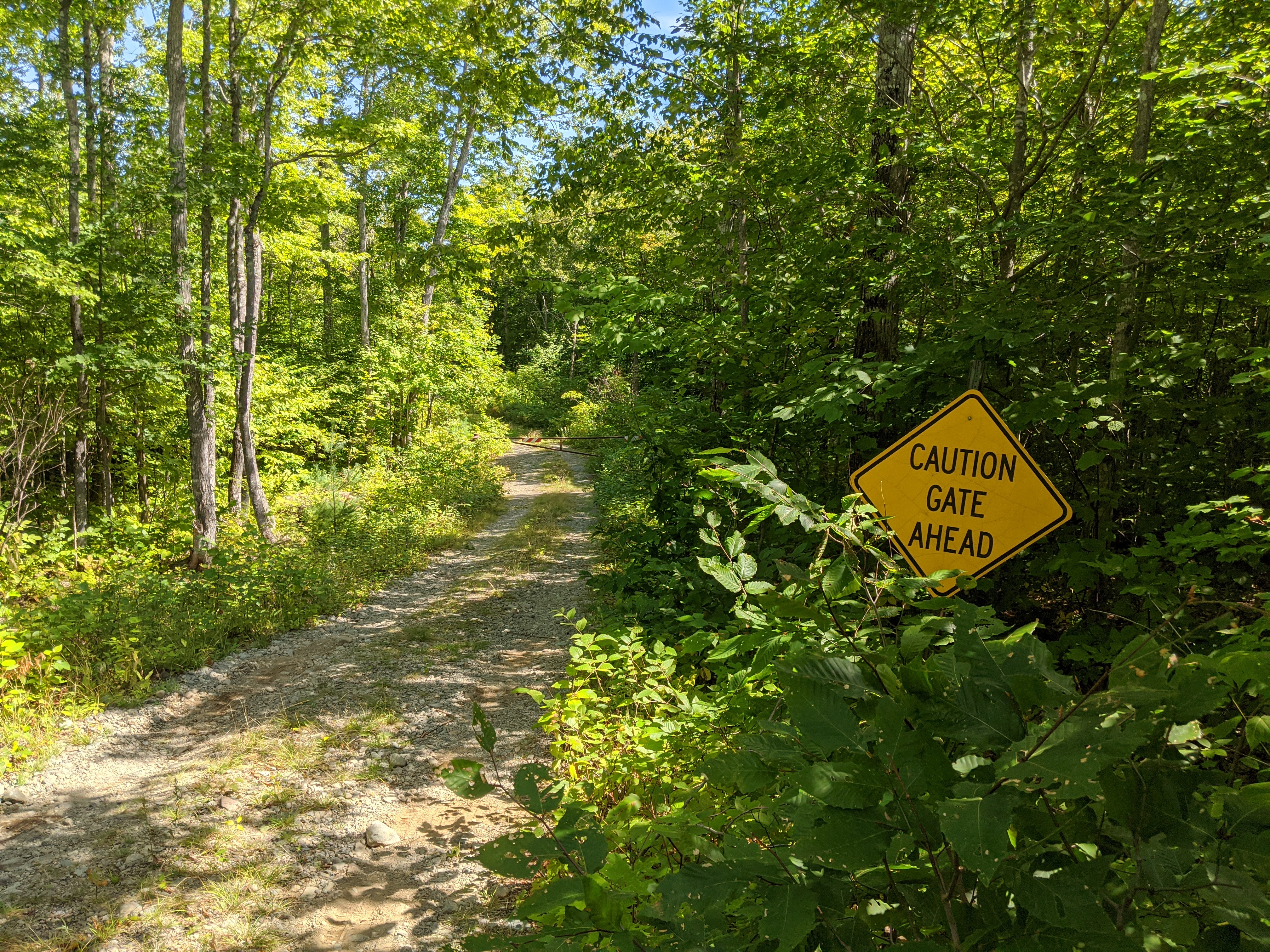
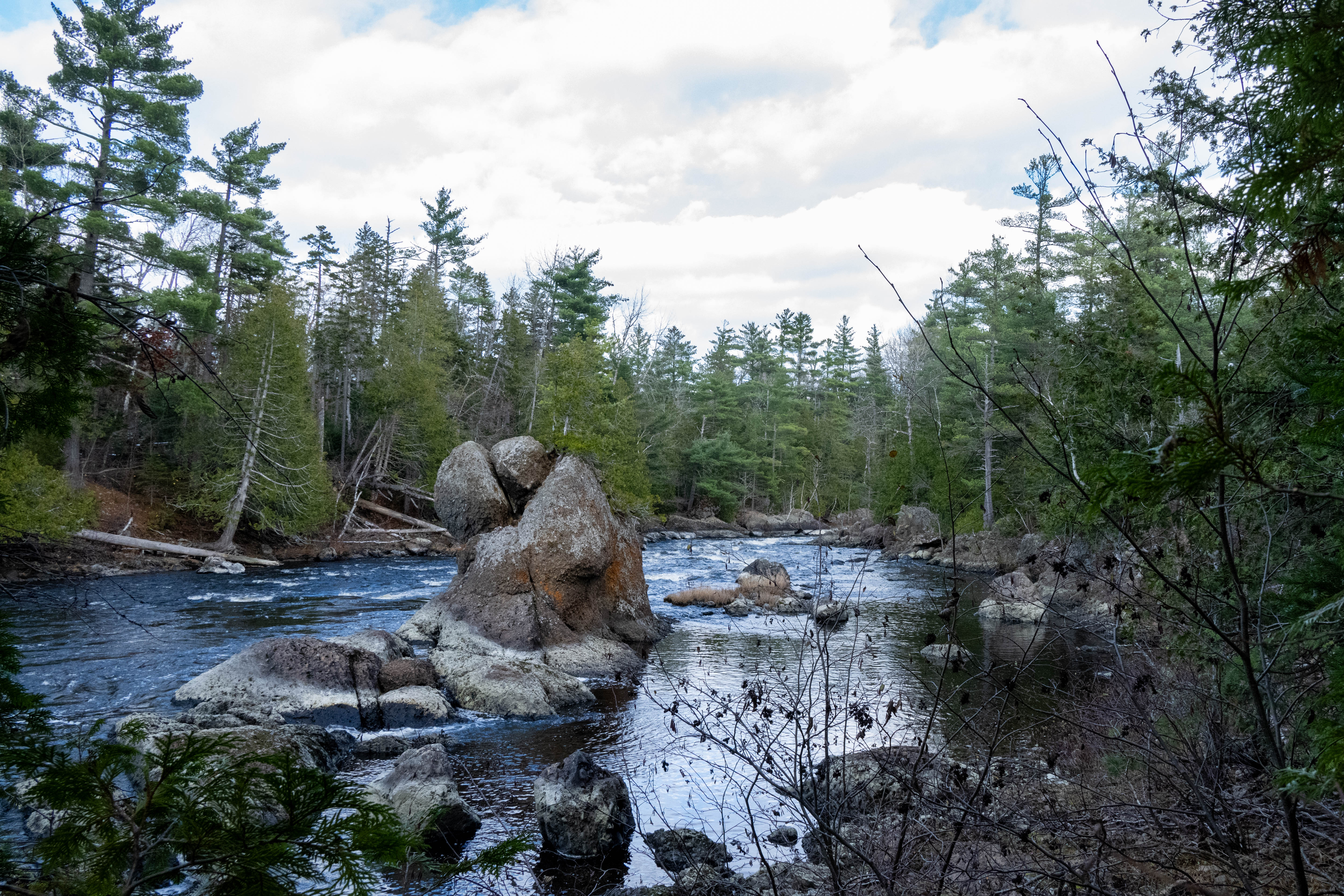
Haskell Rock PitchHaskell Rock is a 20-foot pillar in the East Branch Penobscot River located in the midst of Haskell Rock Pitch. 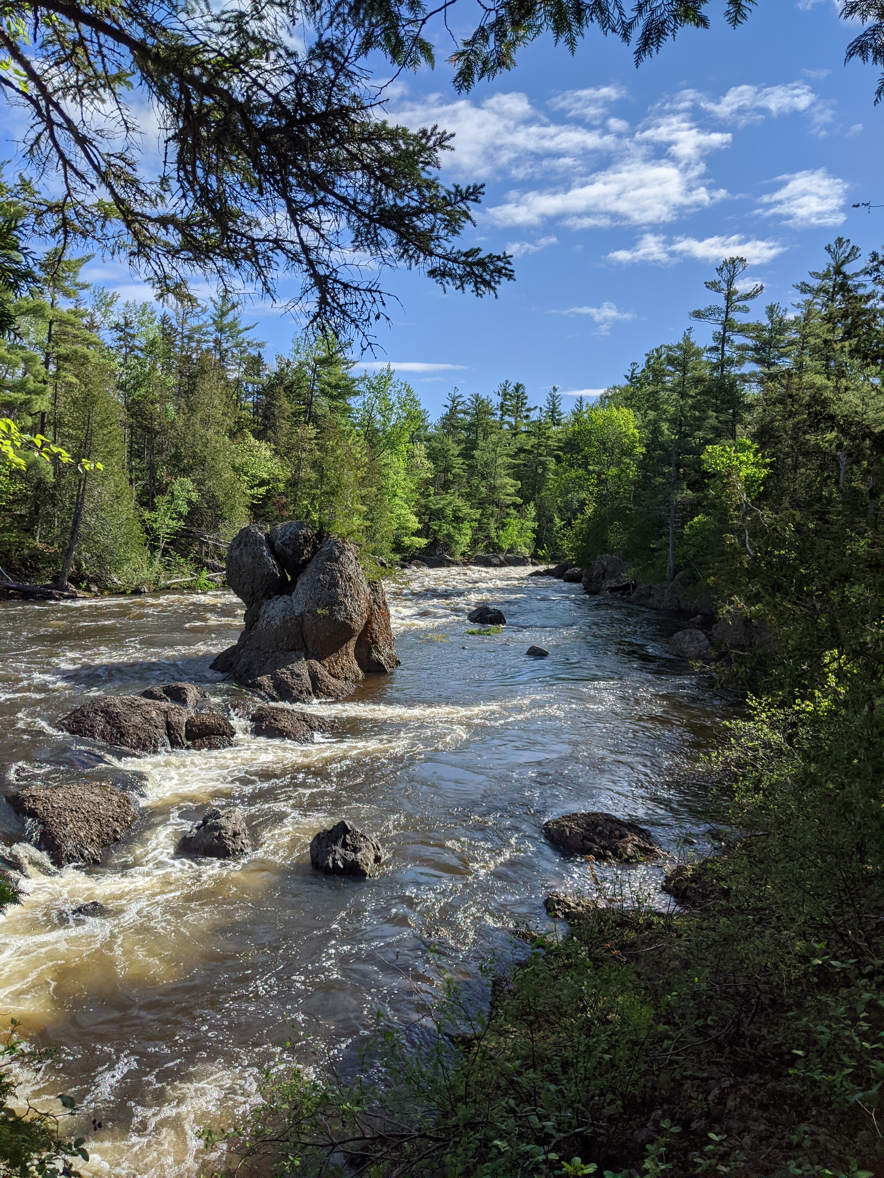
Katahdin - Located in Baxter State ParkNothing compares to the wildness, beauty, and difficulty of "The Greatest Mountain" in Maine. 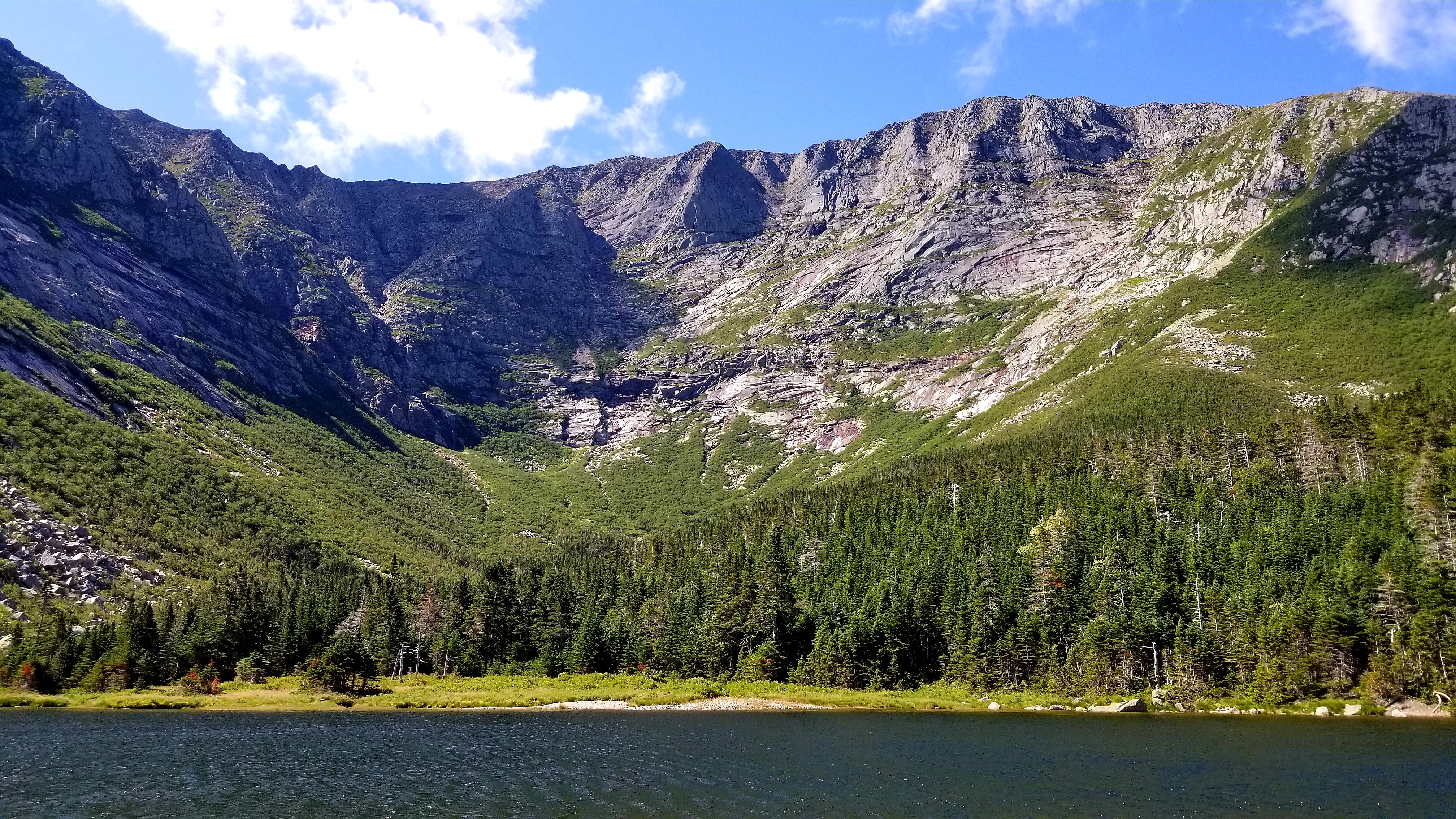
Katahdin Loop Road EntranceThe entrance to the Katahdin Loop Road, a 17-mile scenic drive with views of nearby Mount Katahdin and opportunities for hiking and wildlife viewing. 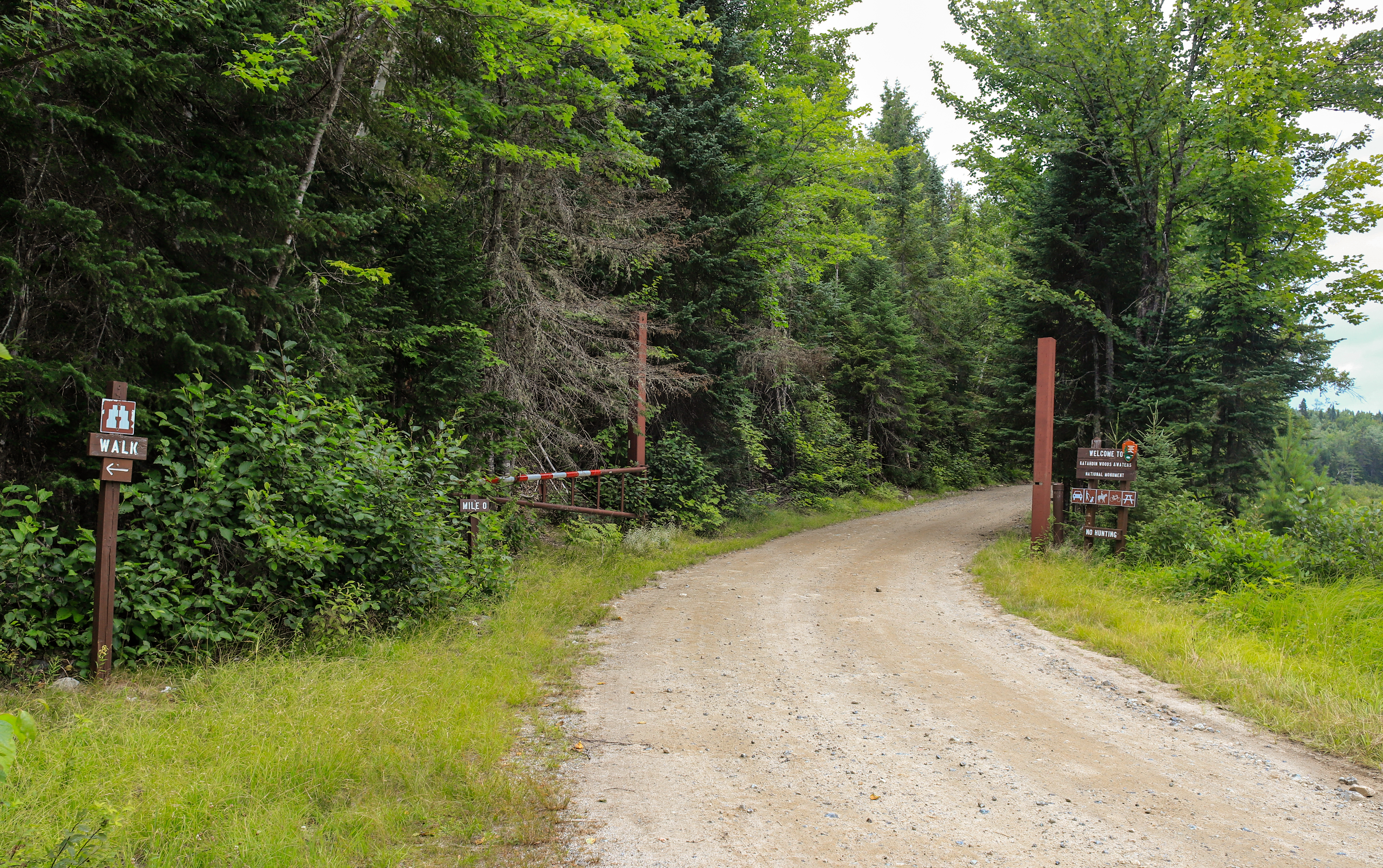
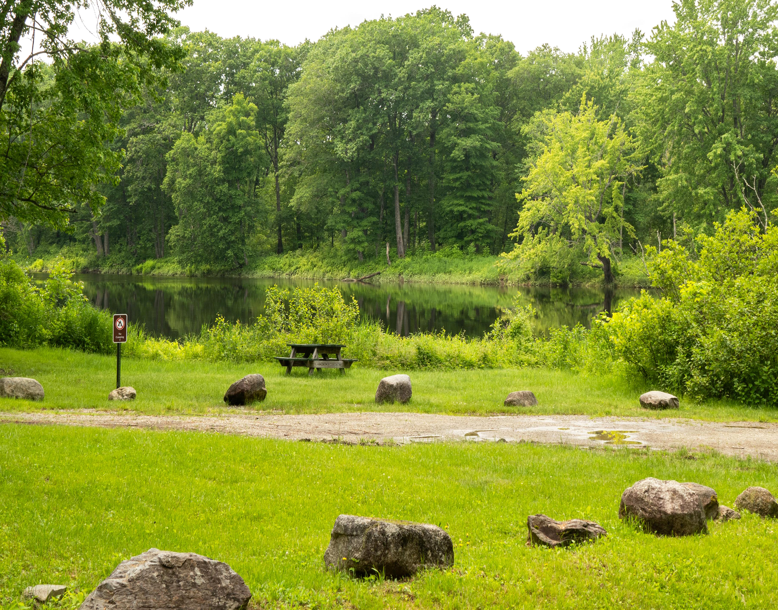
Katahdin OverlookPicnic area and scenic viewpoint on the Katahdin Loop Road. Excellent views of Katahdin and the surrounding landscape, and a popular astronomy site after sunset. 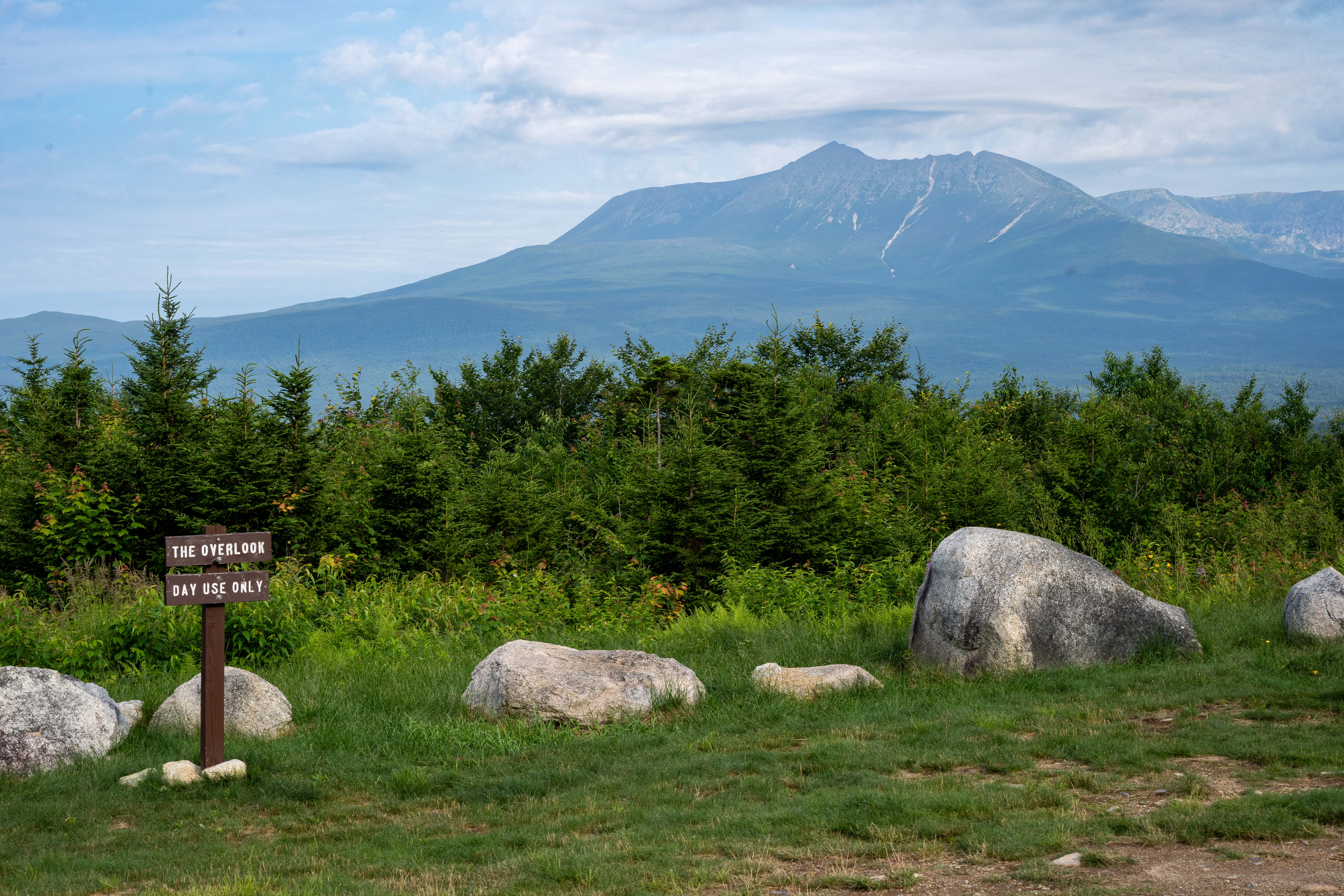
Kimball DeadwaterKimball Deadwater is a wetland area located just off of American Thread Road in the Seboeis Parcel. The habitat here provides a chance to view a variety of wildlife. 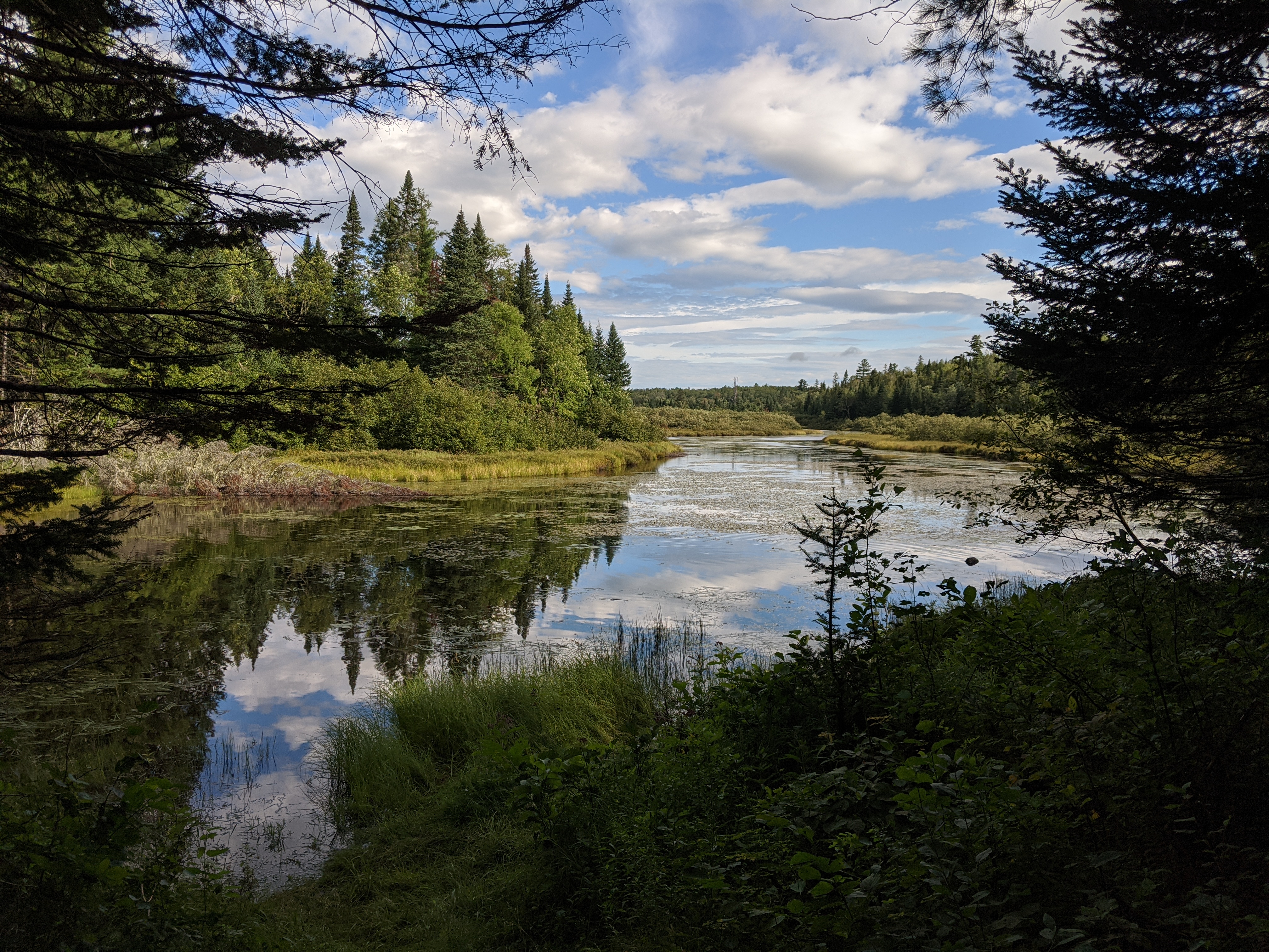
Lichen TrailA short 1.2 mile round-trip hike near the Katahdin Overlook. Visitors can take this trail to observe the diverse vegetation and a chance to see wildlife in the area. Start this hike with a scenic view of Katahdin in the distance. 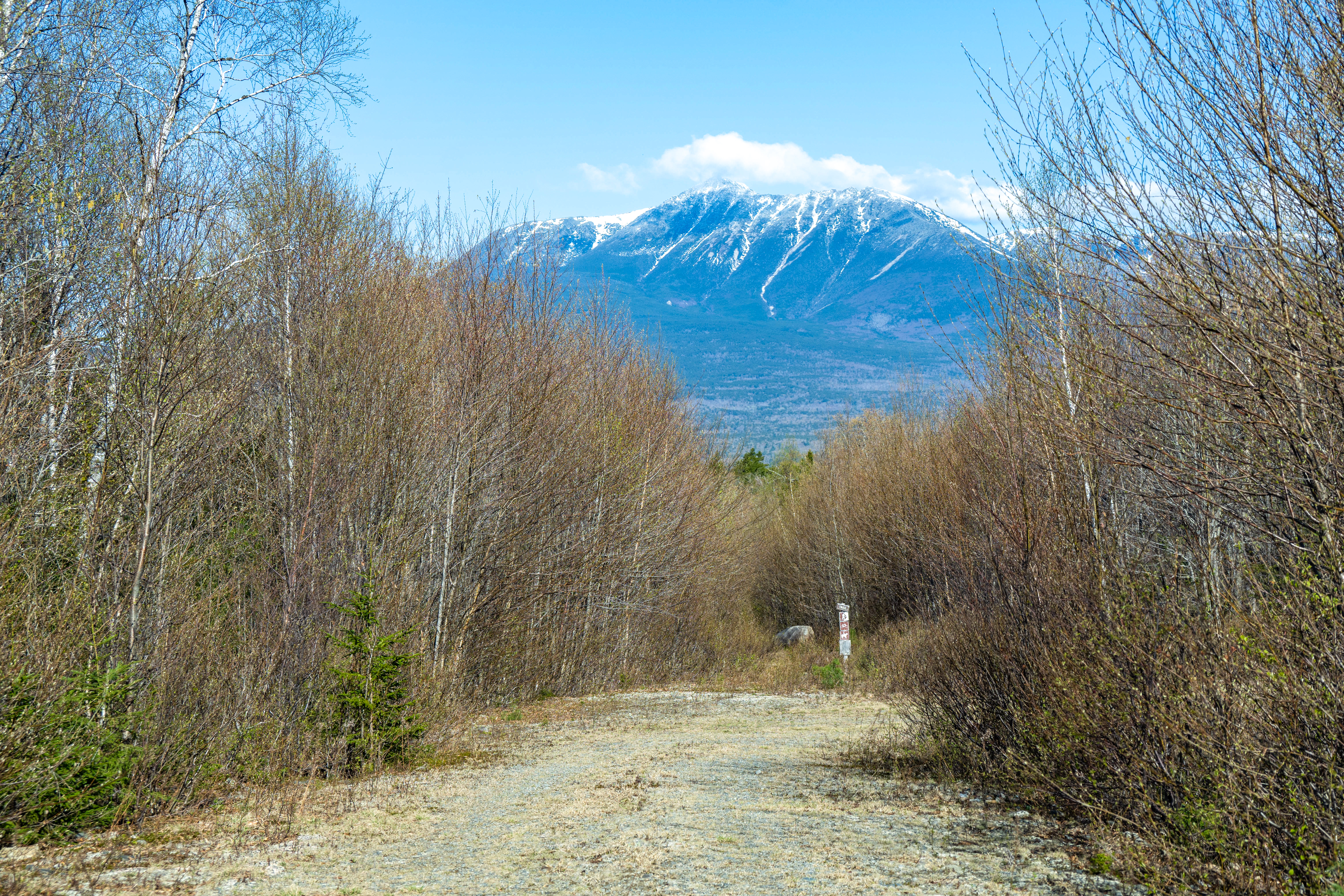
Little Messer PondLittle Messer Pond is a tranquil place for solitude deep within Katahdin Woods and Waters National Monument. 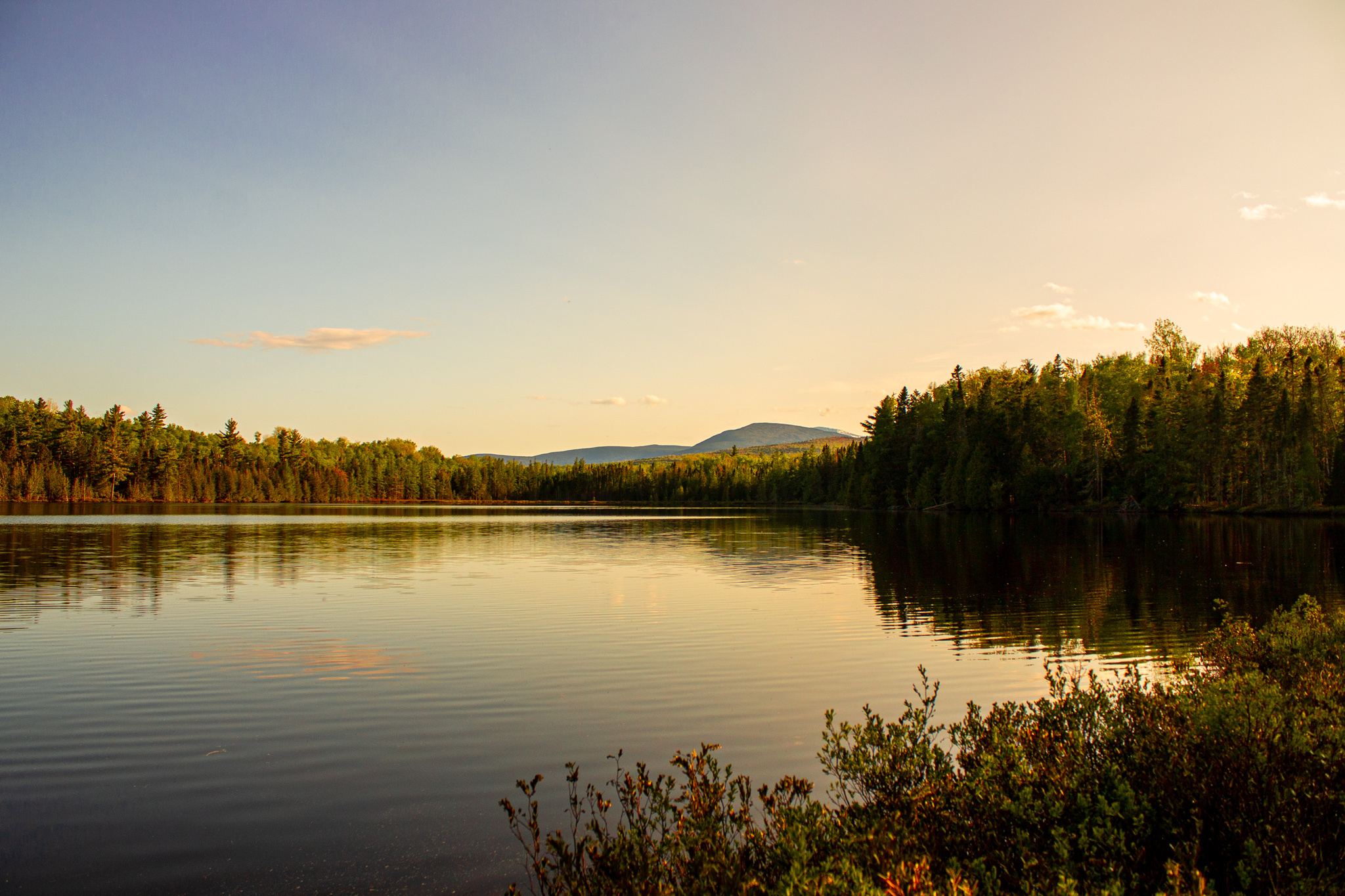
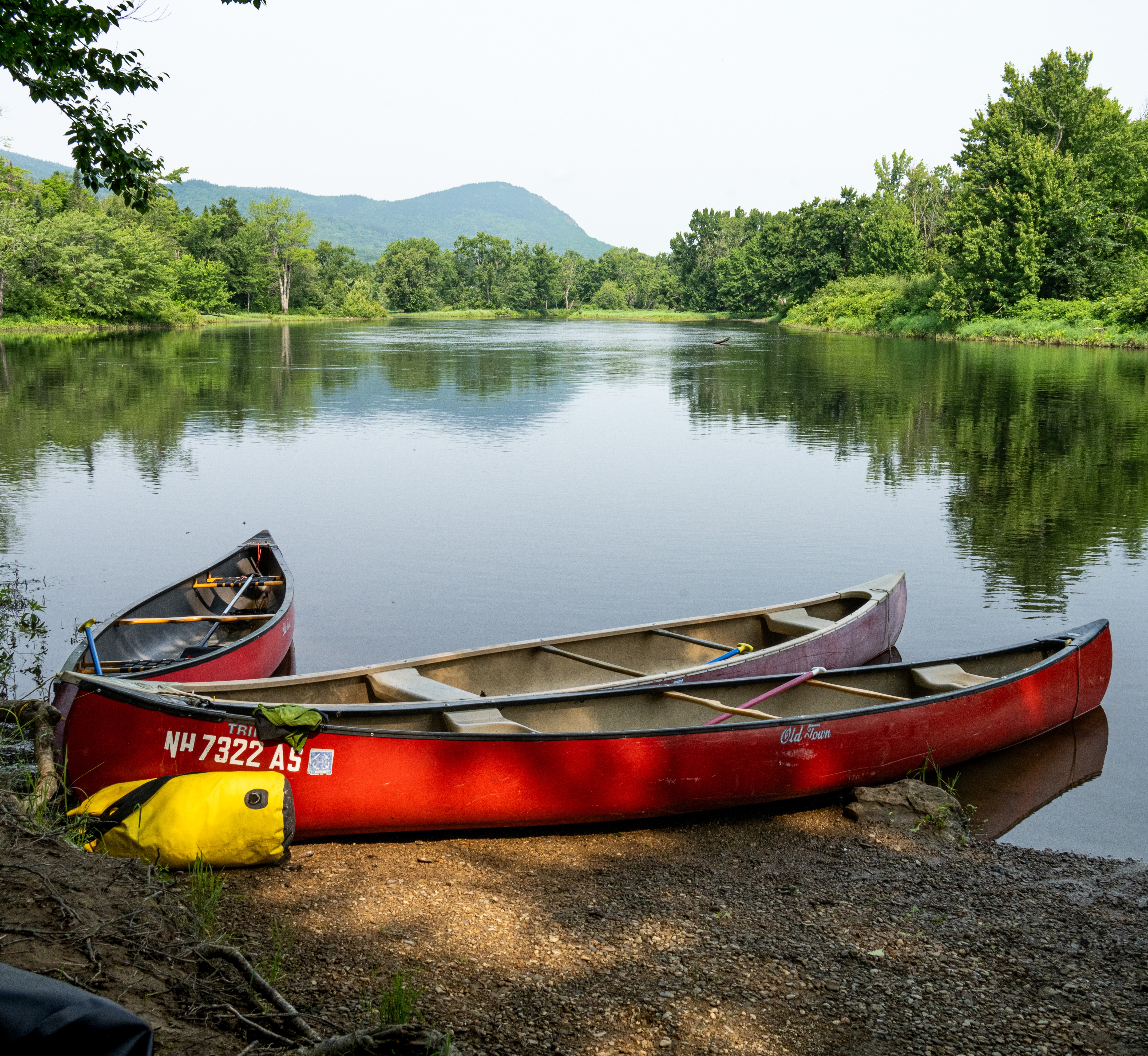
Lunksoos Boat LaunchAccess the East Branch of the Penobscot River by canoe or kayak here, or fish along the bank. 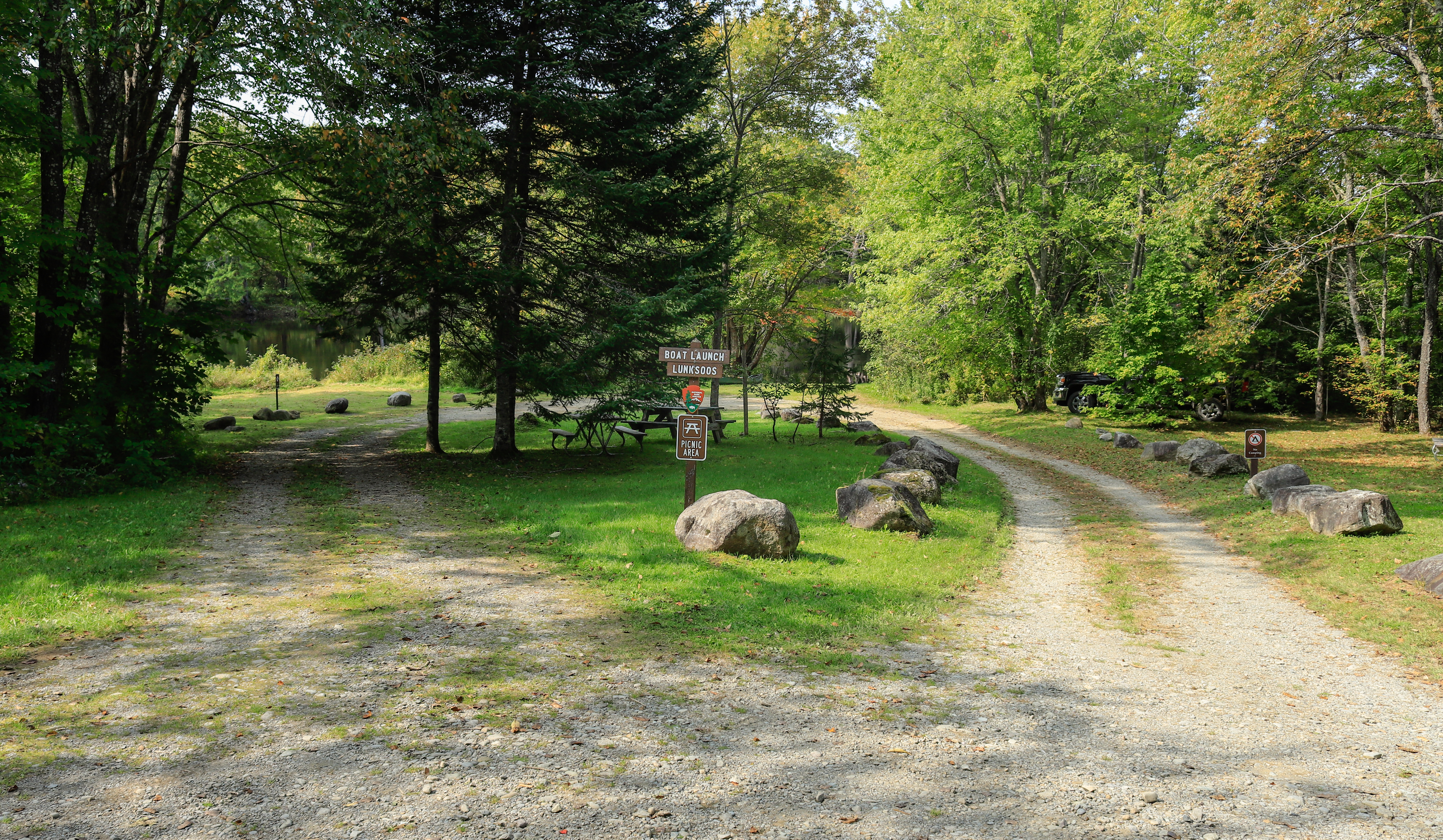
Lunksoos MountainLunksoos Mountain is one of the most remote, wild, and breathtaking mountain peak views at Katahdin Woods and Waters National Monument. 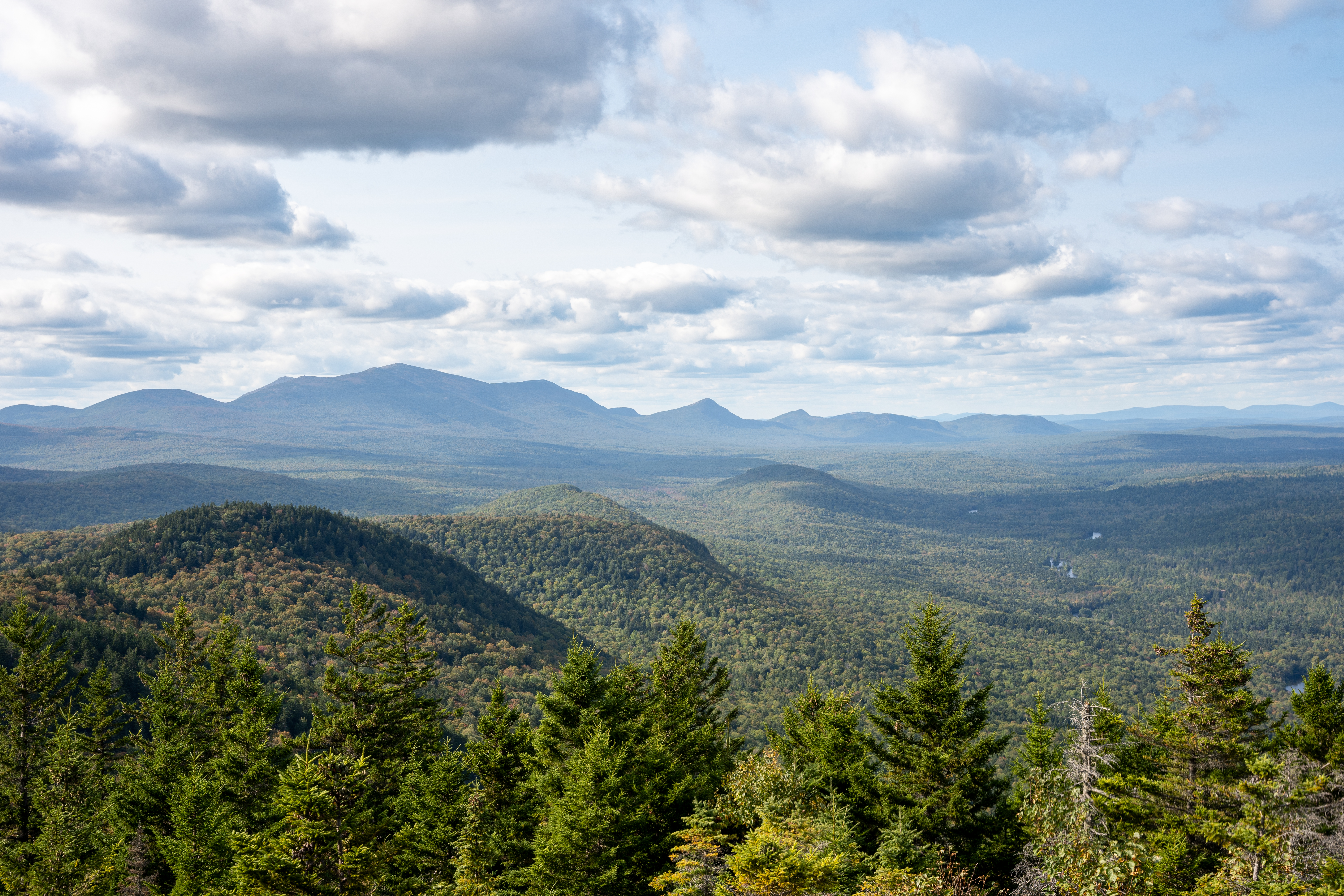
Lynx PondWildlife viewing and/or a relaxing reprieve await visitors at scenic Lynx Pond. 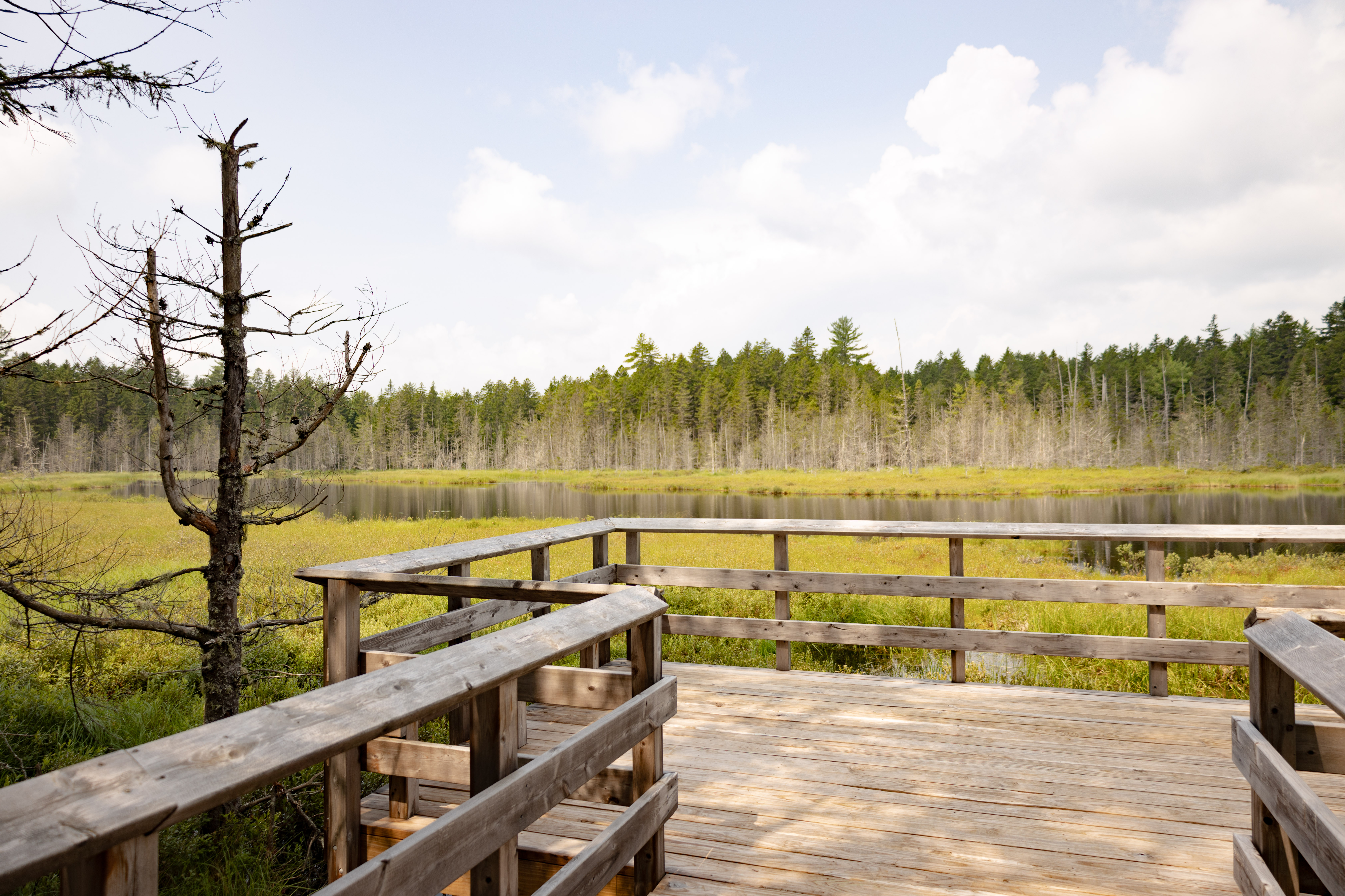
Messer PondMesser Pond is a Great Pond and a heritage pond located at a remote and densely forested area of Katahdin Woods and Waters National Monument. 
Monument LineInterested in surveys, maps, and history? This historic survey line and marker might be of interest to you! 
North GateThe northern access point to the monument offers a parking area, vault toilet, and an information kiosk. This is the trailhead for cross-country ski trails and snowshoeing routes during the winter months (grooming starts early January). 
Orin FallsOrin Falls boasts stunning views of a boulder-studded stream with white-water rapids 
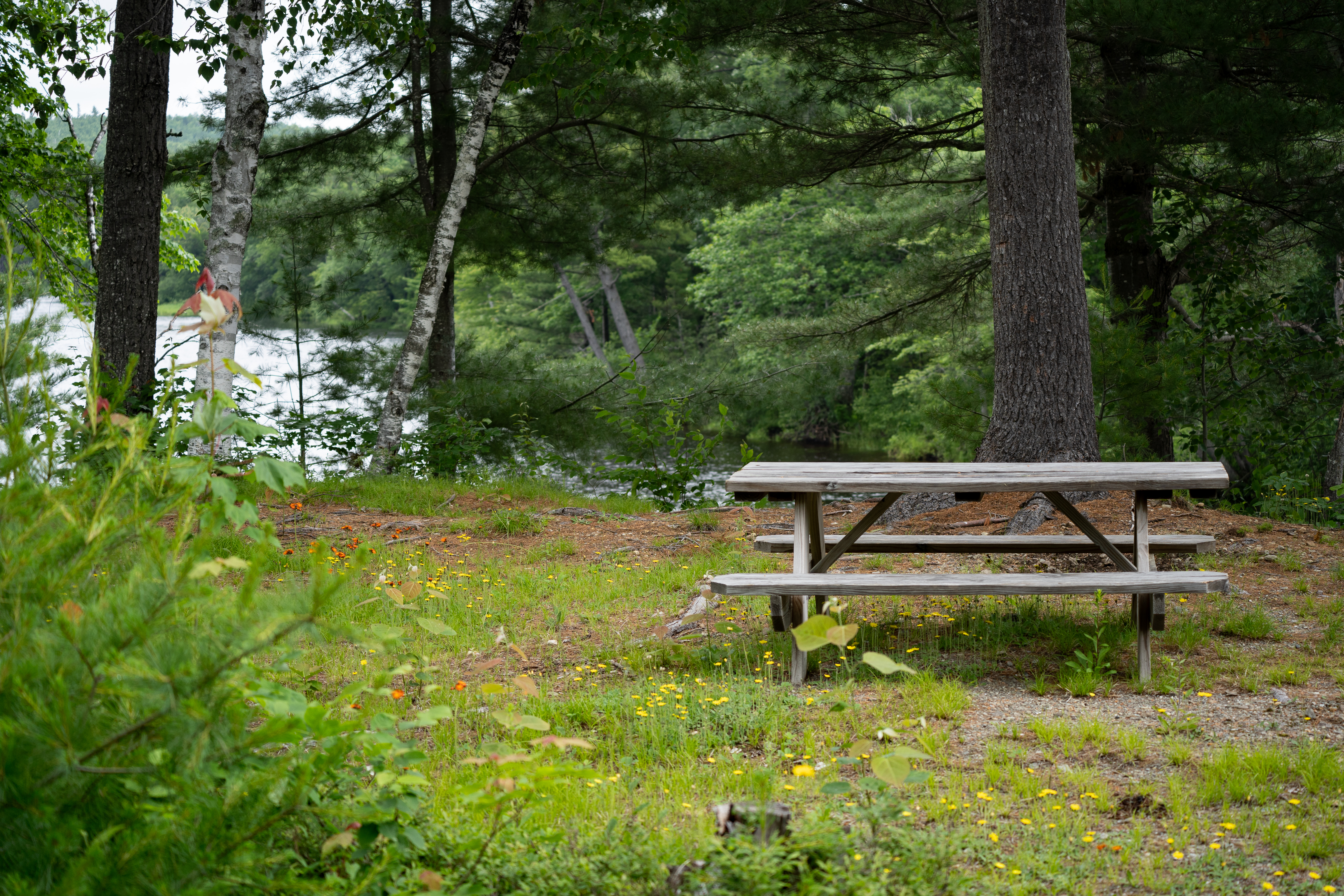
Oxbow Picnic AreaA shaded picnic area located atop a steep river embankment 
Park Sign - American Thread RoadOne of multiple park signs welcoming you into Katahdin Woods & Waters National Monument. 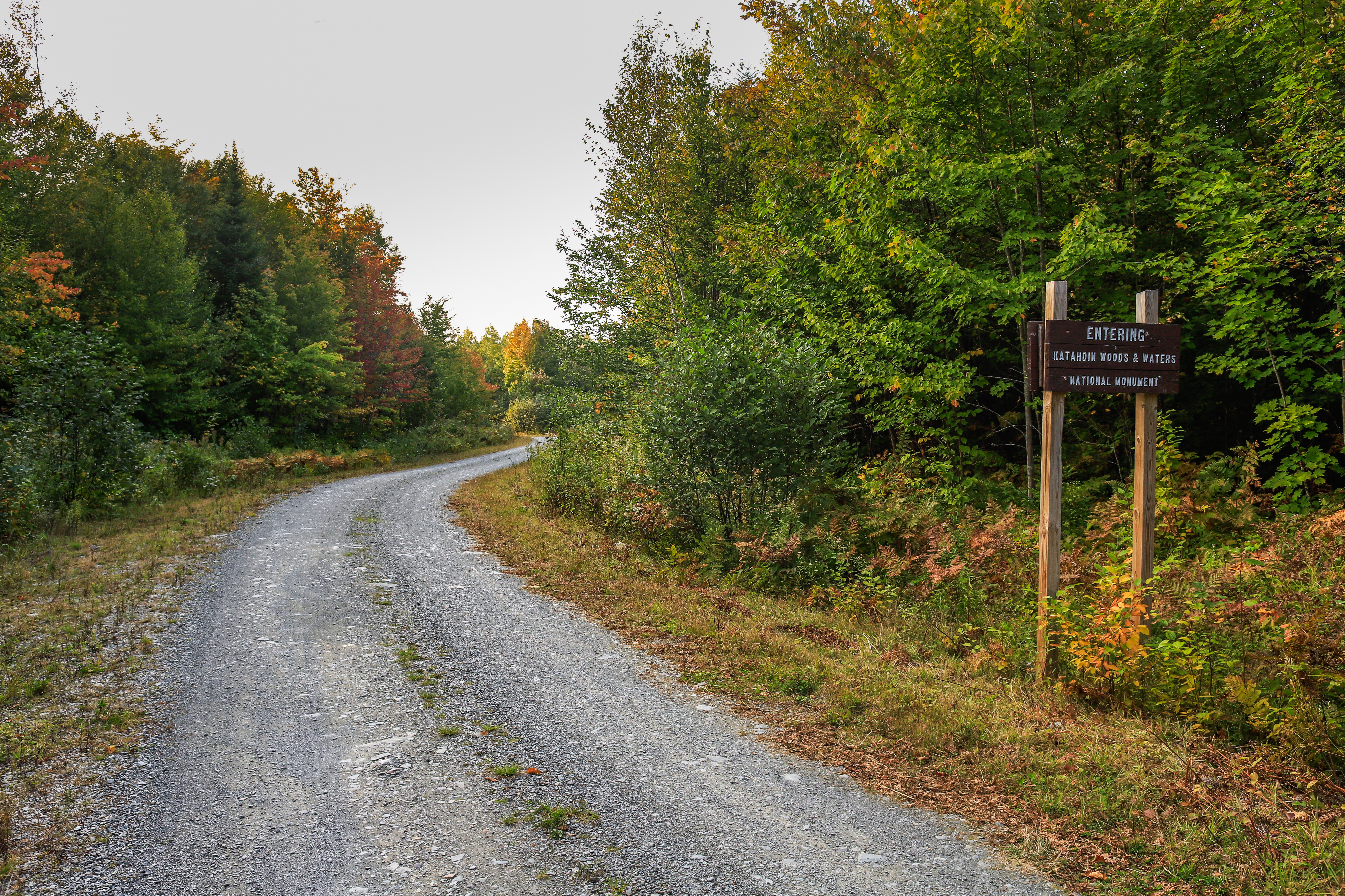
Park Sign - Swift Brook RoadKatahdin Woods & Waters National Monument Park Sign that welcomes visitors to the Hunt Farm Parcel of the national monument. 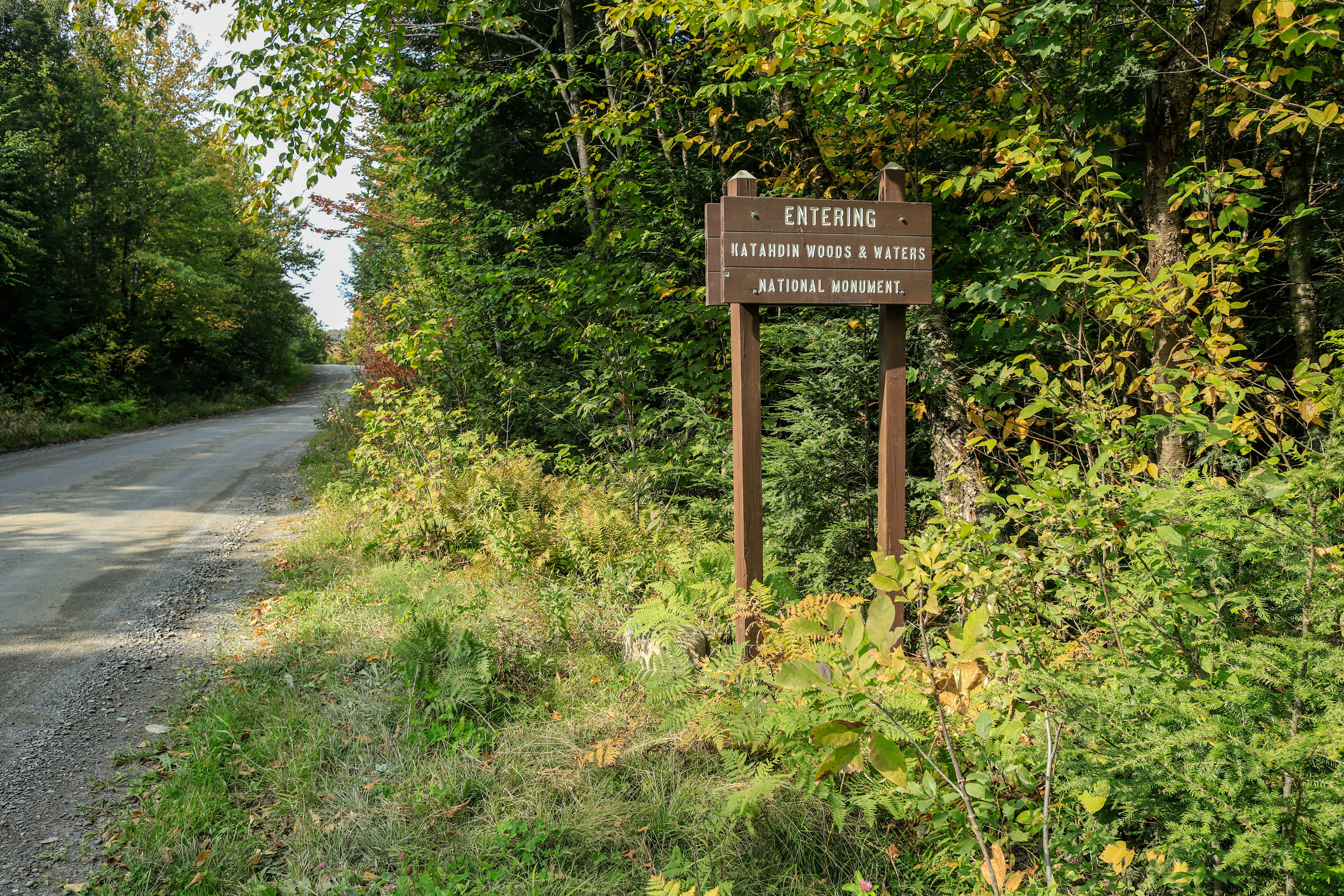
Pond PitchThe majestic Pond Pitch is a scenic viewpoint along the East Branch of the Penobscot River and the International Appalachian Trail. 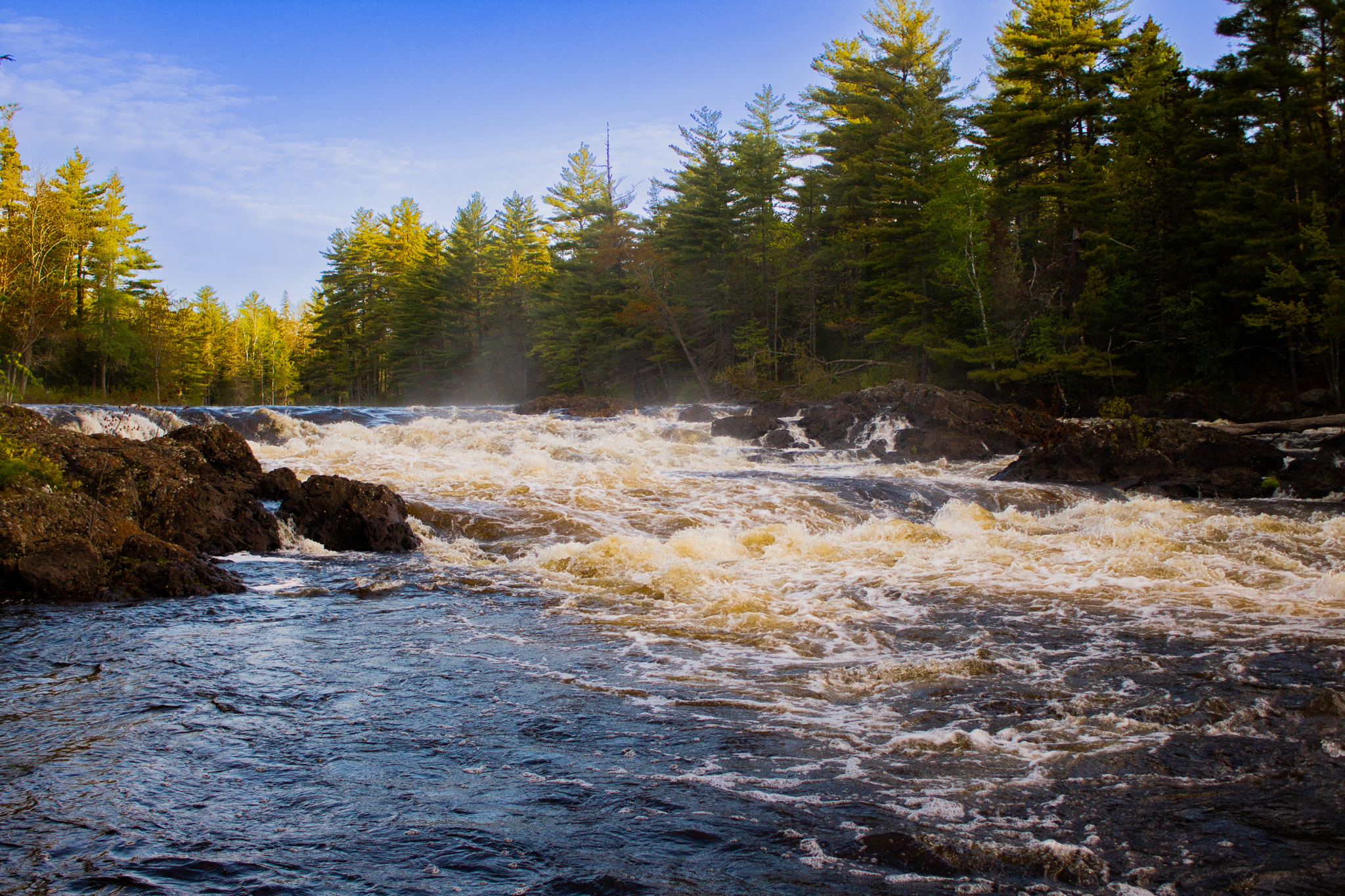
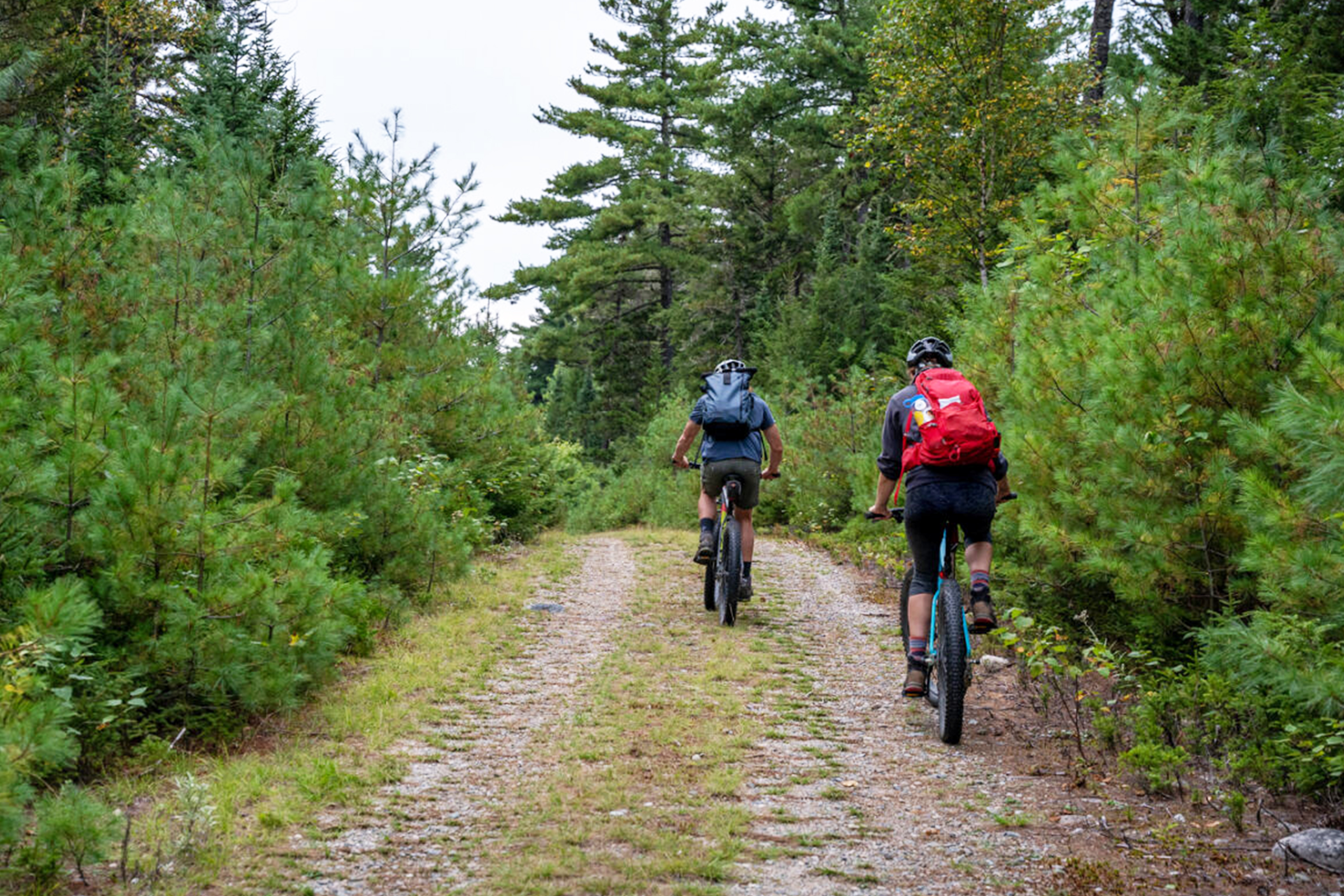
Rocky Pond Road Trailhead - Katahdin Loop Road - Mile 5.75Many recreational opportunities await along the Rocky Pond Road Trail. 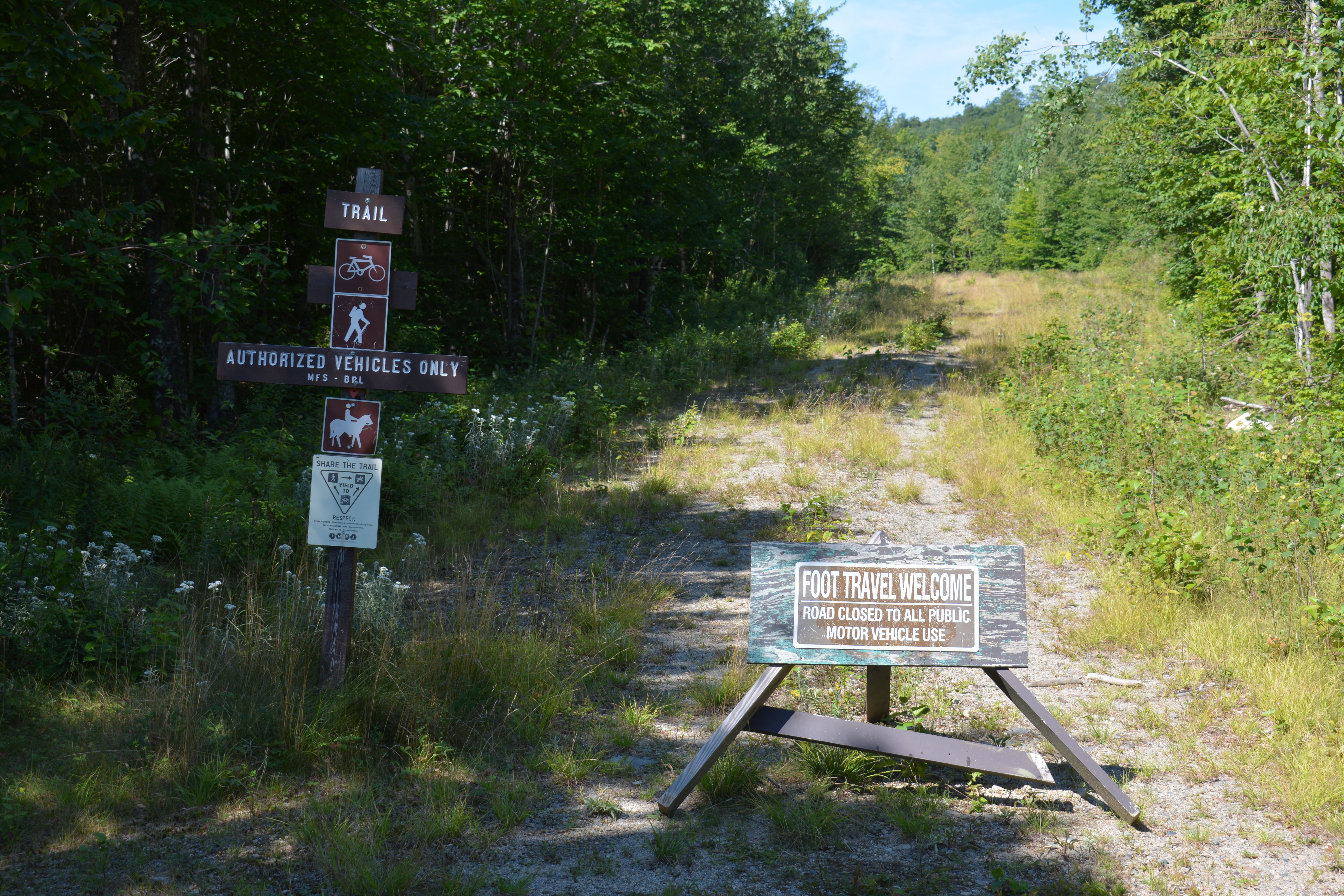
Rocky Pond Road Trailhead - Katahdin Loop Road - Mile 9Whether on a horse, a bike, or simply just hiking Rocky Pond Road is a gateway to the forests of Maine. 
Sandbank GateSandbank Gate may be closed in spring and fall to prohibit vehicle travel when conditions are muddy. Travel during this time can cause damage to the road and vehicles 
Seboeis Connector Trail
Seboeis Connector Trailhead ParkingAccess the Seboeis Connector Trail by parking at the gravel and dirt parking area, just left of the Seboeis Connector Rd. This is the most direct access to the Seboeis Riverside Trail. 
Seboeis Parcel EntranceThe designated entrance to the Seboeis Parcel of Katahdin Woods and Waters National Monument is on American Thread Road. There is no fee to enter. 
Seboeis Riverside Trail North TrailheadA great place to start your journey along the Seboeis River and into Katahdin Woods & Waters National Monument by either hiking or paddling. 
Seboeis Riverside Trail South TrailheadA pleasant hike along the banks of the Seboeis River awaits the adventurous! 
Seboeis Road GateGate at entrance to Seboeis Road. 
Stair FallsStair Falls is a rapid that resembles a staircase waterfall in the East Branch of the Penobscot River. 
Swift Brook Road GateThe Swift Brook Road Gate may be closed in spring and fall to prohibit vehicle travel when conditions are muddy. Travel during this time can cause damage to the road and vehicles. 
The Hulling MachineThe breathtaking views of this waterfall can only be glimpsed by experienced, adventurous paddlers. 
Twin PondsTwin Ponds is a wetland area located off the American Thread Road. Hike to this location for a chance to observe waterfowl and other aquatic wildlife. 
Valley ViewpointValley View offers a remote experience at an incredible view of the treasured landscape of Katahdin Woods and Waters National Monument. 
Wassataquoik Gate Parking LotThe Wassataquoik Gate is the trailhead to many of the national monument's backcountry trails. 
Wassataquoik Stream FordThe Wassataquoik Stream Ford feels like a natural boundary between civilization and the wild backcountry to the north. 
Wassataquoik Stream Road GateThe Orin Falls Road leads to several hiking and biking opportunities such as access to the IAT and Orin Falls. The gate may be closed in spring and fall to prohibit vehicle travel when conditions are muddy. 
|
| Visitor Centers | Count: 1
Tekakapimək Contact Station
|
| Things to do | Count: 25
|
| Tours |
Count: 3
1 Day - Drive and Hike the Northern SectionThis self-guided drive and hike tour suggests an itinerary for visitors looking for a day trip at the northern section of Katahdin Woods and Waters National Monument. The first stop at the Oxbow Picnic Area is an optional stop for a close-up view of the East Branch of the Penobscot River. The northern section of Katahdin Woods and Waters NM provides a more remote experience for visitors with views of the East Branch of the Penobscot River and many miles of trails to hike. 1 Day - Ecology and Geology Experience (Southern Section)Only have 1 day at Katahdin Woods and Waters NM? This family-friendly tour guides visitors to experience the ecology and geology within the southern section of KAWW without too much time on the road. First, take Swift Brook Road to the Loop Road Entrance. Continue ahead to the Deasey Ponds Parking Lot. Here, the tour invites you to use the vault toilet and stretch your legs on a 1.2 mile (round-trip) hike. Then, drive to Katahdin Overlook for a scenic picnic. Stop at Lynx Pond on your way home. Roadside Scenic Views at Katahdin Woods and Waters NMThis self-guided driving tour suggests locations within the monument that are easy to view from within the vehicle or only require a short walk. Be aware of logging trucks on the road, they always have the right of way. |
| Articles |
|