Portions of Stilesboro Rd. Closed Starting on Monday, September 8, 2025
Beginning on Monday, September 8, Stilesboro Rd. will be closed from Gilbert Road and Old Mountain Road to the park's Visitor Center entrance due to Cobb County utility work. The park's Visitor Center will only be accessible via Old Highway 41.
| Title | Kennesaw Mountain |
| Park Code | kemo |
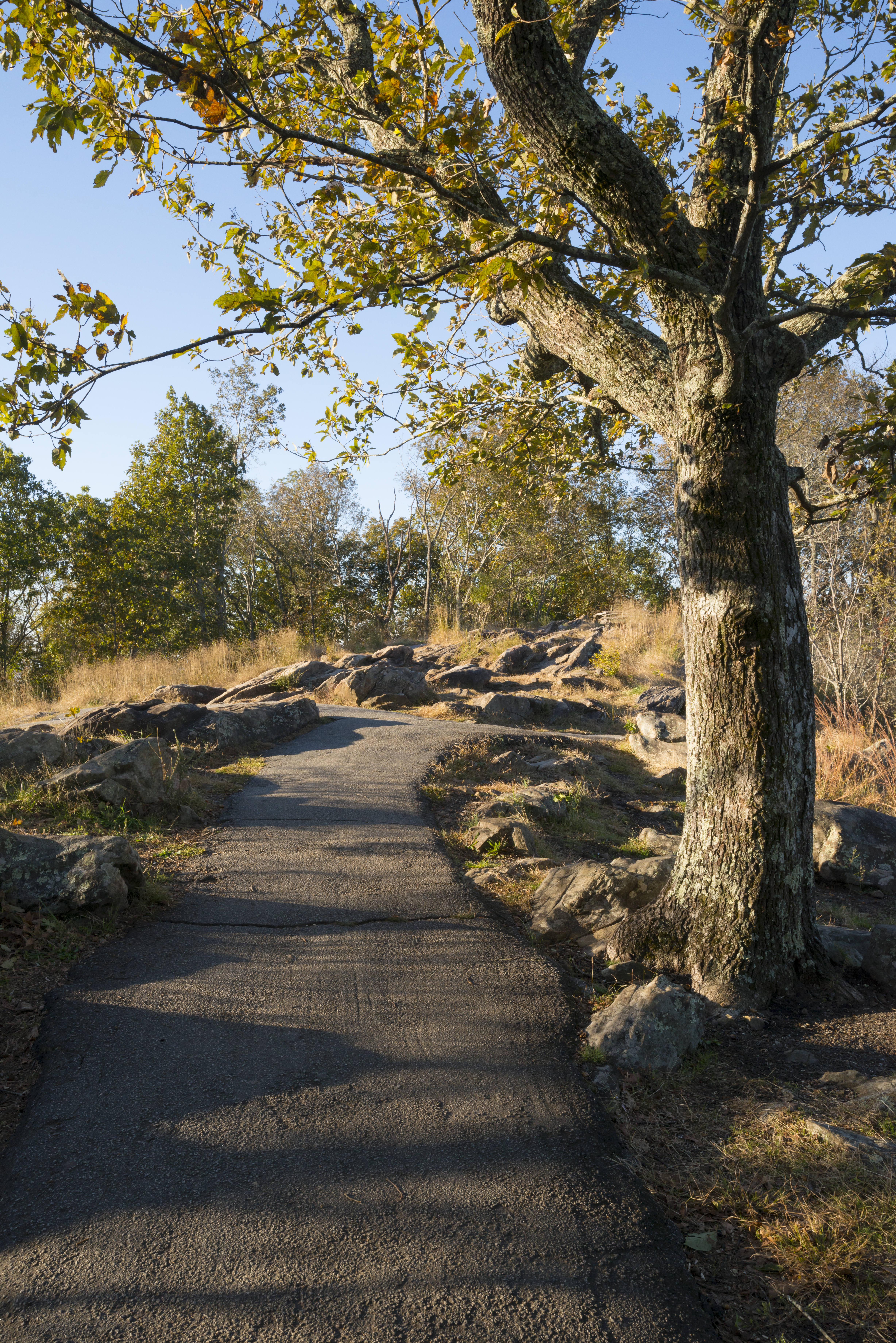
| Description | Kennesaw Mountain National Battlefield Park is a 2,965 acre National Battlefield that preserves a Civil War battleground of the Atlanta Campaign. Opposing forces maneuvered and fought here from June 19, 1864 until July 2, 1864. Although most famo... |
| Location | |
| Contact | |
| Activities |
|
| Entrance fees |
Entrance - Private Vehicle
$5.00
The Daily Pass is valid for the date of purchase only. It admits all persons traveling in a single, private, non-commercial vehicle (car/truck/van) and is non-transferable. This pass does NOT guarantee a parking spot.
Entrance - Per Person
$5.00
The Daily Pass is valid for the date of purchase only. It admits all walk-in visitors aged 16 and older.
Entrance - Education/Academic Groups
$0.00
To request an Academic Fee Waiver for your group, click on the link for further details.
Commercial Entrance - Motor Coach
$100.00
$100 Motor Coach/Commercial Tour Groups with 26 or more people
Commercial Entrance - Mini-bus
$40.00
$40 per passenger bus with 16-25 people
Commercial Entrance - Sedan
$25.00
$25 per passenger bus/sedan with 1-6 people
|
| Campgrounds | Count: 0
|
| Places | Count: 23
63rd Georgia Picket LineLocation of where the 63rd Georgia Infantry attempted to defend against a large frontal assault. The small confederate contingent suffered heavy casualties in this engagement. 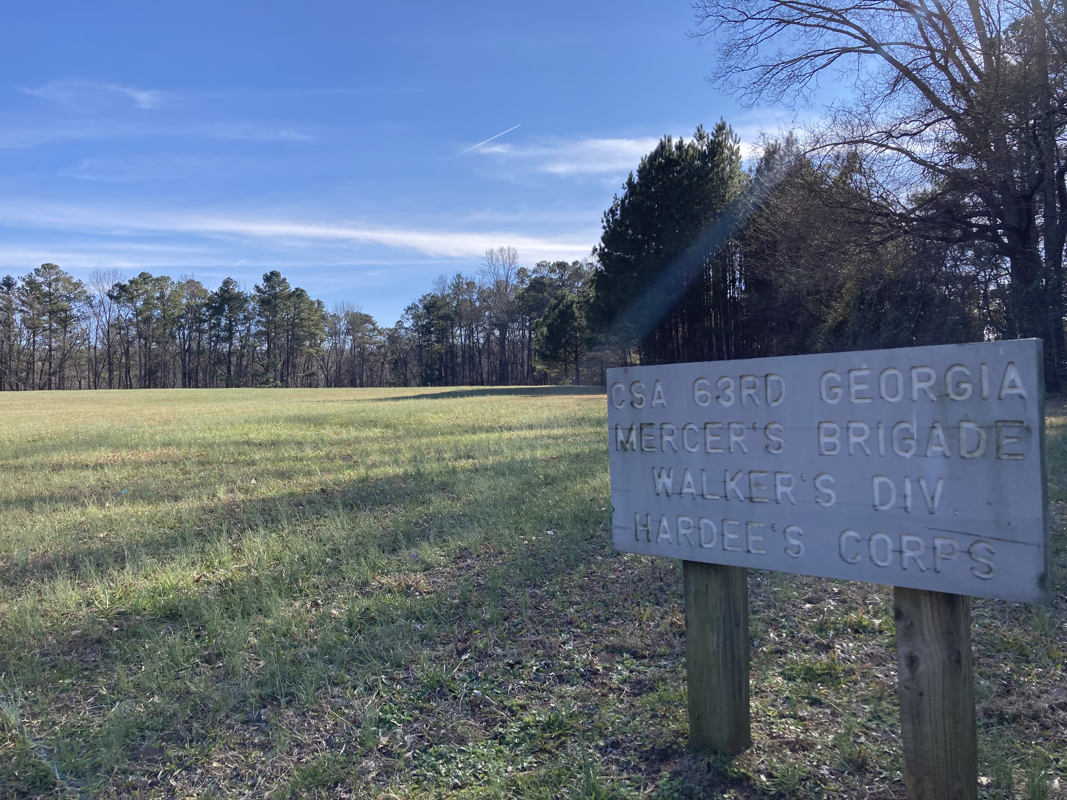
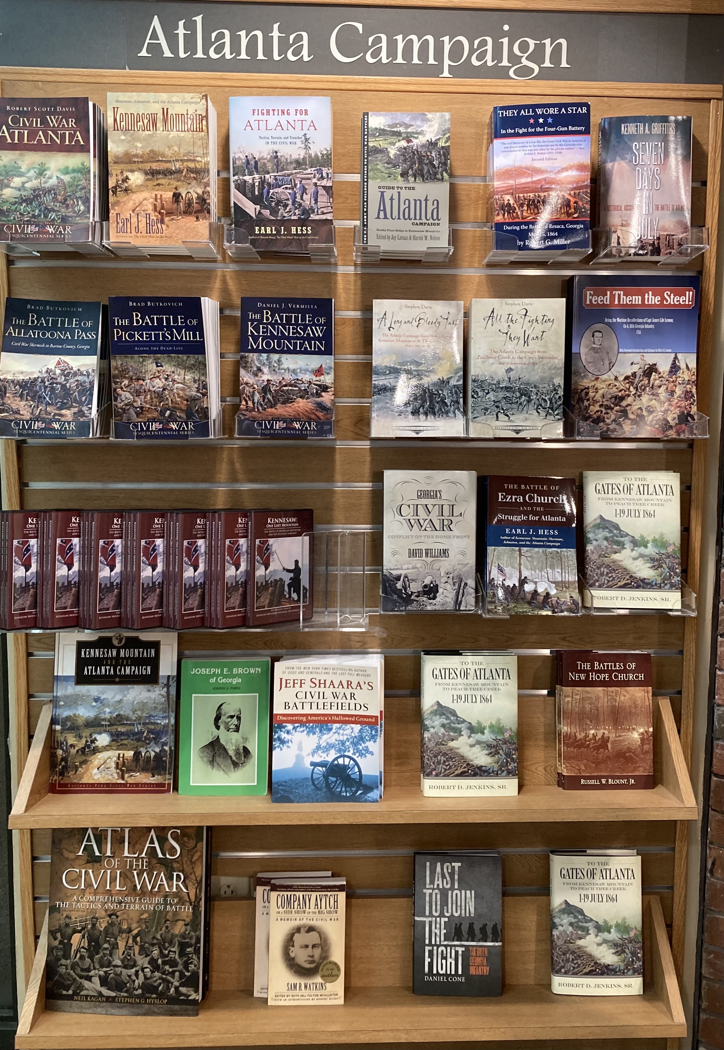
America's National Park BookstoreAmerica's National Park's bookstore is located in the Visitor Center at Kennesaw Mountain National Battlefield Park and is a perfect place to purchase souvenirs, historic books, refreshments, and more! 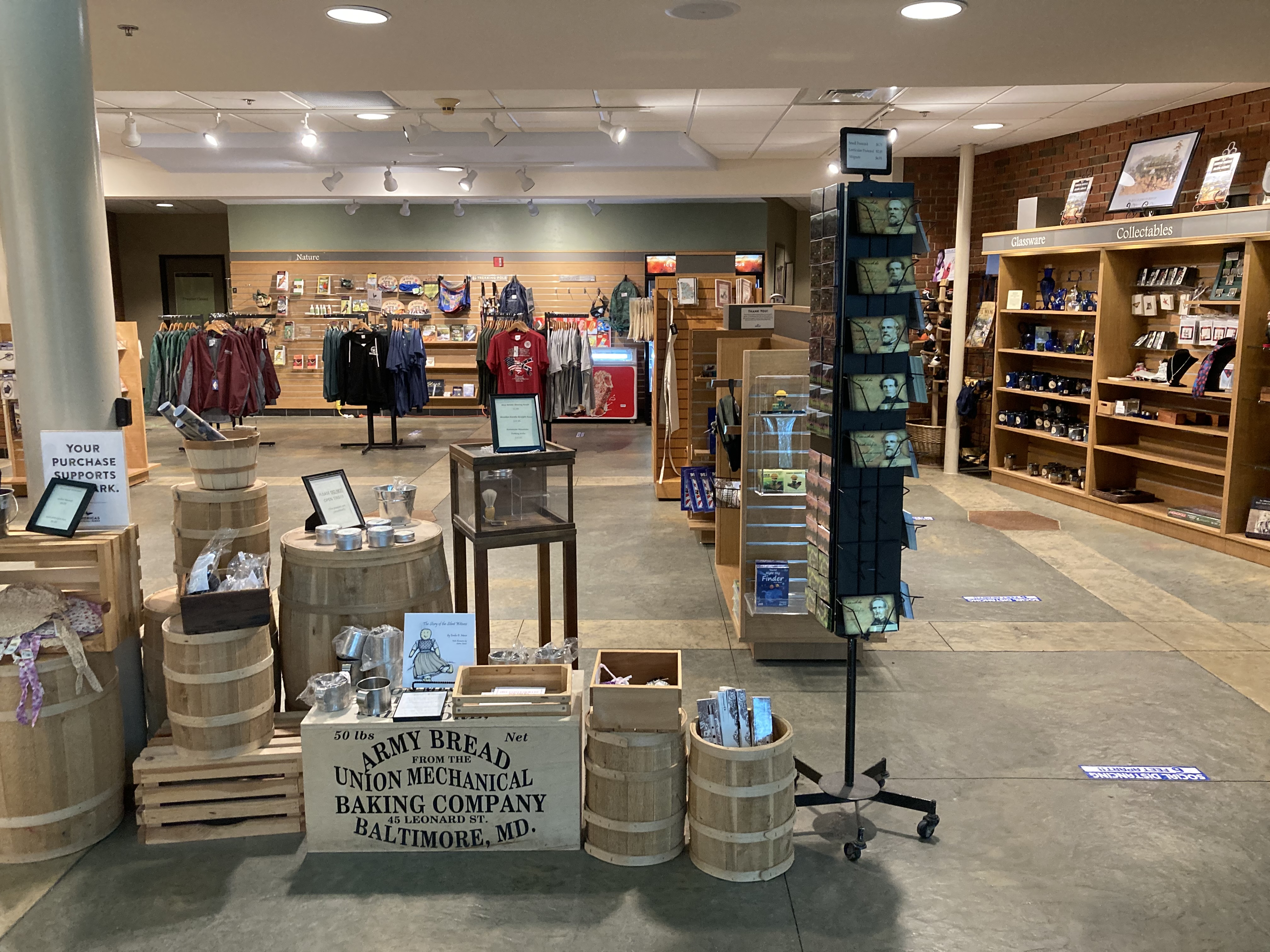
Cockrell's Orphan BrigadeThis is the location where a Confederate regiment from Missouri entrenched and defended against a Union frontal assault. 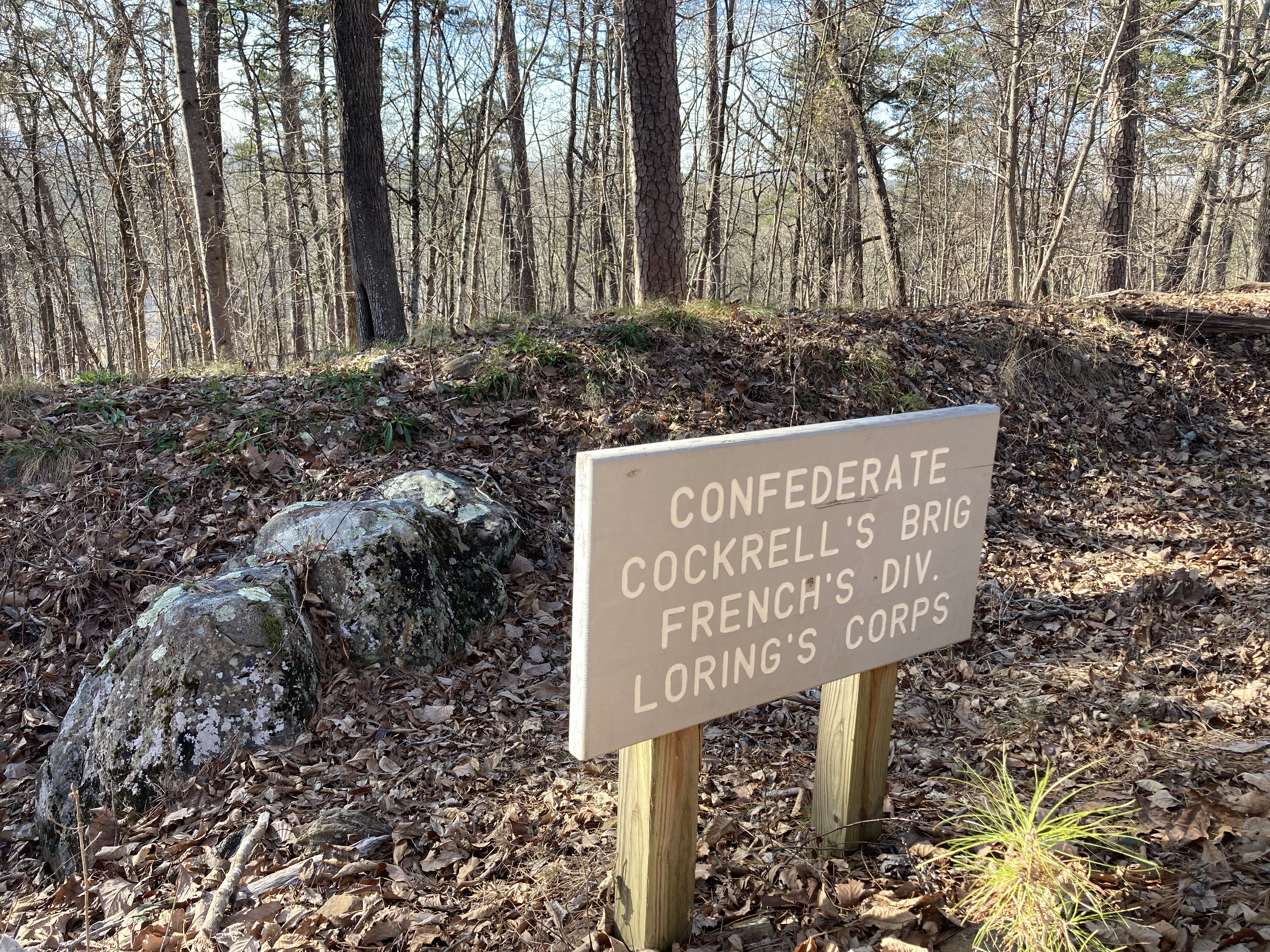
Dan McCook MarkerMarker indicating the starting point of Col. Dan McCook's Brigade during the Battle of Kennesaw Mountain. 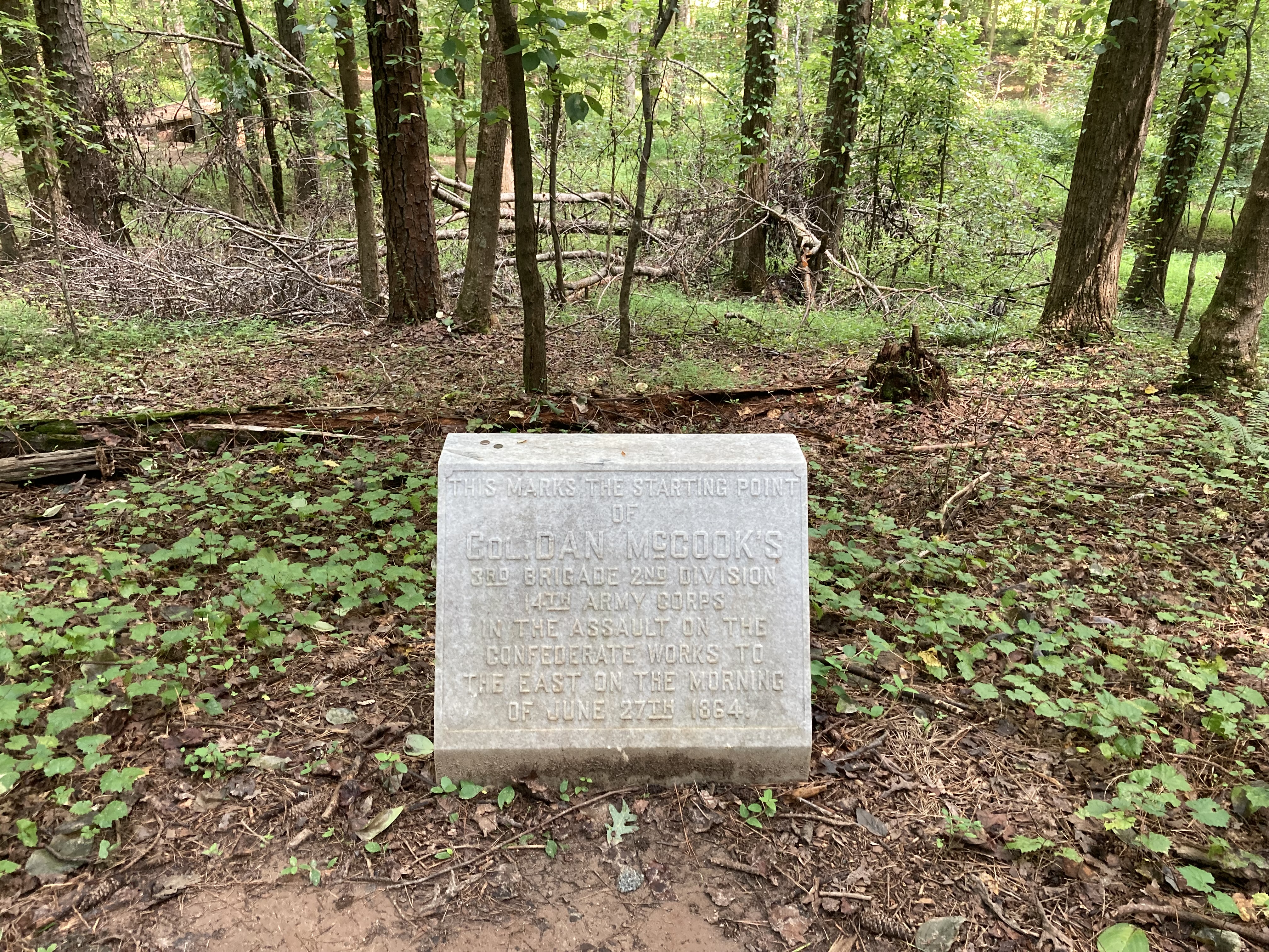
Kolb FarmhouseThe Kolb Farmhouse is the oldest standing structure in the park (dating back to the 1830's). It is also the site of the Battle of Kolb's Farm, which was one of the battles preceding the Battle of Kennesaw Mountain. 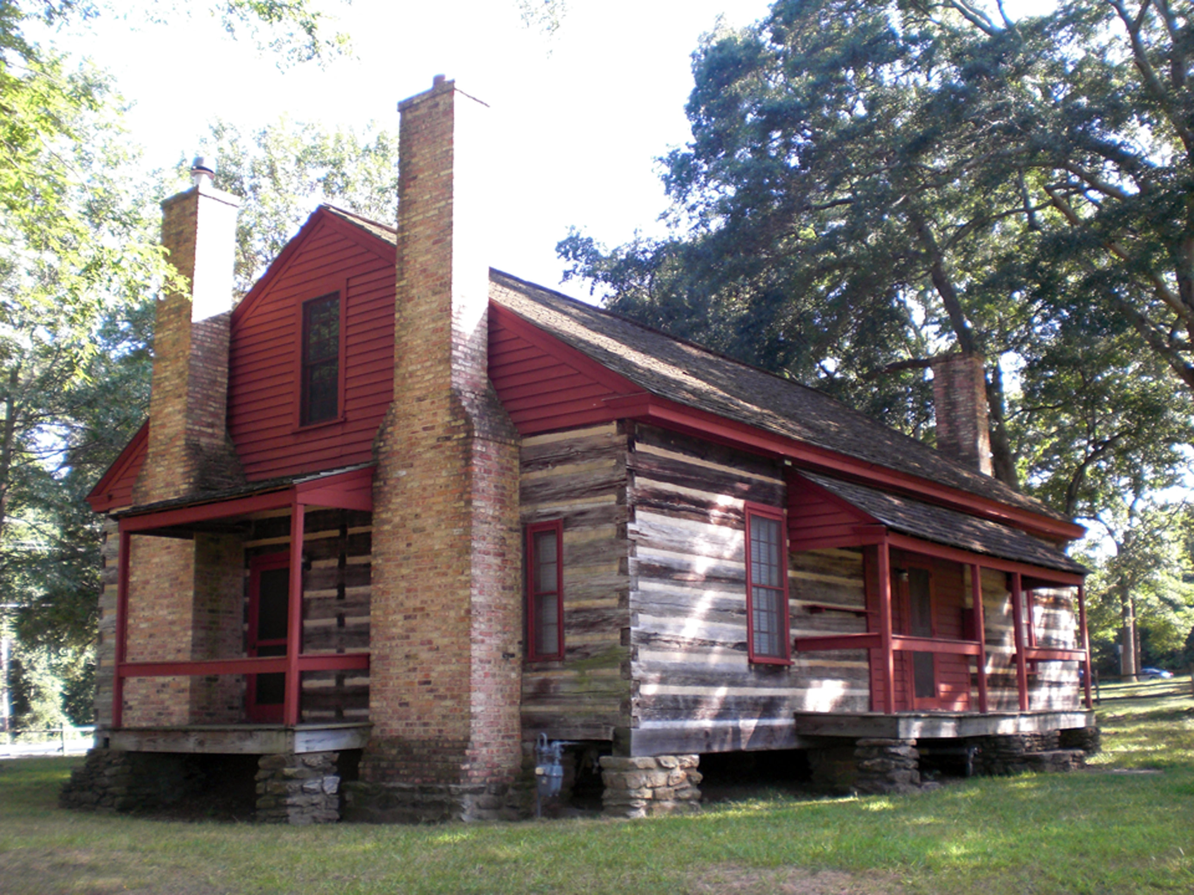
Lumsden's Artillery Battery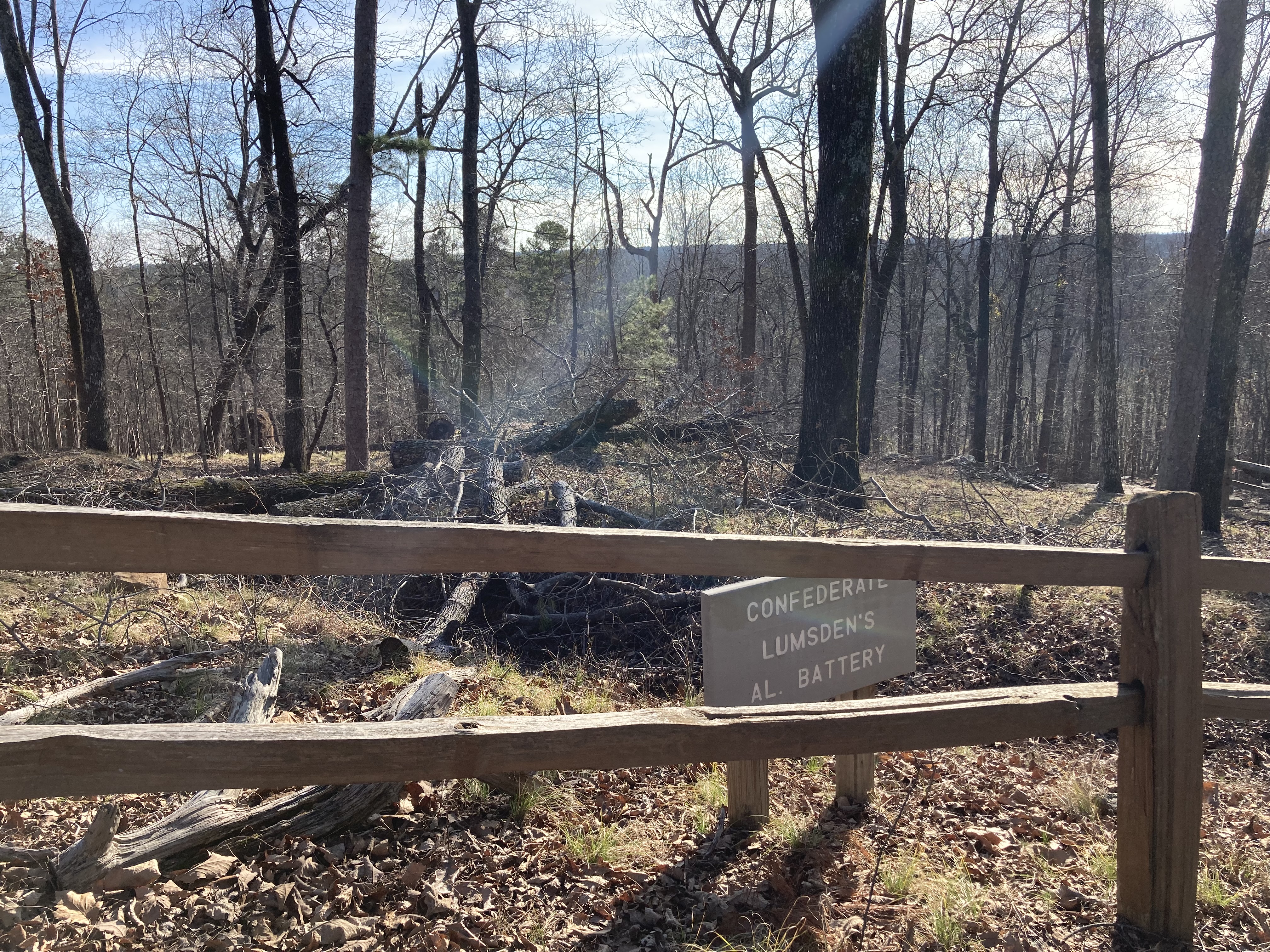
Mebane's BatteryConfederate Mebane's Tennessee artillery battery was used with deadly effectiveness during the Battle Kennesaw Mountain NBP 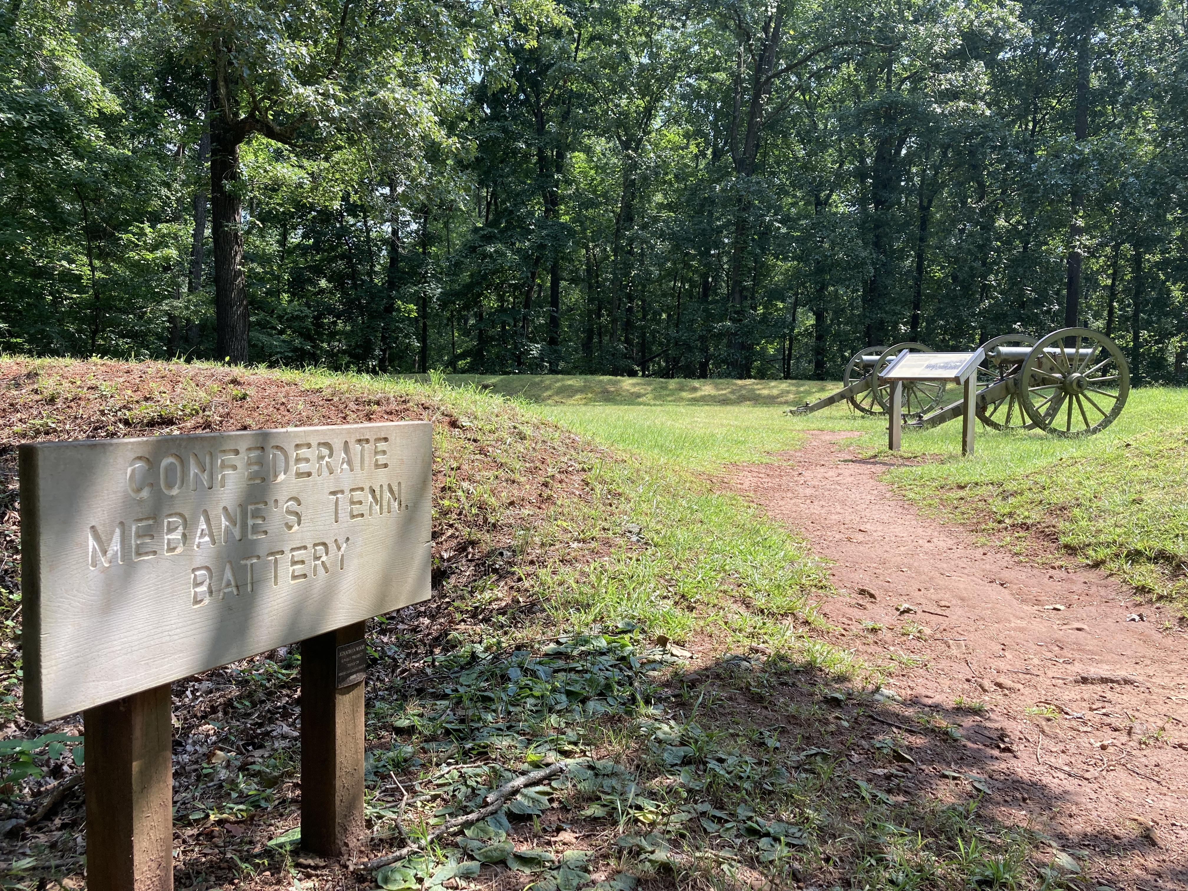
Pigeon HillPigeon Hill is a spur, or small hill just south of Little Kennesaw Mountain. This is a popular hiking area, as well as the site of one of the larger Union assaults during the Battle of Kennesaw Mountain. 
Pigeon Hill and the New Salem CommunityThis is a site within the historic New Salem Community in Marietta. 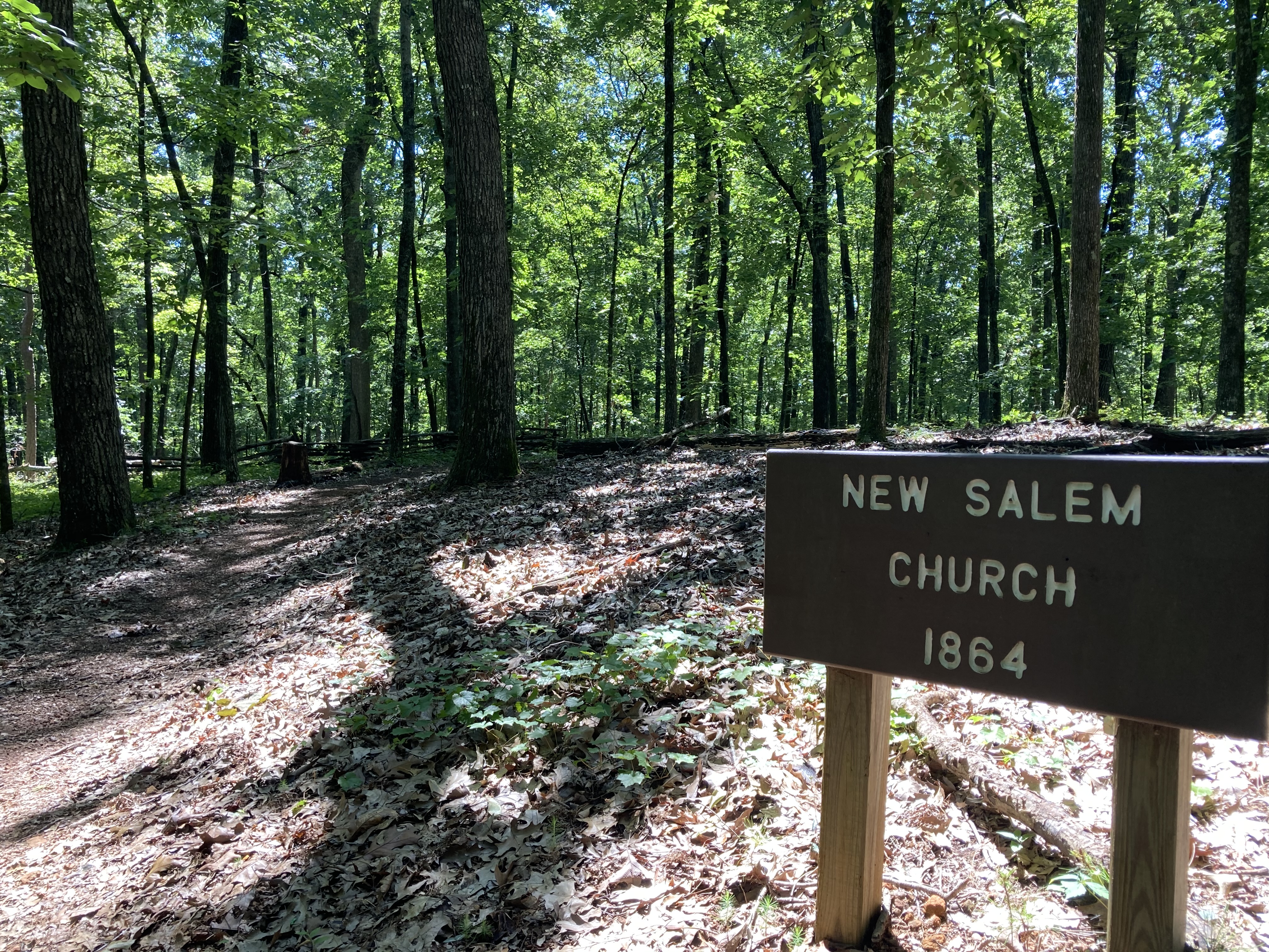
Summit of Big Kennesaw MountainPeak of Big Kennesaw Mountain at 1808 ft above sea level. 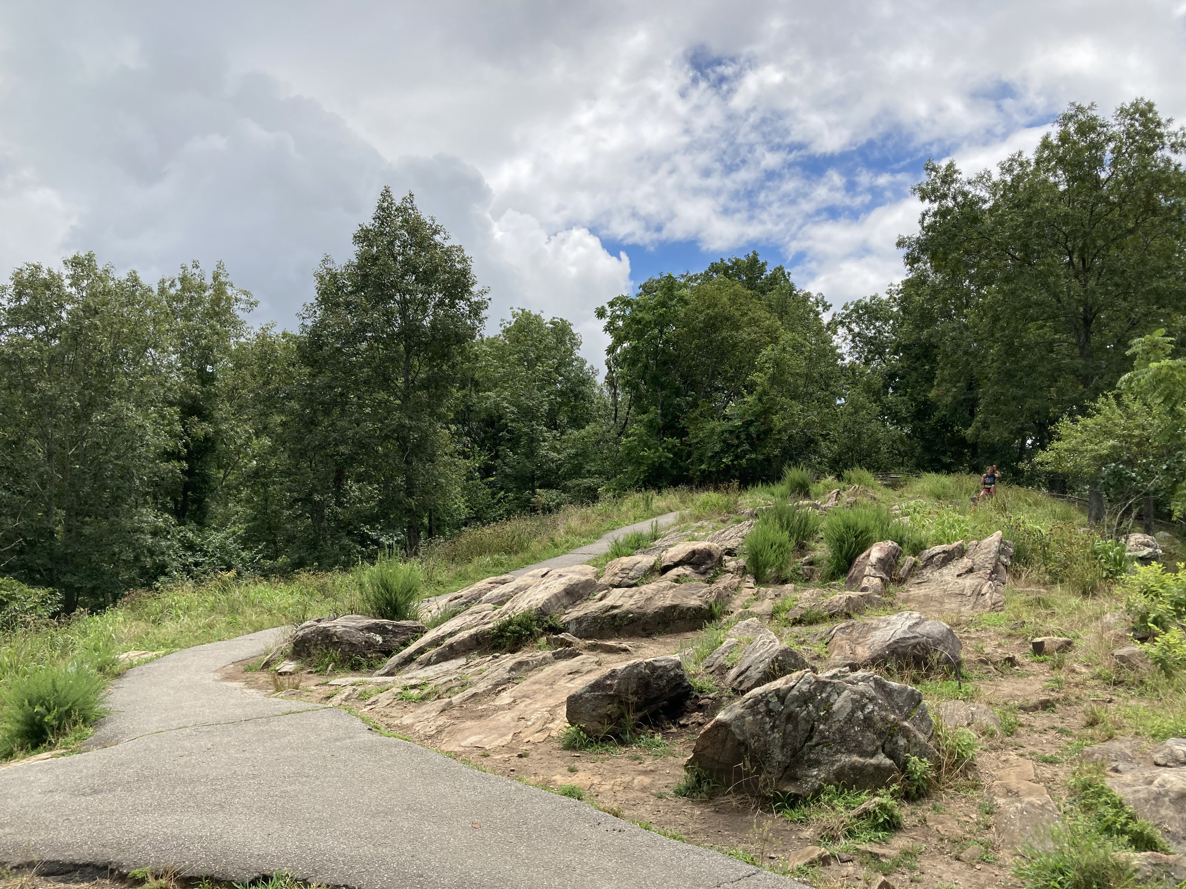
The 24-Gun BatteryThe 24-Gun Battery was the site of 6 Union Lite Artillery Batteries (4 cannons each). The remnants of many of the cannon placements are still visible today. 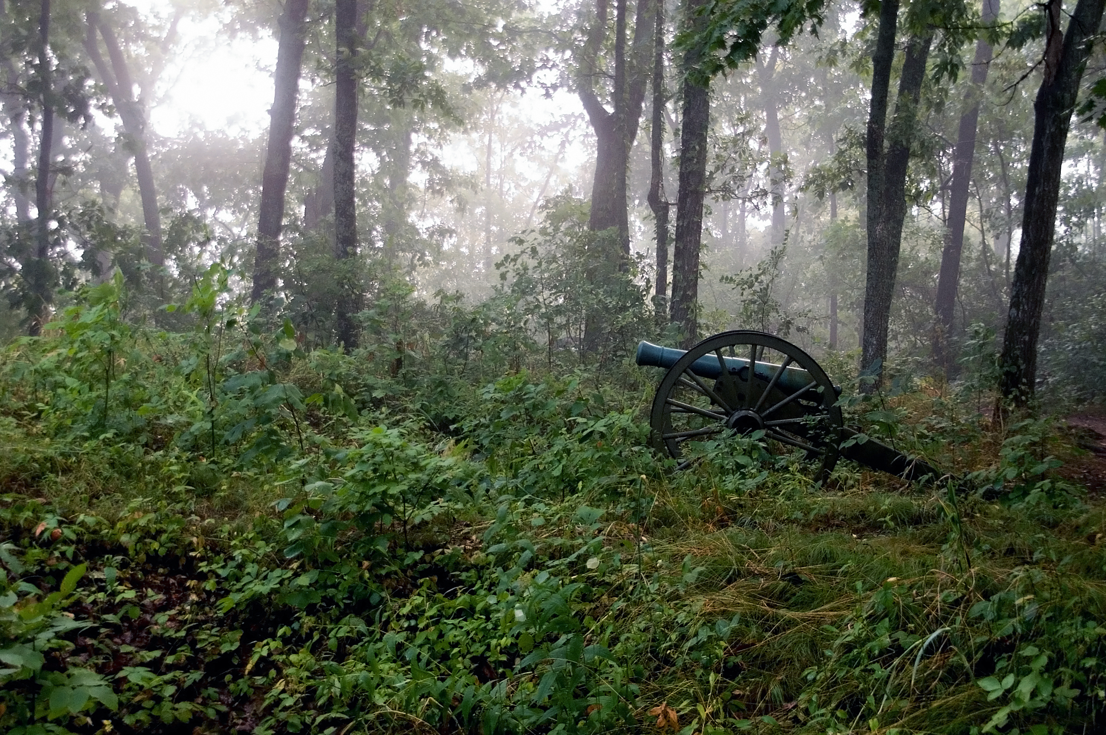
The AssaultBase of Cheatham Hill where a large Union assault too place against a Confederate defensive position. 
The Dead AngleThe 'Dead Angle' was a curve or bend in the Confederate earthworks that was the site of a large Union assault during the Battle of Kennesaw Mountain. 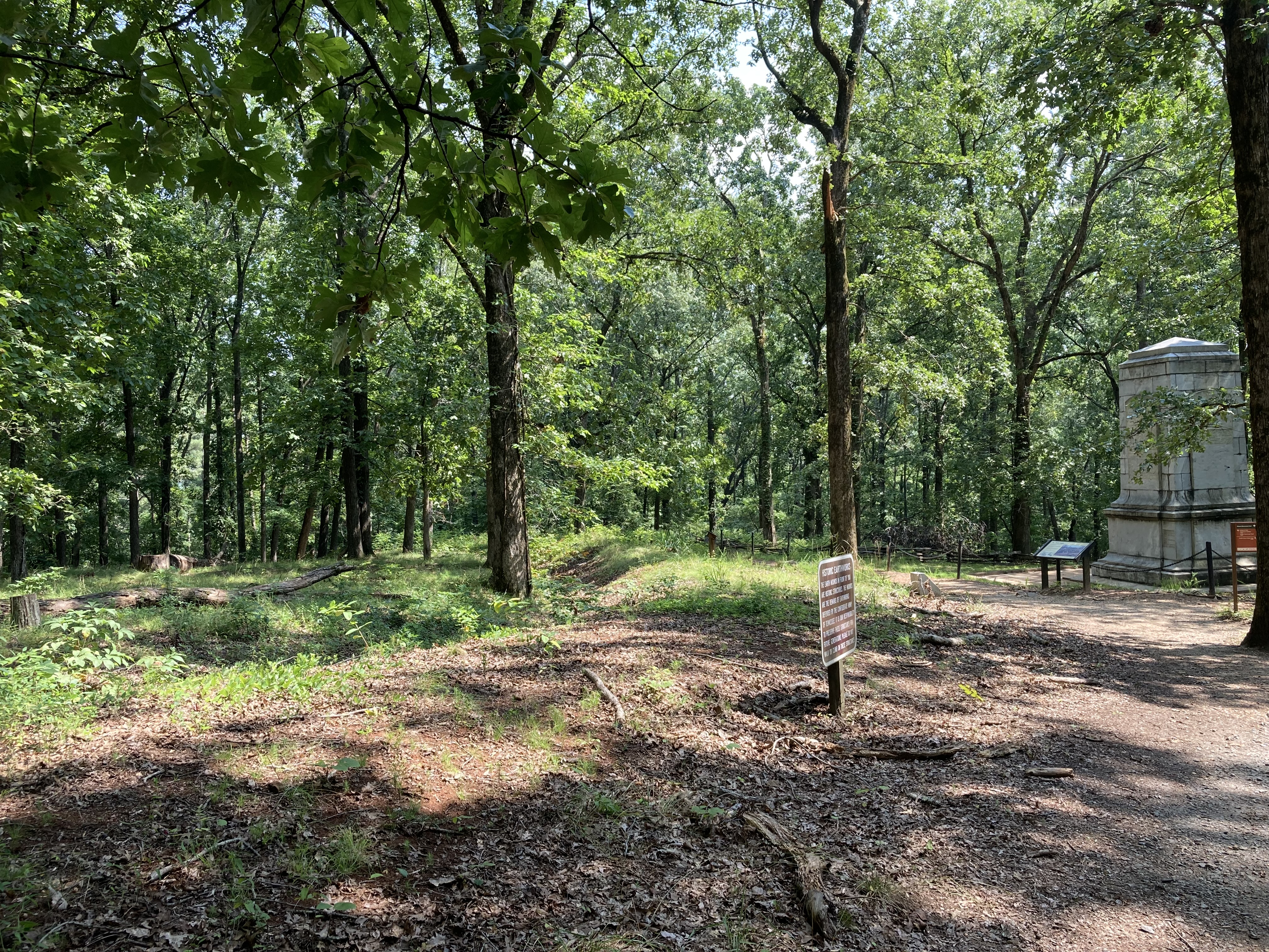
The Death of Colonel DanThe 'Death of Col. Dan' marker 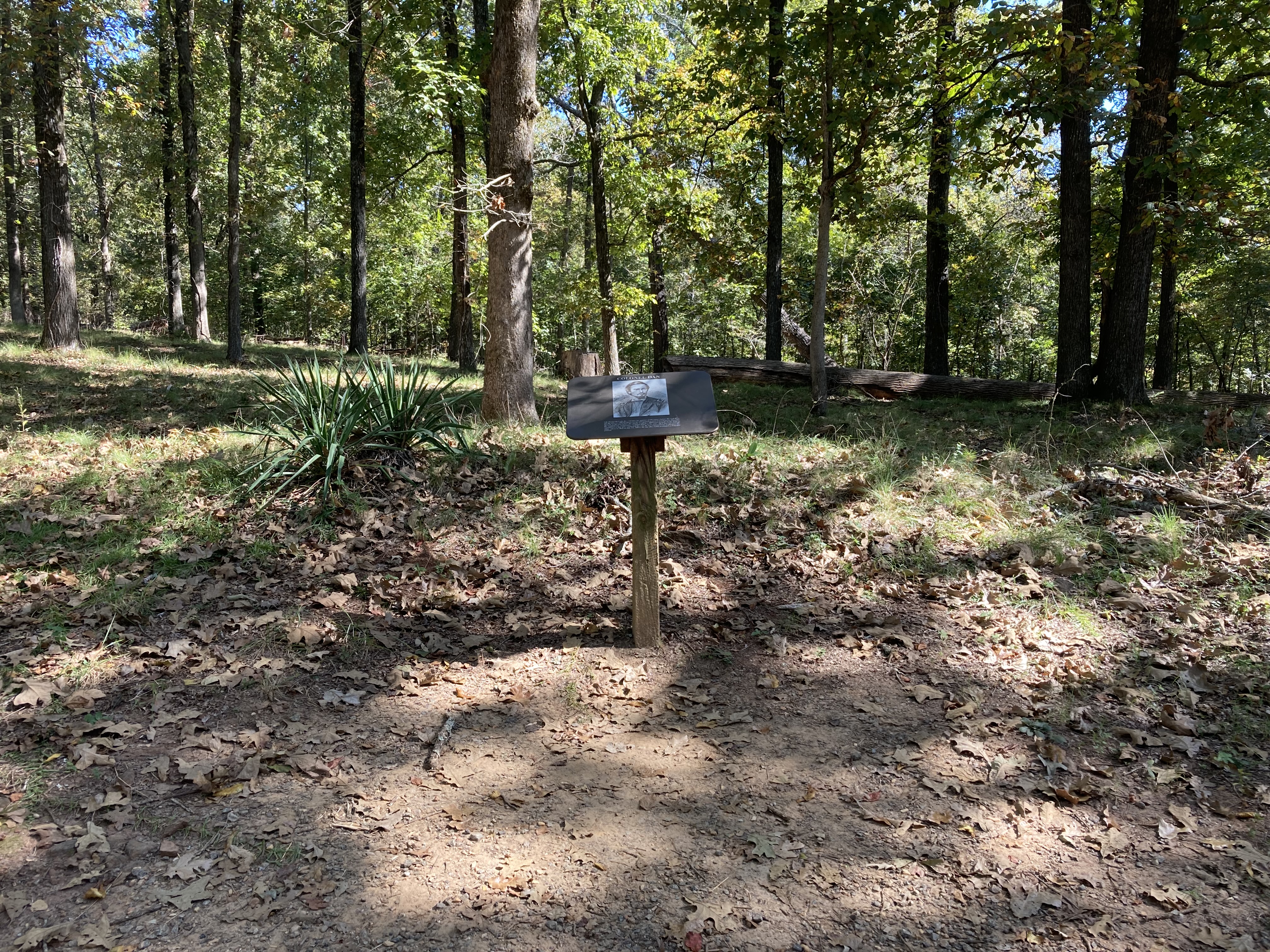
The Death of General HarkerThe site of General Charles Harker's 3rd Brigade during the Battle of Kennesaw Mountain. Also, the approximate site of Harker's death. 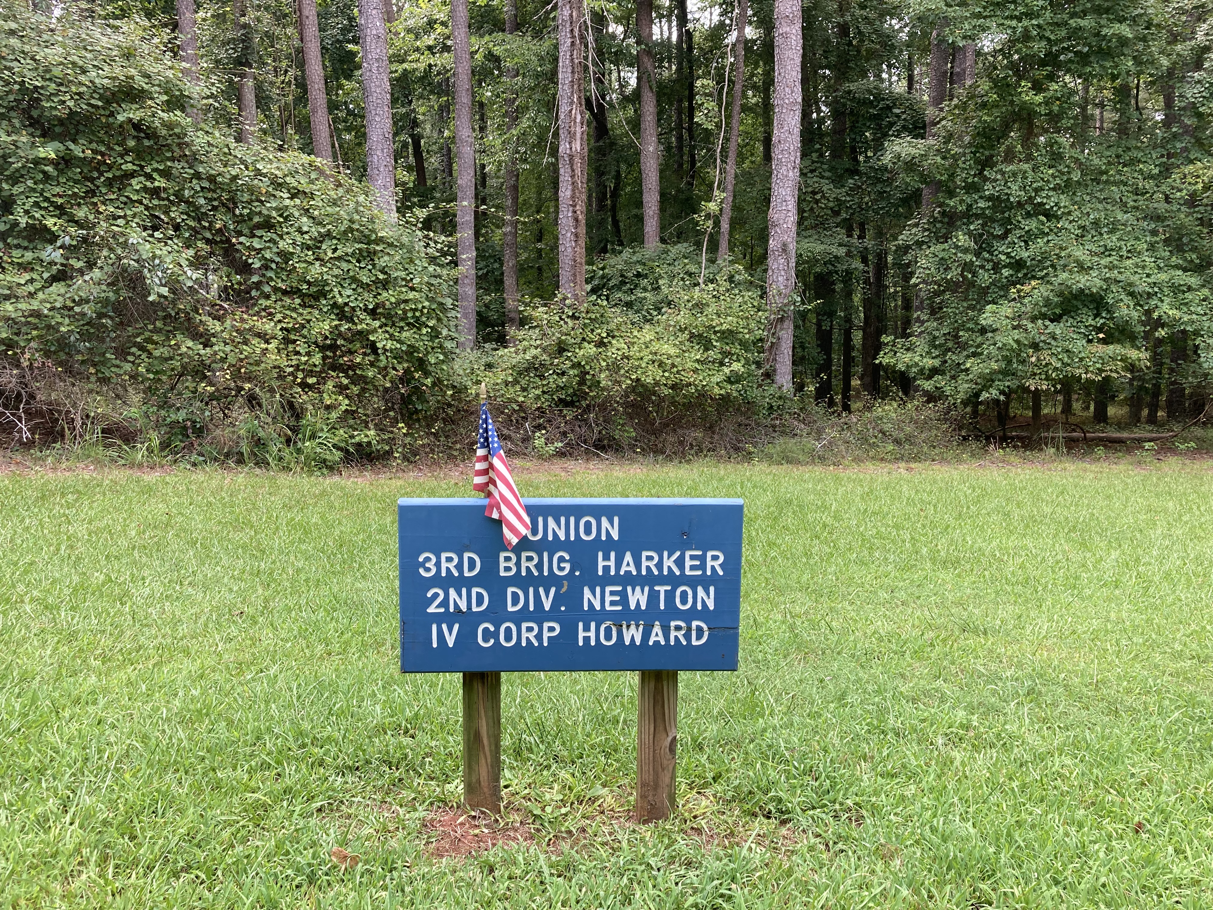
The Death of Sergeant CoffeySite marking the death and temporary interment of Sgt. C.H. Coffey. 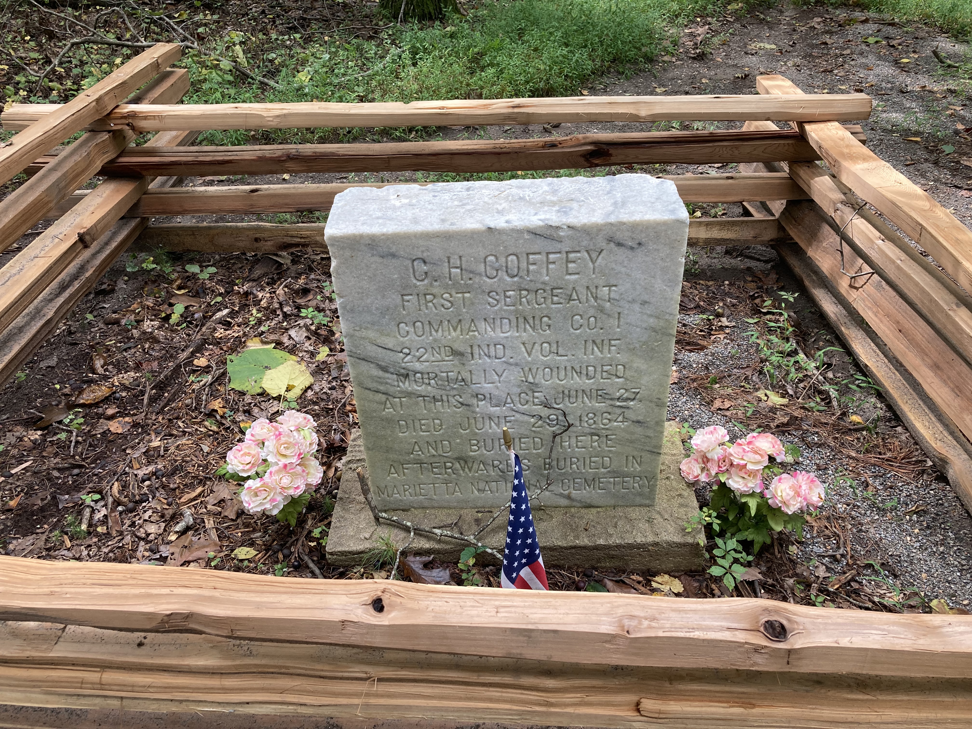
The Grave of the Unknown SoldierGrave of the Unknown Soldier at Kennesaw Mountain National Battlefield Park. 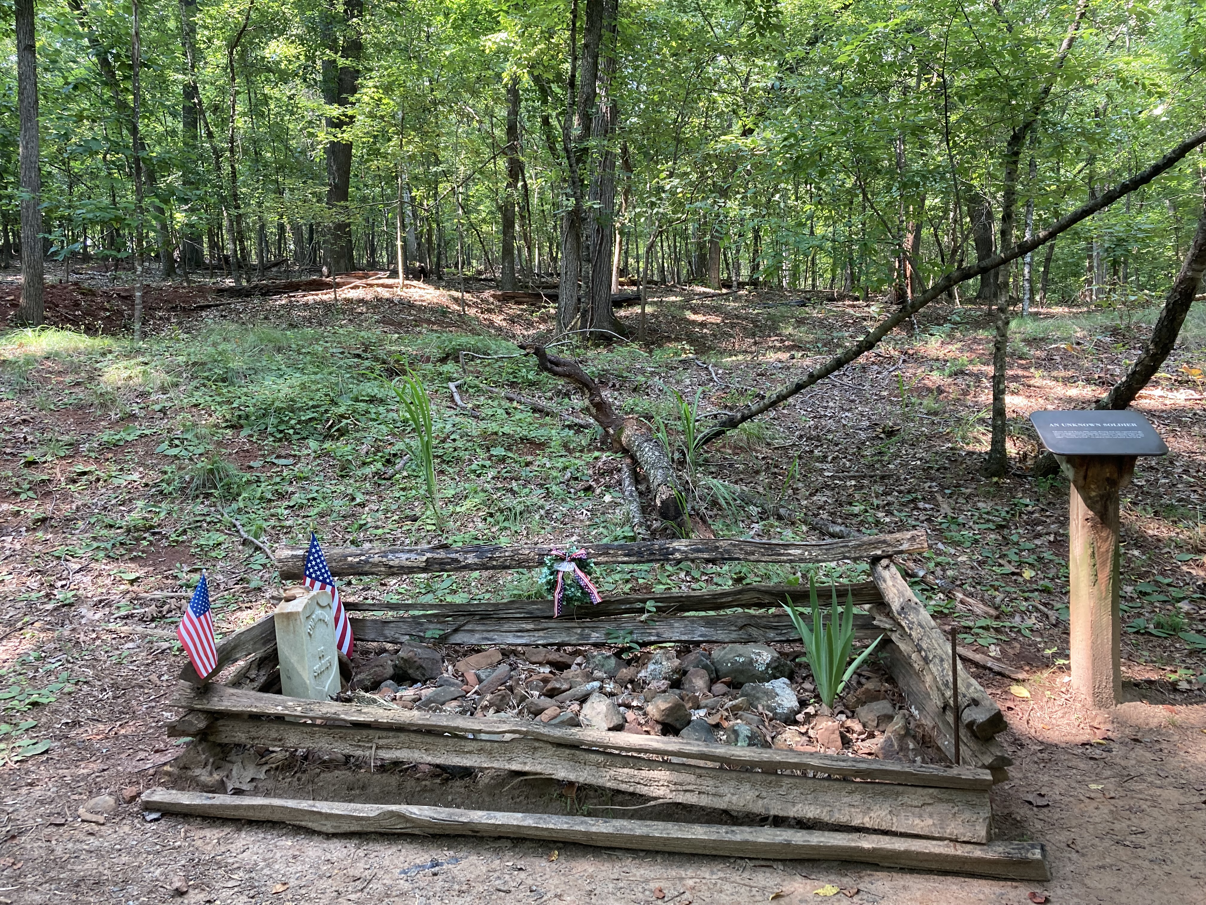
The Illinois MonumentThe Illinois Monument stands on the 'Dead Angle', which was an especially violent and casualty ridden part of the Battle of Kennesaw Mountain and the Atlanta Campaign. This monument was the first in the park, and honors the Union soldiers that lost their lives there on June 27, 1864. 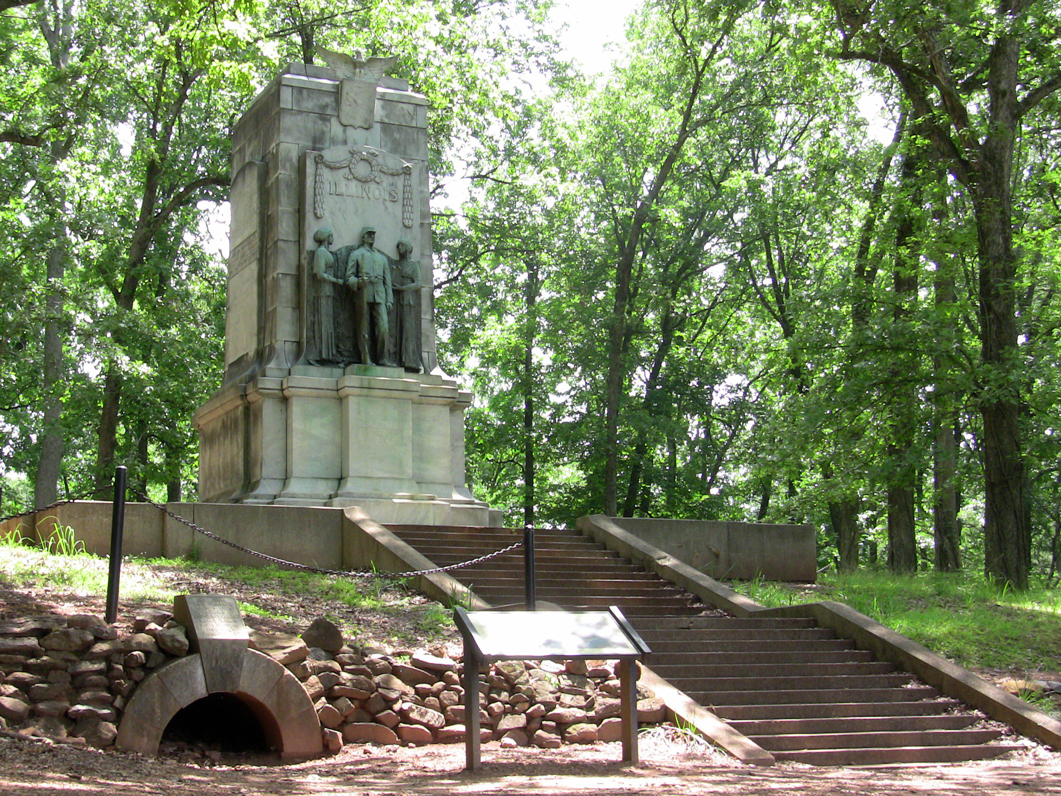
The Texas MonumentThe Texas Monument shows not only the Texas regiments that fought at the Battle of Kennesaw Mountain, but also where most of them were located during the battle. 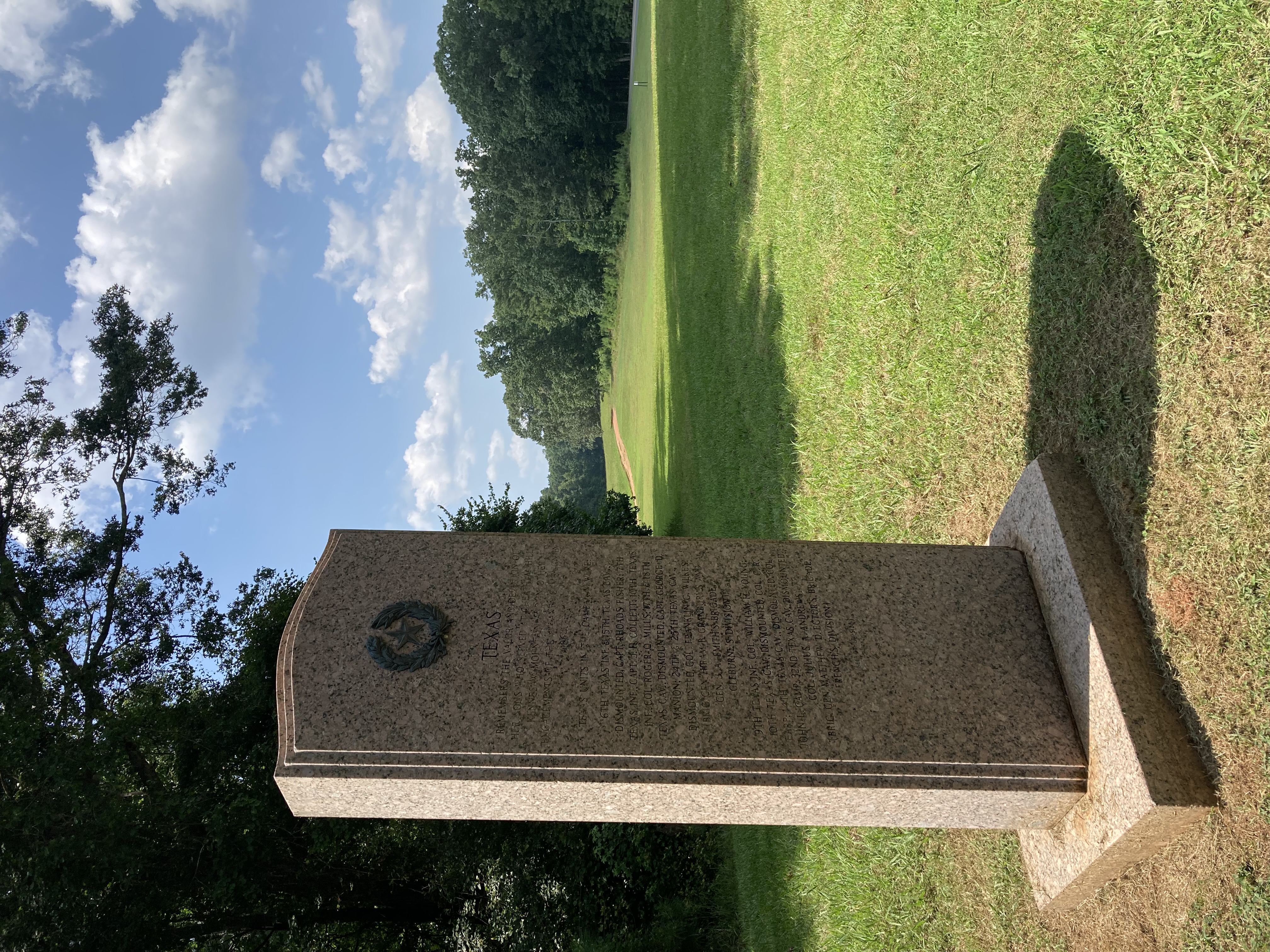
The TruceLocated on the side of Cheatham Hill Dr, in the park's Southern Section, this is the location of a notable truce that occurred during the battle of Kennesaw Mountain. 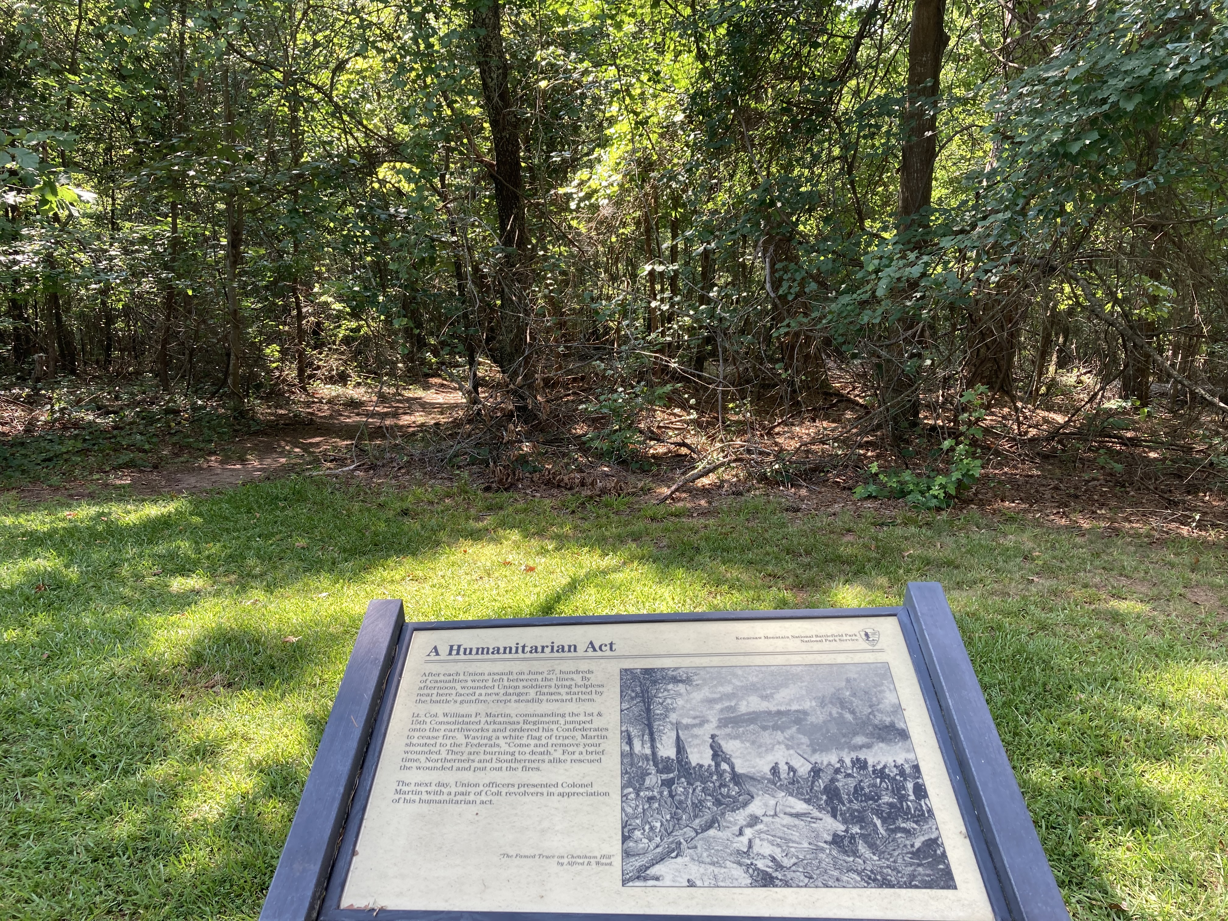
Thomas's HeadquartersSite of Major General George H. Thomas' headquarters during the Battle of Kennesaw Mountain. This was also where the Union assault on Cheatham Hill began. 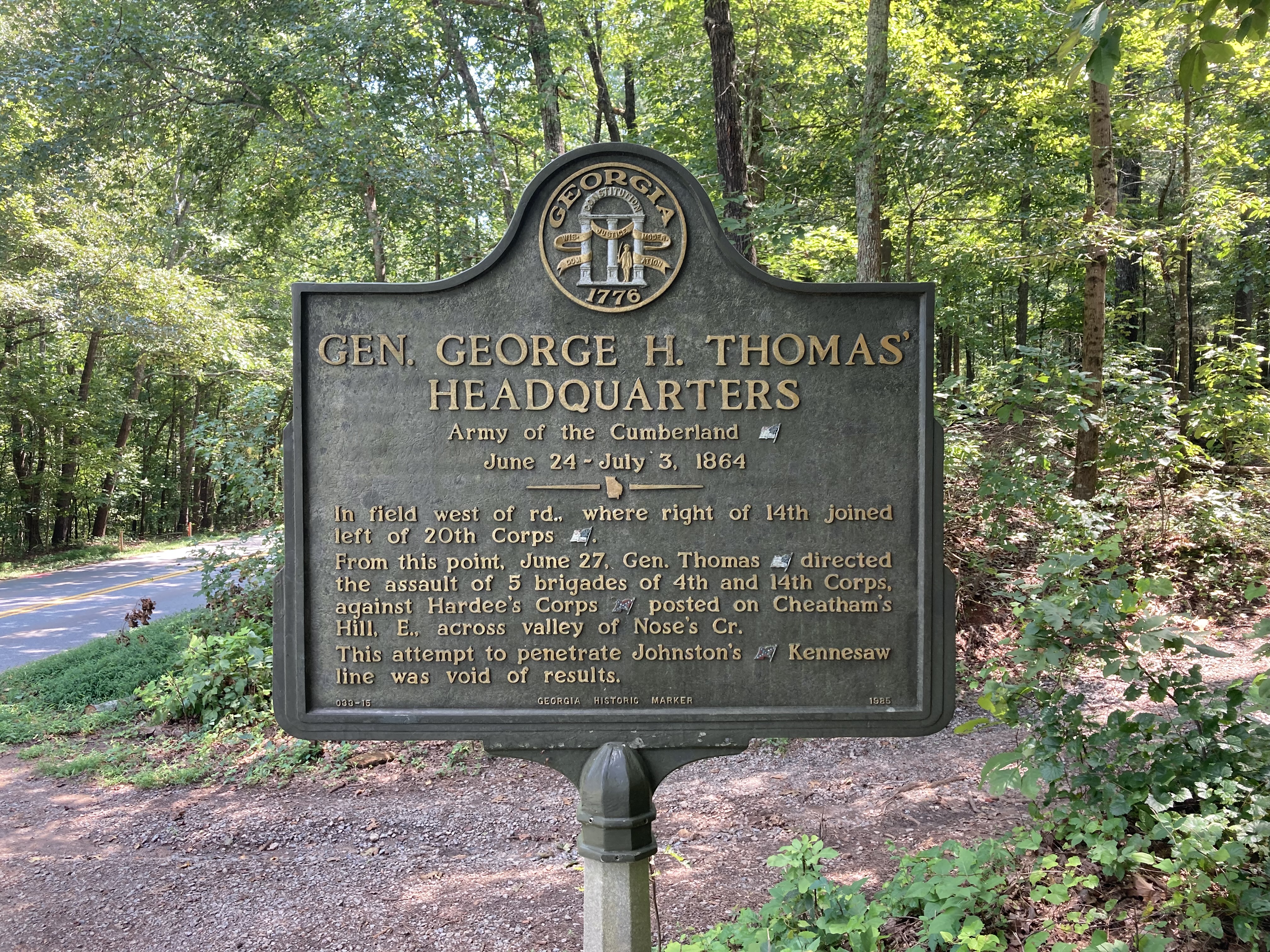
Union Trench LineUnion Trench line along Kennesaw Mountain NBP's 'Assault Trail' 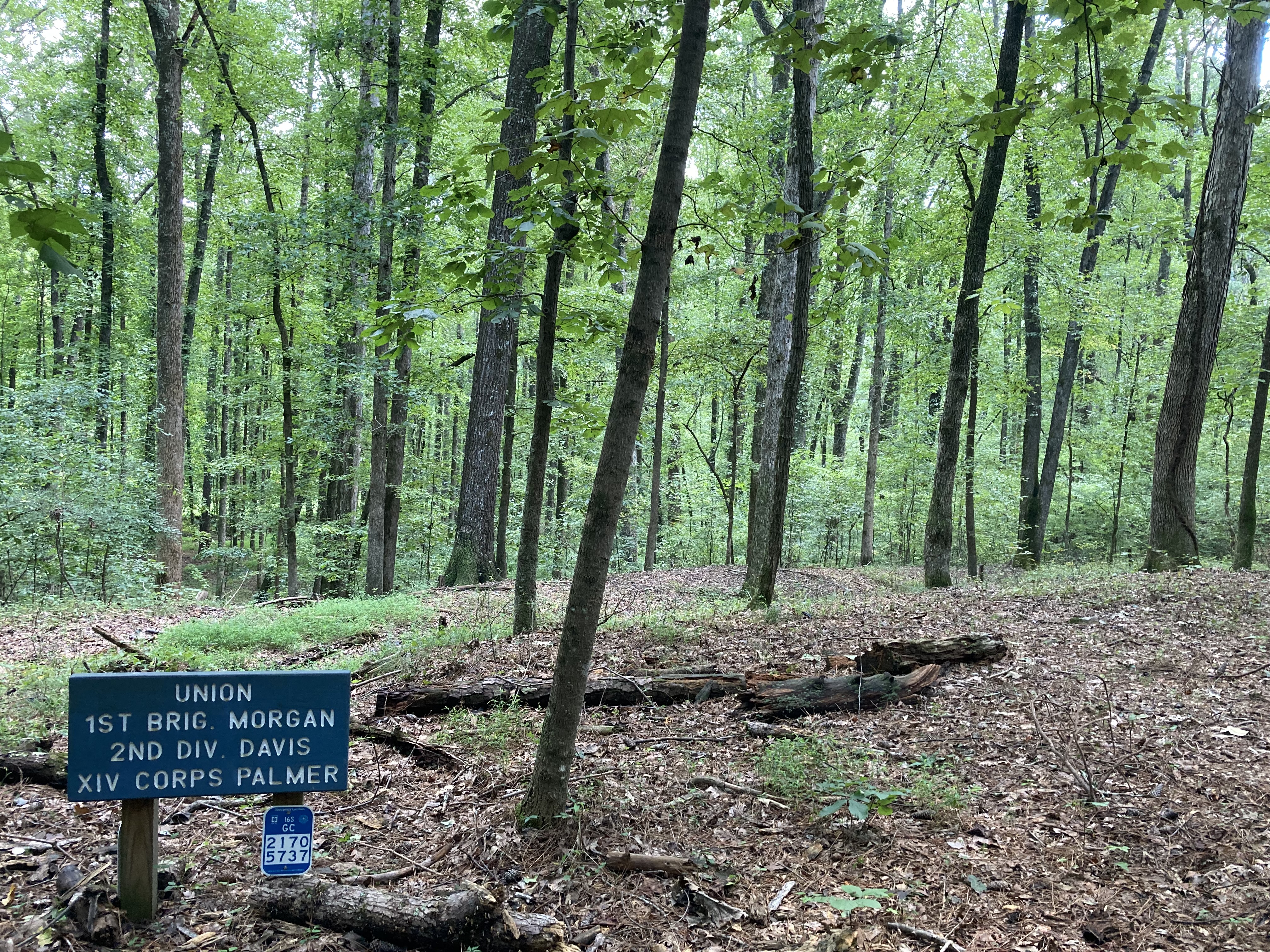
Walcutt's Attack on the GorgeLocation of a major Union frontal assault against a fortified Confederate position. 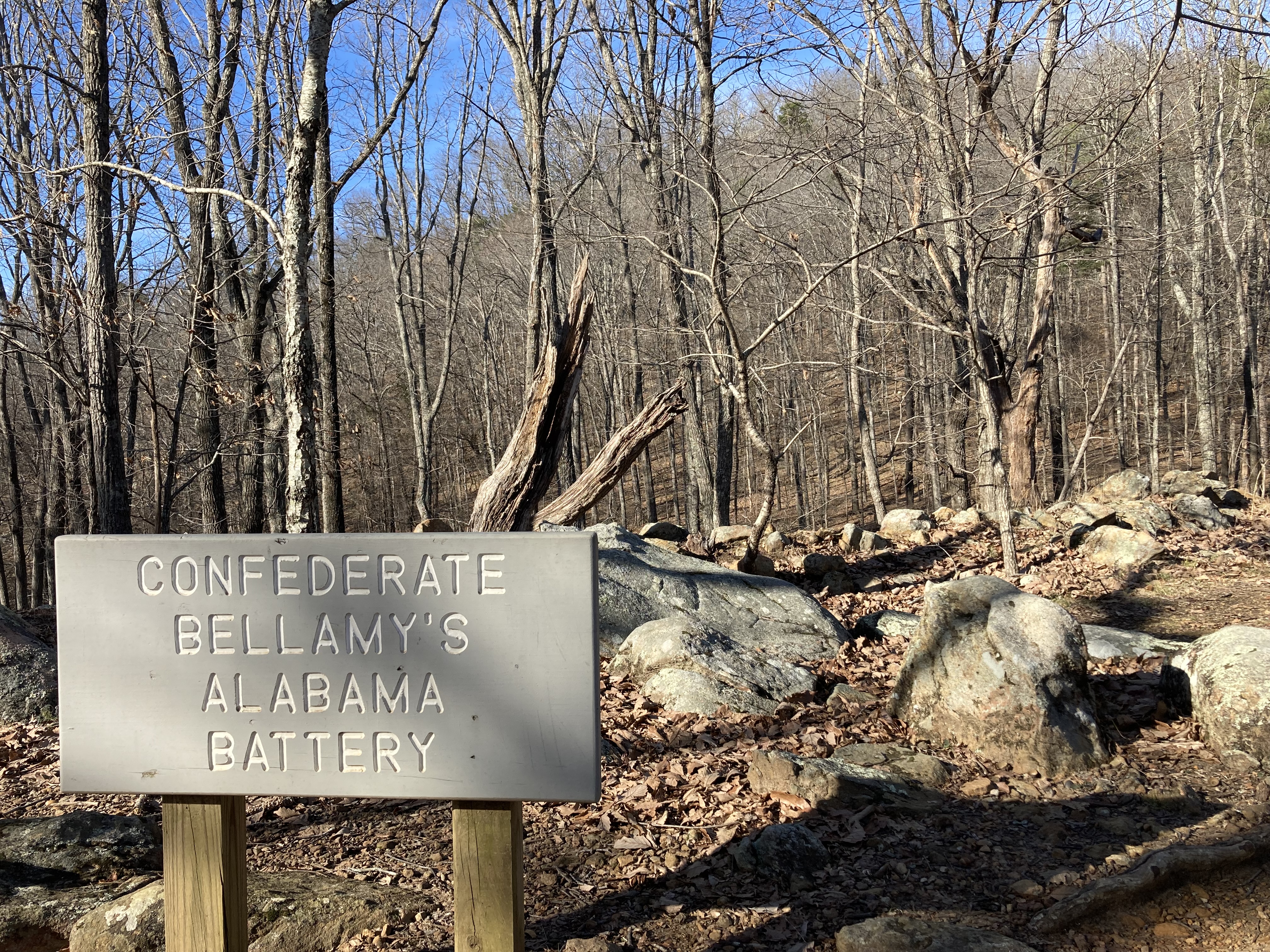
|
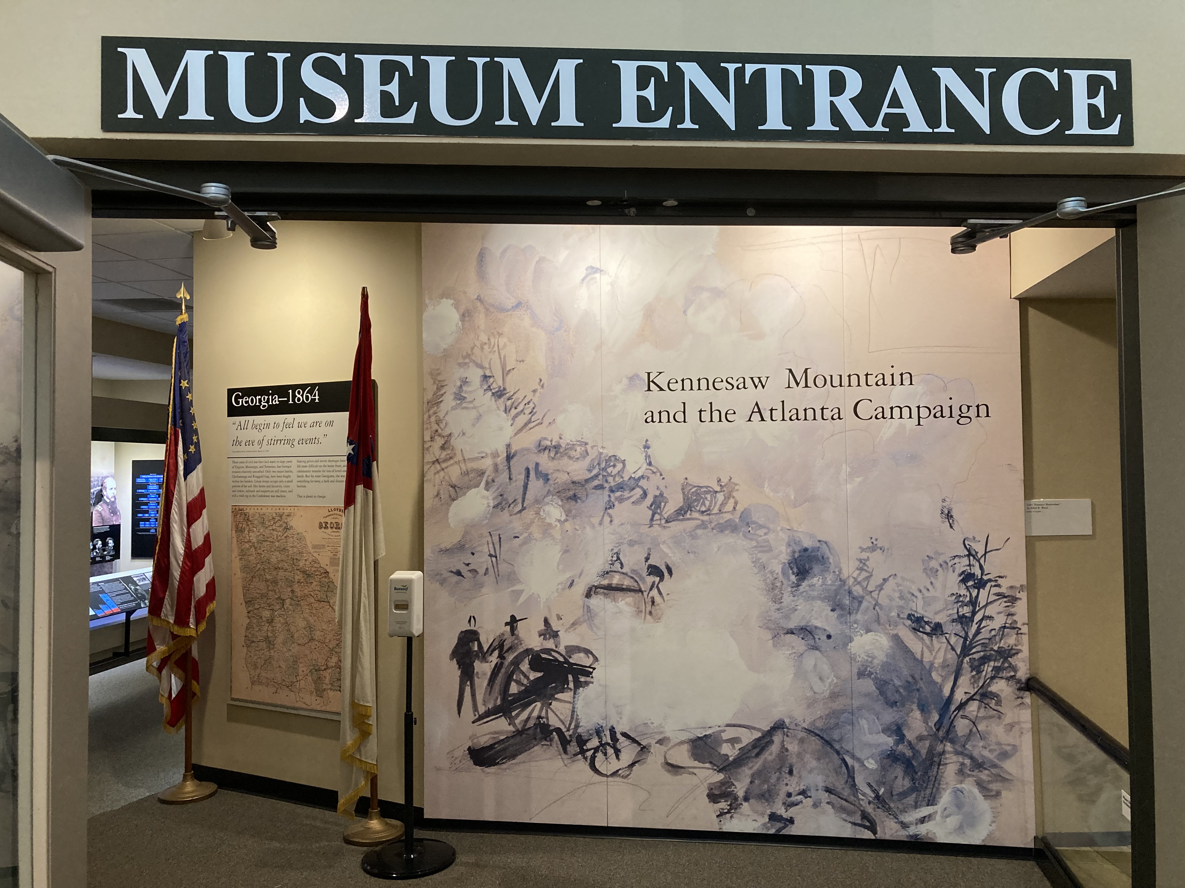
| Visitor Centers | Count: 1
Kennesaw Mountain National Battlefield Park Visitor Center
|
| Things to do | Count: 5
|
| Tours |
Count: 4
Self-Guided Driving TourWhether you are a first timer or a veteran visitor of Kennesaw Mountain, this driving tour with short bits of walking is a great introduction to the country's most heavily visited National Battlefield Park. On this tour, you will see beautiful views, historic earthworks, authentic artillery pieces, and more. The Action at Pigeon HillOn the morning of June 27, 1864, three Union brigades assaulted the Confederate position at Pigeon Hill. While furious, the overall assault would eventually falter. This tour will give you some of the local history of this area and take you through the elements of the attack and the defense. The Confederate Line of Cheatham HillThis self-guided tour will explore some of the key points of the Confederate defensive position and their actions near Cheatham Hill during the Battle of Kennesaw Mountain. The Union Assault at Cheatham HillThis self-guided tour details key points of the Union army's assault at Cheatham Hill during the Battle of Kennesaw Mountain. |
| Articles |
|