| Title | Lewis & Clark |
| Park Code | lecl |
| Description | The Lewis and Clark National Historic Trail winds nearly 4,900 miles through the homelands of more than 60 Tribal nations. It follows the historic outbound and inbound routes of the Lewis and Clark Expedition of 1803-1806 from Pittsburgh, Pennsyl... |
| Location |
lat:41.2646141052, long:-95.9245147705
States: IA,ID,IL,IN,KS,KY,MO,MT,NE,ND,OH,OR,PA,SD,WA,WV
Forecast
|
| Contact | |
| Activities |
|
| Entrance fees |
|
| Campgrounds | Count: 0
|
| Places | Count: 50
Akta Lakota Museum and Cultural CenterThe Akta Lakota Museum and Cultural Center is an educational outreach building, supported by St. Joseph's Indian School in Chamberlain, SD. Akta Lakota means “honor the people” in the Lakota dialect. The museum has welcomed thousands of people since opening its doors in 1991 and sits on the banks of the mighty Missouri River. It tells the story of the Lakota people beginning prior to European colonization and ending with contemporary issues facing tribes today. 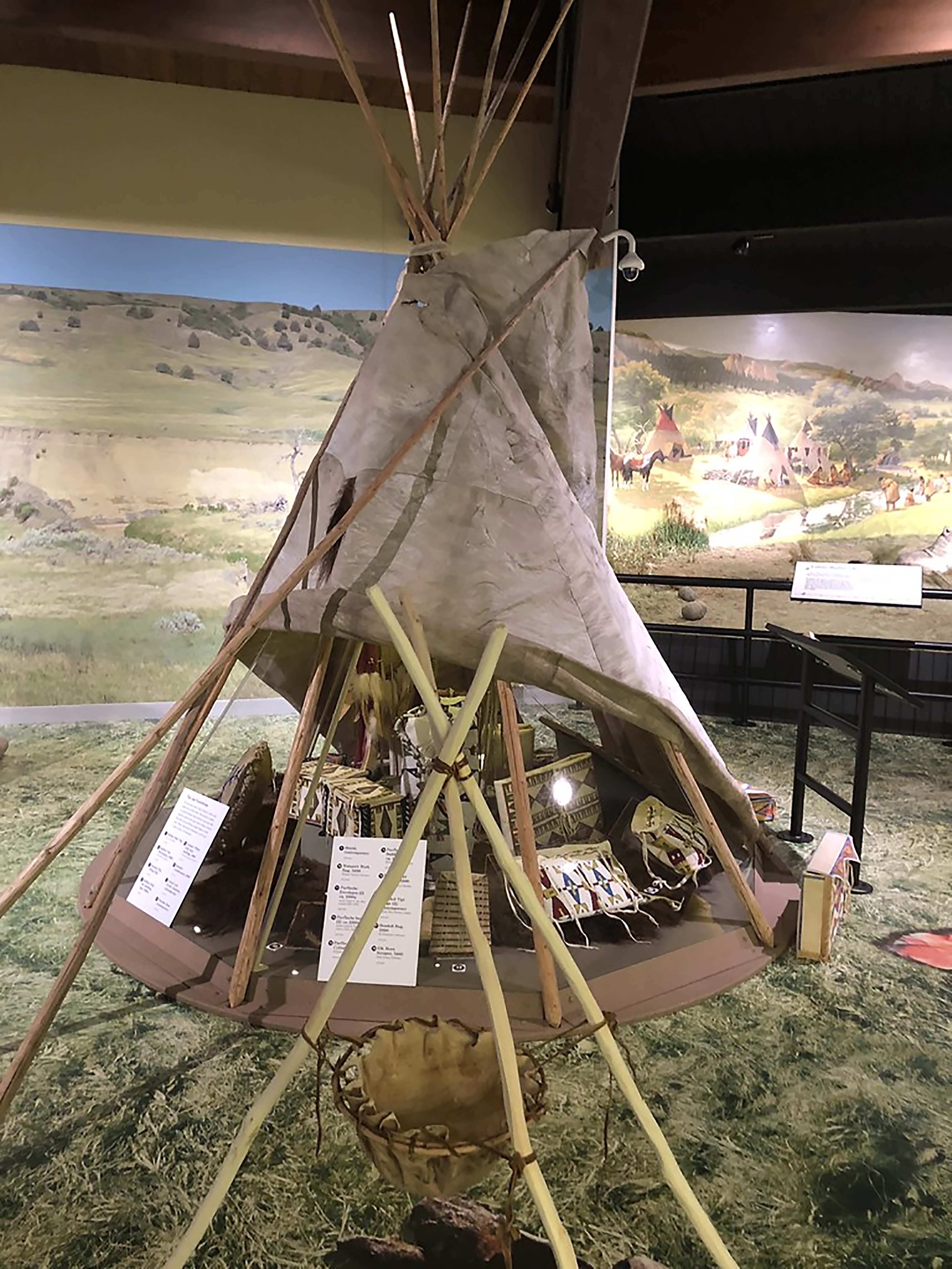
Alice Creek Historic DistrictAlice Creek Historic District is a High Potential Historic Site on the Lewis and Clark National Historic Trail. After departing Travellers Rest on the return journey, Lewis and his detachment followed the Cokahlarishkit Trail, or “Road to the Buffalo,” to cross the Continental Divide. 
Angel Mounds State Historic SiteLocated on the banks of the Ohio River near Evansville, IN, the Angel Mounds State Historic Site boasts a unique combination of nature, history, and archeological wonders sure to entertain all visitors. From 1000-1450 A.D., the area was the site of a Middle Mississippian culture town where the cultivation and storage of corn allowed a permanent community to persist. 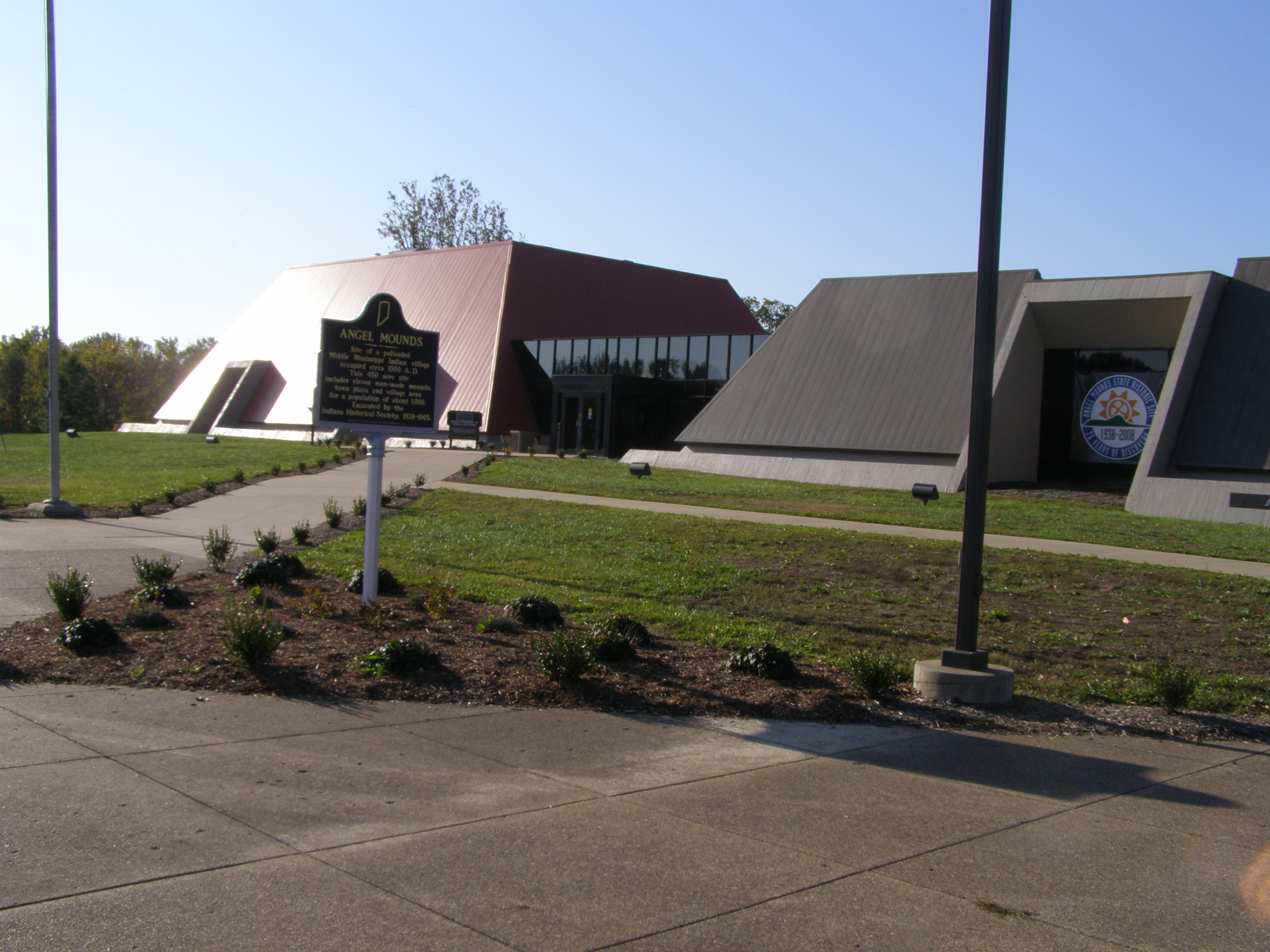
Annie & Abel Van Meter State Park and Missouri's American Indian Cultural Center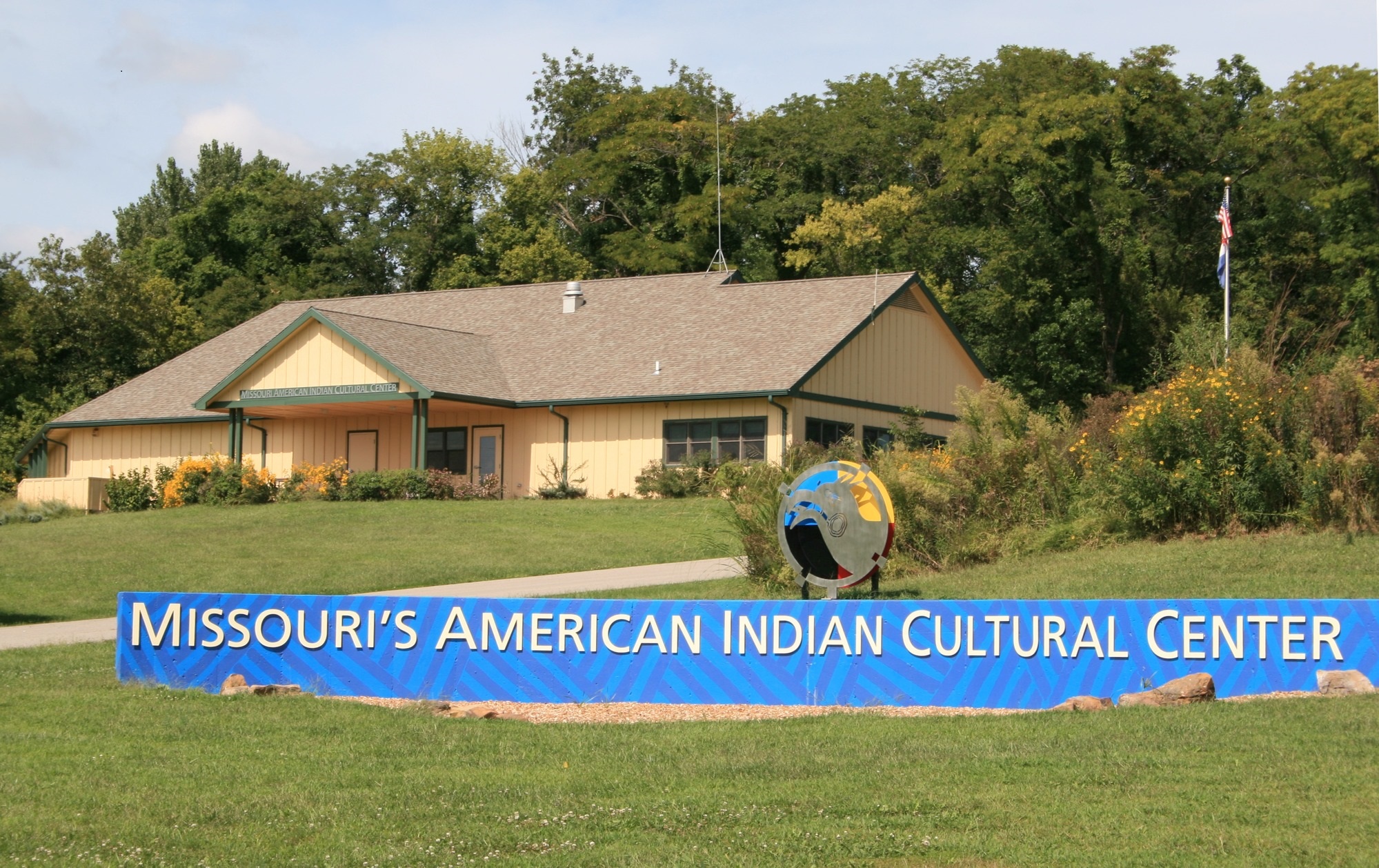
Arrow RockArrow Rock was notable in the journeys that opened the West, beginning with the Lewis and Clark Expedition on June 9, 1804. Clark noted Arrow Rock Bluff and the party's experience in his journal: 
Arrow Rock State Historic Site Visitor CenterThe Arrow Rock State Historic Site visitors’ center opened in 1991 and features nearly 9,000 square feet of exhibit space. The center interprets the history of Arrow Rock and the central Missouri region historically known as “Boone’s Lick Country.” You can watch a 20-minute video “Arrow Rock: Frontier Town of the Boone’s Lick” an introduction and overview of the community. 
Astoria ColumnLocated in Astoria, Oregon, the Astoria Column serves as a monument to the history Pacific Northwest. The idea for the column first came about in 1898 when the city thought to build an electrified tower that would rival the Eiffel Tower in Paris, France. In 1914, the project began to take its first tentative steps toward becoming a reality when the City of Astoria bought 30 acres of land on Coxcomb Hill. 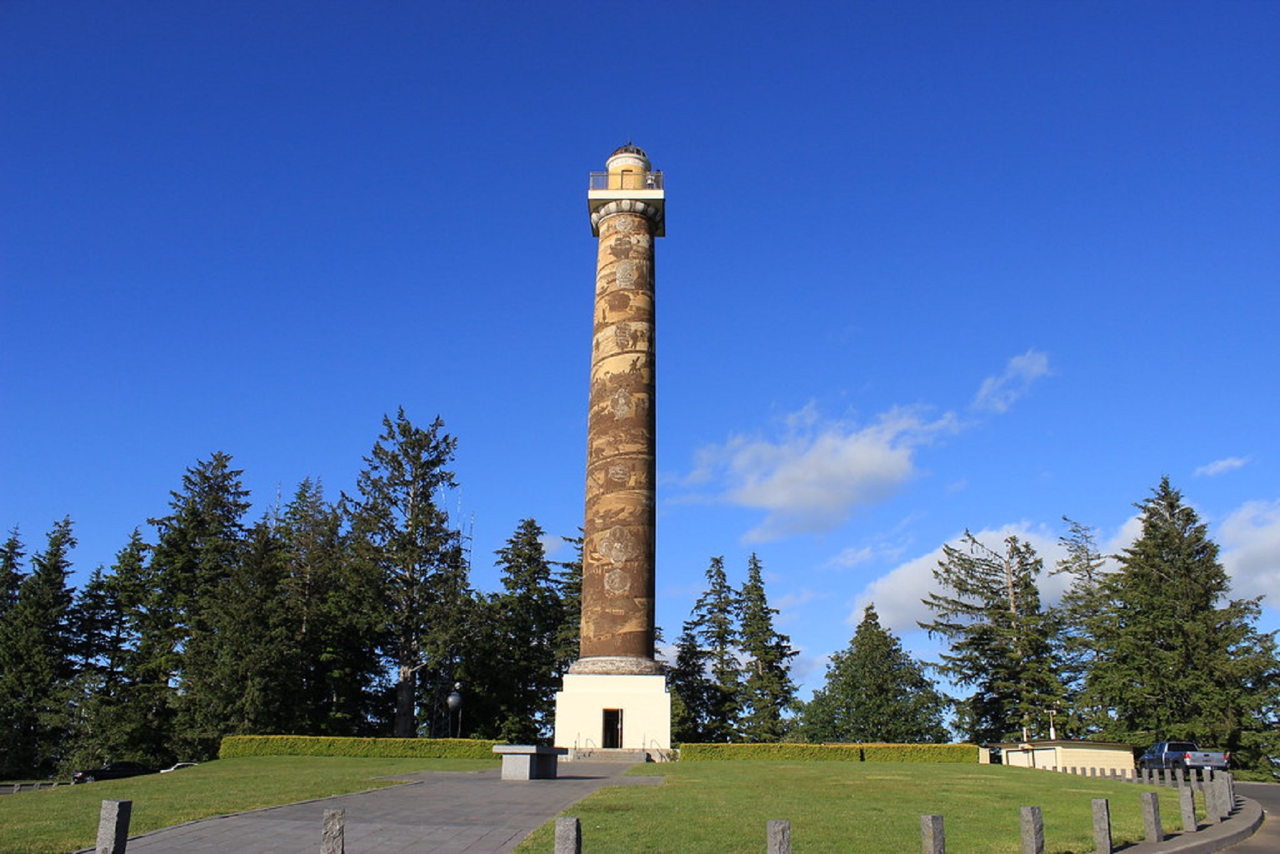
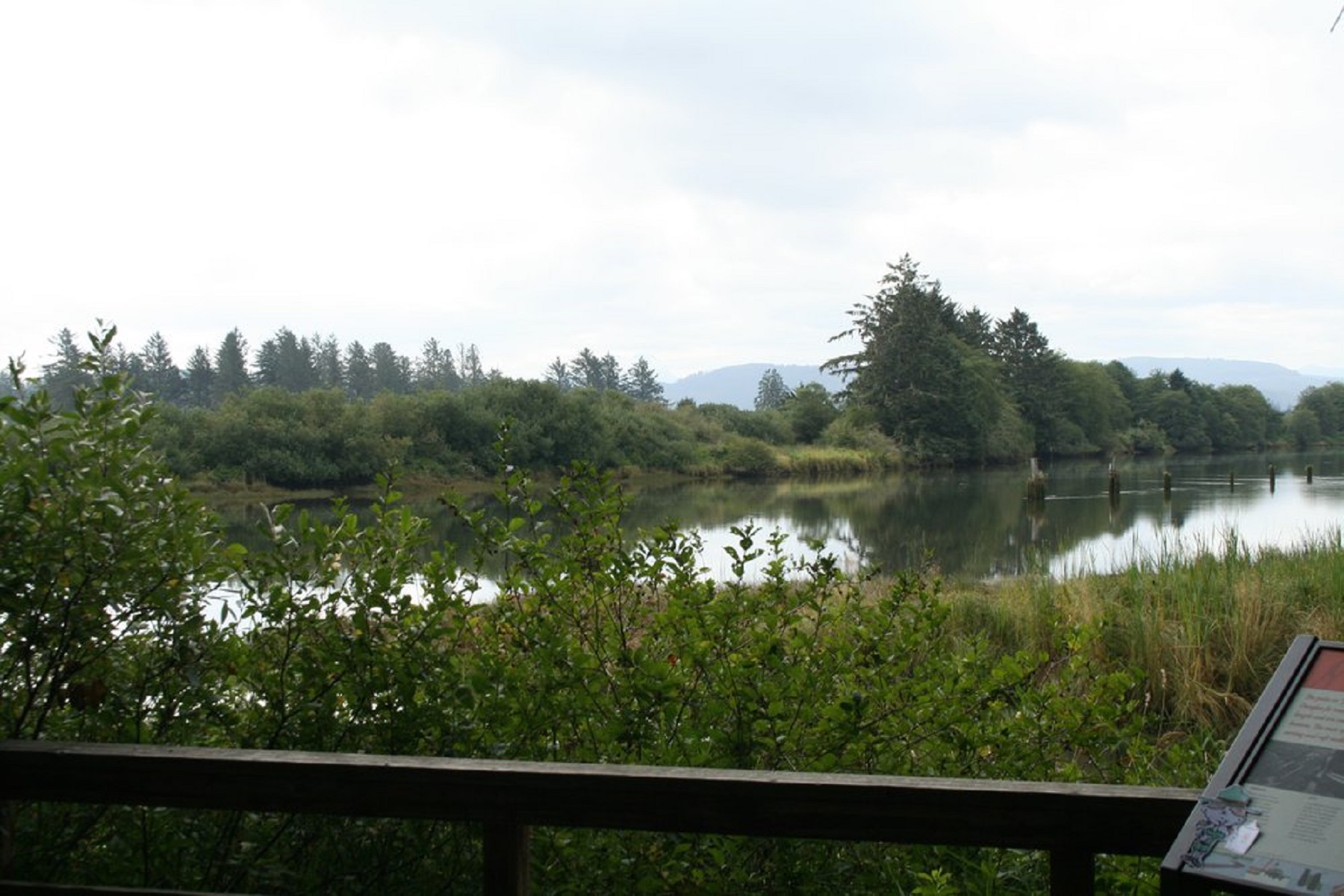
Astoria Riverwalk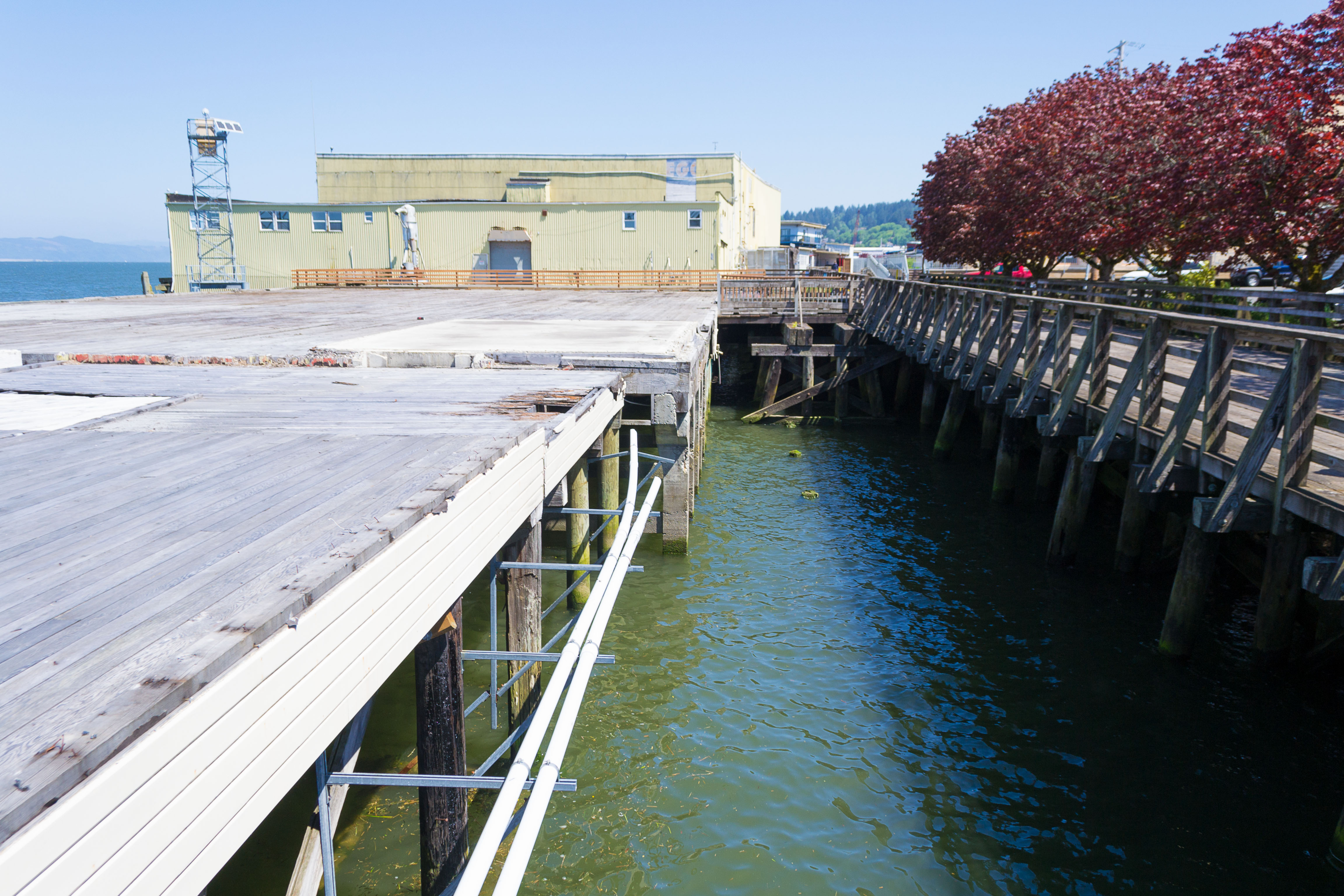
Atchison County Historical MuseumLocated in the city of Atchison, Kansas, the Atchison County Historical Museum is housed in the historic 1880 Santa Fe Freight Depot. It was here in Atchison that, in 1804, Meriwether Lewis and William Clark of the Corps of Discovery celebrated their first independence day of the expedition in present day Atchison. 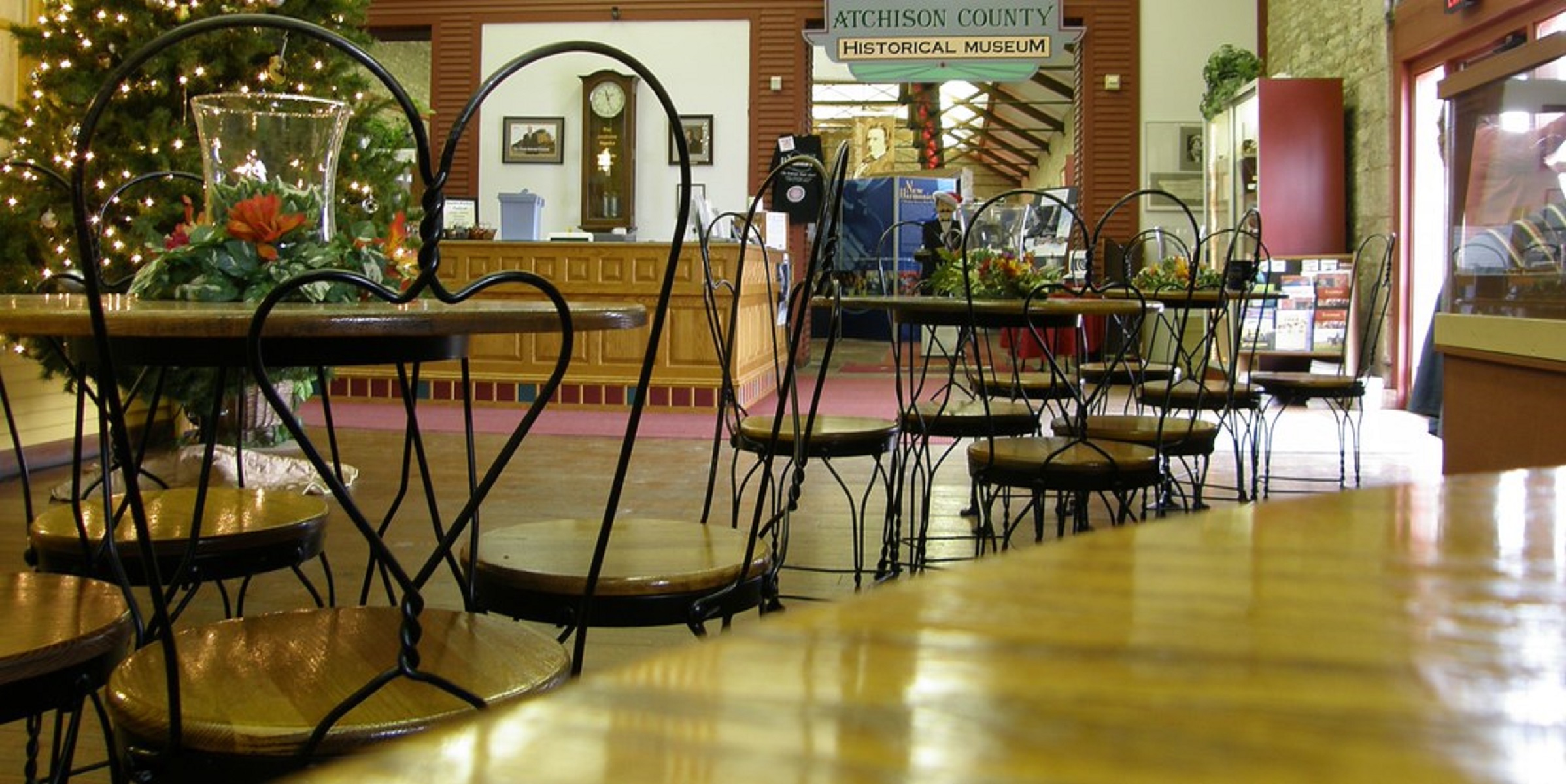
Bad Humored IslandBad Humored Island was the backdrop of a meaningful exchange between Lewis & Clark and the native tribes that called the region home. As the journals discuss, Black Buffalo and the other chiefs were invited to tour the keelboat, where they were presented gifts. Captain Clark conducted them back to Lilly Park in the pirogue.
Bad River EncounterTensions were high when Meriwether Lewis and William Clark entered Lakota homelands. 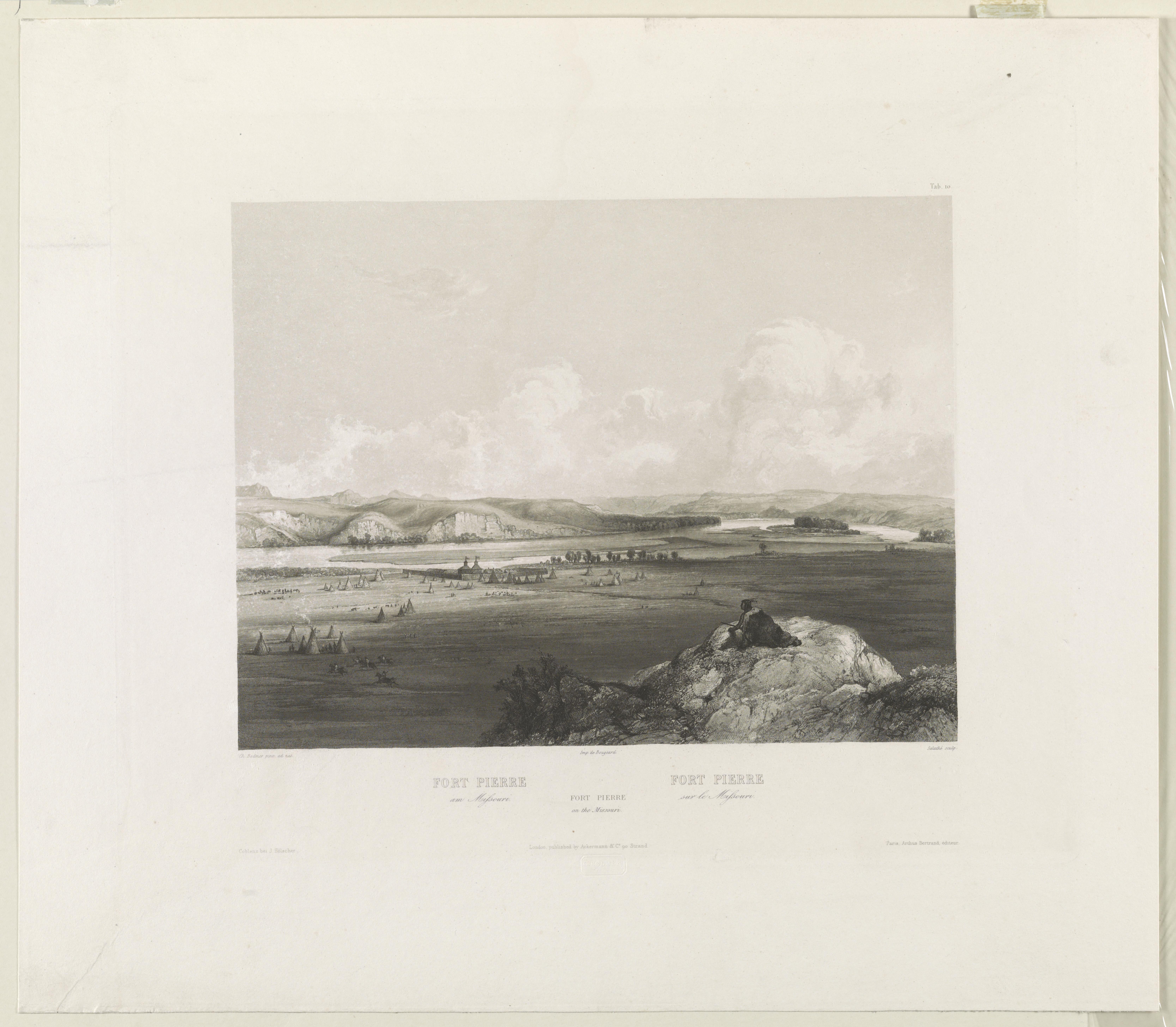
Bad River Encounter SiteBad River Encounter Site is a High Potential Historic Site on the Lewis and Clark National Historic Trail. On September 24, 1804, Lewis and Clark reached the confluence of the Bad River. 
Baker BayIt might be surprising to learn that Meriwether Lewis and William Clark weren’t the first Europeans to explore the Columbia River. In 1792, over a decade before the Corps of Discovery set out, a small crew under the command of Lieutenant William Broughton sailed up the Columbia River all the way up to what would become modern-day Vancouver aboard “The Chatham.” 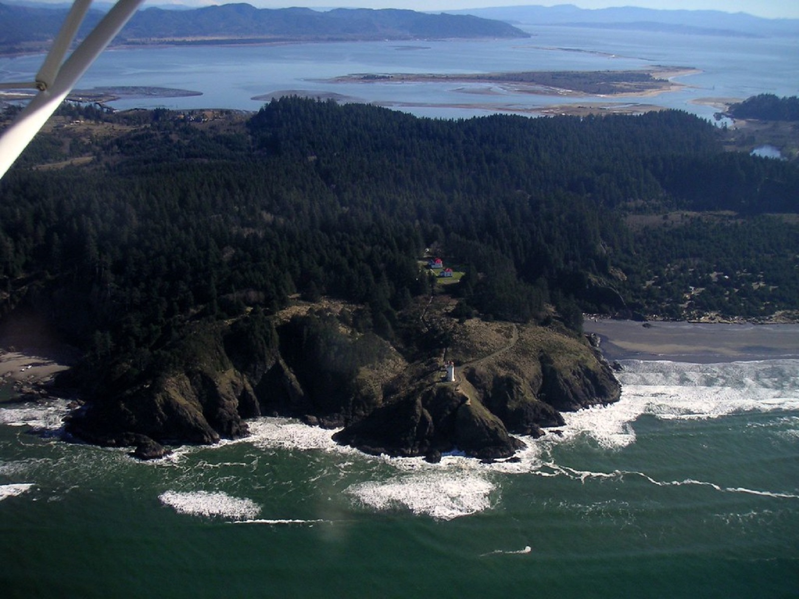
Beacon RockOutside Skamania, Washington is the 848-foot-tall Beacon Rock that overlooks a breathtaking section of the mighty Columbia River. Beacon Rock State Park is a 4,464-acre, year-round camping park sitting in the midst of the Columbia Gorge National Scenic Area. The core of an ancient volcano, Beacon Rock is essentially a basalt plug; the Missoula Flood waters eroded away the softer outer material. Captain Clark wrote in his journals, “…a remarkable high rock on Stard." 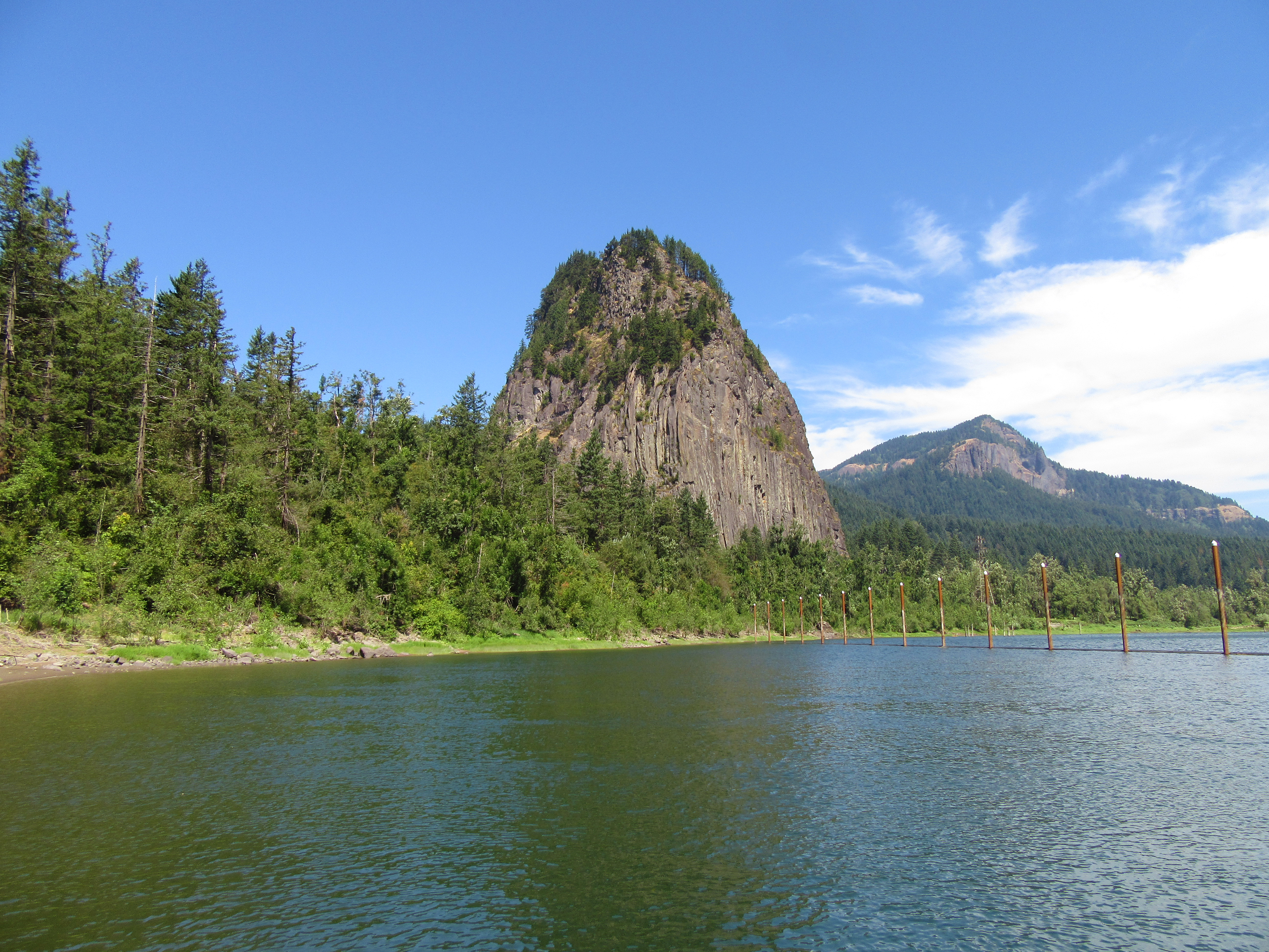
Beaverhead RockIf the Corps of Discovery had not come across this rock formation they might never have made it to the Pacific Ocean. Sacagawea knew that her relatives were nearby after seeing this landmark. 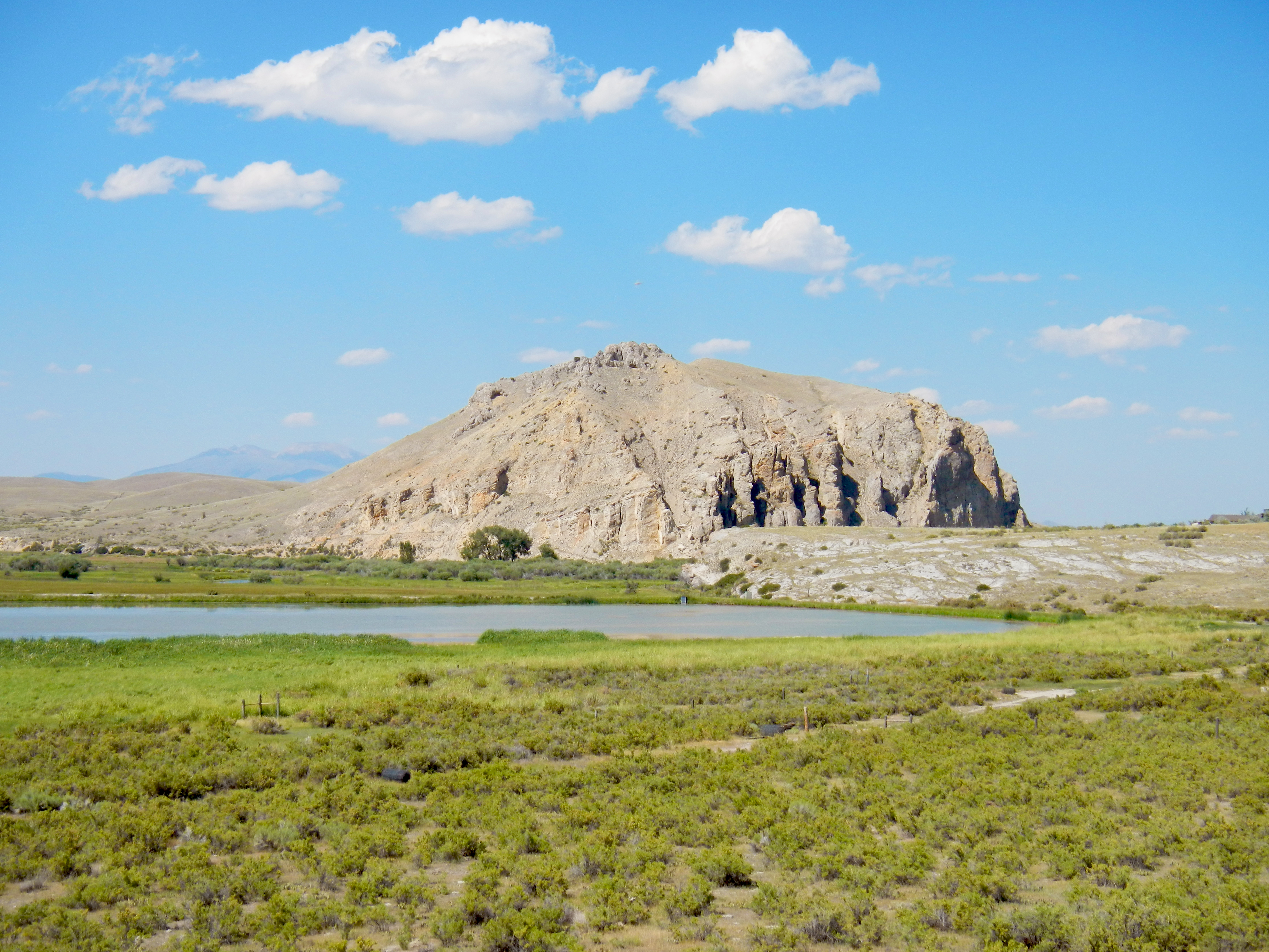
Beaverhead Rock State ParkSacagawea, a young Shoshone Indian guide traveling with the Lewis and Clark Expedition in 1805, recognized this rock formation and knew that she may be in the vicinity of her relatives. The sighting gave the expedition hope that they may be able to find native peoples from which to acquire horses for their trip across the mountains to the Pacific Ocean. 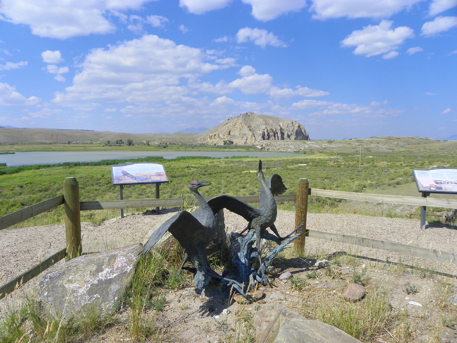
Beaverhead Rock, MontanaWhen the Lewis and Clark Expedition passed Beaverhead Rock, Sacagawea recognized it as close to her Shoshone homelands. 
Bellefontaine CemeteryBellefontaine Cemetery is a High Potential Historic Site on the Lewis and Clark National Historic Trail. Bellefontaine Cemetery contains the grave site of William Clark, who died in St. Louis on September 1, 1838. Located in the northern part of the cemetery above Meadow Lane and near the Broadway Avenue entrance is a 35-foot tall granite obelisk on a pedestal. 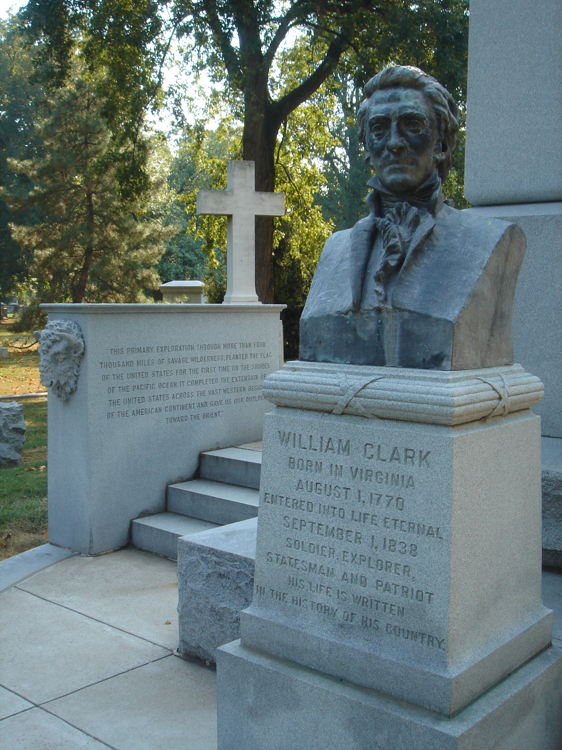
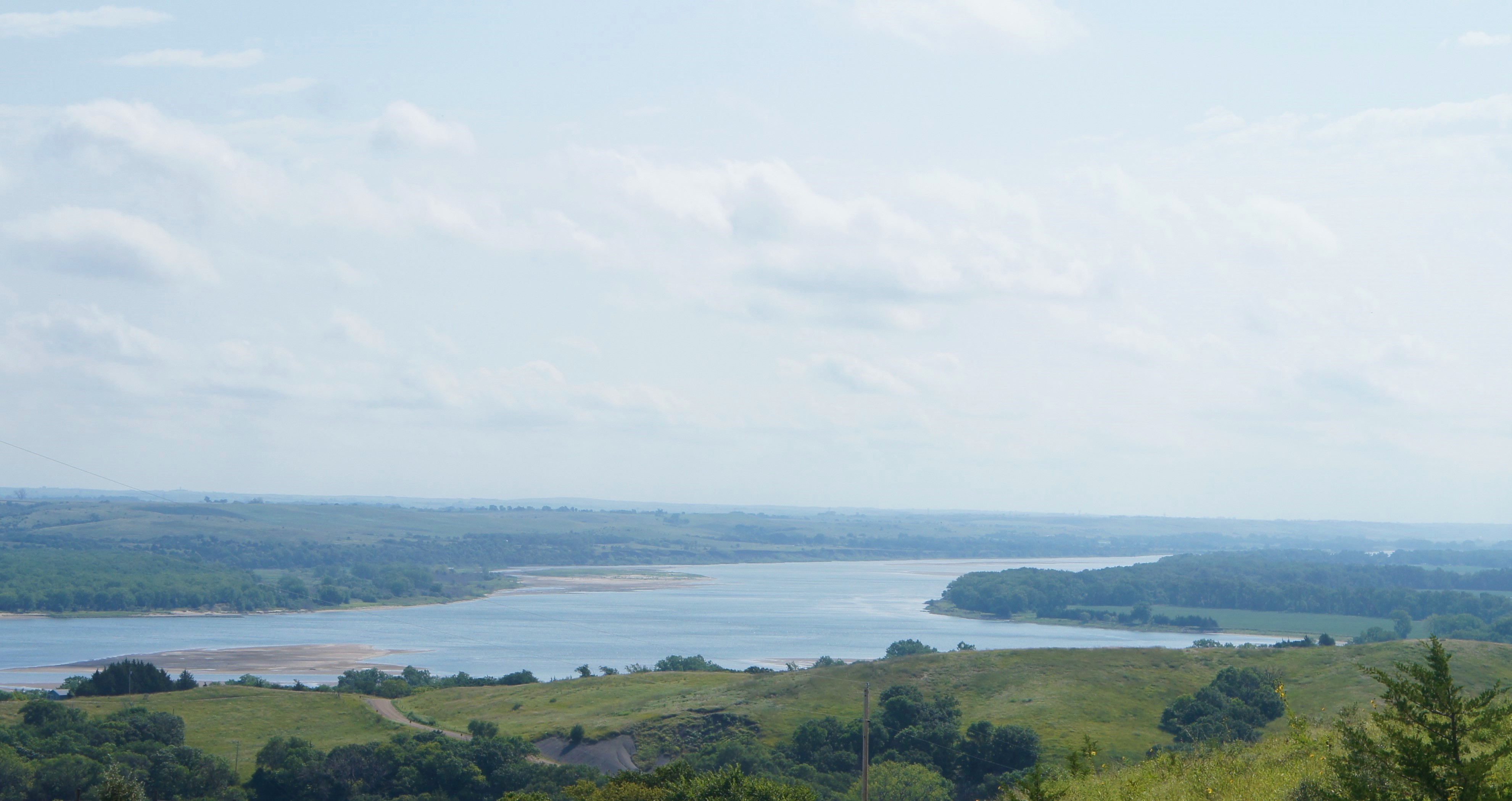
Big Bend of the MissouriBig Bend of the Missouri is a High Potential Historic Site on the Lewis and Clark National Historic Trail. On September 19, 1804, the expedition camped downriver of the Big Bend, an expansive meander of the Missouri River that was already a well-known landmark. 
Big Bone Lick State Historic SiteBig Bone Lick State Park is recognized as the key to understanding the life of the Ice Age on the North American continent over 10,000 years ago. The area was well known to local indigenous populations, such as the Delaware and Shawnee, who relied springs for salt and game. A 1744 map Louisiana marks it as the "place where they found the elephant bones in 1739." Early explorers noted that the large bones lay scattered throughout the valley. 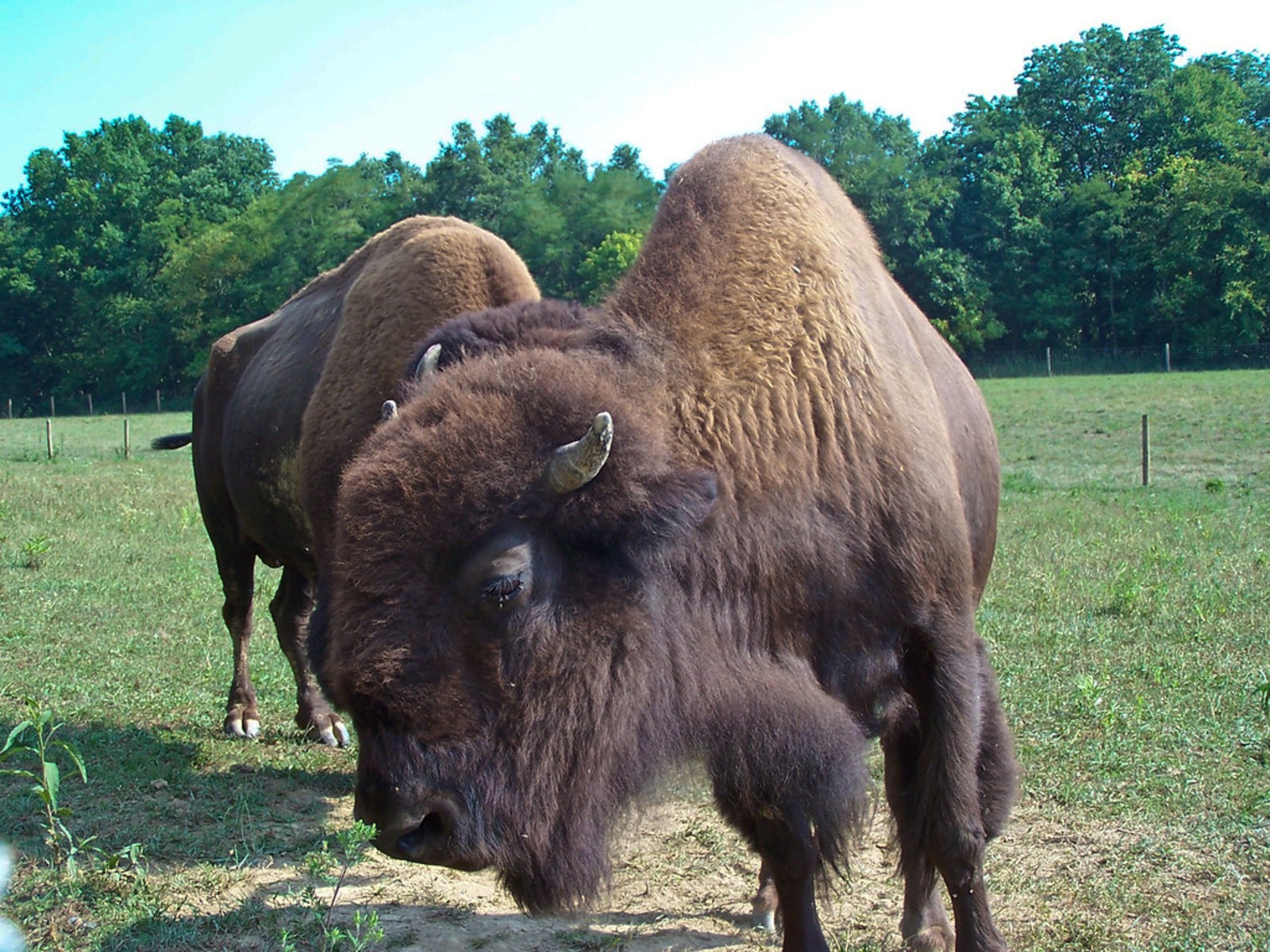
Big Bone Lick State Historic Site, KentuckyMeriwether Lewis stopped at Big Bone Lick in 1803 to collect fossils for President Thomas Jefferson. William Clark returned here in 1807 to do the same. 
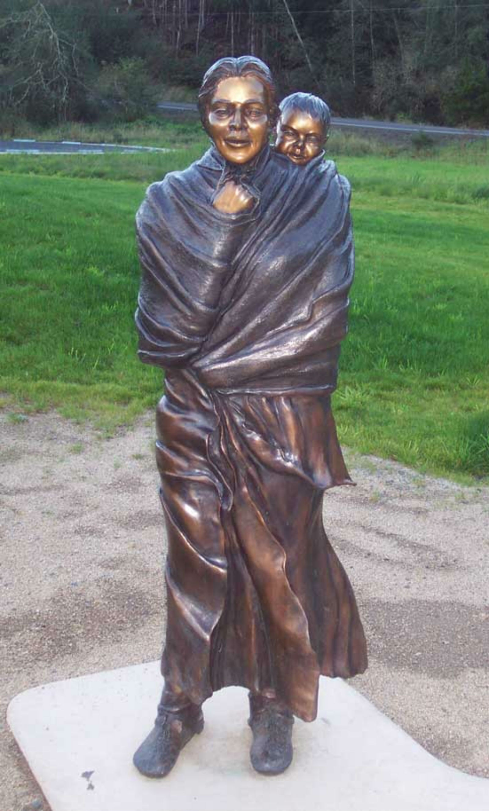
Birth of PompOn February 11, 1805, Sacagawea gave birth to a baby boy. She and her husband, Toussaint Charbonneau, named him Jean Baptiste Charbonneau. 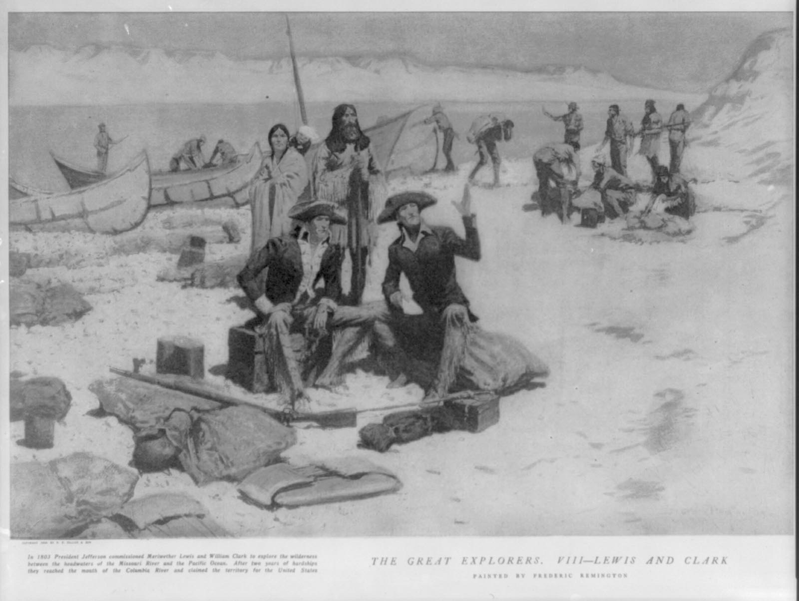
Blackbird HillBlackbird Hill is a High Potential Historic Site on the Lewis and Clark National Historic Trail. Blackbird Hill is a 300-foot-high promontory on the west side of the Missouri River in present-day Nebraska. 
Blackbird Hill, NebraskaWhen Meriwether Lewis and William Clark passed here, they paid their respects at the burial site of Omaha leader Wazhiⁿga’ sabe (Blackbird). 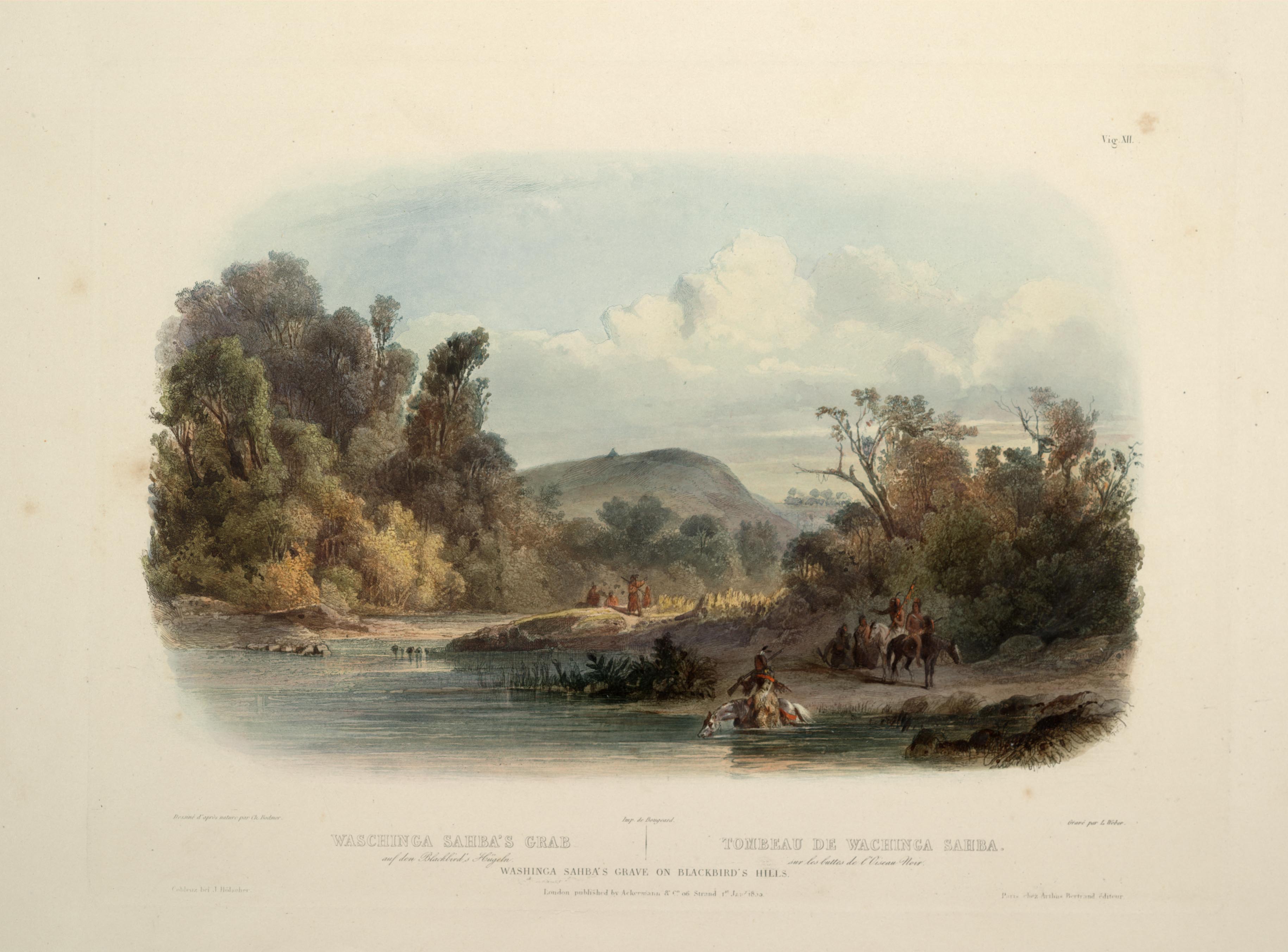
Bow CreekBow Creek is a High Potential Historic Site on the Lewis and Clark National Historic Trail. On August 26, 1804, the expedition camped on a sand bar (in present-day South Dakota) across the Mis-souri from the mouth of Bow Creek (in present-day Nebraska). 
Bozeman PassBozeman Pass is a High Potential Historic Site on the Lewis and Clark National Historic Trail. On July 15, 1806, as Clark’s party traveled from the Gallatin River toward the Yellowstone River valley, they were guided by Sacagawea, who knew the area from her childhood. She led them between the Bridger and Gallatin mountain ranges through Bozeman Pass. 
Bradford Island Visitor Center at Bonneville Lock and DamThe Bonneville dam was completed in 1943 and was the first dam built on the Columbia River. The Bradford Island Visitor Center, located adjacent to the dam on the Oregon side of the river, displays exhibits on local history, hydropower, and fish life cycles. The Lewis and Clark Expedition camped on Bradford Island on April 9, 1806 upon their return journey. 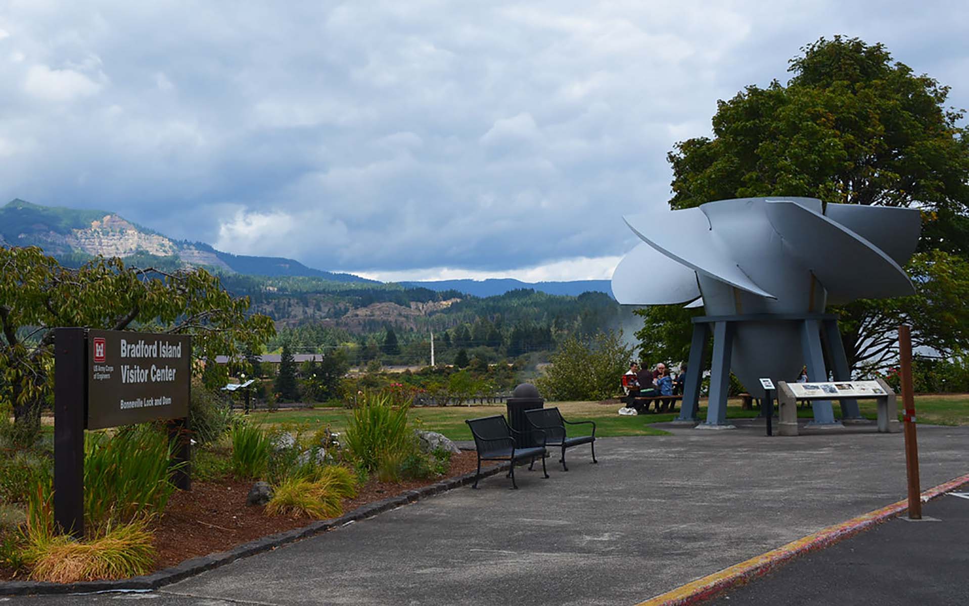
Brandenburg Riverfront ParkBrandenburg Riverfront Park’s 15 acres span the width of the downtown area and offer an unparalleled view of the scenic Ohio River, the graceful Matthew Welch Bridge that crosses the river, and the scenic, wooded Indiana shoreline on the opposite side. The park offers a playground for the children, a checkers/chess table, picnic pavilions, bandstand, amphitheater, soccer fields, a river walk, and more.
Brunot IslandMeriwether Lewis stopped here on his journey west. During his visit, he showed off his new air gun, and someone got shot. 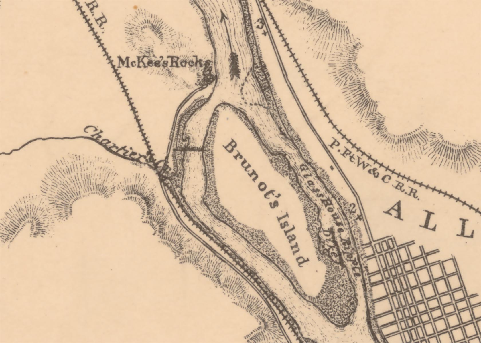
Butte ParkThe dramatic landscape that surrounds Hermiston feels almost as if it’s straight out of a fantasy. From the natural features that look like they’ve been sculpted by hand to the peaceful fields full of shrubs and flowers, visitors might think they’ve stepped into a landscape painting. One of the best places to get up close and personal with this beautiful wilderness is Butte Park. 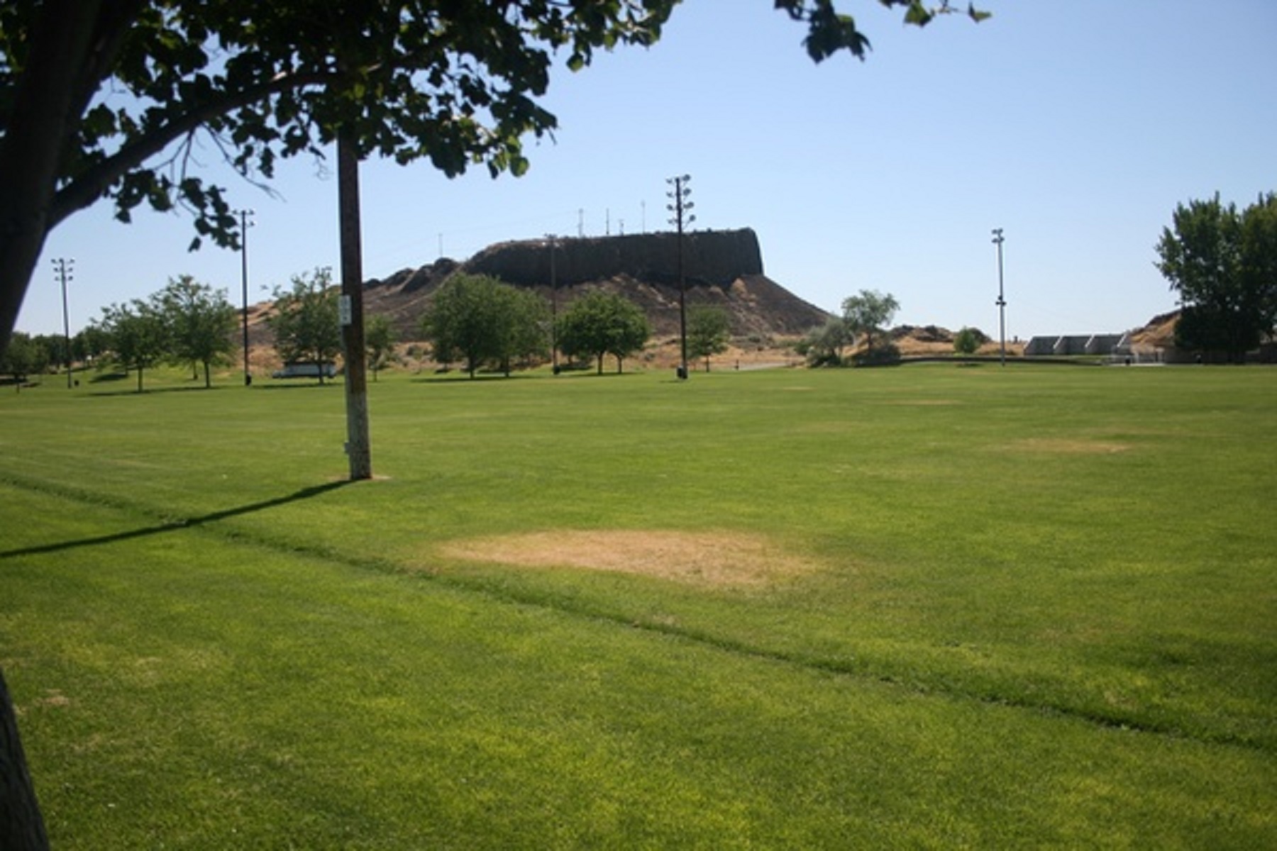
Buttermilk Falls Hiking & Biking TrailThe Buttermilk Falls Hiking & Biking Trail was initially developed in 1996 by turning 2.5 miles of county road into a trail that connects Riverfront Park, on the banks of the Ohio River in Brandenburg east to Kentucky State Route 933. This riverside trail winds through the wooded, scenic area along Flippins Run Creek. The Buttermilk Falls Trail (2.5 miles) includes a wooden footbridge over one of the many streams and passes Buttermilk Falls.
Cahokia Courthouse State Historic SiteThe Cahokia Courthouse State Historic Site is located in Cahokia, Illinois. The courthouse now serves as a museum and historic site. Three exhibit rooms depict cases the court handled around 1800 and the French-roots of the structure. A fourth room is refurbished to represent the courtroom of 1790. 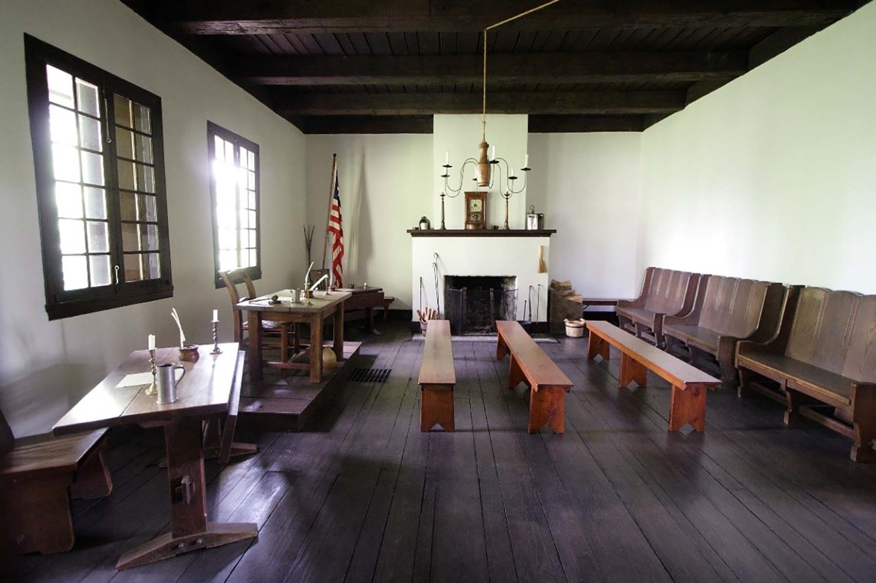
Cahokia Courthouse, IllinoisMeriwether Lewis and William Clark used Cahokia as a place to gather information for the journey ahead. 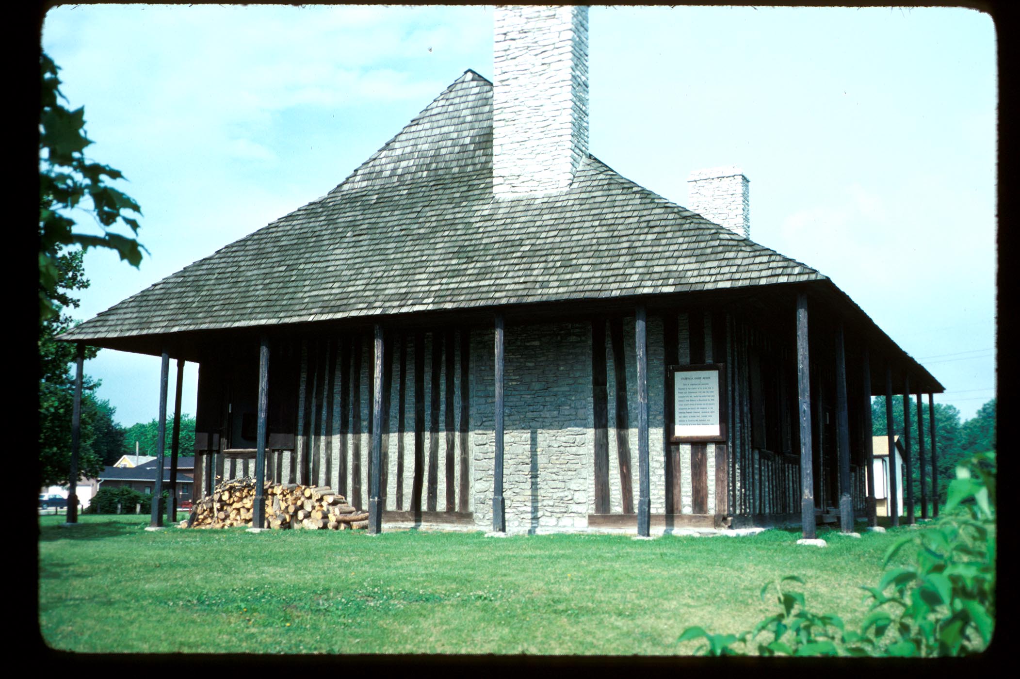
Cahokia Mounds State Historic Site & Interpretive CenterAncient civilizations are perhaps the most fascinating groups of people to study throughout human history. It is jarring to imagine how people could co-exist in such large numbers during an era before modern medicine, advanced irrigation, and an overall staggering amount of danger that lurked everywhere back then. It is inspiring that people could put aside their differences and come together to build something greater than themselves. 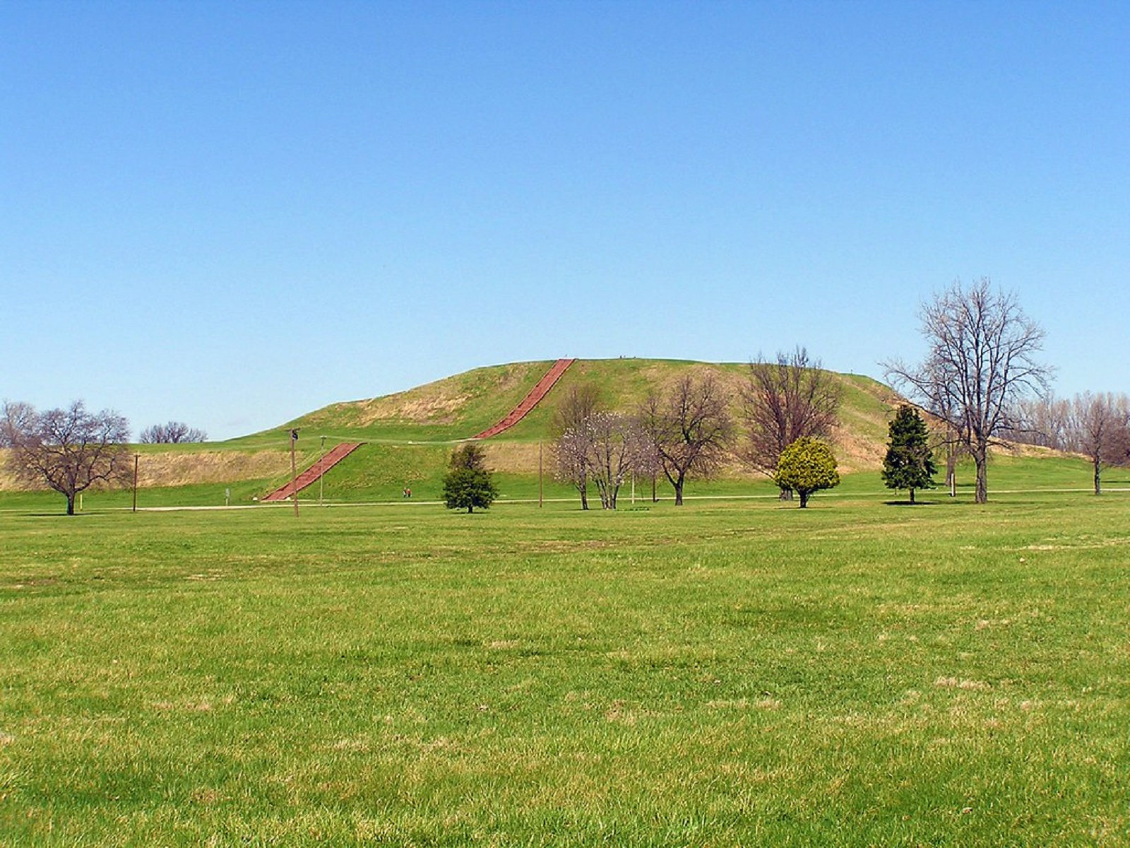
Cairo Custom House MuseumLess than two miles from Fort Defiance State Park sits the Cairo Custom House Museum. The building, built in 1872, is full of history about the surrounding region, as well as being of historical significance itself. Listed on the National Register of Historic Places, the Cairo Custom House was originally used as the location for collecting tariffs on imports being traded along the Mississippi River. 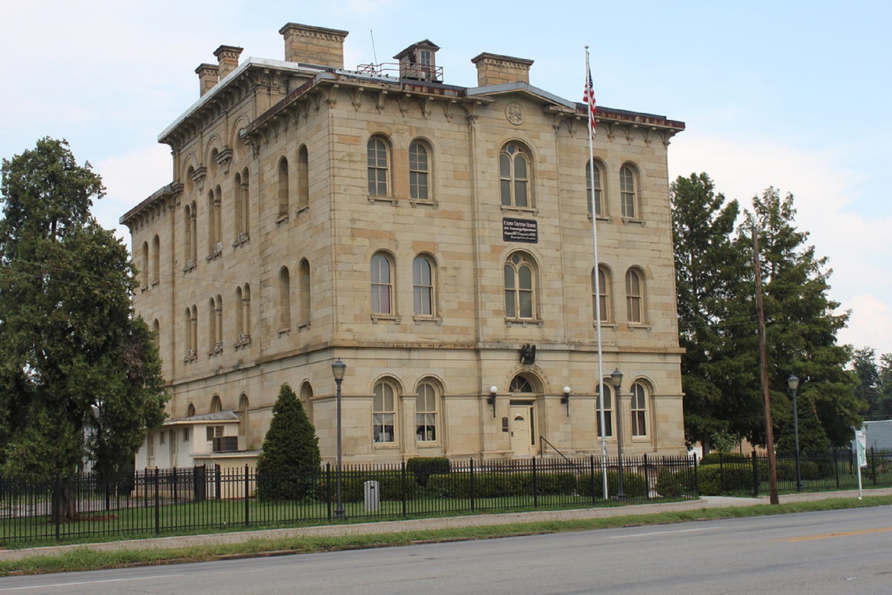
Camp DisappointmentLewis, George Drouillard and Joseph and Reubin Field stayed at Camp Disappointment from July 22 - 26, 1806. It was the northernmost campsite of the Expedition. Jefferson wanted to know if there was a northern tributary of the Missouri River, thus giving the US a claim to a more northern boundary. 
Camp Dubois, IllinoisWilliam Clark and many of the men who joined the Lewis and Clark Expedition spent the winter of 1803–1804 just east of St. Louis, at Camp Dubois. 
Campus Martius MuseumFounded in 1788 by Rufus Putnam, Marietta, Ohio, was the first settlement established in the Northwest Territory. The original settlement was surrounded by a stockade built by the civilian-run Ohio Company. The stockade was known as Campus Martius, so named because it put settlers and soldiers alike in mind of the Fields of Mars, a training ground once used by ancient Roman legions. 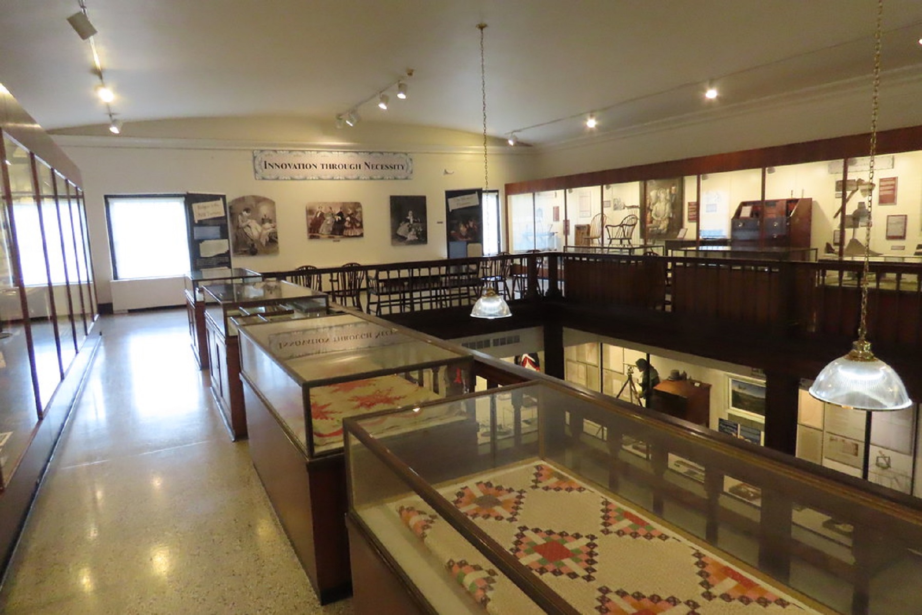
Cannon Beach, OregonDid you know that Meriwether Lewis and William Clark arrived at the Pacific Ocean just before a whale washed up on the Oregon coast? 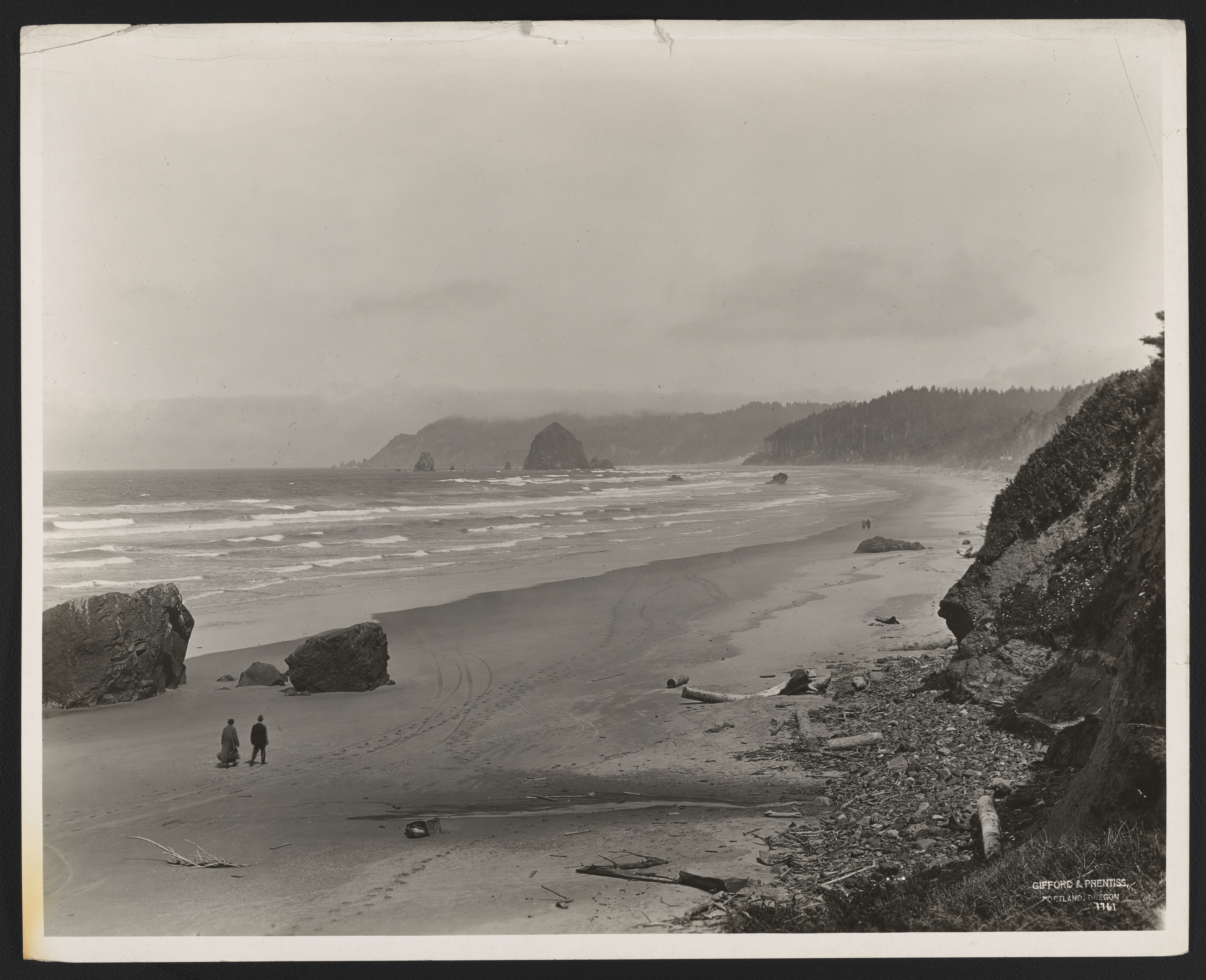
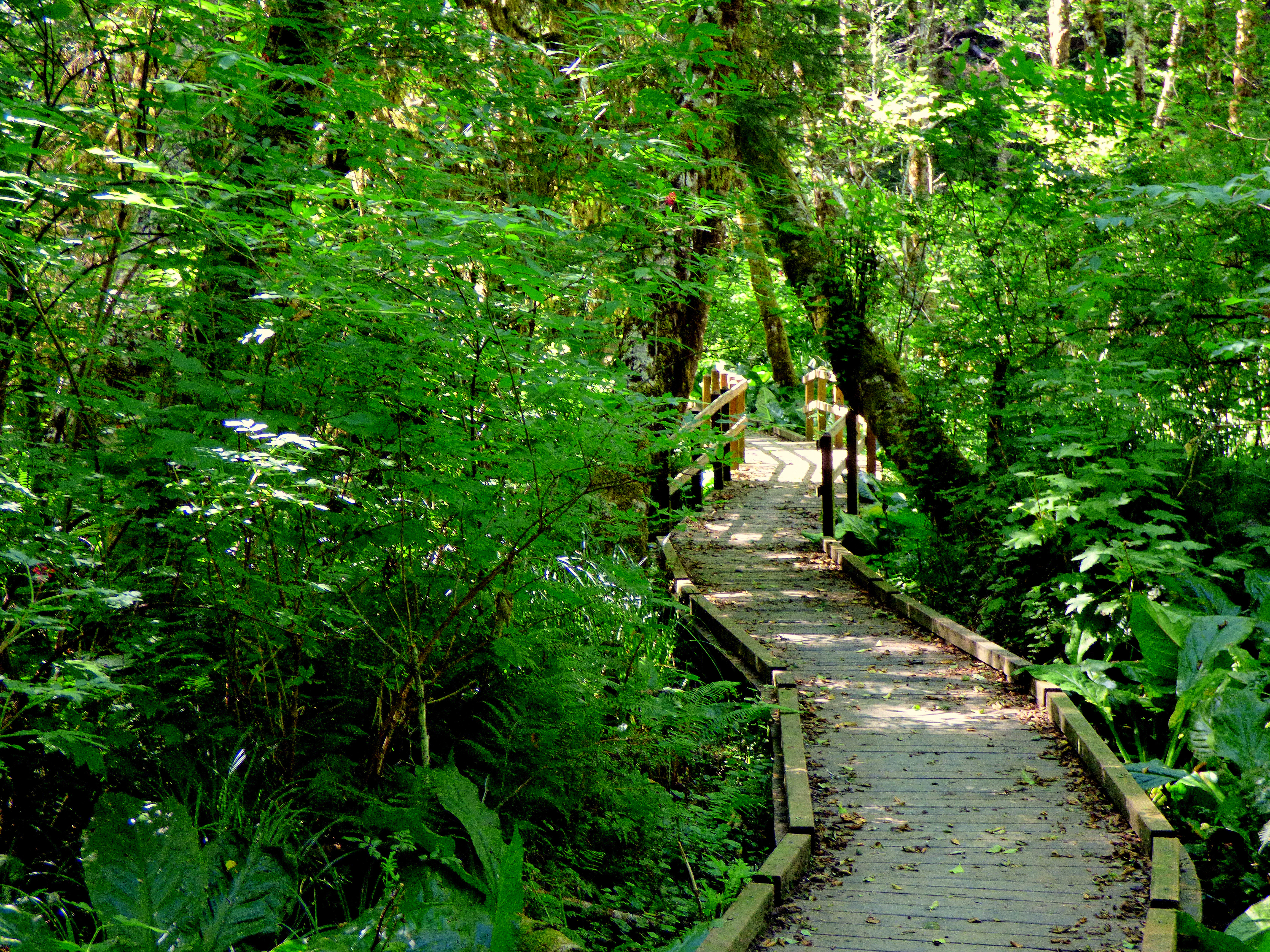
Canoe CampWhere the North Folk of the Clearwater River enters the main channel of the Clearwater, the Corps of Discovery were exhausted and famished. It was the end of September 1805 and the difficult trek over the Continental Divide was finally behind them. But on this point of land over an 11-day period, they worked incredibly hard. This was Canoe Camp. 
Cape DisappointmentCape Disappointment is a large headland forming the northern portion of the mouth of the Columbia River, as it opens to the Pacific Ocean. Most members of the Corps arrived here on November 15, 1805, where they first saw the Pacific Ocean. Clark camp near Chinook Point while Lewis scouted for a favorable site for a winter encampment. 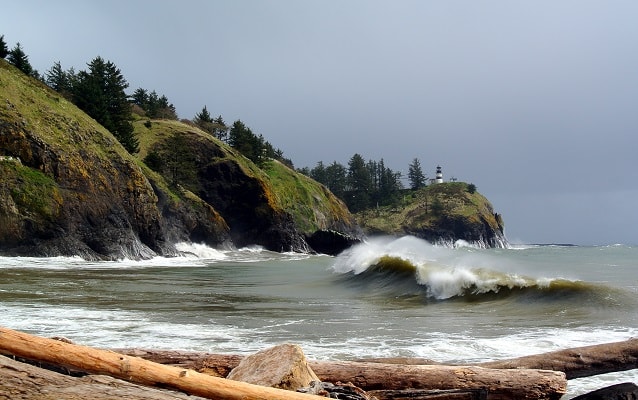
Cape Disappointment State ParkLocated in Ilwaco, Washington, Cape Disappointment State Park was named for Captain John Meares’ first failed attempt to find the Columbia River in 1788. Meriwether Lewis and William Clark would later conduct reconnaissance of this area during their stay at Station Camp from November 15 to November 24, 1805. 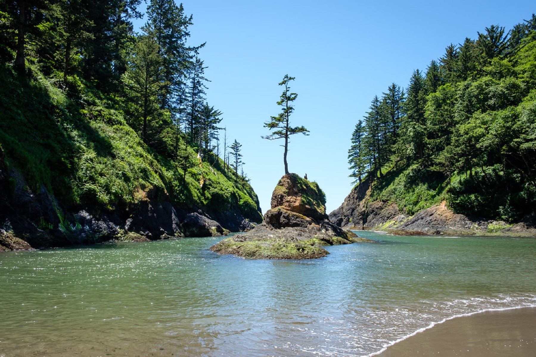
Cape Disappointment State Park-Lewis and Clark Interpretive CenterWhen you visit Cape Disappointment State Park today, you certainly won’t be disappointed in what you find. It’s an amazing park that’s home to the Lewis and Clark Interpretive Center. Perched on a cliff 200 feet above the pounding Pacific surf, the Lewis and Clark Interpretive Center shares the story of the Corps of Discovery’s journey, focusing particularly on their Pacific Coast stay during the winter of 1805-1806. 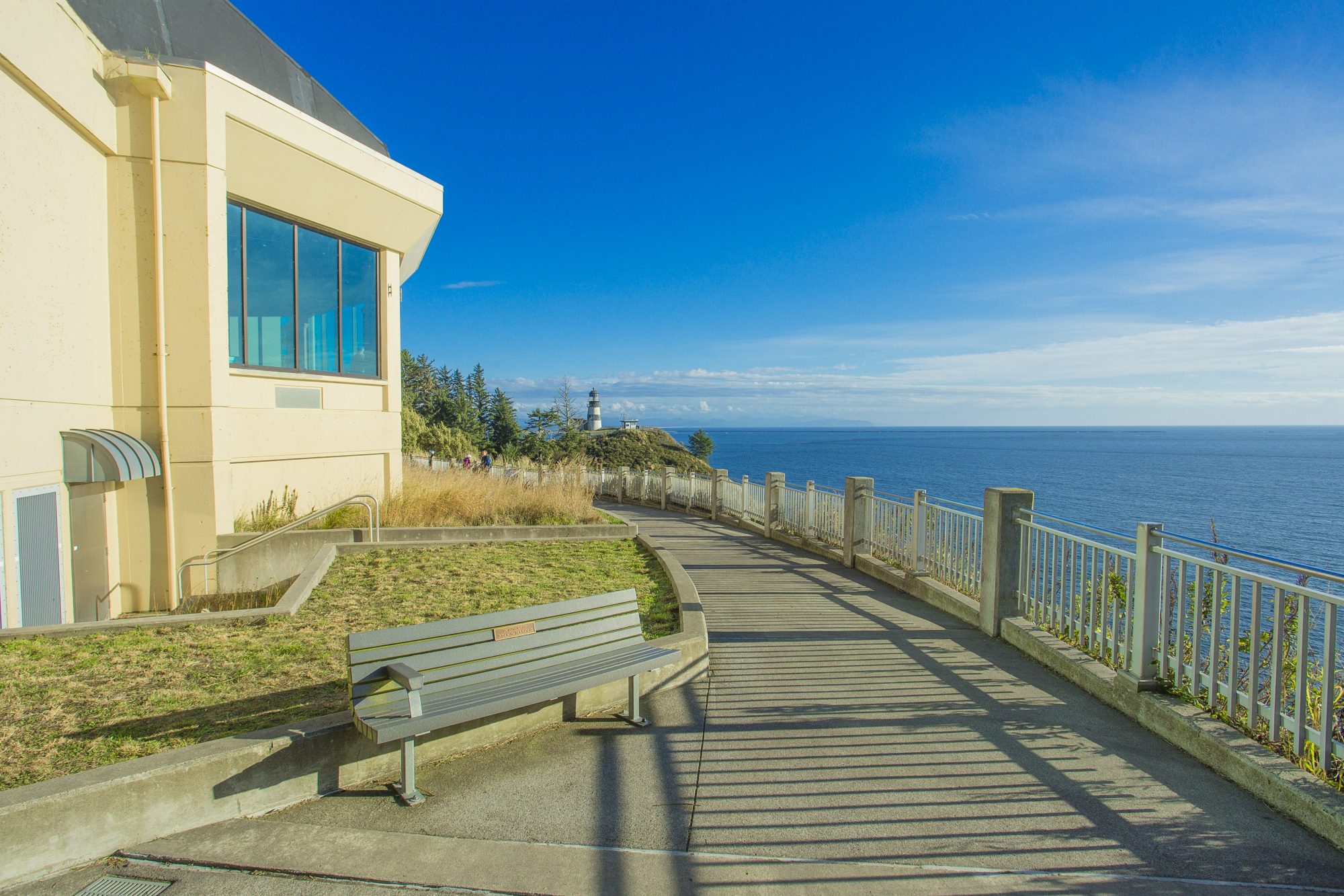
Cape Disappointment, WashingtonWhen Meriwether Lewis and William Clark reached the Pacific Ocean, they were in an area where Chinookan people controlled the extensive trade along the rivers, including trade from ocean-going European ships. 
Captain William Clark Regional Park at Cottonwood BeachOn March 31, 1806, after learning from native tribes that food was scarce to the east, Meriwether Lewis and William Clark ordered the Corps of Discovery to remain at “Provision Camp,” a location that is today known as Cottonwood Beach in Washougal, Washington. 
Catherine Creek TrailheadCatherine Creek Trailhead is one of the premier areas for early spring wildflower viewing in the eastern Columbia River Gorge. There is a seasonal waterfall here as well. The trailhead and parking is located on the north side of the county road, leading to a multi-use biker/hiker/equestrian trail. 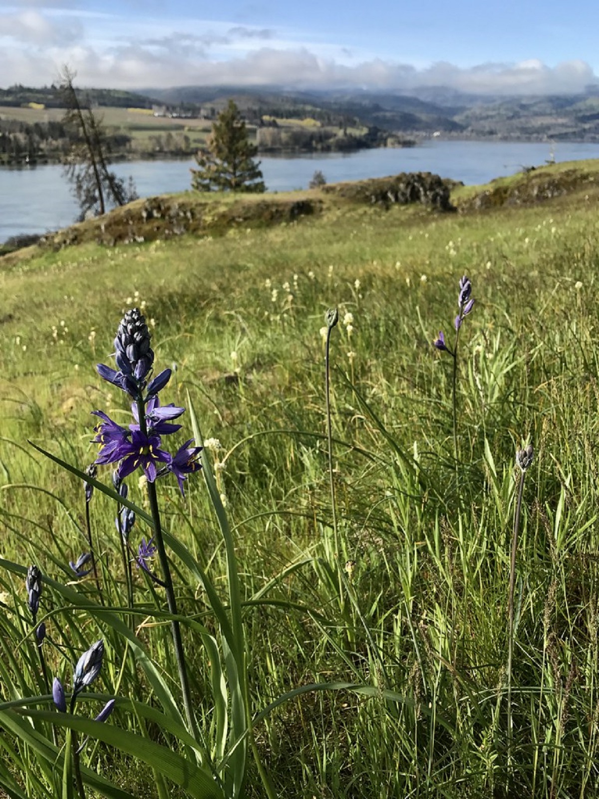
Cathlapotle PlankhouseLocated in the Ridgefield National Wildlife Refuge near Ridgefield, Washington, the Cathlapotle Plankhouse is a full-scale replica of structures built by the Chinookan People who made the Columbia River their home for at least 2,300 years. 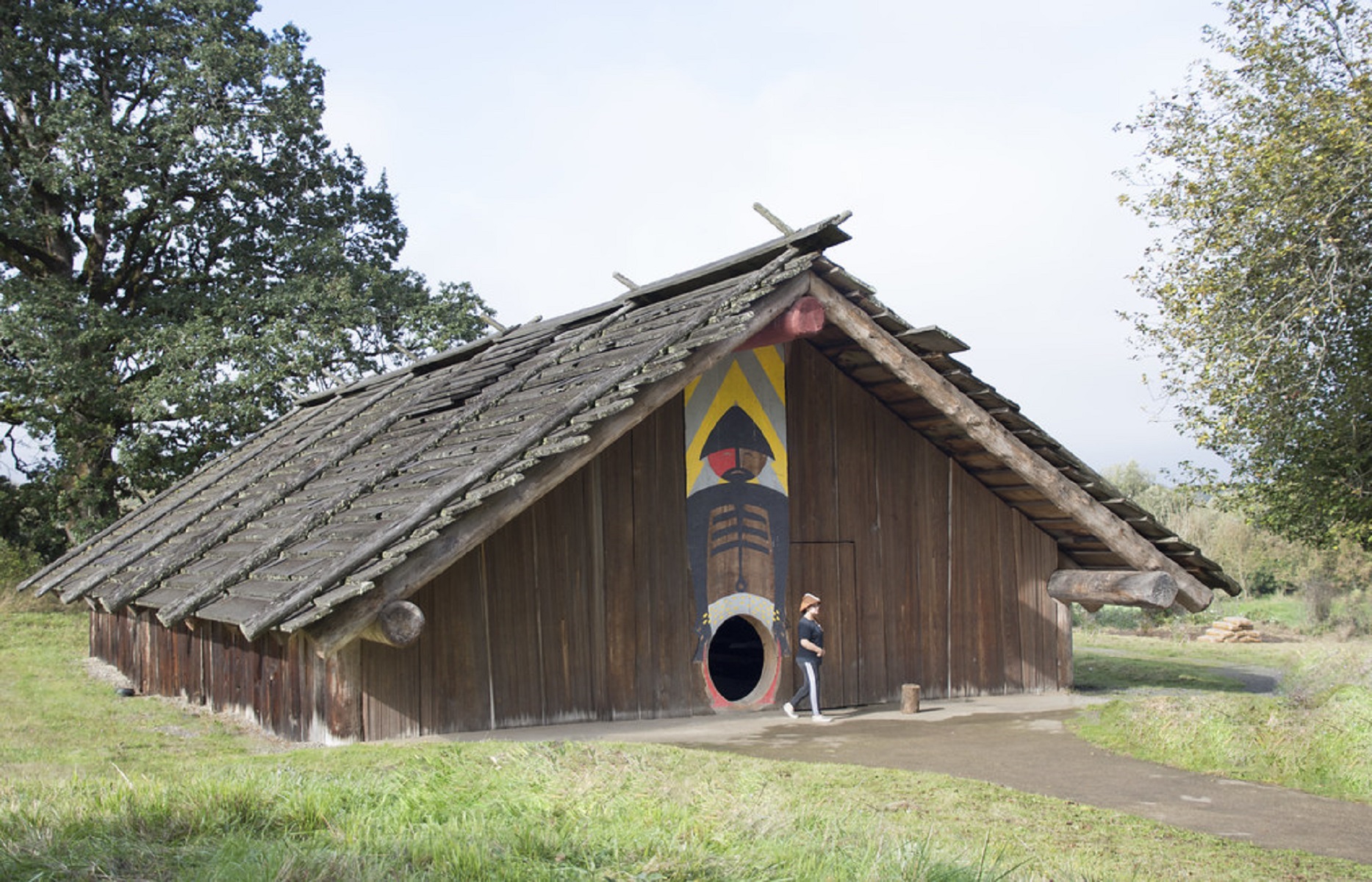
Cave Hill Cemetery & ArboretumCave Hill Cemetery is a 296-acre Victorian era National Cemetery and arboretum. It is the largest cemetery by area and number of burials in Louisville. Cave Hill was listed on the National Register of Historic Places in 1979. Cave Hill National Cemetery, containing military graves, is also on the National Register, added in 1998. 
Celilo Falls PortageCelilo Falls Portage is a High Potential Historic Site on the Lewis and Clark National Historic Trail. On October 22, 1805, the expedition reached Celilo Falls, where the river “divided into Several narrow chanels which pass through a hard black rock forming Islands of rocks at this Stage of the water, on those Islands of rocks [were] great numbers of Stacks of pounded Salmon.” 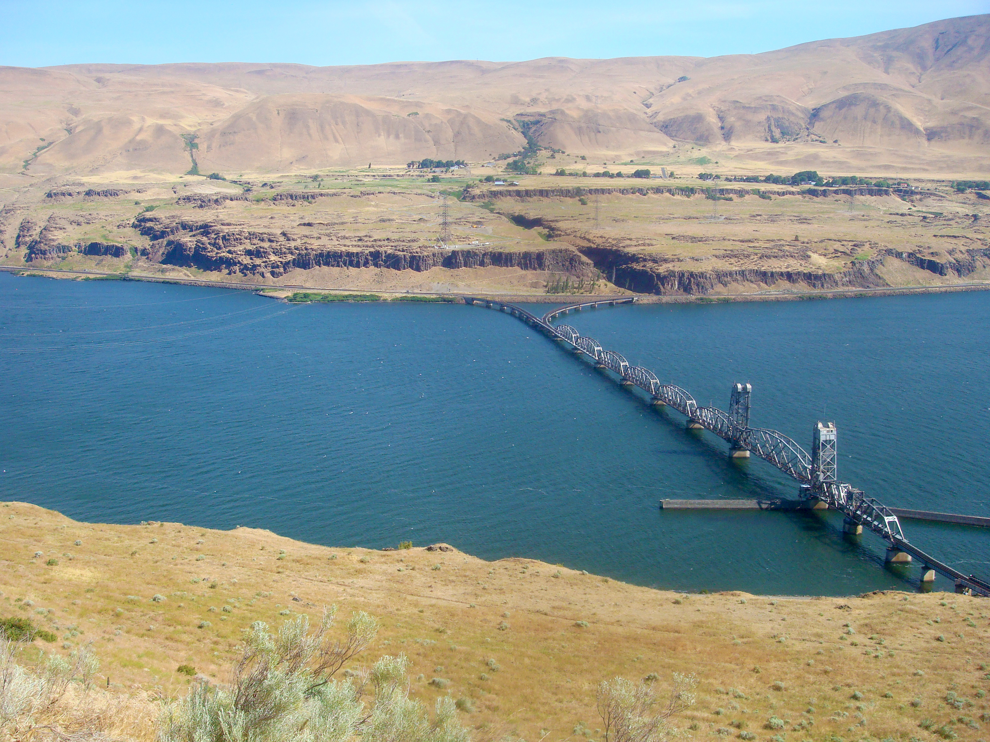
Celilo Falls, OregonCelilo Falls and the Narrows of the Columbia River have been the center of major trading networks for millennia. Meriwether Lewis and William Clark stopped here to buy food and get help carrying their boats around the falls. 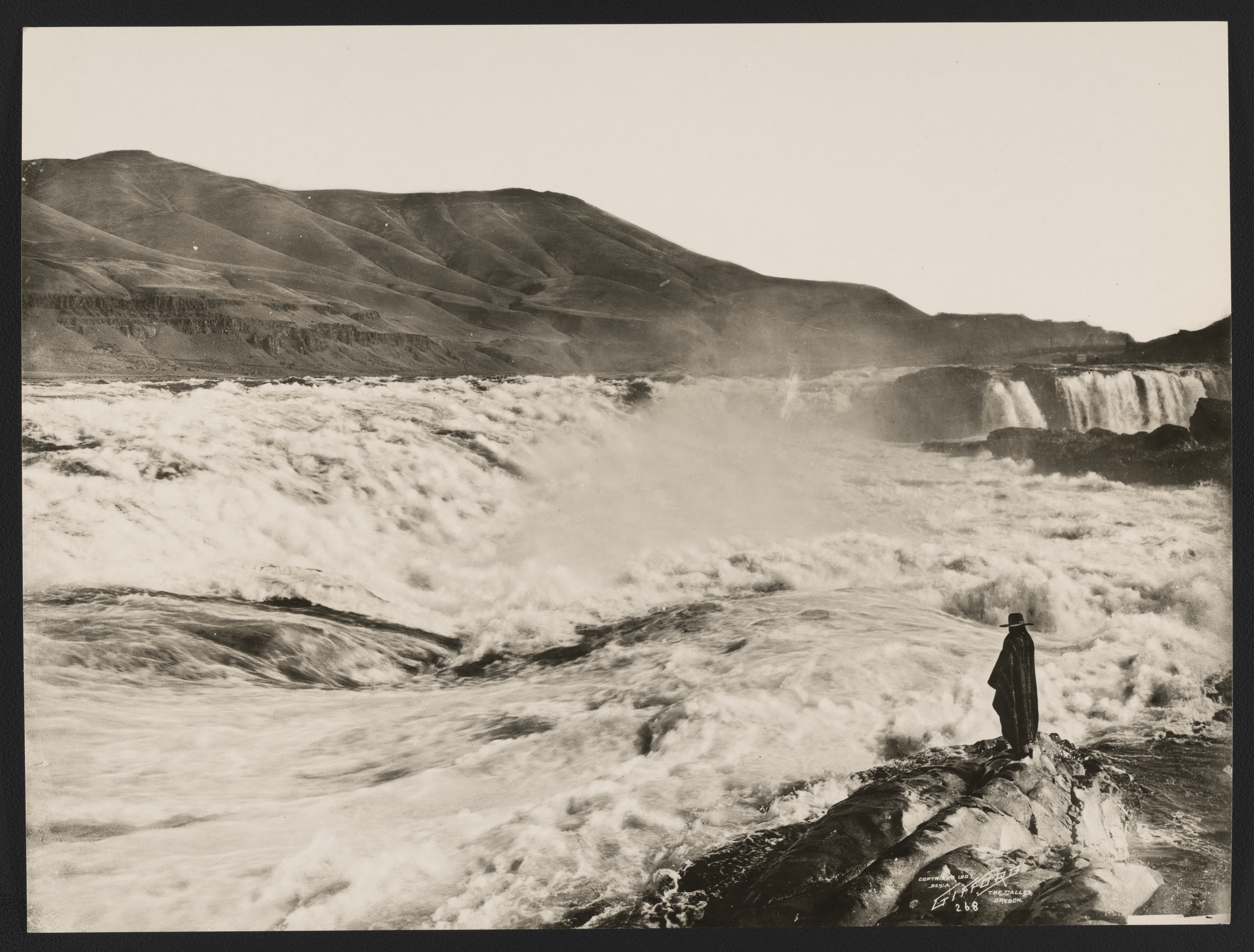
|
| Visitor Centers | Count: 1
Lewis and Clark National Historic Trail Visitor Center
|
| Things to do | Count: 11
|
| Tours |
Count: 0
|
| Articles |
|