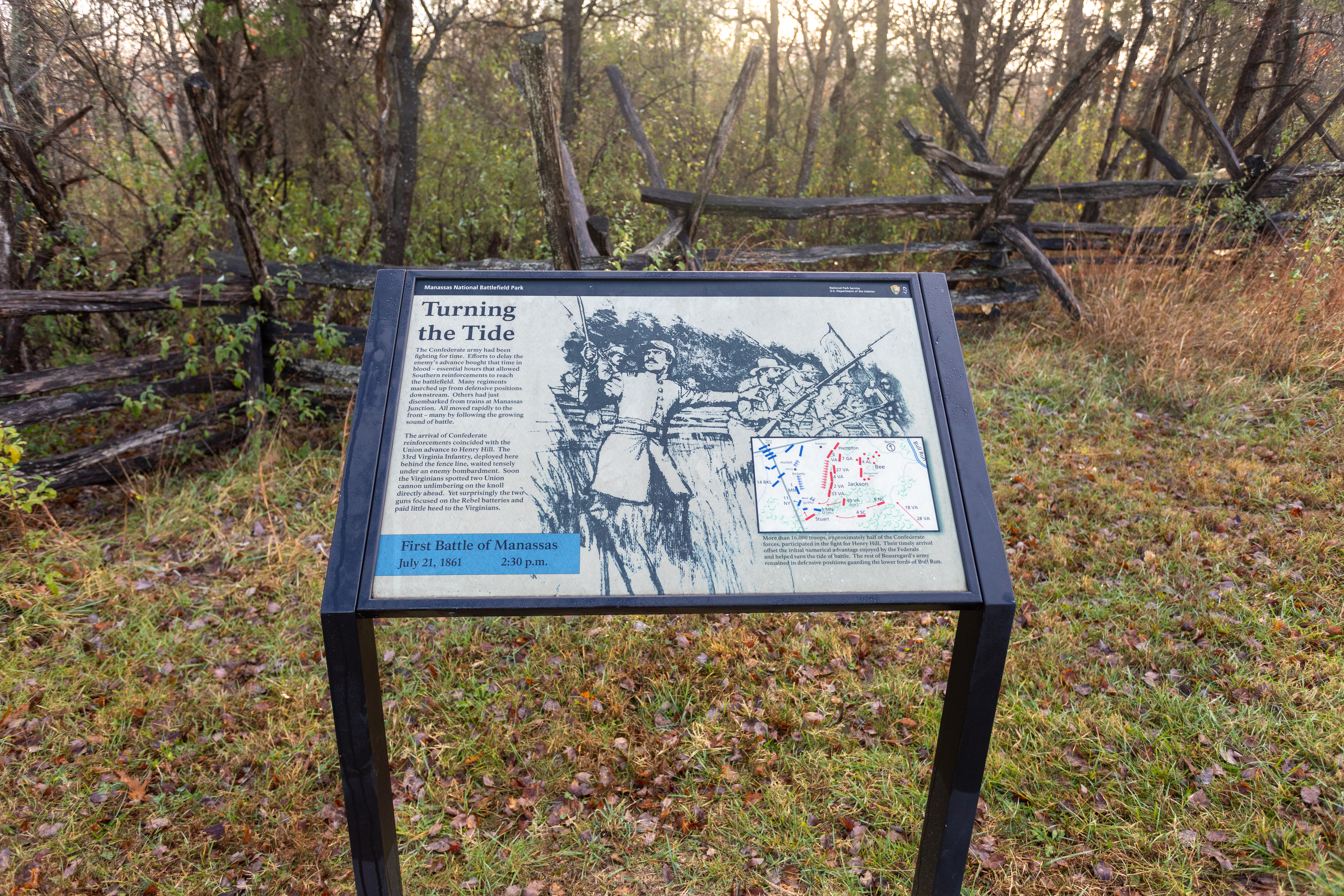
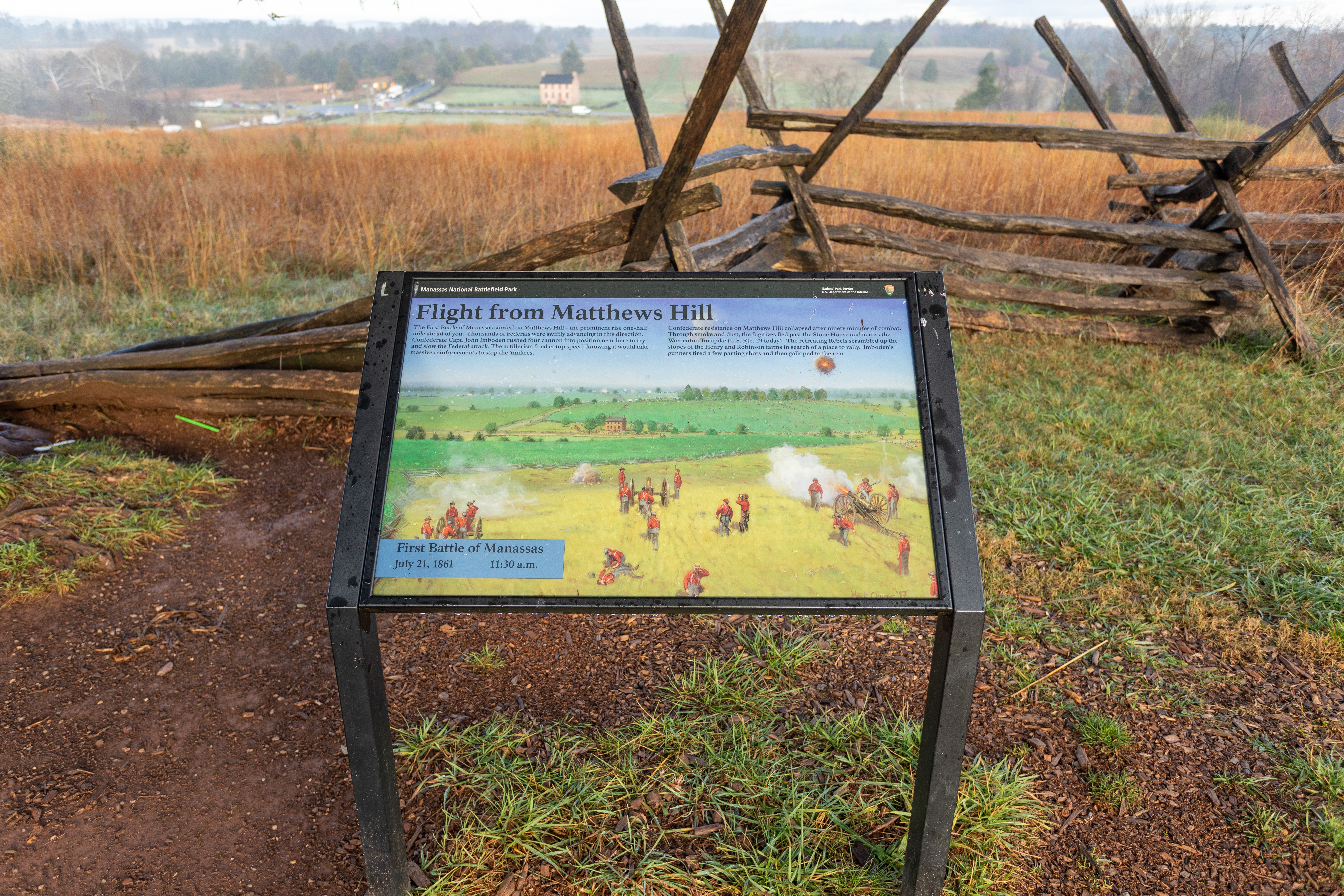
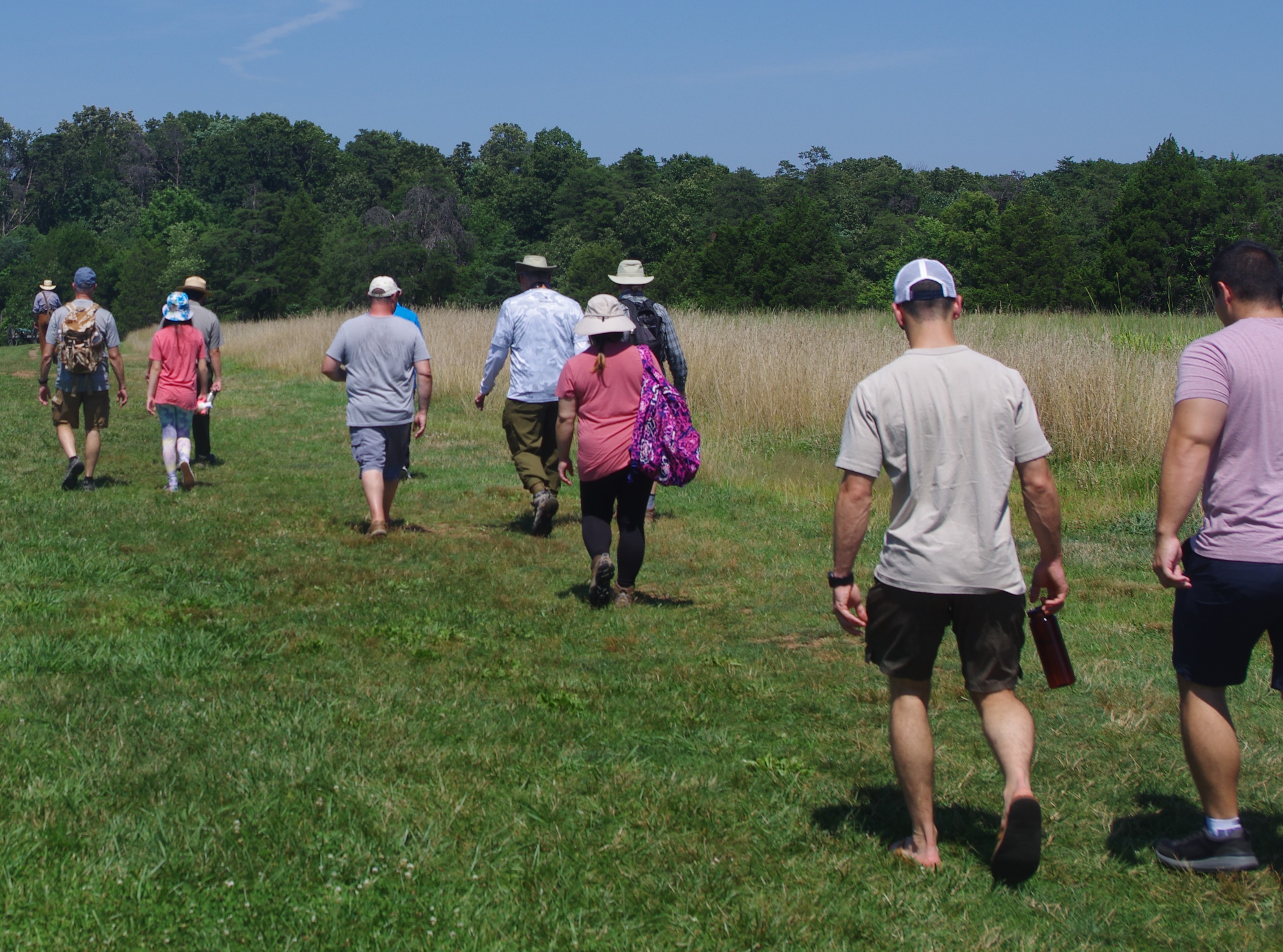
On July 21, 1861, two armies clashed for the first time on the fields overlooking Bull Run. Heavy fighting swept away any notion of a quick war. In August 1862, Union and Confederate armies converged for a second time on the plains of Manassas. T...
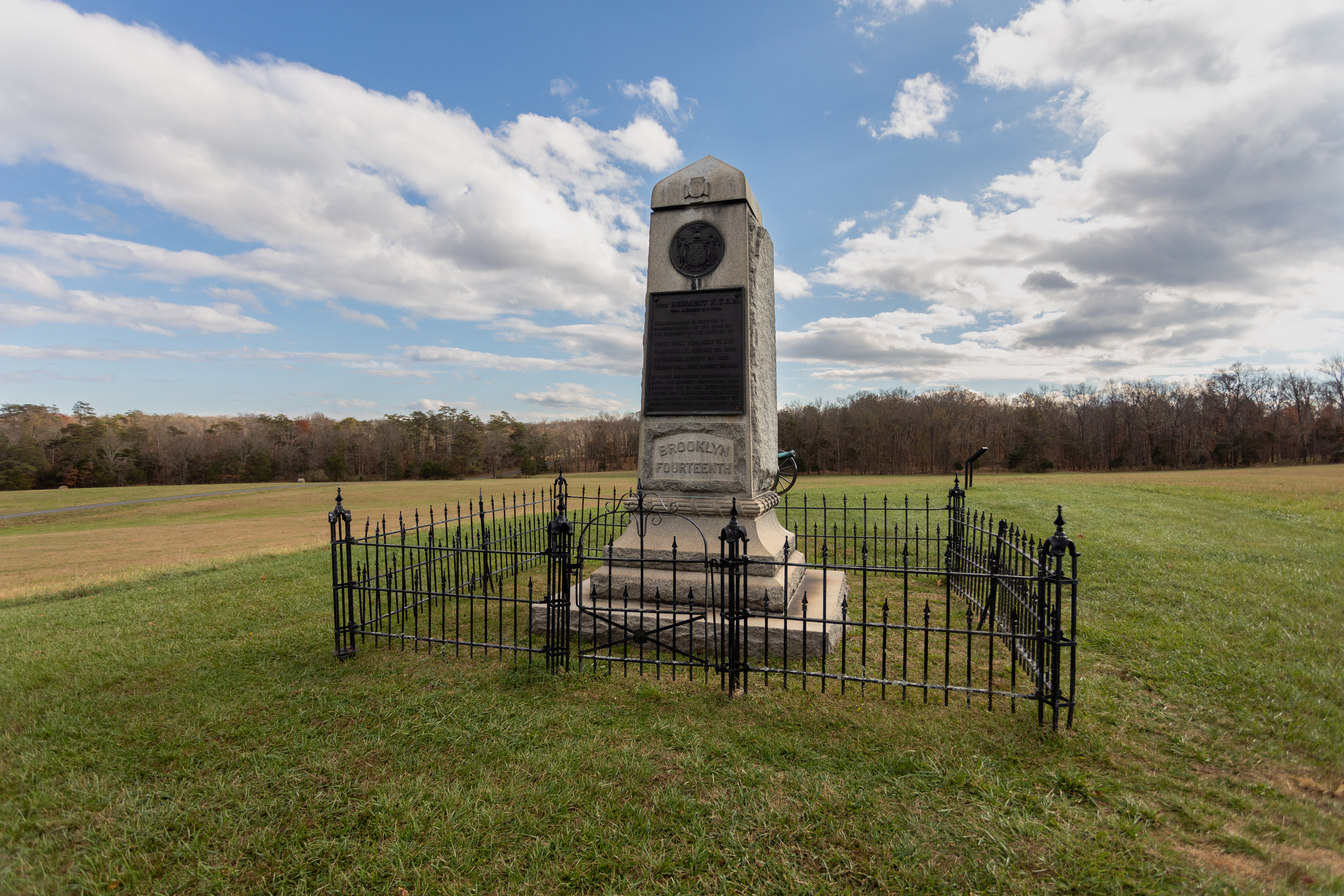
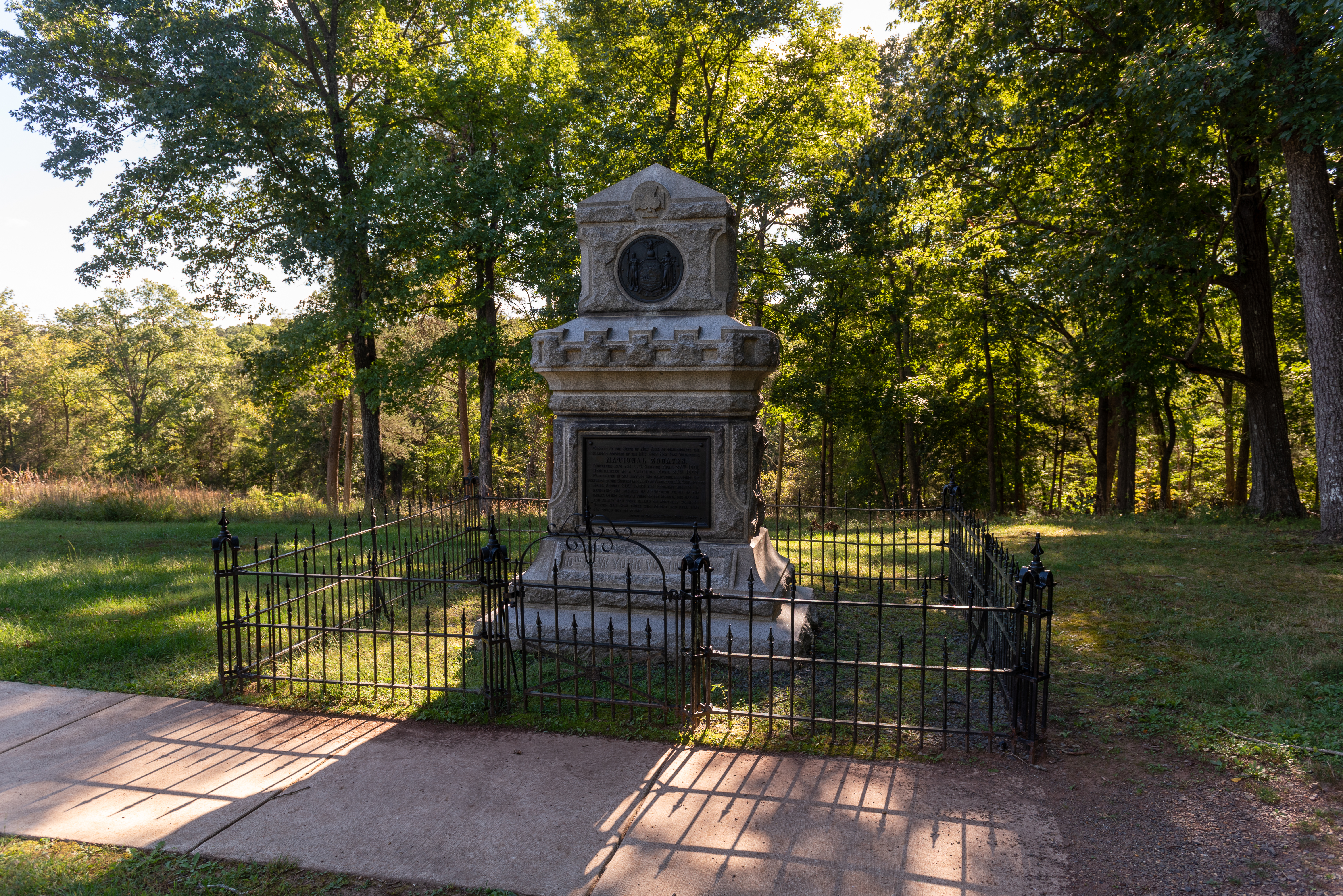
This monument, located at Stop #9 on the park's self-guided driving tour, was dedicated in 1907 by veterans of the 14th Brooklyn Regiment. This unit saw action in both the First and Second Battles of Manassas.
This audio descriptive text for the 14th New York State Militia monument is 177 words in total. The 14th New York State Militia monument is an approximately twelve-foot-tall squared shaft of gray granite with a bronze plaque commemorating the dead of the regiment in both of the Civil War battles at Manassas. The monument is located atop a small hill less than a quarter mile southeast of the intersection of Lee Highway/US 29 and Groveton Road/Featherbed Lane. The monument is surrounded by a three-foot-tall wrought iron fence enclosure and is flanked by two artillery pieces which face west. The front face of the monument faces north. The bronze plaque on that face has the following inscription: “14th Regiment N.Y.S.M. (84th Regiment N.Y. Volunteers). This monument is erected in commemoration of the dead of the regiment in the battles of First Bull Run, July 21, 1861, Gainesville, August 28, 1862, Groveton August 29, 1862, Second Bull Run August 30, 1862. In these and other engagements in which the regiment participated until mustered out of the United States service June 6, 1864, the loss in killed and wounded aggregated about six hundred officers and enlisted men.”
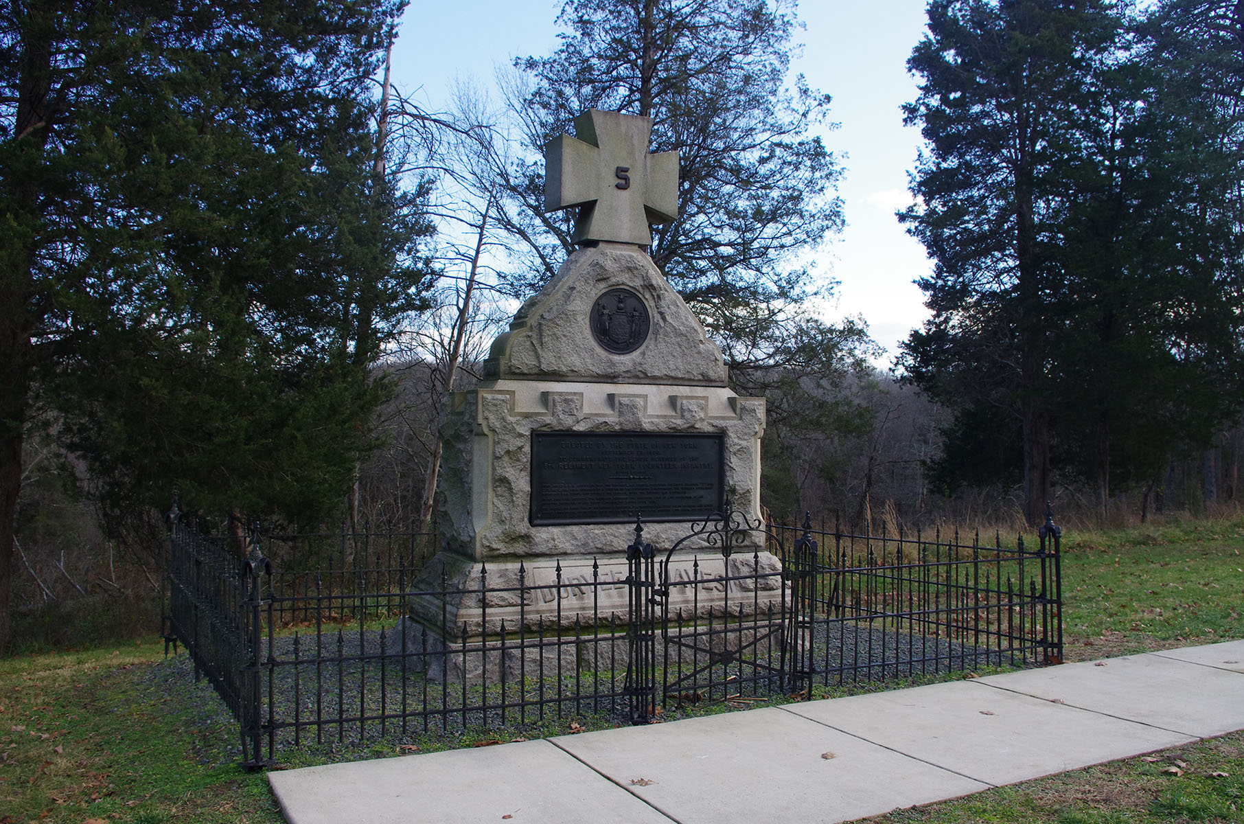
This audio descriptive text for the 5th New York Volunteer Infantry Regiment monument is 274 words in total. The 5th New York Volunteer Infantry Regiment monument is a three-tiered gray granite stone monument with a rectangular bronze plaque and a round bronze state seal on its western, or front, face. The monument is approximately eight and a half feet wide and three feet thick at its base. The top twenty inches of the approximately ten-foot-tall monument is a Maltese Cross with a bronze numeral five in the middle of the cross. The 5th New York was a unit within the Union Army’s Fifth Corps and the Maltese Cross was the Corps badge of the Fifth Corps. The entire stone and bronze artwork is surrounded by a three foot tall wrought iron fence. It stands here to commemorate the unit’s participation in the Civil War and, in particular, their heroic stand here atop this knoll on August 30, 1862. The rectangular bronze plaque has the following inscription: “Erected by the State of New York, September 29, 1906, to commemorate the heroic services of the 5th Regiment New York Volunteer Infantry (Duryee Zouaves). Here, about four PM August 30, 1862, the regiment, 462 strong, supported Hazlett’s Battery “D” 5th U.S. Artillery, when attacked by a Division of the victorious Confederates. The regiment stubbornly withstood this force and checked its advance until the battery had withdrawn. In holding this position, the regiment suffered the greatest loss of life sustained by any infantry regiment, in any battle during the entire Civil War. The casualties were: killed and mortally wounded, 124; wounded, 223. Both color bearers and seven out of eight of the color guard were killed; but the colors were brought with honor, off the field.”
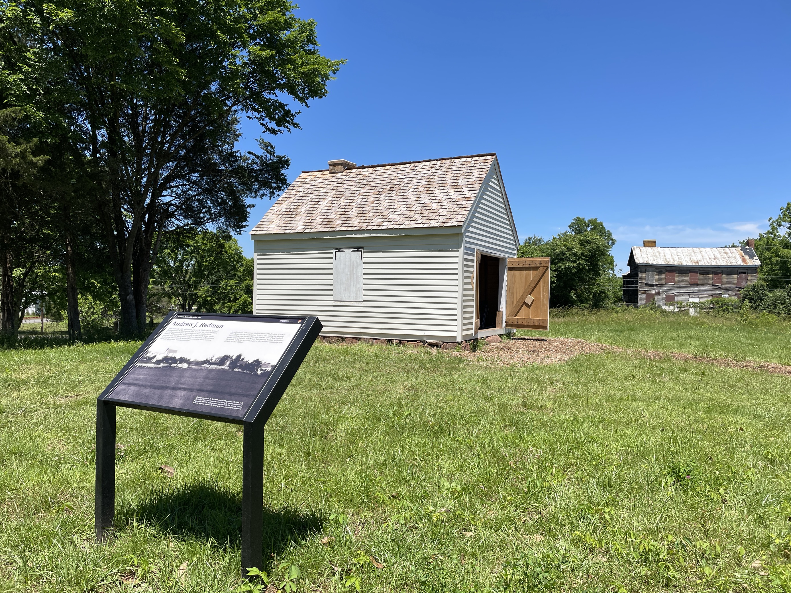
Born enslaved in 1831, only months prior to Nat Turner’s revolt, Andrew J. "Jim" Redman learned the blacksmithing trade at an early age. By the outbreak of the Civil War, Redman worked as a blacksmith at this corner of the Groveton intersection. He witnessed the contending armies maneuver and battle during both Manassas campaigns in 1861 and 1862.
A white building the size of a one-car garage with a peaked roof, low chimney, and wooden shingles stands on a stone foundation. To the rear, a ramshackle ruin of a boarded-up house stands at the edge of some woods.
In 1860, Benjamin Chinn and his family lived here in a two-and-a-half story frame farmhouse. Known as "Hazel Plain," the modest plantation comprised several hundred acres. The property was typical of those in Prince William County, yielding wheat, corn, oats, and potatoes for cash and subsistence. Like roughly one-third of their immediate neighbors, the Chinn family owned slaves.
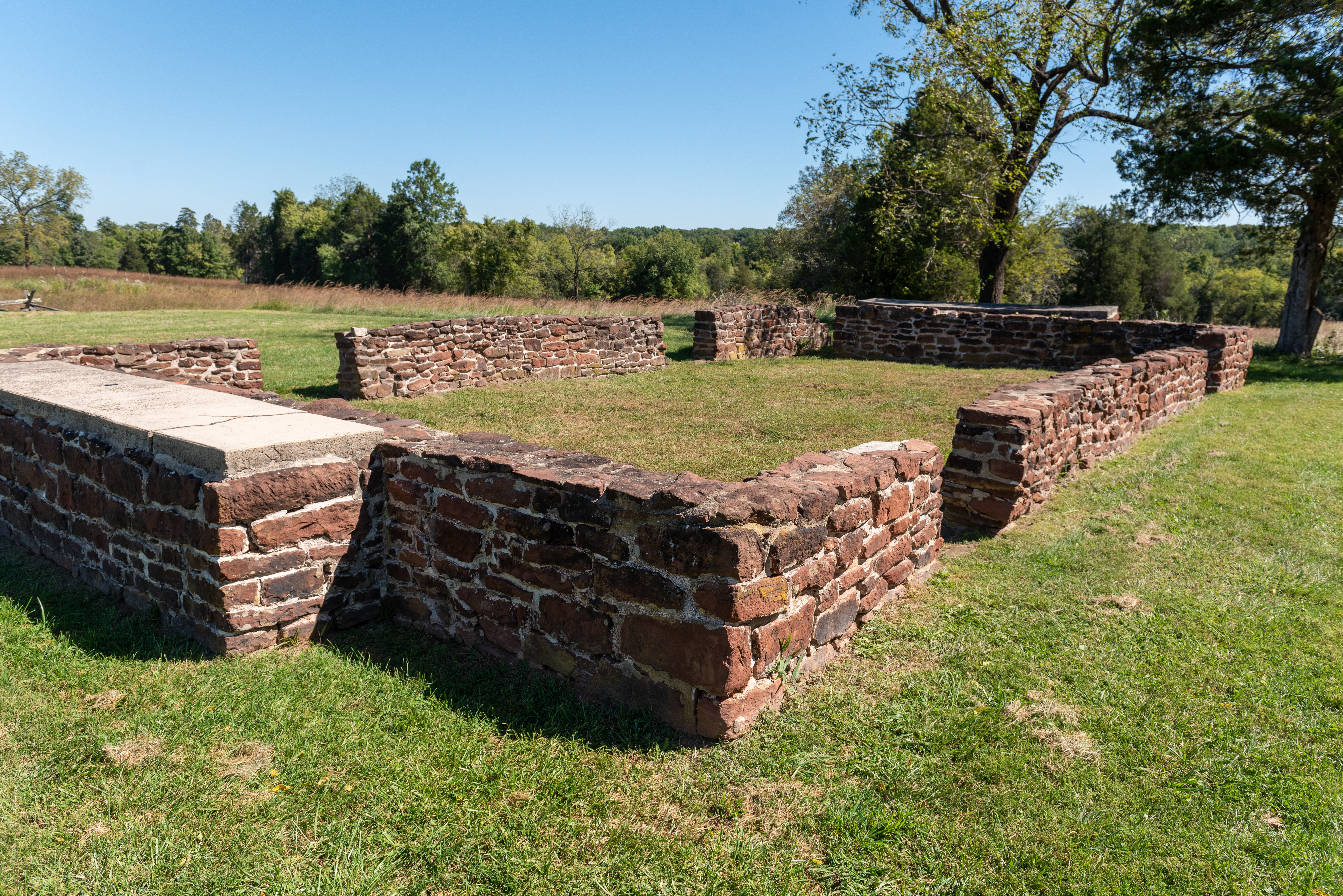
This audio descriptive text for the Chinn House Site is 193 words in total. The Chinn House Site is the stone foundation ruins of a structure termed “Hazel Plain” which stood here upon Chinn Ridge from 1809 until 1950. The rectangular foundation wall is approximately three-feet-tall; 47-feet-long on the northeast and southwest sides; and 30-feet-long on the northwest and southeast sides. The foundation ruins also include twin attached chimney bases on the northwest and southeast sides. The wall is comprised of local brownstone, or sandstone, blocks of similar size and they are predominantly brown, rust red and tan in color. The walls are not a continuous, unbroken feature; absent sections exist where basement windows of the house once existed. The site is situated in a well-manicured grassy lawn. Two semispherical projections of brick and concrete near the eastern corner of the foundation wall are the capped remnants of the cistern and well which were used by the residents of the home. The cistern dome is approximately five feet in diameter and three feet tall. The well cap is less than two feet in diameter and less than two feet tall. The site has largely unimpeded views of fields in all directions and of the Chinn Branch valley.
The plantation house of Francis Lewis, known as Portici, stood atop the ridge to your east. Massive brick chimneys flanked the frame house. The house was destroyed by fire in 1862.
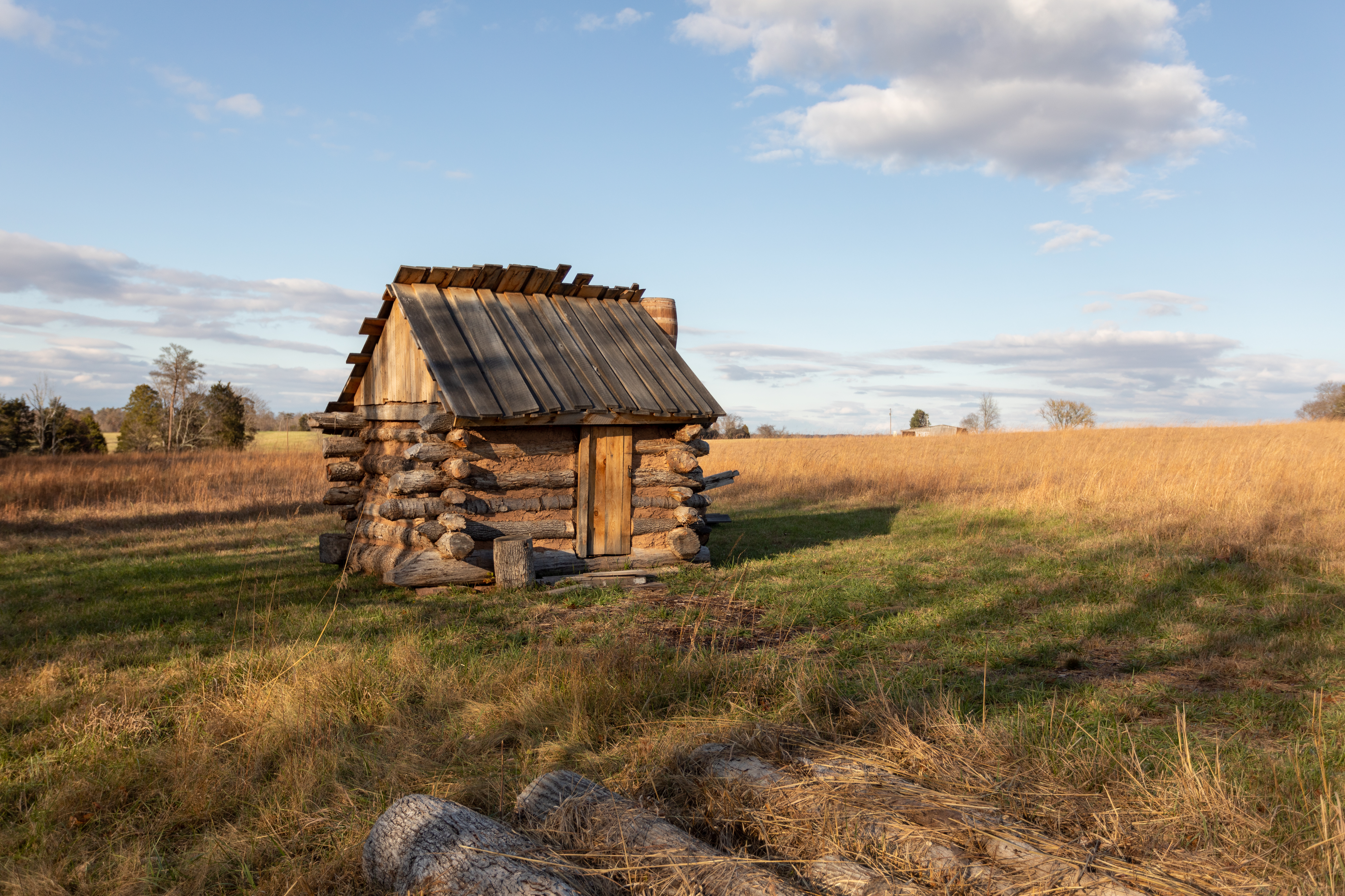
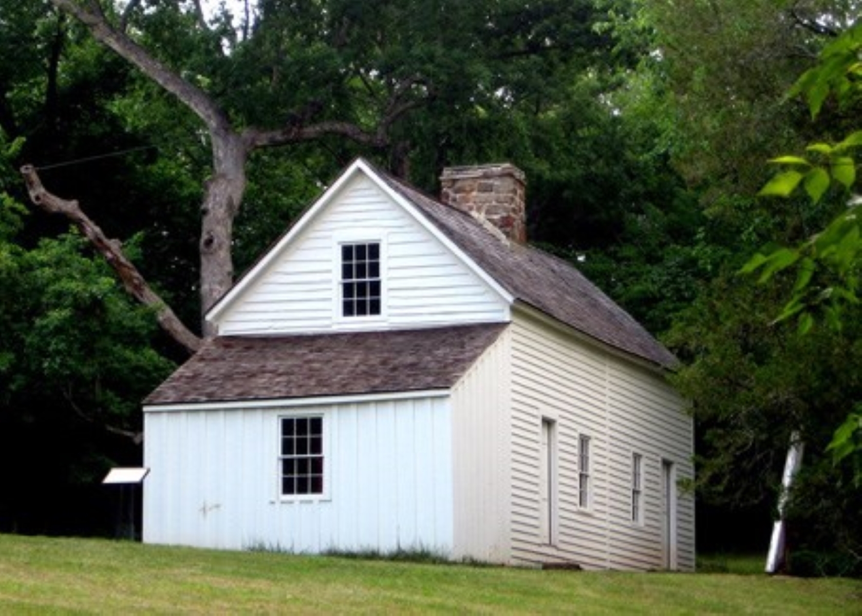
A wood log house sits in the middle of a grassy field. Logs sit on the ground in the foreground.
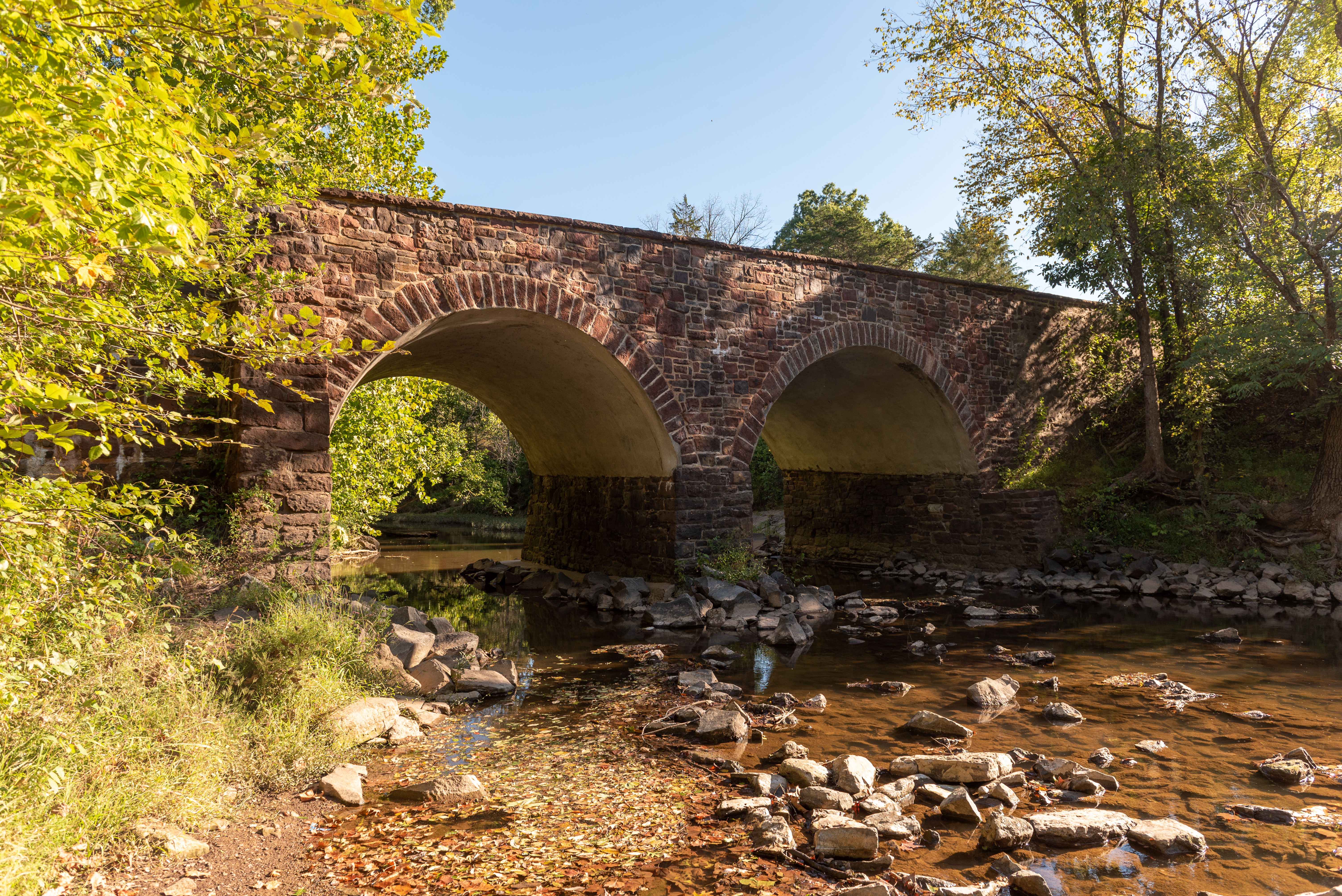
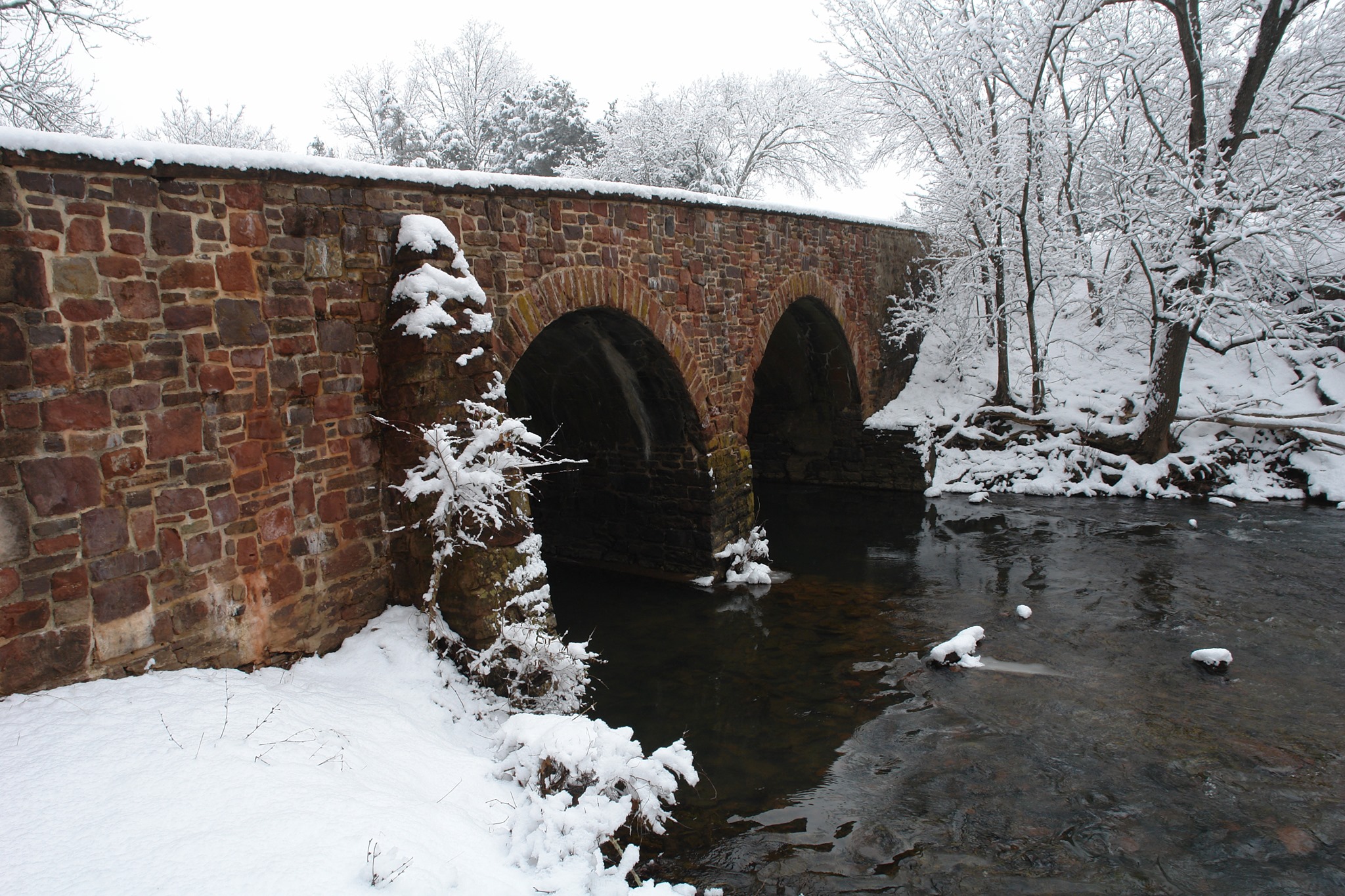
Stone Bridge, destroyed by the Confederates before Second Manassas but still played a roll in the battle in August 1862
This audio descriptive text for the Stone Bridge is 192 words in total. The Stone Bridge is a sandstone masonry structure astride Bull Run in the eastern part of Manassas National Battlefield Park. The bridge is approximately 160 feet in length and thirty feet wide and twenty-feet-tall. The surface of the road bed is about two-and-a-half feet above the crown of the arches. A parapet wall of approximately eighteen-inches thickness extends approximately three feet above the roadbed. The bridge has a higher elevation on the Fairfax County, or eastern bank, of Bull Run than it does on the Prince William County, or western bank, of the watercourse. Therefore, the transportation, or trail, surface of the bridge slopes downward from east to west. The bridge is supported by two semicircular arches which are approximately twenty-feet-wide and fifteen-feet tall and they meet at a six-foot-wide pier in the middle of Bull Run. The bridge is constructed of local red and brown sandstone blocks of various dimensions. The bridge is substantially the same structure that was reconstructed here in the 1880s; on the site of the Civil War-era Stone Bridge.
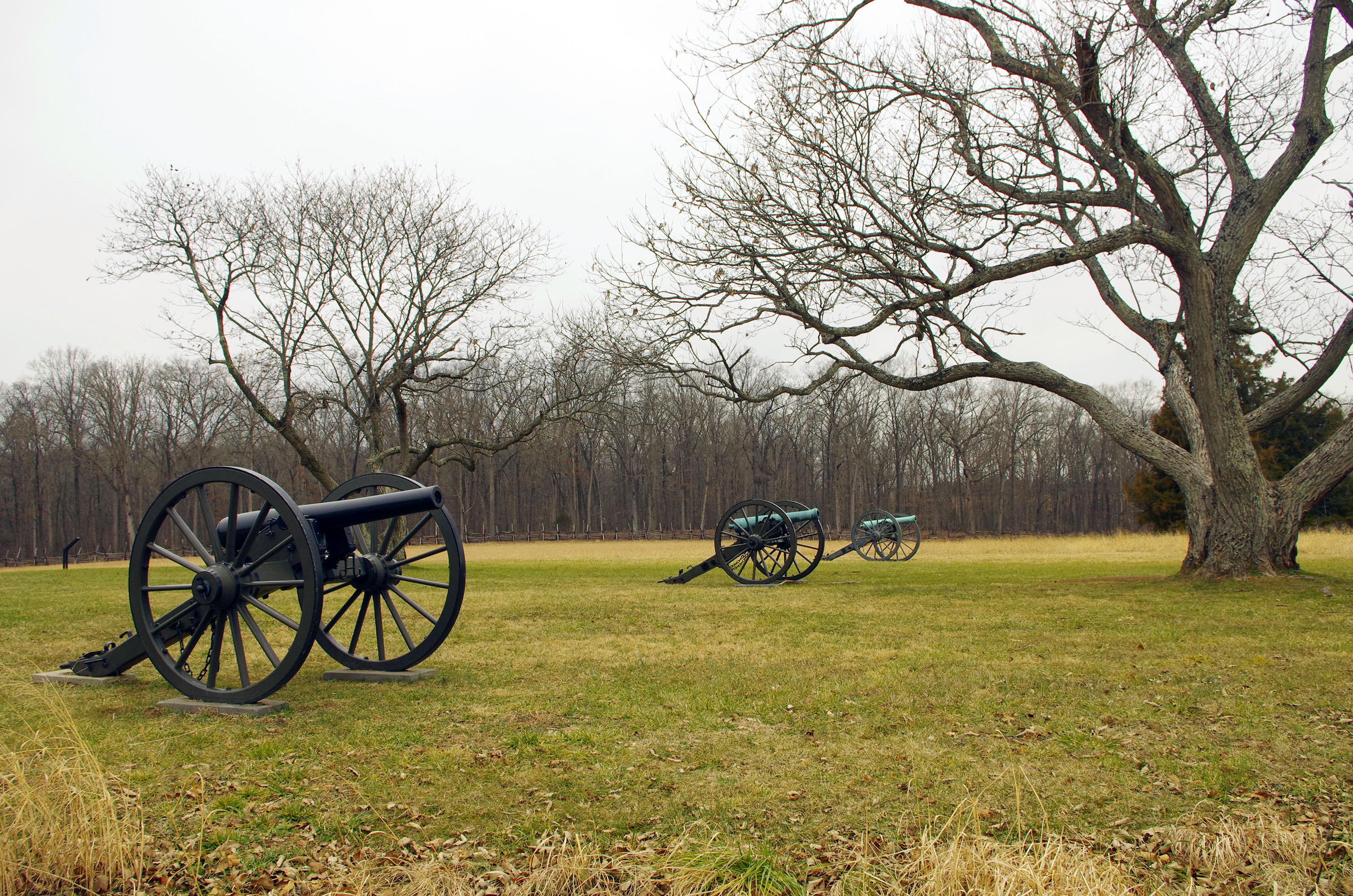
Battery Heights served as a key artillery position for both Union and Confederate Artillery during the Second Battle of Manassas. Today, this site is Stop #2 on the park's self-guided Second Manassas driving tour.
This audio descriptive text for Battery Heights is 182 words in total. Battery Heights is Stop #2 on the Manassas National Battlefield Park driving tour for visitors to explore the Second Battle of Manassas. This slight elevation on the north side of Lee Highway was used as an artillery battery emplacement by the Union army on August 28, 1862 and by the Confederate army on August 30, 1862. Previously without a proper noun name, this modest promontory became Battery Heights. A pair of ornamental trees occupies the crest of Battery Heights and provides shade for visitors as they admire the view and examine the collection of artillery pieces displayed here. The elevation slopes downward to the north and east and the entire vicinity is carpeted with native grasses. Forested terrain is found on the south side of Lee Highway and approximately one hundred yards to the west. A thin line of trees stretches from west to east in a stream bottom approximately two hundred yards to the north. A patchy collection of trees and a line of trees stretching north and south is located approximately two hundred yards to the east of this spot.
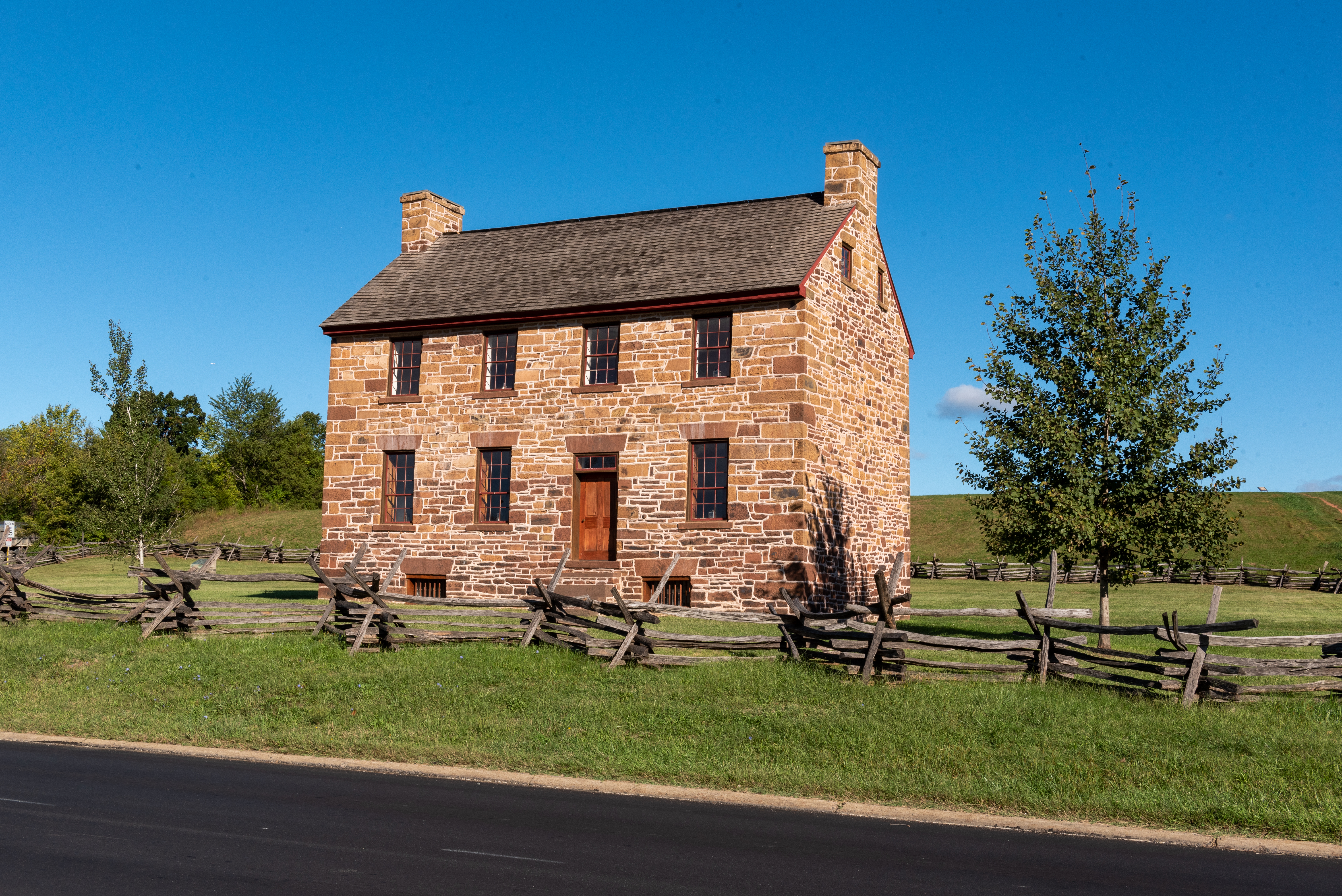
In 1861 and again in 1862, this historic stone structure, was used as a makeshift hospital during and after the First and Second Battles of Manassas.
This audio descriptive text for the Stone House is 231 words in total. The Stone House is one of the three remaining Civil War-era buildings in Manassas National Battlefield Park. The structure is a two-and-a-half story rectangular structure approximately forty-feet-wide and 24-feet-deep that faces south towards Lee Highway. The exterior of the structure is composed of locally available sandstone blocks; some of which are the equivalent size of shoe boxes and some of which are as large as microwave ovens. The stone blocks are various shades of yellow, orange, brown and rusty red. The Stone House has symmetrical chimneys on the west and east ends of the structure. On the first floor, there are three windows and a door on the south and north sides of the house. On the second floor, there are four doors on both the south and north sides of the house. At ground level, there are two window wells on both the north and south sides of the house to provide light to the basement. There is also a small door on the west side of the house to provide exterior entrance into the basement. The Stone House has two small windows on the west and east walls to provide light for the attic. The structure has a wood shingle roof and five artillery projectiles lodged into some of the weather, or war-produced, cavities in the exterior walls to serve as curiosities for postwar visitors to the historic property.
Throughout August 29, 1862, Federal troops repeatedly attacked Jackson's left flank - Gen. Maxcy Gregg's South Carolina Brigade - on a knoll just west of here.
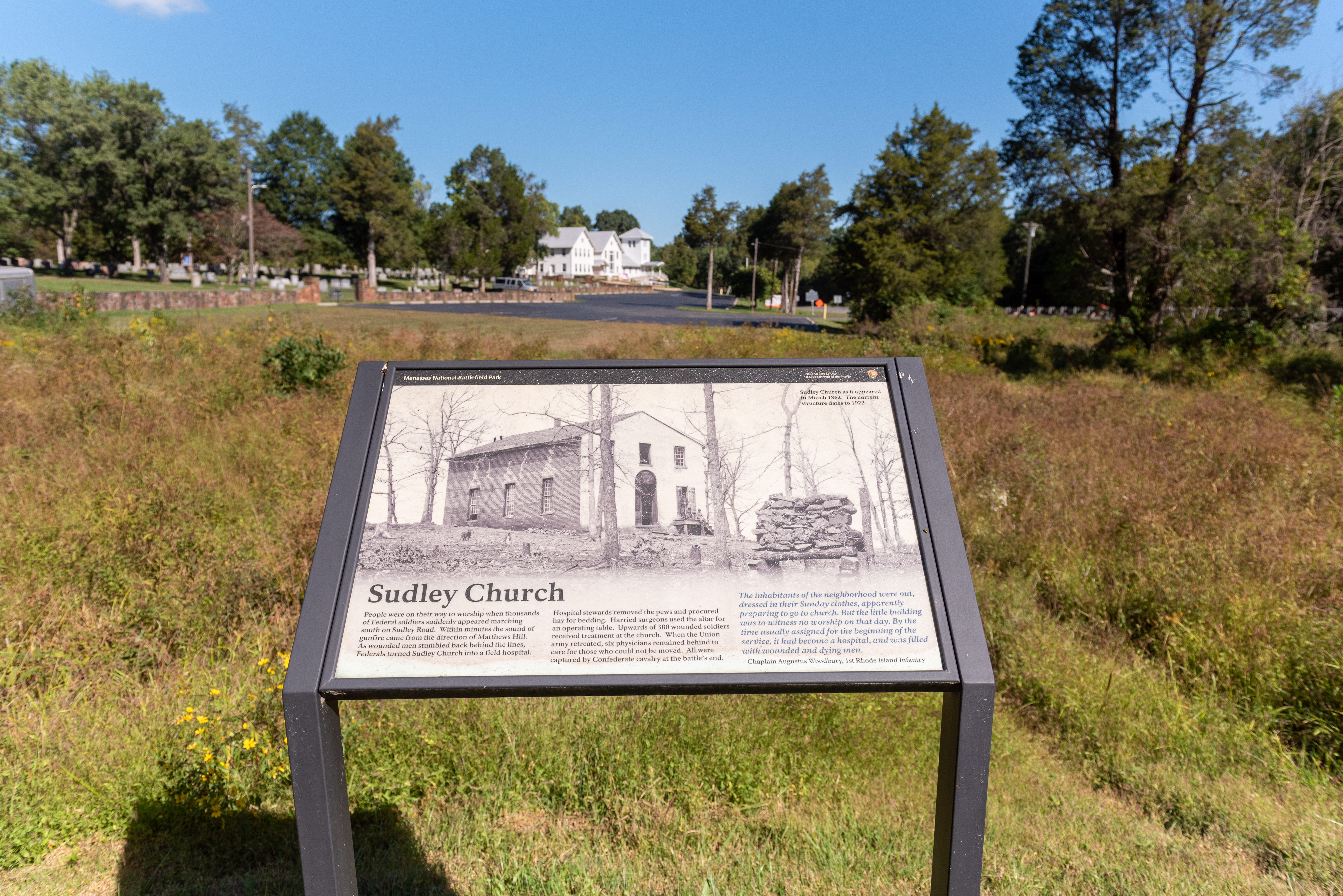
A wayside exhibit titled: "Sudley Church" in front of a large white church, a field, and a graveyard.
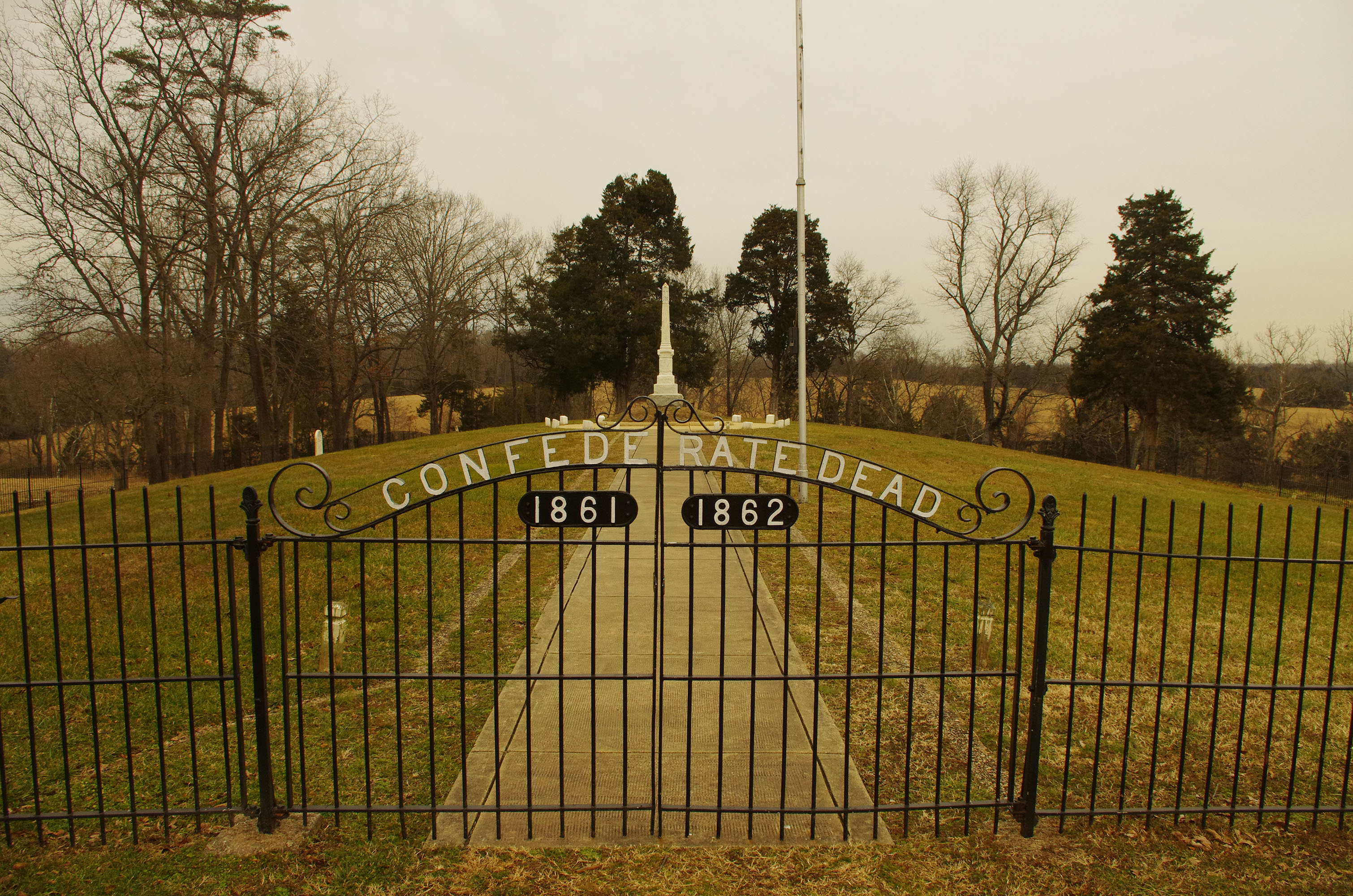
The Bull Run and Groveton Ladies' Memorial Association, established in 1867, launched a campaign to recover Confederate dead from the battlefield. The organization established this cemetery and orchestrated the re-interment of an estimated 500 soldiers.
The audio descriptive text for the Groveton Confederate Cemetery is 437 words in total. The Groveton Confederate Cemetery contains the remains of an estimated five hundred Confederate soldiers who perished in the First and Second Battles of Manassas. An ornamental black iron fence, approximately four feet tall, forms a rectangular enclosure of the roughly two-acre cemetery. The soldiers’ remains were congregated here in the late 1860s and early 1870s from their earlier, hastily improvised burial spots throughout the battlefield area. A white granite and white marble obelisk monument approximately thirteen-feet-tall was unveiled in the center of the cemetery in 1904. The south, or front, face of the monument contains the following inscription: “Dulce et decorum est pro patria mori. Erected to the Confederate dead. We care not whence they came, dear in their lifeless clay! Whether unknown or known to fame, their cause and country still the same. They died and wore the gray.” On the north face of the monument is an inscription stating: “They gave their lives in defense of their country on the fields of the First and Second Battles of Manassas”. On the east face of the monument is an inscription stating: “They sleep well in their unknown graves on the faraway battlefield”. On the west face is an inscription stating: “But for them the counting of time is not: for they dwell in the city of God”. The obelisk is encircled by a five-foot-wide paved walkway and fourteen small white marble stones approximately one-foot-wide, six-inches-long and one-foot-tall, bearing the names of former Confederate and border states which had sent soldiers into the Confederate armies that fought in the two battles of Manassas. When facing the south, or front, face of the obelisk, you are positioned at six o’clock. Encountering the stones in a clockwise pattern from there reveals the following order: “Virginia. North Carolina. South Carolina. Georgia. Florida. Alabama. Mississippi. Louisiana. Texas. Arkansas. Missouri. Tennessee. Kentucky. Maryland.”. There are only two known burials in the cemetery; James Jermain Palmer and William Goodwyn Ridley. Palmer’s gravestone is a white granite tablet approximately three-feet-tall located approximately ten yards west of the central obelisk. Palmer’s inscription includes a Palmetto tree and states: “In memory of James Jermain Palmer. Son of Dr. John S. and Ester Simmons Palmer. Born in Charleston County, South Carolina, May 28, 1840. Was killed in the Second Manassas battle August 30, 1862. He was a private of the Spartan Rifles and Regiment of Palmetto Sharpshooters”. Ridley’s gravestone is a white granite tablet approximately two-feet-tall located approximately five yards north of the southeast fence corner of the cemetery. Ridley’s inscription states: “William Goodwyn Ridley. Company G. 6th Virginia Regiment. Southampton County. Second Manassas. Aged 20 years”.
In 1906 the State of New York authorized the erection of three monuments on the field of the Second Battle of Manassas, honoring the sacrifices of the Fifth New York Volunteers, the Tenth New York Volunteers, and the Fourteenth Brooklyn.
A large, gray monument stands enclosed in a square of black fence in the middle of a grassy field.
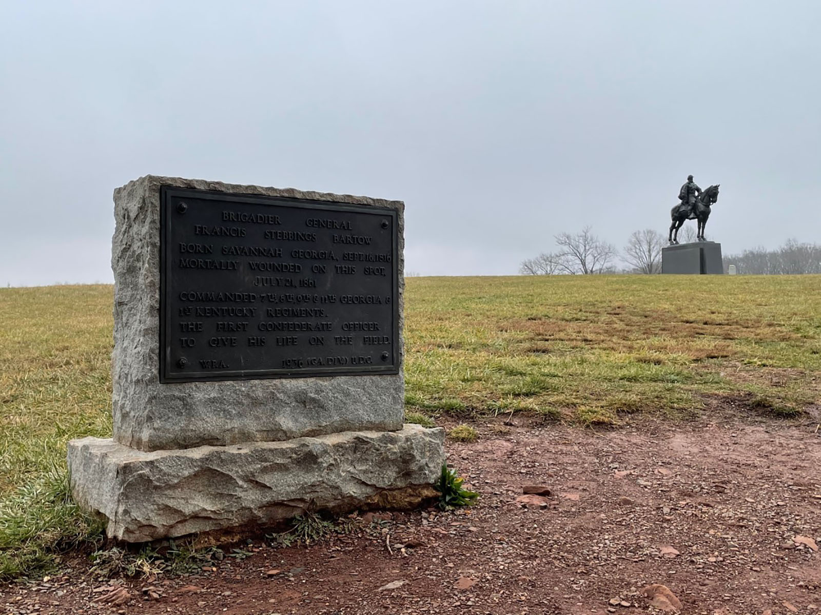
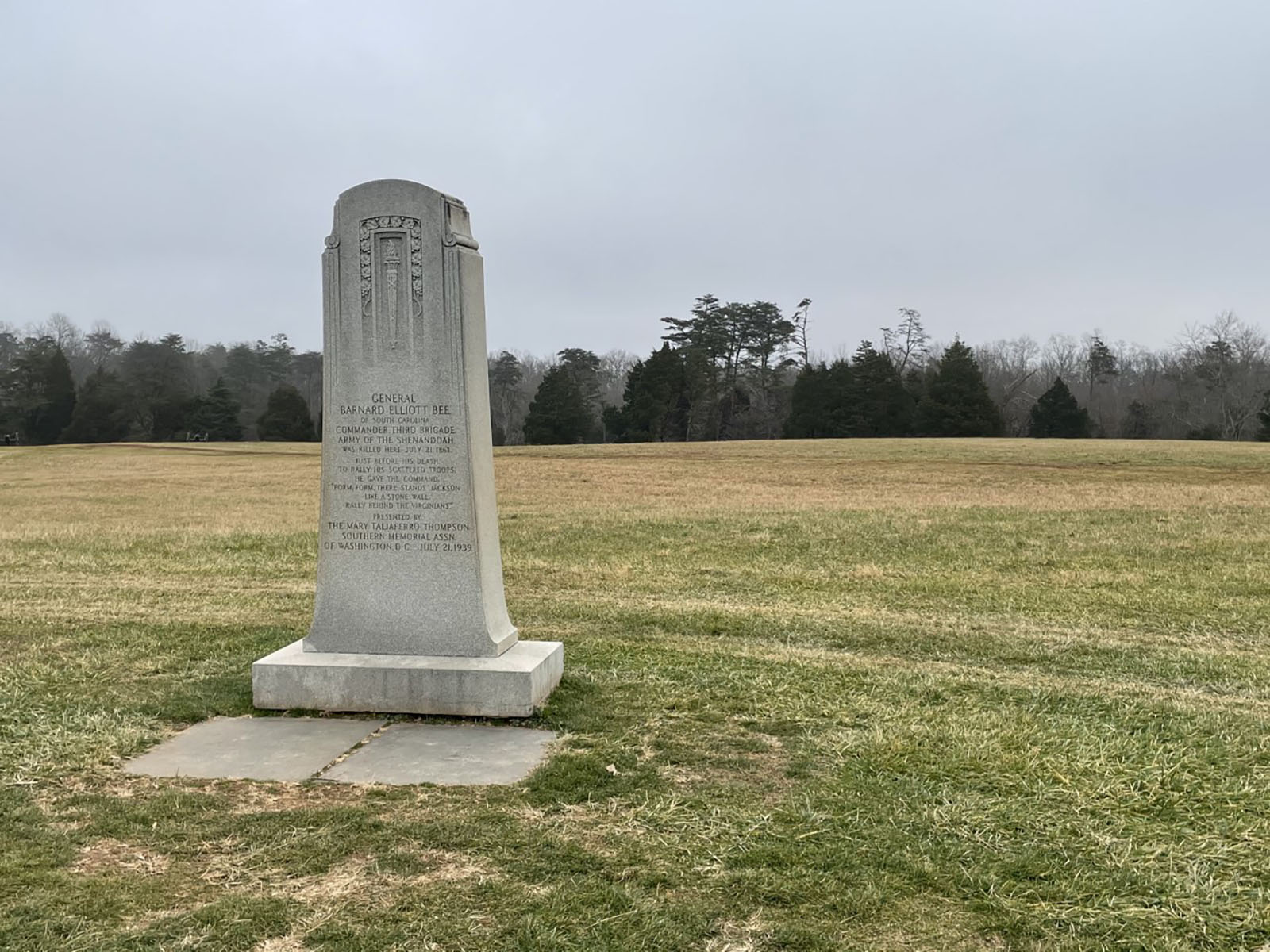
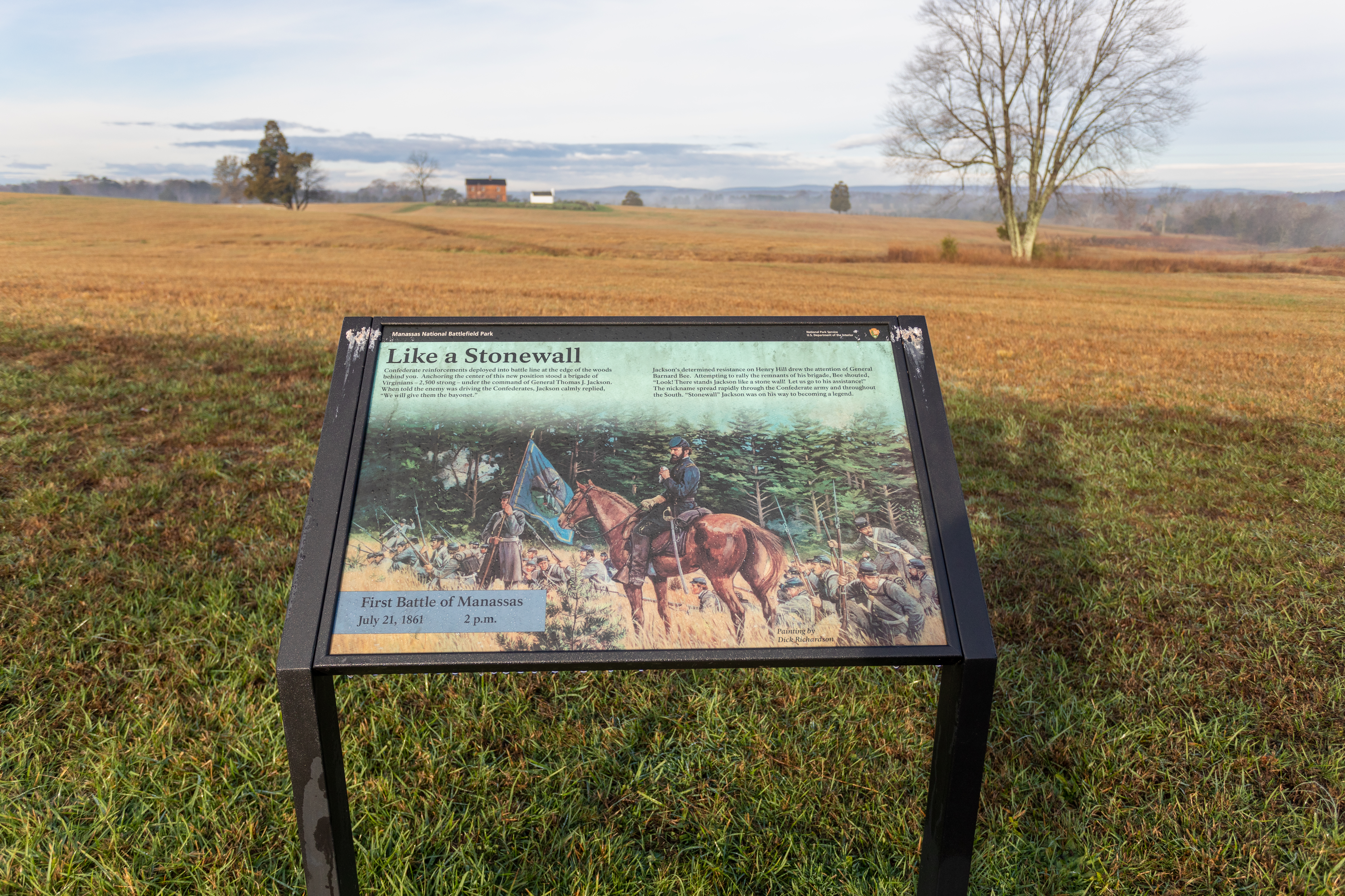
The monument marks the spot where Colonel Francis S. Bartow was mortally wounded leading the 7th Georgia Infantry during the First Battle of Manassas (Bull Run), July 21, 1861.
This audio descriptive text for the Francis S. Bartow Monument is 130 words in total. The Francis S. Bartow Monument is a rough-cut rectangular granite block approximately three-feet-wide and three-feet-tall and one-foot-thick with a bronze plaque on the northwest, or front, face which marks the vicinity where Colonel Bartow was mortally wounded on July 21, 1861. The plaque is approximately thirty inches wide and twenty inches tall and has raised text stating: “Brigadier General Francis Stebbins Bartow. Born Savannah, Georgia, September 16, 1816. Mortally wounded on this spot, July 21, 1861. Commanded 7th, 8th, 9th, 11th Georgia and 1st Kentucky Regiments. The first Confederate officer to give his life on the field. W.P.A. 1936, Georgia Division U.D.C.” The monument is located atop Henry Hill approximately one hundred and sixty yards east of the Visitor Center and approximately thirty yards northeast of the “Stonewall” Jackson monument.
This audio descriptive text for the Brigadier General Barnard E. Bee Monument is 184 words in total. The Brigadier General Barnard E. Bee Monument is an approximately eight-foot-tall and four-foot-wide shaft of white marble located atop Henry Hill approximately one hundred feet southwest of the “Stonewall” Jackson Monument. The Bee monument marks the vicinity where Bee was mortally wounded on July 21, 1861 while leading Confederate soldiers in an attack upon the Union artillery line on the western side of the hill. An inscription on the northwest, or front, face of the monument states: “General Barnard Elliott Bee of South Carolina. Commander, Third Brigade, Army of the Shenandoah, was killed here July 21, 1861. Just before his death, to rally his scattered troops, he gave the command “Form, form, there stands Jackson like a stone wall, rally behind the Virginians!” Presented by the Mary Taliaferro Thompson Southern Memorial Association of Washington, D.C. July 21, 1939”. Above the inscription is a bas relief of a torch framed by garlands. An inscription on the southeast, or rear, face of the monument lists the leaders of the Association: “Lucy Steele Clay, Chairman. Alice Boswell Morrison. Julia Neason Streater. Maude Bird Phares. Norma Hardy Britton”.
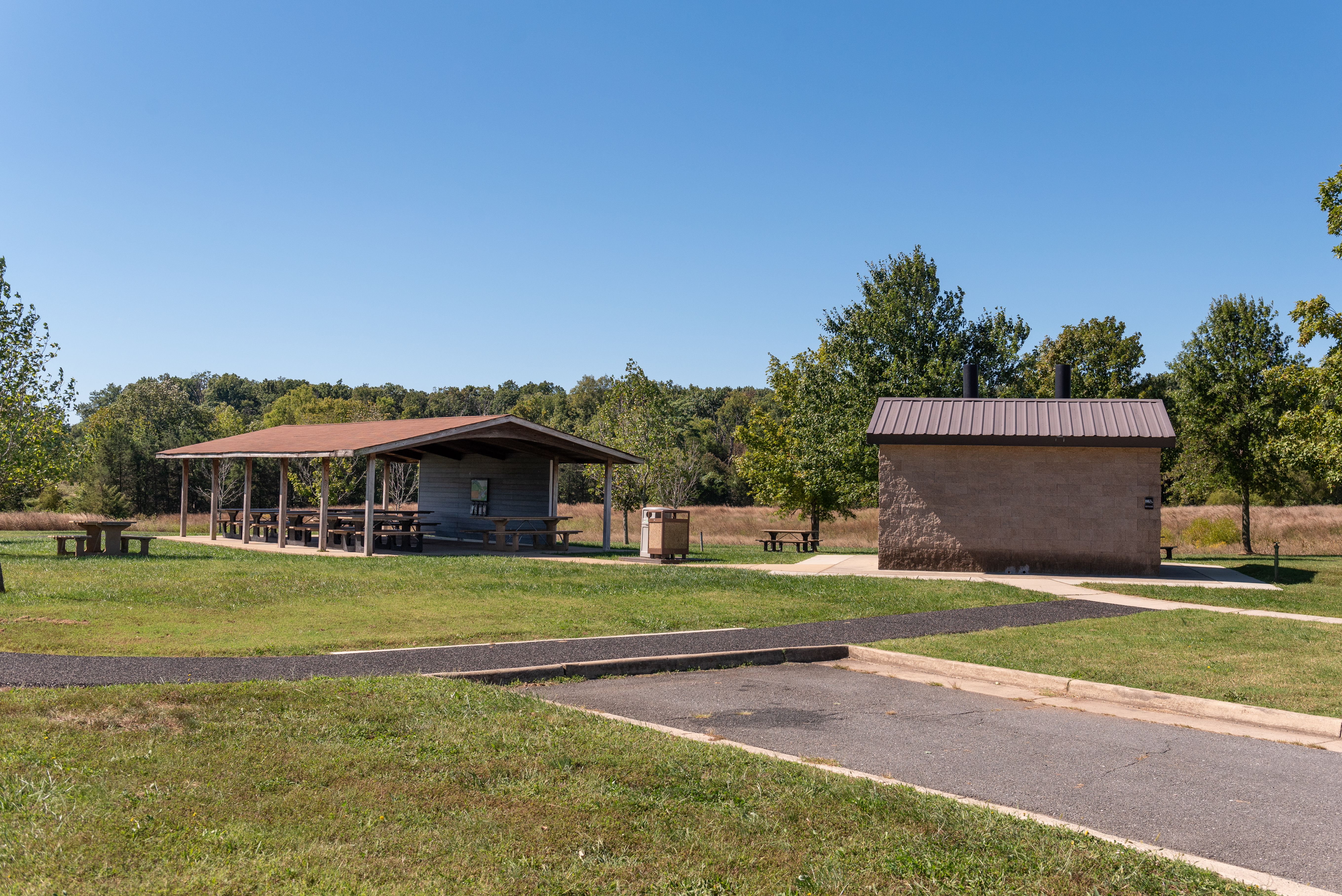
This audio descriptive text for Brownsville is 119 words in total. Brownsville is the designated picnic area within Manassas National Battlefield Park. A paved cul-de-sac roadway provides access to the site and over one hundred parking spaces for vehicles. Approximately fifteen picnic tables and three permanent outdoor grills for charcoal cooking usage allow relatively large groups to hold events here. A pair of pit toilets and a water fountain are also present. Many of the picnic tables are located beneath a shade shelter while others are in the surrounding grass and are open to the weather. The picnic area is surrounded by fields available for recreational use. A hitching post and large parking lanes for horse trailers enable horse owners to park and utilize the equestrian trails in the park.
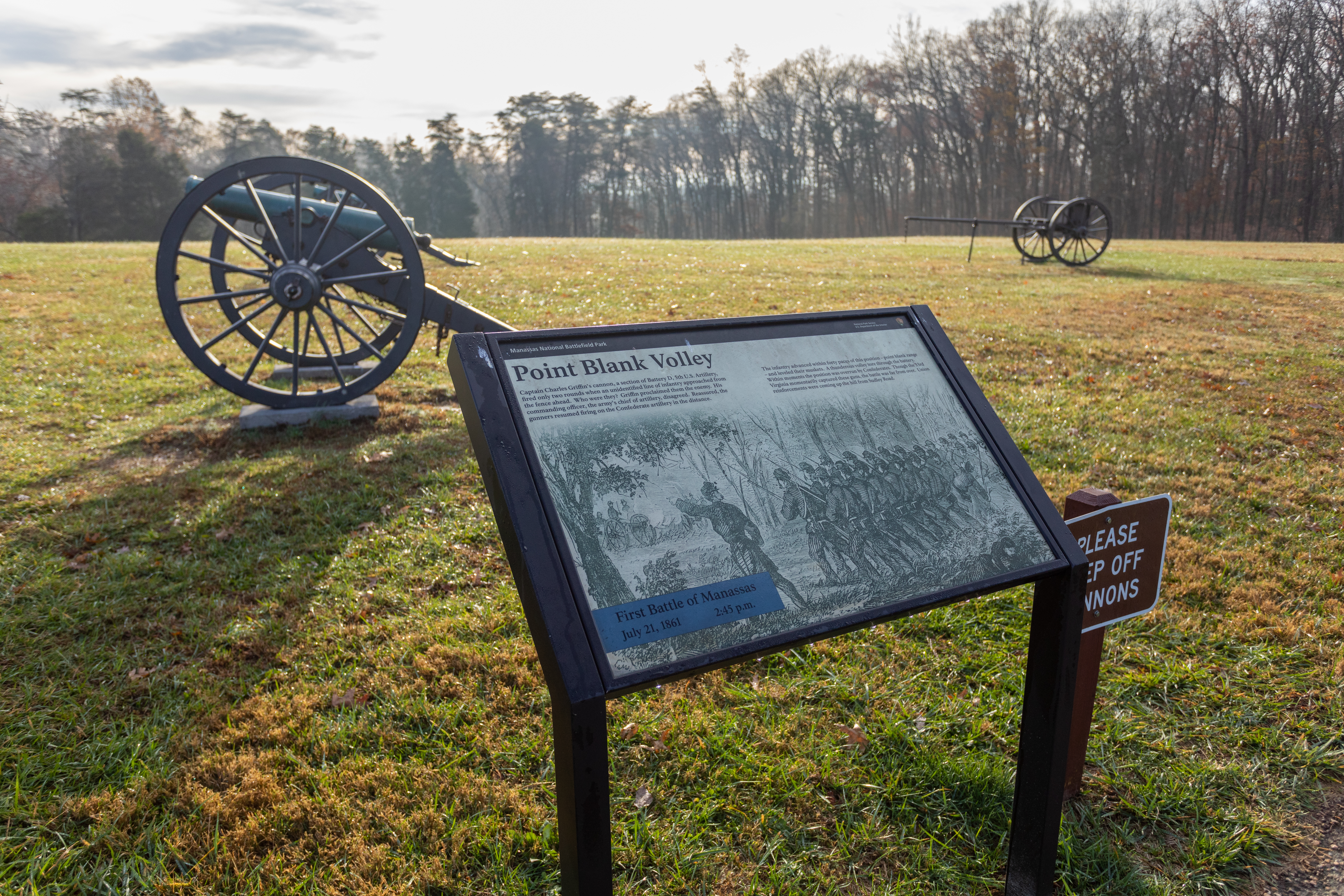
Union Captain James Ricketts' Battery I, 1st US Artillery held this position on the afternoon of 21 July 1861. Fighting raged along this line throughout the afternoon, with the guns changing hands three times. During the fighting, James Ricketts was severely wounded.
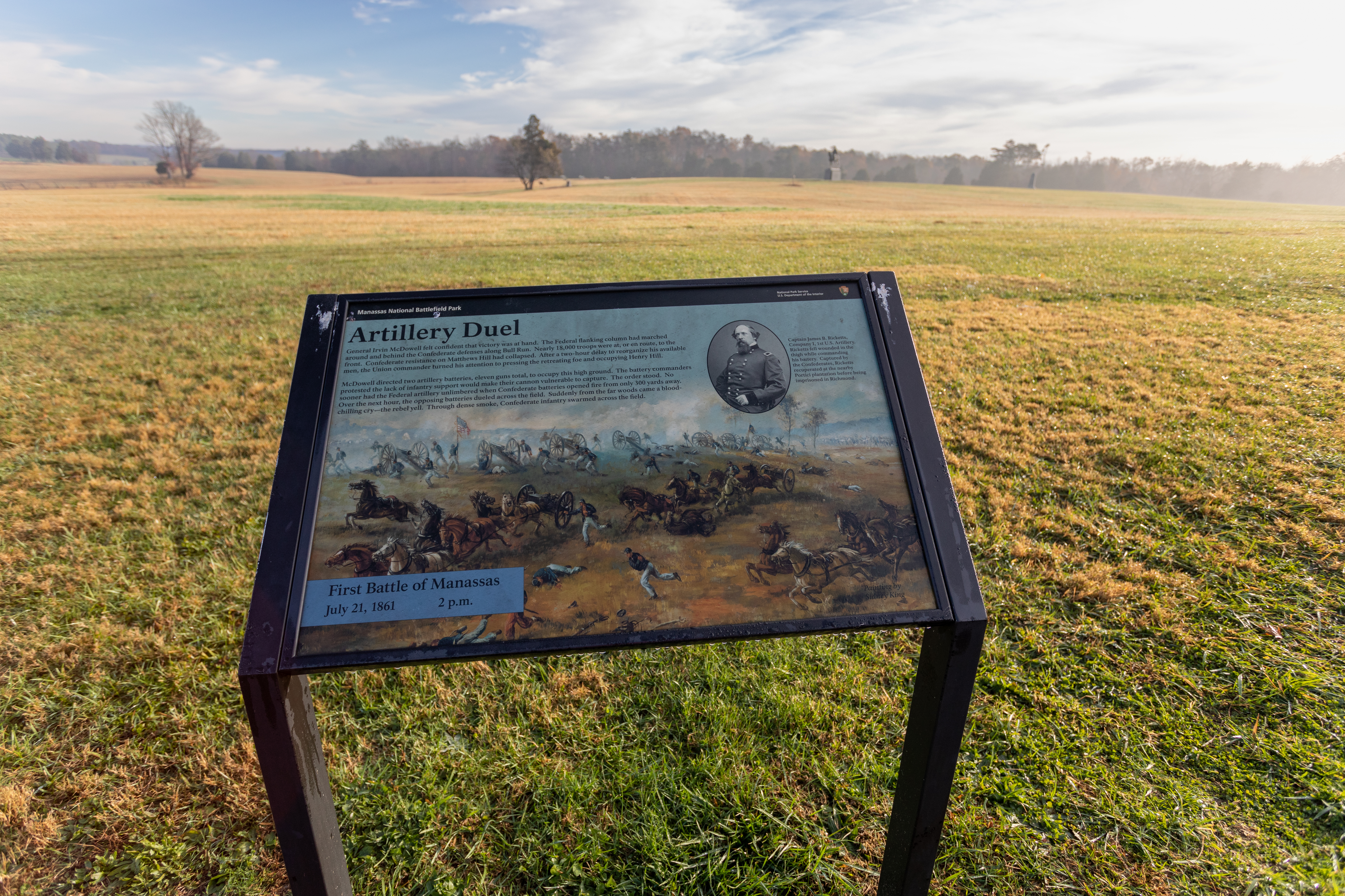
A wayside exhibit titled: "Artillery duel" in front of a large field.
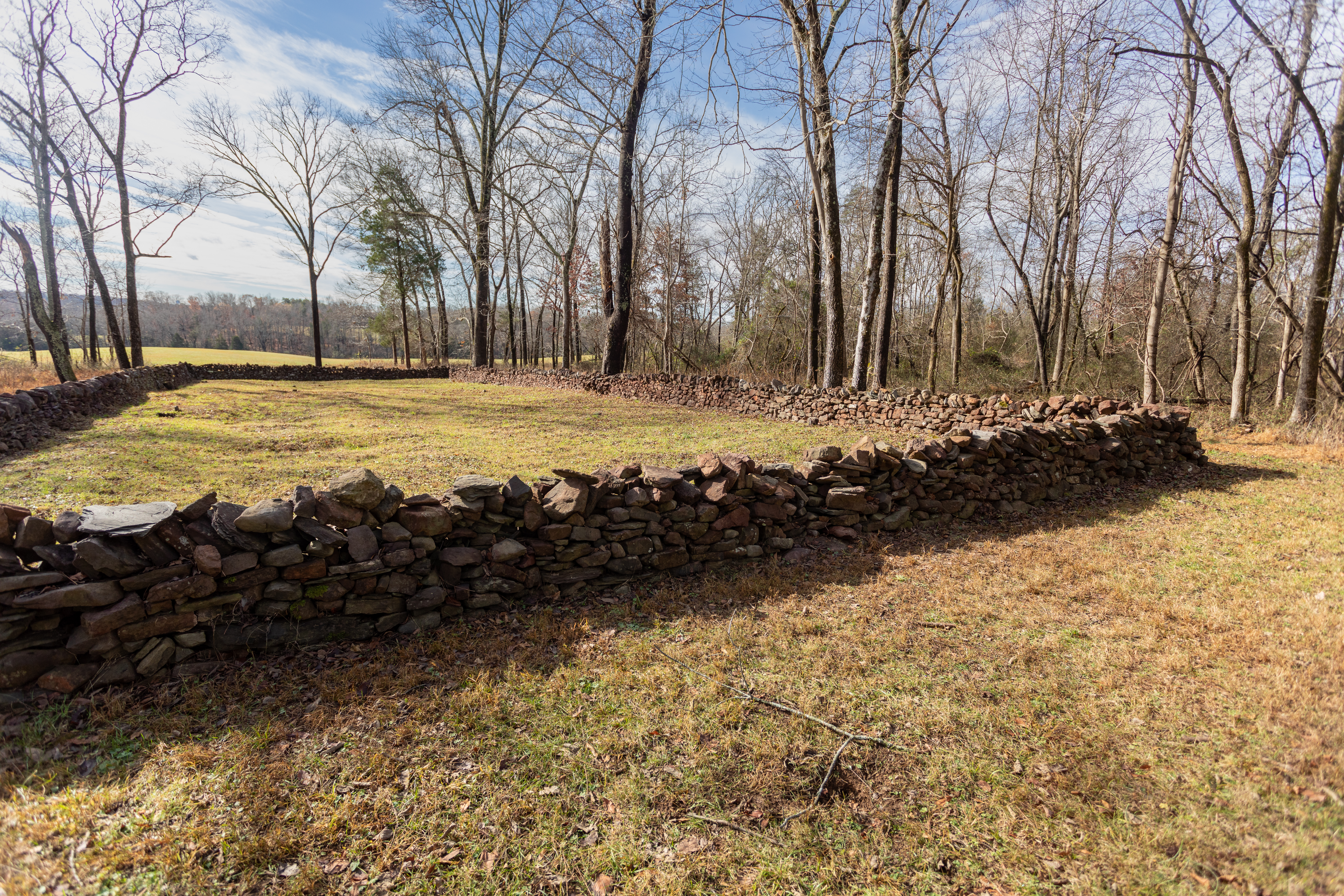
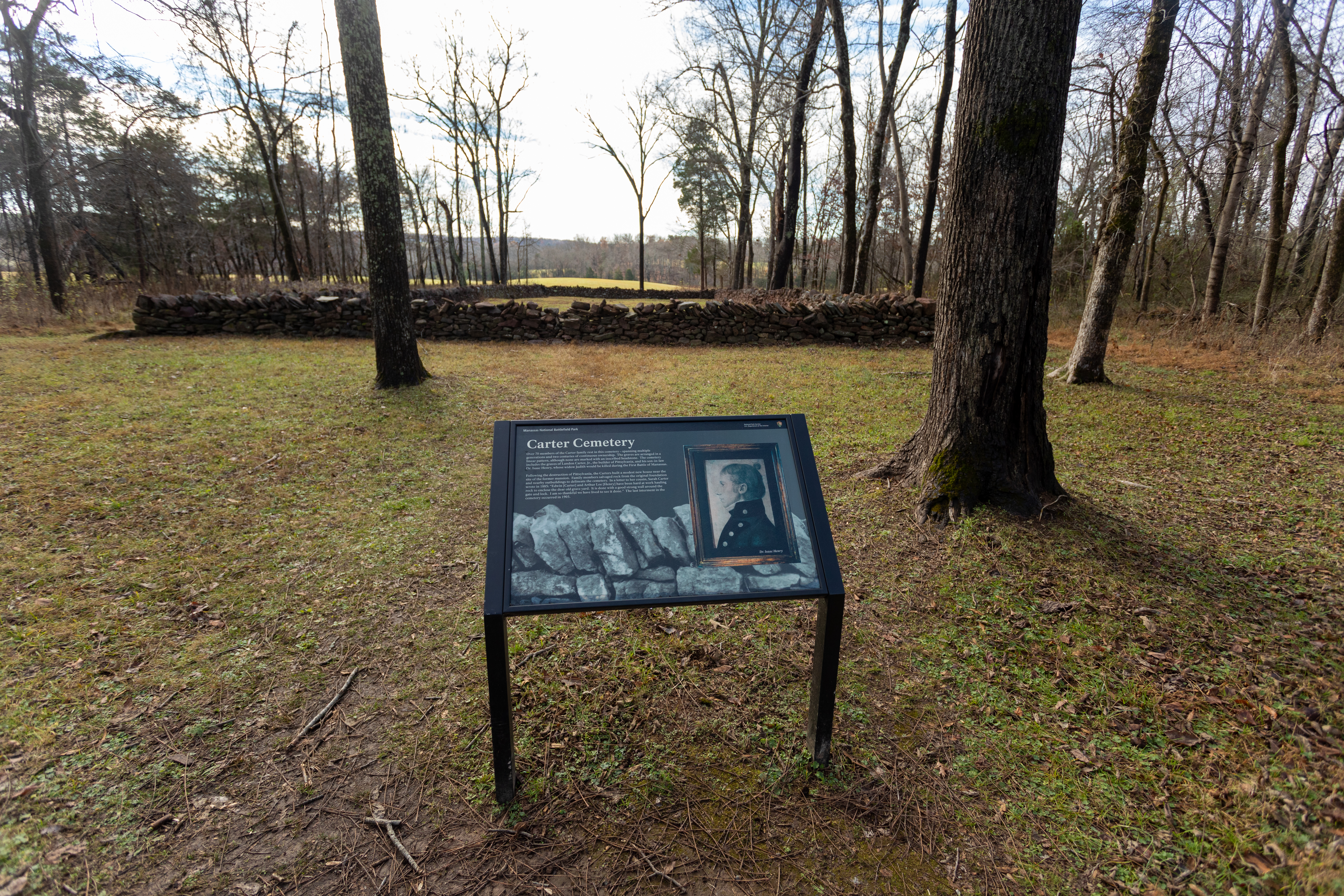
This audio descriptive text for the Carter Family Cemetery is 105 words in total. The Carter Family Cemetery is a cultural landscape feature in the northeastern part of Manassas National Battlefield Park. Located approximately 400 feet south of the site of the Carter family homes of “Pittsylvania”, which stood here from the 1760s until 1862, the cemetery is surrounded by a rectangular native stone wall that is approximately three-feet-tall, 130-feet-long on the west and east sides, and fifty-feet-long on the north and south sides. No legible gravestones are found inside the enclosure. Some depressions in the ground, and a few fieldstones in a linear pattern, denote the burial locations of some of the now-unknown members of the Carter family.
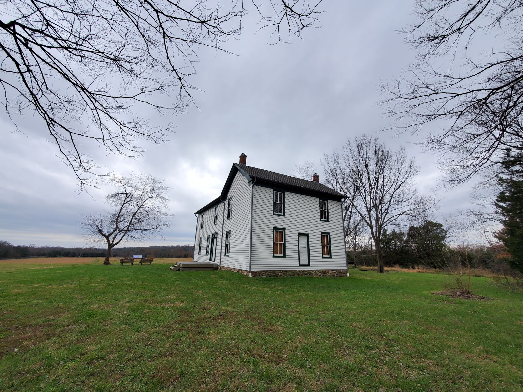
On August 28, 1862, Federal and Confederate soldiers clashed on the fields around the Brawner Farm.
A white building is positioned in a field. Two benches and a wayside are positioned in front of the building. A ramp sits behind the building leading to the backside.
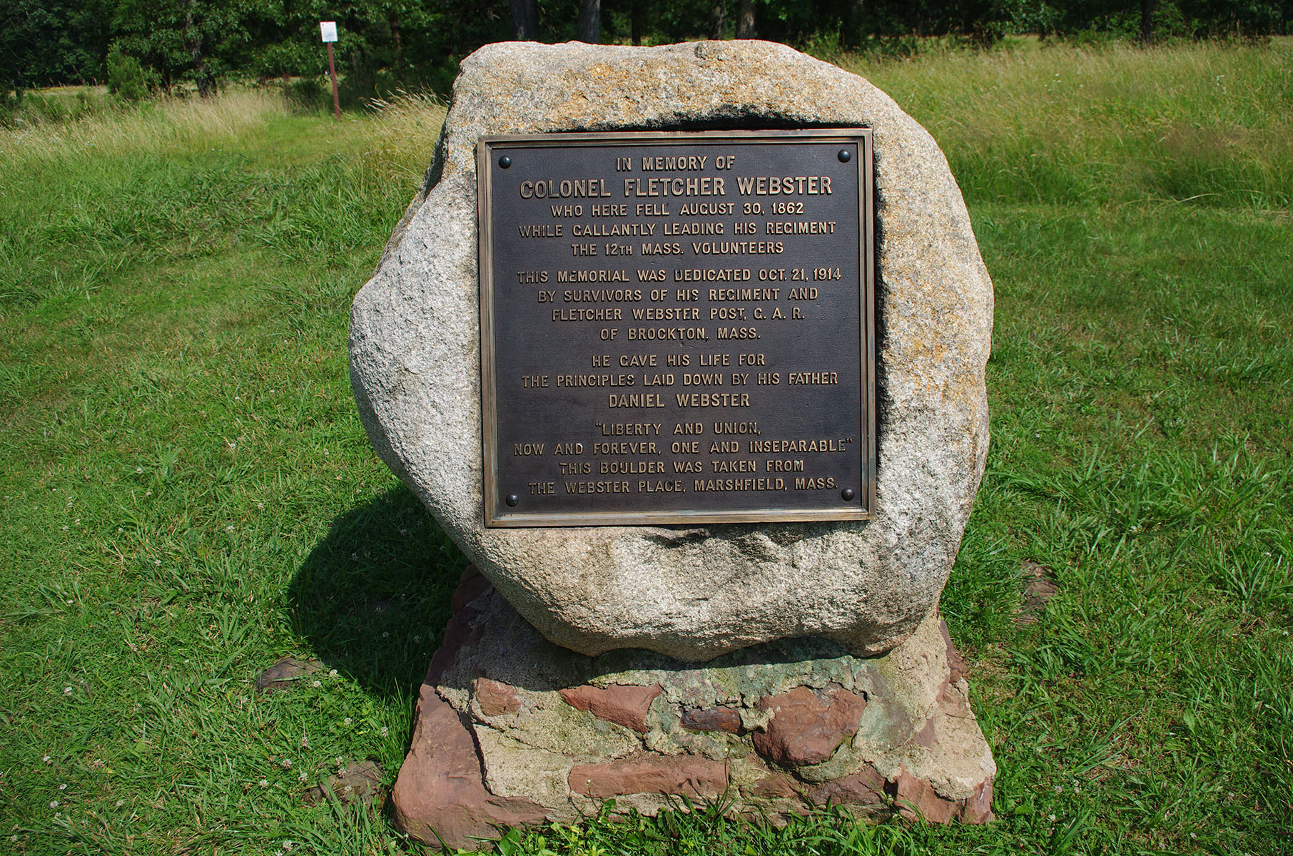
This audio descriptive text for the Colonel Fletcher Webster Monument is 200 words in total. The Fletcher Webster Monument is a granite boulder with a red sandstone base and a bronze plaque affixed to the northwestern side of the boulder. The boulder is approximately four feet tall and four feet wide. It was brought here from the Webster homestead in Marshfield, Massachusetts and the monument was dedicated in 1914 by survivors of Colonel Fletcher Webster’s 12th Massachusetts Infantry to mark the spot where Webster was mortally wounded on August 30, 1862 during the Second Battle of Manassas. The approximately two-foot-tall by two-foot-wide bronze plaque has raised text stating: “In memory of Colonel Fletcher Webster who here fell, August 30, 1862 while gallantly leading his regiment, the 12th Massachusetts Volunteers. This memorial was dedicated October 21, 1914 by survivors of his regiment and Fletcher Webster Post G. A. R. of Brockton, Massachusetts. He gave his life for the principles laid down by his father, Daniel Webster. “Liberty and Union. Now and Forever. One and Inseparable.” This boulder was taken from the Webster Place, Marshfield, Massachusetts”. The monument sits in a small grove of trees approximately seventy yards southeast of the paved trail atop Chinn Ridge and approximately four hundred yards northeast of the Chinn House Site.
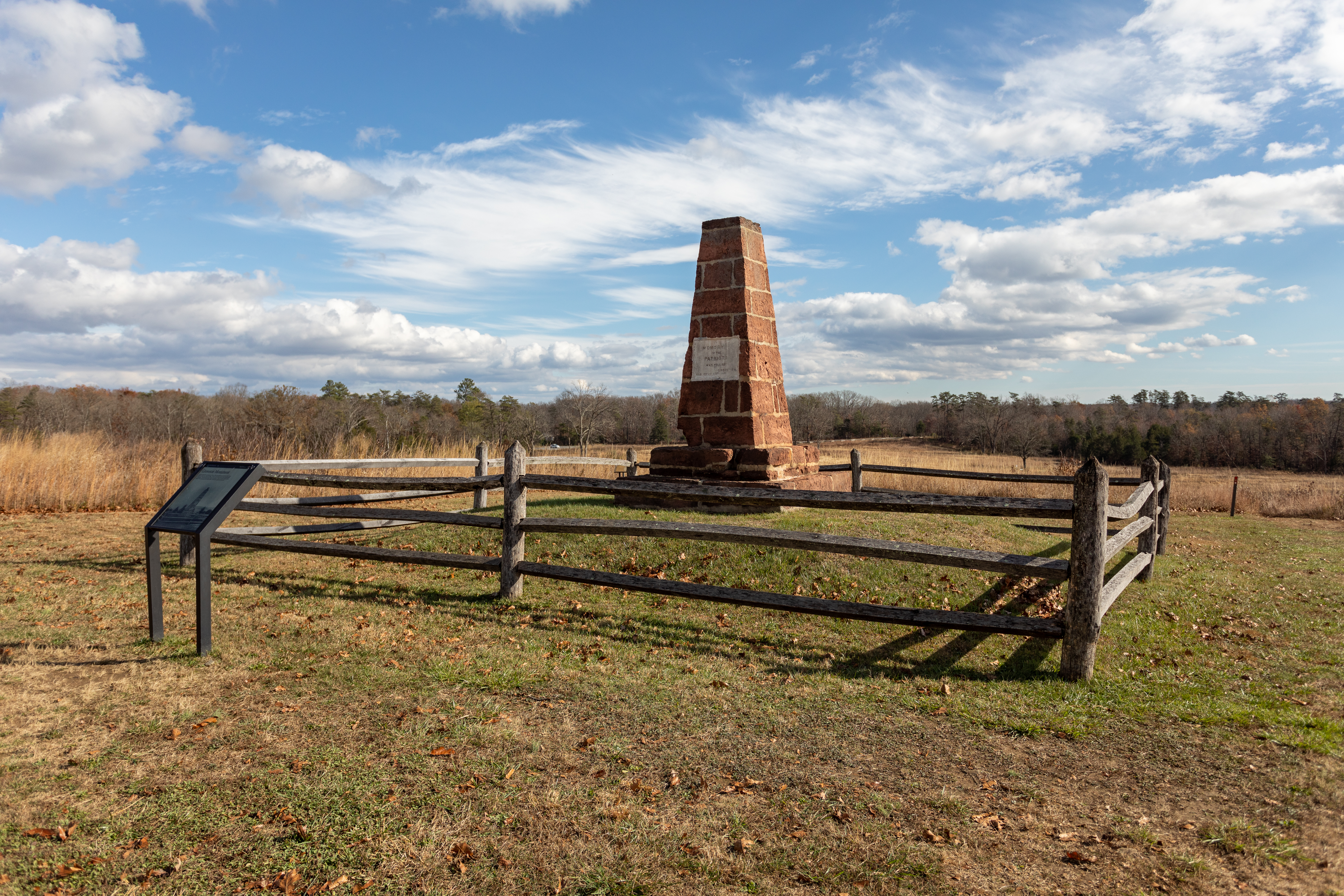
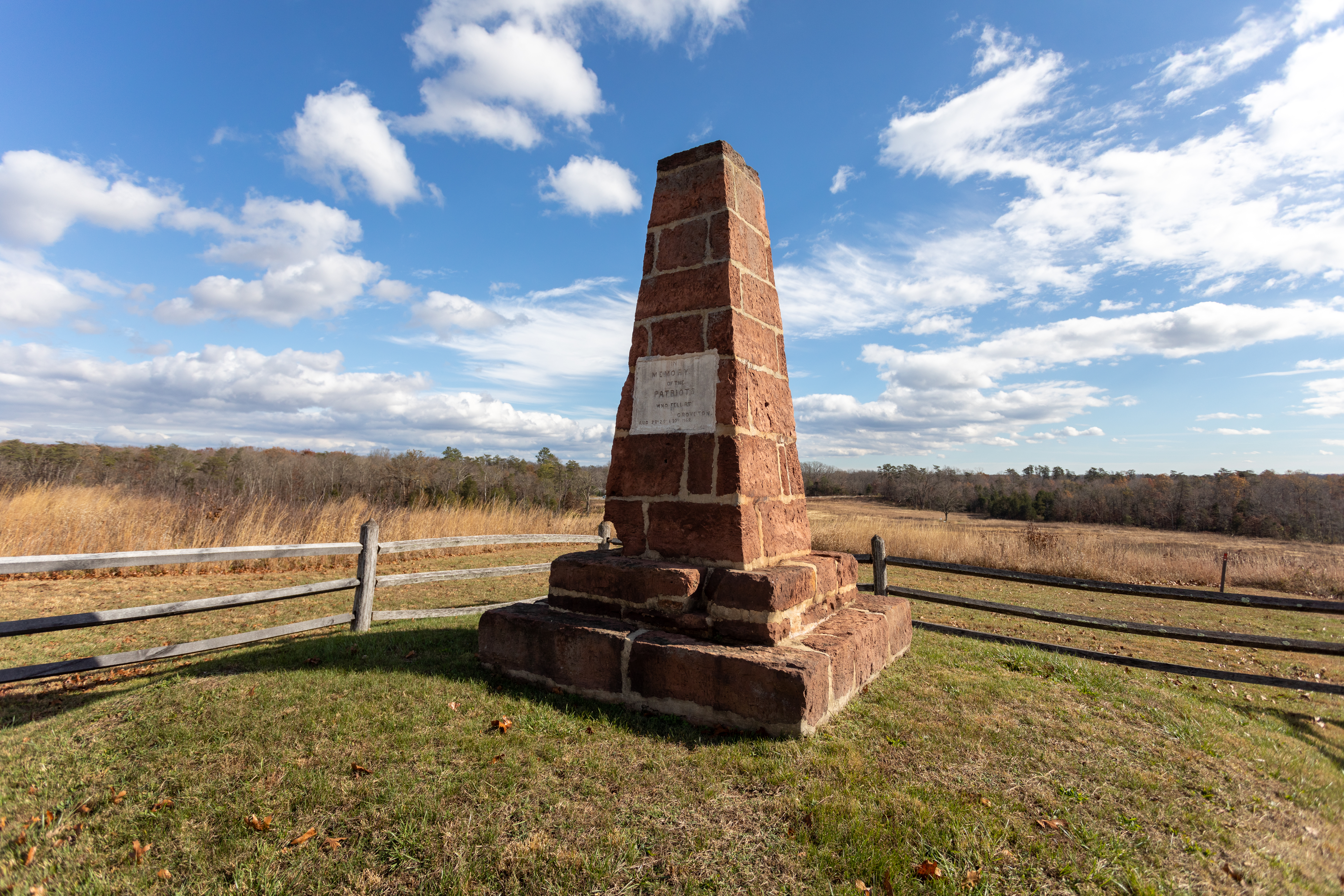
This audio descriptive text for the Second Bull Run (Groveton) Monument is 188 words total. The Second Bull Run (Groveton) Monument is an approximately thirteen-foot-tall native brownstone, or red sandstone, square-shafted columnar monument situated upon a pyramidal earthen pedestal of approximately five feet in height. The monument was built by Union soldiers in the spring of 1865 to commemorate the Union soldiers who had died in the Second Battle of Manassas, also commonly referred to at that time as the Battle of Groveton. Like the fraternal twin First Bull Run monument, this obelisk was once embellished with artillery projectiles at the top and around the base of the monument, but unlike the First Bull Run monument, the original iron projectiles on the Second Bull Run (Groveton) monument have disappeared in the hands of vandals and have not been replaced with facsimiles. An approximately two-foot-square marble plaque on the northwest, or front, face of the monument contains the following inscription: “In memory of the patriots who fell at Groveton. August 28, 29 and 30, 1862”. The monument sits atop a prominent plateau of ground approximately thirty yards south of the Deep Cut of the Unfinished Railroad and several hundred yards west of Featherbed Lane.
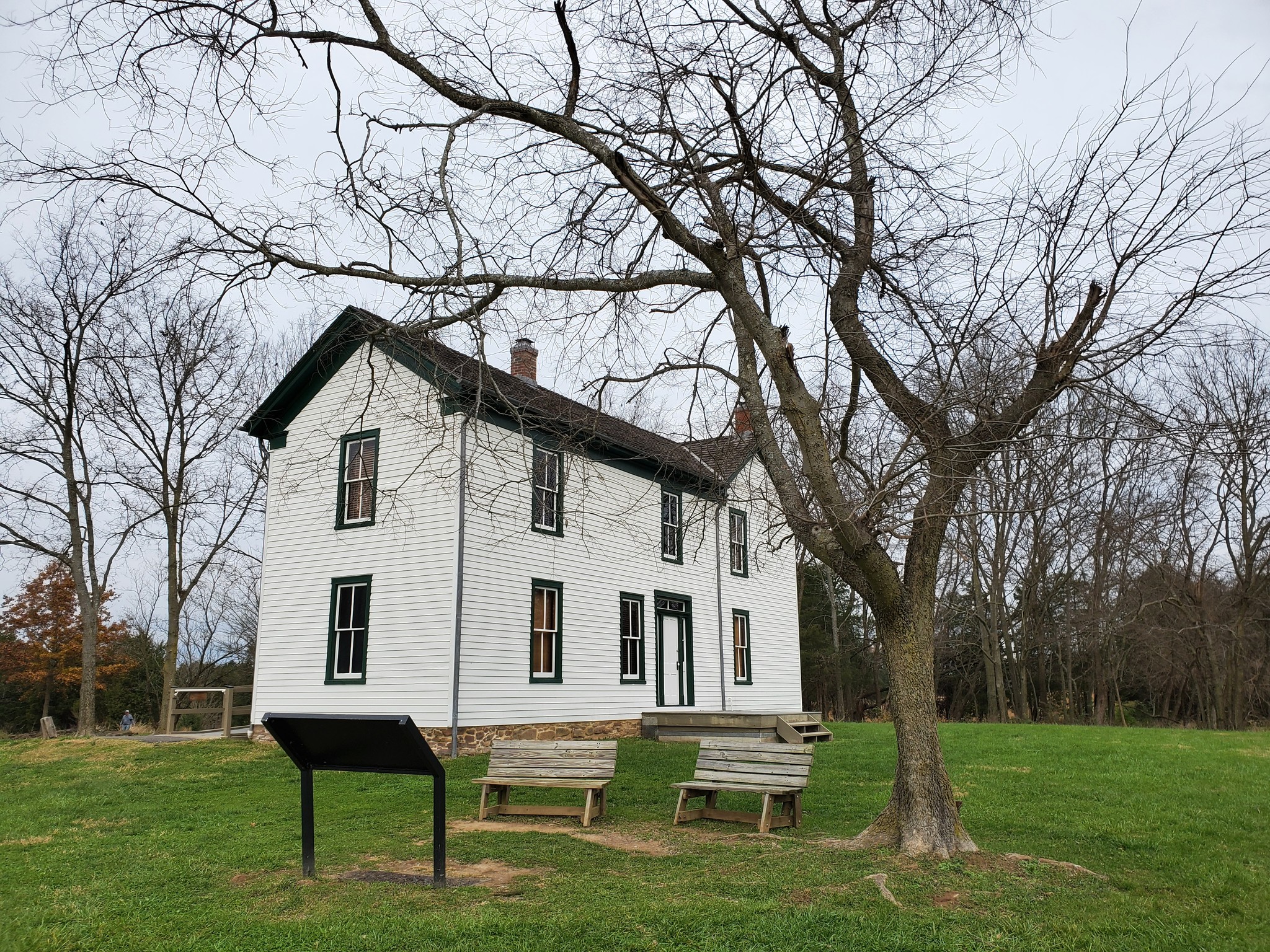
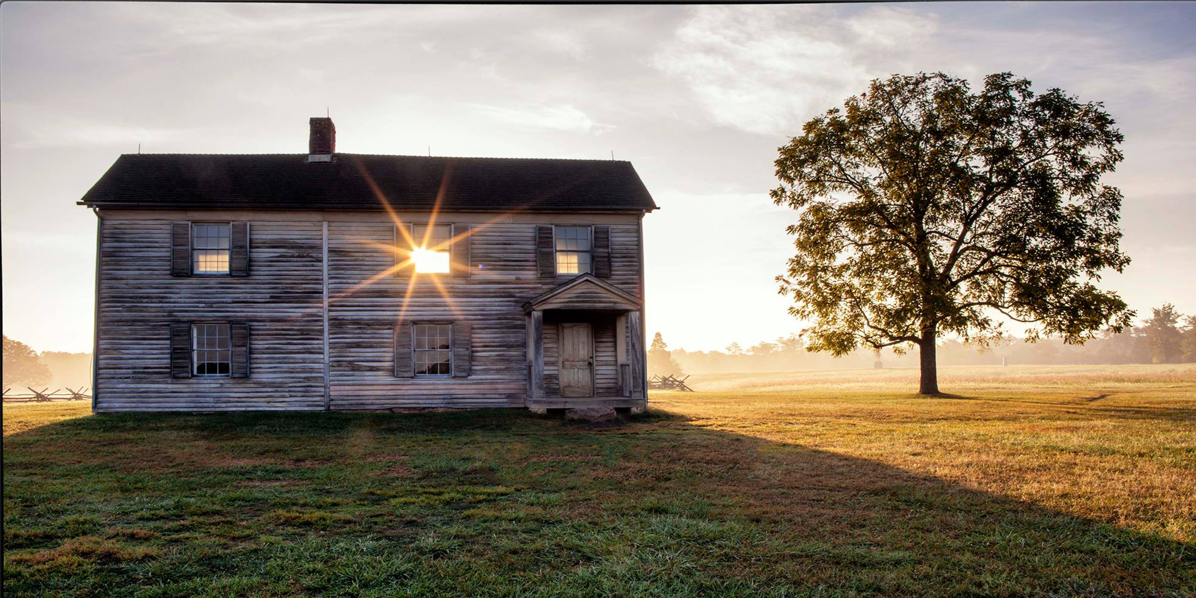
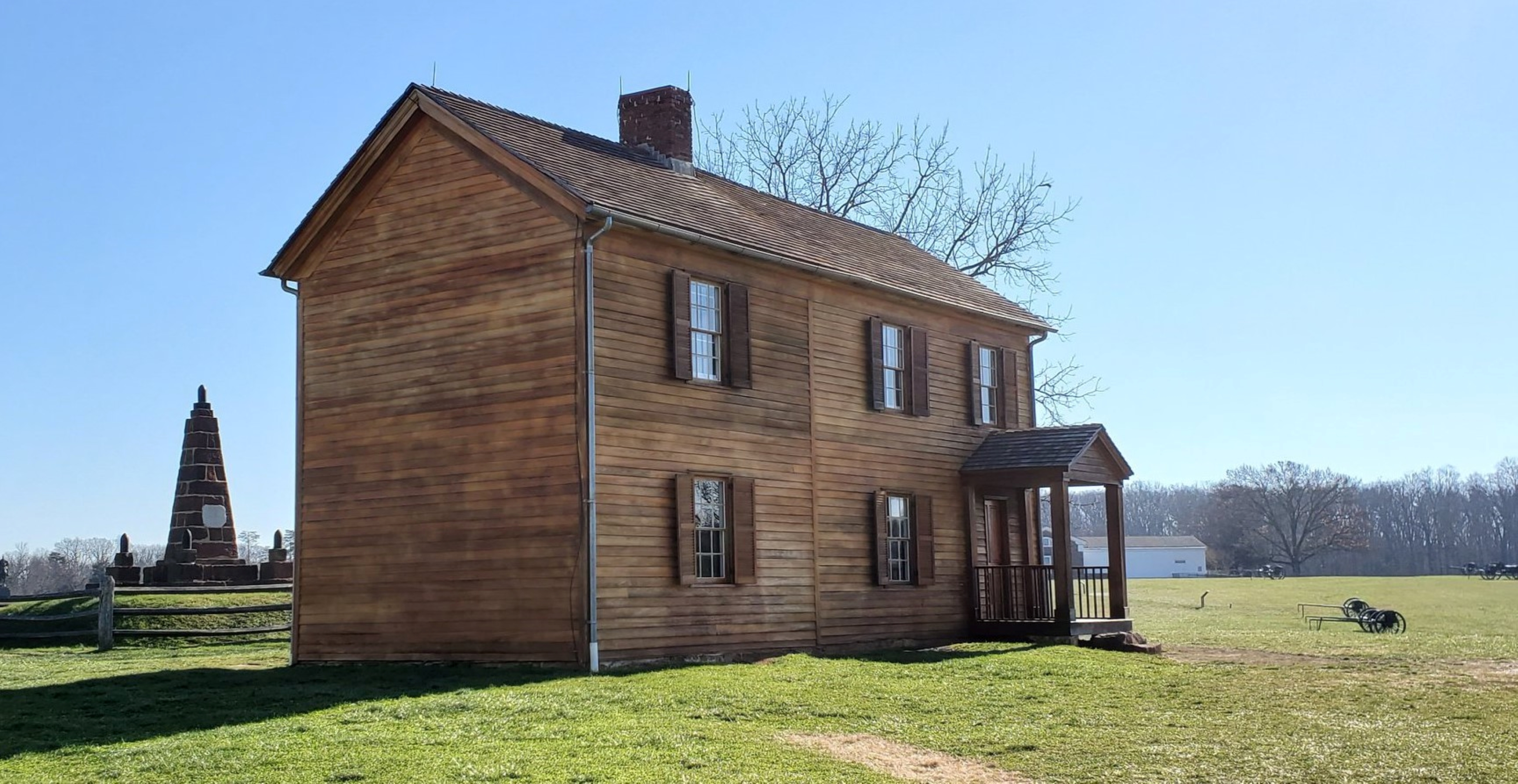
This audio descriptive text for the Henry House is 247 words in total. The Henry House is a rectangular two-story unpainted wood farmhouse standing atop the northwestern edge of Henry Hill approximately two hundred yards north of the Henry Hill Visitor Center. The east and west faces of house are approximately twenty-four-feet wide. The north and south faces of the house are approximately sixteen-feet-wide. The west, or front, face of the house has a six-foot by six-foot roofed-porch entryway to the door on the southwest corner of the structure. A large stepping-stone allows access to the porch. Five windows are present on the front of the house as well. The east face of the house has two doors and five windows. The north face of the house has no windows or doors and the south face of the house has three windows. All of the windows, except for the one small attic window on the south face, are of uniform size with twelve panes of glass and have wood shutters on hinges on both sides of the window. A single brick chimney protrudes above the cedar plank shingle roof. The grassy grounds around the house contains the Henry Family Cemetery less than thirty yards to the west of the house; a small whitewashed farm outbuilding less than twenty yards to the north of the house; the Bull Run Monument less than twenty yards to the east of the house; and a mature Black Walnut tree providing shade for some of the farmyard less than twenty yards south of the house.
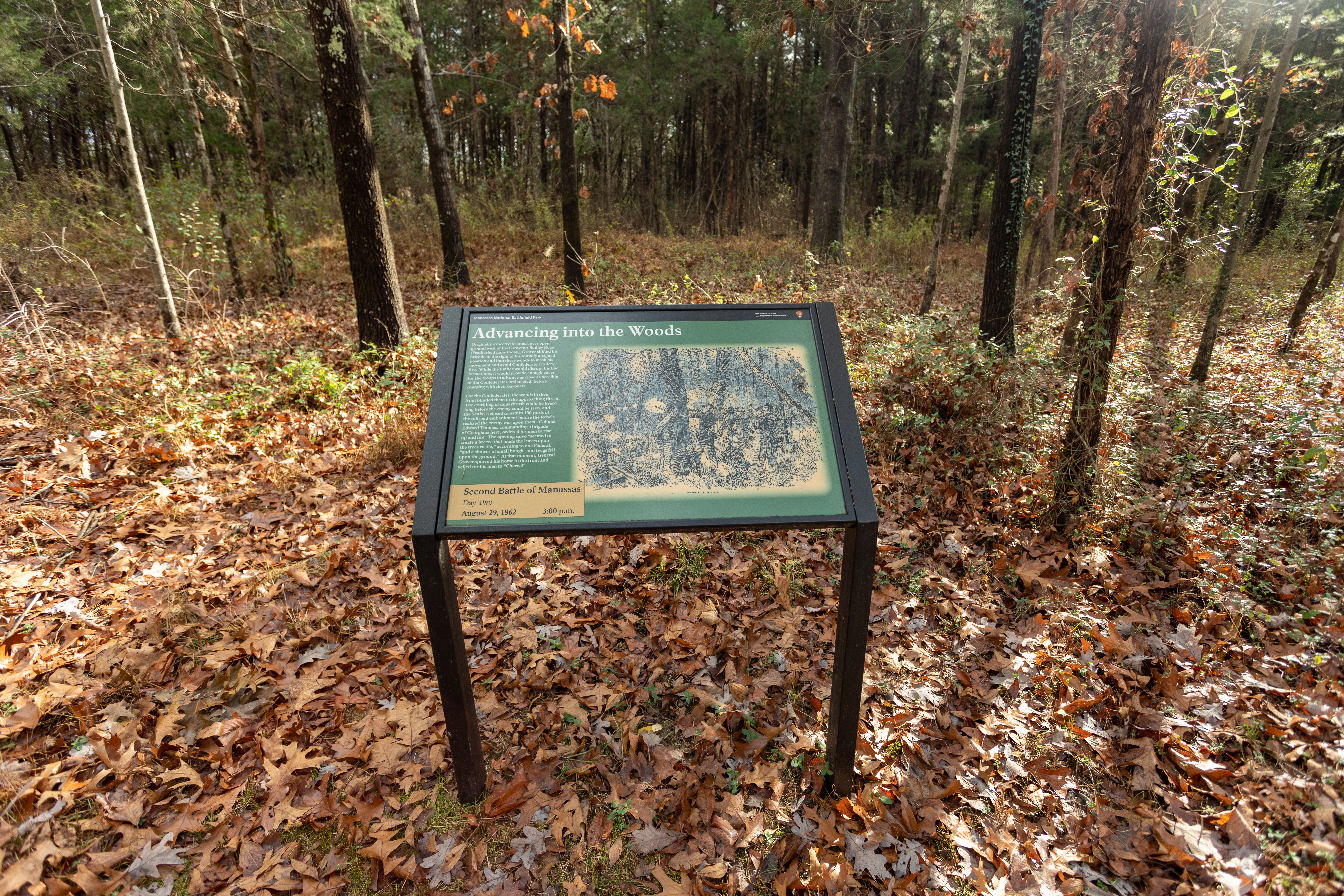
Originally expected to attack over open ground west of the Groveton-Sudley Road (Featherbed Lane today), Grover shifted his brigade to the right of his initially assigned position and into these woods to mask his movement and avoid Confederate artillery fire.
An information panel is positioned in front of a small, open area. Trees and tall bush surround the open area. Leaves lay on the ground atop the green grass.
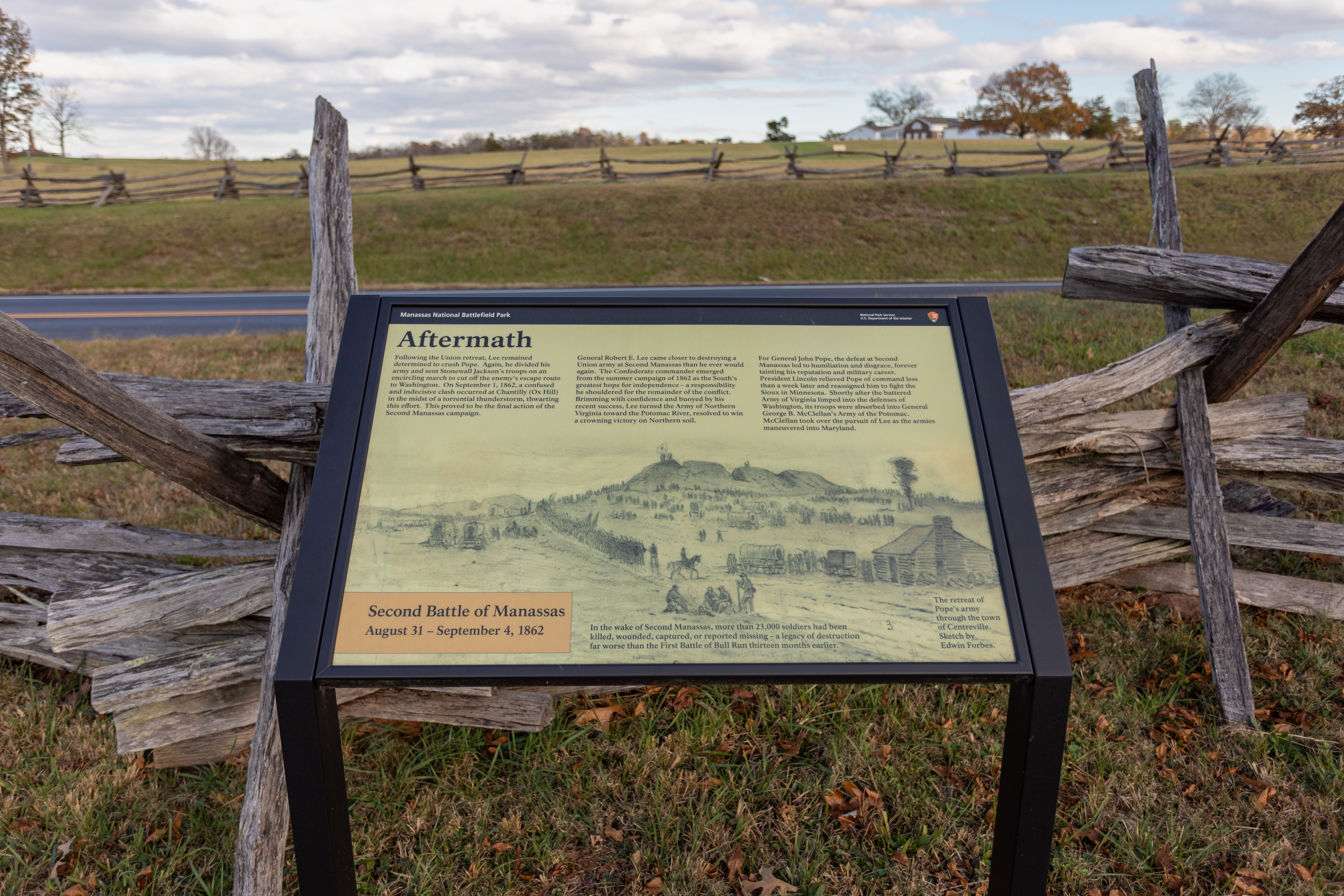
Following the Union retreat, Lee remained determined to crush Pope. Again, he divided his army and sent Stonewall Jackson's troops on an encircling march to cut off the enemy's escape route to Washington.
An information panel is positioned in front of a roadway. Behind the panel and in front of the road is a fence constructed of wood. An open field sits in the distance.
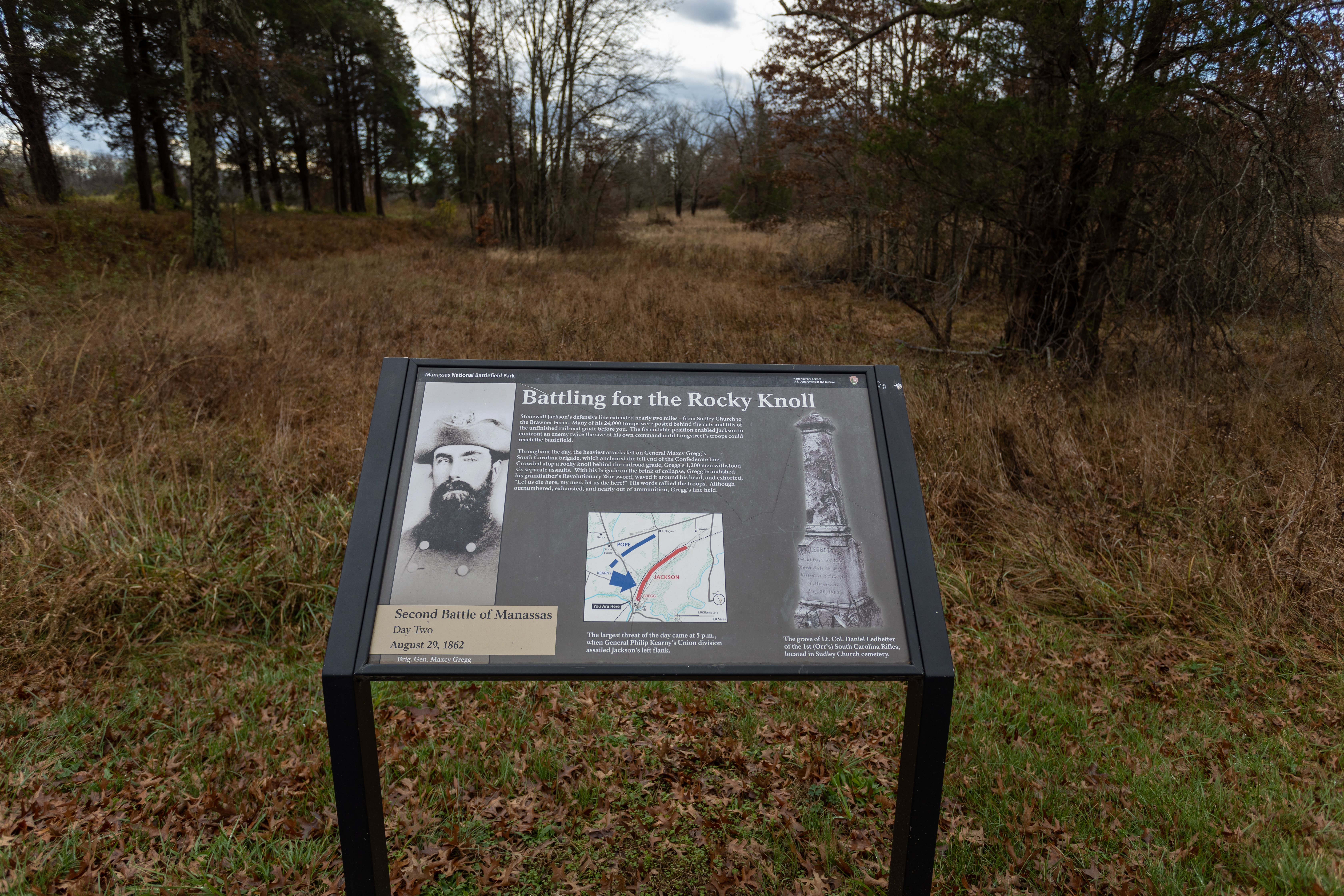
Stonewall Jackson's defensive line extended nearly two miles- from Sudley Church to the Brawner Farm. Many of his 24,000 troops were posted behind the cuts and fills of the unfinished railroad grade before you.
An information panel is positioned in front of a tall, grassy, open area. Trees surround the area on either side.
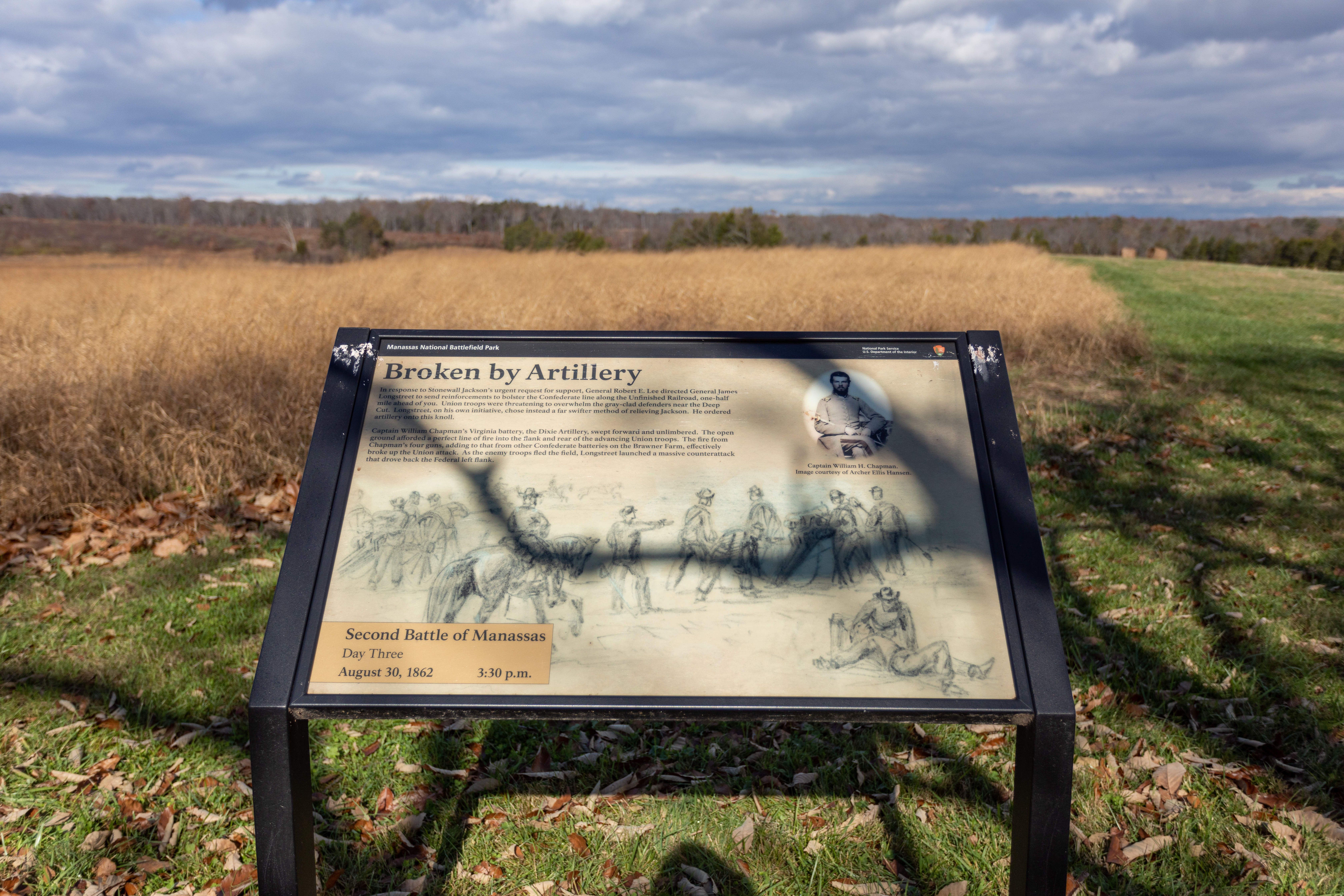
In response to Stonewall Jackson's urgent request for support, General Robert E. Lee directed General James Longstreet to send reinforcements to bolster the Confederate line along the Unfinished Railroad, one-half mile ahead of you.
An information panel is positioned in the middle of an open field. Tall stocks of plants line the field.
Over 70 members of the Carter family rest in this cemetery- spanning multiple generations and two centuries of continuous ownership.
A short wall of stone is positioned about 20 feet behind a wayside. Trees with thick trunks stand in behind the wayside. Grass and sticks lay on the ground.
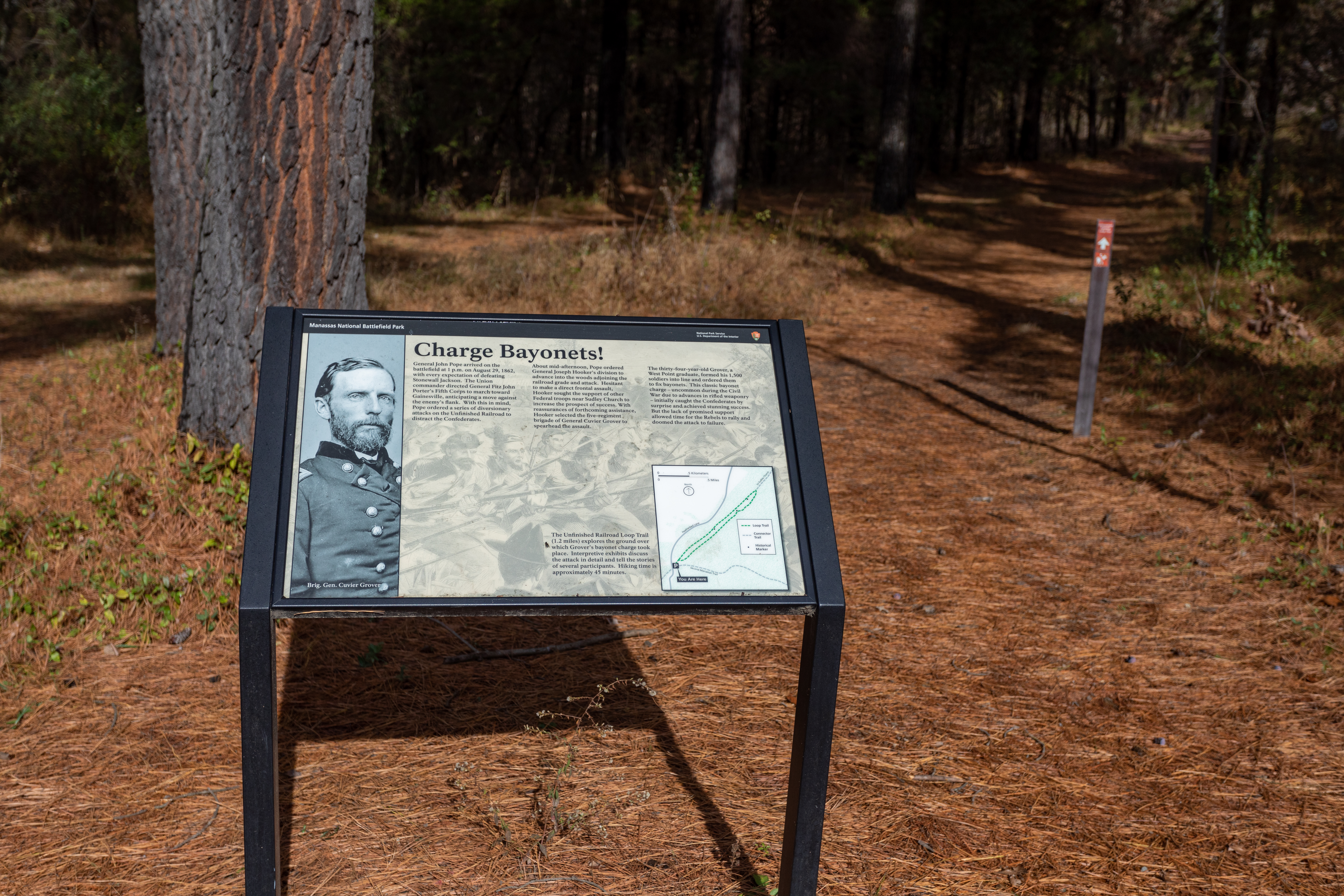
General John Pope arrived on the battlefield at 1 p.m. on August 29, 1862, with every expectation of defeating Stonewall Jackson.
An information panel is positioned at a trailhead. A red marker with a white arrow is seen in the background to indicate where to follow. The trail surface is mostly pine needles. Trees stand on either side of the trail.
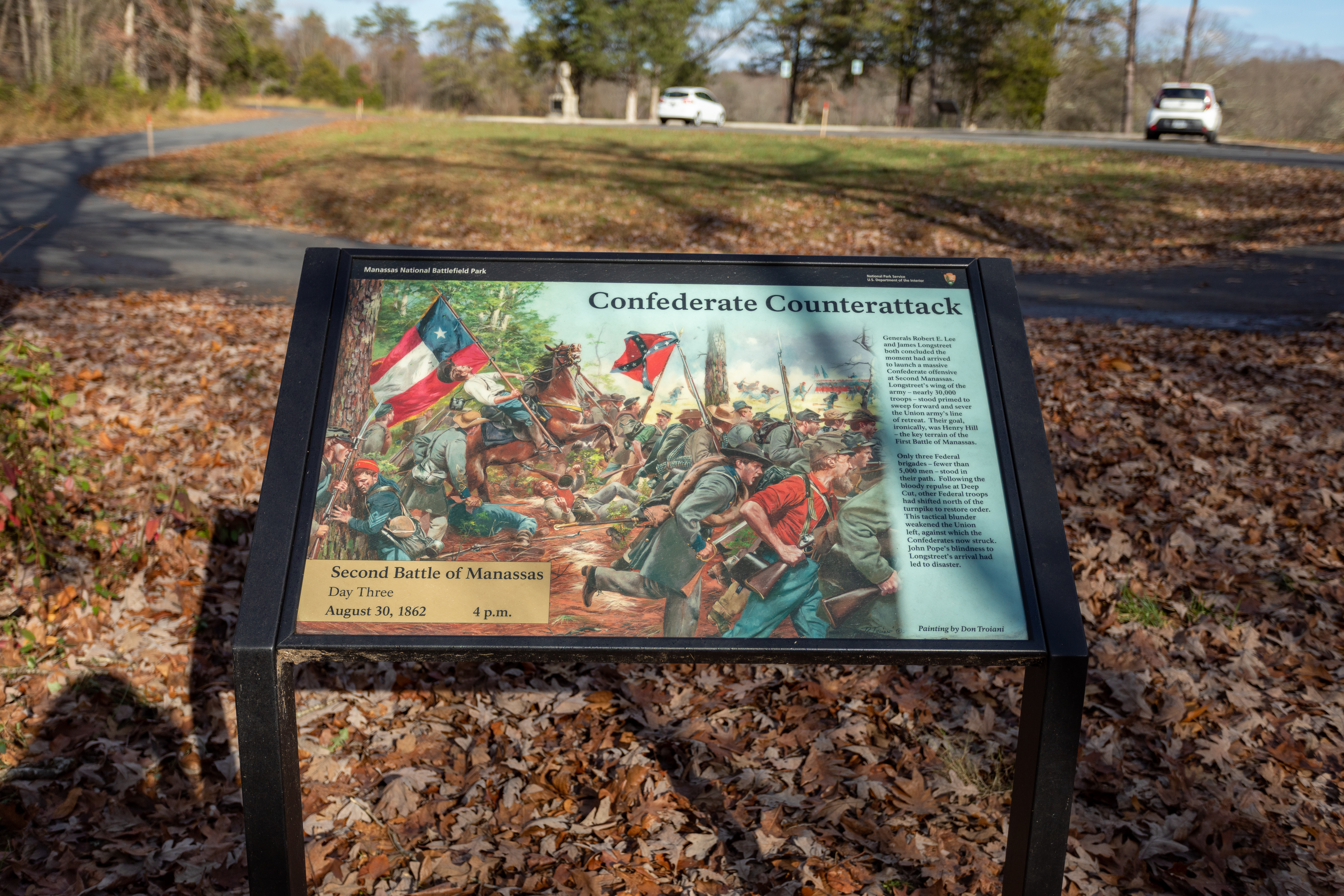
Generals Robert E. Lee and James Longstreet both concluded the moment had arrived to launch a massive Confederate offensive at Second Manassas.
An information panel is positioned in front of a paved loop. Two white cars are parked in the distance. Leaves clutter the area around the information panel.
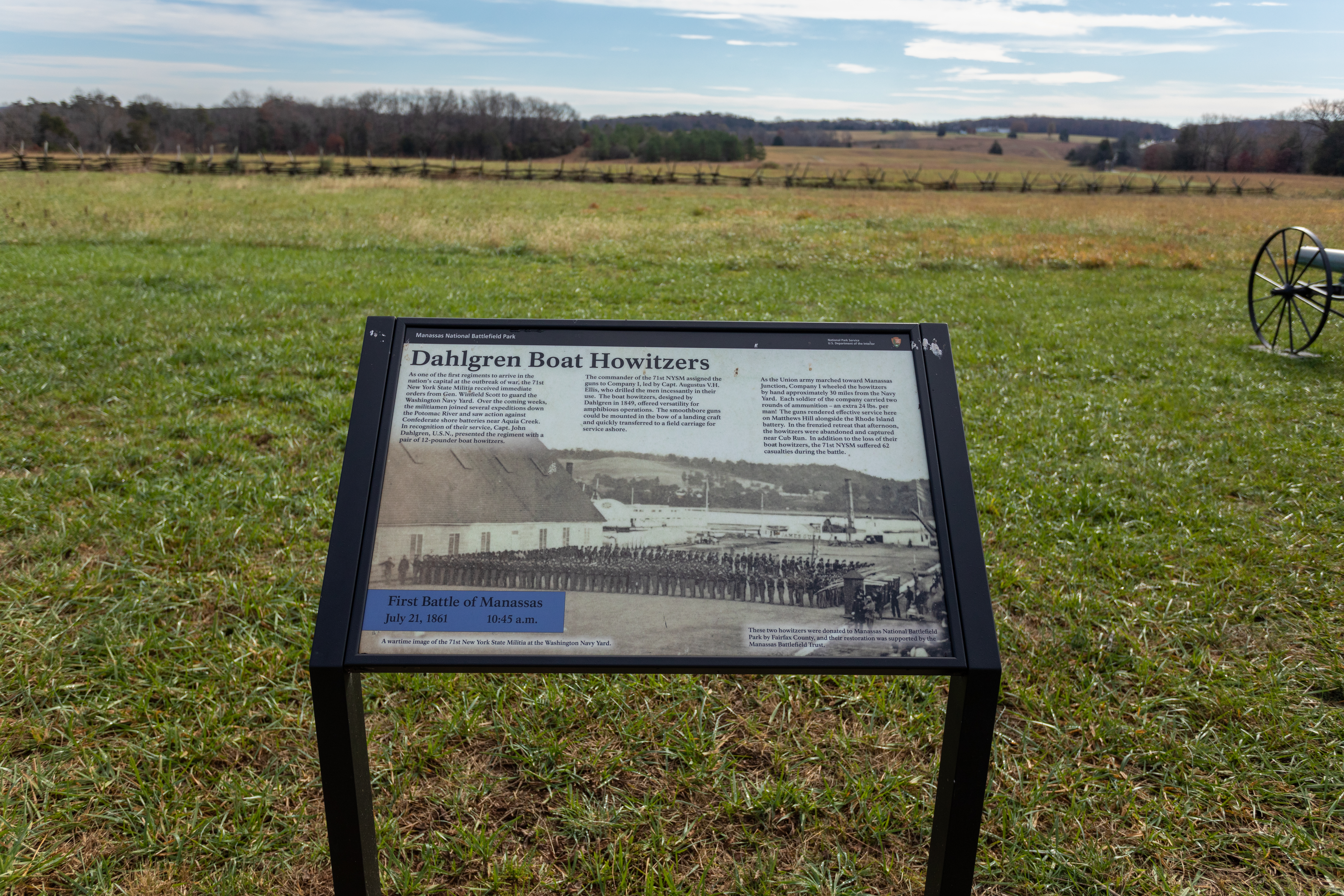
As one of the first regiments to arrive in the nation's capital at the outbreak of war, the 71st New York State Militia received immediate orders from Gen. Winfield Scott to guard the Washington Navy Yard.
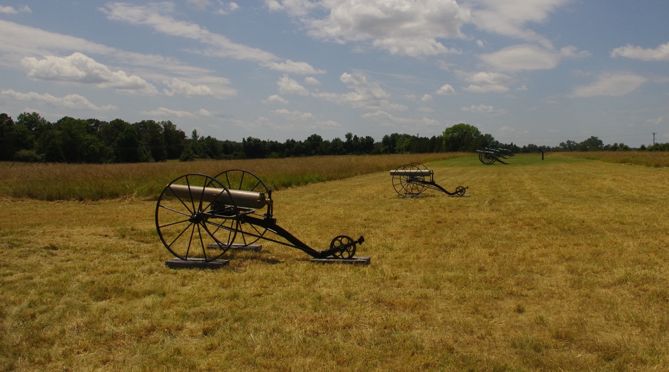
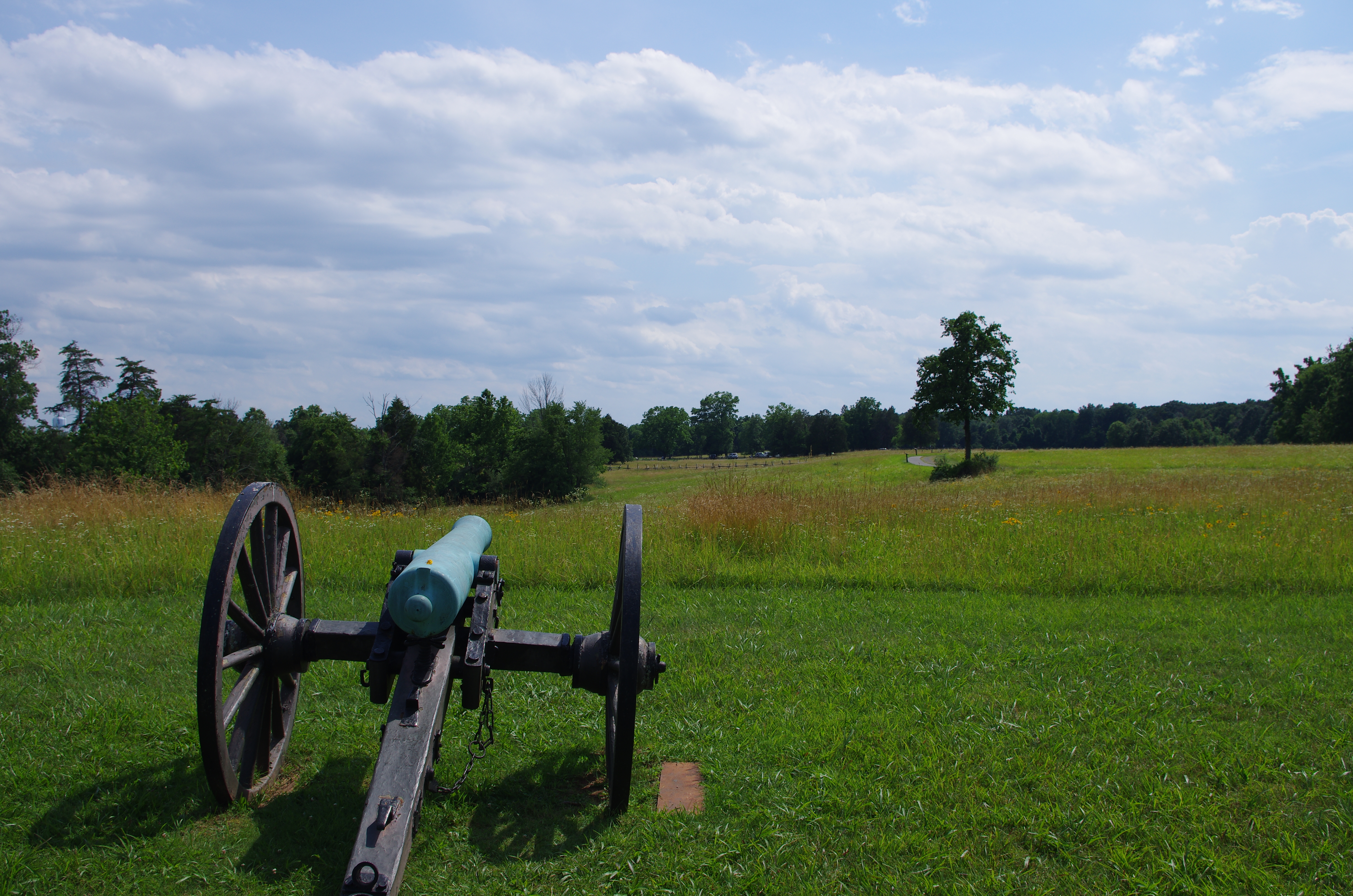
An information panel is positioned in the middle of a grassy field. A fence is seen in the background in a horizontal formation. A canon is positioned to the right of the panel.
As the Ohioans strived to delay the Confederates, Federal reinforcements rushed to Chinn Ridge in support. With these troops came the 5th Battery, Maine Light Artillery, under the temporary command of Lt. William F. Twitchell.
An information panel sits in a grassy field. Three canons in a line are positioned in the background to the left. High stocks of plant surround the canons.
Although the unfinished railroad grade provided a formidable defensive position, weakness existed in the Confederate line, putting some troops at risk. The low and marshy ground on which you stand was meant to be spanned by a railroad trestle.
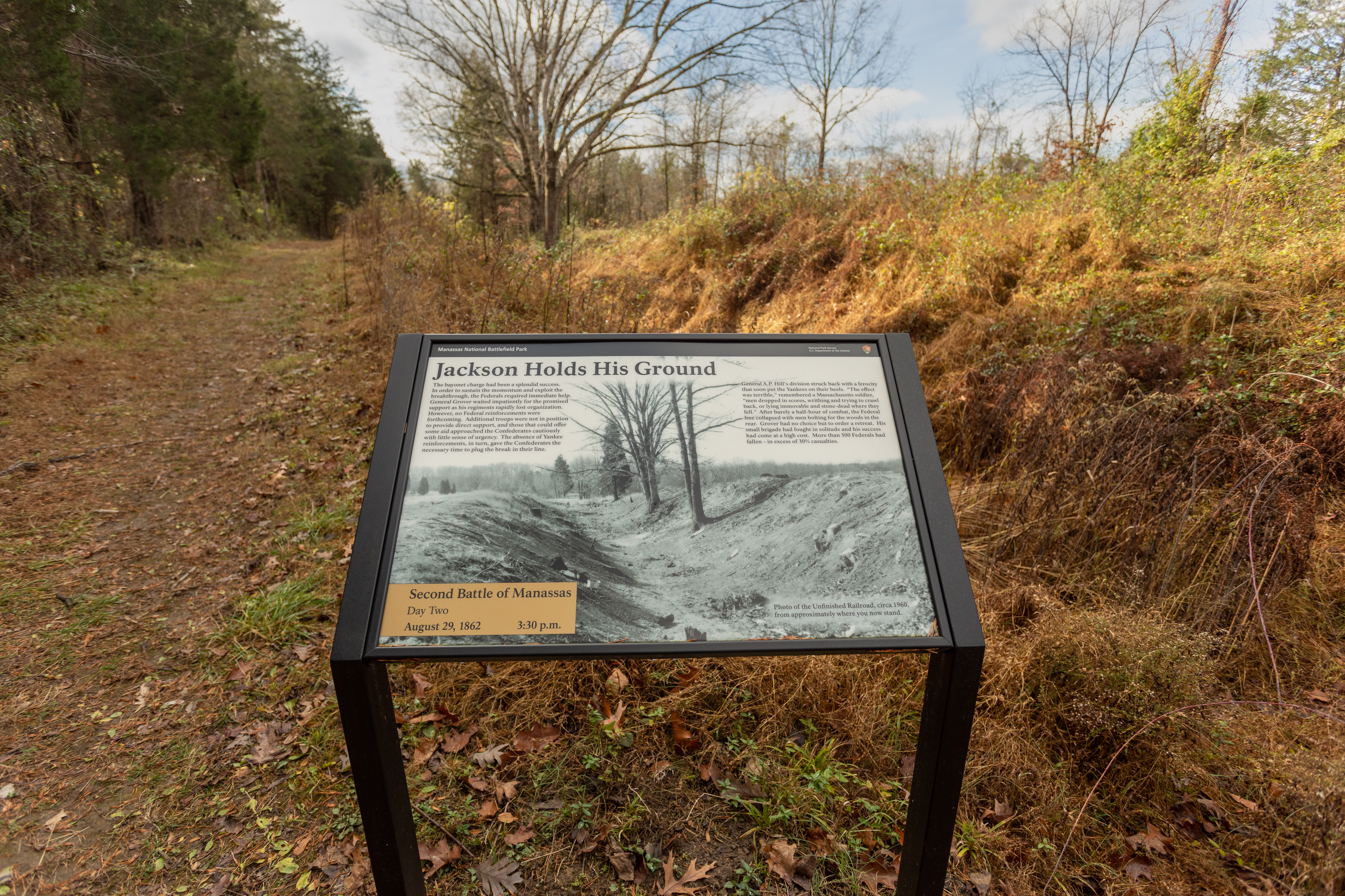
An information panel is positioned in the middle of the woods. Leaves cover the ground and skinny trees are positioned in the background.
Colonel Nathaniel McLean braced his men for the coming onslaught. The Union officer, a civilian attorney with no prewar military background, commanded 1,200 Ohioans on Chinn Ridge.
An information panel is positioned in the middle of a grassy field. Behind the information panel is a dirt road. To the left, is a fence constructed of wood. Tall trees are seen in the background.
In 1860, Benjamin Chinn and his family lived here in a two-and-a-half story frame farmhouse. Known as "Hazel Plain," the modest plantation comprised several hundred acres.
An information panel is positioned in the middle of a grassy field. A short stone wall, or foundation of a building, is positioned behind the information panel.
In 1997 the National Park Service and the Smithsonian Institution began to develop a proposal at Manassas National Battlefield Park to mitigate the loss of wetlands resulting from construction of the Steven F. Udvar-Hazy Center, a National Air and Space Museum facility at Washington Dulles International Airport.
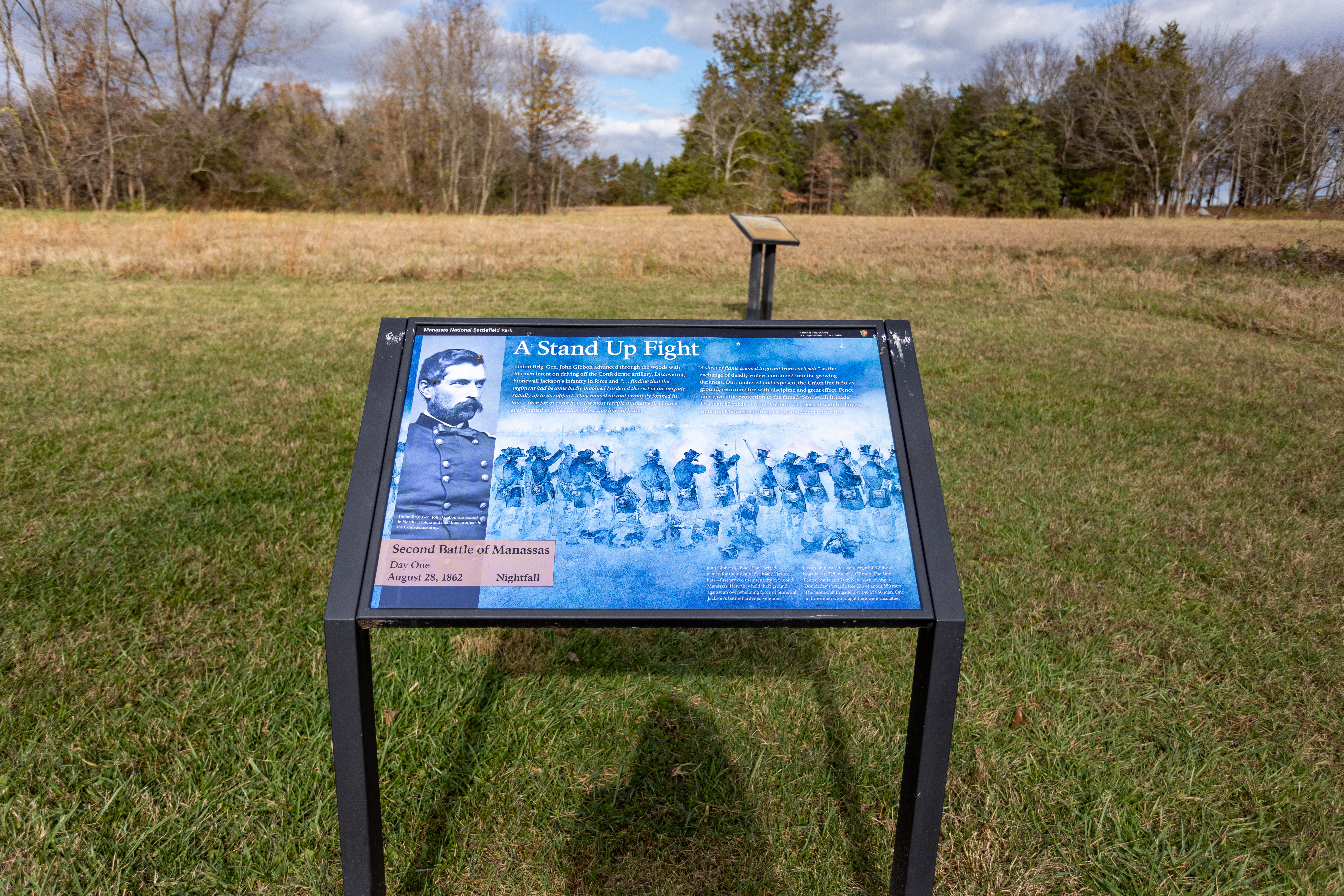
A double information panel is positioned in a grassy field. Tall stocks of plant stand behind the information panel.
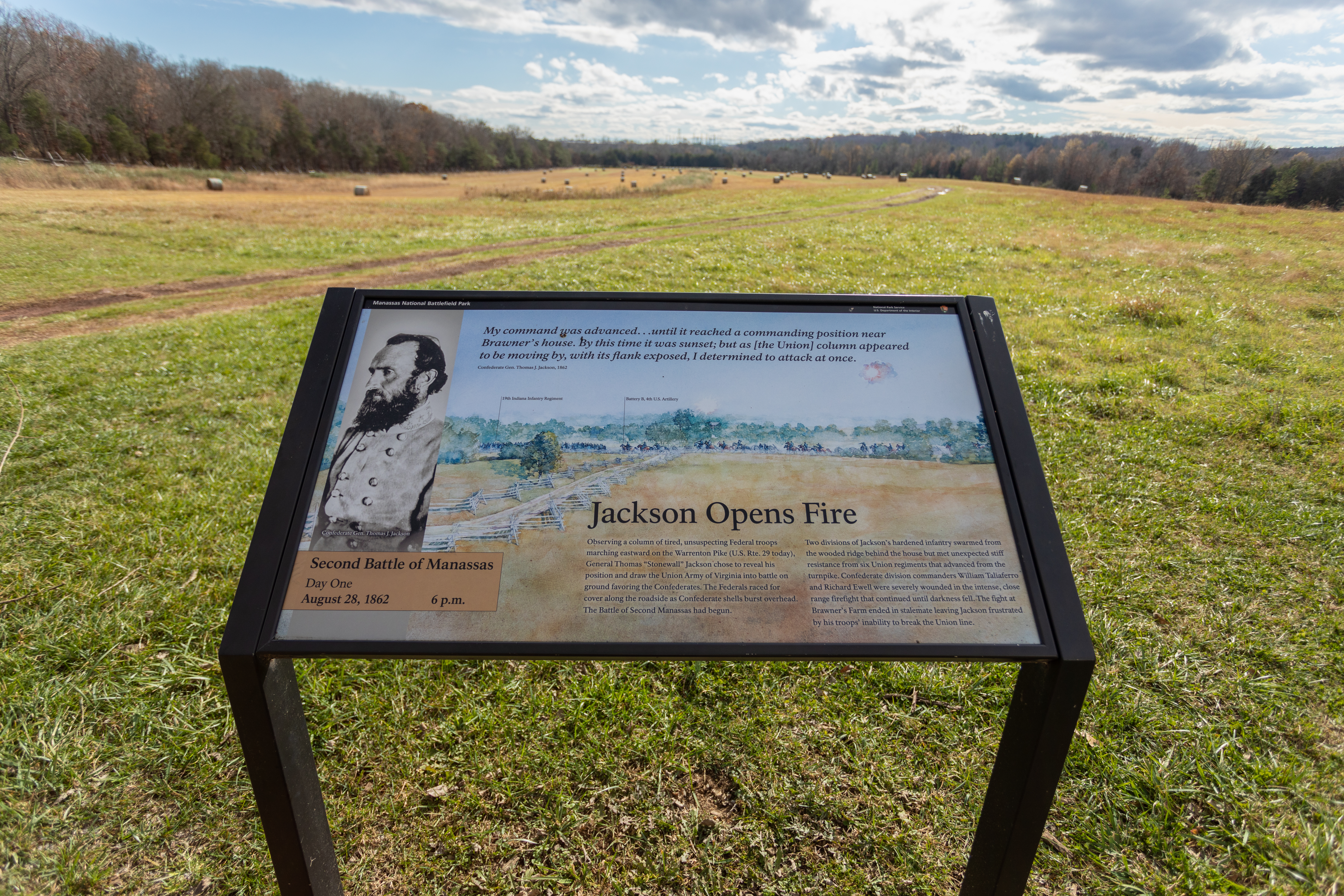
Observing a column of tired, unsuspecting Federal troops marching eastward on the Western Pike (U.S. Rte. 29 today), General Thomas "Stonewall" Jackson chose to reveal his position and draw the Union Army of Virginia into battle on ground favoring the Confederates.
An information panel is positioned in an open, grassy field. A dirt road curves in the background.
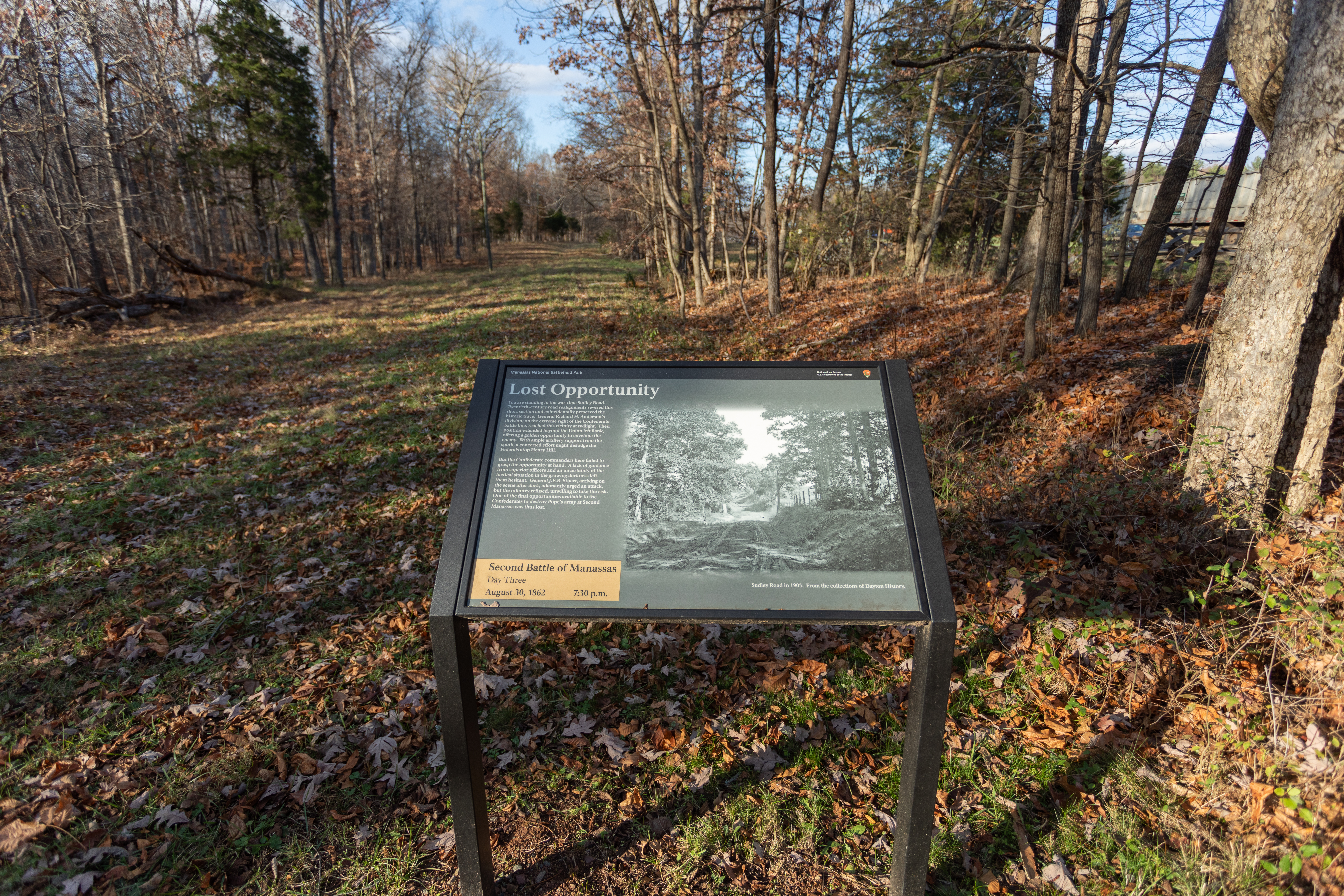
You are standing in the wartime Sudley Road. Twentieth-century Road realignments severed this short section and coincidentally preserved the historic trace.
An information panel sits to the right of a wide, grassy trail. Trees align either side of the trail and leaves lay on the ground.
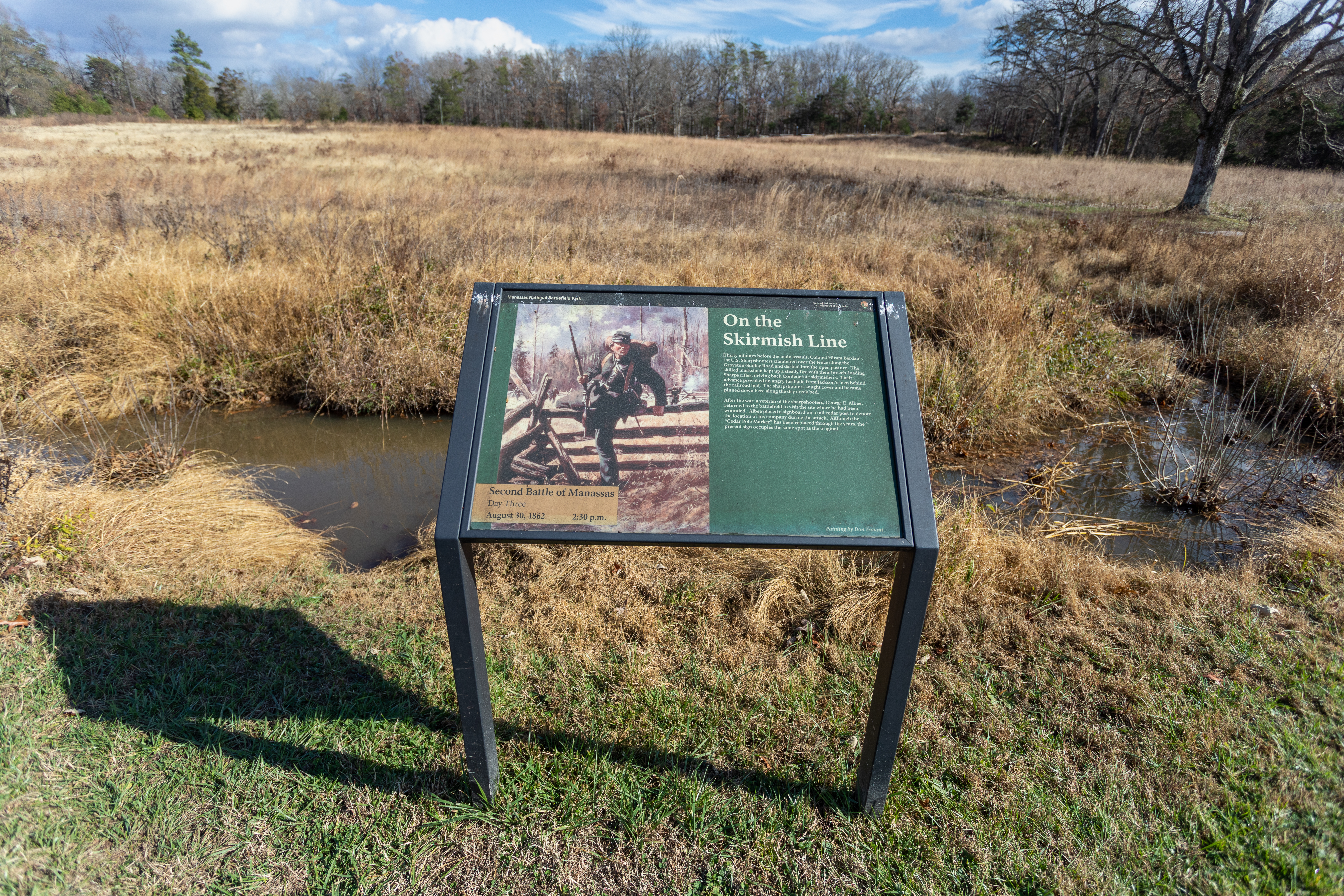
Thirty minutes before the main assault, Colonel Hiram Berdan's 1st U.S. Sharpshooters clambered over the fence along the Groveton-Sudley Road and dashed into the open pasture.
An information panel is positioned in front of a thin creek. Bushes surround either side of creek. Behind the creek is a large open field.
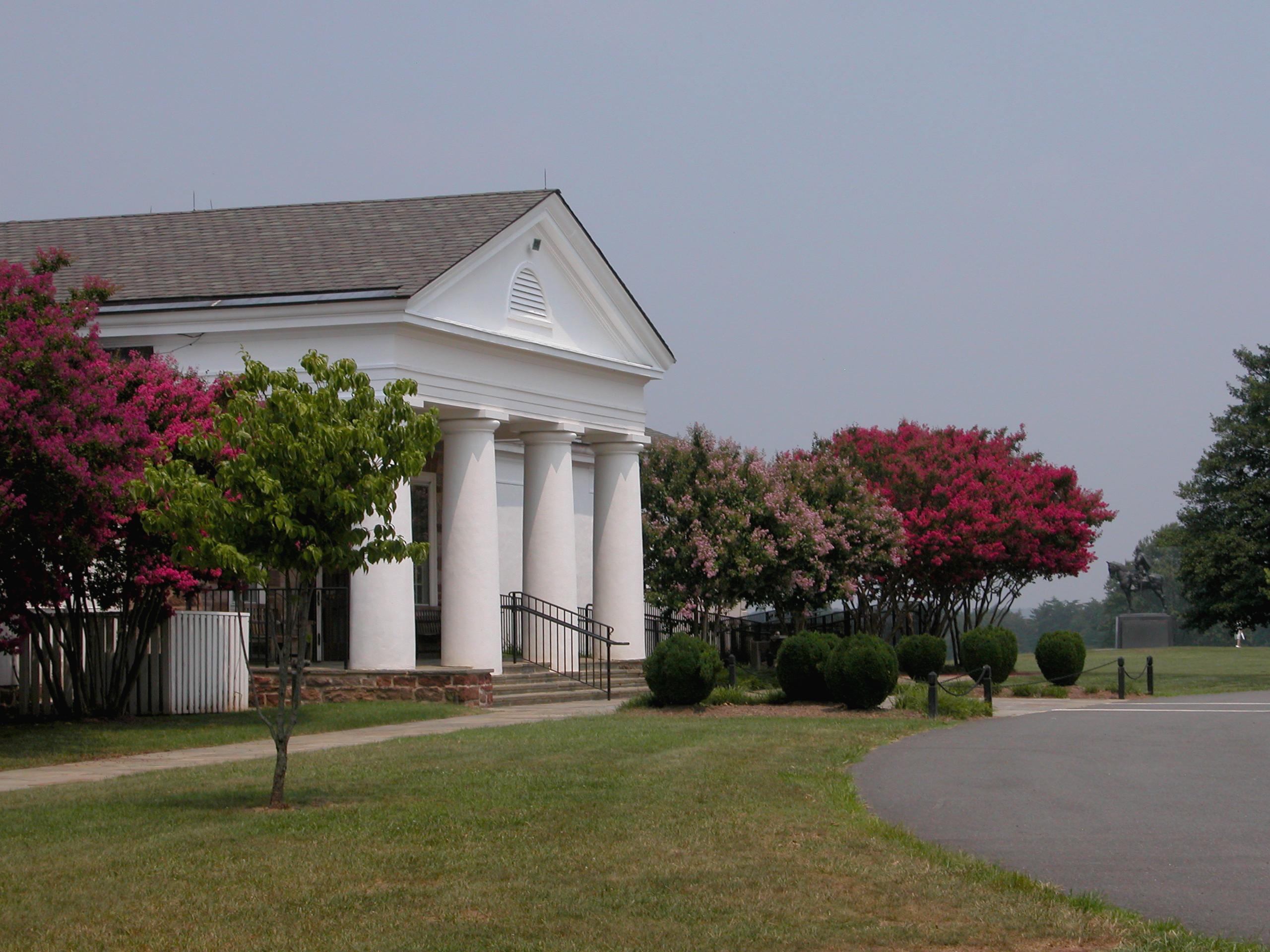
Begin your exploration of the Second Battle of Manassas at the Brawner Farm Interpretive Center. Here you will find an electronic map which provides the story and troop movements of Second Manassas. Three rooms of exhibits provide information on the campaign and some of the personalities of Second Manassas, the civilian experience and the current Brawner farmhouse. This building is open seasonally from late spring through early fall. Check our calendar and guided tours webpage for tour information.
Begin your visit to the park at the Henry Hill Visitor Center. Here, you can pick up a park brochure, trail guide, or learn about the daily schedule of interpretive programs. A museum features artifacts related to the First and Second Battles of Manassas as well as a 6-minute electronic map showing the troop movements during the first battle. Walking tours of the fighting on Henry Hill are offered weekly. Check our calendar or guided tours webpage for current scheduled programs.
Walk along a section of Jackson's line on the Unfinished Railroad where Federal soldiers momentarily breached the Confederate line on August 29, 1862.
Matthews Hill Loop Trail
The Matthews Hill Loop is a .9 mile trail that explores the ground over which the opening shots of the Battle of First Manassas occurred.
Brawner Farm Loop Trail
This trial traces the opposing lines of battle during the opening fighting of the Battle of Second Manassas on August 28, 1862.
Stone Bridge Loop Trail
The Stone Bridge Loop is a moderate 1.3 mile trail that follows along the Bull Run and explores the area where the first shots of the First Battle of Manassas were fired. Picturesque displays can be had along the trail of wildflowers in the spring and colorful foliage in the fall.
Chinn Ridge Trail
Explore the grounds of Chinn Ridge that saw fighting at both First and Second Manassas. A paved path includes signage that explores the fighting in both battles. One way trail, must return along path to get back to parking lot.
Second Manassas Trail
This 6.6 mile loop trail explores key locations on the Second Manassas battlefield.
First Manassas Trail
A 5.4 mile circuit hike where you can explore the First Manassas battlefield in detail.
Ranger's Choice Battlefield Walks
These programs examine unique portions of the battlefield landscape and story ranging from battle actions, civilian stories, and the memorialization of the park landscape. Programs may cross rough/uneven terrain. It is strongly recommended that visitors bring plenty of water, appropriate seasonal clothing, and sturdy hiking shoes.
Sudley Loop Trail
The Sudley Road Loop is a .6 mile trail that takes visitors to one the few pre-war structures in the park, and the spot where 13,000 US troops crossed Bull Run on their way to the First Battle of Manassas.
Henry Hill Loop Trail
The Henry Hill Loop is a easy 1.1 mile trail that encompasses the area of the most intense fighting during the First Battle of Manassas. Rickett's Battery, Jackson's Line, the Robinson Farm, and more are all part of this interpretive trail.
Tours
Count: 5
Chinn Ridge Walking Tour
The landscape of Chinn Ridge saw severe fighting during both battles at Manassas. This roughly one-mile out and back trail will traverse the scene of the most sustained fighting at Second Manassas.
Deep Cut Trail Guide
This out and back trail guide follows in the footsteps of the largest federal assault of Second Manassas on 30 August 1862. This trail will involve walking up a moderate incline over rough and rocky terrain. Please exercise caution and wear appropriate footwear.
First Manassas Driving Tour
This five-stop, self-guided driving tour will take you to key locations related to the 21 July 1861 Battle of First Manassas.
Henry Hill Walking Tour
The Henry Hill Trail is an easy walking trail that encompasses the area of the most intense fighting during the First Battle of Manassas (Bull Run). The trail begins and ends at the visitor center. Starting from the backside of the visitor center, the 1.1-mile trail takes you past significant landmarks and monuments including the positions of Federal artillery, Stonewall Jackson’s Line, the Robinson Farm site, and more.
Second Manassas Driving Tour
The park's self-guided driving tour takes you around the park to key locations during the Battle of Second Manassas. The 13 stops on this tour will take you chronologically through the battle. Each stop has a parking lot and interpretive signage which provide information about the importance of that site in the overall battle. Walking trails with interpretive signage begin at most driving tour stops.