The Manhattan Project is one of the most transformative events of the 20th century. It ushered in the nuclear age with the development of the world’s first atomic bombs. Most of this development took place in three secret communities located in H...
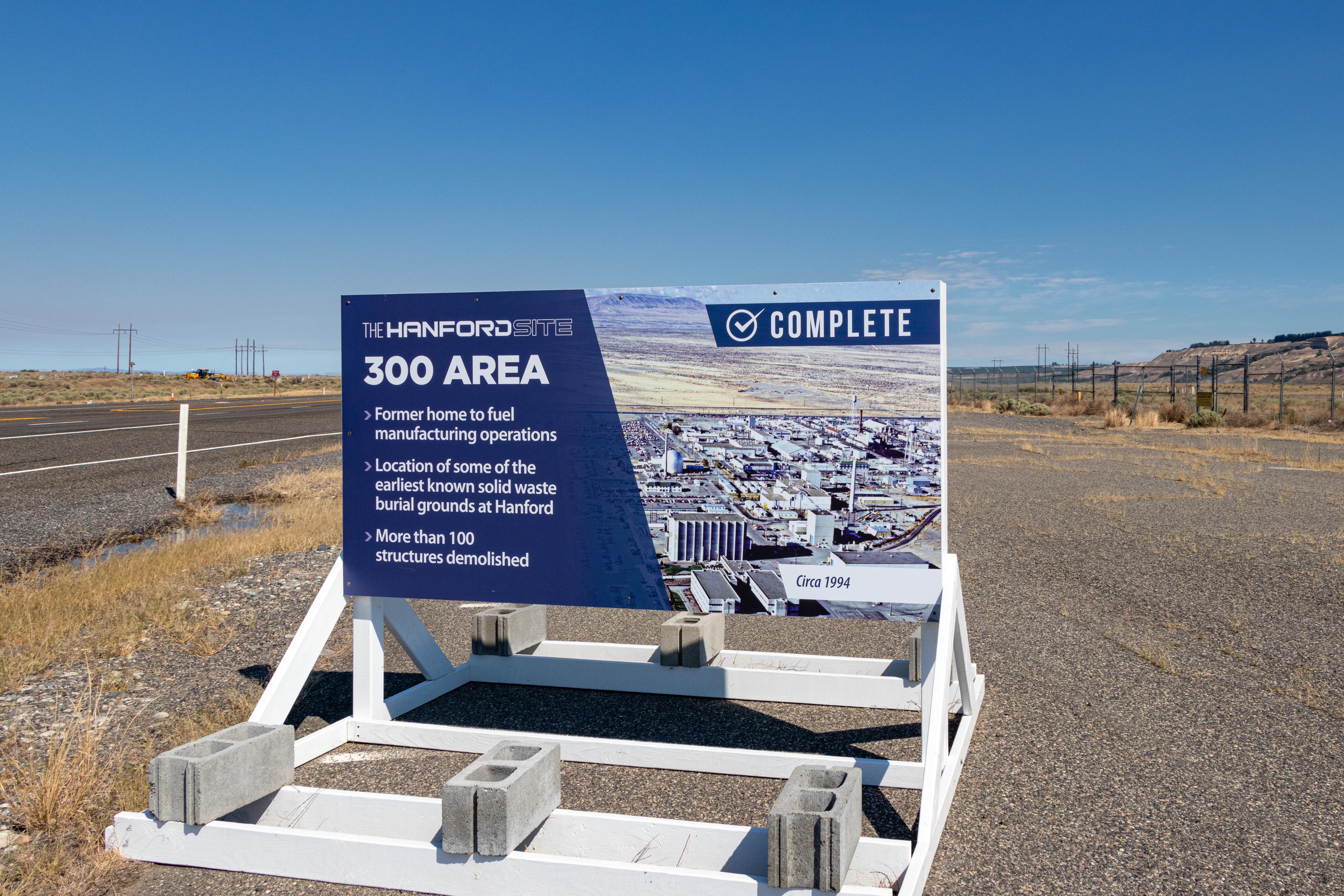
The 300 Area was home to the fuel fabrication operations for Hanford. Here, hundreds of thousands of tons of raw uranium were formed into fuel slugs that were irradiated in the Hanford nuclear reactors to produce plutonium for the war effort. Many of the buildings in the 300 Area have been demolished as part of the Department of Energy’s cleanup efforts.
African American houses of worship existed in Oak Ridge during the Manhattan Project, despite racism and segregation. Today, several African American churches still exist in the community.
African American Hutments were some of the lowest forms of housing during the Manhattan Project. Hutments were 16 X16 foot (4.8 meters) structures made of plywood with screenless windows with shutters and a central oil stove. Residents experienced sweltering summers and freezing winters in these hutments. Today, the site of the hutments is now a modern commercial development.
The approximate location of the hutments is now a modern commercial area. The site currently consists of an Aubrey's restaurant, a square brick building surrounded by a parking lot that sits slightly elevated off Illinois Ave., a main road through the City of Oak Ridge. As you face the restaurant and parking lot with Illinois Ave. behind you, a strip mall approximately 100 yards long is visible to the left of the restaurant with a large parking lot between the strip mall and Illinois Ave.
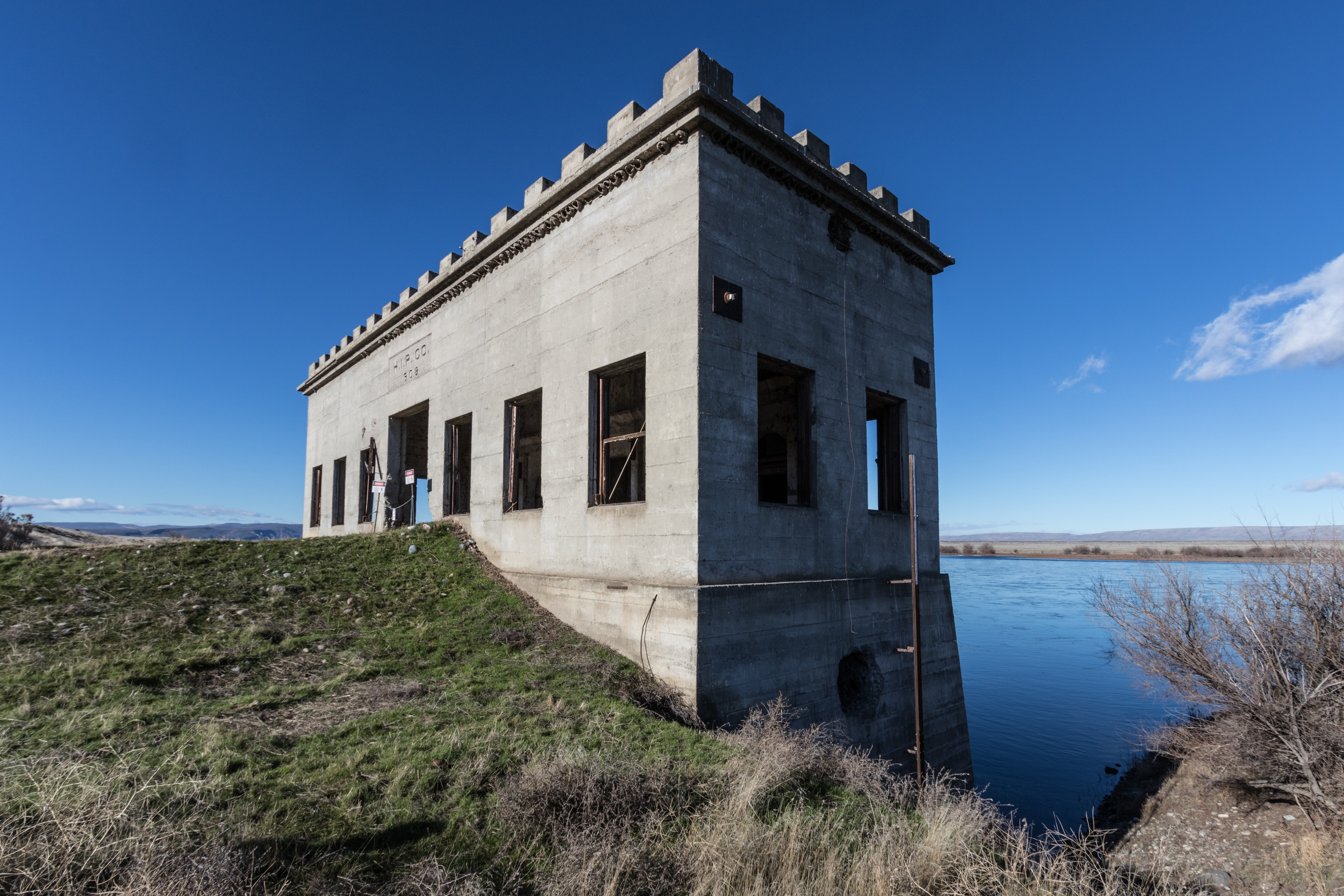
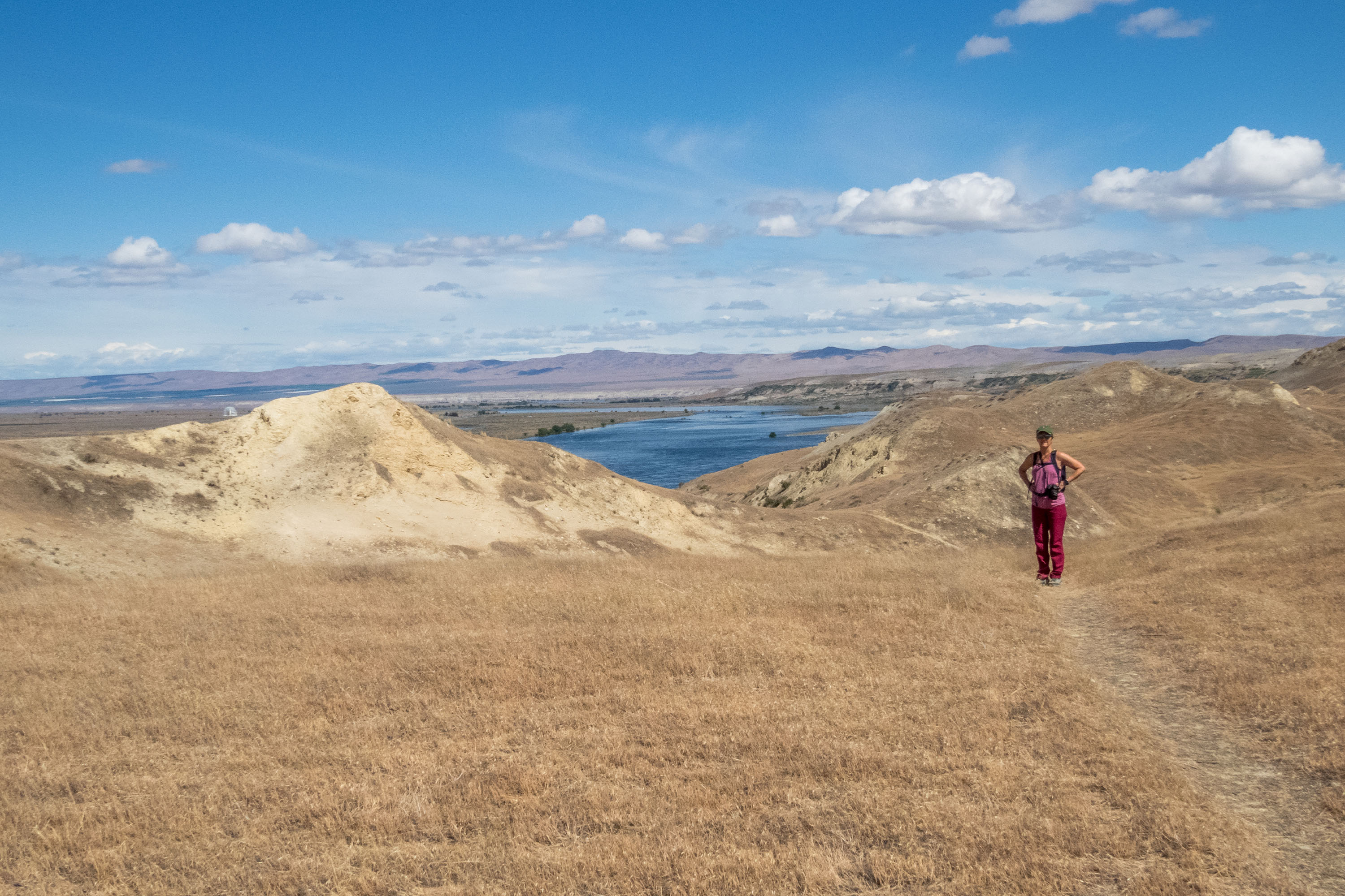
A remnant of an old pumphouse, known colloquially as the Allard Pumphouse, overlooks the Columbia River. For 30 years the pumphouse moved water from the river to an irrigation system that served farmsteads throughout the Priest Rapids Valley. The Allard Pumphouse became part of the Hanford Site when the Manhattan Project acquired the surrounding area in 1943. People can only visit the pumphouse through tours offered by the Department of Energy.
Viewed from the front the pumphouse is a rectangle. Made of concrete blocks, the flat-roofed building is now just an empty shell with openings where windows and the double-wide entrance once were. There is a narrow, decorative ledge around the top of the building. A low parapet extends around the roof with blocks spaced around it leaving indentations in between like the crenellations of a medieval castle. A rectangular tower rises at the center back of the roof. From the intersection of the gravel access roads in front, soil forms a ramp up to the front entrance. A chain across the opening blocks entry. Above the door engraved lettering reads “H.I.P. Company. 1908.” Looking through the doorway you can see the dirt floor covered with scattered stones. On the back wall there are several arched niches. The building sits at the bottom of a low ridge at the very edge of the river. The bank has been cutaway, so that from the side, the building extends down another story with the water lapping at its base. The banks along the river and the low ridge leading down to the building are covered with sagebrush and grasses and an occasional small tree. Looking out over the river, there is a long low island near the far bank to the left.
The American Museum of Science and Energy first opened on March 19, 1949, the same day the City of Oak Ridge opened its gates to the public. The museum’s newly-designed exhibit gallery features exhibits on Big Science, National Security, Energy Leadership, the Manhattan Project, Environmental Restoration, and several temporary exhibits.
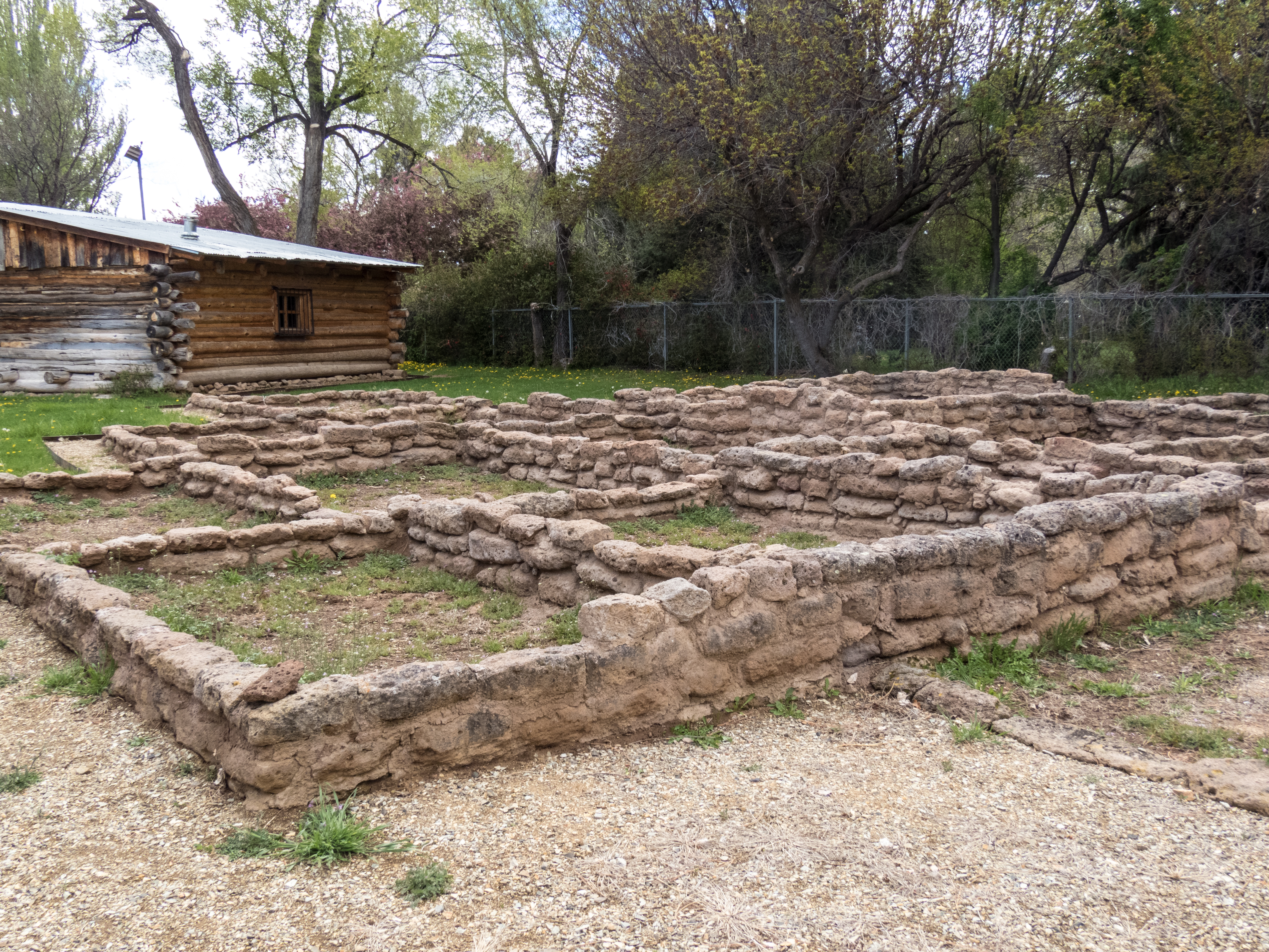
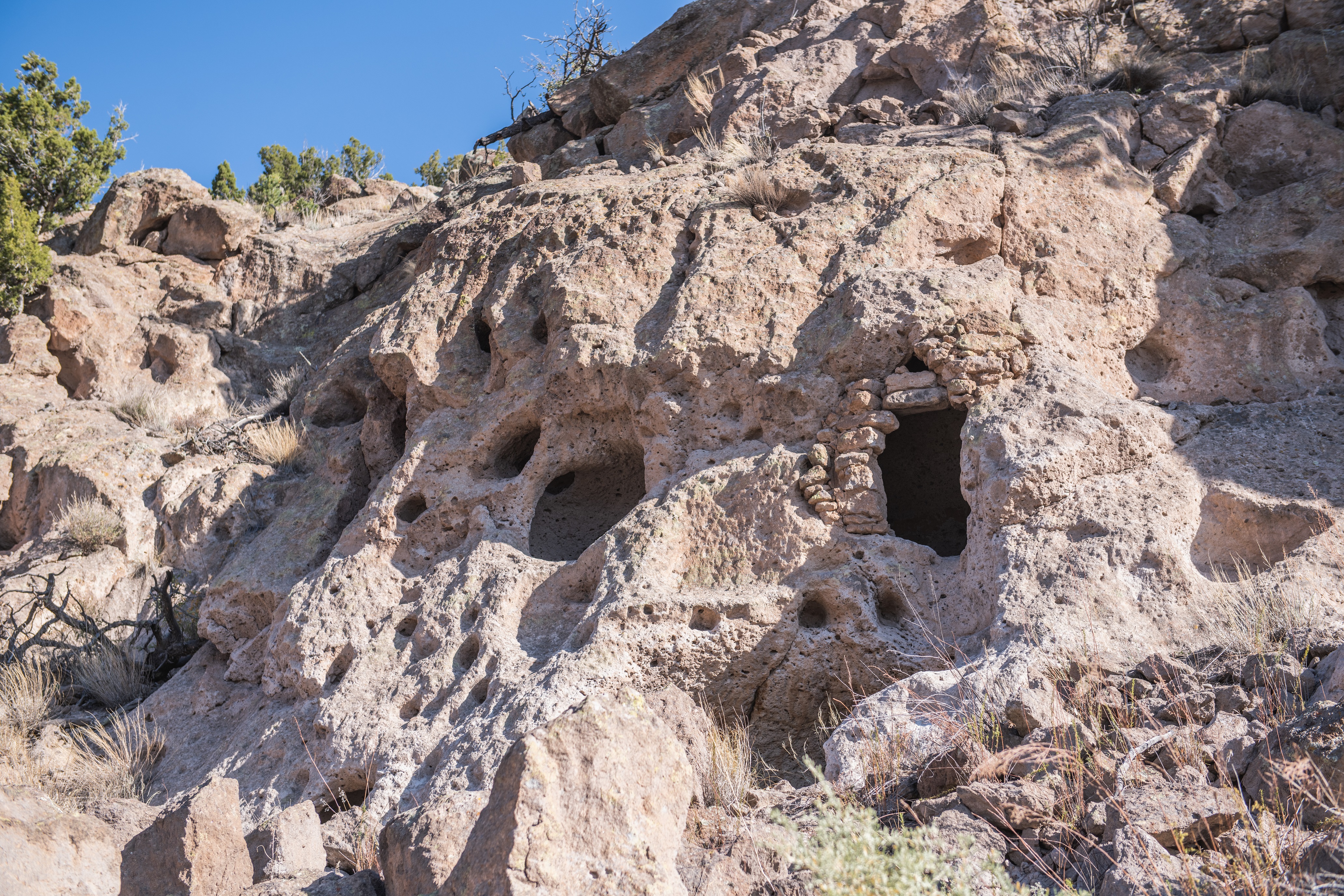
Long before the Manhattan Project came to the Pajarito Plateau, the Ancestral Pueblo people lived in the area. Two to three families of Tewa-speaking people likely occupied this Pueblo around 1225. It would have included bedrooms, kitchens, storage rooms, and a semi-circular kiva used for ceremonies and meetings. The Pueblo is part of the Los Alamos History Museum campus.
This site consists of low stone walls outlining a number of small rooms. From the sidewalk, they are three or four rooms deep in front of you and stretch out to either side. The walls are made of rows of wide, flat rectangular stones, ranging from two to four rows high. One room to the right is semicircular in shape with a small stone circle in the middle. In front of the site is a small graphic panel. Text in the upper left reads, "Ancestral Pueblo Site. Around 1225, this site was home to a group of Tewa-speaking people who possibly came from Mesa Verde or Chaco Canyon. They built structures out of tuff (welded volcanic ash). This pueblo housed two to three families and consisted of bedrooms, kitchens, storage rooms, and a semicircular kiva, which was used for ceremonies and meetings. Drought, depleted soils, declining numbers of game, and an increasing population caused the Ancestral Puebloans to leave the Pajarito Plateau around the 1500s. This site was reconstructed in the early 2000s with help from experts at Bandelier National Monument and input from local Pueblos. Please respect its history and remain on the sidewalk." At bottom left is a black and white photograph of a pueblo, the smooth-sided, rectangular rooms stacked in layers like a wedding cake reaching up to four stories in places. A couple of wooden wagons sit in front. The caption reads, "Taos Pueblo is one of the longest continually occupied Pueblo dwellings in the United States." At upper right is a photograph of an oval stone, carved in an image of a lion head. It has two eyes and two nostrils in the muzzle below with a flat ruff around its neck. The caption reads, "This lion head, believed to have been carved from local stone by an Ancestral Puebloan, was found in a cave near White Rock in 1955 by Los Alamos Scientific Laboratory Archaeologist, Charlie Steen." End of Description.
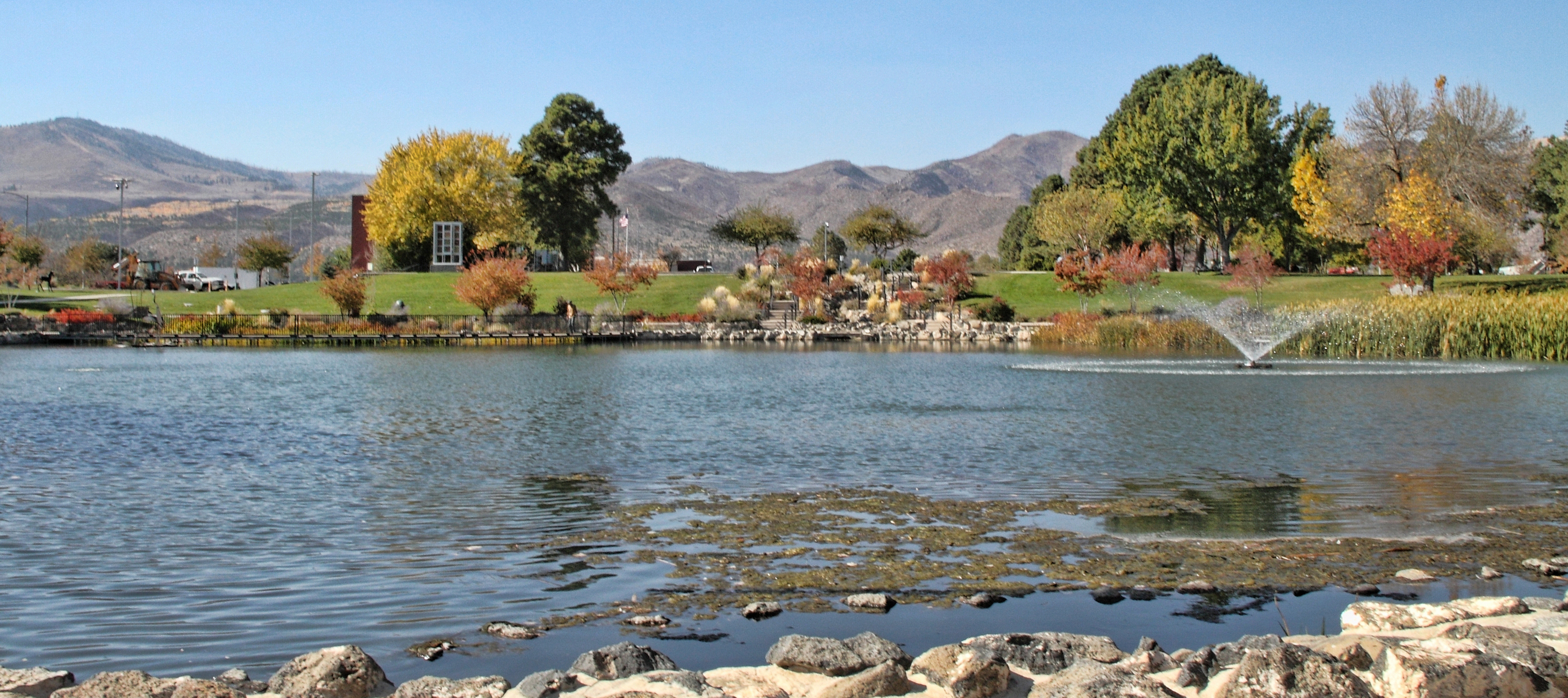
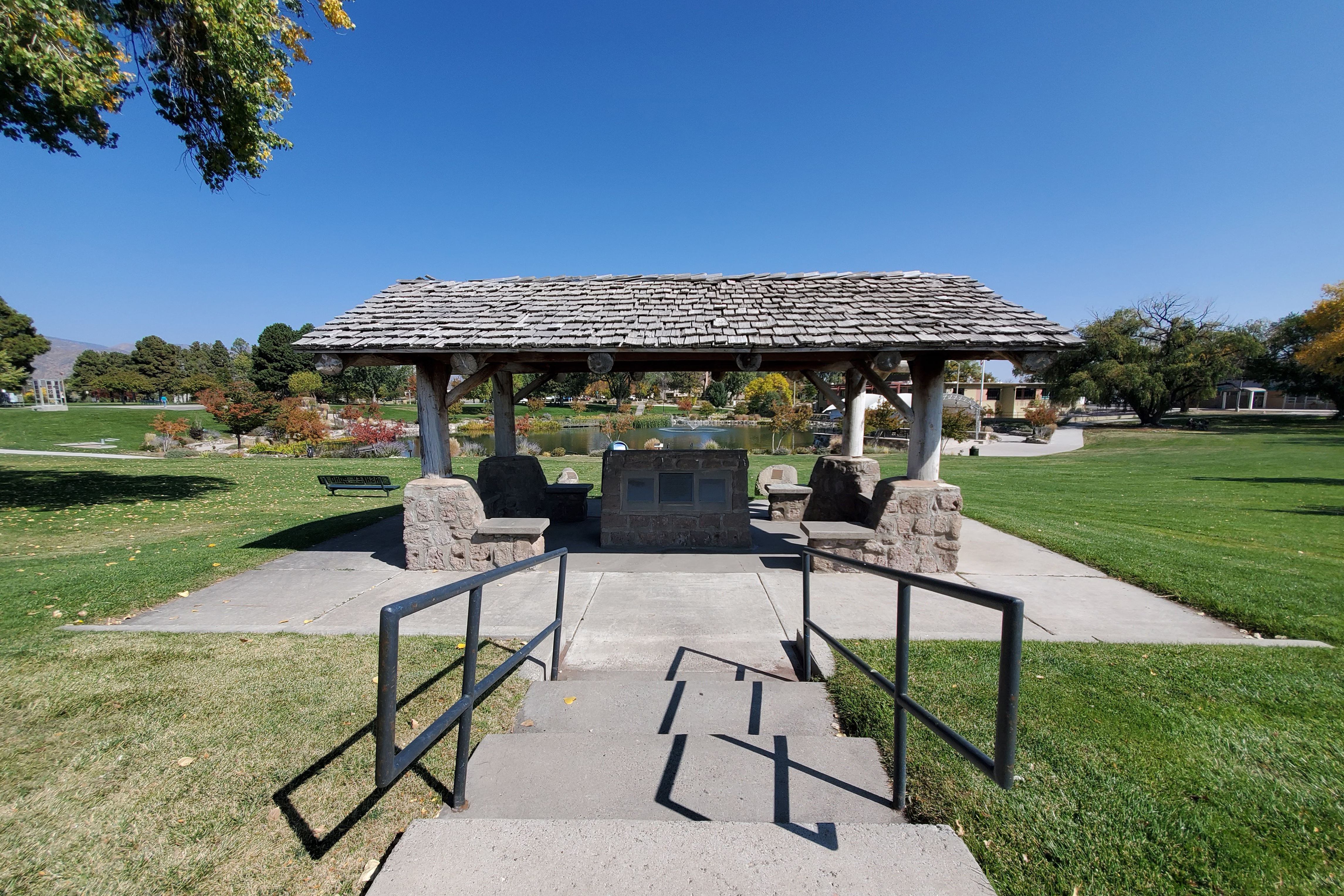
Ashley Pond has been a prominent feature of Los Alamos since the homesteading and Los Alamos Ranch School eras. Strolling around the pond, you may walk in the footsteps of famous scientists, Ranch School students, or the cattle who drank here.
This pond lies behind the Visitor Center. A sidewalk leads down from the pond to the street with three steps at the edge of the pond. From that point the Visitor Center is to the right. Between that point and the Visitor Center is a covered pavilion. To the left, about a quarter of the way around the pond, is a short boardwalk that loops out over the pond, passing a platform with metal sculptures of tall wading birds. Another short boardwalk sits on the other side of the pond. In the quadrant near the Visitor Center there is a fountain. A sidewalk surrounds the entire pond, roughly circular in shape. Grassy lawns surround the area. There are benches spaced around the pond, both along the sidewalk and on the lawn. End of Description.
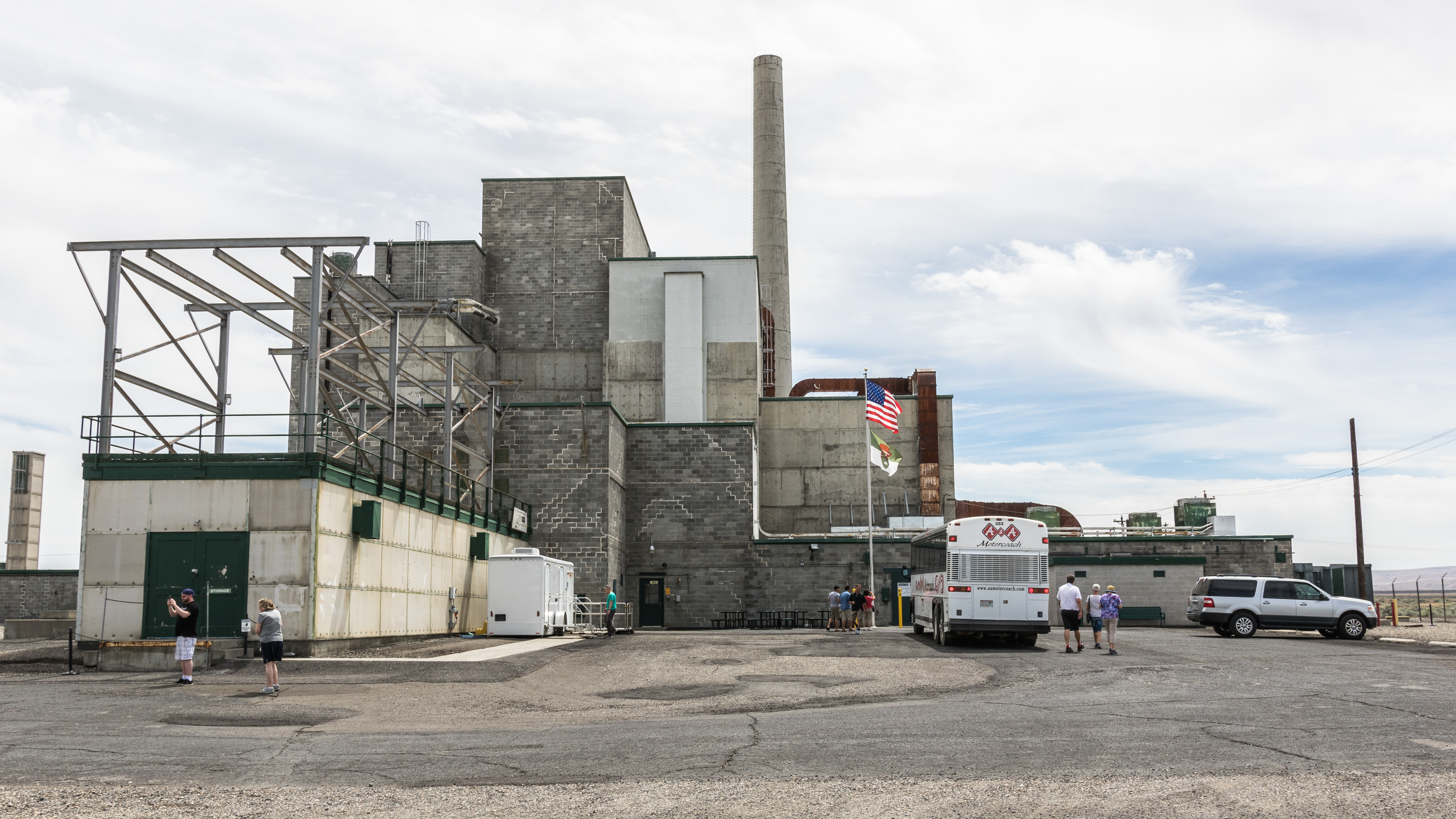
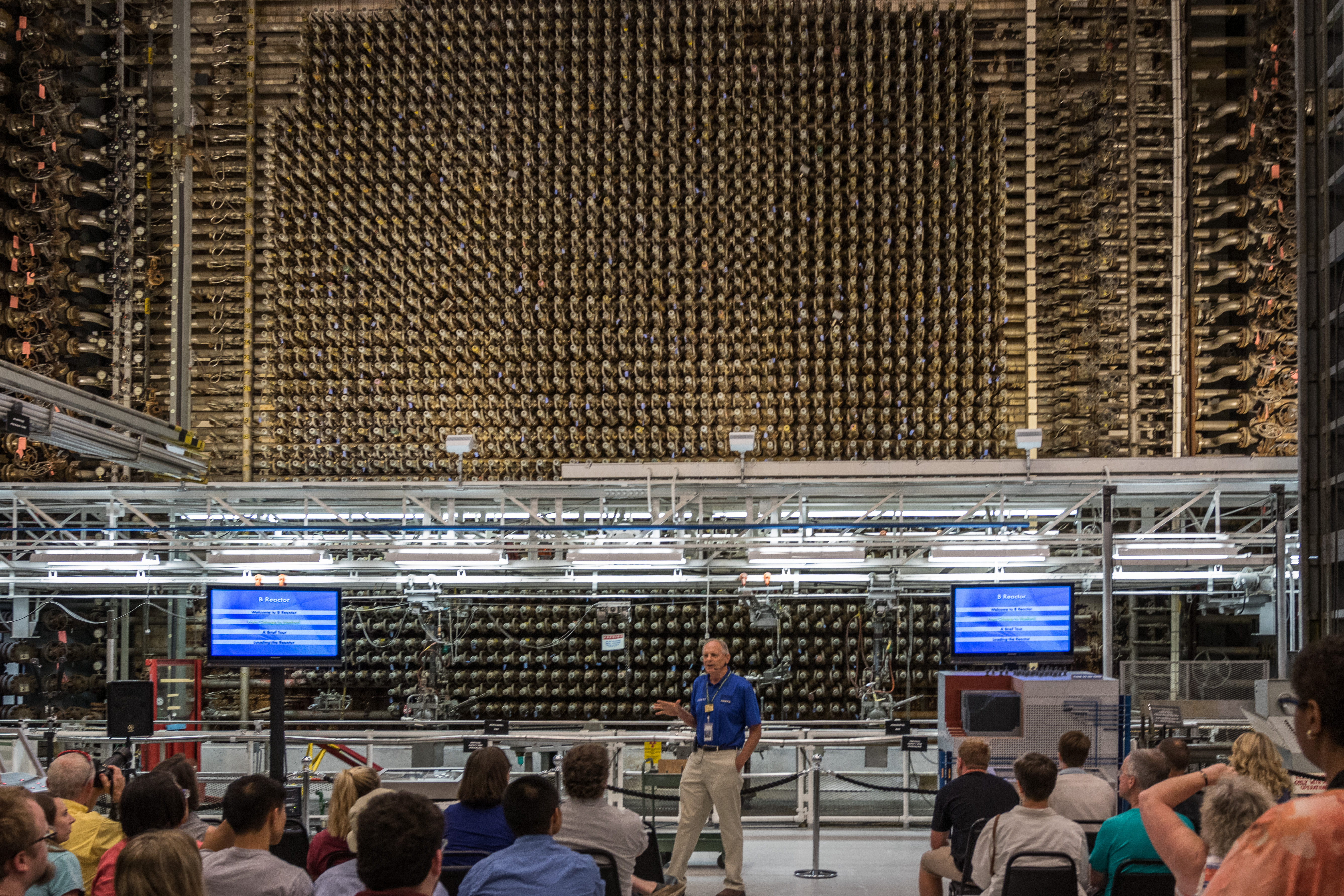
The B Reactor is the world's first full-scale nuclear reactor. The plutonium produced here was used in the Trinity Test and in the Fat Man bomb dropped on Nagasaki, Japan on August 9, 1945. Visitors can only tour the B Reactor via tours offered by the Department of Energy.
This building looks like a pile of rectangular blocks of different sizes. The central rectangle is stacked the highest, with shorter blocks on all sides. The structure is made primarily of gray concrete blocks with a couple of the smaller rectangles made of sheets of concrete asbestos. One of the metal sections forms a low wing extending 80 feet out to the front from near the center of the building. On top of it there is a gridwork of metal girders. Along the side of this extension is a trailer with portable restrooms. On the far side of that section and extending even farther to the front there is a short section of railroad track. At the left end are two locomotive engines, boxy rectangles with a small arche over the engineer’s compartment. Behind the engines are two flat cars. The first one has a central platform that is lowered down between the front and rear wheels. A large rectangular black box sits in that well. The rear car is short, with a lower surface. On top of it is a tall rectangular box with a metal ladder attached to one side. Behind the building, a 200-foot smokestack towers over everything. The entrance is in a one-story section at the right front corner of the building. Double glass doors lead inside. On either side of the entrance are solid, green metal doors that can be closed over the glass entrance. A green bench is located in front of a small extension at the right. To the left are several picnic tables. In front of the entrance is a sign with several plaques on it. Text on the sign reads, “B Reactor, 1944-1968. The World’s First Full-Scale Reactor. 50th Anniversary – American Nuclear Society.” At top center of the sign is an oval plaque that reads “National Historic Landmark, 2880, National Park Service.” Across the lower part of the sign are three rectangular plaques. The one at left reads, “National Historic Mechanical Engineering Landmark, Hanford B Reactor. Construction begun: June 1943. Reactor loaded: September 1944. This nuclear reactor was the first to demonstrate the practicality of producing large quantities of plutonium and was a major milestone in the United States Atomic Energy Program. Constructed by” E.I. DuPont de Nemours Company. Designed by: Enrico Fermi, John A. Wheeler, Eugene Wigner, and Staff. The American Society of Mechanical Engineers, 1976.” The middle plaque reads, “B Reactor. As the first full-scale nuclear reactor in the world, B Reactor successfully demonstrated large-scale energy generation using the fission process. Designated as a Nuclear Historic Landmark, October 1992, by the American Nuclear Society.” The plaque at the right reads, “National Historic Civil Engineering Landmark, American Society of Civil Engineers. Hanford B Reactor, Manhattan Project. World’s first full scale nuclear reactor. Designated 1994.” Small signs with the radiation symbol to the right of the doorway warn that there are internally contaminated systems and fixed contamination areas inside. As you enter through the doors, a wide hallway in front of you leads to the front face of the reactor. There are some informational graphics on the wall, including logos for NPS and DOE, and a table with a guest register to the right.
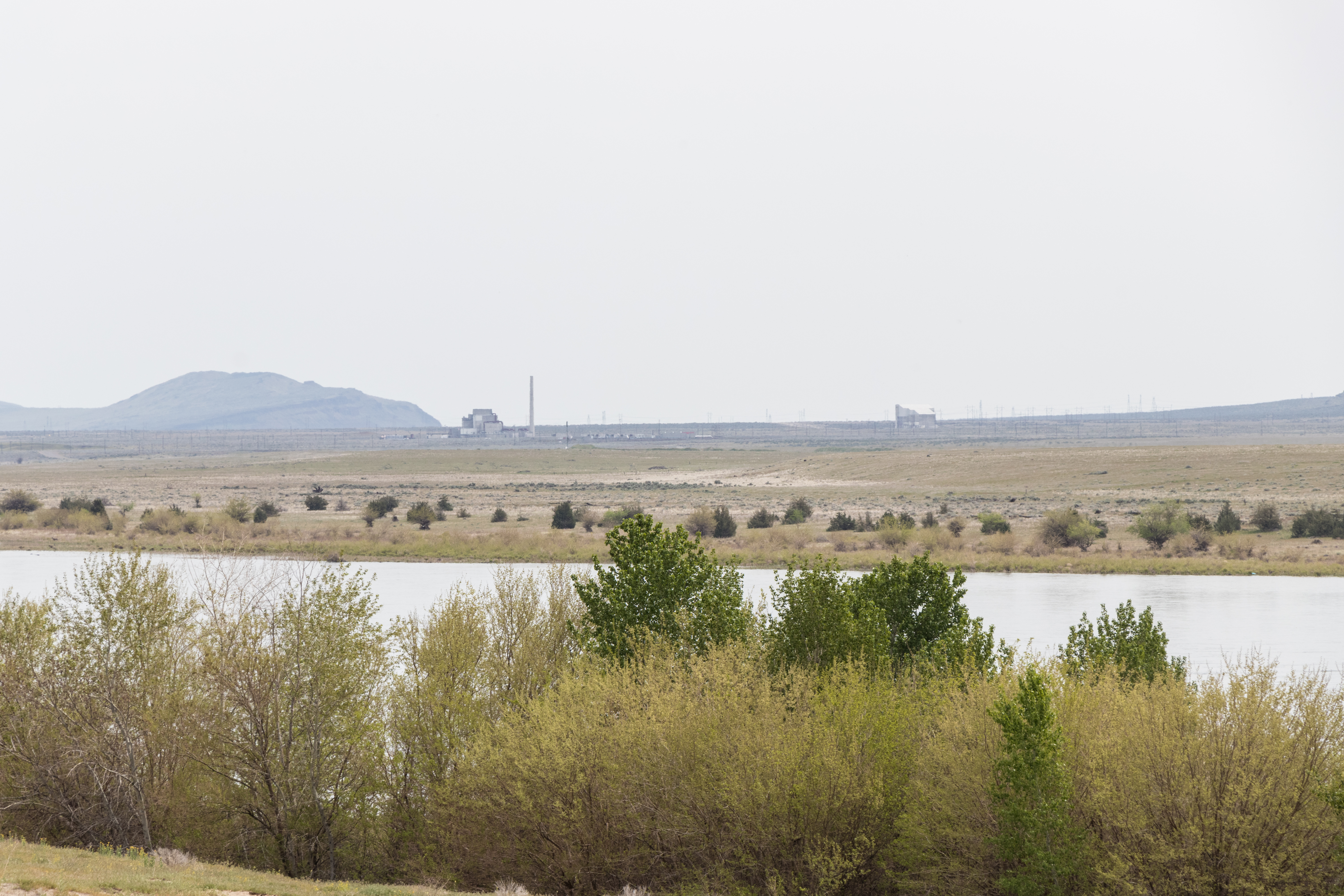
The B Reactor Overlook on Washington State Route 24 offers views of Manhattan Project facilities on the Hanford Site. This vista shows how the Manhattan Project transformed this region, displacing farmers such as the Bruggemans, while constructing massive plutonium production facilities in former farming communities. From this overlook, you can see the B Reactor, T Plant, and the Bruggemann’s warehouse, which was part of a large agricultural operation.
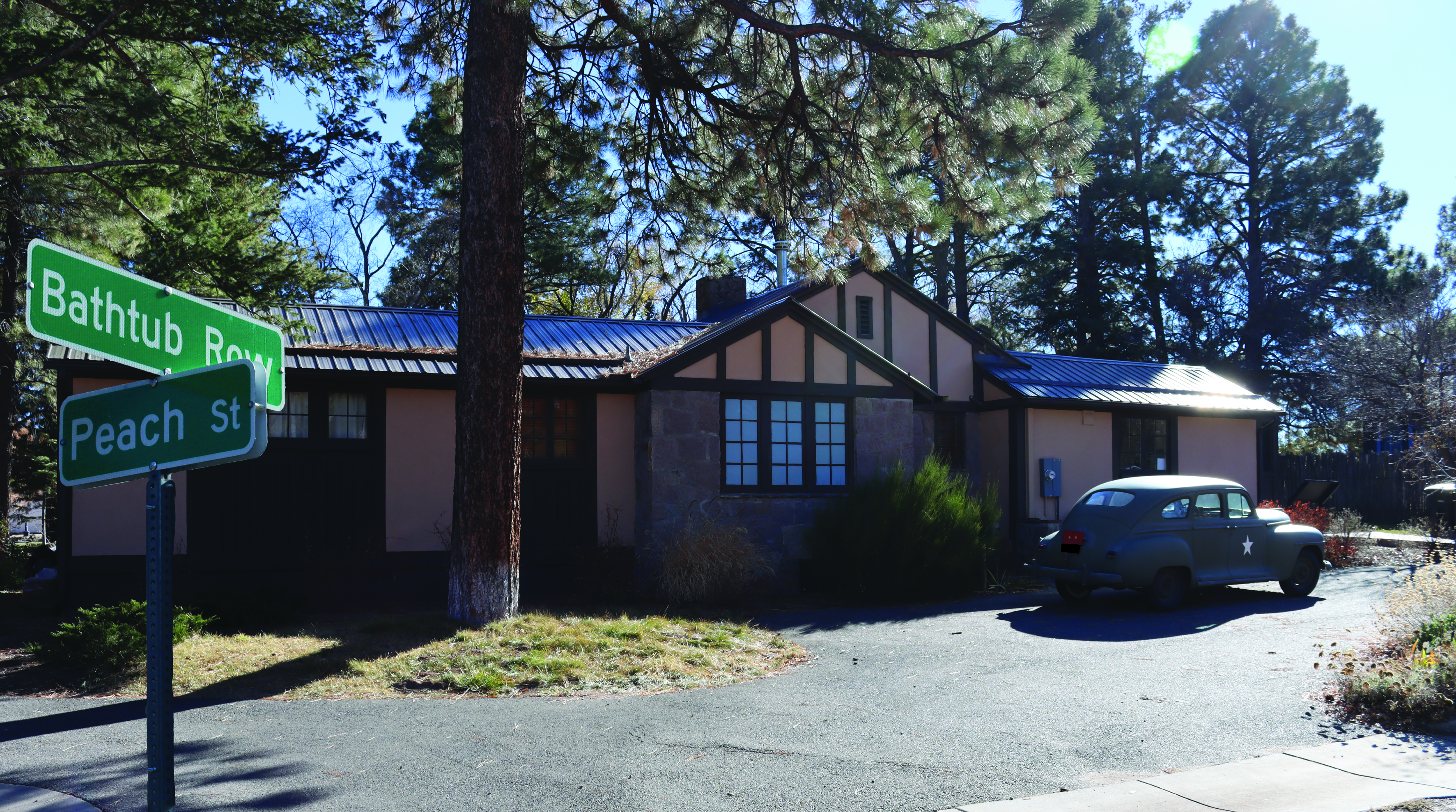
How special is your bathtub to you? In wartime Los Alamos, most residents lived in hastily constructed housing. Houses with amenities like bathtubs were rare and reserved for the highest-ranking members of the Manhattan Project. These well-built homes with their luxurious bathtubs gave this street the nickname “Bathtub Row.” Visitors to Los Alamos can still walk down Bathtub Row today.
Test leader Edward Creutz joined the Manhattan Project in 1942 as a physicist at the University of Chicago Metallurgical Lab. Working under Eugene Wigner, Creutz helped design water-cooled production reactors, which became the basis for the nuclear reactors at the Hanford Site. In 1944, Creutz moved to Los Alamos to develop explosive lenses for Fat Man, the first implosion-type weapon. Find out more about tour reservations and schedules on the Bradbury Museum website.
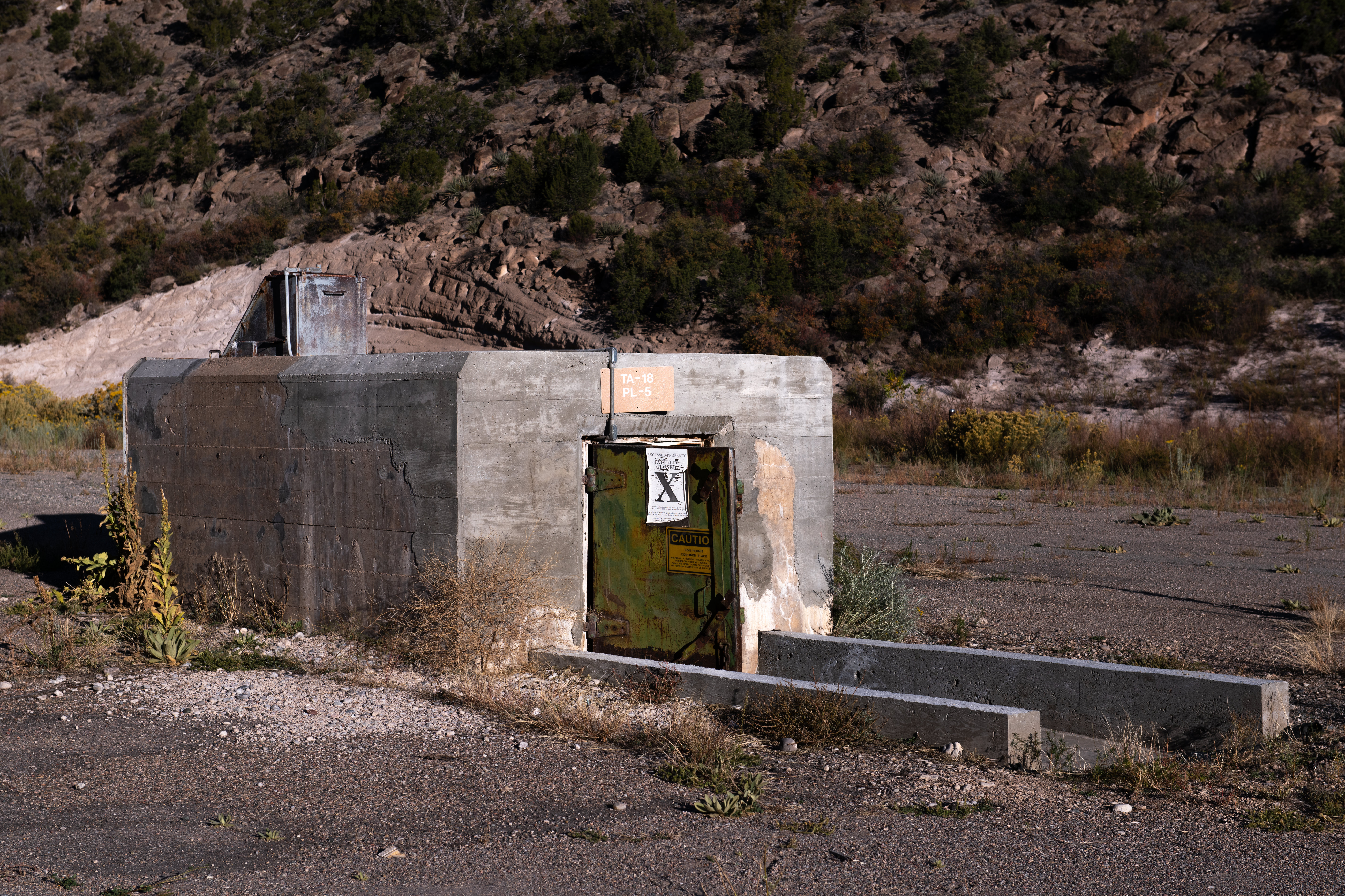
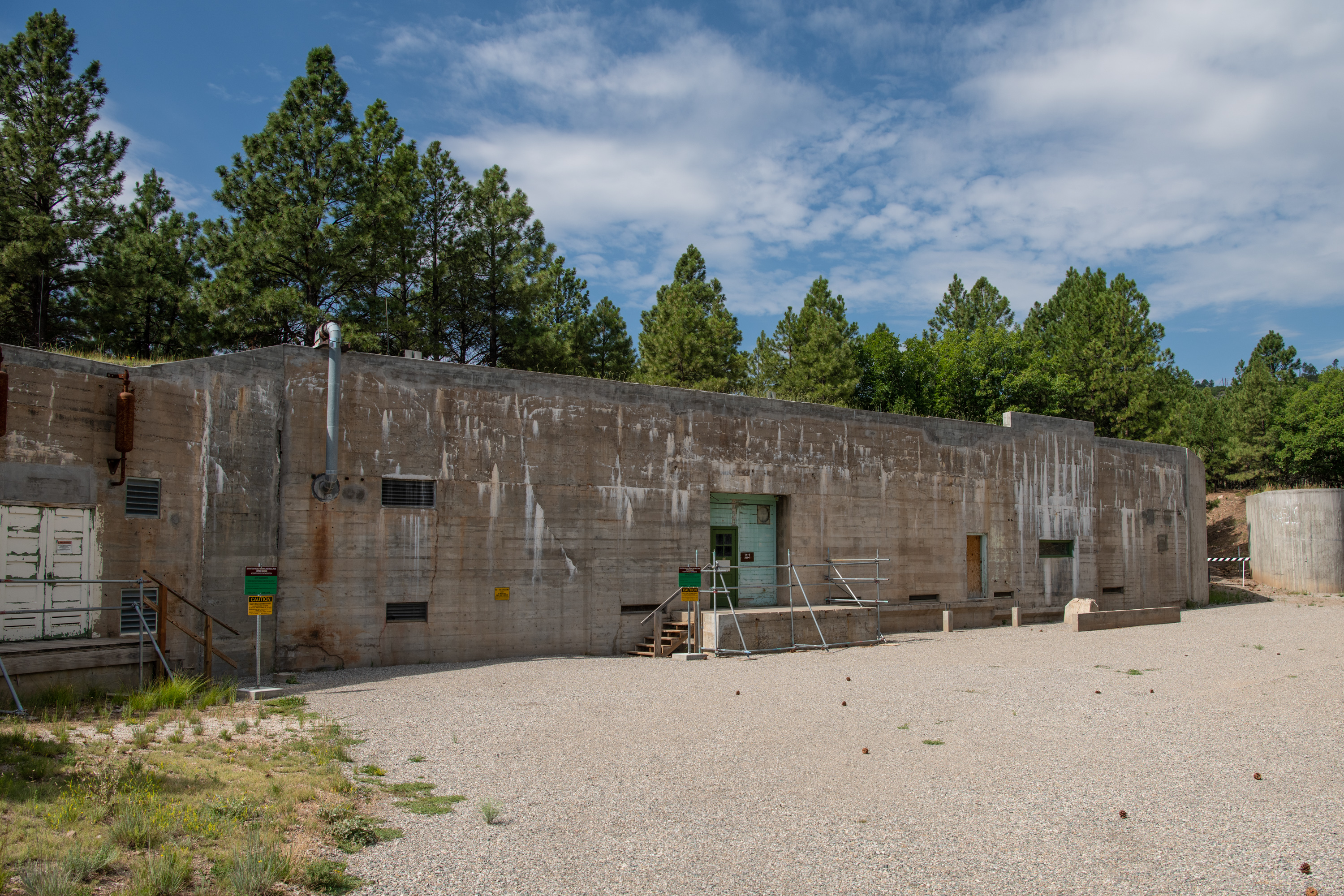
The bunker is located at the end of a gravel drive on the floor of a small, shallow canyon with steep rocky slopes rising on either side, scattered with trees and shrubbery. The structure is a small, concrete box, deeper than it is wide with a heavy metal door, painted green and rusted, at the front. The bunker is partially buried, so only half of the structure is visible above ground. A ramp leads down to the entrance. The inside walls are made of metal, the white paint now rusted over much of the surface. The floor is dirt. The rear of the structure extends out to form a "V," like the bow of a ship. Sitting on top of that section is a metal chute with an opening towards the front where a hatch door opens downward. End of Description.
By studying magnetic field disruptions at the Battleship Bunker (TA-18-2), scientists learned more about implosion. This building is on Los Alamos National Laboratory property. You can only access it through guided tours offered on specific dates. Find out more about tour reservations and schedules on the Bradbury Museum website.
The bunker is a small, concrete box, deeper than it is wide, with a hefty metal door, painted gray, at one end. The bunker is partially buried, so only half of the structure is visible above ground. Concrete steps lead down to the closed door, which is fastened with flat pieces of metal that slide down into metal holders on the wall. There are caution signs on the door, declaring “No Entry Allowed.” Placed against the base of the wall at the left is a small sign that reads, "TA-18, PL-2, Not in use." The rear of the structure extends out to form a "V," like the bow of a ship. This section is covered with a thick steel plate. Behind the bunker are a white building and a taller, but narrow tower surrounded by a tall security fence. End of Description.
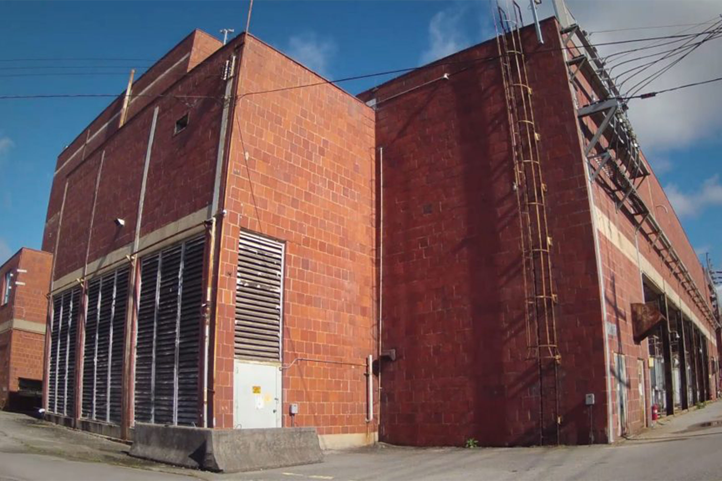
Beta-3 at Y-12 is where the well-known Calutron Girls worked. This building is within the highly secured Y-12 National Security Complex on US Department of Energy property and cannot be accessed by members of the public.
This red brick structure has three sections. The center part is a long rectangle that parallels the street and rises to about the height of a four-story building. Windows line the side near the top. On either side of this central section are other rectangular sections, the same length and width of the central section but only half the height and with no windows. In the middle of the side along the street there is a recess with large gray metal structures like a power substation. Smaller gray metal boxy structures line the ground level at either end of this side.
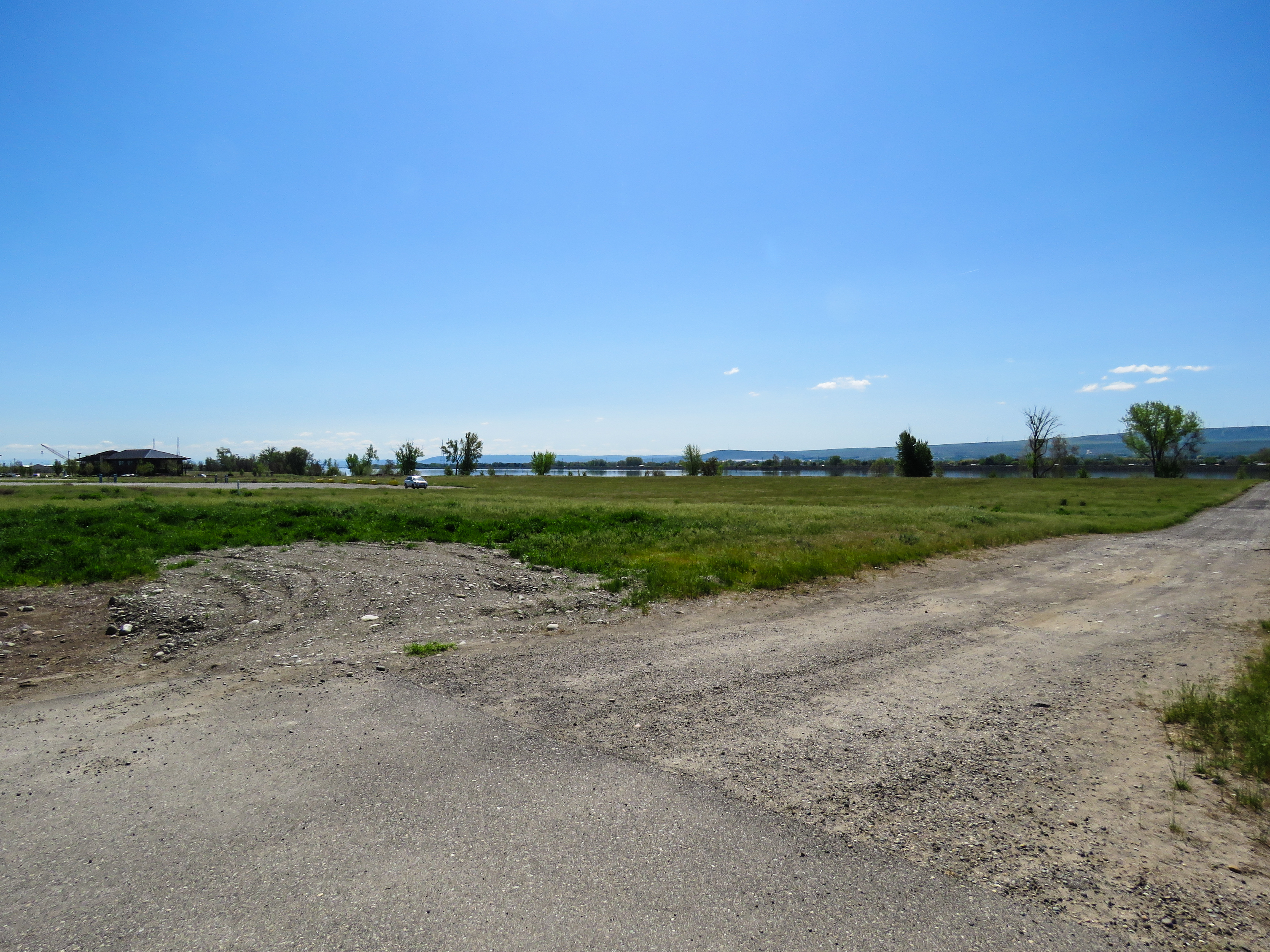
This empty field was once part of Big Pasco, one of the largest logistic centers of World War II. Big Pasco relayed supplies to troops in the Pacific Theater, as well as to Hanford Engineer Works and other units. Built in 1942, Big Pasco welcomed between 100 and 225 railroad cars every day that carried supplies ranging from nails to bulldozers to locomotives. This site is a great quick stop via car, or you can see it while enjoying the Sacagawea Heritage Trail.
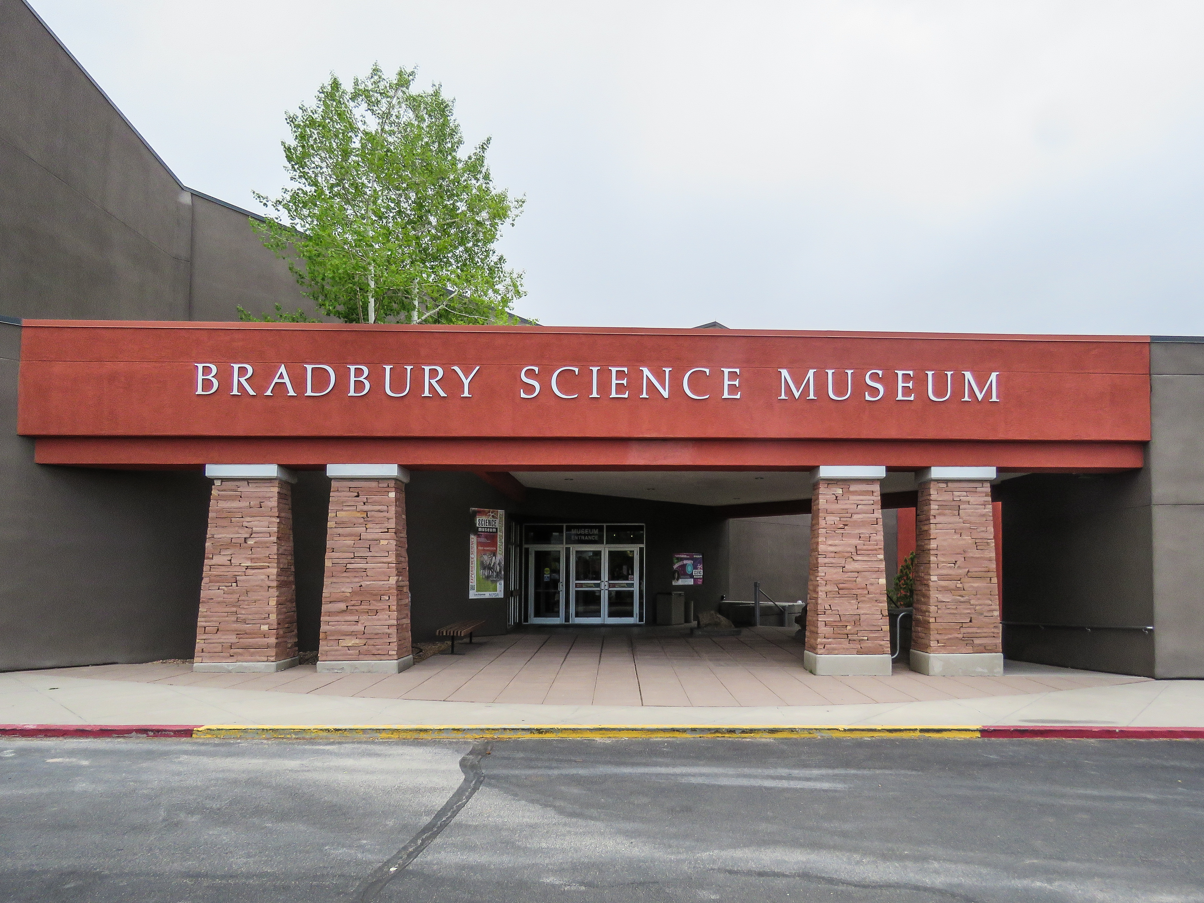
If you want to learn more about the history of the Manhattan Project, make sure to stop by the Bradbury Science Museum. The museum’s interactive exhibits share stories from the project and provide a glimpse of the historic sites “behind the fence.” You’ll also discover the modern advances in research and cutting-edge science that still take place today at the Los Alamos National Laboratory.
A weather-beaten warehouse is all that remains of the once-flourishing Bruggemann Ranch. The 550 acre (222 ha) ranch grew a variety of fruit and vegetables near the Columbia River until the Manhattan Project acquired the land. Today, the warehouse is on the Hanford Site. People can only visit Bruggemann Ranch through tours offered by the Department of Energy. However, a public roadway overlook provides a view of the ranch and warehouse.
The main structures here consist of two separate buildings nestled close together. A tall chain link fence with barbed wire on top surrounds the structures. Both are made of concrete faced with stones cobbles ranging in size from three inches to about a foot across. Closest to the entrance road is an L-shaped, one story building, 40 feet deep, with the 30-foot long base of the L extending along the front to the right. The structure is gutted and there is no roof. To the right of that building is a 65-foot-long rectangular building tucked into the corner of the L and extending out to the right, leaving a narrow passageway between the two buildings. Also made of the stone cobbles it is covered with the remains of a peaked roof, now consisting of horizontal planks with wide gaps between them. A stone chimney sits on top of the ridgeline about 15 feet from the left end. Two sets of wide, sliding, wooden doors sit in the middle of the side wall with two openings for windows at the left end. The other sides also have window openings and there is a wooden door in the middle of the back. To the left of the buildings, outside of the fenced area is a large pile of stone cobbles about 50 feet wide and 40 feet deep. From the building side, the cobbles form a ramp to the top of the pile. At the end of the ramp on the far side of the pile are broken pieces of old timber. The land surrounding the structures is flat and covered mostly with grasses, with scattered brush and tumbleweed. Out in the fields there are other remains of walls and concrete foundation footings.
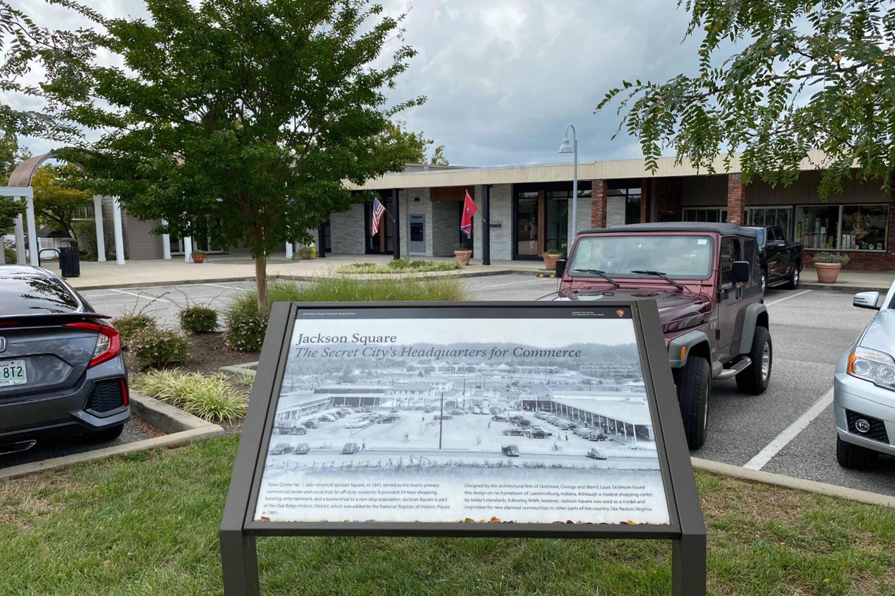
During the Manhattan Project, architect Gustav Pehrson transformed the pre-war farming community of Richland into a compact, walkable city that offered residents a variety of services. This building housed the C.C. Anderson’s Department Store. As the only department store in town, the C.C. Anderson’s Department Store was a hive of activity located in the center of the community. Today, this building houses a number of smaller stores.
Between 1943 and 1945, the Hanford Engineer Works employed approximately 45,000 people—not counting a supplemental workforce of 250 to 290 federal prisoners from the McNeil Island Penitentiary in Puget Sound. The prisoners harvested crops on farms and orchards taken over by the government to make way for the Manhattan Project. They lived in a special camp at the southern boundary of the Hanford Site, on the north bank of the Yakima River, just above Horn Rapids Dam.
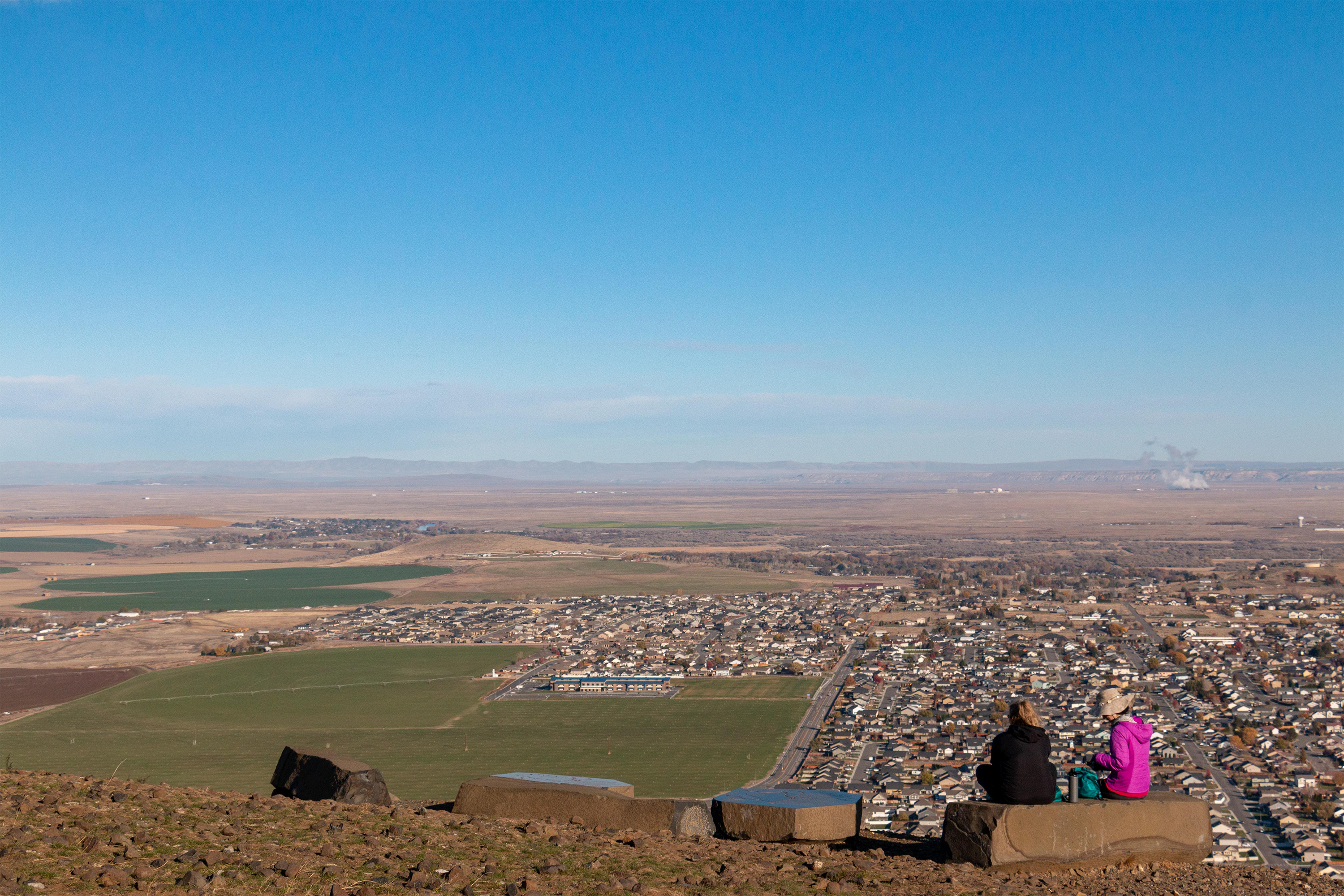
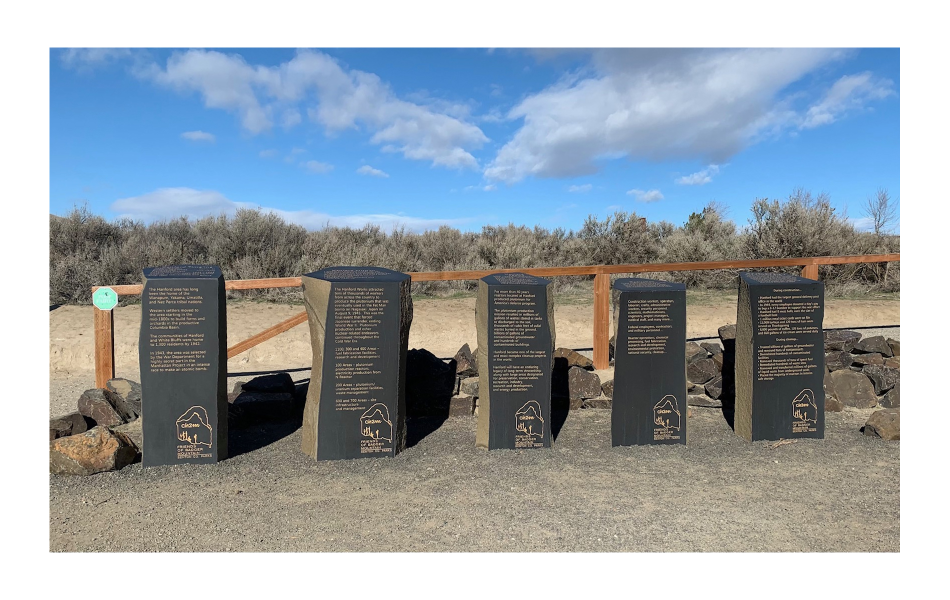
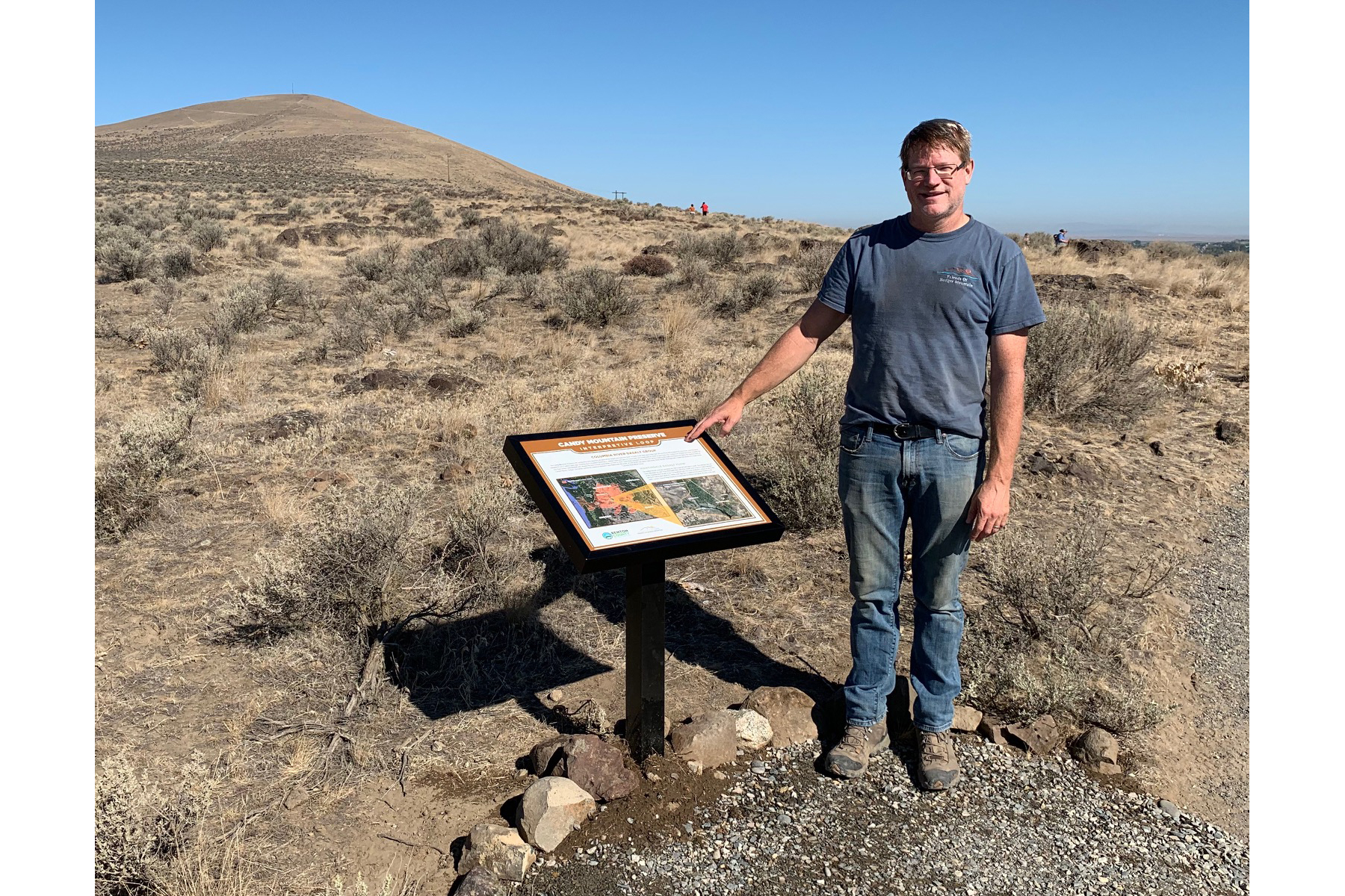
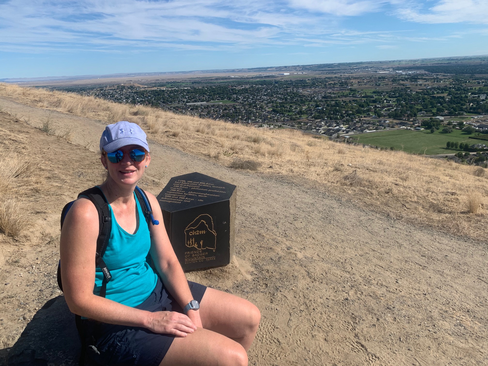
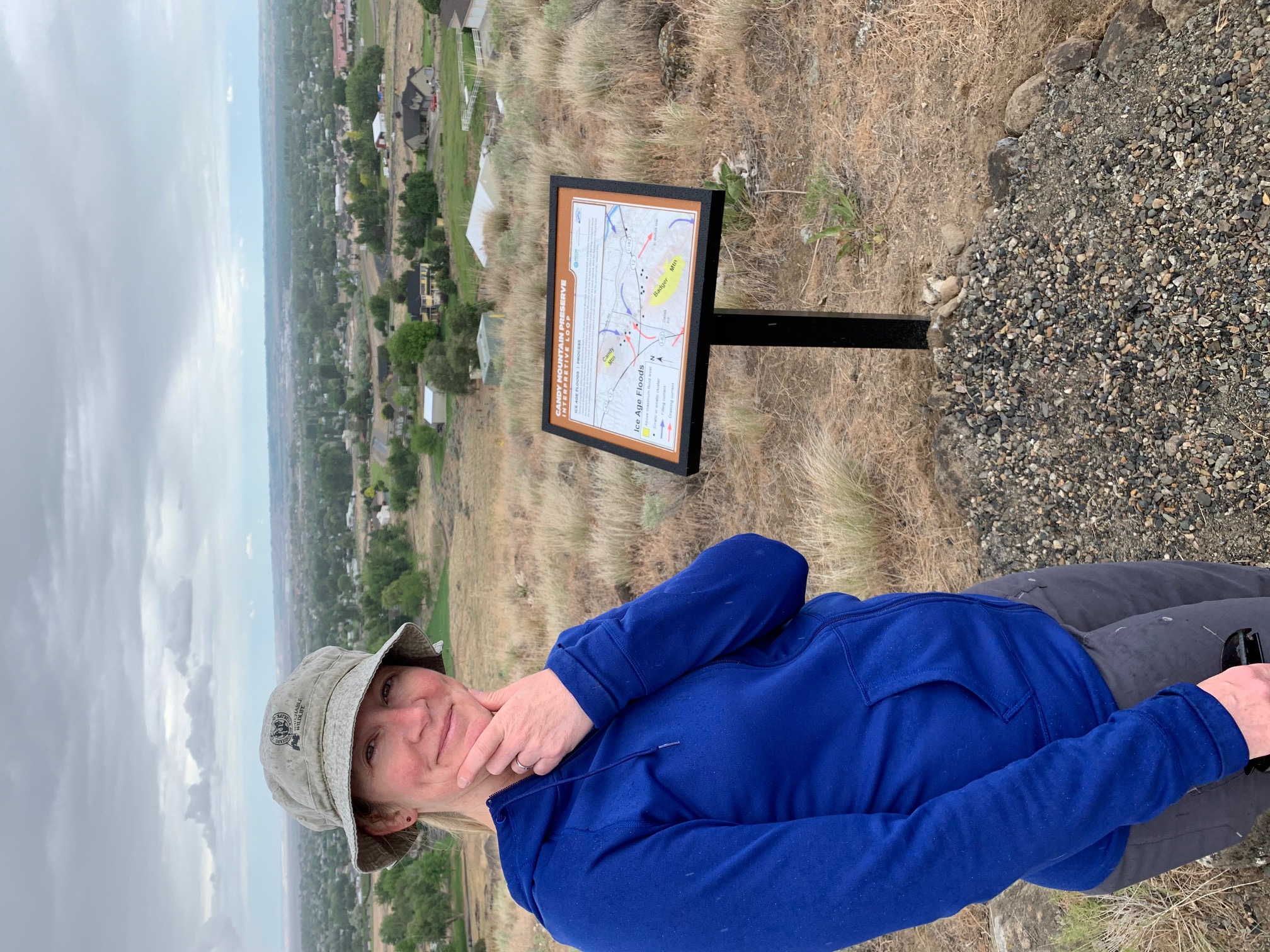
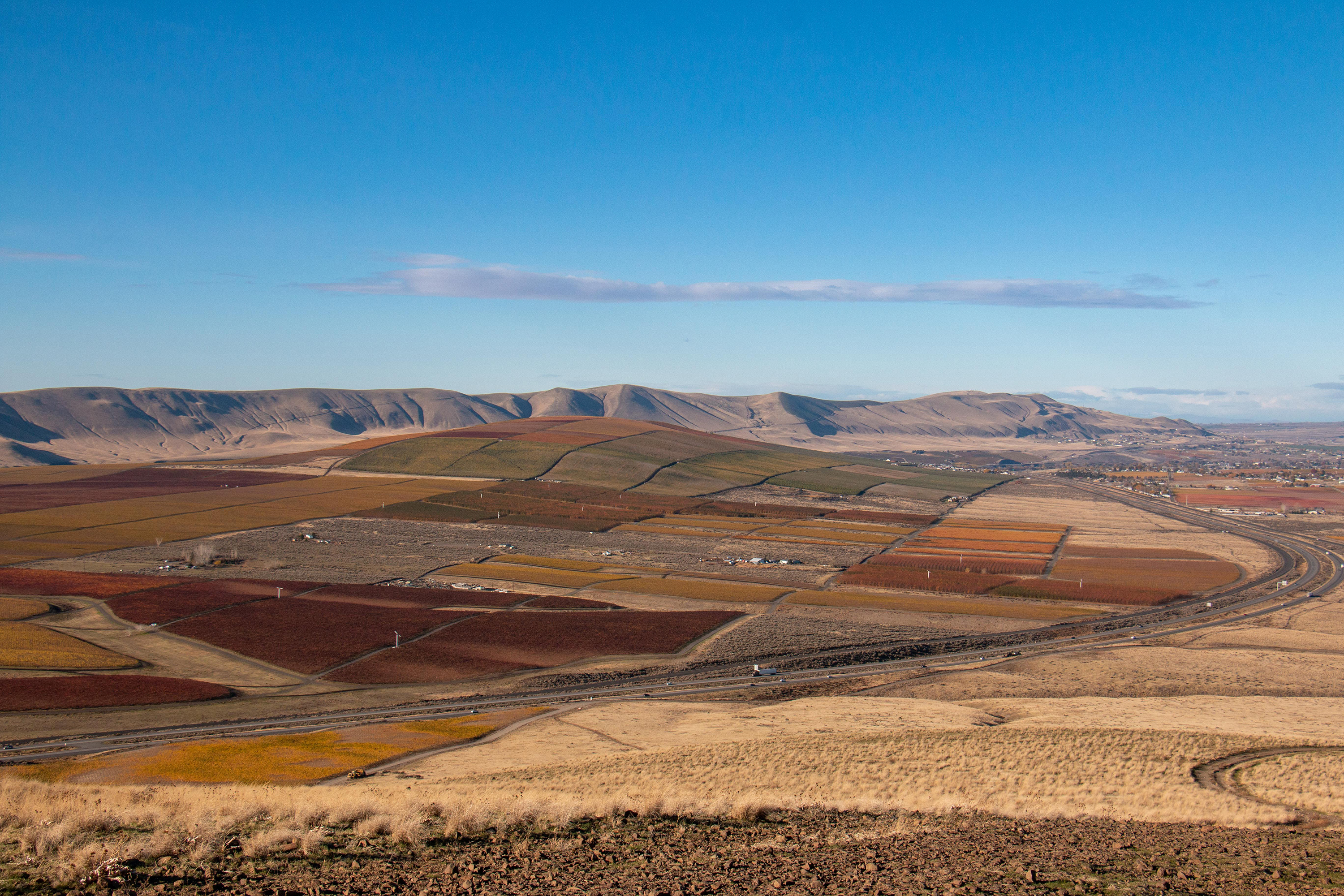
The trail up Candy Mountain is a moderate 3.6 mile (5.8 km) roundtrip hike that offers sweeping views of the Tri-Cities region and a walk through time. Signs along the trail explain the impact of the ice age floods on area geography. Hikers capture sweeping views from the summit, with Mount Adams, Rainier, and Stuart visible on clear days. This perch offers a bird’s-eye view of the Hanford Site. A nearby sign points out the various areas of the Hanford Site.
Décor and art have helped makes houses “homes” for generations. At the cavates in this behind the fence area, you can find evidence of how the Ancestral Pueblo people fixed up their homes. Find out more about tour reservations and schedules on the Bradbury Museum website.
This low jagged cliff face is made of rough, reddish-brown stone. The rocks are pitted with holes. Many of the rocks are round in shape. Some are rectangular, taller than they are wide. Some of the gaps appear to open up into a cavity behind them. Loose stones and boulders lie at the foot of the cliff. End of Description.
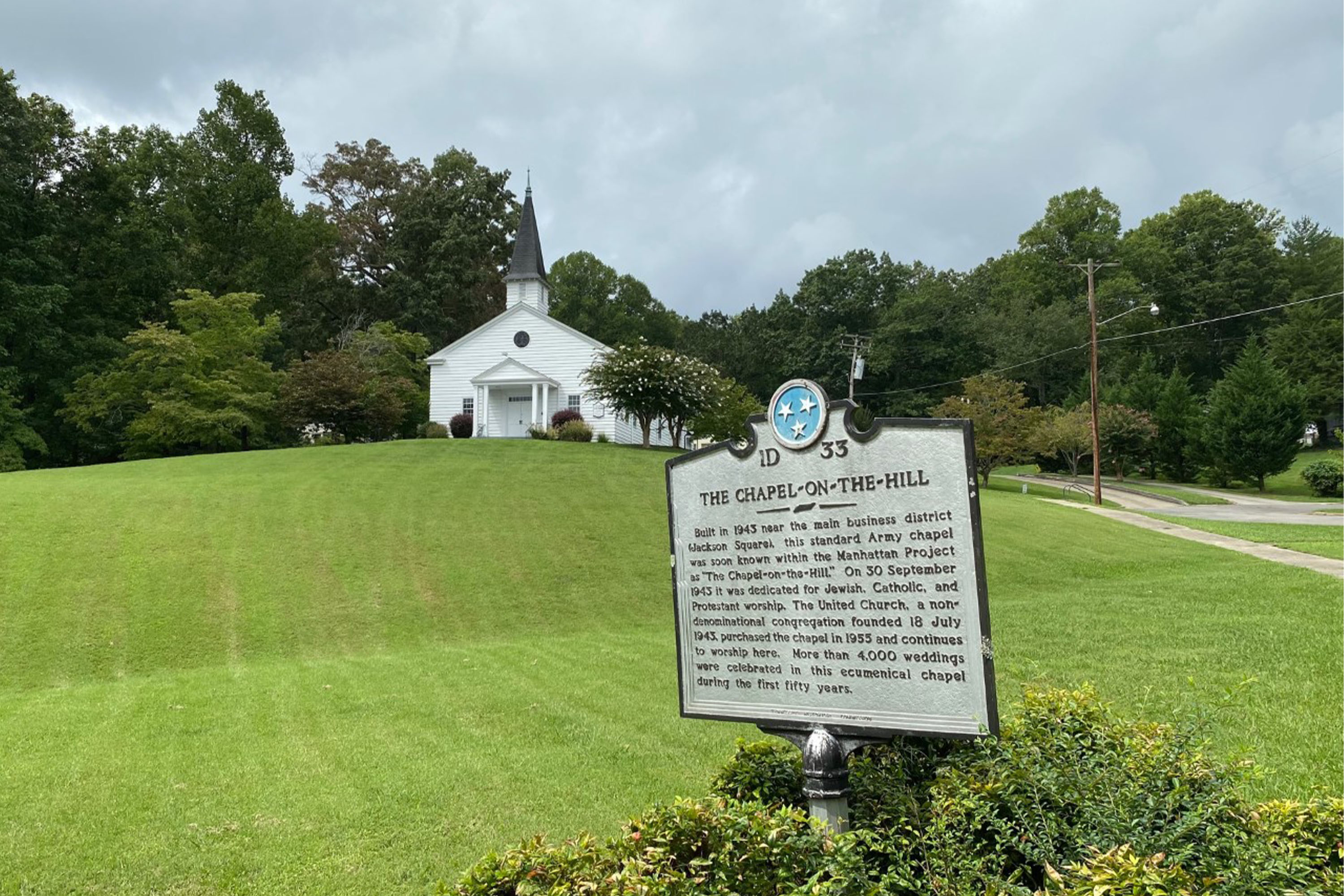
Completed in October 1943, this standard military 700-series chapel, was one of three military chapels constructed at Oak Ridge during the Manhattan Project. The Chapel on the Hill welcomed worshipers of many denominations during the Manhattan Project. Today, the chapel remains a place of worship. The interior is closed to the public, but the grounds are open to visit.
A white wooden church with shingle clad steeple at the top of a grassy hill. From this slanted graphic panel a sidewalk leads to the right, climbing a gentle slope. To the right of the sidewalk is a drive with parking along both sides. At the top of the rise, the drive ends in a parking circle. At that point a series of steps leads up another slope to the left, ending in front of the small church. The wooden building sits on top of the hill with trees on the far side. The door at the front is covered by a small portico with a round window in the peak formed by the roof. On top of the roof is a short steeple. The rectangular building extends back from the front with tall windows along the side. The background of the graphic panel has a black and white photograph of the chapel taken from the hill to the right, looking across the parking circle to the side of the building. The caption reads, “Chapel on the Hill, one of three US Army chapels built in Oak Ridge during World War II, 1944.” Text across the bottom of the panel reads, “In the early days of the Manhattan Project, people gathered in theaters, cafeterias, and schools to attend religious services. Leaders of these groups appealed to administrators to provide dedicated places of worship. Completed in October 1943, a standard military 700-Series chapel was made available for weddings, worship services, and other functions. At peak wartime activity, more than 20 separate congregations, including Jewish, Baptist, Catholic, and Methodist denominations shared the chapel for round-the-clock services. The name ‘Chapel on the Hill’ comes from a prayer of dedication made by the Baptist minister on September 20, 1943. Still in use today, the church was added to the National Register of Historic Places in 1991 as part of the Oak Ridge Historic District as a contributing property.” About halfway along the sidewalk up to the church is a state historical marker which reads, “Built in 1943 near the main business district (Jackson Square), this standard Army chapel was soon known within the Manhattan Project as ‘The Chapel on the Hill.’ On 30 September 1943 it was dedicated for Jewish, Catholic, and Protestant worship. The United Church, a non-denominational congregation founded 18 July 1943, purchased the chapel in 1955 and continues to worship here. More than 4,000 weddings were celebrated in this ecumenical chapel during the first fifty years.”
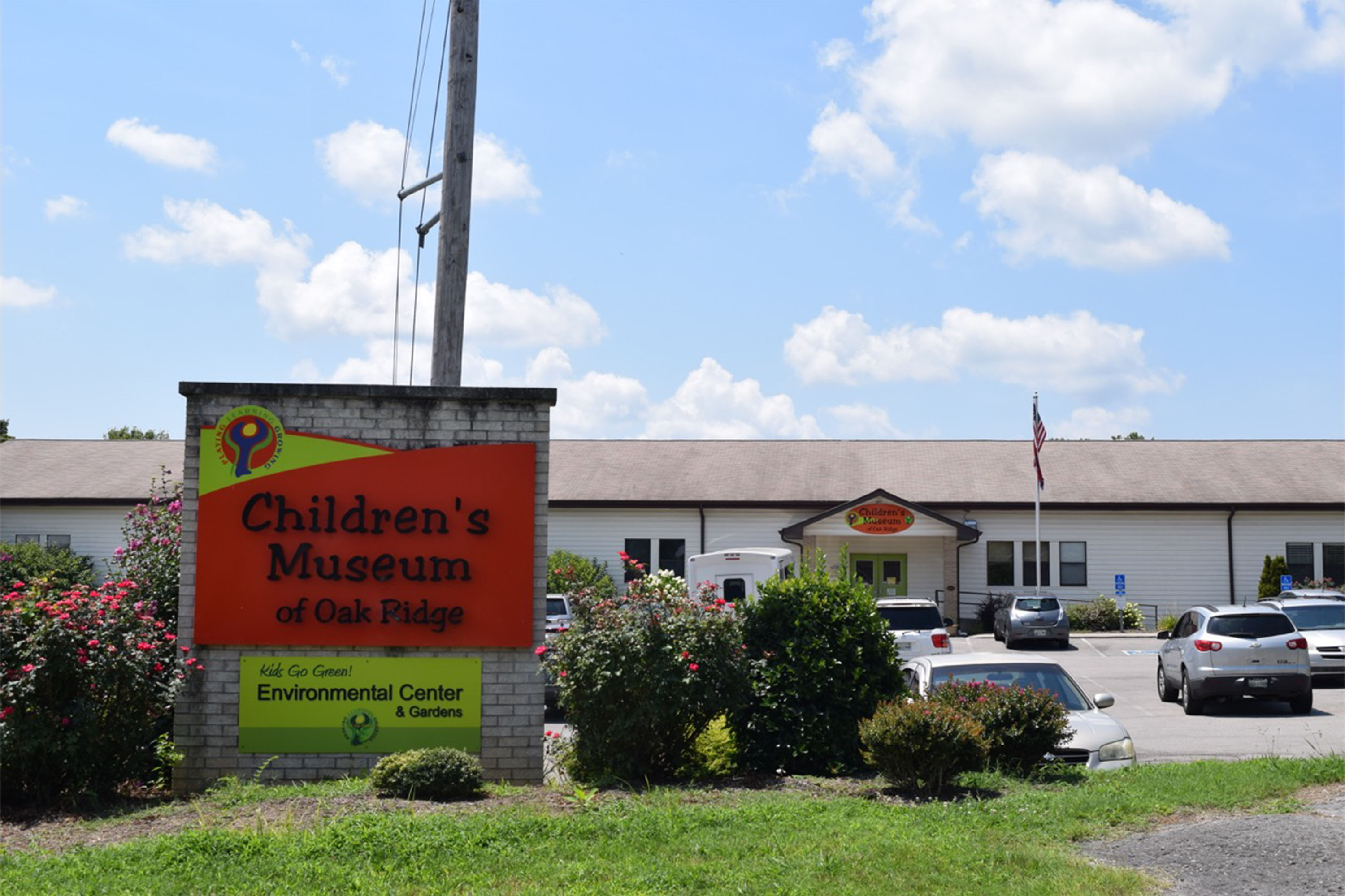
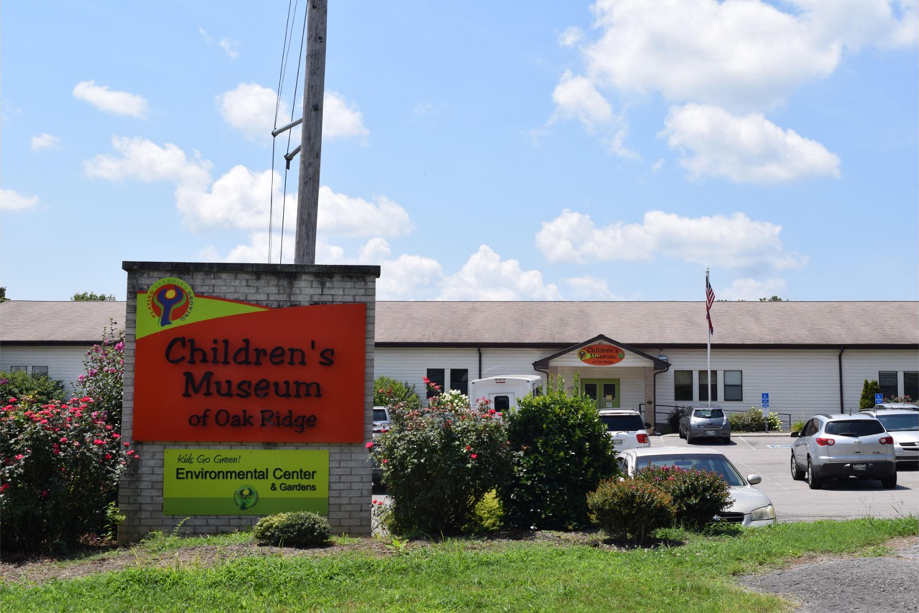
The Manhattan Project Oak Ridge Visitor Center is located within the Children's Museum of Oak Ridge. Inside the museum, you can speak with park staff, stamp your passport book, view a park film, and explore exhibits on the Manhattan Project, science, history, geography, and the environment. The museum building used to be an elementary school that opened in September of 1944 to educate the children of Manhattan Project workers.
There is a slanted graphic panel here along the sidewalk at the edge of this quiet street. From here, there is a small bank down to the parking lot which stretches in both directions along the front of the long building. The museum is housed in a former school and consists of a central rectangle with a long wing extending out to each side. The entrance to the building is in the middle of the left wing. The right wing is set back, intersecting the central structure halfway back. A peaked roof forms a portico in front of the main entrance which may be reached by a set of three steps in front or by a ramp on the right side. An oval sign at the peak of the portico reads “Children’s Museum of Oak Ridge.” There is another sign on the side of the building to the right of the ramp which reads “Manhattan Project National Historical Park” and has the National Park Service arrowhead logo on it. Inside the front doors, the information desk for the museum is in front of you and slightly to the right. An open doorway immediately to your left leads into an exhibit area. Another opening straight ahead, past the information desk, leads to other areas of the museum. To the immediate right is an information desk for the Manhattan Project National Historical Park. A small gift shop may be reached by going to the right between the two information desks. The graphic panel in front has a black and white aerial photograph of the building taken from a viewpoint about 45 degrees to your right as you face the sign. The two wings can be seen along with the back of the central structure that is built into the slope which falls away behind the building. Houses surround the building on all sides. Text at the bottom of the panel reads, “The rapidly increasing population of Oak Ridge during the early 1940s led to a high demand for housing. At one point, homes within the Secret City were being completed every 30 minutes. Oak Ridge needed a school system to meet the educational needs of its community. “General Leslie Groves, military commander of the Manhattan Project, insisted that the schools be of the highest quality, if he wanted to keep scientists in rural Tennessee. The school system hired the most highly qualified teachers from all over the country and from neighboring communities. How? By paying them more. “Schools were constructed within walking distance of most homes, and by 1946, three years after Oak Ridge was established, had roughly 7,000 students enrolled in 10 elementary schools, one high school, and one junior high. “The building you see before you today was Highland View Elementary, one of the few remaining original Oak Ridge school buildings.”
T-101, a civilian women’s dormitory, housed women civilians, or non-military staff who were working for the Manhattan Project. Some of the earliest dormitories built on the mesa, they were designed by architect Willard C. Kruger, who also designed many non-military facilities for Project Y. While there is only one dormitory still standing today, Project Y was said to have four civilian dormitories, two men and two women housing structures.
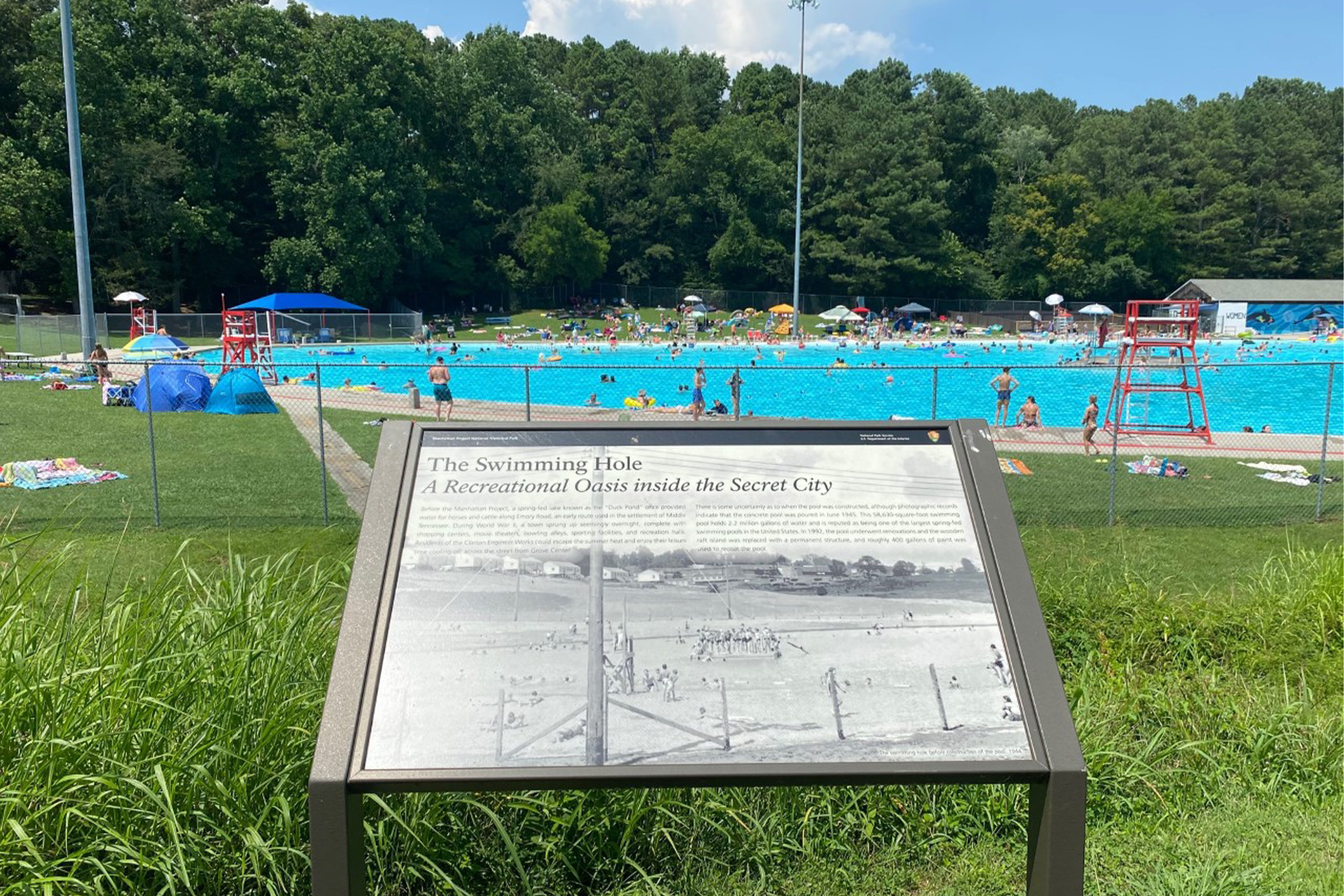
The Oak Ridge community swimming pool was built in 1945 for Manhattan Project workers and their families to enjoy on hot summer days. The pool was built in place of a spring-fed pond. The 58,630 square-foot (5446.9 sq meters) swimming pool holds approximately 2.2 million gallons (8,327,905.9 liters) of water, making it one of the largest spring-fed swimming pools in the United States. Residents of Oak Ridge enjoy the pool to this day.
The Oak Ridge Community Swimming pool is a large outdoor pool. As you face the pool from Robertsville Rd., a narrow parking lot appears in front of you. At left in the parking lot is a wayside. A chain link fence surrounds the majority of the pool's perimeter. A pool house with a painted mural on it is at the right of the pool. This pool house is the main entrance for visitors. Behind the pool is a forested ridgeline. In season, the pool is surrounded by umbrellas and chairs. Floating lane dividers are visible in the pool.
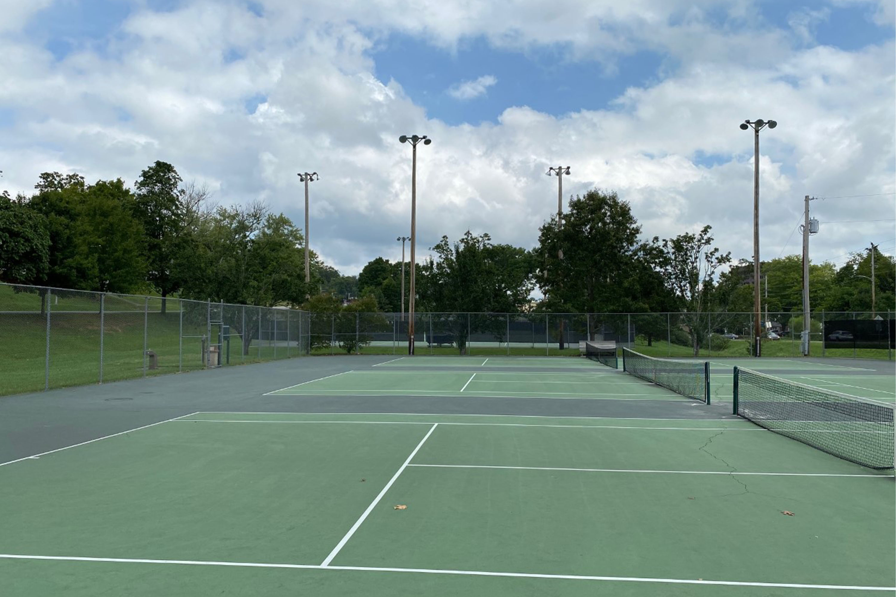
The Oak Ridge community tennis courts were the site of evening dances during the Manhattan Project. Today, the courts are used for public exercise and rangers often hold throwback dances on the courts.
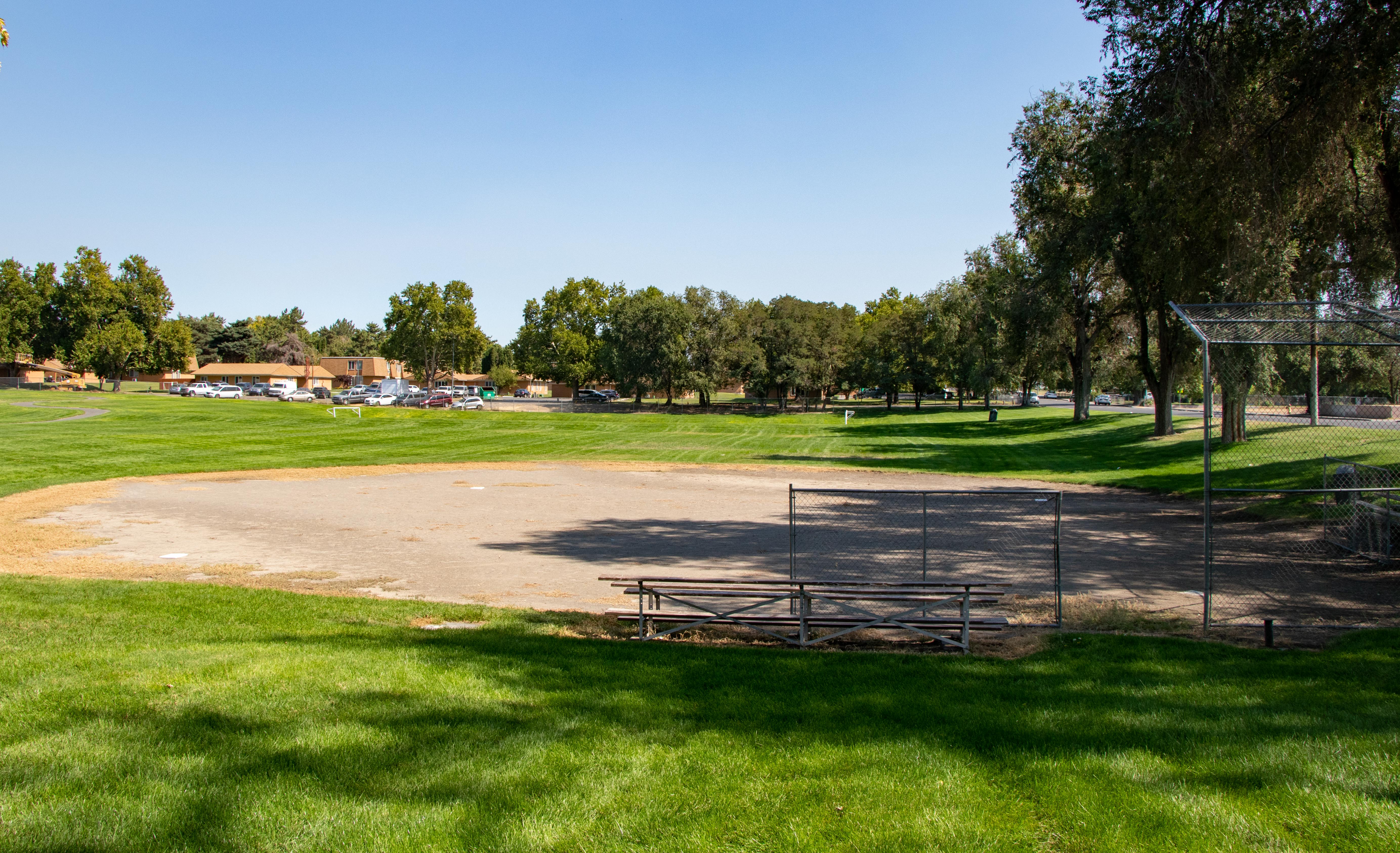
The Community Tennis courts consist of three sets of courts, each surrounded by tall chain link fencing. The surfaces of the courts are green with white lines painted on them. Multiple tall light fixtures illuminate the courts. At one end of the courts is a small parking lot with approximately a half-dozen parking spaces. Behind the courts, an elevated road runs parallel to the courts with a large apartment complex opposite the road.
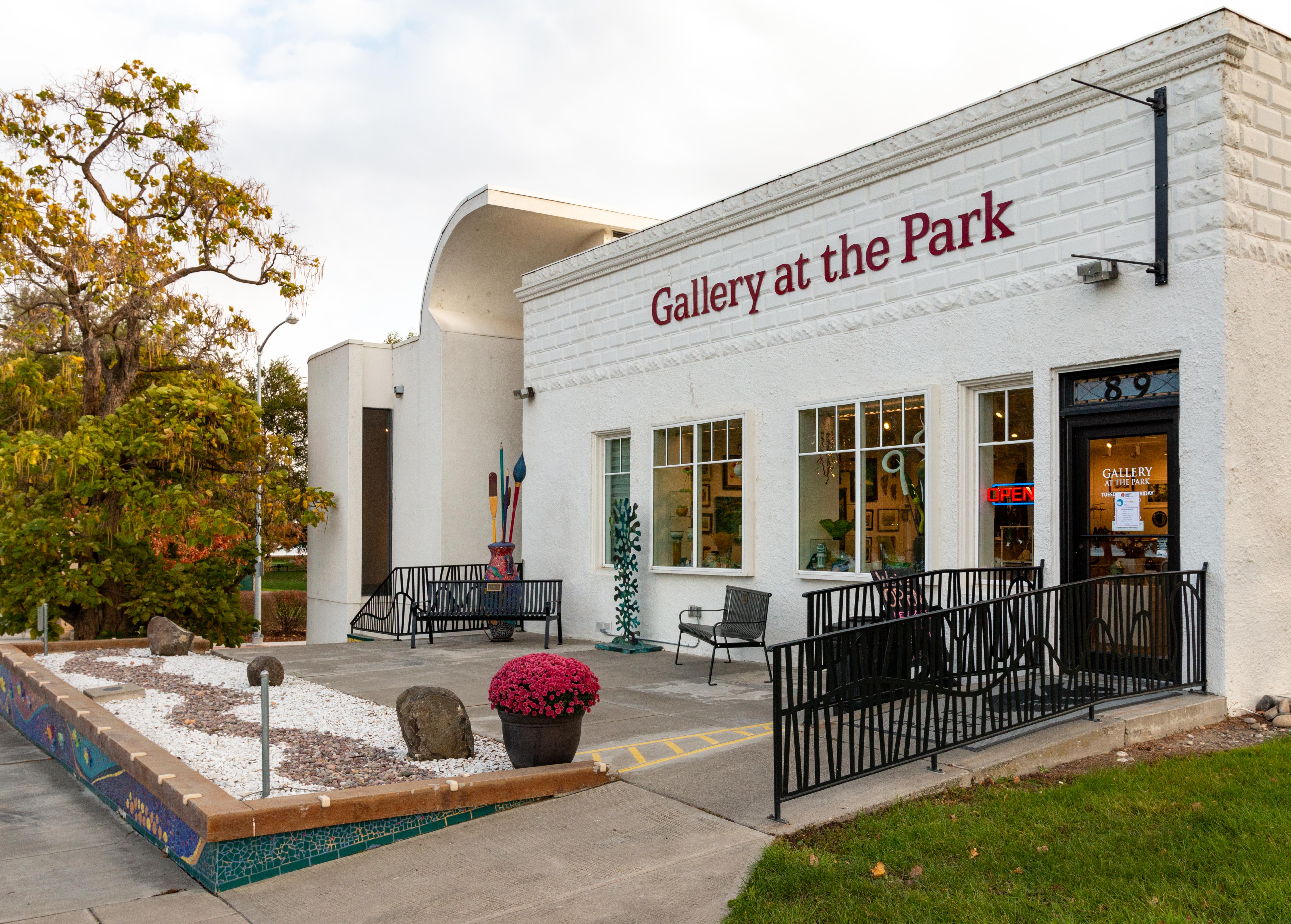
Constructed in 1909, the Dyer Building has witnessed more than a century of change. Its numerous occupants reflect the many phases of Richland as it went from a small farming community, to a “secret city,” to a Cold War technology center, to an incorporated city. The Dyer building has been a boarding house, hotel, single family home, newspaper office, and a library. In 1965 it became an art gallery—the Gallery at the Park.
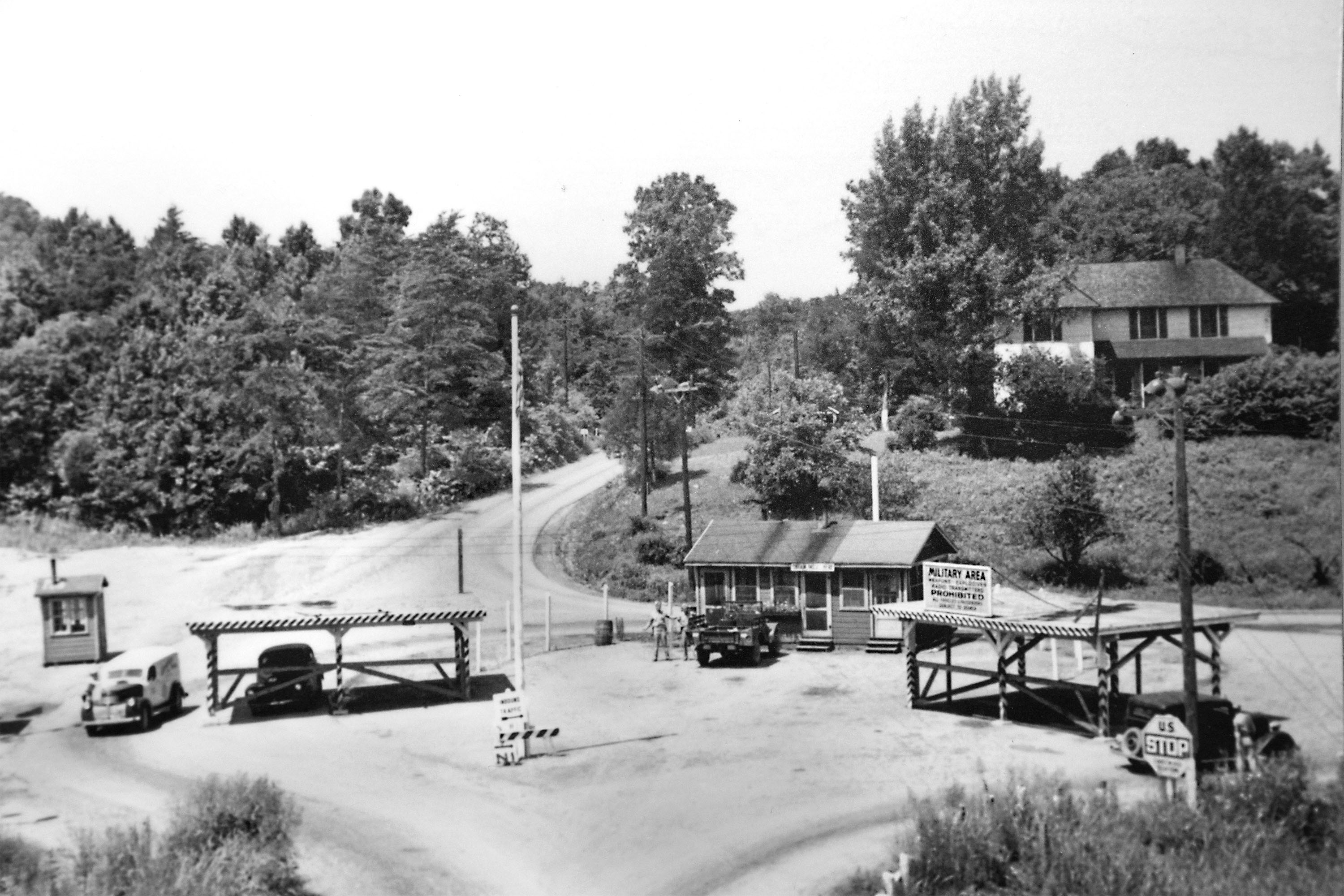
One of seven gates controlling access to Oak Ridge, the Edgemoor Gatehouse controlled traffic entering the reservation via Edgemoor Road connecting to Highway 25, providing access from Knoxville The gate has since been deactivated and torn down.
The Edgemoor Gatehouse no longer exists. Its original location is now along the Melton Lake Greenway at the edge of Haw Ridge Park. A relatively short walking trail surrounded by woods and grassland leads from a parking lot to a wayside exhibit near the Clinch River. The wayside exhibit has forest around it. Near the wayside exhibit is where the gatehouse once stood.
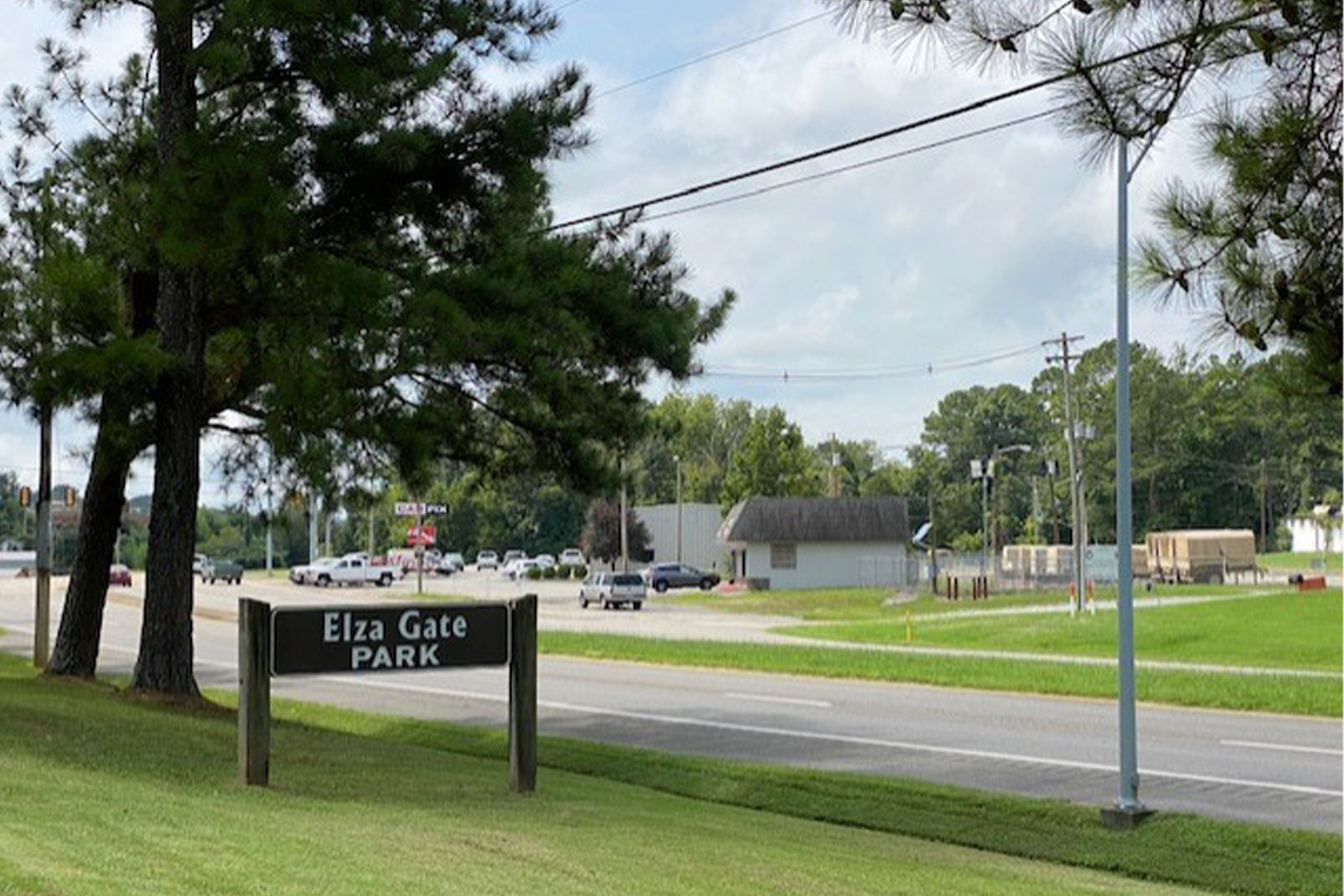
The Elza Gatehouse, named after a small, nearby community, was one of three checkpoints positioned within the secret city. Many considered Elza the main entrance to Oak Ridge. The Elza gatehouse has since been demolished. The Elza Gate Park exists at the original gate’s location. You can find walking trails and wayside exhibits related to the Elza gate’s role during the Manhattan Project.
Elza Gate Park is located directly off the Oak Ridge Turnpike in the Elza community. A small wooden sign with white letters stands next to the turnpike. The sign reads "Elza Gate Park." A circular driveway leads into the parking lot with a handful of parking spaces. A small, lightly wooded greenspace is located next to the parking lot. Denser woods with trails continue away from the parking lot opposite the turnpike.
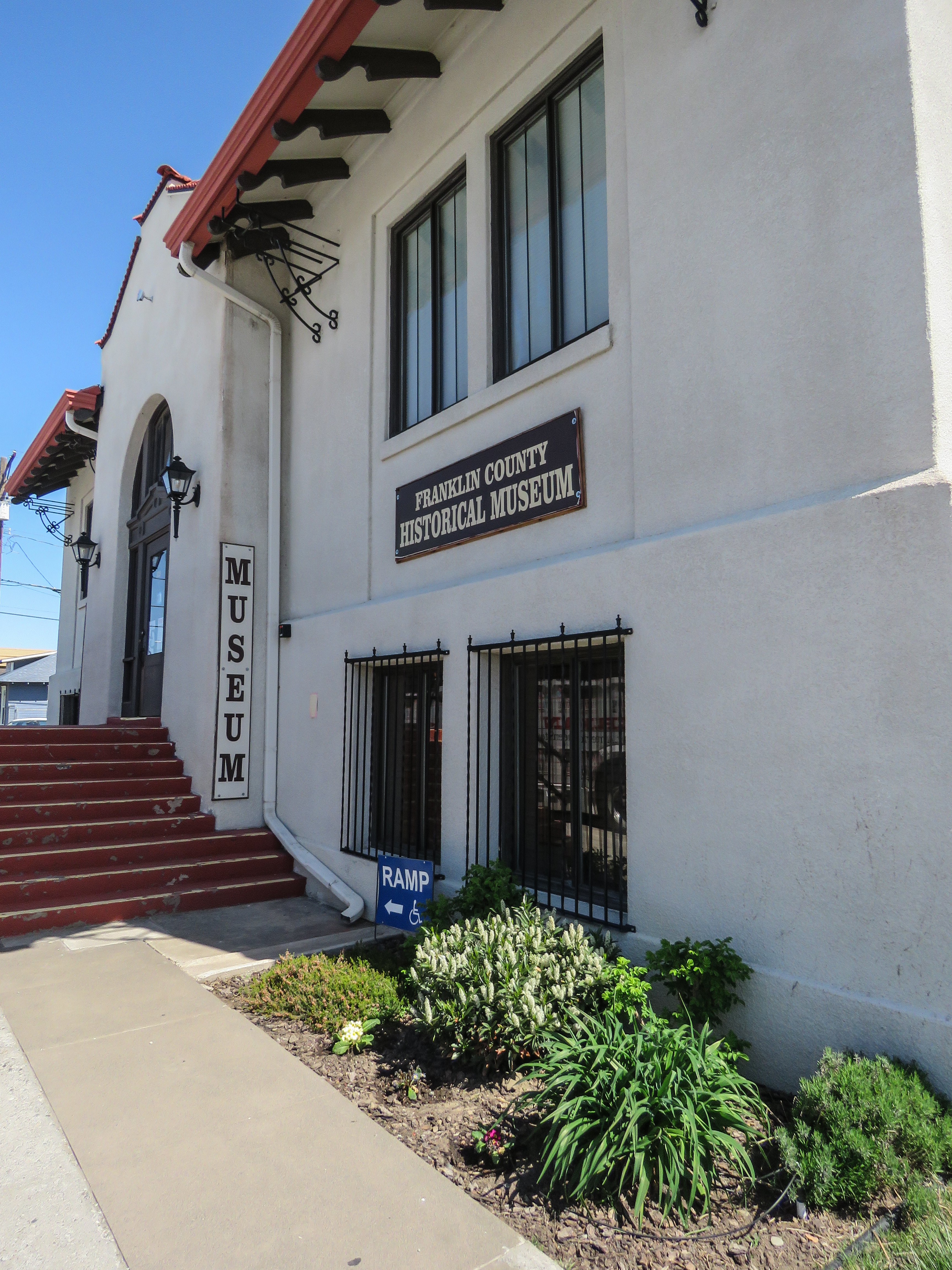
The Franklin County Historical Society has artifacts, educational programs, and displays that share story of the development of Franklin County. The museum building was originally constructed in 1910 as part of Andrew Carnegie’s worldwide library construction program.
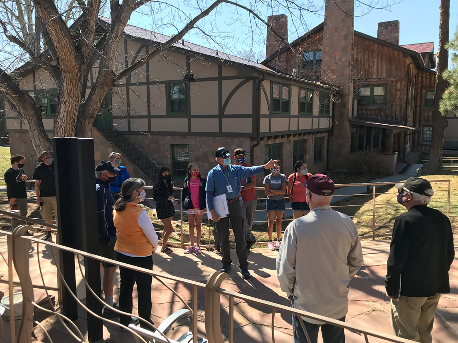
Fuller Lodge served as the dining hall for the Los Alamos Ranch School and as a community center for Manhattan Project workers. By far the largest of the remaining school buildings, Fuller Lodge over the years has played an important role in the Los Alamos community. Today, it is an art center.
The main part of this large, two-story building is made of vertical logs. Extensions on either end are pale stucco on the upper story and stone façade on the lower. Windows and doors are trimmed in green. From the looping drive, the entrance is located near the left end of the building and is reached either by a set of steps down or a ramp. To the right, a central wing extends out towards the parking lot. The rear of the building has a paved patio along the central, log section with several picnic tables. Beyond, a broad grassy lawn stretches out. End of Description.
Why was a rural area of East Tennessee chosen for one of the largest wartime undertakings in history? The geography of Oak Ridge proved vital to the Manhattan Project’s success. Learn why General Leslie Groves selected Oak Ridge to host the massive uranium-enrichment effort.
Richland’s population boom didn’t end with the Manhattan Project. Hanford’s plutonium production facilities continued operating throughout the Cold War. More housing was built to accommodate the constant influx of workers. Built in 1949, this neighborhood near the Columbia River became known as the “gold coast.” The homes in this area were larger, more expensive, and tended to house professionals.
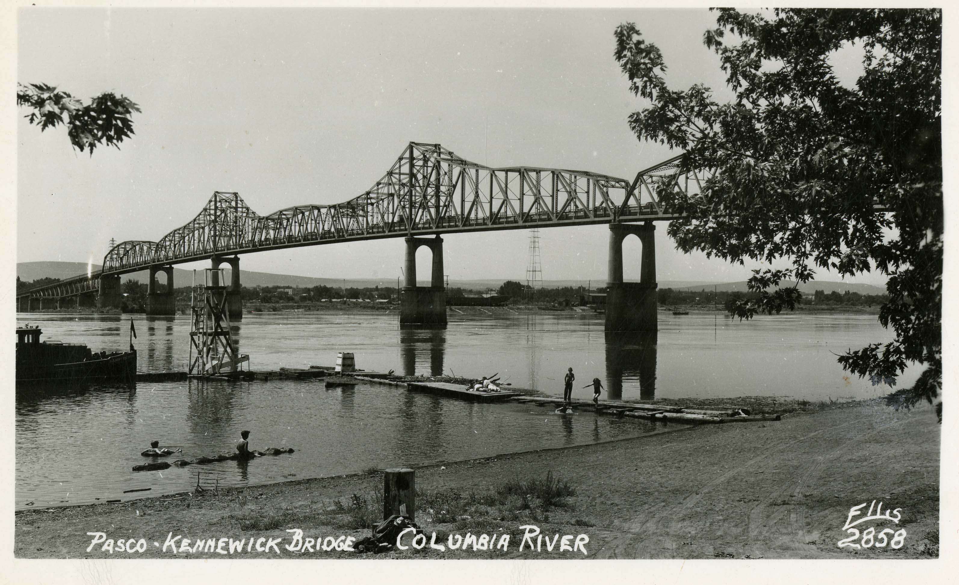
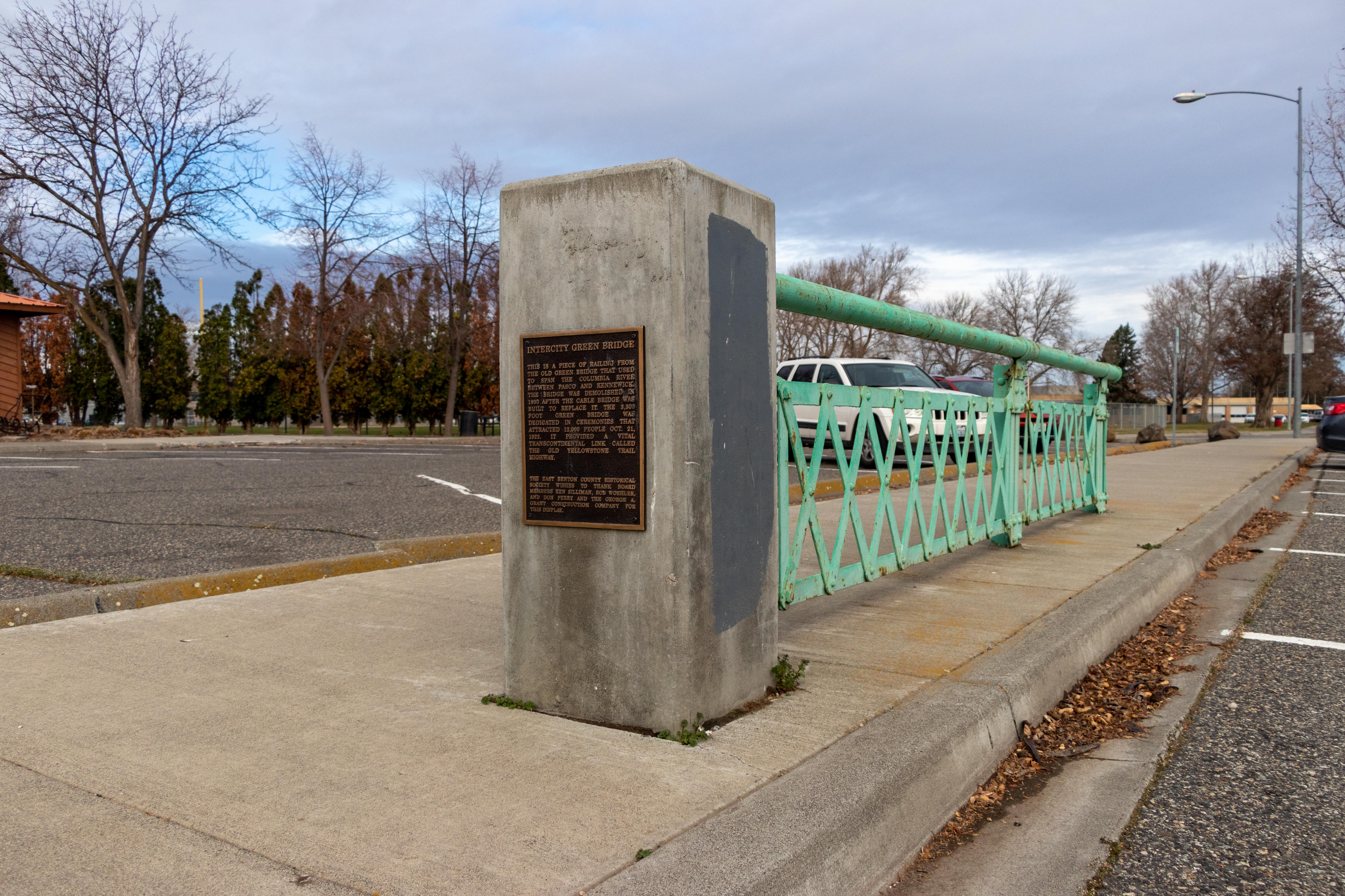
Built in 1922, the Pasco-Kennewick Bridge was constructed to accommodate larger amounts of vehicle travelers compared to the previous ferry system. Linking the cities of Kennewick and Pasco, the bridge was painted green and quickly earned the nickname “the Green Bridge.” This bridge had a direct impact on the social and economic development of the region. A plaque and some remnants of railing is all that remains of this steel cantilever truss bridge.
Built in 1922, the Pasco-Kennewick Bridge (the “Green Bridge”) in southeastern Washington began as a symbol of unity and progress. No one could have known then that the bridge, painted in green, would eventually gain a new and menacing significance, one of exclusion. The Green Bridge would become a dividing line between Kennewick, a community that sought to exclude Blacks, and Pasco, a community that sought to confine Blacks.
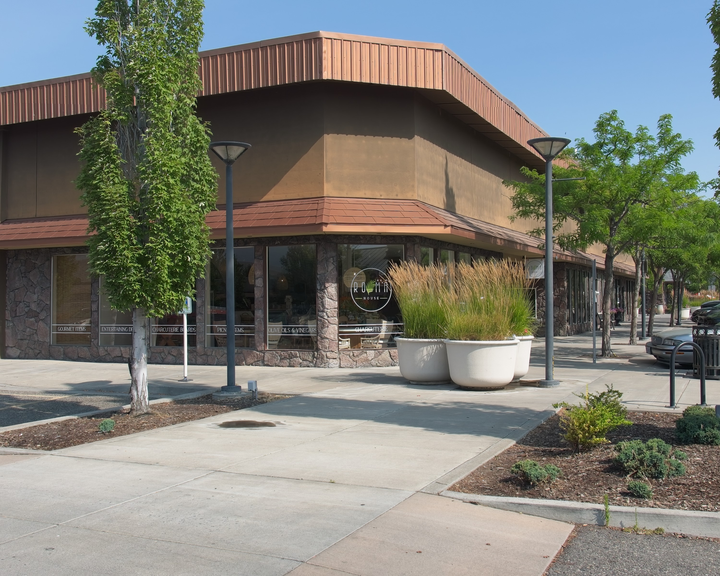
George Gress built a humble brick building in early Richland for his butcher shop. He operated Gress’s Meat Market from 1915 until 1943 when the Manhattan Project displaced most of Richland's existing businesses and residents. Since closure of the meat market, this building has served as a newspaper office, tavern, library, chocolate store, restaurant, and sweet shop.
Oak Ridge became a boomtown due to the Manhattan Project. By 1945, the secret city’s population quickly soared beyond anybody’s expectations to 75,000. Grove Center and other commercial buildings were quickly built to meet the growing demand for goods and services. Today, you can find many of the same amenities at Grove Center that the locals enjoyed long ago.
Grove Center is an L-shaped strip mall that sits across the road from the community swimming pool. The facade of Grove Center is mostly brick. Along the roof line, several signs mark individual businesses in the center. As you enter the center from the road, a small convenience store is visible immediately on the right. The open space in the interior portion of the L is full of parking spaces.
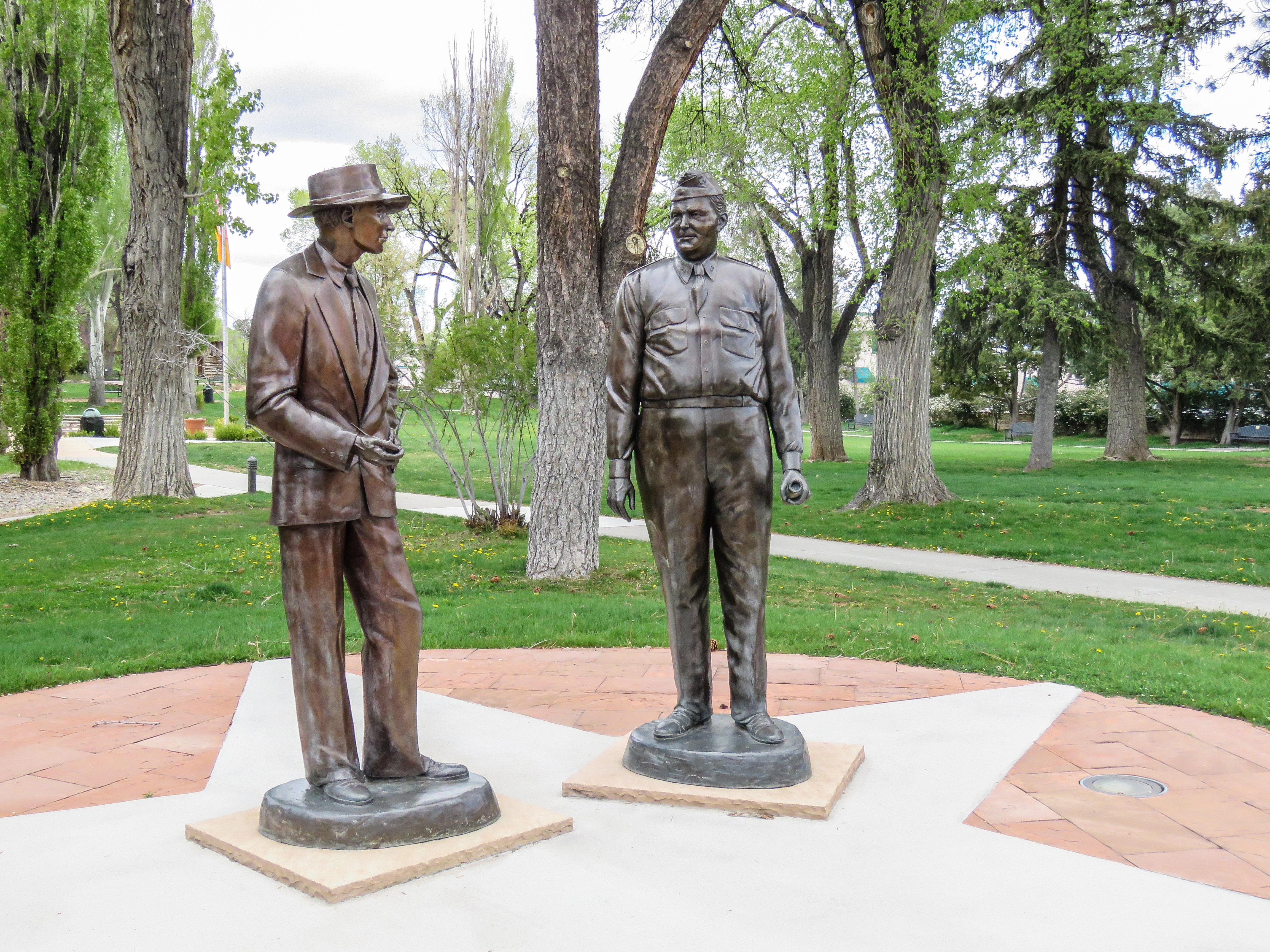
The leaders of Project Y in Los Alamos have statues memorializing them in downtown Los Alamos. One statue is of J. Robert Oppenheimer who oversaw the Los Alamos Laboratory and gathered top scientists and engineers to design and fabricate the world’s first atomic weapons. The other statue is of Gen. Leslie Groves who led the Project Y from a military standpoint, securing funding and supporting project plans and ideas.
These two life-size statues stand side-by-side on top of a flagstone-paved circle with a concrete star in the middle. Short walkways on either side lead to the circle from the street. On the ground between the circle and the street is a bronze plaque on a small stone base. The statue on the right is of a slightly portly man dressed in military shirt and pants with a soft, folding cap on his head. He holds a rolled-up piece of paper in his left hand. The man to the left is dressed in a civilian suit and wears a brimmed hat. The two men are looking at each other and smiling. Text on the plaque in front reads, "Manhattan Project Era. Two gifted World War II leaders whose unique partnership won the wartime race to build an atomic bomb. Dr. J. Robert Oppenheimer, Laboratory Director, Los Alamos Laboratory, 1942-1945.General Leslie R. Groves, Commanding General, Manhattan Engineer District, 1942-1946. In 1943, in the former Los Alamos Ranch School buildings at this location, a joint military and civilian laboratory was established. A mere 28 months later, the men and women of Los Alamos had conceived, designed, developed, built, tested, and fielded the world's first atomic bombs. Suzanne Vertel, Sculptor. Part of the Los Alamos County Art in Public Places Collection. Dedicated by the Los Alamos County Council on May 19, 2011." End of Description.
As theories and designs for the gun-type weapon developed, scientists needed a firing range to run tests in the field. A nearby ranch, known as Anchor Ranch, served this purpose after the War Department purchased the land. The firing range gave researchers a chance to study projectile movement, the effects of impact, interior ballistics, and more. This site is on Los Alamos National Laboratory property and cannot be accessed by members of the public.
This site features bunker-style structures with exposed fronts made of weathered concrete. The sides and backs of the structures are covered with soil. As you face the structures, the long front wall on the left has two entrances, one for TA-8-3 at the far left and one for TA-8-1 near the middle. To the right is a third structure, TA-8-2. Between the two structures is a narrow gravel road leading up a wooded slope behind the buildings. The section at the far left has a set of wooden steps leading up to a wood porch that stretches a third of the way along the section. At the right side of the porch is a set of wooden double doors. At the left side is a single-door-sized opening covered with a sheet of plywood. The wall around the doors is painted a cream color. There are four metal grills surrounding the double doors, two on either side at floor-level and the other two directly above those, just above the height of the doors. Higher up on the wall above the doors are two rusty cylinders. Pipes come out of the wall below each, enter the base of cylinder and exit out its top. The entrance in the middle of the building has a raised concrete porch in front of it with wooden steps on the left. The rectangular opening in the concrete is filled with a wooden wall section painted turquoise. On the left side of the wall is a wooden door with four panes of glass on its top half. The door is painted dark green. Signs posted near each of the entrances identify each building as a Manhattan Project National Historical Park Historic building. On the right third of the building is another door-sized opening, this one covered by a sheet of plywood. To the right of that door, there is a long, horizontal window, about six feet long and two feet tall. A long, two-foot-high concrete curb sits on the gravel in front of the door and window. The next building on the right side of the gravel road extends back into the hill. The narrow end towards us is rounded. On the far side, away from the road, is another concrete porch with two sets of green metal doors. End of Description.
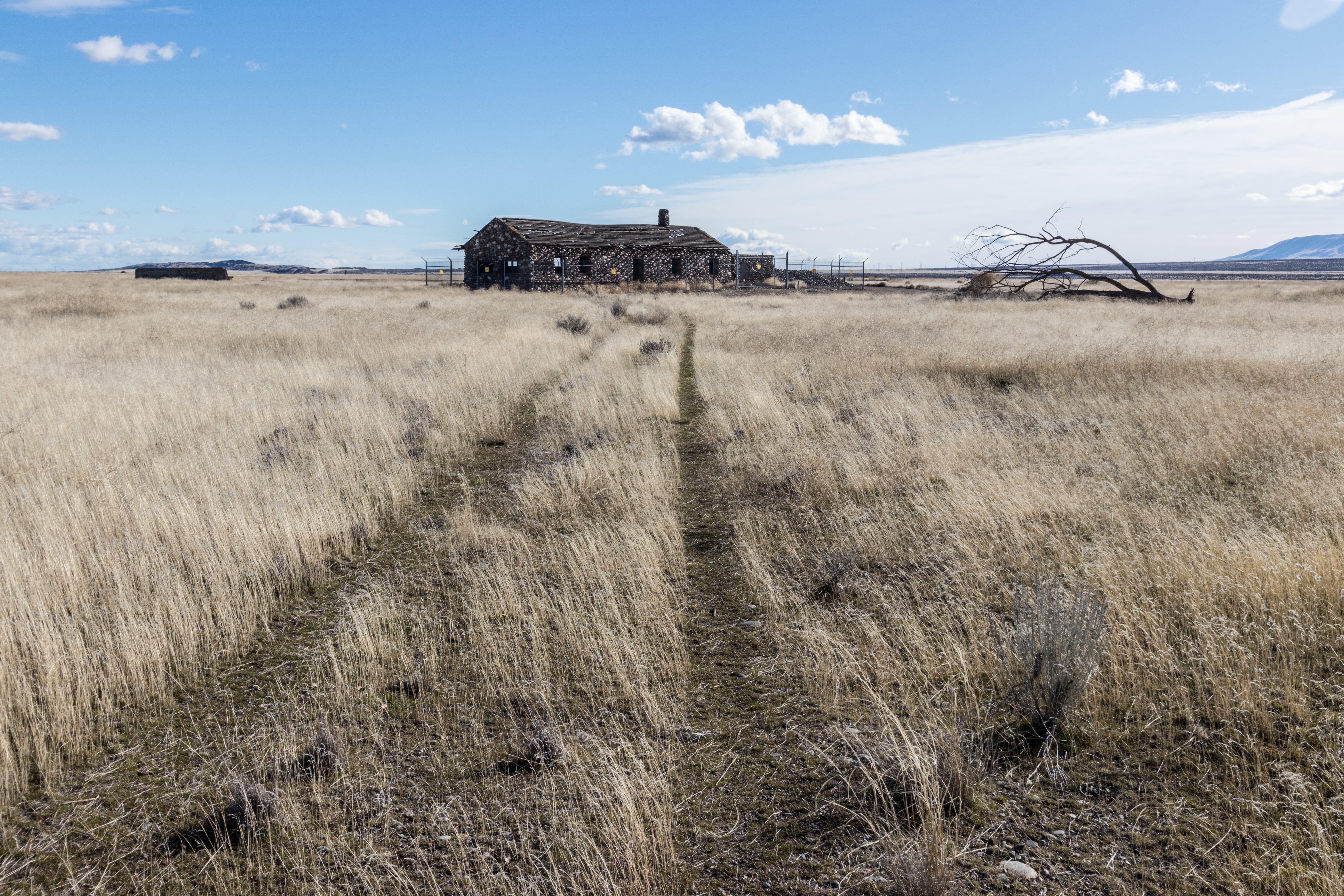
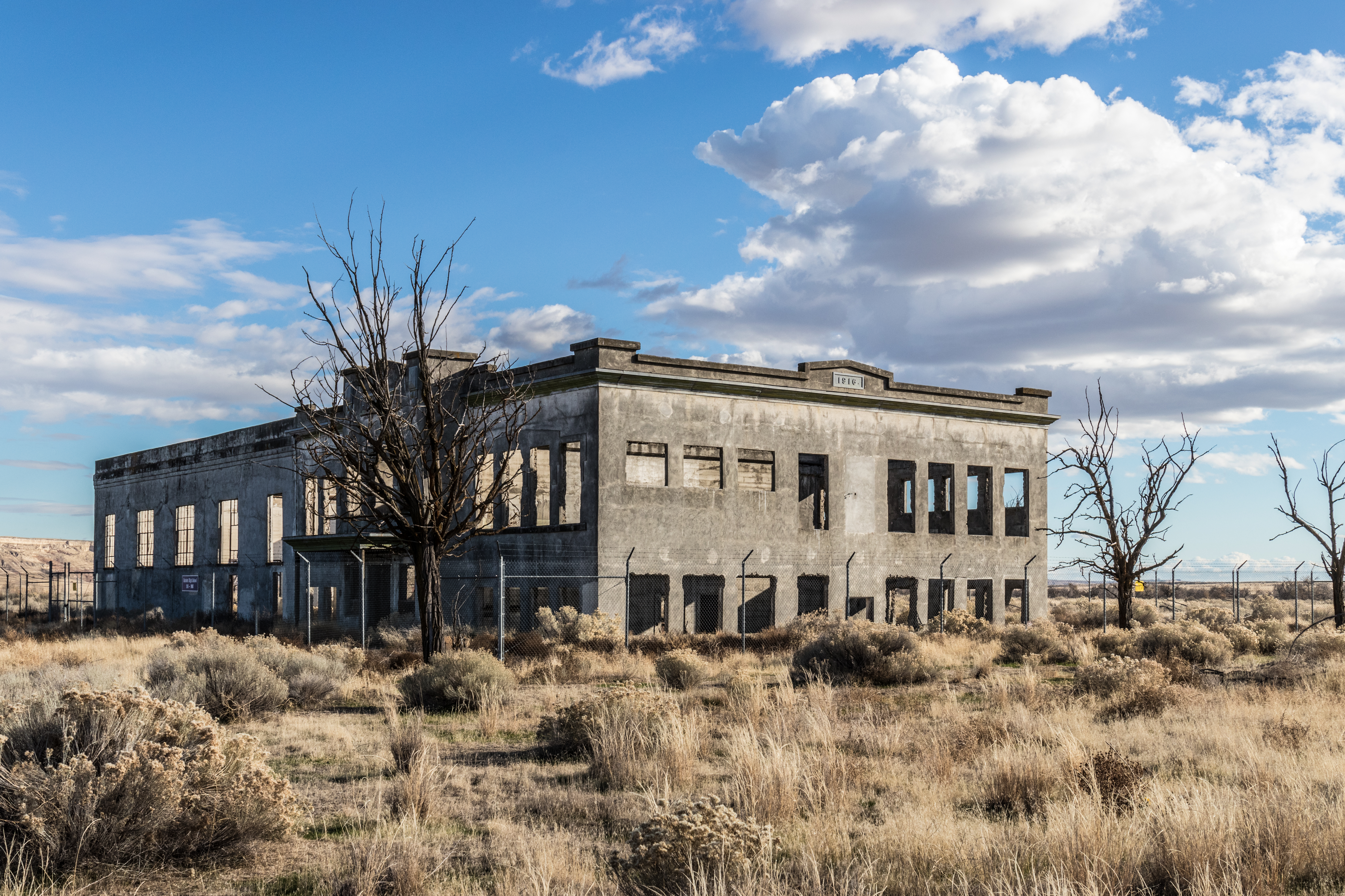
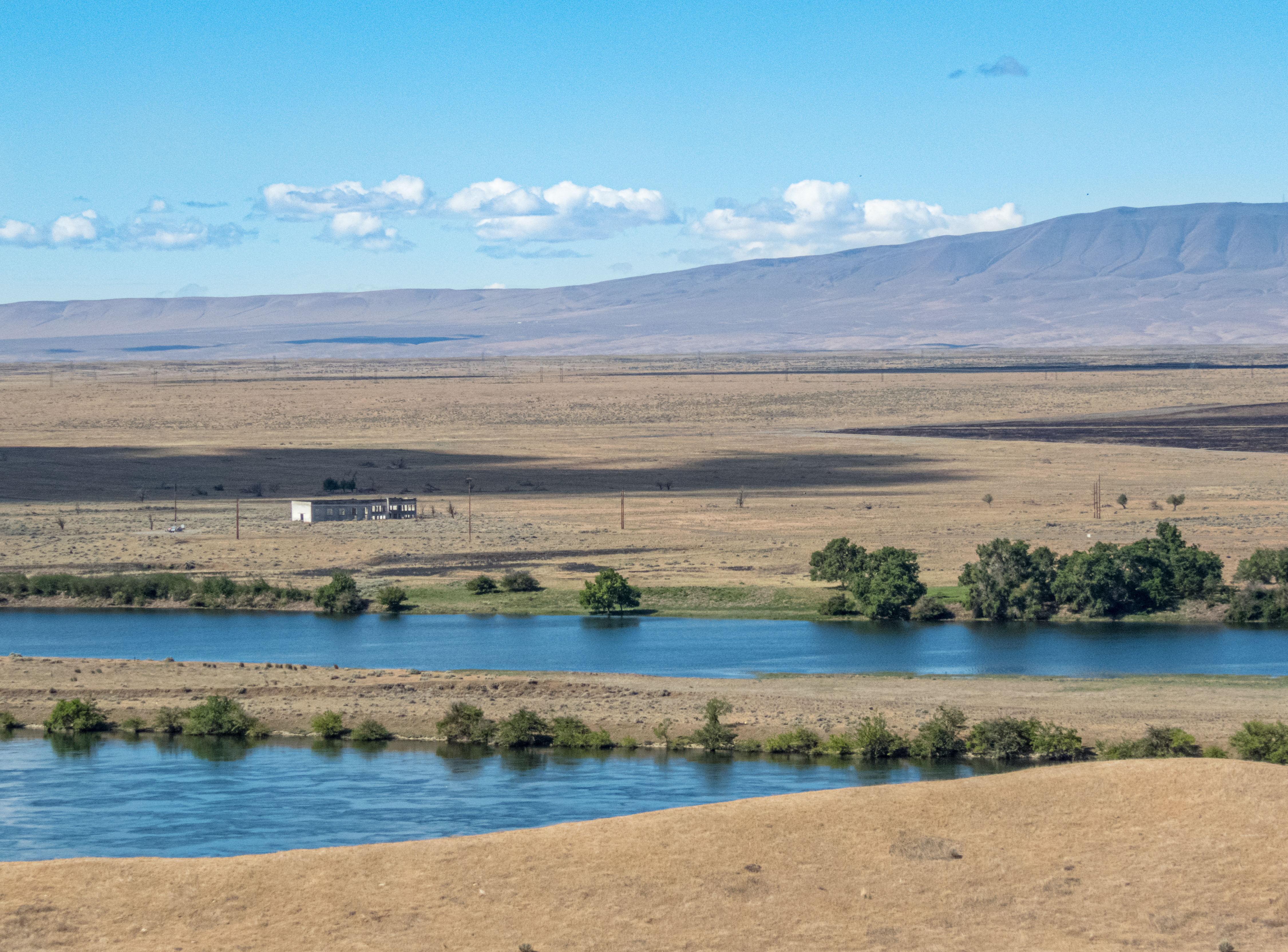
The remnant of Hanford High School, constructed in 1916, is one of the few surviving structures from the town of Hanford. Residents of Hanford were forced to leave when the Manhattan Project took over the area. Project offices soon filled the school, and the surrounding area became a camp that housed thousands of construction workers. People can only visit Hanford High School on tours offered by the US Department of Energy.
The remains of the Hanford High School form a two-story concrete shell. The front right corner of the building faces the intersection of the two roads here. Looking at the front façade of the building makes it clear that the left part of the building was a later addition. The right half features closely spaced window openings and a horizontal ridge near the roofline. The main entrance sits in the middle of this half of the building with a roof covering the wide door opening in the first floor with wide windows above it and an ornamental peaked façade on top with raised letters that read “High School.” The left half of the building has a plain roofline and larger, more widely spaced, window openings. You can look through any of the window openings to see grasses and brush growing inside to match the fields surrounding the structure. Only the walls are standing so the sky is visible through the window openings as well. The entire structure is surround by a tall, chain link fence with barbed wire on top. A sign on the fence in front of the main entrance reads “Hanford High School, 1916-1943.” The land surrounding the school building is flat, fallow fields with sage brush, tumbleweed and grasses. To the left of the building is a low ridge which hides a view of the river. On the far side of the building, stretching close to a mile parallel to the river at left is the site of the Construction Camp. No structures remain, although the old roads made of rounded pebbles in an asphalt base are still there, along with a few scattered trees.
Hike the White Bluffs - South Slope Trail in the Hanford Reach National Monument to reach the Hanford High School Overlook. This vantage point is one of the best views of the old Hanford town site and the location of the Hanford construction camp built for the Manhattan Project. This trail rewards hikers with views of the Hanford Site and opportunities to explore the White Bluffs geologic formation up-close. This is also an excellent trail for birders and wildlife watchers.
Physicist and Nobel laureate Hans Bethe headed the Manhattan Project’s Theoretical Division, a small but prestigious group that studied critical mass and nuclear efficiency. While in Los Alamos, Bethe lived in a house that was first built for the Los Alamos Ranch School for boys. The house is now part of the Los Alamos History Museum, and contains the Harold Agnew Cold War Gallery, which explores the Cold War history of Los Alamos through artifacts and exhibits.
From the street, a long sidewalk leads across a grassy lawn scattered with tall trees to the one-story house. The house has a central square section with a peaked roof that extends in front to form a covered entrance. The central section has stone walls. Short wings extending to either side at the back of the central section are tan stucco. All the trim is dark brown. The roof is brown metal. In the area to the right of the central section is a small garden. On the other side of the central section is a paved area with a short driveway. There are three graphic panels located around the house. A slanted panel, titled "Bathtub Row," is to the right of the sidewalk near the street; a vertical panel, titled "Los Alamos History Museum," is located in the garden area; and the third, another slanted panel, titled "A Sense of Place," is at the left end of the house by the driveway. End of Description.
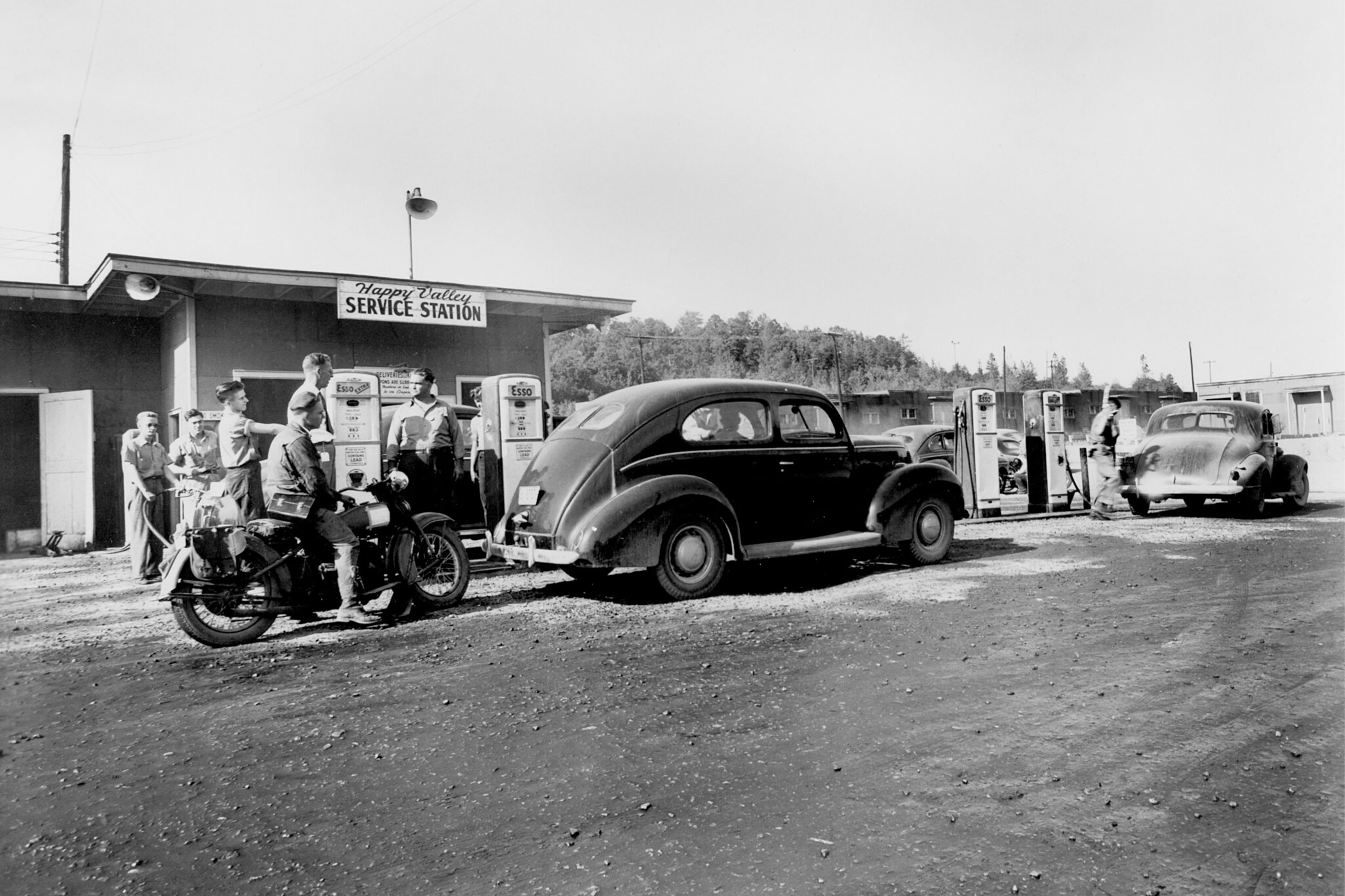
Happy Valley was a community designed for the construction workers who helped build the uranium enrichment plant, K-25. The site no longer exists and has been dense woods for several decades.
The Happy Valley Community no longer exists. It stood near what is now dense forest along SR-58 in Roane County, Tennessee. Its approximate location is within dense woods on the southern side of SR-58 across from the former K-25 Plant site.
This memorial commemorates the building where the world's first atomic device was assembled. When the Manhattan Project acquired the Los Alamos Ranch School, engineers took advantage of the existing buildings, including a small icehouse on the bank of Ashley Pond. Scientists assembled the nuclear components for a test device, known as “the Gadget”, in the Ice House. The Gadget was detonated on July 16, 1945, at the Trinity test site on the Alamogordo Bombing Range.
This stone memorial sits under a 10-foot by 20-foot, covered pavilion on the sidewalk leading from the street to Ashley Pond. There are three broad steps leading down to the memorial from the street. On the far side of the memorial several more steps lead to the sidewalk down to the pond. A sidewalk circles the entire covered area. Each end of the rectangular pavilion is enclosed by a 3-foot high stone corner with flat sections for sitting. At each corner, the stone is topped by a large wood post which supports the roof. Heavy timber logs form the roof structure sheathed with wood planking, which is then covered by wood shingles. In the middle of the covered space is a stone wall, six feet wide and four feet high. The wall is wide at the bottom and narrow at the top. Each slanted side has three metal plaques which talk about the history of the Manhattan Project and Project Y. The side facing the pond has two panels with photographs and one that describes today's laboratory. On the side facing the street has panels that describe the laboratory's historical roles and a plaque designating the laboratory as a National historic Landmark. End of Description.
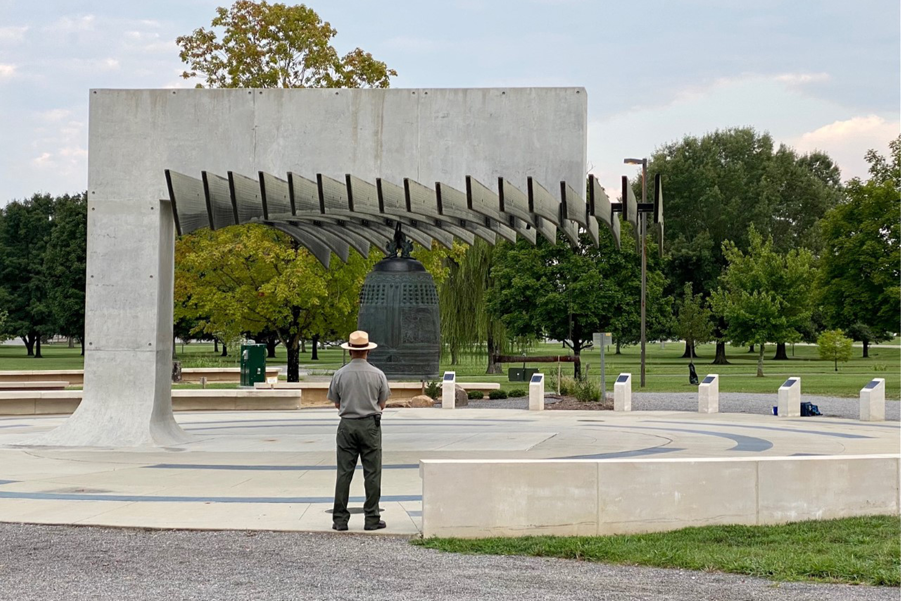
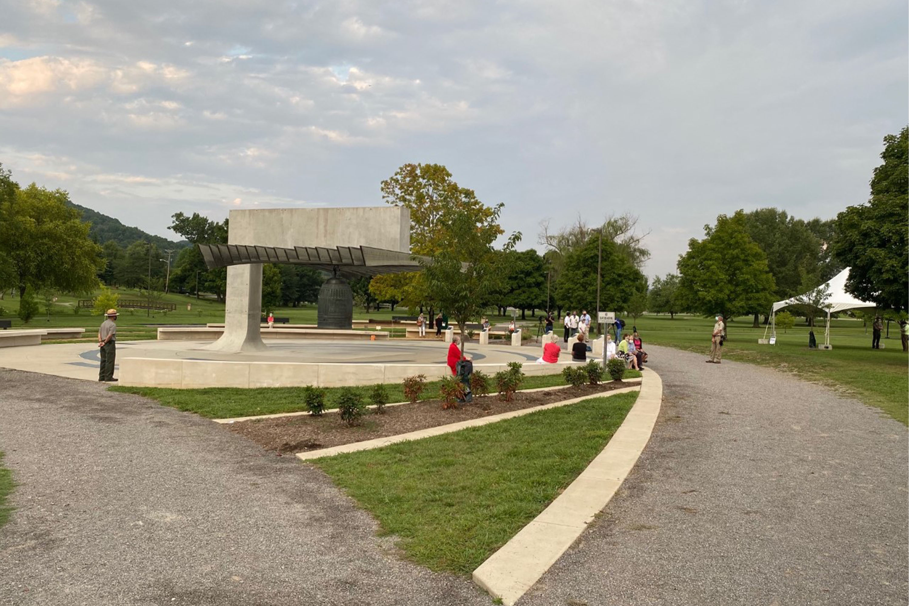
Cast in Kyoto, Japan in 1993, the International Friendship Bell is a symbol of peace and unity between the United States and Japan. This 8,000-pound bell (3.6 metric tons) is located in A.K. Bissell Park. The public can view and ring the International Friendship Bell.
The bell sits in the middle of a paved circular plaza about 80 feet across. Near the center a rectangular concrete pillar stands with a wide rectangular arm extending out over the middle of the circle. The bell hangs underneath with a covering made of horizontal boards mounted edgewise leaving 12-inch gaps. The large bronze bell is about six feet high and hangs with its bottom three feet above the ground. It is cylindrical with a rounded top and no flair at the bottom as most American bells have. Raised lettering on one side reads “Hiroshima, August 6, 1945. Nagasaki, August 9, 1945.” On another side it reads “Pearl Harbor, December 7, 1941. VJ Day, September 2, 1945.” Vertical lettering between those two panels reads “Peace.” On the other two sides of the bell are relief carvings of birds, flowers, and mountains. Each scene is topped by a rainbow that ends in the symbol for an atom, the central nucleus surrounded by long oval orbits. Lettering between those two panels reads “International Friendship.” Feel free to touch. On the side away from the support pillar is the striker, a long wooden pole that hangs five feet above the ground. At the end away from the bell a rope hangs down allowing you to swing it and ring the bell. Around the edge of the plaza are long curved sections of concrete bench. Between two of the bench sections are six short vertical markers with names of donors. Nearby is a Zen-style garden with raked gravel and several small boulders. Outside the circle are shorter sections of benches, some with backs. A grassy park surrounds the plaza with a couple of small streams running through., one of which is crossed by a shallow arched footbridge.
At the Los Alamos Visitor Center you can speak with park rangers, tour exhibits about the Manhattan Project in Los Alamos, and learn more about where to go in town.
The Oak Ridge Visitor Center is located within the Children's Museum of Oak Ridge. Here you are able to speak with National Park Service rangers, watch a short film on the Manhattan Project, and get literature on Manhattan Project-related historic sites throughout Oak Ridge. Visitor Center services are limited on Sundays, but brochures, maps, and site films are available.
Visit Tri-Cities is the tourism information center for the local area. This is a great place to stop by for helpful trip-planning advice for visiting the park and numerous other attractions in the Tri-Cities. The helpful staff can provide you with itineraries for visits to the Tri-Cities region and suggest entertainment, lodging, and dining options. You may also purchase souvenir items and stamp your national parks passport here. Visit Tri-Cities may be reached at 509-735-8486.
Take a tour behind the fence of the Los Alamos National Laboratory.
Oak Ridge: Join a Ranger Program
Oak Ridge ranger programs are a great way to explore the remarkable history of the Manhattan Project. Follow the link for more information on types of programs and availability.
Oak Ridge: Experience a Guided Tour Behind the Fence
Guided bus tours of Manhattan Project sites in Oak Ridge provide visitors an intimate behind-the-scenes glimpse of some of the most revolutionary science of the 20th century. Follow the link to learn how to register for a guided tour.
Hanford: Visit the Museum at Keewaydin
Located in Kennewick's oldest park, the Museum at Keewaydin shares the history of east Benton County and communities that were close to the Manhattan Project. The museum's collections include cultural ephemera, fossils, a butterfly and insect collection, a petrified wood floor and artifacts from European settlers and World War II.
Hanford: Visit LIGO
The Laser Interferometer Gravitational-wave Observatory (LIGO) is a modern example of cutting-edge research that has ties to the Hanford Site. Built on the site in Washington in the 1990s, LIGO uses laser interferometers to detect gravitational waves, which helps in studies of major stellar events like the collision of black holes. LIGO Exploration Center is home to interactive exhibits focused on gravitational waves and related sciences, and the history of astronomy.
Oak Ridge: Visit the Oak Ridge History Museum
The Oak Ridge History Museum, opened in 2019, houses a wealth of exhibits dedicated to the human history of Oak Ridge during the Manhattan Project. Exhibits include a detailed timeline of Oak Ridge’s history, and the largest collection of original photographs from Ed Westcott, the official Army Corps of Engineers photographer during the Manhattan Project.
Hanford: Visit Nez Perce National Historical Park
Since time immemorial, the Nimiipuu (Nez Perce) people have relied on the valleys, prairies, mountains, and plateaus of the Inland Northwest for their way of life. This area includes southeastern Washington where the Hanford Site is today. You can learn about their story through the Nez Perce National Historical Park. The park consists of 38 places spread across Idaho, Montana, Oregon and Washington that are important to the history and culture of the Nimiipuu.
Hanford: Join a Ranger Program
Ranger programs and Junior Ranger events are a great way for families and kids to learn about the Manhattan Project in the Tri-Cities while enjoying hands-on activities.
Hanford: Attend a B Reactor Tour
The US Department of Energy provides guided tours of the B Reactor. These tours provide a glimpse into the science and technology that made plutonium production possible on an industrial scale and helped launch the nuclear age.
Alamogordo: Visit the Trinity Site
Two times a year, visitors are allowed to see the place where history was made at the Trinity Site. Run by the US Army, the Trinity site was the test area for the Gadget, site of the first human-caused nuclear explosion. The Gadget was placed atop a 100-foot (30.48 m) tall steel tower that was designated Ground Zero. View an obelisk at Ground Zero and the McDonald ranch house, where the Gadget’s plutonium core was assembled.
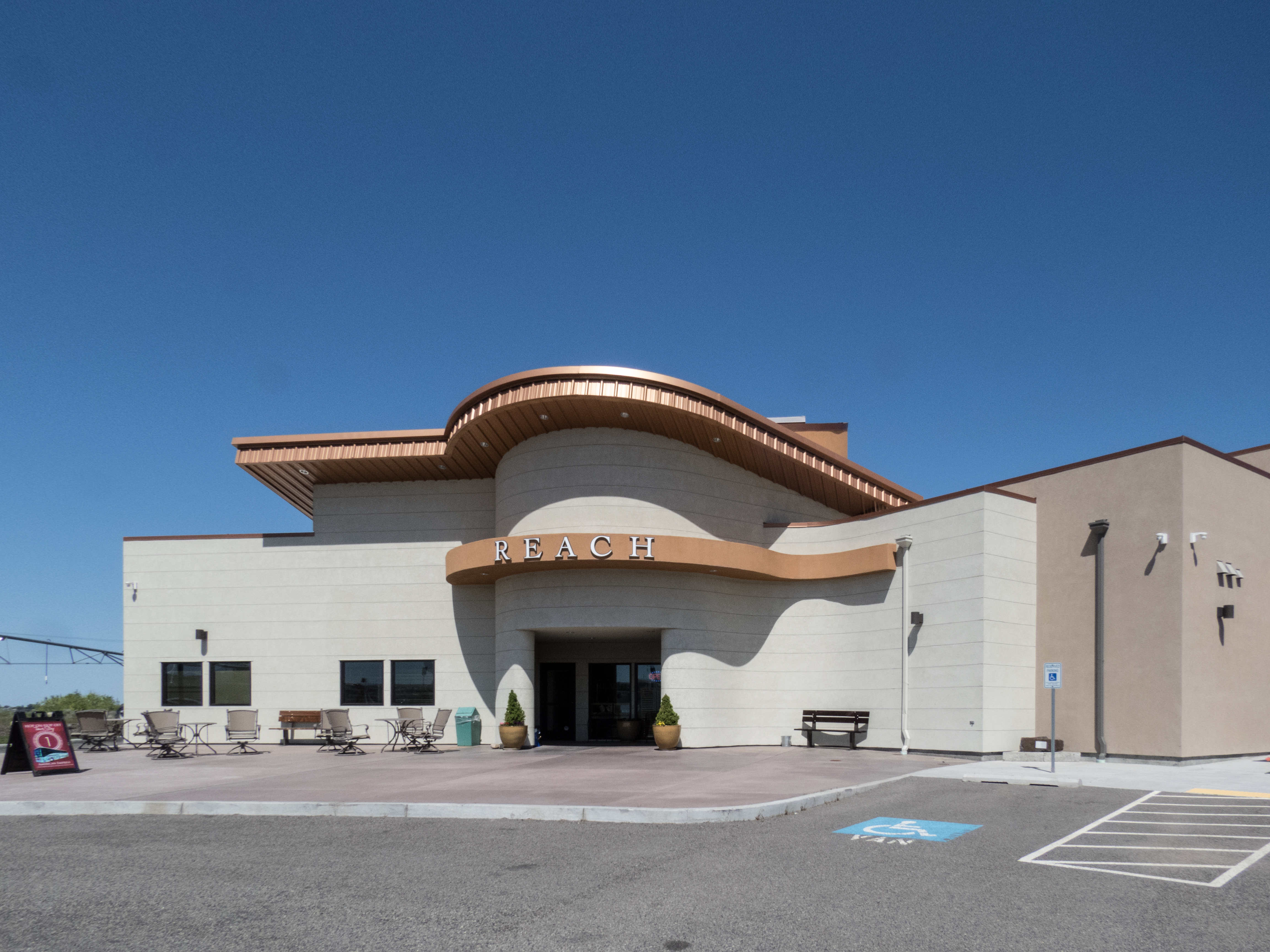
Hanford: Visit the REACH Museum
At The REACH Museum, you can learn about the natural and human history of the Tri-Cities. The museum houses rotating and permanent exhibits, including a robust exhibit on the Manhattan Project and Cold War.
Hanford: Watch Hanford Made
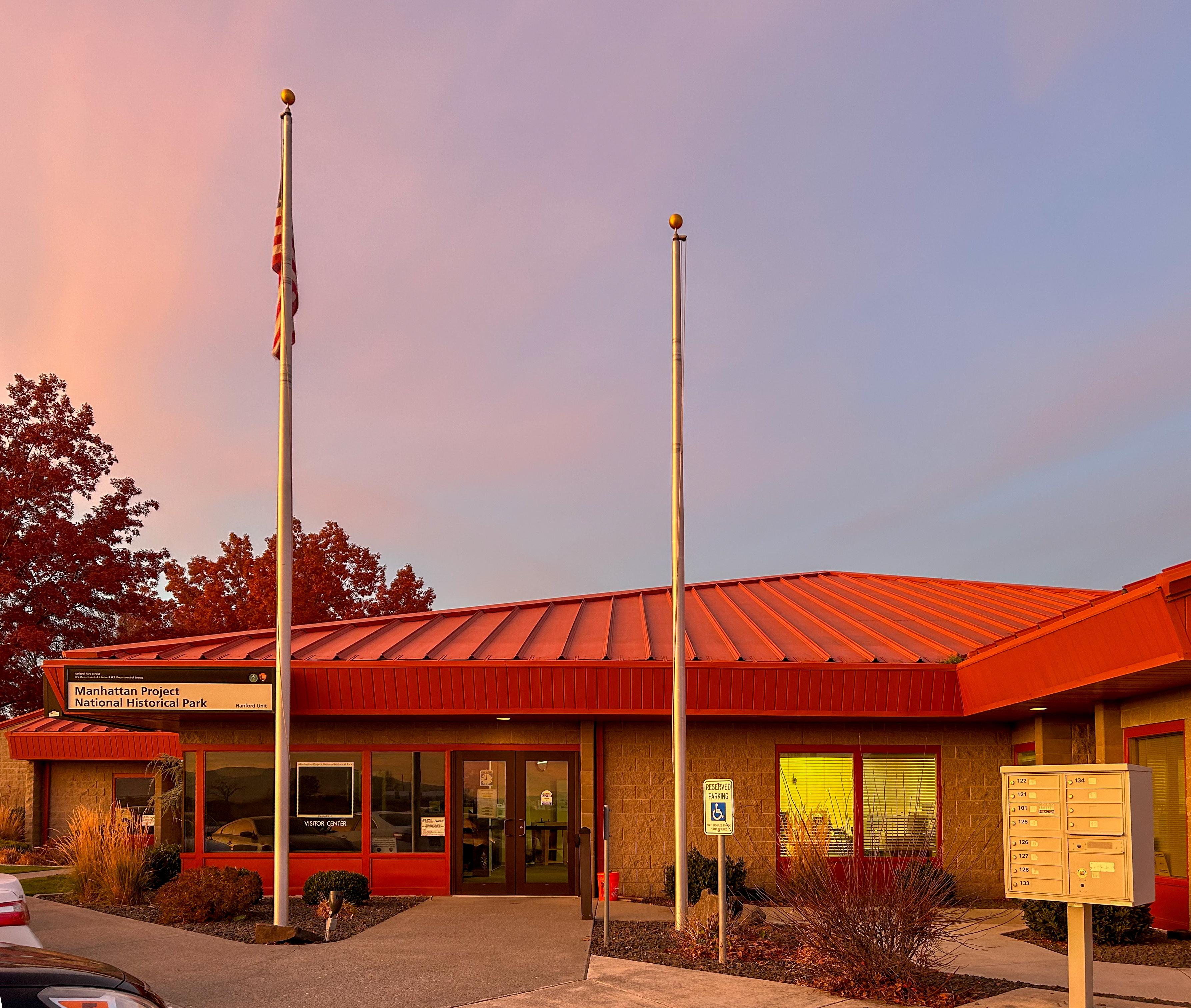
Watch the Hanford Site film at the Manhattan Project NHP Visitor Center for a general introduction to the Manhattan Project and Hanford’s role as the plutonium production site for the project.
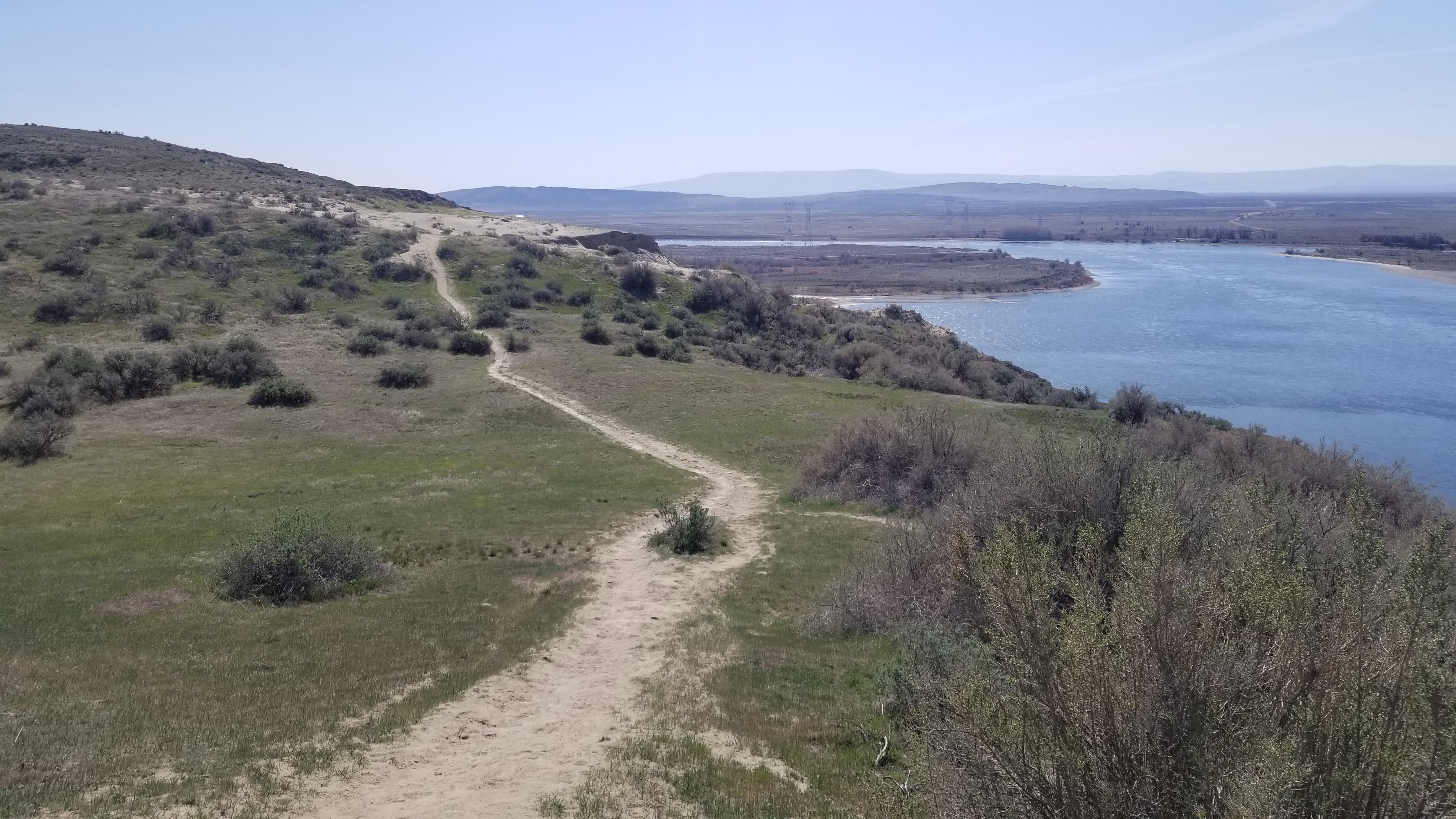
Hanford: Hike the White Bluffs North Trail
On this trail you may explore rolling sand dunes, take in vast vistas dotted with relics of plutonium production during the Manhattan Project and Cold War, and observe a variety of wildlife.
Oak Ridge: Enjoy the Community Swimming Pool
The Oak Ridge Community Swimming Pool, constructed during the Manhattan Project, remains a popular feature of the community to this day. Follow the link to learn more about operating hours, seasons, and fees.
Hanford: Hike Candy Mountain
The trail up Candy Mountain is a moderate 3.6 mile (5.8 km) roundtrip hike that offers sweeping views of the Tri-Cities region and a walk through time. Signs along the trail explain the impact of the ice age floods on area geography. Hikers capture sweeping views from the summit, with Mount Adams, Rainier, and Stuart visible on clear days. This perch offers a bird’s-eye view of the Hanford Site. A nearby sign points out the various areas of the Hanford Site.
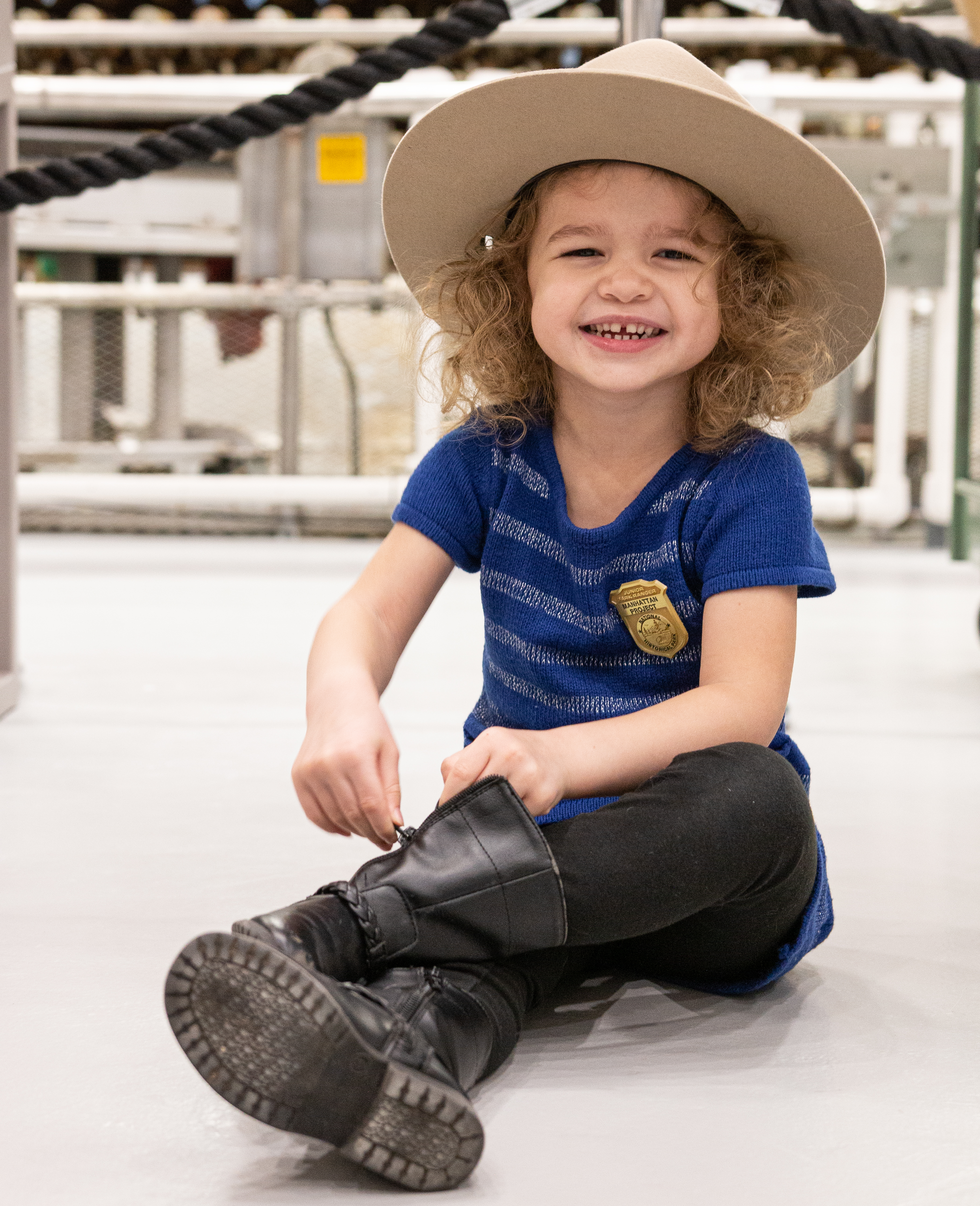
Hanford: Become a Junior Ranger
Hey kids! Have you ever wanted to become a park ranger? Join Atom U. Fission on a fun adventure and learn about the Manhattan Project.
Hanford: Enjoy a Pre-War Historic Sites Tour
Step into the past and learn about the resilient farming communities displaced by the arrival of the Manhattan Project in eastern Washington. The US Department of Energy leads a tour of pre-Project Manhattan sites that are still on the Hanford Site.
Hanford: Hike the White Bluffs South Slope Trail
This trail provides one of the best views of the old Hanford town site and location of the Hanford construction camp for the Manhattan Project. This trail will reward you with expansive views of the Hanford site and opportunities to explore the white bluffs geologic formation up-close. This is also an excellent trail for if you enjoy birding and watching wildlife.
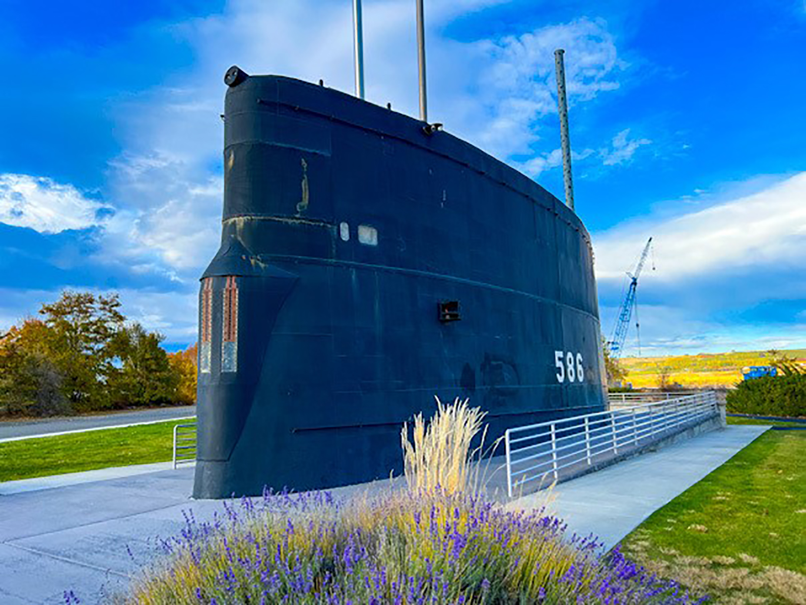
Hanford: Explore USS Triton Sail Park
Enjoy views of the Columbia River as you walk around the sail of the USS Triton. The USS Triton was the first vessel to complete a submerged circumnavigation of the Earth in 1960 powered by nuclear reactor technology developed at Hanford for the Manhattan Project. Visitors to the park can walk along Richland’s Riverfront Trail, which connects walkers to other parks along the Columbia River. Tours inside the USS Triton sail are available.
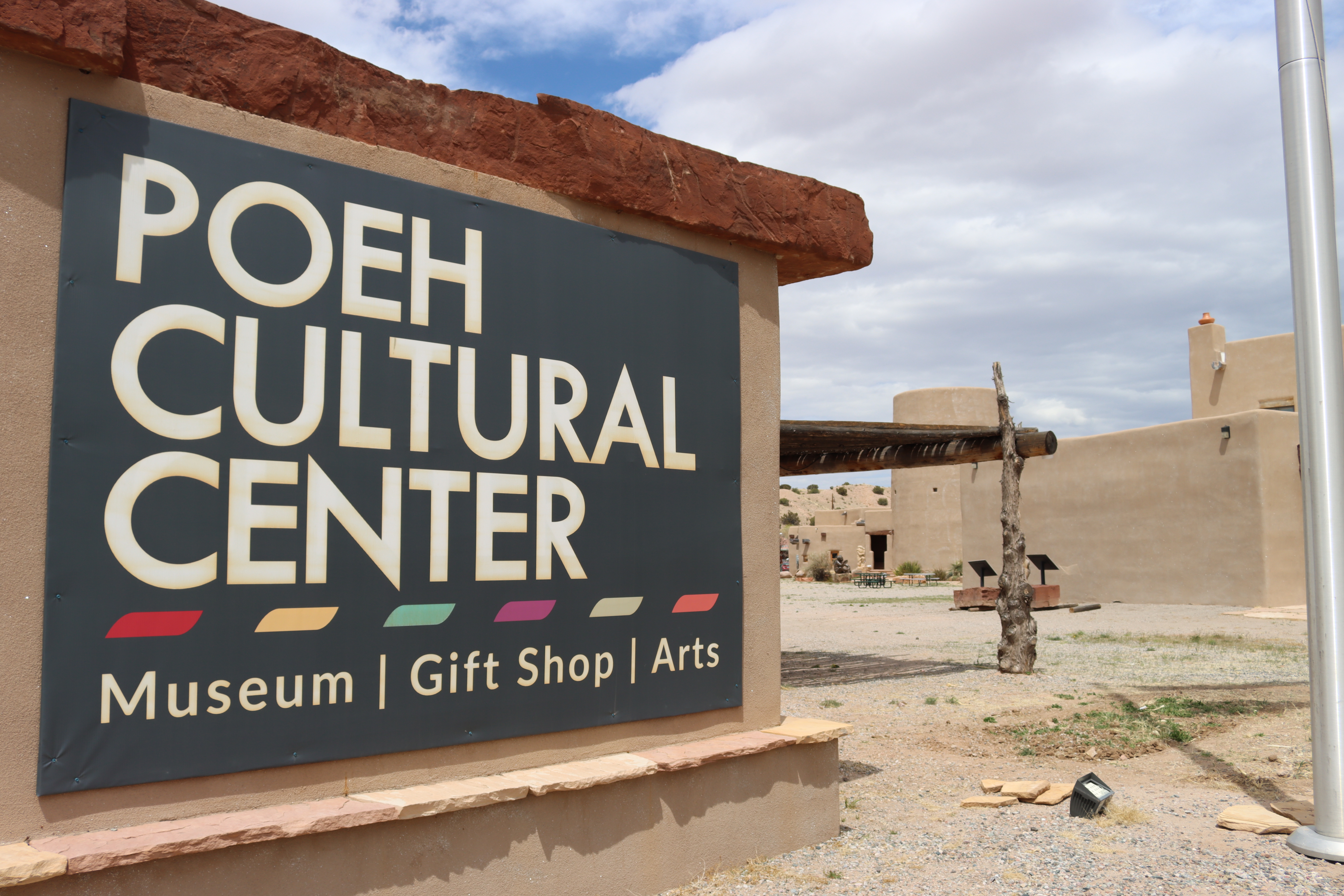
Santa Fe: Visit the Poeh Cultural Center
n the Tewa Pueblo language Poeh translates to “path” and the Poeh Cultural Center leads the way on the path to learning, discovering, and understanding Pueblo cultures and traditions. Located in Santa Fe, the Poeh Cultural Center, preserves and interprets the essence of what it means to be a Tewa person—to be Pueblo.
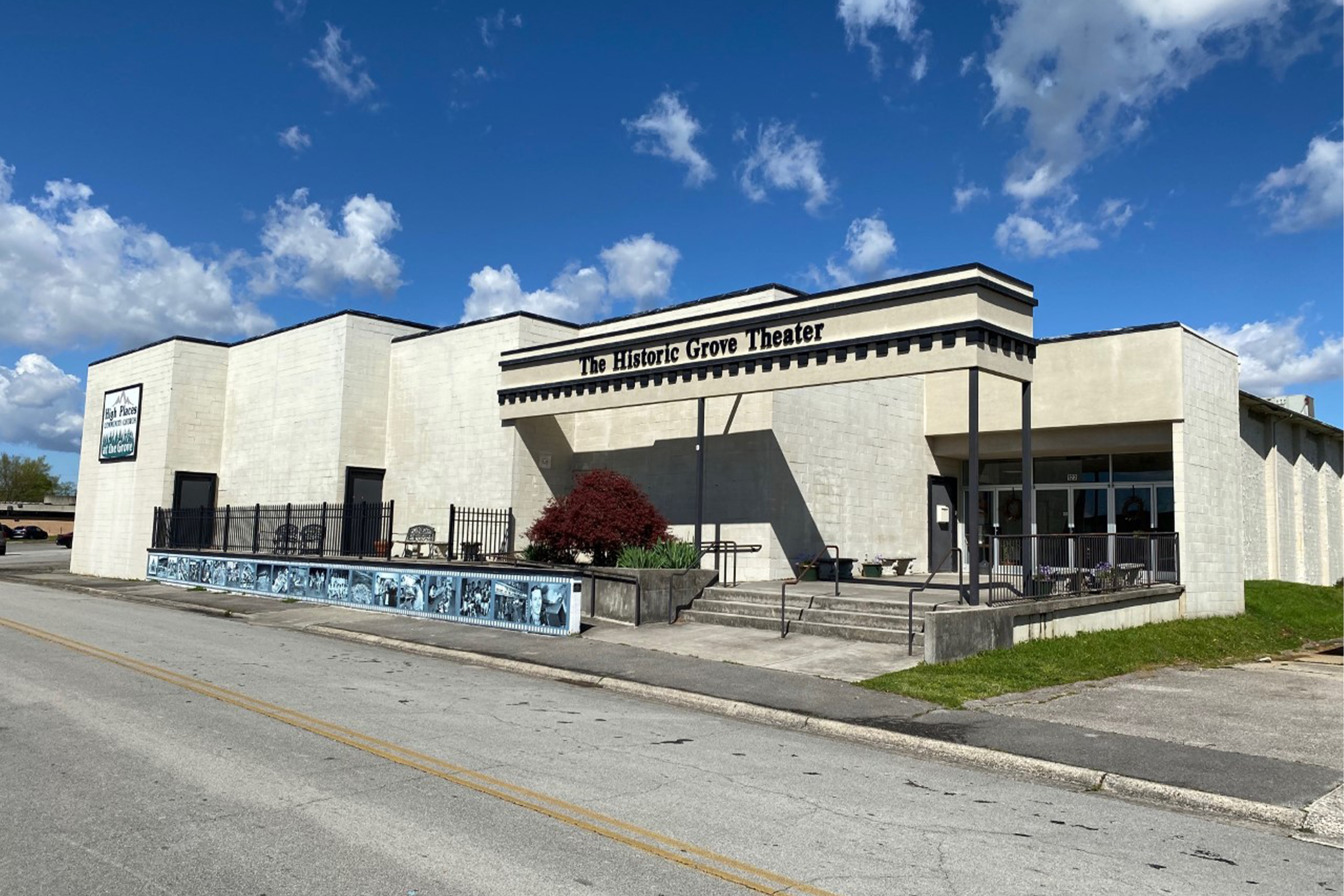
Oak Ridge: Visit the Grove Theater
The Grove Theater opened in 1944 as a 1,000-seat auditorium to entertain Manhattan Project workers with films and live events. Many events are still held at the historic theater.
Oak Ridge: Explore Local Greenways
Oak Ridge, TN is home to over 85 miles (137 km) of walking, jogging, and biking trails on 13 greenways. Follow the link for more information on what each specific greenway offers.
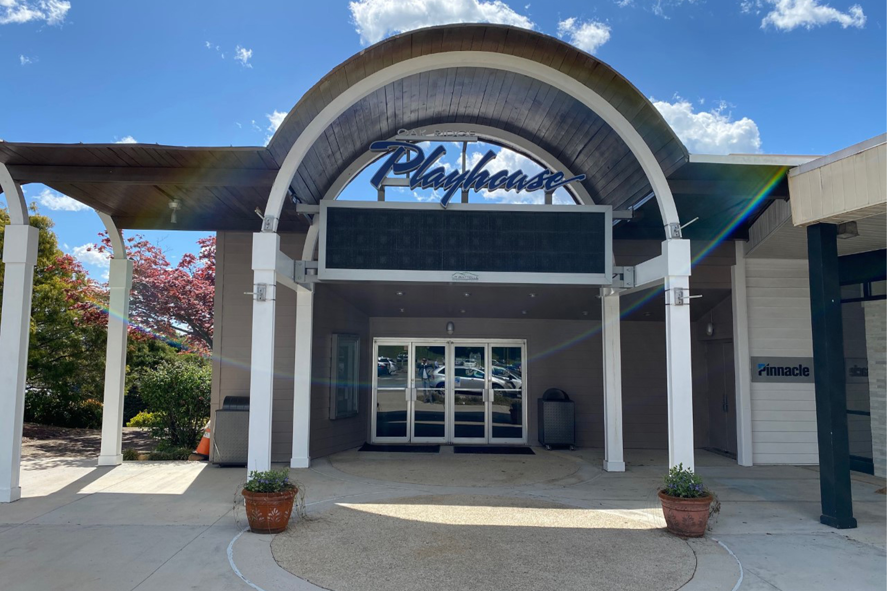
Oak Ridge: See a Play at the Oak Ridge Playhouse
The Oak Ridge Playhouse is one of the oldest continuously operating community theaters in the Southeastern United States. Initially opened in 1943 to entertain Manhattan Project workers in Oak Ridge, the playhouse has resided in historic Jackson Square since 1957.
Los Alamos: Explore the Bradbury Science Museum
Learn about the scientific history of Los Alamos and explore interactive exhibits at the Bradbury Science Museum.
Oak Ridge: Explore Historic Downtown
Downtown Oak Ridge provided Manhattan Project employees with respite from their top-secret work. Follow in the footsteps of urban life during World War II-era Oak Ridge at these historic locations.
Oak Ridge: Explore A.K. Bissell Park
A.K. Bissell Park is a favorite location for Oak Ridgers to exercise, walk a pet, or just relax and enjoy the various attractions the park offers. Follow the link to explore all the things to do in this popular city park.
Oak Ridge: Explore Haw Ridge Park
Haw Ridge Park in Oak Ridge, Tennessee encompasses 780 acres and offers hiking, biking, jogging, and watersports opportunities. Follow the link for more information on available recreational activities.
Los Alamos: Become a Junior Ranger
The junior ranger program is a great way for kids to learn about the Manhattan Project by doing fun activities. Complete pages in the Junior Ranger book to receive a Junior Ranger badge and become an official Junior Ranger for the Manhattan Project National Historical Site.
Hanford: Bike and Walk the Sacagawea Heritage Trail
This recreational trail along the Columbia River is a perfect way to explore the Tri-Cities on foot and bike. Interpretive signs along the route share information about local history including Lewis and Clark’s experience in the Mid-Columbia region. You can also take in panoramic views of the Columbia River, which was essential for the Hanford Site.
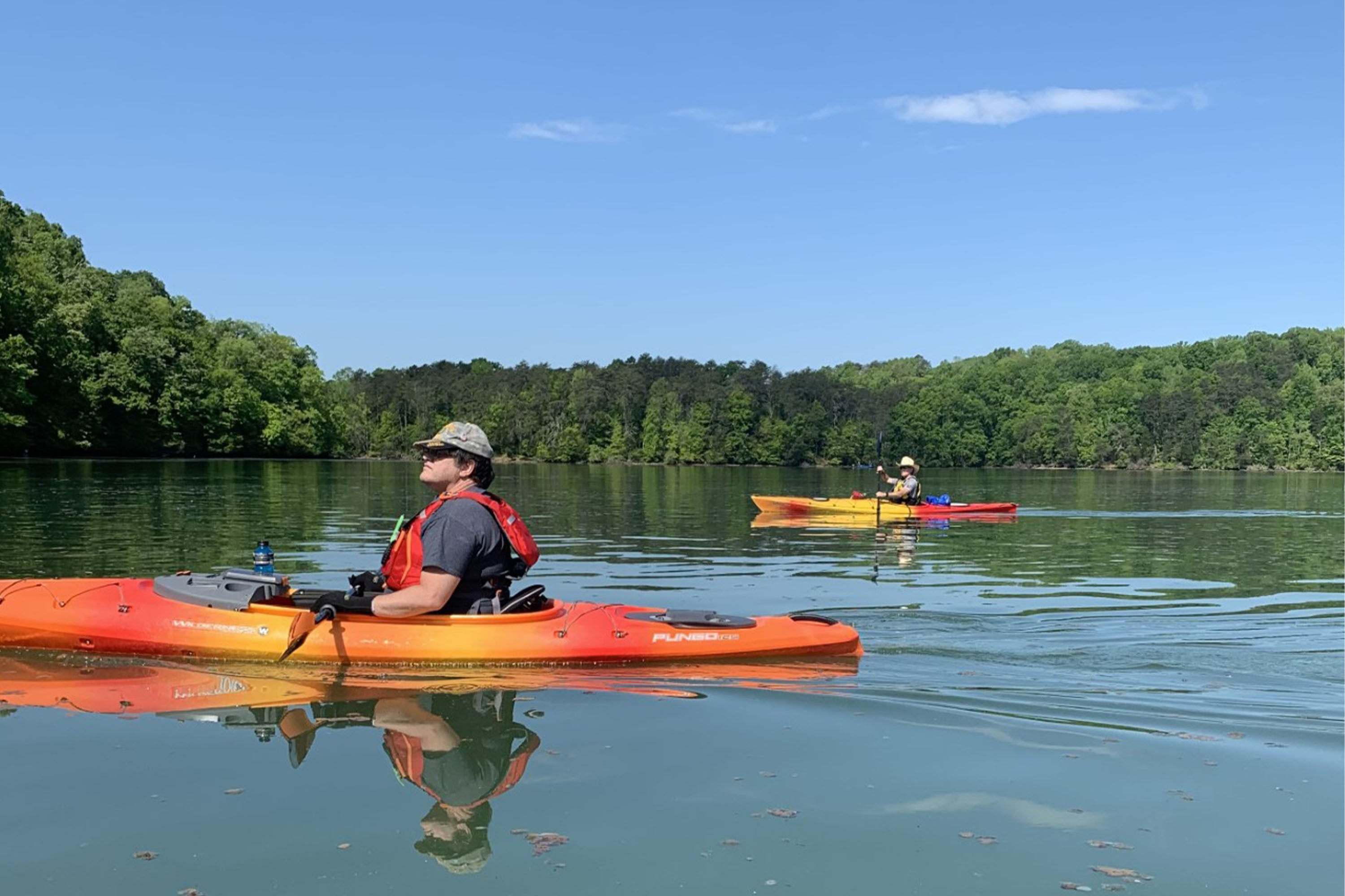
Hanford: Paddle the Hanford Reach
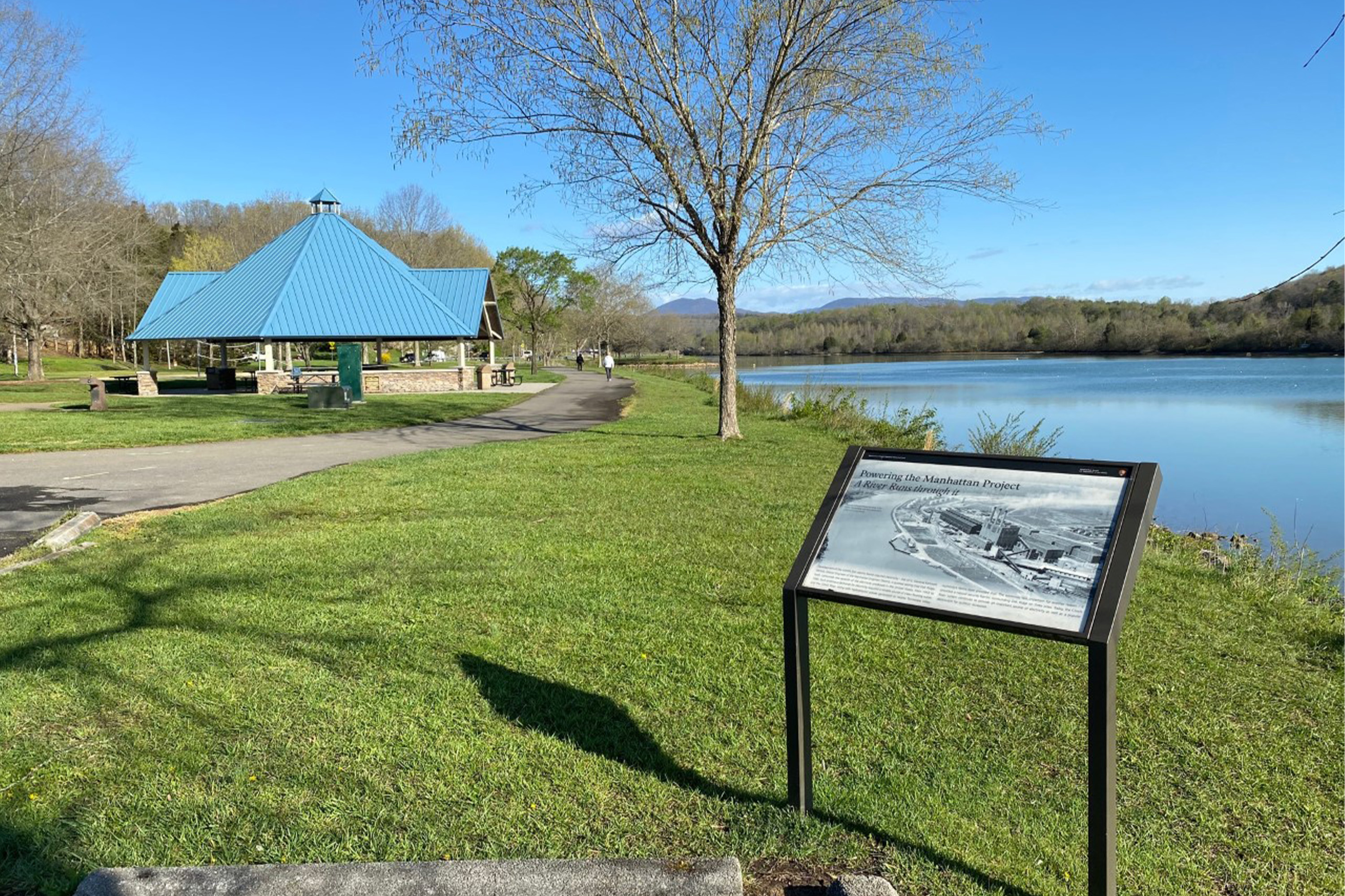
Paddle through the Hanford Reach and check out the geology, plants, animals, and World War II history along its shores. Sustaining human and animal life in the dry shrub steppe of eastern Washington for millennia, the Columbia River also provided water to cool the plutonium production nuclear reactors during the Manhattan Project and Cold War.
Hanford: Picnic at Kurtzman Park
Kurtzman Park is a community park that was created in the late 1950s by Black neighborhood boys in segregated East Pasco who wanted a place to play. The boys transformed a vacant lot into a city park. Today, the park offers a playground, trails, picnic area and soccer fields.
Hanford: Picnic and Play in Rodney Block Park
Rodney Block Park in Richland, Washington, was originally created as a place to play and relax for the Manhattan Project workers and their families who lived in the alphabet homes that surround the park. Today, the park is still a place for recreation that draws people of all ages.
Hanford: Tour the Pasco Aviation Museum
During World War II, Pasco Aviation in Pasco, Washington was one of the three largest training bases for aviators in the United States. Today, it hosts a recently opened and expanded museum that showcases aviation history.
Hanford: Visit the Franklin County Historical Museum
The Franklin County Historical Society has artifacts, educational programs, and displays that share story of the development of Franklin County. The museum building was originally constructed in 1910 as part of Andrew Carnegie’s worldwide library construction program.
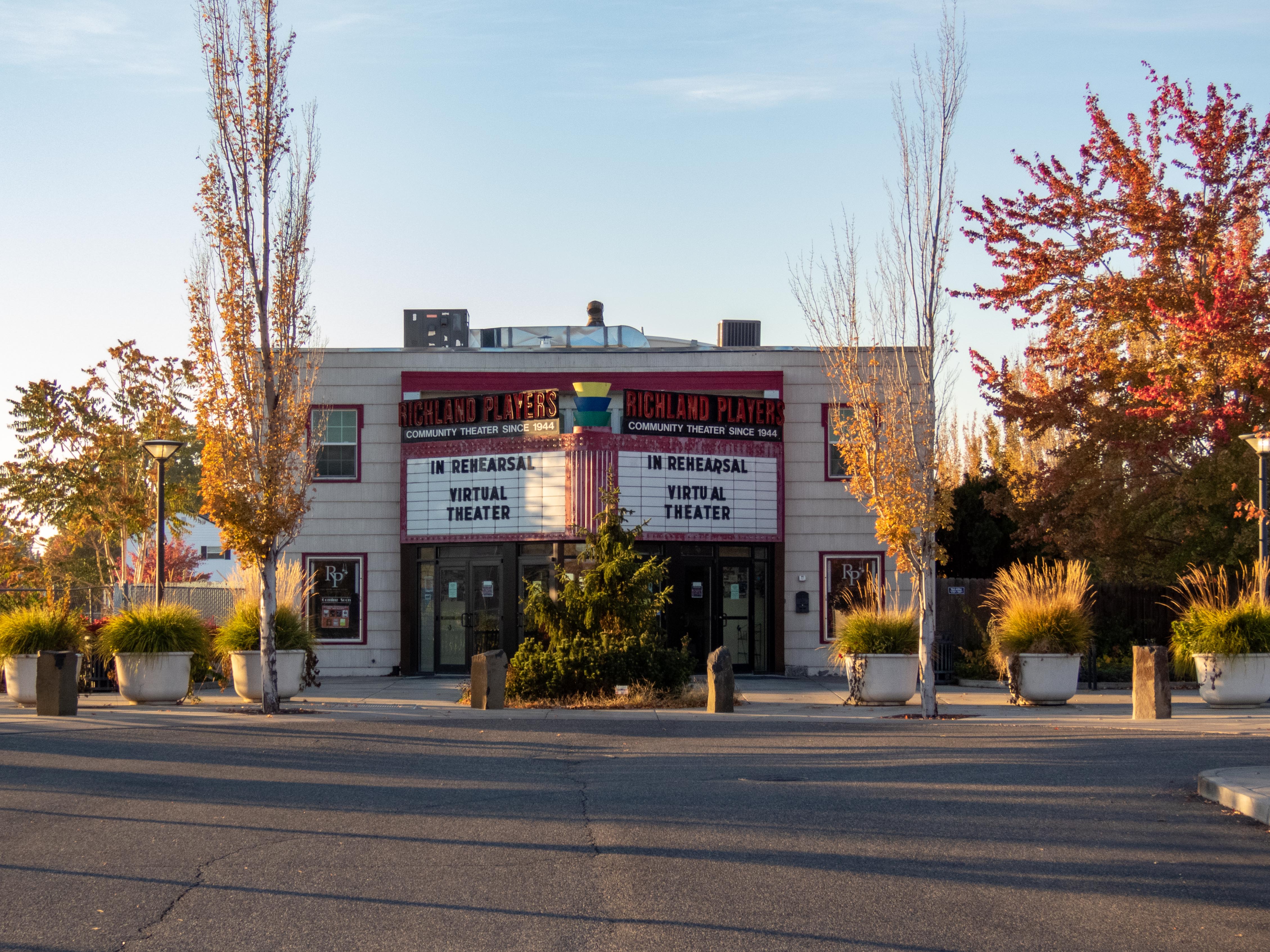
Hanford: See a Play at the Richland Players Theater
The Richland Players were founded by Manhattan Project workers in 1944 to “to bring music and laughter to an isolated community.” Attend live theater productions, choral concerts, chautauqua presentations, and more in this historic building built during the Manhattan Project as a movie theater for the residents of the secret city.
Hanford: Explore Howard Amon Park
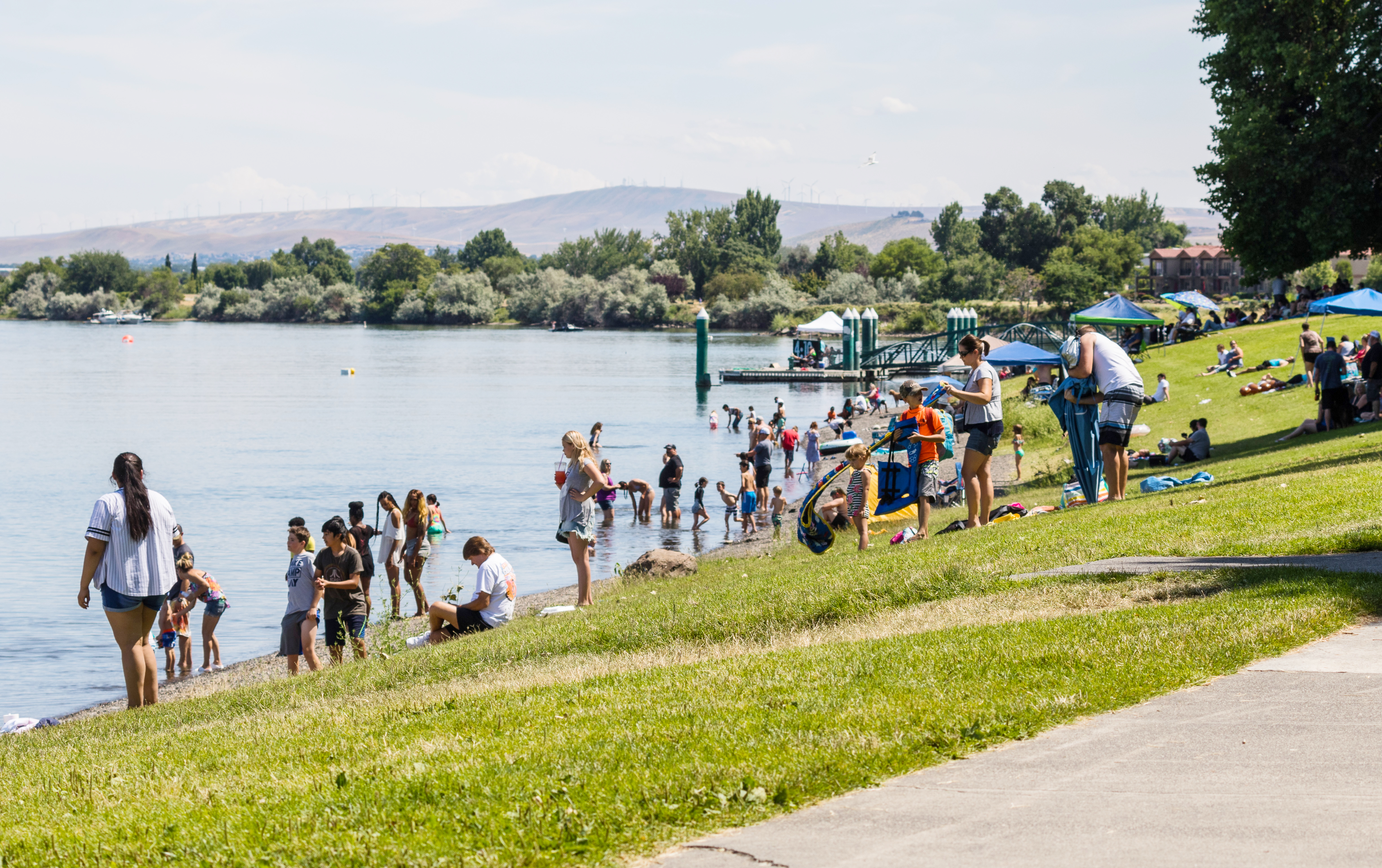
Serving as a community gathering place for over 100 years, Howard Amon Park offers something for everyone. You can relax under a shade tree, wade into the river, walk or ride a bike along the river path, and enjoy family time with your kids on the play equipment.
Hanford: Enjoy Sacajawea Historical State Park
Learn about the first local encounter between White explorers and Native Americans at Sacajawea Historical State Park, which is at the confluence of the Snake and Columbia rivers. You can enjoy many activities including picnicking, swimming, bicycling, hiking, bird watching and wildlife viewing.
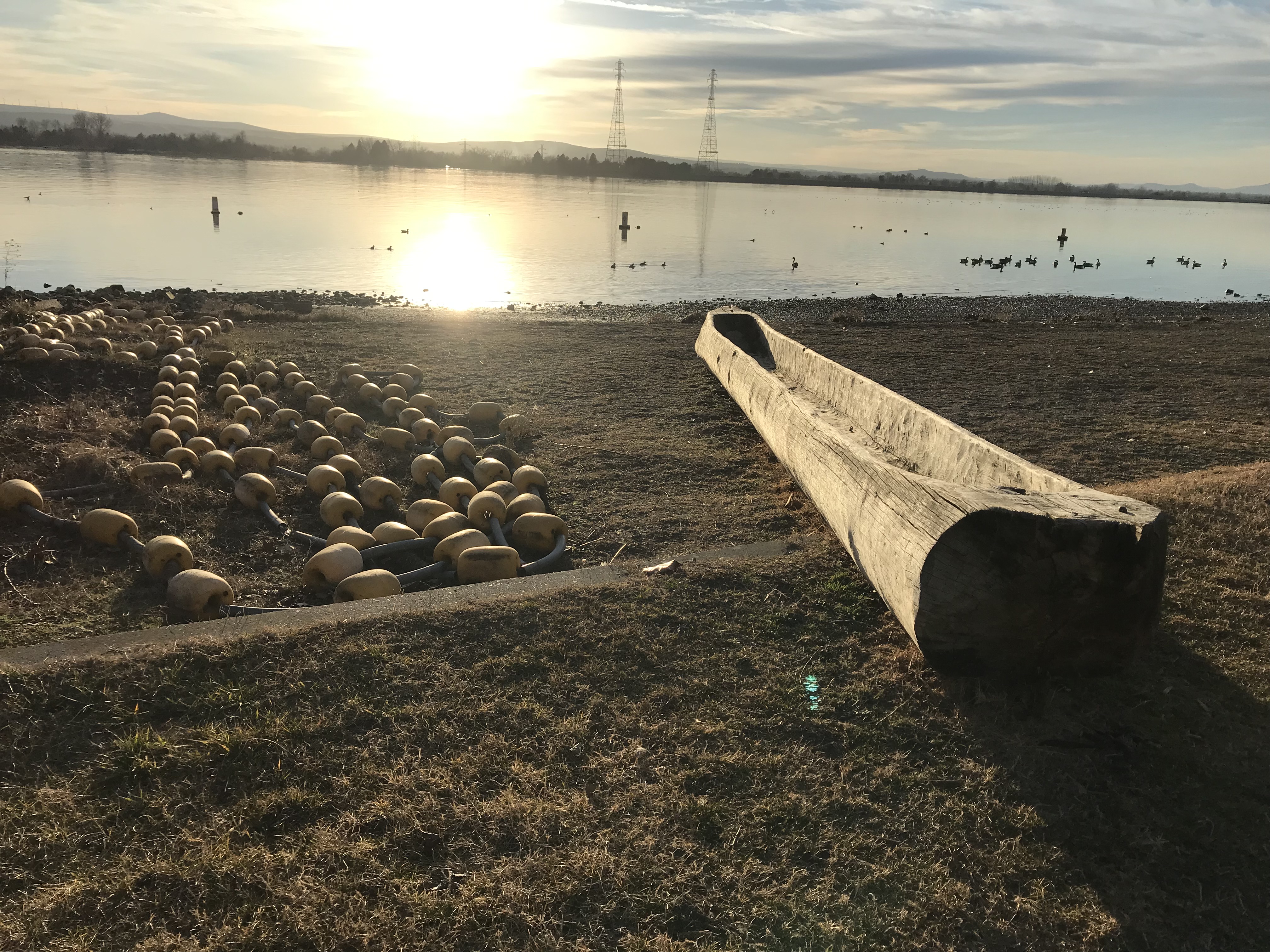
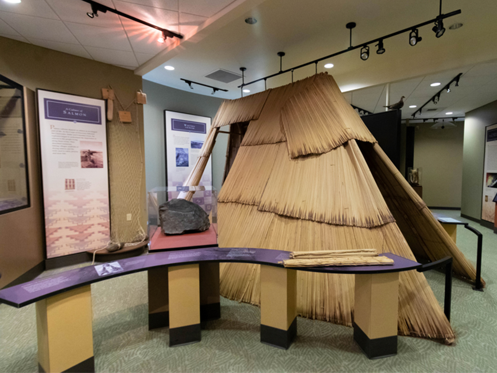
Hanford: Visit Sacajawea Interpretive Center
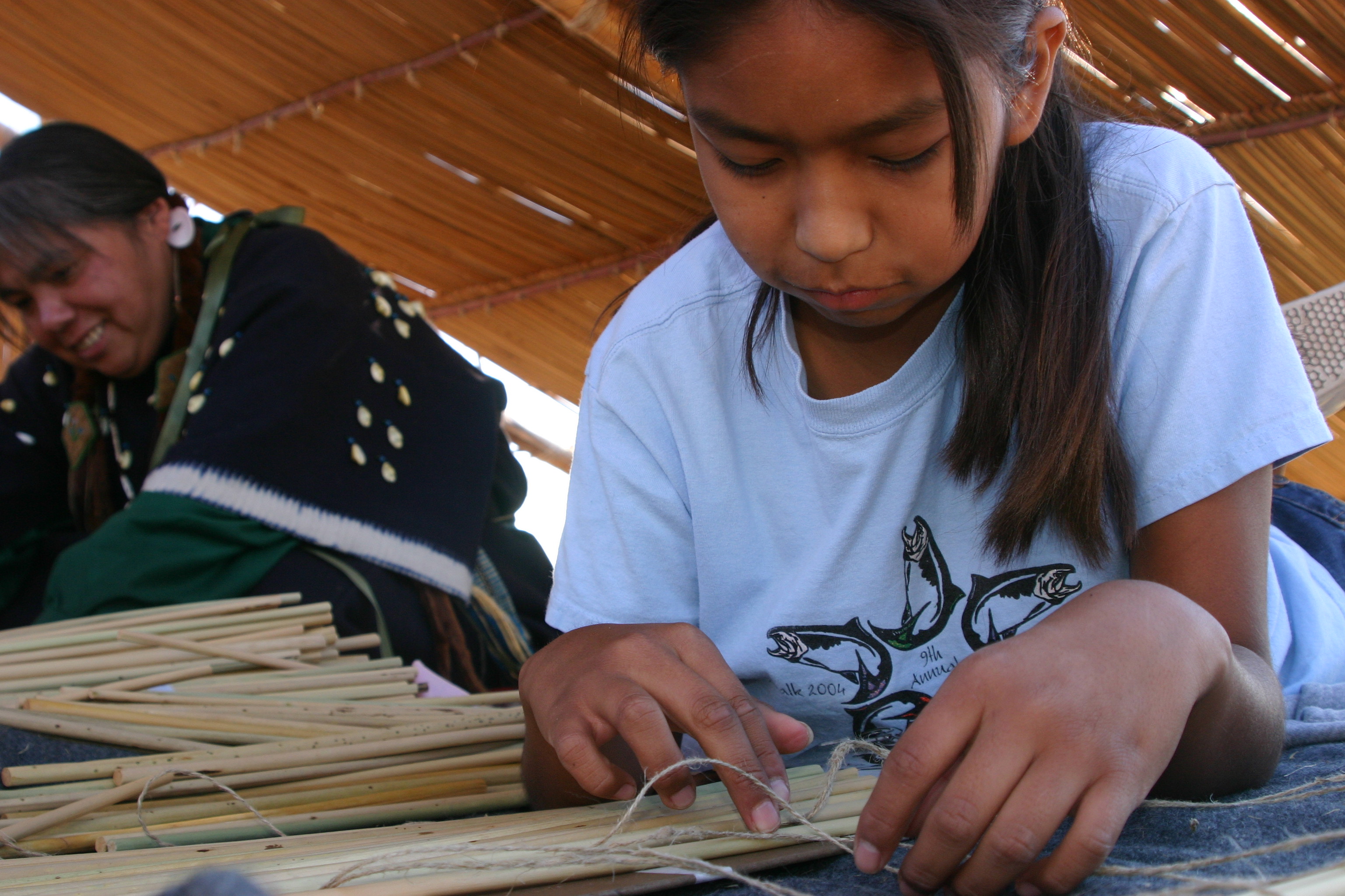
Exhibits in the Sacajawea Interpretive Center at Sacajawea Historical State Parks focus on The Lewis and Clark Expedition, Sacagawea, and the Sahaptian-speaking Native Americans of the Columbia Plateau. Visitors can touch items like the tule used to make lodges and even see a smaller-scale example of a lodge made from tule.
Albuquerque: Explore the National Museum of Nuclear Science & History
Explore the story of the Atomic Age at the National Museum of Nuclear Science & History. Learn about nuclear science in the past, present, and future. A wide array of exhibits discuss topics from atomic theory and the complexities of World War II to the diversity of individuals and events that shaped the technical context of the nuclear age. No matter the topic, there is always something to learn at the National Museum of Nuclear Science & History Museum.
Hanford: Visit the Tamastslikt Cultural Institute
Tamástslikt Cultural Institute is located Oregon Trail and tells the story of western expansionism from a tribal point of view. Permanent exhibits bring to life the traditions of the Cayuse, Umatilla and Walla Walla Tribes. For 10,000 years, these tribes have lived and subsisted in a region that includes southeastern Washington where the Hanford Site is today. The institute is located approximately 75 miles (120 km) south of the Tri-Cities in Oregon.
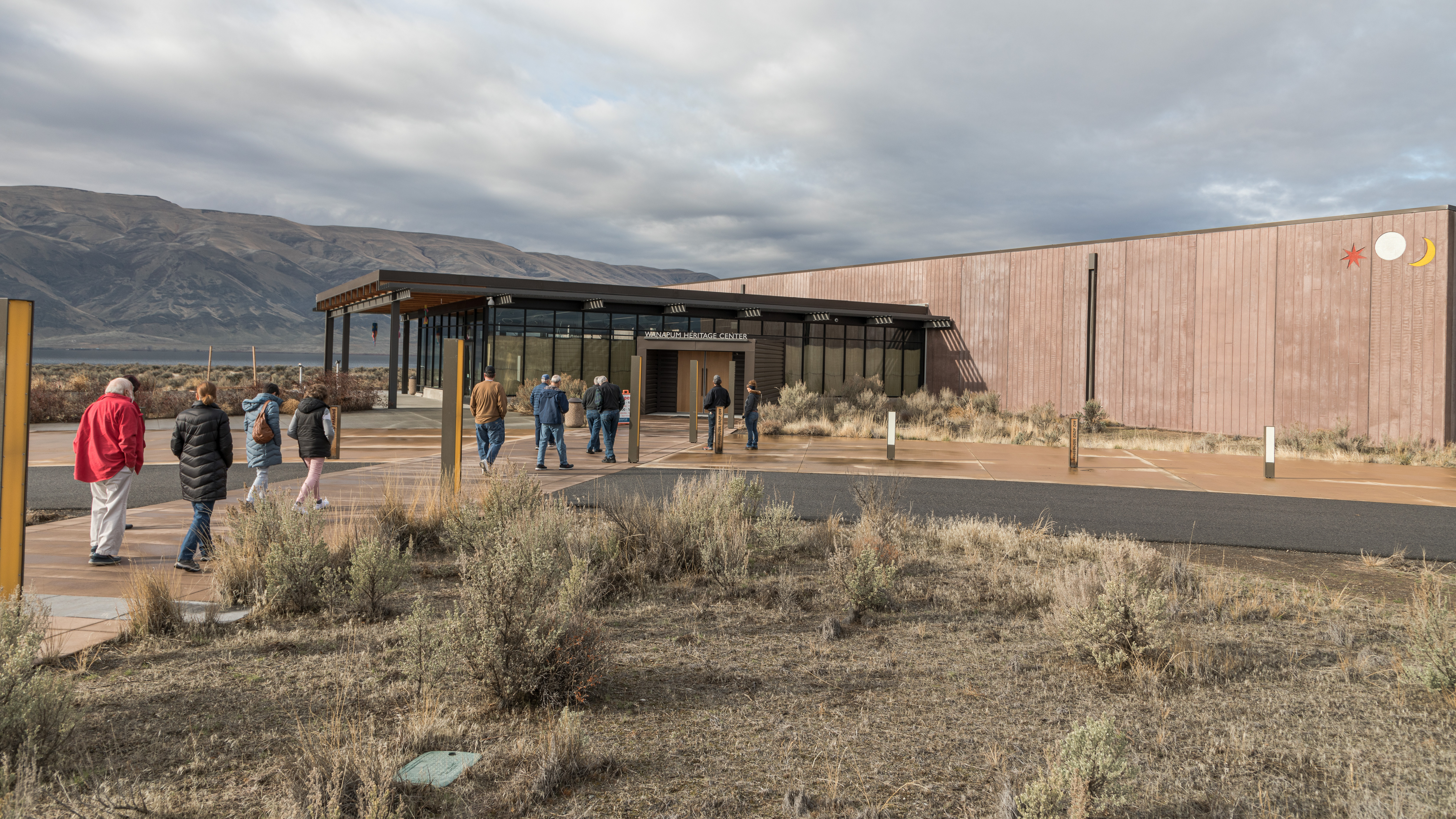
Hanford: Visit the Wanapum Heritage Center
The Wanapum people’s homeland lies at the center of what is now the Hanford Site. Learn more about Wanapum history and traditions at the Wanapum Heritage Center. This museum is located near the site of their former village at the Priest Rapids, which was relocated during construction of the Wanapum Dam.
Hanford: Visit the Yakama Nation Cultural Center
Located approximately 50 miles (80.5 km) from the Tri-Cities, the Yakama Nation Cultural Center preserves and interprets the living culture of the Yakama people. The Yakama homeland extends across the Columbia Plateau, including the Hanford Site and Tri-Cities.
Los Alamos: Join a Ranger Program
Los Alamos ranger programs are a great way to explore the remarkable history of the Manhattan Project. Call 505-661-6277 to see what ranger programs are available during your visit.
Los Alamos: Visit the Los Alamos History Museum Campus
Nestled in downtown Los Alamos, the Los Alamos History Museum presents the stories of this secret city from multiple perspectives via indoor and outdoor venues, historic buildings, artifacts, documents, photographs, audio and video recordings of personal stories, and interactive visitor experiences.
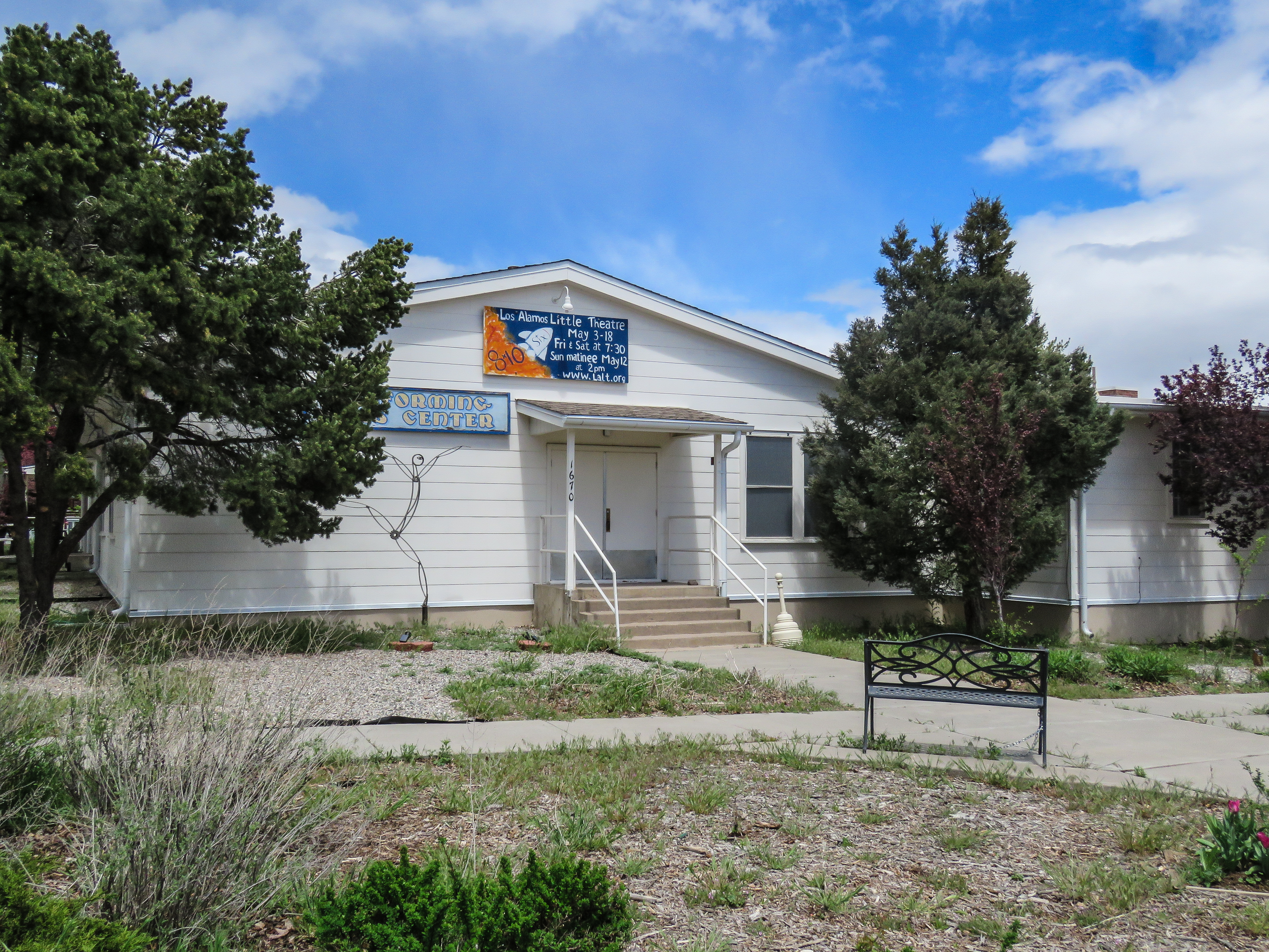
Los Alamos: See a Play at the Los Alamos Little Theater
What started as a wartime cafeteria, today is a pillar in the community Los Alamos. Performers are still bringing magic to the stage at the Los Alamos Little Theater. Visit the Los Alamos Little Theatre website for more information about their schedule and catch a play.
Los Alamos: Picnic at Ashley Pond
Ashley Pond has been a prominent feature of Los Alamos since the homesteading and Los Alamos Ranch School eras. Today, you can view wildlife, have a picnic, or just enjoy the view throughout the year. Spend time around Ashley Pond and follow in the footsteps of famous Manhattan Project scientists.
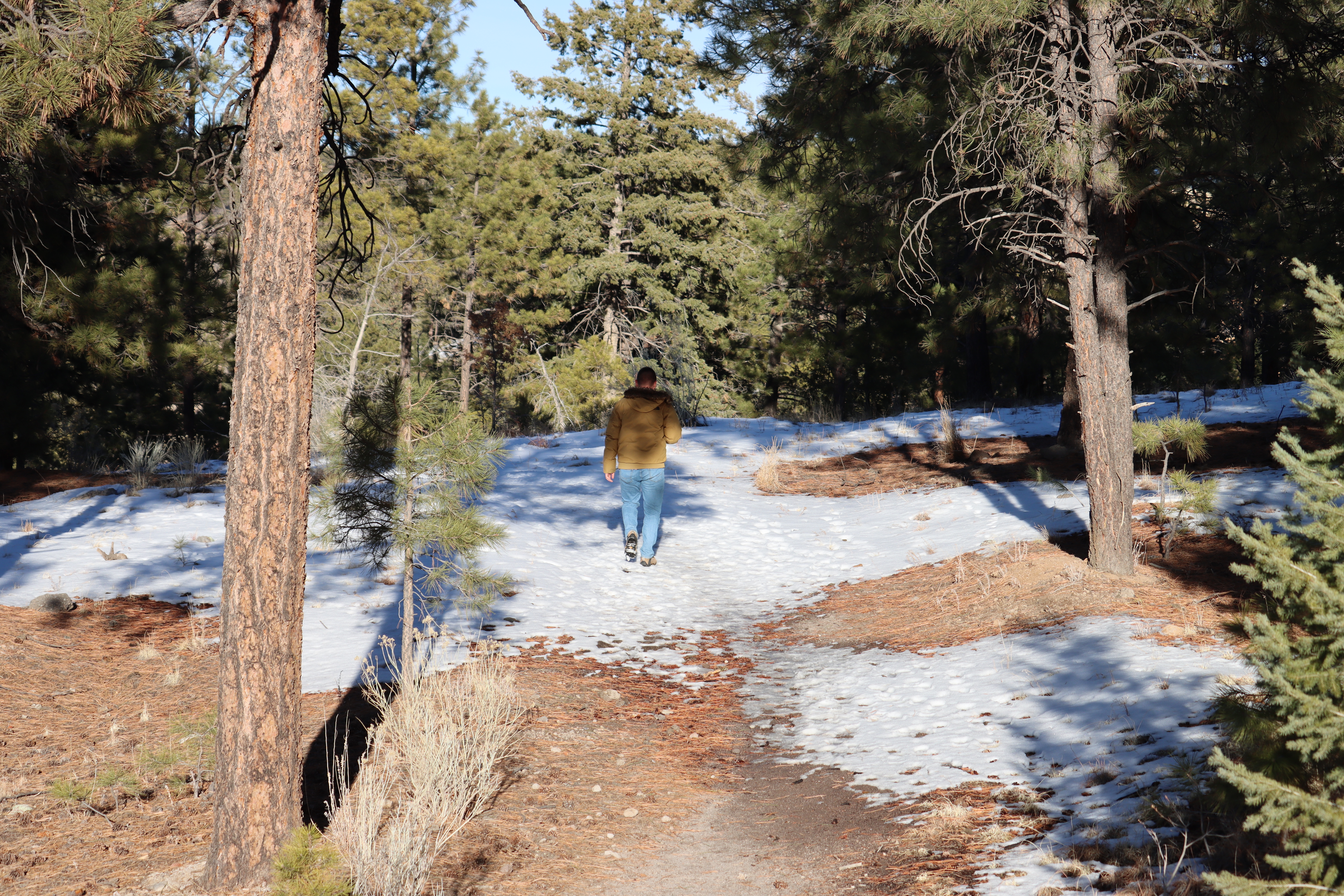
Los Alamos: Hike Acid Canyon Trail
Typical of the amazing urban trail network that threads through Los Alamos, the Acid Canyon Trail is an easy, short trip that provides the feeling of being miles away from town. The trail descends from the rim of Los Alamos Mesa along Acid Canyon, a tributary of Pueblo Canyon. It links with the Ranch School Trail to create a 1 mile (1.6 km) loop. Get outdoors and explore Acid Canyon Trail today!
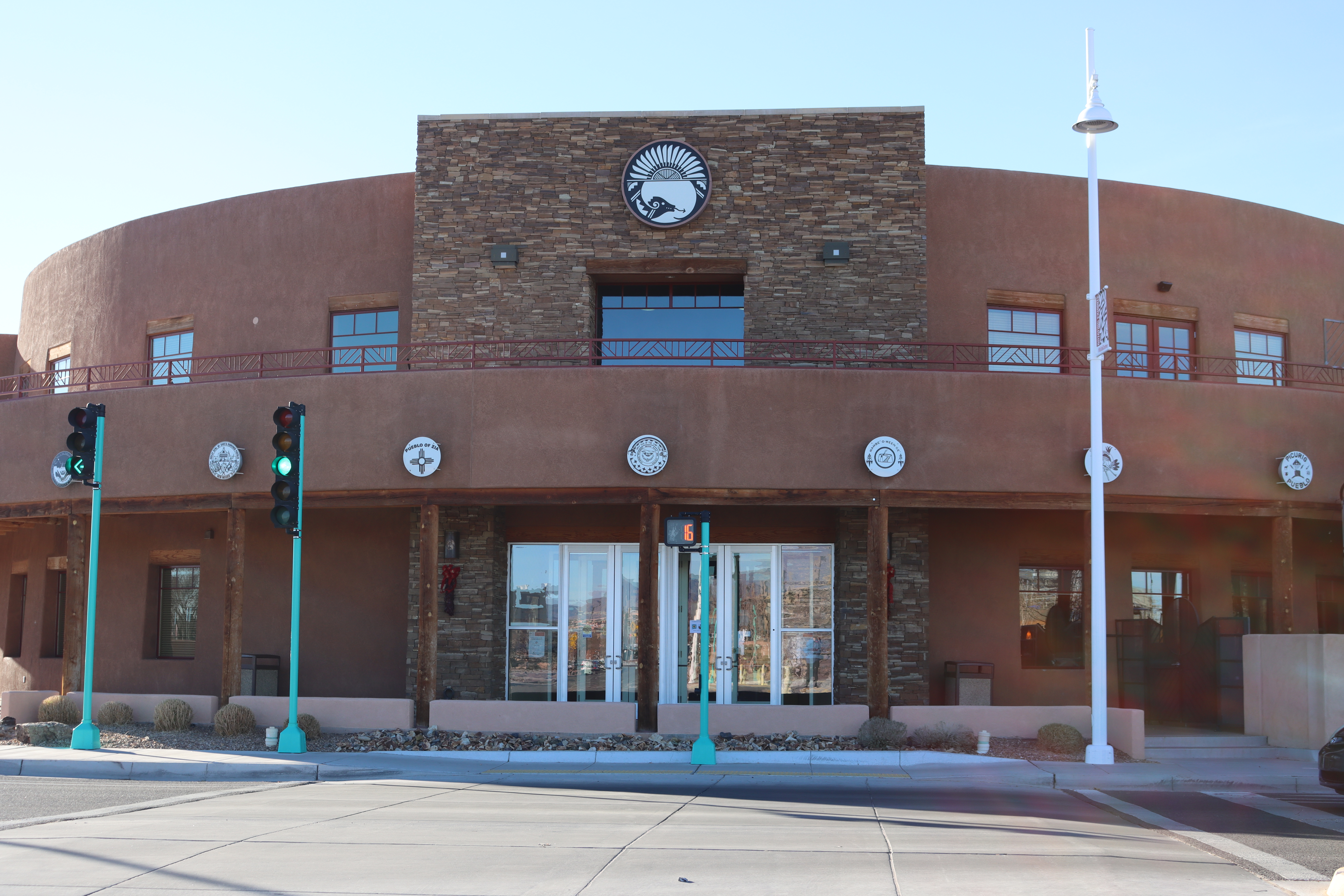
Albuquerque: Explore the Indian Pueblo Cultural Center
The Indian Pueblo Cultural Center preserves Pueblo culture, their accomplishments, and evolving history of the Pueblo people. The center located in Albuquerque on land owned by the 19 Pueblos and governed by the 19 Pueblos District. The Pueblos District is a sovereign government formed by the Tribal Councils of the 19 New Mexico Pueblo Communities at the former location of the Albuquerque Indian School (1881-1982). Visit today and enjoy the museum, gallery, and artifacts.
Los Alamos: Get Outside on a Los Alamos History Museum Walking Tour
Enjoy an outdoor, guided tour around Los Alamos. See the sights and learn about the history from the perspective of a Los Alamos History Museum tour guide. Guided walks take you inside the Romero cabin, near the ancestral Pueblo dwellings, and along Bathtub Row, where homes of some of the most well-known scientists still stand. Connections to the Manhattan Project can be seen along the entire tour and the whole family will enjoy the unique history of this secret community.
Los Alamos: Learn about Nature on the Pajarito Plateau
A visit to the Los Alamos Nature Center gives you the chance to learn more about the incredible wildlife and natural history in this area.
Tours
Count: 13
Hanford: Black History Driving Tour
This driving tour focuses on the local Black life during the Manhattan Project and the civil rights struggle that followed in the Tri-Cities.
Hanford: Secret City Walking Tour
The Manhattan Project transformed Richland from a farming village of about 250 people to a planned garden suburb of 15,000 Hanford workers and their families. Follow in their footsteps and see what life was like in Richland during World War II
Hanford: Summit Candy Mountain
Hike to the top of Candy Mountain to see the Hanford Site and the Tri-Cities. Along the way learn about the Ice Age Floods that shaped the landscape.
Los Alamos: A Walk Down Bathtub Row
The homes along Bathtub Row were originally built for the staff of the Los Alamos Ranch School. When the Manhattan Project arrived in Los Alamos in 1943, school staff moved out and project staff moved into these homes. Bathtubs were considered a luxury in homes constructed for the Manhattan Project. One night at a party, Alice Kimball Smith referred to the occupants living on “Bathtub Row,” giving the homes their unique name. Take a walk down Bathtub Row to learn about these homes and the project scientist
Los Alamos: Junior Ranger Tour
Explore the history of Los Alamos on this short walking tour and learn more about the different people who have called this area home.
Los Alamos: Oppenheimer Movie Manhattan Project Film Locations
Want to visit the historical buildings that were used in the making of the Oppenheimer movie? Then you have come to the right place! Filming of Oppenheimer took place in and around Los Alamos in 2022. Several Manhattan Project era buildings were utilized in the making of the movie including the Oppenheimer house. Check out the film locations on this tour in person, and see if you can recognize the locations when viewing the movie.
Los Alamos: Ranch School Days
Explore the sites in Los Alamos that played an important role in the town's Ranch School era, before the Manhattan Project came to town.
Los Alamos: The Land of the Pueblo People
The city of Los Alamos was constructed on land that has a long history of human use. Follow along this tour to learn some of the history of the Ancestral Pueblo people that have always called this land home and discover untold stories and connections to the Manhattan Project. This tour is best completed as you travel from Santa Fe to Los Alamos and has locations within two National Park Service sites. An America the Beautiful Pass or park-specific passes are needed to explore all stops on this route.
Oak Ridge: A Day in the Life During the Manhattan Project
Step back in time in downtown Oak Ridge as you discover the same shopping districts, lodging, recreation, and houses of worship that Manhattan Project workers and visitors would have enjoyed long ago.
Oak Ridge: A Day in the Life During the Manhattan Project (Part 2)
Step back in time as you discover more places in Oak Ridge that Manhattan Project workers and residents would have visited for shopping, entertainment, and recreation long ago.
Oak Ridge: A Walk Through Wheat
Explore the area that was once the Wheat community, a small rural community that existed for decades prior to the displacement of its citizens to make way for the Manhattan Project, specifically the K-25 Gaseous Diffusion Plant.
Oak Ridge: For Kids
The City of Oak Ridge has something for kids of all ages to enjoy. From world-class museums to outdoor activities and attractions, every member of your family will enjoy a day in the secret city.
Oak Ridge: Visit K-25
Walk in the footsteps of thousands of Manhattan Project employees as you imagine what it was like working in secrecy in the largest building in the world at the time.