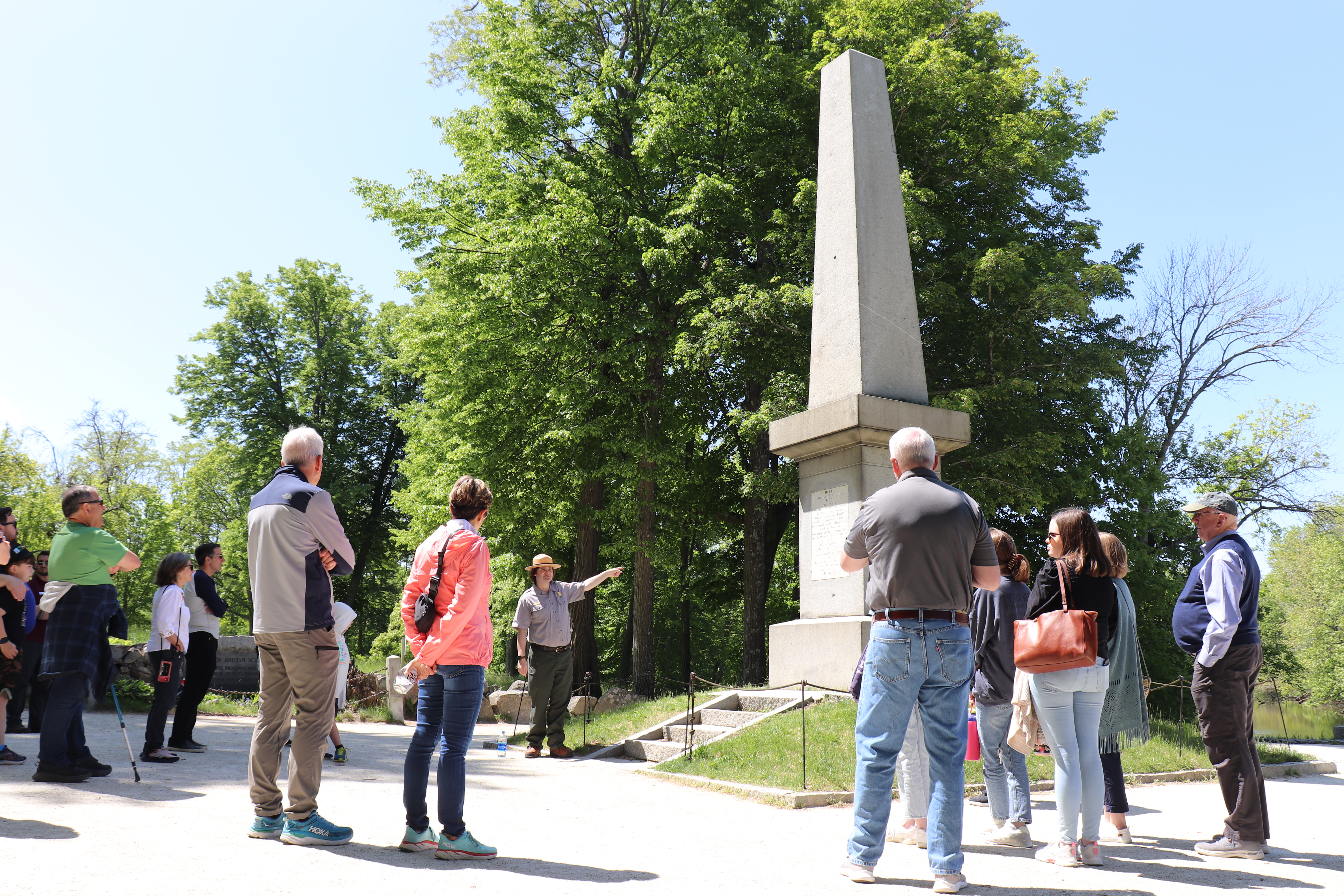
Standing twenty-five feet tall, the 1836 Battle Monument was the first monument erected at the famous North Bridge battlefield in Concord Massachusetts. Although the monument towers over the bridge today, it’s construction and legacy remain fraught with controversy.
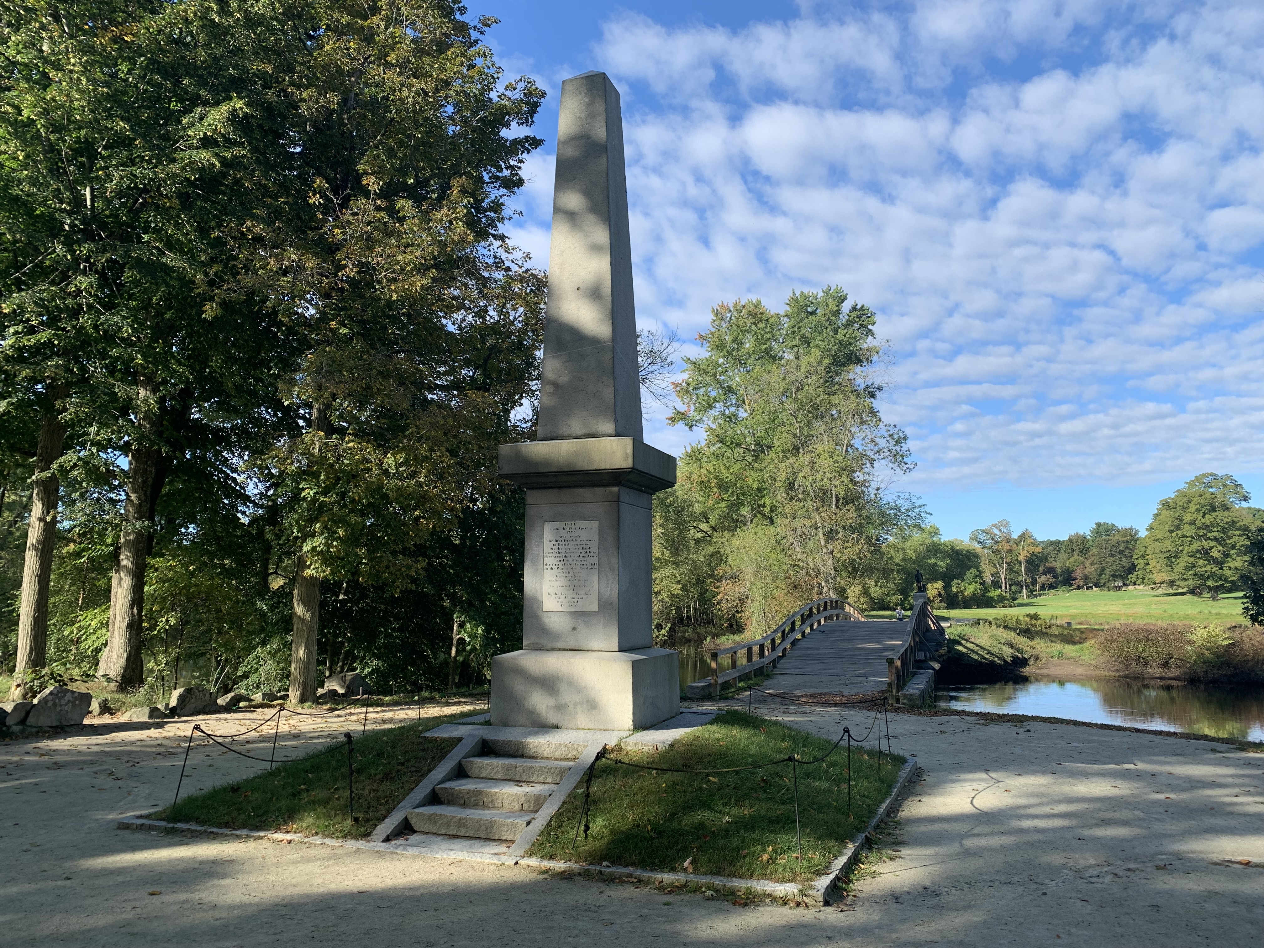
- The 1836 Battle Monument is a twenty-five-foot tall obelisk constructed of four pieces of white granite cut from a single boulder placed on top of a square granite foundation on a small mound of earth. Inset into the east face of the obelisk is a white marble slab inscribed with; “Here on the 19th of April 1775 was made the first forcible resistance to British aggression. On the opposite bank stood the American Militia. Here stood the invading Army and on this spot the first of the enemy fell in the War of that Revolution which gave Independence to these United States. In gratitude to God and in the love of Freedom this monument was erected AD 1836.” The Monument has five steps leading up to the inscription and a thin rope blocks access to the grass covered the sloped earth on all sides. The monument stands in the center of the dirt walking trail, approximately 70 feet east of the North Bridge. The Monument is approximately 393 feet from the trailhead entrance along Monument Street. The monument also stands 32 feet directly north of the grave of British soldiers killed at the North Bridge and 48 feet south of the boulder monument dating from the 20th century.
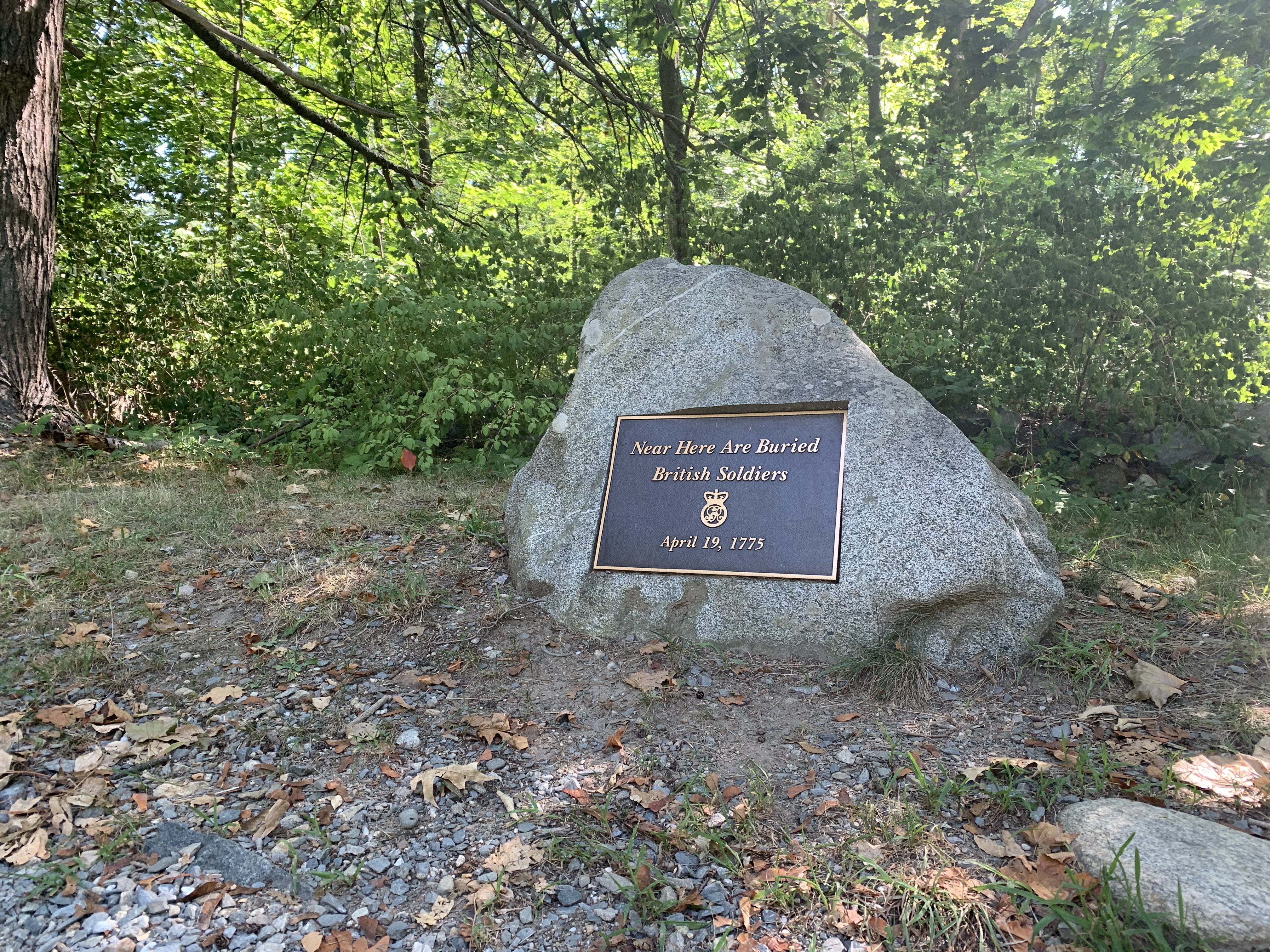
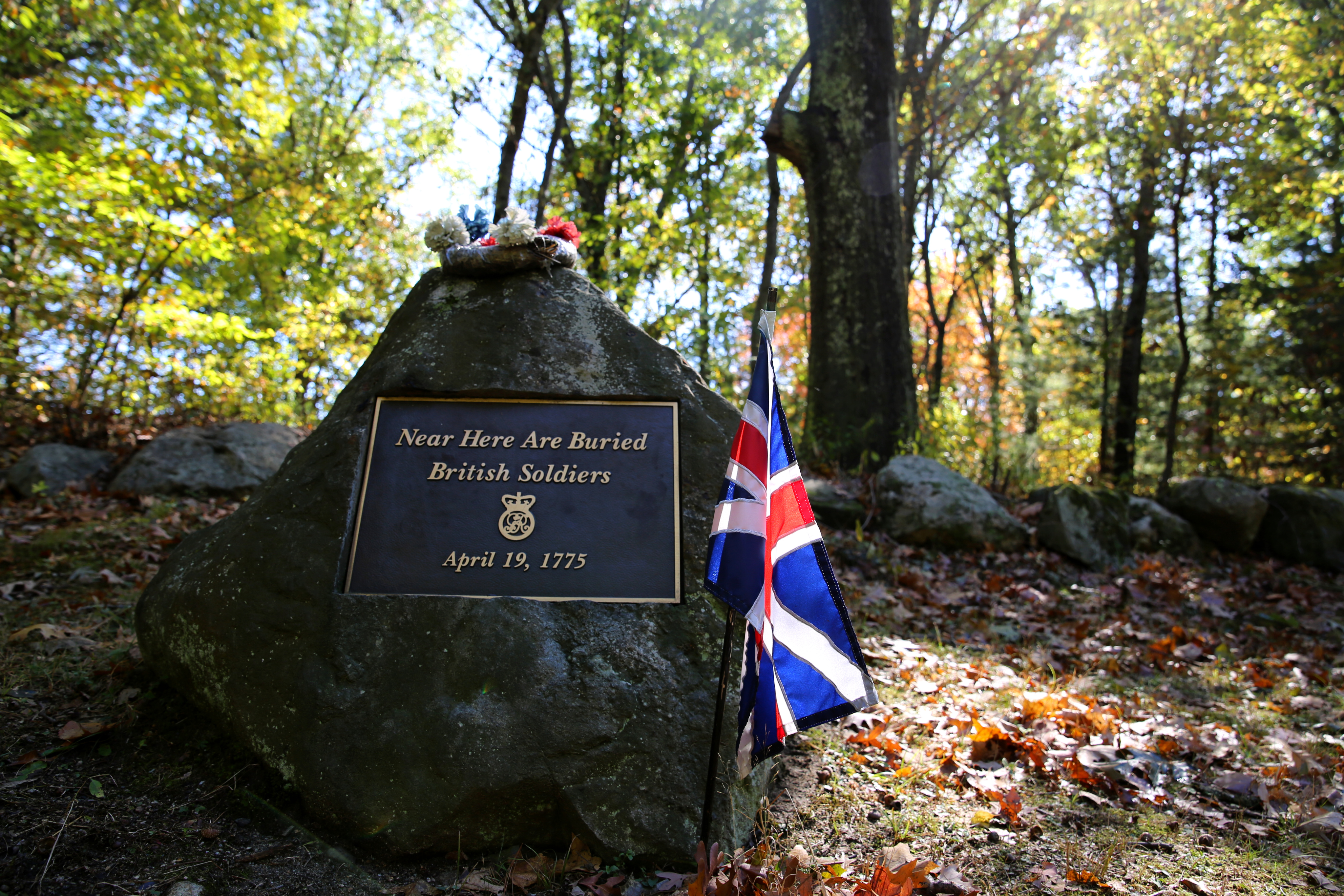
At this sharp curve in the Bay Road there is a stone grave marker for British soldiers killed on April 19, 1775. In the years following the famed battle, local historians dubbed this segment of road, "The Bloody Angle." Today, this grave marker at the northern curve memorializes those British soldiers buried along the roadside after the fight.
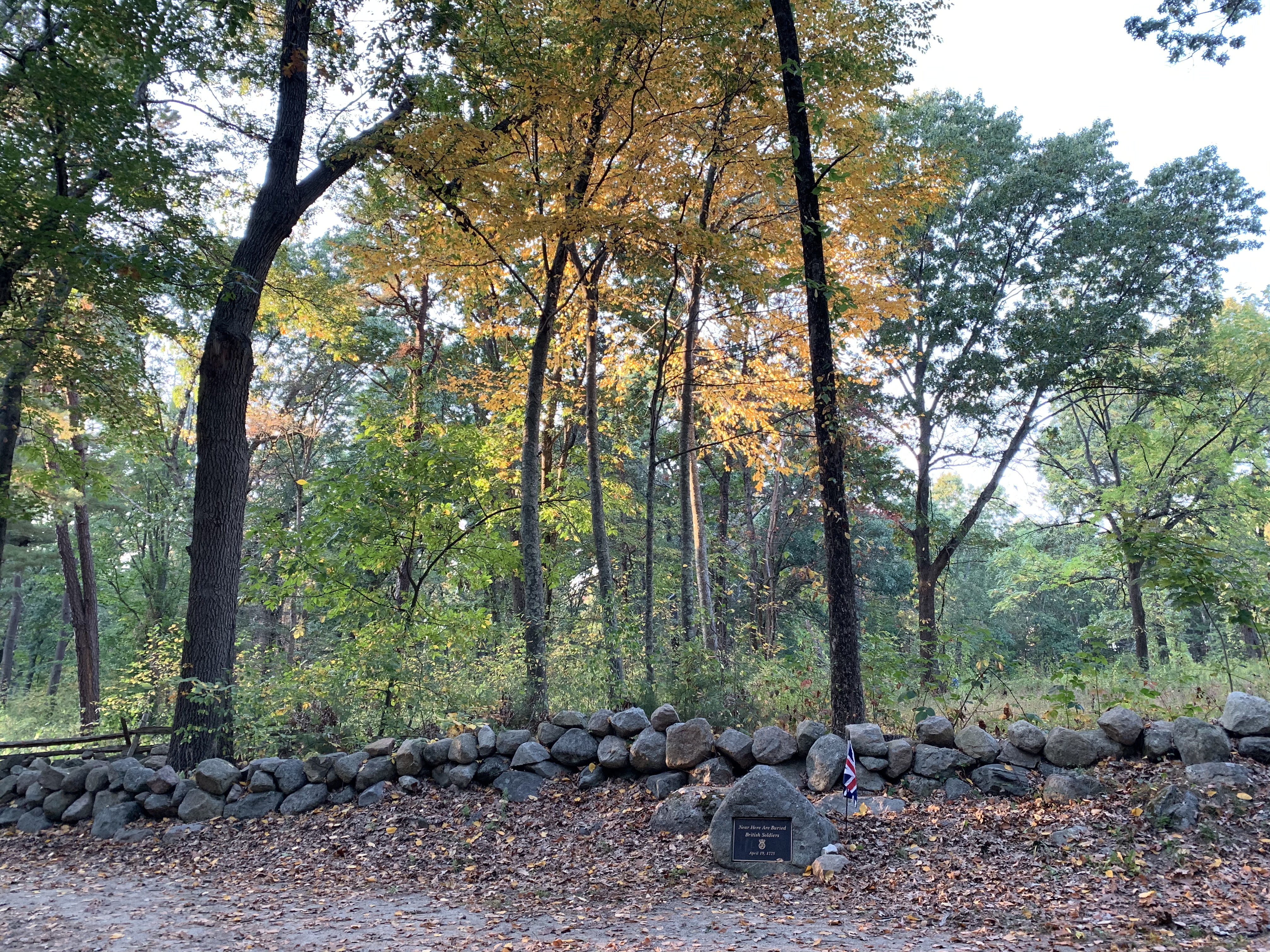
- This turn in the Bay Road is often referred to as the Northern curve of "The Bloody Angle." At this location the road makes a sharp curve from north to east. Made of packed earth, like the historic road from 1775, this section of the Bay Road features stone fences made of gray field stones collected by local farmers and topped with crossed segments of wooden rails. These, "horse high and hog tight" fences flank both sides of the road, approximately 32 feet distance from the other side. Although the original Bay Road curves drastically to the east at this northern bend, the modern trail continues northward for approximately two hundred yards before turning sharply west along the battle road trail. Near this location, another segment of fenced road connects the westward trail to the eastward trail. Thus, a large triangle is created by roads converging together from the south, east, and west. This large triangle is fenced in by stone walls and features a large open lot with 30-50 foot trees, very little undergrowth, and green grass. Similarly, tall trees also surround all segments of the northern curve in the Bloody Angle and block all modern infrastructure surrounding the park land. At the southeastern edge of this curve a dense woodlot is filled with thick undergrowth and vernal pools. At the original northern curve in the Bay Road, a wayside marker explains the colonial militia ambush on the British column passing this point. On the western side of the northern curve is also a gray stone with a metal plaque imbedded into the center. The plaque reads, "Near Here Are Buried British Soldiers April 19, 1775." At the base of the gravestone is a small British flag on a black-painted, wooden stick stuck into the earth. Looking south, away from the northern curve, the section of road also referred to as "The Bloody Angle" stretches out of site and runs through a thick woodlot before meeting the southern curve in the road at Route 2A. This segment of road is still flanked by stone walls with crossed wooden fence rails.
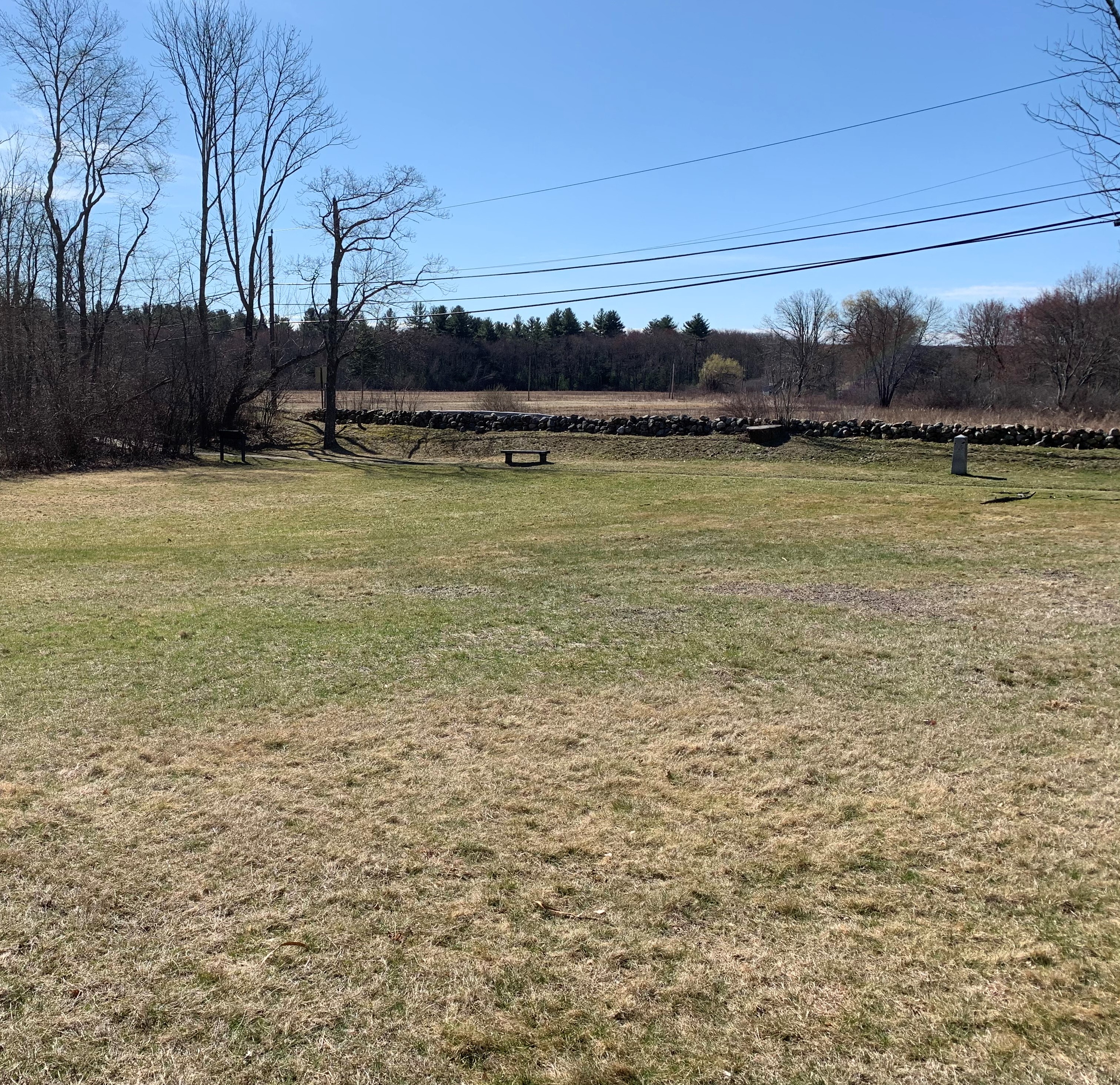
This gravestone marks the burial of British soldiers killed at Meriam's corner on April 19, 1775. These British soldiers were the first to fall during an eight hour running battle from Concord to Boston that afternoon.
- At a busy crossroad a small stone with metal plaque mark the graves of British soldiers killed in this location on April 19, 1775. The gravestone rests on the north-western corner of the crossroad and reads, "Near here are buried British soldiers April 19, 1775." The stone sits just feet from the paved sidewalk and features a small British flag placed at it's base. Behind the stone is an open field with cut grass stretching approximately fifteen yards and leads to a stone retaining wall. The wall marks the boundary of an abrupt rise to a ridgetop beyond and is covered with heavy foliage. Directly east of the gravestone is Meriam's corner. Across the to the north-east is the large colonial era Meriam house.
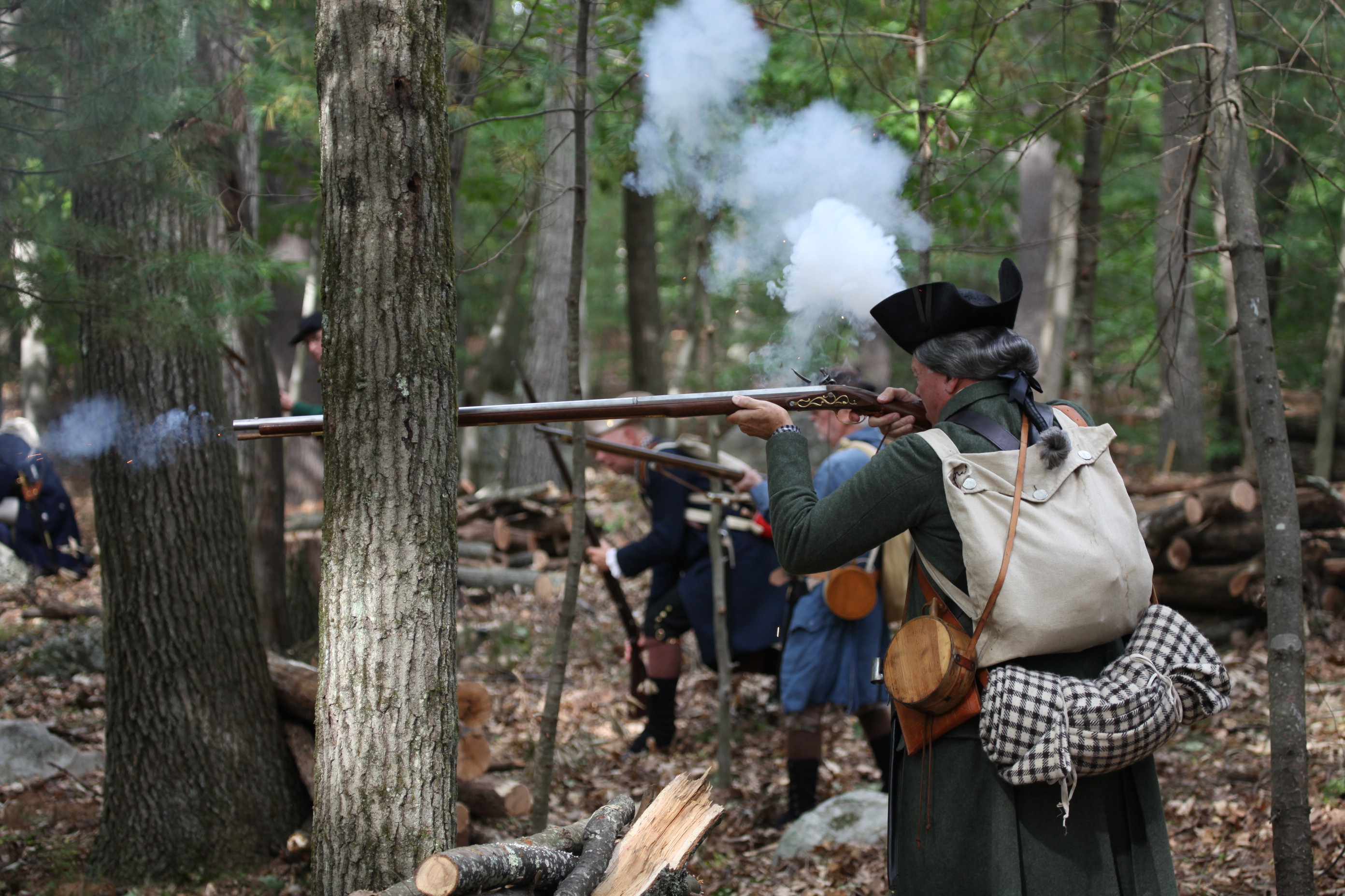
On April 19, 1775, fighting between Colonial Militia and British Regulars spilled over the crest of Fiske Hill. When the fighting ended the dead and dying lay strew across the landscape. Local resident Rebecca Fiske remembered coming home to find a dead British Soldier near her doorstep and three horribly wounded men laying within her home. The next day, Rebecca's husband carried two deceased British soldiers to a meadow a short distance from their house for burial.
- The graves are marked by a small stone located at the juncture of a modern asphalt highway and a dirt walking trail where the historic battle road was. The stone grave marker has a metal plaque on one side etched with the inscription, "Near here are buried British Soldiers April 19, 1775." The trail and marker are surrounded by a thick forest of trees and bushes that obscure any remnant of the once open landscape.
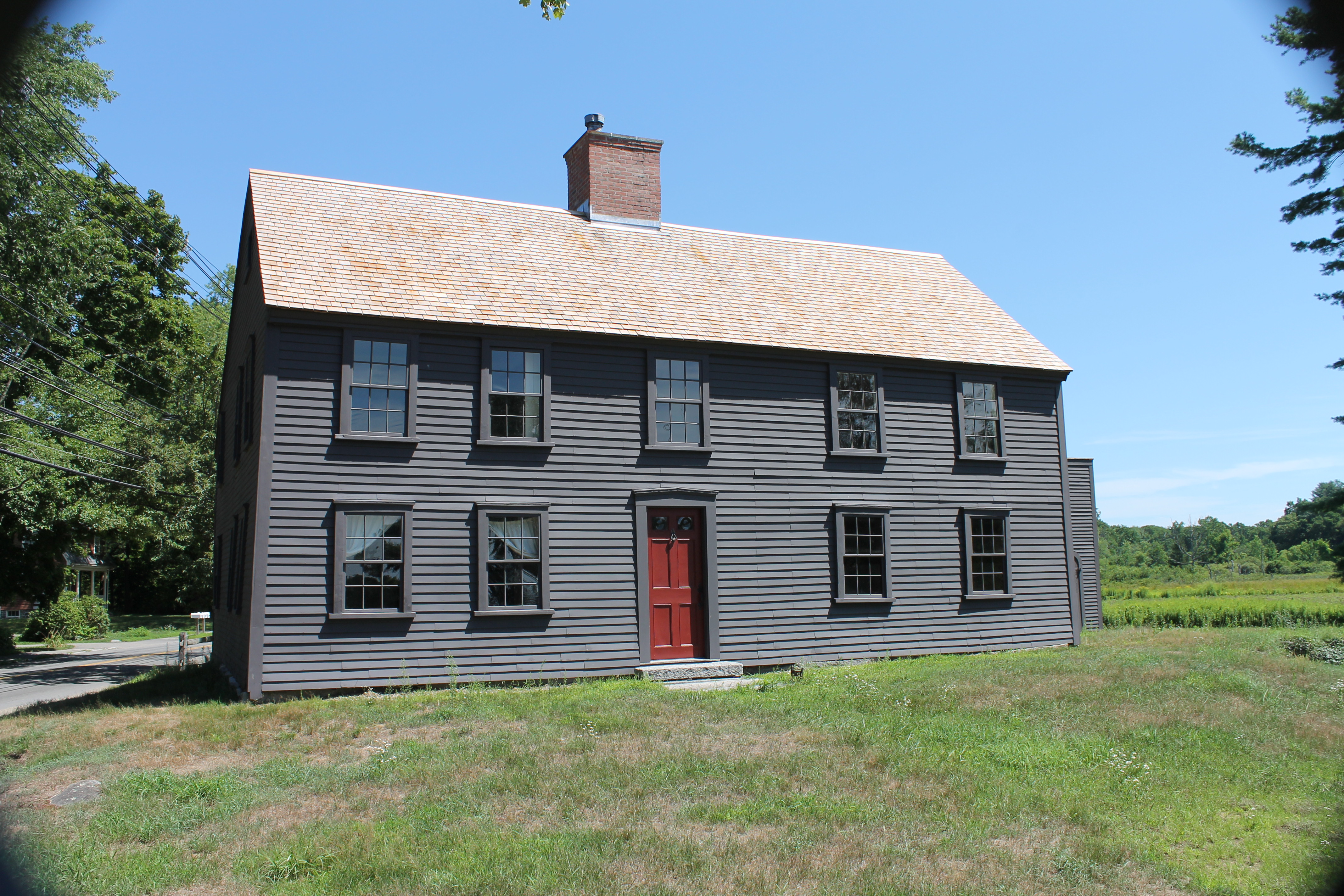
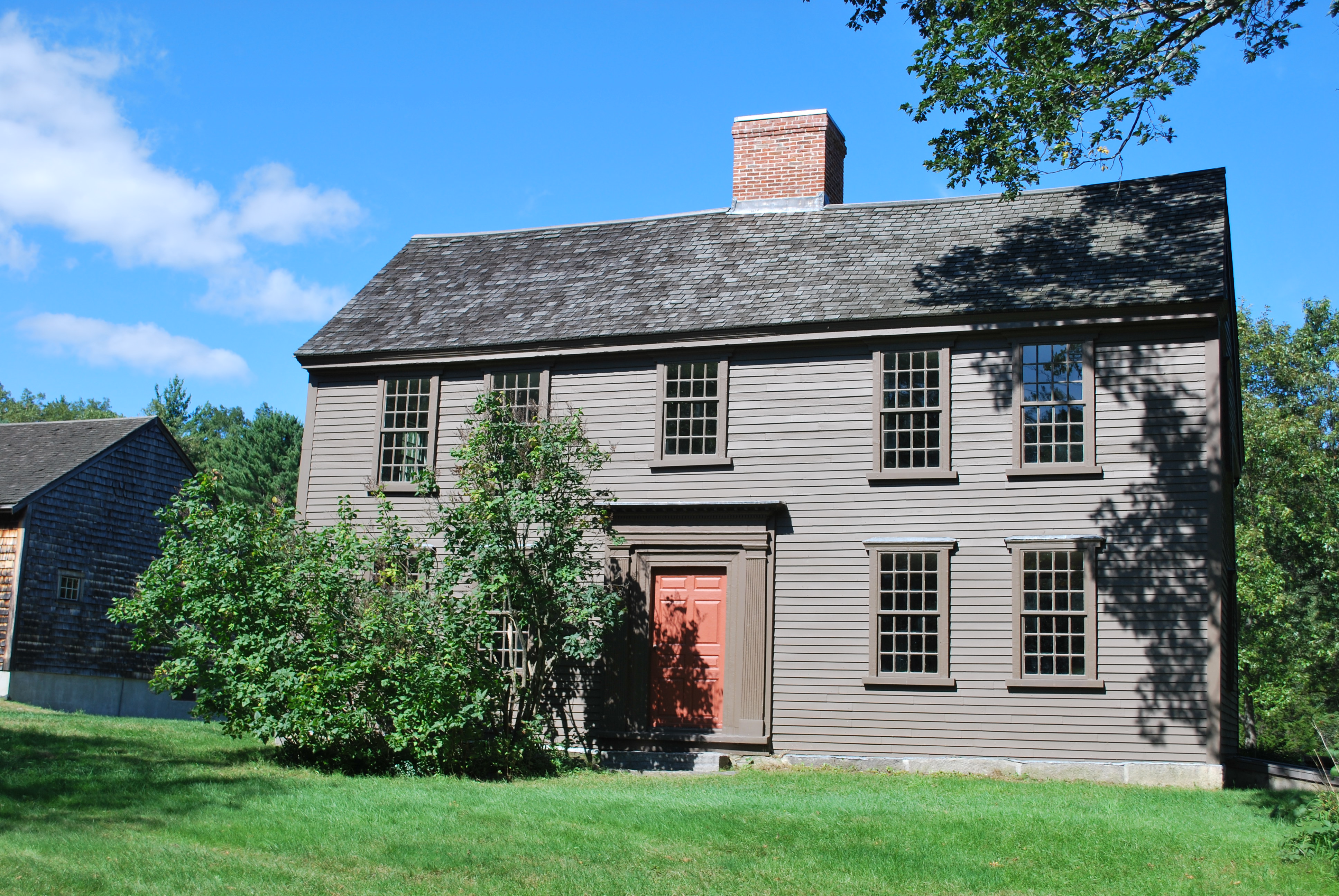
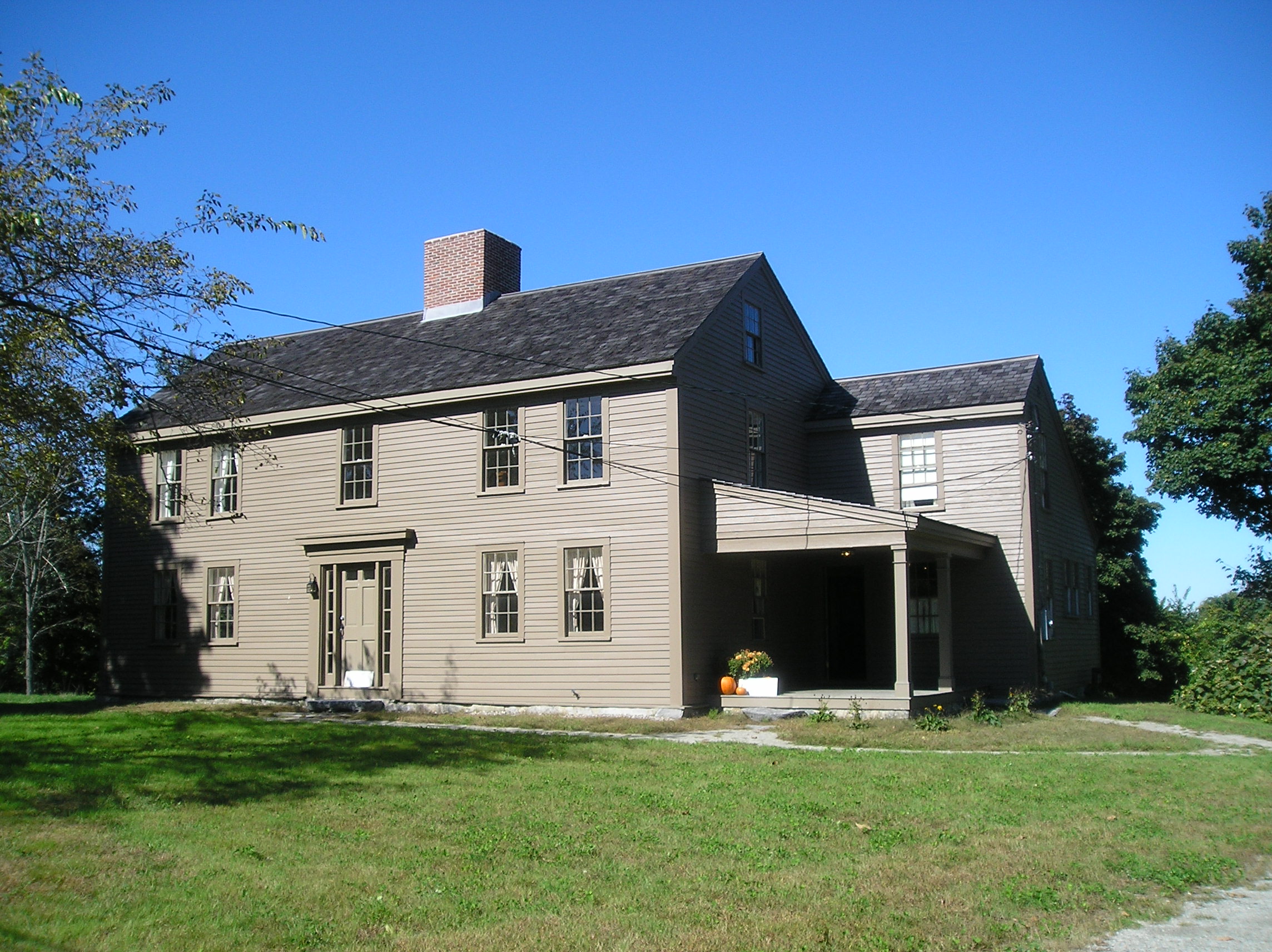
The Captain William Smith House sits on the Bay Road in Lincoln. It was home to William, wife Catherine, three young children and an enslaved man named Cato. On April 19, 1775 the British column passed by here on their way to Concord and again during their fighting retreat to Boston in the afternoon. A wounded British soldier was left behind and treated at the house. He died and is buried near by.
- The Captain William Smith House is a two-story saltbox style house clad in unpainted pine siding. The front of the house faces south and is tall and wide to take advantage of southern exposure. The back of the house features a lean-to addition where the kitchen is located. The lean-to has a low, sloping roof and less wall space exposed to the north wind. The front of the house has a double doorway in the center, painted dark red. There is one window on each side of the doorway on the ground floor and three windows across the second story. There is one window on each side of the house on the ground floor and one on the second floor and small window on the attic. There is a single door on the right (east) side of the house. The central brick chimney includes a popular tablet design and under the roof on the front of the house the cornice is plastered and whitewashed. The trim around doors and windows is red. There is a large, flat stone in front that serves as a doorstep.
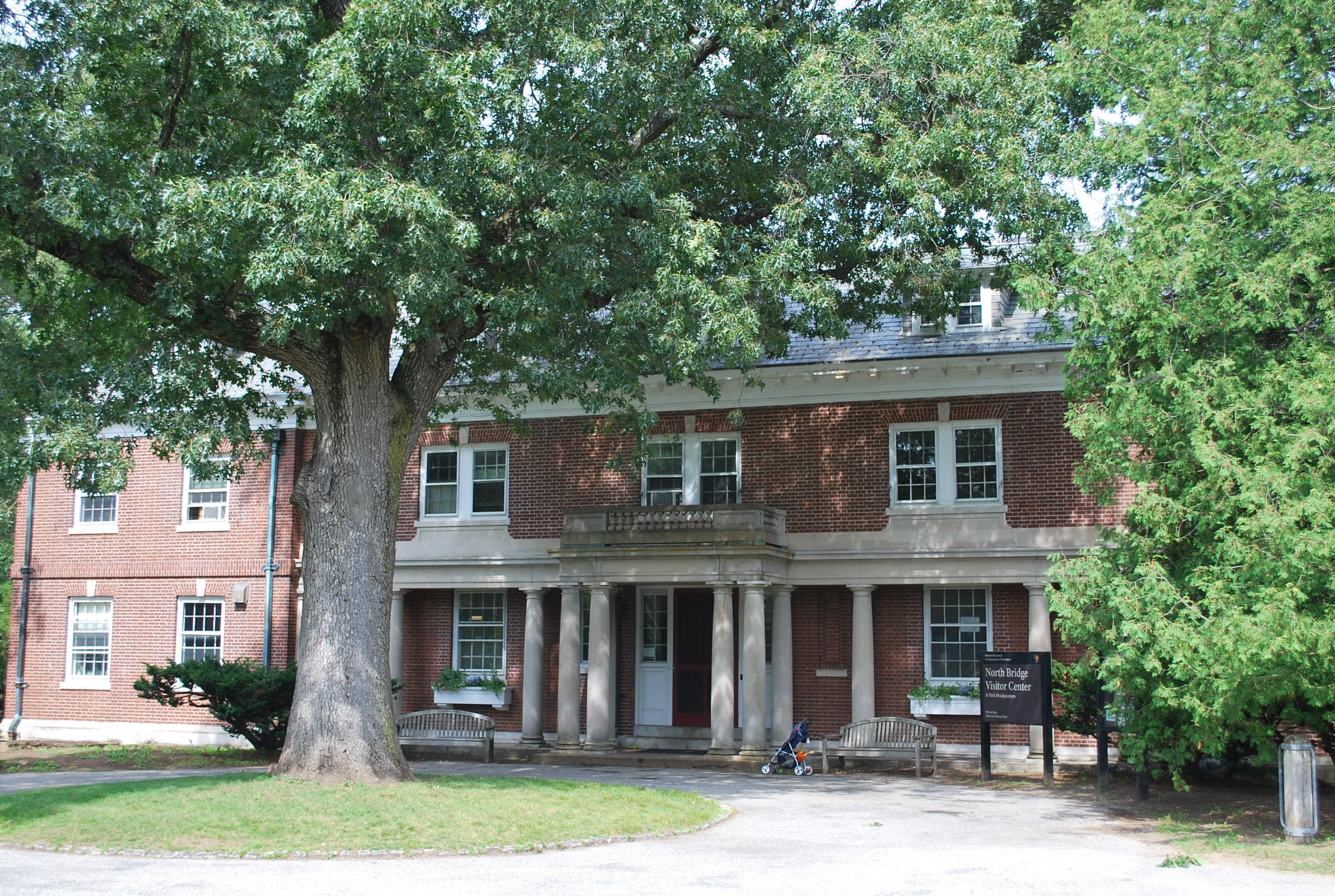
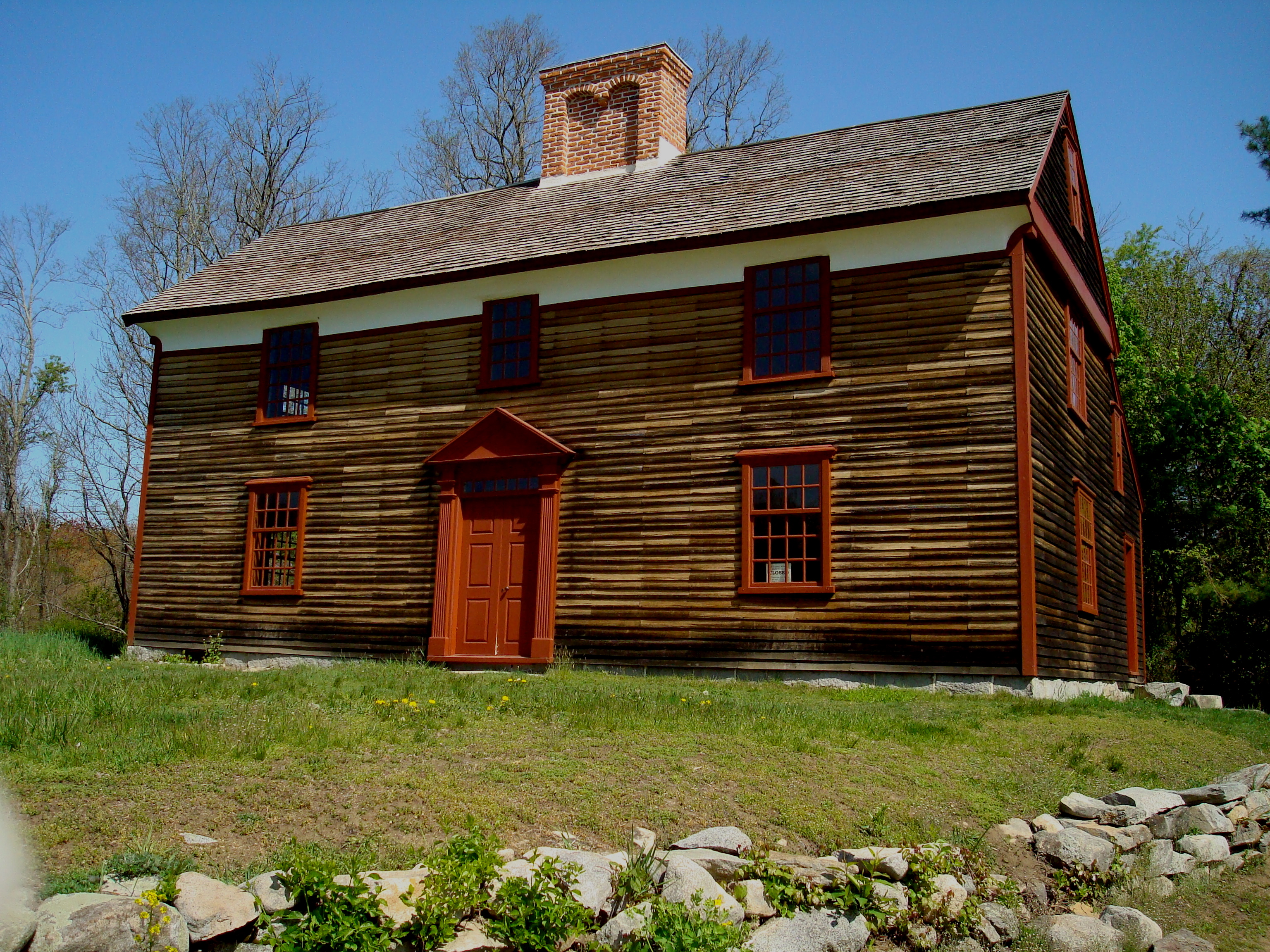
This house was built in 1705 by Benjamin Barrett, father of James Barrett. On April 19, 1775 British Regulars searched this home looking for stores of artillery and ammunition. Though they found nothing there, Colonel James Barrett and members of his family played significant roles in the first battle of the American Revolutionary War.
- A two story colonial home with unpainted wooden siding and cedar shingle roof. There is a central chimney of red brick, a central doorway with a peaked triangular pediment above. There are two 6 pane over 9 pane windows on either side of the doorway with a peaked triangular pediment above each window on the first floor. The windows on the second floor are also 6 over 9 but do not have the pediment. On the left-hand side of the building there is a two and a half story addition with a doorway set slightly back from the main part of the house. There is a doorway on the right-hand side, a window on the left beside it, two windows above on the second floor and two smaller windows above those on the third floor.
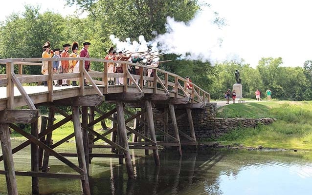
Concord's North Bridge marks the second significant military engagement in the first battle of the American Revolution, April 19, 1775. The first was a few hours earlier in Lexington. At the North Bridge the first British soldiers died.
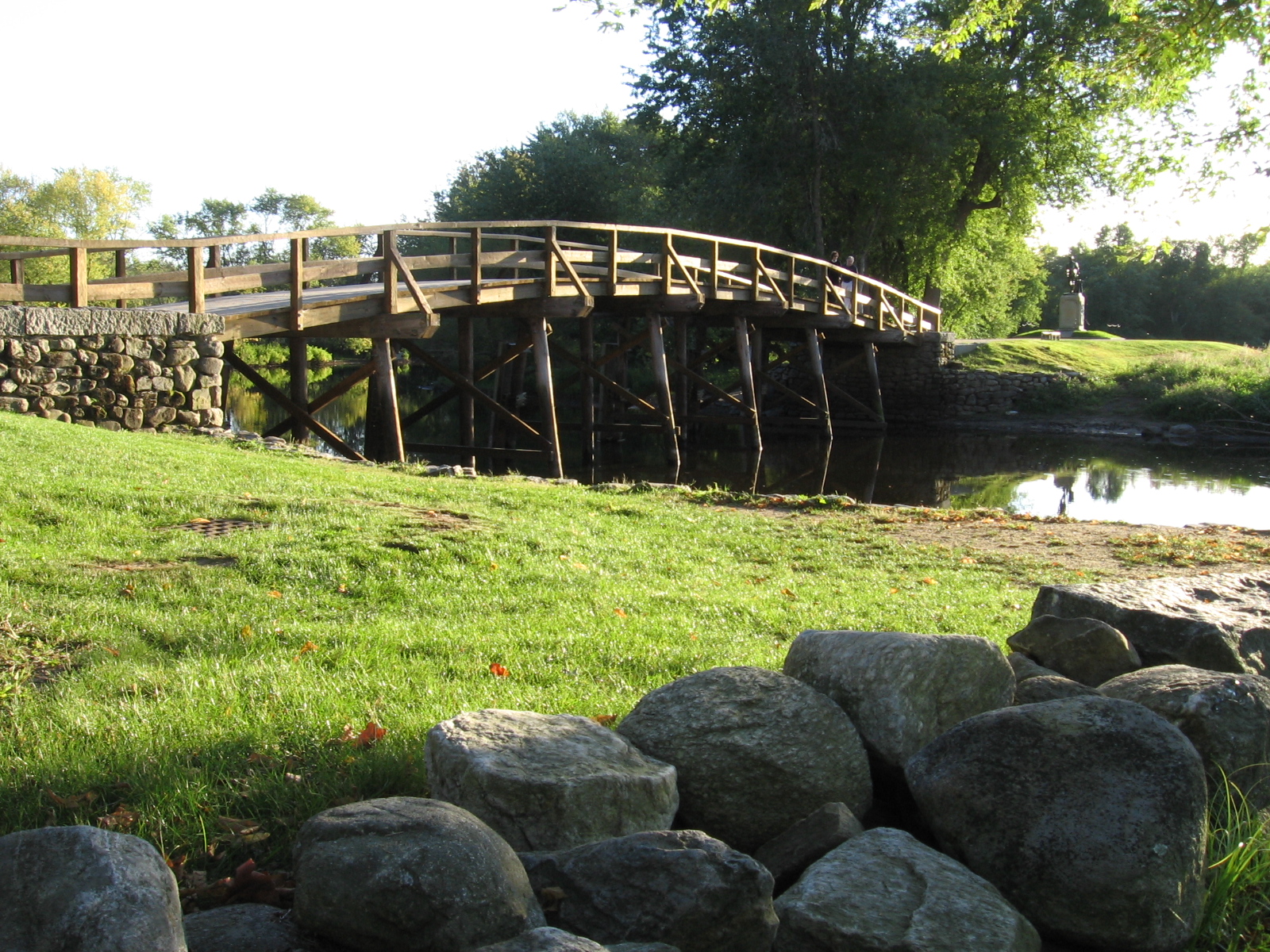
- Concord's North Bridge is today a modern representation of the bridge that stood on this site at the time of the battle on April 19, 1775. It is a slightly arched wooden bridge that spans a slow river with green embankments on either side. On the side nearest the town of Concord on the east there is a stone obelisk, approximately 20 feet high that was erected by the town in 1837. On the west side stands the Minute Man statue. This statue was erected in 1875 and was created by the sculptor Daniel Chester French. It depicts a colonial soldier with a musket, dressed in breeches, shirt and unbuttoned waistcoat walking away from his plough. It is set on top of a rectangular granite base.
At the eastern base of Fiske Hill, a jagged stone foundation marks the location of the historic Ebenezer Fiske house site. This home constructed in the later portion of the 17th century, formed the nucleus of the prosperous Fiske family farm and included over 70 acres of ground on April 19, 1775. When the sounds of battle echoed through the rolling landscape the Fiske family fled to a safer location while their home bore witness to the brutality of 18th century warfare.
- The Ebenezer Fiske House site is situated at the intersection of two roads. One road leads west and goes over the top of the heavily wooded Fiske Hill. Another road skirts the base of the hill running North-South. At the South-West side of where these two roads intersect is a low stone foundation jutting from an open grassy meadow. This stone foundation has three walls consisting of tossed field stone and identifies the location of the once standing Ebenezer Fiske House. At the eastern facing wall of the foundation a large stepping stone marks the long-gone front doorway. Just yards north of the foundation, additional stonewalls mark the location of the original bay road, now the battle road trail. Embedded into the stonewall along the road is a cut stone marker designating the supposed well where Acton militiaman James Hayward confronted a British Soldier. To the south of the house foundation is an orchard surrounded by dense forest that stretches west up onto Fiske Hill. Directly behind the Fiske house site and nearly 200 years into the woods are the stone ruins of a 19th century barn. The barn retaining wall still stands against the hillside and is surrounded by wooden post and rail fencing.
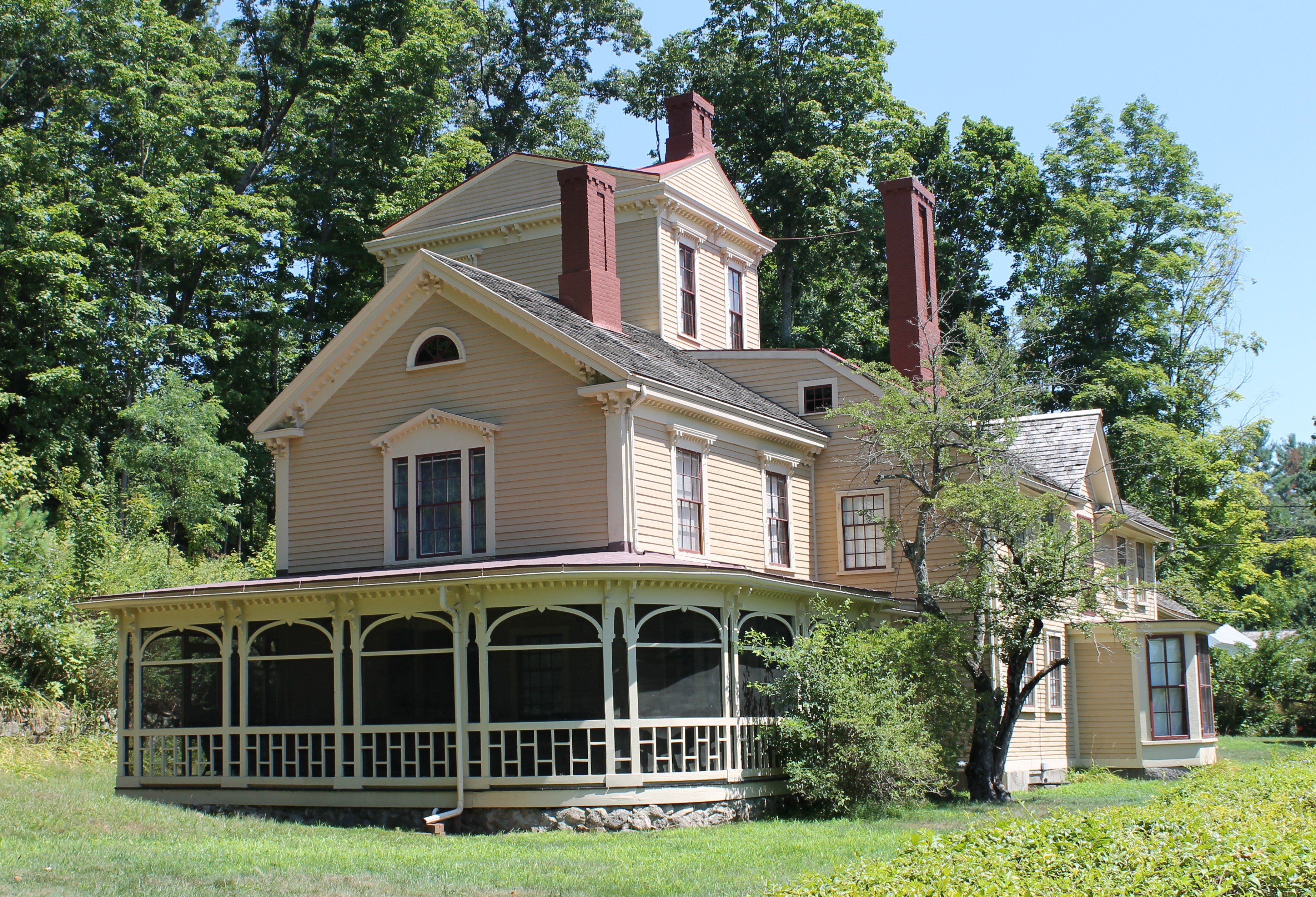
The Elisha Jones, “Bullet Hole House,” built near 1740, boasts a rich history. Only yards from the bloody fighting at Concord’s North Bridge the house is thought to bare the scar of a British musket ball aimed at Elisha Jones on April 19, 1775. In the 19th century the home witnessed the construction and evolution of Concord’s Historical narrative through the life of U.S. Marshal John Shepard Keyes.
- The Elisha Jones house is located at 242 Monument Street, Concord, Massachusetts. It is a yellow two and a half story colonial house with green window shutters and four large chimneys. The original colonial house makes up the southwestern side of the structure. Two large trees shade the yard directly before the front door. The northwestern portion of the home is an attached two and a half story wooden shed with a large carriage door. Near the juncture of the original house and the shed there is a small glass view-port to a round bullet hole. The House is situated on a small grassy knoll and surrounded by tall trees.
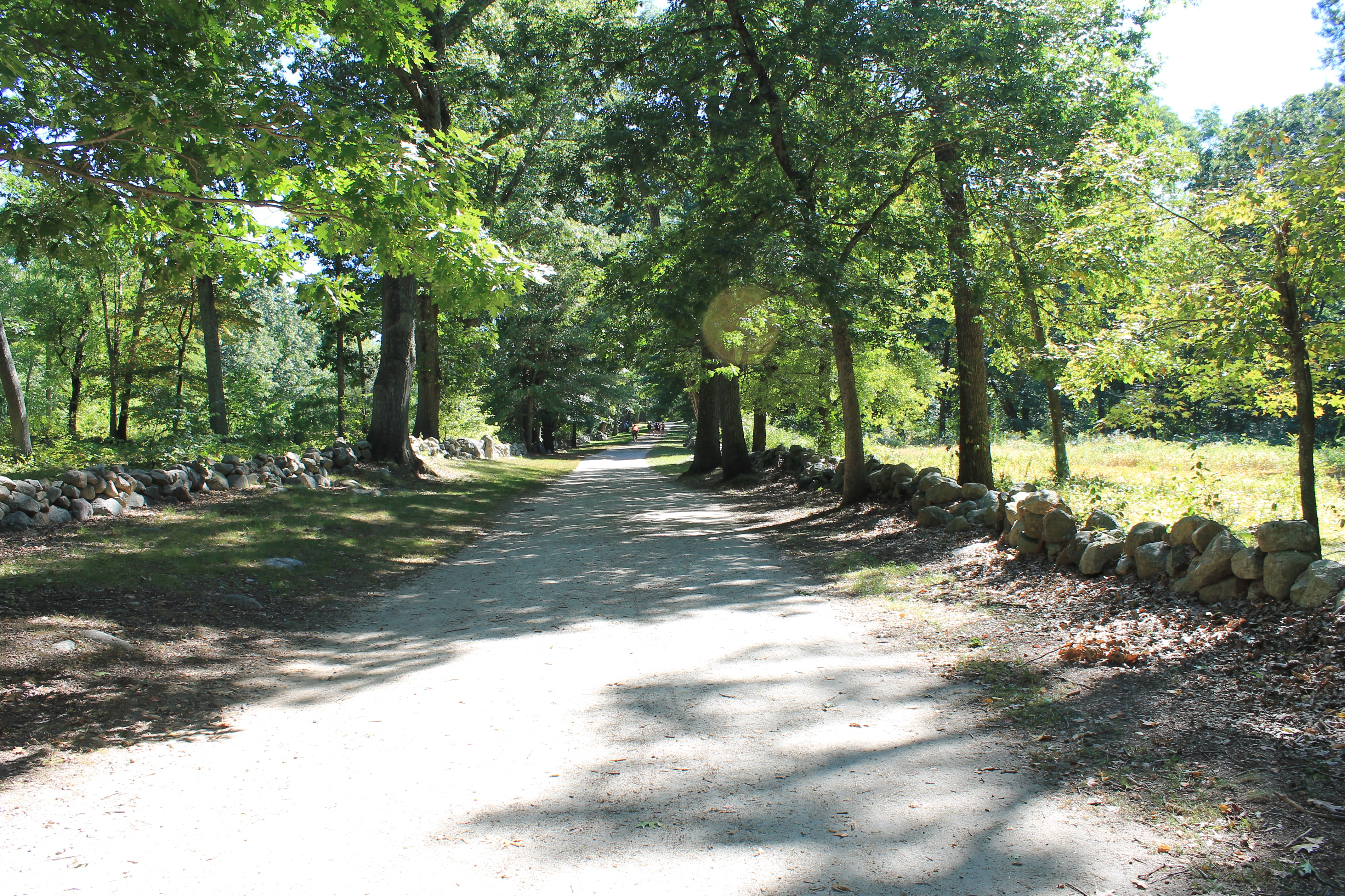
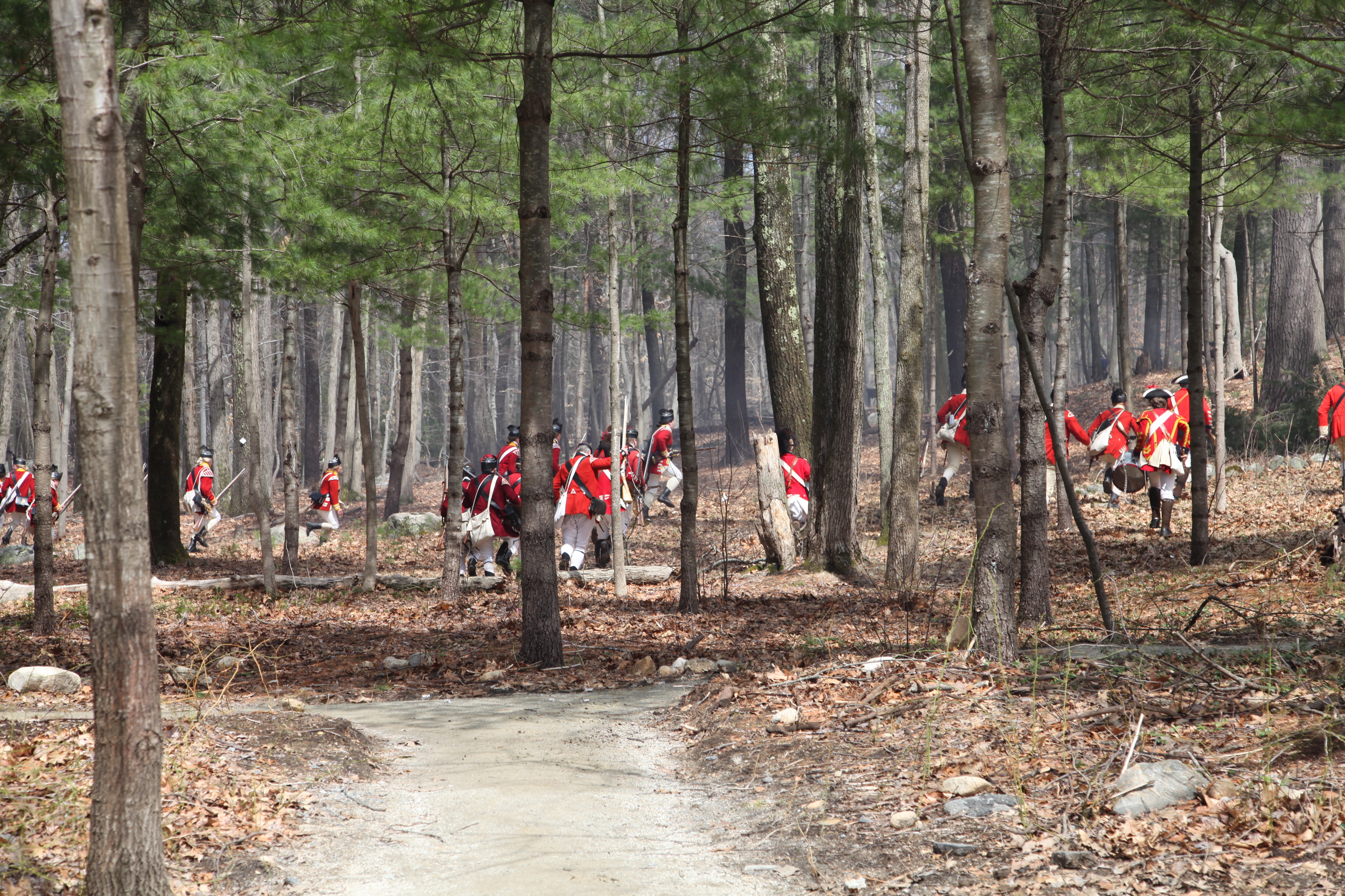
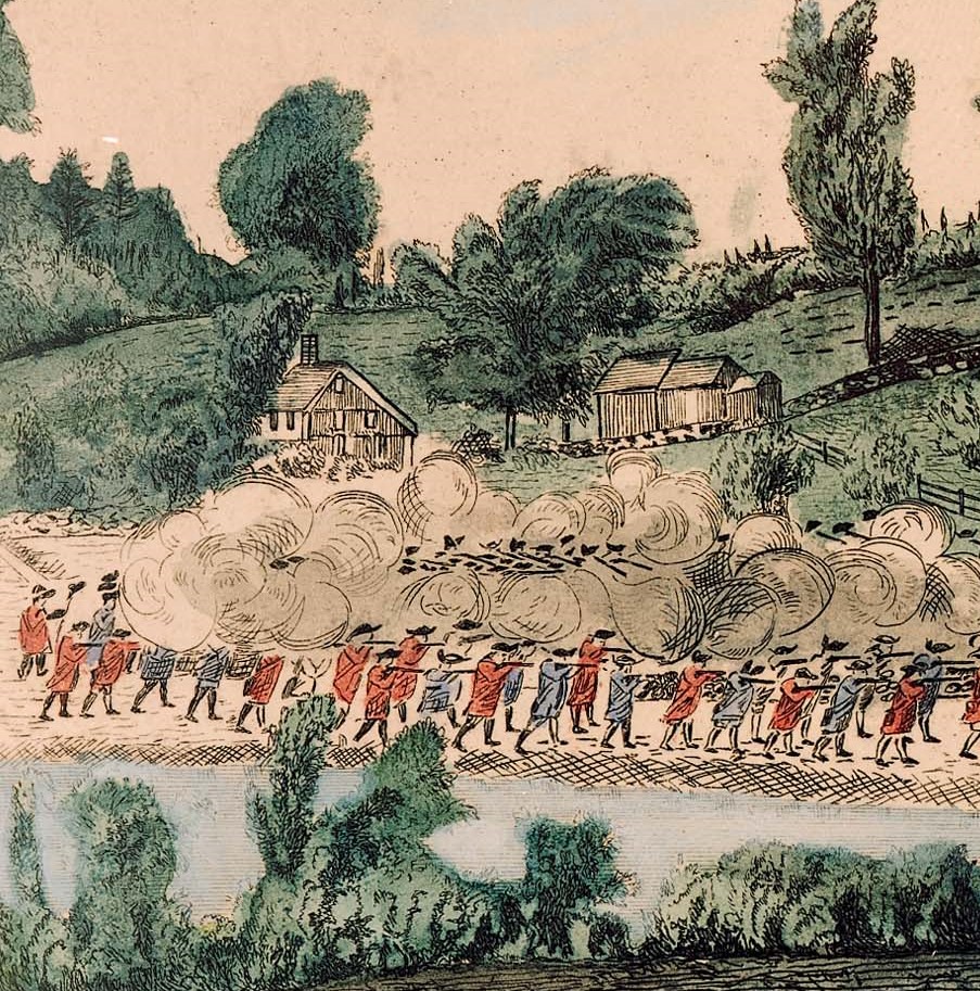
Following the fighting at Meriam’s Corner, the now embattled British column continued their march east towards Boston and safety. Elm Brook Hill (formerly know as the "Bloody Angle") is where militiamen from Woburn, Reading and other towns set up a violent attack against the British column. It was here where the British suffered the heaviest concentration of casualties between Concord and Arlington (Menotomy).
- A dirt road bordered by low stone walls that is wooded on both sides.
Fiske Hill is an elevated position near the western boundary of Lexington, Massachusetts. Gaining its name from the Fiske Family that cultivated the ground during the 18th Century, the hill witnessed intense fighting on April 19, 1775. Colonial Militia used woodlots, stonewalls, and piles of fence rails to attack British Regulars retreating along the Bay Road toward Boston. Today Fiske Hill boasts a diverse natural landscape with numerous hiking trails and historic sites.
- Fiske Hill features a diverse ecosystem including; Sections of Wetland near the lower portion of the hill and along the Battle Road Trail; A large open meadow on the Western slope of the hill is surrounded by thick forested areas; Forest cover large sections of the hill including the summit and eastern face. Within the forested areas there are groves of centuries old pine trees and dense laurel. Occasionally rock walls cross the landscape as a reminder of the historic in-habitation of the hill. On the eastern base of the hill the stone foundation of the Ebeneezer Fiske house remains, along with a large stone barn foundation nestled into the hillside. Aside from historic structures, orchards at both the eastern and western boundaries of the hill mark human occupation. The battle road trail skirts the northern side of the hill and winds through a heavily forested landscape. Along this trail historic markers tell of the fighting on April 19, 1775 and in two places small stones mark the approximate location of British graves. Farther south, a hiking trail bisects the hill from East to West. This trail cuts through open meadows and woodlots.
Encompassing 45 communities in North Central Massachusetts and Southern New Hampshire, Freedom’s Way connects the people, places and communities of the National Heritage Area through preservation, conservation and educational initiatives to protect and promote the natural, historic and cultural resources of the region.
Go Outdoors is a beautifully crafted recycled door, painted by artist Yetti Frenkel. The door evokes the artists’ memories of children’s books and combines words and images into a portal with qualities of whimsy and magic. “The door is my tribute to my parents and all the wonderful hours they spent reading to me, and the joy those memories still bring.”
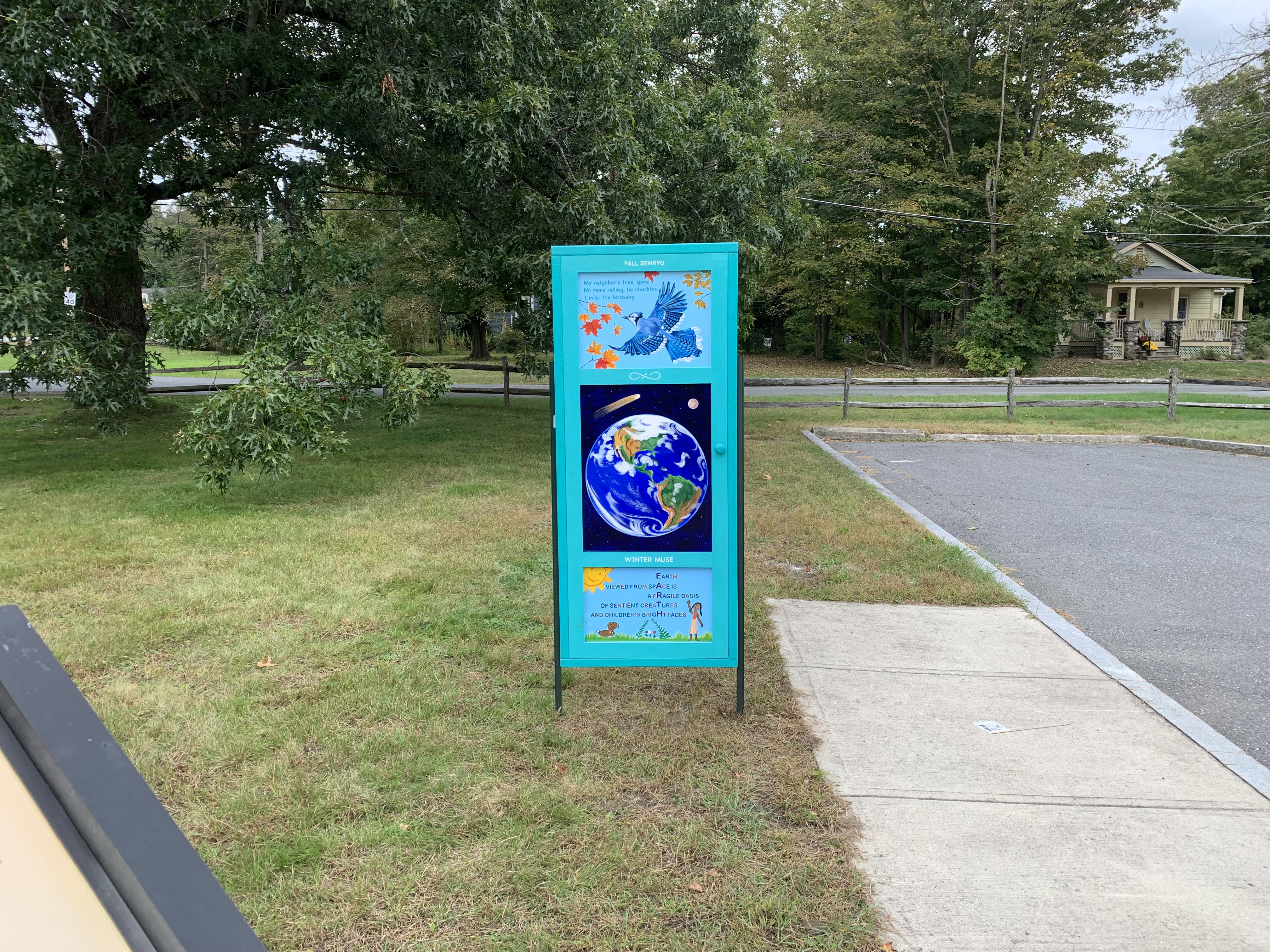
- The reclaimed wood door stands upright just feet north of the edge of the Wayside parking lot. This is a wood door 78 inches tall and 32 inches across. Trim is painted blue. Inset are three panels each with an image. On the top of the painted trim are the words: “Spring Tanka”. Top image is a painting of two ducks, shown from their neck to the top of their heads, one brown, one blue and teal, both with yellow bills. Water and cattails are painted in the background. A small brown frog rests on one of the cattails. Painted text reads: Unexpected frost Fringe of ice at the pond’s edge Spring frogs are sullen, Still, like secretive ducks Hidden in pairs among reeds. The middle image The middle panel is a painting of a cat with brown fur, curled up in a ball, sleeping under a tree branch with wildflowers to the side. Painted text reads: Bees in the garden Purr like the sleeping kitten Curled under the bush. The lower panel is a painting of 2 large yellow sunflower blooms and 4 blooms of a pink and white morning glory. Three yellow and blacked striped bees fly near the flowers with a blue sky background. The painted text above the painting reads: Summer Haiku. The door description on the opposite side: This is a wood door 78 inches tall and 32 inches across. Trim is painted blue. Inset are three panels each with an image. On the top of the painted trim are the words: “Fall senryu”. The top panel is a painted image of a blue jay in flight with wings spread open. It flies among the fall color of a maple and beech trees leaves. Painted text reads: My neighbor’s tree, gone No more raking he chuckles I miss the birdsong The middle panel is a painting of the eath seen from space with blue oceans and continents painted in brown and green. The moon is in the distance and the image of a meteor with a bright tail is near the earth. The lower panel is a painted image of a young girl in a summer dress, standing in a grassy patch with green ferns, white and red flowers and a dog with brown fur nearby. The sun is painted in the upper left corner with a smile on it. The painted text in the image reads: Earth Viewed from space is A fragile oasis Of sentient creatures And children’s bright faces. The painted text above the image reads “Winter Muse”.
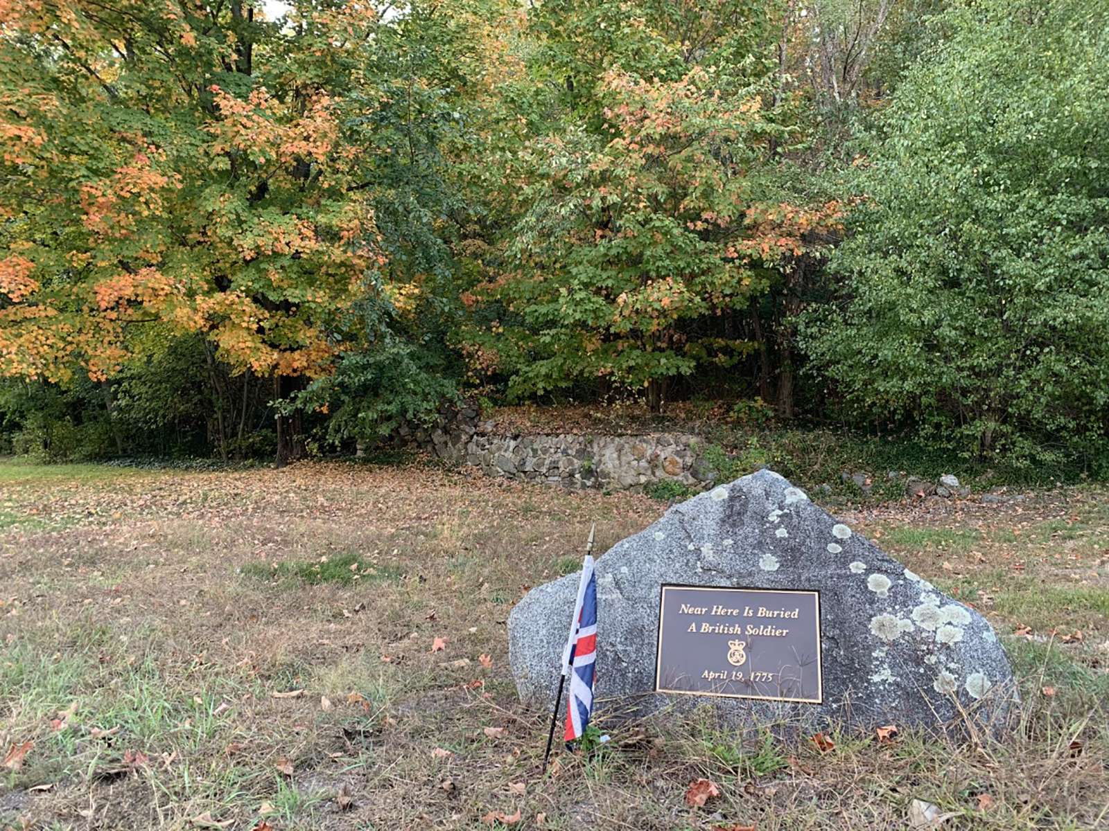
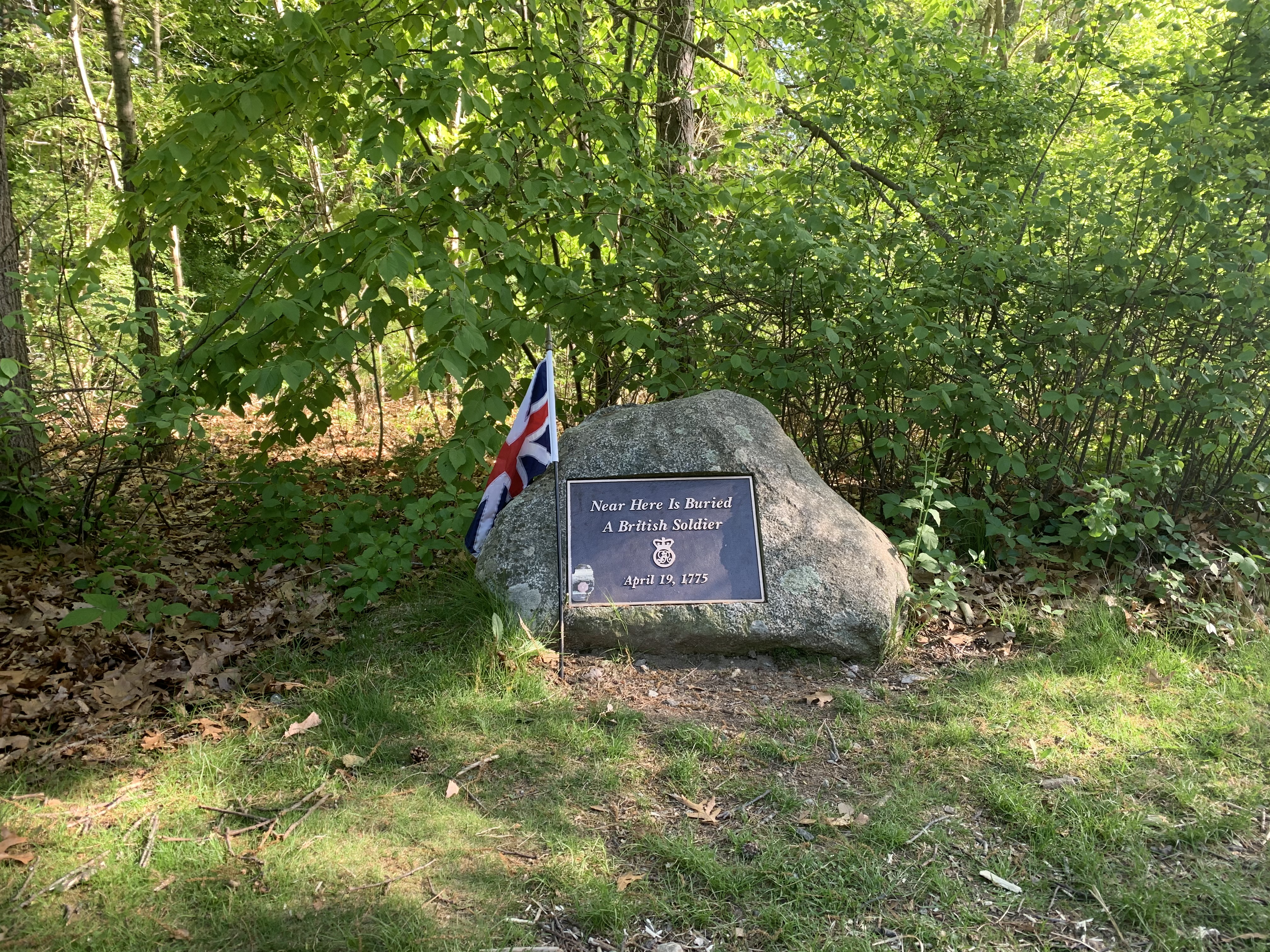
At a sharp outcropping of rocky hillside known as “The Bluff,” British regulars fought a rearguard action during their retreat to Boston on April 19, 1775. This gravestone marks the burial of two British soldiers killed in action near this place.
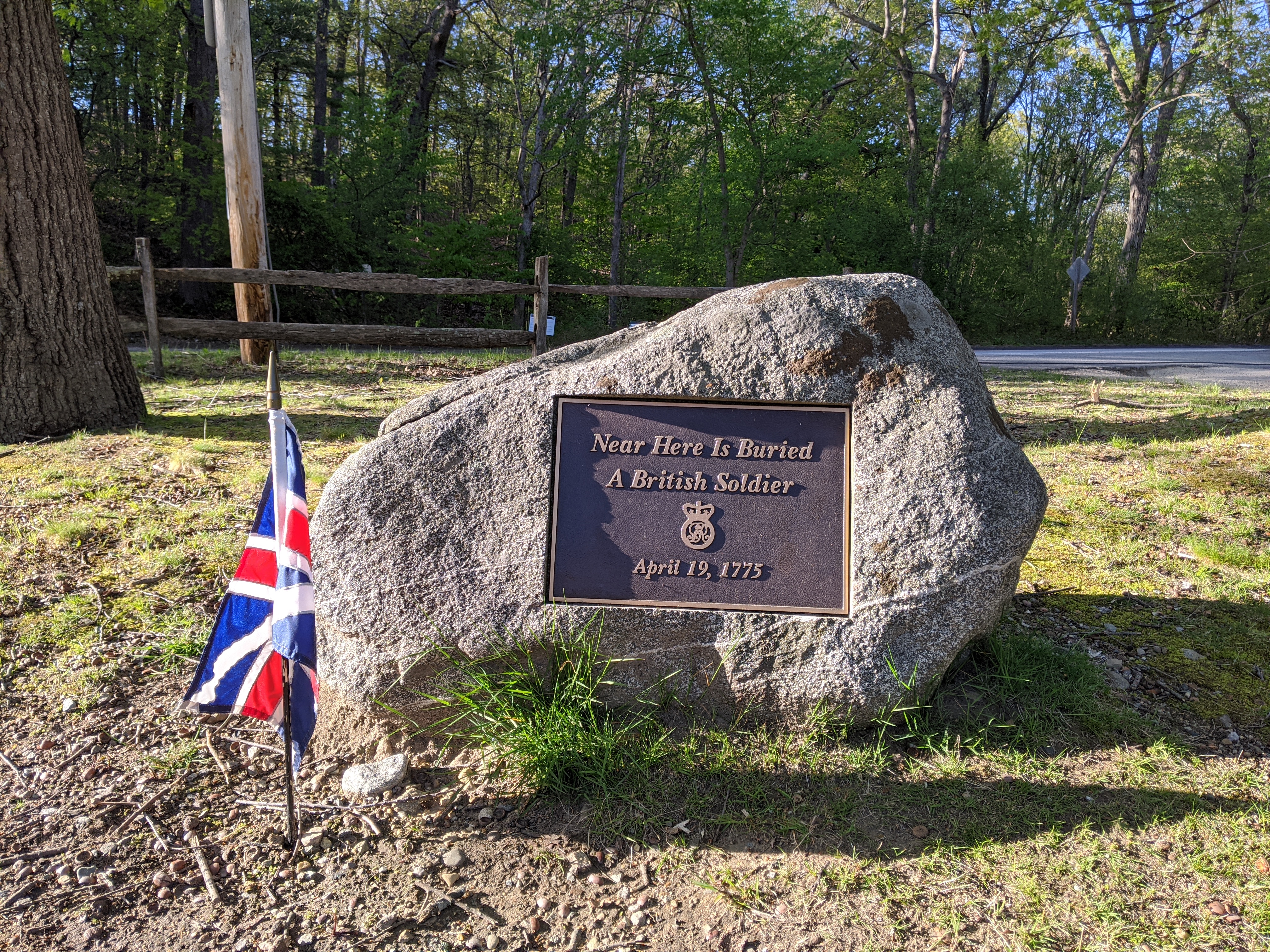
- A small gravestone is situated in a small strip of green grass between modern Massachusetts Avenue and the dirt parking lot for western Fiske Hill. The greenspace is situated at a “Y” shaped spilt in modern route 2A. The gravestone has a dark metal plaque that reads, "Near Here Is Buried A British Soldier April 19, 1775." Directly behind the gravestone is a large tree and a wooden split-rail fence separating the green space from modern Massachusetts Avenue. Across the road to the north is the battle-road trail running east/west and a dense tree lot that raises sharply to the north-west. This hill constitutes the famed "Bluff" where British soldiers and Colonial militia clashed on April 19, 1775. To the west of the grave marker is a large open field with numerous trees and an orchard that comes to a point in the center of the “Y” shaped intersection. To the south of the grave marker is the dirt parking lot of Fiske Hill and a dense tree line broken by a trailhead. To the east of the grave marker is the entrance of the Fiske Hill parking lot and a dense tree line that obscures the dramatic rise of Fiske Hill in the distance.
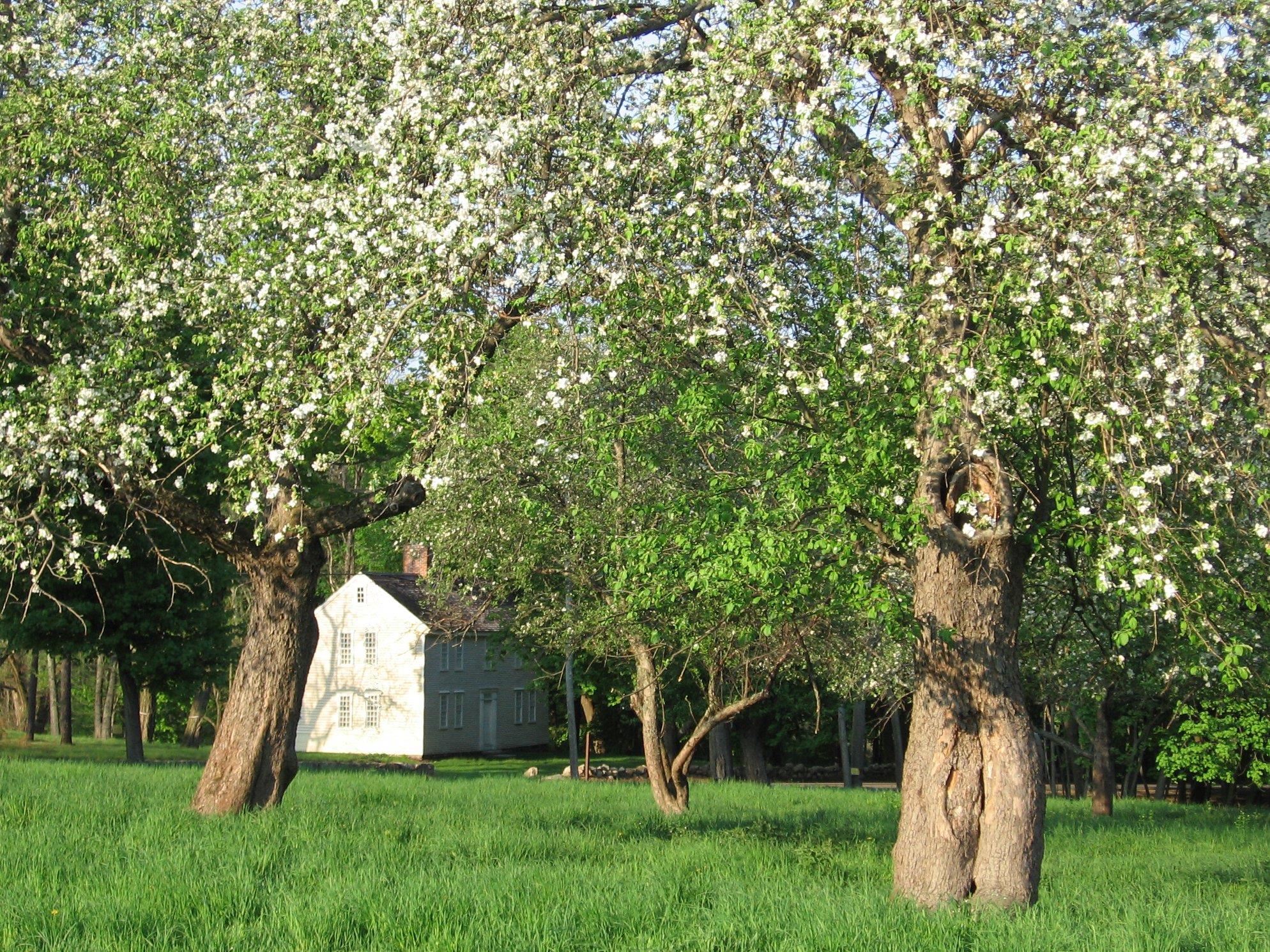
This gravestone makes the final resting place of the first British soldiers killed on April 19, 1775. They were killed during the fight at Concord's North Bridge, of which Ralph Waldo Emerson later wrote, "Here once the embattled farmers stood and fired the shot heard round the world."
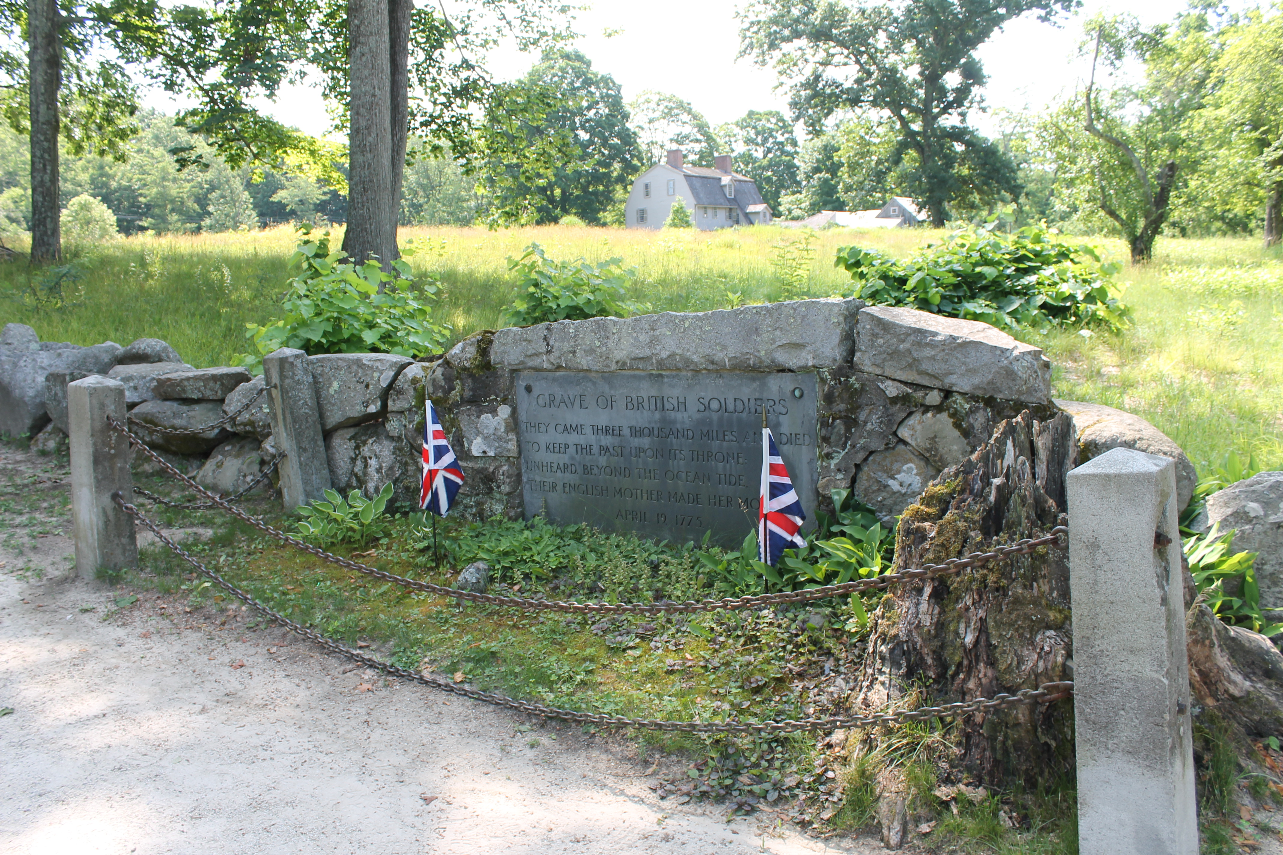
- A stone slab marking the graves of two British soldiers is embedded within a low stonewall near Concord's North Bridge. The grave is located only feet from a large stone obelisk erected in 1836 to commemorate the British position during the battle. The gravesite is surrounded by a low chain fence that protects the original fieldstone markers. The original stones are small, rough, and moss-covered. The stones, along with two British flags are placed in a small bed of plants. Behind the grave and the stonewall is a wide open field with a slight rise leading to the Old Manse house. The gravestone reads "GRAVE OF BRITISH SOLDIERS: They came three thousand miles and died to keep the past upon its throne. Unheard. Beyond the ocean tide. Their English mother made her moan. April 19, 1775." On the western side of the grave is the stump of a centuries old tree that grew into the fencing. The stump is short and rotting away.
On April 19, 1775 British soldiers retreating from Concord, Massachusetts engaged Colonial militia in a running battle toward Boston. According to local legend, one British soldier was mortally wounded near the home of Captain William Smith in Lincoln, MA and left to the mercy of his pursuers. Unfortunately, this soldier perished from his wounds and the Smith family interred him along the battle road in an area known as Folly Pond.
- The grave of a British soldier is marked on the southern side of the battle road trail between the Captain William Smith House and Paul Revere capture site. The grave itself is located at a small rise in the trail just before descending westward to an underground walking tunnel that crosses under the nearby highway. The grave marker is a gray field stone with dark metal plaque set into the front. The plaque reads, "Near Here Is Buried A British Solder April 19, 1775." The grave is set back from the trail approximately four feet and surrounded by well manicured grass. At the base of the grave is a small British flag on a black painted stick planted in the ground. Behind the grave there is a thick tree line with a tangle of bushes and other plants that obscure the highway nearby.
Thaddeus Blood took part in the fighting at North Bridge in Concord, MA, on April 19, 1775, as part of Nathan Barret’s Company. Blood is buried in New Hill Burying Ground later a part of Sleepy Hollow Cemetery in Concord, Ma.
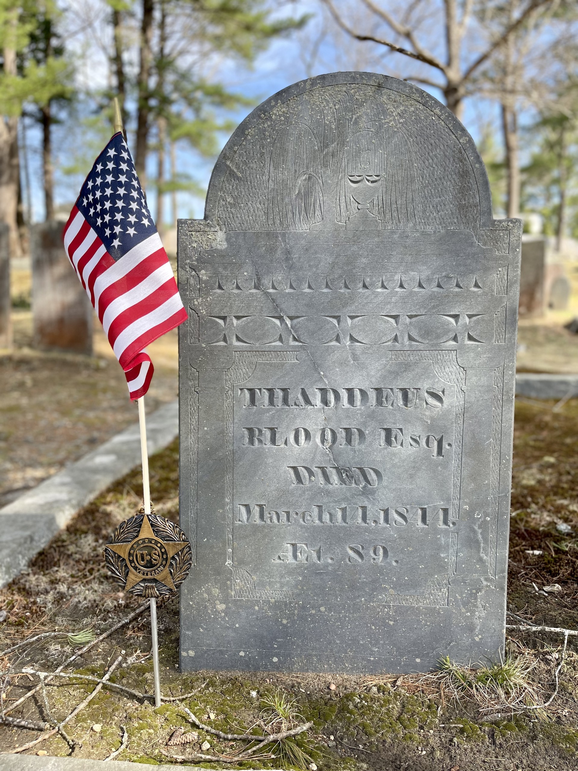
- Sleepy Hollow Cemetery is located on Bedford Street in Concord, Massachusetts. One can enter the cemetery via the Bedford Street Gate, turn right, and travel north along the paved road for about 120 feet. The Blood Family plot is in Lot 114 on Path F. It is necessary to leave the paved road and walk about 30 feet along a grassy, uneven, softly sloping hill to reach the grave. The plot is outlined with tall granite curbing. Grave one is a large slate gravestone decorated with a willow and urn on the upper part of the stone. The brief text on the gravestone states, Thaddeus Blood Esq. Died March 11, 1844 On April 19, 1775, Thaddeus Blood fought as part of Nathan Barrett’s Company. A flag holder next to the grave designates him as a veteran.
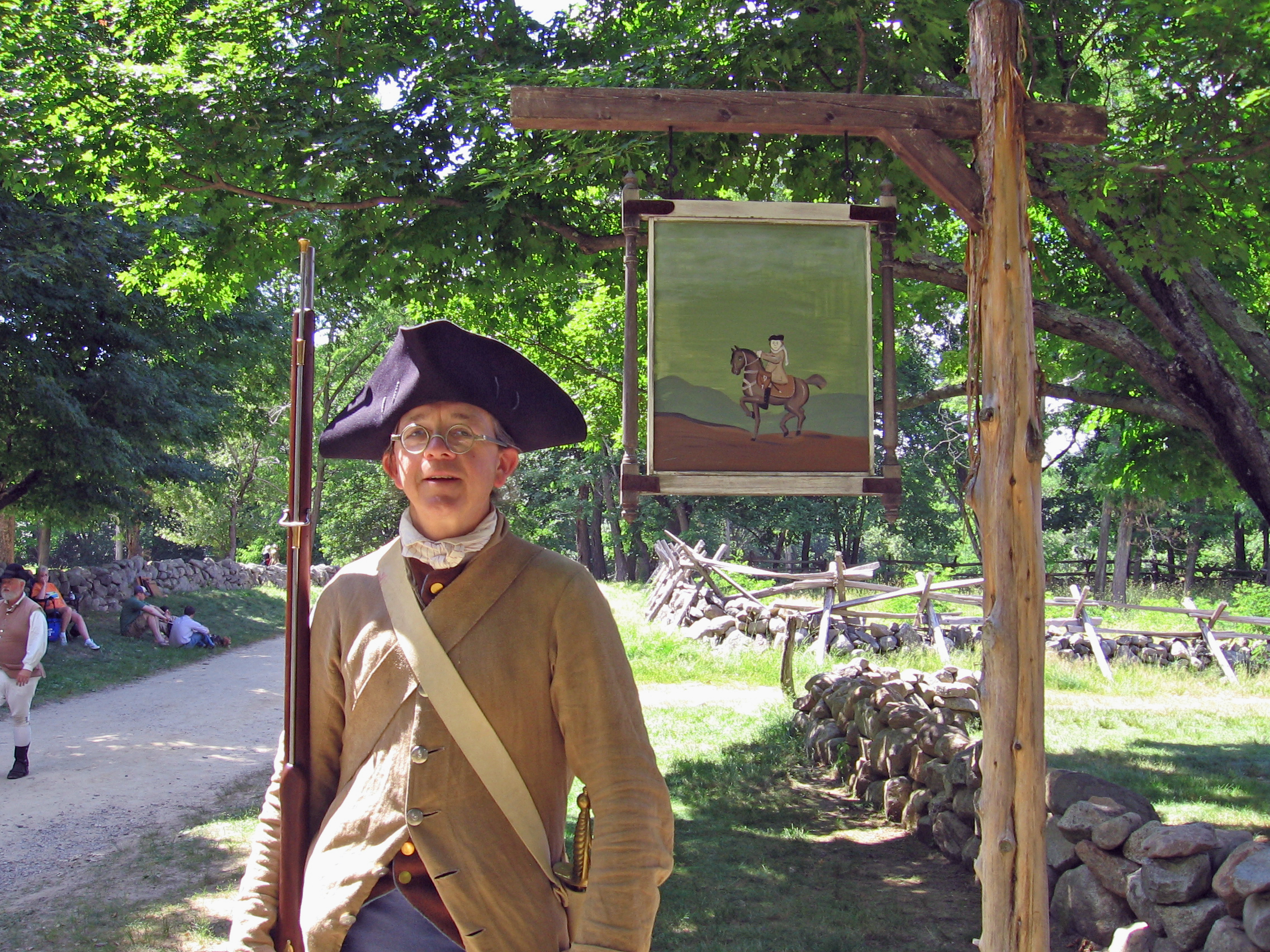
Hartwell Tavern was a well-known stop for travelers on the Bay Road in Lincoln. On April 19, 1775 the British column passed by here on their way to Concord and again during their fighting retreat to Boston in the afternoon. Three of the Hartwell sons, including John and Isaac who lived here, fought as minute men.
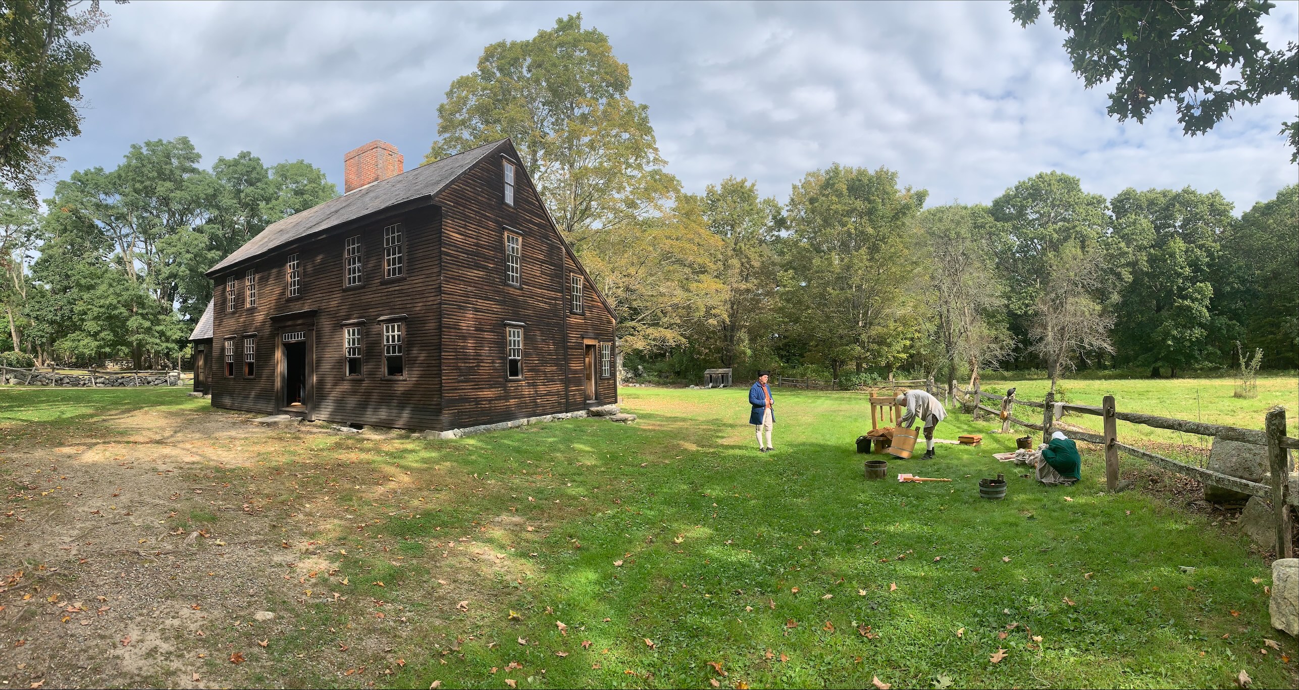
- Hartwell Tavern is a two story colonial saltbox-style house clad in unpainted pine siding darkened with weathering. It has a large front facing south, and on the back of the house, facing north their is a lean-to with a low, sloping roof where the kitchen is located. There is a brick chimney in the center of the roof. There is a double doorway in the center of the ground floor with a large, flat stone for a step. There are two windows on each side of the door. There are five windows across the top of the second story. There is a two story addition attached to the left (west) side of the house with a gambrel roof. There are two windows on the ground floor and a single door on the left-hand side. Two windows are set in dormers in the roof on the second floor.
The Jacob Whittemore House is the only April 19th witness house in the park that is in the town of Lexington. Paul Revere passed by here on his midnight ride. Later the British column passed by here on their way to Concord, and back again in the afternoon during their fighting retreat back to Boston.
- The Jacob Whittmore house is a colonial saltbox style house clad in wood siding painted dark brown. The front face of the house features a central single doorway painted dark red with a large, flat stone for a doorstep. There are two windows on either side of the door on the ground floor and five windows across the second story. The left (west) side of the house features one window on the ground floor, two windows on the second floor and a small window in the attic. There is a single door with stone doorstep on the west side of the house. The back of the house features a low, sloping roof and the back face of the house is shorter than the front. There is a brick chimney in the center of the roof.
The Job Brooks House sits on the Bay Road. On April 19, 1775 the British regulars marched past here on their way to Concord, then back again during their fighting retreat to Boston. An intense skirmish took place just yards from this house at Elm Brook Hill.
- The Job Brooks House is a two story colonial home, rectangular in shape with pale yellow wooden siding. The front of the house features a central doorway with a large, flat stone serving as a step. There are four windows across the front of the house, two on each side of the central doorway, and five windows across the front of the second story. Each side of the house includes two windows on the ground floor, two windows on the second floor and a small window at the attic. There is a central chimney made of brick.
This house was built between 1710 and 1717. In 1775 it was the home of Major John Buttirck of Colonel Abijah Pierce's Minute Man Regiment. On April 19, 1775 Major Buttrick led the advance at Concord's North Bridge and gave the order to fire upon the British soldiers.
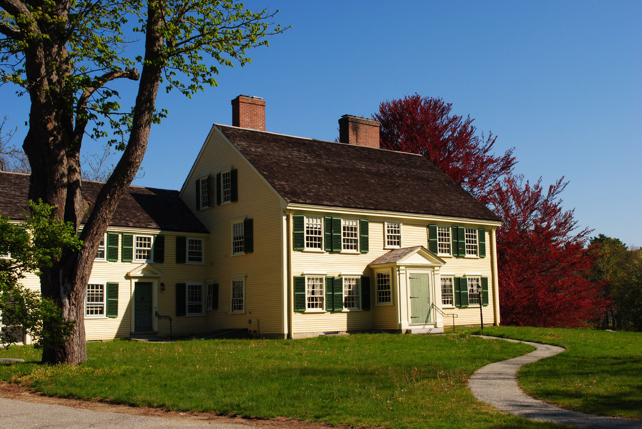
- Yellow wooden house with green shutters and doors, two stories high. Green lawn in front with a tree with maroon leaves behind.
Meriam's corner is where colonial militia first attacked the British column during their return march to Boston on April 19, 1775. It was the beginning of the 16 mile running fight known as the Battle Road.
- Meriam's Corner is a road junction where Lexington Road running east is joined by Bedford Road coming down from the north. There is a dark gray two-story colonial house northeast of the road junction. Directly east of the junction the road crosses a small watercourse called Elm Brook. North of the site are open fields and a meadow.
The Nathan Meriam House, built in 1705, is located at the junction of the Lexington and Bedford Roads. It was here that the British column was first attacked by colonial militiamen on the return march to Boston. This spot marks the beginning of the running fight known as the Battle Road.
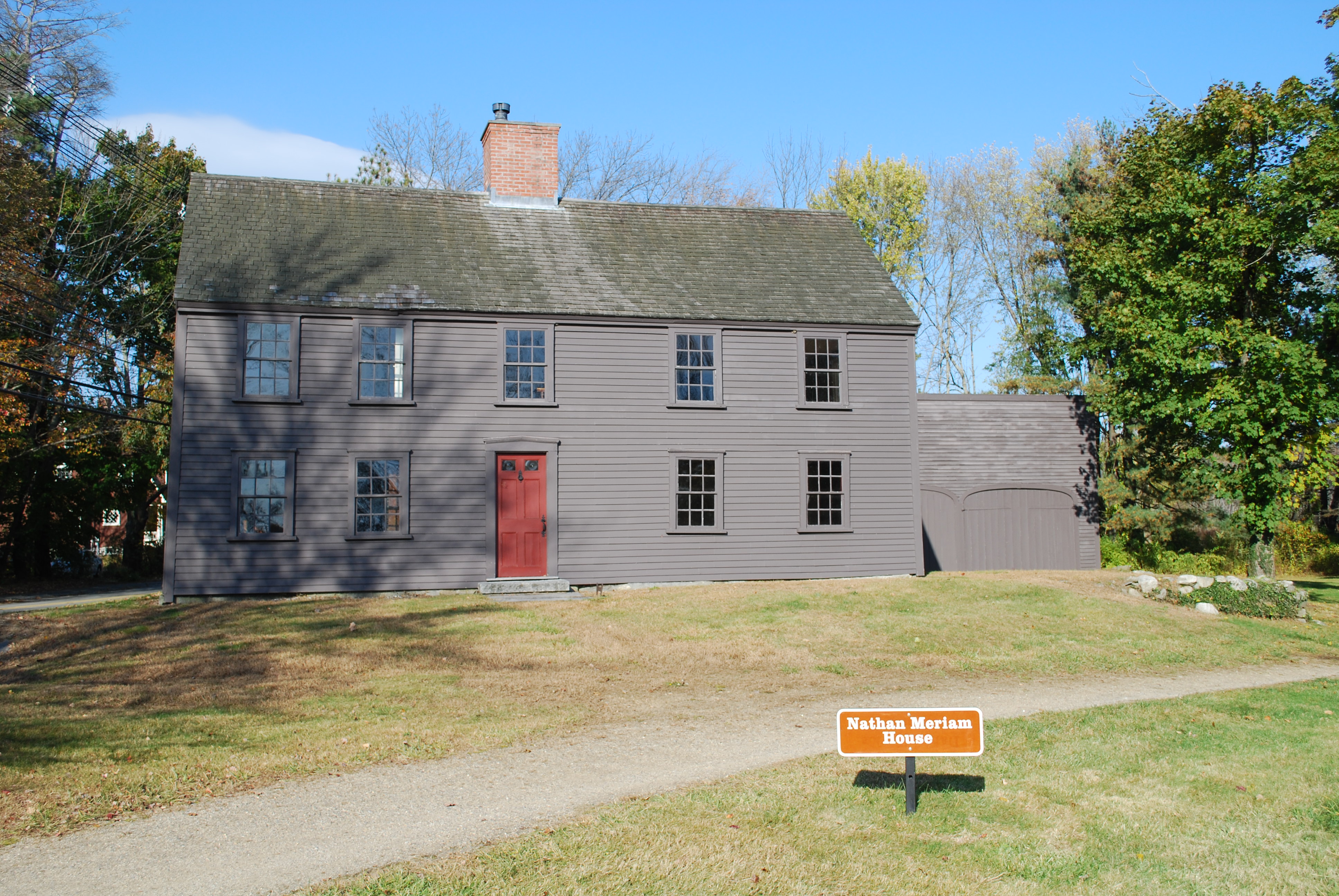
- Meriam's Corner is where two roads form a T-junction. The Lexington Road, also known as the Battle Road, runs east/west. The Bedford Road comes in from the north. 100 feet east of the road junction there is a narrow brook running from the north that cuts across the Lexington Road and is spanned by a stone and cement culvert. At the junction there is a wide green lawn with a walking path running along the edge of it leading to a two-story colonial house. The wooden siding is painted a dark gray and the central front door is painted dark red. The door features four panels and two small, square windows at the top. There are two windows on either side of the door on the ground floor and five windows across the second floor. There is a central brick chimney on the main part of the house. There is a one-story carriage house attached to the right side of the house with two bays.
Parker's Revenge is the name given to the second engagement between the British regulars and the Lexington militia company under Captain John Parker. Despite the significance of the battle the location was a mystery. Between 2012 and 2016 Minute Man NHP, in partnership with the Friends of Minute Man National Park, NPS Northeast Region Archaeology Division, and community partners and volunteers, conducted a historical and archaeological investigation to find it.
- This location is wooded with the land gently rising from the historic roadway up about 75 yards to a ridge dotted with large boulders. Adjacent to the site on the right is a large rocky outcrop. Beside the outcrop on it's left is the trace of a colonial track way bordered with the remnants of low stone walls.
This is the spot on the old Concord Road where Paul Revere was captured by a patrol of British officers, thus bringing to an end his famous "midnight ride."
- The site is an open field, bounded on the north by a line of trees overlooking a housing complex, and on the south by a busy road. The monument is a granite marker at the head of a circular stone enclosure open at one end, with a plaque that reads: "At this point on on the old Concord Road as it then was ended the midnight ride of Paul Revere. He had, at about two o'clock of the morning of April 19, 1775, the night being clear and the moon in its third quarter, got thus far on his way from Lexington to Concord, alarming the inhabitants as he went, when he and his companions, William Dawes of Boston and Dr. Samuel Prescott of Concord were suddenly halted by a British patrol who had stationed themselves at this bend of the road. Dawes, turning back, made his escape. Prescott, clearing the stone wall, and following a path known to him through the low ground, regained the highway at a point further on, and gave the alarm at Concord. Revere tried to reach the neighboring wood but was intercepted by a party of officers accompanying the patrol. Detained and kept in arrest, presently he was carried by the patrol back to Lexington. There released, and that morning joined Hancock and Adams. Three men of Lexington, Sanderson, Brown and Loring, stopped at an earlier hour of the night by the same patrol were also taken back with Revere."
"Playtime For Prince/Black Boy Joy Honoring Prince Estabrook" is a gorgeously decorated, recycled door crafted by regional artist Cassandre Charles. The door explores how enslaved children found joy while also honoring Prince Estabrook a Patriot of Color in the American Revolution.
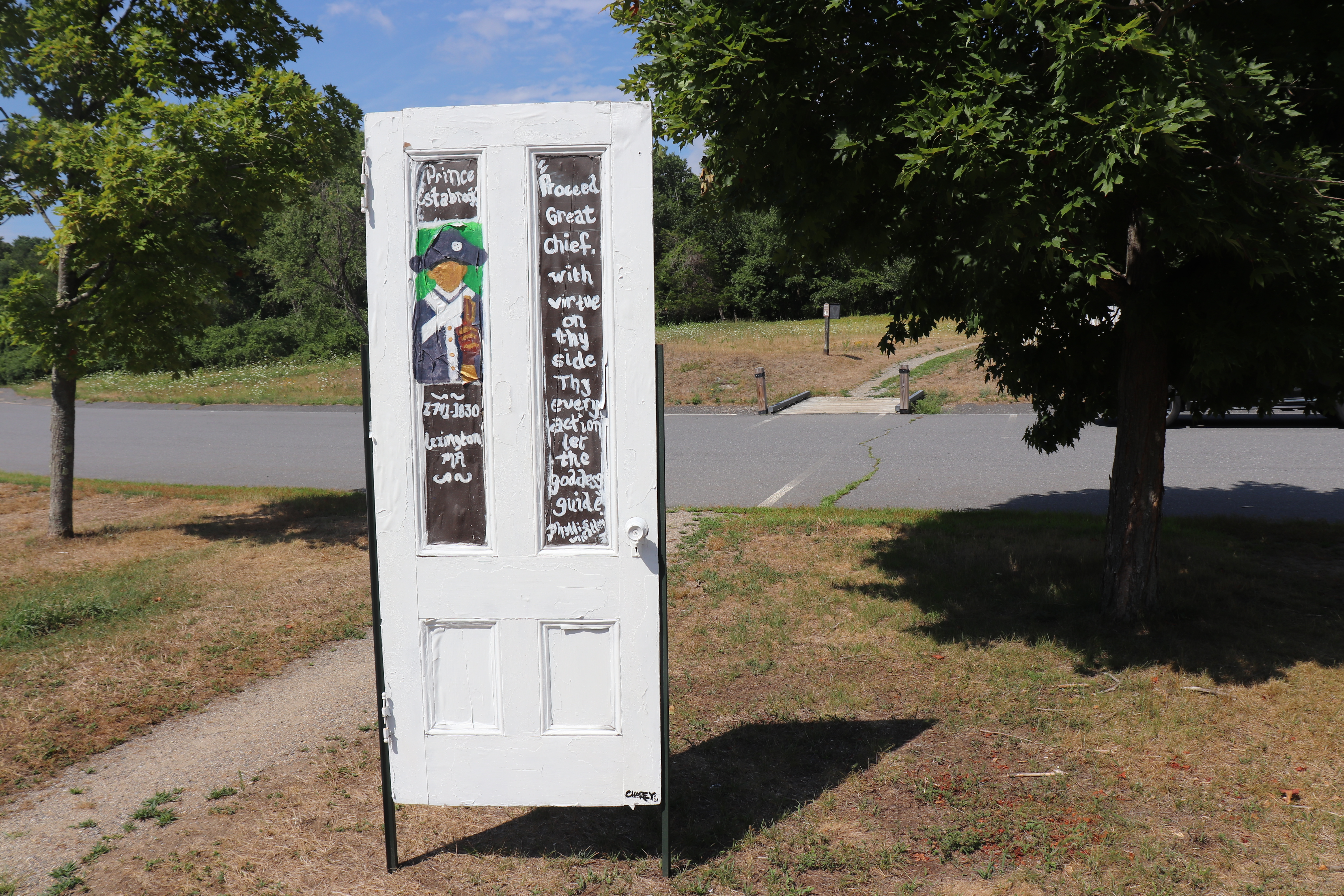
- This reclaimed door stands approximately 30 yards from the front entrance of Minute Man Visitor Center in Lexington Massachusetts. The door is position roughly 3 feet from the edge of a cement walking trail running between the parking lot to visitor center entrance. The door is also positioned under a towering tree, shaded from the elements and in direct sightline of the visitor center front entrance. The reclaimed door is staked into the ground and towers approximately 6' 2" tall and measures 2.5' wide. The door is painted white and features artistic renderings on the front and back. On the east facing front (towards the Visitor Center) the door features two large and long panels, painted brown with the writing "Prince Estabrook," "1791-1830 Lexington, MA," "'Proceed Great Chief. With virtue on thy side Thy every action let the goddess guide' Phillis Wheatley." The top left panel also features the artists rendition of a Patriot of Color in Continental Army uniform, without distinguishing facial features. Two smaller panels at the bottom read "Play 1748" The second small bottom panel features a painted heart with the artists signature, "-Charley" The west facing back features two long panels depicting colorful scenes of Enslaved children playing. On the left panel two young children play in a green field, under a tall tree, with a blue sky and large sun visible above. The Tree in this panel is 3 dimensional and constructed of reclaimed wood. The Right panel features three enslaved children playing in a field before a colonial house with smoke rising out of the chimney. The Blue sky fills overhead. The two smaller bottom panels also depict children at leisure. In the lower left a Black child lays on a bed of green grass looking into the night sky filled with shining stars. On the bottom right a Black child with a large sun hat sits along the bank of a river looking over the water and the distant shore filled with green trees and vegetation.
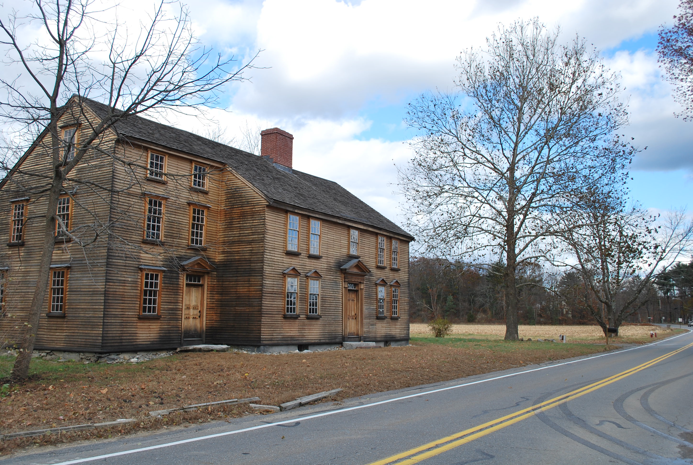
Samuel Brooks (1739-1811) was living with his widowed mother on land first settled in 1692 by his grandfather Daniel, on the Bay Road in Concord. His house was located on the border of the town of Lincoln in an area that had been owned by members of his family since the mid-17th century. Samuel Brooks was a veteran of the battle on April 19, 1775. On that day the British Army passed by here on their way to Concord and later back again during their fighting retreat to Boston.
- The Samuel Brooks House is a two story colonial house with gray-brown wooden siding. It has a central doorway with a stone slab as a step. There are two windows on each side of the door on the ground floor and 5 windows running across the second floor. On each side there are two windows on the ground floor, two windows on the second floor and a single window in the attic. The house has a central brick chimney and an open porch on the right (east) side. There is a one story shed attached to the left (west) side of the house and a two story addition on the right (east) side of the house with a separate doorway.
This was the home of Samuel Hartwell, his wife Mary, and their three small children. Samuel Hartwell served as a sergeant in the Lincoln Minute Men and was thus part of the fighting in Concord and along the Bay Road on April 19, 1775.
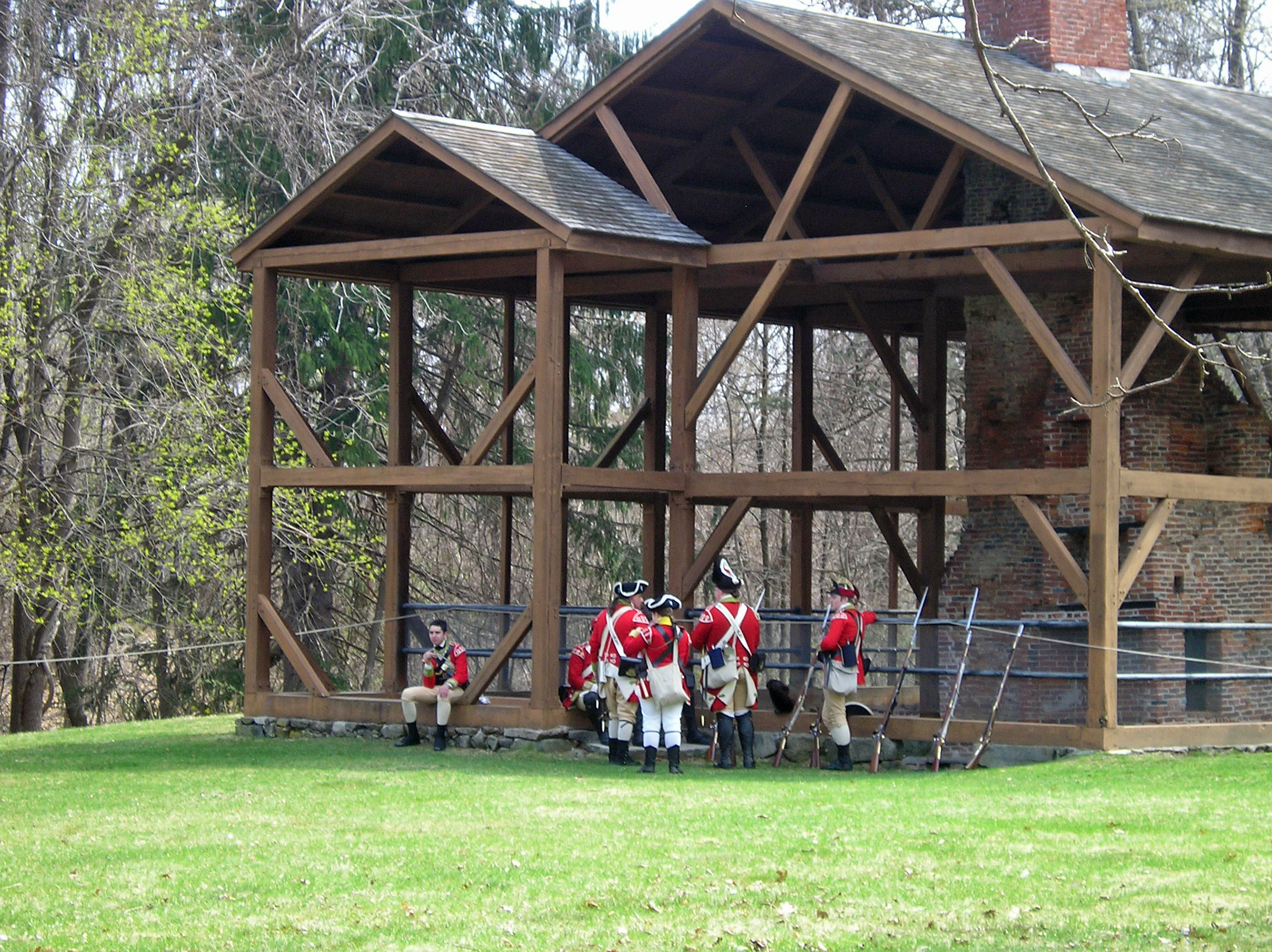
- The remains of the Samuel Hartwell House consist of a large, central chimney visible from the arched base to the top, with all of the fireplaces. The basement has a dirt floor and field stone walls. An open timber frame surrounds the remains following the exact dimensions of the former house.
The Bluff is a sharp outcrop of rocks created by dramatic geological forces millions of years ago. On April 19, 1775 British soldiers fought a short rearguard action from this high, wooded overlook during their retreat to Boston. Today the bluff is a prominent geological and historical feature in Minute Man National Historical Park.
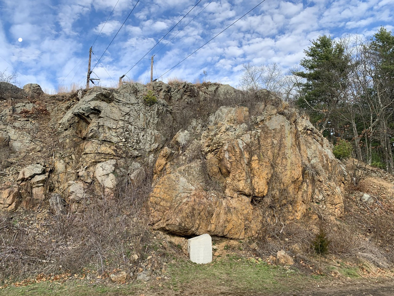
- At the base of a towering cliff face is a carved stone marking the fighting at the Bluff on April 19, 1775. The marker is partially sunk into the ground and obscured by bushes growing from the cliff face. The bluff is made from reddish-gray rock and towers over twenty feet tall. Woodlots flank the eastern and western slopes of the bluff. Directly at the top of the bluff, towers connecting powerlines obscure the viewshed for hundreds of feet surrounding. A network of powerlines spiderweb over the area running north/south. At the base of the Bluff the dirt Battle Road trail runs East/West around the bend of the cliffside. To the west the trail continues onto the Whittemore property, flanked by stone walls, orchards, tree lots, and farm fields. To the east the trail ascends the densely wooded slope of Fiske Hill. The modern Highway Route 2A Runs parallel to the Bluff from East to West. A small modern wood fence separates the Battle Road and the Highway. Directly south of the bluff the highway splits into a "Y" shaped intersection. To the north the highway becomes Old Massachusetts avenue running parallel with the Battle Road Trail over Fiske Hill. To the South route 2A continues toward Lexington. 100 yards southeast of the bluff, across Old Massachusetts avenue is the parking lot for the Bluff. In the lot is a small gravestone for British soldiers killed during this segment of the Battle Road. There is a small trailhead leading to the summit of Fiske Hill from this lot.
Walking from the North Bridge, up the path towards North Bridge Visitor Center, you will notice at a short distance from the curve in the road, a wood rail fence, exposed cellar hole, and to the left, four granite stones laid out in a rectangle. These mark the location and physical remains of the homestead of Captain David Brown, who led his men into battle at Concord’s North Bridge on April 19, 1775.
- Walking from the North Bridge, up the path towards North Bridge Visitor Center, at a short distance from the curve in the road, there is a wood rail fence, exposed stone-lined cellar hole, and to the left, four granite stones laid out in a rectangle. These mark the location and physical remains of the homestead of Captain David Brown. The site sits just below a modern roadway on the side of a hill. The field from the walking path to the site is grassy. There is a line of trees to the left that obscure the bank of the Concord River.
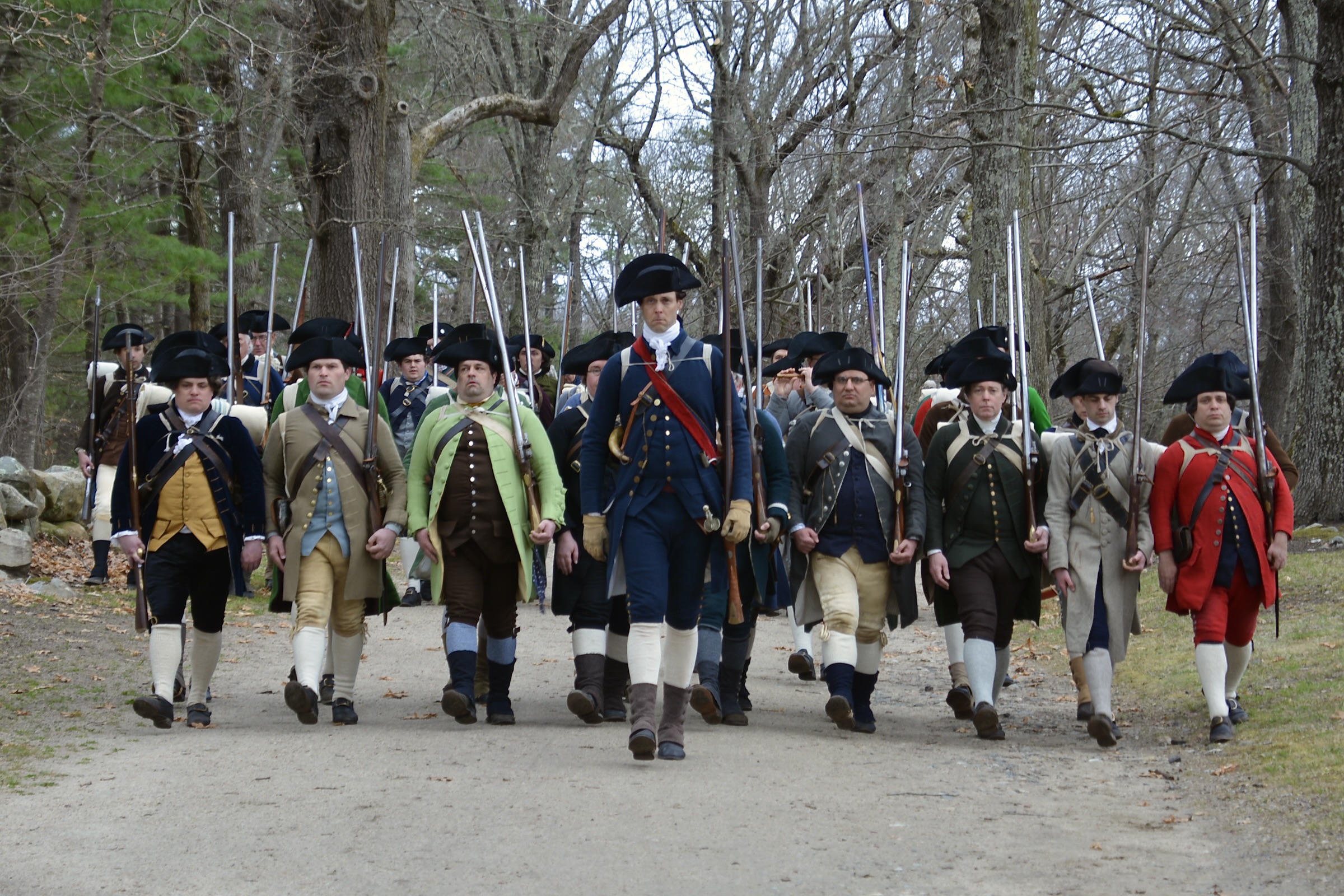
Today, when you walk from North Bridge Visitor Center down the wide, dirt path to the North Bridge battle site you are actually walking on a colonial road that is over three centuries old! This is the same route taken by the minute man and militia companies when they advanced upon a party of British soldiers at North Bridge on April 19, 1775.
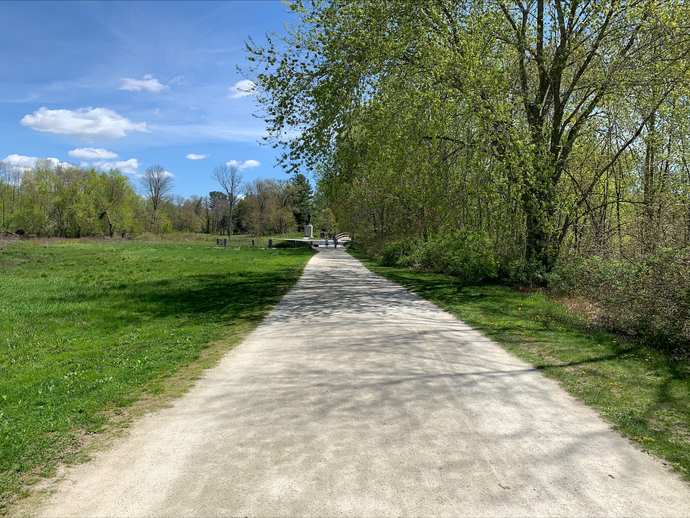
- A dirt and stone dust road winds through open, green fields from the North Bridge across Concord River up to the North Bridge Visitor Center.
Unveiled for the Centennial celebration of the battle on April 19, 1875, The Minute Man statue, by sculptor Daniel Chester French, is an American icon and has stood guard over this hallowed ground ever since. It is set near the spot where the first colonial militia men were killed in Concord on that fateful day in 1775.
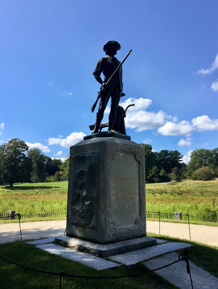
- You approach The Minute Man statue by walking down a path lined with large trees that lead to the North Bridge. Just in front of the Bridge is a tall obelisk monument. Passing by this you cross the wooden bridge and The Minute Man statue is on the opposite shore. The statue is set on a low, grassy mound upon which is set a granite pedestal. The statue itself is a dark green color of oxidized bronze. It depicts a man in colonial dress holding a musket in his right hand. His left hand is touching his plow and he is shown in the moment of walking away to war.
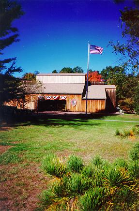
On the morning of April 19, 1775 this tree-less hilltop pasture known as “the Muster Field” served as an important staging ground for nearly 400 Colonial minute men and militia while they observed British soldiers raiding Concord and ultimately formed ranks before advancing against regulars guarding the North Bridge.

- The present Muster Field is a large rectangular field located on a towering hill overlooking the North Bridge some 350 yards to the east. Near the top of the hill, modern day Liberty Street runs east-west and is flanked by 3 foot tall stone walls and towering trees. The hill reaches a peak near the center of the muster field and a singular tree towering over the hilltop. The field is surrounded on three sides by a dense tree line with additional trees that bisect the muster field from North to South. At the peak of the Muster Field looking to the east the North Bridge is visible beyond the thin tree line that shades Liberty street. The bridge is 350 yards away and substantially lower than the muster field. From this hillside the view also includes the curved North Bridge causeway, the Concord River, and glimpses of the Old Manse house farther to the east. Just below the hill peak, a small stone monument three feet high and three feet wide is set into a stonewall along Liberty Street. The Monument reads, “On this field the Minute Men and Militia formed before marching down to the fight at the bridge.”
British soldiers killed on April 19, 1775 are buried atop this small knoll near the Josiah Nelson farm ruins. The knoll is known locally as "The Soldiers' Graves."
- A stone grave marker with metal plaque is situated on the eastern side of the battle road trail. The dirt trail runs northeast by southwest in this segment and is flanked by low stone walls and tall trees. The dark metal plaque on the grave marker is etched with gold letters that read, "Near Here Are Buried British Soldiers April 19, 1775." The gravestone sits at the base of a small knoll filled with dense undergrowth and tall trees. The trees tower over the battle road trail and offer consistent shade. Across the battle road trail on the north western side the stone walls give way to an open space approximately fifty feet north of the trail. In a small clearing are the stone ruins of the Josiah Nelson farm with a red-brick chimney jutting from the center of the ruined structure.
Over more than three hundred years, The Wayside and its families witnessed and influenced both Concord's and America's recorded history. The building interior is closed for the winter. The park grounds surrounding remain open sunrise to sunset.
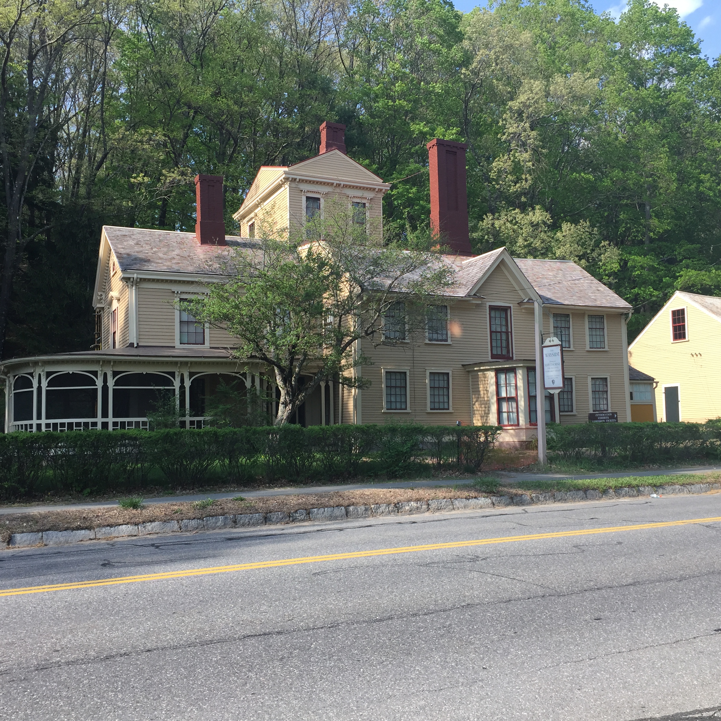
- Two story house clad in pale yellow wooden siding. There is a large two story addition on the left (west) side of the house with a wrap-around screen porch. The center of the main part of the house features a three-sided portico with large windows. There is a three story tower built off the back of the house. The ground floor has four windows on the front and the second floor has five. Tall, red brick chimneys protrude from the center of the main house, the tower, and the two story addition on the left.