Be advised that the NPS has issued alerts for this park.
Natural Bridges has gone cashless
The park now accepts only mobile or electronic payments for entrance & camping fees. You can reserve campsites and buy entrance passes on Recreation.gov, or only use debit/credit cards to pay in person.
Three majestic natural bridges invite you to ponder the power of water in a landscape usually defined by its absence. View them from an overlook, or hit the trails and experience their grandeur from below. Declared a National Monument in 1908, th...
Entry fee admits one private, non-commercial vehicle driver and passengers. Entry fee is valid for 7 days.
Entrance - Motorcycle
$15.00
Entry fee admits one private, non-commercial motorcycle and its rider(s). Each motorcycle must purchase separate entry fee. Entry fee is valid for 7 days.
Entrance - Per Person
$10.00
Admits one individual with no car. This pass is typically used for bicyclists, and pedestrians. Youth 15 and under are admitted free. Entry fee is valid for 7 days.
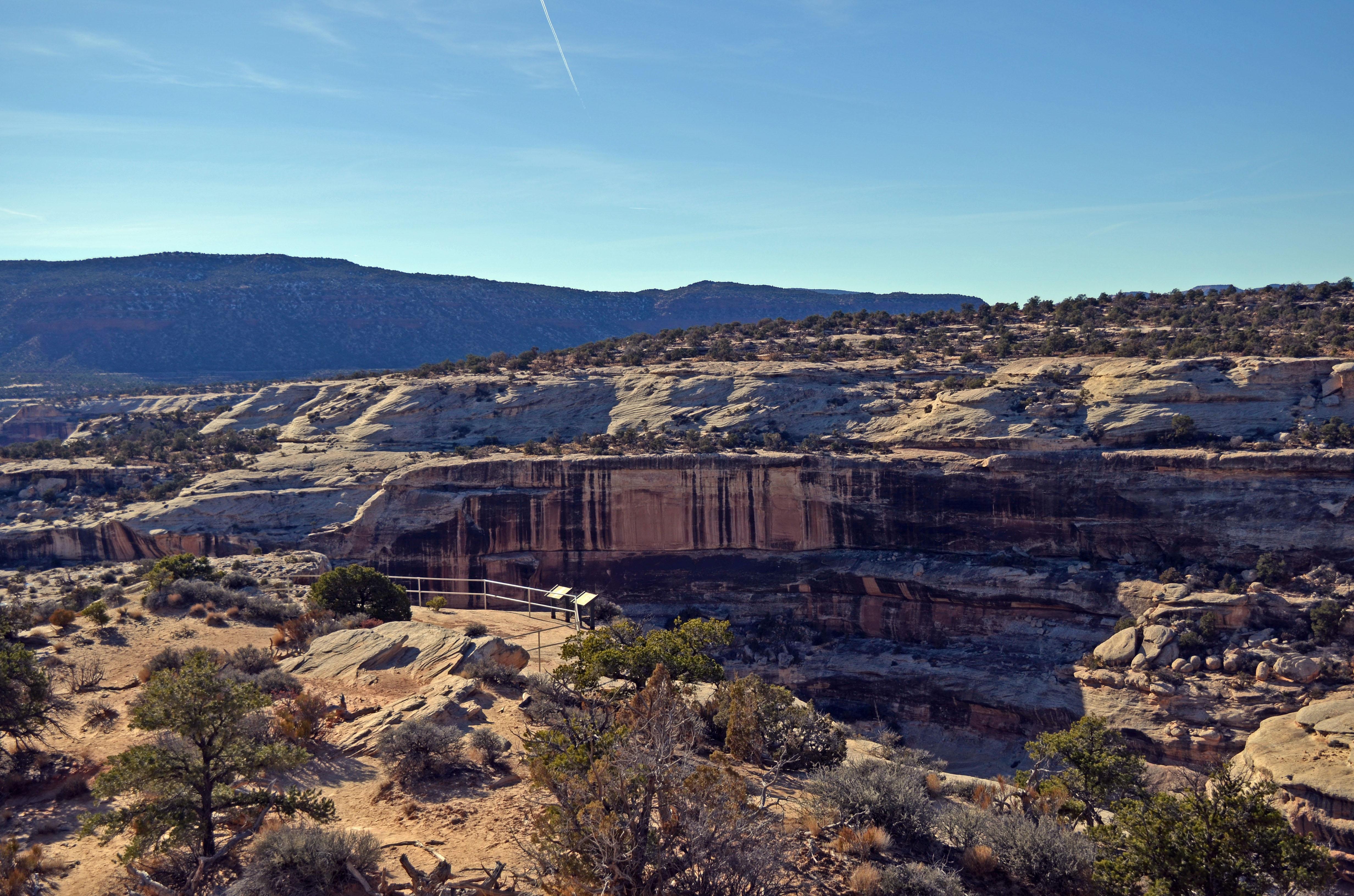
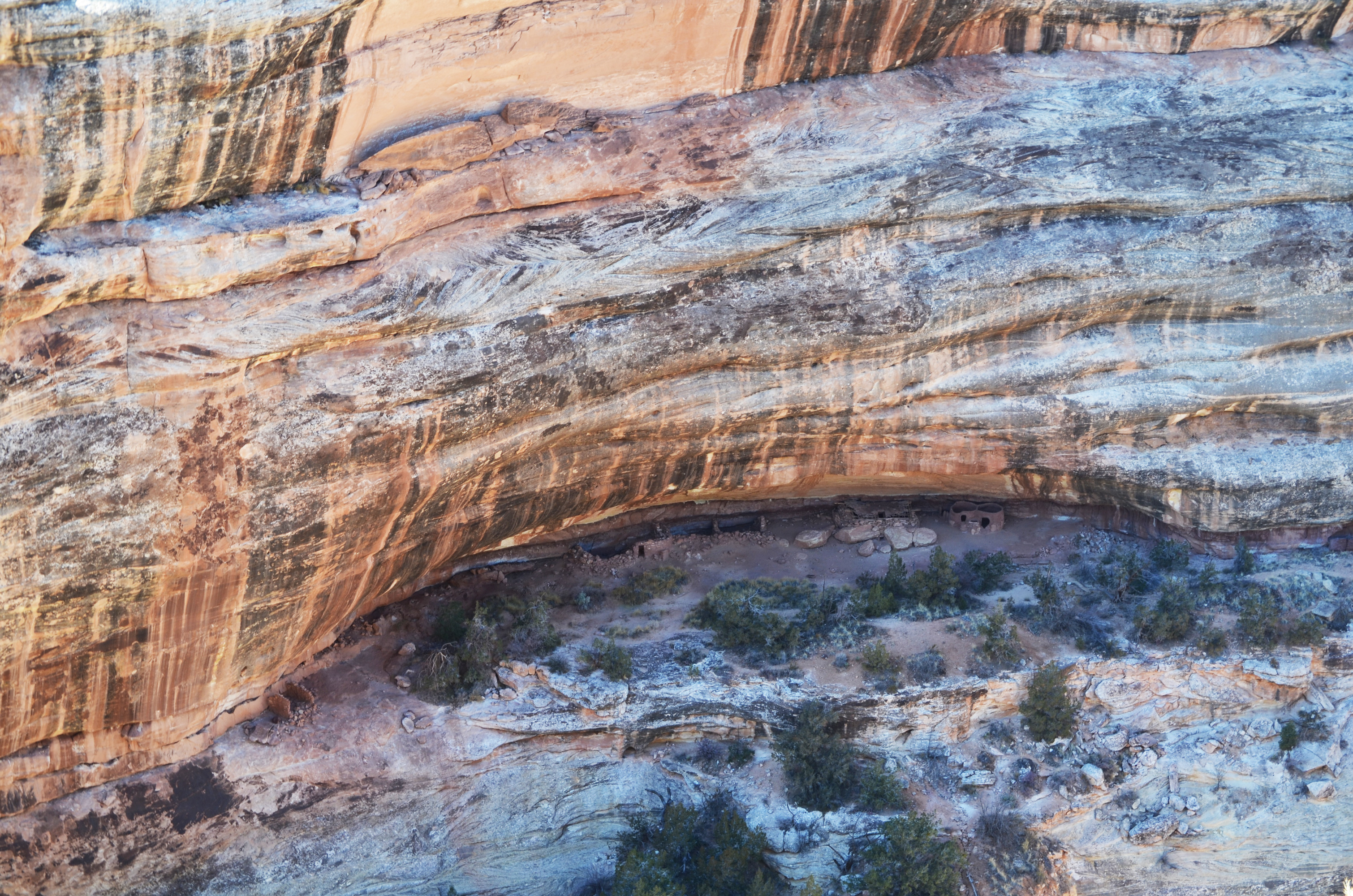
This overlook is the easiest and best way to see Horse Collar Ruin, a well-preserved ancestral Puebloan site tucked into an alcove in the canyon wall.
The natural sandstone cliff edge is lined with metal railing for safety. In the canyon below, a small alcove is carved out of the opposite canyon wall toward the base. In this alcove sits a line of ancestral Puebloan stone structures and stone rubble. Wayside: Horsecollar Ruin Located below and across the canyon, Horsecollar Ruin is a well-preserved ancestral Pueblo village. Inhabited between A.D. 1050 and A.D. 1300, this site is unusual because it contains both round and square kivas (domestic and ceremonial rooms) that represent two different architectural styles. The round kiva is associated with the Pueblo people of the Mesa Verde area of southwestern Colorado and southeastern Utah, while the square kiva is indicative of the Pueblo people in the Kayenta area of northern Arizona. Pottery found at this site also reflects these different influences, indicating likely trade partners. Horsecollar Ruin exhibits a strong Kayenta tradition during the early period of occupation, with a Mesa Verde influence dominating the later period of use. Image: Arhceologists’ drawings of Horsecollar Ruin as seen from above.
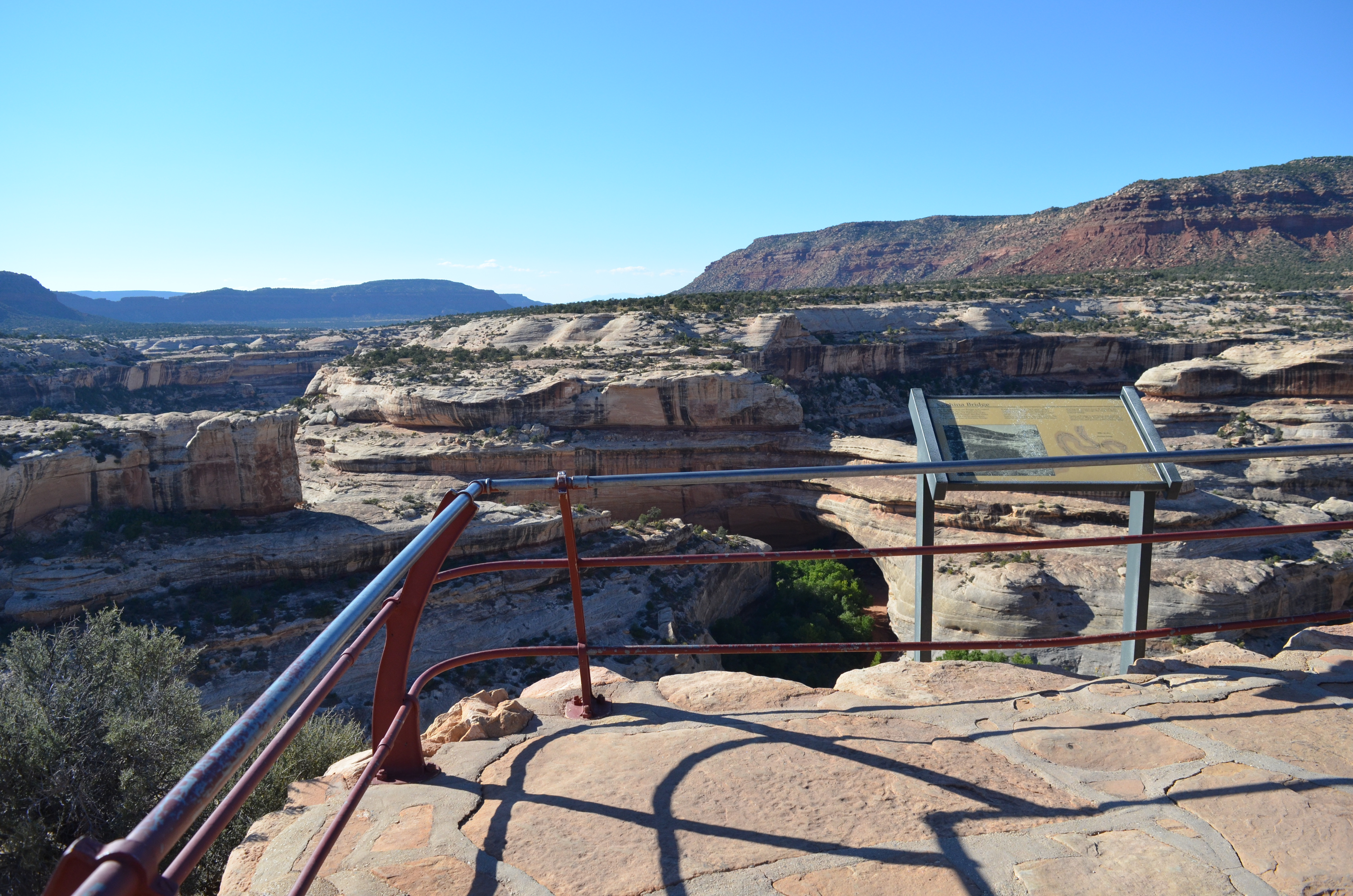
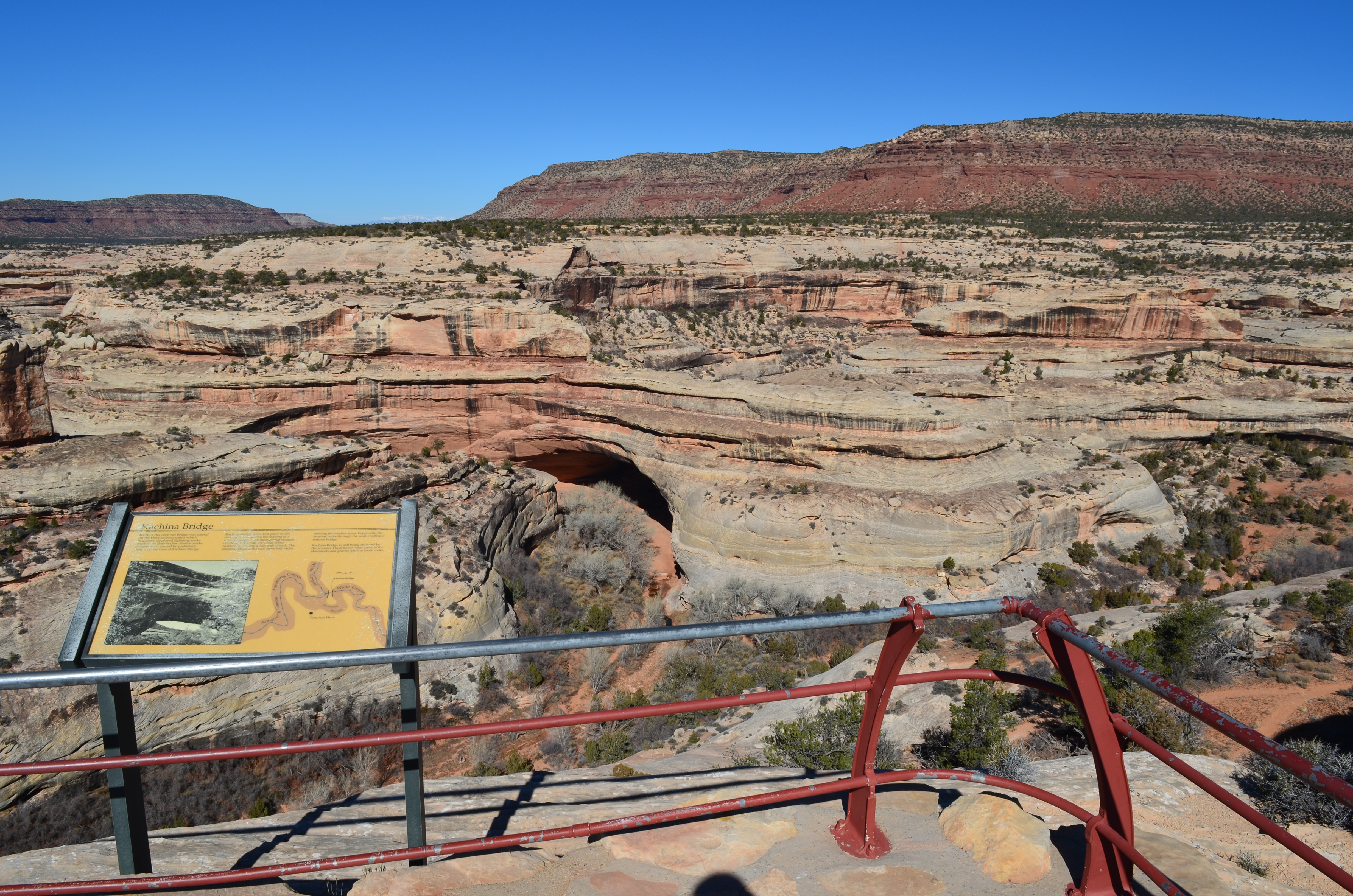
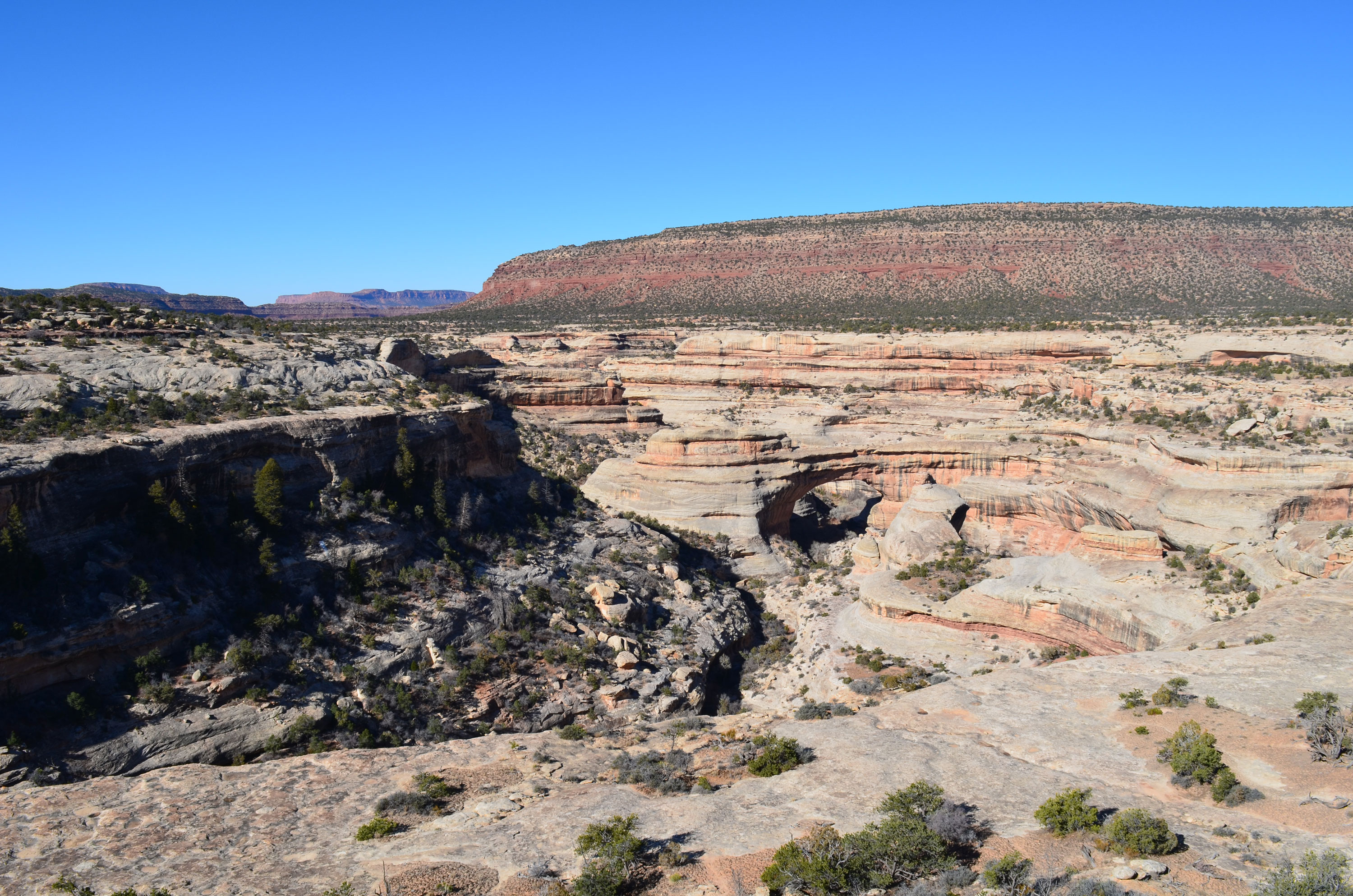
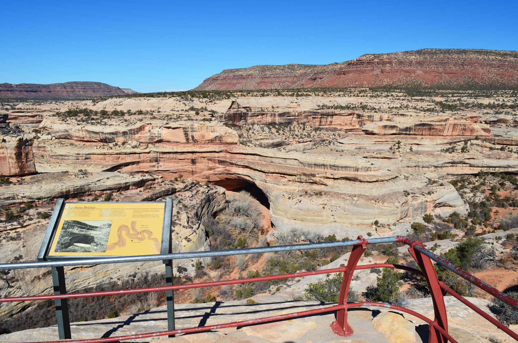
View Kachina Bridge from the mesa top and the scenic drive. Take in the wide-open views of canyons and buttes. Stand safely on the cliff edge and view the park’s thickest natural bridge.
A paved platform with tall metal railing on the cliff edge. Beyond the railing is a thin canyon; to the right is a thick, reddish natural bridge spanning the canyon. The canyon curves out of view to the left and right; beyond the canyon are red rock buttes. Wayside: Kachina Bridge Kachina (Kah-cheé-nah) Bridge was named for the Hopi kachina spirits who frequently display lightning snake symbols on their bodies. Similar snake patterns were carved by ancient people on the base of Kachina Bridge. Kachina Bridge is the best place in the monument to observe the making of a natural bridge. Here meandering streams cut downward into the Cedar Mesa Sandstone, leaving a thin wall of rock. The streams wore away the wall from both sides, eroding the weaker areas. Eventually the streams broke through the wall, creating a natural bridge. Kachina Bridge is still being enlarged by the streams. Flash floods wear away at the abutments and gravity pulls at loose rocks. Images: An image of Kachina Bridge from the base, with caption: The opening of Kachina Bridge is 210ft/64m tall and 204ft/62m wide. A close-up map of Kachina Bridge, surrounding canyons, and wayside’s location in comparison.
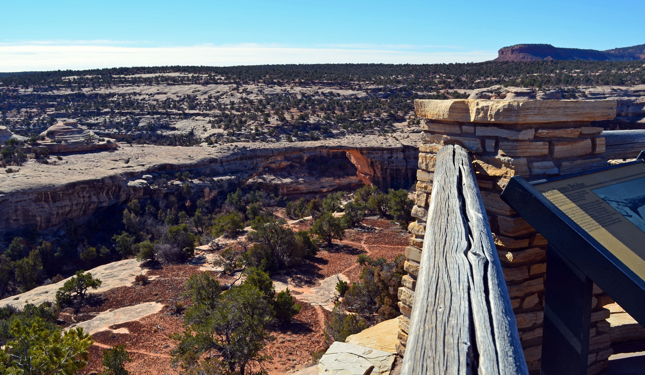
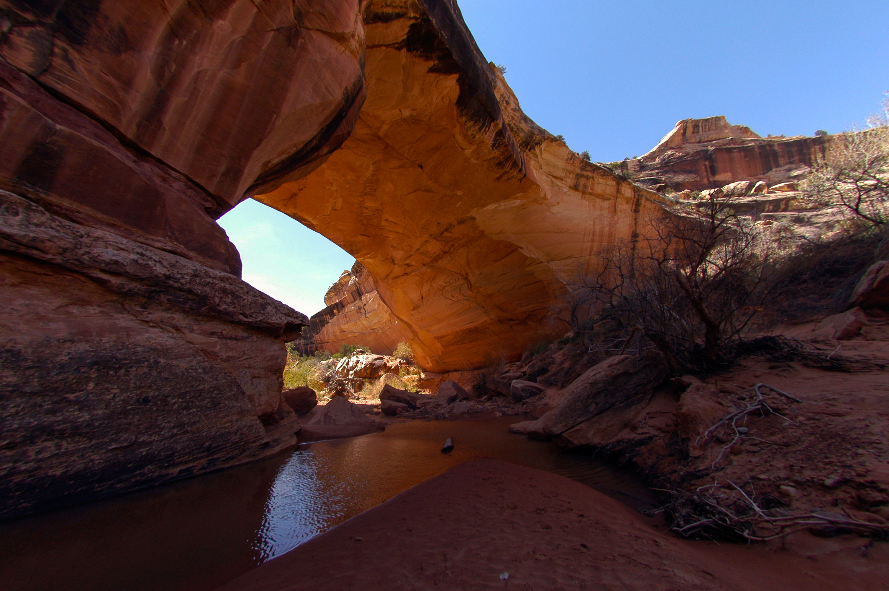
See the park’s most accessible bridge just a short walk from the parking area. Owachomo may be small, but still inspired awe at this incredible feat of water and time. The viewpoint also reveals this area’s secret to life: biological soil crust abounds.
The viewpoint is a paved platform lined with wooden railing. Beyond the platform is a thin natural sandstone bridge with red rock buttes in the distance. The area below and around the bridge is shallow sandstone covered in lumpy dark soil crust. Wayside: Owachomo Bridge Owachomo (Oh-wá-cho-mo) is a Hopi word for rock mound. On the upper left side of the bridge is a rock outcrop that suggested the name for the bridge. Owachomo Bridge looks different from either Sipapu or Kachina Bridge. Owachomo no longer straddles the streams that carved it, and so it appears to be an arch. Flowing water is required to carve a hole through a rock wall to form a bridge, while an arch is freestanding and does not cross a stream. Natural Bridges is famous for its three spectacular bridges, but the monument also contains many smaller and less noticeable arches. Images: An image of Owachomo Bridge from the trail to its base, with caption: The opening of Owachomo Bridge is 106ft/32m tall and 180ft/55m wide. An image of Owachomo Bridge at night, with milky way arching overhead and stars reflected in a pool of water below the bridge.
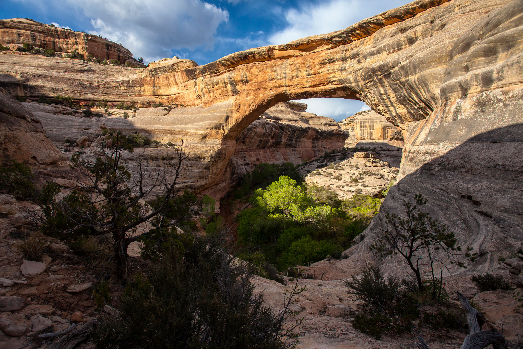
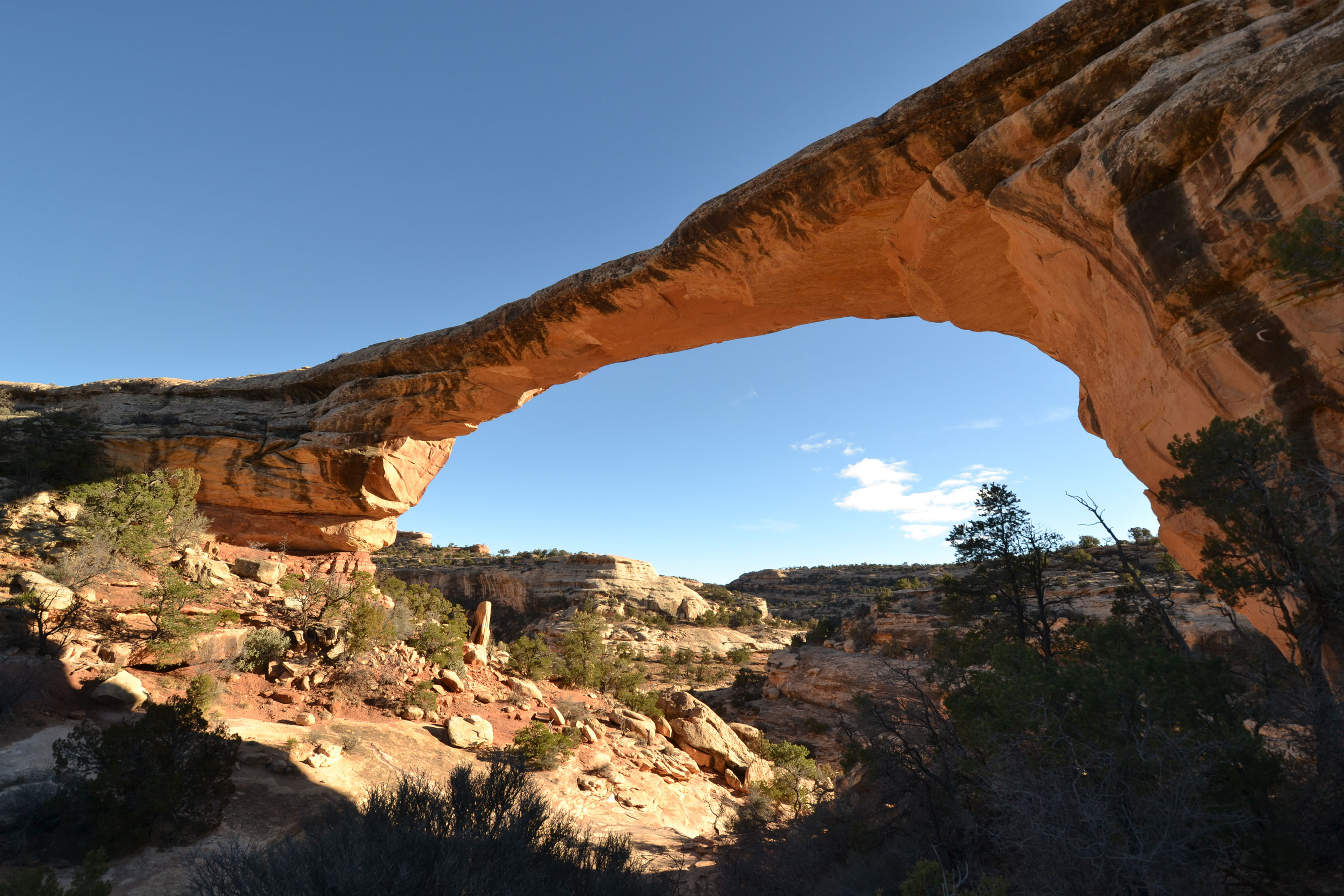
A view of Sipapu Bridge from the mesa top, just a short walk down a paved path. Stand safely on the cliff edge and view America’s second largest natural bridge – the largest in the monument.
A paved platform with tall metal railing on the cliff edge. On either side is bare sandstone or biological soil crust. Beyond the railing is a natural stone bridge spanning the canyon, with redrock buttes in the distance. Wayside: Sipapu Bridge Several names have been given to the bridges over the years. Sipapu (Seé-pa-pu) has had at least two previous names, President and Augusta. Cliff dwellings and rock art in the area reminded William Douglass, leader of the 1908 government survey, of the Hopi culture he had studied extensively in Arizona. Charged with finding “appropriate Indian names” for the bridges, he chose Sipapu, meaning “place of emergence.” Cedar Mesa, a million-acre plateau encompassing the monument and surrounding area, is composed of nearly horizontal sedimentary layers. During the Permian Period, wind blown sands from the north and west were deposited here as dunes. Later sediments buried these dunes and with time, pressure, and moisture, they became “petrified” sand or sandstone. Today, geologists label this layer the Cedar Mesa Sandstone. Buried, then tilted and uplifted, the sandstone was slowly exposed by meandering streams that carried away the overlying sediments. These streams helped carve Sipapu and the other bridges. Images: Sipapu Bridge taken from below, with caption: The opening of Sipapu Bridge is 220ft/67m tall and 268ft/82m wide. A graphic of area stratigraphy, with geologic features labeled in their appropriate layer.
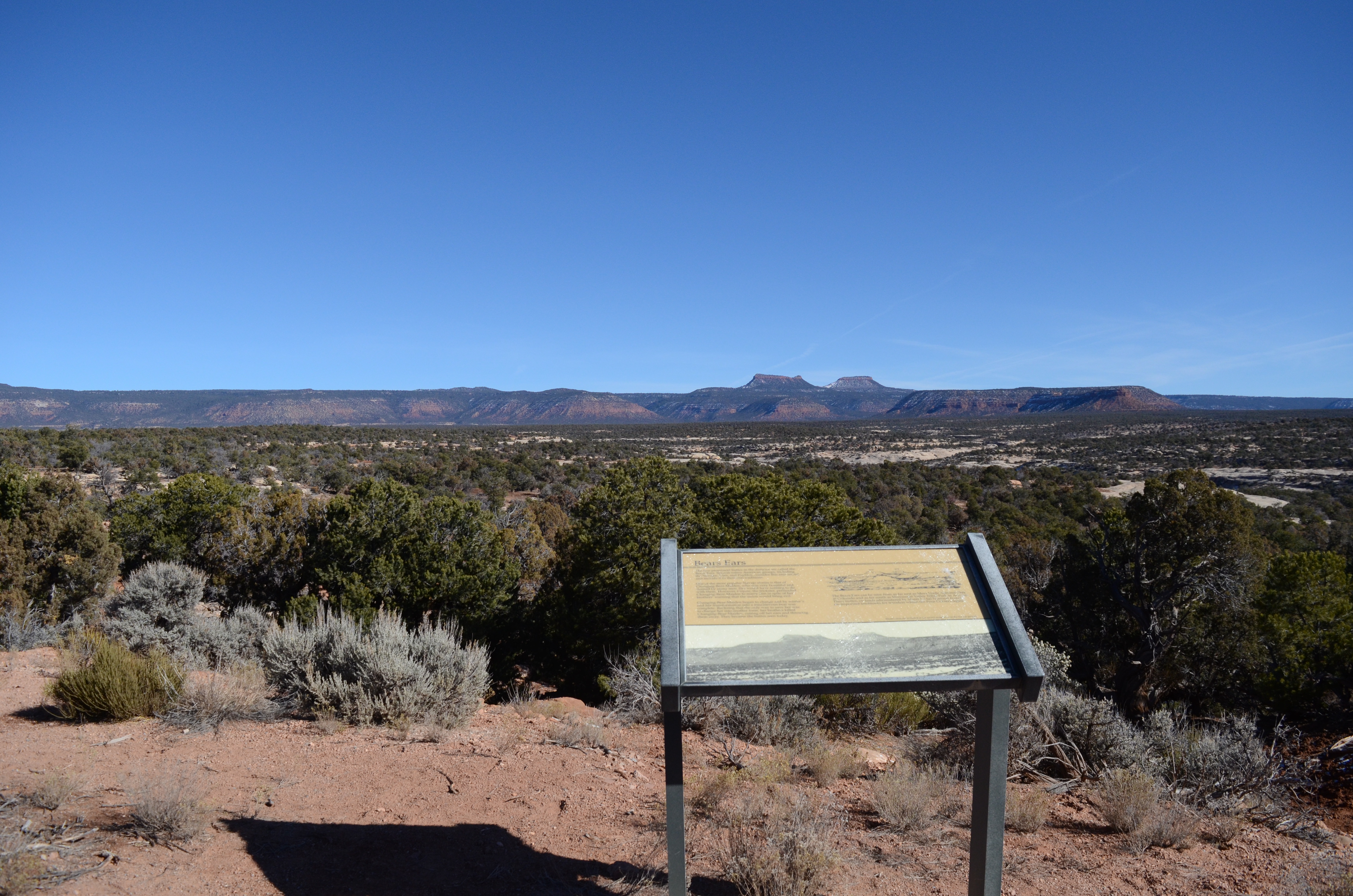
Take in a breathtaking view of Bears Ears Buttes and surrounding landscape outside the monument’s boundary.
Sweeping views of pinyon-juniper woodlands in the low country and two similar-shaped buttes in the distance. Wayside: Bears Ears The two prominent buttes in the distance are called the Bears Ears. Several Native American tribal groups, including the Navajo, the Ute, and the Pueblo people, consider this area sacred and include it in their oral traditions. One Navajo story about the buttes is that of Ataed’ diy ini, or Changing-Bear-Maiden, who was very beautiful and desired by many men. She would have nothing to do with them. However, Coyote, the trickster, persuaded her to marry him despite her brothers’ warning that the union would bring evil. Ataed’ diy ini began to transform and by winter’s end her change into a mischievous bear was complete. As a bear she began to kill the people living nearby, even some of her brothers. They realized that the only way to save her was to change her back to her true form. In a long fight, the youngest brother prevailed over Ataed’ diy ini and her severed head became the Bears Ears that we see today. The Bears Ears can be seen from as far east as Mesa Verde National Park in Colorado and as far south as Monument Valley Tribal Park in Arizona. These buttes are the namesake for Bears Ears National Monument and are important landmarks for travelers within the Four Corners region. Image: Bears Ears Buttes, with caption: These buttes are included in the sacred geography of the Navajo people.
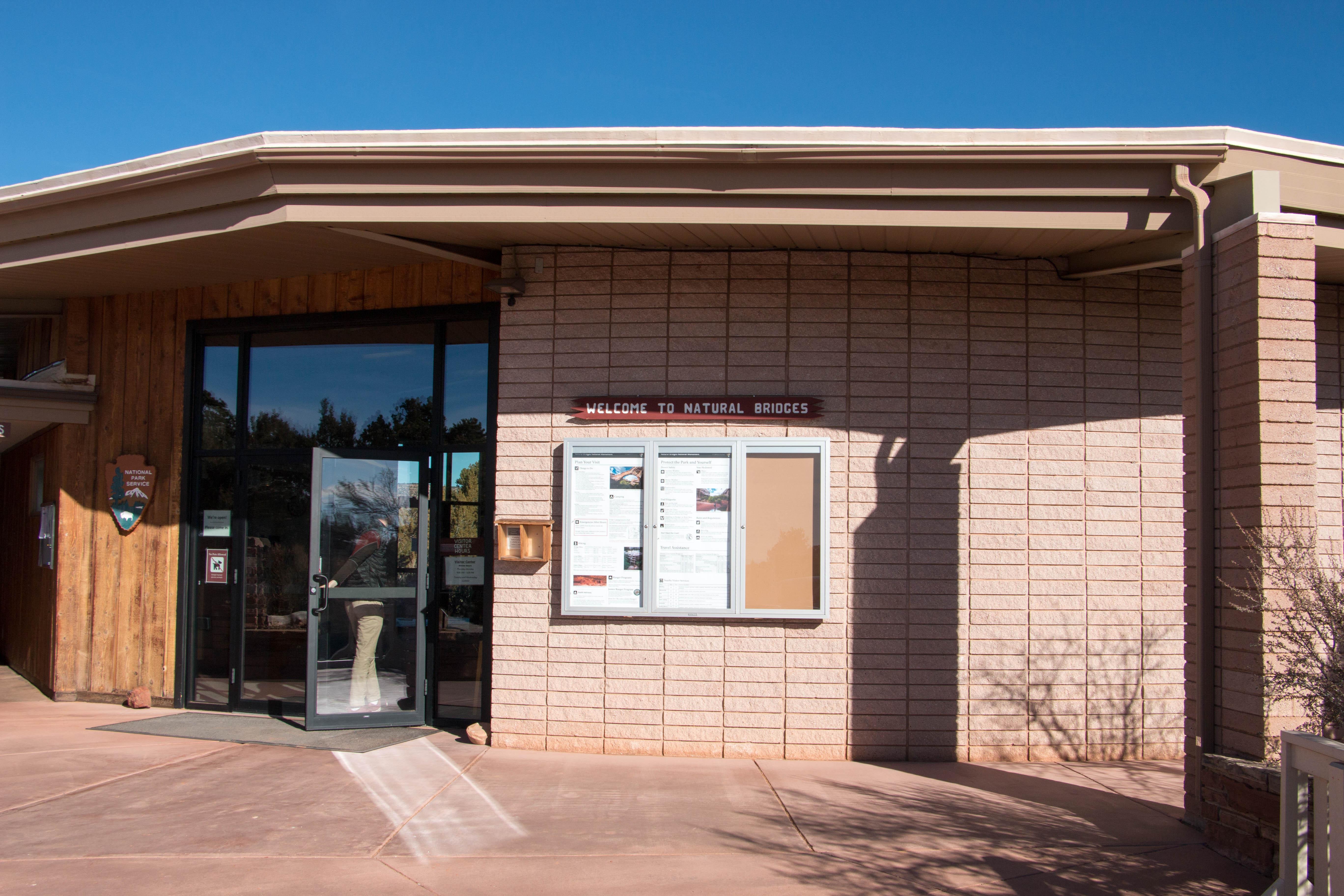
Natural Bridges Visitor Center is typically open five days a week, 9 am to 4 pm, Thursday through Monday during spring through fall. In the winter, the visitor center may also close on Mondays and certain holidays. Exhibits, a park film, and a bookstore are available. You can pay your entrance fee online or at the visitor center.
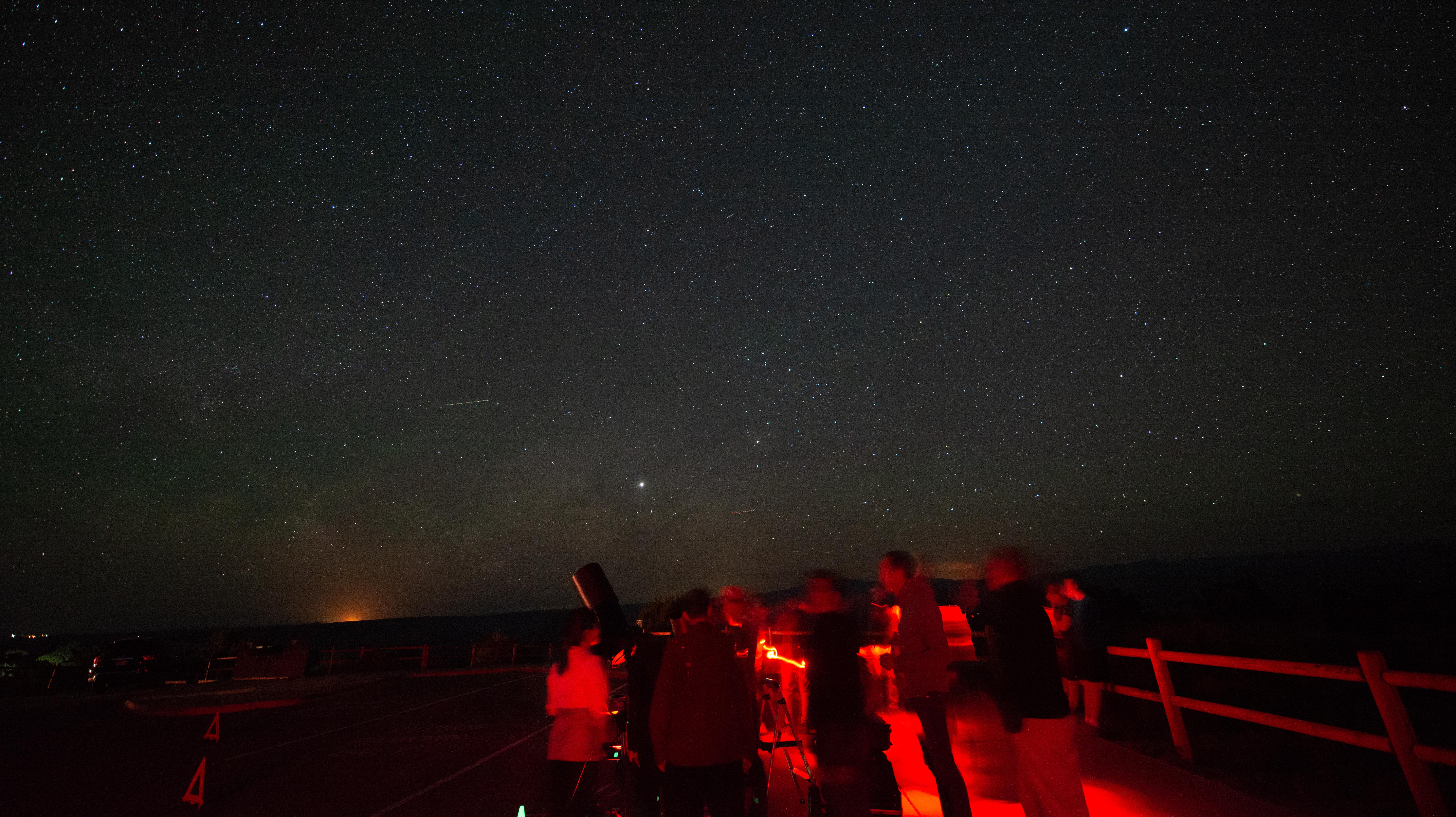
Rangers occasionally lead stargazing programs and events at parks throughout southeast Utah. Learn about what to expect and check out a schedule of stargazing events at Arches and Canyonlands national parks and Hovenweep and Natural Bridges national monuments. Even when formal programs are not offered, people are welcome to enjoy the parks after dark on their own.
Hike to Sipapu Bridge
Sipapu Bridge’s tremendous span inspires and awes the imagination. Hike to the second largest natural bridge in the United States and, along the way, explore the geology of this fascinating region. You will fully appreciate this incredible natural feature with an adventurous canyon hike.
Walk to the Sipapu Bridge Viewpoint
The Sipapu Bridge Viewpoint is your first introduction to the natural bridges – and what a great place to start! This viewpoint provides scenic views of the second largest natural bridge in the United States and the largest in the park. The viewpoint is just a few minutes drive from the visitor center.
Walk to the Owachomo Bridge Viewpoint
This viewpoint provides sweeping vistas of the smallest, and perhaps oldest, bridge in the park. This trail is good for any time of day or season. As the final stop along the loop road, Owachomo Bridge is the perfect conclusion to your visit at Natural Bridges National Monument.
Hike to Kachina Bridge
Named for the petroglyphs on its side, hiking to the base of Kachina Bridge is taking a trip back in time. Gain new perspectives as you stand beneath the widest, and probably youngest, natural bridge in the park.
Hike to Owachomo Bridge
Owachomo Bridge is the most accessible and most photographed natural bridge in the park. It's also likely the oldest natural bridge in the park. See this ancient wonder up close with a half-mile round-trip hike.
Hike to the Horse Collar Ruin Overlook
Get a birds-eye view of Horse Collar Ruin from this mesa-top overlook. A short hike over slickrock provides the chance to ponder what life may have been like 700 years ago. From the overlook, see the remarkably-preserved ancestral Puebloan structures and the surrounding canyon country.
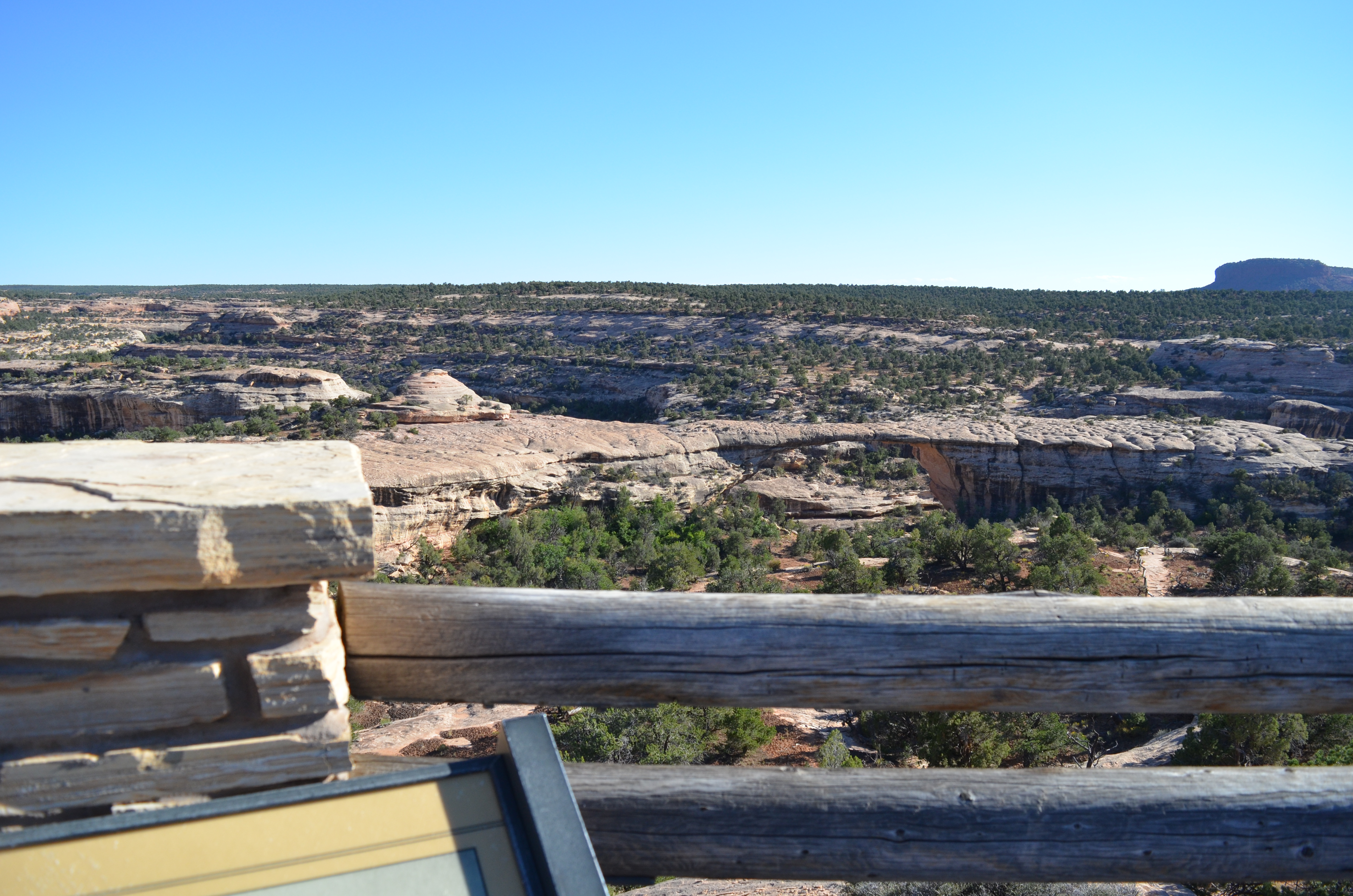
Walk to the Kachina Bridge Viewpoint
This trail provides aerial views of Kachina Bridge and the surrounding landscape. Desert plants abound along this winding, paved trail. Conveniently located halfway along the scenic loop drive, this paved trail is a hub for other, more rugged trails.
Tours
Count: 1
Natural Bridges Scenic Drive
Everything Natural Bridges has to offer is accessed via the scenic drive. Cruise the 9-mile driving loop, stopping for short walks to viewpoints of the bridges, archeological sites, and more. This tour will guide you through the monument, providing helpful directions and must-know facts.