Be advised that the NPS has issued alerts for this park.
Public Access Closure around USPP Facilities & National Capital Parks - East Headquarters
Extension of temporary closure prohibiting the public from entering the area around the USPP Anacostia Operations Facility, USPP Aviation Facility, and National Capital Parks – East Headquarters through 11:59 pm Wednesday, December 31, 2025. Access through Aviation Drive SE entrances and the metro access gate into Anacostia Park will be closed.
National Capital Parks - East Permit Office Temporarily Relocated to Anacostia Park Skating Pavilion
The National Capital Parks - East permit office has been temporarily relocated to the Anacostia Park Skating Pavilion due to the nearby closure through 11:59 pm Wednesday, December 31, 2025. Permit services will be available during normal business hours.
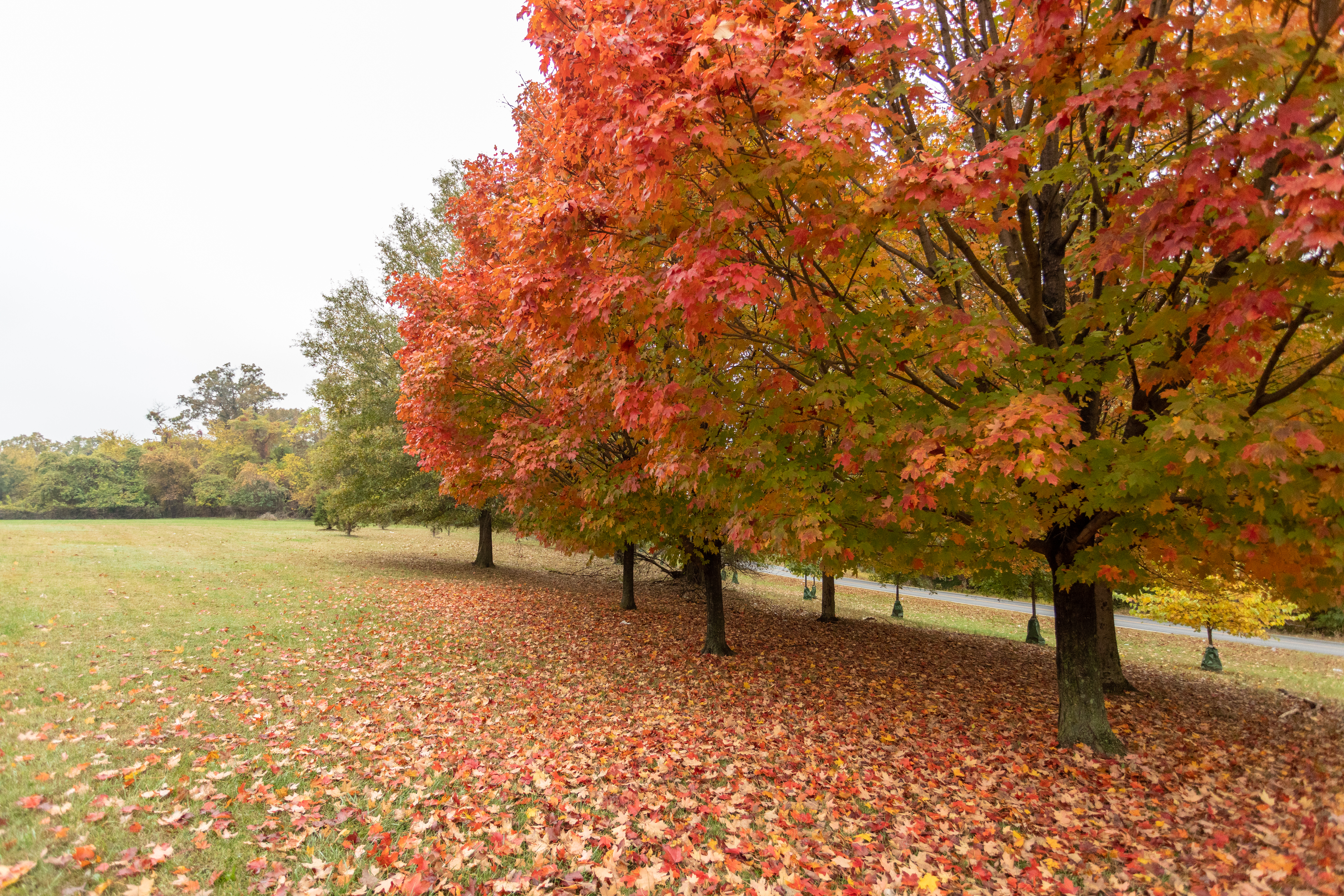
National Capital Parks — East invites you to explore more than 8,000 acres of scenic parkland, historic landmarks, and vibrant community spaces across Washington, D.C. and Maryland. From the riverside trails of Anacostia Park to the homes of Amer...
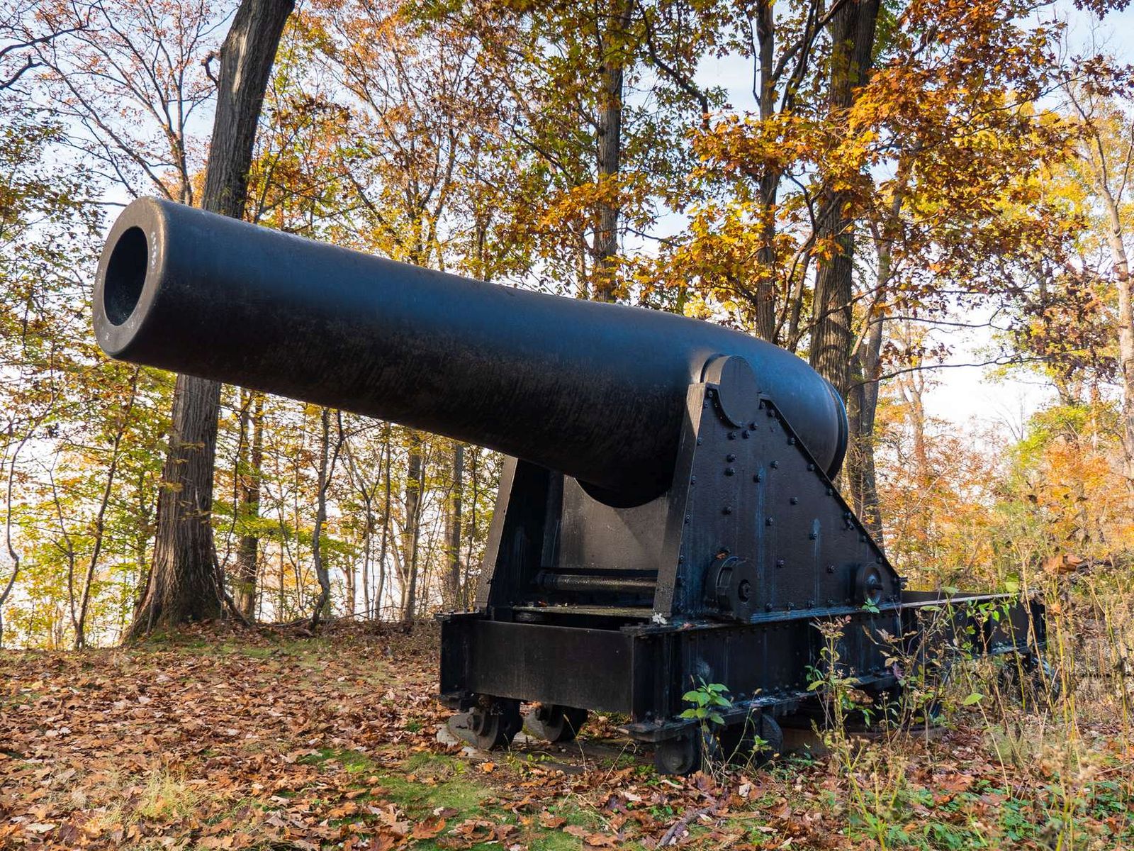
Spaced about 70 yards apart two massive cannons point out over the water. Each cannon is roughly 12 ft long and is mounted on a large metal base which raises it to about 15 ft high. The barrel of the cannon is 15 in in diameter. Both Canon and base are painted black. This rests on a half circle mounts made of stone and metal.
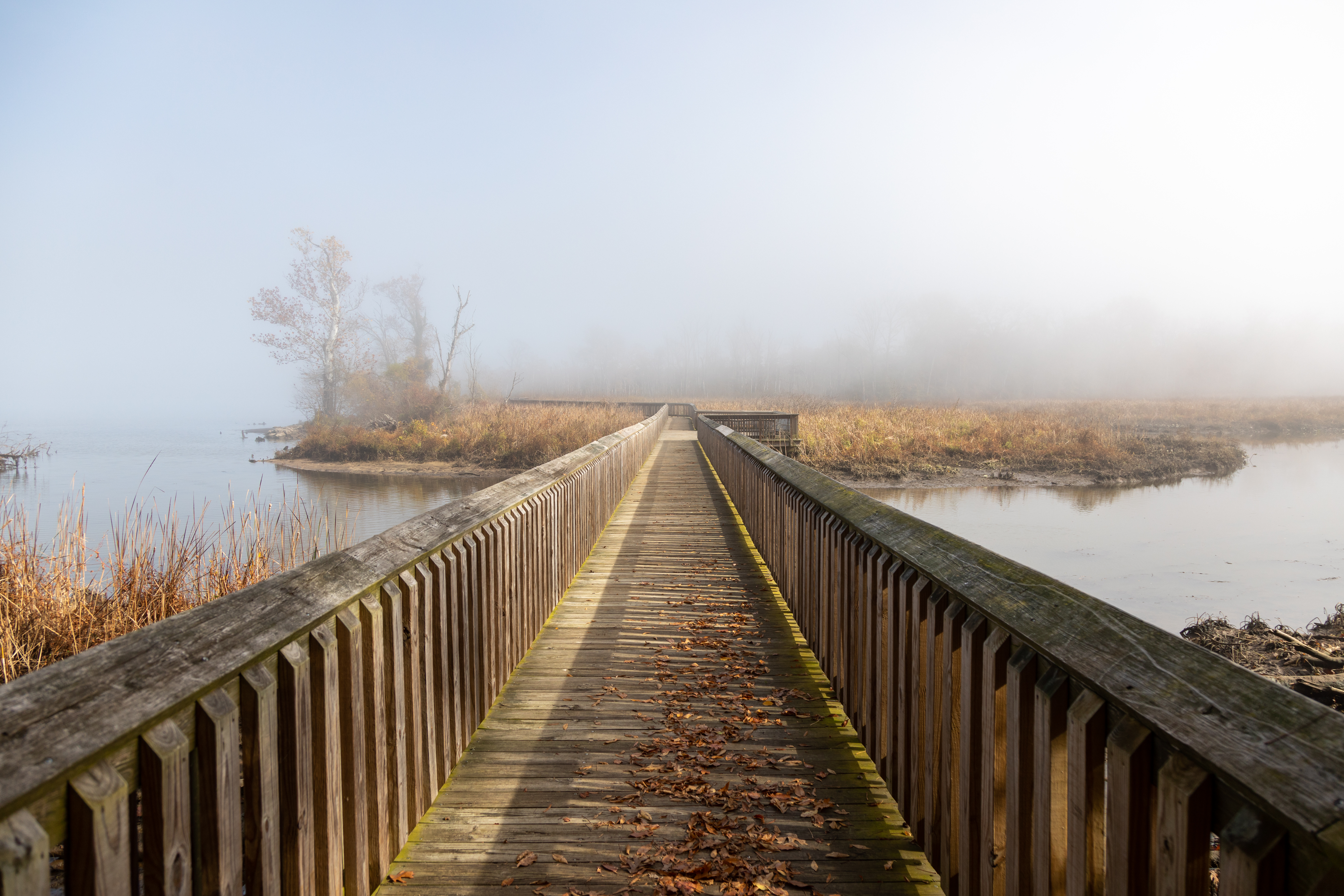
Standing at the trailhead for Accokeek Creek, a wooden boardwalk extends before you before gently curving left and being lost in the foliage. An observation deck ringed with benches overlooks the view to your right, where marsh grass grows in the creek’s delta. When the tide is out, there may be some of the turtles, snakes, and other critters who call the marsh home. To your left the, Accokeek Creek spills into the Potomac river. The park is a popular spot for birders, and on your walk you may find yourself sharing the marsh with ospreys, herons, and falcons as well as the smaller songbirds flitting in the branches. Across the river is the Virginia shore where cars zip along the George Washington Memorial Parkway – another national park site. George Washington’s Mount Vernon estate stands on the opposite shoreline.
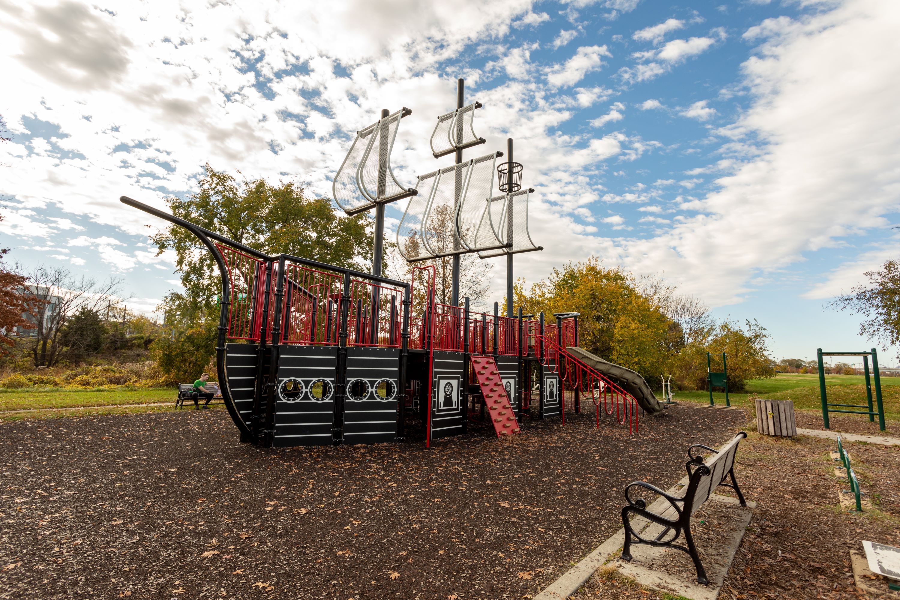
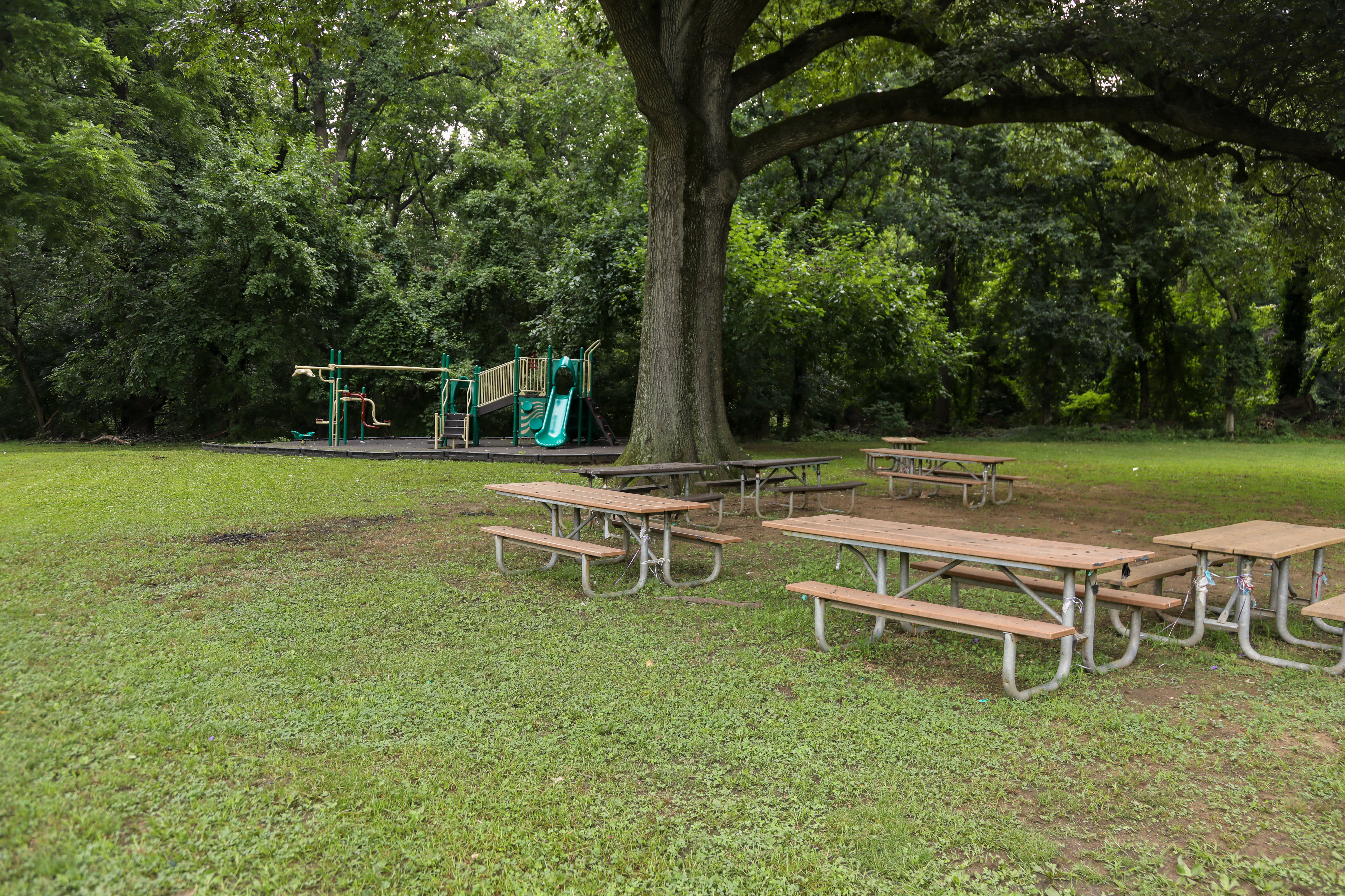
One of the most popular picnic areas in Anacostia Park the Fairlawn Picnic area, nicknamed "Pirate Ship Playground," offers restrooms, picnic tables and exercise equipment for adults and children. The fanciful pirate ship jungle gym reminds us of the ships that once sailed Anacostia's waters.
A play structure shaped like a pirate ship stands in a rectangular bed of mulch. Several benches line the perimeter of the play area, as well as exercise machines.
Built during by the Works Projects Administration during the Great Depression, the Anacostia Recreation Center offers bike rentals, and picnic areas. A pool and weight room are free to Washington, DC, residents and available to others at a nominal fee. In 1949, the Recreation Center was the site of a major integration riot that ultimately paved the way for desegregation of public pools in the District of Columbia.
The Anacostia Recreation Center with a pool and weights room.
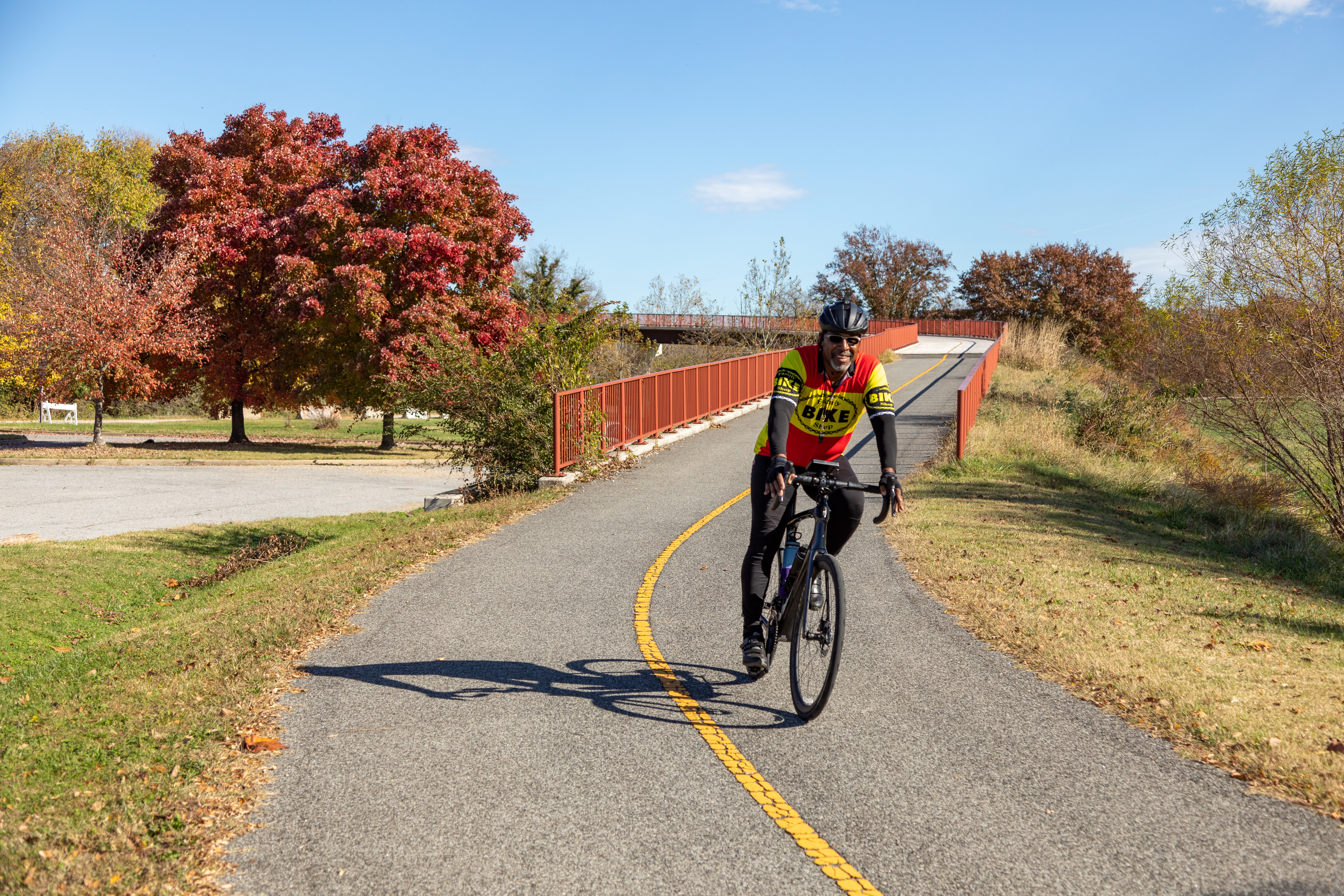
The trail takes you through 12 miles of forest, fields, marsh and river ecosystem.
The Anacostia Riverwalk Trail is a paved trail with a yellow stripe down the middle. Trail users should keep to the right side of the walkway, and pass carefully on the left. The trail is approximately 8 feet wide.
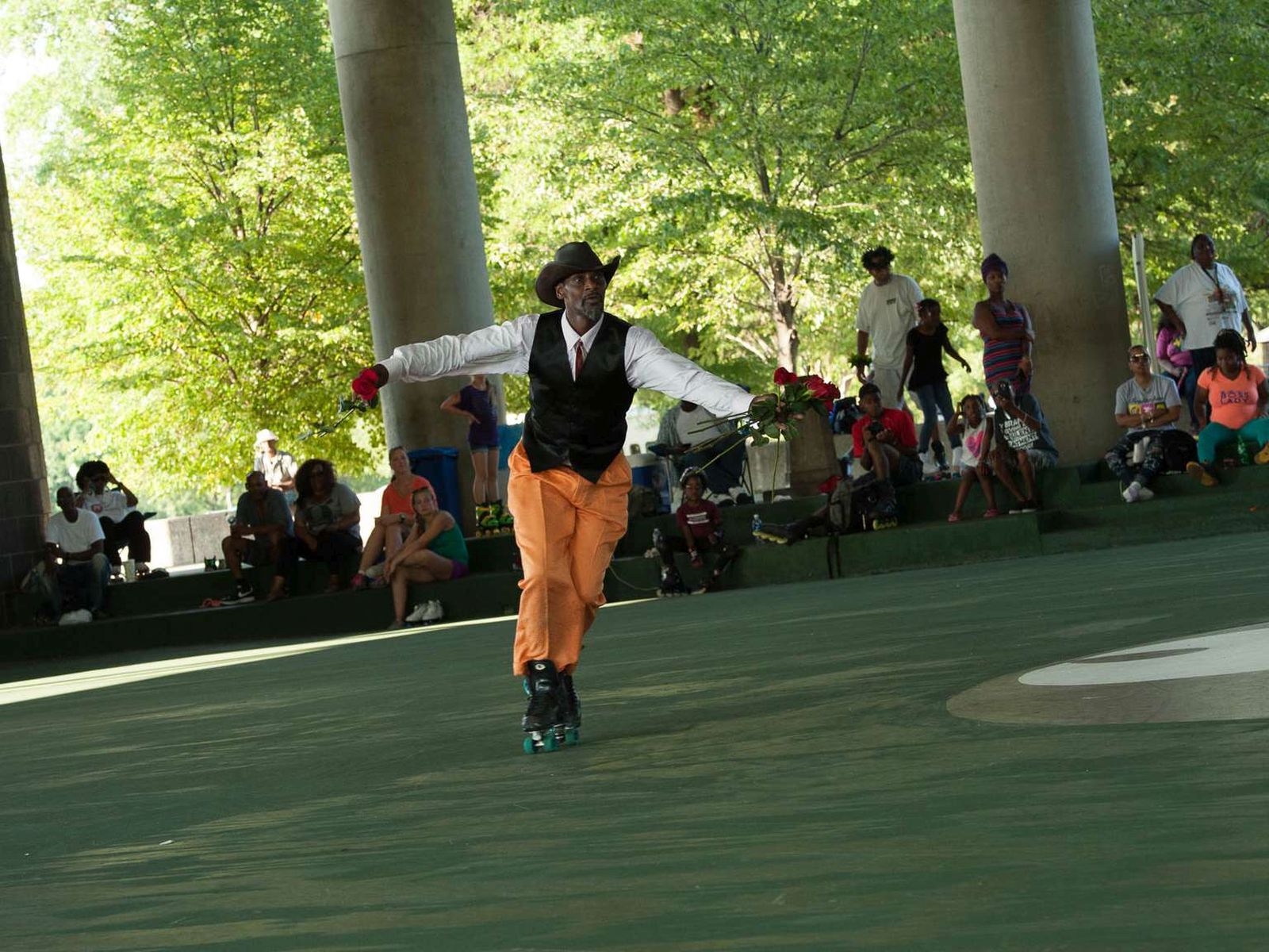
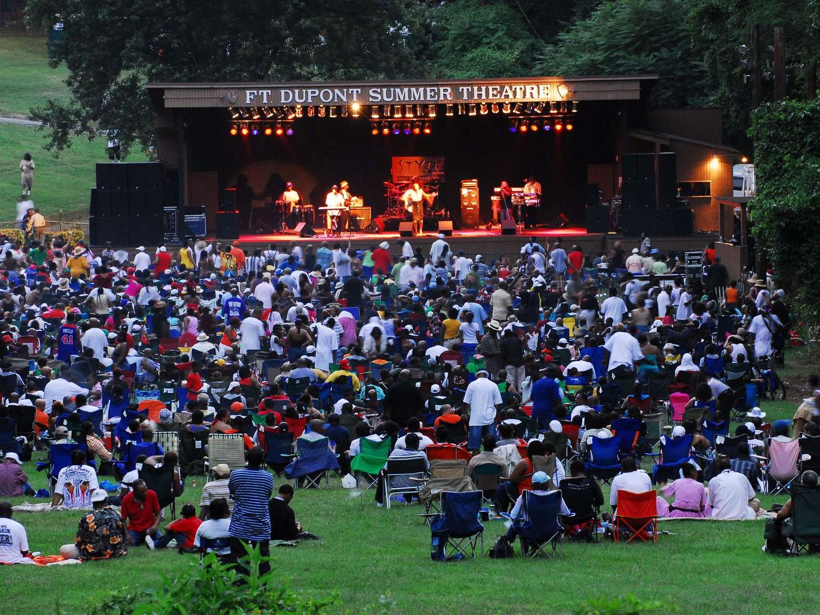
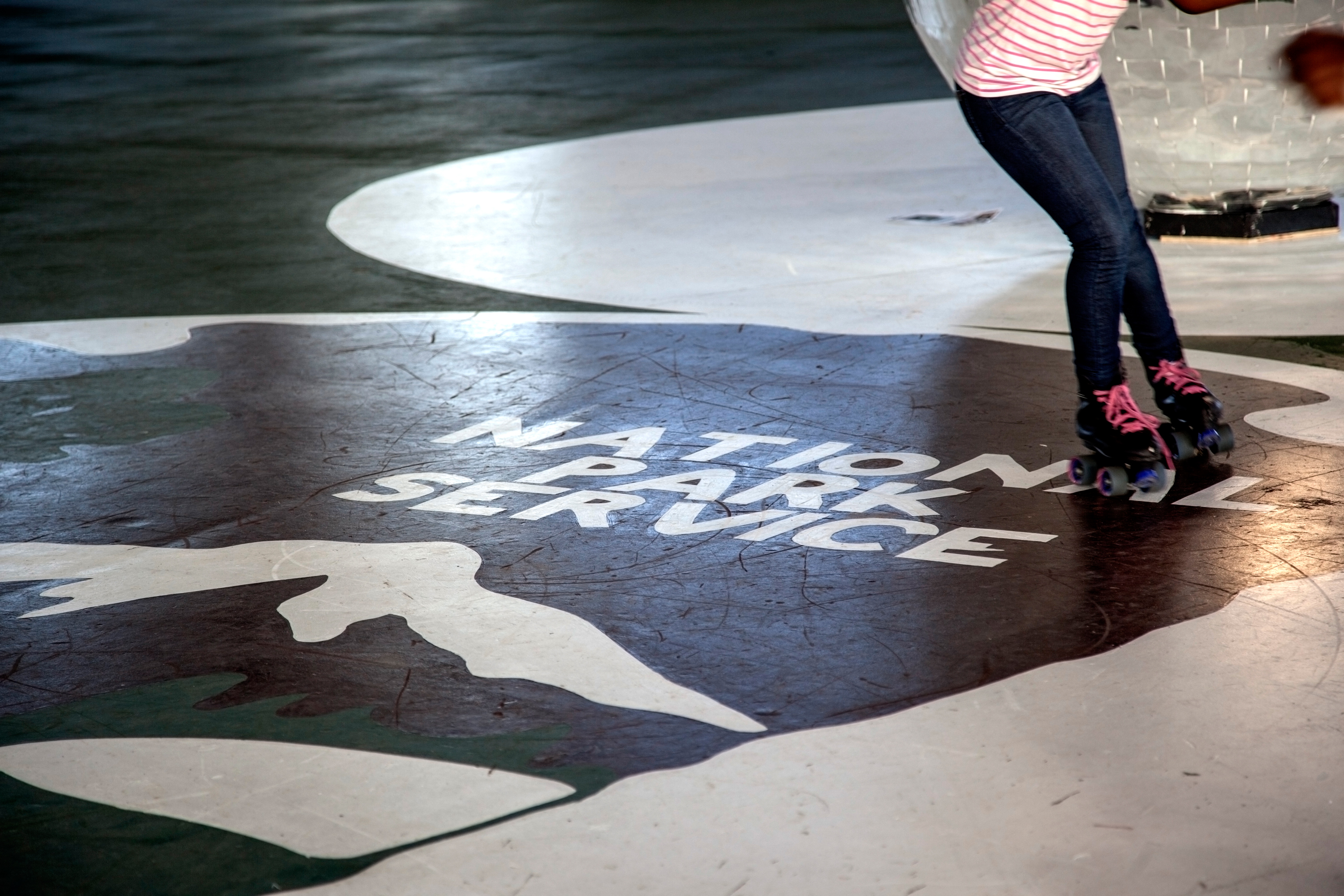
Can you remember the last time you laced up a pair of roller skates? Make new memories with this ‘fun for the whole family' activity. Skate rentals are free and available during summer months. On summer weekends DJ music adds to the fun. This is the one and only roller skating rink owned and operated by the National Park Service!
(296 words)<br />The Anacostia Roller Skating Pavilion is located in the southeast quadrant of Washington, D.C., north of Anacostia Park along the east bank of the Anacostia River.<br />From the Sousa Bridge underpass at Anacostia Drive, SE, travel seven hundred fifty feet north on Anacostia Drive. Turn right and continue along Anacostia Drive about four hundred yards. Turn left into the parking lot. The Anacostia Roller Skating Pavilion sits beyond the parking lot, about one hundred feet to the northwest.<br />The pavilion is an open-air, one-story, rectangular structure, about two hundred thirty feet long and one hundred forty feet wide. <br />Round cement columns, about twenty feet apart, line each side and support the pavilion's wood roof. In each corner are one-story brown stone buildings, each about forty square feet with rounded ends. <br />The southeast building has a curved front window where a National Park Service attendant is available to provide skating equipment and park information. The northeast structure houses restrooms. Two additional brown, curved structures sit at the northwest and southwest corners of the pavilion.<br />A wide-open smooth cement roller skating surface sits underneath the pavilion roof. The open sides provide an abundance of natural light into the space, and two steps along the sides allow for seating. Metal girders above sit on the underside of the wooden beams of the roof. Brown panels line the north and south sides of the roof. On the east and west side, the roof line is open and the roof's metal girders are visible.<br />The parking lot spans over five hundred feet and a basketball court sits to the west of the pavilion. Grass fields and open space line both north and south sides along the Anacostia River and the Kenilworth Avenue Freeway runs beyond the parking lot to the west.<br />END OF DESCRIPTION<br />
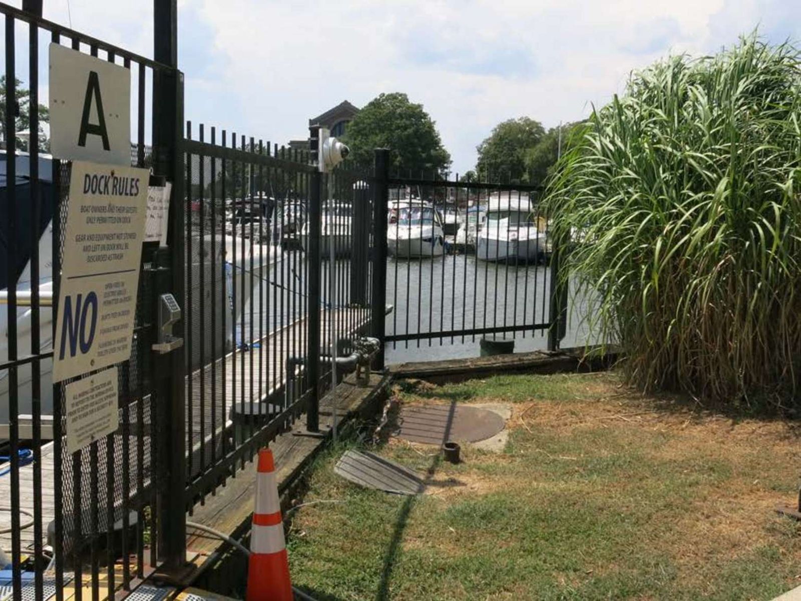
Anacostia Park doesn't just have great view of the river, it has public access! The boat ramp is located at the north end of Anacostia Drive SE. Vehicle and trailer parking is adjacent to the boat ramp. Review <a href="http://mpdc.dc.gov/page/harbor-and-boating-safety-regulations">D.C.'s Harbor and Boating Safety Regulations</a> prior to launching your watercraft.
A wooden pier extends into the Anacostia River with ramps on either side of it.
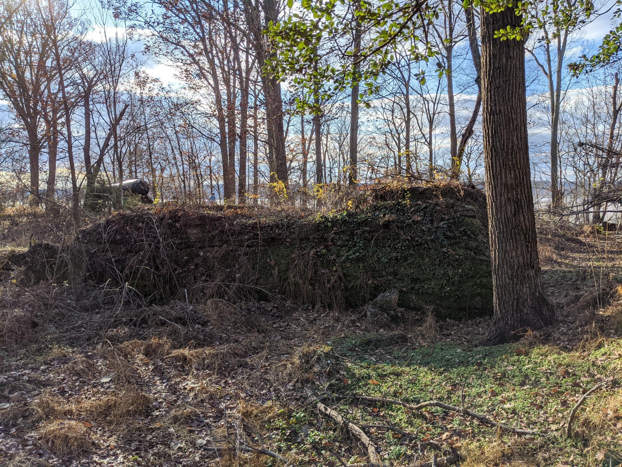
A chain link fence surrounds the battery, brush and weeds have grown up around the fence. The two-story concrete structure is about 200 feet long and in disrepair. The north and south ends slope towards the ground with dirt covering them. The concrete is cracked and falling in places along the upper platform. The ground level has 14 square openings that are created by the concrete supports for the upper level. There are two square columns that stand outside of the main structure with two sets of iron steps behind them that lead from the ground level to the upper level. Under the upper platform are several doorways into the structure where the storage rooms and additional stairs are. The upper level is the gun level. Directly behind the columns is where the gun platforms are. The wall in front of the guns are curved to allow motion of the gun. To the left of the gun platforms are a additional structures which are square and supported with 4 concrete columns across the front. A handrail crosses the battery on the upper level.
The two-level concrete structure is about 175 feet long. It is in the woods and has been overtaken by trees and weeds. The battery is in disrepair. The space behind the battery has trees in the pathway, and in the slopes next to the battery. There are concrete steps from the ground level to the first level. There are concrete supports that hold up the upper level, that forms openings across the battery. The ground level has various storage areas and concrete steps that lead to the upper level. The gun platforms are on the upper level, in front of them the concrete is curved to allow motion of the cannon. To the left of the gun platforms are square buildings with four concrete supports. The top of the battery is overgrown with weeds. The upper level has weeds growing through the concrete.
This two-level concrete structure is about 175 feet long. The upper level has a safety handrail across the length of it. The ends of the battery are sloped with the and covered with dirt. There are 16 concrete supports that hold up the second level platform. There are storage rooms and concrete stairs to the second level across the length of the battery, a few areas have been closed off with chain link fencing. The upper level of the battery has two rounded areas that would have been the gun platforms. To the left of the platforms is additional structures which are square and have three concrete supports. Across the top of Battery Humphreys is another safety hand rail. About 6 foot tall concrete wall that works as a retaining wall.
A one level concrete structure is the largest on site, about 250 feet long. The battery is designed with three large concrete structures and two open spaces. The open spaces are closed by chain link fence with brown privacy slates. The north end has an addition area protruding from the main wall. It looks like the short leg of an "L". This addition has a small room with a door and window opening. Along the main wall are doors leading to storage areas. The doors are either extra wide or regular size doors. Going across from north to south, wide door, regular door, chain link fence about 30 feet, two wide doors, regular door, chain link fence about 30 feet, wide door, door, window, door, window. The majority of the doorways are closed for safety. The top of the battery is covered with weeds or trees. A few small trees have begun to grow within the open spaces. These areas are used for storage by the Park Service.
Fort Ricketts was constructed during the Civil War to protect the Maryland or eastern end of the two bridges crossing the Anacostia (at the Navy Yard and two and a half miles upstream at Benning's Bridge) and to occupy the heights above the Navy Yard and Washington Arsenal.
(344 words)<br />Battery Ricketts is located in southeast Washington, D.C. at the intersection of Bruce place SE and Erie street SE.<br />Travel north along the west side of Bruce place about one hundred fifty feet from the intersection with Erie street. There is no sidewalk on this side of the street. <br />Set about twenty feet back from the road on a strip of grass along the edge of thick forest and overgrowth is a four by three-foot yellow sign.<br />The sign is titled across the top in brown letters to read:<br />Battery Ricketts<br />Earthworks of Battery Ricketts are visible inside the wooded area in front of you.<br />Across a blue border is written in white letters:<br />Civil War Defenses of Washington<br />1861-1865<br />Below on the left is a diagram of a fort, showing an arching top border and straight back end. Above the diagram is labeled: "Rickett Battery." Below, a diagram of the circular boundaries of a fort is titled: "Fort Wagner." Text below reads:<br />Battery Ricketts from the U.S. Army Corps of Engineers drawing.<br />Battery Ricketts, built to defend an area in front of Fort Stanton, was named for Maj. Gen. James B. Ricketts.<br />To the right is a map of Washington and the edge of Virginia at the bottom. The map indicates Civil War fort locations along this section of Washington. They are, from left to right Fort Marcy, Battery Kemble, Fort Bayard, Fort Reno, Fort De Russy, Fort Stevenson, Fort Slocum, Fort Totten, Fort Bunker Hill, Fort Mahan, Fort Chaplin, Fort Dupont, Fort Davis, Fort Stanton, Battery Rickets, Fort Carrol, and Fort Greble.<br />Text below reads: "Other Civil War fort locations administered by the National Park Service.<br />The bottom third of the sign shows a black and white photograph of Civil War soldiers standing in a fort around an eight-foot long cannon on a rotating platform, aimed to the left. The fort sits atop a tall hill with a vast view in the background of open spaces and rolling hills.<br />The caption below reads: <br />During the Civil War, Washington's forts overlooked the land.<br />END OF DESCRIPTION <br />
This two level concrete structure is about 125 feet long. The lower level is at ground level. There are two ramps and one set of steps that lead up to the upper level. Between the ramps and steps are grass covered slopes. There are bridges over the ramps that lead to concrete steps that go to the top of the battery. A second set of steps lead up to the gun platforms. The front of the gun platforms have a curved wall. The battery and surrounding area has high weeds. There is a tree line in front of the battery and grass field behind it.
The two level concrete structure is about 120 feet long. Behind the battery are two small hills with an opening between them that allows access to the battery. This makes it look like the battery is below ground level. The lower level has three ramps and two sets of concrete steps. Between the ramps and steps are grass covered slopes. The ramps lead into storage rooms and the step to the second level. In front of the steps are the areas for the gun platforms. A second set of steps lead up to the platform area. There are bridges that cover the ramp openings that allow travel across the battery. The two bridges on the ends lead to steps that go to the top of the battery. The concrete is cracked and has weeds growing on the battery in areas.
This two level concrete structure is about 175 feet long. The ends are sloped and act as a retaining wall. The battery is in an area that is rarely mowed therefore there are high weeds surrounding it. In front is a line of trees. The north end of the battery has rusted steel steps attached to the side wall the hand rail is broken at the top and crosses the stairs. Across the front are window opening and doors, pattern is window, two doors, window, two doors, double wide door, this pattern continues in the reverse across the rest of the battery. In the center is an outcropping made of steel I-beams supporting an upper platform. A safety hand rail goes around the platform. The left side of the upper level also has a safety rail. The upper level has two gun emplacements with curved wall for movement of the guns. The guns are separated by a large concrete square that is a part of the battery. The top of the battery is covered by grass and weeds.
From this vantage point you can see where the Anacostia River flows into the Potomac. A half a mile in front of you on the night of April 15, 1848 one of the largest escape attempts by enslaved people took place. Under the cover of darkness, 77 freedom seekers boarded the schooner Pearl in an attempt to sail down the Potomac and up the Chesapeake Bay to freedom. Unfortuately, they were recaptured near the mouth of the Potomac River. Known as "The Pearl Incident," the attem
(149 words)<br />Buzzard Point Park is a small waterfront park located in the southwest quadrant of Washington, D.C. along the north shore of the Anacostia River and near its confluence with the Potomac River. The site is about two hundred fifty feet southeast of the intersection of First Street and V Street, SW.<br />Building construction limits access to Buzzard Point. A marina sits at along the shoreline and views across the Anacostia River to the southeast show Anacostia Park, various government buildings and the Anacostia River meeting the Potomac River to the south.<br />At the northeast corner of Buzzard Point, on the south side of V street is a three by five-foot brown sign with text in white letters that reads:<br />Buzzard Point Marina<br />A treelined walkway lined with black metal pillars along the west side of 2nd street provides access to the waterfront and the east end of the marina.<br />END OF DESCRIPTION <br />
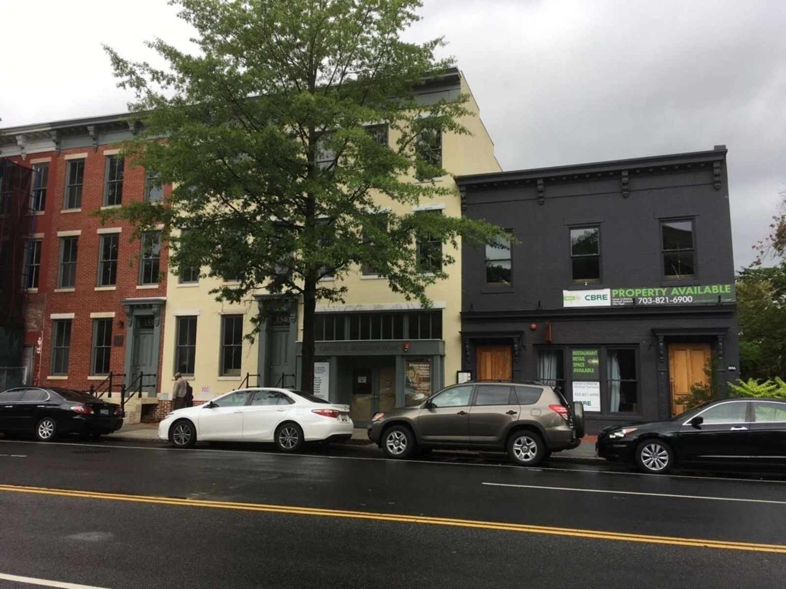
Before Dr. Carter G. Woodson, there was very little accurate written history about the lives and experiences of Americans of African descent. Dr. Woodson's home served as the headquarters for the Association for the Study of African American Life and History. Here, Dr. Woodson established Negro History Week in 1926, which we celebrate today as Black History Month. Plaque CARTER G. WOODSON HOUSE HAS BEEN DESIGNATED A NATIONAL HISTORIC LANDMARK THIS SITE POSSESSES NATIONAL SIGN
(198 words) The Carter G. Woodson Home NHS is located in the Shaw neighborhood of Northwest, Washington, D.C. Traveling south on 9th Street, NW the home sits seventy-five feet south of Q Street, NW on the west side of 9th Street. The home is a three-story red brick rowhouse. Four cement steps with black metal railings on both sides lead up to a gray front door with two windows on the left. Rows of three windows line the second and third floors above. To the left of the front door is a one-square-foot bronze plaque. An inscription on its face reads: CARTER G. WOODSON HOUSE HAS BEEN DESIGNATED A NATIONAL HISTORIC LANDMARK THIS SITE POSSESSES NATIONAL SIGNIFICANCE IN COMMEMORATING THE HISTORY OF THE UNITED STATES OF AMERICA 1976 NATIONAL PARK SERVICE UNITED STATES DEPARTMENT OF THE INTERIOR. The main entrance is next door to the right up four steps at a yellow rowhouse at 1540 9th Street. To the right of this rowhouse is a gray trimmed glass front door framed by two window alcoves and titled above the front door in raised gold lettering: CARTER G. WOODSON HOME. The National Park Service arrowhead-design sign is set to the right. END OF DESCRIPTION
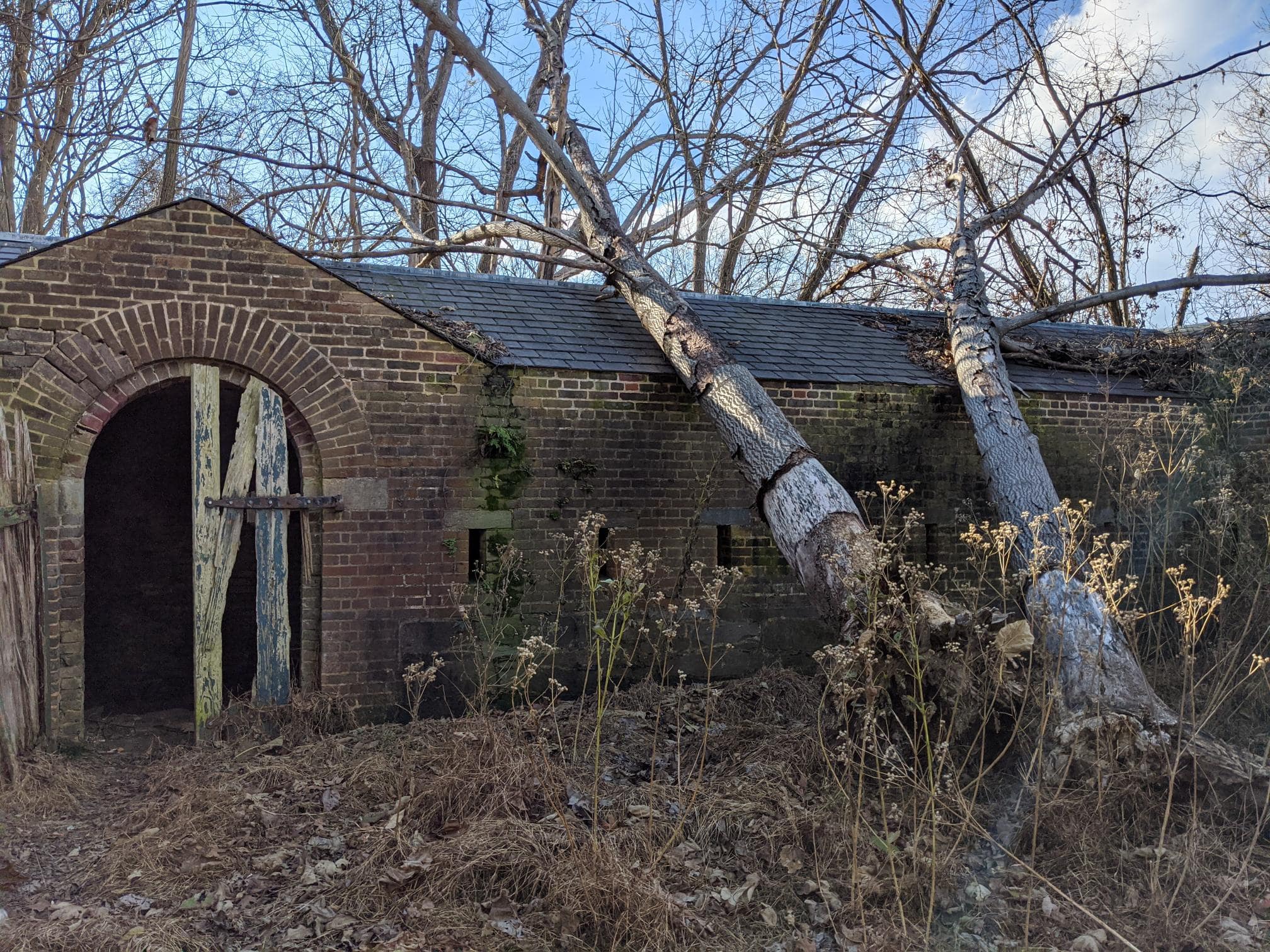
The Counterscarp Gallery is an L- shaped defensive structure that is approximately 50 feet in length, and is made up of red bricks and stone with a black slate shingled roof. The interior of the L-shaped structure is hollow on the inside resembling a tunnel, and was used as a reinforced firing position for the rear defenses of Fort Washington.
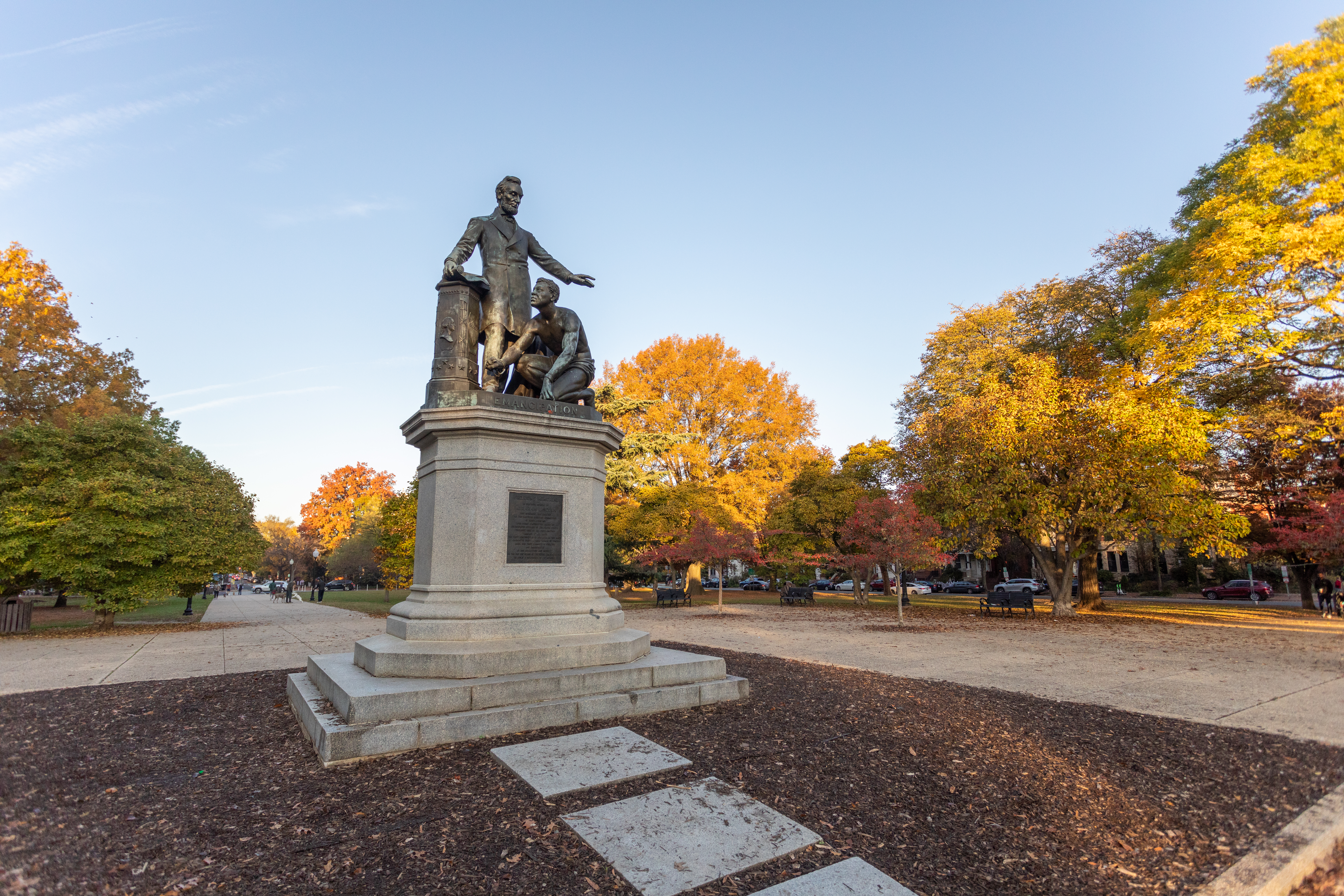
On the morning after Lincoln's death in 1865, sixty-year old Charlotte Scott, a former Virginia slave living in Ohio, donated five dollars to her employer and asked that it be used toward a monument for the president. A campaign among freed slaves raised $18,000 for the memorial. Frederick Douglass delivered the keynote speech at the monument's dedication on April 14, 1876, which was attended by President Ulysses S. Grant and other political figures. The Emancipation Monument
(484 words)<br />Located in the heart of Lincoln Park in Capitol Hill at Massachusetts Avenue and North Carolina Avenue NE is the Emancipation Memorial. <br />Lincoln Park has a rectangular shape and is bounded by 11th Street NE to the west and 13th Street NE to the east. North and south of the park are the respective westbound and eastbound lanes of East Capitol Street, NE. All sides have walkway access into the park with traffic lights, as well as at the park's four corners. There is also street access at 12th Street SE on the south side and 12th Street NE on the northern side.<br />A 20-foot wide cement walkway runs about 100 yards from the west end of the park through a wide grass lawn and shade tree-filled park area on both sides. Tall black walkway lights with glass tops line both sides of the walkway.<br />As you approach the memorial plaza area, the statue of Abraham Lincoln and a slave kneeling at his left side are facing the away from you. The cement plaza is about 100 feet wide and lined with 10-foot tall trees and bench seating throughout on both sides.<br />The memorial statue is surrounded by a ten by ten-foot square patch of grass with low bushes. Walking around to the front side of the statue, three by three-foot stone pavers lead up to its base.<br />The twelve-foot tall bronze sculpture of Lincoln also sits atop a twelve-foot high octagonal-shaped podium. Underneath are two square base pieces, of twelve by twelve and ten by ten widths and each four inches high.<br />The memorial faces out to the west and is directed at another statue about 1oo yards over on the park, who is faces back in his direction.<br />Lincoln is standing, with his left hand outstretched over the head of a man of African descent who is kneeling at his left side. Lincoln is wearing a long coat with tie and no hat. The kneeling man has tight curly hair, no shirt, and only a loin cloth. His left hand supports his weight on the ground, and his right fist is balled up, grasping the broken manacle around his wrist. His right wrist is also chained. Lincoln looks down upon the kneeling man with a benevolent expression. The kneeling man's head is uplifted with a steely hopeful expression.<br />Lincoln's right hand holds a furled-up copy of the Emancipation Proclamation, which rests atop a podium. In bronze below the two figures at the base of the statue is the word "Emancipation."<br />The podium is adorned with the bust of what appears to be George Washington on one of its octagonal sides. Another panel shows a shield with thirteen stars and stripes. Thirteen stars also ring around the base of the podium.<br />Two by three-foot sized bronze memorial plaques are just below the statue on the front and back sides of the granite pedestal.<br />END OF DESCRIPTION <br />
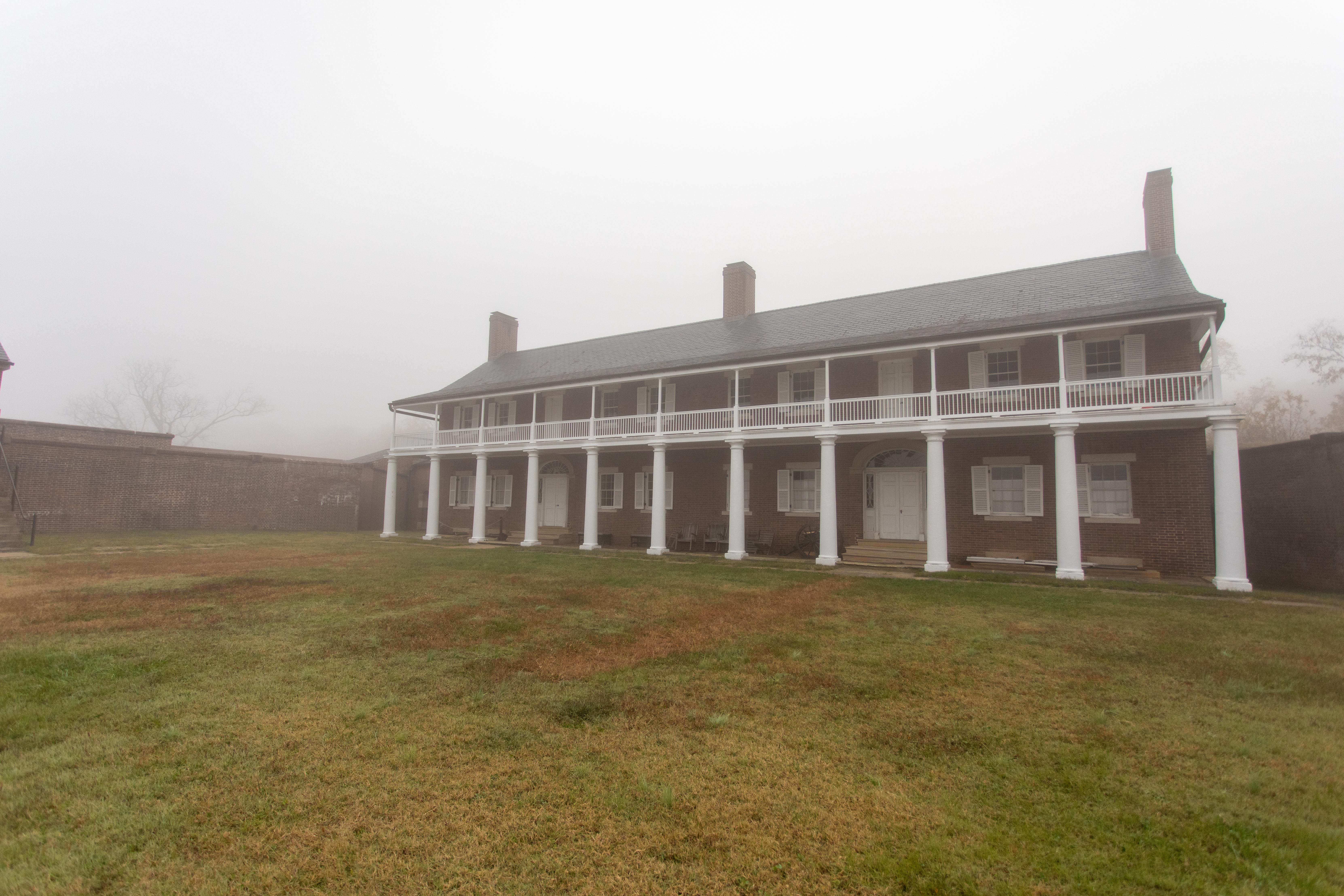
The Enlisted Men's Barracks is a two story building approximately 120 feet by 22 feet in diameter, and primarily made up of red bricks, with a black wooden shingled roof. The front porch of the structure is lined with brick columns which hold up the second story's white wooden balcony. The interior of the first floor is divided into two separate large rooms, while the second floor is made up of one singular large room. There are two white wooden staircases on either side of the building that allows passage up to the second floor.
The small gravel parking lot is often ringed with cars as people fish from the shore. A small boat launch at the end of the access road provides a place for visitors to launch their canoes, kayaks, and other hand-paddles watercraft for a new way to explore the Potomac River and Piscataway Creek.
Located in the Southeast quadrant of Washington, D.C., Folger Park is one of the largest parks in the Capitol Hill area. In 1885, the park was memorialized and named after Charles J. Folger, Secretary of the Treasury. Folger Park is nestled in a quiet residential area, and can be enjoyed by nature lovers and city slickers alike. It includes trees, paved asphalt walkways, and "fountain benches" fashioned after the 1935 "Drinking Fountain and Bench" plan.
Located in the Southeast quadrant of Washington, D.C., Folger Park is one of the largest parks in the Capitol Hill area. In 1885, the park was memorialized and named after Charles J. Folger, Secretary of the Treasury. Folger Park is nestled in a quiet residential area, and can be enjoyed by nature lovers and city slickers alike. It includes trees, paved asphalt walkways, and "fountain benches" fashioned after the 1935 "Drinking Fountain and Bench" plan.
Battery Carroll and Fort Greble were two defense sites north of the Potomac that guarded the gateway to Washington during the Civil War. Battery Carroll was named after Samuel Sprigg Carroll, a native Washingtonian and West Point graduate.
(346 words)<br />Battery Carroll is located in southeast Washington, D.C. at the intersection of South Capitol street SE and Martin Luther King, Jr avenue SE.<br />Travel north along the west side of Martin Luther King, Jr avenue from the intersection with South Capitol street about four hundred feet. On your left about ten feet off the sidewalk will be two signs, sitting on a strip of grass that runs about fifteen feet back to thick forest and overgrowth.<br />The sign on the left is a two by five-foot brown sign titled in white letters: <br />Fort Carroll<br />Civil War Defenses of Washington<br />National Park Service<br />U.S. Department of the Interior<br />About six feet to the right is a four by three-foot yellow sign titled at the top in brown letters to read:<br />Fort Carroll<br />Earthworks of Fort Carroll are visible 100 yards to the right at the top of the hill<br />Below along a blue border is written in white letters:<br />Civil War Defenses of Washington<br />1861-1865<br />Beneath on the left is a diagram of a rectangular fort, showing its boundaries and in the top left corner a closeup look at one of the corners of the fort.<br />To the right is a map of Washington and the edge of Virginia at the bottom. The map indicates Civil War fort locations along this section of Washington. They are, from left to right Fort Marcy, Battery Kemble, Fort Bayard, Fort Reno, Fort De Russy, Fort Stevenson, Fort Slocum, Fort Totten, Fort Bunker Hill, Fort Mahan, Fort Chaplin, Fort Dupont, Fort Davis, Fort Stanton, Battery Rickets, Fort Carrol, and Fort Greble.<br />Text below reads: "Other Civil War fort locations administered by the National Park Service.<br />The bottom third of the sign shows a black and white photograph of Civil War soldiers standing in a fort around an eight-foot long cannon on a rotating platform, aimed to the left. The fort sits atop a tall hill with a vast view in the background of open spaces and rolling hills.<br />The caption below reads: <br />During the Civil War, Washington's forts overlooked the land.<br />END OF DESCRIPTION <br />
Fort Chaplin was constructed in 1864. Its function was to cover the flank of Fort Mahan and force an enemy to detour around Fort Meigs by prolonging the obstructed line to that fortification.
(352 words)<br />Fort Chaplin is located in the southeast quadrant of Washington, D.C., bordered by Texas Avenue SE to the east, C street SE to the south, and East Capitol street SE to the north.<br />From the intersection of Texas avenue and B street, travel south on Texas avenue about one hundred sixty feet. Set on the west side of the road, along the edge of an open grass field, is a four by three-foot wayside, titled across the top to read:<br />Fort Chaplin<br />Earthworks of Fort Chaplin are visible through the wooded area at the top of the hill.<br />Below across a blue border is written in white letters:<br />Civil War Defenses of Washington<br />1861-1865<br />Below on the left side is a diagram of the boundaries and walls of an asymmetrical ten-sided structure. Text below reads:<br />Fort Chaplin from U.S. Army Corps of Engineers drawing.<br />Fort Chaplin was named in honor of Col. Daniel Chaplin, who was mortally wounded on August 17, 1864, at Deep Bottom, Virginia.<br />To the right is a map of Washington and the edge of Virginia at the bottom. The map indicates Civil War fort locations along this section of Washington. They are, from left to right Fort Marcy, Battery Kemble, Fort Bayard, Fort Reno, Fort De Russy, Fort Stevenson, Fort Slocum, Fort Totten, Fort Bunker Hill, Fort Mahan, Fort Chaplin, Fort Dupont, Fort Davis, Fort Stanton, Battery Rickets, Fort Carrol, and Fort Greble.<br />Text below reads: "Other Civil War fort locations administered by the National Park Service<br />The bottom third of the sign shows a black and white photograph of Civil War soldiers standing in a fort around an eight-foot long cannon on a rotating platform, aimed to the left. The fort sits atop a tall hill with a vast view in the background of open spaces and rolling hills.<br />The caption below reads: <br />During the Civil War, Washington's forts overlooked the land.<br />To the west behind the sign is an open field that stretches about four hundred yards north to south along the sidewalk and about one hundred yards west to a heavily forested and overgrown area. <br />END OF DESCRIPTION<br />
Fort Davis was named in honor of Colonel Benjamin F. Davis. Constructed as part of the Eastern Branch Defenses (Anacostia River), the fort had a perimeter of 220 yards and was armed with 12 artillery pieces, including 11 cannons and 1 mortar.
(372 words)<br />Fort Davis is located at the northern intersection of Pennsylvania avenue SE and Alabama avenue NE in Southeast Washington, D.C.<br />Travel about three hundred fifty feet north on Alabama avenue from the intersection with Pennsylvania avenue. On the west side of the street, an iron gate will be set about six feet west of the sidewalk on a patch of asphalt. About ten feet to the right, on a raised grass mound of the park is a four by three-foot wayside.<br />The park is an open grass field, about two hundred fifty feet wide, that stretches about five hundred feet to the northeast. The southern end of the park features thick woods and overgrowth. <br />The yellow wayside sign is written in brown letters across the top:<br />Fort Davis<br />Earthworks of Fort Davis are visible behind the wooded area in front of you.<br />Written across a blue border below reads in white lettering:<br />Civil War Defenses of Washington<br />1861-1865<br />Below on the right is a diagram titled Fort Davis. The image shows a series of walls surrounding two rectangular buildings in the center. Text below reads:<br />Fort Davis from the U.S. Army Corps of Engineers drawing.<br />Fort Davis was named after Col. Benjamin F. "Grimes" Davis, hero at Harpers Ferry in 1862, killed at the Battle of Brandy Station, June 9, 1863.<br />To the right is a map of Washington and the edge of Virginia at the bottom. The map indicates Civil War fort locations along this section of Washington. They are, from left to right Fort Marcy, Battery Kemble, Fort Bayard, Fort Reno, Fort De Russy, Fort Stevenson, Fort Slocum, Fort Totten, Fort Bunker Hill, Fort Mahan, Fort Chaplin, Fort Dupont, Fort Davis, Fort Stanton, Battery Rickets, Fort Carrol, and Fort Greble.<br />Text below reads: "Other Civil War fort locations administered by the National Park Service.<br />The bottom third of the sign shows a black and white photograph of Civil War soldiers standing in a fort around an eight-foot long cannon on a rotating platform, aimed to the left. The fort sits atop a tall hill with a vast view in the background of open spaces and rolling hills.<br />The caption below reads: <br />During the Civil War, Washington's forts overlooked the land.<br />END OF DESCRIPTION <br />
InscriptionsThe Civil War Defenses of WashingtonFort DavisOne of several earthworks commenced late in 1861 to guard the nations capital from the ridge east of the Anacostia River, the fort was named in honour of Colonel Benjamin F. Davis of the 8th New York Cavalry, killed at Beverly Ford, Virginia, June 9th, 1863. Its armament consisted of eleven guns and one mortar.United States Department of the InteriorNational Park Service, National Capital ParkPresented by theNational S
(255 words)<br />Fort Davis is located at the northern intersection of Pennsylvania avenue SE and Alabama avenue NE in Southeast Washington, D.C.<br />Travel about three hundred fifty feet north on Alabama avenue from the intersection with Pennsylvania avenue. On the west side of the street, an iron gate will be set about six feet west of the sidewalk on a patch of asphalt. About ten feet to the right, on a raised grass mound of the park is a four by three-foot wayside.<br />The park is an open grass field, about two hundred fifty feet wide, that stretches about five hundred feet to the northeast. The southern end of the park features thick woods and overgrowth. <br />From the iron gate, proceed west into the park. About one hundred feet into the park, underneath vegetation and overgrowth, is a bronze plaque sitting on the face of a three foot-tall, four foot-wide, and two-foot-deep rock. <br />The plaque is about one by two feet and engraved to read:<br />The Civil War Defenses of Washington<br />Fort Davis<br />One of several earthworks commenced late in 1861 to guard the nations capital from the ridge east of the Anacostia River, the fort was named in honour of Colonel Benjamin F. Davis of the 8th New York Cavalry, killed at Beverly Ford, Virginia, June 9th, 1863. Its armament consisted of eleven guns and one mortar.<br />United States Department of the Interior<br />National Park Service, National Capital Park<br />Presented by the<br />National Society of the Colonial Dames of America<br />In the District of Columbia<br />1956<br />END OF DESCRIPTION<br />
Fort Dupont was commenced between Ocotober and December of 1861 and "completed" in the spring on 1862. It was named for Flag Officer Samuel F. Dupont, who commanded the naval victory at Port Royal, South Carolina, in November 1861.
(513 words)<br />Fort Dupont is located along the north side of Alabama avenue, SE in Southeast Washington, D.C. The park is bordered by Massachusetts avenue to the west and Burns street to the east. <br />From the intersection of Alabama avenue and Massachusetts avenue, travel about eight hundred thirty feet. Turn left into the park entrance. A brown sign will be on the right with white letters that read:<br />Fort Circle Park<br />Picnic Area<br />Park Closed at Dark<br />Proceed to the left along an asphalt-paved path that loops around in a circle in the park, passing through a parking lot. At the north end of the parking lot, the path continues. Proceed about one hundred fifty yards along the path. On your right about ten feet off the path in a grassy knoll at the edge of the forest line is a four by three-foot yellow wayside. Titled across the top in brown letters it reads:<br />Fort DuPont<br />Earthworks of Fort Dupont are visible, follow path to the entrance of fort.<br />Below across a blue border is written in white letters:<br />Civil War Defenses of Washington<br />1861-1865<br />Below to the left is a diagram titled "Fort Dupont." It features a rectangular building surrounded by three hexagonal walls. Text below reads:<br />Fort DuPont from U.S. Army Corps of Engineers drawing.<br />Fort DuPont was named after Rear Admiral Samuel Francis DuPont, a Union naval hero of the early years of the Civil War.<br />To the right is a map of Washington and the edge of Virginia at the bottom. The map indicates Civil War fort locations along this section of Washington. They are, from left to right Fort Marcy, Battery Kemble, Fort Bayard, Fort Reno, Fort De Russy, Fort Stevenson, Fort Slocum, Fort Totten, Fort Bunker Hill, Fort Mahan, Fort Chaplin, Fort Dupont, Fort Davis, Fort Stanton, Battery Rickets, Fort Carrol, and Fort Greble.<br />Text below reads: "Other Civil War fort locations administered by the National Park Service.<br />The bottom third of the sign shows a black and white photograph of Civil War soldiers standing in a fort around an eight-foot long cannon on a rotating platform, aimed to the left. The fort sits atop a tall hill with a vast view in the background of open spaces and rolling hills.<br />The caption below reads: <br />During the Civil War, Washington's forts overlooked the land.<br />About forty feet to the left of the wayside, also set along the tree line, is a four-foot-tall, four-foot-wide, and two-foot-tall rock with a bronze plaque set on its face. The plaque is about one by two feet, and engraved to read:<br />The Civil War Defenses of Washington<br />Fort DuPont<br />This small work was one of the defenses begun in Fall of 1861 on the ridge east of the Anacostia River. It was named after Admiral Samuel F. DuPont, a commander of the South Atlantic Blockage Squadron. Eight guns and one mortar comprised its armament.<br />United States Department of the Interior<br />National Park Service, National Capital Parks<br />Presented by the National Society of the Colonial Dames of America<br />In the District of Columbia<br />1955<br />END OF DESCRIPTION<br />
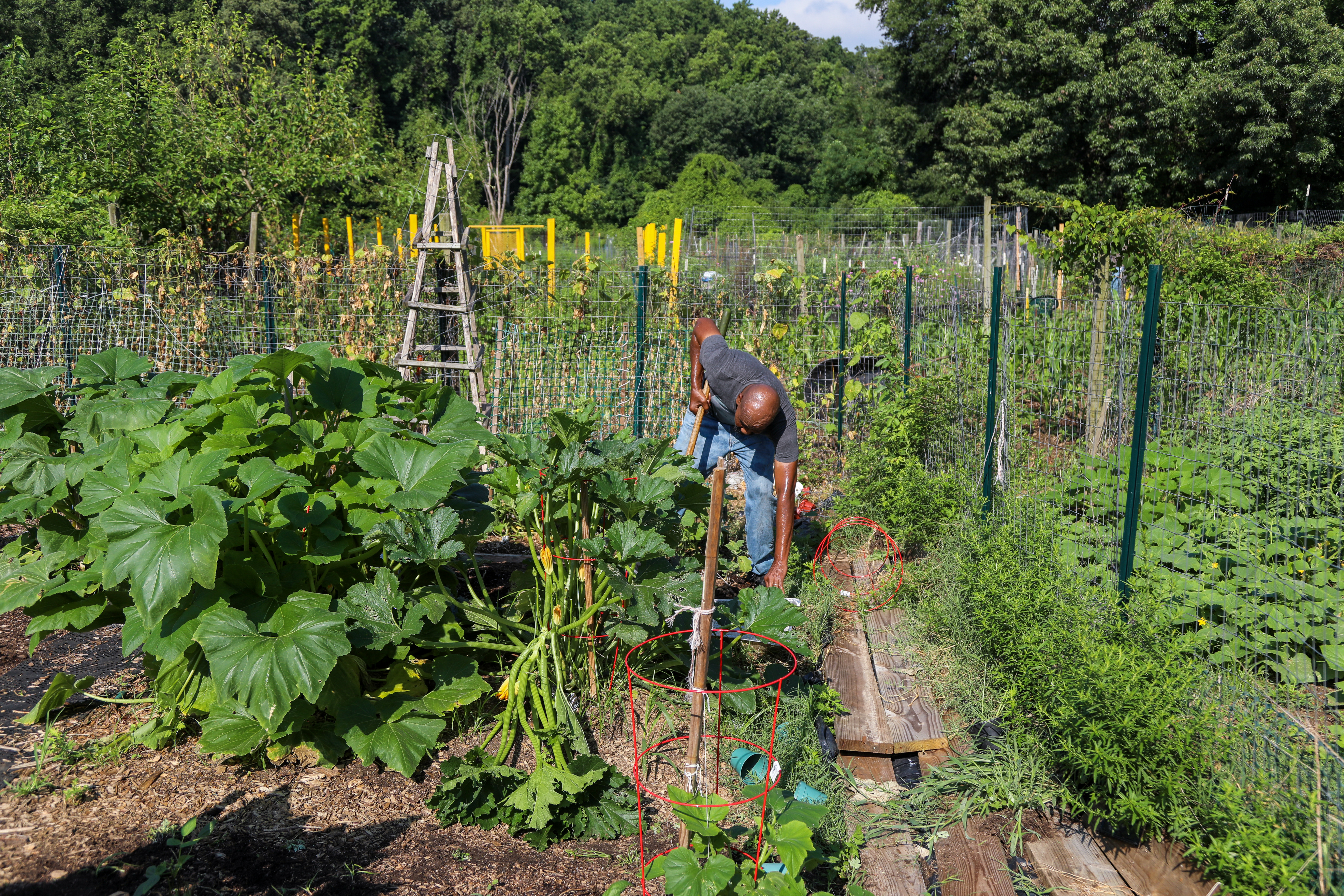
One of the largest community gardens in Washington, DC, the Fort Dupont Community Gardens increases the accessibility and exposure of fruits and vegetables as well as providing education on nutrition and sustainable agriculture for urban residents. The Community Gardens of Fort DuPont provide education through shared knowledge and agricultural practices by empowering the community to grow its own healthy food.
A large community garden filled with different plants and vegetables.
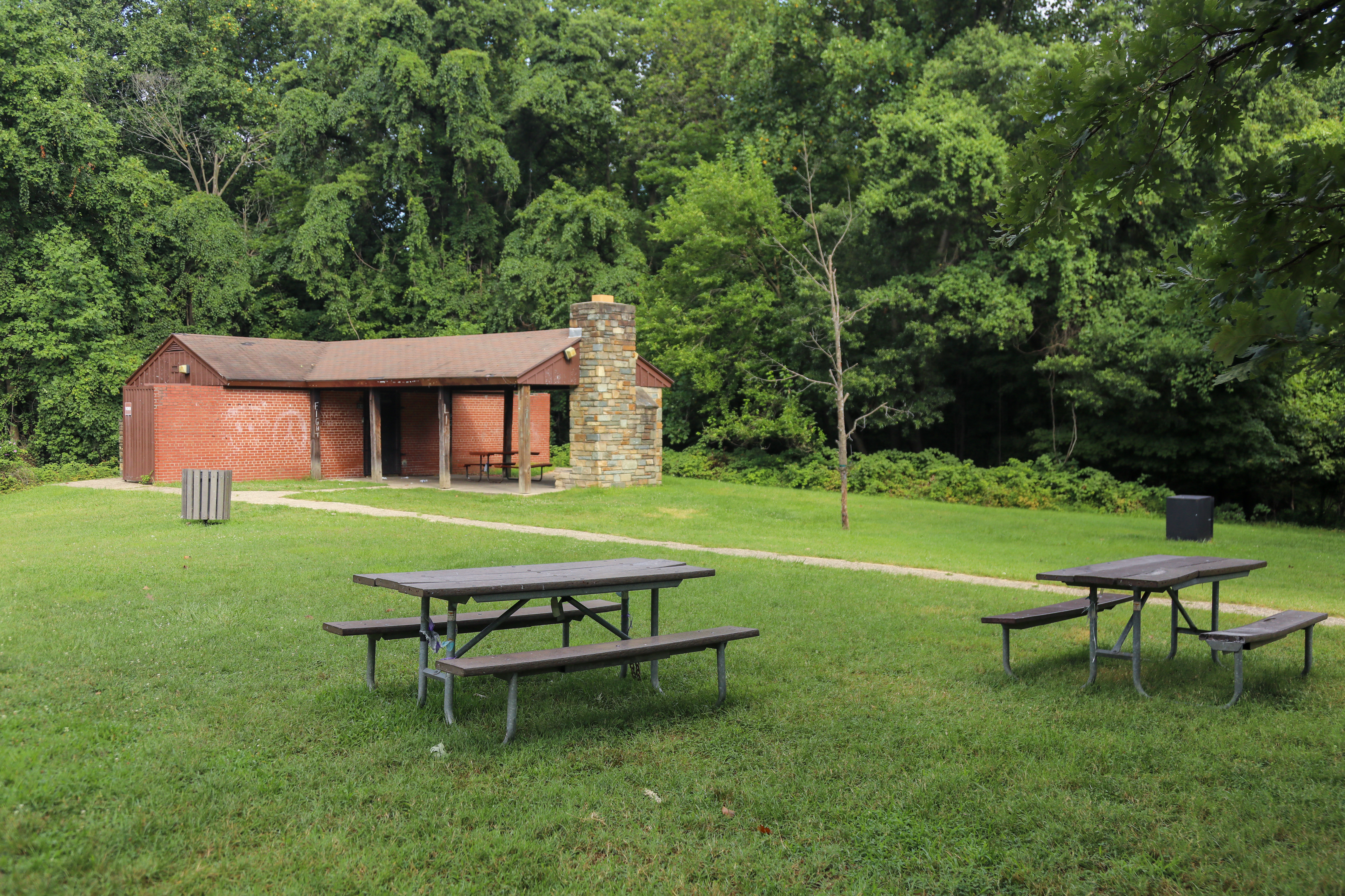
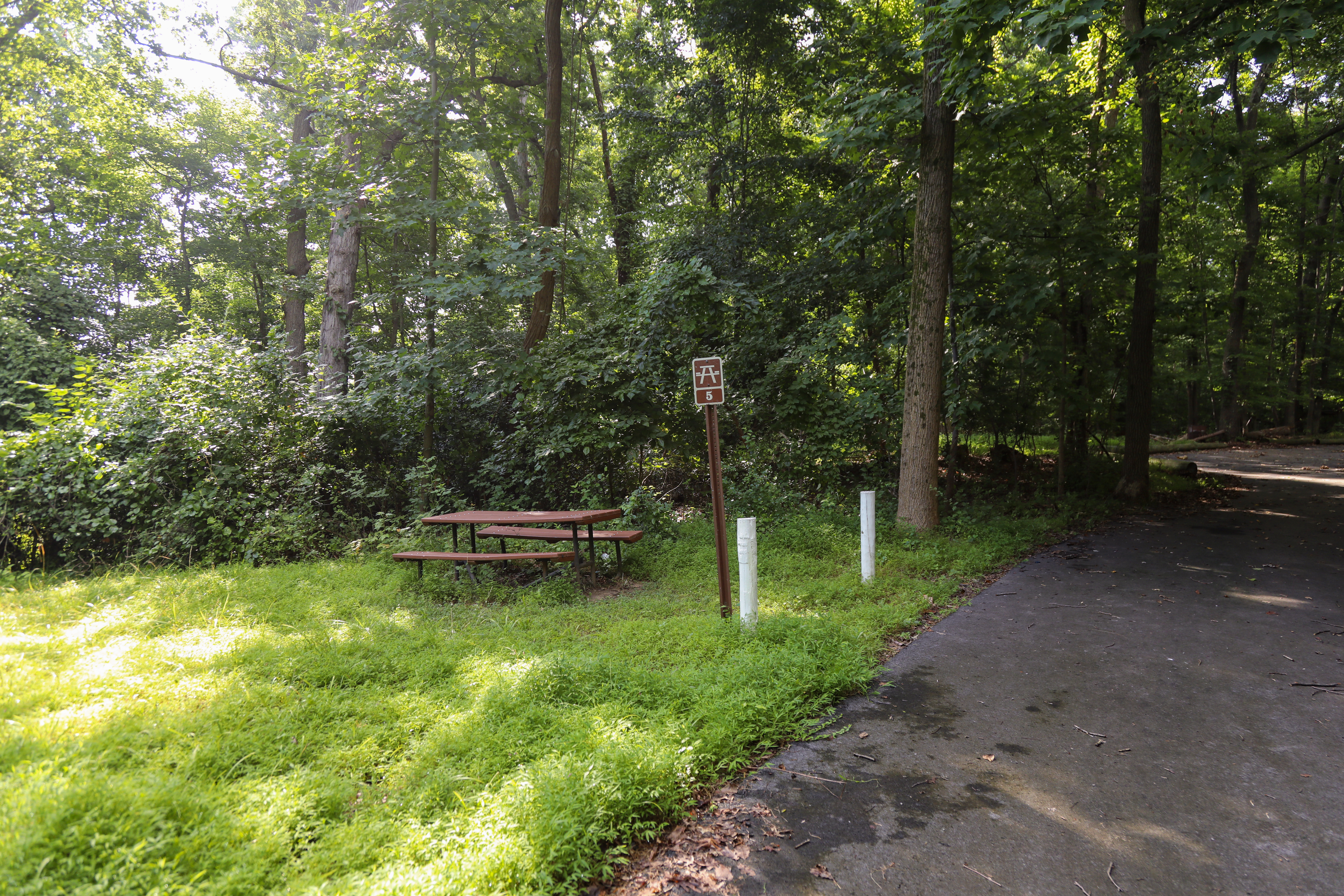
Picnic amid history at the site of Fort Dupont's historic earthworks.<br /><br />Picnickers may <a href="https://www.recreation.gov/camping/campgrounds/250017">reserve sites through Recreation.gov</a> .
Two picnic tables in front of a small brick building.
The picnic grove at Fort Dupont offers a number of recreational opportunities. In addition to picnicking, visitors can hike the nearby trails that link the various Civil War-era forts that protected the capital.<br /><br />Picnickers may reserve sites through <a href="https://www.recreation.gov/camping/campgrounds/250017">Recreation.gov</a> .
Seven picnic tables sit in a wooded area in front of a playground.
Fort Foote was named after Rear Admiral Andrew H. Foote. He distinguished himself in the actions against the Confederate forts on the Mississippi River and died of wounds on June 26, 1863.
A small overgrown fort. The fort is constructed of earth and some stone and is now covered in a forest ecosystem. On the Western side of the fort sit two 7 ft tall cannons.
Located in the center earthwork of Fort Foote the bomb proof magazine is a short t-shape structure measuring about 50 by 50 ft. It is made of a cement-like material filled with small pebbles. It has many tunnels overgrown with moss vines and shrubs. The structure has seen much where over the past century and is in disrepair.
Fort Foote was constructed in 1863 atop Rozier's Bluff to strengthen the ring of fortifications that encircled Washington, DC. Two of the Guns that protected Washington are still there along with the remains of the fort's earthworks.
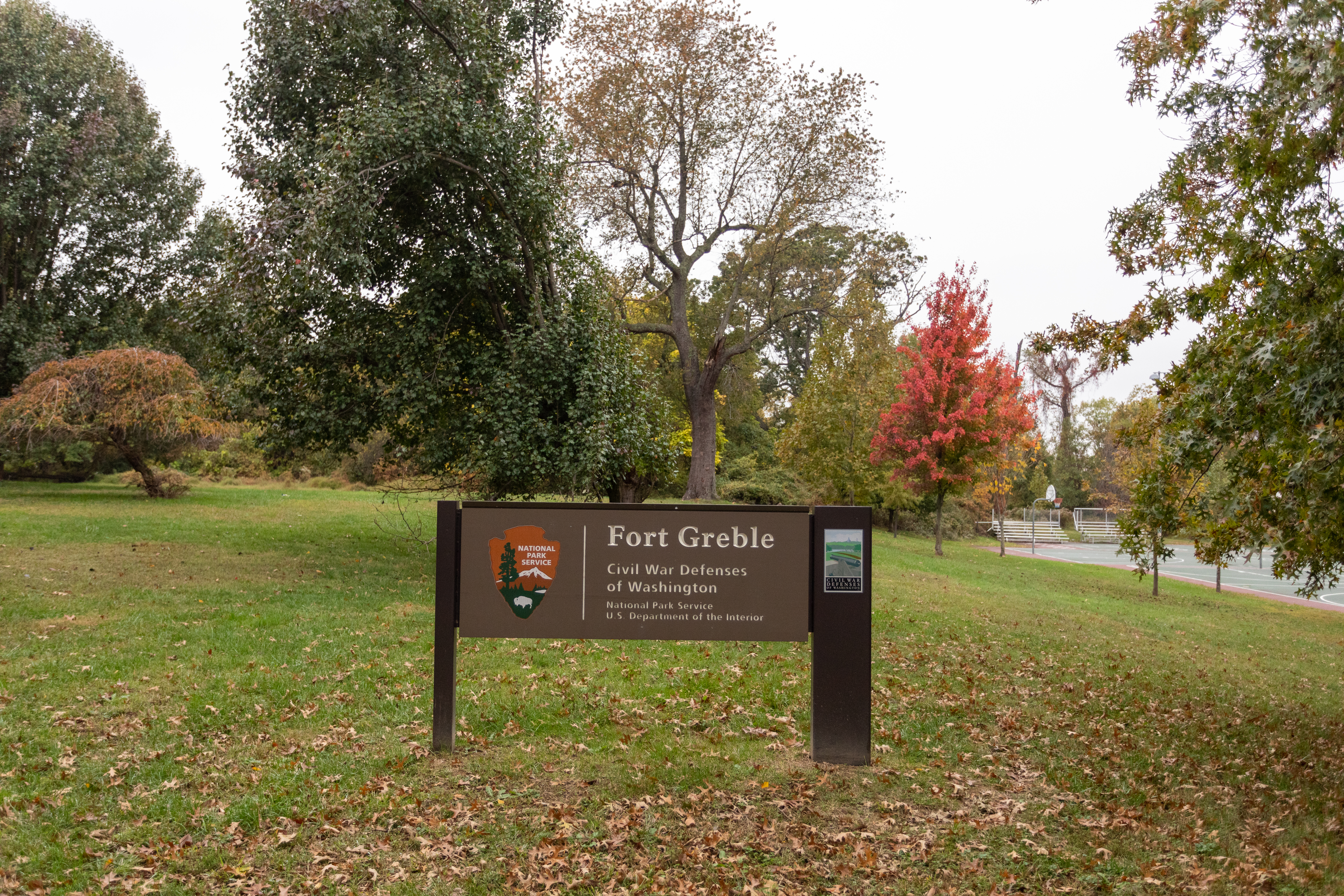
Battery Carroll and Fort Greble were two defense sites north of the Potomac that guarded the gateway to Washington during the Civil War. Fort Greble was named in honor of Lt. J.T. Greble who was killed at Big Bethel, Va., July 10, 1861.
A sign with text that reads "Fort Greble, Civil War Defenses of Washington, National Park Service, U.S. Department of the Interior". The sign is in front of a large field next to a basketball court.
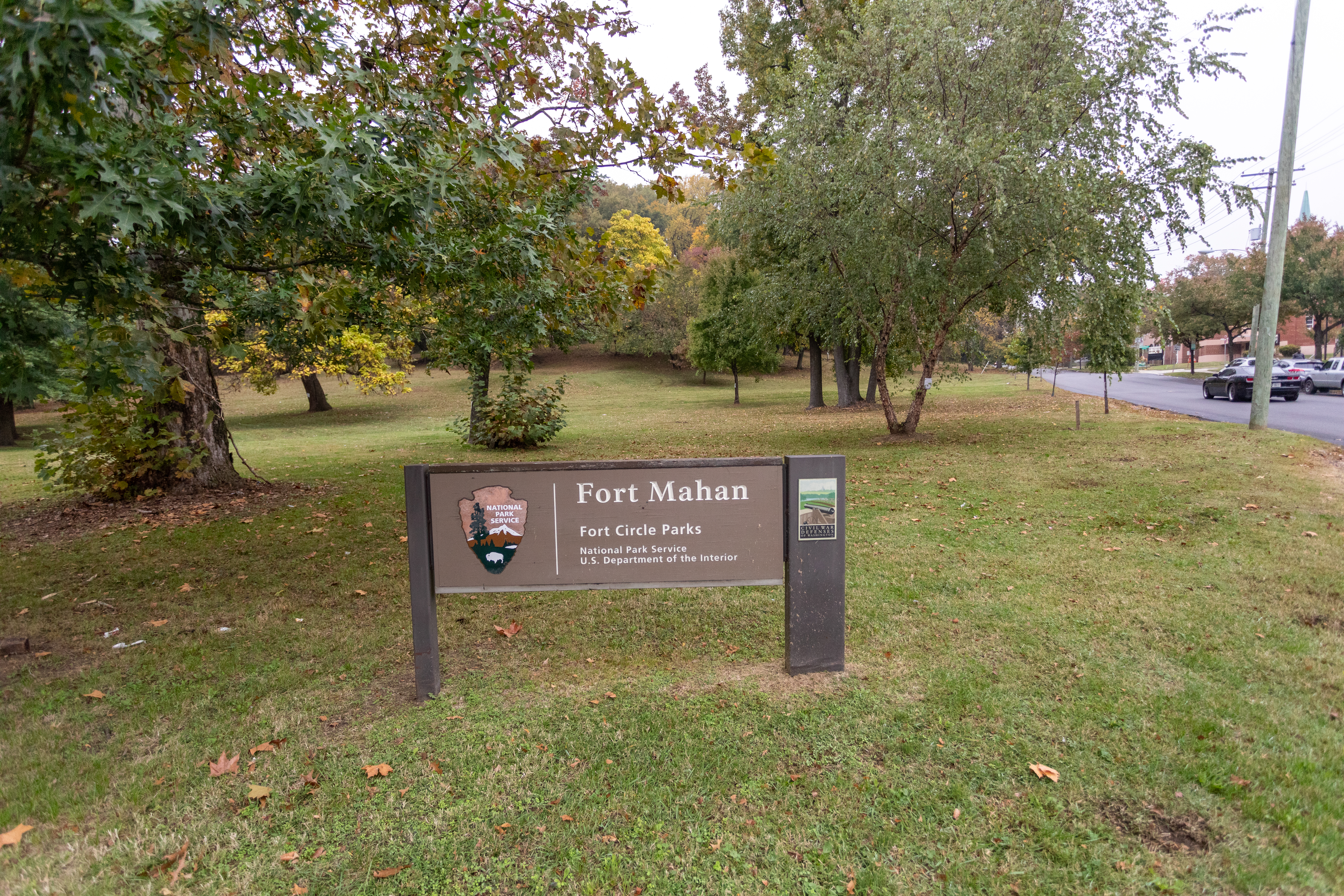
Fort Mahan, situated on an isolated hill belonging to Dr. William Manning, was built to guard the approaches to Benning's Bridge which crosses the Anacostia River.
(425 words)<br />Fort Mahan is located in the northeast quadrant of Washington, D.C., bordered by Grant street NE to the north, Benning road, NE to the south, 42nd street to the east and Minnesota avenue NE to the west.<br />From the intersection of Benning road and 41st street, travel about twenty feet east on the north side of Benning road. Follow the pedestrian walkway north into the park. At one hundred twenty feet, turn left and continue one hundred forty feet, at a slight incline.<br />Set of the right side of the path is a brown sign with white letters, partially obscured by the forest and overgrowth. The sign reads:<br />Fort Circle Park<br />Hiker - Biker - Trail<br />Motorized Vehicles Prohibited<br />Ten feet west is a four by three-foot wayside, titled across the top to read:<br />Fort Mahan<br />Earthworks of Fort Mahan are visible; follow path to the top of the hill.<br />Below across a blue border is written in white letters:<br />Civil War Defenses of Washington<br />1861-1865<br />Below on the left side is a diagram of the walls of an eight-sided structure, titled: "Fort Mahan."<br />Text below reads:<br />Fort Mahan from U.S. Army Corps of Engineers drawing.<br />For Mahan was named after West Point professor Dennis Hart Mahan, whose book on fortifications guided construction of the forts around Washington, D.C.<br />To the right is a map of Washington and the edge of Virginia at the bottom. The map indicates Civil War fort locations along this section of Washington. They are, from left to right Fort Marcy, Battery Kemble, Fort Bayard, Fort Reno, Fort De Russy, Fort Stevenson, Fort Slocum, Fort Totten, Fort Bunker Hill, Fort Mahan, Fort Chaplin, Fort Dupont, Fort Davis, Fort Stanton, Battery Rickets, Fort Carrol, and Fort Greble.<br />Text below reads: "Other Civil War fort locations administered by the National Park Service<br />The bottom third of the sign shows a black and white photograph of Civil War soldiers standing in a fort around an eight-foot long cannon on a rotating platform, aimed to the left. The fort sits atop a tall hill with a vast view in the background of open spaces and rolling hills.<br />The caption below reads: <br />During the Civil War, Washington's forts overlooked the land.<br />The pedestrian path continues west and winds around the block in a loop. A path from 42nd and Eads street leads west into the park about five hundred feet to an open field at the top of a hill. The field spans about two hundred yards in each direction and is surrounded by thick forest and overgrowth.<br />END OF DESCRIPTION<br />
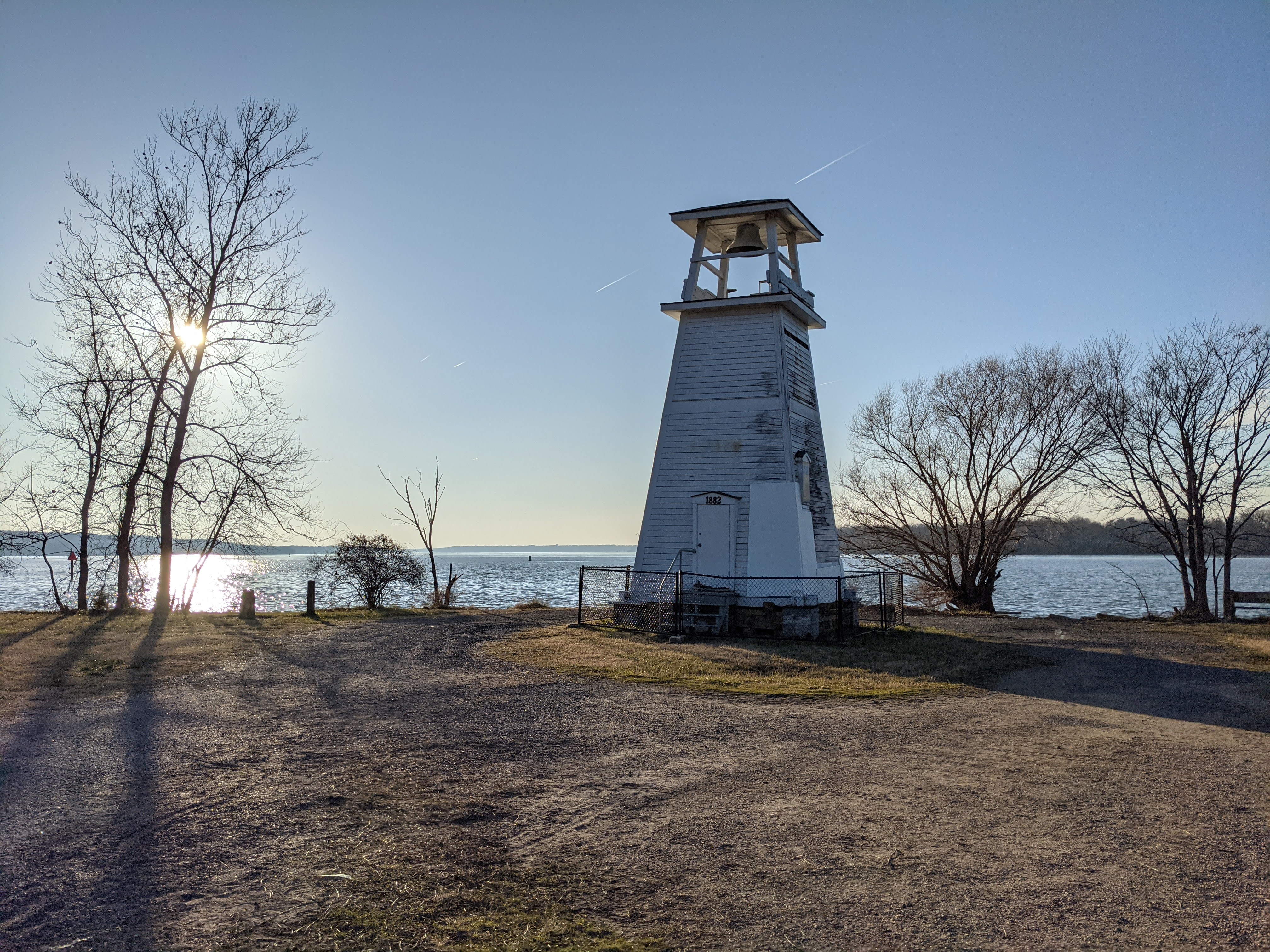
The 32-foot tower is trapezoidal with the base being 16 feet and the top 4 feet. The wooden tower is painted white and is sitting on four grey brick pillars at the corners that are about 2 feet tall. There is a four-foot chain link fence around the lighthouse. The north and south sides of the light has a “ghost” image of the triangle marker that used to be on the tower and removed in October 2020. The west side of the lighthouse has two small windows on in the middle near the right edge and the other close to the top in the center, below a ridge that is part of the top of the lighthouse. The north side of the light has a small window on the left side of the light about midway up the tower. Above the ridge is a shelf that is attached to the tower that was for the light prior to its removal. There is a stack of wood under the tower, to add support to the structure until it can be repaired.
The Main Parking Lot Bathroom is a one story building and is made of orangish tan bricks with a shingled roof. A 20 foot concrete sidewalk leads to the building. The men's room is about 5 feet to the right where the sidewalk meets the building, this is close to the middle of the bathroom. The women's room entrance is another 5 feet at the right corner of the bathroom just to the left. There is a brown, vinyl privacy wall at the end of the sidewalk. Two six foot panels goes toward the back and connects to another 6 foot panel that connect it to the building, making the entrance to the women's room. There are two sets of three vertical rectangular windows that follow the angle of the roof making them three different height sizes and about 18 inches wide, which is to the right and left of the men's entrance way.
Fort Washington Marina provides a convenient location for boaters to launch their recreational watercraft for access to the Potomac River via Piscataway Creek. The grounds include barbecues and picnic spots for patrons to enjoy. A large building in the center of the lot is available to guests and includes restrooms and friendly staff to help with any questions. Boats of all shapes and sizes are docked at the piers and resting on trailers in the parking lot. During the winter, many of the boats are covered in white plastic or canvas to protect against the elements.
The Officers Quarters is a red brick two story building approximately 112 feet by 22 feet, with a black slate shingle roof. The front porch of the structure is lined with white concrete pillars that support the second story white wooden balcony. The two rooms in the interior of the first floor of the structure are divided by an interior staircase, and the second floor is divided in the same way with two rooms separated by a shared common area.
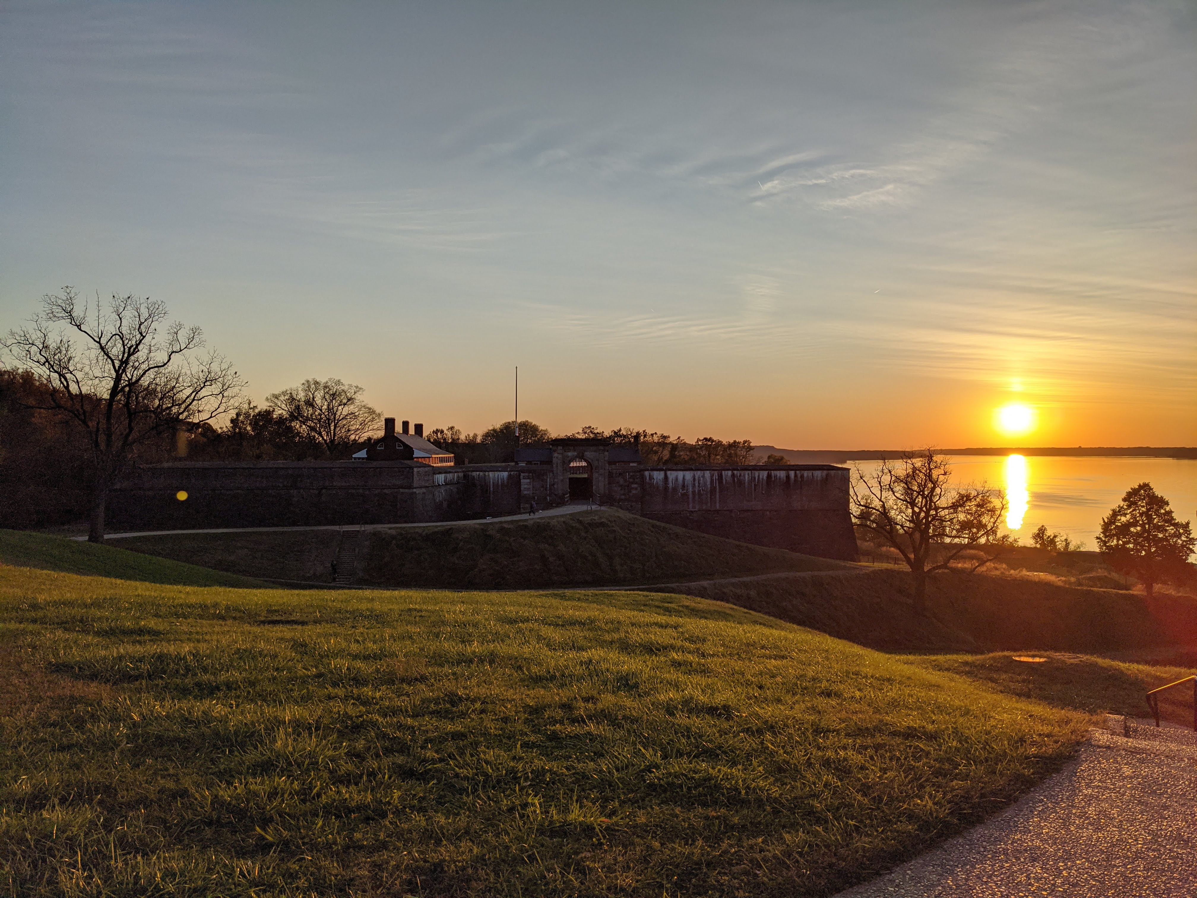
Built to defend the river approach to Washington, DC, Fort Washington has stood as silent sentry for over 200 years. As technologies advanced so did Fort Washington, from the brick and stone of the 19th century to the concrete and steel of the 20th century. Joining the National Park Service in 1946, the park continues to protect the Potomac River.
This 341-acre park was created to preserve its many historic structures. The park's namesake is the 19th century brick and stone fort which stands guard on the shore of the Potomac River. Throughout the park are gray concrete batteries built in the late 19th and early 20th century and other modern and historic buildings. Recreation opportunities include 8 reservable picnic areas, a playground, basketball court, fishing areas, and 3 miles of hiking trails.
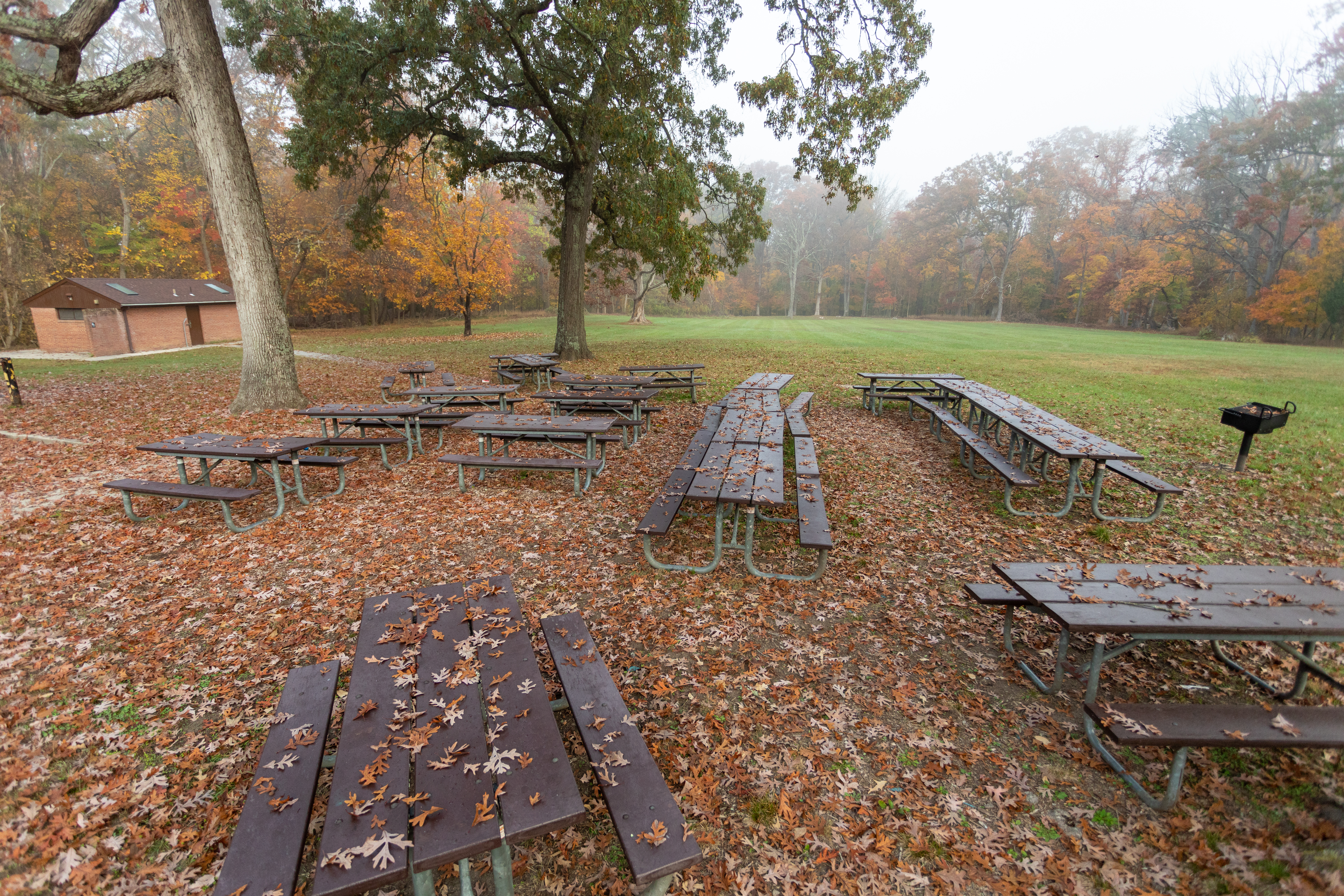
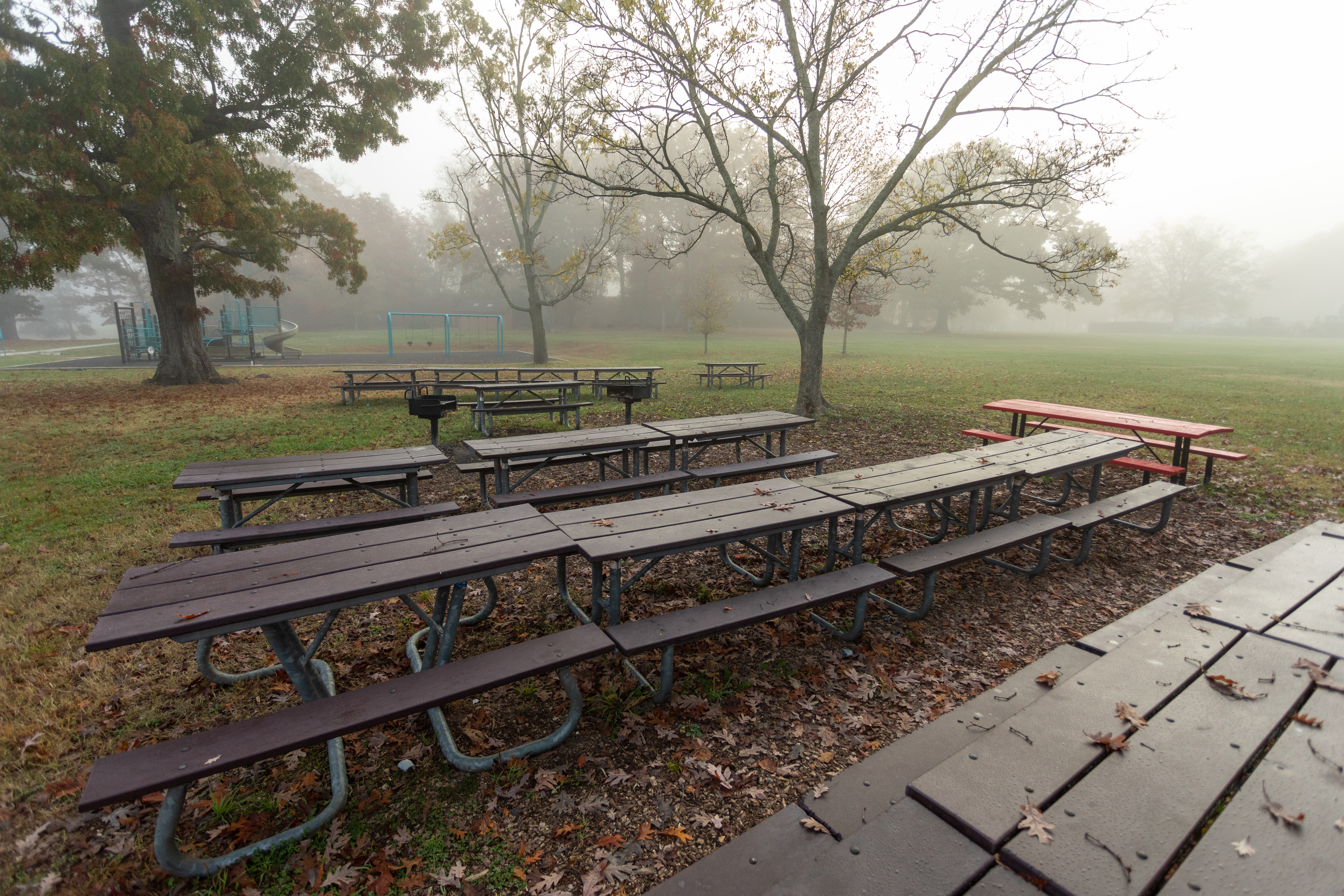
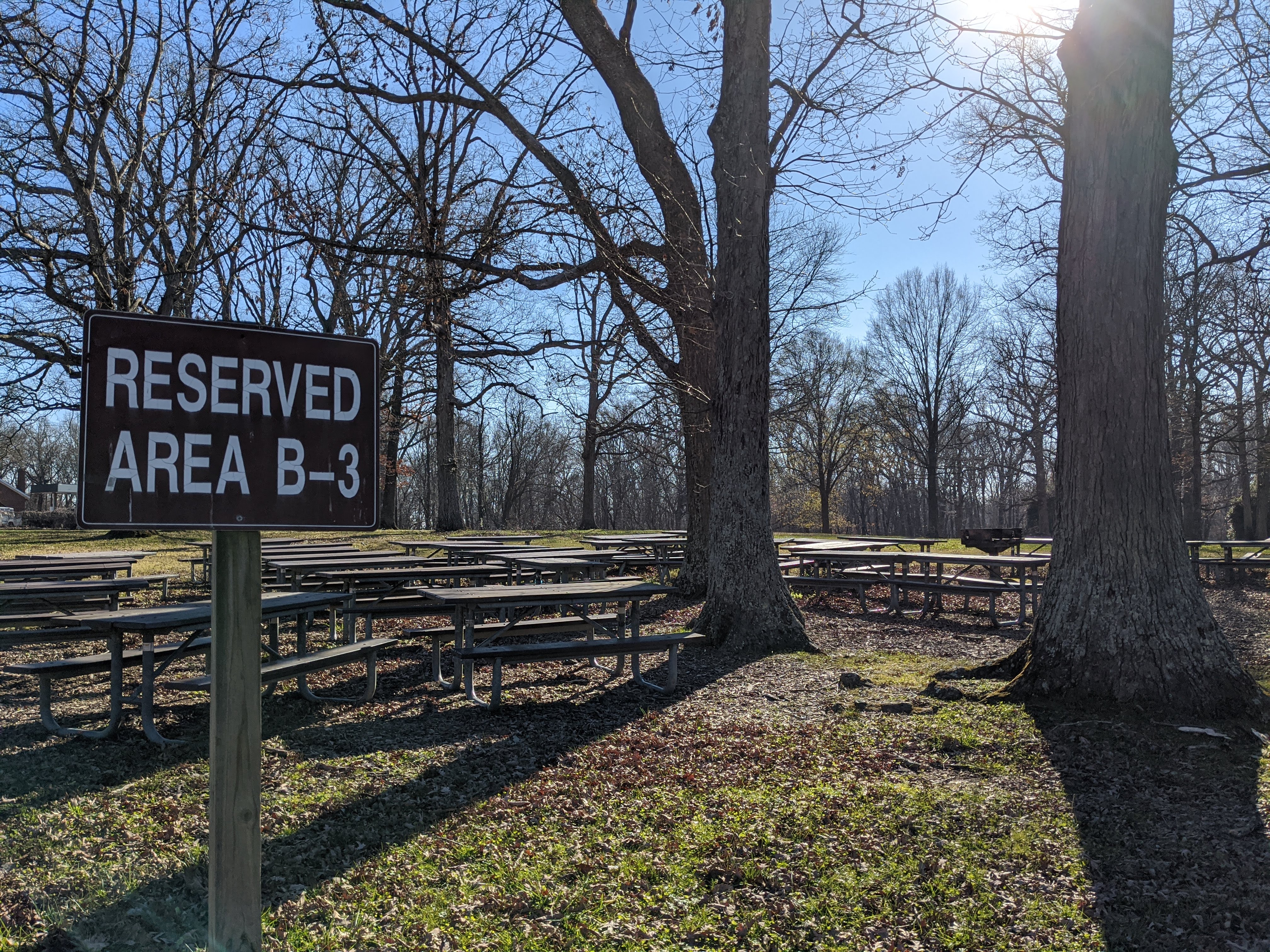
The area is surrounded by trees, creating a private area. The areas is entered from the west to the parking lot. On the east end of the lot is a black metal pole gate that has orange and white reflective stickers on it. To the left of the gate is a brown wooden bulletin board with a shingled room. Behind the gate, about 25 feet back and slightly to the left is the restroom facility. To the north are the picnic tables, about 20 feet from the curb. The tables are placed among a stand of trees that is circular in shape. The grills are placed outside of the tables to the left and right. Behind the tables is a large open field. Behind the field is a wooded area. The east There are four brown trash cans place at the curb of the parking lot about 50 feet from the picnic tables to the right. The restroom is located about 100 feet feet from the tables, there is a concrete sidewalk that leads to the building. It is a rectangular brick building, that is orangish tan in color. It has a brown shingle roof. The gutters and downspouts are brown, the downspouts are on the north and south walls near the corners. There are lights above the doors. There are three windows just below the roof to the left of the women's and right of the men's doors. The sidewalk meets up with the building in the center of the north wall. The brown door is for the maintenance room. To the right is the men's room about 10 feet to the corner there is a brick privacy wall extends about 4 feet from the corner of the building. The women's room is to the left about 15 feet from the maintenance room door. There is a privacy wall that extends about 4 feet from he corner of the building. The doors are brown in color.
From the parking lot, the area is up a short hill, about four feet up. There is a sidewalk to the left that will bypass the hill. The tables are placed to the left of several large trees that provide shade to the area. The grills are to the left of the tables with a hot coals disposal box. Continuing to the left is the playgound area. Area B1 is in the upper left corner where the bathroom is located. To the behind and to the right is an open field. In the far background is the maintenance yard with chain link fence around it.
The area just off of the parking lot. The tables are set up in rows between several large trees which provide shade for the areas. The stone grill is a few feet from the curb with a black hot coals box next to it. Additional grills are behind the tables. Along the curb are trash cans to the left and right of the table area, also to the right is a brown bulletin board with a shingled roof. The area around the tables are open fields with Area B4 to the right. A restroom is located on the far side of Area B4. The maintenance yard is in the background surrounded by a chain link fence.
The picnic tables are less than 50 feet from the parking lot. At the curb are several brown metal trash cans that are supported on wooden poles. The tables are placed under several large trees which provide shade. The grills are near the back of the tables. There is a sidewalk to the right of the picnic tables that leads from the parking lot to the restroom. The restroom is oriented with the men's room at the end of the sidewalk and the women's room around to the right of the building. Is a orangey tan brick building with a shingled roof and brown trim and doors. Battery Humphries is located to the far right. There is an open field between the battery and the tree line. Behind the picnic area is the tree line. To the left diagonal is an area is an open field that is behind all the B picnic areas. Area B3 is to the left of the area with a space between.
The tables are north of the parking lot about 50 feet. At the curb are trash cans. The tables are placed among the trees. The pedestal grills area placed on the the left and right sides of the tables. The area is surrounded by trees except for the east side which is the entrance way into the picnic area. An open field is to the right of the picnic area that lead to a basketball court. The court is asphalt. Several picnic tables surround the court for seating. The restroom is an orangey tan brick building with shingled roof and brown trim and doors. The restroom is about 150 feet from the tables to the left. There is a dirt service road that crosses between the two spaces. In the back of the area are the remains of an Endicotte Command Tower and behind that is a park maintenance building.
The area is surrounded on three sides by large trees providing shade. The tables are spaced around the grills in no particular order. The fourth side is the parking lot and small sidewalk. From the 10 car parking lot, there is a slight slope down about 2 feet to the picnic tables. Two trash cans are by the parking lot along the sidewalk.
The area is surrounded on three sides by large trees providing shade. The tables are spaced around the grills in no particular order. The fourth side is the ten car parking lot and sidewalk. From the parking lot, there is a slight downward slope about 2 feet to the picnic tables. Two trash cans are on the top of the hill near the parking lot.
Junior Ranger Programs at National Capital Parks - East
Become a Junior Ranger at parks across National Capital Parks – East! Explore, complete a booklet, and earn badges and certificates along the way!
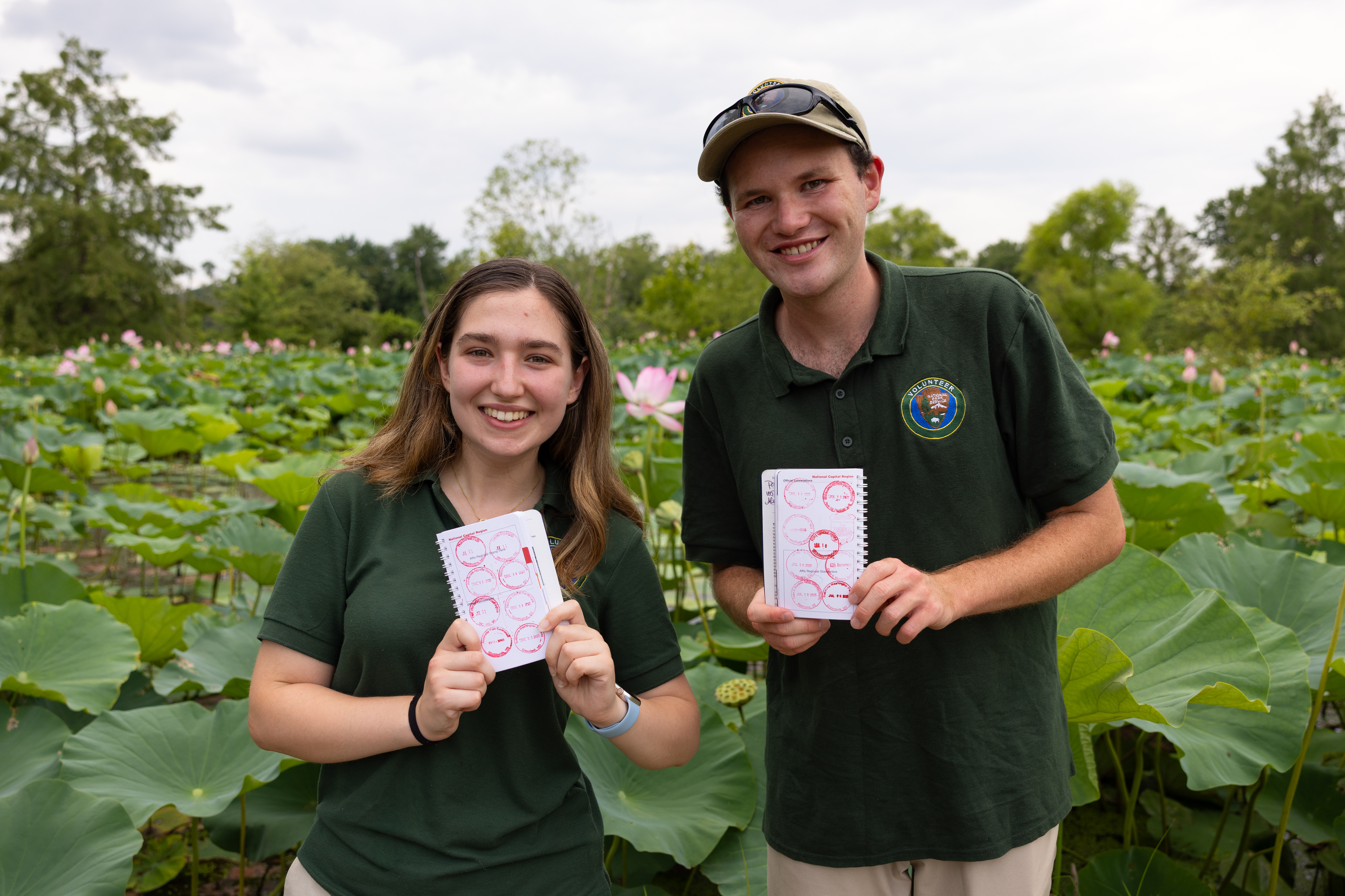
Collect all the National Capital Parks - East Passport Stamps
Start your stamp collection and celebrate every park you visit! Explore historic sites and scenic parks managed by National Capital Parks - East and collect a unique stamp at each one.
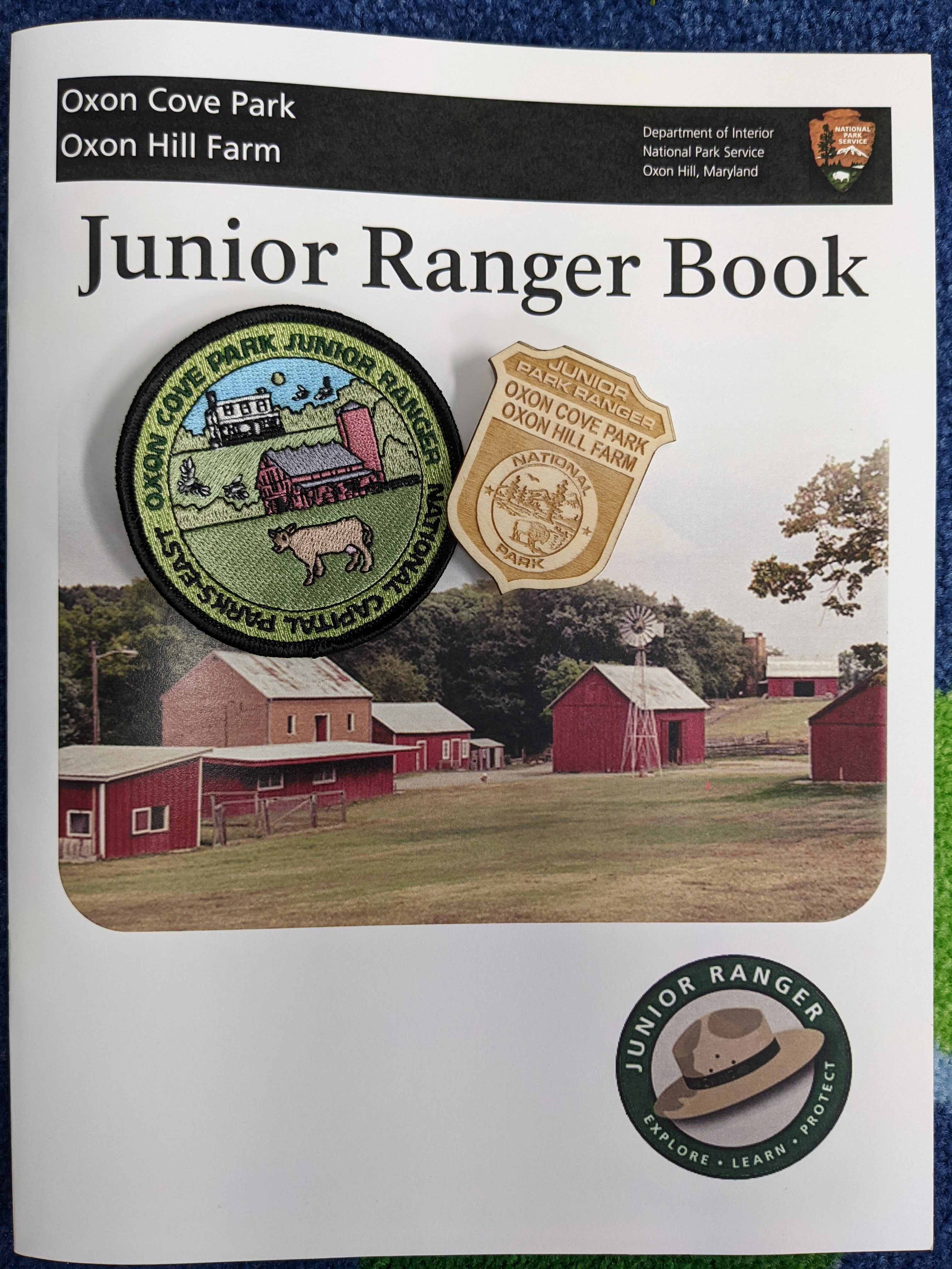
Become an Oxon Hill Farm Junior Ranger
Oxon Hill Farm Junior Ranger Program
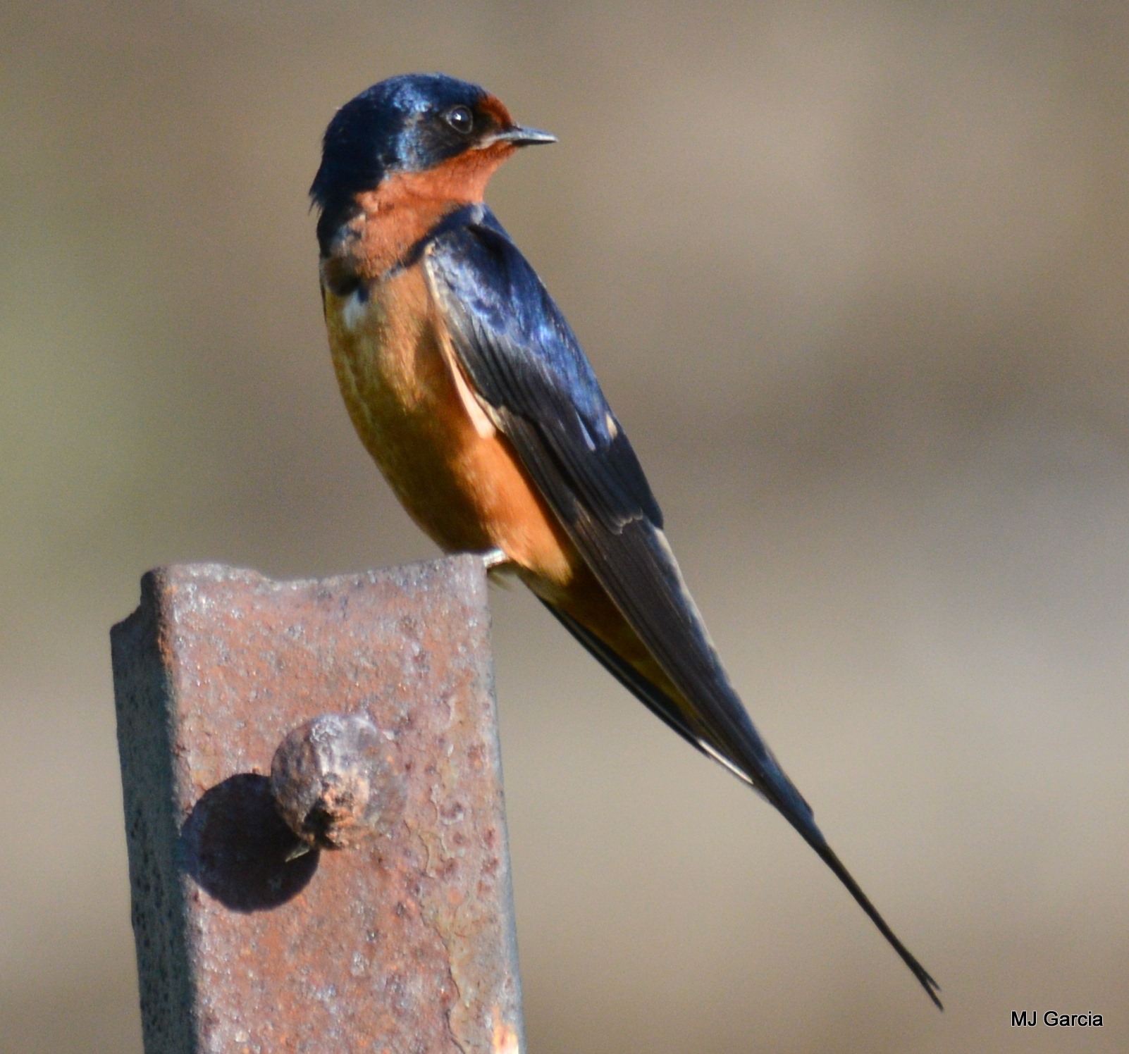
Birding at Fort Washington Park
Come for the history, stay for the birds. Fort Washington Park has a diverse array of bird species spread among its distinct ecosystems.
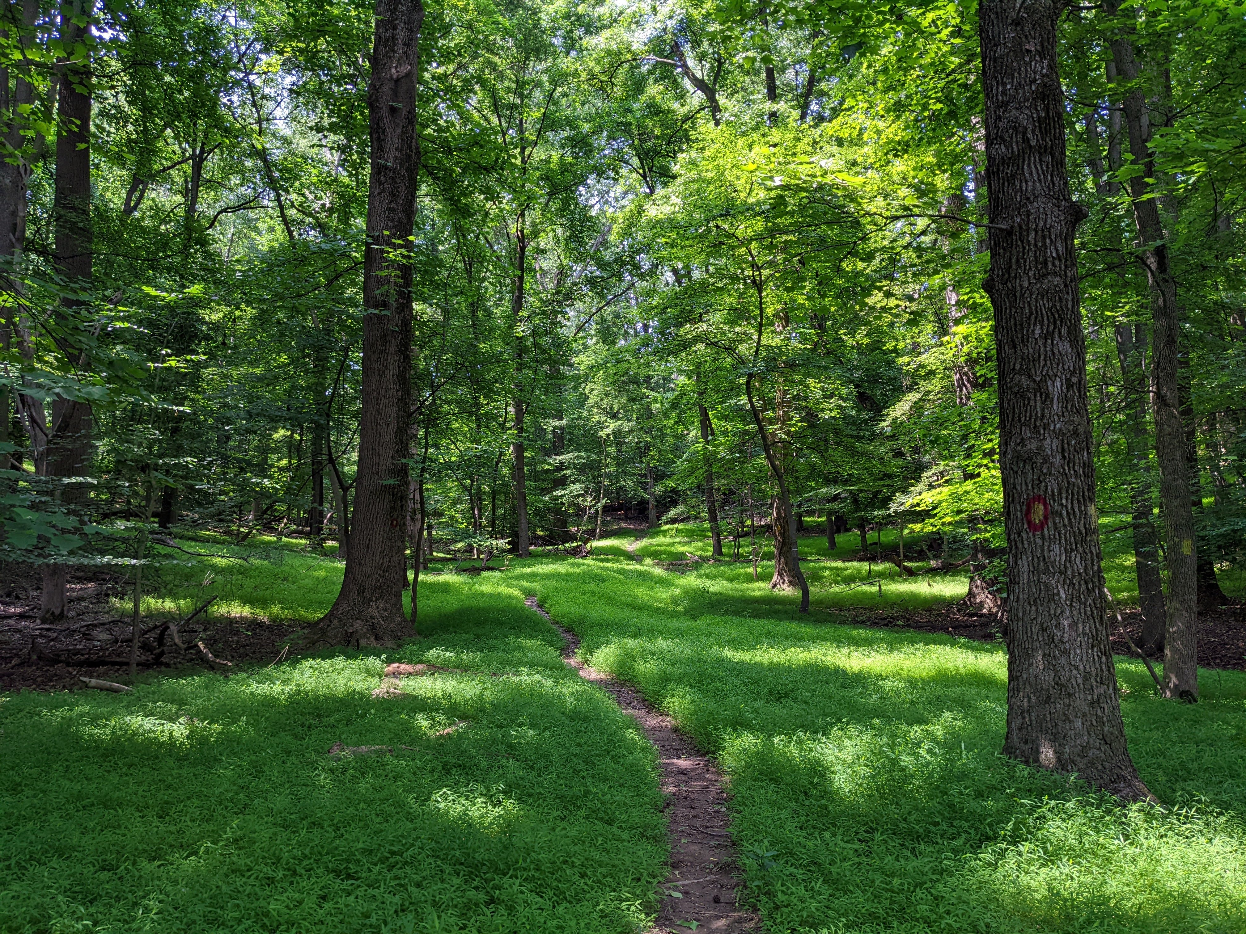
Hiking at Oxon Cove Park
Hiking at Oxon Cove Park
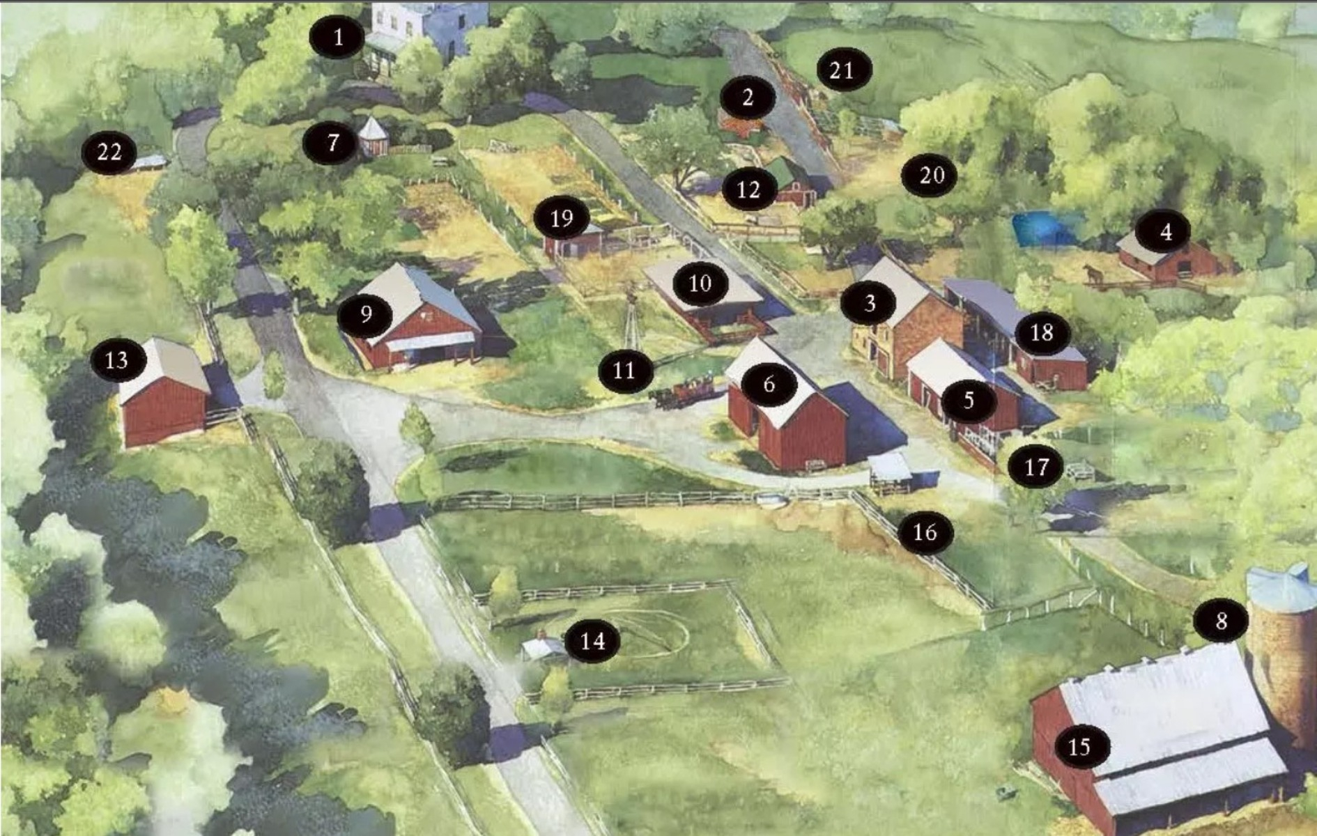
Oxon Hill Farm Self Guided Tour
Take a walk and see the historic structures of Oxon Hill Farm.
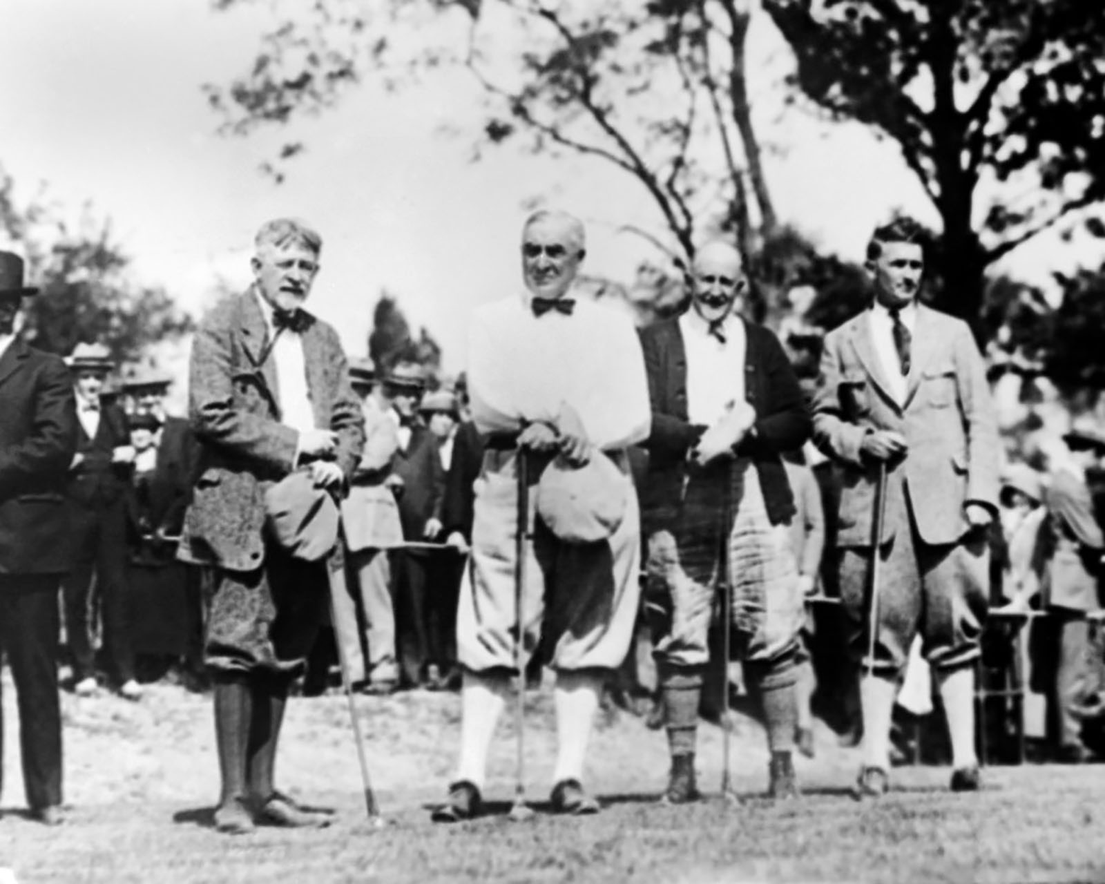
Golf in DC's National Parks
Visit one of three golf courses at National Parks in Washington, DC
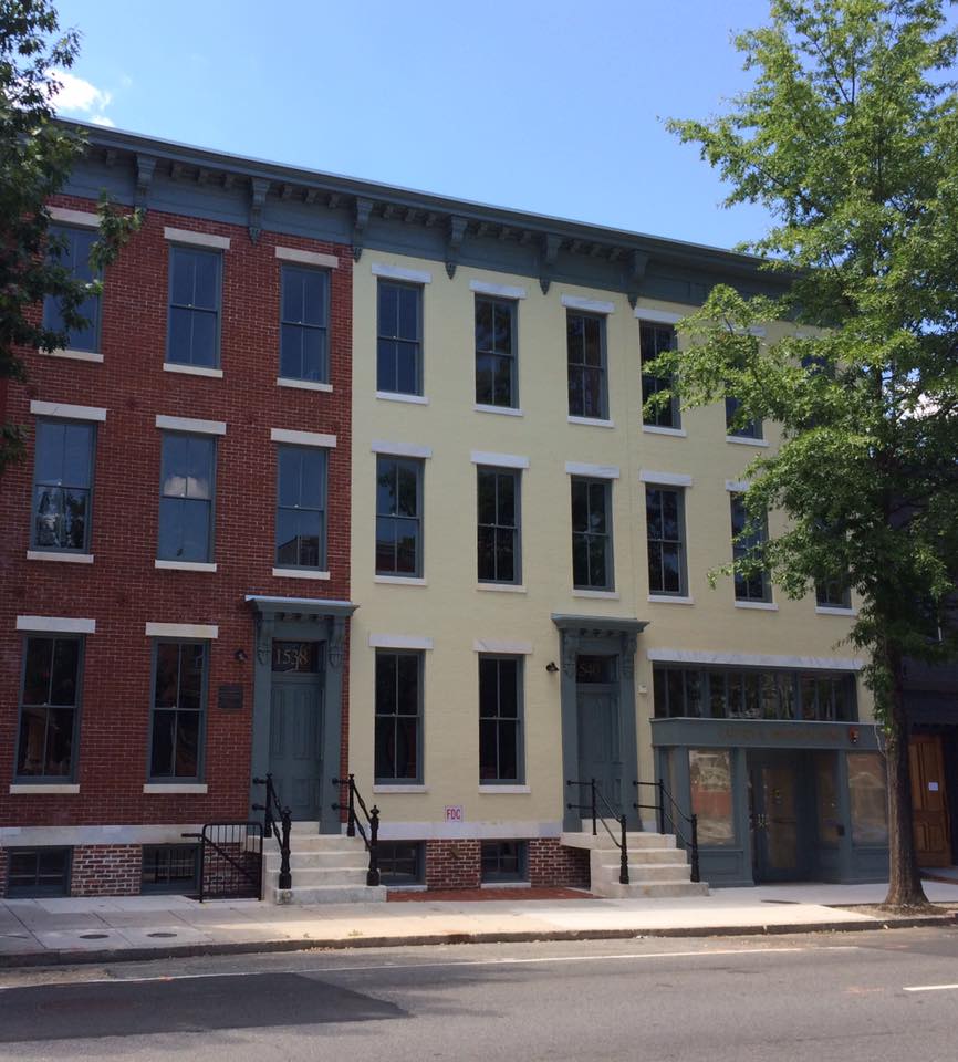
Peer Into the Past at the Carter G. Woodson Home
The Carter G. Woodson Home National Historic Site is one of the newest units of the National Park Service. Acquired in 2005, the historic home was restored and opened to the public in 2017, and the restoration of the remaining structures is expected to be complete in 2022.
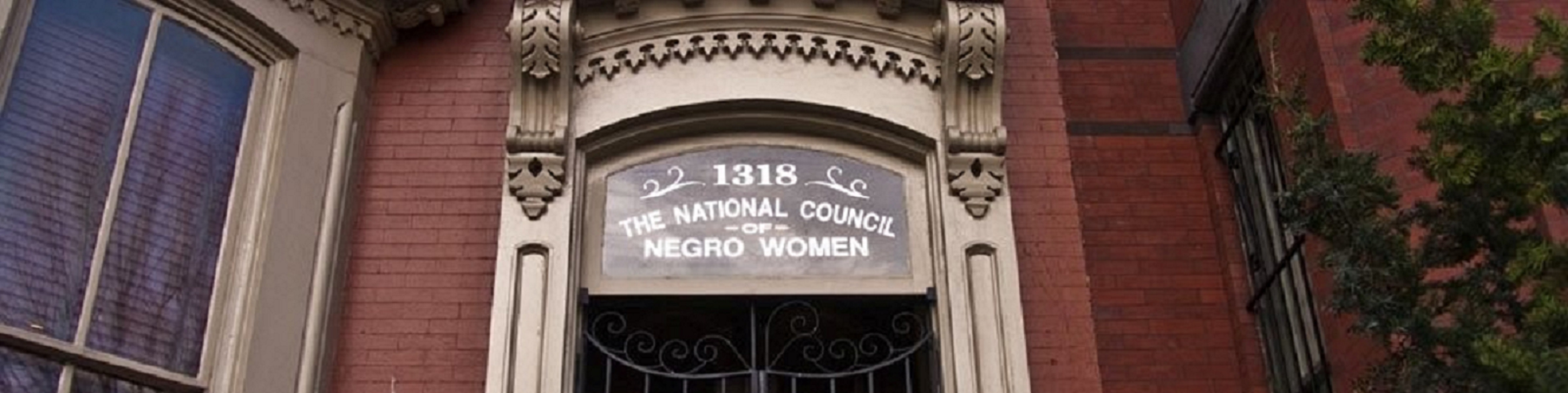
Explore the Mary McLeod Bethune Council House
Learn about the life and legacy of Mary McLeod Bethune as well as the work of the organization she established, the National Council of Negro Women, and how she used the power of education, political activism, and civil service to achieve racial and gender equality throughout the United States and the world.
Discover Frederick Douglass’s Home
Explore the home of Frederick Douglass, a leading voice in the abolitionist movement.
Go Roller Skating
Visit the National Park Service's only roller skating pavilion!