9/19/2025 Update - Parkway and Campground closed from MP 181-204.
The parkway is closed to all traffic from MP 181-204. This includes Jeff Busby Campground at MP 193.1. Follow the signed detour to travel around the closure. Construction is anticipated to continue through October.
Section of Chisha Foka Multi-use Trail to Close beginning 9/24/2025
The section of the Chisha Foka Multi-use Trail from Highland Colony to Choctaw Agency will close for rehabilitation beginning on 9/24/2025. This is a continuation of the rehabilitation work that was completed earlier this year. Barricades will be in place and signs posted to mark the closed area. Individuals found in the closed area may be subject to citation. Large trucks and heavy equipment will be working along the trail, making it difficult to see pedestrians.
7/07/2025 - Single Lane Closures from MP 354.3-363.7
Single lane closures will occur in Wayne County, TN from mileposts 354.3 to 363.7. Flaggers will be on the roadways to help direct traffic.
Mount Locust Visitor Contact Station and Grounds Open Wednesday-Sunday
Mount Locust Visitor Contact Station is now open. The contact station and grounds are open Wednesday through Sunday. The historic inn/stand is closed indefinitely due to serious structural concerns. You can still view the inn/stand but cannot enter.
| Title | Natchez Trace |
| Park Code | natr |
| Description | The Natchez Trace Parkway is a 444-mile recreational road and scenic drive through three states. It roughly follows the "Old Natchez Trace," a historic travel corridor used by American Indians, "Kaintucks," European settlers, slave traders, soldi... |
| Location | |
| Contact | |
| Activities |
|
| Entrance fees |
|
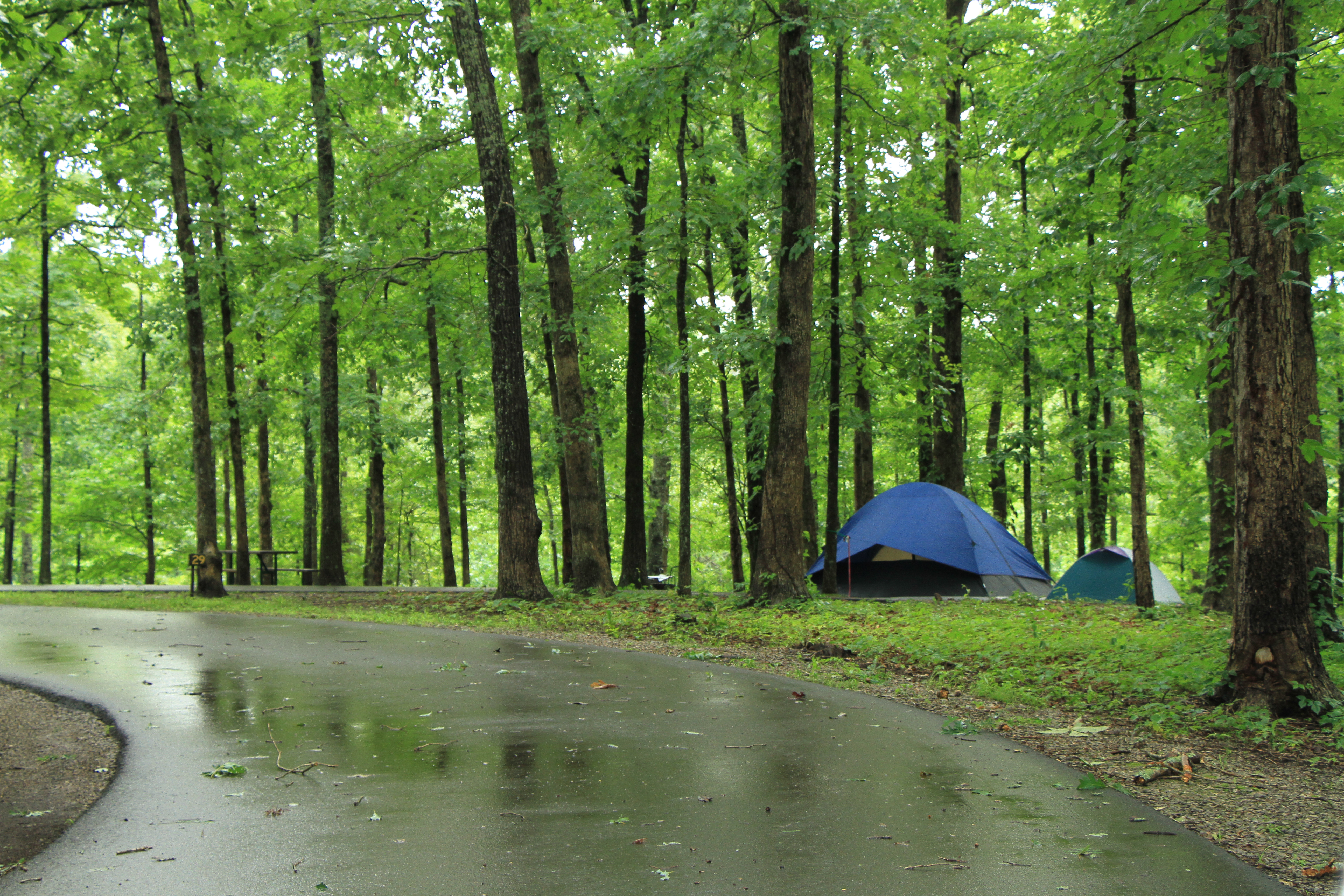
| Campgrounds | Count: 3
Jeff Busby Campground, Milepost 193.1
Meriwether Lewis Campground, Milepost 385.9
Rocky Springs Campground, Milepost 54.8
|
| Places | Count: 50
Baker Bluff Overlook, Milepost 405.1Baker Bluff is a scenic overlook with spectacular views of rural America. 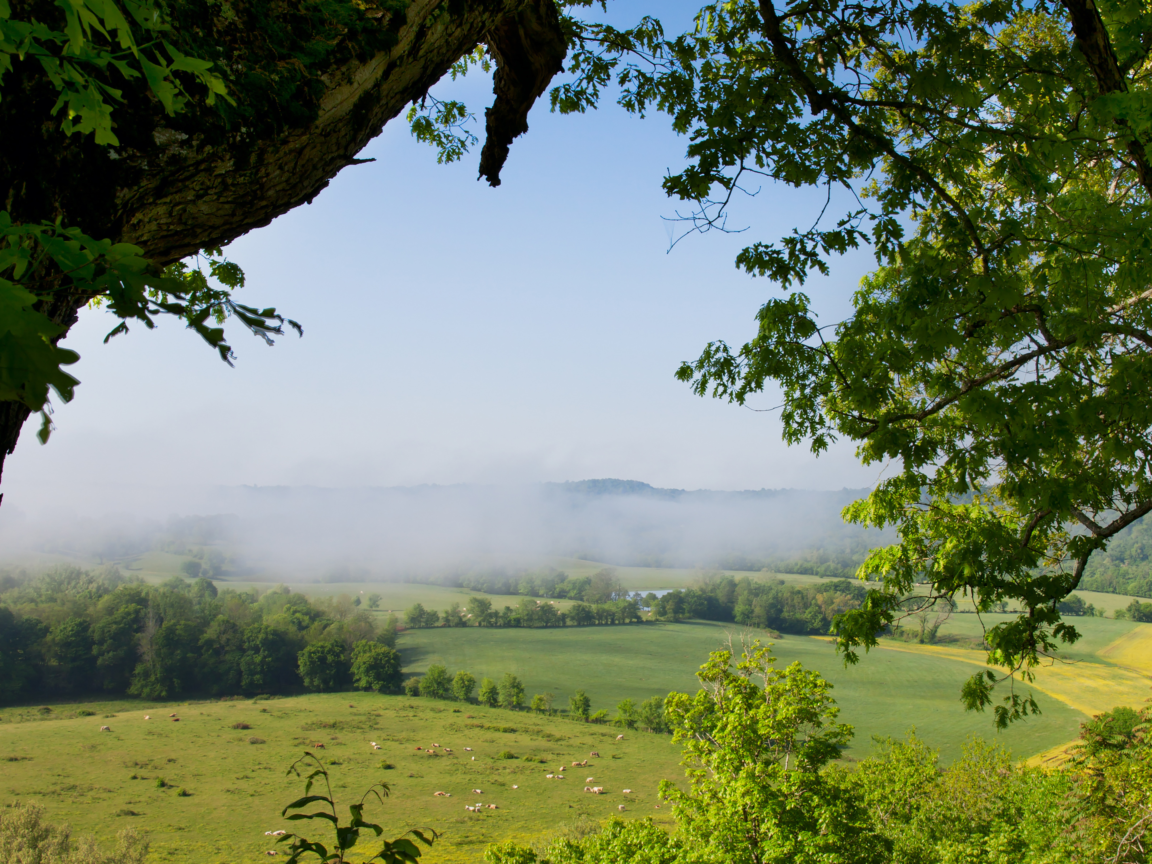
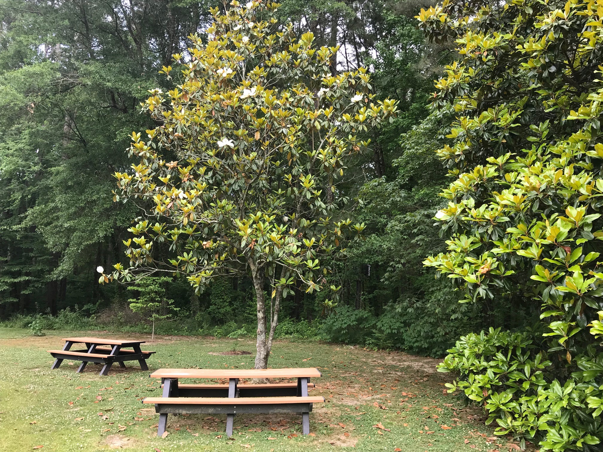
Ballard Creek, Milepost 201.3Ballard Creek is a quiet picnic area located about eight miles north of Jeff Busby Campground along the Parkway. Ballard Creek has a small parking lot with a very short looping trail that leads to a single picnic table. The picnic area is near a flowing creek and surrounded by forests, providing a peaceful place to rest, eat, and enjoy nature. 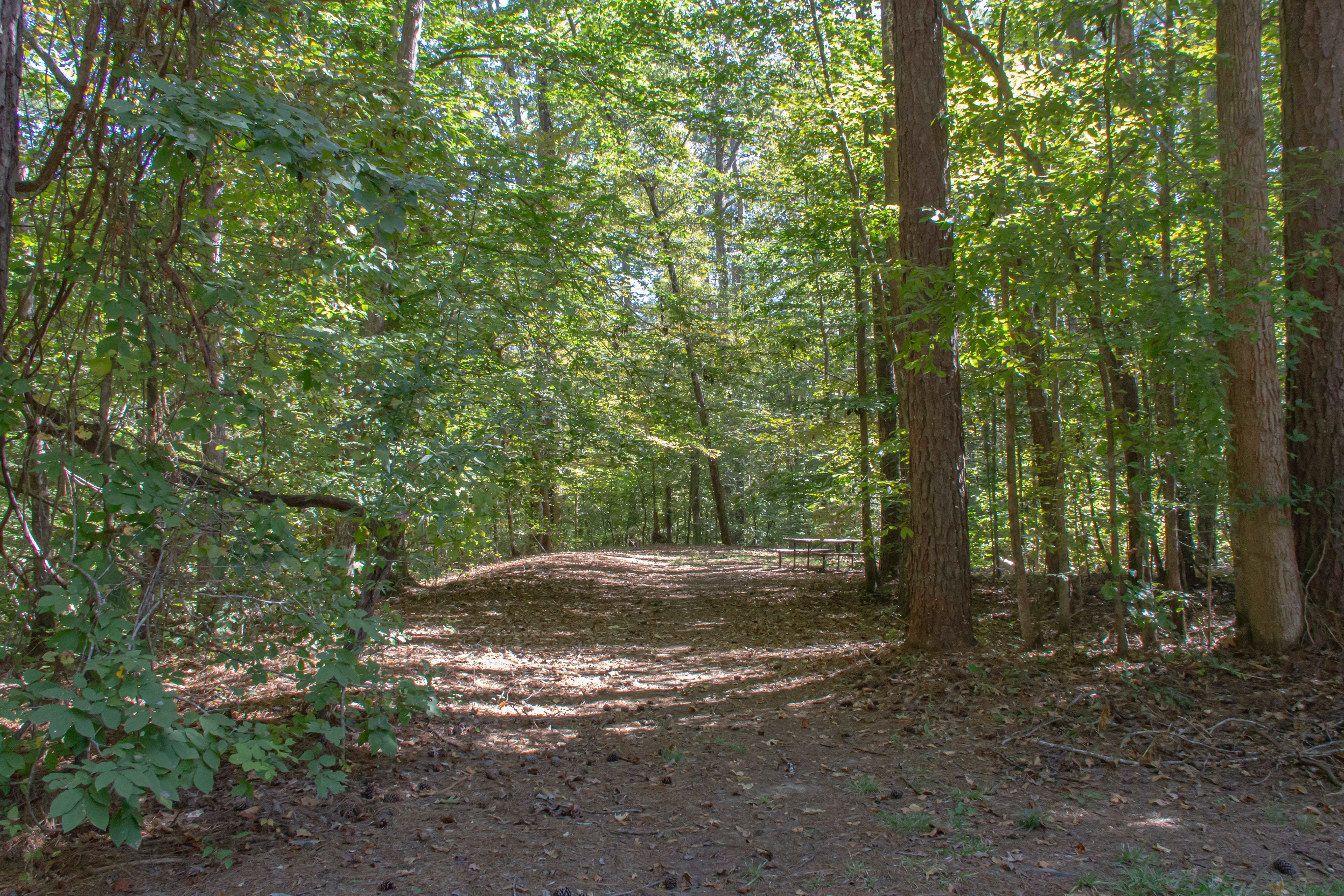
Battle of Raymond, Milepost 78.3On May 8, 1863, Grant's forces drew fire from a Confederate brigade, commanded by Confederate Brigadier General John Gregg, located on the southern edge of Raymond three miles east of this location. After a day of bitter fighting the Confederates retreated toward Jackson, Mississippi leaving their wounded in the county courthouse. This convinced General Grant of the need to capture Jackson, Mississippi in order to assure success of his army's forthcoming siege of Vicksburg. 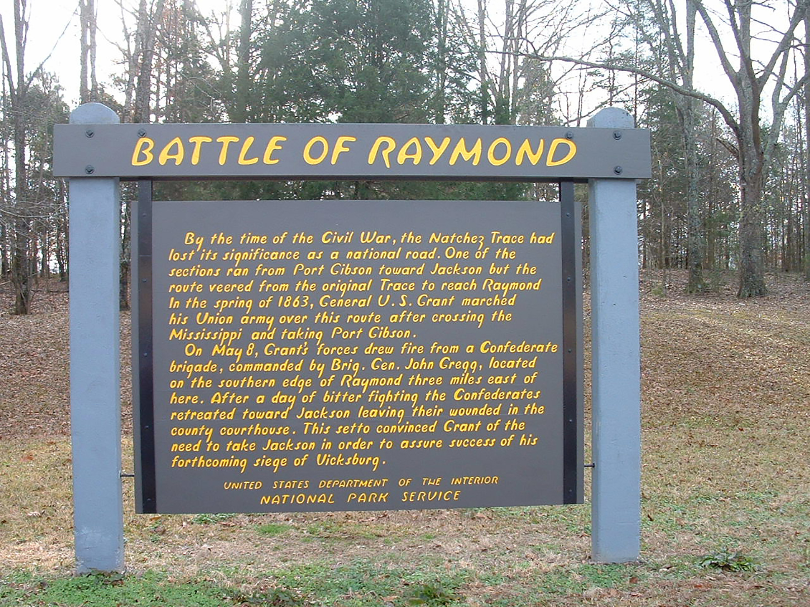
Bear Creek Mound, Milepost 308.8About 900 years ago, mound building began along Bear Creek, this site already had been used by semi-sedentary groups for thousands of years. Typical of a Mississippian period village, a ceremonial building sat on Bear Creek’s flat top, providing a focus for spiritual life. 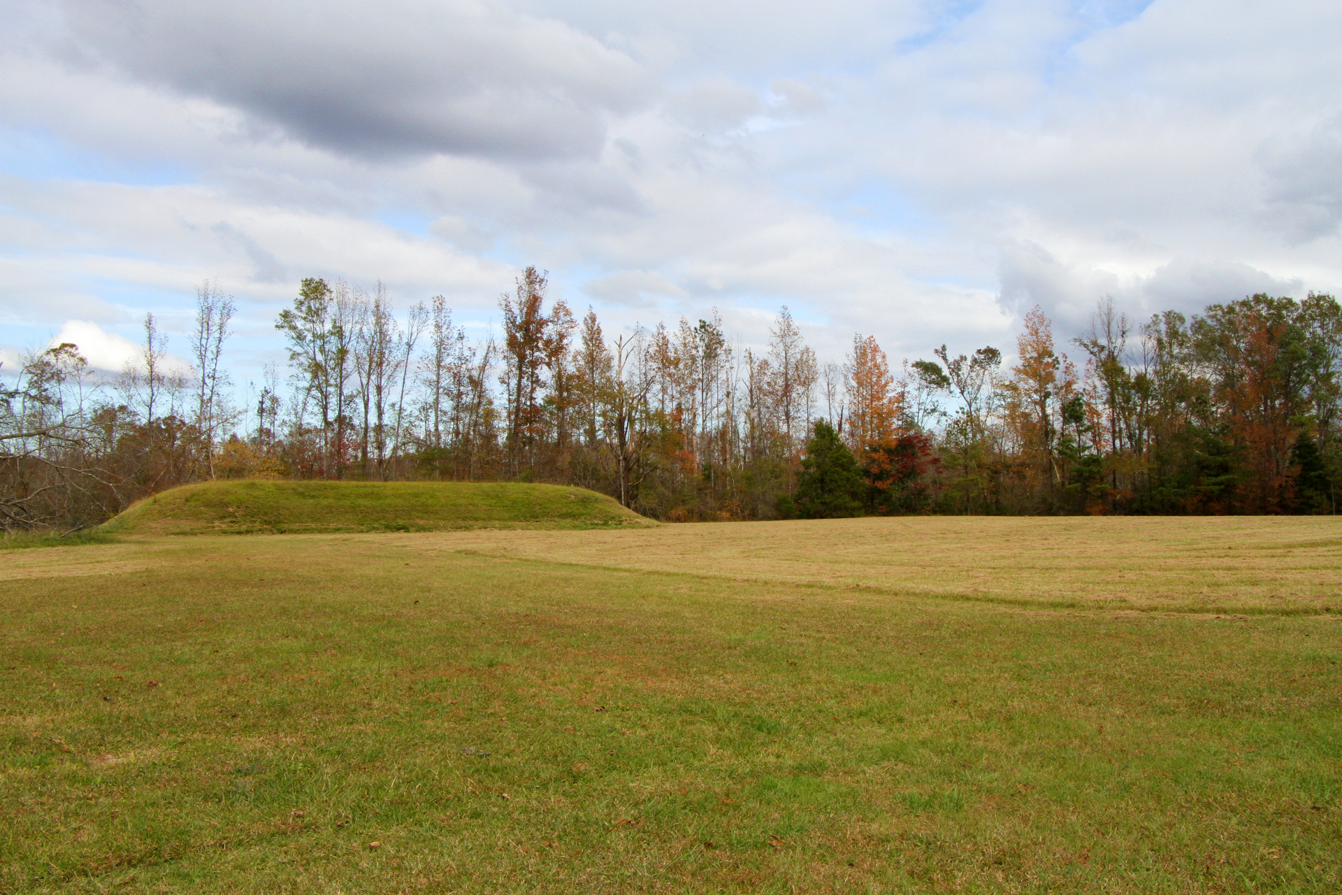
Bear Creek Picnic Area, Milepost 313A quiet picnic area along a large creek in the Chickasaw homeland. 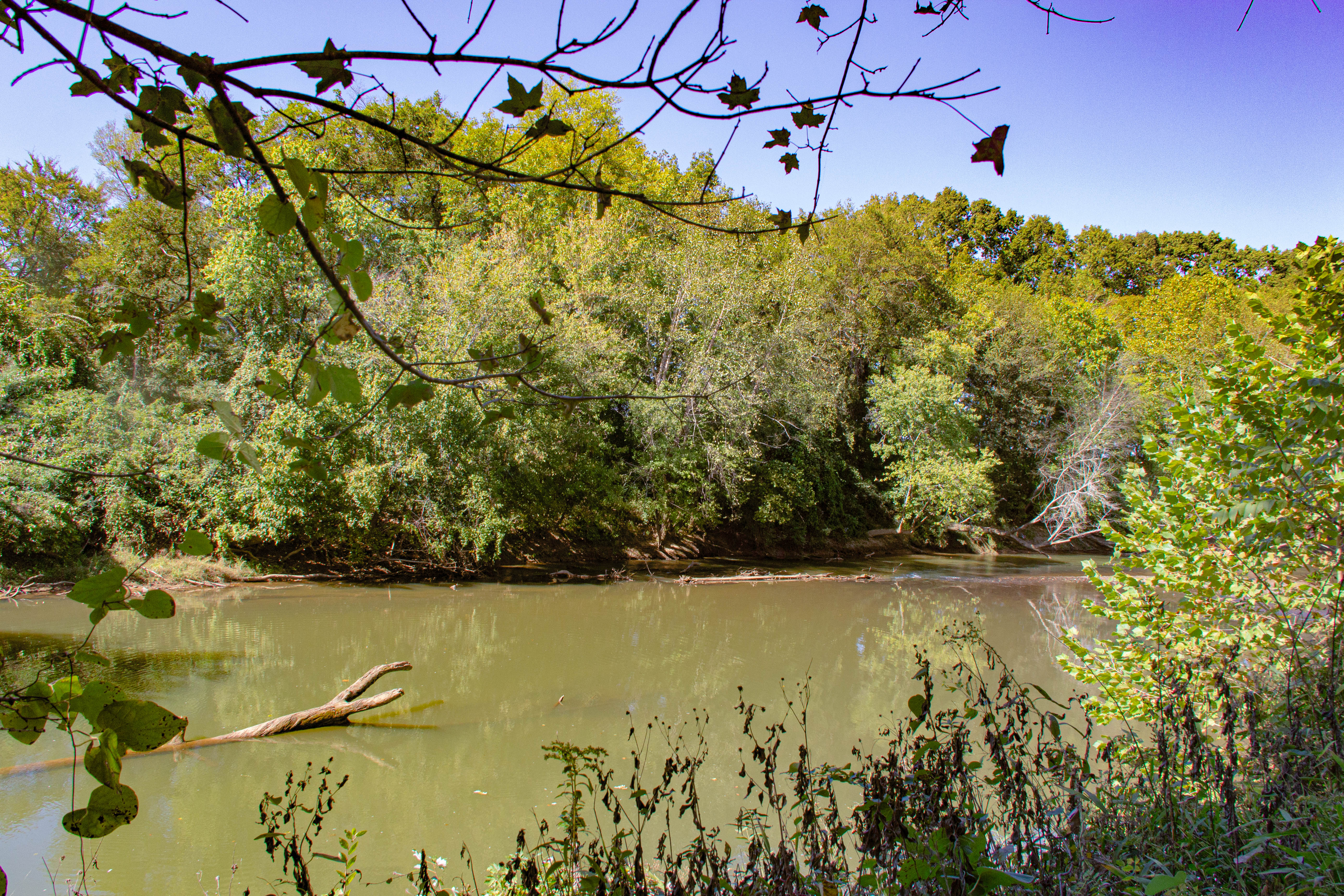
Beech Springs Bicycle Camp (Parkway VC), Milepost 266Take the closed trail across the street from the parking area for the Natchez Trace National Scenic Trail. Potable water is not available, but is available at the Parkway Visitor Center a short distance away. 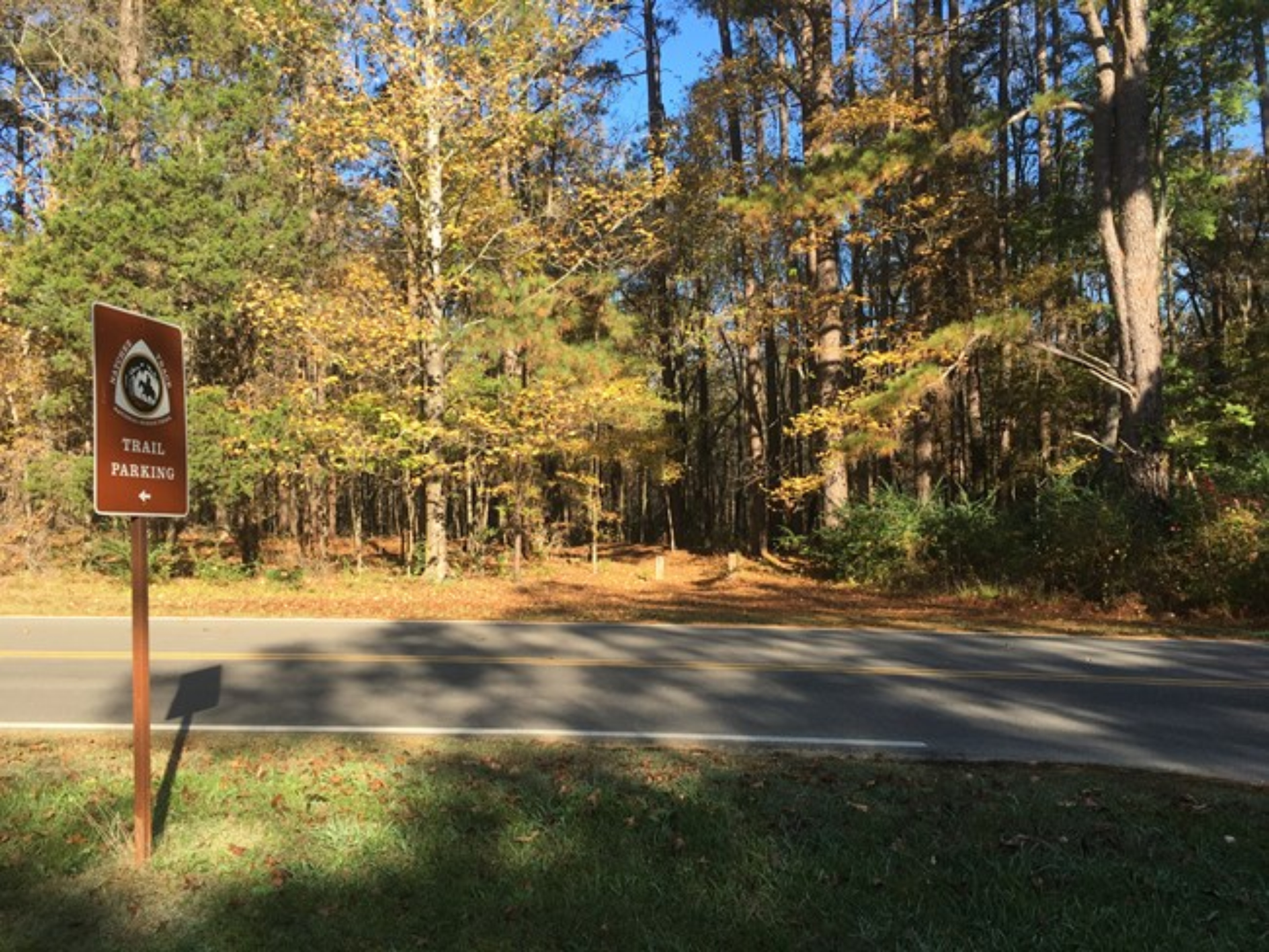
Beech Springs Nature Trail, Milepost 266The Beech Springs Nature Trail is a paved loop through a natural hardwood forest. The trail is stroller friendly. When the visitor center is open, a trail quest is available upon request. 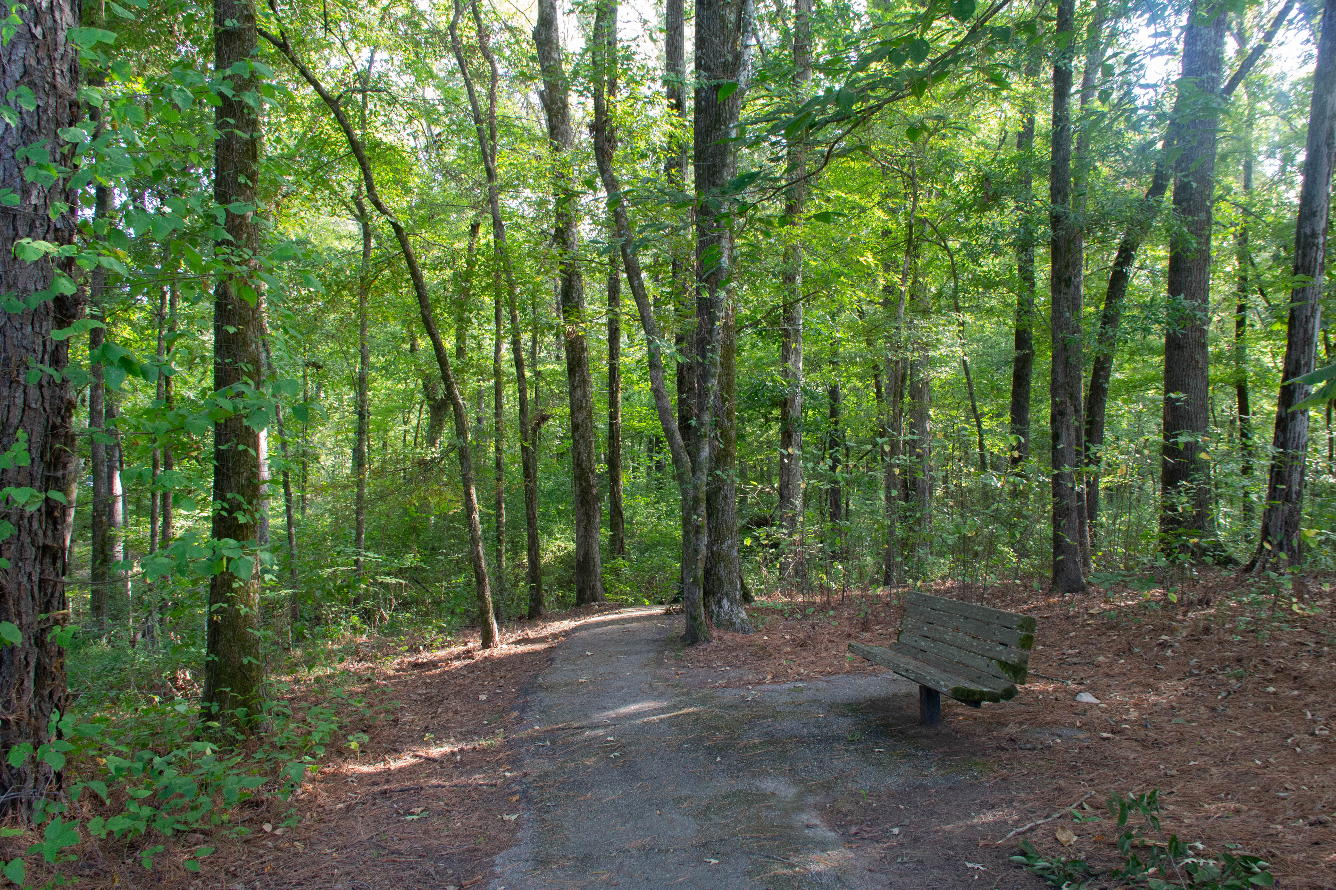
Bethel Mission, Milepost 176.3The commemorative sign that marks the location of a mission that taught traditional European school lessons to indigenous tribes. 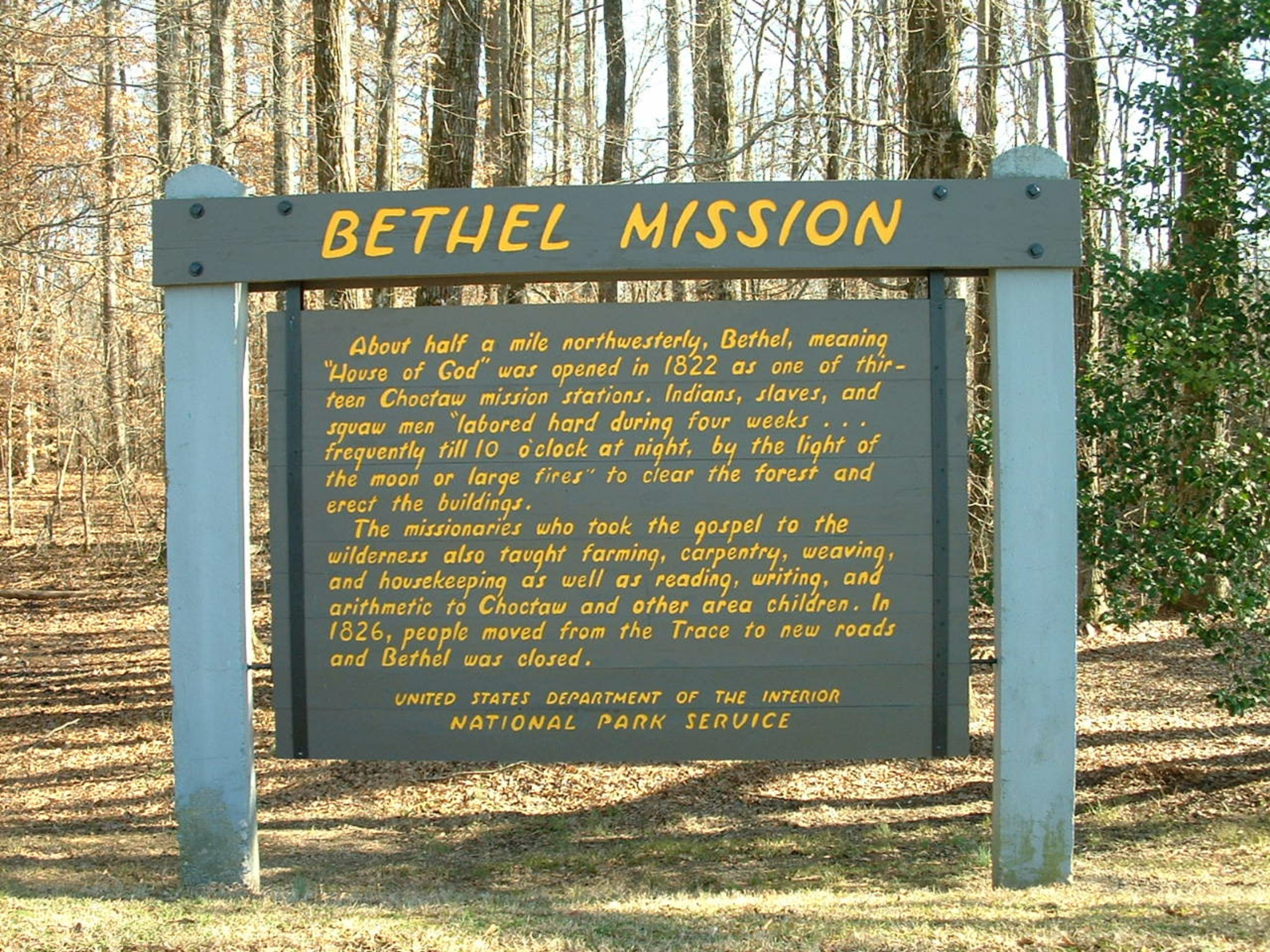
Birdsong Hollow Double Arch Bridge, Milepost 438.0A spectacular bridge with awesome views. An engineering feat, the first segmented bridge in the USA. 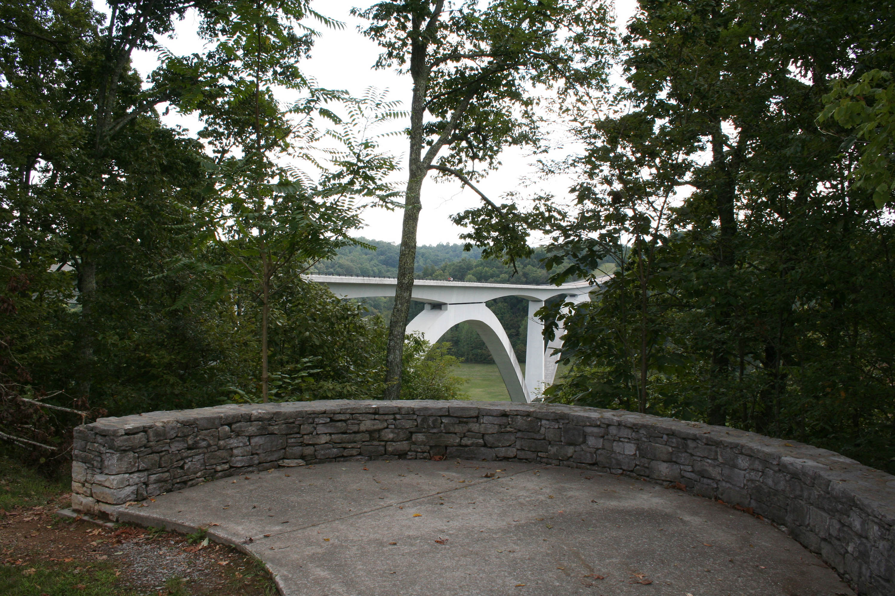
Blackland Prairie Section Southern Terminus Trailhead, West Jackson Street, ClosedClosed until 2023. 
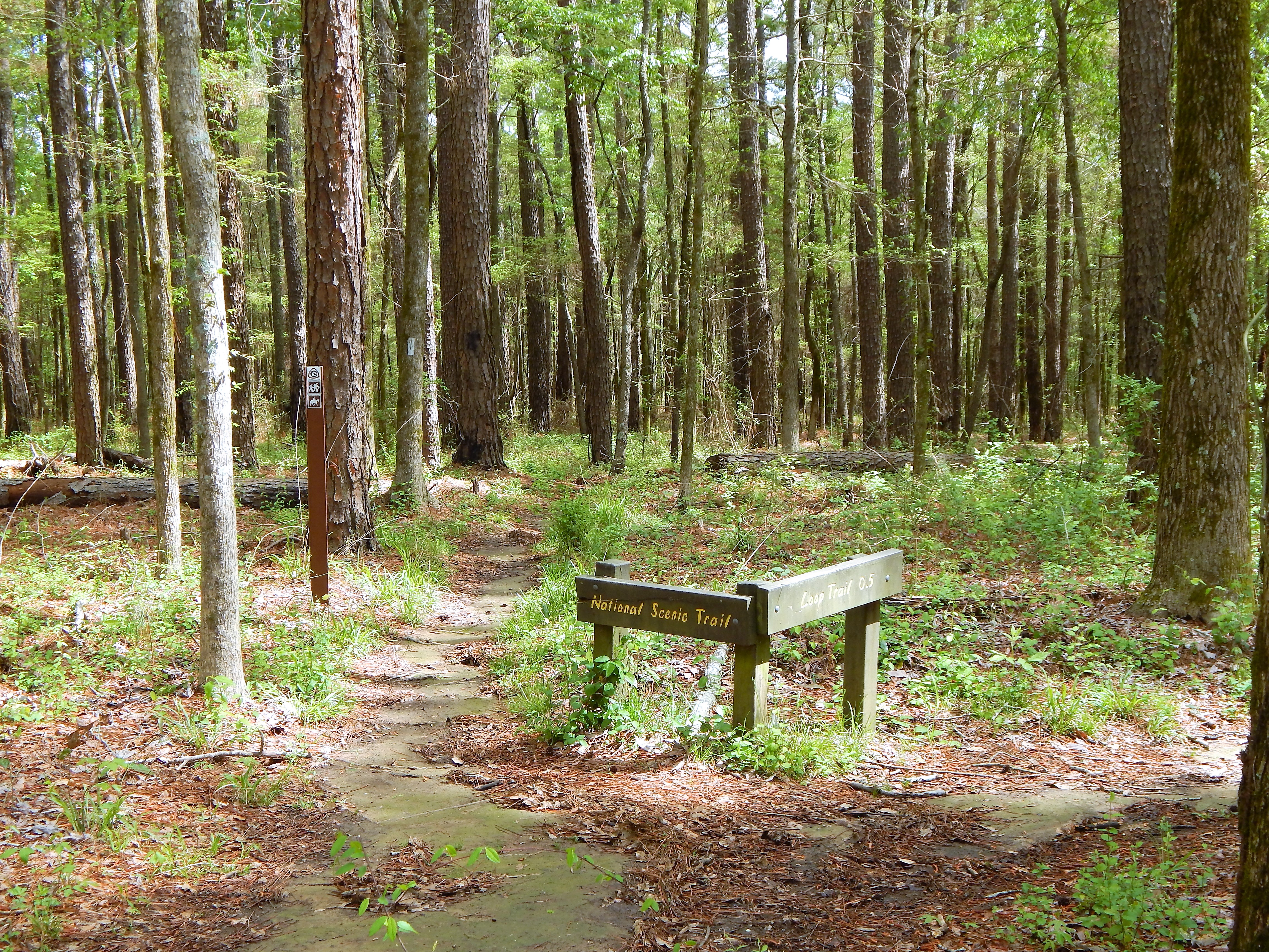
Blackland Prairie section Northern Terminus Trailhead, Milepost 266This trailhead is located just across the Parkway from the Natchez Trace Parkway Visitor Center. Hikers can travel six miles along the outskirts of Tupelo (12 miles roundtrip). You can make the walk as long or as short as you would like on this out and back trail. This section of Scenic Trail is open to hikers only and requires walking on the Parkway for road and creek crossings. 
Boyd Site, Milepost 106.9A transitional American Indian mound site. Partially built in separate centuries. 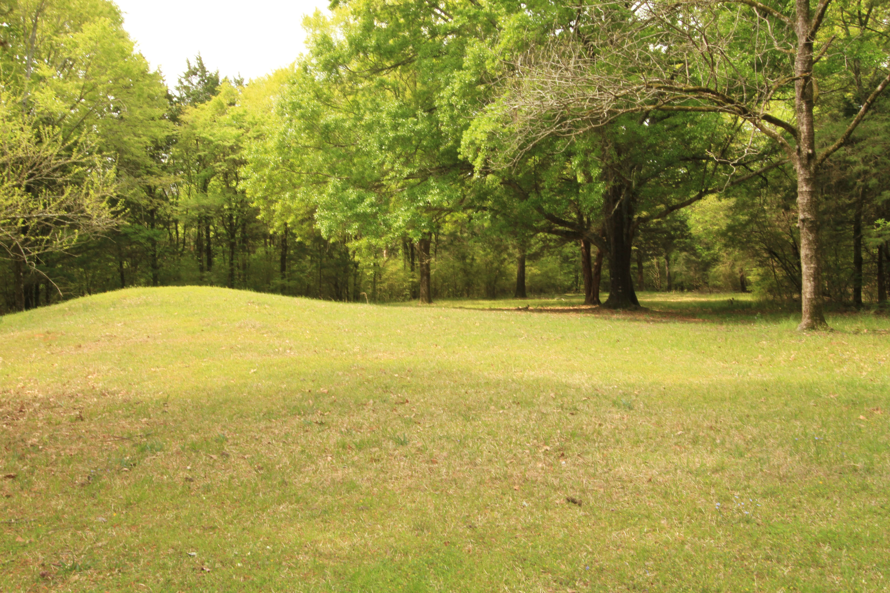
Brashears Stand and Old Trace, Milepost 104.5Brashears Stand is named after Turner Brashears, who moved to the area in the late 1700s. He became a trader with the Choctaw and learned their language. Travelers on the Natchez Trace generally seemed to be pleased with their treatment and accommodations at Brashears Stand. In addition to earning money from his stand operation, Brashears prospered by selling land and enslaved people. 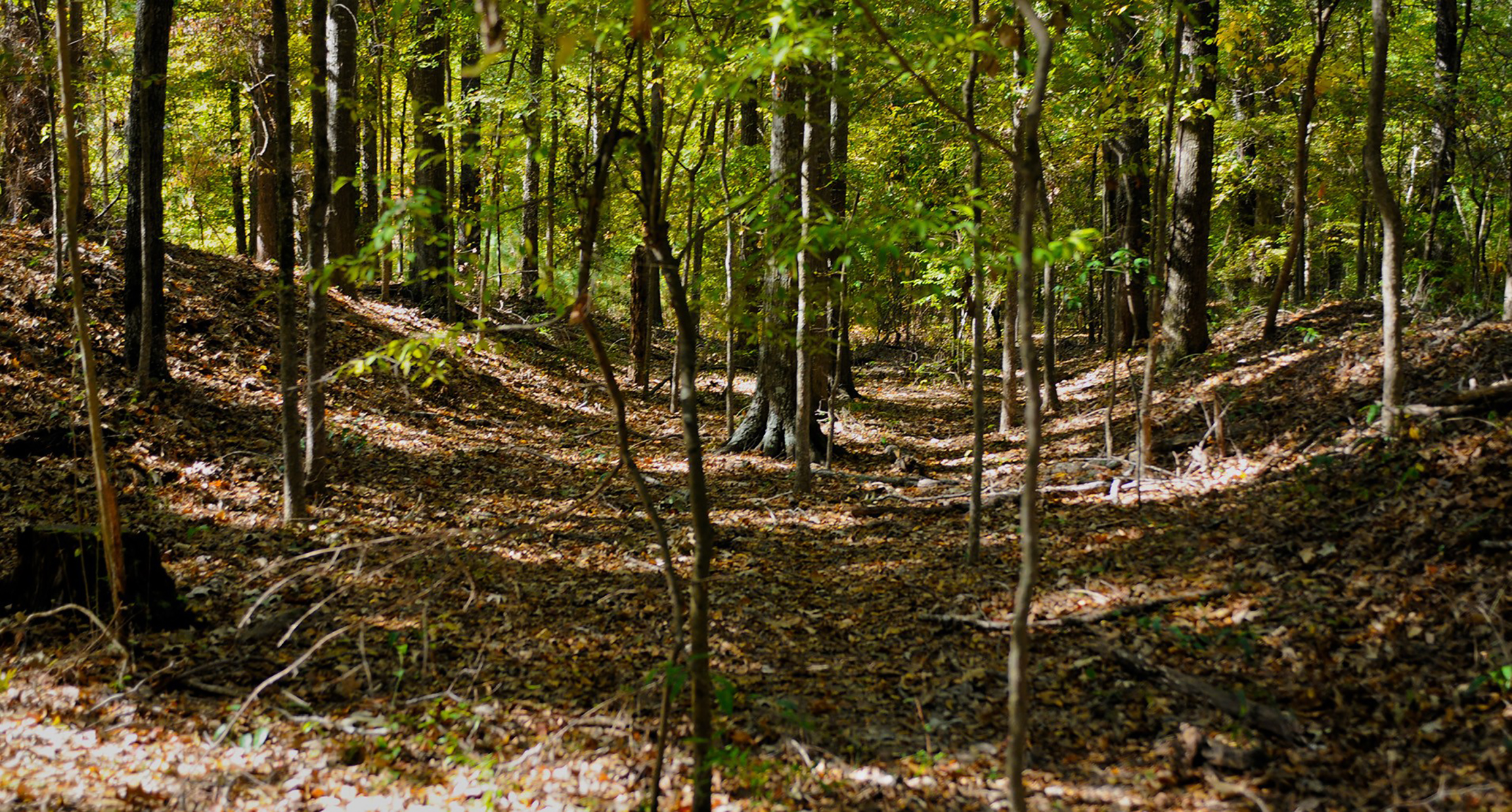
Browns Bottom, Milepost 286.3Browns Bottom is a great place to fish and watch for dragon flies. 
Bullen Creek, Milepost 18.4A 1100-foot nature trail with interpretive stops explaining the characteristics of a mature hardwood forest. 
Burns Branch, Milepost 425.4This is a trailhead for the Highland Rim Section of the Natchez Trace National Scenic Trail. This trailhead has parking for vehicles but not trailer parking and is not a staging area for horses. The site offers a hitching post and a picnic table to take a break if you would like. 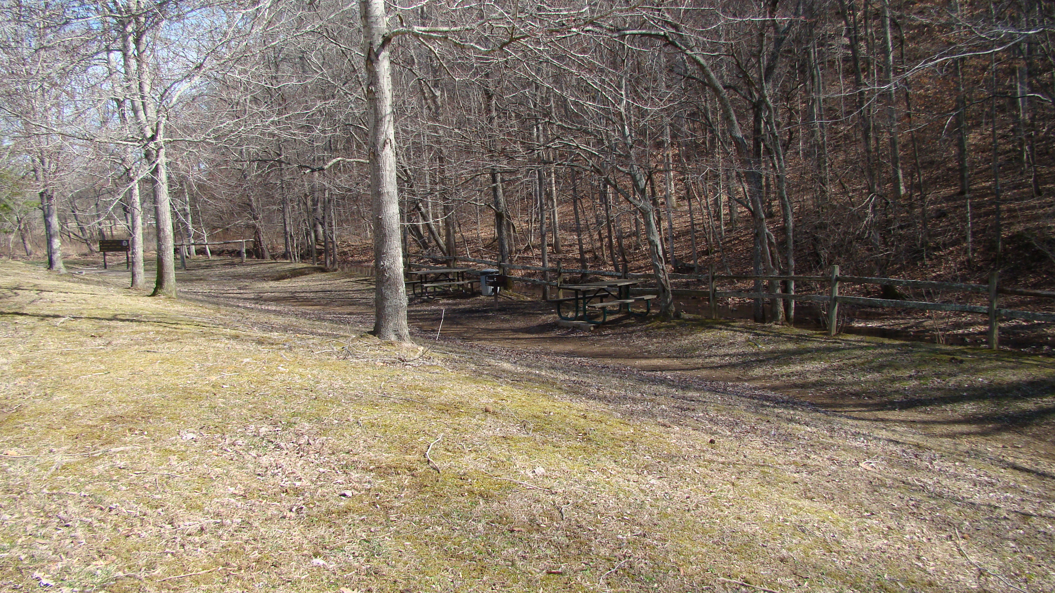
Buzzard Roost Springs, Milepost 320.3Near the bubbling waters of Buzzard Roost Spring, Levi Colbert (Itawamba Minko, "Bench Chief") built one of the many inns, called stands, along the Natchez Trace. Trace travelers no doubt talked about Levi's stand. It was nicer than most, and offered respite from the miles of footsteps that defined a Trace journey. 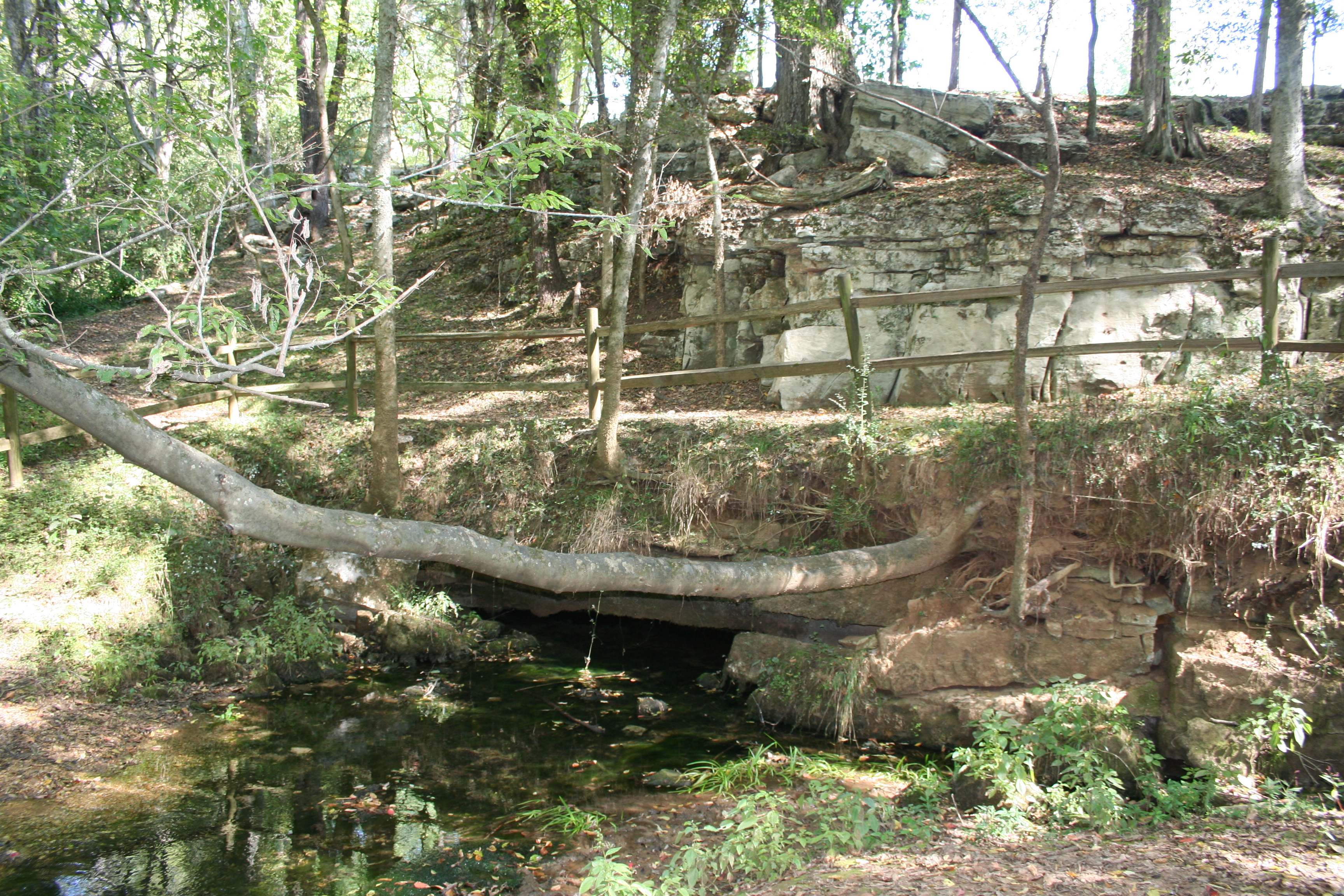
Bynum Mounds, Milepost 232.4Bynum Mounds are the oldest mound site along Natchez Trace Parkway. These mounds were created by American Indians in what was known as the Middle Woodland Period between 100 BCE-100 CE. The mounds range in height from five feet to 14-feet. Originally, there were six mounds at this site. However, in the 1940's five of them were excavated by National Park Service archeologists. The two largest mounds were rebuilt. 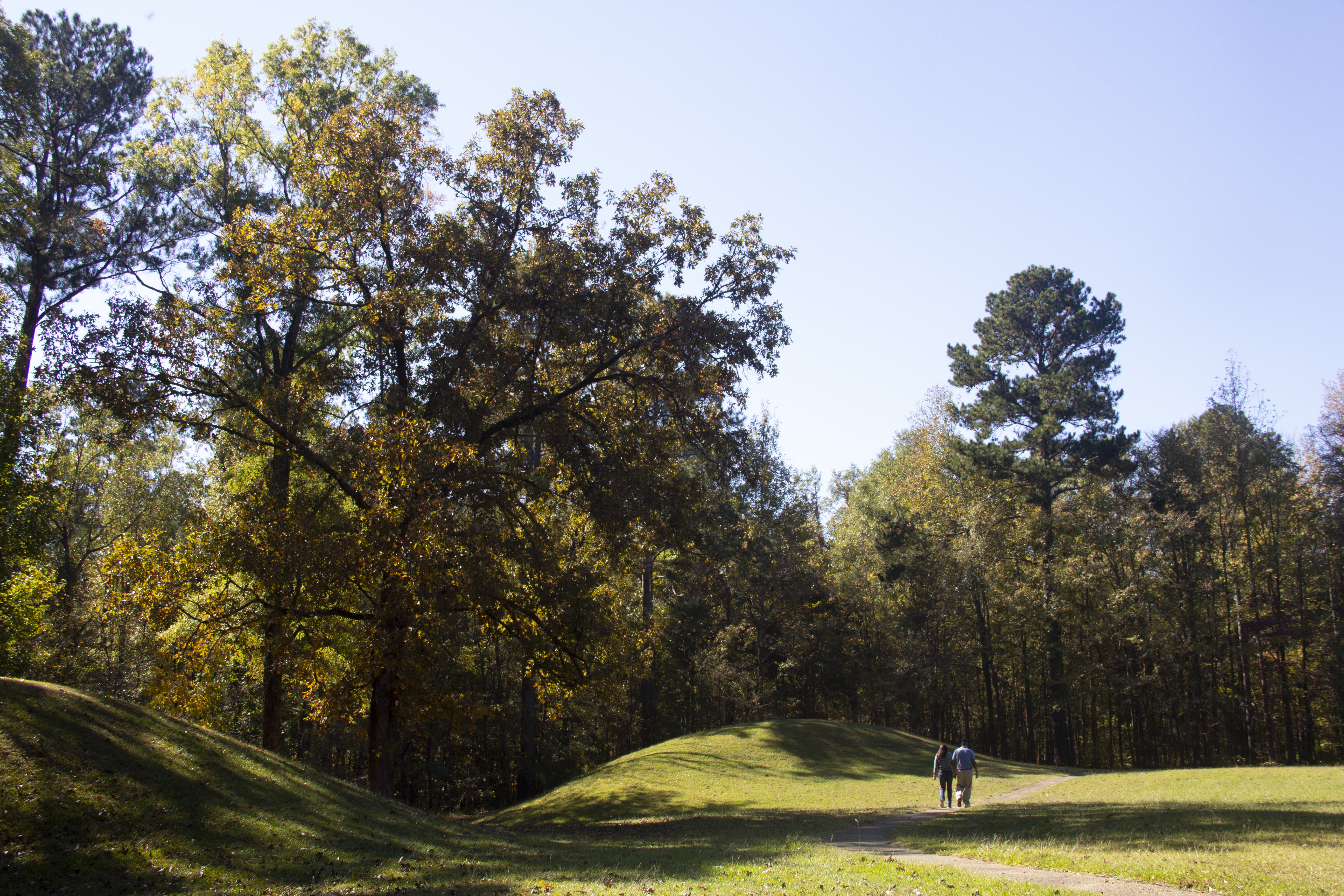
Cave Spring, Milepost 308.4It was a solution. Water dissolved the limestone. It was a solution. The Cave Spring provided shelter from the weather. It was a solution. The water quenched parched travelers. 
Chickasaw Agency, Milepost 241.4The United States agents to the Chickasaws lived from 1802 to 1825 west of here on the Old Natchez Trace. That Americans could peacefully travel the road through Indian lands was due in large measure to the agents. Their efforts to preserve harmony included such thankless tasks as collecting debts, recovering stolen horses, removing trespassers and capturing fugitives. Winters were lonely, but spring and summer brought thousands of “Kaintucks” on their long journey home. 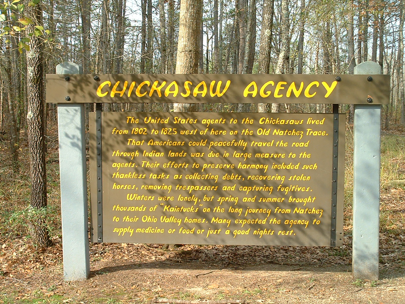
Chickasaw Council House, Milepost 251.1Westerly on the Natchez Trace stood an Indian Village “Pontatock” with its council house which, in the 1820’s, became the “Capitol” of the Chickasaw Nation. 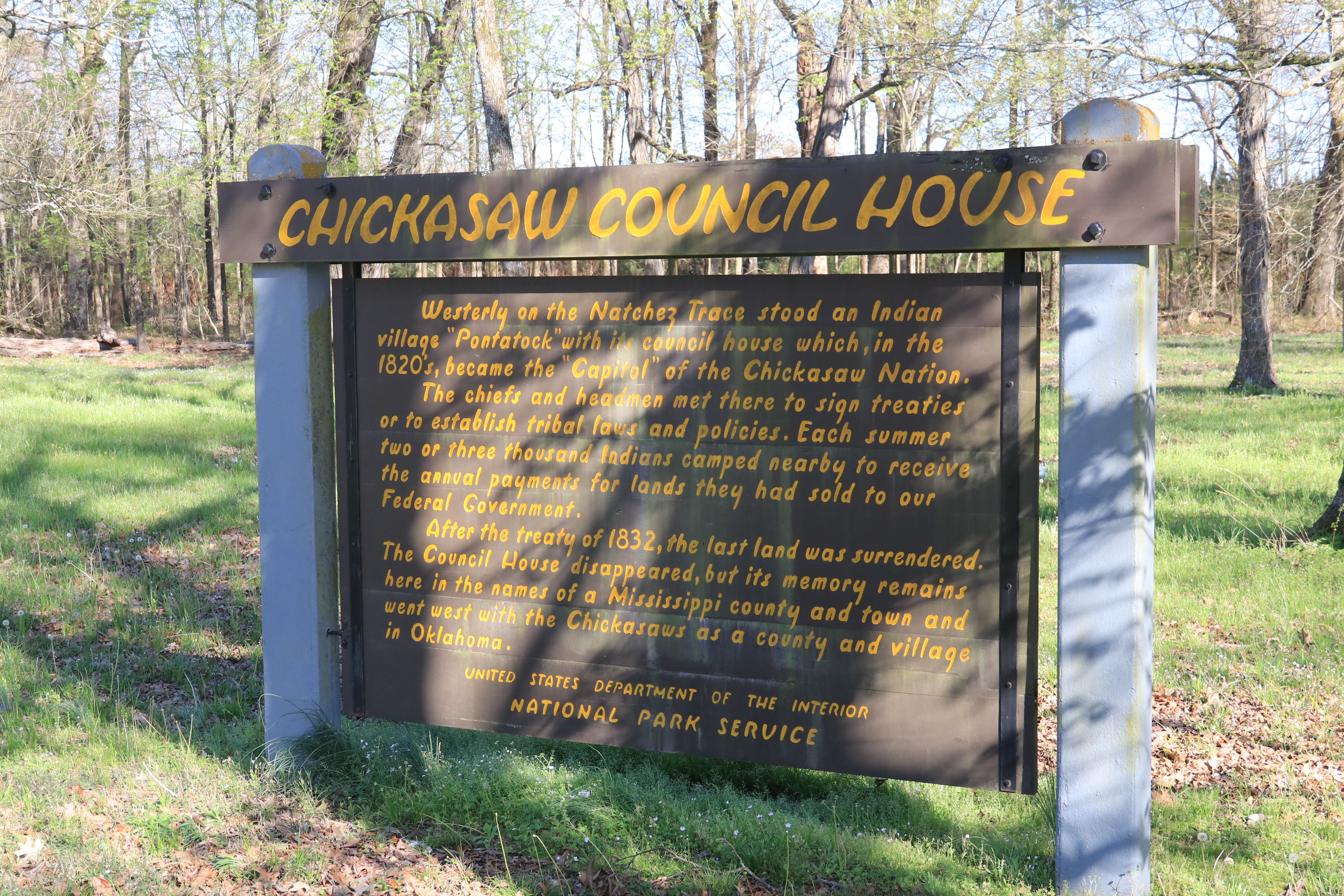
Chickasaw Village Site, Milepost 261.8The Chickasaw Village Site is nearly 90 acres of Blackland Prairie and forest in the heart of Tupelo, MS. The size and shape of the Chickasaw summer and winter homes are preserved. The Natchez Trace National Scenic Trail goes through the village site. An interpretive shelter offers information about the Chickasaw people. 
Choctaw Agency, Milepost 100.7Today, Jackson is the capital of Mississippi and the center of government business, but in the 1800’s this region was the center of business between the U.S. Government and the Choctaw Indians. The Choctaw’s homeland (Chahta yakni aboha) included lands that became the states of Mississippi and Alabama, but the land was gradually ceded to the U.S. Government. The last cession was made in 1830, following the Treaty of Dancing Rabbit Creek. 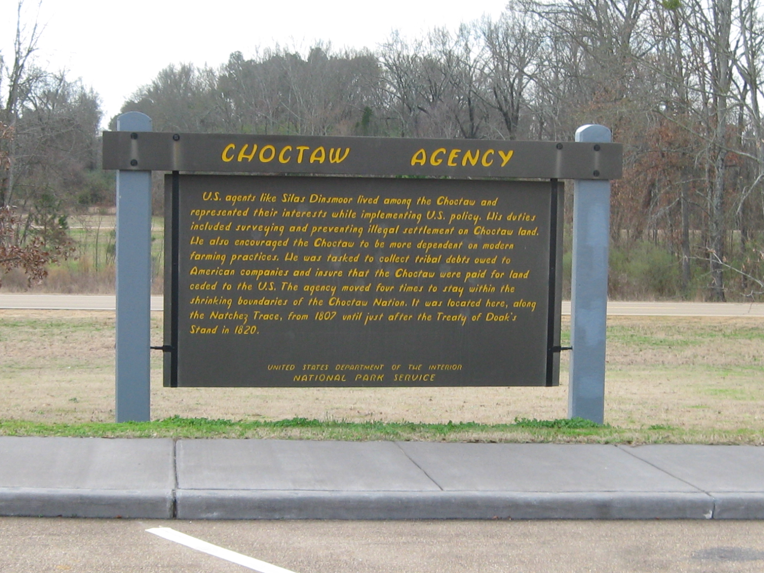
Clinton Visitor Center, near Milepost 89There are many welcome centers up and down the Natchez Trace Parkway that help visitors explore the park and communities near by. One is the Clinton Visitor Center in Clinton, MS just off the Natchez Trace at milepost 89. You can sit in the rocking chairs on the porch and walk the beautiful landscaped grounds. Come by the Clinton Visitor Center, whether you are visiting the city or the Parkway, a newcomer, or a longtime resident. For more details, call 601-924-2221. 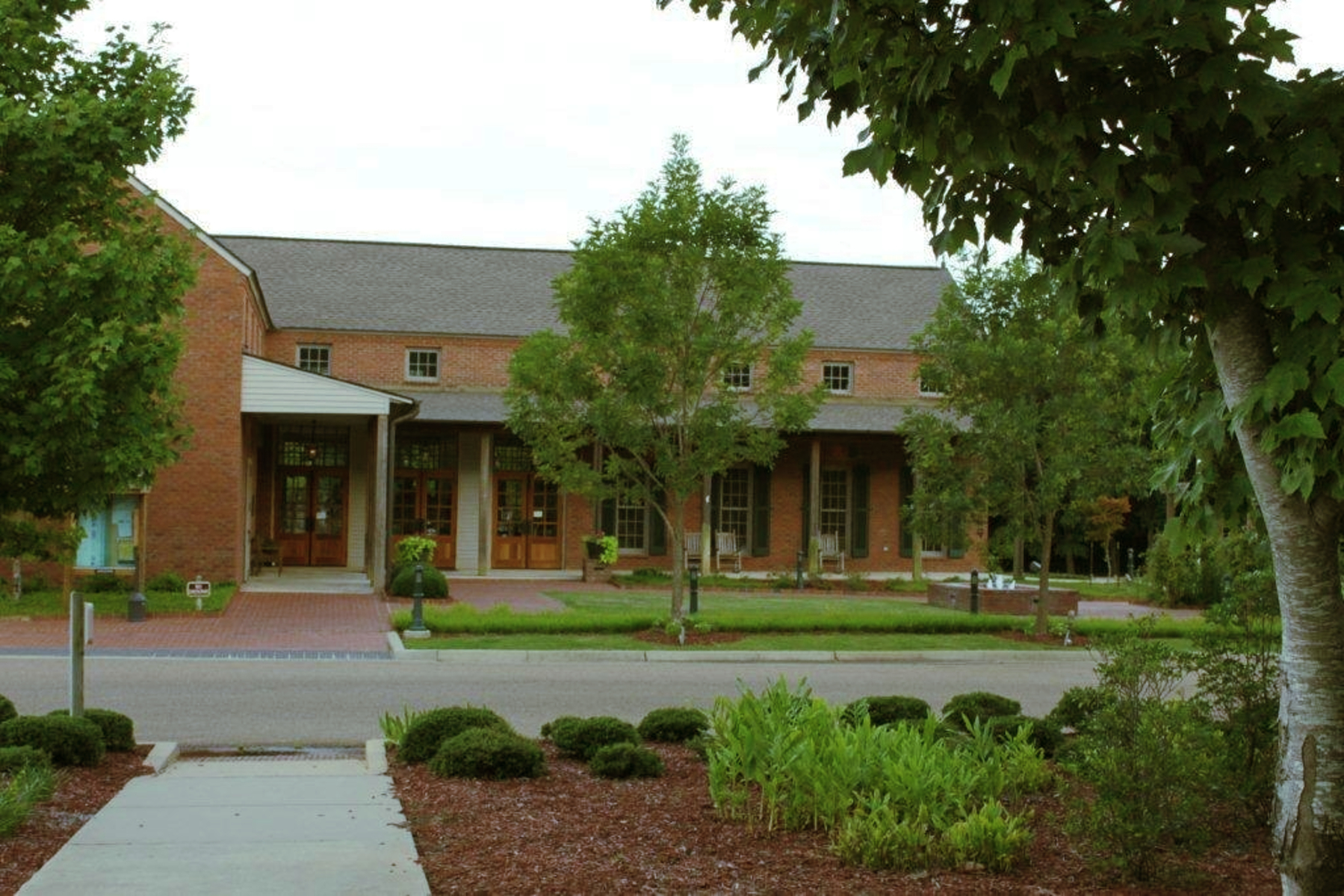
Colbert Ferry Bicycle Camp, Milepost 327.3A bicycle only campground. 
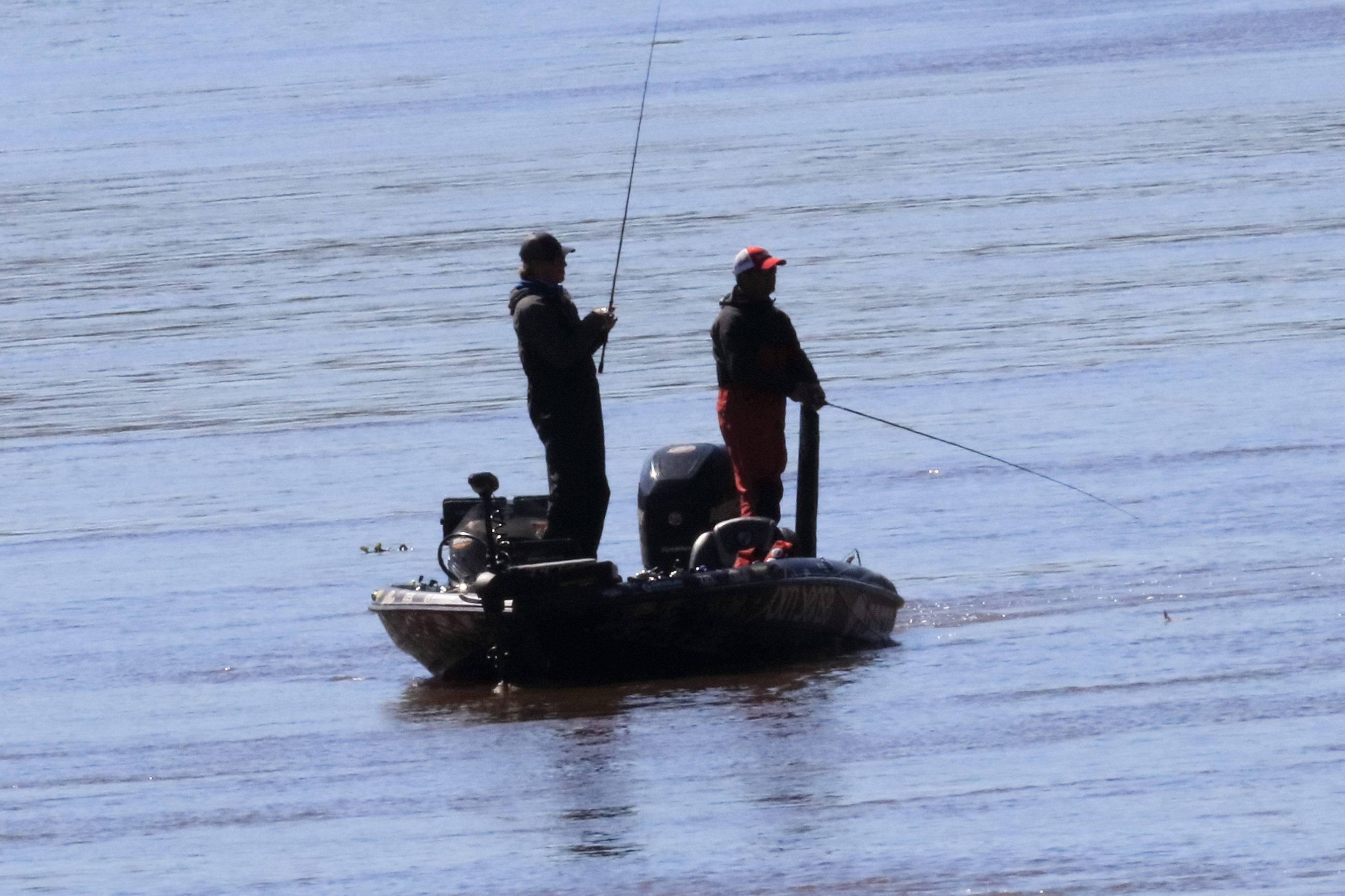
Colbert Ferry Boat Ramp Area, Milepost 327.3Following the signs from the entrance to Colbert Ferry to the boat ramp, visitors can find and two open parking lots. 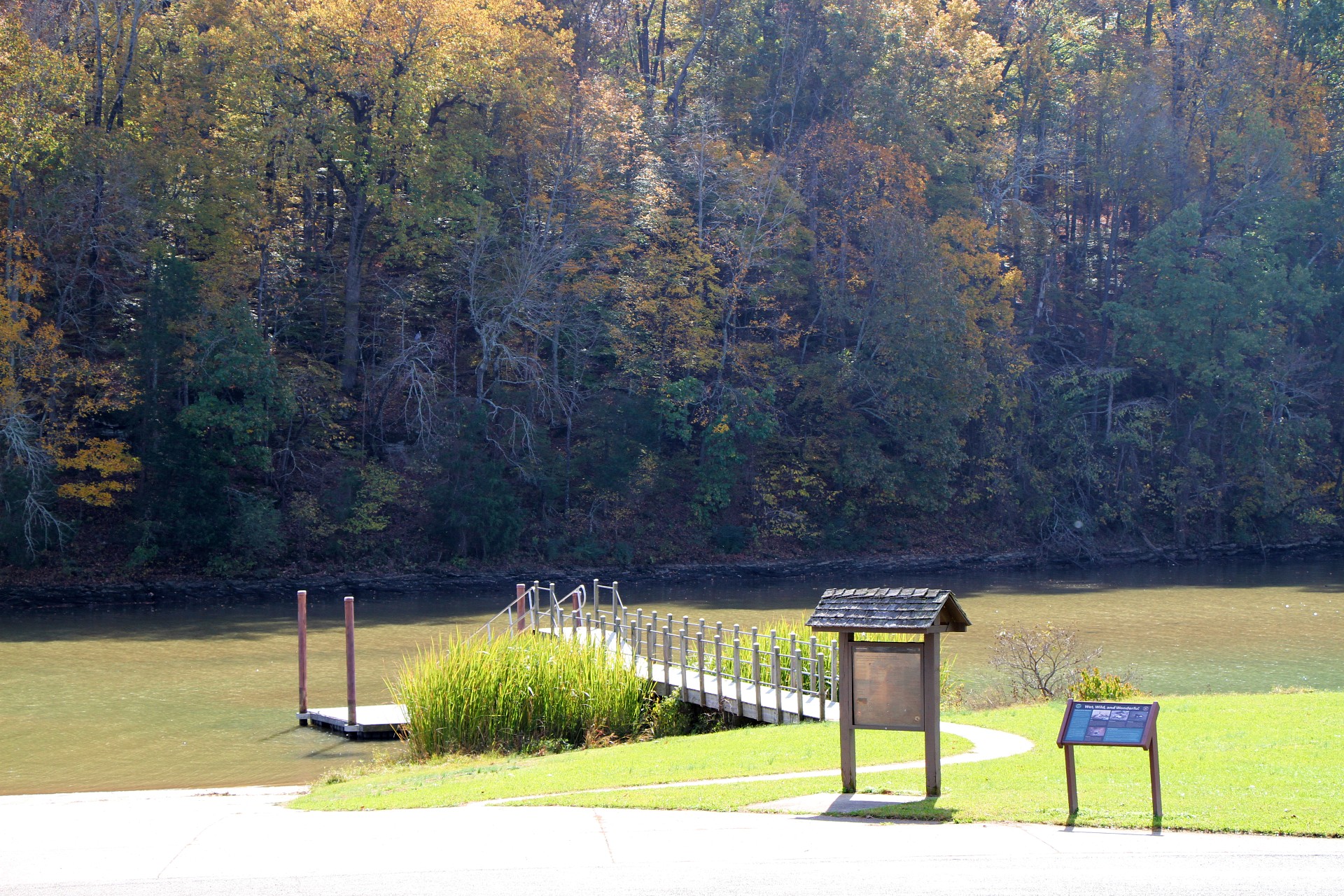
Colbert Ferry Picnic Area, Milepost 327.3Colbert Ferry picnic area is on banks of the Tennessee River, north of HWY 72 in Alabama. It is on the end of the road to the boat dock, so it's off the beaten path. There is plenty of room to stretch your legs and toss a ball. It's a great place to birdwatch and fish. 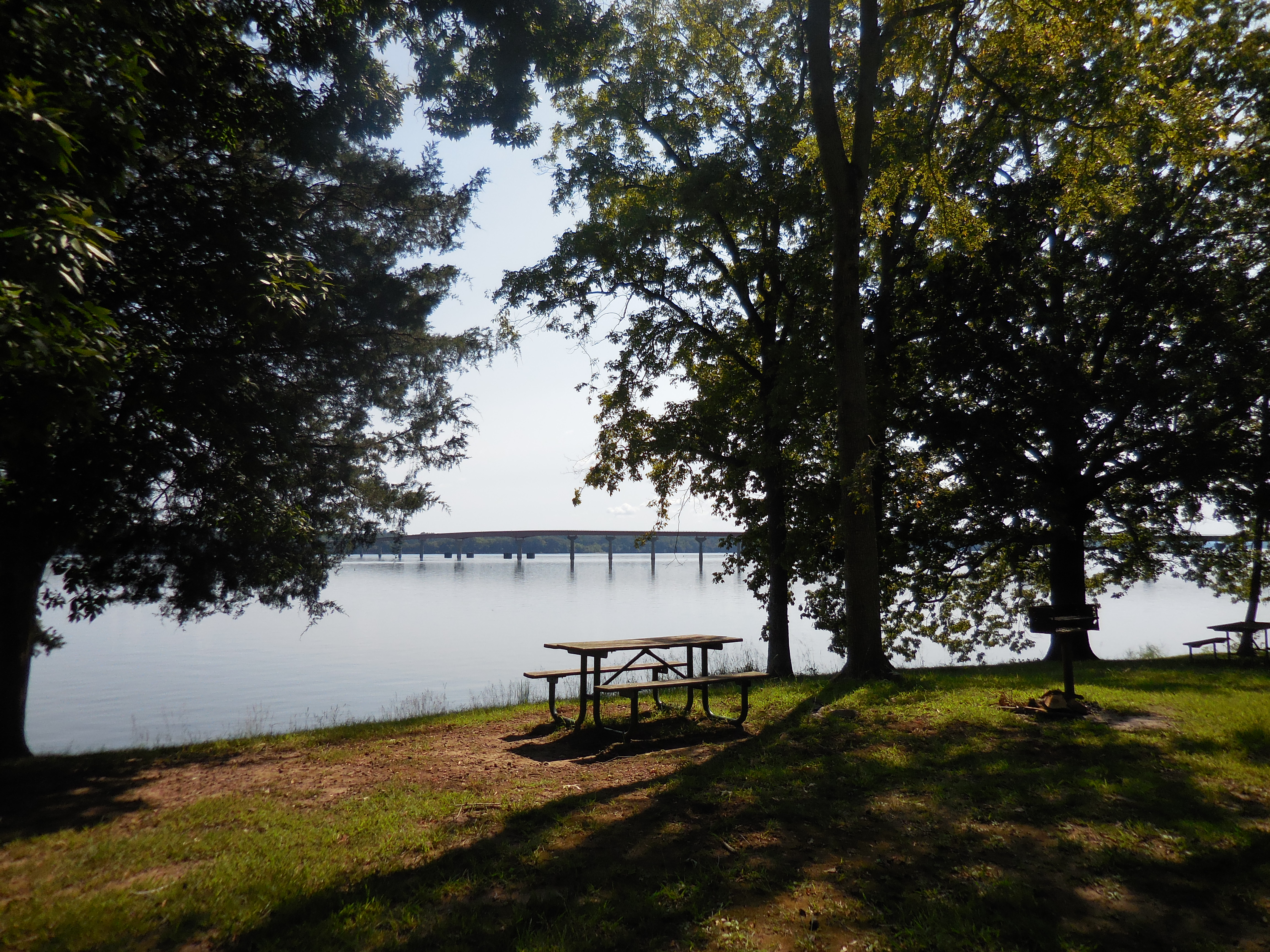
Colbert Ferry Stand Site, Milepost 327.3George Colbert used to live atop this ridge overlooking the Tennessee River. As one of the many inns that dotted the Trace between Nashville and Natchez, it provided travelers with food and lodging. At this site you can take a short walk up to the ridge where the home once sat. An additional 20-minute stroll will take you along the Old Trace to the bluff overlook of the river. 
Cole Creek, Milepost 175.6A bit of a swamp, without the alligators...well, we haven't seen any there yet. This 750-foot trail will provide you with a mini experience of a swamp. 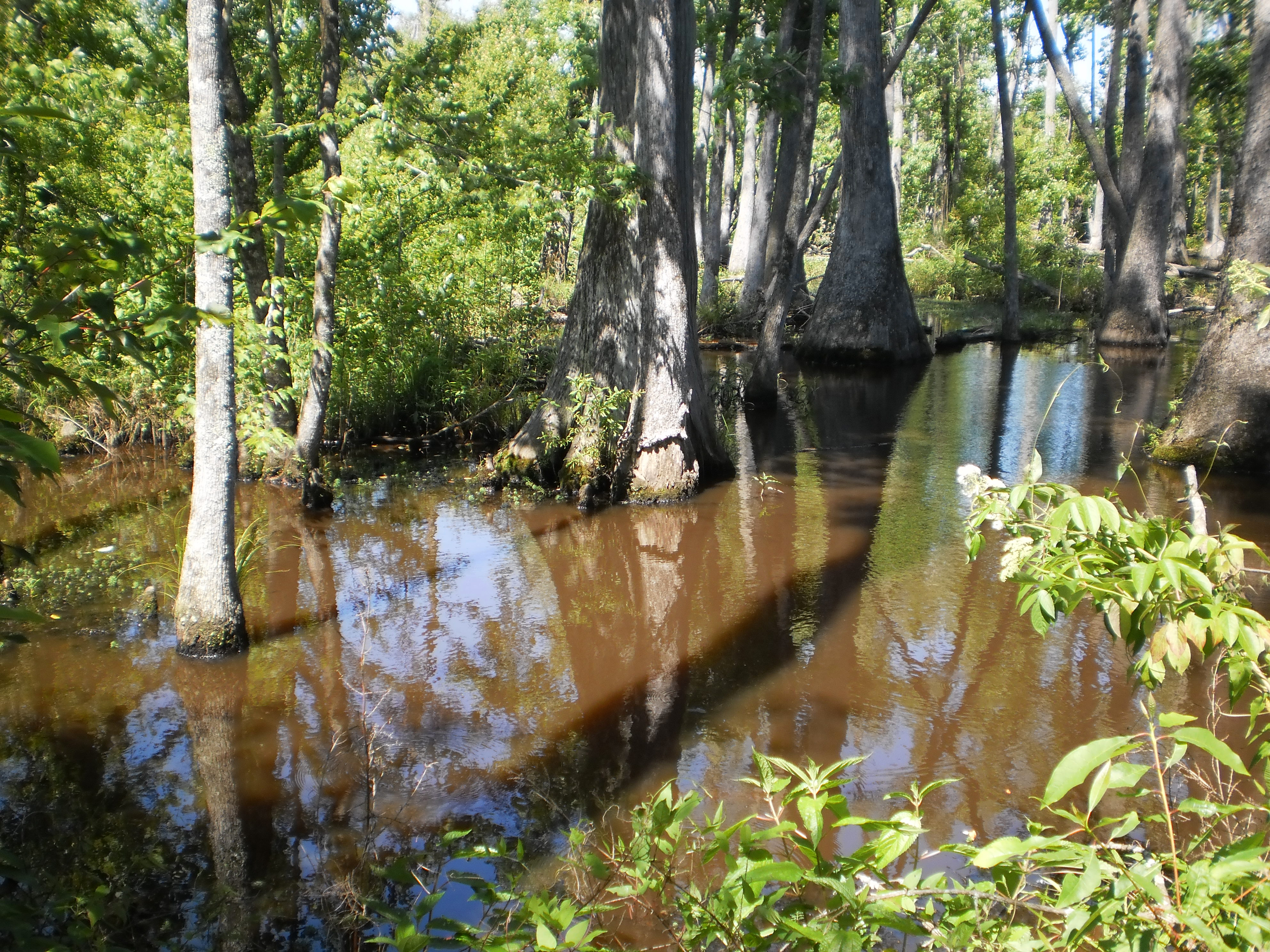
Coles Creek, Milepost 17.5Stop for a picnic and restroom break, at Coles Creek. The southern terminus of the Potkopinu Section of the Natchez Trace National Scenic Trail is a half-mile to the south. 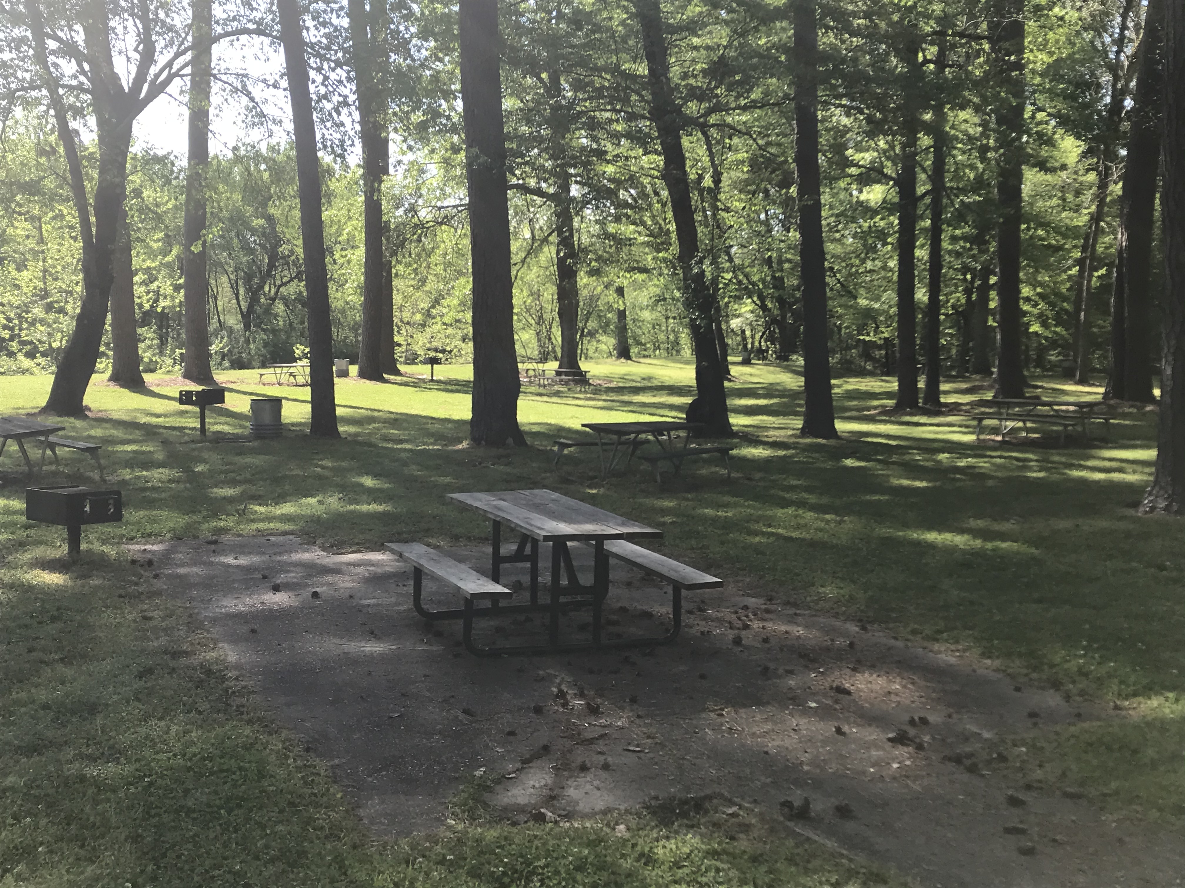
Cowles Mead Cemetery, Milepost 88.1Cowles Mead’s home, called “Greenwood,” was located here, a mile northwest of Clinton in Hinds County, set in a lawn of fifty acres of Bermuda grass, which he is believed to have introduced into the United States. He was an enthusiastic gardener, and proudly entertained distinguished guests amongst the well landscaped grounds. After his death, the home was destroyed in a fire in 1863. 
Cypress Creek Picnic, Milepost 343.5A small picnic area next to the Cypress Creek. 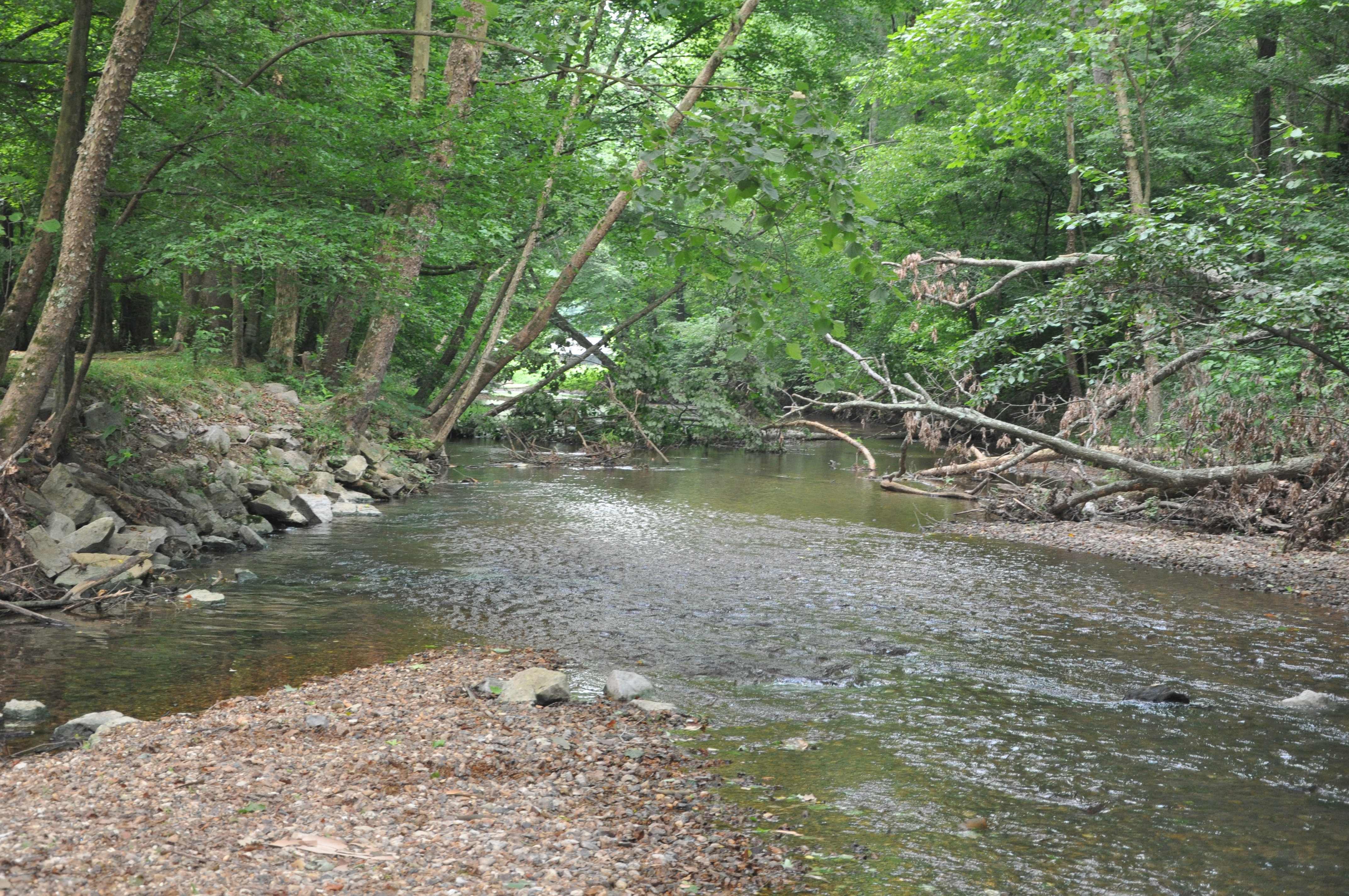
Cypress Swamp, Milepost 122Many years ago, the Pearl River flowed here. The river changed course. A shallow area was created by the deposition of sediments as the river retreated. During periodic low water, seedlings of water-tolerant cypress and tupelo trees gained a foothold. The trees you see today are a result. This is also a trailhead for the Yockanookany Section of the Natchez Trace National Scenic Trail. 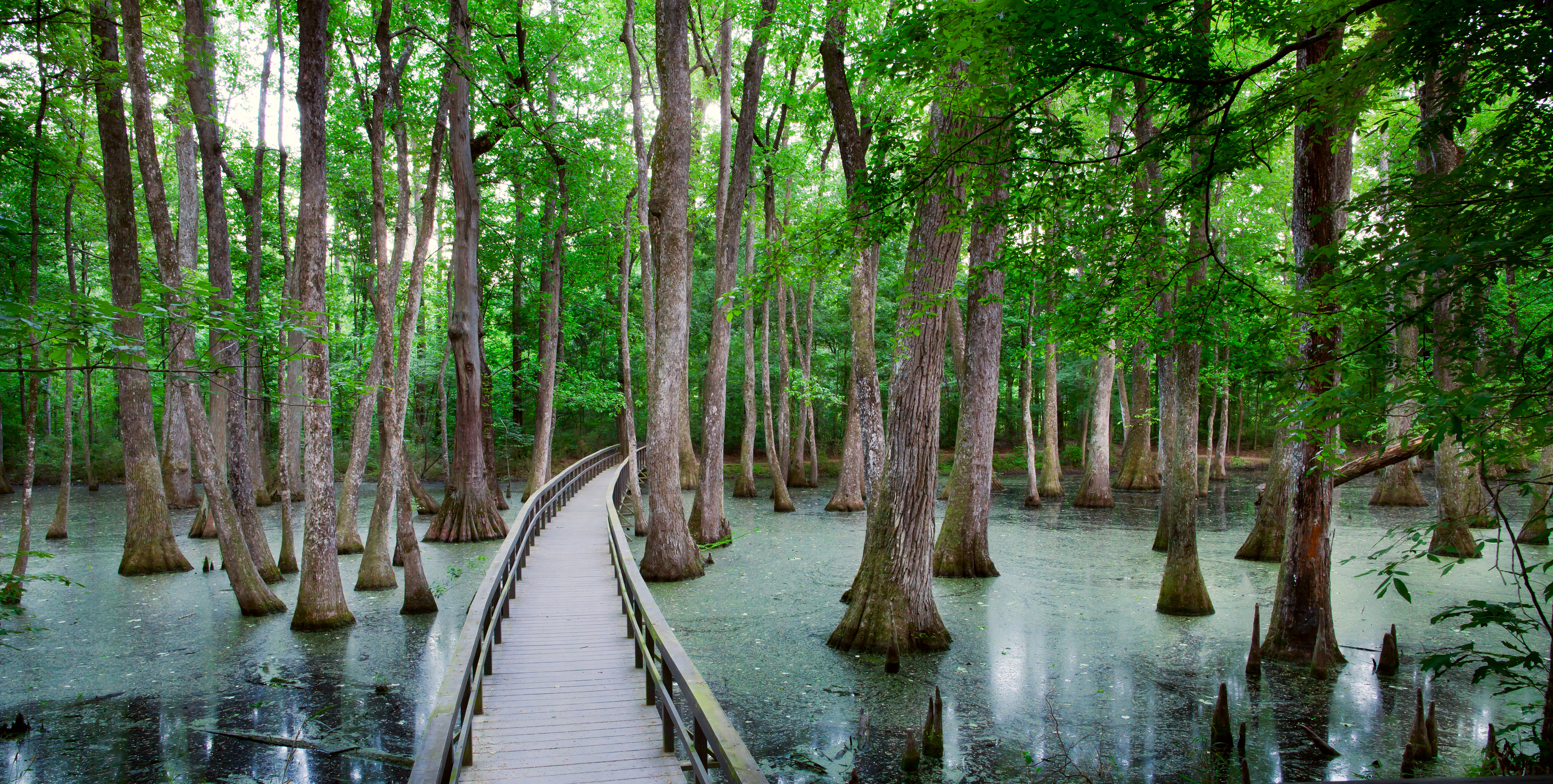
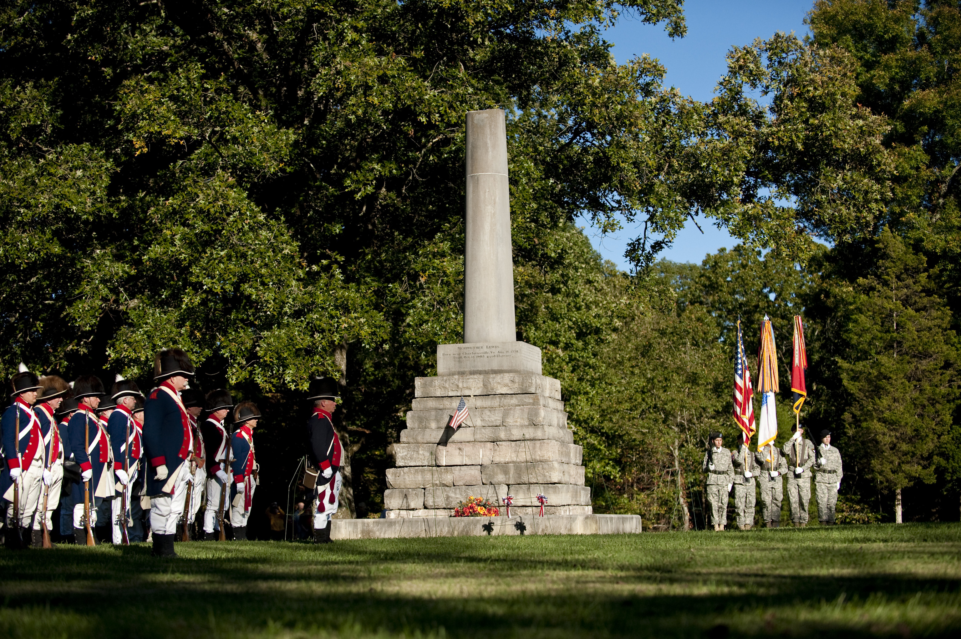
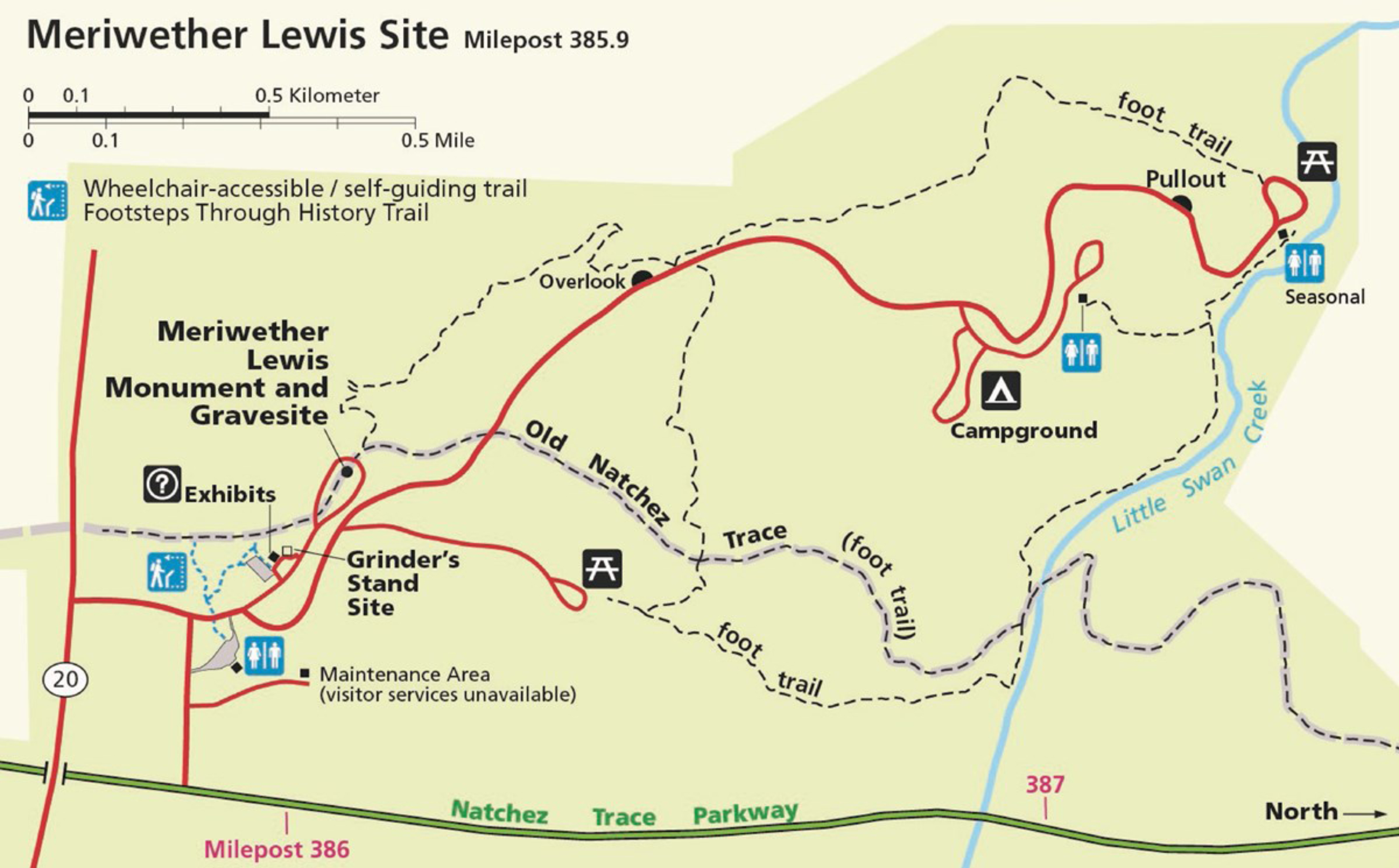
D.A.R. Marker at the Meriwether Lewis Death and Burial Site, Milepost 385.9The Daughters of the American Revolution, D.A.R, began a program in 1903 to place markers along the old Natchez Trace. Mrs. Elizabeth Jones, of Holly Springs, Mississippi, said, “We are in danger of losing all traces of our one-famous military road” and as state regent she began a movement to mark the old Natchez Trace. Similar programs were later adopted in Alabama and in Tennessee. The monument at the Meriwether Lewis Death and Burial Site was placed in 2006. 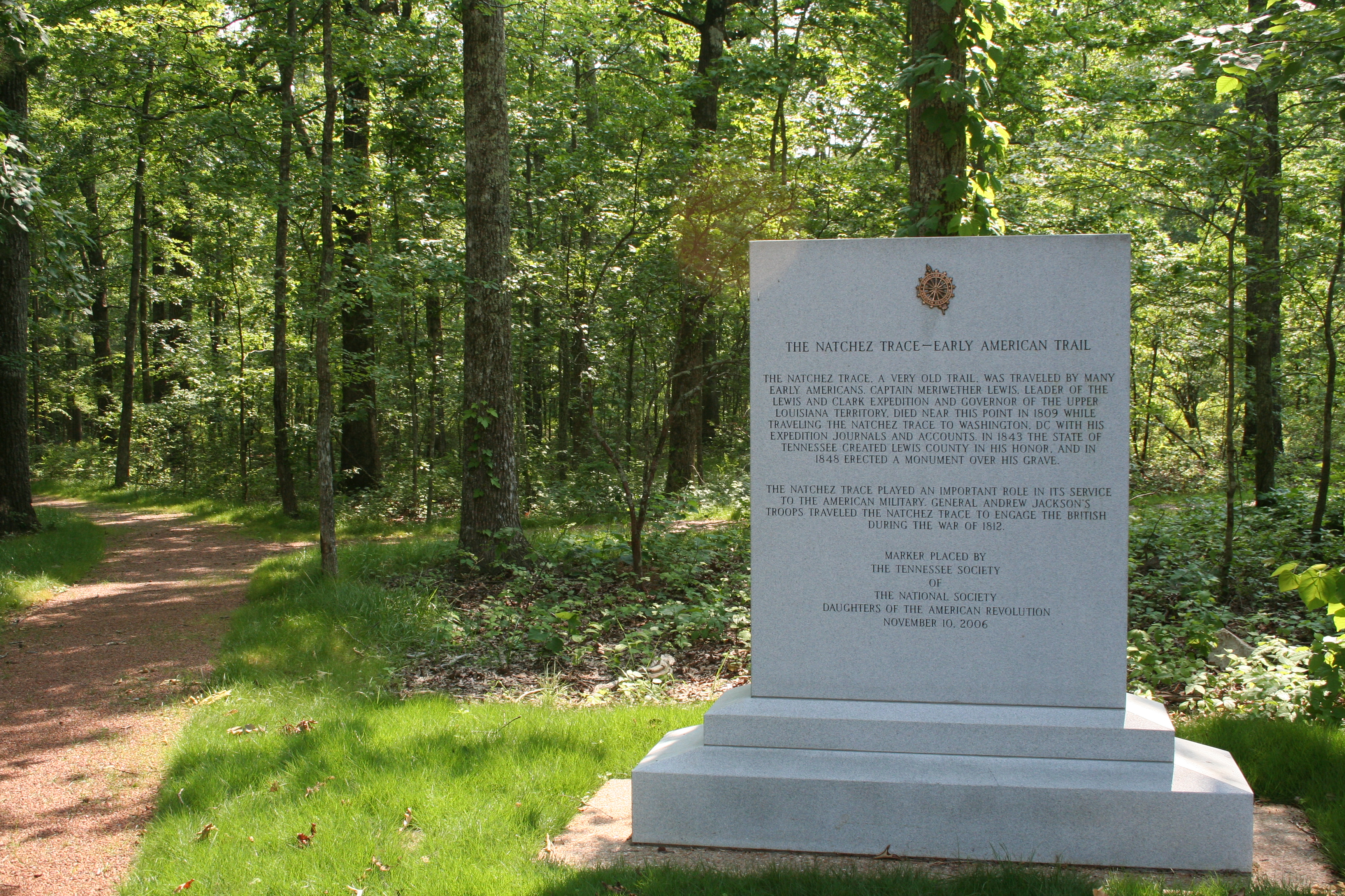
D.A.R. Marker at the Tobacco Barn, Milepost 401.4The Daughters of the American Revolution, D.A.R, began a program in 1903 to place markers along the old Natchez Trace. Mrs. Elizabeth Jones, of Holly Springs, Mississippi, said, “We are in danger of losing all traces of our one-famous military road” and as state regent she began a movement to mark the old Natchez Trace. Similar programs were later adopted in Alabama and in Tennessee. The monument was placed at the Tobacco Barn area on May 5, 2004. 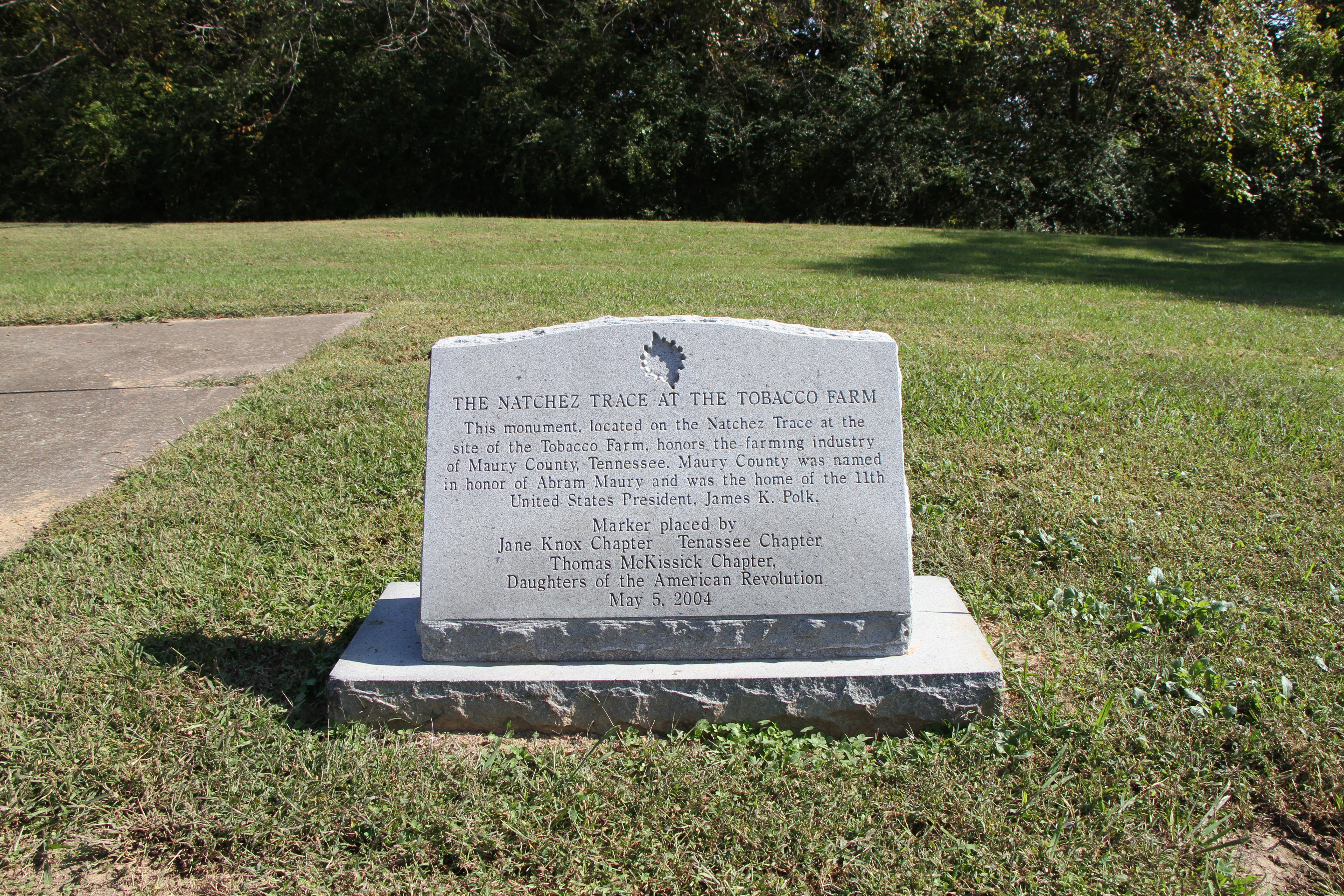
Dean Stand Site, Milepost 73.5The Treaty of Doaks Stand, 1820, opened this land to white settlement. Land was quickly claimed and pioneer families established themselves in this wilderness. William Dean and his wife Margaret settled about here on the Old Natchez Trace in 1823. The Deans supplemented their farm income by offering lodging to travelers. 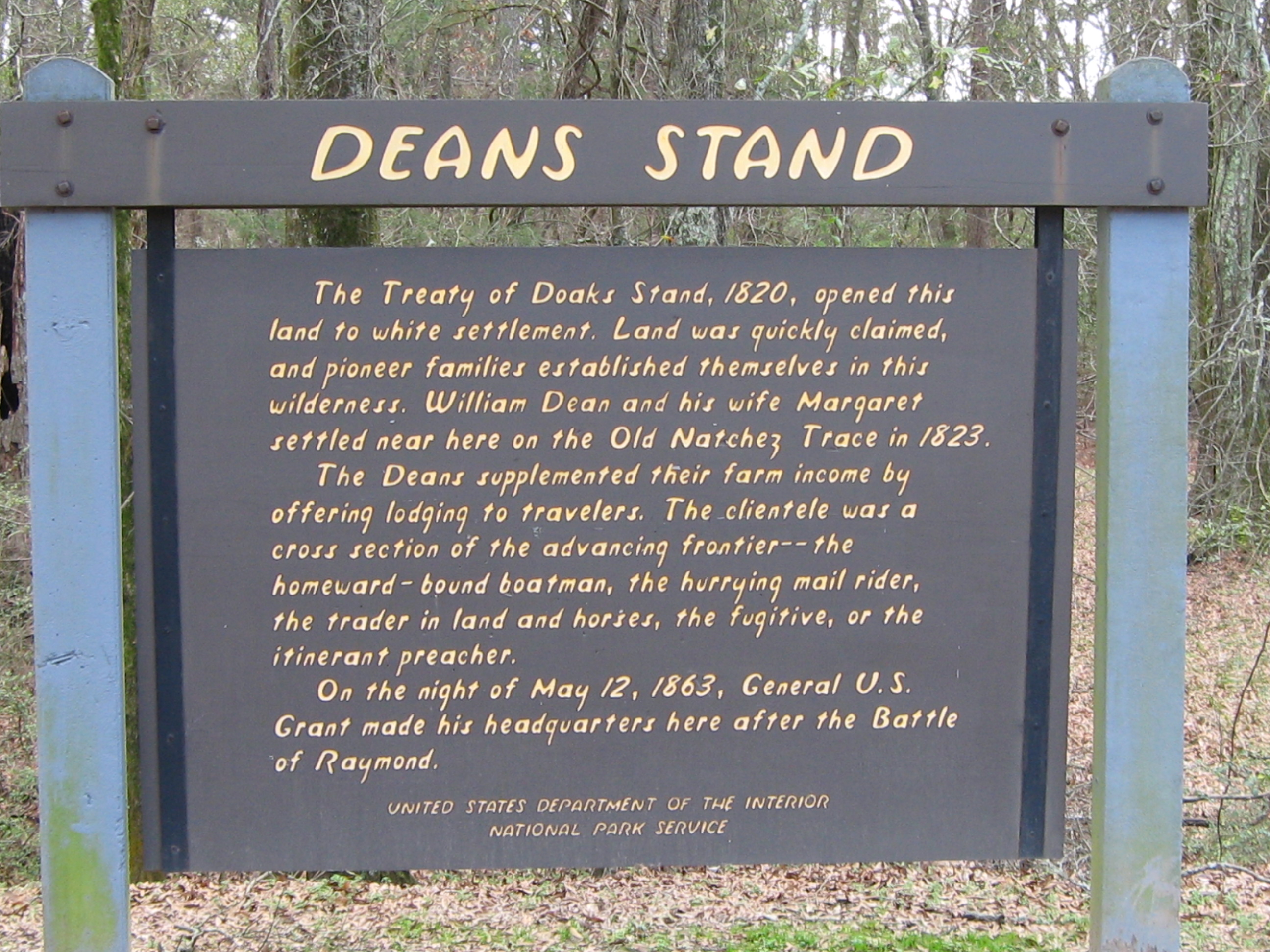
Dogwood Mudhole, Milepost 367.3Dogwood Mudhole is located a mile to the south of the parkway. The Old Natchez Trace crossed a depression in the flat, dogwood covered ridge. After heavy rains it became almost impassable for wagons. Its name, "Dogwood Mudhole", recalls the ordeals of frontier travel. It shows too, how place names arising from local conditions of long ago are carried down through the years. 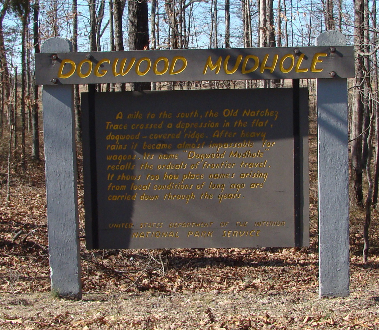
Dogwood Valley, Milepost 275.5Dogwood Valley Nature Trail is a 1600 loop trail into a hardwood forest valley. In April when the weather is right, the trail has several blooming dogwood trees. 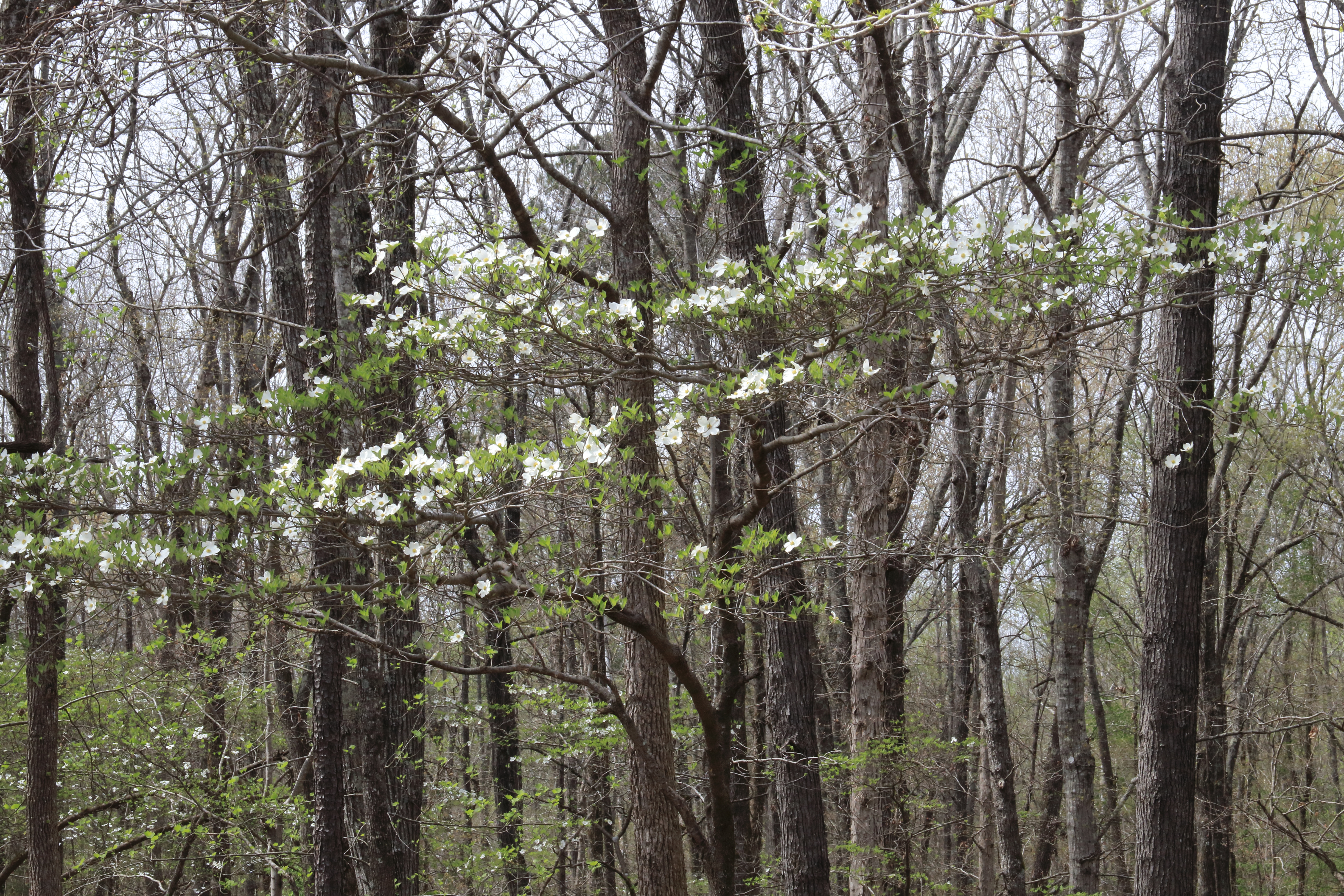
Donivan Slough, Milepost 283.3Donivan Slough, a cultural and nature trail invites walkers on an easy hike to learn about historic agricultural practices and the natural habitat of the area. 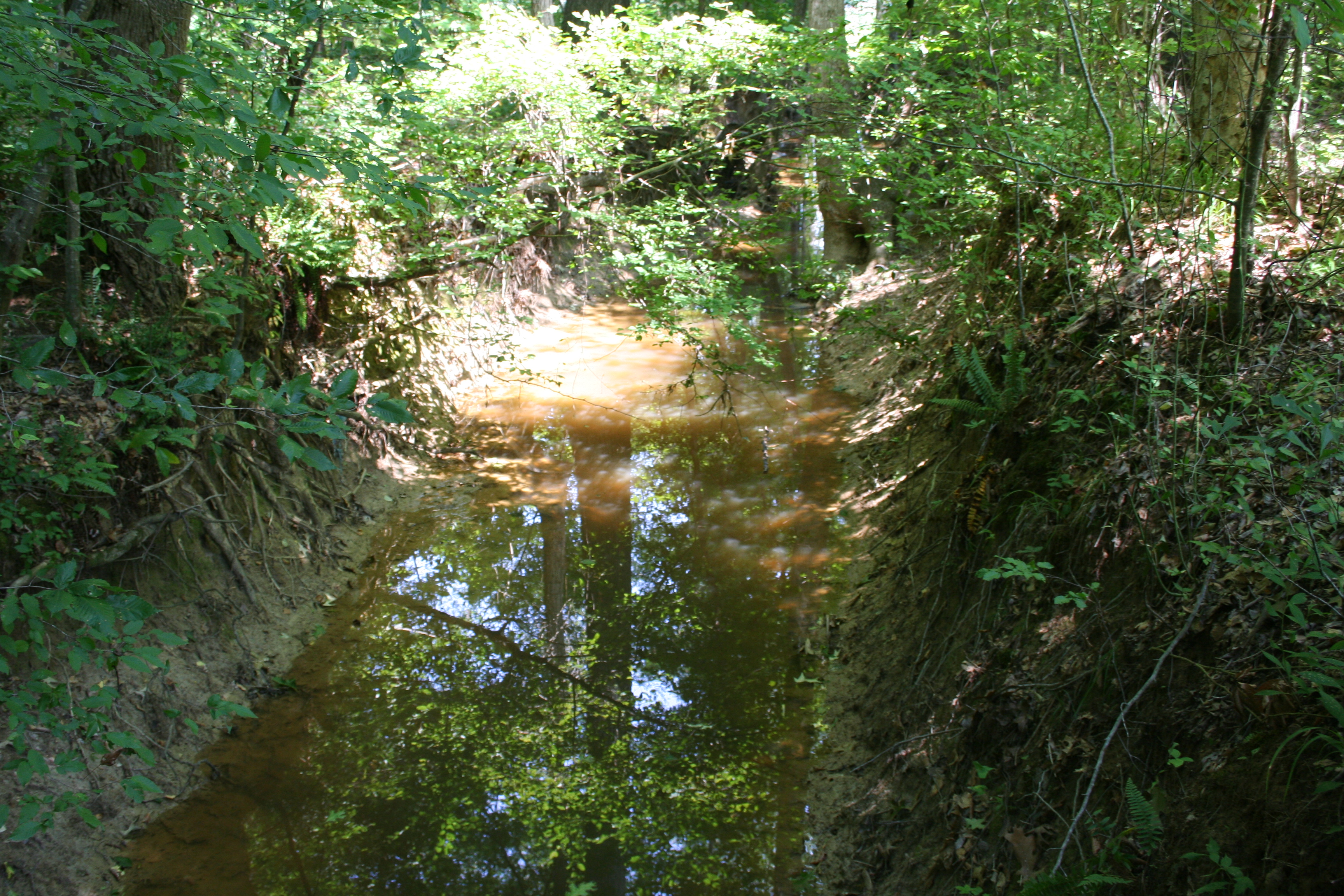
Elizabeth Female Academy, Milepost 5.1From 1818-1845, Elizabeth Female Academy stood on the southern end of the Old Trace. It was the first female institution of higher learning charted by the state of Mississippi. It was one of the first institutions to offer college degrees to women in Mississippi and one of the first female colleges in the country. 
Emerald Mound, Milepost 10.3Located about 10 miles northeast of Natchez, Mississippi, Emerald Mound is the second-largest Mississippian Period ceremonial mound in the United States, surpassed only by Monk’s Mound near Cahokia, Illinois. Built and used between the years 1200 C.E. (current era) and 1600 C.E., this 35-foot-high mound covers eight acres and measures 770 feet by 435 feet at its base. 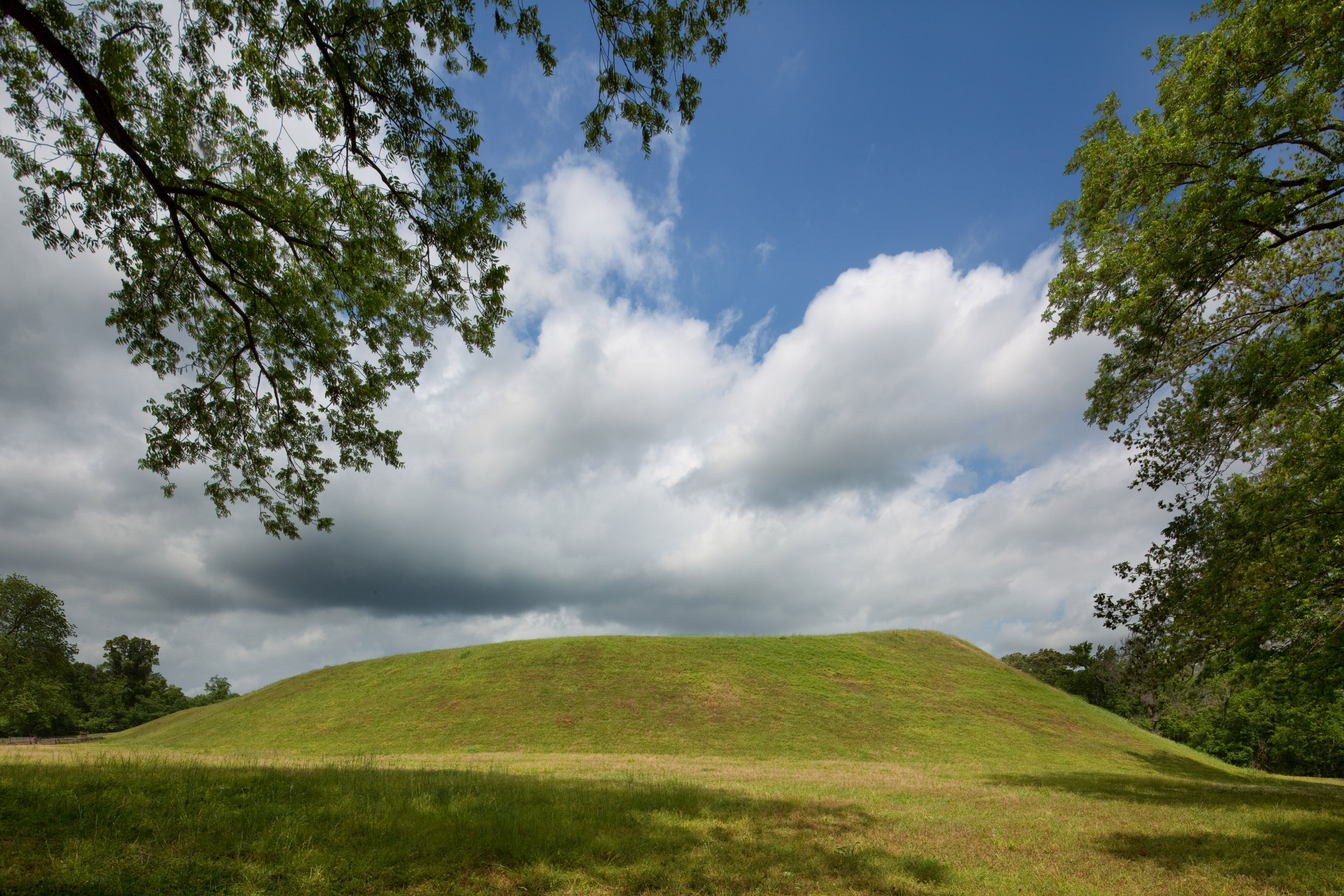
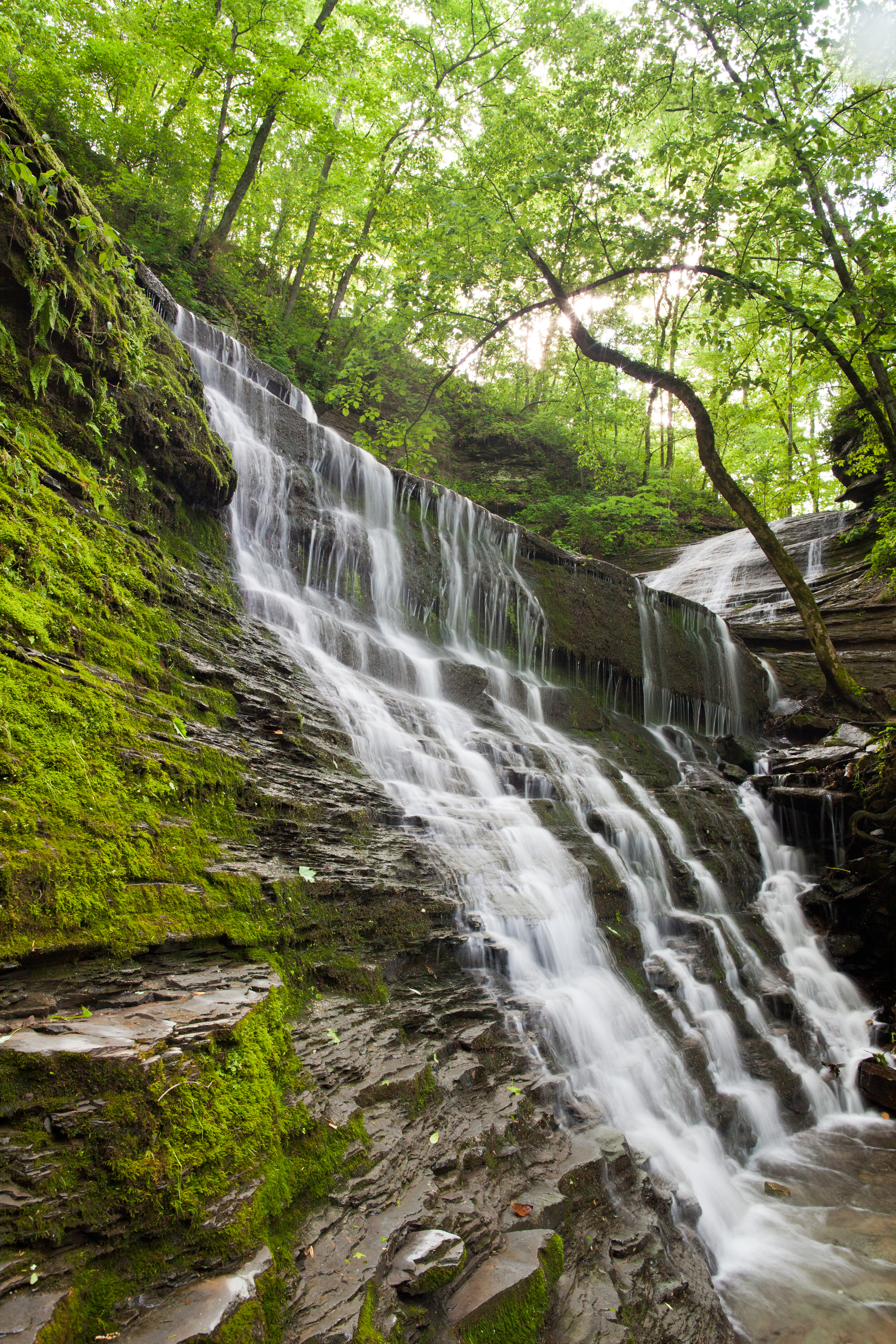
Fall Hollow Waterfall, Milepost 391.9Fall Hollow is one of two waterfalls along the Natchez Trace Parkway. Almost immediately after leaving your vehicle you can hear the water descending over the twenty foot drop making Fall Hollow waterfall. If you continue down this short trail you will come to a viewing platform that views the 20-foot tall waterfall. The trail and platforms get slippery due to the water and moisture of the area. Please watch your step. 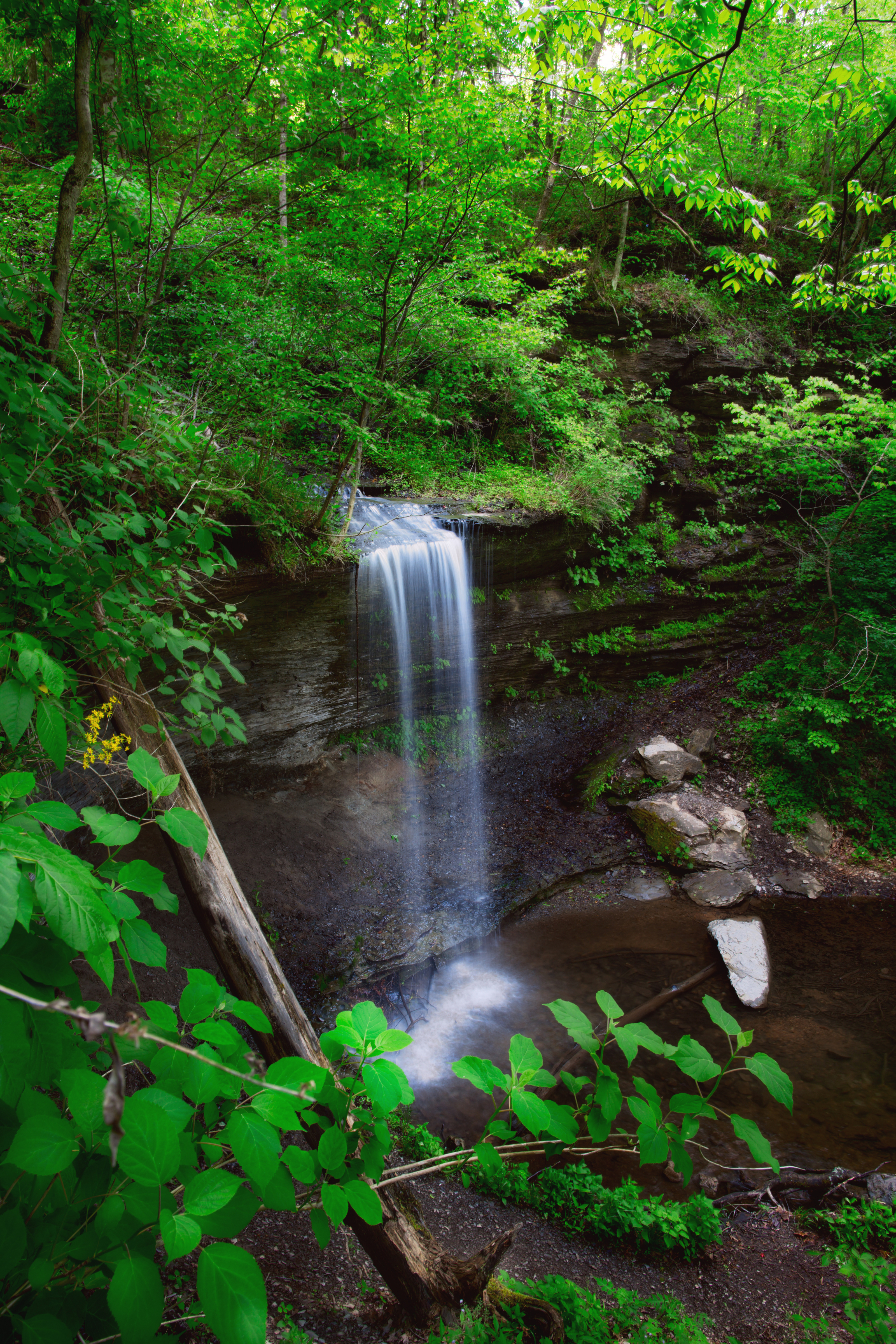
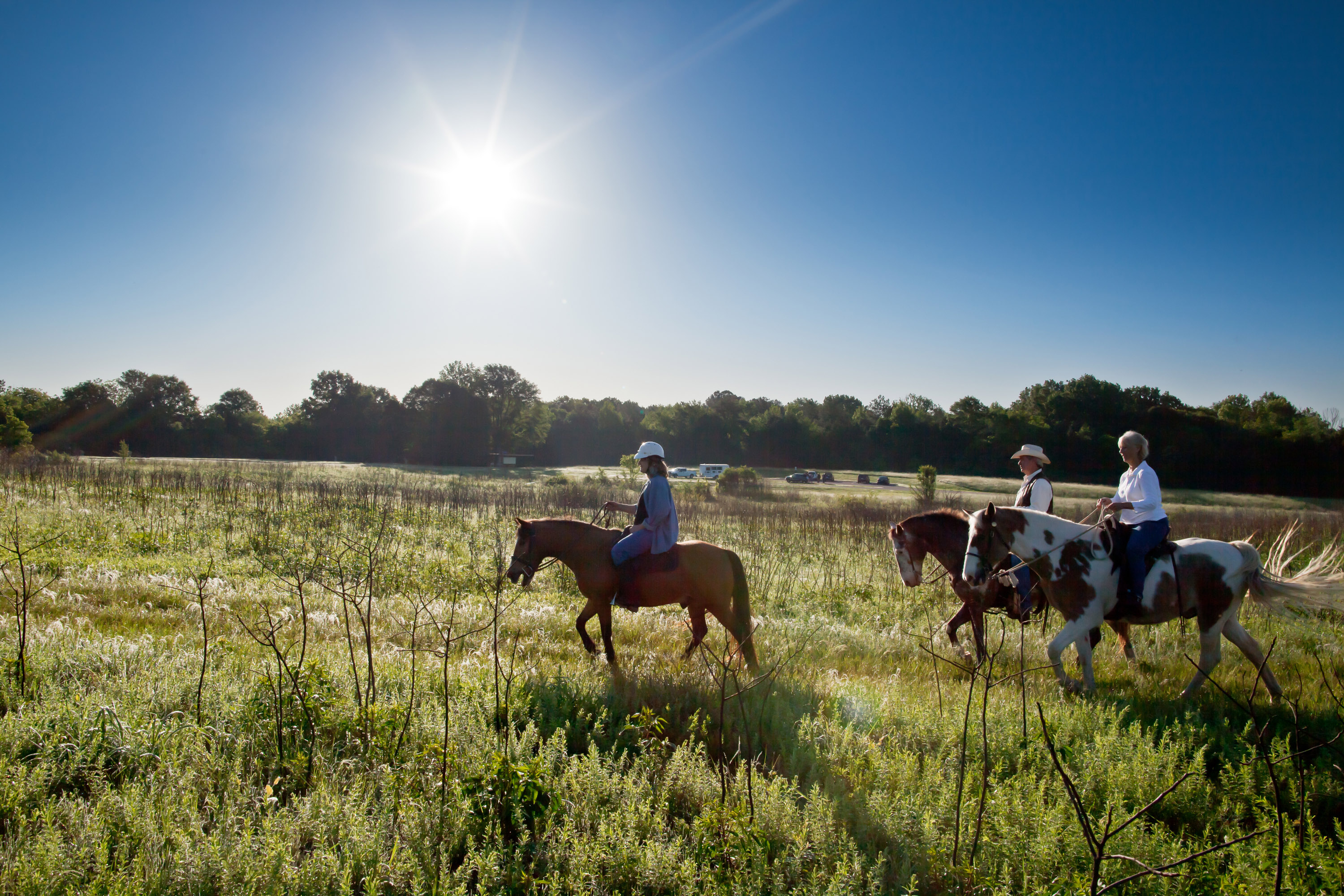
Fly Trailhead On The Highland Rim Section, Milepost 416The Fly Trailhead on Highway 7 provides a small parking area for one or two horse trailers. If space is available, this will be a great starting point for just a few people. If there are numerous people riding together, the Highway 50 trailhead may be a better option. There is no water available at this trailhead. One hitching post is available here. 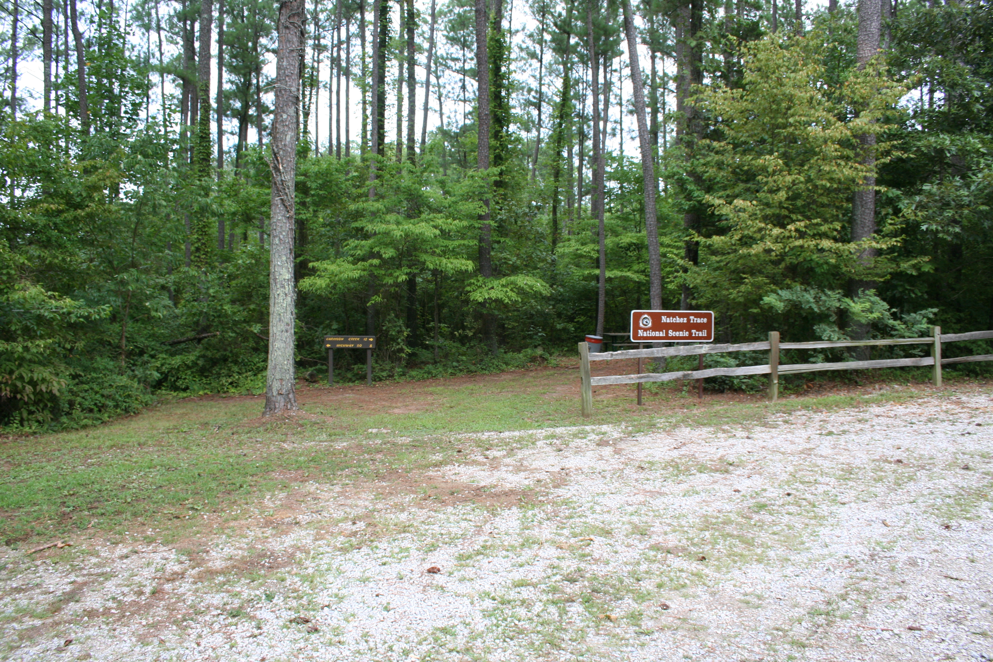
Footsteps Through History Trail, Milepost 385.9Follow this trail to a preserved section of the Old Trace (Old Trace section is not paved), where Meriwether Lewis, renowned explorer, took his last steps. He met his untimely death at the inn that once stood hear here. As you follow the trail, you will encounter some "people" who walked along the Old Natchez Trace, a footpath used by thousands of travelers that spanned over 400 miles from Mississippi through Tennessee. 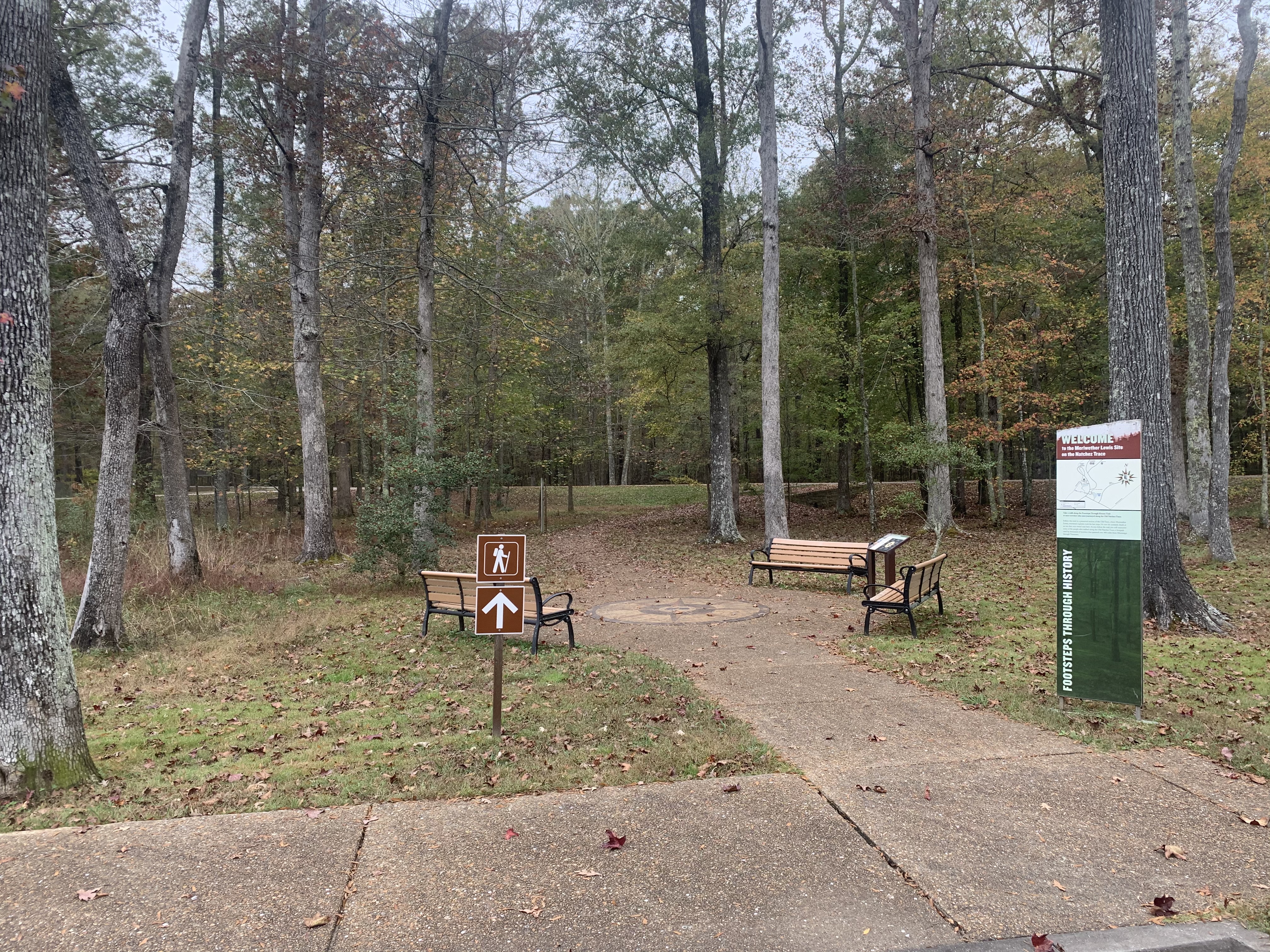
Freedom Hills Overlook, Milepost 317.0An 1100-foot trail uphill to an overlook with spectacular views. A popular spot for leaf peeping in the fall. 
French Camp, Milepost 180.7Louis LeFleur first traded with the Choctaws at a bluff now part of Jackson, Mississippi. About 1812, he established his stand 900 feet to the northeast on the Natchez Trace. Because of the LeFleur's nationality the area was often called "French Camp", a name retained by the present village. LeFleur married a Choctaw woman. Their famous son who changed his name to Greenwood Leflore, became a Choctaw chief and a Mississippi State Senator. For him are named the city of Gree 
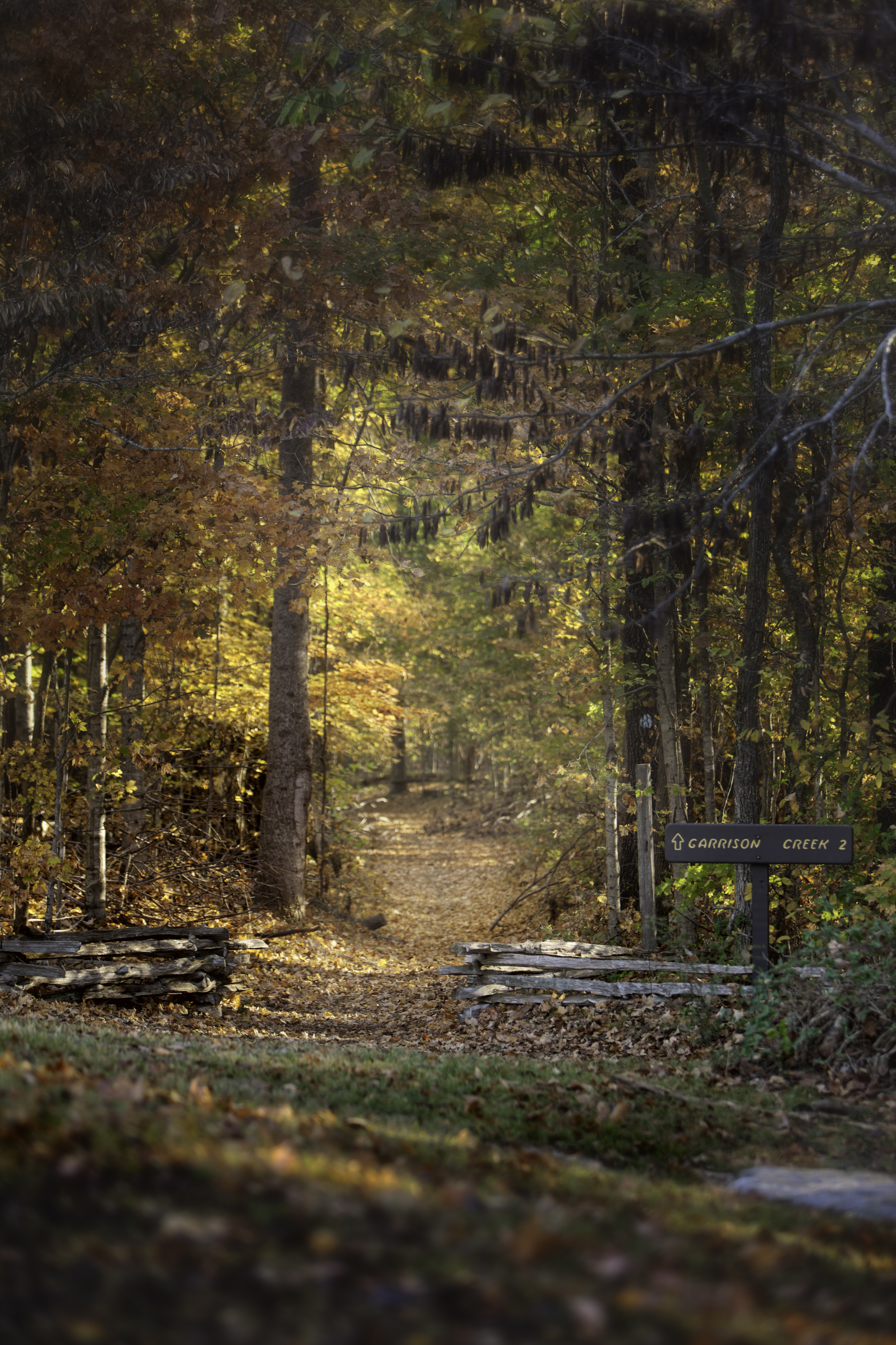
Garrison Creek and Highland Rim Section Northern Terminus, Milepost 427.6Named for a nearby 1801-02 U.S. Army post, Garrison Creek is a trailhead for horseback riders and hikers on the Highland Rim Trail of the Natchez Trace National Scenic Trail. Plenty of horse trailer parking is available. This part of the Natchez Trace National Scenic Trail is 20 miles in length. From the Garrison Creek trailhead you can hike or ride your horse south to Tennessee Highway 50, milepost 408, near the Gordon House. 
Glenrock Branch, Milepost 364.5A beautiful place to stop for a picnic. 
Gordon House Historic Site, Milepost 407.7The brick home of Captain John Gordon and his family, built in 1818, was one of the impressive homes in the area. It was a landmark for travelers of the Old Trace, letting them know that soon they would be in Nashville, TN, where simple human comforts could be found after weeks of walking on a well-traveled but rustic trail. The Gordon family called it home, but it was a business as well. A ferry provided a safe way for travelers and locals alike to cross the Duck River. 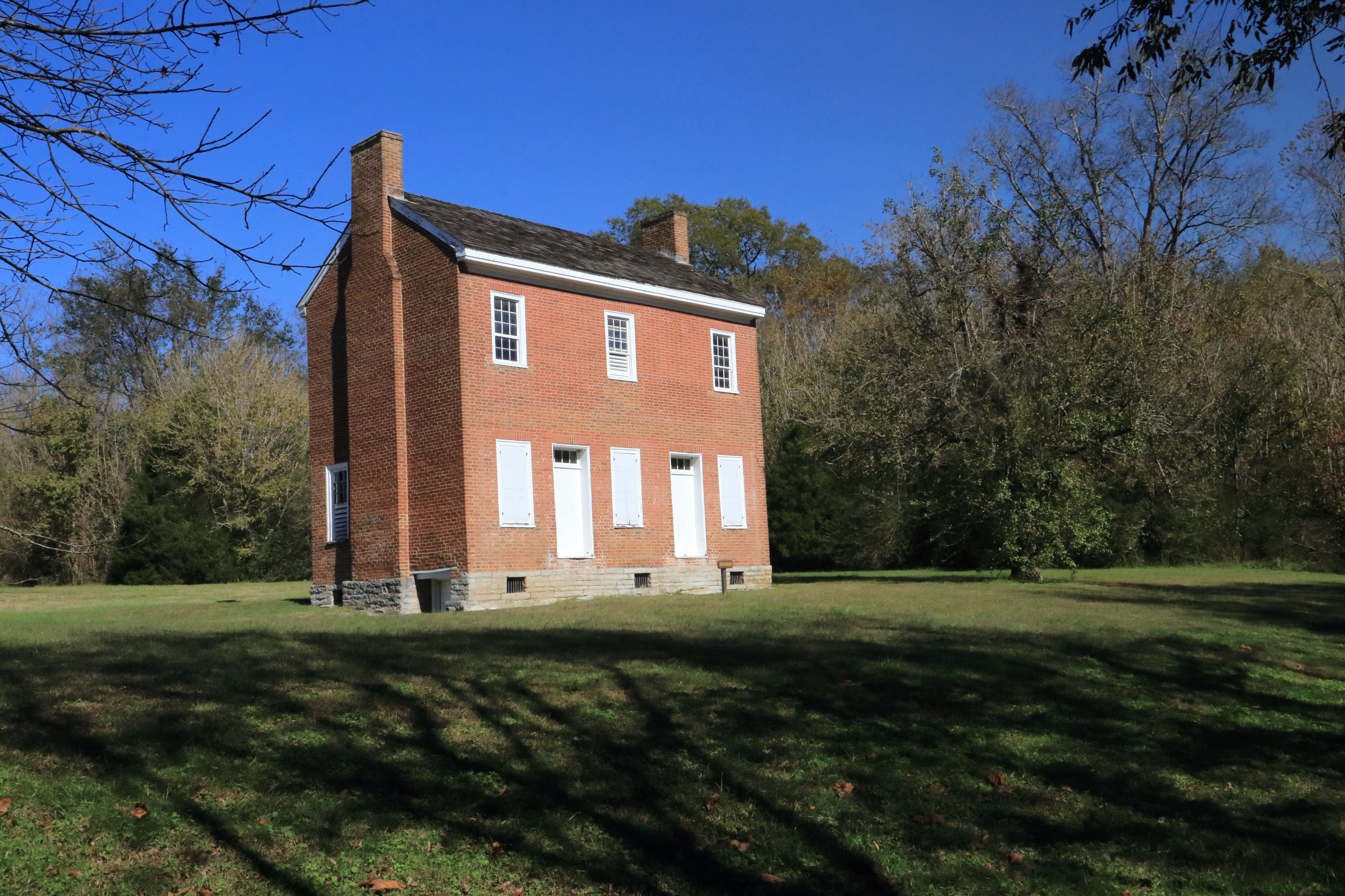
Grinder's Stand, Milepost 385.9Meriwether Lewis arrived at Grinder’s Stand on the evening of October 10, 1809. He was accompanied by Pernia and James Neelly’s enslaved servant. Lewis stayed in the cabin while Pernia and Neelly’s enslaved servant stayed in the stables. Mrs. Grinder and her children stayed in the kitchen separate from the house. In the middle of the night Mrs. Grinder heard two gun shots and found Lewis bleeding from his wounds. By sunrise on October 11,1809, Lewis was dead. 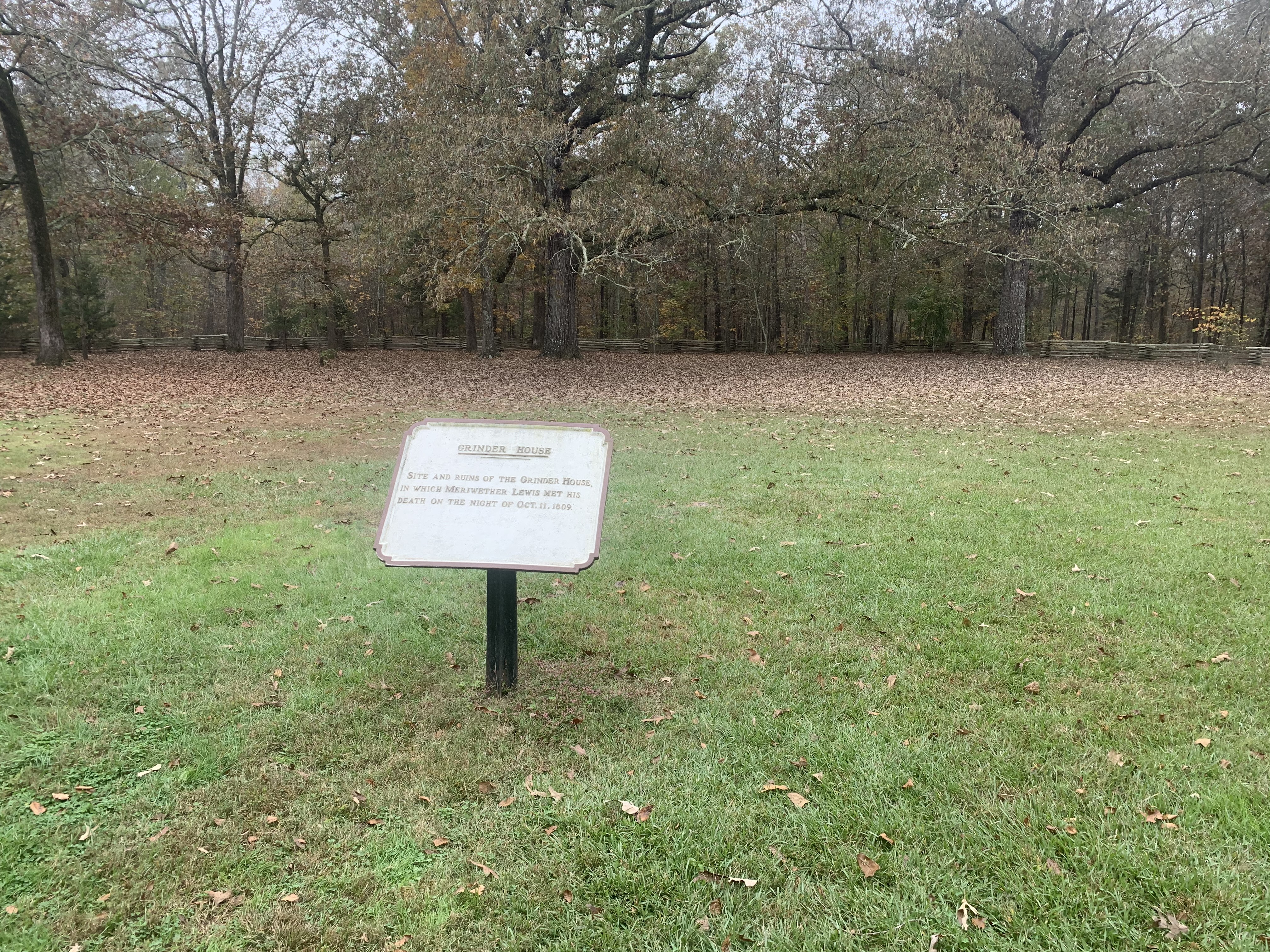
|
| Visitor Centers | Count: 4
Meriwether Lewis Visitor Information Center Milepost 385.9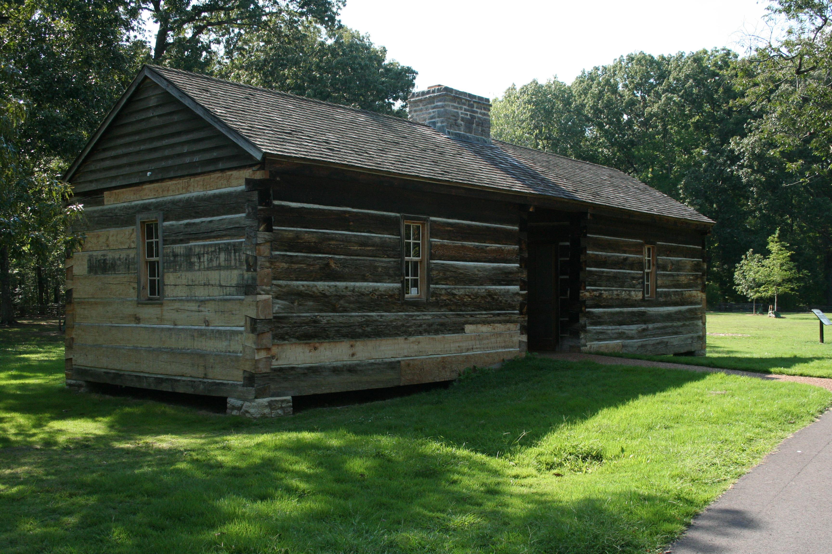
Mount Locust Information Center Milepost 15.5
Parkway Information Cabin Milepost 102.4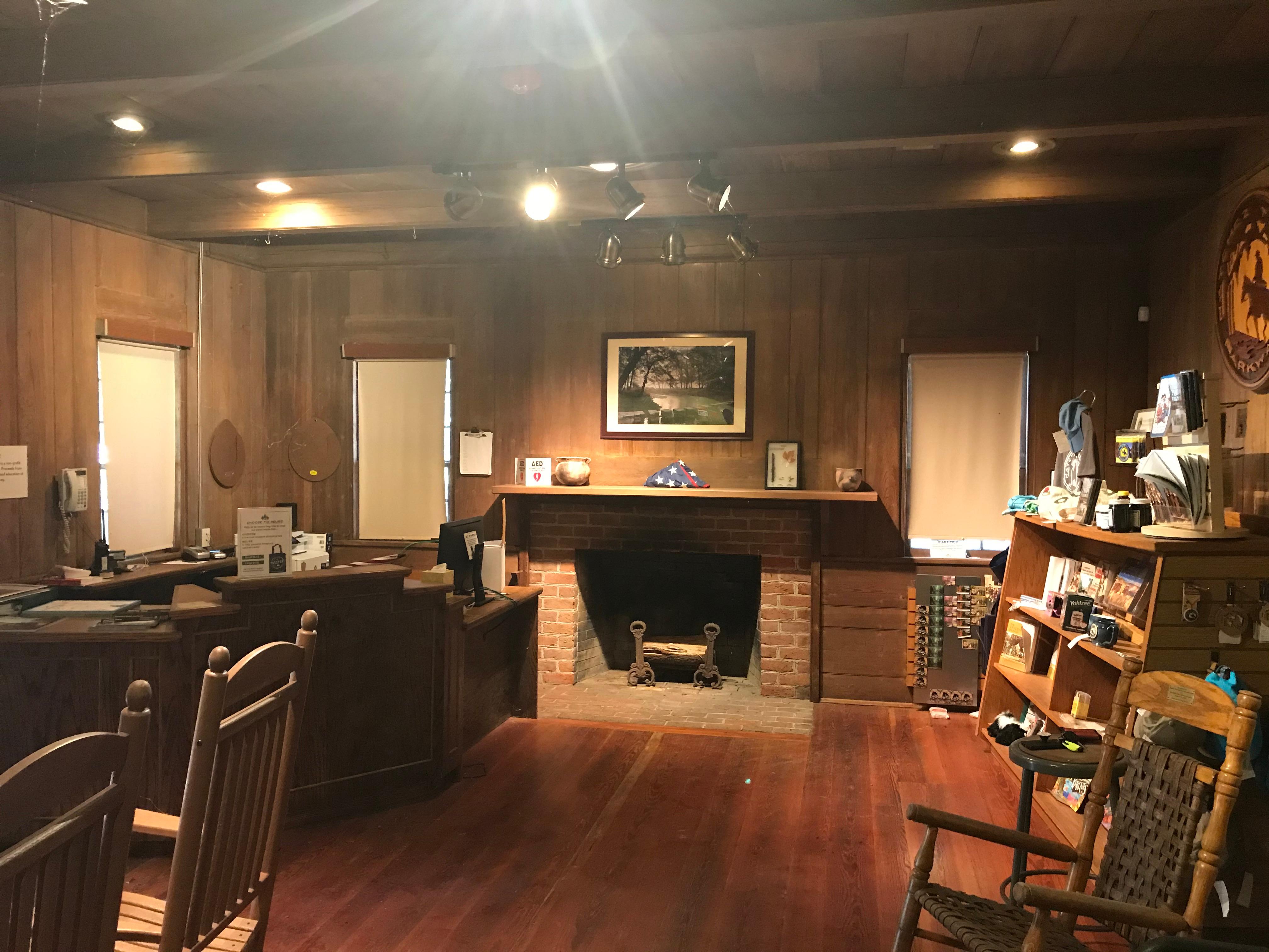
Parkway Visitor Center Milepost 266
|
| Things to do | Count: 27
|
| Tours |
Count: 0
|
| Articles |
|