Partial Closure of Rocky Springs Trail
The Rocky Springs section is closed from the Rocky Springs campground at milepost 55 to the northern terminus at milepost 59 until further notice. Visitors should observe posted closures. The trail is unsafe due to trail erosion and deteriorated bridges.
Temporary Blackland Prairie Trail Closure to Equestrians
Heavy rain has undermined a culvert making it unsafe for passage. Due to horse trailer parking availability, the entire section is closed to equestrians. Hikers are still able to travel from the railroad tracks to the Parkway Visitor Center.
Yockanookany Trail Section Closed to Equestrians
The Yockanookany section of the Natchez Trace National Scenic Trail is closed to equestrian use effective immediately, due to safety concerns with trail bridges and boardwalks. The trail will remain open to pedestrians.
| Title | Natchez Trace |
| Park Code | natt |
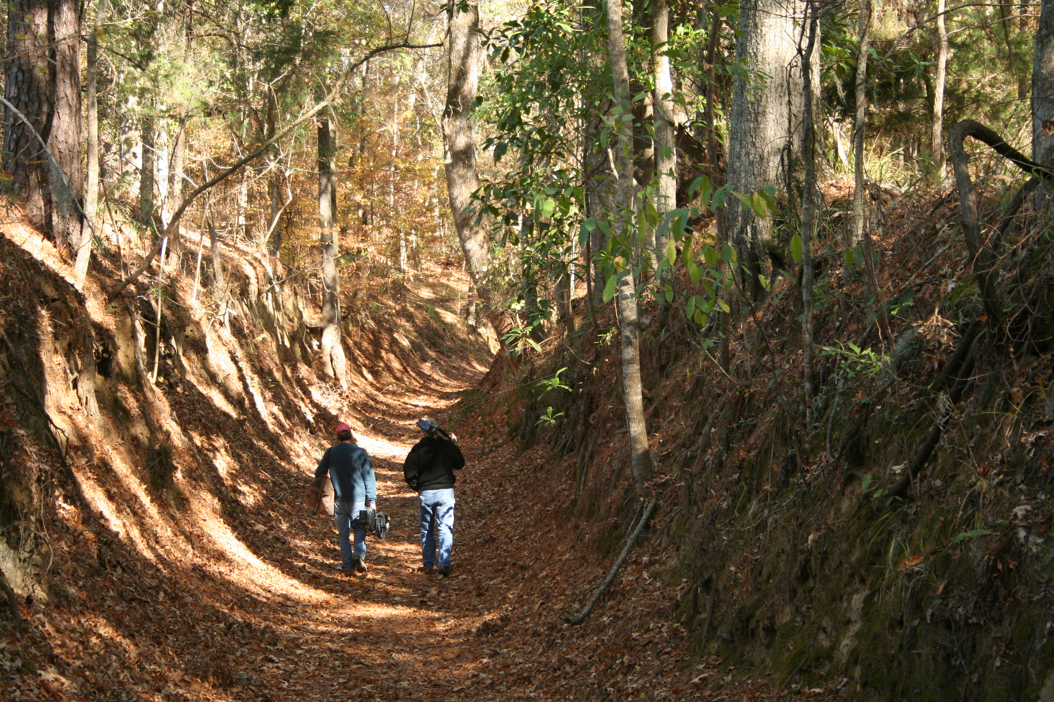
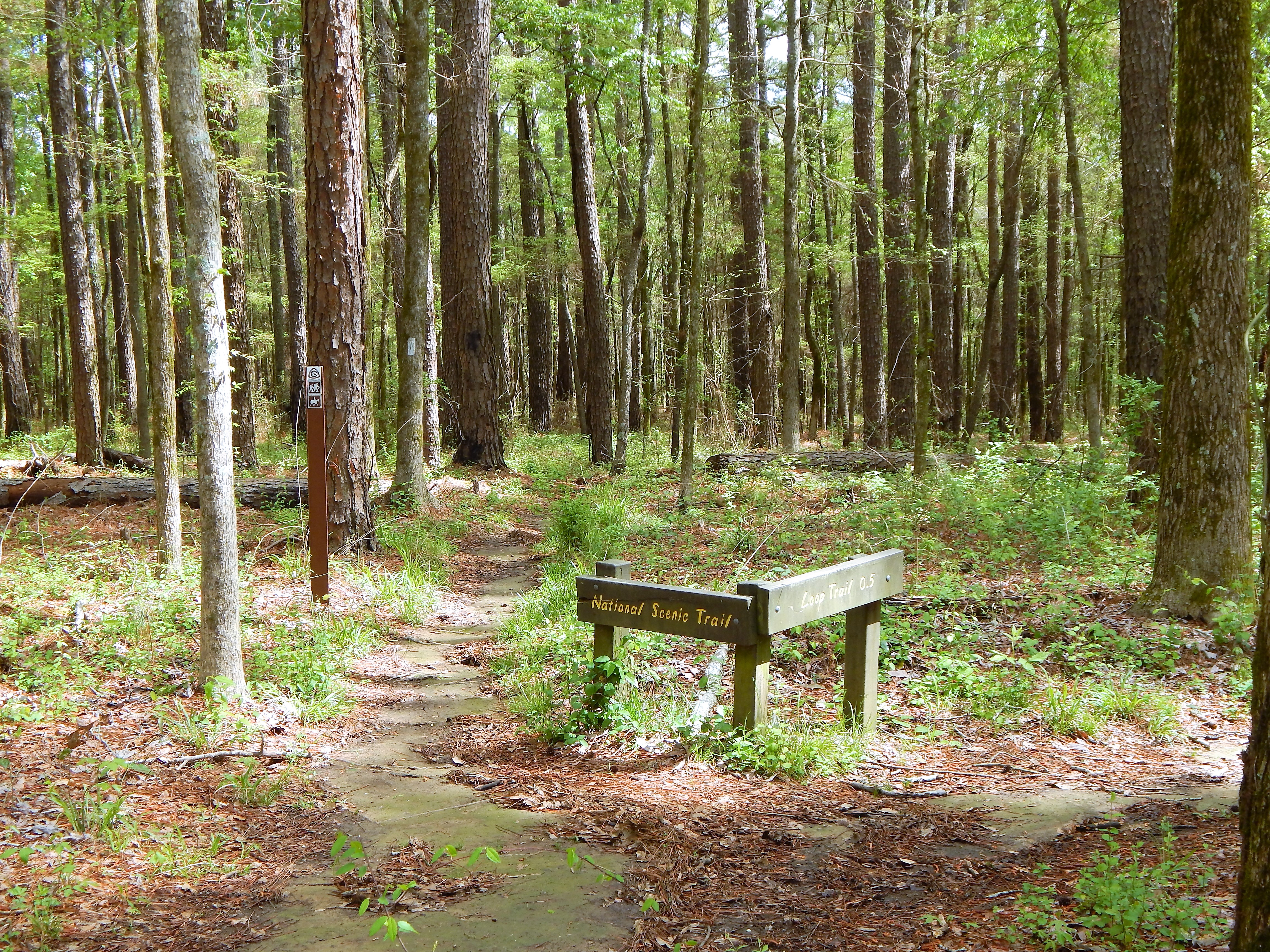
| Description | The Natchez Trace National Scenic Trail is five sections of hiking trail running roughly parallel to the 444-mile long Natchez Trace Parkway scenic motor road. The foot trails total more than 60 miles and offer opportunities to explore wetlands, ... |
| Location | |
| Contact | |
| Activities |
|
| Entrance fees |
|
| Campgrounds | Count: 0
|
| Places | Count: 21
Blackland Prairie Section Southern Terminus Trailhead, West Jackson Street, ClosedClosed until 2023. 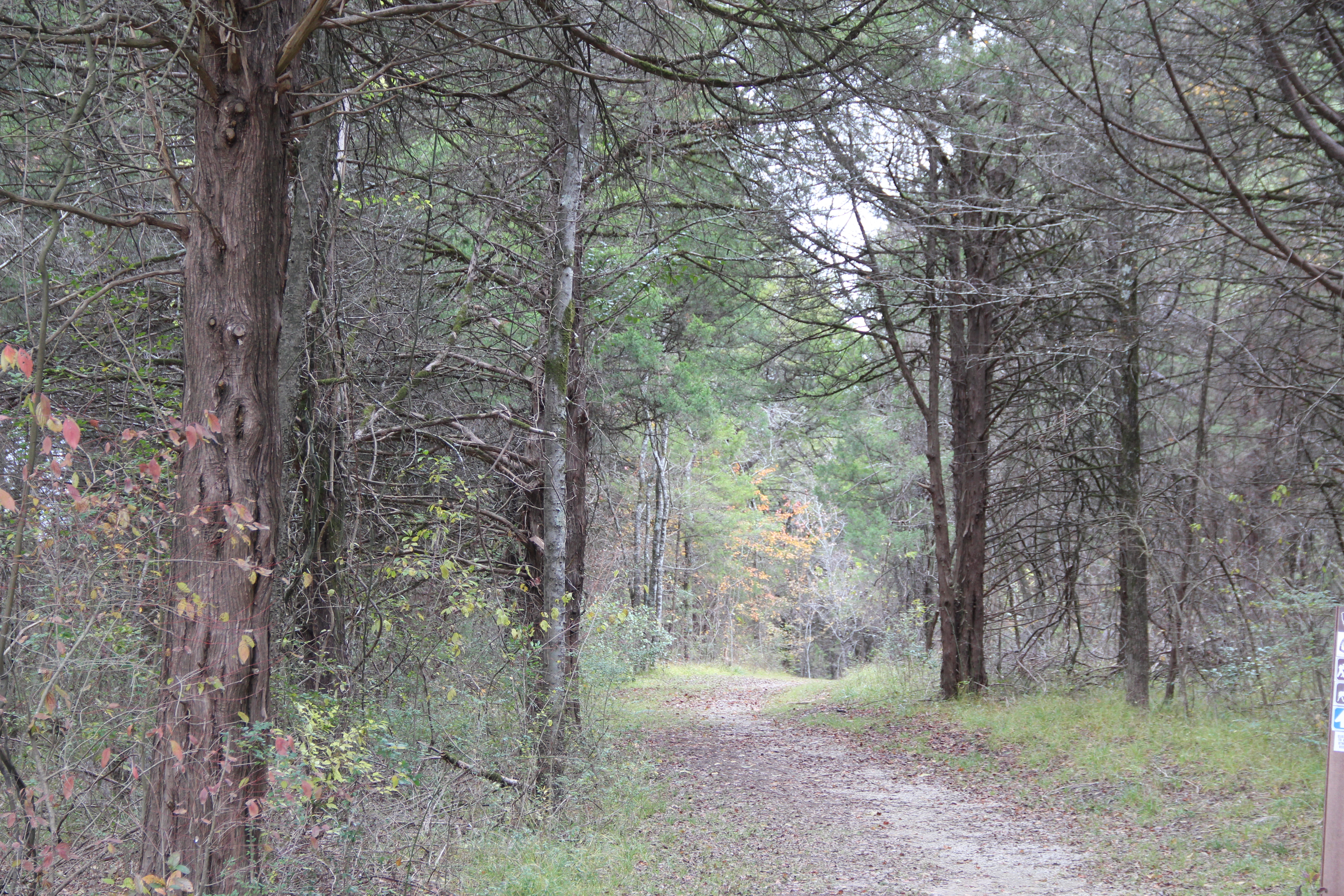
Blackland Prairie section Northern Terminus Trailhead, Milepost 266This trailhead is located just across the Parkway from the Natchez Trace Parkway Visitor Center. Hikers can travel six miles along the outskirts of Tupelo (12 miles roundtrip). You can make the walk as long or as short as you would like on this out and back trail. This section of Scenic Trail is open to hikers only and requires walking on the Parkway for road and creek crossings. 
Burns Branch, Milepost 425.4This is a trailhead for the Highland Rim Section of the Natchez Trace National Scenic Trail. This trailhead has parking for vehicles but not trailer parking and is not a staging area for horses. The site offers a hitching post and a picnic table to take a break if you would like. 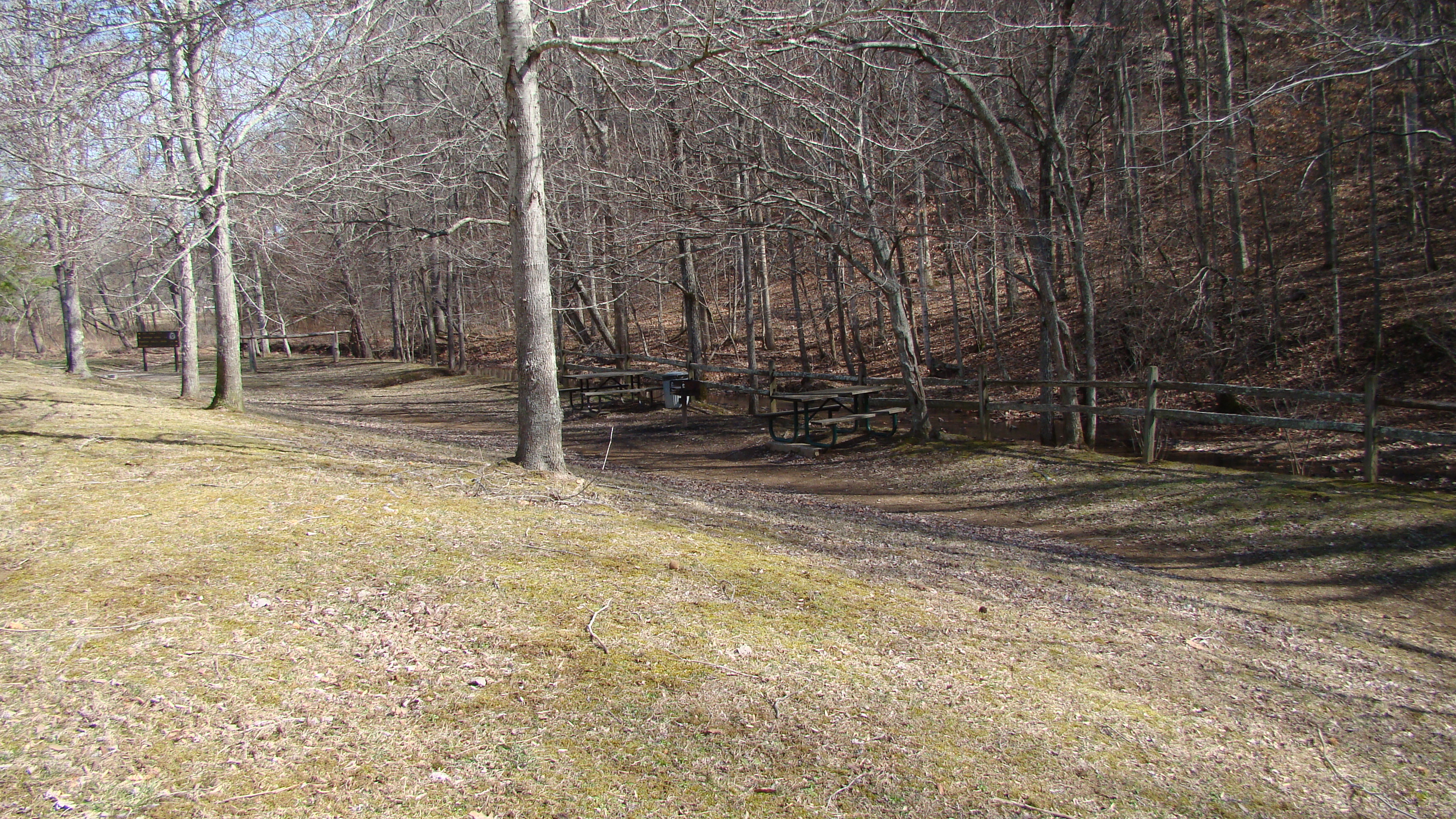
Chickasaw Village Site, Milepost 261.8The Chickasaw Village Site is nearly 90 acres of Blackland Prairie and forest in the heart of Tupelo, MS. The size and shape of the Chickasaw summer and winter homes are preserved. The Natchez Trace National Scenic Trail goes through the village site. An interpretive shelter offers information about the Chickasaw people. 
Cypress Swamp, Milepost 122Many years ago, the Pearl River flowed here. The river changed course. A shallow area was created by the deposition of sediments as the river retreated. During periodic low water, seedlings of water-tolerant cypress and tupelo trees gained a foothold. The trees you see today are a result. This is also a trailhead for the Yockanookany Section of the Natchez Trace National Scenic Trail. 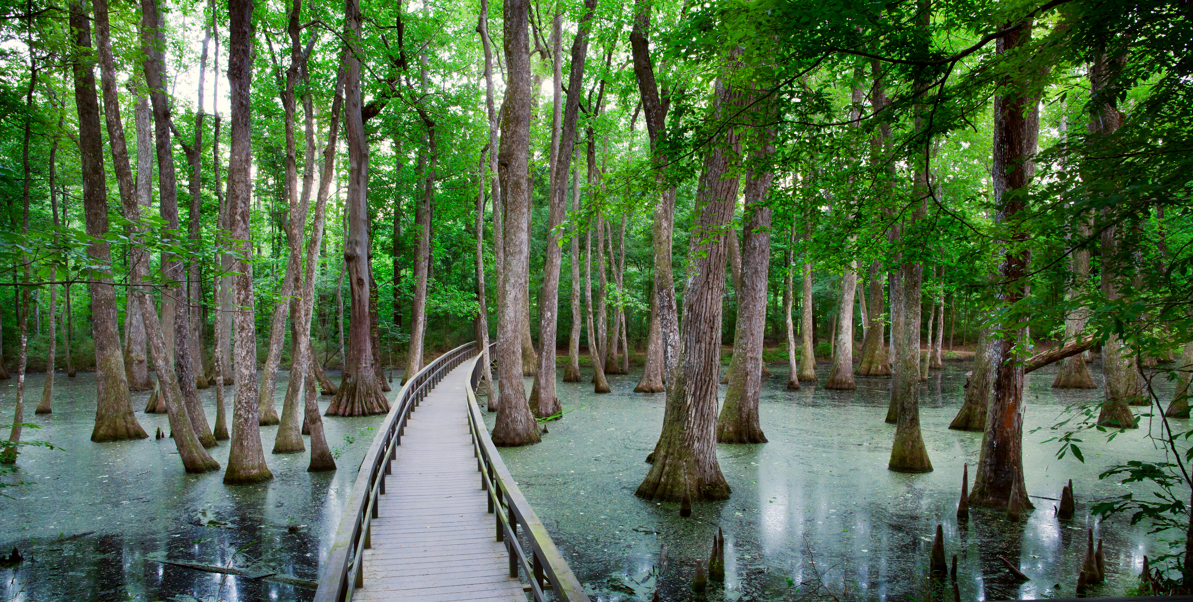
Fly Trailhead On The Highland Rim Section, Milepost 416The Fly Trailhead on Highway 7 provides a small parking area for one or two horse trailers. If space is available, this will be a great starting point for just a few people. If there are numerous people riding together, the Highway 50 trailhead may be a better option. There is no water available at this trailhead. One hitching post is available here. 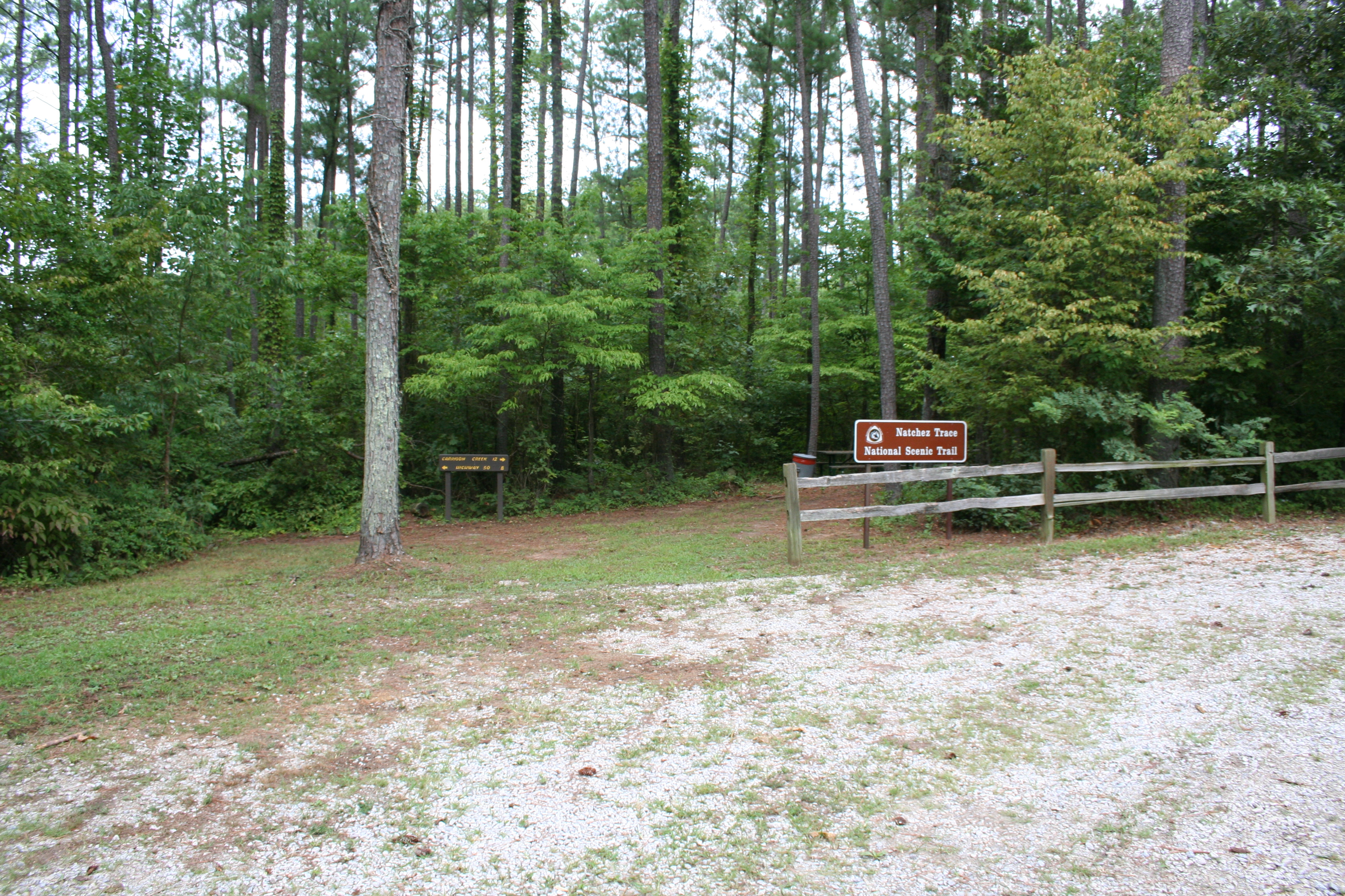
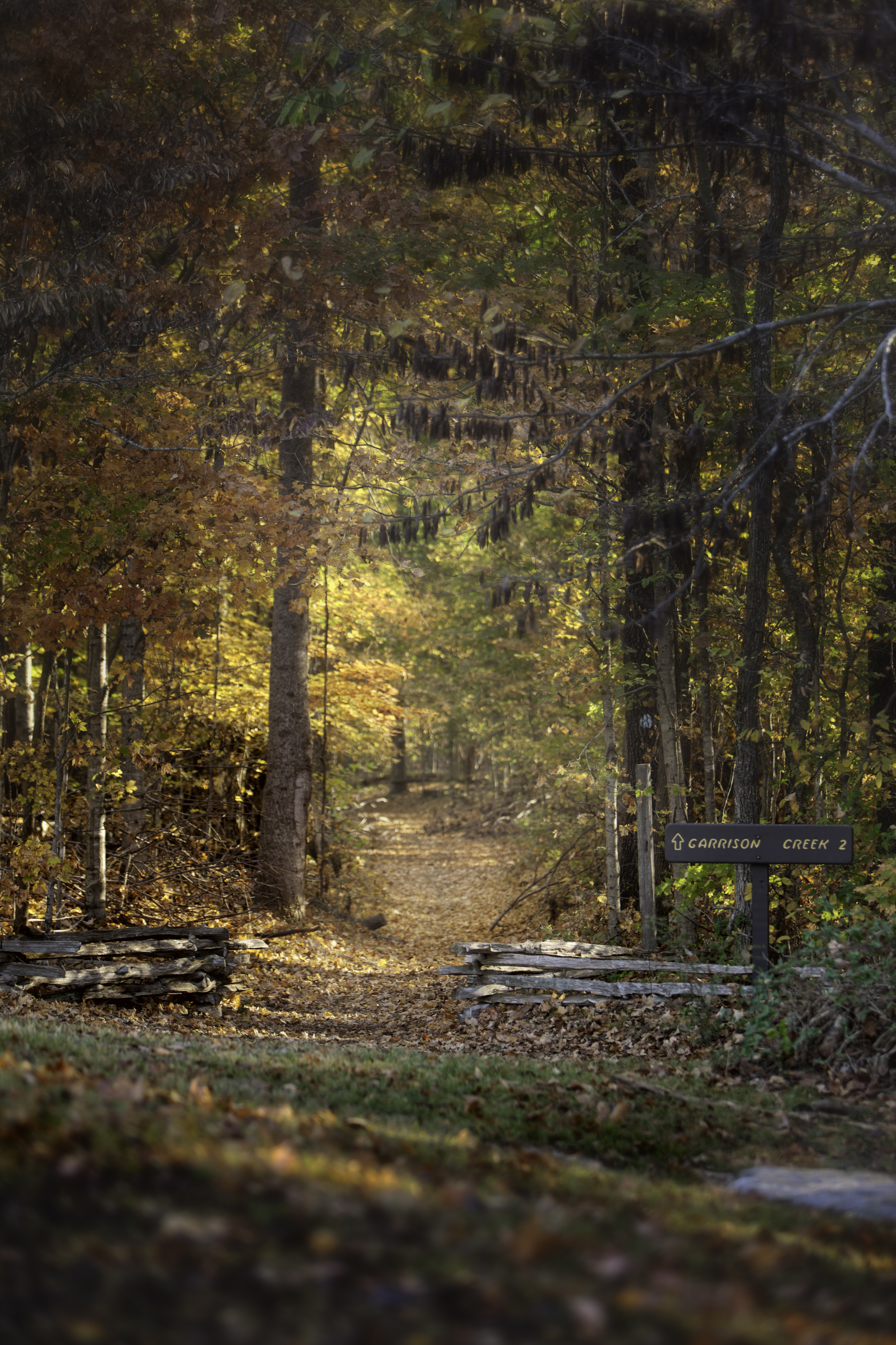
Garrison Creek and Highland Rim Section Northern Terminus, Milepost 427.6Named for a nearby 1801-02 U.S. Army post, Garrison Creek is a trailhead for horseback riders and hikers on the Highland Rim Trail of the Natchez Trace National Scenic Trail. Plenty of horse trailer parking is available. This part of the Natchez Trace National Scenic Trail is 20 miles in length. From the Garrison Creek trailhead you can hike or ride your horse south to Tennessee Highway 50, milepost 408, near the Gordon House. 
Highland Rim Section Southern Terminus Trailhead, Milepost 408This trailhead is a great place for hikers and horseback riders alike to start their journey on the Highland Rim Section of the Natchez Trace National Scenic Trail. There is ample parking for horse trailers, two hitching posts, and water available for horses. Visitors will need to get drinking water at the Gordon House, milepost 407.7. 
Highway 43 Trailhead, Milepost 114.9This is a the only staging area for horses on this section of the Natchez Trace National Scenic Trail. There is ample room for parking trailers, and water is available for horses to drink at this trailhead. Riders can travel north 16 miles to the northern terminus at Yockanookany, or south seven miles to the southern terminus at the West Florida Boundary. 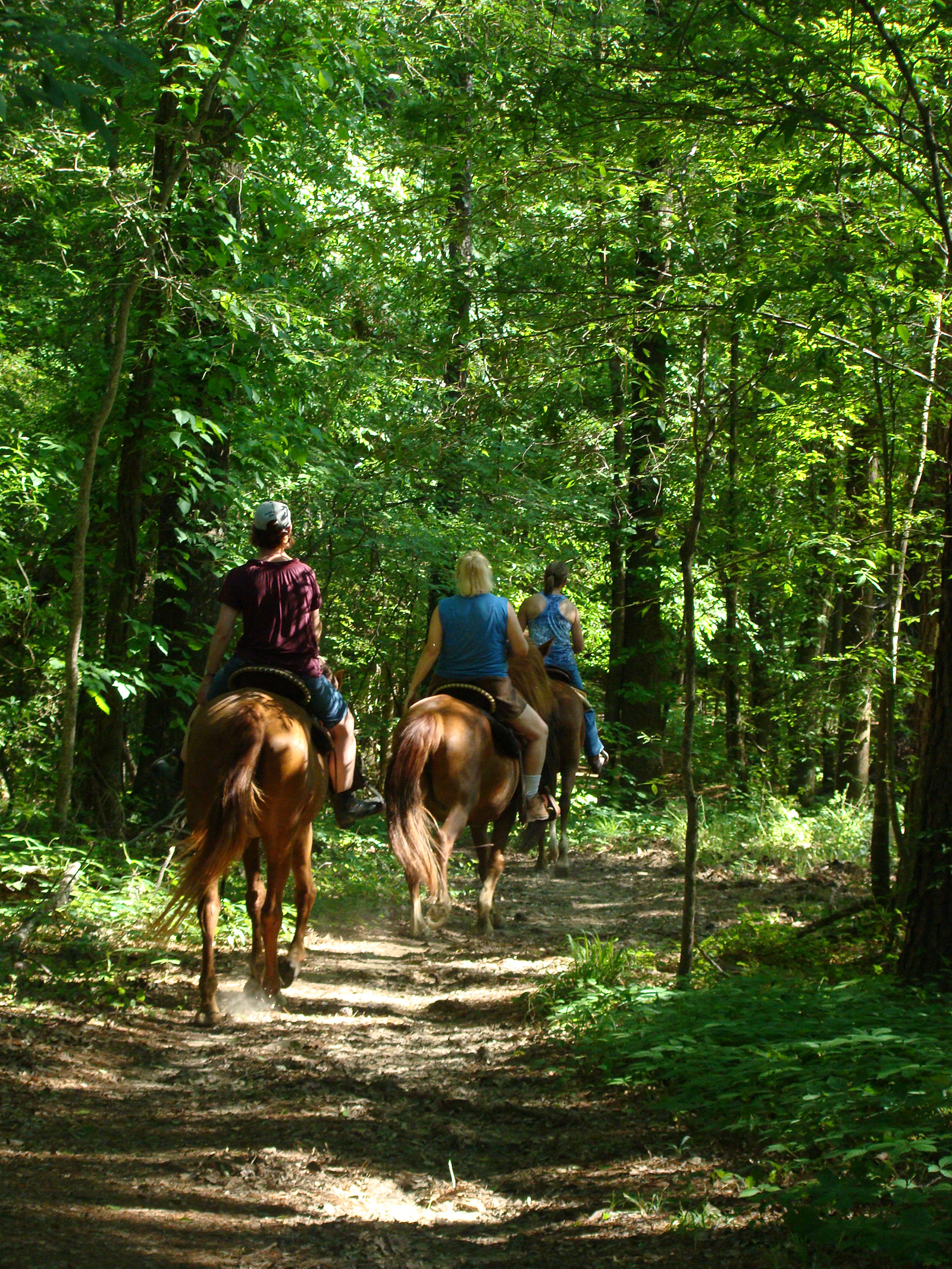
Old Town Overlook, Milepost 263.9A short distance from I-22, Old Town Overlook embraces history, nature, recreation, and agriculture. 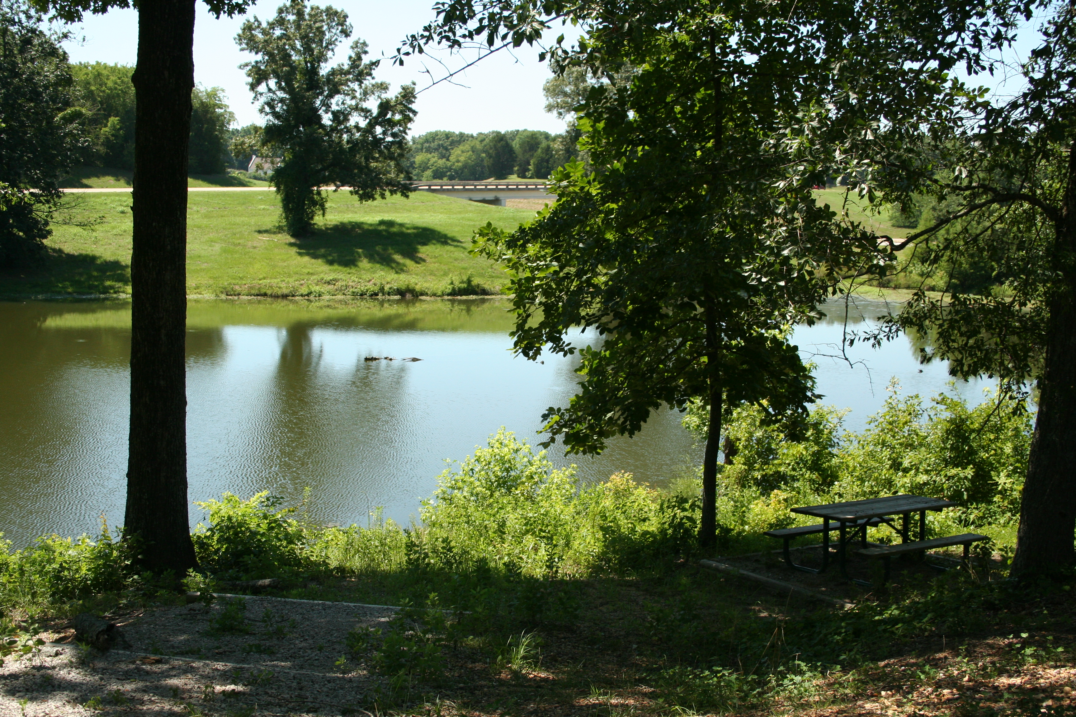
Owens Creek and Rocky Springs Section Southern Terminus, Milepost 52.4The sounds of a busy woodland stream and the quiet murmur of a lazy waterfall have long been stilled here. Only after heavy rainfall does water fill the stream. Over the years the water table has dropped several feet, and the spring which feeds Owens Creek has all but disappeared. Little remains of a scene once familiar to early residents of the Rocky Springs community. This is the southern terminus of the Rocky Springs Section of Natchez Trace National Scenic Trail. 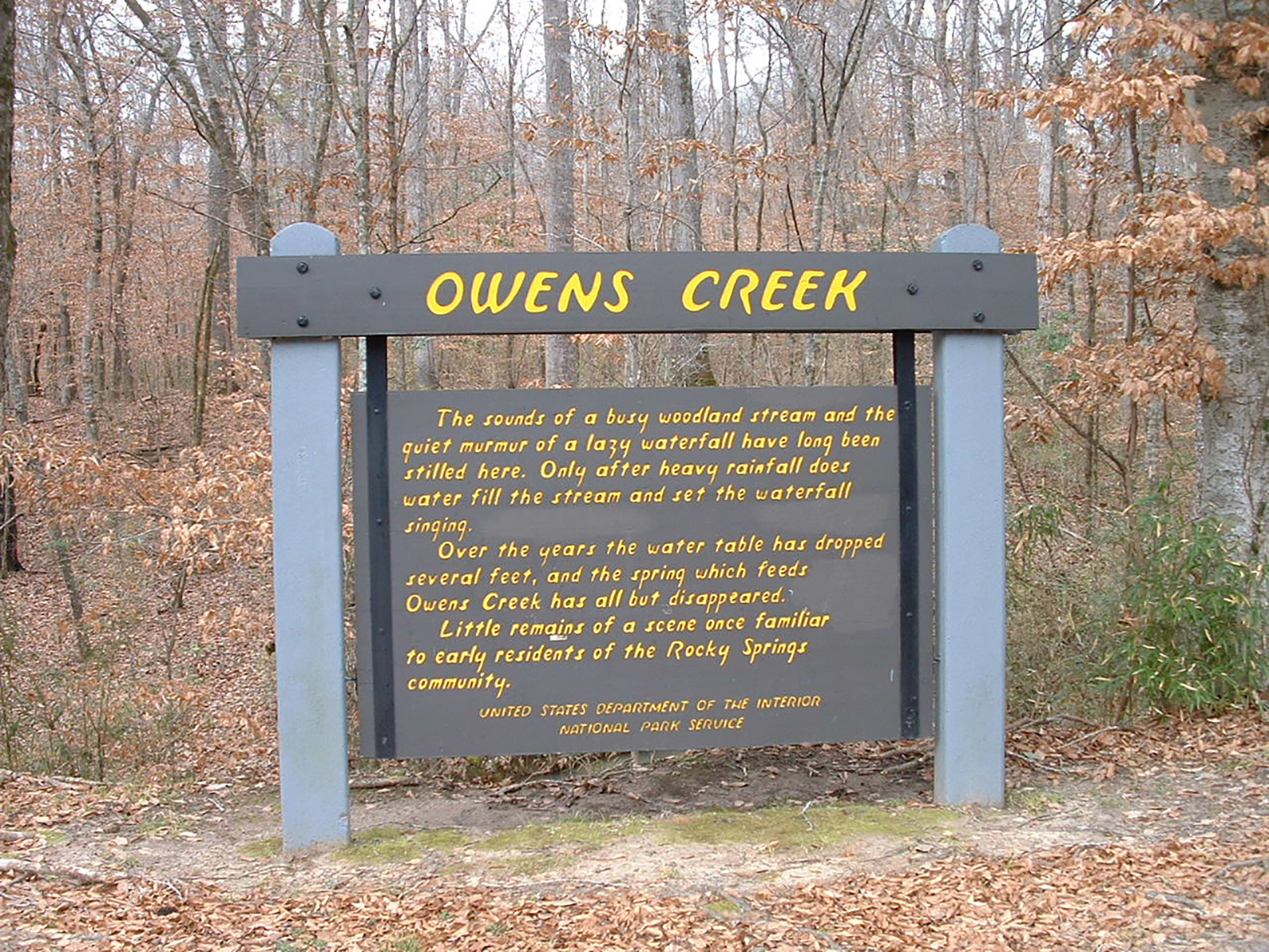
Potkopinu Section Northern Terminus, Milepost 20This trailhead is the larger of the two for Potkopinu Section of the Natchez Trace National Scenic Trail. Vehicles may be parked parallel to the road. If you have an oversized vehicle this is the only place to park to access this trail. To reach this trailhead exit the Parkway at Milepost 20. Turn left (east) on Road #553 known as River Road. Turn right onto a dirt road and travel a short distance and parking is on the right. 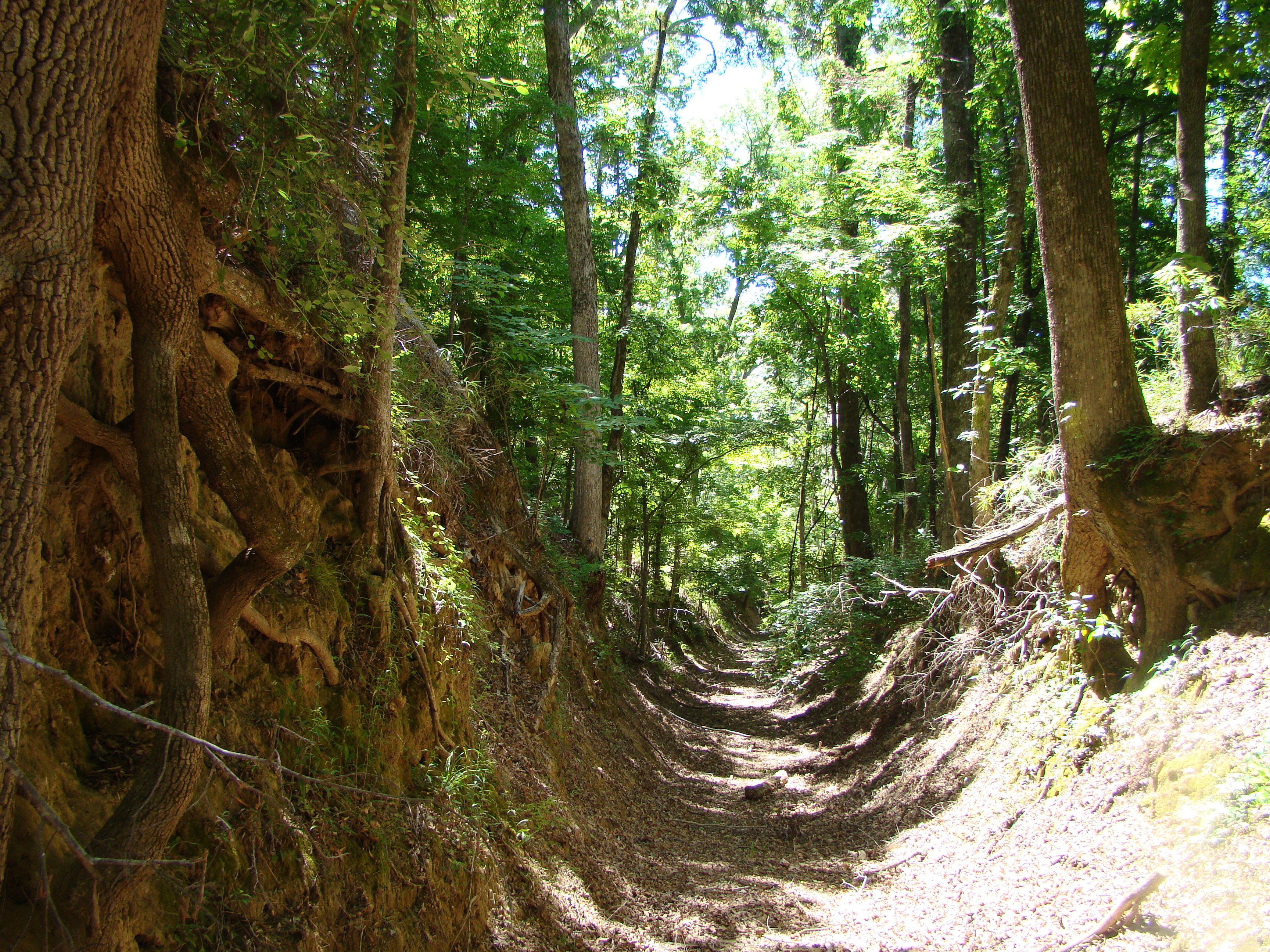
Potkopinu Section Southern Terminus, Milepost 17This trailhead has room for a few cars. There is no overflow parking at this location. This locations is not recommended for oversized or recreational vehicles. Follow the signs on the Parkway to reach this trailhead. You will travel on dirt roads to reach the trailhead. The land surrounding the trail is private property. Please stay on the trail at all times. 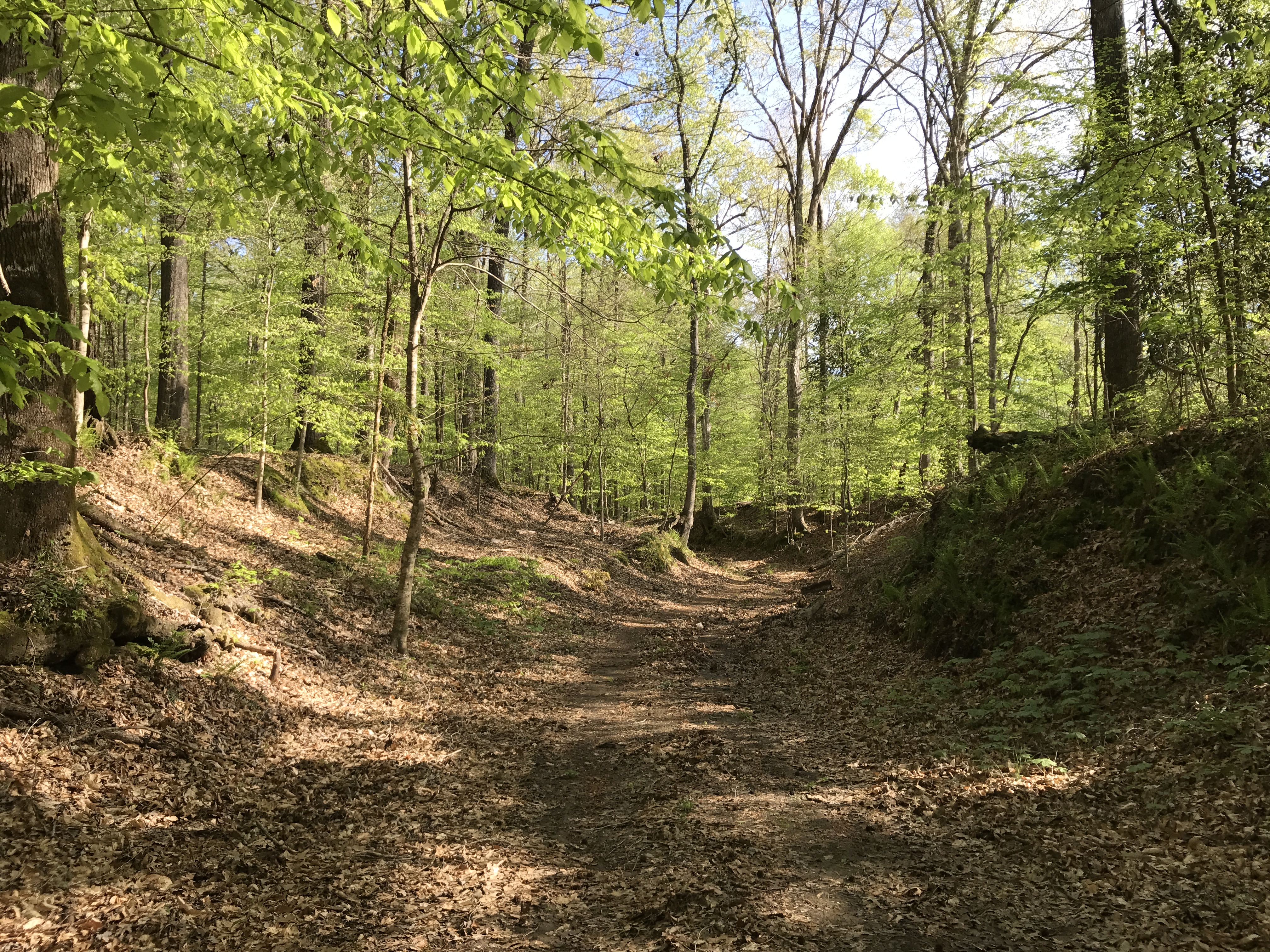
Rocky Springs Picnic Area And Trailhead, Milepost 54.8This area had picnic tables and restrooms nearby. This trailhead for the Rocky Springs Section of the Natchez Trace National Scenic Trail is accessible to hikers only. Hikers can take the trail from the picnic area, and continue north eight miles to the northern terminus or continue south two and one half miles to the southern terminus at Owens Creek. The southern portion of trail takes you over rocky outcroppings and on steep ridges. This trailhead has the most amenities. 
Rocky Springs Section Northern Terminus, Milepost 59This trailhead is an excellent staging area for horseback riders on the Rocky Springs Section of the Natchez Trace National Scenic Trail. There is ample parking for trailers. This is the only area for horses to stage on this section of trail. There is no water available at this location. Horseback riders will be riding on the road shoulder for part of this trail. 
Rocky Springs Town Site, Milepost 54.8Called "the Rocky Spring" by early travelers, the town later became Rocky Springs, a rural community covering about 25 square miles. Settlement of the area began in the late 1790's and continued until about 1860, reaching a peak of approximately 2600 people. 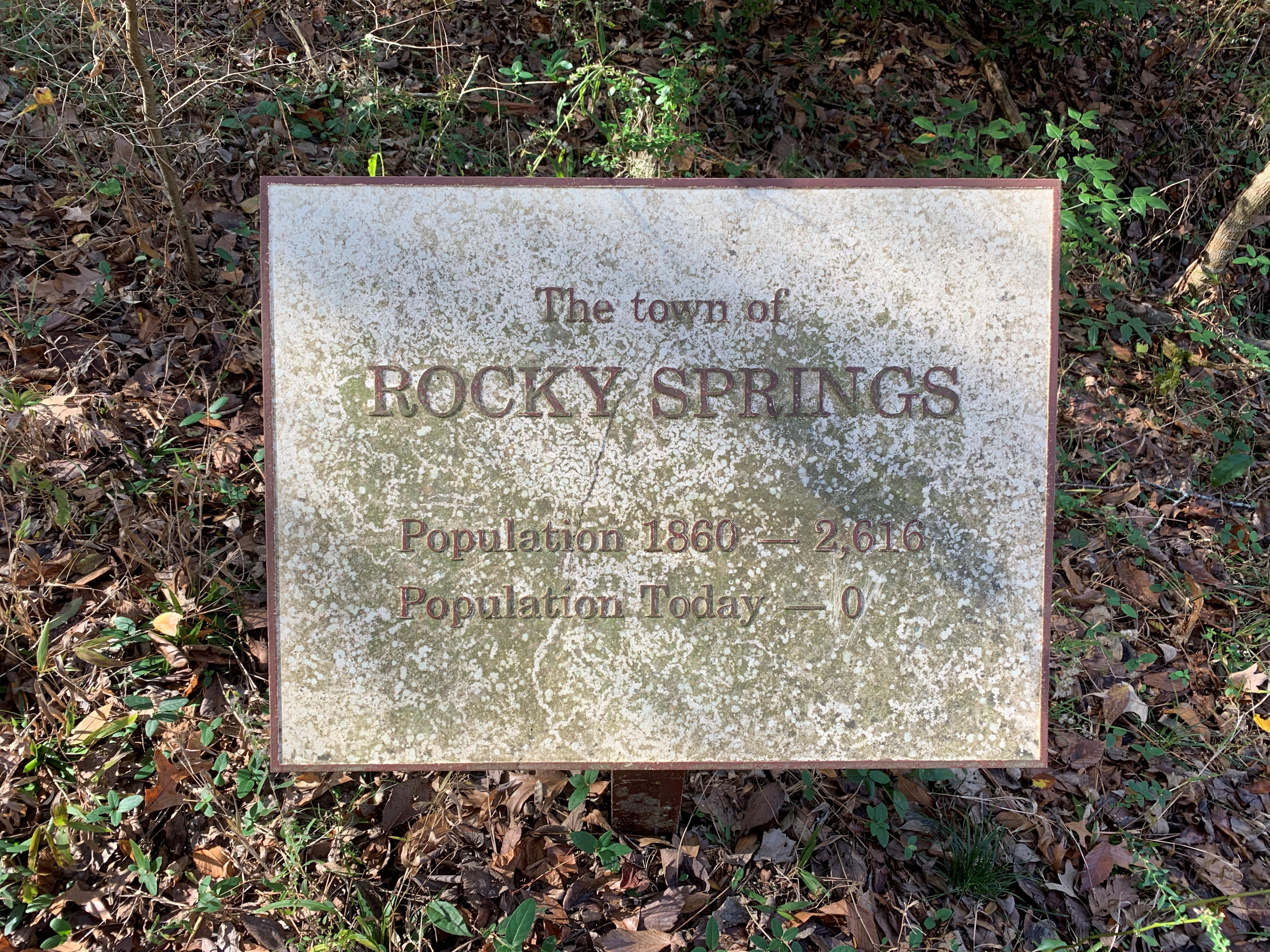
Tennessee Valley Divide, Milepost 423.9The high ground at this site are part of a long ridge that divides central Tennessee. Streams south of the divide flow to the Duck and Tennessee Rivers, while streams to the north empty in the Cumberland River. This is also a trailhead for the Highland Rim Section of the Natchez Trace National Scenic Trail. 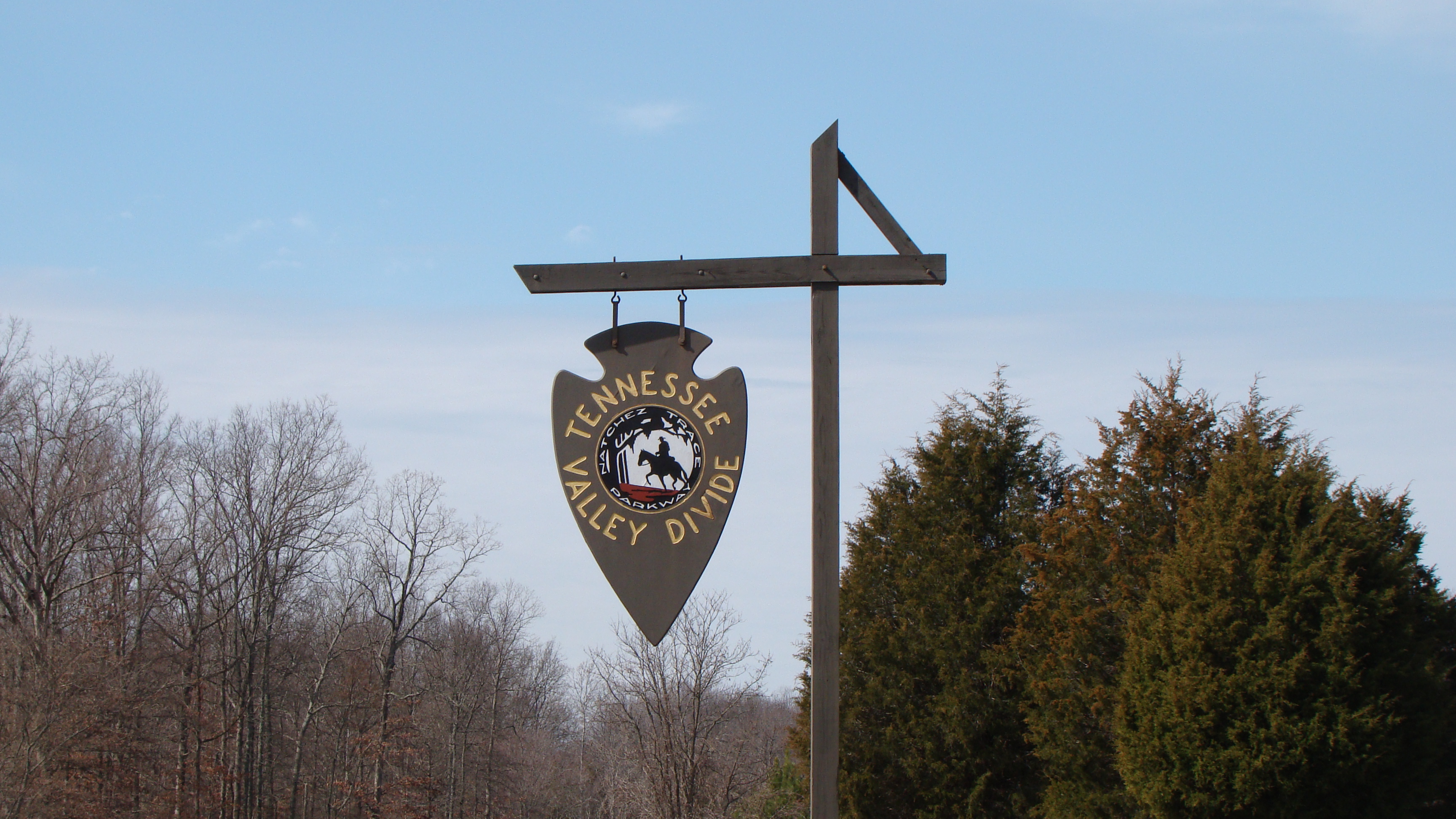
Upper Choctaw Boundary, Milepost 128.4After 1800, treaties between the Choctaw and the US government whittled away tribal rights and lands. Finally, in 1830, the Treaty of Dancing Rabbit Creek was negotiated at a council house near this spot. All the remaining Choctaw homeland--nearly 10.5 million acres--was taken. 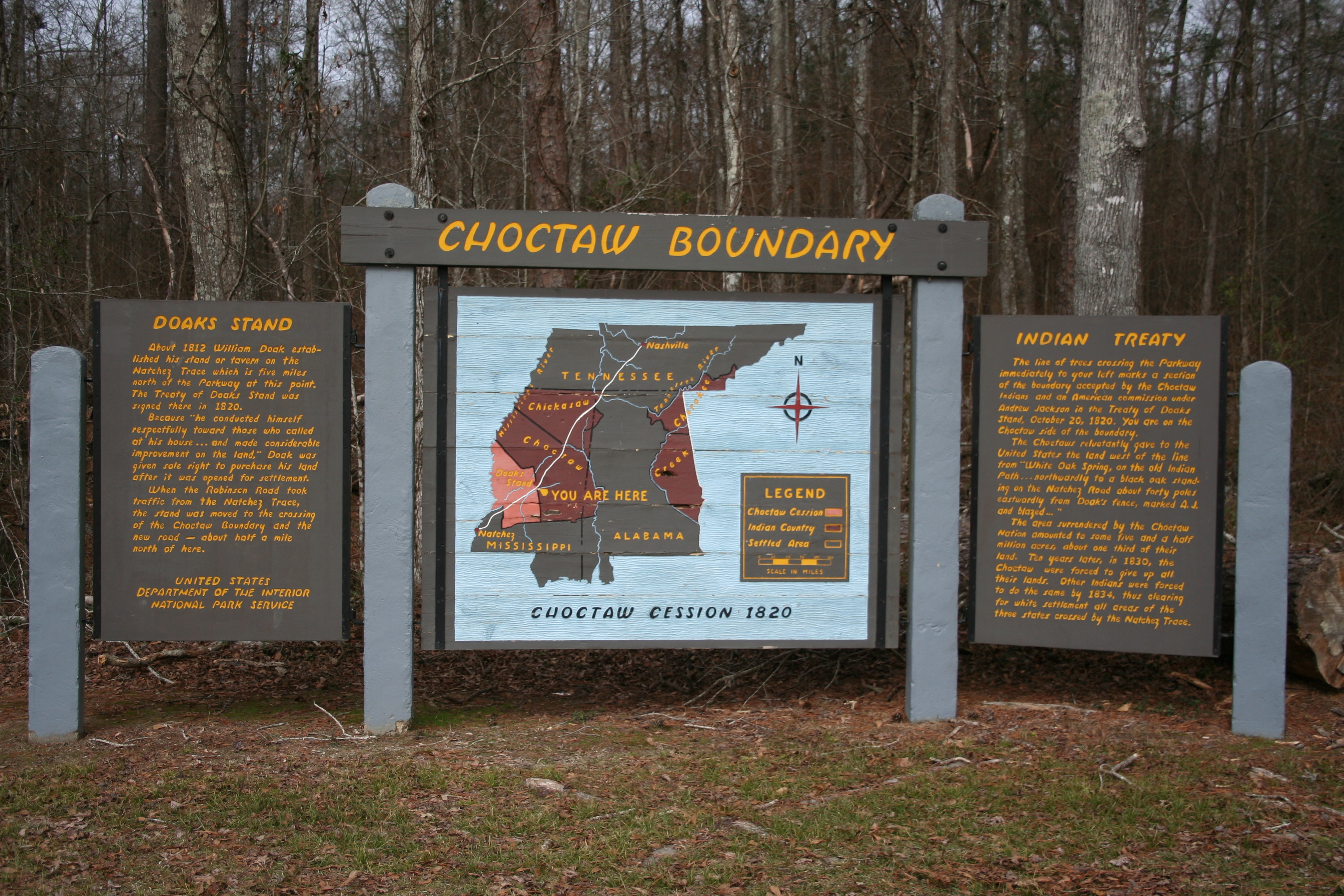
War of 1812 Memorial on the Natchez Trace, Milepost 426.3The War of 1812 Memorial, milepost 426.3, honors the service and sacrifice of all brave volunteers who marched on the Natchez Trace during the War of 1812 especially those that are buried in unmarked graves up and down the Old Natchez Trace. 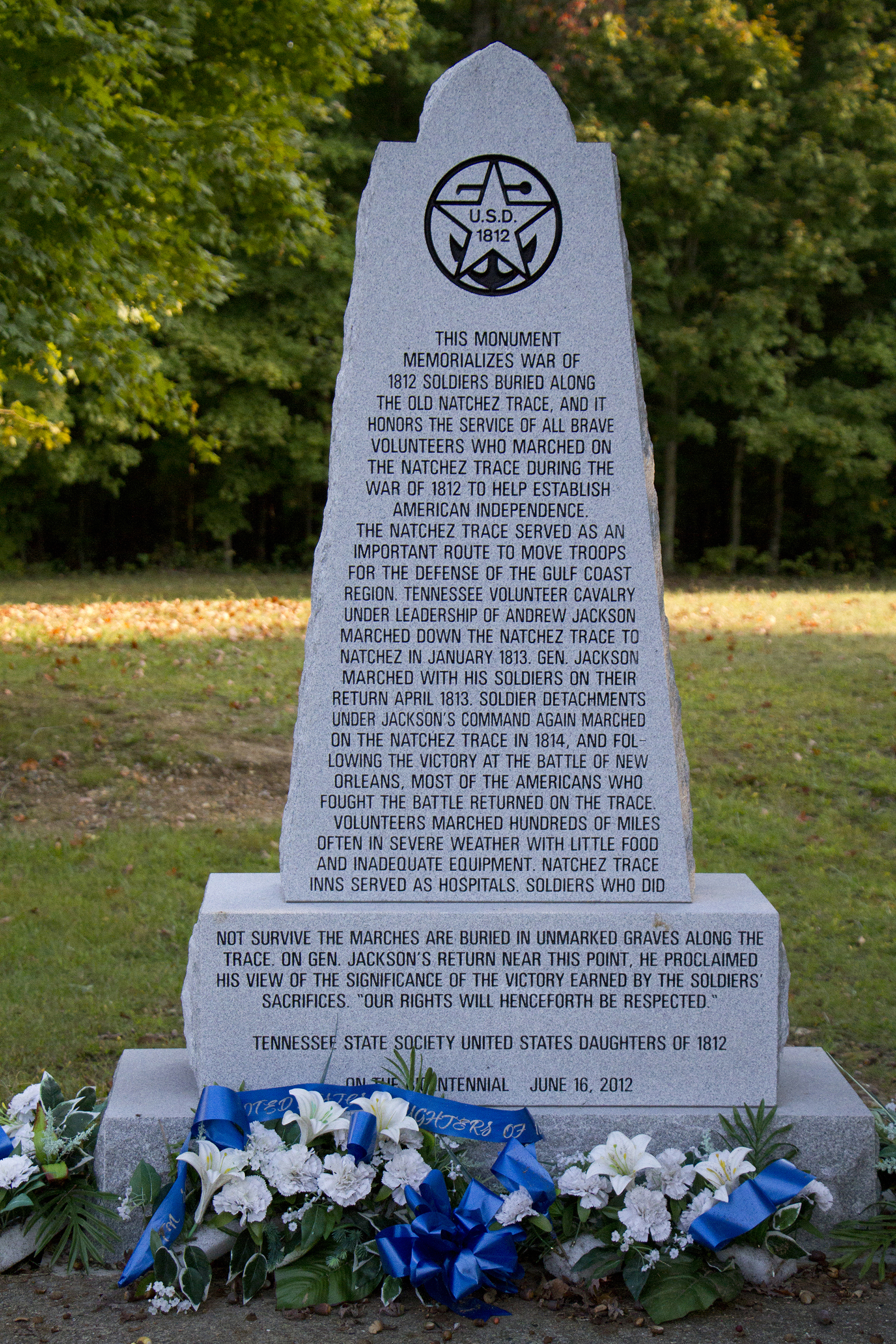
West Florida Boundary and Yockanookany Section Southern Terminus, Milepost 107.9The Treaty of Paris ended the French and Indian War. In the treaty, Great Britain received French territory between the Appalachian Mountains and the Mississippi River. France also ceded West Louisiana to Spain for western Florida, which Spain yielded to Great Britain. Britain, in turn, created West Florida. In 1764, this spot was the northern boundary of West Florida, marked by a line from the Yazoo and Mississippi Rivers’ confluence east to the Chattahoochee River. 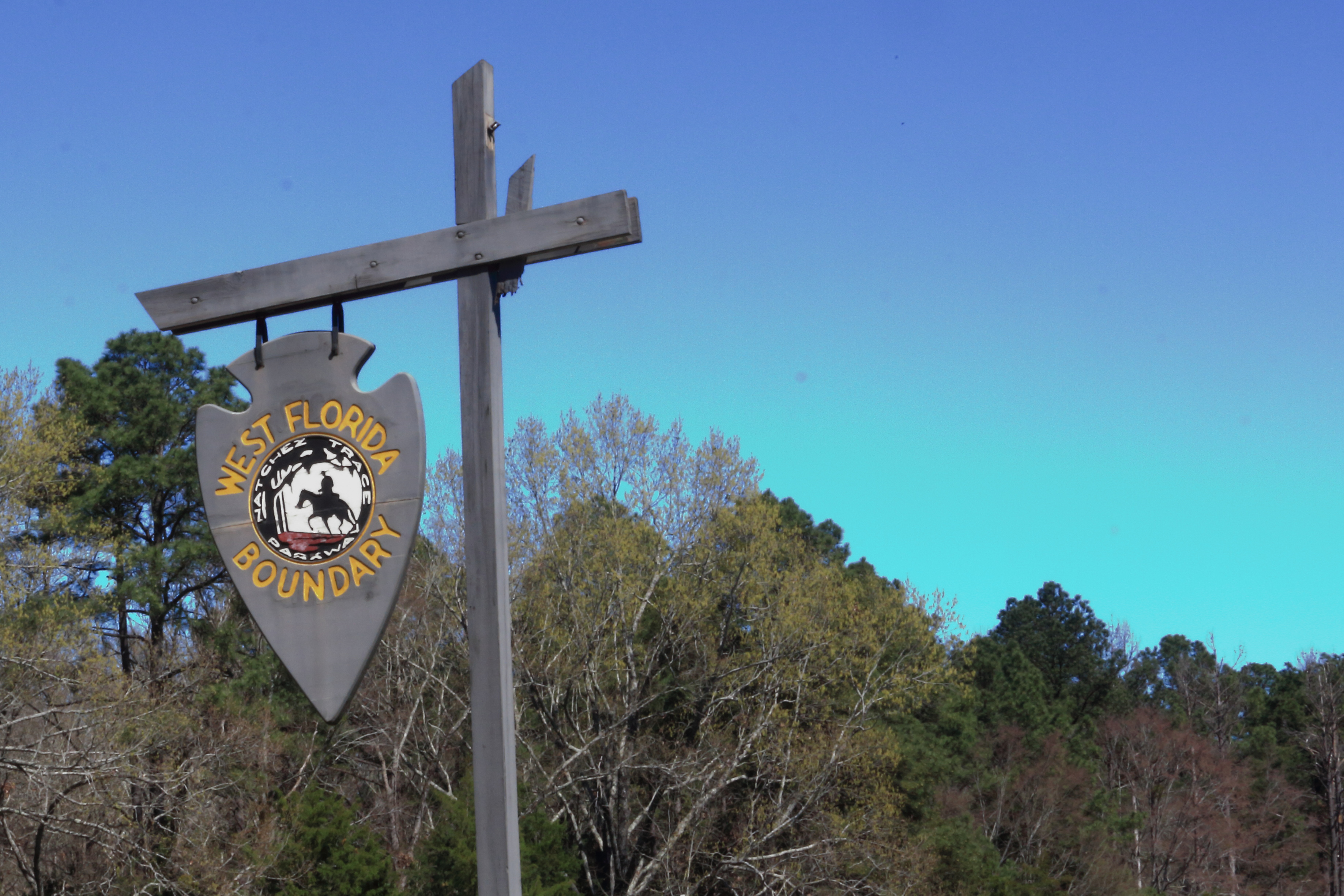
Yockanookany Section Northern Terminus, Milepost 130.9This trailhead is the northern terminus of the Yockanookany Section of the Natchez Trace National Scenic Trail. This trailhead is open to hikers only. From this trailhead, the southern terminus at West Florida Boundary is about 26 miles away. To access the trailhead from the parking area walk south from the parking area several hundred feet until you see the Natchez Trace National Scenic Trail sign on your right. 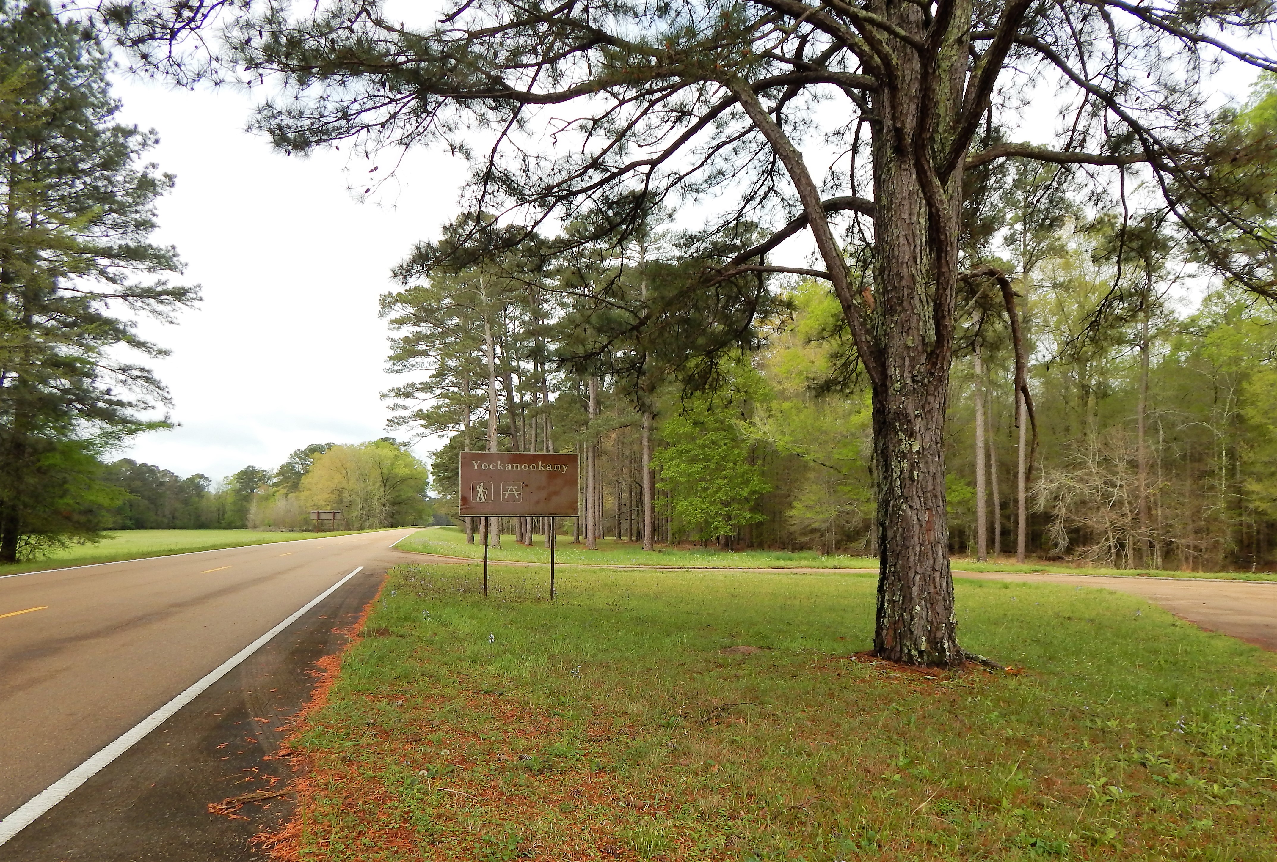
|
| Visitor Centers | Count: 1
Natchez Trace Parkway Visitor Center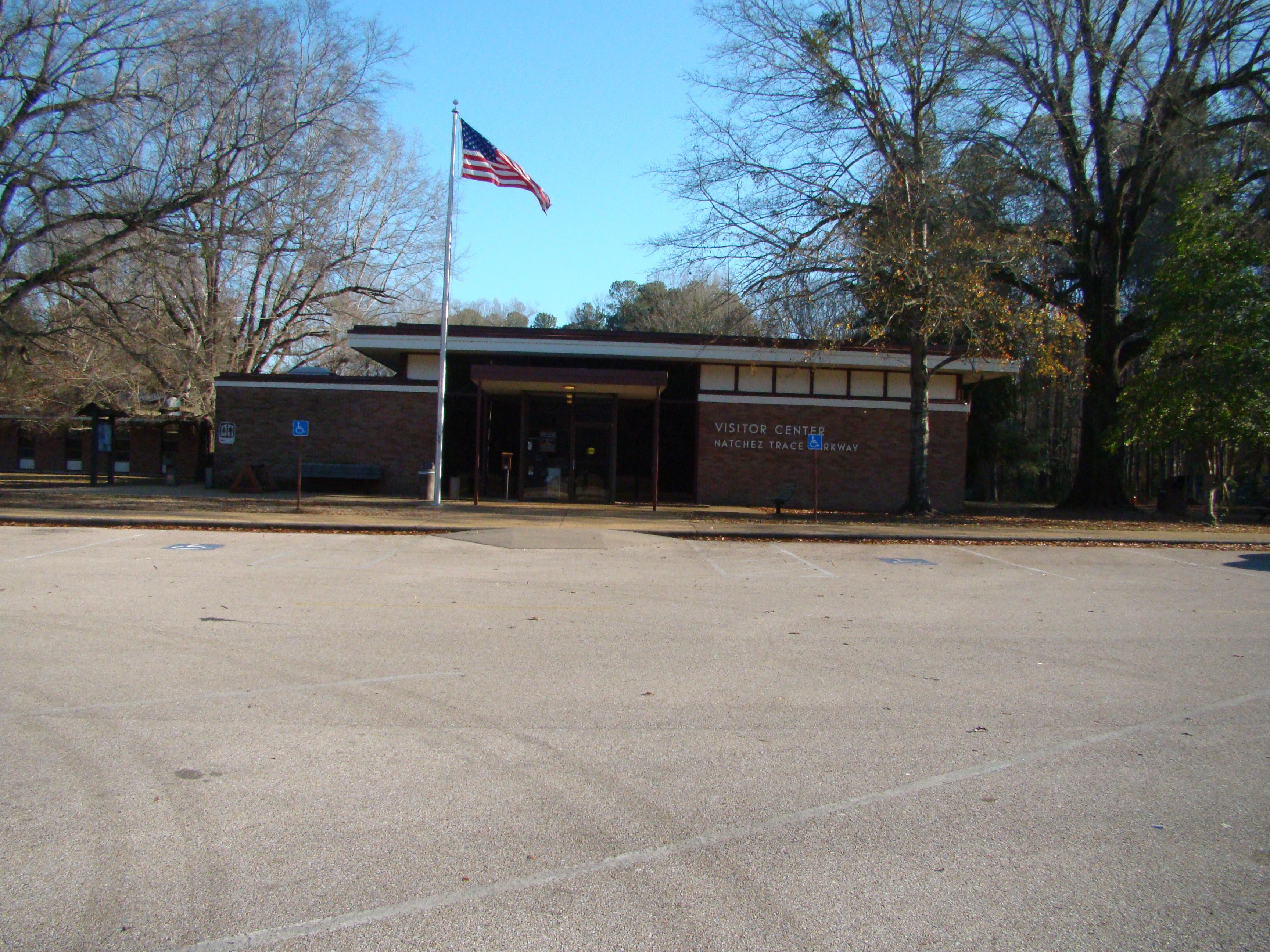
|
| Things to do | Count: 8

|
| Tours |
Count: 0
|
| Articles |