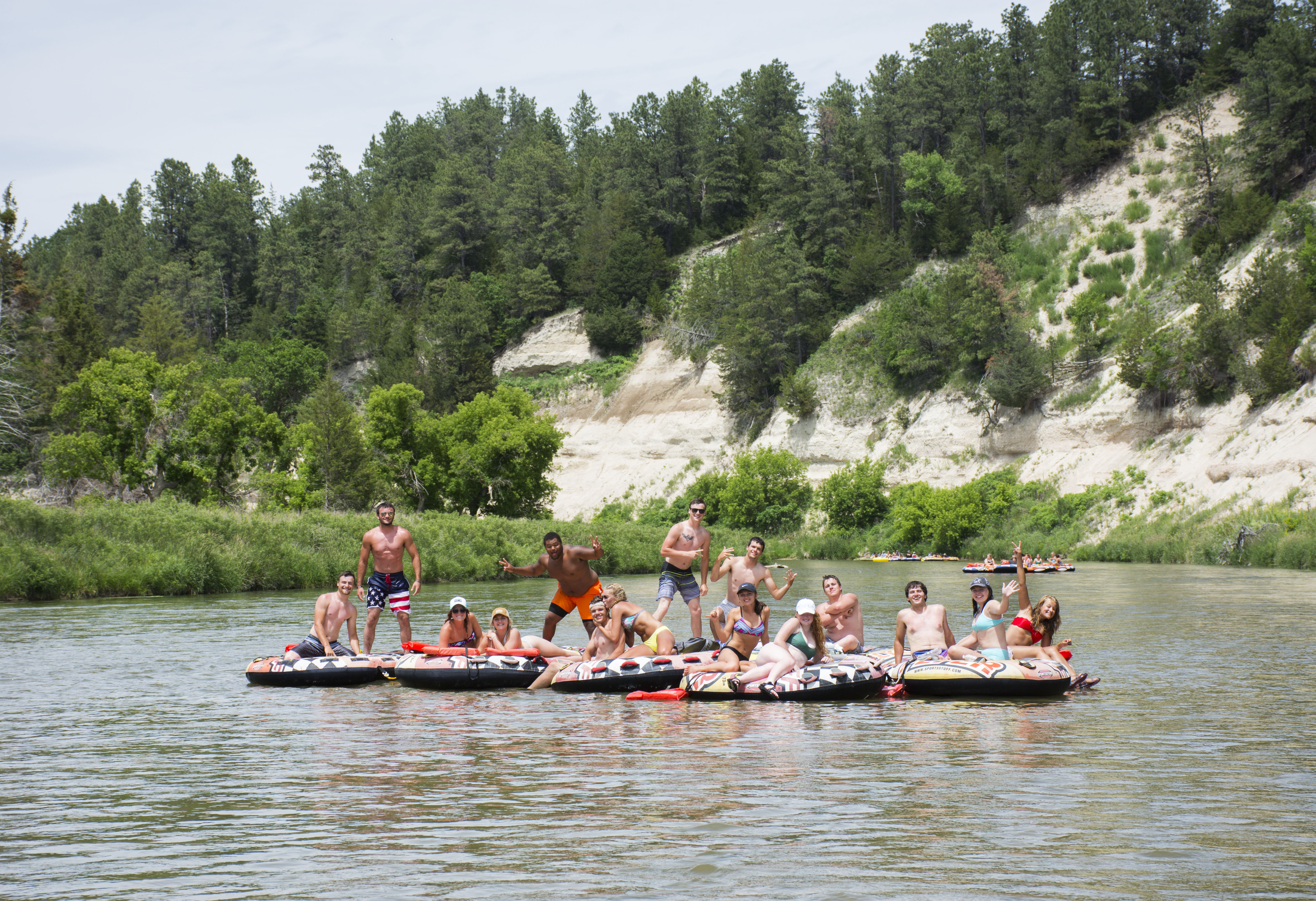
Life Jackets Required!
By Nebraska State law, all children 12 years old and younger must WEAR a USCG approved life jacket to float the Niobrara NSR. Anyone over 12 years old must HAVE a life jacket. If you are renting equipment, your outfitter will provide them.
| Title | Niobrara |
| Park Code | niob |
| Description | With a little something for everyone, the Niobrara National Scenic River is a destination for crossing adventures off your bucket list. Most popular for river recreation, you can float the Niobrara River on a canoe, tube, or kayak as a beginner a... |
| Location | |
| Contact | |
| Activities |
|
| Entrance fees |
|
| Campgrounds | Count: 0
|
| Places | Count: 21
Berry FallsBerry Falls is one great benchmark for floaters on the river. It is one of hundreds of waterfalls on the Niobrara River that is easy to find and can be seen both from car and by boat. 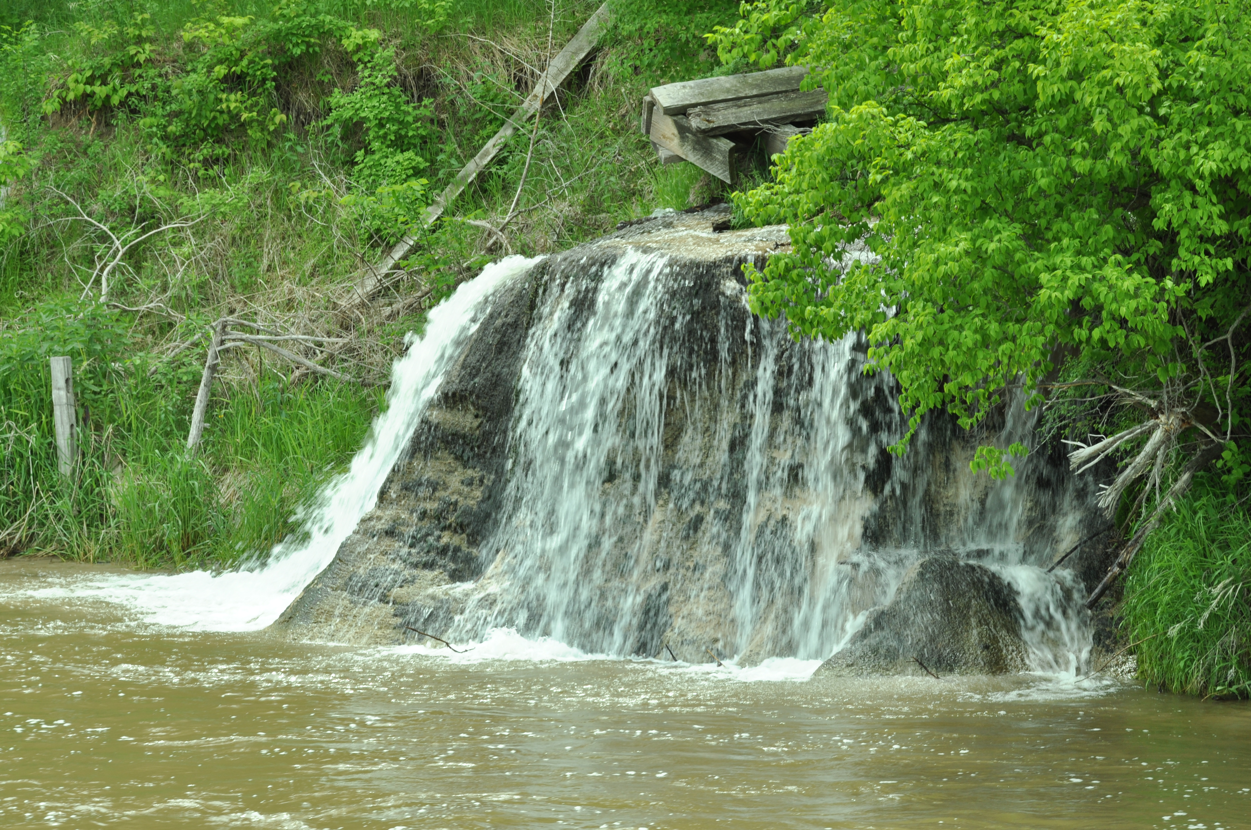
Brewer Bridge LandingBrewer Bridge Landing is a public access landing and launch site at mile 16.2 of the Niobrara National Scenic River. Canoes, tubes, and kayaks can be launched or land here. There is public parking, bathrooms, picnic tables, drinking water, and trash cans along with space to stage equipment. 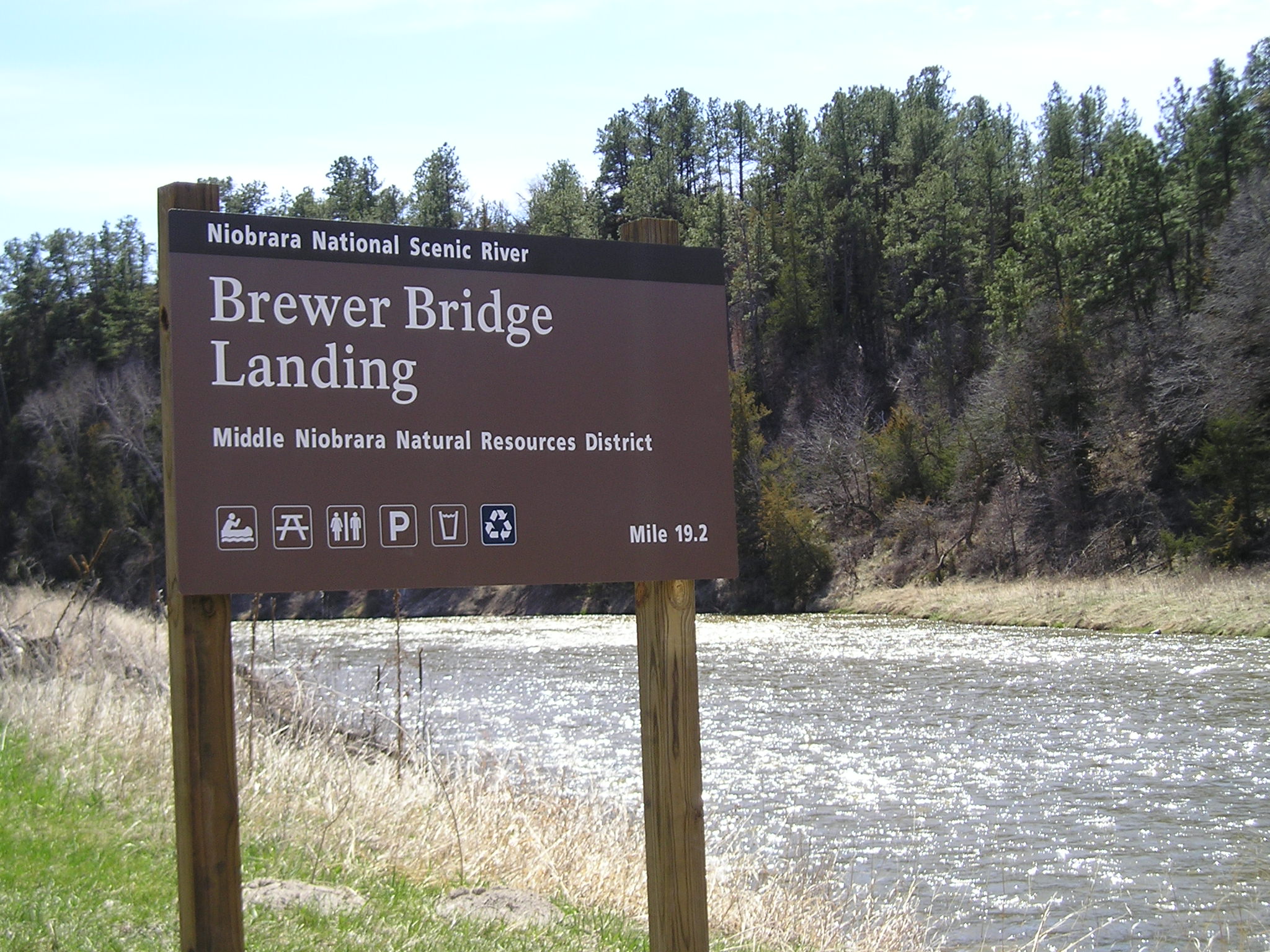
Conner RapidsConnor Rapids are located just after Penbrook Campground and Landing on the Niobrara National Scenic River. They are a Class I rapid and should pose no challenge for most beginner floaters. 
Eagle RapidsEagle Rapids are a class II+ river rapid on the Niobrara National Scenic River after the Norden Bridge and Chute. Beginners should portage this rapid, though it could be navigated in years when the river is low. 
Egelhoff's NarrowsEgelhoff's Rapids, a.k.a. Egelhoff's Chute or Narrows, is a class I river rapid on the Niobrara National Scenic River. Most floaters have fun navigating this feature because of its unique canyon walls. 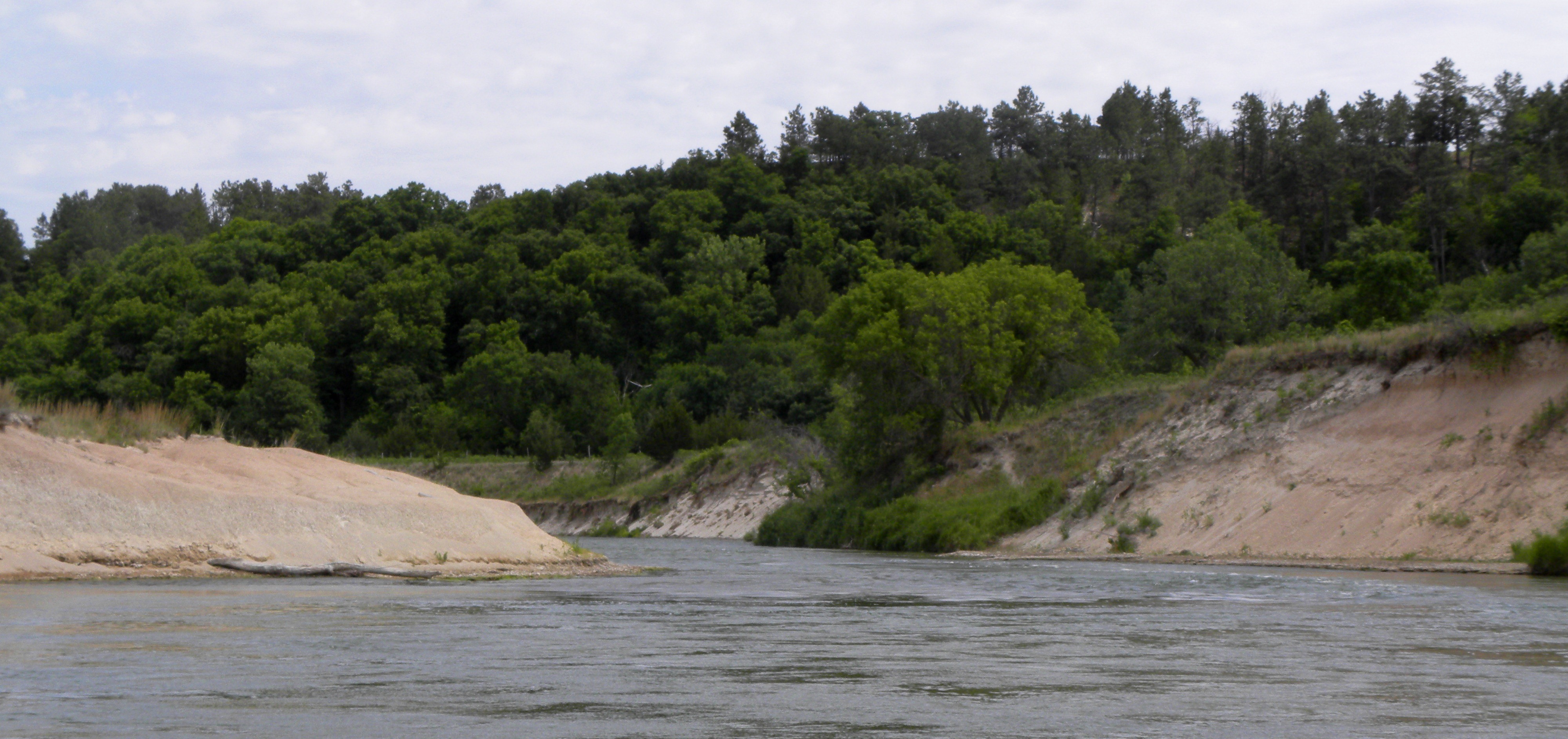
Egelhoff's RapidEgelhoff's Rapids are a class II+ river rapid past Rocky Ford and the County Line Bridge. Floaters should portage left around these, especially beginners. 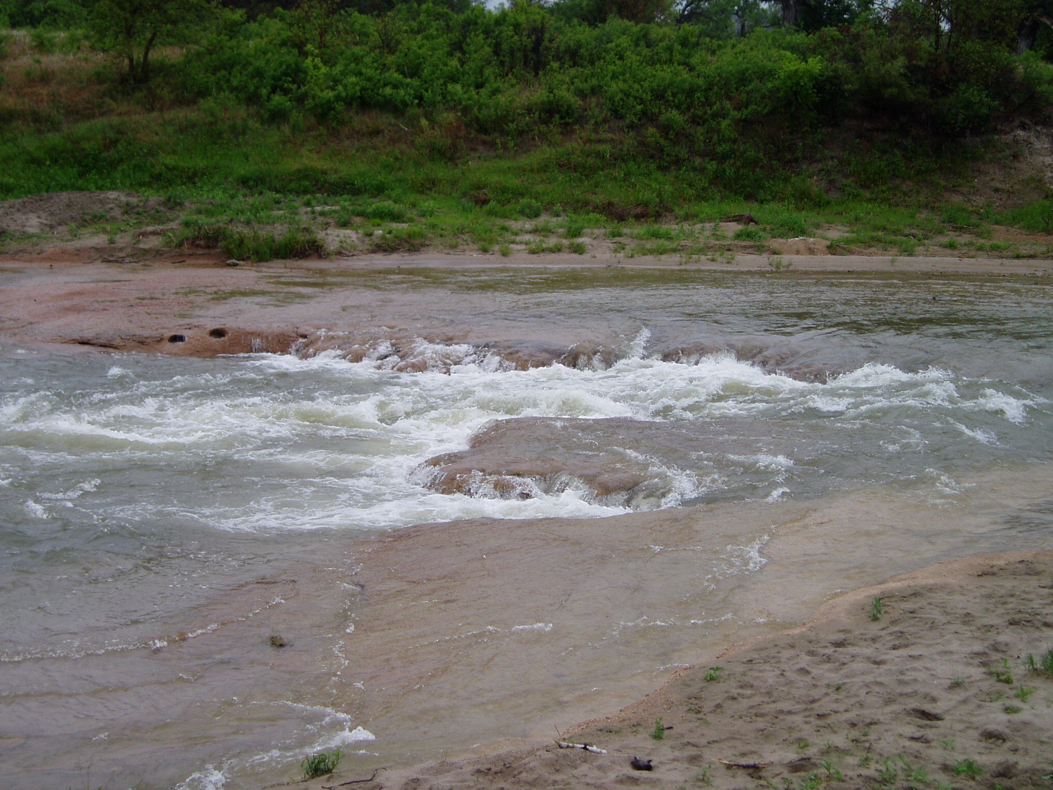
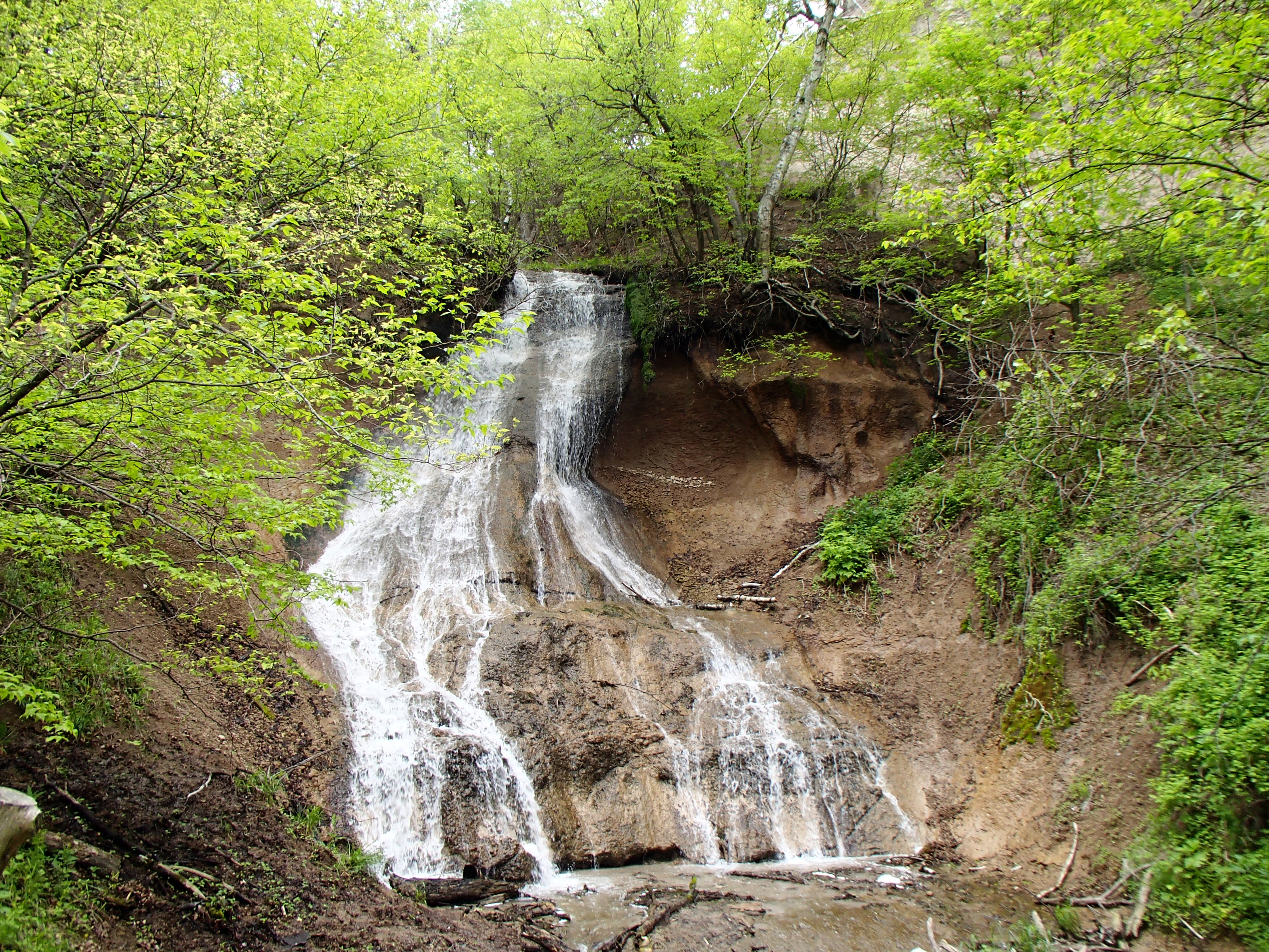
Fort FallsFlowing down over 30 feet of exposed canyon wall, Fort Falls are some of the most easily accessed waterfalls on the Niobrara River. Just a short hike, you can journey down through the tree canopy to the canyon floor to view these falls in all four seasons and follow their flow directly into the Niobrara River, or stop off on your way by while you float in a canoe, tube or kayak! 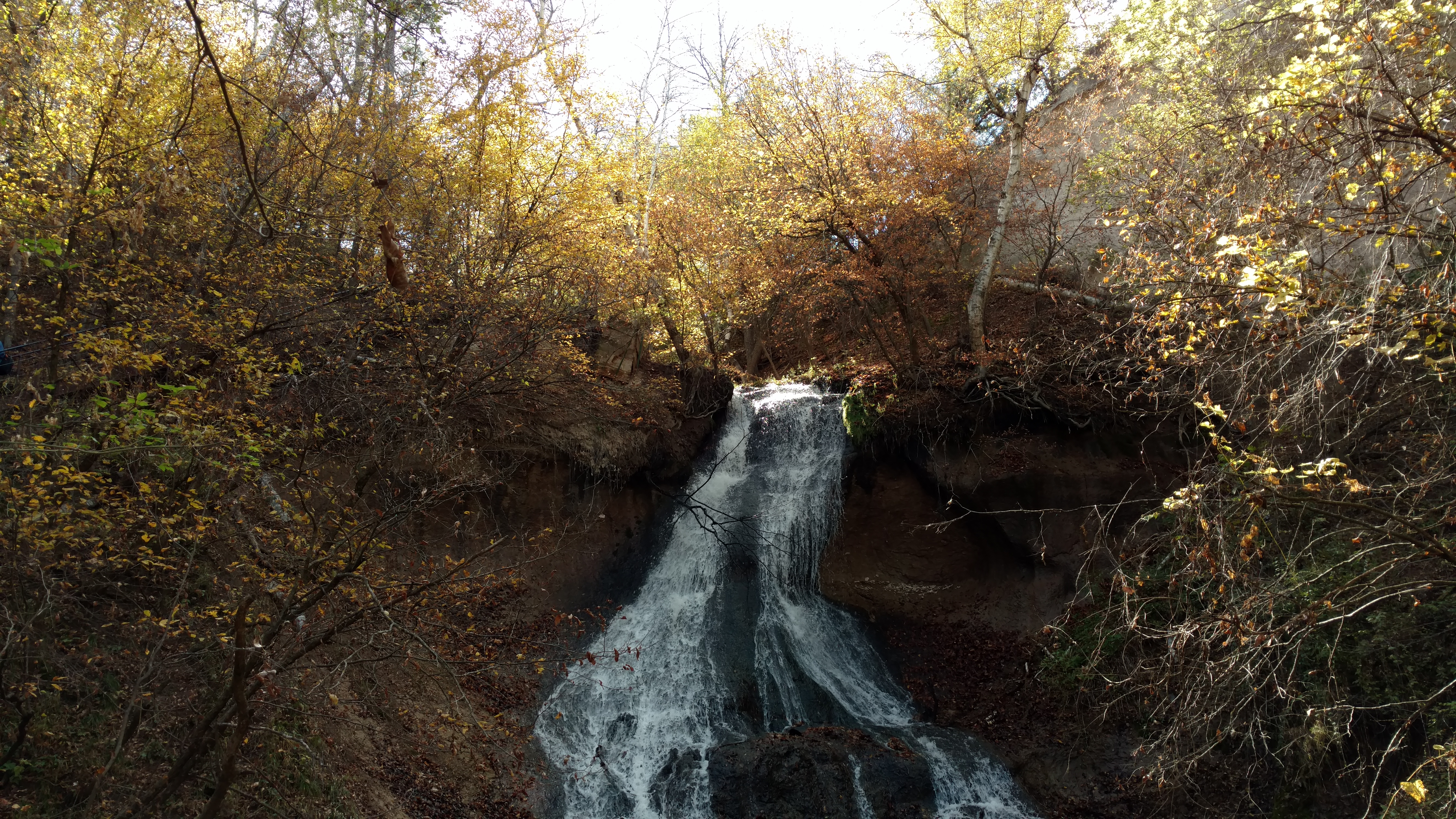
Fort Falls RapidsFort Falls Rapid is a Class I rapid on the Niobrara River adjacent to where the Fort Falls feed into the main river flow 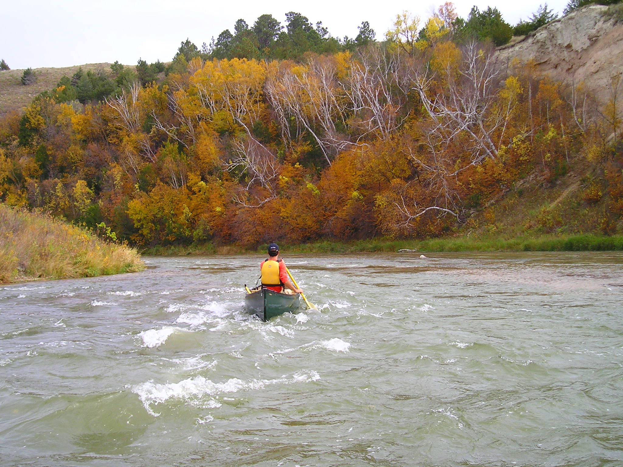
Fort Niobrara NWR Launch SiteFort Niobrara National Wildlife Refuge's Public small watercraft launch site is open to the public and is $1.00/user. Canoes, kayaks, and tubes welcome! There is a parking area and many lanes for floaters to stage equipment. Open dawn to dusk. 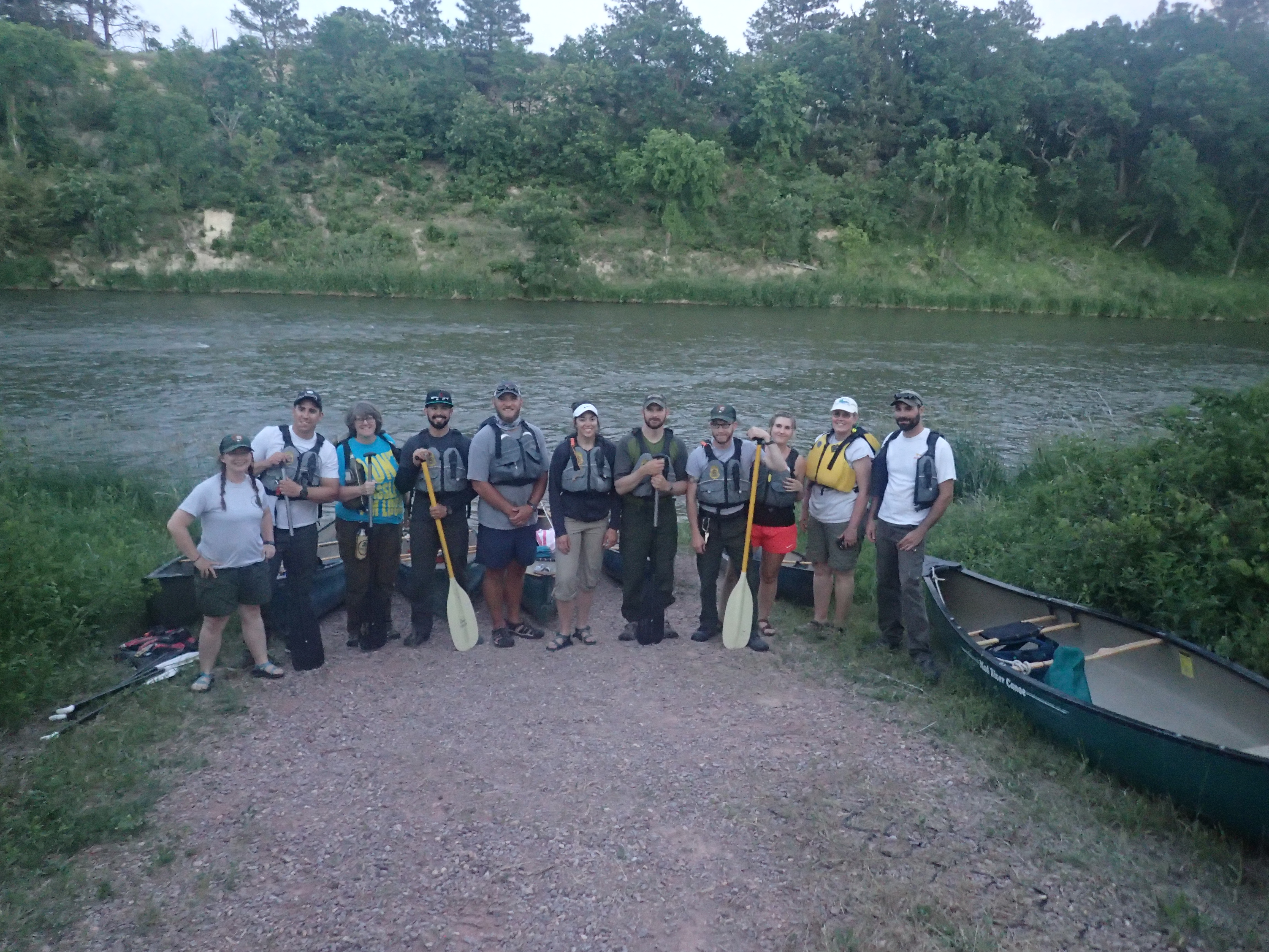
Fort Niobrara National Wildlife RefugeA partner of the Niobrara National Scenic River, the Fort Niobrara National Wildlife refuge provides scenic river access and showcases the Niobrara River Valleys unique biodiversity, geology, and recreational opportunities for exploring the outstanding resources of value of the Niobrara National Scenic River. 
Fritzes Island RapidsFritzes Island Rapid is a class II located a long way down-river after the Brewer Bridge landing. The Conner Rapids are just a few bends in the river before it. 
Fritzes NarrowsFritzes Narrows are a chute in the middle of the Niobrara River. They are a class I rapid and beginners should have no issues navigating them. 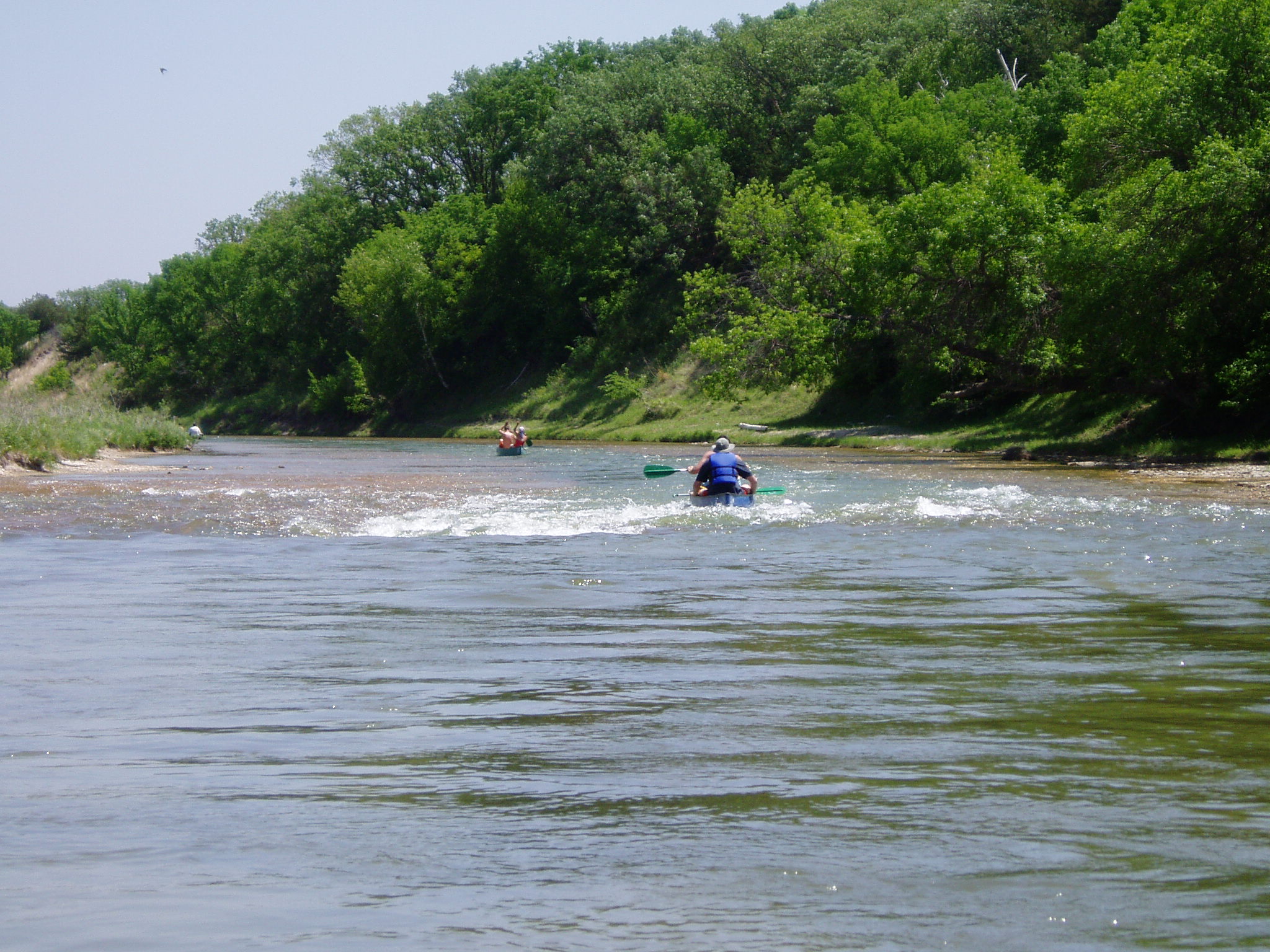
Highway 137 LandingThe Highway 137 Landing is the last landing on the designated length of the Niobrara National Scenic River. It offers public river access to floaters hoping to see the furthest lengths of the Niobrara River. 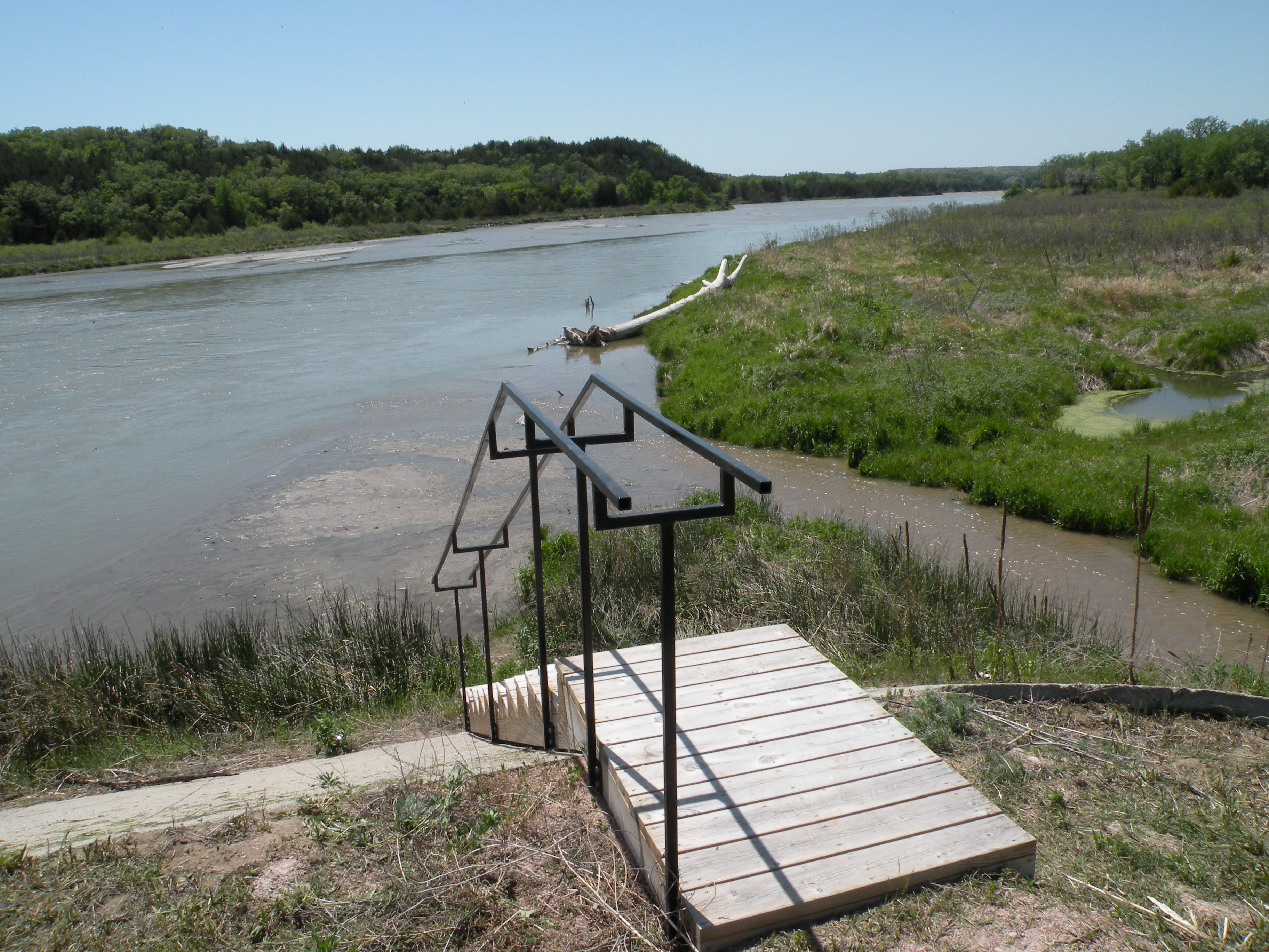
Highway 7 LandingPublic Access landings on the Niobrara National Scenic River becomes more spread out the lower down the river paddlers travel. The Highway 7 Bridge Landing is the second to last of the public access landings that Rangers recommend for kayak and canoe access. 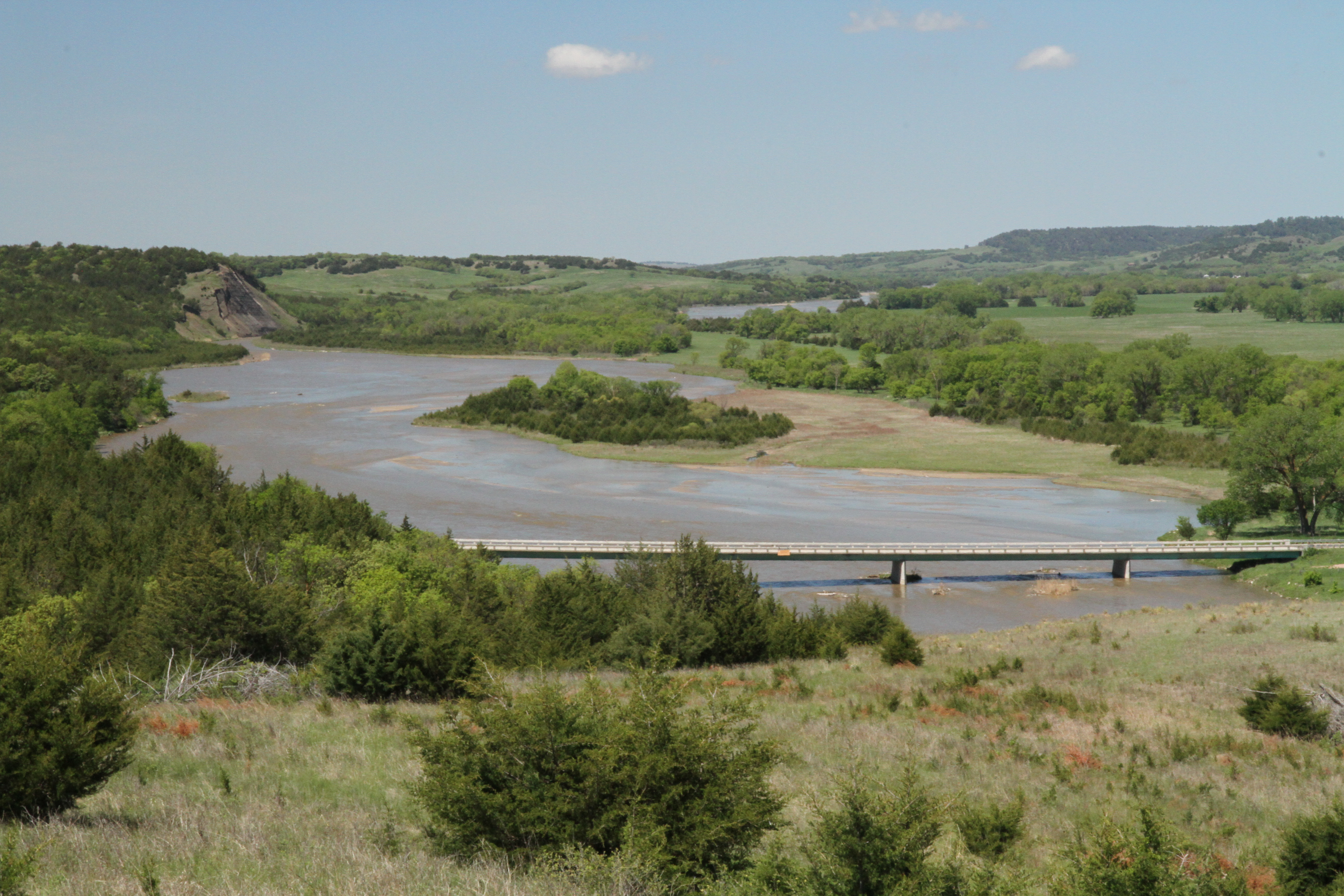
Nichols LandingNickols Landing is a public access small watercraft launch on the Niobrara National Scenic River. Visitors can launch or land with canoes, tubes, kayaks and see the Smith Falls all in one trip! 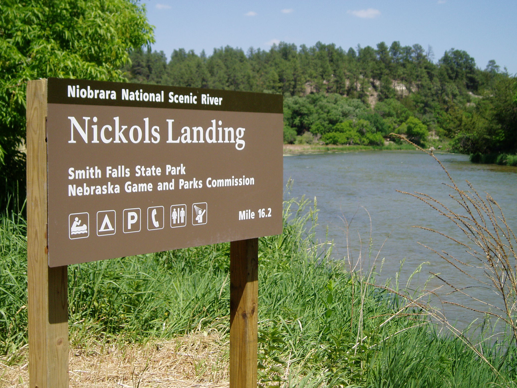
Niobrara National Scenic River BookstoreThe Bookstore at the Niobrara National Scenic River Visitor Center is operated by Americas National Parks, an official non-profit partner of the National Park Service dedicated to supporting the educational mission of Niobrara National Scenic River. 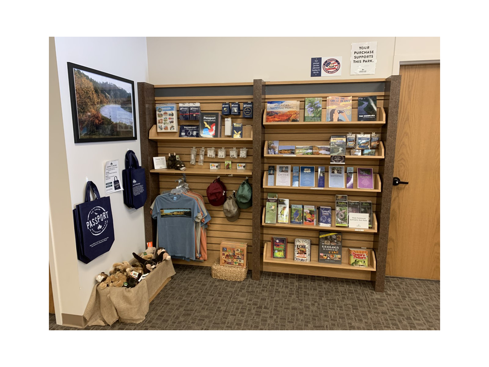
Niobrara Valley PreserveThe Niobrara Valley Preserve protects canyons, grasslands, and a 25 mile stretch of the Niobrara National Scenic River. Managed by The Nature Conservancy, their publicly accessible, privately owned land offers river views, the Norden Chute, hiking trails, and unique Niobrara River Valley wildlife. 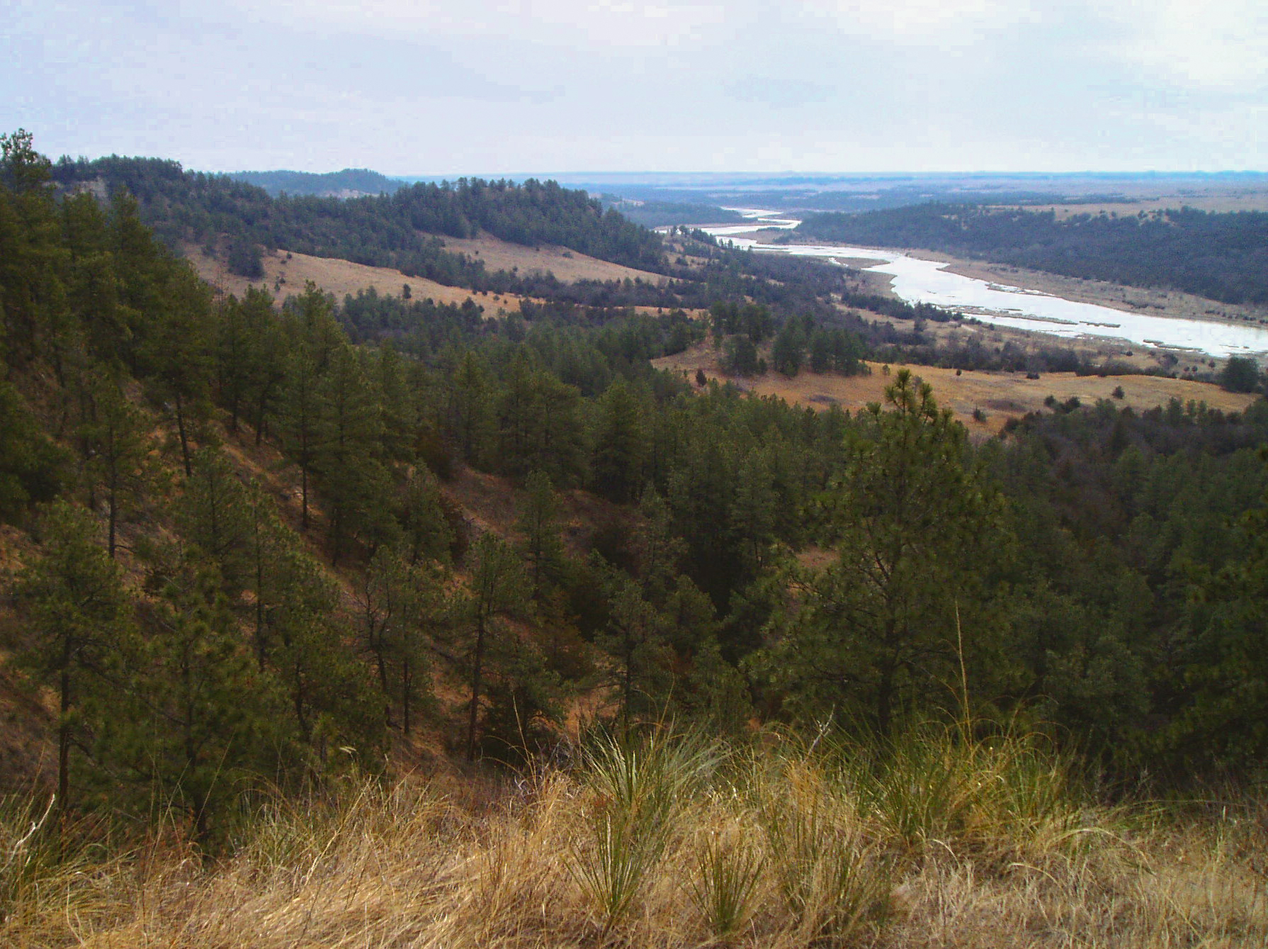
Niobrara/Missouri ConfluenceMeriwether Lewis and William Clark stopped where the Niobrara River flowed into the Missouri River in 1804. 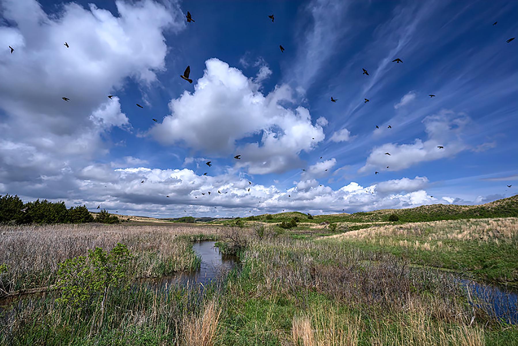
Norden ChuteNorden Chute is a mandatory portage for river floaters because of its powerful hydraulic underneath. Floaters can portage to the left, above the chute, and carry their vessels about 300 yards downstream to resume their river trip. 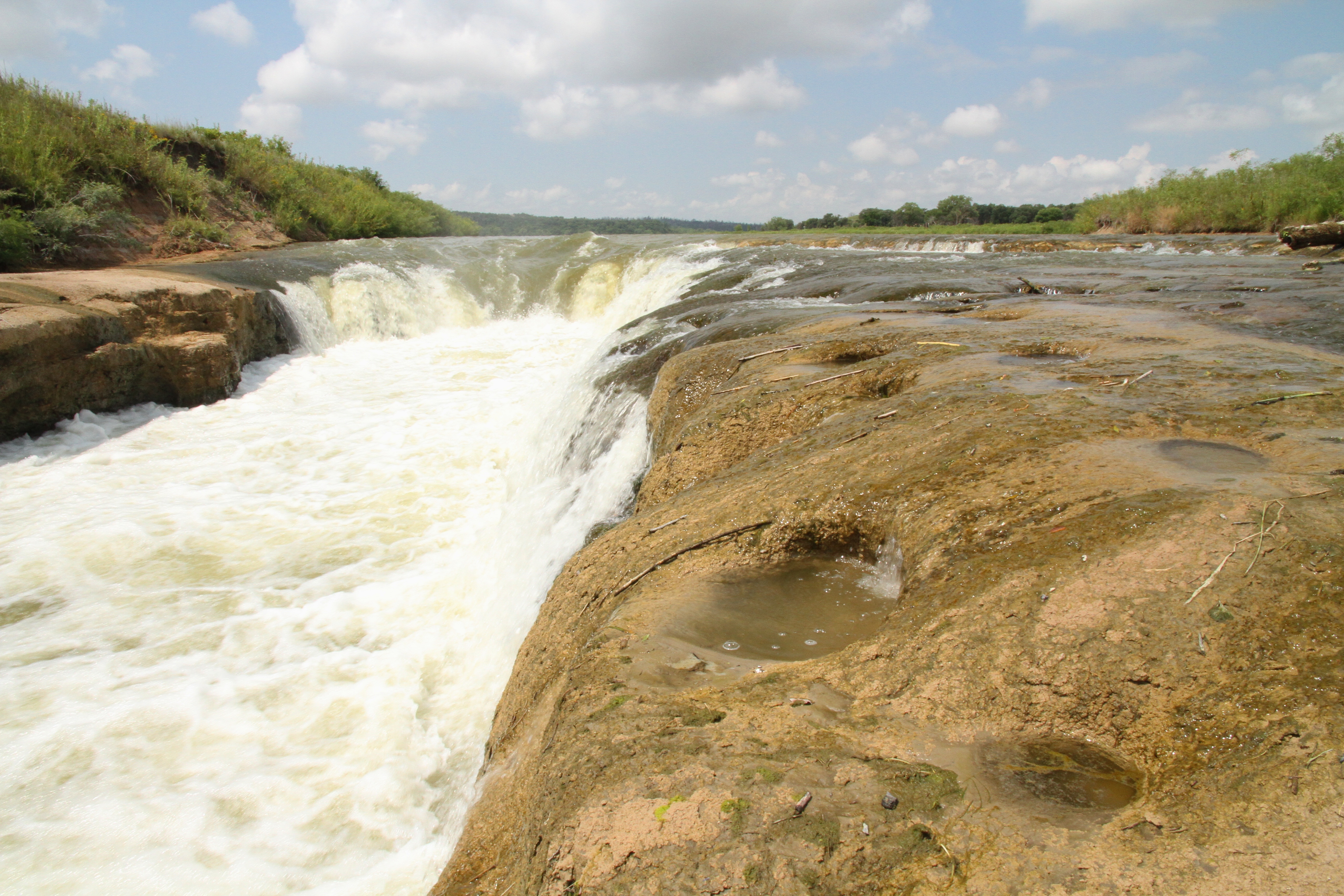
Rocky Ford RapidRocky Ford Rapid is a class III rapid not recommended for inexperienced floaters. Many visitors portage this rapid and continue their float further downstream. 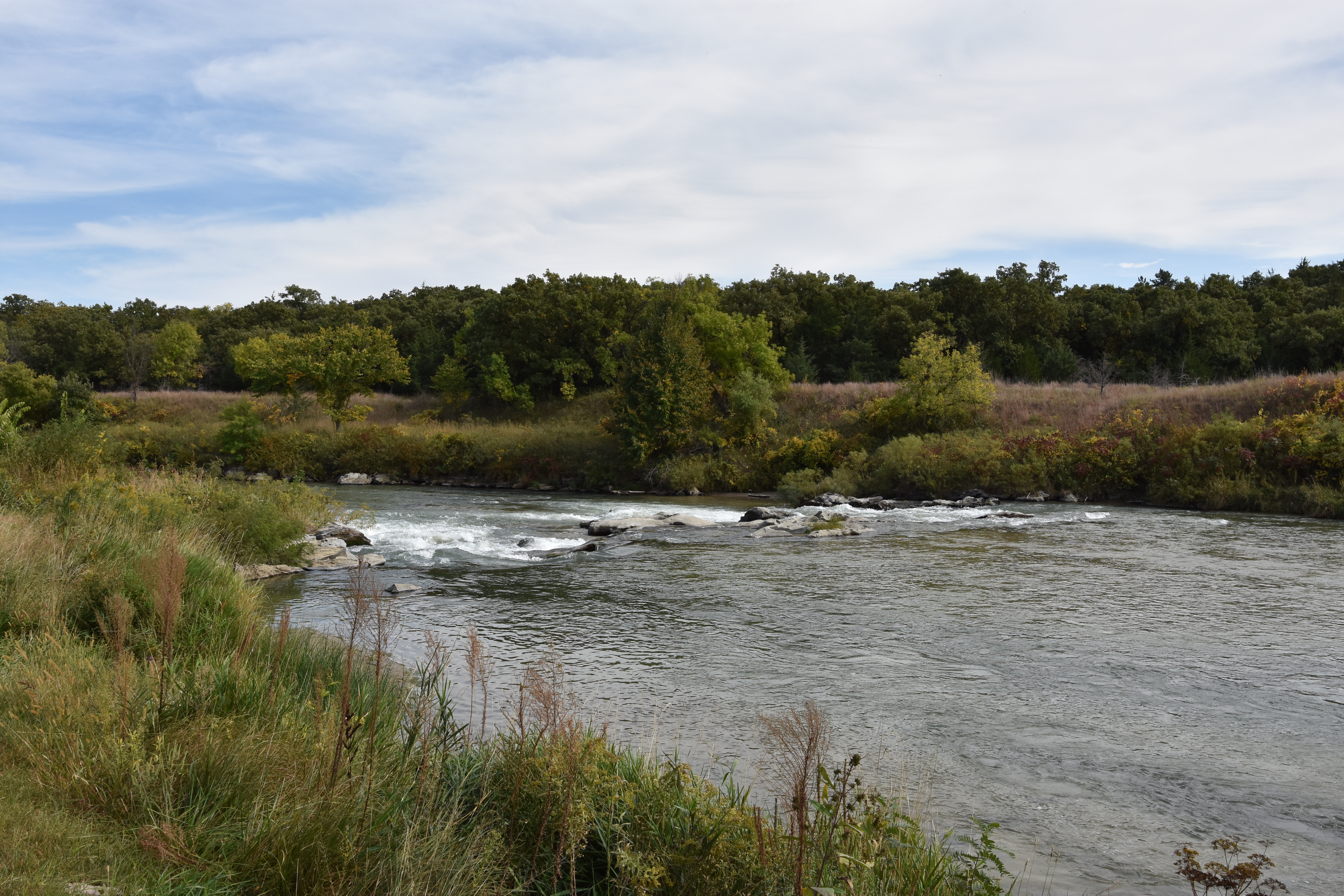
Smith Falls State ParkThe tallest waterfall in Nebraska, Smith Falls are a unique geologic formation fed by the Ogallala Aquafer and a tributary of the Niobrara National Scenic River. 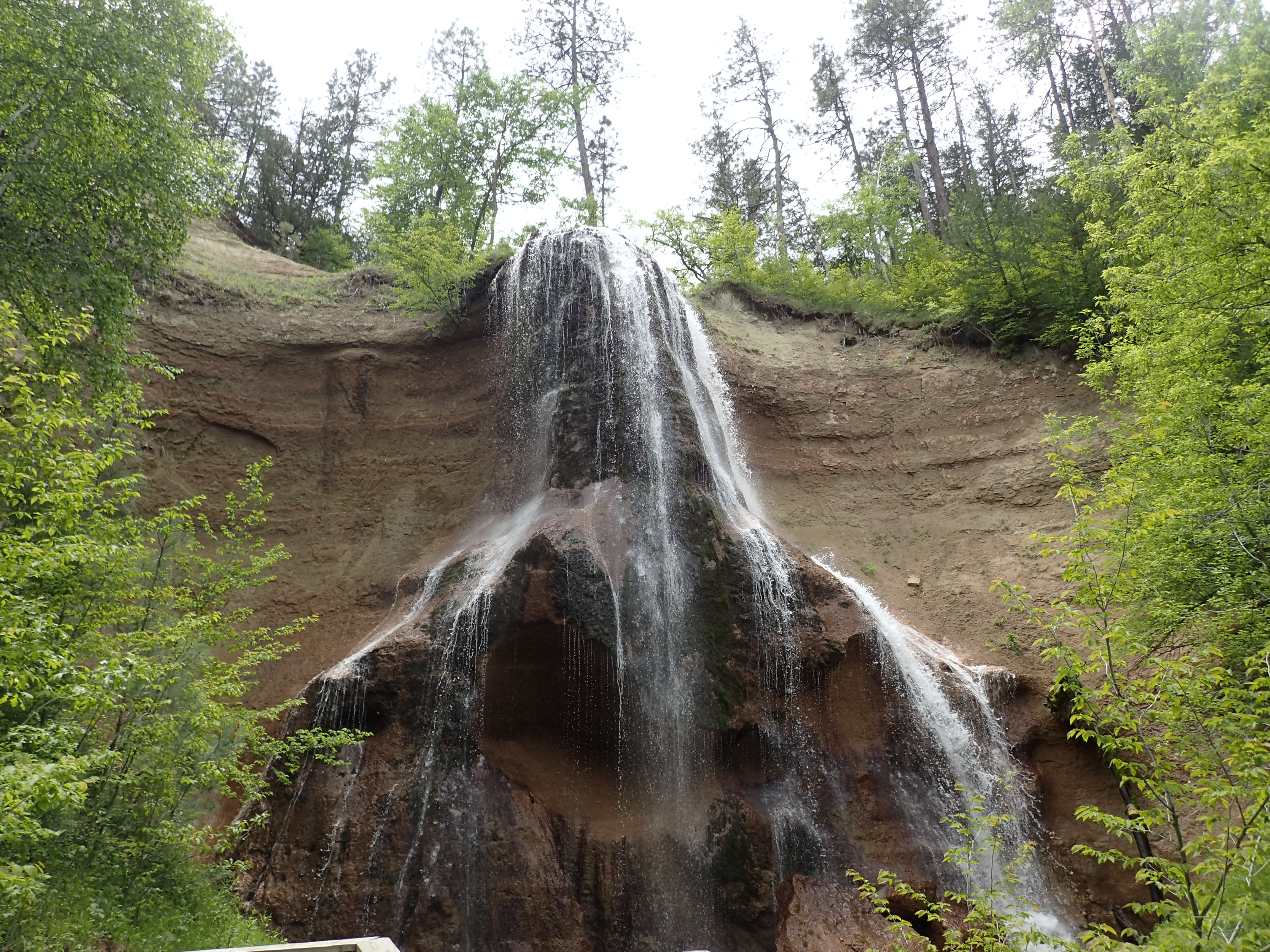
|
| Visitor Centers | Count: 1
Niobrara National Scenic River Visitor Center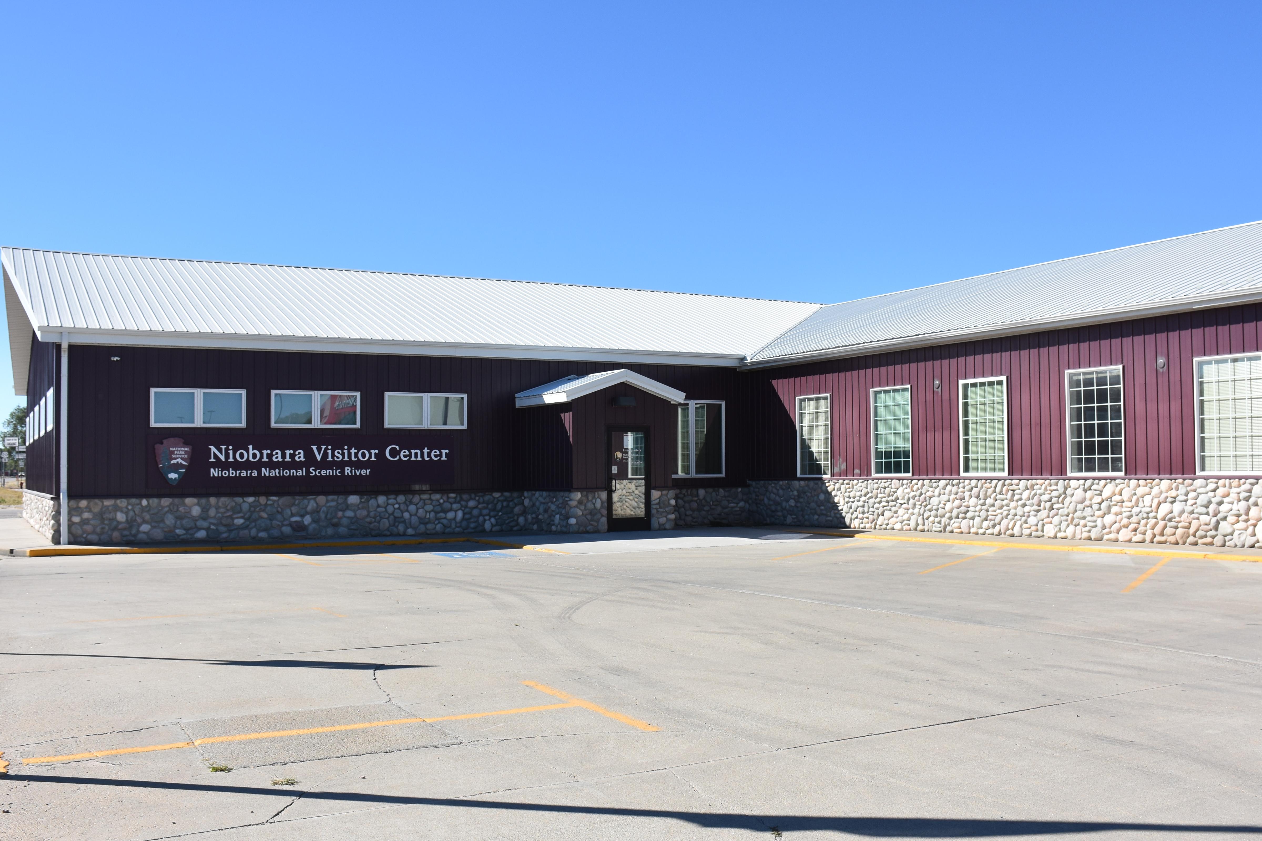
|
| Things to do | Count: 4
|
| Tours |
Count: 1
River Float TourTake a self-guided tour as you float the Niobrara National Scenic River. This tour identifies landmarks along the river where you can stop and explore, finding waterfalls and scenic views, and rapids for you to avoid too! |
| Articles |
|