Be advised that the NPS has issued alerts for this park.
West and East Border Roads closed for public safety
All border roads remain closed (the dirt roads directly along the border and all crossover roads leading from South Puerto Blanco Drive to the border) to all public vehicle and pedestrian traffic for public safety. South Puerto Blanco Drive remains open.
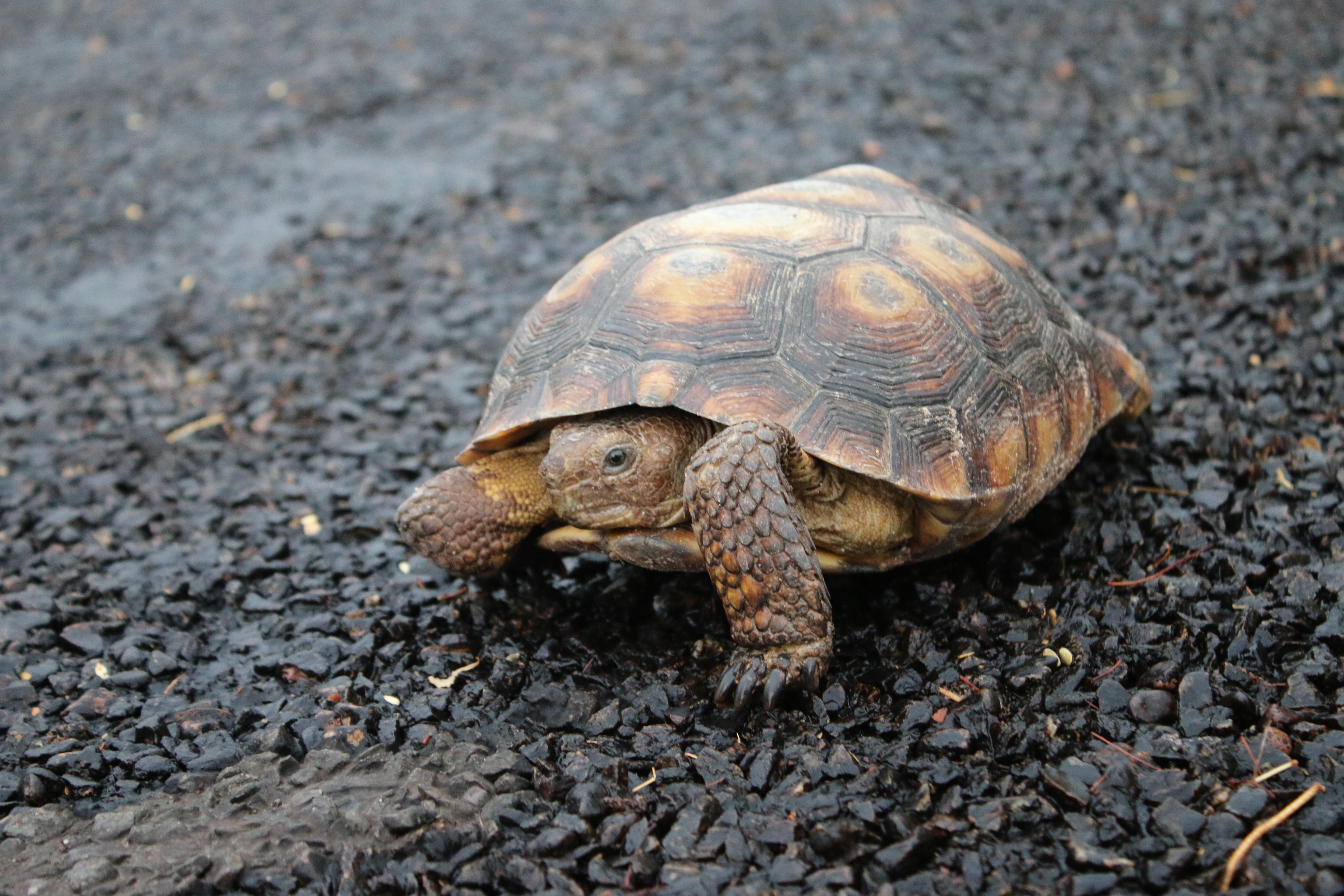
Feral Dogs May Be Seen in Organ Pipe Cactus National Monument
Feral dogs may be present at the Twin Peaks Campground and around the Kris Eggle Visitor Center. Visitors should not attempt to feed or water these dogs or approach them in any way as they may carry disease or become hostile.
Pozo Nuevo Road to Bates Well Ranch High Clearance, 4-Wheel Drive Only
High Clearance, 4-wheel drive is required from where Pozo Nuevo Road begins along South Puerto Blanch Drive to Bates Well Ranch area. The road is washed out in areas. Bates Well Ranch is still accessible from the north on Darby Well Road.
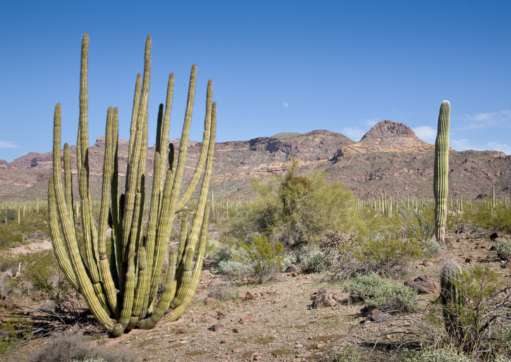
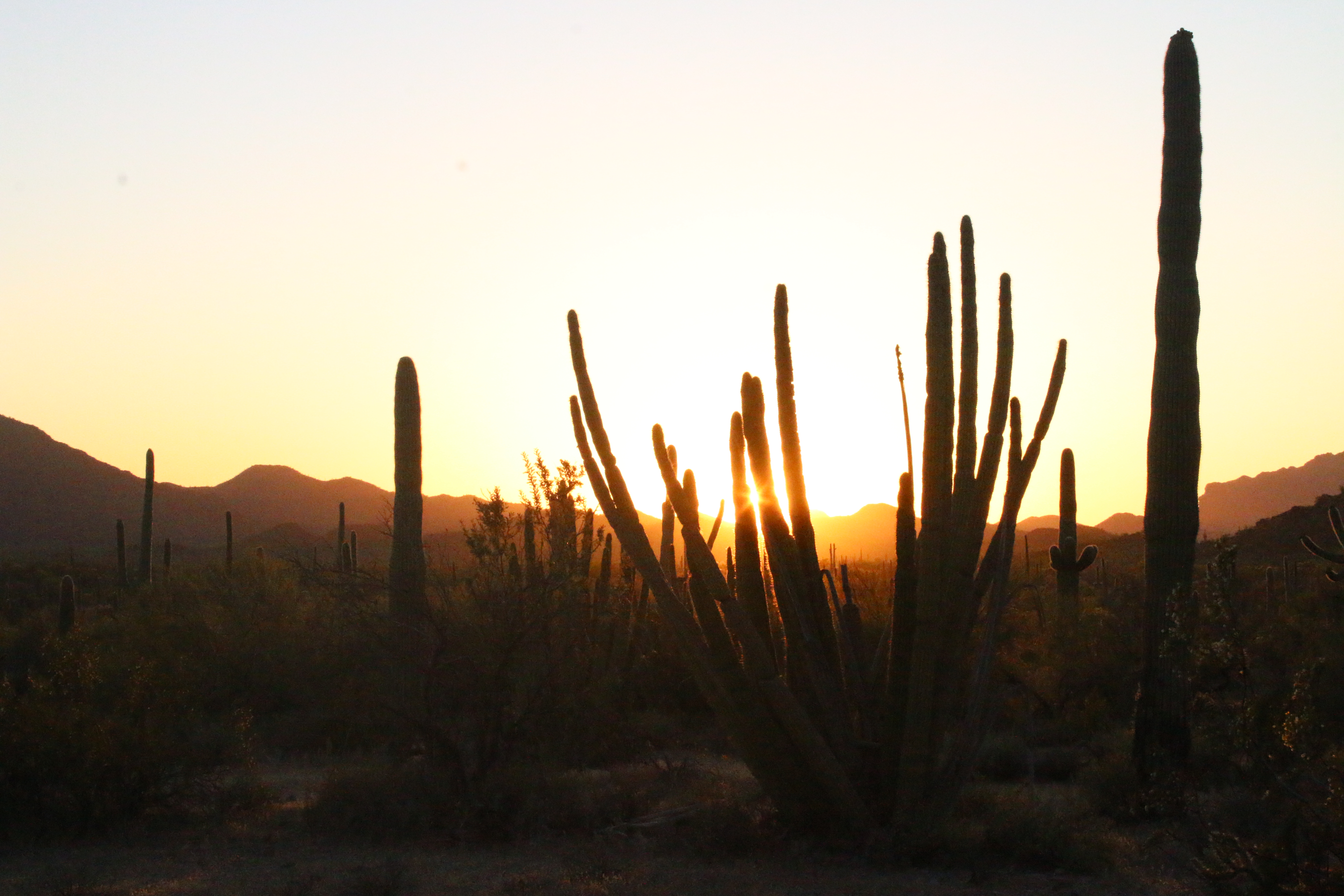
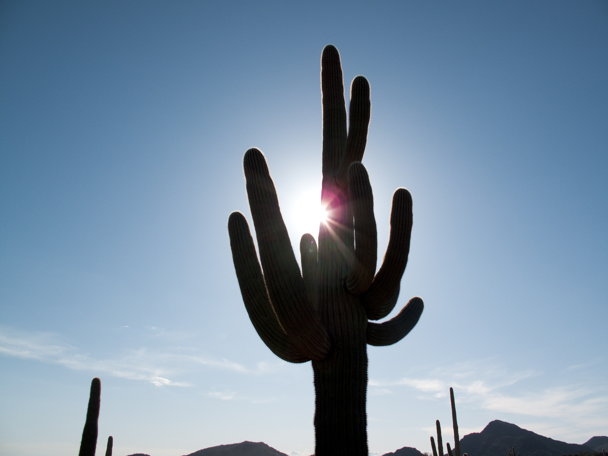
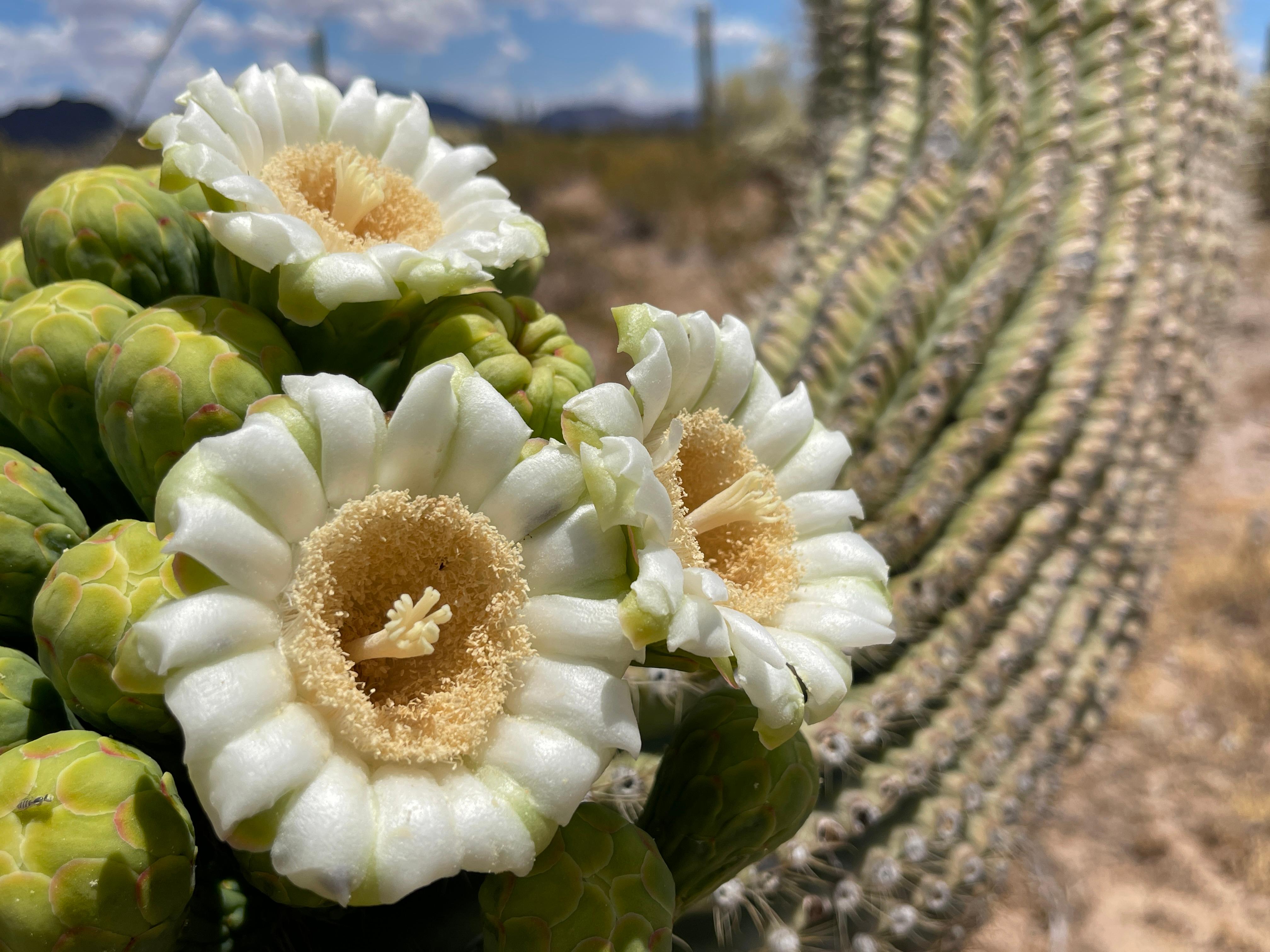
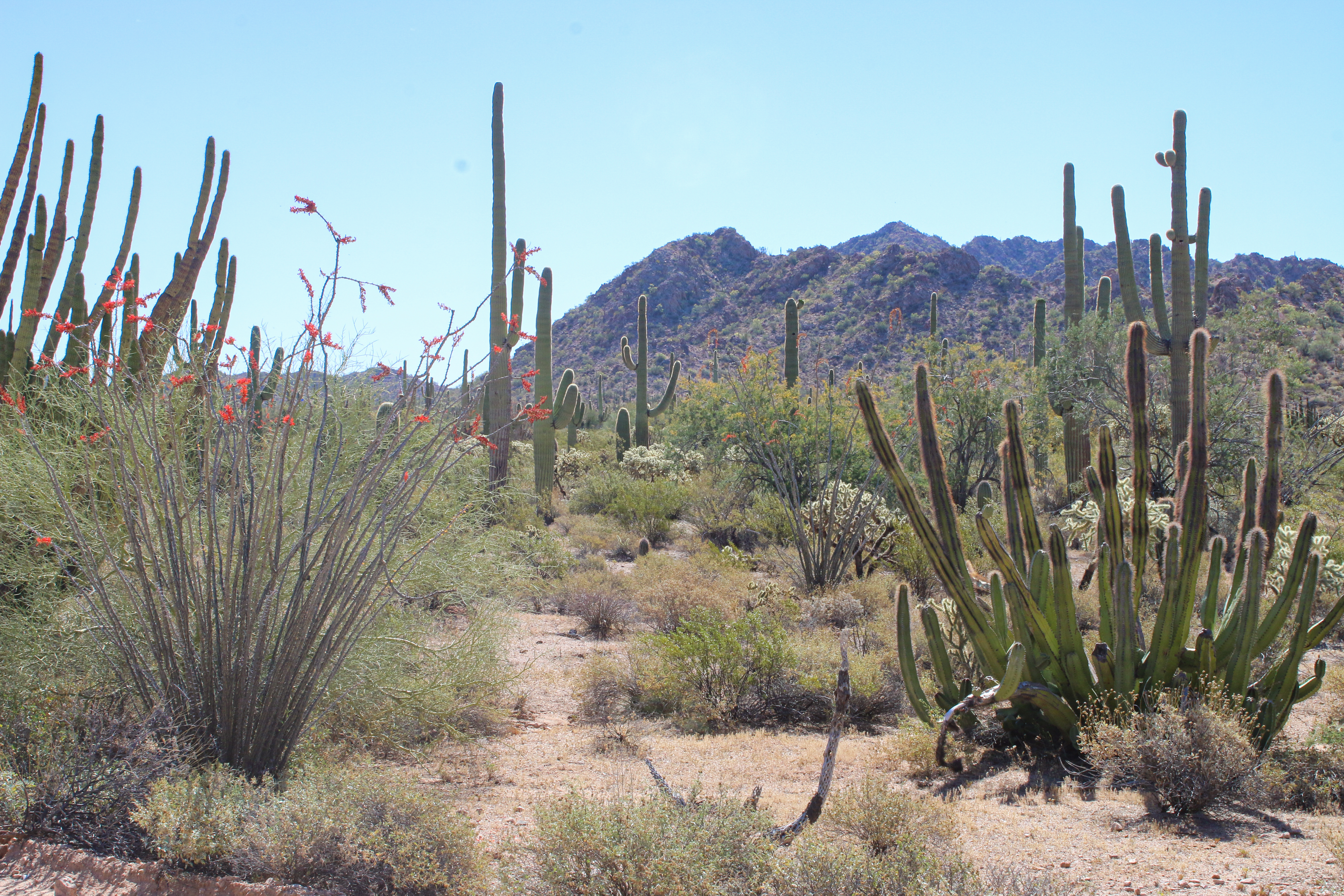
Look closely. Look again. The sights and sounds of Organ Pipe Cactus National Monument, an International Biosphere Reserve, reveal a thriving community of plants and animals. Human stories echo throughout the Sonoran Desert, chronicling thousands...
All campsites are reserved through Recreation.gov or by calling 877-444-6777. Sites may be reserved the same day or up to six months in advance.
Alamo Campground is nestled against small, rocky mountains and located right at the opening of Alamo Canyon. The campground includes four primitive sites, each with a picnic table and standing grill. Thick stands of organ pipe cacti and saguaros surround the campground. To the south of the campground is a wash where the canyon exits; the wash is full of desert greenery. In the center of the campground is a small informational bulletin board, and close by is a vault toilet restroom.
All campsites are reserved through www.Recreation.gov or by calling 877-444-6777. Sites may be reserved the same day or up to six (6) months in advance.
When you drive up the road to the campsite, there is a small fee collection booth, sometimes staffed by a park ranger. Twin Peaks Campground is a large campground with spaces moderately spread out among sixteen curved rows of campsites. Healthy organ pipe cacti and saguaros are dispersed throughout the campsite. Several restrooms are spread throughout the campsite. A trail circles the border of the campground, and in the southwest corner of the campground, a paved trail leads to an amphitheater. The campground is located on flat terrain, with views of mountains in Mexico to the south, the Ajo Mountains to the east, and the Twin Peaks range to the North. The campground road continues westward into the Group Campground. The Group Campground has five large spaces, each with a ramada and picnic table. A restroom is located in the center of the Group Campground. The Group Campground is surrounded by hills dotted with organ pipe cactus and other cacti.
A wayside station sits on the side of the dirt road, Ajo Mountain Drive. There is a 3 panel wayside sign with information about the scenic drive, a map of the park, and information about border safety. A small brown sign reads "Vehicle Limit, 25 feet length." In the distance the Ajo Mountain Drive continues through flat desert plains, small hills, and eventually leads up into the Ajo Mountain range in the distance.
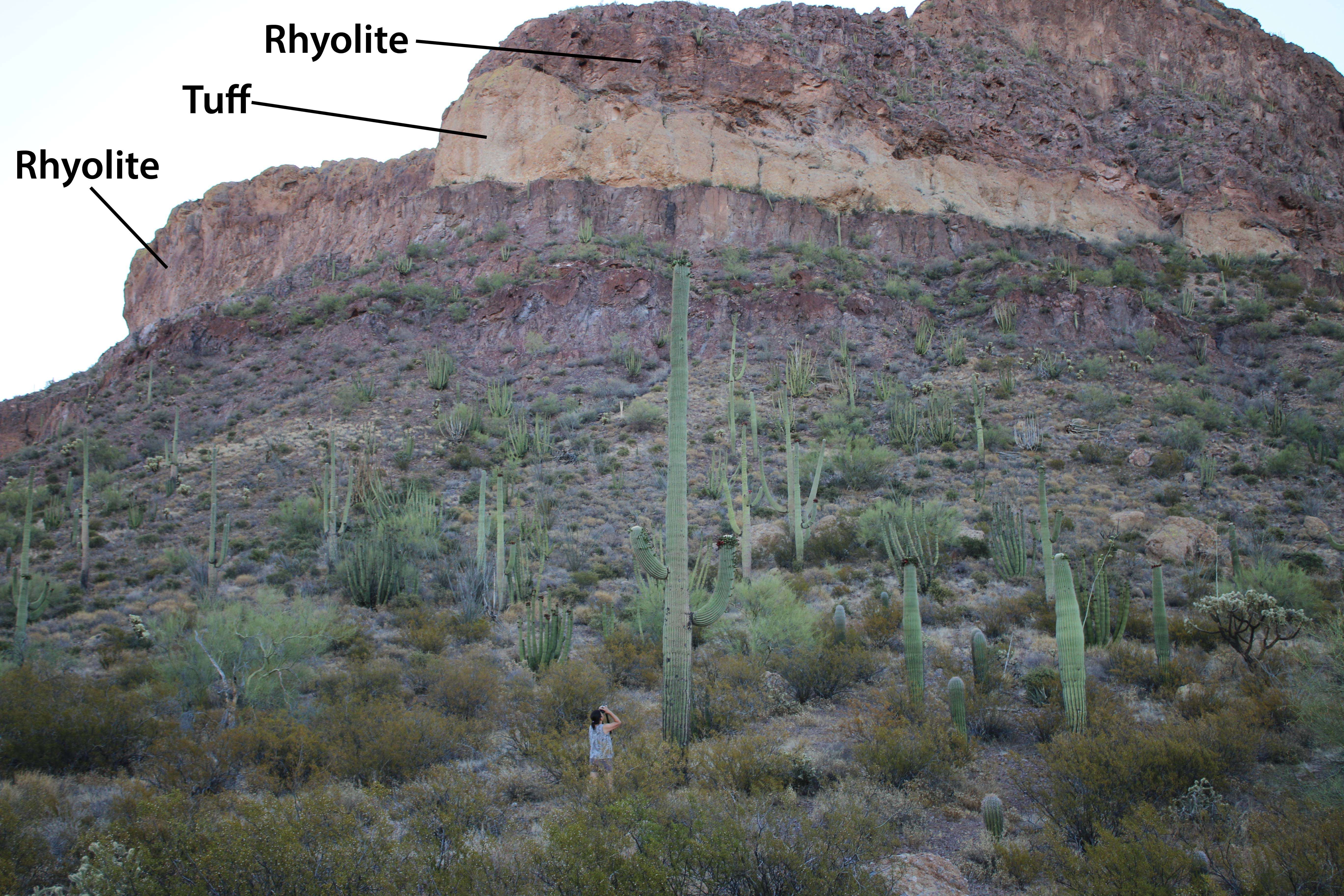
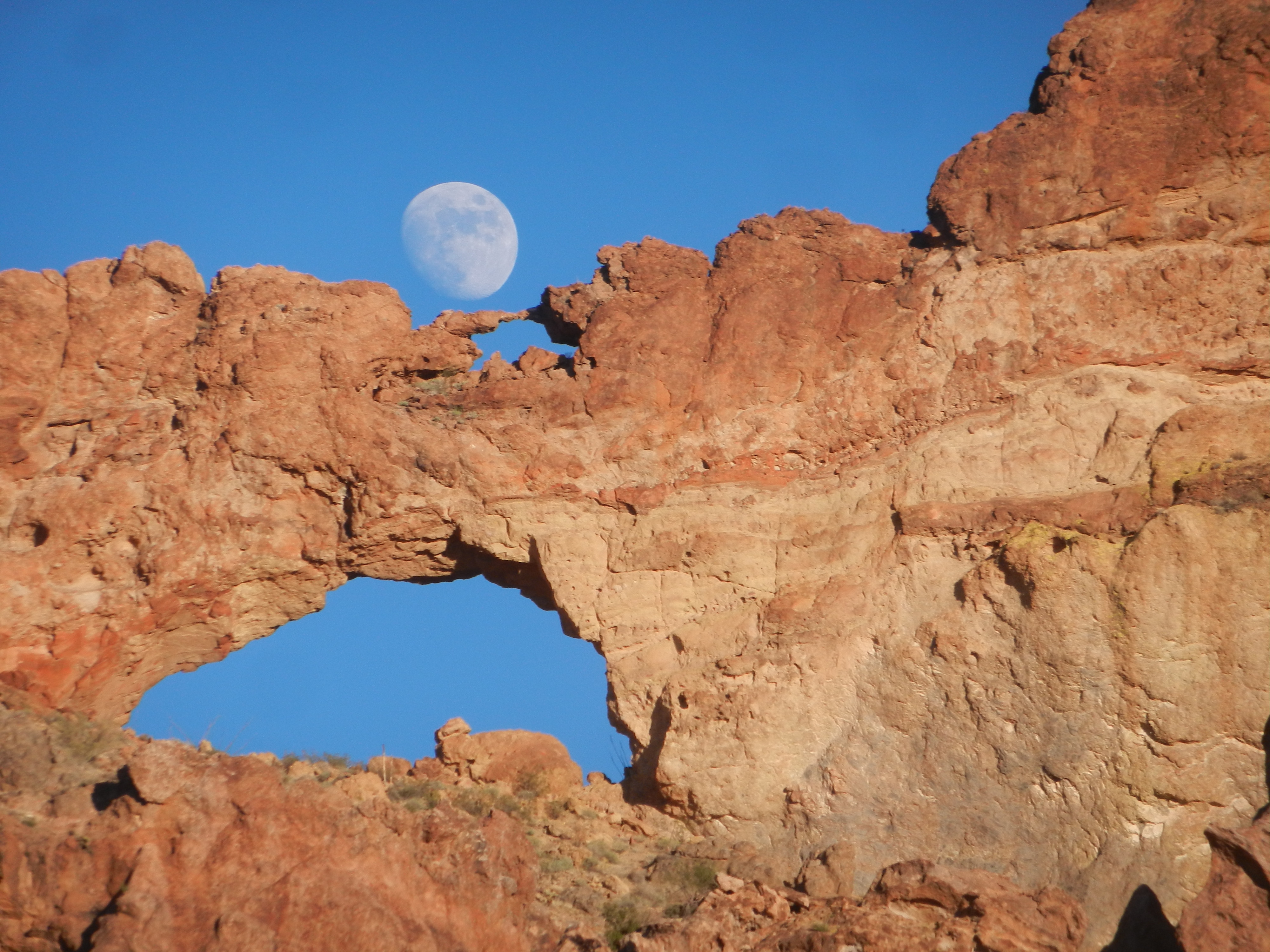
Marked by a white road marker with the number "10" on it, this road pulloff faces the Ajo Mountains: crumbly and bulbous red-colored mountains made of rhyolite and tuff rock. At the top of one of the mountain faces is a natural double arch, with a larger, wider arch on the bottom and a much smaller arch sitting on the top. This stop faces Arch Canyon, a lush canyon filled with palo verde, mesquite and other desert shrubs and trees.
Stop 11, marked by a white road marker sign with the number "11" on it, is located on an overlook in the Ajo Mountains. The stop looks down upon Estes Canyon and the Diaz mountains in the distance to the south. To the east, Mount Ajo and its surrounding peaks loom. These mountains are crumbly and bulbous, a result of the slow moving magma that formed into reddish colored rhyolite rock. Organ pipe cacti and saguaros dot the hillsides.
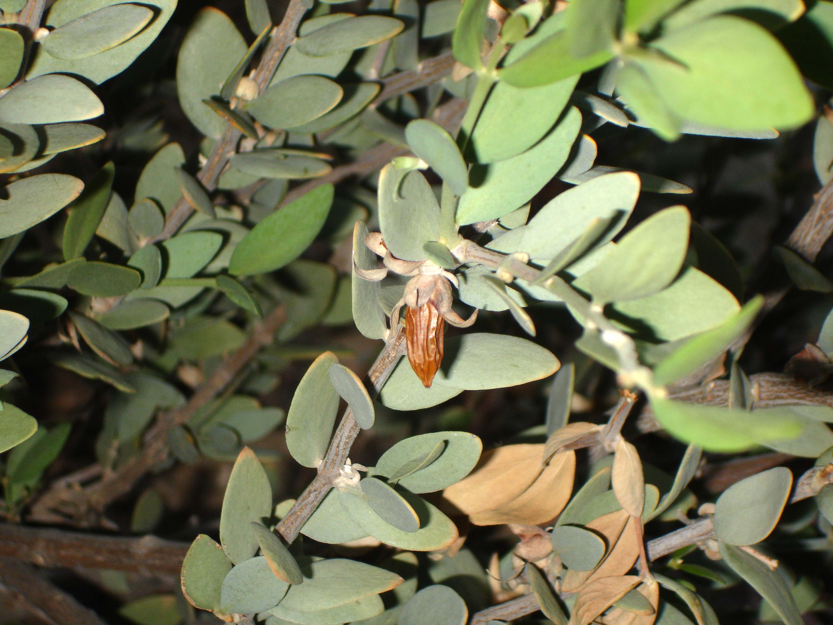
Stop 12, marked with a small white road sign with the number "12" on it, is located in a low spot of the Ajo mountains. The terrain is rocky and hilly, and the Ajo mountains rise to the east and west, and the Diaz mountains loom to the South. Thick, mature jojoba bushes line the road at Stop 12. These bushes have thick, light green oval leaves.
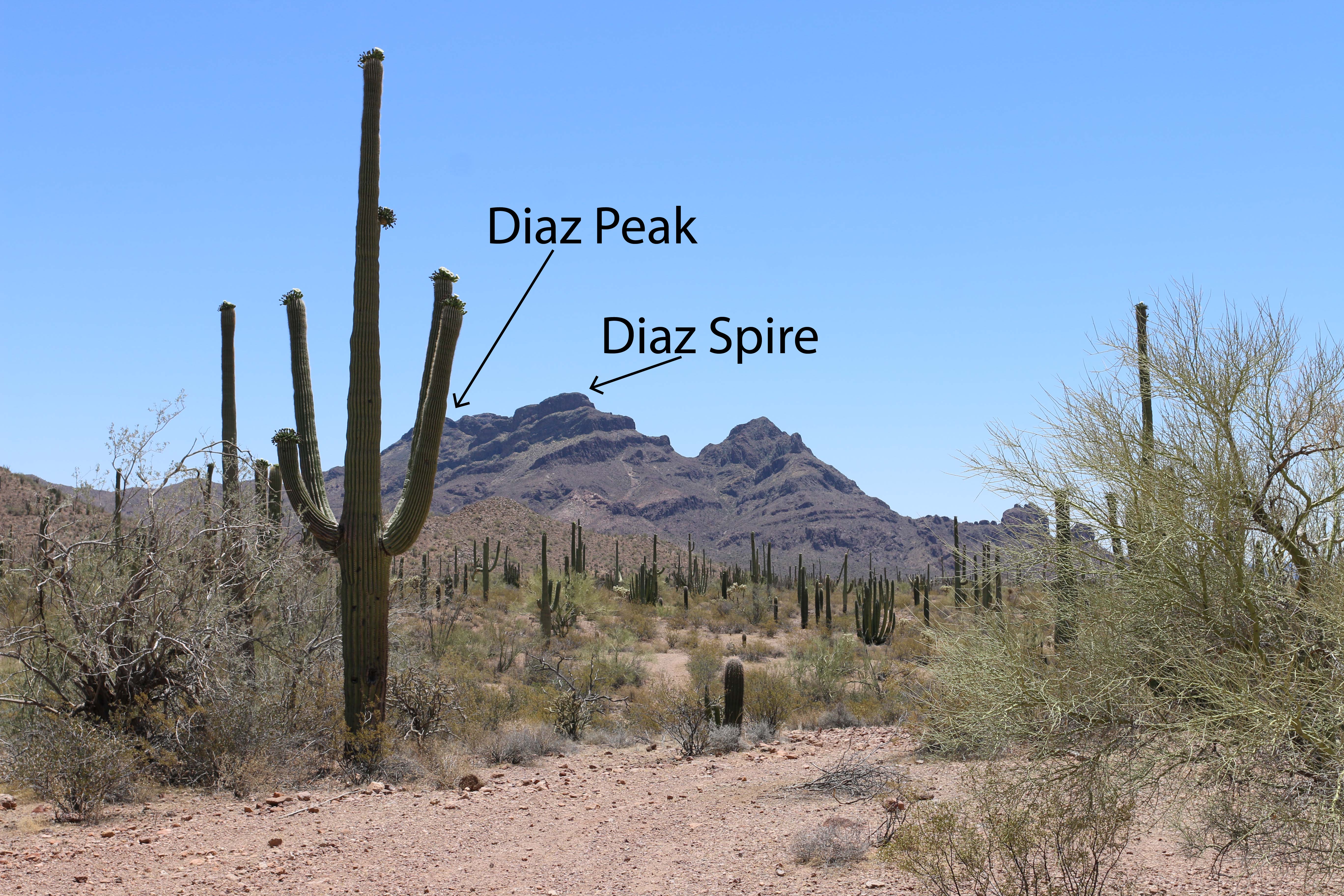
Stop 13, marked by a small white road sign with the number "13" on it, is located in a flat area along Ajo Mountain Drive. The area hosts several larger desert trees, including mesquite trees and palo verde. Most of these trees are nurse trees, and have an associated saguaro growing in the shade of its branches. Hills surround the area, and to the south rises the pointy Diaz mountains.
Stop 14, marked by a small white road sign with the number "14" on it, is a large dirt pull-off along the Ajo Mountain Drive. The pull-off features a view of the Diaz Mountains, a small range with several triangular peaks. The surrounding desert area is lush with saguaros and organ pipe cacti, and dotted with smaller desert trees like palo verde and mesquite.
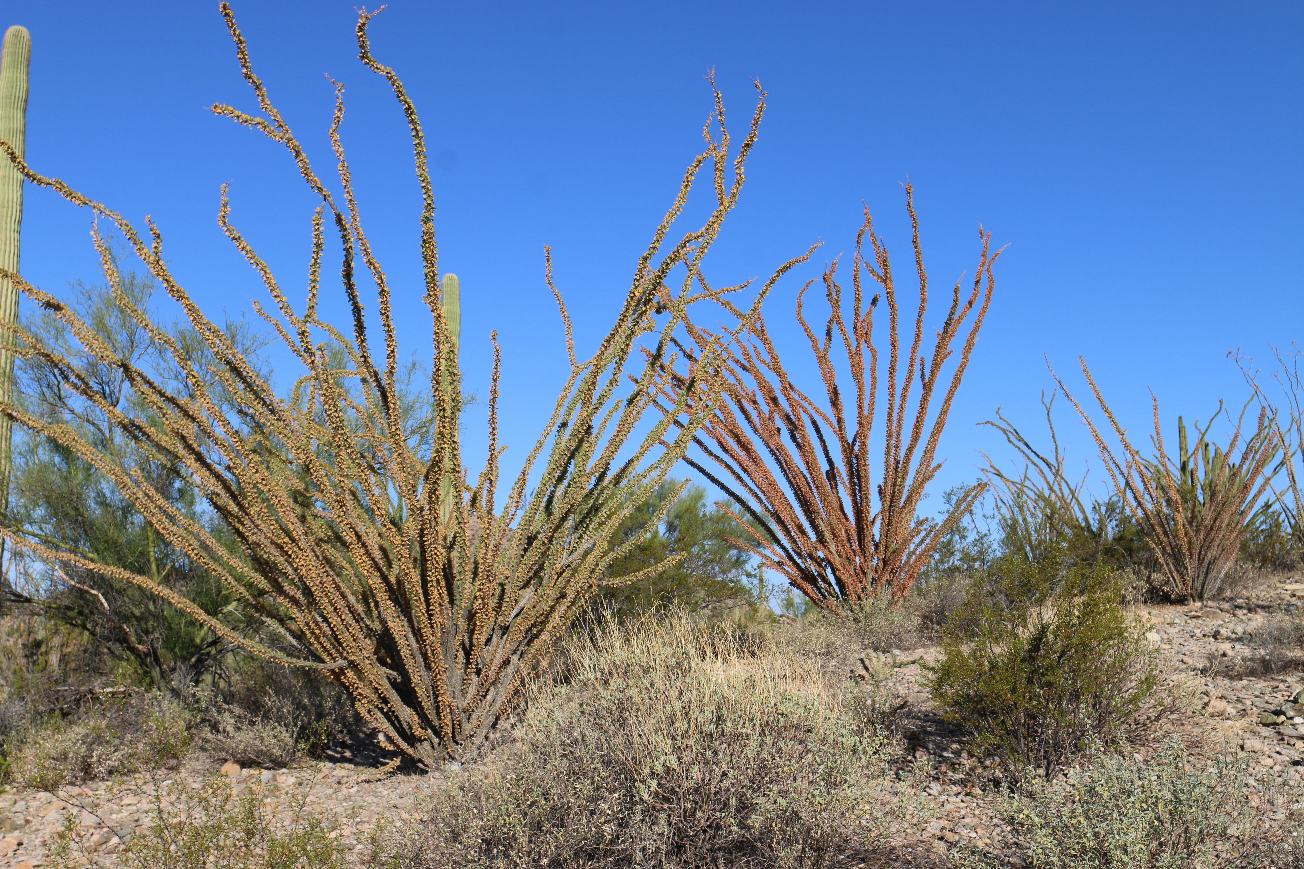
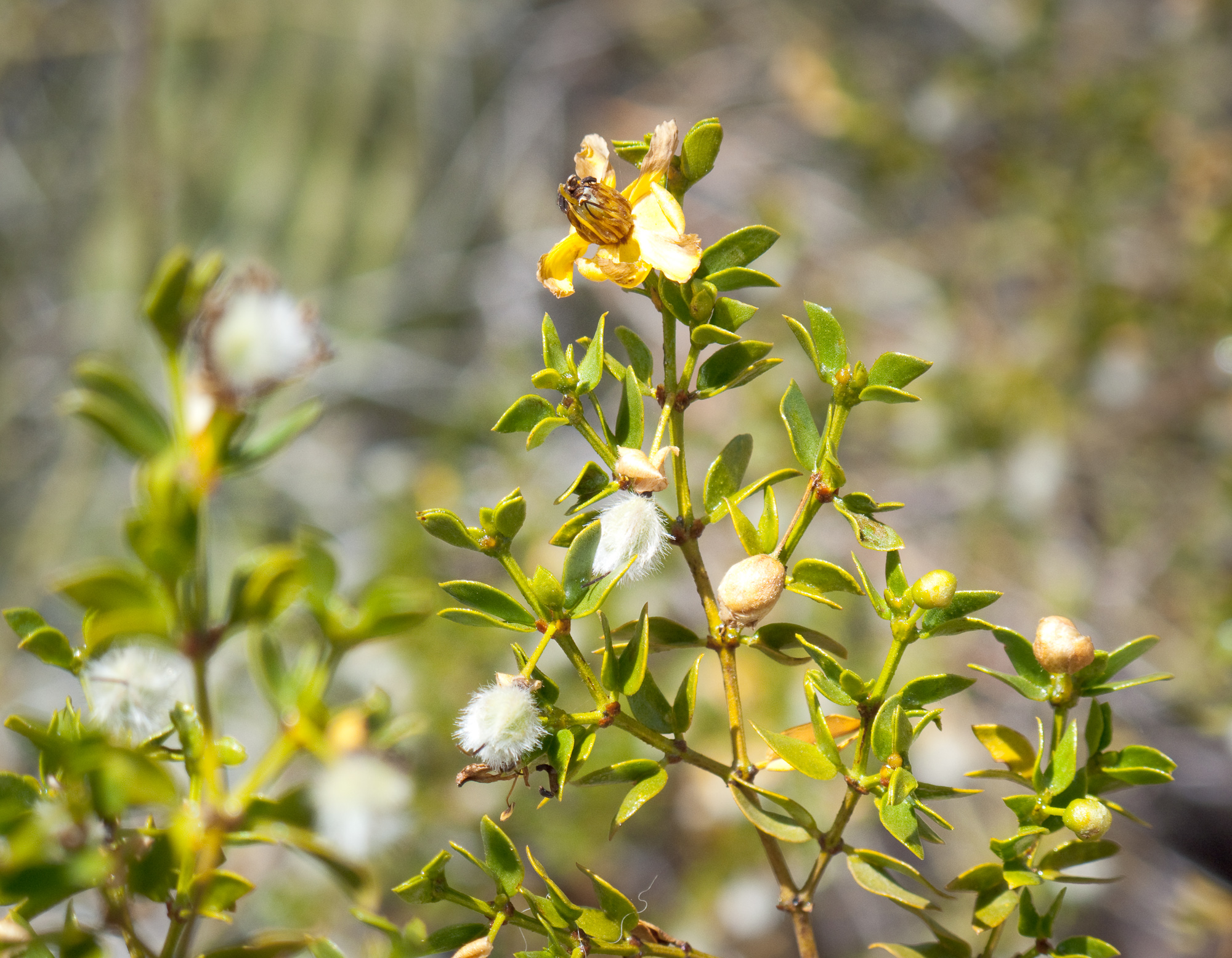
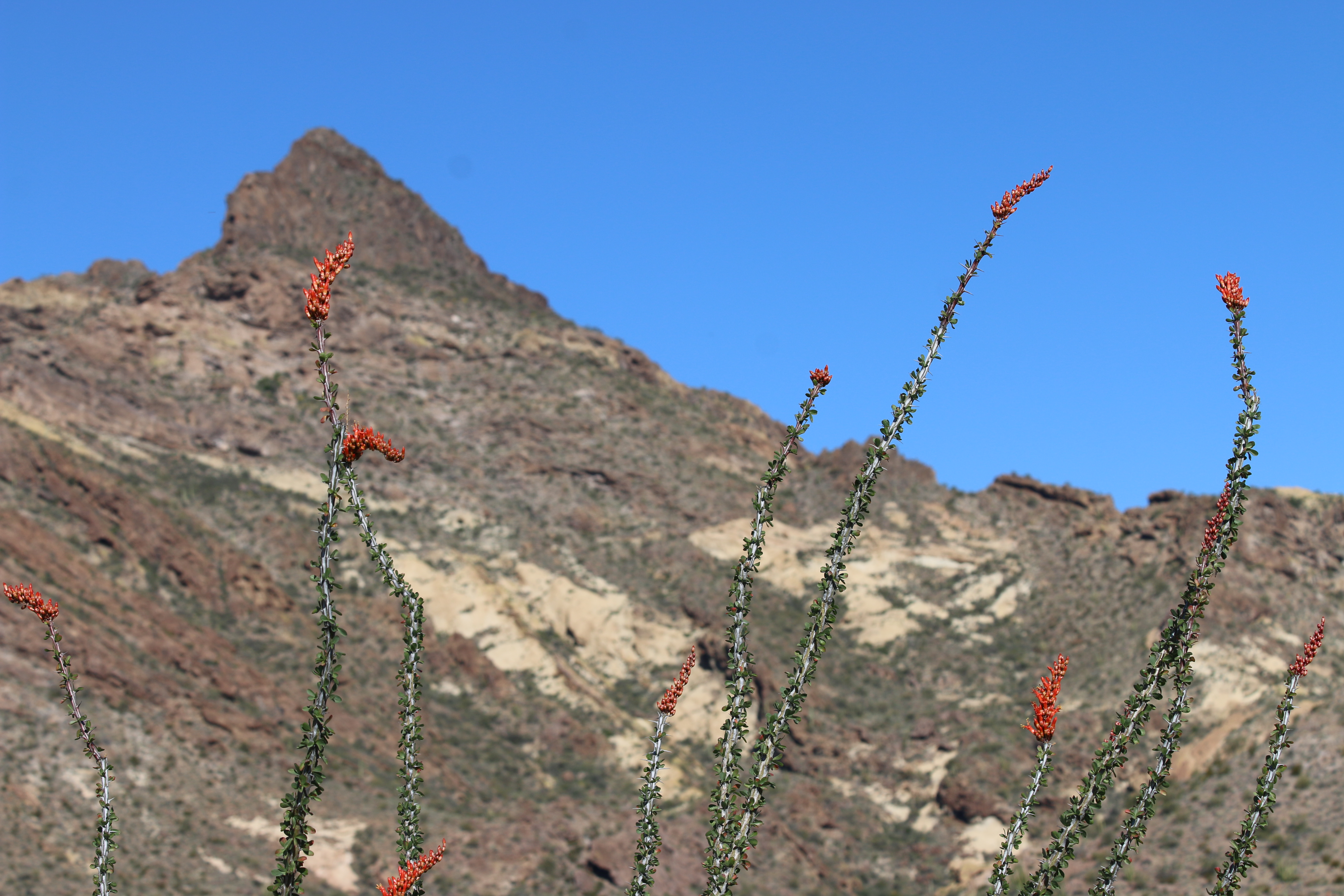
Stop 15, marked by a small white road sign with the number "15" on it, is located in the flat desert plains along the Ajo Mountain Drive. This area is dominated by several large, mature organ pipes, chainfruit cholla, and ocotillos. The ocotillos look like a bundle of dry, gray sticks for most of the year. However after the rains, these bundle of sticks are bright green with small leaves and drooping chains of red flowers.
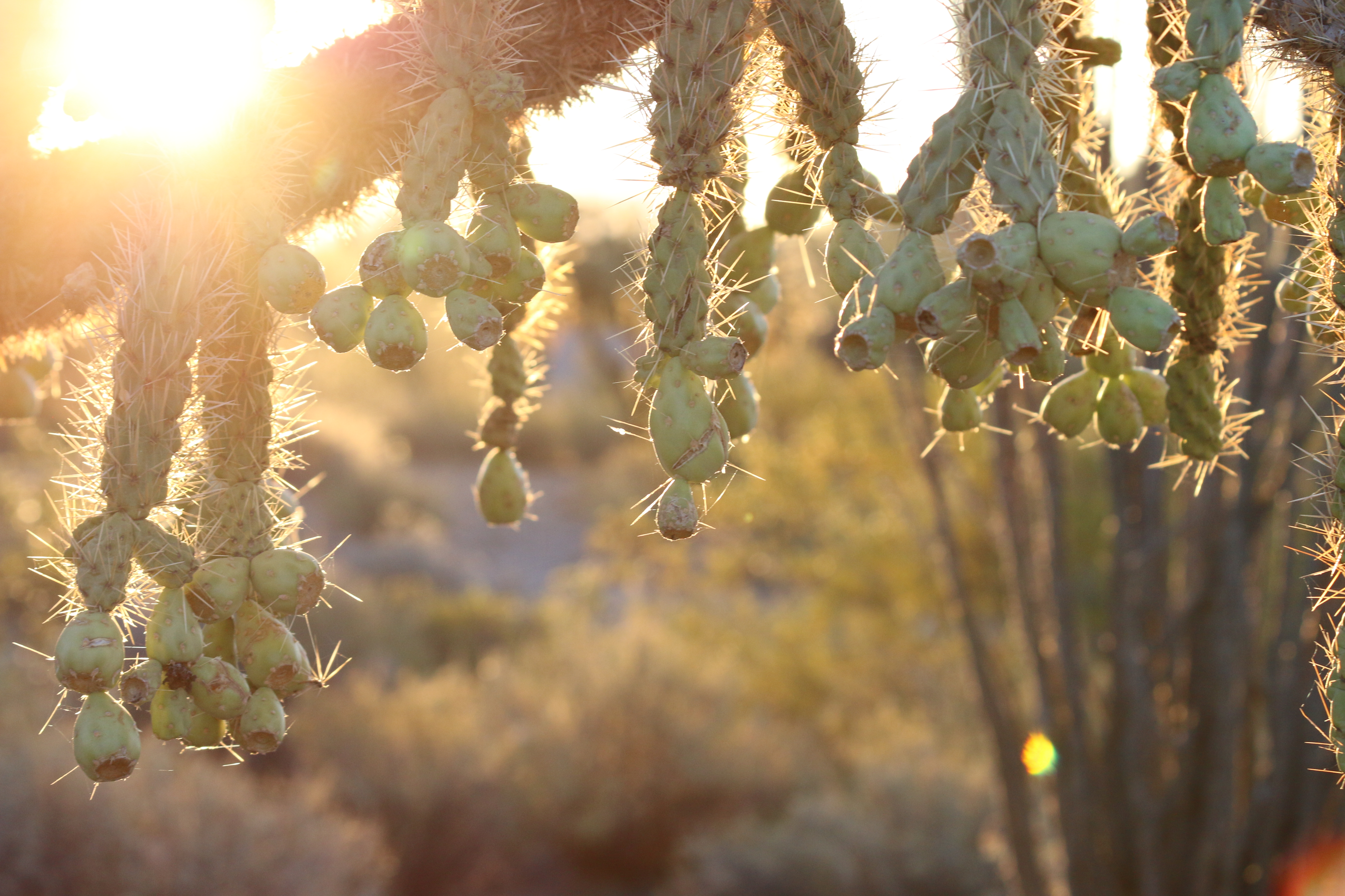
Stop 16, marked by a small white road sign with the number "16" is a dirt pull-off located in the flat desert lowlands of the Ajo Mountain Drive. This area is dominated by chainfruit cholla, a light green cacti shaped like a small tree. It has almost fuzzy looking branches covered with spines. Chains of light green, past fruit, hang from its 'branches.' The area also hosts ocotillo, creosote, saguaro and organ pipe cacti. Small hills rise in the distance to the west.
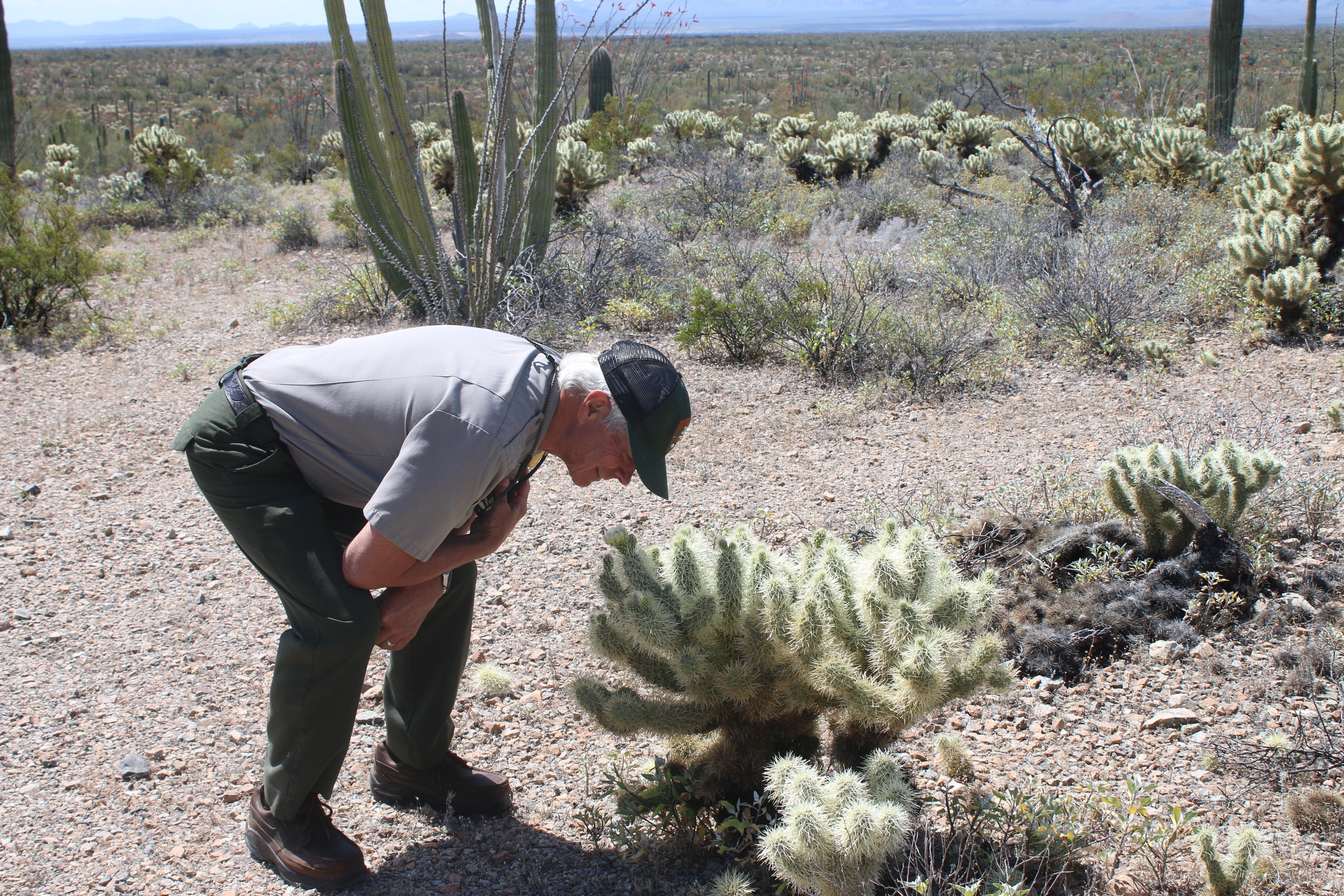
Stop 17, marked by a small white road sign with the number "17" on it, is located on a pass between two hills. The slope between the pass is covered with teddy bear cholla, a seemingly fuzzy looking cactus full of sharp, light-green, translucent spines. When blooming, these cacti have light green-colored, cup shaped flowers.
Stop 18, marked by a small white road sign with the number "18" on it, is located on the west side of the Ajo Mountain drive, closer to the beginning of the drive. The dirt pulloff is located near a small but rocky hill covered with palo verde trees, saguaros, and organ pipes. The visitor center and park housing area is visible in the distance to the west.
A small road marker with the number "2" lays on the side of the dirt road. The surrounding area is flat and filled with desert shrubbery, including creosote, chain-fruit cholla, and teddy-bear cholla. Tall saguaros and a few organ pipes also dot the landscape. In the distance rise the Ajo Mountains range.
Stop two is located along the dirt Ajo Mountain Drive road. The surrounding area are flat, desert plains with sparsely growing creosote, ocotillos, cholla cactus, and saguaro cactus. Some of the saguaros have many arms sticking out, while others are straight without arms. In the distance looms the Ajo Mountains: a rugged and flat mountain range with visible layers of tuff and rhyolite rock.
A small road sign marks "Stop 4" along the Ajo Mountain Drive. This stop is located in a flat desert area with sparsely spread out saguaros and creosote, with a few large individual organ pipe cacti. In the distance to the east looms the Ajo Mountains, a flattish, rugged range made from rhyolite and tuff rock.
Stop 5 is located in a flat desert area dominated by shrubby creosote plants and a thick grove of saguaro cacti. To the north of Stop 5 looms the rugged Tillotsen Peak, and the east rises the Ajo Mountain range.
Stop 6 is located on the edge of Diablo Wash, a dry canyon carved into the rocky hillsides. The wash is sandy, with palo verde trees, mesquite and other vegetation lining the edges and raised islands in the wash. A shaded picnic area sits near the edge of the wash, along with a wayside sign about "Shaping the Culture, Shaping the Land."
Stop 7, indicated by a small white road sign with the number "7" on it, is located at a scenic vista overlooking the dry desert wash, Diablo Wash. A picnic table perches on this rocky overlook. To the south is United States-Mexican border wall, and the large Cubabi mountains looming in the distance. The town of Sonoyta, in Mexico, rests beneath the Cubabi mountains. To the east are the Ajo Mountains, lush with desert vegetation, organ pipe cacti and saguaros. Close to stop 7 is a cristate saguaro, whose body grows straight but then radiates into a fan-like formation at the top.
Stop 8 is located at slightly higher elevations along the desert drive, closer to the bulging, striped, peaks along the Ajo Mountains. The pull-off, indicated by a small white road sign with the number "8" on it, sits against a slight slope full of Engelmann prickly pear patches.
Stop 9, marked with a small white sign with a "9" on it, faces a Boxtop peak, a bulbous rounded peak with a small pointy protrusion at the very top center. The surrounding hillsides are lush with saguaros and desert shrubbery.
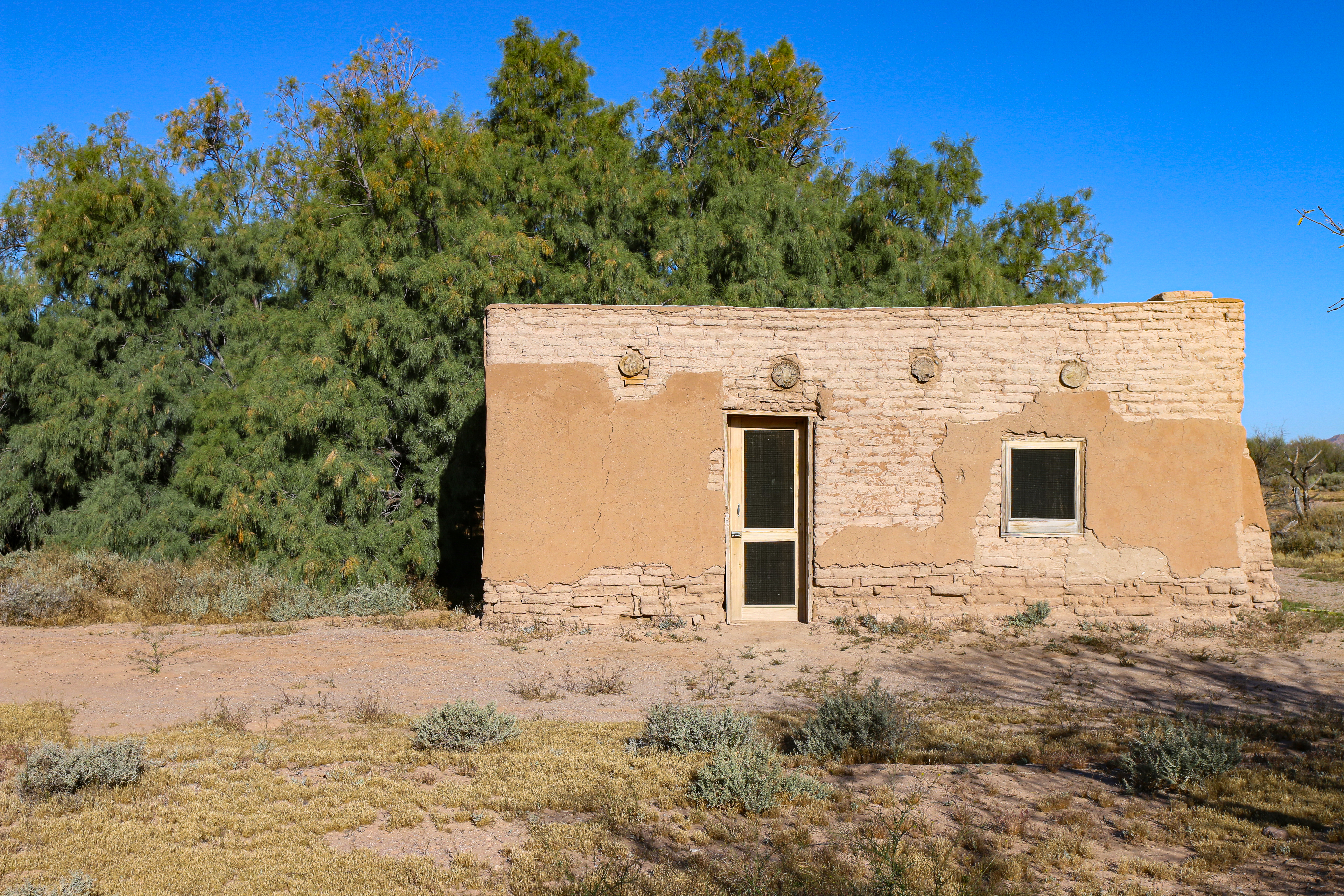
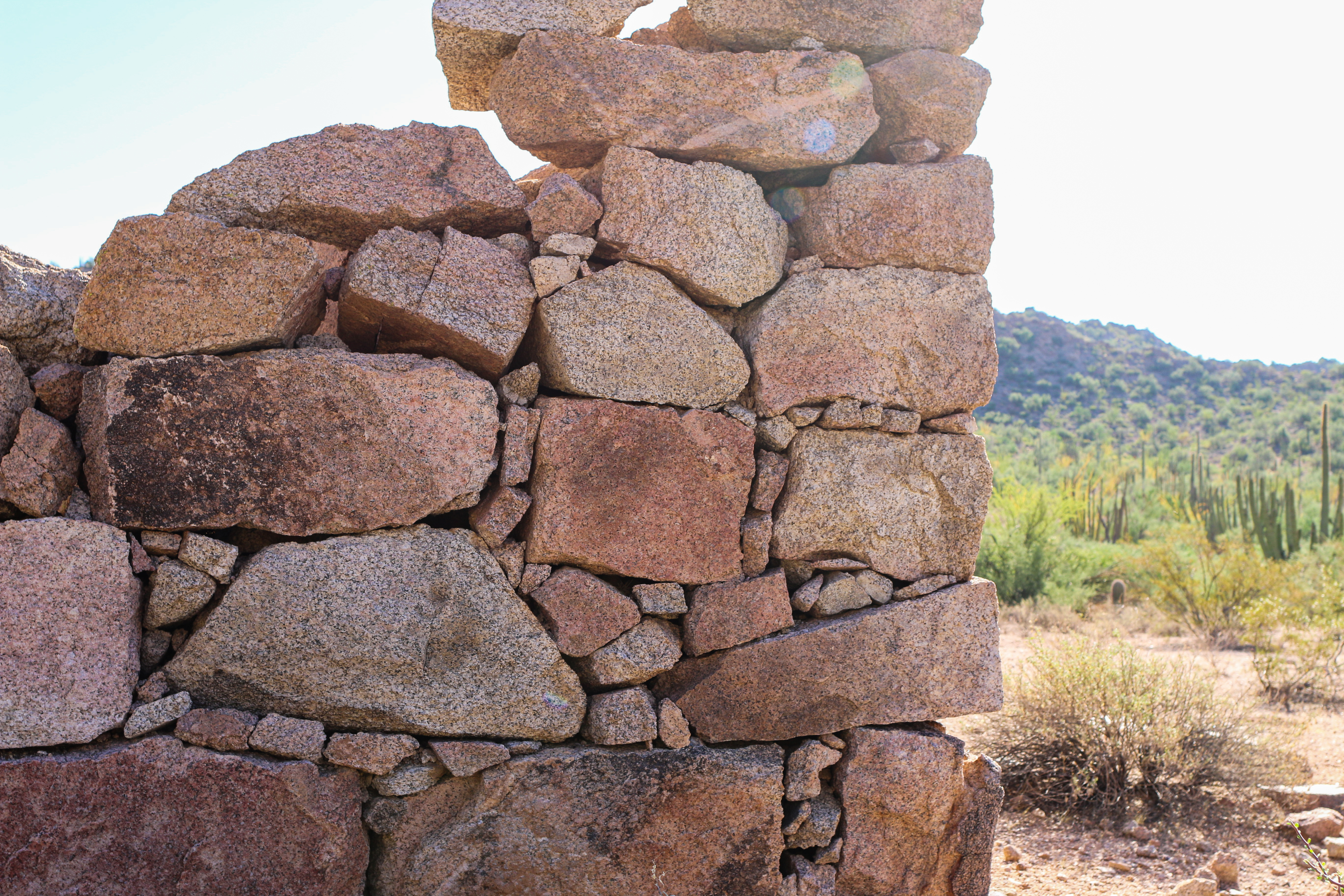
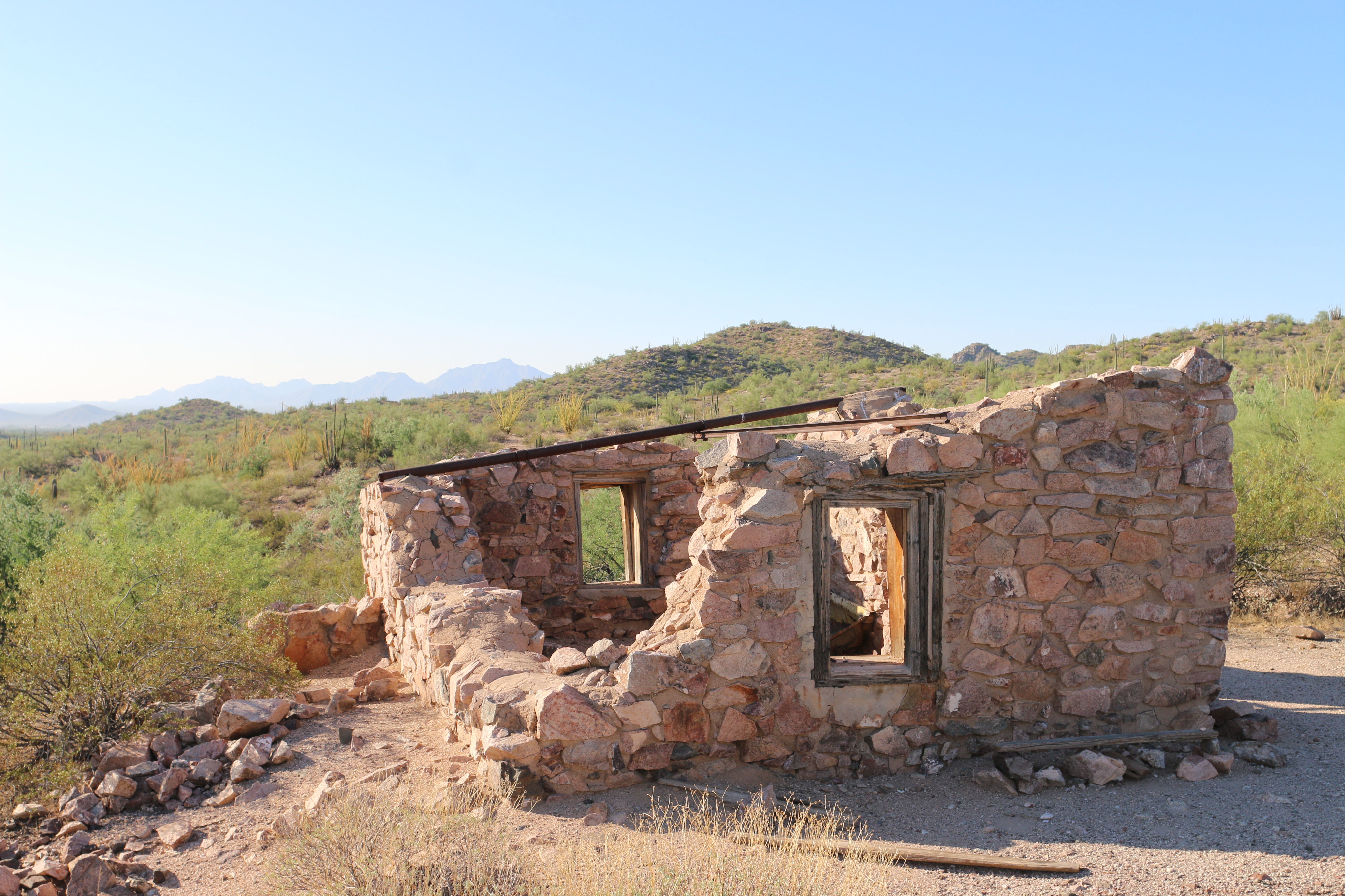
A restored adobe line camp used by the Gray family during the once vast cattle ranching era of the mid 1900s. Visitors can witness the resourcefulness of Sonoran Desert ranchers in the construction and use of native materials in the line camp, but can also view the effects of overgrazing on the surrounding landscape.
As one approaches Gachado Line Camp, there are dilapidated wooden fence posts, troughs, and the surrounding area is relatively flat and lacks vegetation. A giant tamarisk tree grows next to the line camp. The actual building is a one-room, rectangular, tan colored, adobe building with several small, square windows and one door. Only sections of the building are covered with an outer layer of adobe, the rest of the building shows exposed brick. Large tree beams stick out of the front of the building. Inside the building are dirt floors and construction equipment from the ongoing restoration. To the south of Gachado is the international border and border fence.
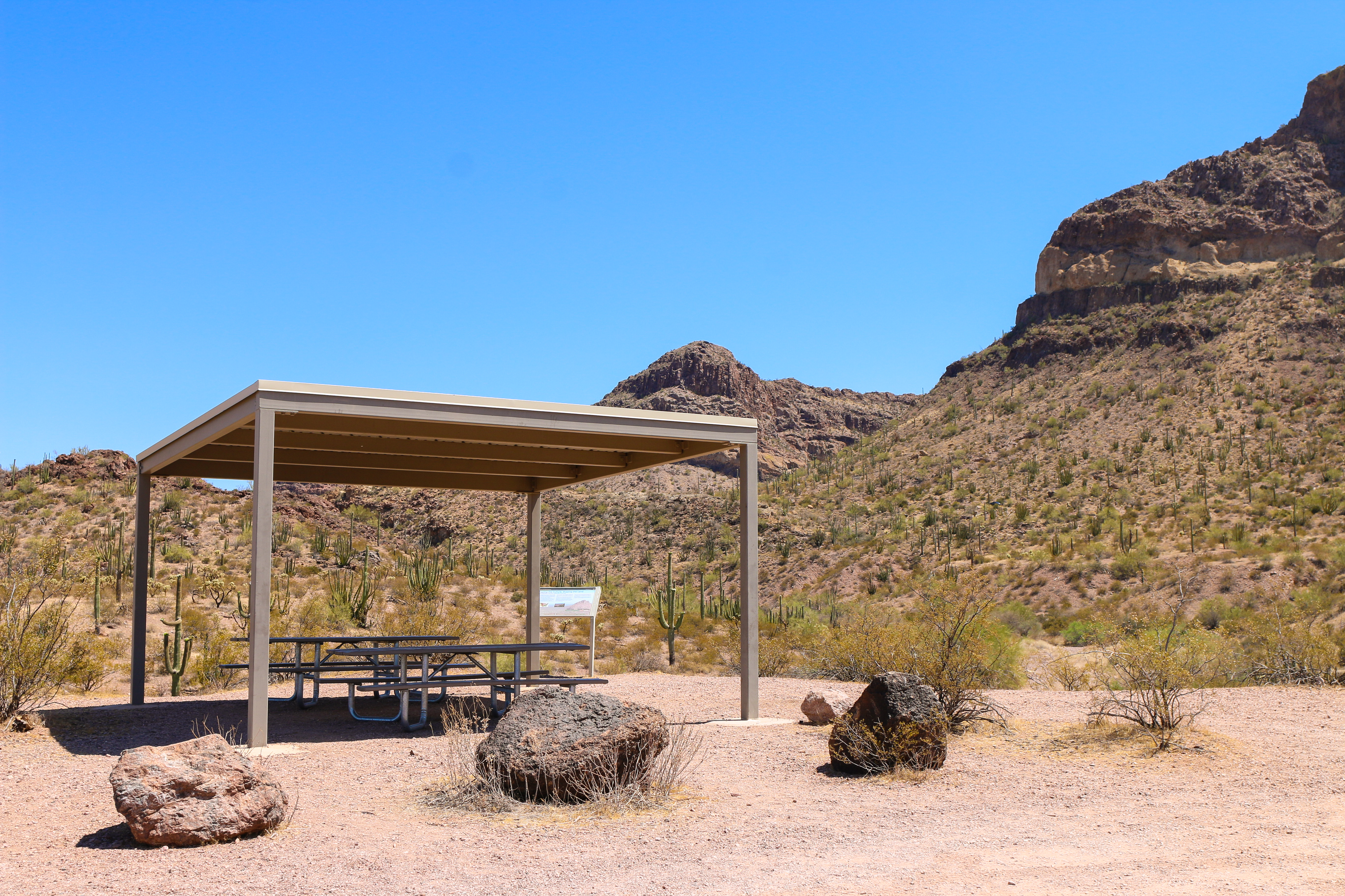
The colorful Pinkley Peak is the highest peak in the Puerto Blanco Mountains. This peak is affectionately named for National Park Service Ranger and Superintendent, Frank “Boss” Pinkley. Nested at the base of the peak are covered picnic areas and restrooms.
Pinkley Peak is a large, triangular-shaped peak formed of rhyolite, a brownish-red jagged rock. The peak a slanted, horizontal layers of tuff, a lighter yellow colored rock. Patches of vegetation and saguaros are visible on the peak. At the eastern base of the peak, about half a mile from the base, is the picnic area. The picnic area has several light colored ramadas (square shaped shade structures) with picnic tables. The picnic area has a vault restroom. To the east there are views of the Ajo Mountain Range, a small, flat, red-tinged mountain range. To the south are views of a double crested peak (Twin-peaks). Surrounding the area are vast swaths of desert plains and washes, dotted with creosote, palo verde, saguaros, organ pipe cacti, and ocotillos.
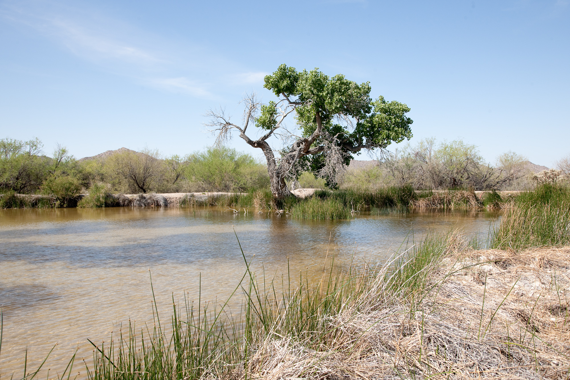
As a natural spring leading to a human constructed pond, Quitobaquito has been used by people for over 16,000 years. The area has a rich history and is an important part of the cultural landscape of the O’odham people. Quitobaquito is also home to several endangered species, including the Quitobaquito Pupfish and the Sonoyta Mudturtle.
A small, shallow pond, about 50 feet long by 25 feet wide. The pond is lined with reeds and a small dirt trail. Further surrounding the pond is a mix of mesquite, palo verde, iron wood, cottonwood trees and other smaller, thorny shrubs. A large cottonwood grows on the northern edge of the pond. Leading into the pond is a skinny, cement channel that runs from the natural spring about 0.1 miles west of the pond. The surrounding area is hilly desert land, with the border wall rising to the south. In the pond live small, 1 or 2 inch long fish called Quitobaquito pupfish. The males are a bright blue color while the females are a duller gray. Small Sonoyta mudturtles bask on small sticks or stick their noses out of the water. A family of American Coots visits and lives in the pond every spring.
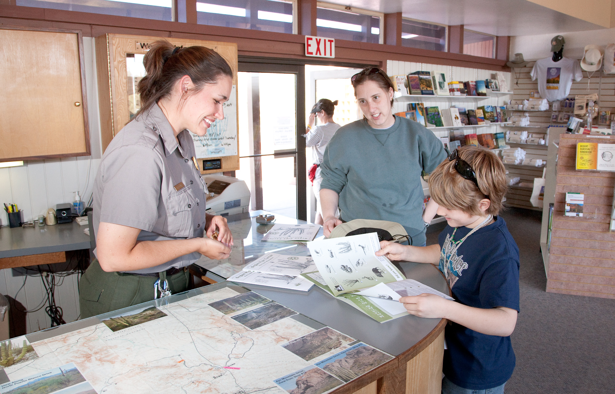
The Kris Eggle Visitor Center is a great place to start your visit at Organ Pipe Cactus. Rangers there provide orientation to the monument, answer questions, and offer suggestions on how to best enjoy your experience during your time here. Inside is an information desk with maps and guides, an exhibit area where visitors may learn about the Sonoran Desert, and a bookstore. A short nature trail starting behind the visitor center features Quitobaquito pupfish and signs about the life found in the monument.
Enjoy scenic views along an 8-mile one-way hike as you explore a historic wagon road through the Sonoran Desert!
Hike the Senita Basin Loop
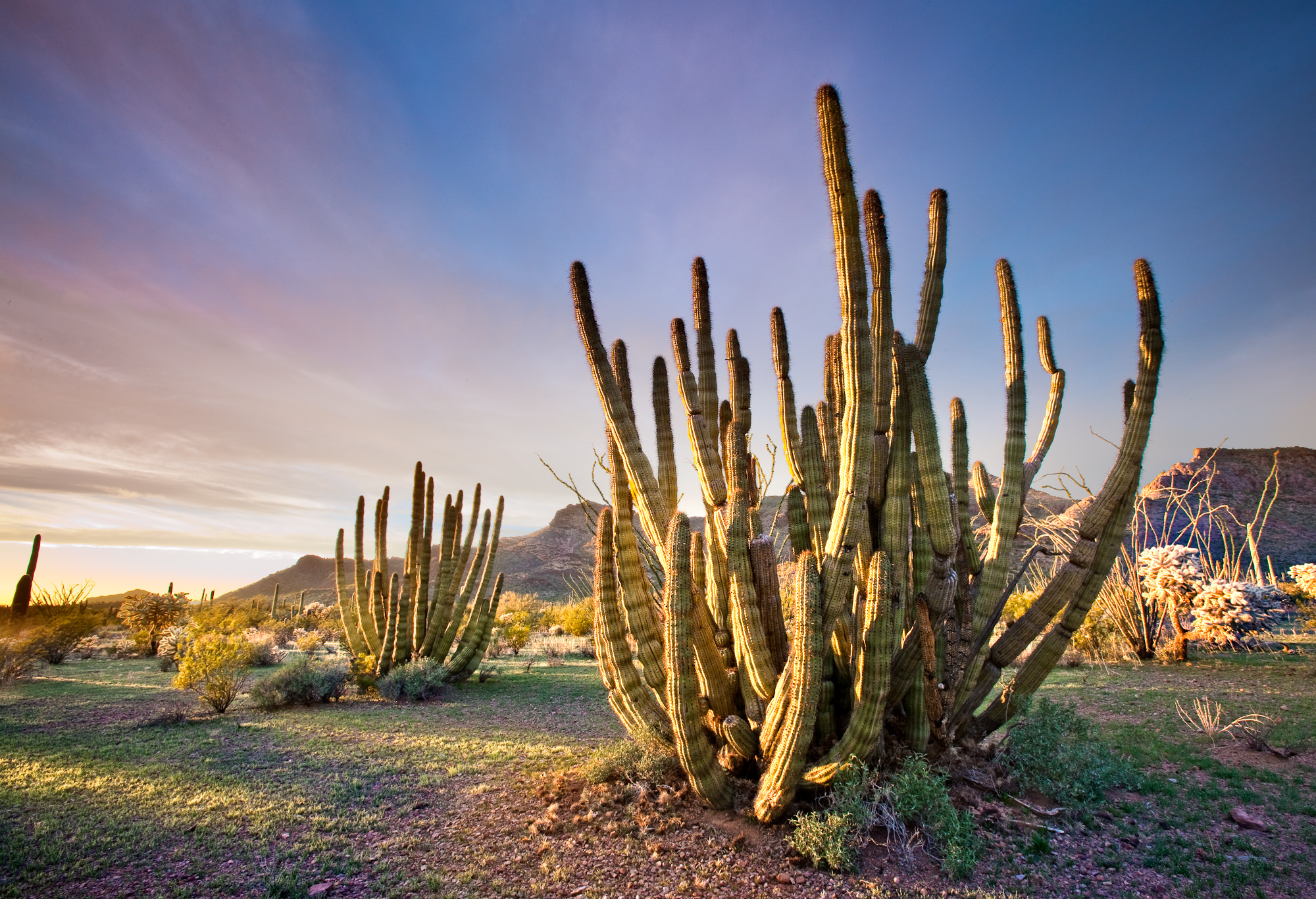
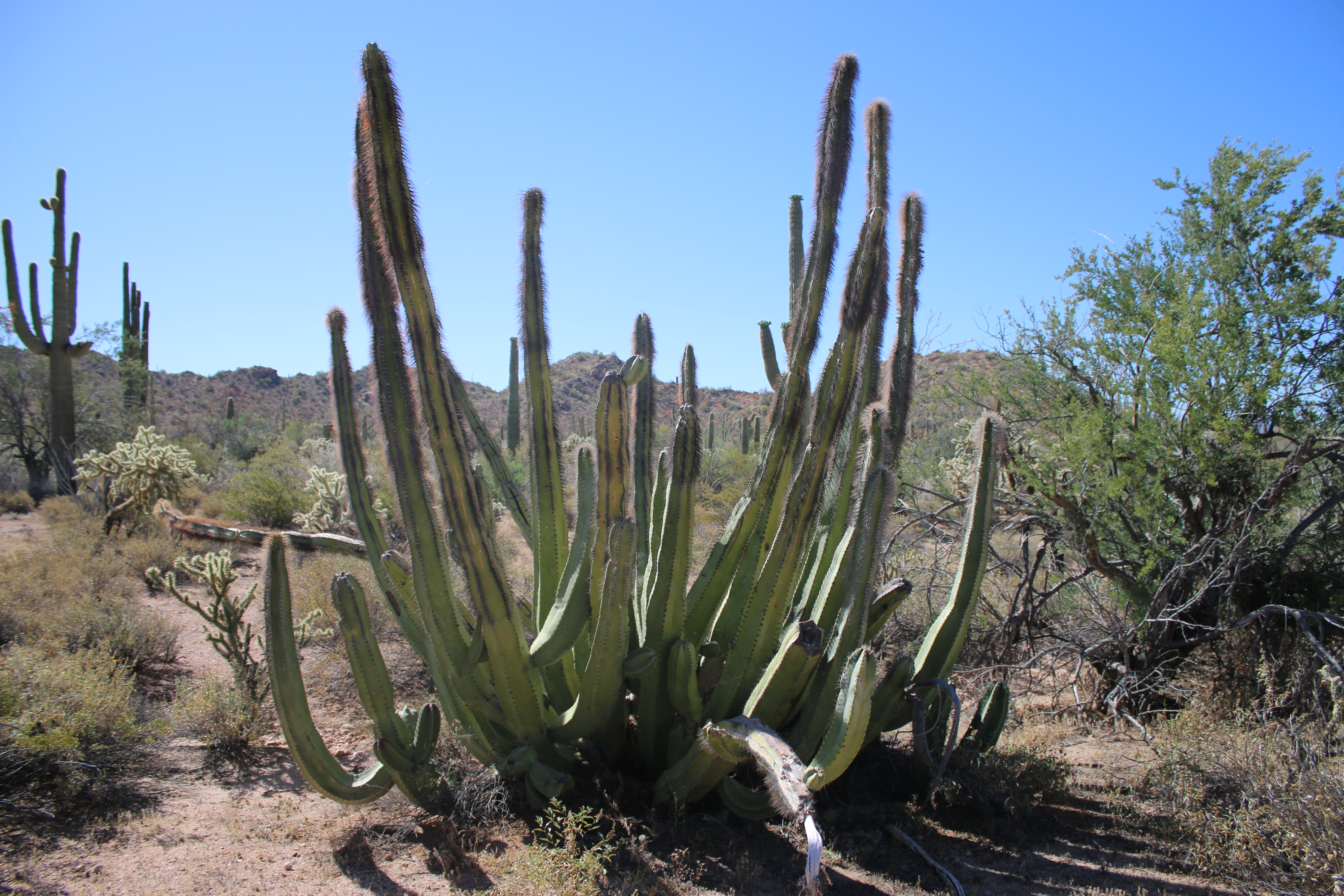
Easy loop trail located in a low elevation area on the south side of the Puerto Blanco Mountains. This lush basin is one of the few places you can see all three of the park’s columnar cacti coexisting: saguaro, organ pipes, and the senita cacti. The most impressive groves of senita cacti are along the road into Senita Basin and near the trailhead.
Hike the Estes Canyon/Bull Pasture Loop
The moderate Estes Canyon trail provides ample wildlife and wildflower viewing opportunities while a steep, strenuous climb up the Bull Pasture spur trail will reward visitors with spectacular views of the Sonoran Desert.
Hike to Lost Cabin
Looking for a lengthier hike that showcases Organ Pipe’s mining history? This 8 mile (12.9 kilometers) round-trip hike includes the Victoria Mine site and an old stone mining house known as Lost Cabin.
Hike to Victoria Mine
Experience Organ Pipe’s mining history by hiking to Victoria Mine, one of the oldest prospecting sites in southwest Arizona and the heart of gold and silver mining in the Organ Pipe area.
Unearth Dripping Springs Mine
Stumble upon an old copper mine while exploring along the trail in the Puerto Blanco Mountains!
Hike Alamo Canyon
The Alamo Canyon Trail follows an old road to a historic ranch house and corral, and provides ample wildlife and wildflower viewing opportunities.
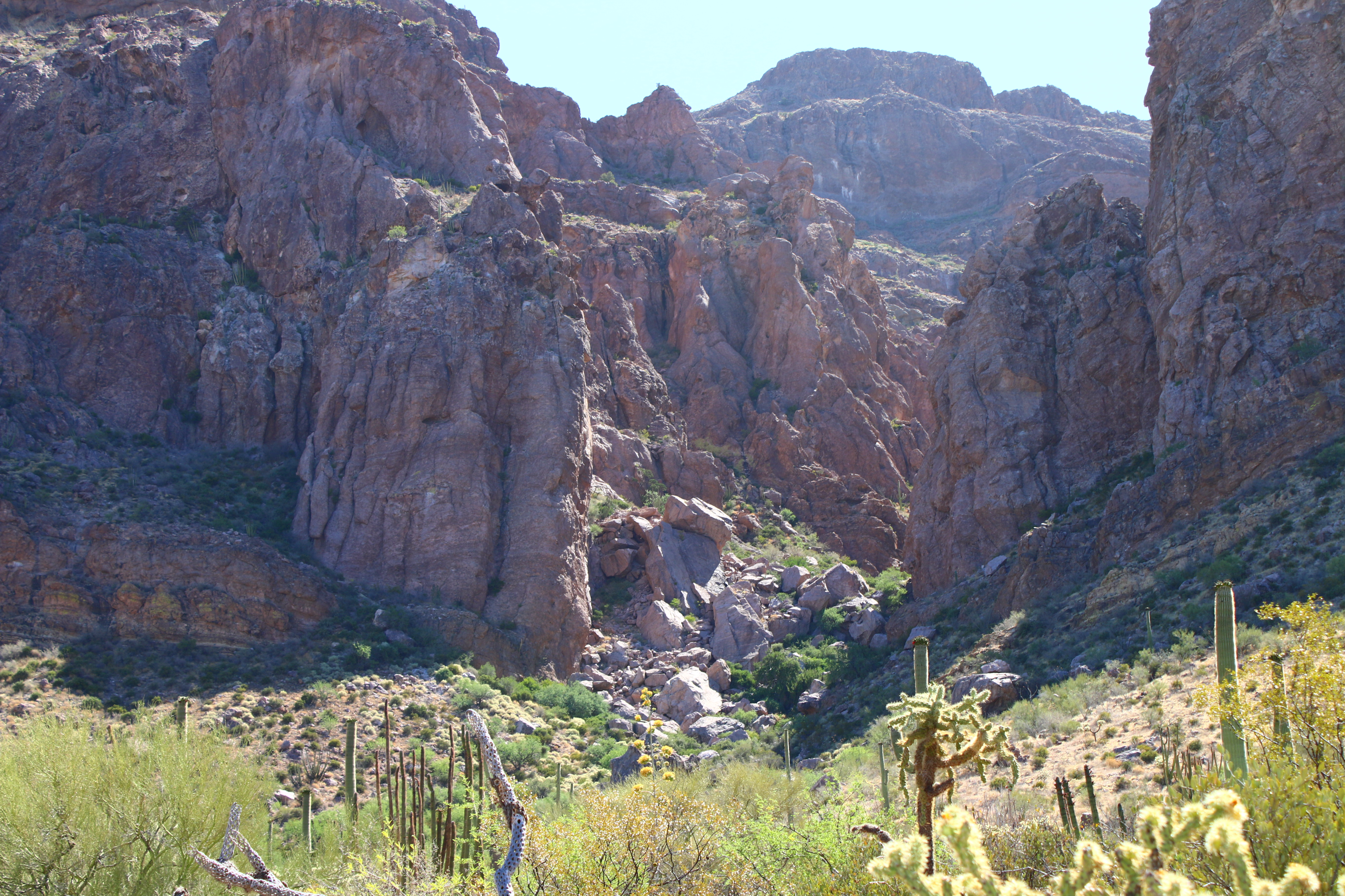
Hike Arch Canyon
One of the most photographed sites along the Ajo Mountain Drive are the double arches carved into the mountains. Walking the easy, relatively flat Arch Canyon trail provides wonderful opportunities to see wildflowers and gaze upon the rhyolite arches.
Watch the Sunset from Desert View Trail
Searching for that quintessential desert sunset? The Desert View trail has your back! This short, 1.2 mile (1.9 km) can be reached from Twin Peaks Campground and loops around striking stands of organ pipe cacti. The Desert View trail offers great views for sunrise or sunset.
See Endangered Pupfish Along the Visitor Center Nature Trail
Next to the Kris Eggle Visitor Center is a 1/10th of a mile paved nature trail that loops by a small pond and showcases native Sonoran Desert plant life. The trail begins by the back door of the visitor center and loops back around to the parking lot.
Stretch Your Legs on the Campground Perimeter Trail
This short, dog-friendly trail circles Twin Peaks Campground and is ADA accessible in areas!
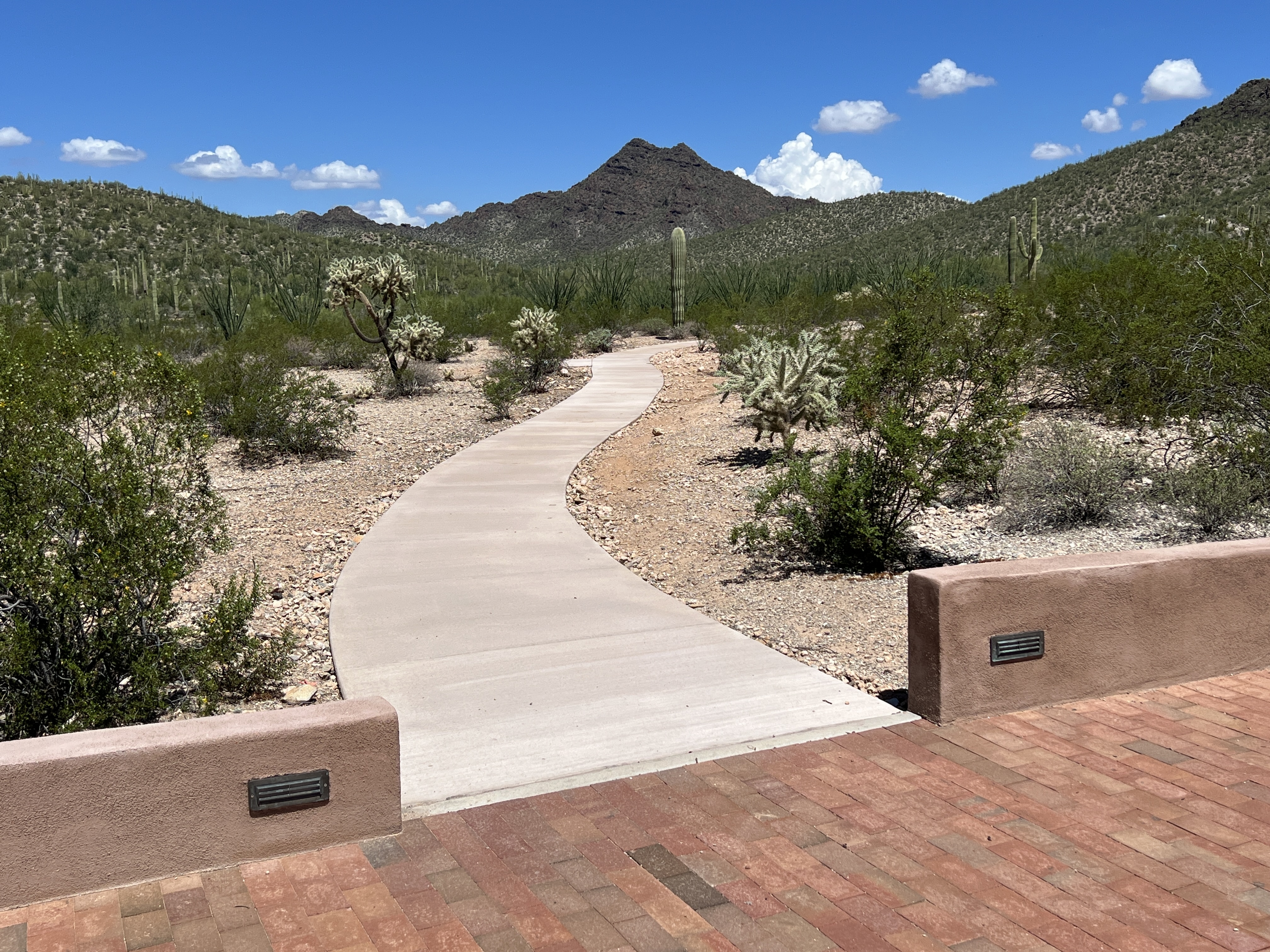
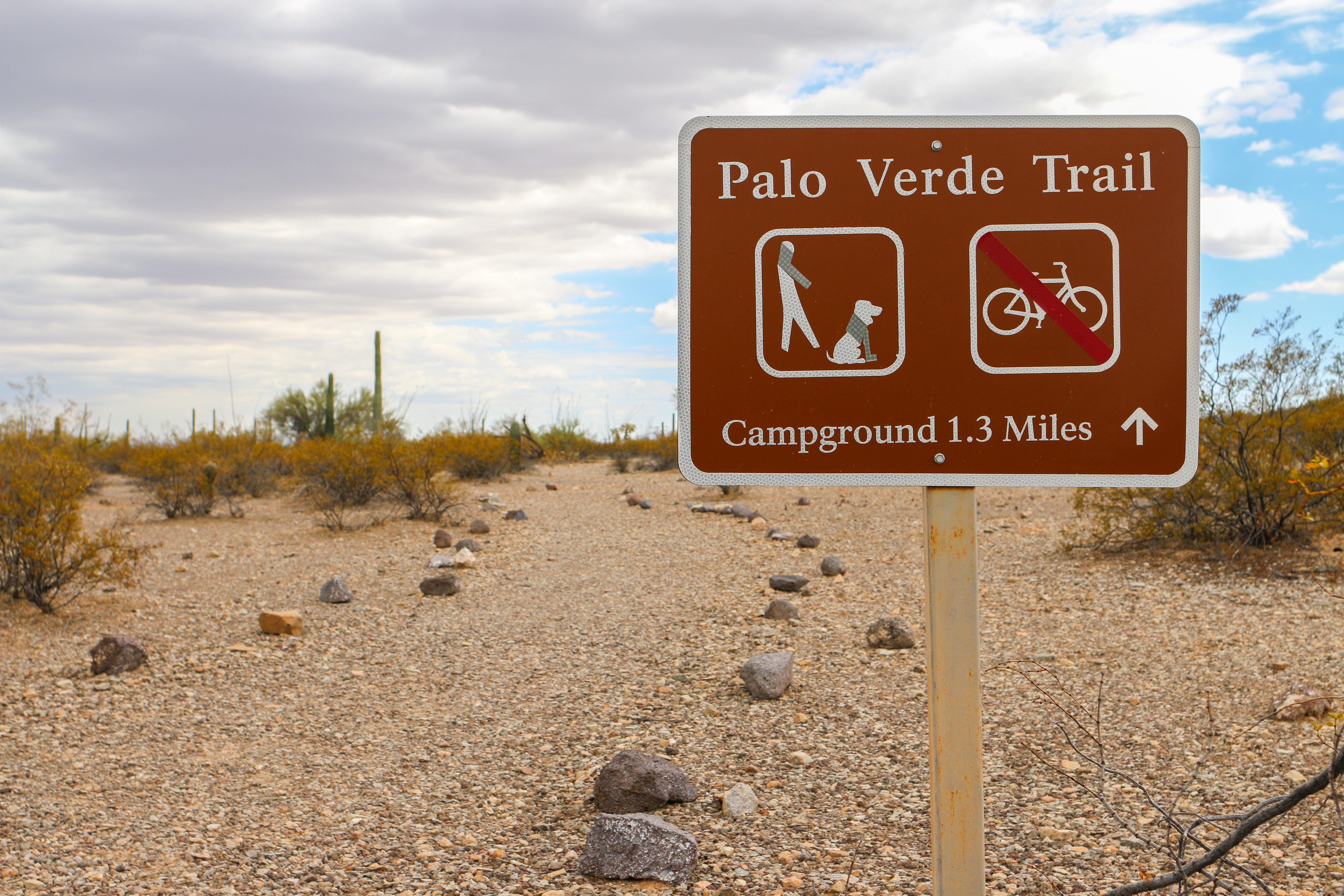
Walk Your Pet along Palo Verde Trail
Easy, pet-friendly trail that connect the Kris Eggle Visitor Center to Twin Peak Campground. Provides beautiful views of the Ajo Mountains.
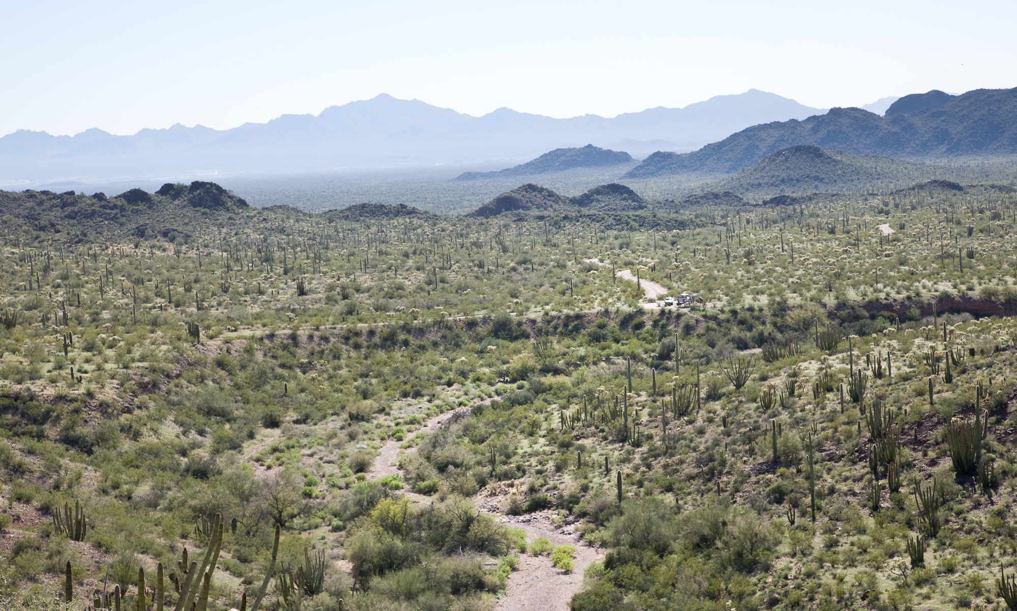
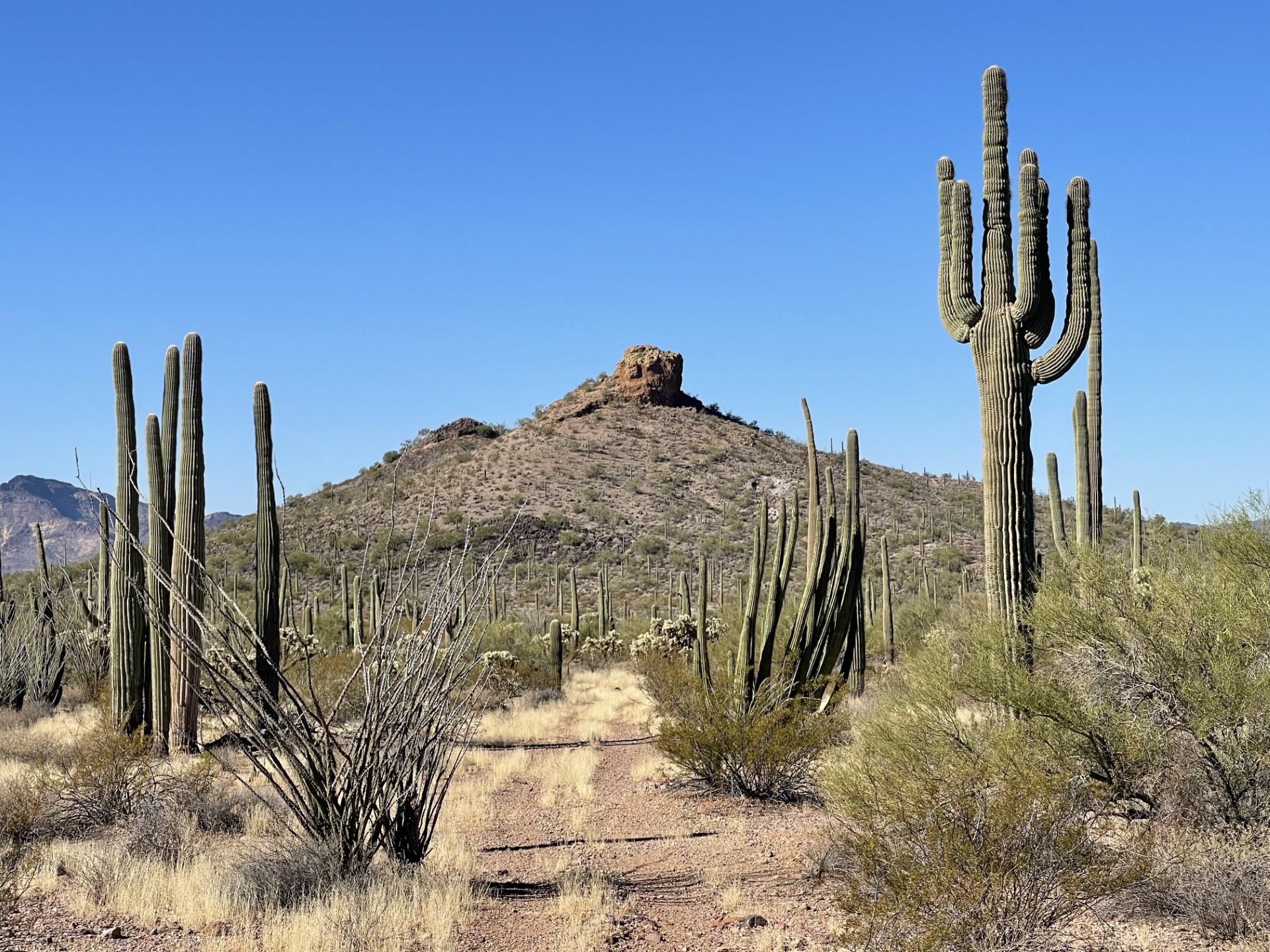
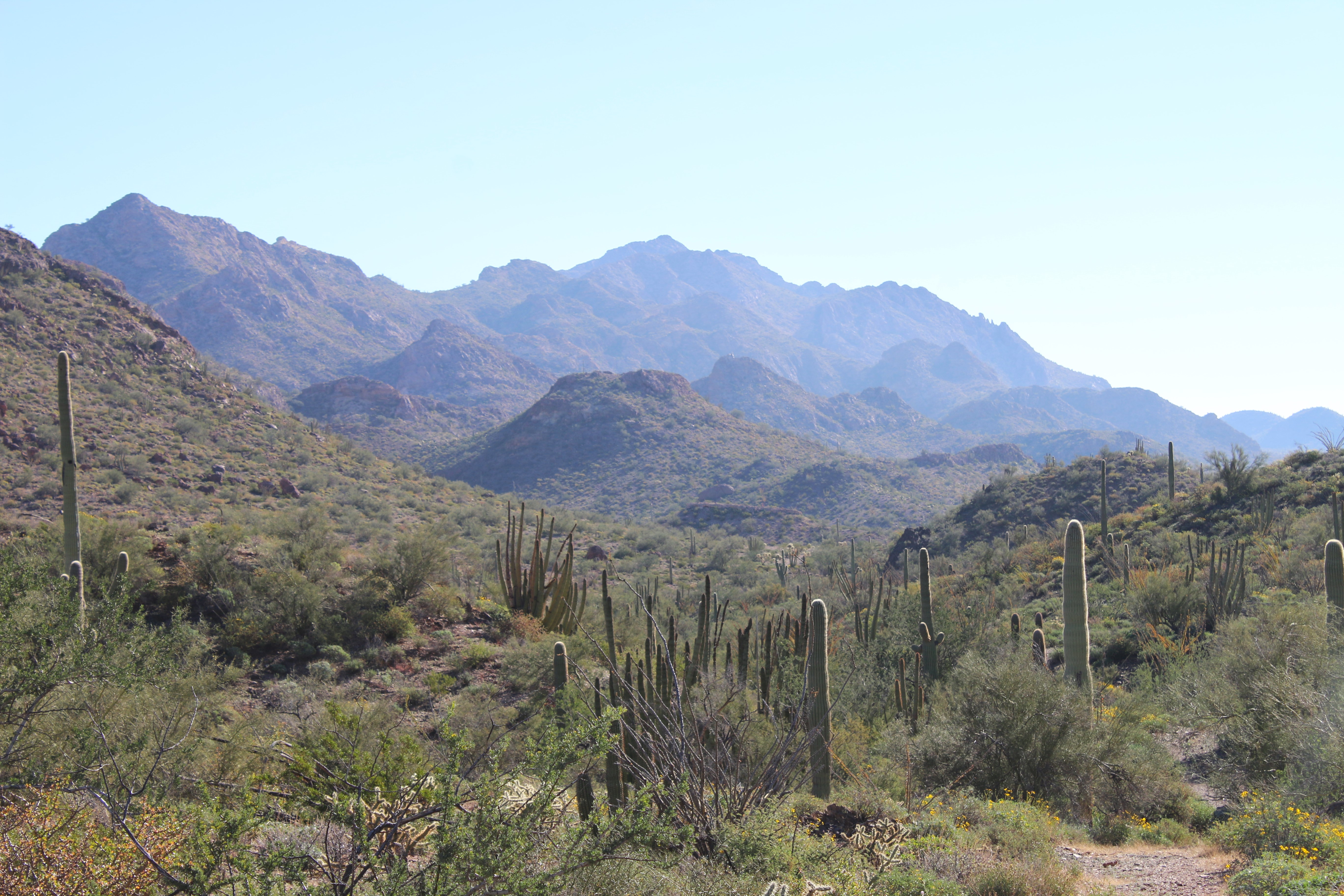
Drive the Ajo Mountain Loop
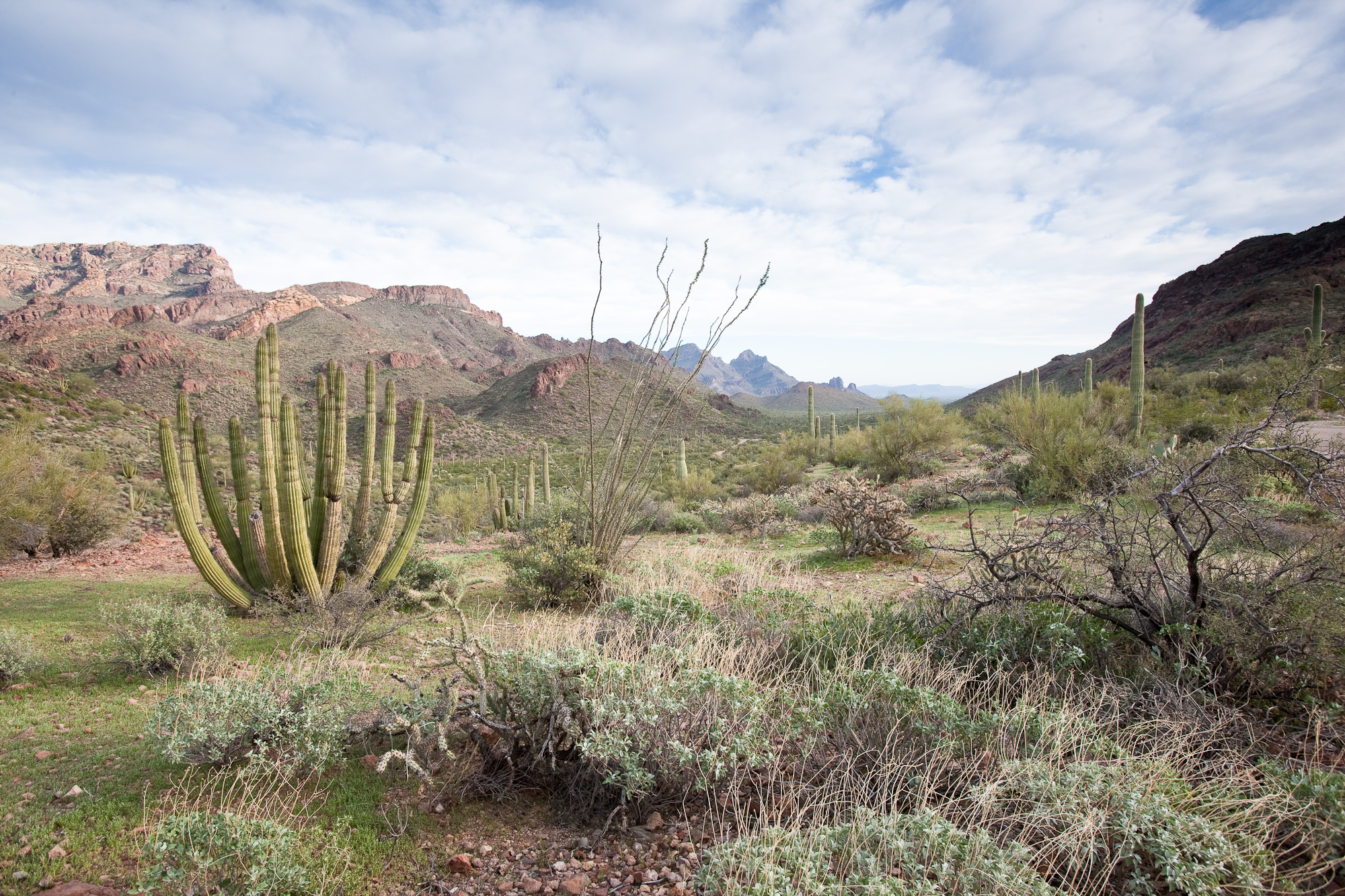
The Ajo Mountain Drive is a 21-mile (34 km) graded, one-way dirt road that gives visitors an excellent overview of the landscape and flora or Organ Pipe Cactus National Monument. The drive takes approximately 2 hours, and has been designed so that a passenger car, driven with caution, may be taken over it safely. Trailers, buses and RVs over 25 ft (8 m) are prohibited on the drive. Several hikes and backcountry camping can be accessed from this drive.
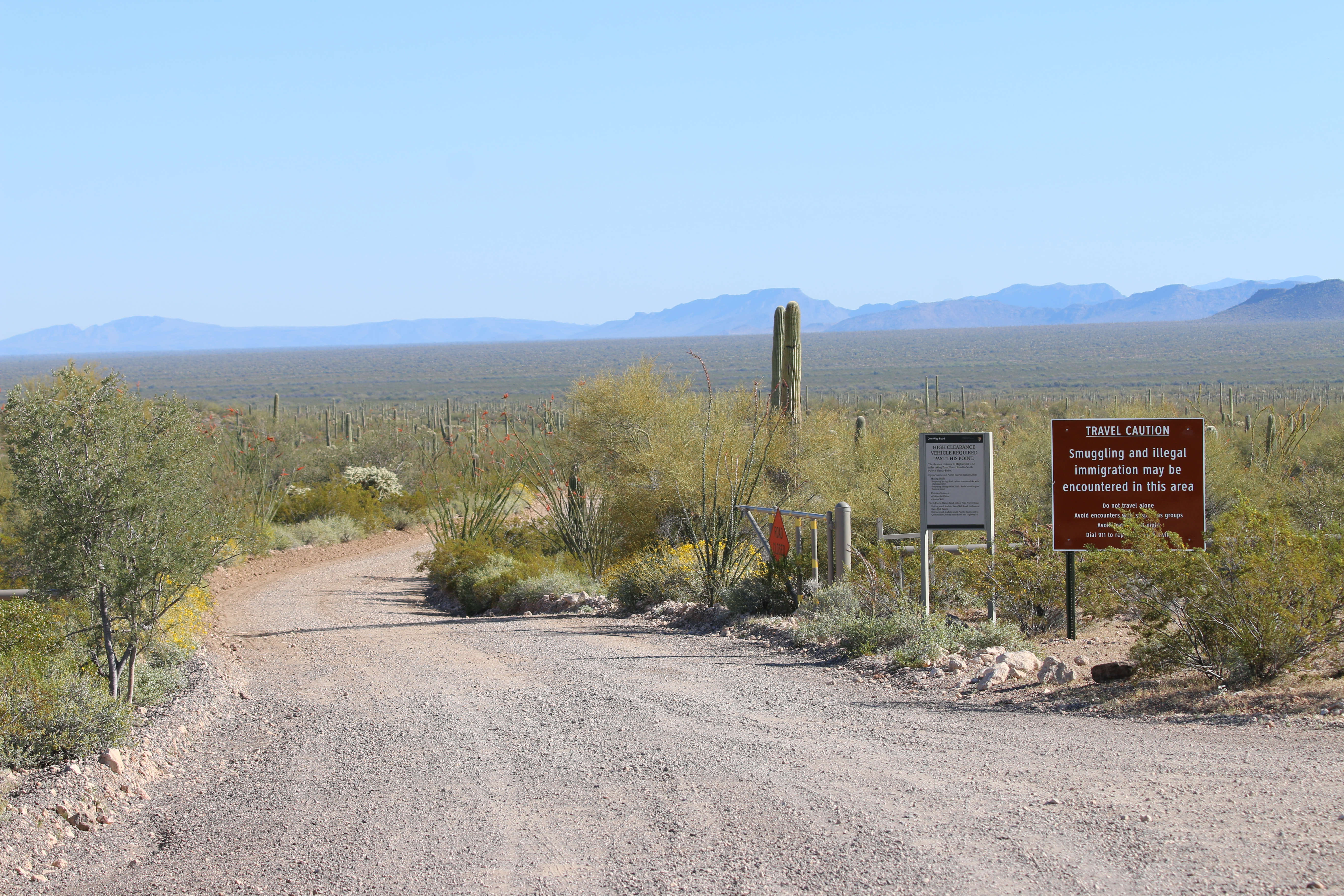
Drive the North Puerto Blanco Loop
For those looking for a longer, more rugged scenic drive through Organ Pipe, Puerto Blanco Drive is a great way to experience some of the park’s volcanic geology, mining history, and natural springs. The 41 mile Puerto Blanco Loop is broken into two parts: North Puerto Blanco Drive and South Puerto Blanco Drive.
Drive South Puerto Blanco Road
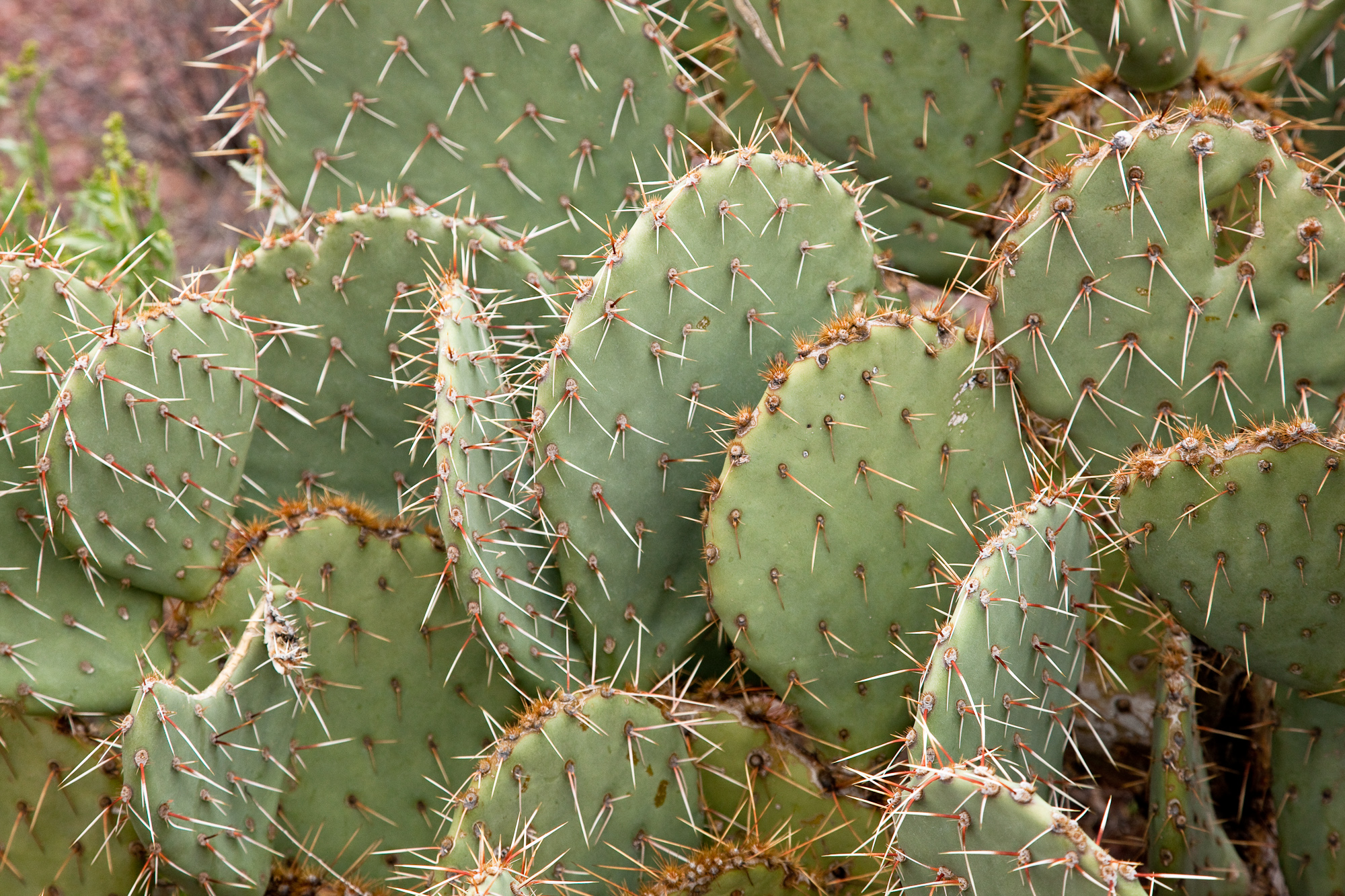
South Puerto Blanco Drive is a two-way, graded dirt road that follows the southern boundary of the park and provides access to Senita Basin and Quitobaquito Springs. Great examples of organ pipe, senita, and saguaro cacti are visible along this route. This road can be washboarded – reduce your speed and allow extra time. These roads are doable in a normal passenger car. Trailers, buses, and motorhomes over 25 feet (8 meters) are prohibited on the drive.
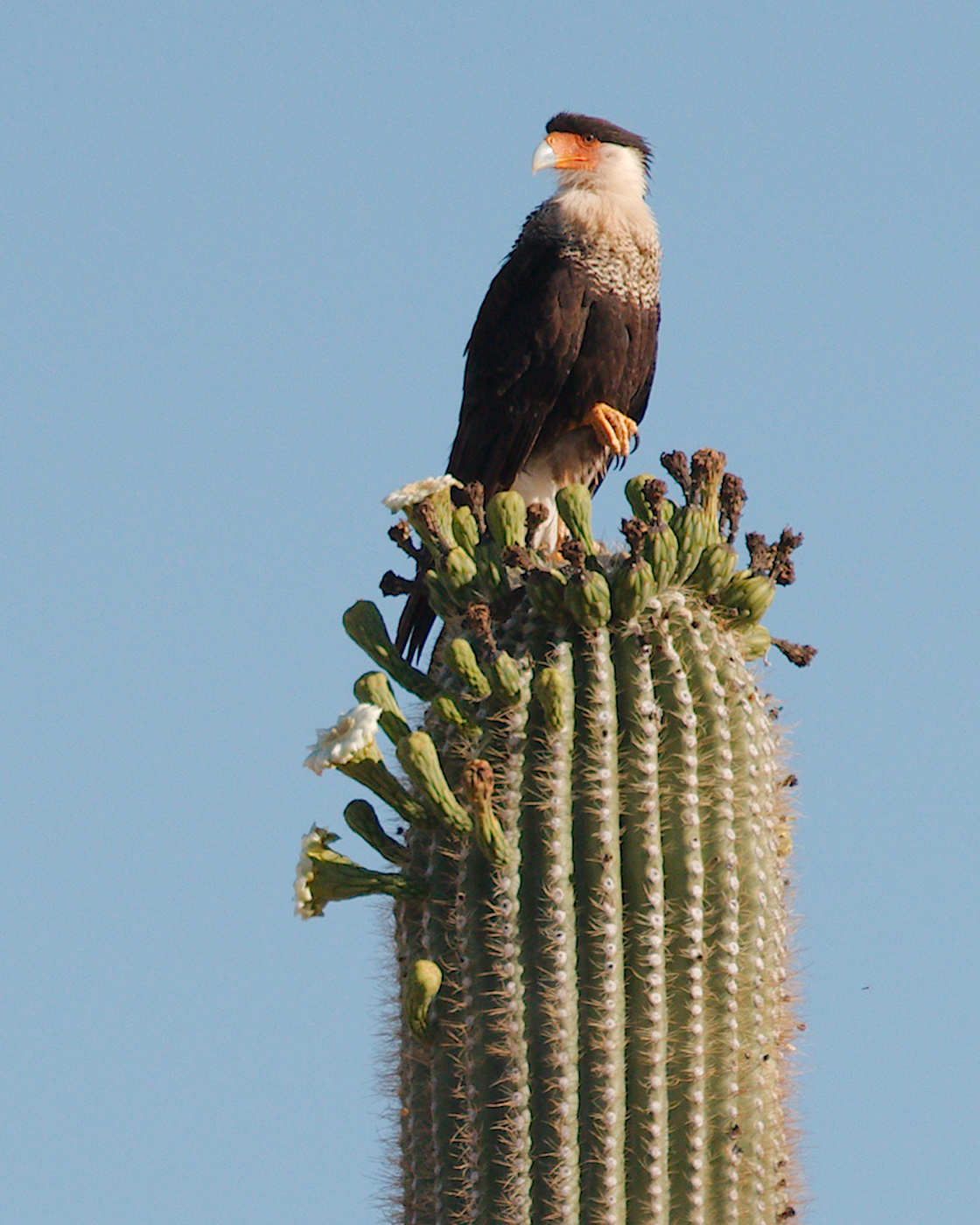
Birding at Organ Pipe
Organ Pipe sits along a primary migratory flyway, creating an oasis for bird enthusiasts of all levels. In addition to hosting an exciting array of migratory birds during fall and spring, we also have 36 species of resident birds that can be found year round at Organ Pipe.
Become an Organ Pipe Junior Ranger
Become a Junior Ranger at Organ Pipe Cactus National Monument.
Become a Desert Ranger
For the 'Not-so-Junior-Ranger," or those looking for a challenge, the free Desert Ranger program allows the young at heart to earn their Desert Ranger badge and patch by completing an activity booklet available at the visitor center.
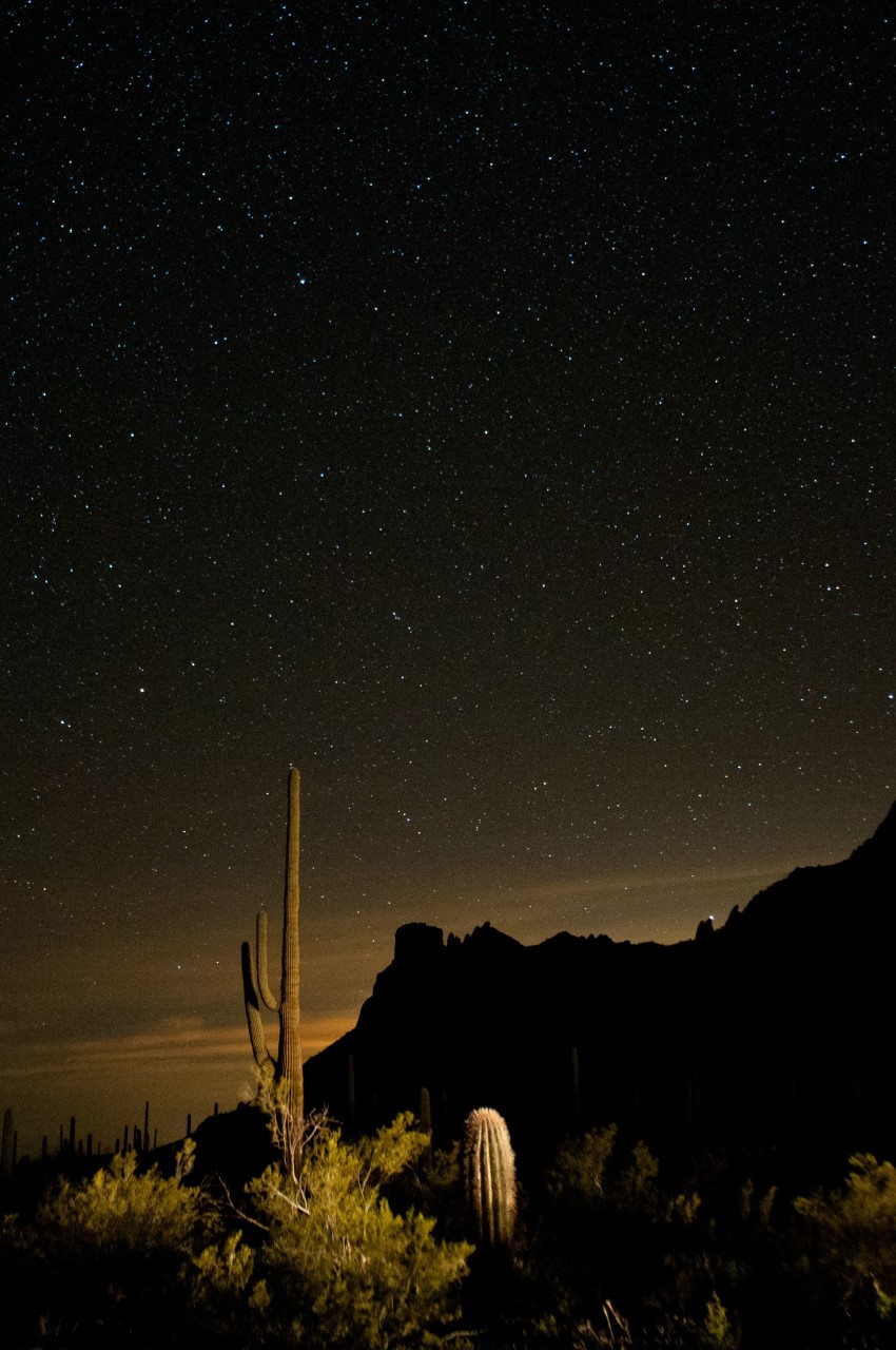
Stargazing at Organ Pipe
Take advantage of our monument's dark skies to do some stargazing and astrophotography, or join in on a night sky ranger program.
Tours
Count: 1
Ajo Mountain Drive - Self Guided Tour
Winding through desert and up into the Ajo Mountains, this drive offers numerous numbered stops with the chance to see and learn about the Sonoran Desert. A physical drive guide booklet can also be obtained in the visitor center.