| Title | Palo Alto Battlefield |
| Park Code | paal |
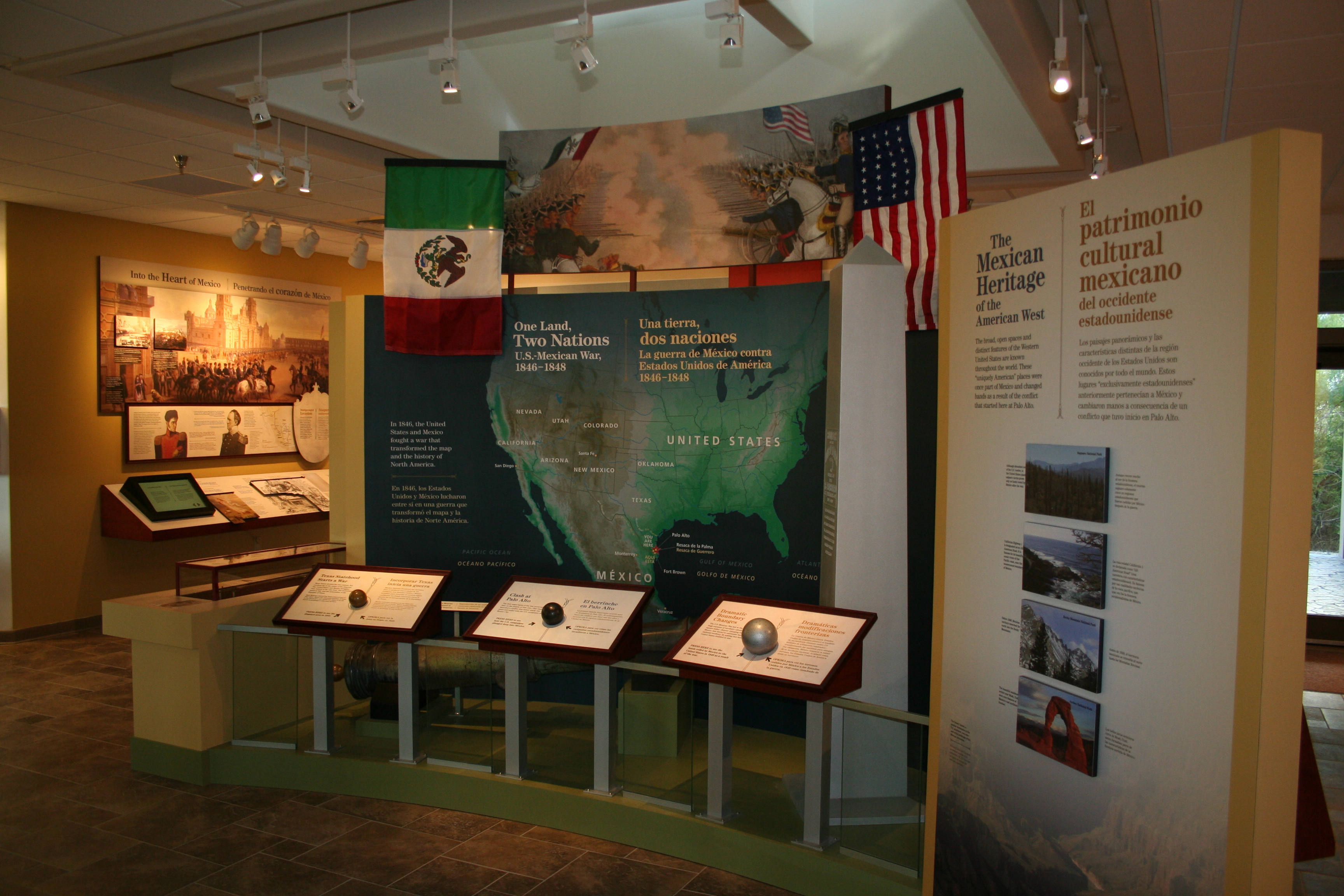
| Description | On May 8, 1846, U.S. and Mexican troops clashed on the prairie of Palo Alto. The battle was the first in a two-year long war that changed the map of North America. Although the two countries have developed strong bonds and friendly ties since the... |
| Location | |
| Contact | |
| Activities |
|
| Entrance fees |
|
| Campgrounds | Count: 0
|
| Places | Count: 37
A Ravaged Army Regroups WaysideThe “A Ravaged Army Regroups” wayside provides a sense of the impact of the Battle of Palo Alto on the Mexican Army. 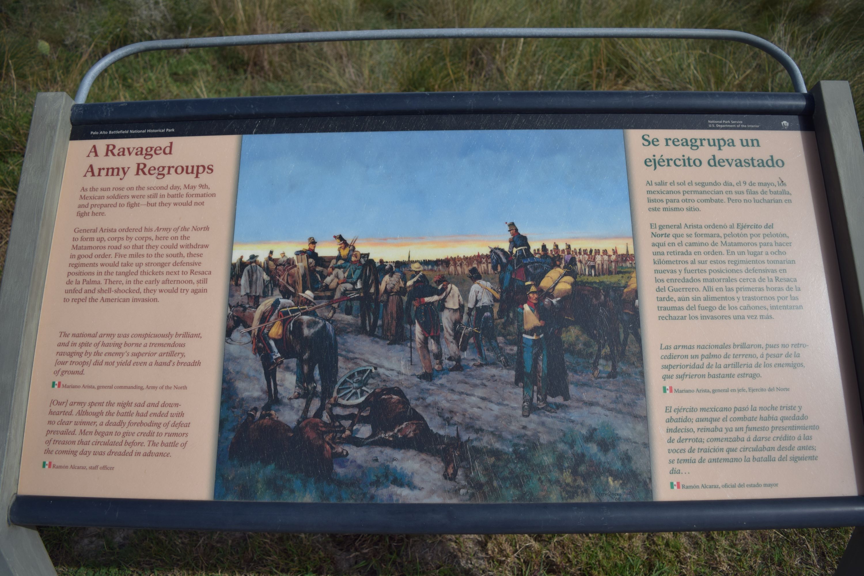
A Retreating River WaysideThe “A Retreating River” wayside provides an overview of some of the wildlife in the resaca habitat. 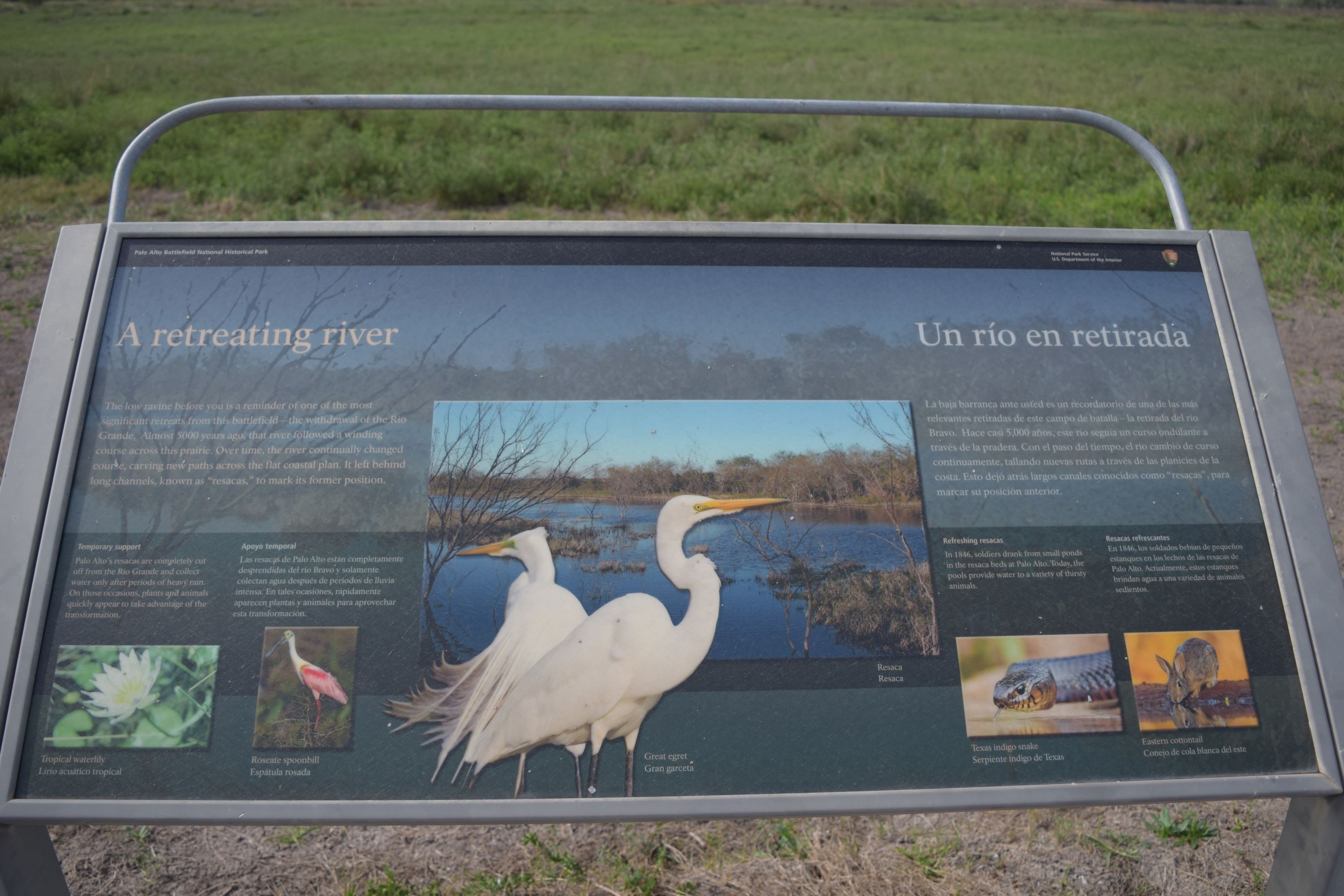
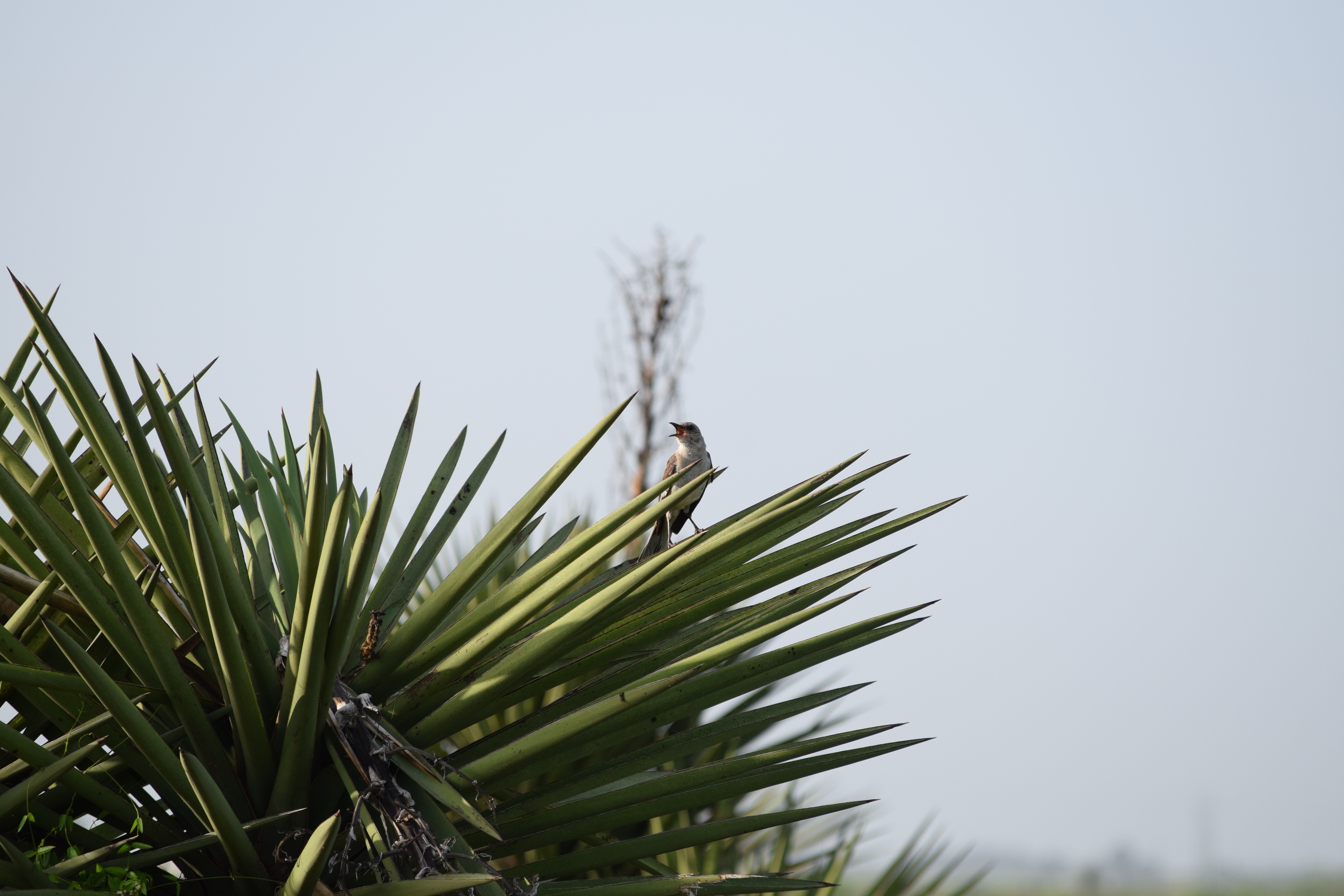
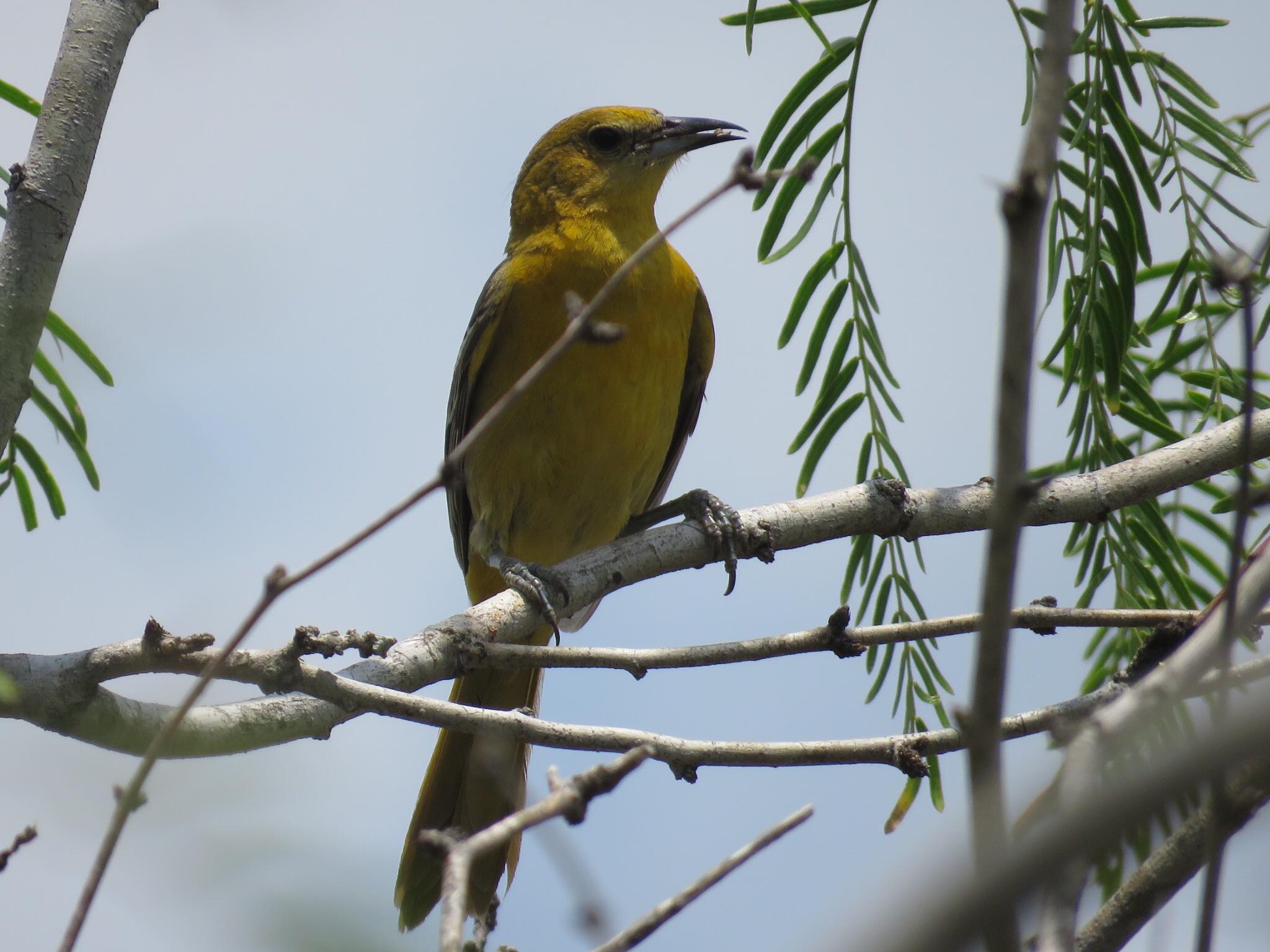
Air Power WaysideThe “Air Power” wayside provides a brief overview of some of the birds found at the park. 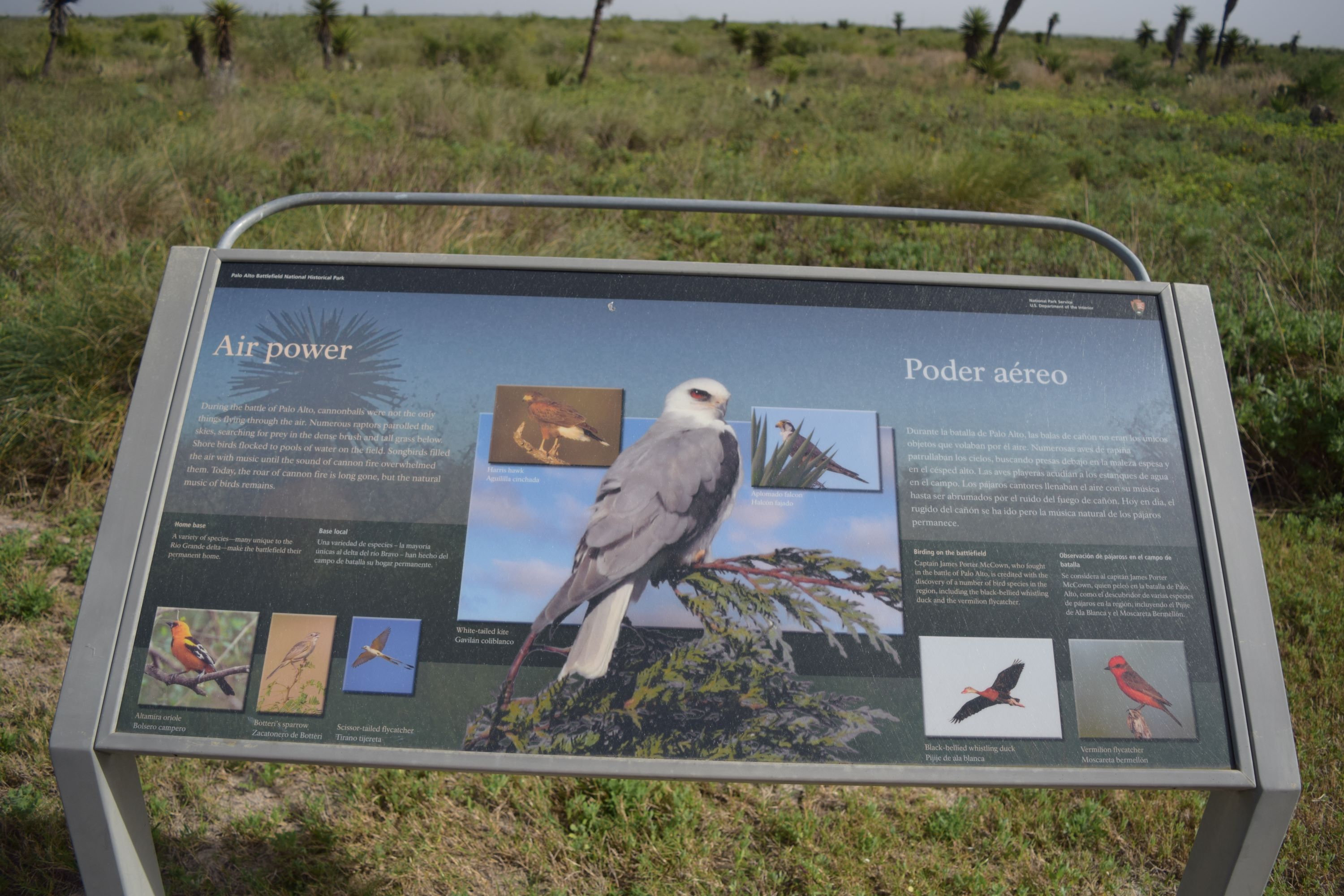
Artesian ParkArtesian Park is the site where U.S. troops encamped in the winter of 1845. 
Border War WaysideThe Border War wayside provides a brief introduction to the U.S.-Mexican War. 
Cavalry Charge WaysideThe “Cavalry Charge” wayside provides an overview of the pivotal moments at the Battle of Palo Alto. 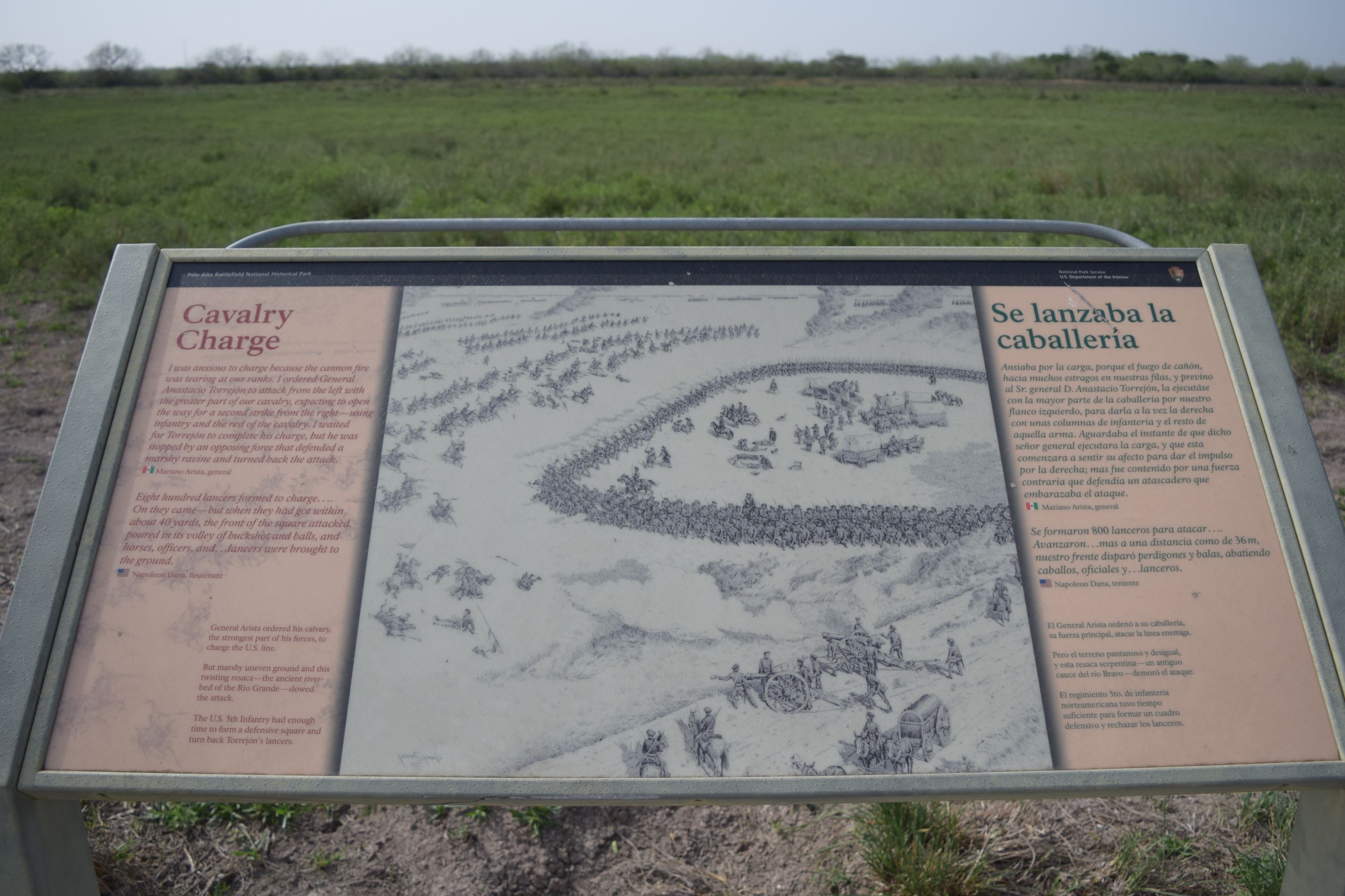
Chaparral TrailThe park’s Chaparral Trail gives visitors a chance to see one of the last remaining stands of native chaparral in all of South Texas. 
Chosen Ground WaysideThe “Chosen Ground” wayside provides overview of the positions of the U.S. and Mexican armies. 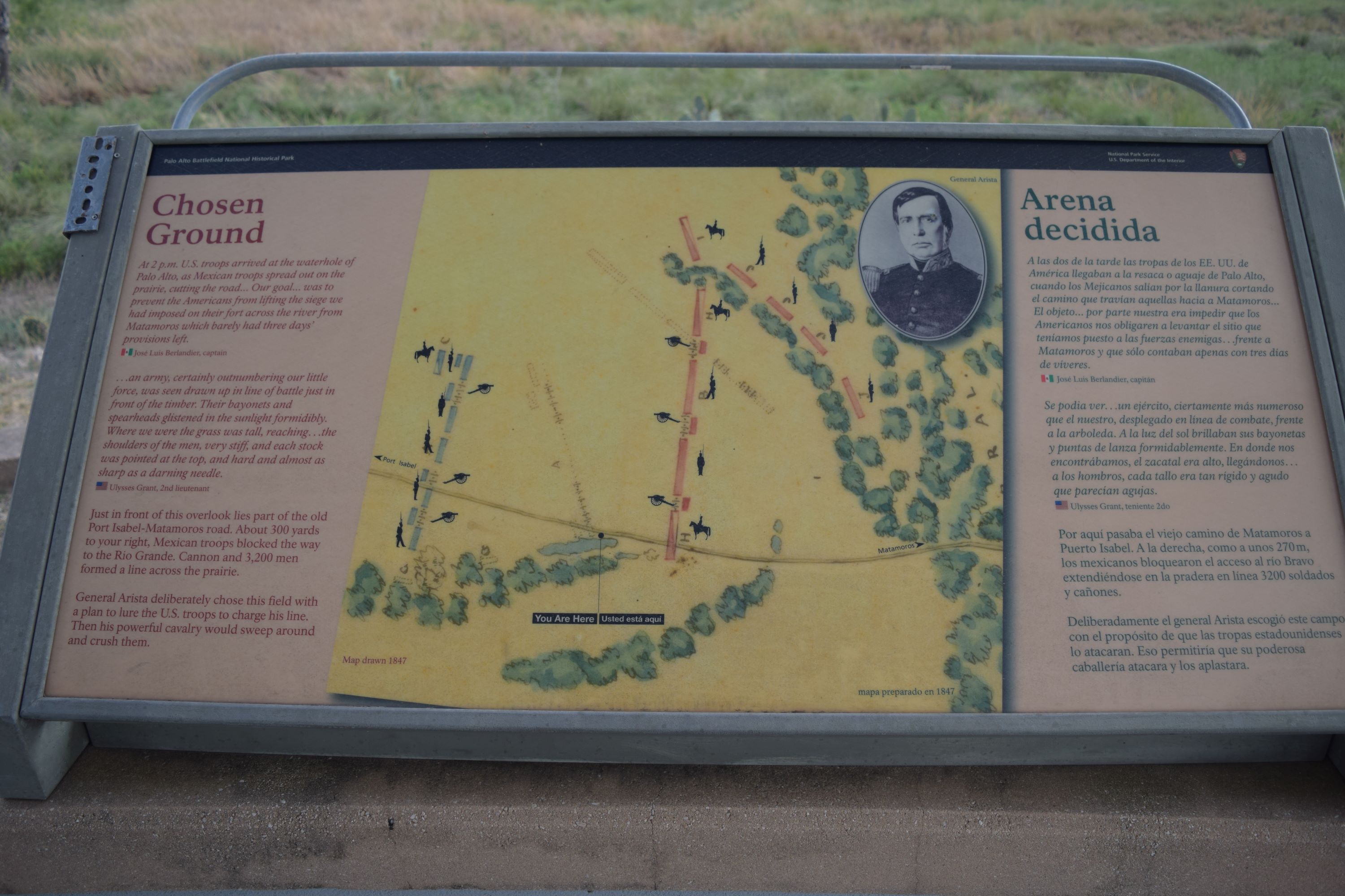
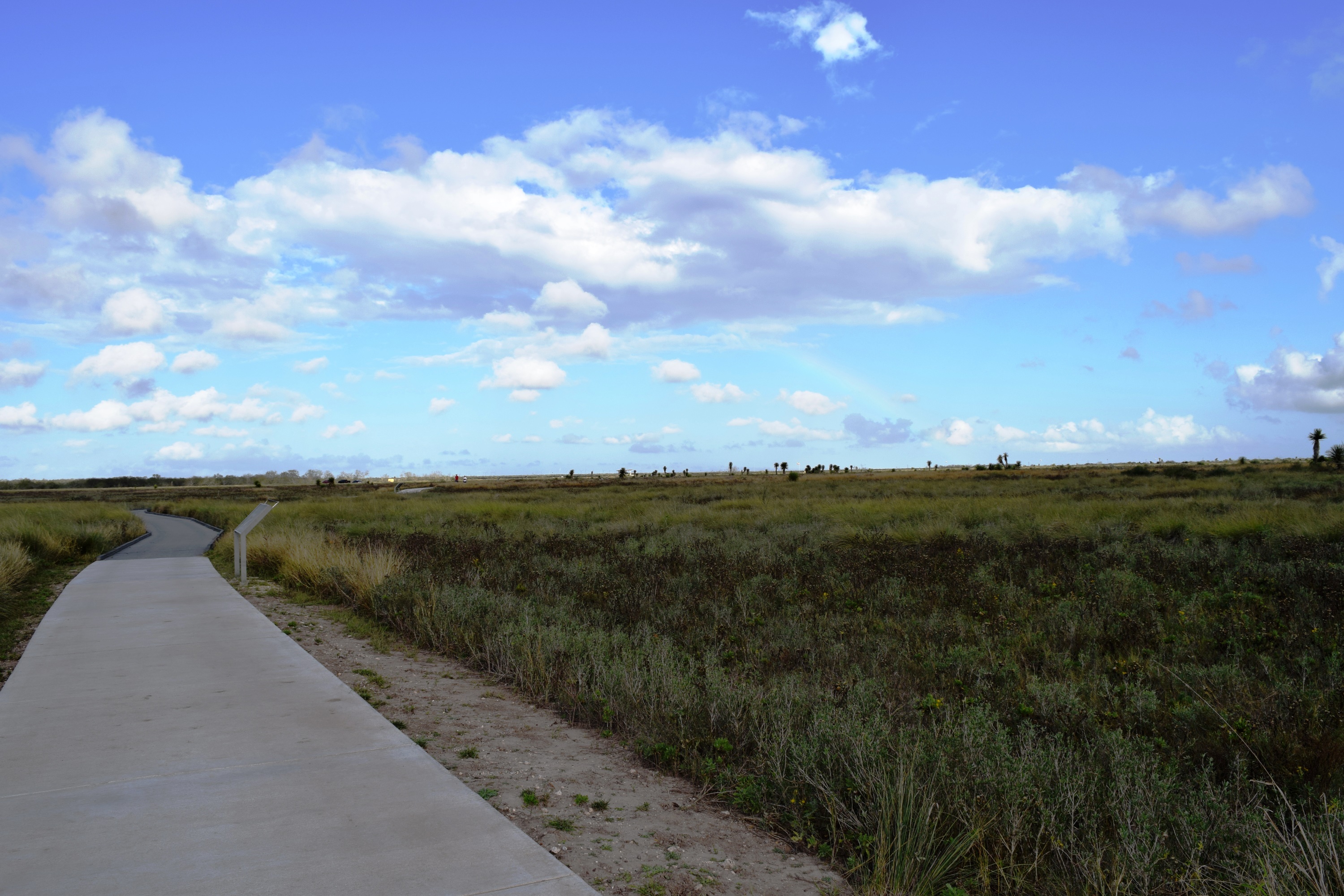
Coastal PrairieThe peacefulness of the coastal prairie at Palo Alto Battlefield today is in sharp contrast to the event that occurred here on May 8, 1846. 
Dodging Cannonballs WaysideThe “Dodging Cannonballs” wayside provides a sense of what it was like to endure cannon fire during the Battle of Palo Alto. 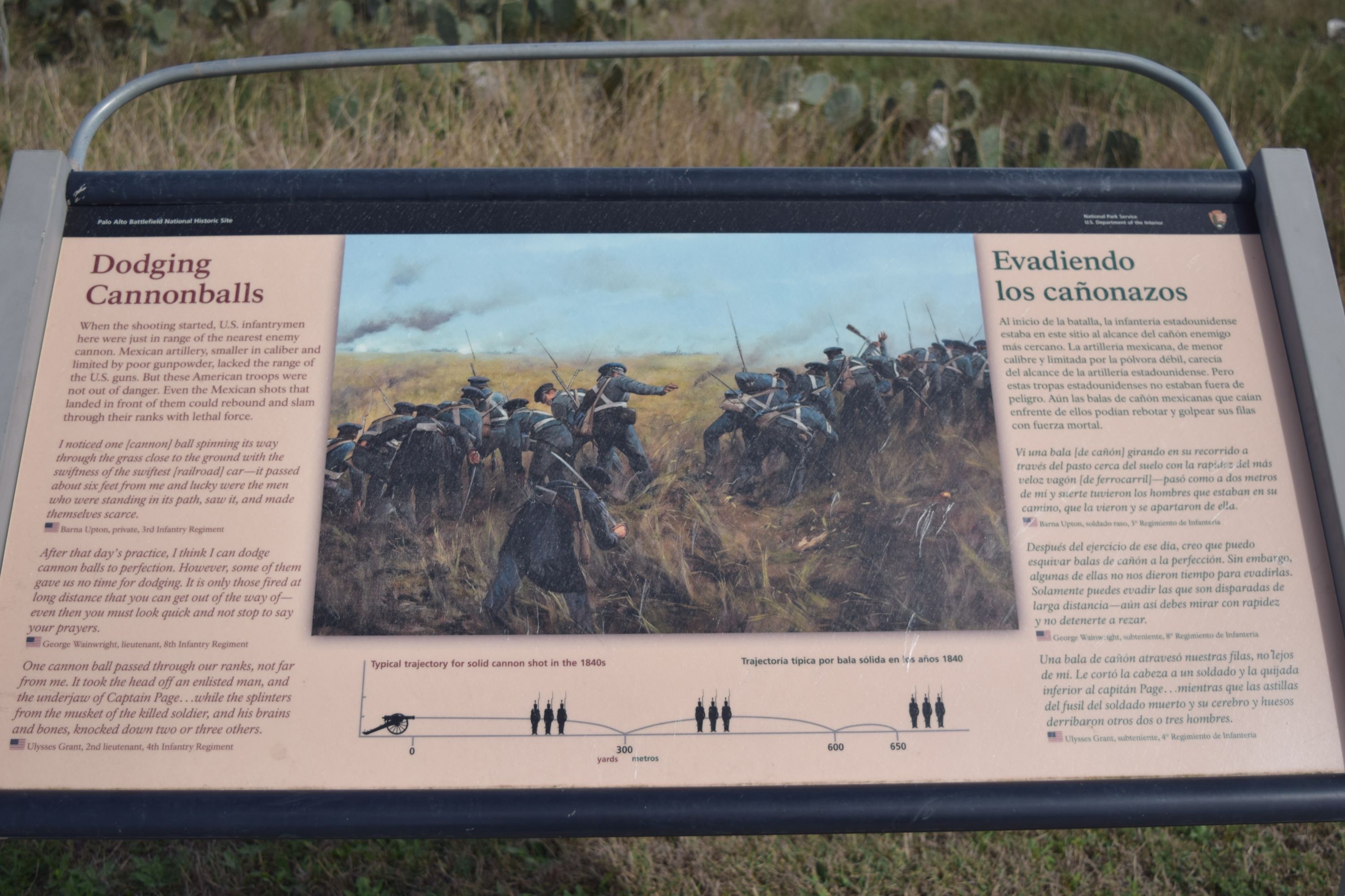
Explore WaysideThe Explore wayside provides an orientation to the site and is located on the main battlefield trailhead near the Visitor Center. 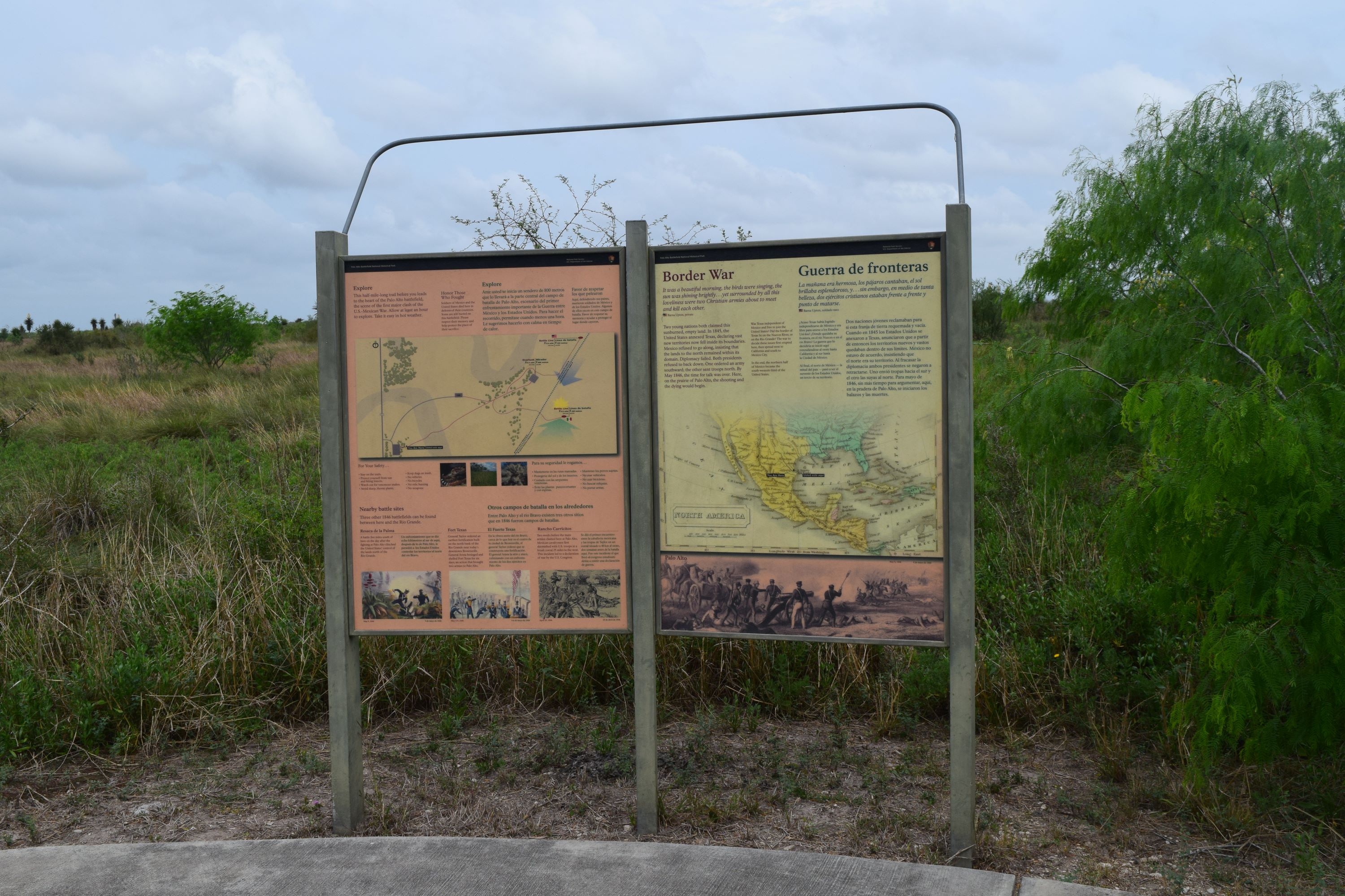
Fiery Finale WaysideThe “Fiery Finale” wayside provides a summary of one of Captain James Duncan’s actions during the battle. 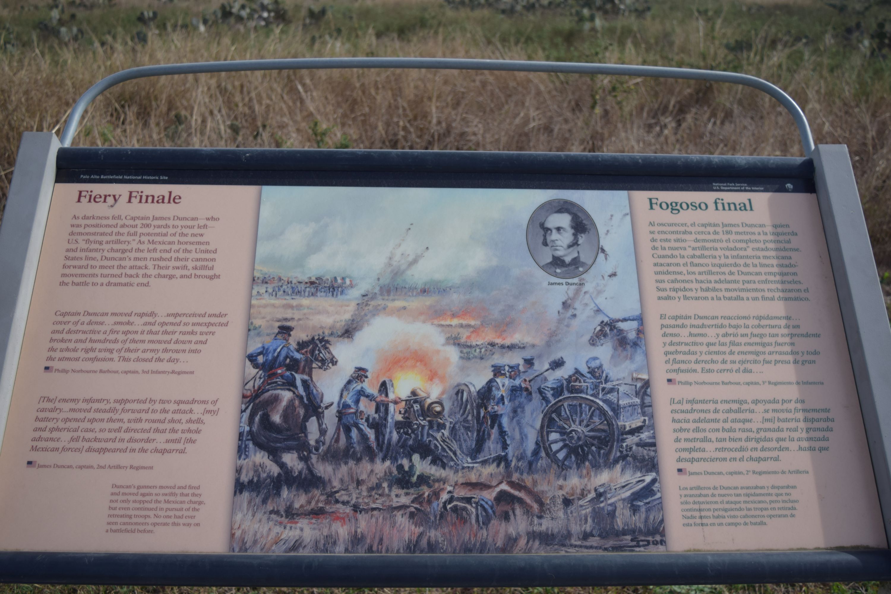
Flying Artillery WaysideThe “Flying Artillery” wayside provides an overview of the role of U.S. light artillery at the Battle of Palo Alto. 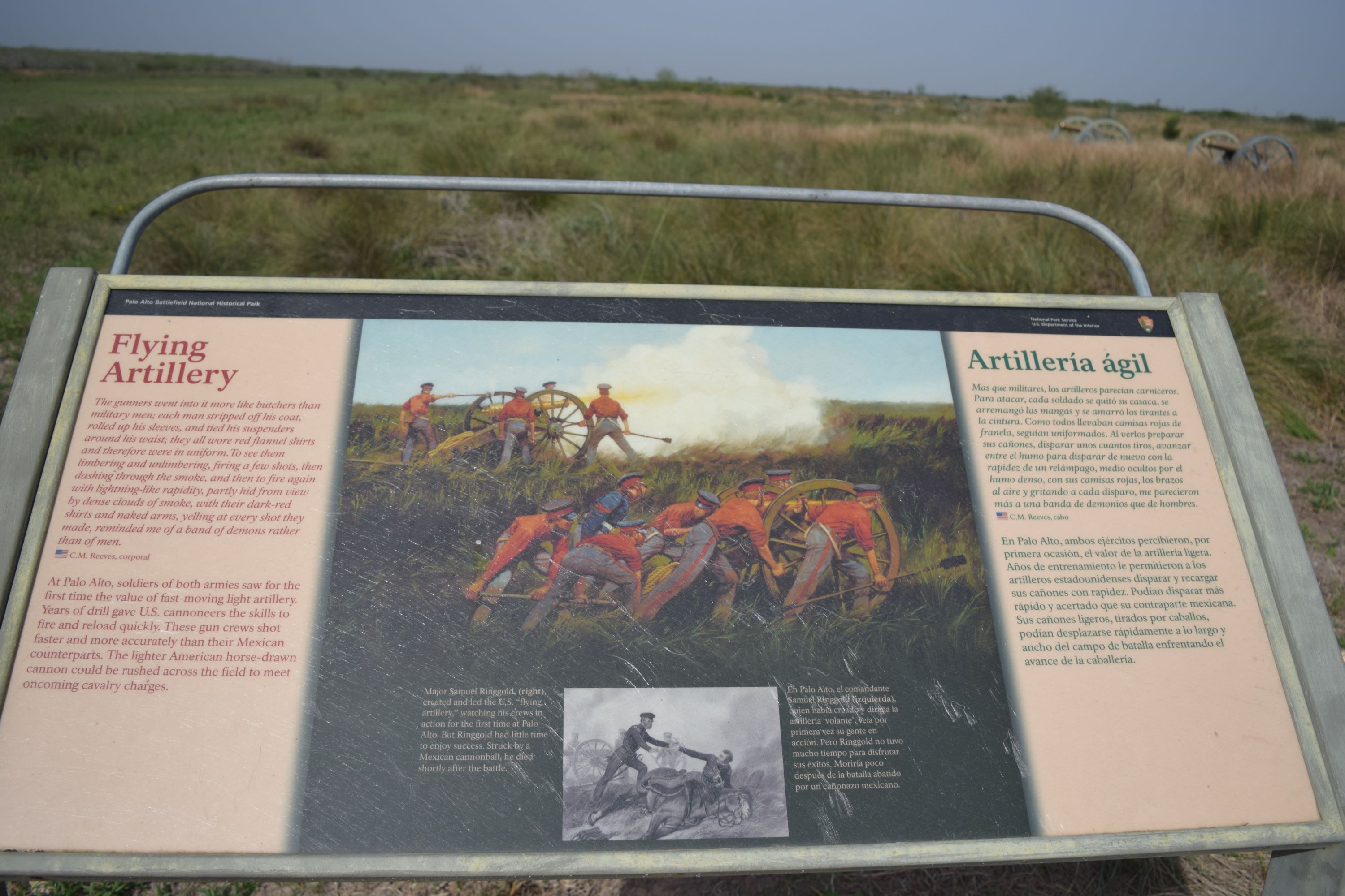
Form Battalions! WaysideThe “Form Battalions!” wayside depicts U.S. Army lines and columns in the beginning stages of the battle. 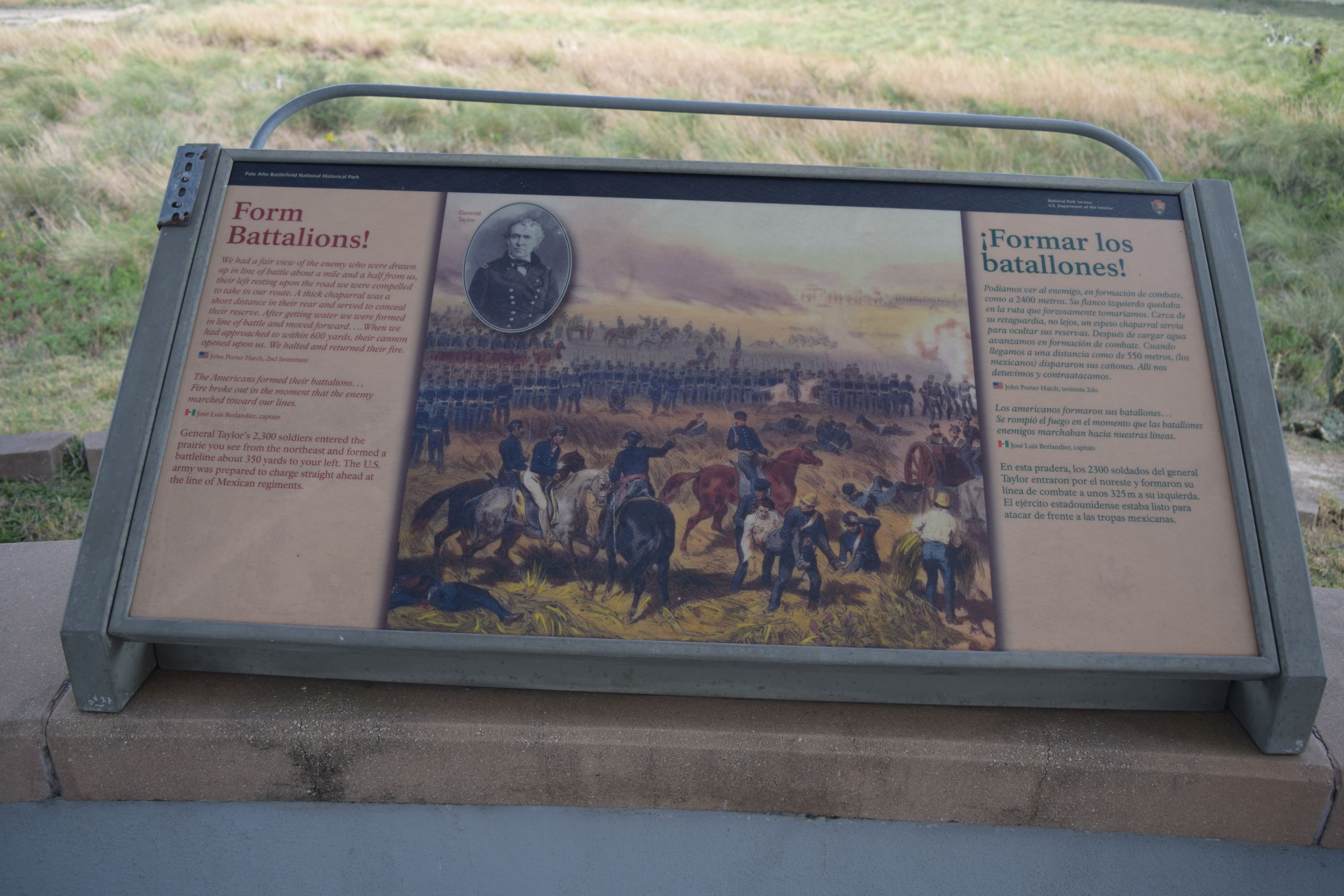
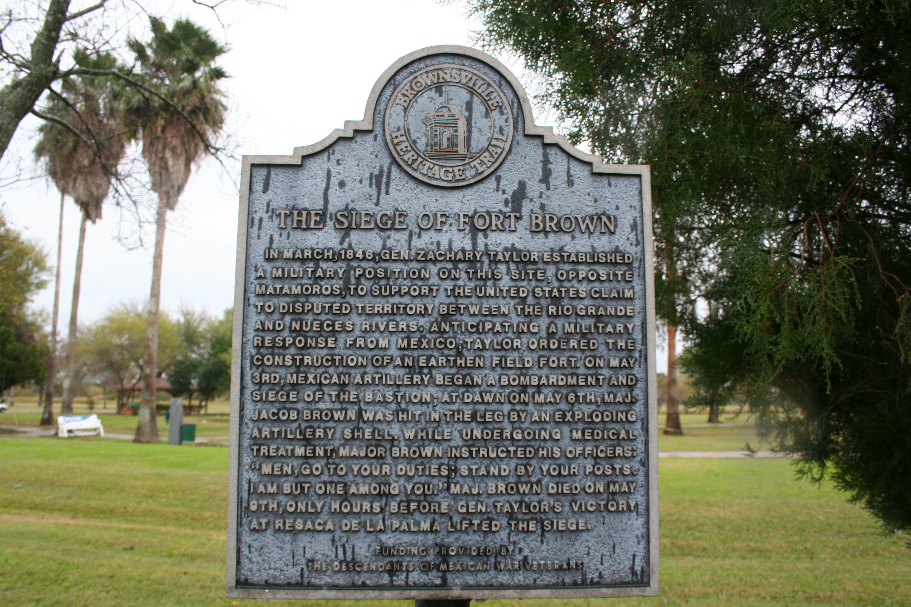
Fort BrownLearn about the site of the U.S. Army’s riverside fort during the U.S.-Mexican War. 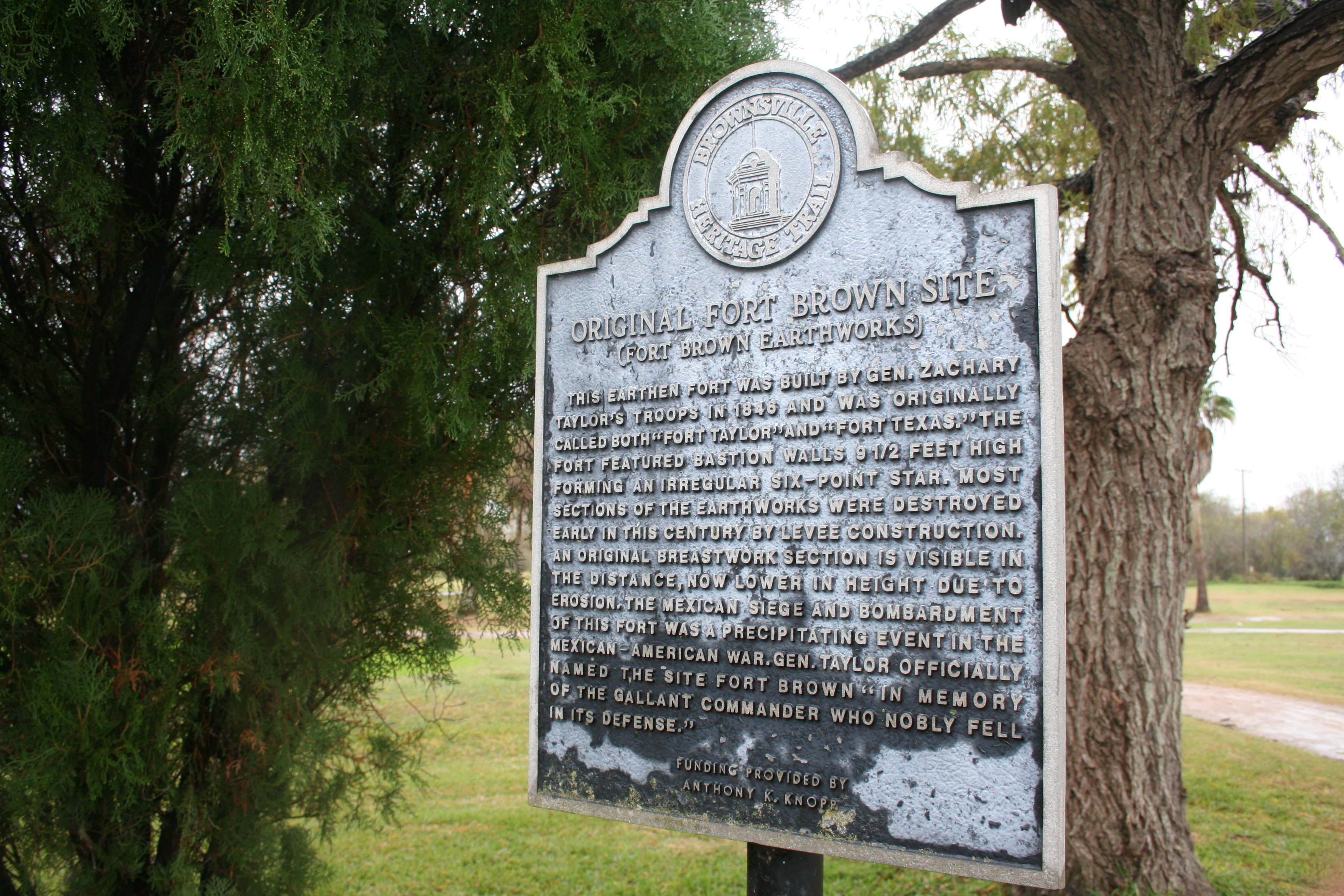
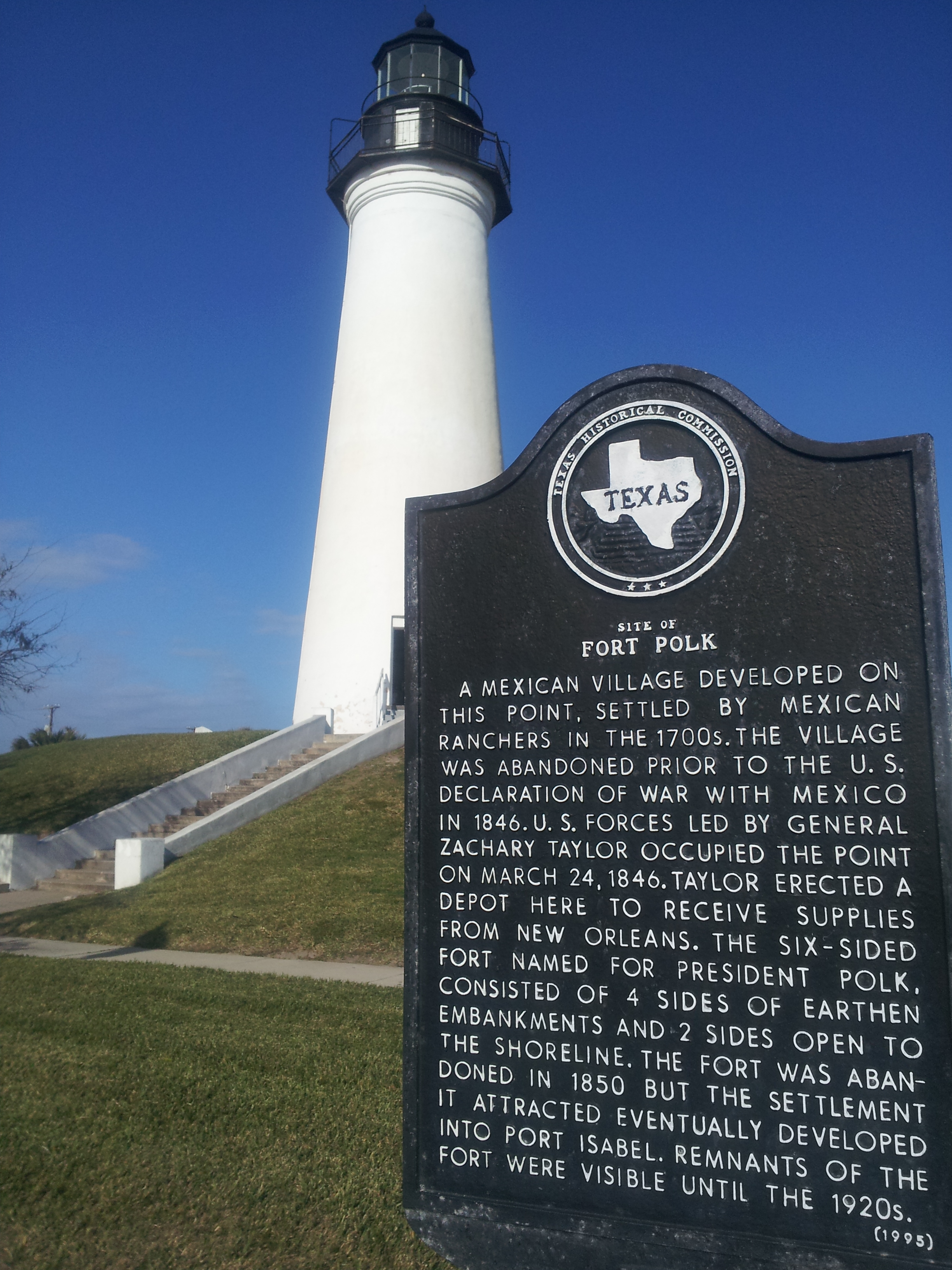
Fort PolkPoint Isabel and Fort Polk played a significant role as a supply base in the start of war between the United States and Mexico. 
Holding Their Ground Wayside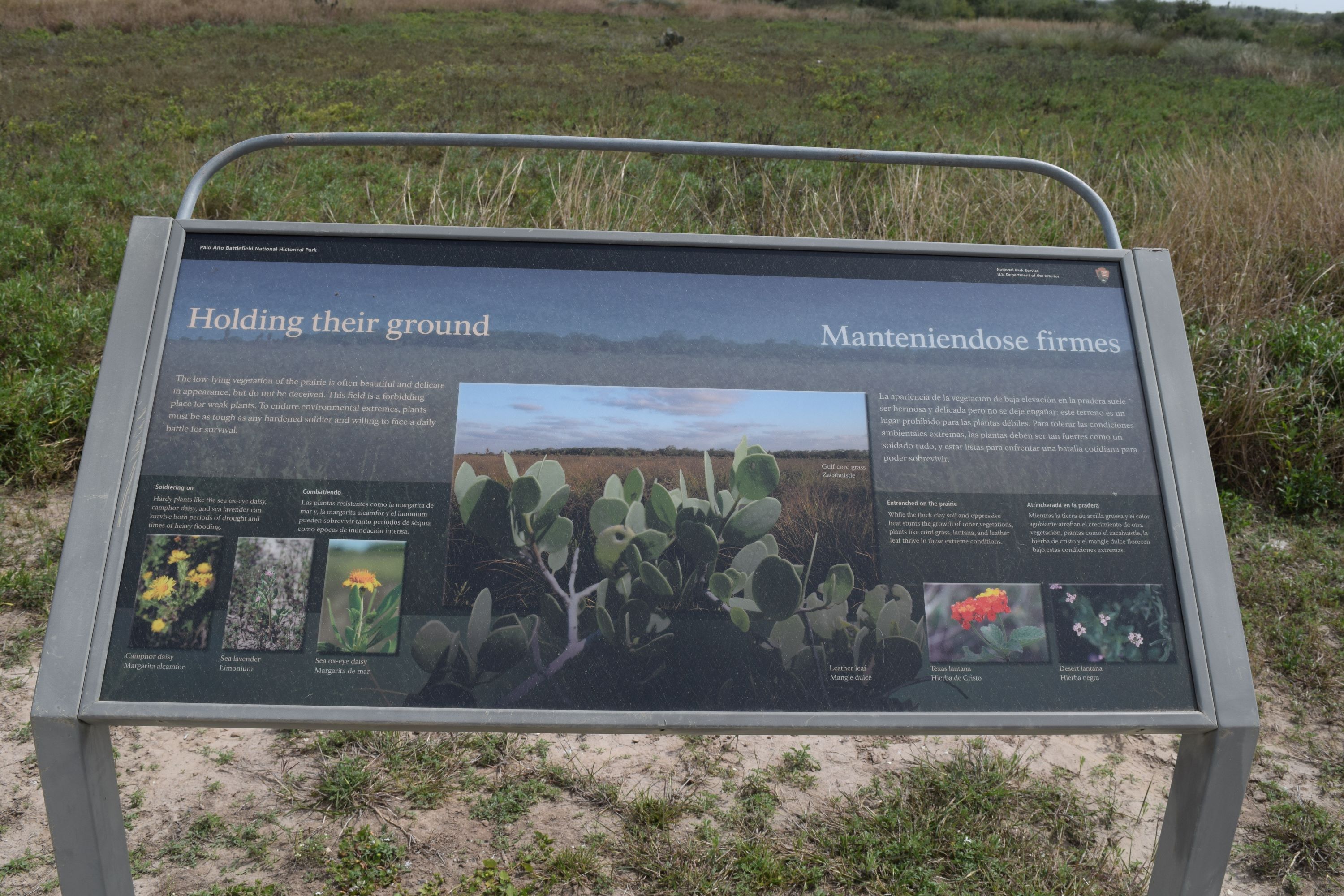
Invading Forces WaysideThe “Invading Forces” wayside provides an overview of some of the invasive species found at the park. 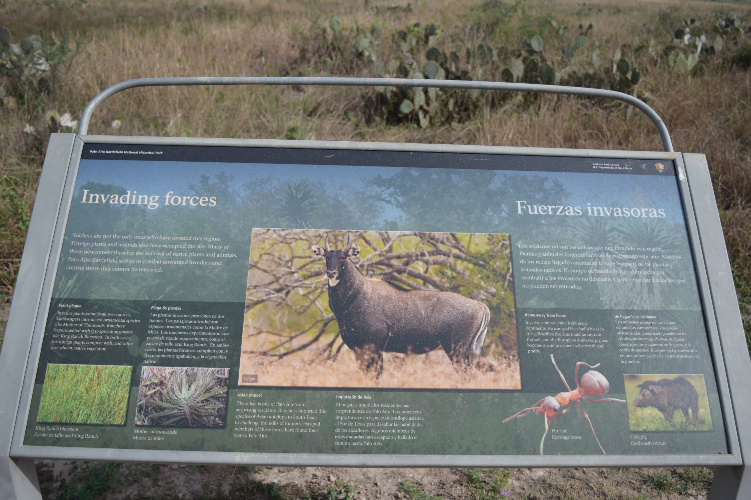
It Is Still A Battlefield WaysideThe "It is still a battlefield" wayside provides a brief overview of the wildlife found at the park. 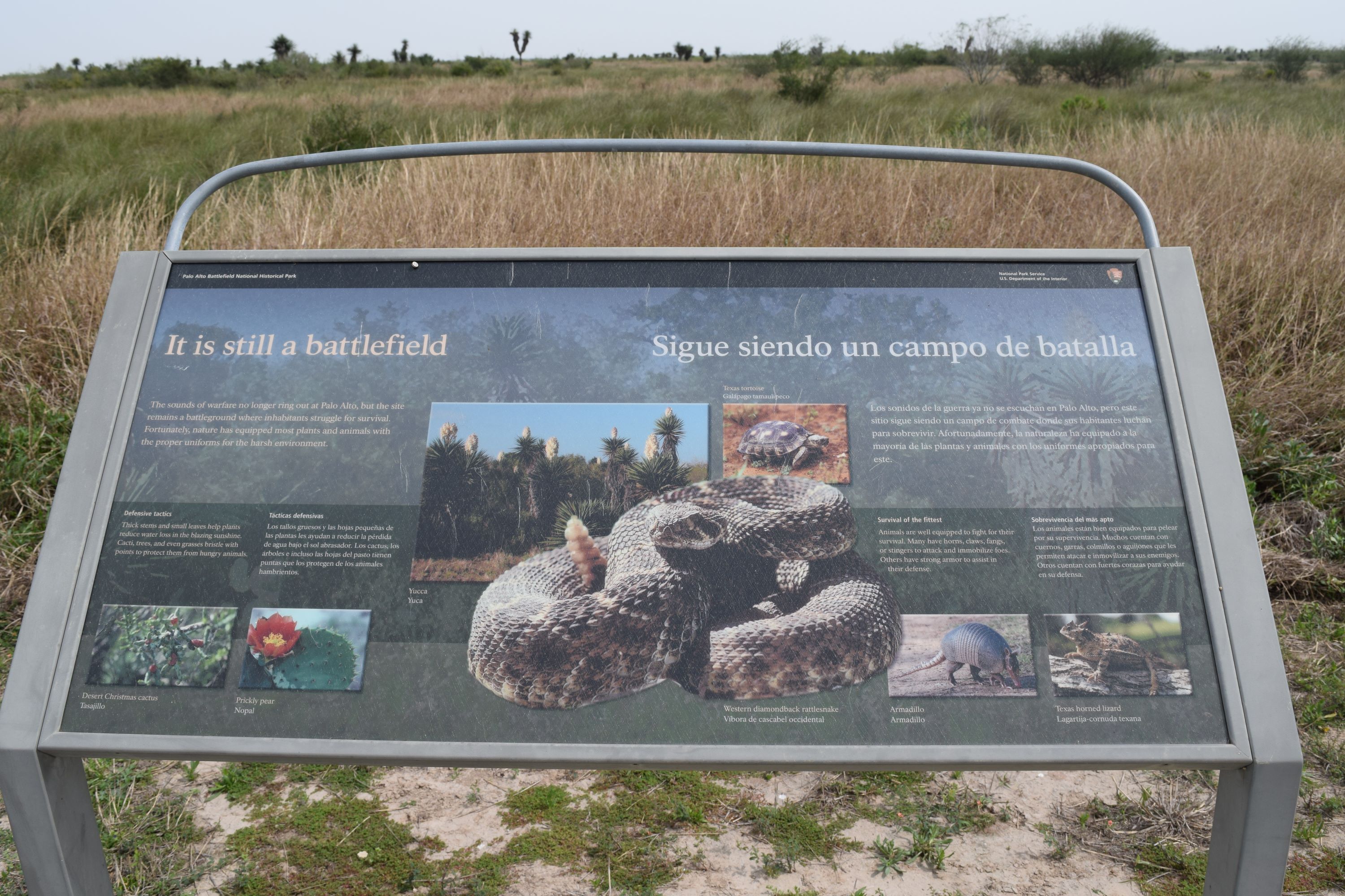
Let Us Attack! WaysideThe “Let Us Attack!” wayside provides a brief overview of what the Mexican Army endured during the Battle of Palo Alto. 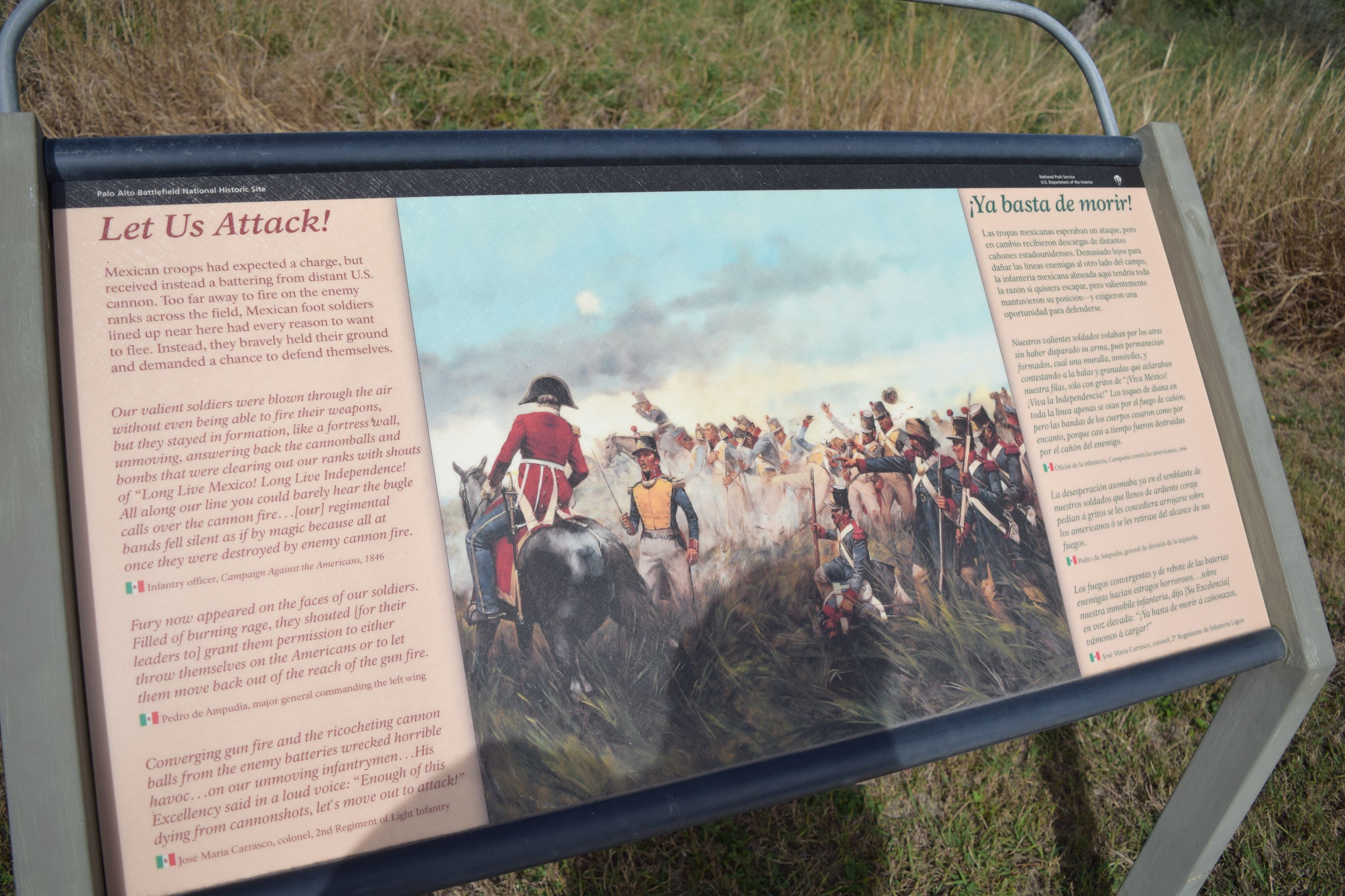
Long Live the Republic! WaysideThe “Long Live the Republic!” wayside provides a brief overview of the makeup and initial formation of the Mexican battle line. 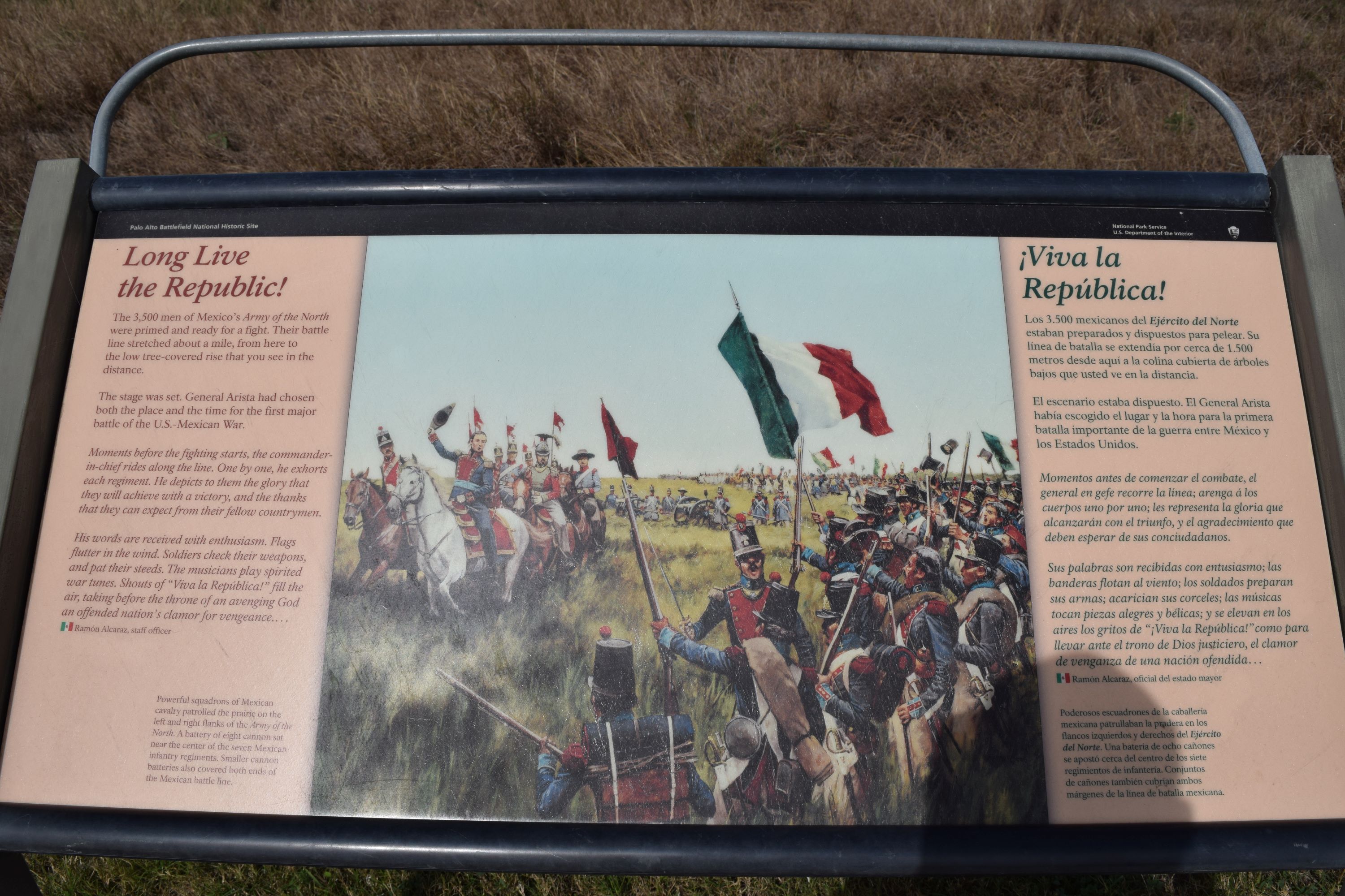
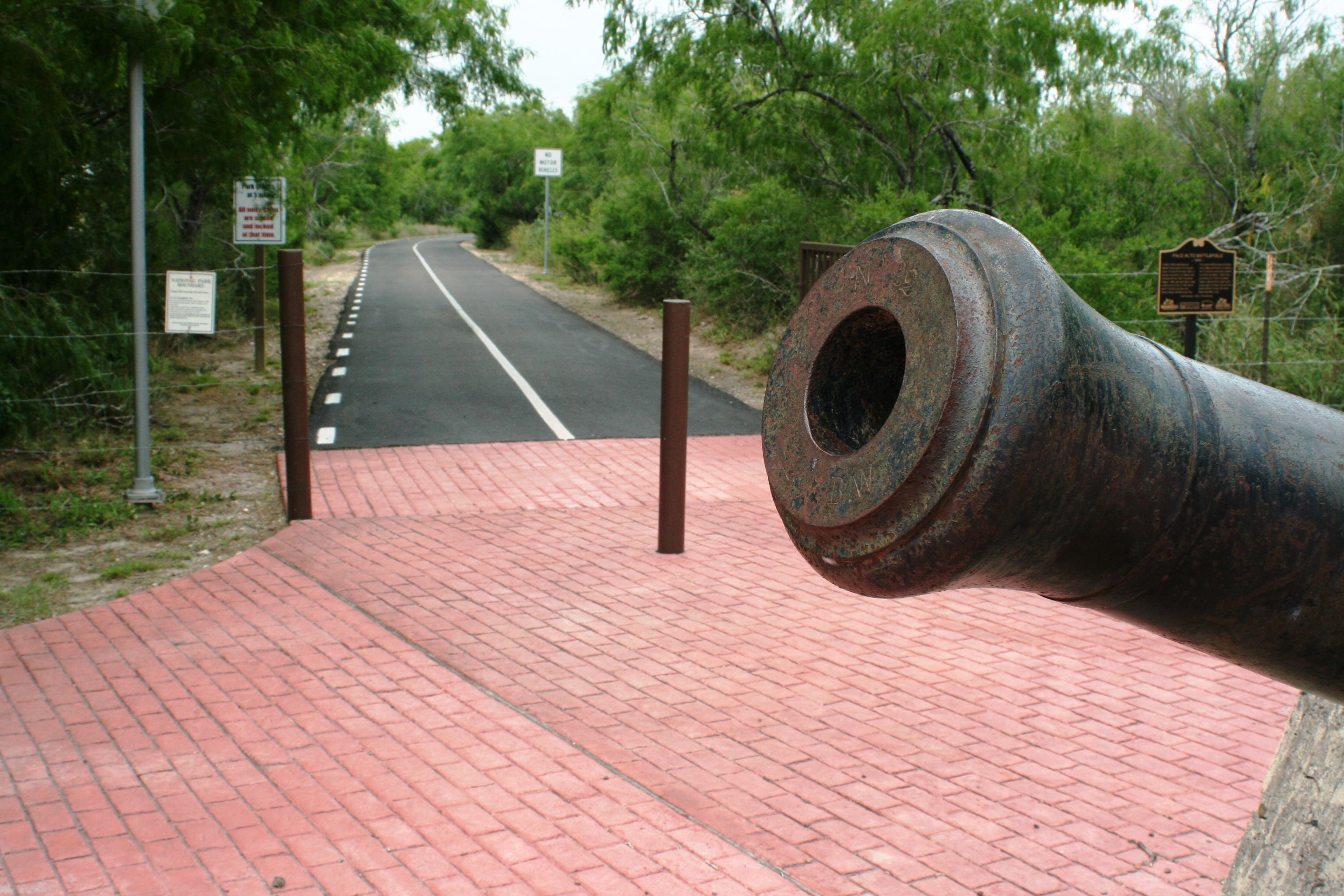
Making the Earth Tremble WaysideThe “Making the Earth Tremble” wayside provides an overview of the immense firepower of the 18-pounder siege cannons. 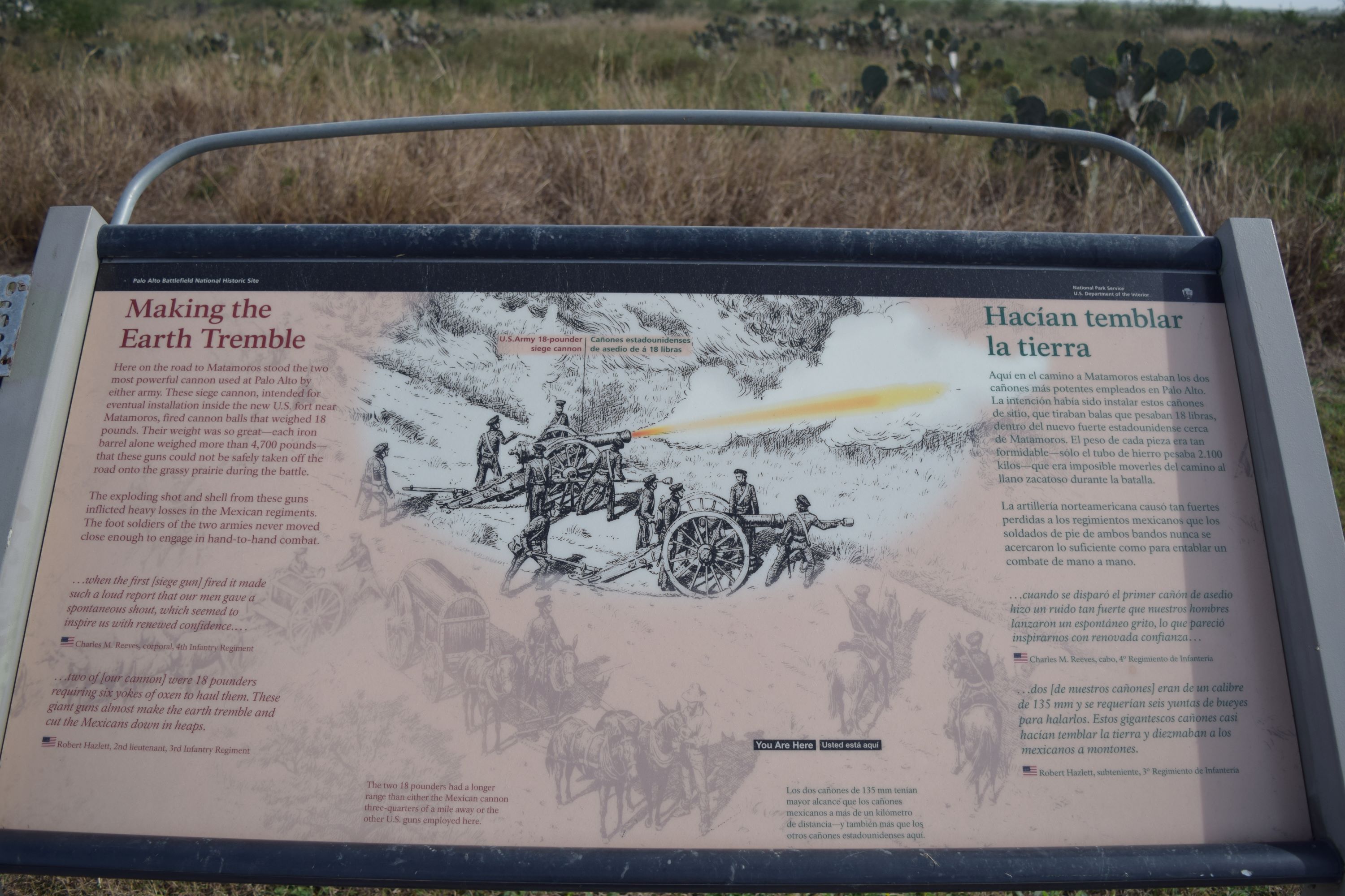
Mexican Battle LineThe Mexican battle line at Palo Alto Battlefield NHP marks the spot where General Arista’s Army made their first formal stand against the U.S. Army. The Mexican Army would not operate north of this line in South Texas for the duration of the war. In fact, the Mexican Army would not formally operate on U.S. soil until 2005 during relief efforts for Hurricane Katrina. 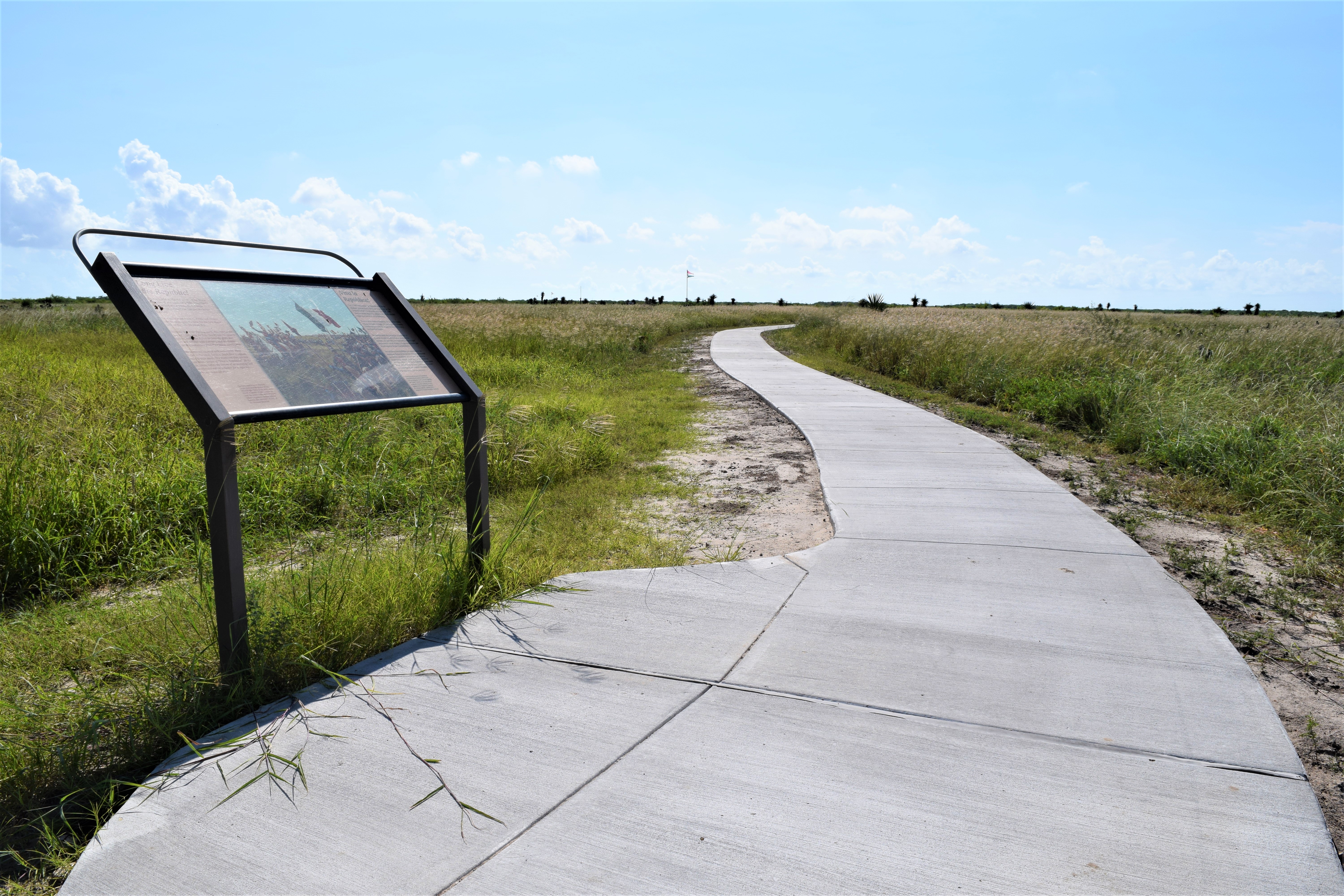
Night Among the Wounded WaysideThe “Night Among the Wounded” wayside provides a sense of the casualties the Mexican Army experienced at the Battle of Palo Alto. 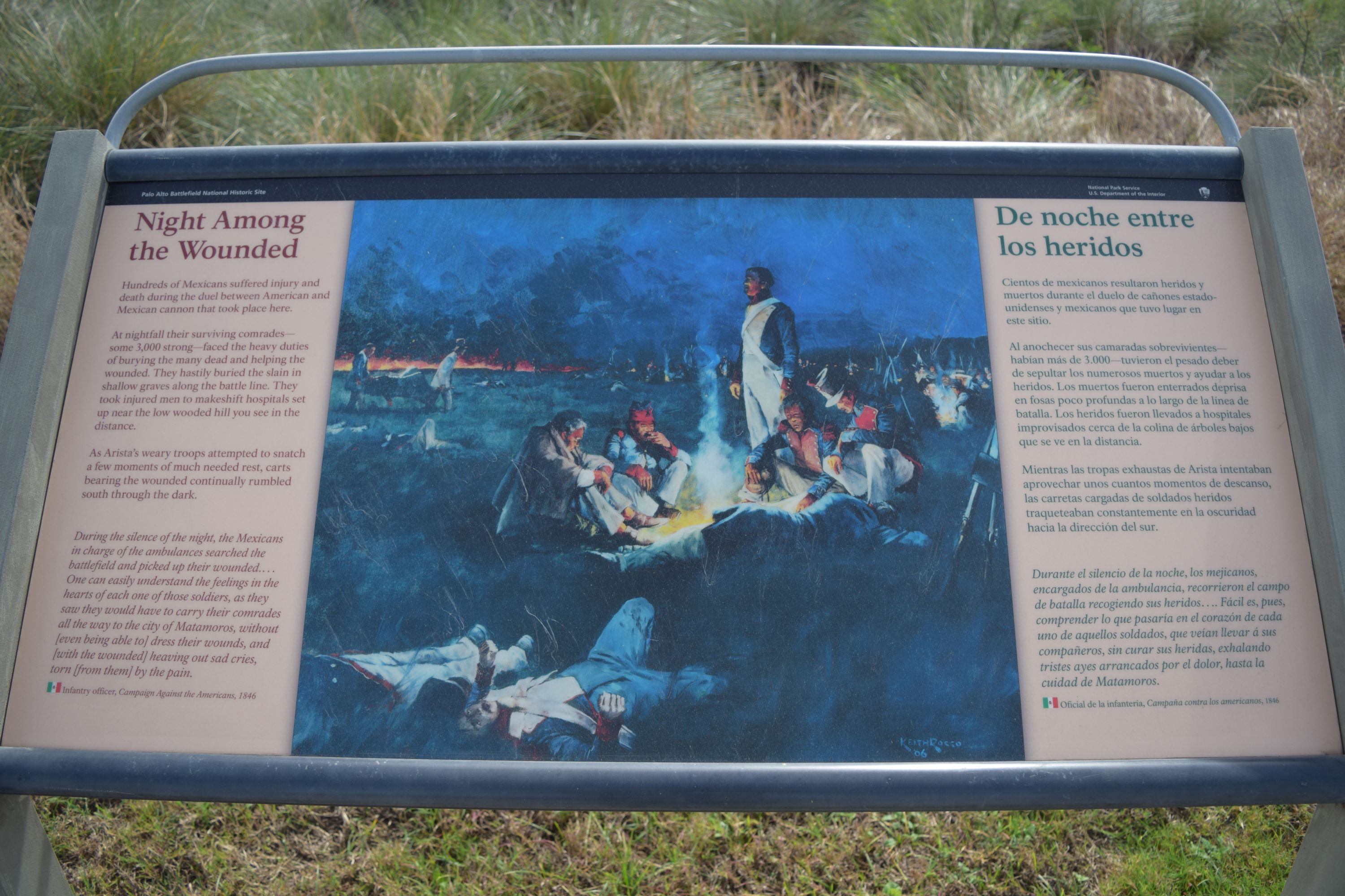
Old Bayview CemeteryOld Bayview Cemetery is the site of the oldest federal military cemetery in Texas. The first people buried at the site were members of the U.S. Army of Occupation. 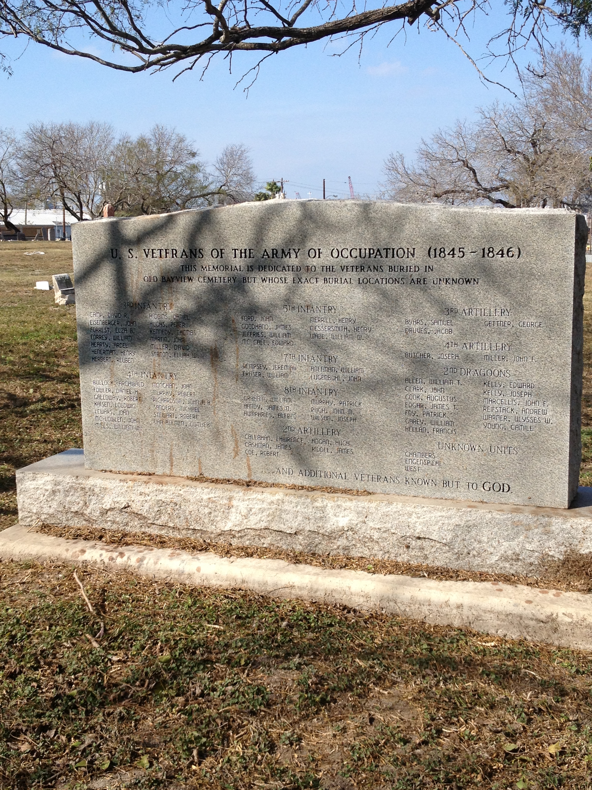
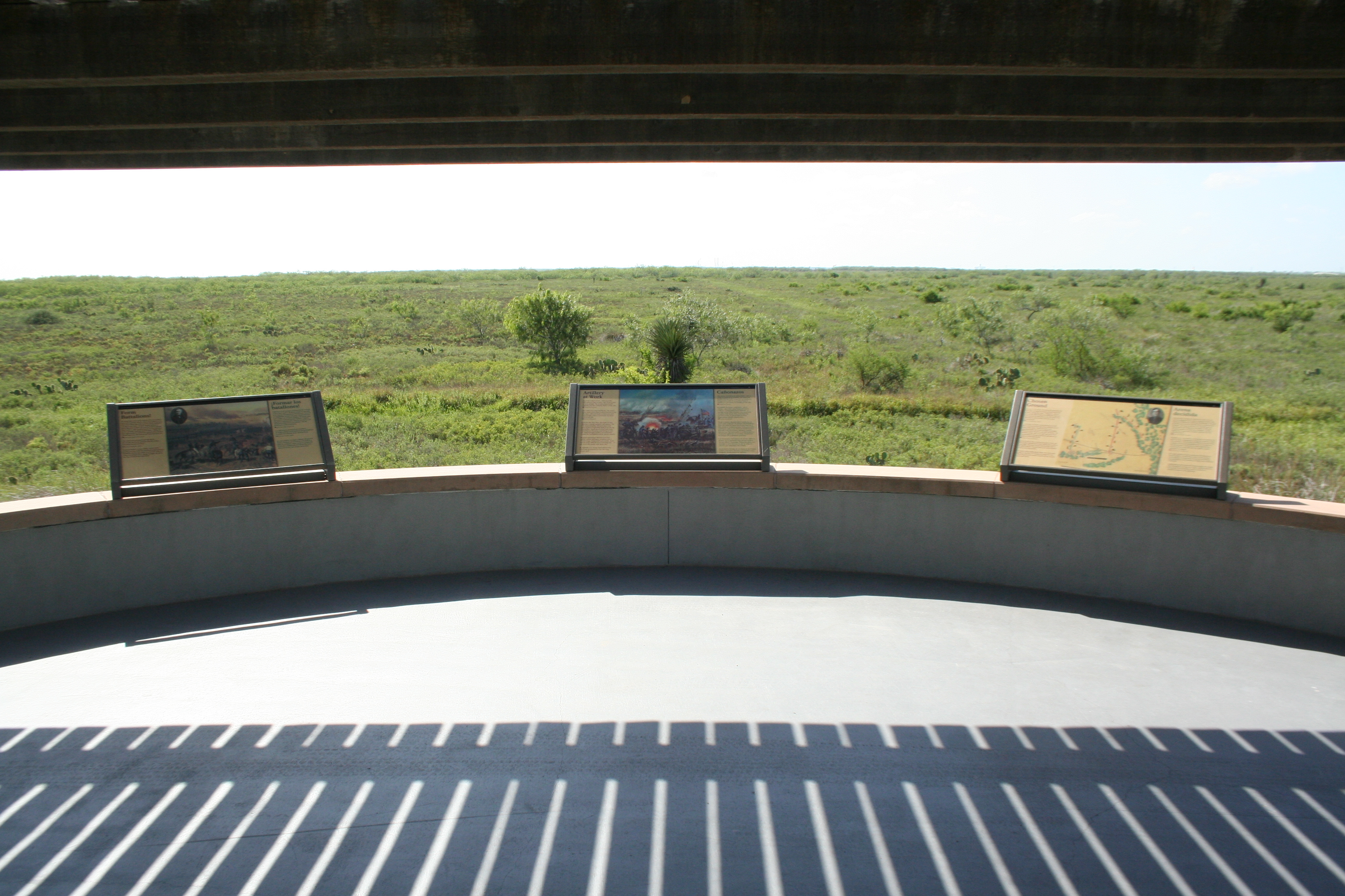
Palo Alto Battlefield OverlookThe Palo Alto Battlefield Overlook sits on the western edge, practically in the center of Palo Alto Battlefield. The Overlook provides an excellent vantage point to view the battlefield. Directly in front of the overlook lay the remnants of the historic Matamoros to Point Isabel Road, a critical strategic element of the battle. Off to the south, is the Mexican battle line and to the north is the U.S. battle line. 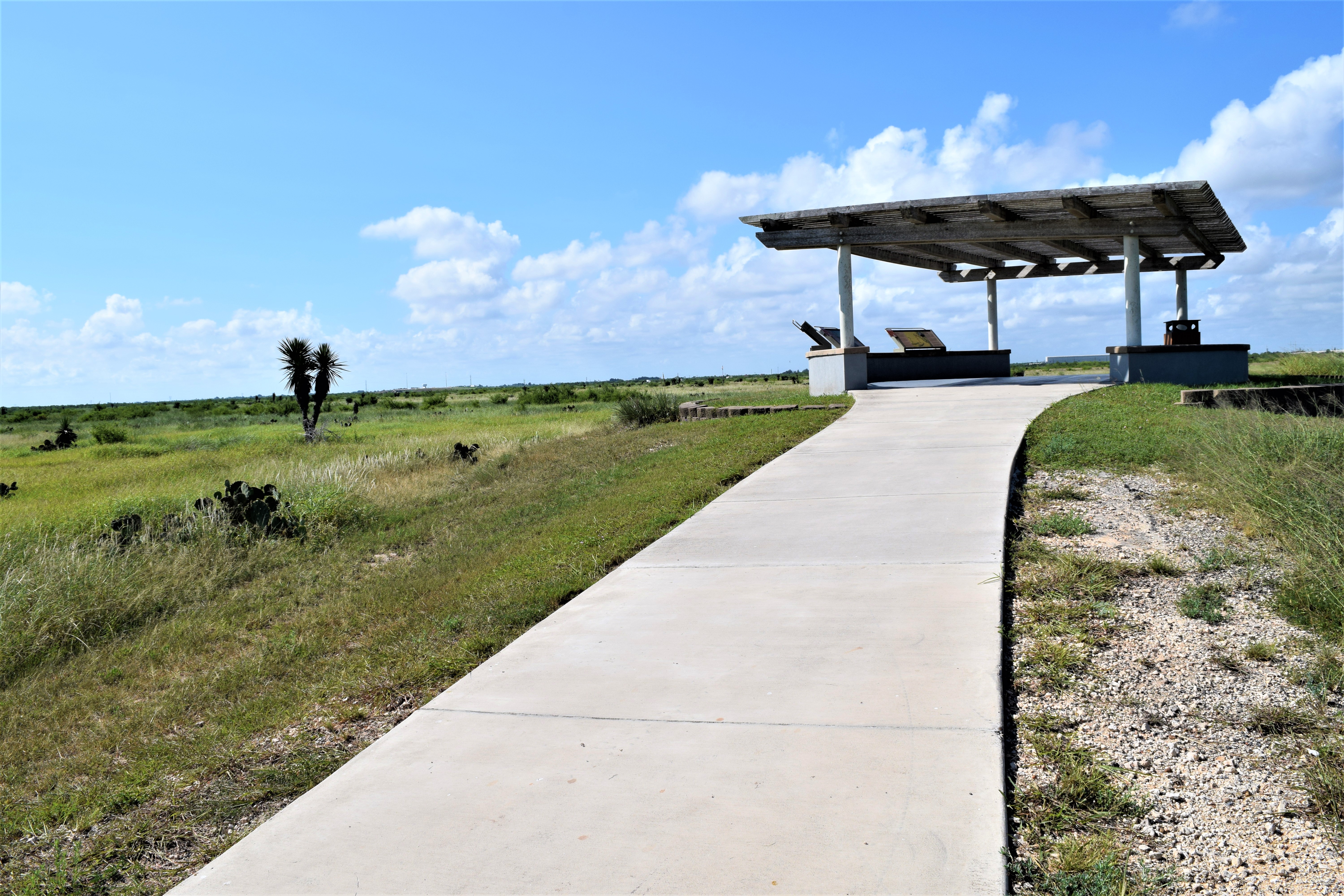
Pollinator GardenThe pollinator garden at Resaca de la Palma Battlefield helps provide plants for use by local wildlife in a landscape where their habitat is highly fragmented. 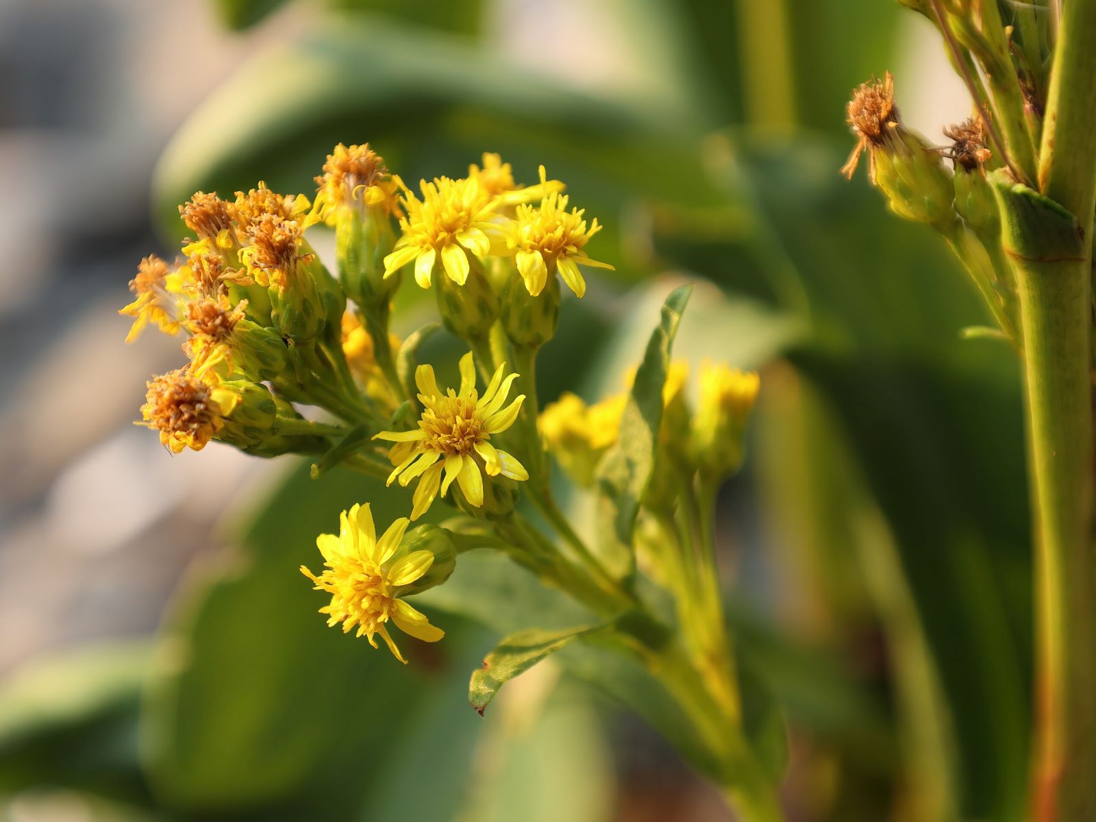
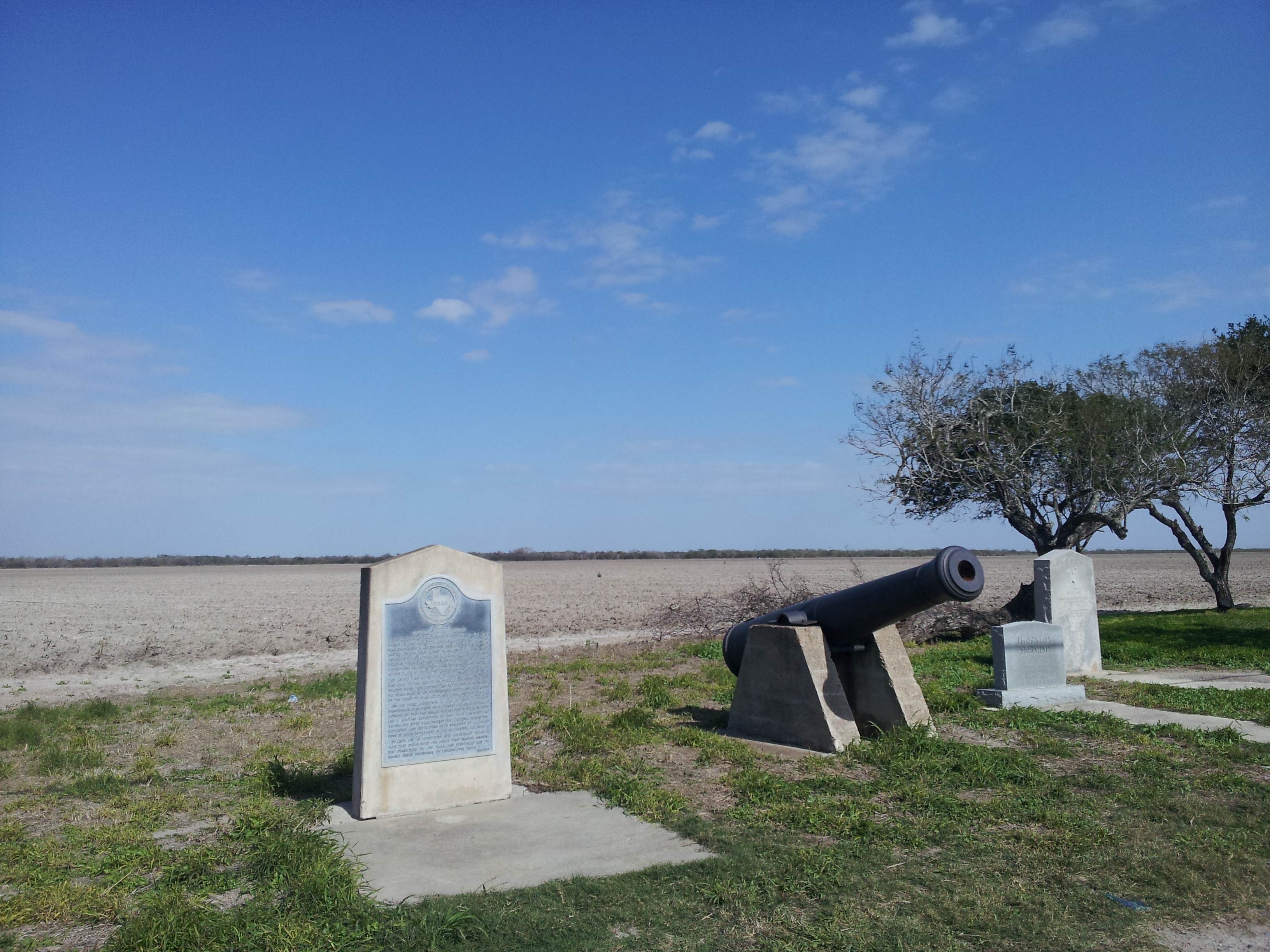
Rancho de CarricitosThe site of the first official combat between U.S. and Mexican forces. Captain Seth Thornton and his 80 dragoons were ambushed by General Anastasio Torrejón. 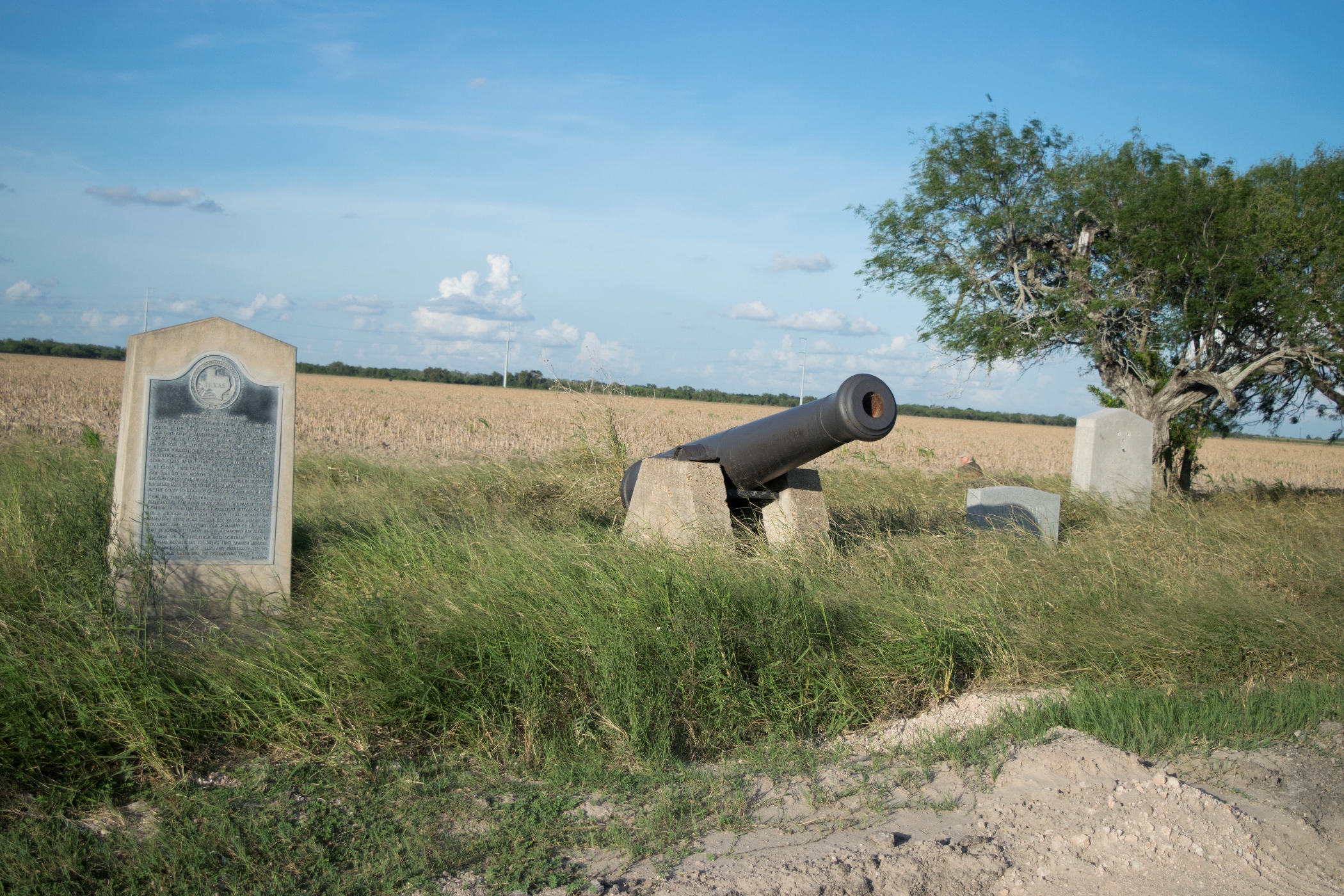
Resaca OverlookThe resaca overlook at Resaca de la Palma Battlefield gives visitors a close-up look at the site’s namesake water feature. 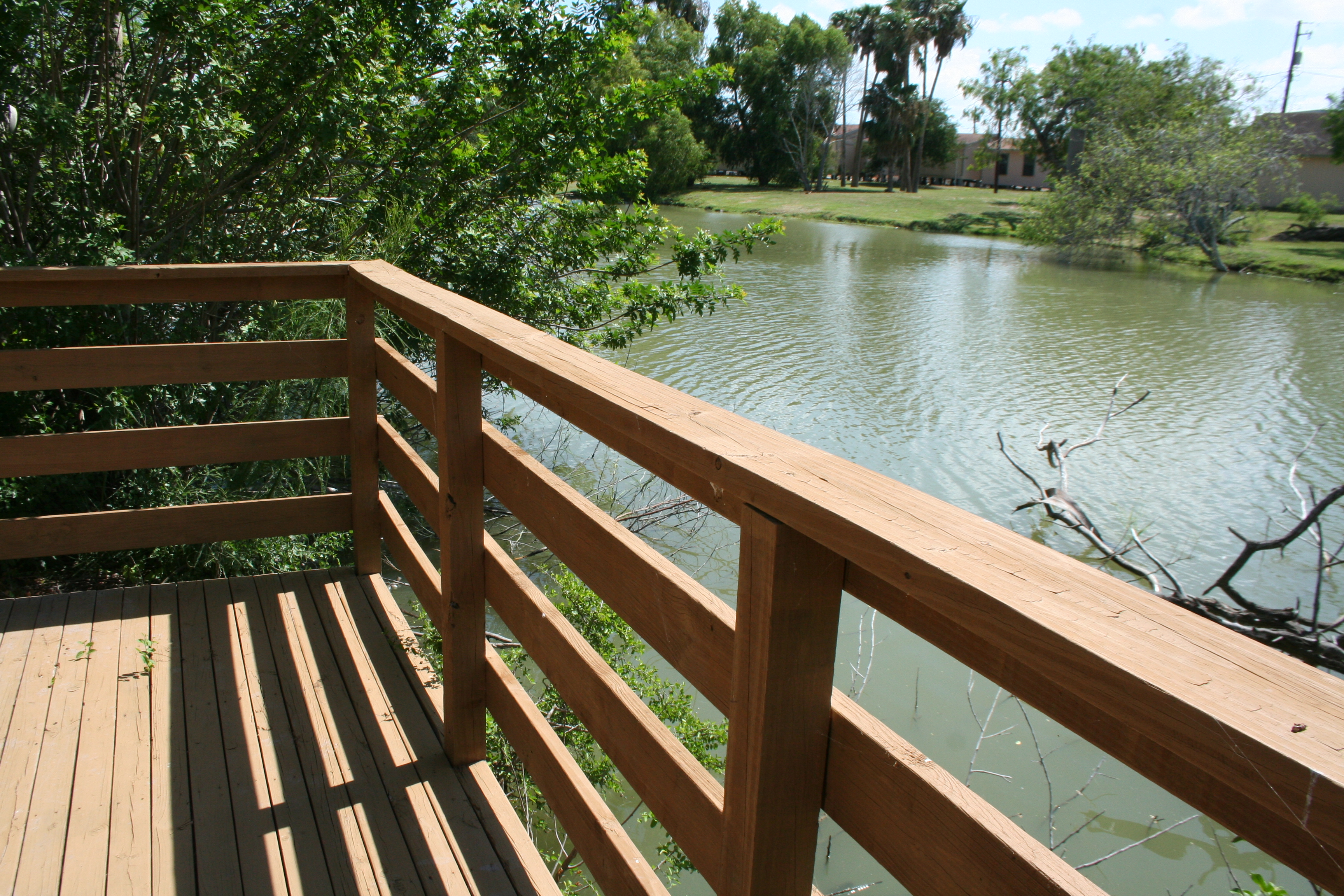
Silence Rested Over the Field WaysideThe “Silence Rested Over the Field” wayside provides a glimpse of what soldiers experienced the evening after the battle. 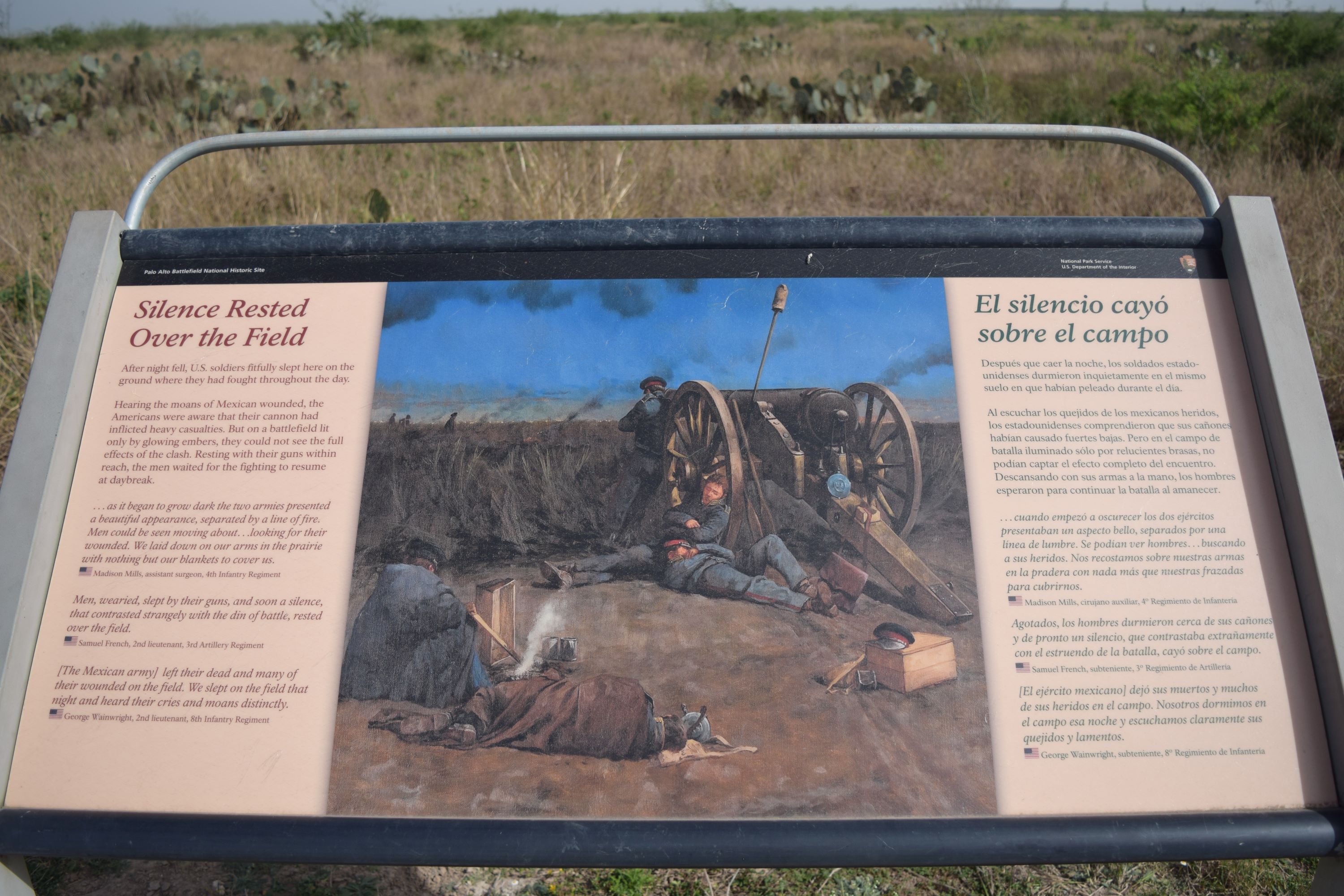
Taylor's CampThe Kenedy County Rest Area is home to a U.S.-Mexican War historical marker. However, the marker you’ll find there is proof that you shouldn’t believe everything that you read. Zachary Taylor never camped under the tree that now stands at this rest area. 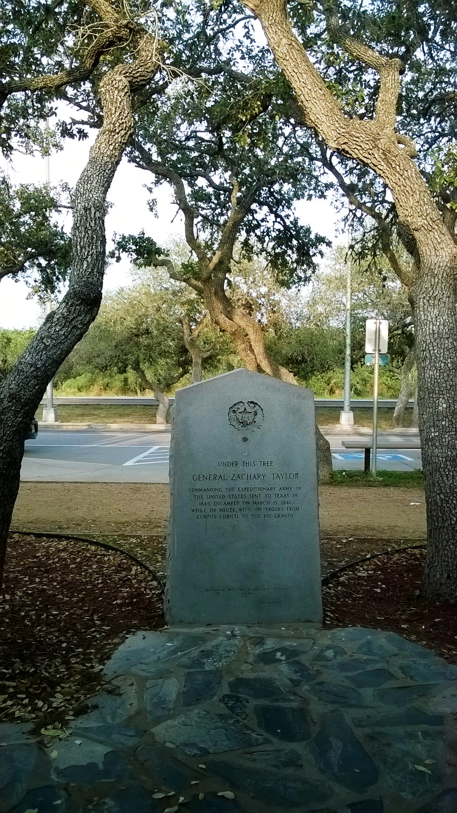
Territorial Claims WaysideThe Territorial Claims wayside provides a brief introduction to the native wildlife at the park. 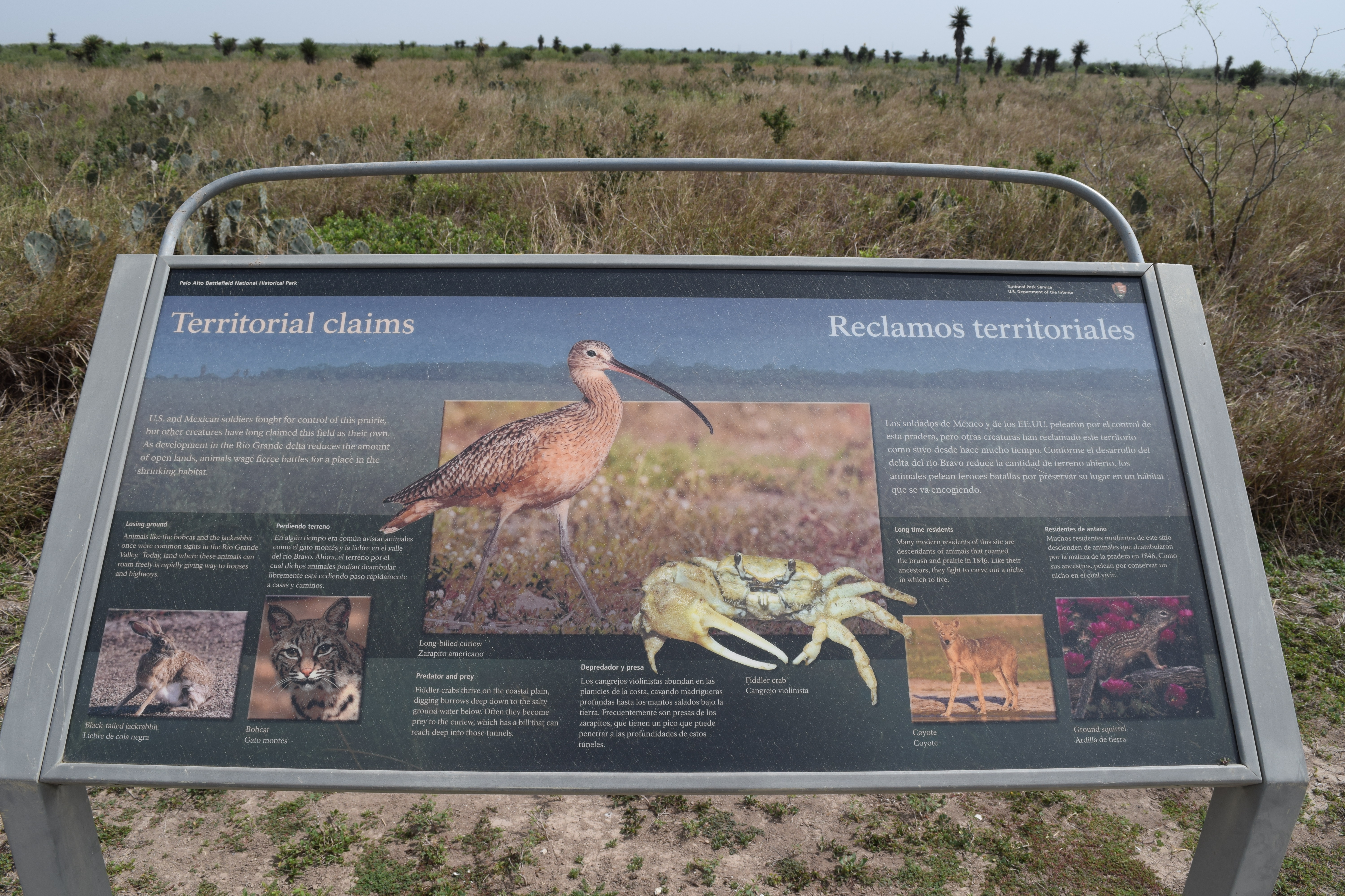
Three Hundred Supply Wagons WaysideThe “Three Hundred Supply Wagons” wayside provides an overview of the size and importance of the supply wagon train present at the Battle of Palo Alto. 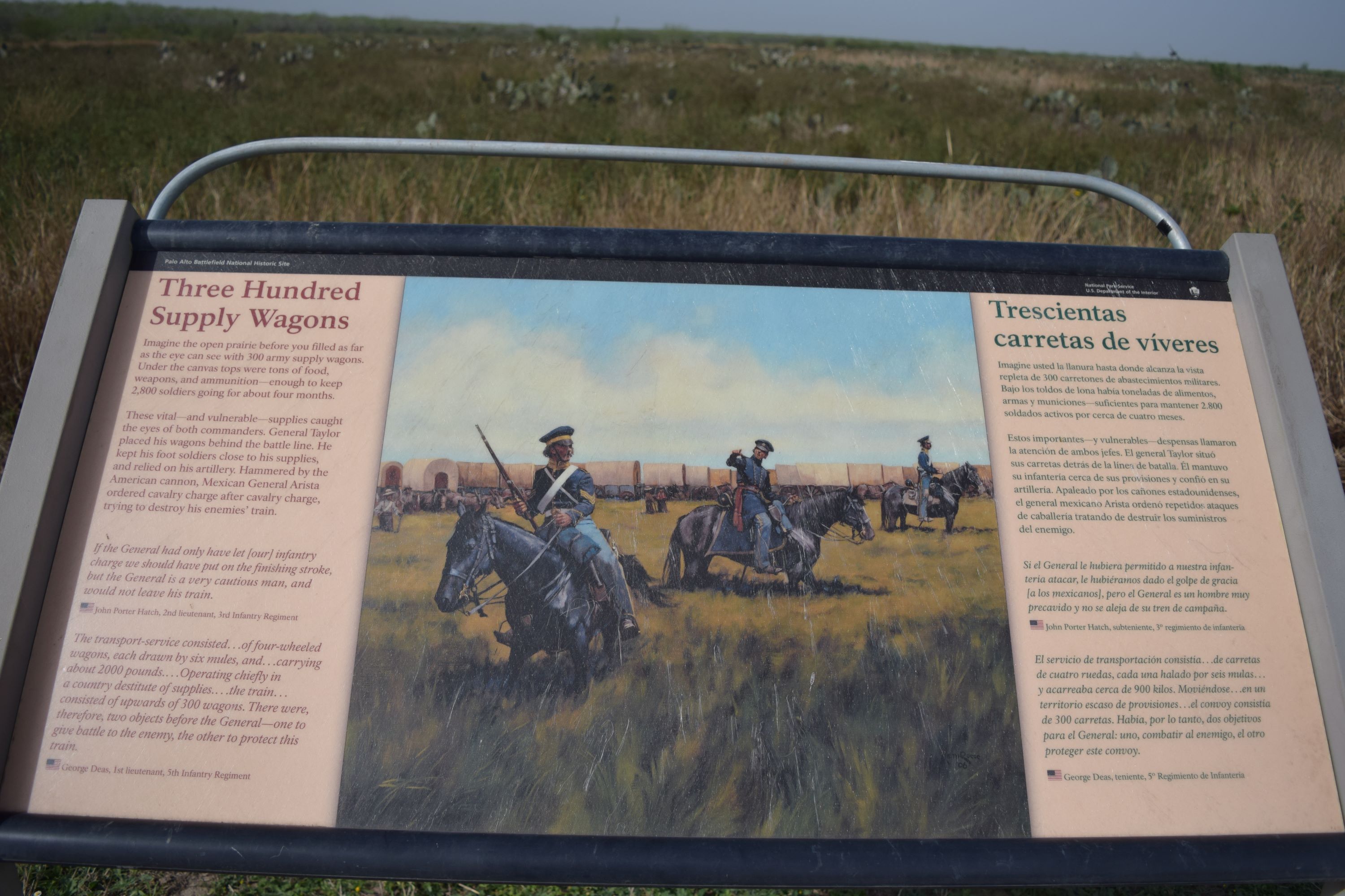
Trees on the March WaysideThe “Trees on the March” wayside provides a brief overview of some of the plant life changes that have occurred at the park. 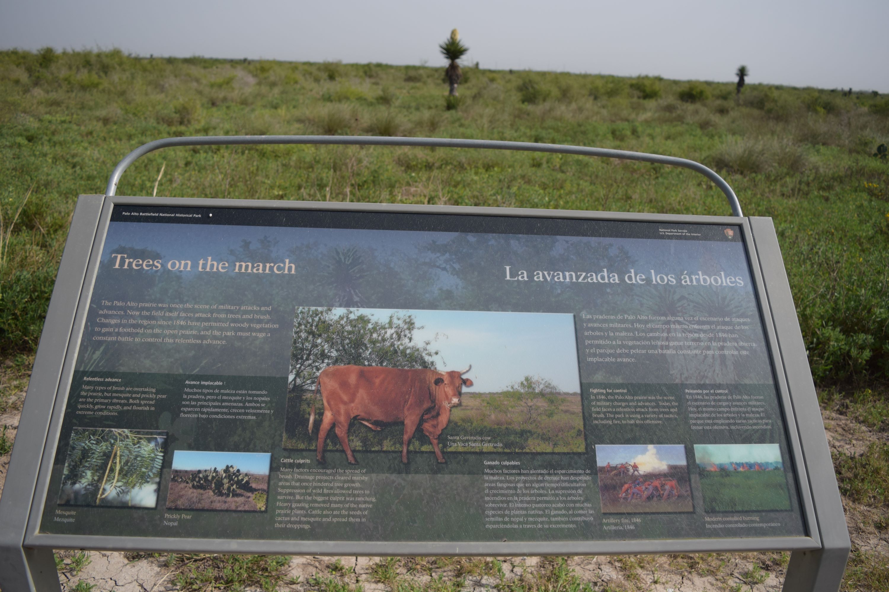
U.S. Battle LineAs General Taylor and his army of twenty five hundred emerged from the brush on the north end of what became Palo Alto Battlefield, they were greeted with an impressive scene...General Arista and his army of thirty five hundred, already in battle formation on the southern end of the field. Taylor halted his advance at this spot and contemplated his next move. 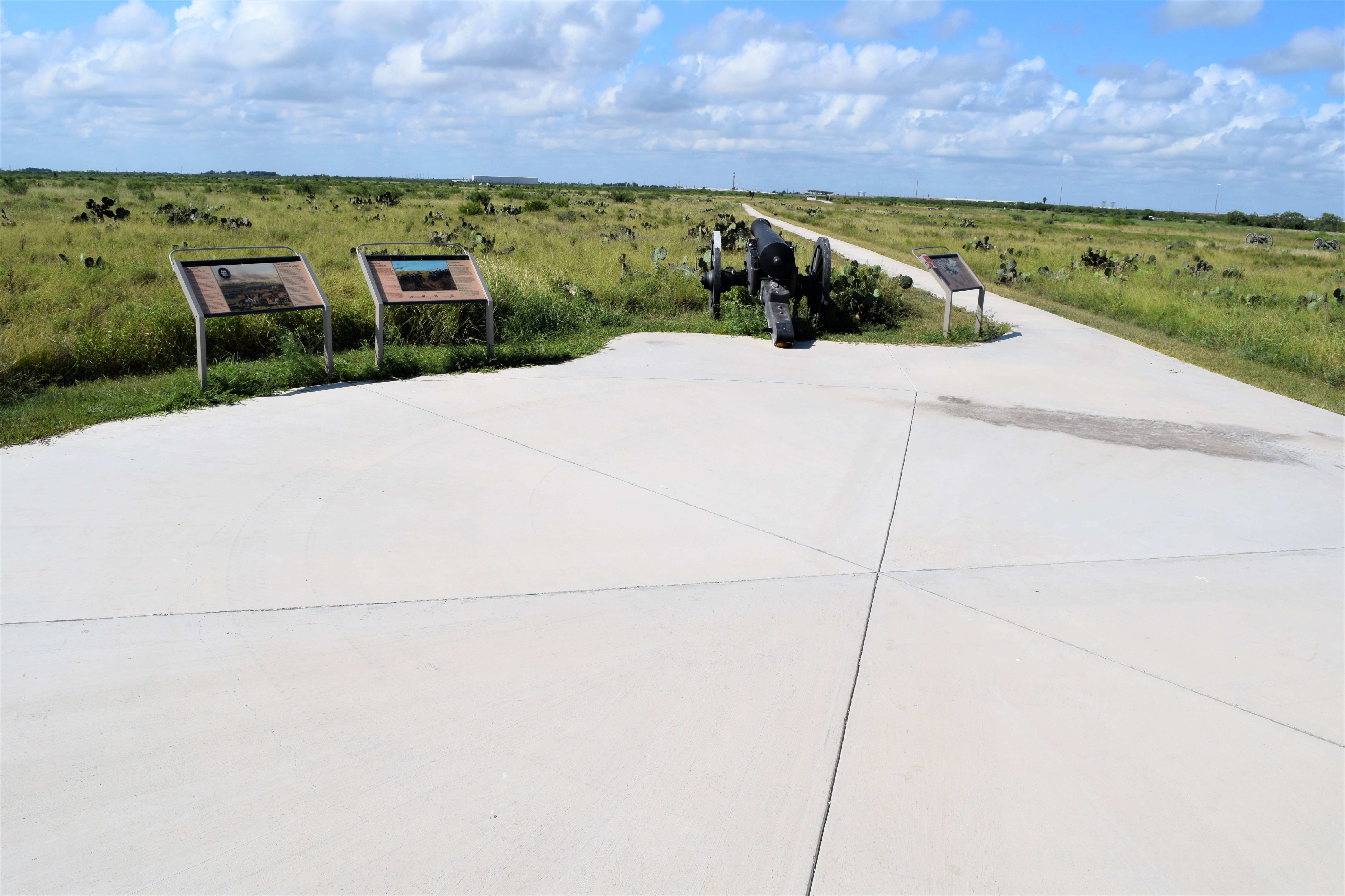
Wall of Flames WaysideThe “Wall of Flames” wayside provides an overview of grassfire that impacted the battle. 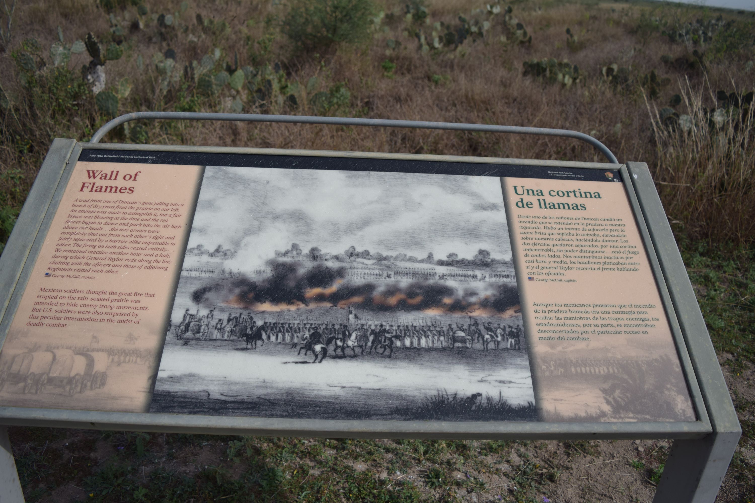
With the Dawn WaysideThe “With the Dawn” wayside provides a glimpse of the violent aftermath of the Battle of Palo Alto. 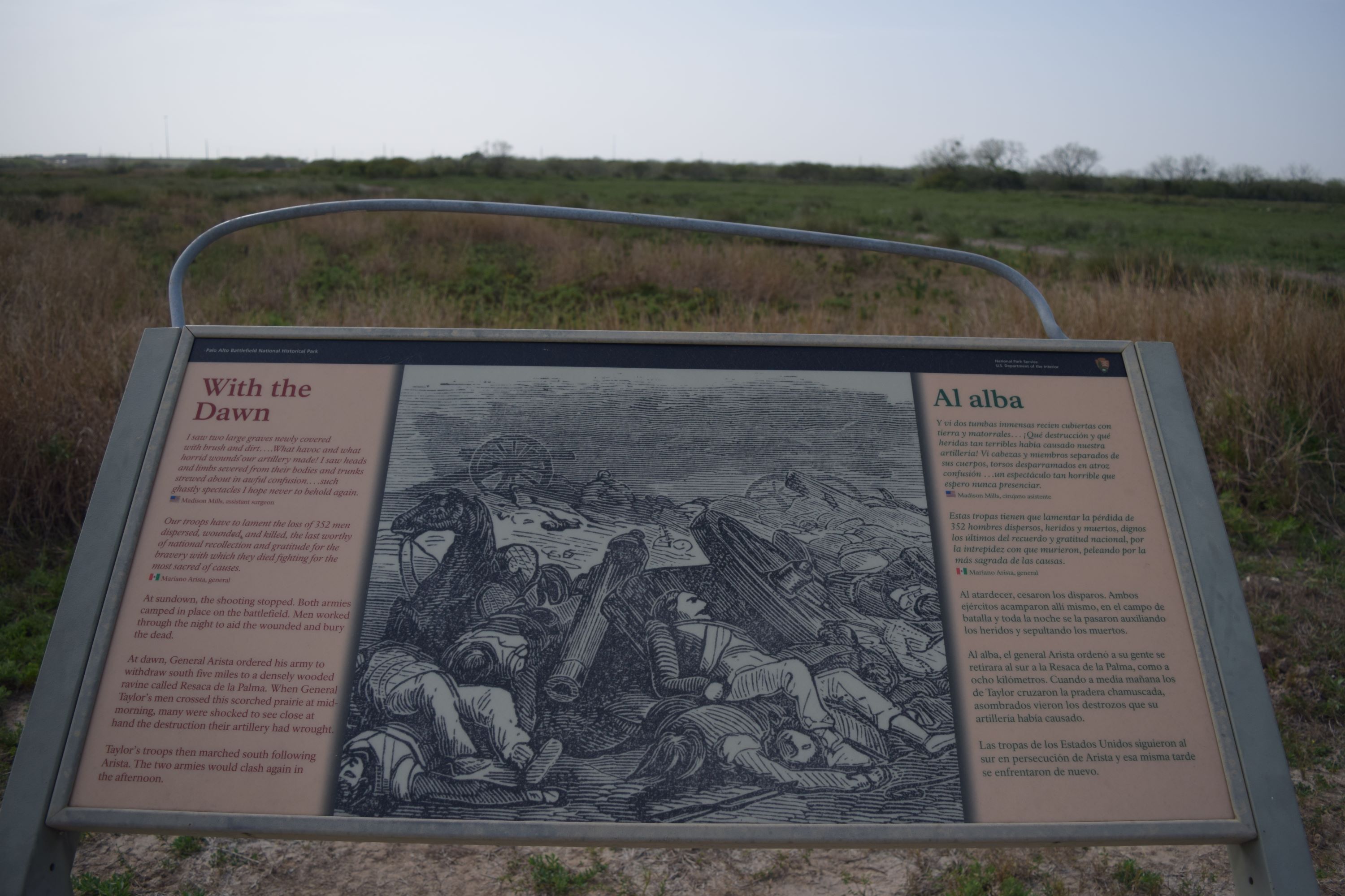
|
| Visitor Centers | Count: 1
Palo Alto Visitor Center
|
| Things to do | Count: 10
|
| Tours |
Count: 1
South Texas Mexican War Sites Driving TourThe story of the U.S.-Mexican War is complex. There are several U.S.-Mexican War sites you can visit in starting in the Corpus Christi, TX area and down the Lower Rio Grande Valley. |
| Articles |
|