Canine distemper is believed to be present in the park.
Contact with saliva from wild animals can transmit distemper to pets, including from but not limited to water bowls, food bowls, trash etc. Distemper is not a threat to humans but can be deadly to pets. Ensure your pets are vaccinated or keep them home.
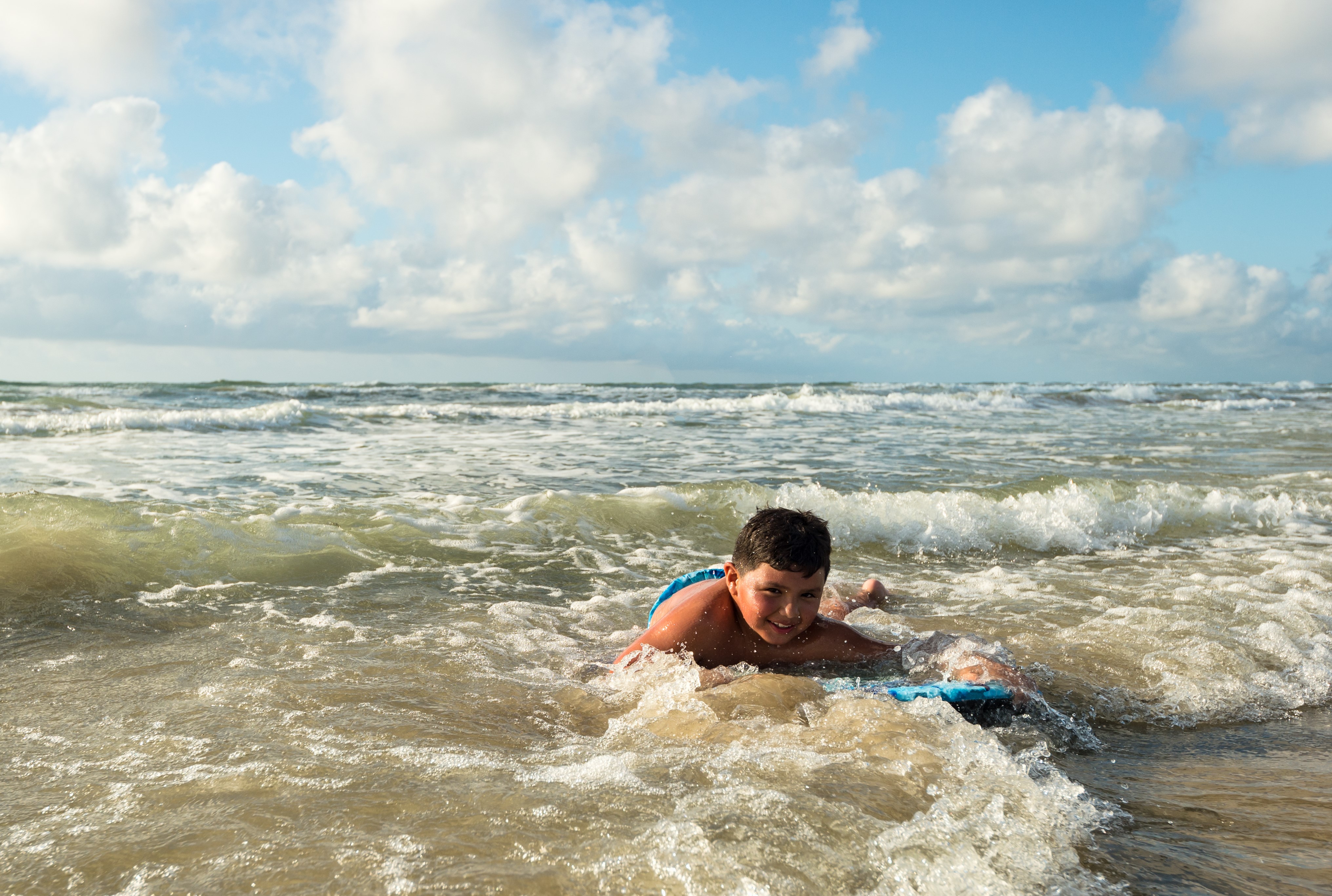
Be aware of changing beach conditions
Beach conditions are changing frequently. Check current tide charts and weather forecasts before traveling on the beach.
Natural tar on beach
Natural tar balls and patties are washing in on the national seashore. To clean tar off skin, wash with soap and water, baby oil, or mineral oil.
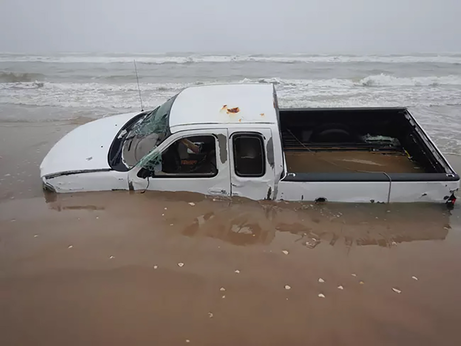
4-wheel drive recommended for beach driving
4-wheel drive is recommended if driving on North and South Beach.
| Title | Padre Island |
| Park Code | pais |
| Description | Protecting sixty-six miles of wild coastline along the Gulf of America, the narrow barrier island is home to one of the last intact coastal prairie habitats in the United States. Along the hypersaline Laguna Madre, tidal mud flats teem with life.... |
| Location | |
| Contact | |
| Activities |
|
| Entrance fees |
Commercial Entrance - Sedan
$25.00
Pass is valid for the day of purchase and the next six days for a vehicle carrying the same group of passengers. The entry fees of commercial tours are based upon the total capacity of vehicles that can carry seven or more passengers regardless of the actual number of passengers.
Commercial Entrance - Van
$40.00
Pass is valid for the day of purchase and the next six days for a vehicle carrying the same group of passengers. The entry fees of commercial tours are based upon the total capacity of vehicles that can carry seven or more passengers regardless of the actual number of passengers.
Commercial Entrance - Mini-bus
$40.00
Pass is valid for the day of purchase and the next six days for a vehicle carrying the same group of passengers. The entry fees of commercial tours are based upon the total capacity of vehicles that can carry seven or more passengers regardless of the actual number of passengers.
Commercial Entrance - Motor Coach
$100.00
Pass is valid for the day of purchase and the next six days for a vehicle carrying the same group of passengers. The entry fees of commercial tours are based upon the total capacity of vehicles that can carry seven or more passengers regardless of the actual number of passengers.
Entrance - Private Vehicle
$25.00
Admits the passholder and up to 15 passengers in the same private (non-commercial) vehicle. It expires one week from the date of purchase. For private vehicles, this entrance pass is required for overnight camping.
A 1-day entrance pass is available for $10 per vehicle. 1-day entrance passes expire at midnight on the date of purchase and are not valid for overnight camping.
Entrance - Motorcycle
$20.00
Admits the passholder and passenger of one motorcycle. It expires one week from the date of purchase. For motorcyclists, this entrance pass is required for overnight camping.
A 1-day entrance pass is available for $5 per motorcycle. 1-day entrance passes expire at midnight on the date of purchase and are not valid for overnight camping.
Entrance - Per Person
$15.00
Admits one individual bicyclist, hiker, or pedestrian visiting the facility without a private vehicle. An individual pass is not required for visitors aged 15 and under. It expires one week from the date of purchase. For an individual, this entrance pass is required for overnight camping.
A 1-day entrance pass is available for $5 per person. 1-day entrance passes expire at midnight on the date of purchase and are not valid for overnight camping.
Entrance - Non-commercial Groups
$15.00
Non-commercial groups traveling in a vehicle with a capacity of 16 persons or more are charged per person. This entrance pass is valid for one week from the date of purchase. Fees will not exceed the commercial fee for the same-sized vehicle. Youth 15 and younger are free. Individuals or families with any valid Annual or Lifetime pass may use their pass for entry.
|
| Campgrounds | Count: 2
Bird Island Basin Campground
Malaquite Campground
|
| Places | Count: 24
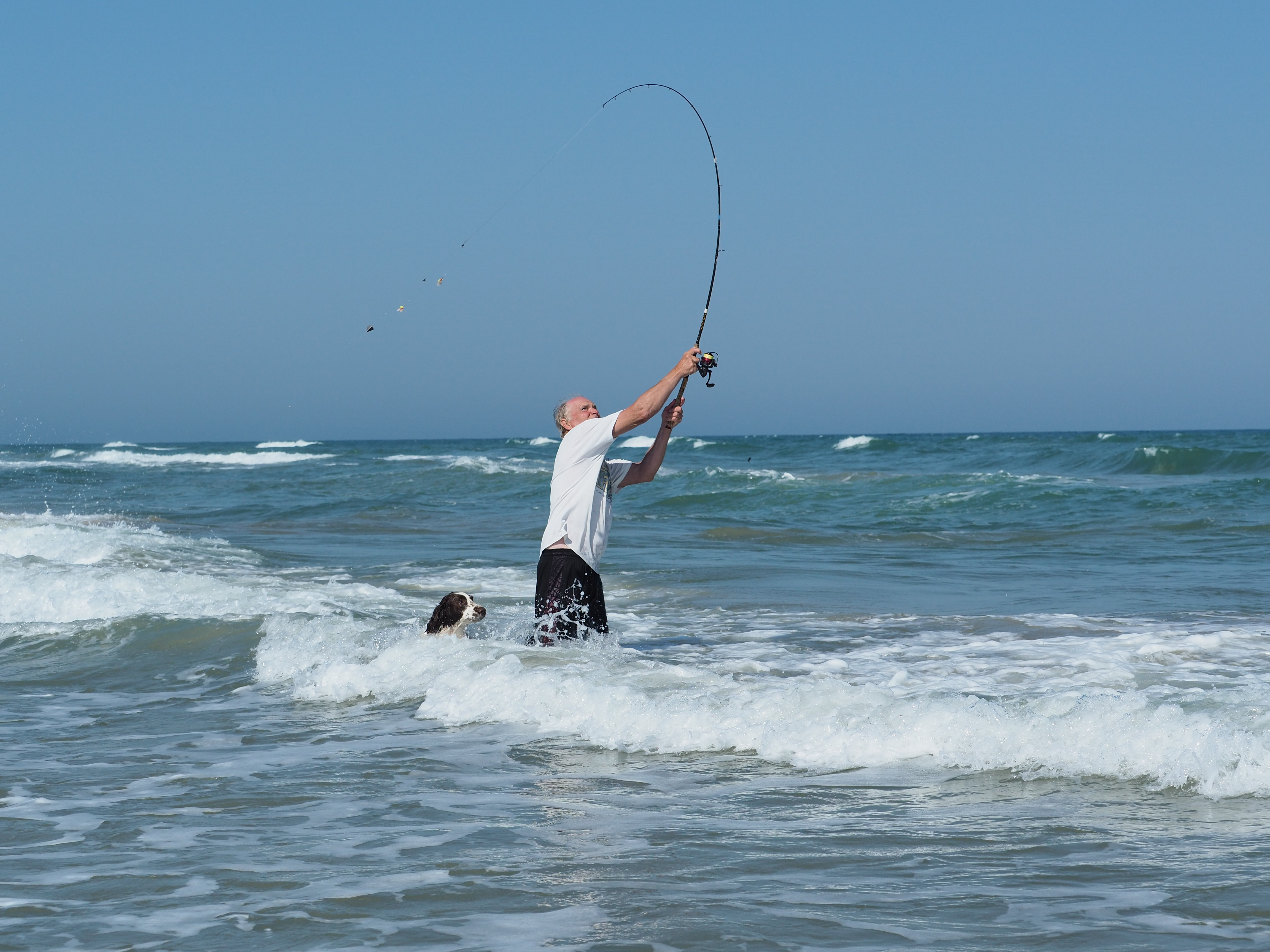
Bird Island Basin Boat RampLocated along the shores of the Laguna Madre, the Bird Island Basin Boat Ramp is the only developed boat ramp in the park. The site is busy in the early mornings, especially on weekends and holidays, as anglers launch their boats for a day of fishing on the Laguna Madre and further south into Baffin Bay. 
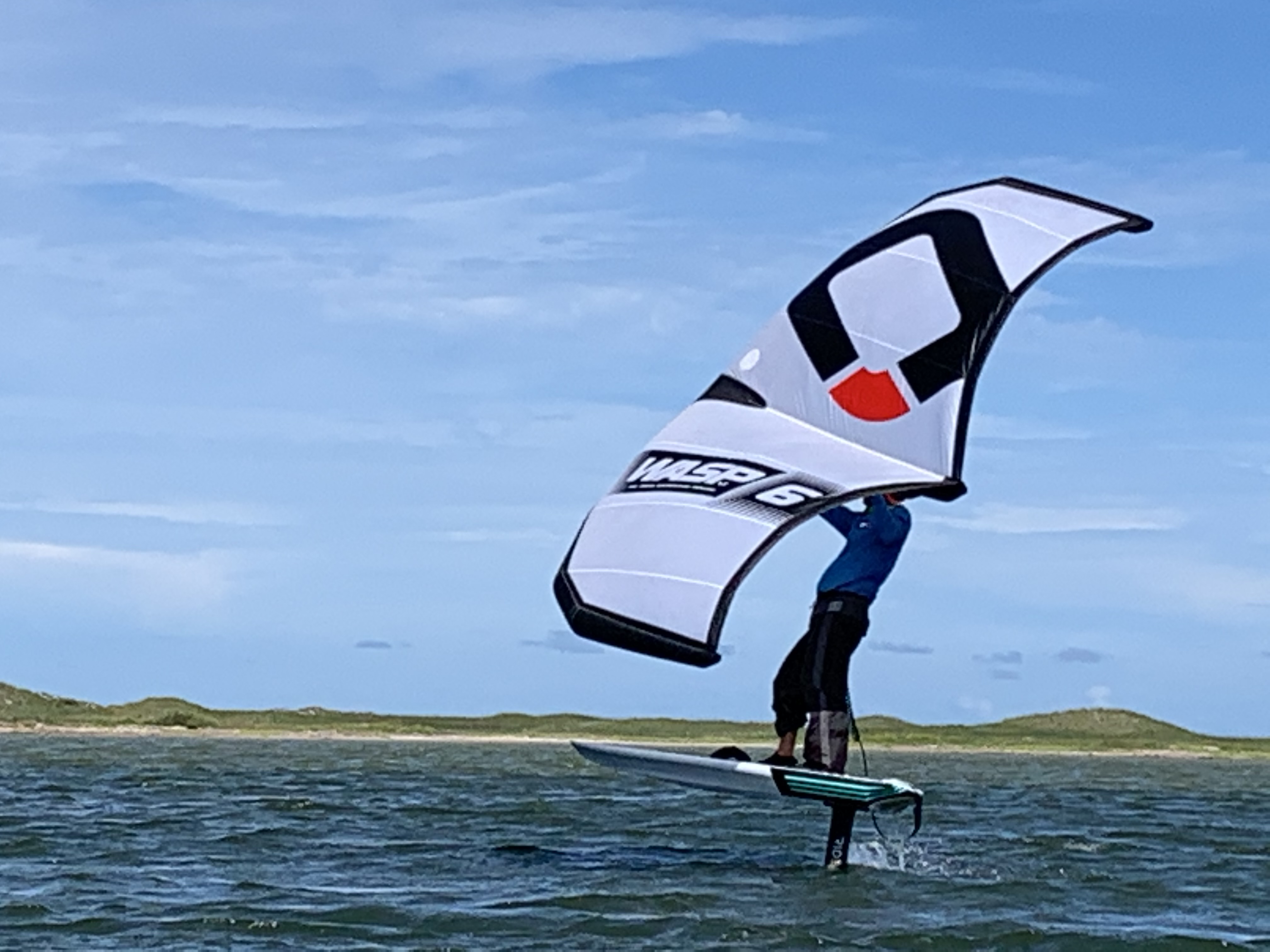
Bird Island Basin Day-use AreaThe Bird Island Basin Day-use Area serves as a central hub for activities along the Laguna Madre. The area is popular with birdwatchers, anglers, campers, and windsurfers alike. 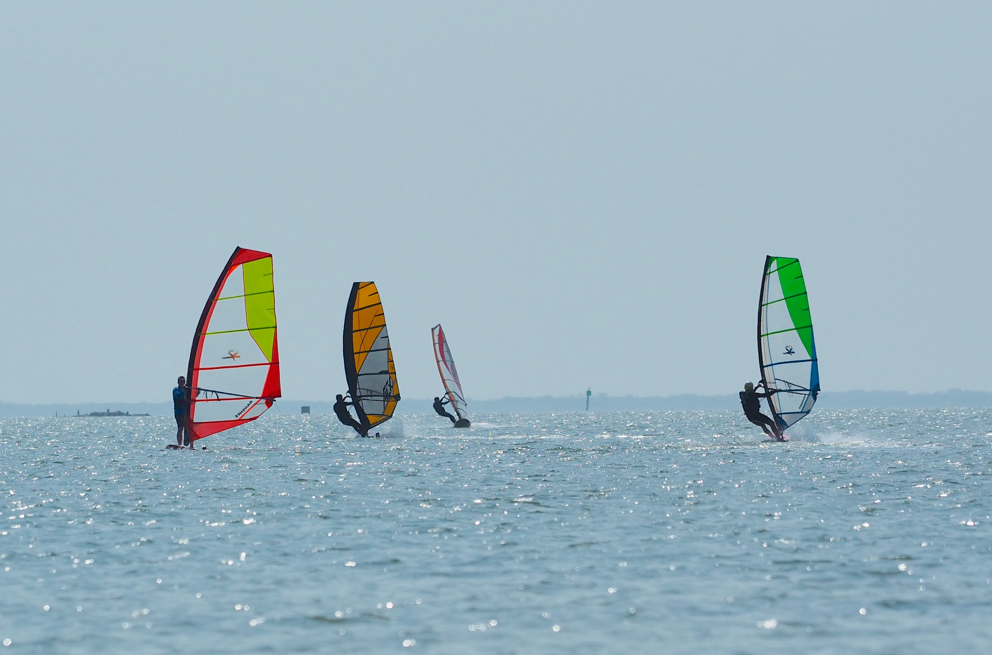
Freshwater PondThe small freshwater pond and adjacent bird blind is a great place to stop for wildlife watching in the park. 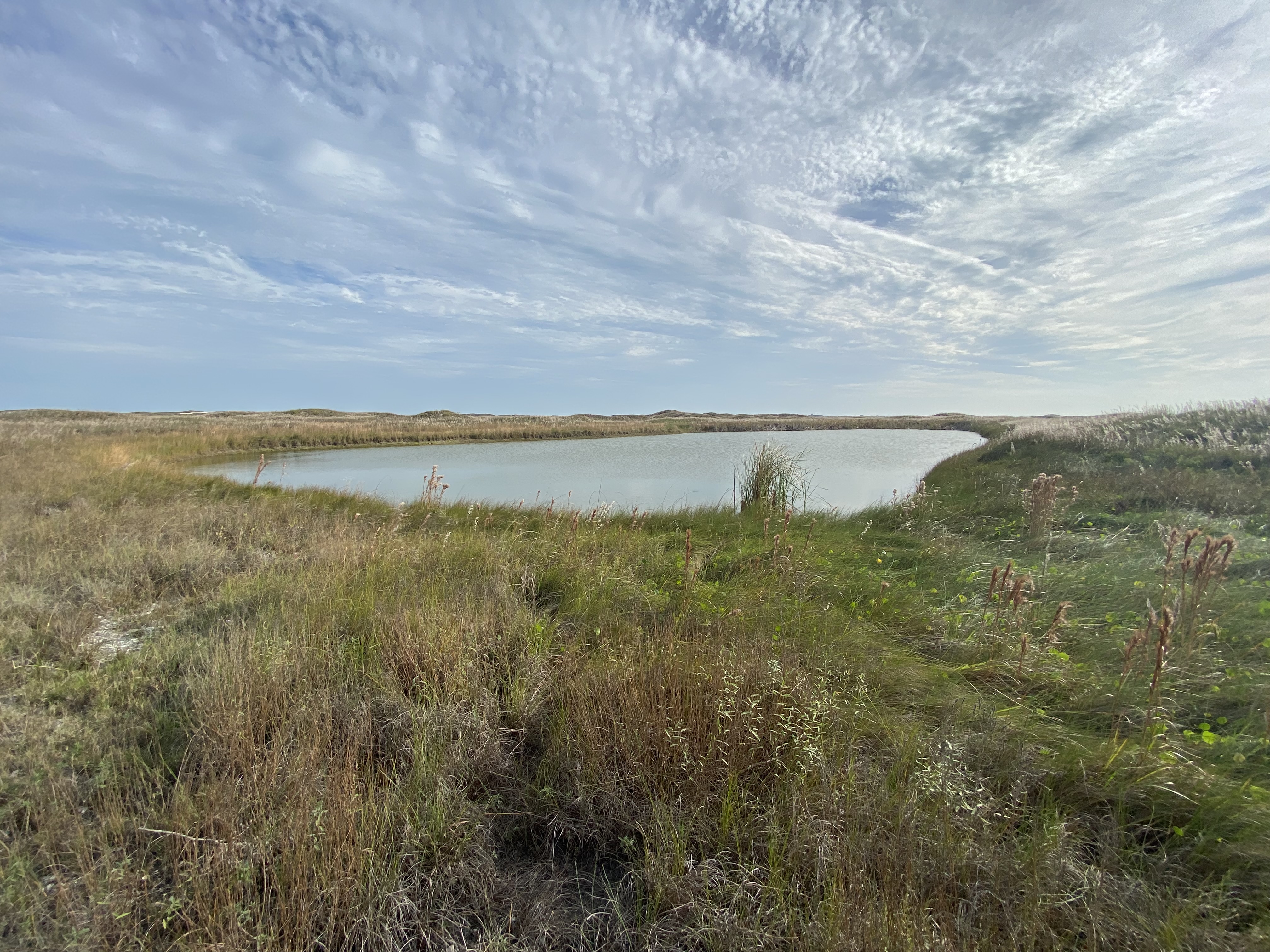
Grasslands Nature TrailThe Grasslands Nature Trail is a 0.75-mile (1.2 km) loop trail with paved access to the grasslands and dunes of the island, and provides benches interspersed throughout the loop. Among the abundant dune grasses and wildflowers of the coastal prairie, hikers may also spot ground squirrels, keeled earless lizards, crested caracaras, and a variety of other wildlife from the trail. 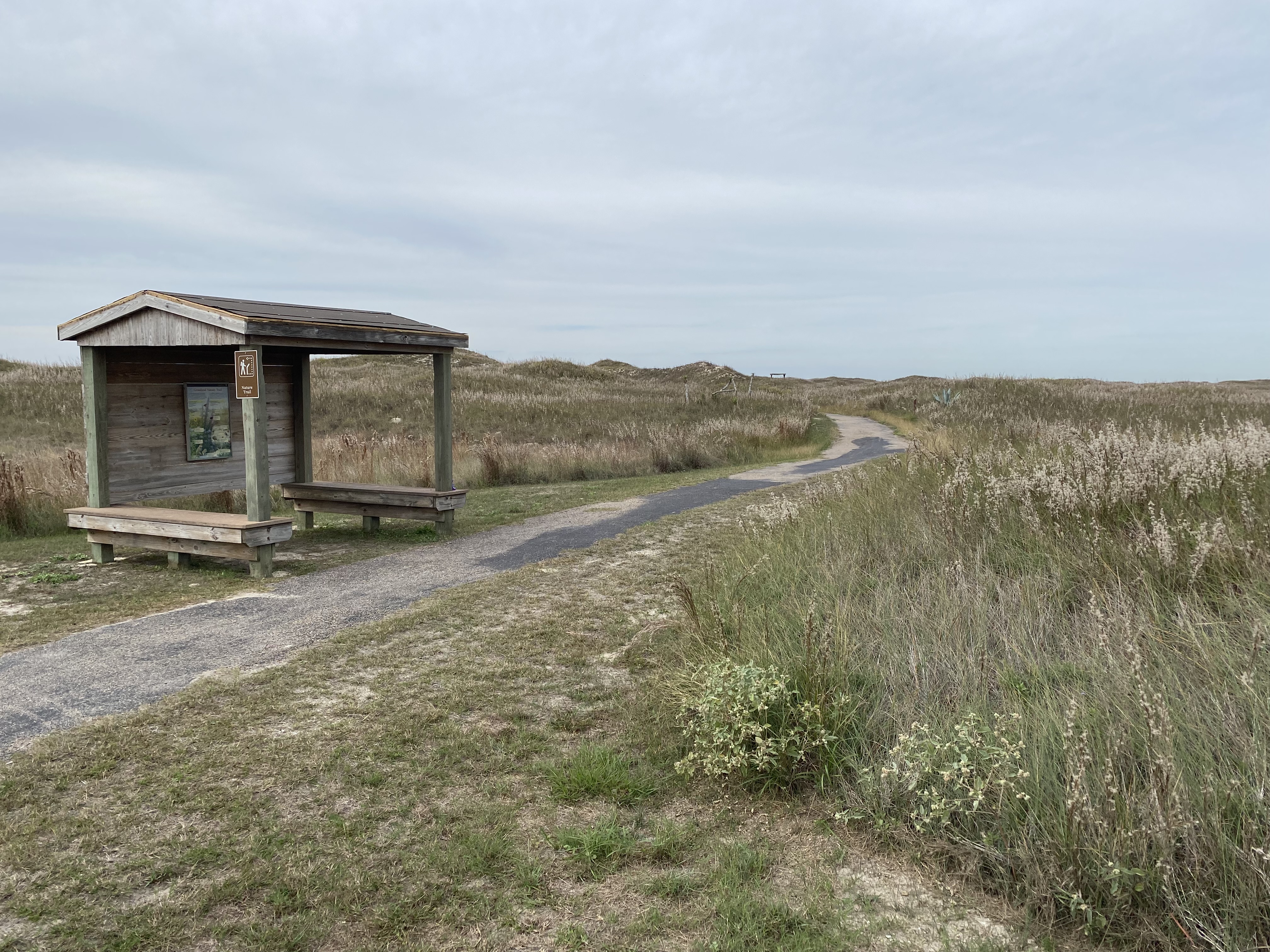
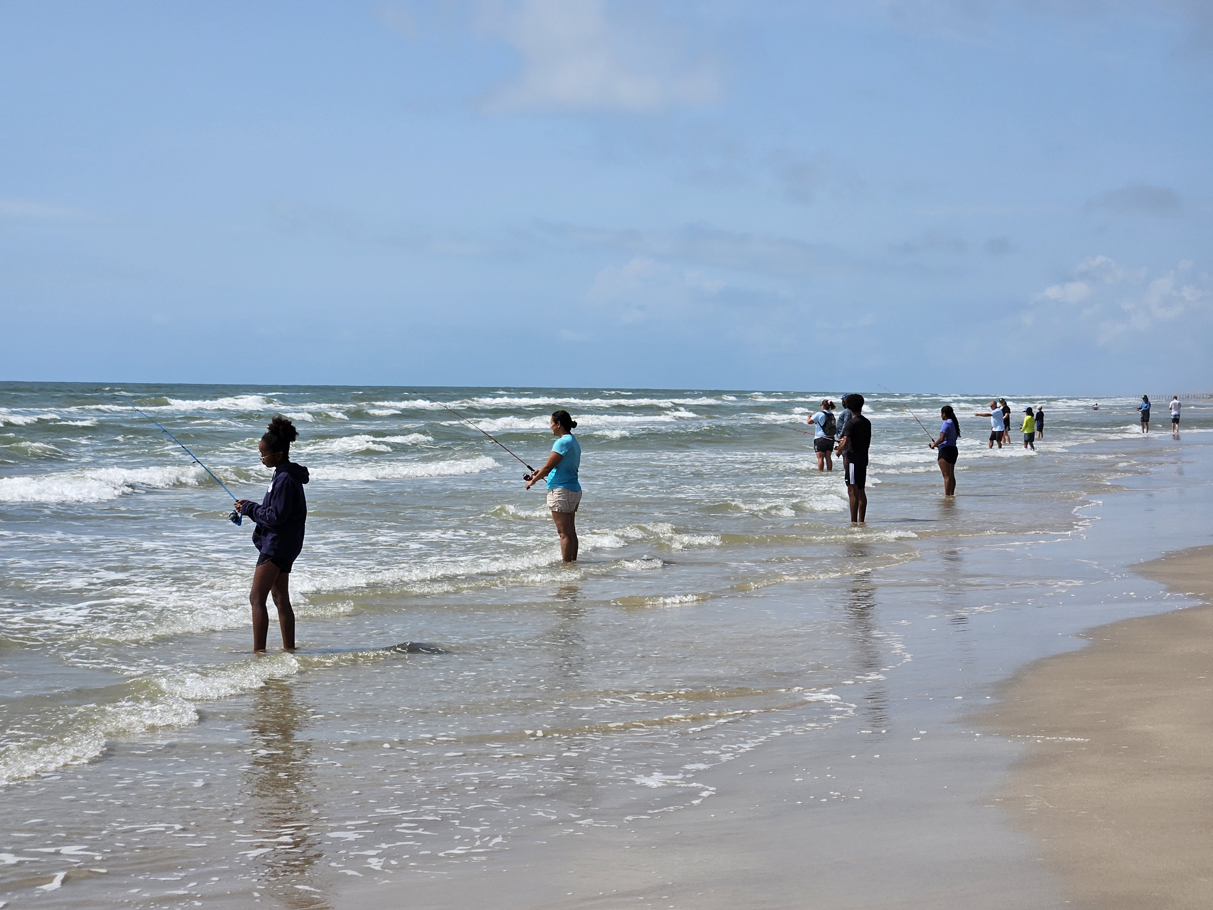
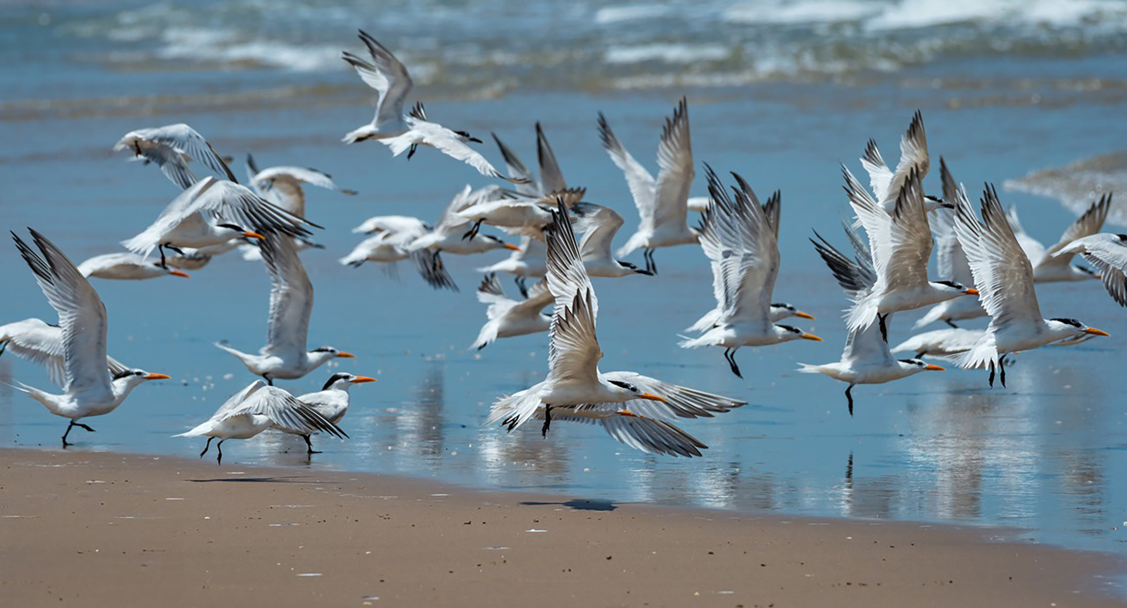
Malaquite BeachMalaquite Beach stretches 4.5 miles (7.24 km) from the North Beach vehicle bollards, south to the South Beach vehicle bollards. The entire stretch of Malaquite Beach is closed to public beach driving, making it an ideal area for families looking for a vehicle free section of beach to recreate on. 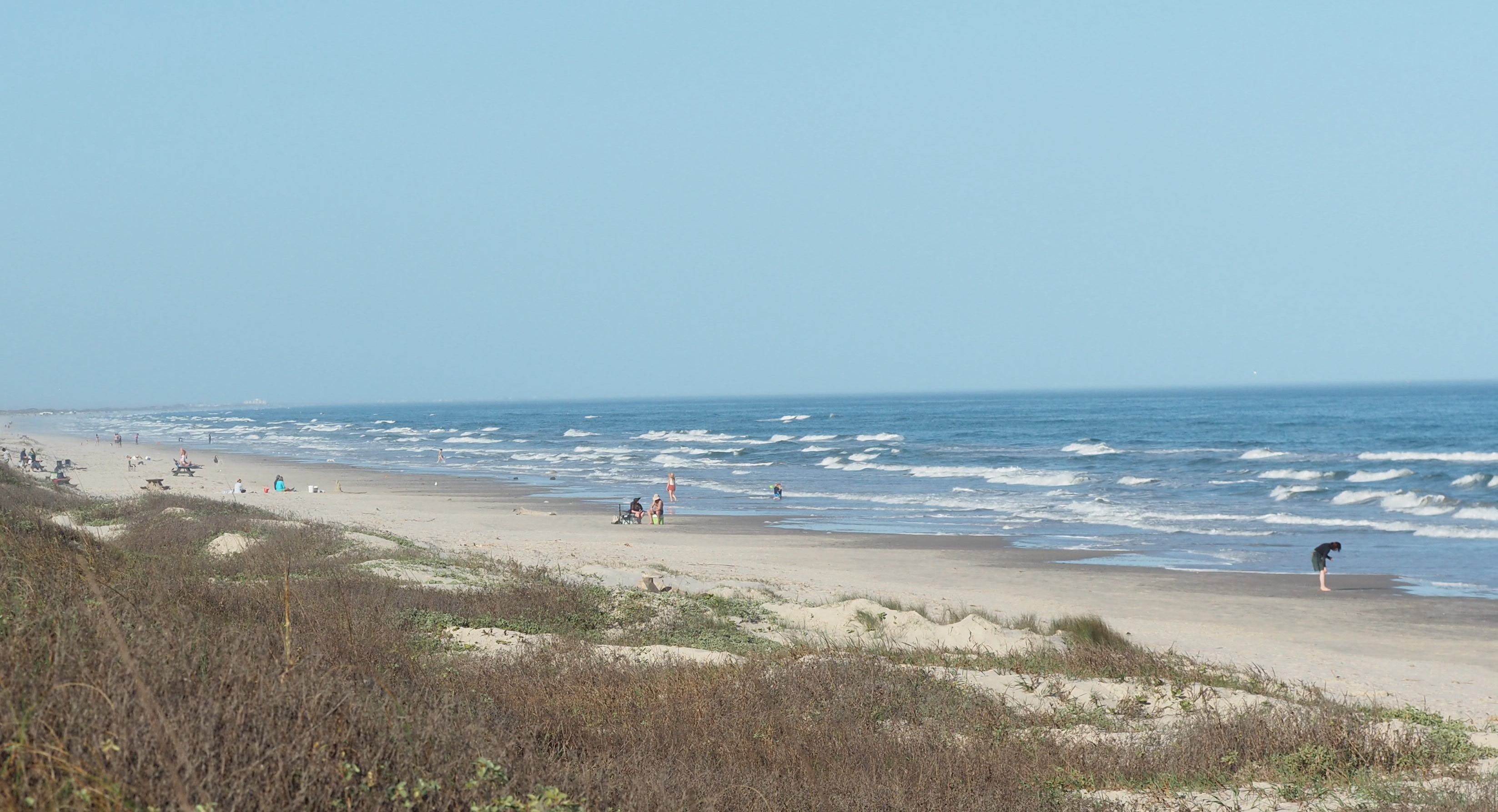
Mansfield ChannelMansfield Channel divides Padre Island National Seashore, located on Padre Island, with South Padre Island. A four-wheel drive vehicle is required to access the Mansfield Channel from the national seashore. 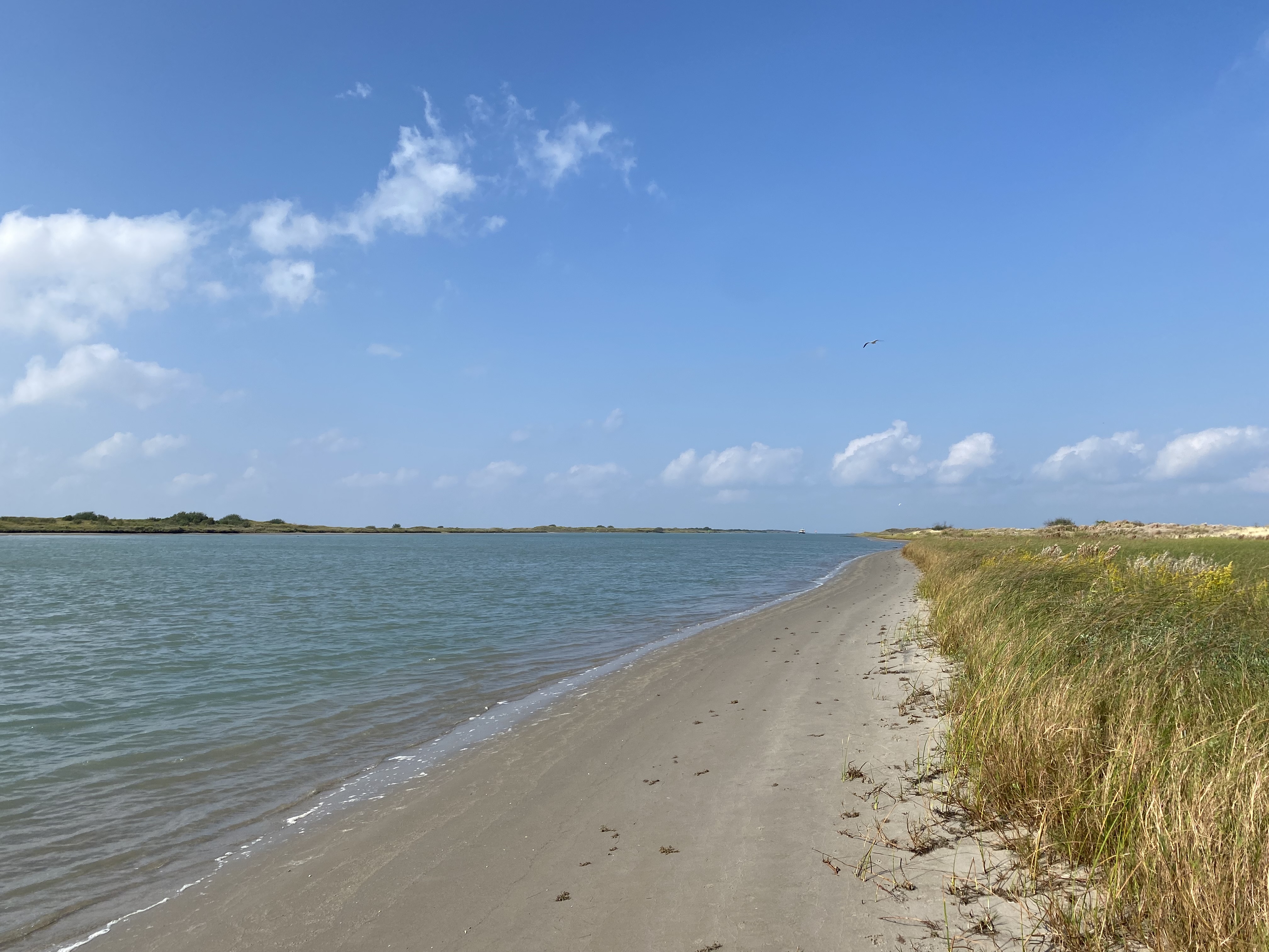
North BeachThe 1.5 mile long North Beach, is open to primitive beach camping. North Beach is generally open to two-wheel drive vehicles, although four-wheel drive is always recommended. 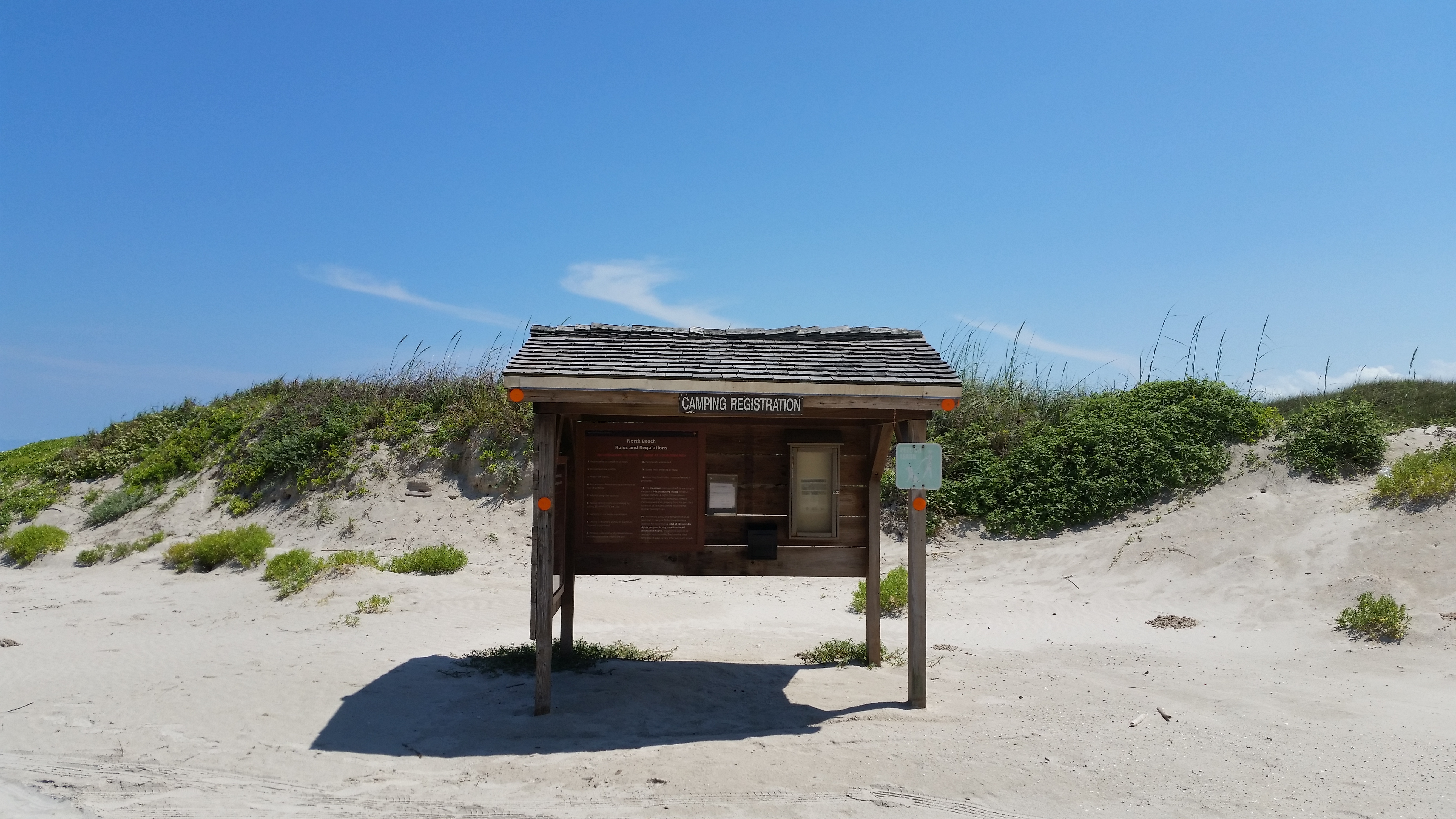
Novillo Line CampStep back in time with a short walk to Novillo Line Camp, where cowboys corralled the cattle that once grazed on the island. The camp is the last remaining structure from the Dunn Cattle Ranch operation. 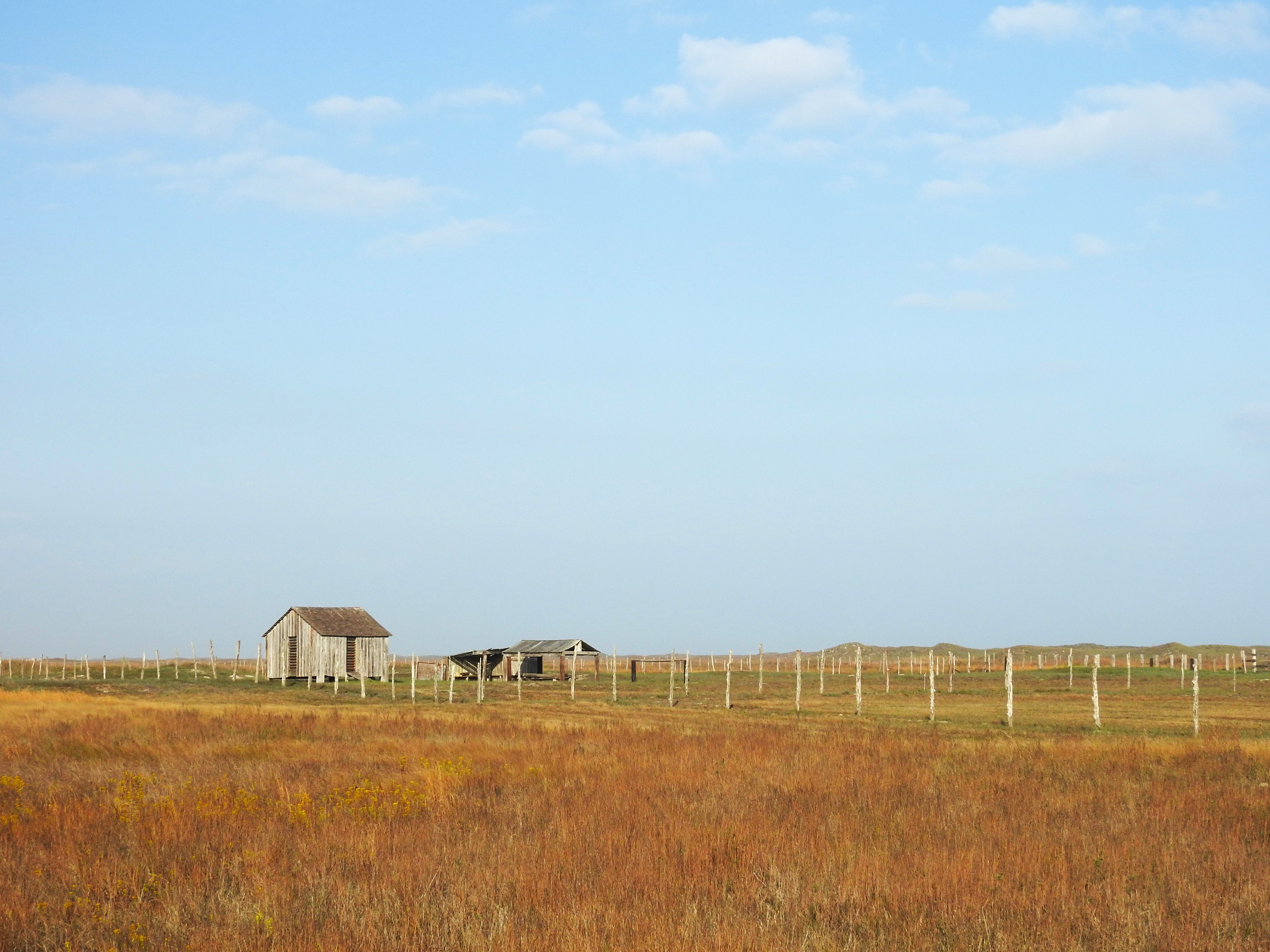
Padre Island Entrance StationThe entrance station to Padre Island National Seashore is where you can purchase your park entrance fee, annual pass, or boat ramp permit in the park. 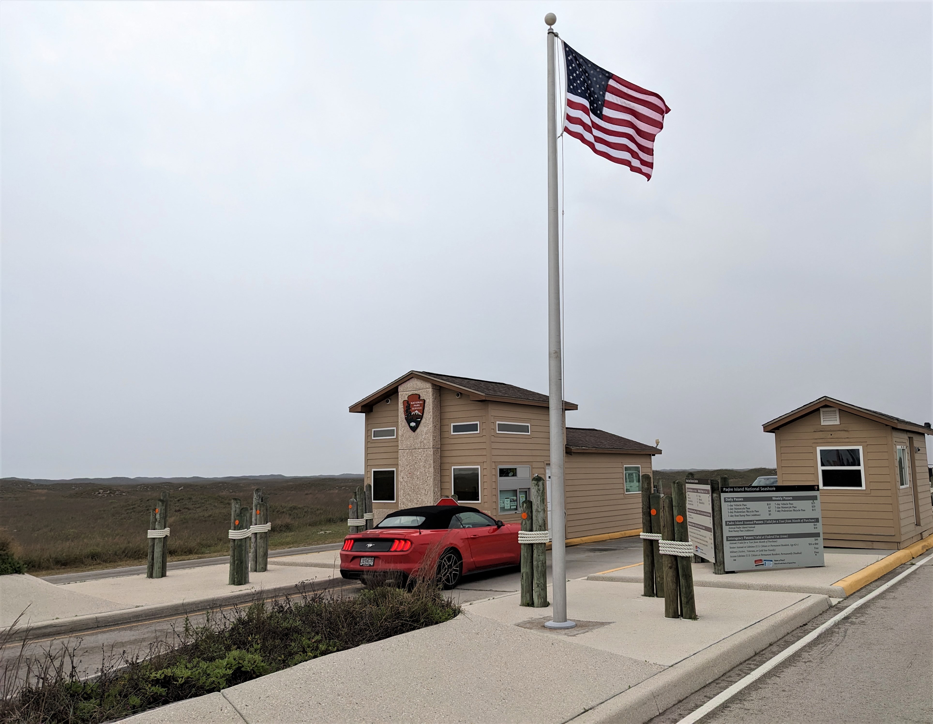
Padre Island Park StoreThe park store has a variety of items to make your visit to the park memorable. 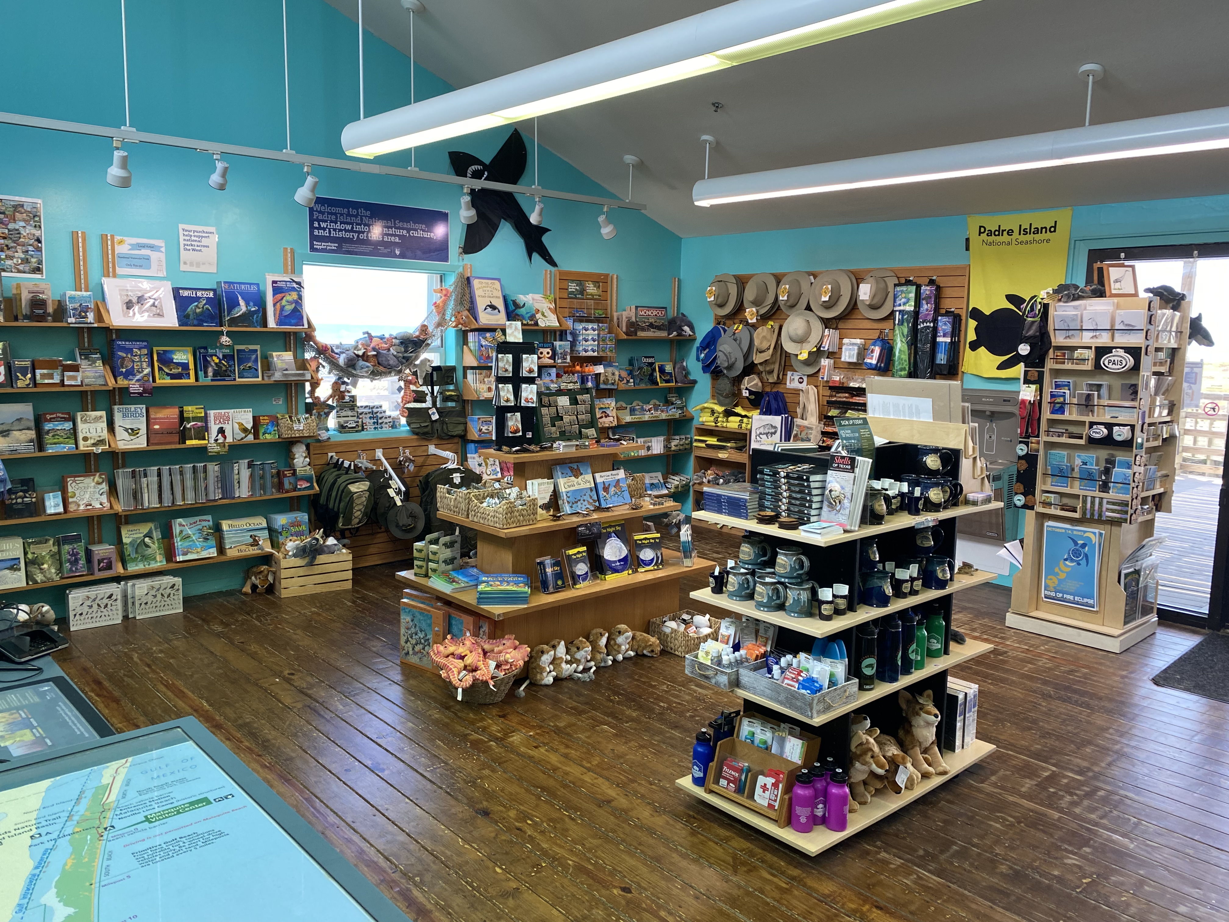
South Beach, Mile 0 to 5The first five miles of South Beach, between beach mile marker 0 to 5, is open to primitive beach camping. Mile 0 to 5 is generally open to two-wheel drive vehicles, although four-wheel drive is always recommended. 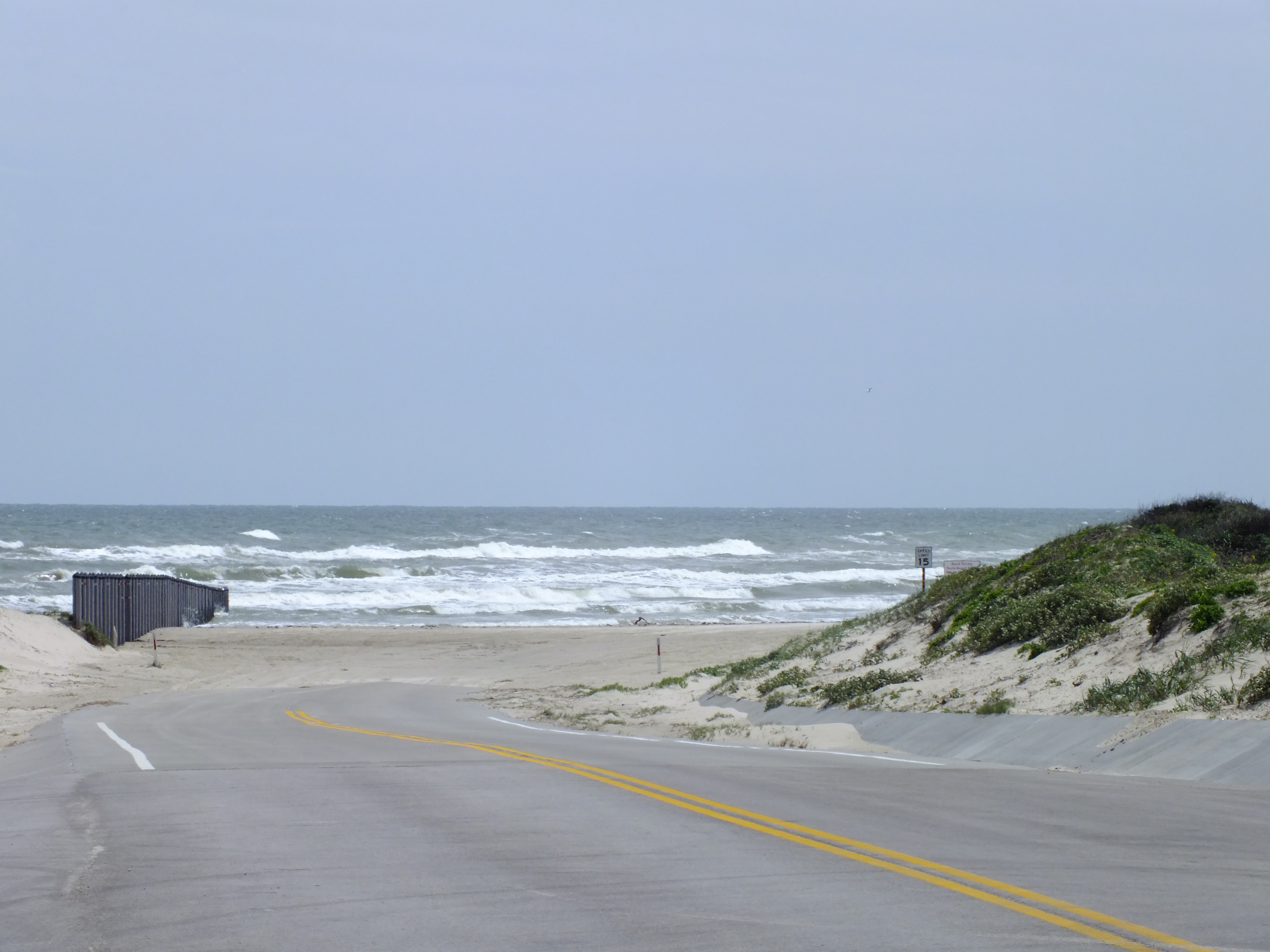
South Beach, Mile 5 to 60The last fifty-five miles of South Beach, between beach mile marker 5 to 60, is open to primitive beach camping. Mile 5 to 55 always requires four-wheel drive vehicles. Popular destinations along this stretch of beach include the sections of beach known as Little Shell Beach and Big Shell Beach, as well as Yarborough Pass, a high-clearance four-wheel drive road with access to the Laguna Madre. 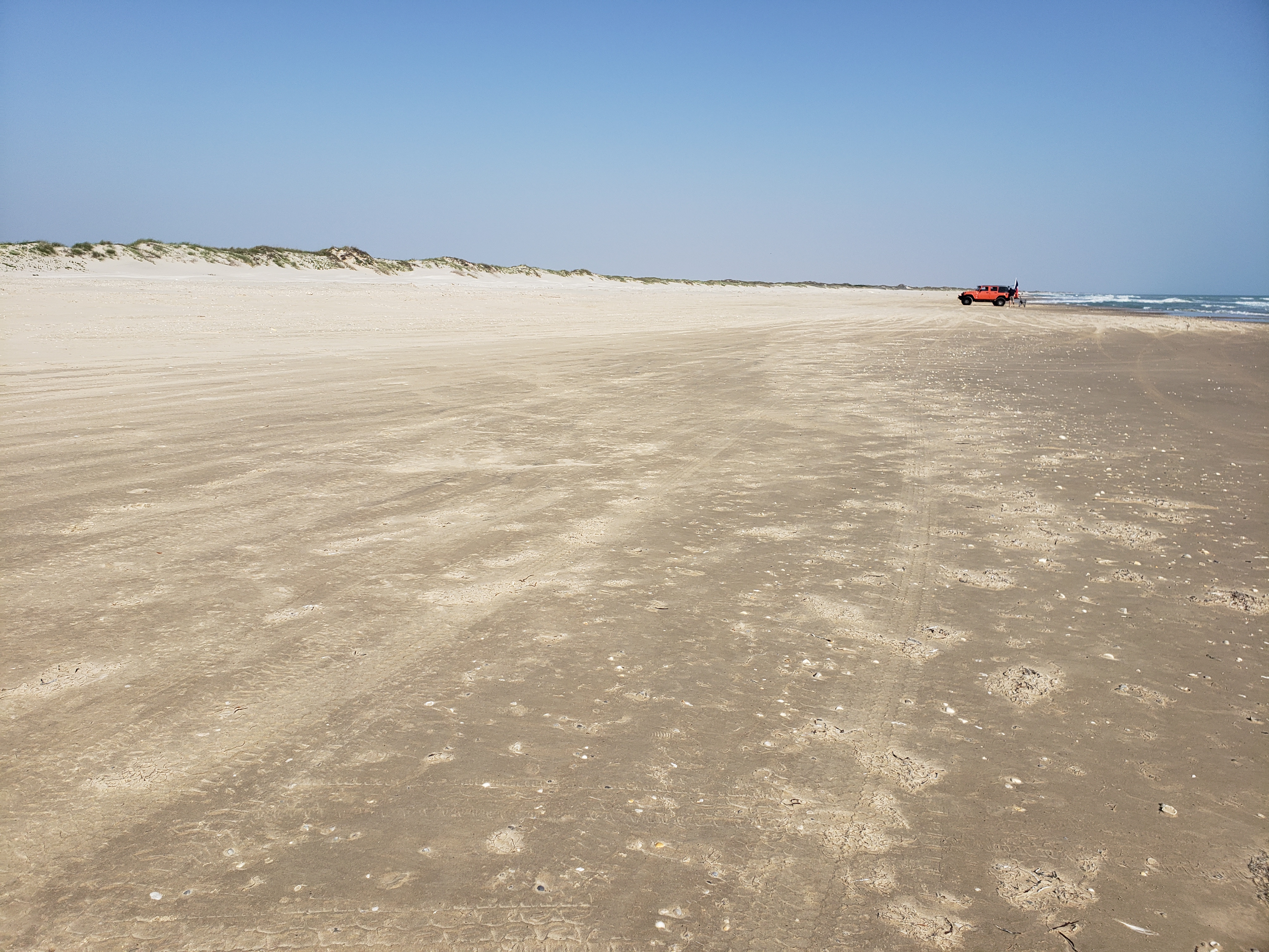
Stop 10: Plains Wild Indigo (Baptisia bracteata var. leucophaea)This species has beautiful creamy, yellow-colored flowers which form long horizontal clusters. In late summer, the entire upper portion of the plant loses its green color. It becomes dry, turns dark grey to black, and breaks off at the ground to become tumbleweeds. This process aids in seed dispersal. 
Stop 11: Gulfdune Paspalum (Paspalum monostachyum)Other common names include gulf dune crowngrass. Distinguished from other similar Paspalum species with numerous flowering branches (notatum, setaceum, plicatulum) by purplish colored spikelets and inrolled, linear leaves with 1-3 terminal panicle branches. The second most common grass on the island behind seacoast bluestem. This common grass was considered a valuable source of forage for livestock by Native Americans. 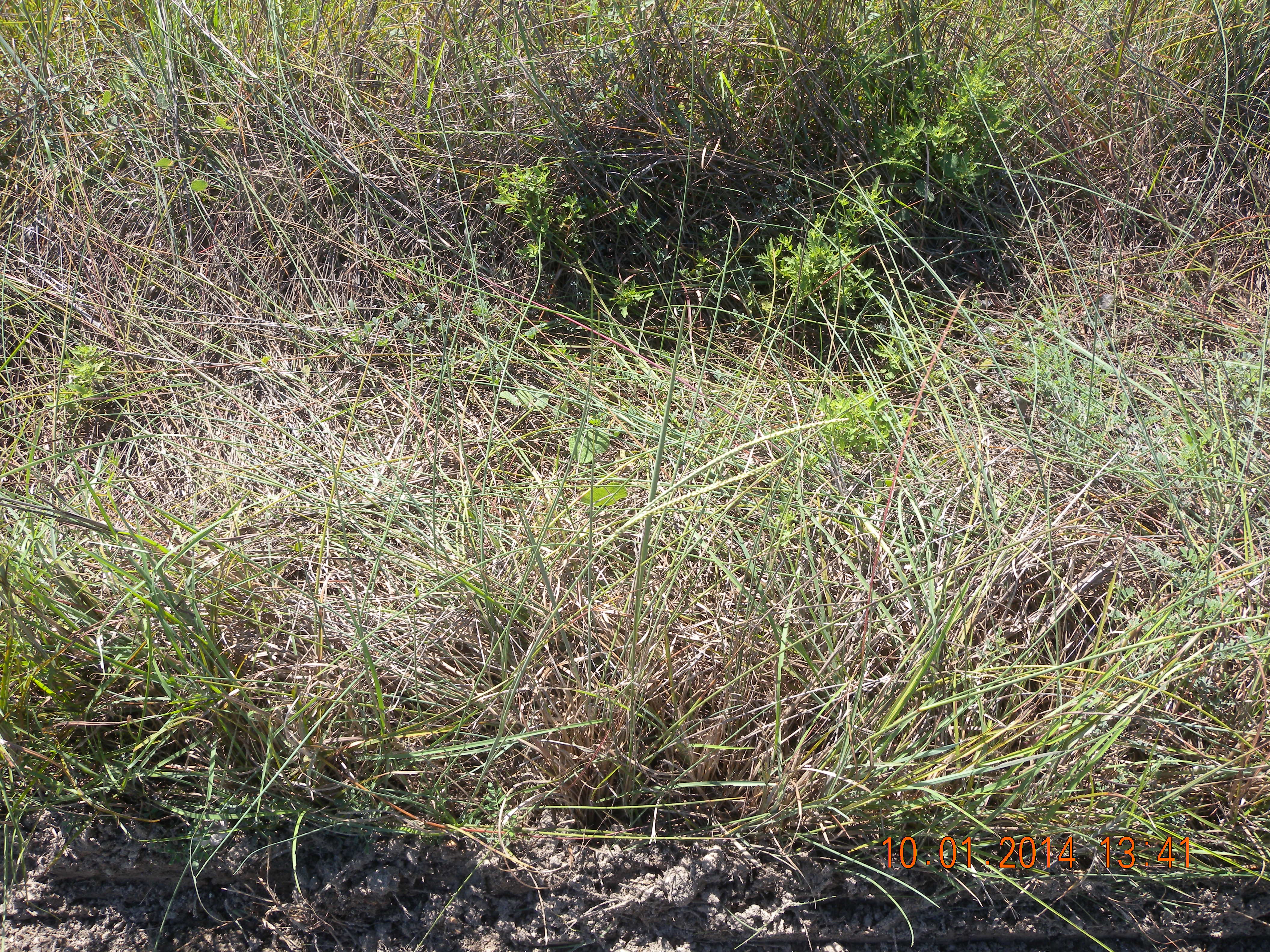
Stop 1: Century Plant (Agave americana)This species is heavily armed with strong spines along the edges and a single spine at the tip of the leaf. The Western Apache Native Americans designed handles for tools and lance shaft weapons from the tall flowering stalks. This is an important larval food plant for the trapdoor giant skipper (Agathymus) complex of butterflies. 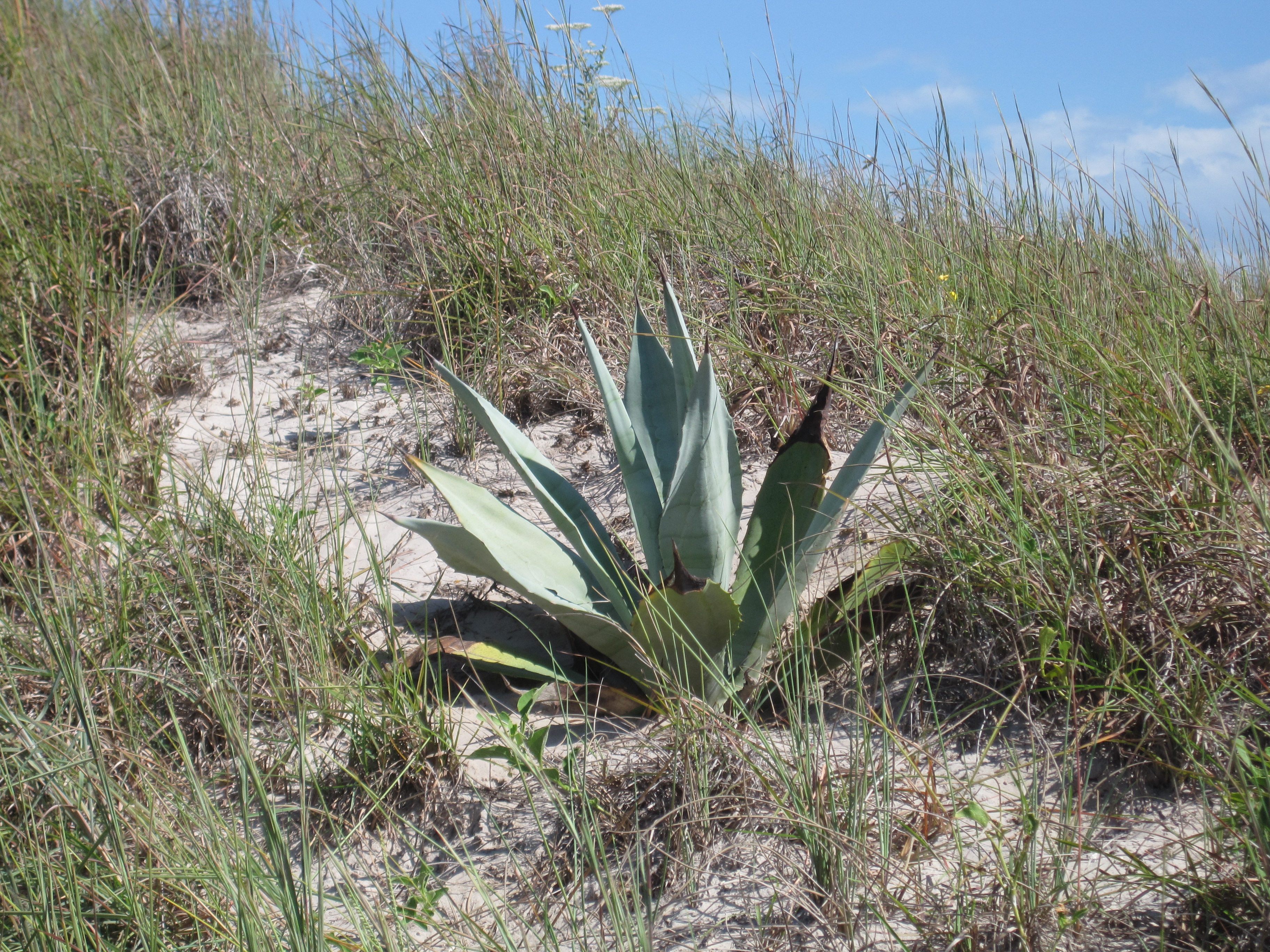
Stop 2: Scarlet Pea (Indigofera miniata)This plant has beautiful salmon-rose to light red flower petals and curved pea pods. This species is beneficial as the larval food plant for the Gray hairstreak, Southern dogface, and Reakirt’s blue butterflies. It is also a popular species in wildflower gardens as a ground cover due to its mat-like growth pattern. Deer and livestock also commonly consume this plant as a food source. 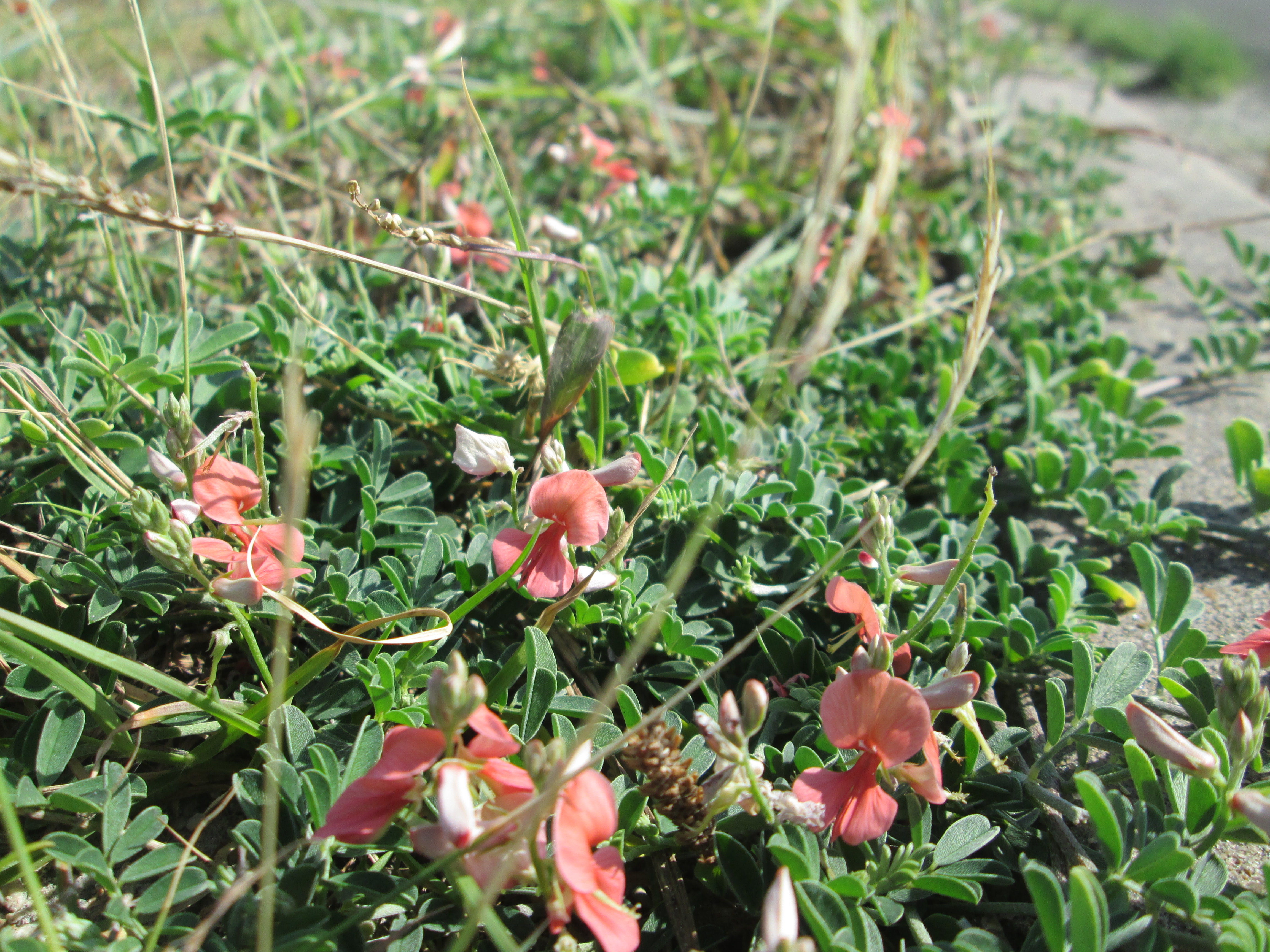
Stop 3: Western Prickly Pear (Opuntia macrorhiza)The long, sharp spines of cacti are actually modified leaves that harden as they age. The ripened fruits were a popular food source for many Native American tribes who would rub the fruits on the ground to remove the spines and eat the fruits raw. The fruits were also used as a source of red dye, fermented to make a beverage, used as a syrup, and dried and ground to be mixed with cornmeal to make a mush for winter food use. 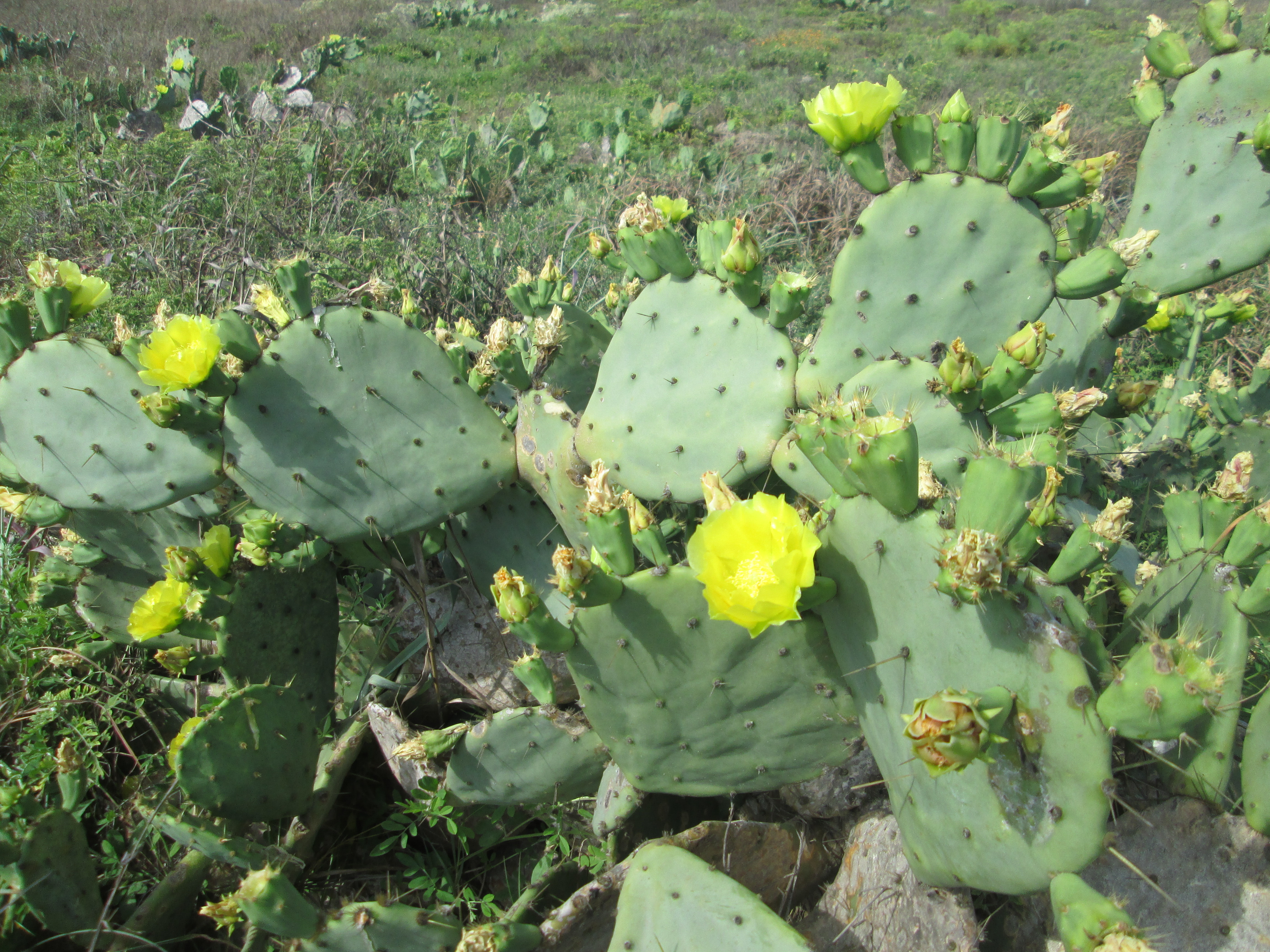
Stop 4: Padre Island Mistflower (Conoclinium betonicifolium)Mistflower is one of the most important nectar sources for butterflies and moths on the island. This is the larval food plant for the Rounded metalmark butterfly and several species of moths. In the park, it is common near ephemeral ponds and marshes, roadsides, open grasslands, and disturbed areas. Native Americans used this plant externally and internally for just about every malady known, including drinking a tea from the roots to treat alcoholism. 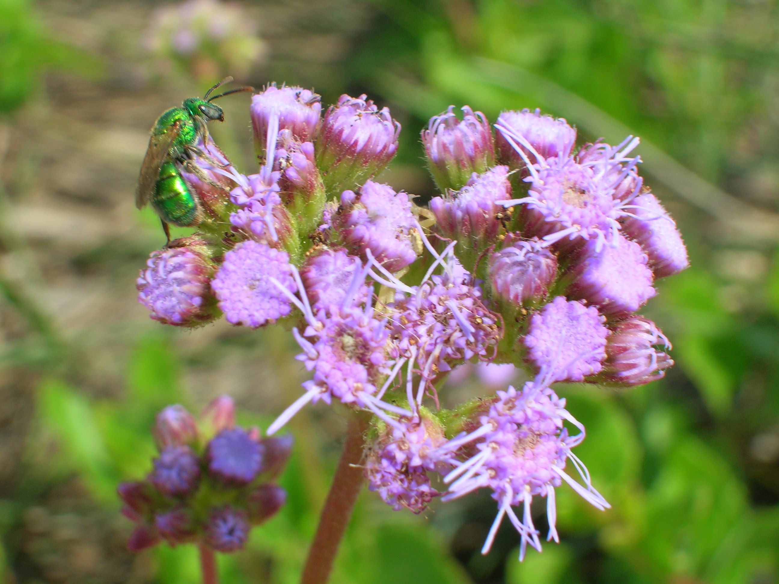
Stop 5: Texas Goldentop (Euthamia gymnospermoides)Euthamia was formerly included in the genus Solidago (Goldenrod). This species can be confused with goldenrods and is differentiated by the presence of glandular and sticky leaves. Euthamia often exhibit extreme phenotypic (environmental) variation. Native American tribes prepared cold infusions of the flowers to relieve chest pains. 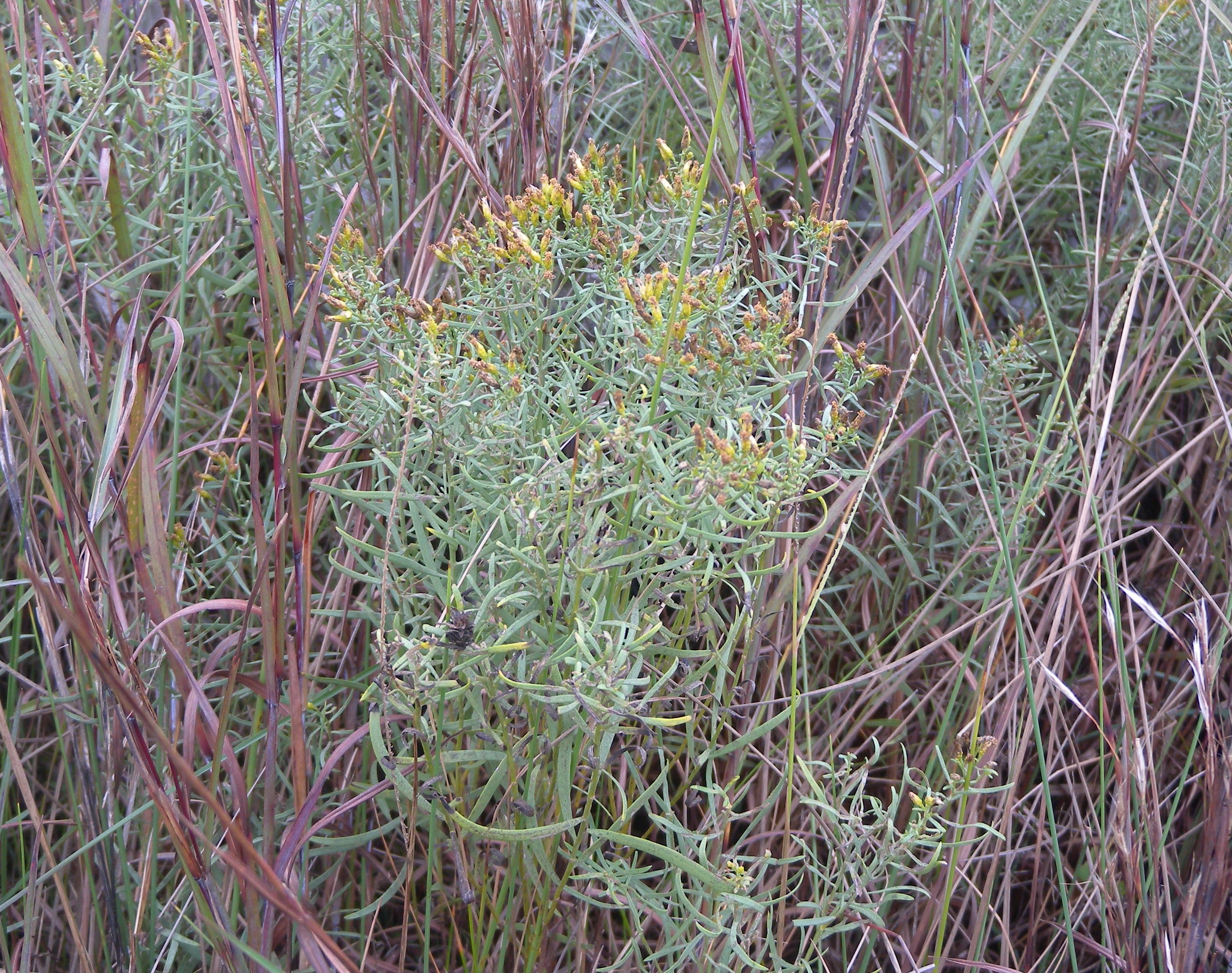
Stop 6: Elegant Gayfeather (Liatris elegans)This is one of the island’s most attractive and showy species. It also provides an important nectar source for butterflies and day flying moths. It was used by Native Americans internally and externally for the treatment of rheumatism. Confederate surgeons utilized other Liatris species in the treatments of sore throats, pain, coughs, colds, colic, and even snake bites. These other Liatris species were referred to as Button snakeroot and Rattlesnake’s master during the 1800s. 
Stop 7: Wax Myrtle (Morella cerifera)This densely branching shrub was used by Native American tribes to treat fever, throat aches, stomach aches, and headaches. The wax of the fruit was historically used to make candles while the leaves were used as a tobacco substitute. In winter, the seeds are important food sources for wildlife. This shrub also provides significant habitat for a variety of bird species. 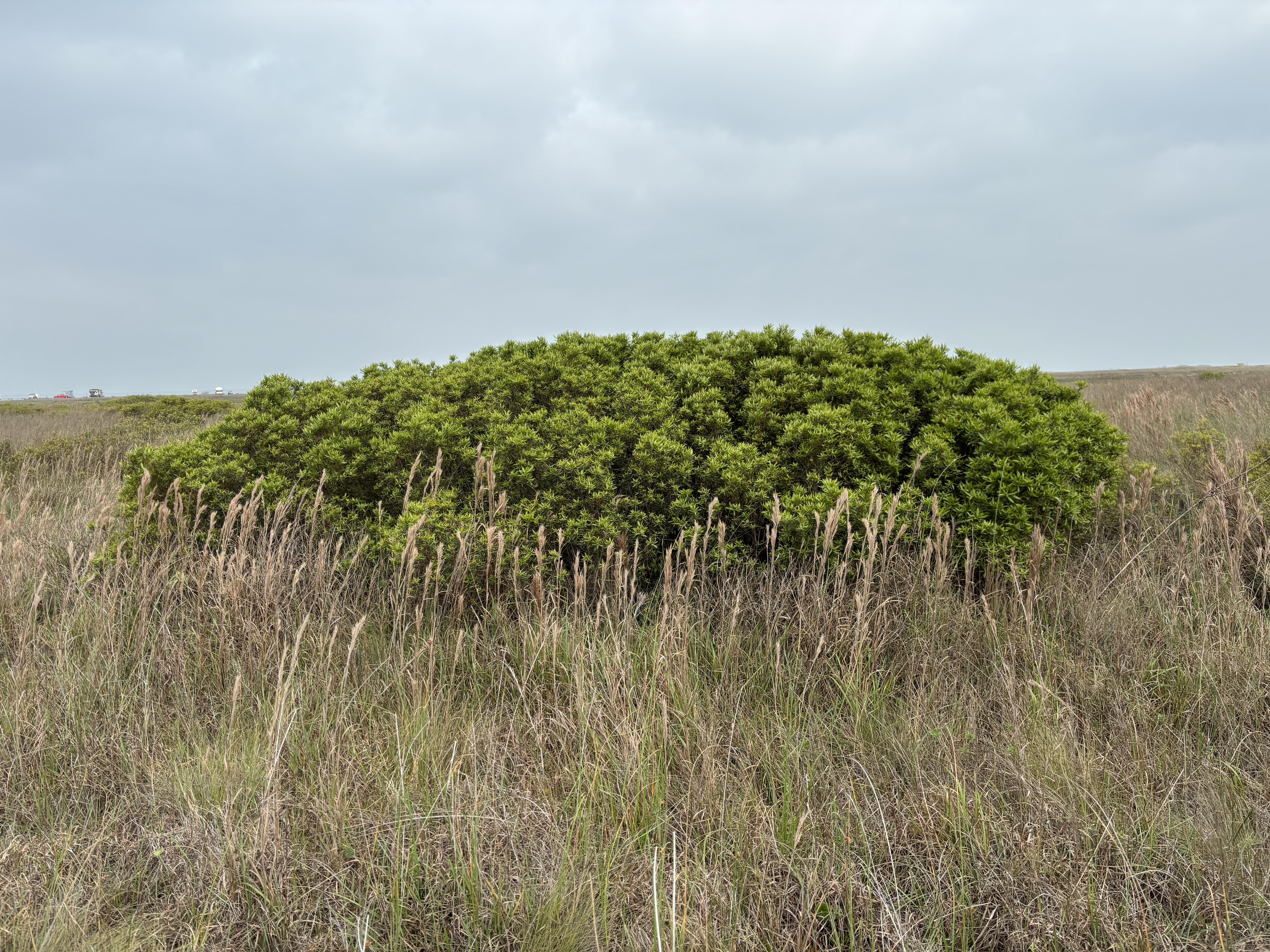
Stop 8: Dagger Plant (Yucca aloifolia)The plant leaves are modified spikes with sharp spines at the tips. Flowers are creamy white and are often tinged with purple. It has been frequently misidentified as Spanish dagger (Yucca treculeana). Dagger plant is a sand growing species most commonly found on the island while Spanish dagger is more common in clay soils and in the Rio Grande valley. 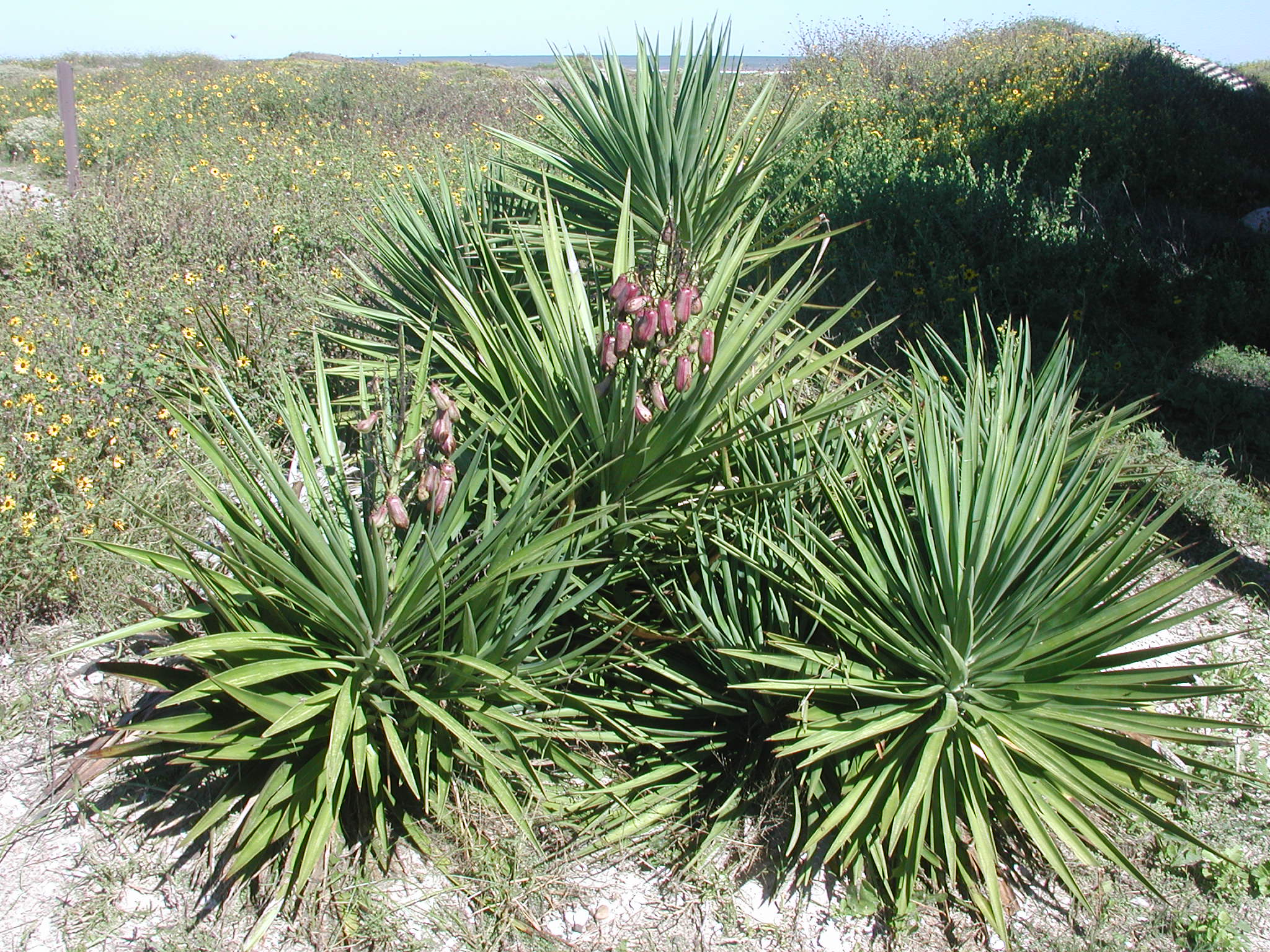
Stop 9: Seacoast Bluestem (Schizachyrium scoparium littorale)This is the most abundant grass on the island. It is an attractive grass forming upright clumps of slender green leaves which have a tinge of blue at the base. It has striking clusters of fluffy, silvery-white seed heads which often persist into winter. The most outstanding feature of this grass may be the bronze-orange fall foliage color. It provides forage and cover for wildlife. 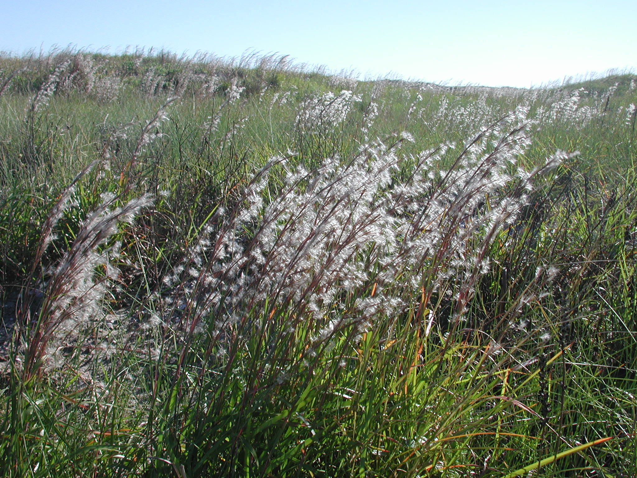
Yarborough PassYarborough Pass, along the Laguna Madre, is open to primitive camping. It is accessed near the 15-mile mark on South Beach and requires a high clearance four-wheel drive vehicle. 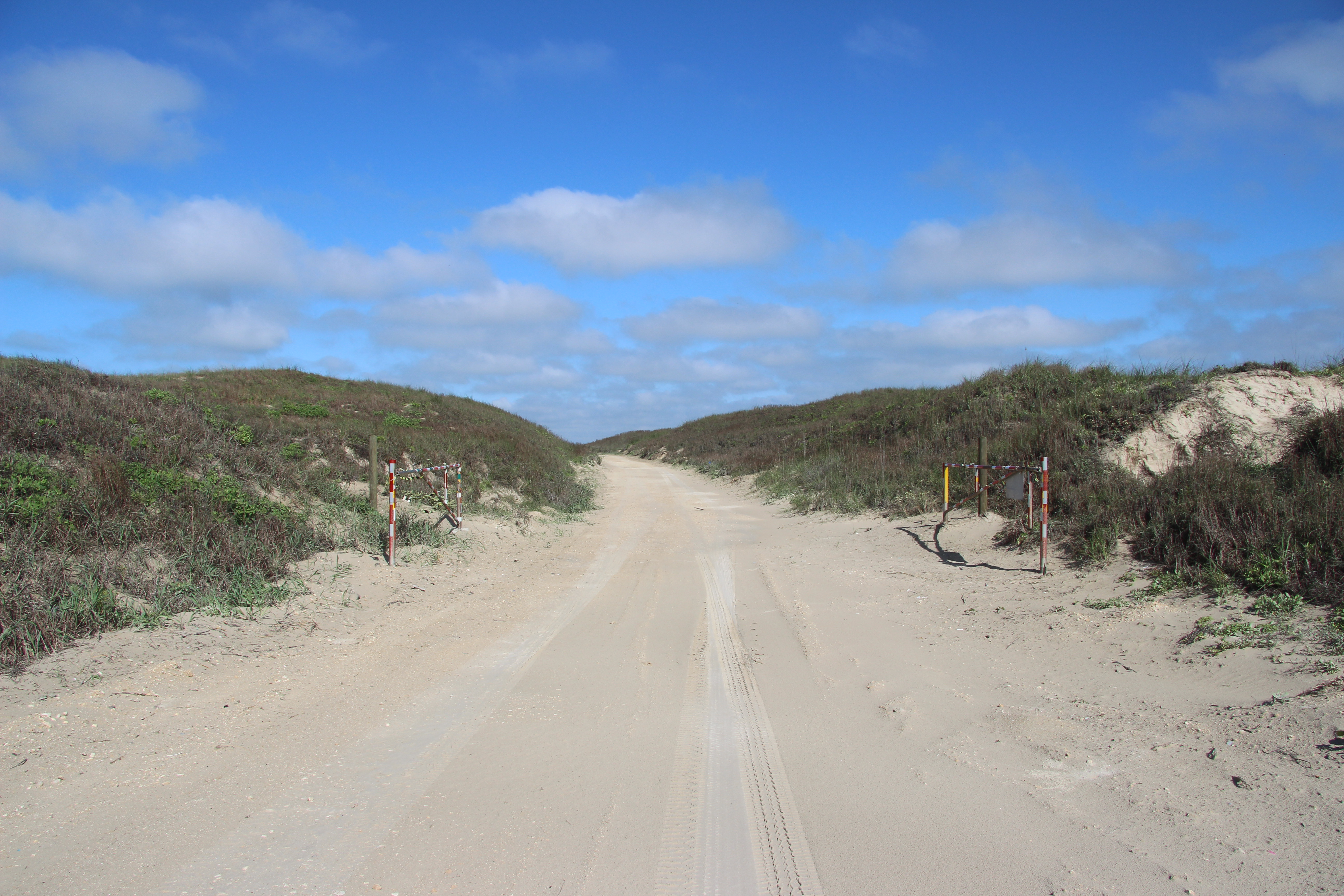
|
| Visitor Centers | Count: 1
Malaquite Visitor Center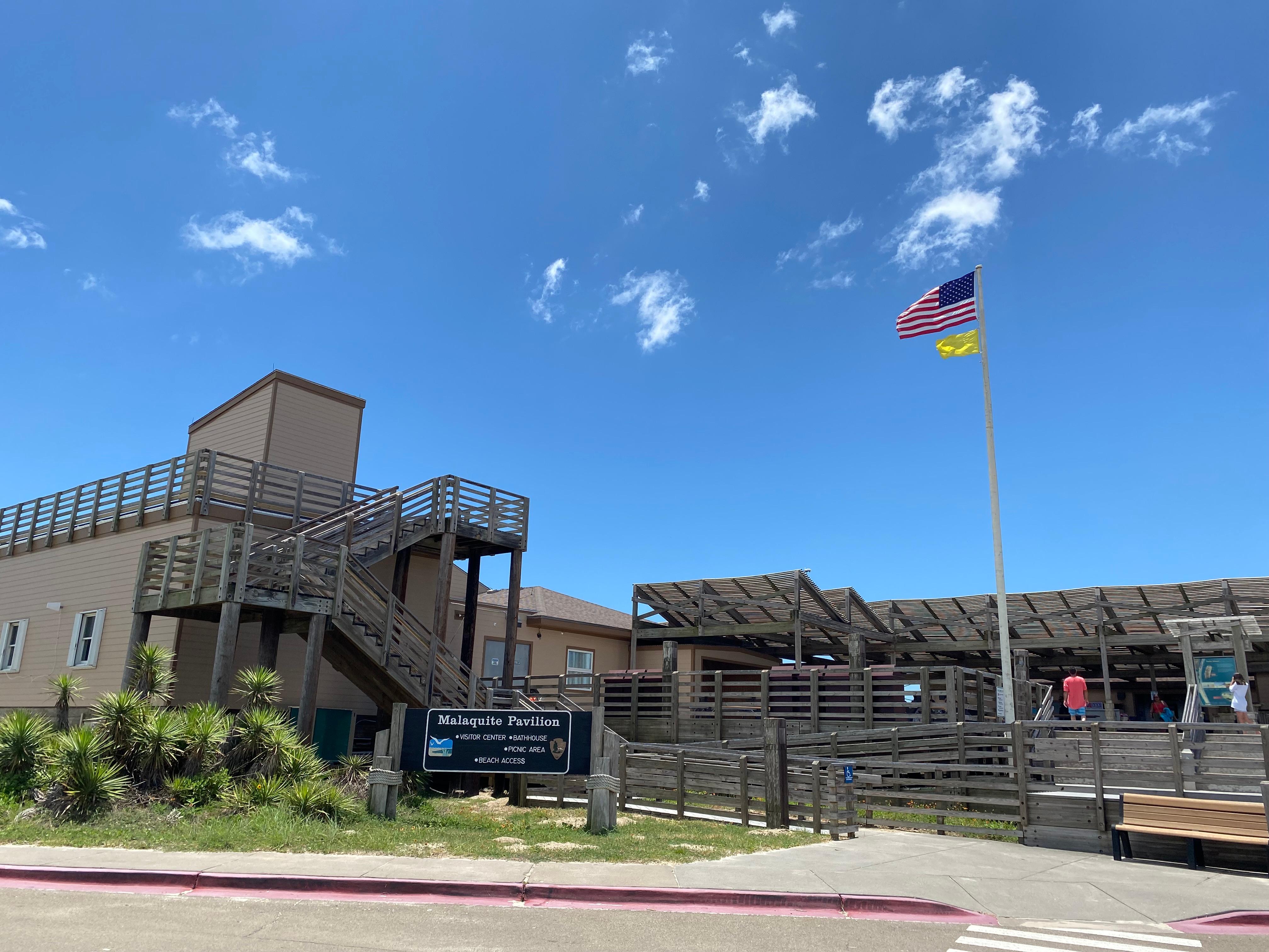
|
| Things to do | Count: 10
|
| Tours |
Count: 1
Grasslands Nature TrailThis 0.75-mile (1.2 km) loop trail takes hikers through one of the last intact coastal prairie ecosystems in the United States and is fully paved to accommodate all visitors. Several benches with limited shade are located throughout the trail. Throughout the trail, numbered posts correspond to the tour stops on the NPS App that offers insight to the native plants growing in the grasslands. |
| Articles |
|