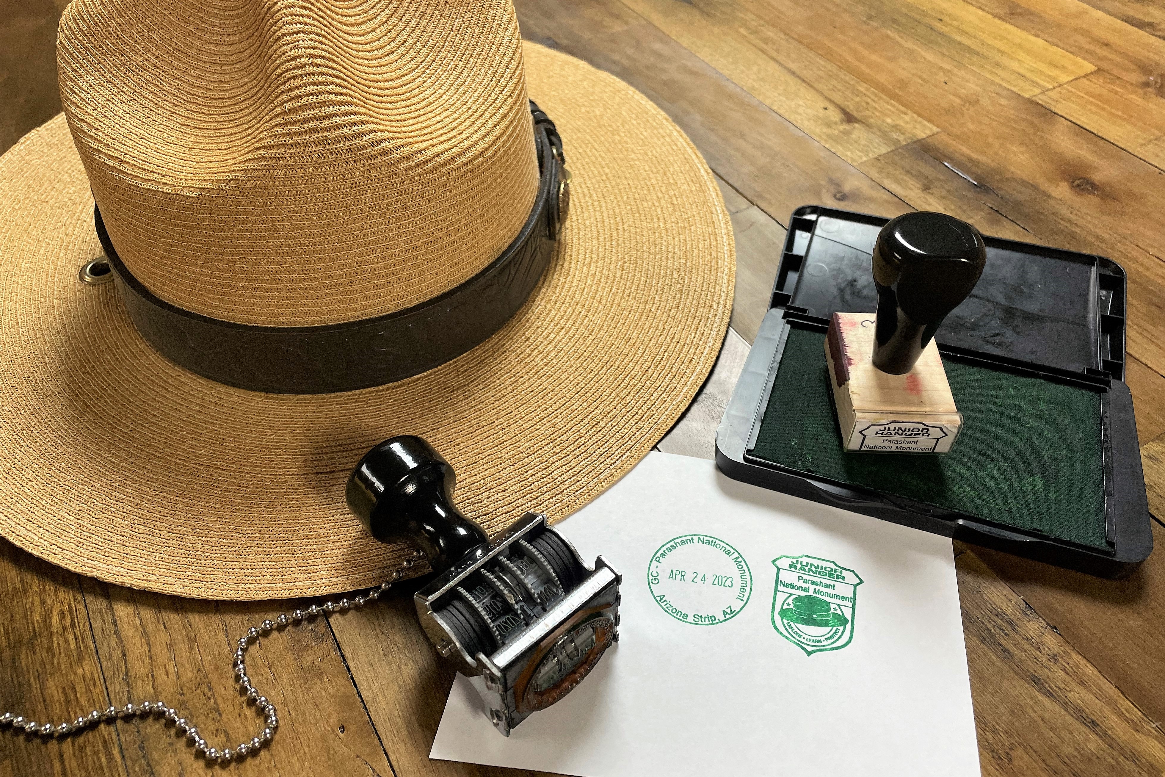
Looking for a Grand Canyon view? A warning about mobile devices and map/navigation apps
Map apps may direct you to Parashant if you search for directions to "Grand Canyon" due the canyon's name in both the national park and monument names. The national park has paved roads and services. Parashant has no services and rugged/remote conditions.
Arizona Off-Highway Vehicle (OHV) Requirements for Residents and Non-residents.
Off-highway vehicles (OHVs) are required by law to display a valid OHV decal to operate on public and state trust lands in Arizona. This includes “street legal” vehicles that meet these two requirements.
| Title | Grand Canyon-Parashant |
| Park Code | para |
| Description | Despite the hardships created by rugged isolation and the lack of natural waters, Parashant has a long human history spanning more than 11,000 years, and an equally rich geologic history spanning almost two billion years. Full of natural splendor... |
| Location | |
| Contact | |
| Activities |
|
| Entrance fees |
|
| Campgrounds | Count: 0
|
| Places | Count: 6
Grand Gulch MineEconomically valuable copper and silver were found here in 1871, attracting miners and settlers. Historic ruins like the adobe smelter and abandoned dump trucks pay silent tribute to the people who lived and worked here until the early 1900s. 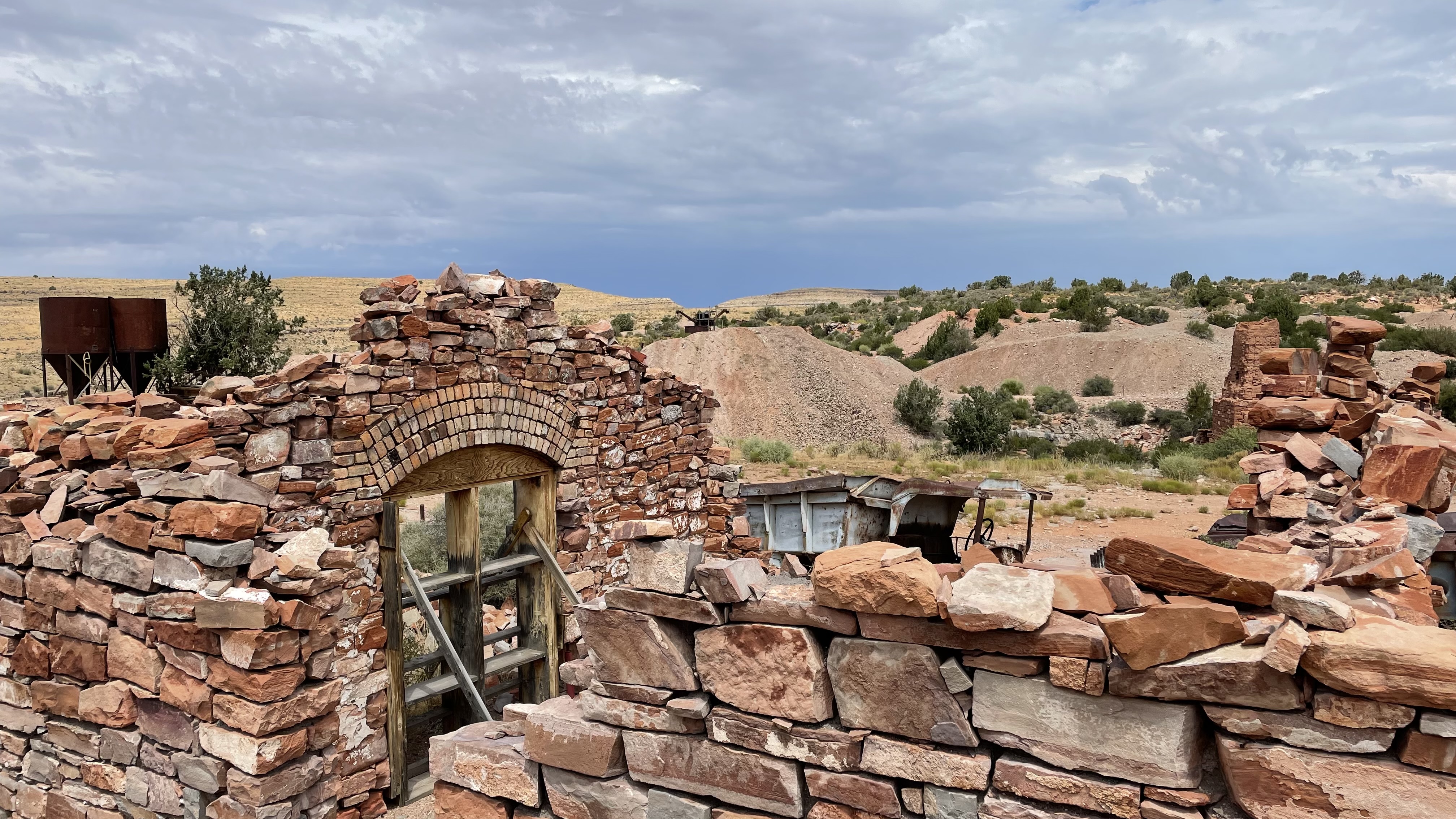
Grand Wash Cliffs WildernessThis remote 37,030-acre Wilderness is a 12-mile-long stretch of the Grand Wash Cliffs. 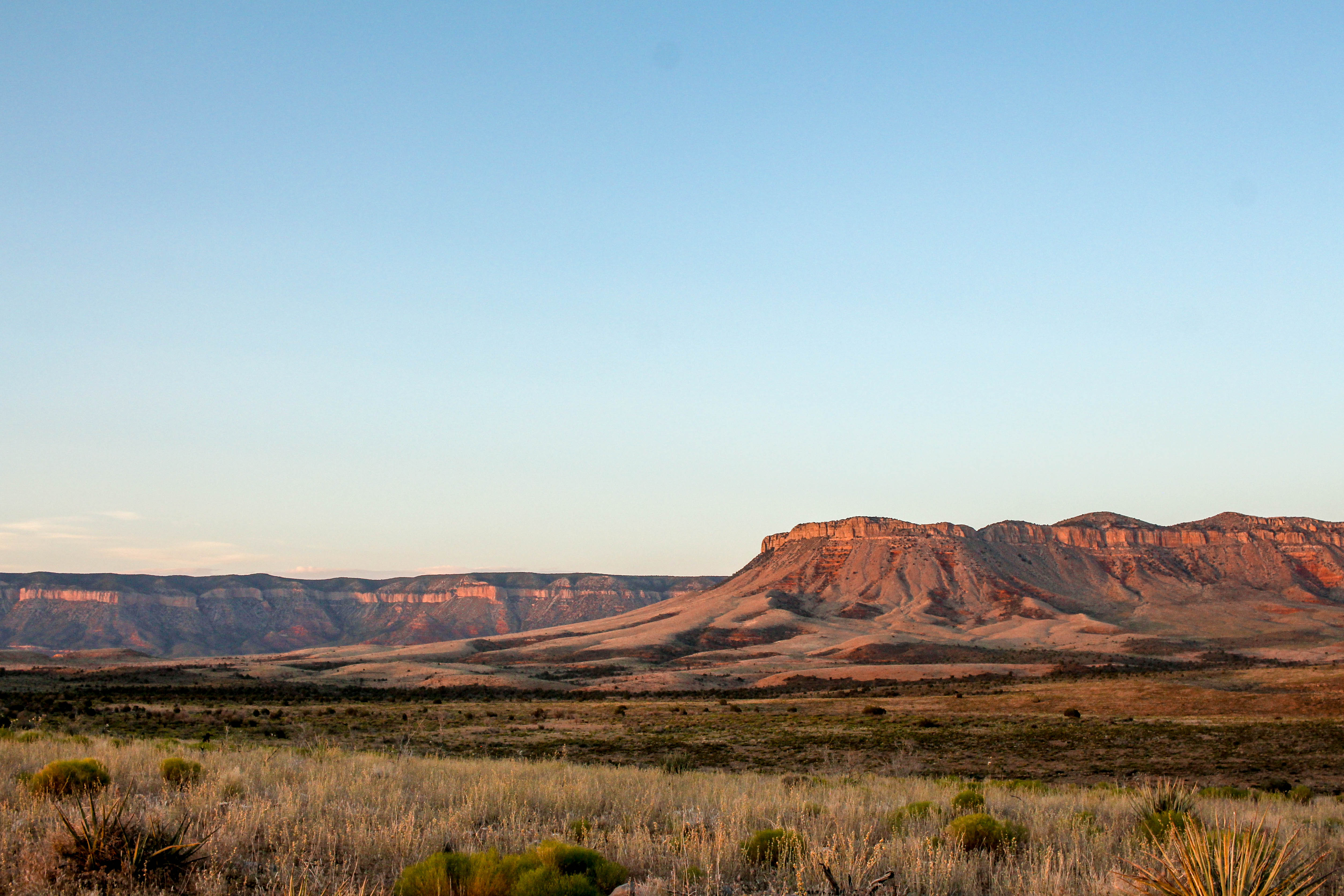
NampaweapNampaweap Petroglyph Site. The Southern Paiute believe their Creator placed them on these lands, where they have lived in respectful balance since time immemorial. Religious specialists made petroglyphs in places full of power such as locations with important plants, rocks, or water. They documented events, histories, family stories, and perhaps their own vision quests, at Nampaweap. 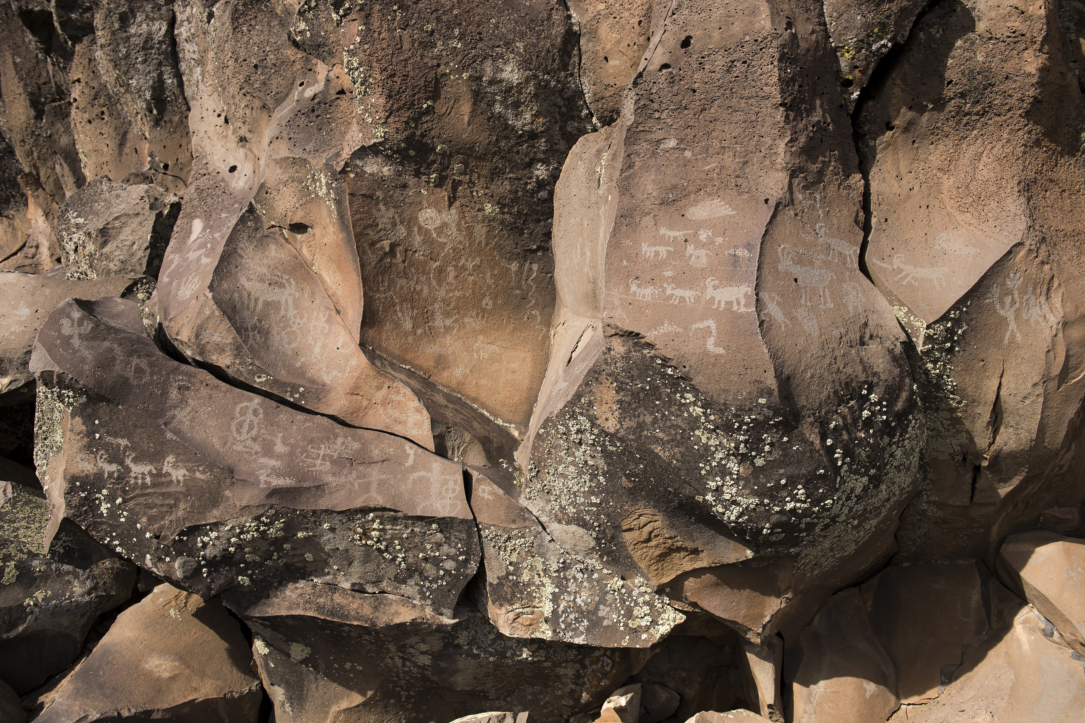
Pakoon SpringsAn island of lush trees and cattails reveal that flowing water is here. Pakoon is one of the monument’s largest springs, but its water was impounded for years. Now it flows freely, allowing the landscape to return to a more natural state. 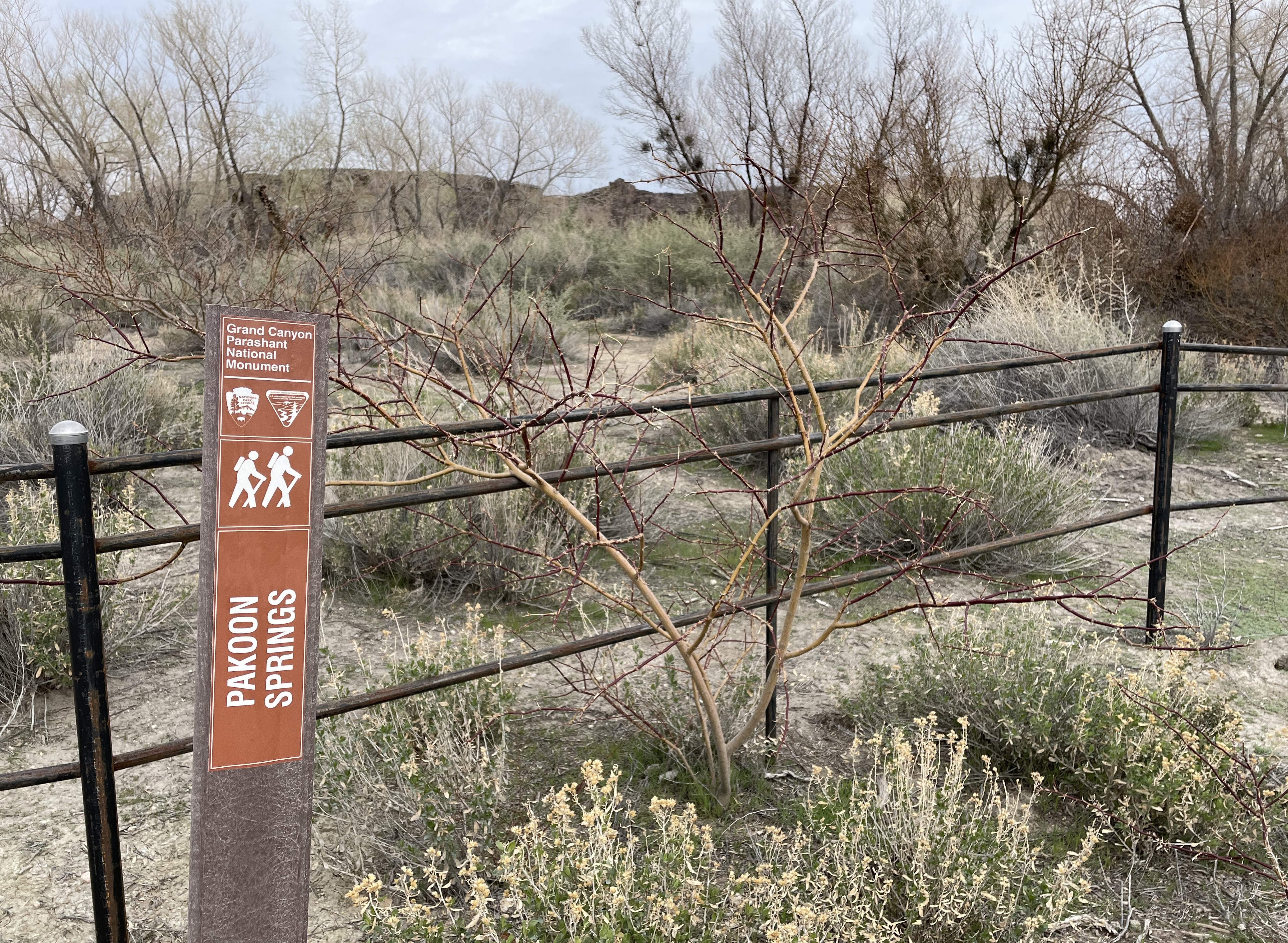
Tassi RanchTucked into the rocky hills beside a flowing spring, a rustic stone house and other ramshackle structures paint a vivid picture of life on a cattle ranch in the 1930's and 1940's. Fed by multiple springs, Tassi Ranch, may have been an important waypoint for Native Americans and American settlers, explorers and ranchers. 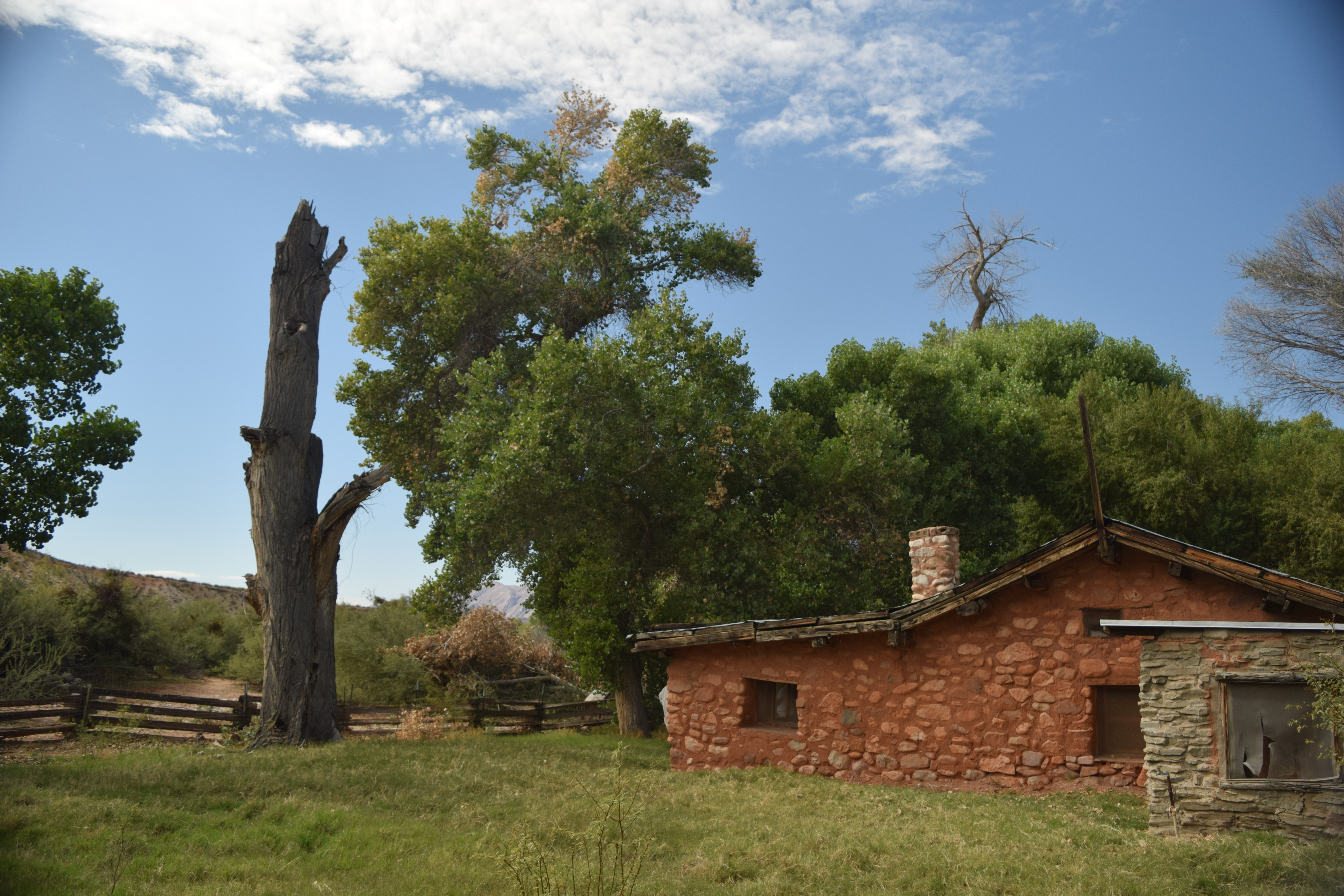
Twin Point OverlookA rough road through pinyons and junipers reaches Twin Point. It's views into the Grand Canyon reveal a fascinating geological story. Its remote location offers a profound sense of solitude. 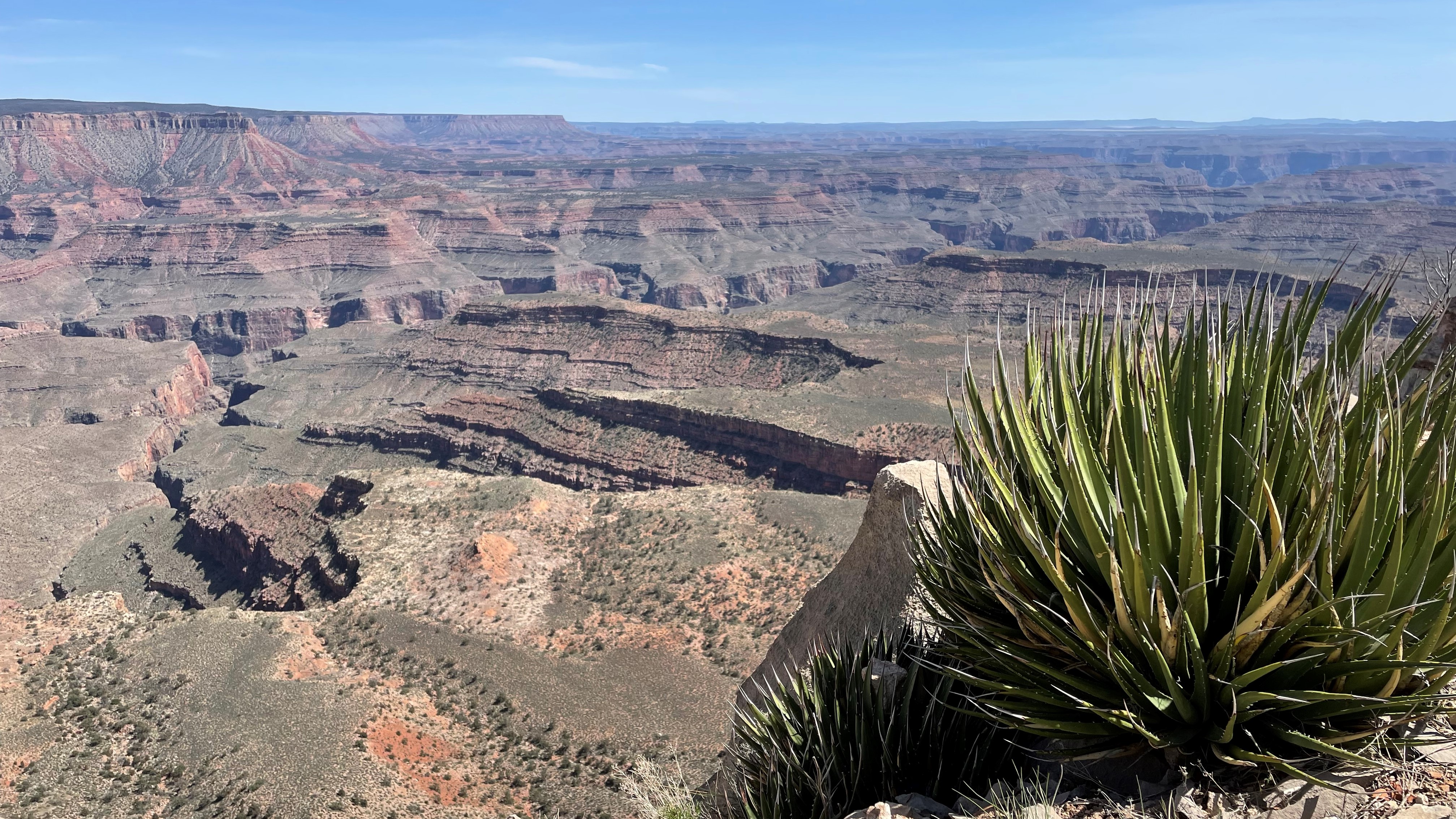
|
| Visitor Centers | Count: 1
Public Lands Center
|
| Things to do | Count: 1 |
| Tours |
Count: 0
|
| Articles |
|