Be advised that the NPS has issued alerts for this park.
Tour Road Closed South of Route 36 at the Eastern Front
The Tour Road south of Route 36 is closed to vehicles at the Eastern Front. Scheduled maintenance begins. Walkers and bicyclists must follow signs for detours around construction areas.
Two hundred ninety-two days, eight offensives, over 70,000 casualties, U. S. Colored Troops, and the decline of Gen. Lee's Army of Northern Virginia all describe the Siege of Petersburg. U.S. forces cut off supplies to both Petersburg and the Con...
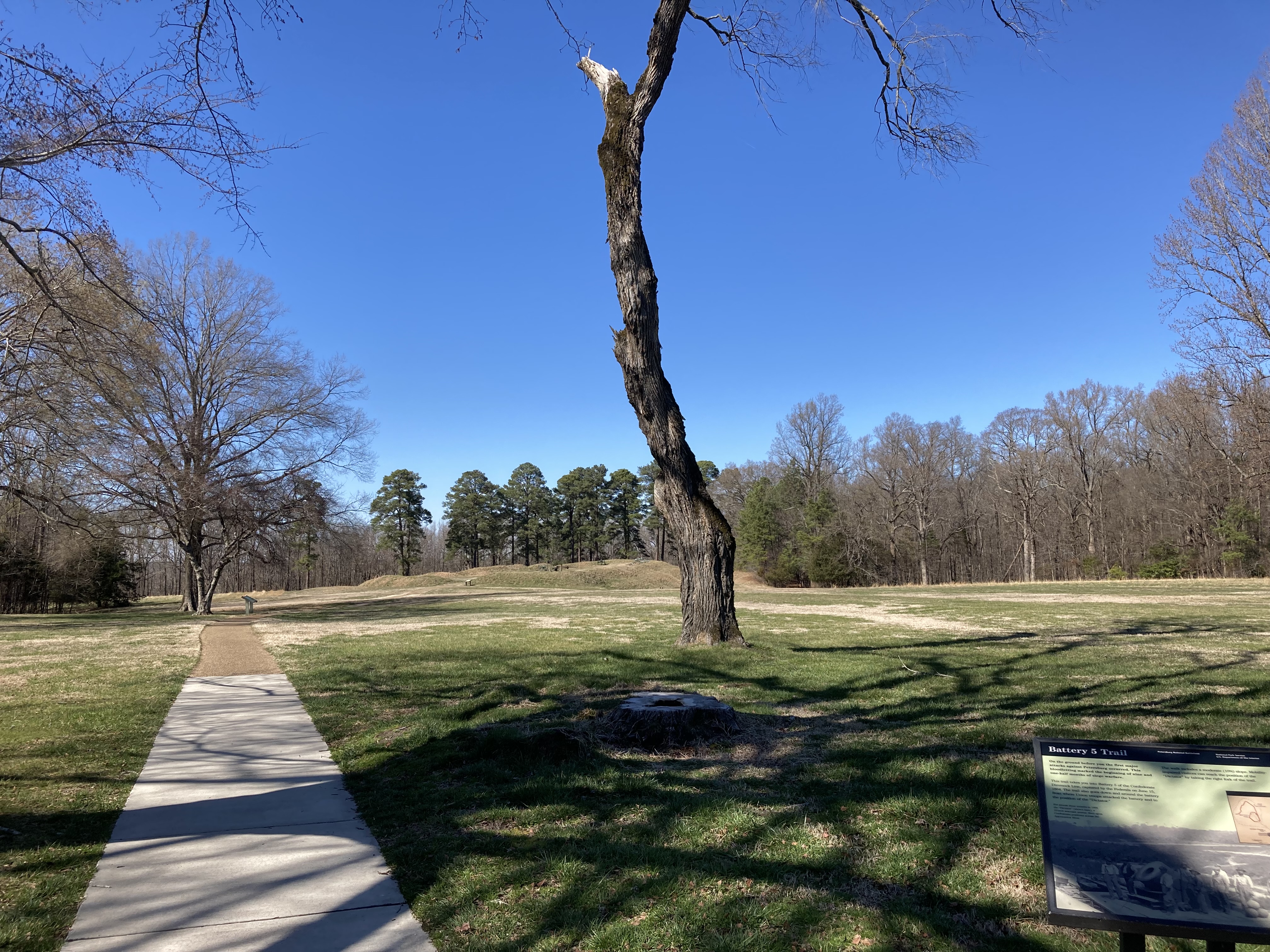
The paved pathway to the "Dictator" leads downhill in front of Battery #5.
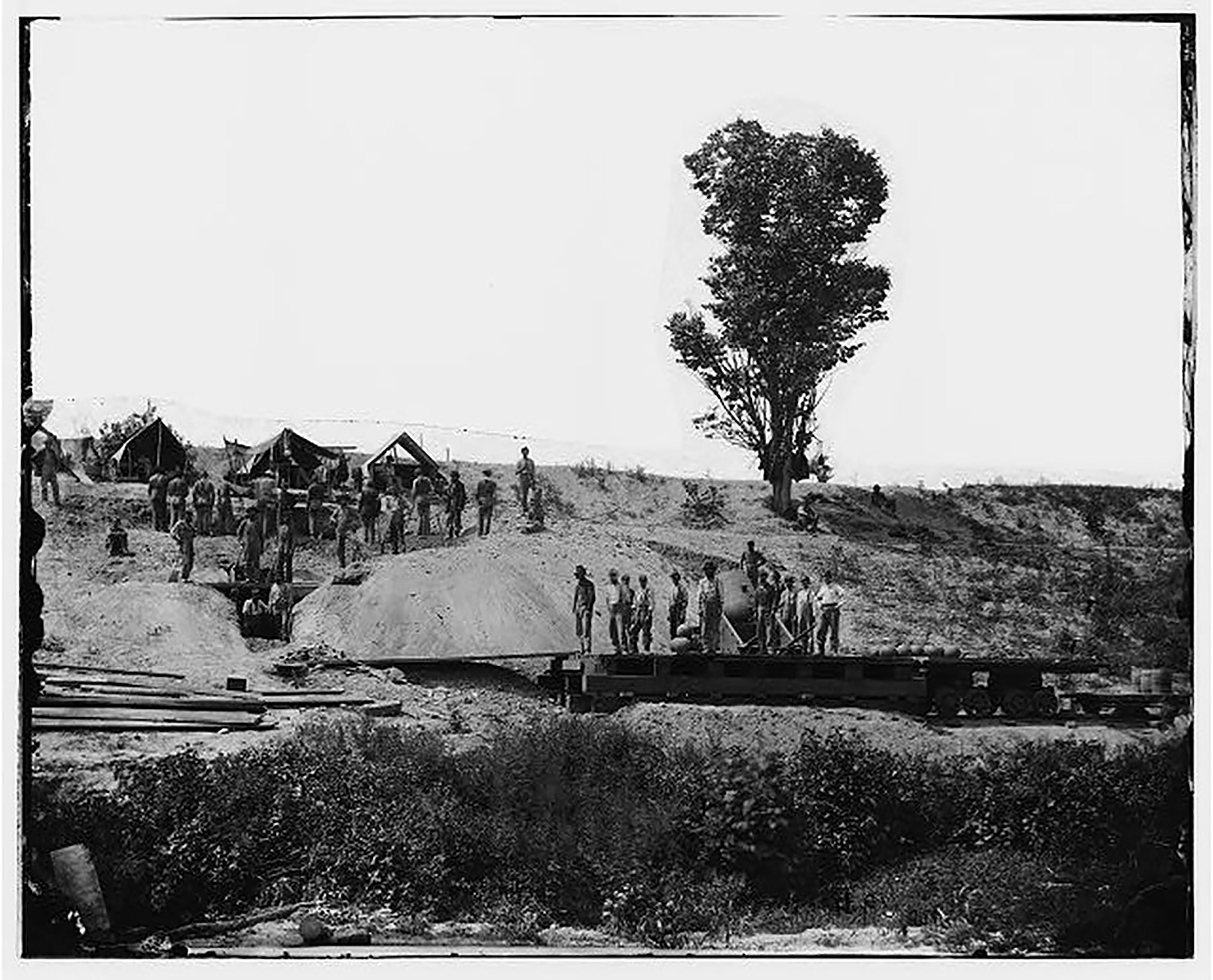
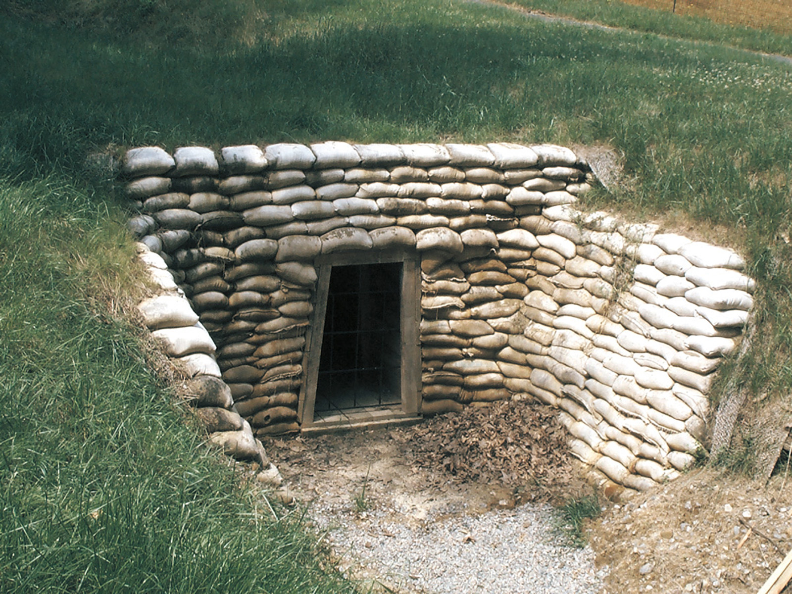
This trail junction leads down the hill into the woods, in front of Battery #5. The paved sidewalk leads to the "Dictator." The slope can be steep on the return hike. To the "Dictator" and back is roughly 0.25 miles. If you continue past the "Dictator," the trail becomes a nature trail and circles around Battery #5, returning to the open field you are in now, finalizing to a 0.5-mile hike. There is one wayside at this junction titled "Battery 5 of the Dimmock Line." There is a black bar along the top, and the photo beneath is a historic photo of Battery 5 taking up the lower half of the wayside. There are two maps on the right side, one showing the Confederate works and the Union additions to Battery 5. The other is a map of Petersburg, showing the Dimmock Line in its entirety. Text on the wayside is the following. "In 1862-two years before the first Federals appeared at the city's gates-Confederate Captain Charles Dimmock oversaw the construction of a ten-mile line of defensive works ringing Petersburg. In front of you is Battery 5, one of the largest of the fifty-five artillery positions in the Dimmock Line." The caption for the historic photo is the following. "This photograph, taken from just inside Battery 5, shows how the battery looked a few days after its capture by the Federals. During the Siege of Petersburg, Battery 5 would be more than a mile behind the main Union siege lines." The caption for the map of Battery 5 is the following. "Most of the works you see at Battery 5 were built by slaves. The parapet to your left, shown on the diagram (near right) in blue, was added by the Federals after the battle here on June 15, 1864." The caption for the map of the Dimmock Line is the following. "Far Right: On June 15, 1864, more than 30,000 Union troops marched from the east toward the Dimmock Line. Only 2,300 Confederates stood between the Federals and Petersburg."
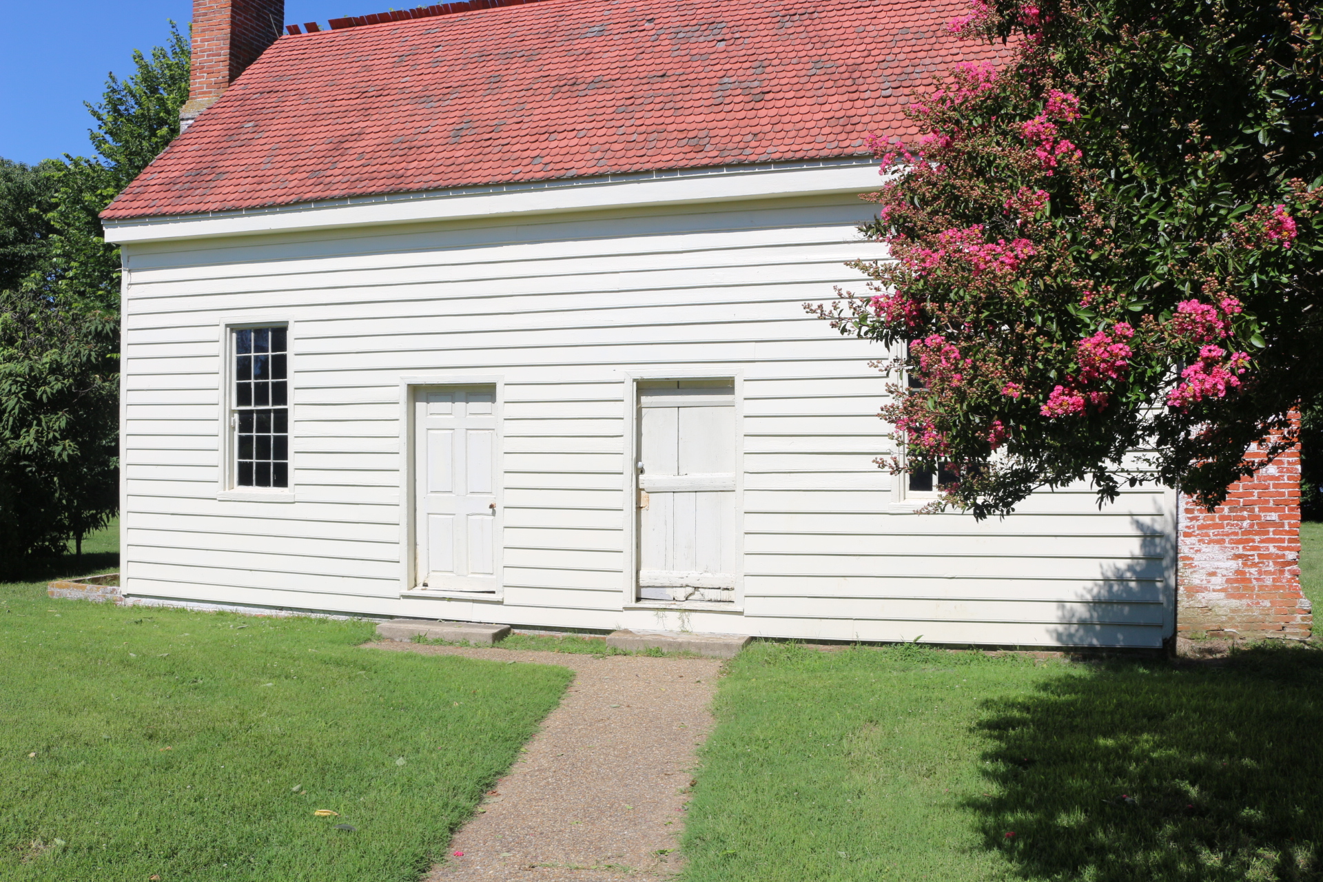
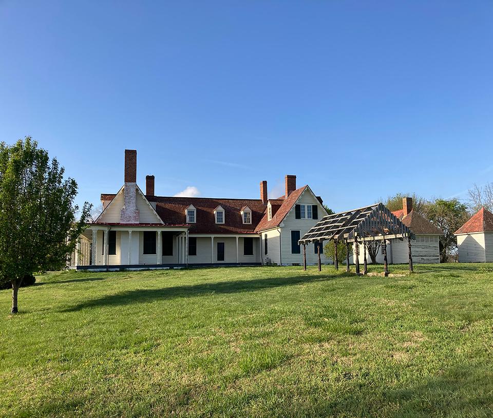
The east wing of the Eppes family home was added in 1841 and added a parlor, sitting room, three bedrooms on the second floor, and an entry hall making it the “front” of the house.
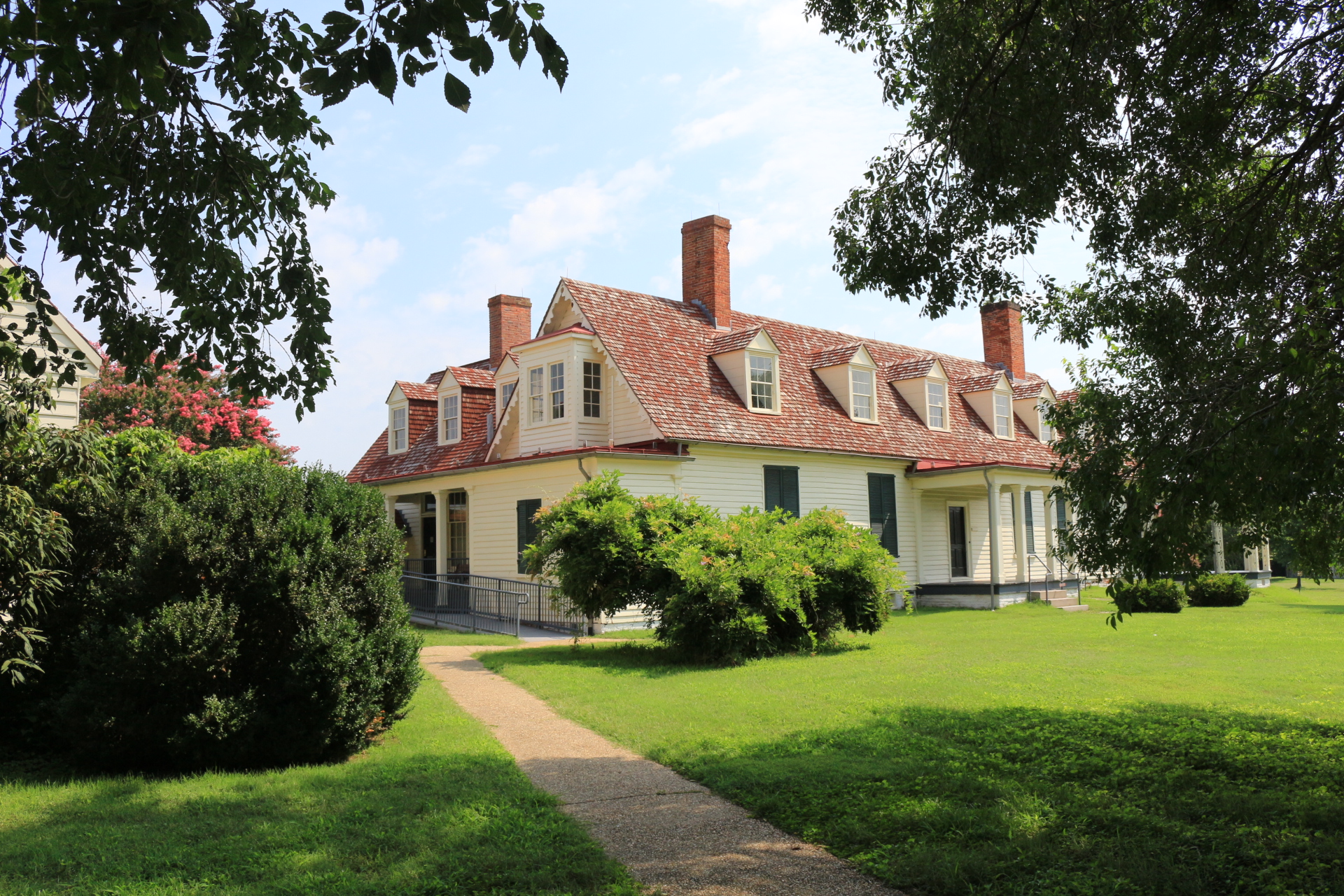
The eastern addition of the Epps family home has a wrap-around porch with gray wood flooring and white pillars placed about six feet apart. There are six steps leading up to the porch and an oversized wooden door to the entrance. To the right and left of the doorway are two large windows. The house is white-sided and the roof is red-bricked. There are three regular-sized windows on the second story, jutting out from the angle of the roof. In front of the home is a dirt and gravel driveway that creates a circle, and then leads to the left/south.
The original front of the Eppes family home built in the 1760s, also known as Appomattox Manor, faced the rivers as most visitors came by boat.
Standing on your left is a wooden rose arbor; built by the Eppes family after the Civil War. About 20 yards in front of you is the Eppes family two-story home. It is a white-sided house with a red-brown colored roof, and there are four red-bricked chimneys; the house is structured like a "U" opening up towards the rose arbor. The middle portion of the house has one wooden door and three large windows. The top floor has normal-sized windows jutted out from the angle of the roof. Along the front of the house is a covered porch that begins in the middle section of the home. This porch has a gray-wooden floor and white pillars that lead to the roof; it continues to the left of the house and around to the other side. The left side of the home has multiple large windows on the lower level and two normal-sized windows jutted out for the angle of the roof on the second level. The right side of the home has a few large windows on the lower level and, two normal-sized windows jutted out for the angle of the roof on the second level. In front of the right side of the home is a medium-sized rhododendron bush.
The laundry and kitchen dependency is a two-story building with two rooms on the lower level and upper level. On the side facing the Eppes family home, there are two doors near the center of the building. The doorway on the left leads to the kitchen, the doorway on the right leads to the laundry area. Both sides of the building have a chimney. The building is white-sided with a red slanted roof and two windows on each side of the doorways.
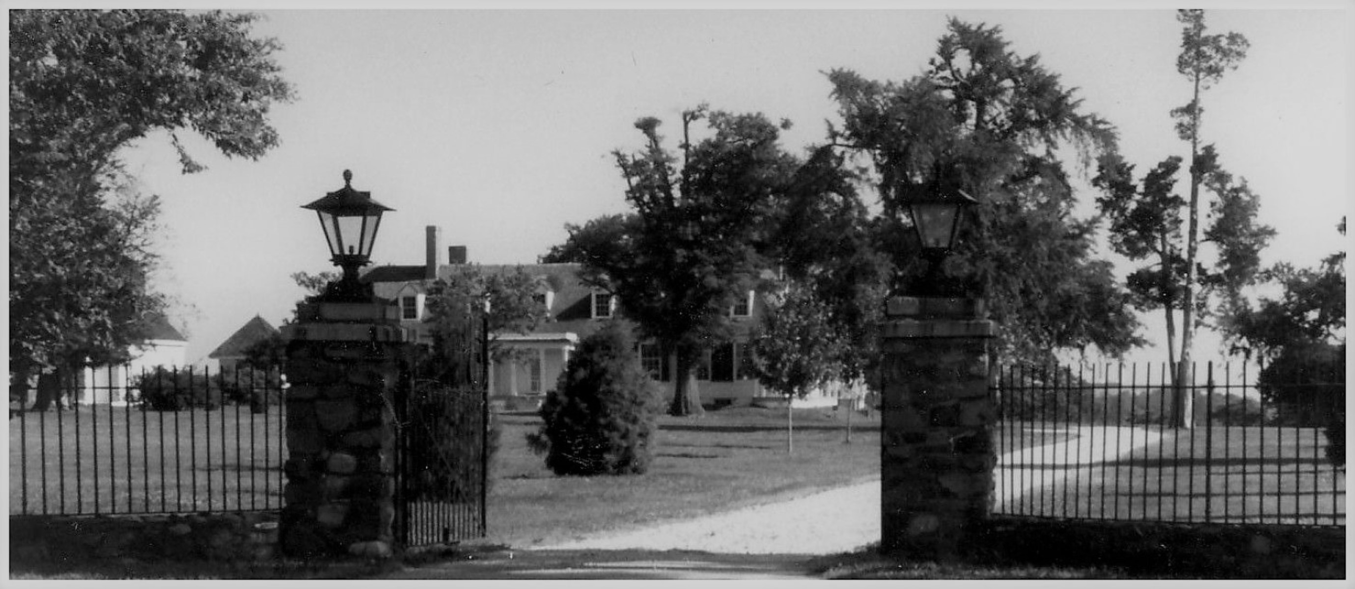
The entrance gates to the Eppes' family home, the home was a century old by the time U.S. forces occupied the site in 1864.
A dirt and gravel covered road leads through two stone pillars wide enough for a vehicle to enter through. The stone pillars have large iron lamps on top with a two-door iron swing-gate at the entrance. To the left and right of the stone pillars is iron fencing. The dirt and gravel road is flat and leads straight towards the Eppes' family home, and travels between two large trees.
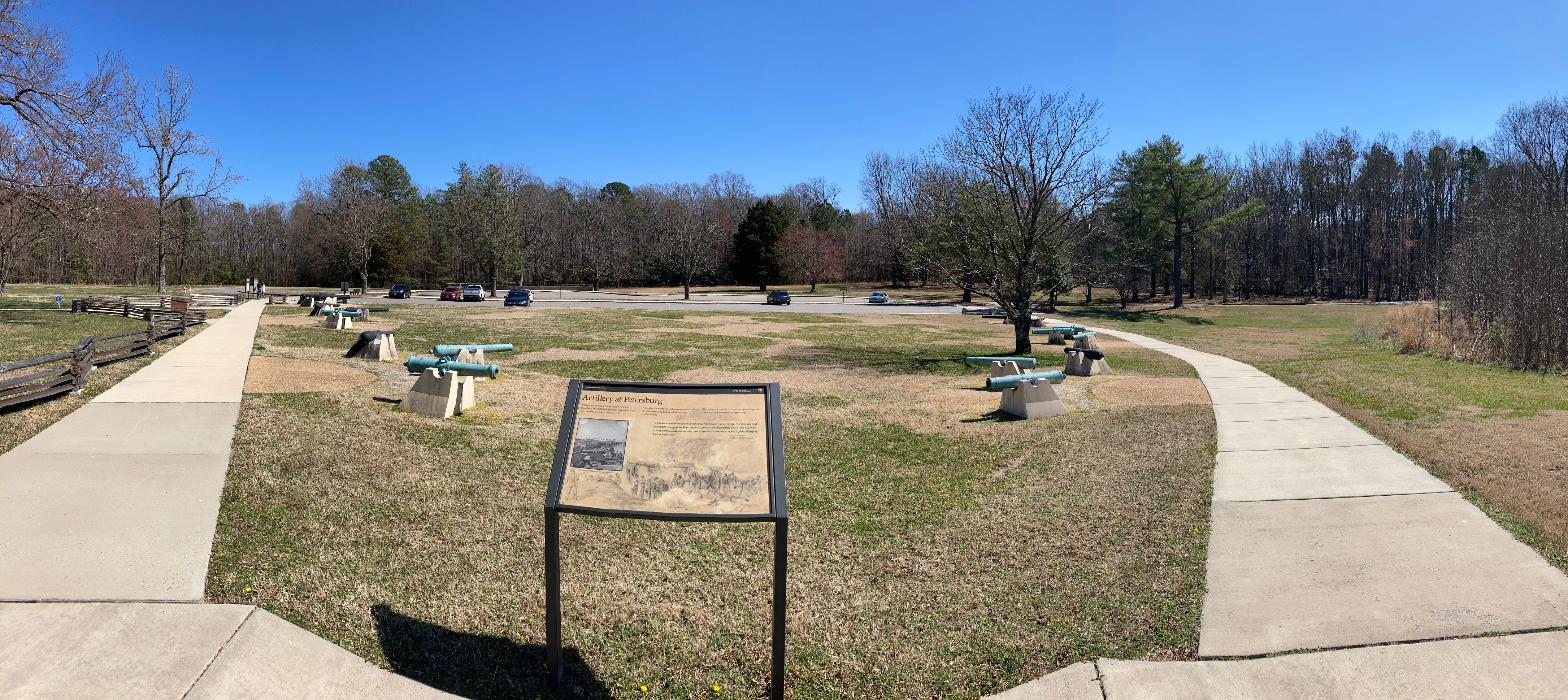
Artillery played and important role during the Petersburg campaign
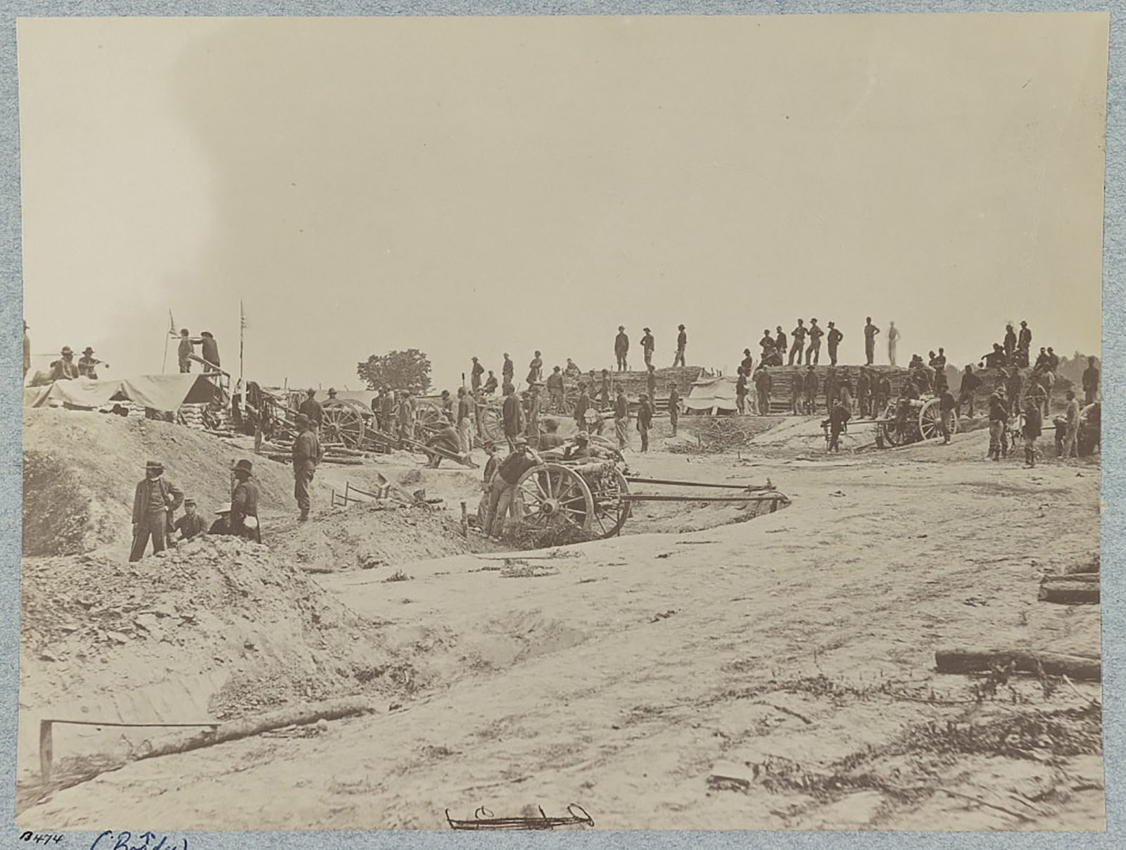
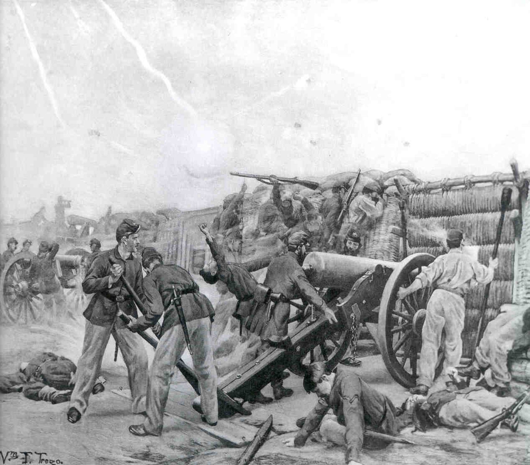
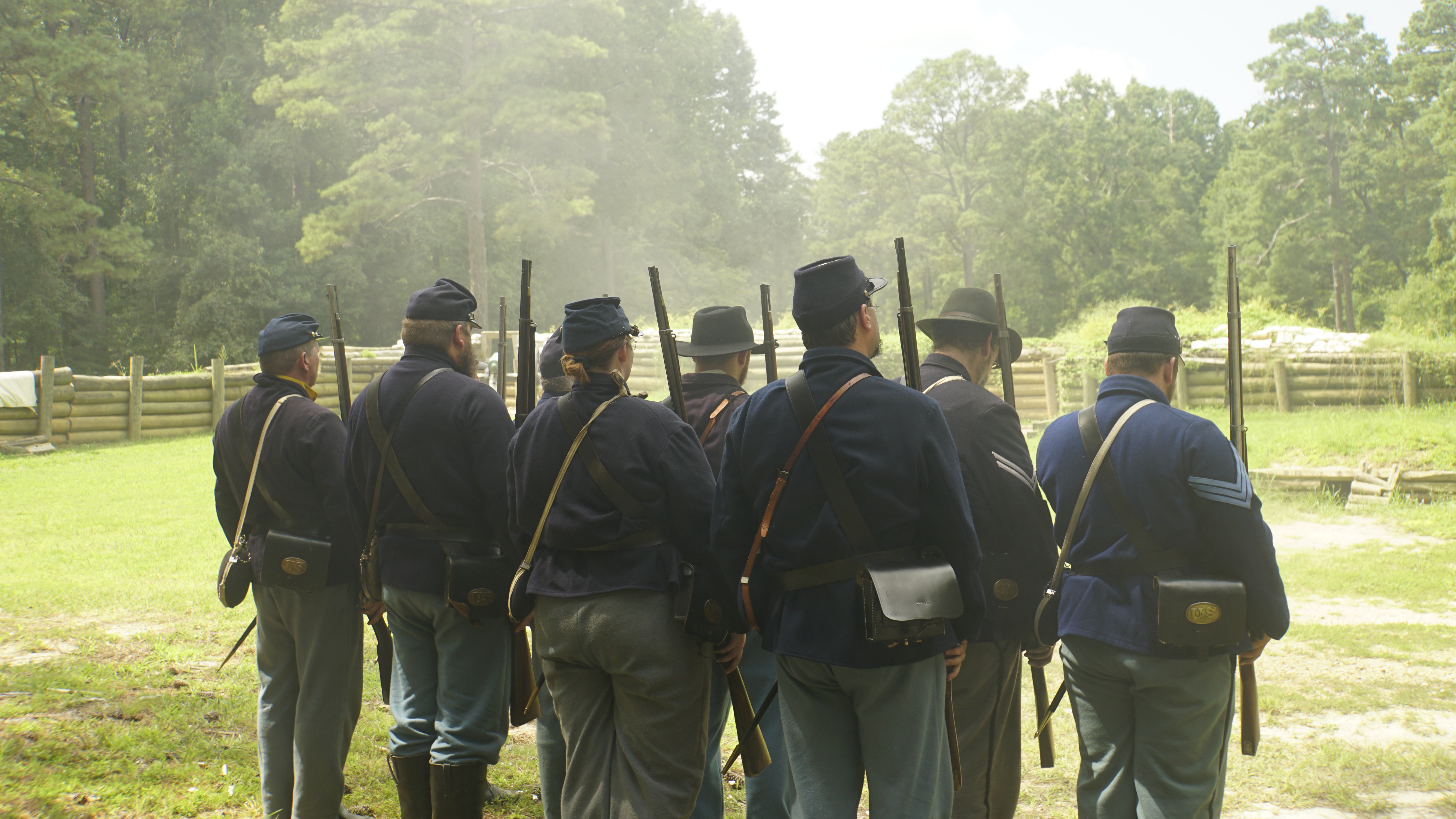
Wayside Title reads - Artillery at Petersburg Background image drawing of soldiers manning an artillery behind fortified earthworks Main Text Reads Artillery was a constant threat along the lines of Petersburg. The daily shelling shaped the landscape and was central to the siege experience. For soldiers, surviving the shelling meant vigilance, living in bomb proofs, and dealing with the stress of bombardments. The artillery pieces before you are examples of types of cannon used by both sides during the siege. Quote by William P. Hopkins 7th Rhode Island Volunteers Reads “Simultaneously the rebels opened their mortar battery very savagely. Our mortars and field artillery responded. This continued for ninety minutes during which time fifteen or twenty shells could be constantly counted in midair at one time. A more splendid display I never witnessed.” Small historic black and image of soldiers around a large artillery piece behind tall reinforced earthen wall. Five other artillery pieces are inline further down the wall. Caption reads First Connecticut Heavy Artillery in siege lines.
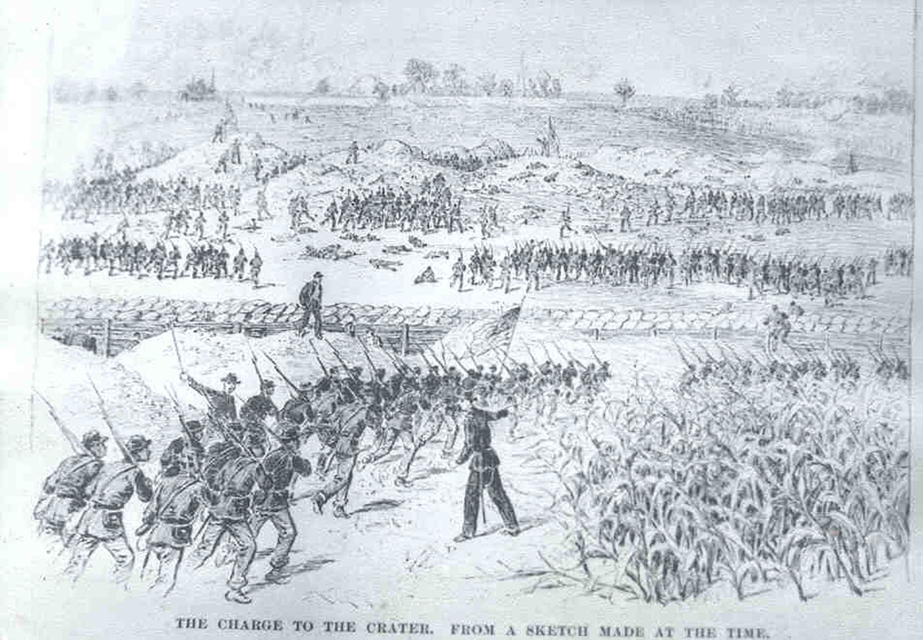
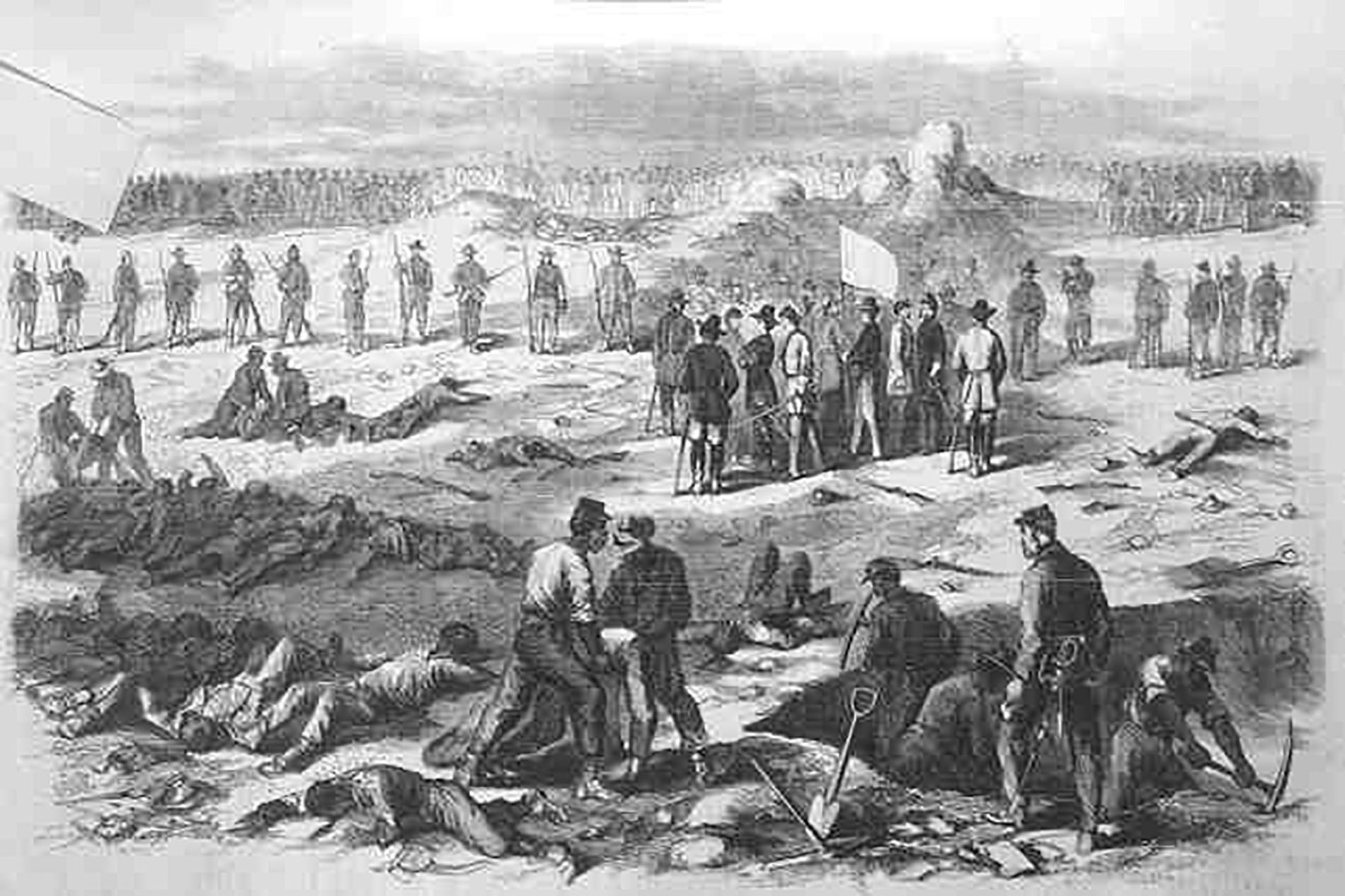
After several weeks of digging, the U.S. 9th Corp dug a mine under a Confederate Salient and exploded it in an attempt to take Petersburg.
The crater is a half-mile walking loop to the tunnel entrance and the crater. The walking loop is a paved sidewalk through an open field. The sidewalk on the right takes you past a sign that states "crater via tunnel." The sidewalk on the left takes you past a sign that states "to the crater." There is a trashcan and bike rack located nearby.
The Fourth Division of the Union 9th Corps, compromised of U.S.C.T. Regiments, was the last to enter the action at the Battle of The Crater.
The paved path curves around the crater, beyond the pathway, is a small forest of young trees. There is one wayside. It reads, "By 8:30 am nearly 4,000 black Union soldiers (known then as United States Colored Troops or USCT) charged north of the Crater with cries of no mercy to be shown the Confederates. In capturing Confederate troops in these trenches there were instances of USCTs shooting Confederate prisoners. Here 250 yards up the trenches is the closest they came to their objective. Twice this division of soldiers charged westward from these captured trenches across the field toward Blandford Cemetery. Each time they were stopped by devastating Southern artillery and rifle fire. While attempting a third charge, the Confederates counterattacked. Some of the USCTs retreated to the Crater or back to the Union lines, sweeping with them supporting Federal troops which had just arrived. Other USCTs stood their ground and were among the last Union soldiers north of the Crater to leave. By battle’s end and in defeat, these men suffered the greatest number of Union casualties, and had advanced farther than any other Union division on this field."
Historical Highway Markers for Appomattox Manor, General Grant’s Headquarters, and City Point.
Three large signs set six feet apart. Each sign is about three feet by three feet with a black border and white background. The letters are black and stick out from the background. TEXT ON SIGN: City Point. First settled as Bermuda Cittie by Sir Thomas Dale 1613. Important colonial port. Peter Francisco put ashore 1765 was Washington's "One Man Army." Incorporated 1826. Annexed Hopewell 1923. TEXT ON SIGN: Appomattox Manor. Patented 1635 by Captain Francis Epes. Who came by tradition in the Hopewell. Owned by same family probably longer than nay land in U.S. Shelled by British during American Revolution. TEXT ON SIGN: General Grant's Headquarters at Appomattox Manor 1864-65 during siege of Petersburg and Richmond. President Lincoln spent 3 weeks in City Point during April, 1865.
Located behind the Eastern Front Visitor Center, this was one of the strongest works on the original Confederate defense line (the Dimmock Line). Federal troops captured it on June 15, 1864.
Facing the wayside sign, you are facing the front of Confederate Battery #5. The grassy mounds in front of you are the original wall that would have been tall enough to stand behind safely from oncoming enemy fire. Behind you would be an open area, but after the U.S. Forces take Battery #5, they will build the walls there to protect them from the retreating Confederate forces. The wayside sign is tan/gray with a black bar along the top. It is labeled "Opportunity Lost" and has a photo of General Beauregard of the CSA and Major General Smith of the USA. A historic drawing of the Union attack on Batter#5 by A. Ward is to the right of the photographs. Along the bottom is a timeline of the Petersburg Campaign. Text under General Beauregard's photo is the following. "At that hour, Petersburg was cleary at the mercy of the Federal commander, who had all but captured it." "General P.G.T. Beauregard, CSA" "Confederate Commander, June 15, 1864" Text under Major General Smith's photo is the following. "Deeming that I held important points of the enemy's line of works, I thought it prudent to make no further advance." "Major General William F. "Baldy" Smith, USA" "Union Commander, June 15, 1864" Text under photo's is the following. "At 7 p.m. on June 15, 1864, the boom of the Union cannons to the east foreshadowed an attack on the Dimmock Line. Minutes later, the soldiers of the Union Eighteenth Corps broke through the undermanned Confederate line and swarmed over the works here at Battery 5. In two hours the Federals captured 1.5 miles of Petersburg's defenses." "Though few Confederates stood between the Federals and the streets of Petersburg, Union Maj. Gen. William F. Smith stopped his advance to await reinforcements. Nine months of tedious, deadly siege would pass before the Federals would again have such an opportunity to capture Petersburg."
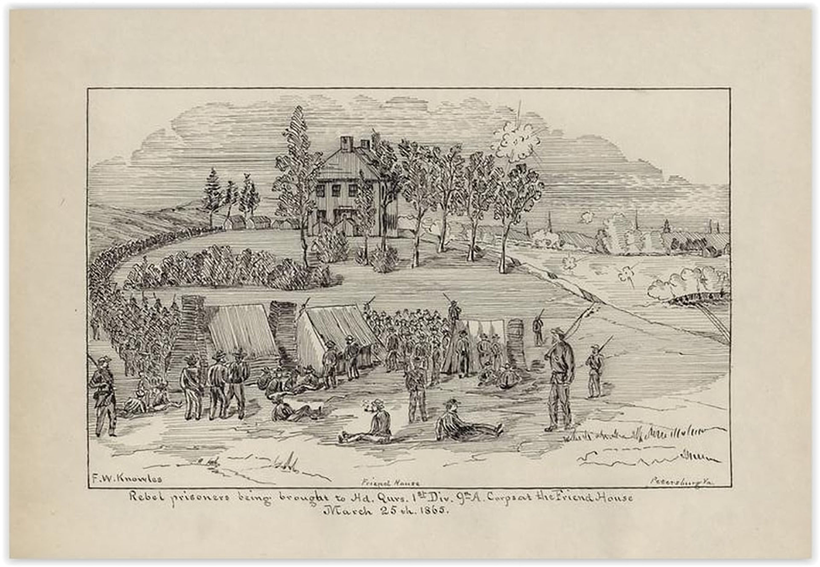
Captured by Black Federal troops, Battery #8 was re-named Fort Friend for the Friend House nearby.
There is a green open area from the pull-out along the road with a few trees in the middle to your right. In the far back corner are six-foot earthen walls, creating a small fort. Battery #8, or Fort Friend, is at least 1/4 the size of Battery #5 next to the Visitor Center.
Black Federal troops captured this position during the first day's fighting, on June 15, 1864. This site features examples of siege fortifications and related camp structures.
From this small parking lot, three trails start to the front of you. They are wide trails, about the width of a road, as they are historic roads. In the middle of the junction is a small, rectangular monument (similar to the shape of a gravestone). It is granite and dedication to the United States Colored Troops that fought during the Civil War. To the right of the monument is a cannon on a small mound, representing where Confederate Battery #9 was. To the left of the parking lot is a reconstructed Civil War Battery. This is an educational reconstruction and not original. There are two wood cabins in the area and two waysides. Surrounding this area is a forest.
A mistake that lead to the near encirclement of Confederate forces.
Two Waysides 1st Wayside Crawford’s Sweep. Body Text reads: The decisive Union movement at the Battle of Five Forks was, for the Federals, a fortunate mistake. While one union division struck the Confederates left at the Angle, Brigadier General Samuel W. Crawford’s division passed too far north and missed the confederate line altogether. Instead, Crawford's lines swept westward to the Confederate rear, cutting the main confederate escape route here along Ford's road. Crawford then pushed across the fields in front of you, toward the rear of the Confederate lines at five forks (to your left). His attacks spelled doom for Pickett’s command. Caption above map: After reaching the Confederate rear, Crawford turned South smashing hastily formed confederate lines here in Benjamin Boisseau’s field. The Federals pushed all the way to the White Oak Road where they turned West again. From that point on they overcame sporadic resistance from the remnants of what had been a 10,000 man confederate force. Map: shows confederate line noted in red a line along White Oak Road with a bend upward on the right end of the line. Blue arrows show the attack on the angle and a blue arrow loops around past the angle, around the back, and heading to the left after crossing the red Confederate line. Image description: Black and white historic photo – three soldiers stand guard over a large group (over 100) soldiers standing in several long lines. Image caption reads: Captured confederate after the battle of five forks. this photograph was probably taken at city point Virginia. Second Wayside Body Text Reads: “Among my gallant officers…” Colonel Thomas Munford One of the Confederates trying to stem Gen. Crawford’s Union troops was James Breckinridge. Born in Fincastle, Virginia he graduated from the Virginia Military Institute and the law school at the University of Virginia. At the outbreak of the war he volunteered, along with his brothers, rising to the rank of Captain of Company C, 2nd Virginia Cavalry in 1862. Colonel Cary Breckenridge of the 2nd Virginia Cavalry wrote about the events of April 1st, 1865 and the death of his 28 year-old brother, “We were ordered to move to the left of his [General George Pickett’s] line, the rest of the Brigade remaining near the road. This was a hurry order and we went through the woods as rapidly as the nature of the ground would permit, and in a direction parallel with the line of battle as it was then raging. When probably 1/4th of a mile from the starting point we ran against a column of Federal Infantry moving directly across our front. The men of the 2nd were dismounted as they came up, being in a straggling condition owing to rapid movement through thick woods, and a weak skirmish line formed which opened on the enemy at close range. The Federals marching in columns of fours right shoulder shift took little notice of us at first, but presently faced to the left returned our fire at the rate of about one thousand shots to one and soon swept us out of the way. This was the beginning of the retreat as far as the 2nd Regt was concerned. We lost some officers and men in this unequal contest. Among them Capt. James Breckinridge, Co. C who endeavored to make a stand on the bank of a small stream at the edge of the woods. He was discharging his pistol into the face of the enemy not over twenty paces distant when shot down.” Breckenridge was buried on the battlefield. A memorial marker was placed in Longwood Cemetery in Bedford, Virginia by his family. During the 1950s the remains were found by a local resident along Courthouse Road. Research indicates the remains belonged to Captain Breckinridge and after consulting with the soldier’s family , a decision was made to rebury the remains where they were found. Image of a man sitting in a chair. He has a thin mustache and is wearing a suit with a vest and square bowtie. Caption beneath it reads: “His gallantry and dash were universally recognized as second to no other officer in the command.” – Munford.
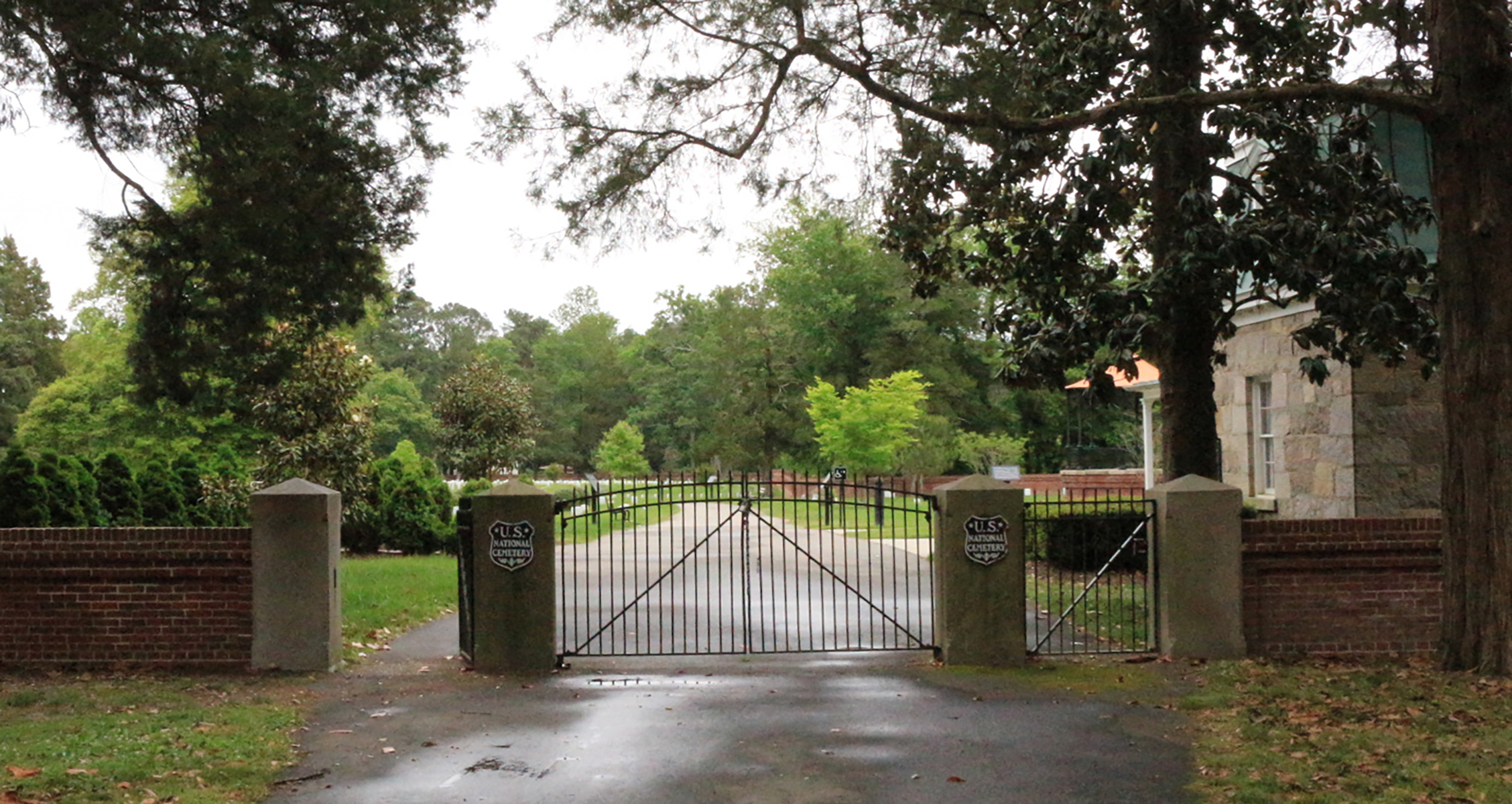
Entrance gates are composed of iron and their posts of granite. The wall was made of red brick with Ohio sandstone blocks atop the pilasters. Each of the center post has a metal plaque with text reading U.S. National Cemetery.
Part of the Federal Eastern Front Line, Fort Haskell stopped the Confederates' southern movement in 1865 from Fort Stedman.
Fort Haskell is a square-shaped fort, represented by un-mowed, earthen mounds with one wayside inside. There is a wooden bridge over a small ditch leading from the road to enter the fort. From Fort Haskell, you can see Fort Stedman across an open field. The other sides of Fort Haskell are next to the forest.
At the Battle of the Crater, Fort Morton was a U.S. 14-gun battery along the main Union line on the Eastern Front.
Fort Morton is a sizeable expansive clearing. There is a singular chimney in the distance of the field. There are no earthworks or fortifications here, as the landowner after the Civil War destroyed them. Fort Morton is to the left, following a paved sidewalk to the edge of the clearing and into the woods for a short time. It is an un-mowed area with four cannons inside.
The area around Fort Stedman lived through fighting in 1864 and 1865.
Fort Stedman is in a large expansive clearing. Multiple trails go through the fort and beyond. Fort Stedman is represented by un-mowed, earthen mounds, with cannons situated inside.
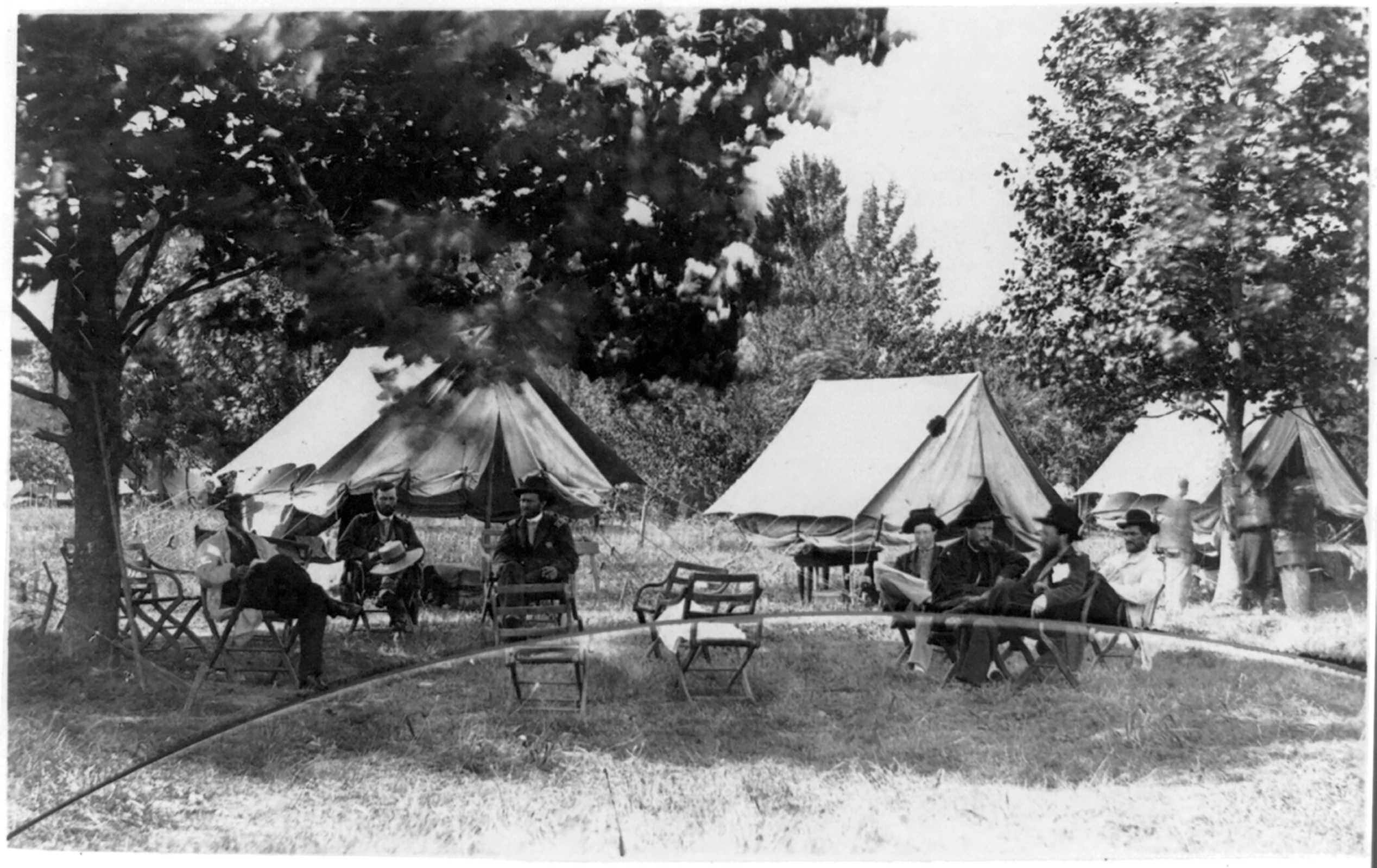
General Grant's cabin is a wooden cabin with the planks constructed together while placed vertically. It is shaped like a wide "T", with the front door on one side. This door is currently covered with plexiglass. There are windows on each side of the building with a fireplace in the back. The chimney is made of red bricks. The interpretive panel in the grass to the front states the following. "From November 1864 through March 1865, Lt. Gen. Ulysses S. Grant lived in this modest cabin. From here he directed Union armies in the climactic final campaigns of the war and hosted some of the notable figures of the era: President and Mrs. Lincoln, Major General William T. Sherman, Secretary of State William Seward, and Secretary of War Edwin Stanton. This was one of 22 cabins that stood on the Eppes property. After the war, Grant's cabin was moved to Philadelphia, where it remained on display for 116 years. In 1981, the National Park Service returned the cabin to City Point and reassembled it on its original site. About 10 percent of the structure is original. It is one of the few vestiges of the Union occupations of City Point." The background of the panel is tan, with a sepia photo of eight wooden cabins in a row leading up the Eppes family front door. It is captioned, "Grant's cabin is at the left of this photograph. The cabin was built in November 1864 to replace the tents that had served as headquarters during warmer months". To the right of the photo is another black and white photo of three men standing in front of the cabin dressed in uniform. It is captioned, "Grant and some of his staff officers pose on the porch of the cabin. Grant is in the center".
Parking lot with grass median in the center - a grove tree on the northern side, cemetery entrance gate to the east and a small grass covered lawn to the west.
Driven from the portions of the Dimmock Line in the opening battles, Confederates dig along the west bank of this stream and hold off the U.S. attack for two days.
Harrison Creek is a small waterway with sandy, rocky, and tree root banks; about 3 feet high from the water level. The creek runs through a wooded area and has a trail alongside, called the Harrison Creek Trail. It has a wayside, a short walk from the parking lot.
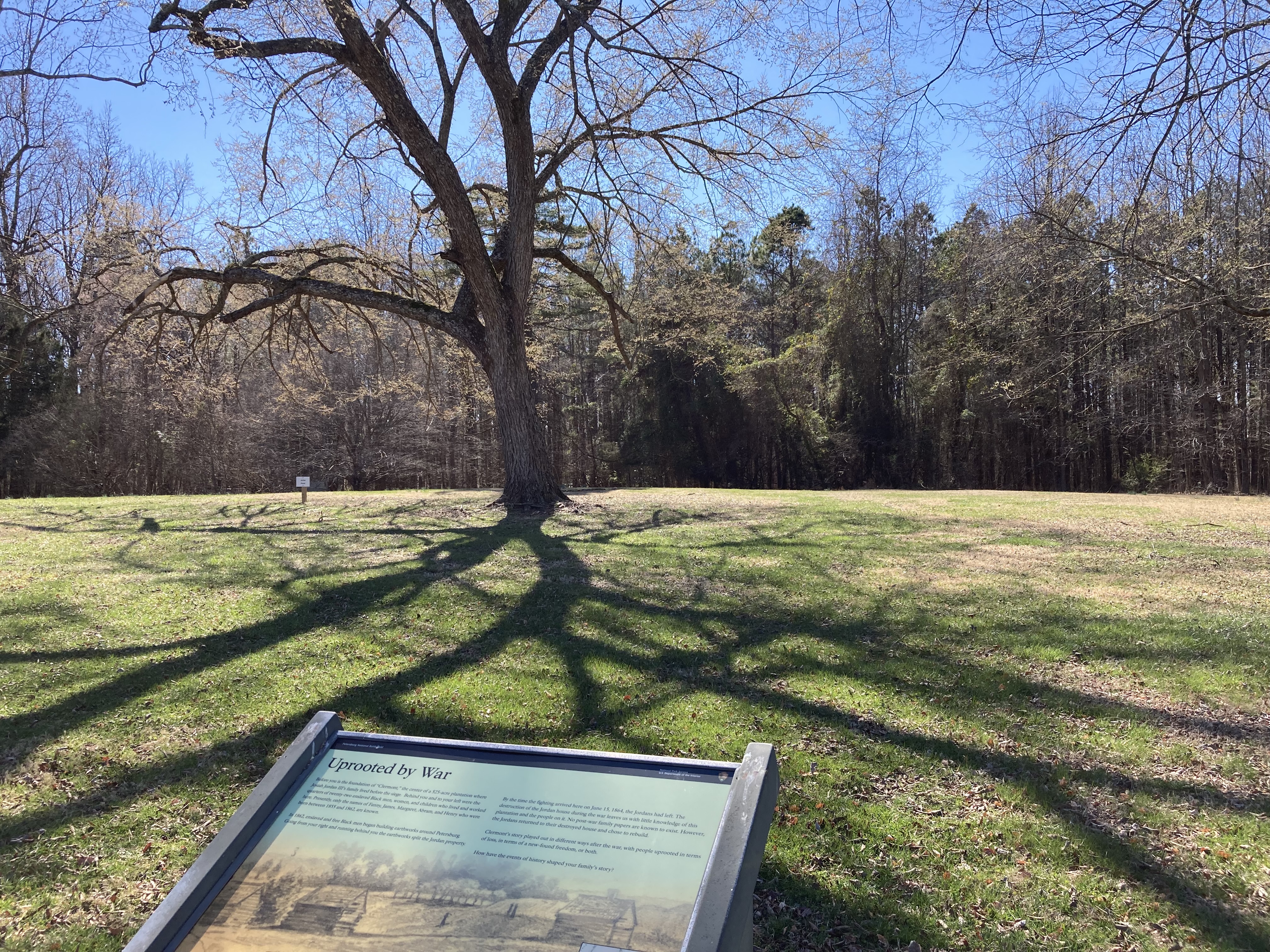
Foundation of Jordan family home near Confederate Battery #5
Wayside title reads: Uprooted By War Background image: a pencil sketch on a yellow-brown background. On the horizon - two chimneys are visible between tall trees. Four people stand between two smaller outbuildings in open fields. Caption Reads: Jordan house in background (two chimneys) and slave quarters foreground Illustration by E. Forbes June 1864 Map inset on right: Hand drawn map of Jordan house in center encircled by earthworks and rifle pits. Caption reads: US Army map detail of Jordan plantation July 1864 Main text reads: Before you is the foundation of “Clermont” the center of a 500 acre plantation where Josiah Jordan III’s family lived before the siege. Behind you and to your left were the quarters of sixteen enslaved Black men and women owned by Jordan. Starting in 1862, slaves and Confederate troops built a wall around Petersburg. Going from your right and running behind you it split the Jordan property. If war came to Clermont the wall may have meant protection to the Jordans but perhaps freedom to the enslaved. By the time war arrived here on June 15, 1864, the Jordans had left. At war’s end there is no evidence the freed Blacks returned here, and nothing is known of their post-Civil War lives. The Jordans returned to their destroyed house and chose to rebuild. Clermont’s story played out in different ways in post-war Petersburg with people uprooted in terms of loss, in terms of a new-found freedom, or both.
The Battery 5 Trail is a short paved walk. This sidewalk takes you into Battery #5 of the Confederate Dimmock Line, captured by the U.S. Army on June 15, 1864.
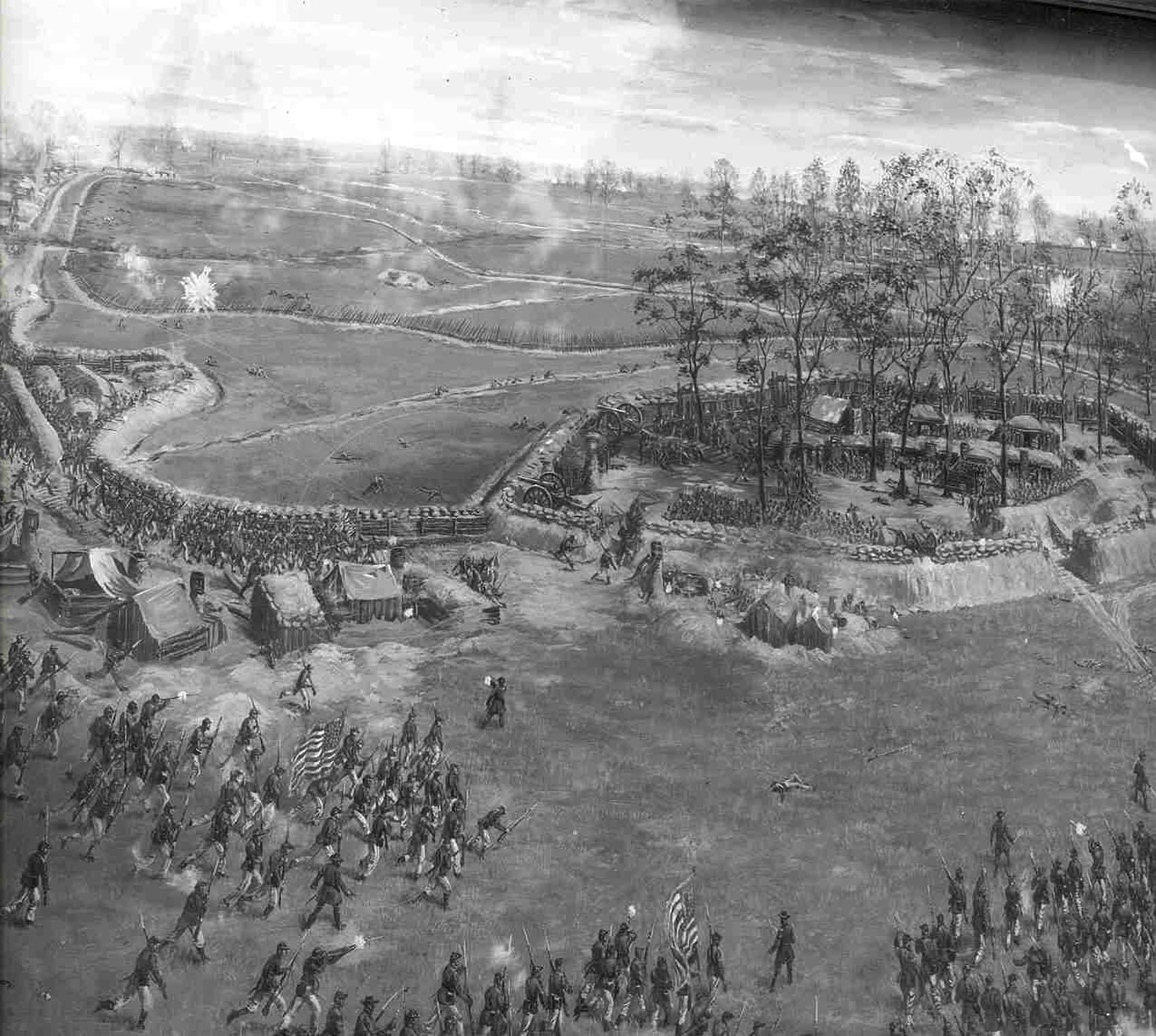
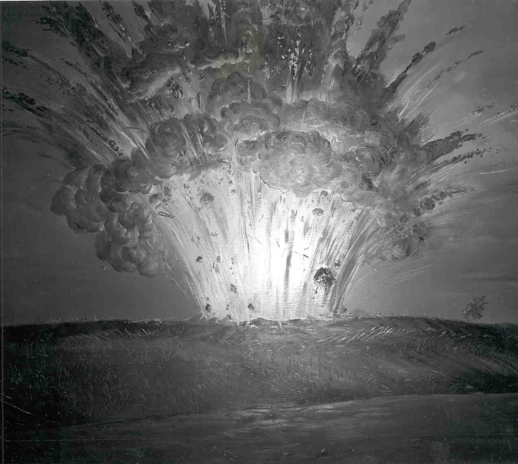
A paved sidewalk leads to the earthen fortification Confederate Battery #5. The sidewalk is level and leads through mowed grass. First of two signs. Battery 5 Trail sign text reads - On the ground before you the first major attacks against Petersburg occurred this bloodletting marked the beginning of nine and a half months of siege warfare. The walk includes a moderate 10% slope mobility impaired visitors can reach the position of the “Dictator” by taking the right fork of the trail. This trail takes you into battery five of the Confederate Dimmock Line captured by Federals on June 15 1864. The trail also goes down and round the battery from where union troops attacked the battery and to the position of the “Dictator.” Background Image description: 12 Union officers and enlisted men standing around a large mortar on a platform on a flatbed railroad car. Image Caption reads: For almost three months in 1864 the dictator shown here a 13- inch seacoast Warner fired up on confederate positions across the Atlantic. Small map on left - A hexagon marks the visitor center next to it a dashed line leads to a loop that encircles battery 5 earthworks (thick brown line). Second of two signs. A vertical sign - Titled the siege of Petersburg - Grants first offensive June 1864 initial assaults The background image is map eastern Virginia. Red lines encircling Richmond and most Petersburg represent Confederate lines. Red and Blue arrows represent Confederate and Union troop movement toward Petersburg. Main Text Reads Union General Ulysses S grant wanted to capture Richmond - capital of the confederacy. Grant knew that the key to Richmond was Petersburg which was lightly defended by Confederate forces. Failing to take Richmond by approaching from the north, Grant surprised by attacking Petersburg from the south. With Union General Benjamin Butler's forces to help strengthen his drive to Petersburg, Grant reached Petersburg defenses, here where you are standing, on June 15, 1864. General P.T.G. Beauregard the confederate commander and Petersburg held off union attacks for the next two days and kept the city in confederate hands. Beauregard brought more of his own troops down from the Bermuda Hundred lines, rebuilding confederate defenses, and finally receiving reinforcements from Lee on June 17th. At the end of the battle on June 18, 1864, Lee still held Petersburg the key to Richmond. Text next to dot labeled Cold Harbor reads: May 31 - June 12, 1864 - Lee defeat grant at cold harbor stalling Grant’s attempt on Richmond. Text at point of red arrow reads: June 17, 1864 - Lee sends reinforcements to Petersburg Text at the point of three blue arrows reads: June 15, 1864 - Grant Surprises Lee by attacking Petersburg. This attack on Petersburg was part of Grant's plan to capture the Confederate capital at Richmond.
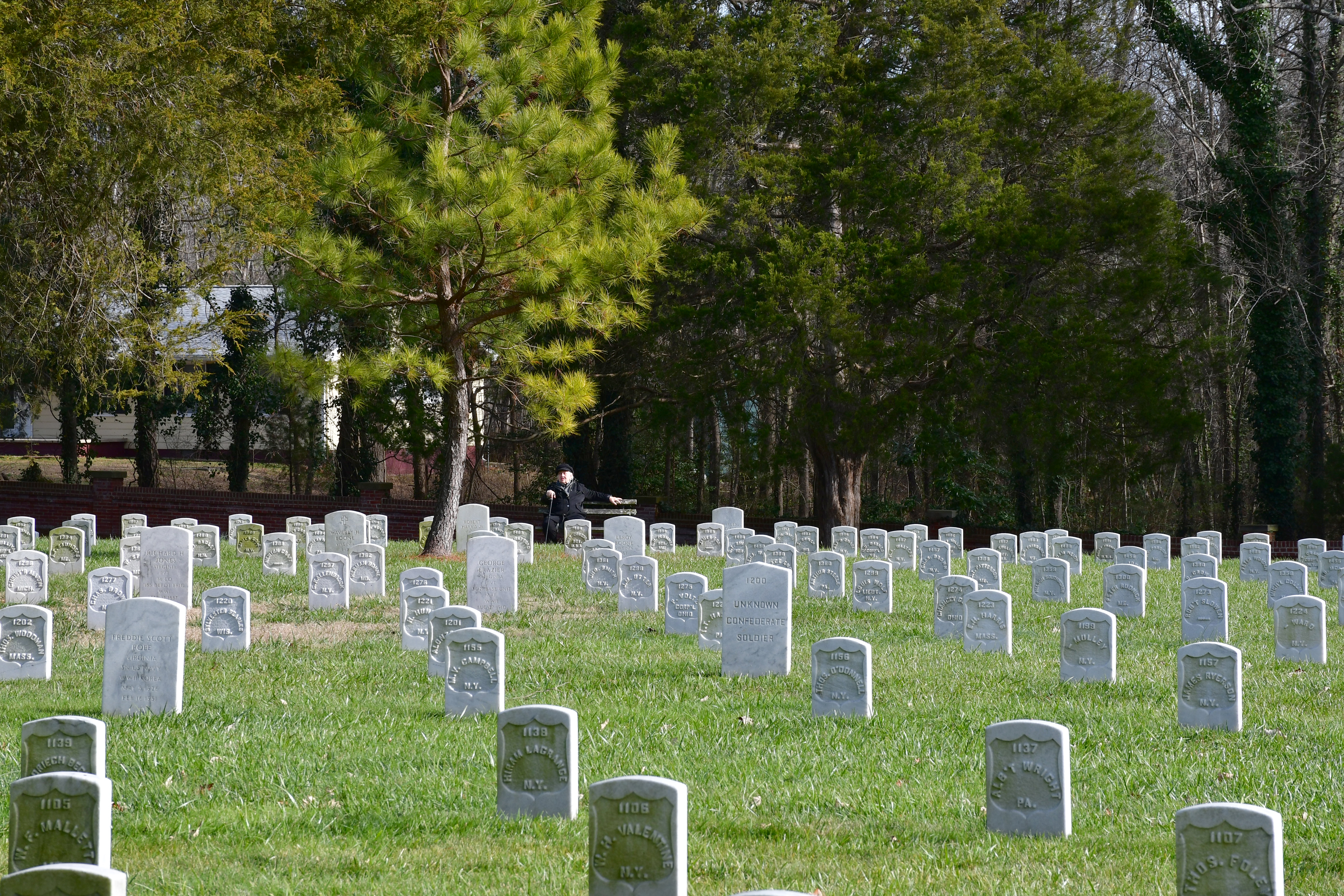
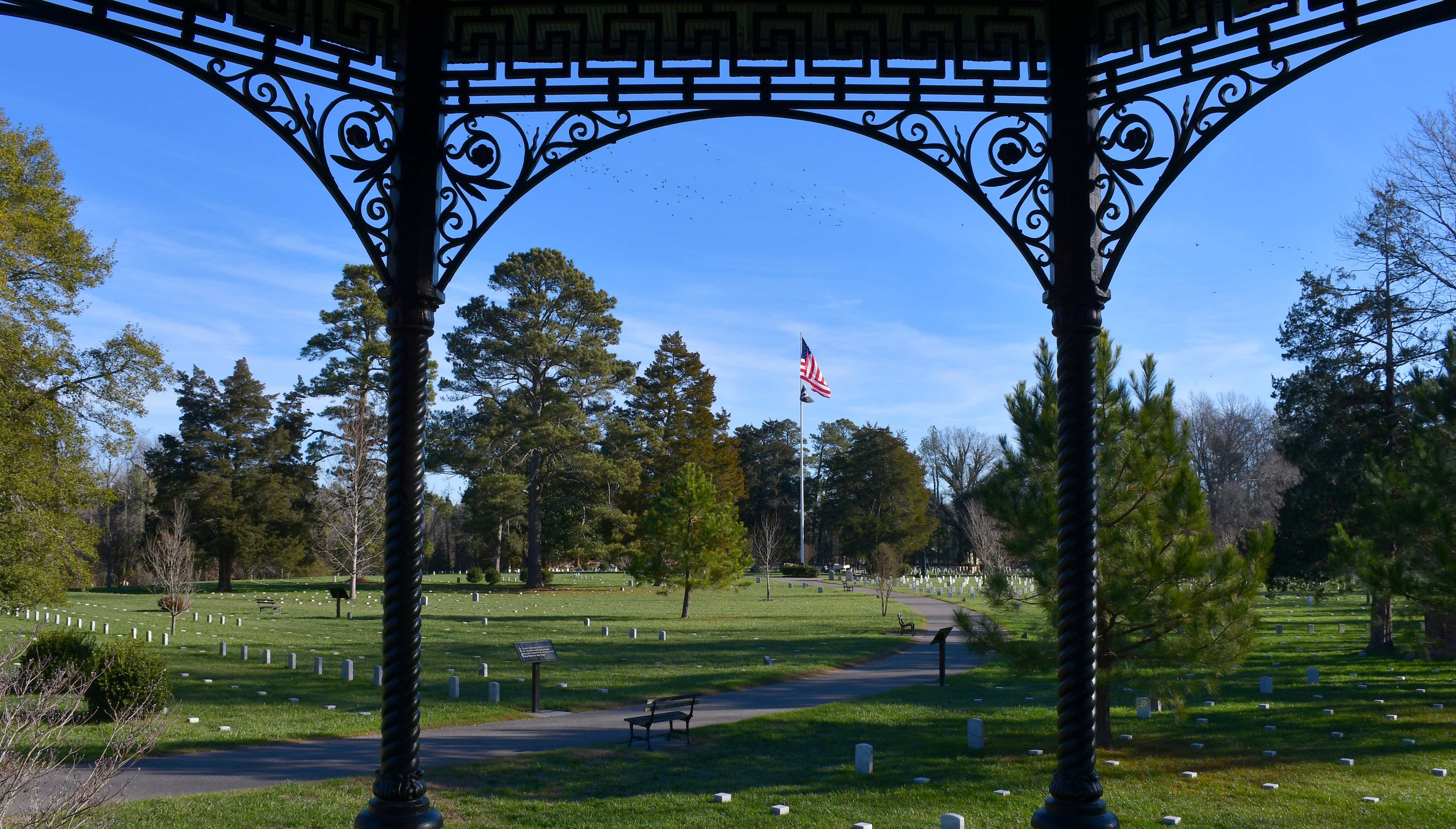
Rod-iron gates in a brick lead to a wide paved walkway into the cemetery. On the is a lodge - a one-and-one-half story brick building in the Second Empire style, notable for its mansard roof and dormer windows. On the left is a large rectangle of asphalt in front of a single-story white building with a green roof. Just past the building on the left are long straight rows of white marble headstones and smaller white blocks marking grave sites. On the right is the octagonal iron rostrum, followed by a section of graves in straight lines. The pathway begins a gentle curve leading to a tall flagpole with large U.S. flag an a black and white POW/MIA flag. As the path curve the graves become more of a circular pattern rather than the straight lines on the edges. A variety of trees are scattered throughout amongst the headstones. A red brick wall marks the boundary.
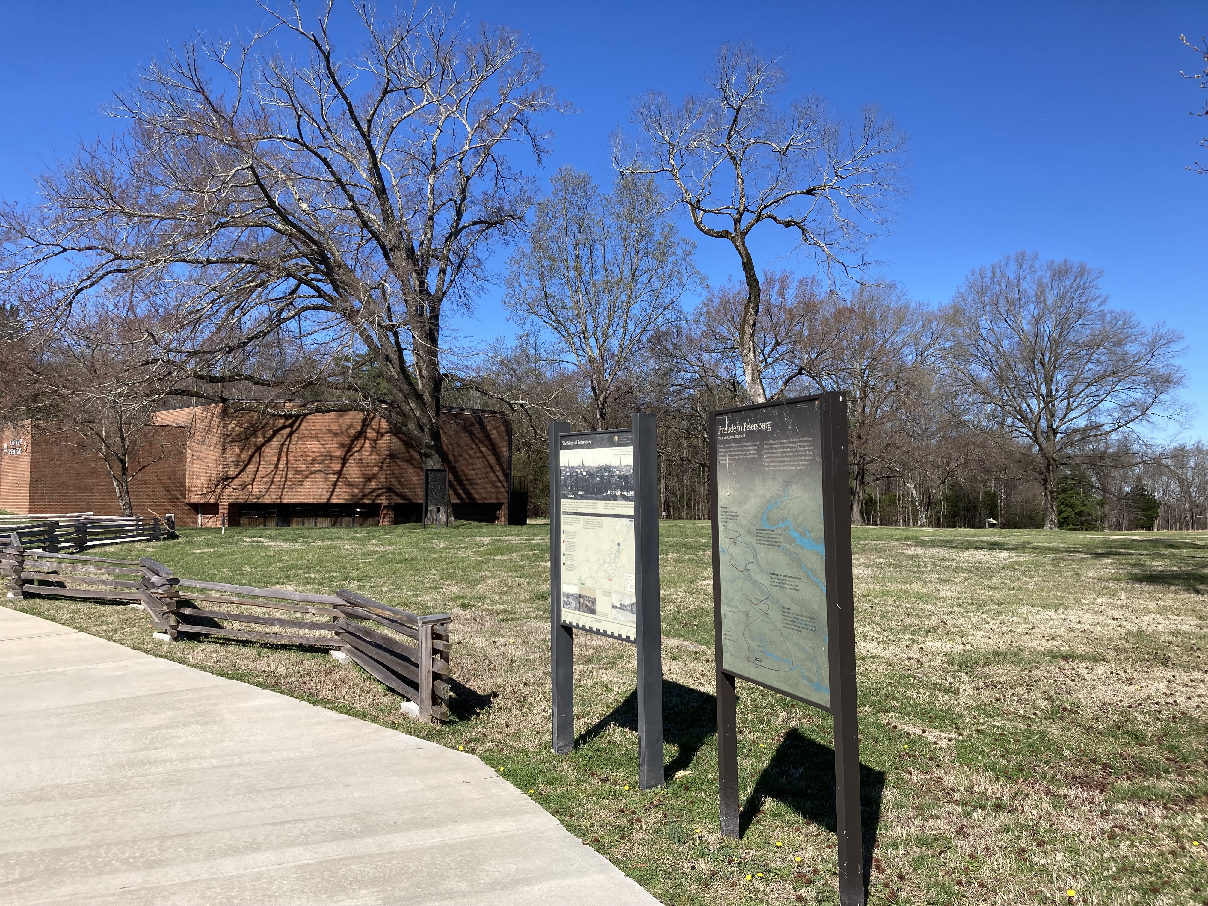
Next to the sidewalk leading to the visitor center are two vertical information panels. The panel on the right closest to the parking lot is Prelude to Petersburg on the left is Touring the Battlefield. Prelude to Petersburg 1864 overland campaign On May 4th 1864, the federal army crossed the Rapidan River 20 miles west Fredericksburg. The next day Confederate General Robert E Lee's forces struck the union army at the Wilderness opening a month-long campaign of nearly nonstop fighting and staggering casualty totals. After the Wilderness, Lee attempted to block Union General Ulysses S. Grant’s southward drive toward Richmond at Spotsylvania Court House then along the North Anna River, again at Topotomoy Creek, and finally at Cold Harbor just eight miles from Richmond. At Cold Harbor Grant’s headlong assaults into Lee’s lines on June 1 and June 3 failed. Undaunted he marched his army South to Petersburg and began the long process of cutting Richmond's supply lines Map of Eastern Virginia with a series of red and blue arrows that meet up at the different battle locations. Wilderness May 5-6 The fighting in the thick woods West of Fredericksburg produced nearly 30,000 casualties but no clear winner. Spotsylvania Court House May 8-21 Grant ignored the indecisive results of wilderness and pressed southward. Lee blocked him here and for two weeks close to 200,000 men fought for an advantage North Anna River May 23-26 and Topotomoy Creek May 28-30 These two engagements forced Grant to continue moving to Lee’s right as the union forces searched for a way to capture Richmond. Cold Harbor May 31 -June 12 Major attacks on the Confederate lines bring the total number of casualties to around 90,000 men in six weeks of fighting. Grant's failure here turns his attention to Petersburg ending the overland portion of the 1864 campaign. The sign on the left. The title reads: The Prize Petersburg Large image across the top is an historic photo of the skyline of Petersburg. A quote on the images reads: “I would not believe before I came here that man was capable of enduring so much.” Leverette Bradley 1st Massachusetts heavy artillery. Text reads: If Petersburg fell the confederate caps capital of Richmond would fall too. Union General Grant new it. Confederate General Lee knew it. For nine and a half months from 1864 - 1865 Union and Confederate armies great waged a brutal campaign here that left the Confederacy on the verge of total defeat. Touring the Battlefield. Text on the left side of a map of the national battlefield reads: Petersburg national battlefield includes four major historic areas a driving tour links to eastern and western fronts with the five forks battlefield. Grant headquarters at City Point is located about 8 miles northeast of Petersburg in the city of Hopewell. You can start your visit in the visitor center where brochures and additional tour information are available Colored dots on the left correspond to the colored lines and numbers on a map of the Petersburg area on the right. Large blue dot and text reads: The eastern front sites spanned the entire seat including the opening assaults June 1864 the spectacular blast at the crater in July and these last offensive at Fort Stedman in March 1865. Large red dot and text reads: The Western Front links fortifications, and battle sites related to the Union’s effort to cut Petersburg supply lines - efforts that ultimately stretched the Confederate defense lines to their breaking point. Poplar Grove National Cemetery is located here as well Large Green dot and text reads: At Five Forks Battlefield on April 1, 1865, the Union army defeated and captured nearly one fifth of Lee's entire force. Petersburg and Richmond fell two days later. Large Black dot and text reads: During the siege City Point was one of the busiest ports in America. From his headquarters here Grant directed the movement of Union armies throughout the South. Three pictures across the bottom from the first two are different views of earthworks, trenches, gabions, and bombproofs. Caption reads: By the end of the siege more than 100 miles of earthworks scarred the landscape around Petersburg. Caption next to the third image reads Converging rail lines made Petersburg the southern gateway to Richmond. Historic photo of Southside Railroad Depot a long single story brick structure with wide openings every ten feet or so. In the center of the structure is a two story building with a tall cupola. At the very bottom of the sign is a Petersburg Timeline 9 months and 18 days From left to right reads: June 1864: Union attack on Dimmock Line. Federals sever Jerusalem Plank Road. July 1864: Battle of the Carter. August 1864: City Point Warf explosion. Federal sever the Weldon Railroad. September 1864: Battle Peebles’s Farm. October 1864: Battle of Boydton Plank Road. February 1865: Battle of Hatcher’s Run. March 1865: Confederate attack on Fort Stedman fails. Battle of Five Forks. April 1865: Confederates evacuate Petersburg.
A reconstructed artillery battery from the Civil War.
Inside this reconstructed battery, there are two guns in place: a mortar and a cannon. The battery is constructed with wood logs and thrown dirt on top to make the walls. There are also sandbags used in the construction to add height. Inside the grassy area is a small mound of earth, an underground room called a bombproof.
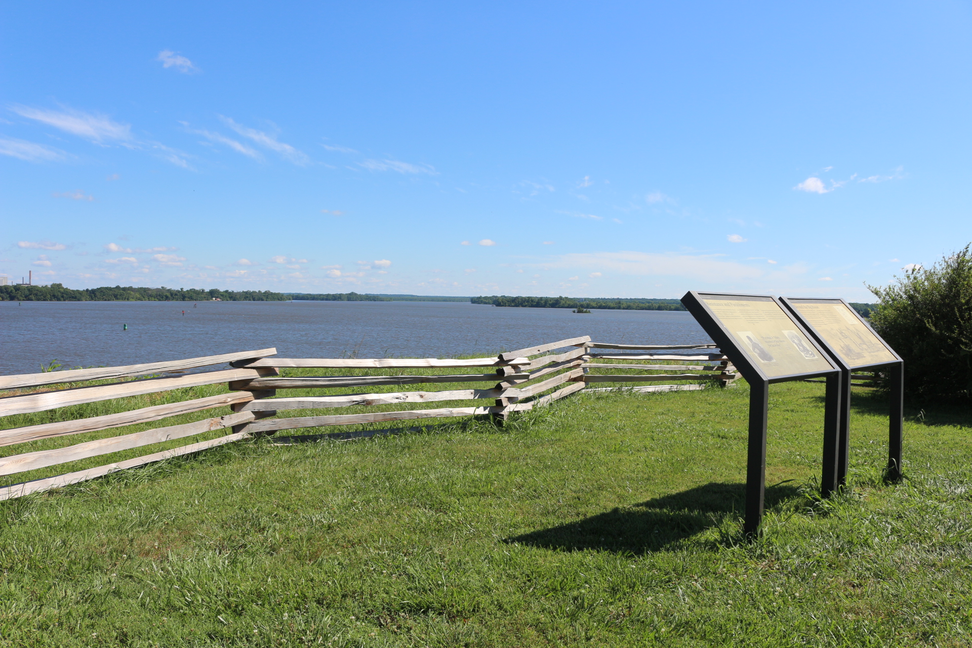
Two interpretive panels discussing the elements of slavery within the Eppes’ family farms, with a view of the confluence of the James and Appomattox Rivers.
A wooden fence of stacked logs is between the cliff and yourself. The view beyond the short, grassy cliff, is off the Appomattox River to the left, and the James River to the right and straight ahead. The rivers are wide and on the other side, the land is covered in trees with a few small buildings to see. There are two interpretive waysides next to each other, both waysides have a black band on top, with the National Park Service arrowhead in the top right corner. The text is all in black and the background of both panels is a light tan color. The panel on the left reads, “Resistance and Punishments. Prior to the Civil War, Dr. Eppes commanded his sales to not get drunk, steal, commit adultery, damage property, nor attack him, the overseers, or each other. The enslaved people resisted by stealing, feigning illness, breaking tools, and at least one slave fought an overseer. In an attempt to make his laborers follow the rules, Eppes commonly took away his slaves’ ability to leave the plantation or he decreased their food allotment. He and his overseers whipped those who resisted and had slaves whip each other as punishment for fighting or stealing from one another. Eppes sold a man named Bins in 1859 for his continued resistance. Though none of the slaves here tried to escape before the war, between May and August of 1862, 106 of Eppes’ 122 slaves escaped. Of the escaped slaves, at least four served in the Federal Navy during the war and at least two others served in United States Colored Troop regiments by war’s end.” On the left under the text is a photo of an enslaved person looking away from the camera, with multiple whipping scares on their back. Underneath the text in the middle is a quote in bold letters that states, “Patience and Dilsy received a few blows for laziness, by Richard Eppes on June 18, 1858”. The last photo on the right is a drawing of an enslaver whipping an enslaved woman who is tied with her hands up on a pole. The caption reads “From a slave narrative published in 1858”. The panel on the right is titled “Beyond the Big House”. “By 1860, Richard Eppes owned 2,300 acres divided into four farms on all sides of the confluence of these two rivers and held 113 people as slaves ranging in age from a few months old to 79 years old. He hired two men as overseers and one free black man before the Civil War. Enslaved field hands planted, tended, and harvested wheat, corn, and oats; they also fished, slaughtered livestock, picked fruit, and did other jobs that generated income for the Eppes family. Eppes’ skilled enslaved men worked as carpenters, blacksmiths, and sawyers. One enslaved woman was a weaver, and another was a midwife. The enslaved community worked on Eppes’ Bermuda Hundred farm (across the Appomattox River where the factory is), on Eppes’ Island to the east (across the James River), and south of here at the Appomattox and Hopewell farms. Only the island remains undeveloped today”. To the write of the text is a drawing of a map showing the different farms of the Eppes’ family as was described in the text. Beneath the text is a drawing of enslaved people stacking wheat and using ox to pull flat wagons. It is titled “Culpeper, VA, Stacking wheat by Edwin Forbes (LOC)”.
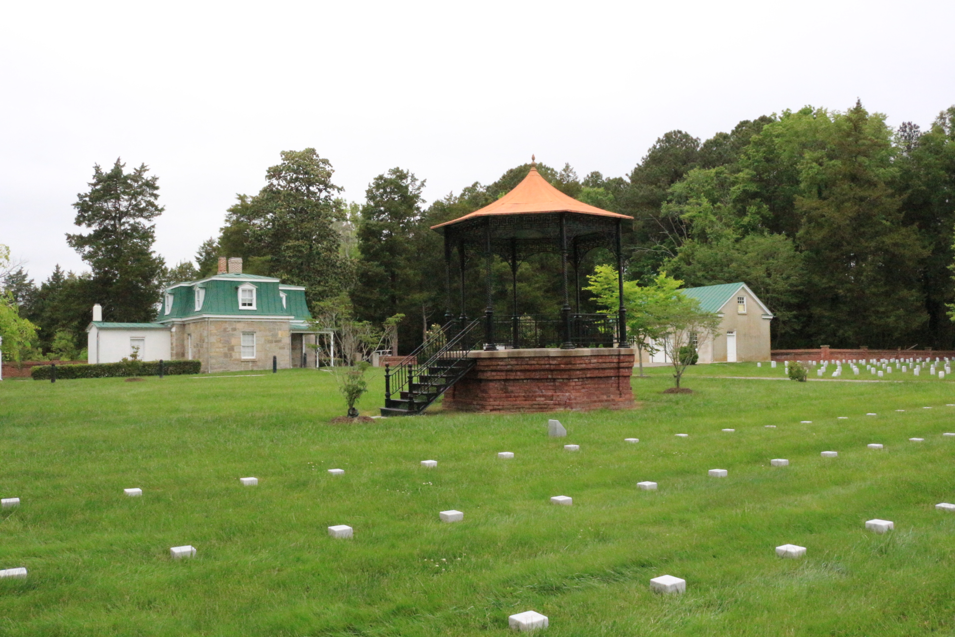
An octagonal, gazebo-like pavilion, raised above a brick foundation. It features cast-iron posts and wrought iron ornamentation with a roof of tin panels. The rostrum was situated within an assembly area where visitors gather to hear speakers during special events.
The parking area for the Eastern Front Visitor Center.
A paved oval parking lot, with a median in the center that has trees. The Eastern Front Visitor Center is a brick building with a flag pole in front of it. The Visitor Center is roughly 50 yards from the parking lot connected by a paved sidewalk. Public bathrooms are located to the left of the Visitor Center in a separate gray building. Along the sidewalk to the Visitor Center are multiple Civil War Artillery Cannons. Halfway from the parking lot, up the sidewalk towards the Visitor Center is another sidewalk leading to the right towards Battery #5.
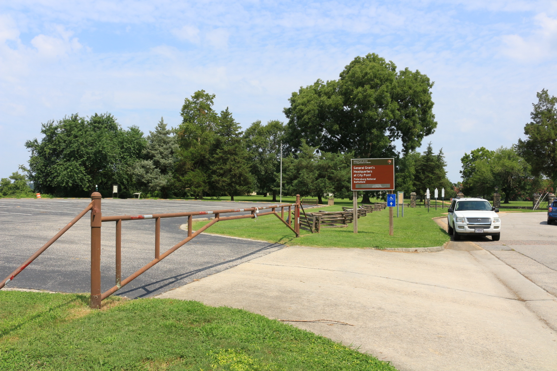
The large, paved parking lot has a wooden fence close to the road, with a large brown metal gate at the entrance. A large brown sign marks the parking lot, with a green section along the top portion. Text on Sign: National Park Service. U.S. Department of Interior. General Grant's Headquarters at City Point. Petersburg National Battlefield.
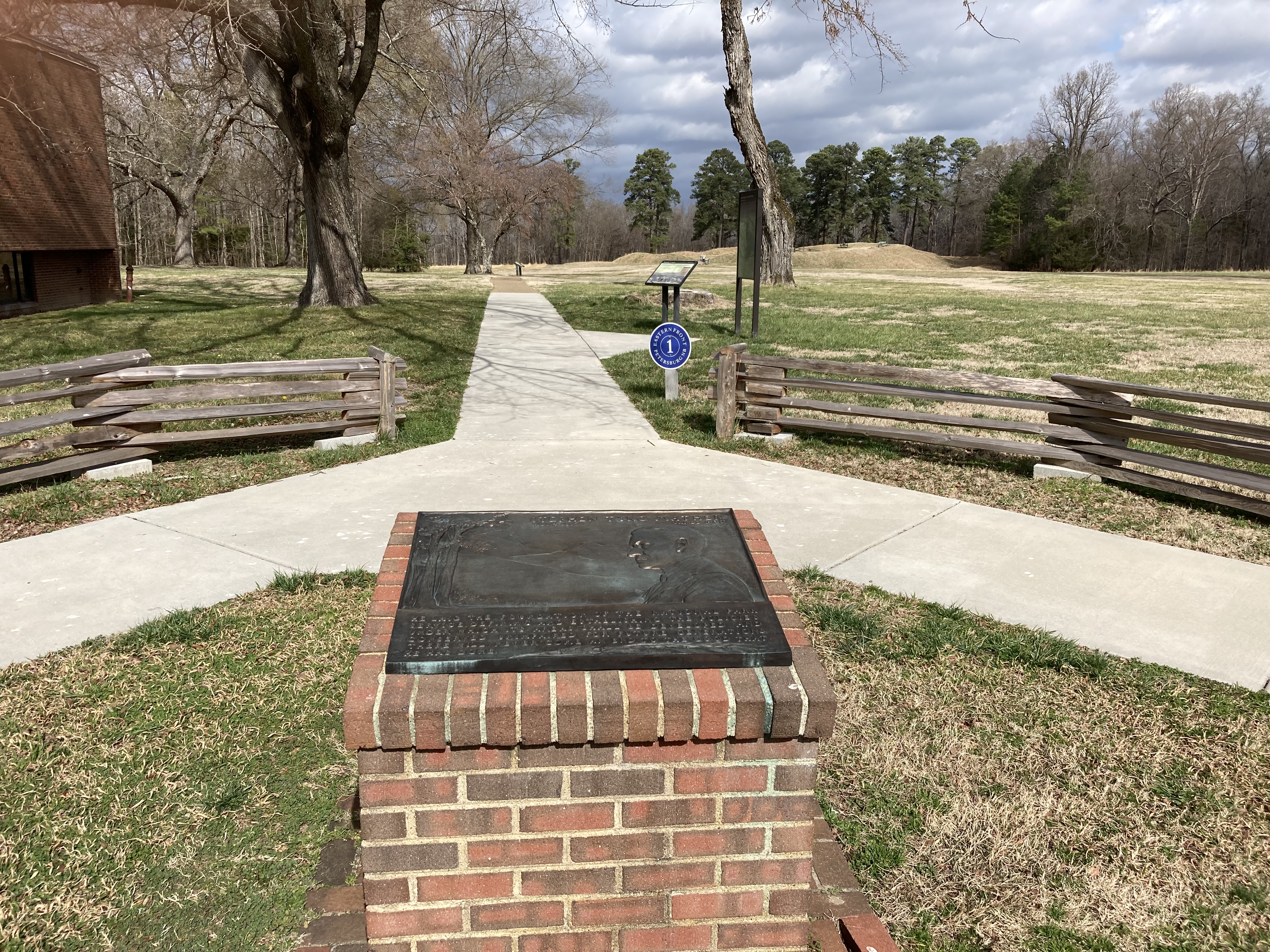
Rectangular bronze plaque on a brick pedestal. Image on plaque - profile of a clean shaven man looking toward mountains and trees on the far left. Inscription at top reads Stephen Tyng Mather July 4, 1867 - Jan. 22, 1930. Inscription at bottom reads HE LAID THE FOUNDATION OF THE NATIONAL PARK SERVICE. DEFINING AND ESTABLISHING THE POLICIES UNDER WHICH ITS AREAS SHALL BE DEVELOPED AND CONSERVED UNIMPAIRED FOR FUTURE GENERATIONS. THERE WILL NEVER COME AN END TO THE GOOD THAT HE HAS DONE.
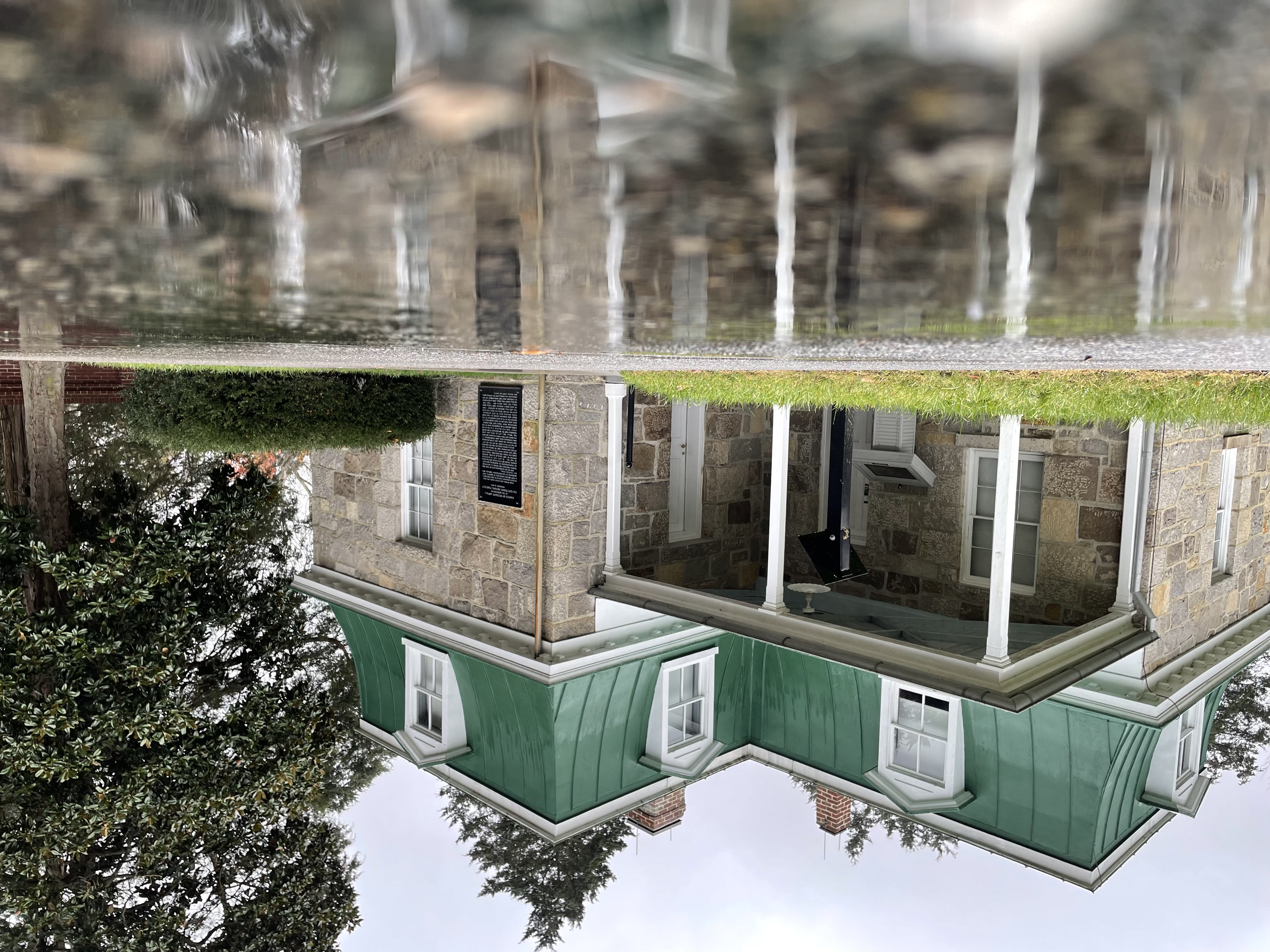
Superintendent's lodge designed by Quartermaster General Montgomery Meigs .
A two-story sandstone building in the “Second Empire Style”, with a characteristic green concave mansard roof and gable dormers. A stucco-covered brick outbuilding behind the building.
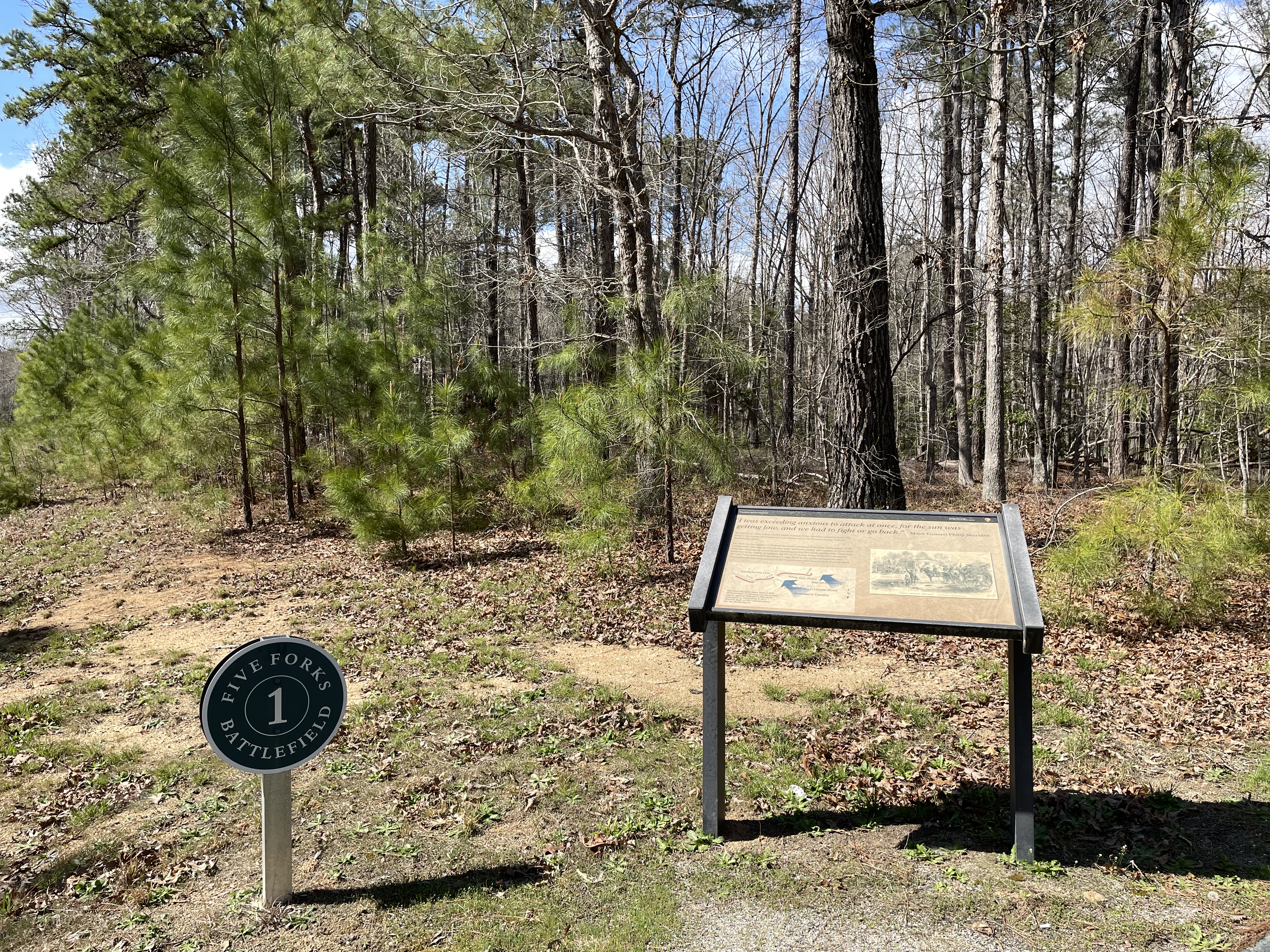
Staging area for Union Major General Warren's V Corp During the battle of Five Forks.
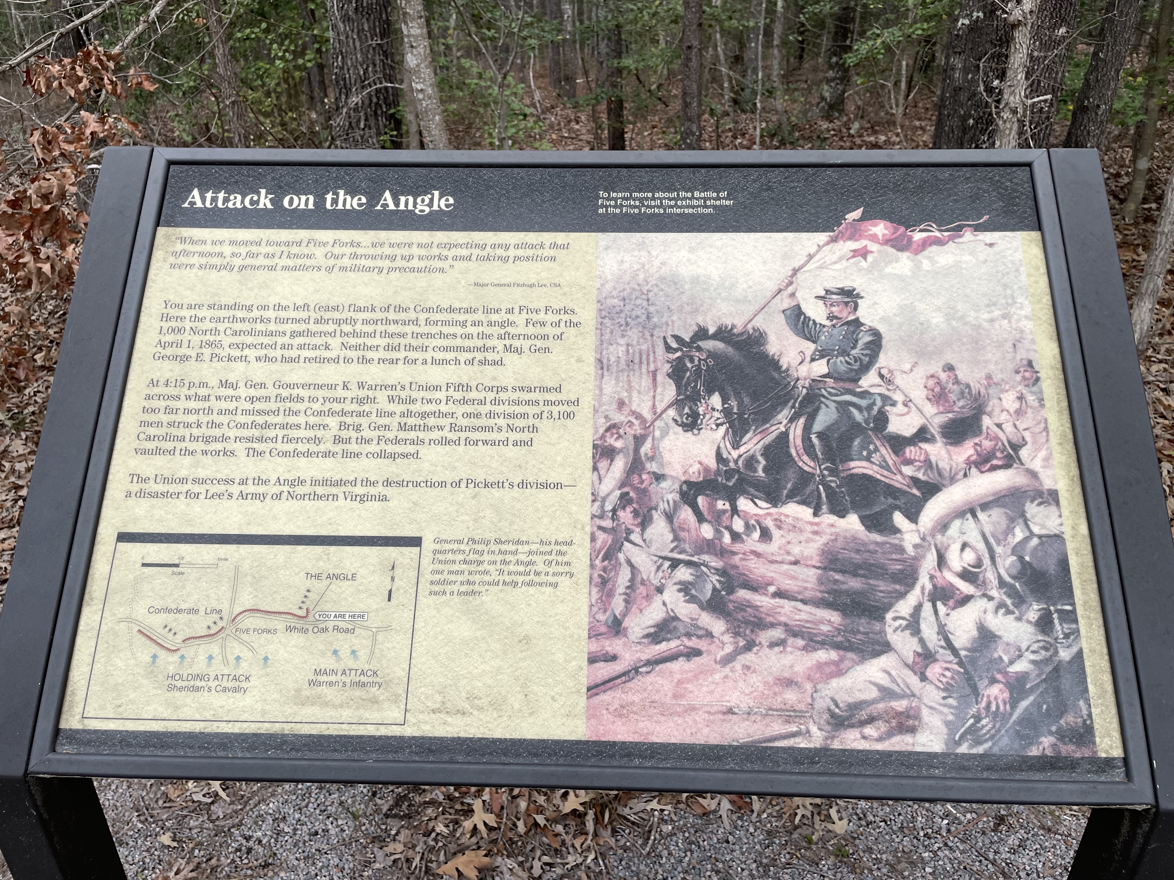
First Wayside Attack on the Angle Quote Reads: “When we moved toward Five Forks…we were not expecting any attack that afternoon, so far as I know. Our throwing up works and taking position were simply general matters of military precaution.” Major General Fitzhugh Lee, CSA Main body text reads You are standing on the left (east flank) of the confederate line at Five Forks. Here the earthworks turned abruptly northward, forming angle. Few of the 1000 North Carolinians gathered behind these trenches on the afternoon of April 1, 1865, expected an attack. Neither did their commander, Major General George Pickett, who had retired to the rear for a lunch of shad. At 4:15 p.m., Major General Gouverneur K. Warren’s Union Fifth Corps swarmed across what were open fields to your right. While two Federal divisions moved too far north and missed the confederate line altogether. One division of 3,100 men struck the Confederates here. Brigadier General Matthew Ransom's North Carolina brigade resisted fiercely. But the federals rolled forward and vaulted the works. The Confederate line collapsed. The Union success at the Angle initiated the destruction of Pickett’s division - a disaster for Lee’s army of Northern Virginia Map shows confederate line noted in red a line along White Oak Road with a bend upward on the right end of the line. Five blue arrows on the left with text reading: Holding Attack Sheridan’s Cavalry. Two blue arrows on the right with text reading: Main Attack Warren’s Infantry. Caption reads: General Philip Sheridan – his headquarters flag in hand – joined the Union charge on the Angle. Of him one man wrote, “It would be a sorry soldier who could help following such a leader.” Image on right is a color painting of a Union officer on horseback jumping over a wooden barricade with startled Confederate soldiers moving out of his way. Second Wayside Quote across top reads: “My command had to lament the loss of some of its bravest and best…” General Charles Griffin. As union general Romeny Ayres Finished aligning his men, about 4:15 PM on April 1st, 1865, near the Gravelly Run Methodist Episcopal Church the order was given for the division two attack. Generals Philip Sheridan. Gouverneur Warren, and Colonel Horace Porter of General Grant’s staff road at the front of the line. Union skirmishers drove in the Confederate outposts. Ayres was told by a staff officer that there were indications of enemy to the left. Ayres alerted his reserve brigade bereft Brigadier General Frederick Winthrop to be ready to bring his brigade forward. Confederate General Matthew Ransom’s brigade began to fire on Ayers’s division after they crossed White Oak Road. Warren later recalled that Ransom's brigade was in a thick belt of woods, which disrupted their aim and reduced initial union casualties. Ayres realized the situation and changed this front to the left to face the return of the southerner’s line. The movement opened a space in the line which Ayres fill filled with Winthrop’s brigade. Ayres‘s men faltered briefly when they became exposed Two closer more accurate firing from Ransom’s brigade. Sheridan rode along the battle line shouting encouragement. Sheridan and Ayres and his officers managed to quickly get the troops under control and ordered them forward again. Ayres's men would take the position, key to the entire confederate line, over 1000 prisoners and eight battle flags but among the union casualties was general Winthrop who was mortally wounded. Image: Photo of a white man with a thick mustache and sideburns down to his jaw. He is wearing an officer’ s coat with 16 buttons in rectangular groups of 4. The thumb of his left hand is tucked in his belt. Text reads: Born on August 3rd, 1893, in New York City, the 25-year-old Winthrop would be taken back to Gravelly Run church, which was now transformed into a field hospital. It was there he succumbed to his wounds. His body was transported back to New York for burial at Green-Wood Cemetery, Brooklyn, Kings County, New York. From his April 13, 1865, obituary in the New York Times. “From private in the ranks to General commanding a brigade, his record has been stainless. Participating in all the principal battles fought in the East, his conduct and each was worthy of the man who in the heat of battle could die as he did in an act of quiet heroism and noble self-sacrifice. He was a splendid soldier, skillful, gallant, cool, and accomplished. But those who knew him simply as a soldier were ignorant other things that most endeared him to a multitude of friends. How many who served with him in the army of the Potomac or who met him in his brief intervals of recreation will mournfully remember his kind genial manner, his love of pleasure, his frank hearted hearing and gentle courtesy in act and word, long after the victory which his name is connected shall have become a tradition in the land.
July 30th, 1864, early in the morning before dawn, a large explosion created The Crater.
Beyond the wooden fence is a depression about 15 feet deep. It's roughly the length of a school bus in both directions, with a tall 7-foot earthen mound behind it. There are delicious and coniferous trees lining the earthen mound. On the other side of the sidewalk are small depressions in the ground, only about 2-3 feet deep.
The final stand of Major General W.H.F. Lee and Brigadier General Montgomery Corse’s men held off Union attacks that allowed for Pickett's 7,000 men to escape.
Wayside Background image black and white image of mem on horseback with sabers drawn charging soldiers standing and kneeling and aiming rifles at them. Body text reads: With their left at the angle crushed and their center the five forks intersection overrun the Confederates made of final stand here in and around Gilman's field. across the open ground to your right Brigadier General George Armstrong Custer glad two union cavalry brigades in a wild charge against the confederate right flank. southern horsemen under Major General W.H.F. Lee held off the federals. Across the road to your left infantrymen of Brigadier General Montgomery Corse’s Virginia brigade struggled against an attack by Union infantry moving westward (towards you) along the White Oak Road. Though Corse’s troops were overrun, their efforts allowed Pickett’s remaining 7,000 men to escape to the north. Pickett's survivors would not rejoin the main Confederate army until three days later at Amelia Court House. The defeat at Five Forks forced Lee to abandon the Petersburg lines - and hence the capital at Richmond. Eight days later caught, in a vice of Union troops Lee surrendered his army at Appomattox Court House. Insert map Map shows confederate line noted in red a line along White Oak Road with a bend upward on the right end of the line. Blue arrows show the directions of the attacks and a red arrow show the direction of retreat.
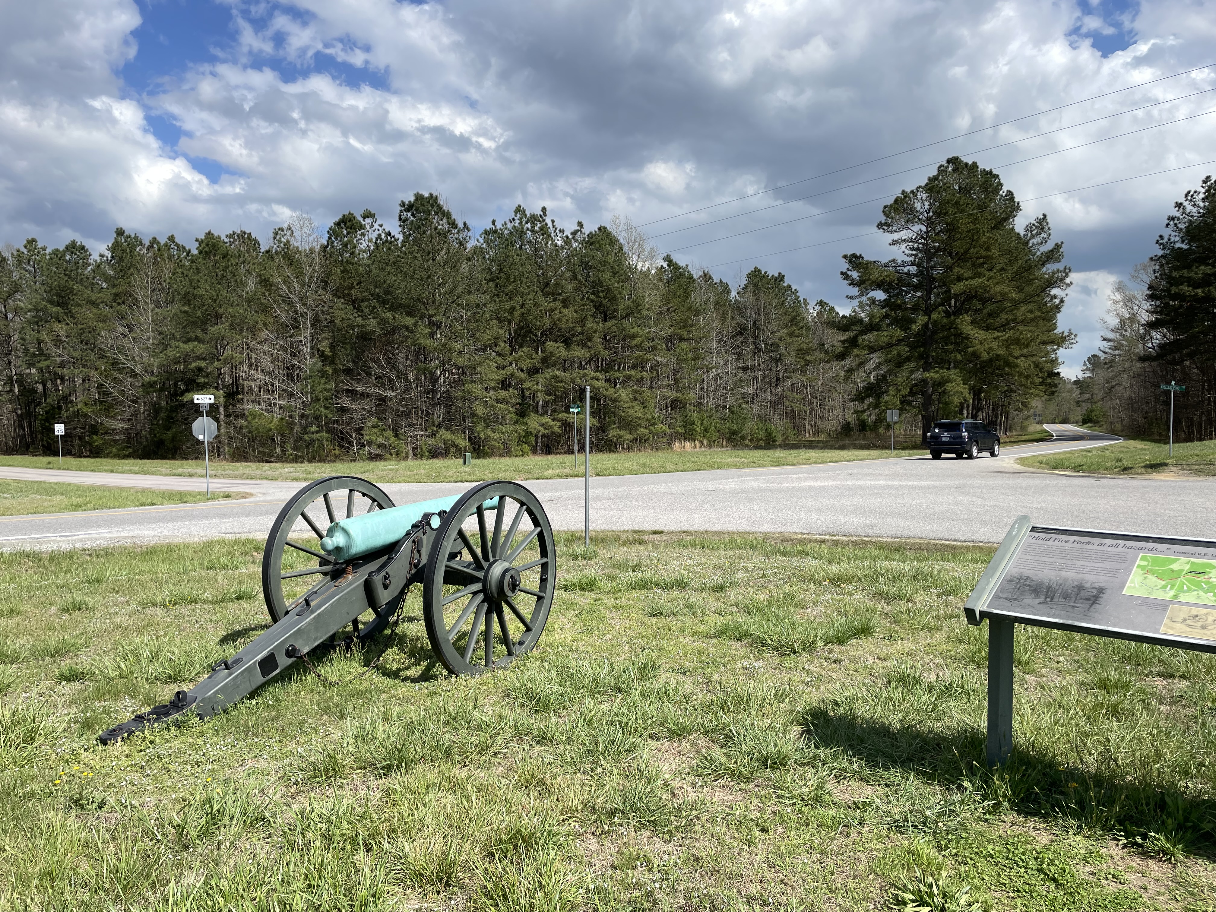
Wayside 1 “Hold Five Forks at all hazards…” General R.E. Lee Confederate General George Pickett’s infantry and General Fitzhugh Lee’s cavalry were ordered to protect the last remaining supply line, the South Side Railroad, coming in to Petersburg. The infantry dug a line of entrenchments along White Oak Road through this intersection of muddy roads to help in the defense. A numerically superior force of Union infantry and cavalry under the command of General Philip Sheridan approached from the south and focused their attack on control of the Five Forks road network. In the last few remaining hours of daylight on April 1, 1865 the Federal troops were able to envelop both ends of the southern line. Faced with being completely surrounded the Confederates were forced to retreat. Several thousand of the infantry were captured as others fled unceremoniously from the battlefield leaving behind the dream of protecting the railroad and Petersburg. Map shows confederate line noted in red a line along White Oak Road with a bend upward on the right end of the line. In the center are three cannons labeled Pegram. Below the red line is a blue dashed line with the Union position and with arrows showing the direction of attack. Two pencil sketches – on the left a barricade with a gap in the center and trees in the background. On the right is a sketch of broken limber with shattered wheels and axels. Caption between the two read: Sketch don shortly after the battle by Alfred Waud of destroyed Confederate artillery and the intersection. Wayside 2 Main Text reads: Late in the afternoon, April 1, 1865. Confederate infantrymen waited behind rude, muddy earthworks lining the White Oak Road. Young Colonel William R. J. Pegram tended to his artillery: three guns in this field, three others further west (your right). Then came the Federals. Sheridan’s dismounted cavalry attacked frontally. Later Warren’s infantry swept down from the east. After fierce fighting, the Confederate positions around the intersection collapsed. In the melee fell Colonel Pegram, mortally wounded in the side. Just 23 years old, Pegram had survived all of the Army of Northern Virginia's major battles. He died only five miles from his ancestral home and just nine days short of the war's end. Caption Colonel William R.J. Pegram “the boy Colonel” whom one man described as “the most splendid soldier in all the world.” Another considered him “one of the few men who, I believe was supremely happy in battle.” Pegram fell near this spot he died the next day at Ford's depot 10 miles to the northwest. Image in lower left - a young man with a full head of hair. wearing pair glasses, and a uniform with a bow tie. The is a sketch of one soldier holds a horse while two other men tend to an injured soldier in a grassy area.
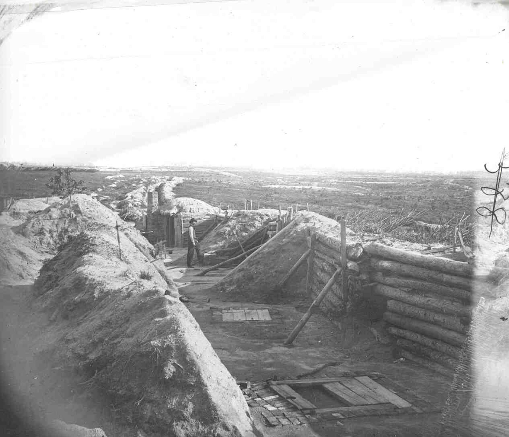
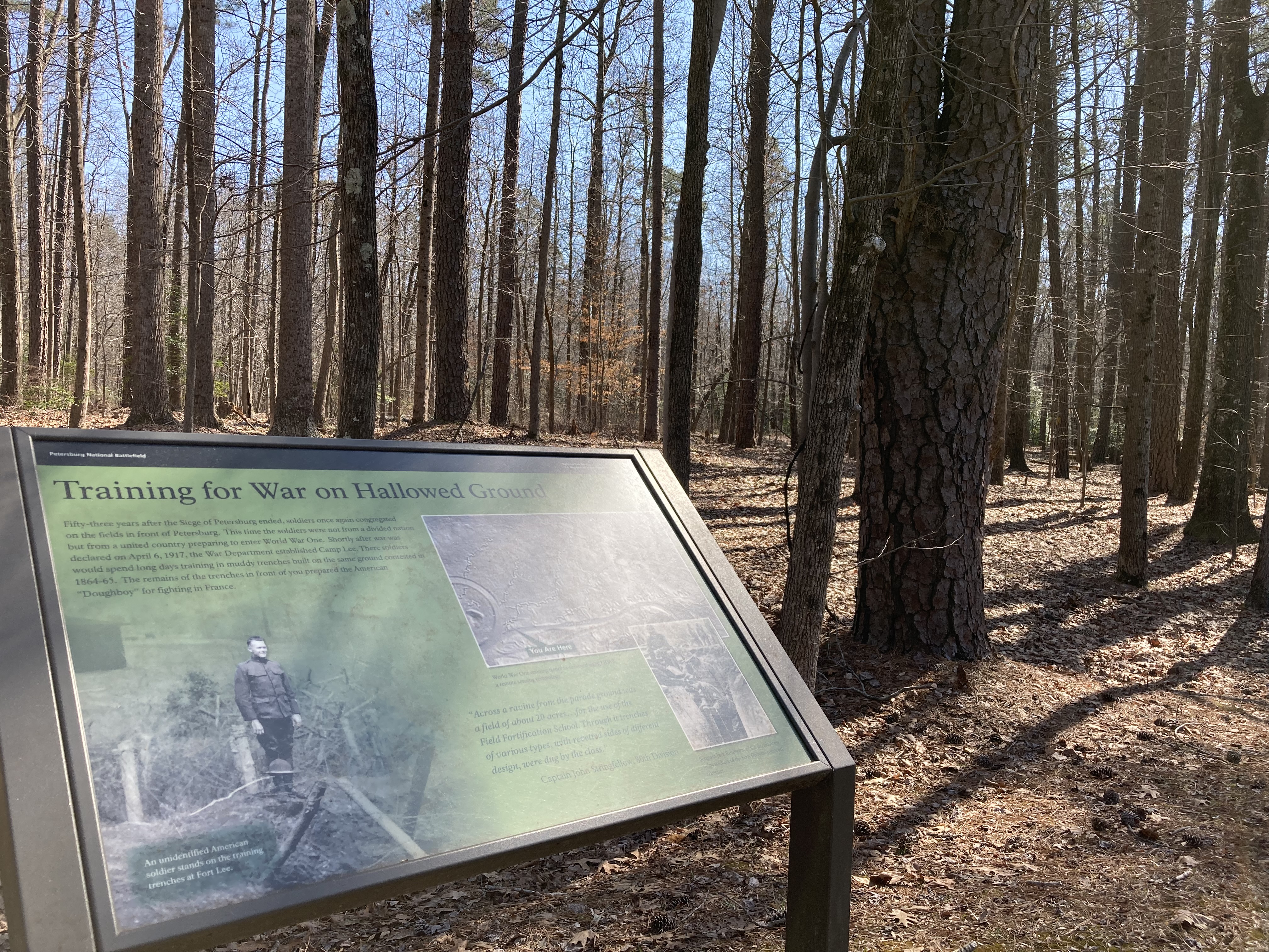
Wayside stands on the side of a road facing a grove of trees growing on and near trenches. Wayside Title reads: Training for War on Hallowed ground Three images on a green background. Main Text Reads Fifty-three years after the Siege of Petersburg ended soldiers once again congregated on the fields in front of Petersburg. This time the soldiers were not from a divided nation but from a united country preparing to enter World War One. Shortly after war was declared on April 6, 1917, the War Department established Camp Lee. There soldiers would spend long days training in muddy trenches built on the same ground contested in 1864-65. The remains of the trenches in front of you prepared the American “Doughboy” for fighting in France. Image 1 A male soldier wearing a World War One army uniform stand atop a trench surrounded by posts connected with barbed wire his hat rest on some of the wire in front of him. Caption reads: An unidentified soldier standing in the training trenches. Image 2 A soldier wearing Sergeant stripes and beret looks at support posts on the side of a trench while three soldiers wearing campaign hats look on. Caption reads: A British Instructor advises American soldiers on the construction of trenches. Image 3 A box with text reading you are here points to a spot on a Gray rectangle with smooth wide lines forming an arc on the left and going across the bottom representing roads and squiggly lines and multiple places across the map representing trenches. Caption reads: World War One training trenches surveyed using LiDAR , a remote sensing technology. Quote: “Across a ravine from the parade ground was a field of about 20 acres…for the use of the Field Fortification School. Through it trenches of various types, with revetted sides of different design, were dug by the class.” Captain John Stringfellow, 80th Division
On June 25th, 1864, the 48th PA Veteran Volunteer Infantry began digging a tunnel under a Confederate Salient.
The tunnel entrance is not original but in the general area of the tunnel entrance. The tunnel itself is original from when the 48th Pennsylvania Veteran Volunteer Infantry dug underneath the hillside and the Confederate Salient on top of the hill. The entrance has been reconstructed to fortify it with cement bags in the shape of sandbags. The entranceway is closed off by a large iron gate. From the entranceway is a short boardwalk leading to stairs to the overlook. The tunnel entranceway is 4.5 feet tall, 2.5 feet wide at the top, and 3.5 feet wide at the bottom. From the overlook, the sidewalk continues to the right, up the hillside. At the top of the hillside are two trees and an interpretive sign showing where the ventilation shaft is for the tunnel.
Dedicated in the 1990s to honor the Black soldiers who served the U.S. at the Siege of Petersburg
The United States Colored Troops Memorial is a granite monument shaped like a large gravestone. It is engraved, "In memory of the valorous service of Regiments and Companies of the U.S. Colored Troops Army of the James and Army of the Potomac. Siege of Petersburg 1864 – 65." The monument is at the junction of the historic roadways, Jordan Plank Road and Prince George Courthouse Road. These historic roadways are now extra wide trails. On top of a small mound, to the right of the monument, is a cannon representing Confederate Battery #9.
Site is used by the Union Cavalry during the battle of Five Forks.
Quote reads - “I was exceeding anxious to attack at once, for the sun was getting low, and we had to fight or go back.” Major General Phillip Sheridan Body Text Reads On March 31, 1865, Union cavalry under General Phillip Sheraton retreated down this road to the city of Dinwiddie Court House driven by general George Pickett confederate force. on April 1st the reinforced federal horseman advanced to find the southerners - with a vengeance. Late that afternoon they were deployed, mostly dismounted, in a two-mile-wide line fronting the Confederates just ahead at the five forks intersection. They were both stirred by the arrival of infantry union 5th Corps, under General Gouverneur Warren. They attacked on the cavalry's right flank as the cavalry pressed forward. outnumbered and outmaneuvered the Confederates were routed from the battlefield. Map shows confederate line noted in red a line along White Oak Road. Two large blue arrows show the Union attack of Warren’s Infantry and Sheridan’s Cavalry on Dinwiddie Court House Road. Map caption reads: Sheraton brought more than 6000 dismounted cavalry men to the frontal attack against Pickett (3000 more remained at Dinwiddie Courthouse) Warren had 12,000 infantrymen for his flank attack. Image – Historic Sketch Soldiers on horseback are greeted by a man, child, and a dog. A courthouse is in the background. Text at bottom reads General Sheridan and Staff Dinwiddie Court House
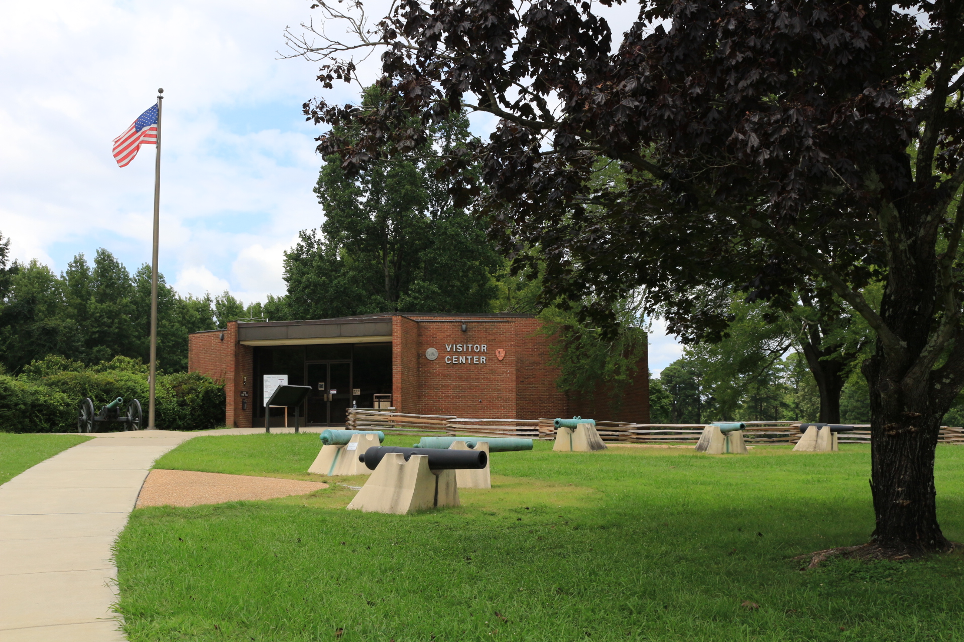
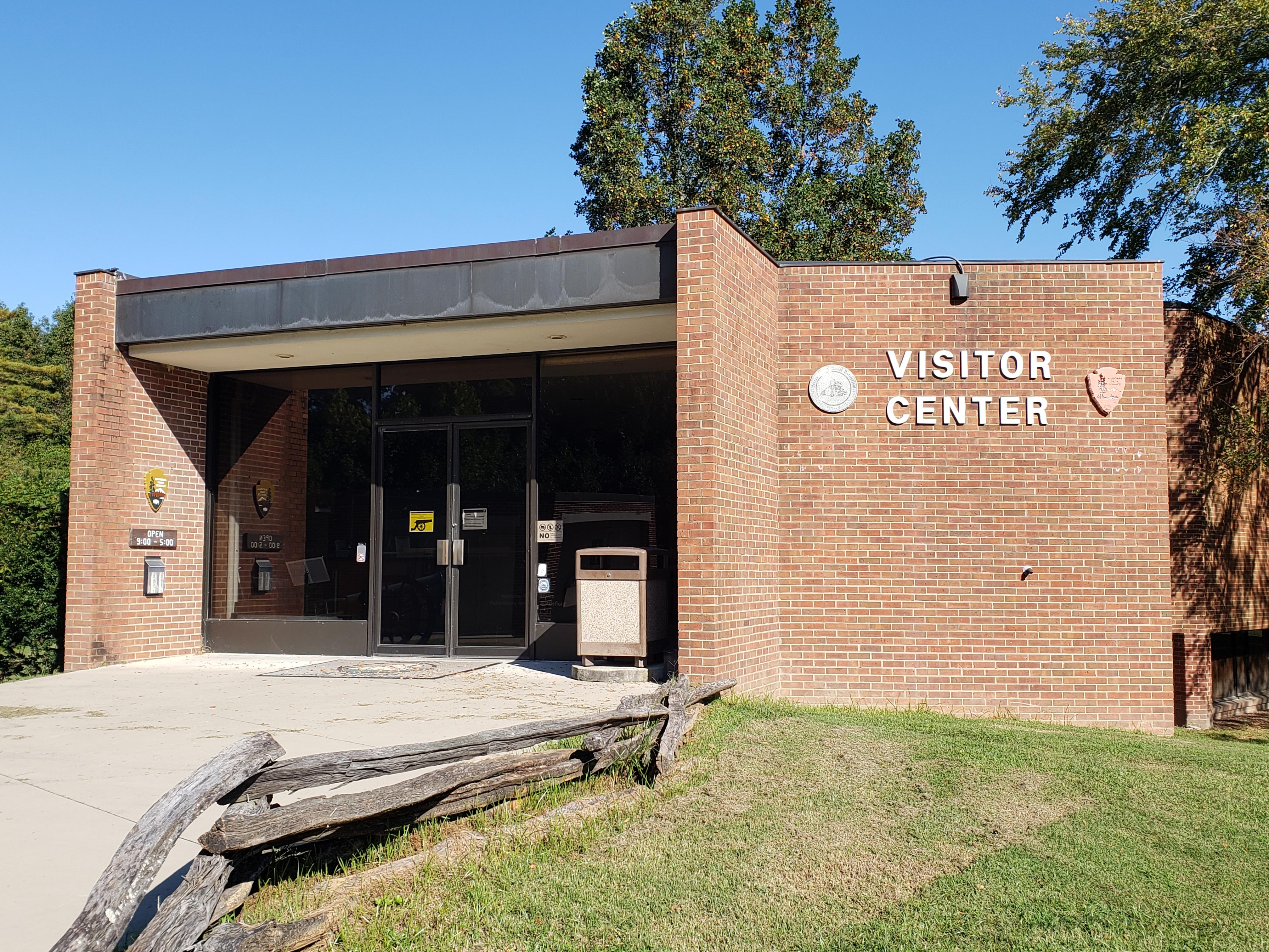
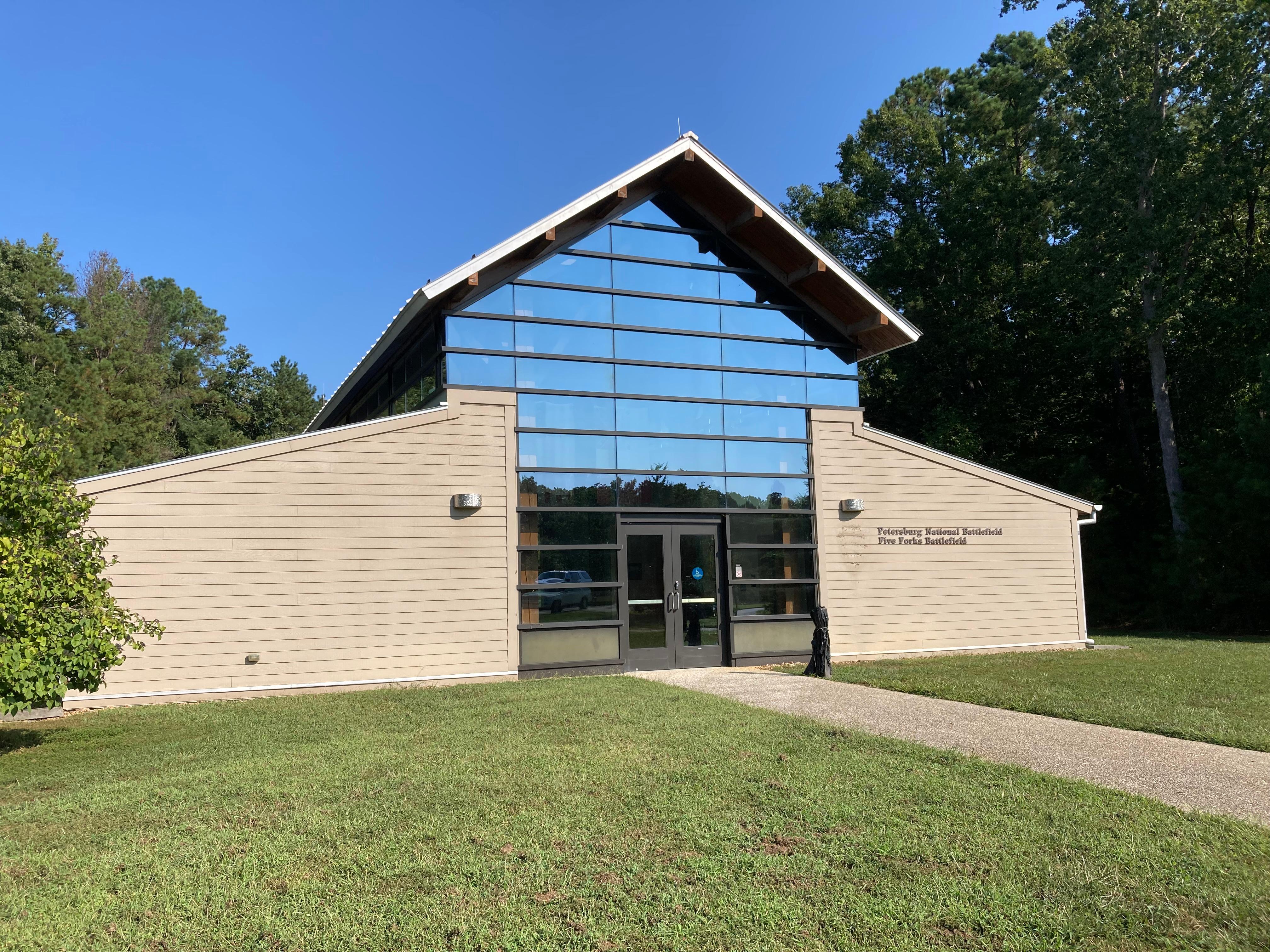
The Eastern Front Visitor Center is the park's main visitor center, including museum, gift shop, and 18 minute video. The Visitor Center is open every day. Hours: 9:00 am - 5:00 pm. Visitor Center is closed Thanksgiving, Christmas and New Years Day.
Station is located in the former plantation home of the Eppes Family. When open, visitors can view a 15 minute video and tour the first floor of the home including a room with interpretive exhibits and two rooms with original 18th and 19th century furniture that belonged to the Eppes Family. Exhibits focus on the Union Army's occupation of City Point, as well as the lives of the free and enslaved people who lived on the plantation before the war.
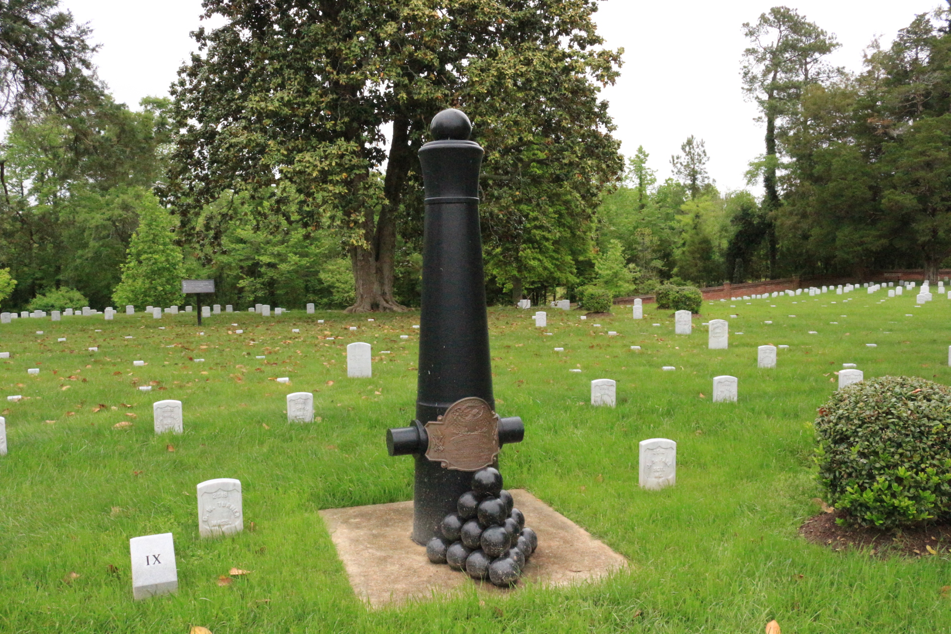
Walk around Poplar Grove National Cemetery and reflect on the tragedy that befell the United States during the Civil War. Each simple headstone is a poignant reminder of the human cost of war.
Drive the Eastern Front Tour Road
The Eastern Front Tour Road is 4-miles, one-way, and has eight stops encompassing the first couple months of General Grant's assault on Petersburg in 1864.
Walk Around City Point
Walk around City Point to explore why this area was, and still is, a popular place for living along the rivers. The Eppes family established the Appomattox plantation and their home here as early as 1635, until 1976. In 1864, General Grant and the U.S. Army used City Point as its headquarters to supply the army during the Petersburg Campaign.
Tours
Count: 3
City Point Audio Walking Tour
Walk around City Point to explore why this area was, and still is, a popular place for living along the rivers. The Eppes family established the Appomattox plantation and their home here as early as 1635, until 1976. In 1864, General Grant and the U.S. Army used City Point as its headquarters to supply the army during the Petersburg Campaign.
Eastern Front Audio Driving and Walking Tour
This four-mile driving tour of the Eastern Front has eight stops and some short, interpretive walking trails. The initial assaults that failed to capture the city and the encounters that followed shaped the siege’s history on the Eastern Front. Soldiers along this front suffered in trenches under constant artillery and rifle fire in lines only yards and sometimes feet apart. Nowhere else along the siege lines were the opposing armies this close.
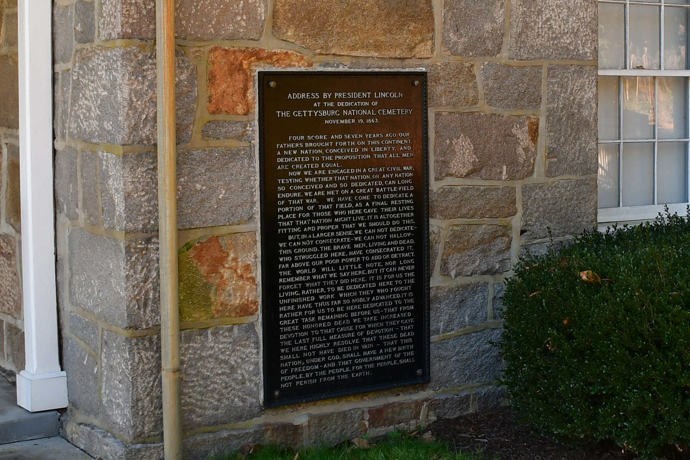
History of Poplar Grove National Cemetery
A walking tour covering the Poplar Grove National Cemetery. This tour stays on the paved surface. Starting with the fourth stop benches are available for rest and contemplation. Round trip the distance walked is approximately one quarter of a mile. Start in the parking lot at the eastern end of the center grass median (near to the cemetery).