Be advised that the NPS has issued alerts for this park.
Trail Closure at Veterans Park at Balls Bluff (Leesburg, Virginia)
Veterans Park in Leesburg, Virginia, is closed for park improvements. All trails in the park are closed until Spring 2026.
Great Allegheny Passage Closure between Rockwood and Markleton, Pennsylvania
Somerset County has closed a segment of the Great Allegheny Passage between Rockwood (mile marker 43.8) and the parking lot at Markleton (mile marker 50.0) due to an active landslide triggered by recent heavy rain and high winds. Conditions are unstable.
Great Allegheny Passage Erosion Near Confluence, Pennsylvania (Mile Marker 56)
Heavy rain & flash floods on June 8 eroded a section of trail along the Great Allegheny Passage between Rockwood and Confluence. Crews from Somerset County have placed caution tape for awareness. The GAP remains open at that location; please be cautious.
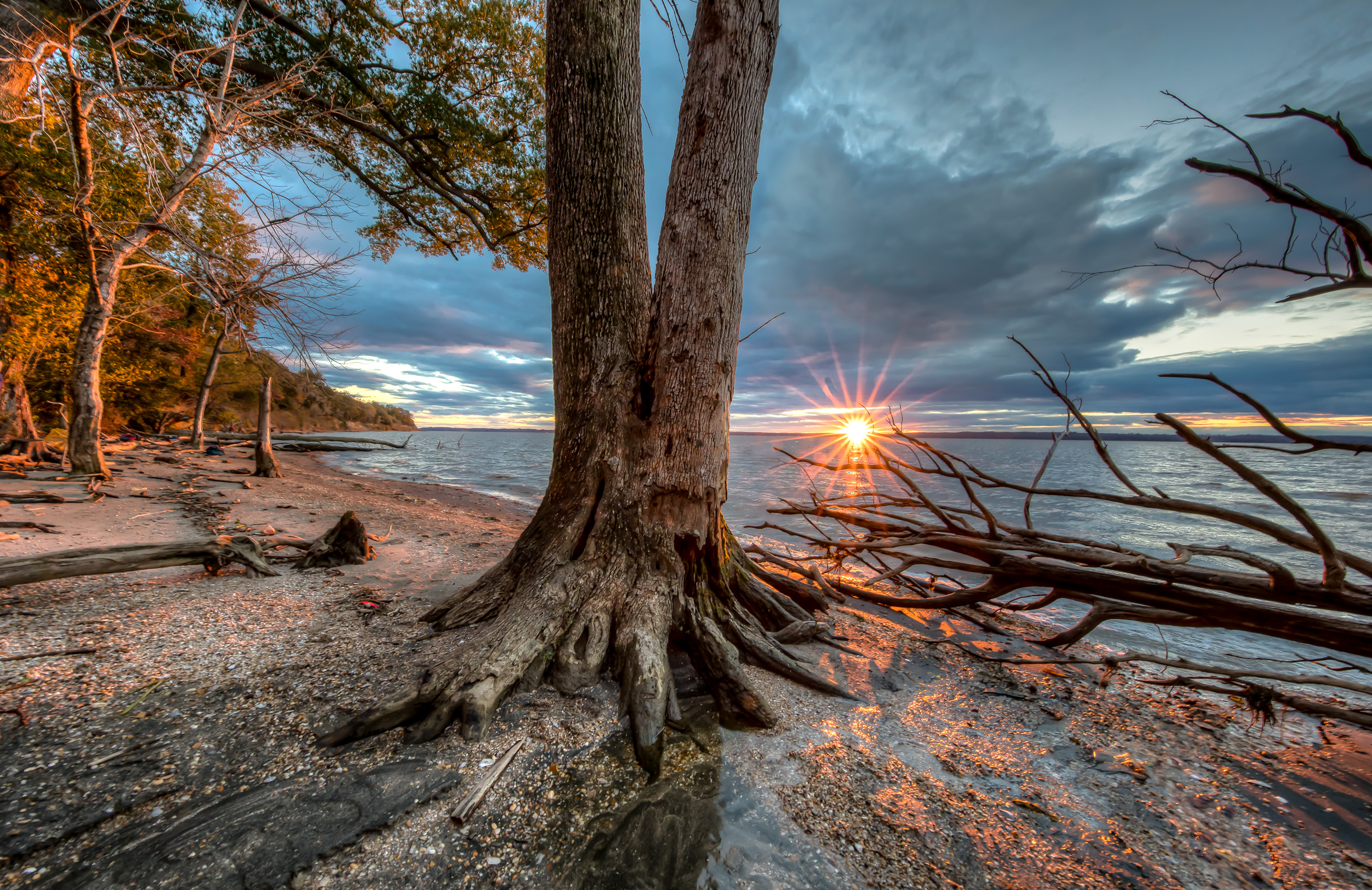
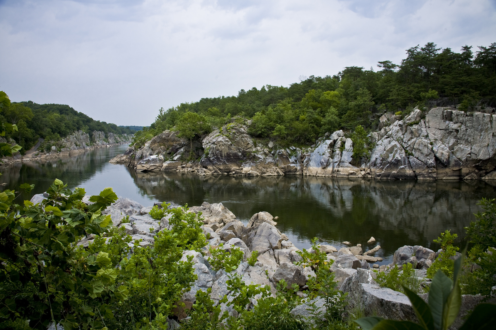
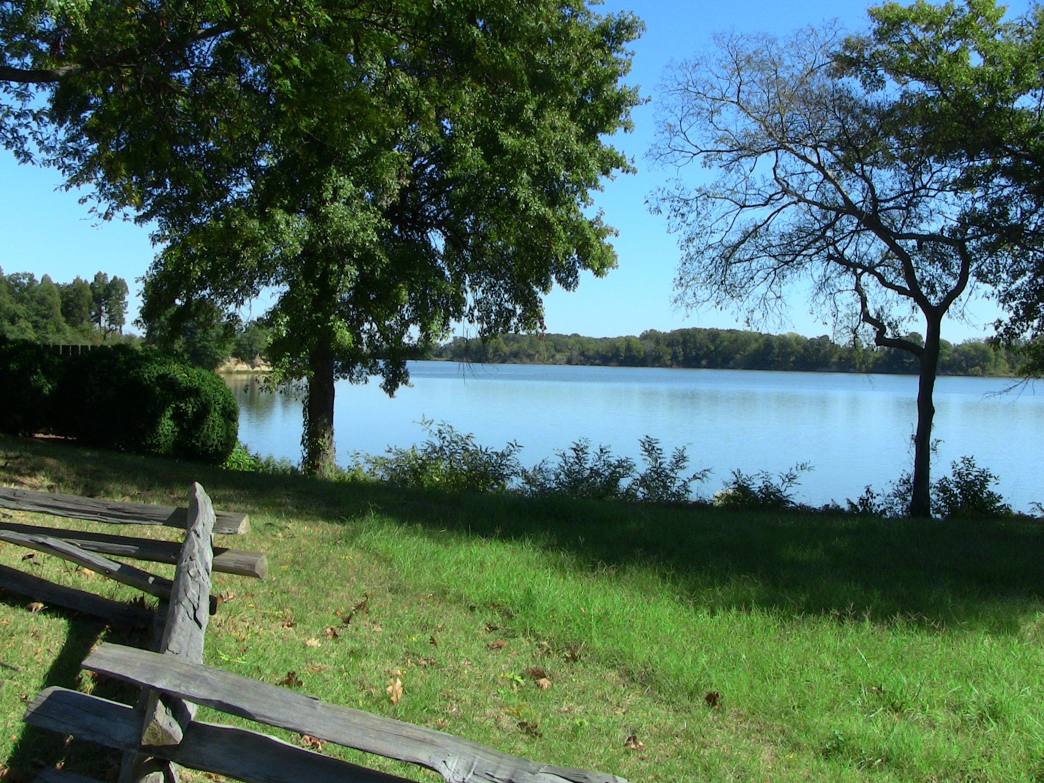
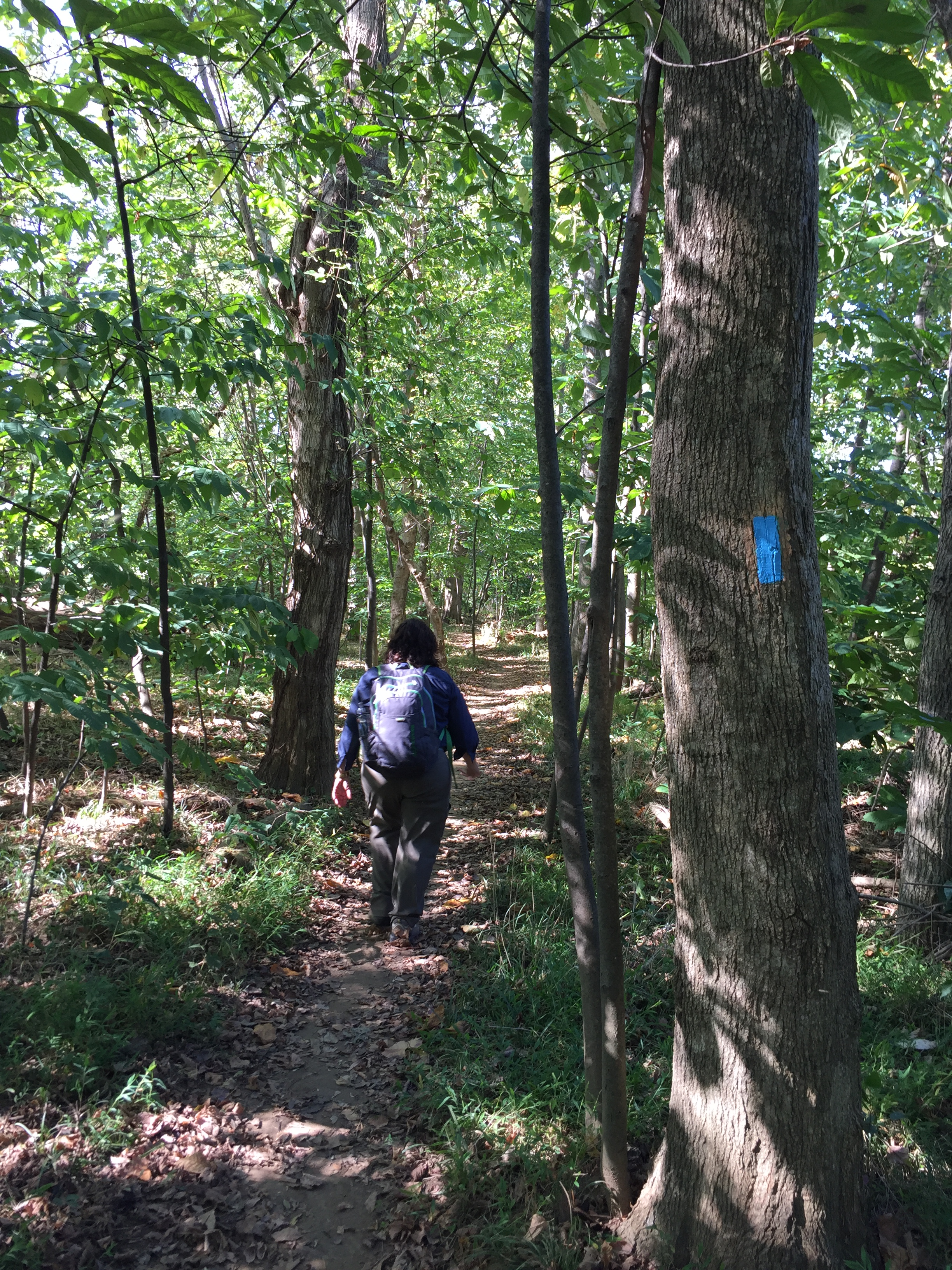
The Potomac River corridor is rich in both history and recreation, offering a chance to both explore your heritage and choose your adventure along the way. Start your journey here!
Monument erected by the 122nd New York Cavalry who served with the Union Army during the Battle of Fort Stevens.
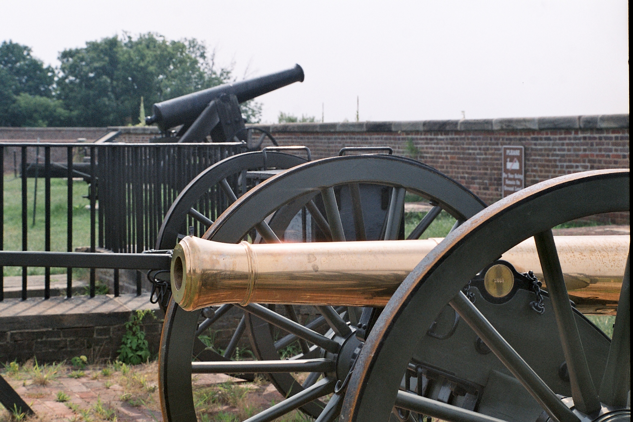
122nd New York Volunteer Cavalry Monument<br />(498 words)<br />Battleground National Cemetery is located in the Brightwood neighborhood of Washington, DC. The one-acre park is on the east side of Georgia avenue, NW between Whittier place to the north and Van Buren street to the south.<br />The Cemetery sits on a terrace approximately five feet above street level. A bluestone wall along the front edge is separated by two sets of three steps that lead up to a wrought-iron black gate at the Cemetery entrance. Set atop stone pillars on either side of the entrance are two six-foot long black cannons, one pointing north and one pointing south. On the face of the columns are black signs in the shape of a shield that both read in white: U.S. National Cemetery.<br />To the right from the front entrance is a two-story red stone building with brown shutters and a gabled roof. A porch extends out on the west side of the building.<br />Directly back and to the east seventy feet from the entrance is a central flagpole, surrounded by forty-one marble headstones. Behind them and the east end of the Cemetery stands a white marble pavilion with four granite pillars.<br />To the left from the entrance and set in a row across the lawn about six feet from the front edge of the cemetery are four granite monuments, each between six and eleven-feet tall. Facing the four monuments, second from the left is a ten-foot-tall white granite obelisk with pointed top and set on a rock-faced one-foot tall base. A leafed border rings the top of the monument. Just below at the top of the front face, a cross is inscribed and below is written:<br />To the gallant sons of Onondaga County, N.Y. who fought on this field July 12, 1864 in defense of Washington and the presence of Abraham Lincoln.<br />Below is a one-foot wide circular bronze plaque depicting two women in flowing robes. The woman on the left is resting her left hand on the side of a shield between them and holds a staff with her right hand with a hood cap set atop its point. The right woman is blindfolded. She raises a scale with her left hand and holds up a sword with her right. Atop the shield is an eagle with wings spread as it stands on a globe. The shield shows an image of the sun shining behind mountains. A sail ship floats by in water below. A smaller ship sits to the right. Below on a banner is inscribed: Excelsior.<br />Below on the front base is inscribed: 122 N.Y.Y.<br />The right side of the monument is inscribed to read:<br />Killed and Died of Wounds<br />Seven names are listed below.<br />The backside is inscribed along the top to read:<br />Served Three Years in the Sixth Army Corps<br />Below a three by two-foot bronze plaque is entitled, "Battles," listing 18 Civil War battles.<br />The left side of the monument is inscribed to read at the top: Wounded<br />Names are inscribed below.<br />END OF DESCRIPTION<br />
Spaced about 70 yards apart two massive cannons point out over the water. Each cannon is roughly 12 ft long and is mounted on a large metal base which raises it to about 15 ft high. The barrel of the cannon is 15 in in diameter. Both Canon and base are painted black. This rests on a half circle mounts made of stone and metal.
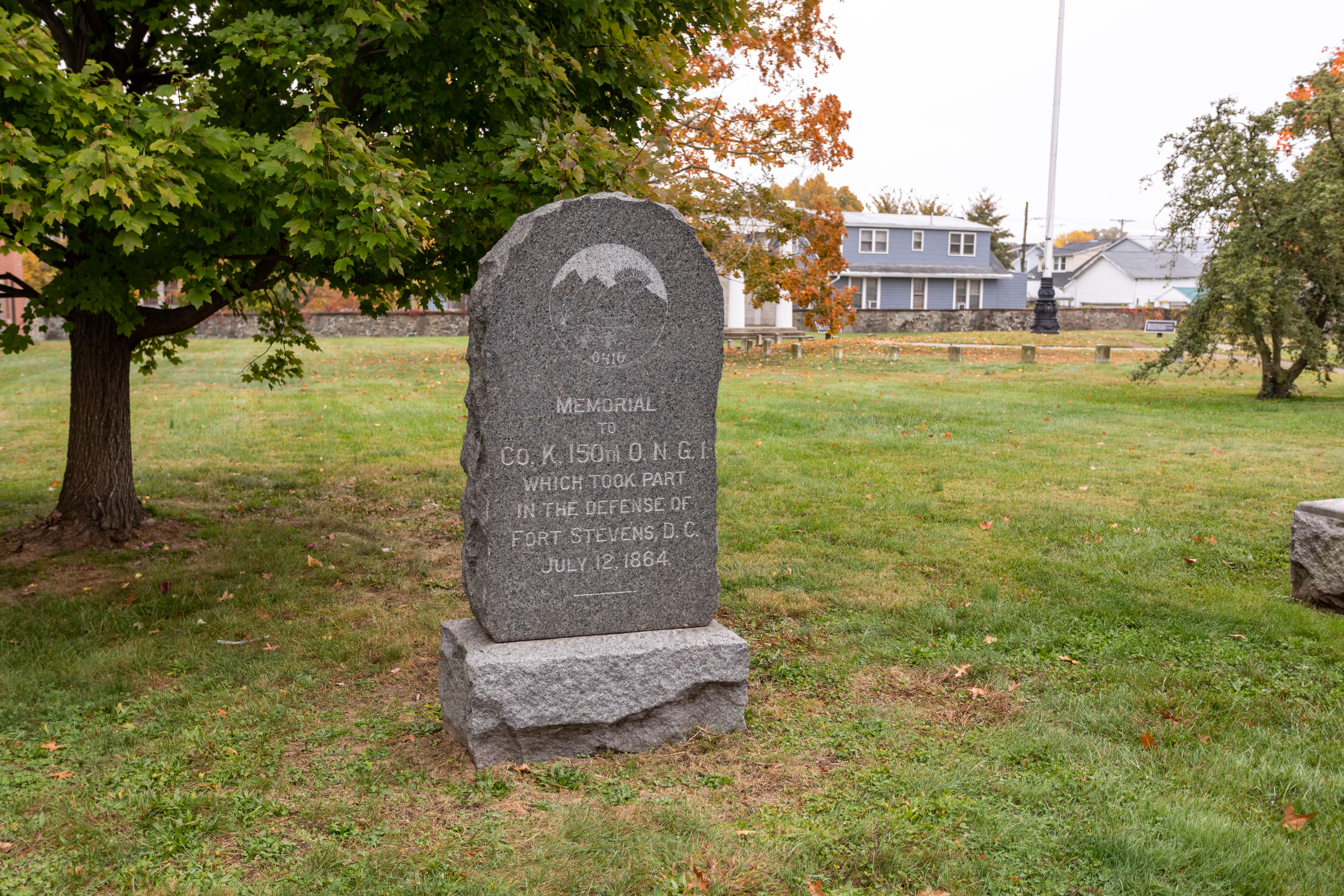
This monument erected by Co. K 150th Ohio National Guard who served in the Defenses of Washington during the Battle of Fort Stevens. The monument was dedicated in 1907.
(330 words) Battleground National Cemetery is located in the Brightwood neighborhood of Washington, DC. The one-acre park sits on the east side of Georgia avenue, NW between Whittier place to the north and Van Buren street to the south. The Cemetery sits on a terrace approximately five feet above street level. A bluestone wall along the front edge is separated by two sets of three steps that lead up to a wrought-iron black gate at the Cemetery entrance. Set atop stone pillars on either side of the entrance are two six-foot long black cannons, one pointing north and one pointing south. On the face of the columns are black signs in the shape of a shield that both read in white: U.S. National Cemetery. To the right from the front entrance is a two-story red stone building with brown shutters and a gabled roof. A porch extends out on the west side of the building. Directly back and to the east seventy feet from the entrance is a central flagpole, surrounded by forty-one marble headstones. Behind them and the east end of the Cemetery stands a white marble pavilion with four granite pillars. To the left from the entrance and set in a row across the lawn about six feet from the front edge of the cemetery are four granite monuments, each between six and eleven-feet tall. Facing the four monuments, furthest left is a six-foot tall gray granite grave marker with a rounded top. The front face is polished smooth. The back and sides have a rocky stone design, as does the one-foot tall base. A faded, circular design at the top of the face shows the sun shining through mountains. A round structure sits below, and three sets of bundled reeds line the left bottom of the circle. At the bottom is inscribed: Ohio Inscribed beneath on the front face reads: Memorial to Co. K, 150th O.N.G.I. Which Took Part in the Defense of Fort Stevens, D.C. July 12, 1864 END OF DESCRIPTION
Monument erected by the 25th New York Cavalry who served in the Defenses of Washington during the Battle of Fort Stevens. The monument was dedicated in 1914.<br />Inscriptions<br />Sacred to the Memory of our Comrades Who Gave Their Lives in Defense of the National Capitol<br />July 11, 1864<br />Erected by the State of New York in Honor of the 25th N.Y. Vol. Cav.<br />
(344 words)<br />Battleground National Cemetery is located in the Brightwood neighborhood of Washington, DC. The one-acre park is on the east side of Georgia avenue, NW between Whittier place to the north and Van Buren street to the south.<br />The Cemetery sits on a terrace approximately five feet above street level. A bluestone wall along the front edge is separated by two sets of three steps that lead up to a wrought-iron black gate at the Cemetery entrance. Set atop stone pillars on either side of the entrance are two six-foot long black cannons, one pointing north and one pointing south. On the face of the columns are black signs in the shape of a shield that both read in white: U.S. National Cemetery.<br />To the right from the front entrance is a two-story red stone building with brown shutters and a gabled roof. A porch extends out on the west side of the building.<br />Directly back and to the east seventy feet from the entrance is a central flagpole, surrounded by forty-one marble headstones. Behind them and the east end of the Cemetery stands a white marble pavilion with four granite pillars.<br />To the left from the entrance and set in a row across the lawn about six feet from the front edge of the cemetery are four granite monuments, each between six and eleven-feet tall. The closest of the four monuments is a nine-foot-tall white granite memorial. Atop a five-foot tall pedestal is a four-foot tall statue of a man with a mustache wearing a hat and double-breasted military jacket. A rifle and canteen hang on his back, and he holds sword at the ground with his right hand. His left hand holds the sheath of his sword.<br />An inscription on the front face of the pedestal reads:<br />Sacred to the Memory of our Comrades Who Gave Their Lives in Defense of the National Capitol<br />July 11, 1864<br />A one by two-foot bronze plaque at the pedestal base reads:<br />Erected by the State of New York in Honor of the 25th N.Y. Vol. Cav.<br />END OF DESCRIPTION<br />
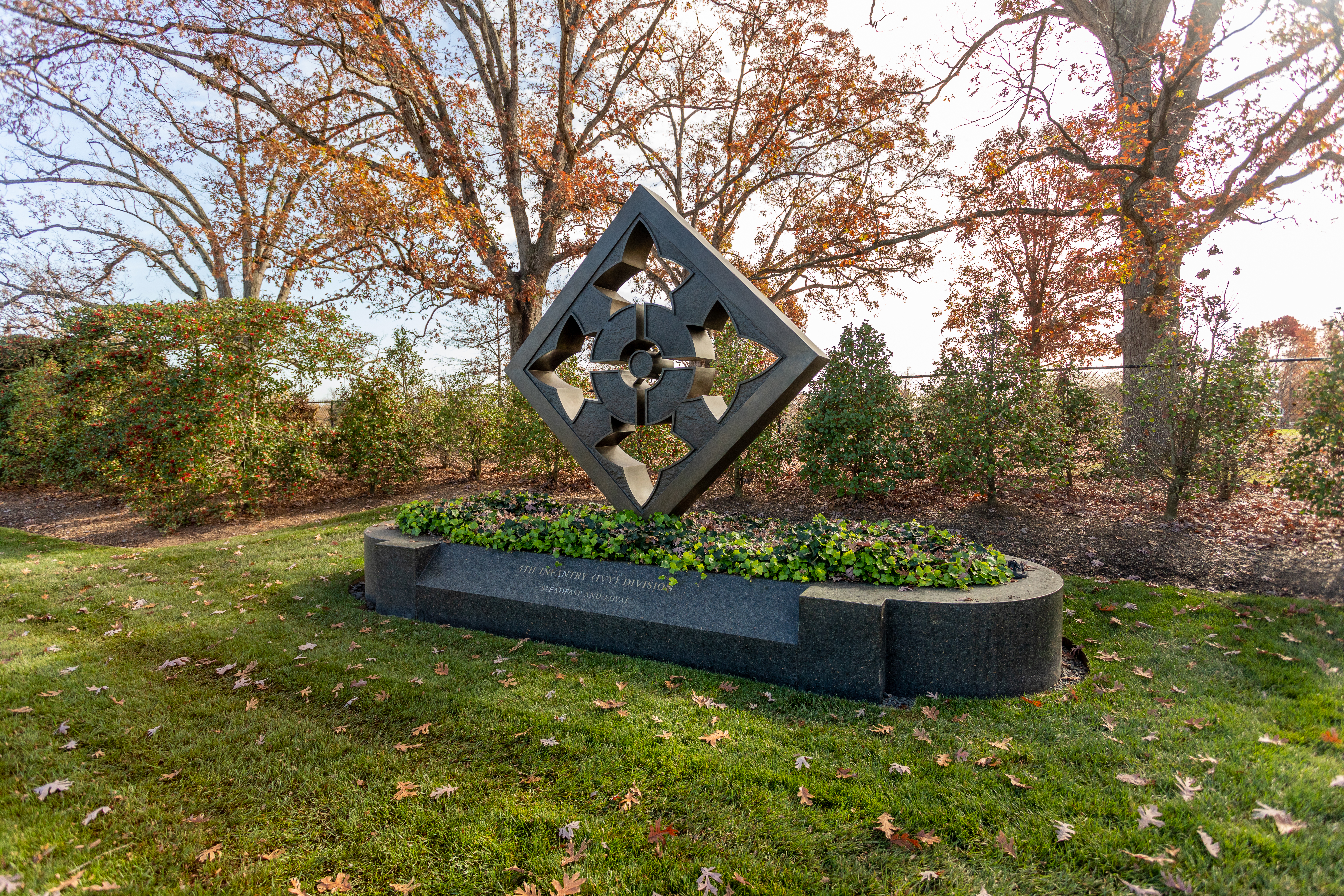
The 4th Division, commonly called the "Ivy Division" after its Roman numeral designation, was organized in December of 1917 to serve in the American Expeditionary Force in World War I. It was involved in the Battle of Mame, during which it fought for 28 consecutive days and sustaining almost 13,000 casualties.The Division was reactivated to serve in World War II. The 4th Infantry Division participated in the Normandy Invasion and campaigns in the Rhineland, Ardennes, and cent
(167 words)<br />The 4th Infantry Division Memorial is located on Memorial Avenue west of the Arlington Memorial Bridge at the entrance to Arlington National Cemetery in Arlington, Virginia.<br />From the west side of Memorial Circle travel west on Memorial Avenue about three hundred seventy yards. Set back about ten feet beyond the sidewalk on the south side of Memorial Avenue is the 4th Infantry Division Memorial.<br />The memorial consists of a six and one-half foot tall square bronze sculpture of a diamond with four ivy leave-shaped windows arranged in a cross pattern. The bronze sculpture rests on an oblong twenty-foot long marble base. The base is filled with ivy that hangs over its edge.<br />An inscription of the front of the base reads in gold:<br />4TH INFANTRY (IVY) DIVISION<br />STEADFAST AND LOYAL<br />A line of trees stand about ten feet behind the memorial. Ten-foot tall hedges about ten feet west and to the right of the memorial run the length of Memorial Avenue to the Arlington National Cemetery entrance.<br />END OF DESCRIPTION<br />
Monument erected by the 98th Pennsylvania Volunteer Infantry who served with the Union Army during the Battle of Fort Stevens. The monument was dedicated in 1891. InscriptionsfrontIn Memory of Our Comrades Killed and Wounded in Battle on This FieldJuly 11th & 12th 186498th Reg't. P.V.1st Brig. 2nd Div. 6th CorpssideKilled in BattleJuly 11th & 12th 1864Frederick Walter Co.Bernhard HoerleSergt. George MarquetCorpl. Henry PoelserMichael BrunerCharles SehausGeorge MerkleJoseph Sc
(401 words)<br />Battleground National Cemetery is located in the Brightwood neighborhood of Washington, DC. The one-acre park is on the east side of Georgia Avenue, NW between Whittier place to the north and Van Buren street to the south.<br />The Cemetery sits on a terrace approximately five feet above street level. A bluestone wall along the front edge is separated by two sets of three steps that lead up to a wrought-iron black gate at the Cemetery entrance. Set atop stone pillars on either side of the entrance are two six-foot long black cannons, one pointing north and one pointing south. On the face of the columns are black signs in the shape of a shield that both read in white: U.S. National Cemetery.<br />To the right from the front entrance is a two-story red stone building with brown shutters and a gabled roof. A porch extends out on the west side of the building.<br />Directly back and to the east seventy feet from the entrance is a central flagpole, surrounded by forty-one marble headstones. Behind them and the east end of the Cemetery stands a white marble pavilion with four granite pillars.<br />To the left from the entrance and set in a row across the lawn about six feet from the front edge of the cemetery are four granite monuments, each between six and eleven-feet tall. Facing the four monuments, second from the right is a nine-foot tall gray granite obelisk, about two feet wide on each side, with a rounded top that meets at a point. A cross is sculpted at the top of each of the four sides. Below on the front is inscribed:<br />In Memory of Our Comrades Killed and Wounded in Battle on This Field<br />July 11th & 12th 1864<br />Below is a one by two-foot bronze plaque of the Pennsylvania State Seal, showing two horses with their front hooves raised up along the sides of a crest featuring a ship in the middle and an eagle standing on top. A banner across the bottom of the plaque reads:<br />Virtue, Liberty and Independence<br />Inscribed along the monument base is written:<br />98th Reg't. P.V.<br />1st Brig. 2nd Div. 6th Corps<br />The three other sides of the monument all feature a cross at the top. One bears the inscription, "KILLED IN BATTLE" and the other two state, "WOUNDED IN BATTLE."<br />Names are inscribed below on each of the three sides.<br />END OF DESCRIPTION<br />
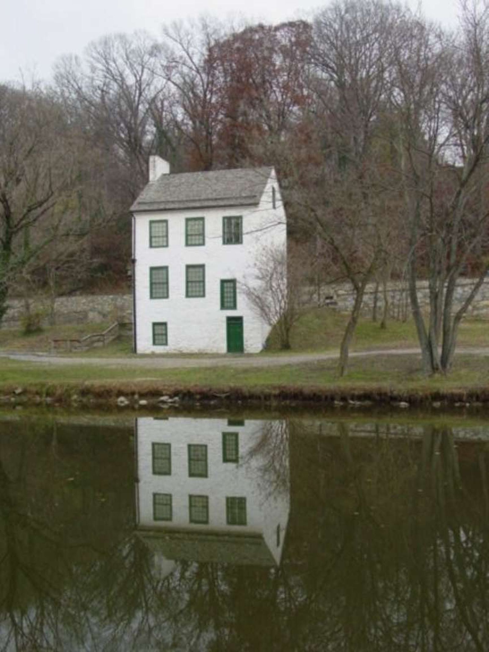
Abner Cloud had this house built in the year 1801. If you look up, on the chimney, you can see the initials "A.C." and the date 1801. Abner Cloud lived here with his family until he died in 1812. His widow lived another 40 years.
(646 words)<br />The Abner Cloud House is located on the C&O Canal in Washington, DC, east of Fletchers Boat House.<br />From the intersection of Canal and Reservoir Roads, NW travel north on Canal Road about one hundred fifty feet, then turn onto the far-left lane side road, to the left of a three-foot tall stone dividing wall. The three-story white Abner Cloud House will be on your left. <br />Follow the gravel path to the left around the corner of the house, where a parking lot runs along the house and about one hundred yards to the south.<br />The three-story white stone house has green painted doors and windows. At the building's west side from the parking lot, a door is on the bottom right and one window on the left. The second story features three windows, with the far-right window smaller and about two-feet lower. The third floor three windows are all the same size.<br />Two three-story trees sit on the right, south side of the building. To the left, north side gravel steps with a wood railing lead up to the side road that runs along the front of the house at an incline.<br />At the front side the road runs along the second-floor level of the building. Here a green door sits on the left side, with two windows to the right. Three windows line the top third floor. A chimney runs up the north side of the house. A small eight-foot tall tree stands to the left of the door.<br />Two small windows sit at the top on the north side of the house, and one small window on the top third level of the south side.<br />A brown metal sign hangs at the third-floor level on the house's east side. Written in white letters it reads:<br />Chesapeake & Ohio Canal National Historic Park<br />Abner Cloud House<br />Fletchers Boat House<br />Boats, Canoes, Bicycles<br />United States <br />Department of the Interior<br />National Park Service<br />On the south side of the house, left of the door, is a two by three-foot wayside. The black and white sign is titled in the top left corner: <br />Abner Cloud House<br />Text below describes the history of the Abner Cloud House:<br />This house witnessed the building of the C&O Canal. Abner Cloud, a miller who had come here from Pennsylvania, built the house in 1801. Cloud's mill was about 200 yards upstream. The basement of the house was used by Cloud to store grain and flour, and the family lived in the upper floors. Restoration was completed in 1976, with much assistance from the Colonial Dames of America, Chapter III. The top two floors are now their headquarters.<br />The full background of the sign is an active scene of a three-story white house sitting alongside a canal. A canal boat passes on the right, two people canoe from the left, and three more people float by on a boat at the canal's far end. Next to them on the path is a donkey-drawn carriage being followed by a dog. A man on a horse walks in front of them, amongst three women in dresses. Other women and girls in dresses with a dog watch from the close side of the canal. Text at the top center reads:<br />This painting of the C&O Canal depicts the Abner Cloud House as a bustling place of commerce and tourism during the mid to late 1800s.<br />In the upper right corner is an image of a man sitting at the front end of a long, thin canal boat floating from right to left. A second man is back in the far end of the boat. Text to the left of them reads: [LINK 3]<br />George Washington's Patowmack Canal, completed in 1802, provided Cloud access to Georgetown markets. Long, narrow boats, called sharpers, transported his flour, entering the Potomac River just upstream from here, near Little Falls.<br />END OF DESCRIPTION<br />
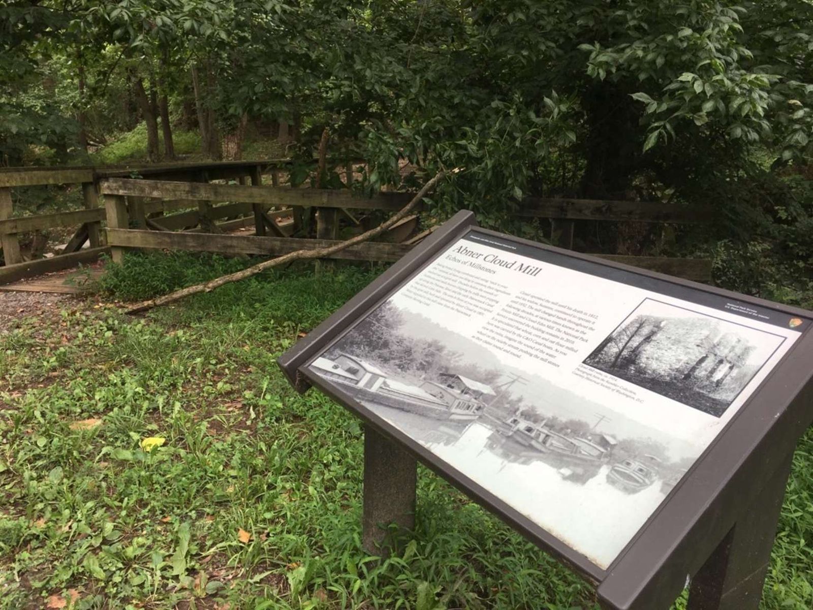
Abner Cloud used the basement of his house to store grain and flour that came from his mill.
(506 words)<br />The Abner Cloud Mill is located west of the Abner Cloud House on the C&O Canal in Washington, DC. <br />From the intersection of Canal and Reservoir Roads, NW travel north on Canal Road about one hundred fifty feet, then turn onto the far-left lane side road, to the left of a three-foot tall stone dividing wall. You will pass the three-story white Abner Cloud House on your left. <br />Continue straight over a ten-foot-long bridge and stone tunnel to your right. The gravel road will turn left and descend as you go into a tunnel after about two hundred feet. This portion of the road is poorly deteriorated. <br />Upon exiting the one-hundred-foot tunnel, you will reach an open gravel space about sixty feet long. To the right, in the northwest corner is a two by three-foot wayside. The white sign is titled in the top left corner and reads:<br />Abner Cloud Mill<br />Echos of Milestones<br />Text beneath describes activity that occurred at the mill:<br />Baking bread, frying cornbread and eating "stick to your ribs" oatmeal, all have one thing in common: their ingredients started out at a grist mill. Decades before the sounds of lockhorns and mule hooves clopping by, mills were popping up along the Potomac River and the early Patowmack Canal that skirted Little Falls. The area in front of you was occupied by the grist mill, built and operated by Abner Cloud in 1801. Water supplied to this mill came from the Patowmack Company Skirting Canal.<br />Cloud operated the mill until his death in 1812, and his widow, Suzanne, continued to operate it until 1852. The mill changed hands throughout the following decades, at various times known as the Frizzle Mill and Cloud-Edes Mill. The National Park Service uncovered the building remains in 2010. It is speculated that wheat, corn, and oat flour milled here was carried by the C&O Canal boats. As you view the ruins, imagine the sound of the water wheel on the nearby stream pushing the mill stones as they clatter round and round.<br />The sign features a black and white picture in the upper right corner of the ruins of a two-story stone building. Three sets of window or door openings are on the first floor and three window openings line the 2nd floor front. Two more openings are on the first and second floor levels on the side of the building, which stands amongst a dead tree and brush. Text below reads:<br />Cloud Mill ruins, ca. 1914.<br />Photograph from the Rambler Collection, <br />Courtesy Historical Society of Washington, DC.<br />The bottom half of the sign shows a black and white photograph of four canal boats sitting in line in still water on a canal. <br />Six feet to the left of the sign is a thirty-foot wooden bridge with handrails on both sides. The bridge carries over a rushing canal that feeds into the Potomac River. Stone blocks line the inner south wall of the canal and three steel beams span the stream on the north side of the bridge.<br />END OF DESCRIPTION<br />
The Accokeek Creek site was excavated in the 1930’s by Alice and Henry Ferguson who purchased land for their home in present-day Piscataway Park in the 1920’s. After excavating tens of thousands of artifacts, the Ferguson’s came to believe that they had rediscovered the site of “Moyaone,” the principal town of the Piscataway chiefdom visited by Captain John Smith in 1608.
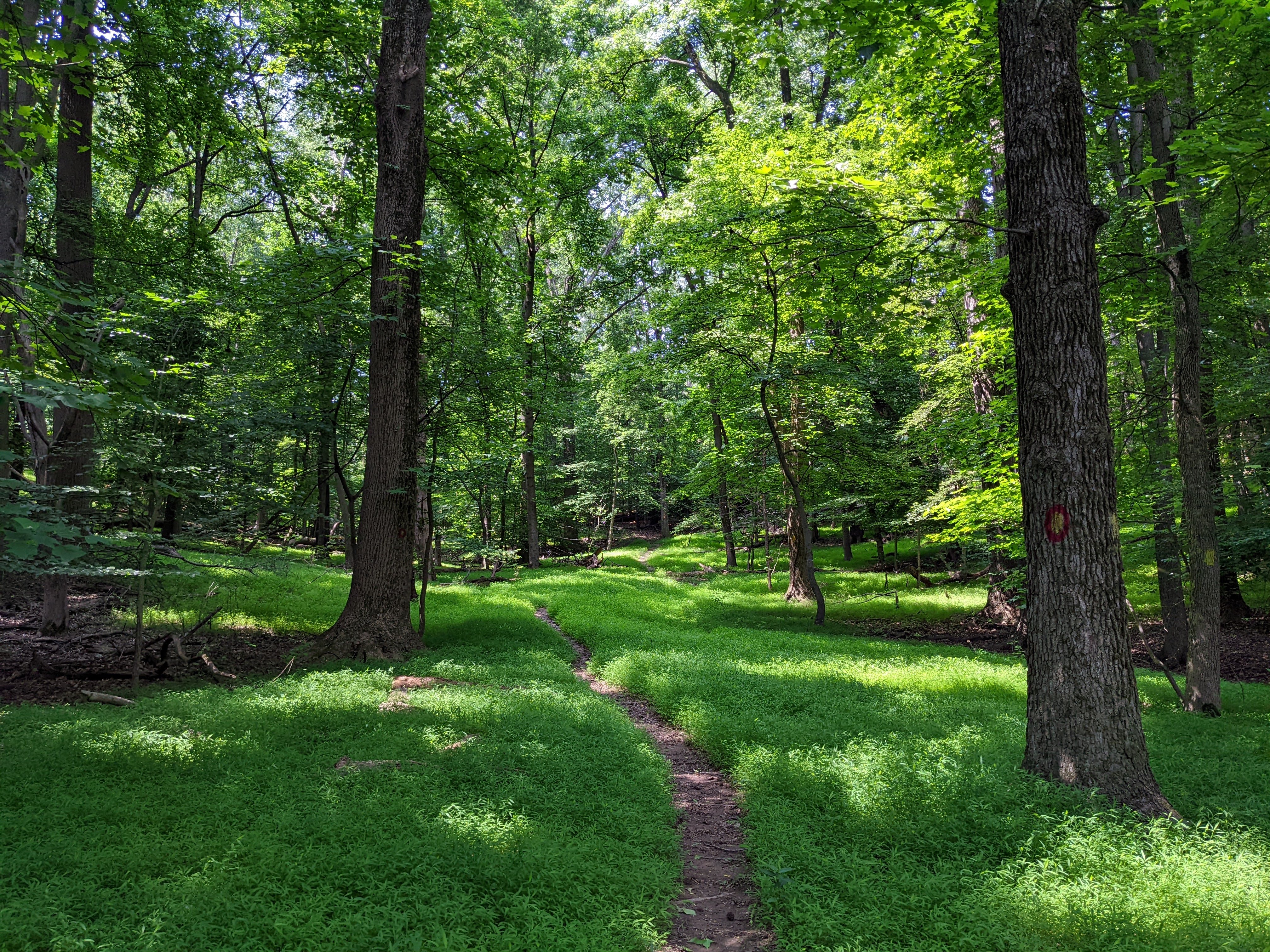
A trail through an open field surrounded by trees.
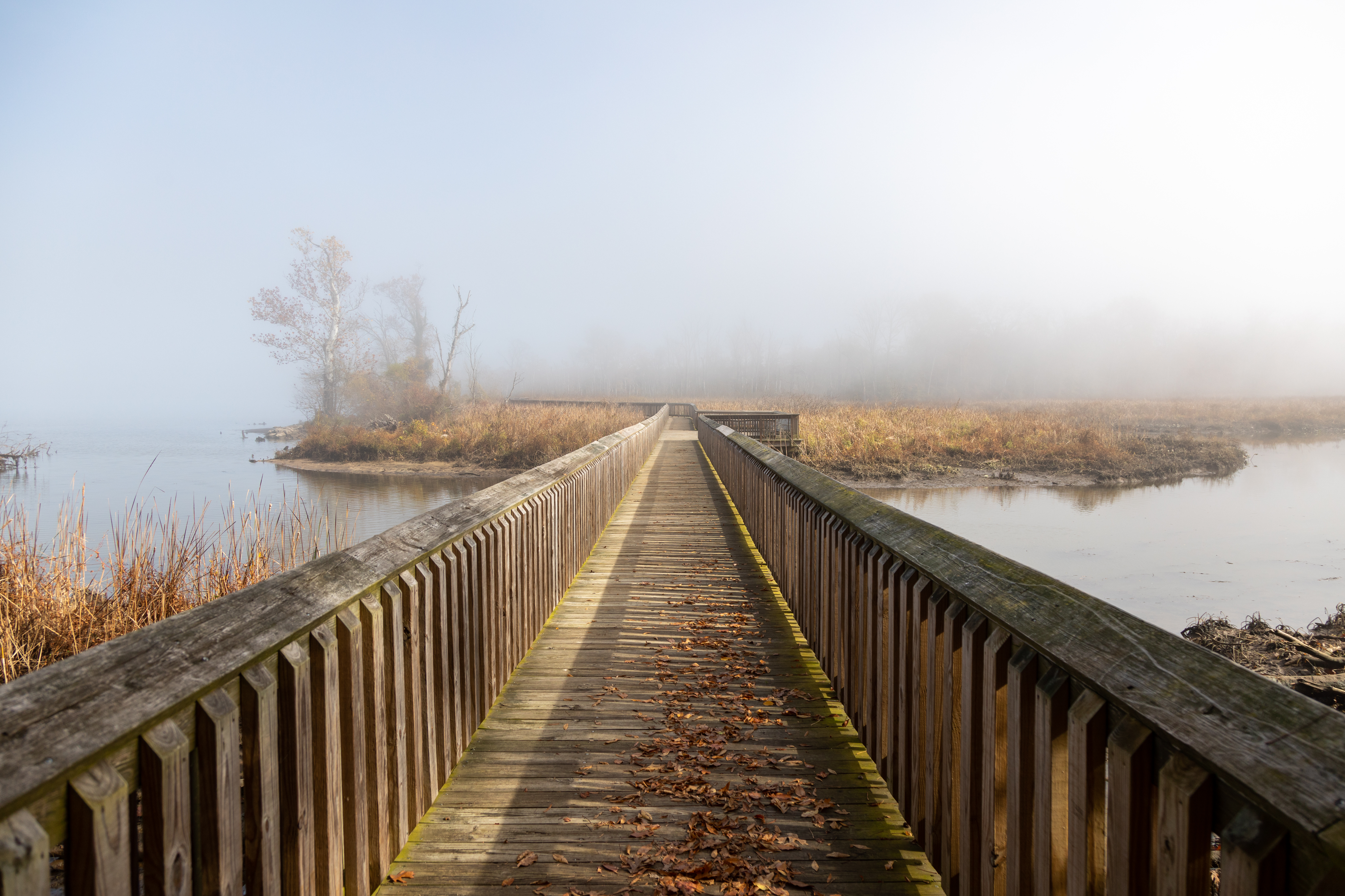
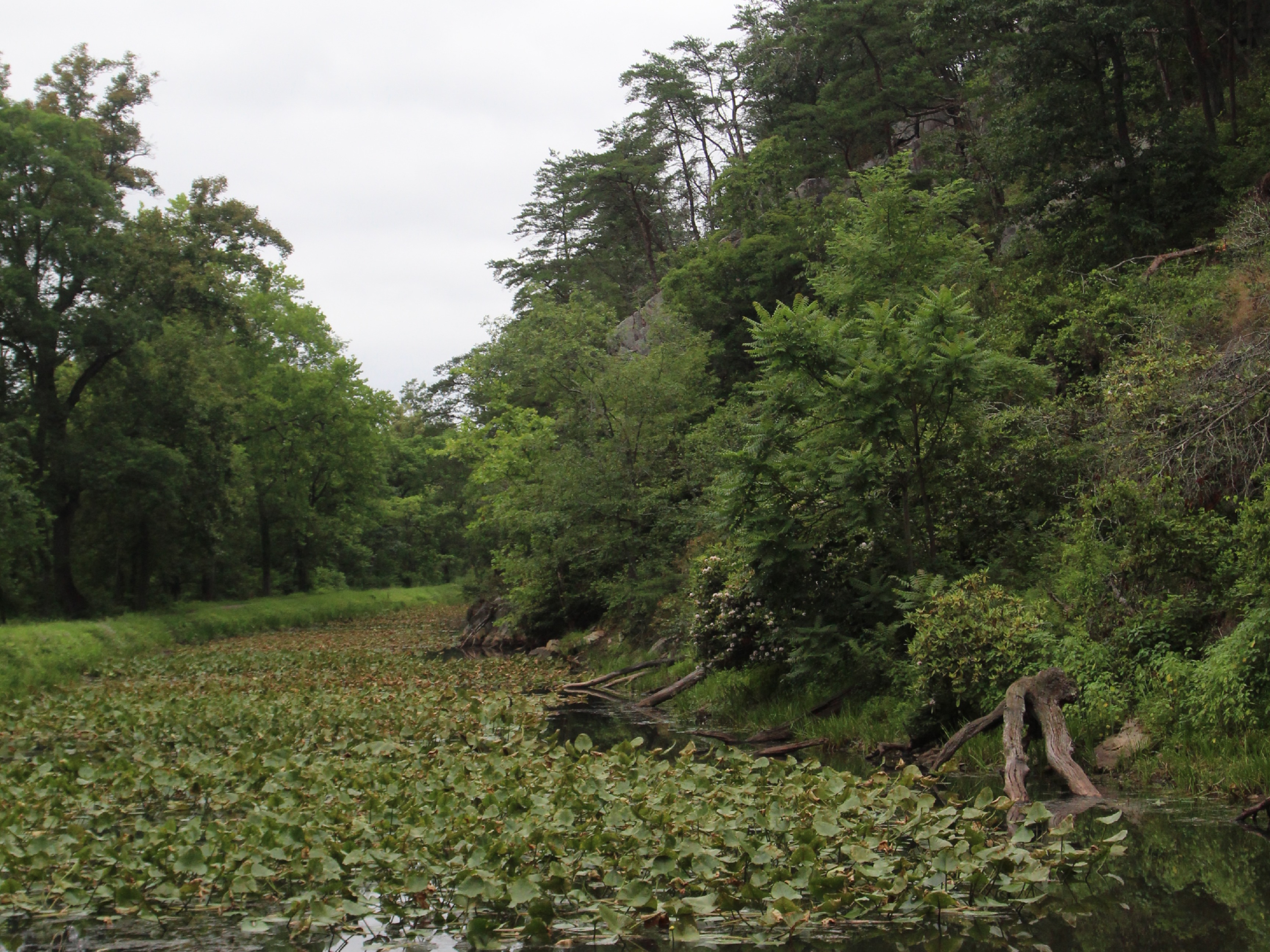
Standing at the trailhead for Accokeek Creek, a wooden boardwalk extends before you before gently curving left and being lost in the foliage. An observation deck ringed with benches overlooks the view to your right, where marsh grass grows in the creek’s delta. When the tide is out, there may be some of the turtles, snakes, and other critters who call the marsh home. To your left the, Accokeek Creek spills into the Potomac river. The park is a popular spot for birders, and on your walk you may find yourself sharing the marsh with ospreys, herons, and falcons as well as the smaller songbirds flitting in the branches. Across the river is the Virginia shore where cars zip along the George Washington Memorial Parkway – another national park site. George Washington’s Mount Vernon estate stands on the opposite shoreline.
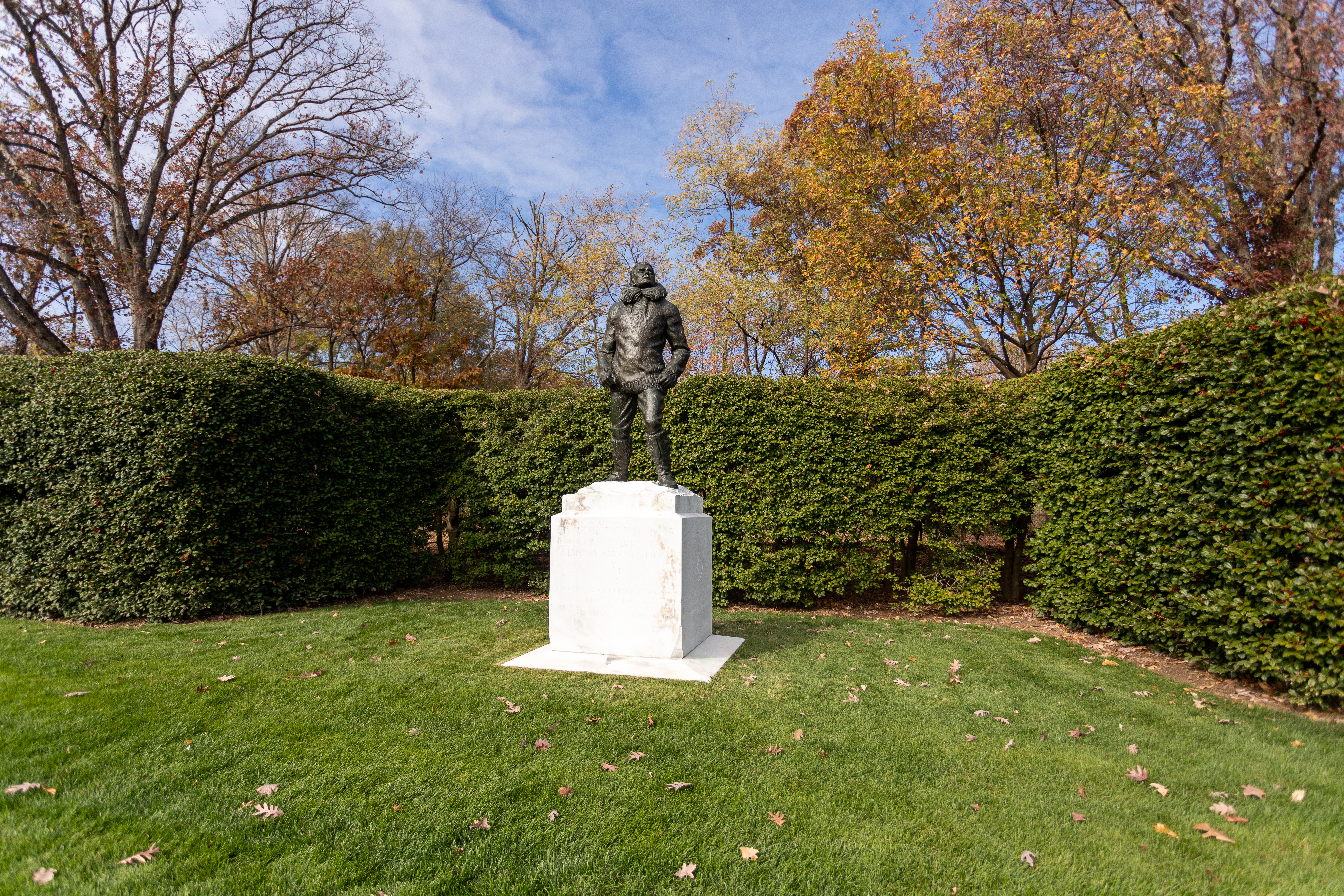
During his long career as a Naval officer, Rear Admiral Richard Evelyn Byrd, Jr. expanded the fields of navigation, aviation, and Arctic exploration. Byrd claimed to lead the first expedition to the North Pole and South Pole by air. Over his lifetime, he received numerous awards, including the Medal of Honor.InscriptionsBelow statueFelix W. de WeldonSc. 1961Base, frontRICHARD EVELYN BYRDREAR ADMIRAL UNITED STATES NAVYOCTOBER 25, 1888 - MARCH 11, 1957UPON THE BRIGHT GLOBE HE C
(300 words)<br />The Admiral Richard Evelyn Byrd statue is located on Memorial Avenue west of the Arlington Memorial Bridge, at the entrance to Arlington National Cemetery in Arlington, Virginia.<br />From the west side of Memorial Circle travel west on Memorial Avenue about five hundred yards. Set back about ten feet from the sidewalk on the north side of Memorial Avenue is the Admiral Richard Evelyn Byrd statue.<br />The eight-foot tall bronze statue is set back along a ten-foot-tall line of hedges that runs the length of Memorial Avenue towards the cemetery. Byrd stands on top of a four-foot tall white marble plinth. Byrd is dressed in fur with a high collar, long gloves and boots. His left foot stands forward, his fists are at his waist and his head is slightly cocked back.<br />An inscription on the right top side of the base reads:<br />Felix W. de Weldon<br />Sc. 1961<br />An inscription on the front of the base reads:<br />RICHARD EVELYN BYRD<br />REAR ADMIRAL UNITED STATES NAVY<br />OCTOBER 25, 1888 - MARCH 11, 1957<br />UPON THE BRIGHT GLOBE HE CARVED<br />HIS SIGNATURE OF COURAGE<br />ERECTED BY NATIONAL GEOGRAPHIC SOCIETY<br />An image of a shield with wings is inscribed in the center.<br />Inscribed on the left side of the base is a circular image labeled "South Pole" in the center. Around the circle is written:<br />ANTARTIC REGION<br />ARCTIC CIRCLE<br />Below is inscribed:<br />VALIANT LEADER OF<br />FIVE ANTARCTIC EXPEDITIONS 1928-1957<br />WHICH REVEALED THE SECRETS OF<br />HALF THE GREAT WHITE CONTINENT<br />The right side of the base features a circular image of the Earth. The "North Pole" is identified in the center, and an inscription along the top reads:<br />ARCTIC REGION<br />Below is inscribed:<br />FIRST TO FLY OVER THE NORTH POLE 1926<br />AND THE SOUTH POLE 1929<br />A PIONEER CONQUEROR OF THE ATLANTIC BY AIR 1927<br />END OF DESCRIPTION<br />
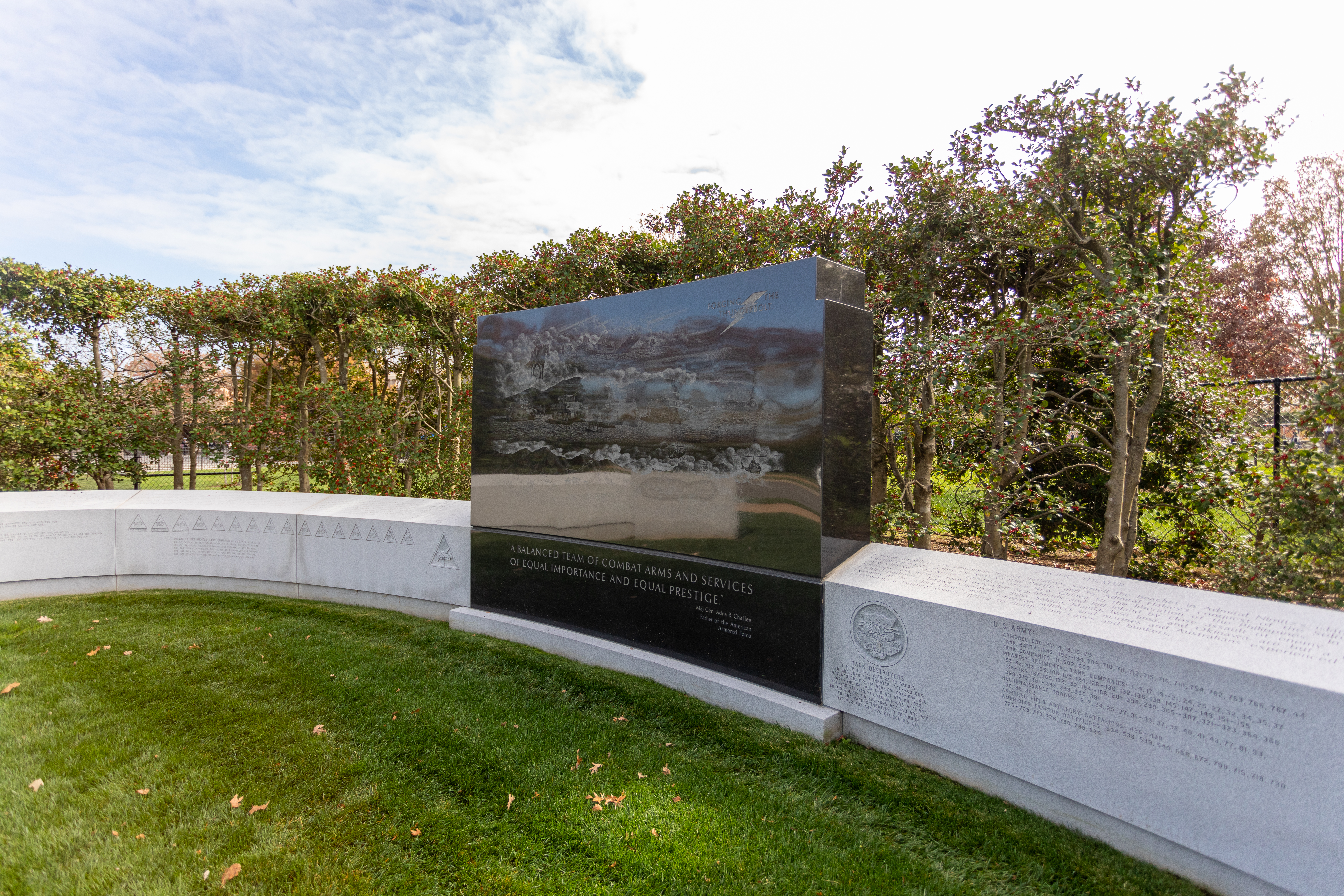
The U.S. has used tanks in conflicts since World War I. Armored forces included tanks, but also armored infantry, field artillery, engineers, tank destroyer units, and support units. The memorial was dedicated in 1991.<br /><br />Inscriptions<br />ARMORED FORCES<br />FORGING THE THUNDERBOLT<br />"A BALANCED TEAM OF COMBAT ARMS AND SERVICES<br />OF EQUAL IMPORTANCE AND EQUAL PRESTIGE."<br />Maj. Gen. Adna R. Chaffee<br />Father of the American<br />Armored Force<br />
(238 words)<br />American Armored Forces Memorial is located on Memorial Avenue west of the Arlington Memorial Bridge, at the entrance to Arlington National Cemetery in Arlington, Virginia.<br />From the west side of Memorial Circle travel west on Memorial Avenue about five hundred eighty yards. Set back about ten feet from the sidewalk and set among ten-foot tall hedges along the south side of Memorial Avenue is the Armored Forces Memorial.<br />The memorial consists of an open oval of white granite about thirty feet wide and three-feet tall on each side, inscribed with the insignia of various armored units. On the top of the wall are etchings of maps and descriptions of the campaigns from WWI, WWII, Mediterranean theater, European theater, Pacific theater, Korean War, Vietnam, and Desert Storm and regiments commissioned in the history of the Armored Service. <br />In the center is a seven-foot four-inch tall, five-foot-wide vertical slab of black granite. The highly polished black granite panel is etched with three military scenes of tanks moving across a mountainous landscape. In the clouds in the upper left is a man on horseback and in the upper right is a lightning bolt with the words: "FORGING THE THUNDERBOLT." An inscription below reads:<br />"A BALANCED TEAM OF COMBAT ARMS AND SERVICES<br />OF EQUAL IMPORTANCE AND EQUAL PRESTIGE."<br />Maj. Gen. Adna R. Chaffee<br />Father of the American<br />Armored Force<br />The front edges of the granite wall are both inscribed to read:<br />ARMORED FORCES<br />END OF DESCRIPTION<br />
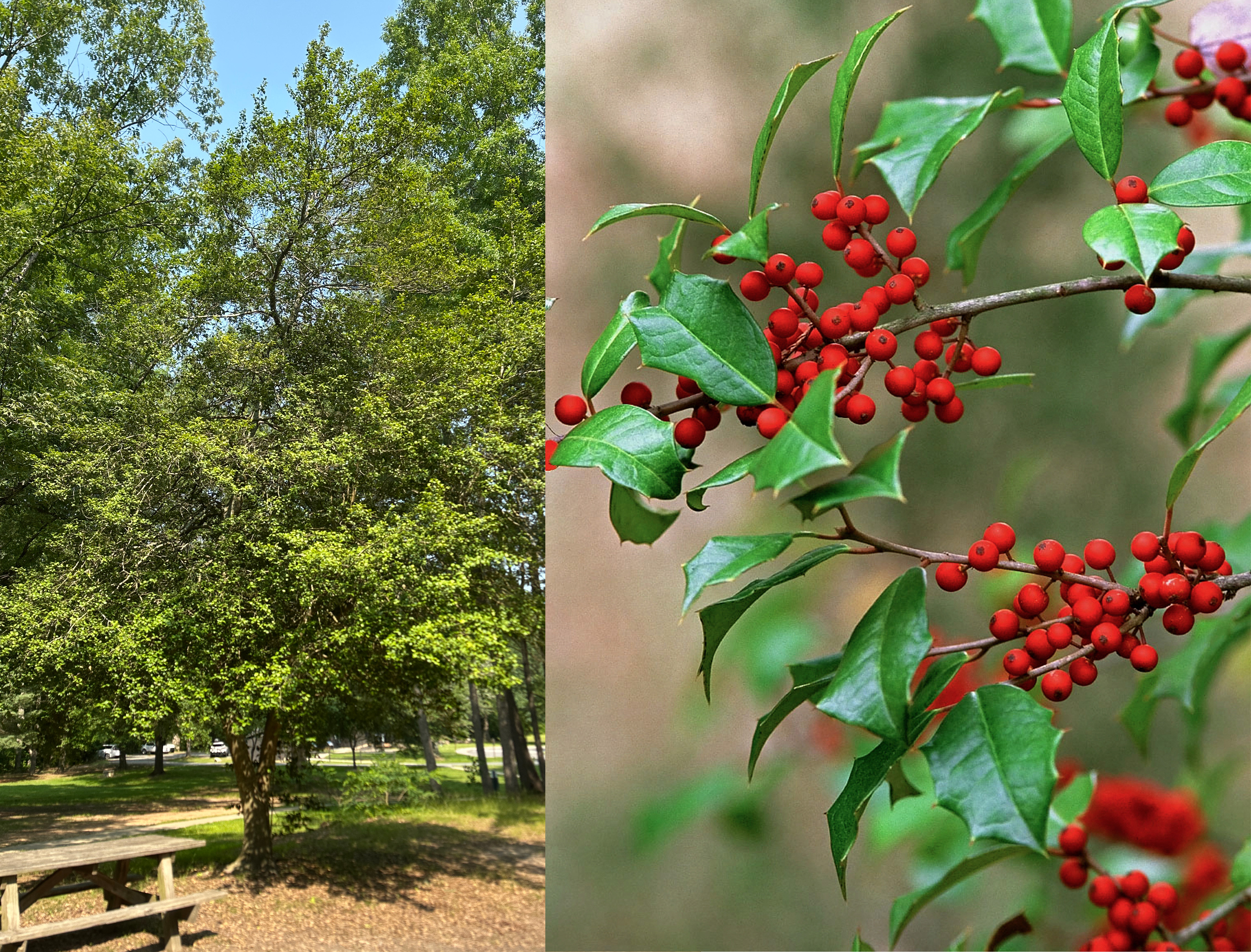
Learn about American Holly, an evergreen tree in the Pine Grove Picnic Area! American holly's glossy spiky leaves and beautiful red berries make it a very popular symbol during the Christmas season.
A small metal sign is placed about two feet from the tree. The sign plate is brown with white text on it. The sign identifies the tree as American Holly and provides a Latin name for it. The tree is a medium size tree, less than a two-story building in height, with a trunk that is split into two parts about a foot above ground level. Split trunks of the tree grow upward at a V-shaped angle. The trunks have smooth grayish-brown bark. The leaves and branches of the tree form an irregular oval-shaped crown. The tree is near a roofed wooden pavilion and several wooden picnic tables. The tree is surrounded by patches of grass and a few larger pine trees.
(193 words) Antietam Aqueduct is located along the towpath in Sharpsburg, Maryland. It is 140 feet long with a three-arch construction. The top of the aqueduct has a water way for canal boats and a towpath for mules. The waterway of the aqueduct is about 15 feet wide and its bottom is about four feet lower than the towpath. To get to the aqueduct start from the Antietam Creek Parking Lot. From the parking lot head towards the wooden pedestrian bridge that passes over a small creek to the towpath. The bridge is at the midway point of the western edge of the lot. The bridge has wooden railings on both sides. Walk across the bridge and turn left onto the towpath. Follow the towpath for three tenths of a mile to reach the aqueduct. Here the towpath narrows to about three feet. On your left is a drop of about five feet to the bottom of the canal waterway. There is no barrier between the towpath and the drop. On your right you can see the Antietam creek flowing into the Potomac River. There is a metal rail between the towpath and the river.
The Appalachian Forest National Heritage Area (AFNHA) works to conserve, enhance, interpret, and promote a regional network of forest heritage resources in the central Appalachian Highlands. Designated a National Heritage Area in 2019, AFNHA covers sixteen counties in West Virginia and two counties in western Maryland.
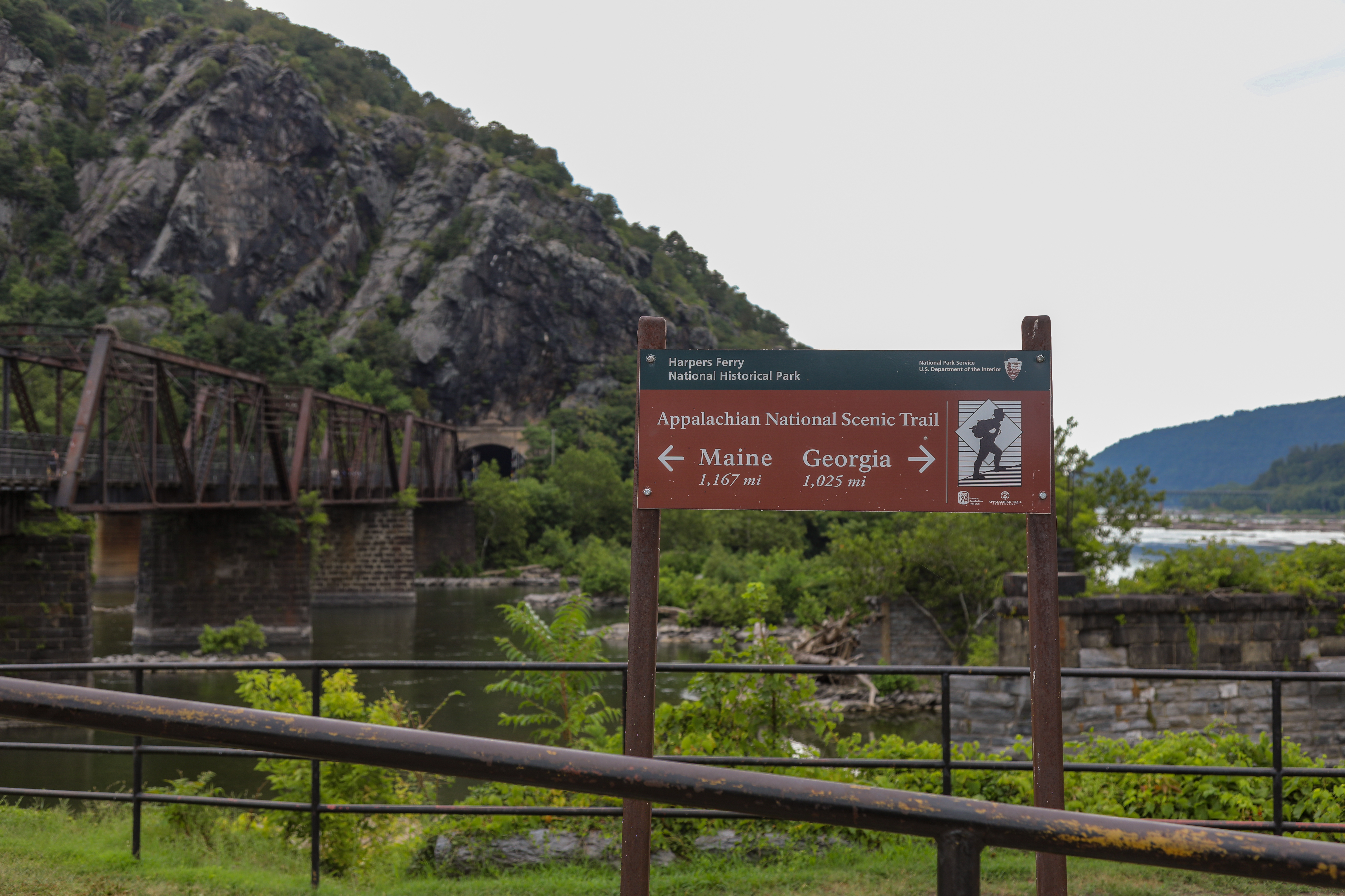
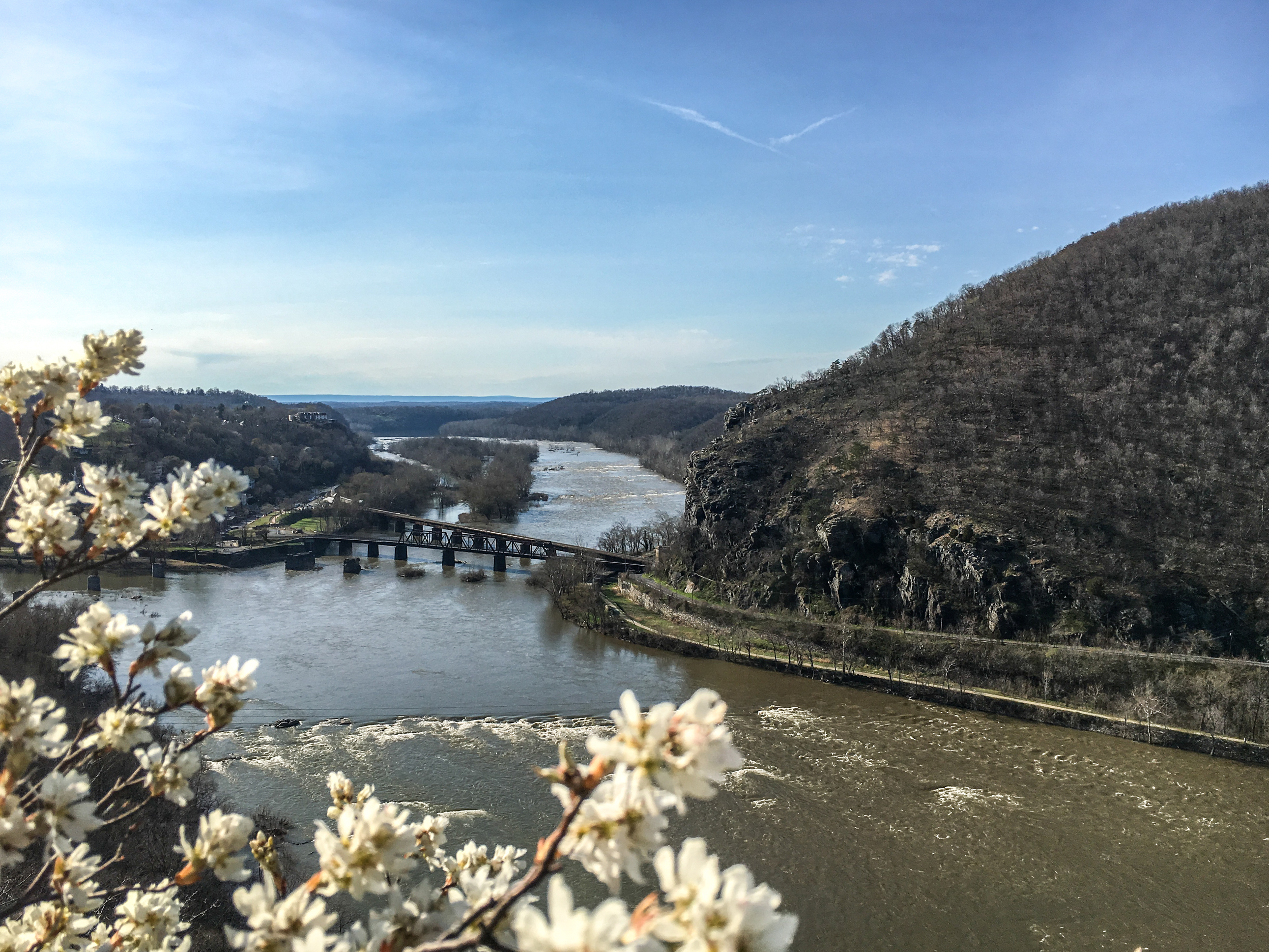
One of the most well-known hikes in the United States, this trail runs through Harpers Ferry and visitors can hike a portion of it! This sign at The Point can help direct guests and get them started on this famous trail.
Brown sign giving arrow directions toward Maine and Georgia for the Appalachian National Scenic Trail. In the background, a railroad bridge over a muddy river leading to a rocky cliff face dotted sparsely with trees.
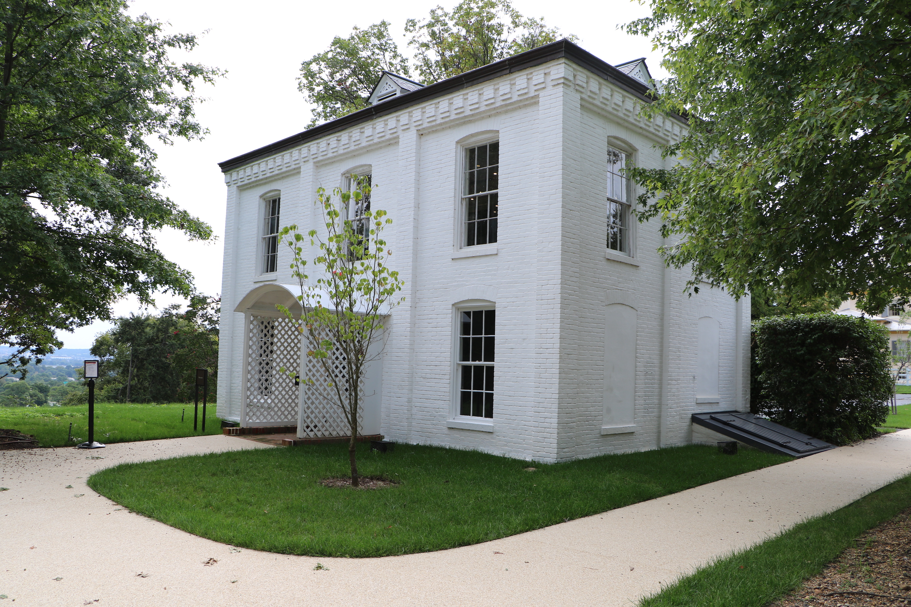
(93 words)<br />The Arlington House Museum is located in a white brick structure the size of a small two-story house at the far end of the kitchen garden.<br />Facing the rear of the mansion, follow the path to the left through the middle of the kitchen garden. The restrooms and gift shop are roughly 30 yards from the garden entrance. The museum is at the end of a short paved path to the right.<br />The exhibit spans about six hundred square feet and features various artifacts, exhibit pieces, a video, and information panels.<br />END OF DESCRIPTION<br />
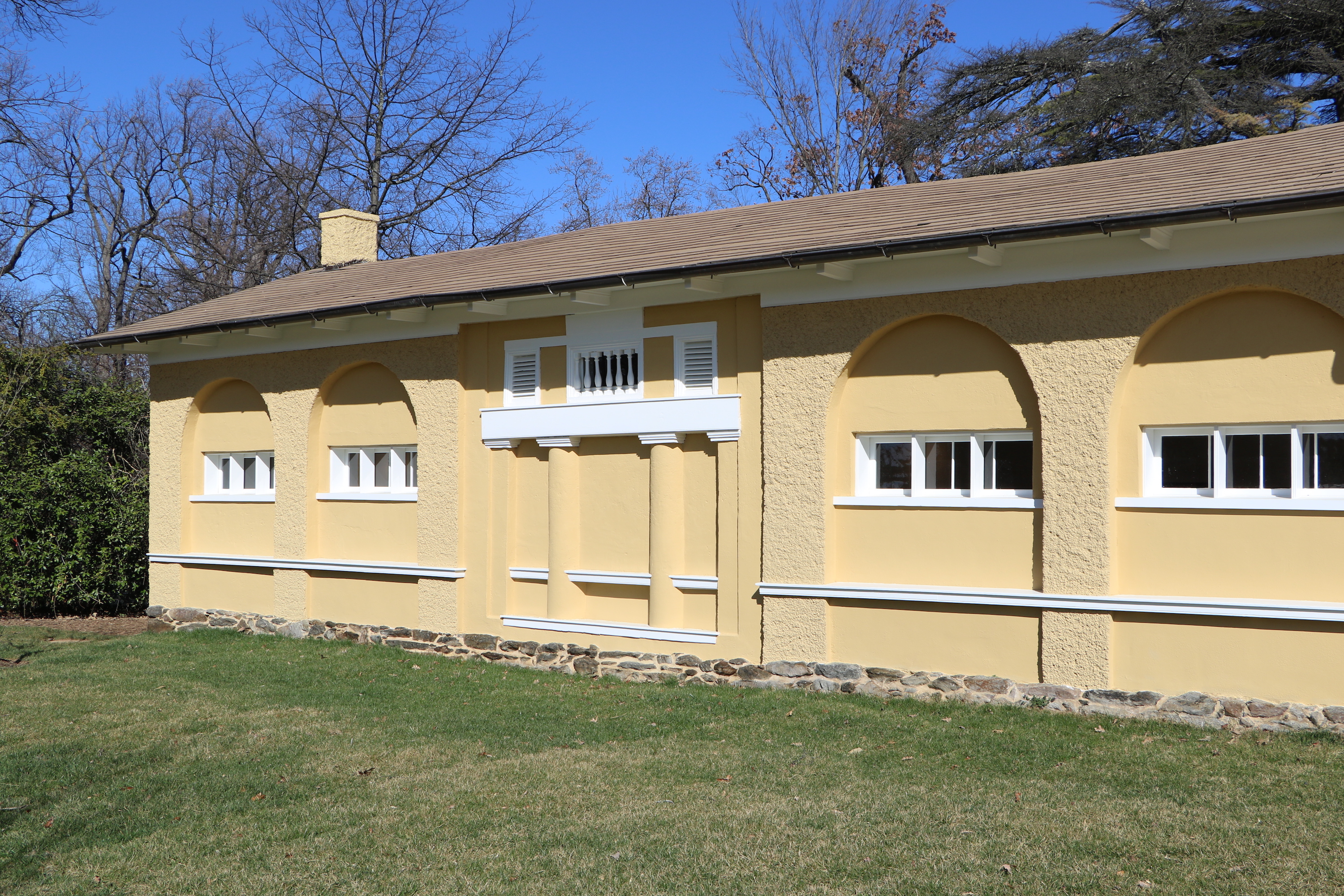
(182 words)<br />The Arlington House North Slave Quarters are located northwest of Arlington House, The Robert E. Lee Memorial in Arlington National Cemetery in Arlington, Virginia.<br />From the intersection of Schley Drive and Roosevelt Drive, follow Roosevelt Drive up the hill to the west about six hundred thirty feet. Turn right at Weeks Avenue and proceed north about four hundred-fifty feet. Turn right at Sheridan Drive and travel north one hundred ninety yards. Turn left and follow the path up Custis Walk two hundred forty-five yards to the Arlington House.<br />The Arlington House North Slave Quarters are set behind and to the right of the Arlington House. The yellow two-story building has a stucco surface, and angled roof line and a large arch set at its front end. Chimneys sit at the front and back center. Four windows are set on the first floor and five along the second on the right side of the building. An archway on the right side is set above four columns on the first floor. A stone foundation about three feet tall is visible along the front side.<br />END OF DESCRIPTION<br />
(190 words)<br />The Arlington House South Slave Quarters are located southwest of Arlington House, The Robert E. Lee Memorial in Arlington National Cemetery in Arlington, Virginia.<br />From the intersection of Schley Drive and Roosevelt Drive, follow Roosevelt Drive up the hill to the west about six hundred thirty feet. Turn right at Weeks Avenue and proceed north about four hundred-fifty feet. Turn right at Sheridan Drive and travel north one hundred ninety yards. Turn left and follow the path up Custis Walk two hundred forty-five yards to the Arlington House.<br />The Arlington House South Slave Quarters are set behind and to the left of the Arlington House. The yellow one-story building has a stucco surface, an angled roof line and a large arch set at its front end. Chimneys sit at the front and back center. Four windows are set on the left side of the building with an arch above them. A square alcove with four columns sits between the two sets of windows. A stone foundation about three feet tall is visible along the front side of the building. Faded frescos adorn each of the three doors above their lintels.<br />END OF DESCRIPTION<br />
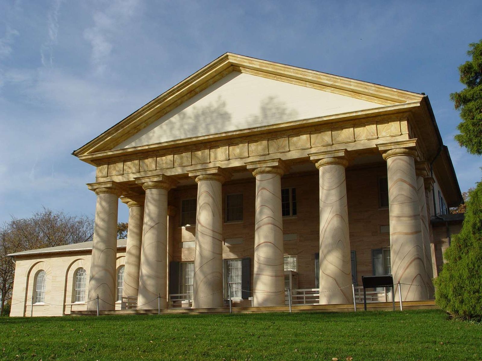
Arlington House is the nation's memorial to Robert E. Lee. It honors him for specific reasons, including his role in promoting peace and reunion after the Civil War. In a larger sense it exists as a place of study and contemplation of the meaning of some of the most difficult aspects of American History: military service; sacrifice; citizenship; duty; loyalty; slavery and freedom.<br /><br />Architect: George Hadfield
(198 words)<br />Arlington House, The Robert E. Lee Memorial is located at the northwest corner of Arlington National Cemetery, in Arlington, Virginia.<br />From the intersection of Schley Drive and Roosevelt Drive, follow Roosevelt Drive up the hill to the west about six hundred thirty feet. Turn right at Weeks Avenue and proceed north about four hundred-fifty feet. Turn right at Sheridan Drive and travel north one hundred ninety yards. Turn left and follow the path up Custis Walk two hundred forty-five yards to Arlington House.<br />The Arlington House is a two-story Greek revival building with six tall columns supporting a triangular roof. One-story wings on either side are each fronted with three arched windows.<br />A grass hillside slopes downward about one hundred yards from the front of the house. Several grave markers, large and small, surround the mansion at the edges of walkways..<br />Facing east from Arlington House provides a sweeping view of the Washington Monument, U.S. Capitol, the Potomac River and downtown Washington.<br />Arlington House Slave Quarters are set behind to the left and right of the Arlington House. The yellow one-story buildings have a stucco surface, an angled roof line and large arches set at their front ends.<br />END OF DESCRIPTION<br />
Designed as a memorial symbolizing reunification of the North and South after the Civil War, Arlington Memorial Bridge links the Lincoln Memorial in Washington, DC, and Arlington House, the Robert E. Lee Memorial, as well as Arlington National Cemetery, in Arlington, VA. The bridge was dedicated in 1932.<br /><br />Architects: McKim, Meade & White
(226 words)<br />Arlington Memorial Bridge links the Lincoln Memorial in Washington, D.C. on the east side of the Potomac River with Arlington House, the Robert E. Lee Memorial and Arlington National Cemetery to the west in Arlington, Virginia.<br /> <br />The steel and stone arch bridge spans two thousand feet. On the pylons of each pier of the bridge are large circular discs with eagles and fasces. Stone railings with balusters and sidewalks line both sides of the bridge.<br />At the northeastern end, the bridge runs into Lincoln Memorial Circle before connecting with Constitution Avenue, Independence Avenue, and Rock Creek Parkway. <br />At its southwestern terminus on Columbia Island, the bridge leads into Memorial Circle and its roadways connect with the George Washington Memorial Parkway, Route 27 and Route 110. Memorial Avenue continues southeast off the circle into Arlington National Cemetery. <br />Two nineteen-foot tall bronze equestrian statues flank the entrance to Arlington Memorial Bridge from Washington, D.C. at its east end. One is inscribed at the base of its pedestal to read "Sacrifice" and the other "Valor." Each statue faces east toward the Lincoln Memorial and is set atop an approximately twenty-foot tall granite base.<br />At the west end of the bridge two sculpted bald eagles stand atop forty-foot tall granite piers on either side. Carved oak leaf wreaths are engraved on the top face of each side of the piers.<br />END OF DESCRIPTION<br />
The golden "The Arts of War" statues standing at the end of Memorial Bridge were sculpted by Leo Friedlander. "Sacrifice" is depicted by a standing female representing the earth looking to the equestrian figure of Mars.<br />Inscriptions<br />SACRIFICE<br />LEO FRIEDLANDER SCULPTOR<br />CAST IN BRONZE FLORENCE 1950<br />A GIFT FROM THE PEOPLE OF ITALY<br />TO THE PEOPLE OF THE UNITED STATES<br />LEO FRIEDLANDR, Sc.<br />
(251 words)<br />Arts of War: Sacrifice is one of two equestrian statues that flank the entrance to Arlington Memorial Bridge from Washington, D.C. at its east end.<br />The Sacrifice statue sits on the north side of Arlington Memorial Bridge and faces east toward the Lincoln Memorial. It stands nineteen feet tall, sixteen feet long, eight feet wide and is set atop an approximately twenty-foot tall granite base. <br />A nude male figure sits atop the horse and a nude female figure stands on the right side of the rider. Her back is against the side of the horse and she looks back and up toward the rider. A small child is sandwiched between the back of the female figure's shoulders and the proper right leg of the rider. The rider reaches out to the child. The female figure reaches up with her right hand to hold the right arm of the child. A bit of drapery is wrapped around the back of the child and down over the left leg of the female figure.<br />The granite base is adorned with a row of 36 stars around its top edge, including five stars along the front side. An engraving of a wreath sits below the five stars.<br />An inscription at the front bottom of the base reads:<br />SACRIFICE<br />LEO FRIEDLANDER SCULPTOR<br />CAST IN BRONZE FLORENCE 1950<br />A GIFT FROM THE PEOPLE OF ITALY<br />TO THE PEOPLE OF THE UNITED STATES<br />An inscription at the right back edge of the sculpture base reads:<br />LEO FRIEDLANDR, Sc.<br />END OF DESCRIPTION<br />
The golden "The Arts of War" statues standing at the end of Memorial Bridge were sculpted by Leo Friedlander. "Valor" is represented by a male equestrian figure accompanied by a female holding a shield.<br />Inscriptions<br />VALOR<br />LEO FRIEDLANDER SCULPTOR<br />CAST IN BRONZE MILAN 1950<br />A GIFT FROM THE PEOPLE OF ITALY<br />TO THE PEOPLE OF THE UNITED STATES<br />LEO FRIEDLANDR, Sc.<br />
(194 words)<br />Arts of War: Valor is one of two equestrian statues that flank the entrance to Arlington Memorial Bridge from Washington, D.C. at its east end.<br />The Valor statue is set on the south side of Arlington Memorial Bridge and faces east toward the Lincoln Memorial. It stands nineteen feet tall, sixteen feet long, eight feet wide and is set atop an approximately twenty-foot tall granite base. <br />A nude male figure sits atop the horse and a nude female figure stands to the left of the rider. A shield is attached to her left arm which swings back behind her. Her right arm is raised up toward the rider. A cape is draped behind her. <br />The granite base is adorned with a row of 36 stars around its top edge, including five stars along the front side. A carving of a wreath sits below the five stars.<br />An inscription at the front bottom of the base reads:<br />VALOR<br />LEO FRIEDLANDER SCULPTOR<br />CAST IN BRONZE MILAN 1950<br />A GIFT FROM THE PEOPLE OF ITALY<br />TO THE PEOPLE OF THE UNITED STATES<br />An inscription at the right back edge of the sculpture base reads:<br />LEO FRIEDLANDR, Sc.<br />END OF DESCRIPTION<br />
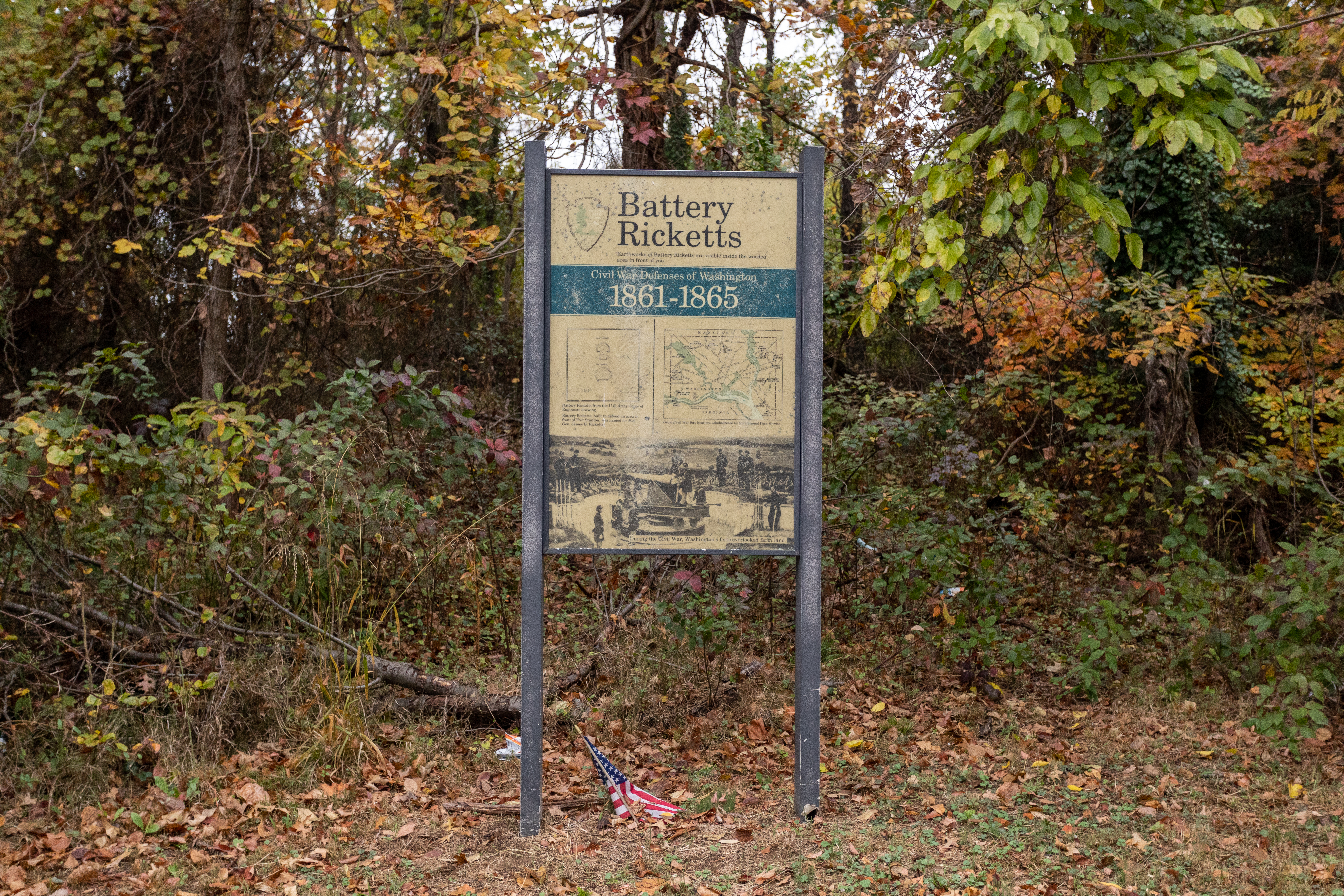
Battery Ricketts was constructed to protect the Maryland or eastern end of the two bridges crossing the Anacostia (at the Navy Yard and two and a half miles upstream at Benning's Bridge) and to occupy the heights above the Navy Yard and Washington Arsenal.
A sign in front of a forest. The sign reads "Battery Ricketts 1861-1865" and has a old black and white photography of people in a park
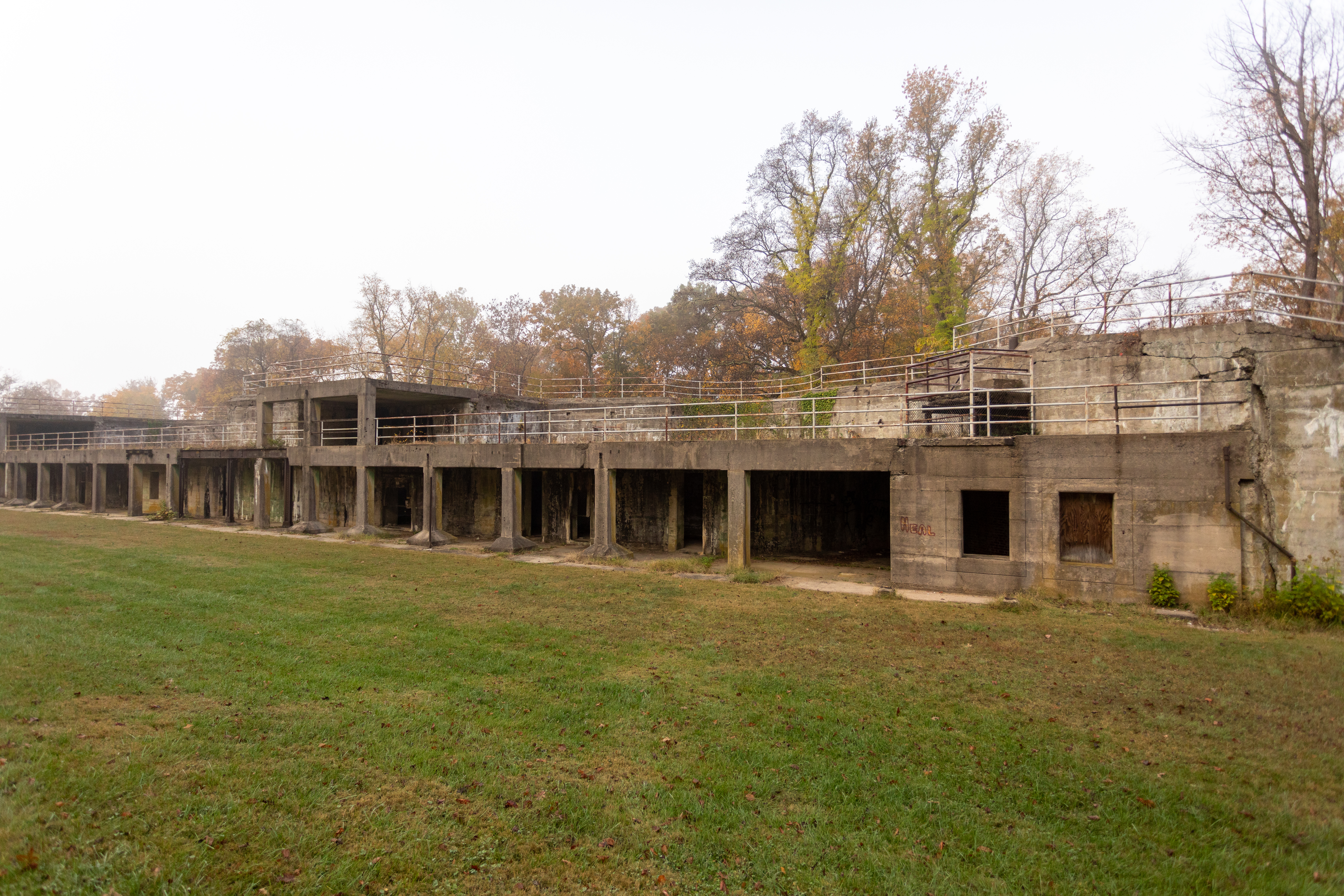
A chain link fence surrounds the battery, brush and weeds have grown up around the fence. The two-story concrete structure is about 200 feet long and in disrepair. The north and south ends slope towards the ground with dirt covering them. The concrete is cracked and falling in places along the upper platform. The ground level has 14 square openings that are created by the concrete supports for the upper level. There are two square columns that stand outside of the main structure with two sets of iron steps behind them that lead from the ground level to the upper level. Under the upper platform are several doorways into the structure where the storage rooms and additional stairs are. The upper level is the gun level. Directly behind the columns is where the gun platforms are. The wall in front of the guns are curved to allow motion of the gun. To the left of the gun platforms are a additional structures which are square and supported with 4 concrete columns across the front. A handrail crosses the battery on the upper level.
The two-level concrete structure is about 175 feet long. It is in the woods and has been overtaken by trees and weeds. The battery is in disrepair. The space behind the battery has trees in the pathway, and in the slopes next to the battery. There are concrete steps from the ground level to the first level. There are concrete supports that hold up the upper level, that forms openings across the battery. The ground level has various storage areas and concrete steps that lead to the upper level. The gun platforms are on the upper level, in front of them the concrete is curved to allow motion of the cannon. To the left of the gun platforms are square buildings with four concrete supports. The top of the battery is overgrown with weeds. The upper level has weeds growing through the concrete.
This two-level concrete structure is about 175 feet long. The upper level has a safety handrail across the length of it. The ends of the battery are sloped with the and covered with dirt. There are 16 concrete supports that hold up the second level platform. There are storage rooms and concrete stairs to the second level across the length of the battery, a few areas have been closed off with chain link fencing. The upper level of the battery has two rounded areas that would have been the gun platforms. To the left of the platforms is additional structures which are square and have three concrete supports. Across the top of Battery Humphreys is another safety hand rail. About 6 foot tall concrete wall that works as a retaining wall.
Battery Kemble held two 100-pounder Parrott rifles, placed in such a way as to sweep Chain Bridge and Virginia beyond. Battery Kemble was named after Gouveneur Kemble of Cold Springs, New York, former superintendent of West Point Foundry.
A large boulder sits near tree-covered earthen mounds. A plaque on the rock reads "Battery Kemble. One of the Civil War defenses of Washington constructed in 1862, Battery Kemble's two 100-pounder Parrott rifles guarded Chain Bridge along the Potomac River. United States Department of the Interior. National Park Service."
A one level concrete structure is the largest on site, about 250 feet long. The battery is designed with three large concrete structures and two open spaces. The open spaces are closed by chain link fence with brown privacy slates. The north end has an addition area protruding from the main wall. It looks like the short leg of an "L". This addition has a small room with a door and window opening. Along the main wall are doors leading to storage areas. The doors are either extra wide or regular size doors. Going across from north to south, wide door, regular door, chain link fence about 30 feet, two wide doors, regular door, chain link fence about 30 feet, wide door, door, window, door, window. The majority of the doorways are closed for safety. The top of the battery is covered with weeds or trees. A few small trees have begun to grow within the open spaces. These areas are used for storage by the Park Service.
Fort Ricketts was constructed during the Civil War to protect the Maryland or eastern end of the two bridges crossing the Anacostia (at the Navy Yard and two and a half miles upstream at Benning's Bridge) and to occupy the heights above the Navy Yard and Washington Arsenal.
(344 words)<br />Battery Ricketts is located in southeast Washington, D.C. at the intersection of Bruce place SE and Erie street SE.<br />Travel north along the west side of Bruce place about one hundred fifty feet from the intersection with Erie street. There is no sidewalk on this side of the street. <br />Set about twenty feet back from the road on a strip of grass along the edge of thick forest and overgrowth is a four by three-foot yellow sign.<br />The sign is titled across the top in brown letters to read:<br />Battery Ricketts<br />Earthworks of Battery Ricketts are visible inside the wooded area in front of you.<br />Across a blue border is written in white letters:<br />Civil War Defenses of Washington<br />1861-1865<br />Below on the left is a diagram of a fort, showing an arching top border and straight back end. Above the diagram is labeled: "Rickett Battery." Below, a diagram of the circular boundaries of a fort is titled: "Fort Wagner." Text below reads:<br />Battery Ricketts from the U.S. Army Corps of Engineers drawing.<br />Battery Ricketts, built to defend an area in front of Fort Stanton, was named for Maj. Gen. James B. Ricketts.<br />To the right is a map of Washington and the edge of Virginia at the bottom. The map indicates Civil War fort locations along this section of Washington. They are, from left to right Fort Marcy, Battery Kemble, Fort Bayard, Fort Reno, Fort De Russy, Fort Stevenson, Fort Slocum, Fort Totten, Fort Bunker Hill, Fort Mahan, Fort Chaplin, Fort Dupont, Fort Davis, Fort Stanton, Battery Rickets, Fort Carrol, and Fort Greble.<br />Text below reads: "Other Civil War fort locations administered by the National Park Service.<br />The bottom third of the sign shows a black and white photograph of Civil War soldiers standing in a fort around an eight-foot long cannon on a rotating platform, aimed to the left. The fort sits atop a tall hill with a vast view in the background of open spaces and rolling hills.<br />The caption below reads: <br />During the Civil War, Washington's forts overlooked the land.<br />END OF DESCRIPTION <br />
This two level concrete structure is about 125 feet long. The lower level is at ground level. There are two ramps and one set of steps that lead up to the upper level. Between the ramps and steps are grass covered slopes. There are bridges over the ramps that lead to concrete steps that go to the top of the battery. A second set of steps lead up to the gun platforms. The front of the gun platforms have a curved wall. The battery and surrounding area has high weeds. There is a tree line in front of the battery and grass field behind it.
The two level concrete structure is about 120 feet long. Behind the battery are two small hills with an opening between them that allows access to the battery. This makes it look like the battery is below ground level. The lower level has three ramps and two sets of concrete steps. Between the ramps and steps are grass covered slopes. The ramps lead into storage rooms and the step to the second level. In front of the steps are the areas for the gun platforms. A second set of steps lead up to the platform area. There are bridges that cover the ramp openings that allow travel across the battery. The two bridges on the ends lead to steps that go to the top of the battery. The concrete is cracked and has weeds growing on the battery in areas.
This two level concrete structure is about 175 feet long. The ends are sloped and act as a retaining wall. The battery is in an area that is rarely mowed therefore there are high weeds surrounding it. In front is a line of trees. The north end of the battery has rusted steel steps attached to the side wall the hand rail is broken at the top and crosses the stairs. Across the front are window opening and doors, pattern is window, two doors, window, two doors, double wide door, this pattern continues in the reverse across the rest of the battery. In the center is an outcropping made of steel I-beams supporting an upper platform. A safety hand rail goes around the platform. The left side of the upper level also has a safety rail. The upper level has two gun emplacements with curved wall for movement of the guns. The guns are separated by a large concrete square that is a part of the battery. The top of the battery is covered by grass and weeds.
Battleground National Cemetery was established shortly after the Battle of Fort Stevens in the summer of 1864. The battle, which lasted two days (July 11 through July 12, 1864) marked the defeat of General Jubal A. Early's Confederate campaign to launch an offensive action against the poorly defended nation's capital.
(337 words) Battleground National Cemetery is located in the Brightwood neighborhood of Washington, DC. The one-acre park is on the east side of Georgia avenue, NW between Whittier place to the north and Van Buren street to the south.<br />The Cemetery sits on a terrace approximately five feet above street level. A bluestone wall along the front edge is separated by two sets of three steps that lead up to a wrought-iron black gate at the Cemetery entrance. Set atop stone pillars on either side of the entrance are two six-foot long black cannons, one pointing north and one pointing south. On the face of the columns are black signs in the shape of a shield that both read in white: U.S. National Cemetery. To the left about six feet from the front edge of the cemetery and set in a row across the lawn are four granite monuments, each between six and eleven-feet tall. To the right is a two-story red stone building with brown shutters and a gabled roof. A porch extends out on the west side of the building. The northwest corner of the building features a three by one-foot bronze plaque engraved with the Gettysburg Address. The entrance walkway is lined with two black signs on stakes on the left side and on the right two waysides about two by three feet each. Directly back seventy feet from the entrance is a central flagpole, surrounded by forty-one marble headstones. Forty-foot tall shade trees are set on the east and west sides of the flagpole area. Further to the east behind the flagpole is a marble rostrum. Raised at a three-step elevation, the structure spans thirty feet across, twelve feet deep, and features eight white columns, four in the front, and four in the back that have a marble block wall running between them. In the northeast corner of the cemetery sits a one-story, red brick building with a flat roof. It features a green door and two windows, along with a wooden sliding barn door. END OF DESCRIPTION
Plaque includes the full text of President Lincoln's Gettysburg Address.
(270 words) Battleground National Cemetery is located in the Brightwood neighborhood of Washington, DC. The one-acre park sits on the east side of Georgia avenue, NW between Whittier place to the north and Van Buren street to the south. The Cemetery sits on a terrace approximately five feet above street level. A bluestone wall along the front edge is separated by two sets of three steps that lead up to a wrought-iron black gate at the Cemetery entrance. Set atop stone pillars on either side of the entrance are two six-foot long black cannons, one pointing north and one pointing south. On the face of the columns are black signs in the shape of a shield that both read in white: U.S. National Cemetery. To the left about six feet from the front edge of the cemetery and set in a row across the lawn are four granite monuments, each between six and eleven-feet tall. To the right is a two-story red stone building with brown shutters and a gabled roof. A porch extends out on the west side of the building. On the west-facing side of the building at its left corner and to the left of the window, sits a one by three-foot bronze plaque. Engraved at the top it reads: ADDRESS BY PRESIDENT LINCOLN AT THE DEDICATION OF THE GETTYSBURG NATIONAL CEMETERY NOVEMBER 19, 1863. Text of the Gettysburg address is in the main content. Directly back seventy feet to the east from the Cemetery entrance is a central flagpole, surrounded by forty-one one-foot tall marble headstones. Set behind is a thirty-foot wide white marble rostrum with eight columns. END OF DESCRIPTION
(130 words) The Billy Goat Trail Section A Trailhead is located along the towpath in Potomac, MD. From the Great Falls Tavern Visitor Center parking lot, follow the sidewalks to the visitor center, passing the concessions building on your right and the public restrooms building on your left. At the visitor center building, turn right, walk about 25 feet and cross the wooden pedestrian bridge over Lock 20. Turn left and walk one half of a mile on the towpath. Past lock 17, and just before the stop gate covered bridge, the trailhead is on the right. Bulletin boards with trail information or located on the left side of the trailhead, and a post engraved with the words ‘Billy Goat Trail Section A’ marks the start of the trail. End of Description.
(100 words) The fee booth is located at the end of MacArthur Boulevard, known as the Entrance Road. A small white building, with a sliding glass window on its right side. Two driving lanes, for park entrance, are to the right of the fee booth building, and one driving lane is to its left, for the park exit. At the booth, each driving lane has vehicle arms crossing the lane, which raise once the entrance fee has been paid. The lane directly to the right of the booth is for small vehicles, while the right most lane is for authorized vehicles only.
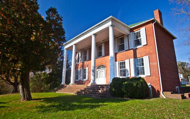
Located in Sharpsburg, Maryland, with a view toward Shepherdstown, West Virginia, Ferry Hill has stood for two centuries above the Potomac River and the Chesapeake & Ohio Canal, participating in and watching history pass by. Ferry Hill is best known as the home of Henry Kyd Douglas, Confederate Officer and author of his Civil War personal account, "I Rode With Stonewall."
To alleviate traffic congestion on the C&O Canal, the Incline Plane allowed coal boats to be transported down to the Potomac River by means of a system of caissons, pulleys, steel cables and counterweights. After an accident in 1877 in which three men were killed, the caissons were drained of water before the boats descended. In 1878, 1,918 trips were recorded on the Incline Plane. Also in that year, a model of the Incline Plane was exhibited at the World's Fair in Paris. Aft
(445 words)<br />The C&O Canal Inclined plane is located along the C&O Canal towpath in Washington, D.C. From canal Mile 2, travel north on the towpath about four hundred fifty yards. A wayside and bench will be on the left side of the towpath.<br />The two by three-foot wayside sits three feet off the towpath at the southwest corner of a ten by ten-foot slate plaza. A six-foot long wood bench is set on the north side of the space. Just beyond the sign, to the south six-foot wide gravel and wood steps that leads down to the Crescent Trail pedestrian path below. A few feet north beyond the bench about six black granite blocks lay partially buried alongside the towpath.<br />The yellow sign is titled across a black border on the top that reads: "Georgetown Incline Plane." Text below describes the creation of the Georgetown incline plane:<br />Here, in 1876, an engineering marvel was built. The largest incline plane in the world and the first built in the United States, carried canal boats to and from the Potomac River. The incline plane was used to help clear heavy boat traffic in Georgetown; canal boats often log-jammed while waiting to unload. Boats left the canal through a lock and entered the incline plane's large water filled car; the water from the car was drained as two stone-filled, counter-balancing cars, moving in the opposite direction, lowered the boat 480 feet to the river, and on to its Georgetown port.<br />To the right is a black and white image showing canal boats lined up along the right, A border to the left divides a road on the left. Text below reads:<br />The incline plane helped move boats to Georgetown docks faster.<br />The bottom two thirds of the sign show a color drawing of a ramp with a canal boat to the left and an arrow indicating its movement to the right. At the right side, two rows of four boxes are moving up the ramp to the left. A canal runs across the top of the image from left to right. A point indicates that you are standing at the intersection of the ramp and the canal. In the top left, a second canal boat waits to enter the ramp. At the bottom right, the ramp leads back down into a river.<br />A faded black and white photograph to the right shows a view looking up from the lower end of a ramp. Two boxes are lined up in a row on the ramp. Text to the left reads:<br />The incline plane was one of the structures selected to represent American engineering achievements at the Paris Exposition of 1878.<br />END OF DESCRIPTION<br />
Inlet lock 1 is where water is diverted from the Potomac River into the five miles of the Georgetown section of the C&O Canal. Eight dams at various points along the canal allowed water to flow into the eight sections. If one of the eight sections were damaged, the canal company could close just one section to affect repairs - they did not have to shut down the whole canal!
(654 words)<br />The C&O Canal Inlet Lock is located on the west side of Canal Road, NW Washington, DC about eight-tens of a mile north of Chain Bridge Road.<br />A gravel parking lot, about sixty-feet wide and one hundred-feet long is set immediately off Canal Road and is bordered by gravel at its east entry side.<br />Two portable bathrooms sit at the northeast end of the lot, on the right as you enter from Canal Road, about twenty feet from the roadside.<br />At the west end of the parking lot a twenty-foot long, six-foot wide wood bridge with railings on both sides carries over Canal Lock 5. Along the west side of Lock 5, a cement-paved area, fifty feet to the north and south, runs eighty feet to the west where it connects to the Inlet Canal that runs parallel to Lock 5. The area rises about four feet along its northern end.<br />From the Lock 5 bridge west side, a second wood bridge about eighty feet across the gravel path, with railings on both sides, carries about forty feet over the Inlet Canal and connects to the south end of the C&O Canal towpath. Water from the inlet canal flows underneath the bridge and connects to water from Lock 5.<br />At the west end of the bridge, to the right, sits a two by three-foot wayside. The faded sign is titled across a block border in white lettering to read:<br />Inlet Locks<br />Text along a yellow border below reads:<br />Eight dams and one steam pump were built along the river to funnel water into the canal in times of drought of low water, usually during the height of summer; river levels dropped dramatically. The canal could not get enough water from the river and the boat traffic would stop. This caused a loss of revenue for the canal company and the loss of a living for boat captains.<br />To the right is a faded and scratched color image of a man in a tan jacket and hat facing to the right. Text to his left reads:<br />As a young man, George Washington surveyed the Potomac River and discovered its riches. Part of the Patowmack Canal, which he championed, ran from here to the Abner Cloud House at mile 3.1.<br />Dam 1, a Little Falls, diverted water to this inlet lock, watering the canal from Lock 5 to Georgetown.<br />A faded image further right appears to be a map of a canal. A sign reading "You Are Here" indicates your location to the left.<br />Three-fourths of the sign below are a color image of a river flowing over a wide dam, a strip of land and towpath to the right, and further right a canal with water flowing top to bottom. An inlet lock is identified just north of the dam along the strip of land. Below is a mule crossover bridge with bridge wall lining the river's edge. Mules walk up the towpath from the south.<br />Text in the top left corner reads:<br />Inlet Lock<br />Dams and inlet locks were the engineering devices used to provide water for the canal.<br />A trail to the left of the sign runs north about one hundred fifty feet to the Inlet Lock. A small brown sign set to the right of the trail reads "Inlet Lock." Two wood doors, angled inward slightly, block the lock's lower south end. Cement walls about six feet long are on either side. A wood railing sits atop the gate.<br />Along the west side of the lock, six four-foot wide cement steps lead up to the top of the lock and an eight-foot high cement wall lines the left side of the steps. A metal fence runs along the lock's east side. The trail continues around to the backside of the lock, where canal water flows in from the north. The lock doors are angled out slightly toward the north at this end.<br />END OF DESCRIPTION<br />
This is one of series of intakes that provided water to help power the mills in this area including a flour and a paper mill. Providing water to the mills was another form of income for the canal company. At least one intake was in used until the 1960's.
(193 words)<br />The C&O Canal Intake is located along the south edge of the C&O Canal just west of 33rd street, NW in the Georgetown neighborhood of Washington, DC.<br />From the intersection of 33rd street and the C&O Canal, travel seventy feet west along the south side of the canal. A cement slab about six-inches wide and six feet long sits in the towpath. In front of it, at the canal edge is a deteriorating wood board, about three feet wide and five feet long.<br />When viewed from the opposite side of the canal, a square opening in the stone wall of the canal is visible underneath the wood board, which extends down to the water's edge. <br />To access the north side of the canal, travel three hundred fifty feet to the east, through the brick plaza of Fish Market Square. A staircase at the northeast end leads up to a pedestrian bridge which carries over the canal. On the opposite side, stairs on the right will lead down to the towpath. Once there, proceed west to the right four hundred feet and you will be across from the Canal Intake on the south side.<br />END OF DESCRIPTION<br />
This is one of series of intakes that provided water to help power the mills in this area including a flour and a paper mill. <br /><br />Thees are ruins of two dual intakes for the Wilkins Rogers Milling Company water intake ruins are located on river (Fishmarket Square) side of the canal. When operational, each intake consisted of two intake openings stacked directly on top of each other. They supplied the former mill to the south with surplus canal water from 1839 to 1960. <br />
(155 words)<br />From the intersection of K street and Potomac street, NW travel three hundred feet north on Potomac street. The road curves to the right at this point and becomes Grace street. Six brick pillars are lined along the north sidewalk curve as it follows the bend of the road. Proceed north into the plaza area. The C&O Canal Intake is set along the edge of the C&O Canal at the northwest corner of the plaza.<br />A black metal railing guards the space, which is a three-foot wide, six-foot long deteriorating wood board set into the brick plaza floor at the canal's edge. A rectangular opening underneath is visible from the opposite side of the canal. <br />A staircase at the northeast side of the plaza will take you over the canal. Follow the staircase on the right down to access the towpath on the north side. From here the underside of the Canal Intake is visible.<br />END OF DESCRIPTION<br />
The very first lock on the C&O Canal. Locks are like elevators and allow boats to move up in elevation. By closing and opening the lock gates in the right order, one can fill or empty the lock chamber. This will raise or lower the boat.Seventy-three more locks over the next 183 miles lead into Cumberland, Maryland in the Allegheny Mountains. Today, visitors can still travel the towpath, tracing the same route as mules and canal boats more than 100 years ago.From the shore of
(262 words)<br />C&O Canal Lock 1 is the southernmost and easternmost lock in the Chesapeake and Ohio canal system. It is located in downtown Washington, DC in the Georgetown area, east of 29th street, NW, south of M street and Pennsylvania avenue, and north of K street. <br />From the intersection of M and 29th streets, travel south on 29th street four hundred feet. Turn left onto the brick walkway and proceed about two hundred feet.<br />A one foot long brown sign with white lettering is set in the grass lawn about four feet off the brick walkway to the right that reads: "Lock 1"<br />Twenty feet to the south is the C&O Canal. Water passes through the twenty-five-foot-wide canal from west to east and empties into Rock Creek about two hundred yards to the west.<br />The wood remains of the lock are set along the canal edge, including a twenty-five-foot-long wood beam that runs parallel to the canal. A wood gate resembling a ladder sits on the face of the brick canal on its opposite side. The canal is about fifteen feet deep and shallow water flows slowly at the bottom. Ivy has overtaken much of the lock on the opposite side and hangs over the canal edge.<br />The grass lawn is about twenty-five feet wide and slopes down about five feet from the brick walkway above. A one-foot border of stone blocks lines the grass lawn edge as it meets the canal. The lawn spans about one hundred yards, from Rock Creek Parkway on the west end to 29th street to the east.<br />END OF DESCRIPTION<br />
(96 words) Lock 10 is located along the towpath in Cabin John, MD. It can be accessed from a small parking lot off of the Clara Barton Parkway. From the Lock 10 parking lot, follow the paved road down the hill approximately 100 feet and arrive at the lock. A vehicle access bridge crosses the lock, with railings along both sides. The dirt towpath is across the lock bridge, with east being to the left and west being to the right. The Lock 10 lockhouse sits just to the left, or east, of the lock. End of Description.
(88 words) Lock 11 is located along the towpath in Cabin John, MD. It can be accessed from a small parking lot at Lock 10 and walking the towpath. From the Lock 10 parking lot, follow the paved road down the hill approximately 100 feet and cross the bridge across lock 10. Turn right and walk 2/10ths of a mile on the towpath. The lock sits in the ground parallel to the towpath. Two stone walls create the lock chamber. The chamber is approximately 90 feet long. End of Description.
(88 words) Lock 12 is located along the towpath in Cabin John, MD. It can be accessed from a small parking lot at Lock 10 and walking the towpath. From the Lock 10 parking lot, follow the paved road down the hill approximately 100 feet and cross the bridge across lock 10. Turn right and walk one half of a mile on the towpath. The lock sits in the ground parallel to the towpath. Two stone walls create the lock chamber. The chamber is approximately 90 feet long. End of Description.
(88 words) Lock 13 is located along the towpath in Cabin John, MD. It can be accessed from a small parking lot at Lock 10 and walking the towpath. From the Lock 10 parking lot, follow the paved road down the hill approximately 100 feet and cross the bridge across lock 10. Turn right and walk 6/10ths of a mile on the towpath. The lock sits in the ground parallel to the towpath. Two stone walls create the lock chamber. The chamber is approximately 90 feet long. End of Description.
(88 words) Lock 14 is located along the towpath in Cabin John, MD. It can be accessed from a small parking lot at Lock 10 and walking the towpath. From the Lock 10 parking lot, follow the paved road down the hill approximately 100 feet and cross the bridge across lock 10. Turn right and walk 7/10ths of a mile on the towpath. The lock sits in the ground parallel to the towpath. Two stone walls create the lock chamber. The chamber is approximately 90 feet long. End of Description.
(99 words) Lock 15 is located along the towpath in Potomac, MD. From the Great Falls Tavern Visitor Center parking lot, follow the sidewalks to the visitor center, passing the concessions building on your right and the public restrooms building on your left. At the visitor center building, turn right, walk about 25 feet and cross the wooden pedestrian bridge over Lock 20. Turn left and walk 8/10ths of a mile on the towpath. The lock sits in the ground parallel to the towpath. Two stone walls create the lock chamber. The chamber is approximately 90 feet long. End of Description.
Great Falls Tavern Visitor Center - Chesapeake and Ohio Canal National Historical Park
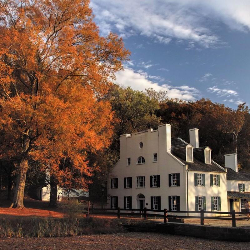
The Great Falls Tavern (also historically known as the Crommelin House) originally functioned as one of the many lockhouses along the canal and serviced thousands of cargo and excursion boats that passed through Lock 20 on the way to and from Cumberland, MD and Georgetown in Washington, DC. Today the Great Falls Tavern remains a hub of activity as it acts as one of C&O Canal National Historical Park's visitor centers. Here, visitors can get information about the park's programs, hiking trails, and history.
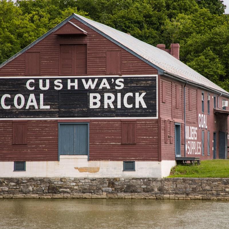
Williamsport Visitor Center - Chesapeake and Ohio Canal National Historical Park
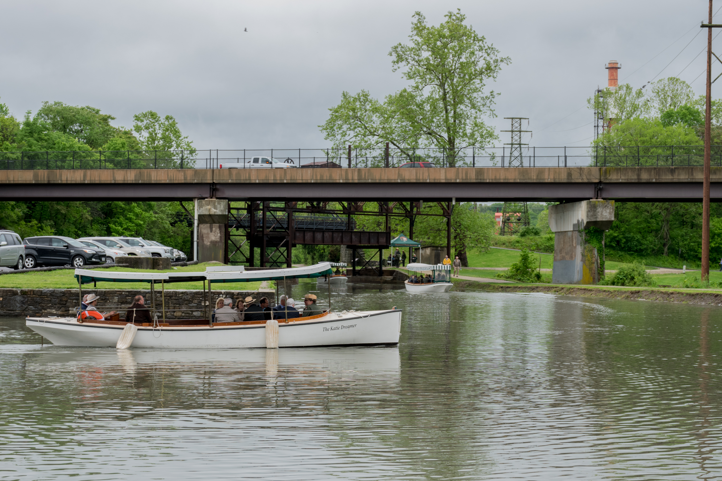
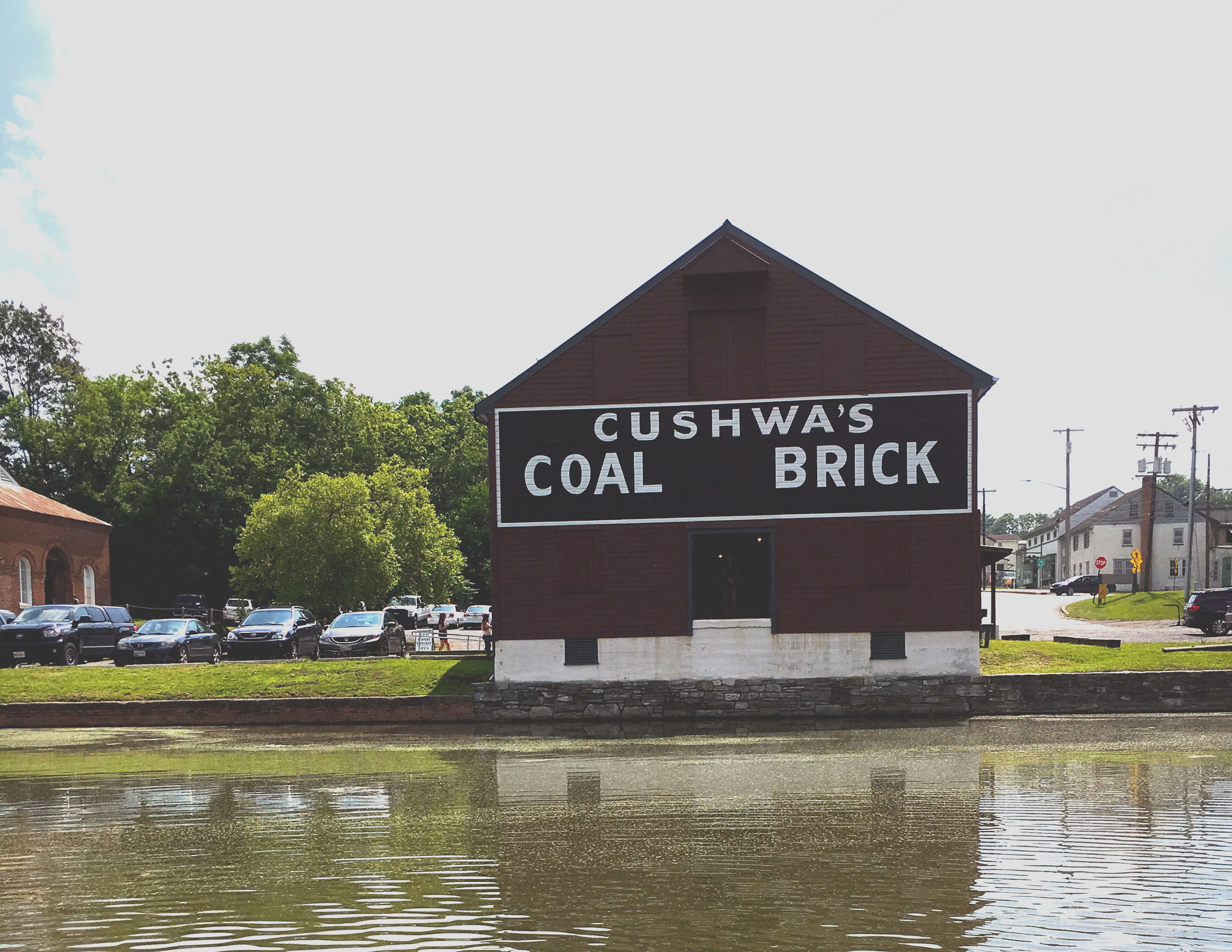
The Cushwa Basin Visitor Center in Williamsport is located at mile 99.8 along the C&O Canal towpath in Washington County, MD. Situated at the confluence of the Conococheague Creek and the Potomac River, Williamsport was first settled in 1740. A half-mile rewatered section of canal leads through the turning basin, under the only railroad lift bridge on the canal, and continues to Lockhouse 44 and the adjacent lock. The Conocheague Aqueduct is located across from the turning basin.
Today, visitors can enjoy life on the canal during a free replica canal launch boat program at Williamsport. During the late 19th and early 20th century, 30-foot battery and steam powered launch boats traveled the canal for leisure and business.
Wildlife Watching - Riverbend Park
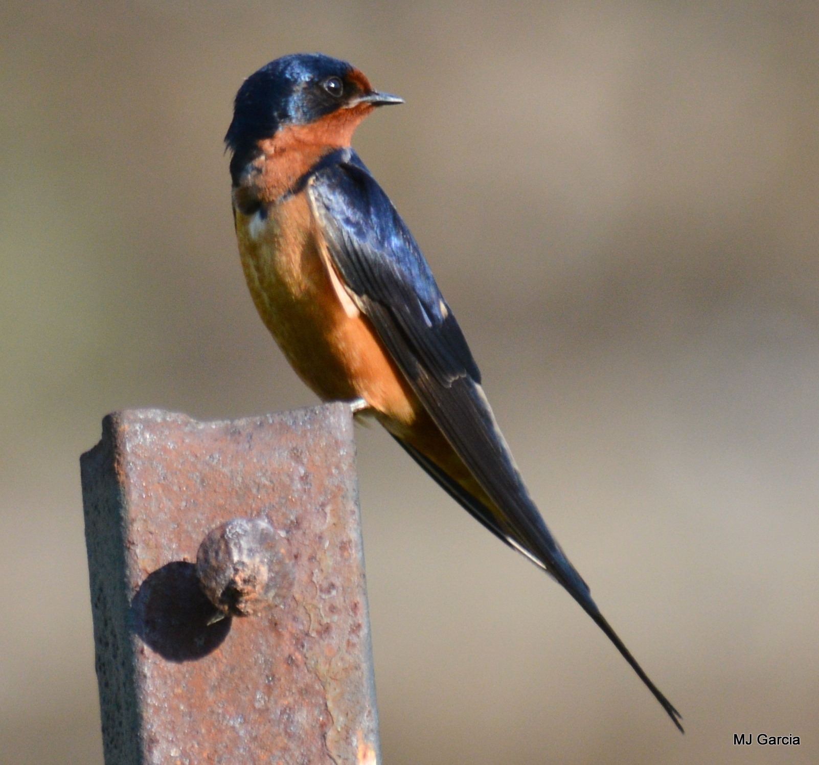
Step onto the Potomac Heritage Trail at Riverbend Park and look out for bald eagles, osprey, belted kingfishers, mergansers, and more!
Wildlife Watching - Government Island
Located in Stafford, VA, this section of trail offers a boardwalk through a freshwater wetland and marsh habitat and a loop around a forested island. There are abundant opportunities for bird watching and wildlife viewing all times of year.
Wildlife Watching - Oldtown C&O Canal
Head down the C&O Canal NHP towpath in Oldtown, Maryland into a rare ecosystem mirroring that of the West. Spot a variety of wildlife and dragonfly species in this secluded hotspot.
Wildlife Watching - Point Lookout State Park
At the terminus of the PHT lays Point Lookout, a Maryland State Park known for its history, but also its birding. Birding enthusiasts can catch sight of rare waterfowl during the winter months and in spring and summer view the migration of a variety of shorebirds.
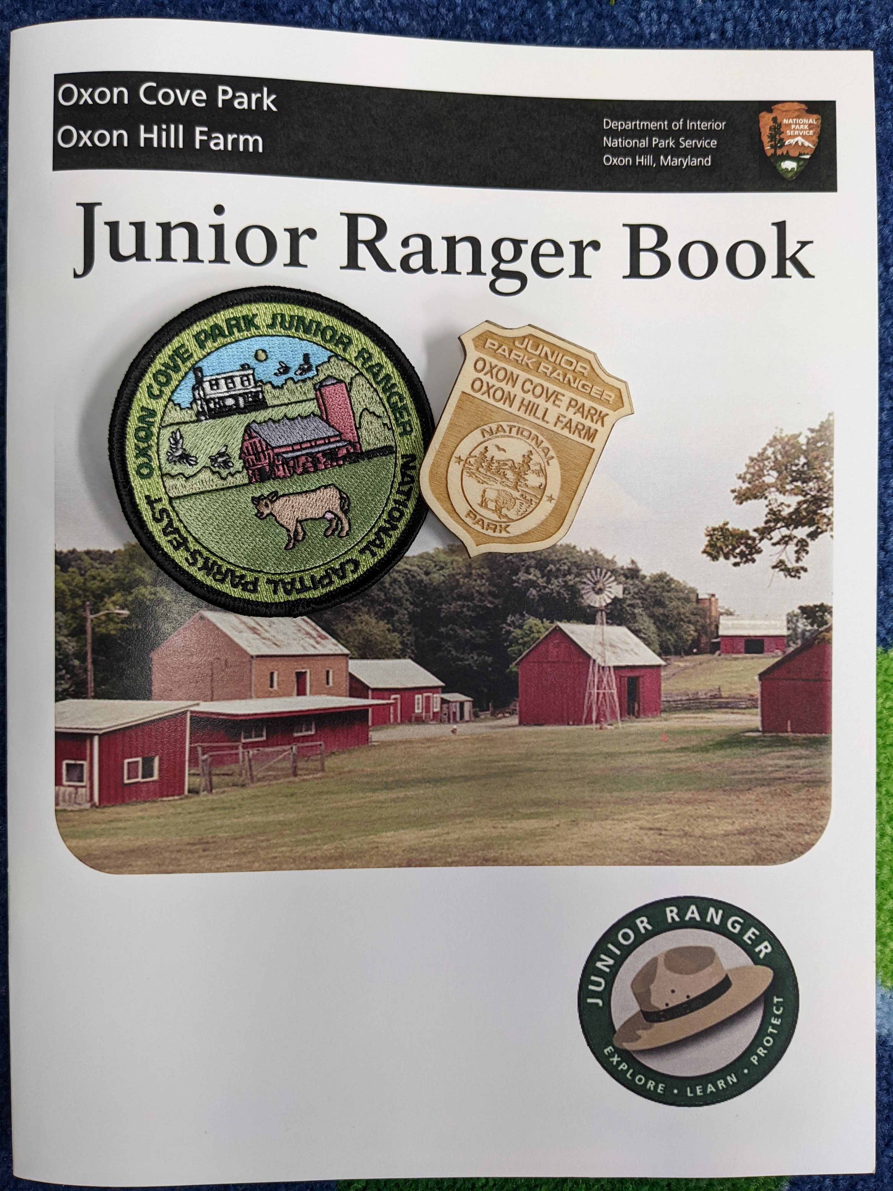
Become an Oxon Hill Farm Junior Ranger
Oxon Hill Farm Junior Ranger Program
Explore the trails at Meadowood
Hike, Bike, and Horseback Ride at Meadowood Special Recreation Management Area.
Take a walk through time to the bank of the Potomac River
Take a two-mile walk from the parking area to access the shoreline of the Potomac River to relax along the river, search for shark teeth, or enjoy a picnic at the overlook.
Bike the Potomac Heritage National Scenic Trail in Prince William Forest Park
Discover Northern Virginia's best kept secret and bike along the park’s Scenic Drive.
Hike between Scott's Run Nature Preserve and Theodore Roosevelt Island
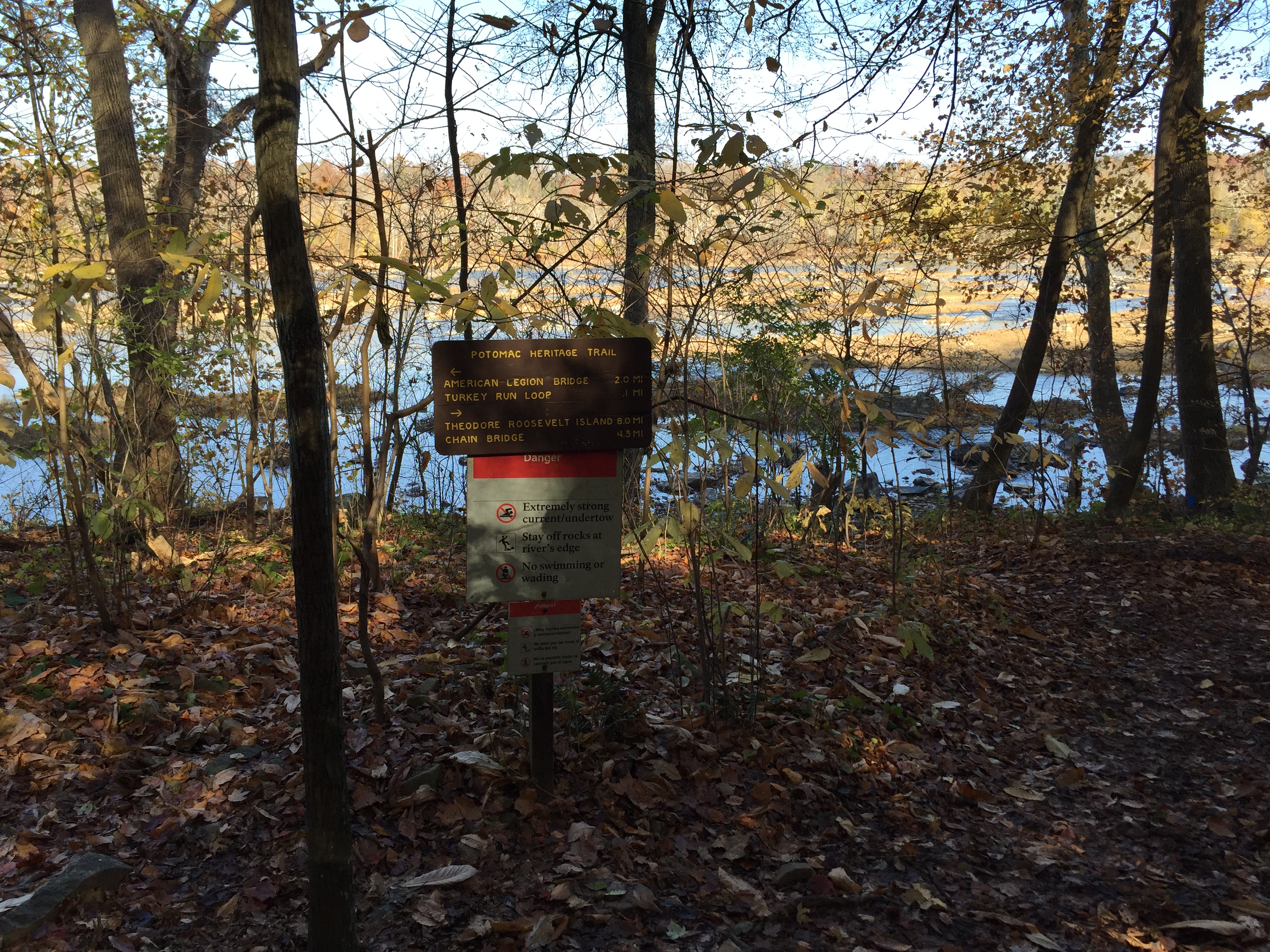
The ten-mile Potomac Heritage Trail within George Washington Memorial Parkway is a popular path, connecting at some places to neighborhood trails, Turkey Run picnic area and Chain Bridge. Here, though, we suggest a longer hike connecting with another PHT segment in Scott's Run Nature Preserve, managed by the Fairfax County Park Authority. A combination natural surface path and road walk along Live Oak Lane connects the two.
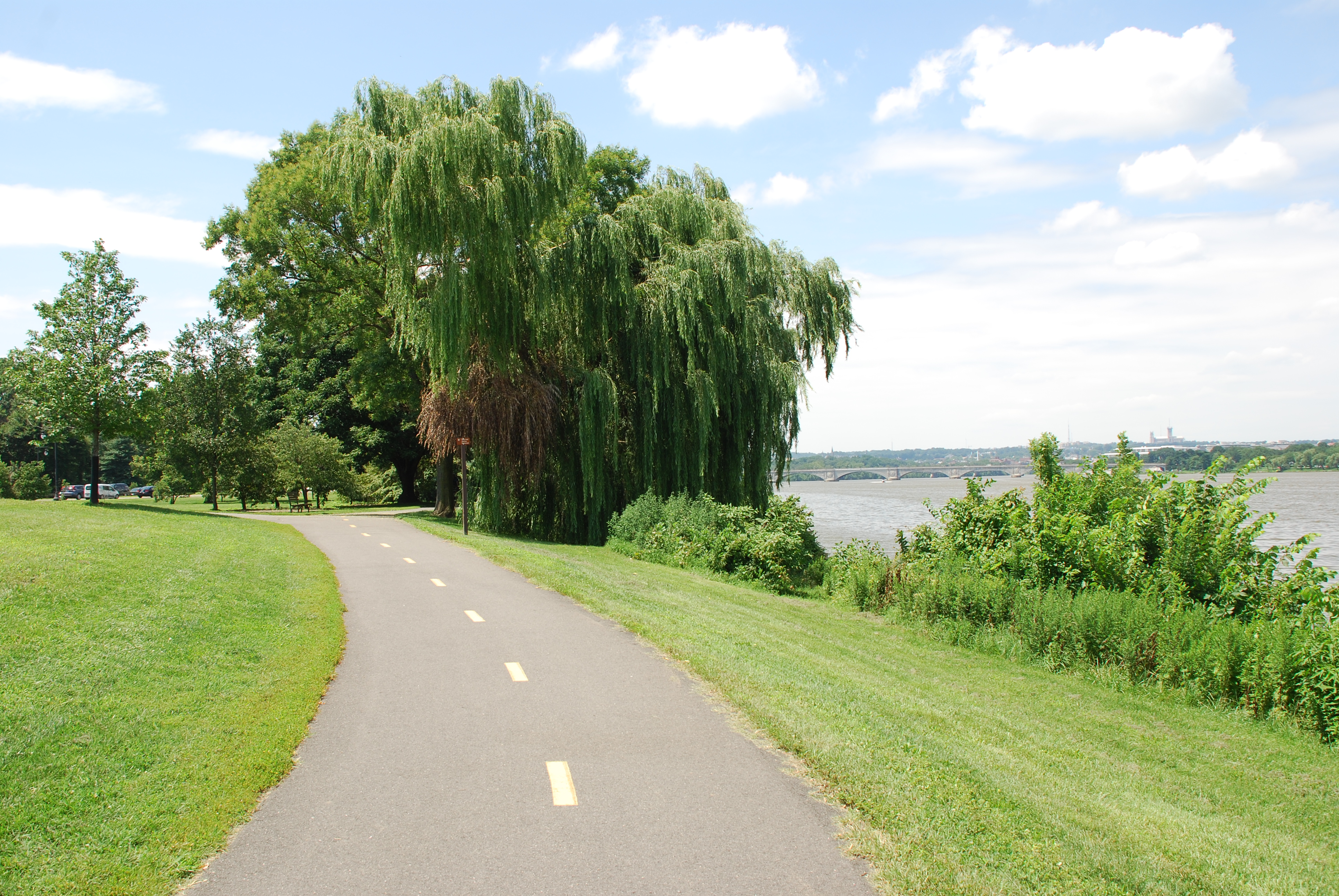
Take a walk or bike ride on the Mount Vernon Trail
The Mount Vernon Trail winds alongside the Potomac River offering uninterrupted views of Washington, D.C.'s skyline. A run, walk, or cycle along the trail leads to all of the same sites that can be reached by car on the parallel section of the parkway.
Volunteer to complete the PHT in Northern Virginia
Volunteers are essential to complete the PHT network in Northern Virginia.
Watch an Artillery Demonstration at Fort Washington Park
Ever wonder how Civil War cannons were fired? Visit the park the first Sunday of every month from May to November to watch the Fort Washington Guard demonstrate and explain the procedures used during the muzzle-loading era of American Artillery.
Woodlawn Manor and Pope-Leighey House
Tour Woodlawn Manor and Pope-Leighey House in the George Washington Memorial Parkway Corridor. View the vast differences in architecture from the early 1800’s to 1900’s in a unique juxtaposition along Route 1.
Laurel Highlands Day Hike to Youghiogheny Overlook
Take the 2.5-mile ascent to a large, flat topped rock formation overlooking the Youghiogheny River valley. Get a view of the Sugarloaf Knob and the gorges cutting into the ridge from side streams.
Hike Along the Towpath Through the Paw Paw Tunnel
Walk through the 3,118-foot Paw Paw Tunnel, a significant engineering feature along Mile 155 of the C&O Canal towpath.
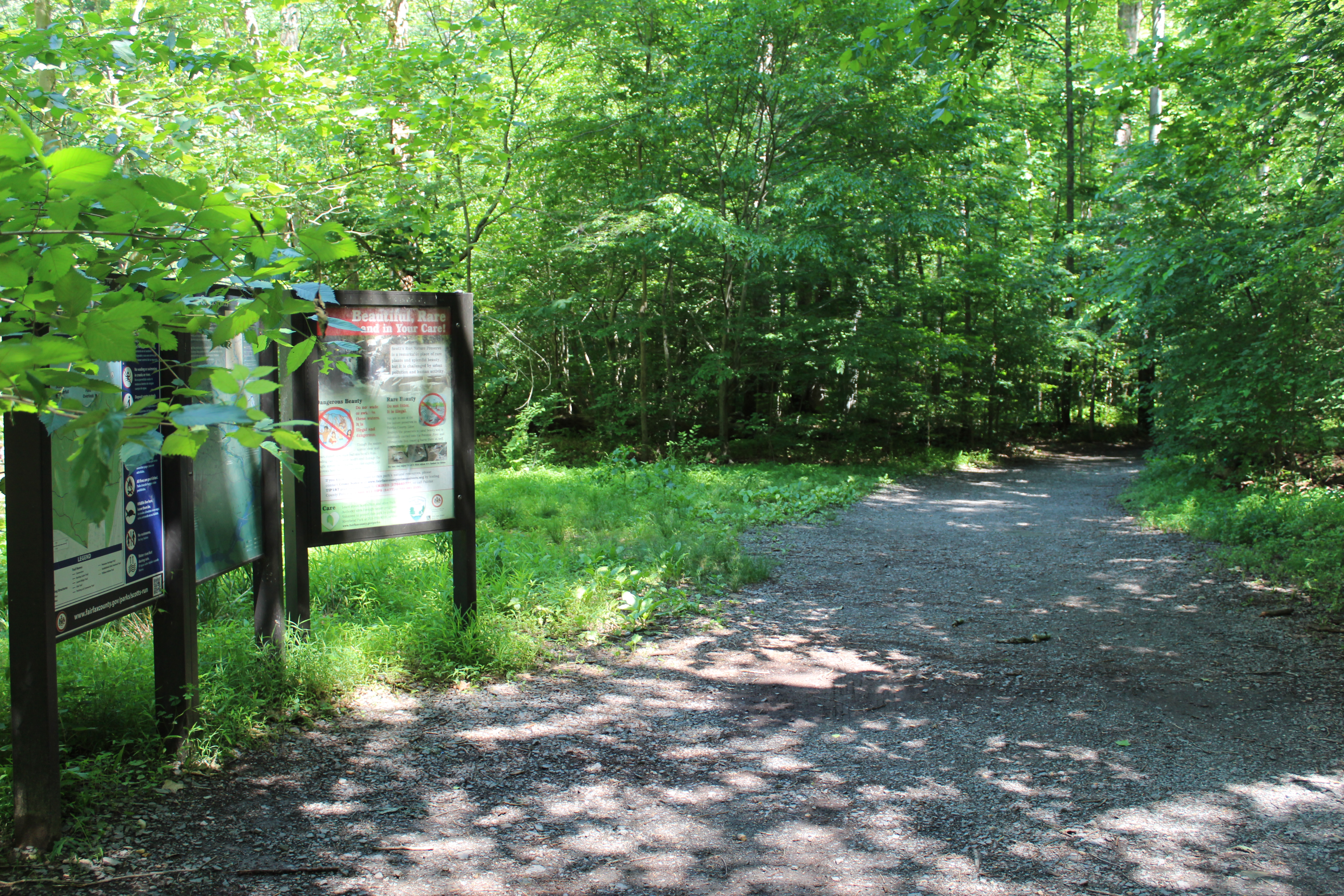
Hiking at Scott's Run Nature Preserve
Hike 0.7 miles to a view of a waterfall and/or 2 miles to a scenic overlook of the Potomac River.
Birding at Fort Washington Park
Come for the history, stay for the birds. Fort Washington Park has a diverse array of bird species spread among its distinct ecosystems.
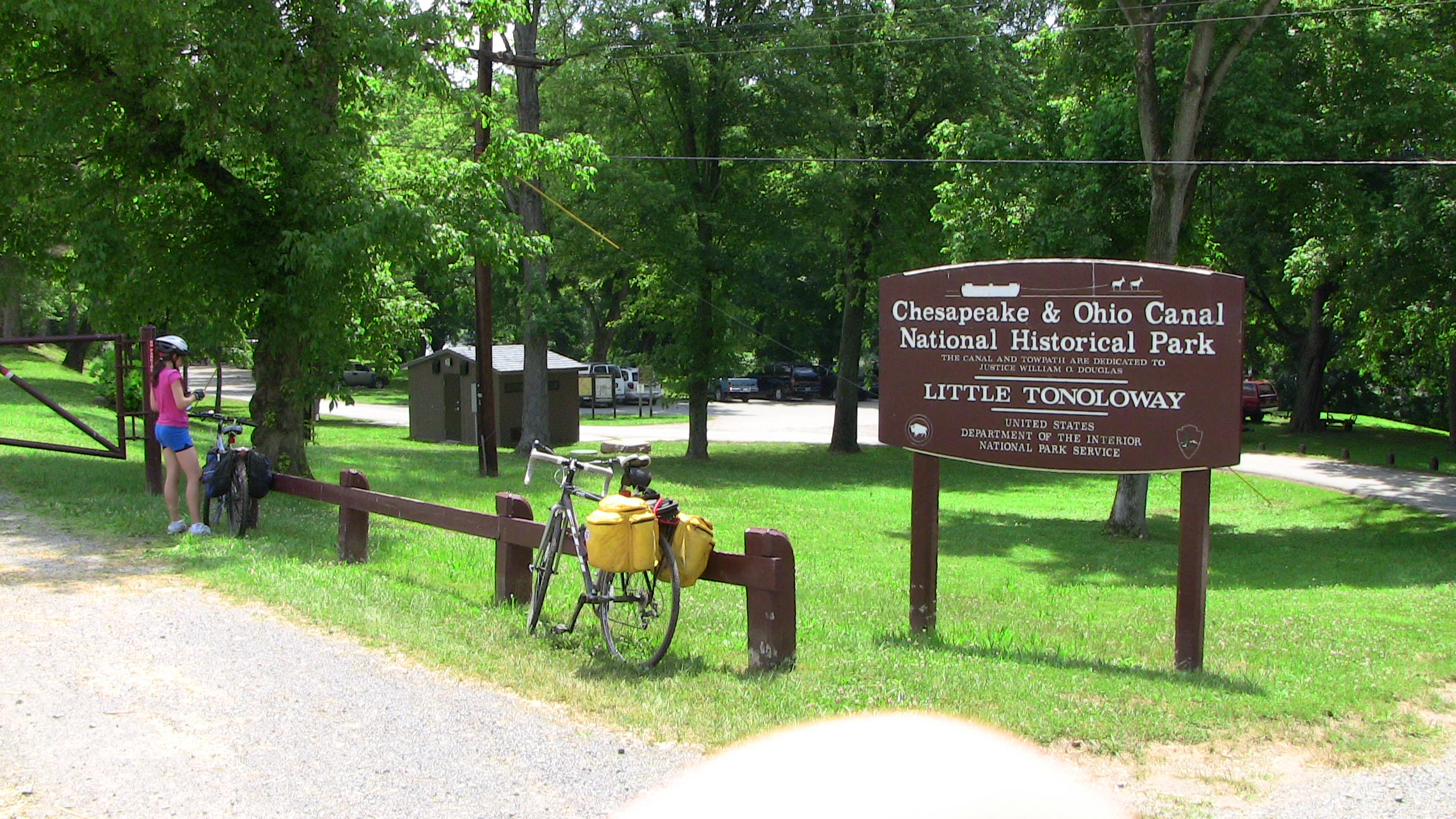
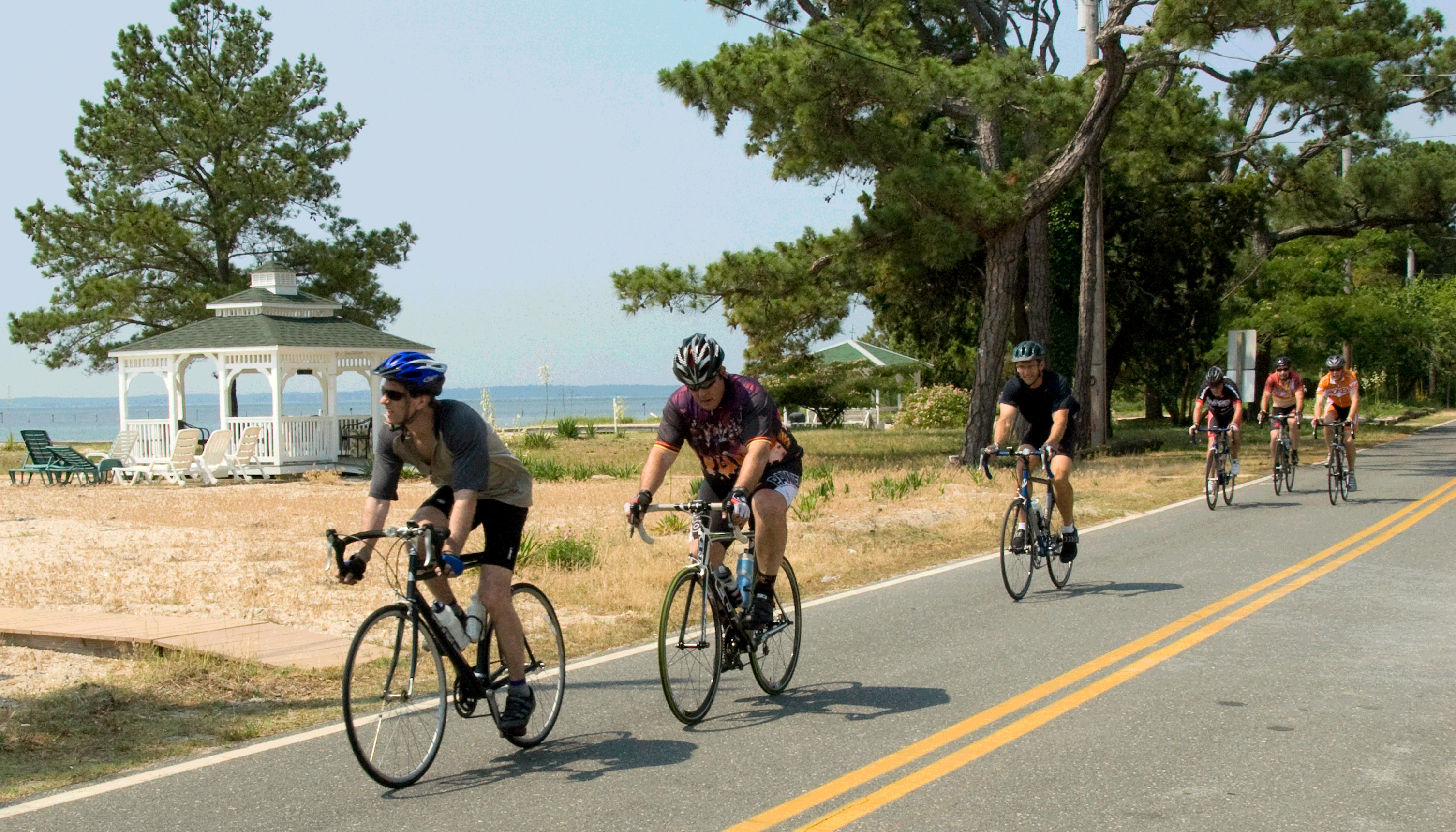
Bike the C&O Canal Towpath
By bicycle or on foot, try a short day trip or travel the entire 184.5-mile length of the Chesapeake and Ohio Canal Towpath.
Bicycle to a marina from Reedville, Virginia
Bicycle from Reedville, an historic village at the northeastern part of the Northern Neck of Virginia, to a marina for a fishing trip or charter tour on the Potomac and Chesapeake Bay.
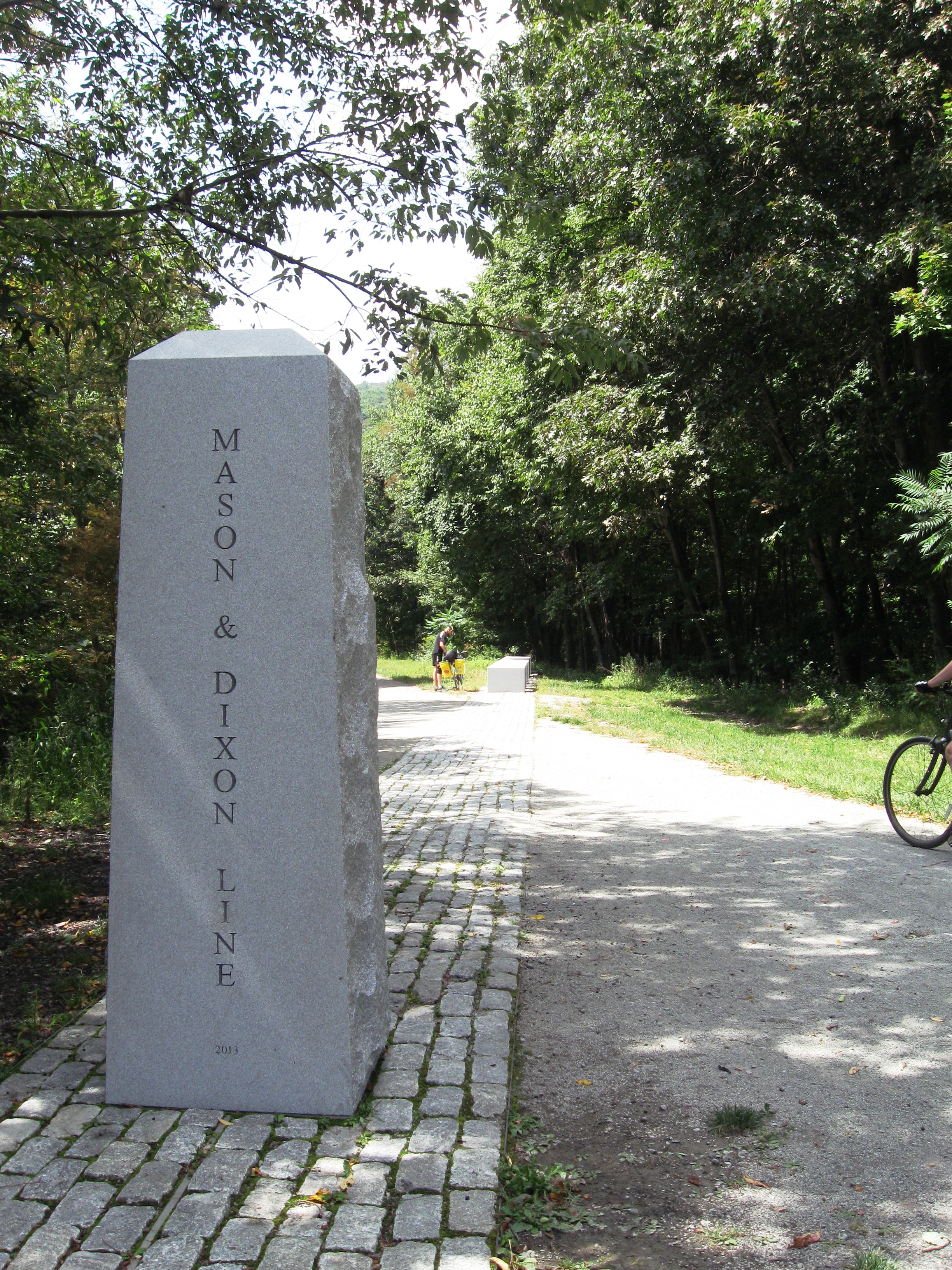
Bicycle the Great Allegheny Passage
The 70-mile section of the GAP between Cumberland, Maryland, and Ohiopyle, Pennsylvania, is popular as an easy grade for bicycling.
Bicycle between Point Lookout and Leonardtown, MD
Bicycling on a section of the Southern Maryland PHT On-Road Bicycling Route between Point Lookout and Leondardtown, MD
Bicycle Confluence to Big Savage Mountain
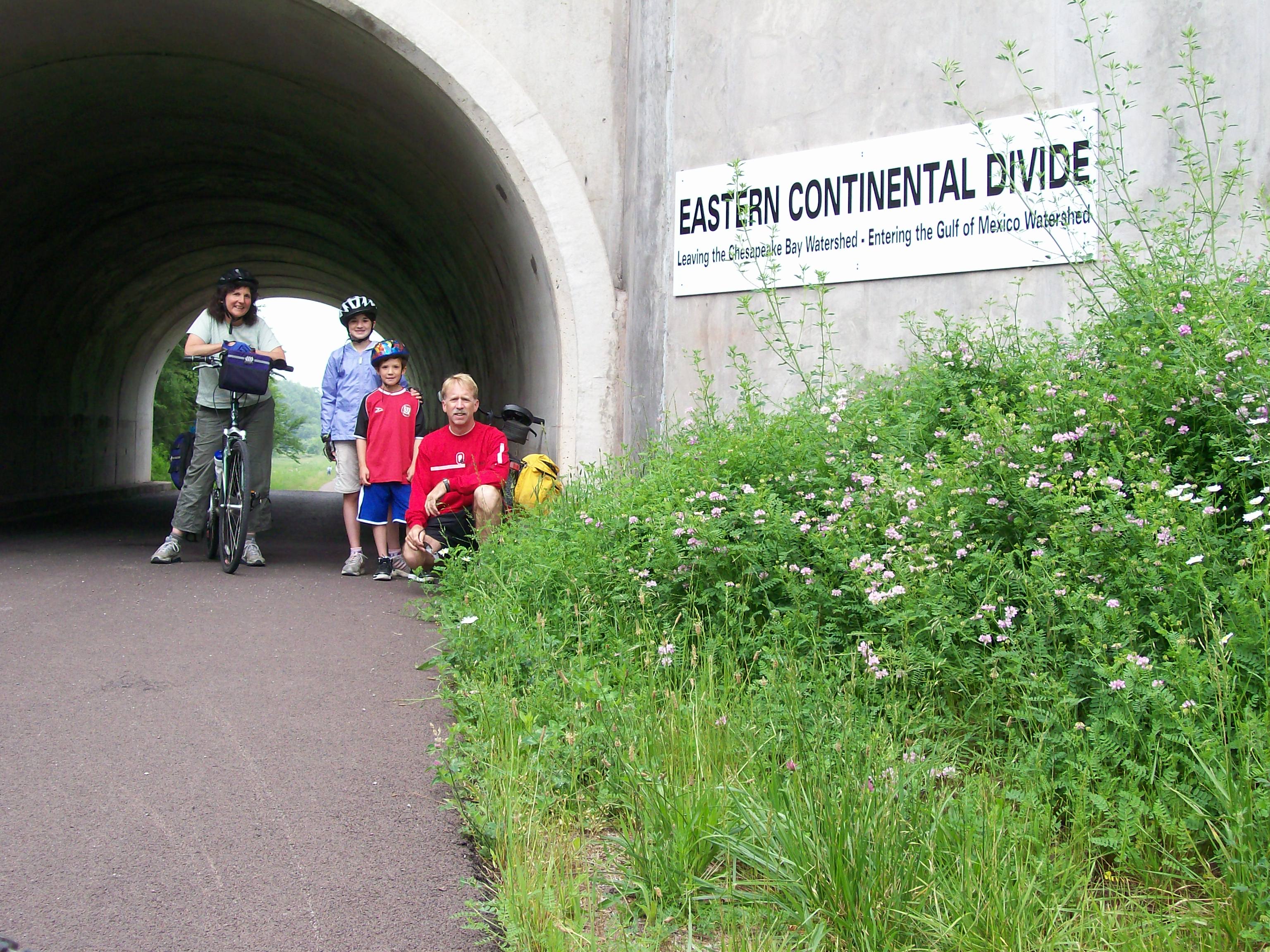
The Great Allegheny Passage is a 150 mile rail-trail between Cumberland, Maryland--terminus of the C & O Canal Towpath--and Point State Park in Pittsburgh. To complete part of the Eastern Continental Divide Loop, bicycle 41 miles from Confluence to Deal, then 8+ miles on-road to the northern trailhead for the Big Savage Mountain Trail. Continue past Deal on the GAP to cross the Divide and to visit the Big Savage Tunnel. Outfitter shuttles and lodging in Meyersdale available.
Explore the C&O Canal Williamsport Visitors Center
Visit the Williamsport Visitor Center at Cushwa Basin for information about the Canal and the surrounding area, sites including an aqueduct, rail lift-bridge, lockhouse, and operable locks.
Explore the tidal Potomac from the Northern Neck by boat
Through the watermen’s heritage tour program, visitors to Tidewater Virginia, including the Northern Neck, can experience the time-honored history and traditions of working watermen through a customized tour.
Soak Up Spectacular Views at the Great Falls Overlooks
Great Falls Park has many opportunities to explore history and nature, all in a beautiful 800-acre park only 15 miles from the Nation's Capital.
Hike Algonkian Regional Park to Difficult Run
This hike is mostly wooded; some parts are rocky and some can be rocky. But you will see, in some places, exceptional displays of bluebells in spring and colors in autumn. Management partners include Loudoun County Department of Parks, Recreation and Community Services; Northern Virginia Regional Park Authority; The Nature Conservancy; Fairfax County Park Authority; and National Park Service, all are aided by volunteers with the Potomac Heritage Trail Association and others.
Hiking at Oxon Cove Park
Hiking at Oxon Cove Park
Bicycle Smallwood State Park to Oxon Cove Park
The on-road bicycling route between Smallwood State Park and Oxon Cove Park makes connections with parks and historic sites.
Explore by bicycle from Westmoreland State Park
With Westmoreland State Park as a base, ride a loop connected with the Northern Neck Heritage Trail to explore Stratford Hall, the birthplace of George Washington, Colonial Beach, wineries, historic sites and the Potomac River shoreline. A map and more information is available from the Northern Neck Tourism Commission at www.northernneck.org.
Bicycle the Northern Neck Heritage Trail
Bicycling between George Washington Birthplace National Monument/Westmoreland State Park and Reedville, Virginia.
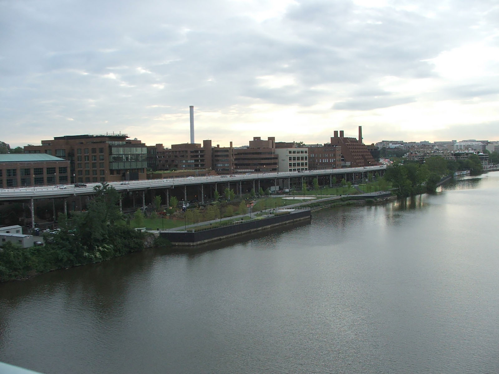
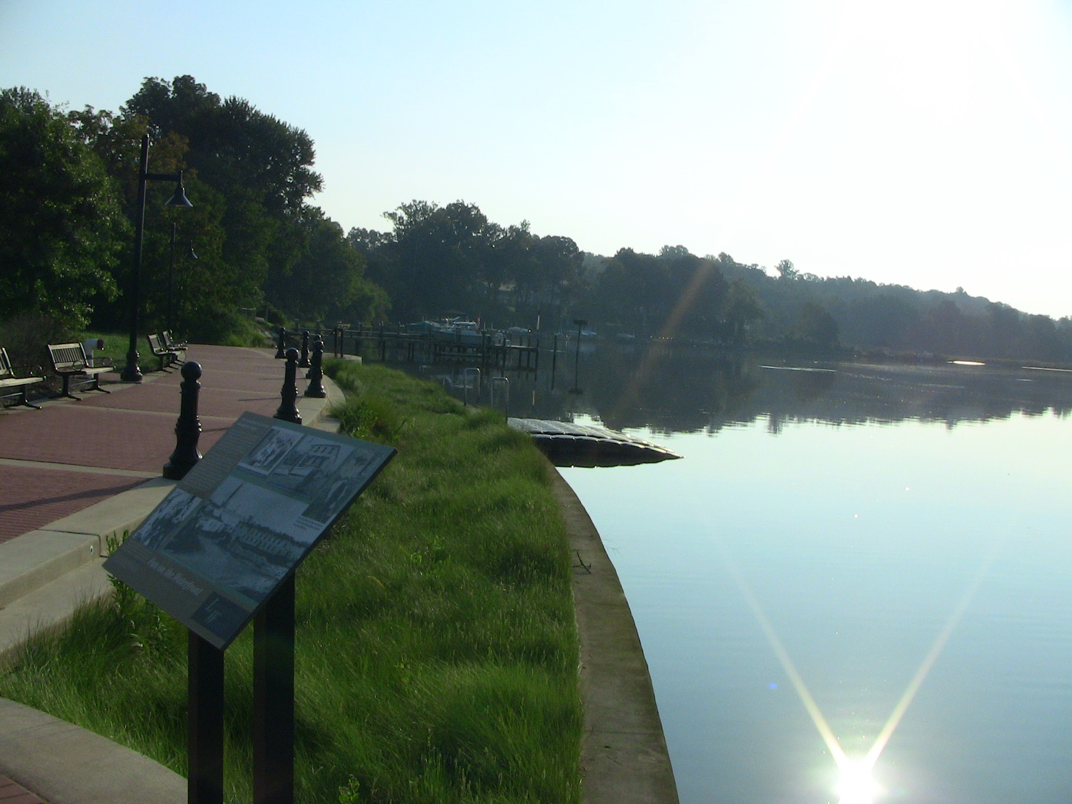
Explore the Georgetown Waterfront
Explore the Georgetown Waterfront and imagine the changes the space has gone through.
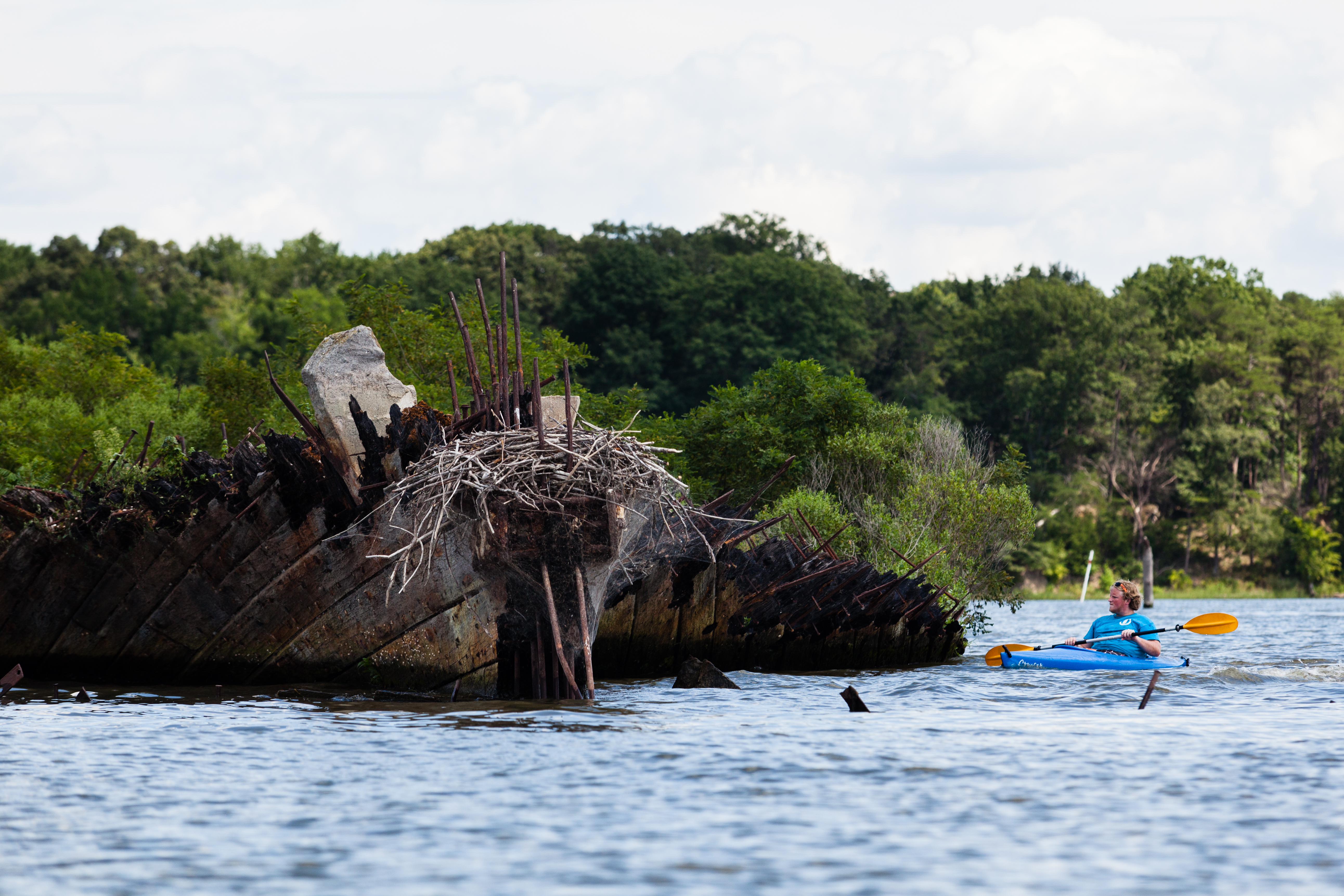
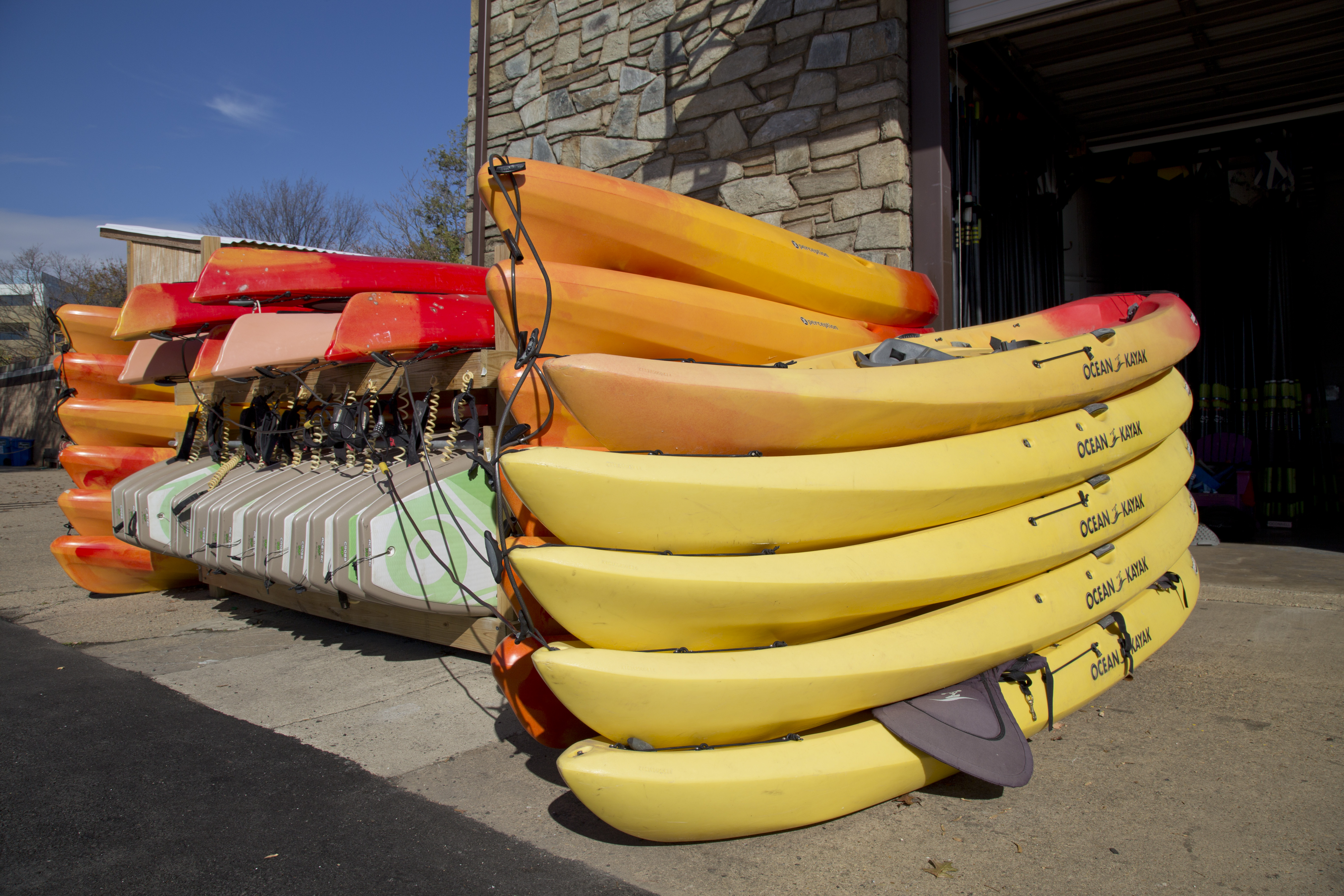
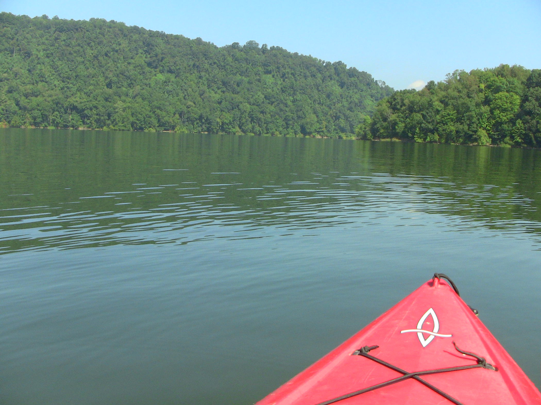
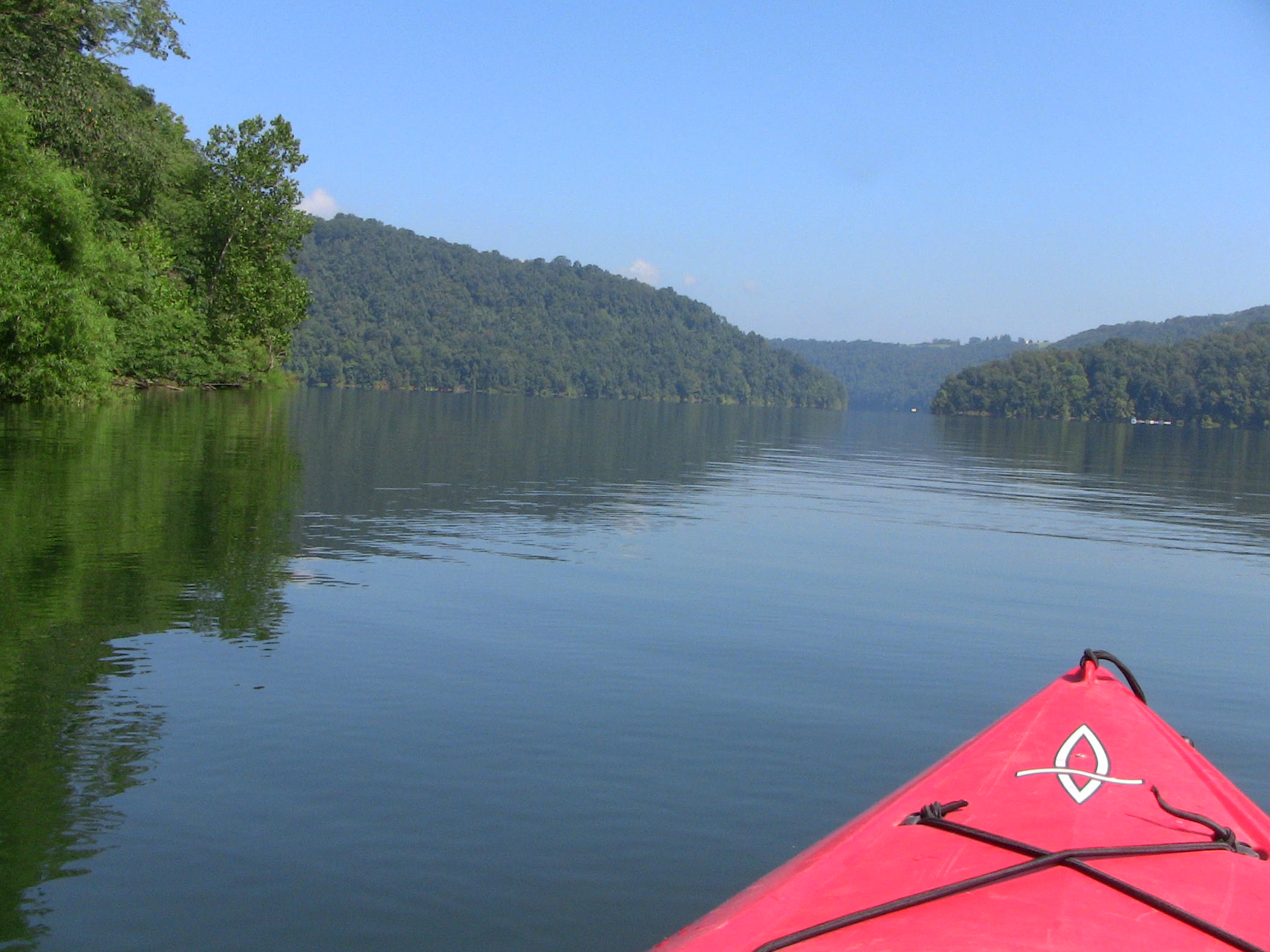
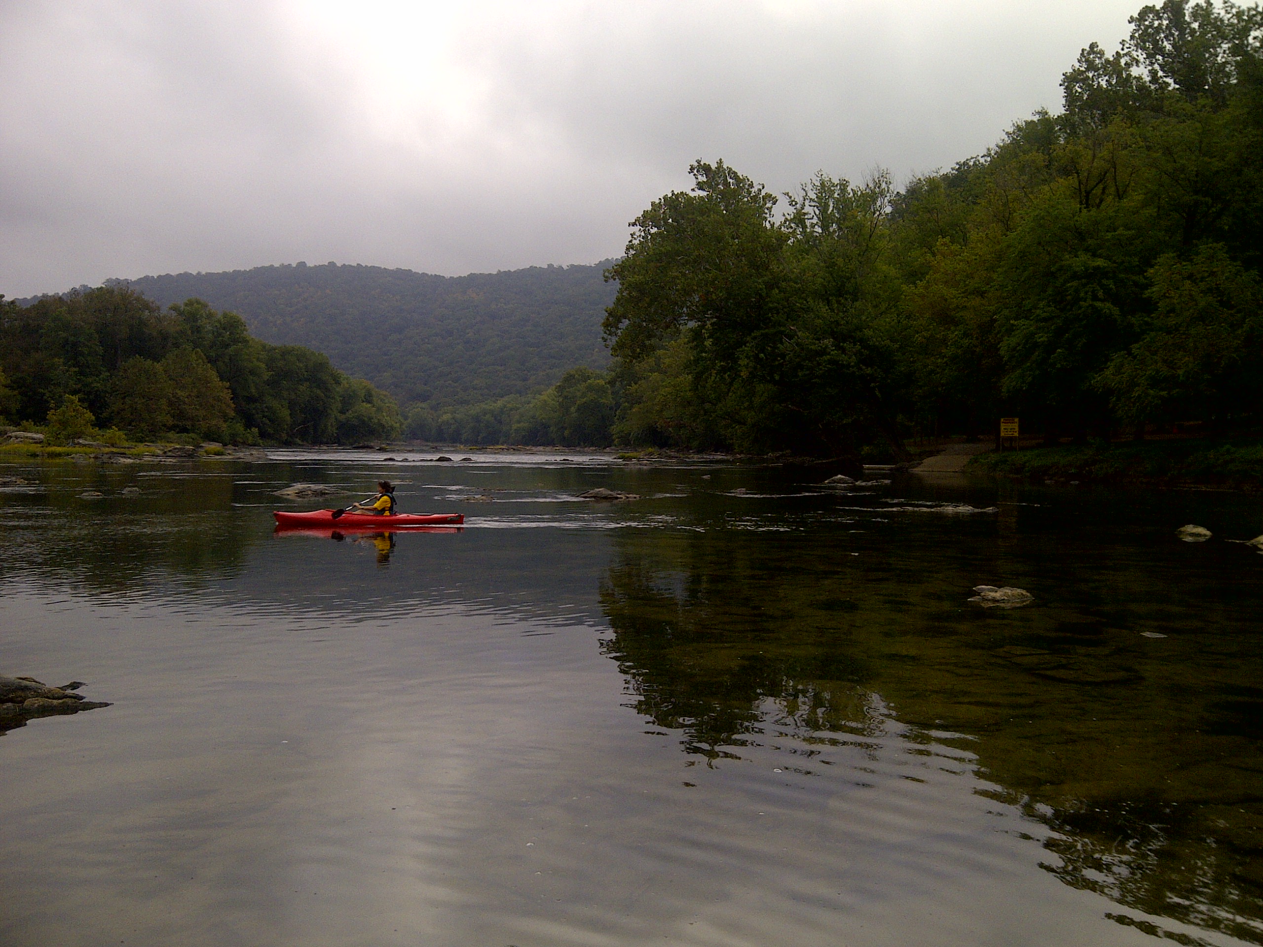
Paddle the Potomac River
Beginning at Jennings Randolph Lake to the mouth of the Potomac, you may choose to paddle the 355 miles to the Chesapeake Bay or take a single or multi-day trip; all will give you a different view of the ways that previous residents used the river and its banks for their livelihood, transportation and recreation.
Boating in Rock Creek Park
Rent kayaks, canoes and stand up paddle boards from one of two boat houses along the Potomac River.
Bicycle from Williamsport to Harpers Ferry
Want to explore history and enjoy a day bicycling? This is the route for you. Enjoy a leisurely 40-mile bike ride, or choose to hike and or paddle the length instead, spending the night camping or staying in paid accommodations. Historic treasures await you in Williamsport, Shepherdstown, and Harpers Ferry along the way.
Multi-Park Loop
Park your car and stretch your legs! Visit four different National Parks in Washington, DC and begin logging miles on seven different National Historic or National Scenic trails!
Hike the Northern Loop in Rock Creek Park
Enjoy an easy 5-mile round trip hike around the northern section of Rock Creek Park.
Paddle Hoyes Run to Sang Run on the Upper Youghiogheny
A mostly easy paddle--kayak, canoe or raft--on upper Youghiogheny River and important to check water levels. Outfitters serve this area, offering shuttles and boats. Part of the Eastern Continental Divide Loop, see the "Do the Loop" section of the Garrett Trails Web page for details.
Paddle Savage River Reservoir
This is a quiet, flat water paddle, approximately 2.6 miles end-to-end. To understand this trip in the context of the Eastern Continental Divide Loop, take note of the southern terminus of the Big Savage Mountain Trail below the dam and see Day 1 of "Do the Loop" on the Garrett Trails Web site.
Paddle Friendsville MD to Confluence PA
Launch at Friendsville, Maryland, and paddle 13.5 miles to Confluence, Pennsylvania, taking out above the dam. Best paddled with a touring kayak, you initially navigate some small rapids on the Youghiogheny River before entering the still water of the Lake. Outfitters in the area rent boats and offer shuttle services. Part of the Eastern Continental Divide Loop, see Day 4 in the "Do the Loop" section on the Garrett Trails Web site.
Explore the Trolley Barn at Cushwa Basin
The trolley barn is located across the parking lot from the Cushwa Building. In 1896, the first trolley line in Washington County, Maryland was built running from Williamsport to Hagerstown. The water supply from the Conococheague Creek made this location ideal for a steam-powered generating station. Today, the trolley barn contains historic photos, historic toys, children's costumes, a scale model of a canal boat’s mule stable, and dioramas.
Paddle the Middle Potomac
Paddle from Potoma (sic) Wayside, at the confluence of the Shenandoah and Potomac rivers, or another launch site and take out at Algonkian Regional Park or Riverbend Park (both Virginia side). Camp at sites along the C & O Canal Towpath, reserve a night in a historic lockhouse (river left upstream of Point of Rocks), reserve a cabin at Algonkian Regional Park (two-night minimum) or find a B & B or hotel. This trip can be combined with hiking and bicycling.
Hike Kephart Bridge Landing to Bles Park
The trailheads might at first seem difficult to find, but this segment of the PHT is one of the most accessible and developed in the corridor between White's Ferry and Scott's Run Nature Preserve. One can also access the PHT 1.4 miles upstream from Kephart Bridge Landing via a sidewalk along Riverside Parkway (no parking).
Paddle Leonardtown to Colton's Point
Paddle approximately 12 miles from Leonardtown to Colton's Point via kayak or canoe, stopping at Newtowne Neck State Park. The trip is mostly on Breton Bay, but joins the Potomac and the mouth of St. Clement's Bay near Colton's Point.
Bicycle Port Tobacco to Smallwood State Park
Port Tobacco Historic District and Smallwood State Park provide a contrast in landscape diversity, and travel between them is a fine bicycle ride. This route is part of the Adventure Cycling Association Tidewater Potomac Heritage Bicycling Route.
Bicycle Colton's Point to Port Tobacco
For those seeking to explore Southern Maryland or to travel the extent of the Potomac Heritage NST corridor, bicycling and paddling, combined with some short hikes, are the best self-powered ways to experience the area. The 38-mile bicycling route between Colton's Point/St. Clement's Island Museum and Port Tobacco (or vice versa) is part of the Adventure Cycling Association "Tidewater Potomac Heritage" map set.
George Washington’s Mount Vernon and Estates
Explore George Washington’s iconic Mount Vernon Mansion and Estate.
Explore Washington’s Gristmill and Distillery Buildings
Explore George Washington’s enterprising Distillery and Gristmill ® on the extended Mount Vernon Estate. Washington’s ambitious and profitable Gristmill used groundbreaking technology in the 1790’s, and provided staple foods for the house, enslaved servicemen and women of the house.
Hike the Monroe Run Trail and Meadow Mountain Trail
Beginning at the western end of the Savage River Reservoir, this 9-mile hike ascends approximately 1900 feet, includes numerous creek crossings, and ends at a viewpoint above State Route 495 on the Meadow Mountain Trail. Part of the Eastern Continental Divide Loop, visit the "Do the Loop" section on the Garrett Trails Web page for detailed information.
Hike the Big Savage Mountain Trail
The Big Savage Mountain Trail, managed by Maryland Dept. of Natural Resources, is an 18-mile footpath providing outstanding views of the high points in western Maryland. Best traversed north to south, the Trail is a challenging one-day hike or can be an overnight; a permit for backpacking is available from the Forest office. The Trail is part of the Eastern Continental Divide Loop, a multi-modal adventure recognized as a segment of the Potomac Heritage National Scenic Trail.