Be advised that the NPS has issued alerts for this park.
Playground in Pine Grove Picnic Area Closed
The park is improving accessibility at the playground in Pine Grove Picnic Area. During construction, until approximately the end of December 2025, the playground is closed and 10 nearby parking spaces will be used for construction vehicles only.
Construction Vehicles on Scenic Drive
On a section of Scenic Drive near Cabin Camp 3, a culvert under the road was recently replaced. Use caution and follow posted speed limits. Be aware of construction vehicles on the roadway in this area.
Prince William Forest Park is an oasis, a respite of quiet and calm. In 1936, Chopawamsic Recreation Area opened its gates to house children's 'relief' camps during the Great Depression. Renamed Prince William Forest Park in 1948, these fragrant ...
Cabin Camp 1 must be reserved ahead of time, at least two weeks in advance. Reservations are accepted on a first come- first served basis. Submit the Cabin Camp Application, along with a $25 application fee, to the following address: Prince William Forest Park, ATTN: Cabin Camps, 18100 Park Headquarters Road, Triangle, VA 22172 or via email at ralph_marrantino@nps.gov. The application can be found on our website on the group cabin camping page. Contact the cabin camp division at 703-221-5843.
Rustic brown log cabins stand among woods at Cabin Camp 1. There are gravel roads and parking lots for vehicles. The camp’s Craft Lodge has two large porches and a stone chimney coming out of it. Stone foundations and fireplaces and whole log supports showcase the beautiful native materials used by the CCC in construction.
Cabin Camp 2 must be reserved ahead of time, at least two weeks in advance. Reservations are accepted on a first come- first served basis. Submit the Cabin Camp Application, along with a $25 application fee, to the following address: Prince William Forest Park, ATTN: Cabin Camps, 18100 Park Headquarters Road, Triangle, VA 22172 or via email at ralph_marrantino@nps.gov. The application can be found on our website on the group cabin camping page. Contact the cabin camp division at 703-221-5843.
Rustic brown log cabins stand among woods at Cabin Camp 2. There are gravel roads and parking lots for vehicles. The units are clustered in a circular arrangement and contain 8 cabins, a bath house, and a lodge. Each unit is in a grassy clearing that is surrounded by dense forest.
The group site at Cabin Camp 3 must be reserved ahead of time, at least two weeks in advance. Group reservations are accepted on a first come- first served basis. Submit the Cabin Camp Application, along with a $25 application fee, to the following address: Prince William Forest Park, ATTN: Cabin Camps, 18100 Park Headquarters Road, Triangle, VA 22172 or via email at ralph_marrantino@nps.gov. The application can be found on our website on the group cabin camping page. Contact the cabin camp division at 703-221-5843.
Rustic brown log cabins stand among woods at Cabin Camp 3. There are gravel roads and parking lots for vehicles. The group camp is clustered together with a large fire pit, dining hall and craft lodge. Individual cabin rentals are further down the road.
Reservations can be made by visiting recreation.gov or calling 877-444-6777 from April to early November. There are no walk-in sites available, however same-day reservations are possible if there are cabins available.
Historic wooden cabins with porches built in the 1930s. Each cabin has windows with screens and shutters and contains metal cots with foam mattresses. Outside of each cabin is a picnic table and standing charcoal grill. Each cabin loop has a shared restroom and shower building and wooden craft lodge with a brick fireplace. There are gravel roads and parking lots for vehicles as well as plastic carts to carry camping gear from your vehicle to your cabin.
Cabin Camp 4 must be reserved ahead of time, at least two weeks in advance. Reservations are accepted on a first come- first served basis. Submit the Cabin Camp Application, along with a $25 application fee, to the following address: Prince William Forest Park, ATTN: Cabin Camps, 18100 Park Headquarters Road, Triangle, VA 22172 or via email at ralph_marrantino@nps.gov. The application can be found on our website on the group cabin camping page. Contact the cabin camp division at 703-221-5843.
Rustic brown log cabins stand among woods at Cabin Camp 4. There are gravel roads and parking lots for vehicles. Cabins are split among five clusters and this camp also has a gymnasium/theater.
Cabin Camp 5 must be reserved ahead of time, at least two weeks in advance. Reservations are accepted on a first come- first served basis. Submit the Cabin Camp Application, along with a $25 application fee, to the following address: Prince William Forest Park, ATTN: Cabin Camps, 18100 Park Headquarters Road, Triangle, VA 22172 or via email at ralph_marrantino@nps.gov. The application can be found on our website on the group cabin camping page. Contact the cabin camp division at 703-221-5843.
Rustic brown log cabins and large dormitories stand among woods at Cabin Camp 5. There are gravel roads and parking lots for vehicles, and a picnic pavilion inside the camp.
A permit is required to gain admittance and can be obtained by visiting recreation.gov or calling 877-444-6777. Permits can be obtained up to 3 days in advance of your visit. There is a small flat fee for the use of the reservation system.
The Chopawamsic Backcountry Area contains a 2.2 mile moderate dirt loop trail through a mixed hardwood forest passing over and around several ridges and drainages to Chopawamsic Creek. The trail starts at a gravel parking area located just off Joplin Road (Hwy 619) about 3 miles north of the park's entrance road. The parking area contains 1 pit toilet, which is the only toilet in the backcountry area. The short dirt side trails to the campsites are indicated by wooden posts off of the main loop and lead to cleared flat areas with a wooden post site marker where tents can be set up. All the campsites are shaded by tall trees. Campsite 1 is one of the farthest campsites from the parking area and is located in a mixed forest of pine and hardwood. Campsite 2 in also far from the parking area and is located up a short, steep hill to a knob on a ridge top. Campsite 3 is located on the edge of the Chopawamsic Creek floodplain near an open meadow that provides easy access to the creek for fishing or birdwatching. Campsite 4 is located the furthest from the main loop trail up a hill to the top of a ridge. Campsite 5 is located on a ridge close to the main loop trail on a mostly flat walk from the parking area. Campsite 6 is the closest to the main parking area on a sheltered ridge. Campsite 7 is near an old homesite in an open hardwood forest on a wide ridge. Campsite 8 is near an old field in a mostly level area. Chopawamsic Backcountry Area is bordered by Quantico Marine Base so firing operations can occasionally be heard when camping here. Breckenridge Reservoir is a large open water reservoir in the far south of the backcountry area that is shared with Quantico Marine Base. The north side of the reservoir is open to visitors to the backcountry area, and although there are no direct trails to the reservoir, Lykes Lane is an old farm road located on the eastern edge of the backcountry area that can be used to access it.
Reservations can be made by visiting recreation.gov or calling 877-444-6777. There are no walk-in sites available, however same-day reservations are possible when the campground isn't full.
Oak Ridge Campground is located on the northern end of the Scenic Drive Loop in the park in a mixed hardwood forest area. The 100 campsites in the campground are located off of 3 loops with a parking space for each campsite. Loop A is the first driving loop you arrive at with campsites on both the interior and exterior of the loop. Each campsite contains a picnic table, fire ring, and lantern hook. A comfort station with flush toilet restrooms and sinks is located in the center of A loop. The second loop you arrive at after driving through A Loop is B Loop, the smallest campground loop. Restrooms with flush toilets, sinks, and showers are located at the beginning of this loop. The third loop you arrive at after driving through A and B Loop is C Loop. Restrooms with flush toilets and sinks are located at the beginning of this loop and C Loop is the tent-only loop of the campground. All campground sites are shaded and in the forest, with trees and bushes between the sites to create some privacy. Some campsites are close together and can be shared by large family groups.
Turkey Run Ridge campsites are available by reservation on www.recreation.gov only. We recommend submitting applications for the spring and fall season at least two to three months in advance.
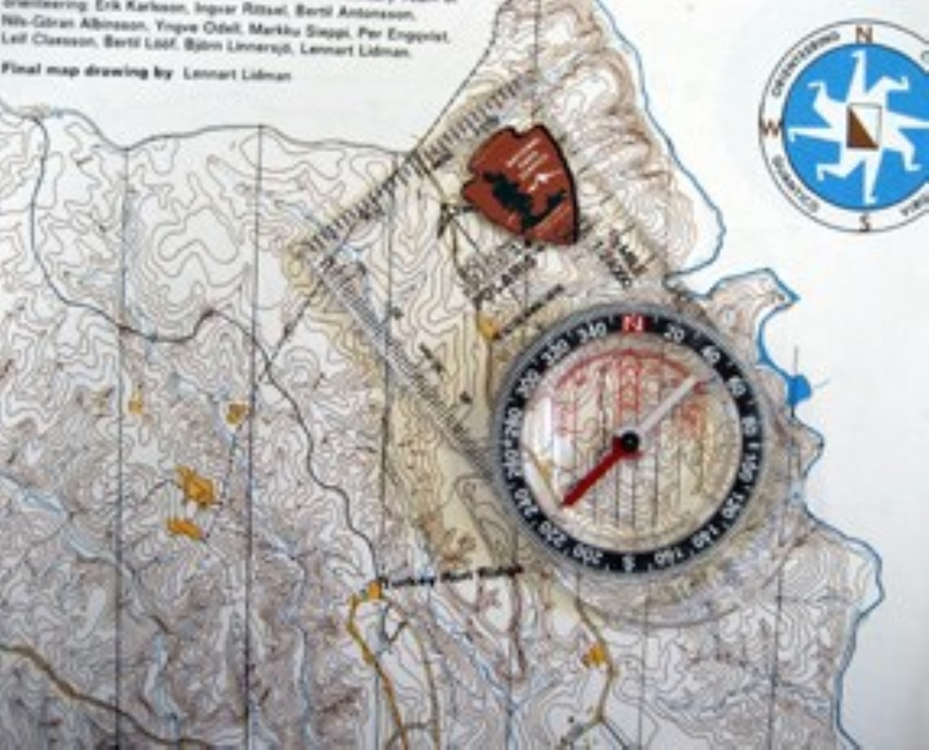
Turkey Run Ridge Group Campground is located around 3 miles from the park entrance on the Turkey Run Road just off of the park's Scenic Drive. There are 9 campsites open year round as well as an amphitheater with wooden benches down a short dirt trail that can be rented for day use. Sites A-E are located on a short paved loop road off of Turkey Run Road and Sites F-I are located around a large paved square parking area at the end of Turkey Run Road. The amphitheater is located down a dirt trail at the southwest corner of the large square paved parking area. Sites A, B, D, G, H, and I can hold up to 25 campers, and sites C, E, and F can hold up to 40 campers. All these group campsites are in a mixed hardwood forest with plenty of shade, several picnic tables at each site, and grated campfire rings. There are 2 restrooms with flush toilets and sinks: one at the end of the loop near sites A-E and one near the square parking area near sites F-I. Several dark brown park office buildings are also located near the square parking area, although they are closed to the public. Several dirt trails through the forest leave from the campground area: the Turkey Run Ridge Trail for hiking starts across Turkey Run Road from the loop holding sites A-E, the Little Run Loop Trails for hiking start from behind the restrooms near the square parking area, and Old Blacktop Road for hiking and biking is a wide gravel trail that start at a gate at the end of Turkey Run Road near the end of the square parking area. An orienteering course to find numbered wooden posts off trail in the forest with a map and compass also starts at this campground with the starting point being a yellow fire hydrant at the northeast corner of the square parking area at the end of Turkey Run Road. Maps and compasses to complete this course can be issued at the visitor center near the entrance of the park.
Learn about animals that live in and travel between the canopy, understory, and floor of the forests at Prince William Forest Park by hiking the Piedmont Forest Trail.
At the intersection between the two sides of the Piedmont Forest Trail loop not far from the trailhead, a slanted sign overlooks a slight hill down into the forest. This sign is titled "A Piedmont Forest High-Rise" and varies in color from green at the top to blue at the bottom. Underlying the text and the color variation is a picture of a heavily forested area near the edge of a creek flowing with water. Directly below the sign title, text reads, "Forests are like high-rise apartment buildings. Various residents live on different floors. Some residents travel between floors, especially when they eat or go to gather food. Exhibits along this path provide a glimpse of various plants and animals that inhabit three floors in this Piedmont forest high-rise from the treetops up above to the stream down below." In bright green to the right of this paragraph on the sign, text reads, "Top Floor: Canopy. In the spring and summer, oaks, hickories, and other deciduous trees provide a leafy umbrella, or canopy, that shades and cools the Piedmont forest." Directly below this paragraph on the sign in dark green, text reads, "Middle Floor: Understory. Shallow gullies carry rainwater and snowmelt and create habitats that are periodically moist, damp, or dry." Directly below this paragraph on the sign in blue, text reads, " Basement: Forest Floor. Low-lying plants, mosses, leaves, and acorns carpet the ground. In some areas a stream runs through the forest floor."
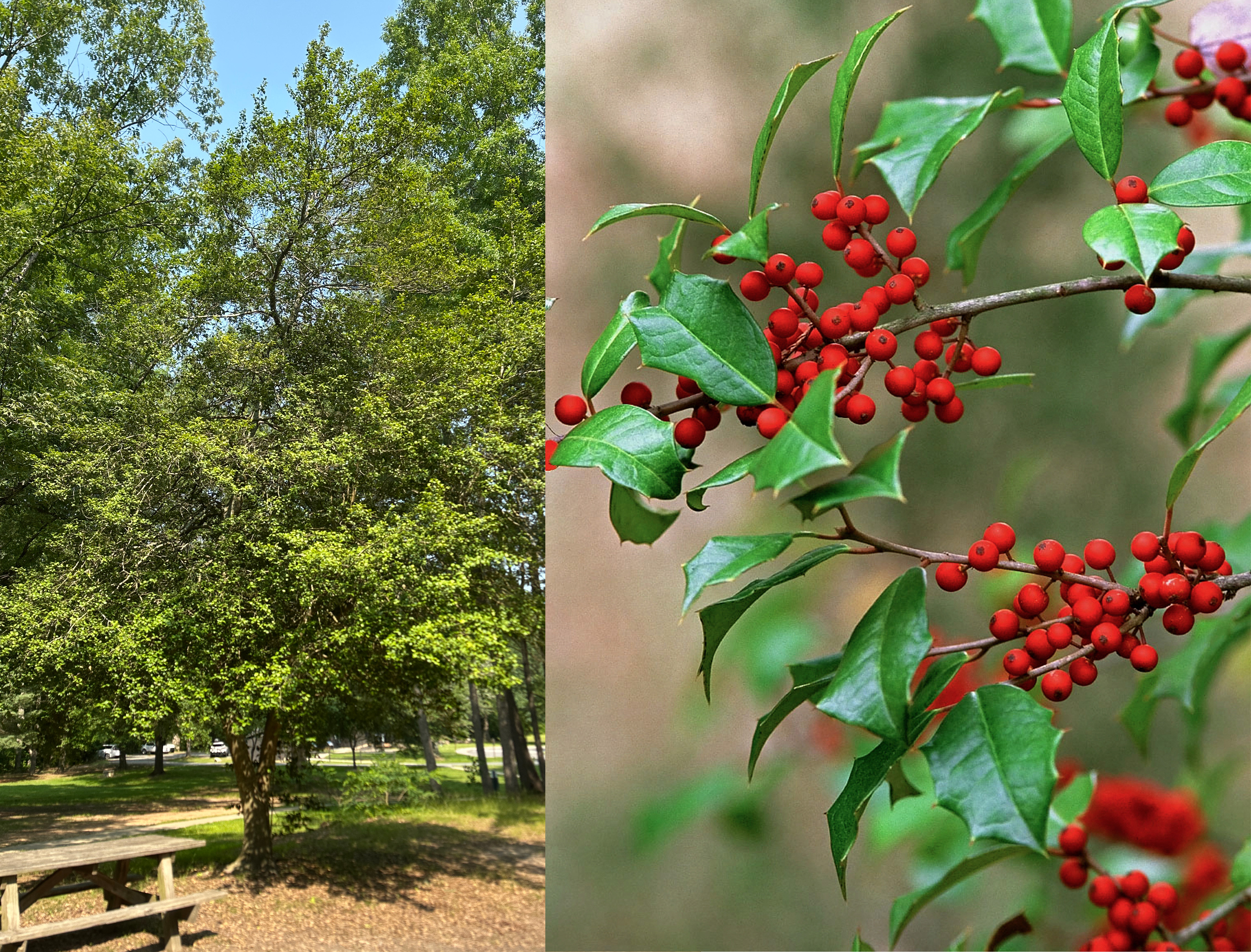
Learn about American Holly, an evergreen tree in the Pine Grove Picnic Area! American holly's glossy spiky leaves and beautiful red berries make it a very popular symbol during the Christmas season.
A small metal sign is placed about two feet from the tree. The sign plate is brown with white text on it. The sign identifies the tree as American Holly and provides a Latin name for it. The tree is a medium size tree, less than a two-story building in height, with a trunk that is split into two parts about a foot above ground level. Split trunks of the tree grow upward at a V-shaped angle. The trunks have smooth grayish-brown bark. The leaves and branches of the tree form an irregular oval-shaped crown. The tree is near a roofed wooden pavilion and several wooden picnic tables. The tree is surrounded by patches of grass and a few larger pine trees.
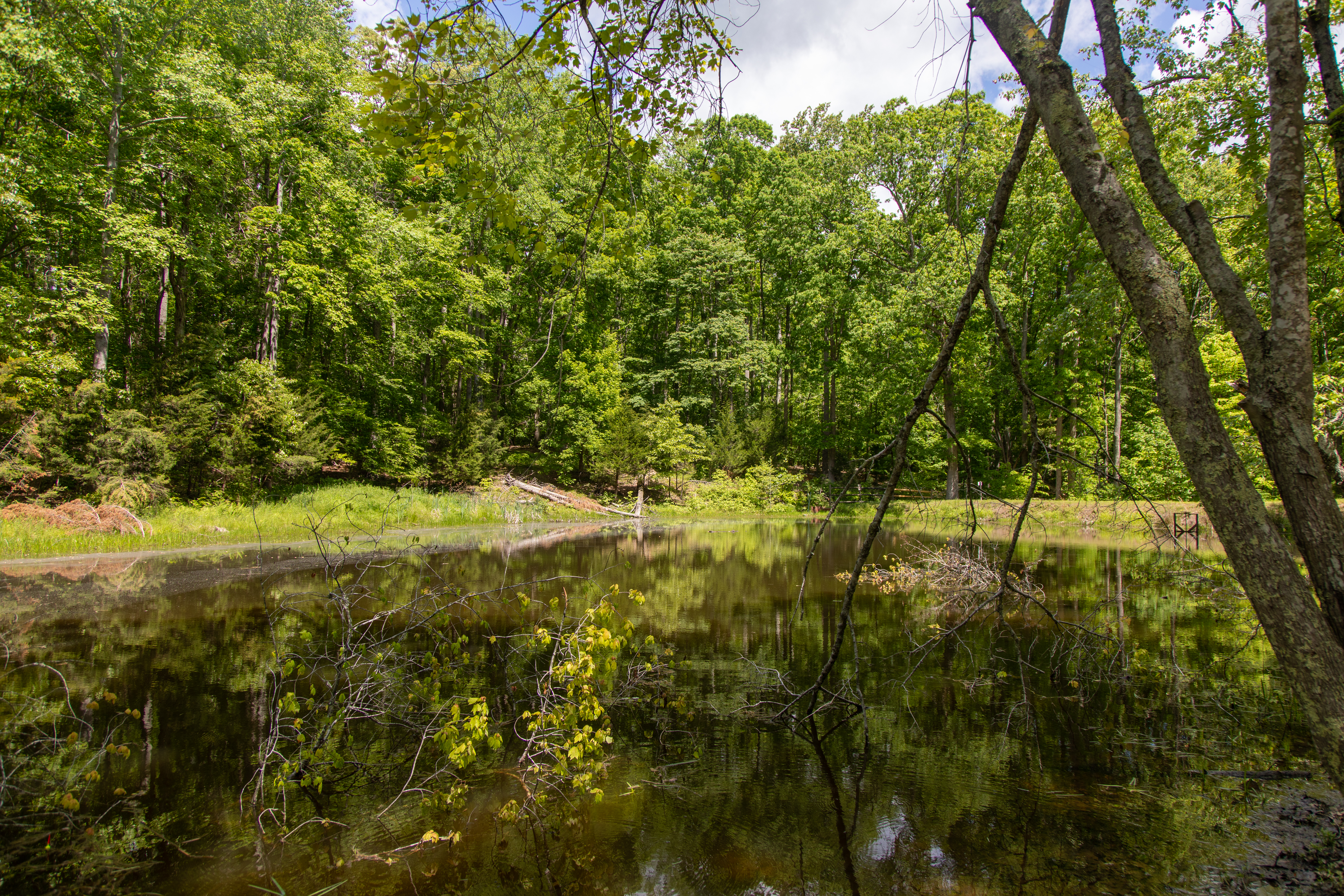
Come to Carters Pond on a summer morning to listen to a chorus of bull frogs.
Drive northeast on Scenic Drive for just over a mile until you come to Carters Pond Road, where there is a parking lot. The picnic table and trail entrance are at the end of the parking lot, about 150 feet away.
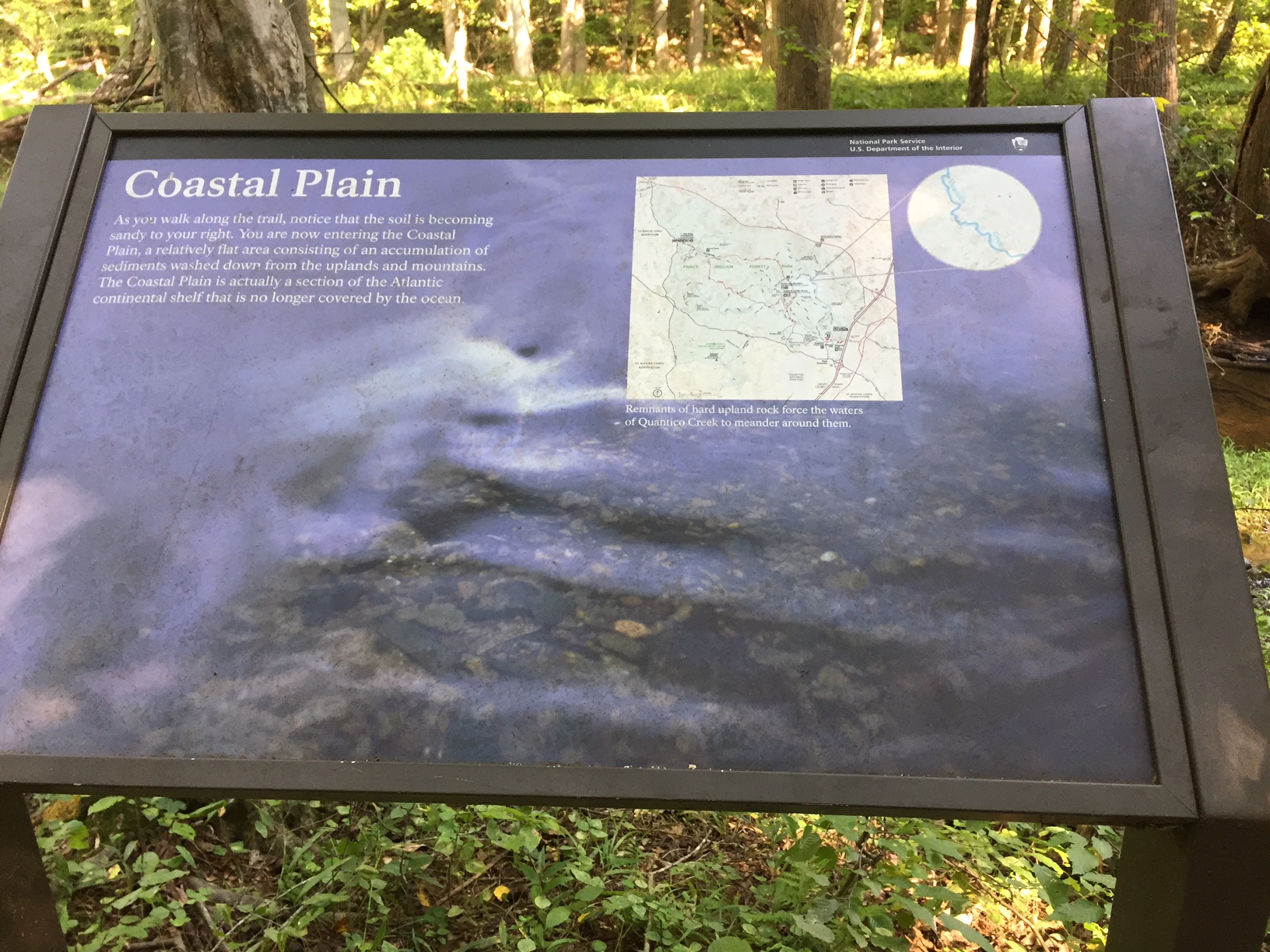
Learn about the geology of Prince William Forest Park by hiking the Quantico Cascades trail and exploring the area where the rolling hills of the Piedmont forest meets the flat, sandy coastal plain sediments.
The trail follows Quantico Creek, a shallow stream about 10 feet in width. This stop is located in a flat, shaded area in the forest beside the creek. The sign has a black bar at the top with the words "National Park Service, U.S. Department of the Interior" and an NPS arrowhead symbol on the black bar in the upper right corner. The sign is titled "Coastal Plain" and a picture of shallow water flowing over gravel underlies the entire sign. Under the title in the upper left corner of the sign is a short paragraph reading, "As you walk along the trail, notice that the soil is becoming sandy to your right. You are now entering the Coastal Plain, a relatively flat area consisting of an accumulation of sediments washed down from the uplands and mountains. The Coastal Plain is actually a section of the Atlantic continental shelf that is no longer covered by the ocean." On the upper right corner of the sign next to the paragraph is a square image of the entire park map which is a large oval-like area of green with the two branches of Quantico Creek and major roadways and trails in the park. A circular enhanced portion of the map is to right of the square map image on the sign. This enhanced circular image shows the mapped waterway of Quantico Creek where you are currently standing. While the creek has tight curves near the top of the enhanced image (in the Piedmont), the curves start to straighten near the bottom of the enhanced image (in the Coastal Plain). A caption of the map image on the sign reads, "Remnants of hard upland rock force the waters of Quantico Creek to meander around them."
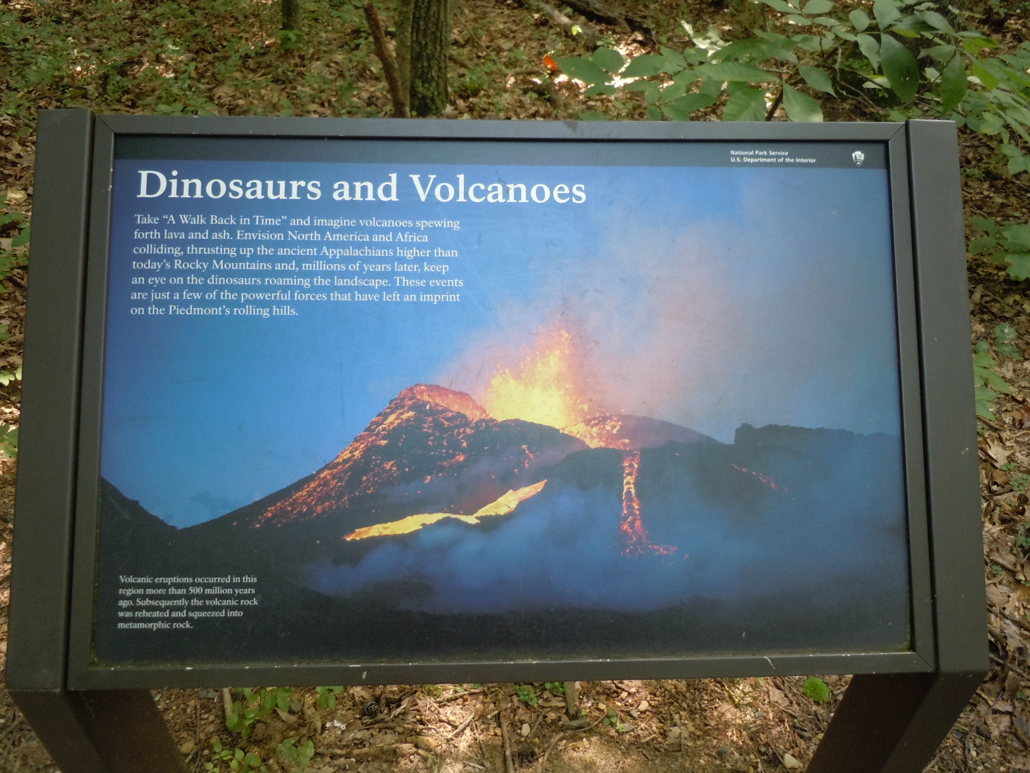
Learn about the geology that shaped the landscape of Prince William Forest Park by hiking the Quantico Cascades Trail.
At the intersection of two trails, a shaded slanted sign overlooks a forested area. The sign has a black bar at the top with the words "National Park Service, U.S. Department of the Interior" and an NPS arrowhead symbol on the black bar in the upper right corner. The sign is titled "Dinosaurs and Volcanoes" and has large picture of a volcano erupting fountains of molten yellow and red lava at dusk that takes up the entire background of the sign. Under the title on the upper left side of the sign, a paragraph reads, "Take 'A Walk Back in Time' and imagine volcanoes spewing forth lava and ash. Envision North America and Africa colliding, thrusting up the ancient Appalachians higher than today's Rocky Mountains and, millions of years later, keep an eye on the dinosaurs roaming the landscape. These events are just a few of the powerful forces that have left an imprint on the Piedmont's rolling hills." In the lower left corner, another paragraph reads, "Volcanic eruptions occurred in this region more than 500 million years ago. Subsequently the volcanic rock was reheated and squeezed into metamorphic rock."
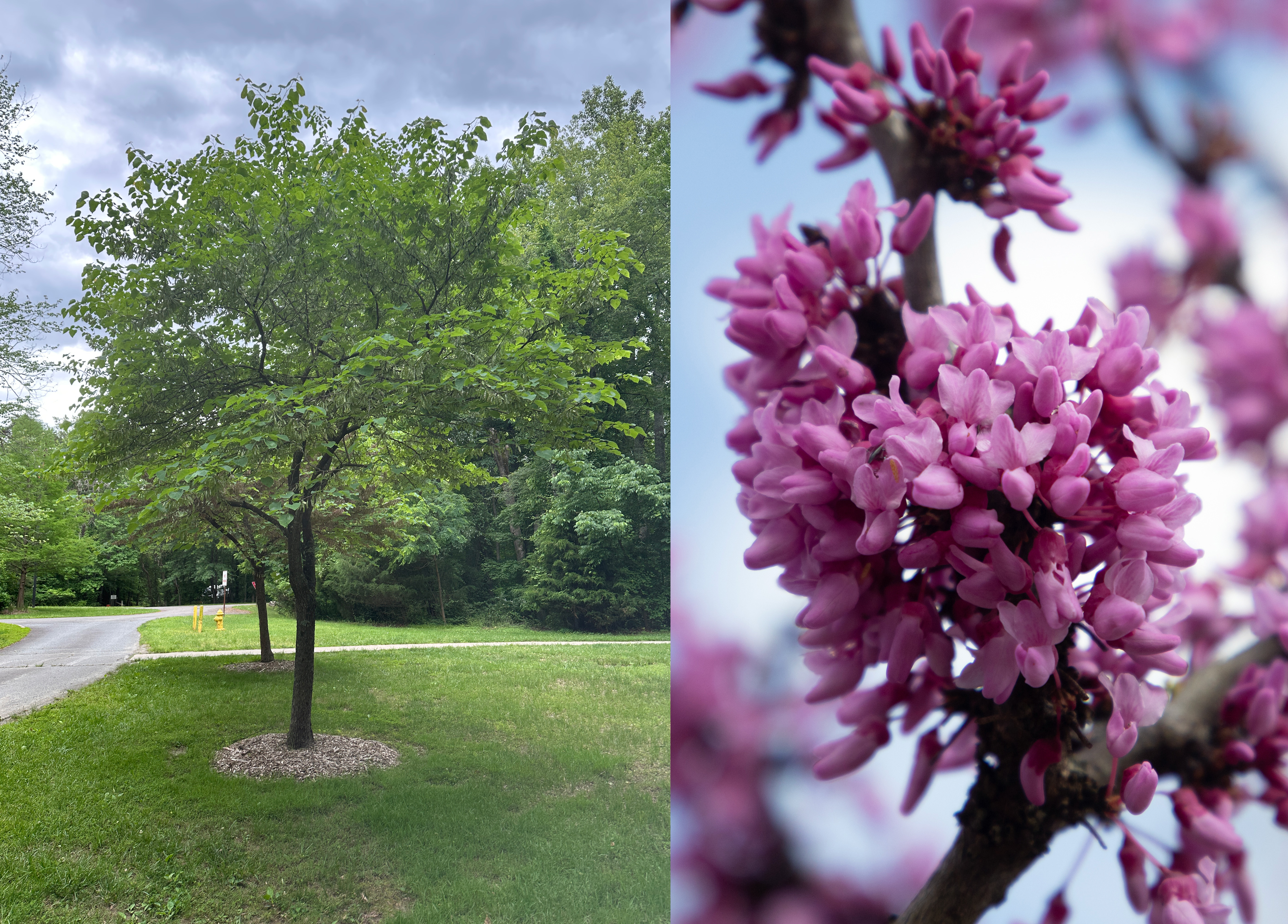
A small metal sign that is placed about a foot from the tree. The sign plate is brown with white text on it. The sign identifies the tree as Eastern Redbud and provides a Latin name for it. It is a small tree, approximately one-story building in height. The tree has a thin trunk, darker brown bark which is mostly smooth to the touch. The leaves and branches form a spreading, irregular-shaped round crown. At the base of the tree, there is a small circular bed of mulch. The tree is located in a grassy flat area, surrounded by two similar trees on each side and is in close proximity to a paved pathway.
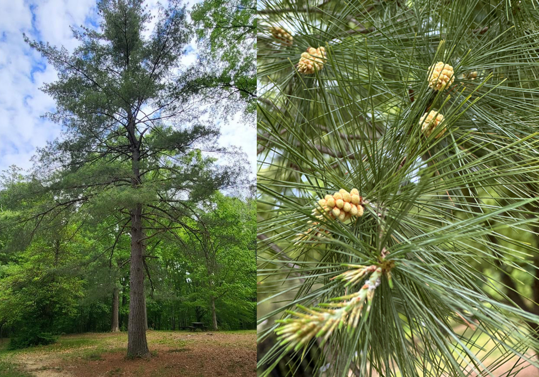
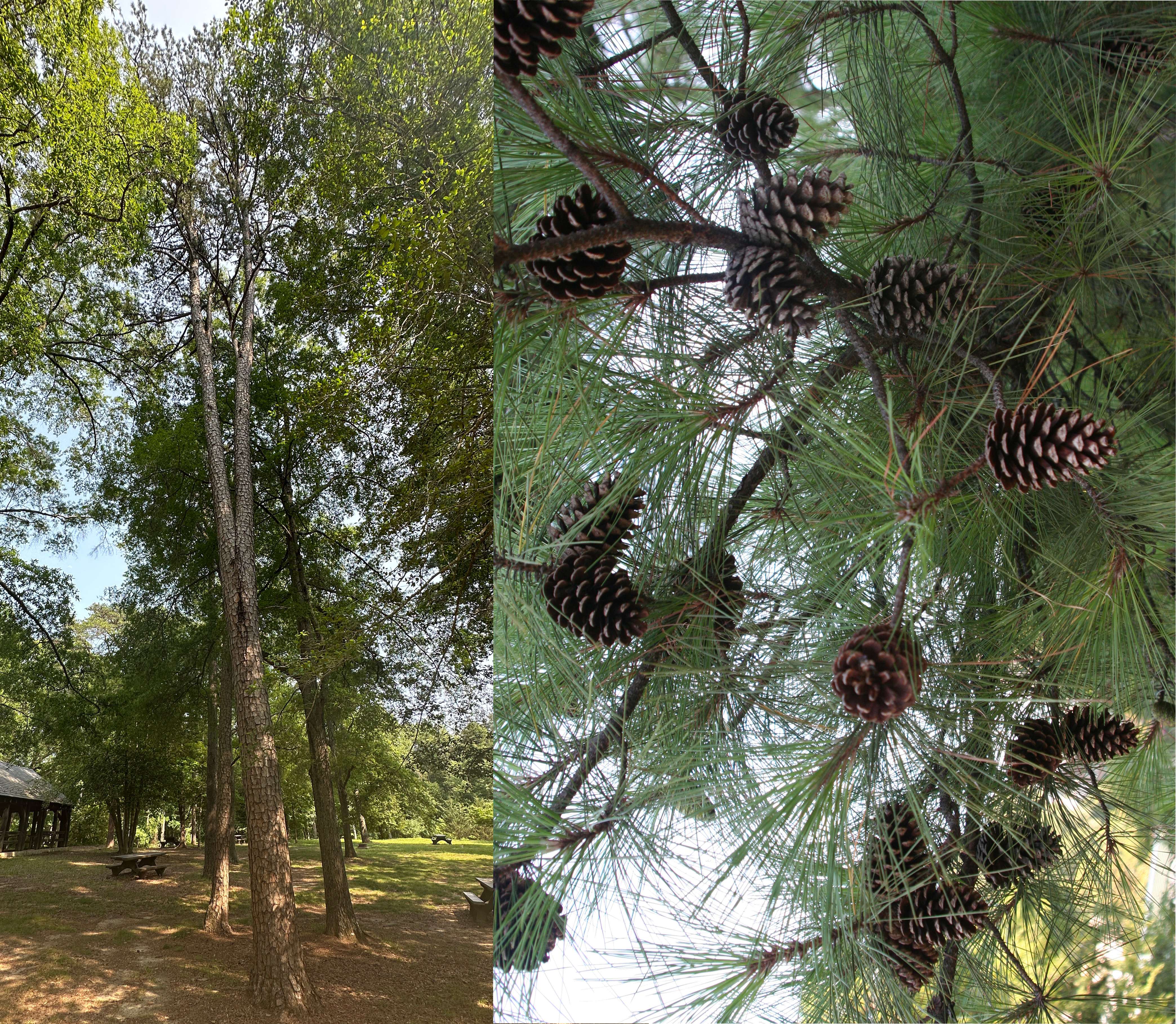
Learn about the Eastern White Pine, a large shade tree near the picnic pavilion! Did you know that the Eastern white pine is largest conifer in the northeast?
A small metal sign that is placed about two feet from the tree. The sign plate is brown with white text on it. The sign identifies the tree as Eastern White Pine and provides a Latin name for it. It is a very tall tree that is approximately the height of a 4-story building. The tree has a tall, straight trunk with dark brown bark that feels rough. The tree trunk is about 3 feet in diameter at its widest part that is close to the ground. The trunk is mostly bare, with the branches located in the top third of the tree and only visible when looking up at the top of the tree. The pointy leaves and branches form a sparce, pyramid-shaped crown. The tree is located in a flat area near the wooden pavilion with a picnic table close by and intersecting paved pathways in front of the tree.
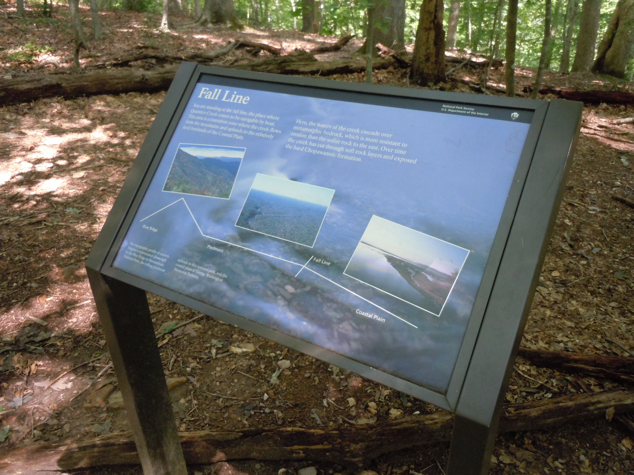
Learn about the geology of the area where the Piedmont Forest and Coastal Plain meet at the fall line in Prince William Forest Park.
At the edge of a hilltop, beside the trail is a shaded, slanted sign surrounded by a mixed hardwood forest. The sign has a black bar at the top with the words "National Park Service, U.S. Department of the Interior" and an NPS arrowhead symbol on the black bar in the upper right corner. The sign is titled "Fall Line" and a background picture of shallow water flowing over small rocks underlies the text on the sign. Directly underneath the sign title at the top are two paragraphs that read, "You are standing at the fall line, the place where Quantico Creek ceases to be navigable by boat. This area is a transition zone where the creek flows from the mountains and uplands to the relatively level lowlands of the Coastal Plain. Here, the waters of the creek cascade over metamorphic bedrock, which is more resistant to erosion than the softer rock to the east. Over time the creek has cut through soft rock layers and exposed the hard Chopawamsic formation." Underneath these paragraphs in the middle of the sign are three pictures spread along a timeline. On the left of the timeline on the sign is a color picture of tree-covered ridges of mountains seen from a high point labeled "Blue Ridge." On the middle of the timeline is a color aerial photograph of several small creeks winding through a forested area labeled "Piedmont." To the right of the Piedmont picture is a break in the timeline labeled "Fall Line." And finally on the right of the timeline is a color picture of shallow grassy marsh at the edge of a large body of water labeled "Coastal Plain." At the bottom left corner of the sign under the timeline is a short sentence reading, "The topographic profile of eastern Virginia is represented (from left) by the Blue Ridge in Shenandoah National Park, the rolling piedmont uplands in this national park, and the coastal plain at George Washington Memorial Parkway."
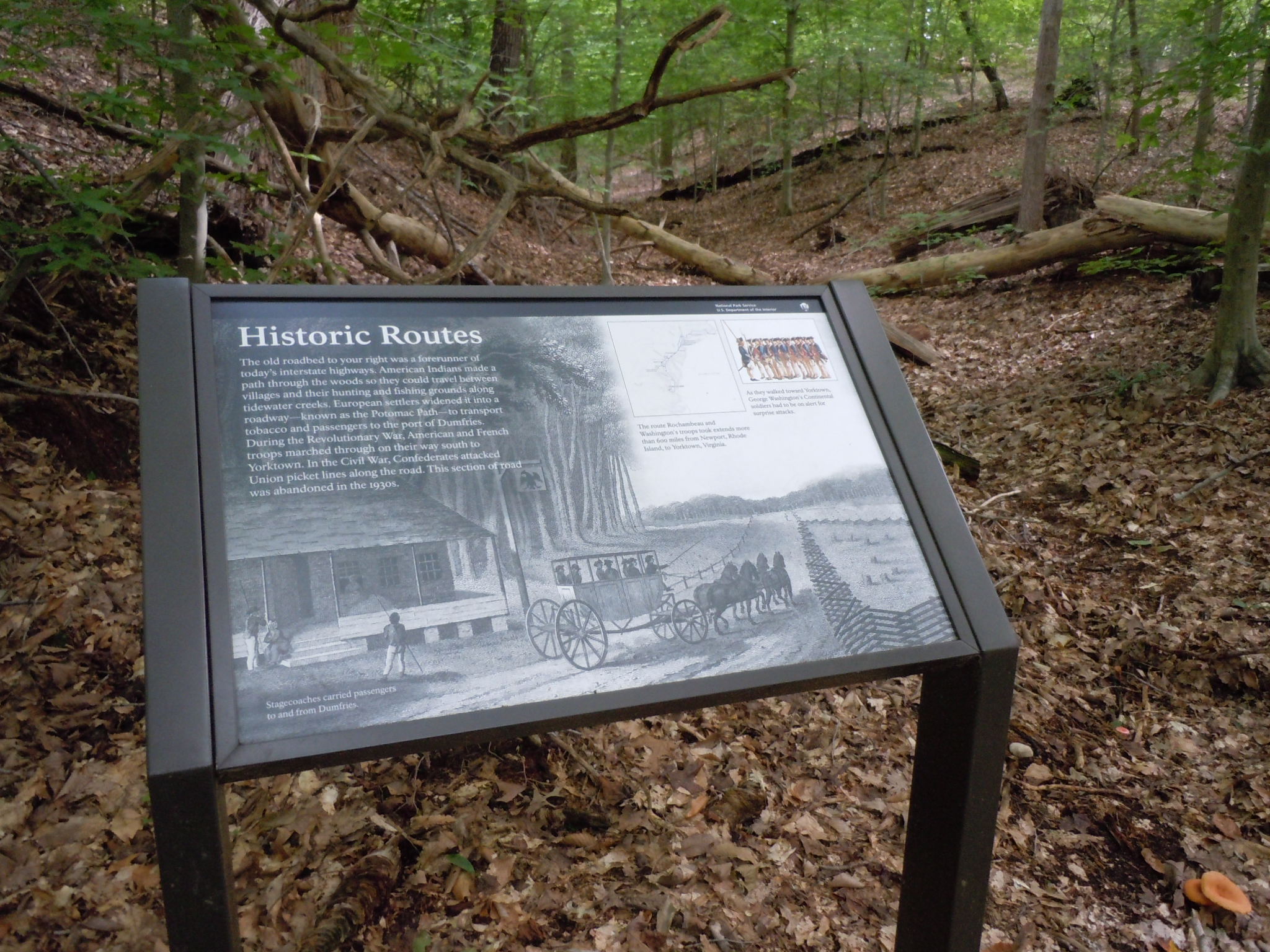
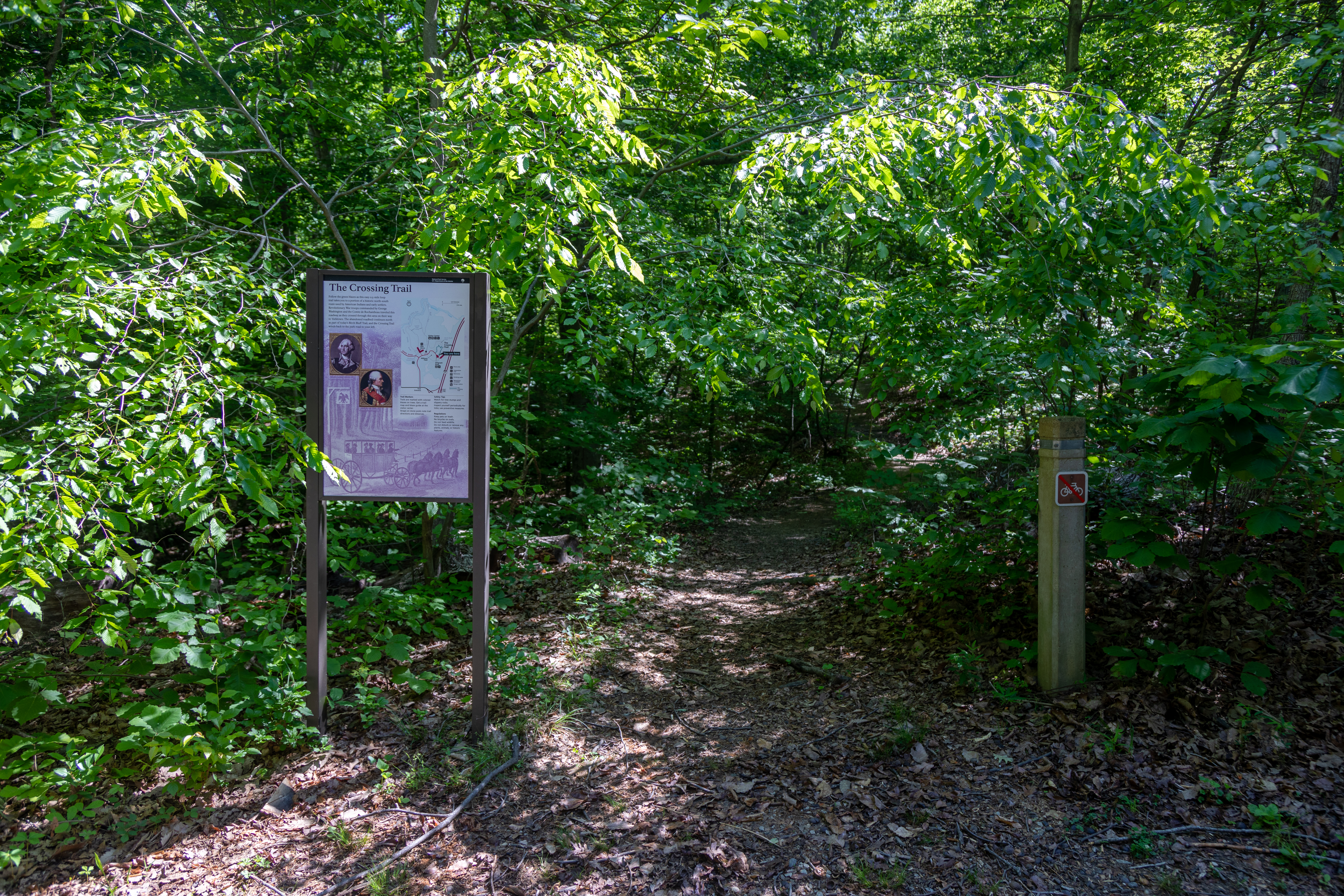
Hike through history on the Crossing Trail in Prince William Forest Park! Follow one of the old roads used by Native Americans and early settlers as well as Revolutionary War troops lead by George Washington and the Comte de Rochambeau as they crossed through this area on their way to Yorktown.
At a bend in the trail is a shaded sign in the forest which is located on an old road that looks like a straight shallow valley between two hills on either side. The sign has a black bar at the top with the words "National Park Service, U.S. Department of the Interior" and an NPS arrowhead symbol on the black bar in the upper right corner. Most of the sign consists of a large black and white print image underlying all the sign text of a house with a porch and sign out front beside a dirt road on which a 4 horse drawn stagecoach is traveling between fences on the edges of the road. A caption of this large background image reads, "Stagecoaches carried passengers to and from Dumfries." The sign itself is titled "Historic Routes" and a paragraph in the upper left under the title reads, "The old roadbed to your right was a forerunner of today's interstate highways. American Indians made a path through the woods so they could travel between villages and their hunting and fishing grounds along tidewater creeks. European settlers widened it into a roadway - known as the Potomac Path - to transport tobacco and passengers to the port of Dumfries. During the Revolutionary War, American and French troops marched through on their way south to Yorktown. In the Civil War, Confederates attacked Union picket lines along the road. This section of road was abandoned in the 1930s." To the right of that paragraph on the sign in the upper center is a square sparsely detailed map of the Washington-Rochambeau Trail route from Virginia to Rhode Island with NPS sites along the route highlighted. The map is captioned, "The route Rochambeau and Washington's troops took extends more than 600 miles from Newport, Rhode Island, to Yorktown, Virginia." To the right of the map image on the sign in the upper right corner is another small image of 13 Revolutionary War soldiers standing in a line wearing tricornered hats, blue jackets, and white pants. A caption of this image reads, "As they walked toward Yorktown, George Washington's Continental soldiers had to be on alert for surprise attacks."
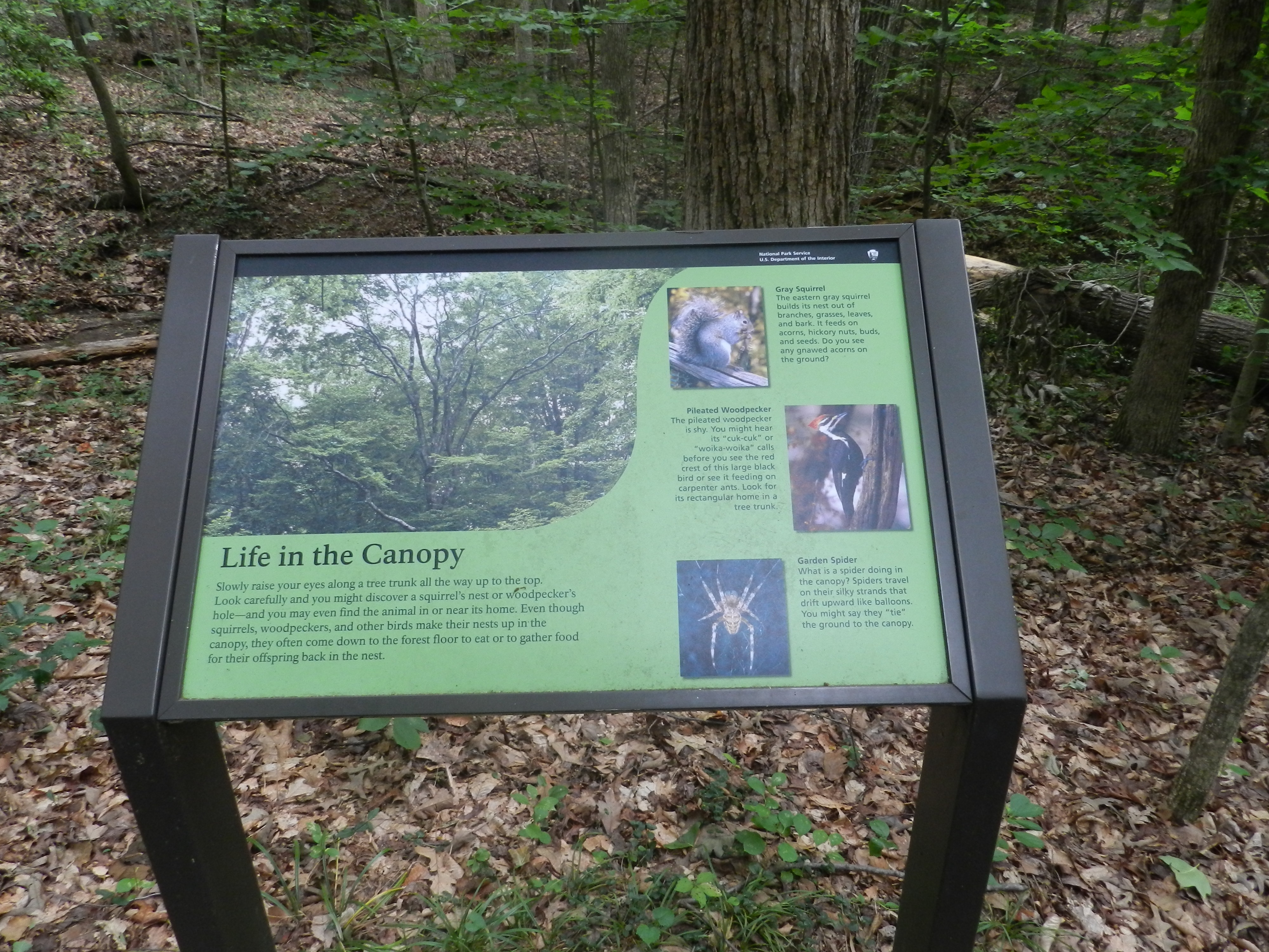
Learn about what animals live in and travel between the treetops at Prince William Forest Park by hiking the Piedmont Forest Trail.
At the corner of a switchback on the Piedmont Forest Trail is a shaded sign looking out into the forest. The sign has a large color picture on a green background of the branches and treetops of a green summer forest and is titled "Life in the Canopy." A paragraph underneath the sign title reads, "Slowly raise your eyes along a tree trunk all the way up to the top. Look carefully and you might discover a squirrel's next or woodpecker's hole - and you may even find the animal in or near its home. Even though squirrels, woodpeckers, and other birds make their nests up in the canopy, they often come down to the forest floor to eat or to gather food for their offspring back in the nest." To the upper right of the main picture on the sign is a smaller picture of a gray squirrel with a bushy tail crouched on a log in a yellow fall forest. A paragraph to the right of the pictures reads, "Grey Squirrel: The eastern gray squirrel builds its nest out of branches, grasses, leaves, and bark. It feeds on acorns, hickory nuts, buds, and seeds. Do you see any gnawed acorns on the ground?" Underneath the squirrel picture is a paragraph that reads, "Pileated Woodpecker: The pileated woodpecker is shy. You might hear its 'cuk-cuk' or 'woika-woika' calls before you see the red crest of this large black bird or see it feeding on carpenter ants. Look for its rectangular home in a tree trunk." To the right of that paragraph is a close-up picture of a large black bird with a red crest, white striped face and long beak perched on a tree trunk. Underneath the woodpecker picture is a paragraph reading, "Garden Spider: What is a spider doing in the canopy? Spiders travel on their silky strands that drift upward like balloons. You might say they 'tie' the ground to the canopy." To the immediate left of this paragraph on the sign is a close-up color picture of a large brown and tan mottled spider with eight legs sitting on the glistening white strands of its web.
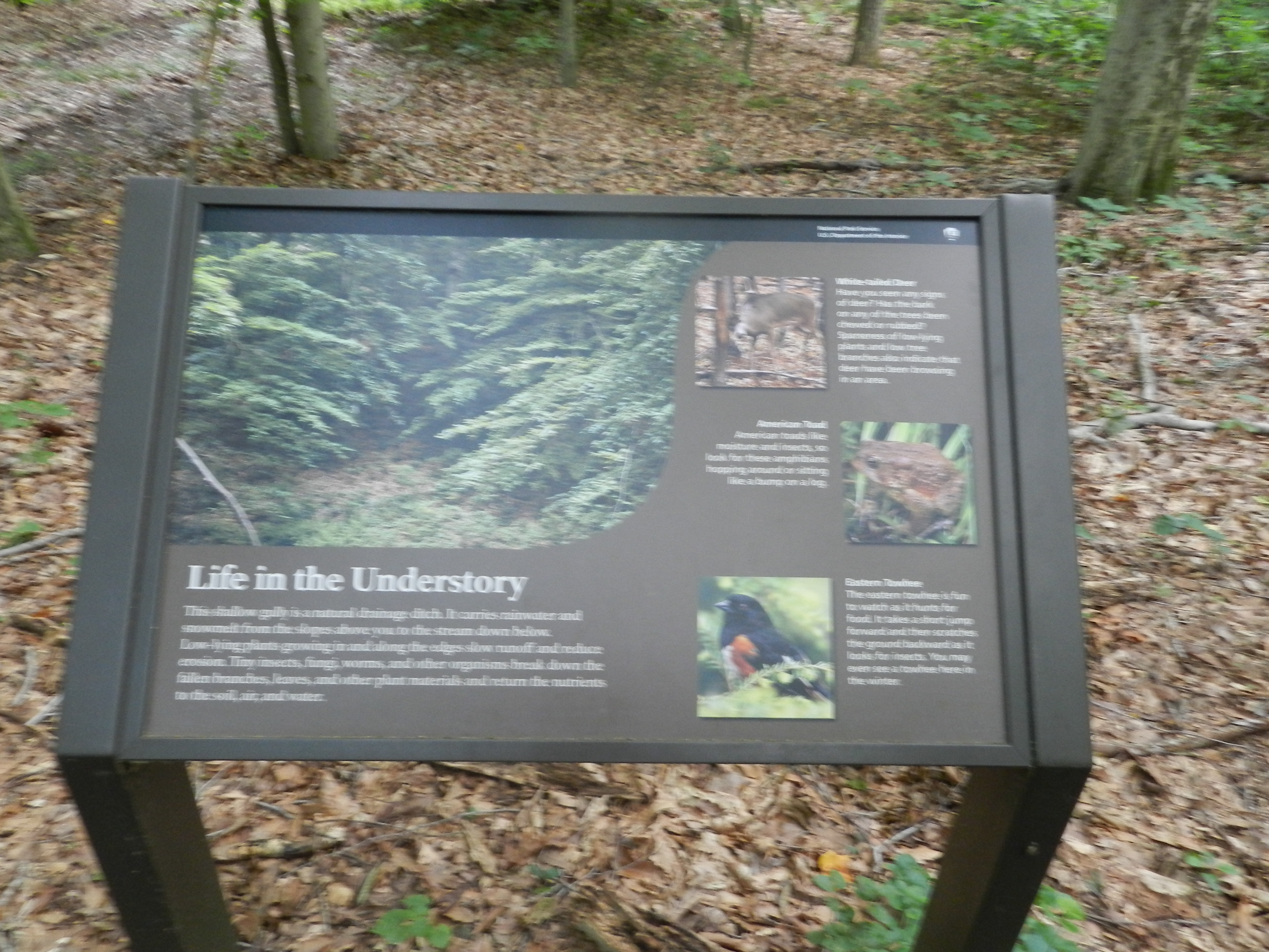
Learn about what animals occupy the understory layer of the forest at Prince William Forest Park by hiking along the Piedmont Forest Trail.
At the edge of a shaded trail in the forest is a sign overlooking a small ditch in the forest. The sign has a large color picture on a brown background of a green leafy forest and is titled "Life in the Understory." A paragraph underneath the sign title reads, "This shallow gully is a natural drainage ditch. It carries rainwater and snowmelt from the slopes above you to the stream down below. Low-lying plants growing in and along the edges slow runoff and reduce erosion. Tiny insects, fungi, worms, and other organisms break down the fallen branches, leaves, and other plant materials and return the nutrients to the soil, air, and water." To the upper right of the main picture and paragraph on the sign is a smaller picture of a brown deer standing in a winter forest among tree trunks and fallen leaves. A paragraph to the right of the picture reads, "White-tailed Deer: Have you seen any signs of deer? Has the bark on any of the trees been chewed or rubbed? Sparseness of low-lying plants and low tree branches also indicate that deer have been browsing in an area." Underneath the deer picture on the sign is a paragraph that reads, "American Toad: American toads like moisture and insects, so look for these amphibians hopping around or sitting like a bump on a log." To the right of that paragraph is a color picture of a bumpy brown toad crouched among green grass. Underneath the toad picture on the sign is a paragraph reading, "Eastern Towhee: The eastern towhee is fun to watch as it hunts for food. It takes a short jump forward and then scratches the ground backward as it looks for insects. You may even see a towhee here in the winter." To the immediate left of this paragraph on the sign is a color picture of a small black bird with a red and white breast perched on a green leafy tree branch.
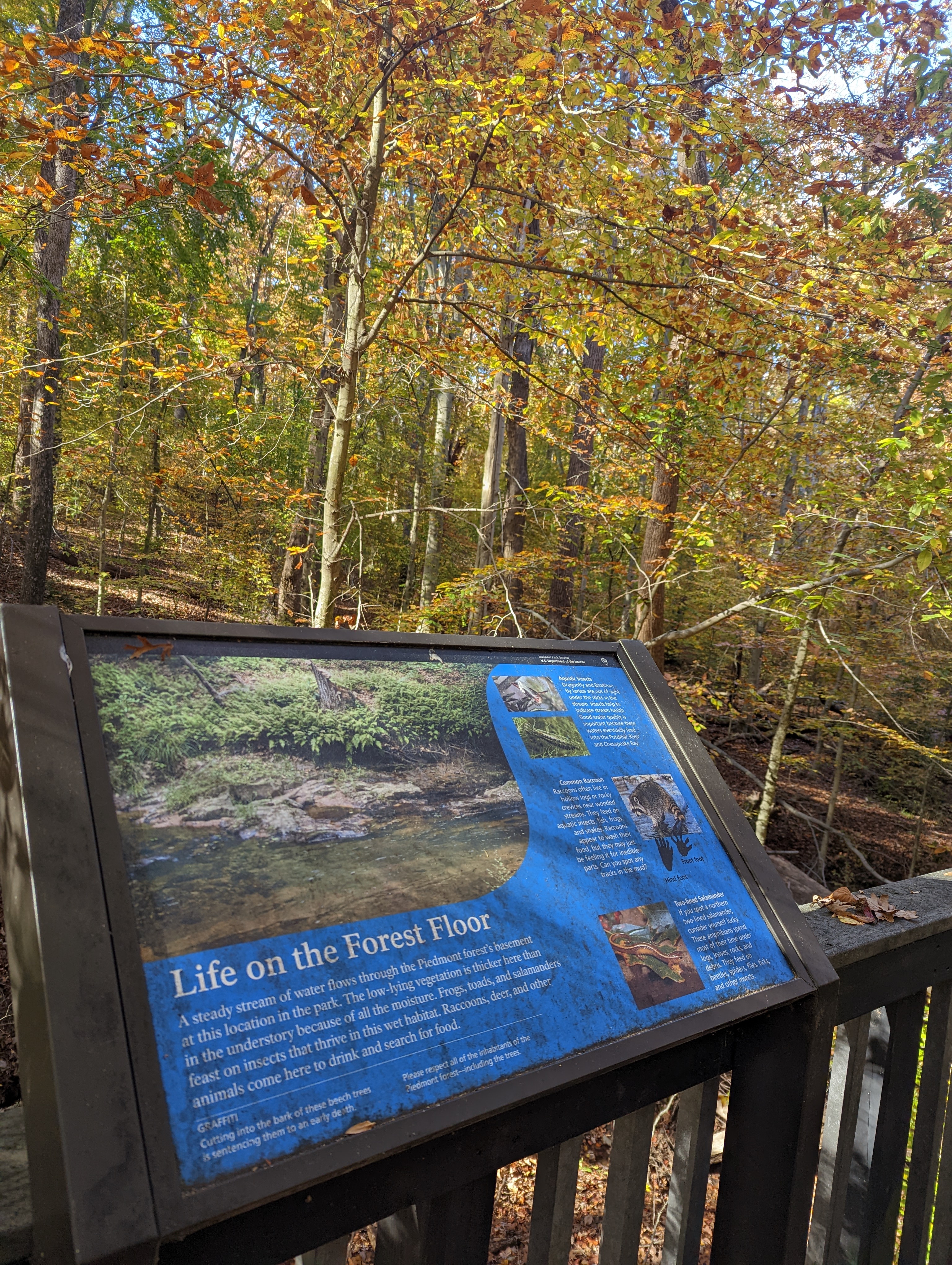
Learn about the different animals that live on the forest floor in Prince William Forest Park by hiking the Piedmont Forest Trail. Pause a moment to take in the sounds of the forest on the deck at the end of the trail.
The Piedmont Forest Trail passes through a large, wide, shaded circular dark brown deck with 3 benches and a high table wrapped around 4 trees growing up through the deck. The deck overlooks a tributary stream to Quantico Creek in the forest that is occasionally filled with water. The deck is encircled by a dark brown railing. On the left side of the deck near the railing is a slanted sign with information about animals in the forest. The sign has a large color picture on a blue background of a flowing creek beneath a streambank covered in green ferns and is titled "Life on the Forest Floor." A paragraph underneath the sign title reads, "A steady stream of water flows through the Piedmont forest's basement at this location in the park. The low-lying vegetation is thicker here than in the understory because of all the moisture. Frogs, toads, and salamanders feast on insects that thrive in this wet habitat. Raccoons, deer, and other animals come here to drink and search for food." A warning underneath the paragraph reads, "Graffiti: Cutting into the bark of these beech trees is sentencing them to an early death. Please respect all of the inhabitants of the Piedmont forest - including the trees." To the upper right of the main picture and paragraph on the sign are two stacked smaller pictures: the top one of a small brown and red winged insect and the bottom one of a small green cylindrical insect. A paragraph to the right of the pictures reads, "Aquatic Insects: Dragonfly and Boatman fly larvae are out of sign under the rocks in the stream. Insects help to indicate stream health. Good water quality is important because these waters eventually feed into the Potomac River and Chesapeake Bay." Underneath the insect pictures is a paragraph that reads, "Common Raccoon: Raccoons often live in hollow logs or rocky crevices near wooded streams. They feed on aquatic insects, fish, frogs, and snakes. Raccoons appear to wash their food, but they may just be feeling it for inedible parts. Can you spot any tracks in the mud?" To the right of that paragraph is a color picture of a grey raccoon with a black face and black and grey striped tail standing in water. Underneath and partially overlaying the raccoon picture are two silhouettes of small, five fingered, clawed tracks labeled hind foot and front foot. Underneath the raccoon tracks and picture is a paragraph reading, "Two-lined Salamander: If you spot a northern two-lined salamander, consider yourself lucky. These amphibians spend most of their time under logs, leaves, rocks, and debris. They feed on beetles, spiders, flies, ticks, and other insects." To the immediate left of this paragraph on the sign is a color picture of a small glistening orange salamander with black eyes laying on a green oak leaf.
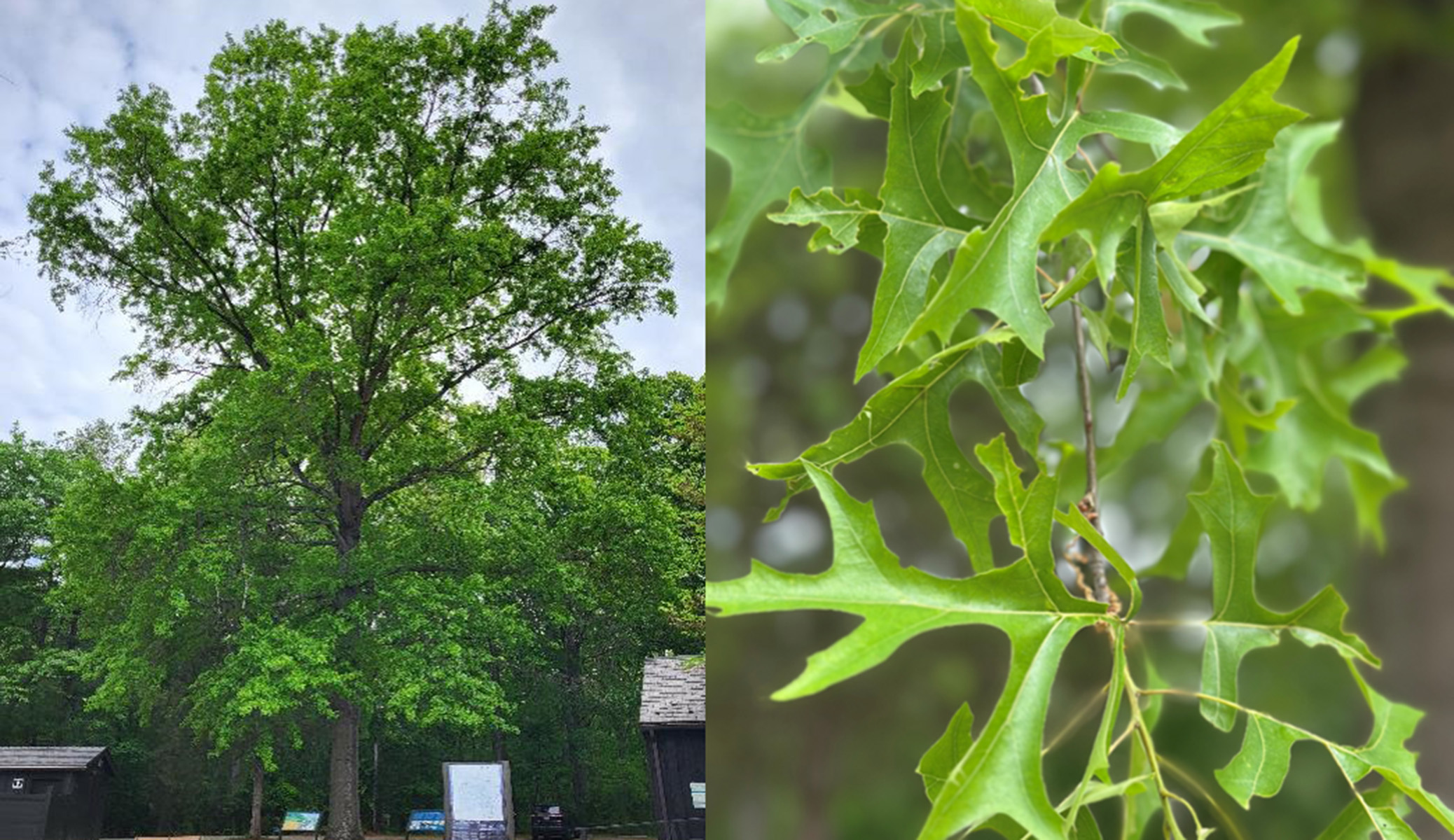
Learn about the Northern Pin Oak, a large shade tree near the visitor center! Can you find a “scary face” on the trunk of the large Northern Pin Oak?
A small metal sign that is placed about four feet from the tree. The sign plate is brown with white text on it. The sign identifies the tree as Northern Pin Oak and provides a Latin name for it. It is a very tall, large-sized tree with a large, slightly ridged trunk. The trunk has a greyer, shallow ridged bark, and the leaves and branches of the tree form a spreading round-shaped crown and provide significant shade. The tree is standing by itself in a flat grassy area. It is surrounded by one-story small wooden buildings on each side, a parking lot behind it, and a cemented pathway with a bench and two informational signs in front of it.
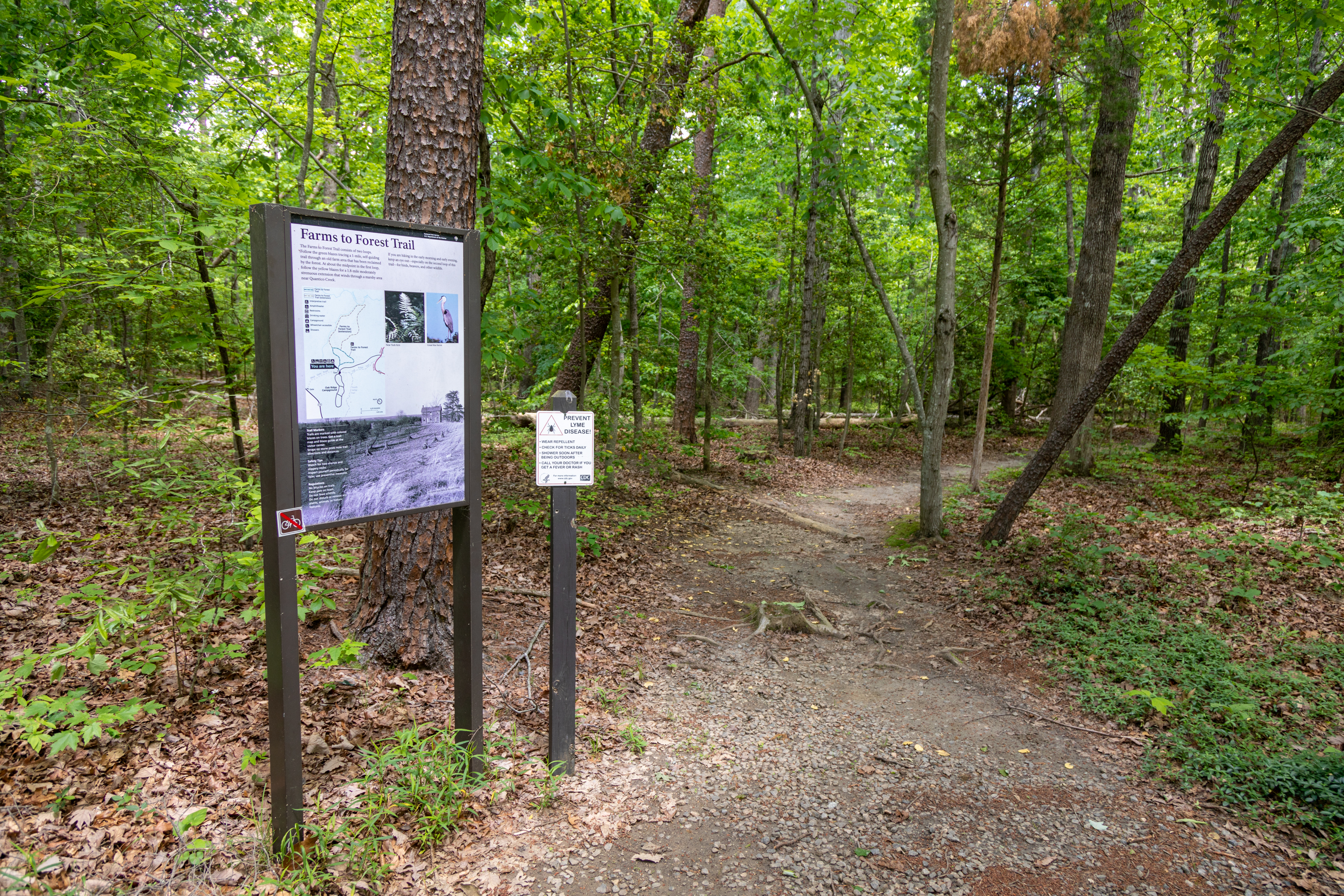
Park at Oak Ridge to access the Farms to Forest Trail, a 1.7-mile loop, and the South Valley Trail, a 9.7-mile trail that weaves throughout the park.
The day use parking area is in front of the entrance to the campground. It is paved, accommodates about 10 vehicles, and provides access to the Farms to Forest Loop and the South Valley trail.
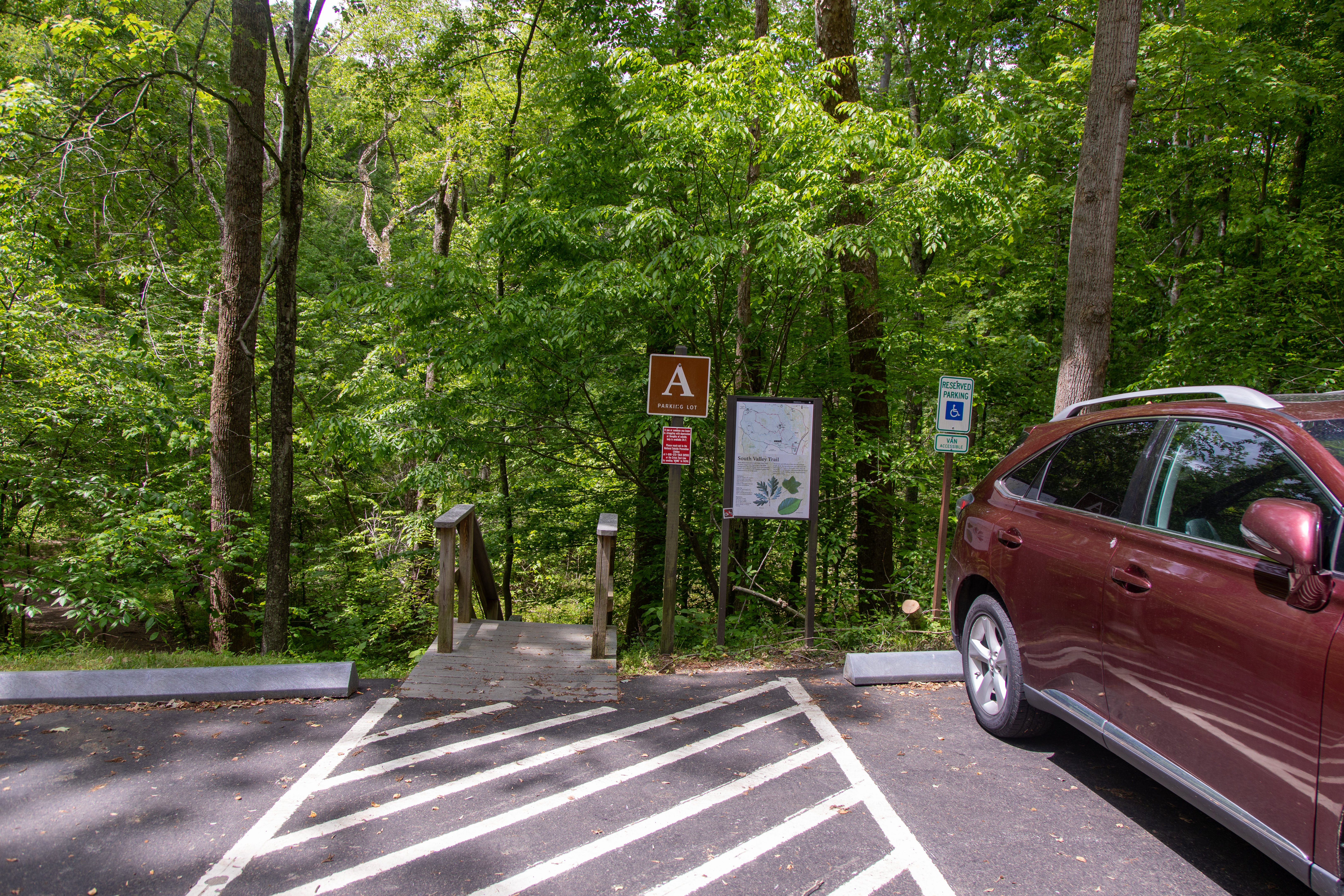
Lot A provides access to the South Valley Trail, a 9.7-mile trail that weaves throughout the park
Lot A is on the west side of the park’s Scenic Drive. It is paved, accommodates about 6 vehicles, and provides access to the South Valley Trail. The trailhead starts in the middle of the parking lot and begins with a set of wooden stairs going down, then the trail becomes a dirt path.
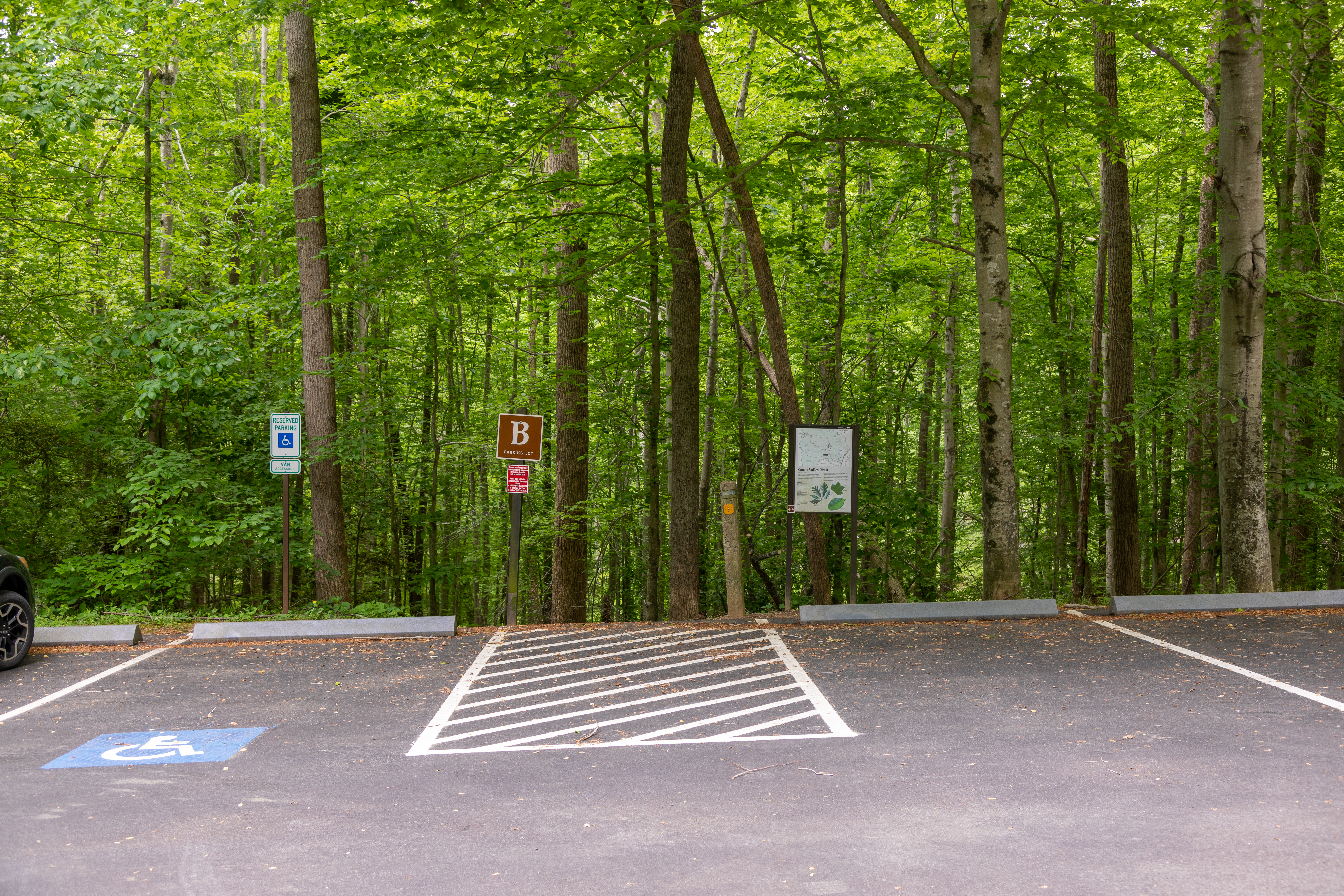
Lot B provides access to the South Valley Trail, a 9.7-mile trail that weaves throughout the park
Lot B is on the west side of the park’s Scenic Drive. It is paved, accommodates 10-15 vehicles, and provides access to the South Valley Trail. The trailhead is positioned in the middle of the parking spots and is a dirt path going slightly downhill at first.
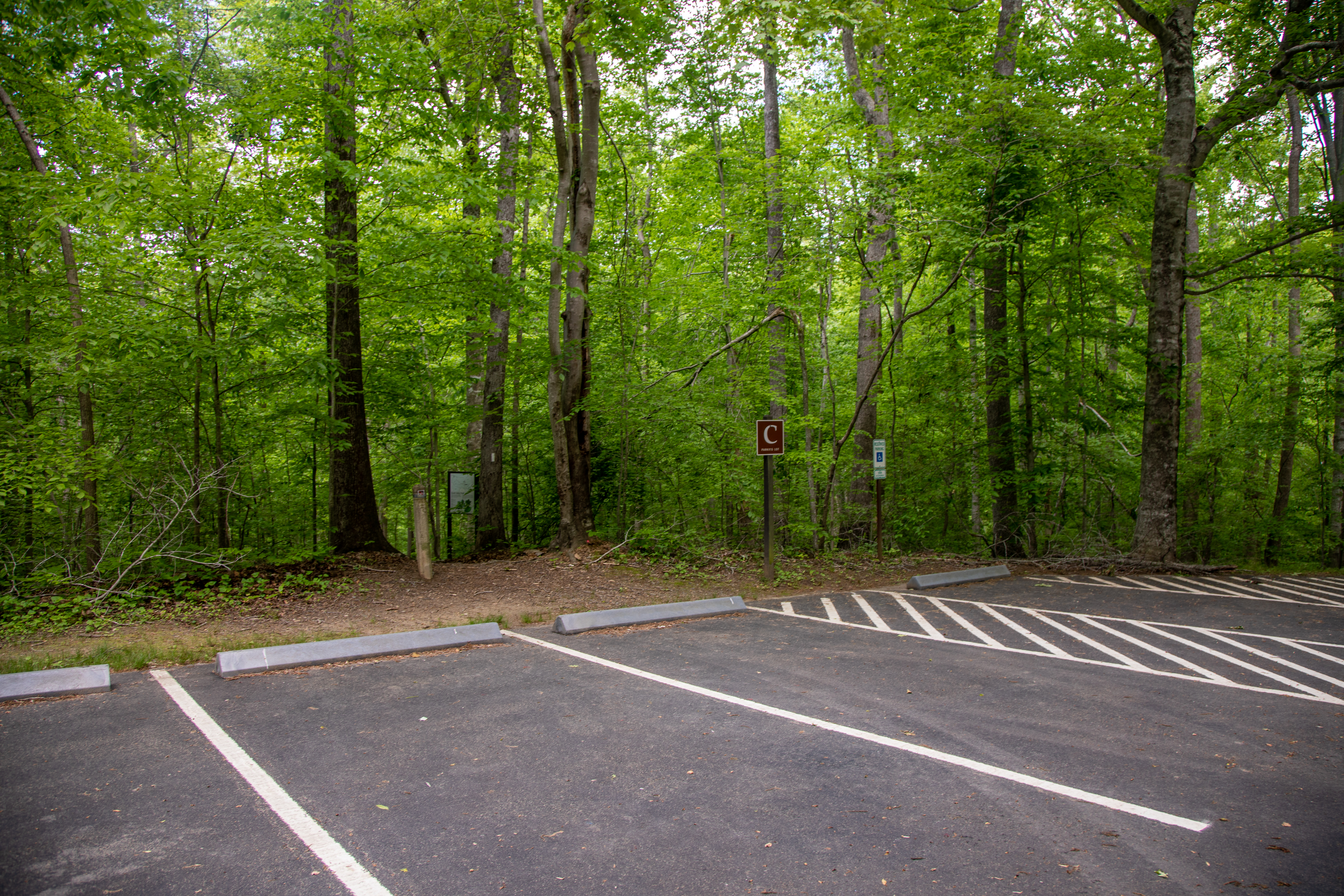
Lot C provides access to the South Valley Trail, a 9.7-mile trail that weaves throughout the park
Lot C is on the west side of the park’s Scenic Drive. It is paved, accommodates 9 vehicles, and provides access to the South Valley Trail. If you are facing the lot, away from the street, the trailhead is positioned towards the right corner of the lot. It is marked with a wayside and is a dirt path.
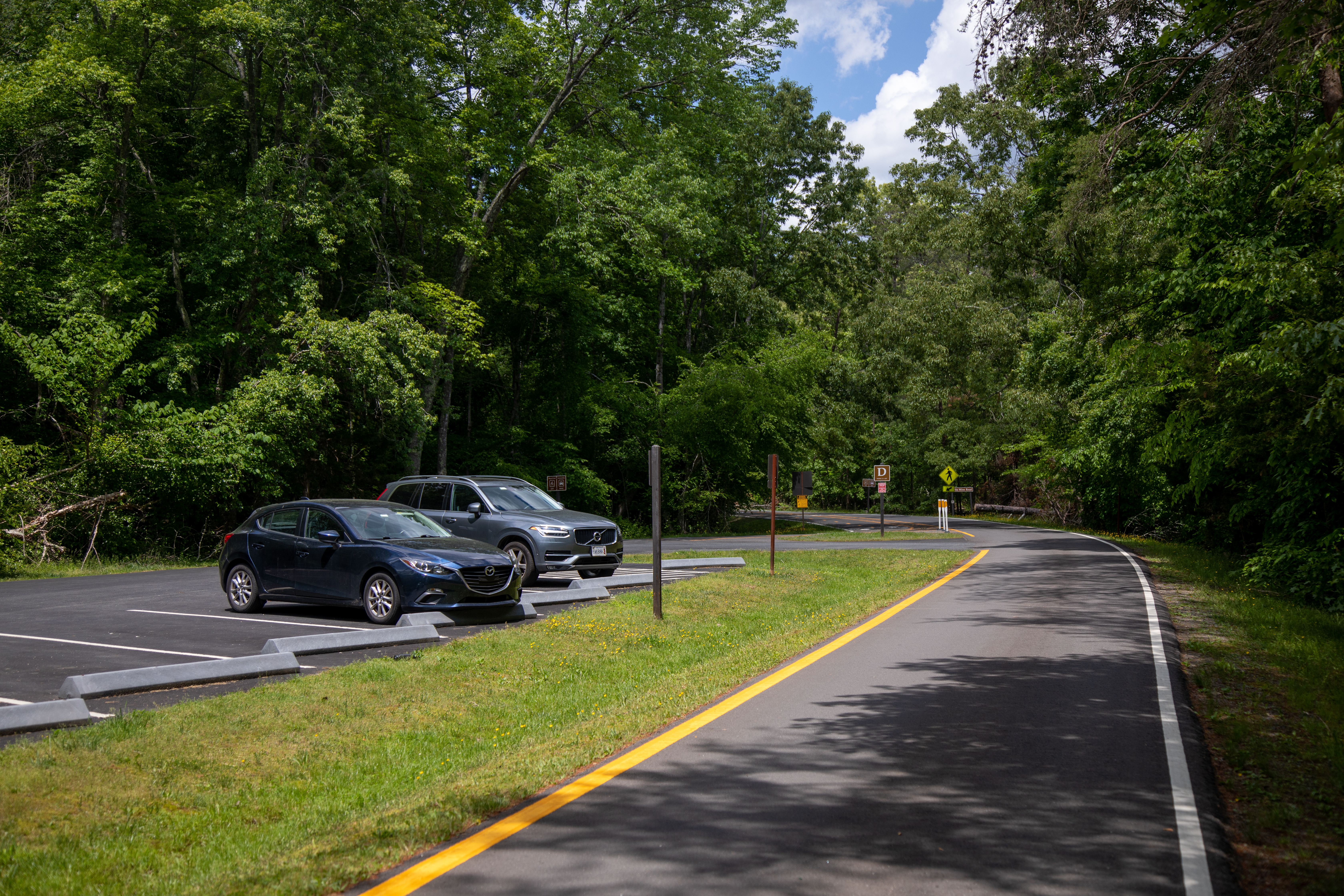
Lot D provides access to North Orenda Road and Pyrite Mine Road, which are both hike and bike trails. The bike lane along the Scenic Drive also begins here.
Lot D is on the west side of the park’s Scenic Drive and is separated from the road by a small grass barrier. It is paved, accommodates about 20 vehicles, and provides access to North Orenda Road and Pyrite Mine Road, which are both hike and bike trails. The bike lane along the Scenic Drive also begins here. To access North Orenda Road after you have parked your car, walk to the south end of the lot and cross the street to find the trailhead. For Pyrite Mine Road, walk to the north end of the lot and cross the street. Two upright information signs on the western side of the parking lot give more information about bicycling in the park and hiking the Pyrite Mine Road. The left sign is titled "Bicycling Guide" and has a large map of the park bicycling trails which consist of unpaved service roads and Scenic Drive loop. Text under the title reads, "The park offers a variety of bicycling experiences on more than 12 miles of paved roads and 9.2 miles of unpaved fire roads. Approximately 3 miles of the Scenic Drive, from parking lot D to Oak Ridge Road, are set aside as a relatively flat, paved bicycle lane. Ask at the visitor center for a bicycle trail brochure." Under the text and map on the bicycling sign is a photo of two people riding bicycles on the road as well as a list of regulations and safety tips. There is also a list of unpaved bicycle routes on the sign which reads "Burma Road (blue blazes) 1.4 miles, Lake One Road (blue blazes) 0.4 miles, Liming Lane 0.9 miles, Mawavi Road 0.9 miles, North Orenda Road 1 mile, Old Black Top Road 1.6 miles. Pyrite Mine Road 1 mile, South Orenda Road 0.5 miles, Taylor Farm Road (blue blazes) 1.5 miles, West Gate Road 0.6 miles." The information sign to the right of the bicycling sign is titled "Pyrite Mine Road, Cabin Branch Mine Trail" and hold a map of this 1.5 mile loop trail as while as information about it. The majority of this mine sign is taken up by a historical black and white photo of the mill for the pyrite mine, which is a group of buildings on a hillside with steam shooting up from them and chutes below them. This large background sign photo is captioned, "The mining operation had more than 70 buildings on the banks of Quantico Creek." A smaller inset black and white photo in the bottom right corner of the mining sign shows an old train engine pulling a train car on tracks through a sparse forest. This train photo is captioned, "A narrow gauge railroad, similar to the one shown, hauled the pyrite ore to barges on the Potomac River."
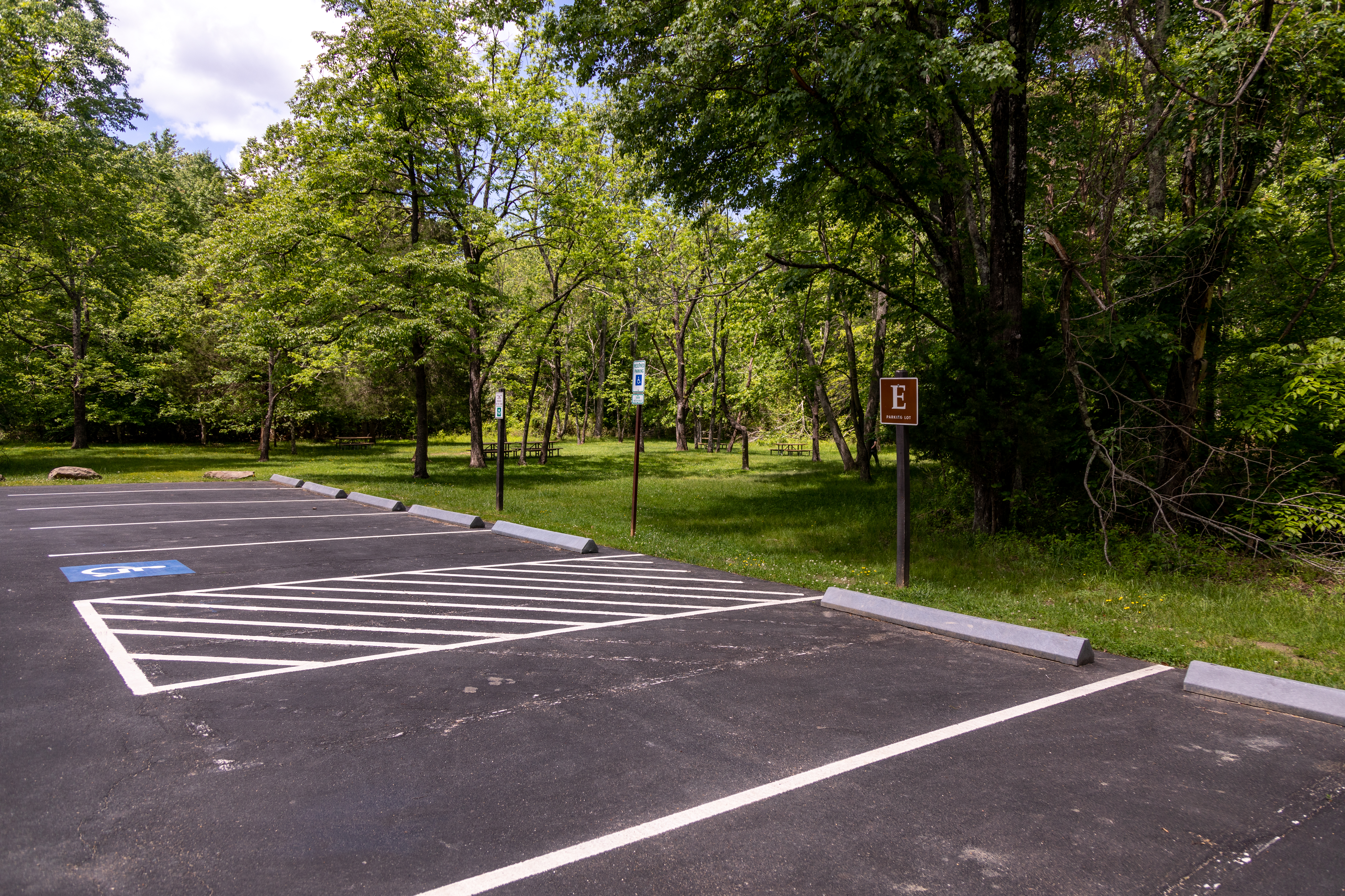
Lot E provides access to the Mary Bird Branch Trail, Lake One Road, and the Quantico Cascades Trail.
Lot E is on the east side of the Scenic Drive. It is paved, accommodates 10 vehicles, and provides access to the Mary Bird Branch Trail, Quantico Cascades Trail, and Lake One Road (which is a hike and bike trail). To access Mary Bird Branch, walk to the north end of the parking lot and cross the street. The trailhead is marked with a wayside and there are some wooden boards laid down to walk across mud. The wayside has a large picture of a beaver with thick fur and a round flat tail crouched in the grass and discusses beaver activity and how 4 beavers were released in this area in the 1950s to help repopulate the area. To access Quantico Cascades Trail, walk through the meadow that surrounds the parking lot. Four picnic tables dot this meadow. In the northwest corner of it you will find the trailhead with a upright wayside marking it. The wayside has a map of the Quantico Cascades Trail and a picture of a creek rushing down cascades through large rocks as well as information about the trail. To access Lake One Road, walk to the south end of the parking lot and down the Scenic Drive for 250 feet, then the road will be on your left.
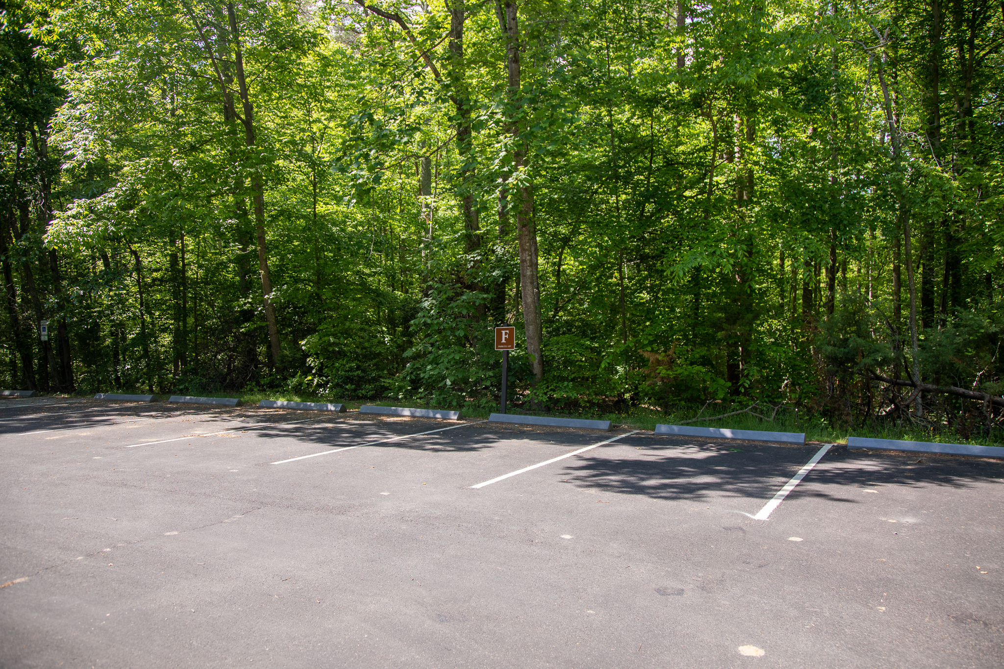
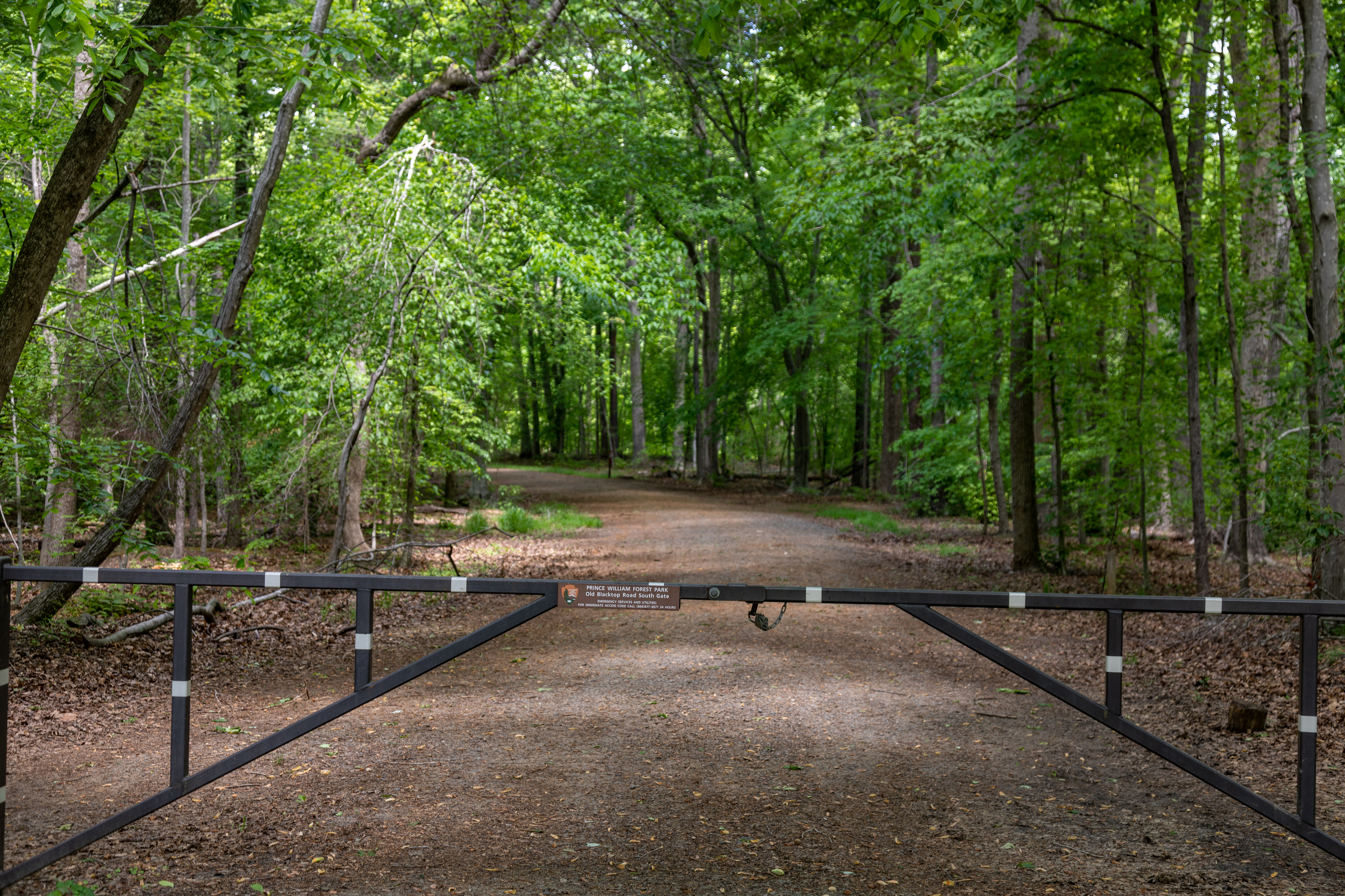
Lot F provides access to Old Black Top Road, which is a 1.6-mile hike and bike trail.
Lot F is on the north side of the Scenic Drive. It is paved, accommodates about 8 vehicles, and provides access to Old Black Top Road. The trailhead is at the east end of the parking lot and across the street.
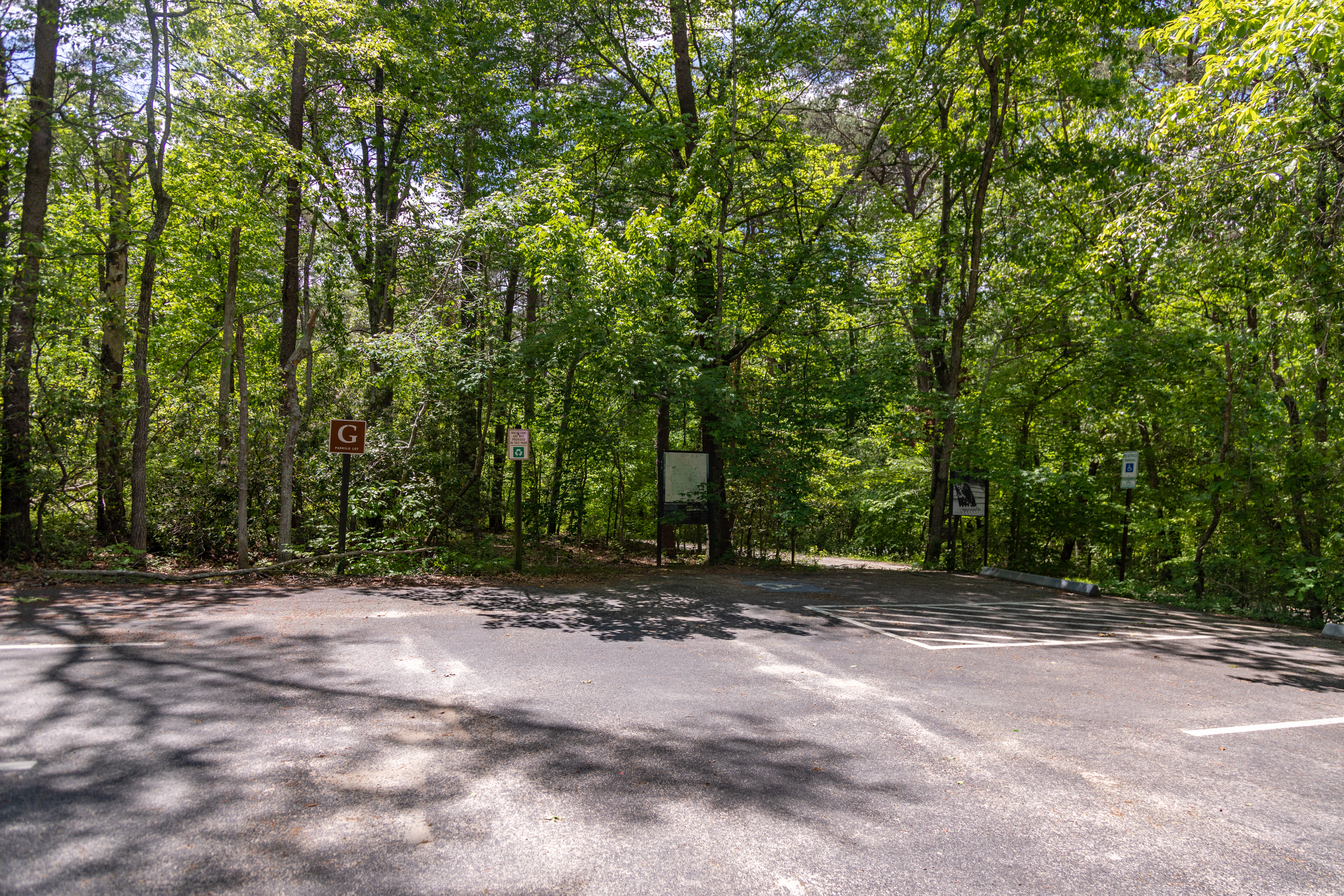
Lot G provides access to Mawavi Road, which is a .9-mile hike and bike trail.
Lot G is on the south side of the Scenic Drive. It is paved, accommodates about 10 vehicles, and provides access to Mawavi Road, which is a .9-mile hike and bike trail. When facing towards the back of the parking lot, away from the Scenic Drive, the trailhead is in the back right corner of the lot.
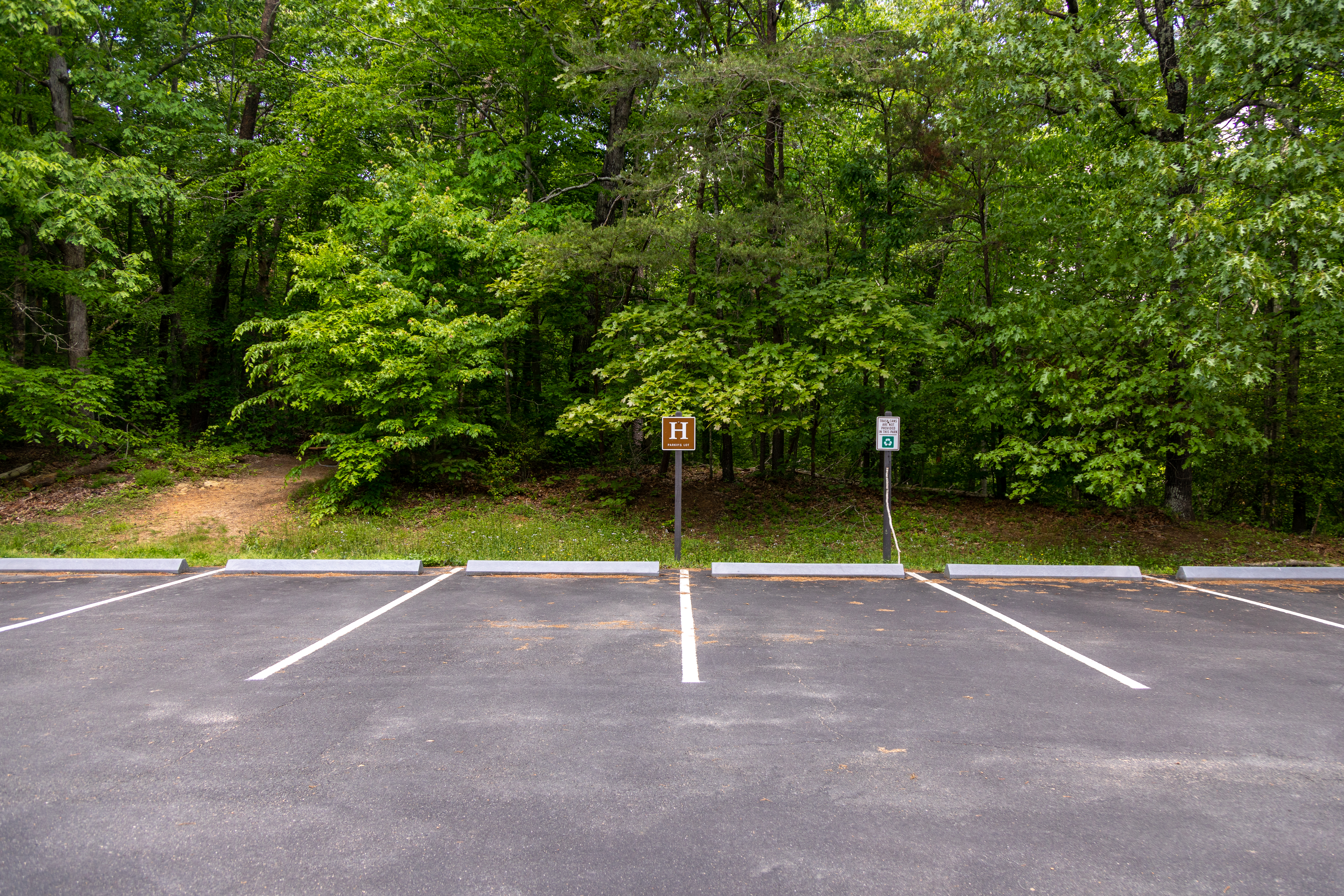
Lot H provides access to two directions of the High Meadows Trail. It goes for 1.3 miles to the northeast and .8 miles to the southwest.
Lot H is on the north side of the Scenic Drive. It is paved, accommodates about 10 vehicles, and provides access to the High Meadows Trail. If facing the parking lot, away from the Scenic Drive, turn right and walk to the end of the lot to find the trailhead.
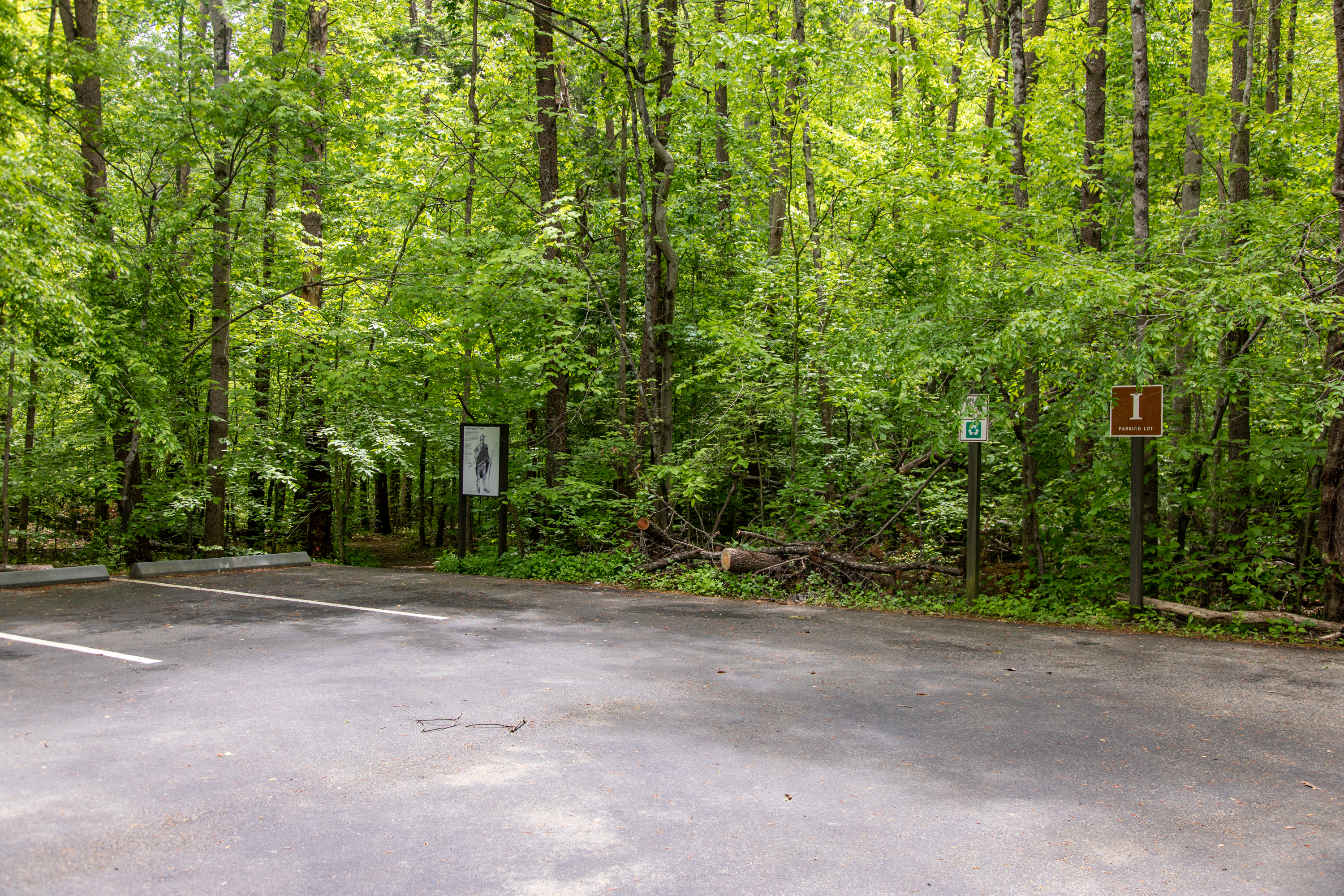
Lot I provides direct access to the Algonquian Trail, a .2-mile out and back trail, and is a short walk to access the South Valley Trail, a 9.7-mile trail that weaves throughout the park
Lot I is on the south side of the Scenic Drive. It is paved, accommodates about 10 vehicles, and provides access to the Algonquian Trail. The South Valley trail is a short walk down the road as well. To access the Algonquian Trail, face towards the back of the parking lot/away from the road and walk to the back left corner of the lot. The trail is made of dirt and marked with a wayside.
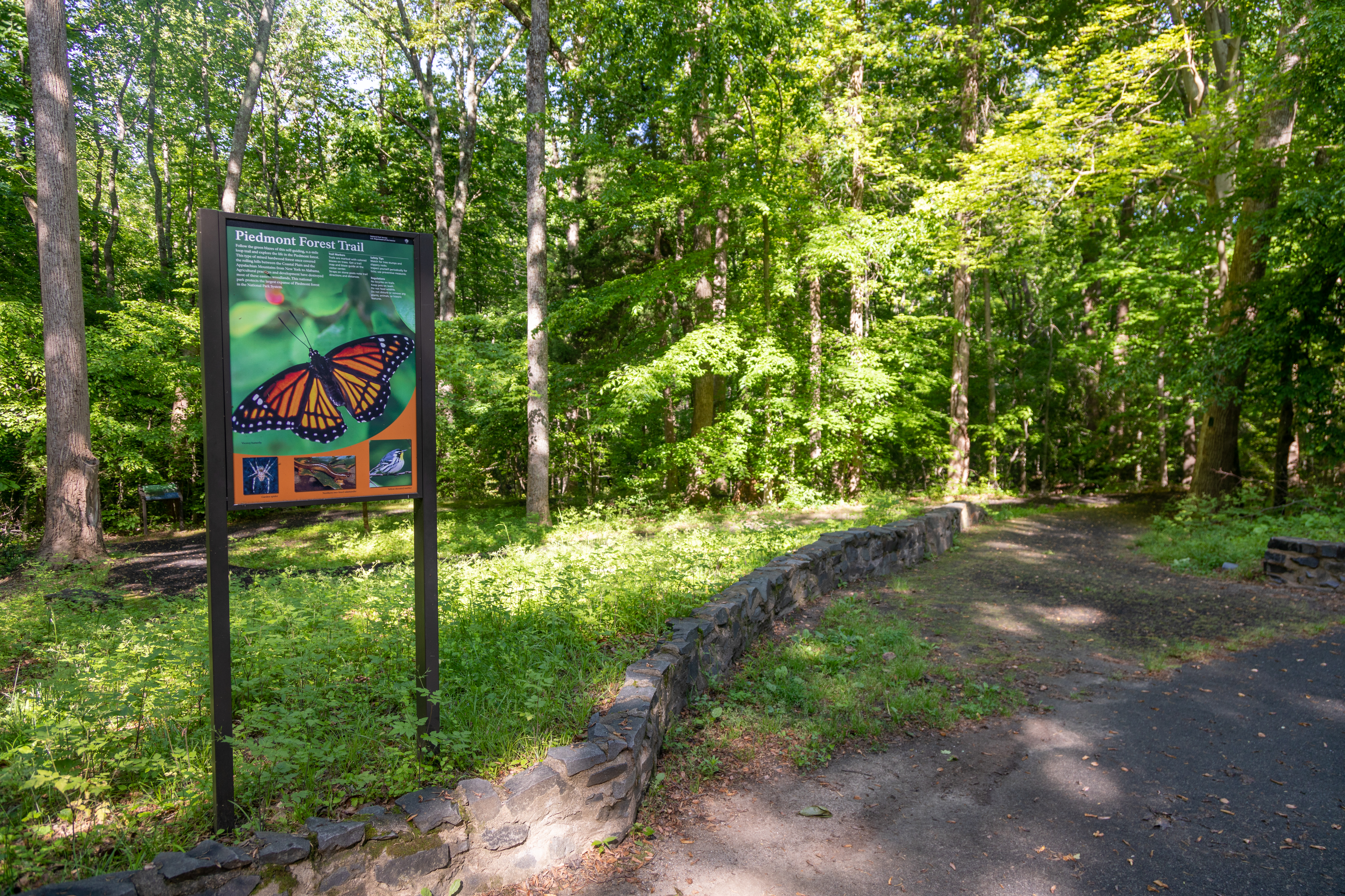
The Piedmont Forest Trail is a .2-mile loop that is wheelchair accessible with parking nearby.
The Piedmont Forest Trailhead is in the same area as the Pine Grove Pavilion. Drive down park entrance road and turn left before getting to the pavilion; then Piedmont Forest Trail parking will be down the road about 400 feet on the left. 350 feet further down the lot is the Pine Grove Trailhead and more parking. A large upright sign with a large background image of an orange and black viceroy butterfly stands to the left of the paved trailhead. The sign is titled "Piedmont Forest Trail" and a paragraph under the title reads, "Follow the green blazes of this self-guiding, 0.2 mile loop trail and explore the life in the Piedmont forest. This type of mixed hardwood forest once covered the rolling hills between the Coastal Plain and the Appalachian Mountains from New York to Alabama. Agricultural practices and development have destroyed most of these eastern woodlands. This national park protects the largest expanse of Piedmont Forest in the National Park System." In the upper right corner of the sign near the title are three short informational paragraphs. The first reads, "Trail Markers: Trails are marked with colored blazes on trees. Get a trail map and blaze guide at the visitor center. Straps on stone posts not trail directions and distances." The second paragraph reads, "Safety Tips: Watch for tree stumps and slippery rocks. Inspect yourself periodically for ticks; use preventative measures." The third paragraph reads, "Regulations: No bicycles on trails. Keep pets on leash. Do not feed wildlife. Do no disturb or remove an plants, animals, or historic features." Under the text and the butterfly image on the sign are three smaller pictures. On the bottom left of the sign is a close-up photo of a brown and tan eight-legged spider on a web captioned "Garden spider." In the bottom center of the sign is a close-up photo of a glistening orange four-legged salamander with brown eyes and a brown stripe down it's back on a green leaf captioned "Northern two-lined salamander." In the bottom right of the sign is a close-up photo of a grey and white backed and yellow breasted bird on a twig with the caption "Yellow-throated warbler."
The Pine Grove Picnic Pavilion is a first come first serve shaded pavilion with about 10 tables underneath it and 30 more tables nearby.
Immediately in front of the visitor center parking lot is a set of stairs. About 80 feet along a paved sidewalk is the Pine Grove pavilion - a wooden picnic pavilion with 10 tables among trees. There is also an accessible ramp to the right. About 30 picnic tables are spread out in the shade surrounding the pavilion. There is an accessible restroom 200 feet behind the pavilion and a playground 200 feet behind the restrooms.
The Pine Grove Playground has slides, monkey bars, see-saws, ladders, and so much more.
Park near the Pine Grove Pavilion or the Piedmont Forest Trailhead and walk along grass and dirt paths to reach the playground, which is in the northern corner of this wooded area.
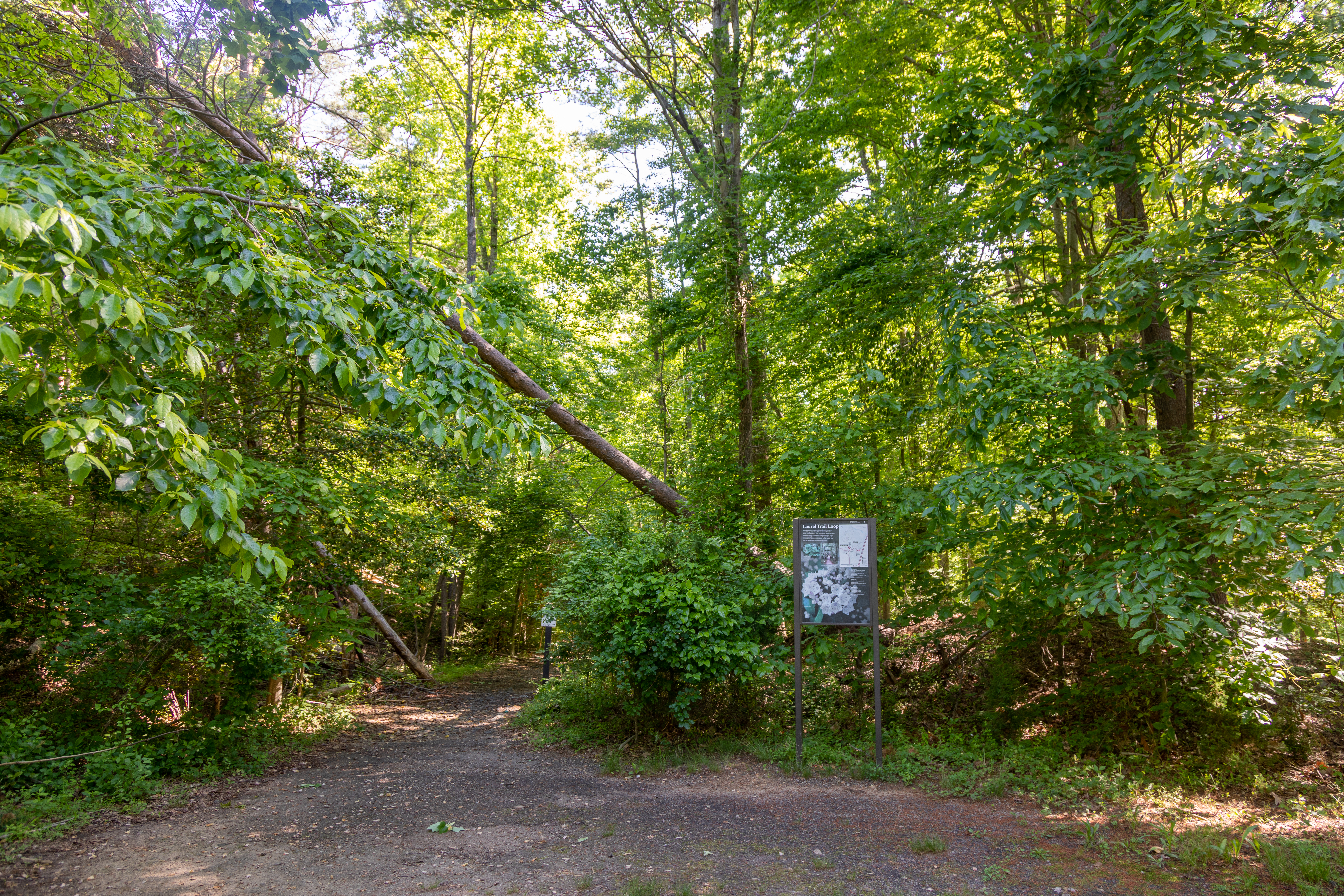
This trailhead provides access to the Muschette Trail, South Orenda Road, and the Laurel Trail Loop
At the end of a loop drive, about 350 feet down the road from the Piedmont Forest trailhead, there is a grassy clearing where two trails diverge. To the left is South Orenda Road and the Muschette Trail. Straight ahead and to the right is the Laurel Trail Loop.
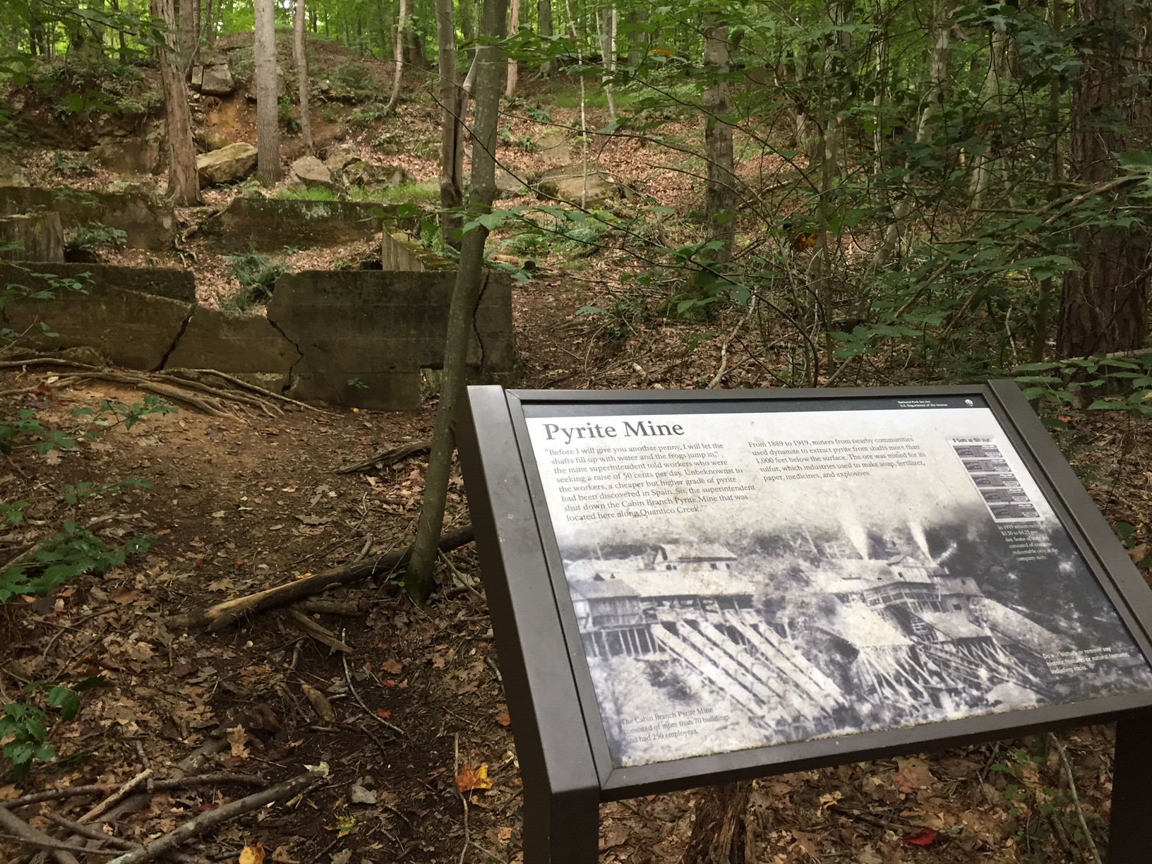
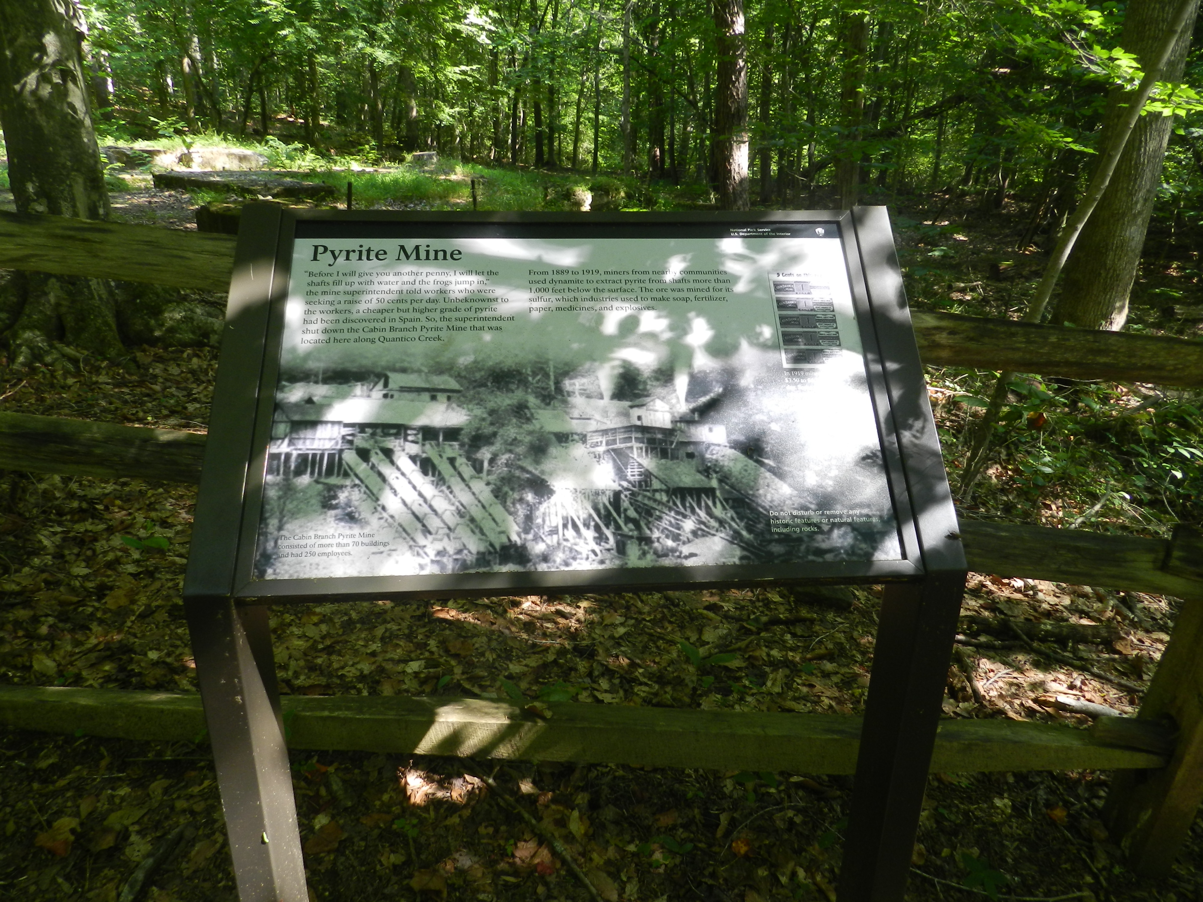
See the foundations of buildings that remain from the Cabin Branch Pyrite Mine operation, which was active in the park in the early 1900s! Learn about life here and what this area looked like when the mine was active.
At the edge of the North Valley Trail is a shaded, slanted sign in the forest. The hillside behind the sign holds rectangular cracked concrete building foundations covered in moss that sit about 2-3 feet above the ground. The sign has a black bar at the top with the words "National Park Service, U.S. Department of the Interior" and an NPS arrowhead symbol on the black bar in the upper right corner. The background image underlying the text on the sign is a black and white photo of several large wooden buildings on a hillside with 5 tubes extending from them down the hillside and stream shooting from the roofs of some of the buildings. The background image is captioned in the lower left corner of the sign, "The Cabin Branch Pyrite Mine consisted of more than 70 buildings and had 250 employees." The sign is titled "Pyrite Mine and in the upper part of the sign under the title paragraphs read, "'Before I will give you another penny, I will let the shafts fill up with water and the frogs jump in,' the mine superintendent told workers who were seeking a raise of 50 cents per day. Unbeknownst to the workers, a cheaper but higher grade of pyrite had been discovered in Spain. So, the superintendent shut down the Cabin Branch Pyrite Mine that was located here along Quantico Creek. From 1889 to 1919, miners from nearby communities used dynamite to extract pyrite from shafts more than 1,000 feet below the surface. The ore was mined for its sulfur, which industries used to make soap, fertilizer, paper, medicines, and explosives." To the right of these paragraphs in the upper right corner of the sign is a black and white historical image of 5 stacked paper money coupons for the mine store labeled "5 Cents on this page." The image is captioned, "In 1919 miners received $3.50 to $4.25 per day. Some of their pay consisted of coupons redeemable only at the company store." In the bottom right corner of the sign is a warning reading, "Do not disturb or remove any historic features or natural features, including rocks."
See the remains of the Cabin Branch Pyrite Mine which was operational in the early 1900s on the land that became Prince William Forest Park. Foundations of mine buildings can be seen along the North Valley Trail and Cabin Branch Mine Trail.
At the edge of the Cabin Branch Mine Trail is a shaded, slanted sign standing in front of a 3 rail wooden fence. Behind the fence are 3 low, square, vegetation covered foundations of concrete with metal pole sticking out of some of them. The sign has a black bar at the top with the words "National Park Service, U.S. Department of the Interior" and an NPS arrowhead symbol on the black bar in the upper right corner. The background image underlying the text on the sign is a black and white photo of several large wooden buildings on a hillside with 5 tubes extending from them down the hillside and stream shooting from the roofs of some of the buildings. The background image is captioned in the lower left corner of the sign, "The Cabin Branch Pyrite Mine consisted of more than 70 buildings and had 250 employees." The sign is titled "Pyrite Mine and in the upper part of the sign under the title paragraphs read, "'Before I will give you another penny, I will let the shafts fill up with water and the frogs jump in,' the mine superintendent told workers who were seeking a raise of 50 cents per day. Unbeknownst to the workers, a cheaper but higher grade of pyrite had been discovered in Spain. So, the superintendent shut down the Cabin Branch Pyrite Mine that was located here along Quantico Creek. From 1889 to 1919, miners from nearby communities used dynamite to extract pyrite from shafts more than 1,000 feet below the surface. The ore was mined for its sulfur, which industries used to make soap, fertilizer, paper, medicines, and explosives." To the right of these paragraphs in the upper right corner of the sign is a black and white historical image of 5 stacked paper money coupons for the mine store labeled "5 Cents on this page." The image is captioned, "In 1919 miners received $3.50 to $4.25 per day. Some of their pay consisted of coupons redeemable only at the company store." In the bottom right corner of the sign is a warning reading, "Do not disturb or remove any historic features or natural features, including rocks."
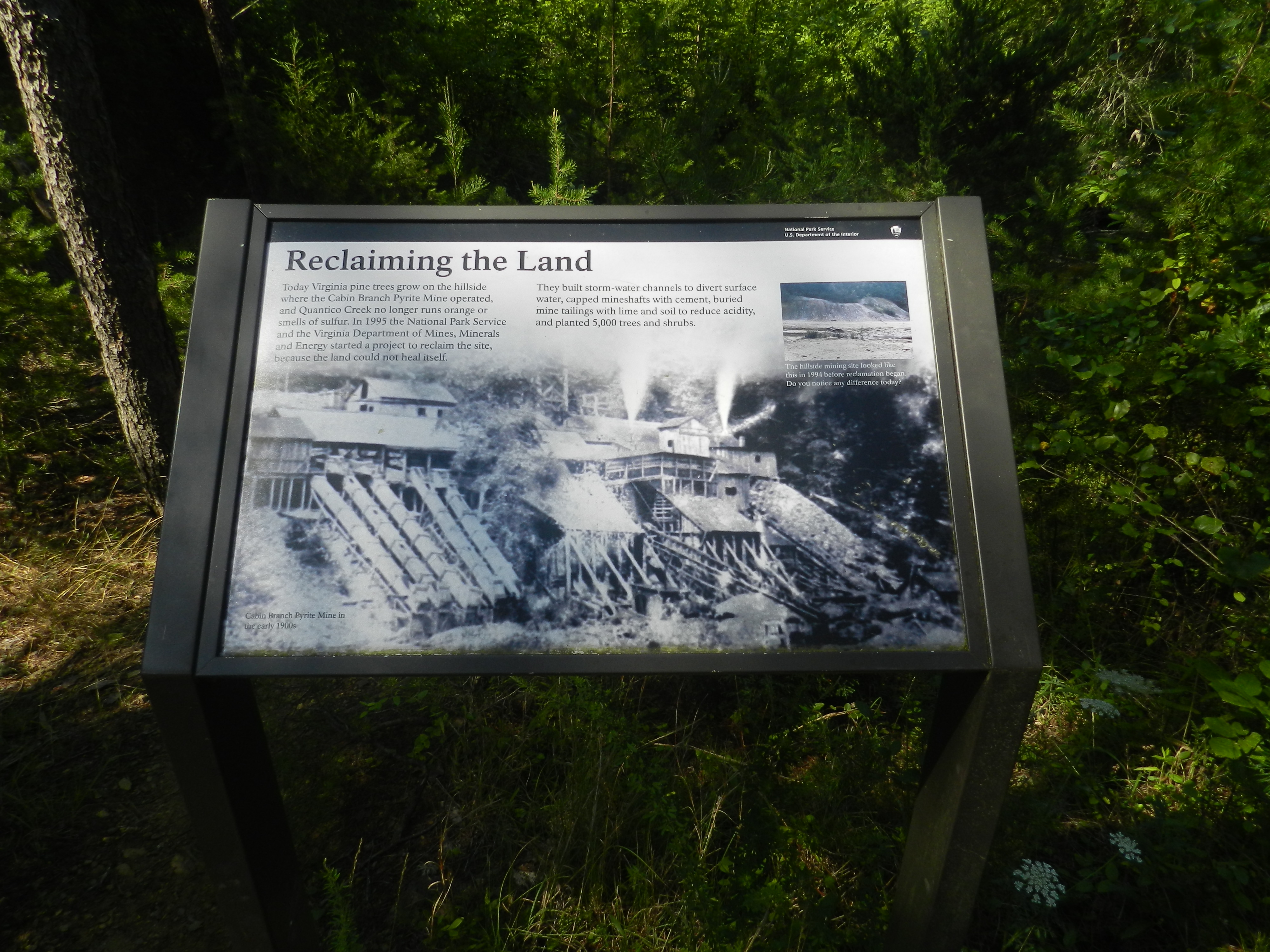
Learn about how the National Park Service and the Virginia Department of Mines, Minerals, and Energy reclaimed and rehabilitated the land on which the Cabin Branch Pyrite Mine once stood.
The sign has a black bar at the top with the words "National Park Service, U.S. Department of the Interior" and an NPS arrowhead symbol on the black bar in the upper right corner. The background image underlying the text on the sign is a black and white photo of several large wooden buildings on a hillside with 5 tubes extending from them down the hillside and stream shooting from the roofs of some of the buildings. The background image is captioned in the lower left corner of the sign, "The Cabin Branch Pyrite Mine in the early 1900s." The sign is titled "Reclaiming the Land" and paragraphs on the upper portion of the sign under the title read, "Today Virginia pine trees grow on the hillside where the Cabin Branch Pyrite Mine operated, and Quantico Creek no longer runs orange or smells of sulfur. In 1995 the National Park Service and the Virginia Department of Mines, Minerals and Energy started a project to reclaim the site, because the land could not heal itself. They built storm-water channels to divert surface water, capped mineshafts with cement, buried mine tailings with lime and soil to reduce acidity, and panted 5,000 trees and shrubs."
Learn about the Shortleaf Pine, an evergreen tree in the Pine Grove Picnic Area! This pine species is a popular source of resin.
A small metal sign is placed about two feet from the tree. The sign plate is brown with white text on it. The sign identifies the tree as a shortleaf pine tree and provides the Latin name for it. The tree is large and tall. Its trunk has light-brown bark and is very textured. Vertical ridges in the bark form a pattern of irregular scales. The trunk is about two feet in diameter and is mostly bare, with branches forming a sparce crown at the top of the tree. The tree is located in a flat area which has a mixture of bare ground, mulch and small patches of grass. There are a few other tall, free-standing trees located in close proximity.
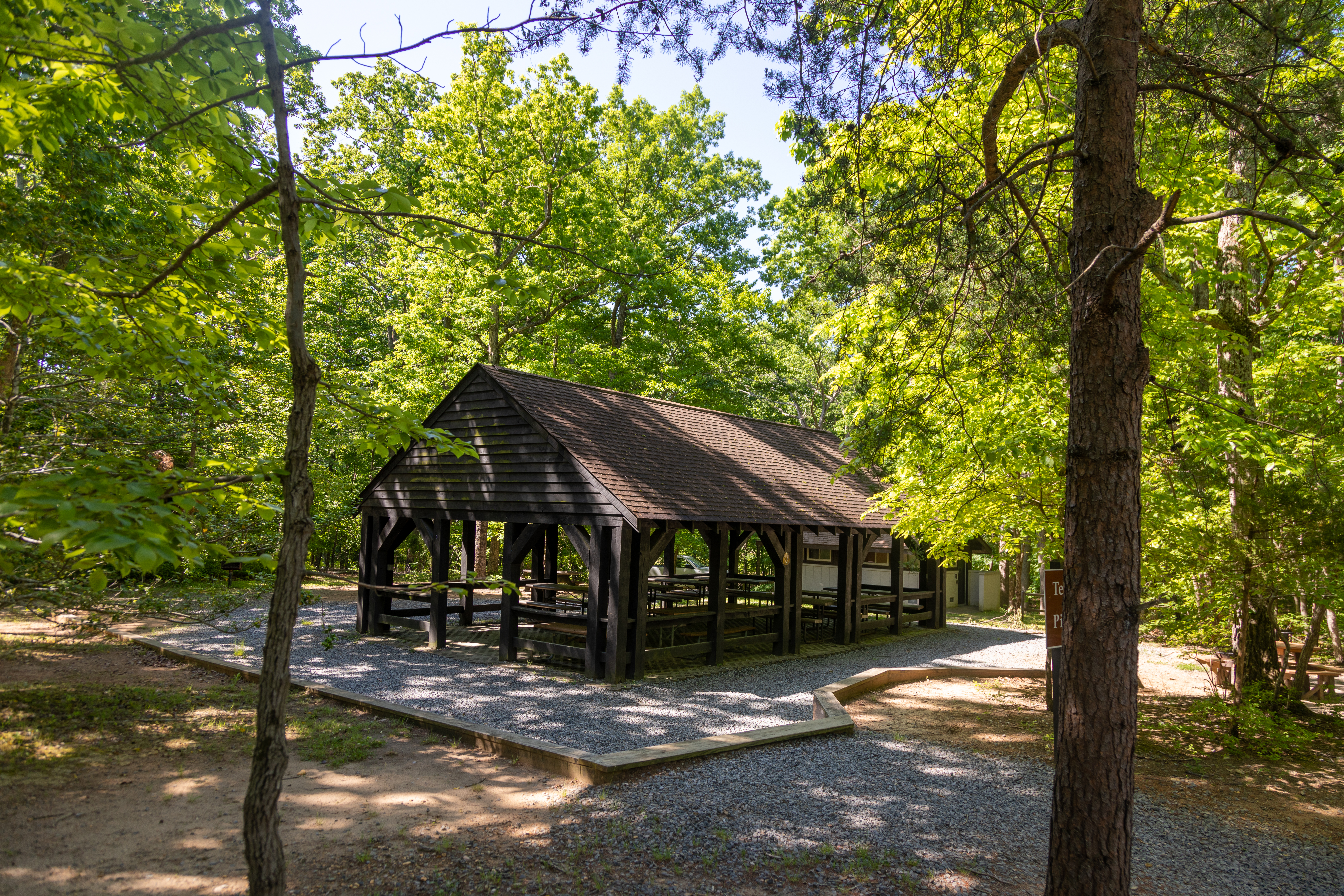
The Telegraph Picnic Pavilion is available to reserve on Recreation.gov. There are about 10 picnic tables in full shade under the pavilion
The pavilion is about 20 feet south of the parking lot. There is a small set of wooden stairs to access it. Alternatively, there is a wheelchair accessible route to the right that takes you near the bathroom building.
The Crossing Trail is a .5-mile loop trail with the option of connecting to the Birch Bluff Trail.
This trailhead is marked by a green blaze on a tree and a wayside panel sign. The park entrance road is to the left of the trailhead and there is parking right next to the trailhead, about 10 feet away near the Telegraph Picnic Area. The wayside panel sign is titled "The Crossing Trail" and a drawing of a stagecoach with 7 passengers pulled by 4 horses on a dirt road through a forest takes up most of the background of the sign. A paragraph below the title in the upper left corner of the sign reads, "Follow the green blazes as this easy 0.5 mile loop trail takes you along a portion of the historic north-south route used by American Indians and early settlers. Revolutionary War troops commanded by George Washington and the Comte de Rochambeau traveled this roadway as they crossed through this area on their way to Yorktown. The abandoned roadbed continues north as part of today’s Birch Bluff Trail, and the Crossing Trail winds back to the park road to your left." Beside this paragraph in the upper right corner of the sign is a map of the park with the Crossing Trail highlighted in green showing it is close to the Visitor Center and Telegraph Road picnic area. Underneath the map on the sign are 3 short informational paragraphs. The first reads, "Trail Markers: Trails are marked with colored blazes on trees. Get a trail map and blaze guide at the visitor center. Straps on stone posts not trail directions and distances." The second paragraph reads, "Safety Tips: Watch for tree stumps and slippery rocks. Inspect yourself periodically for ticks; use preventative measures." The third paragraph reads, "Regulations: No bicycles on trails. Keep pets on leash. Do not feed wildlife. Do no disturb or remove an plants, animals, or historic features." To the left of these paragraphs on the sign are two copies of portraits outlined in gold. The black and white portrait on the left is captioned "General George Washington" and depicts a man in a high collared dress jacket with white curled hair looking to the right. The color portrait to the right is captioned "Comte de Rochambeau" and depicts a side profile of a man with white curled hair wearing a high collared dress jacket with a red sash.
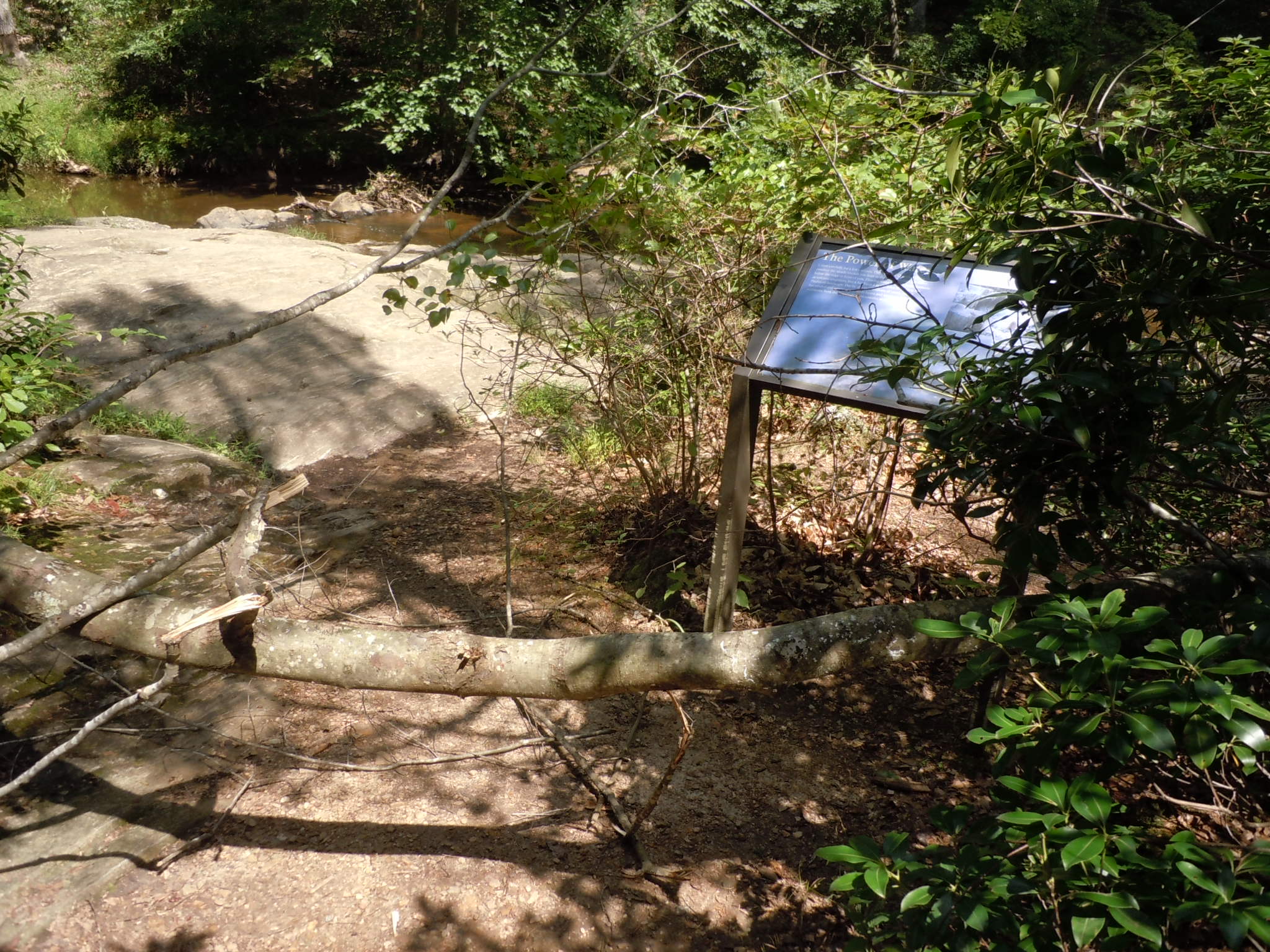
Learn about the power of water while listening to the rushing waters of the cascades on Quantico Creek! Though small, these cascades are a great place to enjoy the peaceful sounds of nature.
At the end of the trail is a slanted sign among bushes by the side of the creek. Though mostly open and unshaded in this area, looking upstream or downstream shows trees of the forest shading the shallow creek. A large mostly flat rock slopes down to the water in the creek near the sign. The water in the creek rushes over this large rock in several places creating 2-3 foot drops. The sign near the water has a black bar at the top with the words "National Park Service, U.S. Department of the Interior" and an NPS arrowhead symbol on the black bar in the upper right corner. The sign is titled "The Power of Water" and has a blue color picture of shallow water flowing over gravel underlying the text on the sign. Under the title in the upper left portion of the sign, a short paragraph reads, "Listen carefully for a few minutes. The waters of Quantico Creek produce the steady sounds you hear as they flow through the valley below the ridge in front of you. Flowing water may not be a dramatic as volcanic eruptions, but it has been a major force in shaping the Piedmont landscape. Day by day over millions of years, runoff has eroded and continues to erode layers and layers of rock and sediments from the Appalachian Mountains and the Piedmont hills." Next to this paragraph on the upper right side of the sign is a color picture of a large rock with large smooth depressions on it beside a flowing creek. The caption of the picture reads, "Over time water smoothes rough edges and carves patterns in rock."
This day use parking lot provides access to Old Blacktop Road, May Bird Branch, and the Little Run Loop.
Take the Scenic Drive through the park. When you get to a fork in the road, go left. After about a half mile, turn right onto Turkey Run Road and the parking lot will be at the end of the drive on the left. The there is a gate at the end of the road that you walk through to access the trails.
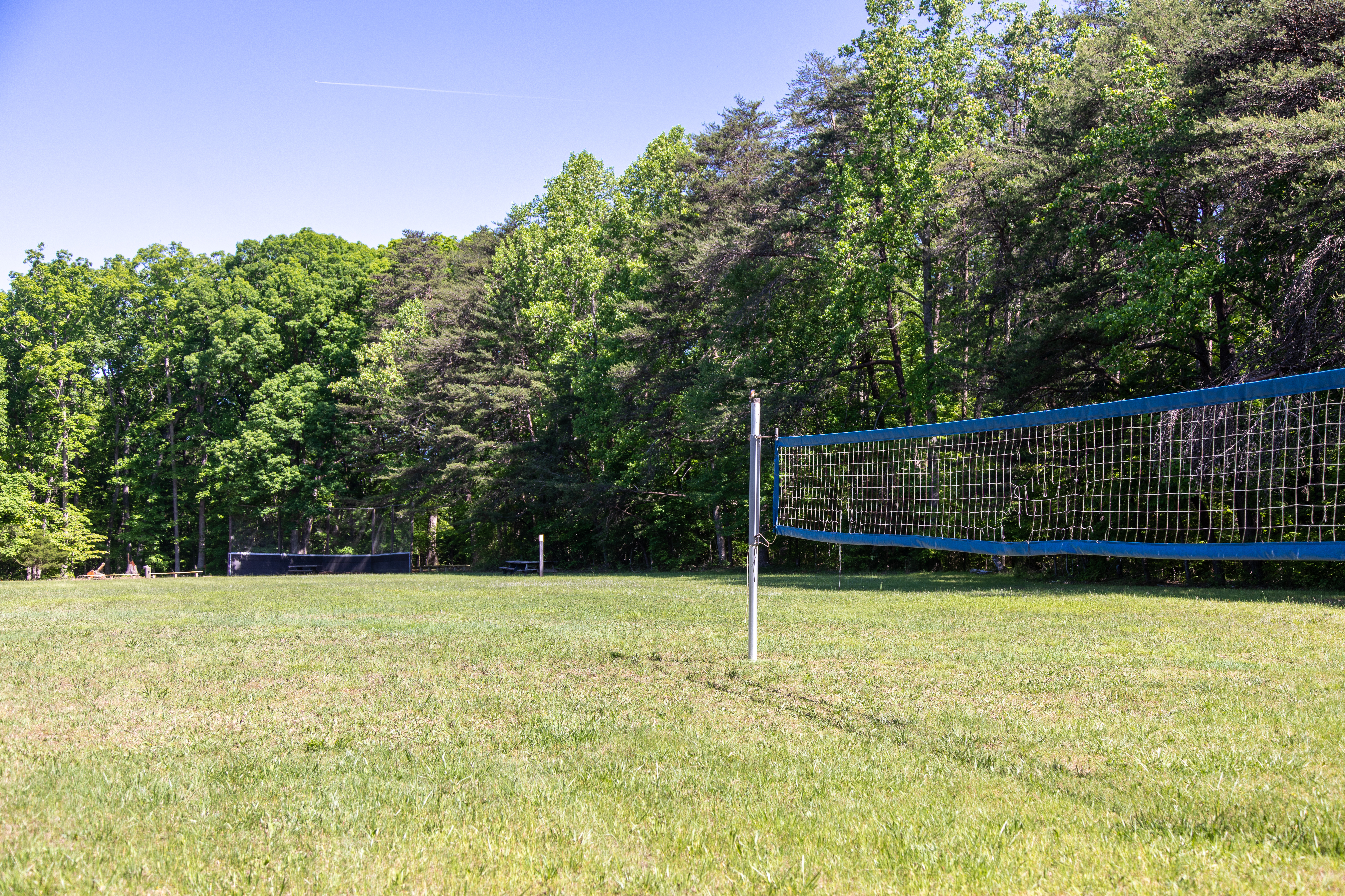
Williams Ball Field is an open field with a baseball diamond and a volleyball net.
A grassy field with a baseball diamond and a volleyball net in the outfield. There are some picnic tables and benches in the shade nearby. You must walk on a short trail through the woods to access this field from either the Visitor Center Parking Lot or the Telegraph Picnic Pavilion parking area.
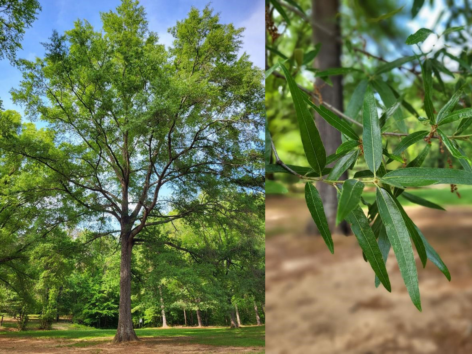
Learn about the Willow Oak, a large shade tree near the picnic area! Did you know that the Willow Oak gets its name from the shape of its leaves, which resembles the leaves of a willow tree?
A small metal sign that is placed about three feet from the tree. The sign plate is brown with white text on it. The sign identifies the tree as Willow Oak and provides a Latin name for it. It is a large tree with a thick, ridged trunk. The trunk has a greyer, rougher textured bark, and the leaves and branches of the tree form a very full, round-shaped crown. The tree is standing by itself in a flat grassy area with a nearby cemented pathway curving around it.
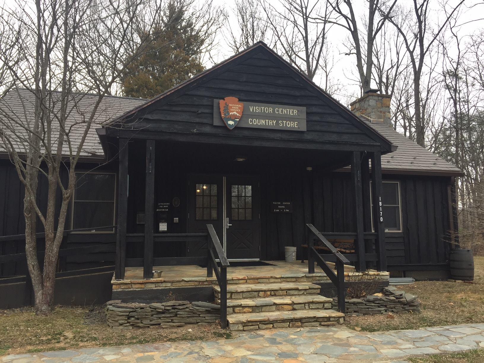
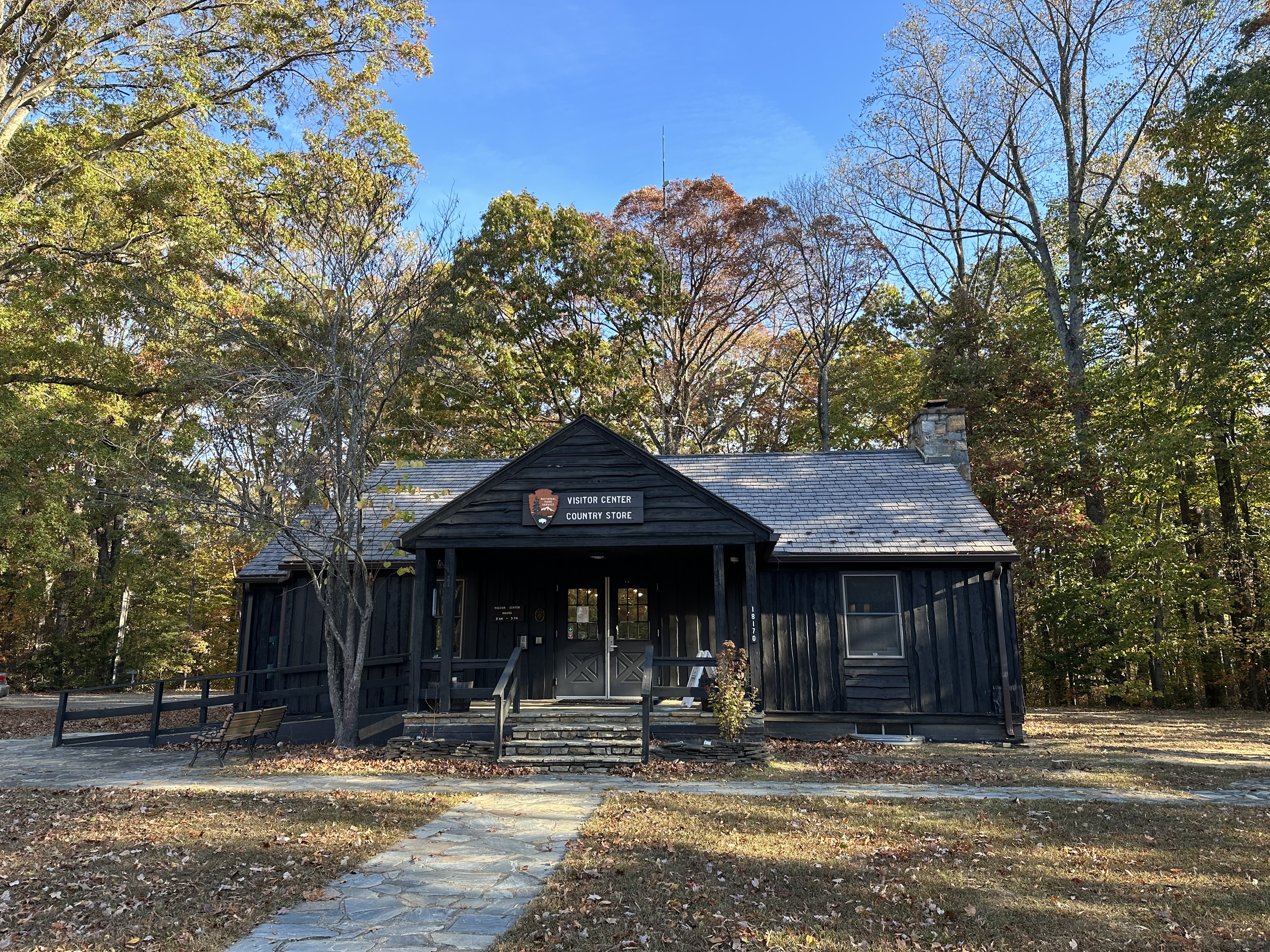
The visitor center is half a mile from the park entrance. The current visitor center hours are 9:00 a.m. to 5:00 p.m. every day. The visitor center is closed on Thanksgiving Day, Christmas Day, and New Year's Day.
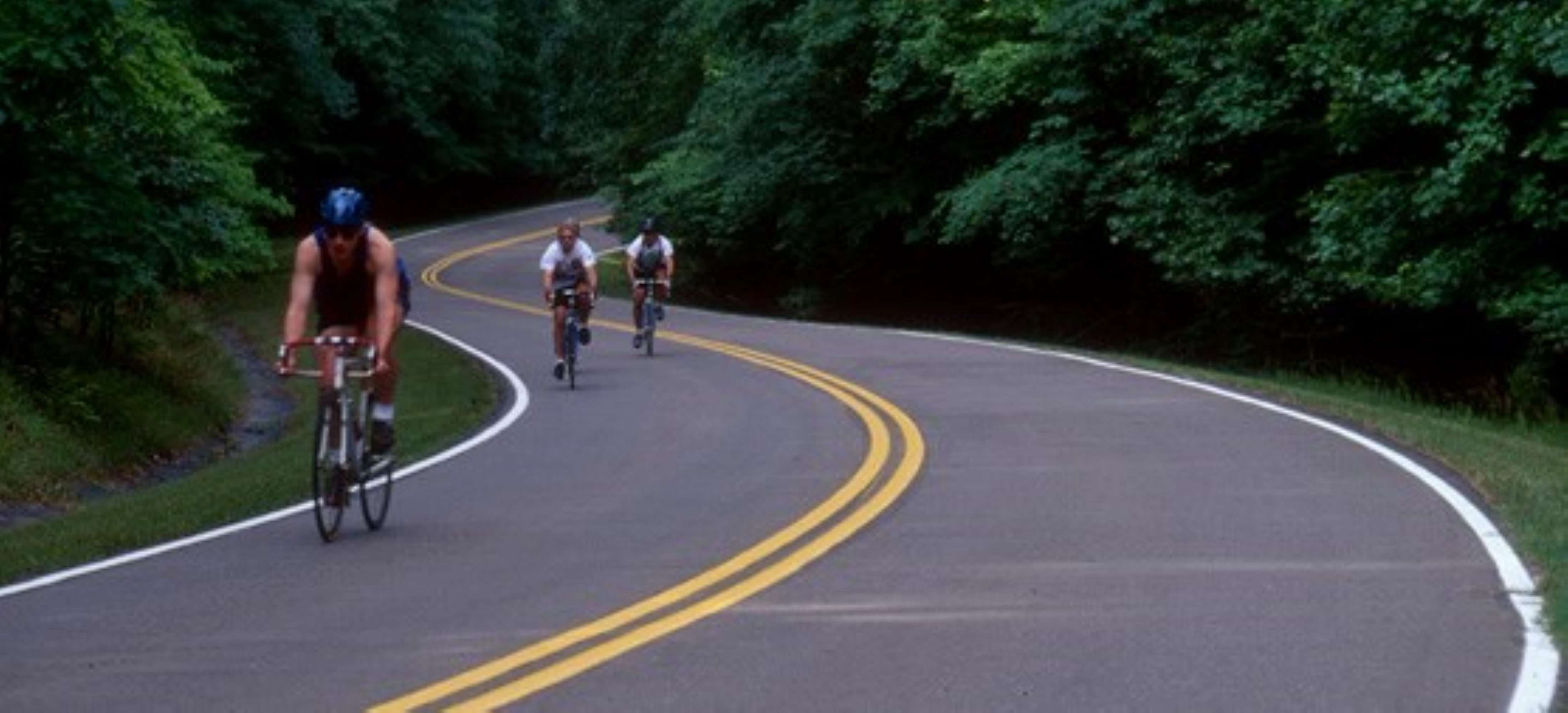
Bike the Potomac Heritage National Scenic Trail in Prince William Forest Park
Discover Northern Virginia's best kept secret and bike along the park’s Scenic Drive.
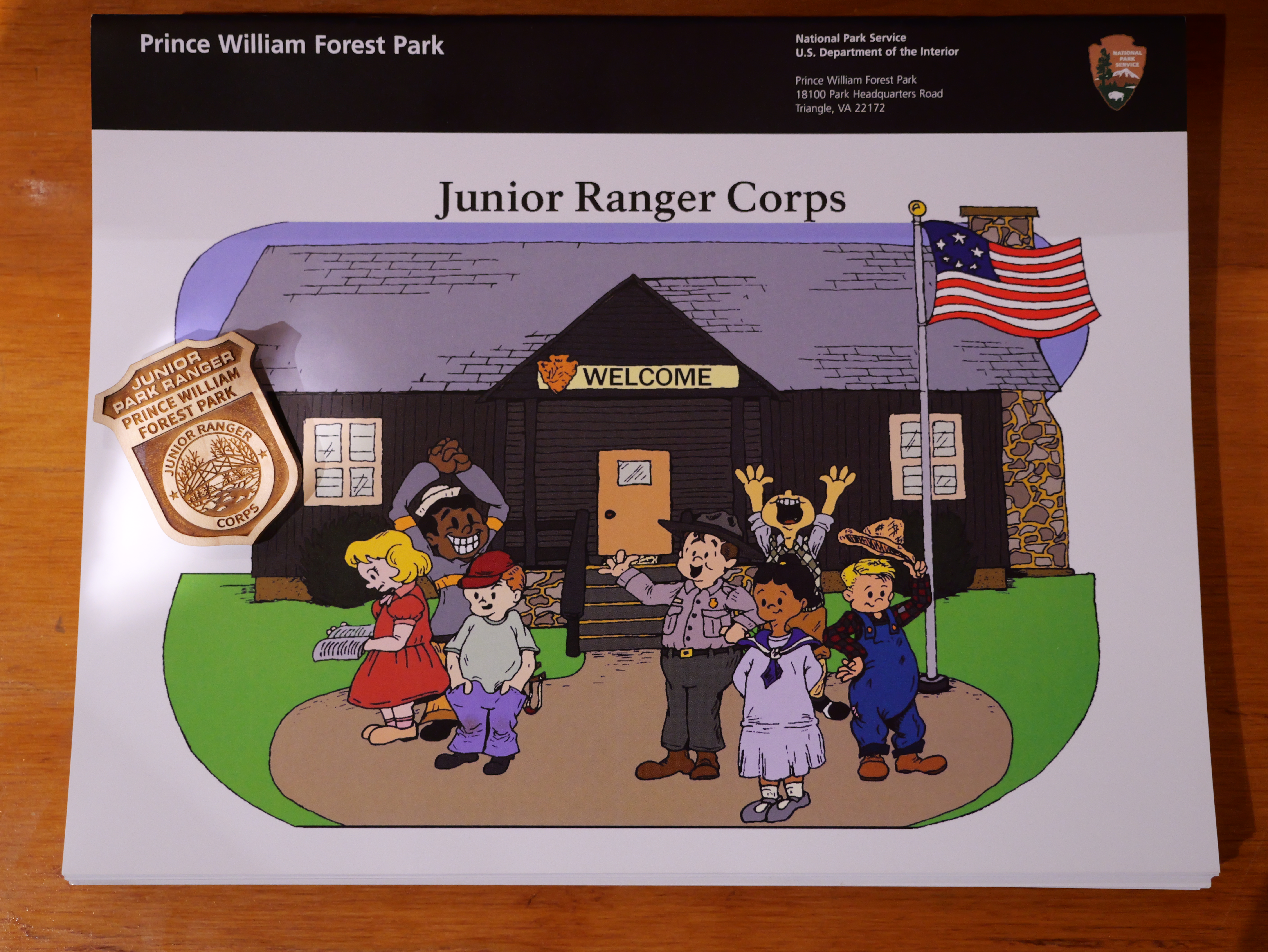
Prince William Forest Park Junior Ranger
Join the Junior Ranger Corps at Prince William Forest Park today to learn more about the park's history and natural resources! Junior Rangers help protect national parks like Prince William Forest Park and explore the forests of this area. Stop by the park's Visitor Center to get your Junior Ranger book today!
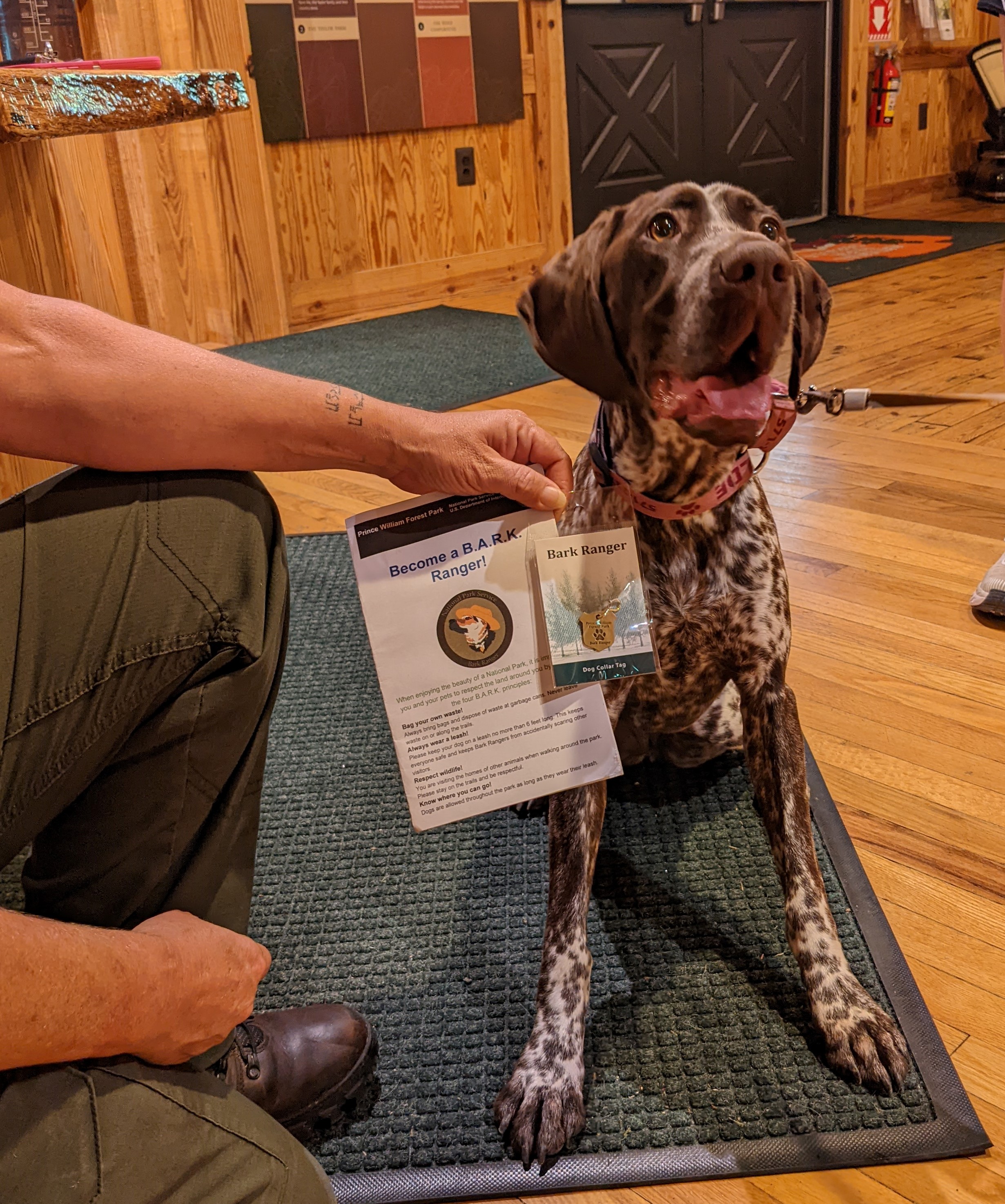
Become a B.A.R.K. Ranger at Prince William Forest Park
Help your pet become a B.A.R.K. Ranger by bagging your pet's waste and properly disposing of it, always leashing your pet, respecting wildlife, and knowing where you can go with your pet. Pick up a B.A.R.K. Ranger booklet at the visitor center, and when you're finished filling it out, return to the visitor center for your pet to earn a free B.A.R.K. Ranger leash tag!
Hike to the Taylor Farm Site
The Taylor Farm site is a short hike from the Turkey Run parking area or parking lot H. While slowly being reclaimed by the forest, this site is a great example of the farms that were once scattered throughout the forest before it became a national park. Though not much evidence of the farm remains, the small meadow provides an opportunity to enjoy the sun in the mostly dense forest of Prince William Forest Park.
Chopawamsic Backcountry
Chopawamsic (chop-ah-wahm-zik) Backcountry Area, which means by the small "divided streams" or "river flats" in Algonquian, is 1,500 acres of backcountry area with eight designated campsites. Campsites are accessible from the 2.2 mile loop trail. Access for day hiking in the backcountry area is also available.
Biking in Prince William
For the on and off road cyclist, Prince William Forest Park is a favorite place for bicyclists. Over 12 miles of paved roads and 9.2 miles of gravel roads are available.
Orienteering In Prince William
Orienteering is an activity for all ages and levels of fitness and skill, in which the object is to locate control points within the park using a map and compass. It can be enjoyed as a leisurely walk in the woods or as a competitive sport combining the suspense and excitement of a treasure hunt. There are 30 orienteering courses within the picturesque setting of Prince William Forest Park. The different orienteering courses are designed to challenge orienteers of all levels.
Tours
Count: 5
Piedmont Forest Trail Hike
Take a short 0.2 mile walk on the Piedmont Forest Trail, a rubber paved, accessible pathway through the forest leading to a deck overlooking a small drainage that flows down to Quantico Creek. Take in the sights and sounds of a mixed hardwood forest as you learn about the different layers of the forest at Prince William Forest Park.
Pyrite Mine Trail Hike
Learn about early mining in the park. The Cabin Branch Pyrite Mine operated on what is now the eastern side of the park from 1889-1920, mining pyrite for its sulfur content. Hike this trail to see the remains of some mine buildings as well as learn about forest restoration of the area after the mine was closed. The trail is around 1.5 miles round trip.
Quantico Cascades Trail Hike
Also known as the Geology Trail, this hike highlights the transition between the different physiographic regions of the Piedmont Forest and Coastal Plain which Prince William Forest Park straddles. The trail is 2 miles round trip and can also be accessed from the Turkey Run Ridge Area by hiking the Mary Byrd Branch Trail (which adds 1 mile round trip).
The Crossing Trail Hike
Step back in time to follow in the footsteps of the people who travelled through this area before it was a national park. The Crossing Trail follows one of the old roads used by American Indians and early settlers as well as Revolutionary War troops lead by George Washington and the Comte de Rochambeau as they crossed through this area on their way to Yorktown.
Tour of Park Trees
Ever wondered what trees grow in the Piedmont forests of Prince William Forest Park? Take a walk around the park's Pine Grove Picnic Area to learn more about some of the different trees here.