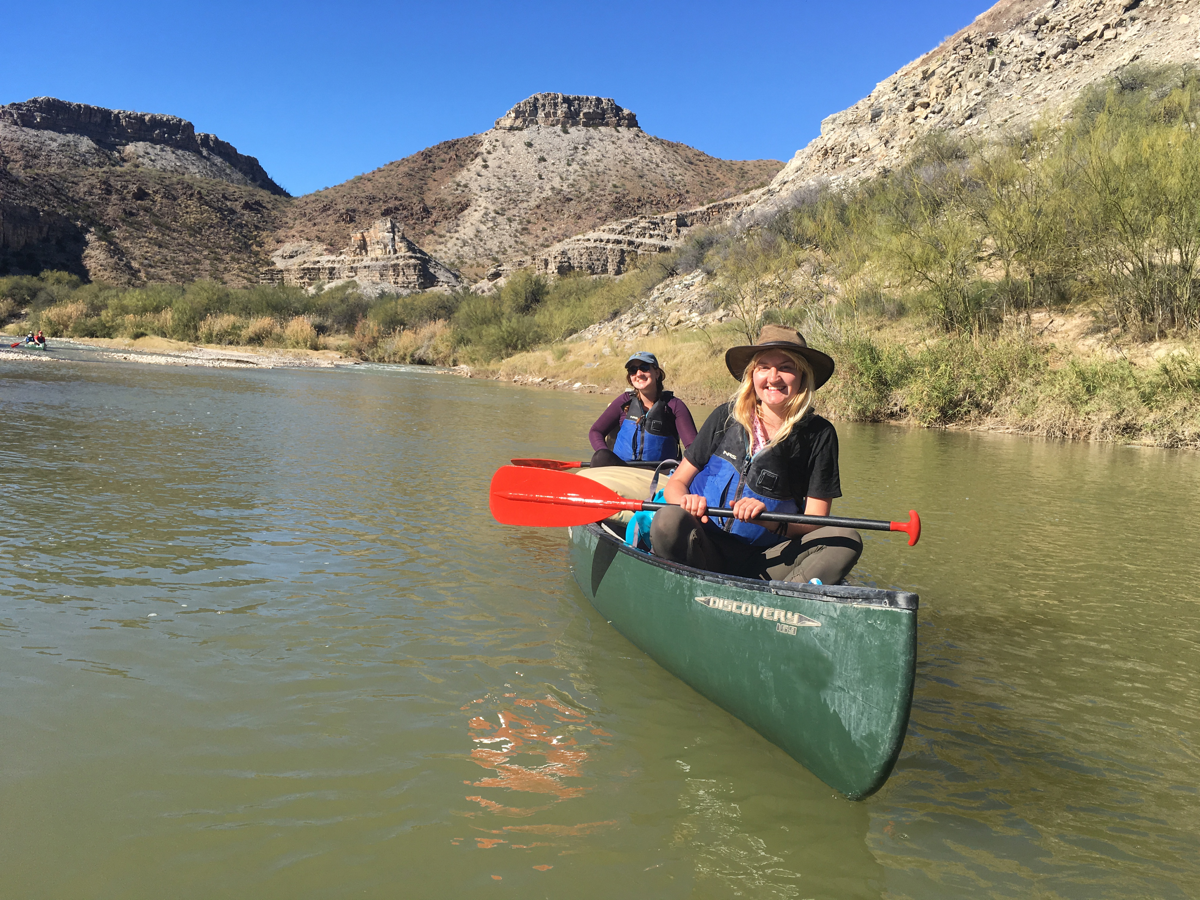
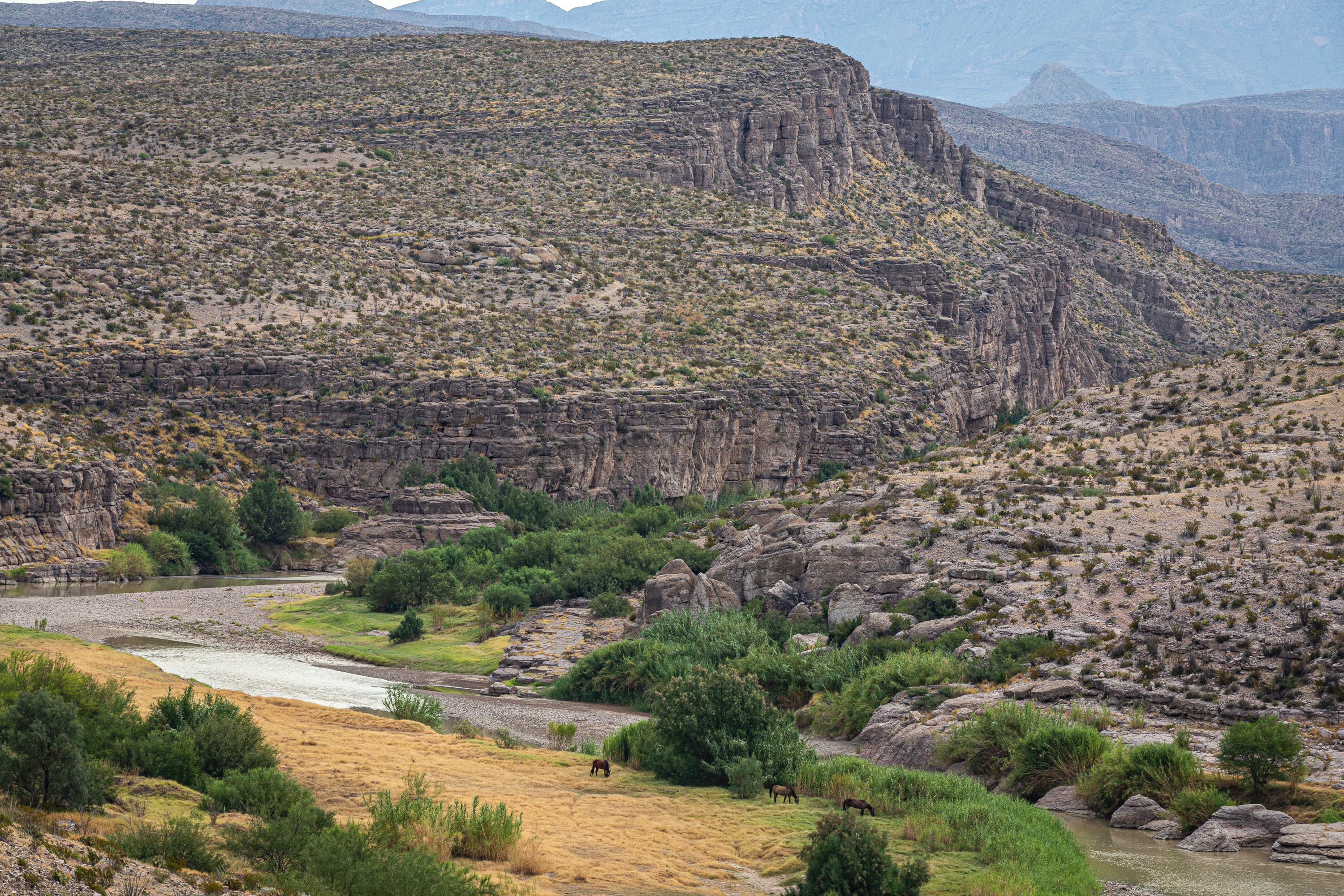
The Boquillas Canyon Trail is a great way to enjoy one of the three major canyons located in Big Bend National Park. This trail is 1.5 miles (2.4 km) round trip and parallels the Rio Grande for a short distance where it first enters Boquillas Canyon.
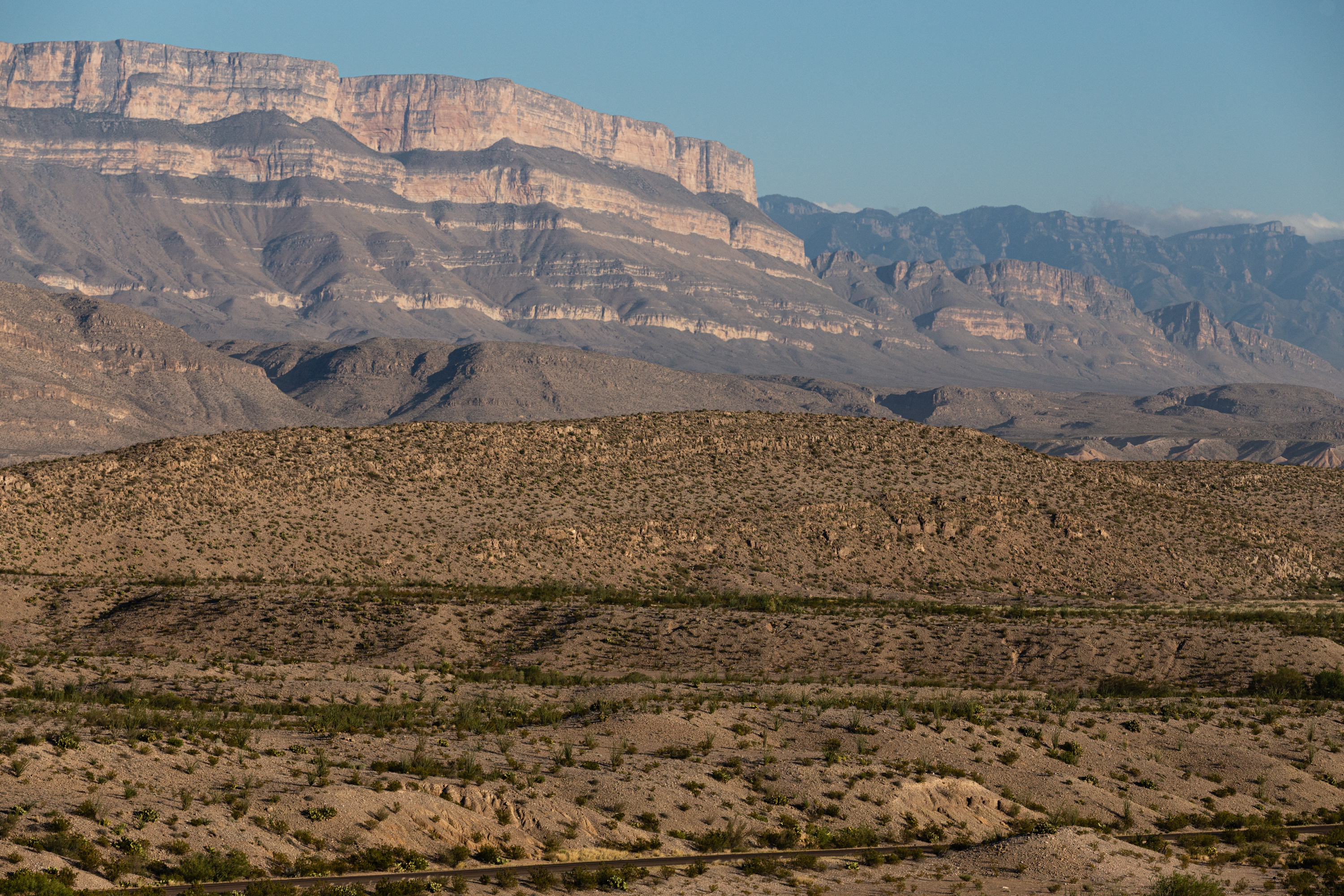
- The trailhead for the Boquillas Canyon Trail is located near the Rio Grande. The tall escarpment directly ahead is the Sierra del Carmen. The canyon walls are about 1200 feet high and are comprised of gray limestone. The trail climbs a small hill, and near the top of the steps are a number of holes in the rock that ancient people used for grinding food. The trail proceeds down the hill and then parallels the river. The trail is composed of sand and river cobbles. Willows and other riparian plants line the river. Listen for the song of the canyon wren and other birds, as well as the lapping of water on the riverbank .
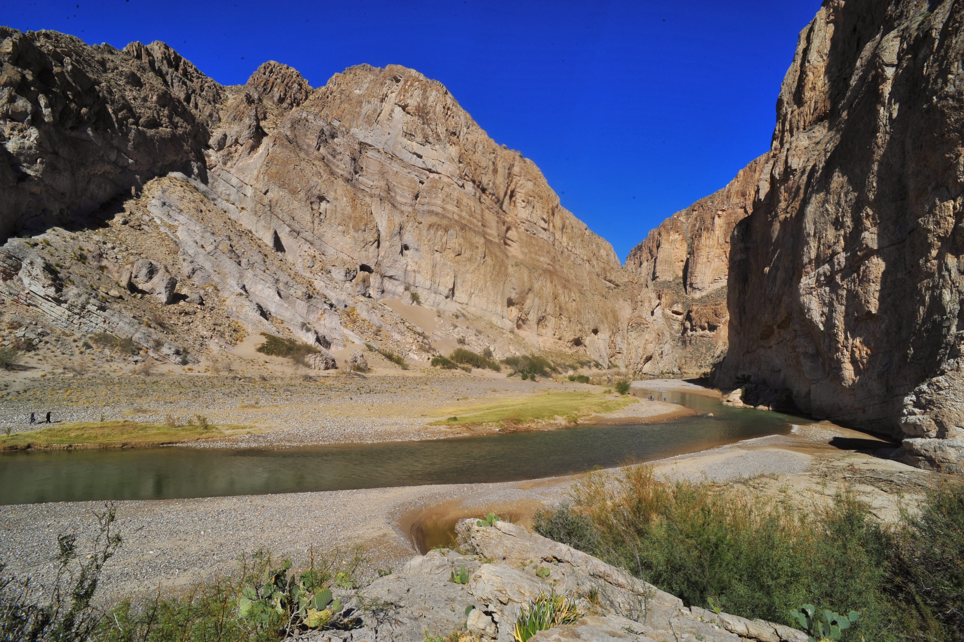
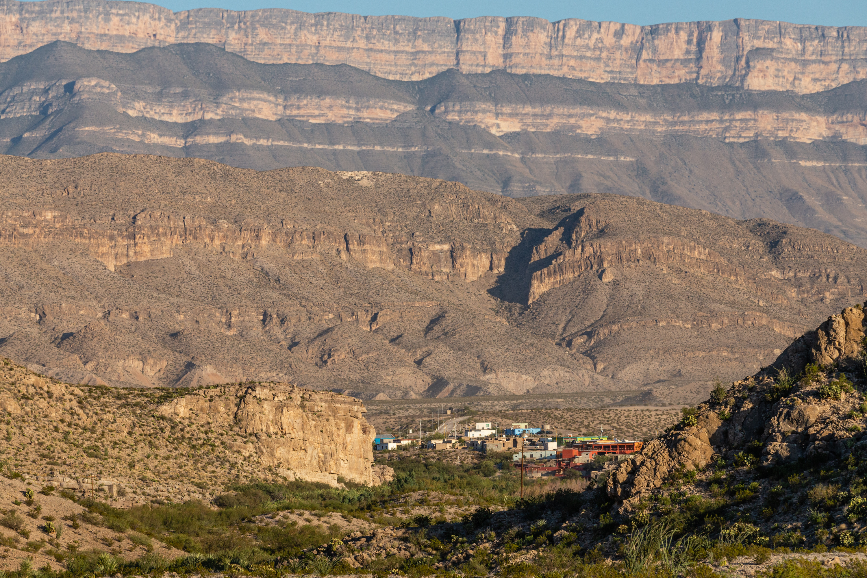
The Boquillas Overlook provides a view of the village of Boquillas, Mexico just across the Rio Grande. It is also a great place for photographs of the Sierra del Carmen and Boquillas Canyon.
- At the Boquillas overlook is a great vista of the village of Boquillas and the Sierra del Carmens in Mexico. Below you, the Rio Grande flows on its journey to the Gulf of Mexico. Also visible from the overlook is the entrance to Boquillas Canyon. There are a number of common Chihuahuan desert plants around you, including creosote bush, lechuguilla, yucca and many different species of cactus.
Visiting the Mexican village of Boquillas through the park's Boquillas Crossing Port of Entry is an option for visitors possessing a valid passport.
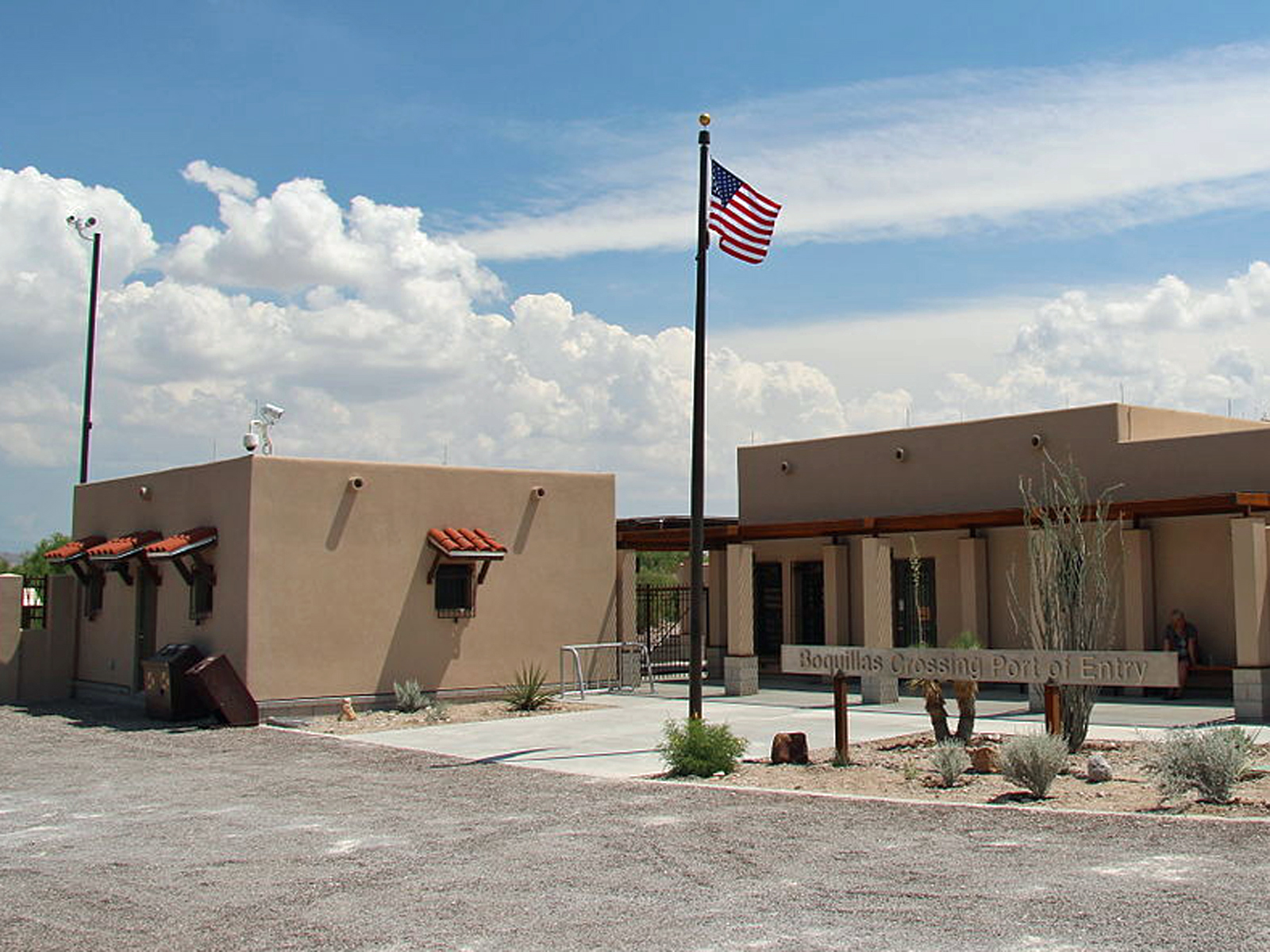
- The Boquillas Port of Entry facility is a large building with kiosks that scan travelers' passports when entering the United States from Mexico. It is located next to the Rio Grande, and the Sierra del Carmen in Mexico are a prominent visual feature. Park rangers are available to help with questions or to assist with U.S. Customs procedures when returning from Mexico.
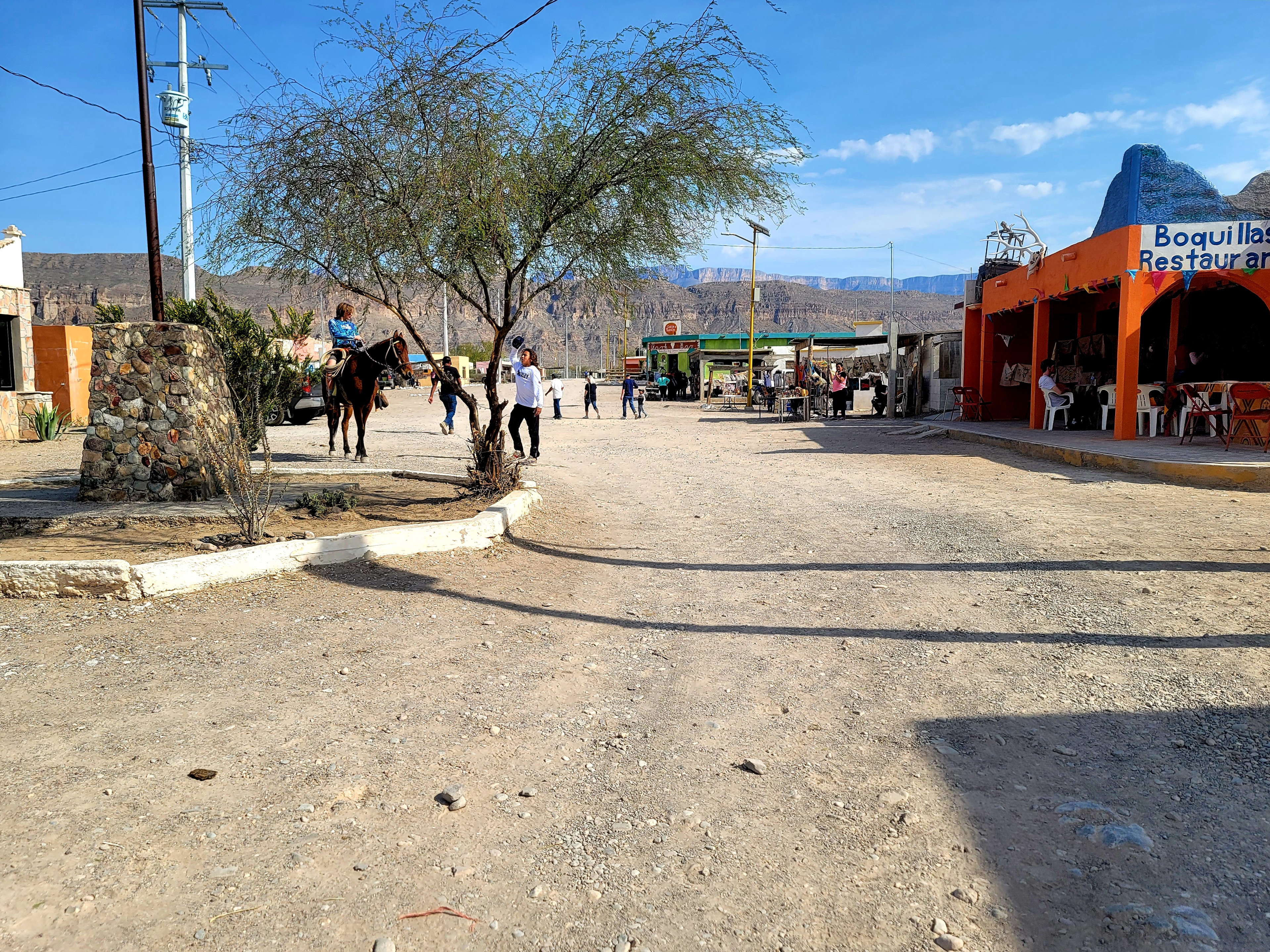
Boquillas, Mexico had its modern beginnings as a mining town in the last decade of the 19th century. You can visit the village through the Boquillas Crossing Port of Entry.
- Boquillas is a small village in Coahuila Mexico. Many families live in the village and depend mostly on their self generated tourism businesses. In the late 19th and early 20th centuries, the villagers work for and in support of the mining operation at the Puerto Rico mine. The mine closed during World War 1, but several families remained in the village. There is also an Immigration office and a military outpost located in and near the village. From the village to the next large town is over 100 miles to the south.
In the early part of the 20th century, hardy homesteaders constructed dwellings and an elaborate network of irrigation ditches for farming near this location beside the Rio Grande.
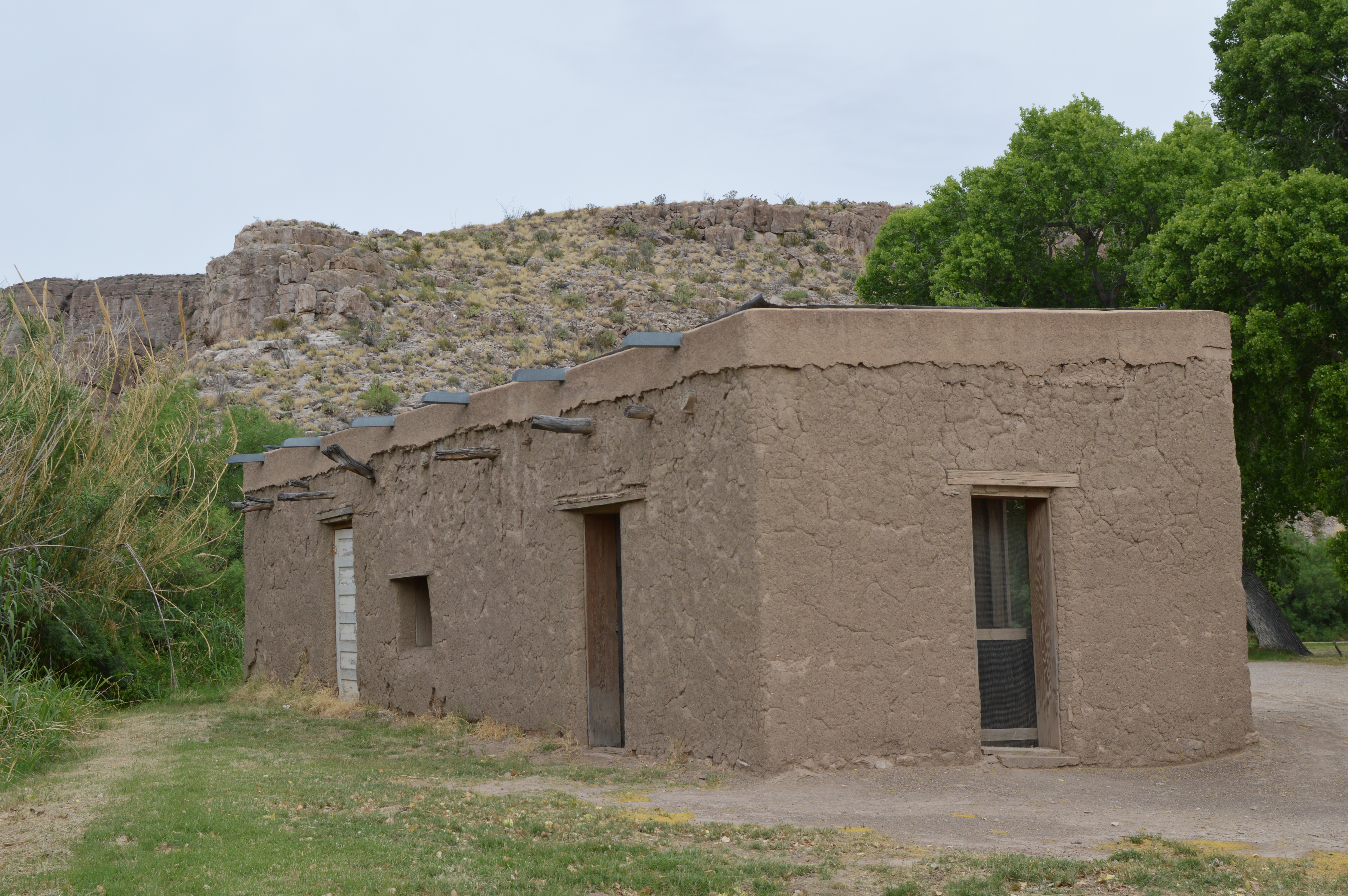
- Text on the Daniels Ranch sign: "From the parking lot you are surrounded by Cottonwood trees, willows and other riverside foliage. Under these trees are some picnic tables and a restroom. There is also a one story adobe building which was part of the farm operation. The building is about 20 feet by 40 feet and has a flat roof. Just 100 yards to the west, tall cliffs follow the course of the river toward the hot springs. These cliffs are made up of ancient limestone and are about 200 feet high on both sides of the river. These cliffs comprise what is called Hot Spring Canyon, which is about three miles in length. The area around Daniels Ranch is rich with wildlife, especially birds."
The 6-mile roundtrip Hot Springs Canyon trail follows the Rio Grande from Daniels Ranch to the hot spring and the Hot Springs Historic District.
- The Hot Springs trailhead at Daniels Ranch begins from a paved parking lot. Nearby are a restroom, picnic tables, a historic adobe structure, and a 0.2 mile walk to a view of the Rio Grande. The trailhead is accessed via a short walk along a dirt road past rows of cottonwood trees. A small sign located in a break of mesquite trees indicates the start of the trail.
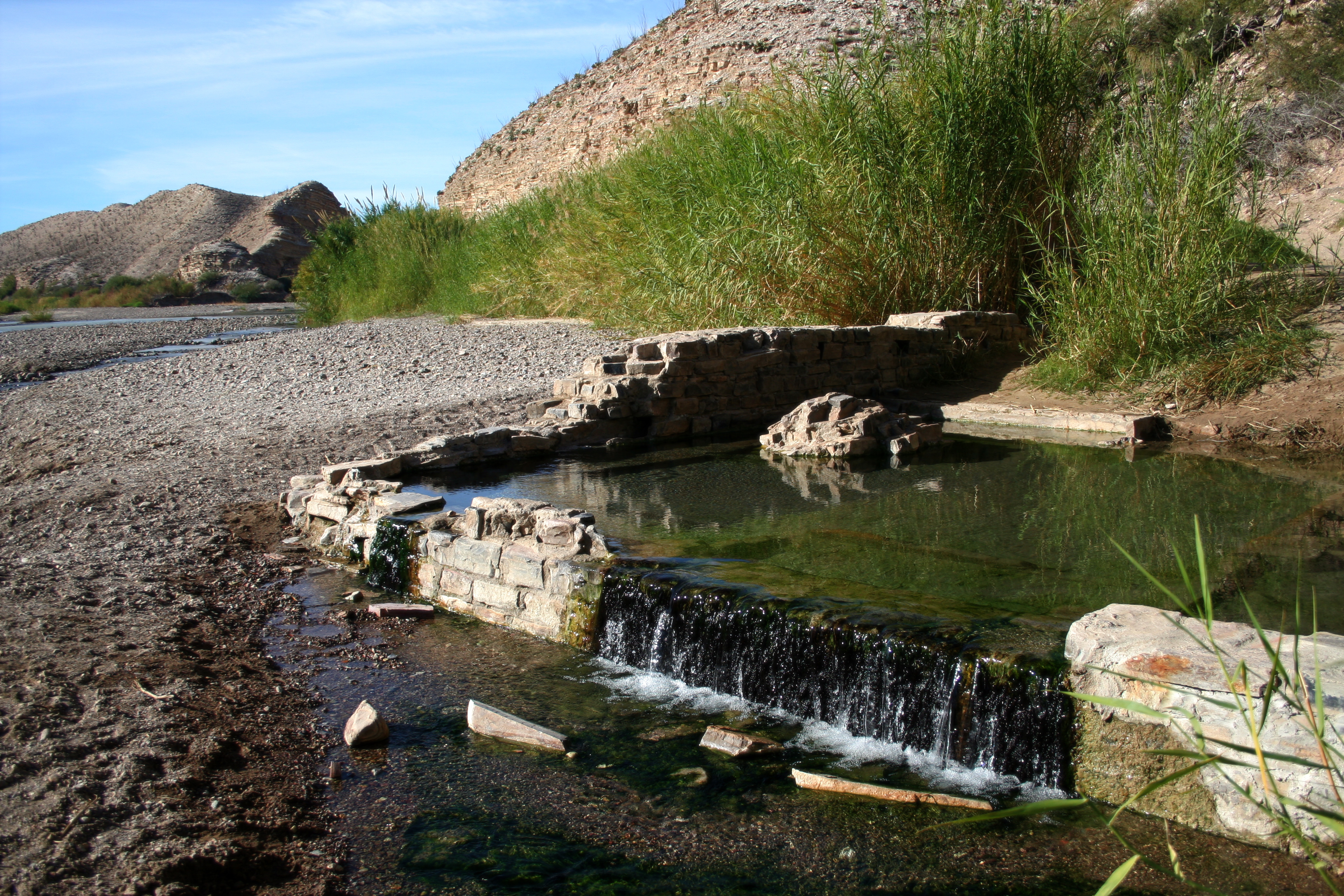
The Hot Springs Historic District preserves a rich history of human occupation from thousands of years ago to the not-so-distant past. Visitors can study rock art left behind on the limestone cliffs, or imagine what it would have been like to meet at the Hot Springs Post Office in the early 1900s to collect your mail. Langford's impressive bathhouse is long gone; today the spring is contained by the foundation remains of the bathhouse, on the north bank of the Rio Grande.
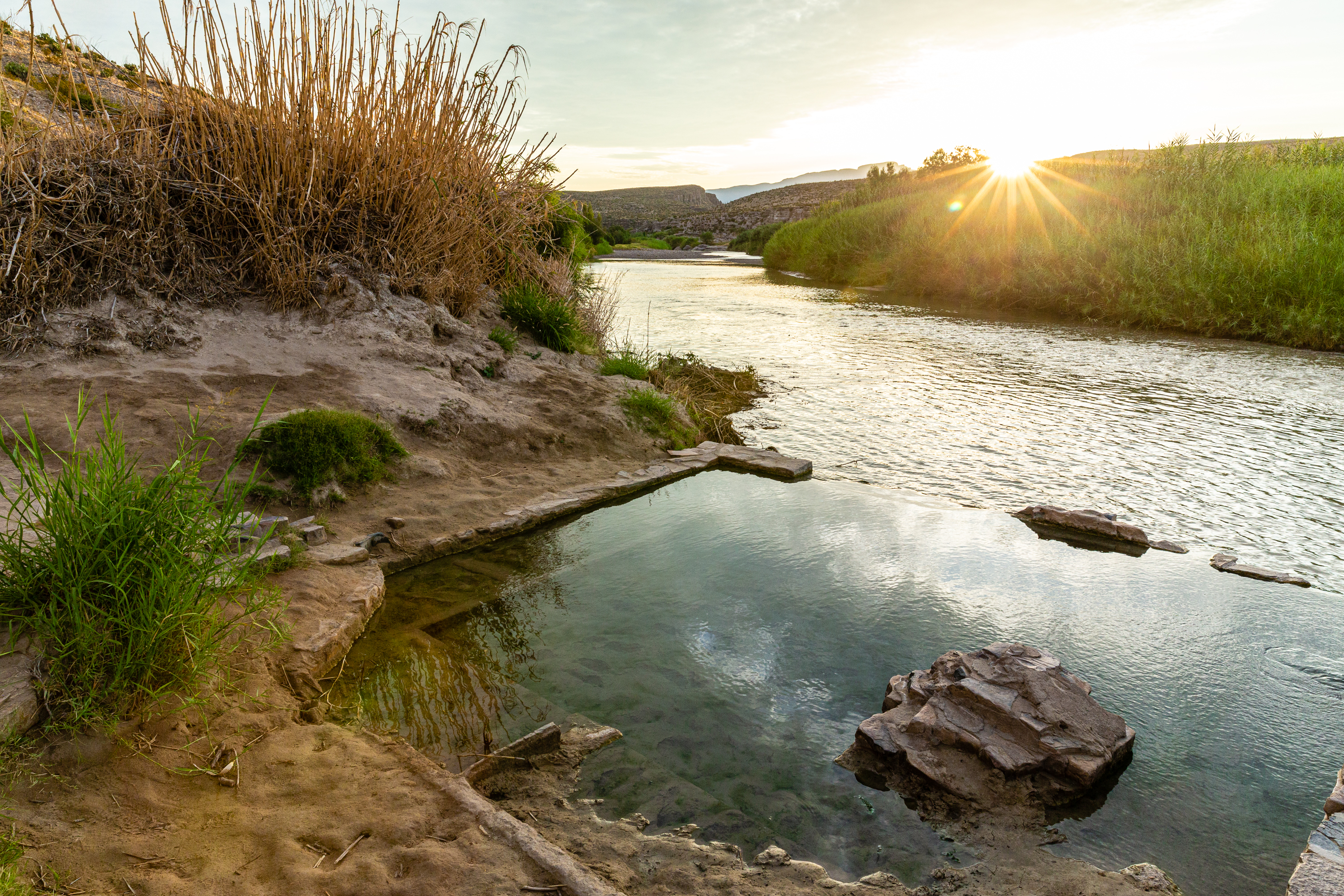
- The hot spring is located right next to the Rio Grande and at times is covered by the river when the flows are high. The cliffs next to the river here are about 100 feet high. The foundation of the bath house where the 105 degree water are about two feet high. The route off the trail to the pool is sometimes wet and slippery.
This 1 mile roundtrip walk passes the remains of a resort, homestead, and pictographs, eventually ending at the hot springs. One can continue hiking above the river to Daniels Ranch, a roundtrip distance of 6 miles.
- This trailhead begins from a dirt parking lot and traverses sand and mud flats as it parallels the Rio Grande. At the parking lot one can see several stone structures that remain from the time when this was J.O. Langford's Hot Springs resort. Thinly bedded limestone cliffs surround the parking lot on two sides. Scrubby desert vegetation including cacti, creosotebush, and mesquite remind one of the fact that little precipitation falls in this part of the park.
The Langford Hot Springs have an impressive history of use from Native Americans to J.O. Langford's healing resort.
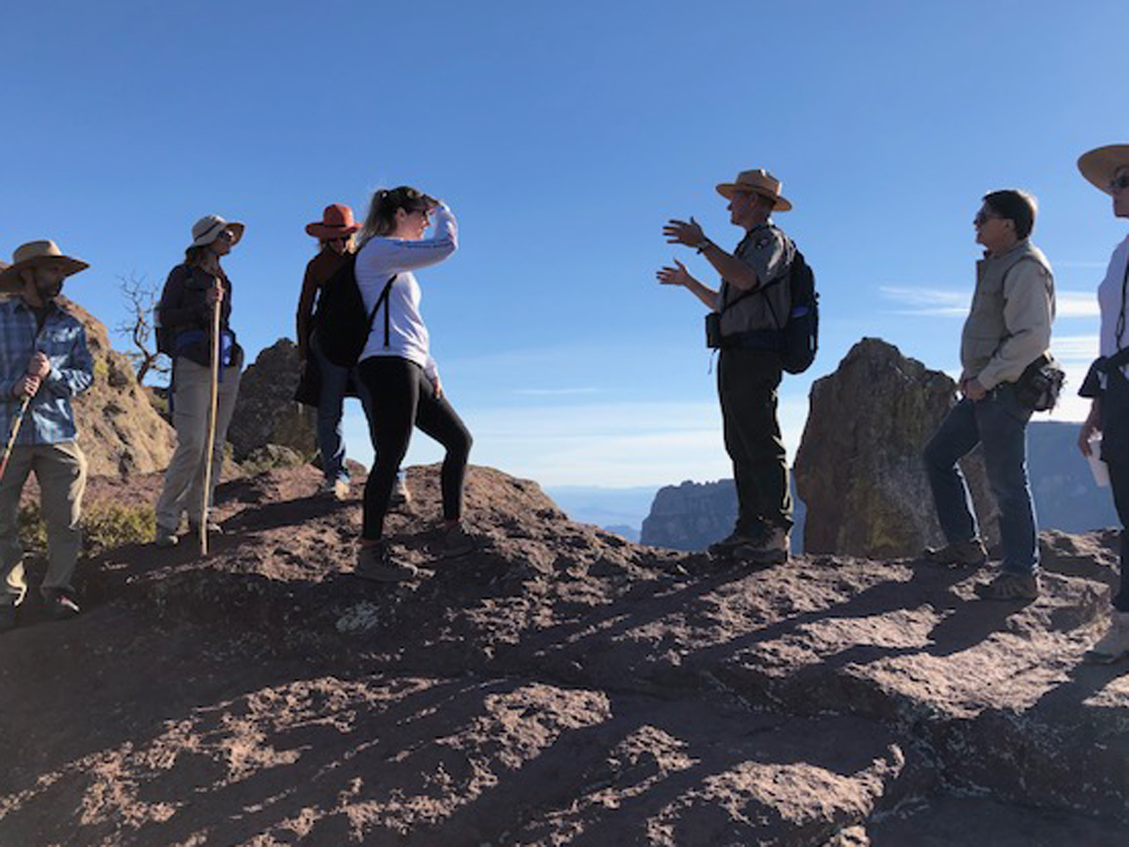
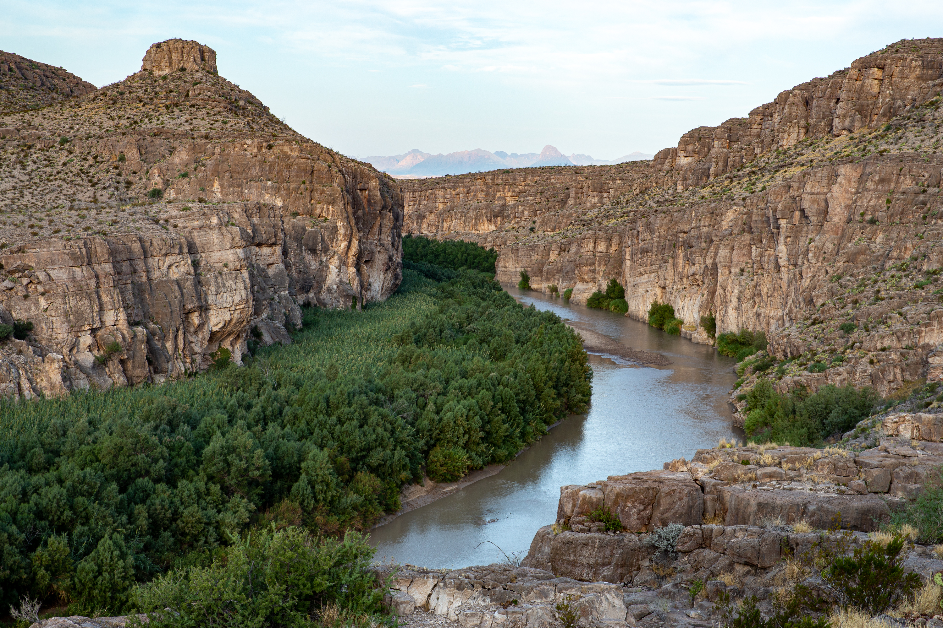
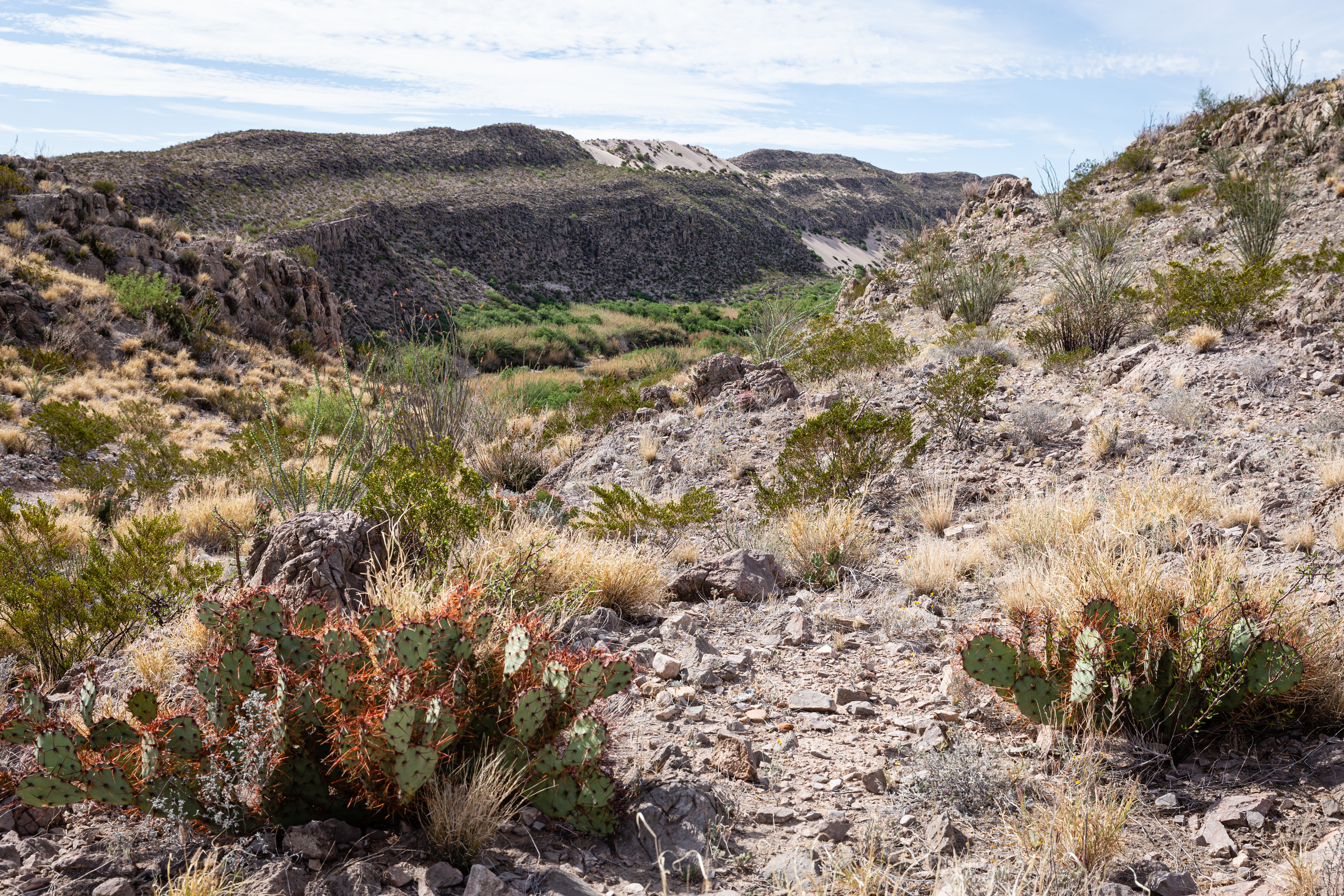
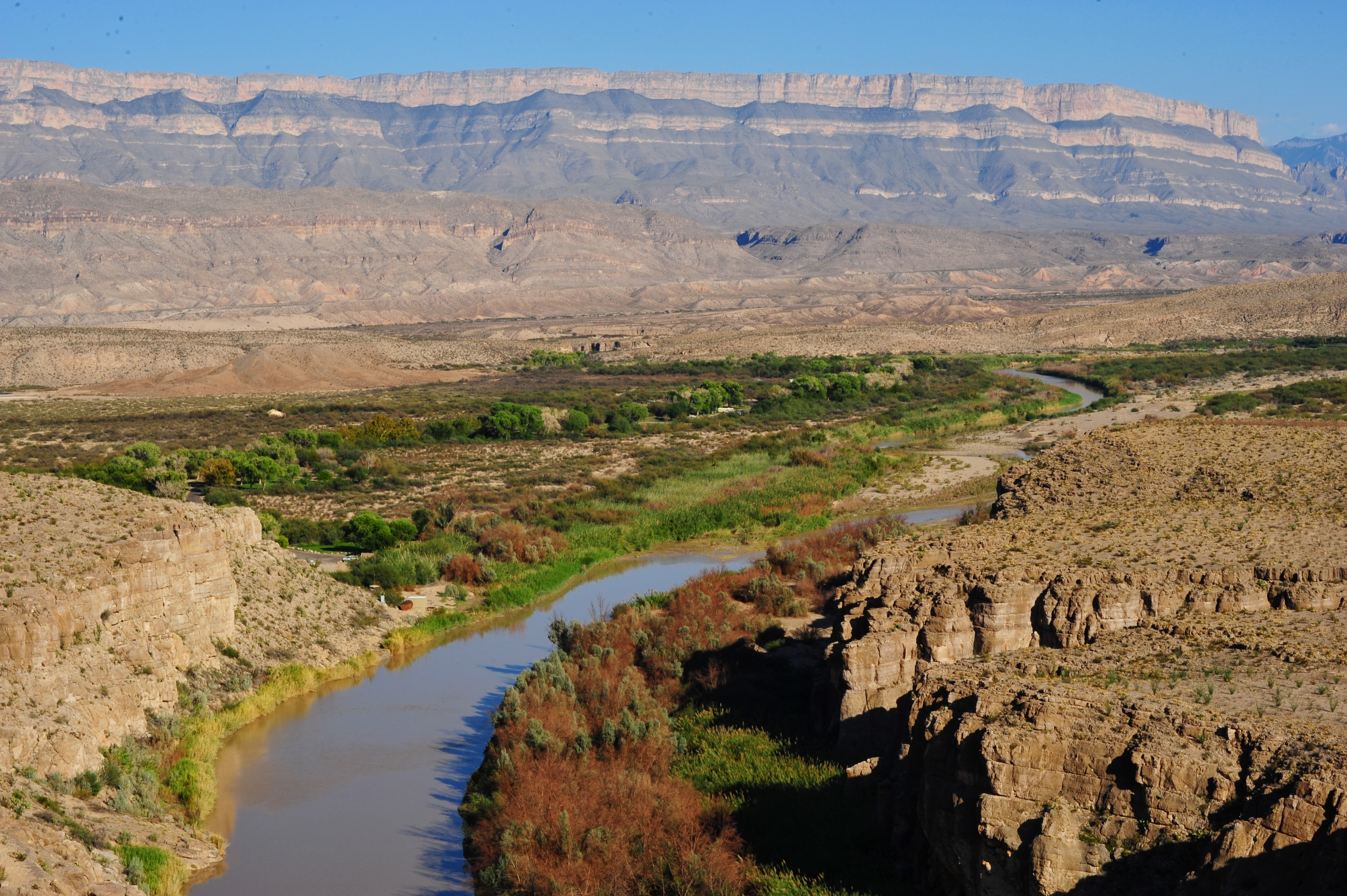
The 6.5 mile Mariscal Rim Trail is as rewarding as it is remote. Located in the very southern part of the park along River Road, it takes 2 hours to reach the trailhead from the paved park road near Rio Grande Village. A high-clearance, 4x4 vehicle is necessary to reach the trailhead.
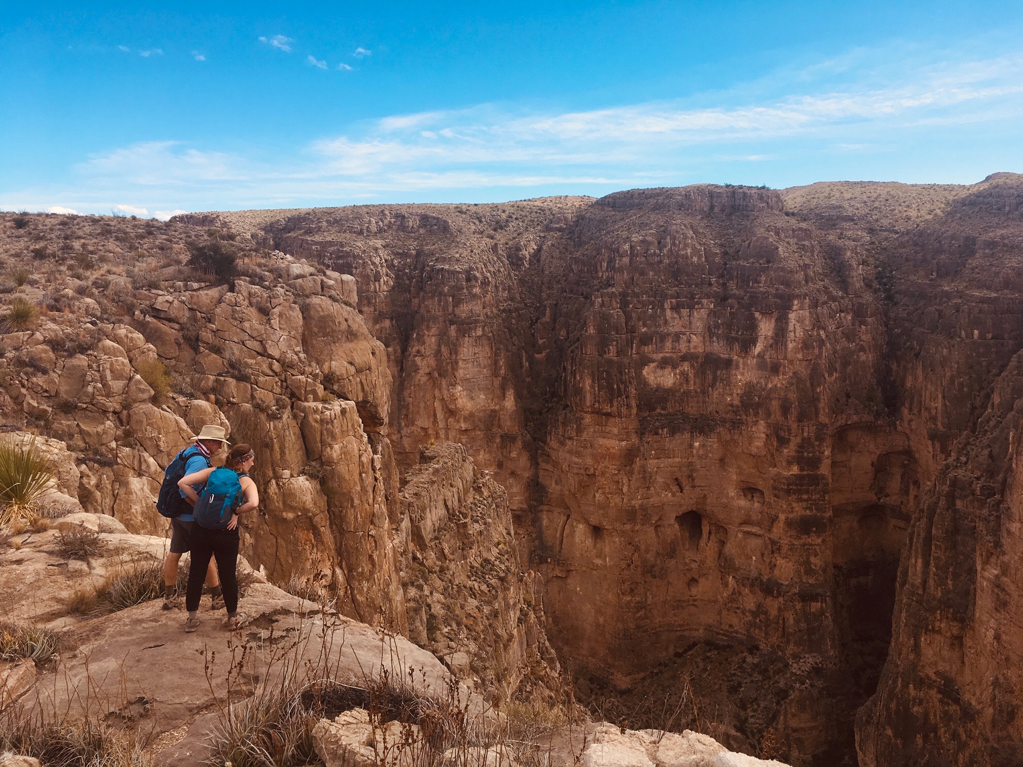
- The hike to the rim of Mariscal Canyon provides hikers the opportunity to peer into the most remote of the three canyons in the park. The trail climbs a mountain composed of limestone, which is thinly covered in desert vegetation including cacti, lechuguilla, and cholla. 1,300 feet below, the river is a band of green providing life-giving water in a parched land. Distant views into Mexico showcase the mountains found on the other side of the Rio Grande.
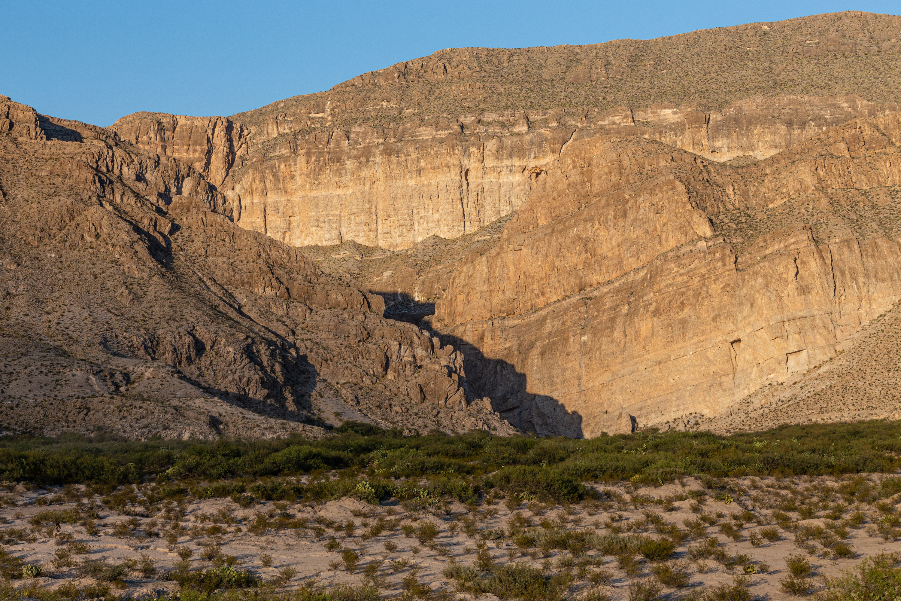
The ore tramway that once spanned the Rio Grande near this location facilitated mining operations in Mexico.
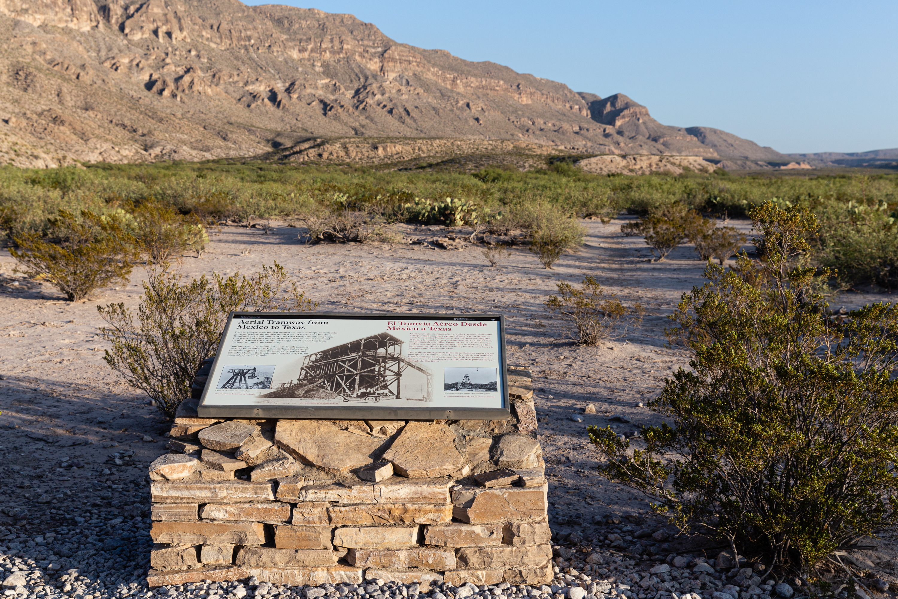
- Standing at the tramway exhibit you are about midway between the Puerto Rico mine in Mexico and the tramway terminal at the top of the mountain above Ernst Valley. The tramway was used to bring the ore from Mexico, to a wagon road, and then on to the railroad at Marathon. The del Carmen mountains dominate the view to the east, and the rugged Dead Horse mountains are to the north. The mouth of Boquillas Canyon can be seen to the east.
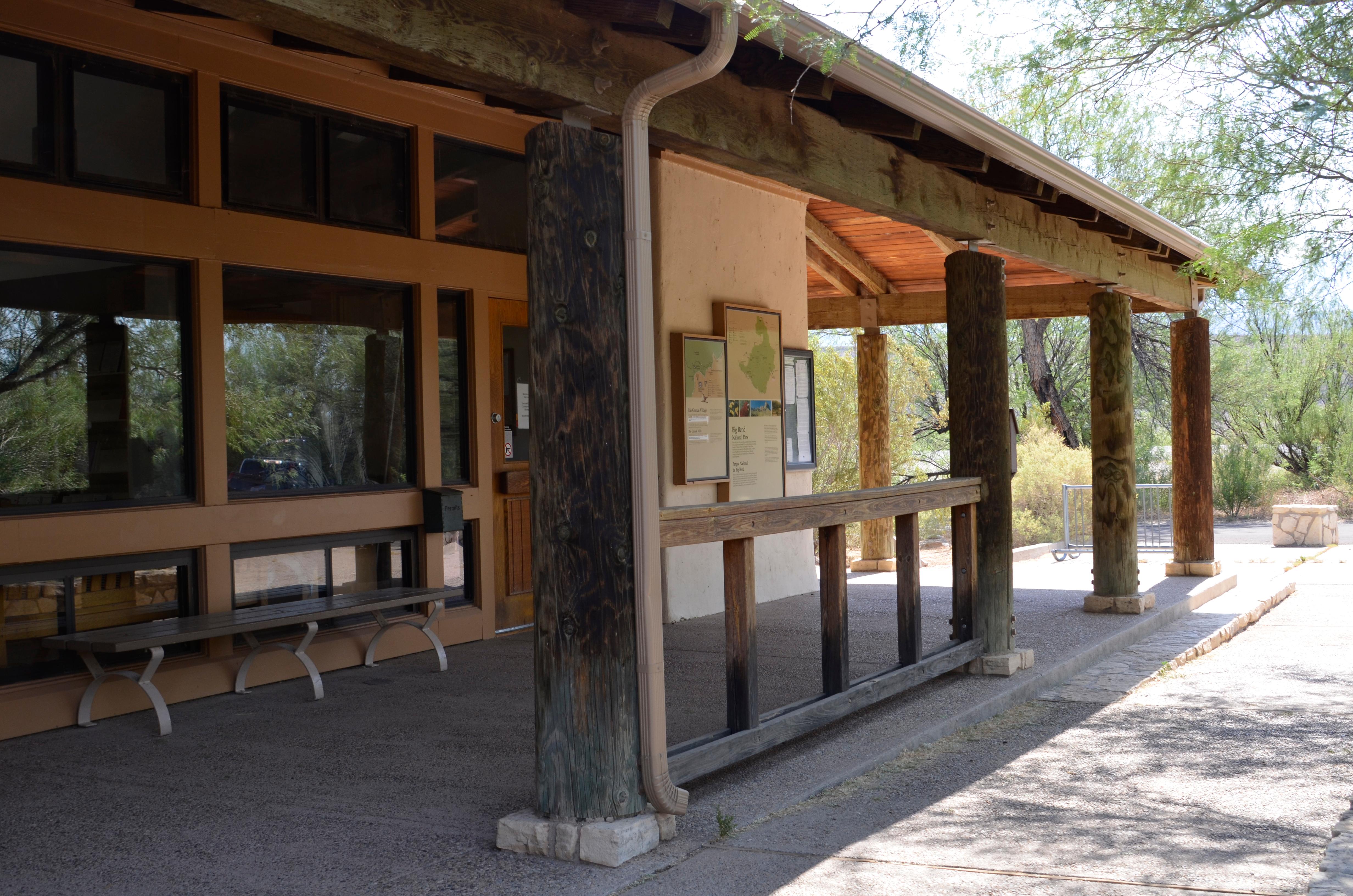
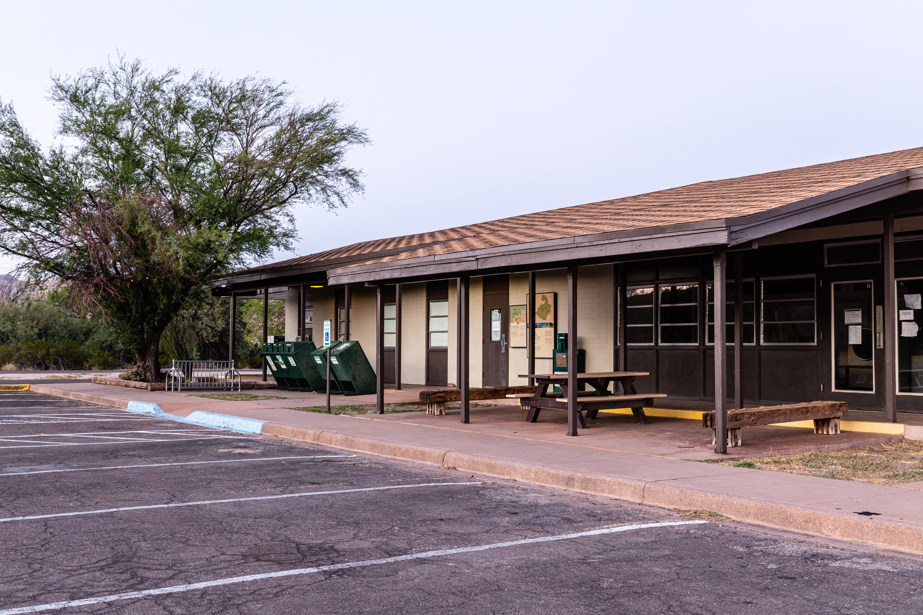
The Panther Junction Service Station is open daily. Operated by the park's concessioner Forever Resorts, the facility offers fuel, snacks, convenience items, restrooms, and souvenirs. Gas pumps open 24 hrs.
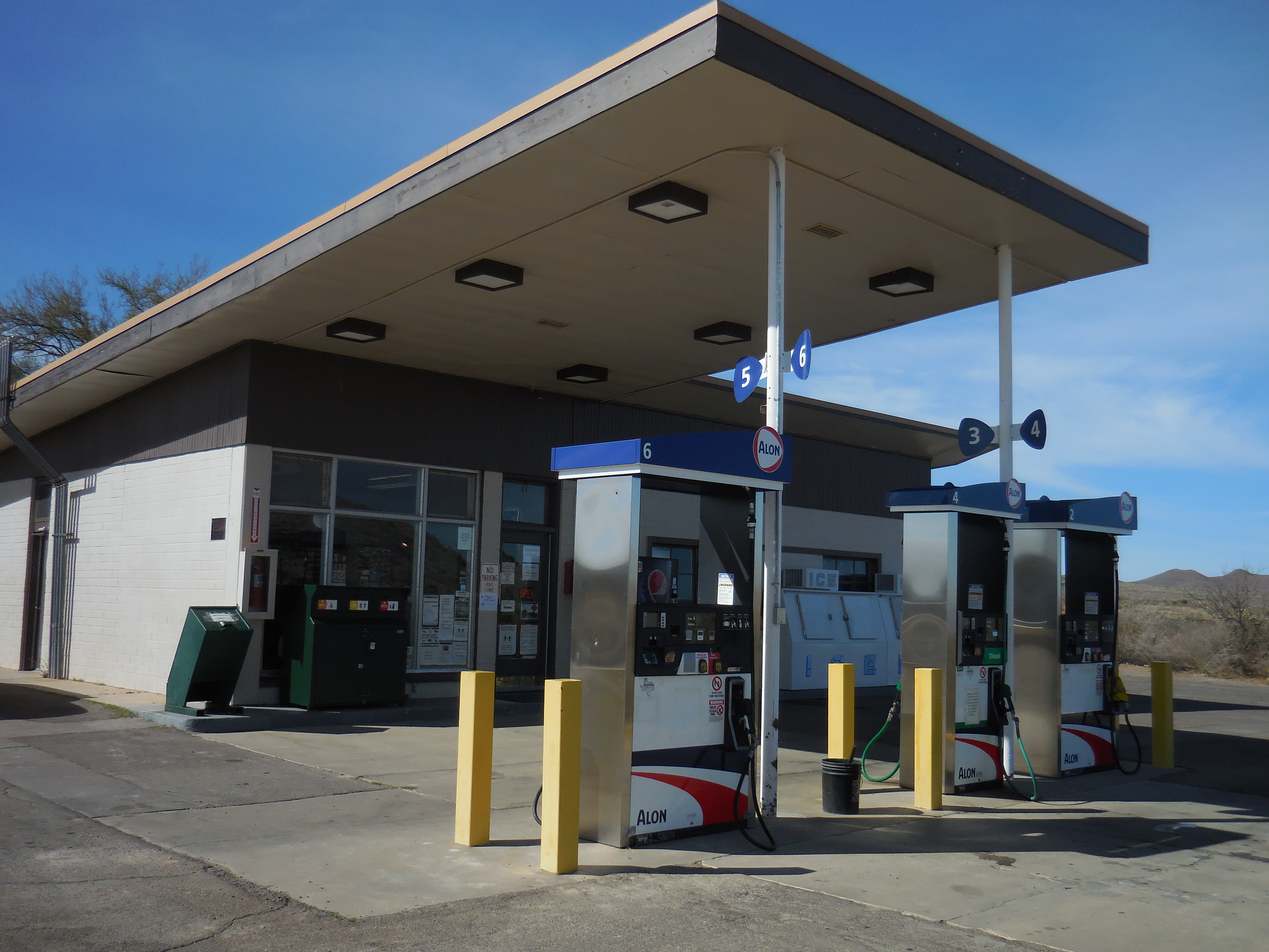
- The Panther Junction Service Station is open daily. Operated by the park's concessioner Forever Resorts, the facility has fuel, snacks, convenience items, and souvenirs. Gas pumps open 24 hrs.
This exhibit looks out over the former Daniels Ranch farm. From the top of the short trail, you can see the remnants of the irrigation system and the tree lined course of the Rio Grande.
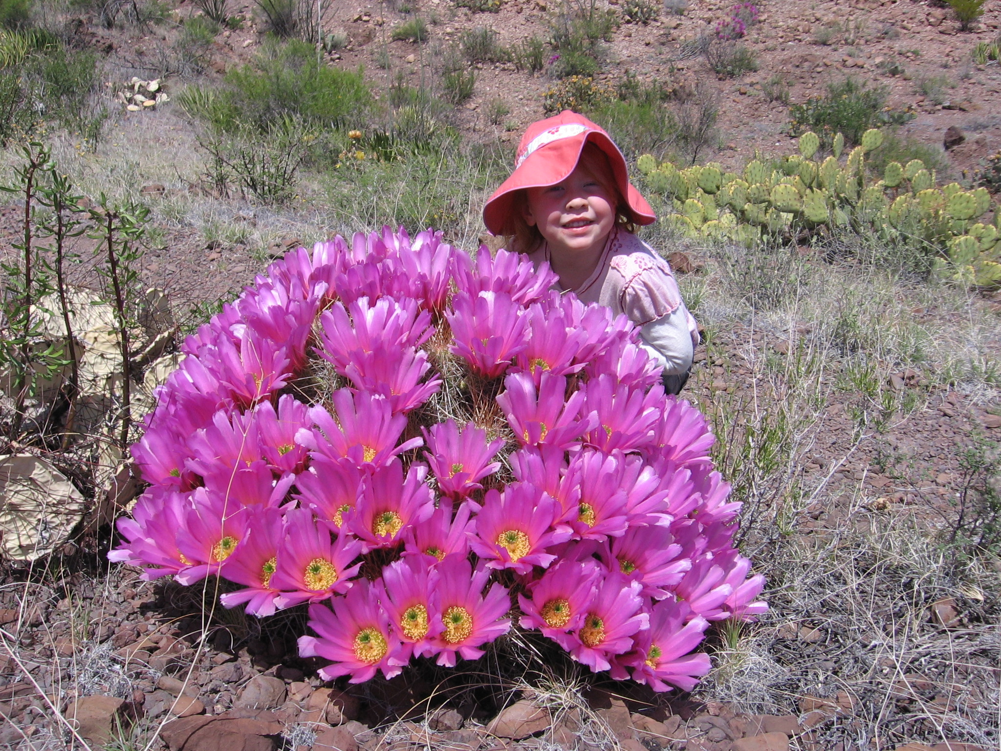
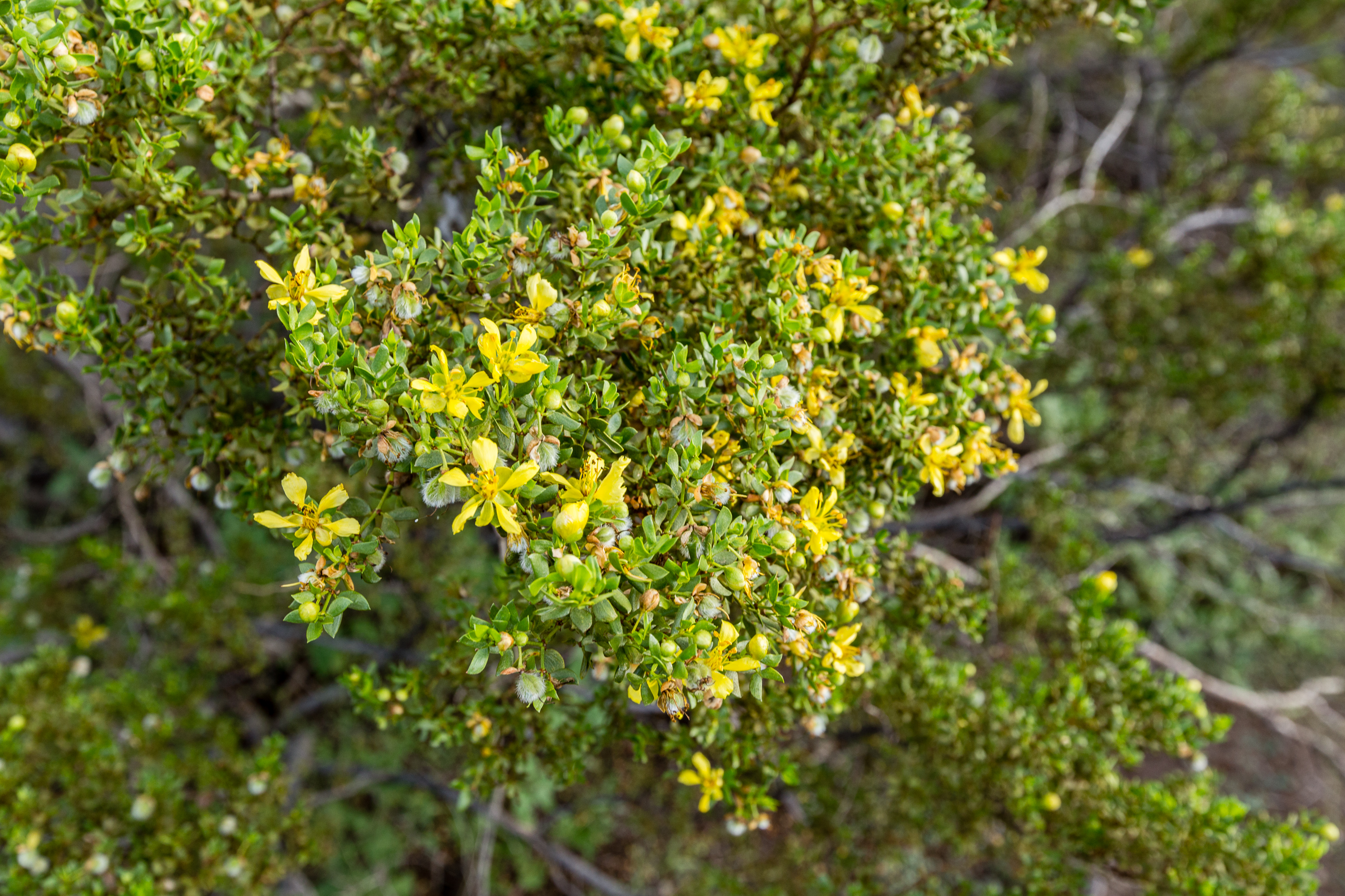
- Living in Limestone Limestone weathers reluctantly in dry climates, and leaves soils rough and stony, with few deep pockets to hold water and nutrients. Certain plants seem to like these dubious qualities. Look around for them as you walk back down the trail. Images of Lechuguilla, Hechtia, Ocotillo, and Candellia Wilderness Without Boundaries You are looking across the Rio Grande floodplain toward the wild reaches of Mexico's Sierra del Carmen. Above those cliffs, black bear and Montezuma quail roam a mountain wilderness of ponderosa pine forest and wildflower meadows. Birds and whitetail deer native to the Sierra del Carmen are often sighted in Big Bends' Chisos Mountains - across an international border but part of the same ecosystem.
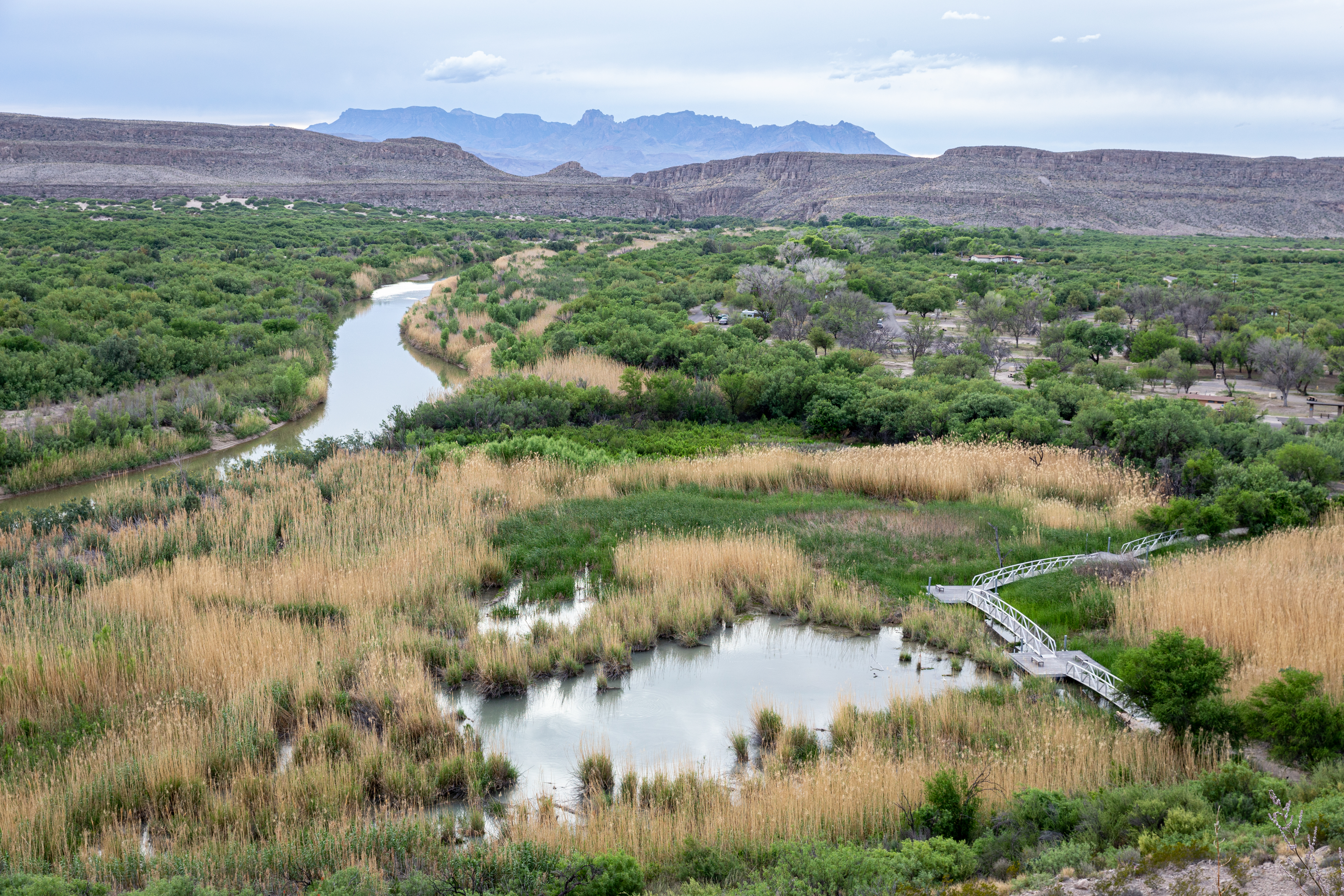
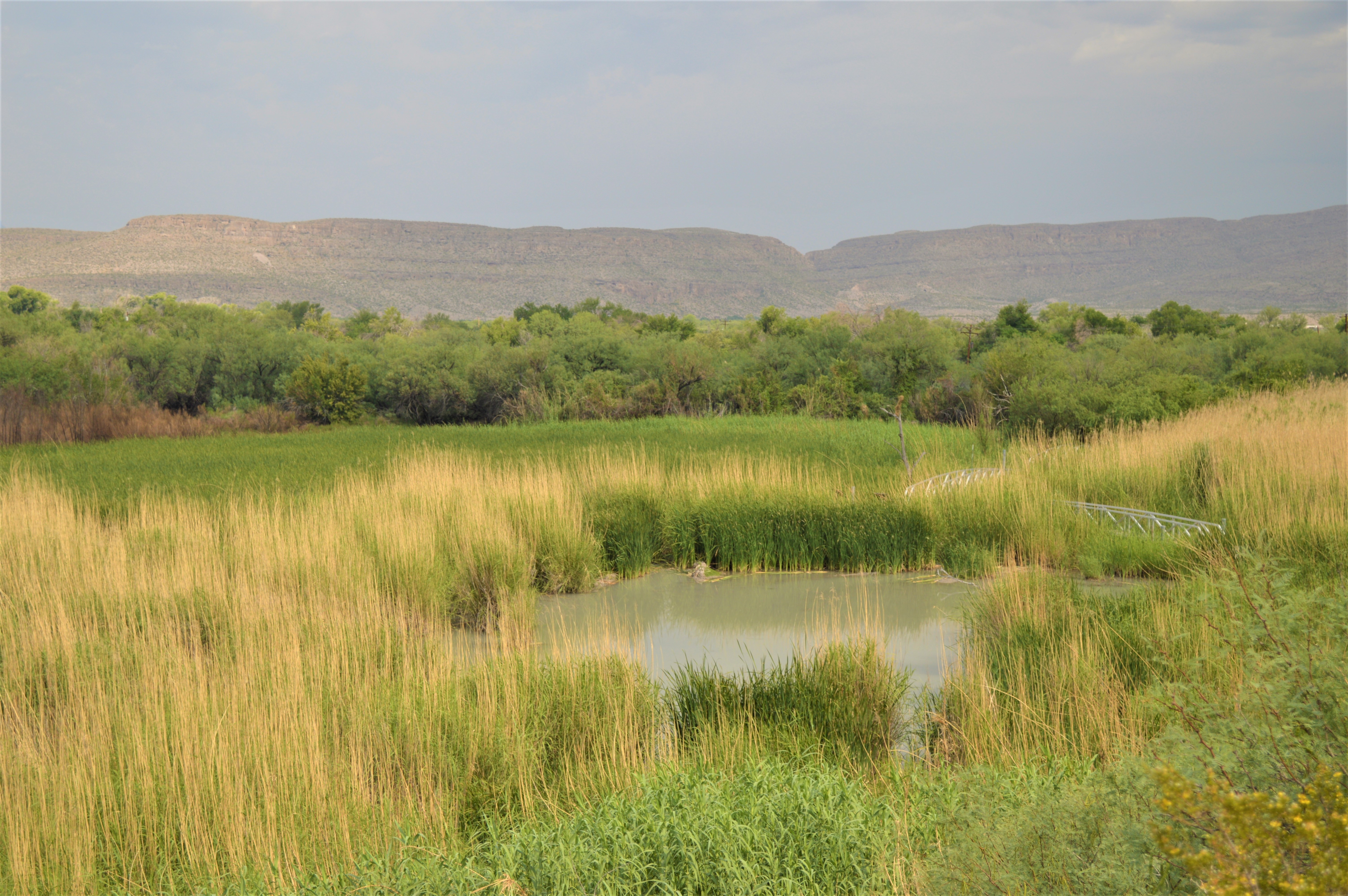
The 0.75 mile Rio Grande Village Nature trail crosses a wetland area on a boardwalk and climbs a small hill to a viewpoint. This is a great hike for birdwatchers and photographers.

- The Rio Grande Village Nature trail begins near site 18 in the campground. Surrounding the trailhead is a dense thicket of mesquite, huisache, willows, and other riparian plants. Just 100 feet down the trail you reach the pond, which is surrounded by cane. A short bridge crosses the pond and brings you to the higher portion of the trail. As you leave the pond, there is a change to common Chihuahuan desert plants like prickly pear cactus and creosote bush. The creosote has a pungent odor which is unmistakable. As you follow the trail, a vista provides views to the south into Mexico, to the village of Ojo Caliente. The terrain on both sides of the river are very similar. When you reach the top of the trail, about 200 feet higher than the pond, a sweeping vista of the surrounding area awaits. You can see the Sierra del Carmen mountains to the east and the Chisos Mountains to the west. The trail then leads back down the hill and returns to the pond and the trailhead.
This is the first stop along the Rio Grande Village Nature Trail Self-Guided Tour. This location discusses beaver and their contribution to the creation of the pond.
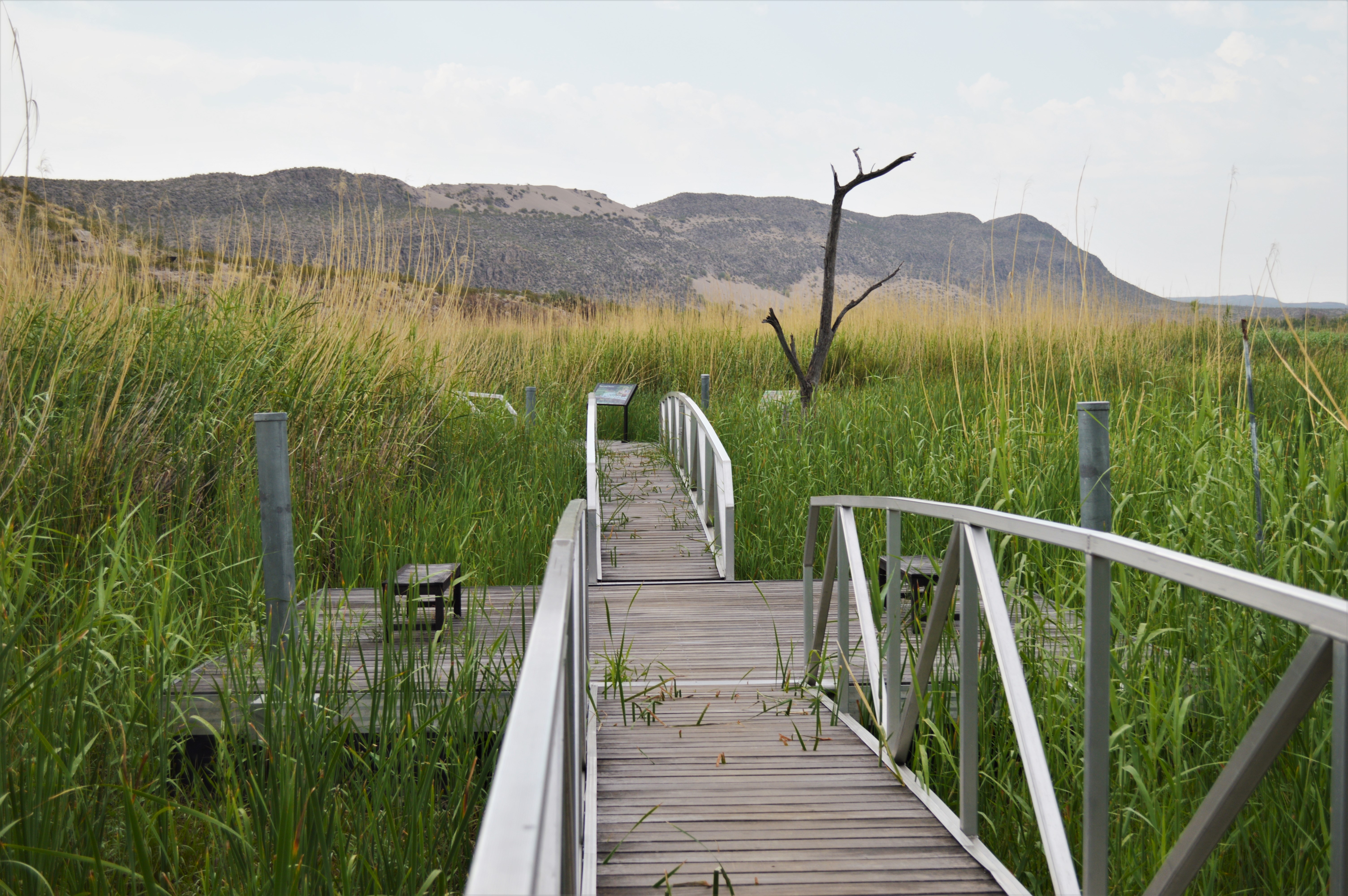
- This is the beginning of the metal boardwalk that stretches out over the pond. This section of boardwalk has two larger square platforms with benches for sitting and observing the wildlife. Surrounding the boardwalk on both sides are tall stalks of cane. A line of cliffs is visible in the distance.
This is the tenth stop along the Rio Grande Village Nature Trail Self-Guided Tour. At this location we discuss mesquite trees and their many uses.
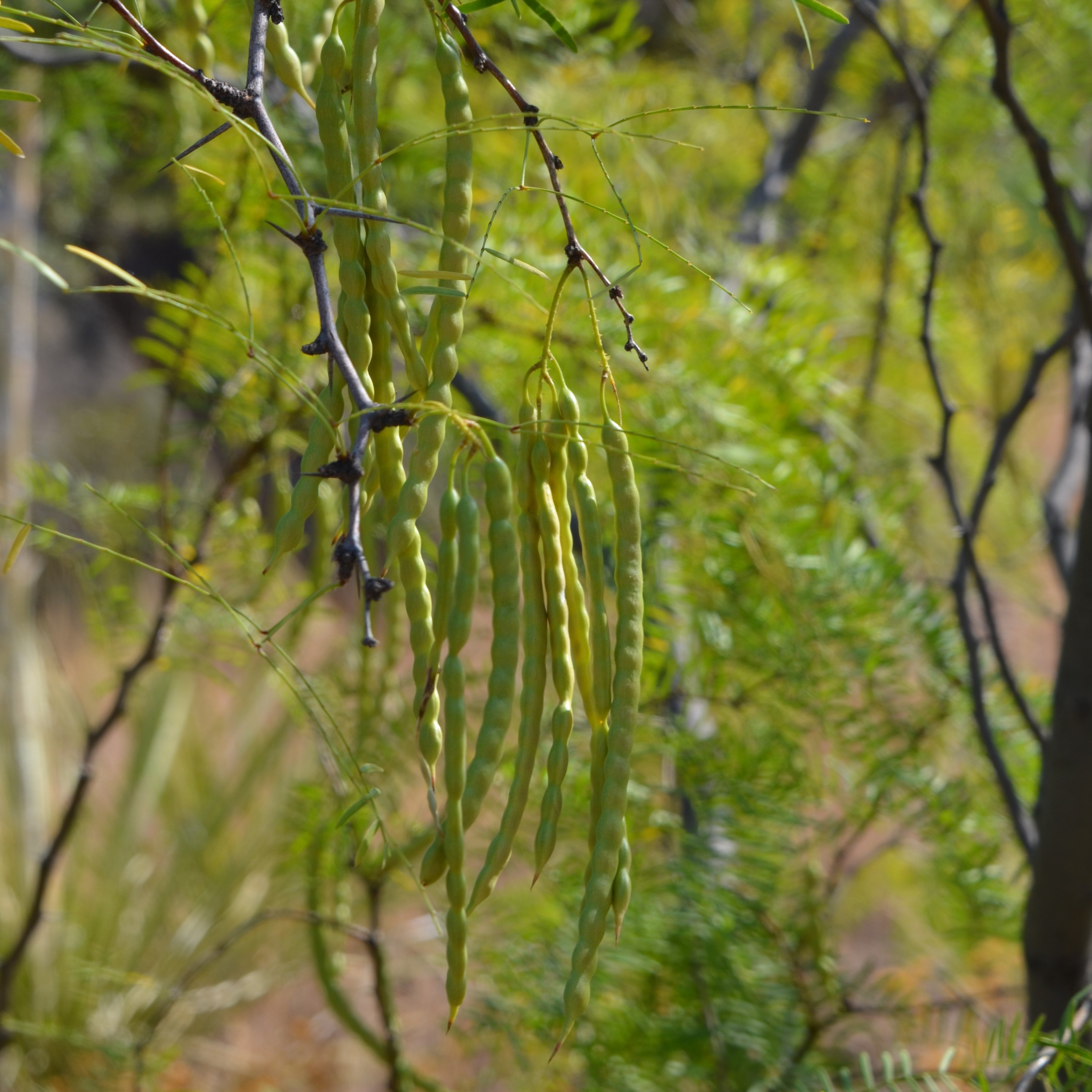
- The trail has dropped off the limestone ledges and into the sand that dominates the river floodplain. At this location one passes through a line of mesquite trees. In the summer months they are very green and their seeds pods are beginning to ripen. When the seed pods turn brown and begin to fall, many different animals may be seen eating the slightly sweet and nutritious pods.
This is the eleventh stop along the Rio Grande Village Nature Trail Self-Guided Tour. The object of discussion is an invasive species of cane known as Arundo donax.
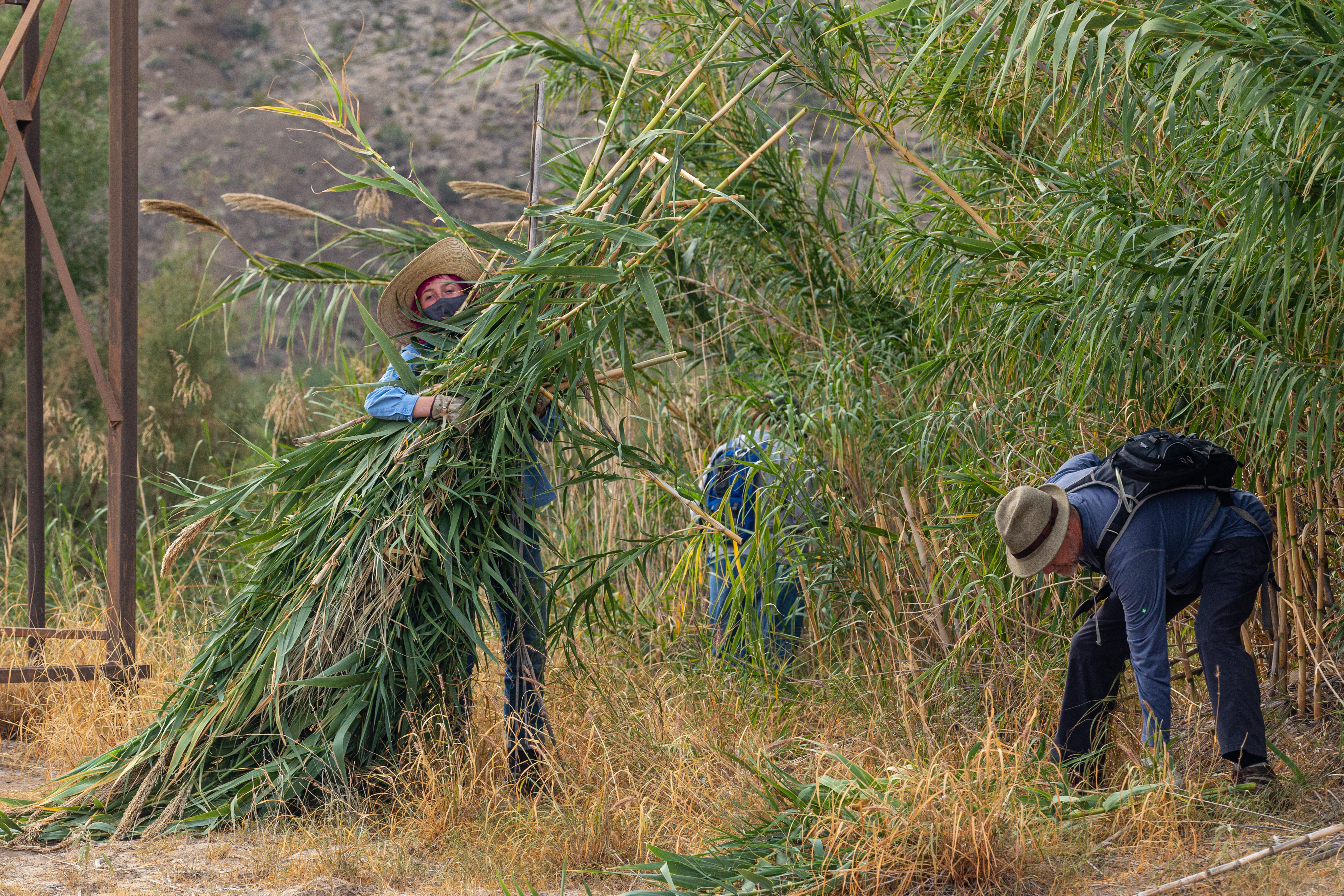
- In this area the trail passes through a thick stand of tall, spindly cane. The cane is easily 10-15 feet high and forms an impenetrable barrier in some places. The cane signals the location of the Rio Grande, as it cannot grow very far from its life-giving water. The trail is soft sand, so walking is more difficult, but the sound of the river just ahead coaxes one to continue walking.
This is the twelfth stop along the Rio Grande Village Nature Trail Self-Guided Tour. The spur trail ends here at the Rio Grande.
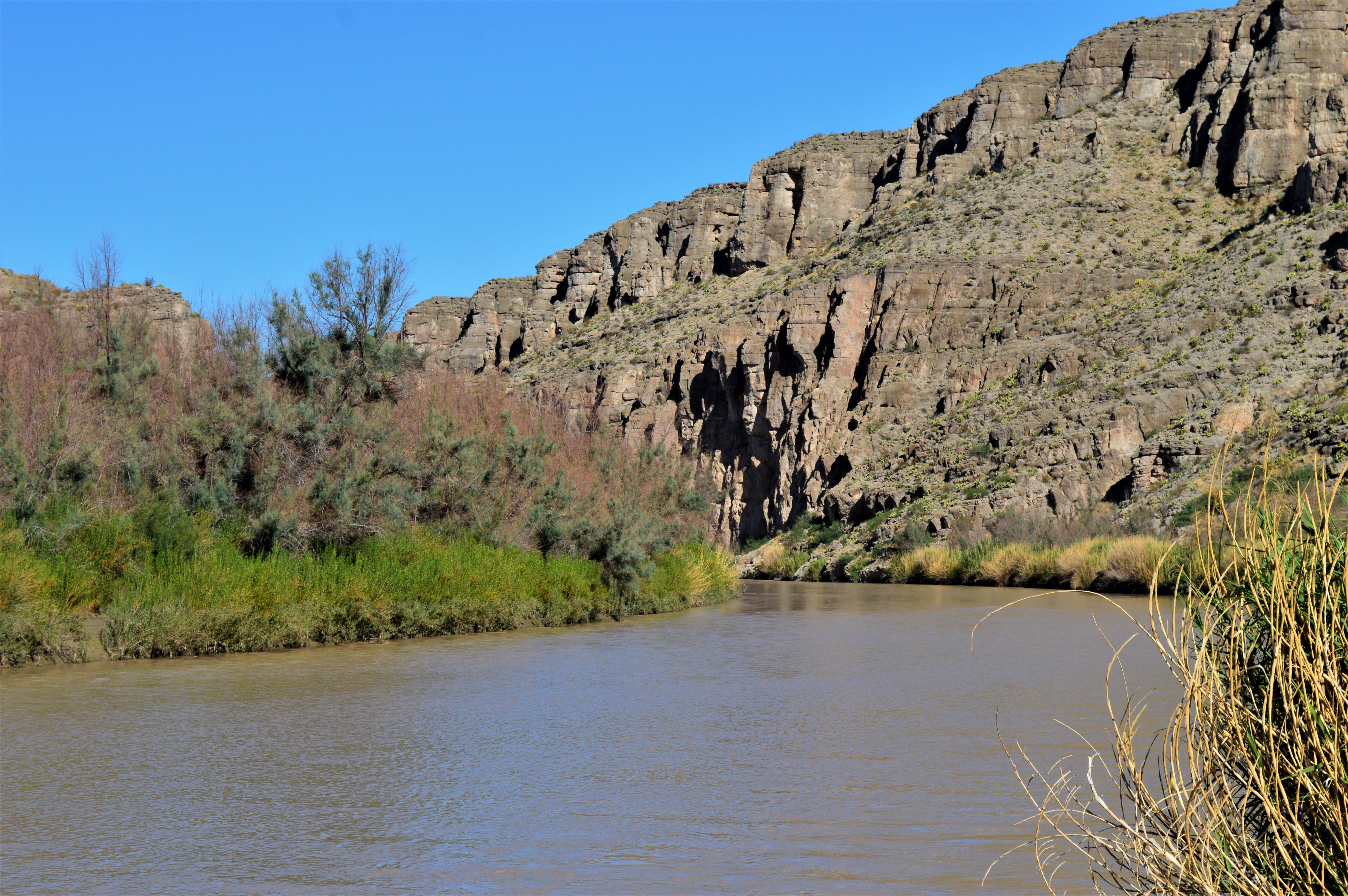
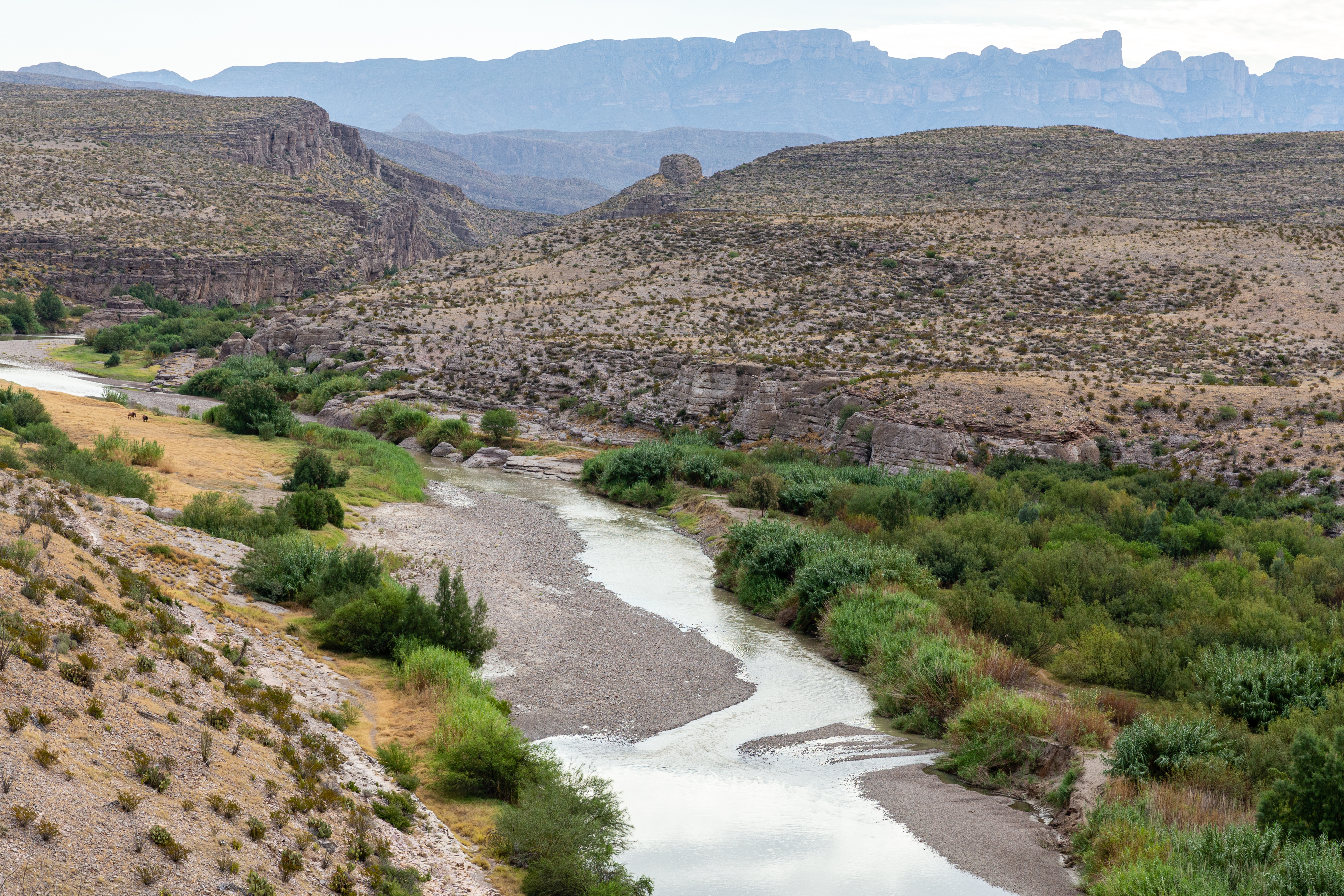
- Standing on the bank of the Rio Grande one can see across into Mexico. Depending on the time of year, the river can vary between one to five feet deep, and have a flow between 20-500 cubic feet per second. The majority of the year it holds around two to three feet deep. As the river flows downstream through this area it butts up against a limestone cliff, which causes it to curve to the left.
This is the thirteenth stop along the Rio Grande Village Nature Trail Self-Guided Tour. The location offers a view of the village of Ojo Caliente in Mexico.
- The trail has climbed about halfway up the hill, so one has a better view of the surrounding landscape. To the east, just across the Rio Grande, five adobe buildings are visible in Mexico. As the trail is far from the river, the vegetation has returned to that typical of the desert - prickly pear cactus, ocotillo, creosote bush, and cholla.
This is the fourteenth stop along the Rio Grande Village Nature Trail Self-Guided Tour. The difference between vegetation here versus along the Rio Grande is quite noticeable.
- The trail has climbed higher up the hill, passing through a shallow canyon at this location. Down below one can see the green ribbon of vegetation surrounding the Rio Grande, while here along the trail the soil and plants all look quite dry. There is no shade on the hill, so the sun beats down on all exposed surfaces, drying things out quickly.
This is the fifteenth stop along the Rio Grande Village Nature Trail Self-Guided Tour. From this location one has a fabulous view to the west of the Chisos Mountains, Rio Grande, and the wetland pond.
- The trail has reached the top of the hill and from this location one has a fantastic 360 degree view of Rio Grande Village and Mexico. Off in the distance rise the volcanic Chisos Mountains, towering above a lower line of limestone cliffs. In addition to the Rio Grande and the wetland, one can see down into the Rio Grande Village Campground and portions of the paved road leading west to the rest of the park.
This is the sixteenth stop along the Rio Grande Village Nature Trail Self-Guided Tour. From here one has a fantastic view of the Sierra del Carmen and the village of Boquillas, Mexico.
- This final stop is the furthest one can walk along the top of the hill. Out at this end one has an unobstructed view of the towering Sierra del Carmen and the tiny village of Boquillas, Mexico. Brightly colored adobe buildings occupy the low ground to the northeast of your present location. This is one of the best locations in the park from which to watch the sunset. As the sun begins to descend in the west, the remaining light turns the light-colored limestone rocks of the Sierra del Carmen into beautiful shades of pink, red, and purple. The sight of the Rio Grande flowing beneath these towering cliffs is one of the highlights of the Rio Grande Village area.
This is the second stop along the Rio Grande Village Nature Trail Self-Guided Tour. This location describes and discusses the tiny fish called the Big Bend Gambusia.
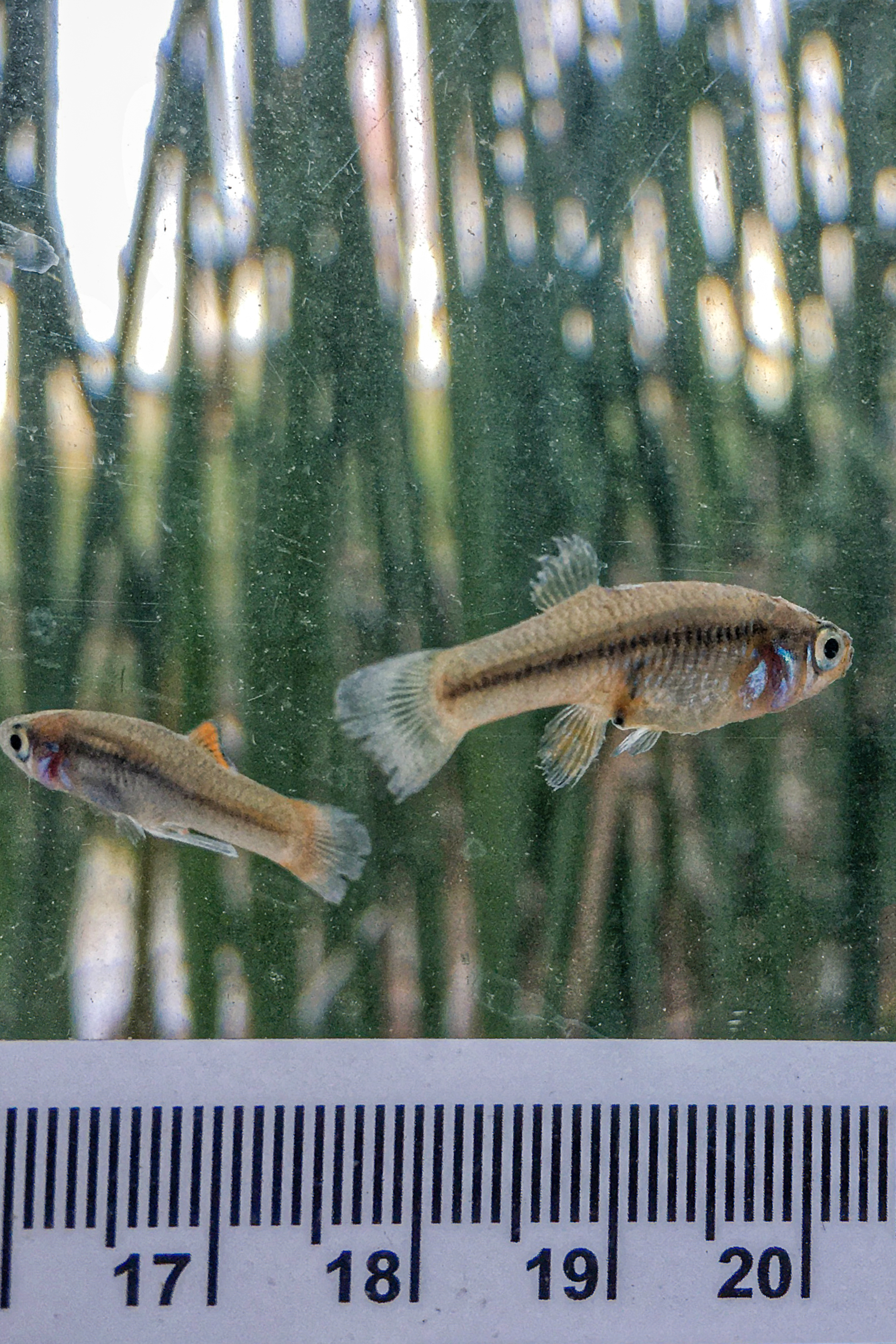
- This second stop is further along the boardwalk, at the second square platform. Two wayside exhibits are attached to the platform. One has pictures of about 20 plants and animals that can be seen in this wetland area. The other exhibit has a picture of the wetland and discusses the importance of wetland areas in the desert. As at the first stop, one is completely surrounded by tall cane. Looking over the side of the platform and into the water reveals both mosquitofish and tilapia swimming in the pond.
This is the third stop along the Rio Grande Village Nature Trail Self-Guided Tour. This location invites visitors to sit on a bench and listen to the sounds of animals in and around the pond.
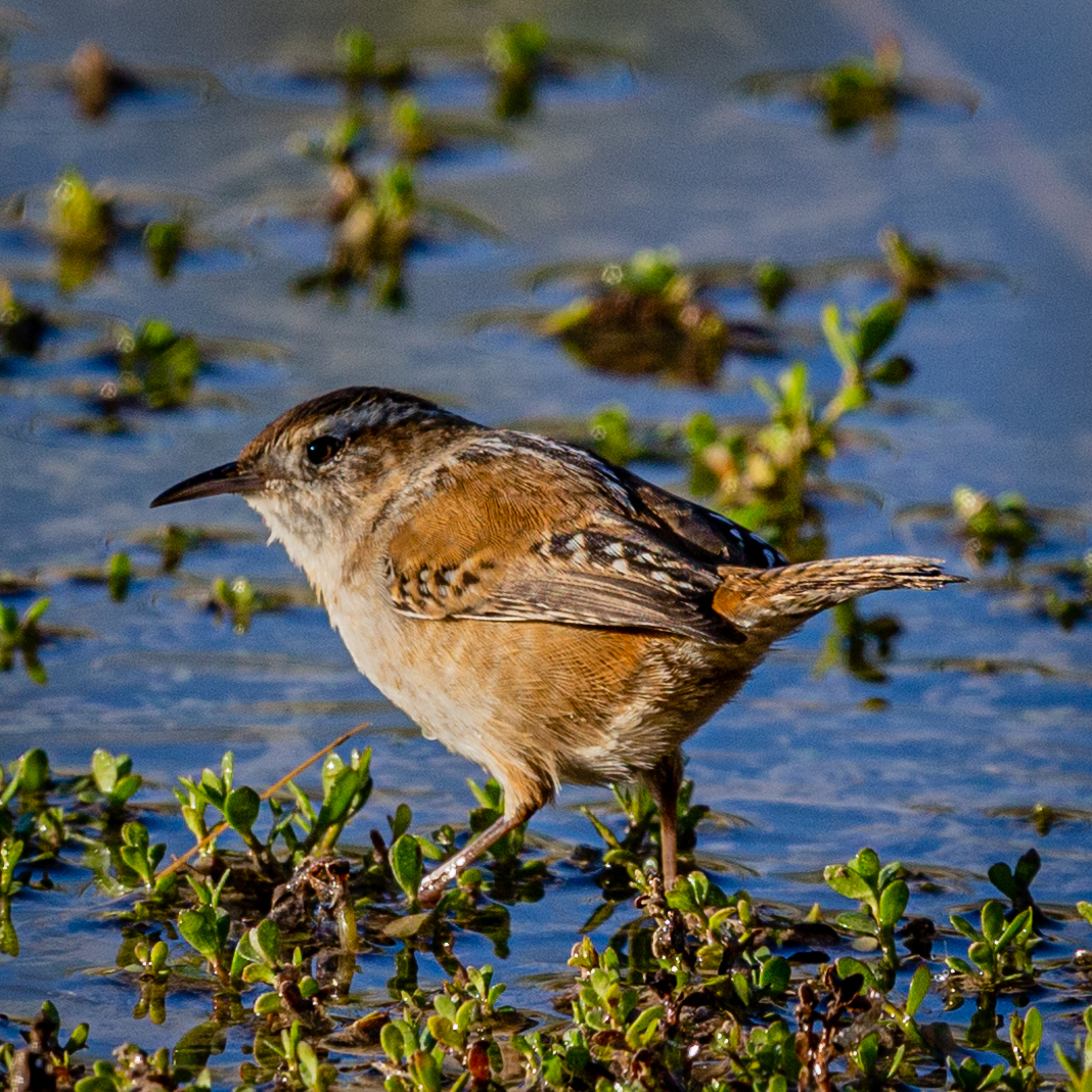
- This stop is located at the third square platform on the boardwalk. In this area the cane and cattails have been cleared out so that one has an unrestricted view out over the pond. Most of the day one can view turtles sunning themselves on logs or rocks, ducks or other shorebirds resting on the pond, and bird songs emanate from the cane.
This is the fourth stop on the Rio Grande Village Nature Trail Self-Guided Tour. This location has a great view looking down on the wetland area.
- From this high point one can look back down on the pond and surrounding green vegetation. Behind the pond is a partial view of the campground, and further in the distance is a line of limestone hills. At this location above the pond the vegetation is much different. Gone are the cane, cattails, grape vines, and mesquite trees. Instead, you are standing next to prickly pear cactus, ocotillo, creosote bush, lechuguilla, and other desert plants that are much more spread out from each other.
This is the sixth stop along the Rio Grande Village Nature Trail Self-Guided Tour. At this location we discuss "resistors" such as creosote bush.
- Standing on the path one is surrounded in all directions by plants that can survive with little water such as creosote bush, ocotillo, prickly pear cactus, lechuguilla, and cholla. The dirt path is approaching an intersection. Further out are a line of cliffs against which the Rio Grande flows.
This is the sixth stop along the Rio Grande Village Nature Trail Self-Guided Tour. This stop discusses the ocotillo and its unique adaptations for surviving in the desert.
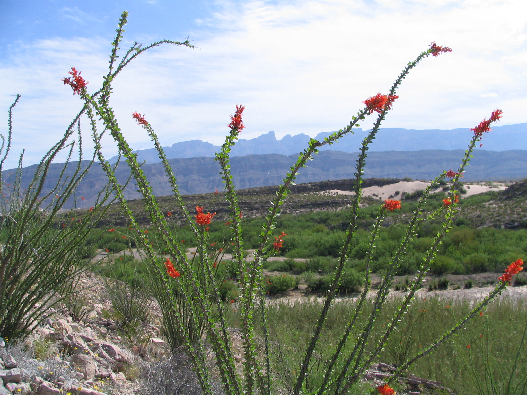
- At this point the trail is surrounded by the tall, thin stalks of the ocotillo. They easily stand five to eight feet tall and during dry times they look dead and lifeless. Their large thorns dissuade anyone from trying to touch them.
This is the seventh stop along the Rio Grande Village Nature Trail. At this location hikers have a choice of walking to the Rio Grande, or up a hill for a great view of the area.
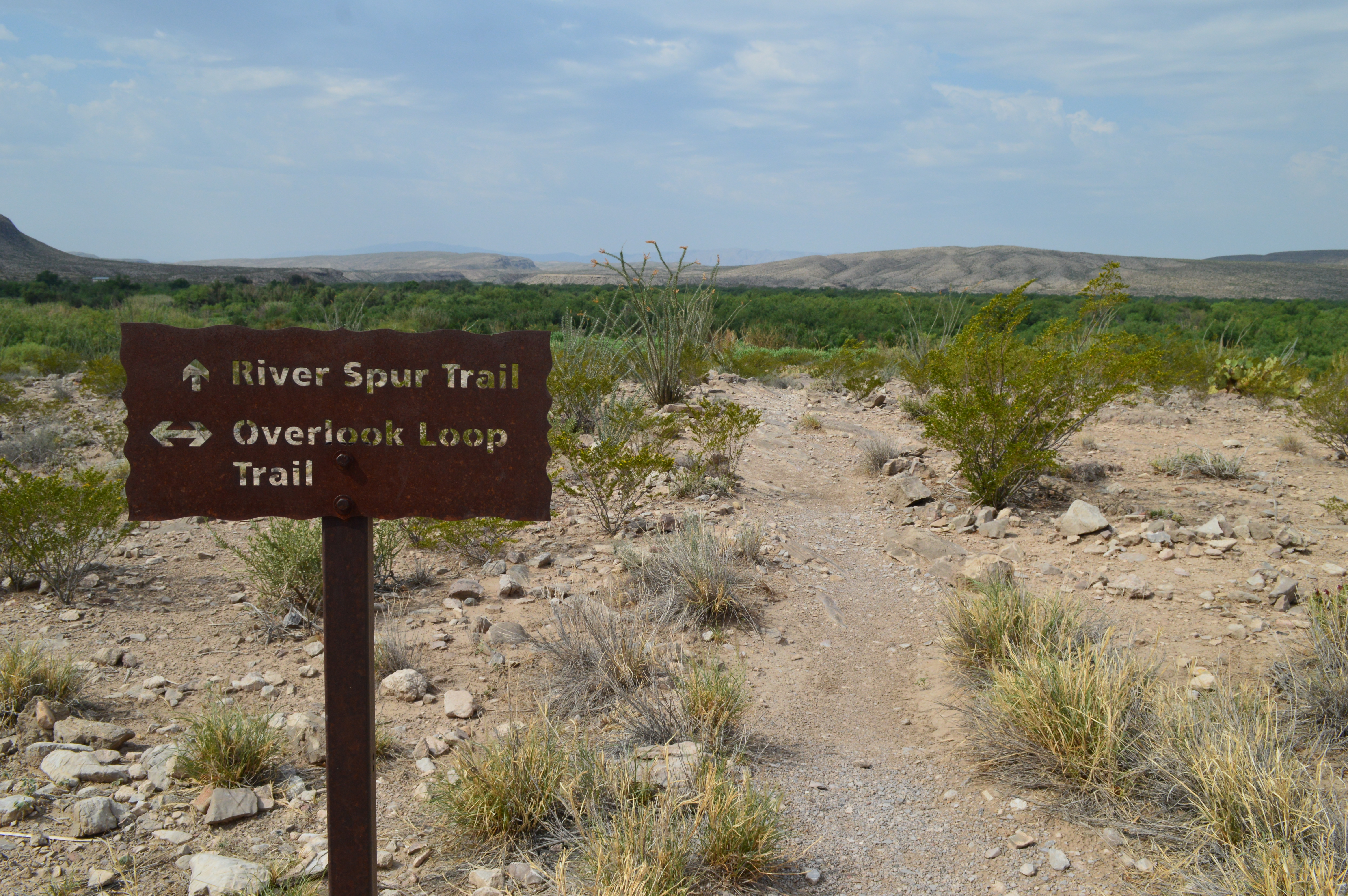
- At this junction one has a choice between taking a trail to the right, which slowly descends to the Rio Grande, or staying on the main trail, which climbs the nearby hill. A brown metal sign at the junction says River Spur Trail with an arrow pointing to the right, and Overlook Loop Trail, with an arrow pointing straight ahead. The green vegetation that surrounds the Rio Grande is visible off to the right.
This is the eighth stop along the Rio Grande Village Nature Trail Self-Guided Tour. This stop highlights fossils found in the limestone ledges along the trail.
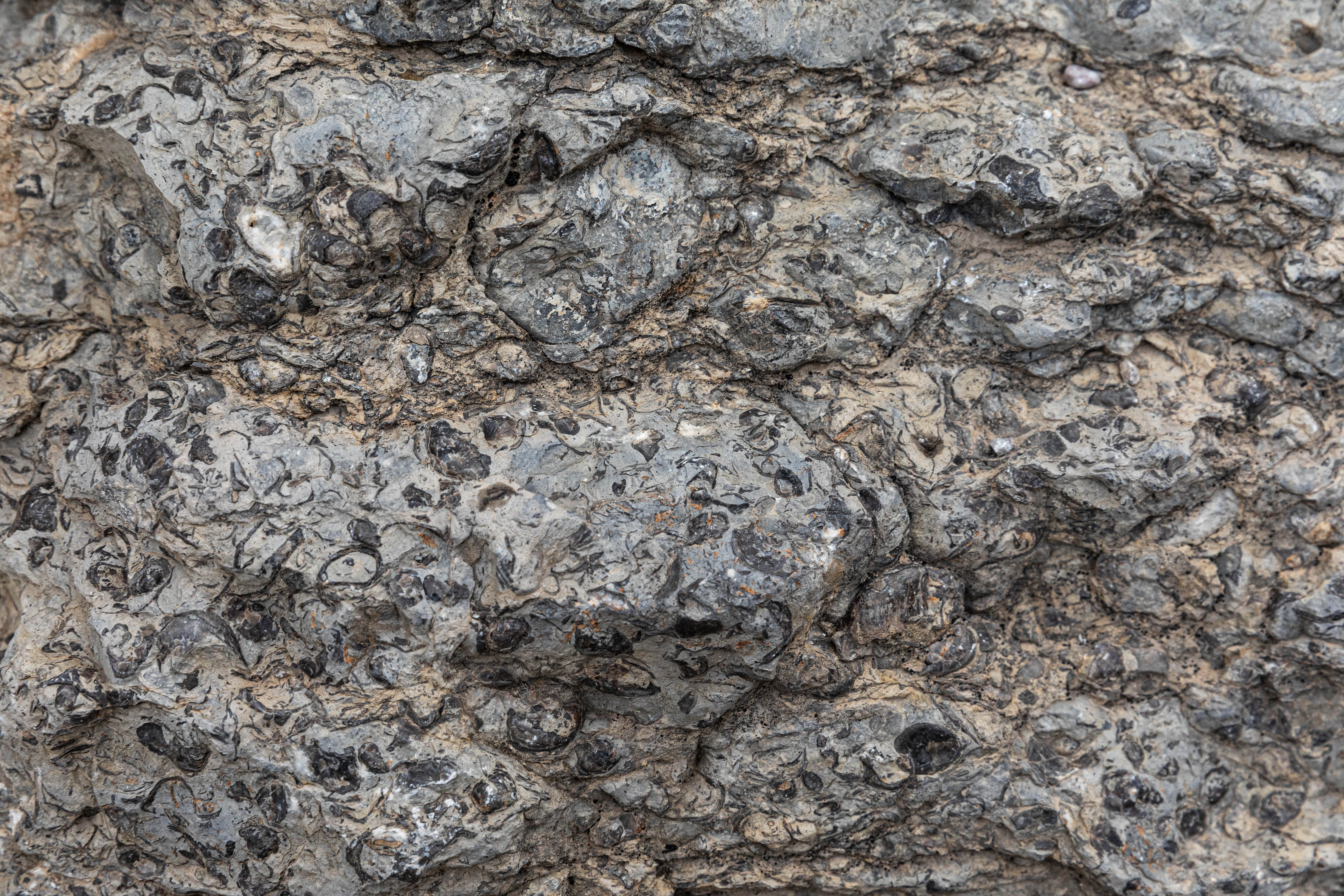
- Along this short section of trail you are walking over limestone benches. Here and there fossils of small shells are visible in the rock. The same desert vegetation of prickly pear cactus, ocotillo, and creosote bush are present.
This is the eighth stop along the Rio Grande Village Nature Trail Self-Guided Tour. This location highlights a number of bedrock mortar holes found in the limestone along the Rio Grande.
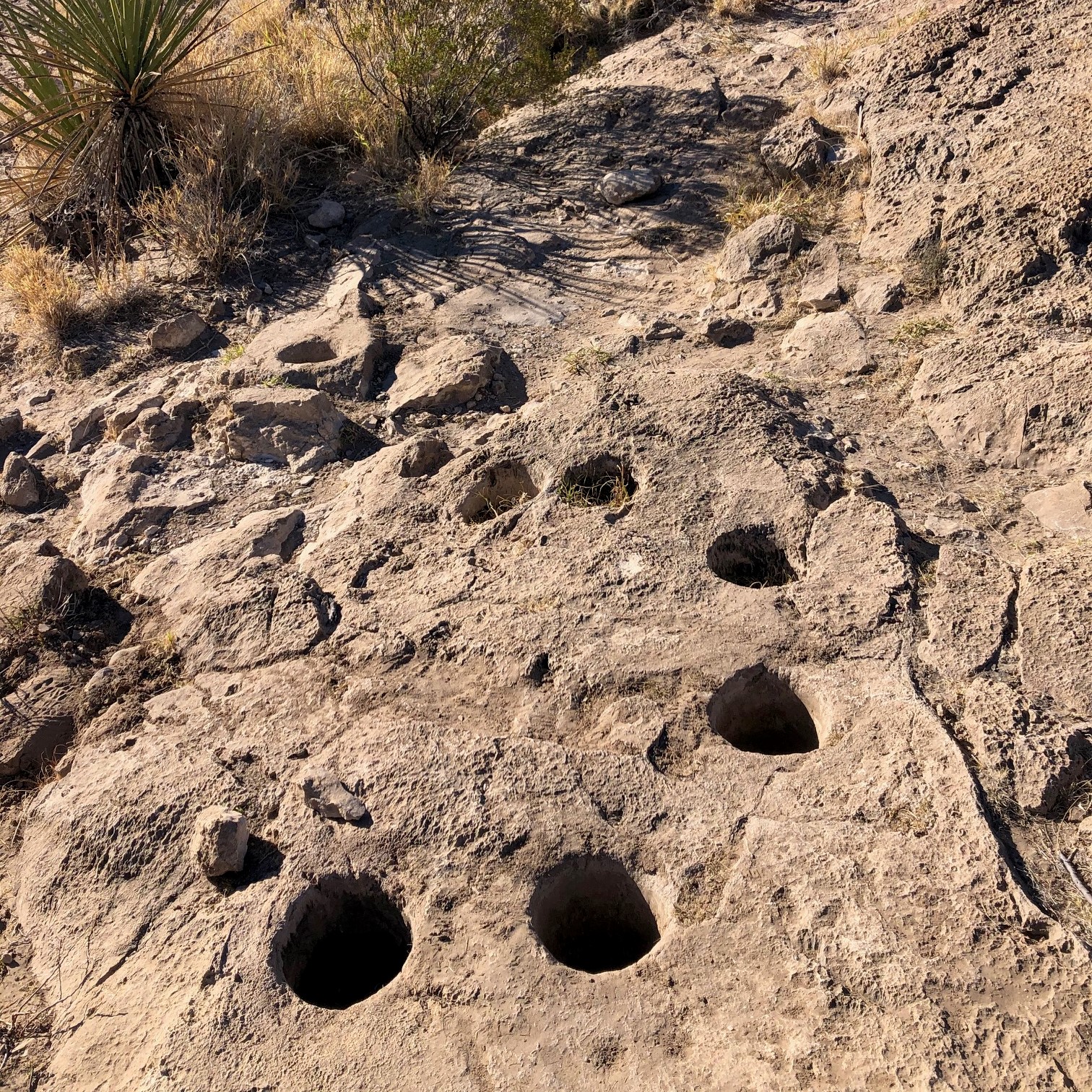
- This section of limestone ledge has between 15-20 cylindrical mortar holes carved into the rock. They average about five inches in diameter and between five to twelve inches deep. Some are filled in with dirt and small plants and grasses are growing in them. Vegetation in sparse on these bare limestone benches.
From cold beverages to ice cream to gasoline, the Rio Grande Village Store has camp supplies to enhance your visit to Big Bend National Park.
- The Rio Grande Village store has many items you may need to enhance your visit to Big Bend National Park. Laundry facilities and showers can make a longer stay more pleasant. Picnic tables in the shade allow a quiet place to wait for clothes to wash and dry. Gasoline and propane can be purchased and the facility is managed by Forever Resorts, the park concessionaire.
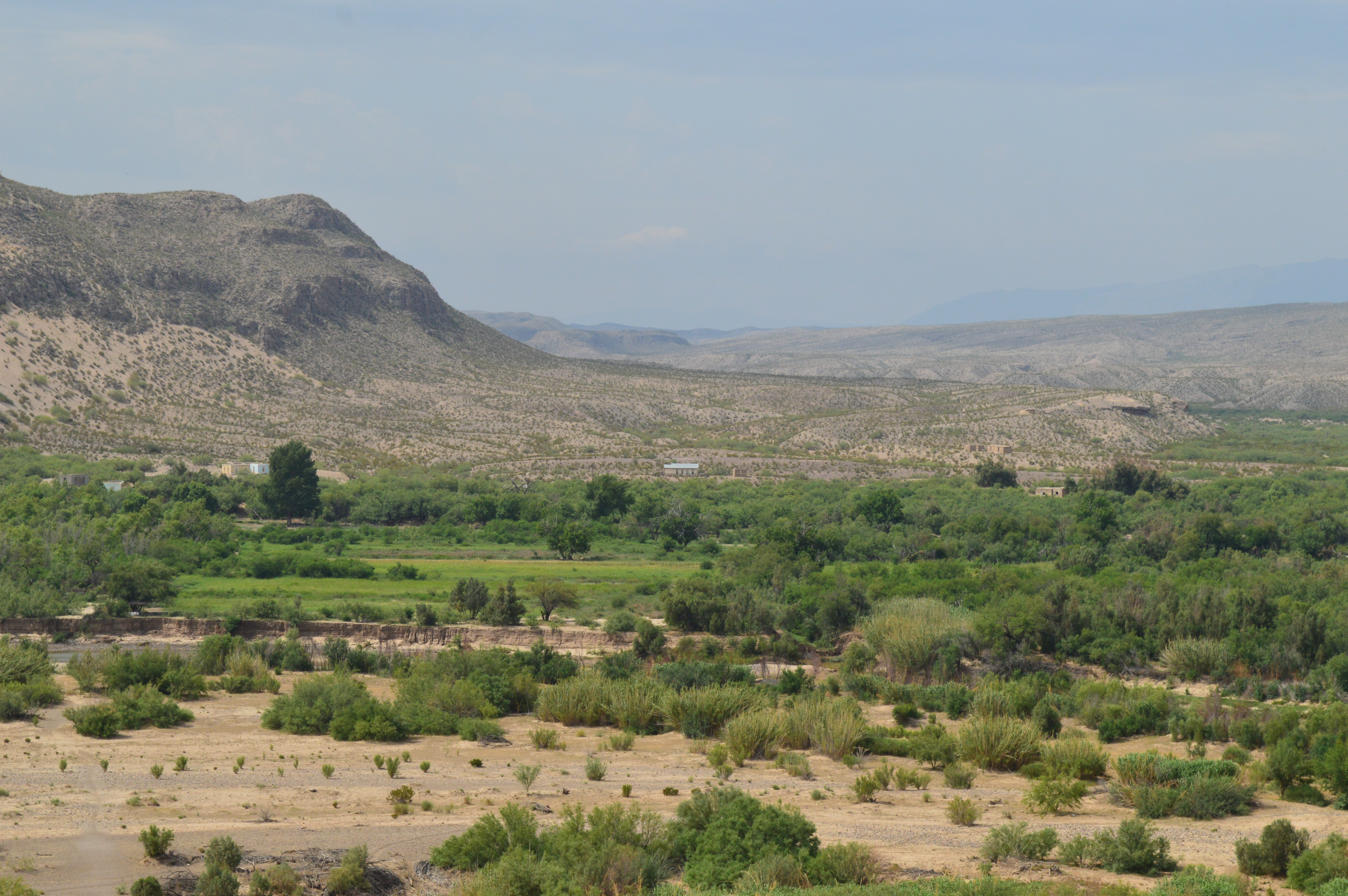
The River Road is a 51-mile long primitive backcountry road between the Rio Grande Village and Castolon areas. This is one of the most remote areas of Big Bend, and rough conditions requires a high-clearance 4x4 vehicle and slow and careful driving. Due to its length and usually rough road conditions, allow a full day to drive from end to end.
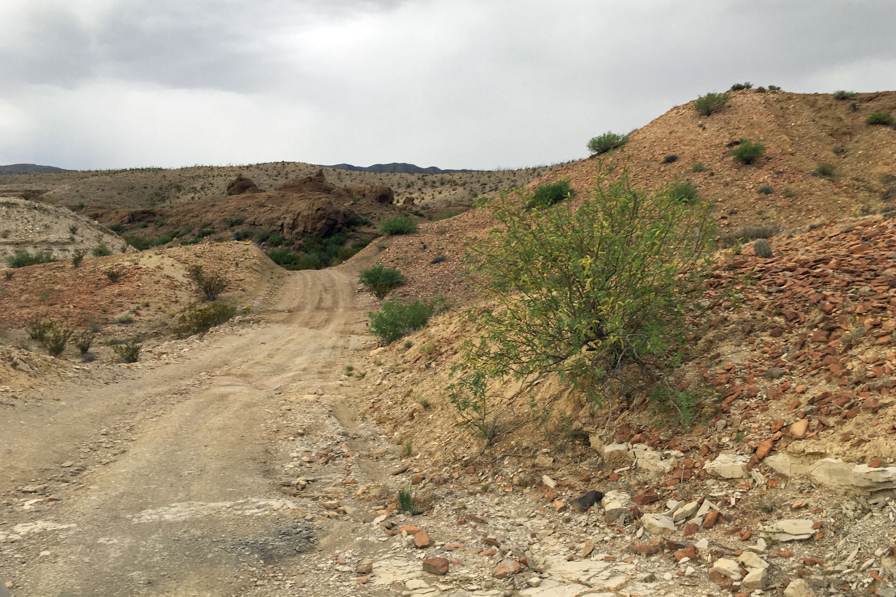
- From here, the rugged River Road stretches off into the wild southern reaches of Big Bend National Park. The route travels through remote Chihuahuan Desert, and provides access to the Rio Grande at a few primitive campsites. This road requires high-clearance and 4-wheel drive to safely negotiate. Highlights include spending time in one of the most remote areas in the lower 48 states, and visiting several historic sites along the way, including the remains of the Mariscal Mine. A journey along this route typically takes most of a day.
Privately owned campground and general store near the northern entrance to Big Bend National Park.
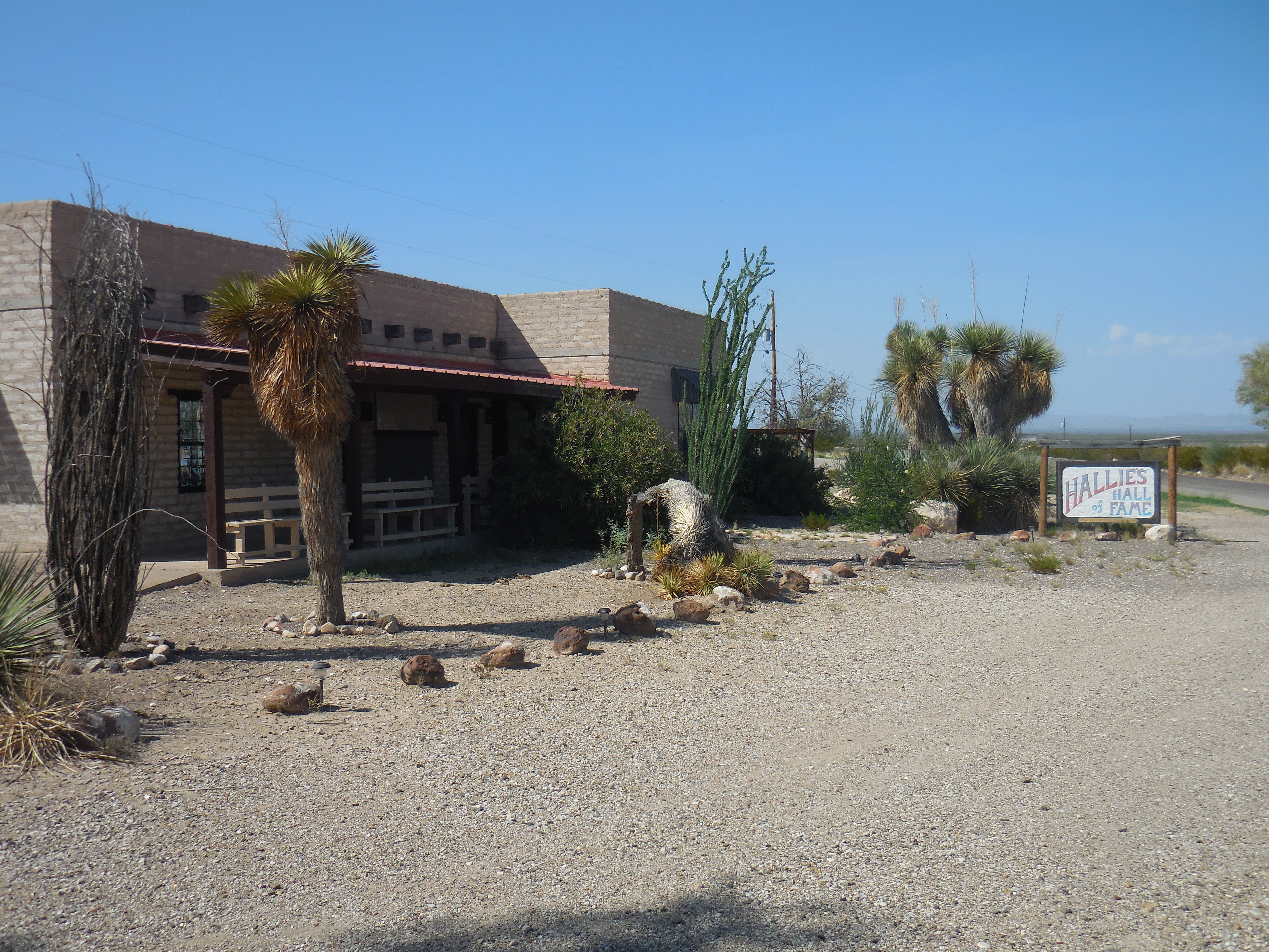
- A small roadside store and RV park located 7 miles from the northern entrance to Big Bend National Park. Adjacent to the store is the Hallie Stillwell Hall of Fame Museum which preserves the ranching legacy and pioneering spirit of Hallie Stillwell, a legend in the history of remote West Texas.