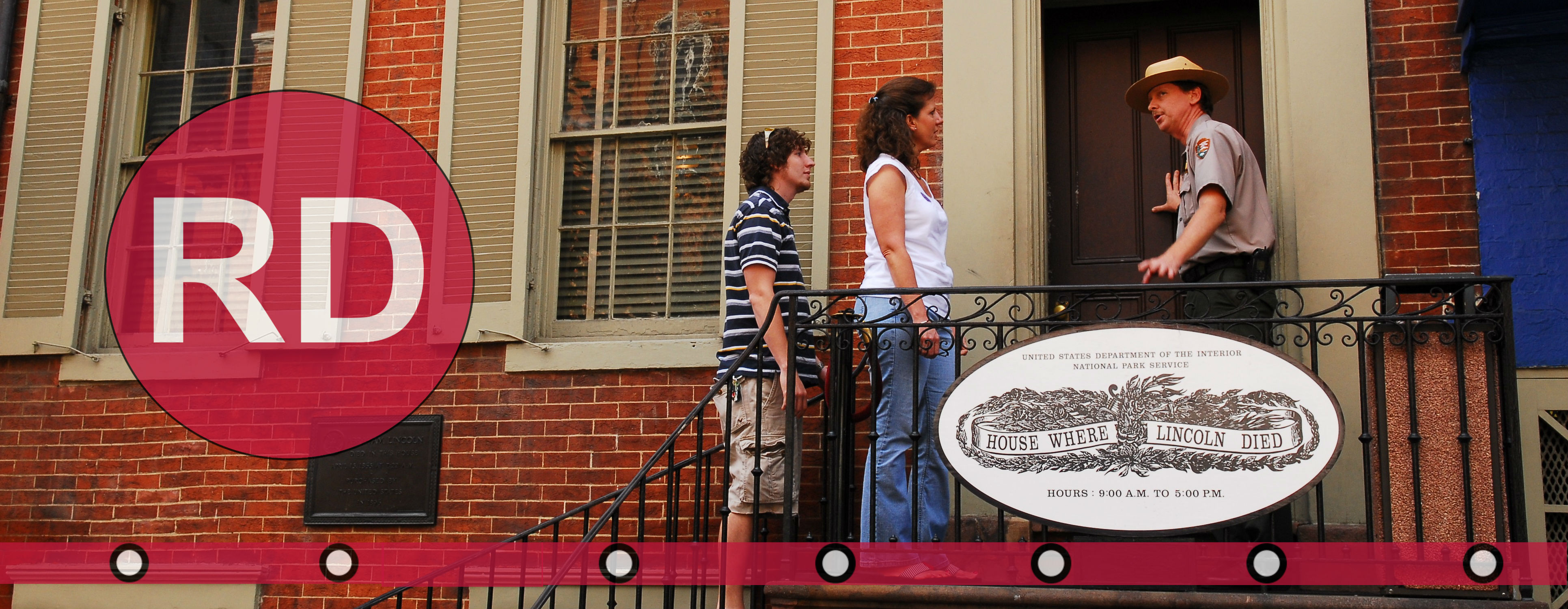
Be advised that the NPS has issued alerts for this park.
P Street Northwest Ramp to Rock Creek and Potomac Parkway is closed
The P Street Northwest Ramp to Rock Creek and Potomac Parkway is closed until further notice due to sinkholes on the ramp that may compromise the roadway. Drivers should seek alternate routes.
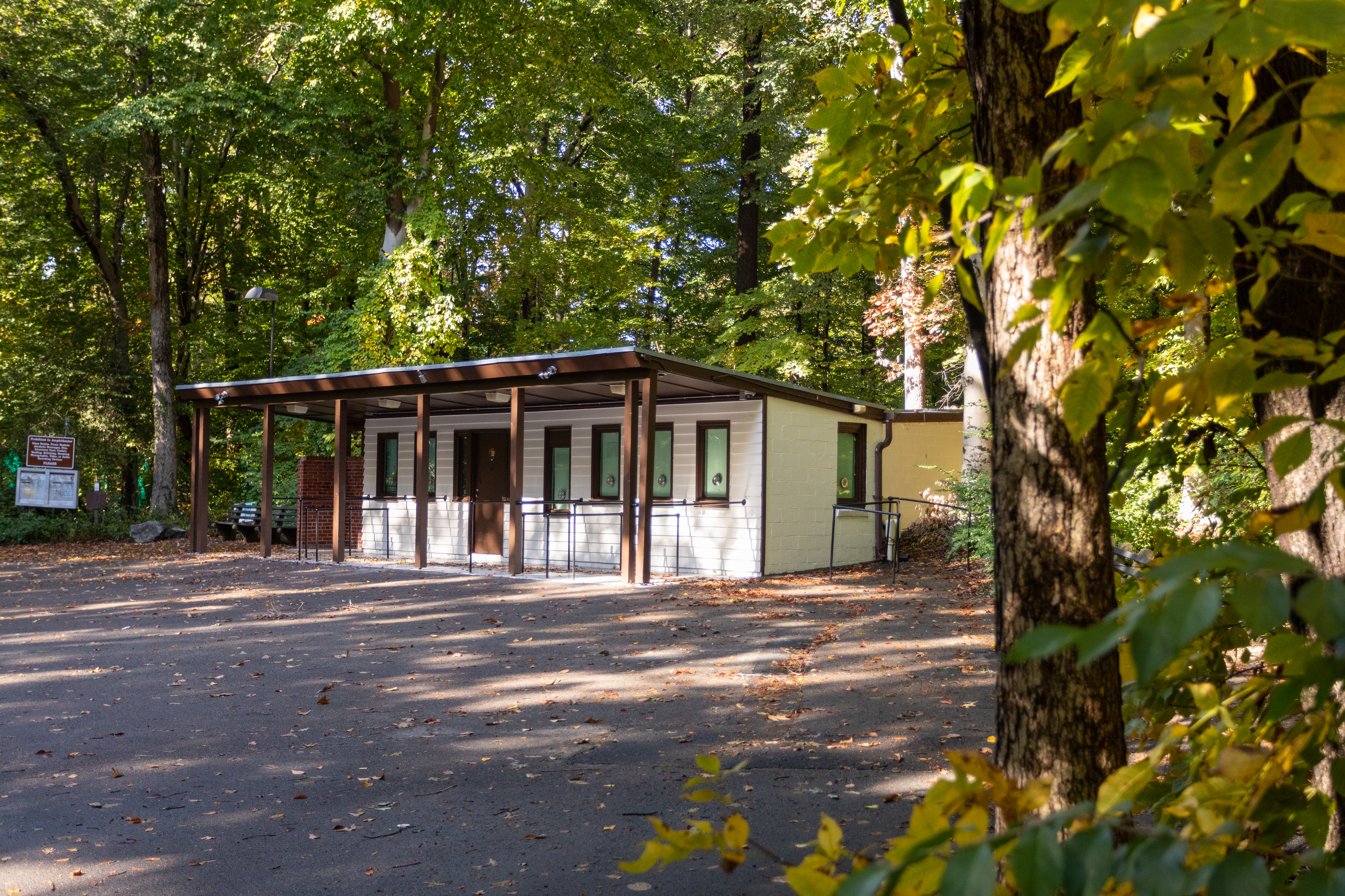
Picnic grove restrooms
The restrooms at the picnic groves throughout the park are currently closed. Portable comfort stations with handwashing stations are in place until they reopen.
Restrooms at Thompson Boat Center
The indoor restrooms of Thompson Boat Center continue to be closed due to repairs needed to a sewage line. Temporary restrooms with hand sanitizer remain available near the building and will be in place until the indoor restrooms reopen.
Glover Archbold Trail detour
For visitor safety, the southern end of the Glover Archbold Trail is under an emergency closure until further notice due to aerial hazards. Please follow the posted detour along Foxhall Rd. / 44th St. NW / P St. NW.
Part of Fort Totten Park remains closed for public safety
Out of an abundance of caution, Fort Totten Park will remain closed east of Fort Totten Drive, south of Gallatin Street/Metropolitan Branch Trail and north of Brookland Ave NE/Farragut St. due to the investigation involving two WWI-era munitions found.
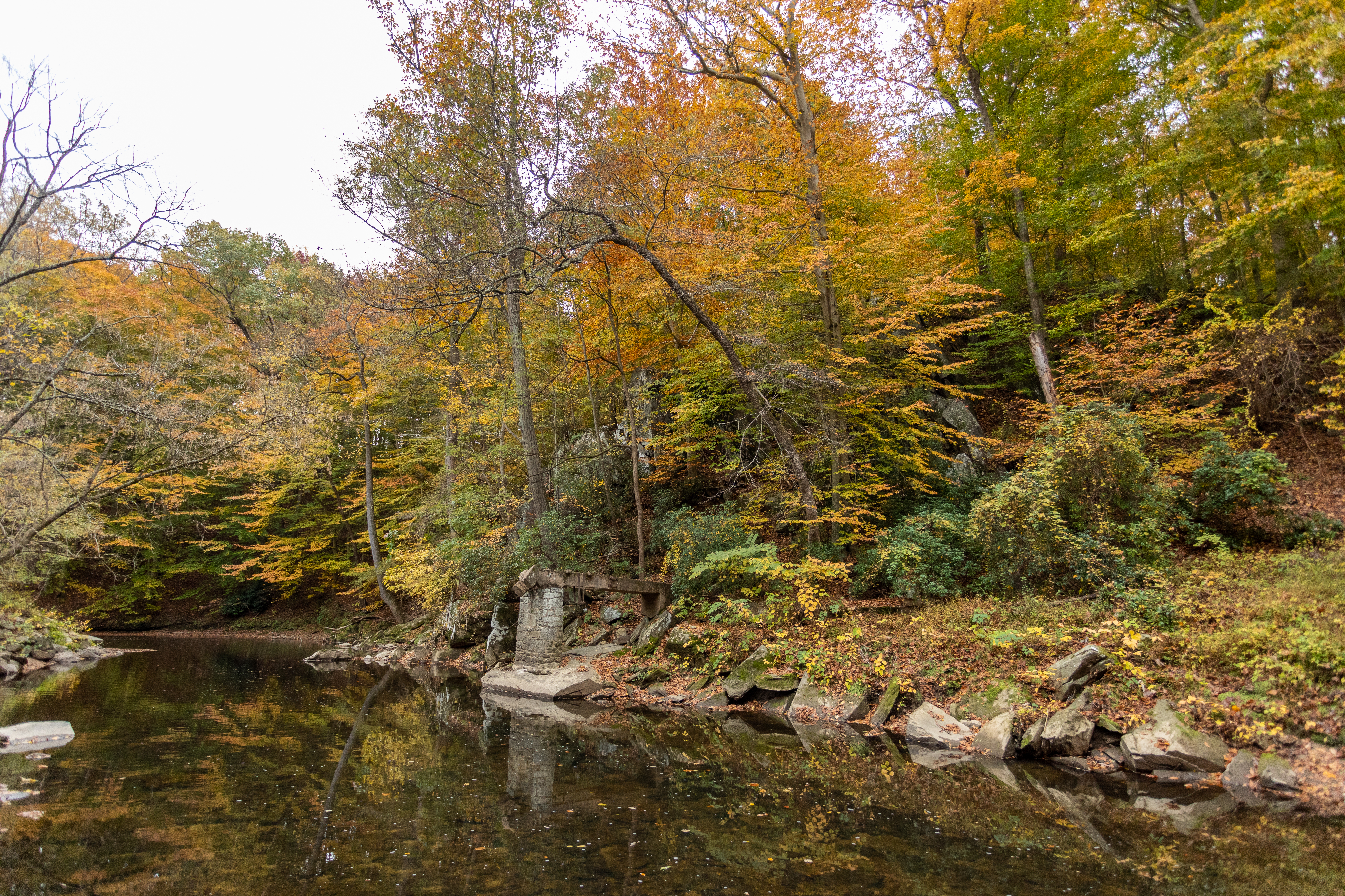
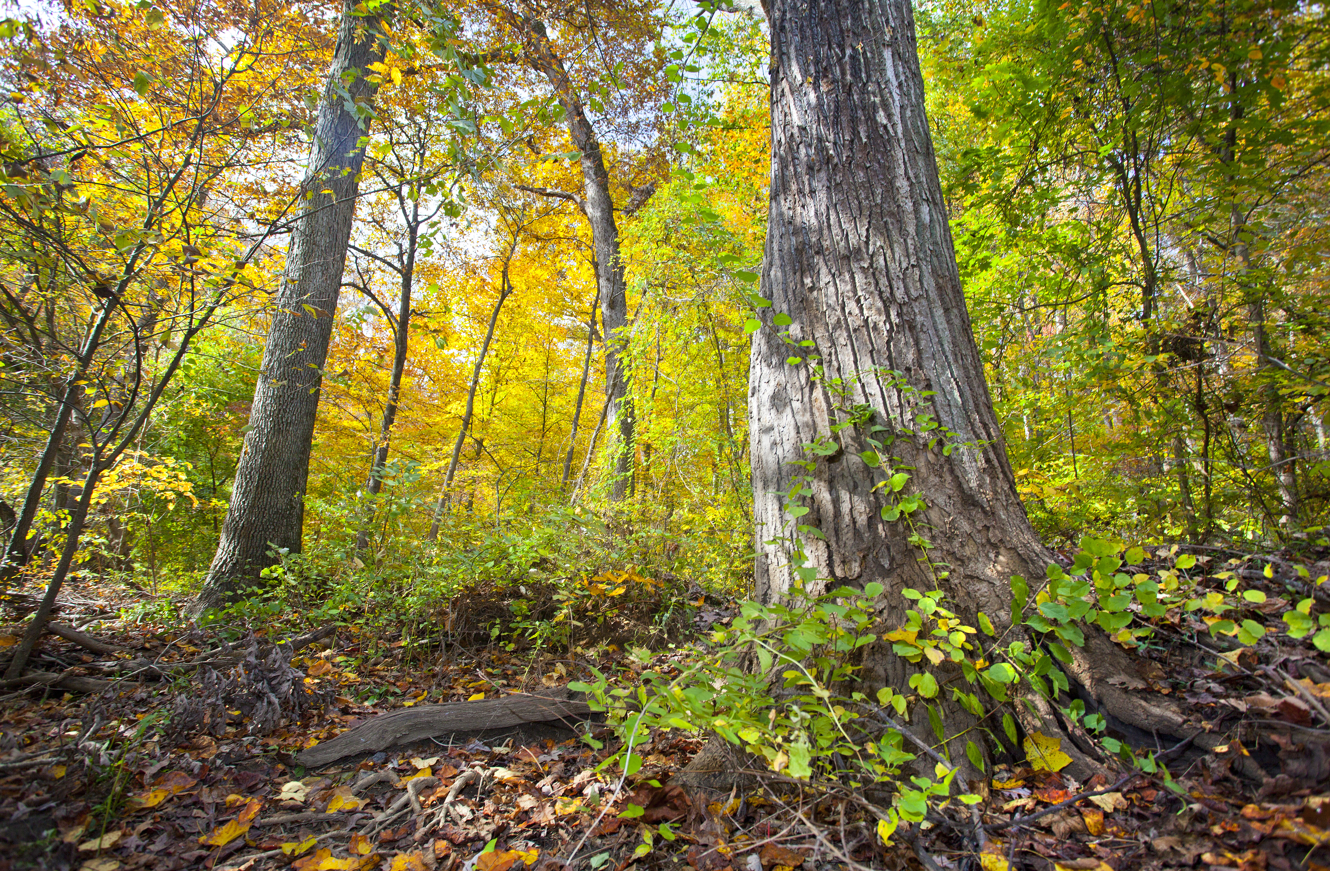
Rock Creek Park is truly a gem in our nation's capital. This 1,754 acre city park was officially authorized in 1890, making it the third national park to be designated by the federal government. It offers visitors the opportunity to escape the bu...
Monument erected by the 122nd New York Cavalry who served with the Union Army during the Battle of Fort Stevens.
122nd New York Volunteer Cavalry Monument<br />(498 words)<br />Battleground National Cemetery is located in the Brightwood neighborhood of Washington, DC. The one-acre park is on the east side of Georgia avenue, NW between Whittier place to the north and Van Buren street to the south.<br />The Cemetery sits on a terrace approximately five feet above street level. A bluestone wall along the front edge is separated by two sets of three steps that lead up to a wrought-iron black gate at the Cemetery entrance. Set atop stone pillars on either side of the entrance are two six-foot long black cannons, one pointing north and one pointing south. On the face of the columns are black signs in the shape of a shield that both read in white: U.S. National Cemetery.<br />To the right from the front entrance is a two-story red stone building with brown shutters and a gabled roof. A porch extends out on the west side of the building.<br />Directly back and to the east seventy feet from the entrance is a central flagpole, surrounded by forty-one marble headstones. Behind them and the east end of the Cemetery stands a white marble pavilion with four granite pillars.<br />To the left from the entrance and set in a row across the lawn about six feet from the front edge of the cemetery are four granite monuments, each between six and eleven-feet tall. Facing the four monuments, second from the left is a ten-foot-tall white granite obelisk with pointed top and set on a rock-faced one-foot tall base. A leafed border rings the top of the monument. Just below at the top of the front face, a cross is inscribed and below is written:<br />To the gallant sons of Onondaga County, N.Y. who fought on this field July 12, 1864 in defense of Washington and the presence of Abraham Lincoln.<br />Below is a one-foot wide circular bronze plaque depicting two women in flowing robes. The woman on the left is resting her left hand on the side of a shield between them and holds a staff with her right hand with a hood cap set atop its point. The right woman is blindfolded. She raises a scale with her left hand and holds up a sword with her right. Atop the shield is an eagle with wings spread as it stands on a globe. The shield shows an image of the sun shining behind mountains. A sail ship floats by in water below. A smaller ship sits to the right. Below on a banner is inscribed: Excelsior.<br />Below on the front base is inscribed: 122 N.Y.Y.<br />The right side of the monument is inscribed to read:<br />Killed and Died of Wounds<br />Seven names are listed below.<br />The backside is inscribed along the top to read:<br />Served Three Years in the Sixth Army Corps<br />Below a three by two-foot bronze plaque is entitled, "Battles," listing 18 Civil War battles.<br />The left side of the monument is inscribed to read at the top: Wounded<br />Names are inscribed below.<br />END OF DESCRIPTION<br />
This monument erected by Co. K 150th Ohio National Guard who served in the Defenses of Washington during the Battle of Fort Stevens. The monument was dedicated in 1907.
(330 words) Battleground National Cemetery is located in the Brightwood neighborhood of Washington, DC. The one-acre park sits on the east side of Georgia avenue, NW between Whittier place to the north and Van Buren street to the south. The Cemetery sits on a terrace approximately five feet above street level. A bluestone wall along the front edge is separated by two sets of three steps that lead up to a wrought-iron black gate at the Cemetery entrance. Set atop stone pillars on either side of the entrance are two six-foot long black cannons, one pointing north and one pointing south. On the face of the columns are black signs in the shape of a shield that both read in white: U.S. National Cemetery. To the right from the front entrance is a two-story red stone building with brown shutters and a gabled roof. A porch extends out on the west side of the building. Directly back and to the east seventy feet from the entrance is a central flagpole, surrounded by forty-one marble headstones. Behind them and the east end of the Cemetery stands a white marble pavilion with four granite pillars. To the left from the entrance and set in a row across the lawn about six feet from the front edge of the cemetery are four granite monuments, each between six and eleven-feet tall. Facing the four monuments, furthest left is a six-foot tall gray granite grave marker with a rounded top. The front face is polished smooth. The back and sides have a rocky stone design, as does the one-foot tall base. A faded, circular design at the top of the face shows the sun shining through mountains. A round structure sits below, and three sets of bundled reeds line the left bottom of the circle. At the bottom is inscribed: Ohio Inscribed beneath on the front face reads: Memorial to Co. K, 150th O.N.G.I. Which Took Part in the Defense of Fort Stevens, D.C. July 12, 1864 END OF DESCRIPTION
Monument erected by the 25th New York Cavalry who served in the Defenses of Washington during the Battle of Fort Stevens. The monument was dedicated in 1914.<br />Inscriptions<br />Sacred to the Memory of our Comrades Who Gave Their Lives in Defense of the National Capitol<br />July 11, 1864<br />Erected by the State of New York in Honor of the 25th N.Y. Vol. Cav.<br />
(344 words)<br />Battleground National Cemetery is located in the Brightwood neighborhood of Washington, DC. The one-acre park is on the east side of Georgia avenue, NW between Whittier place to the north and Van Buren street to the south.<br />The Cemetery sits on a terrace approximately five feet above street level. A bluestone wall along the front edge is separated by two sets of three steps that lead up to a wrought-iron black gate at the Cemetery entrance. Set atop stone pillars on either side of the entrance are two six-foot long black cannons, one pointing north and one pointing south. On the face of the columns are black signs in the shape of a shield that both read in white: U.S. National Cemetery.<br />To the right from the front entrance is a two-story red stone building with brown shutters and a gabled roof. A porch extends out on the west side of the building.<br />Directly back and to the east seventy feet from the entrance is a central flagpole, surrounded by forty-one marble headstones. Behind them and the east end of the Cemetery stands a white marble pavilion with four granite pillars.<br />To the left from the entrance and set in a row across the lawn about six feet from the front edge of the cemetery are four granite monuments, each between six and eleven-feet tall. The closest of the four monuments is a nine-foot-tall white granite memorial. Atop a five-foot tall pedestal is a four-foot tall statue of a man with a mustache wearing a hat and double-breasted military jacket. A rifle and canteen hang on his back, and he holds sword at the ground with his right hand. His left hand holds the sheath of his sword.<br />An inscription on the front face of the pedestal reads:<br />Sacred to the Memory of our Comrades Who Gave Their Lives in Defense of the National Capitol<br />July 11, 1864<br />A one by two-foot bronze plaque at the pedestal base reads:<br />Erected by the State of New York in Honor of the 25th N.Y. Vol. Cav.<br />END OF DESCRIPTION<br />
Monument erected by the 98th Pennsylvania Volunteer Infantry who served with the Union Army during the Battle of Fort Stevens. The monument was dedicated in 1891. InscriptionsfrontIn Memory of Our Comrades Killed and Wounded in Battle on This FieldJuly 11th & 12th 186498th Reg't. P.V.1st Brig. 2nd Div. 6th CorpssideKilled in BattleJuly 11th & 12th 1864Frederick Walter Co.Bernhard HoerleSergt. George MarquetCorpl. Henry PoelserMichael BrunerCharles SehausGeorge MerkleJoseph Sc
(401 words)<br />Battleground National Cemetery is located in the Brightwood neighborhood of Washington, DC. The one-acre park is on the east side of Georgia Avenue, NW between Whittier place to the north and Van Buren street to the south.<br />The Cemetery sits on a terrace approximately five feet above street level. A bluestone wall along the front edge is separated by two sets of three steps that lead up to a wrought-iron black gate at the Cemetery entrance. Set atop stone pillars on either side of the entrance are two six-foot long black cannons, one pointing north and one pointing south. On the face of the columns are black signs in the shape of a shield that both read in white: U.S. National Cemetery.<br />To the right from the front entrance is a two-story red stone building with brown shutters and a gabled roof. A porch extends out on the west side of the building.<br />Directly back and to the east seventy feet from the entrance is a central flagpole, surrounded by forty-one marble headstones. Behind them and the east end of the Cemetery stands a white marble pavilion with four granite pillars.<br />To the left from the entrance and set in a row across the lawn about six feet from the front edge of the cemetery are four granite monuments, each between six and eleven-feet tall. Facing the four monuments, second from the right is a nine-foot tall gray granite obelisk, about two feet wide on each side, with a rounded top that meets at a point. A cross is sculpted at the top of each of the four sides. Below on the front is inscribed:<br />In Memory of Our Comrades Killed and Wounded in Battle on This Field<br />July 11th & 12th 1864<br />Below is a one by two-foot bronze plaque of the Pennsylvania State Seal, showing two horses with their front hooves raised up along the sides of a crest featuring a ship in the middle and an eagle standing on top. A banner across the bottom of the plaque reads:<br />Virtue, Liberty and Independence<br />Inscribed along the monument base is written:<br />98th Reg't. P.V.<br />1st Brig. 2nd Div. 6th Corps<br />The three other sides of the monument all feature a cross at the top. One bears the inscription, "KILLED IN BATTLE" and the other two state, "WOUNDED IN BATTLE."<br />Names are inscribed below on each of the three sides.<br />END OF DESCRIPTION<br />
Battery Kemble held two 100-pounder Parrott rifles, placed in such a way as to sweep Chain Bridge and Virginia beyond. Battery Kemble was named after Gouveneur Kemble of Cold Springs, New York, former superintendent of West Point Foundry.
A large boulder sits near tree-covered earthen mounds. A plaque on the rock reads "Battery Kemble. One of the Civil War defenses of Washington constructed in 1862, Battery Kemble's two 100-pounder Parrott rifles guarded Chain Bridge along the Potomac River. United States Department of the Interior. National Park Service."
Battleground National Cemetery was established shortly after the Battle of Fort Stevens in the summer of 1864. The battle, which lasted two days (July 11 through July 12, 1864) marked the defeat of General Jubal A. Early's Confederate campaign to launch an offensive action against the poorly defended nation's capital.
(337 words) Battleground National Cemetery is located in the Brightwood neighborhood of Washington, DC. The one-acre park is on the east side of Georgia avenue, NW between Whittier place to the north and Van Buren street to the south.<br />The Cemetery sits on a terrace approximately five feet above street level. A bluestone wall along the front edge is separated by two sets of three steps that lead up to a wrought-iron black gate at the Cemetery entrance. Set atop stone pillars on either side of the entrance are two six-foot long black cannons, one pointing north and one pointing south. On the face of the columns are black signs in the shape of a shield that both read in white: U.S. National Cemetery. To the left about six feet from the front edge of the cemetery and set in a row across the lawn are four granite monuments, each between six and eleven-feet tall. To the right is a two-story red stone building with brown shutters and a gabled roof. A porch extends out on the west side of the building. The northwest corner of the building features a three by one-foot bronze plaque engraved with the Gettysburg Address. The entrance walkway is lined with two black signs on stakes on the left side and on the right two waysides about two by three feet each. Directly back seventy feet from the entrance is a central flagpole, surrounded by forty-one marble headstones. Forty-foot tall shade trees are set on the east and west sides of the flagpole area. Further to the east behind the flagpole is a marble rostrum. Raised at a three-step elevation, the structure spans thirty feet across, twelve feet deep, and features eight white columns, four in the front, and four in the back that have a marble block wall running between them. In the northeast corner of the cemetery sits a one-story, red brick building with a flat roof. It features a green door and two windows, along with a wooden sliding barn door. END OF DESCRIPTION
Plaque includes the full text of President Lincoln's Gettysburg Address.
(270 words) Battleground National Cemetery is located in the Brightwood neighborhood of Washington, DC. The one-acre park sits on the east side of Georgia avenue, NW between Whittier place to the north and Van Buren street to the south. The Cemetery sits on a terrace approximately five feet above street level. A bluestone wall along the front edge is separated by two sets of three steps that lead up to a wrought-iron black gate at the Cemetery entrance. Set atop stone pillars on either side of the entrance are two six-foot long black cannons, one pointing north and one pointing south. On the face of the columns are black signs in the shape of a shield that both read in white: U.S. National Cemetery. To the left about six feet from the front edge of the cemetery and set in a row across the lawn are four granite monuments, each between six and eleven-feet tall. To the right is a two-story red stone building with brown shutters and a gabled roof. A porch extends out on the west side of the building. On the west-facing side of the building at its left corner and to the left of the window, sits a one by three-foot bronze plaque. Engraved at the top it reads: ADDRESS BY PRESIDENT LINCOLN AT THE DEDICATION OF THE GETTYSBURG NATIONAL CEMETERY NOVEMBER 19, 1863. Text of the Gettysburg address is in the main content. Directly back seventy feet to the east from the Cemetery entrance is a central flagpole, surrounded by forty-one one-foot tall marble headstones. Set behind is a thirty-foot wide white marble rostrum with eight columns. END OF DESCRIPTION
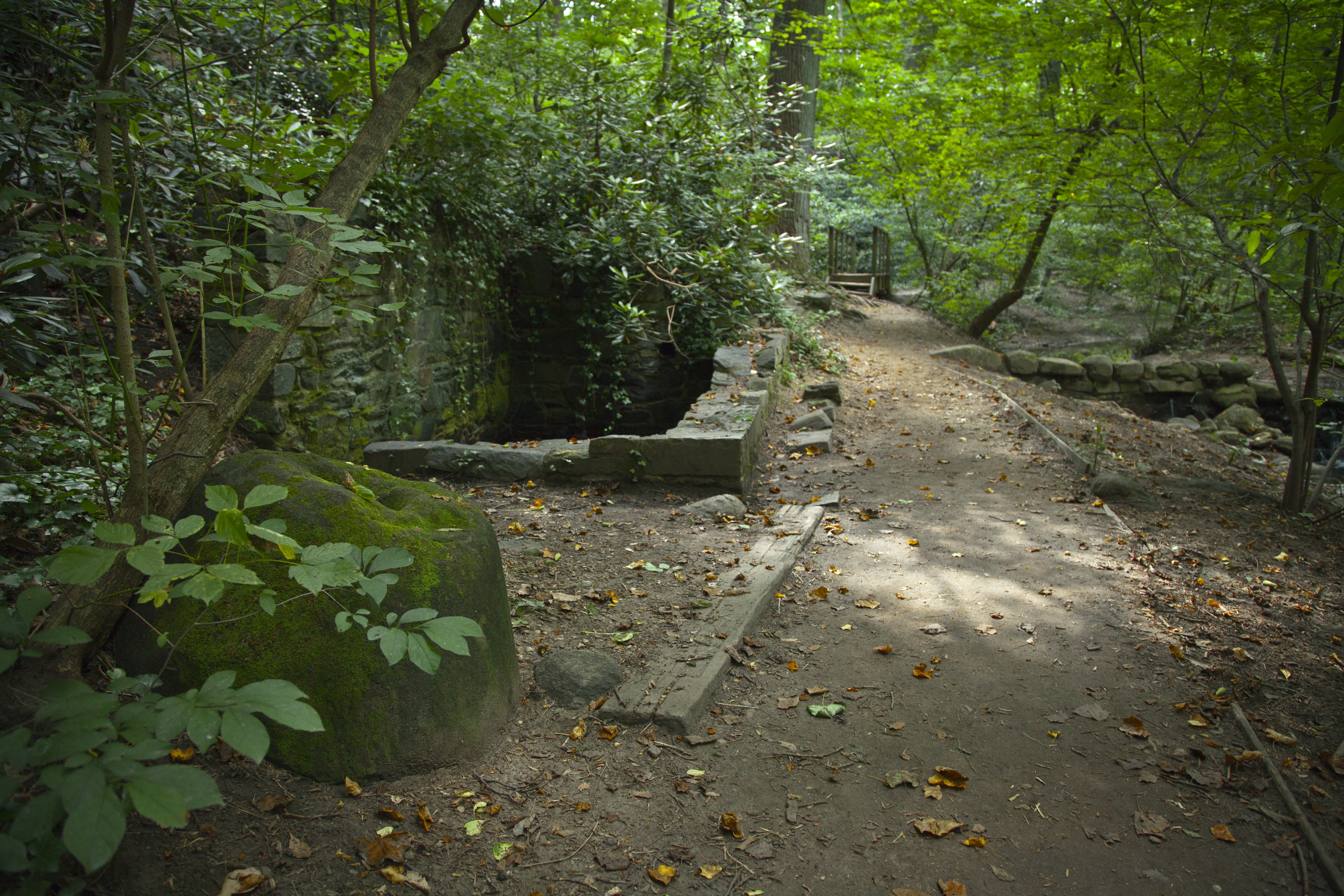
Beginning in the late 1700s, the Blagden Mill turned wheat into flour. By the 1890s, it was out of commission and falling down. The structure was finally torn down to make way for Beach Drive about 1897.
(404 words)<br />Travel north about three hundred fifty yards on Beach Drive NW from the intersection with Broad Branch Road NW in Rock Creek Park is Blagden Mill.<br />At this point, the road bends around to the left. A grassy hillside on the left of the road goes back about two hundred feet before turning to tall grass and heavy brush. A two by three-foot wayside sits about twenty feet off the road.<br />The wayside is a light tan color and in poor condition, faded badly and barely readable. Titled Blagden Mill across the top, it features text on the left side and on the right, a picture of a two-story house sitting to the left of a creek.<br />The text reads:<br />This is the site where Blagden and Argyle mills once stood, two of the twenty-six mills that once flourished along Rock Creek. If you look close, you can still see part of the millrace and the mill road. The exact date of the construction of these mills is unknown, but the mills were in operation during the early 1800's. Stones used in the construction of the mill were quarried on the east bank of the Rock Creek Valley across from the mill. Thomas Blagden, a prominent Washington businessman owned the mills from the 1820's until 1889. Blagden's Mill, a 2 1/2 story structure, contained three millstones for grinding wheat, rye, and corn. Argyle, a smaller mill, ground animal bones for the production of fertilizer. The mills ceased operations in 1889. The millseat was forty-seven miles across and on it were located the mansion of Thomas Blagden, a smaller house for the miller, icehouse, barn, carriage house, and other assorted structures.<br />Across Beach Drive, and beyond about ten feet, the land slopes down into a creek that runs gently from left to right. Directly across the creek are ruins consisting of a seven-foot tall by four-foot wide stone pillar that supports a twenty-foot long wooden beam that connects into the hillside to the right.<br />Another fifty yards up the creek to the left and on its opposite side from where you stand, is a stone structure about twenty-feet tall and forty-feet across, situated at the bank of the creek. Also, on this side of the road on which you stand is a roughly 200-foot-wide open grassy area with picnic table and forty-foot tall tree.<br />END OF DESCRIPTION<br />
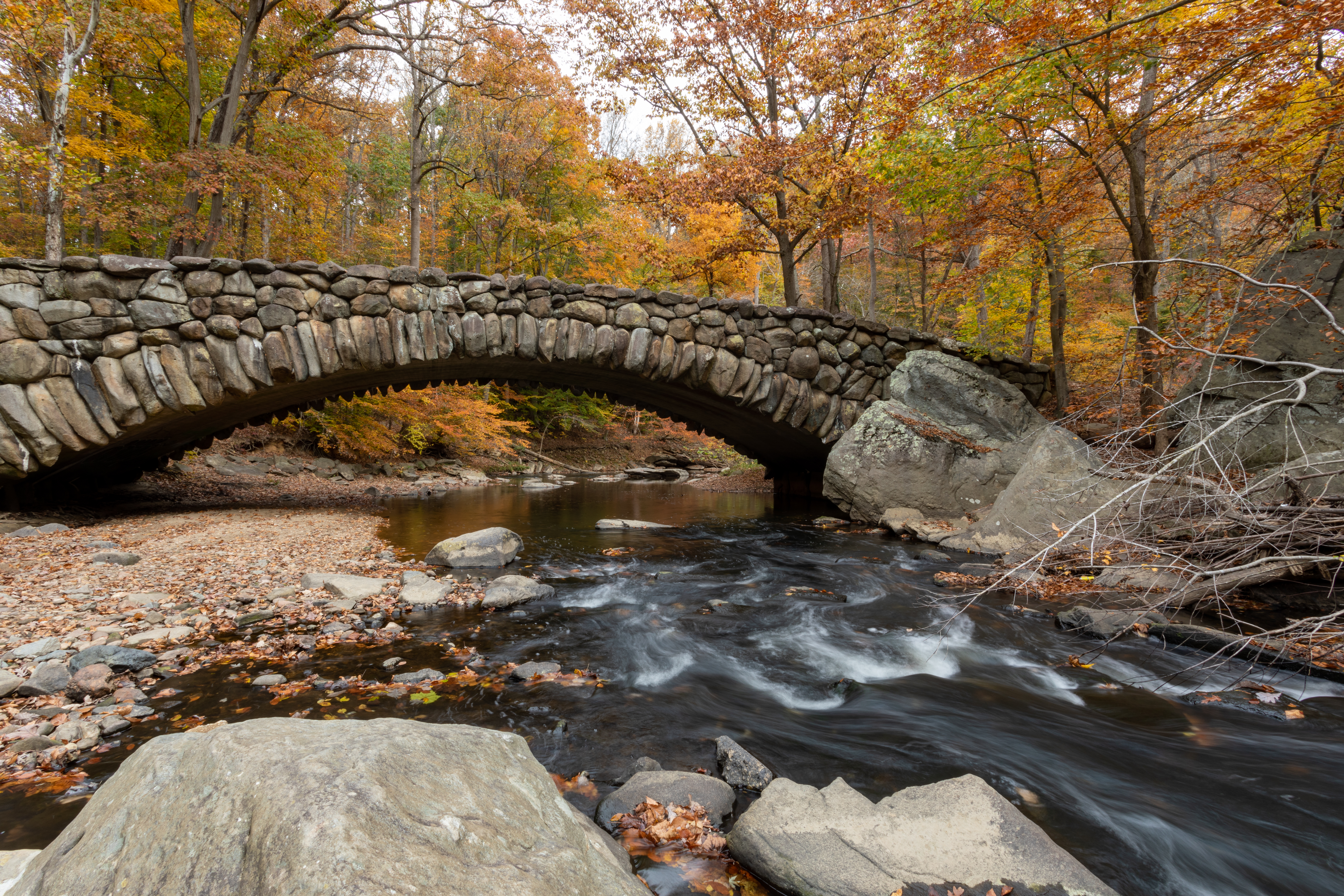
The view of Boulder Bridge from the stream bank is an iconic view of Rock Creek.
A bridge, faced in stone sits in the curve of a shallow creek. The bridge is approximately fifty feet long and twenty feet wide and spans the creek where it's roughly thirty feet across. The bridge extends in a single graceful arch across the creek where the footings extend ten feet in height to the narrowest portion of the sidewall which is about three feet in height.
Bryce Park is an urban triangle park located in the Cathedral Heights neighborhood of Washington, DC. The park is located to the southwest of the Washington National Cathedral. The area is generally busy, with frequent heavy traffic.
(613 words)<br />Bryce Park is an urban triangle park located in the Cathedral Heights neighborhood of Washington, DC. The park is formed by the intersection of Massachusetts Ave., Wisconsin Ave. and Garfield St., NW, and is situated across Massachusetts Ave, NW to the southwest from the Washington National Cathedral. Crosswalks provide pedestrian access at each of the corners of the park, and sidewalks run along the streets on each side.<br />The area is generally busy, with frequent heavy traffic on all bordering streets. The park contains trees and pathways with benches throughout and consists of three tiered plaza areas.<br />Beginning at the southeast corner, a fifteen-foot-wide, thirteen-step cement staircase leads up from the sidewalk, past a fifteen foot tall bush and twenty-foot tall tree on the left and shorter bushes along the ground to the right, to the first plaza level.<br />The first level is an egg shaped plaza, with a cement walkway around the edge of an egg shaped grassy area that is thirty by sixty feet at the widest point. There are two ten to fifteen-foot deciduous trees and one 6-foot tall evergreen bush in the grass. The plaza is surrounded by thirty-foot trees and provides a nice shaded area. Nine benches arc around the north side of the plaza and 10 line the south side. To the northwest, another cement staircase of ten steps leads up to the middle plaza.<br />On the second level, a five-foot tall curved wall of thin stone slabs arcs around the west side of the plaza, running about 70 to 90 feet across. Stairs at each end of the wall lead to the upper level of the park. A two-foot-wide garden area runs along the top of the wall and beyond that is a two-foot high black metal fence. Plants hang over the left side of the wall. Set into the wall near the center top is a three by two-foot bronze plaque. Raised text in gold lettering reads:<br />BRYCE PARK<br />Dedicated to<br />James Bryce<br />Viscount Bryce of Dechmont, O.M.<br />British Ambassador to<br />the United States of America<br />1907-1913<br />Author - Diplomat - Scholar<br />He Delighted<br />in the Parks of Washington<br />About twenty feet to the right is an oblong plaza area, about fifty by ninety feet and featuring two round grass lawn areas, one twenty feet and one thirty feet wide, overlapping slightly to create a figure eight. A five-foot-tall tree sits in the smaller grass area. The plaza is surrounded by benches. Staircases of 11 steps at the northwest corner of the plaza and 12 steps at the right end of the wall lead to the upper level of the park.<br />On the west side of the middle plaza, between two benches which are between the middle and right-hand staircases, is a water fountain.<br />The top-level sits along Wisconsin Avenue at the west edge of the park. A round plaza fills the southwest corner of the park, where a ten foot wide flagstone path surrounds a circle of grass about thirty feet wide.<br />A plaque set in the grass patch at the base of a tall tree reads:<br />Little-Leaf Linden<br />Tilia Cordata<br />Planted on July 11, 1968 in recognition<br />of<br />Mrs. James H. Rowe, Jr.<br />National Capital Planning Commission<br />Appointed May 8, 1961<br />By Pres. John F. Kennedy<br />Chairman Nov. 9, 1961 - July 11, 1968<br />Five benches line the outer edge of the flagstone path on the southwest side. One long semicircular bench curves around the inside edge of the path.<br />A curving ten-foot wide path runs from the top of the northmost staircase towards the northwest corner of the park. A fifteen-foot-long bench, overhung by ten-foot-tall bushes, runs along the north side of the path.<br />END OF DESCRIPTION<br />
The box office is a one story building. There are two windows to the left of a brown door. Four windows are on the right of the door, with the first window closest to the door set at a lower height to allow for wheel chair accessibility. Metal railings separate the windows and create queues. Six beams or poles hold up the roof that hangs over the windows and ticket lines. An asphalt pad extends in front of the building towards a circular driveway. The building is 60 feet to the right of the main gates of the amphitheatre.
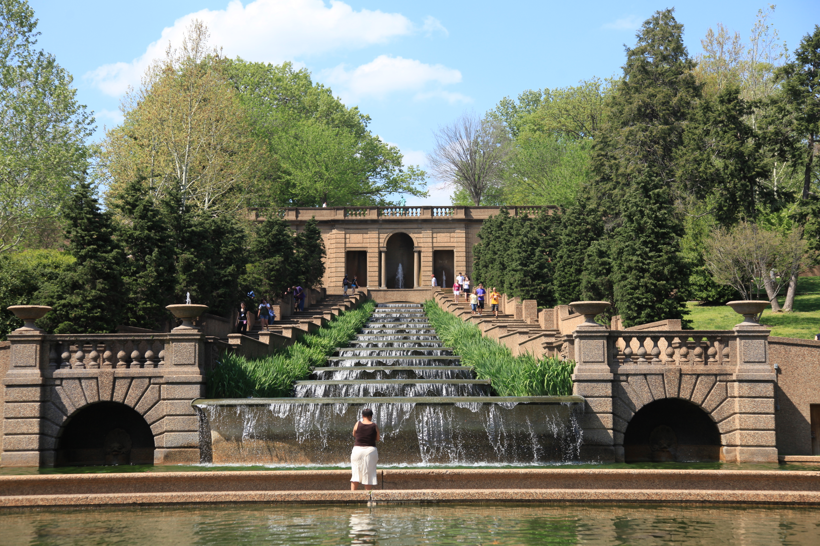
The 13-basin Cascading Fountain in Meridian Hill Park is one of the longest in North America.
(489 words)<br />The cascades fountain is located at the south end of Meridian Hill Park, in the Columbia Heights neighborhood of Washington, DC and runs from north to south from the upper to lower levels of the park. The park is bordered by 15th, 16th, W, and Euclid streets NW, and sits on a prominent hill one and one-half miles (2.5 kilometers) due north of the White House.<br />From the intersection of 16th Street and W streets, NW, proceed north on the east side of 16th street about one hundred feet (30 meters). Turn right into the park entrance and proceed about 150 feet to the east and you will be at the south end of the cascades fountain.<br />The fountain consists of a concrete structure from which water falls vertically about fifty feet from north to south, down thirteen stepped and linked water basins, each about twelve by sixteen by two feet deep, into a pool below. A plaza and rectangular reflecting pool sit to the south.<br />Sets of stairs on either side lead down along the fountain cascades from the upper level of Meridian Hill park. Running east to west across the park just above the cascade fountain is a tall retaining wall. Set into the center of the wall is a fountain in an arched alcove. Water from the fountain falls over two levels to a pool. Two rectangular alcoves on either side also feature waterspouts that feed into the pool. Between the pool and the top level of the cascade fountain is a concrete pedestrian walkway, made of the same concrete as the retaining wall and fountains.<br />The cascades are bracketed by ten-foot wide cement stairs on either side. The outer edges of the stairs are lined with trees. Short walls run between the fountain and each stairway. From the walkways the wall appears 1.5 feet tall, on the water side the wall is about 4 feet tall. he outer walls of the walkway are about 3 feet tall and are set with benches at various points down the cascade. Curved staircases feed into the walkways from outer grass lawn areas that sit on the other side of the tree lines.<br />On the walls that run between the stairs and fountain, near the bottom of the cascade, are bearded faces with curved horns. The faces are located on the sides of the walls facing the fountain, two on each wall for a total of four. Water flows from their mouths into the bottom step of the cascade, just above the pool at the bottom. The pool at the bottom of the cascades is about 75 feet wide. The waterfall from the last of the 13 steps to the basin is about 4 or 5 feet.<br />At the level of the bottom step of the cascade, the staircases flanking the cascades turn outward. Below each staircase, facing the basin, is a low archway framing an additional small fountain.<br />END OF DESCRIPTION<br />
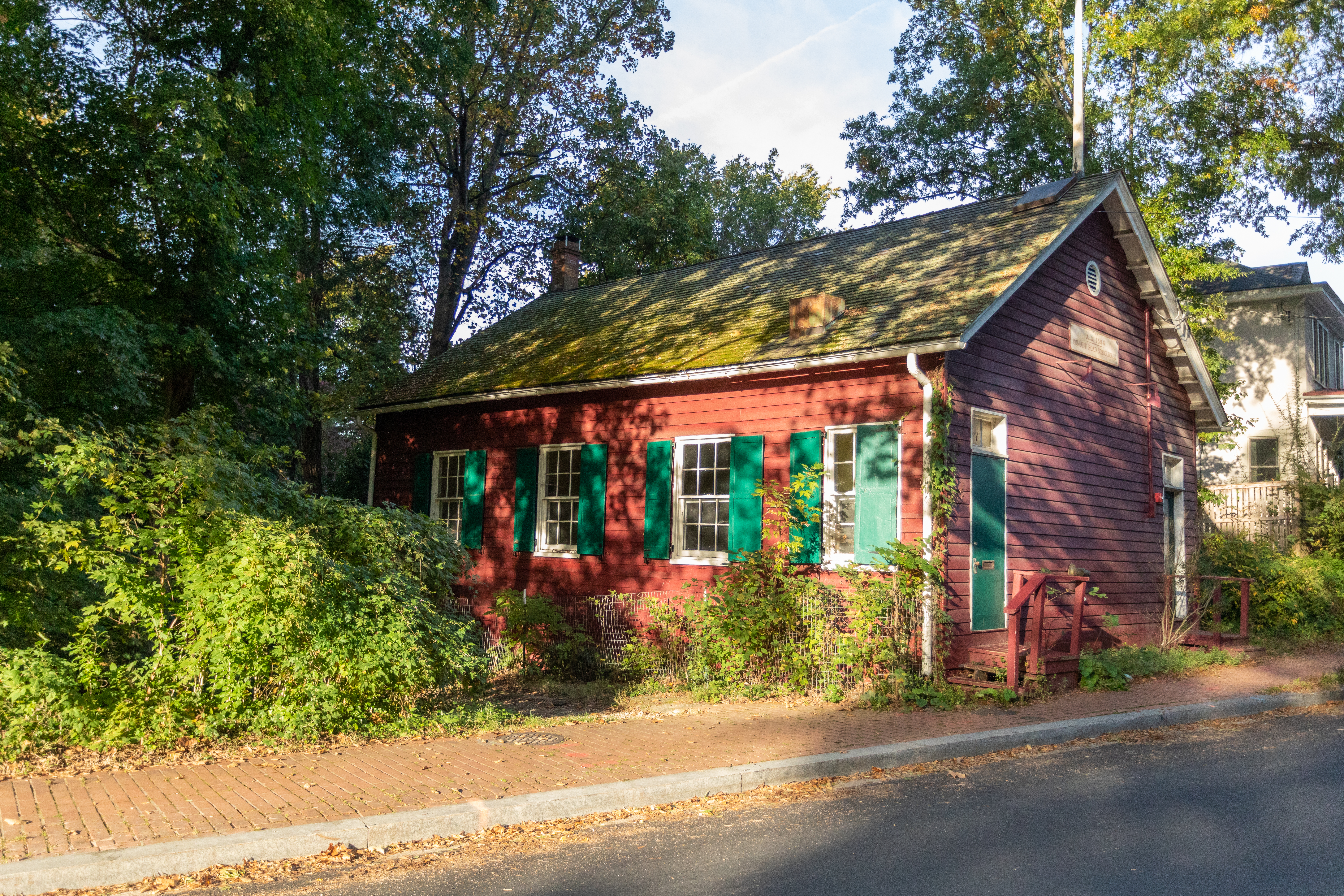
A single-story red schoolhouse with green shutters and doors. The short end of the building faces the street with two doors; the long side has four windows. A chimney rises from the rear of the peaked roof.
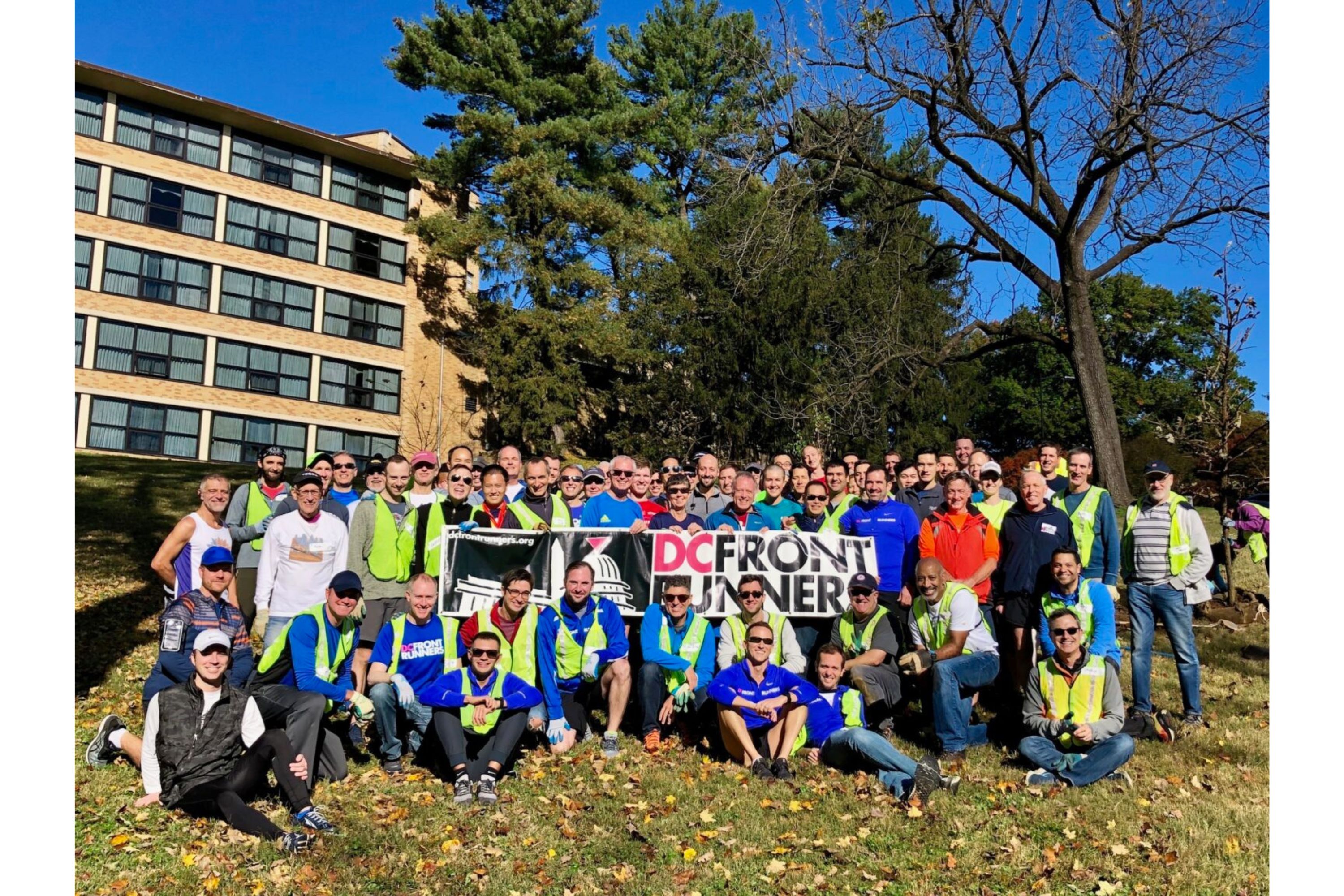
This grove of trees in Rock Creek Park was planted and is cared for by the DC Front Runners, a local LGB running and walking club. In 1988, they collaborated with the National Park Service to establish this memorial grove along a favorite route in honor of members who lost their lives during the AIDS epidemic.
A group of 100 plus runners hold up a sign that reads "DC Front Runners"
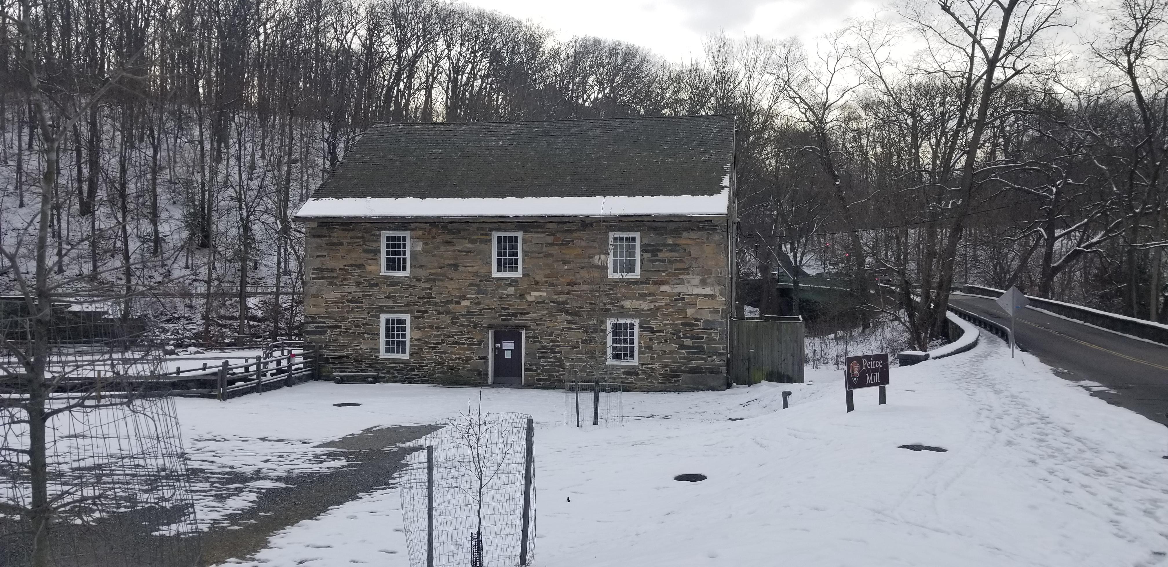
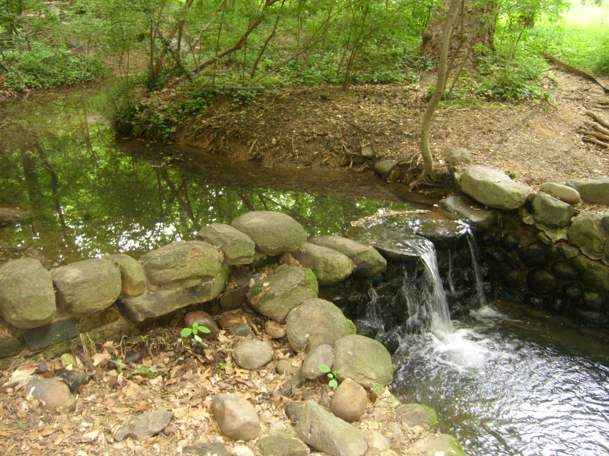
The dam at Peirce Mill was constructed in 1900 and was meant to provide a beautiful view and soundscape for visitors to the renovated Peirce Mill Tea House.
(181 words)<br />The Peirce Plantation dam runs across Rock Creek about three hundred fifty feet (320 meters) north of the intersection of Beach Drive NW and Tilden Street / Park Road, and about seventy-five feet north of Peirce Mill.<br />The dam is a scenic waterfall that spans about fifty feet across Rock Creek. Water falls uniformly over the dam at an approximate six-foot drop as the creek continues south. On either side of the dam are walls of large boulders, about three by three feet each. The stone walls themselves are about six feet high from water level and thirty feet across.<br />On the east side of the creek a cement canal structure has been built. It features two cement walls spaced about three feet apart that make an s-curve as they angle away from the creek side and further into the creek. A forty-foot stone wall lines the creek bank from bottom to street level and Beach Drive above on this side.<br />A bike/walking path runs along-side the east side of the creek and is the easier location to access the dam.<br />END OF DESCRIPTION<br />
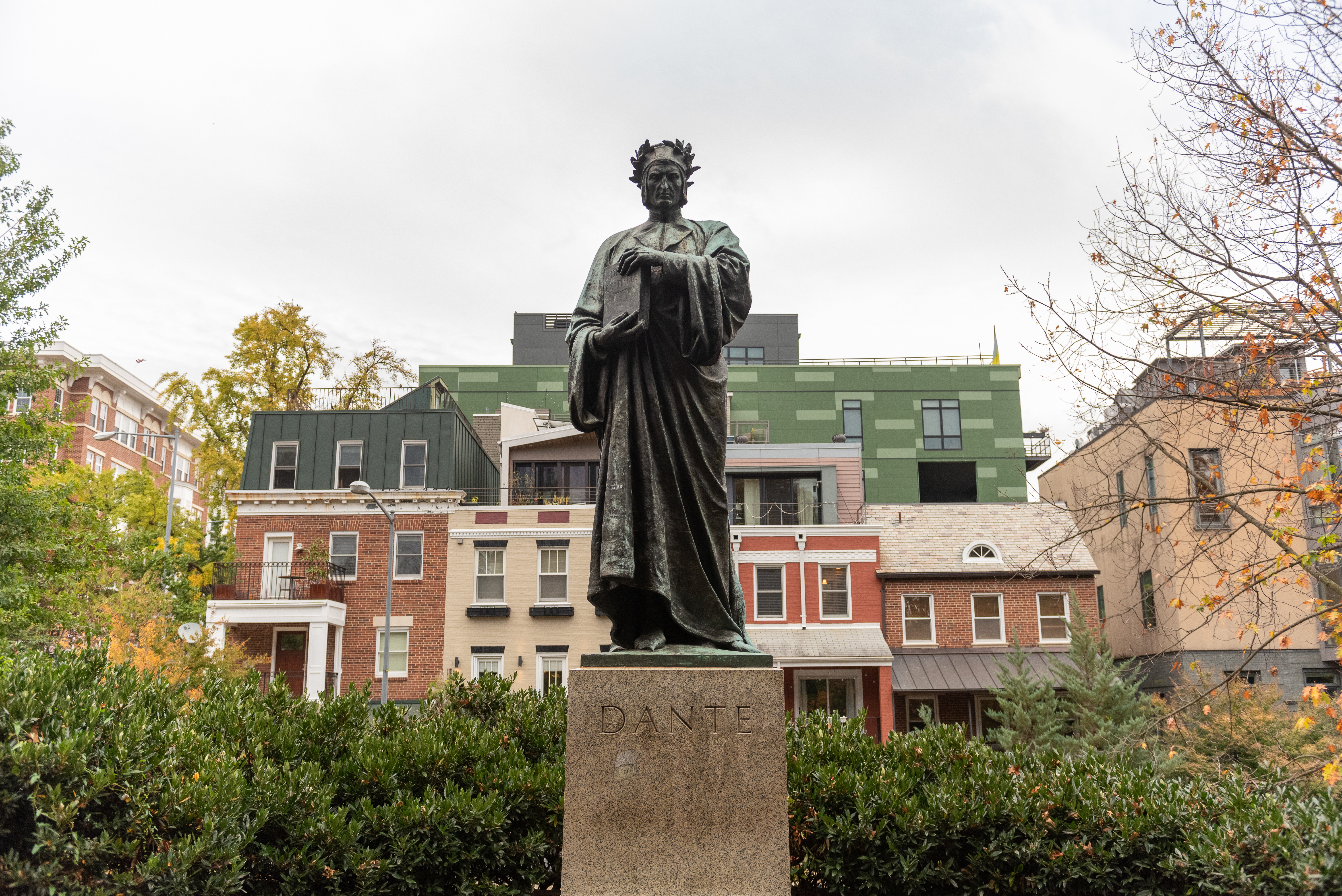
Dante Aligheri was an Italian poet best known for his 1320 work, "The Divine Comedy," an allegorical representation of the afterlife according to the Catholic faith. The statue was a gift from Carlo Barsotti of New York on behalf of Italian-born Americans.
(304 words)<br />The Dante Memorial Statue is located in Meridian Hill Park in Washington, DC. The statue sits along the south eastern edge of the park. The park is bordered by 15th, 16th, W, and Euclid streets NW, and sits on a prominent hill one and one-half miles (2.5 kilometers) due north of the White House.<br />From the 15th street and W street, NW entrance into the park, follow the pathway up about four hundred feet (121 meters). You will pass the James Buchanan Memorial on your right after about two hundred twenty-five feet (68 meters). The path winds as it climbs up the park and features a series of steps along the way.<br />The path will lead into an open plaza area about thirty feet wide and fifty feet long. The statue will be on your right.<br />The nine-foot tall bronze statue shows a man with a stern expression on his face, holding a copy of The Divine Comedy across his right breast, holding the bottom of the book in his right hand and the top in his left hand. . He wears a laurel wreath around his head and long flowing robes.<br />The statue is set atop a four-foot-tall, five-foot square granite pedestal.<br />The front of the base features the inscription: DANTE<br />On the back of the base is an inscription:<br />DANTE ALIGHIERI<br />PRESENTED TO THE<br />CITY OF WASHINGTON<br />IN BEHALF OF THE<br />ITALIANS IN THE<br />UNITED STATES BY<br />COMM CARLO BARSOTTI<br />Along the edge of the statue base, just below the statue's left foot, is an inscription that reads:<br />Roman Bronze Works N.Y.<br />There are two benches on each side of the plaza and trees and bushes line the area. The memorial is set along the park's eastern edge and residential housing can be seen rising across the street behind the memorial.<br />END OF DESCRIPTION<br />
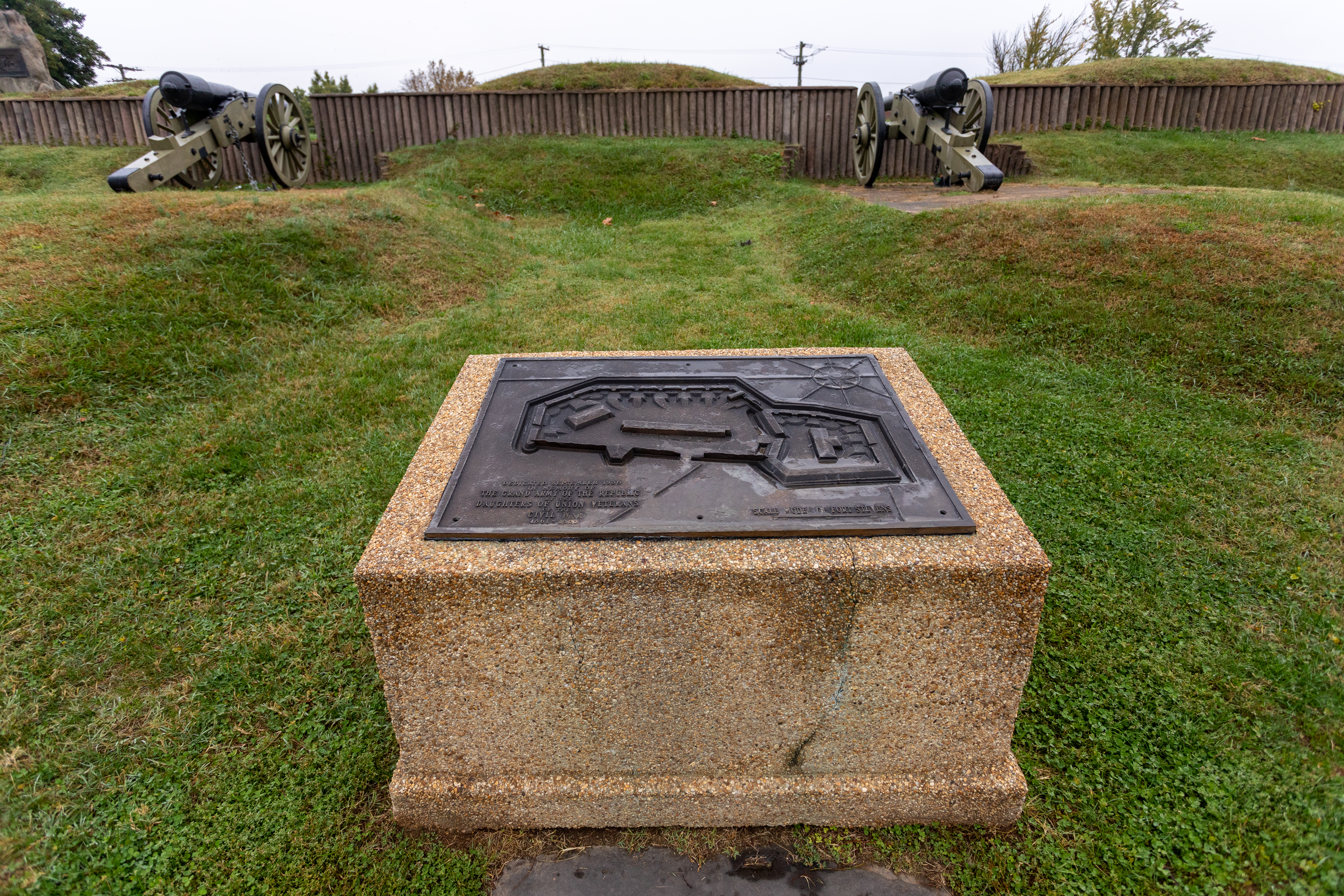
(295 words)<br />Fort Stevens is located in the northern corner of Washington, DC, within the center of a block bordered by 13th Street, NW to the west, Georgia Avenue to the east, Rittenhouse Street to the north, and Quakenbos Street to the south.<br />The park area rises about thirty feet from street level at the northwest corner of 13th and Rittenhouse Streets to the eastern end where the fort is situated. A flagpole in the center of the hilly field marks the fort location. Lined in front to the north are a wall of grassy bunkers, about four feet tall. One six-foot tall hill to the left has a white wooden double-sided door on its face.<br />A cement bunker wall with wood-log designed vertical ridges spans about one hundred yards across the top of the hill. The wall stands about five feet tall with seven three-foot wide, three-foot tall openings. Pointed out of two of those openings are sixteen-foot long cannons set on cement platforms and directed out to the north.<br />Set in the grassy hill, equidistant between the two cannons and back to the south about thirty feet, is a bronze plaque atop a cement block. The cement base is about five-feet wide, four-feet deep, and three-feet tall. The bronze plaque measures three by three feet. It features a bas-relief of the fort design as viewed from above, detailing its walls, borders, bunkers and cannon platforms. In the upper right corner is a compass rose.<br />The lower left corner is inscribed to read:<br />Dedicated September 1936<br />In the Memory of<br />The Grand Army of the Republic<br />by the<br />Daughters of Union Veterans<br />of the<br />Civil War<br />1861-1865<br />An inscription in the lower right corner reads:<br />Scale Model of Fort Stevens<br />A measurement ruler is etched below.<br />END OF DESCRIPTION<br />
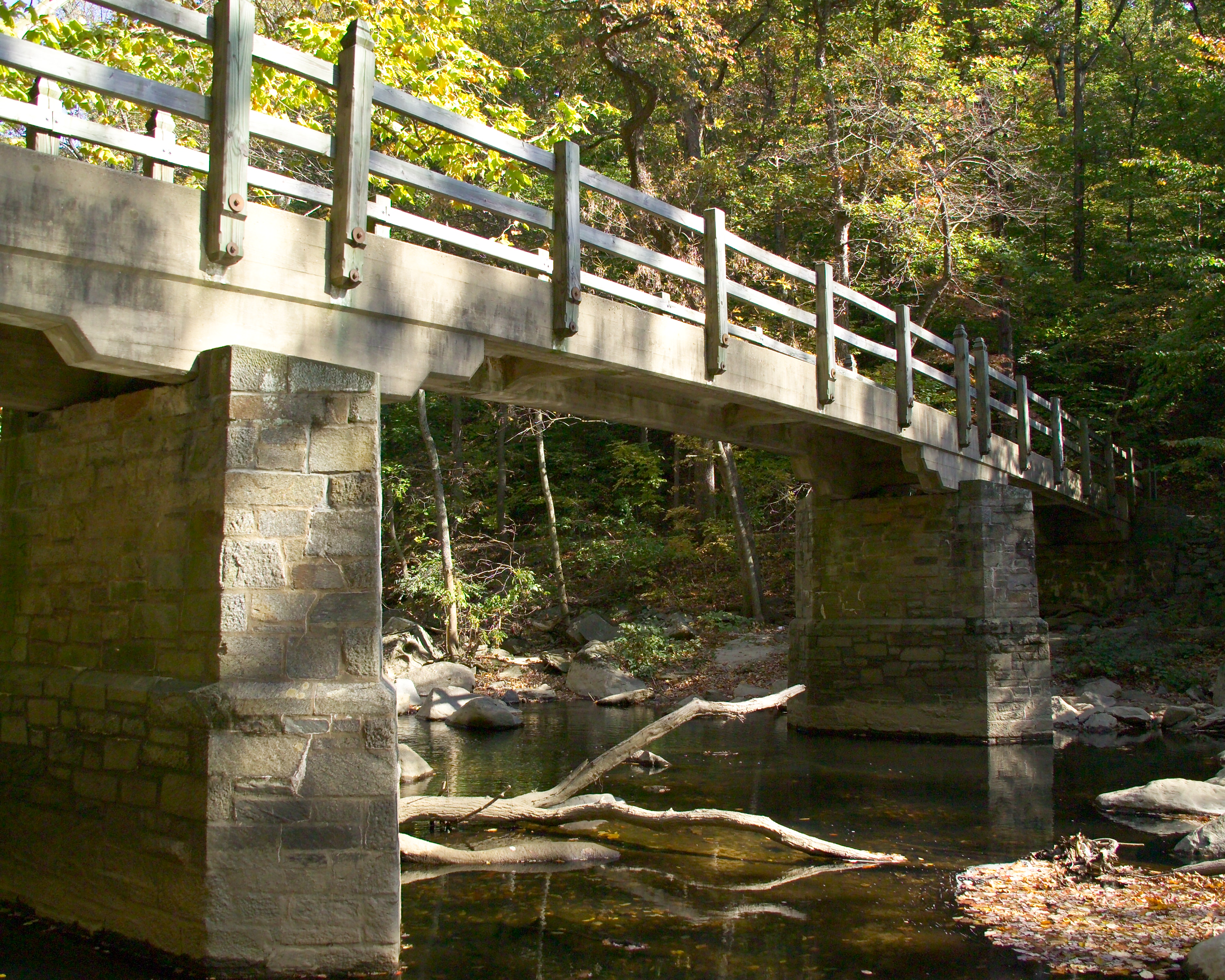
(221 words)<br />Devils Chair Bridge carries Rock Creek Trail over Rock Creek, east of the Georgetown neighborhood in Washington, DC.<br />Travel three hundred seventy-five yards (340 meters) north along Rock Creek Trail from Q street, NW. The trail turns to the right and becomes Devils Chair Bridge.<br />The bridge structure is a long, sweeping concrete arch measuring eighty-eight-feet (26 meters) long and ten-feet (3 meters) wide. Three-foot tall cement railings line both sides of the bridge. The bridge abutments underneath on both sides are made of blue stone.<br />The west side of the bridge is heavily wooded along Rock Creek and along a steep hillside that runs up to the west. On the east side of the bridge Rock Creek Trail turns to the left and continues north along the creek. A twenty-foot-wide strip of grass runs between the trail and Rock Creek Parkway to the east.<br />A trail at the west side the bridge leads to the west up steep steps that carry through thick woods up five hundred feet (152 meters) to Mount Zion Cemetery at the top of the hill. The dirt trail has many loose rocks and can be difficult to navigate. A fence about ten feet (3 meters) to the east borders a paved road that runs along the east edge of Oak Hill Cemetery to the right.<br />END OF DESCRIPTION<br />
This 27-acre park in the historic Georgetown neighborhood of Washington, DC, was part of the Dumbarton Oaks estate. Designed by Beatrix Farrand for Mildred and Robert Bliss, the National Park Service now manages the wild portion of the garden while Harvard University manages the formal gardens.
A dirt path lined with wood beams and rocks passes a stone wall in the woods.
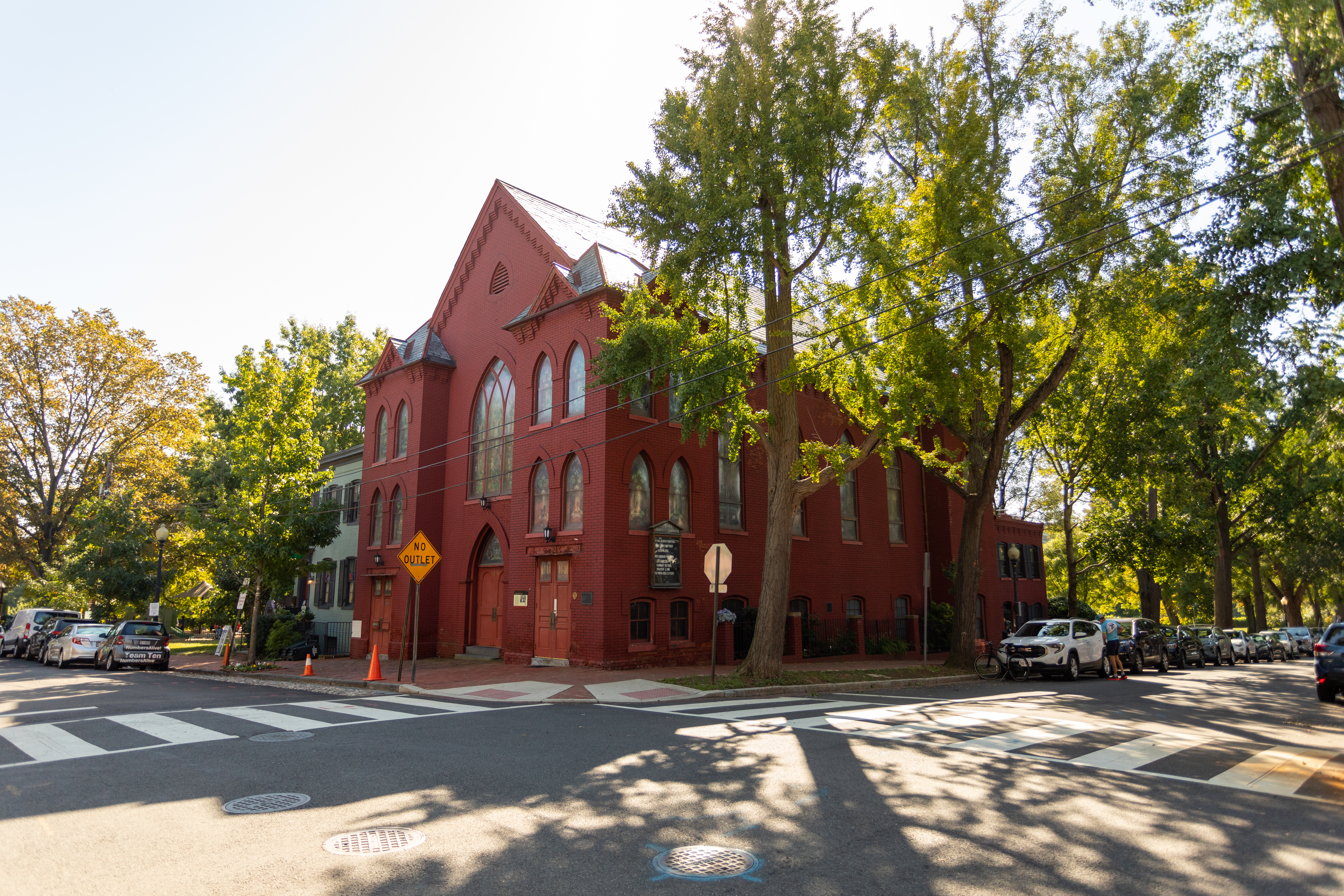
First Baptist Church of Georgetown was largely constructed by members of its congregation at night, after they had finished laboring elsewhere in Georgetown.
A red, brick church with three floors of large windows with pointed tops on a street corner. Three doors face the street.
Fort Bunker Hill was built in the fall of 1861 by the 11th Massachusetts Infantry and was named after the Revolutionary fortification at Bunker Hill, Massachusetts.
A sign on the edge of the woods with National Park Service logo and text "Fort Bunker Hill, Fort Circle Parks, National Park Service, U.S. Department of the Interior."
<br />Inscriptions<br />FORT BUNKER HILL<br />ONE OF THE CIVIL WAR DEFENSES OF WASHINGTON<br />ERECTED IN THE FALL OF 1861, FORT BUNKER HILL OCCUPIED AN IMPORTANT POSITION BETWEEN FORT TOTTEN AND FORT LINCOLN IN THE DEFENSE OF THE NATIONAL CAPITAL. THIRTEEN GUNS AND MORTARS WERE MOUNTED IN THE FORT.<br />UNITED STATES DEPARTMENT OF THE INTERIOR<br />NATIONAL PARK SERVICE<br />
(234 words)<br />Fort Bunker Hill is located in the northeast quadrant of Washington, DC, bordered by Perry Street, NE to the north, Otis Street NE to the south, 13th street NE to the west and 14th street NE to the east. The block consists of wooded forest with trails that rise to a point in the middle.<br />From the intersection of 14th and Otis streets, proceed north on 14th street about two hundred twenty-five feet (68 meters). A brown sign with white letters is set at a trail head on the west side of the street. Text on the sign reads:<br />Rock Creek Park<br />Park Watch<br />Below in English and Spanish is written:<br />Information 202-895-6000<br />US Park Police 202-610-7500<br />A white sign below reads in English and Spanish:<br />Park Closed at Dark<br />Turn left and travel west slightly uphill on a dirt path into the park. About three hundred eighty feet west (115 meters), on the right side of the path, is an approximately two-foot tall rock set with a one by two-foot bronze plaque. An inscription on the plaque reads:<br />FORT BUNKER HILL<br />ONE OF THE CIVIL WAR DEFENSES OF WASHINGTON<br />ERECTED IN THE FALL OF 1861, FORT BUNKER HILL OCCUPIED AN IMPORTANT POSITION BETWEEN FORT TOTTEN AND FORT LINCOLN IN THE DEFENSE OF THE NATIONAL CAPITAL. THIRTEEN GUNS AND MORTARS WERE MOUNTED IN THE FORT.<br />UNITED STATES DEPARTMENT OF THE INTERIOR<br />NATIONAL PARK SERVICE<br />END OF DESCRIPTION<br />
Fort DeRussy was built on a high hill with the purpose of providing cross fire upon the approaches to Fort Stevens on the 7th Street Pike (now Georgia Avenue NW ) and, together with Fort Kearney and Fort Reno to the west, controlling the country roads between Rockville Pike and Rock Creek Valley.
A large boulder on the edge of mounds of tree-covered earth displays a bronze plaque, "Fort DeRussy. One of the Civil War Defenses of Washington. Constructed on the site in 1861, Fort DeRussy commanded the deep valley of Rock Creek. Its armament consisted of 11 guns and mortars including a 100-pounder Parrott rifle. United States Department of the Interior. National Park Service."
Fort Reno was originally named Fort Pennsylvania, and was built during the winter of 1861 shortly after the disastrous defeat of the Union Army at the First Battle of Manassas. In charge of construction of the defenses around Washington was Brig. Gen. John G. Barnard, Col. of Engineers, U.S. Army. Barnard chose the location of Fort Reno for its strategic importance in guarding the Rockville Pike (present-day Wisconsin Avenue NW).
A broad grassy field dotted with trees. A slight rise of earthworks is detectable at the perimeter.
<br />Inscriptions<br />National Park Service<br />Highest Natural Elevation<br />In cooperation with the D.C. Association of Land Surveyors<br />Point Reno<br />Elev. 409 Ft.<br />2007<br />Washington D.C.<br />
(706 words)<br />Located in the middle of Fort Reno Park at the northwest corner of Nebraska Avenue and Chesapeake Streets, NW, in Tenleytown, Washington, DC is the highest point in the District of Columbia marker.<br />From Nebraska Avenue and Chesapeake streets, NW, travel west on Chesapeake about seven hundred twenty feet. To your right will be a dirt and gravel walking path. Travel north along the path five hundred feet, passing a four-foot tall, thirty square foot brown stage on the right at about mid-point. A three by four wayside sign will be on your right.<br />The sign has a light tan background and is titled at the top: Fort Reno. A map on the left side shows the diagram of a fort, with buildings, walls, and boundaries. A drawing at the top is titled: Battery Reno.<br />The right side shows a black and white image, presumed to be Major General Reno. The man is in a civil war uniform with full beard, and faces to the left. Beneath him is a sketch of an iron wire tower and is labeled Signal Tower at the bottom.<br />Text in the middle of the sign reads:<br />At 409 feet above sea level, this site is the highest point in Washington, D.C. It is no coincidence that in 1861, the Union army designed one of the largest and most heavily armed Civil War fortifications at this location.<br />Originally names "Fort Pennsylvania," and renamed after Major General Jesse L. Reno, this site was the epicenter of the Union's northern defenses of Washington, D.C. With a commanding view of the surrounding countryside, Fort Reno presided over three major roads that converged at Tenleytown: River Road, Rockville Road (today Wisconsin Avenue NW, and Brookville Road (today Belt Road NW). Together with an attached artillery battery (Battery Reno), the fort's grounds stretched over 70 acres, including barracks, camps, and a parade ground.<br />During the July 1864 Confederate raid on Washington, D.C., Fort Reno's signal tower was the first to observance the advancing troops. The fort's 100-pounder Parrott rifle fired rounds 3.5 miles north, killing Confederate soldiers near present-day Walter Reed National Military Medical Center. After the war, the army abandoned Fort Reno. By the late 1800s, most traces of the fortifications were gone, making way for the creation of several reservoirs and later, residential development in the north. To the south and west of the fort, African Americans, including those who had helped construct Fort Reno and found refuge under its protection during the war, were joined by working class white residents to create Reno City. The distinct but segregated neighborhood was demolished for the creation of Fort Reno Park.<br />A three-inch black border along the bottom of the sign features a round plaque in the middle. Text on both sides reads:<br />The benchmark was placed by the Washington, D.C. Surveyors Association after surveying and establishing the highest natural ground of the District in 2007. The wayside and benchmark for the highpoint were made possible by the donations of the Highpointers Foundation in cooperation with the Highpointers Club.<br />Following the dedication ceremony in April 2008, the highpoint officially became known as Point Reno. The higher land behind the fenced area is man-made and, therefore, not the highest natural point.<br />The natural highpoint is marked with a benchmark just 180 feet north east of this sign. Can you find it?<br />Please visit the Ft. Reno homepage in the Rock Creek Park website, https://www.nps.gov/rocr/index.htm to learn more about the Foundation's education, support & conservation of the highest natural point in each of the 50 United States and Washington, D.C.<br />The bronze plaque has a triangle in its center with a + in the middle. Text around the plaque reads:<br />National Park Service<br />Highest Natural Elevation<br />In cooperation with the D.C. Association of Land Surveyors<br />Point Reno<br />Elev. 409 Ft.<br />2007<br />Washington D.C.<br />As you face the wayside sign, a second identical wayside is one hundred sixty feet east on a grassy hillside. From this location, the highest point marker is twenty-five feet east and set in the ground. The five-inch wide plaque is set in cement about seven-inches wide. A large fifty-foot tall oak tree will be sitting about fifty feet to the southeast from this location.<br />END OF DESCRIPTION<br />
<br />Inscriptions<br />The Civil War Defenses of Washington<br />Fort Reno<br />The site of this fort was selected in August, 1861. First called Fort Pennsylvania, the fort was located at an elevation of 430 feet, commanding three important roads which entered the city from the northwest in the vicinity of what is now Wisconsin and Nebraska Avenues, N.W.<br />National Capital Sesquicentennial Commission<br />1970<br />
(274 words)<br />The Fort Reno: Stone and Plaque is located on Chesapeake Street, NW in Tenleytown, Washington, DC. The stone marker is set on the north side of Chesapeake Street, five hundred feet west of Nebraska Avenue and three hundred twenty feet east of 40th Street, NW.<br />The marker sits about six feet beyond the sidewalk from the street, at a slight incline. It is five feet long, three feet wide, and two feet tall and features a three by one-foot bronze plaque set on its top surface.<br />Raised text on the plaque reads:<br />The Civil War Defenses of Washington<br />Fort Reno<br />The site of this fort was selected in August, 1861. First called Fort Pennsylvania, the fort was located at an elevation of 430 feet, commanding three important roads which entered the city from the northwest in the vicinity of what is now Wisconsin and Nebraska Avenues, N.W.<br />National Capital Sesquicentennial Commission<br />1970<br />Beyond the stone marker is a soccer field, elevated about eight feet from street level. The park also features a baseball field, tennis courts, and large grassy field areas.<br />As you face the marker, three water towers stand about two hundred yards in the distance. The tower furthest to the right is about three hundred feet tall and resembles a castle, with its rounded stone face, pointed top, and a smaller stairwell tower connected to its left side. The two towers to the left are made of red brick and have flat rooftops.<br />To the right of the stone marker, a gravel and dirt road leads into a grass field area and through the middle of the park.<br />
Fort Slocum was built by the 2nd Rhode Island Infantry and named after Colonel John Slocum of the 2nd Rhode Island Infantry.
A sign stands in front of a field with scattered trees, reading "Fort Slocum, Fort Circle Parks, National Park Service, U.S. Department of the Interior."
Fort Slocum was built by the 2nd Rhode Island Infantry. The fort had 25 guns and mortars, and commanded the intersection of the left and right forks of Rock Creek Church Road (near today's New Hampshire Avenue and McDonald Place). The fort also provided support for Fort Stevens to the west.
Fort Stevens is one of many fortifications that surrounded Washington, DC, during the Civil War and the place where President Abraham Lincoln came under fire from Confederate forces.
(632 words)<br />Fort Stevens is located in the northern corner of Washington, DC, within the center of a block bordered by 13th Street, NW to the west, Georgia Avenue to the east, Rittenhouse Street to the north, and Quakenbos Street to the south.<br />The park area rises about thirty feet from street level at the northwest corner of 13th and Rittenhouse streets to the eastern end where the fort is situated. A flagpole in the center of the hilly field marks the fort location. Lined in front to the north are a wall of grassy bunkers, about four feet tall. One six-foot tall hill to the west of the flagpole has a white wooden double-sided door on its face.<br />A cement bunker wall with vertical ridges spans about one hundred yards across the top of the hill. The wall stands about five feet tall with seven three-foot wide, three-foot tall openings. Pointed out of two of those openings are sixteen-foot long cannons set on cement platforms and directed out to the north.<br />About thirty feet behind and six feet to the right of the right cannon sits a two by three-foot wayside. The sign is titled in black letters in the upper left corner: Fort Stevens.<br />The left two thirds of the sign feature a color painting of a battle scene. Men in blue military uniforms stand in a fort on a hilltop around a cannon set on a wheeled turret. A man standing above in the top left corner wears a long black suit coat and black top hat. Below him a man holds an American flag. Two men carry a wounded soldier below, a man runs with a raised right arm and hand, and a man to the right stands while holding a white flag with a red and blue cross. A quote above the image reads: "We haven't taken Washington, but we scared Abe Lincoln like hell!" The quote is attributed to General Jubal Early.<br />Text in the bottom right reads:<br />Illustration of President Lincoln on the parapet of Fort Stevens<br />Text below describes the battle that took place at Fort Stevens:<br />Built between 1861-1863 this structure was originally called Fort Massachusetts and guarded the northern defenses of the nation's capital during the Civil War. On July 11-12, 1864 Fort Stevens defended the city from a Confederate attack under the command of General Jubal Anderson Early. During the battle, President Abraham Lincoln came under direct fire from Confederate sharpshooters while he witnessed the battle from the parapet of the fort. The Battle of Fort Stevens marks the only time in American history that a seated President came under fire from an enemy combatant during a time of war.<br />Fort Stevens was named after General Isaac Ingalls Stevens. General Stevens was killed on September 2, 1862 during the Battle of Chantilly, Virginia.<br />You can download a podcast of Fort Stevens at www.nps.com/rocr<br />The right third of the sign is a white panel. In the top left is a sketch of an older African American woman, sitting with a slight smile and hands clasped. Text to her right reads:<br />In order to construct Fort Stevens, the home of the original property owner, Elizabeth Thomas, was destroyed.<br />To the right is a QR code to scan for additional information about the Battle of Fort Stevens.<br />Below is a black and white image of about forty military soldiers posing in a fort for the camera To the right men stand among two cannons, and another four cannons line the fort behind them from a raised platform, pointed out over the tops of the forts walls. About twenty more soldiers stand and kneel on the left by a flagpole and amongst piles of cannonballs. Text beneath them reads:<br />3rd Massachusetts Heavy Artillery at Fort Stevens 1865<br />END OF DESCRIPTION<br />
(436 words)<br />Fort Stevens is located in the northern corner of Washington, DC, within the center of a block bordered by 13th Street, NW to the west, Georgia Avenue to the east, Rittenhouse Street to the north and Quakenbos Street to the south.<br />Two fifty-foot tall oak trees stand along the lower south end of the park at street level by 13th Street. The park area rises about thirty feet from street level at 13th and Rittenhouse Streets about two hundred yards to the eastern end where the fort is situated. A flagpole in the center of the hilly field marks the fort location.<br />Lined in front, to the north of the flagpole are a wall of grassy bunkers, about four feet tall. One eight-foot tall hill to the left has a white wooden double-sided door on its face. The bunker measures sixty feet across and twenty feet deep. The white door is about seven feet tall and six feet wide and has three metal brackets on the outer sides of each door. The doors overlap in the center. It is set on a cement base that appears to run back into the hill.<br />A cement bunker wall with three-inch-wide log-like vertical ridges spans about one hundred yards across the top of the hill. The wall stands about five feet tall with seven three-foot wide, three-foot tall openings. Pointed out of two of those openings are sixteen-foot long cannons on wheels, set on cement platforms and directed out to the north. Five additional cement platforms are set on about three-foot tall grass mounds that lead up to the cement wall.<br />About six feet left of the left cannon, sitting on grass just beyond the cement bunker wall is a stone marker with a bronze plaque displayed on its face. The stone is about five feet tall, four feet wide, and two feet deep. The plaque measures about one and a half feet high by two feet wide. It features a bas-relief and is engraved across the top to read:<br />LINCOLN UNDER FIRE AT FORT STEVENS<br />July 12, 1864<br />The image below is a bas-relief of a man in the center with top hat and long suit coat tending to a wounded man on the right falling with his head thrown back. Another man tries to pull the man in top hat away from the left. A man in the lower left corner watches on while holding a staff.<br />Back towards the flagpole is another bas-relief, atop a cement block base. It features the Fort Stevens design as viewed from above, detailing its walls, borders, bunkers and cannon platforms.<br />END OF DESCRIPTION<br />
(232 words)<br />Fort Stevens is located in the northern corner of Washington, DC, within the center of a block bordered by 13th Street, NW to the west, Georgia Avenue to the east, Rittenhouse Street to the north and Quakenbos Street to the south.<br />The park area rises about thirty feet from street level at the northwest corner of 13th and Rittenhouse streets about two-hundred yards to the eastern end where the fort is situated. A flagpole in the center of the hilly field marks the fort location.<br />Lined in front to the east of the flagpole are a wall of grassy bunkers, about four feet tall. One eight-foot tall hill to the left has a white wooden double-sided door on its face. The bunker measures sixty feet across and twenty feet deep. The white door is about seven feet tall and six feet wide and has three metal brackets on the outer sides of each door. The doors overlap in the center. It is set on a cement base that appears to run back into the hill.<br />A cement bunker wall with wood-log designed vertical ridges spans about one hundred yards (90 meters) across the top of the hill. The wall stands about five feet tall with six three-foot wide, three-foot tall openings. Pointed out of two of those openings are sixteen-foot long cannons set on cement platforms and directed out to the north.<br />END OF DESCRIPTION<br />
Construction of Fort Totten began in August 1861 and was finished by 1863. It occupied a high point in advance of the Soldiers' Home, President Lincoln's summer home.
A picnic table sits alongside a path under the shade of tall trees.
This plaque commemorates the construction of Fort Totten as part of the Civil War Defenses of Washington.
(176 words)<br />Fort Totten Park is located in Northeast Washington, DC, about three hundred yards east of Rock Creek Cemetery. The park is bordered by Fort Totten Drive NE to the west, Brookland avenue NE to the north and east, and Bates road NW to the south.<br />At the southwest end of the park, from the intersection of Fort Totten Drive and Allison Street, proceed into the park along the gravel entrance road. Travel about one hundred yards. Turn left off the path and walk through the grass about eighty yards. The Fort Totten plaque is near the ground along the tree line.<br />The one by two-foot bronze plaque rests on the face of a three-foot tall, two by three-foot boulder. The plaque is inscribed to read:<br />Fort Totten<br />One of the Civil War defenses of Washington.<br />Construction of Fort Totten was begun in August 1861. Named after Gen. Joseph G. Totten the Fort contained 20 guns and mortars including eight 32-pounders.<br />United States Department of the Interior<br />National Park Service<br />END OF DESCRIPTION<br />
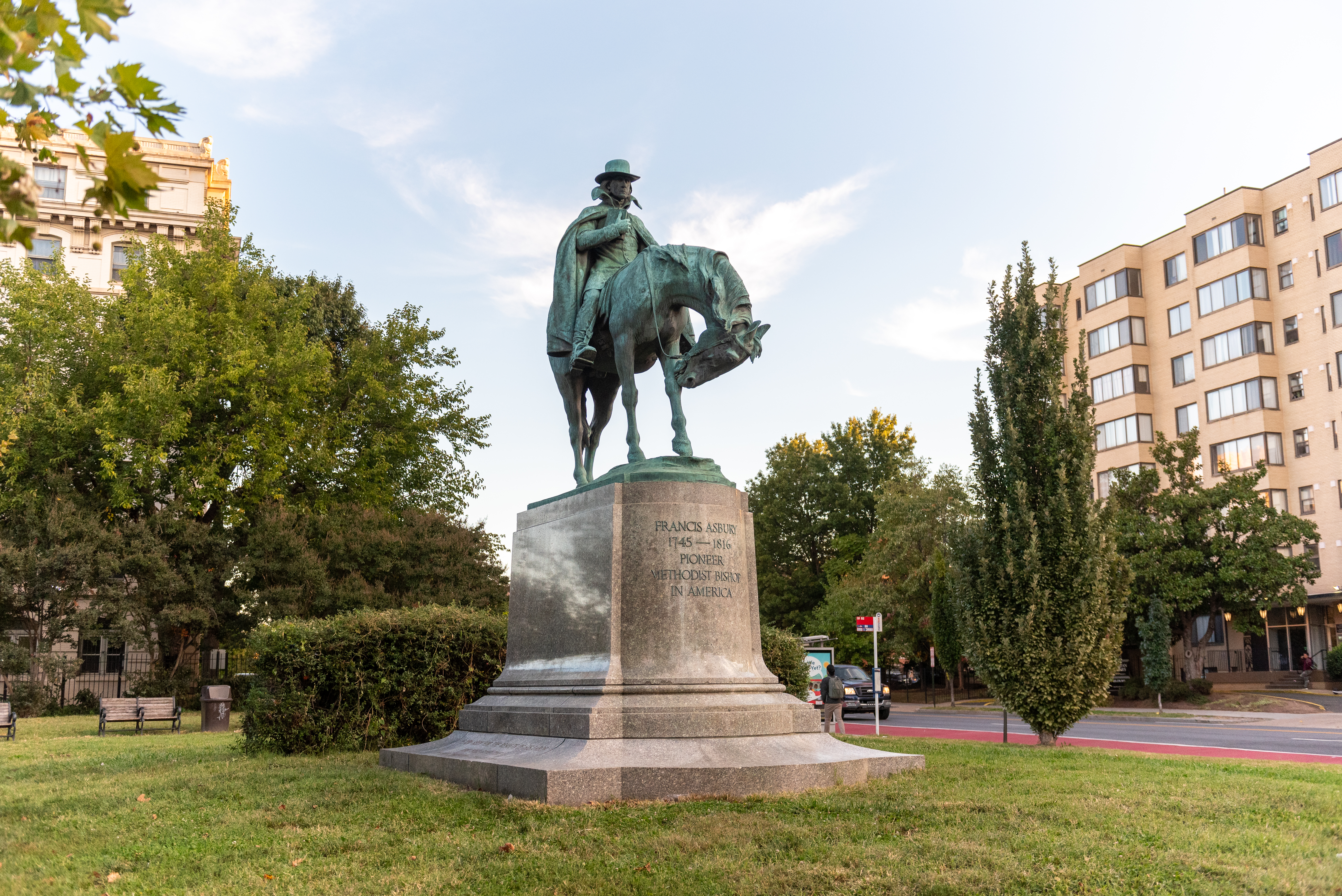
Francis Asbury (1745-1816) was a traveling preacher in colonial America, and one of the first two bishops appointed to the Methodist Episcopal Church. In DC, he founded Georgetown's Foundry Church.Sculptor: Augustus LukemanInscriptionsfrontFRANCIS ASBURY1745-1816PIONEERMETHODIST BISHOPIN AMERICAbackTHE PROPHETOF THE LONG ROADSide, eastHIS CONTINUOUS JOURNEYING THROUGH CITIESVILLAGES AND SETTLEMENTS FROM 1771 TO 1816GREATLY PROMOTED PATRIOTISM EDUCATION MORALITYAND RELIGION IN
(240 words)<br />The Francis Asbury Memorial is located in a small triangular park in the Mount Pleasant neighborhood in Washington, DC. The memorial is bordered by 16th Street, NW to the east, Mount Pleasant Street, NW to the west and Harvard Street to the south.<br />The grass lawn park is about two hundred feet long, and one hundred feet wide. Sidewalks run along both east and west sides.<br />The bronze sculpture features an approximately six-foot-tall Asbury seated upon a horse wearing a cape and wide-brimmed hat. His right arm is bent, as he carries a book in front of his chest. The hand holds the closed book while his forefinger is inserted between the pages. The horse, carrying a bulging saddlebag, bends his neck to lick his left knee.<br />The statue stands on an eight-foot-tall, sixteen-foot-long and eleven-foot-wide granite base. A row of bushes lines the back of the memorial.<br />A bronze inscription on the front of the pedestal reads:<br />FRANCIS ASBURY<br />1745-1816<br />PIONEER<br />METHODIST BISHOP<br />IN AMERICA<br />An inscription on the pedestal back reads:<br />THE PROPHET<br />OF THE LONG ROAD<br />Text inscribed along the east side base of the pedestal reads:<br />HIS CONTINUOUS JOURNEYING THROUGH CITIES<br />VILLAGES AND SETTLEMENTS FROM 1771 TO 1816<br />GREATLY PROMOTED PATRIOTISM EDUCATION MORALITY<br />AND RELIGION IN THE AMERICAN REPUBLIC - Act of Congress<br />Text on the west side base reads:<br />IF YOU SEEK FOR THE RESULTS OF HIS LABOR<br />YOU WILL FIND THEM<br />IN OUR CHRISTIAN CIVILAZATION<br />END OF DESCRIPTION<br />
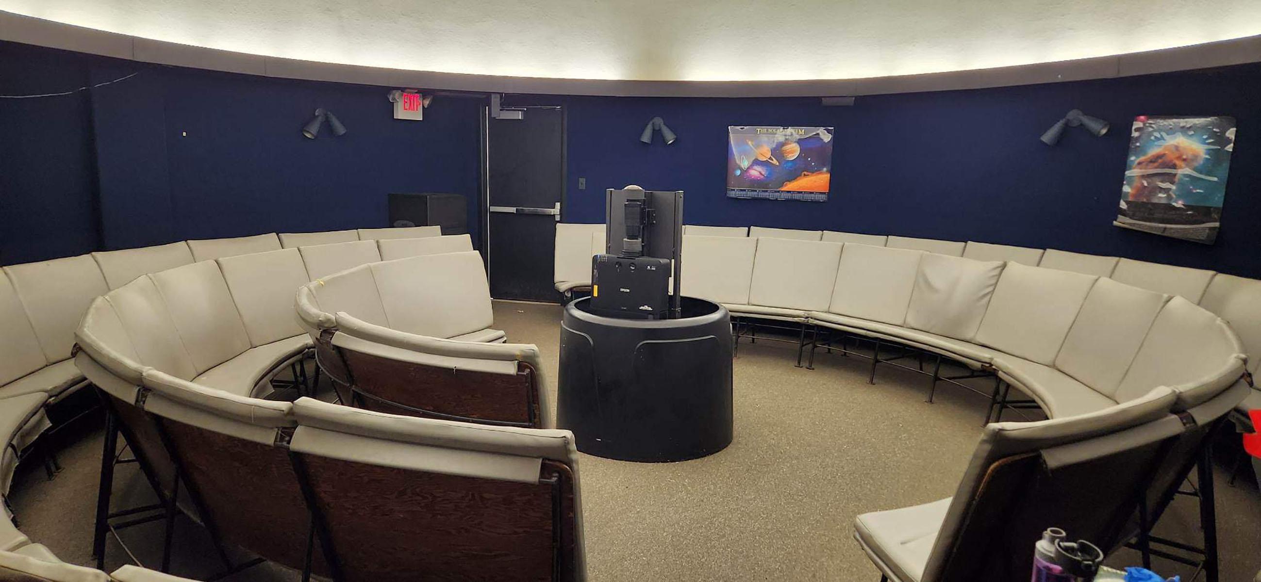
The Nature Center is home to our Planetarium and nature exhibit area which features displays of plants and animals that can be found in the park. Most of Rock Creek park's public and educational programs begin at the Nature Center.
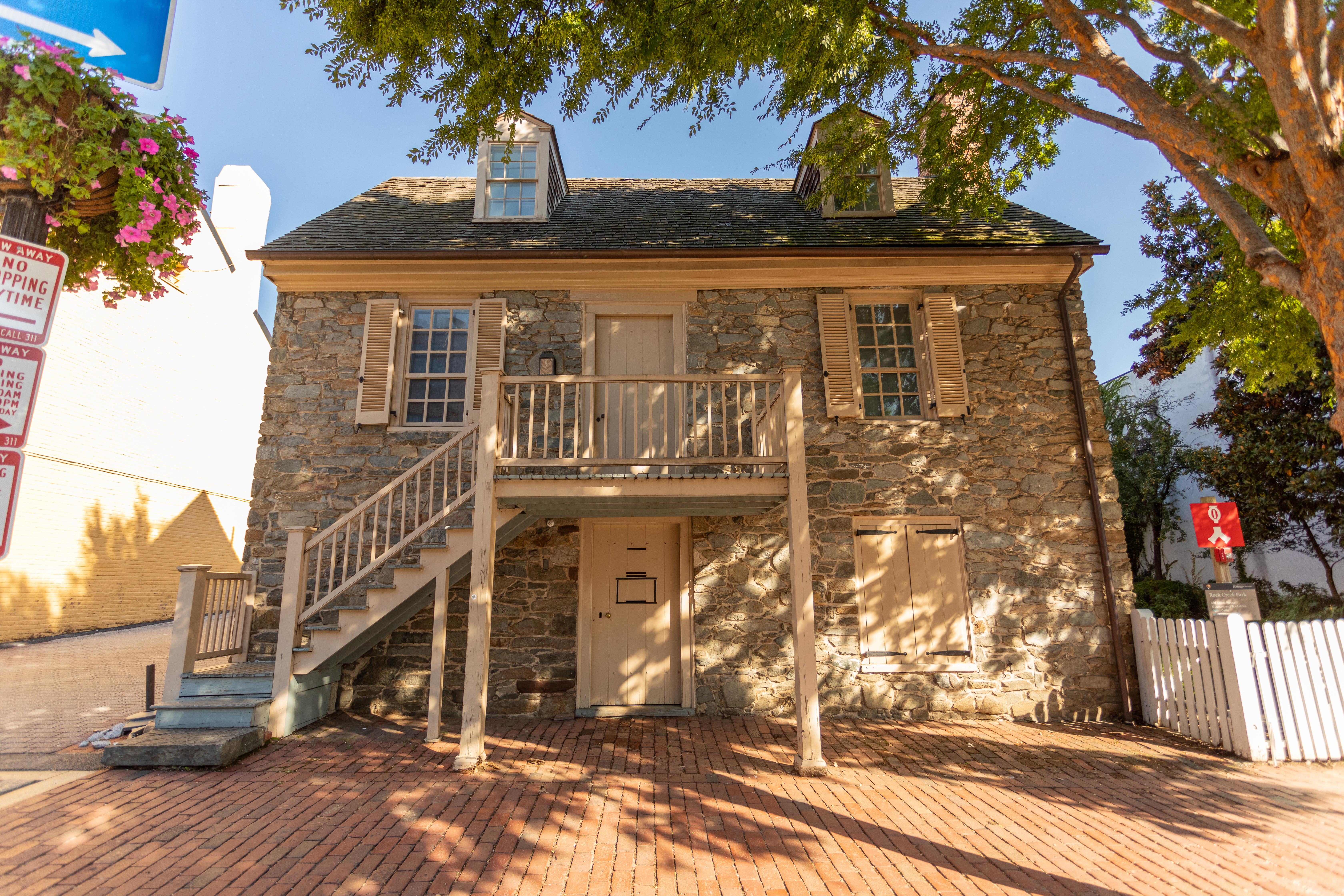
Built circa 1766, Old Stone House is the oldest structure on its original foundation in Washington, DC. Old Stone House is open for visitors at the hours listed below. The grounds are open according to general park hours (sunrise to sunset).
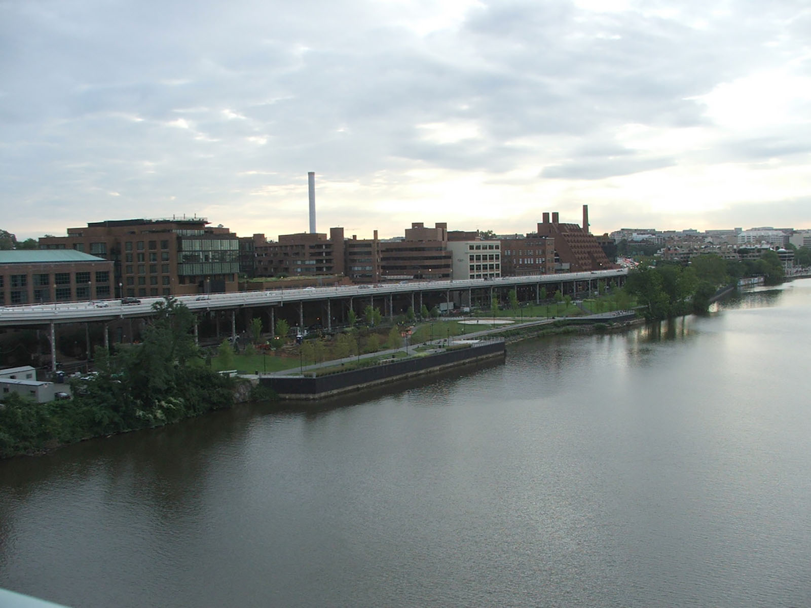
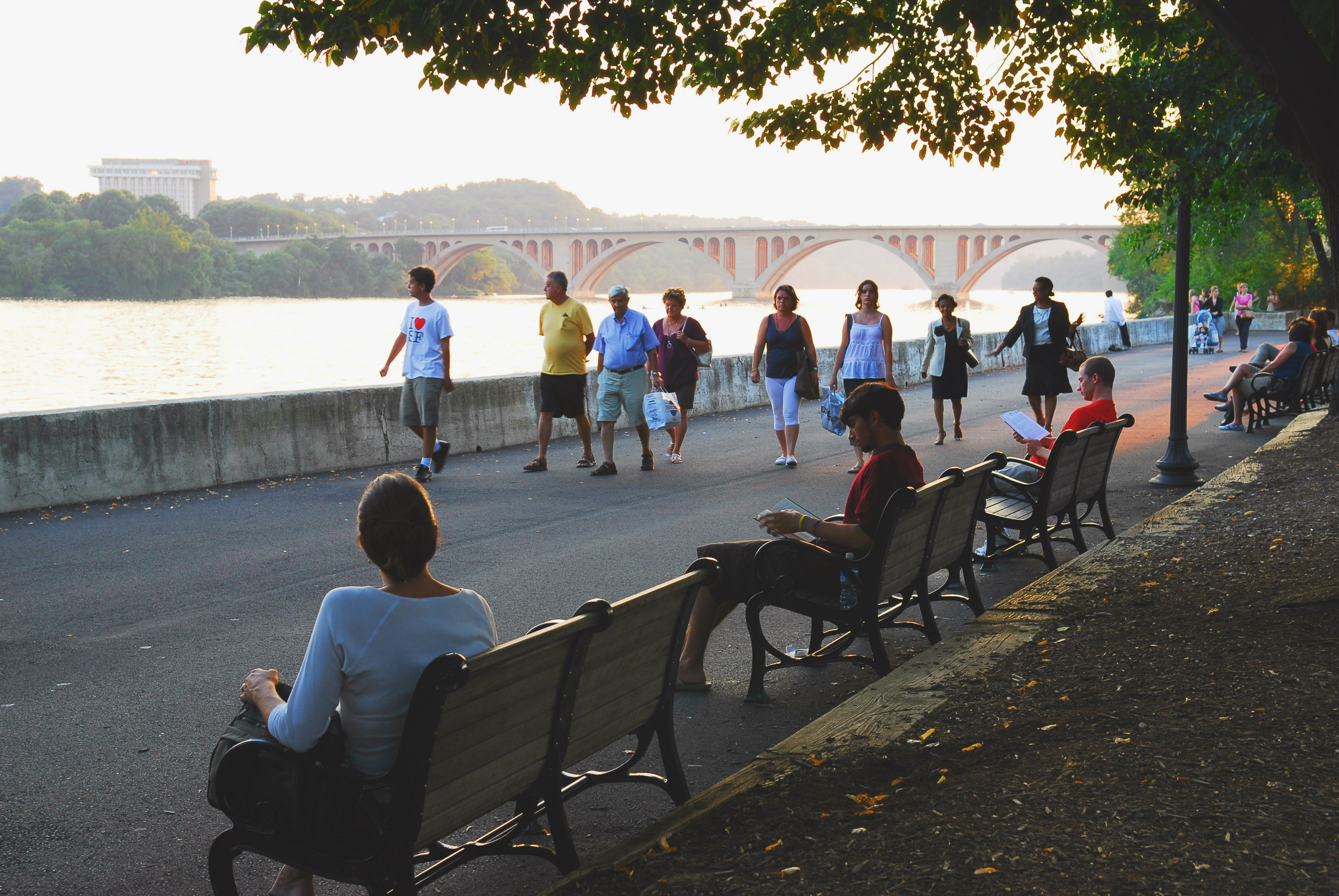
Explore the Georgetown Waterfront and imagine the changes the space has gone through.
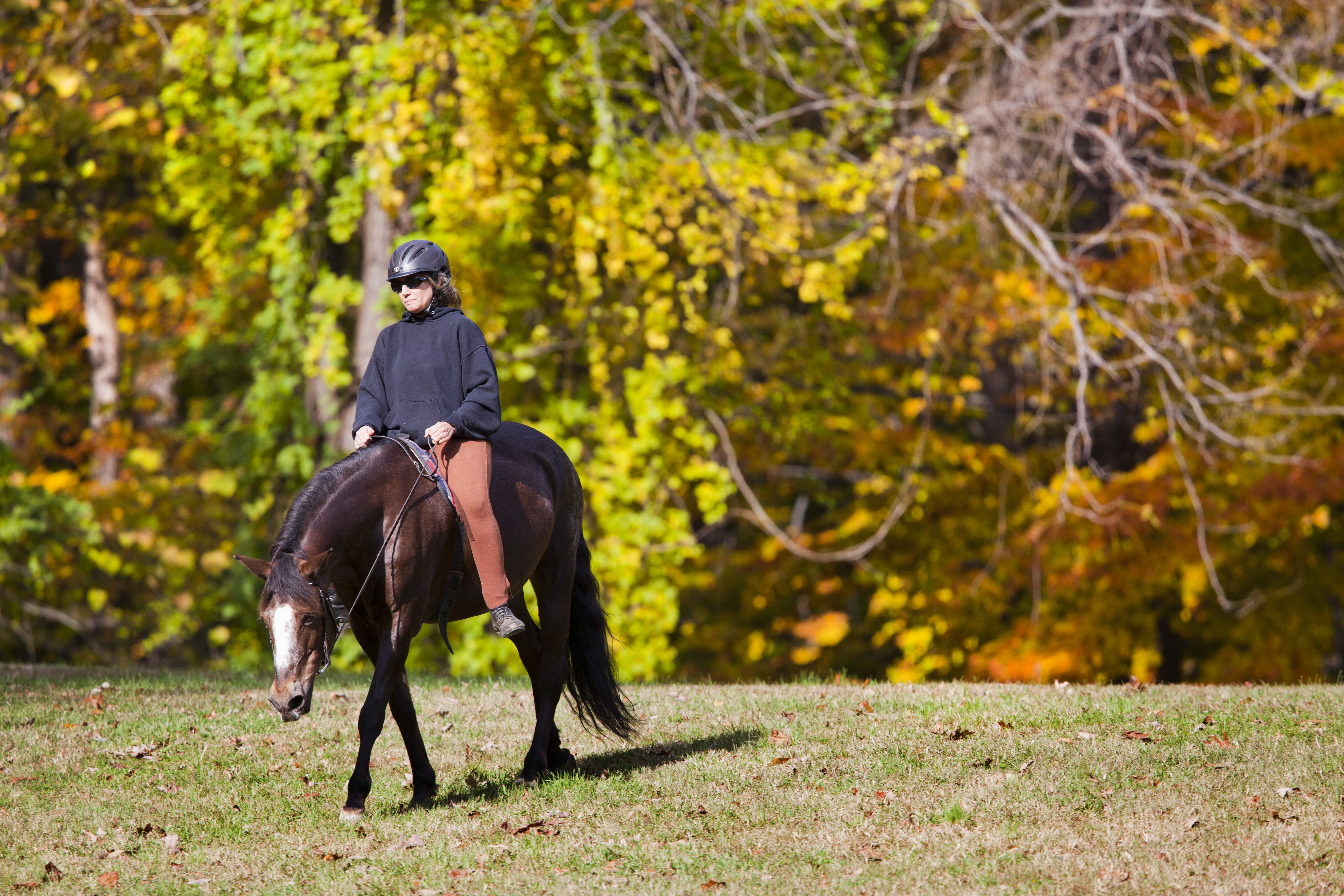
Horseback Riding in Rock Creek Park
For the horseback rider, 13 miles of dirt and gravel bridle paths crisscross the park.
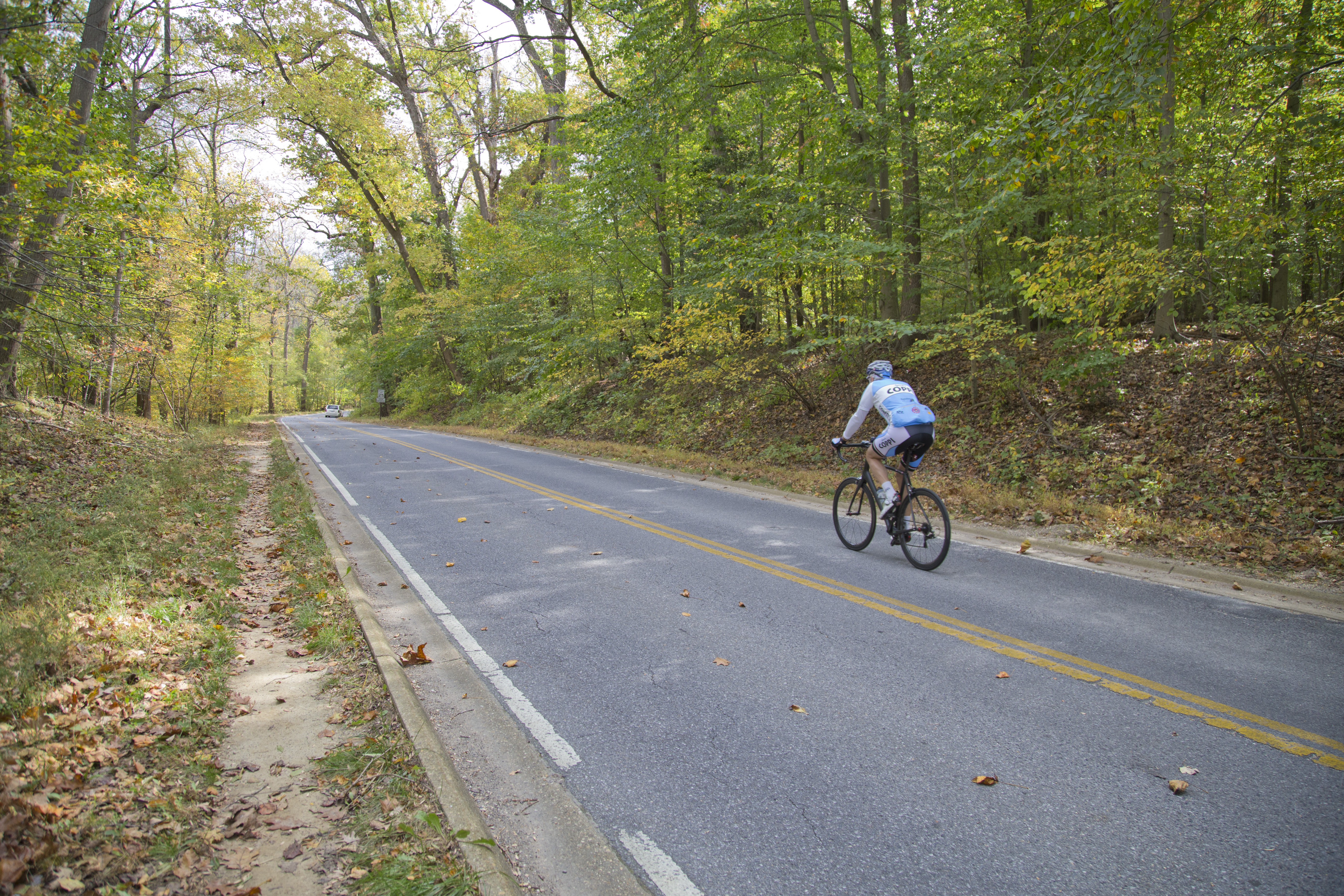
Biking in Rock Creek Park
Bicycling is permitted on paved surfaces in Rock Creek Park.
Red Line - DC Metro
Embrace the outdoors, explore interactive exhbits and stand where history happened by taking the Red Line to visit some of DC's National Park Sites. Each of the parks listed here are 1 mile or less from each metro stop (about a 20 minute walk) or a 10 minute bus ride away.
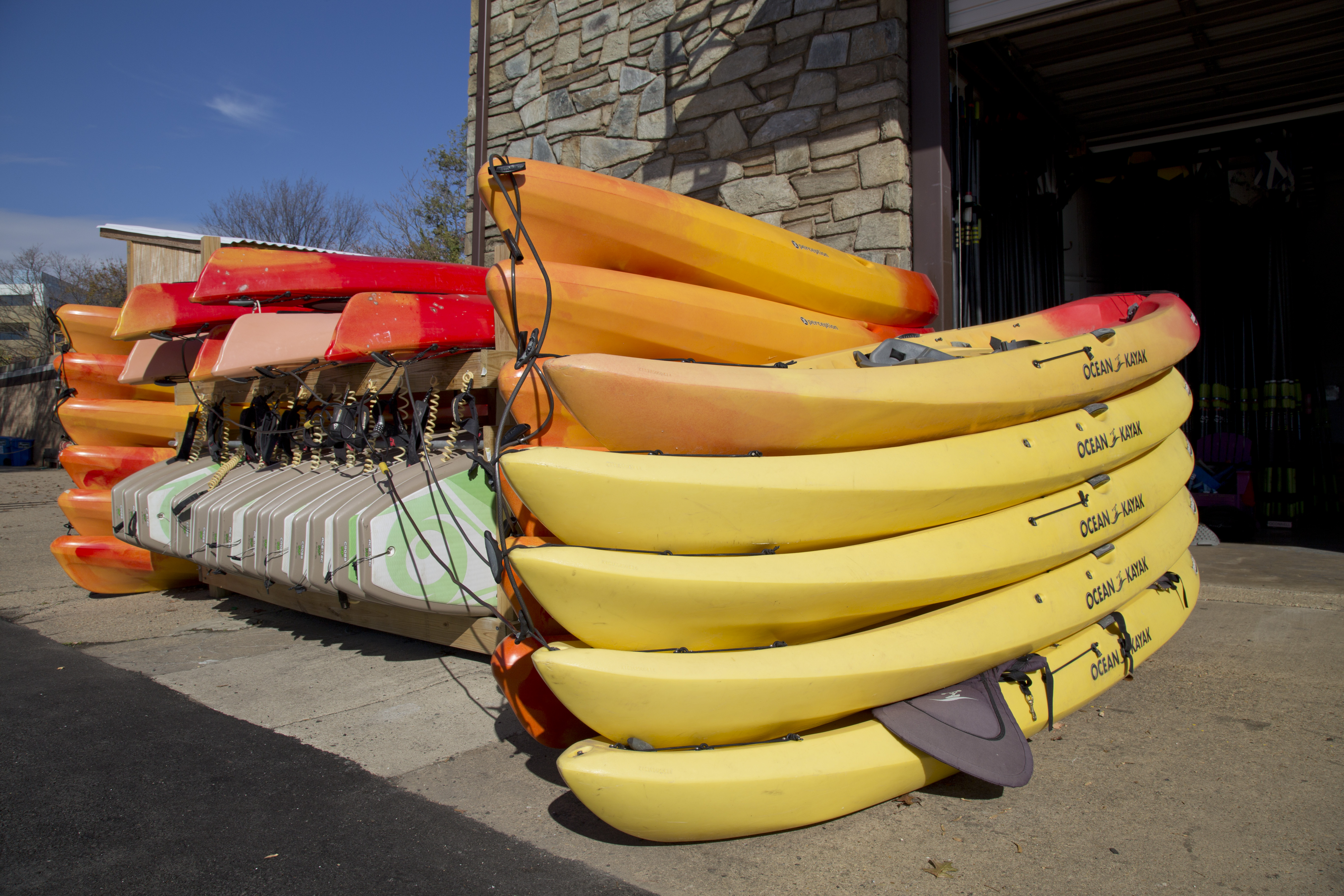
Boating in Rock Creek Park
Rent kayaks, canoes and stand up paddle boards from one of two boat houses along the Potomac River.
Visit the Planetarium
Learn about the night sky in the Rock Creek Park planetarium.
Milkhouse Ford Hike
This 1.75-mile loop hike offers a glimpse into Washington, DC’s history—a Civil War fort, poet’s cabin, and historic creek crossing (or ford).
Rapids Bridge Hike
This 2-mile loop hike takes you through the forest and then parallels scenic Rock Creek before heading back uphill.
Multi-Park Loop
Park your car and stretch your legs! Visit four different National Parks in Washington, DC and begin logging miles on seven different National Historic or National Scenic trails!
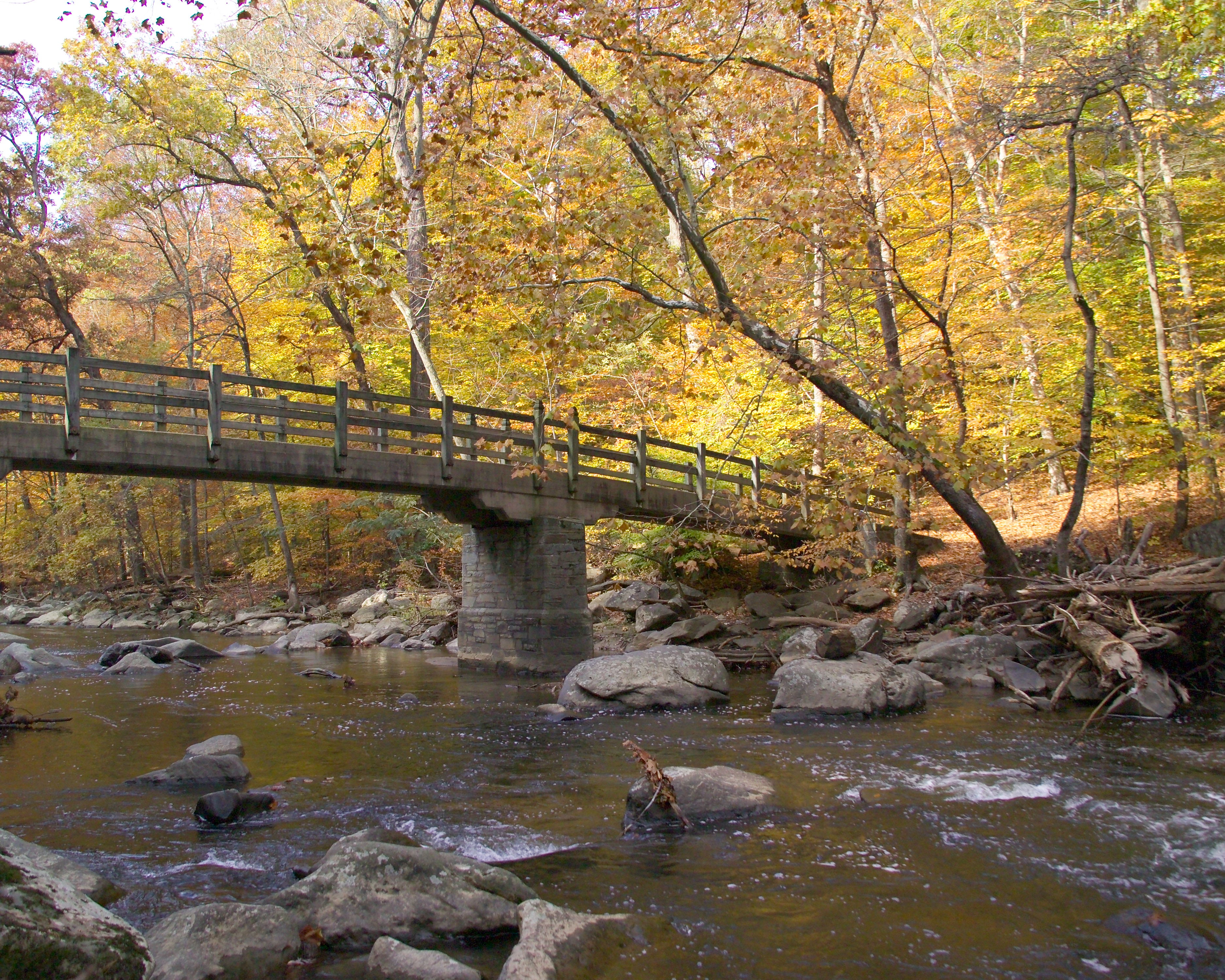
Boulder Bridge Hike
Hike the 3.5-mile Boulder Bridge Loop from the Rock Creek Park Nature Center to one of the most iconic places in Rock Creek Park
Hike the Southern Loop in Rock Creek Park
The Southern Loop provides visitors with an almost 5-mile loop to explore the deciduous forests of the Western Ridge and provides numerous opportunities for varying terrain on the return trip to their vehicles.
Hike the Northern Loop in Rock Creek Park
Enjoy an easy 5-mile round trip hike around the northern section of Rock Creek Park.
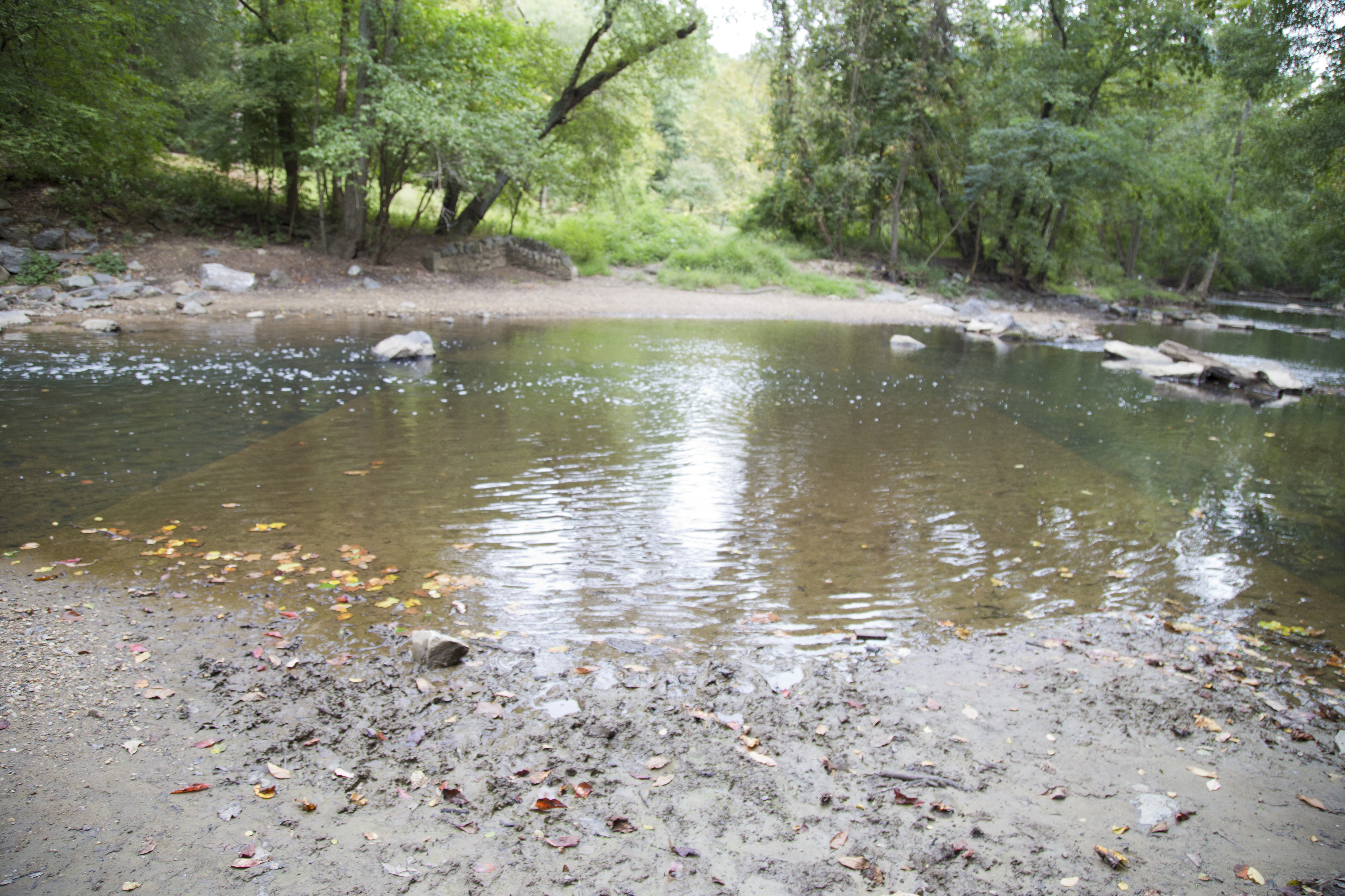
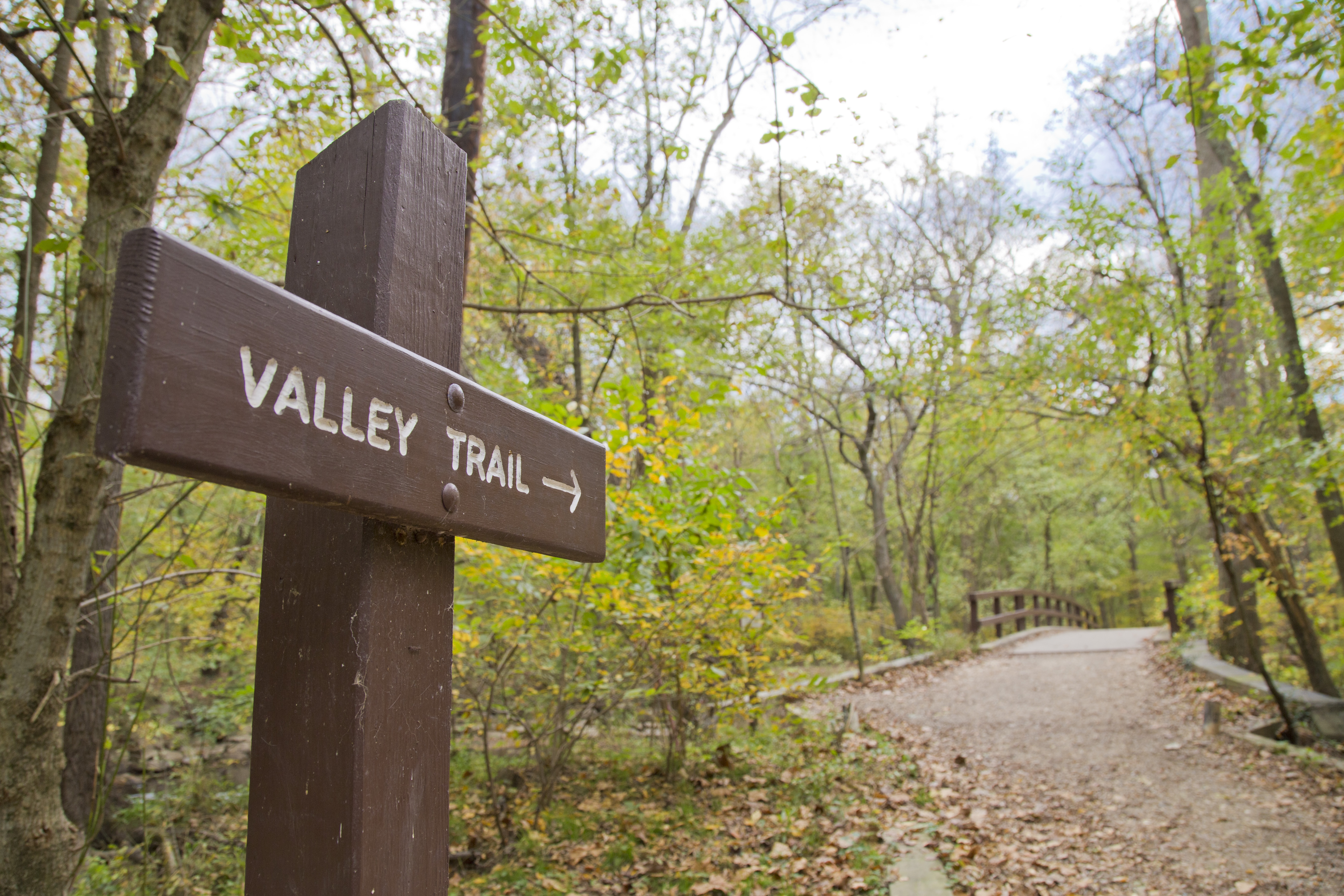
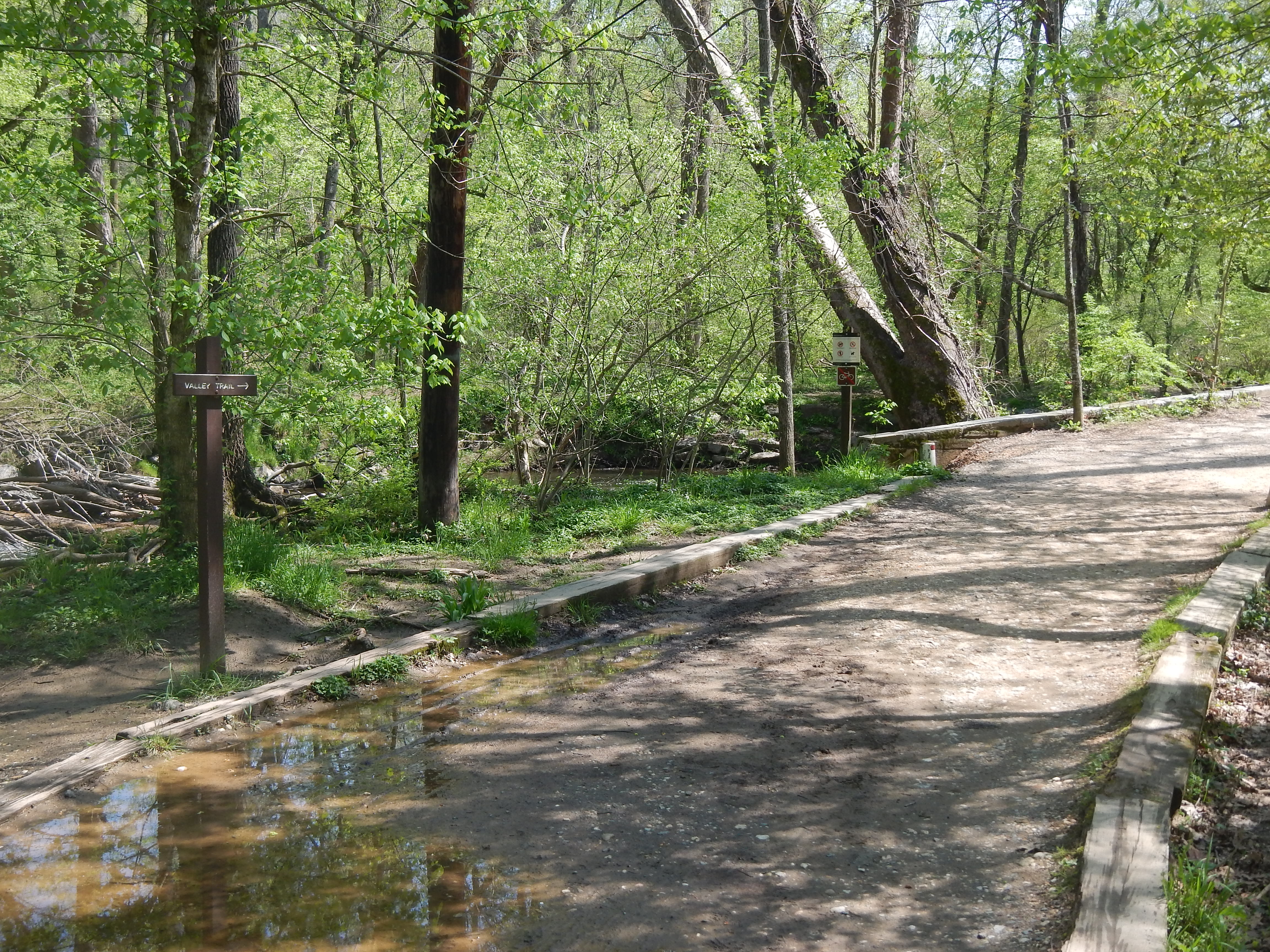
Hike the Valley Trail
The Valley Trail stretches for five miles down the east side of Rock Creek Park from Boundary Bridge to a spot near Peirce Mill and Picnic Grove #1.
Bridge Loop Trail
This 8-mile loop hike will take you on an adventure through the northern section of Rock Creek Park. In addition, you will cross over five of the named bridges that cross Rock Creek.
Golf in DC's National Parks
Visit one of three golf courses at National Parks in Washington, DC
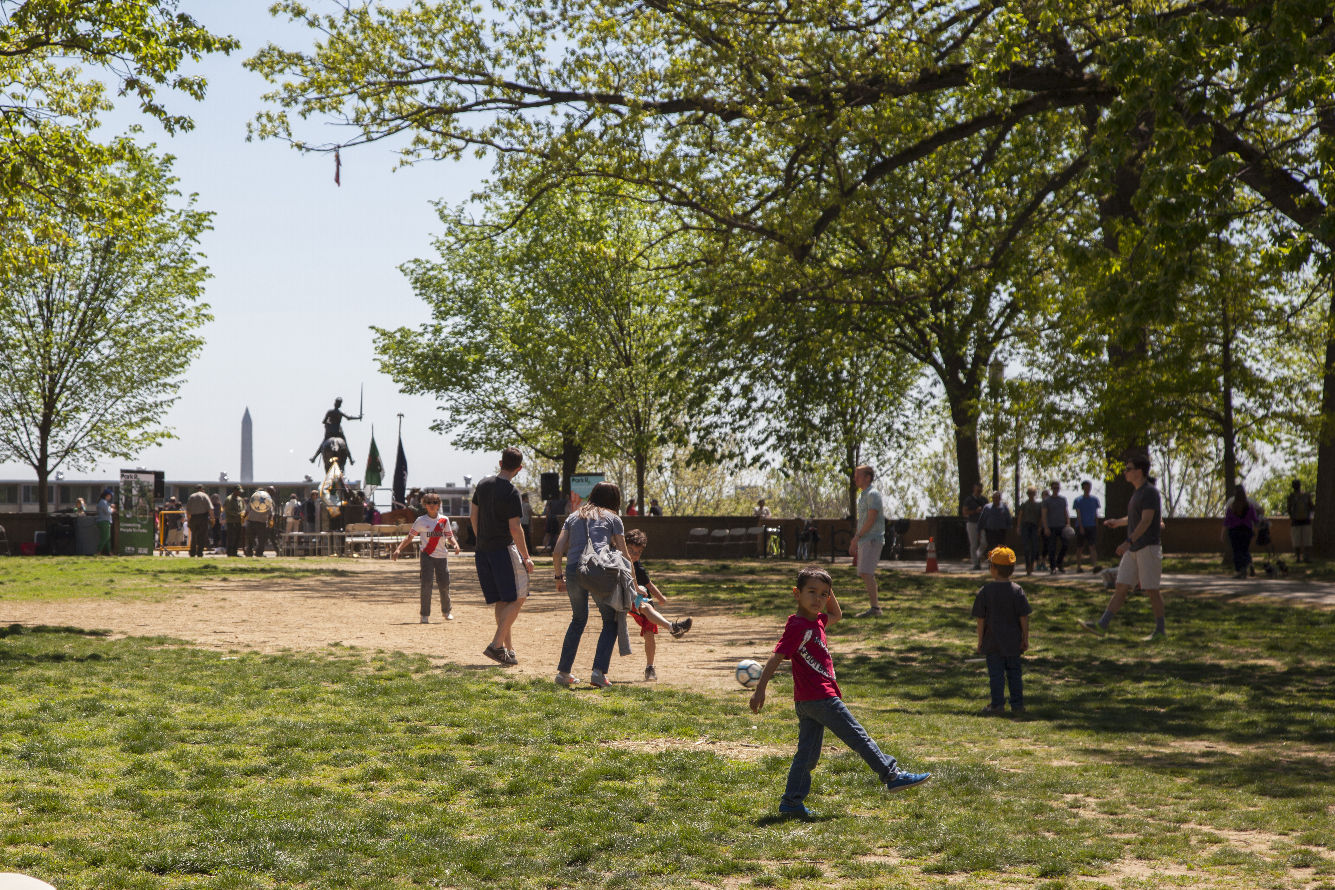
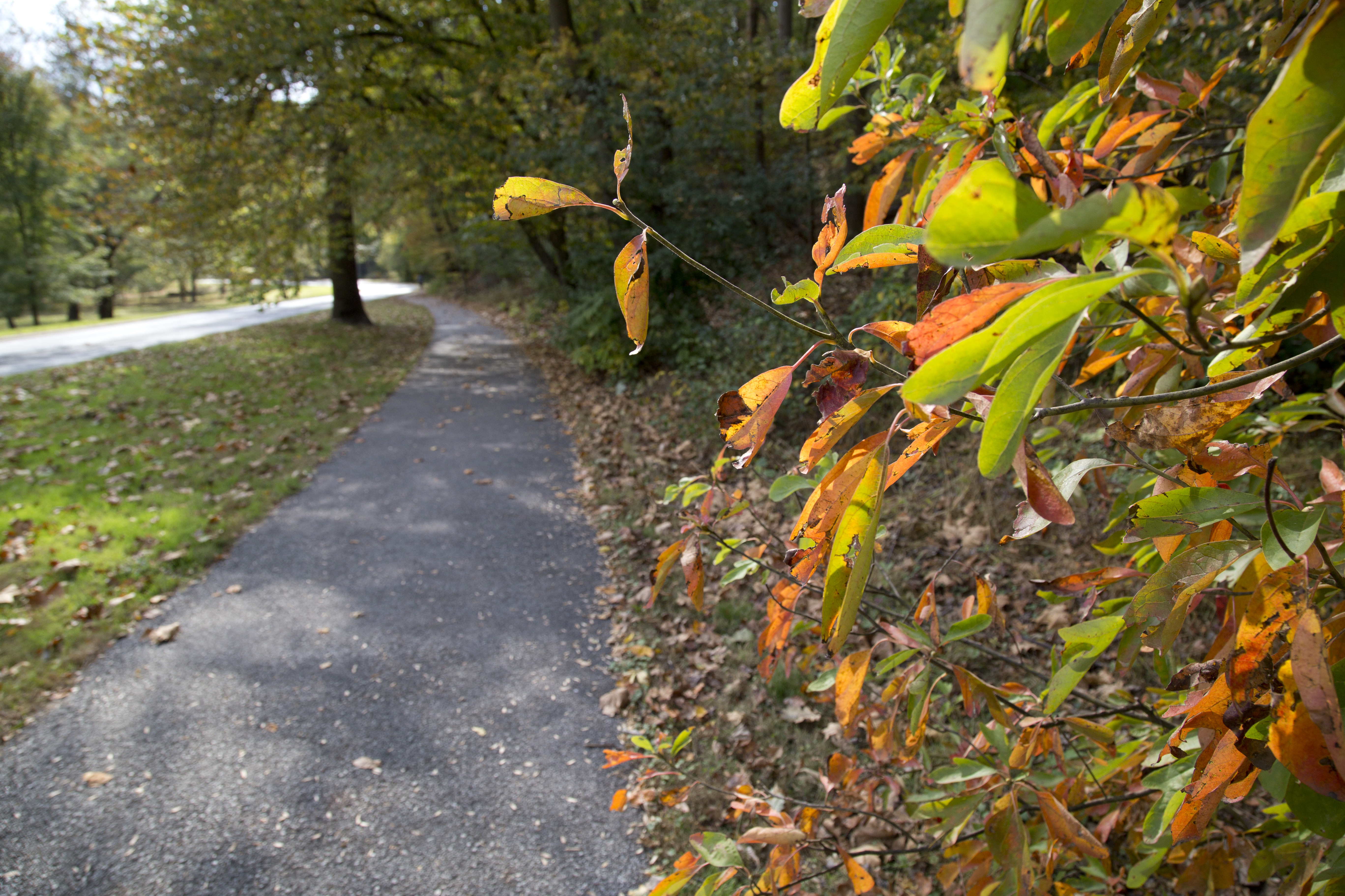
Explore the Outdoors at Rock Creek Park
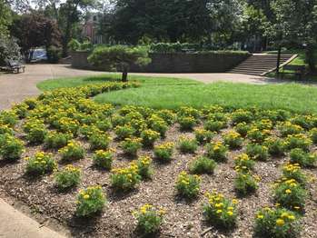
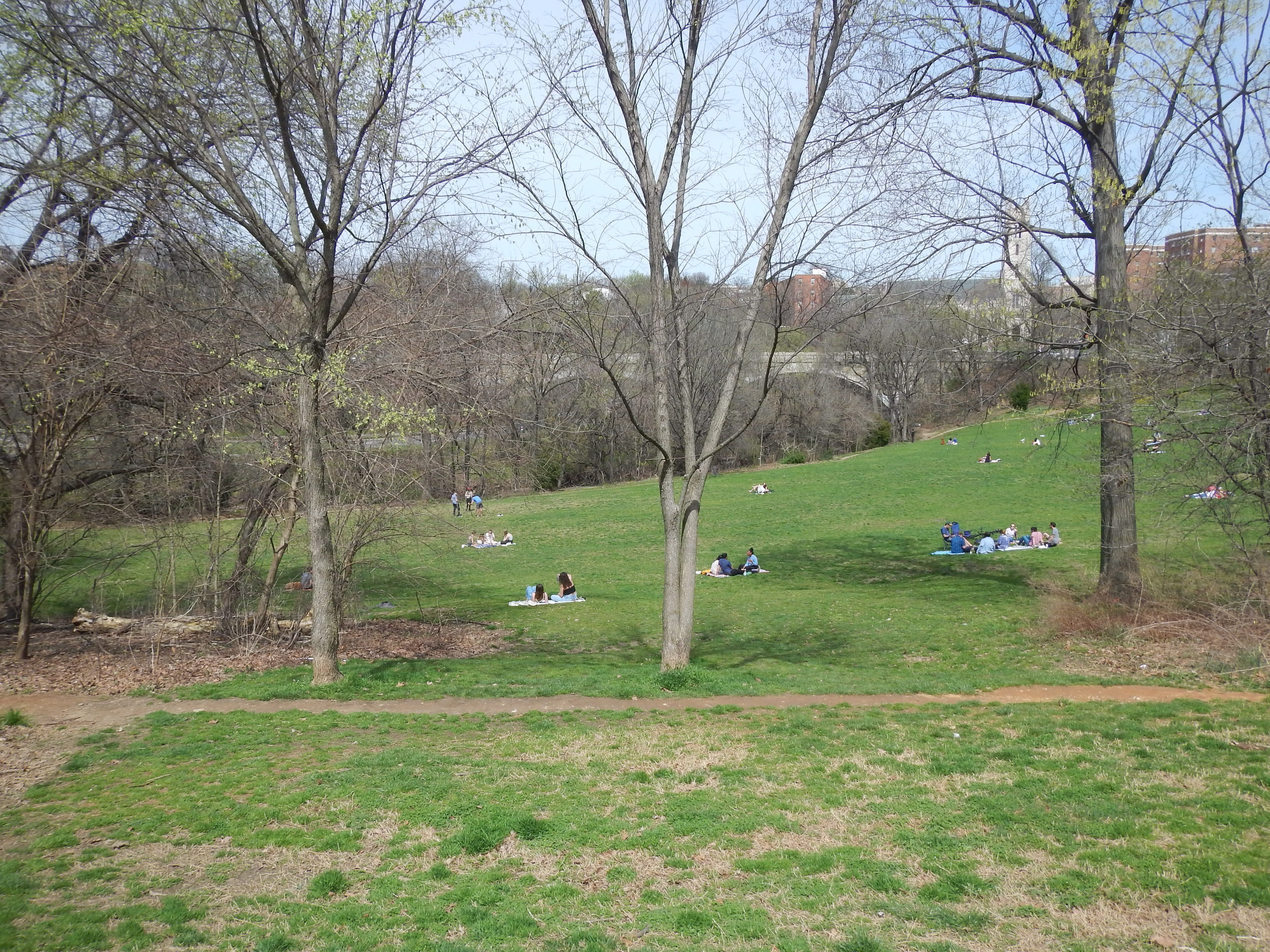
Rock Creek Park is truly a gem in our nation's capital. This park offers visitors the opportunity to escape the bustle of the city and find a peaceful refuge with majestic trees, wild animals, fresh air, recreational opportunities, and thousands of years of human history.
Discover Meridian Hill Park
Meridian Hill Park was designed and built between 1912 and 1936, and has been under the jurisdiction of the National Park Service since 1933.
Tennis in Rock Creek Park
Open play courts are available at Montrose Park, Francis Field off of 23rd St NW, as well as being the home to the Rock Creek Park Tennis Center.
7-mile Hiking/Biking Loop
This 7-mile trek is fully accessible and utilizes closed roads and multi-use trails in the park. Steep descents and sharp turns can make this a challenging and fun ride for everyone.
Spring Ephemeral Hike
Enjoy a 1.5-mile hike through the northern floodplain of Rock Creek Park and look for spring ephemerals.
3-Mile Rolling Meadows Bridge Hike
This trail allows visitors to make the choice between the more rugged Valley Trail and the multi-use paved trail. Park visitors can enjoy creek views and a gentle walk through the forest.
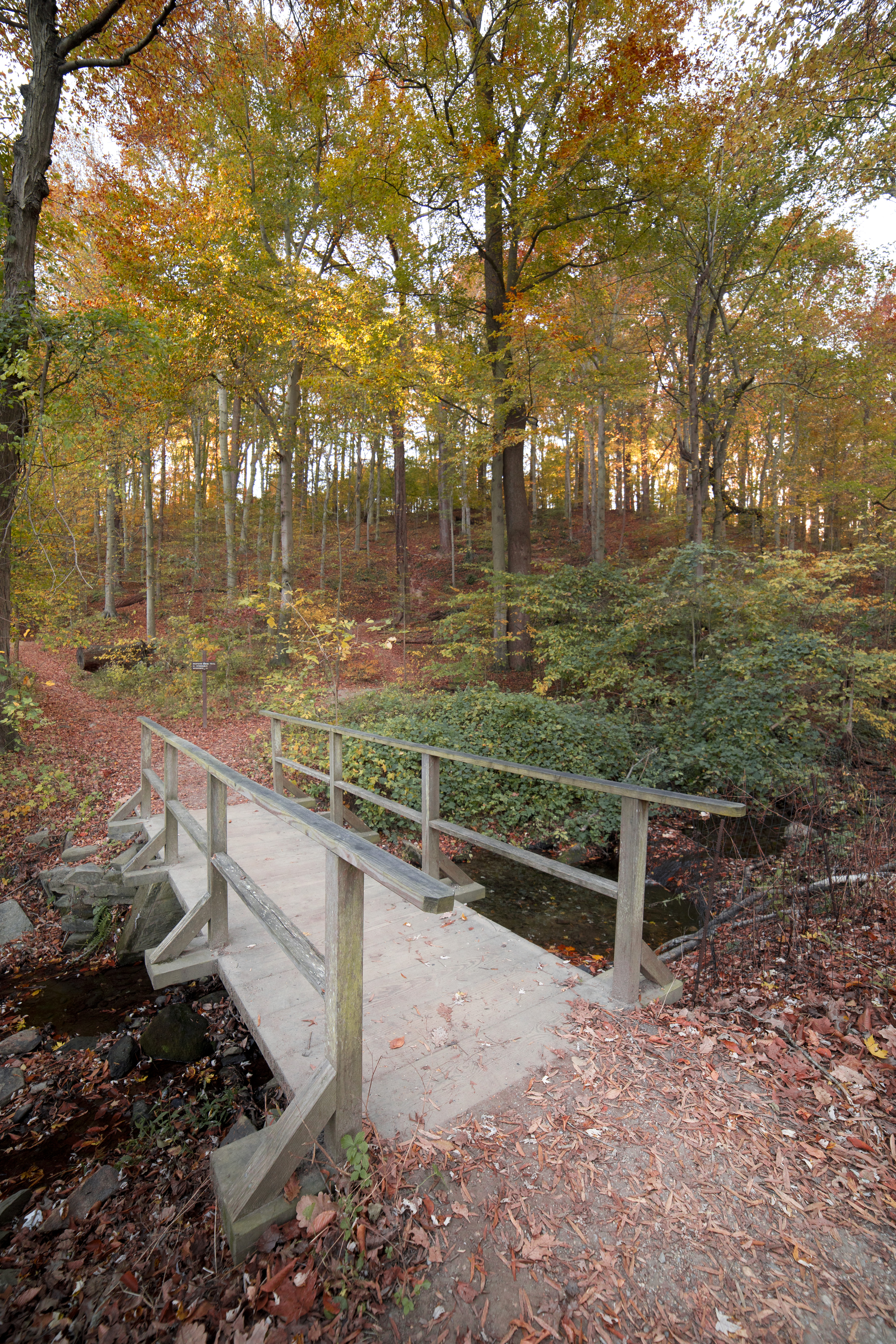
Hike the Western Ridge Trail
The Western Ridge Trail has green trail markings and runs the length of the park north to south.
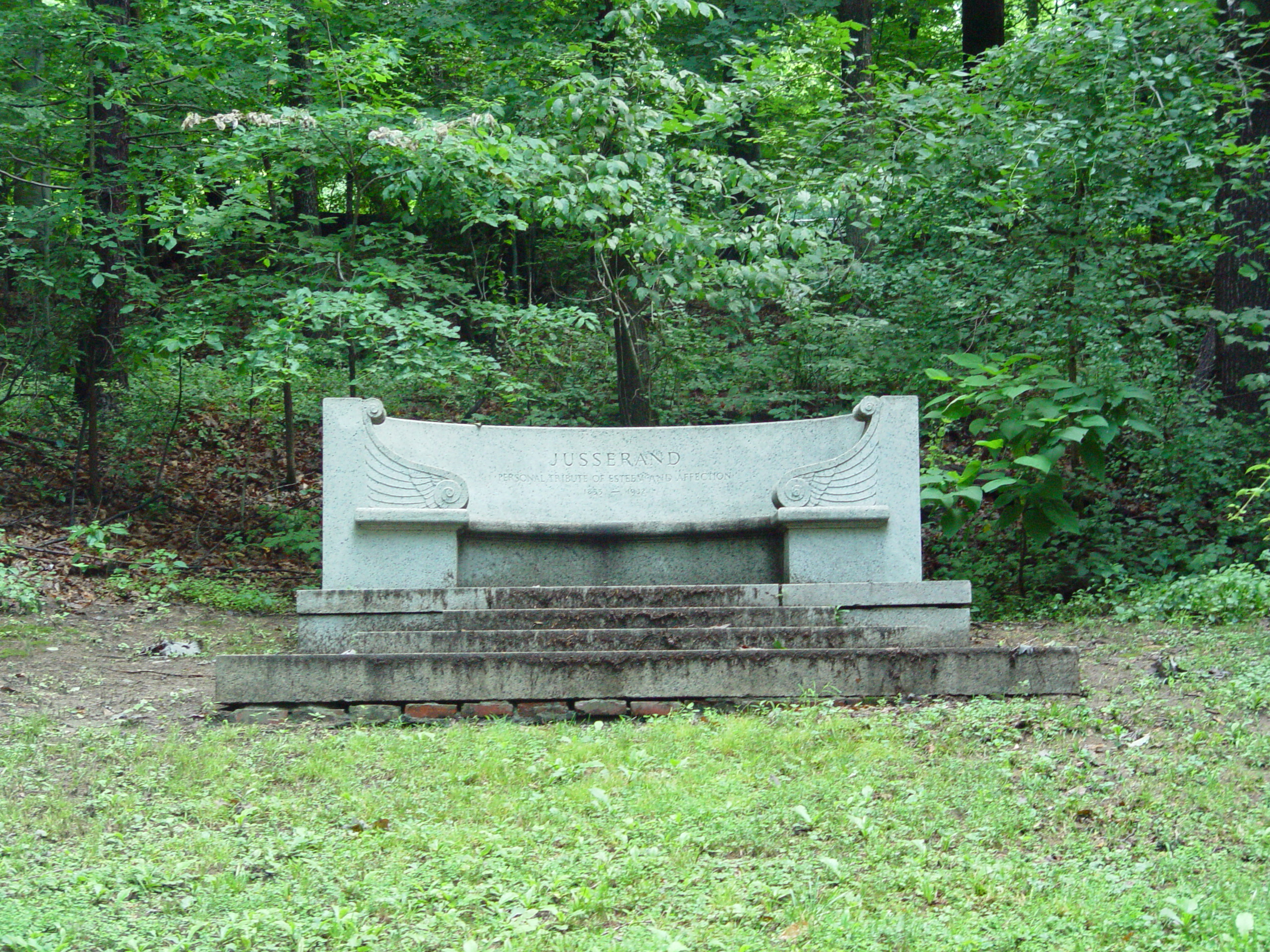
Jusserand Memorial Loop
Follow in the steps of President Roosevelt and French Diplomat Jean Jules Jusserand on this rigorous five mile hike. See the first memorial dedicated to a foreign diplomat erected on federal property.
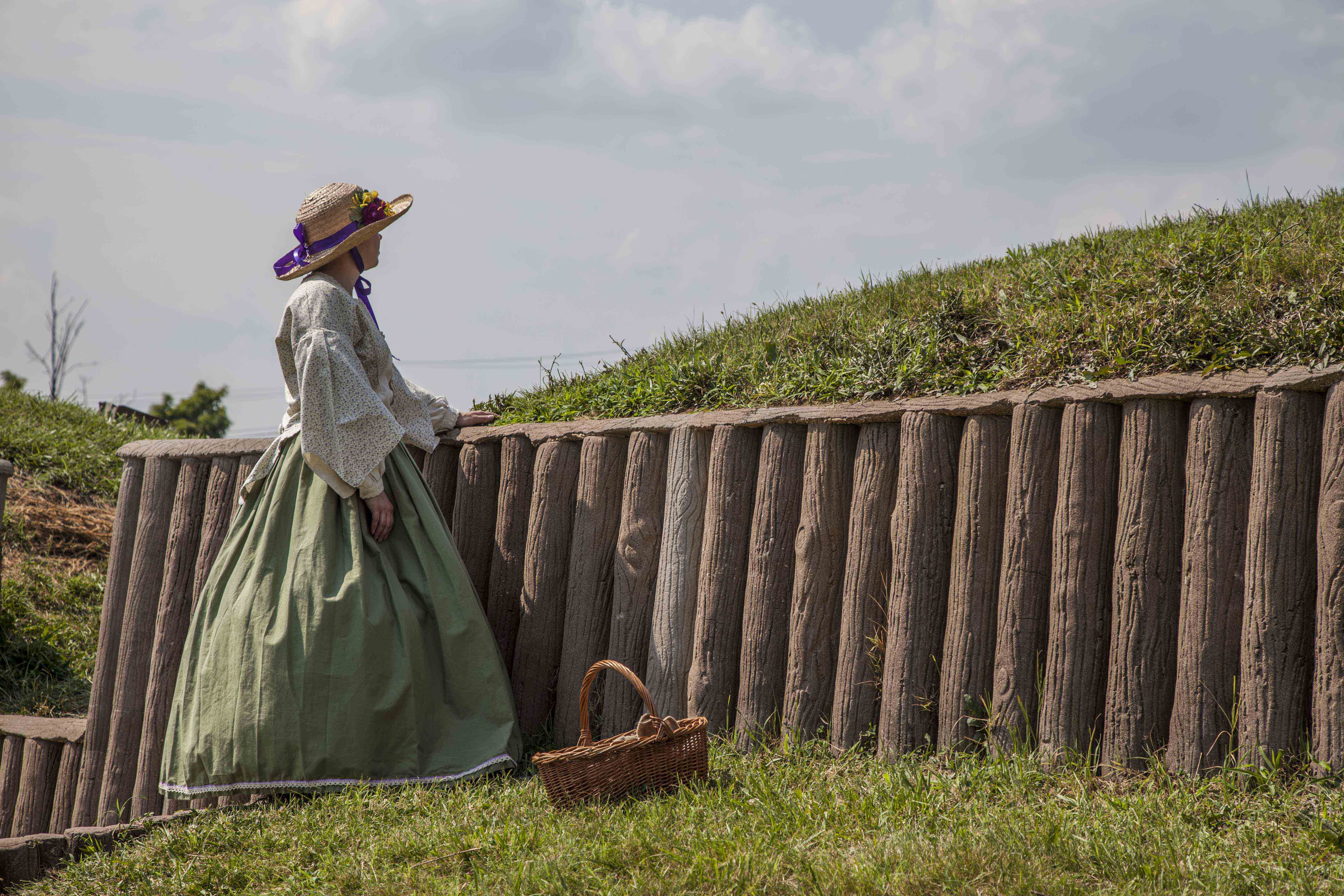
Survey Fort Stevens
Take a step back in time and imagine the sights and sounds of the Civil War at a Civil War Defense of Washington. Fort Stevens, now partially restored, was built to defend the approaches to Washington from the 7th Street Pike (now Georgia Avenue) which was then the main thoroughfare from the north into Washington.
Wander Through Georgetown Waterfront Park
Georgetown Waterfront Park stretches along the banks of the Potomac River
Tours
Count: 6
After Emancipation- life in the Rock Creek Valley
Explore Rock Creek Park through the stories of those formerly enslaved and the lives they built in what would become the park.
Boulder Bridge Loop Hike
Follow this 4-mile long trail through Rock Creek Park to the iconic Boulder Bridge and back to the Rock Creek Nature Center
Explore the historic Herring Hill neighborhood of Georgetown
Historically, the area of Georgetown South of P Street (between 29th Street NW and Rock Creek) was known as Herring Hill. The area was an historically African American neighborhood for almost 200 years until it was gentrified during the New Deal. Follow this tour to explore this historic neighborhood and contemplate the meaning of the word "community" and what it's loss can signify.
Meridian Hill Park
A tour of the features and informational panels within Meridian Hill Park.
Migration on Rock Creek
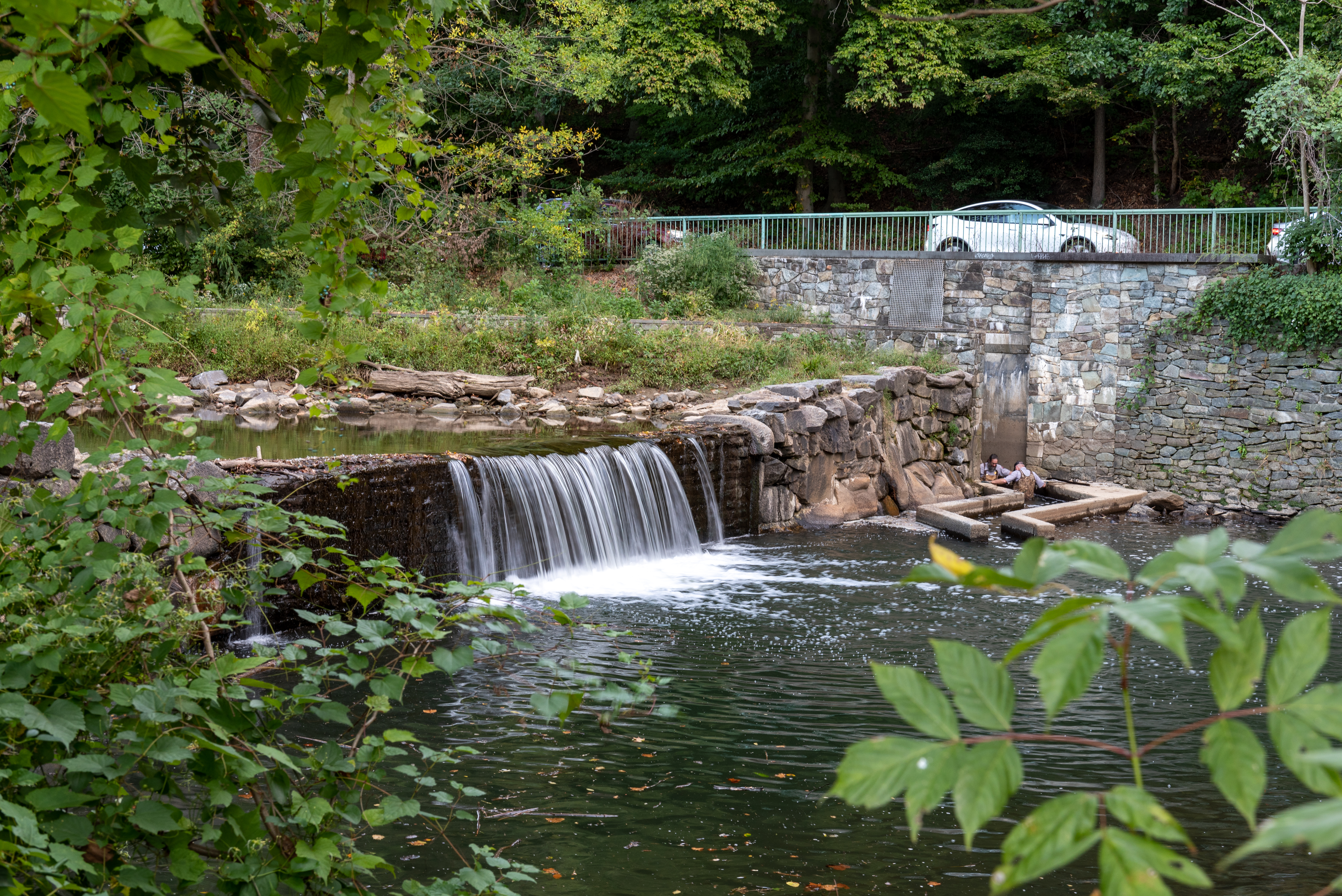
Learn about the annual migration of anadromous fish and how they navigate Rock Creek.
Milkhouse Ford Loop
This 1.75 mile hike takes park visitors to some of the historically significant sections of the park.