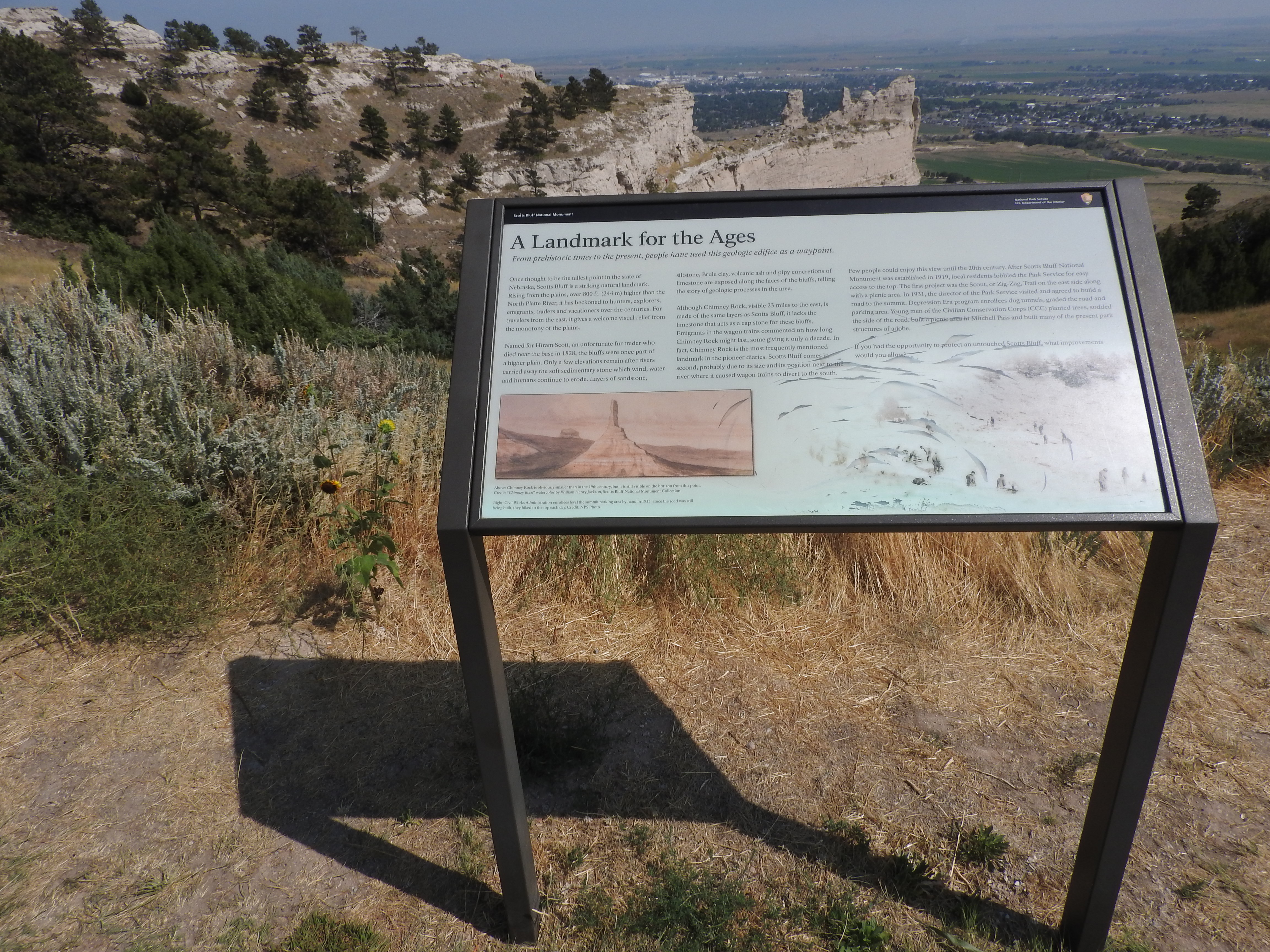
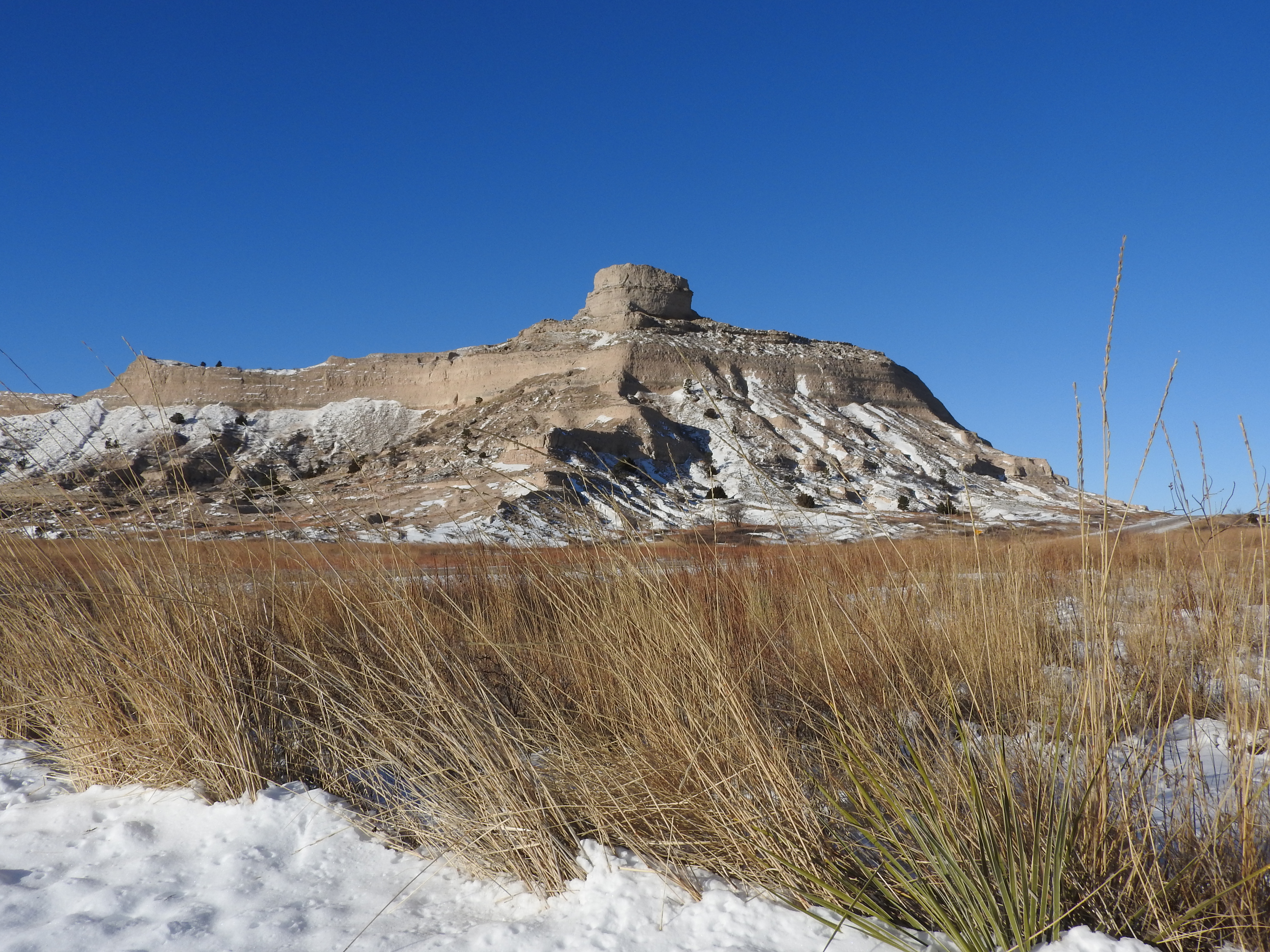
Towering 800 feet above the North Platte River, Scotts Bluff has served as a landmark for peoples from Native Americans to emigrants on the Oregon, California and Mormon Trails to modern travelers. Rich with geological and paleontological history...
Learn more about the development of the Scotts Bluff summit area.
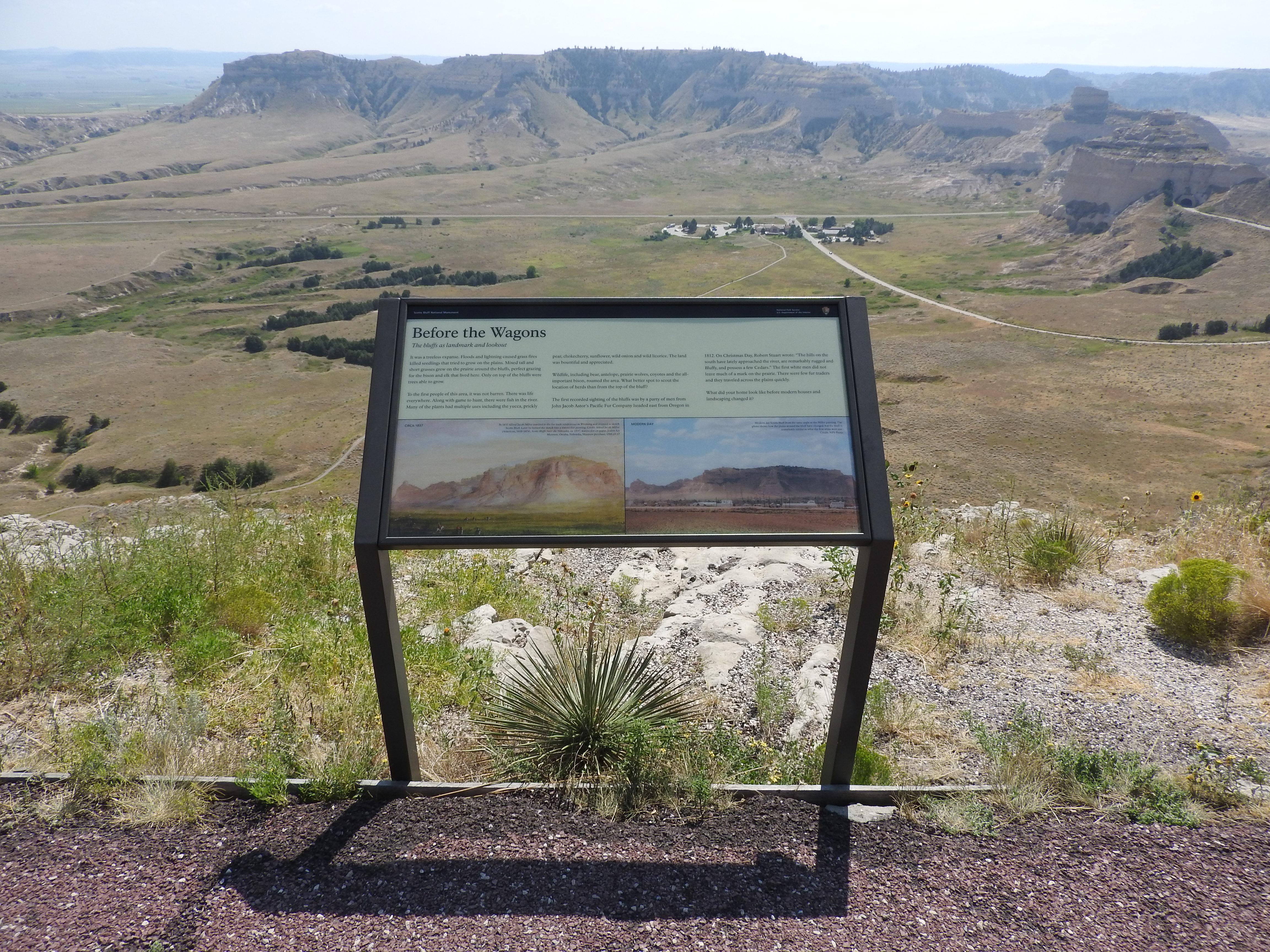
A wayside panel sits at the east edge of a parking lot. In the distance, beyond the panel a section of sandstone bluff can be seen. Beyond the sandstone bluff, lower elevations of the great plains can be seen along with several small communities and agricultural lands.
Learn more about how people have changed the prairie landscape of Scotts Bluff National Monument and the surrounding area.
Interpretive wayside sign in placed at the end of a paved, asphalt trail, at the edge of a cliff with a view overlooking Mitchell Pass, the monument visitor center complex, and a modern highway.
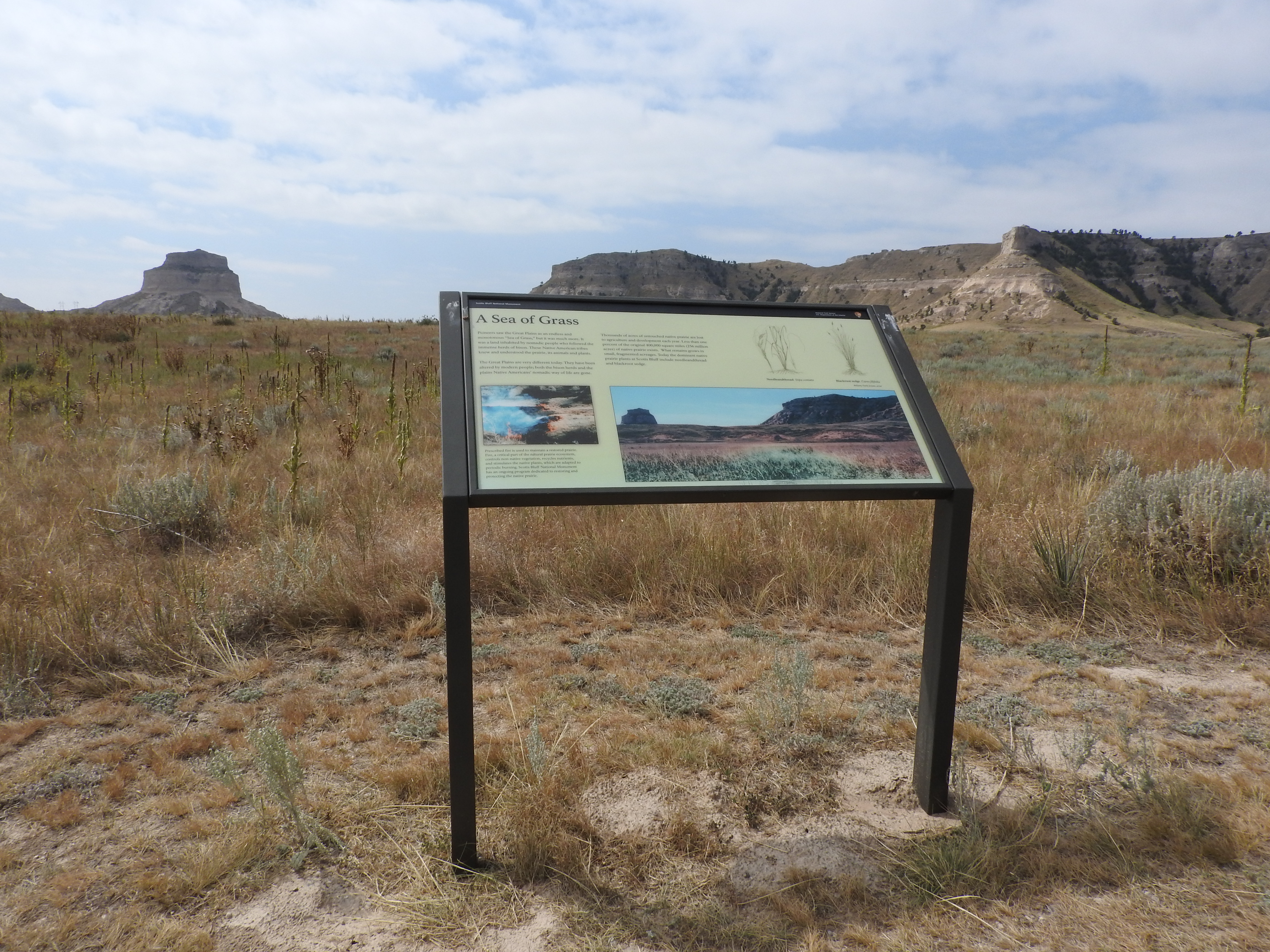
The wayside faces southeast toward an expanse of grasses, shrubs, and yucca. The distinctive sandstone formations, Dome and Crown Rocks, can be seen in the distance.
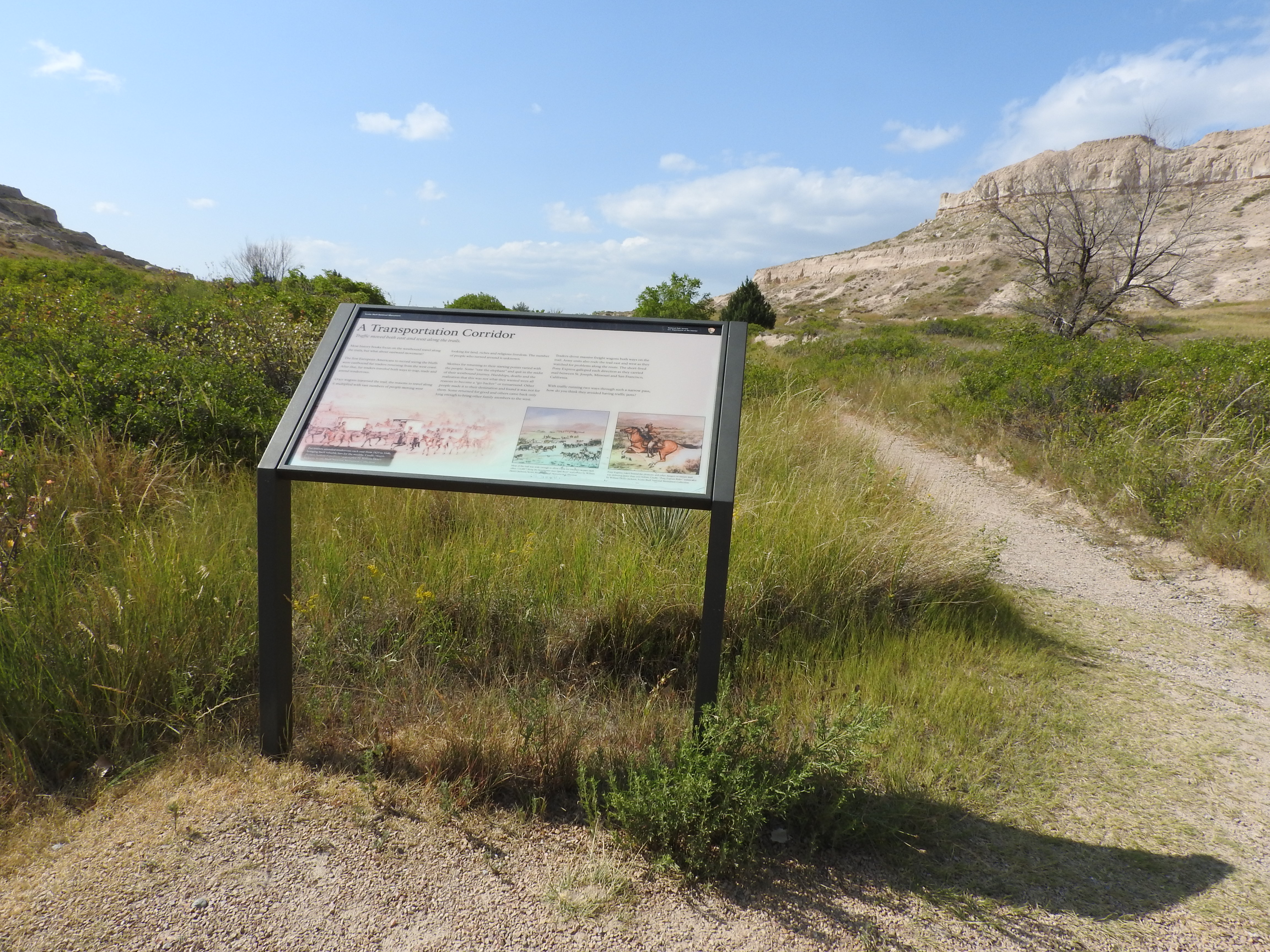
A wayside panel sits to the left of a gravel trail in the middle of a pass between two sandstone bluffs. Varied vegetation, including trees, shrubs and grasses, lines the sides of the trail.
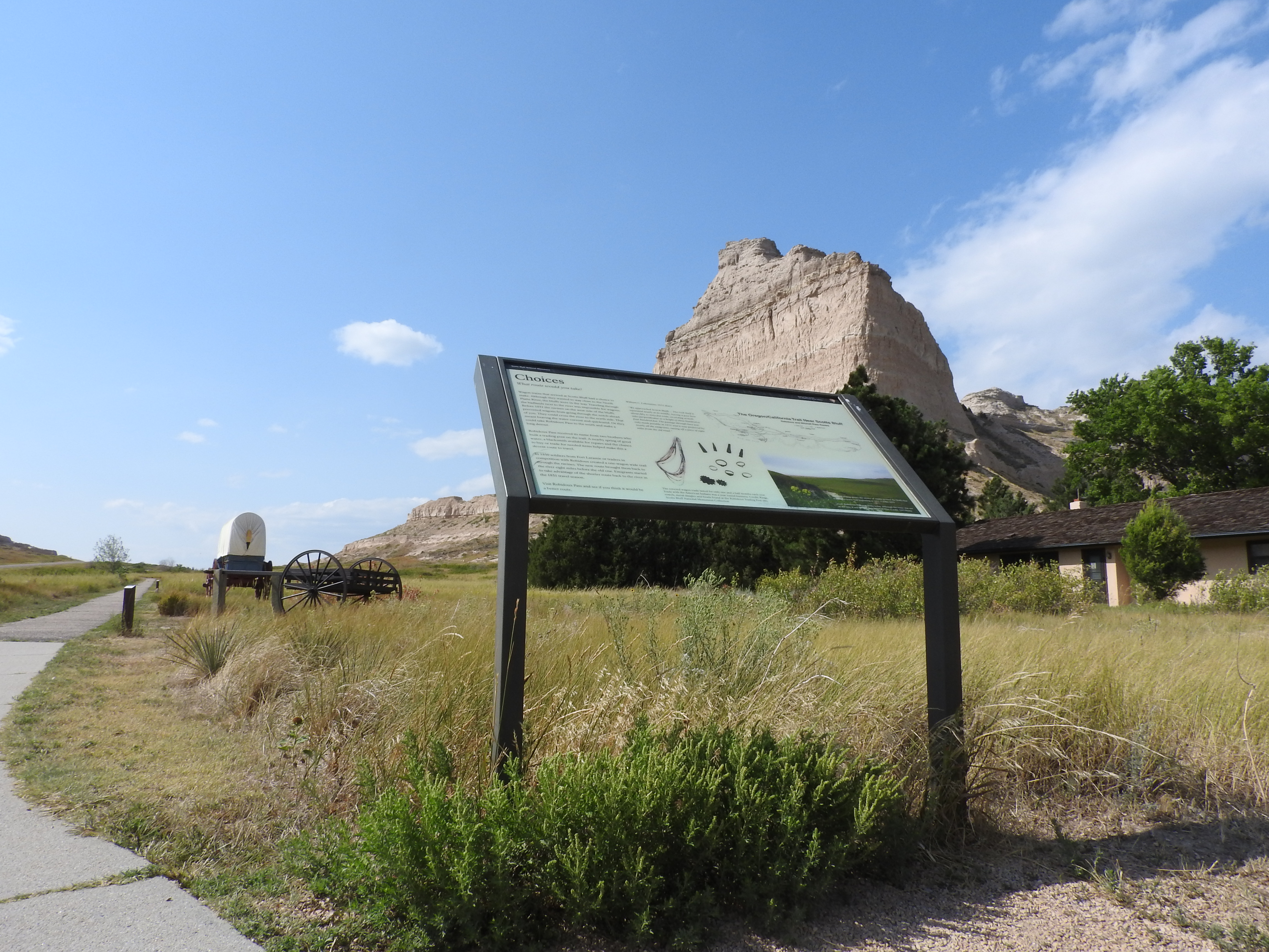
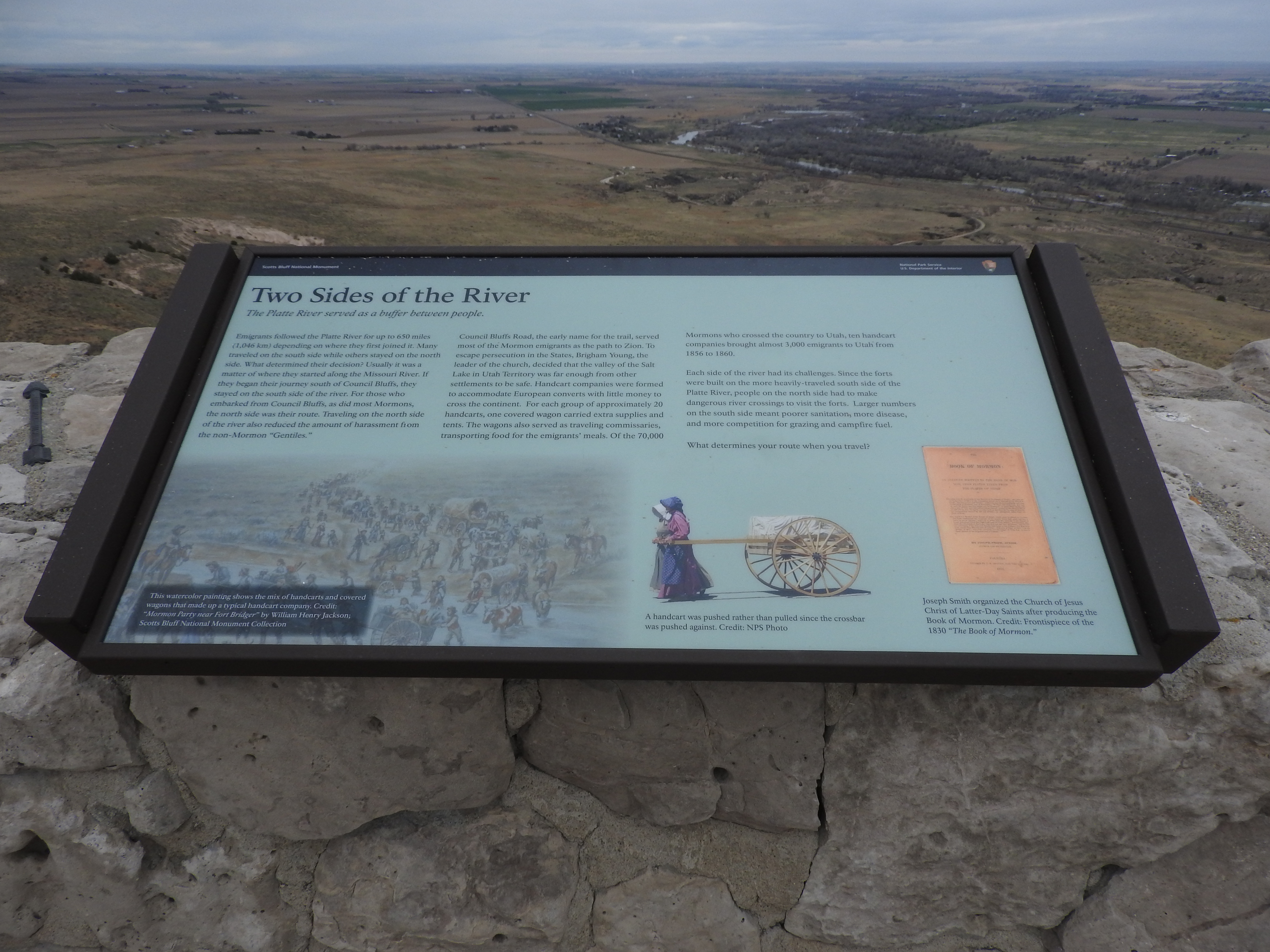
Learn about the factors that emigrants took into consideration when deciding on their route west.
A low profile wayside sits to the right of a trail paved with asphalt. Ahead can be seen sandstone bluffs on the right and left sides of a gap. A modern, paved road passes though the left side of the gap. The paved trail continues ahead in roughly the center of the pass.
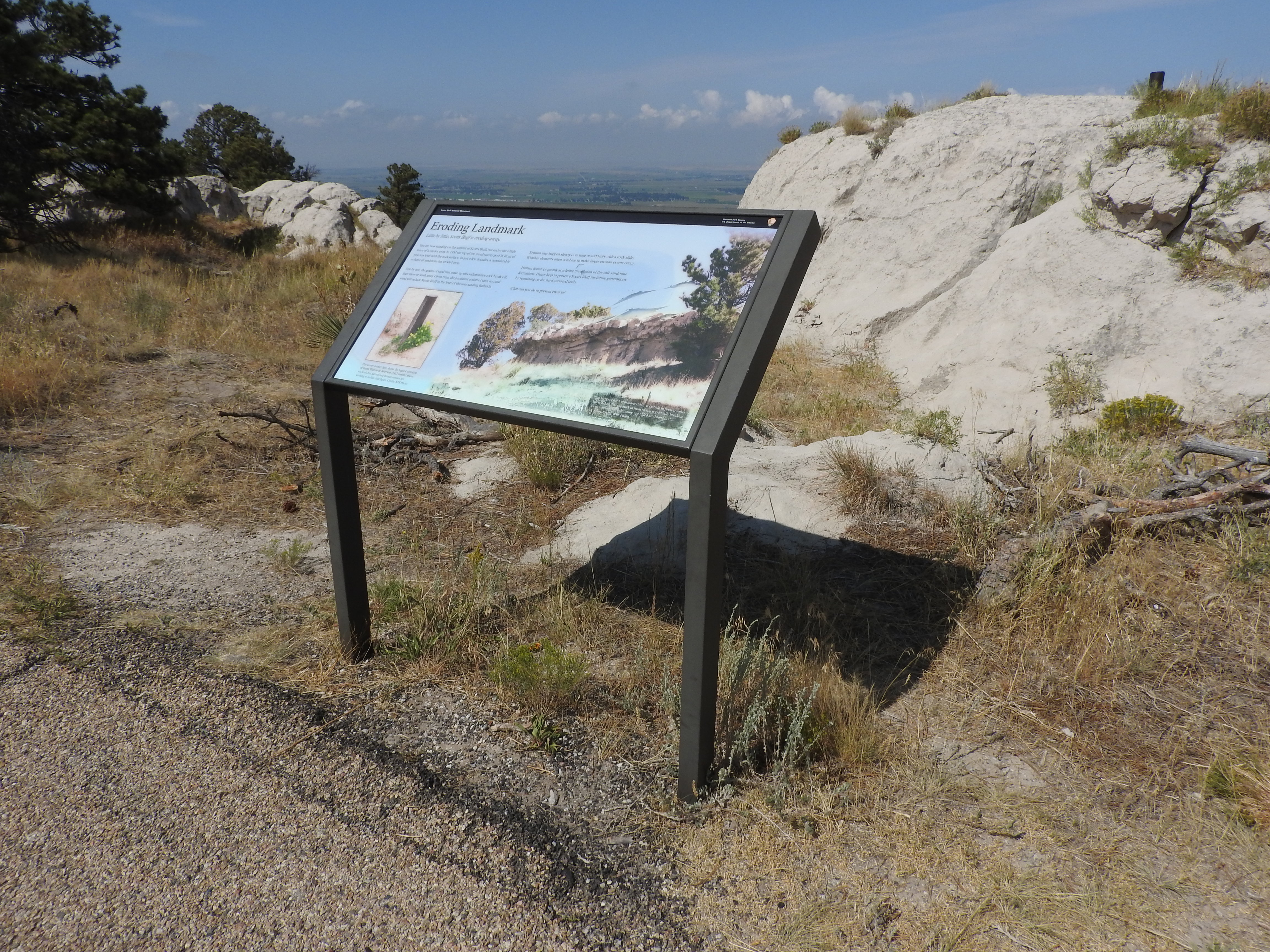
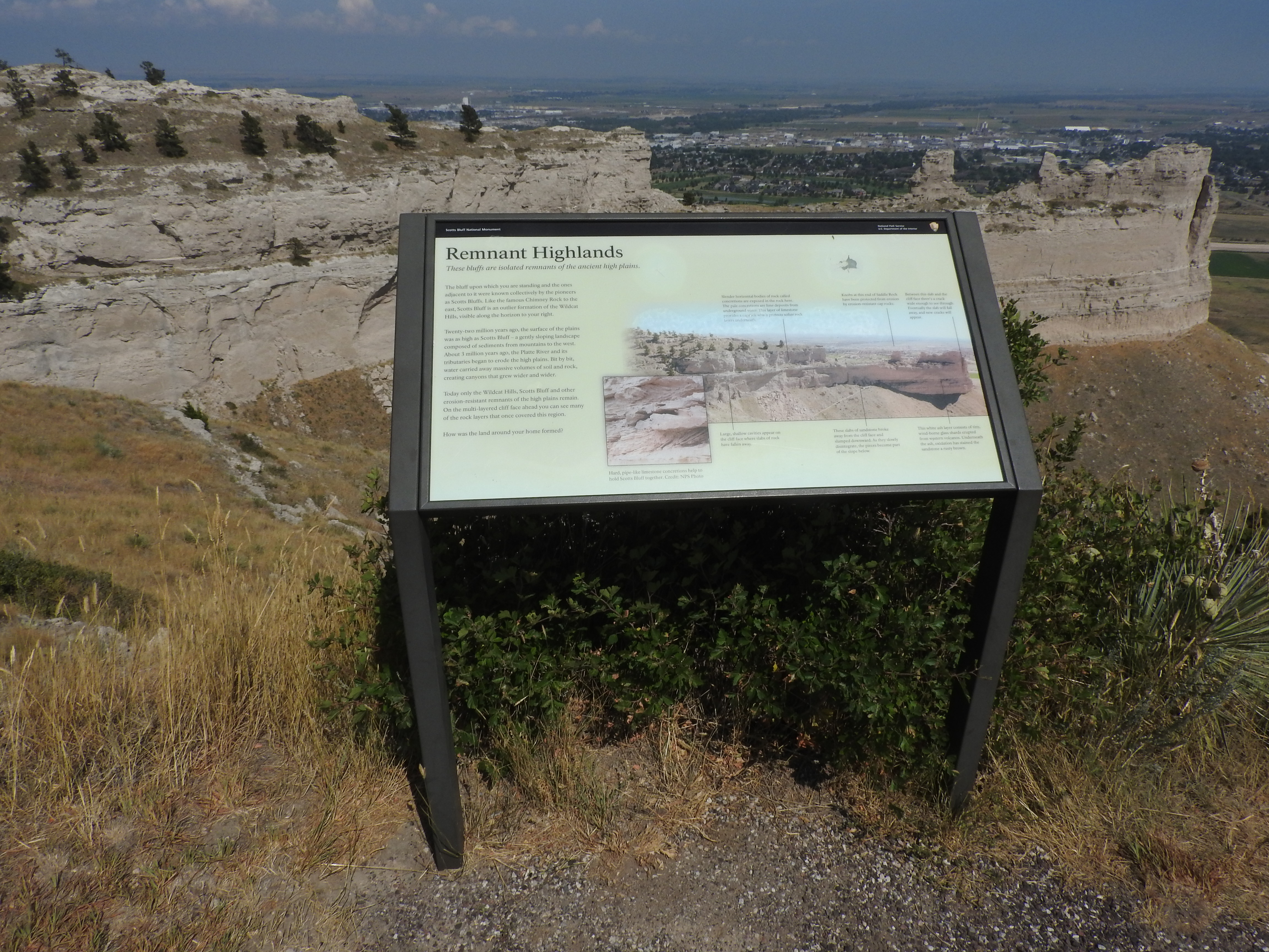
Learn about how erosion has shaped Scotts Bluff and continues to shape it even to this day.
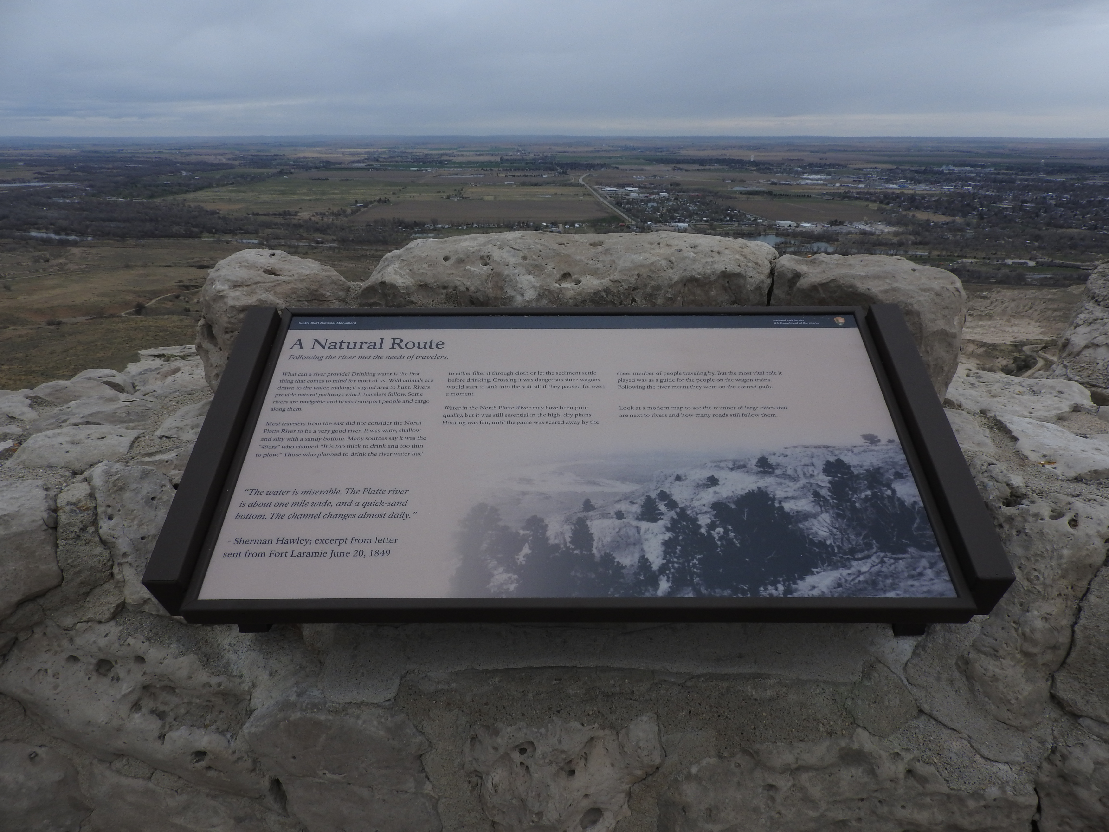
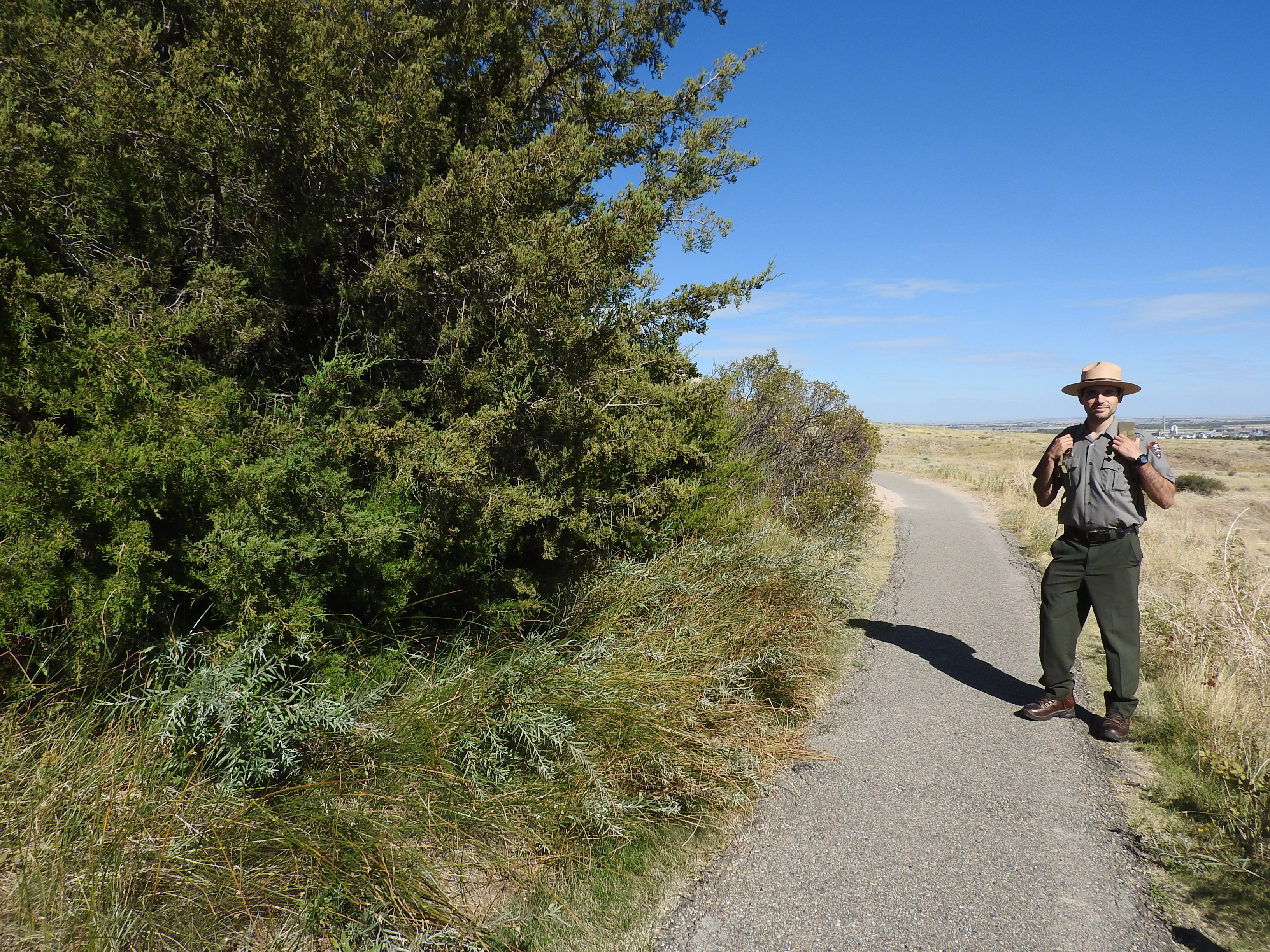
A interpretive wayside sits just to the east of the asphalt-paved North Overlook Trail. Just behind the wayside is a mound of sandstone. There is a metal post survey marker sticking out of the sandstone. In the distance, the lower elevations of the plains can be seen, along with towns and a river.
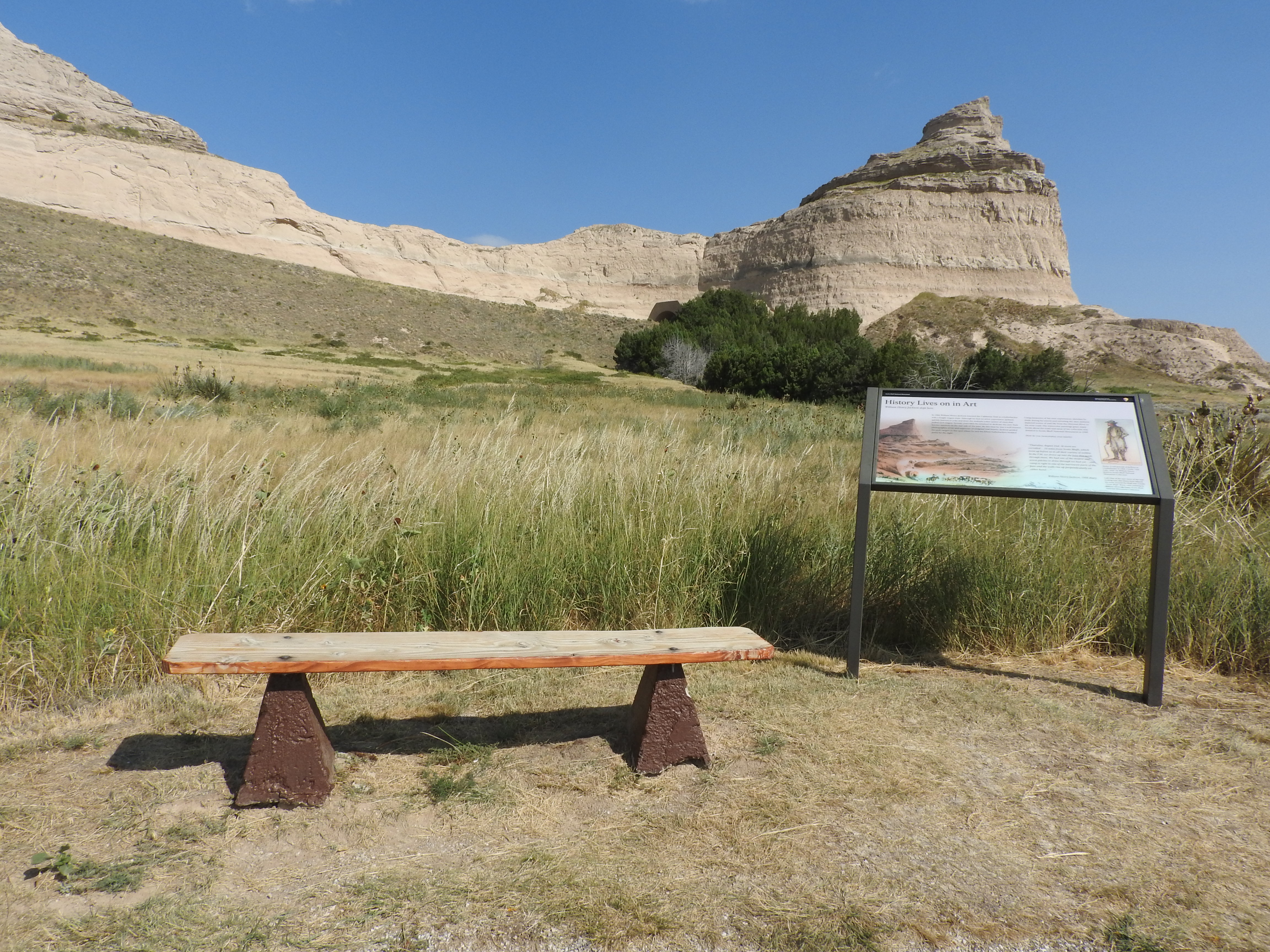
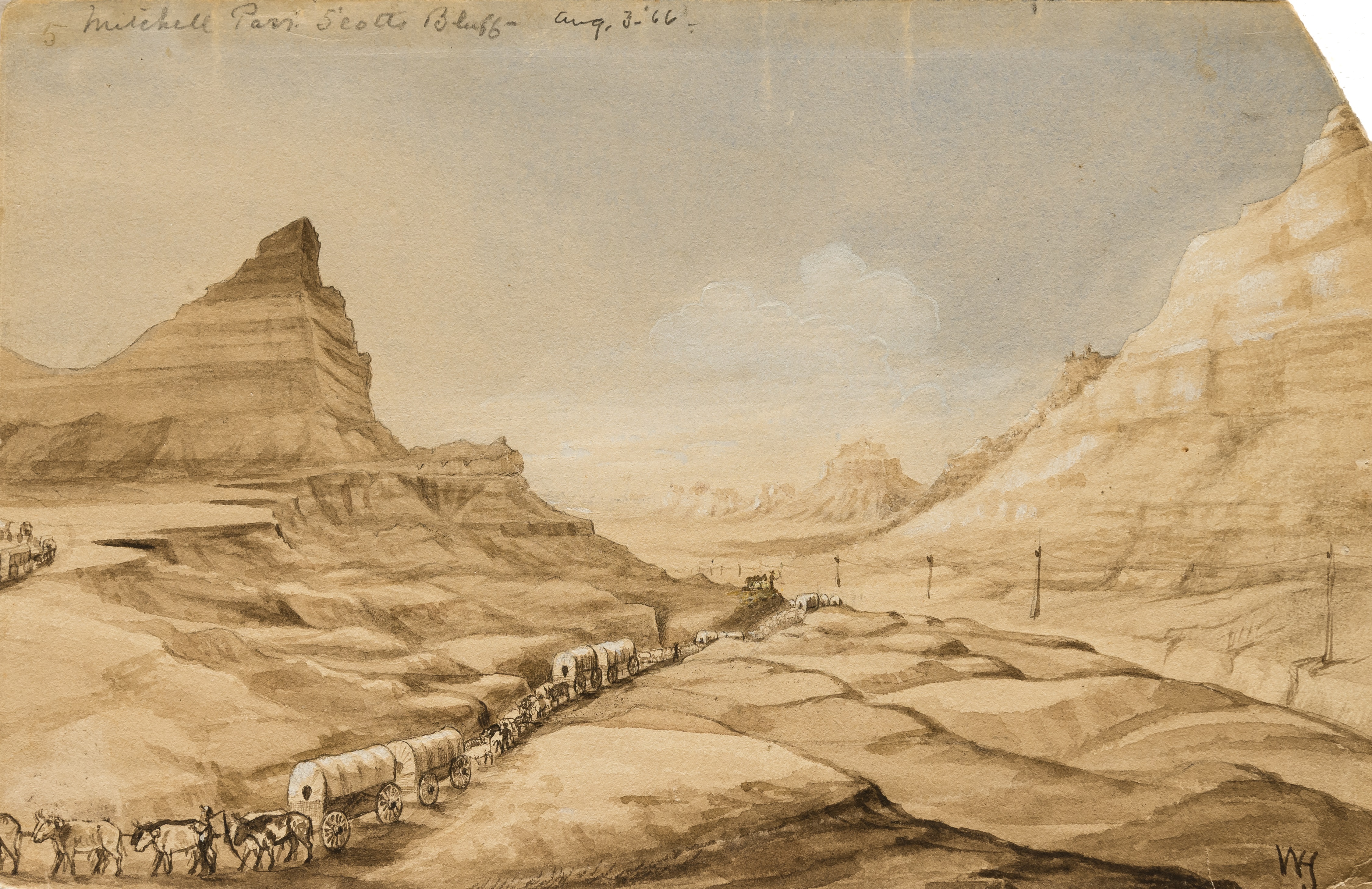
Learn more about William Henry Jackson, a pioneer artist.
A wayside panel sits off of an asphalt trail. Just to the left of the panel is a wood bench. Behind the panel and to the east is a pass between two sandstone bluffs. In the distance is a sandstone tower that stands on its own.
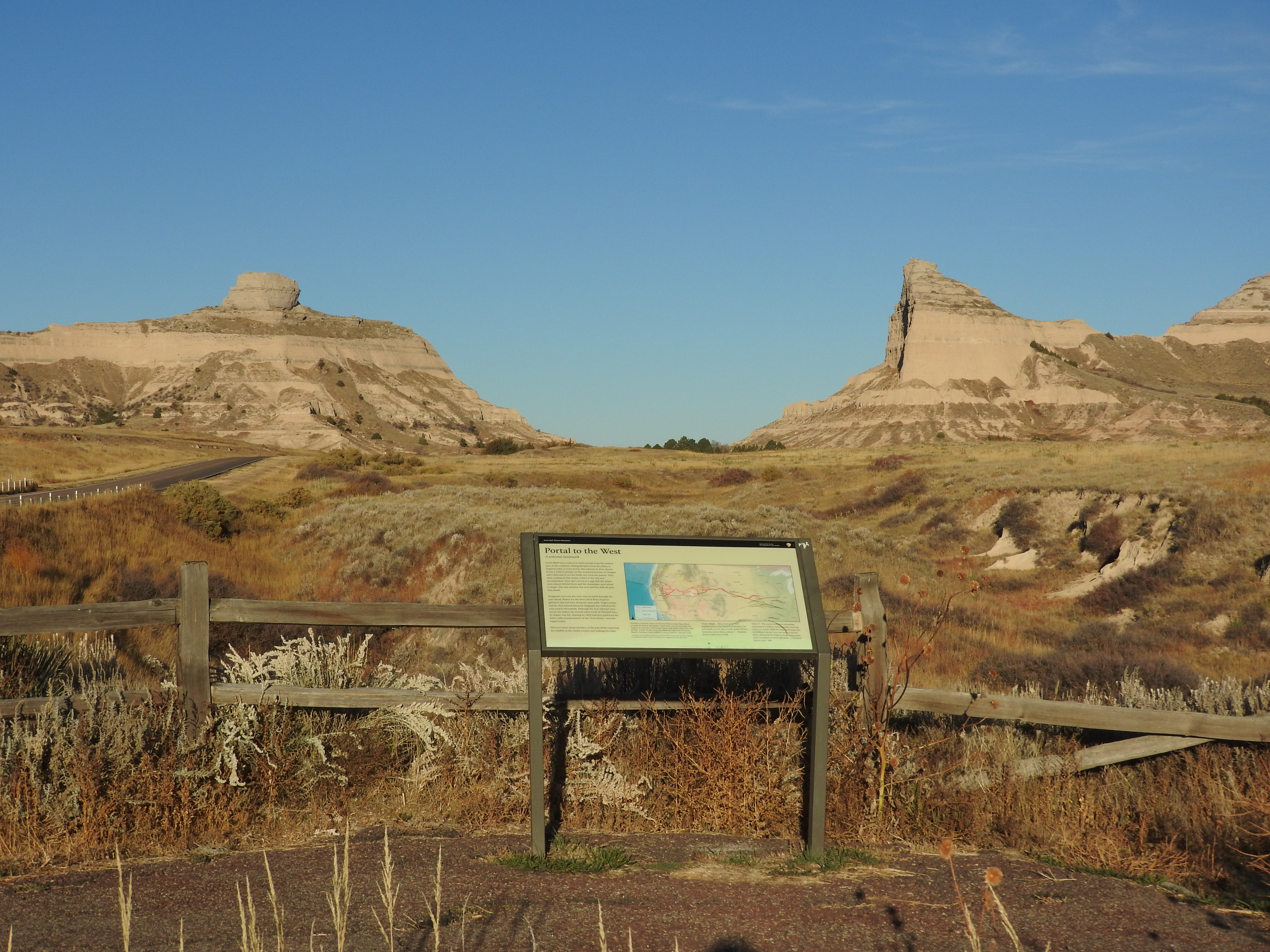
Welcome to Scotts Bluff National Monument. Learn more about the significance of the "Landmark on the Plains."
An interpretive panel sits at the northwest end of a paved trail. Directly behind the panel is a split-rail style fence. Beyond the fence is a ravine cut into the landscape of the prairie. In the distance a gap between two sandstone bluff can be seen.
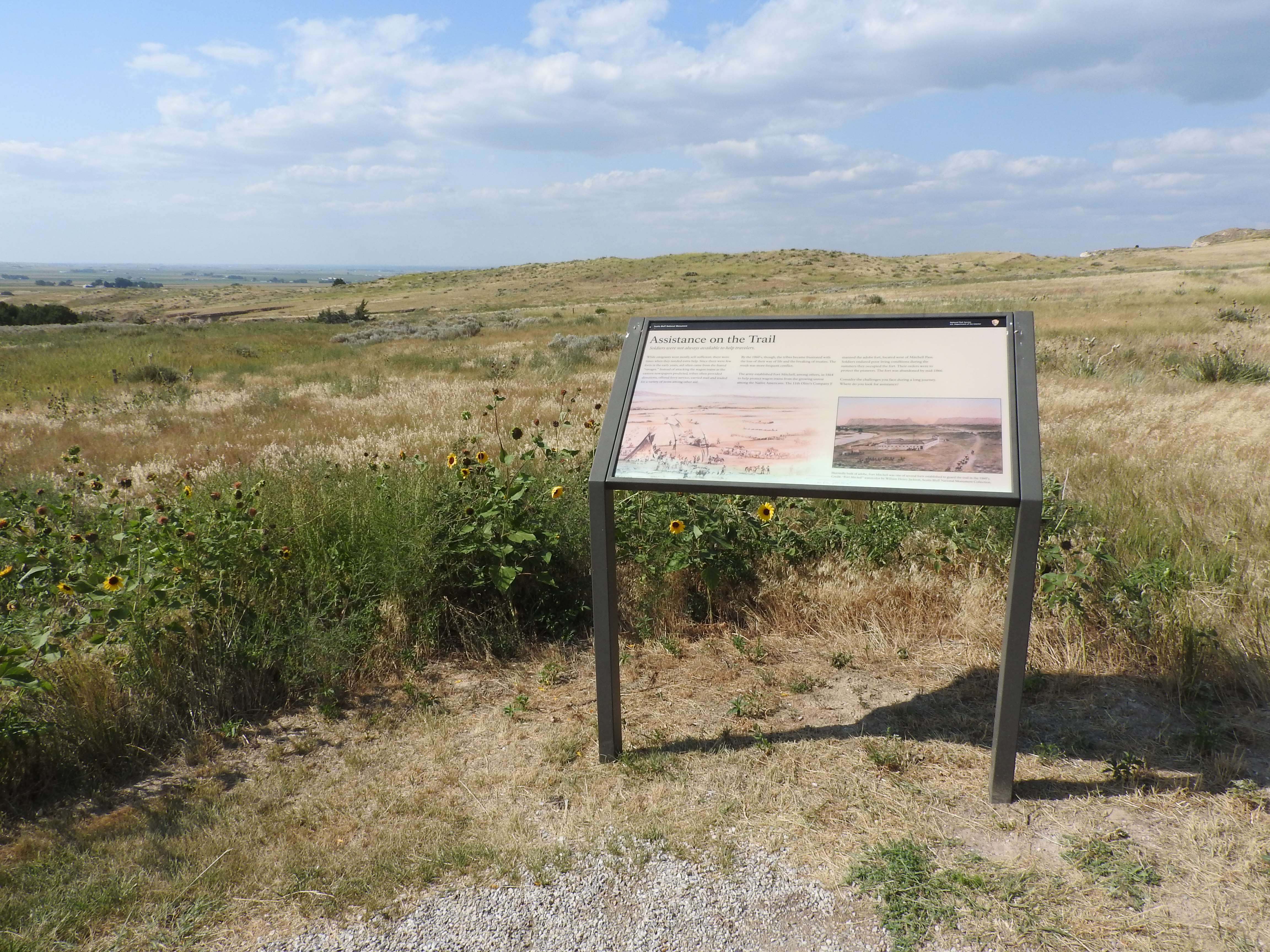
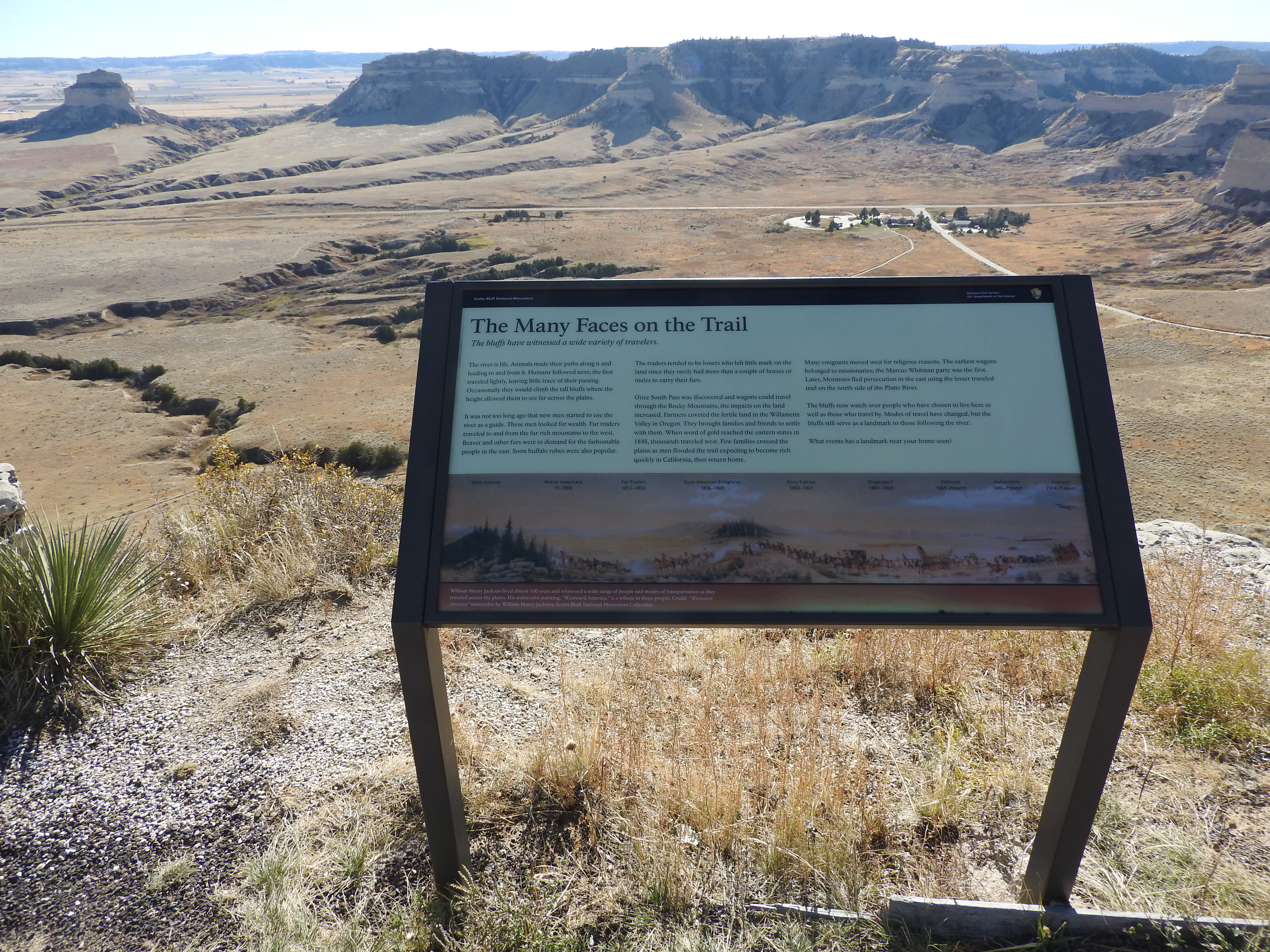
Learn about different groups of people who have passed by Scotts Bluff.
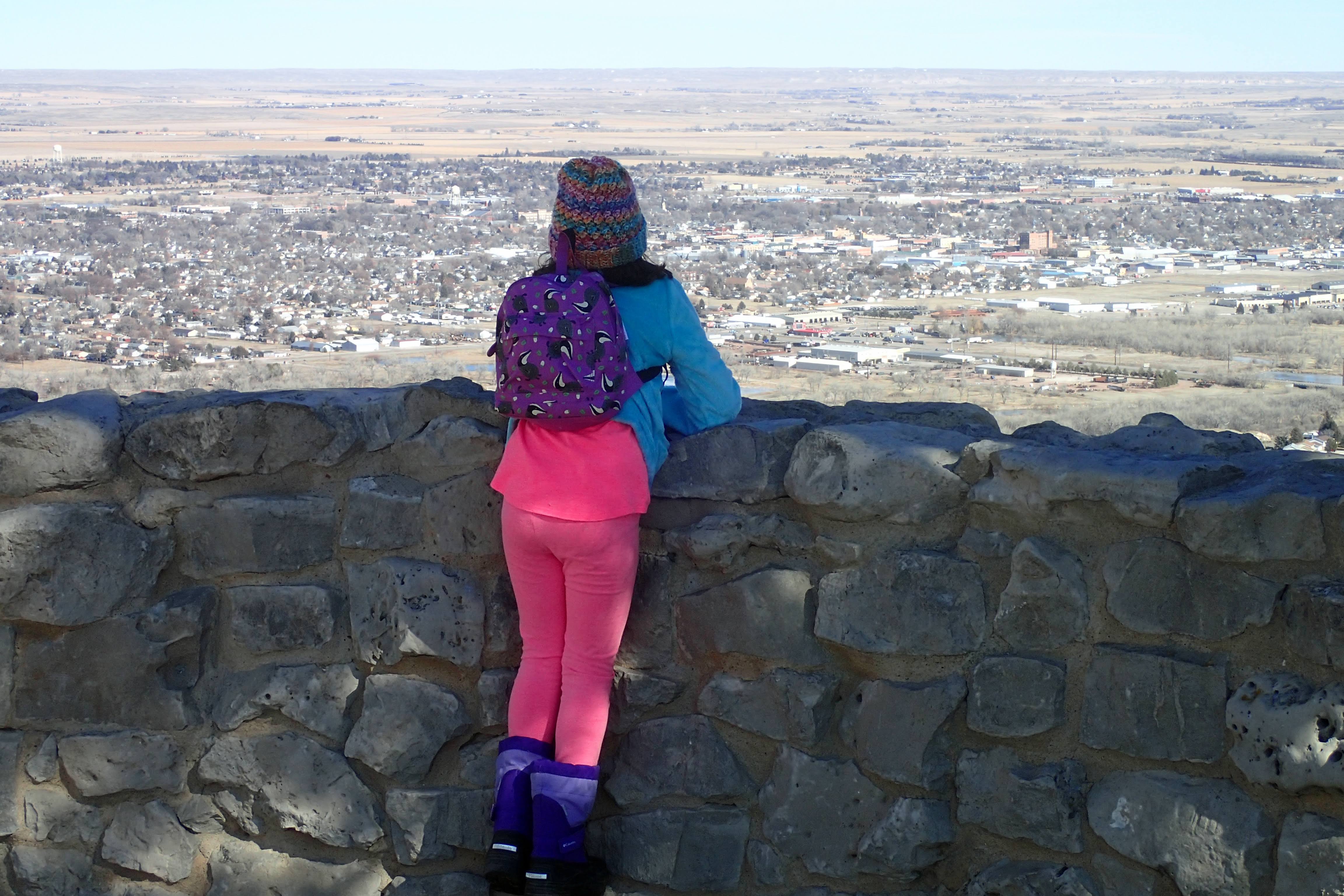
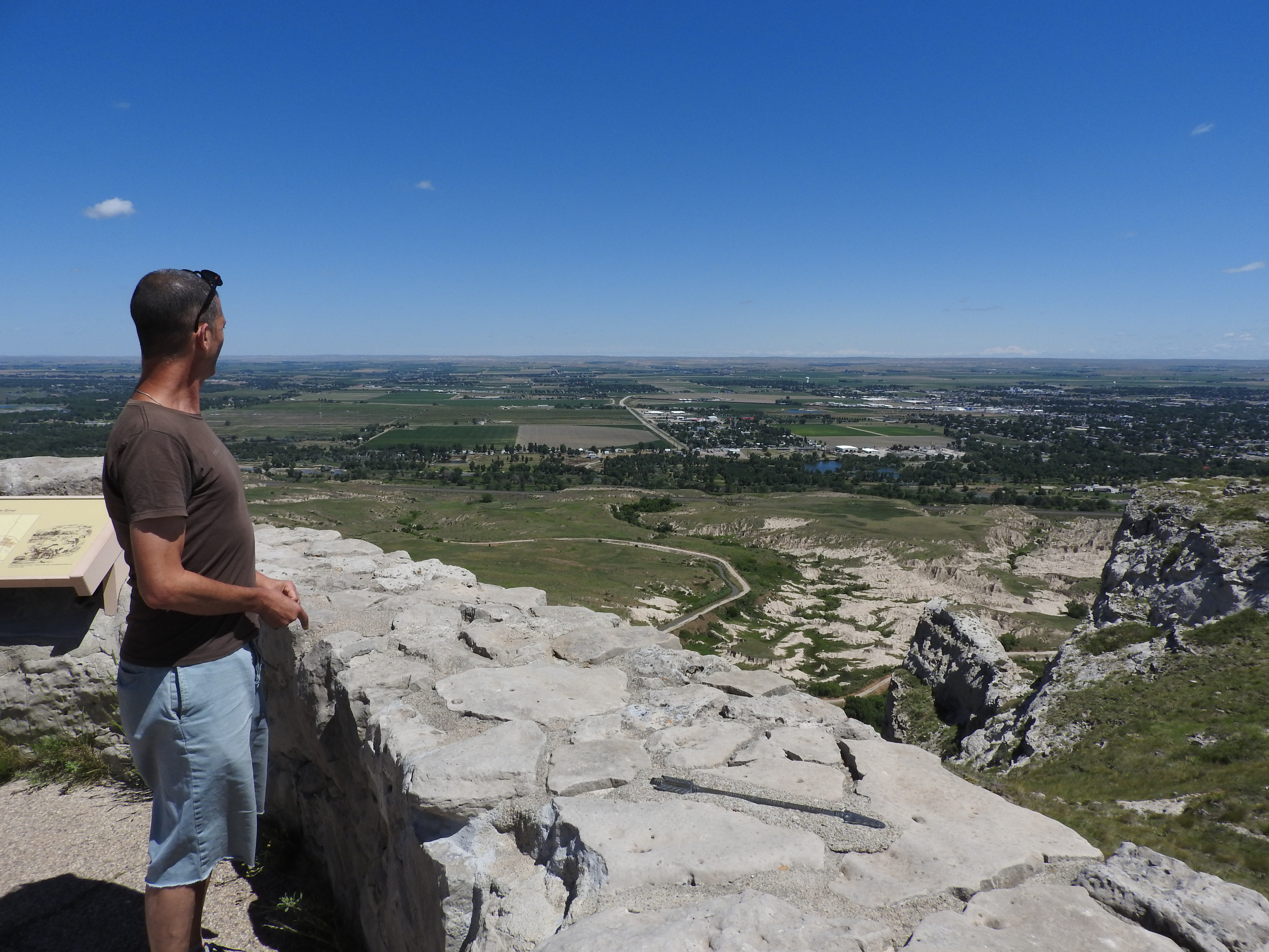
Three interpretive panels are arranged at the south end of an asphalt-paved trail. Beyond the panels is a steep drop-off and views that look out over a cluster of buildings, a modern highway, and a gap between sandstone bluffs.
Chimney Rock was more than a wonder of nature. It was also a significant landmark in measuring the emigrants' progress west. This natural feature was a "grand and splendid object" to emigrants who had never seen the geology of the American West.
Chimney Rock National Historic Site. 231 words<br /><br />The visitor center here consists of a long, central rectangular building with its peak in front and it long axis running away from you as you approach up the wide sidewalk. Two wings stair-step off the right side and a longer, flatter wing extends to the left. The entrance is reached by moving under an open wooden-truss supported by six sandstone pillars, three on each side. A small sign at the edge of the sidewalk warns of rattlesnakes in the area. Please stay on sidewalks.<br /><br />Entering through the double doors you will be in an open hallway that extends to the rear of the building where another set of doors exits to a patio with seating. The information desk is about halfway down the 40-foot hallway on your left. The gift shop may be found by turning to the left just before you reach the desk. An exhibit area is found on the right side of the hallway.<br /><br />Chimney Rock itself is behind on the far side of fenced pasture land where cattle may be grazing. Towering over the surrounding landscape, it may be easily seen both from the parking lot and from the patio behind the visitor center. The formation is shaped like a large cone, wide at its base, and topped with a narrow finger of rock projecting upwards like a steeple.
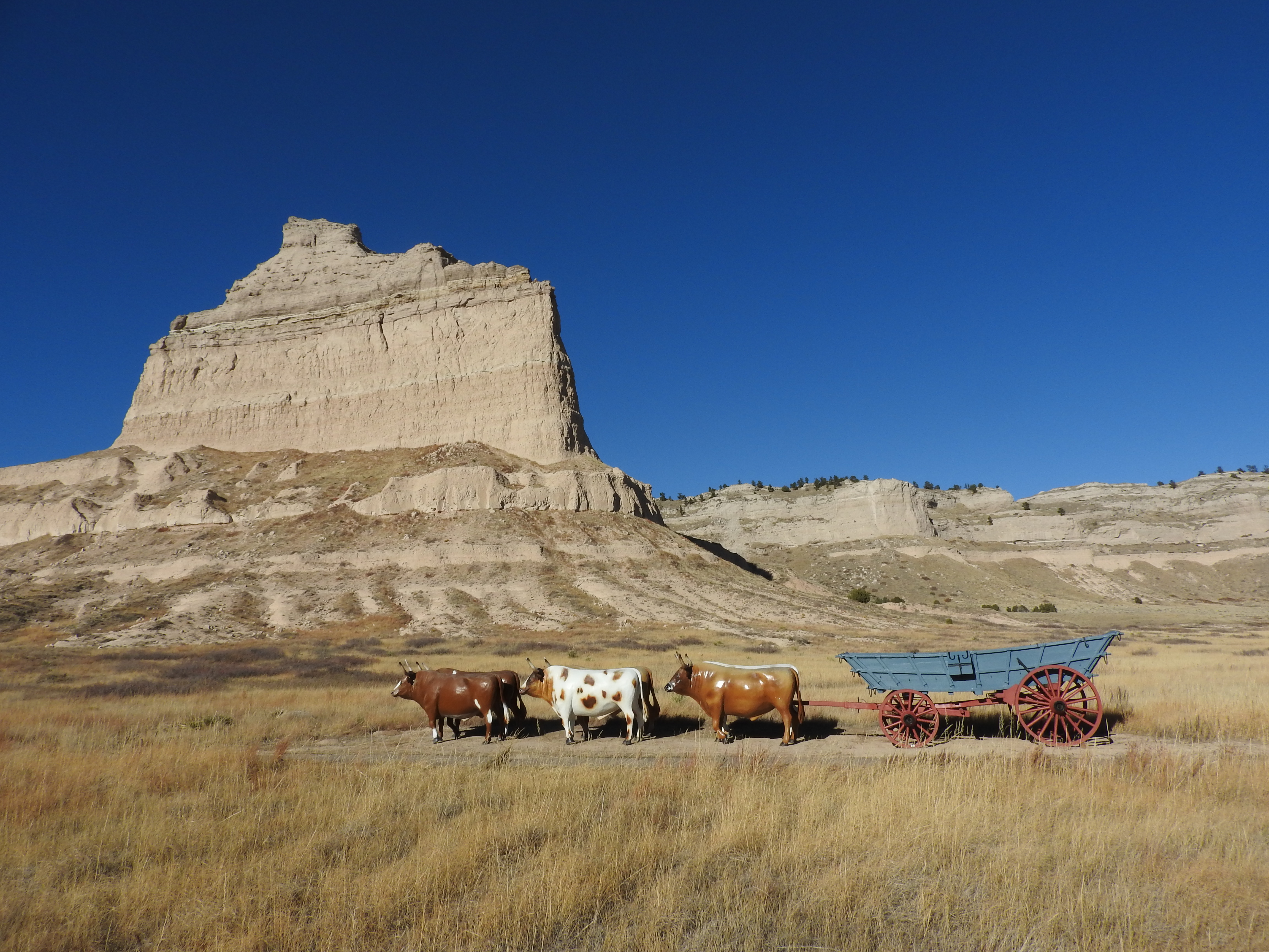
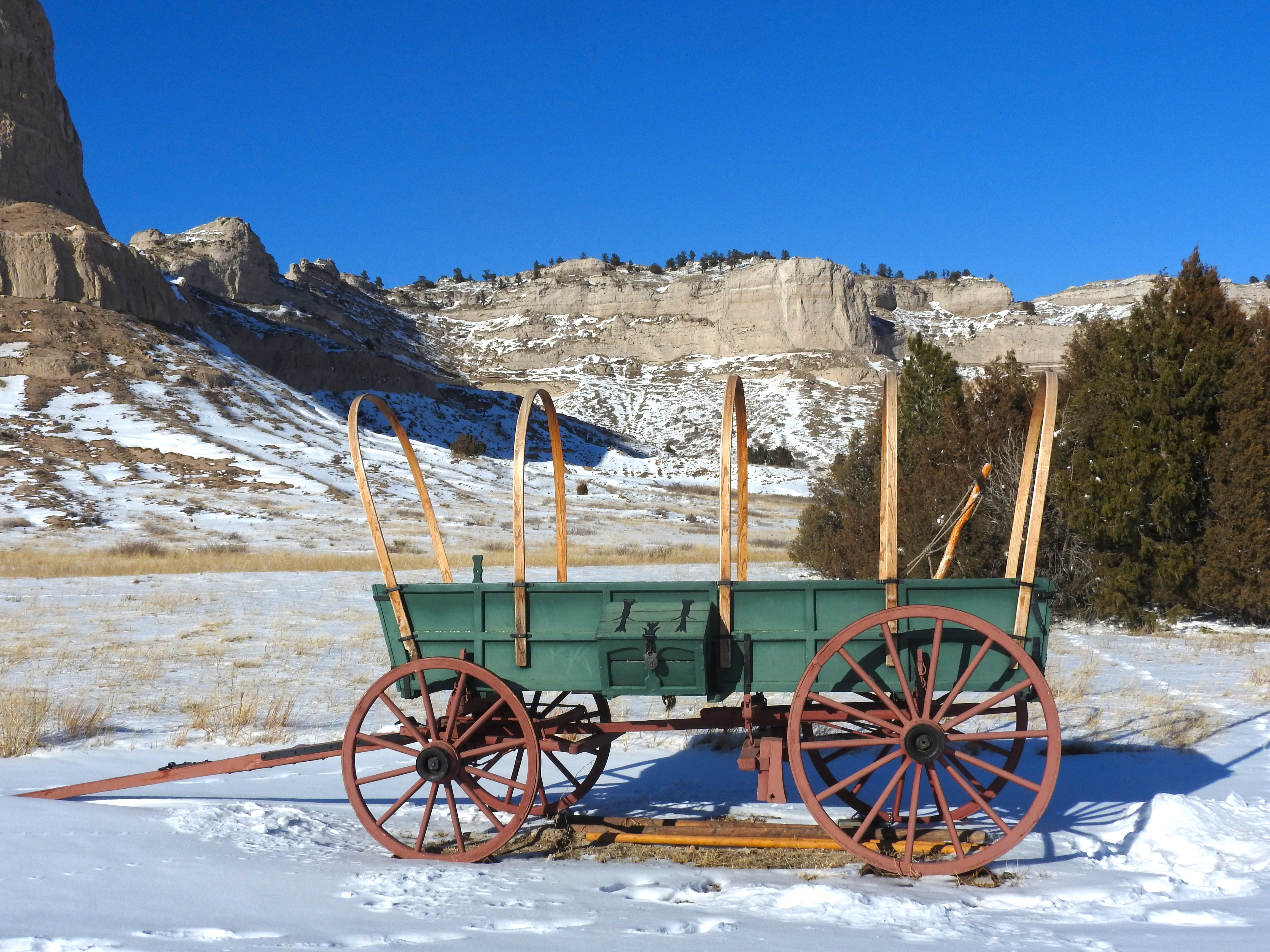
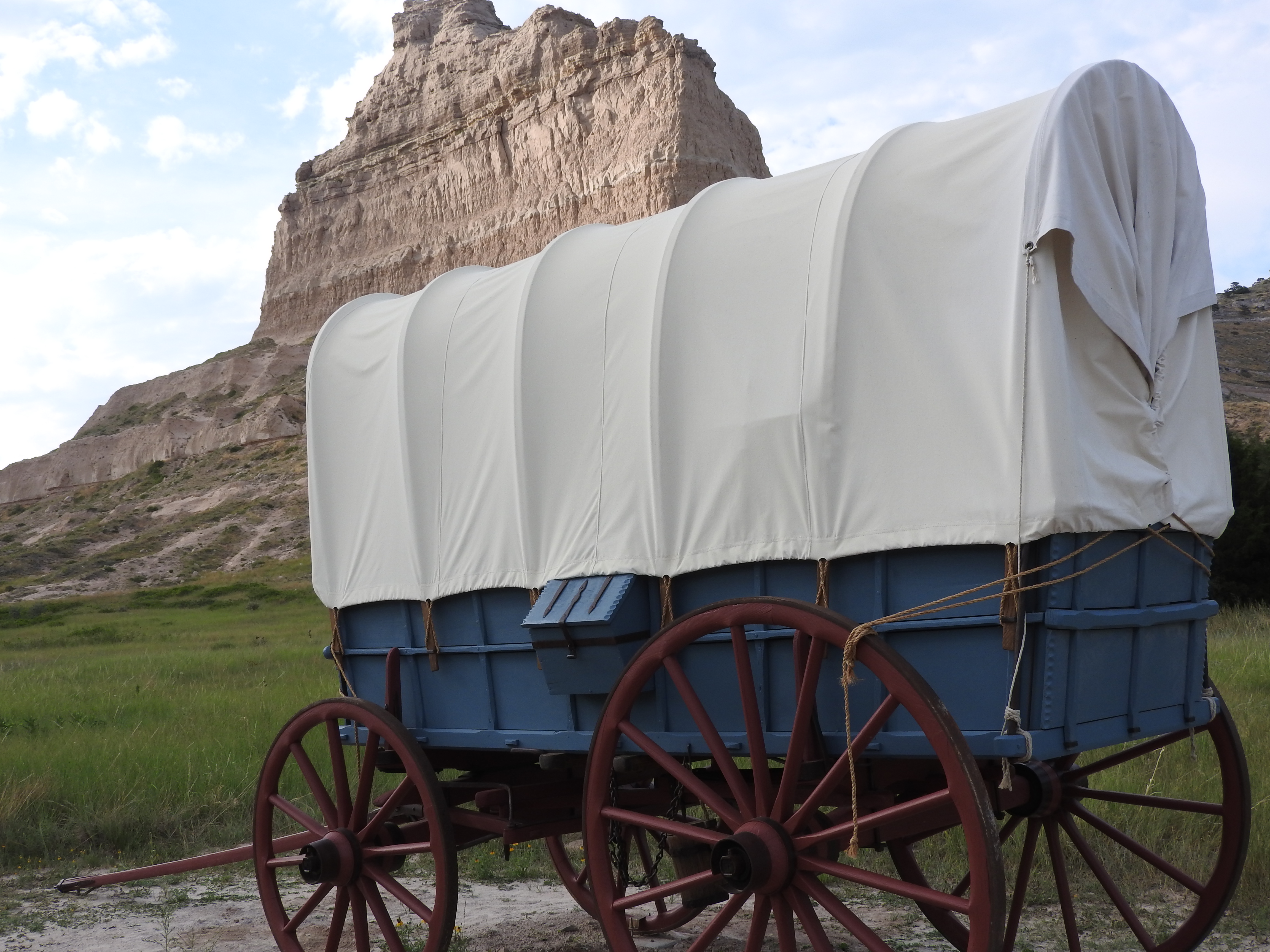
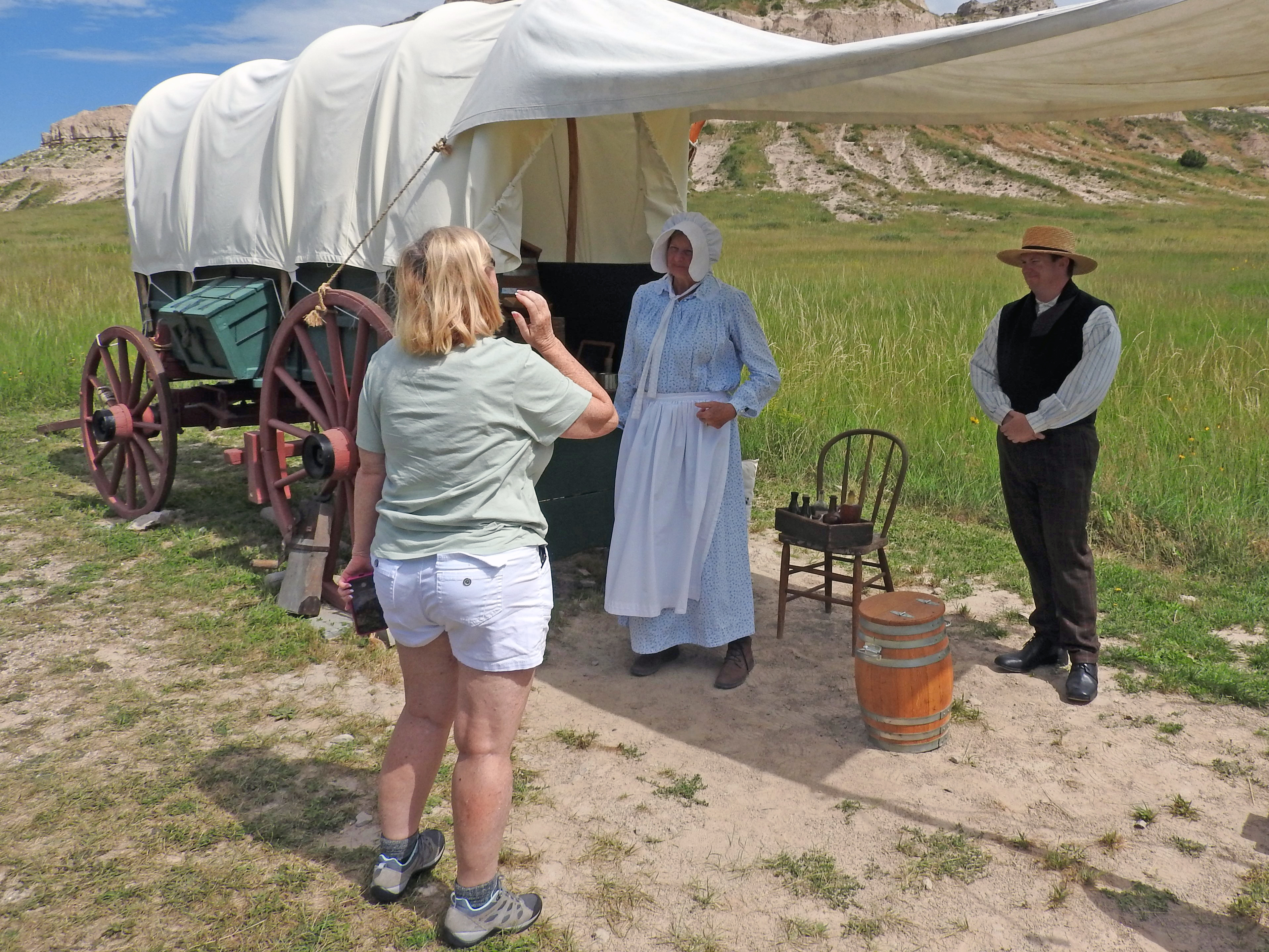
A visit to the replica Conestoga wagon will give an idea about how freight was hauled to forts and scattered supply centers in the 1850s through the 1890s.
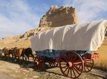
A large wagon is painted blue. In front of the wagon are three replica yoke of oxen that are fabricated out of fiberglass. The wagon sits along an asphalt path at the east end of a gap between two sandstone bluffs. To the south is a modern, paved highway. Along the asphalt trail grow prairie grasses and shrubs. In the summertime, the wagon is covered with a large, cream-colored canvas cover. It is left bare in the winter.
Courthouse and Jail Rocks are massive monoliths made of Brule clay and Gering sandstone. Over time, wind and water erosion slowly sculpted the rocks into their current courthouse or castle appearance. The rocks were first noted by Robert Stuart in 1812 and quickly became guiding landmarks for fur traders and emigrants.
Courthouse and Jail Rocks. 273 words<br /><br />Although called "rocks," these are two striking landmarks, visible at great distances. At the edge of the gravel pullout is a Nebraska Historical Marker that reads, "Courthouse and Jail Rocks are two of the most famous landmarks of westward migration. Nearby passed the Oregon-California Trail, the Mormon Trail, the Pony Express Trail, and the Sidney-Deadwood Trail. The rocks were vanguards of unforgettable scenic wonders that travelers would encounter farther west, including Chimney Rock's curious spire and the rugged heights of Scott's Bluffs.<br /><br />"Hundreds of overland emigrants mentioned Courthouse Rock in their diaries. Often called a 'castle' or 'solitary tower,' the name Courthouse was first used in 1837. One 1845 traveler described the rock as ‘resembling the ruins of an old castle [which] rises abruptly from the plain... It is difficult to look upon it and not believe that art had something to do with its construction. The voyagers have called it the Courthouse; but it looks infinitely more like the Capitol.'<br /><br />"Courthouse and Jail Rocks, rising some 400 feet above the North Platte Valley, are erosional remnants composed of clay, sandstone, and volcanic ash. The rocks are listed in the National Register of Historic Places and in the Nebraska Natural Areas Register."<br /><br />Looking westward, past the sign, the two formations can be seen rising out of the surrounding pasture land. Courthouse Rock, on the right, is larger, looming over the prairie like a squat cylinder with a smaller circular layer sitting on top. Jail Rock, on the left, is the same height but only about one-third as wide. It is also cylindrical, but has more sloping sides.
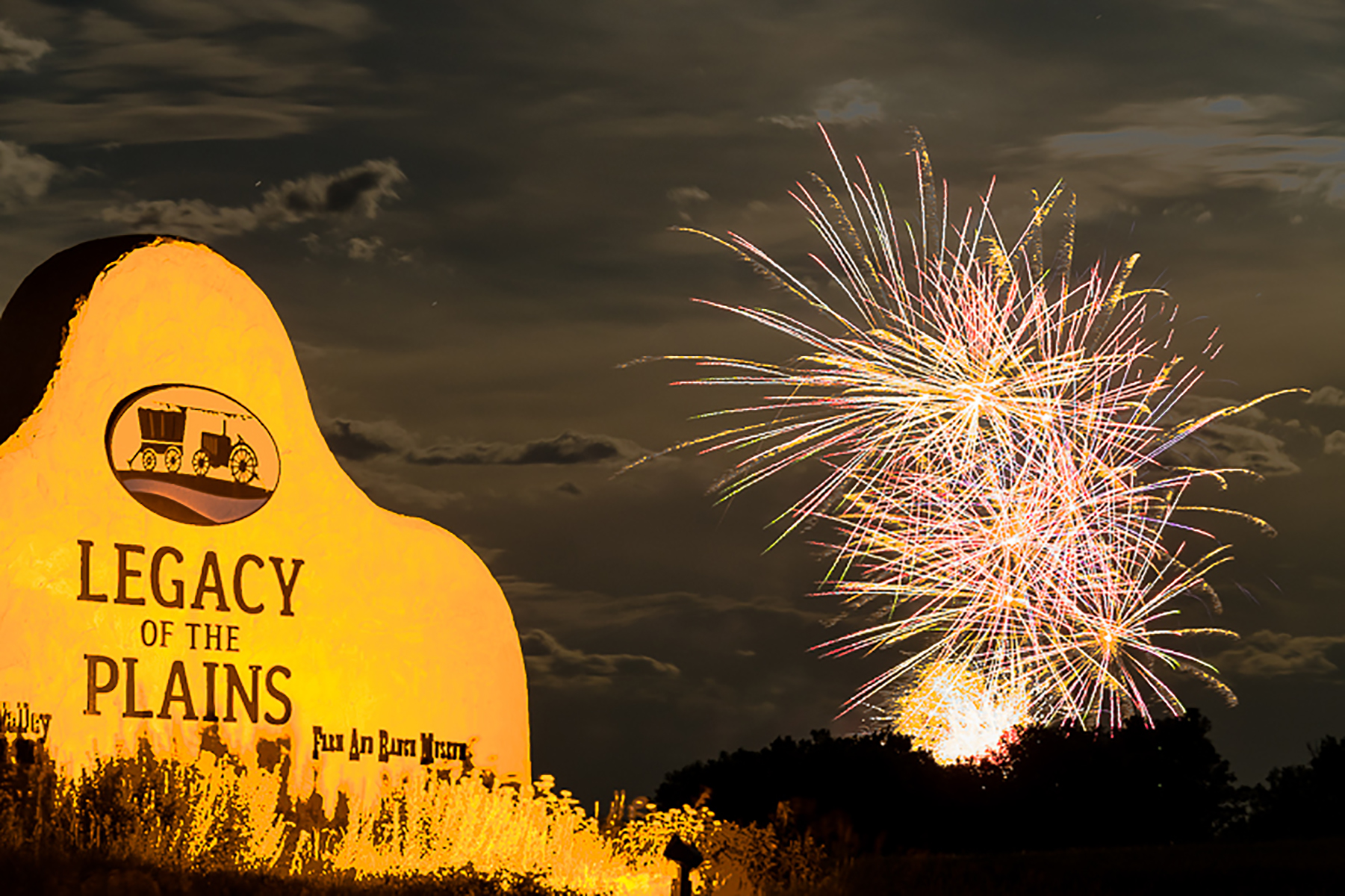
Located on the Oregon Trail, legacy of the Plains Museum is a destination for people interested in stories of human and agricultural history in the North Platte Valley and High Plains. Fine new state-of-the-art and interactive exhibits.
Large, red, barn-inspired buildings set in the surroundings of tall sandstone bluffs.
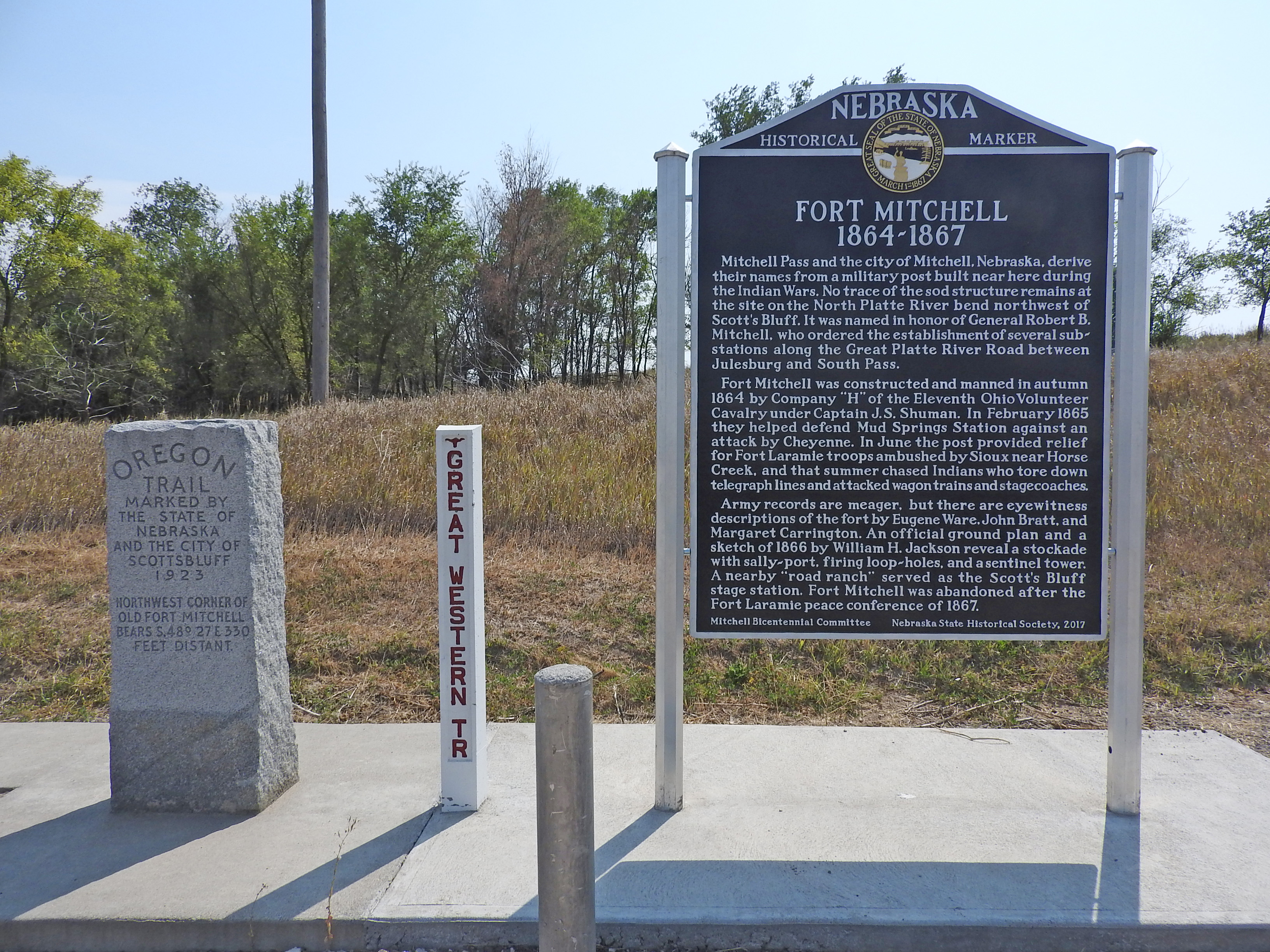
Mitchell Pass marks the route of the Oregon/California Trails around Scotts Bluff starting in 1851. The Pony Express and Transcontinental Telegraph also traveled through Mitchell Pass.
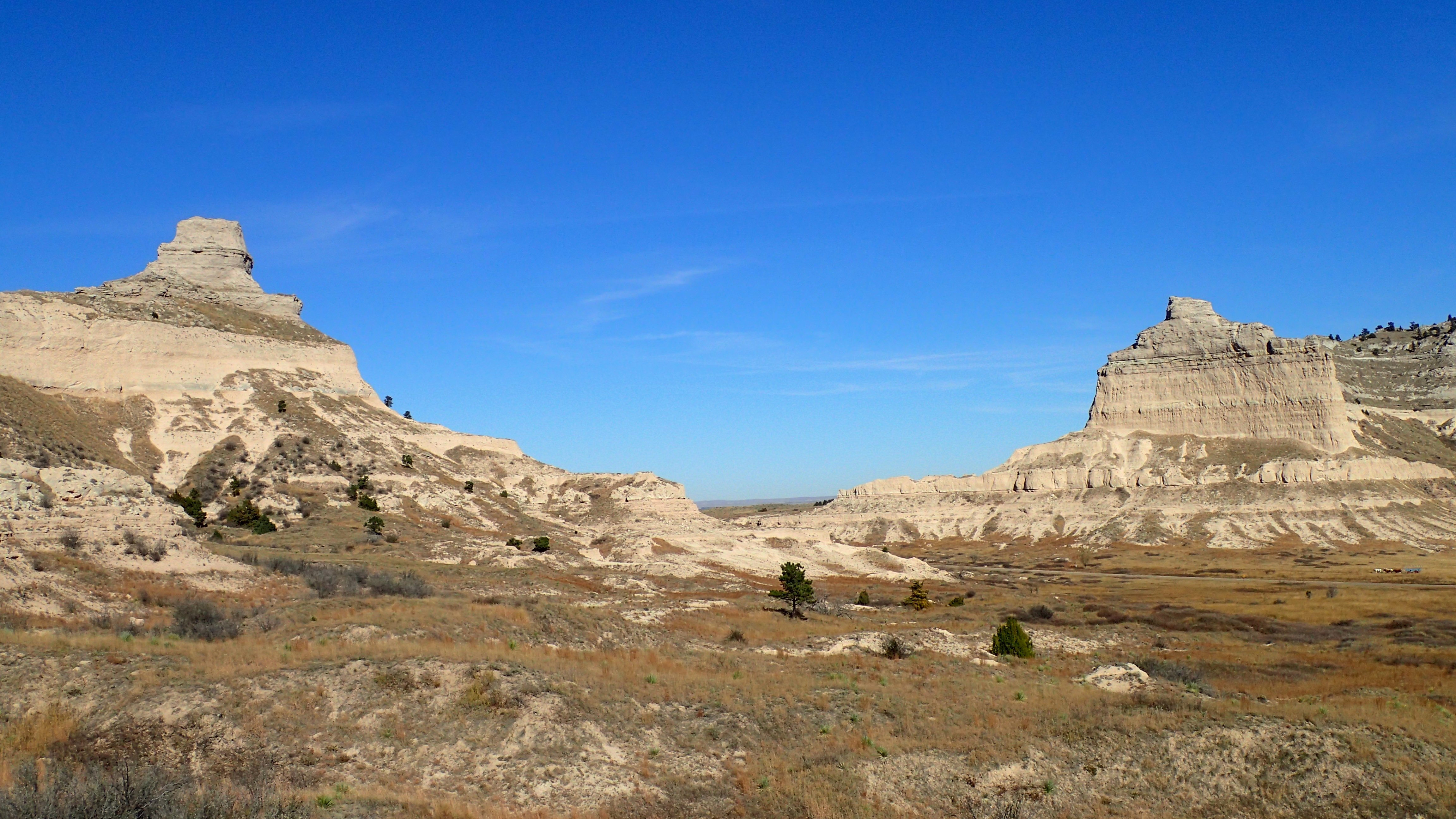
A distinctive gap between two sandstone bluffs. Each bluff features steep sides and is partially covered with grasses and ponderosa pine trees. The south side of the pass is traversed by a modern, asphalt-paved, two-lane highway. The middle of the pass is traversed by a naturally-surfaced hiking trail.
A point along a paved trail that heads northeast through the mixed-grass prairie. A distinctive sandstone bluff can be seen to the north. South of this point is a group of buildings, the Scotts Bluff National Monument visitor center and administration complex.
Handcarts were a cost effective way for poor Mormon emigrants to move their belongings to the Salt Lake Valley.
On the north side of the paved trail sits a replica Mormon handcart. The handcart is 3 feet wide by 4 feet long. It has a shallow box about 9 inches high. There are two wood wheels offset to the sides of the box that each have a diameter of 4 feet and are rimmed with iron.
The Murphy Wagon was used first by traders on the Santa Fe Trail. Later, emigrants adapted the Murphy wagon to haul their belongings to Oregon and California.
A Murphy Wagon replica sits off to the north side of the paved trail. Behind the wagon, a tall sandstone bluff rises 400 feet above the prairie below.
The Oregon Trail Pathway Trailhead is the starting point for a 1/2 mile long trail that leads from the Scotts Bluff National Monument Visitor Center Parking Lot to the site of William Henry Jackson's 1866 campsite. Along the way, visitors can explore replica wagons and learn what life on the Great Platte River Road was like for emigrants traveling to Oregon, California and Utah was like in the mid to late 1800s.
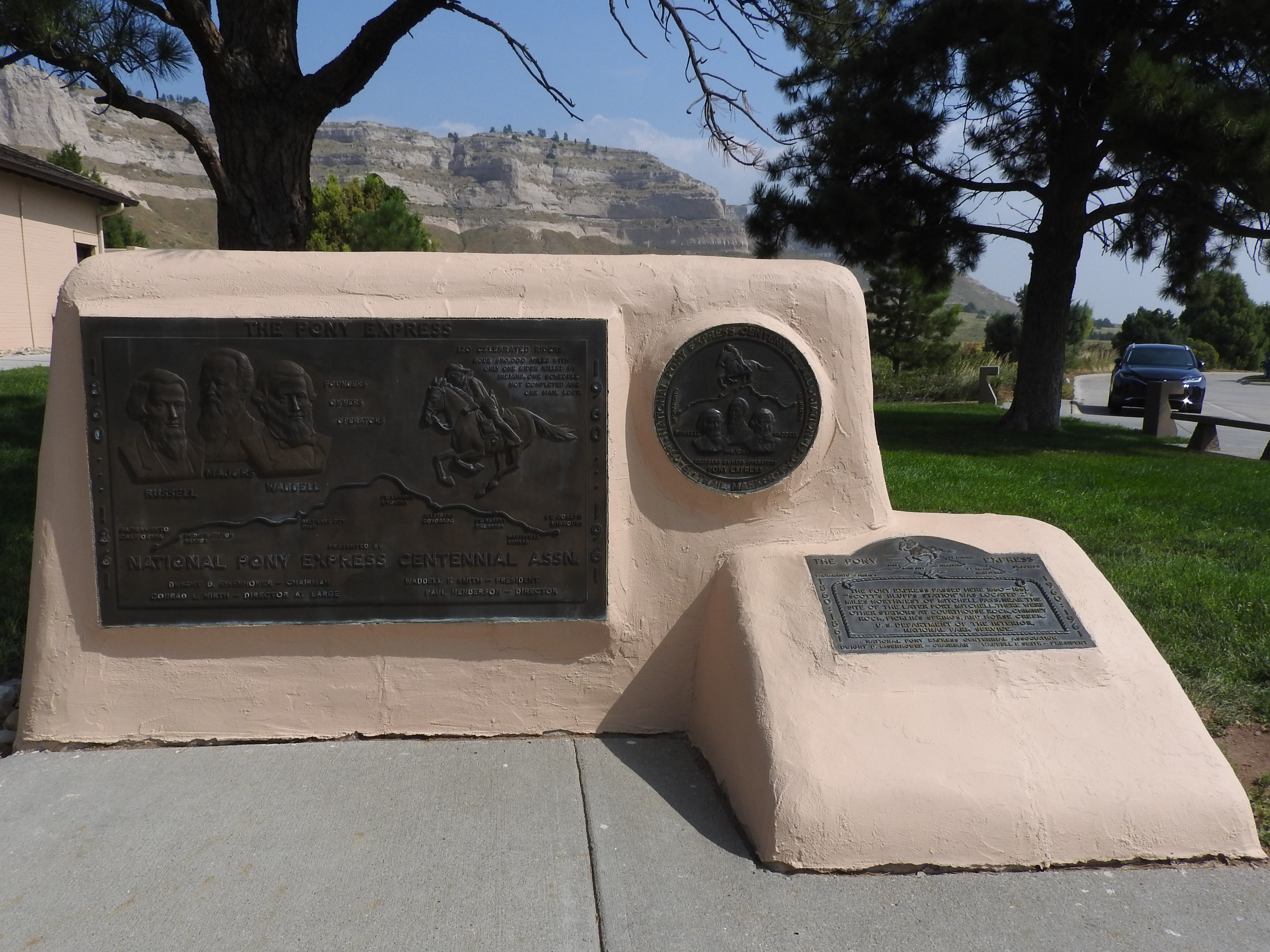
A monument erected by the Pony Express Centennial Association. The monument celebrates the riders and owners of the famous mail delivery system.
The monument is constructed of concrete, covered with stucco and painted tan. There are three metal plaques inset into the base. The largest of the plaques is rectangle-shaped and measures 50 inches wide by 30 inches tall. It is titled "The Pony Express" and one the left margin vertically reads "1860 - 1861". The right margin vertically reads "1960 - 1961". In the upper left-hand corner, there are images of the heads of the three founders that are labeled "Russell, Majors, Waddell." To the right of the three heads text reads "Founders, owners, operators." In the upper right-hand corner, there is an image of a man on horseback. Text reads "120 celebrated riders rode 670,000 miles with only one rider killed by Indians, one schedule not completed, and one mail lost." A map below two images shows important landmarks on the Pony Express Trail. Labeled, left to right are: Sacramento, California; Fridays Station, Nevada; Salt Lake City, Utah; Fort Laramie, Wyoming; Julesburg, Colorado; Fort Kearney, Nebraska; Marysville, Kansas; and St. Joseph, Missouri. Text at the bottom reads "National Pony Express Centennial Assn. Dwight D. Eisenhower - Chairman, Waddell R. Smith - President, Conrad L. Wirth - Director at Large, Paul Henderson - Director." A circular metal plague measuring 17 inches in diameter is located to the right of the large rectangular plaque. Around the perimeter of the plaque is text that reads "National Pony Express Centennial Association, Trail Marker, 1860-61, 1960-61." Inside the perimeter text at the top is an image of a rider on horseback, over a map with the label of "Sacramento" on the left and "St. Joseph" on the right. Below the map are the images of the heads of three men. They are labeled left to right "Russell, Majors, Waddell." Below the image is text that reads "Founders, Owners, Operators, Pony Express." A third metal plaque is located on a vertically angled section of the monument. It measures 24 inches wide by 17 inches tall. It is titled "The Pony Express" with the image of a rider on horseback. Below the image is text that reads "The Pony Express passed here 1860 - 1861. "Scott's Bluffs Station" was located 2 1/2 miles northwest of Mitchell Pass, near the site of the later Fort Mitchell. There were other stations at Courthouse Rock, Chimney Rock, Ficklin's Springs, and Horse Creek. U.S. Department of the Interior, National Park Service."
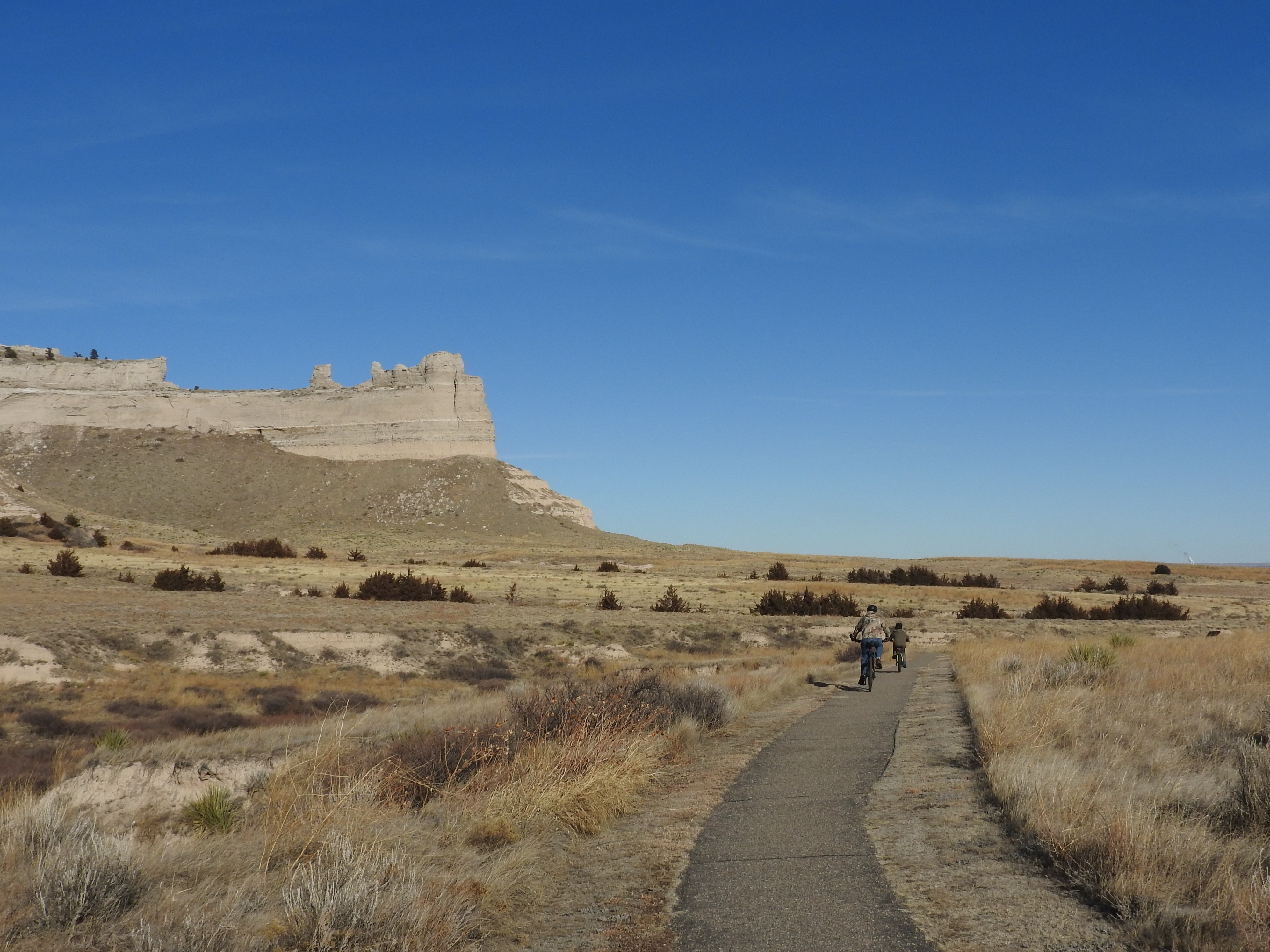
The West Trailhead of Scotts Bluff National Monument's Prairie View Trail. This trail is open to bicyclists and hikers and connects to the City of Gering's Monument Valley Pathway.
A wooden bicycle rack sits to the left of the start of a paved trail. High sandstone bluffs can be seen in the background.
The final resting place of Mormon emigrant Rebecca Winters. Rebecca died of cholera on August 15, 1852. Her grave site was marked with a metal wagon wheel rim that was engraved “Rebecca Winters, Age 50.” The grave had been forgotten for years until 1899 when surveyors for the Burlington Northern Railroad rediscovered it.
A small park, just off of busy US Highway 26. A solitary grave is seen with railroad tracks about 30 feet beyond.
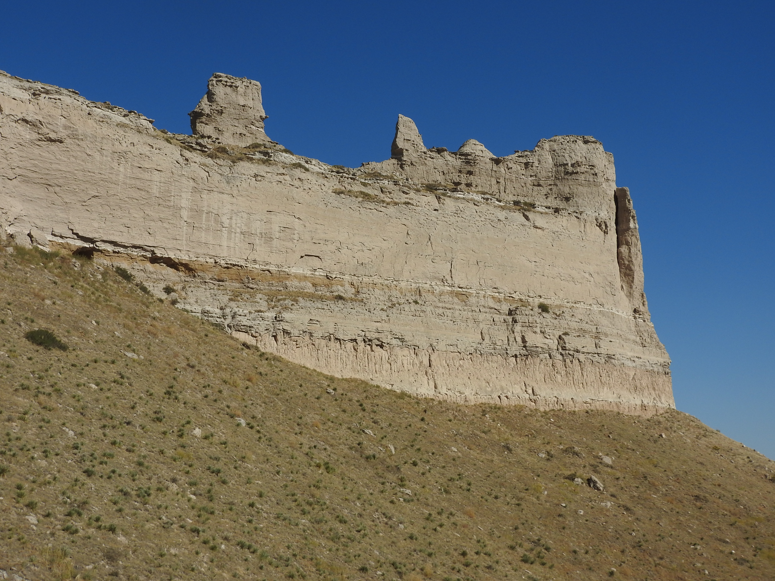
A sharp bend in the paved trail. To the south, a series of what appear to be sandstone chimneys rise from the top of a sandstone bluff. In the distance below can be seen a prairie valley. To the east are the neighborhoods of the towns of Scottsbluff and Gering.
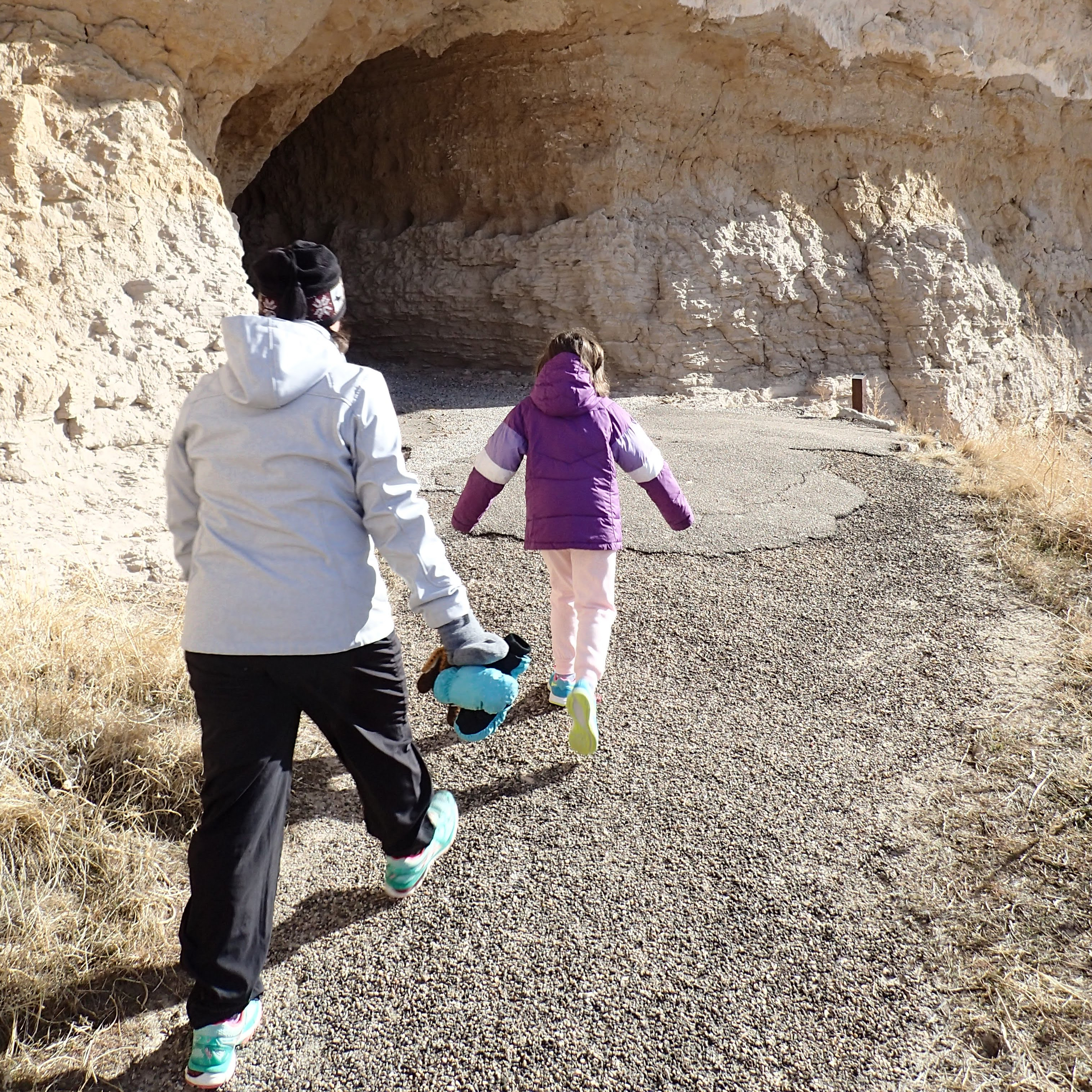
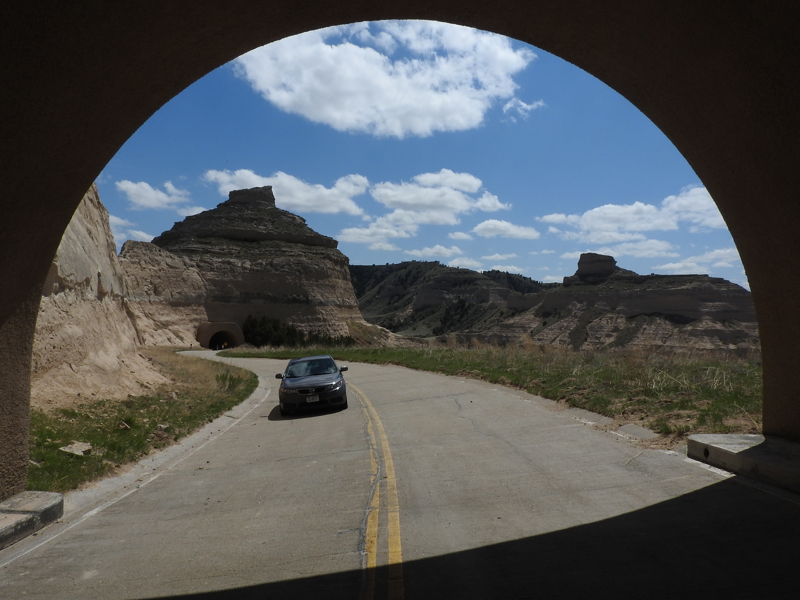
A section of paved trail leads steeply up a sandstone bluff. To the east the trail enters a tunnel carved into a sandstone cliff face. To the southwest is a wide valley and on the other side of the valley is another sandstone bluff.
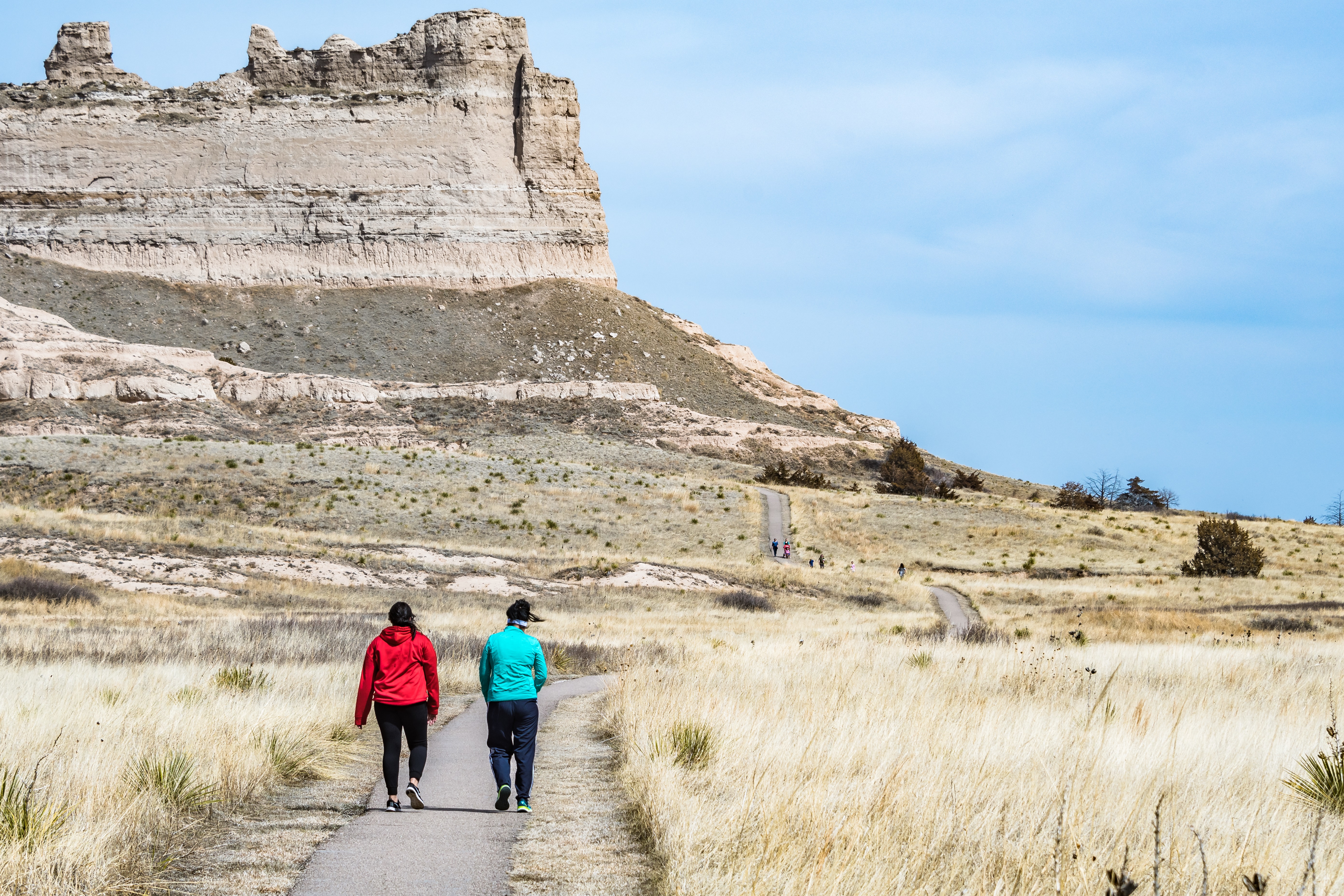
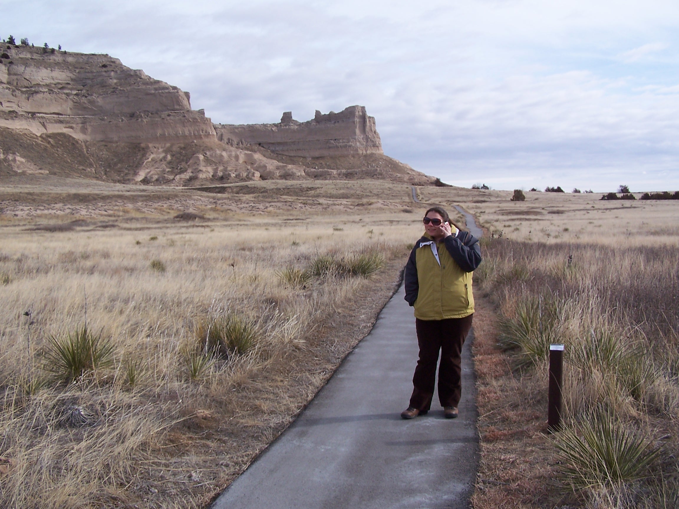
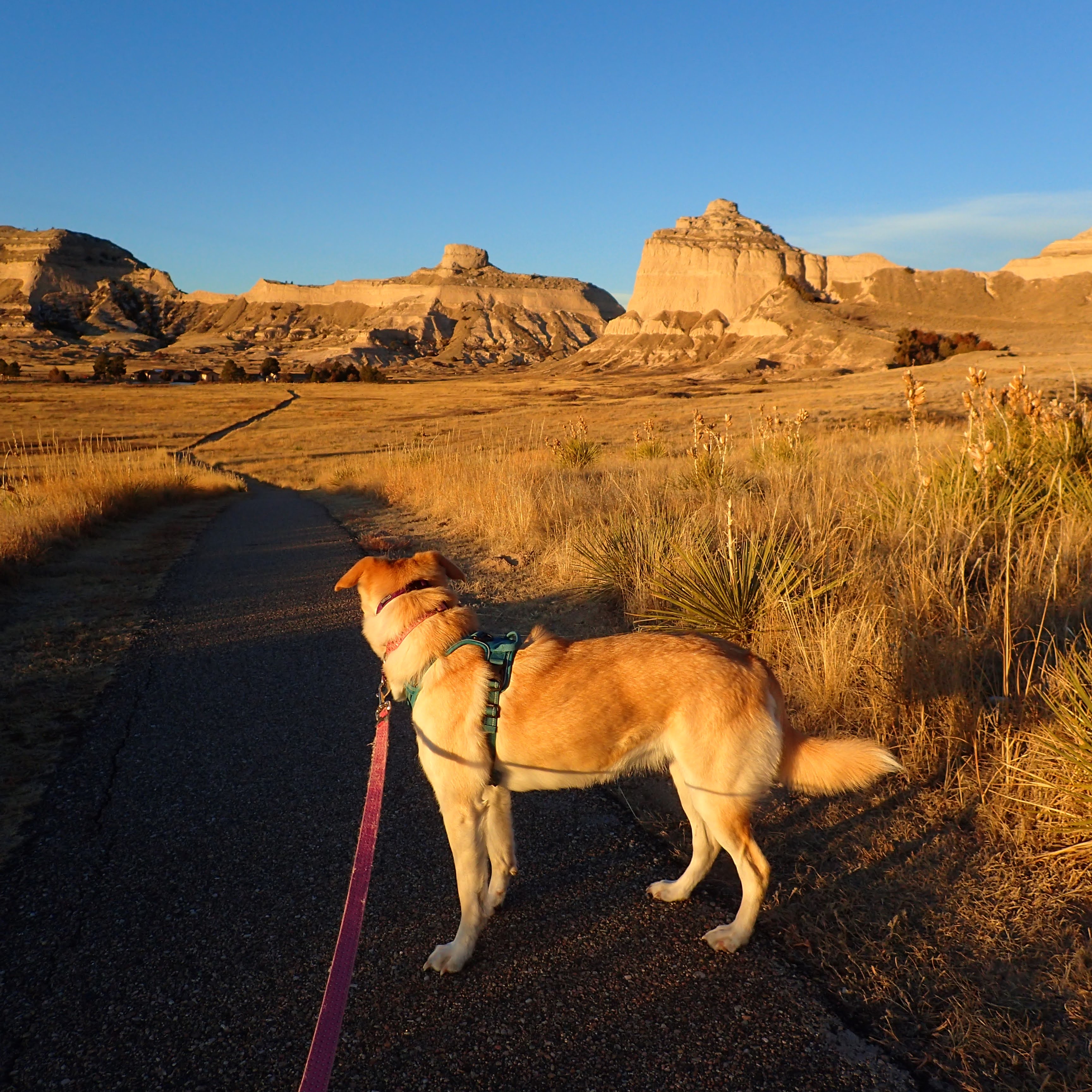
The Saddle Rock Trail is the most popular hiking trail at Scotts Bluff National Monument. The trail leads 1.6 miles from the Scotts Bluff National Monument Visitor Center to the summit of Scotts Bluff. It is a 435 foot ascent featuring some of the best views in the state of Nebraska.
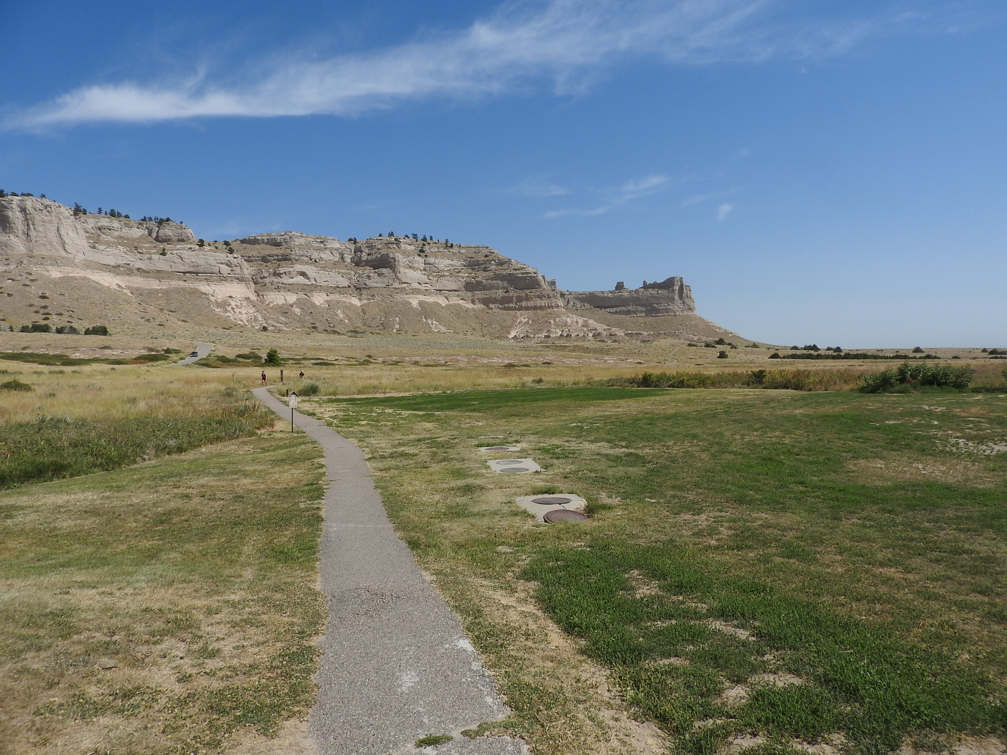
An asphalt trail leads through a mowed lawn into natural prairie and towards towering sandstone bluffs.
Scotts Bluff National Monument is named for an immense section of sandstone and clay bluffs that tower 800 feet above the North Platte River. This 3000 acre monument is managed by the National Park Service and has numerous amenities and things to do.
Scotts Bluff National Monument. 217 words<br /><br />The visitor center here consists of a long, rectangular building made of tan adobe, extending parallel to the parking lot. At the left end, a two-story wing extends back away from the parking lot. Where the two wings meet, the wide sidewalk leads through an archway to the entrance. Dark brown wooden shingles cover the roof. Restrooms are at the far right end of the building.<br /><br />The massive bluff itself, with its tan and brown layers, rises behind and to the left of the building. Immediately to the left is the flat cliff face of the south end, looking like someone sliced it with a knife.<br /><br />The main structure has no windows but there is decorative open grillwork just under the eaves. A curved adobe wall lines the sidewalk from the parking lot. In front to the left of the entrance is a flagpole with a granite-topped, brick vault next to it. Engraved text on the granite reads, "Time Capsule, sealed December 12, 1994, to be opened December 12, 2069."<br /><br />As you enter the building, the information desk extends parallel to the left-hand wall. On the right side of the door is a small seating area, with the entrance to the exhibit area just beyond. The gift shop is straight ahead.
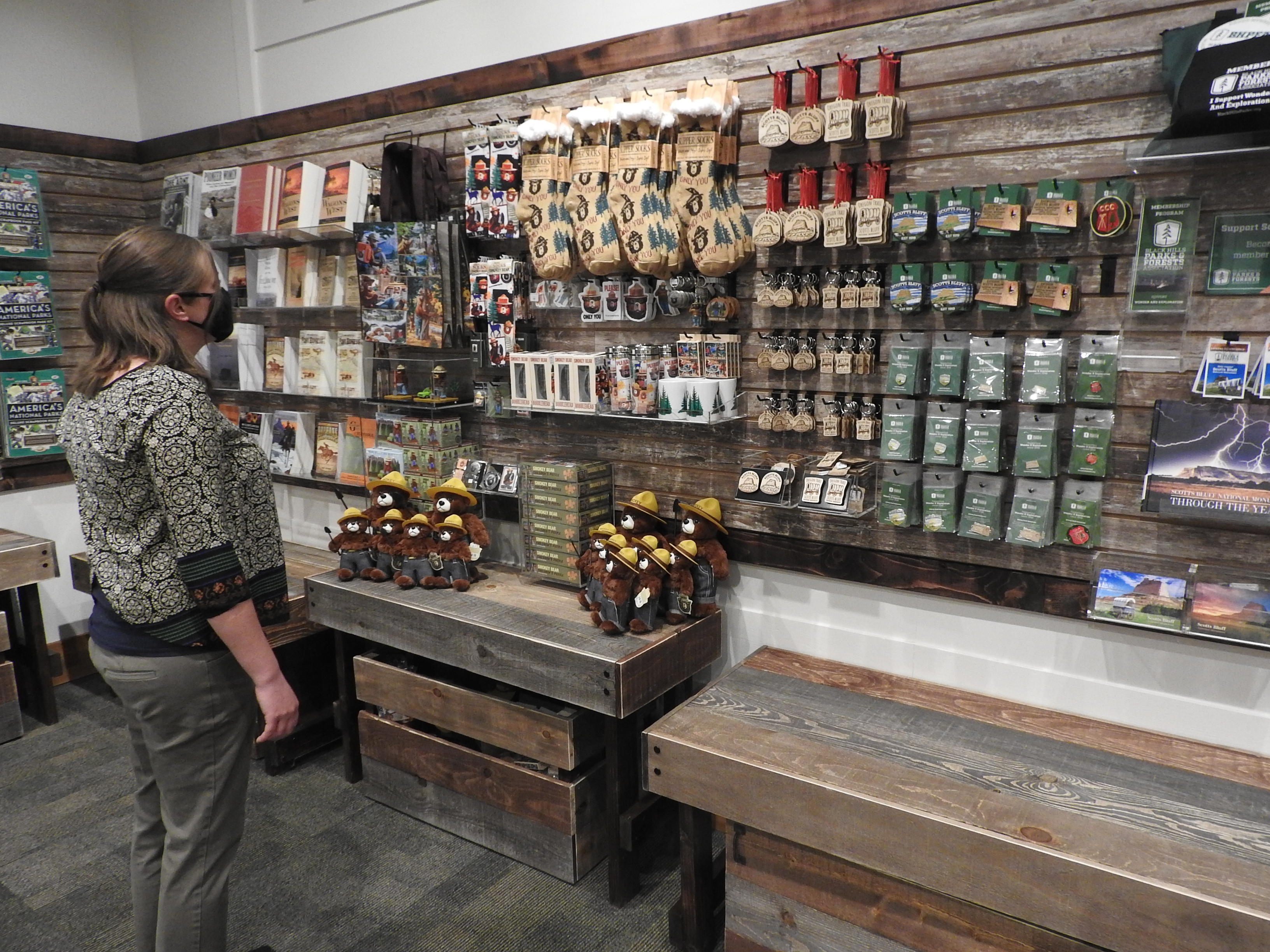
A rectangular-shaped room, approximately 19.5 feet long by 27 feet long. The ceiling is approximately 12 feet high. There are entryway portals, each measuring approximately 6 feet wide by 7 feet tall centered on the east, west and north walls of the room. The north and south walls both have windows that are 5 feet wide by 3 feet tall. The windows are all approximately 8 feet above the floor level and covered with gray, steel shutters. The north, south and east walls are covered with weathered-looking slatwall with merchandise hung from various fixtures. This merchandise includes clothing, books, and plush animals, among other items. Below the slatwall sections are benches of various heights, that are used to dsiplay some sales items. Below each bench is a crate used for storing more merchandise. The floor is covered with carpet patterned with rectangles of various shades of gray.
The bluffs of Scotts Bluff National Monument rise directly from the North Platte River, blocking wagon travel along the river's south bank. At first, emigrants had to take a detour south and use Robidoux Pass, a natural gateway, to get through the bluffs. This mostly stopped in 1850 when a new route was opened at Mitchell Pass.
To reach the walking trail, cross the access road at the left of the visitor center. The sidewalk on the other side leads back to the left towards the highway and then turns right to parallel the highway. Once past the curve, there are four reproductions of different style emigrant vehicles along the right side of the sidewalk as well as several wayside signs. Please feel free to touch any of the vehicles. To the left, on the other side of the road are more bluffs, layered in tan and brown. A cylindrical feature sits on top of the bluff nearest to the road.<br /><br />The first emigrant vehicle along the sidewalk, located about where the surface changes from smooth cement to a rougher aggregate, is a handcart. It has a small, square structure sitting directly over the two large wagon wheels with simple poles and a crosspiece extending in front for pulling it.<br /><br />A wayside sign near the handcart asks which route would you take? Before 1851, many emigrants took a long detour to the south through Robidoux Pass. Later a one-wagon wide trail was created through the ravines of these bluffs here at Mitchell Pass.<br /><br />Next is a common wagon, green in color with off-white canvas stretched on the overhead hoops. The rear wheels are larger than those in the front. The next wagon is very similar, this one painted white.<br /><br />The final wagon is larger, painted pale blue. The wagon bottom is slightly curved to the middle and the front and rear ends are angled outward. This one has a team of model oxen in front, wearing wooden yokes with chains running back to the tongue of the wagon.<br /><br />Past the last wagon, the sidewalk changes to a dirt and gravel path. A wayside sign here tells us that traffic went both ways through the pass. Fur traders traveled both directions, but some of the emigrants gave up and turned back eastward. Others returned to bring other family members out west. Traders drove massive freight wagons in both directions and Army units rode both ways as they patrolled the route.<br /><br />The trail continues around the base of Scotts Bluff, the flat end rising high above you on the right. Meadow vegetation lines the path along with earthen and rocky outcroppings. The path may be rough and uneven in places. More waysides at the end of the trail talk about how emigrants might get assistance along the trail and one shows a painting by William Henry Jackson that depicts the view of the trail looking back eastward through the pass, matching the current location of the sign.
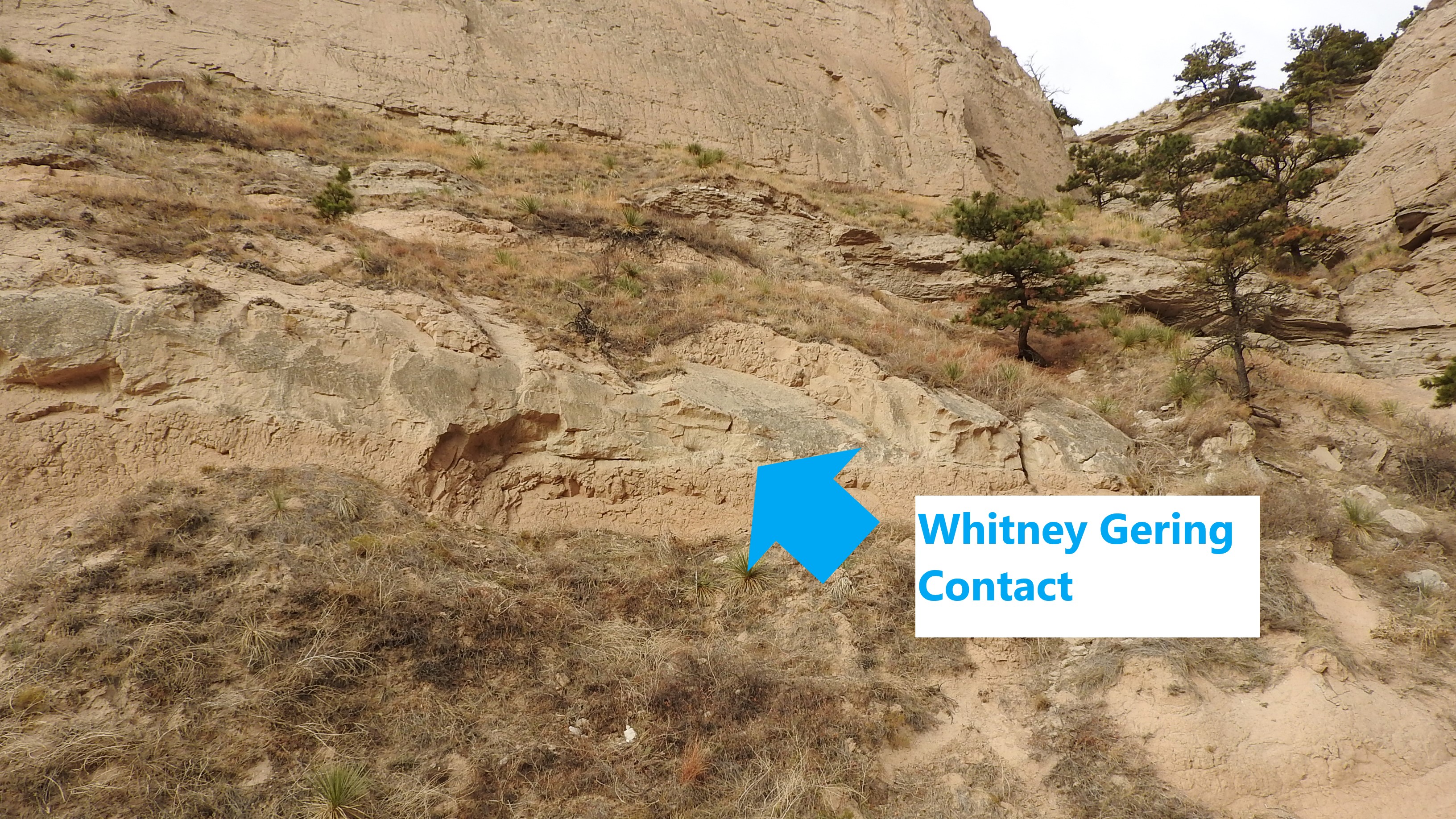
A paved trail leads past a gray rock layer that overlies lighter colored and softer rocks underneath it. Scattered ponderosa pines, yuccas and grasses are seen off to the side of the trail.
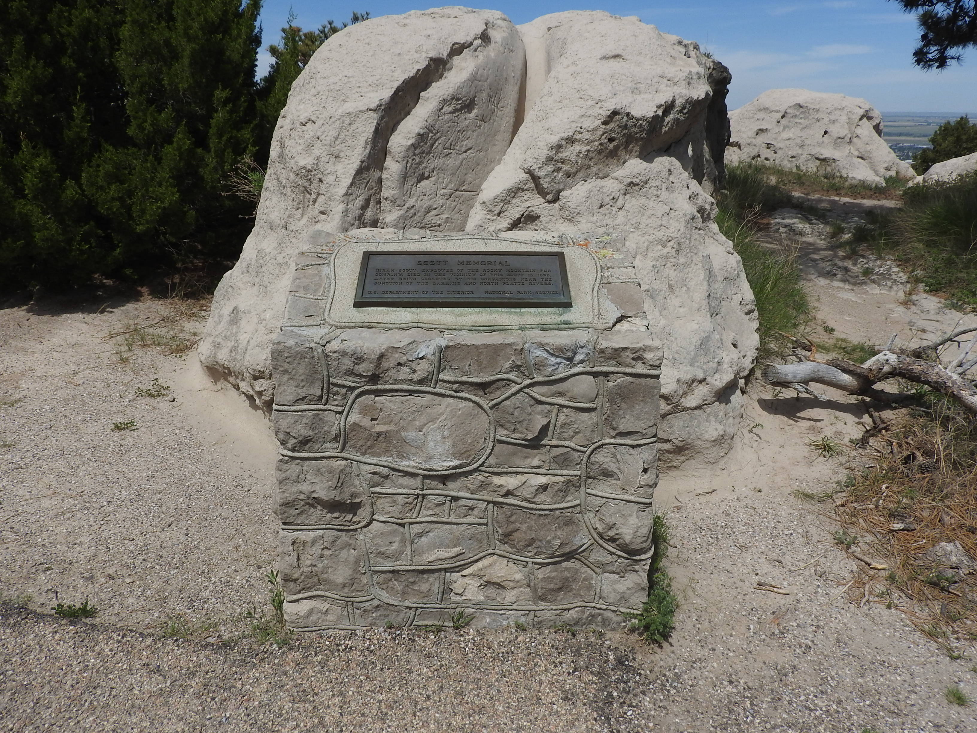
A memorial plaque to the namesake of Scotts Bluff.
A metal plaque set on a stone and mortar base that reads "Scott Memorial. Hiram Scott, employee of the Rocky Mountain Fur Company, died in the vicinity of this bluff in 1828, after being deserted by his companions near the junction of the Laramie and North Platte Rivers. US Department of the Interior, National Park Service."
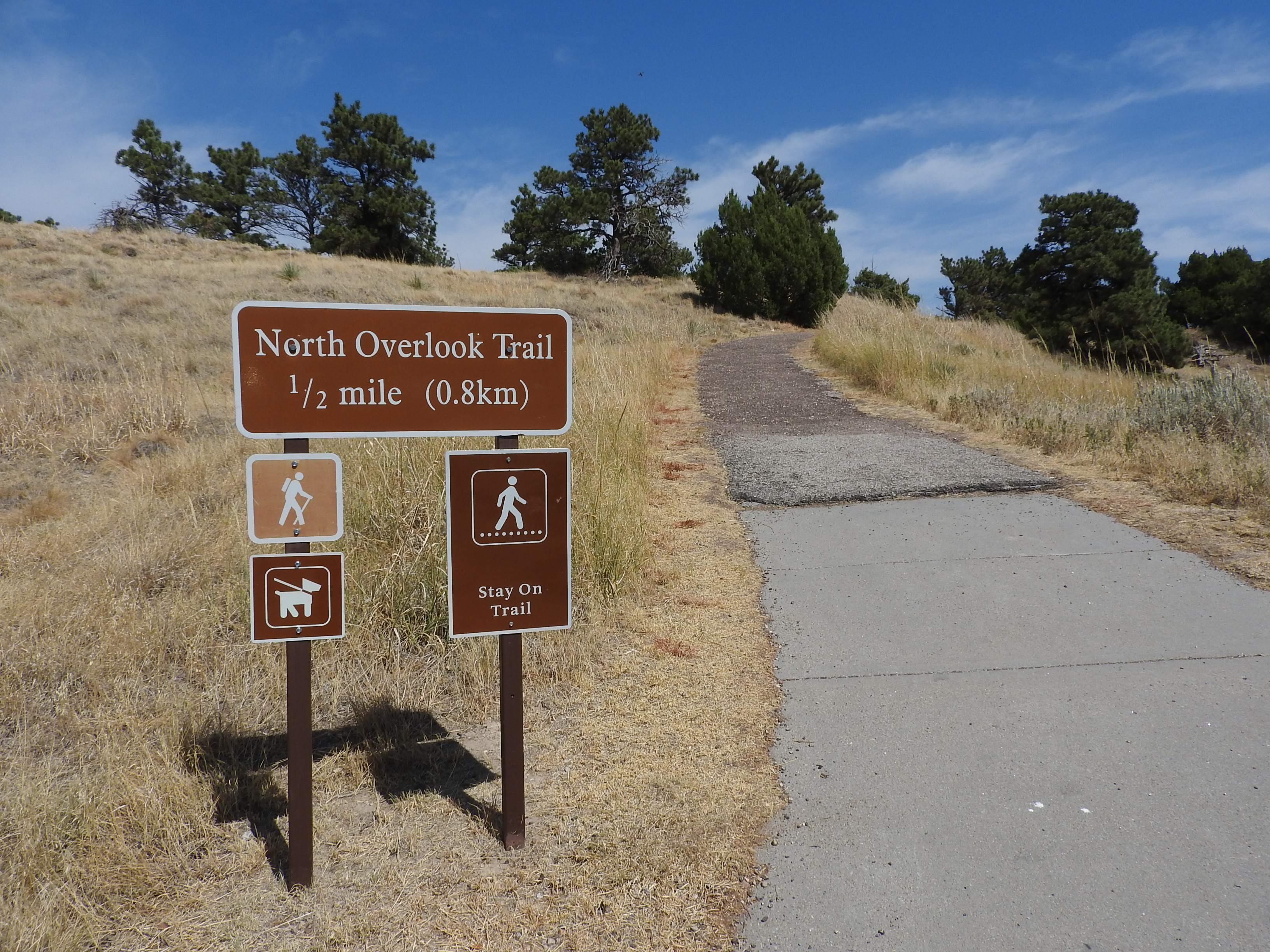
This is the trailhead for the 1/2 mile long North Overlook Trail. This trail features wonderful views of the North Platte River, the badlands, and the cities of Gering and Scottsbluff.
Located just steps away from the route of the Oregon, California, and Pony Express Trails; the Scotts Bluff National Monument Visitor Center features exhibits, a theater, and restroom facilities. The visitor center is located in the Mountain Time Zone.
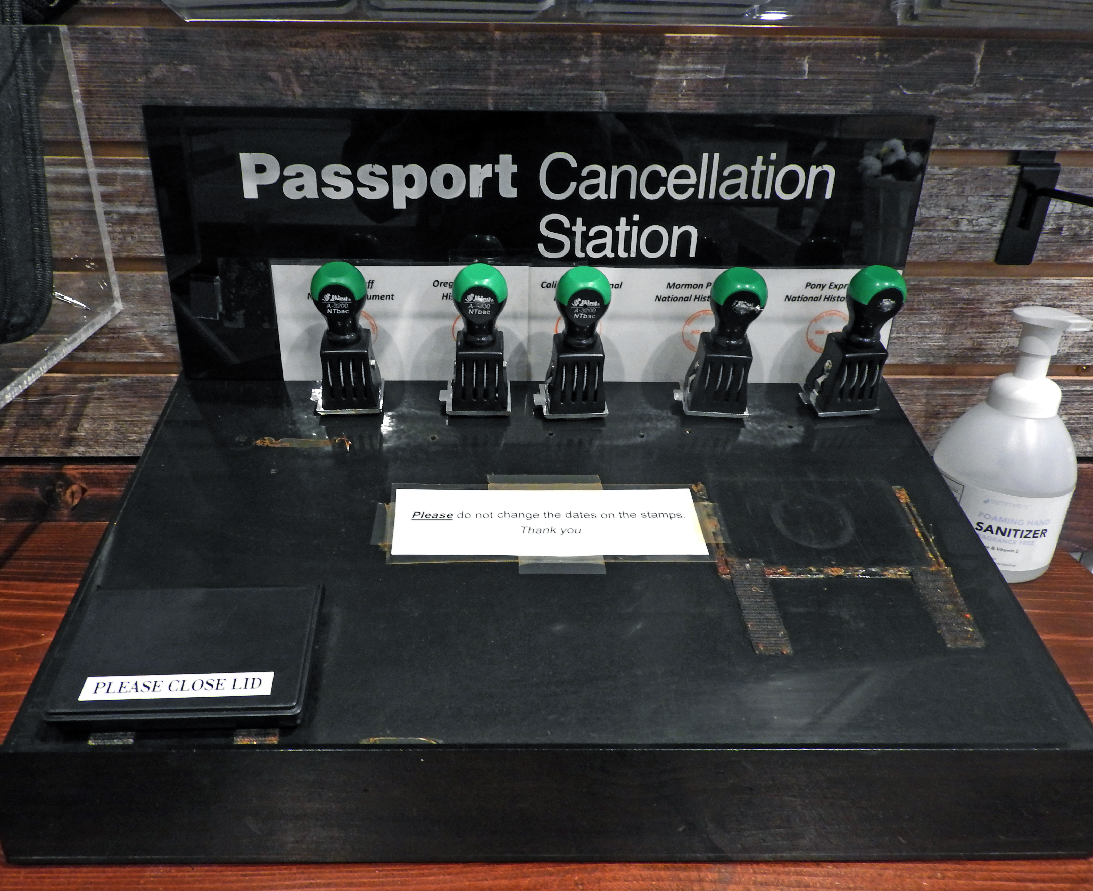
Stamp your "Passport to Your National Parks" book in the Scotts Bluff National Monument Visitor Center!
Viewing the William Henry Jackson Collection
A selection of the Scotts Bluff National Monument collection of the works of William Henry Jackson is displayed in the monument visitor center.
Hiking Scotts Bluff National Monument
There are nearly four miles of hiking trails at Scotts Bluff National Monument. There is a trail for every ability.
Scotts Bluff Cell Phone Audio Tour
The Scotts Bluff National Monument Cell Phone Audio Tour is a great way to learn more about the natural and cultural history of this famous landmark on the Oregon and California Trails.
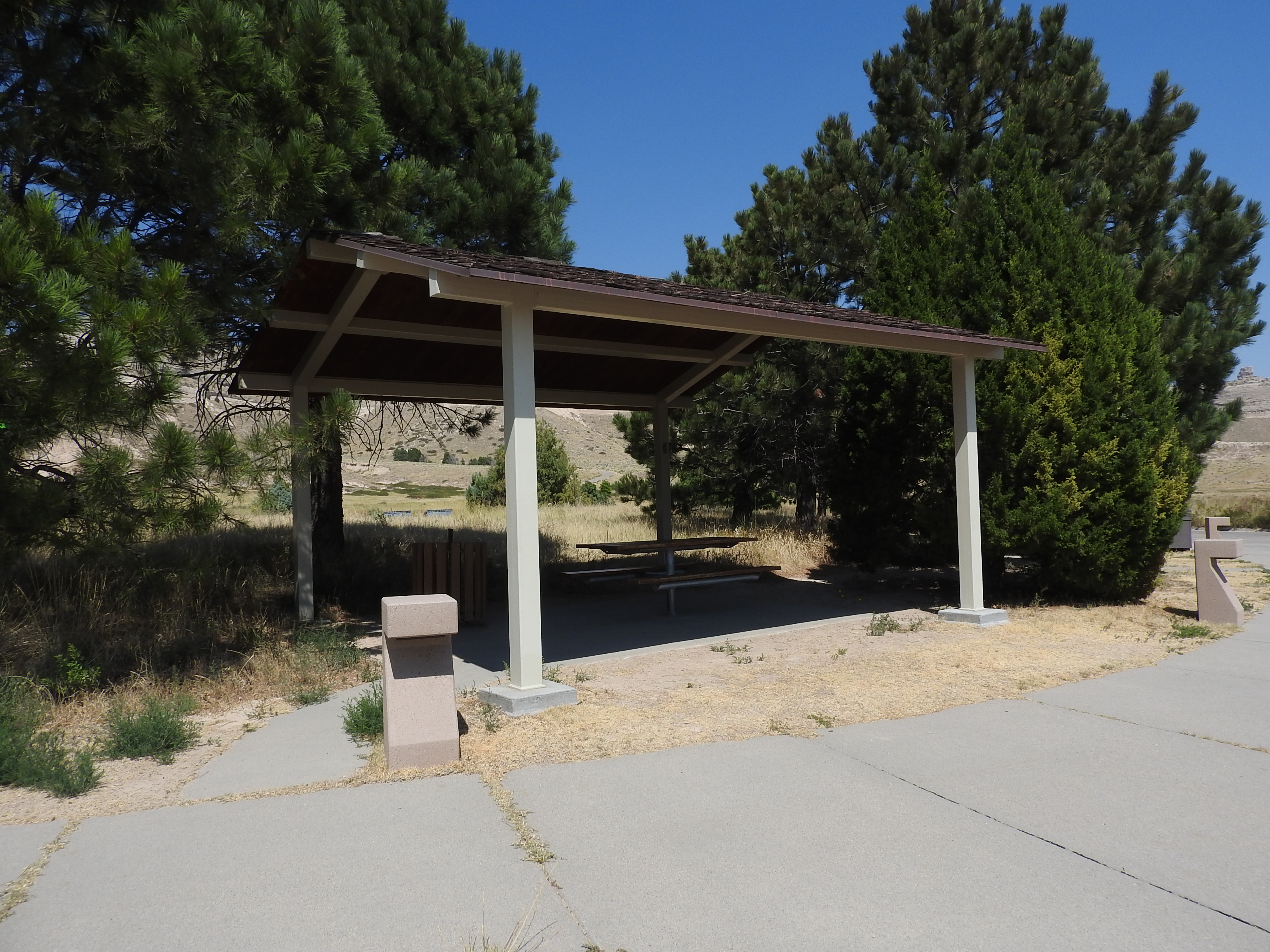
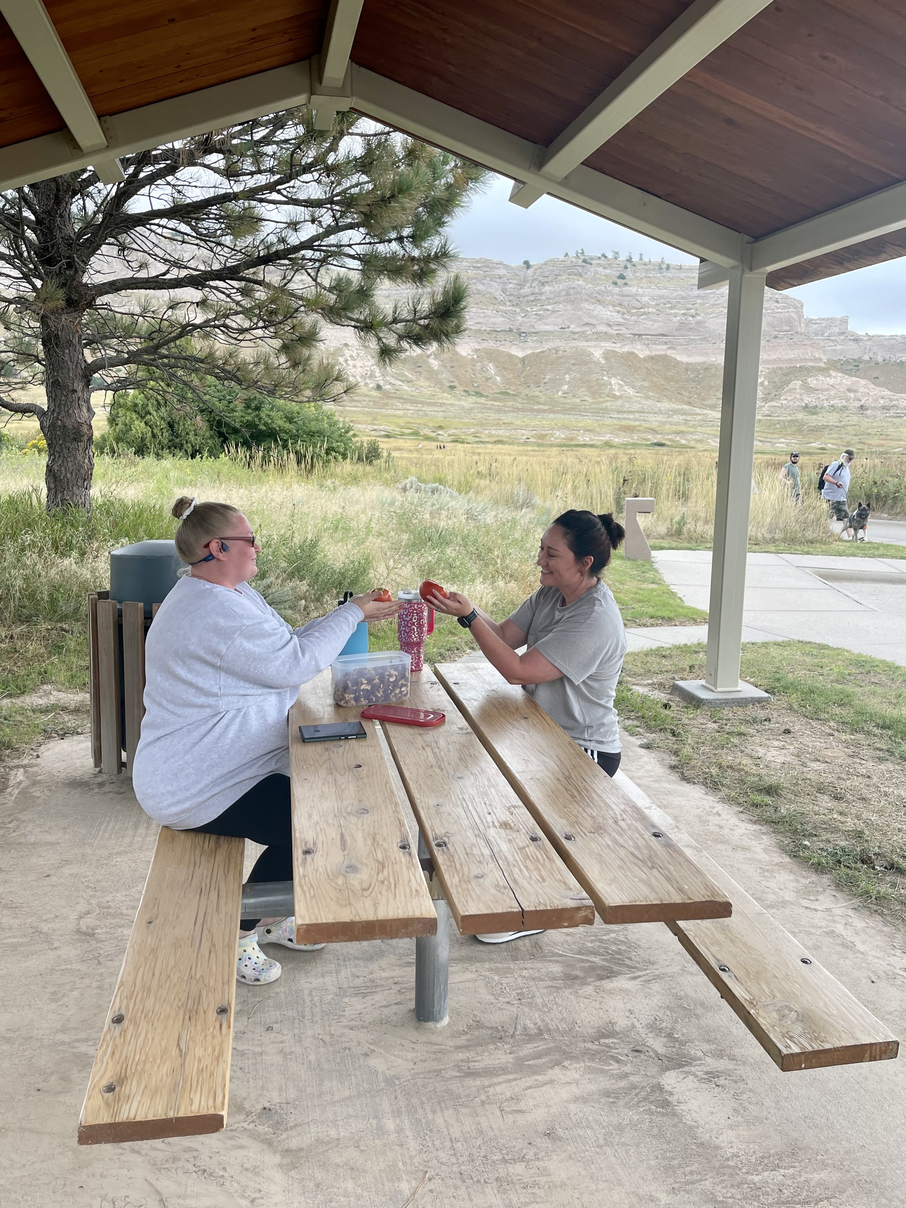
Enjoy a Picnic at Scotts Bluff
Enjoy a picnic at Scotts Bluff National Monument
Bicycling at Scotts Bluff National Monument
Bicycling can be a great way to experience Scotts Bluff National Monument. There are two locations in the monument where bicycling is permitted: the Prairie View Trail, and the Summit Road when it is closed to vehicular traffic.
Scotts Bluff Ranger Programs
Learn more about Scotts Bluff National Monument by attending a ranger-guided program!
Help Your Pet Become a B.A.R.K. Ranger
Learn what it takes to help your pet become a Scotts Bluff National Monument B.A.R.K. Ranger!
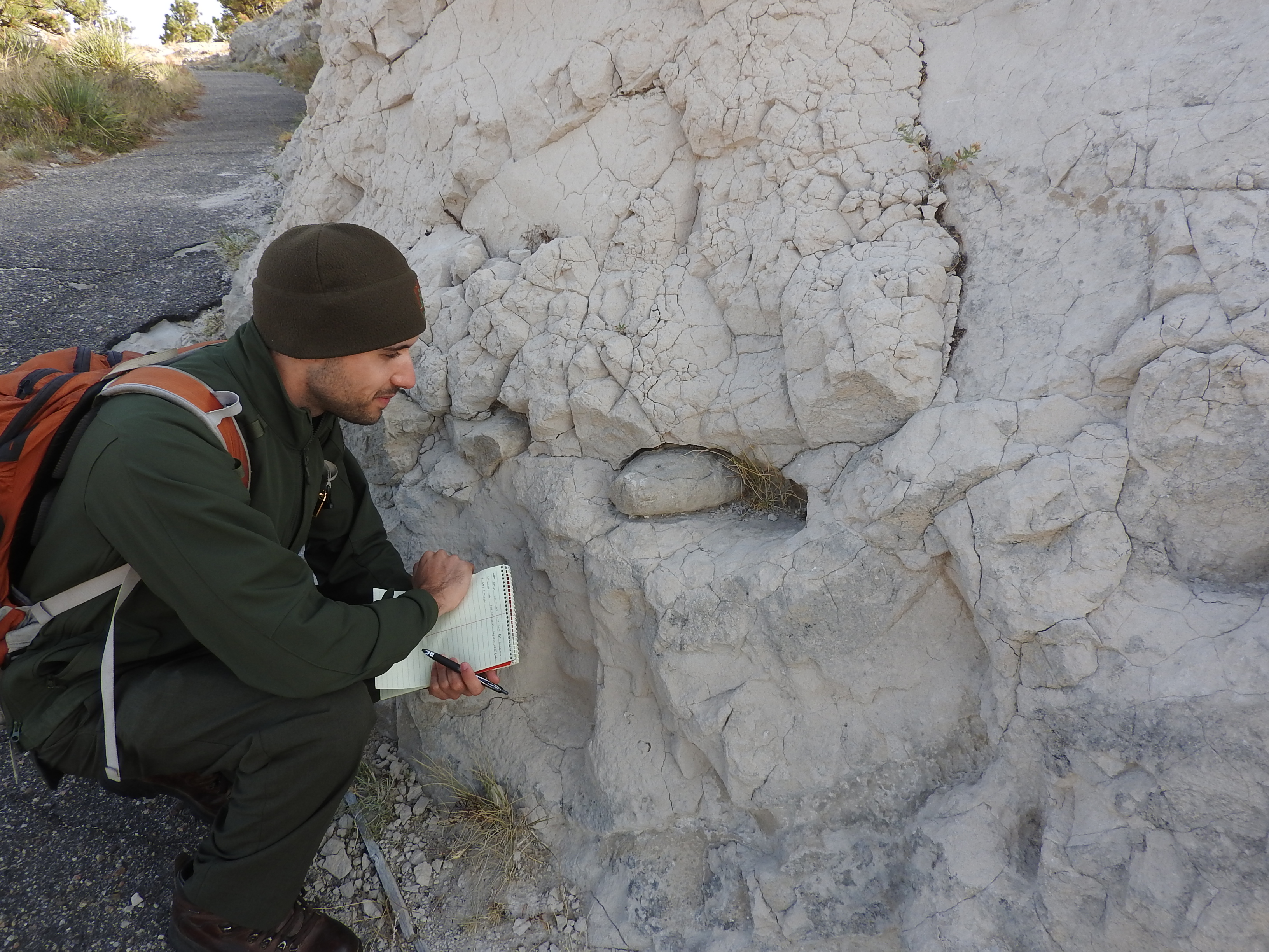
Saddle Rock Trail Geology Hiking Tour
This 1.6 mile hike on the Saddle Rock Trail features 435 feet of elevation change. Participants will have an opportunity to observe and learn about some unique geological features and the processes that created the landscape of Scotts Bluff National Monument.
Drive the Scotts Bluff Summit Road
A 1.6 mile drive from the Scotts Bluff Visitor Center Parking Lot to the summit of Scotts Bluff. This drive features scenic views and interesting geology. Vehicles longer than 25 feet (7.6 meters) and/or higher than 11 feet 7 inches (3.53 meters) are prohibited. All trailers are prohibited.
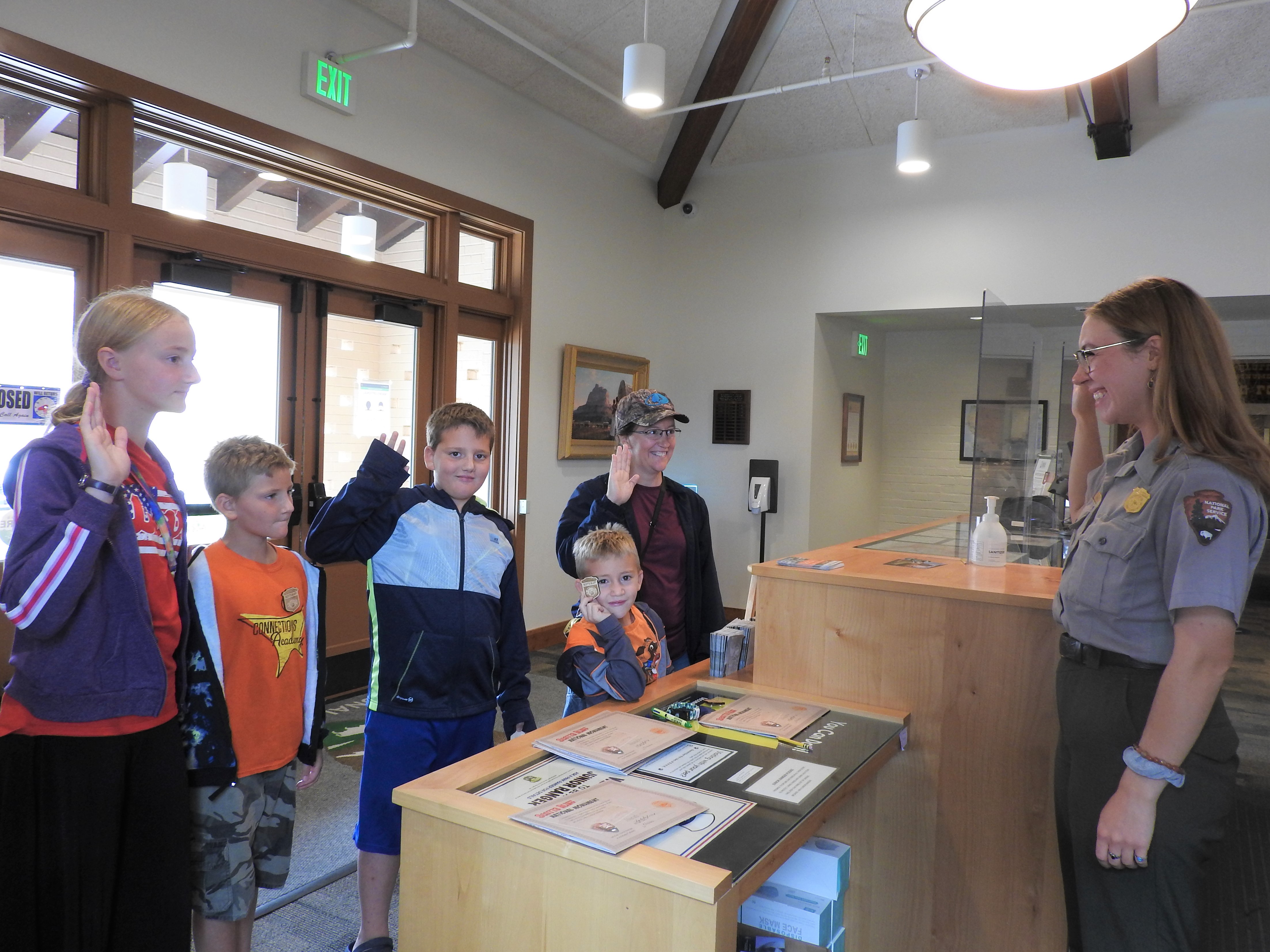
Become a Scotts Bluff Junior Ranger
Earn your Scotts Bluff National Monument Junior Ranger badge!
Backcountry Hiking South Bluff
Backcountry hiking on South Bluff is difficult and should only be attempted by experienced hikers. Please check in with the ranger at the visitor center.
Tours
Count: 3
Oregon Trail Pathway Audio Tour
Learn more about how emigrants travelled the emigrant trail through Scotts Bluff National Monument on this 1 mile long (round-trip) hike of the Oregon Trail Pathway. While some sections of the trail are paved, others have a natural surface. Be aware of uneven and slippery surfaces.
Saddle Rock Audio Tour
Learn more about the prairie ecosystem and geology of Scotts Bluff National Monument on this 1.6 mile long (one way) walking tour of the Saddle Rock Trail.
Saddle Rock Geology Hiking Tour
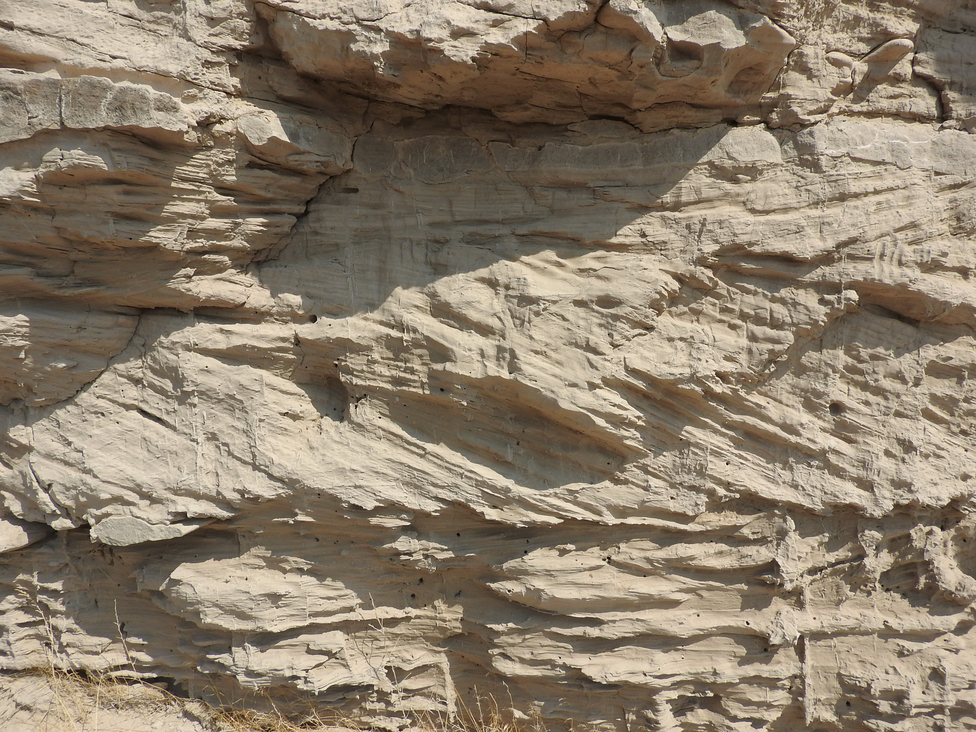
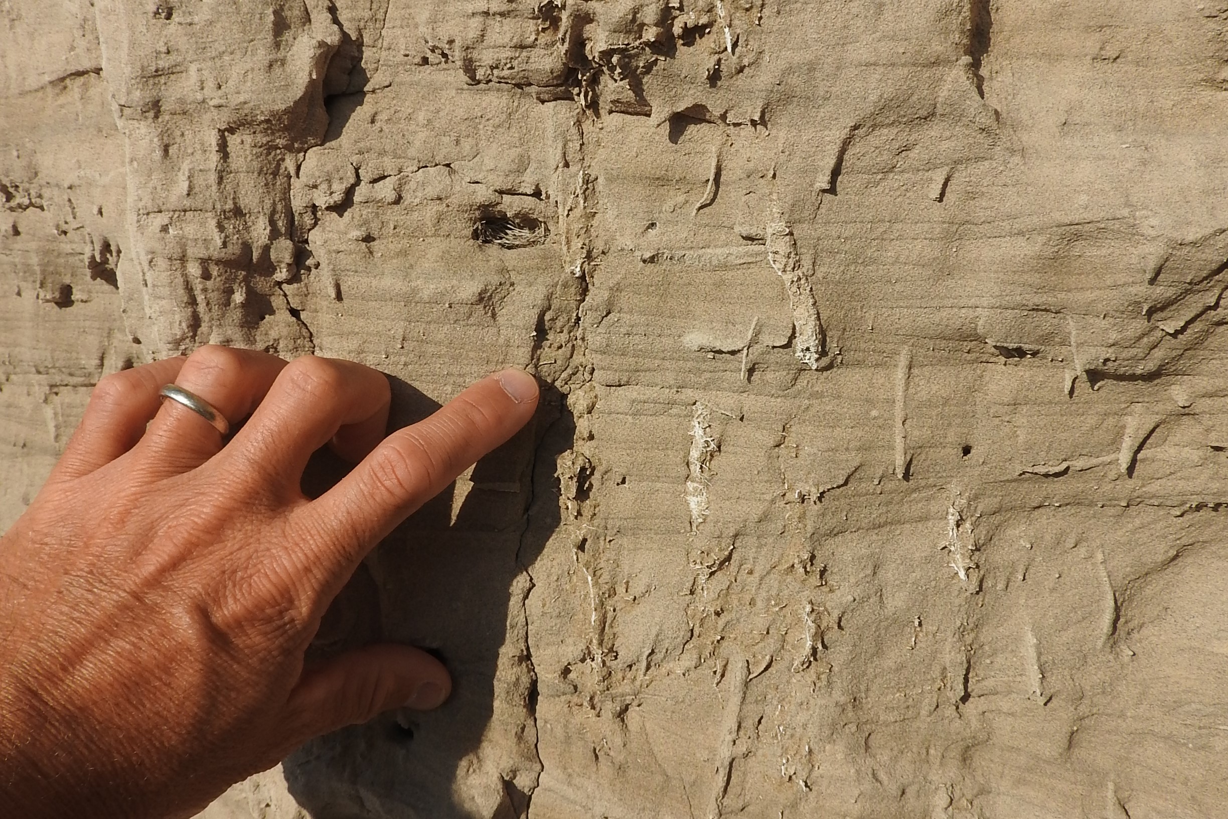
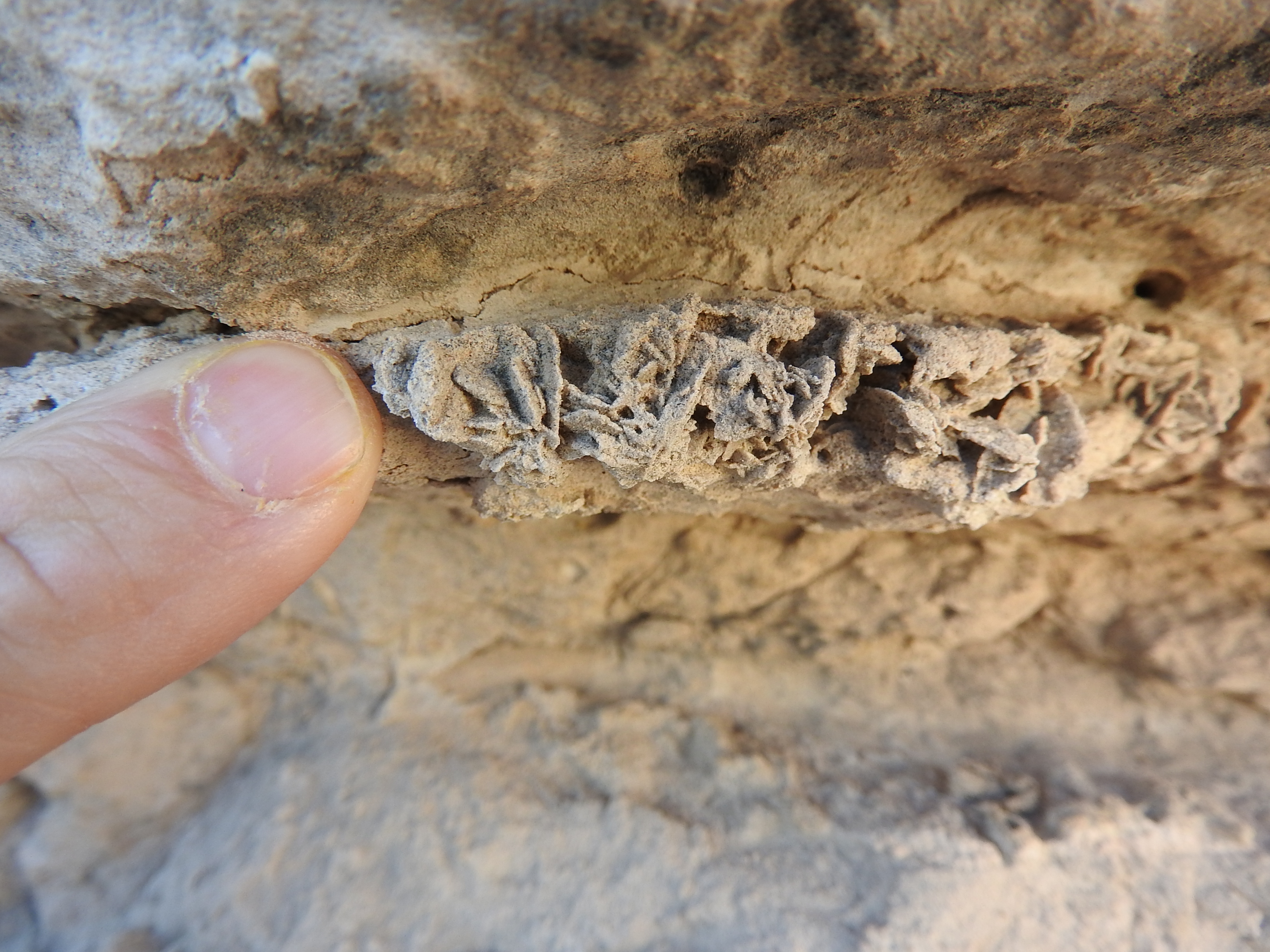
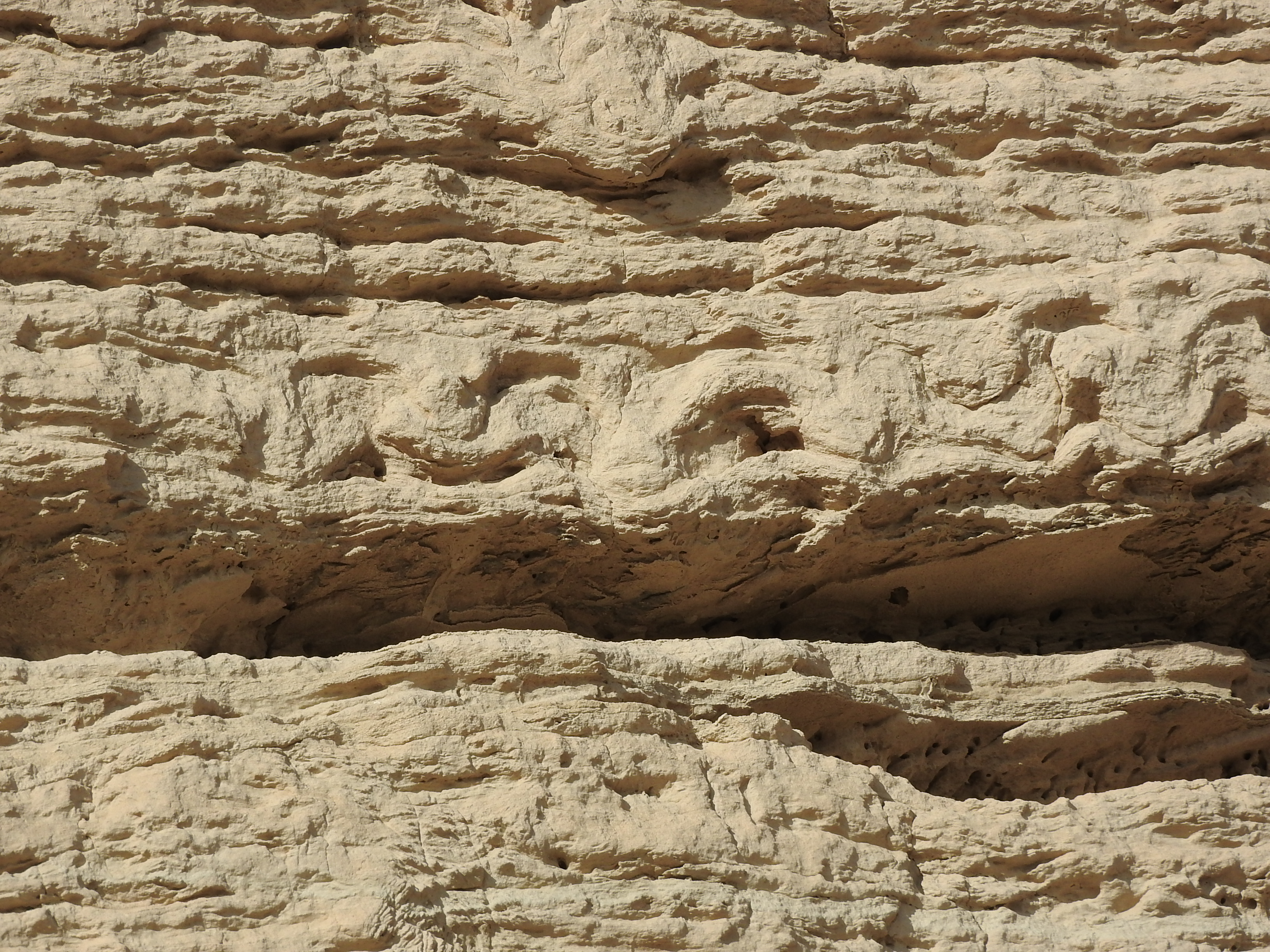
The Saddle Rock Trail, a 1.6 mile paved trail with 435 of elevation change, features the most accessible exposures of the Arikaree and White River Groups in western Nebraska. A wide variety of sedimentary structures, diagenetic features, trace fossils, and volcaniclastic sediments can be seen along the trail. This tour is based upon the Geological Society of America Centennial Field Guide, North-Central Section developed in 1987 by James B. Swimehart and David B. Loope.