The lava flow lies on the land like a dream, a wonderland of rock. A thousand years ago the ground was torn open and lava erupted into the sky, forever changing the landscape and the lives of the people who lived here. A thousand years later, tre...
This pass covers the pass holder and up to 15 passengers of a single, private (non-commercial) vehicle at both Sunset Crater Volcano and Wupatki National Monuments for 1-7 days.
Entrance - Motorcycle
$20.00
Admits the passholder and passenger of one motorcycle to both Sunset Crater and Wupatki National Monument for 1-7 days.
Entrance - Per Person
$15.00
Admits one individual bicyclist, hiker, or pedestrian visiting the facility without a private vehicle. Good for both Sunset Crater and Wupatki National Monuments for 1-7 days. A pass is not required for individuals 15 or younger.
Entrance - Non-commercial Groups
$15.00
The per person fee is charged for non-commercial groups up to the point that it exceeds the cost of the commercial rate for the same size vehicle.
Entrance - Education/Academic Groups
$0.00
Bona fide educational institutions visiting for non-recreational purposes whose visit pertains directly to established curriculum are exempt from paying entry fees. Apply for an educational fee waiver at least 4 weeks in advance by submitting an educational fee waiver. Please see the below link to access the waiver.
Commercial Entrance - Sedan
$28.00
Covers occupants of a vehicle with an occupancy of 1-6 individuals at Sunset Crater, Wupatki, and Walnut Canyon for 1 day. A commercial group is defined as a group that is entering for the purpose of providing commercial tour services within the unit. A commercial group consists of one or more persons traveling on an itinerary that has been packaged, priced, or sold for leisure/recreational purpose by an organization that realizes financial gain through the provision of the service.
Commercial Entrance - Van
$40.00
Covers occupants of a vehicle with an occupancy of 7-15 individuals at Sunset Crater, Wupatki, and Walnut Canyon for 1 day. A commercial group is defined as a group that is entering for the purpose of providing commercial tour services within the unit. A commercial group consists of one or more persons traveling on an itinerary that has been packaged, priced, or sold for leisure/recreational purpose by an organization that realizes financial gain through the provision of the service.
Commercial Entrance - Motor Coach
$100.00
Covers occupants of a vehicle with an occupancy of 16+ individuals at Sunset Crater, Wupatki, and Walnut Canyon for 1 day. A commercial group is defined as a group that is entering for the purpose of providing commercial tour services within the unit. A commercial group consists of one or more persons traveling on an itinerary that has been packaged, priced, or sold for leisure/recreational purpose by an organization that realizes financial gain through the provision of the service.
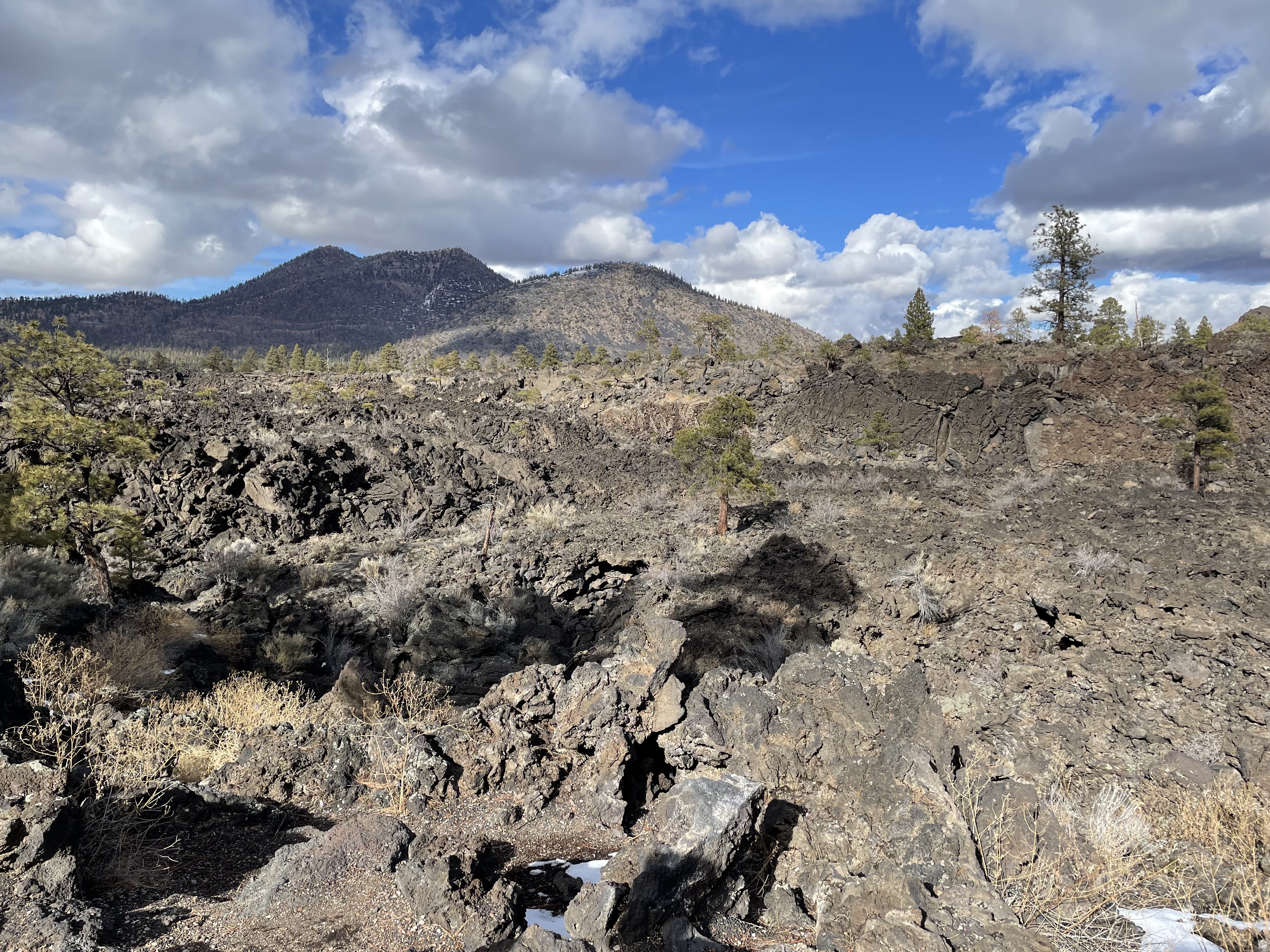
The A'a Overlook has views of the Bonito Lava Flow and A'a Trail below. The O'Leary Peak lava dome within the Coconino National Forest can be seen in the distance.
For all directions in this description, face your back to the parking area. A concrete sidewalk runs parallel to the parking area and road with a textured ramped curb in the center. This sidewalk leads to informational signs to the right of the ramped curb, A'a trail access in the center and on the far right, and the Lava's Edge trailhead on the far left. A wooden split rail fence with two rails is parallel to the sidewalk between the parking area and the trails. Views from the A’a overlook include large, jagged basalt rocks, some of which are 30 feet tall, ponderosa pine and quaking aspen trees, and several of the surrounding volcanic hills in the distance. Several informational and interpretive signs exist along the sidewalk and at the trailheads. From left to right these are the Lava’s Edge Trailhead sign, a yellow burnt area cautionary sign, and the A’a Trailhead sign, and two interpretive signs about the geology and plant life. The Lava’s Edge trailhead sign frame is 16.5 inches wide by 70 inches tall. The sign panel is 12 inches wide by 24 inches tall. The text and graphics on the sign include length and difficulty, a safety message, a photo taken from the trail a park map with the trail location, and information about rules and regulations. Sign text from top to bottom reads: Lava’s Edge Trail East Trailhead The stark silhouette of jagged basalt is softened by ponderosa pines growing at the edge of this ancient lava flow. This moderate 3.4 mi (5.5 km) round-trip trail follows the edge of the Bonito Lava Flow, showcasing jagged volcanic features and ponderosa pines struggling to grow on the uncompromising landscape. Allow 2.5 hours for a round-trip hike. Are you prepared? Know your limits. You are at nearly 7,000 ft (2,134 m) in elevation. Consider your physical condition before attempting this trail. The trail surface is composed of loose cinders. Sturdy, closed-toe footwear is recommended. This trail travels across both the National Park Service (NPS) and US Forest Service (USFS). Pets are only allowed on the USFS between Bonito Campground and the NPS boundary. Pets are prohibited from this trailhead. Silhouetted graphics for safety and rules include captions that read “Stay on Trail. No pets on NPS lands. No smoking. No bicycles. Don’t forget water!” The photo shows a field of jagged basalt rocks with various sizes of ponderosa pine trees, Sunset Crater Volcano in the background, and a clear blue sky. The photo caption reads “View of Sunset Crater Volcano across the Bonito Lava Flow.” The park map is a standard NPS map with minimal topography showing the roads and parking lots, locations of the trails, the monument boundary, the location of USFS campgrounds, and the Sunset Crater Volcano visitor center. The yellow cautionary sign has a black silhouette graphic of a dead and broken tree and the NPS arrowhead. Text on this sign reads: “Caution Burned Area. Potential Hazards Include: Loose rocks, Flash Flooding, and Debris Flows. Trees may have been weakened from fire damage and may fall at any time. •Avoid area during high winds •Be alert for falling trees •Do not linger around large burned trees Flash floods and debris flows may occur anytime. •Avoid area during heavy rain •Seek high ground immediately during flood” The A’a trailhead sign is the same size and layout at the Lava’s Edge trailhead sign and includes text, one photo, a park map, and graphics for rules and safety. Text on the sign from top to bottom reads: “A’a Trail On the jagged lava surface new life emerges. This easy 0.2 mile (0.3 km) loop trail traverses a section of the Bonito Lava Flow. “A’a” is from the Hawaiian word for “stony rough lava.” It forms sharp, fragmented surfaces as it flows rapidly and cools quickly. Sturdy footwear is recommended due to sharp edges along this basalt and loose cinders trail. On this extreme landscape, new growth brings transformation. Colorful lichens, flowers, and changing aspen leaves provide a bright contrast to the dark basalt and cinders. To the left is the Lava’s Edge Trail. Across the road is the Lenox Crater Trail. Please park vehicles in the Lava Flow Trail parking lot when hiking these longer trails. The photo is of quaking aspen trees with yellow leaves during the fall, basalt rocks and cinder hills in the background, with a clear blue sky. A caption below the photo reads “An aspen grove heralds seasonal change on the Bonito Lava Flow.” Silhouetted graphics for safety and rules include captions that read No Pets. No Smoking. No Bicycles. No Climbing. Please stay on trail to protect fragile resources. The park map is a standard NPS map with minimal topography showing the roads and parking lots, locations of the trails, the monument boundary, the location of USFS campgrounds, and the Sunset Crater Volcano visitor center. The two interpretation signs are angled with metal frames at a height of 3.5 feet at the back and just under 3 feet high at the front where a person would stand. The sign panels are 24.5 inches tall by 40.5 inches wide. Both signs are designed using the NPS graphic identity with a top black banner and NPS arrowhead. The sign on the left has a background photo of a ground level close up of black volcanic cinders and a small blooming scarlet gilia (Ipomopsis aggregate) plant. The text including a title and three sections of body text reads “Living on The Margins. Life on a lava flow begins with the smallest of steps. The natural processes at work within Sunset Crater Volcano National Monument continue to slowly change as soil is formed and the succession of plants adapt to this volcanic area. Despite their stark appearance, lava flows can be home to a great diversity of species. Over the last nine hundred years, isolated trees, shrubs, and cacti have germinated and survived in the crevices and sheltered pockets of cinder cover within the Bonito Lava Flow. Here, aspen have taken root and several feet away, a claret cup cactus grows on a solid rock face. Over time the wind, rain, and new plant life here will cause even the hardest rocks to erode into soil through a process called weathering. Because soil formation from weathering hasn’t progressed very far in the short time since the eruption, most soil on the Bonito Lava Flow has been carried in on the wind and collected in small pockets. For many of the flowers, shrubs, and trees you see growing on the flow, life began as a single seed that found its way into a sheltered pocket of windblown soil. The margin for success out here is small, but all around us life continues to thrive in this fragile landscape. Below the text there is an image of a painted landscape with ponderosa and quaking aspen trees in the background and rocks with yellow lichen on them in the foreground. The caption for this image reads: “Visible today as colorful green, gray, orange, and yellow patches on surrounding rocks, lichen are a result of the symbiotic association between algae and fungi. Lichens slowly break rock into soil-sized particles, creating habitat for other plant life.” The sign on the right has a background photo of Sunset Crater Volcano and several surrounding cinder hills taken from a high viewpoint on the O’Leary Peak Trail. The cinder hills are surrounded by ponderosa pine trees and there is a clear blue sky in the background. This photo only takes up the top two-thirds of the sign panel. Text over this image includes a title and three sections of body text which reads: “Lava Lake In an instant, geologically speaking, the Bonito Lava Flow transformed this area into the jagged, chaotic landscape before you. The flow, which covers about two square miles (5 sq. km), formed when molten lava squeezed out of a deep fissure beneath the base of an actively spattering cinder cone, known today as Sunset Crater Volcano. As Sunset Crater Volcano erupted amid older extinct volcanoes, it closed off the lower end of a broad valley to form a shallow enclosed basin. With nowhere else to go, lava pooled and accumulated to perhaps 100 feet (30 m) thick during at least three phases. The surface of the lava hardened as it contacted air and cooled. However, the inside of the lava remained molten and under pressure, eventually bursting apart the hardened surface and piling up in jagged blocks as liquid lava moved below. Although the final shape and texture of the lava flow appear very complex, both the flow and all the volcanic cinder deposits around you consist of a single type of volcanic rock called basalt that originated some 25 miles (40 km) beneath the earth’s surface. The Sunset Crater eruption covered more than 800 square miles (2,071 sq. km) in volcanic cinder and ash called tephra. The tephra layer is more than 60 feet (20 m) deep on the slopes of Sunset Crater, and gradually thins to only a few inches about 12 miles (19 km) to the northeast at Wupatki National Monument.” Below the text there are three painted images showing the sequence of a lava flow during the eruption of a cinder hill. End of Description
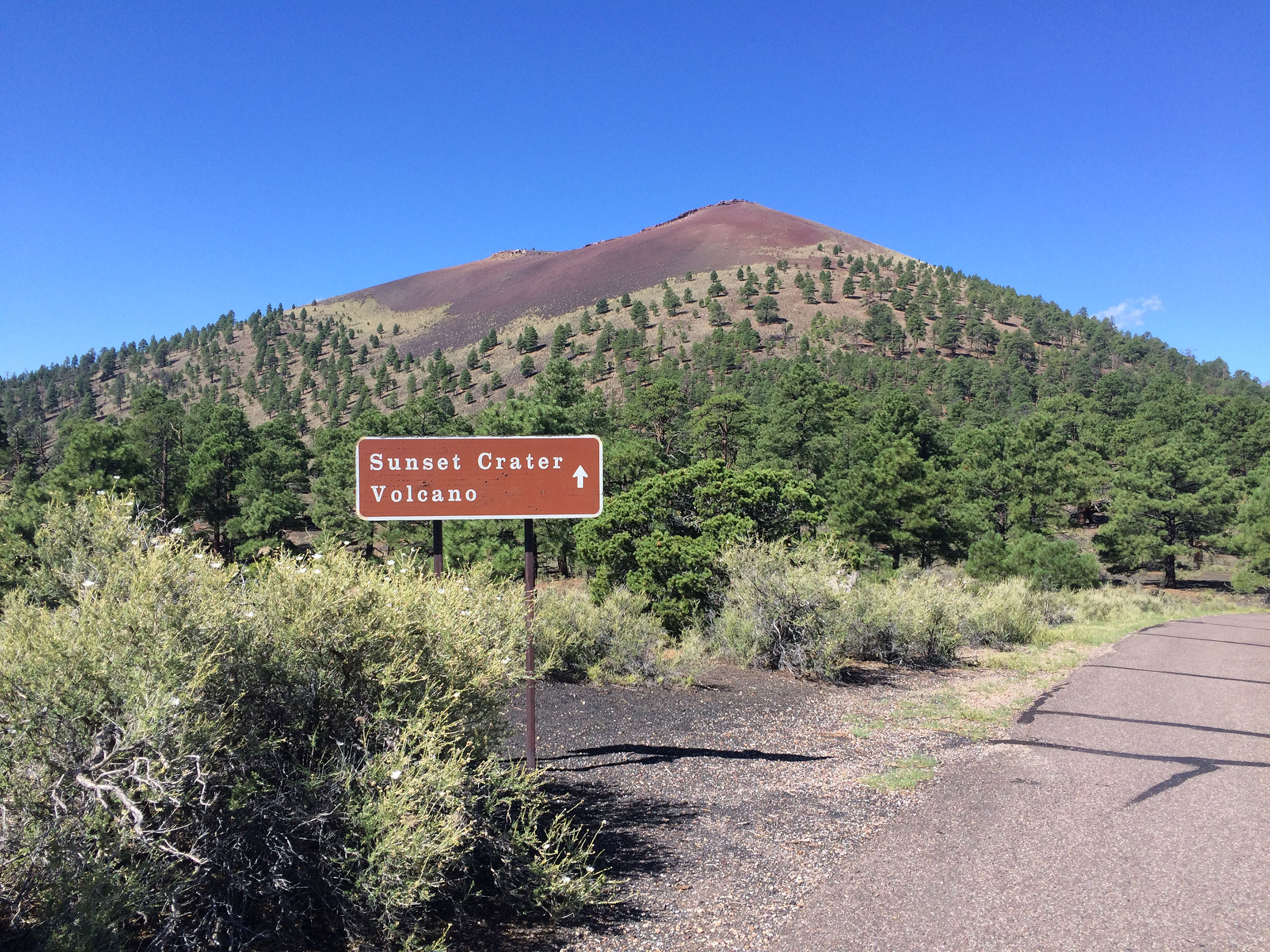
Experience a spectacular view of Sunset Crater Volcano and the San Fransisco Volcanic Field along a short loop road.
A one-way loop drive surrounds a small circular traffic island that has trash cans, large basalt rocks, and small shrubs. On the east side of the loop drive there is a 5x10 foot concrete pad with two angled information signs in metal frames. The view from the overlook includes several of the nearby cinder hills which look like rolling mounds of black gravel. A combination of ponderosa and pinion pine trees, small shrubs, and wildflowers grow at the base of the hills amongst exclusively volcanic rocks. The informational panel pointing south towards Sunset Crater Volcano explains the events of the eruption. A close-up photo of black cinder rocks provides the backdrop for white text in the top half of the panel. Three illustrations of lava erupting from the ground makes up the bottom half of the panel. Text for this panel reads: Formation of Sunset Crater. Sunset Crater Volcano is a nearly symmetrical cinder cone formed in the mid 1080s. It is a single eruption feature among many from a larger eruption event. The lines of red deposits on the older, dark gray cinder hills marks part of a six-mile (9 km) long volcanic fissure extending to the southeast of Sunset Crater. Eruption activity from the same magma chamber occurred within a relatively short time along the entire fissure. Volcanic fragments, called pyroclasts, shot Upwards all along the fissure in a dramatic "curtain of fire." Pressure fluctuations caused the fissure to quickly close in places, and magma began erupting from a series of vents. The red hills are small cinder cones that formed at that stage. When magma became focused at a primary vent, it erupted as a spectacular lava fountain that geologists say would have spouted nearly a thousand feet (305 m) high. The accompanying ash cloud, estimated to have risen more than 2.5 miles (4 km), would have been visible across much of present-day Arizona, New Mexico, and parts of Utah. Sunset Crater grew as the shoer of cinders and ash piles up around the vent. Lava broke out of the base and flowed for many miles. The Kana-a Flow is visible on the drive to Wupatki National Monuments. On the other side of Sunset Crater, The Bonito Lava Flow remains jagged and sharp even after 900 years. The second informational sign points northeast towards an open landscape. Text for this panel reads: To Preserve and Protect. You are standing at the boundaries of Sunset Crater Volcano National Monument, managed by the National Park Service (NPS) and Coconino National Forest (USFS). These agencies have different land management policies that determine visitor use and access. NPS preserves natural and cultural resources and values, protects them for future generations, and provides opportunities for research, education, and discovery. This means resources are preserved and protected in their natural or historical state. Visitors hike on designated trails or within specified boundaries, leaving other areas closed to visitation to protect fragile environments. USFS cares for the land and serves the people, maintaining the health, diversity and productivity of the nation’s forests and grasslands through sustainable multiple-use policies. Off-highway vehicles, hunting, wood cutting, and dispersed camping are activities allowed in some USFS areas but prohibited throughout the national monument. Both land management agencies provide meaningful recreational opportunities while protecting natural and cultural resources. Thank you for following agency policies and treating these lands with respect. Land managers study the effects of both natural processes and human impacts across agency boundaries, adjusting access and use to protect resources. How we collectively interact with the landscape directly affects recreation for present and future generations.
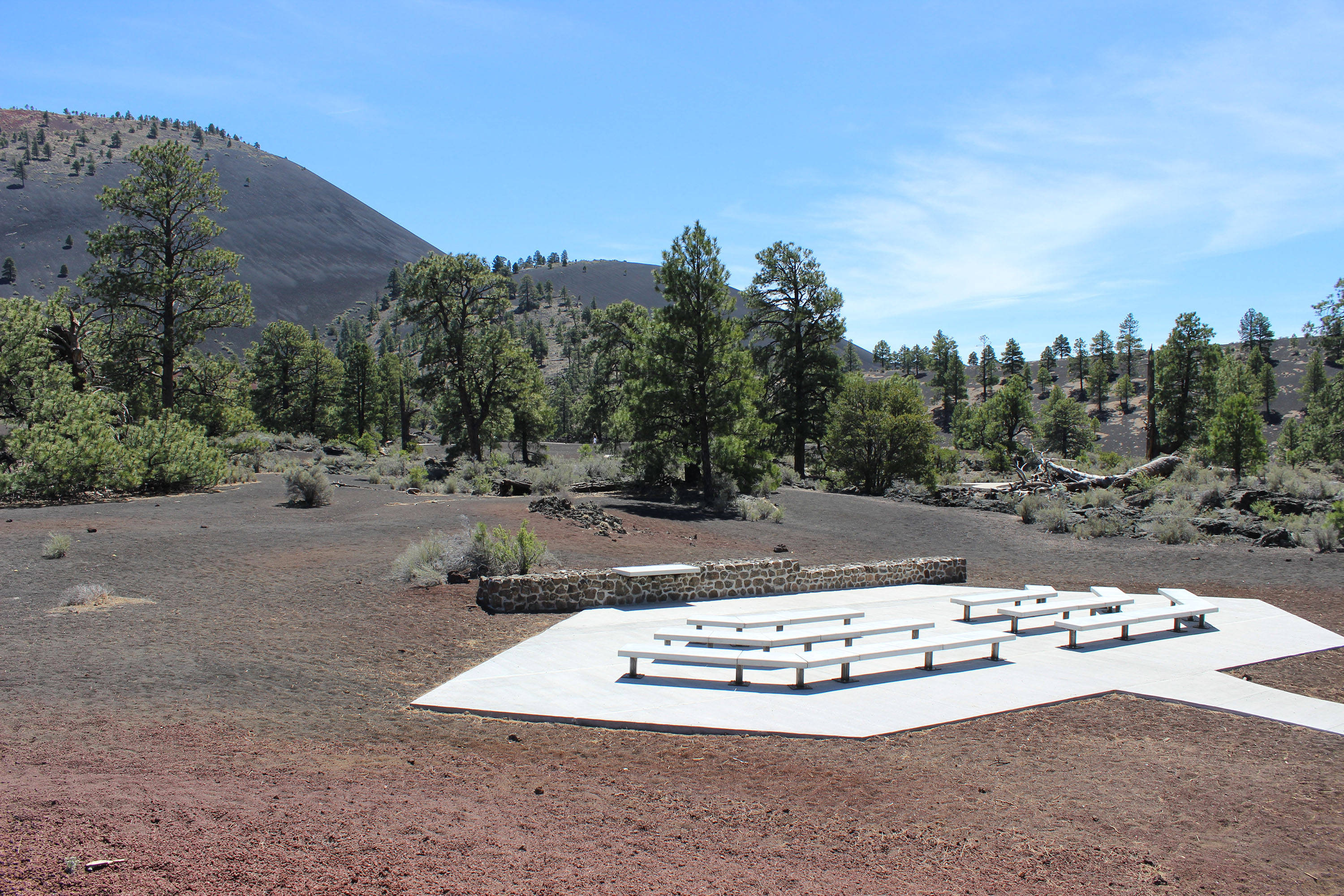
The Lava Flow Trail Amphitheater is a place for quiet reflection, scenic views, ranger programs, and starry skies.
An accessible concrete sidewalk leads to a large concrete slab with a series of six concrete benches in two rows facing a low stone wall. The concrete slab is the shape of a horizontally elongated hexagon where the longest edge connects to the sidewalk and the sides come to a point. The benches increase in size in each row starting with the bench closest to the stone wall and mirror the edges of the concrete slab creating L shapes. There is a gap between the two rows of benches allowing space to move between them and access all sides. On the top of the stone wall, just left of center, there is a concrete table which is used by rangers and park partners during interpretive presentations. Both the paved and unpaved sections of the Lava Flow Trail go around the amphitheater in a loop. The amphitheater is built in the middle of an open area of volcanic cinders. These cinders are small basalt rocks that vary in size from dust to a marble and are a mix of black and rusty red. Between 50 and 150 feet from the amphitheater on all sides are small shrubs, medium sized juniper trees, and large ponderosa pine trees. Many dried logs and branches from fallen trees are scattered on the ground providing habitat for small animals and insects. Sunset Crater Volcano is about ½ mile away and in direct view from the amphitheater. Sunset Crater is a volcanic cone shaped hill made of basalt cinder rocks that erupted from a fissure in the ground. It is about 1,000 feet tall with black rocks at the bottom and rusty red rocks at the top making it look like the sky during a sunset. During the eruption fountains of lava came out of the fissure, cooled in the air, and landed on top of each other to form the cinder hill. There is a depression, or crater, in the center of the top of the hill. Many ponderosa pine trees grow at the base of Sunset Crater, fewer at the top. Smaller cinder hills and jagged basalt rocks also surround the base of Sunset Crater creating a landscape of a dynamic volcanic history. End of description.
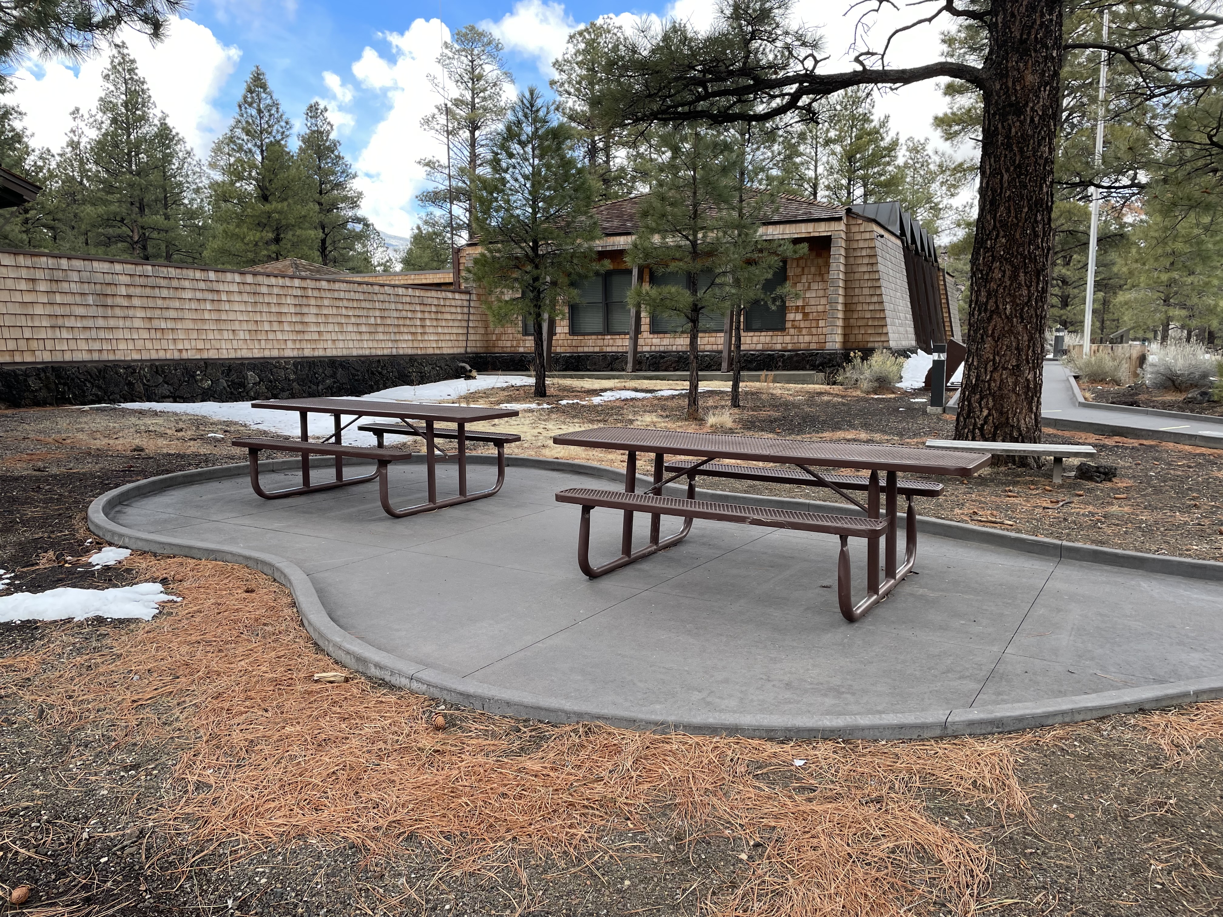
Five picnic tables around the Lava Flow Trail parking lot offer a place to eat lunch, a quick snack, or just take a break under the shade of ponderosa pine trees.
A one-way loop drive goes around a curbed traffic island approximately 300ft long and 60 ft wide. On either side of the island are a total of 39 regular sized parking spaces and three long RV spaces. Accessible parking spaces are located midway along the right side of the loop and near the bathrooms in the beginning of the left side of the loop. A concrete sidewalk exists along the entire perimeter of the loop drive and the traffic island providing access to the Lava Flow and Bonito Vista trailheads, two accessible composting toilets, Informational signs, and several picnic tables. The ground is covered with a variety of sizes of volcanic rock from small cinder pebbles to large basalt boulders. Varying sizes of ponderosa pine trees and small shrubs sparsely vegetate the landscape.
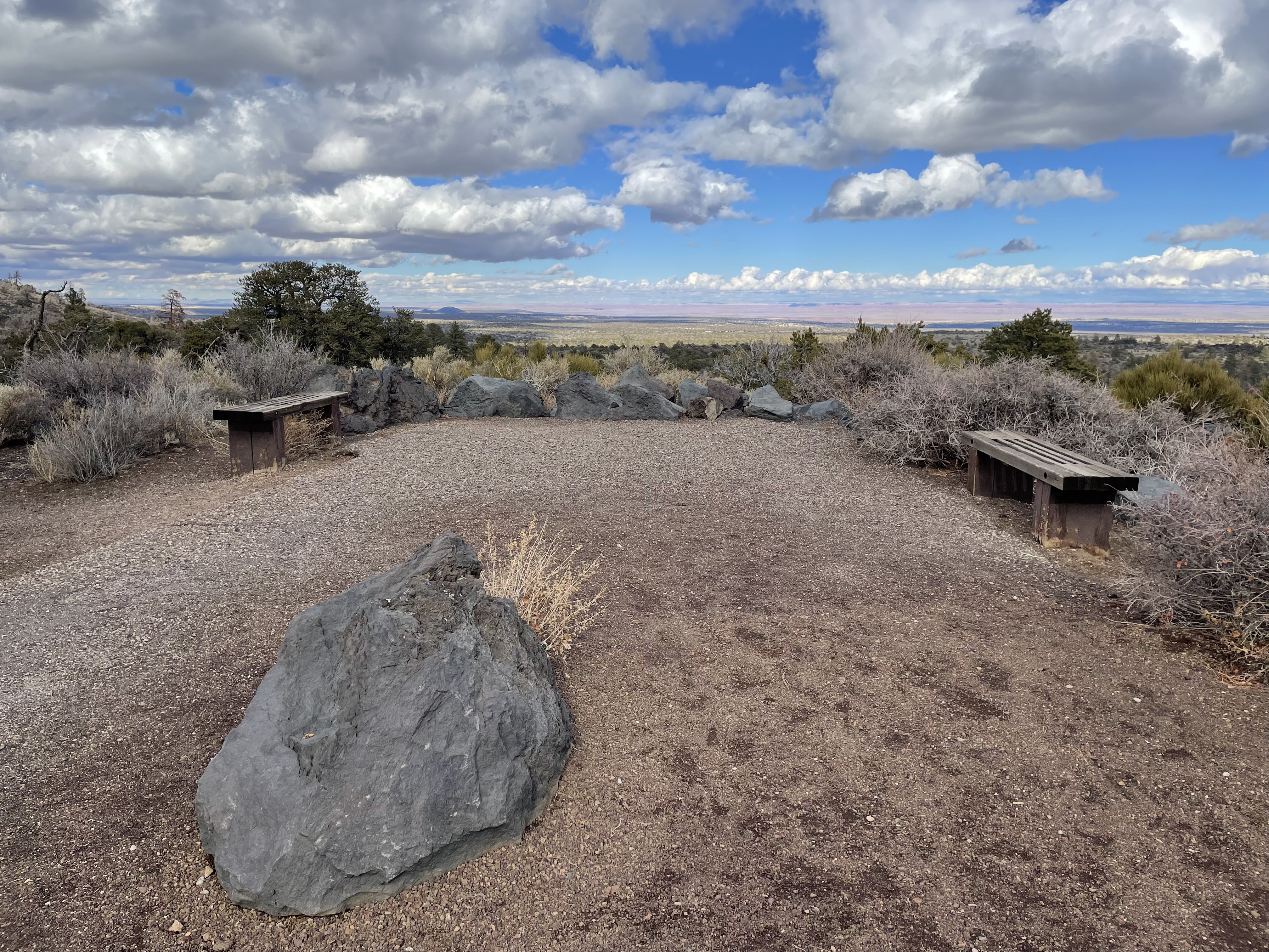
A one-way loop drive provides access to 9 parking spaces on the east side and 6 spaces on the west side. The area in the middle of the loop is sparsely vegetated among cinders and large basalt rocks and a concrete path leads to vault toilets from both sides of the parking lot. The loop is surrounded by large pines trees and medium sized desert shrubs. Many of the trees have been burnt by a past wildfire. The path to the overlook is about 15 ft wide and 65 ft long with a combination of loose gravel and asphalt. There is a large basalt rock in the middle of the path 30 feet from the parking lot. There are two wooden benches on either side of the overlook just before the path ends. The view from the overlook includes long distance vistas of the Painted Desert with red and orange layers as well as many of the nearby volcanic cinder hills and pine forests.
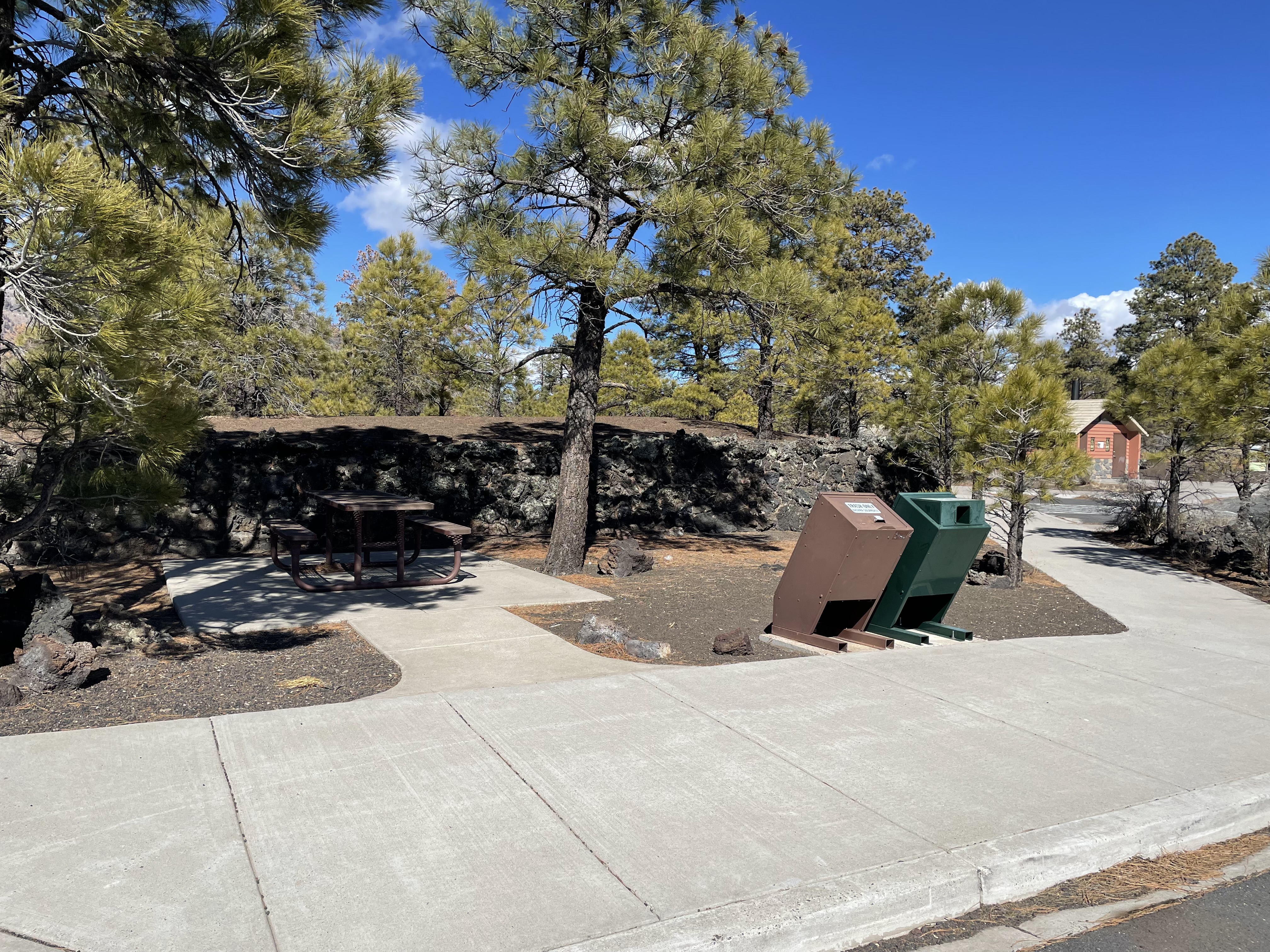
Two brown accessible metal picnic tables with attached benches are in the middle of a lollipop shaped concrete pad on the left side of the visitor center building. The concrete pad is approximately 40ft long by 15 ft wide and has a four-inch curb around the entire pad. This curb creates a step up onto the ground surrounding the picnic area. As you enter the picnic area from the accessible sidewalk around the parking lot there is one brown metal trashcan with a locking lid, and one green metal recycle can with an opening in the front to dispose of recyclable materials. The picnic area is surrounded by large ponderosa pine trees among a field of black volcanic cinders. Across the street from the picnic area and opposite of the visitor center is a US Forest Service Campground and the trailhead for the Lava's Edge trail.
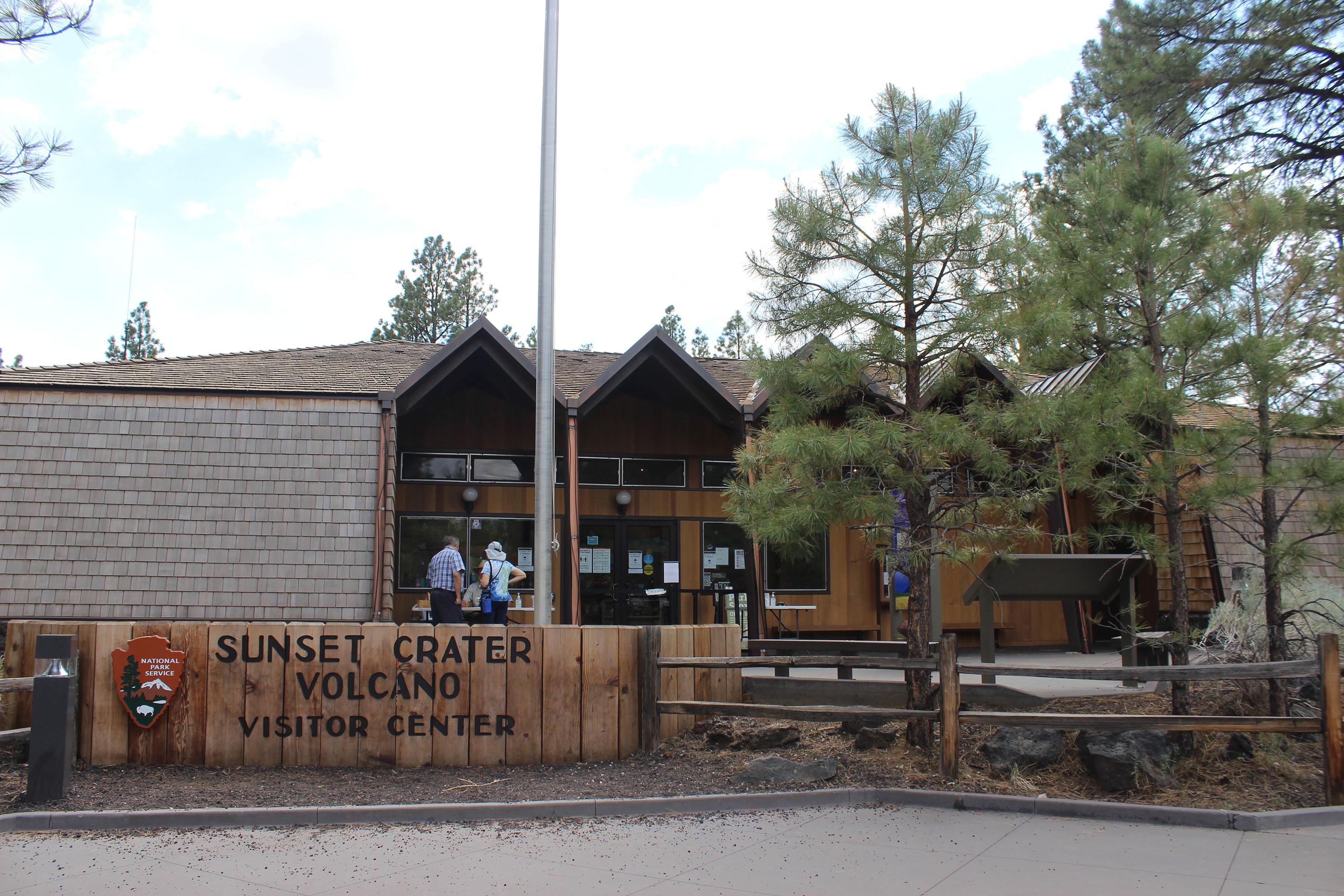
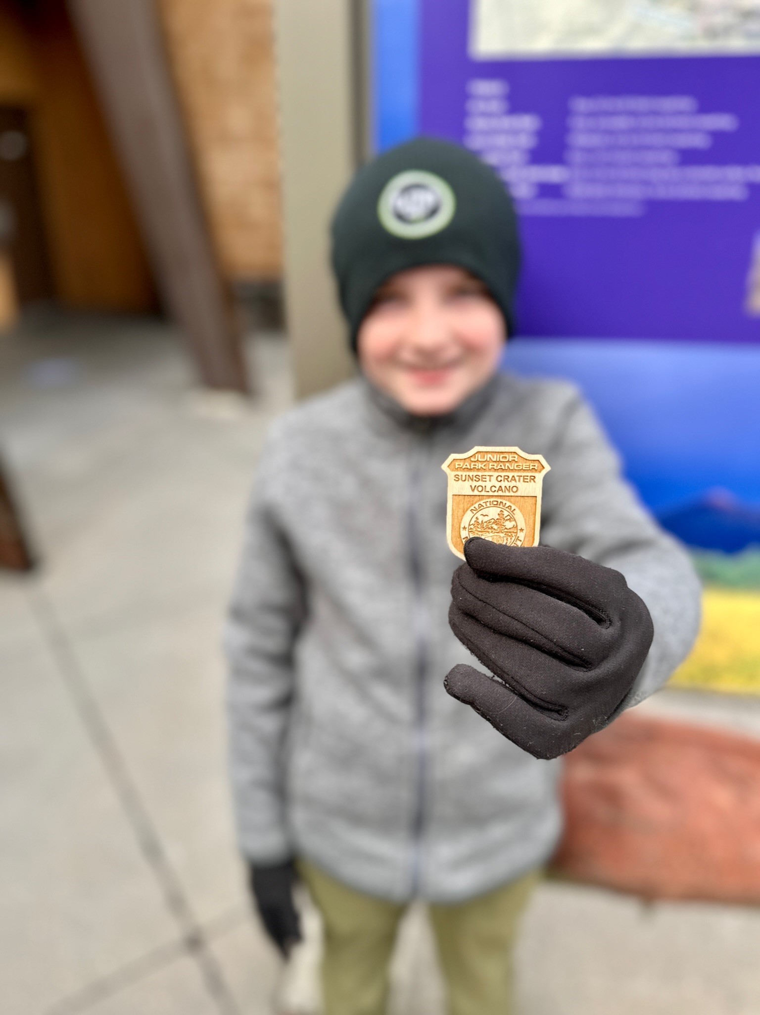
The Sunset Crater Volcano Visitor Center includes a museum, WNPA park store, park film, and restroom facilities. The building features architecture from the Mission 66 era. Park rangers are present, passes are available for purchase, and Junior Ranger activities are available.