Be advised that the NPS has issued alerts for this park.
South Unit Address for Mobile Maps – Theodore Roosevelt NP
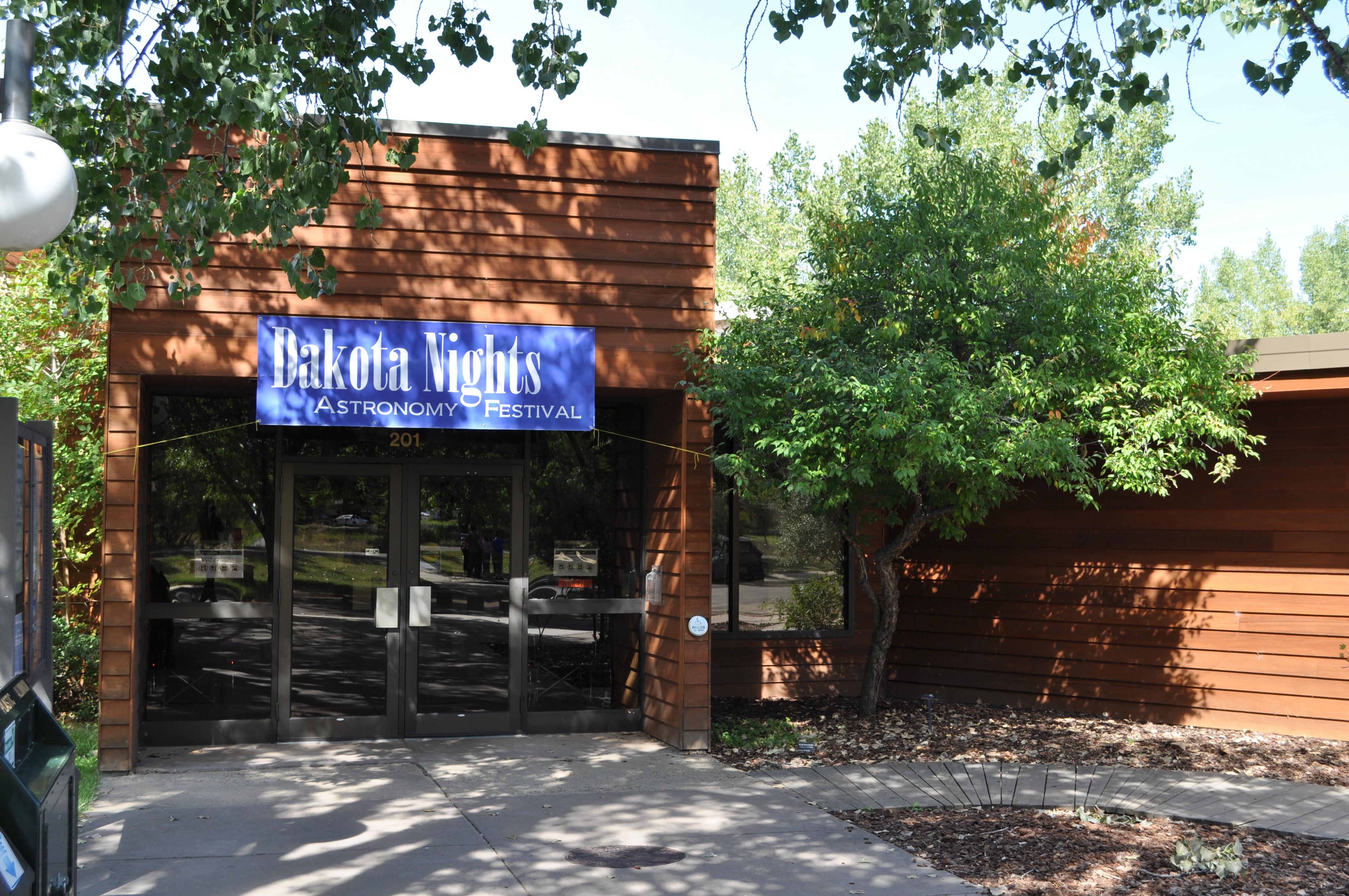
On all maps used on mobile devices, use the following address to reach the South Unit Visitor Center and Entrance Station 201 East River Road N. Medora, ND 58645
Petrified Forest Trailhead Access Update: Use Approved Route
Directions to the Petrified Forest trailhead have changed. Please use the approved legal route from I-94, Exit 10 toward Camels Hump Lake and follow the clearly marked posts. This update helps maintain good cooperation with neighbors and respect park boundaries. For precise directions, use the link provided.
South Unit Road from the Old East Entrance station mile near marker 22 to mile marker 28
Due to major road repair work, the former scenic loop between the Old East Entrance Station (near mile marker 22) and mile marker 28 is closed to all traffic, including pedestrian, and bicycle access.
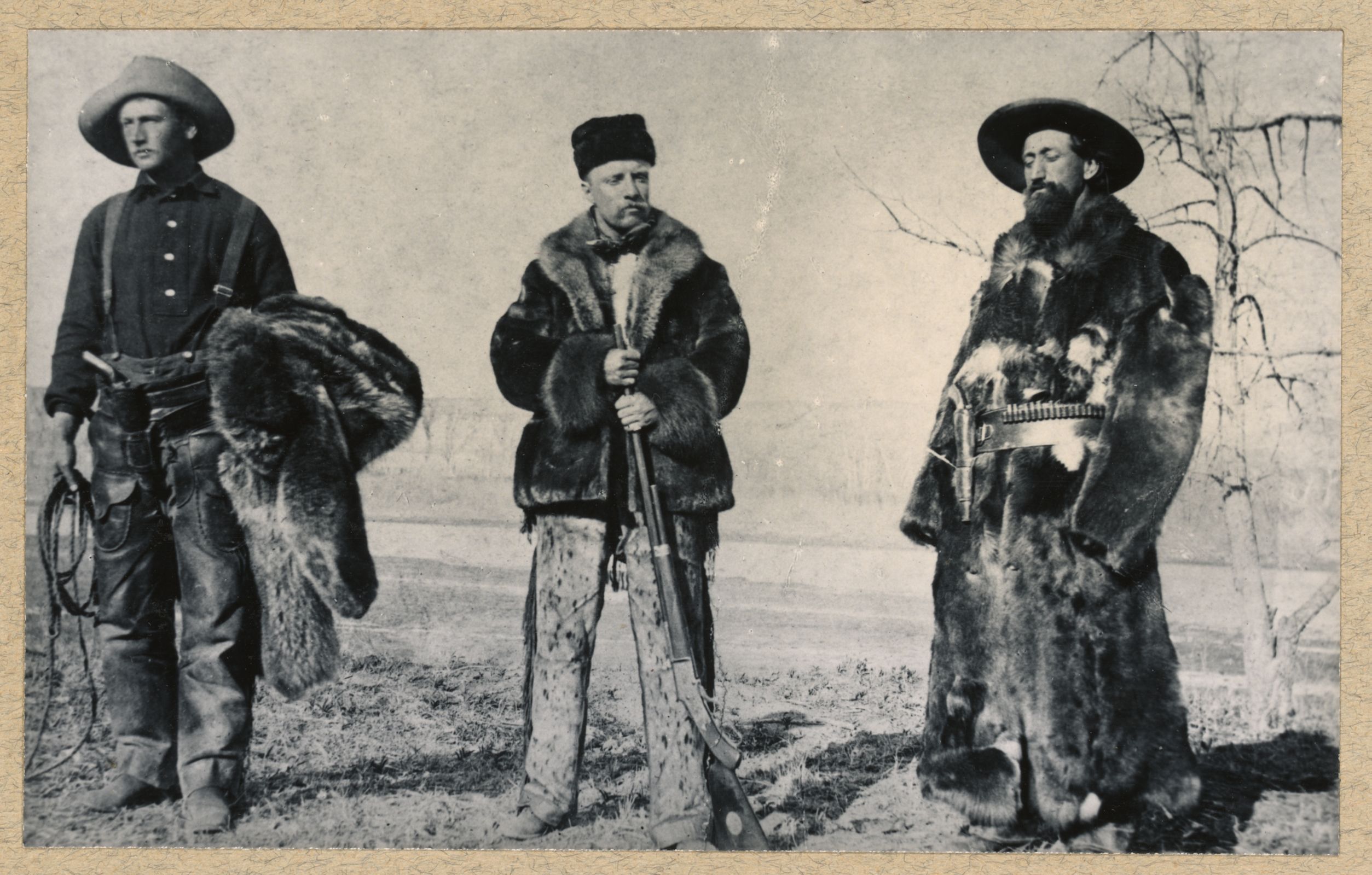
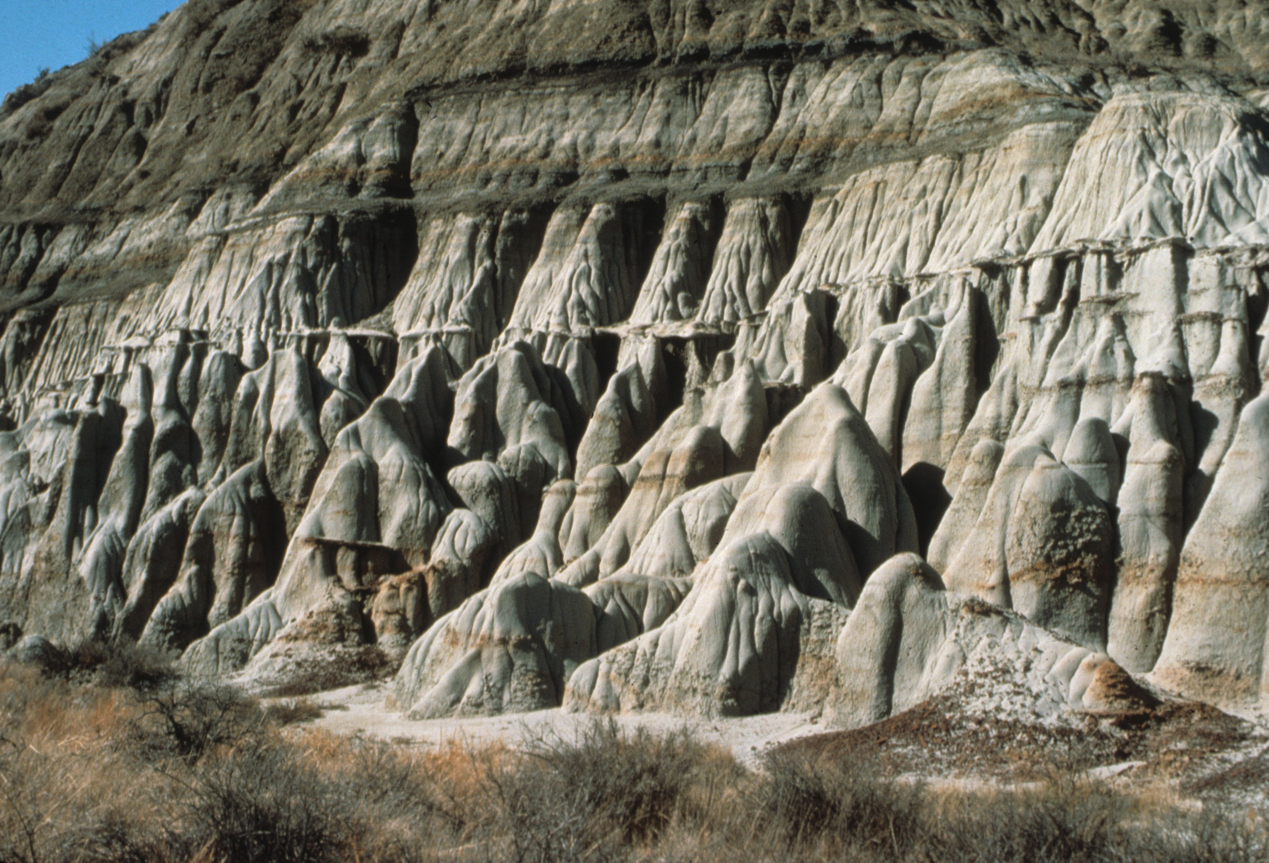
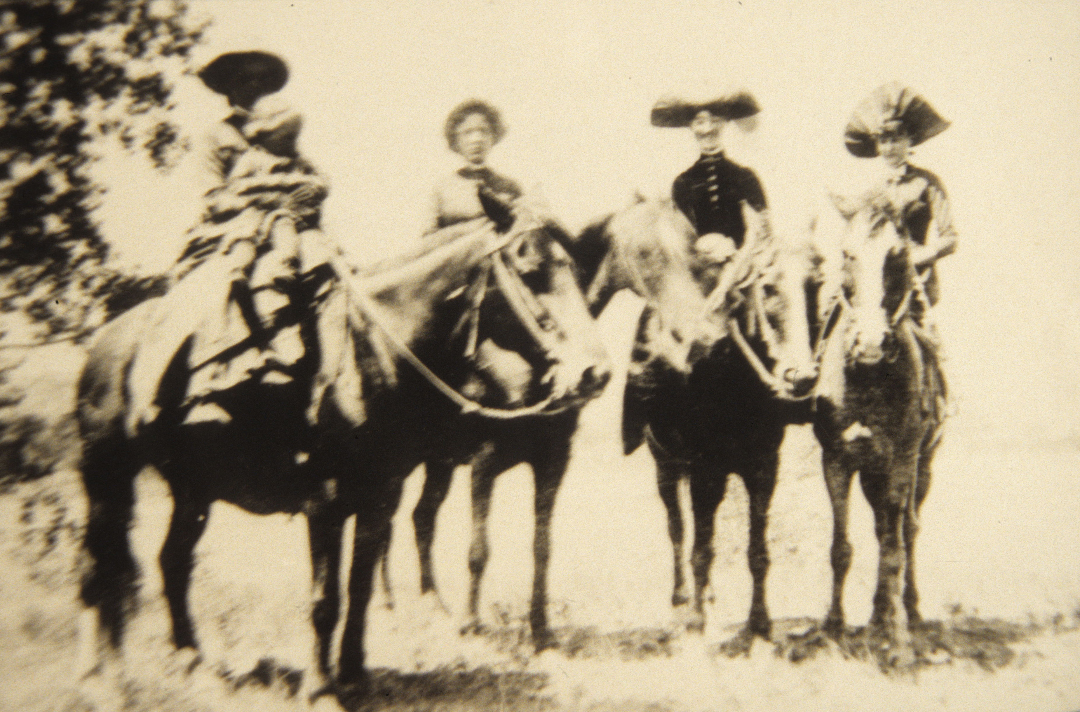
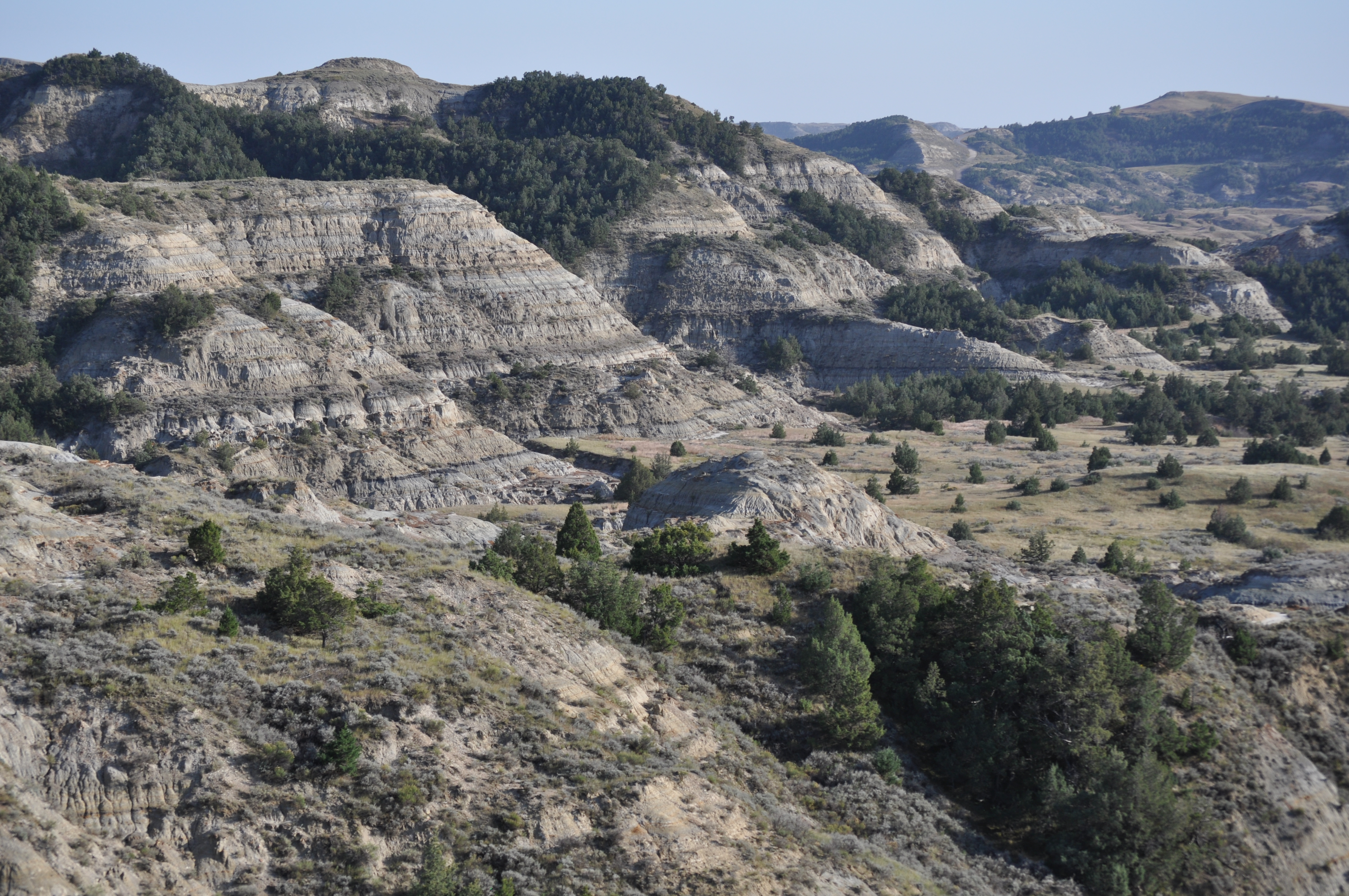
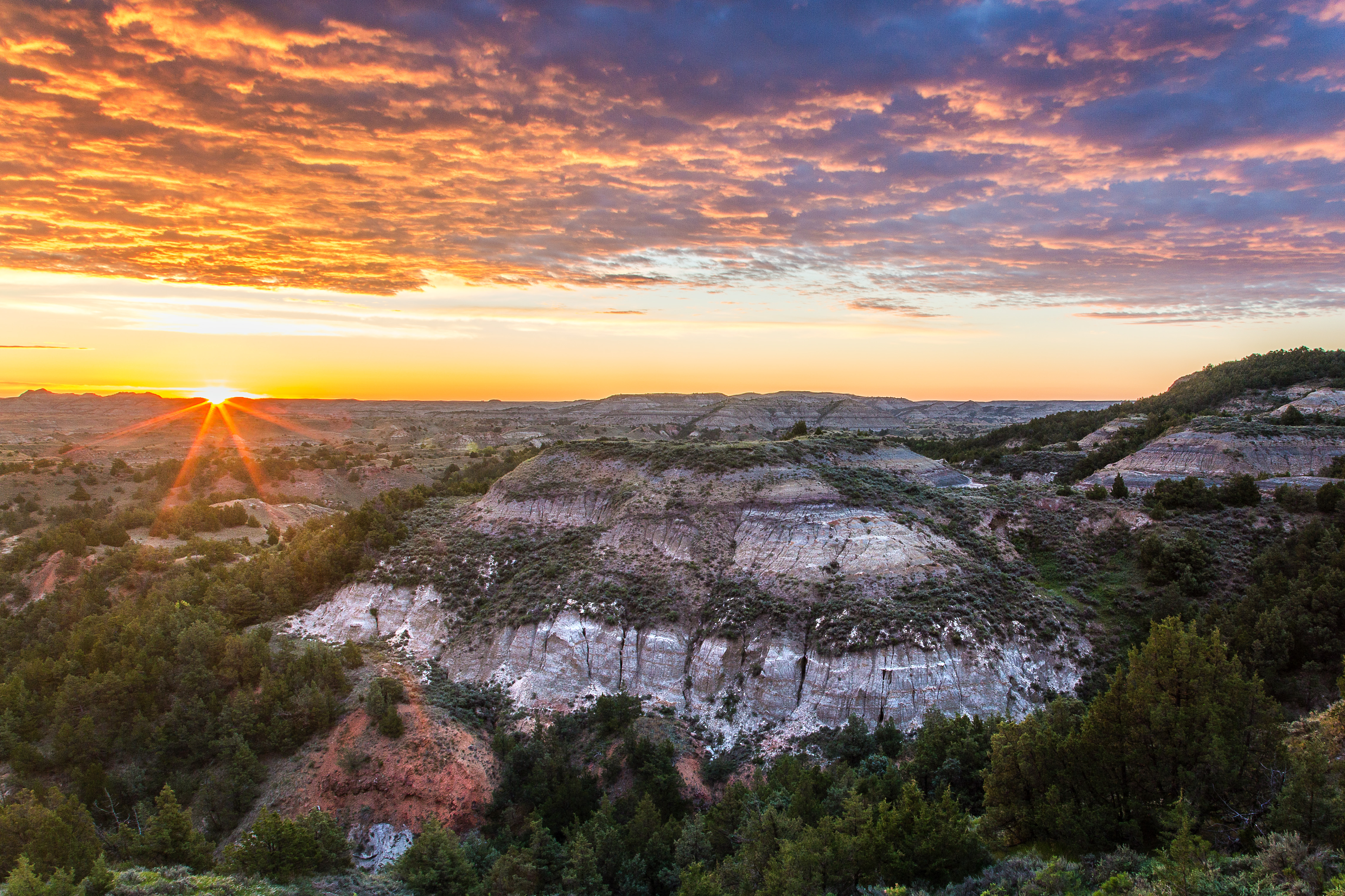
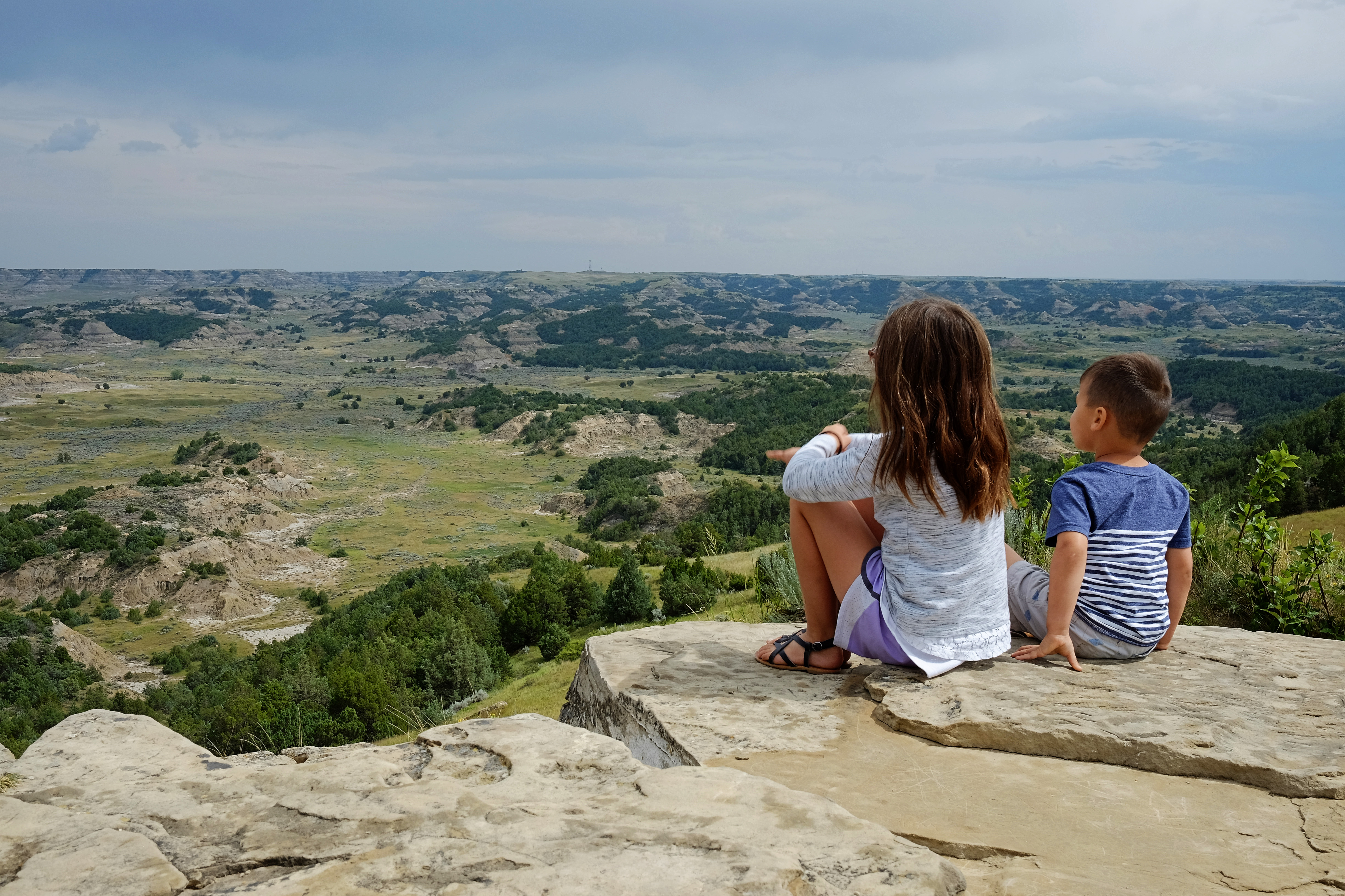
When Theodore Roosevelt came to Dakota Territory to hunt bison in 1883, he was a skinny, young, spectacled dude from New York. He could not have imagined how his adventure in this remote and unfamiliar place would forever alter the course of the ...
Valid for 7 days for all persons traveling in a single, private, non-commercial vehicle.
Entrance - Motorcycle
$25.00
Valid for 7 days for all persons traveling on a single, non-commercial motorcycle.
Entrance - Per Person
$15.00
Valid for 7 days for a visitor traveling on foot, bicycle, horse, or other non-motorized means of travel.
Commercial Entrance - Van
$50.00
Based upon the total capacity of a vehicle that can carry 7-15 passengers, regardless of the actual number of passengers. A commercial tour is defined as consisting of one or more persons traveling on an itinerary that has been packaged, priced, or sold for leisure or recreational purposes by an organization that realizes financial gain through the provision of the service. Pass is good for seven days as long as it's the same passenger group.
Commercial Entrance - Mini-bus
$60.00
Based upon the total capacity of a vehicle that can carry 16-25 passengers, regardless of the actual number of passengers. A commercial tour is defined as consisting of one or more persons traveling on an itinerary that has been packaged, priced, or sold for leisure or recreational purposes by an organization that realizes financial gain through the provision of the service. Pass is good for seven days as long as it's the same passenger group.
Commercial Entrance - Motor Coach
$150.00
Based upon the total capacity of a vehicle that can carry 26 or more passengers, regardless of the actual number of passengers. A commercial tour is defined as consisting of one or more persons traveling on an itinerary that has been packaged, priced, or sold for leisure or recreational purposes by an organization that realizes financial gain through the provision of the service. Pass is good for seven days as long as it's the same passenger group.
Odd-numbered sites are reservable May through September. All campsites are first come, first served the rest of the year. Reservations can be made up to 6 months in advance and no less than 5 days before your arrival. The group site is available by reservation only. Group site reservations begin each season on the first business day in March at 8:00 am MST. The park cannot take reservations - they must all be made through recreation.gov. Click RESERVATIONS below or call recreation.gov at 1 (877) 444-6777.
Only the Juniper Campground Group Site may be reserved, May through September. Reservations begin each year on the first business day in March at 8:00 am MST. Reservations must be made at least 5 days in advance.
This site is available by reservation only. Reservations can be made starting March 1st at 8:00am MST and must be made at least 5 days in advance. Maximum length of stay is 5 nights.
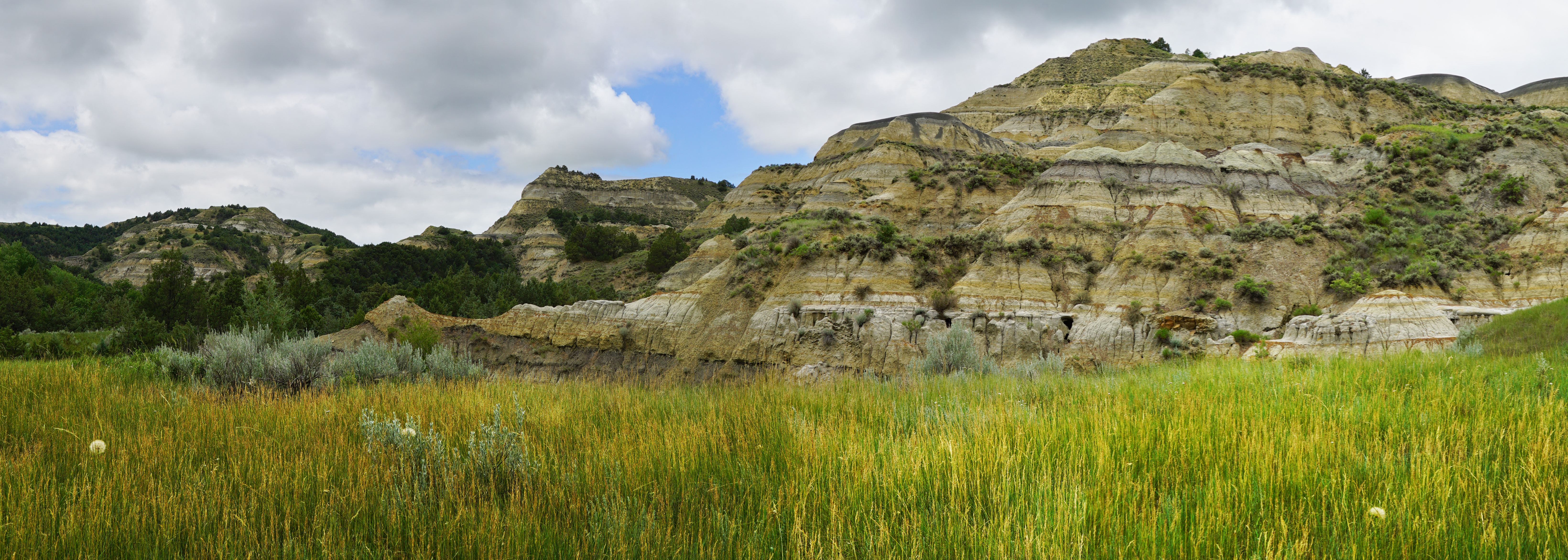
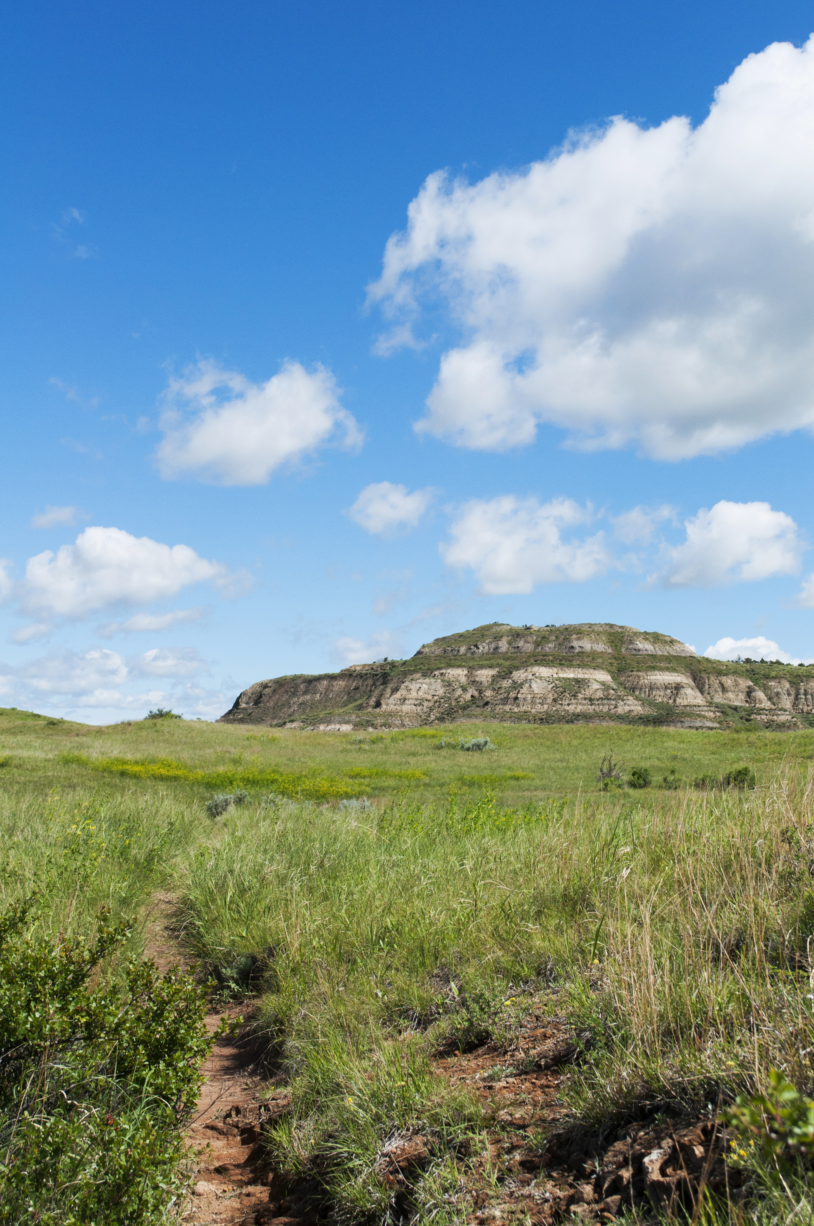
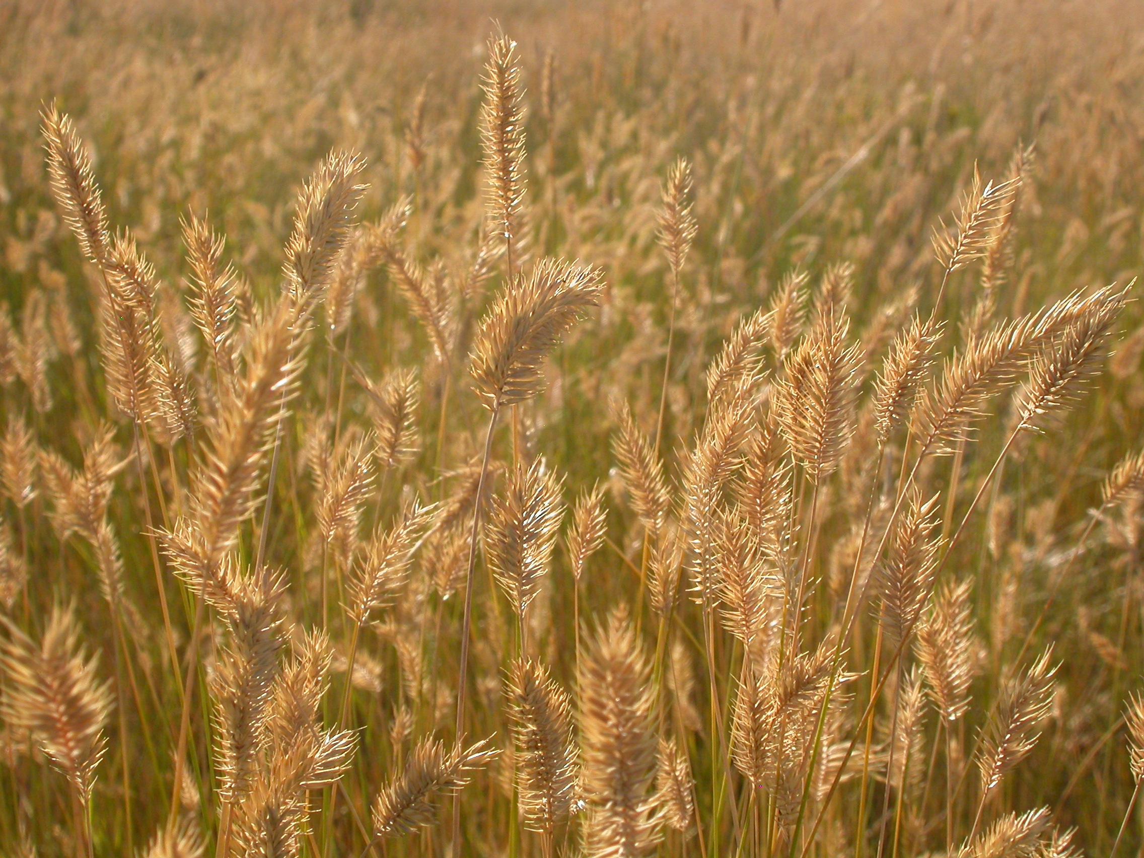
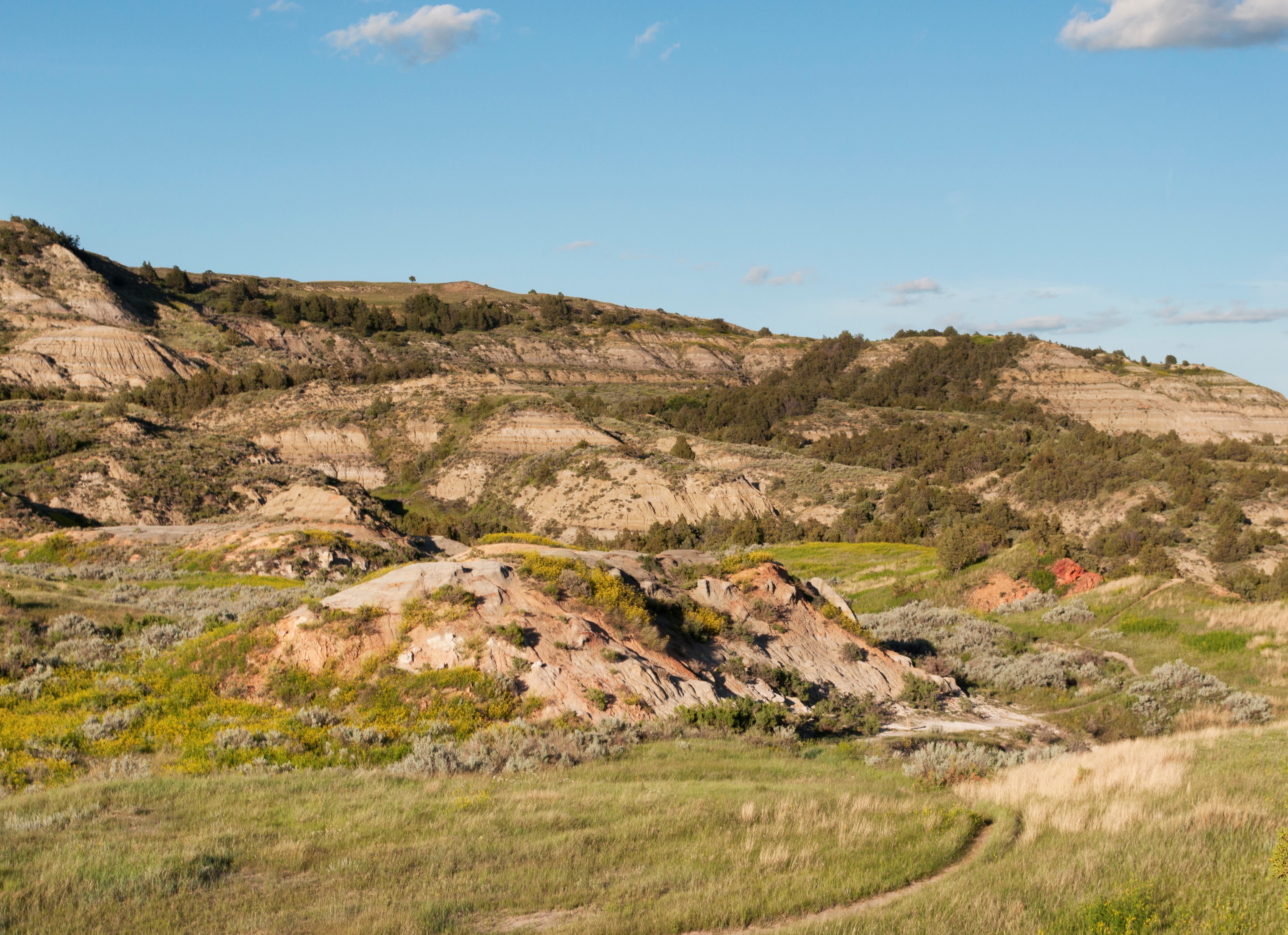
A dirt trail with tall grasses alongside it. The trail curves as it exits a mixed tree forested area and opens to a grassy field. Tan buttes made of sedimentary rock can be seen in the distance.
A junction where two trails merge together in an open grassy area scattered with sage brush and shrubs. A bench made of split logs. The bench is roughly 6 feet long with no back. There are two interpretive signs with quotes from Theodore Roosevelt. Surrounding the grassy area is a mixed tree forest. In the distance are buttes made up of layers of sedimentary rock
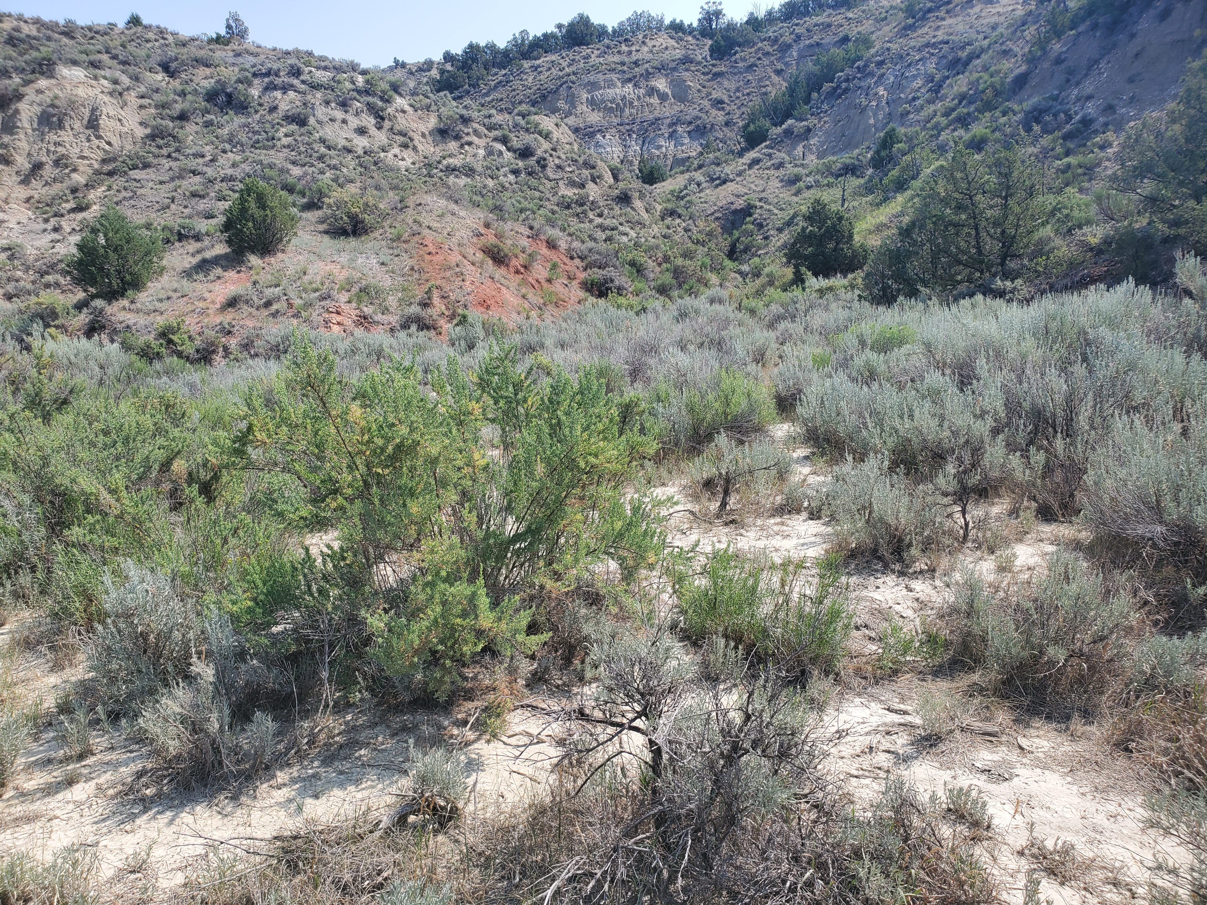
A dirt trail leading from a treed area to an opening of prairie grass and sage. More cottonwood and juniper trees can be seen farther down. Buttes made of layers of sedimentary rock can be seen surrounding the area in the distance.
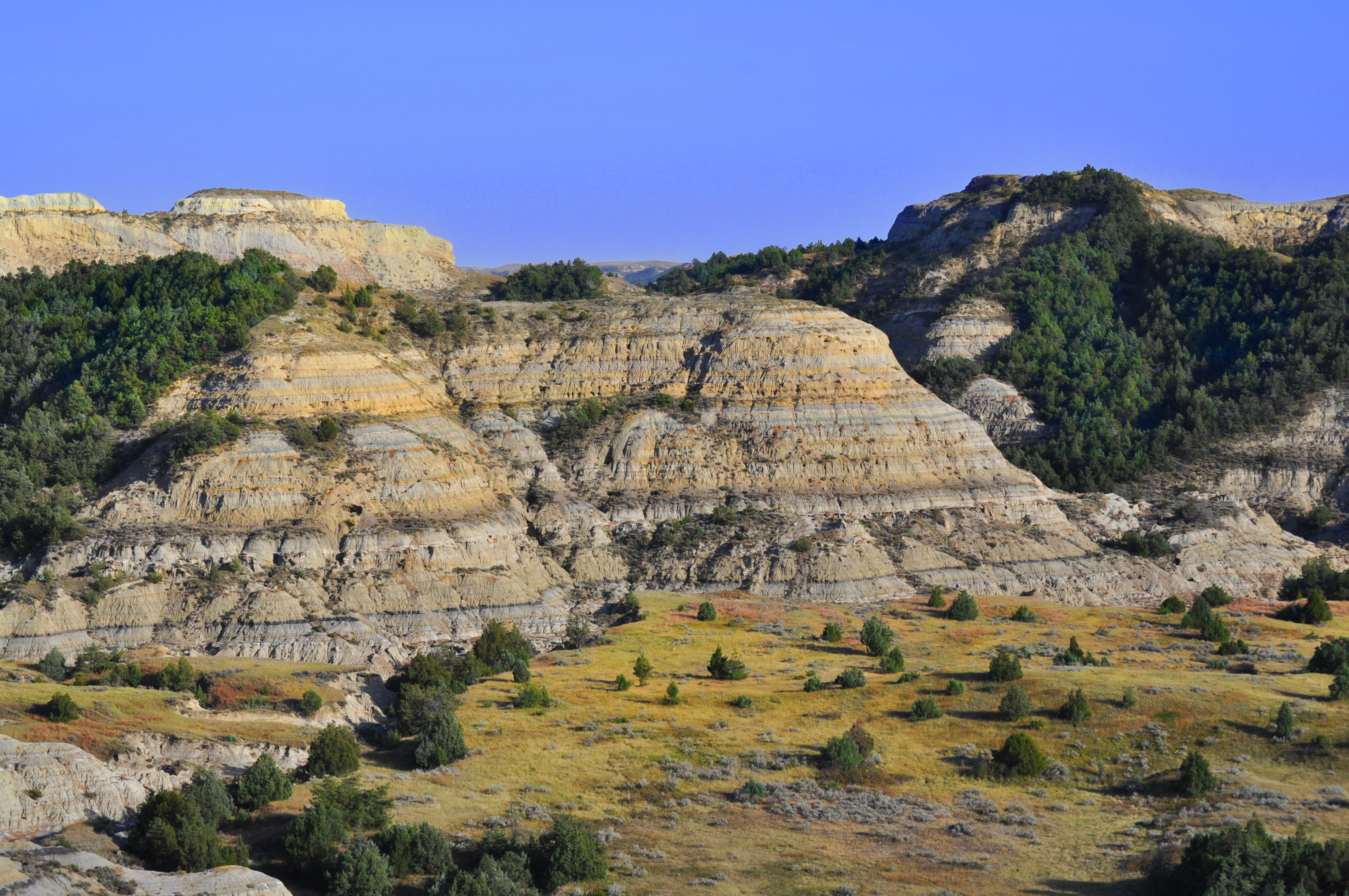
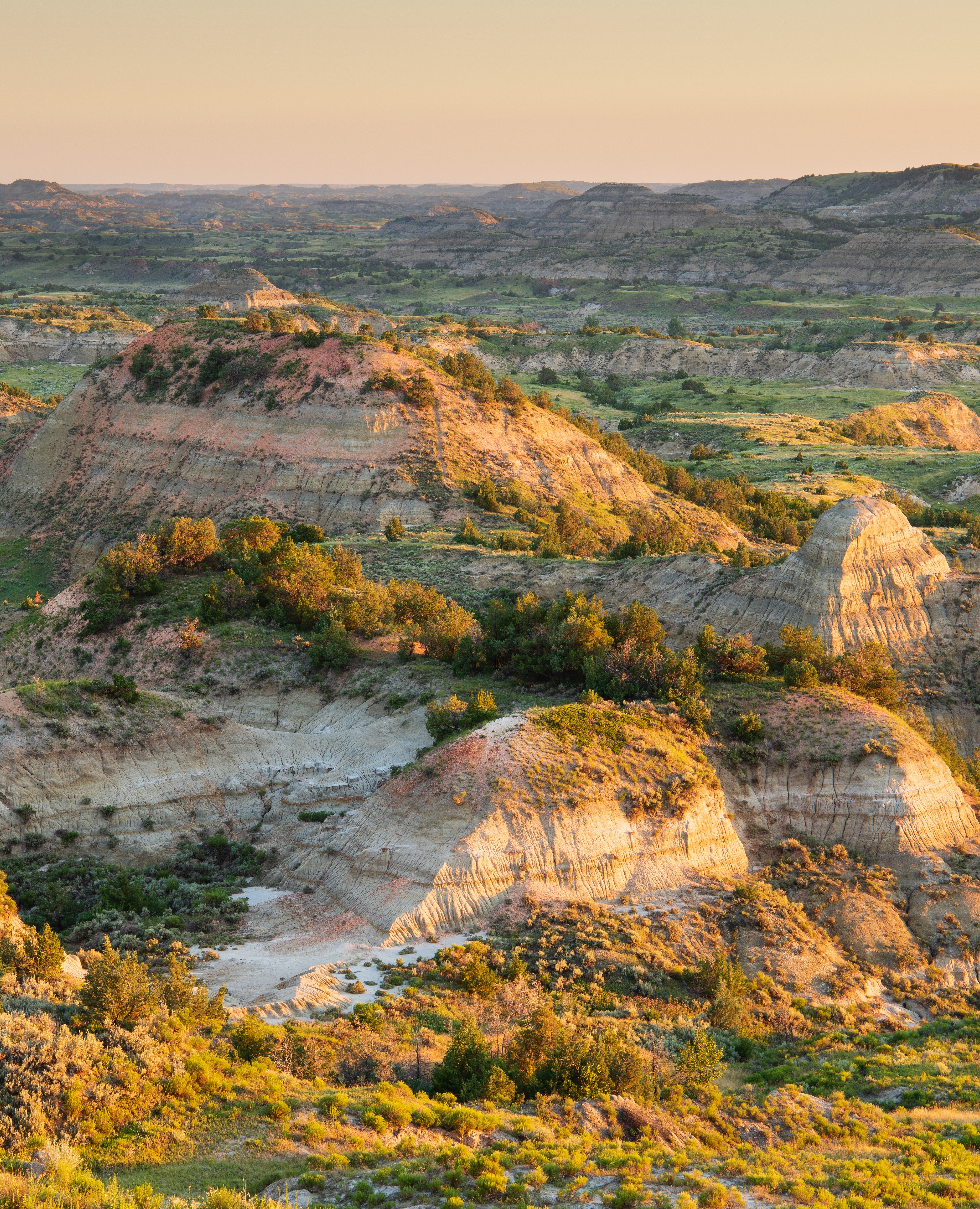
Get a new perspective on the badlands of Theodore Roosevelt National Park's South Unit from this scenic vista.
Badlands Overlook. 323 words. The viewing area for Badlands Overlook is located alongside the curved parking area. A paved sidewalk is bounded by a stone wall on the north and east, with a wayside located part of the way along this wall. The wayside is titled Badlands Overlook and the background photo is the view from the overlook on a slightly cloudy day. Below the main title, a quote attributed to Theodore Roosevelt reads “This broken country extends back from the river many miles, and has been called always, by Indians, French voyagers, and American trappers alike, the ‘Bad Lands.’” Next to this text reads: To the Lakota, this land is mako sica, meaning bad land or bad earth. French fur trappers called it les mauvais terres à traverser meaning the bad lands to cross. Anyone who has experienced the badlands understands exactly how this place earned its name. Below the text is a white line pointing to a butte across the valley with a title asking How Would You Get Here? Below this are three circular call out images. The leftmost circle depicts the side of a butte. Text to its right reads: Cliffs, sinkholes, coulees, and creeks disrupt the land in all directions. These obstacles can turn a seemingly short trip into a lengthy ordeal. The middle circle depicts muddy water with grass growing out of it. Text to its right reads: According to Roosevelt, water is found in “tepid little pools, almost dried up,” and so muddy it “can only be called liquid by courtesy.” The rightmost circle depicts a cactus. Text to its right reads: Cacti and other prickly plants make travel difficult and sometimes painful! From the viewing area, the badlands landscape is visible to the north, east, and west, though part of the western view is blocked by a large butte. On the other side of the stone wall, the ground quickly drops away down a cliff edge. End of description.
A dirt trail with small trees and shrubs along the side. A post marking the 5th stop on the nature trail. Large butte made of layers of sedimentary rock are visible all around.
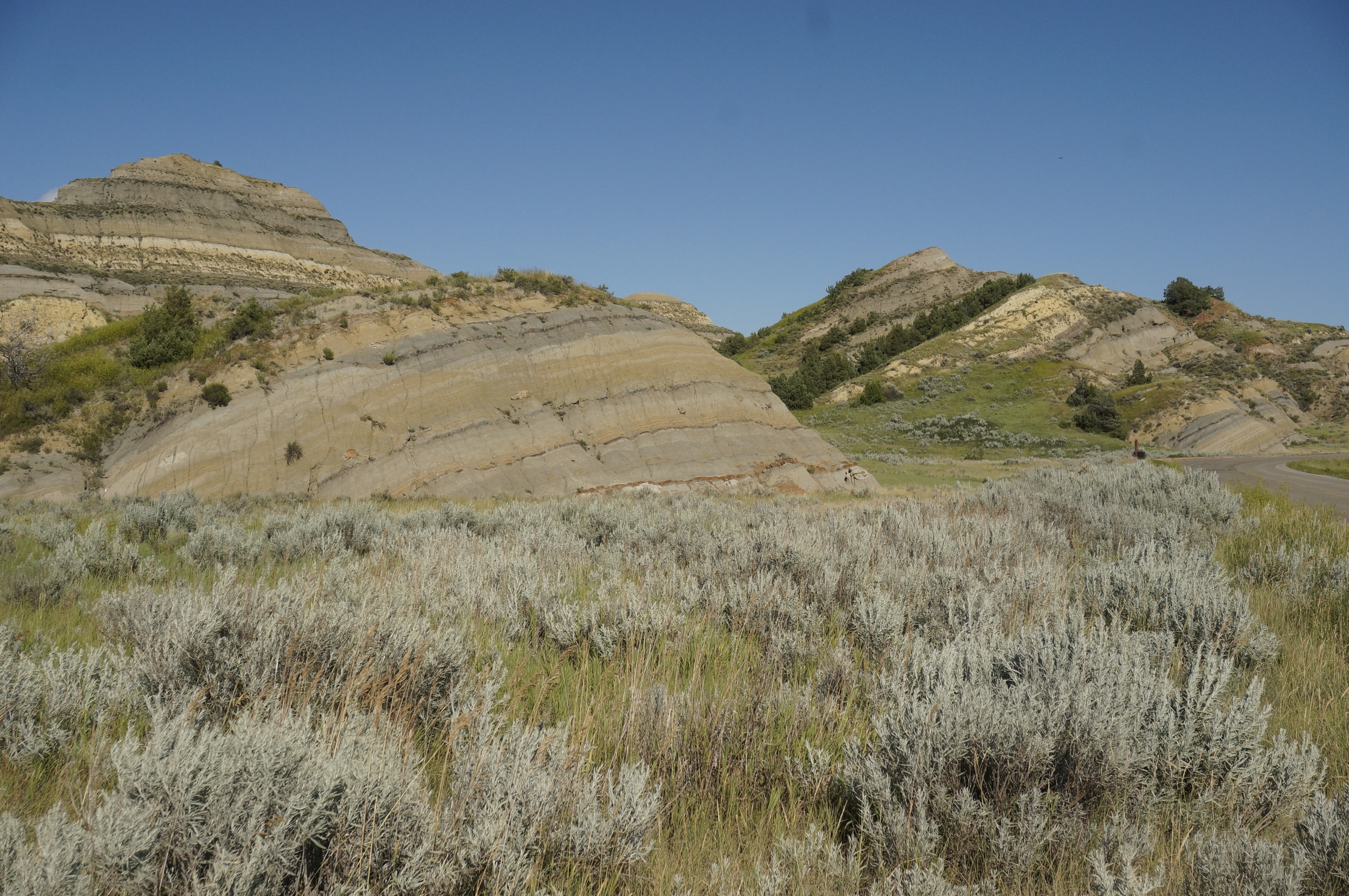
A dirt trail with prairie grass and sage alongside it. Mixed juniper and other trees are scattered along the trail. A large butte displays prominent layers of grey bentonite clay
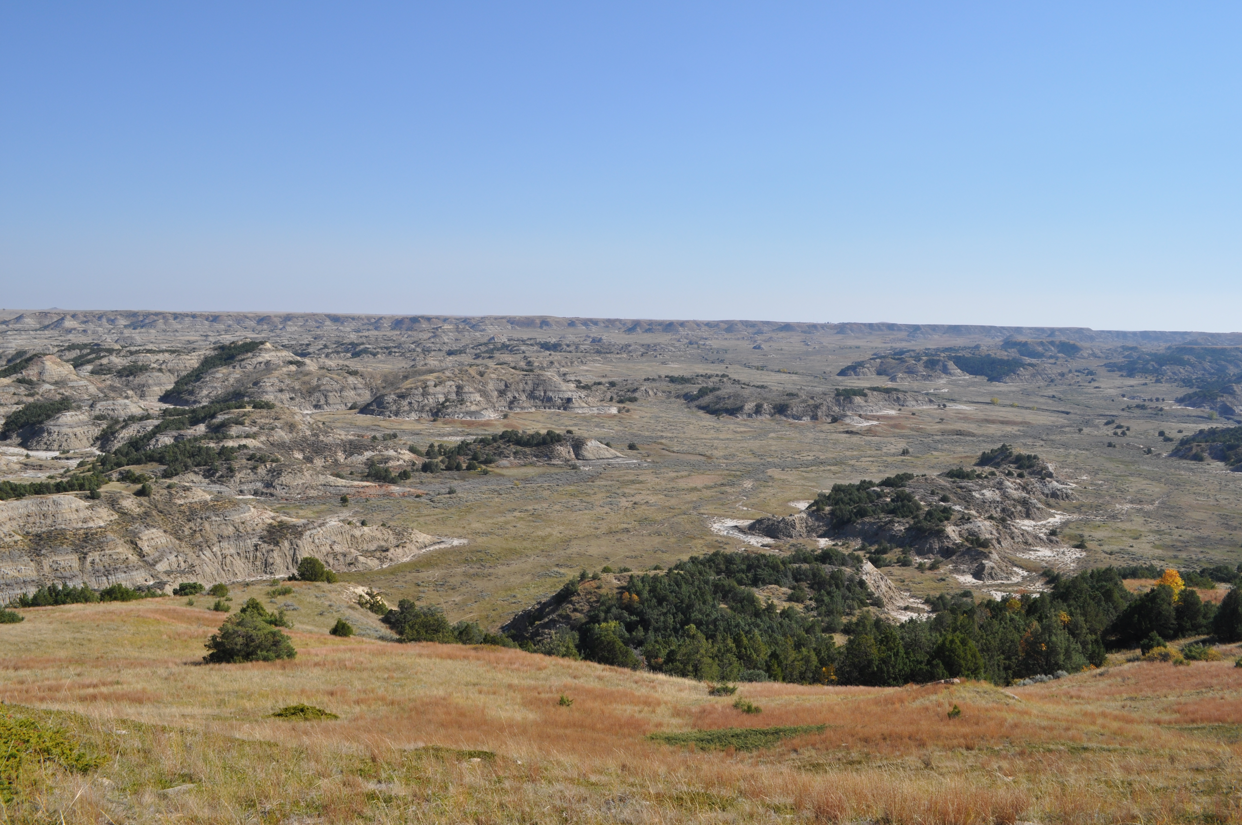
Stop at this overlook to enjoy the awesome vista that is the Little Missouri Badlands.
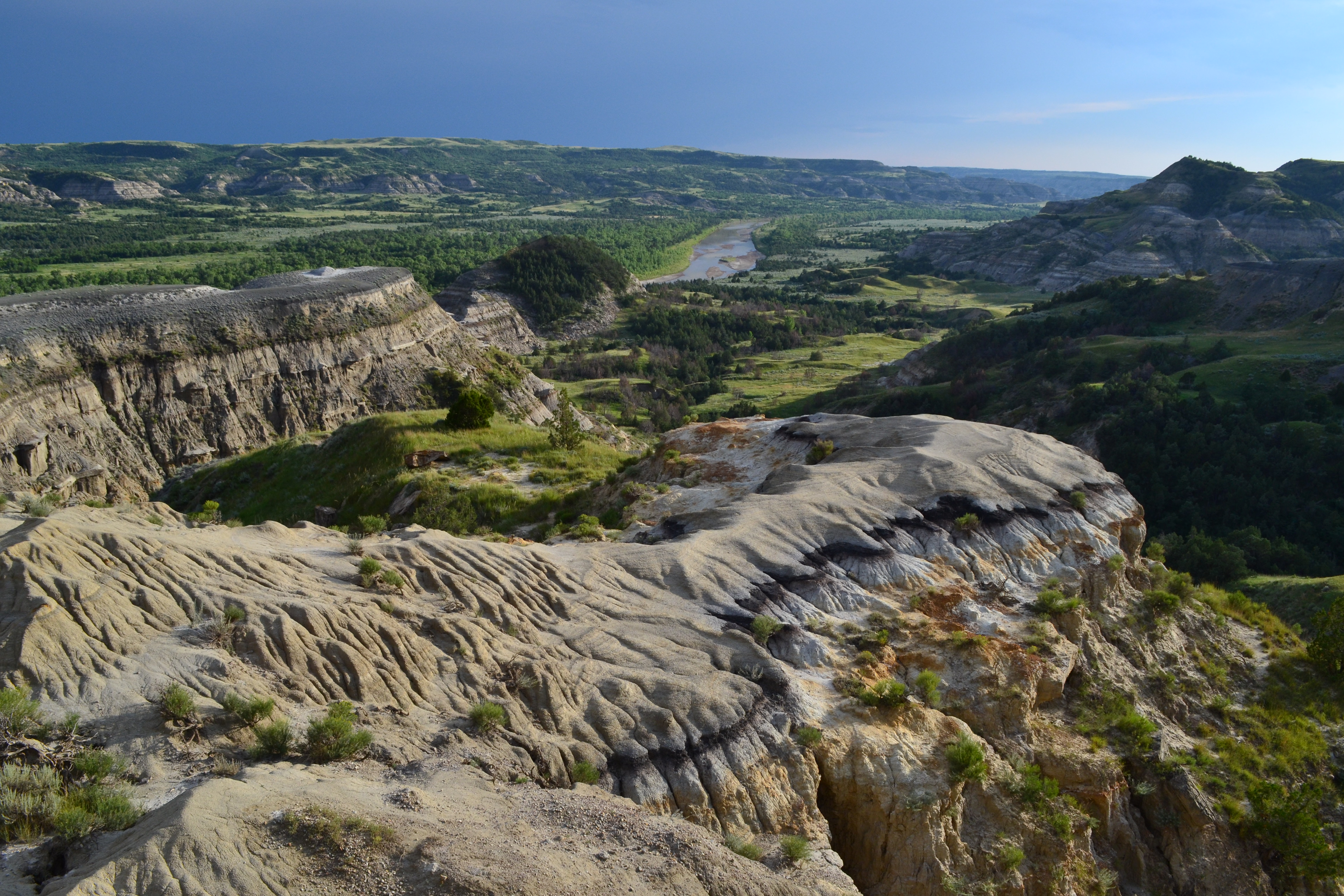
Boicourt Overlook. 263 words. The pull-out for the Boicourt Overlook is located on the south side of the scenic drive, with a sidewalk that is accessible. Next to this sidewalk stand trash receptacles and an interpretive wayside. The overlook offers a view to the south and west into a large valley. The sides of the buttes that drop into this valley are bare in places and covered in dark green juniper in others. Juniper also dots the valley floor. The wayside has a large photo of the view from the overlook, taken on a sunny day. Written in the blue sky are the words “A land of vast, silent spaces…” attributed to Theodore Roosevelt. Below this in the photo, five buttes on the horizon are labeled. Square Butte is 15.4 miles away. Sentinel Butte is 21.3 miles away. Camels Hump Butte is 18.6 miles away. West & East Twin Buttes are 17.9 and 16.4 miles away, respectively. Below the main photograph is a black bar with white text reading Boicourt Overlook. Below the title, it reads: From here, the Little Missouri badlands seem to go on forever. At about 100 miles long and averaging 15 miles wide, they are North Dakota’s most noticeable landform. Theodore Roosevelt National Park protects only a small part of this vast landscape. The buttes on the horizon lie many miles away, far outside the park boundary. To the left of this text is a map of the park, with a marker indicating where the reader is standing, and dashed lines leading to the location of each of the buttes, outside park boundaries. End of description.
Take a short hike above the badlands on one of the South Unit of Theodore Roosevelt National Park's accessible trails.
Boicourt Trail. 95 words. The trailhead for Boicourt Trail is located next to a pullout of the same name near mile marker 16. The trail is paved and starts just behind the trailhead, winding out along a long ridge. To the west along another ridge, large quantities of juniper grow, while to the east the landscape drops into a deep valley. When the paved part of the path ends, the trail continues, narrowing and with steep drop offs eventually on both sides. After going slightly down, it climbs up to an overlook where the surrounding badlands can be seen. End of description.
One of the highest points in the South Unit of Theodore Roosevelt National Park, Buck Hill offers incredible, 360° views.
Buck Hill. 869 words. The Buck Hill trailhead is located at the top of a 1-mile drive that is accessed by turning south off the South Unit Scenic Drive, approximately 18-miles into the park. A small roundabout offers parking and a way to turn around for larger vehicles. The roundabout has a paved sidewalk around it, with several trash cans and a two-part wayside. The wayside has a title reading Hidden Garden. Under this, there is text over a photograph of the prairie and buttes to the South as seen from Buck Hill. The text reads: Although it may look like a sea of solid grass, the prairie in front of you supports a great diversity of plant life. Over 400 species of prairie plants reside in the park. Humans have long relied on prairie plants for food and medicine. The leaves, fruits, and seeds of these plants sustain wildlife of all kinds. Next to this text in italics reads: wild flowers should be enjoyed unplucked where they grow. This quote is attributed to Theodore Roosevelt. Below this a line of text reads Please leave all plants for wildlife and other park visitors to enjoy. Beneath this text is a line of six photos of flowers, each with symbols and text beneath them. A key to the left of these photos reads Knowing What’s Growing. Before you can use a plant for food or medicine, you must be able to figure out what it is. Do you know what’s growing here? The key contains symbols representing medicinal use, food for humans, food for birds, food for small mammals like mice and rabbits, and food for grazers like deer, pronghorn and elk. The first flower is a scarlet globemallow, a small orange flower with a yellow center. It has the symbols for medicinal use and food for grazers below it. Text reads: when crushed into a paste, the leaves of this plant help heal cuts and burns. The second flower is a purple coneflower, a tall flower with a spiky center and long, drooping purple petals. It has the symbols for medicinal use, food for birds, food for small mammals, and food for grazers below it. Text reads: Echinacea has many medicinal properties including its root’s ability to relieve toothache. The third flower is plains pricklypear, a small cactus with a large yellow blossom. It has the symbols for food for humans and food for small mammals below it. Text reads: fruits packed with vitamin C make a nutritious snack and can be made into jelly. The fourth flower is Indian Breadroot, a flower with many small blueish purple blooms. It has the symbols for food for humans and food for grazers below it. Text reads: Roots of tipsin were a staple in the Plains Indian diet, earning the plant its name. The fifth flower is prairie wild rose, a pink flower with large petals and a yellow center. It has the symbols for food for humans, food for birds, food for small mammals, and food for grazers below it. Text reads: Red, waxy fruits called rose hips are rich in vitamins. They serve as an emergency food source. The final flower is the sunflower, a tall yellow flower with a large, dark center. It has the symbols for food for humans, food for birds, and food for small mammals below it. Text reads: Local agricultural tribes cultivated sunflowers for their nutritious seeds. The second wayside is titled Prairie Remnants. Text under this reads: The prairie on Buck Hill is special – it has never been plowed. Native, never-plowed grasslands are rare across the Great Plains and around the world. The main image on the wayside is a large circle made up of smaller circles, some of them filled in green, others empty. This circle is labeled The Great Plains. Small bullet points on the green side read: Once disturbed, prairie takes decades to recover, but the healing is superficial. The full complexity of life that exists in native prairie takes thousands of years to achieve. Of all the world’s major biomes, grasslands have experienced the greatest human impacts and yet receive the least protection. What remains exists in small isolated pockets. The ecosystem struggles to function in this highly fractured state. The plants, roots, and soils of native prairie are complex, site-specific communities built up over thousands of years. Prairie is the second most diverse ecosystem in the world. Only rainforests have a great variety of plant and animal life. On the other side of the circle, indicating the clear section are more bullet points. They read: More than 70% of native prairie on the great plains has been lost to development. About 60% has been plowed and converted to agricultural lands. Another 10% has been lost to land uses including construction of roads, buildings, parking lots, and human-made lakes. The trail to the top of Buck Hill starts at the northeast section of this sidewalk, next to a trailhead sign. The first section is paved, after which wide steps lead to a scenic viewpoint. A social trail continues onward, allowing access to trails that lead down from the hill. End of description.
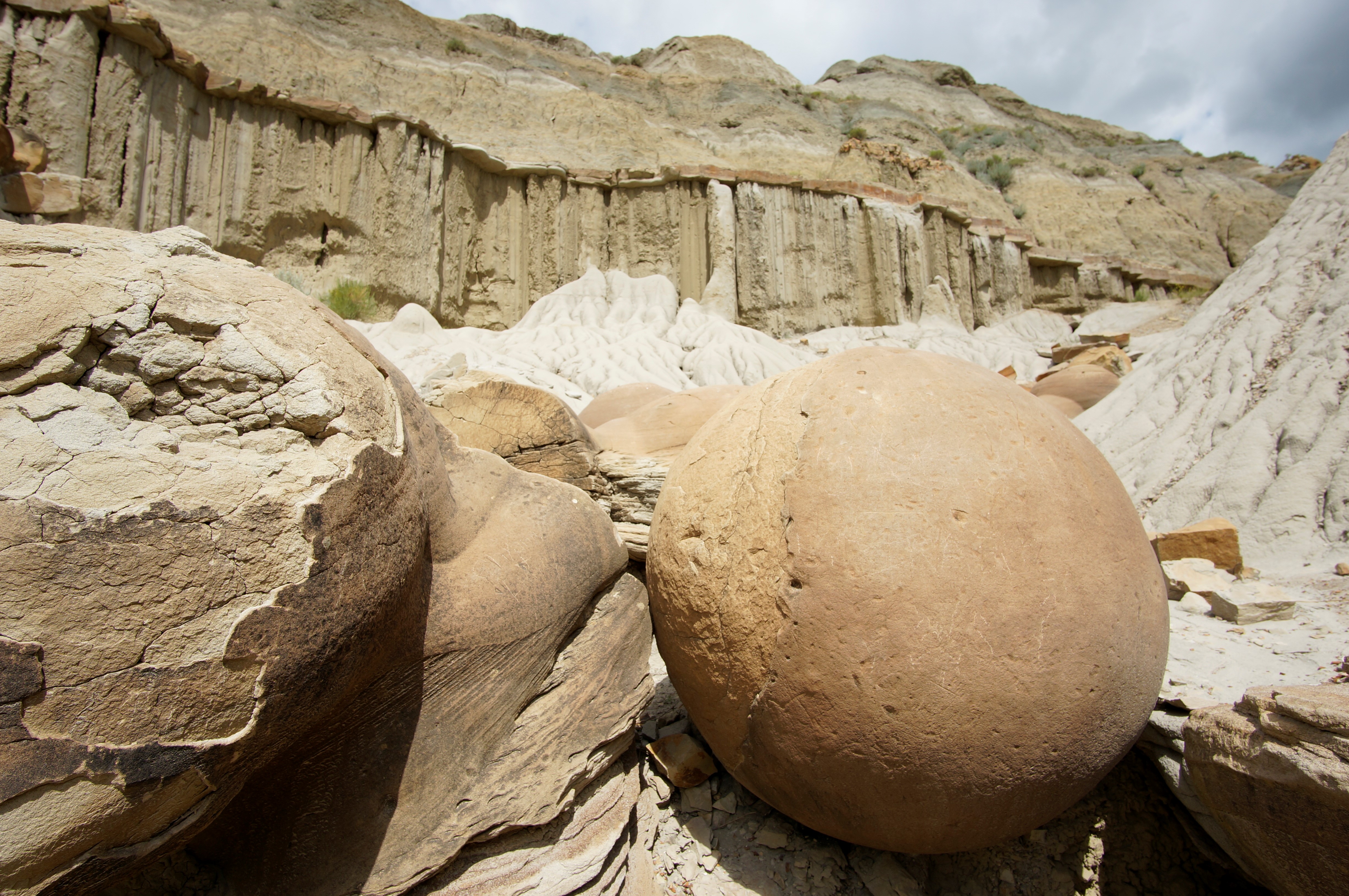
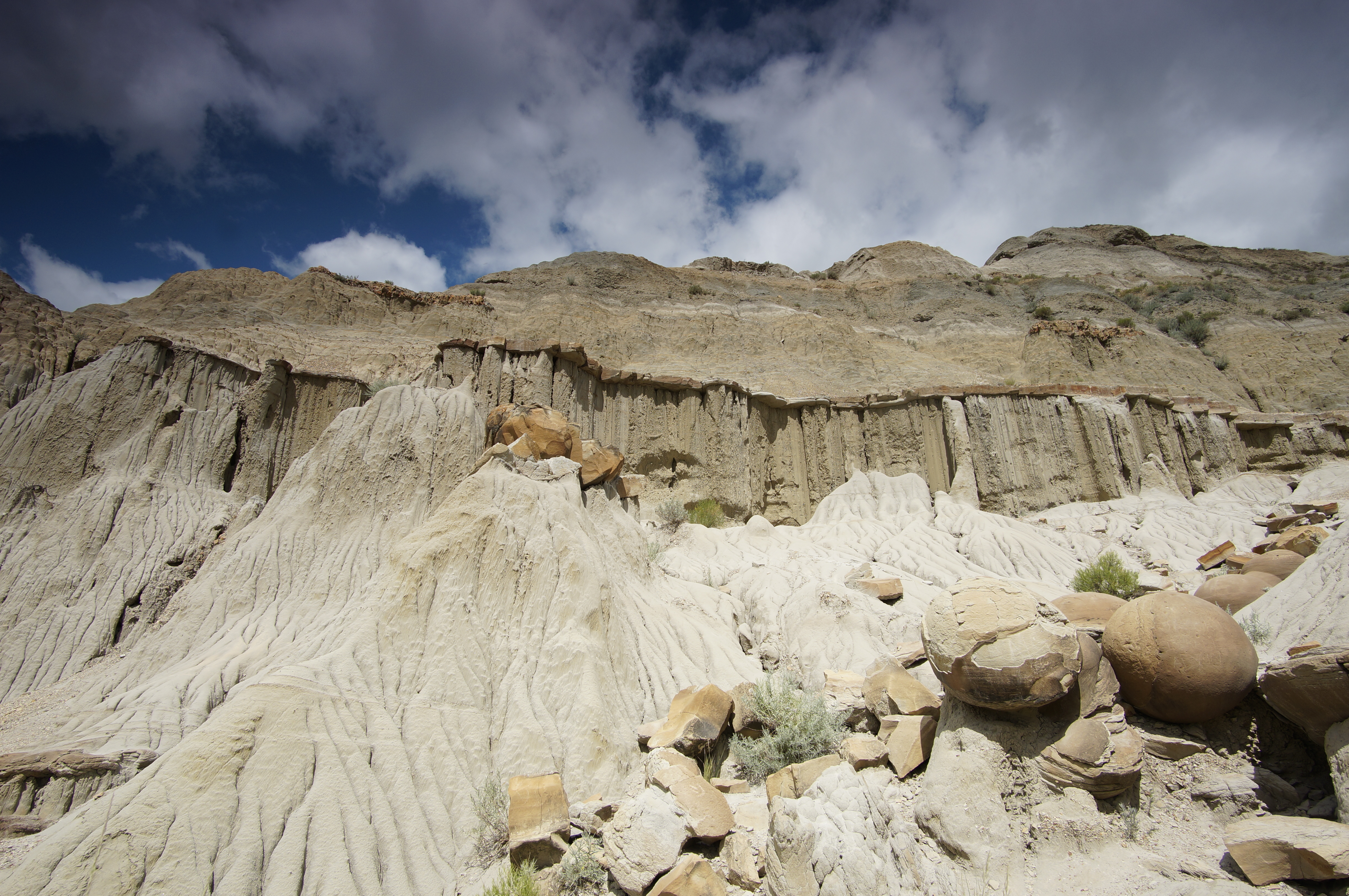
These unusual, round rock formations stand out against the broken landscape of the North Dakota badlands.
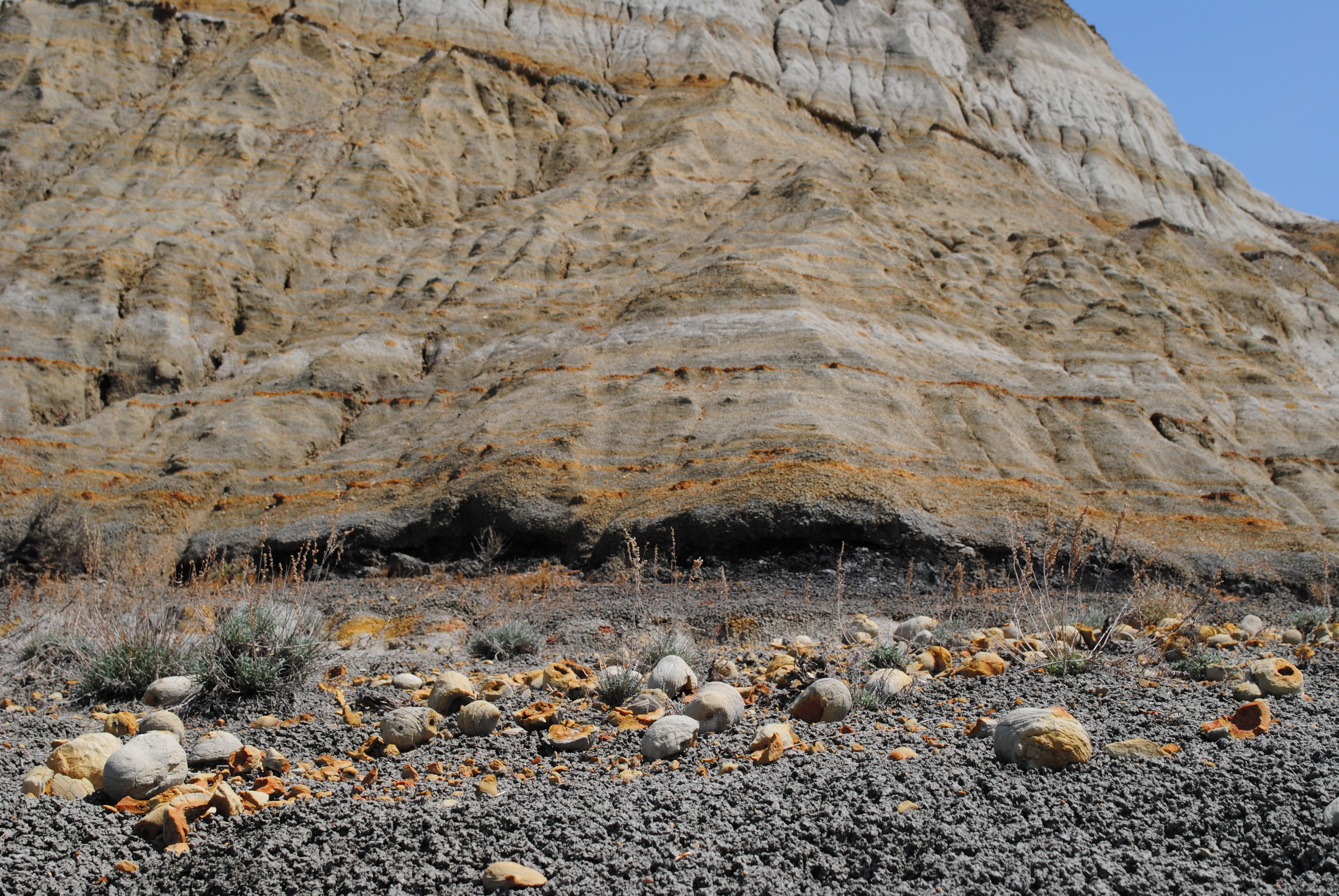
Cannonball Concretions. 429 words. The cannonball concretion pullout is a natural area located on the north side of the North Unit scenic drive. A sidewalk runs approximately 100 feet along the parking area, with an interpretive wayside, a trash can, and a trailhead sign for the Buckhorn Trail spaced along its length. A large butte stands to the northeast, nearly reaching the parking area, with a large prairie containing grasses and sagebrush to its west. The butte, named Battleship Butte, resembles the prow of a ship. Scattered along the base of the butte, with a few among the sagebrush, are large, round, rock formations. To the east of the butte, more of these round formations are scattered in an eroded and washed out area. Others are visible just beginning to appear from the surface of the butte. The wayside has a large photo of one of the cannonball concretions, under a black band with the National Park Service arrowhead, and is titled Cannonball Mystery. Under this the text reads: The large, round rocks littering the ground and protruding from the butte are bizarre. They don’t seem to fit with the rest of the landscape. Where did they come from? These “cannonballs” were not carried here by flowing water or glaciers. Instead, they formed within the sediment layers of the badlands. Now, erosion is slowly exposing these buried treasures. Notice how some cannonballs have completely eroded out of the butte while others are just being exposed. Even more lie deep within the rock layers, yet to be revealed. Under this, next to the image of the cannonball more text reads: There are small pockets of cannonball concretions throughout the park and the Little Missouri Badlands. Those seen here are some of the largest and most impressive yet discovered. To the right of this main image, a second image of several cannonballs in a wash. Under this, there is title text reading: How Do They Form? Under this is written: Mineral-rich water deposits minerals as it seeps through porous sediment layers. The minerals act like glue, binding the sediments together and forming concretions. Concretions form in many different shapes and sizes. Those that are spherical are called “cannonballs.” For now, scientists can only guess why some concretions take on such spherical shapes. Under this, one final title reads: Save the Cannonballs. Under this is written: These cannonball concretions have been a popular attraction for decades Help make sure they are here for future generations to enjoy by leaving them as you find them. If you see someone defacing the cannonballs, report the illegal activity immediately. End of description.
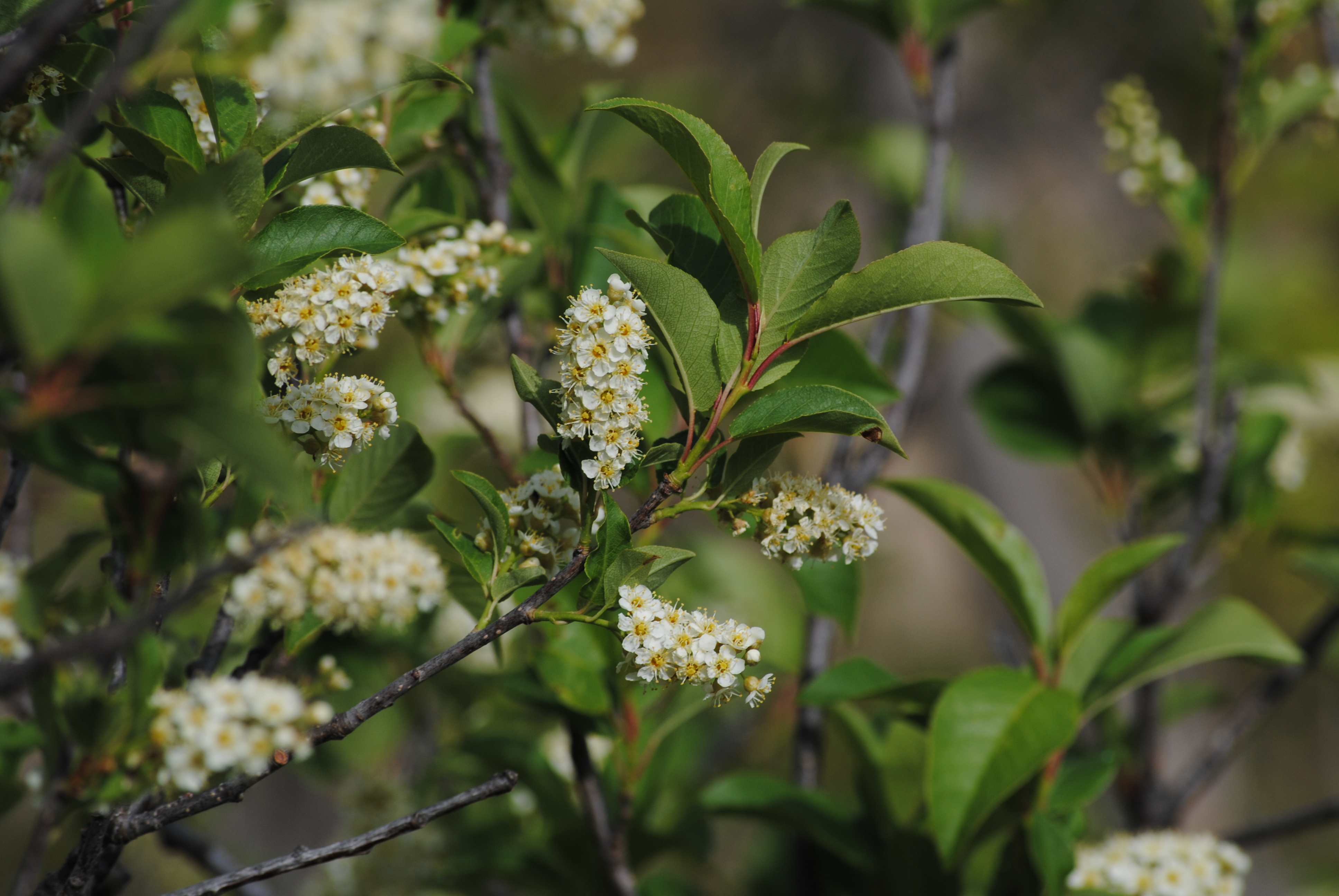
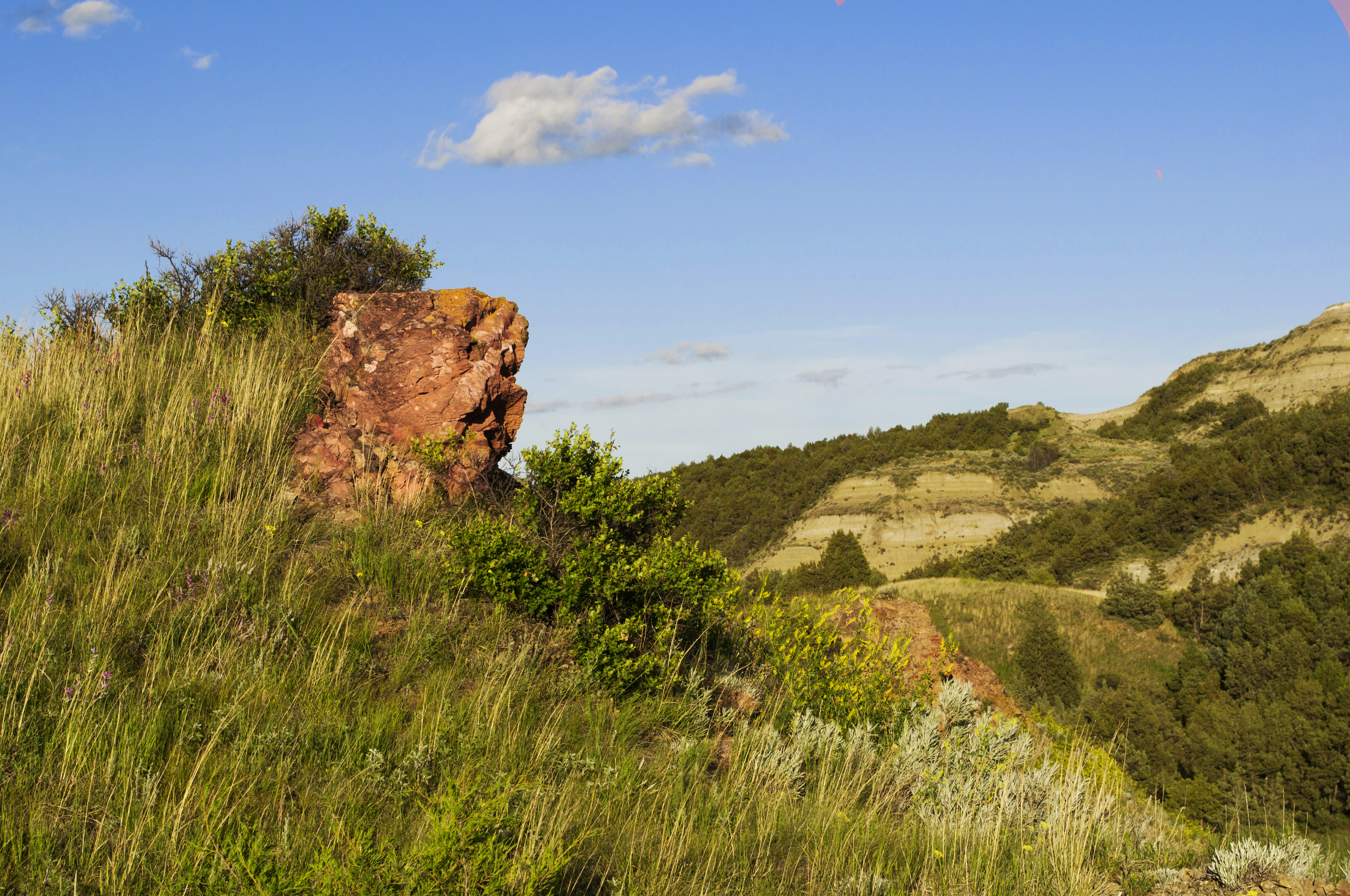
A dirt trail with small chokecherry trees and other shrubs along the side of the trail. Large buttes made of layered sedimentary rock surround the area.
Trail post 10 on the Coal Vein Guided Nature Trail
The post sits right at the edge of a cliff, with junipers growing behind it. Steep wooden stairs descend to the right of it, through an area shaded by more trees.
Trail post 11 on the Coal Vein Guided Nature Trail
The trail winds through an area of prairie, with several larger shrubs scattered about near the trail. Continuing toward the next post, the trail slopes upward slightly.
Trail post 12 on the Coal Vein Guided Nature Trail
A small spur trail leads up hill just past the trail marker. Toward the top of the hill a sign reads "Caution. Steep drop off." in front of some juniper trees.
Trail post 13 on the Coal Vein Guided Nature Trail
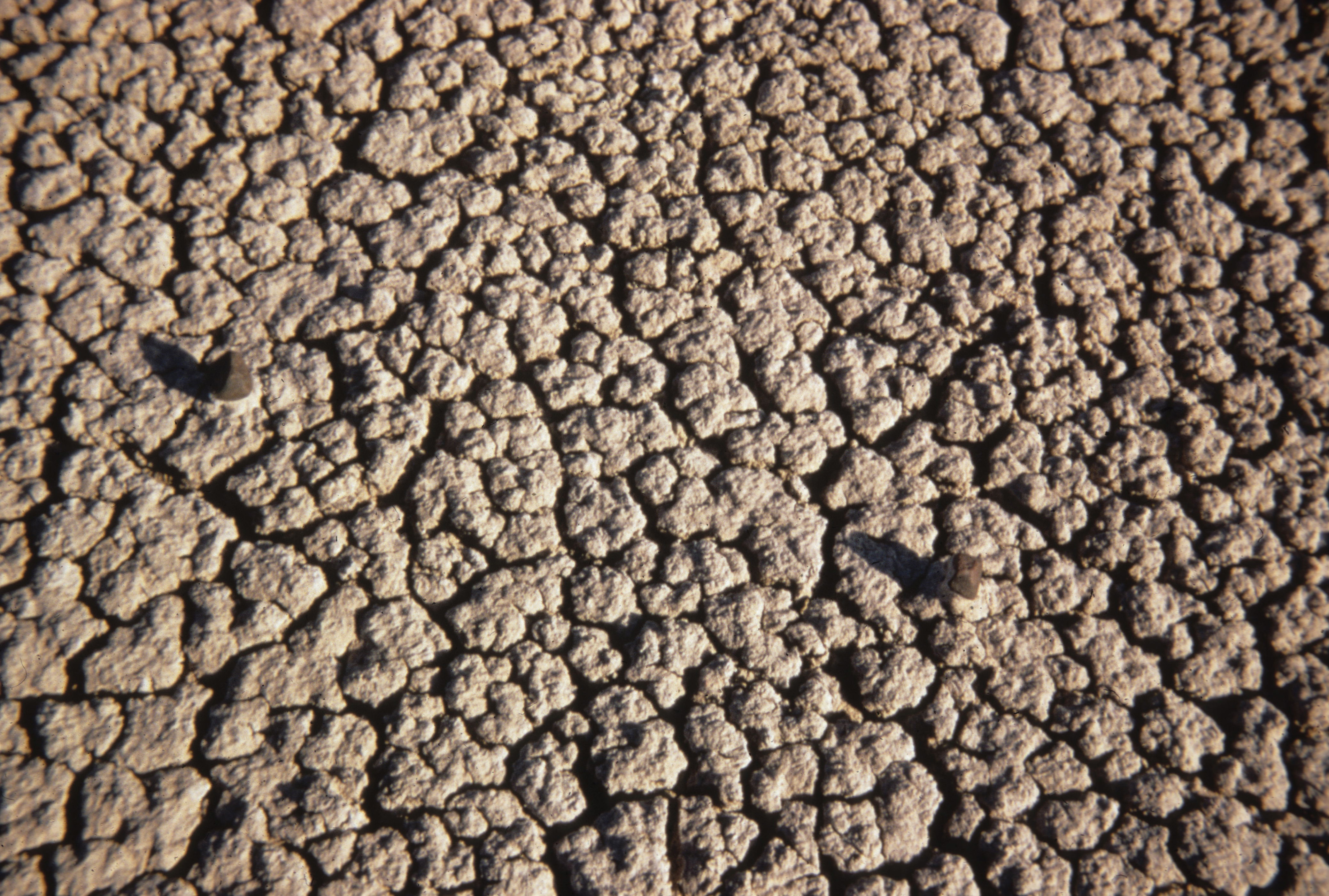
The trail winds along the base of a butte, made up of slumping bentonite clay. To the left of the trail, the ground falls away at a relatively steep angle, with evidence of water drainage.
Trail post 15 on the Coal Vein Guided Nature Trail
The trail, red in color from crushed clinker, slopes uphill here. The immediate area is covered with a variety of grasses, with occasional scattered sage. Further away, buttes continue until the horizon.
Trail post 16 on the Coal Vein Guided Nature Trail
Just past the trail post, the trail drops down to the right. A spur trail drops sharply to the left, with several clinker covered wooden steps. This spur terminates next to an approximately 4 foot tall clinker chimney, surrounded by bushes.
The trail begins to slope upward toward some gray clay buttes. To the left side of the trail, a bare spot is surrounded by sage and a butte slopes upward.
To the east of the trail, a flat area sprouts assorted plants. A low depression is relatively bare, while sage spreads out to the base of the nearby butte. Red rock makes up the base of the butte, but plant life takes over as it rises.
A small wooden fence stands at the edge of a small drop. Shrubs and small trees grow at the base of and along the sides of a small draw, which angles up towards the top of the butte. More juniper are visible along the top edge.
From the post, a spur trail continues to the left, heading to a steep overlook lined by juniper. The view beyond the trail post drops down into a canyon, with a clinker rock wall on the other side.
The trail curves slightly downward past the post through a stand of juniper towards the top of some stairs. A orange-red rock sticks slightly out of the ground next to the post.
The trailhead for the Coal Vein Guided Nature Trail.
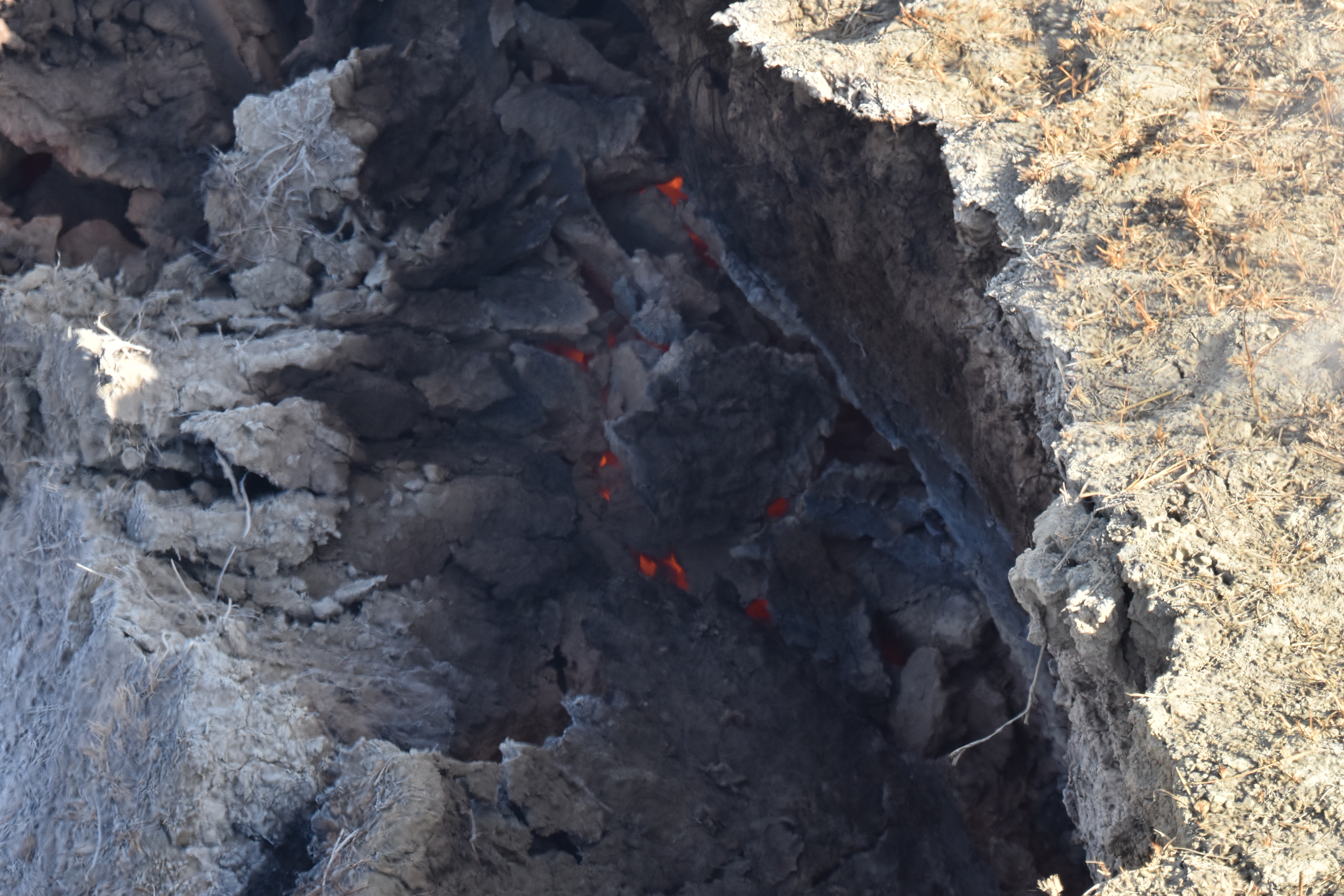
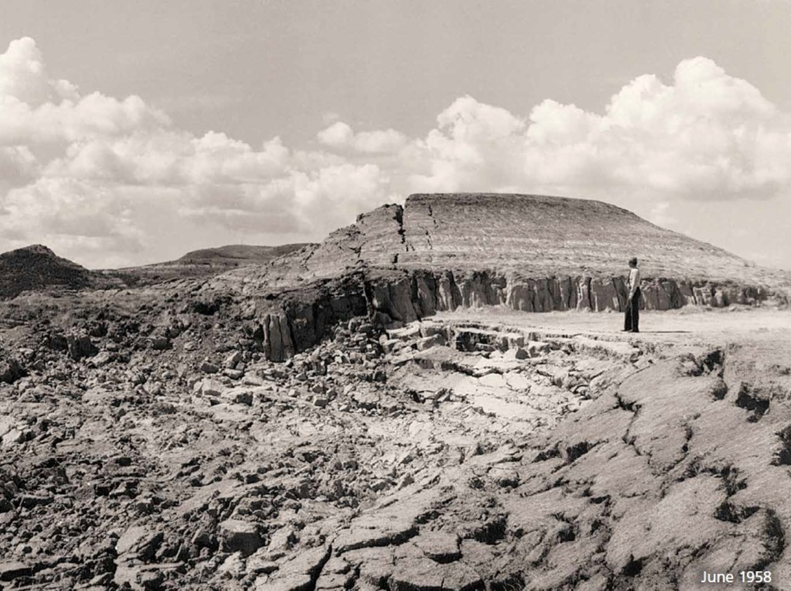
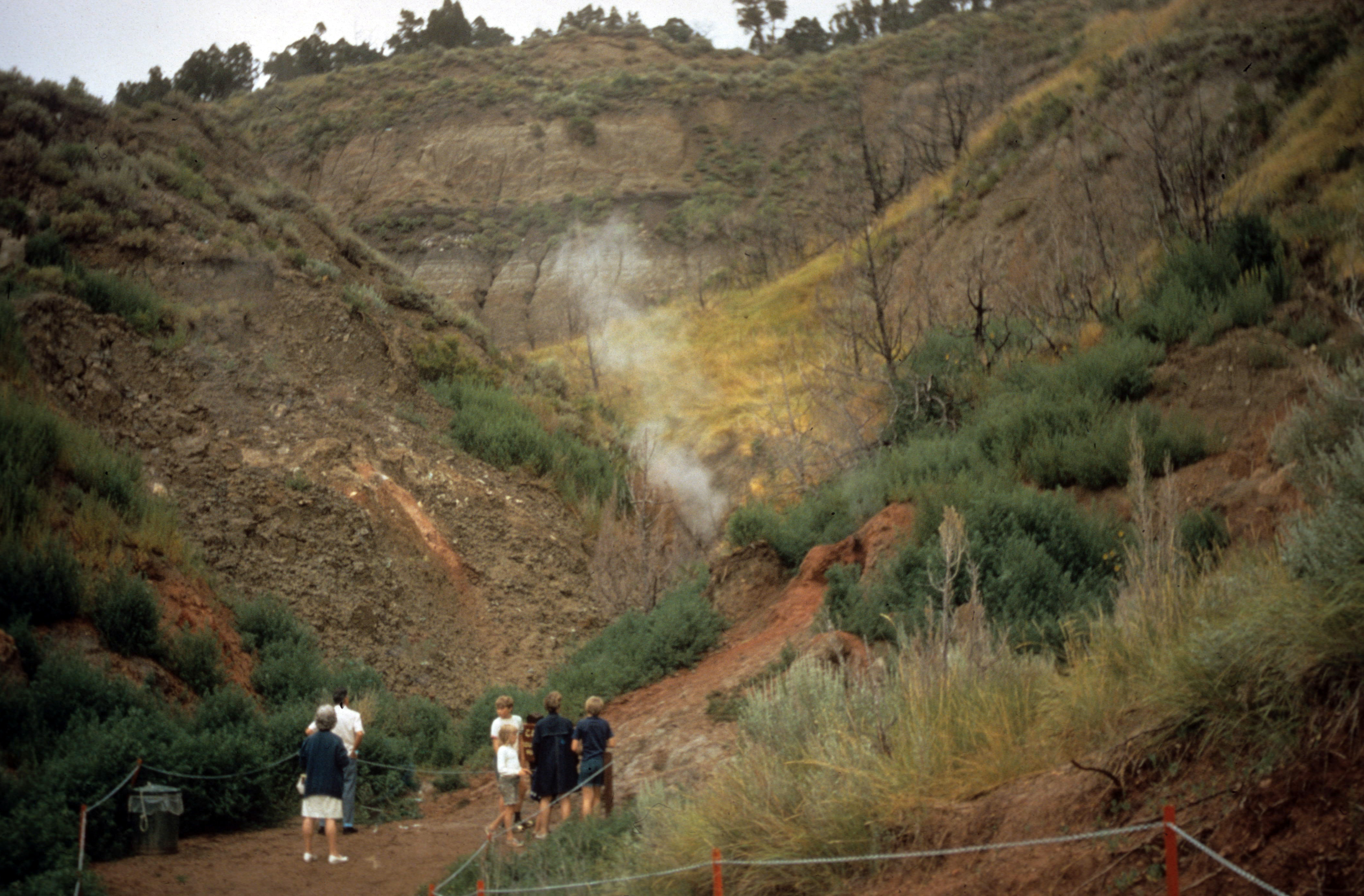
Coal Vein trailhead. 326 words. A trailhead sign stands at the edge of a dirt parking lot surrounded by posts. A trail starts just past the sign, continuing toward the southeast. Sagebrush and other plants grow along the edge of this trail. The trailhead sign has a black bar along the top, containing the words "Theodore Roosevelt National Park" and "National Park Service, US Department of the Interior," as well as the National Park Service Arrowhead. Under this a grey bar contains the words "Coal Vein Nature Trail," followed by a photo of the badlands scenery, including a grey butte, some small plants, and rocky mountain juniper trees under a blue sky. Below this is a map of the Trail, as well as an outline indicating the area burned in the coal vein fire the trail is named for, which burned from 1951-1977. Text indicates the trail is of moderate difficulty with steep stairs, and will take about 45 minutes to complete the 0.8 mile, or 1.3 kilometer, loop. Text below this reads: "Coal Vein Nature Trail explores an area that was impacted by an underground coal vein fire." "Though the land has healed, there are still signs of the area's fiery past. Look for them along the nature trail." "No bicycles. No horses. No pets. Never approach wildlife. Do not collect or disturb natural features." Below this is a title reading "Collapse" next to a black and white photo of a person standing above a collapsed area of ground. Text reads: "Many geologic processes happen slowly over hundreds, thousands, or millions of years. But some, like coal vein fires, happen right before our eyes." "Park visitors came to this spot to watch an underground coal fire that burned from 1951 to 1977. Some days there was only a wisp of smoke. Other days change was rapid. Red-hot rock glowed at the bottom of deep crevasses. Plants withered on the hot ground. Hillsides crumbled. The land gave way." End of description.
Trail entering into a valley with a large butte on one side. Juniper trees, and prairie grass species line the trail. There is a wooden post indicating the first stop on the nature trail
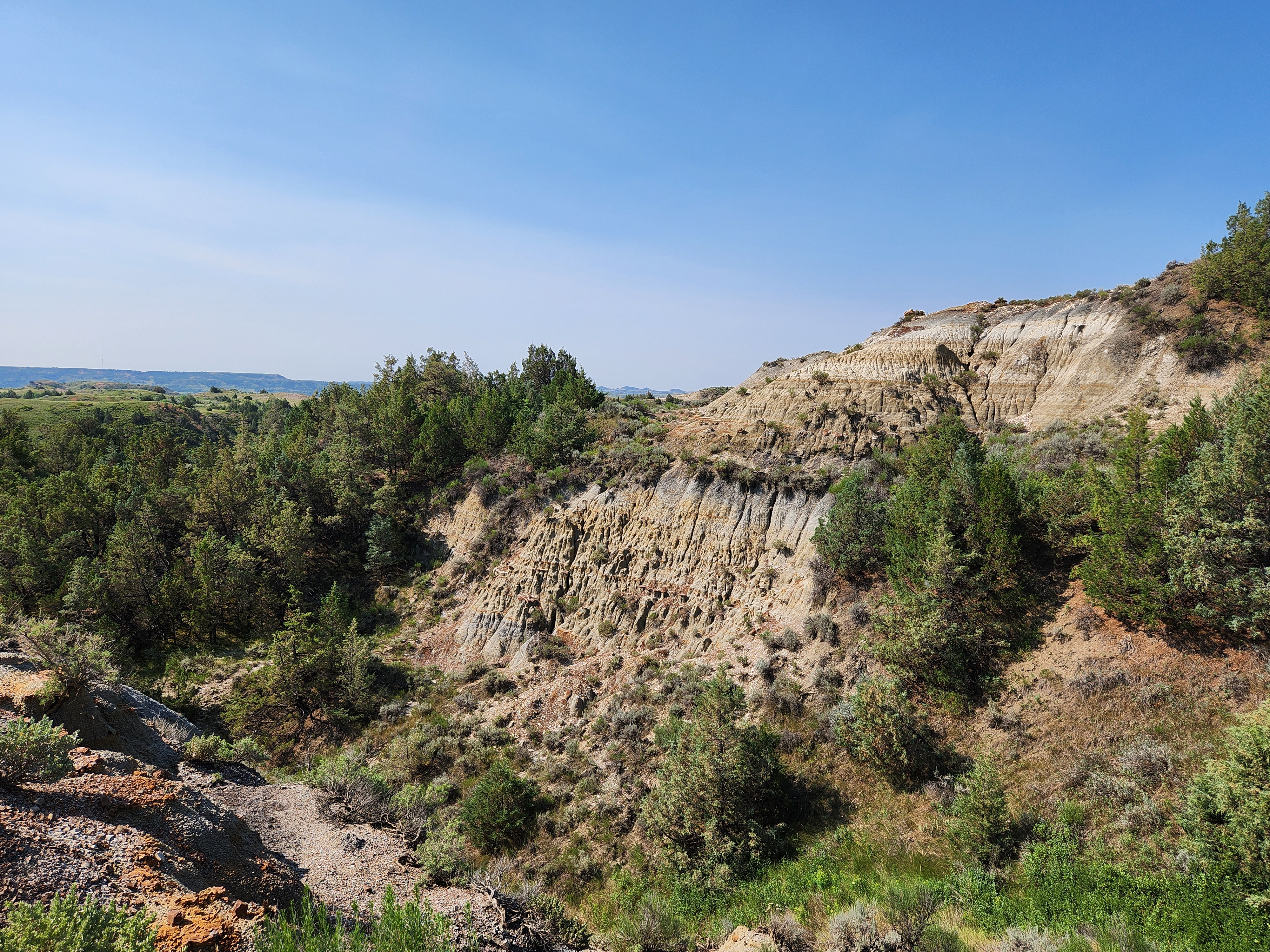
A dirt trail rising at a slight incline. On one side the trail hugs a rock face made of different colored layers of sedimentary rock. The rock shows patterns of erosion On the other side of the trail are junipers and small shrubs. A post marks the 6th stop on the guided nature trail.
The original location of Theodore Roosevelt's Elkhorn Ranch Cabin.
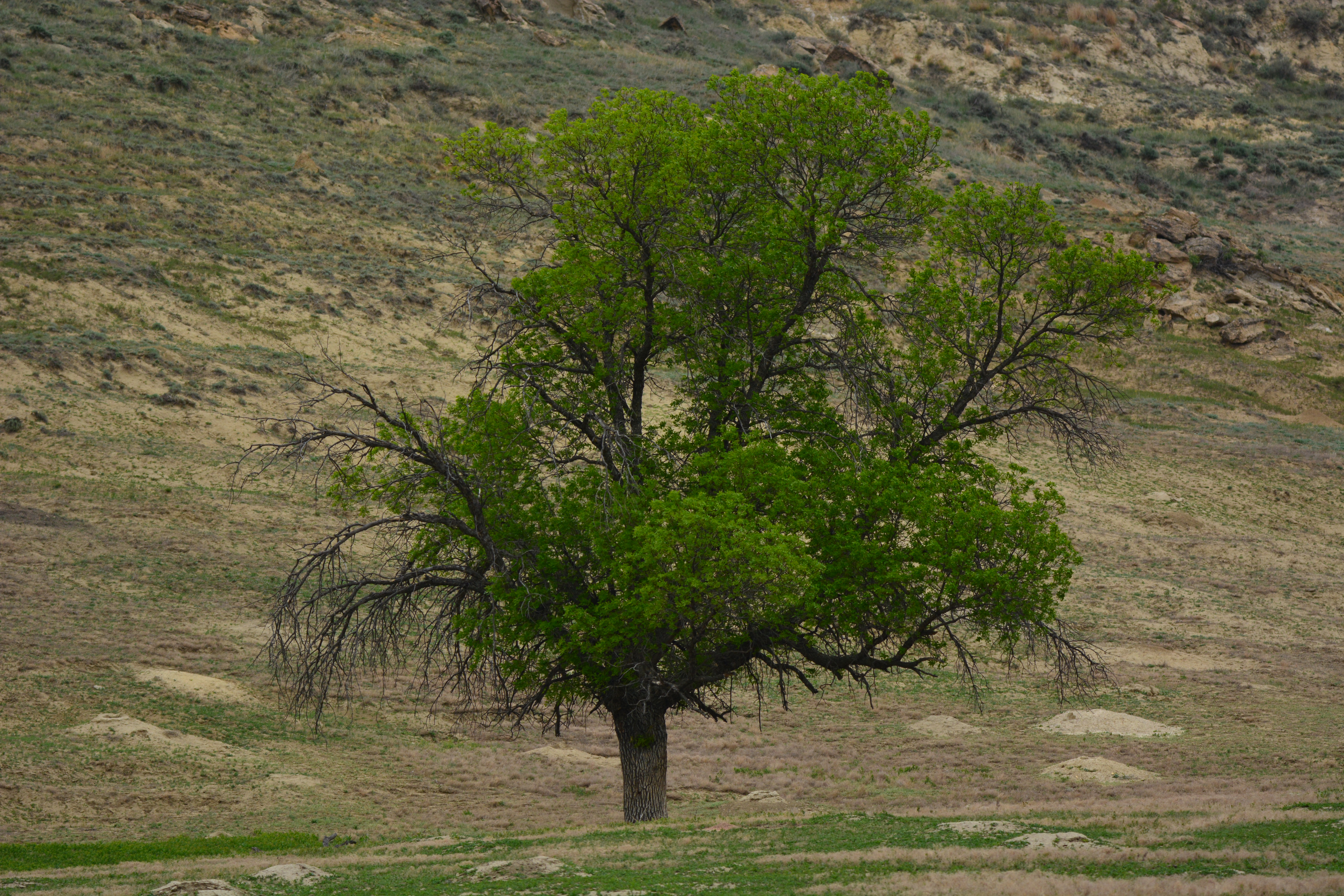
Elkhorn Ranch Cabin Site. 88 words. The location where the Elkhorn Cabin once stood is a grassy area beneath the branches of nearby cottonwood trees, with scattered juniper nearby. Large Stones bound the place where the cabin once stood, varying in distance from one another between six and ten feet. A nearby field of grass contains stakes that mark the boundaries of where other buildings once stood, and a wire fence surrounds the entire area. The river is visible to the east, slightly lower than the cabin site, and buttes surround the entire valley. End of description.
Take a short trail to reach the location where Theodore Roosevelt's Elkhorn Ranch once stood. While the cabin is no longer standing, some of the foundation stones remain.
There is a large wooden interpretive display sign with a panel sharing information about Theodore Roosevelt and the Elkorn Ranch. Next to that is a fence with a gate allowing access to a grassy trail that leads into a grove of Cottonwoods. There is a gravel parking lot. The area is surrounded by large buttes made of sedimentary rocks.
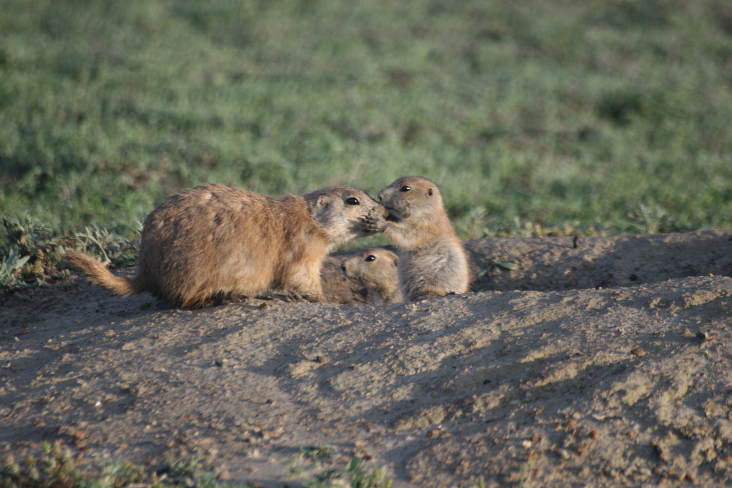
A wayside pull off along the north side of a single lane road. The road is on a high plateau. On both side of the road is an expansive prairie dog town. The prairie dog town is made up of prairie grasses and forbs cut short by prairie dogs along with mounds of dirt at the openings to tunnels. You may see prairie dogs popping out of holes or running across the field.
A dirt trail with a roughly 10 foot spur trail leading to an overlook of the Little Missouri River. A barbed wire fence runs along the edge of the overlook marking the park boundary. There is a large cottonwood tree next to the trail and a lightly forested area of juniper trees. Across the muddy river is a grove of cottonwood trees and badlands buttes can be seen in the distance.
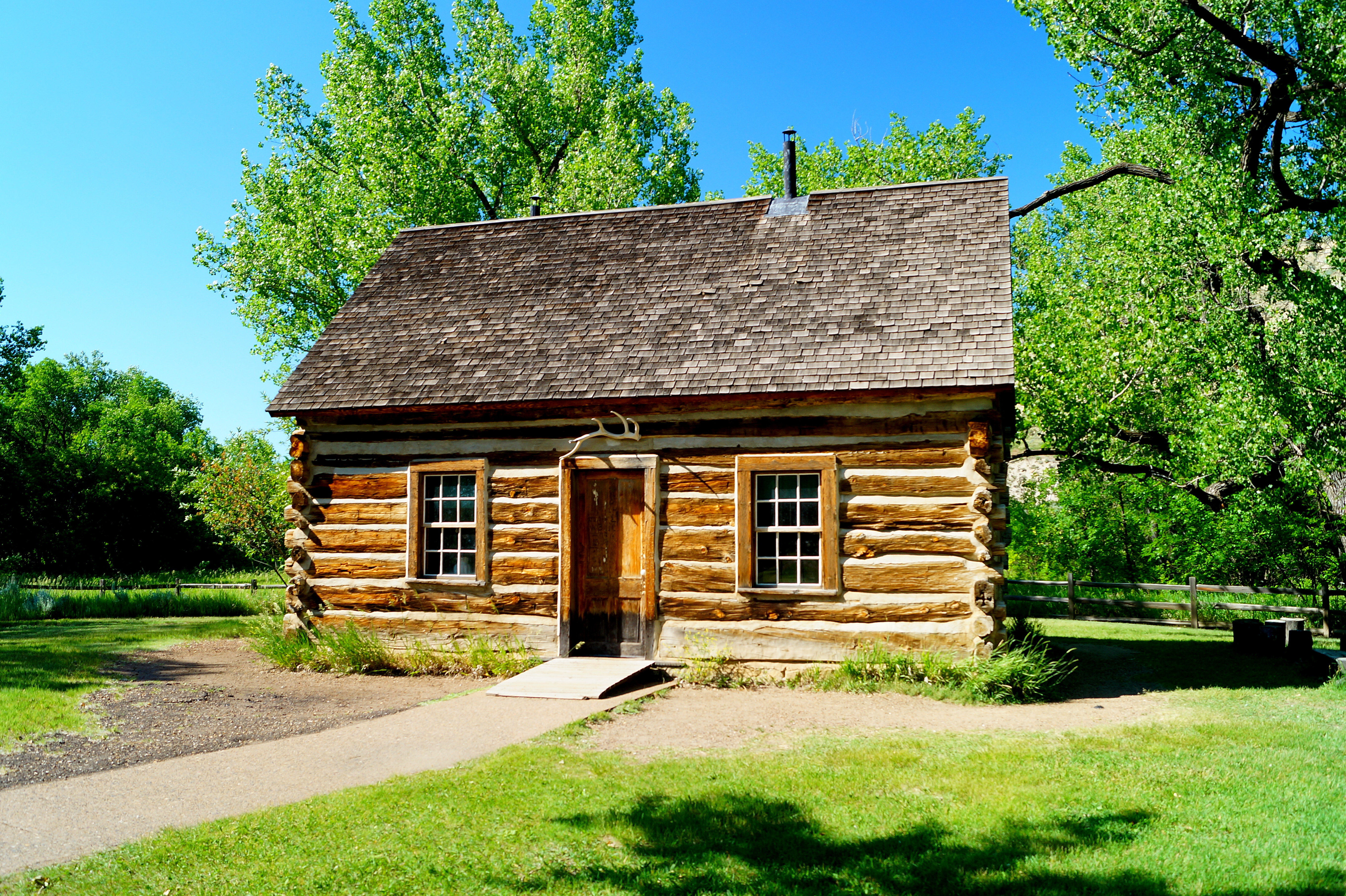
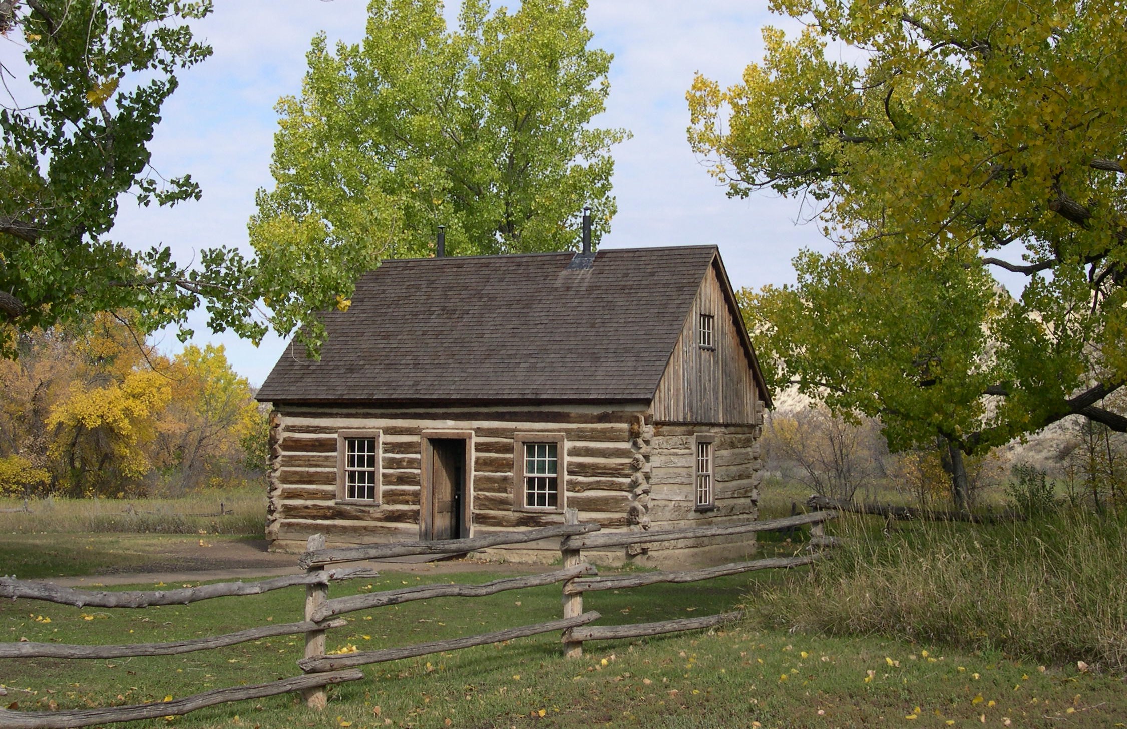
The first home of Theodore Roosevelt in the Little Missouri badlands of North Dakota.
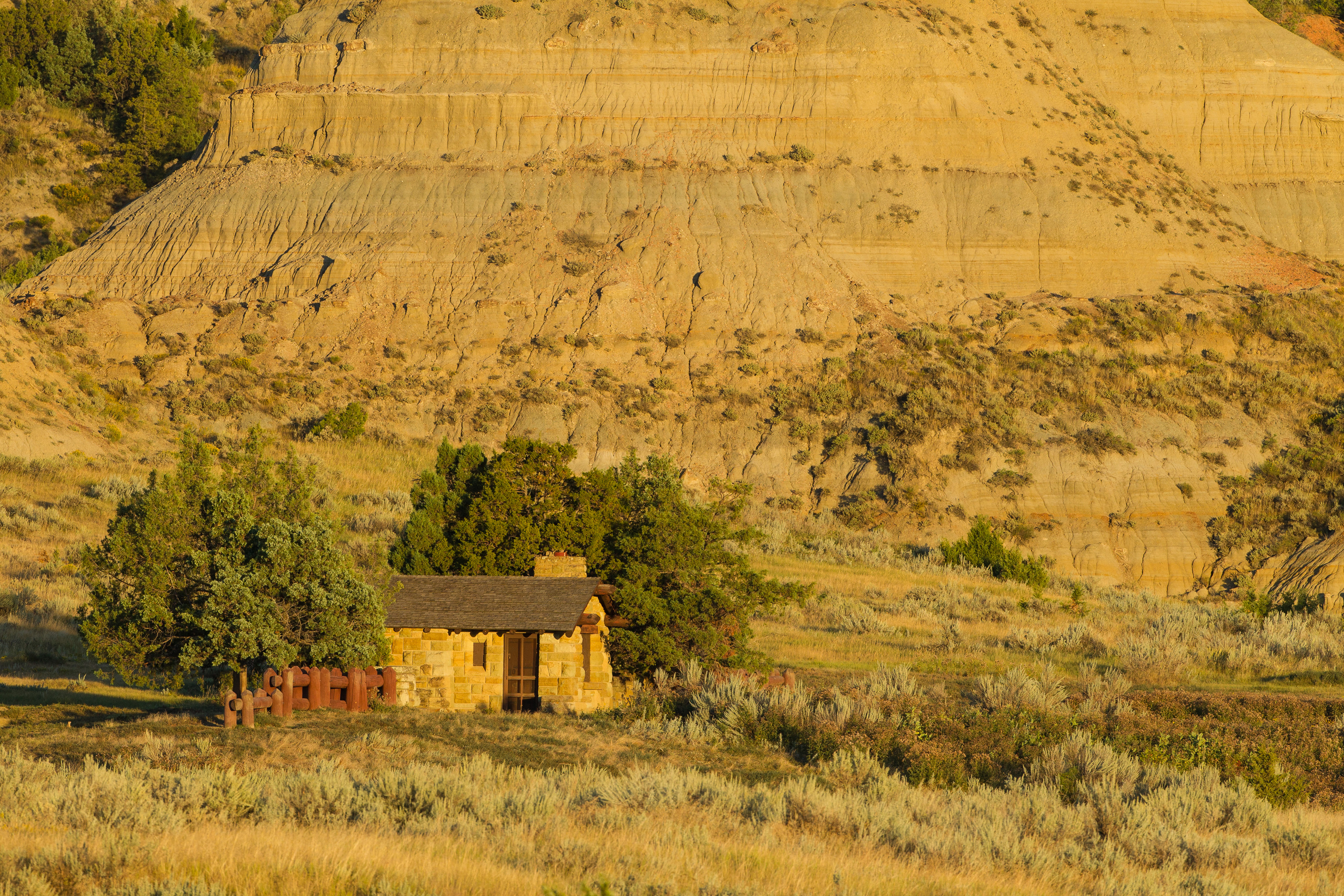
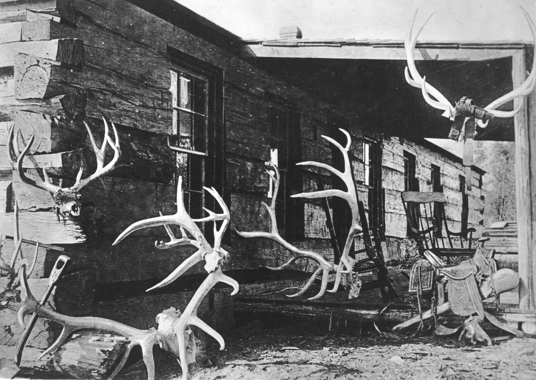
Maltese Cross Cabin. 839 words. The Maltese Cross Cabin is a single-story log structure with a high peaked roof located approximately 100 feet from the North doors of the South Unit Visitor Center. A door and two windows are visible. The logs of the cabin are light in color, with concrete chinking. East of the cabin, wooden benches and stumps make an outdoor seating area. A sidewalk leads through a grassy area to a small ramp to the front door. The cabin’s roof is shingled and has two chimneys, one near either end. The wooden front door has a small white doorknob on the right side. An elk antler hangs above the door. Situated approximately five feet to either side of the door are small windows. Inside the cabin, white painted walls and plexiglass panels enclose a space of approximately 50 square feet. There are two doors on the west side of this space, leading to plexiglass alcoves in the kitchen and the bedroom. The floor is made of wooden boards and visitors can see items that belonged to Theodore Roosevelt. Near the rear of the visitor center is a wayside about the cabin. It is titled “Maltese Cross Cabin: Launching a Legacy.” The main image on the wayside is a photo illustration of the cabin at its current location morphing into a historic image of the cabin with a horse and buggy in front of it. Text on the historic section of the photo reads: Photo by Theodore Roosevelt ca.1884-1886. Underneath the photo, captions read: After traveling the country on exhibition, the cabin now sits about 7 miles north of its original location. Sylvane Ferris in a wagon and an unidentified man on horseback pose in front of the Maltese Cross Cabin. Text to the left of the image reads: “I never would have been president if it had not been for my experiences in North Dakota.” – Theodore Roosevelt, 1918. The Maltese Cabin was a temporary home for Theodore Roosevelt who, during his mid-20s, divided his time between his home in New York City and his two ranches in Dakota Territory. The cabin offers a glimpse of what Roosevelt’s life was like on the ranch. The books and letters he wrote about his experiences here reveal the role of the badlands in shaping his character and his passion for protecting wild places. Later, as our nation’s 26th president, Roosevelt established the National Forest Service and designated more than 230 million acres of land as national parks, forest, monuments, and wildlife reserves. How could the strenuous life on the ranch prepare Theodore Roosevelt for his presidency? Text to the right of the image describes the features of the cabin and reads: Features Steeply-Pitched Roof: An oddity on the Northern Plains, the cabin’s steep roof created a sleeping loft for Roosevelt’s ranch hands, accessed by a ladder on the kitchen wall. Pine logs: Exterior walls were built from ponderosa pine logs cut near Ekalaka, MT. The cabin’s survival is owed, in part, to these sturdy logs which were intended for railroad construction. A Grand Structure: The cabin had wooden floors, a root cellar, three rooms, a sleeping loft, and two coal-burning stoves, setting it apart from most frontier homes of its time. Seal of Approval: Empty rifle casings were used to make the shape of the Maltese Cross on the end of a log on the cabin’s right front corner. Just one partial casing remains; the rest were taken as souvenirs long ago. Today, such destruction is illegal. Along the bottom of the wayside is a timeline titled Maltese Cross Cabin Timeline. The text of the timeline reads: September 4, 1883: Roosevelt arrives in Little Missouri, Dakota Territory to hunt bison. Near the end of his two-week trip, he invests $14,000 in the Maltese Cross Ranch. Winter 1883-1884: Ranch partners, Sylvane Ferris and Bill Merrifield, build the Maltese Cross Cabin according to TR’s request. June 1884: While grieving the deaths of his wife and mother, Roosevelt turns his focus to ranching, establishing the Elkhorn Ranch, 35 miles north of Medora. Winter 1886-1887: A very harsh winter causes major cattle losses on the Northern Plains. Roosevelt loses 60% of his cattle. April 1887: Roosevelt begins to sell off interests in his ranches to minimize financial loss. 1898: Roosevelt sells his interests in the Maltese Cross Ranch, including the cabin, to his partner, Sylvane Ferris. 1904: The cabin is dismantled and shipped via railcar to be exhibited at the World’s Fair in St. Louis, Missouri. 1905: The cabin goes on exhibit at the Lewis and Clark Centennial Exposition in Portland, Oregon. 1906: The cabin exhibits at the State Fair in Fargo, then moves to the capitol grounds in Bismarck where the Daughters of the American Revolution take over its care. 1947: Theodore Roosevelt National Memorial Park established (now Theodore Roosevelt National Park). 1959: Cabin ownership is transferred to the National Park Service (NPS). 1960-1961: The NPS places the cabin on its current foundation and restores the roof to its original appearance. End of description.
The original entrance station for the South Unit of Theodore Roosevelt National Park.
Old East Entrance Station. 178 words. The Old East Entrance Station is a single story, rectangular stone structure with a low peaked roof located approximately four tenths of a mile southeast of the pullout that shares its name. A low wooden log fence extends north, continuing a stone wall that terminates in a large, square stone pillar located approximately twenty feet from the north side of the entrance station. Both this wall and the entrance station building itself are built of yellow stone blocks. A locked screen door is located on the north facing wall, with a small, blocked window located approximately a foot to its left. Other windows, all blocked, are located on other sides of the building. The entrance station’s slightly peaked roof is covered in dark brown shingles. Dark stained logs are visible under the eaves, acting as supports. A small stone chimney is located toward the rear of the building. Rocky mountain juniper grow near the approach fence and behind the station itself. The entrance station is approached on a dirt path over uneven ground, surrounded by prairie dog holes. End of description.
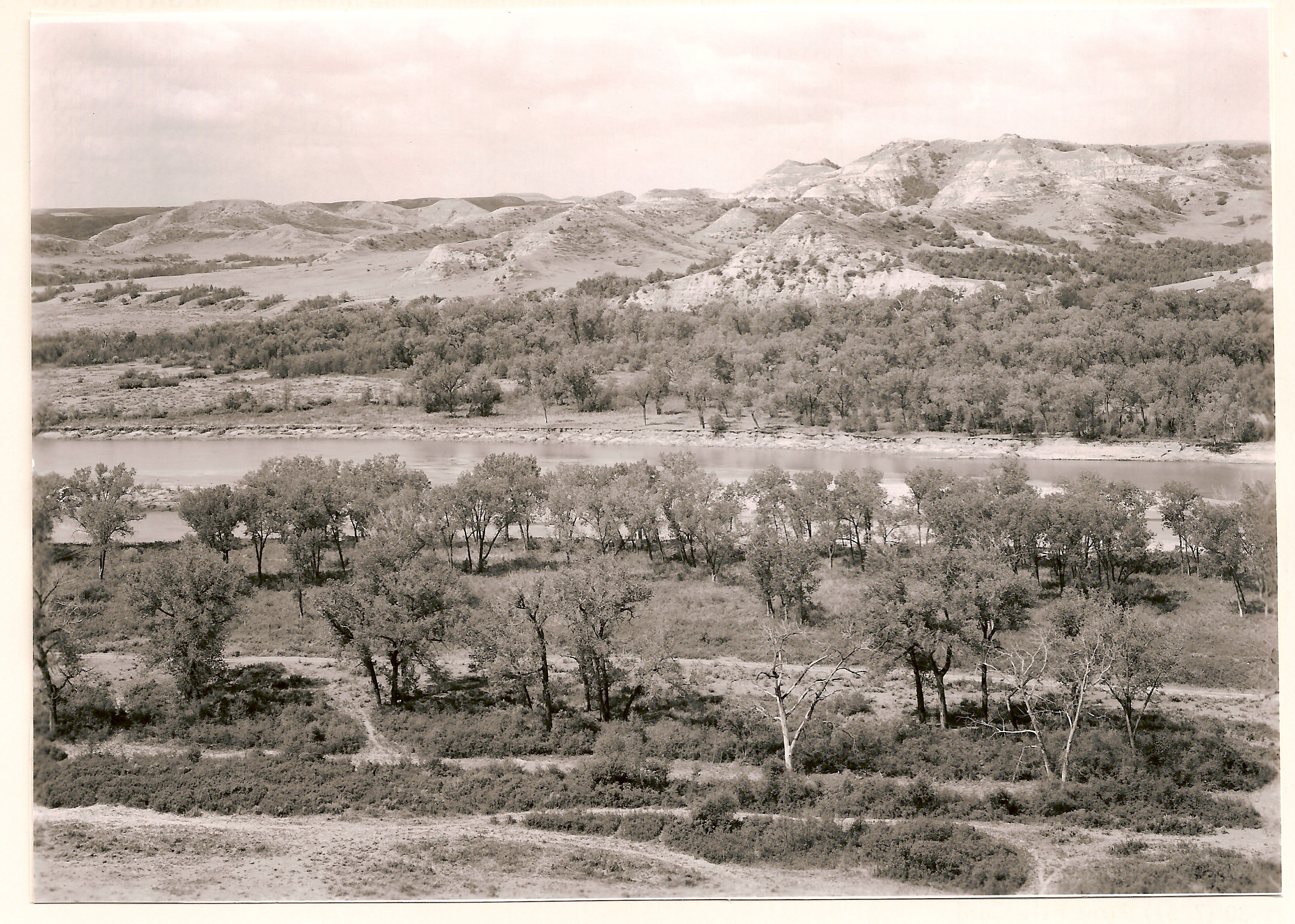
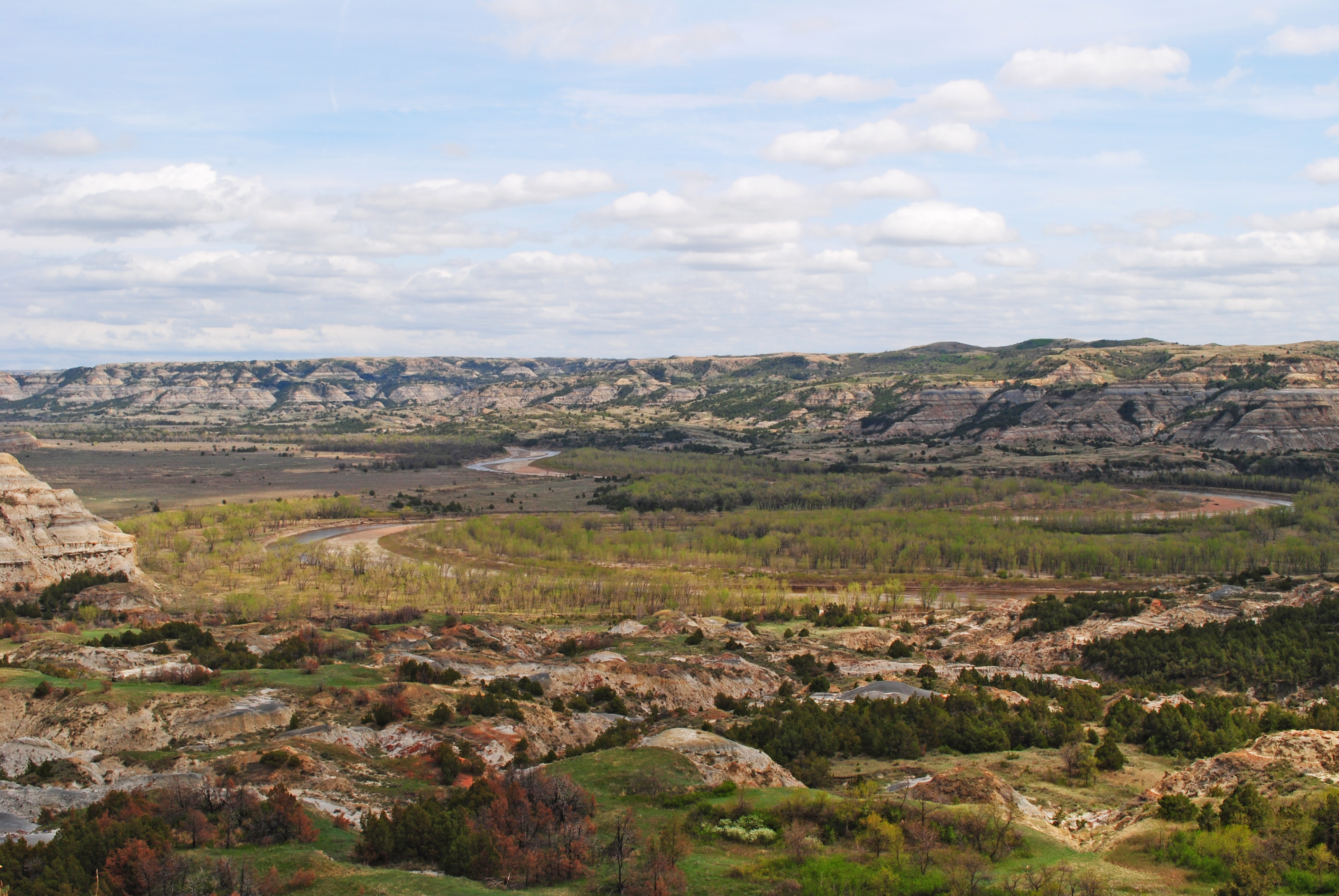
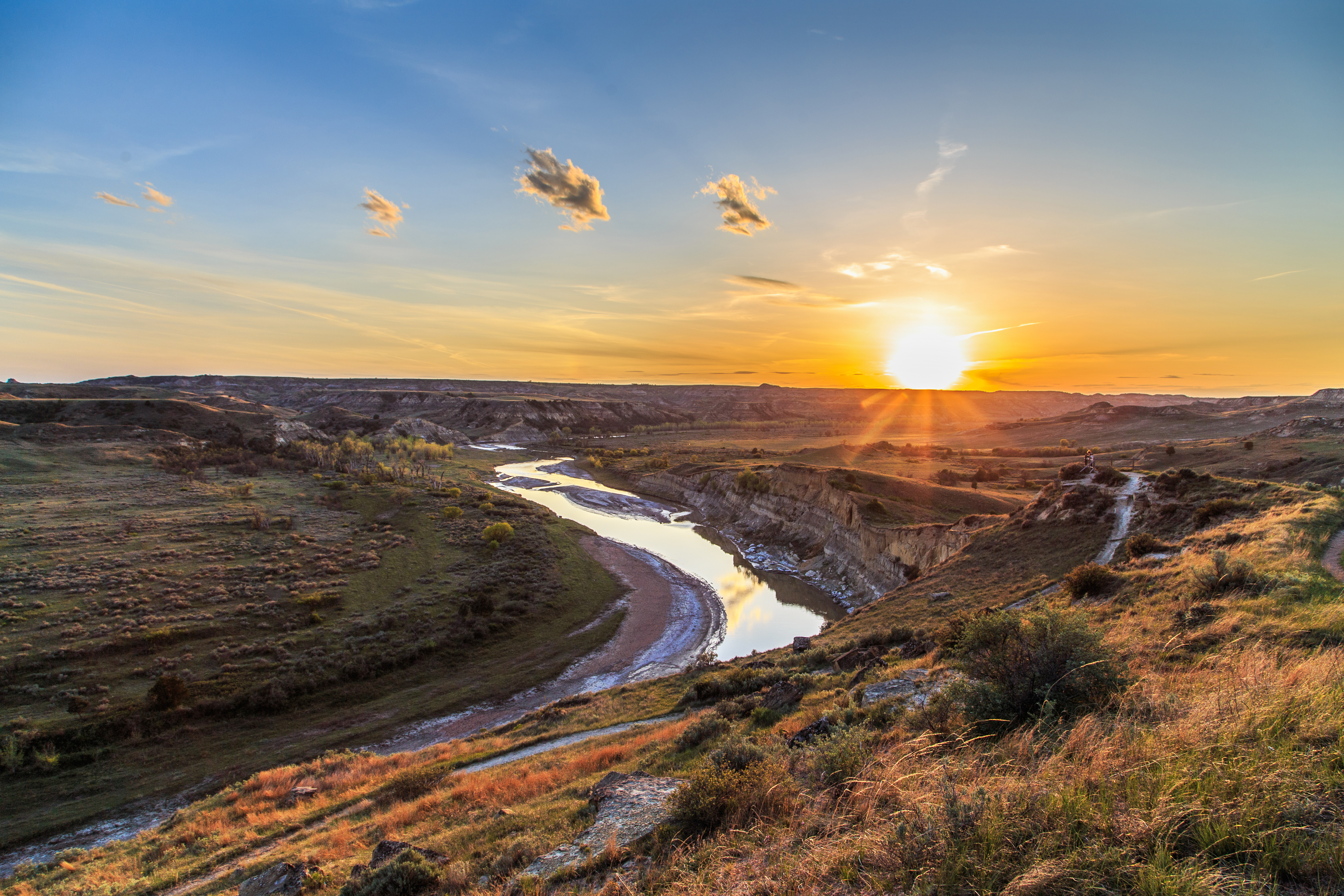
Enjoy a stunning scenic vista of the meandering Little Missouri River surrounded by tall cottonwood trees and impressive buttes.
The viewpoint for Oxbow Overlook starts next to the parking area at the very end of the North Unit Scenic Drive. A vault toilet restroom is available when entering the parking lot for Oxbow Overlook. A few picnic tables are available for use in the parking lot where a u-shaped paved path to the overlook starts. A short-paved, wheelchair accessible sidewalk, less than 0.1 miles, leads to the scenic view where interpretive waysides explain the processes happening at the oxbow. End of description.
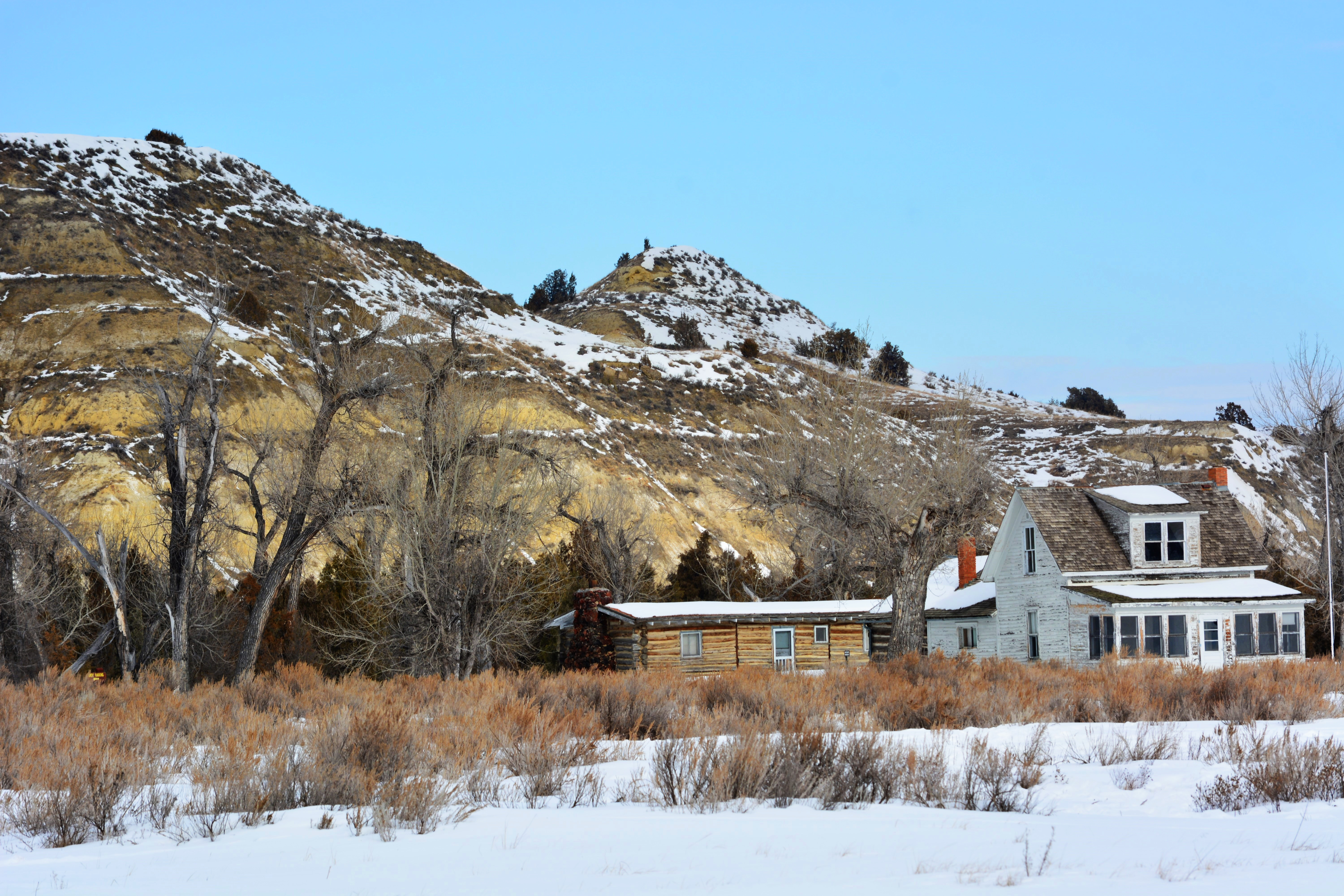
Once a dude ranch, the Peaceful Valley Ranch house and other buildings have served wide and varied purposes since first being built in the late 19th century.
Peaceful Valley Ranch. 214 words. Peaceful Valley Ranch consists of a complex of buildings around a large dirt parking area at the end of a paved road approximately one quarter mile long. A two-story white farmhouse sits on the south side of this parking lot. A screened in porch with a low, sloping roof is attached to the south side of the house, while a single-story extension with log walls and a brick chimney is on the north side. The main part of the house has a steeply pitched roof, with one window just under the peak and another on the first floor below that. North, across the driveway, sits a low log bunkhouse. The roof is low and covered and red shingles, and a stone chimney is built at the west end. The south side of the bunkhouse has a door and two windows, each spaced well away from the door. On the north side, a white painted additional room extends out, with a lower half built of stone. Behind these buildings, others are visible, including a long wooden stable, with corrals behind it. A boardwalk extends the approximately 100 feet between the house and stable. Several large cottonwood trees surround the ranch house, and a small pit toilet sits approximately 300 feet east of the bunk house. End of description.
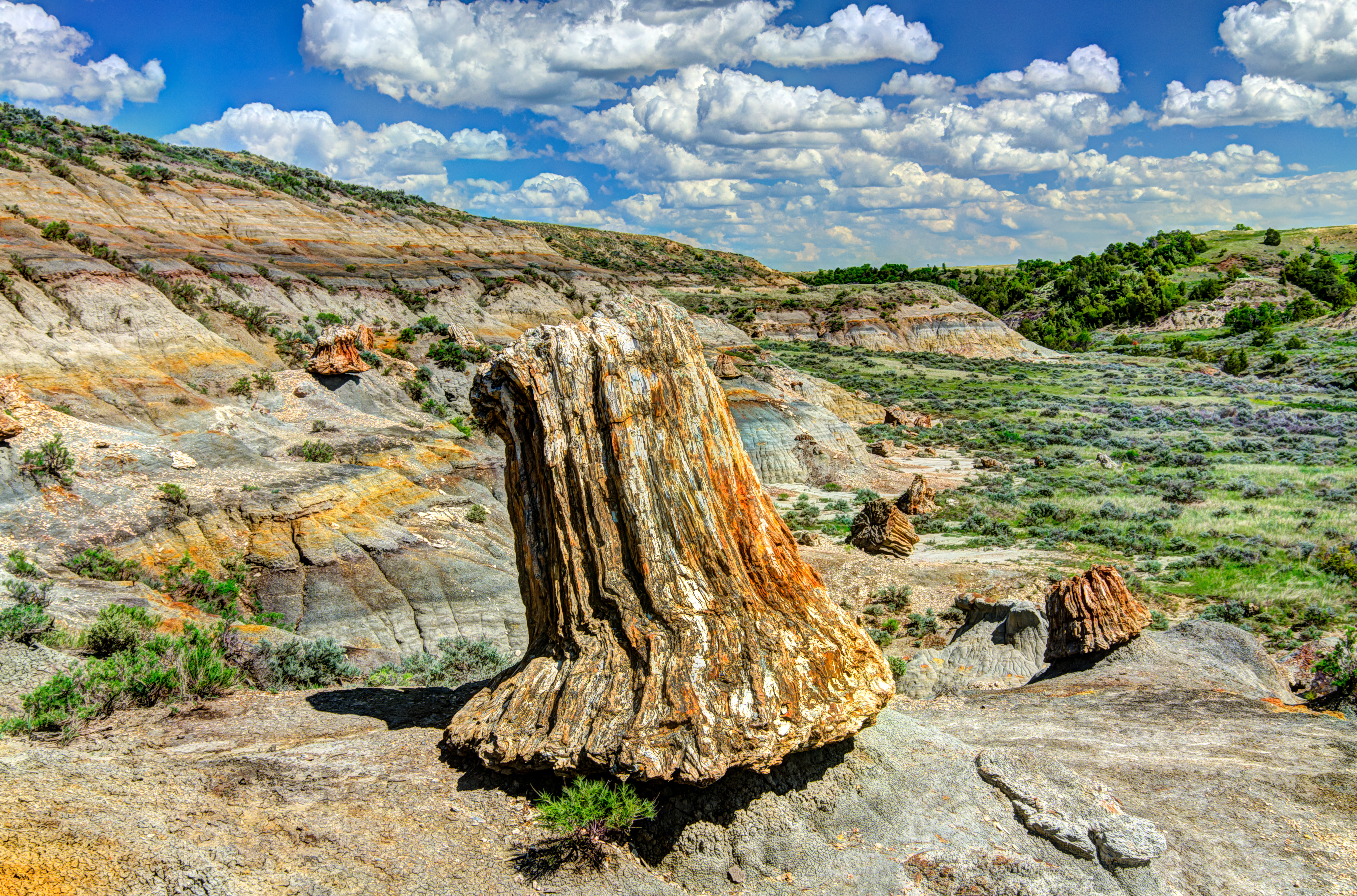
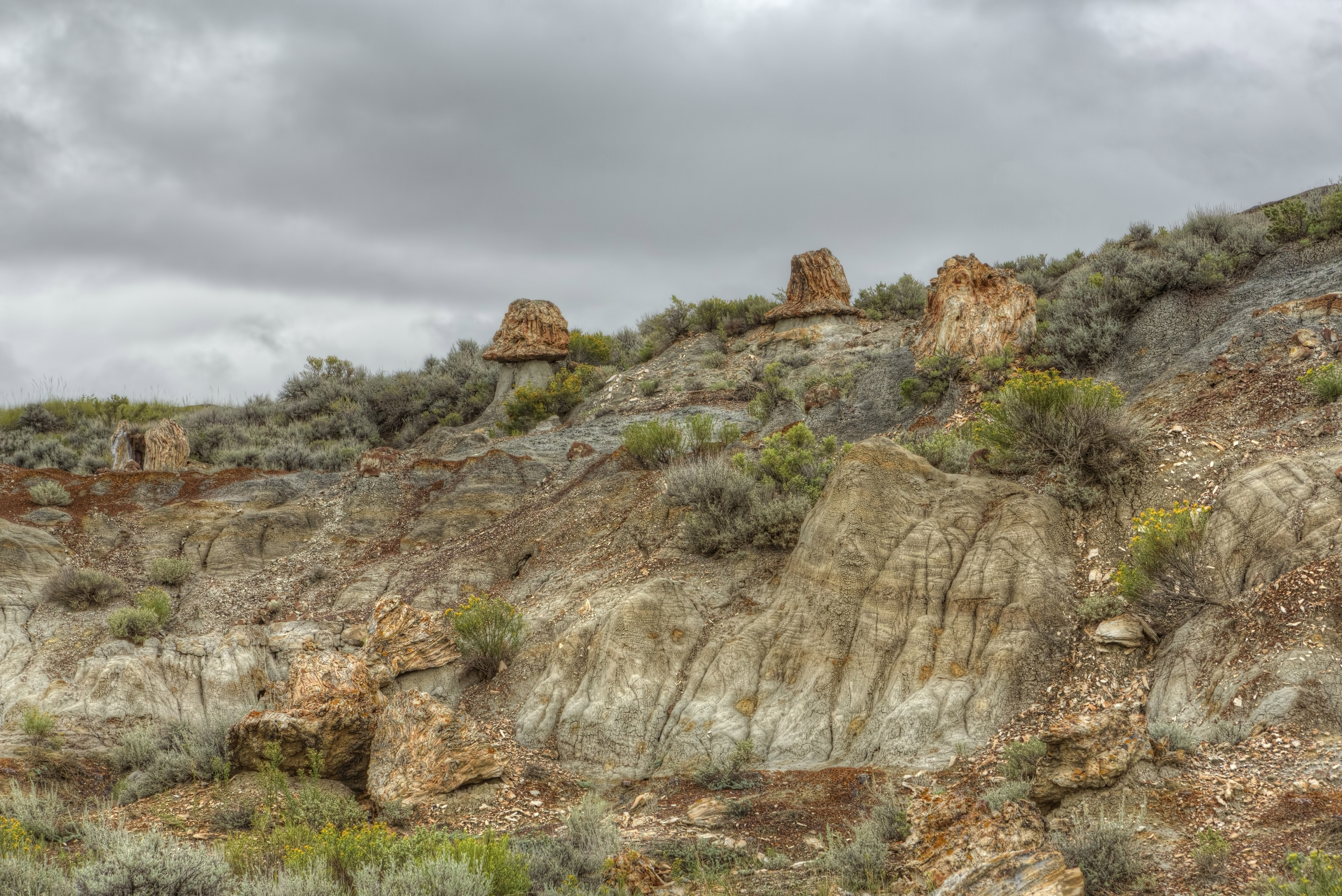
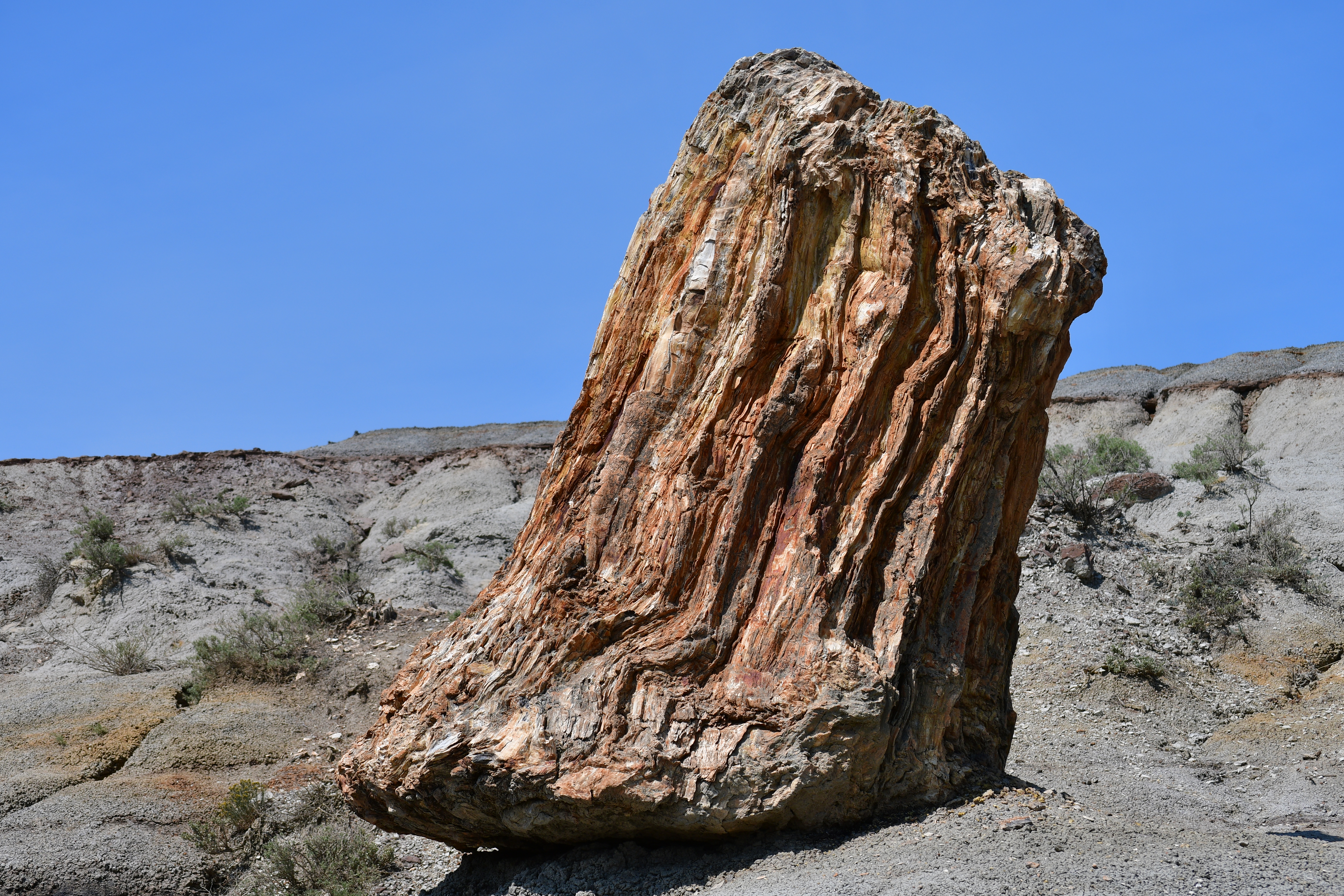
Take a hike on the northern fork of the petrified forest trail, and experience the dramatic otherworldly topography and scattered stumps of Theodore Roosevelt National Park's petrified forest.
Petrified Forest – North. 125 words. From the petrified forest trailhead, hikers travel along an uneven trail approximately one-half a mile, with the last section up a steep hill made of bentonite clay. This clay can be very slippery in inclement weather. At the top of the hill, the trail forks. To reach the northern section of the petrified forest, hikers travel approximately a mile along the north fork through rolling prairie, occasionally broken by bison wallows, until the trail descends again. The trail drops deeply into a valley scattered with petrified stumps, large concretions, and cracks in the ground. Some of the stumps are more than six feet in height. The trail in the valley meanders around the scattered stumps before climbing again after approximately 1 mile. End of description.
Theodore Roosevelt National Park contains one of the highest concentrations of petrified wood in the country, and the rolling badlands offer unique opportunities to hike amongst these geological wonders.
Petrified Forest – South. 125 words. From the petrified forest trailhead, hikers travel along an uneven trail approximately one-half a mile, with the last section up a steep hill made of bentonite clay. This clay can be very slippery in inclement weather. At the top of the hill, the trail forks. To reach the southern section of the petrified forest, hikers travel approximately a mile along the south fork through rolling prairie, occasionally broken by bison wallows, until the trail descends again. The trail drops deeply into a valley scattered with petrified stumps, large concretions, and cracks in the ground. Some of the stumps are more than six feet in height. The trail in the valley meanders around the scattered stumps before climbing again after approximately 1 mile. End of description.
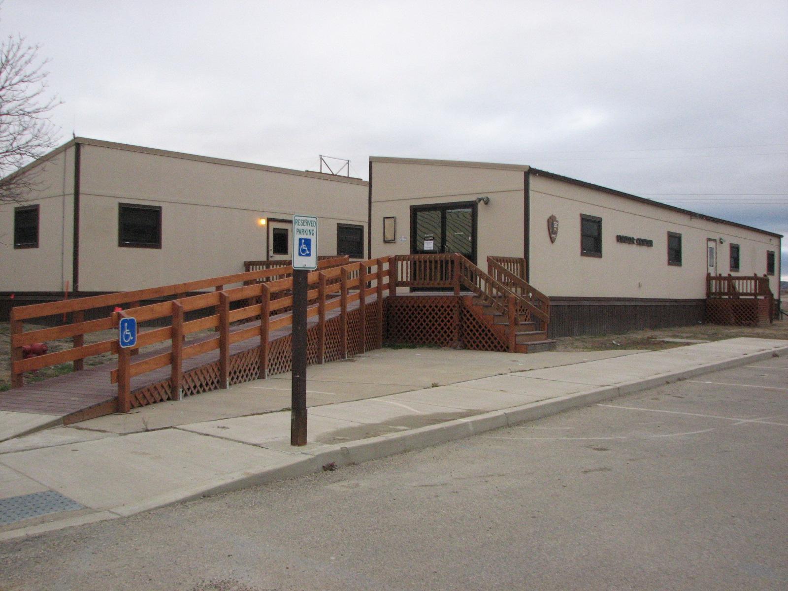
A small visitor center is located at the park entrance for visitors to the North Unit. Speak with a ranger, receive assistance with any trip planning needs, obtain a backcountry permit, purchase a souvenir at the bookstore, or watch the park film, Refuge of the American Spirit. Restrooms are available at this location.
Features: Panoramic views, wildlife viewing, hiking trails, staffed information desk, exhibits and displays, gift shop, picnic shelters, drinking fountain, vending machines, public telephone, and restrooms are wheelchair accessible.
Rangers staff the desk, assist visitors with trip planning, and issue backcountry permits. Theodore Roosevelt's Maltese Cross Cabin, located just outside, is open for self-guided tours year-round. Ranger-led cabin tours are offered in the summer. The park film, Refuge of the American Spirit, shows in the theater. A bookstore sells books, postcards, and more. A museum houses artifacts from Theodore Roosevelt's presidency and time in the badlands.
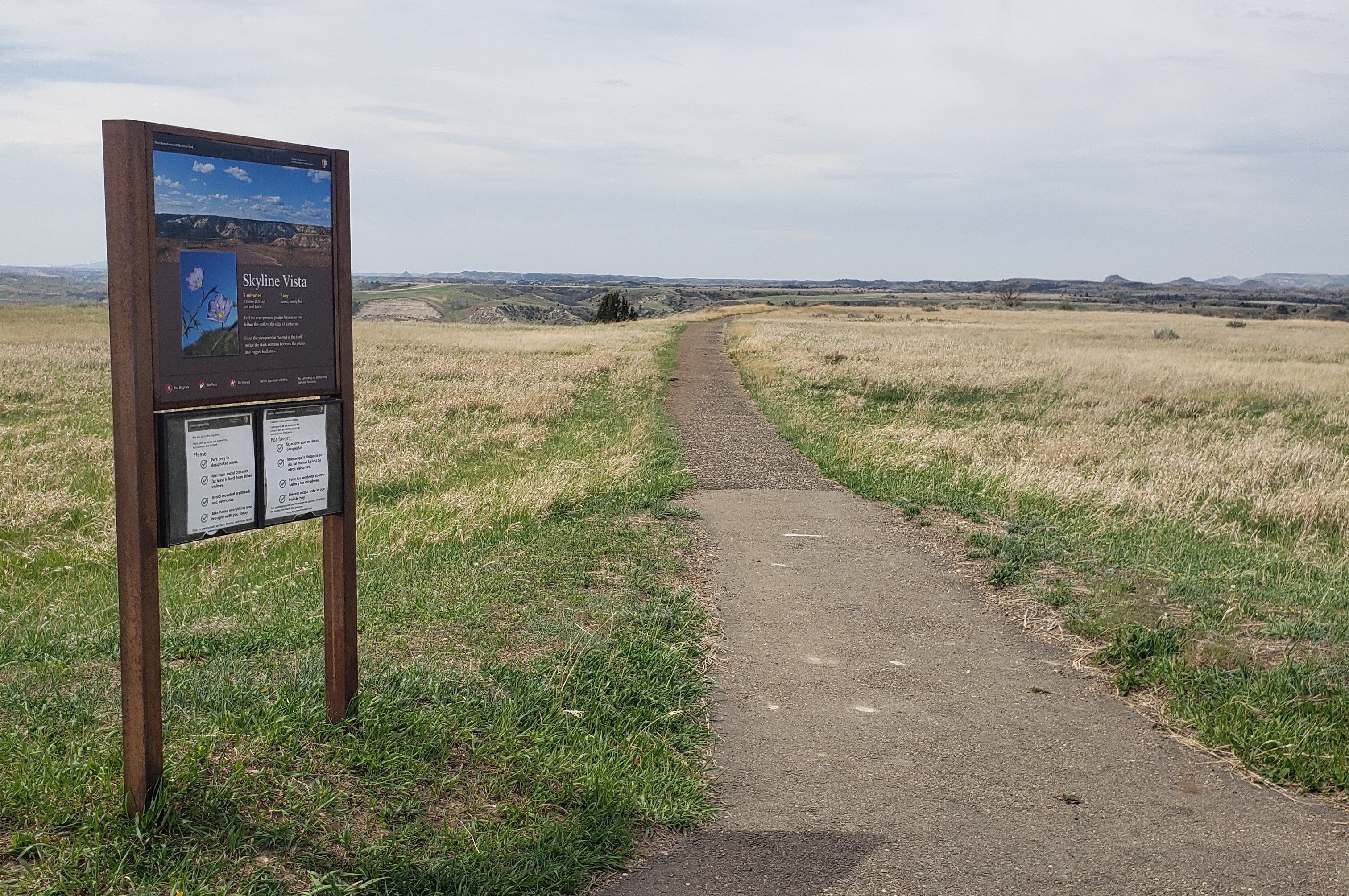
Skyline Vista Trail is a great accessible introduction to Theodore Roosevelt National Park.
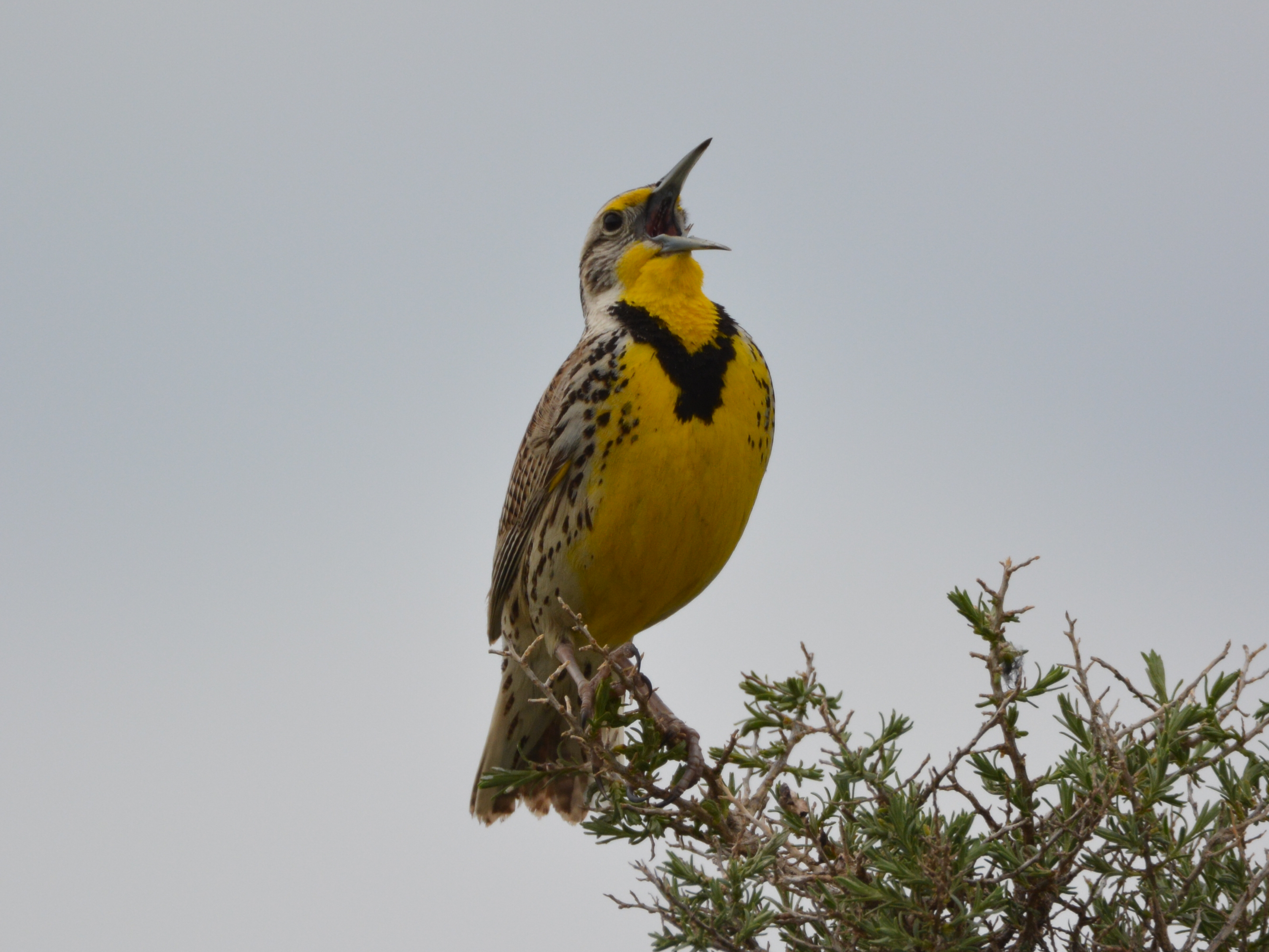
Birding in Theodore Roosevelt National Park
The badlands of North Dakota are home to more than 180 species of birds. Take a moment and see which ones you can spot!
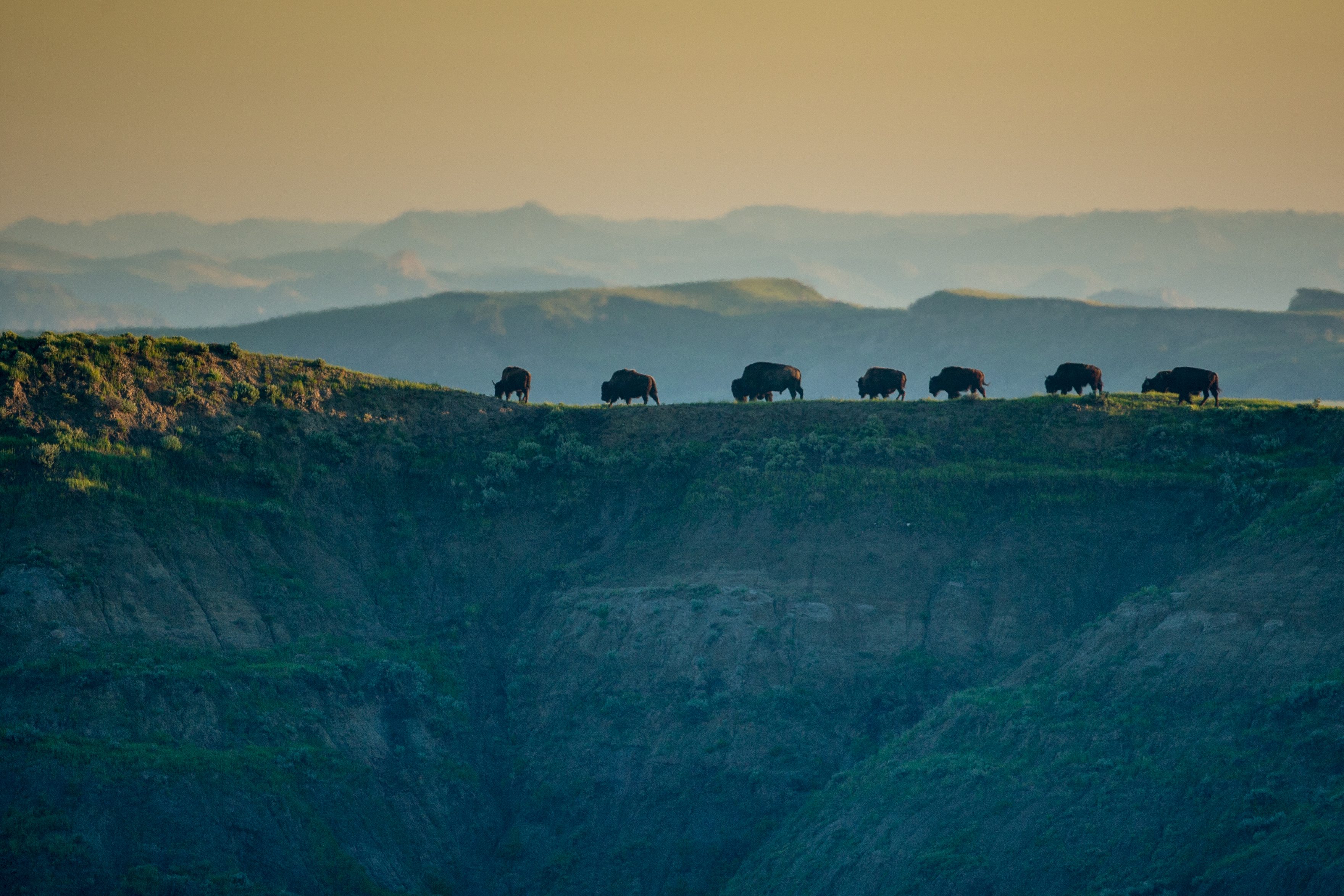
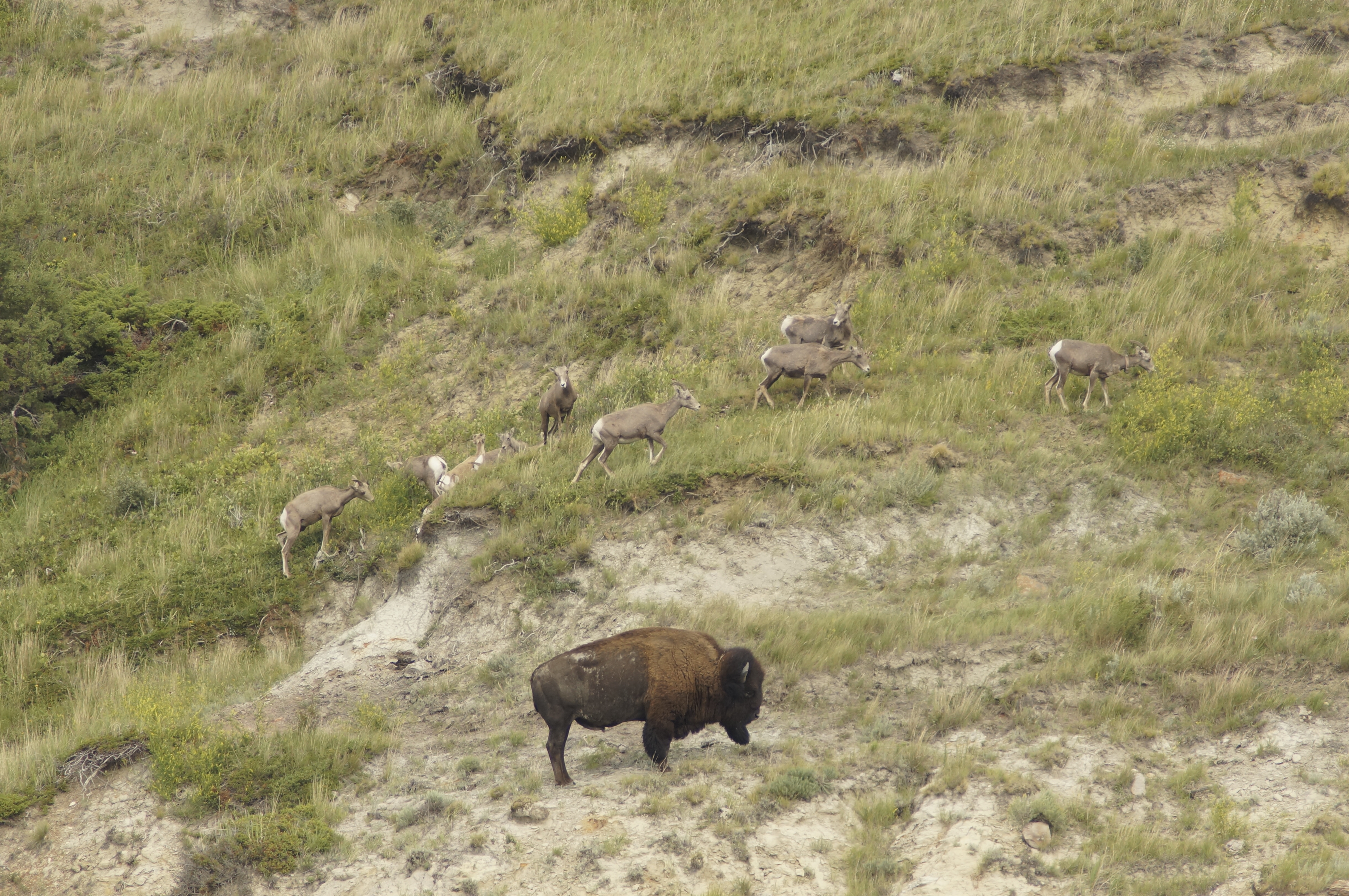
Wildlife Viewing - South Unit
Explore the South Unit of Theodore Roosevelt National Park and see the wide variety of wildlife that lives there.
Wildlife Viewing - North Unit
Explore the North Unit of Theodore Roosevelt National Park and see the wide variety of wildlife that lives there.
Visit the Elkhorn Ranch Unit
Visit the location of Theodore Roosevelt's home ranch, the Elkhorn, and experience the solitude of the North Dakota badlands.
Hike Coal Vein Trail
Take a hike on this 0.8-mile loop and learn about the geology of Theodore Roosevelt National Park.
Hike Wind Canyon Trail
Wind Canyon trail is a short, moderate-difficulty trail that rewards hikers with incredible views of the Little Missouri river and the surrounding badlands.
Hike Boicourt Trail
This short hike, with its elevated perspective and accessible trail, offers a unique view of the Little Missouri Badlands that the whole family can enjoy.
Visit Theodore Roosevelt's Maltese Cross Cabin
The Maltese Cross Cabin was Theodore Roosevelt's first home in Dakota territory. Step inside and learn about how he lived during his time in the badlands where the romance of his life began.
Hike The Little Mo Nature Trail
Take a short hike along the Little Mo Nature Trail and learn about the nature and geology of Theodore Roosevelt National Park!
Watch the Theodore Roosevelt National Park Film: Refuge of the American Spirit
Visit one of the visitor centers and watch the Theodore Roosevelt National Park film, Refuge of the American Spirit.
Hike up Buck Hill
Hike to the top of Buck Hill, one of the highest points in the park, and get an amazing 360° view of the surrounding badlands!
Bike the South Unit Scenic Drive
Hop on your mountain bike and experience the South Unit Scenic Drive in a whole new way.
Bike the North Unit Scenic Drive
Bike the 14-mile scenic drive of Theodore Roosevelt National Park's remote North Unit!
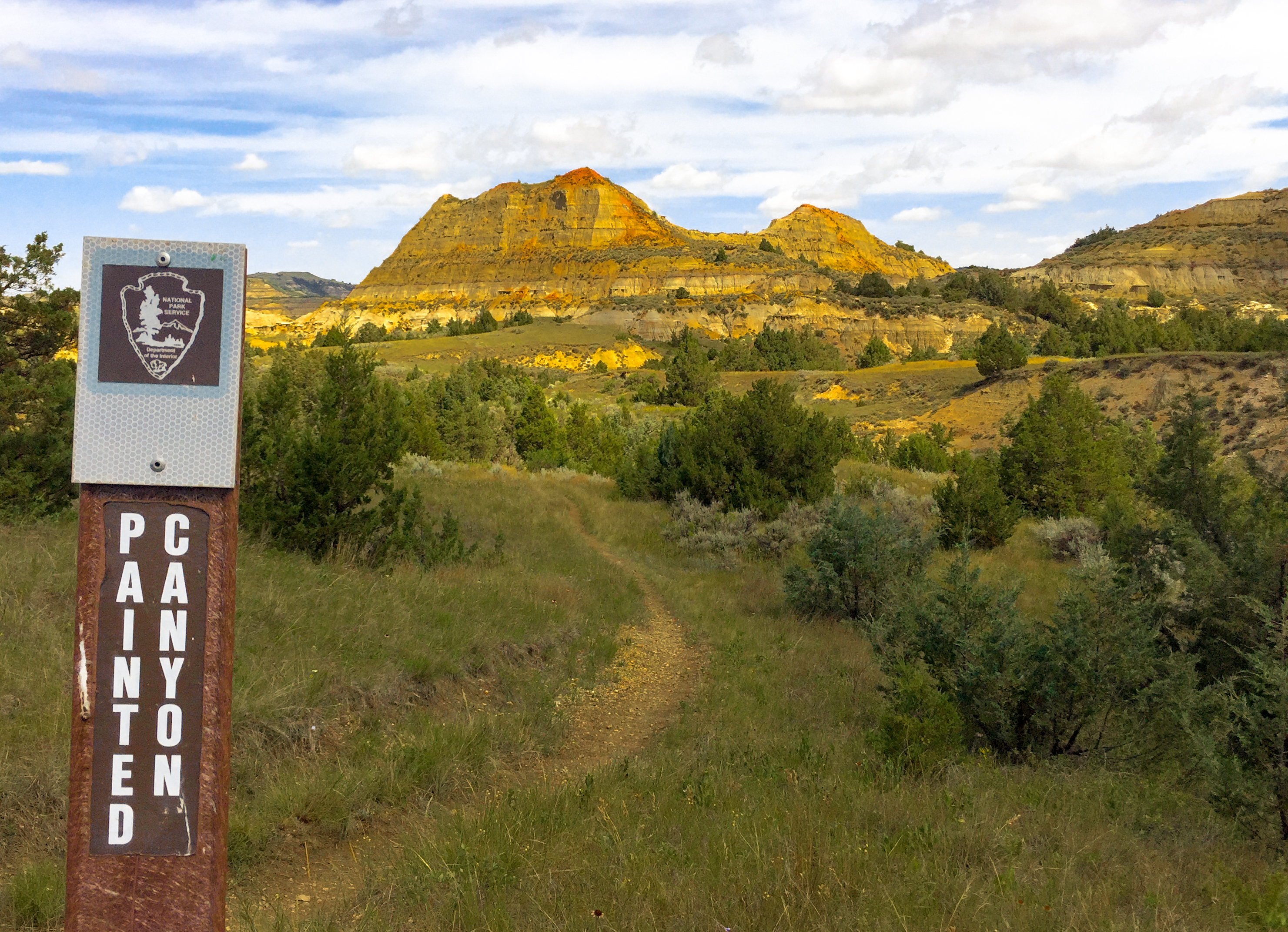
Hike the Painted Canyon Nature Trail
Painted Canyon Trail is a 1-mile loop trail located just off Interstate 94 near the Painted Canyon Visitor Center. It offers a great introduction to Theodore Roosevelt National Park, whether visitors are just passing through or planning on a multi-day stay.
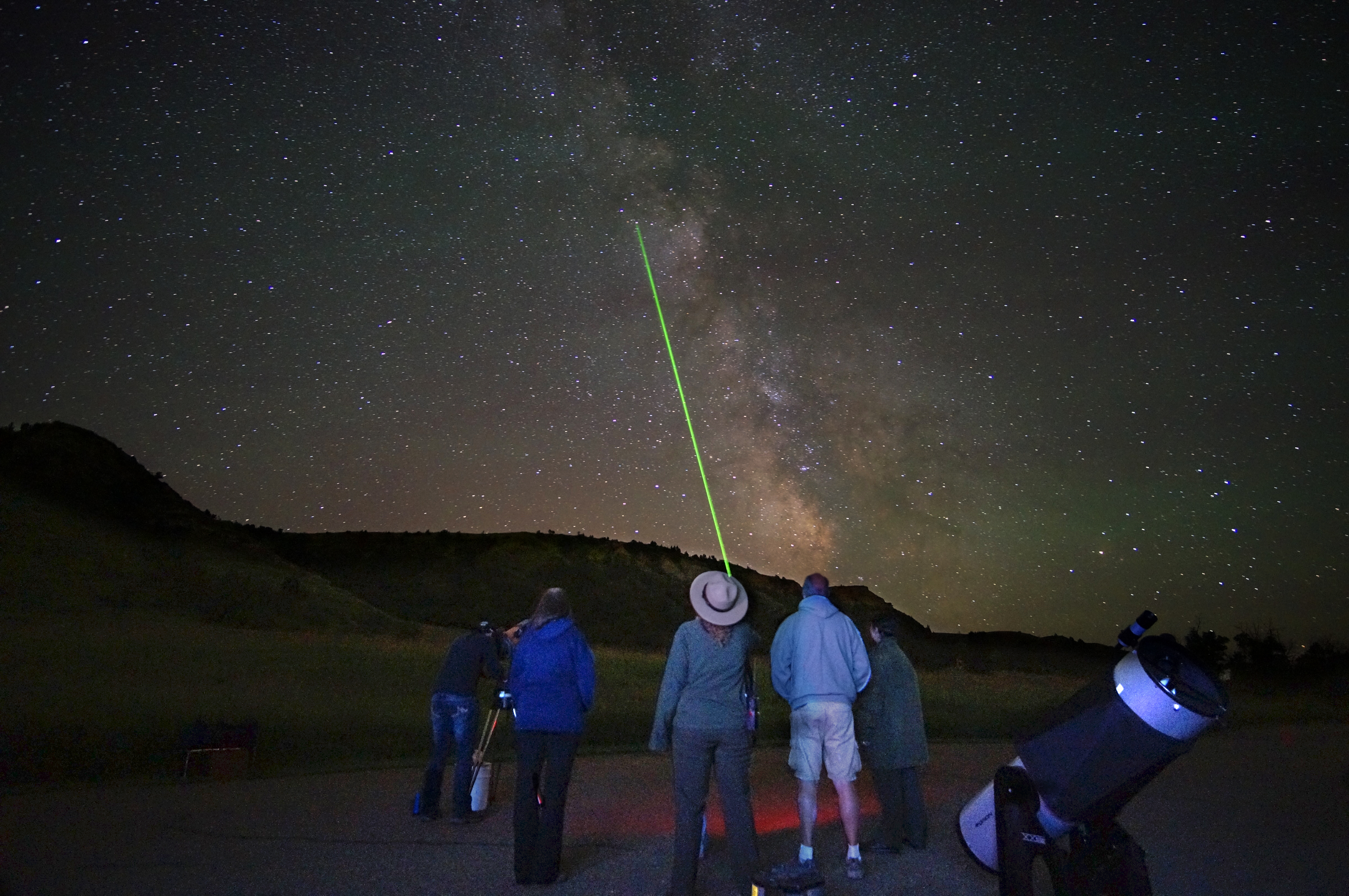
See the Stars in Theodore Roosevelt National Park
Theodore Roosevelt National Park offers incredible night skies for amateur and expert stargazers alike to enjoy year round.
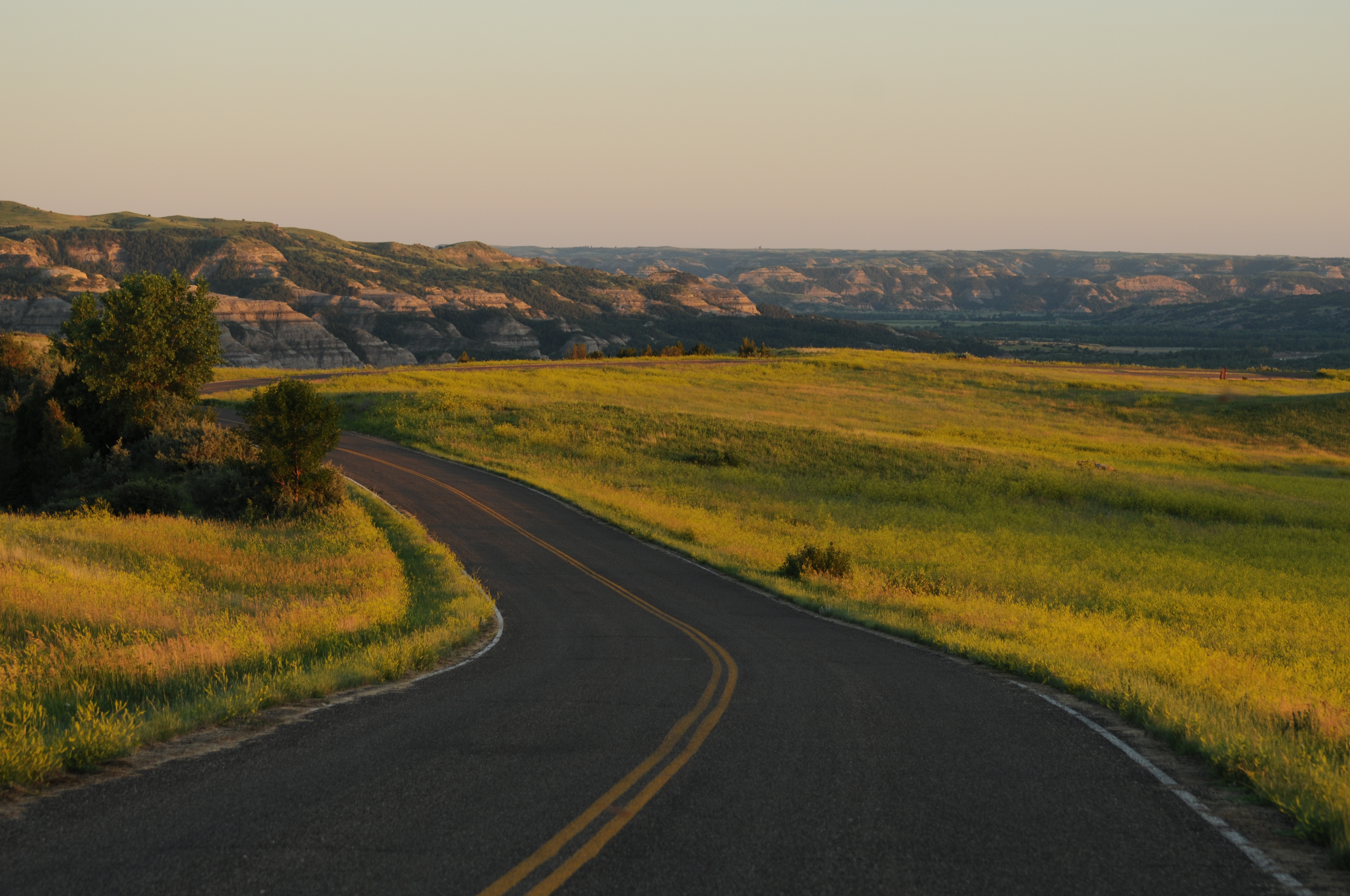
Drive the South Unit Scenic Drive
The South Unit scenic drive is the gateway to the South Unit of Theodore Roosevelt National Park.
Drive the North Unit Scenic Drive
The North Unit scenic drive provides access to the more rugged North Unit of Theodore Roosevelt National Park.
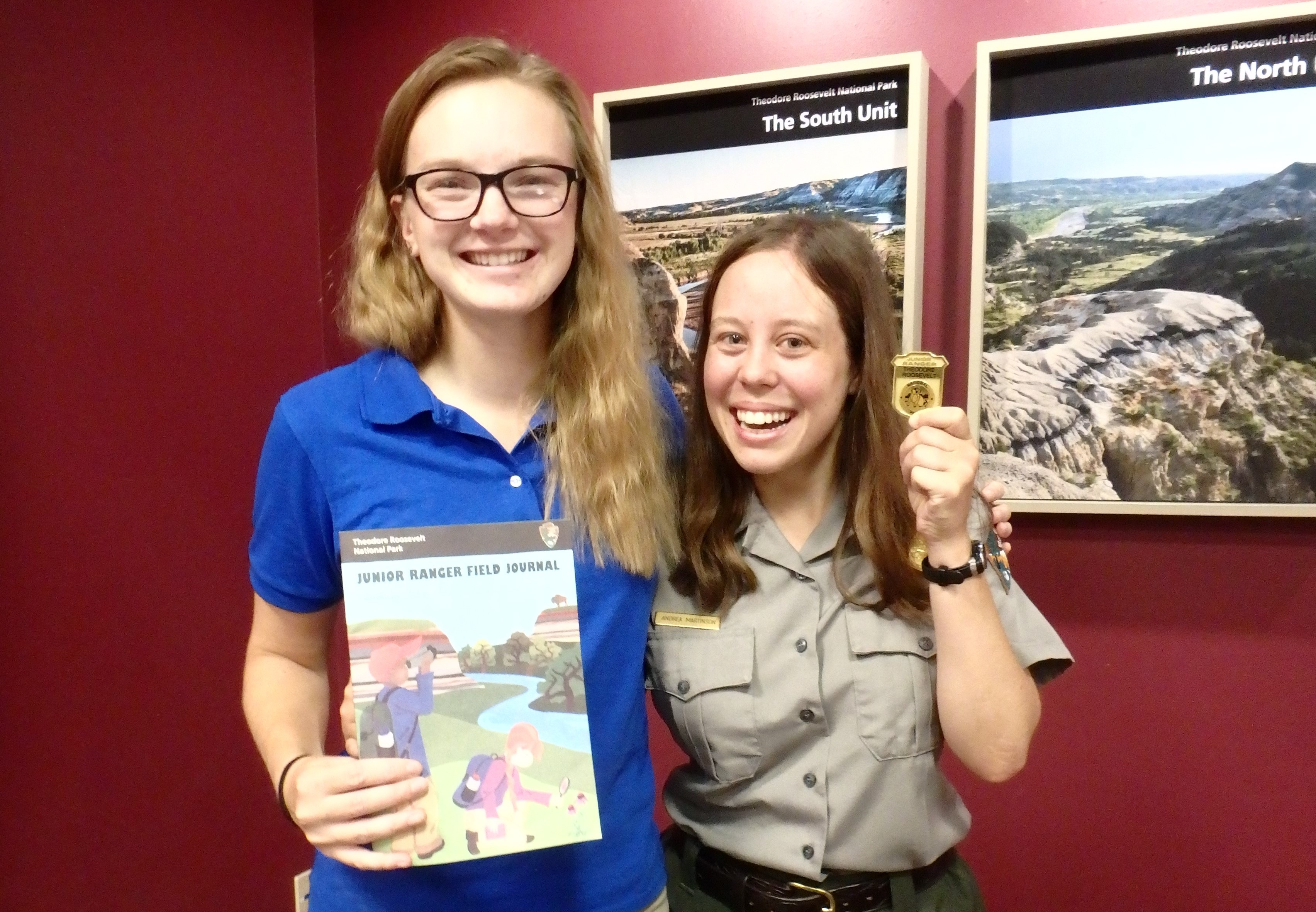
Become a Theodore Roosevelt National Park Junior Ranger
Visit one of the park's visitor centers to pick up a Junior Ranger Field Journal, and start your journey to becoming a Junior Ranger!
Explore the Cannonball Concretions
The cannonball concretions are an arresting and unusual geological formation. Stop at this pullout to explore their mysteries!
Hiking in the South Unit
From paved paths to strenuous backcountry trails – the hiking trails in the South Unit have a little something for everyone. Explore a sampling of park terrain with trail options to fit all levels of hikers.
Hiking in the North Unit
Nature Trails in the North Unit are perfect for casual hikers and nature enthusiasts, but the backcountry trails really steal the show! The Buckhorn, Caprock Coulee, and famed Achenbach Trails traverse the park's vast wilderness areas. Check out all the options and what will fit your trip best.
Tours
Count: 3
Caprock Coulee Nature Trail
The Caprock Coulee Nature Trail is a 0.8 mile section of the Caprock Coulee Trail. The trail shows the natural and geologic variety of the badlands. It also provides a rare look at a densely wooded area of the park. When you reach the end of the nature trail, turn back for a trip totaling 1.6 miles. Or, if you are prepared for a longer hike, continue on the Caprock Coulee Trail for a hike of 4.1 miles. As you hike, stop at each numbered trail post and read the corresponding text below.
Coal Vein: A Guided Nature Trail
Take a self-guided stroll through the badlands of Theodore Roosevelt National Park and learn about the constantly changing geology of this unique landscape.
Elkhorn Ranch Walking Tour
While the Elkhorn Cabin no longer stands, foundation stones indicate where the structure, built of the local cottonwood, was once located. As you walk the half mile trail to where Theodore Roosvelt once sat on his porch watching the sun set over the badlands, learn about Roosevelt's time as a rancher, what his Elkhorn Ranch meant to him, and how his time here shaped the man he would become.