Be advised that the NPS has issued alerts for this park.

Dogs Prohibited on Grand Parade Trails from April 1 to September 15

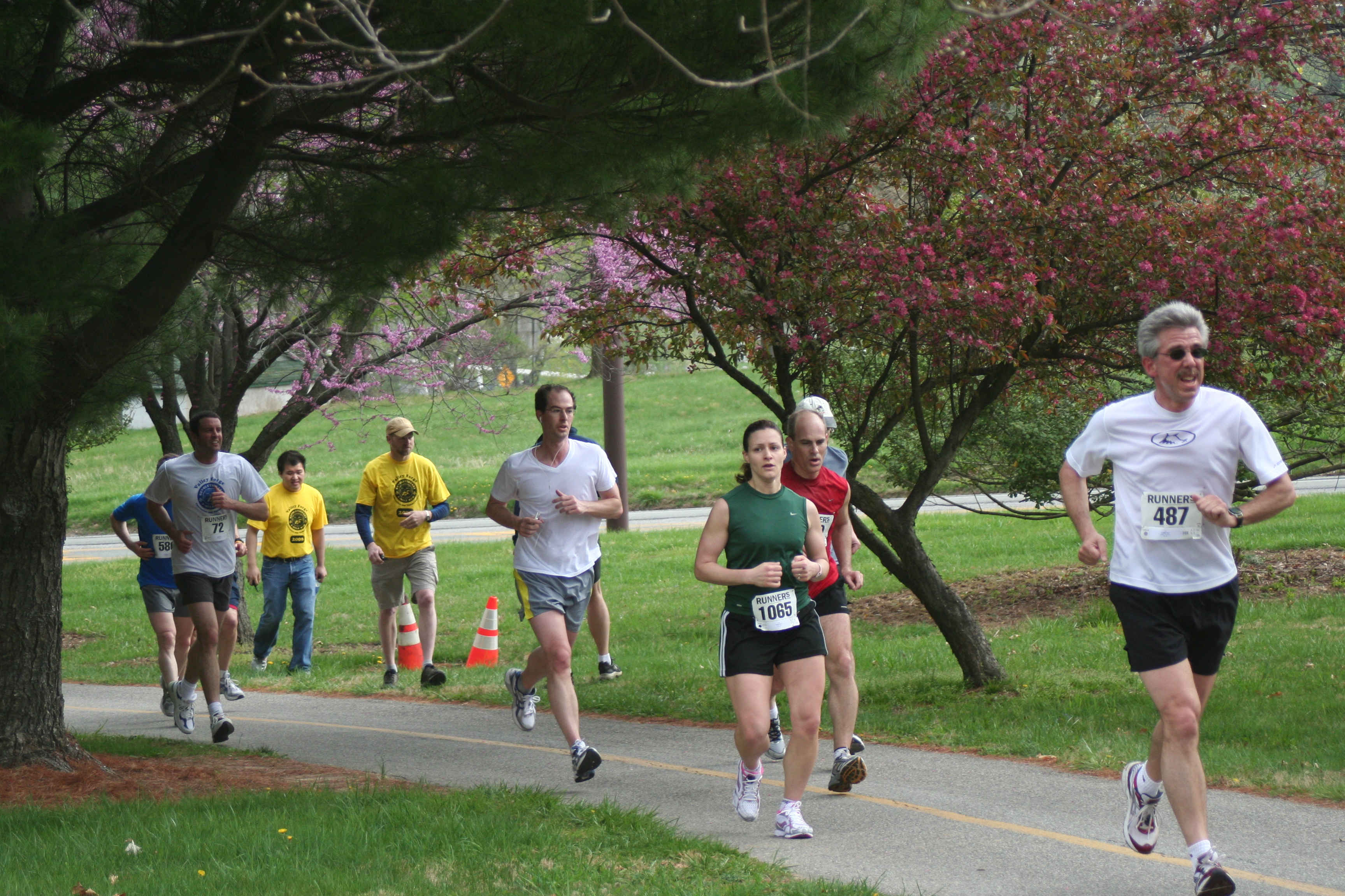
The Grand Parade Trails are closed to dogs from April 1 to September 15 to protect breeding birds nesting in the meadows. Nesting songbirds see dogs as predators, which can stress the birds and lead to less productive or even failed nests.

Route 23 Closed and Detoured During AQUA Water Main Project (Mar 3 to Apr 25, 2025)

AQUA is replacing an outdated water main along Rte 23. From Mon. Mar 3 through Fri. Apr 25, 9 AM to 3 PM, Rte 23 is scheduled to be closed and detoured weekdays at the intersection with Rte 252. Click below for more information from PennDOT.

Trail Maintenance Work on the River and Chapel Trails in 2025

Ongoing maintenance work on River Trail between Betzwood and parking lot on Pawlings Rd and on Chapel Trail west of the Chapel, taking place in 2025. Trails to remain open to visitors. Trail users should exercise extra caution and follow safety warnings.

Maurice Stephens Parking Lot Closed During Construction Project

The parking lot near the Maurice Stephens house, located on Rt 23 opposite from the Washington Memorial Chapel, is closed during construction and renovation work on the house. Visitors are encouraged to park in the Chapel lot for Grand Parade trail access

County Line Road Closed Monday To Friday

County Line Road is closed during the week, from Monday through Friday. The closure will apply to all vehicular, pedestrian, and bicycle traffic. Please find an alternate route.

Title Valley Forge
Park Code vafo
Description Valley Forge is the place where George Washington and the Continental Army took refuge during the winter of 1777-1778. Today the park protects 3,500 acres of meadows, woodlands, historic landscapes, and monuments commemorating the resolve of the ...
Location
Contact
Activities
  • Auto and ATV
  • Scenic Driving
  • Biking
  • Fishing
  • Fly Fishing
  • Guided Tours
  • Self-Guided Tours - Walking
  • Self-Guided Tours - Auto
  • Hiking
  • Horse Trekking
  • Living History
  • Historic Weapons Demonstration
  • First Person Interpretation
  • Junior Ranger Program
  • Wildlife Watching
  • Birdwatching
  • Park Film
  • Museum Exhibits
  • Shopping
  • Bookstore and Park Store
Entrance fees
Campgrounds Count: 0
Places Count: 45

Artillery Park

Artillery Park was the central location used during the encampment to keep cannons at the ready in case of a British attack.

Betzwood Picnic Area

Located on the north side of the Schuylkill River within Valley Forge National Historical Park, the Betzwood picnic area provides shade, picnic tables, potable water, restrooms, and established charcoal grills. Betzwood also provides boat trailer parking and a boat launch on the Schuylkill River, trailhead access to the popular regional Schuylkill River Trail, and trailhead access to the NPS-managed River Trail.

Butler's Brigade Monument

Stone monument with bronze plaque marking the location of the encampment of troops in the first and second Brigades of the Pennsylvania Line.
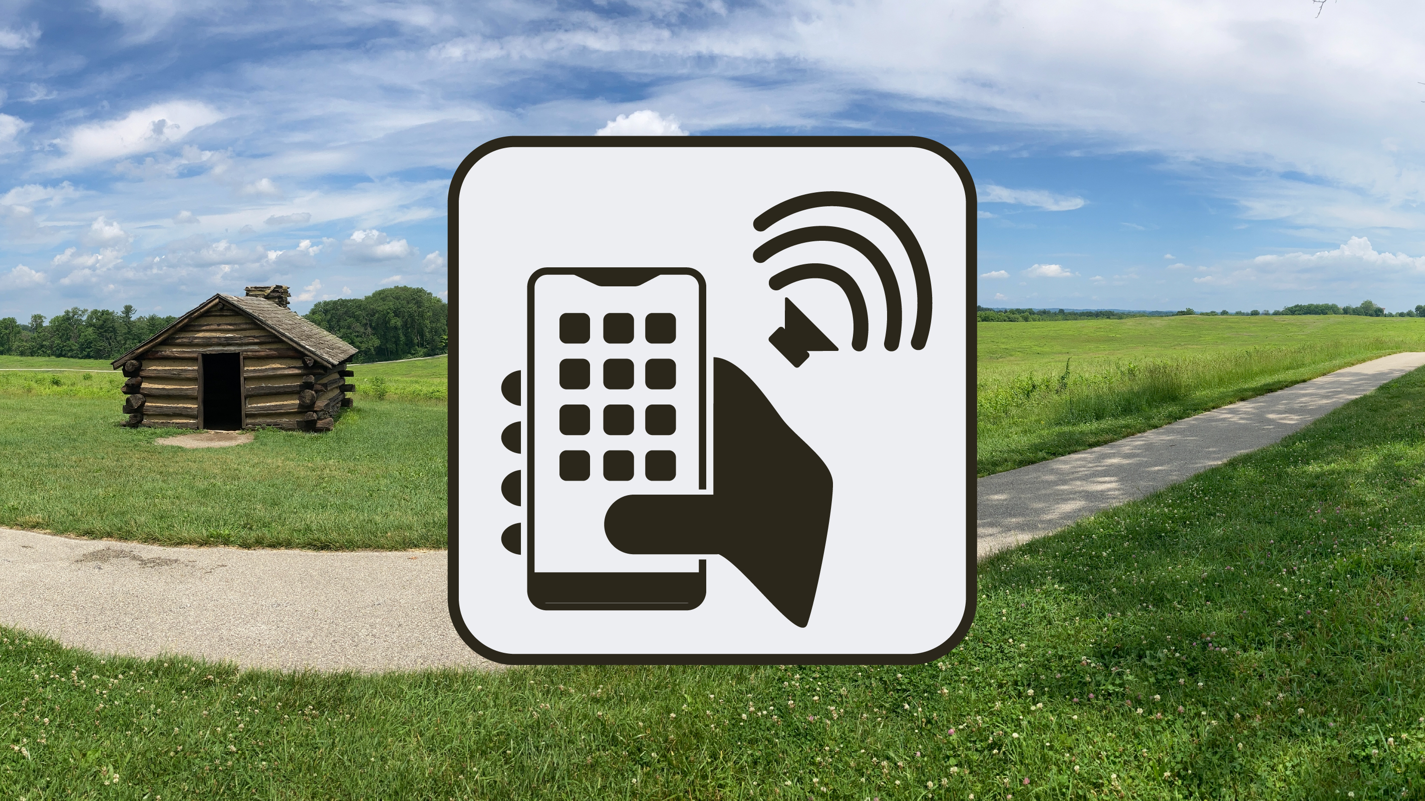
  • This monument is a large, rectangular granite block with a bronze plaque. The granite on the front of the monument is smooth, except along the bottom. The sides and back are also rough. It is six feet tall by four feet wide by two feet deep. South Outer Line Drive runs from northeast to southwest and is just southeast of the monument. To the north, northwest, and west, there is a line of worm fencing with forest behind. Worm fencing uses no posts and is made up of split rails in a zigzagging pattern. To the southwest, there is a log hut. To the east, southeast, and south, the land drops away steeply among meadows and trees.

Commander in Chief's Guard Huts

The Commander in Chief's guard huts are reconstructed log structures representing the quarters where soldiers of General George Washington's guard lived during the Valley Forge encampment.

Glover's Brigade Monument

Stone monument with bronze plaque marking the location of the encampment of Glover's Brigade.
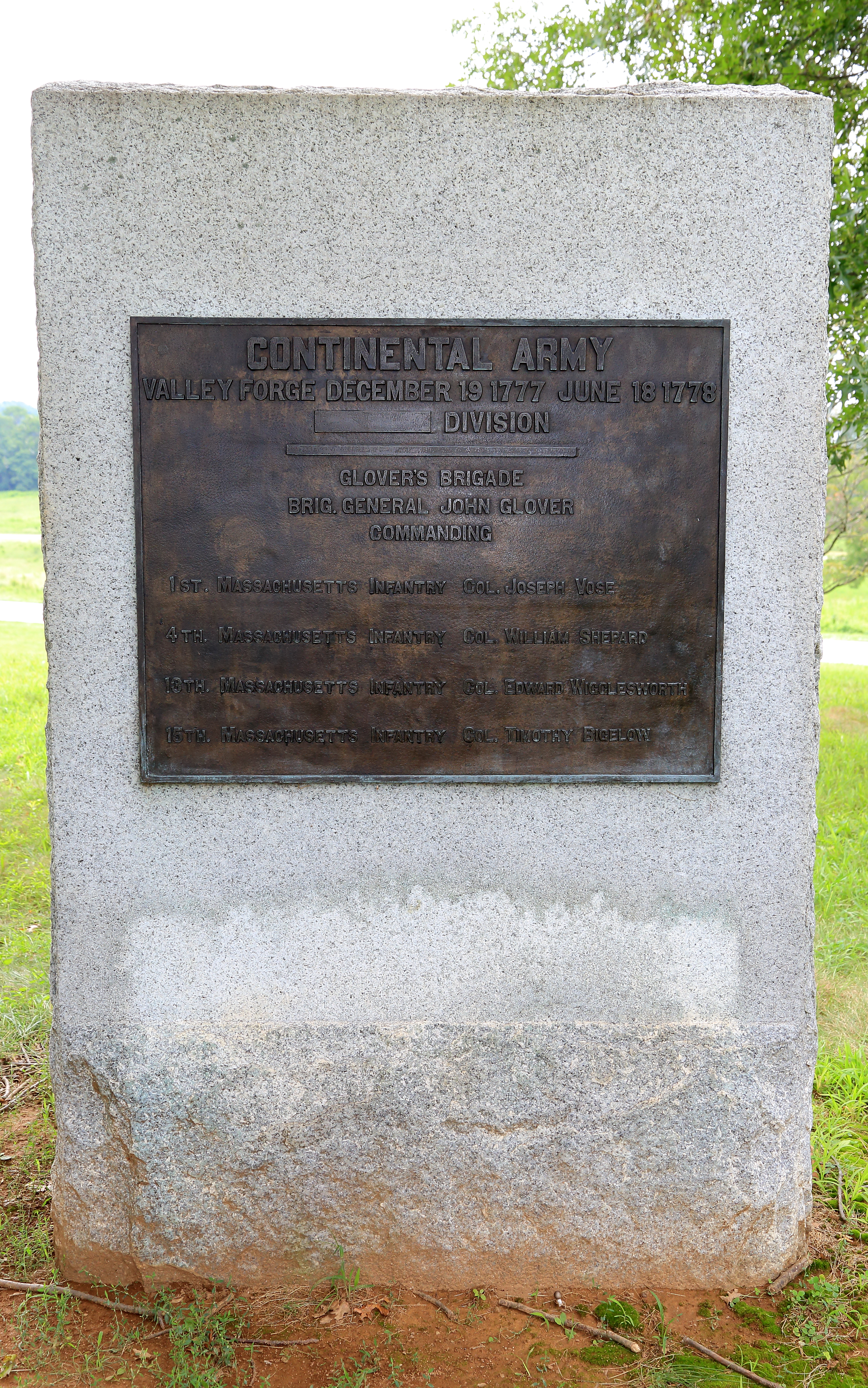
  • This monument is a large, rectangular granite block with a bronze plaque. The granite on the front of the monument is smooth, except along the bottom. The sides and back are also rough. It is six feet tall by four feet wide by two feet deep. It is located along a sidewalk between South Outer Line Drive and Gulph Road. This and the nearby National Memorial Arch are along a high point, and the ground slopes downward in most directions. To the north and northwest, there are trees nearby. Beyond them, North Outer Line Drive, and the Joseph Plumb Martin Trail are meadows along a slope downhill. To the southwest are a few more trees and the National Memorial Arch on the other side of Gulph Road. To the southeast, the Massachusetts State Monument is immediately beyond the sidewalk. The ground also slopes downhill to the east and southeast.

Hartley's Brigade Monument

Stone monument with bronze plaque marking the location of the encampment of the first Brigade of the Pennsylvania Line.
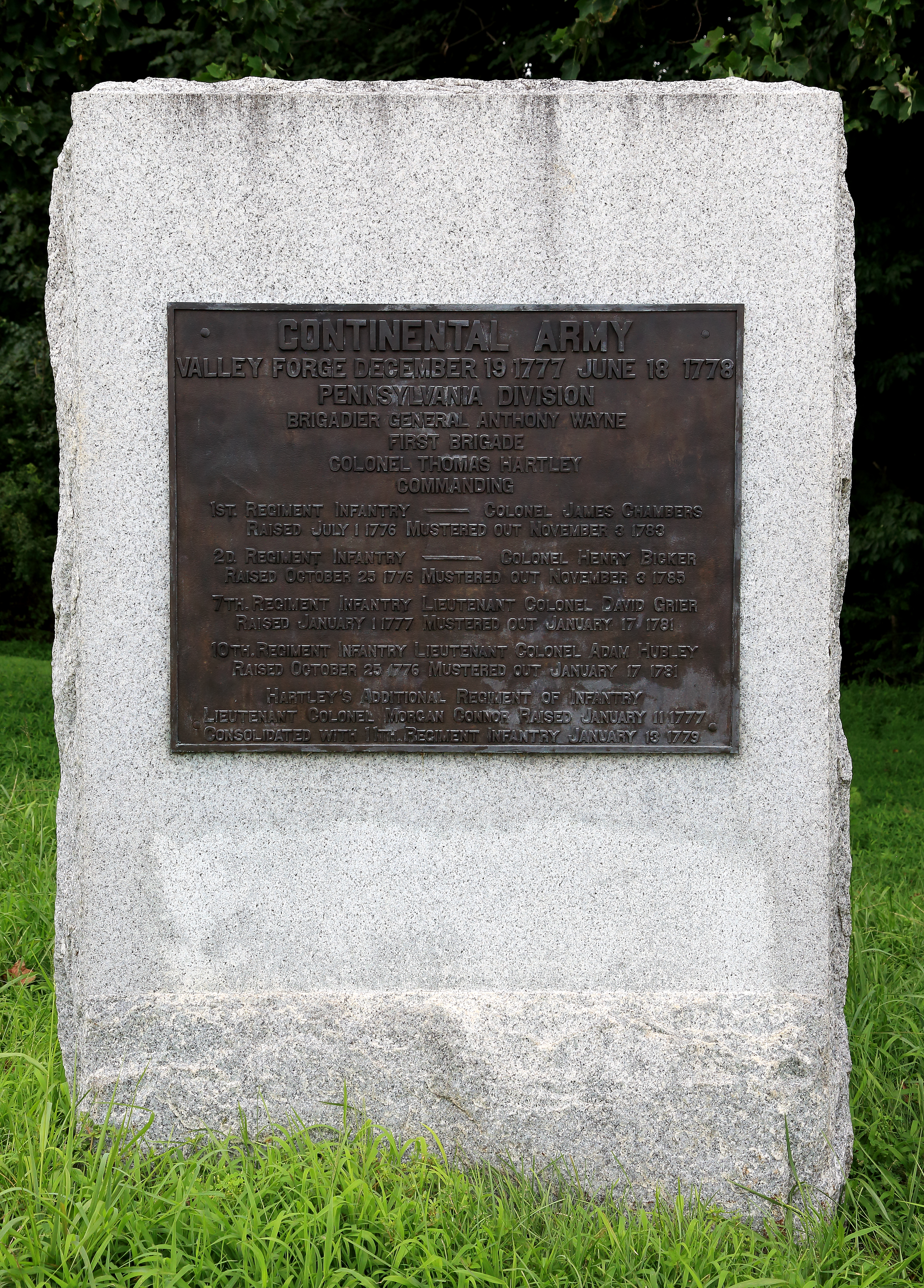
  • This monument is a large, rectangular granite block with a bronze plaque. The granite on the front of the monument is smooth, except along the bottom. The sides and back are also rough. It is six feet tall by four feet wide by two feet deep. South Outer Line Drive runs from northeast to southwest and is just southeast of the monument. To the north and northwest there is a line of worm fencing with forest behind. Worm fencing uses no posts and is made up of split rails in a zigzagging pattern. To the west is a statue of Brigadier General Anthony Wayne. To the east, southeast, and south, the land drops away steeply among meadows and trees.

Historic Valley Forge Station

The historic Valley Forge Station building, an elegant passenger station designed to welcome visitors arriving to Valley Forge State Park, was constructed in 1911. Today it is home to interpretive exhibits.

Huntington's Brigade Monument

Stone monument with bronze plaque marking the location of the encampment of Huntington's Brigade.
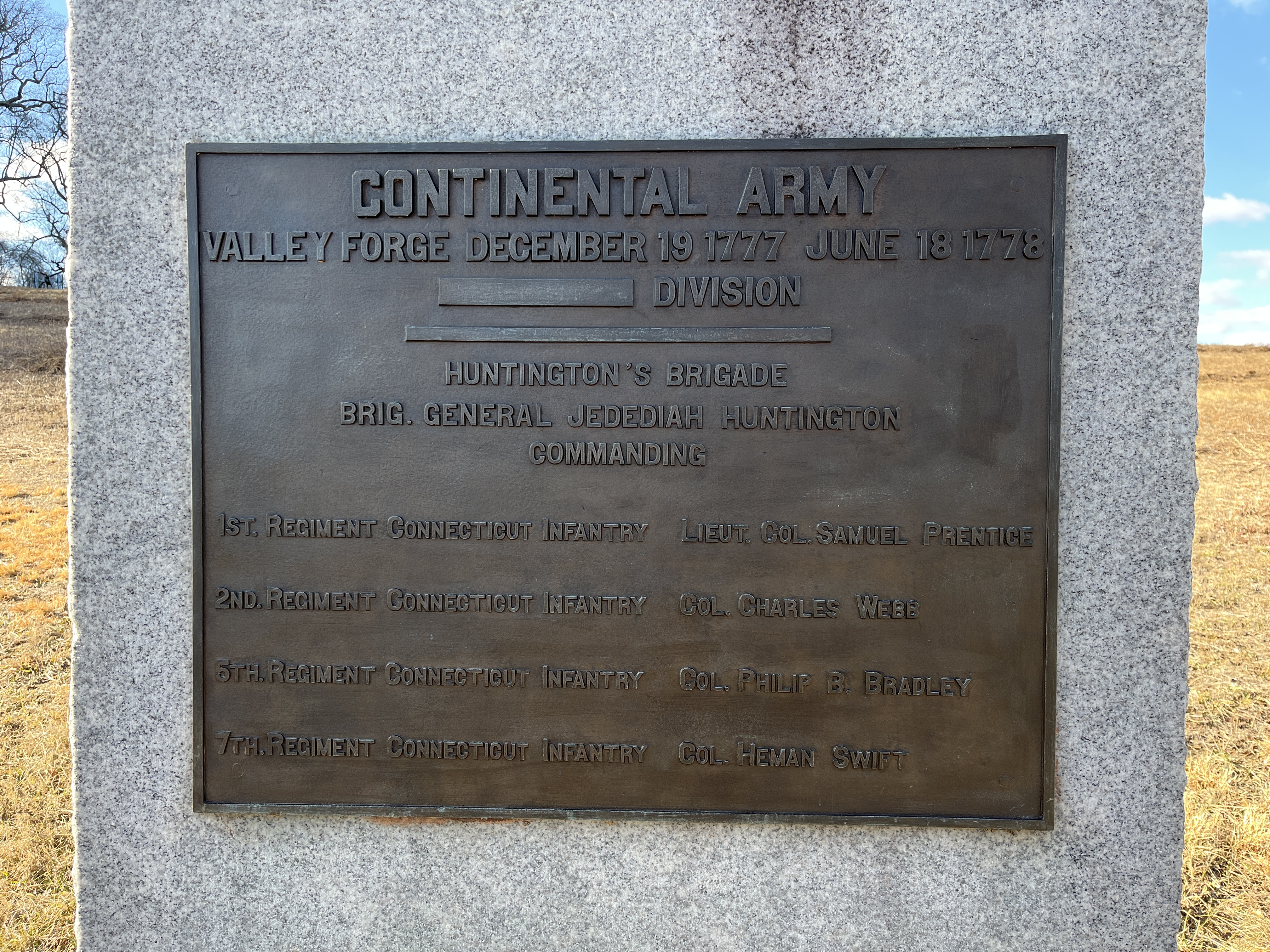
  • This monument is a large, rectangular granite block with a bronze plaque. The granite on the front of the monument is smooth, except along the bottom. The sides and back are also rough. It is six feet tall by four feet wide by two feet deep. This monument is located along North Inner Line Drive, which runs roughly southwest to northeast. To the north and northwest, the ground slopes upward. To the northwest, there is a redoubt, and earthen fortification, further up the hill. To the west and southwest are dense trees. To the south, southeast, and east, there are meadows and trees along a gentle downward slope within the Grand Parade. To the southeast, on the other side of North Inner Line Drive and the Joseph Plumb Martin Trail, are three log huts. The ground rises to the northeast towards Varnum's Quarters.

Knox Covered Bridge

The Knox Covered Bridge is a scenic feature for many visitors to Valley Forge National Historical Park. The first covered bridge across Valley Creek was built in 1851; it was rebuilt in 1865 after being washed away in a flood. Measuring 10 feet wide and 65 feet long, the bridge connects Yellow Spring Road and Route 252. This picturesque bridge is owned and maintained by the Commonwealth of Pennsylvania Department of Transportation (PennDOT).
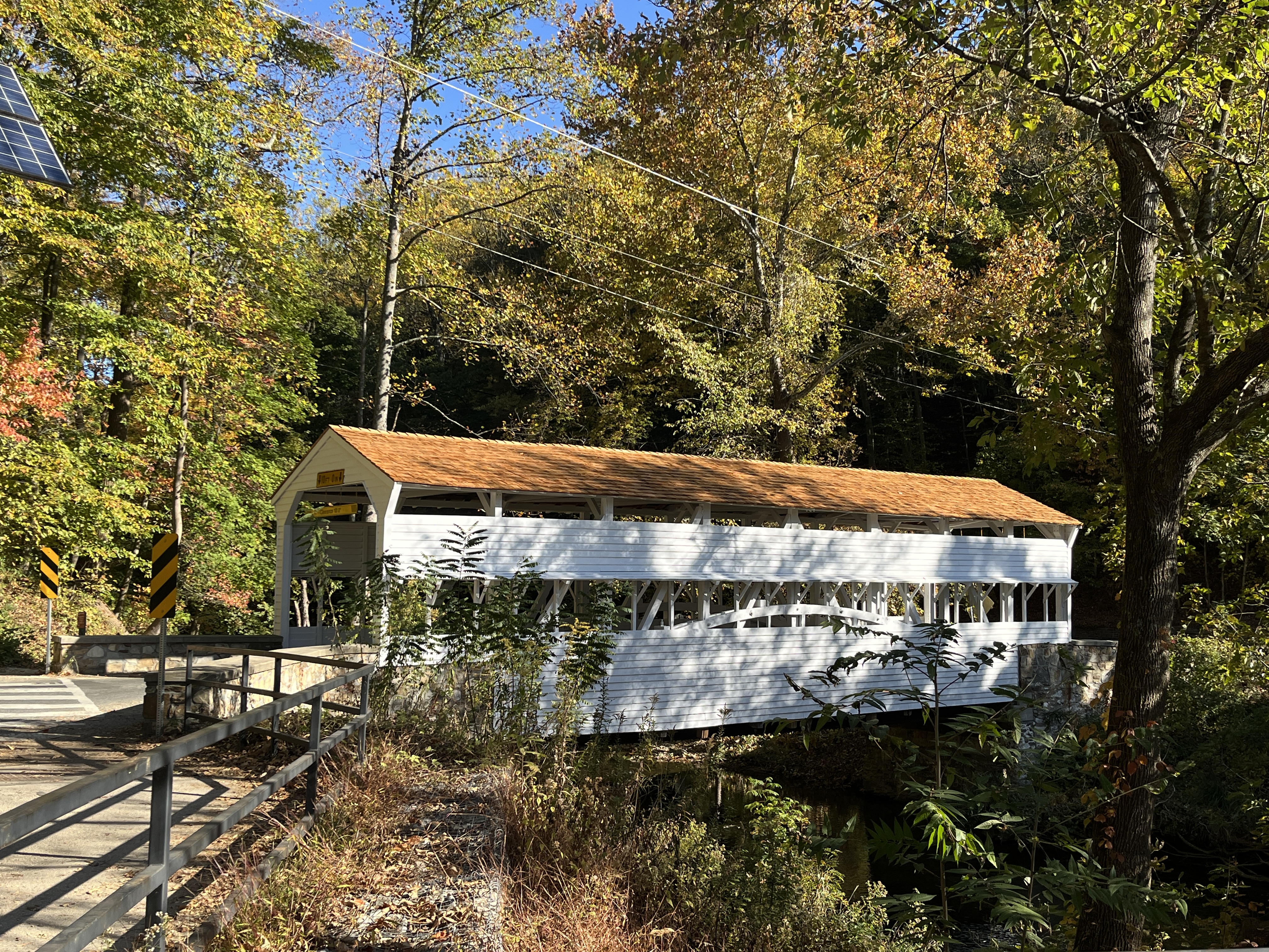
  • A one-lane wooden covered bridge 10 feet wide and 65 feet long with a shingle roof. The bridge spans the forested Valley Creek and sits at the intersection of Route 252/Valley Creek Road and Yellow Springs Road.

Knox's Quarters

The small stone section of this house was lived in by 27-year-old Brigadier General Henry Knox during the Valley Forge encampment in 1777 and 1778.

Learned's Brigade Monument

Stone monument with bronze plaque marking the location of the encampment of troops in Learned's Brigade.

  • This monument is a large, rectangular granite block with a bronze plaque. The granite on the front of the monument is smooth, except along the bottom. The sides and back are also rough. It is six feet tall by four feet wide by two feet deep. It is located in a strip of grass between North Outer Line Drive and the Joseph Plumb Martin Trail. There is a tree a few yards away on either side. To the northwest, meadows slope gently downward. There are trees and rising ground beyond the meadows. To the southeast, on the other side of the road, the ground slopes downward through meadows and towards a line of trees.

Maurice Stephens House

The Maurice Stephens House is a 2-story, 5-bay farmhouse with 1 1/2 story 2-bay addition to the east. The original section has a full attic and cellar. The main entrance to the home faced south and the rear-facing entrance towards present Rt. 23. The main section of the house was built around 1816 by Maurice Stephens, and additions were built around 1841 by William Henry. The home was remodeled by the Valley Forge State Park in the 1950s and in 1975.
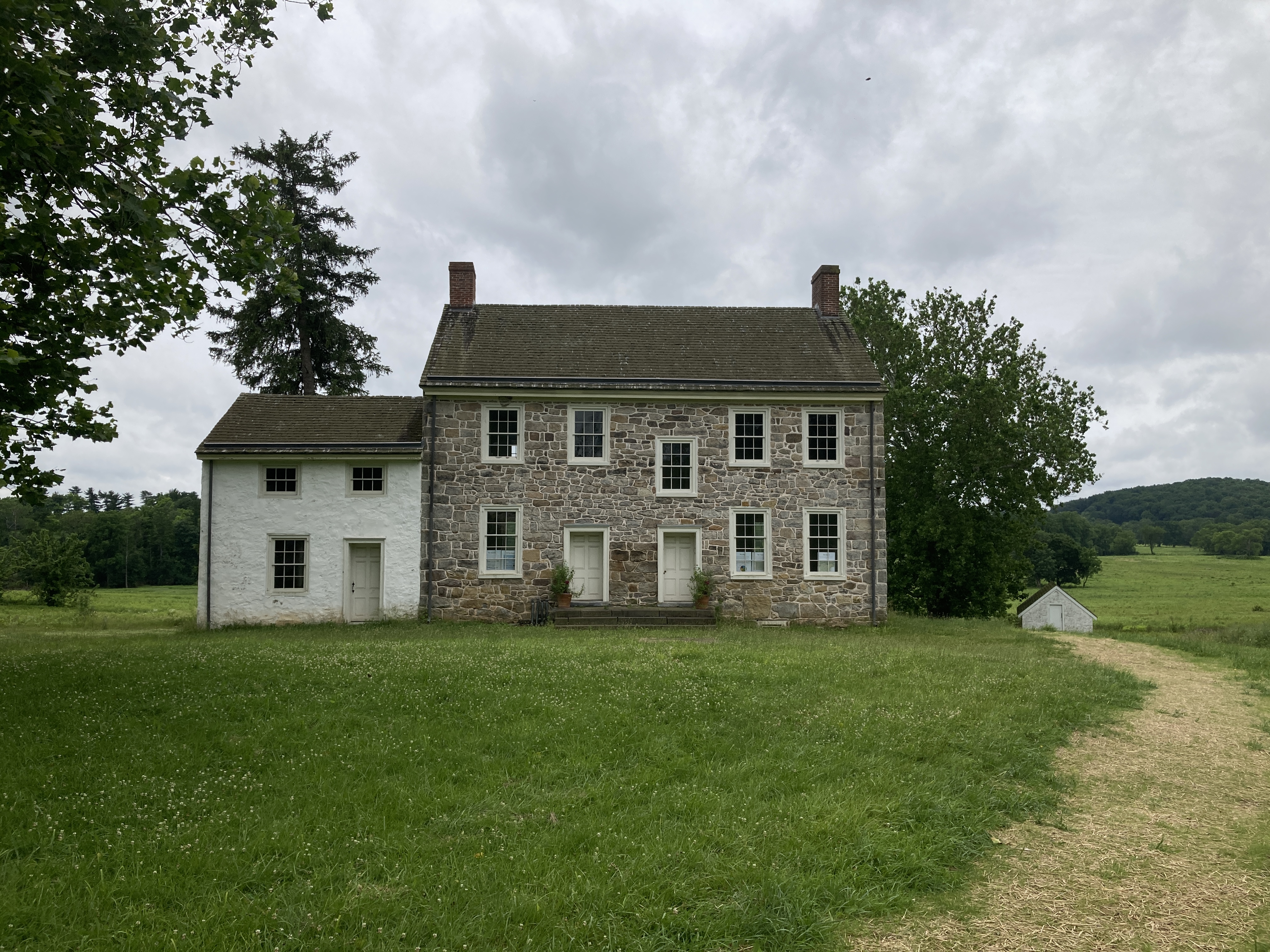
Maxwell's Brigade Monument

Stone monument with bronze plaque marking the location of the encampment of Maxwell's Brigade.
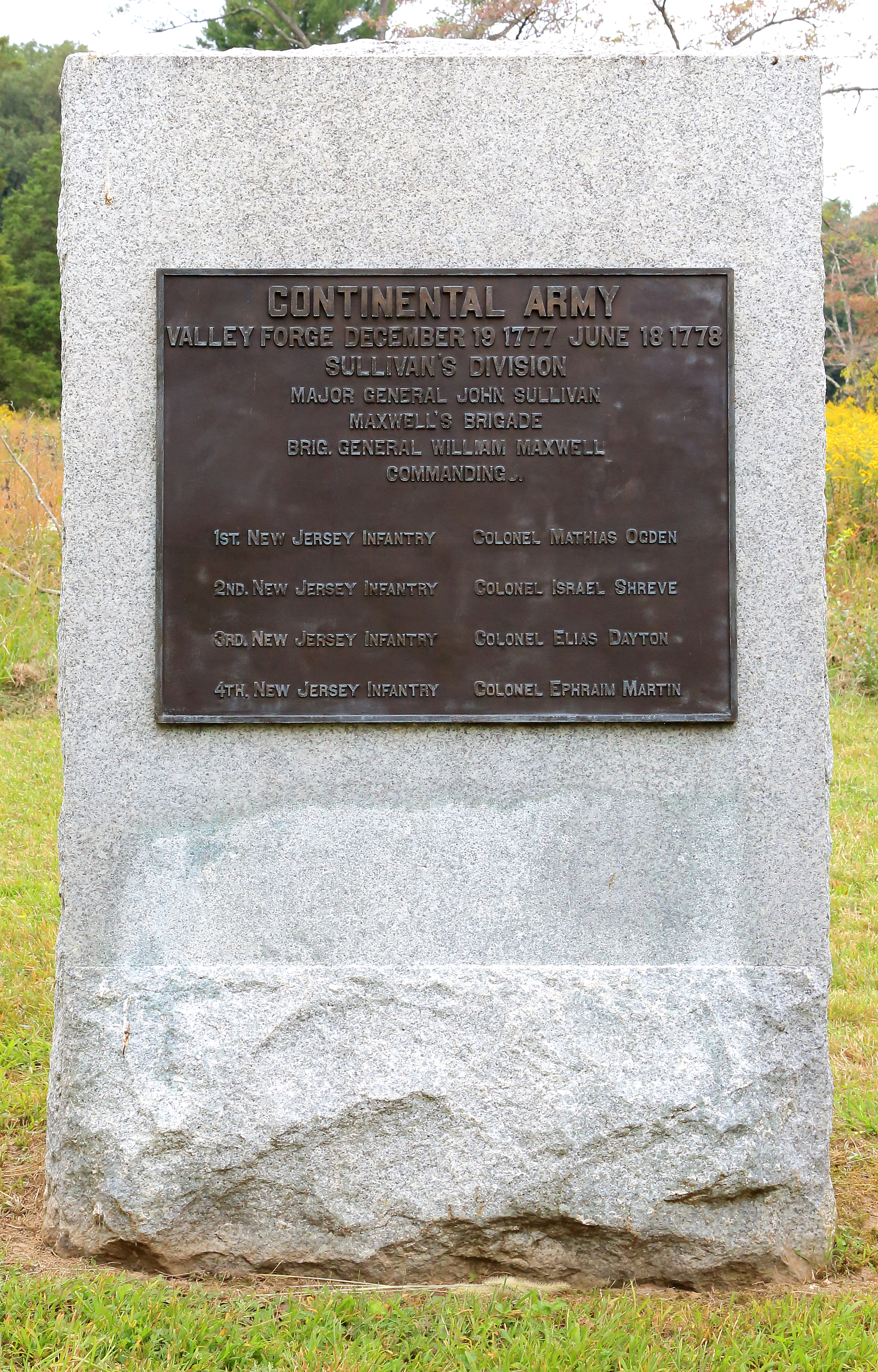
  • This monument is a large, rectangular granite block with a bronze plaque. The granite on the front of the monument is smooth, except along the bottom. The sides and back are also rough. It is six feet tall by four feet wide by two feet deep. This monument is located near an intersection immediately to the east. Gulph Road runs from the northwest to the southeast. North Inner Line Drive goes to the northeast, and East Inner Line Drive goes to the south. The ground slopes upwards to the north, northwest, and west among dense trees. There are two huts among dense trees to the south. The ground drops sharply to the east with a small flight of stairs that leads towards Gulph Road. Beyond the roads to the east and southeast, the ground drops more gradually through meadows interspersed with trees.

McIntosh's Brigade Monument

Stoen monument with bronze plaque marking the location of the encampment of McIntosh's Brigade.
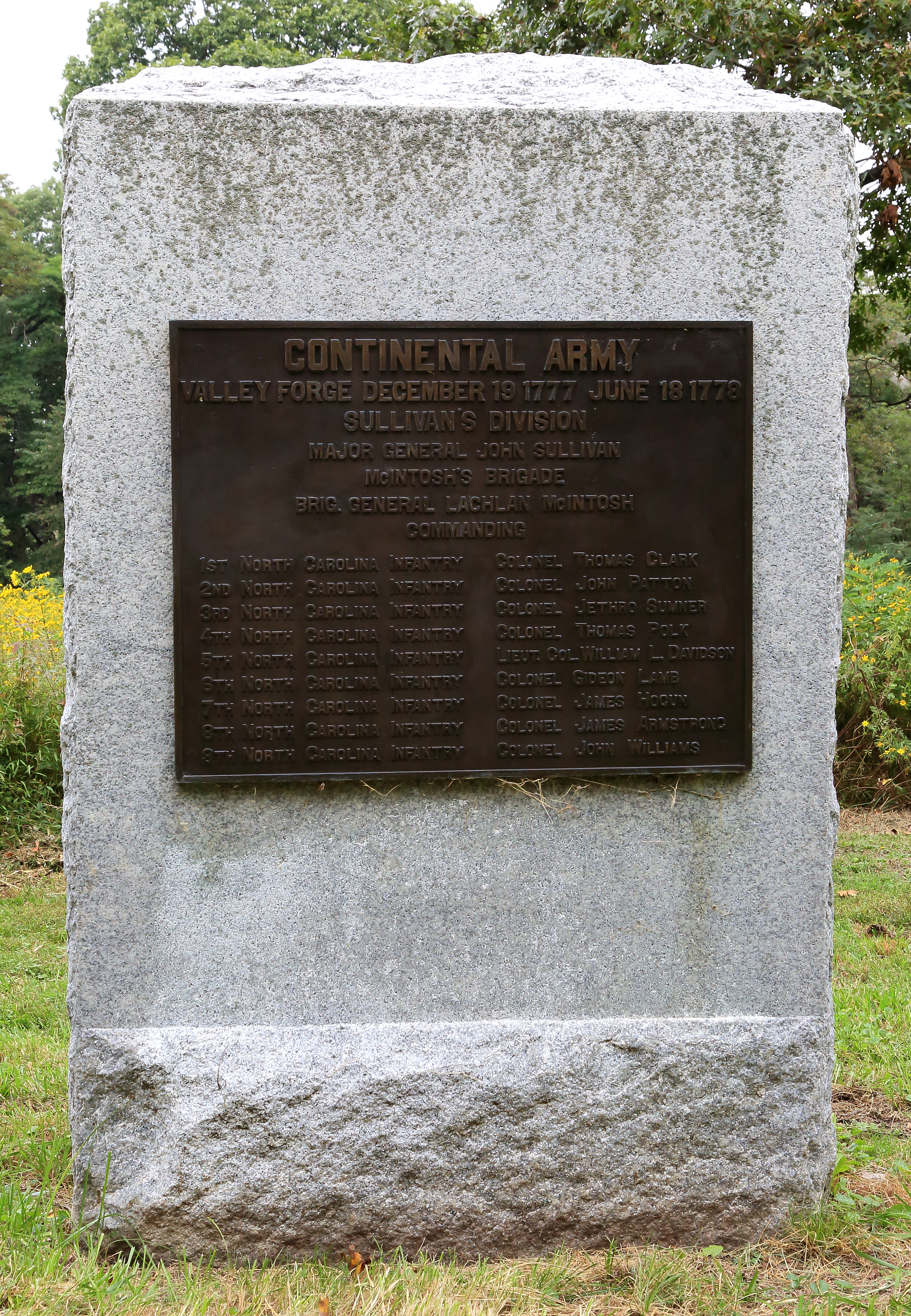
  • This monument is a large, rectangular granite block with a bronze plaque. The granite on the front of the monument is smooth, except along the bottom. The sides and back are also rough. It is six feet tall by four feet wide by two feet deep. This monument is located between Route 23 and the Joseph Plumb Martin Trail. To the north, the land drops down beyond the Joseph Plumb Martin Trail towards dense trees. To the east, the land slopes upward among dense trees before sloping downward again. Route 23 is immediately to the south, beyond which the land slopes upward among dense trees. To the west and southwest, the land slopes downward among trees and meadows.

Meeting Room at Valley Forge

The Meeting Room at Valley Forge is a multipurpose meeting space located next to the Mini Grand Parade and the second floor of the visitor center building. The room is not open to the public during regular operating hours.
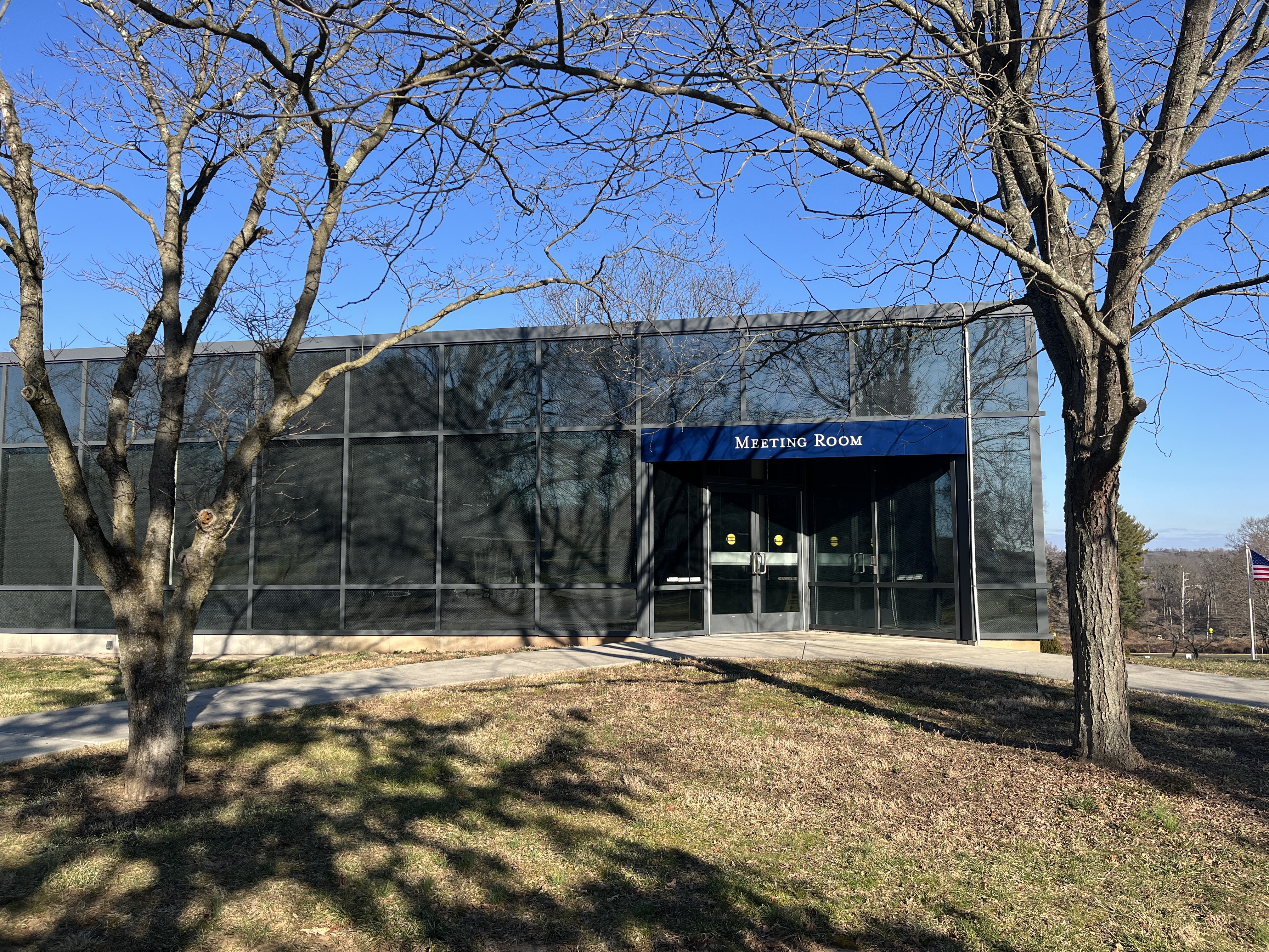
  • A glass building with a set of double doors.

Mini Grand Parade

Named after the Grand Parade, where soldiers trained during the encampment of the Continental Army at Valley Forge, the Mini Grand Parade is a flat and open grassy field located behind the Visitor Center at Valley Forge. The field contains wooden bench seating along the edges, and some trees planted for shade.

Muhlenberg's Brigade

Muhlenberg's Brigade is the site of the encampment of troops led by Brigadier General Peter Muhlenberg during the winter of 1777-78. Today the area consists of nine reconstructed log soldiers' huts facing a gravel company street.
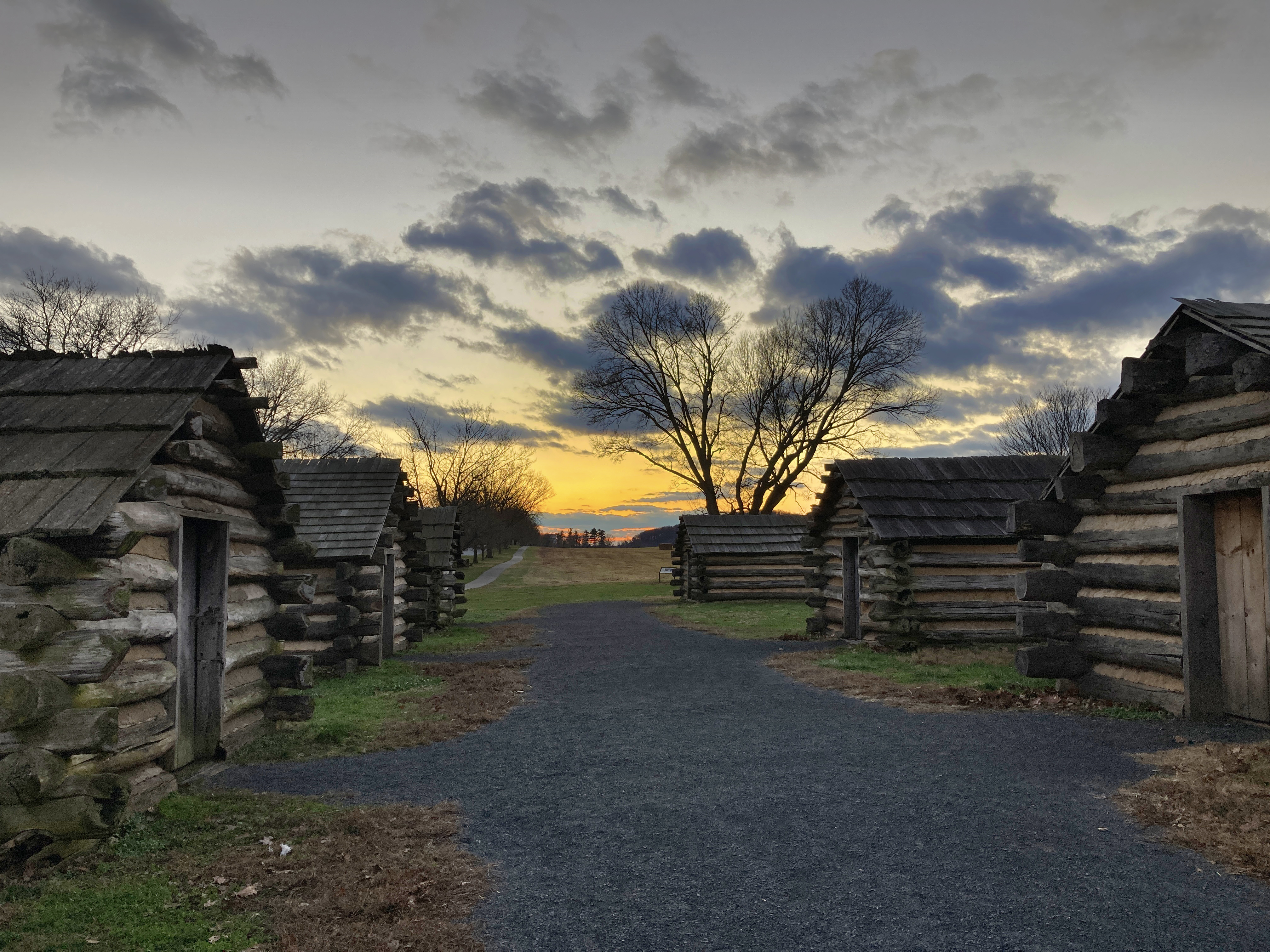
Muhlenberg's Brigade Monument

Stone monument with bronze plaque marking the location of the encampment of Muhlenberg's Brigade.
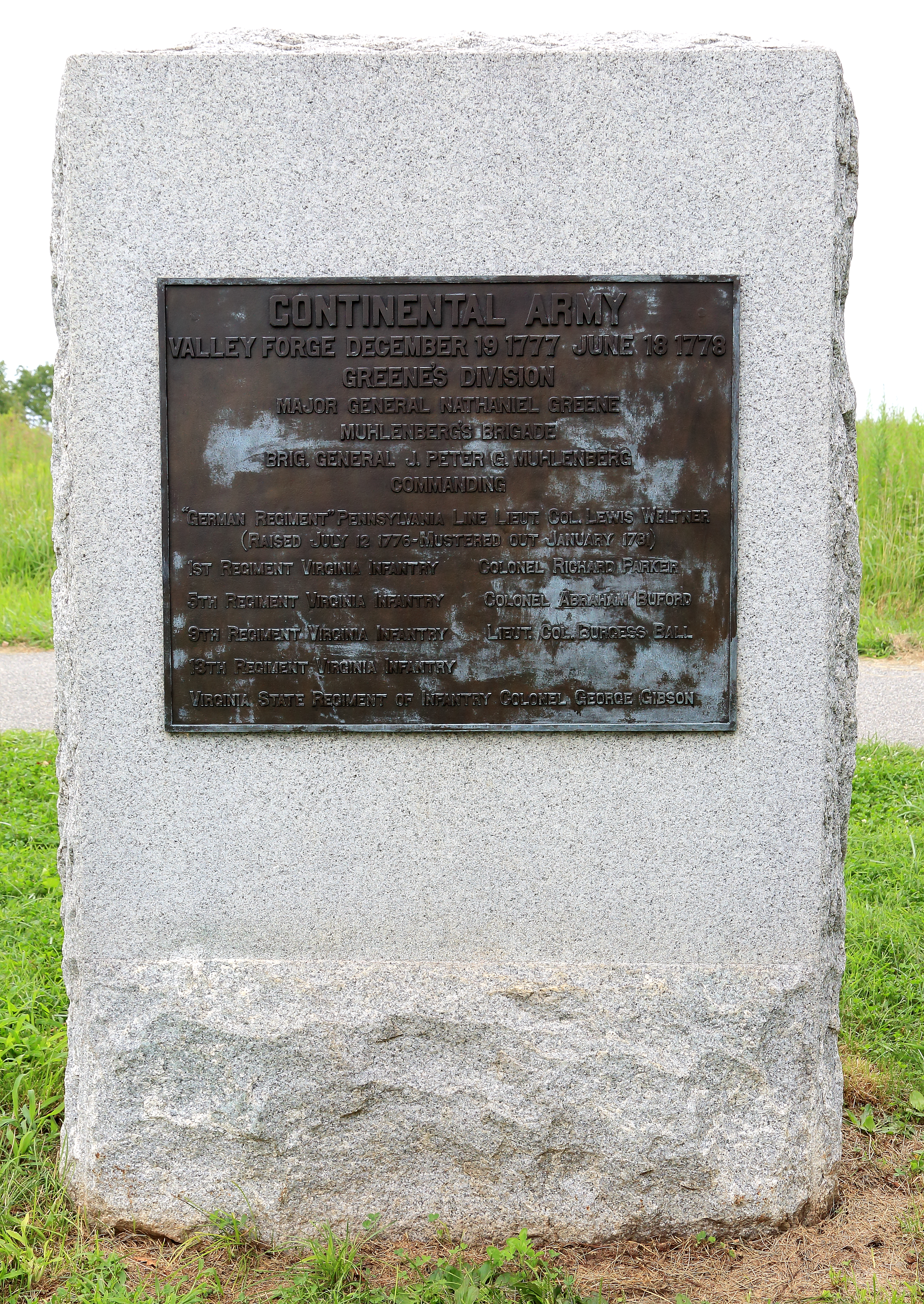
  • This monument is a large, rectangular granite block with a bronze plaque. The granite on the front of the monument is smooth, except along the bottom. The sides and back are also rough. It is six feet tall by four feet wide by two feet deep. It is located in a strip of grass between North Outer Line Drive and the Joseph Plumb Martin Trail. There is a tree a few yards away on either side. To the northwest, Redoubt 2, an earthen fortification, dominates a landscape of meadows. To the southeast, on the other side of the road, the ground slopes downward through more meadows and towards a row of trees.

National Memorial Arch

The United States National Memorial Arch was erected in the early part of the 20th century on the road where soldiers marched into Valley Forge on December 19, 1777. The monument commemorates the arrival and the sacrifices of General George Washington and the Continental Army at Valley Forge during that winter of the American Revolutionary War.

Patriots of African Descent Monument

The Patriots of African Descent Monument at Valley Forge honors the contributions of Black Americans in the American Revolution.
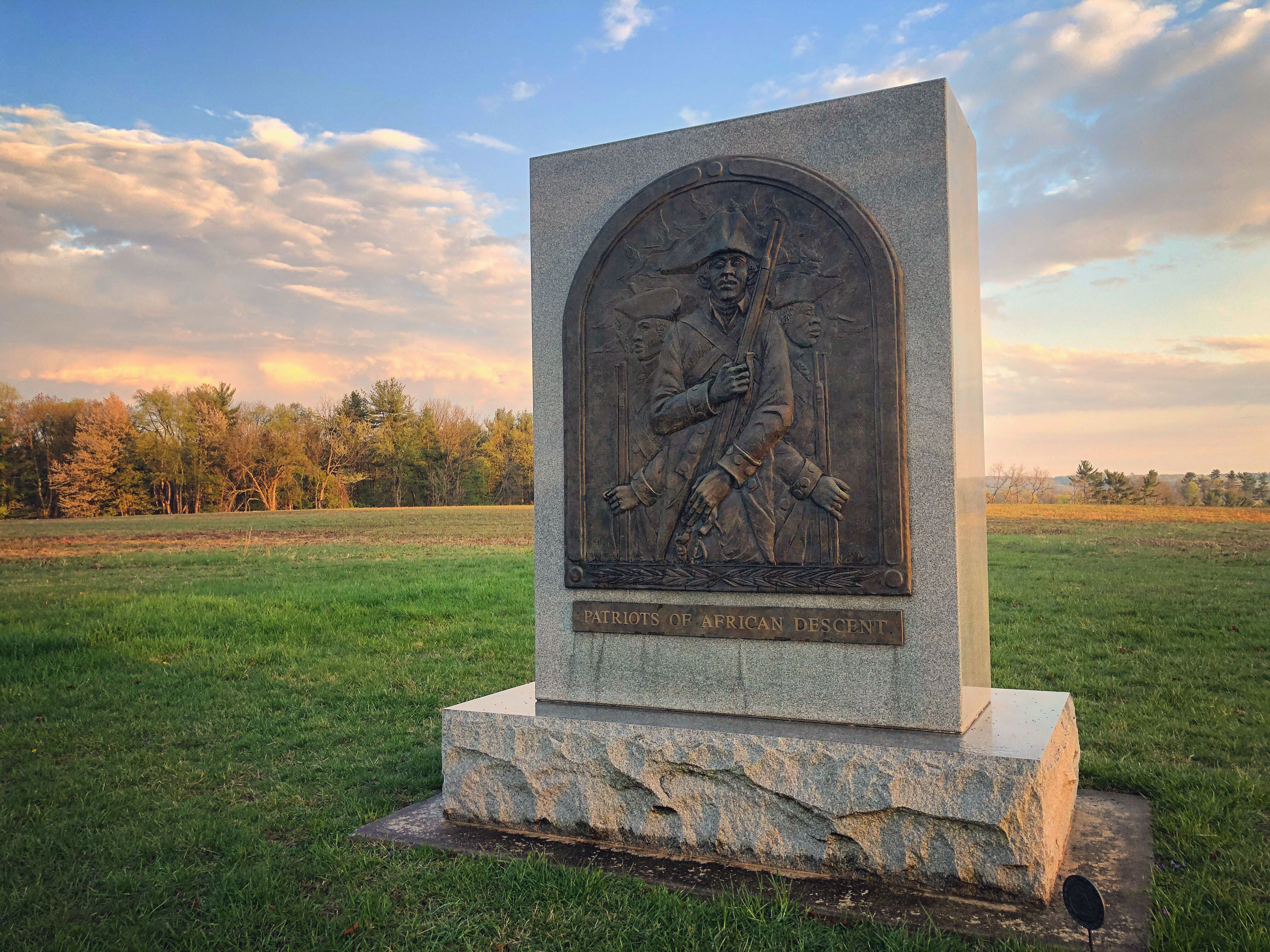
  • The Patriots of African Descent Monument is a granite block with carved text and a bronze bas-relief. The bronze relief depicts three soldiers of African descent, one facing left, one facing right, and one in the middle facing straight ahead. The men all wear military uniforms, each holding a musket. The three soldiers depicted in the bronze relief look well-disciplined and proud. On the back of the monument another reaffirms why the monument is there with the words: “In Honor of the PATRIOTS OF AFRICAN DESCENT who served, suffered, and sacrificed during the Valley Forge Encampment 1777-1778.” There is also a quote by Charles L. Blockson, the founder of the Blockson Collection of African American historical documents at Temple University: “Throughout these historic and hallowed campsites were courageous Black Patriots who participated in our nation’s bitter fight for independence.”

Patterson's Brigade Monument

Stone monument with bronze plaque marking the location of the encampment of Patterson's Brigade.
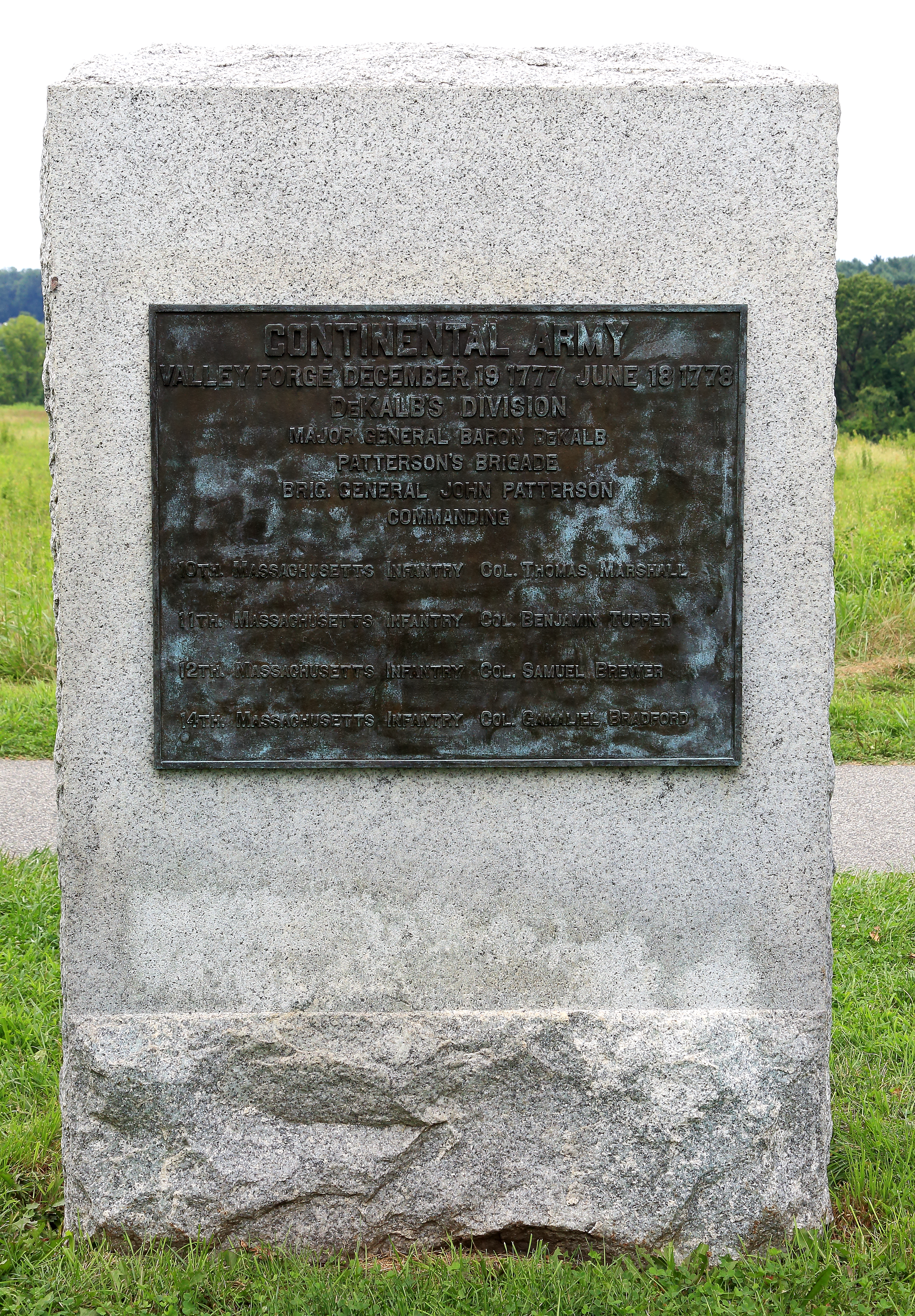
  • This monument is a large, rectangular granite block with a bronze plaque. The granite on the front of the monument is smooth, except along the bottom. The sides and back are also rough. It is six feet tall by four feet wide by two feet deep. It is located in a strip of grass between North Outer Line Drive and the Joseph Plumb Martin Trail. There is a tree a few yards away on either side. To the northwest, meadows slope gently downward. There are trees and rising ground beyond the meadows. To the southeast, on the other side of the road, the ground slopes downward through meadows and towards a line of trees.

Pennsylvania Brigade Monument

Stone monument with bronze plaque marking the location of the encampment of the Pennsylvania Brigade.
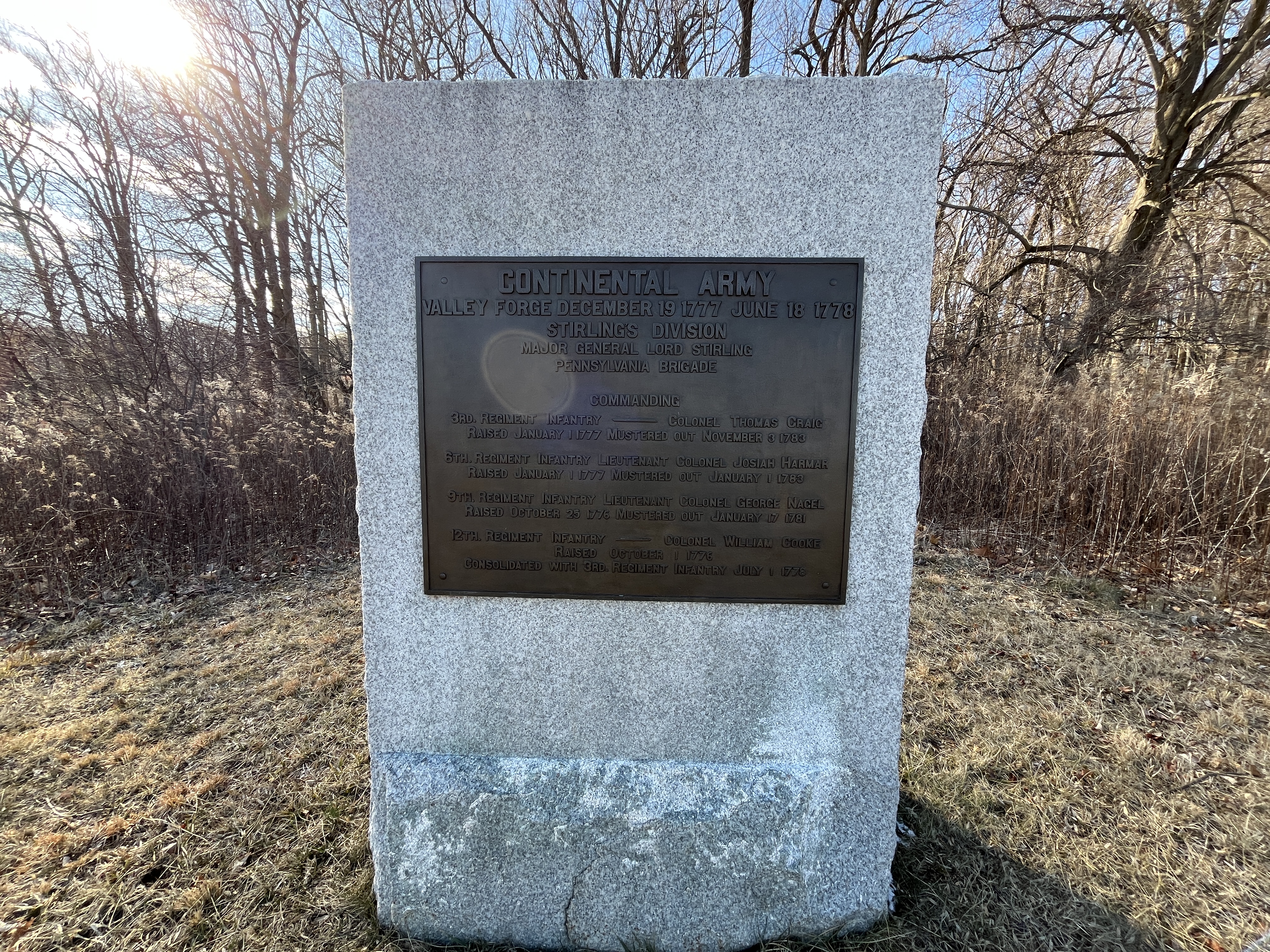
  • This monument is a large, rectangular granite block with a bronze plaque. The granite on the front of the monument is smooth, except along the bottom. The sides and back are also rough. It is six feet tall by four feet wide by two feet deep. This monument is located along North Inner Line Drive, which runs roughly southwest to northeast. To the west, northwest, and southwest, the ground rises among dense trees. To the north and south, North Inner Line Drive and the Joseph Plumb Martin Trail bend wind away from us. To the southeast, just across North Inner Line Drive and the Joseph Plumb Martin Trail, is a redan, a small earthen fortification containing two replica cannons. To the south, southeast, and east, the ground slopes downward among mixed meadows and trees that make up the Grand Parade. The ground also contains meadows and trees to the northeast but slopes upward.

Philander Chase Knox Estate

The Philander Chase Knox home has traditionally been known as the site of Maxwell's quarters, since Brigadier General William Maxwell, commander of the New Jersey Brigade, established his headquarters near this site during the Valley Forge encampment. A small section of the house may have stood during the encampment. Today, the P.C. Knox estate is leased by National Park Service and currently functions as an event venue.
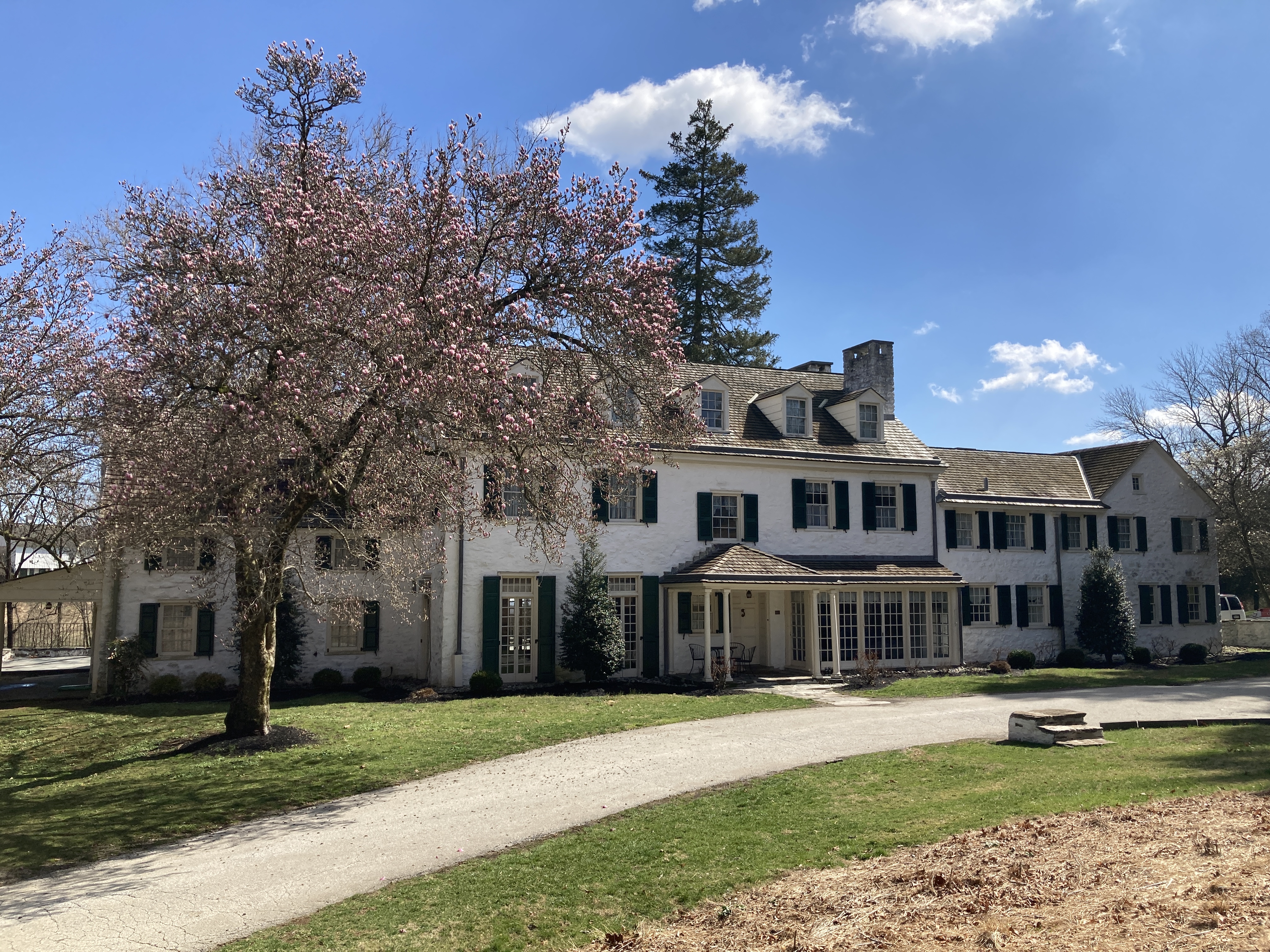
Poor's Brigade Monument

Stone monument with bronze plaque marking the location of the encampment of troops in Poor's Brigade.
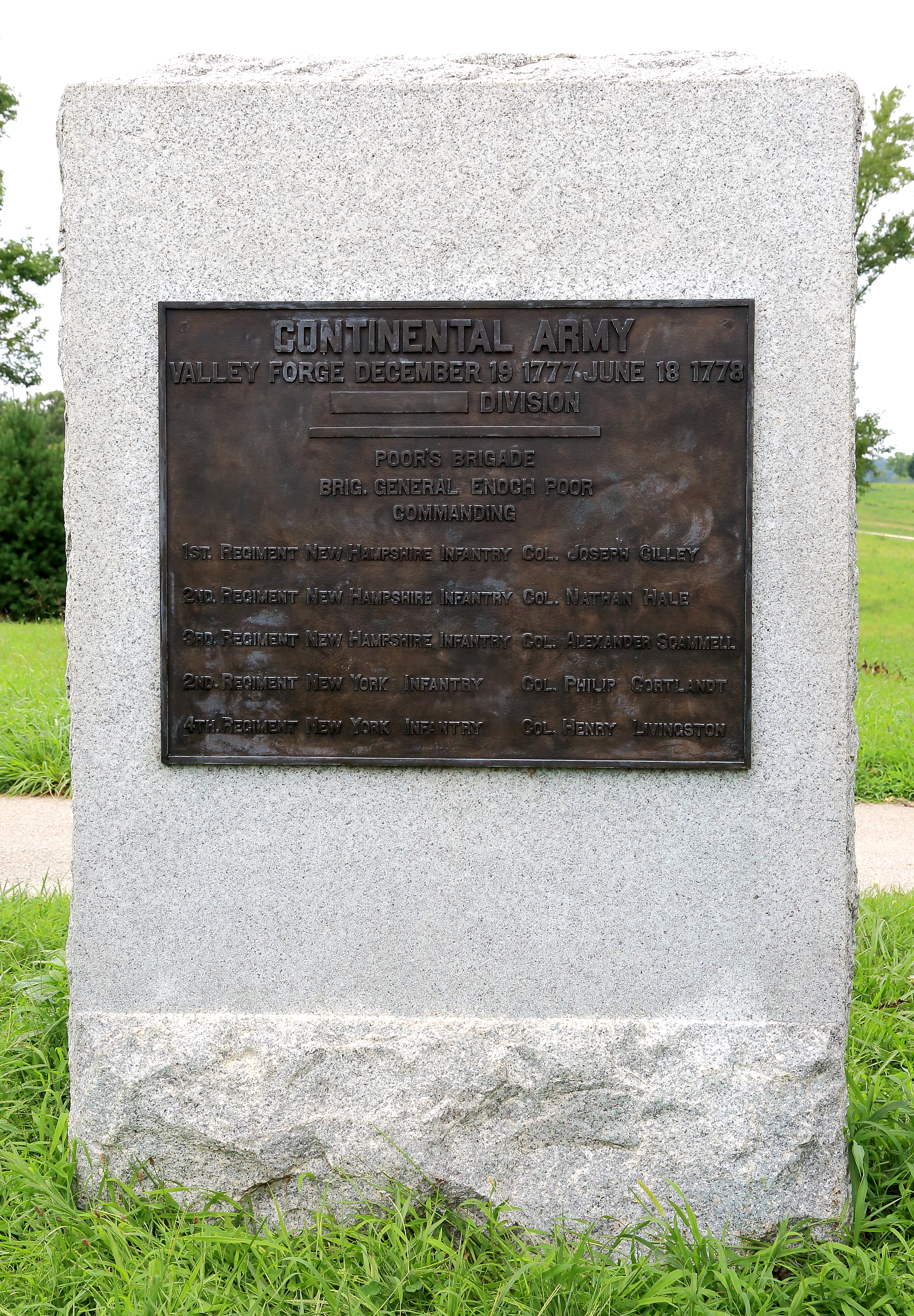
  • This monument is a large, rectangular granite block with a bronze plaque. The granite on the front of the monument is smooth, except along the bottom. The sides and back are also rough. It is six feet tall by four feet wide by two feet deep. This monument is located in a strip of grass between the Joseph Plumb Martin Trail and South Outer Line Drive. To the north, beyond the Joseph Plumb Martin Trail, the ground drops then rises among meadows towards the National Memorial Arch. To the east and south, beyond South Outer Line Drive, the ground slopes downward through meadows towards lines of trees. Immediately to the west are two log huts and the New York State and New Hampshire State Monuments. Beyond them flanking South Outer Line Drive on the way to the Wayne's Woods Picnic Area are the Pennsylvania State Columns.

Redoubt 2

Redoubt 2 is a reconstruction of one of the five earthworks fortifications built by soldiers during the Valley Forge encampment to defend the position from a possible British attack.

Redoubt 3

Redoubt 3 is the site of a partially reconstructed earthworks fortification originally constructed by Continental troops during the Valley Forge encampment and designed to help defend the camp from potential attack from the south.

Redoubt 4

Redoubt 4 is one of several earthen fortifications that were originally constructed by soldiers encamped at Valley Forge in order to aid in the defense of the army from possible British attack.

Schuylkill River Greenways National Heritage Area

The Schuylkill River Valley National Heritage Area celebrates the Schuylkill River region for its cultural, historical and industrial significance. It was along the banks of this river and its tributaries that the American, Industrial, and Environmental Revolutions were born. From the Continental Congress to Washington's encampment at Valley Forge, the region played a key role in the American Revolution and more.

Scott's Brigade Monument

Stone monument with bronze plaque marking the location of the encampment of troops in Scott's Brigade.
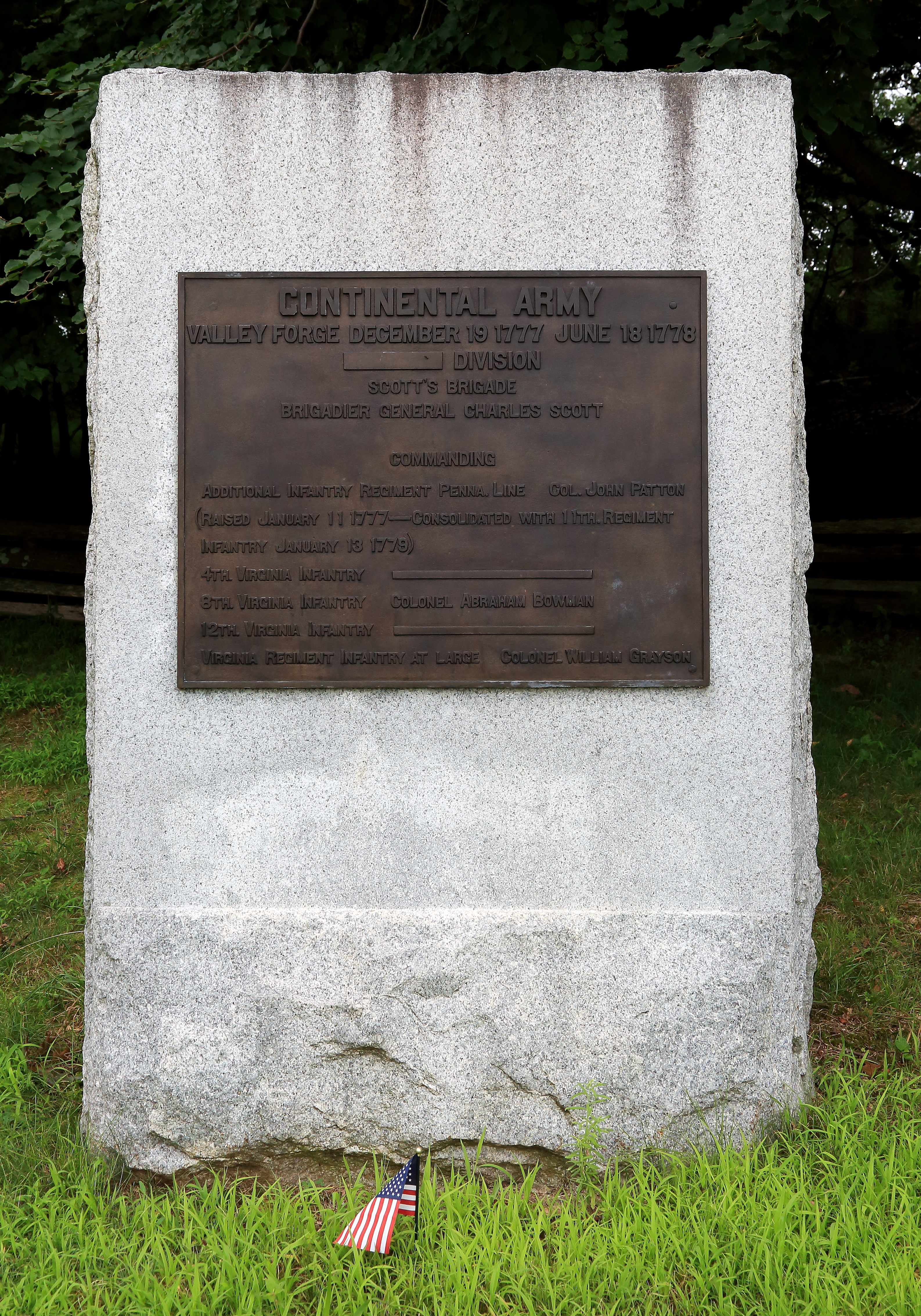
  • This monument is a large, rectangular granite block with a bronze plaque. The granite on the front of the monument is smooth, except along the bottom. The sides and back are also rough. It is six feet tall by four feet wide by two feet deep. To the east of the monument is a line of worm fencing with forest behind. Worm fencing uses no posts and is made up of split rails in a zigzagging pattern. The ground slopes downhill to the north, and the Virginia State Monument is slightly downhill. To the northwest and west, the ground drops among meadows and then rises again to a wooded hill. To the southwest and south, the ground drops steeply among meadows before encountering lines of trees.

Soldiers of New Jersey Monument

Monument commemorating the location of the New Jersey soldiers at the Valley Forge encampment.
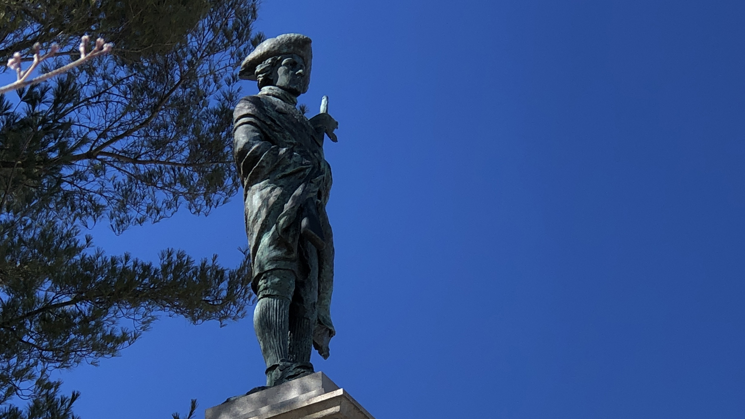
  • This monument consists of a column above a pedestal which carries a bronze plaque all standing upon a three-step base. The base of the column and the top step of the lower base have bas relief text. The column is topped with a bronze statue of a Continental soldier. The overall dimension of the stepped base is 10.5 square feet. The overall height of the monument is 35 feet. The pedestal is 4 square feet with a base that is 5 feet 2 inches square. The column tapers, is about 2 square feet at the base, and is about 7 feet high. The bronze casting of the soldier is about 8 feet high. Most surfaces are plain except the bottom step of the base which is rough-hewn. On the front face of the pedestal and above the bronze plaque, there is a carved tulip-shaped frame with oak leaves at the base and sides and a triple leaf motif at the top and bottom. Set in this frame is a bronze plaque, 10 inches in diameter, bearing the seal of the state of New Jersey. There is a complex series of moldings where the pedestal meets the column. Halfway up the column is a carved swag and rosette with tassel on each of the four faces. There is a pattern of small, carved squares below the capital of the column. The bronze statue of a New Jersey infantryman, carrying a musket, stands atop the column. His musket is clutched against his chest by hands wrapped in the thin blanket which is drawn tightly around him. This monument is located on South Inner Line Drive just south of the intersection with Gulph Road.

Stable at Washington's Headquarters

The stable building at Washington's Headquarters is estimated to have been constructed around the same time as the house itself (c. 1773 or earlier). Today the building is home to a museum exhibit called Forging a Nation: Iron Making in Colonial America.

Steuben Memorial State Historic Site

The Steuben Memorial honors the "Drillmaster of the American Revolution," Baron von Steuben, whose valuable wartime services have been described as being second in importance only to those of George Washington.
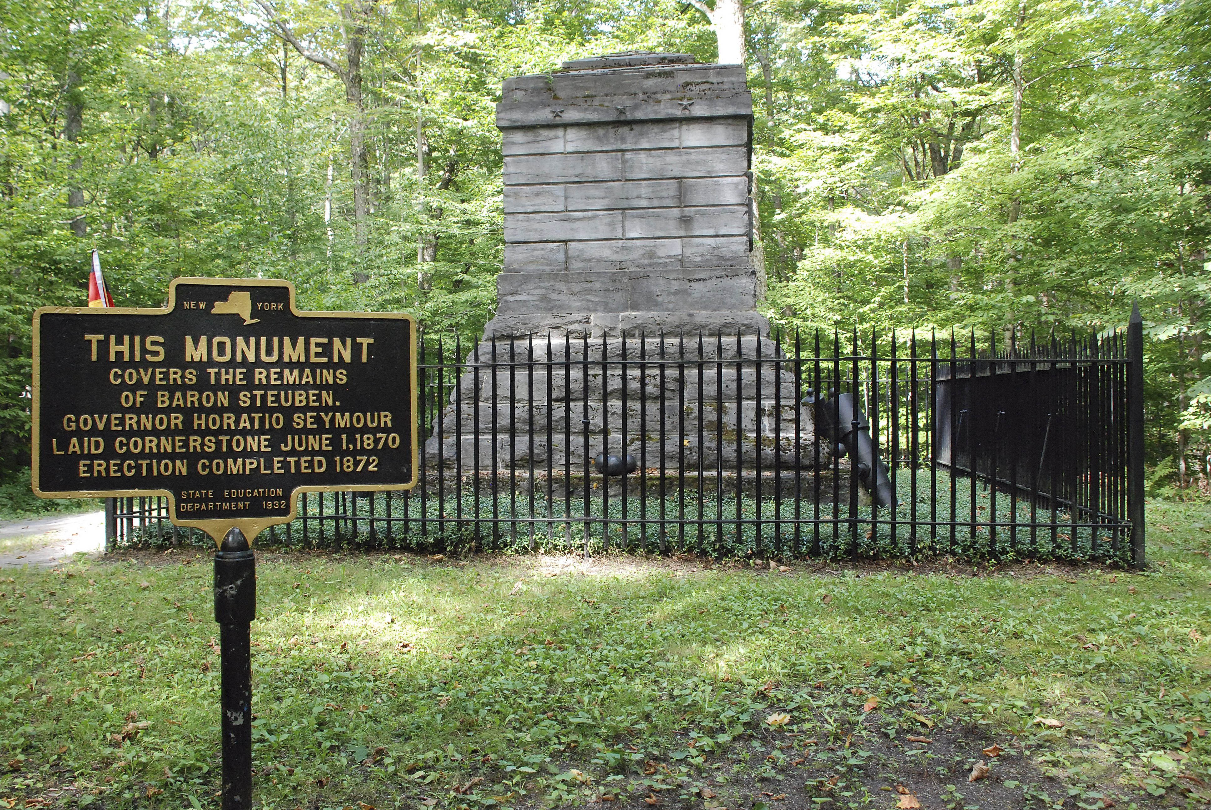
Sullivan's Bridge

This multi-use pedestrian bridge spanning the Schuylkill River provides access to the north side of Valley Forge National Historical Park, including Betzwood Picnic Area and boat launch, and trail access to the River Trail (unpaved, managed by Valley Forge NHP), and the Schuylkill River Trail (paved, part of the Schuylkill River National Heritage Area).
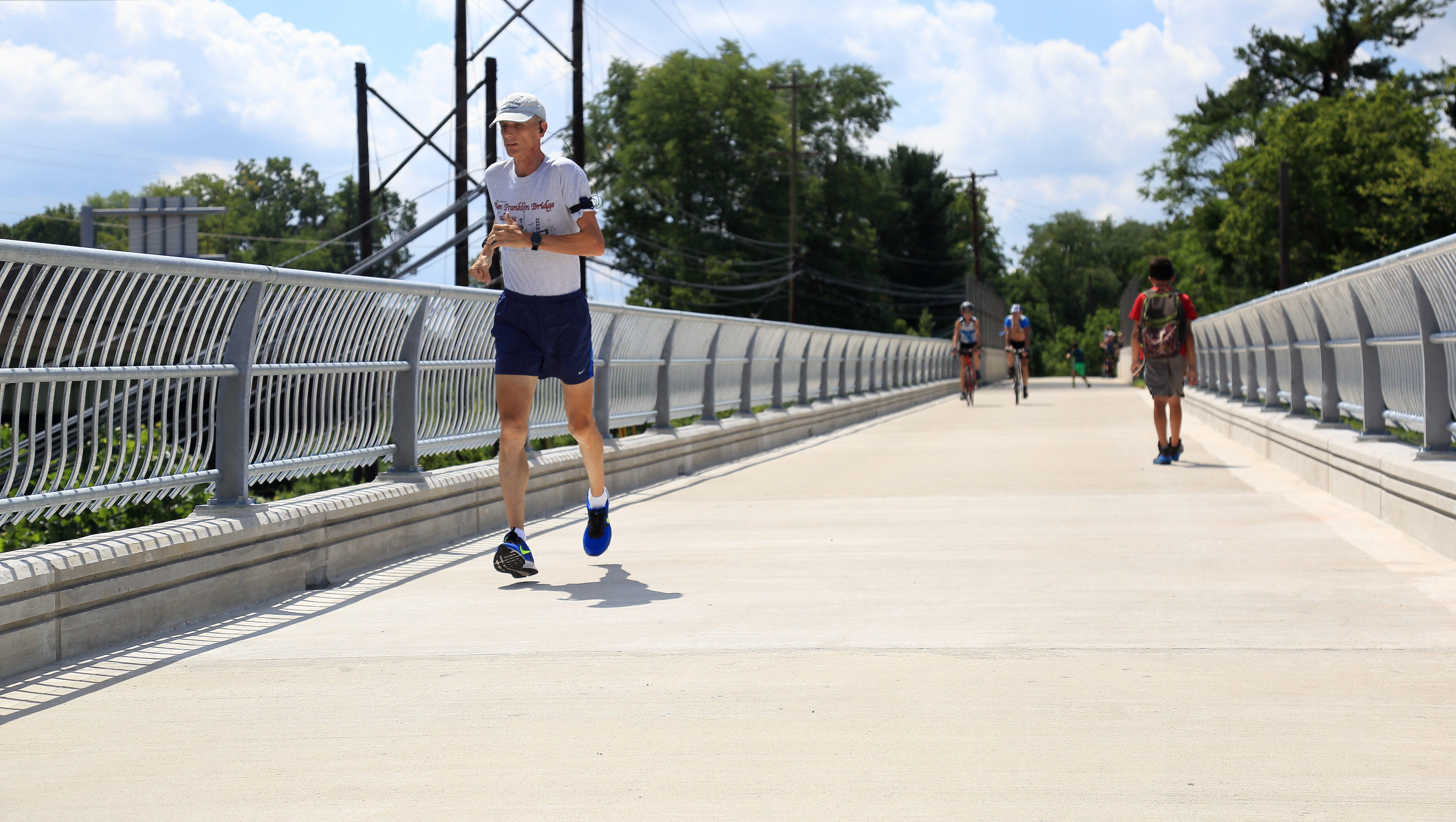
Theater at Valley Forge

The Theater at Valley Forge is located behind the visitor center and adjacent to the administration building and the Mini Grand Parade. Open to the public from 9 AM to 5 PM daily (except for Christmas, Thanksgiving, and New Year's Days), and the 19-minute orientation film is shown on the hour and the half-hour from 9:30 AM to 4:30 PM.
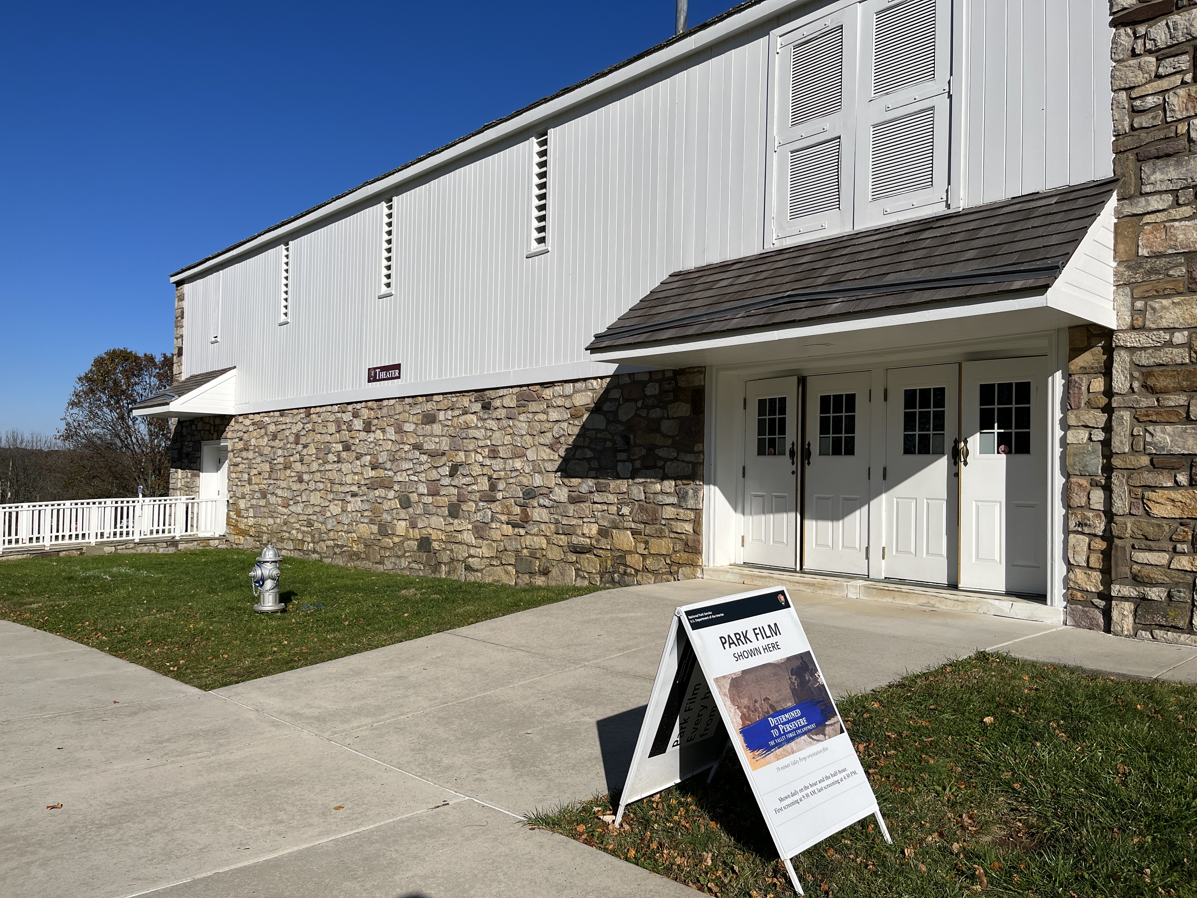
Varnum's Brigade Monument

Stone monument with bronze plaque marking the location of the encampment of troops from Varnum's Brigade.
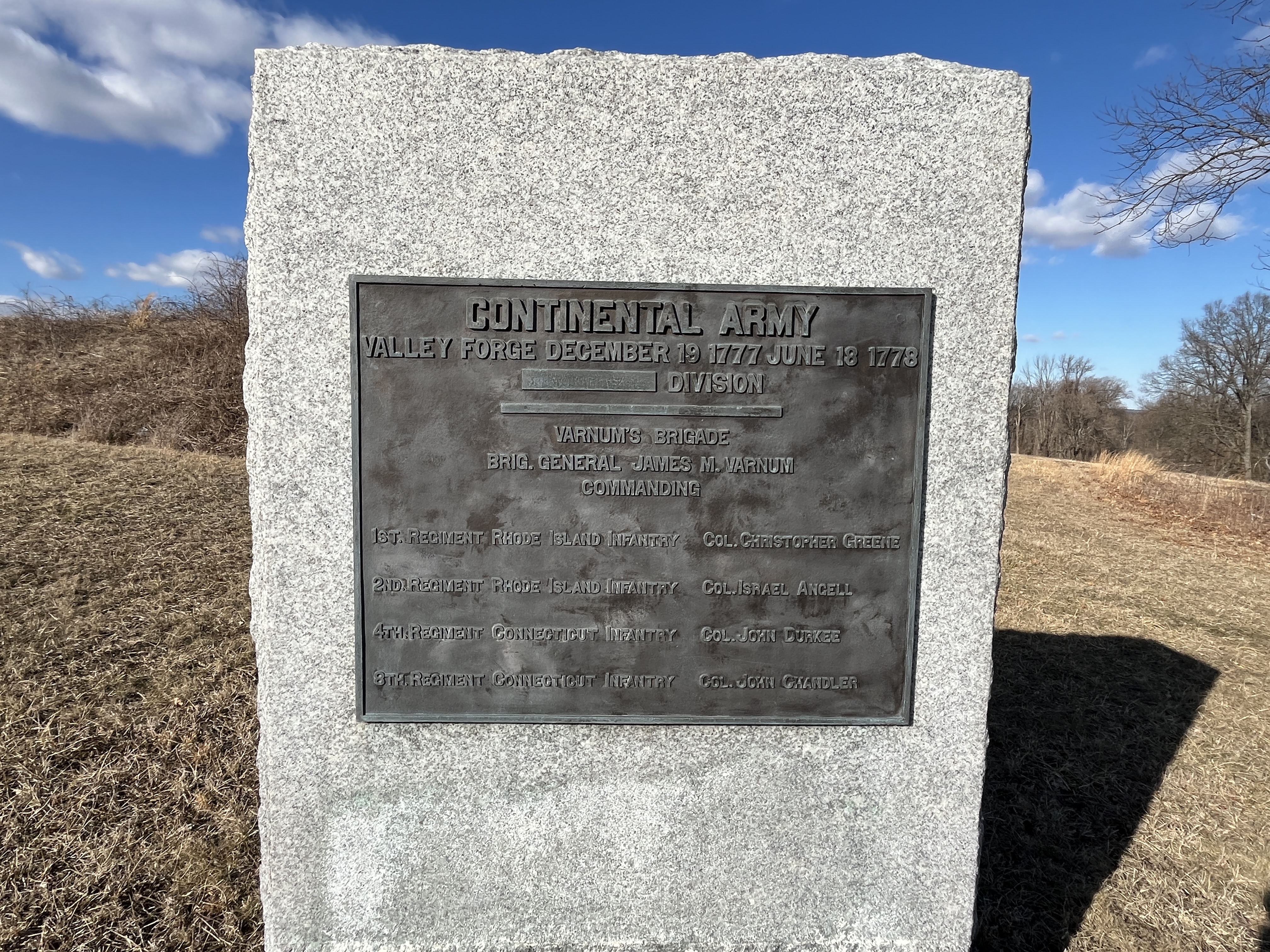
  • This monument is a large, rectangular granite block with a bronze plaque. The granite on the front of the monument is smooth, except along the bottom. The sides and back are also rough. It is six feet tall by four feet wide by two feet deep. It is located between the Star Redoubt and Route 23. Immediately to the north is the redoubt, an earthen fortification. To the east and west are rolling hills containing a mix of meadows and trees. To the east there is also a log hut and some logs in place indicating huts under construction. Immediately to the south a short steep slope drops downwards to Route 23. Beyond Route 23 and the Joseph Plumb Martin Trail, the land slopes downward among the expansive meadows and trees of the Grand Parade.

Varnum's Picnic Area

Varnum's Picnic Area is a shady, grassy lawn with picnic tables. In the parking lot there is a restroom facility, an information kiosk, and a short trail to the Star Redoubt. The parking lot is open daily from April to October, 7 AM to dark, then open weekends only through November. The parking lot is closed December through March.
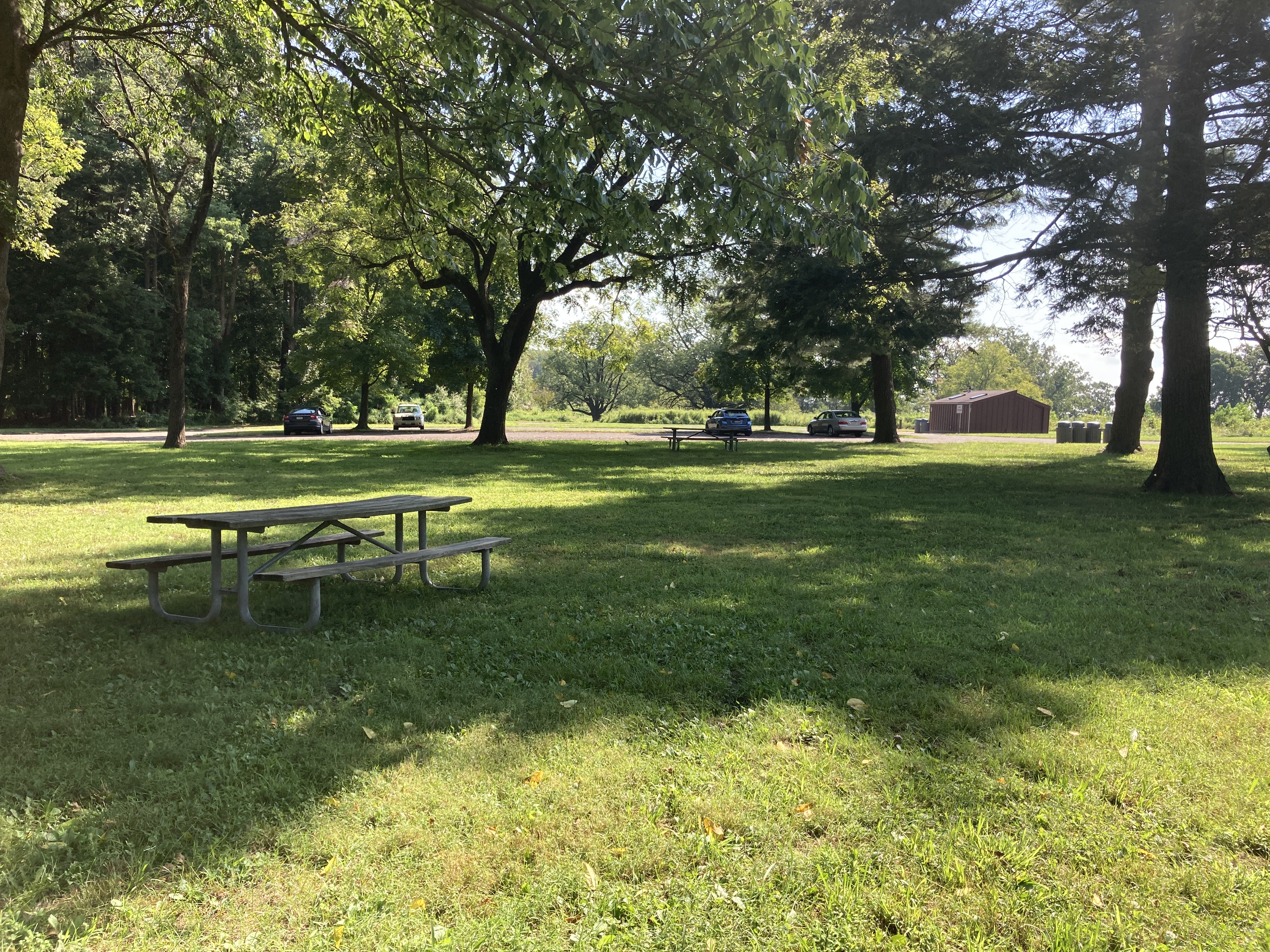
Varnum's Quarters

A stone farmhouse belonging to the Stephens family that was rented by Brigadier General James Mitchell Varnum during the Valley Forge encampment to serve as quarters for the General and office space for six other military staff.
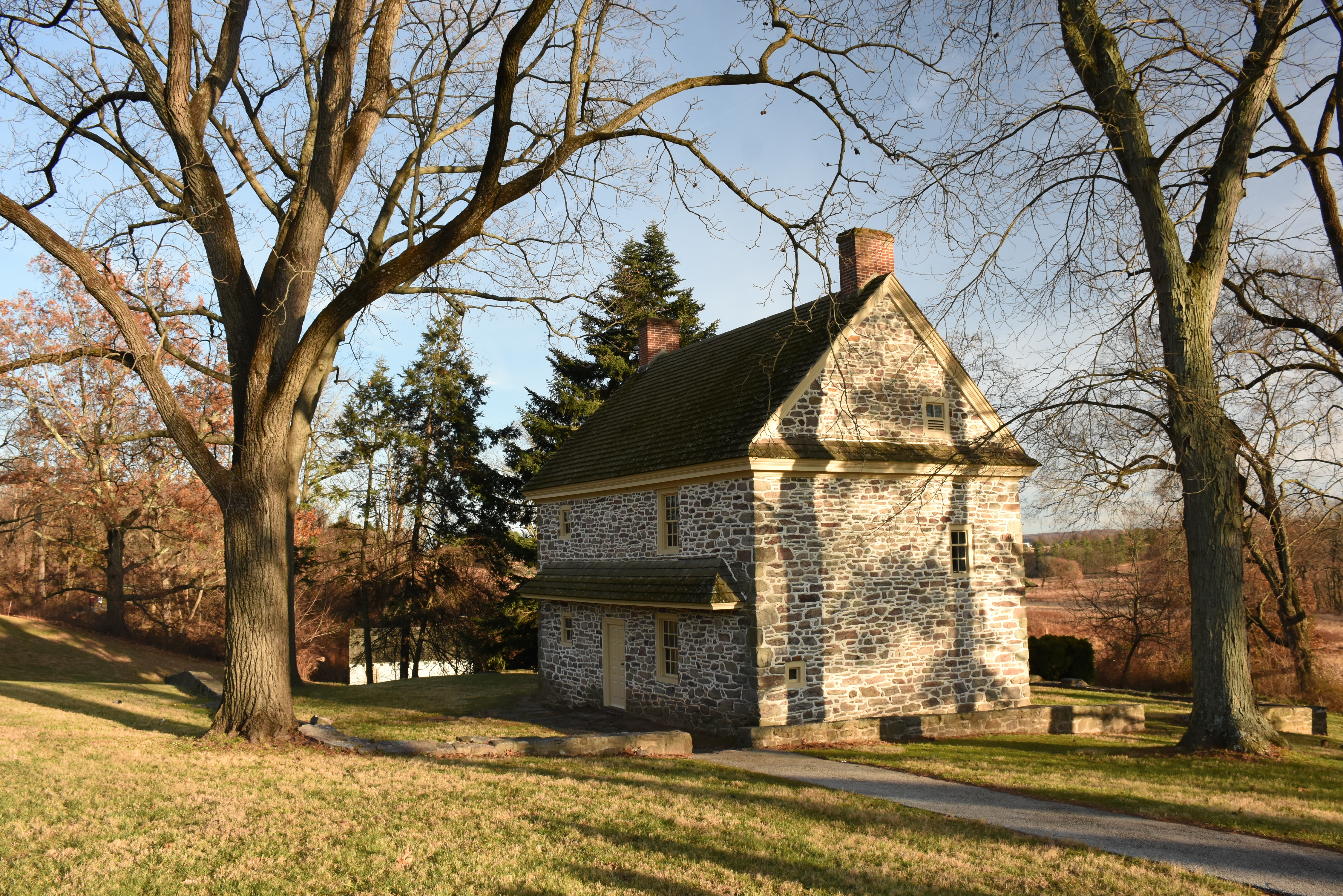
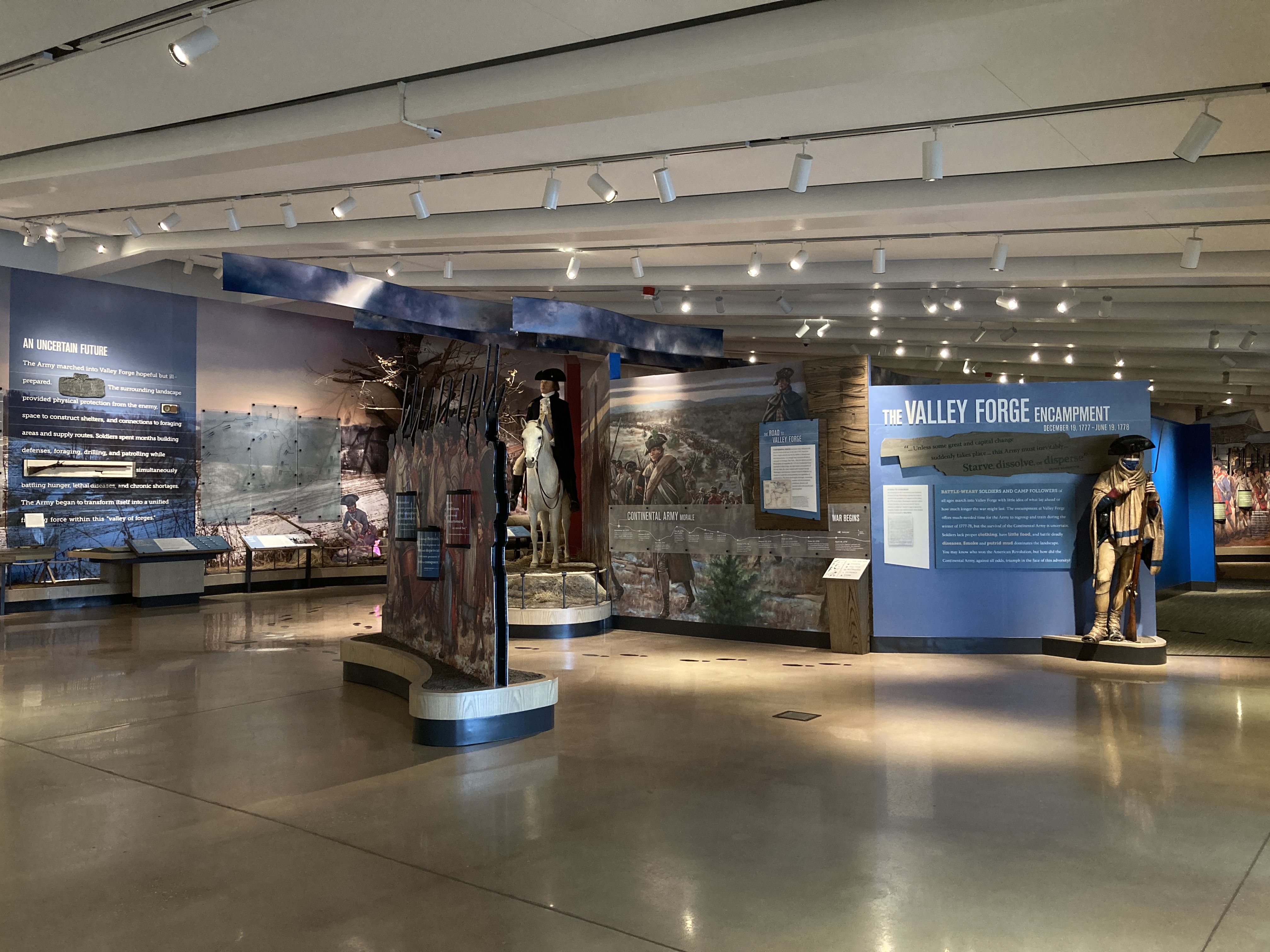
Visitor Center at Valley Forge

The Visitor Center at Valley Forge is open daily, 9 AM to 5 PM. Closed Thanksgiving, Christmas, and New Years Day. The building is home to The Encampment Store, the Valley Forge Tourism & Convention Board Montgomery County Welcome Center regional travel desk, an information desk staffed by park ranger historians and volunteer, and a museum exhibit.

Von Steuben Statue

The bronze statue of Inspector General Friedrich Wilhelm August Heinrich Ferdinand de Steuben, more commonly known as Baron von Steuben, overlooks the Grand Parade at Valley Forge National Historical Park.

Washington Memorial Chapel

The Washington Memorial Chapel sits on private land and is not managed by the National Park Service. The impressive building was constructed between 1903 and 1917, and features a Gothic Revival style.

Washington Statue

This statue of George Washington, located near Washington's Headquarters at Valley Forge, is a cast bronze copy of a marble statue by French sculptor Jean-Antoine Houdon.

Washington's Headquarters

Washington's Headquarters, also known as the Isaac Potts House, is the structure used by General George Washington and his household during the 1777-1778 encampment of the Continental Army at Valley Forge.

Wayne Statue

The Anthony Wayne Monument at Valley Forge is located in a grassy area surrounded by trees and facing Wayne’s home in Chester County. The bronze statue, supported by a large rectangular base of pink granite, features Brigadier General Wayne on horseback, emphasizing his role in the military. The north side of the pedestal lists the many roles that Wayne filled during his lifetime.

Wayne's Woods Picnic Area

Wayne's Woods picnic area provides excellent views of the National Memorial Arch and the landscape of Valley Forge. The area features wooden picnic tables under the shade of tall trees and easy access to the paved 5-mile loop of the Joseph Plumb Martin trail. The use of picnic tables is first-come, first-served. A public restroom and outdoor water fountain is available seasonally.

Weedon's Brigade Monument

Stone monument with bronze plaque marking the location of the encampment of troops in Weedon's Brigade

  • This monument is a large, rectangular granite block with a bronze plaque. The granite on the front of the monument is smooth, except along the bottom. The sides and back are also rough. It is six feet tall by four feet wide by two feet deep. It is located at Stop 2 on the driving tour between North Outer Line Drive and the Joseph Plumb Martin Trail. To the northwest and west is a group of log huts. To the north, a gravel path leads towards Redoubt 2, an earthen fortification. To the southeast, there is worm fencing before the road. Worm fencing uses no posts and is made up of split rails in a zigzagging pattern. Beyond the fence and road, there is a redan, an earthen defensive feature pointing towards the southeast. There is a replica cannon within the redan. Beyond the redan, the slope drops downward through meadows and towards a row of trees.
Visitor Centers Count: 1

Visitor Center at Valley Forge

  • Visitor Center at Valley Forge
  • The Visitor Center at Valley Forge is open daily, 9 AM to 5 PM. Closed on Thanksgiving, Christmas, and New Year's days. First opened in 1978, the Visitor Center at Valley Forge is a multi-use building designed by Walter Ogg of the Philadelphia firm of Eshbach, Glass, Kale, and Associates, and includes visitor information services, The Encampment Store, and a museum exhibit that tells the story of the Valley Forge encampment of the Continental Army.
Things to do Count: 15

  • Rent a Bicycle
  • For those who want to explore Valley Forge on two wheels, The Encampment Store offers seasonal bike rentals, weather permitting. Please call 610-551-7870 before going to the park to confirm that bike rentals are on for the day.

  • Be a Valley Forge B.A.R.K. Ranger
  • Learn the four B.A.R.K. principles, complete pages in the activity book, and show your work to a ranger at the visitor center. After you make the B.A.R.K. Ranger promise, you and your doggo will get a Valley Forge B.A.R.K. Ranger dog tag!

  • Watch the Park Orientation Film
  • The 19-minute park orientation film Determined to Persevere: The Valley Forge Encampment is shown daily on the hour and the half-hour in the Meeting Room. The first screening is at 9:30 AM and the final screening is at 4:30 PM.

  • Take a Trolley Tour
  • Trolley tours are offered on a seasonal basis. Check the schedule for current tour status. Trolley tours depart from the front of the Visitor Center and make extended stops at Muhlenberg's Brigade and Washington's Headquarters. Trolley Tours are 90 minutes long, ADA accessible, and administered by The Encampment Store.

  • Dial in to the Cell Phone Guide
  • The Cell Phone Guide provides recorded audio information about the history, people, landscapes, and buildings of Valley Forge National Historical Park and can enhance any visit to the park. Dial 484-396-1018 to access the guide.

  • Watch the Short Films
  • Four short films play regularly in the museum exhibit located in the Visitor Center at Valley Forge.

  • Listen to the Audio Tour
  • The Audio Tour is available for purchase as an audio CD, a downloadable MP3 file, or for streaming using a smartphone or tablet. You can purchase and listen to the Audio Tour by visiting The Encampment Store website.

  • Be a Valley Forge Junior Ranger
  • Complete in the in-park Junior Ranger program by picking up a copy of the Junior Ranger Activity Booklet from a ranger at the visitor center.

  • Explore the Valley Forge Encampment Museum Exhibit
  • Explore the sights, sounds, and stories of the Valley Forge encampment in the brand-new museum exhibit located at the Visitor Center at Valley Forge!

  • Be a Virtual Junior Ranger
  • You can become a Valley Forge Virtual Junior Ranger even if you can't visit the park! This program features six online activities that you can do with your computer, a pencil, a piece of paper, and about thirty minutes. Designed for kids 7-12, but open to all.

  • Explore the Washington's Wartime Family Exhibit
  • Explore the motivations and decisions of General George Washington and learn about the people that made up Washington's military family during the Valley Forge encampment in this museum exhibit, located in the Historic Valley Forge Station near Washington's Headquarters.

  • Explore the Iron Making in Colonial America Museum Exhibit
  • The museum exhibit Forging a Nation: Iron Making in Colonial America features artifacts from the 18th century iron industry and puts the industry in the context of the American Revolution.

  • Bike the Joseph Plumb Martin Loop
  • Biking the paved 5-mile loop of the Joseph Plumb Martin trail is a great way to get some exercise and experience Valley Forge!

  • Walk or Run the Joseph Plumb Martin Trail
  • Walking or running on the paved Joseph Plumb Martin trail is a great way to get some exercise and experience Valley Forge!

  • Drive the Encampment Tour Route
  • Drive the 10-mile Encampment Tour route and stop at nine key locations within the park. An excellent overview of the history, significance, and scenic offerings of Valley Forge National Historical Park.
Tours Count: 1

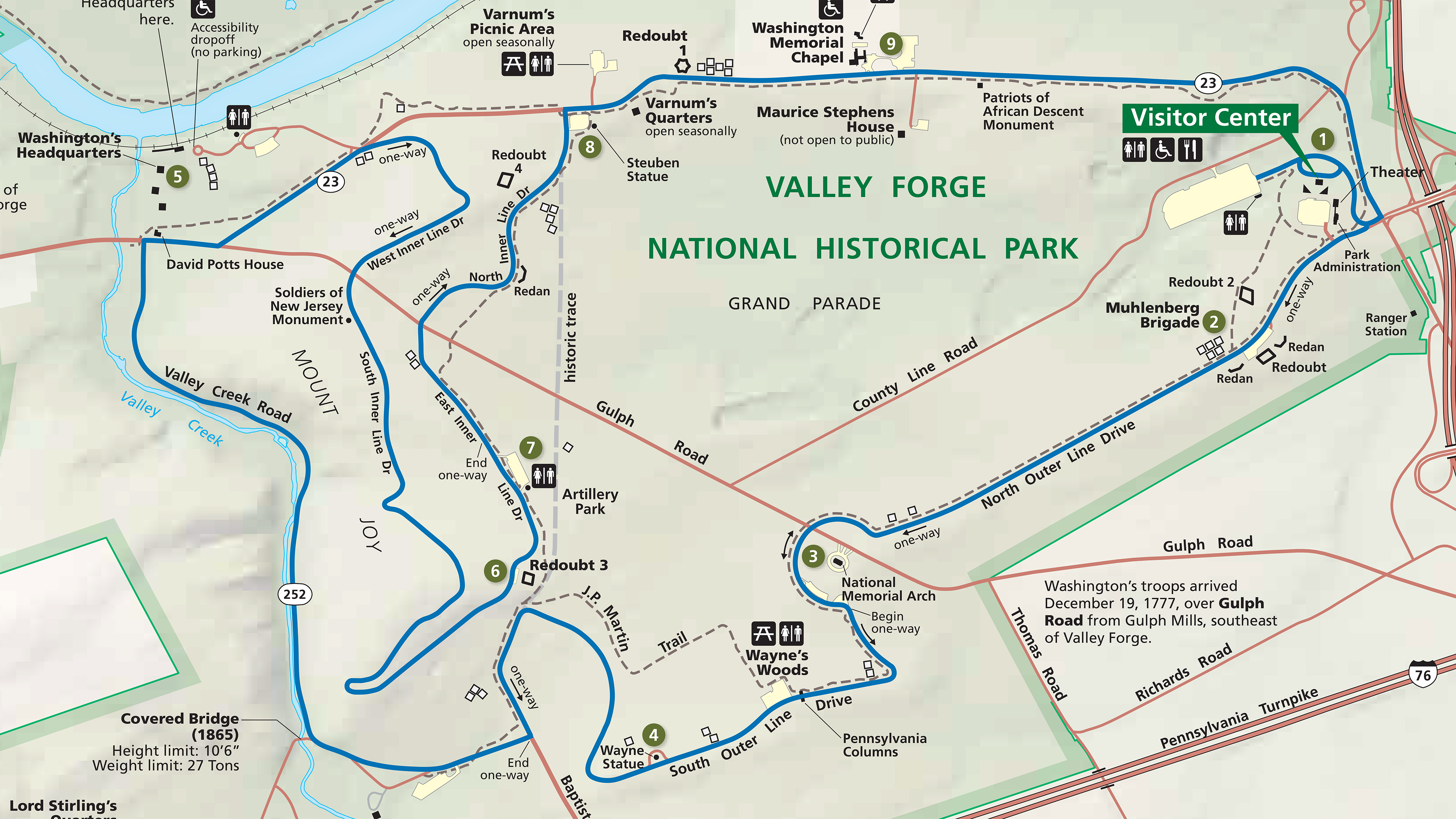
Driving Tour: The Valley Forge Encampment

The Encampment Tour route consists of 9 major tour stops along a 10-mile driving route. This self-guided tour takes you to many historic monuments and sites and past some of the most scenic views of the park.

Articles